Groundwater Protection in the UK: from source protection to integrated catchment planning
|
|
|
- Madison Washington
- 6 years ago
- Views:
Transcription
1 Groundwater Protection in the UK: from source protection to integrated catchment planning Bob Harris Environment Agency, England and Wales National Groundwater & Contaminated Land Centre
2 Groundwater in the UK - some background information Around 34% of the total drinking water requirements of the UK is supplied from groundwater, but: this proportion varies greatly across the country because of the complex/variable geology and climatic differences. To the S & E of England there is very high reliance on groundwater; this area coincides with some of the greatest land use pressures (people, industry and agriculture) and the lowest recharge. (e.g. Kent has less water availability/person than Oman).
3 Groundwater Use for Public Supply North West North East Midland < 15% Anglian Wales > 50% Thames South West Southern % of total public water supply derived from groundwater
4 Some Historical Context Protection of groundwater was previously focused on sources of drinking water - wells and boreholes - through localised ad-hoc legislation: e.g. Margate Act of 1902 and Brighton Act of 1924.

5 .wells were clearly vulnerable to pollution from early on
6 Some Historical Context Ad-hoc reliance on the inter-connection of water supply undertakings and local authorities but; land use controls could be imposed from 1948 through the Town and Country Planning Acts to protect abstractions from new development. In 1963 first controls over abstractions (licensing controls), although focus still on the impacts of pumping on other sources. In 1974 river-basin management was introduced. First opportunities for co-ordination on a Regional scale with 10 Regional Water Authorities set up.
7 First Aquifer Protection Policies Largely driven by the introduction of national waste disposal legislation from 1976 and reinforced by the European Groundwater Directive in 1979/80; Regional Water Authorities (RWAs) drew up the first Aquifer Protection Policies in the UK in the late 1970s/early 1980s; largely based on the protection from pollution of water supplies (simple zones) with simplified resource protection. Crude maps were published to reinforce (simple) policy statements.
8 Source Protection to Resource Protection There was an increased emphasis in the early 1980s on groundwater protection for resource potential reasons - e.g. sustainability issues; also: a growing awareness of the influence of soils in both recharge and the attenuation of pollutants from the land surface. The first groundwater vulnerability maps in UK drawn up and published in late 1980s for main aquifers in the Midlands; based on the national soil survey database and aquifer properties; Used to influence diffuse land-use activity - e.g. sewage sludge spreading.
9 The Growing Threat of Diffuse Pollution Concerns arose in the 1980s about how increasing nitrate concentrations in groundwater (derived from agricultural practices) were affecting drinking water. European and WHO limit for drinking water of 50mg/l NO 3 was being, or in danger of being, exceeded in many areas. Two approaches: treat abstracted water or; protect borehole catchments. Economic studies showed a combination of both was the best option in many situations; This led to the trialling of catchment wide protection measures for diffuse pollution control.
10 Catchment Protection Firstly voluntary Nitrate Sensitive Areas (NSAs), and then regulatory based Nitrate Vulnerable Zones (NVZs) for groundwater defined, on a source catchment basis. Catchment modelling therefore introduced: firstly based on simple water balance and local knowledge; However, if farming practices/livelihoods are to be constrained then more certainty/transparency is needed about the primary areas for protection; so later models used a time-of-travel approach using proprietary models (Flowpath, Modflow, WHPA).
11 Groundwater Protection Policy Following their introduction for NSAs the modelling approach for the definition of source protection zones was incorporated into the first national (E&W) groundwater protection policy - published in Two central tenets: resource protection through groundwater vulnerability based on properties of soils; superficial deposits, solid geology and unsaturated zone and; source protection through the definition of Source Protection Zones (SPZs). Maps and zones (the tools) were supported by policy statements for specific activities.

12 Policy re-published by the Environment Agency in 1998 and distributed to Local Authorities.. and it remains the Agency s best selling publication
13 Groundwater Protection Tools Developed to support the Protection Policy and legislation with tools to support decision-making; Enable policies to be put into practice; Provide a basis for future development, new tools and improved regulation and environmental protection.
14 Groundwater Vulnerability Vulnerability maps produced covering the whole of England and Wales; National Map at 1:1,000,000 scale and 52 maps at 1:100,000 scale; Allows an initial appraisal of risk to be undertaken for any potentially polluting activity. NOT a site specific tool but has application in preliminary vetting of activity and identifying high risk activities.

15 Vulnerability Illustrated Thin Soil (No Drift) Thick Clay Soil Unsaturated Zone Drift High Water Table Deep Water Table Fractured Limestone High Low Sand and Gravel

16 Groundwater Vulnerability Map

17 Groundwater Vulnerability Maps 1:100k Groundwater Vulnerability Major - High Major - Intermediate Major - Low Minor Non Aquifer Paper maps 1:10 6 % % % % Derby Mansfield Nottingham B t T t Non Aquifer Mids_gw_vul.shp MAJOR_H MAJOR_I MAJOR_L MINOR_H MINOR_I MINOR_L Notrate Data < 20 mg/l (as NO3) mg/l (as NO3) > 40 mg/l (as NO3) % Towns 10 km Grid Kilometers Digital data and GIS
18 Schematic Source Protection Zones Source Protection Zones around a borehole Catchment Boundary III II I I - Inner Zone II - Outer Zone III - Total Catchment Direction of groundwater flow
19 Source Protection Zones - Classification ZONE EXTENT CONTAMINANT TYPE Zone I 50 day travel time Biological Zone II 400 day travel time Slowly degraded Zone III Total Catchment Non-degradable also Zone of Special Interest Zones where local conditions require additional protection
20 Source Protection Zones Modelling undertaken for, and by, the NRA/Environment Agency, based on best information ; In some cases data lacking or geology highly complex; for these, SPZs based on best conceptual model; Modelled information held in Source Evaluation Reports and available for inspection; May be challenged where better data/interpretation is held by others; SPZs also subject to change/improvement as a result of: Improved data availability and modelling Change in pumping regime/licence conditions
21 Source Protection Zones - examples of change induced by pumping A A B 8km B Borehole A Pumping m³/d Borehole A Pumping m³/d Borehole B Pumping m³/d
22 Source Protection Zones Modelling undertaken for, and by, the NRA or Environment Agency, based on best information ; In some cases data lacking or geology highly complex; for these, SPZs based on best conceptual model; Modelled information held in Source Evaluation Reports and available for inspection; May be challenged if better data/interpretation held by others; SPZs also subject to change/improvement as a result of: Change in pumping regime/licence conditions Improved data availability and modelling SPZs therefore NOT transposed into formal legal status.


23 Source Protection Zones A3 Maps 1:50k Catchment Boundary Source Protection Zones around a borehole I - Inner Zone III II II - Outer Zone I 31 III - Total Catchment Paper maps A 15 Internet option GIS Application A0 Maps 30 29A :100k
24 Getting the Tools Used Producing maps and zones is one thing but getting them applied in practice is another; They have greatest applicability not in site-specific assessment, but in influencing land use at a high level; e.g. filtering out unacceptable development proposals at strategic or outline stages. Can also be used as a first level of risk assessment for existing activities.
25 The Future We will need tiered approaches that filter out the less problematical issues and allow more detailed analysis of the difficult ones; Environmental protection and land-use planning have to move closer together.
26 Example of use Planning Applications & Informal Approaches GPP & SPZ Maps Strategic (Planning) level Groundwater Vulnerability Maps, SPZ Maps and Local Knowledge Non-expert (Authorisation) level Site Specific Risk Assessment Expert level

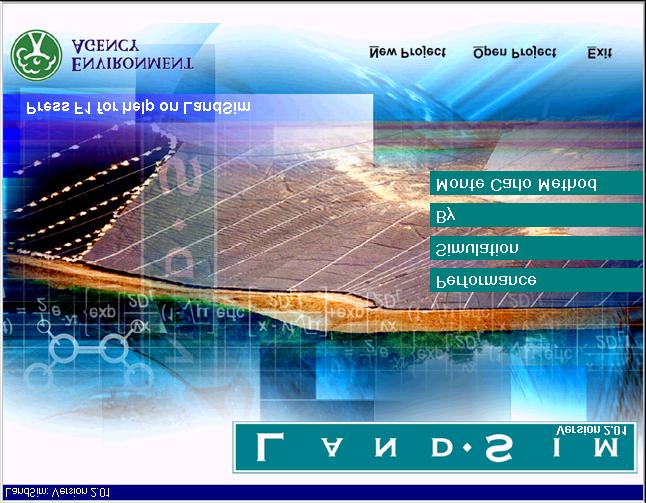
27 Site/activity specific tools (expert level) Remedial targets methodology LandSim ConSim
28 The Future We will have much more detailed and complete environmental protection legislation and it will be a more litigious society. Moving from a minimalist pseudo-voluntary approach to an all-embracing regulatory risk-based approach. We will need more certainty; but we ll never have enough knowledge; We therefore have to use risk-based approaches to decision-making for potentially polluting activities.
29 The Future Could be more precautionary unless we understand more about the complex science of the sub-surface. we will be more integrated - groundwater and surface waters have to be considered as a whole in catchment scale planning, being introduced as part of the Water Framework Directive...
30 Water Framework Directive Introduces integrated water management on the catchment scale, but will have to involve the identification and management of all impacts on aquatic ecosystems
31 Groundwater pumped for drinking water Traditional UK view of groundwater use and protection

32 Changed focus given by the Water Framework Directive

33 We will need to change our conceptual thinking Groundwater pumped for drinking water A river is simply an outcrop of groundwater
34 Water Framework Directive Introduces integrated water management on the catchment scale, but will have to involve the identification and management of all impacts on aquatic ecosystems The conceptual approach and associated tools need to be modified to reflect the new regime; So, Groundwater Vulnerability maps will need to be re-focused; Current maps place emphasis on resource potential of aquifers not role of groundwater in an integrated system.
35 New Developments Increased use of GIS: improved assimilation, visualisation and analysis of spatial data; Increased availability of data, e.g. soil, geology, physical and geochemical aquifer properties, baseline groundwater chemistry; Combination of process-based models and spatial data, e.g. nitrate and pesticide leaching to produce pollutant specific vulnerability and risk maps. e.g. POPPIE.
36 MACRO metamodel and Attenuation Factor model Rain Pesticide HER Soil Unsaturated Zone Aquifer Outline of Pesticide Leaching Model - POPPIE Current developments Gridded model predictions of pesticide leaching to groundwater Groundwater map vulnerability Overlay of leaching grid and GVM and re-interpretation to produce pesticide specific risk potential maps Isoproturon Low Medium High Source Protection Zones (SPZ) Possible future development Prediction of concentrations at boreholes Overlay of SPZ with combined layers Likelihood of Isoproturon detection in groundwater
37 Conclusions Whole package provides a framework that enables costeffective decision making by allowing policies to be put into practice at a range of scales; A suite of groundwater specific tools developed over past 15 years that can be applied at a range of scales to address multi-functional issues; Experience gained has identified further opportunities and the understanding of groundwater protection issues has been enhanced; R&D and improved knowledge/data coupled with improved IT capability and new initiatives will continue to drive the development of tools.
Environment Agency Guidance on Requirements for Land Contamination Reports. July 2005
 Environment Agency Guidance on Requirements for Land Contamination Reports July 2005 ENVIRONMENT AGENCY GUIDANCE ON REQUIREMENTS FOR LAND CONTAMINATION REPORTS Context Who is this guidance aimed at? Developers,
Hydrogeological mapping for site-specific groundwater protection zones in Denmark
 The Danish action plan for promotion of eco-efficient technologies Danish Lessons The Danish action plan for promotion of eco-efficient technologies Danish Lessons Hydrogeological mapping for site-specific
Monitoring and Assessment of Chemical Quality. Session Objectives
 Monitoring and Assessment of Chemical Quality Session Objectives To highlight the relative priority for microbiological and chemical water quality monitoring and emphasis the need for a rational, health-based
Groundwater Risk Assessment
 Groundwater Risk Assessment ELQF - 6 November 2012 Katy Baker Technical Director ARCADIS (UK) Limited Imagine the result Problem definition The importance of the CSM 2 The definition of the problem: 3
Portsmouth Water Response
 CONSULTATION UNDER THE TOWN AND COUNTRY PLANNING (DEVELOPMENT MANAGEMENT PROCEDURE ENGLAND) ORDER 2010 Applicant: UK Oil and Gas Investments PLC Planning Application Reference: SDNP/16/04679/CM Proposal:
Chapter 2: Aquifers and groundwater
 Chapter 2: Aquifers and groundwater Groundwater movement through aquifers is driven by differences in groundwater levels or pressure and is controlled by how porous the material is that it passes through.
Groundwater Bodies in the UK
 Groundwater Bodies in the UK Rob Ward Head of Groundwater Science British Geological Survey 15 th December 2011 2nd Workshop on Groundwater Bodies in Europe Introduction Background Delineation in UK England,
Water Framework Directive Water for Life and Livelihoods
 England and Wales Approach to Implementation UKELA Conference 17th June 2005 Dr Martin Griffiths Environment Agency England and Wales Purpose Prevent deterioration, enhance status of aquatic ecosystems
REPUBLIC OF ZAMBIA. Roland Bäumle & Levy Museteka Fringilla Lodge, Feb 8 th, 2011
 Groundwater in Lusaka a - A Resource in Need of Protection - Roland Bäumle & Levy Museteka Fringilla Lodge, Feb 8 th, 2011 Presentation Outline 1. Groundwater Pollution 2. Groundwater Protection 3. Vulnerability
COAL AND COAL SEAM GAS REGULATION
 COAL AND COAL SEAM GAS REGULATION The Australian Government protects water resources from the impacts of coal and coal seam gas development through the water trigger provisions of the Environment Protection
UK Technical Advisory Group on the Water Framework Directive
 UK Technical Advisory Group on the Water Framework Directive Derivation of Nitrate Threshold Values for Assessing Risks to Groundwater Drinking Water Resources This Guidance Paper is a working draft defined
Using Fractran Fracture Flow Modeling in Tandem with Modflow to Assist in the Development of Wellfield Protection Zones for Municipal Wells in Bedrock
 Using Fractran Fracture Flow Modeling in Tandem with Modflow to Assist in the Development of Wellfield Protection Zones for Municipal Wells in Bedrock T.K. Wiezel 1, G.G. Violette 1 and S.T. Hamilton 2
Watershed: an area or ridge of land that separates waters flowing to different rivers, basins, or seas. It is the interdependent web of living
 Watershed: an area or ridge of land that separates waters flowing to different rivers, basins, or seas. It is the interdependent web of living organisms that inhabit a geographic area and depend on it
Eye Water and Berwick coastal catchment profiles
 Eye Water and Berwick coastal catchment profiles These catchment profiles have been produced together because the Eye Water priority catchment work includes water bodies within both catchments, the land
Water Resources on PEI: an overview and brief discussion of challenges
 Water Resources on PEI: an overview and brief discussion of challenges Components: Components and links Atmospheric water Surface water (including glacial water) Groundwater Links: Precipitation (atm(
Position Statement (WAT-PS-10-01)
") Water Use Position Statement (WAT-PS-10-01) Assigning Groundwater Assessment Criteria for Pollutant Inputs Version: v3.0 Released: Aug 2014 Copyright and Legal Information Copyright 2014 Scottish Environment
Water Use Position Statement (WAT-PS-10-01) Assigning Groundwater Assessment Criteria for Pollutant Inputs Version: v3.0 Released: Aug 2014 Copyright and Legal Information Copyright 2014 Scottish Environment
Charleville WS (BH 3)
") Water Framework Directive Groundwater Monitoring Programme Site Information Charleville WS (BH 3) ImagePath1: Charleville WS (BH 3)\04-008 (a) p.hse_(800_x_600).jpg Charleville WS (BH-3) is a borehole
Water Framework Directive Groundwater Monitoring Programme Site Information Charleville WS (BH 3) ImagePath1: Charleville WS (BH 3)\04-008 (a) p.hse_(800_x_600).jpg Charleville WS (BH-3) is a borehole
East Maui Watershed Partnership Adapted from Utah State University and University of Wisconsin Ground Water Project Ages 7 th -Adult
 INTRODUCTION What is groundwater? Water contained in saturated soil and rock materials below the surface of the earth. It is not NEW water, but is recycled water through the hydraulic cycle. The source
UK Legislative Approach: Contaminated Land
 UK Legislative Approach: Contaminated Land Presented by: David Middleton, Defra, UK Date: Monday 7 March 2016 Overview Legislation Risk Based Approach Guidance Brownfield Development enabling factors Sustainable
National Groundwater and Contaminated Land Centre. Decommissioning Redundant Boreholes and Wells
 National Groundwater and Contaminated Land Centre Decommissioning Redundant Boreholes and Wells Decommissioning Redundant Boreholes and Wells in order to Protect Groundwater Resources. 1. Scope This booklet
Ontario s Approach to Drinking Water Source Protection
 Ontario s Approach to Drinking Water Source Protection Well 5 What Happened In Walkerton? A public inquiry found that nearly every protection measure failed. The Inquiry examined those failures and made
Groundwater protection plan for the Managua aquifer - development of a planning tool
 Future Groundwater Resources at Risk (Proceedings of the Helsinki Conference, June 1994). IAHS Publ. no. 222, 1994. 443 Groundwater protection plan for the Managua aquifer - development of a planning tool
Remediation of the Former Gasworks, High Wycombe, UK
 Remediation of the Former Gasworks, High Wycombe, UK Apr-4-06 MGP Symposium, Reading UK, April 2006 Presented By Stuart Arch Apr-4-06 4/4/06 WPREpresentation1.ppt 1 Site Setting Contents of Presentation
In Situ, Low Temperature Thermal Remediation of LNAPL with Pesticides and Other Recalcitrant Compounds
 In Situ, Low Temperature Thermal Remediation of LNAPL with Pesticides and Other Recalcitrant Compounds RemTech 2017, Banff Springs Hotel and Conference Centre October 11, 2017 Presented by - Jay Dablow,
An Approach to Siting Solid Waste Disposal Facilities in Minnesota
 An Approach to Siting Solid Waste Disposal Facilities in Minnesota A collaborative effort of: McCain and Associates, Inc. R.W. Beck, Inc. SKB Environmental, Inc. Waste Management, Inc. Xcel Energy, Inc.
Nitrate, Well Testing and Rules
 Nitrate, Well Testing and Rules Where is all this heading? February 7, 2017 Pesticide and Fertilizer Management Division Minnesota Department of Agriculture Outline Nitrogen Fertilizer Management Plan
Groundwater Reserve, Ecological Reserve, National Water Act, water resource protection, water resource classification, RQOs
 Groundwater Reserve a critical review Umvoto Africa (Pty) Ltd, P.O. Box 61, Muizenberg 7950, South Africa Kornelius@umvoto.com, +27217096700 (work), +27865240001 (fax) Abstract The concept of the Groundwater
(this cover page left intentionally blank)
") 4. Siting the Well (this cover page left intentionally blank) 4. Siting the Well Chapter Table of Contents Chapter Table of Contents Chapter Description... 4 Regulatory Requirements Well Siting... 4 Relevant
4. Siting the Well (this cover page left intentionally blank) 4. Siting the Well Chapter Table of Contents Chapter Table of Contents Chapter Description... 4 Regulatory Requirements Well Siting... 4 Relevant
1. Introduction. Keywords Groundwater, Vulbnerability, Aquifer, Aquitard, Vadose zone. Alsharifa Hind Mohammad
 World Environment 2014, 4(1): 22-32 DOI: 10.5923/j.env.20140401.03 New Groundwater Vulnerability Index for the Main Aquifers in Central Catchment Area in Jordan and Validation of the Results Using NO 3
Agriculture and the Environment IX, Valuing Ecosystems: Policy, Economic and Management Interactions (2012)
") DELIVERING ECOSYSTEM SERVICES IN NATIONAL TRUST LANDSCAPES: DEVELOPING A LAND CAPABILITY PROCESS KA Hearn 1 and TRE Thompson 2 1 National Trust, Heelis, Kemble Drive, Swindon, Wilts, SN2 2NA, UK, E-mail:
DELIVERING ECOSYSTEM SERVICES IN NATIONAL TRUST LANDSCAPES: DEVELOPING A LAND CAPABILITY PROCESS KA Hearn 1 and TRE Thompson 2 1 National Trust, Heelis, Kemble Drive, Swindon, Wilts, SN2 2NA, UK, E-mail:
Awesome Aquifers A DEMONSTRATION. THE GROUNDWATER FOUNDATION
 Awesome Aquifers A DEMONSTRATION THE GROUNDWATER FOUNDATION www.groundwater.org Groundwater is water found underground in the spaces and cracks between rocks, sand, soil and clay. Groundwater is stored
Our Eastern Shore Groundwater Part IV Groundwater Quality on the Eastern Shore: How safe is our groundwater and are there ways we can protect it?
 Our Eastern Shore Groundwater Part IV Groundwater Quality on the Eastern Shore: How safe is our groundwater and are there ways we can protect it? Britt McMillan, Malcolm Pirnie, Inc. Mercury Venus Mars
Section 5 Packages. 5.1 Package Development Problem Statements A 5-1
 5.1 Package Development Each of the options presented in Section 4 was conceived to serve one or more purposes. No single option, however, is capable of addressing all of the County s water management
Assessment of groundwater vulnerability to pollution by pesticides in catchment scale
 Assessment of groundwater vulnerability to pollution by pesticides in catchment scale Ireneusz KAJESKI Institute of Environmental Engineering, Agricultural University, roclaw ABSTACT In the paper DASTIC
Water Framework Directive (WFD) River Basin District Management Systems. Interim Report of Working Group on Groundwater
 River Basin District Management Systems. Interim Report of Working Group on Groundwater") Water Framework Directive (WFD) River Basin District Management Systems Technical Requirements for Groundwater and Related Aspects Interim Report of Working Group on Groundwater September 2001 Contents
Water Framework Directive (WFD) River Basin District Management Systems Technical Requirements for Groundwater and Related Aspects Interim Report of Working Group on Groundwater September 2001 Contents
URBAN GROUNDWATER POLLUTION MONITORING: CASE OF WATER SUPPLY AQUIFER OF ABIDJAN
 Groundwater Governance and Management In Arid & Semi-Arid Climates 3 to 8 April 2005, Cairo, Egypt URBAN GROUNDWATER POLLUTION MONITORING: CASE OF WATER SUPPLY AQUIFER OF ABIDJAN Dr. J. Patrice JOURDA
Prediction for Natural Recharging In Langat Basin and Ukm Campus as Case Study
 Prediction for Natural Recharging In Langat Basin and Ukm Campus as Case Study 1 Mohaad Fawzi Al Ajlouni, 2 Rakmi Abd Rahman, 3 Abdul Ghani Rafek, 4 Mazlin Mokhtar, 5 Noor Ezlin Ahmad Basri 1, 5 Department
Water Framework Directive. Groundwater Monitoring Programme. Site Information. Ballygar
 Water Framework Directive Groundwater Monitoring Programme Site Information Ballygar ImagePath1: Ballygar\IE_SH_G_07_002_a_Sit e.jpg Ballygar comprises a spring which provides 600-700 m3/d to the Ballygar
Groundwater. Groundwater Movement. Groundwater Movement Recharge: the infiltration of water into any subsurface formation.
 On March 22, 2014, a major landslide occurred near Oso, Washington. Death toll currently at 30, with 15 still missing. Groundwater Before and After Swipe http://bit.ly/pen1jt N. Fork Stillaguamish River
Solway-Tweed WFD aquatic monitoring strategy
 Version Comments 1.0 First released version of WFD aquatic monitoring strategy for Solway-Tweed River Basin District Solway-Tweed WFD aquatic monitoring strategy 1.0 Introduction 1.1 Solway Tweed A River
Overview. Students will...
 Overview Students will... Understand the interaction between ground water and surface water. Observe the difference between a permeable layer and an impermeable layer in an aquifer. See how water is stored
Geology 627, Hydrogeology Review questions for final exam h t 1/ 2
 Geology 67, Hydrogeology Review questions for final exam 004 Multiple choice and fill in the blank. There may be more than one correct choice for each question. 1. Which hydrogeologic quantities are represented
Water of Leith catchment profile
 catchment profile Introduction The catchment covers a total area of 122 km 2 and predominantly drains the north western slopes of the Pentland Hills from its source in the Colzium springs. The natural
Requires Member States to take actions to mitigate the effects of floods and droughts.
 2.5 THE WATER FRAMEWORK DIRECTIVE Official Title: Council Directive 2000/60/EC of 23 October 2000 establishing a framework for Community action in the field of water policy 2.5.1 INTRODUCTION The Water
UTILIZING GEOGRAPHIC INFORMATION SYSTEMS TO IDENTIFY AND MONITOR CONCENTRATED ANIMAL FEEDING OPERATIONS IN DUPLIN COUNTY, NC
 UTILIZING GEOGRAPHIC INFORMATION SYSTEMS TO IDENTIFY AND MONITOR CONCENTRATED ANIMAL FEEDING OPERATIONS IN DUPLIN COUNTY, NC Sean Burke Graduate Student Department of Geography and Geology University of
Water Framework Directive. Groundwater Monitoring Programme. Site Information. Banagher BH
 Water Framework Directive Groundwater Monitoring Programme Site Information Banagher BH ImagePath1: Banagher BH\19_001 Sampling Point.JPG Banagher is a public water supply scheme which comprises a groundwater
4.05. Groundwater Program. Chapter 4 Section. Background. Follow-up to VFM Section 3.05, 2004 Annual Report. Ministry of the Environment
 Chapter 4 Section 4.05 Ministry of the Environment Groundwater Program Follow-up to VFM Section 3.05, 2004 Annual Report Chapter 4 Follow-up Section 4.05 Background Groundwater is defined as water located
Groundwater Models and Modeling Considerations
 Groundwater Models and Modeling Considerations MPCA Industrial Landfill Guidance Workgroup April 30, 2009 Terry Johnson, P.G. Waste Management Inc., The Three Legs of the Stool 1. Engineering design and
Development of Remediation Targets for Contaminated Land
 Development of Remediation Targets for Contaminated Land Dr Trevor Jones Managing Consultant Remediation on Nuclear Sites The Decision Making Process Birmingham, 7 October 2009 Overview Framework for managing
Protecting Our Water Keeping Our Water Healthy
 Protecting Our Water Keeping Our Water Healthy Draw a bubble map about "Why Water is Important in Our Daily Lives". Include at least 5 reasons. Compare answers with your neighbors, noting similarities
Construction of first wastewater treatment plant in Kosovo: an EU pilot project
 Water Utility Journal 14: 41-46, 2016. 2016 E.W. Publications Construction of first wastewater treatment plant in Kosovo: an EU pilot project B.Sh. Kajtazi European Union Office in Kosovo, Kosovo Street
Longbridge Town Centre Planning Application
 Longbridge Town Centre Planning Application Non-Technical Summary of the Environmental Statement January 2011 Introduction An application for Planning Permission has been submitted to Birmingham City Council
Flooding of the Underground Uranium Leach Operation at Königstein (Germany) A Multidisciplinary Report
 A Multidisciplinary Report") An Interdisciplinary Response to Mine Water Challenges - Sui, Sun & Wang (eds) 2014 China University of Mining and Technology Press, Xuzhou, ISBN 978-7-5646-2437-8 Flooding of the Underground Uranium Leach
An Interdisciplinary Response to Mine Water Challenges - Sui, Sun & Wang (eds) 2014 China University of Mining and Technology Press, Xuzhou, ISBN 978-7-5646-2437-8 Flooding of the Underground Uranium Leach
Monitoring and Assessment of Microbiological Quality. Session Objectives
 Monitoring and Assessment of Microbiological Quality Session Objectives To describe the process of planning monitoring and surveillance activities and the need for progression through a number of stages
Technical Briefing: Water Framework Directive
 Technical Briefing: Water Framework Directive Summary: The Water Framework Directive (WFD) will revolutionise the way that the water environment is managed and protected. It replaces today s piecemeal
Proposed New 18 CFR Part Hydraulic Fracturing in Shale and Other Formations:
 Proposed New 18 CFR Part 440 - Hydraulic Fracturing in Shale and Other Formations: SUBCHAPTER B SPECIAL REGULATIONS * * * * PART 440 HYDRAULIC FRACTURING IN SHALE AND OTHER FORMATIONS Sec. 440.1 Purpose,
PROTECTION OF GROUNDWATER QUALITY AND QUANTITY FROM THE VIEWPOINT OF CLIMATE CHANGE IN AUSTRIA. Andreas Scheidleder (Umweltbundesamt)
") PROTECTION OF GROUNDWATER QUALITY AND QUANTITY FROM THE VIEWPOINT OF CLIMATE CHANGE IN AUSTRIA Andreas Scheidleder (Umweltbundesamt) WATER RESOURCES IN AUSTRIA Precipitation Land use Annual average: 1100
PROTECTION OF GROUNDWATER QUALITY AND QUANTITY FROM THE VIEWPOINT OF CLIMATE CHANGE IN AUSTRIA Andreas Scheidleder (Umweltbundesamt) WATER RESOURCES IN AUSTRIA Precipitation Land use Annual average: 1100
STRAWMAN OUTLINE March 21, 2008 ISWS/ISGS REPORT ON THE OPPORTUNITIES AND CHALLENGES OF MEETING WATER DEMAND IN NORTH-EAST ILLINOIS
 STRAWMAN OUTLINE March 21, 2008 ISWS/ISGS REPORT ON THE OPPORTUNITIES AND CHALLENGES OF MEETING WATER DEMAND IN NORTH-EAST ILLINOIS REPORT TO BE DELIVERED TO THE RWSPG BY SEPTEMBER 30, 2008 Table of Contents
What is Agricultural pollution?
 What is Agricultural pollution? http://www.naturegrid.org.uk/rivers/gt%20stour%20case%20studypages/plln frm.html A wide range of contaminants can reach the river either via groundwater or through drainage
The Peace Watershed. Current and Future Water Use and Issues, 2011
 This is an Executive Summary. For full report go to: www.mightypeacewatershedalliance.org The Peace Watershed Current and Future Water Use and Issues, 2011 March 2012 EXECUTIVE SUMMARY This study was undertaken
Analysis of the Co-occurrence Of Nitrate-Nitrogen and Pesticides In Minnesota Groundwater
 Analysis of the Co-occurrence Of Nitrate-Nitrogen and s In Minnesota Groundwater Prepared by: and Fertilizer Management Division Monitoring Unit May 10, 2006 (Revised) 5/11/2006 MDA Co-occurrence of Nitrate
Modeling the Managed Aquifer Recharge for Groundwater Salinity Management in the Sokh River Basin
 Modeling the Managed Aquifer Recharge for Groundwater Salinity Management in the Sokh River Basin A. Karimov, 1 I. Gracheva, 2 F. Miryusupov 2 1 International Water Management Institute (IWMI) Central
Predicting Unmet Irrigation Demands due to Climate Change An integrated Approach in WEAP
 Predicting Unmet Irrigation Demands due to Climate Change An integrated Approach in WEAP Marc Haering Emad Al-Karablieh, Amer Salman University of Jordan G-Wadi International Session 5: Risks Assessment
The effect of Hilti / Salahi Recharge Dam in Batineh Area, Sultanate of Oman on the Quality of Groundwater Using GIS
 The effect of Hilti / Salahi Recharge Dam in Batineh Area, Sultanate of Oman on the Quality of Groundwater Using GIS William Bajjali University of Wisconsin Superior, Department of Biology & Earth Sciences,
Licensing Nuclear Power Plants in Canada. Ensuring Safe and Environmentally Acceptable Operations
 Licensing Nuclear Power Plants in Canada Ensuring Safe and Environmentally Acceptable Operations Nuclear Power the ultimate Energy Source It s been around a long time Nuclear power closer to home Needs
The Water We Drink. Why is drinking water important to you? How much drinking water do we have? Where We Find the Earth's Water
 Written for youth in grades 6-12, this tool introduces public and private water systems and includes an activity on how to read a water quality test report. Why is drinking water important to you? You
CHAPTER 2. Objectives of Groundwater Modelling
 CHAPTER 2 Objectives of Groundwater Modelling In the last two decades mathematical modelling techniques have increasingly proved their value in furthering the understanding of groundwater systems and,
Environment Agency Update
 Defra Water Stakeholder Workshop Environment Agency Update Geoff Bateman 24 September 2010 London Agenda Update - taken as read Environment Agency implementation Examples of current activity What is Europe
Schlumberger WATER SERVICES. Schlumberger Water Services. Solutions for Water Exploration and Sustainable Supply
 Schlumberger Water Services Solutions for Water Exploration and Sustainable Supply Schlumberger WATER SERVICES Corporate Overview Schlumberger Water Services Pioneering technologies and delivering scalable
MTBE Fact Sheet #2 Remediation Of MTBE Contaminated Soil And Groundwater Background
 United States Office Of Solid Waste And EPA 510-F-98-002 Environmental Protection Emergency Response Agency (5401G) www.epa.gov/oust/mtbe/ Office Of Underground Storage Tanks MTBE Fact Sheet #2 Remediation
VILLAGE OF GREENWICH STATE OF OHIO Administration Offices: 45 Main Street. Greenwich, Ohio (419)
") Village of Greenwich PWS ID# 3900312 Drinking Water Consumer Confidence Report For 2016 The Village of Greenwich has prepared the following report to provide information to you, the consumer, on the quality
Village of Greenwich PWS ID# 3900312 Drinking Water Consumer Confidence Report For 2016 The Village of Greenwich has prepared the following report to provide information to you, the consumer, on the quality
Alison Duffy, Brian D Arcy, Neil Berwick, Rebecca Wade, Roshni Jose (Abertay University) Drew Hill (Transport Scotland) Les Watson, Andy Hemingway
 Drew Hill (Transport Scotland) Les Watson, Andy Hemingway") Alison Duffy, Brian D Arcy, eil Berwick, Rebecca Wade, Roshni Jose (Abertay University) Drew Hill (Transport Scotland) Les Watson, Andy Hemingway (SEPA) Content Phases 1 and 2 Background Research Phase
Alison Duffy, Brian D Arcy, eil Berwick, Rebecca Wade, Roshni Jose (Abertay University) Drew Hill (Transport Scotland) Les Watson, Andy Hemingway (SEPA) Content Phases 1 and 2 Background Research Phase
Potential effects evaluation of dewatering an underground mine on surface water and groundwater located in a rural area
 Potential effects evaluation of dewatering an underground mine on surface water and groundwater located in a rural area ITRODUCTIO Michel Mailloux* Eng. M.Sc, Vincent Boisvert, M.Sc, Denis Millette, Eng.,
Effect of the Underlying Groundwater System on the Rate of Infiltration of Stormwater Infiltration Structures.
 Effect of the Underlying Groundwater System on the Rate of Infiltration of Stormwater Infiltration Structures. Presented at: Storm Water Infiltration & Groundwater Recharge A Conference on Reducing Runoff
Ground-Water Monitoring Perspectives and Needs
 Ground-Water Monitoring Perspectives and Needs Thomas Nicholson 1, James Shepherd 2 and Jon Peckenpaugh 2 1 Office of Nuclear Regulatory Research 2 Office of Nuclear Material Safety and Safeguards U.S.
Drought Plan February 2013
 Drought Plan February 2013 Table of contents Chapter pages 1. Introduction 1 Drought 1 Overview of the regulatory drought planning process 1 Purpose of a Drought Plan 4 Consultation 6 2. Overview of Southern
Rural diffuse pollution plan for Scotland ( )
") Rural diffuse pollution plan for Scotland (2015-2021) 1 1. Introduction It is important that key stakeholders in Scotland work in a co-ordinated way to reduce diffuse pollution from rural sources. The
Rural diffuse pollution plan for Scotland (2015-2021) 1 1. Introduction It is important that key stakeholders in Scotland work in a co-ordinated way to reduce diffuse pollution from rural sources. The
Alternative Futures for the City of La Paz, Mexico
 O N T H E G R O U N D Alternative Futures for the City of La Paz, Mexico Caroline Dragoo University of Arizona and Robert Faris Harvard University La Paz, Mexico is working hard not to turn into Cabo San
IMPACT OF SEPTIC SYSTEM ON GROUND WATER QUALITY IN A NILE VALLEY VILLAGE, EGYPT
 Sixth International Water Technology Conference, IWTC 2001, Alexandria, Egypt 237 IMPACT OF SEPTIC SYSTEM ON GROUND WATER QUALITY IN A NILE VALLEY VILLAGE, EGYPT A.K. Abdel-Lah 1 and M. Shamrukh 2 1 Lecturer,
Branch of Hydraulics, Hydrology and Hydrogeology
 T. G. MASARYK WATER RESEARCH INSTITUTE PUBLIC RESEARCH INSTITUTION Branch of Hydraulics, Hydrology and Hydrogeology The Branch focuses its activities on hydrology and hydraulics of surface water and groundwater.
Groundwater resources in the Indo Gangetic Basin
 Groundwater resources in the Indo Gangetic Basin Resilience to climate change and abstraction Executive Summary Groundwater within the Indo Gangetic Basin (IGB) alluvial aquifer system forms one of the
FREEWAT architecture in details and potential new development.
 Open Workshop 1st FREEWAT User and Developers International Workshop September 21 st 2017 IDAEA. CID - CSIC 16 Jordi Girona. 08034 Barcelona FREEWAT architecture in details and potential new development.
NAMIBIA: Assessing Recharge to the Southeast Kalahari Artesian Basin
 Overall Goal NAMIBIA: Assessing Recharge to the Southeast Kalahari Artesian Basin To quantify the modern recharge to the aquifers of the Southeast Kalahari Artesian Basin, also known as the Stampriet Artesian
Grid Soil Sampling Outside of Source Areas
 Voluntary Remediation Program (VRP) (307) 777-7752 http://deq.state.wy.us/volremedi/index.asp Grid Soil Sampling Outside of Source Areas In its 2000 session, the Wyoming Legislature created new opportunities,
Cottonmount Landfill Stable Non Reactive (SNR) Asbestos Cell. Volume 2 NON TECHNICAL SUMMARY. December 2012 SLR Ref:
 Asbestos Cell. Volume 2 NON TECHNICAL SUMMARY. December 2012 SLR Ref:") Cottonmount Landfill Stable Non Reactive (SNR) Asbestos Cell Volume 2 NON TECHNICAL SUMMARY December 2012 SLR Ref: 419.00034.00473 INTRODUCTION 1. This Non Technical Summary (NTS) has been produced by
Cottonmount Landfill Stable Non Reactive (SNR) Asbestos Cell Volume 2 NON TECHNICAL SUMMARY December 2012 SLR Ref: 419.00034.00473 INTRODUCTION 1. This Non Technical Summary (NTS) has been produced by
Oxon Ray Catchment Summary of significant issues affecting the water environment
 Oxon Ray Catchment Summary of significant issues affecting the water environment Introduction This information pack has been produced to support the Challenges and Choices consultation document for the
Groundwater in Bayfield County. Madeline Gotkowitz Hydrogeologist April 23, 2015
 Groundwater in Bayfield County Madeline Gotowitz Hydrogeologist April 23, 2015 Groundwater in Bayfield County Groundwater basics Hydrogeology across Wisconsin Hydrogeology in Bayfield County Mapping groundwater
Building on yesterday s Wallonia to create the Wallonia of tomorrow. The brownfield rehabilitation process
 Building on yesterday s Wallonia to create the Wallonia of tomorrow The brownfield rehabilitation process SPAQuE is the expert in the Walloon Region in the area of landfill and brownfield rehabilitation
Design of a passive hydraulic containment system using FEFLOW modelling
 Design of a passive hydraulic containment system using FEFLOW modelling Rémi Vigouroux remi.vigouroux@arteliagroup.com Florence Lenhardt florence.lenhardt@arteliagroup.com Noëlle Doucet noelle.doucet@arteliagroup.com
ADDRESS FOR SERVICE: Ballance Agri-Nutrients Limited Hewletts Road, Mt Maunganui Private Bag Tauranga Mail Centre TAURANGA 3143
 SUBMISSION TO PLAN CHANGE 9 OF THE BAY OF PLENTY REGIONAL WATER AND LAND PLAN TO: Bay of Plenty Regional Council PO Box 364, Whakatane 3158 BY E-MAIL: waterquantity@boprc.govt.nz SUBMISSION ON: Plan Change
Teacher Resources: Lesson 3: Groundwater. Lesson #3: Groundwater
 Teacher Resources: Lesson 3: Groundwater Lesson #3: Groundwater Main Ideas: Accounts (From the Water Upper Anchor V. 3) Structure of Systems: Water usually exists underground in the liquid state. Macroscopic
The Nitrates Directive Implementation
 The Nitrates Directive Implementation Marco Bonetti DG Environment, European Commission ENV B1-Agriculture, Forests & Soil BFFE Conference on Agricultural Water Protection and Sustainable Food Production
Rainwater harvesting for Aquifer Storage and Recovery - Case Studies in Goa
 Rainwater harvesting for Aquifer Storage and Recovery - Case Studies in Goa Dr. A.G. CHACHADI, Professor in Geology Department of Earth Science Goa University Goa 403 206 E-Mail: chachadi1@gmail.com CSE
In-Situ Containment and Treatment of a Free Phase Hydrocarbon Plume beneath Plant Infrastructure
 In-Situ Containment and Treatment of a Free Phase Hydrocarbon Plume beneath Plant Infrastructure M. Brewster 1, S. Penny 1, B. Odell 1 and T. Jorgensen-Nelson 2 Abstract A very shallow (1 2 m deep) hydrocarbon
Centre for Environmental Contaminants Research. CSIRO Land and Water
 Centre for Environmental Contaminants Research CSIRO Land and Water A multidisciplinary approach to contaminant research is essential if we are to fully evaluate potential risks to the health of the environment
Information Request 11
 Information Request 11 Information Request 11 11-1 Responses to Information Request 11 Response to Information Request 11a Response to Information Request 11b 11-2 11-6 Federal Review Panel Information
Strategic Overview Series ECOSYSTEM CONSERVATION & GROUNDWATER
 International Association of Hydrogeologists Strategic Overview Series ECOSYSTEM CONSERVATION & GROUNDWATER KEY MESSAGES groundwater-dependent ecosystems (GDEs) comprise a complex subset of ecosystems
Groundwater Flow Evaluation and Spatial Geochemical Analysis of the Queen City Aquifer, Texas
 Groundwater Flow Evaluation and Spatial Geochemical Analysis of the Queen City Aquifer, Texas Abstract The Queen City Aquifer is a saturated sandstone unit in the coastal plain of East Texas. The goals
Numerical Groundwater Model for the Kaweah Delta Water Conservation District
 Numerical Groundwater Model for the Kaweah Delta Water Conservation District Nels Ruud and Peter Leffler Fugro West, Inc. Larry Dotson Kaweah Delta Water Conservation District Presentation Outline Background