Use of EO for integrated Coastal Zone Management [ICZM]
|
|
|
- Gwendoline Lyons
- 6 years ago
- Views:
Transcription


1 Use of EO for integrated Coastal Zone Management [ICZM] Prof. George Zalidis Aristotle University of Thessaloniki, School of Agriculture Director of the Laboratory of Applied Soil Science Director of the Laboratory of Remote Sensing and GIS Scientific Coordinator of i-bec Aristotle University of Thessaloniki Faculty of Agriculture, Forestry and Natural Environment, School of Agriculture Lab of Remote Sensing, Spectroscopy and GIS Lab of Applied Soil Science


2 WHO WE ARE We are a non-profit, mission oriented international organization linking local and regional communities. OUR MISSION Utilize EO Data Protect Natural Resources applying NEXUS Approach Stakeholer Engagement RD of new Products & Sevices
3 INTRODUCTION Pressures Water quality degradation State Large water bodies are missing Marine Debris ends up in landfills Impact Economic, ecological, public health, aesthetic (coastal communities, maritime activities) Drivers Climate change Human activities Responses Integrated Solutions based on EO data Continuous water quality monitoring and coastal surveillance services based on EO data and improved through novel in-situ data from different sources


4 MONITORING AND REPORTING ON TARGETS AND INDICATORS SOCIENTAL BENEFIT AREAS NATIONAL OFFICIAL STATISTICS BIG DATA DATA FUSION & NOVELTY DETECTION APPROACHES SERVICES


5 TRIPLE HELIX MODEL. Earth in-situ data Low cost sensors, UAVs, big data archiving and advanced processing algorithms. Science and Policy to address gaps. Satellite and Airborne Data Archive Landsat 7/8, SPOT 1-6, ALOS-1 Copernicus Program, Sentinel 1/2

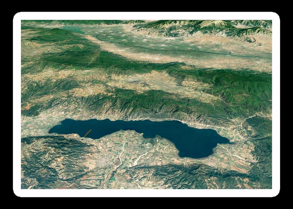
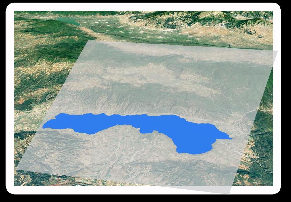
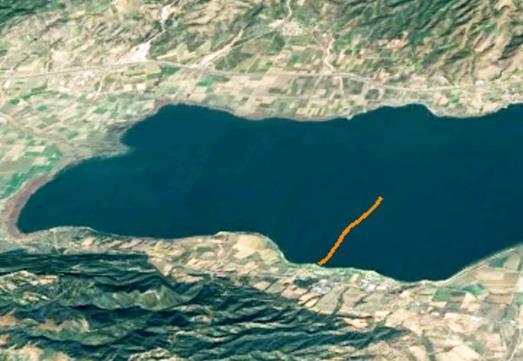
6 CASE STUDIES Mediterranean Gulf Coastal Habitat Mapping i-oyster In situ Tool for Spatial Monitoring RESMALI Remote Sensing for Marine Litter

7 COASTAL HABITAT MAPPING Chemical and Ecological Classification of coastal and transitional water bodies Multi Level Monitoring using state of the art systems Mapping and Detection of Macro algal Blooms Mapping of anthropogenic pressures and their influence to water bodies Implementation of ICZM in Western Mediterranean Gulf

![biological parameters [2000/60/EC] Mapping](/docs-images/78/78380350/images/8-1.jpg "macroalgae population using Sat images and")
8 MAPPING RESULTS Monitoring of chemical compounds [2000/60/EC] Monitoring of physicochemical and biological parameters [2000/60/EC] Mapping macroalgae population using Sat images and spectral libraries


9 i-oyster Fully Autonomous Water Telemetry Sensing System High temporal and spatial resolution data Rapid environmental assessment Algae & other water quality parameters Water depth Hot spot detection Benthos Plankton Sediment Water Quality

10 DEPTH (M) DEPTH (M) CHLOROPHYLL A OXYGEN i-oyster RESULTS i-oyster s deployment Monitoring Environmental Health Indicators Chlorophyll a DISTANCE Dissolved Oxygen DISTANCE Near Real Time Monitoring of priority substances according the European Water Framework Directive 200/60/EC in conjunction with sensory early warning system. Telemetry Data Reliability Samplers & sensors are calibrated and results are validated at i-bec s accredited Chemical Laboratory Accredited priority substances measurements from active and passive sampling Water in-situ Databases Capable of delivering in-situ data [OGC WaterML], compatible with GEOSS databases i-bec owns and operates information system through a Data Hub

11 i-oyster RS Integration of Space borne and earth in situ EO data Path 1.5 km
![MARINE LITTER [ML] IN MEDITERRANEAN Review potential measurement technics and associated technologies Define the requirements for RSof](/docs-images/78/78380350/images/12-0.jpg "plastic ML Conceptual design of a remote sensing methodology to satisfy the defined requirements Extract spectral features of plastic")
12 MARINE LITTER [ML] IN MEDITERRANEAN Review potential measurement technics and associated technologies Define the requirements for RSof plastic ML Conceptual design of a remote sensing methodology to satisfy the defined requirements Extract spectral features of plastic ML
13 EO TOOLS AND EXPERIMENTAL PLAN Unmanned Aerial Vehicles able to carry out sensors of various payload Very high resolution RGB cameras Optical sensors in the vis-swir region Hyperspectral sensor in the region of LWIR [8-12 μm] A proof of concept to the thermal idea Spectral libraries contain meticulous recordings of emissivity reference spectra from samples coupled with precise ground truth observations


14 NEXT STEPS ENGAGEMENT OF THE COMPLETE ECOSYSTEM Advocate Promote science and transfer of know-how and foster national ownership of SDGs Working together with selected GEO initiatives ECO SYSTEM Engage Aware Develop and promote a tools to achieve SDGs in terms of SBAs

15 IMPLEMENTATION PLAN Provide support to Region of Interest in measuring, monitoring and achieving specific indicators with regards to SDGs Promote to uptake of existing capacities Support the effective integration of Earth Observation capacities in the RoI [Develop flagship projects] Facilitate the engagement of the complete ecosystem of EO stakeholders


16 Find us at:
Future remote sensors for chlorophyll a. Dimitry Van der Zande, Quinten Vanhellemont & Kevin Ruddick
 Future remote sensors for chlorophyll a Dimitry Van der Zande, Quinten Vanhellemont & Kevin Ruddick Workshop Scheldt Commission: eutrophication 20 th October 2016 Ocean colour from space ESA MERIS 7 May
$ / maximum area Imagery $10-20 No limit $<1-3. $ / minimum area
 Technical Note Forest Industry Applications of UAVs 20 July 2017 Authors: Dr Grant Pearse *, Dr Michael Watt. * Corresponding author: grant.pearse@scionresearch.com Summary A recent project at Scion explored
Remote Sensing in Support of Multilateral Environmental Agreements
 Remote Sensing in Support of Multilateral Environmental Agreements Alex de Sherbinin CIESIN, The Earth Institute, Columbia University Presented at the Satellites and the Law Enforcement Meeting London,
Summary of the socio-economic impact of Copernicus in the EU
 Summary of the socio-economic impact of Copernicus in the EU ESA Since the entry into service of Copernicus first satellite, Sentinel-1A, in 2014, the impacts of the programme are witnessed beyond the
Regional Seas Indicators Working Group
 18 th Global Meeting of the Regional Seas Conventions and Action Plans 30 September 1 October 2016, Incheon, the Republic of Korea Regional Seas Indicators Working Group Black Sea Commission Irina Makarenko
Low Cost Aerial Mapping Alternatives for Natural Disasters in the Caribbean
 Low Cost Aerial Mapping Alternatives for Natural Disasters in the Caribbean Raid Al-Tahir, Marcus Arthur, and Dexter Davis The University of the West Indies, Trinidad and Tobago Presentation Outline: The
Monitoring water quality of the Southeastern Mediterranean sea using remote sensing
 Monitoring water quality of the Southeastern Mediterranean sea using remote sensing Tamir Caras The Remote Sensing Laboratory Jacob Blaustein Institutes for Desert Research Ben-Gurion University of the
Forest change detection and monitoring using passive and active remote sensing data (RS4FOR project)
") Forest change detection and monitoring using passive and active remote sensing data (RS4FOR project) Katarzyna Staszyńska, Ewa Grabska, Anna Zielonka, Katarzyna Ostapowicz Institute of Geography and Spatial
Forest change detection and monitoring using passive and active remote sensing data (RS4FOR project) Katarzyna Staszyńska, Ewa Grabska, Anna Zielonka, Katarzyna Ostapowicz Institute of Geography and Spatial
ECOPOTENTIAL Improving future ecosystem benefits through Earth Observations. This project is funded by the European Union
 ECOPOTENTIAL Improving future ecosystem benefits through Earth Observations This project is funded by the European Union E C O P OT E N T I A L P ro j e c t S i t e s Biogeographic Regions Abisko Atla
Belair Litora. B E L A I R WO R KS H OP J U N E 1 3, G e m bl o u x, B e l g i um
 Belair Litora B E L A I R WO R KS H OP 2 0 1 4 - J U N E 1 3, 2 0 1 4 G e m bl o u x, B e l g i um E l s k n a e ps, D r i e s R ay m a e ke rs, S i v e e C h a w l a, N i t i n B h a t i a, P i e t e
LAND AND WATER - EARTH OBSERVATION INFORMATICS FSP
 Earth Observation for Water Resources Management Arnold Dekker,Juan P Guerschman, Randall Donohue, Tom Van Niel, Luigi Renzullo,, Tim Malthus, Tim McVicar and Albert Van Dijk LAND AND WATER - EARTH OBSERVATION
Copernicus and Downstream Industry
 Copernicus and Downstream Industry Powered by INSPIRE Conference 5 March, 2013 Bussels Daniel Quintart Legal Officer 1 Outline Copernicus an introduction Specific service applications Access to in situ
ESA Thematic Exploitation Platforms and the Forestry Thematic Exploitation Platform (Forestry-TEP)
") ESA Thematic Exploitation Platforms and the Forestry Thematic Exploitation Platform (Forestry-TEP) Copernicus Training and Information Session November 22, 2016 Tuomas Häme, Renne Tergujeff VTT Technical
ESA Thematic Exploitation Platforms and the Forestry Thematic Exploitation Platform (Forestry-TEP) Copernicus Training and Information Session November 22, 2016 Tuomas Häme, Renne Tergujeff VTT Technical
BALTIC OPERATIONAL OCEANOGRAPHIC SYSTEM BOOS
 BALTIC OPERATIONAL OCEANOGRAPHIC SYSTEM BOOS E. Buch, J. Elken, J. Gajewski, B. Haakansson, K. Kahma and K. Soetje BOOS Steering Group, Copenhagen, Denmark E-mail: ebu@dmi.dk Abstract BOOS is a formal
Exploration of alternative monitoring strategies in relation to water body assessments. Imre Schep
 Imre Schep DID Team Hydro Advise on information and monitoring strategies Advise on instruments and sensors Exploration of alternative monitoring strategies in relation to water body assessments How can
Application of Gliders for Near-Real Time METOC Data Collection Capability for Battlespace Characterization
 DISTRIBUTION STATEMENT A: Approved for public release; distribution is unlimited. Application of Gliders for Near-Real Time METOC Data Collection Capability for Battlespace Characterization Charles Trees
"The preparation and execution of the National Plan for the protection of the marine environment in the State of Kuwait"
 "The preparation and execution of the National Plan for the protection of the marine environment in the State of Kuwait" 1 Kuwait Environment Public Authority Content Why do we care about the marine environment?
Use of Earth Observation Data for Water Resources Management by the Nile Basin Initiative. - Tigernet Project
 Use of Earth Observation Data for Water Resources Management by the Nile Basin Initiative. - Tigernet Project By Milly Mbuliro GIS/ Remote Sensing Specialist Nile Basin Initiative Secretariat 25-27 March,
Opportunities for UAS as Smart Inspectors in Environmental Monitoring Applications
 Opportunities for UAS as Smart Inspectors in Environmental Monitoring Applications Lammert Kooistra 1, Juha Suomalainen 1, Niels Anders 2, Jappe Franke 3, Harm Bartholomeus 1, Saskia Keesstra 2 and Sander
Forest and Land Cover Monitoring by Remote Sensing Data Analysis
 Low Carbon Asia Research Network (LoCARNet) 3rd Annual Meeting Bogor, Indonesia November 24 26, 2014 Forest and Land Cover Monitoring by Remote Sensing Data Analysis Muhammad Ardiansyah Center for Climate
Design of an Agricultural Runoff Monitoring & Incentive System for Maryland
 Design of an Agricultural Runoff Monitoring & Incentive System for Maryland Hoon Cheong, Willie Heart, Lisa Watkins, and Harry Yoo Department of Systems Engineering and Operations Research George Mason
Date: Author: Doc Title. 20/08/14 Jimmy Slaughter Copernicus Services. Copernicus Services
 Date: Author: Doc Title 20/08/14 Jimmy Slaughter Copernicus Services Copernicus Services Table of Contents Introduction... 3 What Will Copernicus Do?... 3 2.1 Land Monitoring... 3 2.2 Marine Monitoring...
GEOGLAM international cooperation activities
 GEOGLAM international cooperation activities Chris Justice Center for Global Agricultural Monitoring and Research Dept. of Geographical Sciences University of Maryland GEO: an International Coordinating
Airship-based LiDAR and multi-sensor forest monitoring
 Airship-based LiDAR and multi-sensor forest monitoring S. Esposito, P. Fallavollita, M. Balsi, R. Tognetti, M. Marchetti COST WORKSHOP Green Engineering Camp ( GEC) Plitvice Lakes National Park, Croatia
The PICO Plan The building blocks of a System of Systems Requirements for implementation
 Panel for Integrated Coastal Observations Requirements for Global Implementation of the Strategic Plan for Coastal GOOS Data & information requirements for ecosystem based approaches to Managing human
Challenges for international cooperation Case Examples of Needs in the Environmental Monitoring Sector Juha-Markku Leppänen Head of the Monitoring
 Challenges for international cooperation Case Examples of Needs in the Environmental Monitoring Sector Juha-Markku Leppänen Head of the Monitoring and Assessment Unit, Marine Research Centre, SYKE Content
Mapping water constituents concentrations in estuaries using MERIS full resolution satellite data
 Mapping water constituents concentrations in estuaries using MERIS full resolution satellite data David Doxaran, Marcel Babin Laboratoire d Océanographie de Villefranche UMR 7093 CNRS - FRANCE In collaboration
The Balkan Environment Center and the Balkan Wildland Fire Observatory. Ioannis Gitas George Zalidis
 The Balkan Environment Center and the Balkan Wildland Fire Observatory Ioannis Gitas George Zalidis The Balkan Environment Center (BEC) Environmental Monitoring Environmental quality, threats, pressures
Earth Observation for Sustainable Development of Forests (EOSD) - A National Project
 - A National Project") Earth Observation for Sustainable Development of Forests (EOSD) - A National Project D. G. Goodenough 1,5, A. S. Bhogal 1, A. Dyk 1, R. Fournier 2, R. J. Hall 3, J. Iisaka 1, D. Leckie 1, J. E. Luther
Earth Observation for Sustainable Development of Forests (EOSD) - A National Project D. G. Goodenough 1,5, A. S. Bhogal 1, A. Dyk 1, R. Fournier 2, R. J. Hall 3, J. Iisaka 1, D. Leckie 1, J. E. Luther
A REVIEW OF FOREST FIRE INFORMATION TECHNOLOGIES IN VIETNAM
 A REVIEW OF FOREST FIRE INFORMATION TECHNOLOGIES IN VIETNAM Le Thanh Ha 1, Nguyen Hai Chau 1, Nguyen Hoang Nam 1, Bui Quang Hung 1, Nguyen Thi Nhat Thanh 1, Nguyen Ba Tung 1, Do Khac Phong 1, Nguyen Van
Design of an Agricultural Runoff Monitoring and Reward System for the Upper Chesapeake Bay
 Design of an Agricultural Runoff Monitoring and Reward System for the Upper Chesapeake Bay Harry Yoo, Hoon Cheong, Will Heart, Lisa Watkins, and Dr. George Donohue George Mason University, hyoo9, bcheong2,
VT Group Unmanned Systems Capabilities Brief.
 VT Group Unmanned Systems Capabilities Brief Our Company Our success rests in its three lines of business Integrated Solutions, Technical Services and Unmanned Systems. From providing turnkey engineering
Application of PALSAR data to classify vegetation in an anthropogenically affected wetland area in Central Spain (Las Tablas de Daimiel)
") Rhodes, Greece, Application of PALSAR data to classify vegetation in an anthropogenically affected wetland area in Central Spain (Las Tablas de Daimiel) Thomas Schmid 1, Magaly Koch 2, Jesús Solana 3 and
Rhodes, Greece, Application of PALSAR data to classify vegetation in an anthropogenically affected wetland area in Central Spain (Las Tablas de Daimiel) Thomas Schmid 1, Magaly Koch 2, Jesús Solana 3 and
Coordinating Implementation of the Global Ocean Observing System
 GEO Science and Technology Committee, Melbourne, 16 September 2009 Coordinating Implementation of the Global Ocean Observing System Peter Dexter Co-President of JCOMM Thanks to Candyce Clark, Hester Viola,
GeoCarb. PI: Berrien OU (Leadership, science analysis)
") PI: Berrien Moore @ OU (Leadership, science analysis) Partner Institutions: Lockheed-Martin (instrument) CSU (Algorithms) NASA Ames (Validation) GeoCarb A NASA Earth-Ventures mission, awarded in Dec 2016,
PI: Berrien Moore @ OU (Leadership, science analysis) Partner Institutions: Lockheed-Martin (instrument) CSU (Algorithms) NASA Ames (Validation) GeoCarb A NASA Earth-Ventures mission, awarded in Dec 2016,
Future Marine Data Collection and Sharing - the Digital Ocean
 David Mills & Graham Worley Marine Centre Wales Bangor University Menai Bridge Anglesey UK Future Marine Data Collection and Sharing - the Digital Ocean Introduction The Digital Ocean a journey Data collection
Impact assessment of human activities, the EO-MINERS showcase. EO contribution in monitoring environmental and societal impact of mining Activities
 Impact assessment of human activities, the EO-MINERS showcase EO contribution in monitoring environmental and societal impact of mining Activities Stephane CHEVREL General context Securing EC raw material
EU FP7-SPACE project INFORM
 Improvedmonitoring andforecastingof ecologicalstatus of European INland waters by combining Future earth ObseRvation data and Models Miguel Dionisio Pires Deltares miguel.dionisio@deltares.nl EU FP7-SPACE
Developing the next generation of coastal water quality products and services - the FP7/HIGHROC project
 Developing the next generation of coastal water quality products and services - the FP7/HIGHROC project K. Ruddick, C. Brockmann, E. Capuzzo, K. Collingridge, S. Constantin, V. Créach, L. De Keukelaere,
UNEP N eeds Needs for for LULC data and information
 UNEP Needs for LULC data and information By Ashbindu Singh Chief, Early Warning Branch UNEP Division of Early Warning& Assessment and Regional Coordinator UNEP Division of Early Warning & Assessment- North
ChloroGIN Addressing GEO Task EC-09-01c: Regional Networks for Ecosystems
 Addressing GEO Task EC-09-01c: Regional Networks for Ecosystems Stewart Bernard (CSIR, South Africa), Mark Dowell (JRC, Italy), Steve Groom (PML, UK), Nicolas Hoepffner (JRC, Italy), Milton Kampel (INPE,
Operations Research in the Department of Defense
 Operations Research in the Department of Defense Jason Daly Senior Operations Analyst for Marine Corps Operational Test and Evaluation Activity (MCOTEA) Outline Background on Operations Research (OR) How
CEOS/LPV workshop on LAI & fapar validation. Davos 15/03/2007
 CEOS/LPV workshop on LAI & fapar validation Davos 15/03/2007 Proposed Agenda 09:00-09:30 Introduction, objectives of the meeting, relation to GEO/GEOSS 09:30-10:45 Ongoing direct validation activities
SUMMARY OF THE COPERNICUS MARINE ENVIRONMENT MONITORING SERVICE OCEAN STATE REPORT 2016
 SUMMARY OF THE COPERNICUS MARINE ENVIRONMENT MONITORING SERVICE OCEAN STATE REPORT 2016 C O P E RNICUS M ARINE E NVIRO N MEN T M ONIT ORING SE R VICE OCEAN STATE REPORT No.1, 2016 Journal of Operational
A look past and a look forward. David Skole Michigan State University
 A look past and a look forward David Skole Michigan State University Antecedents ca. 1988-94 There were important antecedents to the NASA LCLUC program Two important drivers: Large scale Landsat databases
Diego Fernández Prieto European Space Agency
 Diego Fernández Prieto European Space Agency Diego.Fernandez@esa.int Background In 2006, ESA has published The Changing Earth, which represents the main new driver for the ESA EO Science Strategy. The
Stocktaking Overview of the G20. Global Agricultural Monitoring Initiative
 Stocktaking Overview of the G20 Global Agricultural Monitoring Initiative February 2018 Background The Group on Earth Observations Global Agricultural Monitoring Initiative (GEOGLAM) was initially launched
HYPOXIA Definition: ~63 µm; 2 mg l -1 ; 1.4 ml l -1 ; 30 %
 HYPOXIA Definition: ~63 µm; 2 mg l -1 ; 1.4 ml l -1 ; 30 % Consequences of hypoxia Reduce habitat for living resources Change biogeochemical processes P released from sediments Denitrification reduced
User Awareness & Training: LAND. Tallinn, Estonia 9 th / 10 th April 2014 GAF AG
 User Awareness & Training: LAND Tallinn, Estonia 9 th / 10 th April 2014 GAF AG Day 2 - Contents LAND (1) General Introduction to EO and the COPERNICUS Sentinel Programme Overview of COPERNICUS/GMES LAND
Monitoring Natural Sal Forest Cover in Modhupur, Bangladesh using Temporal Landsat Imagery during
 Monitoring Natural Sal Forest Cover in Modhupur, Bangladesh using Temporal Landsat Imagery during 1972 2015 Hasan Muhammad Abdullah *, M. Golam Mahboob, Md.Mezanur Rahman, Tofayel Ahmed * Assistant Professor,
Application of remote sensing technique for rice precision farming
 Application of remote sensing technique for rice precision farming Teoh Chin Chuang (DR) Chan Chee Wan (DR) Abu Hassan Daud Malaysian Agricultural Research and Development Institute (MARDI) Background:
EU-Africa collaboration on Space applications for Africa
 EU-Africa collaboration on Space applications for Africa Background Maputo Declaration: African policy makers request EC to open its GMES initiative to Africa (Oct 2006) Build on existing EO activities
MERIS VALIDATION WITH RESPECT TO OPERATIONAL MONITORING NEEDS IN THE NORTH AND BALTIC SEA
 MERIS VALIDATION WITH RESPECT TO OPERATIONAL MONITORING NEEDS IN THE NORTH AND BALTIC SEA Kerstin Stelzer (1), Jasmin Geißler (1), Carsten Brockmann (1), Holger Klein (2), Jeanette Göbel (3), Anu Reinart
Recommendations G7 expert workshop on future of the oceans and seas
 Background Recommendations G7 expert workshop on future of the oceans and seas The ocean is the largest feature on Earth - covering over 70% of its surface and is its largest connected ecosystem. It delivers
Ecosystems: Nutrient Cycles
 Ecosystems: Nutrient Cycles Greeks, Native Peoples, Buddhism, Hinduism use(d) Earth, Air, Fire, and Water as the main elements of their faith/culture Cycling in Ecosystems the Hydrologic Cycle What are
A STRATEGIC VISION FOR NOAA S ECOLOGICAL FORECASTING ROADMAP
 A STRATEGIC VISION FOR NOAA S ECOLOGICAL FORECASTING ROADMAP 2015-2019 FOREWORD Ecological forecasts are used to predict likely changes in ecosystems and ecosystem components in response to environmental
Michel F. Massart DG ENTR - European Commission
 Michel F. Massart DG ENTR - European Commission COPERNICUS Program COPERNICUS Global Land component COPERNICUS Program Copernicus seen from the Regulation (GMES) Global Monitoring for Environment and Security
Status of FerryBox Systems in Europe. Franciscus Colijn and Wilhelm Petersen HZG
 Status of FerryBox Systems in Europe Franciscus Colijn and Wilhelm Petersen HZG History of using Ships of Opportunity (SoOs) for Ocean Monitoring 1853 Brussels Conference: systemizing reporting of marine
Spatial Distribution of the Winter Nutrient Pool
 Spatial Distribution of the Winter Nutrient Pool Author: Philip Axe, Swedish Meteorological and Hydrological Institute Key message Good news: DIN concentrations remain below those observed in the 1990s,
Transitioning Submersible Chemical Analyzer Technologies for Sustained, Autonomous Observations from Profiling Moorings, Gliders and other AUVs
 Transitioning Submersible Chemical Analyzer Technologies for Sustained, Autonomous Observations from Profiling Moorings, Gliders and other AUVs PI: Alfred K. Hanson SubChem Systems, Inc. 66 North Main
Instructions to Regional Planners
 Module 1 Educator s Guide, Handout 3: Regional Planner Instructions Investigation 1 Instructions to Regional Planners You are a planner on the Chesapeake Bay regional planning council. Prior to the town
TerraSAR-X Applications Guide
 TerraSAR-X Applications Guide Extract: Change Detection and Monitoring: Forestry April 2015 Airbus Defence and Space Geo-Intelligence Programme Line Change Detection and Monitoring: Forestry Issue Anthropogenic
Fundamental of Peatland Mapping Consultation Meeting for Indonesian Climate Change Center (ICCC)
") Fundamental of Peatland Mapping Consultation Meeting for Indonesian Climate Change Center (ICCC) DNPI, 15th August 2011 Mitsuru Osaki Research Faculty of Agriculture, Hokkaido University Kazuyo Hirose
Fundamental of Peatland Mapping Consultation Meeting for Indonesian Climate Change Center (ICCC) DNPI, 15th August 2011 Mitsuru Osaki Research Faculty of Agriculture, Hokkaido University Kazuyo Hirose
Farming from Space: Current and future opportunities for remote sensing to boost productivity for grain growers
 Farming from Space: Current and future opportunities for remote sensing to boost productivity for grain growers Hamlyn G Jones Division of Plant Sciences and University of Dundee, UK School of Plant Biology
AEM 5495 Spring Design, Build, Model, Simulate, Test and Fly Small Uninhabited Aerial Vehicles (UAVs)
") AEM 5495 Spring 2011 Design, Build, Model, Simulate, Test and Fly Small Uninhabited Aerial Vehicles (UAVs) Gary J. Balas balas@umn.edu Monday-Wednesday 3:35-4:50 PM 211 Akerman Hall UAV Course Syllabus
AEM 5495 Spring 2011 Design, Build, Model, Simulate, Test and Fly Small Uninhabited Aerial Vehicles (UAVs) Gary J. Balas balas@umn.edu Monday-Wednesday 3:35-4:50 PM 211 Akerman Hall UAV Course Syllabus
UNMANNED SURFACE VESSEL (USV)
") UNMANNED SURFACE VESSEL (USV) UNMANNED SURFACE VESSEL (USV) By using Arma-Tech Tactical Autonomous Control Kit (ATTACK), the vessel can operate independently or combined in swarm. Completely autonomously
UNMANNED SURFACE VESSEL (USV) UNMANNED SURFACE VESSEL (USV) By using Arma-Tech Tactical Autonomous Control Kit (ATTACK), the vessel can operate independently or combined in swarm. Completely autonomously
Introduction (Welcome!)
") Introduction (Welcome!) OCN 401 Biogeochemical Systems LECTURES Lectures will generally be given using PowerPoint presentations. As a convenience to students, copies of the PowerPoint slides will be
Introduction (Welcome!) OCN 401 Biogeochemical Systems LECTURES Lectures will generally be given using PowerPoint presentations. As a convenience to students, copies of the PowerPoint slides will be
Towards a European Forest Fire Simulator
 Towards a European Forest Fire Simulator J.M. Baetens Research Unit Knowledge-based Systems Ghent University COST Green Engineering Camp July 2, 2012 KERMIT J.M. Baetens (KERMIT) A European Forest Fire
Handling a Data Stream from the Flanders Marine LifeWatch Observatory. Fernando Aguilar IFCA - CSIC
 Handling a Data Stream from the Flanders Marine LifeWatch Observatory Fernando Aguilar IFCA - CSIC Lifewatch LifeWatch is the European e-science infrastructure for biodiversity and ecosystem research.
Toyama Framework on Material Cycles
 Toyama Framework on Material Cycles We, the G7 Ministers and high representatives, and European Commissioner responsible for the environment, based on our discussion on resource efficiency and the 3Rs
AlgaeTorch. The handy measurement instrument for rapid deployment. Fast and simple algae monitoring
 www.bbe-moldaenke.de The handy instrument for rapid deployment Fast and simple algae monitoring Designed for all types of surface water: lakes, reservoirs, rivers and bathing water What does the offer?
Rice crop monitoring using EO data in the Mekong Delta, Vietnam
 The 10th GEOSS Asia-Pacific Symposium WG5: Agriculture and Food Security Hanoi, 18-20 th, Sep. 2017 Rice crop monitoring using EO data in the Mekong Delta, Vietnam Lam Dao Nguyen, Hoang Phi Phung, Dang
The Catholic University Ávila
 TheCatholic University Ávila of Academiccourse 2014/2015 INTERNATIONAL PROGRAMS: DIPLOMAS,HONORS ANDCOURSES 1. Diplomas () DIPLOMA IN INTERNATIONAL BUSINESS MANAGEMENT Strategic Management 6 Financial
Partner meeting for the WAB project application, Sopot, August 27. Matilda Gradin, Linda Wolski and Sten Björk Trelleborg Municipality
 Partner meeting for the WAB project application, Sopot, August 27 Matilda Gradin, Linda Wolski and Sten Björk Trelleborg Municipality An interrelated complex of problems -demands integrated solutions Source:http//e-podatnik.pl
DEVELOPMENT OF AN AUTONOMOUS UNMANNED AERIAL VEHICLE FOR AEROBIOLOGICAL SAMPLING. A Thesis
 DEVELOPMENT OF AN AUTONOMOUS UNMANNED AERIAL VEHICLE FOR AEROBIOLOGICAL SAMPLING A Thesis Presented to the Faculty of Virginia Polytechnic Institute and State University In Partial Fulfillment of the Requirements
Feasibility Study for an Aquatic Ecosystem Earth Observing System
 Feasibility Study for an Aquatic Ecosystem Earth Observing System Version 1.1. 16 November 2017 1 Feasibility Study for an Aquatic Ecosystem Earth Observing System Committee on Earth Observing Satellites
THE GLOBAL WATER CYCLE THEME WITHIN THE INTEGRATED GLOBAL OBSERVING STRATEGY FRAMEWORK
 THE GLOBAL WATER CYCLE THEME WITHIN THE INTEGRATED GLOBAL OBSERVING STRATEGY FRAMEWORK RICK LAWFORD & JOSEF ASCHBACHER WATER FOR THE WORLD: SPACE SOLUTIONS FOR WATER MANAGEMENT SEPTEMBER 13, 2004 GRAZ,
Crop Growth Remote Sensing Monitoring and its Application
 Sensors & Transducers 2014 by IFSA Publishing, S. L. http://www.sensorsportal.com Crop Growth Remote Sensing Monitoring and its Application Delan Xiong International School of Education, Xuchang University,
Using Airborne Imagery, GIS & Remote Sensing for Ecological Monitoring and Mapping
 Using Airborne Imagery, GIS & Remote Sensing for Ecological Monitoring and Mapping Multi-spectral Aerial Photography Geo-referenced Oblique Aerial Photography Tools and Mapping Products AES Imaging Plane
The use of satellite pictures and data provided by drones for the purposes of identification of crops and assessment of plant production
 The use of satellite pictures and data provided by drones for the purposes of identification of crops and assessment of plant production Tomasz Milewski Białobrzeska 11/64, 02-379 Warsaw Central Statistical
DR1000 Flying Laboratory, Drone Environmental Monitoring
 cccc DR1000 Flying Laboratory, Drone Environmental Monitoring 1 P a g e Mission Statement The Scentroid DR1000 is a fully capable flying laboratory, used to sample and analyze ambient air at heights of
GISBLOOM Project Hand in hand for healthy surface and coastal waters
 Project reference: LIFE09 ENV/FI/000569 GISBLOOM Project Hand in hand for healthy surface and coastal waters Dr. Olli Malve Finnish Environment Institute Life Environment & Resource-efficiency training
AnaEE Platform Criteria
 AnaEE Platform Criteria In the context of the Call for Expression of Interest This document outlines the criteria for all types of platforms aiming to be part of the distributed AnaEE infrastructure. Page
3D Reconstruction Optimization Using Imagery Captured By Unmanned Aerial Vehicles
 3D Reconstruction Optimization Using Imagery Captured By Unmanned Aerial Vehicles Abby Bassie, Sean Meacham, David Young, Gray Turnage, and Robert J. Moorhead Geosystems Research Institute, Mississippi
Mapping the world s forests: work by FAO and partners in the global Forest Resource Assessment (FRA) Mette L. Wilkie Adam Gerrand FAO
 Mette L. Wilkie Adam Gerrand FAO") Mapping the world s forests: work by FAO and partners in the global Forest Resource Assessment (FRA) Mette L. Wilkie Adam Gerrand FAO www.fao.org/forestry/fra2010 Main points Challenges unprecedented global
Mapping the world s forests: work by FAO and partners in the global Forest Resource Assessment (FRA) Mette L. Wilkie Adam Gerrand FAO www.fao.org/forestry/fra2010 Main points Challenges unprecedented global
Suborbital Measurement Program Using the MEOS Spectrometer (MEOSuB)
") Suborbital Measurement Program Using the MEOS Spectrometer (MEOSuB) J.J. Sloan, R. V. Kruzelecky, K. Strong and J. Lin Workshop on Suborbital Platforms and Nanosatellites Canadian Space Agency, Saint-Hubert,
Suborbital Measurement Program Using the MEOS Spectrometer (MEOSuB) J.J. Sloan, R. V. Kruzelecky, K. Strong and J. Lin Workshop on Suborbital Platforms and Nanosatellites Canadian Space Agency, Saint-Hubert,
HUMAN RESOURCES AND EDUCATIONAL INFRASTRUCTURE
 University of Palangka Raya HUMAN RESOURCES AND EDUCATIONAL INFRASTRUCTURE Human Resources The number of academic staff in UNPAR until 2003 is 640, consists of 399 undergraduates, 221 masters and 20 doctors.
AIMS pilot project. Monitoring the rehabilitation of degraded landscapes from Food Assistance for Assets programmes with satellite imagery
 Fighting Hunger Worldwide AIMS pilot project Monitoring the rehabilitation of degraded landscapes from Food Assistance for Assets programmes with satellite imagery September 2017 BEFORE road construction
AeroVironment, Inc. Unmanned Aircraft Systems Overview. Background
 AeroVironment, Inc. Unmanned Aircraft Systems Overview Background AeroVironment ( AV ) is a technology company with a 40-year history of practical innovation in the fields of unmanned aircraft systems
Airborne oil spill remote sensing: Current status & recent developments
 Airborne oil spill remote sensing: Current status & recent developments Nils Robbe Optimare Systems GmbH Bremerhaven, Germany Presented at the Bonn Agreement Remote Sensing Workshop, Middelburg, NL, 14-16
Work Programme 2012 COOPERATION. Theme 6. Environment (including climate change)
") Work Programme 2012 COOPERATION Theme 6 Environment (including climate change) (European Commission C(2011)5068 of 19 July 2011) 1 Table of Contents Objective:... 3 I CONTEXT... 3 II CONTENT OF CALLS...
Work Programme 2012 COOPERATION Theme 6 Environment (including climate change) (European Commission C(2011)5068 of 19 July 2011) 1 Table of Contents Objective:... 3 I CONTEXT... 3 II CONTENT OF CALLS...
ГЕОЛОГИЯ МЕСТОРОЖДЕНИЙ ПОЛЕЗНЫХ ИСКОПАЕМЫХ
 LE HUNG TRINH (Le Quy Don Technical University) APPLICATION OF REMOTE SENSING TECHNIQUE TO DETECT AND MAP IRON OXIDE, CLAY MINERALS, AND FERROUS MINERALS IN THAI NGUYEN PROVINCE (VIETNAM) This article
UAV assessment to support EU policies
 UAV assessment to support EU policies Elena Roglia Max Craglia www.jrc.ec.europa.eu Serving society Stimulating innovation Supporting legislation Sistema di Monitoraggio Avanzato del Territorio SMAT SMAT
MONDAY, 27 FEBRUARY 2017
 MONDAY, 27 FEBRUARY 2017 Room 301 B 302 A/B 304 A/B 305 A/B 306 A 306 B 308 A/B 199 168 258 162 150 168 194 9:00-9:50 9:50 - MORNING PLENARY - Marcia McNutt - 9:00 to 9:50 Session# 71 96 12 9 34 58 65
Optimized maintenance and inspection concept for offshore wind energy turbines
 December 2017 Page 1 5 Optimized maintenance and inspection concept for offshore wind energy turbines Inspecting rotor blades with thermography and acoustic monitoring Wind turbines have a design life
Future Data Access & Analysis Architectures Strategy for CEOS
 Future Data Access & Analysis Architectures Strategy for CEOS Discussion Document for the 31 st CEOS Plenary Version 1.0, October 2017 A Future Data Access & Analysis Architectures Strategy for CEOS Discussion
Automatic retrieval of biophysical and biochemical canopy variables: an example based on AHS data from AGRISAR campaign
 Automatic retrieval of biophysical and biochemical canopy variables: an example based on AHS data from AGRISAR campaign Wouter Dorigo, Heike Gerighausen & Erik Borg German Remote Sensing Data Centre, German
Approaches to assessing the value of precise positioning
 Approaches to assessing the value of precise positioning Alan Smart ACIL Allen Consulting 24 January 2014 Many approaches to estimating economic value Economic welfare analysis Benefit cost analysis Value
User Needs and High-Level Requirements for the Next Generation of Observing Systems for the Polar Regions
 User Needs and High-Level Requirements for the Next Generation of Observing Systems for the Polar Regions Summary Report Prepared for: European Space Agency Prepared by: Polar View Earth Observation Limited