ADOT Experiences Analyzing and Using Climate Projections: Handling Scientifically-Informed Climate Data Downscaling
|
|
|
- Rosa Bell
- 6 years ago
- Views:
Transcription


1 ADOT Experiences Analyzing and Using Climate Projections: Handling Scientifically-Informed Climate Data Downscaling Steven Olmsted Arizona Department of Transportation Intermodal Transportation Division Federal Highway Administration Building a Climate Resilient Transportation System Webinar Series Developing Scenarios of Future Temperature and Precipitation Conditions February 24, 2015
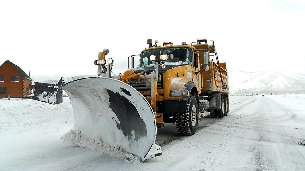
2 Arizona Asset Universe Arizona 140,000 maintenance lane miles 7,800 bridges 1 International border Arizona Department of Transportation 30,000 maintenance lane miles connecting those 140,000 4,700 bridges 10 maintenance and construction districts 1,500 facility buildings Spread over 114,000 square miles Our agency operates from sea level to 6,000 feet Temperatures below 0 F to over 120 F 2
3 Impacts
4 Impacts
5 Impacts
6 Impacts
7 Impacts
8 Formalize Approach ADOT s FHWA sponsored climate resilience pilot project was to assess the vulnerability of critical infrastructure to extreme weather for the major Arizona highway corridor (I-19, I-10, I-17) extending from Nogales to Flagstaff. Objectives Integrate asset data, gain stakeholder input, identify a reasonable defensible long-term climate model (CMIP-5) Establish key climate variables, identify and rate vulnerabilities Develop risk models for multiple ecoregions/ecosystems Contribute to the national adaptation process and enhance the FHWA Vulnerability Assessment Framework 8
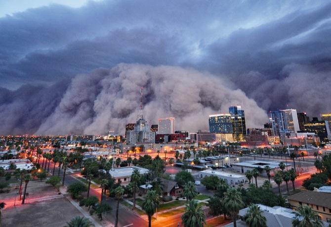
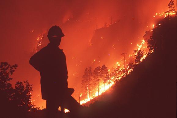
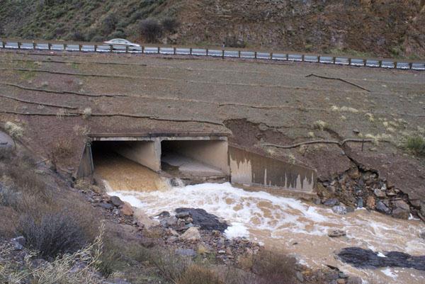
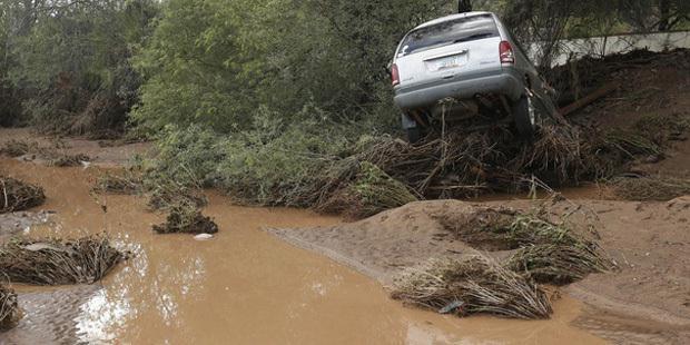
9 Frame Potential Effects ADOT looked at climate-related stressors - Extreme Heat, Freeze- Thaw, Extreme Precipitation, and Wildfire, considering the potential change in these risk factors as the century progresses. Stressor considerations hit all business areas Planning, Design, Construction, Maintenance and Operations, Asset Management Shortened pavement life (heat, freeze-thaw, snow plowing) Culverts - design capacity, maintenance frequency Bridges - design capacity, maintenance frequency Roadside erosion Road closures - flooding/fire/rockfall/dust/low water crossings Shifting periods for paving operations Winter storm maintenance costs 9
10 Customize the Resilience Assessment ADOT chose a bold large scale resilience assessments 322-mile corridor made up study area Gather members of Arizona s climate science community Study boundary defined by watersheds adjacent to corridor Hydrologic Unit Code 6 (HUC-6) basins as defined by USGS Further complicated by elevations and eco-regions Extreme weather events (severity and likelihood) Average climate (annual and seasonal) Landscapes and vegetation (e.g., fire risk, imperviousness, etc.) Question Could ADOT be satisfied working with one best case scenario outcome for now as the climate science develops? 10
11 ADOT Approach - Climate Data Downscaling Climate Data Parameters Projections & Historical Data Source Emissions Pathway Selection for Assessment CMIP5 Bias Corrected Spatially Disaggregated (BCSD) daily projections and historical data Representative Concentration Pathway 8.5 Downscaled General Circulation Models NorESM1-M, HadGEM2-ES, CSIRO- MK3.6, CanESM2, MPI ESM-LR, MPI ESM-P, GFDL-ESM2M Horizontal Spatial Resolution Temporal Resolution 1/8 (~7.5 mile or ~12 km) Daily for (backcastings from models in addition to historical data), , and
12 Climate Data Fields Summary Field Name(s) Temporal Period(s) Max 1-Day Precipitation Event (by time period) , , /200-Year Maximum Precipitation Event Minimum Annual Precipitation , , Average Annual Precipitation Avg Number of Days Per Year in which Precipitation Exceeds Baseline Period s 99th-Percentile Precipitation Event Avg May-June-July-August Precipitation Avg Daily Maximum Temperature Avg Number of Days Per Year in which Temperature equals or exceeds 100 Avg Number of Days Per Year in which Temperature equals or exceeds 110 Avg Number of Days Per Year in which Temperature falls below or equals 32 Avg Daily Minimum Temperature 12
13 CMIP Customization for ADOT To retrieve downscaled climate data, the team leveraged the U.S. DOT CMIP Climate Data Processing Tool (2014). In order to automate the downscaling process - a necessity given the approximately 450 CMIP grid cells covering the study area (multiplied by as many as seven (7) climate models, three (3) time periods, and thirteen (13) climate variables) - the team enhanced the Tool to facilitate batch processing and to derive a wider range of variables (such as the projected 100-year 24-hour rainfall magnitude) Within a given grid cell, projections vary depending on which climate model is referenced (and would vary further if alternative emissions scenarios were considered). Across the study corridor, projections vary spatially depending on factors such as latitude, topography, urbanization, and land cover. 100-/200-Year Maximum Precipitation Event - Estimated by fitting Generalized Extreme Value (GEV) distribution to annual precipitation maxima to 2049 and 2050 to 2099 are the future analysis periods for GEV-generated projections. 13
14 Lessons Learned More confidence in climate temperature projections than in the precipitation projections need to focus on extrapolating historical precipitation data for now Precipitation seasonality modeling difficult ADWR CMIP processing experience had a host of lessons learned Determining appropriate Representative Concentration Pathways ADOT primarily concerned with extreme impacts Natural climate variability representation what metrics to use currently looking at climatology, atmospheric variability, surface temps, historic precipitation data Address bias implications for the precipitation data but also Pacific sea surface temps. (i.e. ENSO) 14
15 Lessons Learned Gather something more than just 24-hr maximum precipitation event numbers scale up to address erosion, sediment, scour, run-off, flooding, man-made structures Development guidance to allow implementation into construction contracts regarding this material - specifically the higher risk drainage structures and system pinch points ADOT effort addresses unique component of ecoregions and biotic communities impacts as our corridor study covers about sea level to 6000 Currently looking at 3 ecoregions and 8 biotic communities 5 of which intersect our corridor study Watershed Complementary USGS/ADOT partnering project under development 15
16 How has ADOT Used the Results Federal - Begin framing how to address FHWA Order 5520 and last week s Executive Order on Federal Flood Risk Management. Agency - Identified key entry points for adaption planning and implementation, and MAP-21 TAMP risk modeling development. Planning - Assist state, county and municipal entities with efforts. Design - Proposed ADOT/USGS partnership to identify data and modeling tools and approaches to assist ADOT with incidents of flood, hydraulic-related and extreme weather. Construction - Develop Statewide hotspot GIS w/ project overlay M&O - Using climate results and FHWA INVEST M&O module s fourteen (14) criteria to frame ADOT M&O resilience discussion. Assisting FHWA Office of Operations Road Weather and Work Zone Management Group in furthering discussion. 16
17 Resilience - Structure by Structure


18 Questions? Questions Steven Olmsted Intermodal Transportation Division Arizona Department of Transportation 18
New York State DOT Adaptation to Climate Change and Extreme Weather. Elisabeth Lennon New York State Department of Transportation
 New York State DOT Adaptation to Climate Change and Extreme Weather Elisabeth Lennon New York State Department of Transportation Union College, January 2014 New York State Transportation is A vast and
World Bank Study: Making Transport Climate Resilient
 World Bank Study: Making Transport Climate Resilient Adapting the road sector to climate change Presented by: Fang Xu, Economist, Africa Region Office, fxu@worldbank.org Karsten Sten Pedersen, Project
Climate Change Adaptation Strategies for Infrastructure Managers
 Climate Change Adaptation Strategies for Infrastructure Managers Green Streets and Highways Conference November 17, 2010 Butch Wlaschin Office of Asset Management Federal Highway Administration U.S. Department
Office of Strategic Planning and Projects Connecticut Department of Transportation CLIMATE CHANGE & EXTREME WEATHER PILOT PROJECT
 Office of Strategic Planning and Projects Connecticut Department of Transportation CLIMATE CHANGE & EXTREME WEATHER PILOT PROJECT LITCHFIELD HILLS Lake Waramaug, Warren/Kent/Washington LITCHFIELD HILLS
Adaptation to Extreme Weather Events and Climate Change
 Office of Planning, Environment and Realty Office of Infrastructure Adaptation to Extreme Weather Events and Climate Change SASHTO Meeting Robert Kafalenos, FHWA August 25, 2014 1 Planning for the Future
Climate and Water Supply in the Santa Ana River Watershed
 Climate and Water Supply in the Santa Ana River Watershed Will surface water supply decrease? Annual surface water is likely to decrease over the future periods. Precipitation shows somewhatlong term decreasing
Submission date: March 1, Word : 4,901 7 figures : 2, tables : Total : 7,151
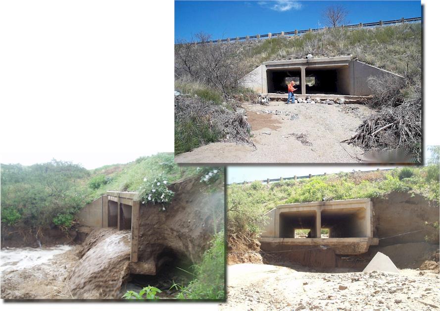
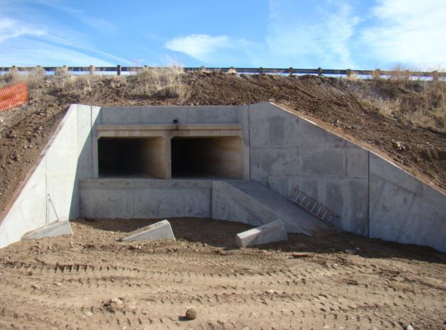
 0 0 0 0 An Arizona Department of Transportation - United States Geological Survey Pilot Project Blending Science and Engineering - Laguna Creek Bridge Bank Protection Submission date: March, 0 Word :,0
Ben Sanderson National Center for Atmospheric Research, Boulder CO
 RISK: Ben Sanderson National Center for Atmospheric Research, Boulder CO Likelihoods of significant consequences Ice sheet collapse, Rapid Sealevel rise Impact Runaway greenhouse, Mass extinctions Widespread
What s Your Drought Vulnerability? (Surviving the Drought of )
") What s Your Drought Vulnerability? (Surviving the Drought of 2012-2014) Jay Jasperse, P.E. Chief Engineer Sonoma County Water Agency February 21, 2014 www.sonomacountywater.org Historical Ukiah Precipitation
What s Your Drought Vulnerability? (Surviving the Drought of 2012-2014) Jay Jasperse, P.E. Chief Engineer Sonoma County Water Agency February 21, 2014 www.sonomacountywater.org Historical Ukiah Precipitation
Uncertainty in projected impacts of climate change on water
 1928 2000 Uncertainty in projected impacts of climate change on water Ed Maurer Civil Engineering Cambio Climático y Políticas Públicas Centro de Cambio Global Universidad Católica de Chile 23 abril 2009
Chapter 7. Street Drainage. 7.0 Introduction. 7.1 Function of Streets in the Drainage System. 7.2 Street Classification
 7. Introduction This chapter summarizes methods to evaluate runoff conveyance in various street cross sections and curb types in the Town of Castle Rock and identifies acceptable upper limits of street
BAEN 673 / February 18, 2016 Hydrologic Processes
 BAEN 673 / February 18, 2016 Hydrologic Processes Assignment: HW#7 Next class lecture in AEPM 104 Today s topics SWAT exercise #2 The SWAT model review paper Hydrologic processes The Hydrologic Processes
Uncertainty in hydrologic impacts of climate change: A California case study
 Uncertainty in hydrologic impacts of climate change: A California case study Ed Maurer Civil Engineering Dept. Santa Clara University Photos from USGS Motivating Questions What are potential impacts of
Extreme Weather Events and State DOTs
 Extreme Weather Events and State DOTs Date: August 25, 2014 Committee: Presenter: SASHTO Michael Meyer, Parsons Brinckerhoff AASHTO EXTREME WEATHER EVENTS SYMPOSIUM Best Practices for Extreme Weather Management
Climate Change/Extreme Weather Vulnerability and Risk Assessment for Transportation Infrastructure in Dallas and Tarrant Counties
 Climate Change/Extreme Weather Vulnerability and Risk Assessment for Transportation Infrastructure in Dallas and Tarrant Counties Yekang Ko (School of Urban and Public Affairs) With Arne Winguth & Jun
Climate Change Impact and Adaptation Assessment
 Climate Change Impact and Adaptation Assessment Projected warming (ºF) by NASA center, 2080s minus 1980s averaged across 16 GCMs under the A1B emissions scenario Cynthia Rosenzweig NASA Goddard Institute
Colorado River Basin Water Supply and Demand Study. WRRC 2013 Conference University of Arizona Tucson, AZ March 5, 2013
 Colorado River Basin Water Supply and Demand Study WRRC 2013 Conference University of Arizona Tucson, AZ March 5, 2013 Colorado River Basin Water Supply and Demand Study Study Objective Assess future water
Integrated Modeling: ENVISION
 Integrated Modeling: ENVISION Cimarron River Watershed Gehendra Kharel Oklahoma State University Cimarron River Watershed Research and Extension Symposium November 17, 2016 1 Research, Data Archiving,
Click to edit title style
 Click to edit title style Samuel B. Merrill, PhD Judy Gates November 16, 2015 Click to edit Master text styles Second level Third level Fourth level» Fifth level Integrating Storm Surge and Sea Level Rise
Evaluating Regional Watershed Sensitivity to Climate Change: Future Runoff and Sediment Variability in Southern California
 Evaluating Regional Watershed Sensitivity to Climate Change: Future Runoff and Sediment Variability in Southern California Dr. Terri Hogue Sonya Lopez, Ph.D. Candidate University of California Los Angeles
Santa Clara River Watershed Feasibility Study. Information Meeting City of Santa Clarita August 16, 2007
 Santa Clara River Watershed Feasibility Study Information Meeting City of Santa Clarita August 16, 2007 Darrell Buxton Los Angeles District U.S. Army Corps of Engineers Public Issues and Concerns Balance
Adaptation: Advising Local Governments on Climate Change Vulnerability
 Local Government Commission Building Livable Communities Ahwahnee Hotel Adaptation: Advising Local Governments on Climate Change Vulnerability March 12, 2009 2 Planning for Climate Vulnerability Exec.
Physically-based distributed modelling of river runoff under changing climate conditions
 doi:10.5194/piahs-368-156-2015 156 Remote Sensing and GIS for Hydrology and Water Resources (IAHS Publ. 368, 2015) (Proceedings RSHS14 and ICGRHWE14, Guangzhou, China, August 2014). Physically-based distributed
Culvert Sizing procedures for the 100-Year Peak Flow
 CULVERT SIZING PROCEDURES FOR THE 100-YEAR PEAK FLOW 343 APPENDIX A: Culvert Sizing procedures for the 100-Year Peak Flow A. INTRODUCTION Several methods have been developed for estimating the peak flood
WMS Tools For Computing Hydrologic Modeling Parameters
 WMS Tools For Computing Hydrologic Modeling Parameters Lesson 9 9-1 Objectives Use the drainage coverage as a basis for geometric parameters as well as overlaying coverages to compute important hydrologic
Outcomes. Kelly Karll-SEMCOG Margaret Barondess - MDOT
 Eco-Logical: I-75 Corridor I-75 Conservation Transportation Action Planning in to Monroe Achieve County: Multiple Stormwater Environmental Considerations Outcomes Kelly Karll-SEMCOG Karll@semcog.org Margaret
Overview of NRCS (SCS) TR-20 By Dr. R.M. Ragan
 TR-20 By Dr. R.M. Ragan") Overview of NRCS (SCS) TR-20 By Dr. R.M. Ragan TR-20 is a computer program for the simulation of runoff occurring from a single storm event. The program develops flood hydrographs from runoff and routes
Overview of NRCS (SCS) TR-20 By Dr. R.M. Ragan TR-20 is a computer program for the simulation of runoff occurring from a single storm event. The program develops flood hydrographs from runoff and routes
ODOT Asset Management Plan 0
 ODOT Asset Management Plan 0 Table of Contents Executive Summary... 1 ODOT s Experience with Asset Management... 1 A New Way of Doing Business... 2 ODOT s Investment Plans... 3 Moving Forward... 5 1.0
The Fourth Assessment of the Intergovernmental
 Hydrologic Characterization of the Koshi Basin and the Impact of Climate Change Luna Bharati, Pabitra Gurung and Priyantha Jayakody Luna Bharati Pabitra Gurung Priyantha Jayakody Abstract: Assessment of
Adapting Road Infrastructure to Climate Extremes and Change
 Adapting Road Infrastructure to Climate Extremes and Change Experience from Small Pacific Island States September 2015 Pacific Island Countries (PICs) - - geographically dispersed, remote with small populations
Hydrology and Water Management. Dr. Mujahid Khan, UET Peshawar
 Hydrology and Water Management Dr. Mujahid Khan, UET Peshawar Course Outline Hydrologic Cycle and its Processes Water Balance Approach Estimation and Analysis of Precipitation Data Infiltration and Runoff
Mike Jastremski, CFM Watershed Conservation Director
 Planning for Flood Resilient and Fish Friendly Road-Stream Crossings in CT s Northwest Hills Mike Jastremski, CFM Watershed Conservation Director Presentation Outline Project area Climate threats Field
Climate Change Vulnerability Assessment Support
 Climate Change Vulnerability Assessment Support Nelson Lee, P.Eng. Green Sky Sustainability 2017 May 11 BC EIA BEST Annual Conference Whistler, BC Walt Kelly Pogo April 22, 1970 we have met the enemy and
America s Climate Choices Adaptation A Challenge to the Transportation Industry
 America s Climate Choices Adaptation A Challenge to the Transportation Industry November 3, 2010 TRB Webinar H. G. Schwartz, Jr. 1 Major Factors Affecting Climate 2 MITIGATION Measures to reduce Greenhouse
Comparison of Statistical and Dynamic Downscaling methods for Hydrologic Applications in West Central Florida
 Comparison of Statistical and Dynamic Downscaling methods for Hydrologic Applications in West Central Florida Wendy Graham and Syewoon Hwang, University of Florida Water Institute Alison Adams and Tirusew
Building resilience to extreme weather events
 Building resilience to extreme weather events Scott Vaughan Federal / Provincial / Territorial Deputy Ministers of Agriculture Fall Retreat October 29 th, 2014 Toronto, Ontario www.iisd.org 2014 The International
Note that the Server provides ArcGIS9 applications with Spatial Analyst and 3D Analyst extensions and ArcHydro tools.
 Remote Software This document briefly presents the hydrological and hydraulic modeling software available on the University of Nice Server with Remote Desktop Connection. Note that the Server provides
FloodCast: A Framework for Enhanced Flood Event Decision Making for Transportation Resilience
 NCHRP 20-59(53) FloodCast: A Framework for Enhanced Flood Event Decision Making for Transportation Resilience April 2017 Presenters: Mat Mampara, Caroline Whitehead & Alaurah Moss (Dewberry) Project Overview
NetMap Community Digital Watersheds & Shared Analysis Tools
 NetMap Community Digital Watersheds & Shared Analysis Tools Earth Systems Institute U. S. Forest Service, Pacific Northwest Experiment Station & Collaborating Agencies The NetMap Project Collaborators:
Estimation of the extreme meteorological and hydrological conditions in Slovenia in the future
 International Workshop on Climate Change, Budapest, 6 8 June 2016 REPUBLIC OF SLOVENIA MINISTRY OF THE ENVIRONMENT AND SPATIAL PLANNING SLOVENIAN ENVIRONMENT AGENCY Estimation of the extreme meteorological
Session I: Introduction
 STAC Workshop M O N I T O R I N G A N D A S S E S S I N G I M P A C T S O F C H A N G E S I N W E A T H E R P A T T E R N S A N D E X T R E M E E V E N T S O N B M P S I T I N G A N D D E S I G N Session
TECHNICAL METHODOLOGY
 States at Risk: America s Preparedness Report Card Technical Methodology Table of Contents Introduction... 2 Climate Threat Analysis... 2 Data Sources... 2 Conterminous United States... 2 Alaska and Hawaii...
One Maryland One Centerline. GIS-T 2014 May 7, 2014
 One Maryland One Centerline GIS-T 2014 May 7, 2014 Current Road Centerlines in Maryland SHA maintains a statewide centerline Supports HPMS program Represents state and local roads Capturing dual carriageways
Aashka Patel*, Daniel Tufford, Gregory Carbone, Peng Gao, Lauren Felker
 Aashka Patel*, Daniel Tufford, Gregory Carbone, Peng Gao, Lauren Felker Resource Management Concerns Water supply Ecological Resources SCDNR Water quality Assessing impacts of climate change on water resources
Highway Drainage 1- Storm Frequency and Runoff 1.1- Runoff Determination
 Highway Drainage Proper drainage is a very important consideration in design of a highway. Inadequate drainage facilities can lead to premature deterioration of the highway and the development of adverse
MnDOT Flash Flood Vulnerability and Adaptation Assessment Pilot Project DISTRICT 1 SILVER CREEK CASE STUDY
 MnDOT Flash Flood Vulnerability and Adaptation Assessment Pilot Project DISTRICT 1 SILVER CREEK CASE STUDY NOVEMBER 2014 This document is part of a series of short reports based on the full Flash Flood
Assisting Arctic Inhabitants in Responding to a Changing Climate
 in Responding to a Changing Climate By Brook Gamble, Sarah Trainor, and Nancy Fresco Climate Change in Alaska and the Arctic Alaska and the Arctic are warming more rapidly than any other place on the planet.
State Knowledge Management Centre on Climate Change (SKMCCC)
") State Knowledge Management Centre on Climate Change (SKMCCC) Government of Madhya Pradesh Urban Development and Environment Department Environmental Planning & Coordination Organization Background of SKMCCC
State Knowledge Management Centre on Climate Change (SKMCCC) Government of Madhya Pradesh Urban Development and Environment Department Environmental Planning & Coordination Organization Background of SKMCCC
Climate Change Impacts on Joint Riverine and Coastal Flooding on Calleguas Creek in Ventura County, CA
 Climate Change Impacts on Joint Riverine and Coastal Flooding on Calleguas Creek in Ventura County, CA James Gregory, James Jackson (ESA) Lily Verdone (TNC) FMA, September 8, 2016 Project Overview Coastal
(1) Bridge, Road and Railway (Adaptation Project) (2) Bridge, Road and Railway (BAU Development with Adaptation Options)
 Bridge, Road and Railway (Adaptation Project) (2) Bridge, Road and Railway (BAU Development with Adaptation Options)") Sub-sector Guideline: (1) Bridge, Road and Railway (Adaptation Project) (2) Bridge, Road and Railway (BAU Development with Adaptation Options) Basic Concept A. General Concept Climate change will increase
Sub-sector Guideline: (1) Bridge, Road and Railway (Adaptation Project) (2) Bridge, Road and Railway (BAU Development with Adaptation Options) Basic Concept A. General Concept Climate change will increase
Resiliency in Flagstaff, Arizona: A Community Commitment. Nicole Antonopoulos Woodman, City of Flagstaff
 Resiliency in Flagstaff, Arizona: A Community Commitment Nicole Antonopoulos Woodman, City of Flagstaff 1 Flagstaff, Arizona Founded in 1882 Population 67,500 Elevation 7,000 ft / 2,130 m Largest contiguous
Sea Level Rise: Impacts, Adaptation and Information Gaps
 University of New Orleans ScholarWorks@UNO Coastal Resilience Workshop Coastal Resilience Workshop 2015 Oct 28th, 10:00 AM - 12:00 PM Sea Level Rise: Impacts, Adaptation and Information Gaps Jeffrey R.
Tomorrow s Railway and Climate Change
 Tomorrow s Railway and Climate Change John Dora CEng FICE FRMetS FPWI Northern Hub and Beyond - PWI Technical Seminar, March 2017 Images and material by kind permission from the IPCC, Met Office, Network
International Bank for Reconstruction and Development International Development Association
 International Bank for Reconstruction and Development International Development Association PROGRESS REPORT TO THE BOARD OF EXECUTIVE DIRECTORS ON THE IMPLEMENTATION OF THE MANAGEMENT ACTION PLAN IN RESPONSE
Climate Change Simulation in the CBP Watershed Model. Gopal Bhatt, PSU and Kyle Hinson, CRC August 9, 2016
 Climate Change Simulation in the CBP Watershed Model Gopal Bhatt, PSU and Kyle Hinson, CRC August 9, 2016 Incorporating Climate Change 1. Introduction to RCP Scenarios 2. Data Inputs and GCM Comparison
Surprise in Plymouth as flood floods floodplain in flooding season, 28 Feb 2017 (taken from Twitter)
") Surprise in Plymouth as flood floods floodplain in flooding season, 28 Feb 2017 (taken from Twitter) Projecting Future Changes in Flooding Across New England: More Challenging than You Might Think Cameron
Surprise in Plymouth as flood floods floodplain in flooding season, 28 Feb 2017 (taken from Twitter) Projecting Future Changes in Flooding Across New England: More Challenging than You Might Think Cameron
Global Climate Model Selection for Analysis of Uncertainty in Climate Change Impact Assessments of Hydro-Climatic Extremes
 American Journal of Climate Change, 2016, 5, 502-525 http://www.scirp.org/journal/ajcc ISSN Online: 2167-9509 ISSN Print: 2167-9495 Global Climate Model Selection for Analysis of Uncertainty in Climate
FLAGSTAFF FAMILY FOOD BANK FLOOD REMEDIATION PROJECT
 FLAGSTAFF FAMILY FOOD BANK FLOOD REMEDIATION PROJECT Final Design Report 5/12/2016 Erik Henricksen, Elena Smith, Garrett Ribas, Meshal Alotaibi Table of Contents Acknowledgments... 3 1.0 Project Description...
Climate Change in the Columbia Basin. Stephanie Smith Manager of Hydrology, BC Hydro
 Climate Change in the Columbia Basin Stephanie Smith Manager of Hydrology, BC Hydro June 20, 2017 Outline Climate change in the Columbia River basin What has happened? What could happen? What can we do
Adapting Infrastructure and Civil Engineering Practice to a Changing Climate
 Adapting Infrastructure and Civil Engineering Practice to a Changing Climate National Academies Roundtable on Science and Technology for Sustainability June 5, 2015 Richard N. Wright, NAE Vice Chair, ASCE
TDMS A Traffic Data Repository for Government and Business Use
 TDMS A Traffic Data Repository for Government and Business Use Prepared for: Arizona Association of County Engineers Prescott, Arizona February 13, 2014 Presented by: Mark Catchpole ADOT Multimodal Planning
Impact of Sea Level Rise on Roadway Design. Paul Carroll, PE
 Impact of Sea Level Rise on Roadway Design Paul Carroll, PE September 14, 2016 State of Maryland Action Executive Order by Gov. O Malley established the Maryland Commission on Climate Change (MCCC) - 2007
NOAA/NWS Ohio River Forecast Center. Water Resources Committee Climate Trends and Change
 NOAA/NWS Ohio River Forecast Center Water Resources Committee Climate Trends and Change Jim Noel Service Coordination Hydrologist November 27, 2012 Today s Discussion Climate Trends Climate Change vs Variability
Municipal Stormwater Management Planning
 Municipal Stormwater Management Planning Christopher C. Obropta, Ph.D., P.E. Water Resources Extension Specialist with Rutgers Cooperative Extension Assistant Professor with Department of Environmental
Stormwater Local Design Manual For Houston County, Georgia
 Stormwater Local Design Manual For Houston County, Georgia Adopted November 15, 2005 TABLE OF CONTENTS 1. FORWARD... 1 2. GENERAL LEVEL OF SERVICE STANDARDS... 2 2.1. DETENTION REQUIREMENTS... 2 2.1.1.
Pre-Treatment Bioretention Cells Bioswales IOWA STORMWATER MANAGEMENT MANUAL DECEMBER 16, 2015
 Pre-Treatment Bioretention Cells Bioswales IOWA STORMWATER MANAGEMENT MANUAL DECEMBER 16, 2015 Urban Runoff Background How we got here What Problem?? Provenance of the Problem Unified Sizing Criteria What
Chehalis Basin Strategy Causes of Extreme Flooding. October 11, 2016 Policy Workshop
 Chehalis Basin Strategy Causes of Extreme Flooding October 11, 2016 Policy Workshop Agenda Hydrology o Precipitation o Flow Climate Change Effects Land Use o Channel straightening and incision o Riparian
CLIMATE INFORMATION IN HAZARD RISK ASSESSMENT JANNEKE ETTEMA, VICTOR JETTEN, DINAND ALKEMA, THEA TURKINGTON
 CLIMATE INFORMATION IN HAZARD RISK ASSESSMENT JANNEKE ETTEMA, VICTOR JETTEN, DINAND ALKEMA, THEA TURKINGTON FIRE ENSCHEDE - YESTERDAY On fire ~100 m ITC building Short rain event made the wind direction
Natural Hazards Mitigation Plan Kankakee County, Illinois Executive Summary
 1. Introduction Natural Hazards Mitigation Plan Kankakee County, Illinois Executive Summary Kankakee County s first Natural Hazards Mitigation Plan was adopted by the Kankakee County Board on October 11,
Boulder County Climate Change Preparedness Plan
 Boulder County Climate Change Preparedness Plan Prepared for: Boulder County Commissioner s Sustainability Office PO Box 471 Boulder, CO 80306 Boulder County Climate Change Preparedness Plan Prepared for:
A State Policy Framework for Adaptation to Climate Change
 A State Policy Framework for Adaptation to Climate Change James Murley, Director Barry N. Heimlich Nick Bollman* Center for Urban and Environmental Solutions at Florida Atlantic University *In Memoriam
Watersheds. A river is the report card for its watershed. Alan Levere. Arizona Water Issues 2010 The University of Arizona HWR203 1
 Watersheds A river is the report card for its watershed. Alan Levere 1 What separates watersheds? How do you identify watershed boundaries? Drainage Divides River Networks boto.ocean.washington.edu/gifs/purus.gif
Arctic Civil Infrastructure and Adaptation to Climate Change AASHTO Climate Change Symposium
 Arctic Civil Infrastructure and Adaptation to Climate Change AASHTO Climate Change Symposium Michael J. Coffey Statewide Maintenance and Operations Chief Alaska Department of Transportation and Public
Climate Change Impact Assessments: Uncertainty at its Finest. Josh Cowden SFI Colloquium July 18, 2007
 Climate Change Impact Assessments: Uncertainty at its Finest Josh Cowden SFI Colloquium July 18, 27 Global Climate Modeling Emission Scenarios (SRES) A1 very rapid economic growth global population that
Coyote Springs HOA P.O. BOX 996, Flagstaff, AZ Home:
 Coyote Springs HOA P.O. BOX 996, Flagstaff, AZ 86001 Home: 928-774-4346 Email: araziperin@gmail.com Dear Coyote Springs HOA, The Northern Arizona University College of Engineering, Forestry, and Natural
Climate Change, Precipitation Trends and Water Quality David S. Liebl
 Climate Change, Precipitation Trends and Water Quality David S. Liebl Wisconsin Lakes Partnership Convention Stevens Point 4/25/14 Map - Kate Barrett Wisconsin Precipitation Trends: 1950-2006 Annual Summer
Appendix G Preliminary Hydrology Study
 Appendix G Preliminary Hydrology Study Preliminary Hydrology Study VESTING TTM 72608 Long Beach, CA Prepared for: The Long Beach Project, LLC 888 San Clemente, Suite 100 New Port Beach, CA May 28, 2014
Mekong Climate Change and Adaptation Initiative of the Mekong River Commission
 Mekong Climate Change and Adaptation Initiative of the Mekong River Commission H. E. Mr. Kol Vathana Mekong River Commission; Deputy Secretary General Cambodia National Mekong Committee Mekong is one of
COON CREEK WATERSHED DISTRICT PERMIT REVIEW. Spring Lake Park Schools Westwood Middle School st Avenue NE, Spring Lake Park, MN 55432
 PAN 16-112, Westwood Middle School, Page 1 of 6 COON CREEK WATERSHED DISTRICT PERMIT REVIEW MEETING DATE: August 22, 2016 AGENDA NUMBER: 10 FILE NUMBER: 16-112 ITEM: Westwood Middle School RECOMMENDATION:
RIPARIAN CORRIDOR STUDY FINAL CITY CREEK MANAGEMENT PLAN TABLE OF CONTENTS
 TABLE OF CONTENTS 1.0 INTRODUCTION... 1-1 Riparian Corridor Study and Management Plan Goals... 1-1 Study Area... 1-2 Importance and Functions of Riparian Corridors... 1-2 Habitat for Mammals, Birds, and
IMPACT OF CLIMATE CHANGE ON SALINITY INTRUSION IN THE MEKONG DELTA
 Proceedings of the 14 th International Conference on Environmental Science and Technology Rhodes, Greece, 3-5 September 2015 IMPACT OF CLIMATE CHANGE ON SALINITY INTRUSION IN THE MEKONG DELTA DUONG T.A.
TfL Managing Adaptation to Climate Change
 TfL Managing Adaptation to Climate Change 14 September 2010 Matthew Webb, Climate Change Strategy Manager TfL Group Sustainability Unit Transport for London London Underground 3m trips per day Traffic
1.6 Influence of Human Activities and Land use Changes on Hydrologic Cycle
 1.6 Influence of Human Activities and Land use Changes on Hydrologic Cycle Watersheds are subjected to many types of changes, major or minor, for various reasons. Some of these are natural changes and
Here is an overview of the material I will present over the next 20 minutes or so. We ll start with statistics, move on to physics, and look at
 1 Here is an overview of the material I will present over the next 20 minutes or so. We ll start with statistics, move on to physics, and look at climate change issues. Then we will move onto discussion
Hampton Roads Climate Impact Quantification Initiative
 David Arthur Chief Energy Analysis and Sustainability The Volpe Center, USDOT Hampton Roads Climate Impact Quantification Initiative Task 1 Briefing Transportation Technical Advisory Committee (TTAC) Hampton
CHESAPEAKE BAY COMPREHENSIVE WATER RESOURCES AND RESTORATION PLAN. Habitat GIT Meeting 9 May 2017
 CHESAPEAKE BAY COMPREHENSIVE WATER RESOURCES AND 255 255 255 237 237 237 0 0 0 217 217 217 163 163 163 200 200 200 131 132 122 239 65 53 80 119 27 RESTORATION PLAN 110 135 120 252 174.59 112 92 56 62 102
Guidance for NEPA and SEPA Project-Level Climate Change Evaluations
 Guidance for NEPA and SEPA Project-Level Climate Change Evaluations Environmental Services Office November 2014 Update Introduction to the 2014 Version WSDOT s Environmental Services Office developed the
Extreme Flood Frequency Analysis and Risk Curve Development under a Changing Climate
 Extreme Flood Frequency Analysis and Risk Curve Development under a Changing Climate Yasuto TACHIKAWA Hydrology and Water Resources Research Lab. Dept. of Civil & Earth Resources Engineering, Kyoto University
MODEL Stormwater Local Design Manual. City of Centerville
 MODEL Stormwater Local Design Manual City of Centerville Adopted December 6, 2005 TABLE OF CONTENTS 1. FORWARD... 1 2. GENERAL LEVEL OF SERVICE STANDARDS... 1 2.1. DETENTION REQUIREMENTS... 1 2.1.1. Discharge
Transportation Vulnerability and Risk Assessment Pilot. American Planning Association Monday, April 16, 2012
 Transportation Vulnerability and Risk Assessment Pilot American Planning Association Monday, April 16, 2012 Goal The goal of Adapting to Rising Tides is to increase preparedness and resilience of Bay Area
21st Century Climate Change In SW New Mexico: What s in Store for the Gila? David S. Gutzler University of New Mexico
 21st Century Climate Change In SW New Mexico: What s in Store for the Gila? David S. Gutzler University of New Mexico gutzler@unm.edu Silver City, NM June 5, 2008 Global Warming in the 20th/Early 21st
Flood risk management and land use planning in changing climate conditions Mikko Huokuna Finnish Environment Institute, SYKE
 10th International Drainage Workshop of ICID 06.-11. July 2008 Flood risk management and land use planning in changing climate conditions Mikko Huokuna Finnish Environment Institute, SYKE Background hydrological
Underlying any discussion of the long-term
 UNIVERSITIES COUNCIL ON WATER RESOURCES, ISSUE 126, PAGES 48-53, NOVEMBER 2003 Respecting the Drainage Divide: A Perspective on Hydroclimatological Change and Scale Katherine K. Hirschboeck University
Chapter 4 "Hydrology"
 Chapter 4 "Hydrology" Revised TxDOT Hydraulics Manual Jorge A. Millan, P.E., CFM TxDOT Design Division/Hydraulics 2012 Transportation Short Course October 17, 2012 Chapter 4 Sections 1 Hydrology s Role
Quantifying Impacts of Land-use and Land Cover Change in a Changing Climate at the Regional Scale using an Integrated Earth System Modeling Approach
 Quantifying Impacts of Land-use and Land Cover Change in a Changing Climate at the Regional Scale using an Integrated Earth System Modeling Approach Maoyi Huang 1, Guoyong Leng 1, Yannick Le Page 1,2,
National Stormwater Calculator. Webcast Logistics
 National Stormwater Calculator Webcast sponsored by EPA's Watershed Academy Wednesday, October 16, 2013 2:00pm 3:30pm Eastern Instructors: Tamara Mittman, Environmental Engineer, U.S. EPA s Office of Wastewater