Noise Study Report December 2016
|
|
|
- Jonathan Bruce
- 6 years ago
- Views:
Transcription


1 Noise Study Report December 2016

2 DRAFT Noise Study Report US 92 Project Development and Environment Study from County Line Road to Wabash Avenue Financial Project ID: Federal Aid Project No.:TBD ETDM No.: 3192 This roadway capacity improvement project involves widening US 92 from the existing two-lane undivided facility to a four-lane divided facility to accommodate projected growth in the study area. The study limits extend from County Line Road to Wabash Avenue. The total project length is 4.1 miles. Florida Department of Transportation District One Prepared By: AIM Engineering & Surveying, Inc. Tampa, Florida December 2016
3 EXECUTIVE SUMMARY The Florida Department of Transportation (FDOT), District One, is conducting a Project Development and Environment (PD&E) study to evaluate the proposed widening of approximately 4.1 miles of US 92 from County Line Road to Wabash Avenue in Polk County. US 92 is also known locally as New Tampa Highway. The purpose of the PD&E study is to evaluate engineering and environmental data to determine the type, preliminary design and location of the proposed improvements. The study is being conducted in order to meet the requirements of the National Environmental Policy Act (NEPA) and other related federal and state laws, rules and regulations. The objectives of this noise study are to identify noise sensitive sites adjacent to the US 92 project corridor, compare and evaluate the traffic noise levels at these sites with and without the project, and evaluate noise abatement measures where warranted. Additional objectives include the evaluation of construction noise and the estimation of future noise level contours adjacent to the project corridor. This information will assist local officials in the development of setback requirements for future noise sensitive land uses. This study was prepared in accordance with 23 CFR, Part 772, Procedures for Abatement of Highway Traffic Noise and Construction Noise (July 13, 2010). The evaluation uses methodology established by the FDOT and documented in the PD&E Manual, Part 2, Chapter 17 (July 27, 2016). The Traffic Noise Model (TNM), version 2.5, was used to predict existing and future traffic noise levels with and without the preferred build alternative at 507 noise sensitive sites located adjacent to US 92. All noise levels described in this Noise Study Report are expressed in A-weighted decibels [db(a)] in terms of a one-hour equivalent continuous noise level, abbreviated as Leq(h). The existing and no-build condition traffic noise levels are predicted to range from 53.3 db(a) to 71.4 db(a), and 54.5 db(a) to 73.7 db(a) respectively. The proposed build alternative is predicted to result in traffic noise levels ranging from 59.5 db(a) to 76.4 db(a). Of the 507 noise sensitive sites evaluated, 229 residences are predicted to experience future noise levels with the proposed widening of US 92 that approach, meet or exceed the Noise Abatement Category (NAC) for Activity Category B. Similarly, 53 non-residential noise sensitive sites are predicted to experience future noise levels that approach or exceed the NAC for Activity Categories C and D. Two receptors, 2-03 and 2-04, representing church buildings at the New Beginnings Church are classified as Activity Category D, and therefore have an interior evaluation From County Line Road to Wabash Avenue ES 1 FPID:
4 EXECUTIVE SUMMARY location. Following FHWA guidance, interior noise levels were estimated by subtracting 25 and 20 db(a) respectively from the exterior noise levels predicted by TNM to account for exterior to interior reduction provided by the building structures. The building structure at receptor 2-03 is masonry and receptor 2-04 is considered light frame. Only receptor 2-03 which represents the wooden framed church building is predicted to approach or exceed the NAC for Activity Category D at this location. None of the evaluated sites will experience a substantial increase [15 db(a) or more] of traffic noise as a result of the proposed widening. The maximum increase between the existing condition/no-build alternative and the proposed build alternative is 8.6 db(a) at receptor Noise abatement measures were evaluated for the 282 noise sensitive sites that are predicted to experience future noise levels that approach, meet or exceed the NAC with the proposed widening of US 92. It was determined that traffic system management techniques, alignment modifications and property acquisition are not reasonable abatement measures. Land use controls were identified as a feasible abatement measure that could be used in the future by local officials to minimize the permitting and construction of incompatible land uses along the US 92 corridor. Additionally, noise barriers located along the proposed right-of-way line were evaluated in TNM for heights ranging from 8 feet to 22 feet in 2-foot increments (with one exception evaluated at the 15-foot height to maximize cost efficiency). For a particular height, the length of a barrier was optimized to minimize cost while trying to maintain the required 5 db(a) reduction at two or more impacted noise sensitive sites and a 7 db(a) reduction at one impacted noise sensitive site. Noise barriers were found to be a cost reasonable and feasible abatement measure for the impacted noise sensitive sites at nine different locations along US 92. Noise barrier systems consisting of several barriers of the same height were the most common configuration modeled in this analysis due to numerous driveway access points that would cause breaks in a continuous barrier. Depending on the physical location and proximity of the impacted noise sensitive sites to the breaks in the barrier, the effectiveness of the barrier reduction provided with each barrier system varied between locations. The nine locations where noise barrier systems are potentially cost reasonable and feasible are as follows: Noise Barrier Systems located on the north side of US 92: Oakwood Mobile Home Park (between Stations and ) Single Family Homes and Holiday Park (between Stations and ) Meadowbrook (between Stations and ) From County Line Road to Wabash Avenue ES 2 FPID:
5 EXECUTIVE SUMMARY Pine Grove Mobile Home Park and Woodall s Mobile Home Village (between Stations and ) Noise Barrier Systems located on the south side of US 92: Evergreen Motel and Mobile Home Park (between Stations and 56+00) Chapman s, Melody Acres and Parkway Mobile Home Parks (between Stations and ) Amick Properties and Single Family Homes (between Stations and ) Friendship Village (between Stations and ) Single Family Home and Shangri-La Mobile Home Park (between Stations and ). Because of the elapsed time between when the noise study was performed and when Location and Design Concept Acceptance will be granted by FDOT Office of Environmental Management (date of public knowledge), the potential exists for additional building permits to be granted subsequent to this study. Any noise analysis performed during the design phase of this project will include a review of building permit dates. The Florida Department of Transportation is committed to the construction of feasible and reasonable noise abatement measures at the noise-impacted locations listed above contingent upon the following conditions: 1. Detailed noise analyses during the final design process supports the need for, and the feasibility and reasonableness of, providing abatement; 2. Cost analysis indicates that the cost of the noise barrier(s) will not exceed the cost reasonable criterion; 3. Community input supporting types, heights, and locations of the noise barrier(s) is provided to the District Office; and 4. Safety and engineering aspects, as related to the roadway user and the adjacent property owner, have been reviewed and any conflicts or issues resolved. From County Line Road to Wabash Avenue ES 3 FPID:
6 TABLE OF CONTENTS EXECUTIVE SUMMARY... ES 1 TABLE OF CONTENTS... i SECTION 1.0 INTRODUCTION Project Description Need for the Project Primary Criteria CAPACITY/TRANSPORTATION DEMAND: Improve Level of Service Secondary Criteria AREA WIDE NETWORK/SYSTEM LINKAGE: Improve Traffic Mobility and Transportation Network Access SAFETY: Enhance Safety Conditions MODAL INTERRELATIONSHIPS: Enhance Mobility Options and Multi Modal Access SECTION 2.0 METHODOLOGY Model and Noise Metrics Traffic Data SECTION 3.0 TRAFFIC NOISE ANALYSIS Noise Sensitive Sites Measured Noise Levels Predicted Noise Levels SECTION 4.0 NOISE ABATEMENT MEASURES Traffic Management Measures Alignment Modifications Land Use Controls Noise Barriers Noise Barriers Located North of US Single Family Homes (between Stations and 25+00) Miami Court Cottages (Station 45+00) Single Family Homes (between Stations and 54+00) New Beginnings Church (Station 72+00) Opportunity Villa and Westwood Apartments (between Stations and 78+00) Oakwood Mobile Home Park (between Stations and ) From County Line Road to Wabash Avenue i FPID:
7 TABLE OF CONTENTS Single Family Homes and Holiday Park (between Stations and ) Meadowbrook (between Stations and ) Lakeland Palms Mobile Home Park (between Stations and ) Imperial Manor (between Stations and ) Pine Grove Mobile Home Park and Woodall s Mobile Home Village (between Stations and ) Noise Barriers Located South of US Evergreen Motel and Mobile Home Park (between Stations and 56+00) Tiger Villa Motel (between Stations and 77+00) Hibiscus Gardens and Pine Tree Apartments (between Stations and 83+00) Chapman s, Melody Acres and Parkway Mobile Home Parks (between Stations and ) Amick Properties and Single Family Homes (between Stations and ) Single Family Homes and Mobile Homes (between Stations and ) Multi unit Residential Dwellings and Mobile Home (between Stations and ) Silver Moon Drive In (between Stations and ) Friendship Village (between Stations and ) Single Family Home and Shangri La Mobile Home Park (between Stations and ) Single Family Homes (between Stations and ) SECTION 5.0 CONCLUSIONS SECTION 6.0 CONSTRUCTION NOISE AND VIBRATION SECTION 7.0 PUBLIC COORDINATION Public Meetings Coordination with Local Officials SECTION 8.0 REFERENCES From County Line Road to Wabash Avenue ii FPID:
8 TABLE OF CONTENTS LIST OF FIGURES Figure 1 1 Project Location Map Figure 2 1 Noise Levels for Common Outdoor and Indoor Activities LIST OF TABLES Table 2 1 Traffic Volume Characteristics used in TNM Table 3 1 Noise Abatement Criteria Table 3 2 Noise Model Validations Table 4 1 Estimated Noise Contours Table 4 2 Noise Barrier Analysis Results Oakwood Mobile Home Park Table 4 3 Feasibility and Reasonableness for the Oakwood Mobile Home Park Table 4 4 Noise Barrier Analysis Results Single Family Homes and Holiday Park Table 4 5 Feasibility and Reasonableness for the Holiday Mobile Home Park Table 4 6 Noise Barrier Analysis Results Meadowbrook Table 4 7 Feasibility and Reasonableness for Meadowbrook Table 4 8 Noise Barrier Analysis Results Lakeland Palms Mobile Home Park Table 4 9 Noise Barrier Analysis Results Imperial Manor Shuffleboard Court Table 4 10 Noise Barrier Analysis Results Pine Grove Mobile Home Park and Woodall s Mobile Home Village Table 4 11 Feasibility and Reasonableness for Pine Grove Mobile Home Park and Woodall s Mobile Home Village Table 4 12 Noise Barrier Analysis Results Evergreen Motel and Mobile Home Park Table 4 13 Feasibility and Reasonableness for Evergreen Motel and Mobile Home Park Table 4 14 Noise Barrier Analysis Results Tiger Villa Motel Table 4 15 Noise Barrier Analysis Results Hibiscus Gardens and Pine Tree Apartments Table 4 16 Noise Barrier Analysis Results Chapman s, Melody Acres and Parkway Mobile Home Parks Table 4 17 Feasibility and Reasonableness for Chapman s, Melody Acres and Parkway Mobile Home Parks Table 4 18 Noise Barrier Analysis Results Amick Properties and Single Family Homes Table 4 19 Feasibility and Reasonableness for Amick Properties and Single Family Homes Table 4 20 Noise Barrier Analysis Results Silver Moon Drive In Table 4 21 Noise Barrier Analysis Results Friendship Village Table 4 22 Feasibility and Reasonableness for Friendship Village From County Line Road to Wabash Avenue iii FPID:
9 TABLE OF CONTENTS Table 4 23 Noise Barrier Analysis Results Single Family Home and Shangri La Mobile Home Park Barrier Table 4 24 Feasibility and Reasonableness for the Single Family Home and Shangri La Mobile Home Park LIST OF APPENDICES Appendix A Traffic Data for Noise Studies Appendix B Predicted Noise Levels Appendix C Concept Plans with Noise Data Appendix D TNM Files and Digital NSR From County Line Road to Wabash Avenue iv FPID:
 is conducting a Project Development and Environment (PD&E) study to evaluate the proposed widening of US 92 from County Line Road to")
 and other related federal and state laws, rules and regulations.")
10 SECTION 1.0 INTRODUCTION The Florida Department of Transportation (FDOT) is conducting a Project Development and Environment (PD&E) study to evaluate the proposed widening of US 92 from County Line Road to Wabash Avenue in Polk County. The purpose of the PD&E study is to evaluate engineering and environmental data to determine the type, preliminary design and location of the proposed improvements. The study was conducted in order to meet the requirements of the National Environmental Policy Act (NEPA) and other related federal and state laws, rules and regulations. The project limits are shown in Figure 1-1 and the total project length is approximately 4.1 miles. 1.1 Project Description Figure 1-1 Project Location Map US 92 is classified as an Urban Other Principal Arterial. This project s limits extend from County Line Road to Wabash Avenue in Polk County, and the majority of the existing right-of-way (ROW) width is 100 feet. From County Line Road to Wabash Avenue 1-1 FPID:
11 SECTION 1.0 INTRODUCTION US 92 is a two-lane undivided facility with 12-foot travel lanes (one in each direction) and 12-foot shoulders (5-feet paved). Stormwater runoff is collected in roadside swales. With the exception of the west leg of the Wabash Avenue intersection and along the Family Dollar property, there are no existing pedestrian facilities on US 92 within the project limits. The posted speed limit for the portion of US 92 between County Line Road and Airport Road/Galloway Road is 55 miles per hour (mph), while the posted speed limit for the portion between Airport Road/Galloway Road and Wabash Avenue is 45 mph. There are four bridges and seven culverts within the project limits. Two of the bridges are concrete flat slab bridges. Bridge No is located over Hamilton Branch while Bridge No is located over Winston Creek. Both of these structures are considered to be functionally obsolete due to their substandard shoulder width and noncrash tested barriers. The other two bridges (No and No ) are single span concrete AASHTO beam bridges that carry the Polk Parkway over US 92 just to the east of Clark Road. Both of these bridges are in good condition. The seven culverts range in size from 24-inch diameter pipes to an 8-foot by 3-foot concrete box. 1.2 Need for the Project The purpose of this project is to increase the capacity of US 92 from County Line Road to Wabash Avenue in order to achieve an acceptable Level of Service (LOS) on the facility in the future condition. While the roadway currently operates at an acceptable LOS, conditions will deteriorate below standards if no improvement occurs by 2040 as the roadway will have insufficient capacity to accommodate the projected travel demand. The need for the project is based on the following primary and secondary criteria: Primary Criteria CAPACITY/TRANSPORTATION DEMAND: Improve Level of Service The widening (four-laning) of US 92 is needed to provide additional capacity to accommodate the future travel demand projected for the study corridor. The increased daily and peak hour traffic volumes expected to occur on US 92 are the result of the population and employment growth projected to occur both in the vicinity of the study corridor, as well as in areas to the west (Hillsborough County) and east (downtown Lakeland) of the study corridor. The 2014 AADT volumes range between 10,300 vehicles per day (vpd) and 16,300 vpd, while the 2014 daily truck volumes range between 9.5% and 11.9% of the AADT volumes. The existing facility is currently operating at LOS B during the peak periods; however, the design year (2040) AADT volumes are projected to range between 36,800 vpd and 39,500 vpd and the existing two-lane undivided facility is projected to operate at LOS E and F during the peak periods. If US 92 is widened to a four-lane divided facility, LOS C From County Line Road to Wabash Avenue 1-2 FPID:
12 SECTION 1.0 INTRODUCTION or better operations are projected to occur during the peak periods. The proposed improvement is expected to meet the mobility needs of the area by alleviating future congestion within the study corridor and maintaining an acceptable LOS for vehicles (including trucks) traveling between Hillsborough County and downtown Lakeland via this roadway Secondary Criteria AREA WIDE NETWORK/SYSTEM LINKAGE: Improve Traffic Mobility and Transportation Network Access Classified as an Urban Other Principal Arterial, the US 92 corridor provides access between the downtown Lakeland area and industrial developments/freight activity centers concentrated in western Polk County (such as the West Lakeland Industrial Area and eastern Hillsborough County. Given the presence of the City of Lakeland Enterprise Zone immediately east of the project, the area surrounding the corridor is composed primarily of industrial and commercial activities (including the Publix Industrial/Regional Distribution Center, Rooms To Go, Advance Auto Parts, and Ruthven Commerce Center). In addition, three Planned Unit Developments and two Developments of Regional Impact (Flagler/Lakeland Central Park and Publix Corporate Headquarters) are located to the west and south of the project. The Lakeland Linder Airport is also located to the south. Further, a CSX rail line runs parallel to the US 92 corridor. As this roadway connects to other regional transportation network facilities (such as County Line Road, SR 570, Airport Road, and eventually Interstate 4), it is critical in facilitating the east-west movement of local and regional traffic (including truck traffic as a designated truck route of Polk County and regional freight mobility corridor of Central Florida); it also provides parallel east-west service to Interstate 4 in northern Polk County. Overall, the widening is anticipated to: Enhance east-west access and regional mobility between Downtown Lakeland and areas targeted for development, particularly accommodating traffic of the West Lakeland Industrial Area; Improve the viability of US 92 as a parallel east-west alternative to I-4 by reducing travel delay; Complement other are transportation improvements (including the extension of Wabash Avenue and intersection enhancements at County Line Road and Wabash Avenue); and Enhance freight mobility and access as US 92 links to other recognized freight facilities. From County Line Road to Wabash Avenue 1-3 FPID:
13 SAFETY: Enhance Safety Conditions. SECTION 1.0 INTRODUCTION The actual five-year average crash rate (i.e., crashes per million vehicle miles traveled) for this project corridor, along with the statewide five-year average crash rate for similar facilities, was obtained from the FDOT Safety Office. During the five-year period from 2008 to 2012, the actual crash rate was equal to while the statewide crash rate was equal to This data reveals that the average crash rate for the US 92 project corridor exceeds the statewide average crash rate for similar facilities by 78.1%. By expanding vehicular capacity, a reduction in crash rates is anticipated due to dispersion of traffic. US 92 is additionally part of the emergency evacuation route network designated by the Florida Division of Emergency Management, as well as the network established by Polk County. As this roadway connects to other major arterials designated on the state evacuation route network (including SR 570, Airport Road, and I-4), as well as existing and future areas of development, the widening of US 92 to four lanes will be critical in: Facilitating east-west traffic movement and the number of residents that can be evacuated during and emergency event in northern Polk County and eastern Hillsborough County; Improving access for emergency responders; and Enhancing access to facilities of the state evacuation route network. MODAL INTERRELATIONSHIPS: Enhance Mobility Options and Multi Modal Access Notable pedestrian and bicycle traffic was observed in the field as facilities accommodating pedestrians, bicyclists, and transit users exist in the area; a transit dependent population is also present. While paved shoulders occur on both sides of US 92, no sidewalks are present except at the west leg of the Wabash Avenue intersection and along the Family Dollar property. Citrus Connection Route 45 currently operates along US 92 connecting industrial and commercial activities in western Polk County to Downtown Lakeland. It should be noted that US 92 is a designated transit-oriented corridor as commuter rail is planned to operate along the parallel CSX rail line; in addition, a park-n-ride lot is proposed at I-4 and County Line Road. The widening of US 92 is anticipated to enhance pedestrian/bicycle/transit access and circulation as it will account for and incorporate sidewalks, bicycle lanes, and future transit improvements. From County Line Road to Wabash Avenue 1-4 FPID:
14 SECTION 2.0 METHODOLOGY The objectives of this noise study are to identify noise sensitive sites adjacent to the US 92 project corridor, compare and evaluate the traffic noise levels at these sites with and without the project, and evaluate noise abatement measures where warranted. Additional objectives include the evaluation of construction noise and the estimation of future noise level contours adjacent to the project corridor. This information will assist local officials in the development of setback requirements for future noise sensitive land uses. Noise is typically defined as unwanted sound. It is emitted from many sources including airplanes, factories, railroads, power generation, daily activities, plants, and vehicles. Noise levels for common outdoor and indoor activities are shown in Figure 2-1. Figure 2-1 Noise Levels for Common Outdoor and Indoor Activities This study was prepared in accordance with 23 CFR, Part 772, Procedures for Abatement of Highway Traffic Noise and Construction Noise (July 13, 2010). The evaluation uses methodology established by the FDOT and documented in the PD&E Manual, Part 2, Chapter 17 (July 27, 2016). From County Line Road to Wabash Avenue 2-1 FPID:
15 SECTION 2.0 METHODOLOGY 2.1 Model and Noise Metrics The prediction of existing and future traffic noise levels with and without the preferred build alternative was performed using FHWA s computer model for highway traffic noise prediction and analysis the Traffic Noise Model (TNM), version 2.5. TNM predicts sound energy, in one-third octave bands, between highways and nearby receptors while considering the intervening ground s acoustical characteristics and topography. TNM was used to predict traffic noise levels at noise sensitive land uses along US 92. The predicted noise levels presented in this report are expressed in decibels (db) on the A-weighted scale [db(a)]. This scale most closely approximates the response characteristics of the human ear to traffic noise. All noise levels are reported as hourly equivalent level [Leq(h)] values, which is the equivalent steady-state sound level for a one-hour period that contains the same acoustic energy as the time-varying sound level during the same time period. A receptor is defined as a discrete or representative location of a noise sensitive area(s) for any of the land use categories listed in FHWA s Noise Abatement Criteria. Receptors representing the noise sensitive sites adjacent to US 92 were mapped in TNM in accordance with the FDOT PD&E Manual, Part 2, Chapter 17 (July 27, 2016). TNM points for the residential and church sites were placed at the edge of the dwelling unit closest to the major traffic noise source (US 92). Additionally, TNM points for pools, shuffleboard courts or other exterior areas of frequent human use were placed near the perimeter of the area closest to the major traffic noise source (US 92). The exception to this would be the receptor sites placed at each parking space of the Silver Moon Drive-In consistent with methodology detailed in FDOT s A Method to Determine Reasonableness and Feasibility of Noise Abatement at Special Use Locations (July 2009). In addition, the existing privacy walls between US 92 and Imperial Manor were modeled in TNM to evaluate the true existing conditions at those residential noise sensitive sites. 2.2 Traffic Data As stipulated in the FDOT Noise Policy Traffic Requirements (Part 2, Chapter 17, Section of the PD&E Manual), traffic characteristics that would yield the highest traffic noise impact for the design year were used to ensure worst-case traffic noise conditions in the analysis. Consistent with guidance set forth in the FDOT Traffic Noise Modeling and Analysis Practitioners Handbook (January 1, 2016), the maximum peakhourly traffic representing LOS C was used in TNM unless the traffic analysis showed that LOS C will not be reached. If LOS C will not be reached, then demand volumes were used. Table 2-1 presents the traffic volume characteristics used in TNM for each mainline traffic segment of US 92 in the 2040 no-build and build conditions. From County Line Road to Wabash Avenue 2-2 FPID:
16 Table 2-1 Traffic Volume Characteristics used in TNM SECTION 2.0 METHODOLOGY Traffic Segment 2040 No-Build Condition 2040 Build Condition County Line Road to Clark Road LOS C Demand Clark Road to Airport Road/Galloway Road LOS C Demand Airport Road/Galloway Road to Publix Gate 10 LOS C LOS C Publix Gate 10 to Wabash Avenue LOS C LOS C All of the traffic data used in the noise analysis are documented in the Traffic Data for Noise Studies Summary Output, FDOT District 1 prepared in April 2013 (updated June 2016) and provided in Appendix A. This data was obtained from Appendix M of the Final Design Traffic Technical Memorandum prepared by HDR Engineering, Inc. dated August Traffic data for the existing, 2040 no-build and 2040 build conditions are presented in this output file along with the peak direction factor (D-factor) and truck factors (T-factor) used to divide hourly volumes between cars, medium trucks, heavy trucks, buses and motorcycles to obtain the number of each vehicle type as required for TNM input. The vehicle speeds used in TNM are based on existing posted speed limits and the proposed posted speed for the build alternative. From County Line Road to Wabash Avenue 2-3 FPID:
17 SECTION 3.0 TRAFFIC NOISE ANALYSIS 3.1 Noise Sensitive Sites A noise sensitive site is any property (owner occupied, rented or leased) where frequent exterior human use occurs. To evaluate traffic noise, the FHWA has established noise levels at which abatement must be considered. These noise levels are referred to as the Noise Abatement Criteria (NAC). The NAC are noise impact thresholds for considering abatement measures. As shown in Table 3-1, NAC vary according to land use activity. Table 3-1 Noise Abatement Criteria Activity Category Activity Leq(h) 1 FHWA FDOT Evaluation Location Description of Activity Category A Exterior Lands on which serenity and quiet are of extraordinary significance and serve an important public need and where the preservation of those qualities is essential if the area is to continue to serve its intended purpose. B Exterior Residential C Exterior D Interior E Exterior F Active sports areas, amphitheaters, auditoriums, campgrounds, cemeteries, day care centers, hospitals, libraries, medical facilities, parks, picnic areas, places of worship, playgrounds, public meeting rooms, public or nonprofit institutional structures, radio studios, recording studios, recreational areas, Section 4(f) sites, schools, television studios, trails, and trail crossings. Auditoriums, day care centers, hospitals, libraries, medical facilities, places of worship, public meeting rooms, public or nonprofit institutional structures, radio studios, recording studios, schools, and television studios. Hotels, motels, offices, restaurants/bars, and other developed lands, properties or activities not included in A-D or F. Agriculture, airports, bus yards, emergency services, industrial, logging, maintenance facilities, manufacturing, mining, rail yards, retail facilities, shipyards, utilities (water resources, water treatment, electrical), and warehousing. G Undeveloped lands that are not permitted. (Based on Table 1 of 23 CFR Part 772) 1. The Leq(h) Activity Criteria values are for impact determination only, and are not design standards for noise abatement measures. 2. Includes undeveloped lands permitted for this activity category. From County Line Road to Wabash Avenue 3-1 FPID:
18 SECTION 3.0 TRAFFIC NOISE ANALYSIS As defined in 23 CFR 772, traffic noise impacts occur when predicted future traffic noise levels associated with the proposed improvements approach or exceed the NAC or when predicted future traffic noise levels substantially exceed the existing condition noise levels. FDOT defines approach to mean within 1 db(a) of the NAC. A substantial increase in noise is defined as an increase of 15 or more decibels above the existing noise level as a direct result of the transportation improvement project in question. For example, Activity Category B (residential) applies to a majority of the noise sensitive land uses within the study limits. Under Activity Category B, noise abatement measures would be considered if the predicted future exterior levels from the proposed improvements are 66 db(a) or higher, or if the predicted future traffic noise levels exceed the existing condition noise levels by 15 db(a) or more. Since the proposed improvement consists of widening an existing road, and not the construction of a road on a new alignment, a substantial increase above existing conditions is not likely to occur. Common noise environments are defined in the PD&E Manual, Part 2, Chapter 17 (July 27, 2016) as groups of receptors within the same activity category of FHWA s Noise Abatement Criteria that are exposed to similar noise sources and levels; traffic volumes, traffic mix, speed and topographic features. The developed lands along the project corridor include both noise sensitive and non-noise sensitive sites. Field reviews within the project limits revealed 507 noise sensitive sites in the vicinity of US 92 for inclusion within the analysis. The locations of these sites are mapped on the concept plans provided in Appendix C. The receptors placed in the noise model representing the identified noise sensitive sites adjacent to US 92 have been grouped into eight different noise sensitive areas (NSAs). NSA1 through NSA4 are located north of US 92 from west to east, and NSA5 through NSA8 are located south of US 92 from west to east. Additionally, the number 1 through 8 at the beginning of each receptor name indicates that the receptor represents a noise sensitive site located within one of the eight different NSAs. For example, receptor 4-03 represents the third site in NSA4. A summary description of the noise sensitive sites modeled in this analysis as detailed by each NAC Activity Category is provided below. Activity Category A Activity Category A covers lands on which serenity and quiet are of extraordinary significance and serve an important public need and where the preservation of those qualities is essential if the area is to continue to serve its intended purpose. No Activity Category A site is located adjacent to the study limits of US 92. From County Line Road to Wabash Avenue 3-2 FPID:
19 SECTION 3.0 TRAFFIC NOISE ANALYSIS Activity Category B There are 409 residences within the study limits. These residences designated Activity Category B are described by location and receptor name as follows: Receptors located north of US 92 Three single family homes represented by receptors 1-01 through 1-03 located east of County Line Road between Stations and Seven cabins represented by receptors 1-06 through 1-12 at the Miami Court Cottages located east of Pine Chase Avenue at Station Two single family homes represented by receptors 1-13 and 1-14 located west of Polk Parkway between Stations and Two single family homes represented by receptors 2-01 and 2-02 located east of Polk Parkway/Clark Road between Stations and Two single family homes represented by receptors 2-06 and 2-07 located farther east of Polk Parkway/Clark Road at Station Three mobile homes within Opportunity Villa represented by receptors 2-08 through 2-10 located farther east of Polk Parkway/Clark Road at Station Nine apartment units within the Westwood Apartments represented by receptors 2-18 through 2-26 located even farther east of Polk Parkway/Clark Road between Stations and Nine mobile homes within the Oakwood Mobile Home Park represented by receptors 2-27 and 2-29 through 2-36 east of Kraft Road between Stations and Two single family homes represented by receptors 2-40 and 2-42 located farther east of Kraft Road between Stations and Two single family homes represented by receptors 3-01 and 3-02 located east of Galloway Road between Stations and Thirty-two mobile homes within Holiday Park represented by receptors 3-04 through 3-07, 3-10 through 3-36, and 3-38 located farther east of Galloway Road between Stations and Forty-nine mobile homes within Meadowbrook represented by receptors 3-81 through 3-89, 3-91 through 3-97, and through located west of Publix Gate 10 between Stations and Seven mobile homes within the Lakeland Palms Mobile Home Park represented by receptors 4-01 through 4-07 located west of Publix Gate 7 between Stations and Two single family homes represented by receptors 4-16 and 4-17 located west of Murray Drive between Stations and From County Line Road to Wabash Avenue 3-3 FPID:
20 SECTION 3.0 TRAFFIC NOISE ANALYSIS Nine mobile homes within Imperial Manor represented by receptors 4-20 through 4-27, and receptor 4-29 located east of Imperial Drive between Stations and Three single family homes represented by receptors 4-44, 4-45 and 4-47 located west of North Chestnut Drive behind the Sunset Motel between Stations and Fifteen mobile homes within the Pine Grove Mobile Home Park represented by receptors 4-48 through 4-62 located east of North Chestnut Road between Stations and Twenty-seven mobile homes within Woodall s Mobile Home Village represented by receptors 4-75 through 4-98, and through located west of Wabash Avenue between Stations and Receptors located south of US 92 Twenty-nine mobile homes within the Evergreen Motel and Mobile Home Park represented by receptors 5-01 through 5-29 located west of the Polk Parkway between Stations and Eleven mobile homes within the Hibiscus Gardens Mobile Home Park represented by receptors 6-02 through 6-12 located east of Polk Parkway/Clark Road and along Hibiscus Parkway West and East between Stations and Fourteen apartment units within the Pine Tree Apartment complex represented by receptors 6-25 through 6-38 located east of Hibiscus Parkway East and West between Stations and Thirty-three mobile homes within Chapman s Mobile Home Park represented by receptors 6-46 through 6-58, 6-67 through 6-85, and located adjacent to, and east of Gentry Circle between Stations and Twenty-six mobile homes within Melody Acres Mobile Home Park represented by receptors through 6-118, through 6-155, and through located adjacent to, and east of Lee Avenue between Stations and Three mobile homes within the Parkway Mobile Home Park represented by receptors through located east of Kraft Road between Stations and Eight residential units within the Amick Properties complex represented by receptors through located adjacent to Amick Loop between Stations and Four single family homes and three mobile homes represented by receptors 6-202, 6-203, 6-205, and through located west of Tawny Lane between Stations and From County Line Road to Wabash Avenue 3-4 FPID:
21 SECTION 3.0 TRAFFIC NOISE ANALYSIS Twelve multi-unit residential dwellings and two mobile homes represented by receptors through and through located east of Tawny Lane between Stations and One single family home represented by receptor 7-01 located east of Churchill Lane at Station Fourteen mobile homes within Friendship Village represented by receptors 7-83 through 7-96 located east of Silver Moon Drive between Stations and One single family home represented by receptor 8-01 located west of Publix Gate 7 at Station Forty mobile homes within the Shangri-La Mobile Home Park represented by receptors 8-02 through 8-42 located across US 92 from Publix Gate 7 between Stations and Nine single family homes represented by receptors 8-70 through 8-78 located east of Twin Lakes Circle West between Stations and Fourteen single family homes represented by receptors 8-79 through 8-92 located east of Edwards Avenue between Stations and Activity Category C Activity Category C applies to the exterior traffic noise levels at a variety of noise sensitive land uses that include active sports areas, amphitheaters, auditoriums, campgrounds, cemeteries, day care centers, hospitals, libraries, medical facilities, parks, picnic areas, places of worship, playgrounds, public meeting rooms, public or nonprofit institutional structures, radio studios, recording studios, recreational areas, Section 4(f) sites, schools, television studios, trails and trail crossings. The non-residential noise sensitive sites modeled within this analysis and classified as Activity Category C are described by location and receptor names as follows: Receptors located north of US 92 An outdoor baptismal fountain at the New Beginnings Church represented by receptor 2-05 located east of Polk Parkway/Clark Road at Station A pool and shuffleboard court located at Holiday Park represented by receptors 3-08 and 3-09 respectively, located east of Galloway Road at Station A picnic table and basketball court located at the Shree Swaminarayan Temple represented by receptors 4-14 and 4-15 respectively, located east of Publix Gate 7 between Stations and A pool located at Prestlers Motel represented by receptor 4-18 located between Murray Drive and Imperial Drive at Station From County Line Road to Wabash Avenue 3-5 FPID:
22 SECTION 3.0 TRAFFIC NOISE ANALYSIS A shuffleboard court located at Imperial Manor represented by receptor 4-19 located west of Imperial Drive at Station A pool located at the Sunset Motel represented by receptor 4-43 located west of North Chestnut Road at Station Two shuffleboard courts and a pool located at Woodall s Mobile Home Village represented by receptors 4-72, 4-73 and 4-74 respectively, located west of Wabash Avenue between Stations and Receptors located south of US 92 A pool and basketball court located at the Tiger Villa Motel represented by receptors 6-01 and 6-01b respectively, located east of Polk Parkway/Clark Road between Stations and A shuffleboard court within Chapman s Mobile Home Park represented by receptor 6-66 located east of Mo Trail Circle West at Station The parking area for screen 1 at the Silver Moon Drive-In represented by receptors 7-02 through 7-82 located west of Silver Moon Drive between Stations and A shuffleboard court within the Shangri-La Mobile Home Park represented by receptor 8-04 located east of Publix Gate 7 at Station Activity Category D Activity Category D applies to the interior traffic noise levels at a variety of noise sensitive land uses that include auditoriums, day care centers, hospitals, libraries, medical facilities, places of worship, public meeting rooms, public or nonprofit institutional structures, radio studios, recording studios, schools, and television studios. The only non-residential noise sensitive sites modeled within this analysis and classified as Activity Category D are two separate buildings at the New Beginnings Church represented by receptors 2-03 and The church is located north of US 92 and east of Polk Parkway/Clark Road at Station Activity Category E Activity Category E represents hotels, motels, offices, restaurants/bars, and other developed lands, properties or activities not included in categories A-D or F. Although, there are many land uses present adjacent to US 92 within the study limits that fall under the description of Activity Category E, none of them have been identified as having exterior areas of frequent human use, therefore have not been included in the analysis. Activity Category F Activity Category F land uses include agriculture, airports, bus yards, emergency services, industrial logging, maintenance facilities, manufacturing, mining, rail yards, retail From County Line Road to Wabash Avenue 3-6 FPID:
23 SECTION 3.0 TRAFFIC NOISE ANALYSIS facilities, shipyards, utilities (water resources, water treatment, electrical), and warehousing. There is no NAC level for this activity category since the FHWA considers these land uses as not sensitive to highway traffic noise, therefore, no noise analysis is required for these locations. Activity Category G Activity Category G includes undeveloped lands that are not permitted for construction. There is no NAC level for Activity Category G. Although consideration of mitigation is not required, the FDOT has developed noise contours to illustrate the best estimate of the distance from the edge of the nearest travel lane pavement at which traffic noise would approach or exceed the NAC for Activity Categories A, B, C and E. These noise contours, which delineate points of equal noise levels, do not consider any shielding of noise provided by structures between the noise sensitive receptor and the roadway. Land use controls are discussed further in Section 4.3 and will assist local officials in planning and permitting future noise compatible land uses on the undeveloped parcels. In addition to the established residential areas, the traffic noise evaluation attempted to identify residential areas that have been permitted. Development will be deemed permitted if a proposed noise sensitive land use such as a residence has received a building permit (or occupancy permit if mobile home) from the local agency with jurisdiction for each building prior to the date of public knowledge (i.e., date that the environmental document is approved by FDOT Office of Environmental Management). No such developments were identified at the time of this study. Due to the elapsed time between when the noise study was performed and when the date of public knowledge will be established, the potential exists for additional residential building permits to be granted subsequent to this study. Any noise analysis performed during the design phase of this project will include a review of building permit dates. The date of the PD&E land use review was April 29, Measured Noise Levels To validate the accuracy of TNM as a prediction model, traffic noise levels were measured in the early afternoon of April 29, 2015, at two locations adjacent to US 92. The locations are shown in the concept plans provided in Appendix C. Both locations were selected because they provide a clear view of the passing vehicles on US 92 traveling at free-flow conditions for more than a quarter mile in each direction in close proximity to residential noise sensitive sites. Traffic data including vehicle volumes by type, vehicle speeds, and meteorological conditions were recorded during each measurement period. The measurements were taken following procedures documented in Measurement of Highway-Related Noise (FHWA, 1996) using a Casella CEL-633C Type I sound level meter. The sound level From County Line Road to Wabash Avenue 3-7 FPID:
24 SECTION 3.0 TRAFFIC NOISE ANALYSIS meter was calibrated using a Casella CEL-120 acoustic calibrator. Speeds of passing vehicles were recorded with a Stalker Sport radar gun. The recorded traffic data were used as input in TNM to determine if, given the topography and actual site conditions of the area, the computer model could recreate the measured levels with the existing roadway. Table 3-2 presents the field measurements and the validation results for both locations adjacent to US 92. Following FDOT guidelines, a noise prediction model is considered within the accepted level of accuracy if the measured and predicted noise levels are within a tolerance standard of 3 db(a). As shown, the ability of the model to predict noise levels within the FDOT limits of 3 db(a) for the project was confirmed. Table 3-2 Noise Model Validations Site Run Measured Leq(h) Predicted Leq(h) Differences Validation Measurement #1 Amick Properties 5070 New Tampa Highway Validation Measurement #2 Citgo Gas Station 3991 New Tampa Highway *Noise levels represented in db(a) 3.3 Predicted Noise Levels The predicted traffic noise levels modeled for 507 noise sensitive sites along US 92 are shown in The Predicted Noise Level Table located in Appendix B. The existing and future year (2040) noise levels with and without the proposed widening are provided. The existing and no-build condition traffic noise levels are predicted to range from 53.3 db(a) to 71.4 db(a) and 54.5 db(a) to 73.7 db(a) respectively. The proposed build alternative is predicted to result in traffic noise levels ranging from 59.5 db(a) to 76.4 db(a). Of the 507 noise sensitive sites evaluated, 229 residences are predicted to experience future noise levels with the proposed widening of US 92 that approach, meet or exceed the NAC for Activity Category B. Similarly, 53 non-residential noise sensitive sites are predicted to experience future noise levels that approach or exceed the NAC for Activity Categories C and D. Two receptors, 2-03 and 2-04, representing church buildings at the New Beginnings Church are classified as Activity Category D, and therefore have an interior evaluation location. Following FHWA guidance, interior noise levels were estimated by subtracting 25 and 20 db(a) respectively from the exterior noise levels predicted by TNM to account for exterior to interior reduction provided by the building structures. The building structure at receptor 2-03 is masonry and receptor 2-04 is considered light frame. Only receptor 2- From County Line Road to Wabash Avenue 3-8 FPID:
25 SECTION 3.0 TRAFFIC NOISE ANALYSIS 03 which represents the wooden framed church building is predicted to approach or exceed the NAC for Activity Category D at this location. None of the evaluated sites will experience a substantial increase [15 db(a) or more] of traffic noise as a result of the proposed widening. The maximum increase between the existing condition/no-build alternative and the proposed build alternative is 8.6 db(a) at receptor From County Line Road to Wabash Avenue 3-9 FPID:
26 SECTION 4.0 NOISE ABATEMENT MEASURES FDOT considers noise abatement measures when future traffic noise levels attributed to a proposed roadway widening approach, meet or exceed the NAC, or when levels increase substantially. Since noise levels from the preferred build alternative are predicted to approach or exceed the NAC at 282 noise sensitive sites, the feasibility and cost reasonableness of noise abatement measures were evaluated for these individual sites. As outlined in the PD&E Manual, Part 2, Chapter 17 (July 27, 2016), these measures may include traffic management, alignment modifications, land use controls, and noise barriers. The following discusses the feasibility (i.e., amount of noise reduction, engineering considerations) and/or reasonableness (i.e., number of noise sensitive sites benefited, absolute noise levels, cost, etc.) of these measures. 4.1 Traffic Management Measures Traffic control measures that limit motor vehicle speeds and restrict certain vehicle types can be effective noise mitigation measures. However, these measures may also negate a project s ability to meet the need of the facility. For example, prohibiting heavy trucks from using US 92 would lower traffic noise levels; however, it would also eliminate the ability to efficiently move people and goods through the study limits. Therefore, this method of noise mitigation is not reasonable. 4.2 Alignment Modifications Alignment modification involves shifting the roadway alignment at sufficient distances from residential areas to minimize traffic noise. Since this project involves lane additions to the existing road, the existing alignment dictates the proposed horizontal alignment. Several alternatives were analyzed. Because of limited right-of-way, shifting the US 92 alignment to reduce impacts would likely result in more severe impacts, including property acquisitions, residential and business relocations, and other environmental impacts. For these reasons, shifting the US 92 alignment to reduce traffic noise impacts would result in other undesirable impacts and is not a reasonable measure to reduce noise levels associated with this project. 4.3 Land Use Controls Another noise abatement measure is to use land use controls to minimize impacts to future development. Providing a buffer between a highway and future noise sensitive land uses is an abatement measure that can minimize/eliminate noise impacts in areas of future development. To encourage use of this abatement measure through local land use planning, noise contours have been developed. From County Line Road to Wabash Avenue 4-1 FPID:
27 SECTION 4.0 NOISE ABATEMENT MEASURES Noise contours were developed to illustrate the best estimate of the distance from the edge of the nearest travel lane pavement at which traffic noise would approach, meet or exceed the NAC for Activity Categories A, B, C, D and E. These noise contours, which delineate points of equal noise level, do not consider any shielding of noise provided by structures between the noise sensitive receptor and the roadway. Table 4-1 will assist local officials in planning and permitting future noise compatible land uses adjacent to US 92. Table 4-1 Estimated Noise Contours Traffic Segment NAC Activity Category A 56 db(a) B/C 66 db(a) D 51 db(a) * E 71 db(a) County Line Road to Clark Road 573 feet 148 feet 16 feet 64 feet Clark Road to Airport/Galloway Road 546 feet 145 feet 15 feet 63 feet Airport/Galloway Road to Publix Gate feet 158 feet 20 feet 72 feet Publix Gate 10 to Wabash Avenue 605 feet 147 feet 16 feet 64 feet *Interior noise levels 4.4 Noise Barriers Noise barriers reduce noise levels by blocking the sound path between a roadway and noise sensitive site. To achieve the most efficient reduction of traffic noise, a noise barrier must be relatively long, continuous (with no intermittent openings for driveways, etc.) and of sufficient height. Noise barriers located along the right-of-way line were evaluated in TNM for heights ranging from 8 feet to 22 feet in 2-foot increments. For each evaluated height, the length of a barrier was optimized to minimize cost while trying to maintain at least a 5 db(a) reduction at noise sensitive sites that have predicted noise levels that approach or exceed the NAC. For a noise barrier to be considered feasible and cost reasonable, the following minimum conditions should be met: A noise barrier must provide at least the minimum noise reduction of 5 db(a) at two impacted noise sensitive sites with a reduction of 7 db(a) or more at one impacted noise sensitive site. The cost of the noise barrier should not exceed $42,000 per benefited noise sensitive site. This is the reasonable cost limit established by FDOT. A benefited noise sensitive site is defined as a site that would experience at least a 5 db(a) From County Line Road to Wabash Avenue 4-2 FPID:
28 SECTION 4.0 NOISE ABATEMENT MEASURES reduction as a result of constructing a noise barrier. The current unit cost used to evaluate economic reasonableness is $30 per square foot, which covers barrier materials and labor. Feasibility factors of noise barriers relate to driver and pedestrian sight distance (safety), access and driveway requirements for affected sites, right-of-way requirements, maintenance issues, utility impacts, and stormwater drainage factors. According to Part 2, Chapter 17 of the PD&E Manual (July 27, 2016), a minimum of two impacted sites must achieve a 5 db(a) or greater reduction in order for a noise barrier to be considered feasible. There are several instances where only one impacted site occurs in a particular area along the US 92 study area and therefore a noise barrier was not considered for that location. These instances are described below: Receptors located north of US 92 The single family home located east of Polk Parkway/Clark Road at Station (receptor 2-06) is the only impacted residence among the two evaluated in this area. A picnic table located at the Shree Swaminarayan Temple east of Publix Gate 7 at Station (receptor 4-14) is the only impacted noise sensitive site among the two evaluated in this area. The single family home located west of Murray Drive at Station (receptor 4-17) is the only impacted residence among the two evaluated in this area. A pool located at Prestlers Motel between Murray and Imperial Drives at Station (receptor 4-18) is an isolated impacted noise sensitive site at this location. A pool located at the Sunset Motel west of North Chestnut Road at Station (receptor 4-43) is an isolated impacted noise sensitive site at this location. Receptors located south of US 92 The residence located at the corner of Edwards Avenue and Morrow Street at Station (receptor 8-79) is the only impacted residence among the 14 evaluated in this area. The TNM was used to evaluate the effectiveness of noise barriers for the remaining 226 residences and 50 non-residential land uses that are predicted to experience noise levels that approach, meet or exceed the NAC for Activity Categories B, C and D. Noise barriers were modeled for locations that best represent the size and configuration of the affected residential lots. At each noise barrier location, the ability to meet noise reduction requirements was first assessed. If noise reduction requirements were met, the cost reasonableness was evaluated. The discussions of the representative noise barriers From County Line Road to Wabash Avenue 4-3 FPID:
29 SECTION 4.0 NOISE ABATEMENT MEASURES modeled are provided below with respect to their location within the US 92 PD&E study limits, both north and south of the proposed roadway, and from west to east. All barriers were modeled in TNM at a location that would be 5 feet inside of the proposed US 92 right-of-way with lengths limited to line of sight considerations at driveways and arterial roadways Noise Barriers Located North of US Single Family Homes (between Stations and 25+00) With the proposed widening of US 92, two single family homes represented by receptors 1-01 and 1-03 located east of County Line Road, are predicted to experience future noise levels that approach or meet the NAC of 67.0 db(a) for Activity Category B. To accommodate driveway access for three homes (two impacted and one non-impacted) and adjacent commercial properties in this area, a system of six noise barriers was evaluated to abate for future noise levels. The locations of these driveways and impacted receptors are shown on sheet 3 of the concept plans provided in Appendix C. Although the minimum noise reduction requirement of 5 db(a) at two impacted residences could be achieved, the noise reduction goal of at least 7 db(a) at one impacted residence could not be achieved for any noise barrier length or height. The ineffectiveness of a barrier at this location can be attributed to the relatively low density of the sites (because of their larger properties) and driveway connections with US 92. These breaks would have to be provided in the noise barrier to provide access for the residents. Any breaks in the barrier would significantly reduce its effectiveness. Therefore, noise barriers at these locations are not feasible Miami Court Cottages (Station 45+00) With the proposed widening of US 92, four cabins represented by receptors 1-06, 1-07, 1-11 and 1-12 at the Miami Court Cottages located east of Pine Chase Avenue, are predicted to experience future noise levels that approach, meet or exceed the NAC of 67.0 db(a) for Activity Category B. Two cabins that would have been represented by receptors 1-04 and 1-05 have been identified as residential relocations and therefore not included in the barrier evaluation. To accommodate driveway access to the cabins and the adjacent property to the east, a system of four noise barriers was evaluated to abate for future noise levels. The locations of these driveways and impacted receptors are shown on sheet 5 of the concept plans provided in Appendix C. The minimum noise reduction requirements of 5 db(a) at two impacted residences and 7 db(a) at one impacted residence could not be achieved at any noise barrier length or From County Line Road to Wabash Avenue 4-4 FPID:
30 SECTION 4.0 NOISE ABATEMENT MEASURES height. The barrier system could provide at most one site with a reduction in traffic noise of at least 5 db(a) but a reduction of 7 db(a) could not be achieved. The ineffectiveness of a barrier at this location can be attributed to the sites being adjacent to the driveway connections with US 92. These breaks would have to be provided in the noise barrier to provide access for the residents of the Miami Court Cottages. Any breaks in the barrier would significantly reduce its effectiveness. Therefore, noise barriers at these locations are not feasible Single Family Homes (between Stations and 54+00) With the proposed widening of US 92, two single family homes represented by receptors 1-13 and 1-14 located west of Polk Parkway, are predicted to experience future noise levels that exceed the NAC of 67.0 db(a) for Activity Category B. To accommodate their driveway access, a system of three noise barriers was evaluated to abate for future noise levels. The locations of these driveways and impacted receptors are shown on sheet 5 of the concept plans provided in Appendix C. The minimum noise reduction requirements of 5 db(a) at two impacted residences and 7 db(a) at one impacted residence could not be achieved at any noise barrier length or height. The ineffectiveness of a barrier at this location can be attributed to the sites being adjacent to the driveway connections with US 92. These breaks would have to be provided in the noise barrier to provide access for the residents. Any breaks in the barrier would significantly reduce its effectiveness. Therefore, noise barriers at these locations are not feasible New Beginnings Church (Station 72+00) With the proposed widening of US 92, one non-residential noise sensitive site at the New Beginnings Church east of Polk Parkway/Clark Road is predicted to experience a future noise level that exceeds the NAC of 67.0 db(a) for Category C. This site identified as a baptismal fountain located at the back of the church property is represented by receptor To accommodate the church s driveway/parking lot access, and the driveway access of adjacent properties, a system of three noise barriers was evaluated to abate for future noise levels. The locations of the driveways, parking lot and impacted receptor are shown on sheet 7 of the concept plans provided in Appendix C. Per FHWA guidance, the FDOT established a policy in A Method to Determine Reasonableness and Feasibility of Noise Abatement at Special Use Locations FL-ER to evaluate cost reasonableness of non-residential land uses, such as recreation areas, isolated picnic tables, walking trails, hotels, motels, offices, restaurants/bars, and From County Line Road to Wabash Avenue 4-5 FPID:
31 SECTION 4.0 NOISE ABATEMENT MEASURES similar areas of less frequent human use. This method evaluates the intensity of use of the facility and assigns a value to each user to determine cost reasonableness. Current procedure is to evaluate these uses and, if impacted, perform a noise barrier analysis demonstrating that the number of person-hours of use on an average day would, or would not be achieved based on common sense application (i.e., expected use) at each impacted noise sensitive site. The results of the barrier evaluation predicts the minimum noise reduction requirements of 5 db(a) at two impacted sites and 7 db(a) at one impacted site could not be achieved at any noise barrier length or height. The ineffectiveness of a barrier at this location can be attributed to the large parking lot frontage adjacent to US 92 and directly in front of this noise sensitive site. A barrier could not be modeled across the front of the driveway/parking lot which significantly reduces the effectiveness of the barrier system. Therefore, noise barriers at this location are not a feasible abatement measure for the baptismal fountain at the New Beginnings Church. Consistent with guidance regarding the analysis of land uses identified as Activity Category D of the NAC presented in Part 2, Chapter 17 of the PD&E Manual (July 27, 2016), an interior noise analysis was performed for both of the buildings on the church property. With the proposed widening of US 92, one non-residential noise sensitive site (the church building closest to proposed US 92) represented by receptor 2-04 is predicted to experience an interior future noise level that approaches the NAC of 52.0 db(a) for Category D. To accommodate the church s driveway/parking lot access, and the driveway access of adjacent properties, the same system of three noise barriers evaluated for the baptismal fountain was evaluated to abate for future interior noise levels at this site. The locations of the driveways, parking lot and impacted receptors are again shown on sheet 7 of the concept plans provided in Appendix C. Once again using the methodology established in A Method to Determine Reasonableness and Feasibility of Noise Abatement at Special Use Locations to evaluate cost reasonableness of this impacted non-residential land use, the results of the barrier evaluation predicts the minimum noise reduction requirements of 5 db(a) at two impacted sites and 7 db(a) at one impacted site could not be achieved at any noise barrier length or height. The ineffectiveness of a barrier at this location can be attributed to the large parking lot frontage adjacent to US 92 and directly in front of this noise sensitive site. A barrier could not be modeled across the front of the driveway/parking lot which significantly reduces the effectiveness of the barrier system. Therefore, noise barriers at this location are not a feasible abatement measure for the New Beginnings Church. From County Line Road to Wabash Avenue 4-6 FPID:
32 SECTION 4.0 NOISE ABATEMENT MEASURES Opportunity Villa and Westwood Apartments (between Stations and 78+00) With the proposed widening of US 92, three mobile homes and eight apartment units represented by receptors 2-08 through 2-10 and 2-18 through 2-25 located at Opportunity Villa and the Westwood Apartments respectively, are predicted to experience future noise levels that approach, meet or exceed the NAC of 67.0 db(a) for Activity Category B. To accommodate driveway access, a system of four noise barriers was evaluated to abate for future noise levels. The locations of these driveway connections and impacted receptors are shown on sheet 7 of the concept plans provided in Appendix C. Although the minimum noise reduction requirement of 5 db(a) at two impacted residences could be achieved, the noise reduction goal of at least 7 db(a) at one impacted residence could not be achieved for any noise barrier length or height. The ineffectiveness of a barrier at this location can be attributed to the numerous driveway connections with US 92 located in this area. These breaks would have to be provided in the noise barrier to provide access for the property owners. Any breaks in the barrier would significantly reduce its effectiveness. Therefore, noise barriers at these locations are not feasible Oakwood Mobile Home Park (between Stations and ) With the proposed widening of US 92, six mobile homes represented by receptors 2-27, 2-29 through 2-32, and 2-34 located at the Oakwood Mobile Home Park are predicted to experience future noise levels that approach or exceed the NAC of 67.0 db(a) for Activity Category B. The mobile home that would have been represented by receptor 2-28 has been identified as a residential relocation and therefore not included in the noise barrier evaluation. To accommodate the park s dual driveway access and the driveway of an adjacent property, a system of three noise barriers was evaluated to abate for future noise levels as illustrated on sheet 9 and 10 of the concept plans provided in Appendix C. The eastern and western ends of the barrier system were optimized using the TNM to successfully achieve the minimum noise reduction requirements of 5 db(a) at two impacted residences and 7 db(a) at one impacted residence, at each height evaluated, from 12 to 22 feet in increments of 2 feet. The results of the evaluation are shown in Table 4-2 below. From County Line Road to Wabash Avenue 4-7 FPID:
33 Barrier Height (feet) SECTION 4.0 NOISE ABATEMENT MEASURES Table 4-2 Noise Barrier Analysis Results Oakwood Mobile Home Park Barrier Length (feet) Number of Impacted Receptors 1 Noise Reduction at Impacted Receptors db(a) db(a) 7 db(a) Number of Benefited Receptors 2 Impacted Not Impacted Total Average Reduction for Benefited Receptors (db(a)) Total Estimated Cost 3 Cost per Benefited Receptor $150,720 $150, $188,400 $188, $226,080 $56, $199,080 $33, $207,840 $34, $223,020 $37, $235,800 $39, $272,580 $45,430 1 Receptors with a predicted noise level of 66 db(a) or greater. 2 Receptors with a predicted reduction of 5 db(a) or more are considered benefited. 3 Based on a unit cost of $30 per square foot. 4 FDOT cost reasonable criterion is $42,000 per benefited receptor. As represented in the table above, a noise barrier system placed along the right-of-way line and adjacent to the Oakwood Mobile Home Park is predicted to provide the necessary noise reduction at five of the six impacted residences plus one other residence that is not predicted to be impacted by traffic noise levels from the proposed build alternative. Because this barrier system is predicted to provide the impacted residences with a reduction in traffic noise of at least 5 db(a) at a cost below the cost reasonable guideline for heights between 14 and 20 feet, the barrier system was evaluated further. Table 4-3 lists the additional considerations that were evaluated. Based on the results of this study, a noise barrier system adjacent to the Oakwood Mobile Home Park appears to be a potentially feasible and cost reasonable noise abatement measure. The noise barrier system and the factors considered in Table 4-3 must be reevaluated during the final design phase of the project when more physical engineering data (survey, drainage, utilities, etc.) is obtained. From County Line Road to Wabash Avenue 4-8 FPID:
34 SECTION 4.0 NOISE ABATEMENT MEASURES Table 4-3 Feasibility and Reasonableness for the Oakwood Mobile Home Park Feasibility and Reasonableness 1. Noise Reduction Factor 2. Design and Construction 3. Safety Comments Between one and five impacted sites, depending on noise barrier height, are predicted to receive at least a 5 db(a) insertion loss. One non-impacted site is predicted to receive at least a 5 db(a) insertion loss for barrier heights between 14 and 22 feet. The constructability of the barrier system should be reviewed in greater detail as part of the design process. Consideration should be given to any existing landscaping, and any utilities within the right-ofway. The noise barrier system was evaluated within the right-of-way line offset from the proposed sidewalk. The barrier system would be located outside of the clear zone, and sight distance has been taken into consideration. The safety of pedestrians walking on the sidewalk adjacent to the modeled barriers should be considered. A final review should be made during the design phase of the project. 4. Access The barrier system will not have an impact on accessibility to adjacent properties. 5. Right-of-Way It does not appear that additional right-of-way would need to be acquired to accommodate the modeled noise barrier system. 6. Maintenance Maintenance access between the proposed right-of-way and the modeled noise barrier system should be considered during the final design phase of the project. 7. Drainage The potential for drainage of stormwater along the modeled barriers adjacent to the Park s driveway access should be evaluated during the final design phase to determine if special accommodations are necessary. 8. Utility Potential lighting and buried utility conflicts associated with the construction of the barriers should be evaluated in greater detail as part of the design process. 9. Viewpoint of Benefited Receptors 10. Cost Effectiveness Viewpoints of the public regarding traffic noise will be documented as received from the public workshop, public hearing or other mediums to be referenced during the design phase. Public support or opposition by property owners affected by a specific noise barrier should be established in the design phase of the project. The cost is within FDOT's cost reasonable guideline of $42,000 per benefited site. 11. Noise Reduction Design Goal The evaluated barrier system meets the design goal of a 7 db(a) reduction for at least one receptor at all barrier heights from eight to 22 feet. From County Line Road to Wabash Avenue 4-9 FPID:
35 Barrier Height (feet) SECTION 4.0 NOISE ABATEMENT MEASURES Single Family Homes and Holiday Park (between Stations and ) With the proposed widening of US 92, two single family homes represented by receptors 3-01 and 3-02 and 20 mobile homes located at Holiday Park represented by receptors 3-04 through 3-07 and 3-10 through 3-25 are predicted to experience future noise levels that approach or exceed the NAC of 67.0 db(a) for Activity Category B. The mobile home that would have been represented by receptor 3-03 has been identified as a residential relocation and therefore not included in the noise barrier evaluation. Additionally, the pool and shuffleboard courts located at Holiday Park represented by receptors 3-08 and 3-09 are predicted to experience future noise levels that exceed the NAC of 67.0 db(a) for Activity Category C. To accommodate the park s driveway access and the driveways of adjacent properties, a system of three noise barriers was evaluated to abate for future noise levels as illustrated on sheet 12 of the concept plans provided in Appendix C. The eastern and western ends of the barrier system were optimized using the TNM to successfully achieve the minimum noise reduction requirements of 5 db(a) at two impacted residences and 7 db(a) at one impacted residence, at each height evaluated, from 8 to 22 feet in increments of 2 feet. The results of the evaluation are shown in Table 4-4 below. Table 4-4 Noise Barrier Analysis Results Single Family Homes and Holiday Park Barrier Length (feet) Number of Impacted Residential Receptors 1 Noise Reduction at Impacted Residential Receptors db(a) db(a) 7 db(a) Number of Benefited Residential Receptors 2 Impacted Not Impacted Average Reduction for Benefited Residential Receptors Total Estimated Cost 3 (db(a)) 8 2, $499,440 $49, , $455,400 $20, , $409,320 $13, , $477,540 $14, , $545,760 $17, , $613,980 $19, , $669,000 $20, , $735,900 $22,300 1 Receptors with a predicted noise level of 66 db(a) or greater. 2 Receptors with a predicted reduction of 5 db(a) or more are considered benefited. 3 Based on a unit cost of $30 per square foot. 4 FDOT cost reasonable criterion is $42,000 per benefited receptor. As represented in the table above, a noise barrier system placed along the right-of-way line and adjacent to the single family homes and Holiday Park is predicted to provide the necessary noise reduction at the 22 impacted residences plus as many as 11 other residences that are not predicted to be impacted by traffic noise levels from the proposed build alternative. Total Cost per Benefited Residential Receptor 4 From County Line Road to Wabash Avenue 4-10 FPID:
36 SECTION 4.0 NOISE ABATEMENT MEASURES Because this barrier system is predicted to provide the impacted residences with a reduction in traffic noise of at least 5 db(a) at a cost below the cost reasonable guideline for all heights between 10 and 22 feet, the barrier system was evaluated further. Table 4-5 lists the additional considerations that were evaluated. Based on the results of this study, a noise barrier system adjacent to the single family homes and Holiday Park appears to be a potentially feasible and cost reasonable noise abatement measure. The noise barrier system and the factors considered in Table 4-5 must be reevaluated during the final design phase of the project when more physical engineering data (survey, drainage, utilities, etc.) is obtained. If the noise barrier system evaluated for these impacted residences is found to be not feasible or cost reasonable during the design phase analysis, the pool and shuffleboard courts will be evaluated separately using the methodology established in FDOT s A Method to Determine Reasonableness and Feasibility of Noise Abatement at Special Use Locations. From County Line Road to Wabash Avenue 4-11 FPID:
37 SECTION 4.0 NOISE ABATEMENT MEASURES Table 4-5 Feasibility and Reasonableness for the Holiday Mobile Home Park Feasibility and Reasonableness 1. Noise Reduction Factor 2. Design and Construction 3. Safety Comments Between 10 and 22 impacted residential sites, depending on noise barrier height, are predicted to receive at least a 5 db(a) insertion loss. Between eight and 11 non-impacted sites are predicted to receive at least a 5 db(a) insertion loss for barrier heights between 12 and 22 feet. The constructability of the barrier system should be reviewed in greater detail as part of the design process. Consideration should be given to any existing landscaping, and any utilities within the right-ofway. The noise barrier system was evaluated within the right-of-way line offset from the proposed sidewalk. The barrier system would be located outside of the clear zone, and sight distance has been taken into consideration. The safety of pedestrians walking on the sidewalk adjacent to the modeled barriers should be considered. A final review should be made during the design phase of the project. 4. Access The barrier system will not have an impact on accessibility to adjacent properties. 5. Right-of-Way It does not appear that additional right-of-way would need to be acquired to accommodate the modeled noise barrier system. 6. Maintenance Maintenance access between the proposed right-of-way and the modeled noise barrier system should be considered during the final design phase of the project. 7. Drainage The potential for drainage of stormwater along the modeled barriers adjacent to the residential homes and Park s driveway access should be evaluated during the final design phase to determine if special accommodations are necessary. 8. Utility Potential lighting and buried utility conflicts associated with the construction of the barriers should be evaluated in greater detail as part of the design process. 9. Viewpoint of Benefited Receptors 10. Cost Effectiveness Viewpoints of the public regarding traffic noise will be documented as received from the public workshop, public hearing or other mediums to be referenced during the design phase. Public support or opposition by property owners affected by a specific noise barrier should be established in the design phase of the project. The cost is within FDOT's cost reasonable guideline of $42,000 per benefited site. 11. Noise Reduction Design Goal The evaluated barrier system meets the design goal of a 7 db(a) reduction for at least one receptor at all barrier heights from eight to 22 feet. From County Line Road to Wabash Avenue 4-12 FPID:
38 Barrier Height (feet) Meadowbrook (between Stations and ) SECTION 4.0 NOISE ABATEMENT MEASURES With the proposed widening of US 92, 26 mobile homes located at Meadowbrook represented by receptors 3-81 through 3-85 and through are predicted to experience future noise levels that approach or exceed the NAC of 67.0 db(a) for Activity Category B. The mobile home that would have been represented by receptor has been identified as a residential relocation and therefore not included in the barrier evaluation. To accommodate the park s driveway access and the driveway of an adjacent property to the west, a system of three noise barriers was evaluated to abate for future noise levels as illustrated on sheet 13 and 14 of the concept plans provided in Appendix C. The eastern and western ends of the barrier system were optimized using the TNM to successfully achieve the minimum noise reduction requirements of 5 db(a) at two impacted residences and 7 db(a) at one impacted residence, at each height evaluated, from 8 to 22 feet in increments of 2 feet. The results of the evaluation are shown in Table 4-6 below. Table 4-6 Noise Barrier Analysis Results Meadowbrook Barrier Length (feet) Number of Impacted Receptors 1 Noise Reduction at Impacted Receptors db(a) db(a) 7 db(a) Number of Benefited Receptors 2 Impacted Not Impacted Average Reduction for Benefited Receptors Total Estimated Cost 3 (db(a)) 8 1, $250,800 $35, $293,700 $19, , $376,200 $13, , $429,240 $11, $479,040 $13, $538,920 $14, $598,800 $15, $658,680 $16,889 1 Receptors with a predicted noise level of 66 db(a) or greater. 2 Receptors with a predicted reduction of 5 db(a) or more are considered benefited. 3 Based on a unit cost of $30 per square foot. 4 FDOT cost reasonable criterion is $42,000 per benefited receptor. As represented in the table above, a noise barrier system placed along the right-of-way line and adjacent to Meadowbrook is predicted to provide the necessary noise reduction at the 26 impacted residences plus as many as 13 other residences that are not predicted to be impacted by traffic noise levels from the proposed build alternative. Because this barrier system is predicted to provide the impacted residences with a reduction in traffic noise of at least 5 db(a) at a cost below the cost reasonable guideline for all heights between 8 and 22 feet, the barrier system was evaluated further. Table 4-7 lists the additional considerations that were evaluated. Based on the results of this study, a noise barrier system adjacent to Meadowbrook appears to be a potentially feasible and cost reasonable noise abatement measure. The noise barrier system and the factors From County Line Road to Wabash Avenue 4-13 FPID: Total Cost per Benefited Receptor 4
39 SECTION 4.0 NOISE ABATEMENT MEASURES considered in Table 4-7 must be reevaluated during the final design phase of the project when more physical engineering data (survey, drainage, utilities, etc.) is obtained. Table 4-7 Feasibility and Reasonableness for Meadowbrook Feasibility and Reasonableness Comments 1. Noise Reduction Factor 2. Design and Construction 3. Safety Between seven and 26 impacted sites, depending on noise barrier height, are predicted to receive at least a 5 db(a) insertion loss. Between four and 13 non-impacted sites are predicted to receive at least a 5 db(a) insertion loss for barrier heights between 12 and 22 feet. The constructability of the barrier system should be reviewed in greater detail as part of the design process. Consideration should be given to any existing landscaping, and any utilities within the right-of-way. The noise barrier system was evaluated within the right-of-way line offset from the proposed sidewalk. The barrier system would be located outside of the clear zone, and sight distance has been taken into consideration. The safety of pedestrians walking on the sidewalk adjacent to the modeled barriers should be considered. A final review should be made during the design phase of the project. 4. Access The barrier system will not have an impact on accessibility to adjacent properties. 5. Right-of-Way It does not appear that additional right-of-way would need to be acquired to accommodate the modeled noise barrier system. 6. Maintenance Maintenance access between the proposed right-of-way and the modeled noise barrier system should be considered during the final design phase of the project. 7. Drainage The potential for drainage of stormwater along the modeled barriers adjacent to Meadowbrook s driveway access should be evaluated during the final design phase to determine if special accommodations are necessary. 8. Utility Potential lighting and buried utility conflicts associated with the construction of the barriers should be evaluated in greater detail as part of the design process. 9. Viewpoint of Benefited Receptors Viewpoints of the public regarding traffic noise will be documented as received from the public workshop, public hearing or other mediums to be referenced during the design phase. Public support or opposition by property owners affected by a specific noise barrier should be established in the design phase of the project. 10. Cost Effectiveness The cost is within FDOT's cost reasonable guideline of $42,000 per benefited site. 11. Noise Reduction Design Goal The evaluated barrier system meets the design goal of a 7 db(a) reduction for at least one receptor at all barrier heights from eight to 22 feet. From County Line Road to Wabash Avenue 4-14 FPID:
40 Barrier Height (feet) SECTION 4.0 NOISE ABATEMENT MEASURES Lakeland Palms Mobile Home Park (between Stations and ) With the proposed widening of US 92, three mobile homes located at the Lakeland Palms Mobile Home Park represented by receptors 4-01 through 4-03 are predicted to experience future noise levels that approach the NAC of 67.0 db(a) for Activity Category B. To accommodate the driveway access for the park, along with the driveways of the properties owned by Publix adjacent to the park, a system of three noise barriers was evaluated to abate for future noise levels. The locations of these driveways and impacted receptors are shown on sheet 15 of the concept plans provided in Appendix C. The eastern and western ends of the barrier system were optimized using the TNM to successfully achieve the minimum noise reduction requirements of 5 db(a) at two impacted residences and 7 db(a) at one impacted residence, at only one of the heights evaluated (22-feet). The results of the evaluation are shown in Table 4-8 below. Table 4-8 Noise Barrier Analysis Results Lakeland Palms Mobile Home Park Barrier Length (feet) Number of Impacted Receptors 1 Noise Reduction at Impacted Receptors db(a) db(a) 7 db(a) Number of Benefited Receptors 2 Impacted Not Impacted Average Reduction for Benefited Receptors Total Estimated Cost 3 Cost per Benefited Receptor 4 (db(a)) 8 N/A N/A N/A 5 10 N/A N/A N/A $295,200 N/A $344,400 N/A $393,600 N/A $442,800 N/A $492,000 N/A $527,340 $131,835 1 Receptors with a predicted noise level of 66 db(a) or greater. 2 Receptors with a predicted reduction of 5 db(a) or more are considered benefited. 3 Based on a unit cost of $30 per square foot. 4 FDOT cost reasonable criterion is $42,000 per benefited receptor. 5 7 db(a) reduction or more not achieved at any impacted receptor. Total As shown, the goal of reducing predicted traffic noise levels 7 db(a) or more at one residence could be achieved at only one of the impacted mobile homes with a barrier height of 22 feet. The 22-foot high barrier system could provide two additional impacted sites and one non-impacted site with a reduction in traffic noise of at least 5 db(a). The cost per benefited site for this barrier system is $131,835 and exceeds the cost reasonable limit of $42,000 per benefited site. Since the cost per benefited receiver exceeds the cost reasonable guideline, the barrier system is not considered a reasonable noise abatement measure. The ineffectiveness of a barrier at this location can be attributed to the driveway connections with US 92 for access to the park and Publix properties. These breaks would From County Line Road to Wabash Avenue 4-15 FPID:
41 SECTION 4.0 NOISE ABATEMENT MEASURES have to be provided in the noise barrier to provide access for the residents. Any breaks in the barrier would significantly reduce its effectiveness. Therefore, noise barriers at this location are not feasible Imperial Manor (between Stations and ) With the proposed widening of US 92, five mobile homes located at Imperial Manor represented by receptors 4-20 through 4-24 are predicted to experience future noise levels that approach or exceed the NAC of 67.0 db(a) for Activity Category B. To accommodate the driveway access for Imperial Manor, along with the driveways of the motel properties adjacent to the park on both sides, a system of four noise barriers was evaluated to abate for future noise levels. The locations of these driveways and impacted receptors are shown on sheet 17 and 18 of the concept plans provided in Appendix C. The existing 6-foot privacy wall located between US 92 and the noise sensitive sites was included in the model to evaluate the true existing conditions. The eastern and western ends of the barrier system were optimized using the TNM for the evaluation. Although the minimum noise reduction requirement of 5 db(a) at two impacted residences could be achieved, the noise reduction goal of at least 7 db(a) at one impacted residence could not be achieved for any noise barrier length or height. The ineffectiveness of a barrier at this location can be attributed to the close proximity of the impacted residences to Imperial Manor s driveway connection with US 92 and the driveway connections of the motel properties on either side. These breaks would have to be provided in the noise barrier to provide access for the residences of Imperial Manor and the adjacent property owners. Any breaks in the barrier would significantly reduce its effectiveness. Additionally, the presence of the 6-foot privacy wall significantly reduces the noise reduction efficiency of the modeled noise barriers. Therefore, noise barriers at this location are not a feasible abatement measure for the impacted residences. Additionally, with the proposed widening of US 92, the shuffleboard court located at Imperial Manor represented by receptor 4-19 is predicted to experience future noise levels that exceed the NAC of 67.0 db(a) for Activity Category C. Per FHWA guidance, the FDOT established a policy in A Method to Determine Reasonableness and Feasibility of Noise Abatement at Special Use Locations FL-ER to evaluate cost reasonableness of non-residential land uses, such as recreation areas, isolated picnic tables, walking trails, hotels, motels, offices, restaurants/bars, and similar areas of less frequent human use. This method evaluates the intensity of use of the facility and assigns a value to each user to determine cost reasonableness. Current procedure is to evaluate these uses and, if impacted, perform a noise barrier analysis demonstrating that the number of person-hours of use on an average day would, or would From County Line Road to Wabash Avenue 4-16 FPID:
42 Barrier Height (feet) SECTION 4.0 NOISE ABATEMENT MEASURES not be achieved based on common sense application (i.e., expected use) at each impacted noise sensitive site. Twelve receptors were placed in an equidistant grid in TNM to represent the shuffleboard court and identify the extent of the impact, and subsequently, the extent of the traffic noise reduction provided by noise barriers. All 12 receptors were predicted to experience future noise levels that exceed the NAC of 67.0 db(a) for Activity Category C, meaning that 100% of the shuffleboard court is predicted to be impacted by traffic noise. The same system of four noise barriers modeled for the impacted residences was evaluated to abate for future noise levels at the shuffleboard court. The eastern and western ends of the barrier system were optimized using the TNM to successfully achieve the minimum noise reduction requirements of 5 db(a) at two impacted receptors and 7 db(a) at one impacted receptor, at each height evaluated, from 18 to 22 feet in increments of 2 feet. The results of the evaluation are shown in Table 4-9 below. Table 4-9 Noise Barrier Analysis Results Imperial Manor Shuffleboard Court Barrier Length (feet) Number of Impacted Receptors 1 Noise Reduction at Impacted Receptors db(a) db(a) 7 db(a) Number of Benefited Receptors 2 Impacted Not Impacted Average Reduction for Benefited Receptors Total Estimated Cost 3 (db(a)) 8-16 N/A N/A N/A N/A $434,160 N/A $372,600 N/A $376,860 N/A 1 Receptors with a predicted noise level of 66 db(a) or greater. 2 Receptors with a predicted reduction of 5 db(a) or more are considered benefited. 3 Based on a unit cost of $30 per square foot. 4 7 db(a) reduction or more not achieved at any impacted receptor. As shown in the table above, the most cost efficient barrier configuration for the abatement of traffic noise at the 12 impacted receptors representing the shuffleboard court at Imperial Manor is the 20-foot high, 621-foot long barrier system at a total cost of $372,600. However, the required noise reduction could only be provided at five of the 12 receptors representing 42% of the shuffleboard court that is located closest to US 92. With a criteria abatement cost factor of $995,935/person-hr/ft2 as defined in A Method to Determine Reasonableness and Feasibility of Noise Abatement at Special Use Locations, in order for a noise barrier to be considered reasonable, the portion of the shuffleboard court that would be benefited would have to have an average daily use of 262 people or more for at least two hours each on every day of the year. It is not reasonable to assume this amount of daily use occurs at this site. Therefore, a noise barrier is not a reasonable measure to abate for traffic noise at this location. Total Cost per Benefited Receptor From County Line Road to Wabash Avenue 4-17 FPID:
43 Barrier Height (feet) SECTION 4.0 NOISE ABATEMENT MEASURES Pine Grove Mobile Home Park and Woodall s Mobile Home Village (between Stations and ) With the proposed widening of US 92, 11 mobile homes at Pine Grove Mobile Home Park (represented by receptors 4-48 through 4-58) and 15 mobile homes at Woodall s Mobile Home Village (represented by receptors 4-75 through 4-85 and 4-87 through 4-90) are predicted to experience future noise levels that approach or exceed the NAC of 67.0 db(a) for Activity Category B. Additionally, two shuffleboard courts and a pool located at Woodall s Mobile Home Village represented by receptors 4-72, 4-73 and 4-74 respectively are predicted to experience future noise levels that exceed the NAC of 67.0 db(a) for Activity Category C. To accommodate the driveway accesses to US 92 at South Jackson Avenue, Flint Avenue and adjacent commercial properties located to the east, along with two internal residential roadways, a system of five noise barriers was evaluated to abate for future noise levels as illustrated on sheet 18 and 19 of the concept plans provided in Appendix C. The eastern and western ends of the barrier system were optimized using the TNM to successfully achieve the minimum noise reduction requirements of 5 db(a) at two impacted residences and 7 db(a) at one impacted residence, at each height evaluated, from 8 to 22 feet in increments of 2 feet. The results of the evaluation are shown in Table 4-10 below. Table 4-10 Noise Barrier Analysis Results Pine Grove Mobile Home Park and Woodall s Mobile Home Village Barrier Length (feet) Number of Impacted Receptors 1 Noise Reduction at Impacted Receptors db(a) db(a) 7 db(a) Number of Benefited Receptors 2 Impacted Not Impacted Average Reduction for Benefited Receptors Total Estimated Cost 3 (db(a)) $194,640 $97, , $358,200 $71, $339,480 $17, $327,180 $14, $422,880 $17, $442,260 $17, $491,400 $19, $540,540 $21,622 1 Receptors with a predicted noise level of 66 db(a) or greater. 2 Receptors with a predicted reduction of 5 db(a) or more are considered benefited. 3 Based on a unit cost of $30 per square foot. 4 FDOT cost reasonable criterion is $42,000 per benefited receptor. As represented in the table above, a noise barrier system placed along the right-of-way line and adjacent to Pine Grove Mobile Home Park and Woodall s Mobile Home Village is predicted to provide the necessary noise reduction at 16 of the 26 impacted residences Total Cost per Benefited Receptor 4 From County Line Road to Wabash Avenue 4-18 FPID:
44 SECTION 4.0 NOISE ABATEMENT MEASURES plus as many as 9 other residences that are not predicted to be impacted by traffic noise levels from the proposed build alternative. Because this barrier system is predicted to provide the impacted residences with a reduction in traffic noise of at least 5 db(a) at a cost below the cost reasonable guideline for all heights between 12 and 22 feet, the barrier system was evaluated further. Table 4-11 lists the additional considerations that were evaluated. Based on the results of this study, a noise barrier system adjacent to Pine Grove Mobile Home Park and Woodall s Mobile Home Village appears to be a potentially feasible and cost reasonable noise abatement measure. The noise barrier system and the factors considered in Table 4-11 must be reevaluated during the final design phase of the project when more physical engineering data (survey, drainage, utilities, etc.) is obtained. If the noise barrier system evaluated for these impacted residences is found to be not feasible or cost reasonable during the design phase analysis, the pool and shuffleboard courts will be evaluated separately using the methodology established in FDOT s A Method to Determine Reasonableness and Feasibility of Noise Abatement at Special Use Locations. From County Line Road to Wabash Avenue 4-19 FPID:
45 SECTION 4.0 NOISE ABATEMENT MEASURES Table 4-11 Feasibility and Reasonableness for Pine Grove Mobile Home Park and Woodall s Mobile Home Village Feasibility and Reasonableness 1. Noise Reduction Factor 2. Design and Construction 3. Safety Comments Between two and 16 impacted residential sites, depending on noise barrier height, are predicted to receive at least a 5 db(a) insertion loss. Between four and nine non-impacted sites are predicted to receive at least a 5 db(a) insertion loss for barrier heights between 12 and 22 feet. The constructability of the barrier system should be reviewed in greater detail as part of the design process. Consideration should be given to any existing landscaping, and any utilities within the right-of-way. The noise barrier system was evaluated within the right-of-way line offset from the proposed sidewalk. The barrier system would be located outside of the clear zone, and sight distance has been taken into consideration. The safety of pedestrians walking on the sidewalk adjacent to the modeled barriers should be considered. A final review should be made during the design phase of the project. 4. Access The barrier system will not have an impact on accessibility to adjacent properties. 5. Right-of-Way It does not appear that additional right-of-way would need to be acquired to accommodate the modeled noise barrier system. 6. Maintenance Maintenance access between the proposed right-of-way and the modeled noise barrier system should be considered during the final design phase of the project. 7. Drainage The potential for drainage of stormwater along the modeled barriers adjacent to the driveway access to both communities should be evaluated during the final design phase to determine if special accommodations are necessary. 8. Utility Potential lighting and buried utility conflicts associated with the construction of the barriers should be evaluated in greater detail as part of the design process. 9. Viewpoint of Benefited Receptors Viewpoints of the public regarding traffic noise will be documented as received from the public workshop, public hearing or other mediums to be referenced during the design phase. Public support or opposition by property owners affected by a specific noise barrier should be established in the design phase of the project. 10. Cost Effectiveness The cost is within FDOT's cost reasonable guideline of $42,000 per benefited site. 11. Noise Reduction Design Goal The evaluated barrier system meets the design goal of a 7 db(a) reduction for at least one receptor at all barrier heights from eight to 22 feet. From County Line Road to Wabash Avenue 4-20 FPID:
46 SECTION 4.0 NOISE ABATEMENT MEASURES Barrier Height (feet) Noise Barriers Located South of US Evergreen Motel and Mobile Home Park (between Stations and 56+00) With the proposed widening of US 92, 17 mobile homes located at the Evergreen Motel and Mobile Home Park represented by receptors 5-01 through 5-12 and 5-14 through 5-18 are predicted to experience future noise levels that approach, meet or exceed the NAC of 67.0 db(a) for Activity Category B. To accommodate the driveway accesses to US 92 at Streets A, B and C within the community, and an adjacent commercial property located to the east, a system of four noise barriers was evaluated to abate for future noise levels as illustrated on sheet 5 and 6 of the concept plans provided in Appendix C. The eastern and western ends of the barrier system were optimized using the TNM to successfully achieve the minimum noise reduction requirements of 5 db(a) at two impacted residences and 7 db(a) at one impacted residence, at each height evaluated, from 8 to 22 feet in increments of 2 feet. The results of the evaluation are shown in Table Table 4-12 Noise Barrier Analysis Results Evergreen Motel and Mobile Home Park Barrier Length (feet) Number of Impacted Receptors 1 Noise Reduction at Impacted Receptors db(a) db(a) 7 db(a) Number of Benefited Receptors 2 Impacted Not Impacted Average Reduction for Benefited Receptors Total Estimated Cost 3 (db(a)) 8 1, N/A N/A $124,200 $41, $272,880 $19, $265,860 $18, , $514,080 $24, $514,620 $23, $453,600 $28, $474,540 $29,659 1 Receptors with a predicted noise level of 66 db(a) or greater. 2 Receptors with a predicted reduction of 5 db(a) or more are considered benefited. 3 Based on a unit cost of $30 per square foot. 4 FDOT cost reasonable criterion is $42,000 per benefited receptor. 7 db(a) reduction or more not achieved at any impacted receptor. As represented in the table above, a noise barrier system placed along the right-of-way line and adjacent to the Evergreen Motel and Mobile Home Park is predicted to provide the necessary noise reduction at the 15 of the 17 impacted residences plus as many as seven other residences that are not predicted to be impacted by traffic noise levels from the proposed build alternative. Because this barrier system is predicted to provide the impacted residences with a reduction in traffic noise of at least 5 db(a) at a cost below the cost reasonable guideline From County Line Road to Wabash Avenue 4-21 FPID: Total Cost per Benefited Receptor 4
47 SECTION 4.0 NOISE ABATEMENT MEASURES for all heights between 10 and 22 feet, the barrier system was evaluated further. Table 4-13 lists the additional considerations that were evaluated. Based on the results of this study, a noise barrier system adjacent to the Evergreen Motel and Mobile Home Park appears to be a potentially feasible and cost reasonable noise abatement measure. The noise barrier system and the factors considered in Table 4-13 must be reevaluated during the final design phase of the project when more physical engineering data (survey, drainage, utilities, etc.) is obtained. Table 4-13 Feasibility and Reasonableness for Evergreen Motel and Mobile Home Park Feasibility and Reasonableness 1. Noise Reduction Factor 2. Design and Construction 3. Safety Comments Between one and 15 impacted residential sites, depending on noise barrier height, are predicted to receive at least a 5 db(a) insertion loss. Between one and seven non-impacted sites are predicted to receive at least a 5 db(a) insertion loss for barrier heights between 12 and 22 feet. The constructability of the barrier system should be reviewed in greater detail as part of the design process. Consideration should be given to any existing landscaping, and any utilities within the right-of-way. The noise barrier system was evaluated within the right-of-way line offset from the proposed sidewalk. The barrier system would be located outside of the clear zone, and sight distance has been taken into consideration. The safety of pedestrians walking on the sidewalk adjacent to the modeled barriers should be considered. A final review should be made during the design phase of the project. 4. Access The barrier system will not have an impact on accessibility to adjacent properties. 5. Right-of-Way It does not appear that additional right-of-way would need to be acquired to accommodate the modeled noise barrier system. 6. Maintenance Maintenance access between the proposed right-of-way and the modeled noise barrier system should be considered during the final design phase of the project. 7. Drainage The potential for drainage of stormwater along the modeled barriers adjacent to the Evergreen Motel and Mobile Home Park s driveway access should be evaluated during the final design phase to determine if special accommodations are necessary. 8. Utility Potential lighting and buried utility conflicts associated with the construction of the barriers should be evaluated in greater detail as part of the design process. From County Line Road to Wabash Avenue 4-22 FPID:
48 SECTION 4.0 NOISE ABATEMENT MEASURES Table 4-13 Feasibility and Reasonableness for Evergreen Motel and Mobile Home Park (continued) Feasibility and Reasonableness Comments 9. Viewpoint of Benefited Receptors Viewpoints of the public regarding traffic noise will be documented as received from the public workshop, public hearing or other mediums to be referenced during the design phase. Public support or opposition by property owners affected by a specific noise barrier should be established in the design phase of the project. 10. Cost Effectiveness The cost is within FDOT's cost reasonable guideline of $42,000 per benefited site. 11. Noise Reduction Design Goal The evaluated barrier system meets the design goal of a 7 db(a) reduction for at least one receptor at all barrier heights from 10 to 22 feet Tiger Villa Motel (between Stations and 77+00) With the proposed widening of US 92, a pool and basketball court located at the Tiger Villa Motel represented by receptors 6-01 and 6-01b respectively are predicted to experience future noise levels that approach, meet or exceed the NAC of 67.0 db(a) for Activity Category C. Per FHWA guidance, the FDOT established a policy in A Method to Determine Reasonableness and Feasibility of Noise Abatement at Special Use Locations FL-ER to evaluate cost reasonableness of non-residential land uses, such as recreation areas, isolated picnic tables, walking trails, hotels, motels, offices, restaurants/bars, and similar areas of less frequent human use. This method evaluates the intensity of use of the facility and assigns a value to each user to determine cost reasonableness. Current procedure is to evaluate these uses and, if impacted, perform a noise barrier analysis demonstrating that the number of person-hours of use on an average day would, or would not be achieved based on common sense application (i.e., expected use) at each impacted noise sensitive site. A noise barrier was modeled across the front of the Tiger Villa Motel property between both of their US 92 driveway accesses to abate for future traffic noise levels. The eastern and western ends of the barrier system were optimized using the TNM to successfully achieve the minimum noise reduction requirements of 5 db(a) at two impacted receptors and 7 db(a) at one impacted receptor, at each height evaluated, from 12 to 22 feet in increments of 2 feet. The results of the evaluation are shown in Table 4-14 below. From County Line Road to Wabash Avenue 4-23 FPID:
49 Barrier Height (feet) Barrier Length (feet) SECTION 4.0 NOISE ABATEMENT MEASURES Table 4-14 Noise Barrier Analysis Results Tiger Villa Motel Number of Impacted Receptors 1 Noise Reduction at Impacted Receptors db(a) db(a) 7 db(a) Number of Benefited Receptors 2 Impacted Not Impacted Average Reduction for Benefited Receptors Total Estimated Cost 3 (db(a)) 8 N/A N/A N/A N/A $97,200 N/A $94,680 N/A $102,480 N/A $107,520 N/A $120,960 N/A $134,400 N/A $147,840 N/A 1 Receptors with a predicted noise level of 66 db(a) or greater. 2 Receptors with a predicted reduction of 5 db(a) or more are considered benefited. 3 Based on a unit cost of $30 per square foot. 4 7 db(a) reduction or more not achieved at any impacted receptor. As shown in the table above, the most cost efficient barrier configuration for the abatement of traffic noise at the impacted receptors located at the Tiger Villa Motel is the 12-foot high, 263-foot long barrier at a total cost of $94,680. However, with a criteria abatement cost factor of $995,935/person-hr/ft 2 as defined in A Method to Determine Reasonableness and Feasibility of Noise Abatement at Special Use Locations, in order for a noise barrier to be considered reasonable, the pool and basketball court would have to have an average daily use of 67 people or more for at least two hours each on every day of the year. It is not reasonable to assume this amount of daily use occurs at these sites. Therefore, a noise barrier is not a reasonable measure to abate for traffic noise at this location Hibiscus Gardens and Pine Tree Apartments (between Stations and 83+00) With the proposed widening of US 92, seven mobile homes located at Hibiscus Gardens represented by receptors 6-02 through 6-08 and seven apartment units located at the Pine Tree Apartments represented by receptors 6-25 through 6-31 are predicted to experience future noise levels that approach, meet or exceed the NAC of 67.0 db(a) for Activity Category B. To accommodate the dual driveways at both Hibiscus Gardens and the Pine Tree Apartments, as well as the driveway access for the commercial properties adjacent to these communities on either side, a system of six noise barriers was evaluated to abate for future noise levels. The locations of these driveways and impacted receptors are shown on sheet 7 and 8 of the concept plans provided in Appendix C. The eastern and western ends of the barrier system were optimized using the TNM to successfully achieve the minimum noise reduction requirements of 5 db(a) at two impacted residences and 7 db(a) at one impacted residence, at each height evaluated, From County Line Road to Wabash Avenue 4-24 FPID: Total Cost per Benefited Receptor
50 Barrier Height (feet) SECTION 4.0 NOISE ABATEMENT MEASURES from 14 to 22 feet in increments of 2 feet. The results of the evaluation are shown in Table 4-15 below. Table 4-15 Noise Barrier Analysis Results Hibiscus Gardens and Pine Tree Apartments Barrier Length (feet) Number of Impacted Receptors 1 Noise Reduction at Impacted Receptors db(a) db(a) 7 db(a) Number of Benefited Receptors 2 Impacted Not Impacted Average Reduction for Benefited Receptors Total Estimated Cost 3 (db(a)) 8 N/A N/A N/A 5 10 N/A N/A N/A N/A N/A $219,240 $109, $210,720 $105, $225,720 $112, $231,600 $115, $254,760 $127,380 1 Receptors with a predicted noise level of 66 db(a) or greater. 2 Receptors with a predicted reduction of 5 db(a) or more are considered benefited. 3 Based on a unit cost of $30 per square foot. 4 FDOT cost reasonable criterion is $42,000 per benefited receptor. 5 7 db(a) reduction or more not achieved at any impacted receptor. As shown, the goal of reducing predicted traffic noise levels 7 db(a) or more at one impacted residence could be achieved at only one of the receptors with barrier heights between 12 and 22 feet. The barrier system could provide one additional impacted site with a reduction in traffic noise of at least 5 db(a) with barrier heights between 14 and 22 feet. However, the range in cost per benefited receptor is $105,360 to $127,380 at heights between 14 and 22 feet and exceed the cost reasonable limit of $42,000 per benefited site. Since the cost per benefited receiver exceeds the cost reasonable guideline, the barrier system is not considered a reasonable noise abatement measure at this location. The ineffectiveness of a barrier at this location can be attributed to the numerous driveway connections with US 92 for access to both residential communities and the adjacent commercial properties. These breaks would have to be provided in the noise barrier to provide access for the residents and property owners. Any breaks in the barrier would significantly reduce its effectiveness. Therefore, noise barriers at this location are not feasible Chapman s, Melody Acres and Parkway Mobile Home Parks (between Stations and ) With the proposed widening of US 92, 16 mobile homes at Chapman s Mobile Home Park (represented by receptors 6-46 through 6-52, 6-67 through 6-74 and 6-103), 15 mobile homes at Melody Acres Mobile Home Park (represented by receptors through 6- From County Line Road to Wabash Avenue 4-25 FPID: Total Cost per Benefited Receptor 4
51 Barrier Height (feet) SECTION 4.0 NOISE ABATEMENT MEASURES 108, 6-110, 6-111, 6-116, through 6-153, and 6-166) and two mobile homes at the Parkway Mobile Home Park (represented by receptors and 6-175) are predicted to experience future noise levels that approach or exceed the NAC of 67.0 db(a) for Activity Category B. Additionally, a shuffleboard court located at Chapman s Mobile Home Park represented by receptor 6-66 is predicted to experience a future noise level that exceeds the NAC of 67.0 db(a) for Activity Category C. To accommodate the numerous driveway accesses to US 92 at all three mobile home parks (includes Gentry Circle, Mo Trail Circle West, Mo Trail Circle East, Lee Avenue, Nassau Avenue and Glades Avenue) and an adjacent commercial property located to the west, along with a railroad track, a system of 11 noise barriers was evaluated to abate for future noise levels as illustrated on sheet 8 and 9 of the concept plans provided in Appendix C. The eastern and western ends of the barrier system were optimized using the TNM to successfully achieve the minimum noise reduction requirements of 5 db(a) at two impacted residences and 7 db(a) at one impacted residence, at each height evaluated, from 8 to 22 feet in increments of 2 feet. The results of the evaluation are shown in Table 4-16 below. Barrier Length (feet) Table 4-16 Noise Barrier Analysis Results Chapman s, Melody Acres and Parkway Mobile Home Parks Number of Residential Impacted Receptors 1 Noise Reduction at Impacted Residential Receptors db(a) db(a) 7 db(a) Number of Benefited Residential Receptors 2 Impacted Not Impacted Average Reduction for Benefited Residential Receptors Total Estimated Cost 3 Cost per Benefited Residential Receptor 4 (db(a)) 8 2, $495,840 $61, , $619,800 $38, , $542,160 $15, , $714,420 $16, , $795,360 $15, , $886,680 $17, , $945,000 $17, , $1,039,500 $18,900 1 Receptors with a predicted noise level of 66 db(a) or greater. 2 Receptors with a predicted reduction of 5 db(a) or more are considered benefited. 3 Based on a unit cost of $30 per square foot. 4 FDOT cost reasonable criterion is $42,000 per benefited receptor. Total As represented in the table above, a noise barrier system placed along the right-of-way line and adjacent to the mobile homes located within Chapman s, Melody Acres and Parkway Mobile Home Parks is predicted to provide the necessary noise reduction at the 31 of the 33 impacted residences plus as many as 24 other residences that are not predicted to be impacted by traffic noise levels from the proposed build alternative. From County Line Road to Wabash Avenue 4-26 FPID:
52 SECTION 4.0 NOISE ABATEMENT MEASURES Because this barrier system is predicted to provide the impacted residences with a reduction in traffic noise of at least 5 db(a) at a cost below the cost reasonable guideline for all heights between 10 and 22 feet, the barrier system was evaluated further. Table 4-17 lists the additional considerations that were evaluated. Based on the results of this study, a noise barrier system adjacent to Chapman s, Melody Acres and Parkway Mobile Home Parks appears to be a potentially feasible and cost reasonable noise abatement measure. The noise barrier system and the factors considered in Table 4-17 must be reevaluated during the final design phase of the project when more physical engineering data (survey, drainage, utilities, etc.) is obtained. If the noise barrier system evaluated for these impacted residences is found to be not feasible or cost reasonable during the design phase analysis, the shuffleboard court will be evaluated separately using the methodology established in FDOT s A Method to Determine Reasonableness and Feasibility of Noise Abatement at Special Use Locations. Table 4-17 Feasibility and Reasonableness for Chapman s, Melody Acres and Parkway Mobile Home Parks Feasibility and Reasonableness 1. Noise Reduction Factor 2. Design and Construction 3. Safety Comments Between eight and 31 impacted residential sites, depending on noise barrier height, are predicted to receive at least a 5 db(a) insertion loss. Between 10 and 24 non-impacted sites are predicted to receive at least a 5 db(a) insertion loss for barrier heights between 12 and 22 feet. The constructability of the barrier system should be reviewed in greater detail as part of the design process. Consideration should be given to any existing landscaping, and any utilities within the right-ofway. The noise barrier system was evaluated within the right-of-way line offset from the proposed sidewalk. The barrier system would be located outside of the clear zone, and sight distance has been taken into consideration. The safety of pedestrians walking on the sidewalk adjacent to the modeled barriers should be considered. A final review should be made during the design phase of the project. 4. Access The barrier system will not have an impact on accessibility to adjacent properties. 5. Right-of-Way It does not appear that additional right-of-way would need to be acquired to accommodate the modeled noise barrier system. 6. Maintenance Maintenance access between the proposed right-of-way and the modeled noise barrier system should be considered during the final design phase of the project. From County Line Road to Wabash Avenue 4-27 FPID:
53 SECTION 4.0 NOISE ABATEMENT MEASURES Table 4-17 Feasibility and Reasonableness for Chapman s, Melody Acres and Parkway Mobile Home Parks (continued) Feasibility and Reasonableness 7. Drainage Comments The potential for drainage of stormwater along the modeled barriers adjacent to Chapman s, Melody Acres and Parkway Mobile Home Park s driveway access should be evaluated during the final design phase to determine if special accommodations are necessary. 8. Utility Potential lighting and buried utility conflicts associated with the construction of the barriers should be evaluated in greater detail as part of the design process. 9. Viewpoint of Benefited Receptors 10. Cost Effectiveness Viewpoints of the public regarding traffic noise will be documented as received from the public workshop, public hearing or other mediums to be referenced during the design phase. Public support or opposition by property owners affected by a specific noise barrier should be established in the design phase of the project. The cost is within FDOT's cost reasonable guideline of $42,000 per benefited site. 11. Noise Reduction Design Goal The evaluated barrier system meets the design goal of a 7 db(a) reduction for at least one receptor at all barrier heights from eight to 22 feet Amick Properties and Single Family Homes (between Stations and ) With the proposed widening of US 92, six residential units at Amick Properties represented by receptors 6-189, 6-190, and through 6-199, and two single family homes located to the east of Amick properties (represented by receptors and 6-203) are predicted to experience future noise levels that approach or exceed the NAC of 67.0 db(a) for Activity Category B. To accommodate the dual driveways at Amick Properties, as well as the driveway access for the single family homes and properties adjacent to these communities on either side, a system of six noise barriers was evaluated to abate for future noise levels. The locations of these driveways and impacted receptors are shown on sheet 9 of the concept plans provided in Appendix C. The eastern and western ends of the barrier system were optimized using the TNM to successfully achieve the minimum noise reduction requirements of 5 db(a) at two impacted residences and 7 db(a) at one impacted residence, at each height evaluated, from 14 to 22 feet in increments of 2 feet (with one exception evaluated at the 15-foot height to maximize cost efficiency). The results of the evaluation are shown in Table 4-18 below. From County Line Road to Wabash Avenue 4-28 FPID:
54 Barrier Height (feet) Barrier Length (feet) SECTION 4.0 NOISE ABATEMENT MEASURES Table 4-18 Noise Barrier Analysis Results Amick Properties and Single Family Homes Number of Impacted Receptors 1 Noise Reduction at Impacted Receptors db(a) db(a) 7 db(a) Number of Benefited Receptors 2 Impacted Not Impacted Average Reduction for Benefited Receptors Total Estimated Cost 3 Cost per Benefited Receptor 4 (db(a)) 8 N/A N/A N/A N/A $227,500 N/A $333,000 N/A $388,500 $48, $333,000 $41, $343,680 $42, $374,220 $46, $401,400 $50, $441,540 $49,060 1 Receptors with a predicted noise level of 66 db(a) or greater. 2 Receptors with a predicted reduction of 5 db(a) or more are considered benefited. 3 Based on a unit cost of $30 per square foot. 4 FDOT cost reasonable criterion is $42,000 per benefited receptor. 5 7 db(a) reduction or more not achieved at any impacted receptor. Total As shown, the goal of reducing predicted traffic noise levels 7 db(a) or more at one impacted residence could be achieved at only one of the receptors with barrier heights between 14 and 22 feet. The barrier system could provide seven additional impacted sites with a reduction in traffic noise of at least 5 db(a) with barrier heights between 14 and 22 feet. The range in cost per benefited receptor is $42,960 to $50,175 at heights between 14 and 22 feet that were evaluated at 2 foot increments and exceed the cost reasonable limit of $42,000 per benefited site. However, a barrier system was also evaluated at a height of 15 feet (to ensure that maximum cost efficiency was considered for these impacted residents) and was predicted to provide the required reduction in traffic noise at a cost below the cost reasonable guideline. Therefore, the 15-foot-high, 740-foot-long noise barrier system was evaluated further. Table 4-19 lists the additional considerations that were evaluated. Based on the results of this study, a noise barrier system adjacent to Amick Properties and neighboring single family homes appears to be a potentially feasible and cost reasonable noise abatement measure. The noise barrier system and the factors considered in Table 4-19 must be reevaluated during the final design phase of the project when more physical engineering data (survey, drainage, utilities, etc.) is obtained. From County Line Road to Wabash Avenue 4-29 FPID:
55 SECTION 4.0 NOISE ABATEMENT MEASURES Table 4-19 Feasibility and Reasonableness for Amick Properties and Single Family Homes Feasibility and Reasonableness 1. Noise Reduction Factor 2. Design and Construction 3. Safety Comments Between three and eight impacted residential sites, depending on noise barrier height, are predicted to receive at least a 5 db(a) insertion loss. Additionally, one non-impacted site is predicted to receive at least a 5 db(a) insertion loss for the 22-foot barrier height. The constructability of the barrier system should be reviewed in greater detail as part of the design process. Consideration should be given to any existing landscaping, and any utilities within the right-ofway. The noise barrier system was evaluated within the right-of-way line offset from the proposed sidewalk. The barrier system would be located outside of the clear zone, and sight distance has been taken into consideration. The safety of pedestrians walking on the sidewalk adjacent to the modeled barriers should be considered. A final review should be made during the design phase of the project. 4. Access The barrier system will not have an impact on accessibility to adjacent properties. 5. Right-of-Way 6. Maintenance 7. Drainage It does not appear that additional right-of-way would need to be acquired to accommodate the modeled noise barrier system. Maintenance access between the proposed right-of-way and the modeled noise barrier system should be considered during the final design phase of the project. The potential for drainage of stormwater along the modeled barriers adjacent to the Amick Property s and single family home s driveway access should be evaluated during the final design phase to determine if special accommodations are necessary. 8. Utility Potential lighting and buried utility conflicts associated with the construction of the barriers should be evaluated in greater detail as part of the design process. 9. Viewpoint of Benefited Receptors 10. Cost Effectiveness Viewpoints of the public regarding traffic noise will be documented as received from the public workshop, public hearing or other mediums to be referenced during the design phase. Public support or opposition by property owners affected by a specific noise barrier should be established in the design phase of the project. The cost is within FDOT's cost reasonable guideline of $42,000 per benefited site. 11. Noise Reduction Design Goal The evaluated barrier system meets the design goal of a 7 db(a) reduction for at least one receptor at all barrier heights from 14 to 22 feet. From County Line Road to Wabash Avenue 4-30 FPID:
56 SECTION 4.0 NOISE ABATEMENT MEASURES Single Family Homes and Mobile Homes (between Stations and ) With the proposed widening of US 92, two single family homes and three mobile homes located west of Tawny Lane and represented by receptors 6-02, 6-03, and 6-05 through 6-08 are predicted to experience future noise levels that approach or exceed the NAC of 67.0 db(a) for Activity Category B. To accommodate the resident s driveway access to US 92 at Noel Drive North and the driveway accesses of both adjacent properties, a system of four noise barriers was evaluated to abate for future noise levels. The locations of these driveway connections and impacted receptors are shown on sheet 10 of the concept plans provided in Appendix C. Although the minimum noise reduction requirement of 5 db(a) at two impacted residences could be achieved, the noise reduction goal of at least 7 db(a) at one impacted residence could not be achieved for any noise barrier length or height. The ineffectiveness of a barrier at this location can be attributed to the numerous driveway connections with US 92 in the immediate area. These breaks would have to be provided in the noise barrier to provide access for the property owners. Any breaks in the barrier would significantly reduce its effectiveness. Therefore, noise barriers at this location are not feasible Multi unit Residential Dwellings and Mobile Home (between Stations and ) With the proposed widening of US 92, four multi-unit residential dwellings (within one building) and one mobile home located east of Tawny Lane and represented by receptors through and respectively, are predicted to experience future noise levels that approach or exceed the NAC of 67.0 db(a) for Activity Category B. To accommodate the dual driveway accesses at the impacted resident s property, Tawny Lane to the west, and driveways for the adjacent commercial properties located on both sides, a system of five noise barriers was evaluated to abate for future noise levels. The locations of these driveway connections and impacted receptors are shown on sheet 10 of the concept plans provided in Appendix C. Although the minimum noise reduction requirement of 5 db(a) at two impacted residences could be achieved, the noise reduction goal of at least 7 db(a) at one impacted residence could not be achieved for any noise barrier length or height. The ineffectiveness of a barrier at this location can be attributed to the numerous driveway connections with US 92 in the immediate area. These breaks would have to be provided in the noise barrier to provide access for the property owners. Any breaks in the barrier would significantly reduce its effectiveness. Therefore, noise barriers at this location are not feasible. From County Line Road to Wabash Avenue 4-31 FPID:
57 Silver Moon Drive In (between Stations and ) SECTION 4.0 NOISE ABATEMENT MEASURES With the proposed widening of US 92, a portion of the parking area for screen 1 located at the Silver Moon Drive-in (represented by receptors 7-02 through 7-38) respectively is predicted to experience future noise levels that approach or exceed the NAC of 67.0 db(a) for Activity Category C. There are two movie screens at the Silver Moon Drive-in but only screen 1 is adjacent to US 92 and therefore within the predicted impact zone for traffic noise in the future build condition. Per FHWA guidance, the FDOT established a policy in A Method to Determine Reasonableness and Feasibility of Noise Abatement at Special Use Locations FL-ER to evaluate cost reasonableness of non-residential development, such as isolated picnic tables, walking trails, hotels, motels, offices, restaurants/bars, and similar areas of less frequent human use. This method evaluates the intensity of use of the facility and assigns a value to each user to determine cost reasonableness. Current procedure is to evaluate these uses and, if impacted, perform a noise barrier analysis demonstrating that the number of person-hours of use on an average day would, or would not be achieved based on common sense application (i.e., expected use) at each impacted noise sensitive site. In order to complete the noise barrier reasonableness matrix consistent with FDOT policy, attendance data was solicited from the owner of the Silver Moon Drive-in through a telephone interview. The information that was received in August 2016 was that yearly attendance (February 28, 2015 through March 1, 2016) was 125,339 people total for both screens. The Drive-in has a total capacity of 450 cars for both screens and is open seven days a week, every day of the year. This data is important for completion of item #5 of the reasonableness matrix when combined with the number of benefited receptors that can be provided by each optimized barrier height. A noise barrier was evaluated across the entire frontage of the Silver Moon Drive-in property parallel with US 92 to abate for future noise levels. The receptors and Drive-in facilities are shown on sheet 12 of the concept plans provided in Appendix C. The eastern and western ends of the noise barrier were optimized using the TNM to successfully achieve the minimum noise reduction requirements of 5 db(a) at two impacted receptors and 7 db(a) at one impacted receptor, at each height evaluated, from 10 to 22 feet in increments of 2 feet. The results of the evaluation are shown in Table 4-20 below. From County Line Road to Wabash Avenue 4-32 FPID:
58 SECTION 4.0 NOISE ABATEMENT MEASURES Table 4-20 Noise Barrier Analysis Results Silver Moon Drive-In Item Criteria Input Values Units Length of proposed barrier Height of proposed barrier Multiply item 1 by item 2 Average amount of time that a person stays at the site per visit (a) Average number of people that use this site per day that will receive at least 5 db(a) benefit from abatement at this site (b) Feet Feet Feet Hours People Multiply item 4 by item 5 Divide item 3 by item 6 Multiply $42,000 by item 7 Does item 8 exceed the abatement cost factor: of $995,935/personhr/ft 2? If item 9 is no, abatement is reasonable Personhr Feet 2 / Personhr $6,130,740 $2,563,260 $2,428,860 $2,553,600 $2,669,940 $2,746,800 $2,862,720 Dollars Yes Yes Yes Yes Yes Yes Yes Yes or No x x x x x x x or x If item 9 is yes, abatement is not reasonable or x Estimated cost of the barrier (multiply item 3 $267,300 $234,720 $243,600 $278,400 $291,060 $323,400 $355,740 Dollars by $30.00) (a) Assumed to be 2.0 hours as an average movie length. (b) Assuming the usage of the parking lot for screen 1 is evenly distributed, this will be the number of benefited receptors x 2 (each receptor is worth 2 parking spaces) divided by 225 (total possible parking spaces available at screen 1) x (average daily persons attending screen 1). As represented in the table above, a noise barrier placed along the right-of-way line and adjacent to the Silver Moon Drive-in is predicted to provide the necessary noise reduction at all 37 of the impacted receptors for optimized barrier heights from 12 to 22 feet, and up to an additional 20 receptors that are not predicted to be impacted by traffic noise levels from the proposed build alternative at the 22-foot height. However, none of the optimized barrier heights could provide a calculated abatement cost factor below the criteria abatement cost factor of $995,935/person-hr/ft2 as defined in A Method to Determine Reasonableness and Feasibility of Noise Abatement at Special Use Locations. Since the calculated abatement cost factor exceeds the cost reasonable guideline, the barrier system is not considered a reasonable noise abatement measure at this location. From County Line Road to Wabash Avenue 4-33 FPID:
59 Barrier Height (feet) Friendship Village (between Stations and ) SECTION 4.0 NOISE ABATEMENT MEASURES With the proposed widening of US 92, nine mobile homes located at Friendship Village represented by receptors 7-83 through 7-91 are predicted to experience future noise levels that approach or exceed the NAC of 67.0 db(a) for Activity Category B. A noise barrier was evaluated across the entire frontage of the community parallel with US 92 (since the driveway access is located to the east away from the impacted receptors) to abate for future noise levels as illustrated on sheet 13 of the concept plans provided in Appendix C. The eastern and western ends of the noise barrier were optimized using the TNM to successfully achieve the minimum noise reduction requirements of 5 db(a) at two impacted residences and 7 db(a) at one impacted residence, at each height evaluated, from 8 to 22 feet in increments of 2 feet. The results of the evaluation are shown in Table 4-21 below. Barrier Length (feet) Table 4-21 Noise Barrier Analysis Results Friendship Village Number of Impacted Receptors 1 Noise Reduction at Impacted Receptors db(a) db(a) 7 db(a) Number of Benefited Receptors 2 Impacted Not Impacted Average Reduction for Benefited Receptors Total Estimated Cost 3 (db(a)) $110,640 $15, $233,700 $25, $196,560 $21, $211,260 $23, $241,440 $24, $271,620 $27, $301,800 $30, $317,460 $31,746 1 Receptors with a predicted noise level of 66 db(a) or greater. 2 Receptors with a predicted reduction of 5 db(a) or more are considered benefited. 3 Based on a unit cost of $30 per square foot. 4 FDOT cost reasonable criterion is $42,000 per benefited receptor. As represented in the table above, a noise barrier placed along the right-of-way line and adjacent to Friendship Village is predicted to provide the necessary noise reduction at the nine impacted residences plus one other resident that is not predicted to be impacted by traffic noise levels from the proposed build alternative. Because this noise barrier is predicted to provide the impacted residences with a reduction in traffic noise of at least 5 db(a) at a cost below the cost reasonable guideline for all heights between 8 and 22 feet, the barrier was evaluated further. Table 4-22 lists the additional considerations that were evaluated. Based on the results of this study, a noise barrier adjacent to Friendship Village appears to be a potentially feasible and cost Total Cost per Benefited Receptor 4 From County Line Road to Wabash Avenue 4-34 FPID:
60 SECTION 4.0 NOISE ABATEMENT MEASURES reasonable noise abatement measure. The noise barrier and the factors considered in Table 4-22 must be reevaluated during the final design phase of the project when more physical engineering data (survey, drainage, utilities, etc.) is obtained. Table 4-22 Feasibility and Reasonableness for Friendship Village Feasibility and Reasonableness 1. Noise Reduction Factor 2. Design and Construction 3. Safety Comments Between seven and nine impacted sites, depending on noise barrier height, are predicted to receive at least a 5 db(a) insertion loss. One non-impacted site is also predicted to receive at least a 5 db(a) insertion loss for barrier heights between 16 and 22 feet. The constructability of the noise barrier should be reviewed in greater detail as part of the design process. Consideration should be given to any existing landscaping, and any utilities within the right-of-way. The noise barrier was evaluated within the right-of-way line offset from the proposed sidewalk. The noise barrier would be located outside of the clear zone, and sight distance has been taken into consideration. The safety of pedestrians walking on the sidewalk adjacent to the modeled barrier should be considered. A final review should be made during the design phase of the project. 4. Access The noise barrier will not have an impact on accessibility to adjacent properties. 5. Right-of-Way It does not appear that additional right-of-way would need to be acquired to accommodate the modeled noise barrier. 6. Maintenance Maintenance access between the proposed right-of-way and the modeled noise barrier should be considered during the final design phase of the project. 7. Drainage The potential for drainage of stormwater along the modeled barrier adjacent to Friendship Village s driveway access should be evaluated during the final design phase to determine if special accommodations are necessary. 8. Utility Potential lighting and buried utility conflicts associated with the construction of the barrier should be evaluated in greater detail as part of the design process. 9. Viewpoint of Benefited Receptors Viewpoints of the public regarding traffic noise will be documented as received from the public workshop, public hearing or other mediums to be referenced during the design phase. Public support or opposition by property owners affected by a specific noise barrier should be established in the design phase of the project. 10. Cost Effectiveness The cost is within FDOT's cost reasonable guideline of $42,000 per benefited site. 11. Noise Reduction Design Goal The evaluated noise barrier meets the design goal of a 7 db(a) reduction for at least one receptor at all barrier heights from eight to 22 feet. From County Line Road to Wabash Avenue 4-35 FPID:
61 Barrier Height (feet) SECTION 4.0 NOISE ABATEMENT MEASURES Single Family Home and Shangri La Mobile Home Park (between Stations and ) With the proposed widening of US 92, one single family home represented by receptor 8-01 and twenty-six mobile homes located at the Shangri-La Mobile Home Park represented by receptors 8-02, 8-03, 8-05 through 8-27, and 8-34, are predicted to experience future noise levels that approach, meet or exceed the NAC of 67.0 db(a) for Activity Category B. Additionally, the shuffleboard court located at the Shangri-La Mobile Home Park represented by receptor 8-04 is predicted to experience a future noise level that exceeds the NAC of 67.0 db(a) for Activity Category C. To accommodate the driveway access to US 92 of the single family home, and numerous access drives to the mobile home park and adjacent commercial properties, a system of seven noise barriers was evaluated to abate for future noise levels as illustrated on sheet 15 and 16 of the concept plans provided in Appendix C. The eastern and western ends of the barrier system were optimized using the TNM to successfully achieve the minimum noise reduction requirements of 5 db(a) at two impacted residences and 7 db(a) at one impacted residence, at each height evaluated, from 8 to 22 feet in increments of 2 feet. The results of the evaluation are shown in Table 4-23 below. Table 4-23 Noise Barrier Analysis Results Single Family Home and Shangri-La Mobile Home Park Barrier Barrier Length (feet) Number of Impacted Residential Receptors 1 Noise Reduction at Impacted Residential Receptors db(a) db(a) 7 db(a) Number of Benefited Residential Receptors 2 Impacted Not Impacted Average Reduction for Benefited Residential Receptors Total Estimated Cost 3 (db(a)) 8 1, $290,160 $96, , $362,700 $36, , $370,800 $12, $359,100 $10, $400,800 $10, $439,560 $11, $476,400 $12, $509,520 $13,408 1 Receptors with a predicted noise level of 66 db(a) or greater. 2 Receptors with a predicted reduction of 5 db(a) or more are considered benefited. 3 Based on a unit cost of $30 per square foot. 4 FDOT cost reasonable criterion is $42,000 per benefited receptor. As represented in the table above, a noise barrier system placed along the right-of-way line and adjacent to the single family home and Shangri-La Mobile Home Park is predicted to provide the necessary noise reduction at the 26 of the 27 impacted residences plus as Total Cost per Benefited Residential Receptor 4 From County Line Road to Wabash Avenue 4-36 FPID:
62 SECTION 4.0 NOISE ABATEMENT MEASURES many as 12 other residences that are not predicted to be impacted by traffic noise levels from the proposed build alternative. Because this barrier system is predicted to provide the impacted residences with a reduction in traffic noise of at least 5 db(a) at a cost below the cost reasonable guideline for all heights between 10 and 22 feet, the barrier system was evaluated further. Table 4-24 lists additional considerations that were evaluated. Based on the results of this study, a noise barrier system adjacent to the single family home and Shangri-La Mobile Home Park appears to be a potentially feasible and cost reasonable noise abatement measure. The noise barrier system and the factors considered in Table 4-24 must be reevaluated during the final design phase of the project when more physical engineering data (survey, drainage, utilities, etc.) is obtained. If the noise barrier system evaluated for these impacted residences is found to be not feasible or cost reasonable during the design phase analysis, the shuffleboard court will be evaluated separately using the methodology established in FDOT s A Method to Determine Reasonableness and Feasibility of Noise Abatement at Special Use Locations. Table 4-24 Feasibility and Reasonableness for the Single Family Home and Shangri-La Mobile Home Park Feasibility and Reasonableness 1. Noise Reduction Factor 2. Design and Construction 3. Safety 4. Access 5. Right-of-Way Comments Between three and 26 impacted residential sites, depending on noise barrier height, are predicted to receive at least a 5 db(a) insertion loss. Between four and 12 non-impacted sites are predicted to receive at least a 5 db(a) insertion loss for barrier heights between 12 and 22 feet. The constructability of the barrier system should be reviewed in greater detail as part of the design process. Consideration should be given to any existing landscaping, and any utilities within the right-ofway. The noise barrier system was evaluated within the right-of-way line offset from the proposed sidewalk. The barrier system would be located outside of the clear zone, and sight distance has been taken into consideration. The safety of pedestrians walking on the sidewalk adjacent to the modeled barriers should be considered. A final review should be made during the design phase of the project. The barrier system will not have an impact on accessibility to adjacent properties. It does not appear that additional right-of-way would need to be acquired to accommodate the modeled noise barrier system. 6. Maintenance Maintenance access between the proposed right-of-way and the modeled noise barrier system should be considered during the final design phase of the project. 7. Drainage The potential for drainage of stormwater along the modeled barriers adjacent to the single family home and Shangri-La Mobile Home Park s driveway access should be evaluated during the final design phase to determine if special accommodations are necessary. From County Line Road to Wabash Avenue 4-37 FPID:
63 SECTION 4.0 NOISE ABATEMENT MEASURES Table 4-24 Feasibility and Reasonableness for the Single Family Home and Shangri-La Mobile Home Park (continued) Feasibility and Reasonableness Comments 8. Utility Potential lighting and buried utility conflicts associated with the construction of the barriers should be evaluated in greater detail as part of the design process. 9. Viewpoint of Benefited Receptors 10. Cost Effectiveness Viewpoints of the public regarding traffic noise will be documented as received from the public workshop, public hearing or other mediums to be referenced during the design phase. Public support or opposition by property owners affected by a specific noise barrier should be established in the design phase of the project. The cost is within FDOT's cost reasonable guideline of $42,000 per benefited site. 11. Noise Reduction Design Goal The evaluated barrier system meets the design goal of a 7 db(a) reduction for at least one receptor at all barrier heights from eight to 22 feet Single Family Homes (between Stations and ) With the proposed widening of US 92, three single family homes adjacent to Twin Lakes Circle East and represented by receptors 8-70 through 8-72 are predicted to experience future noise levels that exceed the NAC of 67.0 db(a) for Activity Category B. A system of two barriers was evaluated with each one located on either side of Twin Lakes Circle East to abate for future noise levels. The locations of these impacted receptors are shown on sheet 17 of the concept plans provided in Appendix C. Although the minimum noise reduction requirement of 5 db(a) at two impacted residences could be achieved, the noise reduction goal of at least 7 db(a) at one impacted residence could not be achieved for any noise barrier length or height. The ineffectiveness of a barrier system at this location can be attributed to the proximity of the impacted receptors to Twin Lakes Circle East and its connection with US 92. The break in a continuous barrier that is needed for this connection would significantly reduce its effectiveness. Therefore, noise barriers at this location are not feasible. From County Line Road to Wabash Avenue 4-38 FPID:
64 SECTION 5.0 CONCLUSIONS The TNM noise prediction model was used to predict traffic noise levels at 507 noise sensitive sites located adjacent to US 92 for the existing and future year (2040) conditions with and without the proposed widening. The existing and no-build condition traffic noise levels are predicted to range from 53.3 db(a) to 71.4 db(a), and 54.5 db(a) to 73.7 db(a) respectively. The proposed build alternative is predicted to result in traffic noise levels ranging from 59.5 db(a) to 76.4 db(a). Of the 507 noise sensitive sites evaluated, 229 residences are predicted to experience future noise levels with the proposed widening of US 92 that approach, meet or exceed the NAC for Activity Category B. Similarly, 53 non-residential noise sensitive sites are predicted to experience future noise levels that approach or exceed the NAC for Activity Categories C and D. Two receptors, 2-03 and 2-04, representing church buildings at the New Beginnings Church are classified as Activity Category D, and therefore have an interior evaluation location. Following FHWA guidance, interior noise levels were estimated by subtracting 25 and 20 db(a) respectively from the exterior noise levels predicted by TNM to account for exterior to interior reduction provided by the building structures. The building structure at receptor 2-03 is masonry and receptor 2-04 is considered light frame. Only receptor 2-03 which represents the wooden framed church building is predicted to approach or exceed the NAC for Activity Category D at this location. None of the evaluated sites will experience a substantial increase [15 db(a) or more] of traffic noise as a result of the proposed widening. The maximum increase between the existing condition/no-build alternative and the proposed build alternative is 11.0 db(a) at receptor Noise abatement measures were evaluated for the 282 noise sensitive sites that are predicted to experience future noise levels that approach, meet or exceed the NAC as a result of the proposed widening of US 92. It was determined that traffic system management techniques, alignment modifications and property acquisition are not reasonable abatement measures. Land use controls were identified as a feasible abatement measure that could be used in the future by local officials to minimize the permitting and construction of incompatible land uses along the US 92 corridor. Additionally, noise barriers located along the proposed right-of-way line were evaluated in TNM for heights ranging from 8 feet to 22 feet in 2-foot increments (with one exception evaluated at the 15-foot height to maximize cost efficiency). For a particular height, the From County Line Road to Wabash Avenue 5-1 FPID:
65 SECTION 5.0 CONCLUSIONS length of a barrier was optimized to minimize cost while trying to maintain the required 5 db(a) reduction at two or more impacted noise sensitive sites and a 7 db(a) reduction at one impacted noise sensitive site. Noise barriers were found to be a cost reasonable and feasible abatement measure for the impacted noise sensitive sites at nine different locations along US 92. Noise barrier systems consisting of several barriers of the same height were the most common configuration modeled in this analysis due to numerous driveway access points that would cause breaks in a continuous barrier. Depending on the physical location and proximity of the impacted noise sensitive sites to the breaks in the barrier, the effectiveness of the barrier reduction provided with each barrier system varied between locations. The nine locations where noise barrier systems were found to be cost reasonable and feasible are as follows: Oakwood Mobile Home Park (between Stations and ) Single Family Homes and Holiday Park (between Stations and ) Meadowbrook (between Stations and ) Pine Grove Mobile Home Park and Woodall s Mobile Home Village (between Stations and ) Evergreen Motel and Mobile Home Park (between Stations and 56+00) Chapman s, Melody Acres and Parkway Mobile Home Parks (between Stations and ) Amick Properties and Single Family Homes (between Stations and ) Friendship Village (between Stations and ) Single Family Home and Shangri-La Mobile Home Park (between Stations and ). Because of the elapsed time between when the noise study was performed and when the Project Development Summary Report will be signed by FDOT Office of Environmental Management (date of public knowledge), the potential exists for additional residential building permits to be granted subsequent to this study. The date of the PD&E land use review was April 29, Any noise analysis performed during the design phase of this project will include a review of building permit dates. From County Line Road to Wabash Avenue 5-2 FPID:
66 SECTION 6.0 CONSTRUCTION NOISE AND VIBRATION Within the project limits, land uses adjacent to US 92 are identified on the FDOT listing of noise- and vibration-sensitive sites (e.g., residences and a church). Construction of the proposed roadway improvements is not expected to have any significant noise and vibration impact. If sensitive land uses develop adjacent to the roadway prior to construction, increased potential for noise and vibration impacts could result. It is anticipated that the application of the FDOT Standard Specifications for Road and Bridge Construction will minimize or eliminate potential construction noise and vibration impacts. However, should unanticipated noise and vibration issues arise during the construction process, the Project Engineer, in coordination with the District Noise Specialist and the Contractor, will investigate additional methods of controlling these impacts. From County Line Road to Wabash Avenue 6-1 FPID:
67 SECTION 7.0 PUBLIC COORDINATION 7.1 Public Meetings FDOT held an Alternatives Public Meeting at the Lakeland Center (Sikes Hall F) in Lakeland on April 28, The workshop provided attendees an overview of the alternatives under consideration, the status of the study to date and provided an opportunity for the public to ask questions and provide input into the alternatives selection process. The meeting used an informal open house format beginning at 5:00 p.m. and ending at 7:00 p.m. with a video providing a complete overview of the project continuously showing throughout the two hours. Noise specialists responsible for conducting the noise analysis were present to answer questions and discuss FDOT s traffic noise evaluation process. The study team provided handouts to the public that described the process and answered several questions regarding the US 92 traffic noise analysis. 7.2 Coordination with Local Officials Local officials can promote compatibility between land development and highways. FDOT will send copies of this report, which includes the noise contours described in Section 4.3, to Polk County and City of Lakeland to assist them in permitting future noisecompatible land uses along US 92. From County Line Road to Wabash Avenue 7-1 FPID:
68 SECTION 8.0 REFERENCES 23 CFR Part 772, Procedures for Abatement of Highway Traffic Noise and Construction Noise, Federal Register, Vol. 75, No. 133, Tuesday, July 13, 2010; pages Available from FHWA. Florida Department of Transportation Project Development and Environment Manual Part 2, Chapter 17, July 27, Available from FDOT. Federal Highway Administration Report Number FHWA-PD , FHWA Traffic Noise Model, Version 1.0 User s Guide. January 1998, 192 pages + supplements. Available from McTrans Center, University of Florida, Gainesville, Florida. Florida Statute , State Highway Construction; Means of Noise Abatement. 1989; 1 page. Available from FDOT. Federal Highway Administration Report Number FHWA-PD , Measurement of Highway-Related Noise. Cynthia S.Y. Lee and Gregg Fleming; May, 1996; 206 pages. Available from the National Technical Information Service (NTIS), Springfield, Virginia. Florida Department of Transportation Plans Preparation (Topic No ) Manual Volume 1, Chapter 32, Sound Barriers Available from FDOT. Florida Department of Transportation A Method to Determine Reasonableness and Feasibility Of Noise Abatement at Special Use Locations, July Available from FDOT. Florida Department of Transportation Standard Specifications for Road and Bridge Construction Available from FDOT Florida. Florida Department of Transportation, Traffic Noise Modeling and Analysis Practitioners Handbook, January 1, From County Line Road to Wabash Avenue 8-1 FPID:
69 Appendix A Traffic Data for Noise Studies
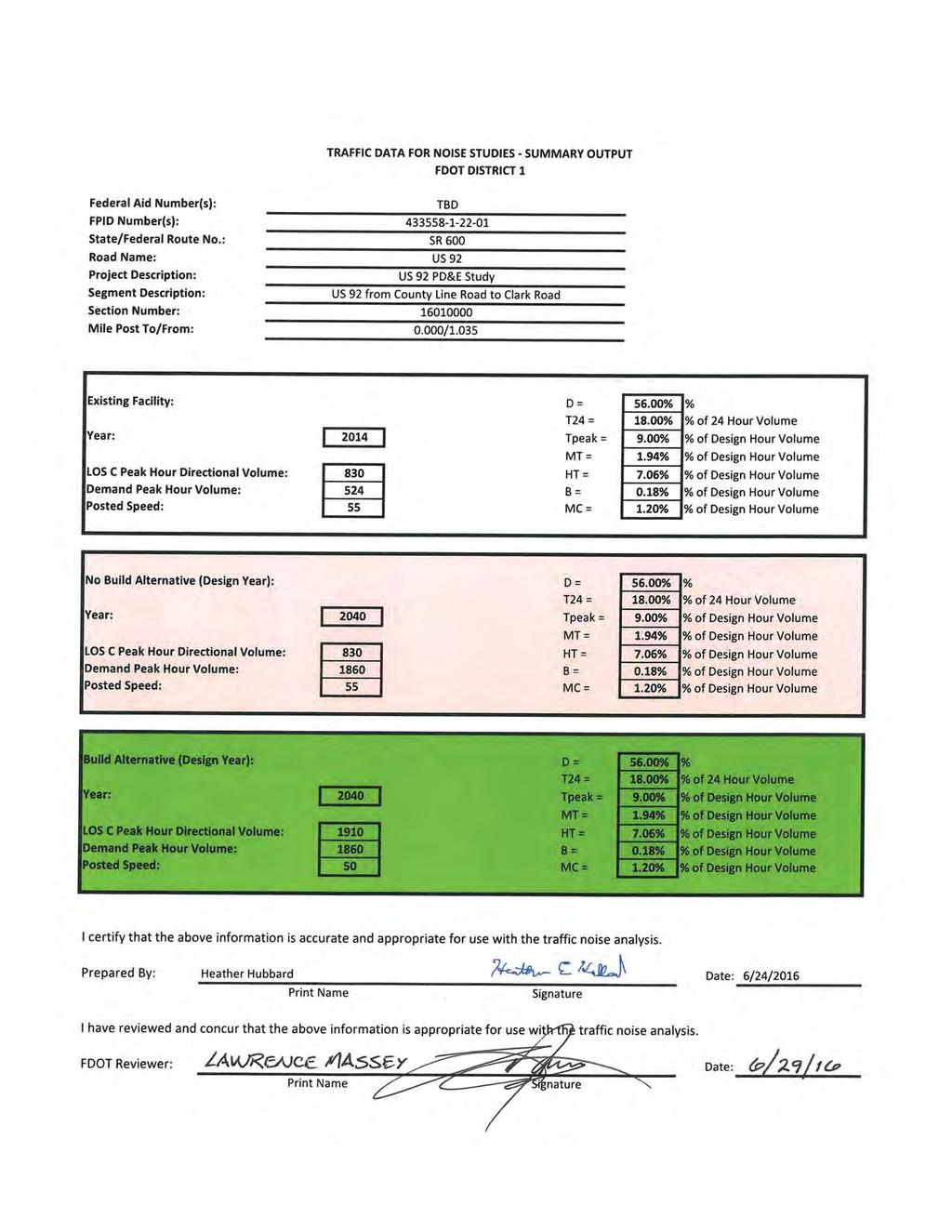
70
71
72
73
74
75
76
77

78
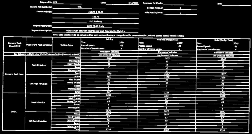
79
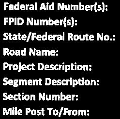
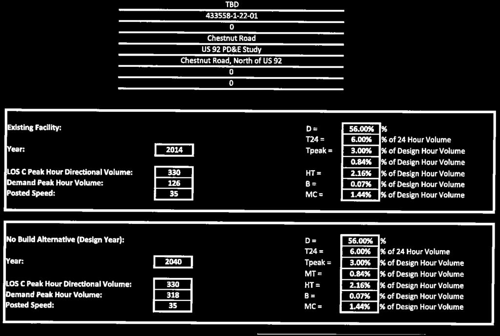

80
81
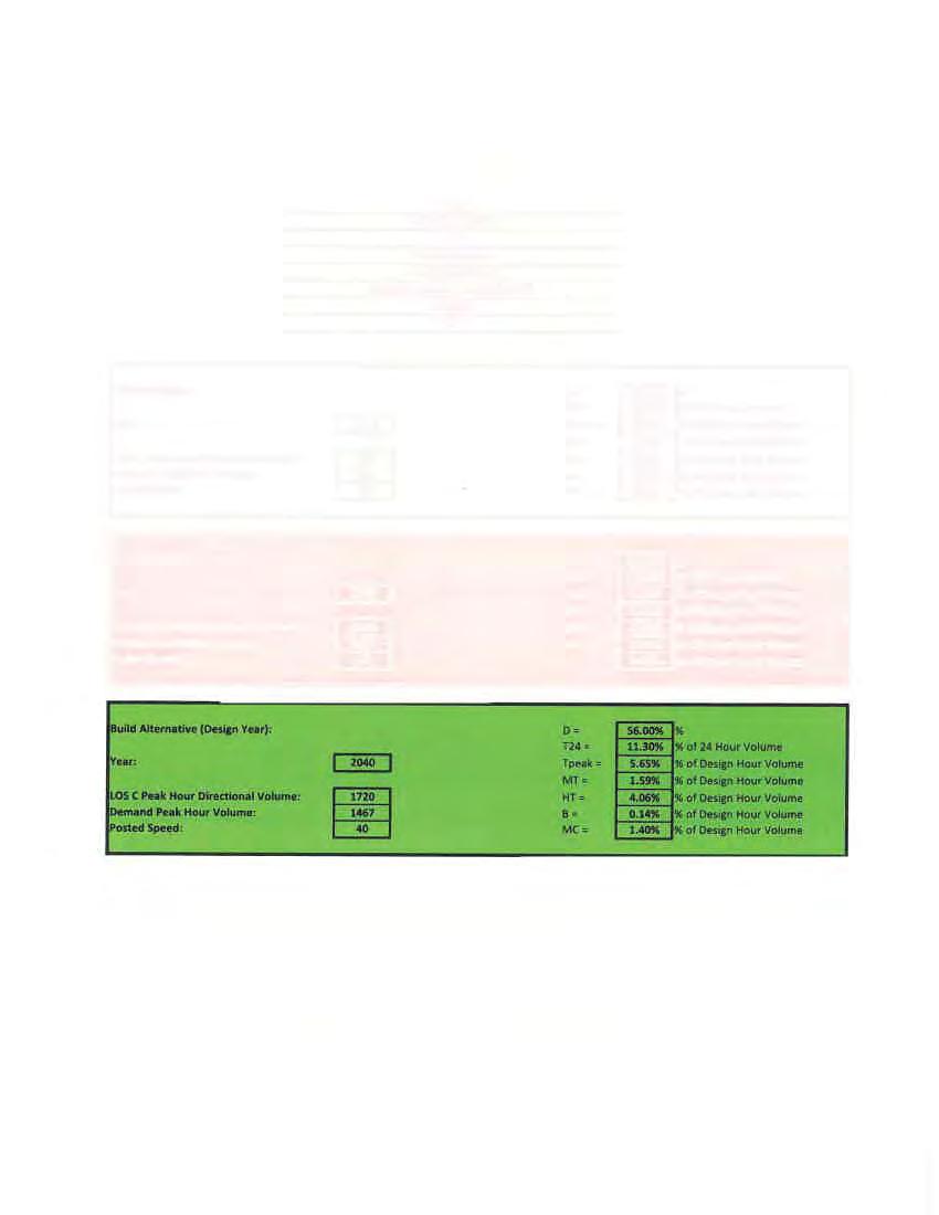
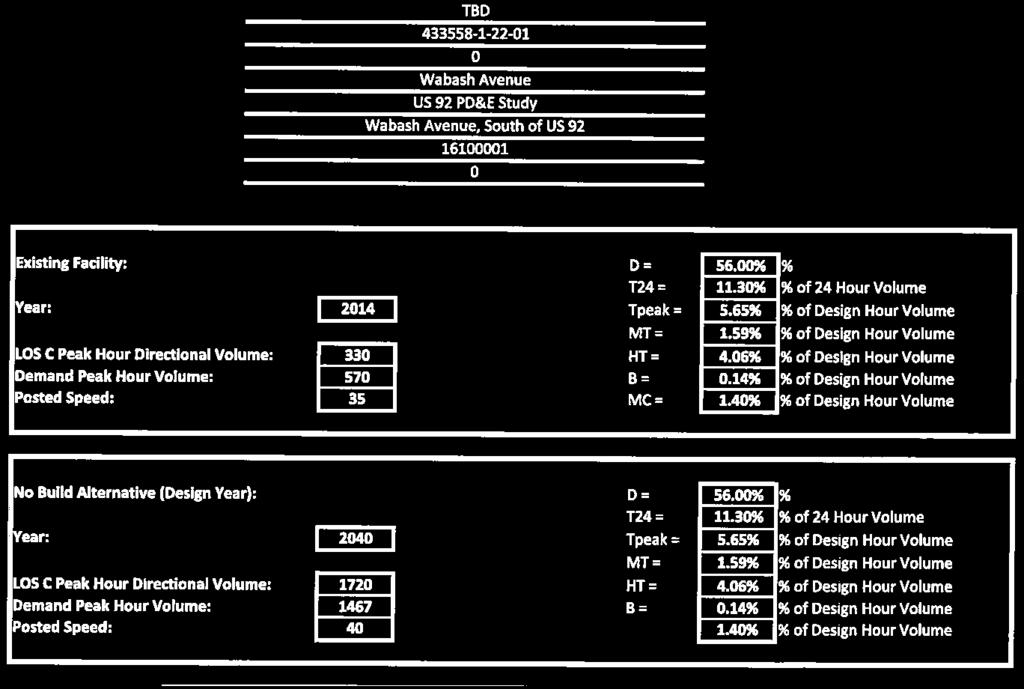


82
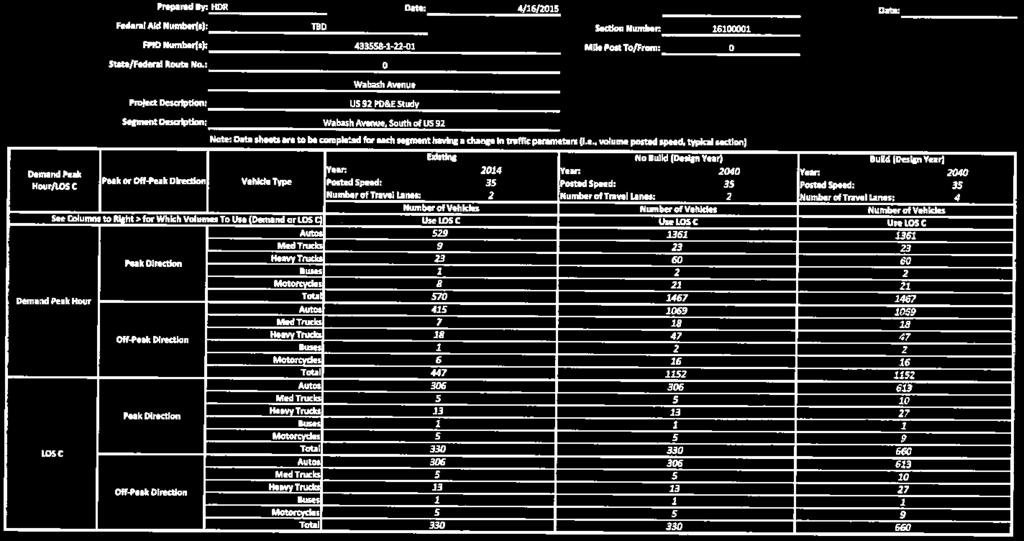
83
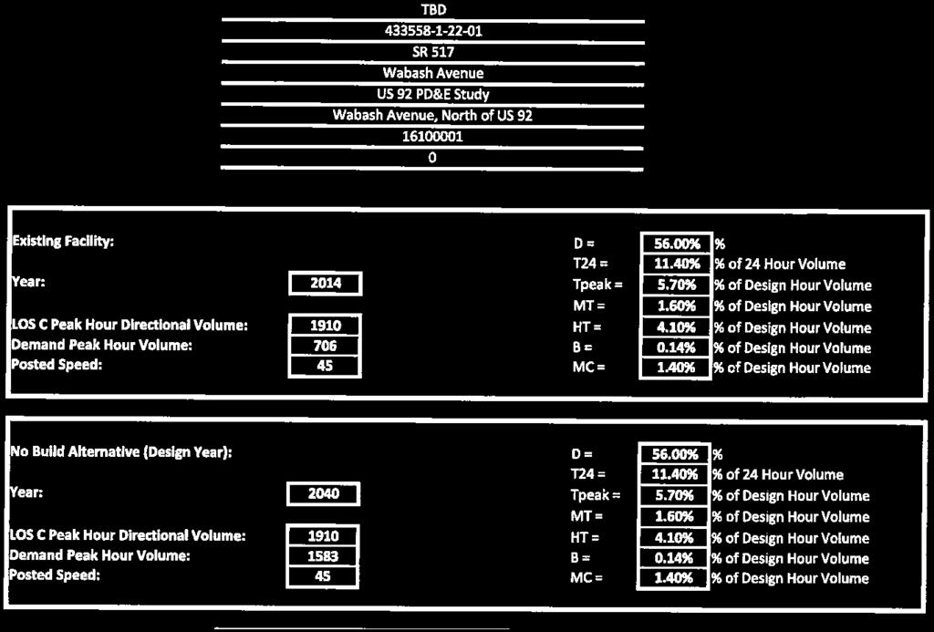


84
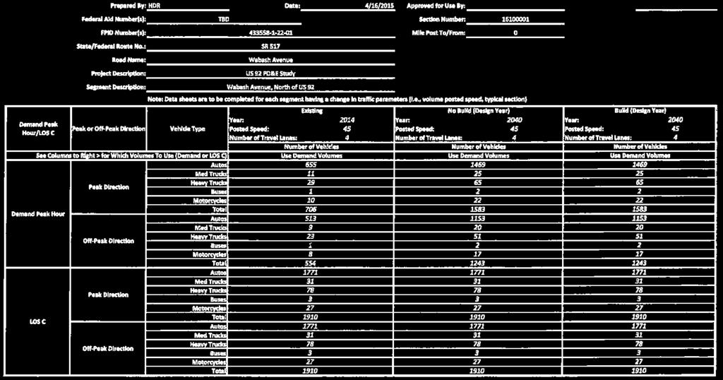
85
86 Appendix B Predicted Noise Levels
87 Mapped Receptor ID 1 Concept Plan Sheet Numbers No. of Dwelling Units NAC Existing Leq(h) db(a) Future (2040) No-Build Future (2040) Build Future (2040) Build Increase Over Existing Approaches or Exceeds NAC 2? Receptors Located North of US 92 Single Family Homes (between Stations and 25+00) B Yes B No B Yes Miami Court Cottages (Station 45+00) B Yes B Yes B No B No B No B Yes B Yes Single Family Homes (between Stations and 54+00) B Yes B Yes Single Family Homes (between Stations and 69+00) B No B No New Beginnings Church (Station 72+00) D No D Yes C Yes Single Family Homes (Station 75+00) B Yes B No Opportunity Villa (Station 76+00) B Yes B Yes B Yes Westwood Apartments (between Stations and 78+00) B Yes B Yes B Yes B Yes B Yes B Yes B Yes B Yes B No
88 Mapped Receptor ID Concept Plan Sheet Numbers No. of Dwelling Units NAC Existing Leq(h) db(a) Future (2040) No-Build Future (2040) Build Future (2040) Build Increase Over Existing Approaches or Exceeds NAC 2? Oakwood Mobile Home Park (between Stations and ) B Yes B Yes B Yes B Yes B Yes B No B Yes B No B No Single Family Homes (between Stations and ) B No B No Single Family Homes (between Stations and ) B Yes B Yes Holiday Park (between Stations and ) B Yes B Yes B Yes B Yes C Yes C Yes B Yes B Yes B Yes B Yes B Yes B Yes B Yes B Yes B Yes B Yes B Yes B Yes B Yes B Yes B Yes B Yes B No B No B No B No B No B No
89 Mapped Receptor ID 1 Concept Plan Sheet Numbers No. of Dwelling Units NAC Existing Leq(h) db(a) Future (2040) No-Build Future (2040) Build Future (2040) Build Increase Over Existing Approaches or Exceeds NAC 2? B No B No B No B No B No B No Meadowbrook (between Stations and ) B Yes B Yes B Yes B Yes B Yes B No B No B No B No B No B No B No B No B No B No B No B Yes B Yes B Yes B Yes B Yes B Yes B Yes B Yes B Yes B Yes B Yes B Yes B Yes B Yes B Yes B Yes B Yes B Yes B Yes B Yes B Yes B No B No
90 Mapped Receptor ID 1 Concept Plan Sheet Numbers No. of Dwelling Units NAC Existing Leq(h) db(a) Future (2040) No-Build Future (2040) Build Future (2040) Build Increase Over Existing Approaches or Exceeds NAC 2? B No B No B No B No B No B No B No B No B No B No Lakeland Palms Mobile Home Park (between Stations and ) B Yes B Yes B Yes B No B No B No B No Shree Swaminarayan Temple (between Stations and ) C Yes C No Single Family Homes (between Stations and ) B No B Yes Prestlers Motel Pool (Station ) C Yes Imperial Manor (between Stations and ) C Yes B Yes B Yes B Yes B Yes B Yes B No B No B No B No Pool at Sunset Motel (Station ) C Yes Single Family Homes (between Stations and ) B No B No B No Pine Grove Mobile Home Park (between Stations and ) B Yes
91 Mapped Receptor ID 1 Concept Plan Sheet Numbers No. of Dwelling Units NAC Existing Leq(h) db(a) Future (2040) No-Build Future (2040) Build Future (2040) Build Increase Over Existing Approaches or Exceeds NAC 2? B Yes B Yes B Yes B Yes B Yes B Yes B Yes B Yes B Yes B Yes B No B No B No B No Woodall s Mobile Home Village (between Stations and ) C Yes C Yes C Yes B Yes B Yes B Yes B Yes B Yes B Yes B Yes B Yes B Yes B Yes B Yes B No B Yes B Yes B Yes B Yes B No B No B No B No B No B No B No B No B No B No B No
92 Mapped Receptor ID 1 Concept Plan Sheet Numbers No. of Dwelling Units NAC Existing Leq(h) db(a) Future (2040) No-Build Future (2040) Build Receptors located south of US 92 Future (2040) Build Increase Over Existing Evergreen Motel and Mobile Home Park (between Stations and 56+00) Approaches or Exceeds NAC 2? B Yes B Yes B Yes B Yes B Yes B Yes B Yes B Yes B Yes B Yes B Yes B Yes B No B Yes B Yes B Yes B Yes B Yes B No B No B No B No B No B No B No B No B No B No B No Tiger Villa Motel (between Stations and 77+00) C Yes 6-01b 7 0 C Yes Hibiscus Gardens Mobile Home Park (between Stations and 80+50) B Yes B Yes B Yes B Yes B Yes B Yes B Yes B No B No
93 Mapped Receptor ID 1 Concept Plan Sheet Numbers No. of Dwelling Units NAC Existing Leq(h) db(a) Future (2040) No-Build Future (2040) Build Future (2040) Build Increase Over Existing Approaches or Exceeds NAC 2? B No B No Pine Tree Apartments (between Stations and 83+00) B Yes B Yes B Yes B Yes B Yes B Yes B Yes B No B No B No B No B No B No B No Chapman s Mobile Home Park (between Stations and 92+50) B Yes B Yes B Yes B Yes B Yes B Yes B Yes B No B No B No B No B No B No C Yes B Yes B Yes B Yes B Yes B Yes B Yes B Yes B Yes B No B No B No B No B No
94 Mapped Receptor ID 1 Concept Plan Sheet Numbers No. of Dwelling Units NAC Existing Leq(h) db(a) Future (2040) No-Build Future (2040) Build Future (2040) Build Increase Over Existing Approaches or Exceeds NAC 2? B No B No B No B No B No B No B Yes Melody Acres Mobile Home Park (between Stations and ) B Yes B Yes B Yes B Yes B Yes B No B Yes B Yes B No B No B No B No B Yes B No B No B Yes B Yes B Yes B Yes B Yes B No B No B Yes B Yes B No B No Parkway Mobile Home Park (between Stations and ) B Yes B Yes B No Amick Properties (between Stations and ) B Yes B Yes B No B Yes B Yes B Yes B Yes
95 Mapped Receptor ID 1 Concept Plan Sheet Numbers No. of Dwelling Units NAC Existing Leq(h) db(a) Future (2040) No-Build Future (2040) Build Future (2040) Build Increase Over Existing Approaches or Exceeds NAC 2? B No Single Family Homes / Mobile Homes (between Stations and ) B Yes B Yes B Yes B Yes B Yes B No B No Multi-unit Residential Dwellings / Mobile Homes (between Stations and ) B Yes B Yes B Yes B Yes B Yes B No B No B No B No B No B No B No B No B No Single Family Home (Station ) B No Silver Moon Drive-In (between Stations and ) C Yes C Yes C Yes C Yes C Yes C Yes C Yes C Yes C Yes C Yes C Yes C Yes C Yes C Yes C Yes C Yes C Yes C Yes
96 Mapped Receptor ID 1 Concept Plan Sheet Numbers No. of Dwelling Units NAC Existing Leq(h) db(a) Future (2040) No-Build Future (2040) Build Future (2040) Build Increase Over Existing Approaches or Exceeds NAC 2? C Yes C Yes C Yes C Yes C Yes C Yes C Yes C Yes C Yes C Yes C Yes C Yes C Yes C Yes C Yes C Yes C Yes C Yes C Yes C No C No C No C No C No C No C Yes C No C No C No C No C No C No C No C No C No C No C No C No C No C No C No C No C No C No C No C No
97 Mapped Receptor ID 1 Concept Plan Sheet Numbers No. of Sites NAC Existing Leq(h) db(a) Future (2040) No-Build Future (2040) Build Future (2040) Build Increase Over Existing Approaches or Exceeds NAC 2? C No C No C No C No C No C No C No C No C No C No C No C No C No C No C No C No C No Friendship Village (between Stations and ) B Yes B Yes B Yes B Yes B Yes B Yes B Yes B Yes B Yes B No B No B No B No B No Single Family Home (Station ) B Yes Shangri-La Mobile Home Park (between Stations and ) B Yes B Yes C Yes B Yes B Yes B Yes B Yes B Yes B Yes B Yes B Yes
98 Mapped Receptor ID 1 Concept Plan Sheet Numbers No. of Dwelling Units NAC Existing Leq(h) db(a) Future (2040) No-Build Future (2040) Build Future (2040) Build Increase Over Existing Approaches or Exceeds NAC 2? B Yes B Yes B Yes B Yes B Yes B Yes B Yes B Yes B Yes B Yes B Yes B Yes B Yes B Yes B Yes B No B No B No B No B No B No B Yes B No B No B No B No B No B No B No B No Single Family Homes (between Stations and ) B Yes B Yes B Yes B No B No B No B No B No B No Single Family Homes (between Stations and ) B Yes B No B No B No
99 Mapped Receptor ID 1 Concept Plan Sheet Numbers No. of Dwelling Units NAC Existing Leq(h) db(a) Future (2040) No-Build Future (2040) Build Future (2040) Build Increase Over Existing Approaches or Exceeds NAC 2? B No B No B No B No B No B No B No B No B No B No Notes: 1. The locations of the receptor sites are mapped on the concept plans in Appendix C. 2. "Approaches" means within 1 db(a) of FHWA's Noise Abatement Criteria (NAC). 3. Interior noise levels calculated by subtracting 25 db(a) from the exterior level estimated in TNM. Per FHWA guidance, 25 db(a) is the minimum noise reduction provided by masonry buildings with closed windows. 4. Interior noise levels calculated by subtracting 20 db(a) from the exterior level estimated in TNM. Per FHWA guidance, 20 db(a) is the minimum noise reduction provided by light frame buildings with closed windows.
100 Appendix C Concept Plans with Noise Data
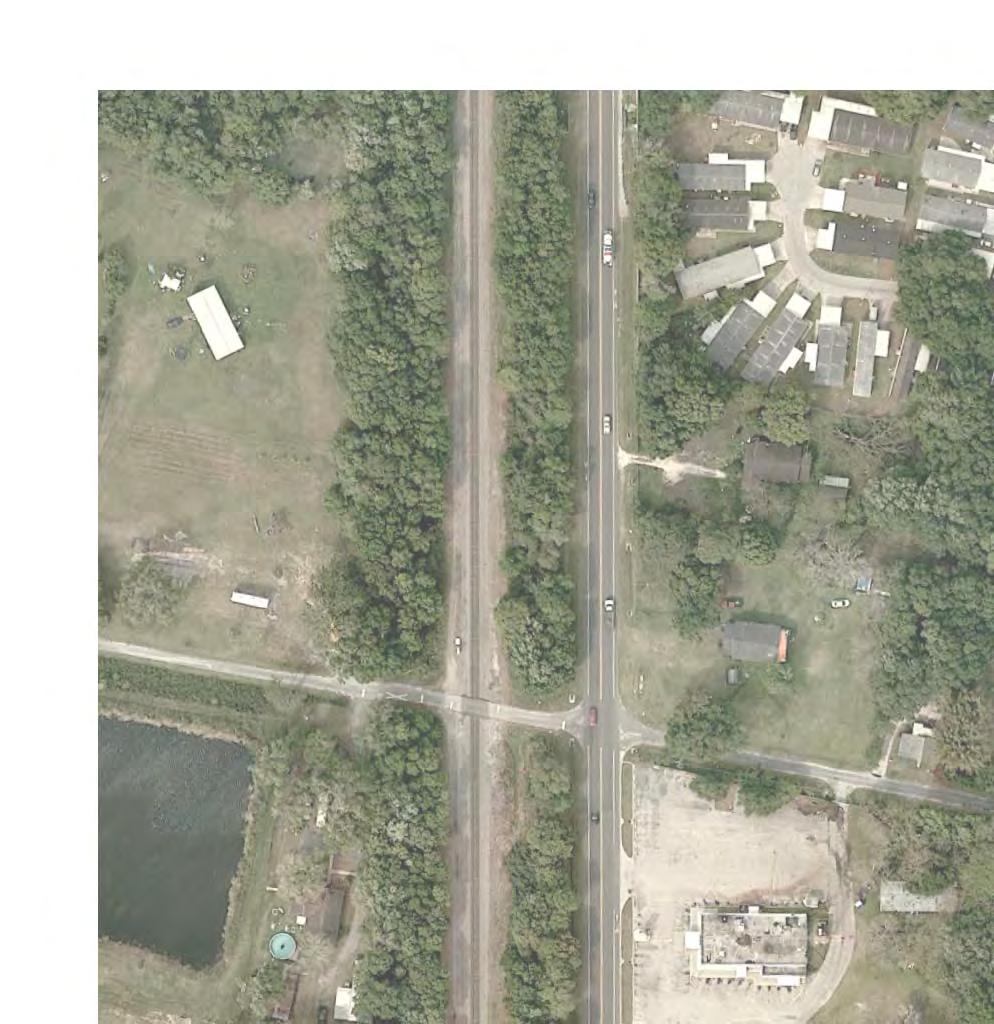
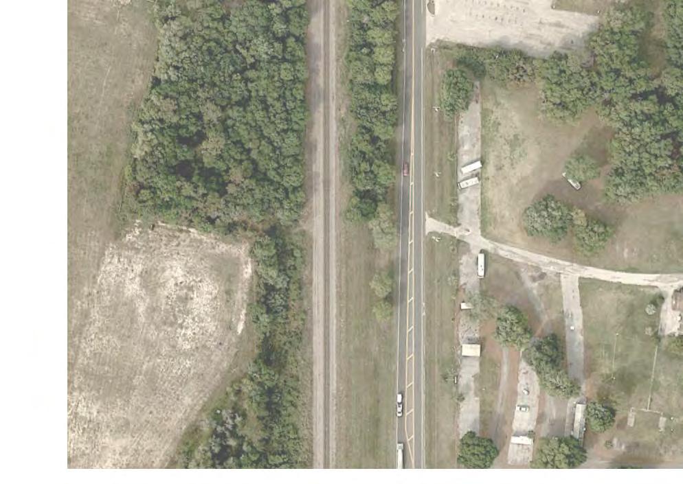

101
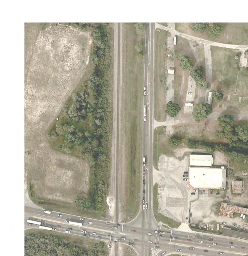
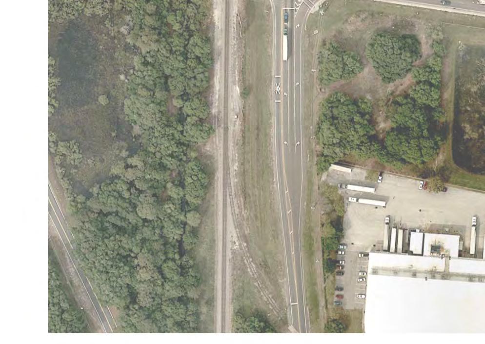
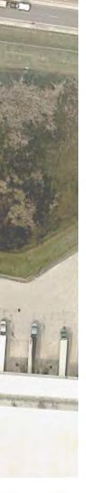
102
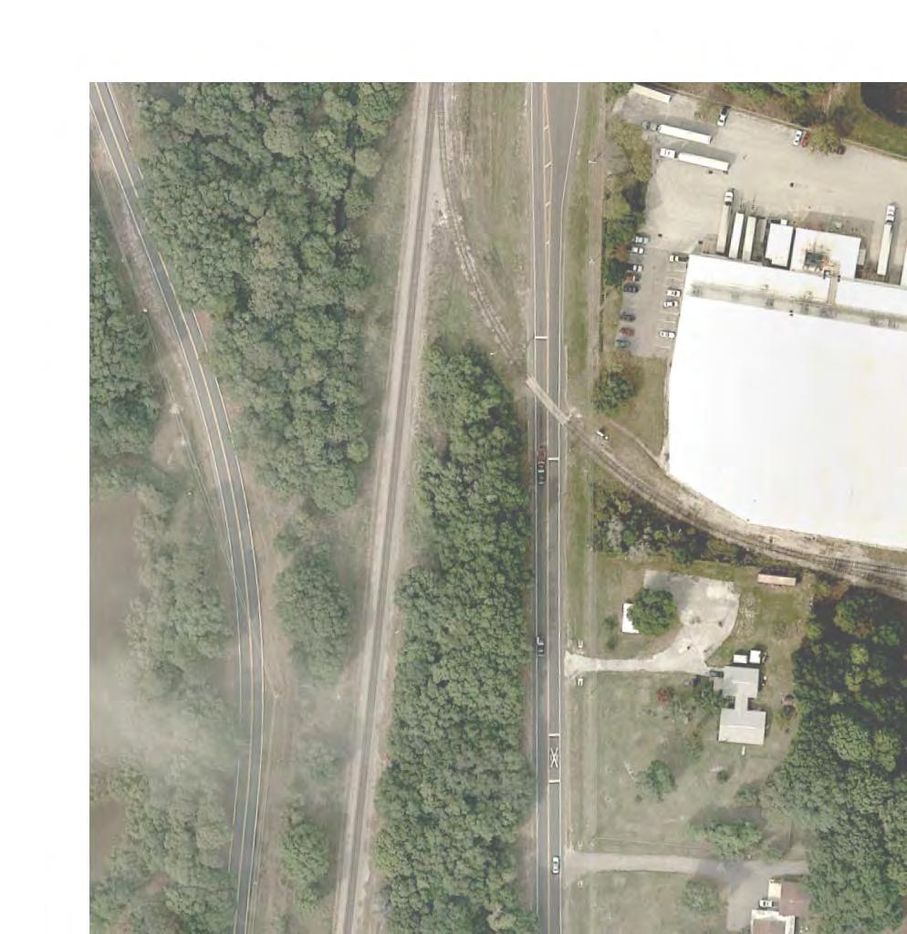
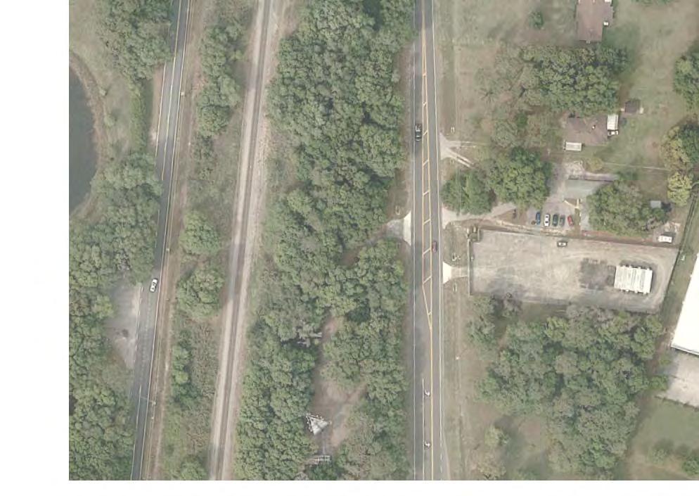
103

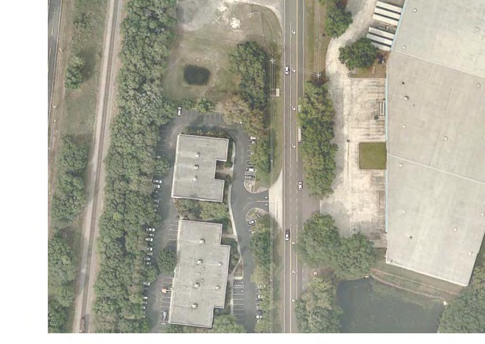

104
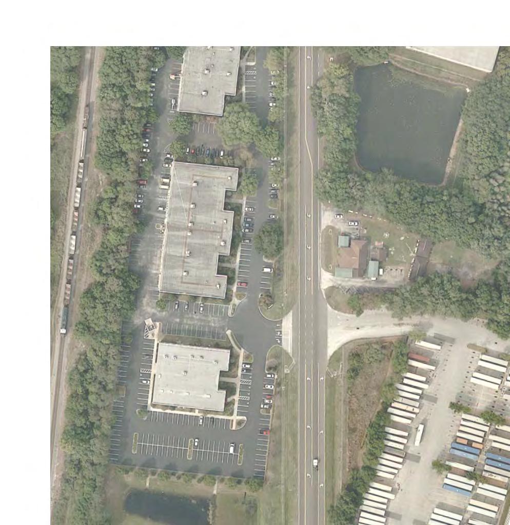
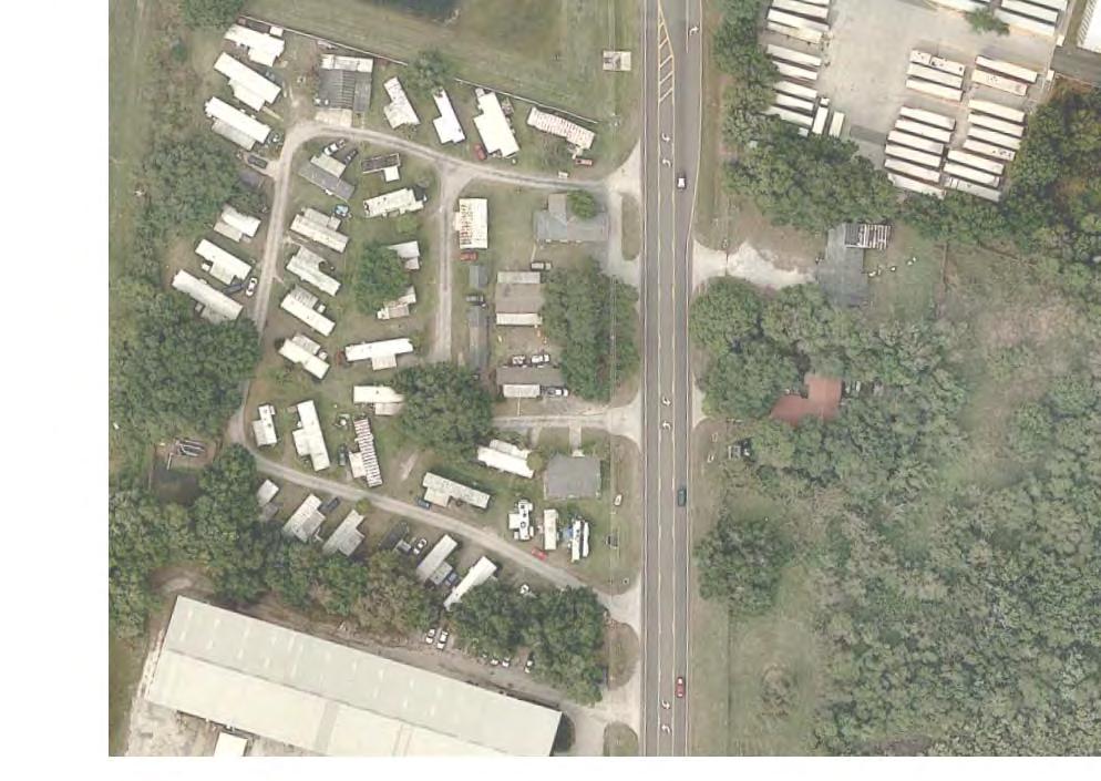
105
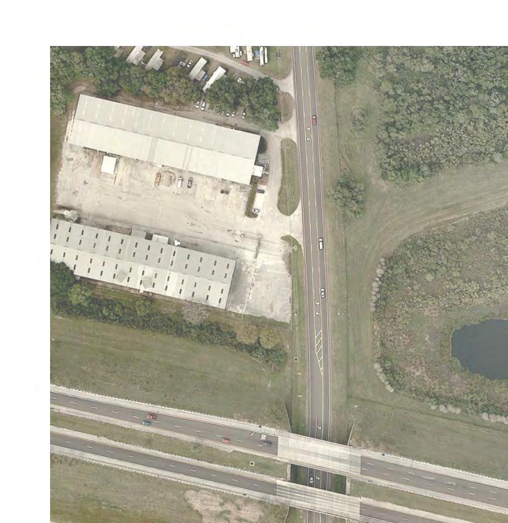
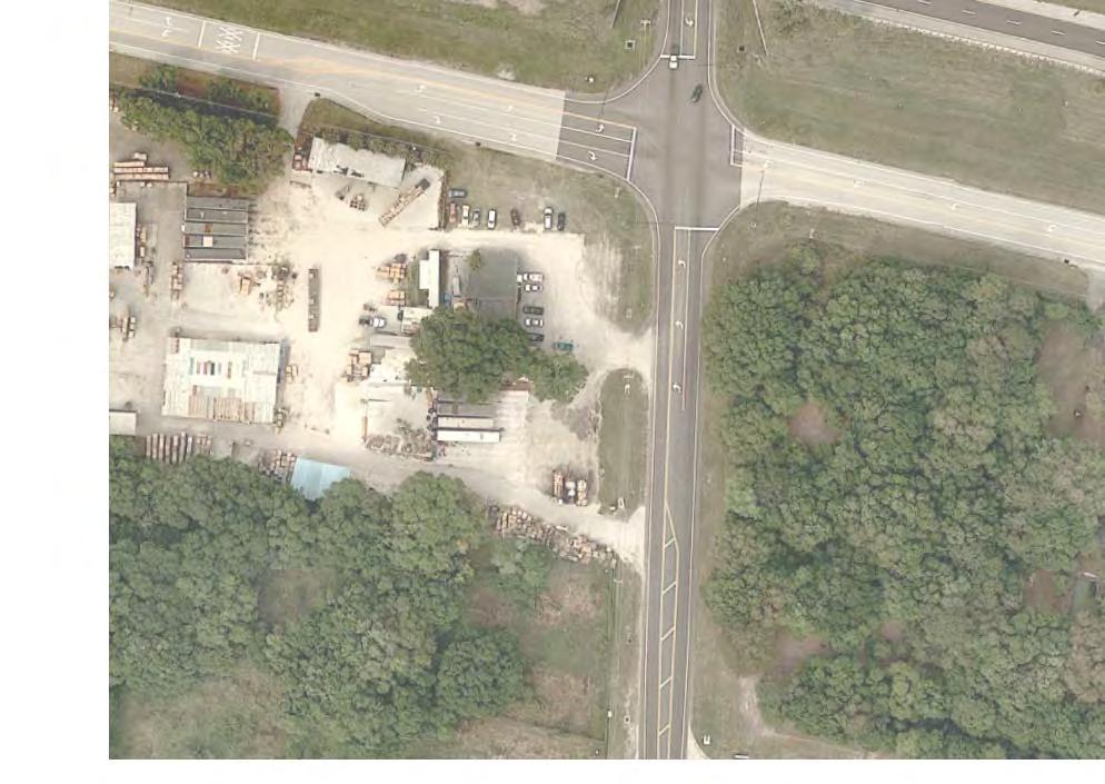
106
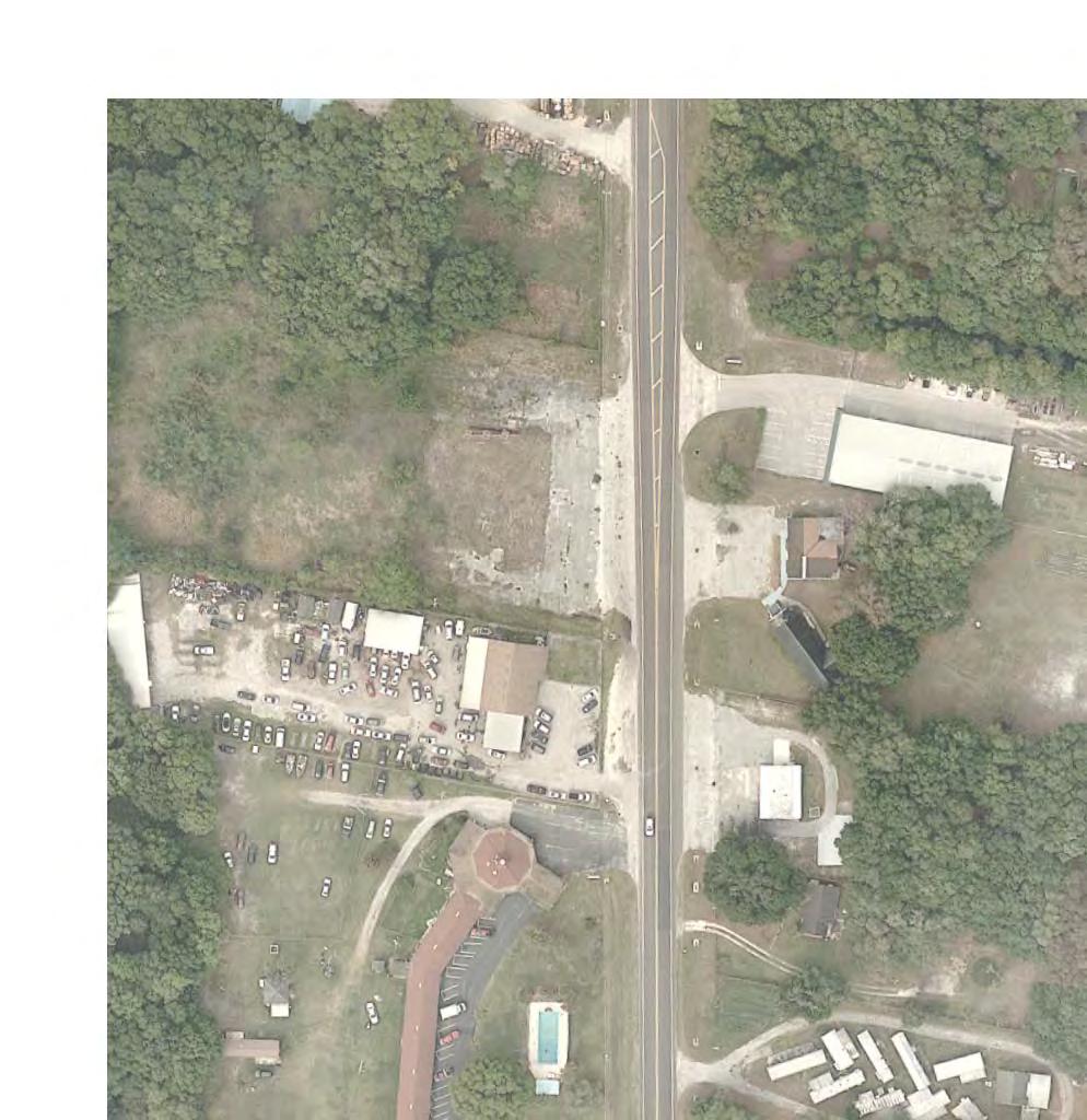

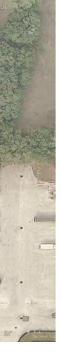
107

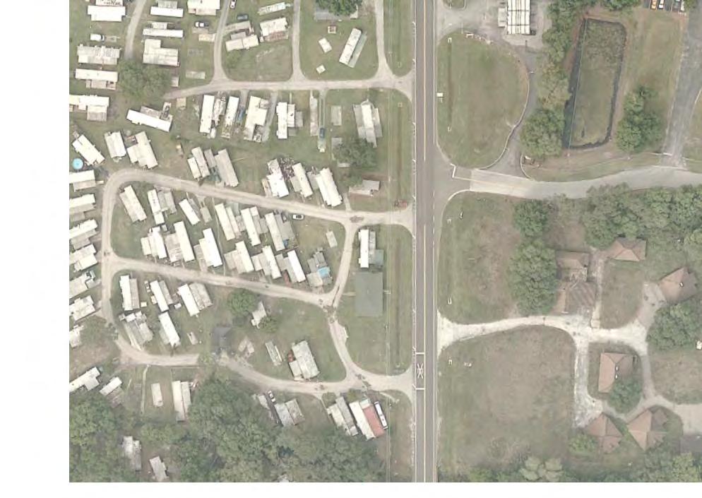
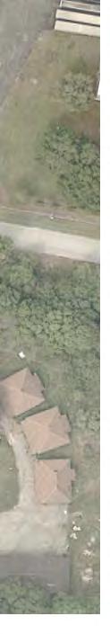
108
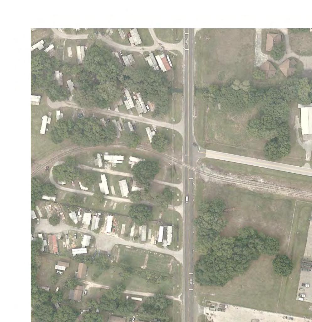
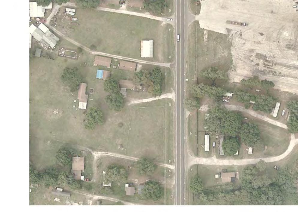
109
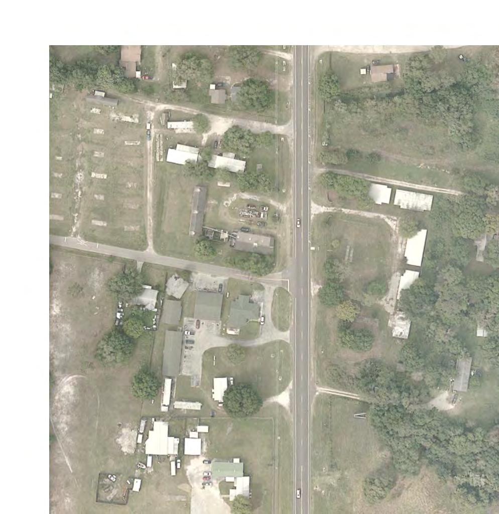

110
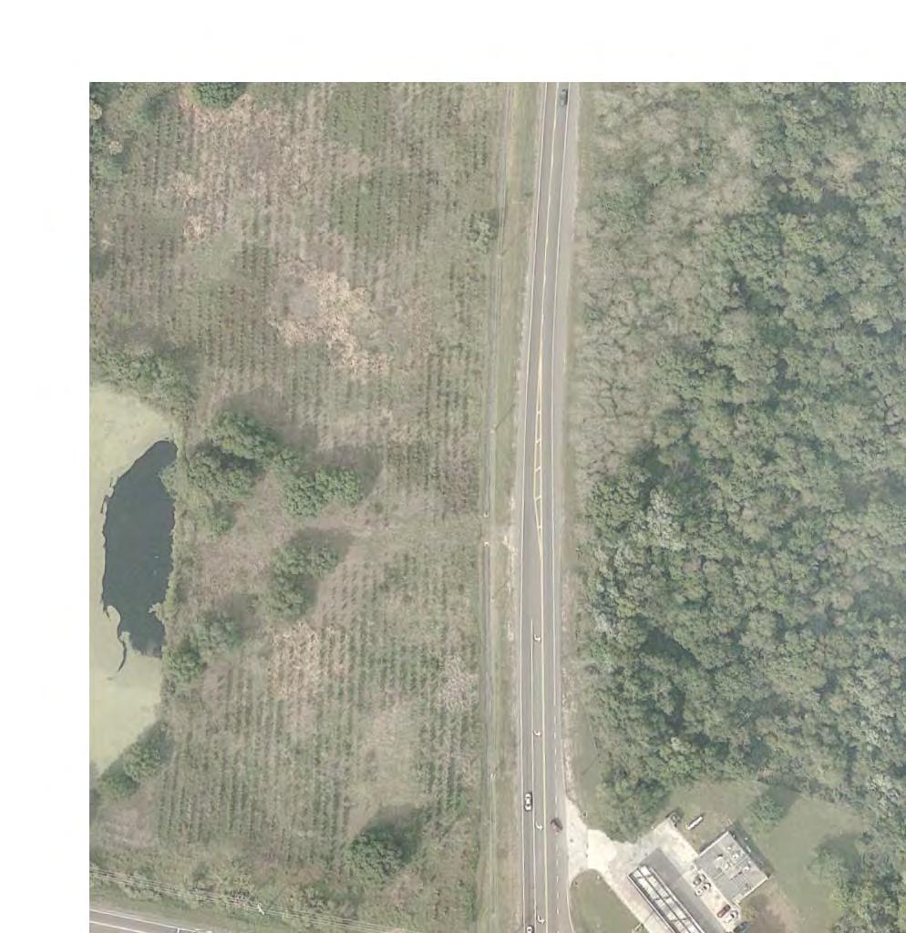
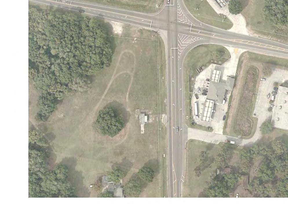

111
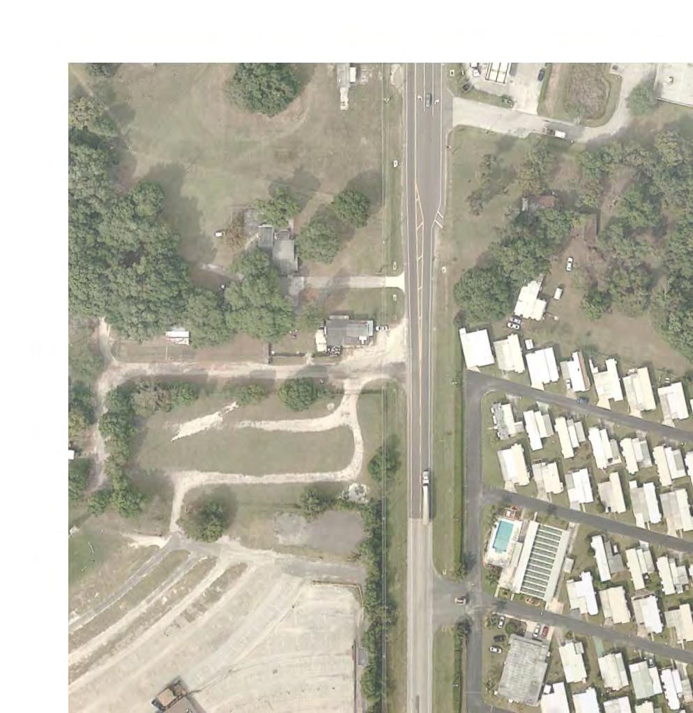
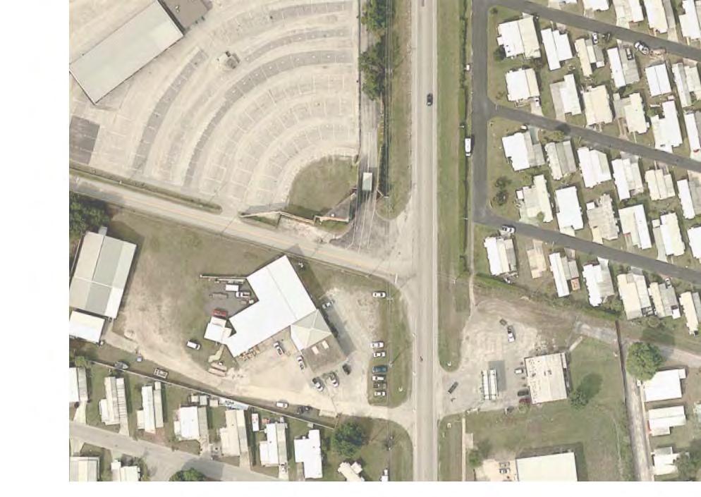
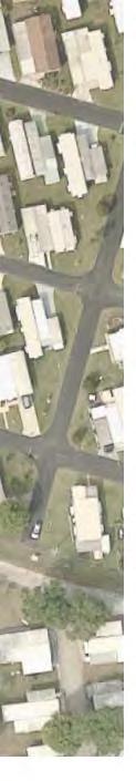
112
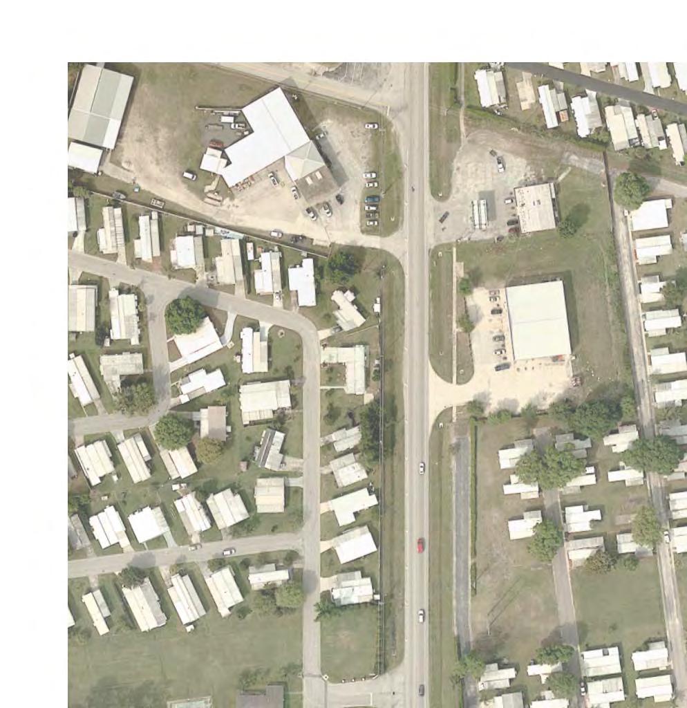
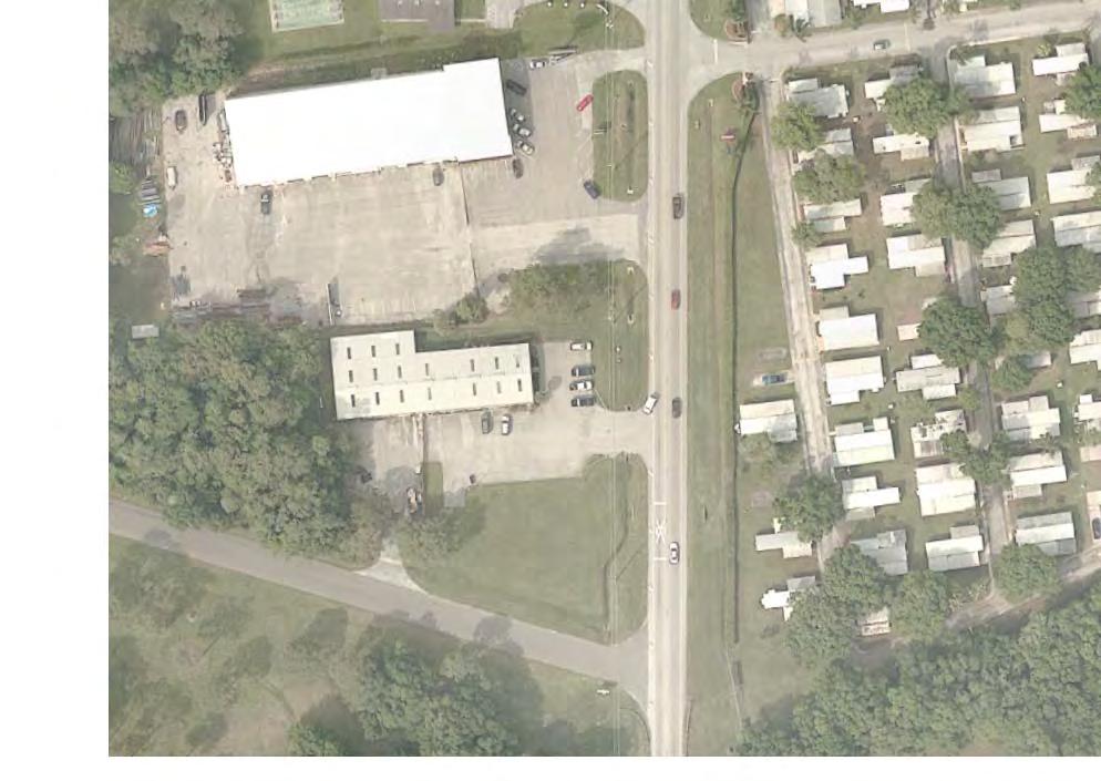
113
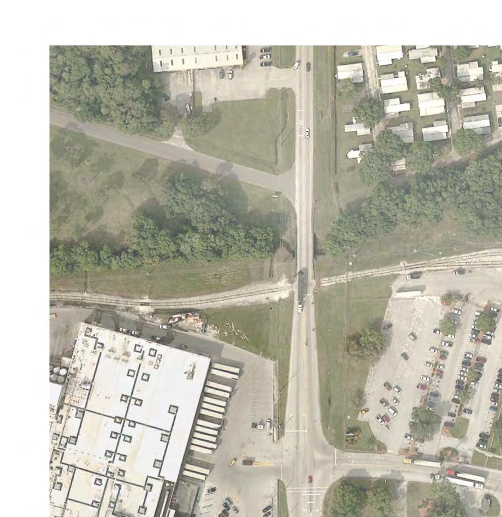
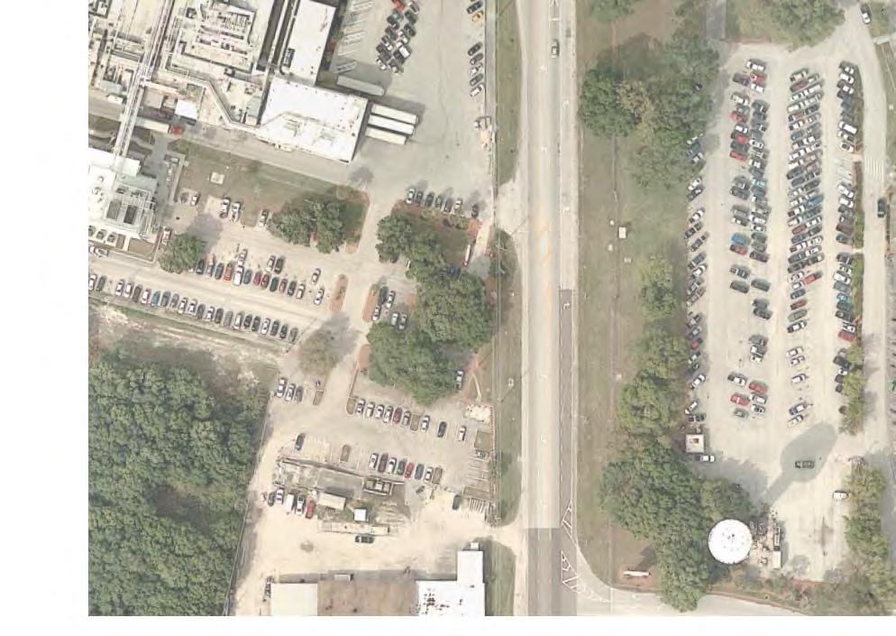
114

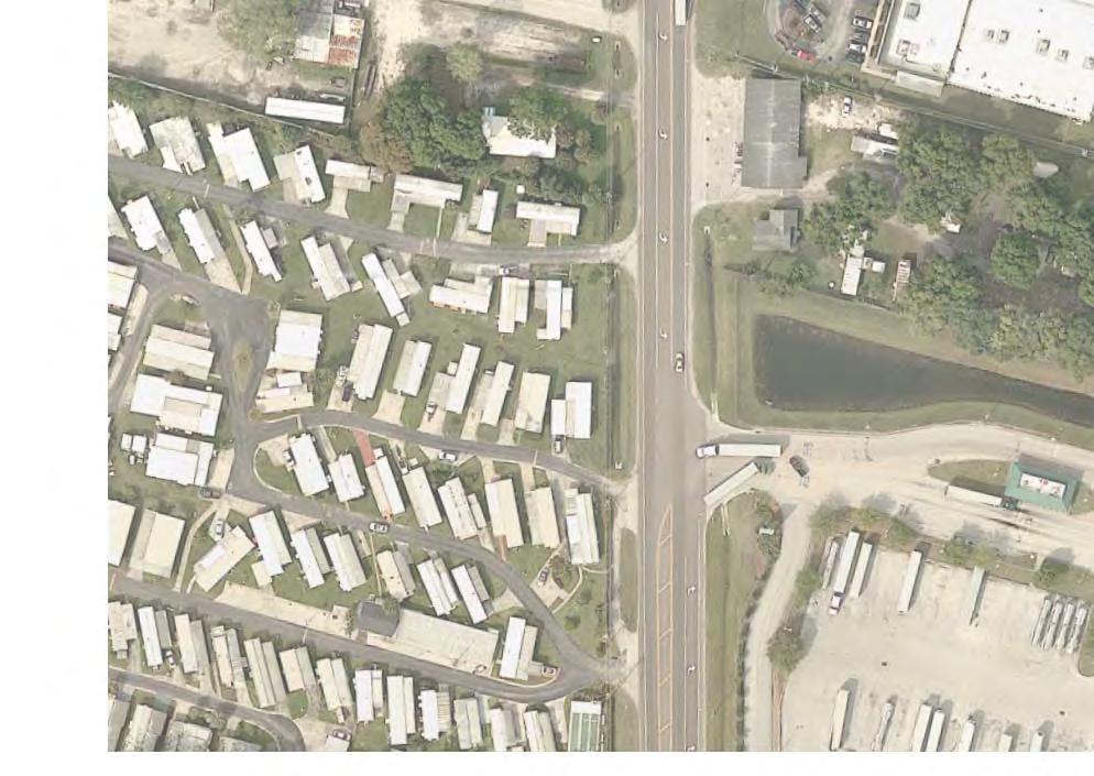
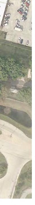
115
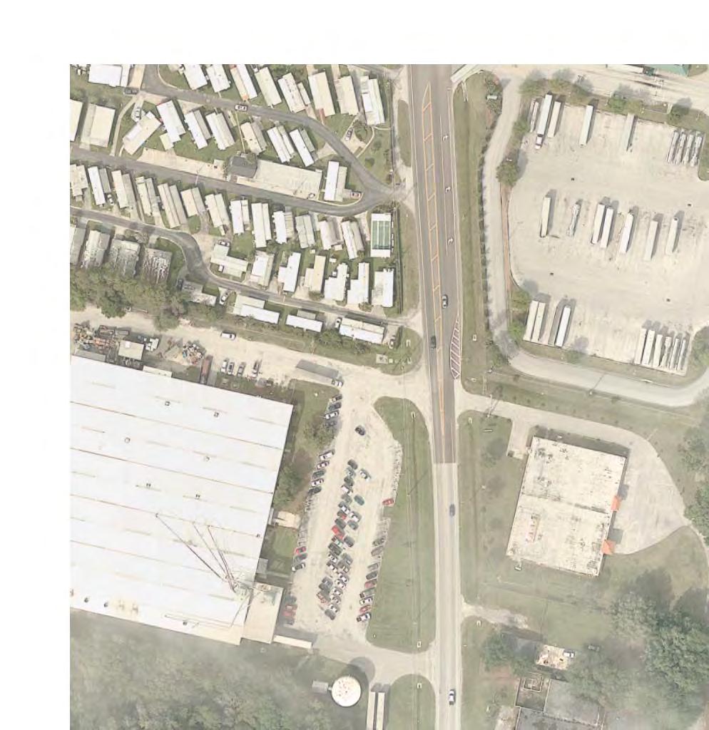
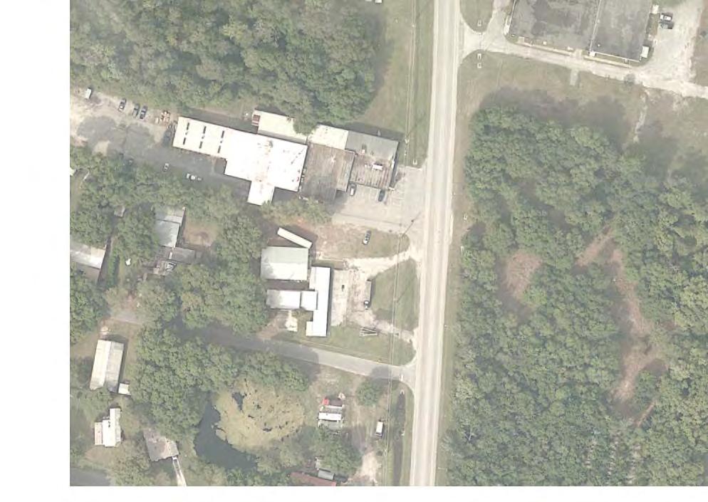
116
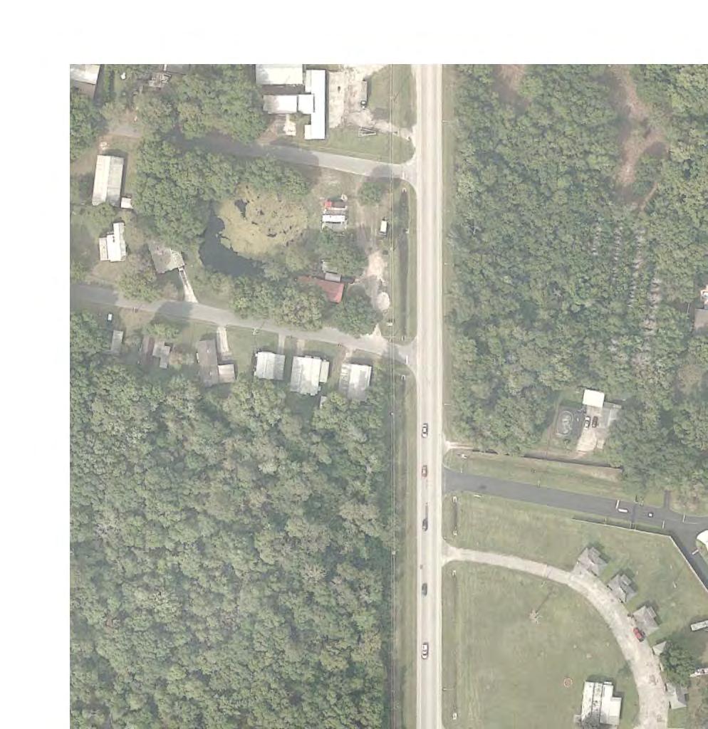
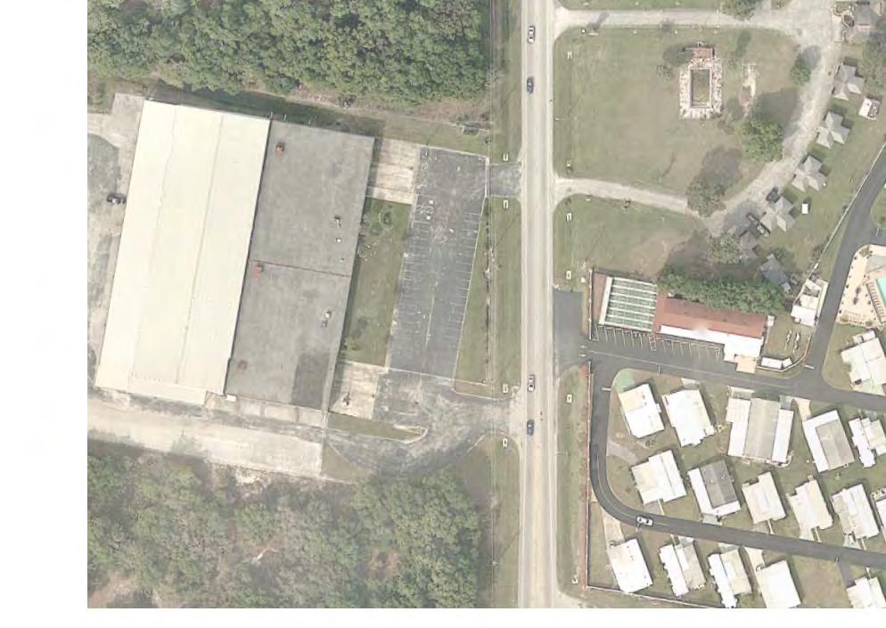

117
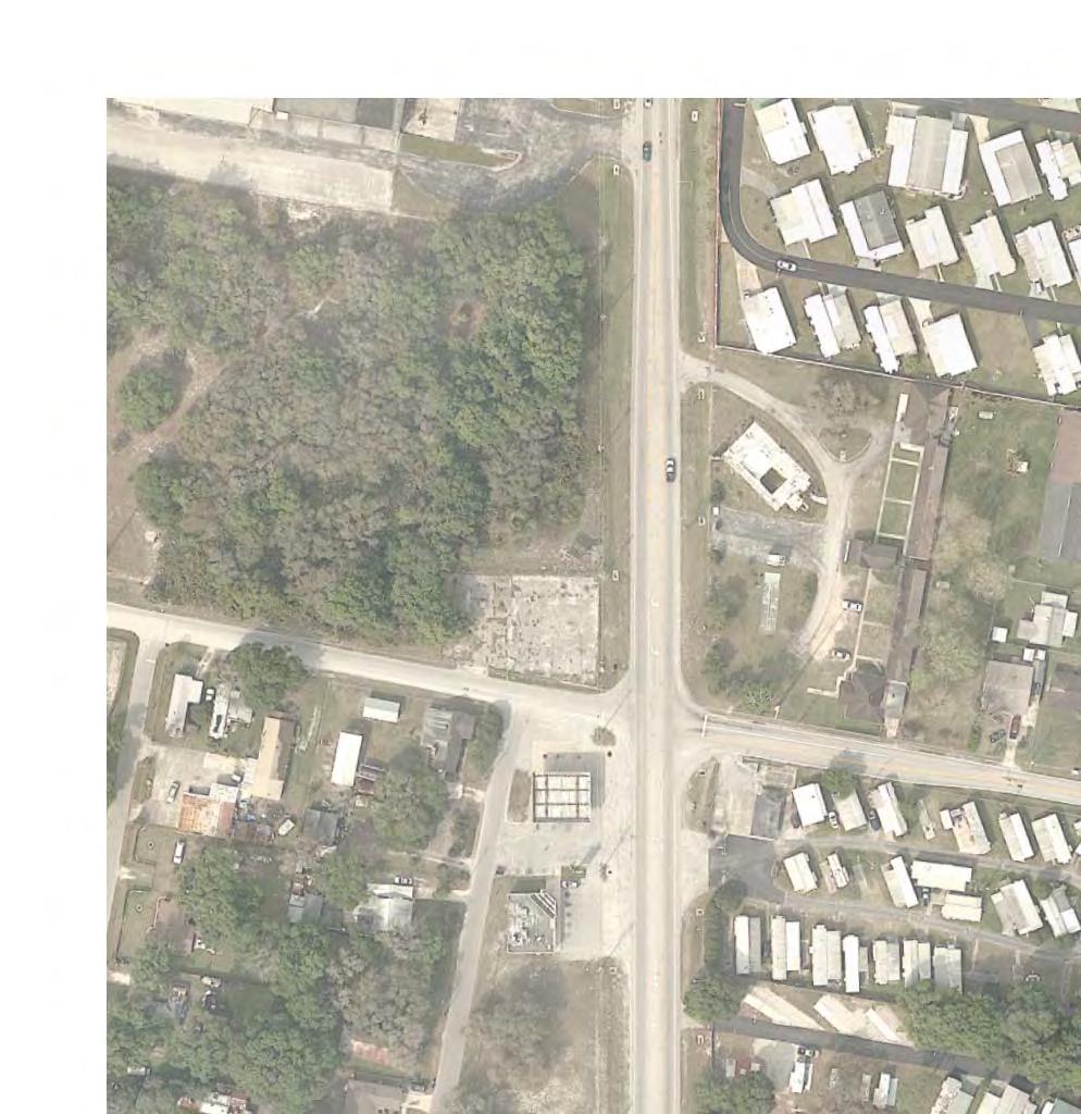
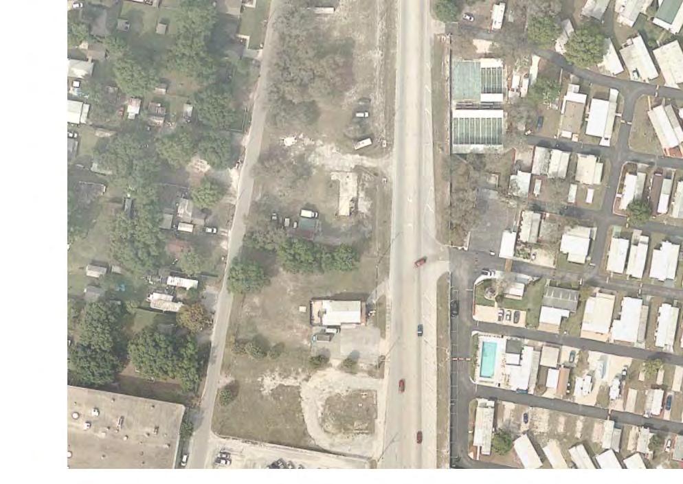
118
119
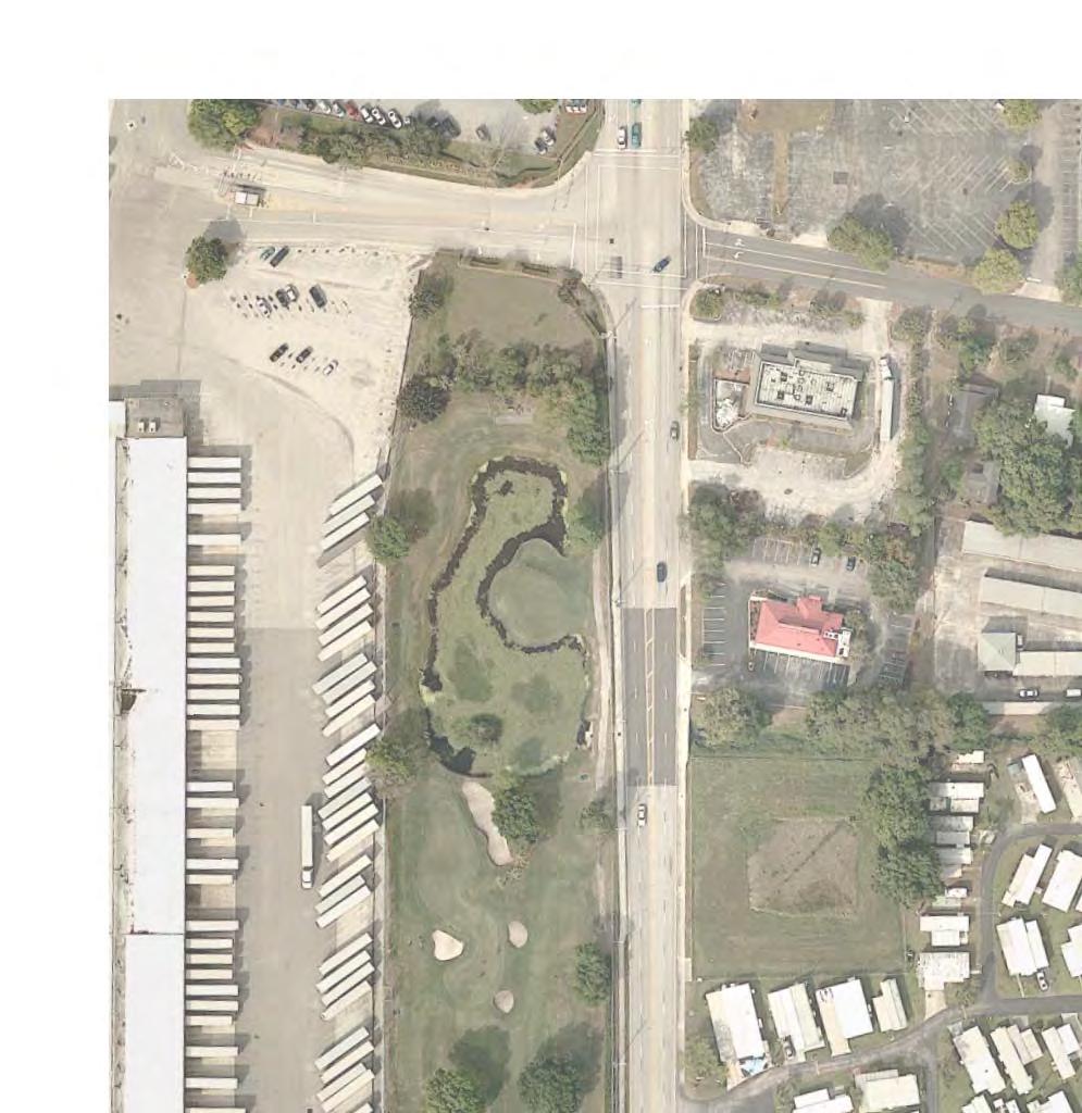
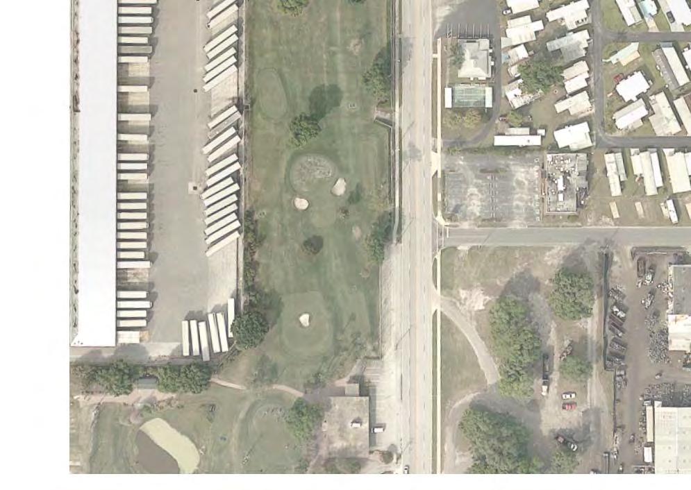
120
1. Introduction Noise Analysis Results Figures. List of Tables
 Traffic Noise Technical Report FM 2218 Widening (From US 59 to SH 36) Fort Bend County Prepared by: Houston District Date: July 2017 CSJ: 2093-01-010 The environmental review, consultation, and other actions
Dulles Toll Road Highway Traffic Noise Policy. February 2, 2011
 Dulles Toll Road Highway Traffic Noise Policy February 2, 2011 as revised February 1, 2012 Table of Contents 1. Purpose... 1 2. Definitions... 1 3. Applicability... 5 4. Sound Fundamentals... 6 5. Highway
MnDOT GREATER MN STAND ALONE NOISE BARRIER PROGRAM
 MnDOT GREATER MN STAND ALONE NOISE BARRIER PROGRAM 7 November 2017 MINNESOTA S EXPERIENCE WITH HIGHWAY NOISE MITIGATION The Minnesota Department of Transportation (MnDOT) has been constructing noise walls
APPENDIX C NOISE STUDY TECHNICAL REPORT
 APPENDIX C NOISE STUDY TECHNICAL REPORT Noise Study Technical Report Watertown South Connector US 81 to 29 th Street SE Watertown, South Dakota HDR Project No. 39319 Prepared by 6300 So. Old Village Place
Why does MnDOT build noise barriers? What is a Type I project? What is an impacted location?
 Why does MnDOT build noise barriers? Noise barriers generally prove to be quite effective in providing noise reduction at receptors near transportation facilities. In 1972, the U.S. Congress passed legislation
Draft Noise Study Report
 Florida Department of TRANSPORTATION PD&E Study From East of Babcock Street (SR 507) to US 1 Brevard County, Florida FPID: 430136 1 22 01 ETDM: 13026 The environmental review, consultation, and other actions
APPENDIX C NOISE STUDY TECHNICAL REPORT
 APPENDIX C NOISE STUDY TECHNICAL REPORT 1) 9/25/06 Noise Study Technical Report; revised 05/08 2) 9/4/09 Memo Regarding Option 3 Noise Impacts to Pelican Lake Game Production Area Noise Study Technical
Virginia Department Of Transportation. Highway Traffic Noise Impact Analysis Guidance Manual
 Virginia Department Of Transportation Highway Traffic Noise Impact Analysis Guidance Manual FHWA Approval: March 15, 2011 CTB Approval: June 15, 2011 Effective: July 13, 2011 Last Updated: February 20,
FEDERAL BOULEVARD (5 TH AVENUE TO HOWARD PLACE) PLANNING ENVIRONMENTAL LINKAGE STUDY TRAFFIC NOISE IMPACT ANALYSIS
 PLANNING ENVIRONMENTAL LINKAGE STUDY TRAFFIC NOISE IMPACT ANALYSIS") FEDERAL BOULEVARD (5 TH AVENUE TO HOWARD PLACE) PLANNING ENVIRONMENTAL LINKAGE STUDY TRAFFIC NOISE IMPACT ANALYSIS Prepared for: City and County of Denver 201 West Colfax Avenue, Department 509 Denver,
FEDERAL BOULEVARD (5 TH AVENUE TO HOWARD PLACE) PLANNING ENVIRONMENTAL LINKAGE STUDY TRAFFIC NOISE IMPACT ANALYSIS Prepared for: City and County of Denver 201 West Colfax Avenue, Department 509 Denver,
NOISE STUDY REPORT DESIGN ADDENDUM
 NOISE STUDY REPORT DESIGN ADDENDUM for Wekiva Parkway Segment 8 - Ballantrae Apartments Seminole County, Florida Financial Project ID: 240200-4-32-01 Prepared for: Florida Department of Transportation
COMPONENTS OF THE NOISE ELEMENT
 COMPONENTS OF THE NOISE ELEMENT Definitions Following is a list of commonly used terms and abbreviations that may be found within this element or when discussing the topic of noise. This is an abbreviated
Traffic Noise Analysis
 Traffic Noise Analysis For Interstate 10: Las Cruces to Texas State Line AC-GRIP-010-2(108)144; CN G18A1 Submitted to: Taschek Environmental Consulting and New Mexico Department of Transportation Prepared
Draft Noise Study Report
 Project Development & Environment Study I-75 (SR 93A) From Moccasin Wallow Road (CR 6) to South of US Highway 301 (SR 43) Draft Noise Study Report WPI Segment No.: 419235 2 Manatee & Hillsborough Counties
NORTHWEST CORRIDOR PROJECT. NOISE TECHNICAL REPORT 2015 Addendum Phase IV
 Noise Technical Report 2015 Addendum NOISE TECHNICAL REPORT 2015 Addendum PREPARED FOR: Federal Highway Administration and Georgia Department of Transportation PREPARED BY: Parsons Brinckerhoff Project
Draft Noise Abatement Guidelines
 Document under Separate Cover refer to IMLC01-13 Draft Noise Abatement Guidelines April 2013 Legislative & Planning Services Table of Contents 1.0 Introduction...1 1.1 Key Definitions...1 2.0 Existing
12-1 INTRODUCTION 12-2 REGULATORY REQUIREMENTS
 Chapter 12: Noise and Vibration 12-1 INTRODUCTION This chapter assesses the potential noise and vibration effects resulting from operation of the Tappan Zee Hudson River Crossing Project. The potential
NOISE STUDY REPORT. Interstate 75 / State Road 951 Ultimate Interchange Improvements PD&E Study. Collier County. June 20, 2013
 NOISE STUDY REPORT Interstate 75 / State Road 951 Ultimate Interchange Improvements PD&E Study Florida Department of Transportation District One 801 N. Broadway Ave. Bartow, Florida 33830-3809 Collier
CREATE. Noise and Vibration Assessment Methodology
 CREATE Noise and Assessment Methodology June 2014 TABLE OF CONTENTS 1. INTRODUCTION... 1 2. BACKGROUND... 1 3. OVERALL FTA IMPACT ASSESSMENT METHODOLOGY... 2 4. KEY ELEMENTS OF NOISE ASSESSMENT... 4 4.1
Attachment E2 Noise Technical Memorandum SR 520
 Attachment E2 Noise Technical Memorandum SR 520 Prepared for: Prepared by: Jodi Ketelsen Michael A. Minor Date: November 4, 2012 Subject: Project: Noise Modeling Results: NE 51st Street to NE 65th Street
NOISE BARRIER ANALYSIS
 NOISE BARRIER ANALYSIS Interstate 26 Port Access Road Interchange Cities of North Charleston and Charleston CHARLESTON COUNTY, SOUTH CAROLINA Prepared For: South Carolina Department of Transportation Prepared
FLORIDA DEPARTMENT OF TRANSPORTATION Planning and Environmental Management Office INTERCHANGE MODIFICATION REPORT
 FLORIDA DEPARTMENT OF TRANSPORTATION Planning and Environmental Management Office INTERCHANGE MODIFICATION REPORT District 2 1109 South Marion Avenue Lake City, FL 32025-5874 INTERSTATE 10 (SR 8) / SR
APPENDIX B. Public Works and Development Engineering Services Division Guidelines for Traffic Impact Studies
 APPENDIX B Public Works and Development Engineering Services Division Guidelines for Traffic Impact Studies Revised December 7, 2010 via Resolution # 100991 Reformatted March 18, 2011 TABLE OF CONTENTS
Virginia Department of Transportation I-66 Tier 2 Environmental Assessment
 Virginia Department of Transportation I-66 Tier 2 Environmental Assessment VDOT Project 0066-96A-297, UPC #105500 Prince William and Fairfax County, Virginia PRELIMINARY NOISE ANALYSIS Submitted to: Virginia
Peak noise levels during any time period can be characterized with statistical terms.
 3.11 NOISE Introduction This Noise section provides a discussion of applicable noise policies and standards, the results of ambient noise measurements, an evaluation of the projects compatibility with
Noise Analysis Study along I Tim Bjorneberg Project Development Program Manager SDDOT
 Noise Analysis Study along I - 29 Tim Bjorneberg Project Development Program Manager SDDOT Meeting Format Very informal Meeting is not recorded General questions after presentations Specific questions
Traffic Noise Introduction to Traffic Noise Analysis and Abatement
 Traffic Noise Introduction to Traffic Noise Analysis and Abatement NW Bethany Blvd Improvement Project Michael Minor, President Michael Minor & Associates Inc. Introduction to Acoustics What is Noise?
DRAFT NOISE STUDY REPORT
 DRAFT NOISE STUDY REPORT for Project Development and Environment (PD&E) Study Midway Road/CR 712 from Glades Cut Off Road to Selvitz Road Milepost 5.813 to 7.405 St. Lucie County, Florida Financial Project
WELCOME IL 47. Community Advisory Group Meeting #5 Waubonsee Community College Wednesday, May 31, 2017
 WELCOME IL 47 Community Advisory Group Meeting #5 Waubonsee Community College Wednesday, May 31, 2017 MEETING PURPOSE MEETING AGENDA 1. Welcome/Introduction 2. Review Previous Public Involvement 3. Process/Schedule
Appendix D: Functional Classification Criteria and Characteristics, and MnDOT Access Guidance
 APPENDICES Appendix D: Functional Classification Criteria and Characteristics, and MnDOT Access Guidance D.1 Functional classification identifies the role a highway or street plays in the transportation
Highway Traffic Noise: Analysis and Abatement Guidance
 Highway Traffic Noise: Analysis and Abatement Guidance 1 TABLE OF CONTENTS TABLE OF CONTENTS... 2 THREE-PART APPROACH TO HIGHWAY TRAFFIC NOISE ABATEMENT... 6 Noise Compatible Planning... 6 Source Control...
ARTICLE VII - OFF-STREET PARKING AND LOADING Section 7-10
 ARTICLE VII - OFF-STREET PARKING AND LOADING Section 7-10 Section 7-10.1 Off Street Parking. Off-street parking spaces, with proper access from a street, alley or driveway shall be provided in all districts
NOISE STUDY REPORT. for the WEKIVA PARKWAY (SR 429)/SR 46 REALIGNMENT PD&E STUDY. Orange, Lake, and Seminole Counties, Florida
/SR 46 REALIGNMENT PD&E STUDY. Orange, Lake, and Seminole Counties, Florida") UPDATED FINAL REPORT NOISE STUDY REPORT for the WEKIVA PARKWAY (SR 429)/SR 46 REALIGNMENT PD&E STUDY Orange, Lake, and Seminole Counties, Florida Financial Project ID: 238275 1 22 01 and 240200 1 22 01
UPDATED FINAL REPORT NOISE STUDY REPORT for the WEKIVA PARKWAY (SR 429)/SR 46 REALIGNMENT PD&E STUDY Orange, Lake, and Seminole Counties, Florida Financial Project ID: 238275 1 22 01 and 240200 1 22 01
GEOMETRIC DESIGN CRITERIA for Non-freeway Resurfacing, Restoration, and Rehabilitation Projects
 GEOMETRIC DESIGN CRITERIA for Non-freeway Resurfacing, Restoration, and Rehabilitation Projects SEPTEMBER 1989 Arkansas State Highway and Transportation Department GEOMETRIC DESIGN CRITERIA for Non-freeway
South Access to the Golden Gate Bridge Doyle Drive Project EXECUTIVE SUMMARY
 EXECUTIVE SUMMARY This addendum to the December 2004 Final Noise and Vibration Study (NVS) presents the results of the noise impact assessment of two new and previously unstudied design options associated
DECISION REGARDING NEED FOR ENVIRONMENTAL IMPACT STATEMENT
 IV. DECISION REGARDING NEED FOR ENVIRONMENTAL IMPACT STATEMENT A. Type, Extent, and Reversibility of Impacts Traffic Noise Analysis Traffic Noise Analysis Summary Construction of the Interstate 123 (I-123)
SP Old Florida Investment Resources, LLC SMR Aggregates SR 64 Borrow Pit (DTS # )
") H.O. 03/24/14 SP-14-01 Old Florida Investment Resources, LLC SMR Aggregates SR 64 Borrow Pit (DTS #201400001) Request: Approval of a Special Permit for major earthmoving in the A (General Agriculture)
H.O. 03/24/14 SP-14-01 Old Florida Investment Resources, LLC SMR Aggregates SR 64 Borrow Pit (DTS #201400001) Request: Approval of a Special Permit for major earthmoving in the A (General Agriculture)
Project Initiation Form
 Meeting Date: The Project Initiation Form should be completed in conjunction with the Level 2 Screening Form. Process Leads and/or Planners should complete the Project Initiation Form to document coordination
South Boston. Transportation Plan. Transportation Planning Division. Virginia Department of Transportation
 2020 Transportation Plan Developed by the Transportation Planning Division of the Virginia Department of Transportation in cooperation with the U.S. Department of Transportation, Federal Highway Administration
TRAFFIC NOISE REPORT
 TRAFFIC NOISE REPORT Apex Peakway Connector (STIP Project U-5928) Wake County WBS 36249.3505 Prepared for: North Carolina Department of Transportation Project Development and Environmental Analysis Unit
Environmental Assessment May 2007
 jurisdictional waters. It is assumed that, at a minimum, a USACE Section 404 Nationwide Permit would be necessary to construct these features. The impacts of the fill into the floodplain cannot be fully
FIGURE N-1 LAND USE COMPATIBILITY FOR NEW DEVELOPMENT NEAR TRANSPORTATION NOISE SOURCES
 NOISE ELEMENT OBJECTIVES AND POLICIES Noise Standards N1. To protect the citizens of Arroyo Grande from the harmful and annoying effects of exposure to excessive noise. Policy N1-1 The noise standards
TRAFFIC STUDY GUIDELINES
 TRAFFIC STUDY GUIDELINES December 2013 The scope of the traffic impact analysis (TIA) should follow these guidelines and the requirements of VMC 11.80.130 and VMC 11.70, transportation concurrency (attached
Policy for the Assessment and Mitigation of Traffic Noise on County Roads
 Lanark County Policy for the Assessment and Mitigation of Traffic Noise on County Roads d r a f t f o r d i s c u s s i o n Prepared by: AECOM Canada Ltd. 302 1150 Morrison Drive, Ottawa, ON, Canada K2H
TABLE OF CONTENTS Chapter 12 Noise
 TABLE OF CONTENTS Chapter 12 Noise 12.1 Introduction... 12-3 12.1.1 Purpose and Content... 12-3 12.1.2 Legal Requirements... 12-3 12.1.3 Definitions... 12-3 12.2 Existing Conditions... 12-5 12.2.1 Standards...
VDOT Land Use Overview. Brad Shelton, AICP Transportation and Mobility Planning Division June 2015
 VDOT Land Use Overview Brad Shelton, AICP Transportation and Mobility Planning Division June 2015 VDOT Land Development Programs Local/State Plan and Program Consistency Review local comp plan transportation
The Folded Interchange: An Unconventional Design for the Reconstruction of Cloverleaf Interchanges
 The Folded Interchange: An Unconventional Design for the Reconstruction of Cloverleaf Interchanges I. ABSTRACT Keith A. Riniker, PE, PTOE This paper presents the Folded Interchange design and compares
LAND USE POLICIES BY COMMUNITY DESIGNATION
 137 2040 138 Land Use Policies by Community Designation As discussed earlier in Thrive MSP 2040, the Council assigns a community designation to each city and township. This designation indicates the overall
4.13 NOISE AND VIBRATION
 4.13 NOISE AND VIBRATION 4.13.1 INTRODUCTION This section describes and analyzes the current noise environment in the areas where project facilities will be located, and evaluates the potential impacts
LOCATION AND DESIGN DIVISION
 VIRGINIA DEPARTMENT OF TRANSPORTATION LOCATION AND DESIGN DIVISION INSTRUCTIONAL AND INFORMATIONAL MEMORANDUM GENERAL SUBJECT: Design Exceptions / Waivers SPECIFIC SUBJECT: Design Exception Request Form
Woodburn Interchange Project Transportation Technical Report
 Final Report Woodburn Interchange Project Transportation Technical Report Prepared for Oregon Department of Transportation April 212 Prepared by DKS Associates Contents Methodologies... 4 Volume Development...
SAFETY AND NOISE 9. Safety and Noise
 SAFETY AND NOISE 9 9 Safety and Noise Safety is a basic human need and is required for a community to thrive. The goals and policies in this element are designed to protect and enhance public health and
3.1 Noise Overlay District
 3.1 A. Purpose The purpose of this District is to establish a Noise Overlay Zoning District within the. B. Special Definitions As used in this Article only, the following terms shall be defined as set
MAINE TRANSPORTATION BY THE NUMBERS:
 MAINE TRANSPORTATION BY THE NUMBERS: Meeting the State s Need for Safe and Efficient Mobility OCTOBER 2012 202-466-6706 www.tripnet.org Founded in 1971, TRIP of Washington, DC, is a nonprofit organization
CHAPTER 13 R-5 MANUFACTURED MOBILE HOME PARK RESIDENTIAL DISTRICT
 15.1300 CHAPTER 13 R-5 MANUFACTURED MOBILE HOME PARK RESIDENTIAL DISTRICT 15.1301 SECTION 13.01 STATEMENT OF PURPOSE To provide for manufactured home park development, of long-term duration of stay, in
CITY OF JACKSONVILLE 2030 MOBILITY PLAN STUDY UPDATE GOALS, OBJECTIVES, AND PERFORMANCE MEASURES PREPARED FOR: CITY OF JACKSONVILLE
 CITY OF JACKSONVILLE 2030 MOBILITY PLAN STUDY UPDATE GOALS, OBJECTIVES, AND PERFORMANCE MEASURES 3.20.2017 PREPARED FOR: CITY OF JACKSONVILLE 55 Railroad Row White River Junction, VT 05001 802.295.4999
For Public Input Period
 20142018 CAPITAL IMPROVEMENT PLAN ( Thousands) CITY OF HOUSTON STREET & TRAFFIC CONTROL Project: Kingwood Drive N100011 Loop 494 to Woodland Hills Project Description Project provides for the ROW acquisition,
6.0 Indirect Effects and Cumulative Impacts
 6.0 Effects and Impacts 6.1 Introduction This chapter of the Draft EIS addresses potential indirect and cumulative impacts of the Bottineau Transitway project. effects are those that are caused by the
MDX Contract #: RFP MDX Work Program #: ETDM #: 11501
 SR 874/Don Shula Expressway Ramp Connector Project Development & Environment (PD&E) Study PUBLIC HEARING December 8, 2011 MDX Contract #: RFP-09-04 MDX Work Program #: 87410.011 ETDM #: 11501 1 This Public
BAY MEADOWS PHASE II SPAR 2 SAN MATEO, CALIFORNIA
 Charles M Salter Associates Inc BAY MEADOWS PHASE II SPAR 2 SAN MATEO, CALIFORNIA RESIDENTIAL INTERIOR NOISE ANALYSIS Prepared for: Kim Havens Wilson Meany Sullivan Four Embarcadero Center, Suite 3330
3.0 REVIEW OF PREVIOUS STUDIES
 3.0 REVIEW OF PREVIOUS STUDIES This section of the highlights the significant features from previous plans and studies that could impact the development of the I-20 East Transit Initiative. Much of the
AREAWIDE BRIDGE REPLACEMENT AND REHABILITATION
 CECIL COUNTY 2018 TRANSPORTATION IMPROVEMENT PROGRAM AREAWIDE BRIDGE REPLACEMENT AND REHABILITATION DESCRIPTION: On-going program to provide major upgrades to state owned bridges that are structurally
PINELLAS COUNTY MOBILITY PLAN SUMMARY REPORT
 PINELLAS COUNTY MOBILITY PLAN SUMMARY REPORT In September, 2013, the Pinellas County Mobility Plan Report was approved by the Metropolitan Planning Organization (MPO). This action endorsed a countywide
ARTICLE 4 SUPPLEMENTARY PROVISIONS
 ARTICLE 4 SUPPLEMENTARY PROVISIONS Section 4-10 1. Permitted Uses and Conditional Uses Permitted uses and uses permitted by special review may be located in the same building Section 4-102. District Boundaries
IOWA TRANSPORTATION BY THE NUMBERS:
 IOWA TRANSPORTATION BY THE NUMBERS: Meeting the State s Need for Safe and Efficient Mobility MARCH 2013 202-466-6706 www.tripnet.org Founded in 1971, TRIP of Washington, DC, is a nonprofit organization
High-Speed Rail - Chicago to St. Louis Alton Regional Multimodal Transportation Center Project
 High-Speed Rail - Chicago to St. Louis Alton Regional Multimodal May 2012 Draft Report: Alternatives Screening Version 1.0 1.0 Introduction This document outlines the alternatives screening process used
TRANSPORTATION IMPACT STUDIES
 January 28, 2009 POLICIES AND PROCEDURES FOR TRANSPORTATION IMPACT STUDIES Related to Highway Occupancy Permits Pennsylvania Department of Transportation Bureau of Highway Safety and Traffic Engineering
Dormitory Authority of the State of New York Page 14-1 Staten Island Supreme Courthouse Project Draft EIS
 Dormitory Authority of the State of New York Page 14-1 Section 14. Noise Introduction This section analyzes the potential noise impacts of the Proposed Project. Projectgenerated noise sources include mobile
Appendix K. Environmental Noise Assessment
 Appendix K Environmental Noise Assessment ENVIRONMENTAL NOISE ASSESSMENT THORNTON ROAD NORTH TAUNTON ROAD WEST TO WINCHESTER ROAD WEST SCEDULE 'C' MUNICIPAL CLASS ENVIRONMENTAL ASSESSMENT CITY OF OSHAWA
November 8, RE: Harrah s Station Square Casino Transportation Analysis Detailed Traffic Impact Study Review. Dear Mr. Rowe:
 November 8, 2006 Mr. Glenn Rowe, P.E. Pennsylvania Department of Transportation Bureau of Highway Safety and Traffic Engineering Commonwealth Keystone Building 400 North Street, 6 th Floor Harrisburg,
M E T R O P O L I T A N W A S H I N G T O N A I R P O R T S A U T H O R I T Y. Dulles Toll Road Highway Noise Wall Program
 Dulles Toll Road Highway Noise Wall Program 1 Purpose The purpose of the Dulles Toll Road Highway Noise Wall Program is to guide the repair or replacement of existing noise walls and assess requirements
Mobility and System Reliability Goal
 Mobility and System Reliability Goal Provide surface transportation infrastructure and services that will advance the efficient and reliable movement of people and goods throughout the state. Background:
I-10 CORRIDOR IMPROVEMENTS STAGE 0 FEASIBILITY STUDY STATE PROJECT NUMBER H FEDERAL AID PROJECT NUMBER H004100
 JULY 2016 I-10 CORRIDOR IMPROVEMENTS STAGE 0 FEASIBILITY STUDY STATE PROJECT NUMBER H.004100 FEDERAL AID PROJECT NUMBER H004100 EAST BATON ROUGE AND WEST BATON ROUGE PARISHES, LOUISIANA Section TABLE OF
Douglas Woods Wind Farm
 Traffic Evaluation and Access Management Report Douglas Woods Wind Farm Douglas,Massachusets Prepared for American Pro Wind 195 Libbey Parkway - Unit Two Weymouth, MA 02189 Prepared by Transportation,
Working with Transportation Concurrency Exception Areas
 Working with Transportation Concurrency Exception Areas September 2006 Presented by the Florida Department of Transportation Working with Transportation Concurrency Exception Areas Volume 1, September
1.1 Purpose of the Project
 Chapter 1 Purpose and Need for East Link Project 1.1 Purpose of the Project The purpose of the East Link Project is to expand the Sound Transit Link light rail system from Seattle to Mercer Island, Bellevue
MAINE TRANSPORTATION BY THE NUMBERS:
 MAINE TRANSPORTATION BY THE NUMBERS: Meeting the State s Need for Safe, Smooth and Efficient Mobility OCTOBER 2016 202-466-6706 tripnet.org Founded in 1971, TRIP of Washington, DC, is a nonprofit organization
LAFAYETTE RAILROAD RELOCATION, NORFOLK SOUTHERN CORRIDOR
 LAFAYETTE RAILROAD RELOCATION, NORFOLK SOUTHERN CORRIDOR July 12, 2002 A Paper Submitted for the AREMA Annual Conference by: Paul B. Satterly, P.E. HNTB CORPORATION 111 Monument Circle, Suite 1200 Indianapolis,
SR 29 Project Development & Environment Study. Presentation to SR 29 Stakeholders Advisory Committee. January 23, 2014
 SR 29 Project Development & Environment Study Presentation to SR 29 Stakeholders Advisory Committee January 23, 2014 Purpose and Need Enhancing Economic Competitiveness Improving Emergency Evacuation Capabilities
3. STATION SPACING AND SITING GUIDELINES
 3. STATION SPACING AND SITING GUIDELINES The station spacing and siting guidelines are summarized in Table 3-1. Table 3-1 also includes benchmark information for local transit service and express bus as
NW La Center Road/I-5 Interchange Improvement Project (MP 16.80)
") FINAL DRAFT - NW La Center Road/I-5 Interchange Improvement Project (MP 16.80) La Center, Washington February 2015 FINAL DRAFT - NW La Center Road/I-5 Interchange Improvement Project (MP 16.80) La Center,
FINAL DRAFT - NW La Center Road/I-5 Interchange Improvement Project (MP 16.80) La Center, Washington February 2015 FINAL DRAFT - NW La Center Road/I-5 Interchange Improvement Project (MP 16.80) La Center,
PLANNING FOR CHILDCARE IN THE GATEWAY DISTRICT NODE: CITY OF MISSISSAUGA
 APPENDIX C: TRANSPORT CANADA: LAND USE IN THE VICINITY OF AIRPORTS, TABLE 3 Table 3 Land Use Tables Aircraft Noise Considerations Only This land use tabulation should not be considered as an exhaustive
6.2.2 Environmental Consequences and Mitigation Measures
 6.2 6.2.1 Introduction The existing conditions, regulatory setting, and methods of analysis for transportation under CEQA are described in Chapter 3, NEPA and CEQA Analysis. Impacts that would result from
Jim Alexander Director of Design and Engineering, Southwest Light Rail Transit Project
 Memorandum Date: January 15, 2014 To: CC: From: Subject: Jim Alexander Director of Design and Engineering, Southwest Light Rail Transit Project Paul Danielson, P.E. Project Manager, Southwest Light Rail
Traffic Study Guidelines
 Traffic Study Guidelines March 2015 Manatee County Public Works Transportation Planning Division 1022 26 th Avenue East Bradenton, FL 34208 Phone: (941) 708-7450 Fax: (941) 708-7503 TABLE OF CONTENTS
2030 Transportation Policy Plan SUMMARY PRESENTATION. Land Use Advisory Committee November 15, 2012
 2030 Transportation Policy Plan SUMMARY PRESENTATION Land Use Advisory Committee November 15, 2012 Today s Topics Transportation Policy Plan (TPP) Requirements and Background Current TPP Policies, Issues
South Sounder Capital Improvements Program
 South Sounder Capital Improvements Program Subarea South King/Pierce Primary Mode Commuter Rail Facility Type Infrastructure Improvement Length Version Draft ST3 Plan Date Last Modified March 28, 2016
Project Evaluation Criteria
 Project Evaluation Criteria Goals and Objectives were developed to guide Envision 35 Long Range Transportation Plan (LRTP) Update. These guiding principles were based on the requirements included in the
The Policies section will also provide guidance and short range policies in order to accomplish the goals and objectives.
 4 Goals & Objectives INTRODUCTION The 2015-2040 MTP preserves and promotes the quality of life and economic prosperity of the MAB by providing a transportation system consistent with the regional goals.
Integrating Intermodalism and Multimodalism
 Forest Hills Gardens, NY, station area, c.1916 Working Definitions Multimodal means multiple modes of transportation. Multimodal systems enhance capacity across modes. Linden Hills neighborhood, Mpls.
Noise Study Bristol Park Redevelopment Area
 Noise Study Bristol Park Redevelopment Area Distribution No. of Copies Sent To 3 Ms. Susan K. Jones Environmental Coordinator City of Champaign 102 N. Neil Street Champaign, IL 61820 X:\CH\IE\2013\13C018.00\10000
PRINCIPAL CONCLUSIONS
 Chapter 20: Noise A. INTRODUCTION This chapter assesses the potential noise effects of the Proposed Actions, and includes: (1) the noise effects of project-generated vehicular trips on existing and future
Chapter 6: Regional Transportation
 Chapter 6: Regional Transportation Continued growth and development throughout the region magnifies the significance of connections to surrounding counties as economic and social interactions continue
Northwest State Route 138 Corridor Improvement Project
 Northwest State Route 138 Corridor Improvement Project Los Angeles County, CA DISTRICT 7- LA- 138 (PM 0.0/36.8); DISTRICT 7- LA- 05 (PM 79.5/83.1); DISTRICT 7- LA- 14 (PM 73.4/74.4) 265100/ 0700001816
SECTION 5 EXCEPTIONS AND MODIFICATIONS
 Sec. 5-1 Walls and Fences. SECTION 5 EXCEPTIONS AND MODIFICATIONS All walls and fences shall be erected or constructed in compliance with the provisions of this section. These regulations shall not prohibit
2 Purpose and Need. 2.1 Study Area. I-81 Corridor Improvement Study Tier 1 Draft Environmental Impact Statement
 2 Purpose and Need 2.1 Study Area Interstate 81 (I-81) is relied upon for local and regional travel and interstate travel in the eastern United States. It extends 855 miles from Tennessee to New York at
B-2 COMMUNITY COMMERCIAL BUSINESS DISTRICT. Uses allowed in the B-2 Community Commercial Business District are subject to the following conditions:
 SECTION 46-53.1 B-2 COMMUNITY COMMERCIAL BUSINESS DISTRICT A. PURPOSE The B-2 Community Commercial Business District is oriented toward retail, service businesses and multi-family residential development.
The existing land use surrounding North Perry Airport can be described as follows:
 7.1 INTRODUCTION This land use evaluation will accomplish the following: Identify existing and future land uses in the Airport environs; Document existing land use, future land use, and zoning around the
US 27 Transportation Alternatives Study
 US 27 Transportation Alternatives Study Prepared for: Florida Department of Transportation Systems Planning Office October 2012 Technical Memorandum: Alternative Options and Policy Implications Prepared
Hamilton Rapid Transit Preliminary Design and Feasibility Study
 Hamilton Rapid Transit Preliminary Design and Feasibility Study B-LINE STRUCTURAL ASSESSMENT DESIGN BRIEF Version:1.0 Hamilton Rapid Transit Preliminary Design and Feasibility Study B-LINE STRUCTURAL ASSESSMENT
TRANSPORTATION TRANSPORTATION 9-1
 TRANSPORTATION Community Vision 2028 Because we place such high value on our natural surroundings, we responsibly plan for, manage, and mitigate the impacts of growth on those surroundings. Kezziah Watkins