LEAD CITY AGENCY City of Los Angeles PROJECT TITLE 2 nd and Vignes Project PROJECT LOCATION: 929 East 2 nd Street, Los Angeles, California 90012
|
|
|
- Chester Logan
- 6 years ago
- Views:
Transcription
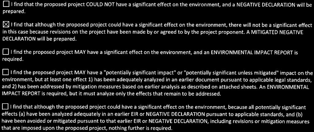
1 LEAD CITY AGENCY City of Los Angeles PROJECT TITLE 2 nd and Vignes Project PROJECT LOCATION: 929 East 2 nd Street, Los Angeles, California CITY OF LOS ANGELES OFFICE OF THE CITY CLERK ROOM 395, CITY HALL LOS ANGELES, CALIFORNIA CALIFORNIA ENVIRONMENTAL QUALITY ACT PROPOSED MITIGATED NEGATIVE DECLARATION COUNCIL DISTRICT 14 CASE NO. ENV MND PROJECT DESCRIPTION Art District E4 LLC (Applicant) proposes a change of use and addition to the existing 66,663 gross square feet former Challenge and Creamery Butter Association Building (CCBA Building) into a proposed 190,165 gross square-foot mixed-use commercial development of 102,679 square feet of commercial and office space floor area on a 0.68-acre parcel at 929 E. 2nd Street (Project Site) in the Central City North community of the City of Los Angeles. The remaining 87,486 gross square feet that do not contribute to the building s total floor area includes 48,579 square feet of parking, 22,110 square feet of vertical circulation and shafts (e.g. stairways, elevator shafts), 16,797 square feet of non-floor building area (e.g. exterior walls, storage areas, rooms housing equipment). 71,161 square feet would be dedicated to a private membership club, consisting of office space, dining and lounge area, event space, a screening room, a gym, swimming pool, and private terraces. The remaining 31,518 square feet would feature commercial uses open to the public, including a ground-level food market and café/restaurant and retail/restaurant uses. The development would have a floor area ratio of approximately 3.47:1. The Applicant requests a General Plan Amendment, Zone Change, Height District Change, Master Conditional Use Permit, Zone Variance, Site Plan Review, and Haul Route Approval, among other approvals, to permit development of the Project. The Project Site is located approximately 0.3 mile southeast of the Los Angeles County Metropolitan Transportation Authority (Metro) Gold Line Little Tokyo/Arts District Station and west of the channelized Los Angeles River. The Project Site is currently developed with a two-story commercial building that accommodates 17 artist live/work lofts of varying sizes. The Project seeks to retain the architectural character and historical design of the existing CCBA Building by retaining many of the character-defining architectural features, while still providing a structurally sound building. The Project would increase the existing twostory building to seven stories above ground (Modified Building). The above-grade automated parking system consists of four levels of open structural framing with only solid flooring at the base of the parking system and the floor of the occupiable level above (level 5). Per LAMC definition for STORY: that portion of a building included between the upper surface of any floor and the upper surface of the floor next above, the above grade automated parking system is an installation within a single story that does not include multiple levels of solid floors. The Modified Building would be stylistically differentiated through the use of design elements intended to both differentiate the new portion of the building from the original façades while invoking the design geometry and architectural rhythm of the original facades. The Project proposes to construct seven stories on the western unimproved portion of the Project Site (West Building Addition). The seven-story West Building Addition is integrated with the Modified Building to form one building. The Project s primary frontages are oriented towards Second and Vignes Streets, where ground-level restaurant and retail uses are programmed to activate the façade and increase pedestrian interaction with 2nd and Vignes Street. Parking would be accommodated through an automated parking system, wherein the parking spaces would be stacked in vertical rows on the Basement Level and Floor 4 of the Modified Building, which is considered a single tall story that would be designed to have the height of two floors. The Project proposes to provide 241 on-site vehicle parking spaces to serve Project employees and guests. A total of 40 bicycle spaces would also be provided within the automated parking system. NAME AND ADDRESS OF APPLICANT IF OTHER THAN CITY AGENCY Art District E4 LLC Empire State Building, 350 Fifth Avenue, 41 st Floor, New York, NY FINDING: The City Planning Department of the City of Los Angeles has Proposed that a mitigated negative declaration be adopted for this project because the mitigation measure(s) outlined on the attached page(s) will reduce any potential significant adverse effects to a level of insignificance. SEE ATTACHED SHEET(S) FOR ANY MITIGATION MEASURES IMPOSED.


2
3 SUMMARY OF PROJECT DESIGN FEATURES AND MITIGATION MEASURES Aesthetics PDF-AES-1: The ground floor plaza along 2 nd Street shall include attractive landscaping. It shall be maintained in accordance with a landscape plan, including an automatic irrigation plan, prepared by a licensed landscape architect to the satisfaction of the decision maker. PDF-AES-2: Every building, structure, or portion thereof, shall be maintained in a safe and sanitary condition and good repair, and free from graffiti, debris, rubbish, garbage, trash, overgrown vegetation or other similar material, pursuant to Municipal Code Section PDF-AES-3: During construction of the Project, the exterior of buildings and fences shall be free from graffiti when such graffiti is visible from a public street or alley, pursuant to Municipal Code Section PDF-AES-4: Outdoor lighting shall be designed to shine downward and installed with shielding and be directed onto the Project Site, so that the light source does not directly illuminate any adjacent properties or the above night skies. PDF-AES-5: Automobiles parked within the stacked parking system would not be permitted to have headlights turned on thereby eliminating the potential for illumination on adjacent uses. PDF-AES-6: The exterior of the proposed building shall be constructed of materials such as high-performance low reflectivity glass and pre-cast concrete or fabricated wall surfaces. Mitigation Measure AES-1: Exterior screening shall be installed to minimize the spill light from luminaires within open structure buildings from reaching beyond the Project Site. The screening shall also be installed so as to minimize the views and potential glare of headlights of motor vehicles within the garage from beyond the Project Site boundary. Screening measures may include, but are not limited to, shielding attached to the luminaire, building, or site structures. Agriculture and Forestry Resources No mitigation measures are required. 2 nd and Vignes Project 1 ESA PCR
4 Summary of Project Design Features and Mitigation Measures Air Quality Mitigation Measure AIR-1: The Project shall limit daily application of architectural coatings applied on-site to 170 gallons per day with an average of 50 grams VOC per liter of coating, less water and less exempt compounds, or equivalent usage resulting in similar or less VOC emissions. For example, stains, specialty primers, and industrial maintenance coatings allowed by Rule 1113 that contain VOCs at a level of 100 grams per liter of coating, less water and less exempt compounds would be limited to 85 gallons per day on site. Compliance with this measure would result in approximately 71 pounds of VOC emissions per day, which would be less than the threshold of 75 pounds per day. Biological Resources Mitigation Measure BIO-1a: Any construction activities that occur during the nesting season (February 15 to August 31) shall require that all suitable habitat (i.e., street trees and shrubs) be surveyed for the presence of nesting birds by a qualified biologist, retained by the Applicant as approved by the City of Los Angeles Building and Safety, before commencement of clearing and prior to grading permit issuance. The survey shall be conducted within 72 hours prior to the start of construction. A copy of the pre-construction survey shall be submitted to the City of Los Angeles Building and Safety. Mitigation Measure BIO-1b: If the required pre-construction survey detects any active nests, an appropriate buffer as determined by the biological monitor, shall be delineated, flagged, and avoided until the qualified biological monitor has verified that the young have fledged or the nest has otherwise become inactive. Cultural Resources PDF-CULT-1: The Project shall incorporate design features that include preservation or in-kind replacement of the Building s windows, board-formed reinforced concrete exterior, and decorative cornice and frieze, as well as restoration of the original loading bay openings and primary (south and east) elevations in compliance with the Secretary of the Interior s Standards for Rehabilitation. The Project s plan for restoration of the Building s exterior features shall be developed in conjunction with a qualified architectural historian, historic architect, or historic preservation professional who satisfies the Secretary of the Interior s Professional Qualifications Standards for History, Architectural History, or Architecture, pursuant to 36 CFR 61. Mitigation Measure CULT-1: Prior to Project initiation, a recordation document prepared in accordance with Historic American Buildings Survey (HABS) Level III requirements shall be completed for the existing Building. The recordation document shall be prepared by a qualified architectural historian or historic preservation professional who satisfies the Secretary of the Interior s Professional Qualification Standards for Architectural History pursuant to 36 CFR 61. This document shall include a historical narrative on the architectural and historical importance of the Building, the Building s construction history, history of occupancy and use, association with the potential Los Angeles Industrial Historic District, and record the existing appearance of the 2 nd and Vignes Project 2 ESA PCR
5 Summary of Project Design Features and Mitigation Measures Building in professional large format photographs. The Building s exteriors, representative interior spaces, character-defining features, as well as the property setting and contextual views shall be documented. All documentation components shall be completed in accordance with the Secretary of the Interior s Standards and Guidelines for Architectural and Engineering Documentation (HABS standards). Copies of the completed report shall be distributed to the South Central Coastal Information Center at the California State University, Fullerton, City of Los Angeles Office of Historic Resources, and the City of Los Angeles Public Library Special Collections (Central Library). Mitigation Measure CULT-2: The Applicant shall retain a qualified archaeologist who meets the Secretary of the Interior s Professional Qualifications Standards to oversee an archaeological monitor who shall be present during construction excavations such as demolition, clearing/grubbing, grading, trenching, or any other construction excavation activity associated with the Project. The frequency of monitoring shall be based on the rate of excavation and grading activities, proximity to known archaeological resources, the materials being excavated (younger alluvium vs. older alluvium), and the depth of excavation, and if found, the abundance and type of archaeological resources encountered. Full-time monitoring may be reduced to parttime inspections, or ceased entirely, if determined adequate by the archaeological monitor. Mitigation Measure CULT-3: In the event that archaeological resources are unearthed, grounddisturbing activities shall be halted or diverted away from the vicinity of the find so that the find can be evaluated. An appropriate buffer area shall be established around the find where construction activities shall not be allowed to continue. Work shall be allowed to continue outside of the buffer area. All archaeological resources unearthed by Project construction activities shall be evaluated by a qualified archaeologist. The Applicant shall coordinate with the archaeologist and the City to develop an appropriate treatment plan for the resources if they are determined to be potentially eligible for the California Register of Historical Resources or potentially qualify as unique archaeological resources as defined in (a) and (g) of the Public Resources Code, respectively. If the archaeological resources are prehistoric or Native American in origin, the Applicant shall consult with a representative from the Gabrielino Tribe(s) to determine whether the resource qualifies as a tribal cultural resource pursuant to 21074(a) of the Public Resources Code and to determine appropriate treatment. If preservation in place or avoidance is not feasible, treatment may include implementation of archaeological data recovery excavations to remove the resource along with subsequent laboratory processing and analysis of the artifacts. Any archaeological material collected shall be curated at a public, non-profit institution with a research interest in the materials, such as the Natural History Museum of Los Angeles County or the Fowler Museum, if such an institution agrees to accept the material. If no institution accepts the archaeological material, they shall be donated to a local school or historical society in the area for educational purposes. Mitigation Measure CULT-4: The archaeological monitor shall prepare a final report and appropriate California Department of Parks and Recreation Site Forms at the conclusion of archaeological monitoring. The report shall include a description of resources unearthed, if any, treatment of the resources, results of the artifact processing, analysis, and research, and evaluation of the resources with respect to the California Register of Historical Resources. The report and 2 nd and Vignes Project 3 ESA PCR
6 Summary of Project Design Features and Mitigation Measures the Site Forms shall be submitted by the Applicant to the City of Los Angeles, the South Central Coastal Information Center, and representatives of other appropriate or concerned agencies to signify the satisfactory completion of the Project and required mitigation measures. Mitigation Measure CULT-5: If human remains are encountered unexpectedly during implementation of the project, State Health and Safety Code Section requires that no further disturbance shall occur until the County Coroner has made the necessary findings as to origin and disposition pursuant to PRC Section If the remains are determined to be of Native American descent, the coroner has 24 hours to notify the Native American Heritage Commission (NAHC). The NAHC shall then identify the person(s) thought to be the Most Likely Descendent (MLD). The MLD may, with the permission of the land owner, or his or her authorized representative, inspect the site of the discovery of the Native American remains and may recommend to the owner or the person responsible for the excavation work means for treating or disposing, with appropriate dignity, the human remains and any associated grave goods. The MLD shall complete their inspection and make their recommendation within 48 hours of being granted access by the land owner to inspect the discovery. The recommendation may include the scientific removal and nondestructive analysis of human remains and items associated with Native American burials. Upon the discovery of the Native American remains, the landowner shall ensure that the immediate vicinity, according to generally accepted cultural or archaeological standards or practices, where the Native American human remains are located, is not damaged or disturbed by further development activity until the landowner has discussed and conferred, as prescribed in this mitigation measure, with the MLD regarding their recommendations, if applicable, taking into account the possibility of multiple human remains. The landowner shall discuss and confer with the descendants all reasonable options regarding the descendants' preferences for treatment. Whenever the NAHC is unable to identify a MLD, or the MLD identified fails to make a recommendation, or the landowner or his or her authorized representative rejects the recommendation of the descendants and the mediation provided for in Subdivision (k) of Section , if invoked, fails to provide measures acceptable to the landowner, the landowner or his or her authorized representative shall inter the human remains and items associated with Native American human remains with appropriate dignity on the property in a location not subject to further and future subsurface disturbance. Geology and Soils Mitigation Measure GEO-1: All recommendations included in the Geotechnical Report prepared for the Project (provided in Appendix D of this MND) shall be followed. In regards to the foundation design, the existing foundations will need to be enlarged or strengthened as a result of the proposed addition and renovation. Where the existing footings will need to be enlarged, the new footings shall be designed to match the depth of the existing footings and shall bear into the underlying dense native soils. The proposed foundation plan shall be reviewed and approved by the geotechnical engineer and be in compliance with the City s Building Code. In regards to the slabs on grade, the concrete floor slabs should be a minimum of 5 inches in thickness. They should be cast over undisturbed natural geologic materials or property controlled 2 nd and Vignes Project 4 ESA PCR
7 Summary of Project Design Features and Mitigation Measures fill materials. Any materials loosened or over-excavated should be wasted from the site or properly compacted to 95 percent of the maximum dry density. Greenhouse Gas Emissions PDF-GHG-1: The Project shall incorporate the following GHG reduction measures: 1. The use of materials and finishes that emit low quantities of volatile organic compounds, or VOCs; 2. The installation of modern heating, ventilation, and air conditioning (HVAC) systems that utilize ozone-friendly refrigerants; 3. High-efficiency Energy Star appliances; 4. Drought-resistant landscaping, stormwater retention, and the incorporation of water conservation features (i.e., dual-flush toilets, low-flow faucets); and 5. The provision of bicycle parking. No mitigation measures are required. Hazards and Hazardous Materials PDF-HAZ-1: If construction activities affect access to portions of the streets adjacent to the Project Site, the Project would implement traffic control measures, such as construction flagmen or installation of signage to maintain flow and access in the vicinity of the Project. PDF-HAZ-2: The Project would develop a Construction Management Plan, in accordance with City Requirements, during Project construction, which would include the designation of a haul route, to ensure that emergency access is maintained during construction. No mitigation measures are required. Hydrology and Water Quality PDF-HYDRO-1: The Project shall install a dry infiltration well system that would be designed in accordance with City of Los Angeles Guidelines to pretreat and infiltrate storm runoff before entering the storm drain system. No mitigation measures are required. Land Use and Planning PDF-LU-1: Of the total parking provided, five percent of spaces would be dedicated for electric vehicles and provide charging stations. In addition, twenty percent of spaces would be pre-wired for the future installation of electric charging stations. 2 nd and Vignes Project 5 ESA PCR
8 Summary of Project Design Features and Mitigation Measures No mitigation measures are required. Mineral Resources No mitigation measures are required. Noise PDF-NOISE-1: The Applicant shall designate a construction relations officer to serve as a liaison with surrounding residents and property owners who is responsible for responding to any concerns regarding construction noise and vibration. The liaison s telephone number(s) shall be prominently displayed at the Project Site. Signs shall also be posted at the Project Site that includes permitted construction days and hours. PDF-NOISE-2: All mechanical equipment used would be designed with appropriate noise control devices, such as sound attenuators, acoustics louvers, or sound screen/parapet walls to comply with noise limitation requirements provided in Section of the LAMC. PDF-NOISE-3: The proposed facility shall incorporate noise-attenuating features (physical as well as operational) designed by a licensed acoustical sound engineer to minimize operational sounds beyond the property line. Measure shall include, but are not limited to, the use of wall and floor-ceiling assemblies separating commercial tenant spaces and public places that shall have a Sound Transmission Class (STC) value of at least 50, as determined in accordance with ASTM E90 and ASTM E413. PDF-NOISE-4: During construction, the contractor shall install and maintain at least two continuously operational automated vibrational monitors on the on-site historic building. The monitors must be capable of being programmed with two predetermined vibratory velocities levels: a first-level alarm equivalent to a level of 0.45 inches per second at the face of the building and a regulatory alarm level equivalent to a level of 0.5 inches per second at the face of the building. The monitoring system must produce real-time specific alarms (via text message and/or to on-site personnel) when velocities exceed either of the predetermined levels. In the event of a first-level alarm, feasible steps to reduce vibratory levels shall be undertaken, including but not limited to halting/staggering concurrent activities and utilizing lower-vibratory techniques. In the event of an exceedance of the regulatory level, work in the vicinity shall be halted and the onsite historic building visually inspected for damage. Results of the inspection must be logged. In the event damage occurs to historic finish materials due to construction vibration, such materials shall be repaired in consultation with a qualified preservation consultant, and if warranted, in a manner that meets the Secretary of the Interior s Standards. Mitigation Measure NOISE-1: Noise-generating equipment operated at the Project Site shall be equipped with the most effective and technologically feasible noise control devices, such as mufflers, lagging (enclosures for exhaust pipes), and/or motor enclosures. All equipment shall be properly maintained to assure that no additional noise, due to worn or improperly maintained parts, would be generated. 2 nd and Vignes Project 6 ESA PCR
9 Summary of Project Design Features and Mitigation Measures Mitigation Measure NOISE-2: Construction and demolition activities shall be scheduled so as to avoid operating several pieces of equipment simultaneously. Mitigation Measure NOISE-3: Temporary noise barriers (e.g., sound blankets) shall be used to block the line-of-site between construction equipment and noise-sensitive receptors (residences) during Project construction. Noise barriers shall be a minimum of 20-feet tall along the west, and 10-feet tall along the south and east boundaries, which are adjacent to residential uses. Mitigation Measure NOISE-4: Amplified music from speakers located in the outdoor seating area at the southwest corner of the project may not exceed 75 dba during the daytime or 63 dba during the nighttime as measured at the southwestern property line adjacent to the Garey Building. Measurements shall be taken using a calibrated handheld or in-place noise monitor that meets the American National Standard Institute (ANSI) S1.4 specification for sound level meters or equivalent. Sound system or speaker volume settings should be tested prior to the installation of permanent speakers or prior to the beginning of an event for temporary speakers. The maximum allowed sound system or speaker volume settings, based on the results of the measurements, shall be labeled on the settings controls and on-site personnel shall be required to comply with the maximum allowed volume settings. Speakers shall not be directed towards the Garey Building and shall be directed towards the interior of the Project Site. Mitigation Measure NOISE-5: Heavy equipment shall not be used within 60 feet of the neighboring residential structures. Heavy equipment is defined as equipment with an engine size of 600 horsepower or greater and includes large dozers, large excavators, and large loaders). Mitigation Measure NOISE-6: High vibratory construction equipment, such as use of a pile driver, shall not be used. Population and Housing No mitigation measures are required. Public Services PDF-PS-1: The Project would incorporate a security program to ensure the safety of employees and site visitors. The design considers guidelines per the Design out Crime Guidelines: Crime Prevention Through Environmental Design published by the Los Angeles Police Department s Crime Prevention Section (located at Parker Center, 150 N. Los Angeles Street, Room 818, Los Angeles, (213) This measure would be approved by the LAPD prior to issuance of building permits. PDF-PS-2: Private security personnel would monitor vehicle and pedestrian access to the construction areas and patrol the Project Site. 2 nd and Vignes Project 7 ESA PCR
10 Summary of Project Design Features and Mitigation Measures PDF-PS-3: Construction fencing with gated and locked entry would be installed around the perimeter of the construction site to minimize trespassing, vandalism, short-cut attractions and attractive nuisances. PDF-PS-4: Security measures would include controlled access to the private membership club and retail areas to assist in crime prevention efforts and to reduce the demand for police protection services. PDF-PS-5: The Project Site would be well-illuminated by security lighting in entryways, public areas, and parking facilities. PDF-PS-6: Security would also include the provision of a 24-hour video surveillance system at key locations and security staff stationed within the lobby of the private membership club. PDF-PS-7: Valet staff would also be present to assist in parking vehicles and to monitor site activity, and vehicles would be parked within a controlled-access area not open to the public, visitors, or guests. PDF-PS-8: The Project proposes to provide closed-circuit television camera security systems, onsite security guards posted at the proposed alcohol uses, an alarm system installed as needed, pedestrian appropriate illumination at entryways, alleys, etc., and controlled access into and out of the parking garage. PDF-PS-9: All alcohol sales employees will receive STAR training in responsible alcohol sales; age verification devices and prompts will be part of the Point of Sale system to assist cashiers in prevention of sales to minors. PDF-PS-10: Potential effects on adjacent accessibility would be reduced with flagging and traffic control personnel. Mitigation Measure PS-1: Prior to issuance of a building permit, the General Manager of the City of Los Angeles, Department of Building and Safety, or designee, shall ensure that the Applicant has paid all applicable school facility development fees in accordance with California Government Code Section Recreation No mitigation measures are required. 2 nd and Vignes Project 8 ESA PCR
11 Summary of Project Design Features and Mitigation Measures Transportation and Traffic PDF-TRAF-1: The Applicant shall prepare a detailed Construction Management Plan that shall include, but not be limited to, the following elements, as appropriate: Advance, bilingual notification of adjacent property owners and occupants of upcoming construction activities, including estimated duration of construction and daily hours of construction. Prohibition of construction worker or equipment parking on adjacent streets. Temporary pedestrian, bicycle, and vehicular traffic controls during all construction activities adjacent to Vignes Street and E. 2 nd Street to ensure traffic safety on public rights of way. These controls shall include, but not be limited to, flag people trained in pedestrian and bicycle safety at the Project Site s Vignes Street and E. 2 nd Street driveways. Temporary traffic control during all construction activities adjacent to public rights-ofway to improve traffic flow on public roadways (e.g., flag men). Scheduling of construction activities to reduce the effect on traffic flow on surrounding arterial streets. Potential sequencing of construction activity for the Project to reduce the amount of construction-related traffic on arterial streets. Containment of construction activity within the Project Site boundaries. Prohibition on construction-related vehicles/equipment parking on surrounding public streets. Safety precautions for pedestrians through such measures as alternate routing and protection barriers shall be implemented. Scheduling of construction-related deliveries, haul trips, etc., so as to occur outside the commuter peak hours. Applicant shall plan construction and construction staging as to maintain pedestrian access on adjacent sidewalks throughout all construction phases. This requires the applicant to maintain adequate and safe pedestrian protection, including physical separation (including utilization of barriers such as K-Rails or scaffolding, etc.) from work space and vehicular traffic and overhead protection, due to sidewalk closure or blockage, at all times. Temporary pedestrian facilities should be adjacent to the project site and provide safe, accessible routes that replicate as nearly as practical the most desirable characteristics of the existing facility. Covered walkways shall be provided where pedestrians are exposed to potential injury from falling objects. 2 nd and Vignes Project 9 ESA PCR
12 Summary of Project Design Features and Mitigation Measures Applicant shall keep sidewalk open during construction until only when it is absolutely required to close or block sidewalk for construction staging. Sidewalk shall be reopened as soon as reasonably feasible taking construction and construction staging into account. No mitigation measures are required. Tribal Cultural Resources No mitigation measures are required. Utilities and Service Systems PDF-USS-1: Prior to the issuance of any demolition or construction permit, the applicant shall provide a copy of the receipt or contract from a waste disposal company providing services to the Project, specifying recycled waste service(s), to the satisfaction of the Department of Building and Safety. The demolition and construction contractor(s) shall only contract for waste disposal services with a company that recycles demolition and/or construction-related wastes. PDF-USS-2: All waste shall be disposed of properly. Use appropriately labeled recycling bins to recycle demolition and construction materials including: solvents, water-based paints, vehicle fluids, broken asphalt and concrete, bricks, metals, wood, and vegetation. Non-recyclable materials/wastes shall be taken to an appropriate landfill. Toxic wastes must be discarded at a licensed regulated disposal site. PDF-USS-3: To facilitate onsite separation and recycling of demolition and construction-related wastes, the contractor(s) shall provide temporary waste separation bins on-site during demolition and construction. These bins shall be emptied and recycled accordingly as a part of the Project's regular solid waste disposal program. PDF-USS-4: Recycling bins shall be provided at appropriate locations to promote recycling of paper, metal, glass, and other recyclable material. These bins shall be emptied and recycled accordingly as a part of the Project's regular solid waste disposal program. No mitigation measures are required. 2 nd and Vignes Project 10 ESA PCR
13 TABLE OF CONTENTS 2 nd and Vignes Project Initial Study Page Initial Study and Checklist... EC-1 Responsible Agencies... EC-1 Project Description... EC-1 Environmental Setting... EC-2 Project Location... EC-2 Determination... EC-3 Evaluation of Environmental Impacts... EC-4 Aesthetics... EC-6 Agriculture and Forest Resources... EC-6 Air Quality... EC-7 Biological Resources... EC-7 Cultural Resources... EC-8 Geology and Soils... EC-8 Greenhouse Gas Emissions... EC-8 Hazards and Hazardous Materials... EC-9 Hydrology and Water Quality... EC-9 Land Use and Planning... EC-10 Mineral Resources... EC-10 Noise... EC-11 Population, Housing, and Employment... EC-11 Public Services... EC-11 Recreation... EC-12 Transportation/Traffic... EC-12 Tribal Cultural Resources... EC-12 Utilities and Service Systems... EC-13 Mandatory Findings of Significance... EC-14 Attachment A: Project Description... A-1 A. Introduction... A-1 B. Project Location and Surrounding Uses... A-2 C. Existing Conditions and Site Background... A-6 D. Existing Planning and Zoning... A-7 E. Description of the Proposed Project... A-7 F. Necessary Approvals... A-19 2 nd and Vignes Project i ESA PCR
14 Table of Contents Page Attachment B: Explanation of Checklist Determinations... B-1 I. Aesthetics... B-1 II. Agriculture and Forest Resources... B-12 III. Air Quality... B-14 IV. Biological Resources... B-25 V. Cultural Resources... B-29 VI. Geology and Soils... B-45 VII. Greenhouse Gas Emissions... B-50 VIII. Hazards and Hazardous Materials... B-62 IX. Hydrology and Water Quality... B-71 X. Land Use and Planning... B-79 XI. Mineral Resources... B-105 XII. Noise... B-106 XIII. Population, Housing, and Employment... B-126 XIV. Public Services... B-134 XV. Recreation... B-146 XVI. Transportation/Traffic... B-147 XVII. Tribal Cultural Resources... B-158 XVIII. Utilities and Service Systems... B-159 XVIX. Mandatory Findings of Significance... B-177 Appendices A Air Quality Worksheets B Tree Assessment Letter Report C-1 Historical Resources Assessment Report and Environmental Impact Analysis C-2 Tribal Cultural Resources Documentation D-1 Geotechnical Engineering Investigation D-2 Soils Report Approval Letter E Greenhouse Gas Emissions Worksheets F-1 Phase 1 Environmental Assessment November 15, 1994 F-2 Phase 1 Environmental Site Assessment May 3, 2015 G Civil Engineering Memorandum H Noise Worksheets I-1 Traffic Impact Study I-2 Revised Trip Generation Analysis I-3 Construction Traffic Analysis I-4 LADOT Traffic Impact Assessment J Population and Housing Projection Documentation K Shadow Study Figures A-1 Project Location Map... A-3 A-2 Aerial Photograph of the Project Site... A-4 A-3 Conceptual Site Plan... A-9 A-4 Conceptual Architectural Rendering (from Vignes Street)... A-10 A-5 Conceptual Architectural Rendering (from 2nd Street)... A-11 A-6 Project Building Sections... A-12 A-7 Project Building Elevations... A-13 B-1 Noise Measurement Locations... B nd and Vignes Project ii ESA PCR
15 Table of Contents Page Tables A-1 Development Program... A-14 B-1 Unmitigated Regional Construction Emissions (pounds per day)... B-17 B-2 Unmitigated Localized Construction Emissions (pounds per day)... B-18 B-3 Unmitigated Net Regional Operational Emissions (pounds per day)... B-19 B-4 Unmitigated Net Localized Operational Emissions (pounds per day)... B-20 B-5 Construction Greenhouse Gas Emissions... B-53 B-6 Estimated Mitigated Annual Greenhouse Gas Emissions... B-55 B-7 Project Consistency with Applicable GHG Reduction Strategies... B-57 B-8 Comparison of the Project to Applicable Policies of the General Plan Framework... B-82 B-9 Comparison of the Project to Applicable Policies of the Health and Wellness Element (Plan for a Healthy Los Angeles)... B-85 B-10 Comparison of the Project to Provisions of the Central City North Community Plan... B-87 B-11 Comparison of the Project to Applicable Land Use Regulations of the LAMC... B-91 B-12 Comparison of the Project to Applicable Guidelines of Do Real Planning... B-93 B-13 Comparison of the Project to the Objectives and Goals of the Walkability Checklist... B-94 B-14 Consistency of the Project with Applicable Policies of the Regional Transportation Plan... B-101 B-15 Guidelines for Noise Compatible Land Use... B-110 B-16 Summary of Ambient Noise Measurements... B-114 B-17 Estimate of Construction Noise Levels (Leq) at Off-Site Sensitive Receiver Locations... B-116 B-18 Existing With Project (2016) Off-Site Traffic Noise Impacts... B-118 B-19 Future (2019) Off-Site Traffic Noise Impacts... B-119 B-20 Projected Population, Housing and Employment Estimates... B-127 B-21 Project Increases in Employment... B-128 B-22 Project Employment Impacts... B-129 B-23 Cumulative Increases in Population, Housing, and Employment... B-131 B-24 Total Cumulative Development... B-132 B-25 Cumulative Population, Housing, and Employment Impacts... B-132 B-26 Estimated Number of Students to be Generated by the Project... B-141 B-27 Existing CMA and LOS Conditions (2016)... B-149 B-28 Trip Generation... B-150 B-29 Project Directional Trip Distribution Percentages... B-150 B-30 Impact Summary for Existing (2016) and Future (2019) Traffic Conditions... B-152 B-31 Estimated Project Wastewater Generation... B-160 B-32 Project Construction Debris... B-166 B-33 Estimated Operational Solid Waste Generation... B-168 B-34 Estimated Electricity Use... B-172 B-35 Estimated Natural Gas Use... B-173 B-36 Related Projects List... B nd and Vignes Project iii ESA PCR
16 This page left intentionally blank
17 CITY OF LOS ANGELES OFFICE OF THE CITY CLERK ROOM 395, CITY HALL LOS ANGELES, CALIFORNIA CALIFORNIA ENVIRONMENTAL QUALITY ACT INITIAL STUDY AND CHECKLIST (Article IV B City CEQA Guidelines) LEAD CITY AGENCY Department of City Planning RESPONSIBLE AGENCIES COUNCIL DISTRICT 14 DATE February 16, 2017 City of Los Angeles Department of City Planning, Los Angeles Regional Water Quality Control Board, South Coast Air Quality Management District (SCAQMD), Los Angeles Building and Safety Department, Los Angeles Department of Water and Power (Board of Water and Power Commissioners), Los Angeles Board of Public Works, Los Angeles Department of Transportation PROJECT TITLE/NO. 2 nd and Vignes Project PREVIOUS ACTIONS CASE NO. CASE NO. ENV MND DOES have significant changes from previous actions. PROJECT DESCRIPTION: EC-1 DOES NOT have significant changes from previous actions. Art District E4 LLC (Applicant) proposes a change of use and addition to the existing 66,663 gross square feet (gsf) former Challenge and Creamery Butter Association Building (CCBA Building) into a proposed 190,165 gsf mixed-use commercial development of 102,679 square feet of commercial and office space floor area on a 0.68-acre parcel at 929 E. 2 nd Street (Project Site) in the Central City North community of the City of Los Angeles. The remaining 87,486 gross square feet that do not contribute to the building s total floor area includes 48,579 square feet of parking, 22,110 square feet of vertical circulation and shafts (e.g. stairways, elevator shafts), 16,797 square feet of non-floor building area (e.g. exterior walls, storage areas, rooms housing equipment). 71,161 square feet would be dedicated to a private membership club, consisting of office space, dining and lounge area, event space, a screening room, a gym, swimming pool, and private terraces. The remaining 31,518 square feet would feature commercial uses open to the public, including a ground-level food market and café/restaurant and retail/restaurant uses. The development would have a floor area ratio of approximately 3.47:1. The Applicant requests a General Plan Amendment, Zone Change, Height District Change, Master Conditional Use Permit, Zone Variance, Site Plan Review, and Haul Route Approval, among other approvals, to permit development of the Project. The Project Site is located approximately 0.3 mile southeast of the Los Angeles County Metropolitan Transportation Authority (Metro) Gold Line Little Tokyo/Arts District Station and west of the channelized Los Angeles River. The Project Site is currently developed with a two-story commercial building that accommodates 17 artist live/work lofts of varying sizes. The Project seeks to retain the architectural character and historical design of the existing CCBA Building by retaining many of the character-defining architectural features, while still providing a structurally sound building. The Project would increase the existing two-story building to seven stories above ground (Modified Building). The above-grade automated parking system consists of four levels of open structural framing with only solid flooring at the base of the parking system and the floor of the occupiable level above (level 5). Per LAMC definition for STORY: that portion of a building included between the upper surface of any floor and the upper surface of the floor next above, the above grade automated parking system is an installation within a single story that does not include multiple levels of solid floors. The Modified Building would be stylistically differentiated through the use of design elements intended to both differentiate the new portion of the building from the original façades while invoking the design geometry and architectural rhythm of the original facades. The Project proposes to construct seven stories on the western unimproved portion of the Project
18 Site (West Building Addition). The seven-story West Building Addition is integrated with the Modified Building to form one building. The Project s primary frontages are oriented towards 2nd and Vignes Streets, where ground-level restaurant and retail uses are programmed to activate the façade and increase pedestrian interaction with 2 nd and Vignes Street. Parking would be accommodated through an automated parking system, wherein the parking spaces would be stacked in vertical rows on the Basement Level and Floor 4 of the Modified Building, which is considered a single tall story that would be designed to have the height of two floors. The Project proposes to provide 241 on-site vehicle parking spaces to serve Project employees and guests. A total of 40 bicycle spaces would also be provided within the automated parking system. ENVIRONMENTAL SETTING: The Project Site is located in the Central City North Community Plan Area. The areas north, east, and south of the Project Site are developed with hybrid and light industrial land uses. The Los Angeles River is located 1,000 feet east of the Project Site. Bunker Hill is located approximately one mile to the west, Little Tokyo is approximately 0.25 mile to the west, and Chinatown is approximately 0.75 mile to the north of the Project Site. PROJECT LOCATION: The Project Site is located at 929 E. 2 nd Street and is bordered on the west by the mixed-use Garey Building; on the north by a service alley and a two-story commercial building; on the south by 2 nd Street; and on the east by Vignes Street. The Project Site is served by a network of regional transportation facilities. Local access to the Project Site is provided by 1 st Street and Alameda Street. Regional vehicle access to the Project Site is provided by the US-101 (Hollywood Freeway), located approximately 0.5 mile to the north, the I-10 (San Bernardino Freeway) located approximately 0.7 mile to the northeast, the I-110 (Harbor Freeway) located approximately 1.5 miles to the west, the I-10 (Santa Monica Freeway) located approximately 1.3 miles to the south, and the I-5 (Golden State Freeway) located approximately 1.2 miles to the east. For further discussion see Attachment A, Project Description. PLANNING DISTRICT Central City North Community Plan EXISTING ZONING CM-1-RIO PLANNED LAND USE & ZONE Regional Commercial/C2-2 SURROUNDING LAND USES See Attachment A, Project Description MAX. DENSITY ZONING 1.5:1 MAX. DENSITY PLAN PROJECT DENSITY 3.47:1 STATUS: PRELIMINARY PROPOSED ADOPTED DOES CONFORM TO PLAN DOES NOT CONFORM TO PLAN NO DISTRICT PLAN EC-2


19
20 EVALUATION OF ENVIRONMENTAL IMPACTS: 1) A brief explanation is required for all answers except "No Impact" answers that are adequately supported by the information sources a lead agency cites in the parentheses following each question. A "No Impact" answer is adequately supported if the referenced information sources show that the impact simply does not apply to projects like the one involved (e.g., the project falls outside a fault rupture zone). A "No Impact" answer should be explained where it is based on project-specific factors as well as general standards (e.g., the project will not expose sensitive receptors to pollutants based on a project-specific screening analysis). 2) All answers must take account of the whole action involved, including off-site as well as on-site, cumulative as well as project-level, indirect as well as direct, and construction as well as operational impacts. 3) Once the lead agency has determined that a particular physical impact may occur, then the checklist answers must indicate whether the impact is potentially significant, less that significant with mitigation, or less than significant. "Potentially Significant Impact" is appropriate if there is substantial evidence that an effect may be significant. If there are one or more "Potentially Significant Impact" entries when the determination is made, an EIR is required. 4) "Negative Declaration: Less Than Significant With Mitigation Incorporated" applies where the incorporation of a mitigation measure has reduced an effect from "Potentially Significant Impact" to "Less Than Significant Impact." The lead agency must describe the mitigation measures, and briefly explain how they reduce the effect to a less than significant level (mitigation measures from Section XVII, "Earlier Analysis," cross referenced). 5) Earlier analysis must be used where, pursuant to the tiering, program EIR, or other CEQA process, an effect has been adequately analyzed in an earlier EIR, or negative declaration. Section (c)(3)(d). In this case, a brief discussion should identify the following: 1) Earlier Analysis Used. Identify and state where they are available for review. 2) Impacts Adequately Addressed. Identify which effects from the above checklist were within the scope of and adequately analyzed in an earlier document pursuant to applicable legal standards, and state whether such effects were addressed by mitigation measures based on the earlier analysis. 3) Mitigation Measures. For effects that are "Less Than Significant With Mitigation Measures Incorporated," describe the mitigation measures which were incorporated or refined from the earlier document and the extent to which they address site-specific conditions for the project. 6) Lead agencies are encouraged to incorporate into the checklist references to information sources for potential impacts (e.g., general plans, zoning ordinances). Reference to a previously prepared or outside document should, where appropriate, include a reference to the page or pages where the statement is substantiated 7) Supporting Information Sources: A sources list should be attached, and other sources used or individuals contacted should be cited in the discussion. 8) This is only a suggested form, and lead agencies are free to use different formats; however, lead EC-4
21 agencies should normally address the questions from this checklist that are relevant to a project s environmental effects in whichever format is selected. 9) The explanation of each issue should identify: 1) The significance criteria or threshold, if any, used to evaluate each question; and 2) The mitigation measure identified, if any, to reduce the impact to less than significance. ENVIRONMENTAL FACTORS POTENTIALLY AFFECTED: The environmental factors checked below would be potentially affected by this project, involving at least one impact that is a "Potentially Significant Impact" as indicated by the checklist on the following pages. Aesthetics Hazards & Hazardous Materials Public Services Agriculture and Forestry Resources Hydrology/Water Quality Recreation Air Quality Land Use/Planning Transportation/Traffic Biological Resources Mineral Resources Tribal Cultural Resources Cultural Resources Noise Utilities/Service Systems Geology/Soils Population/Housing Mandatory Findings of Significance Greenhouse Gas Emissions INITIAL STUDY CHECKLIST (To be completed by the Lead City Agency) BACKGROUND PROPONENT NAME Art District E4 LLC PHONE NUMBER (646) PROPONENT ADDRESS Empire State Building, 350 Fifth Avenue, 41 st Floor, New York, NY AGENCY REQUIRING CHECKLIST Department of City Planning PROPOSAL NAME (If Applicable) 2 nd and Vignes Project DATE SUBMITTED February 16, 2017 EC-5
22 ENVIRONMENTAL IMPACTS I. AESTHETICS. Would the project: a. Have a substantial adverse effect on a scenic vista? b. Substantially damage scenic resources, including, but not limited to, trees, rock outcroppings, and historic buildings, or other locally recognized desirable aesthetic natural feature within a city-designated scenic highway? c. Substantially degrade the existing visual character or quality of the site and its surroundings? d. Create a new source of substantial light or glare which would adversely affect day or nighttime views in the area? (Explanations of all potentially and less than significant impacts are required to be attached on separate sheets) Potentially Significant Impact Less Than Significant With Mitigation Incorporated Less Than Significant Impact No Impact II. AGRICULTURE AND FOREST RESOURCES. In determining whether impacts to agricultural resources are significant environmental effects, lead agencies may refer to the California Agricultural Land Evaluation and Site Assessment Model (1997) prepared by the California Department of Conservation as an optional model to use in assessing impacts on agriculture and farmland. In determining whether impacts to forest resources, including timberland, are significant environmental effects, lead agencies may refer to information compiled by the California Department of Forestry and Fire Protection regarding the state s inventory of forest land, including the Forest and Range Assessment Project and the Forest Legacy Assessment project; and forest carbon measurement methodology provided in Forest Protocols adopted by the California Air Resources Board. Would the project: a. Convert Prime Farmland, Unique Farmland, or Farmland of Statewide Importance, as shown on the maps prepared pursuant to the Farmland Mapping and Monitoring Program of the California Resources Agency, to non-agricultural use? b. Conflict with existing zoning for agricultural use, or a Williamson Act Contract? c. Conflict with existing zoning for, or cause rezoning of, forest land (as defined in Public Resources Code section 12220(g)), timberland (as defined by Public Resources Code section 4526), or timberland zoned Timberland Production (as defined by Government Code section 51104(g))? d. Result in the loss of forest land or conversion of forest land to non-forest use? e. Involve other changes in the existing environment which, due to their location or nature, could result in conversion of Farmland, to non-agricultural use? EC-6
23 Potentially Significant Impact Less Than Significant With Mitigation Incorporated Less Than Significant Impact No Impact III. AIR QUALITY. Where available, the significance criteria established by the South Coast Air Quality Management District (SCAQMD) may be relied upon to make the following determinations. Would the project: a. Conflict with or obstruct implementation of the SCAQMD or Congestion Management Plan? b. Violate any air quality standard or contribute substantially to an existing or projected air quality violation? c. Result in a cumulatively considerable net increase of any criteria pollutant for which the air basin is non-attainment (ozone, carbon monoxide, & PM 10) under an applicable federal or state ambient air quality standard? d. Expose sensitive receptors to substantial pollutant concentrations? e. Create objectionable odors affecting a substantial number of people? IV. BIOLOGICAL RESOURCES. Would the project: a. Have a substantial adverse effect, either directly or through habitat modification, on any species identified as a candidate, sensitive, or special status species in local or regional plans, policies, or regulations by the California Department of Fish and Game or U.S. Fish and Wildlife Service? b. Have a substantial adverse effect on any riparian habitat or other sensitive natural community identified in the City or regional plans, policies, regulations by the California Department of Fish and Game or U.S. Fish and Wildlife Service? c. Have a substantial adverse effect on federally protected wetlands as defined by Section 404 of the Clean Water Act (including, but not limited to, marsh vernal pool, coastal, etc.) Through direct removal, filling, hydrological interruption, or other means? d. Interfere substantially with the movement of any native resident or migratory fish or wildlife species or with established native resident or migratory wildlife corridors, or impede the use of native wildlife nursery sites? e. Conflict with any local policies or ordinances protecting biological resources, such as tree preservation policy or ordinance (e.g., oak trees or California walnut woodlands)? f. Conflict with the provisions of an adopted Habitat Conservation Plan, Natural Community Conservation Plan, or other approved local, regional, or state habitat conservation plan? EC-7
24 Potentially Significant Impact Less Than Significant With Mitigation Incorporated Less Than Significant Impact No Impact V. CULTURAL RESOURCES: Would the project: a. Cause a substantial adverse change in significance of a historical resource as defined in State CEQA ? b. Cause a substantial adverse change in significance of an archaeological resource pursuant to State CEQA ? c. Directly or indirectly destroy a unique paleontological resource or site or unique geologic feature? d. Disturb any human remains, including those interred outside of formal cemeteries? VI. GEOLOGY AND SOILS. Would the project: a. Expose people or structures to potential substantial adverse effects, including the risk of loss, injury or death involving: i. Rupture of a known earthquake fault, as delineated on the most recent Alquist-Priolo Earthquake Fault Zoning Map issued by the State Geologist for the area or based on other substantial evidence of a known fault? Refer to Division of Mines and Geology Special Publication 42. ii. Strong seismic ground shaking? iii. Seismic-related ground failure, including liquefaction? iv. Landslides? b. Result in substantial soil erosion or the loss of topsoil? c. Be located on a geologic unit or soil that is unstable, or that would become unstable as a result of the project, and potential result in on- or off-site landslide, lateral spreading, subsidence, liquefaction, or collapse? d. Be located on expansive soil, as defined in Table 18-1-B of the Uniform Building Code (1994), creating substantial risks to life or property? e. Have soils incapable of adequately supporting the use of septic tanks or alternative waste water disposal systems where sewers are not available for the disposal of waste water? VII. GREENHOUSE GAS EMISSIONS. Would the project: a. Generate greenhouse gas emissions, either directly or indirectly, that may have a significant impact on the environment? b. Conflict with an applicable plan, policy or regulation adopted for the purpose of reducing the emissions of greenhouse gases? EC-8
25 Potentially Significant Impact Less Than Significant With Mitigation Incorporated Less Than Significant Impact No Impact VIII. HAZARDS AND HAZARDOUS MATERIALS. Would the project: a. Create a significant hazard to the public or the environment through the routine transport, use, or disposal of hazardous materials b. Create a significant hazard to the public or the environment through reasonably foreseeable upset and accident conditions involving the release of hazardous materials into the environment? c. Emit hazardous emissions or handle hazardous or acutely hazardous materials, substances, or waste within one-quarter mile of an existing or proposed school? d. Be located on a site which is included on a list of hazardous materials sites compiled pursuant to Government Code Section and, as a result, would it create a significant hazard to the public or the environment? e. For a project located within an airport land use plan or, where such a plan has not been adopted, within two miles of a public airport or public use airport, would the project result in a safety hazard for people residing or working in the project area? f. For a project within the vicinity of a private airstrip, would the project result in a safety hazard for the people residing or working in the area? g. Impair implementation of or physically interfere with an adopted emergency response plan or emergency evacuation plan? h. Expose people or structures to a significant risk of loss, injury or death involving wildland fires, including where wildlands are adjacent to urbanized areas or where residences are intermixed with wildlands? IX. HYDROLOGY AND WATER QUALITY. Would the project result in: a. Violate any water quality standards or waste discharge requirements? b. Substantially deplete groundwater supplies or interfere with groundwater recharge such that there would be a net deficit in aquifer volume or a lowering of the local groundwater table level (e.g., the production rate of pre-existing nearby wells would drop to a level which would not support existing land uses or planned land uses for which permits have been granted)? EC-9
26 Potentially Significant Impact Less Than Significant With Mitigation Incorporated Less Than Significant Impact No Impact c. Substantially alter the existing drainage pattern of the site or area, including through the alteration of the course of a stream or river, in a manner which would result in substantial erosion or siltation on- or off-site? d. Substantially alter the existing drainage pattern of the site or area, including through the alteration of the course of a stream or river, or substantially increase the rate or amount of surface runoff in an manner which would result in flooding on- or off site? e. Create or contribute runoff water which would exceed the capacity of existing or planned stormwater drainage systems or provide substantial additional sources of polluted runoff? f. Otherwise substantially degrade water quality? g. Place housing within a 100-year flood plain as mapped on federal Flood Hazard Boundary or Flood Insurance Rate Map or other flood hazard delineation map? h. Place within a 100-year flood plain structures which would impede or redirect flood flows? i. Expose people or structures to a significant risk of loss, injury or death involving flooding, including flooding as a result of the failure of a levee or dam? j. Inundation by seiche, tsunami, or mudflow? X. LAND USE AND PLANNING. Would the project: a. Physically divide an established community? b. Conflict with applicable land use plan, policy or regulation of an agency with jurisdiction over the project (including but not limited to the general plan, specific plan, coastal program, or zoning ordinance) adopted for the purpose of avoiding or mitigating an environmental effect? c. Conflict with any applicable habitat conservation plan or natural community conservation plan? XI. MINERAL RESOURCES. Would the project: a. Result in the loss of availability of a known mineral resource that would be of value to the region and the residents of the state? b. Result in the loss of availability of a locally-important mineral resource recovery site delineated on a local general plan, specific plan, or other land use plan? EC-10
27 Potentially Significant Impact Less Than Significant With Mitigation Incorporated Less Than Significant Impact No Impact XII. NOISE. Would the project result in: a. Exposure of persons to or generation of noise in level in excess of standards established in the local general plan or noise ordinance, or applicable standards of other agencies? b. Exposure of people to or generation of excessive groundborne vibration or groundborne noise levels? c. A substantial permanent increase in ambient noise levels in the project vicinity above levels existing without the project? d. A substantial temporary or periodic increase in ambient noise levels in the project vicinity above levels existing without the project? e. For a project located within an airport land use plan or, where such a plan has not been adopted, within two miles of a public airport or public use airport, would the project expose people residing or working in the project area to excessive noise levels? f. For a project within the vicinity of a private airstrip, would the project expose people residing or working in the project area to excessive noise levels? XIII. POPULATION AND HOUSING. Would the project: a. Induce substantial population growth in an area either directly (for example, by proposing new homes and businesses) or indirectly (for example, through extension of roads or other infrastructure)? b. Displace substantial numbers of existing housing necessitating the construction of replacement housing elsewhere? c. Displace substantial numbers of people necessitating the construction of replacement housing elsewhere? XIV. PUBLIC SERVICES. Would the project result in substantial adverse physical impacts associated with the provision of new or physically altered governmental facilities, construction of which could cause significant environmental impacts, in order to maintain acceptable service ratios, response times or other performance objectives for any of the public services: a. Fire protection? b. Police protection? c. Schools? d. Parks? e. Other governmental services (including roads)? EC-11
28 Potentially Significant Impact Less Than Significant With Mitigation Incorporated Less Than Significant Impact No Impact XV. RECREATION. a. Would the project increase the use of existing neighborhood and regional parks or other recreational facilities such that substantial physical deterioration of the facility would occur or be accelerated? b. Does the project include recreational facilities or require the construction or expansion of recreational facilities which might have an adverse physical effect on the environment? XVI. TRANSPORTATION/CIRCULATION. Would the project: a. Conflict with an applicable plan, ordinance or policy establishing measures of effectiveness for the performance of the circulation system, taking into account all modes of transportation including mass transit and non-motorized travel and relevant components of the circulation system, including but not limited to intersections, streets, highways and freeways, pedestrian and bicycle paths, and mass transit? b. Conflict with an applicable congestion management program, including, but not limited to level of service standards and travel demand measures, or other standards established by the county congestion management agency for designated roads or highways? c. Result in a change in air traffic patterns, including either an increase in traffic levels or a change in location that results in substantial safety risks? d. Substantially increase hazards to a design feature (e.g., sharp curves or dangerous intersections) or incompatible uses (e.g., farm equipment)? e. Result in inadequate emergency access? f. Conflict with adopted policies, plans, or programs regarding public transit, bicycle, or pedestrian facilities, or otherwise decrease the performance or safety of such facilities? XVII. TRIBAL CULTURAL RESOURCES. Would the project: a. Cause a substantial adverse change in the significance of a tribal cultural resource, defined in Public Resources Code section as either a site, feature, place, cultural landscape that is geographically defined in terms of the size and scope of the landscape, sacred place, or object with cultural value to a California Native American tribe, and that is: Listed or eligible for listing in the California Register of Historical Resources, or in a local register of historical resources as defined in Public Resources Code section (k)? EC-12
29 Potentially Significant Impact Less Than Significant With Mitigation Incorporated Less Than Significant Impact No Impact b. Cause a substantial adverse change in the significance of a tribal cultural resource, defined in Public Resources Code section as either a site, feature, place, cultural landscape that is geographically defined in terms of the size and scope of the landscape, sacred place, or object with cultural value to a California Native American tribe, and that is: A resource determined by the lead agency, in its discretion and supported by substantial evidence, to be significant pursuant to criteria set forth in subdivision (c) of Public Resources Code Section In applying the criteria set forth in subdivision (c) of Public Resource Code Section , the lead agency shall consider the significance of the resource to a California Native American tribe? XVIII. UTILITIES. Would the project: a. Exceed wastewater treatment requirements of the applicable Regional Water Quality Control Board? b. Require or result in the construction of new water or wastewater treatment facilities or expansion of existing facilities, the construction of which could cause significant environmental effects? c. Require or result in the construction of new stormwater drainage facilities or expansion of existing facilities, the construction of which could cause significant environmental effects? d. Have sufficient water supplies available to serve the project from existing entitlements and resource, or are new or expanded entitlements needed? e. Result in a determination by the wastewater treatment provider which serves or may serve the project that it has adequate capacity to serve the project s projected demand in addition to the provider s existing commitments? f. Be served by a landfill with sufficient permitted capacity to accommodate the project s solid waste disposal needs? g. Comply with federal, state, and local statutes and regulations related to solid waste? h. Other utilities and service systems? EC-13
30 XVIX. MANDATORY FINDINGS OF SIGNIFICANCE. a. Does the project have the potential to degrade the quality of the environment, substantially reduce the habitat of fish or wildlife species, cause a fish or wildlife population to drop below self-sustaining levels, threaten to eliminate a plant or animal community, reduce the number or restrict the range of a rare or endangered plant or animal or eliminate important examples of the major periods of California history or prehistory? b. Does the project have impacts which are individually limited, but cumulatively considerable?("cumulatively considerable" means that the incremental effects of an individual project are considerable when viewed in connection with the effects of past projects, the effects of other current projects, and the effects of probable future projects). c. Does the project have environmental effects which cause substantial adverse effects on human beings, either directly or indirectly? DISCUSSION OF THE ENVIRONMENTAL EVALUATION (Attach additional sheets if necessary) PREPARED BY Christine Abraham ESA PCR 233 Wilshire Blvd., Suite 150 Santa Monica, CA TITLE Principal Planner TELEPHONE # (310) DATE February 16, 2017 EC-14
31 ATTACHMENT A Project Description A. Introduction Art District E4 LLC (Applicant) proposes to develop a mixed-use commercial project (Project) on a 0.68-acre parcel at northwest intersection of 2 nd Street and Vignes Street (Project Site) in the Central City North community of the City of Los Angeles. The Project Site is presently improved with a two-story, approximately 66,663 gross square-foot commercial building with one subterranean level that was constructed in 1926 as the headquarters for the Challenge Cream and Butter Association (CCBA Building). 1 An abandoned railroad spur also parallels the west side of the building. The Project seeks to retain the architectural character and historical design of the existing CCBA Building by retaining character-defining architectural features, while still providing a structurally sound building. Alterations to the CCBA Building s concrete structural support system would be made to allow a five-story increase in the height of the building (Modified Building). A new seven-story addition (West Building Addition) to the building would also be constructed adjacent to the west façade of the CCBA Building, in the location of the abandoned railroad spur. The Project would integrate the Modified Building and West Building Addition into one seamless building. The Project would consist of 102,679 square feet of floor area upon completion, with a resulting site-wide floor area ratio (FAR) of 3.47:1. The majority of the Project s proposed floor area would operate as a private membership club (71,161 square feet, or approximately 69 percent), consisting of retail space, office space, dining and lounge area, photo studio, event space, a screening room, artist studios, a gym/spa, swimming pool, photo studios, and private terraces, accessible only to patrons with active memberships. An annual membership of approximately 2,000 patrons is anticipated. The remainder of the Project s proposed floor area would feature commercial uses (31,518 square feet, or approximately 31 percent) that are open to the public, including a ground-level food market, café/restaurant uses, and artist studios fronting the intersection of 2 nd Street and Vignes Street, ground-level retail uses accessible from Vignes Street, and three stories of retail/restaurant uses on the westerly and southerly portion of the Project Site. The Project would also provide a 1,183-square-foot public landscaped courtyard on 2 nd Street. 1 The existing building is zoned as a commercial/manufacturing building; however, the building currently permits live-work uses, after approval of a conditional use permit. 2 nd and Vignes Project A-1 ESA PCR
32 ATTACHMENT A. Project Description Parking for 241 vehicles would be provided in the Basement and 4 th Floor through the use of an automated lift and shuttle-carriage system accessed from an internal porte cochere along Vignes Street. The 4 th floor would be designed to have the height of two floors, each of which would have two stacked levels of parking, resulting in four levels of stacked parking. 2 The Project would also provide 40 bicycle parking spaces (20 long-term, 20 short-term) to be accommodated within the automated parking system via a bike valet interface. B. Project Location and Surrounding Uses The Project Site is located at the southwest intersection of 2 nd Street and Vignes Street in the City s Arts District within Downtown Los Angeles (Assessor s Parcel Numbers and ). Bunker Hill in Downtown Los Angeles is located approximately one mile west, Little Tokyo is approximately 0.25 mile to the west, and Chinatown is approximately 0.75 mile to the north of the Project Site. The channelized Los Angeles River is located approximately 1,000 feet east of the Project Site. The Project Site s location is shown in Figure A-1, Project Location Map. The Project Site is bound on the north by a service alley and then a two-story commercial building currently occupied by Environmental Contracting Corporation; on the east by Vignes Street, across which is located a largely vacant, two-story brick commercial building; on the south by 2 nd Street, across which is located a two- to four-story brick commercial building (929 E. 3rd St) providing creative office (R204Design) and restaurant (Americano, Cerveteca) uses; and on the west by the Garey Building, which is a five-story mixed-use development providing 320 apartment units and 15,290 square feet of retail and restaurant space. Figure A-2, Aerial Photograph of Project Site provides an aerial photo of the Project Site and surrounding uses. Owing to its proximity and connection to the nearby Santa Fe Railroad Freight Depot, the Arts District was historically a center of industrial, commercial industrial, and warehousing activity on the eastern edge of Downtown Los Angeles. These railroad and industrial uses defined the urban character and form, and architectural design of buildings the area. However, by the 1980s, many of the industrial and commercial business had failed, leaving empty buildings that began to be occupied by a growing artist community. The evolution of the Arts District from its highly industrialized past to a more eclectic mix of uses has accelerated over the last decade, and the surrounding vicinity now includes as wide variety of uses, including light industrial, commercial industrial, residential, warehouse, retail, live/work lofts, creative offices, artist galleries, boutique retail stores, and restaurant/café uses. 2 The above-grade automated parking system consists of four levels of open structural framing. The only solid flooring is at the base of the parking system and the floor of the occupiable level above (level 5). Per LAMC definition for a story: that portion of a building included between the upper surface of any floor and the upper surface of the floor next above, the above grade automated parking system is an installation within a single story that does not include multiple levels of solid floors. 2 nd and Vignes Project A-2 ESA PCR


33 0 500 Feet Project Site Project Site SOURCE: ESRI Street Map, E. 2nd Street, Los Angeles Figure A-1 Project Location Map
34 Artisan on 2nd Apartment Homes (6 stories) Garey Building (5 story mixed-use) (early 2016) Mura Apartment Homes (6 stories) One Santa Fe Mixed-Use Project Project Site Feet Imagery 2016, DigitalGlobe, U.S. Geological Survey, USDA Farm Service Agency SOURCE: Google Maps, E. 2nd Street, Los Angeles Figure A-2 Aerial Photograph of the Project Site
35 ATTACHMENT A. Project Description Like the existing on-site CCBA Building, many of these uses occur in former industrial buildings that have been altered and/or renovated to accommodate non-industrial uses. Recently completed and planned infill projects, as well as the redevelopment of older commercial/industrial buildings, are increasing the amount of new residential, commercial, creative office, live/work, retail, restaurant, and entertainment uses in the vicinity. A few recent examples of such development projects include the adjacent Garey Building; the Savoy Project and Artisan on 2nd Project, both located two blocks west of the Project Site; and the One Santa Fe Mixed-Use Development, located two blocks east of the Project Site. The Project Site is well served by a network of regional transportation facilities, as it is located within a City-designated transit priority area. 3 Regional vehicle access to the Project Site is provided by the US-101 (Hollywood Freeway), located approximately 0.5 mile to the north, the I- 10 (San Bernardino Freeway) located approximately 0.7 mile to the northeast, the I-110 (Harbor Freeway) located approximately 1.5 miles to the west, the I-10 (Santa Monica Freeway) located approximately 1.3 miles to the south, and the I-5 (Golden State Freeway) located approximately 1.2 miles to the east. Locally, the Project Site is accessed by 1st Street and Alameda Street. The Project Site is also located in an area well served by public transit. The Los Angeles County Metropolitan Transportation Authority (Metro) Gold Line Little Tokyo/Arts District Station is located approximately 0.3 miles northwest of the Project Site on Alameda Street. The Metro Gold Line provides regular service between East Los Angeles and Pasadena, with direct linkages to other lines of the Metro Rail system. Union Station is located less than one-half mile northwest of the Project Site, one Metro stop away from the Gold Line Little Tokyo/Arts District Station, and accommodates transit service from Amtrak, Metrolink, and Metro rail services and numerous bus routes operated by Metro, the City of Los Angeles Department of Transportation (LADOT), and other transit operators. Metro is also constructing the Regional Connector Project, which will extend the Metro Gold Line from the Little Tokyo/Arts District Station to the 7th Street/Metro Center Station in downtown Los Angeles, allowing passengers to transfer to Blue, Expo, Red and Purple Lines, bypassing Union Station. The 1.9-mile alignment will serve Little Tokyo, the Arts District, Civic Center, The Historic Core, Broadway, Grand Avenue, Bunker Hill, Flower Street and the Financial District. Bus service in the Project vicinity is provided by LADOT, which maintains a bus stop for the DASH Downtown A (Little Tokyo/City West) at the intersection of 2 nd Street and Hewitt Street, located approximately two blocks west of the Project Site. In addition to providing a stop within a half-block of the Gold Line Little Tokyo/Arts District Station, DASH Downtown Line A provides services to other DASH Downtown lines, and includes a stop at the 7th Street Metro Station, where riders can transfer to the Metro Red, Purple, Blue and Expo rail lines. 3 According to City of Los Angeles Department of City Planning Zoning Information File ZI No. 2452, a transit priority area is described as an area within one-half mile of a major transit stop that is existing or planned. Section of the Public Resources Code (PRC) defines a major transit stop" as a site containing an existing rail transit station, a ferry terminal served by either a bus or rail transit service, or the intersection of two or more major bus routes with a frequency of service interval of 15 minutes or less during the morning and afternoon peak commute periods. For purposes of Section of the PRC, a transit priority area also includes major transit stops in the City of Los Angeles (city) that are scheduled to be completed within the planning horizon of the Southern California Association of Governments (SCAG) Regional Transportation Plan / Sustainable Community Strategy (RTP/SCS). 2 nd and Vignes Project A-5 ESA PCR
36 ATTACHMENT A. Project Description C. Existing Conditions and Site Background The Project Site encompasses an approximately 0.68-acre (29,683-square-foot) parcel at the northwest intersection of 2 nd Street and Vignes Street. The earliest recorded non-agricultural use of the Project Site occurred in 1906, when the Project Site was occupied by a lumber storage yard. The lumber yard was replaced in 1926 by the existing two-story utilitarian industrial building, when the Challenge Cream and Butter Association commissioned Los Angeles architect Charles F. Plummer to construct a new headquarters building. The existing two-story CCBA Building is a Class A reinforced concrete structure, with foundations and walls made to support two additional floors, if needed. The CCBA Building rises to a height of approximately 32 feet above adjacent grade, excluding rooftop mechanical equipment and stairway/elevator enclosures. The CCBA Building contains approximately 66,663 sf of gross building area. The CCBA Building served as the main distributing plant and executive offices for the Challenge Cream and Butter Association for approximately 38 years. In 1967, the property was purchased by Standard Oil, likely for oil rights only, since the building was left vacant during Standard Oil s ownership of the property. Oil wells were drilled near the property, but no oil extraction or development of wells occurred on the Project Site. The property changed owners in 1982, and the interior area was extensively renovated to accommodate 17 artist live/work lofts of varying size under a Certificate of Occupancy issued in Parking for the 17 artist live/work lofts is provided in the Basement Level and accessed via an entrance driveway and ramp on 2 nd Street. The Basement Level provides 23 vehicle parking spaces. A sidewalk fronts 2 nd Street and Vignes Street. A single street tree is planted along the 2 nd Street frontage, and six street trees are planted in the sidewalk along the Vignes Street frontage. There are currently seven Ginkgo bioloba trees in the sidewalk adjacent to the existing building on the northwest corner of 2 nd Street and Vignes Street. No landscaping is present within the Project Site and no native trees or other plant species are present on-site. Two of the trees would be relocated a short distance from their current location, and the rest of the trees would remain in place. Although the existing building does not appear individually eligible for national, state, or local listing, the Los Angeles citywide historic resources survey ( SurveyLA ) recently identified it as a contributor to the potential Los Angeles Industrial Historic District ( District ). The existing building was inventoried under the property type of an Industrial-Food Processing/Creamery constructed in The District was found potentially eligible for the National Register of Historic Places (National Register), California Register of Historic Places (California Register), and local listing. Located east of Downtown Los Angeles, along the west bank of the Los Angeles River, the District is bounded by 1st Street to the north, Alameda Street to the west, and 7th Street to the south, while the District s east boundary is composed of Santa Fe Avenue, 4th Street, The Los Angeles River, 6th Street and Mateo Street. The contributors identified by SurveyLA were constructed between 1900 and 1940, reflecting the expansion of Los Angeles railroad network and the economic boom in the early twentieth century. The District is characterized by utilitarian industrial structures ranging between one- and seven-stories in height. Because the existing building has been identified as a contributor to the potentially eligible district, it is considered a 2 nd and Vignes Project A-6 ESA PCR
37 ATTACHMENT A. Project Description potentially eligible historic resource for the purposes of this analysis under the California Environmental Quality Act (CEQA). D. Existing Planning and Zoning 1. Land Use Plan Map and Zoning The Project Site is located within the Central City North Community Plan (Community Plan) Area, one of 35 community plan areas within the City of Los Angeles. The City s 35 community plans collectively comprise the Land Use Element of the General Plan; they are the official guide to the future development of the City of Los Angeles. The Community Plan Land Use Map applies the Commercial Manufacturing land use designation to the Project Site, with a corresponding zoning designation of CM-1-RIO (Commercial Manufacturing Zone, Height District 1, River Improvement Overlay District). Within this designation, the CM (Commercial Manufacturing) Zone primarily permits manufacturing and industrial uses, as well as any use permitted in the C2 (Commercial) and R3 (Multiple Residential) Zones. The C2 Zone permits clubs or lodges, grocery stores, a variety of retail uses, and restaurants and cafés. The Commercial Manufacturing designation is limited to Height District 1. The 1 portion of the zoning designation indicates that the Project Site is located within Height District 1, which establishes a maximum FAR of 1.5:1. The RIO portion of the zoning designation indicates that the Project Site is located within the River Improvement Overlay District, established by City Ordinance Nos and to support implementation of Los Angeles River Revitalization Plan and establish landscape design criteria for projects within the Overlay District, among other criteria. Lastly, the Project Site is located within the Arts District Los Angeles Business Improvement District (BID), a diverse group of private property owners that assess themselves additional fees to pay for maintenance and security services above those provided by the City. E. Description of the Proposed Project 1. Development Program The Project proposes to rehabilitate and adaptively reuse the Building as a mixed-use commercial space and construct a five-story addition above the existing two-story façade. The proposed development would consist of a 71,161-square-foot private membership club, accessible only to patrons with active memberships, and 31,518 square feet of commercial uses open to the public. The private membership club is anticipated to provide members with fully-outfitted office areas for temporary, non-daily use by patrons; private event space; photo studios; a 70-seat screening room; a gym/spa; small pool, and a 312-seat dining lounge and bar. The club s main working area would close at approximately 10:00 P.M., while the restaurants and event spaces would be open until 2:00 A.M. The public commercial-use component of the Project would include a groundlevel food market and 192-seat restaurant/café fronting the intersection of 2 nd Street and Vignes Street, ground-level retail uses accessible from Vignes Street, and retail/restaurant uses provided in a seven-story addition to the western side of the CCBA Building. The public retail uses are 2 nd and Vignes Project A-7 ESA PCR
38 ATTACHMENT A. Project Description envisioned to be boutique stores and clothing/accessory shops, as well as a 48-seat café on the 3 rd floor. These retail/restaurant uses would also close at approximately 10:00 P.M. The Project would increase the height of the existing CCBA Building from two to seven stories above ground, with both the Modified Building and West Building Addition ultimately rising to a height of approximately 131 feet and one inch above grade, not including rooftop mechanical equipment and stair/elevator enclosures. In total, the Project would develop an additional 63,531 sf of floor area, in addition to the existing 39,148 sf of existing floor area, for a total of 102,679 sf of floor area, and a sitewide FAR of 3.47:1. The proposed development program is discussed in detail below and summarized in Table A-1, Development Program Summary. The locations of the Project s key ground-level components are shown in Figure A-3, Conceptual Site Plan. A conceptual rendering of the Modified Building s architectural design from Vignes Street is shown in Figure A-4, Conceptual Architectural Rendering (from Vignes Street), while a conceptual rendering of the West Building Addition and 2 nd Street Courtyard, as viewed from 2 nd Street, is depicted in Figure A-5, Conceptual Architectural Rendering (from 2 nd Street). The Project s building sections are depicted in Figure A-6, Project Building Sections. The Project s building elevations are shown in Figure A-7, Project Building Elevations. When completed, the Project s private membership club component would be expected to maintain an annual active membership of approximately 2,000 members and have a staff of approximately 80 full-time employees. Project implementation is also expected to result in additional temporary and part-time employees, which would fluctuate and be largely dependent on events occurring at the private membership club s event space and dining/lounge/bar areas. 2. Project Design and Architecture The Project seeks to retain the architectural character and historical design of the existing CCBA Building by retaining character-defining architectural features, while still providing a structurally sound building. For instance, the Project would maintain and/or rehabilitate the existing north, east, and south exterior concrete façades; protect, retain, or replace-in-kind the metal sash windows on the north, east, and south façades; and remove more recent alterations to the building s original ground-level loading bays, among other features. The new construction, which would rise five floors above the existing two-story facade, would be stylistically differentiated through the use of design elements intended to both differentiate the new portion of the building from the original façades while invoking the design geometry and architectural rhythm of the original facades. 2 nd and Vignes Project A-8 ESA PCR

39 0 64 Feet 2nd and Vignes Street Project SOURCE: why, 2017 Figure A-3 Conceptual Site Plan

40 SOURCE: why, nd and Vignes Street Project Figure A-4 Conceptual Architectural Rendering (from Vignes Street)

41 SOURCE: why, nd and Vignes Street Project Figure A-5 Conceptual Architectural Rendering (from 2nd Street)

42 0 64 Feet SOURCE: why, nd and Vignes Street Project Figure A-6 Project Building Sections


43 0 64 Feet SOURCE: why, nd and Vignes Street Project Figure A-7 Project Building Elevations
44 ATTACHMENT A. Project Description TABLE A-1 DEVELOPMENT PROGRAM Use Size / Area Site Area (sf/ac) 29,683 sf/0.68 ac Private Membership Club Fully-Equipped Offices 33,961 sf Dining/Lounge/Bar (312 seats) 10,534 sf Event Space 7,843 sf Gym/Spa 6,133 sf Photo Studios 9,064 sf Screening Room (70 seats) 2,641 sf Retail 985 sf Subtotal - Private Membership Club 71,161 sf Commercial Uses (Non-Private) Food Market & Restaurant (192 seats, Ground Flr at 2 nd /Vignes) 6,054 sf Retail 20,521 sf Artist Studios 1,000 sf Lobby/Member Services/WC 1,534 sf Café (48 seats, 3 rd Flr, West Building Addition) 1,859 sf Coffee Bar (Ground Floor) 550 sf Subtotal - Commercial Floor Area 31,518 sf Total Floor Area 102,679 sf Floor-to-Area Ratio (FAR) 3.47:1 Vehicle Parking Automated System Basement Level at Floor 4 of the Modified Building) a 241 sp Total Vehicle Parking 241 sp b LAMC Code Required Parking 190 sp Bicycle Parking Bicycle Spaces (long-term) 20 sp Bicycle Spaces (short-term) 20 sp Total Bicycle Spaces 40 sp LAMC Code Required Spaces 34 sp Public Open Space and Landscaped Terraces Public Open Space (2 nd Street Courtyard) 1,183 sf Retail Terraces 6,153 sf Total Public Open Space 7,336 sf Landscaped Terraces for Club Members 8,367 sf Total Project Open Space c 15,703 sf a Floor 4 would have four stacked floors within the massing of approximately 32 feet, roughly comprising the physical space of two levels.. b The parking spaces provided would be Americans With Disabilities Act (ADA) accessible, as the load bay would have adequate height clearance to accommodate ADA vehicles; and five percent of spaces would be equipped with infrastructure for electric vehicles. c Some of the Project s open space square footage is captured by floor area calculations above. SOURCE: why Architecture. January nd and Vignes Project A-14 ESA PCR
45 ATTACHMENT A. Project Description The second level above the existing façades (i.e., Level 4) would accommodate vehicle and bicycle parking internal to the building and would be wrapped with a translucent metal screening element that is designed to both obscure vehicles from view while retaining the visual prominence of the cornice atop the existing building s retained façades. The three levels above the parking levels (i.e., Levels 5, 6, and 7) would be stylistically differentiated from the lower floors in a glass curtain wall language intended to invoke the geometry of the original façades. The penthouse level (Level 7) would be step-backed approximately 67 feet (3 structural bays) from 2 nd Street to reduce the overall visual massing of the building and provide a landscaped rooftop deck for use by patrons of the private membership club. On the ground level, the first three floors occupying the Western Addition are set back roughly two structural bays from the existing 2 nd Street façade to form an urban courtyard. Within the Western Addition, a ground level two-story enclosed space, one bay deep, immediately abuts this open space, allowing the entire height of the CCBA building to read three bays deep from the right of way and maintaining the prominence of the existing CCBA Building's southwest corner. The Modified Building s ground-level uses would be pedestrian-oriented to activate the streetscape. For instance, the public food market and restaurant would be primarily accessed through the 2 nd Street Courtyard and would also be accessible from the Vignes Street porte cochere entry. The commercial uses would display transparent glass storefront displays along street frontages. Similarly, the Project would remove the non-original block and glazing infill from the original loading bay openings on Vignes Street, creating an indoor-outdoor porte cochere that parallels Vignes Street and facilitates pedestrian ingress-egress into the building envelope. The 1,183-square-foot 2 nd Street Courtyard and the retail storefront in the West Building Addition would enhance and activate the streetscape along 2 nd Street. Roof-level screening enhanced with decorative enclosures would screen the Project s mechanical equipment. Commercial signage would utilize fixtures to compliment architectural features and reduce the potential for light spillover. Trash collection and recycling would be screened from public view and the loading area would be located to be accessed by and face the alley north of the Project Site. 3. Open Space, Recreational Amenities, and Landscaping The Project would provide public open space though the provision of the 2nd Street Courtyard. The 1,183-square-foot 2 nd Street Courtyard would be open to the public during regular retail hours and would include decorative hardscapes, ornamental trees, landscaped planters, and patio tables. The third floor will have a 6,153 sf terrace with publicly accessible open space. These landscaped areas would close at the same times as the retail and restaurant uses. There would be a total of 7,336 sf of public open space. Further, the Project would improve the streetscape fronting the Project Site by rehabilitating the deteriorated condition of the existing sidewalks, installing three new street trees and benches along 2 nd Street, and relocating two of the seven existing street trees and installing benches along Vignes Street. The Project would also include recreational amenities for members of the private club, which would include 8,367 square feet of landscaped rooftop terraces placed strategically throughout 2 nd and Vignes Project A-15 ESA PCR
46 ATTACHMENT A. Project Description Levels 3, 6, and 7 of the Modified Building and include decorative hardscapes, seating areas, and landscaped planters; a 6,133 square foot gym/spa area on the 3 rd Floor, and a small pool located on the 7 th Floor. The 3 rd floor terrace, 6 th floor terrace, and 7 th floor roof deck would have projected maximum occupancy populations of 131 people, 45 people, and 212 people, respectively. A landscape plan incorporating the elements described above would be implemented as part of the Project. 4. Access and Circulation, Parking, and Bicycle Amenities Under existing conditions, vehicle access for tenants of the artist live-work lofts is provided via a garage entrance on 2 nd Street. Under the Project, the driveway entrance on 2 nd Street would be transformed into a store front for the ground-level food market and restaurant, and vehicle access would be relocated to Vignes Street, where two new driveways would provide access to an indoor-outdoor, one-way porte cochere parallel to Vignes Street. The southern driveway would provide ingress while the northern driveway would provide egress. The porte cochere would also provide access to the automated parking system, described below. Much of the ground floor portion of the northern building façade would be transformed and opened up to accommodate vehicle egress for the automated parking system. The Project proposes to provide 241 on-site vehicle parking spaces to serve Project employees and guests. To accommodate this parking within the existing building footprint, the Project proposes an automated parking system, wherein the parking spaces would be stacked in linear rows on the Basement Level and Floor 4 of the Modified Building. Vehicles would be delivered to these parking spaces by three car lifts accessed from the northern end of the porte cochere. Once a vehicle is loaded onto the car lift, it would move to the stacked parking on the selected level, where an automated shuttle-carriage would then shuttle the vehicle from the car lift to a designated space. This system would operate in reverse to retrieve a vehicle. Once returned to ground level, vehicles would exit the car lift onto the alley adjacent to the north side of the Project Site, where guests and visitors would then egress to Vignes Street. The mechanical lift would also be utilized to provide both short term and long term bicycle parking spaces, with each pallet accommodating up to 20 bicycles. The bicycles would be similarly conveyed to Floor 4 of the Modified Building by the automated shuttle carriage. The parking spaces provided by the Project would be compliant with the Americans with Disabilities Act (ADA), as the same car lift system would apply to all vehicles. Lifts will have adequate clearance for sport utility vehicles and vans, as well as adequate capacity to accommodate ADA vans. Of the total parking provided approximately five percent would be dedicated for electric vehicles and provide charging stations. In addition, 20 percent of the spaces would be pre-wired for the future installation of electric charging stations. In total, approximately ten percent of the overall spaces would be either provided with charging stations or the wired for the future implementation of charging stations. The Project would also include an automated bicycle valet to serve Project patrons, guests, and employees. Automated storage of bicycles would be located on the 4 th floor to maintain an open path of travel along site sidewalks and would provide 40 bicycle stalls (20 2 nd and Vignes Project A-16 ESA PCR
47 ATTACHMENT A. Project Description long-term, 20 short term), in excess of the 34 bicycle parking space requirement, pursuant to the City of Los Angeles Bicycle Ordinance and LAMC, and may also include lockers for employees. As discussed above, the Project has been designed to activate the streetscape by orienting groundlevel commercial uses toward the 2 nd Street and Vignes Street frontages. Therefore, pedestrian access to the commercial uses would be provided along the Vignes Street porte cochere or from the 2 nd Street Courtyard. Pedestrian access to the private membership club, as well as additional access to the public retail spaces, would occur through the lobby entrance in the Vignes Street porte cochere. 5. Lighting and Signage New Project Site signage would include building address identification, commercial retail, wayfinding, and security markings. The private membership club would be identified by a small wall sign either close to the main entry door at the valet parking or on the outer wall of the private membership club. The signage for the Project would comply with the LAMC. Signage for the retail uses and 3 rd Floor café in the Western Building Addition would be minimal, if included at all. Commercial signage would minimize glare from fixtures to compliment architectural features and reduce the potential for light spillover, and no off-site signage is proposed. Pedestrian areas, such as the 2 nd Street Courtyard, would be well-lighted for security. Lighting would be shielded downward and/or away from adjacent uses, including lighting for outdoor terraces, and the use of pole-mounted lighting or floodlights is not anticipated. Project lighting would also include visible interior light emanating from the ground-level commercial uses, architectural lighting to highlight architectural features of the retained portions of the existing building, and decorative lighting within the pedestrian plazas and seating areas. The automated parking system does not require vehicles or their headlights to be operating, thereby eliminating the potential for illumination on adjacent uses. The Project would also include a decorative translucent metal screening element that wraps the parking levels to provide a pleasing architectural appearance. 6. Site Security The Project would incorporate a number of design features to ensure the safety of site visitors and workers. Security measures would include controlled access to the private membership club and retail areas to assist in crime prevention efforts and to reduce the demand for police protection services. The Project Site would be well-illuminated by security lighting in entryways, public areas, and parking facilities. Security would also include the provision of a 24-hour video surveillance system at key locations and security staff stationed within the lobby of the private membership club. There would be closed-circuit television (CCTV) at all key public spaces, assembly points, and general building security monitoring. Valet staff would also be present to assist in parking vehicles and to monitor site activity, and vehicles would be parked within a controlled-access area not open to the public, visitors, or guests. The Project proposes to provide closed-circuit television camera security systems, onsite security guards posted at the proposed alcohol uses, an alarm system installed as needed, pedestrian appropriate illumination at entryways, alleys, etc., and controlled access into and out of the 2 nd and Vignes Project A-17 ESA PCR
48 ATTACHMENT A. Project Description parking garage. All sales employees would receive STAR training in responsible alcohol sales; age verification devices and prompts would be part of the Point of Sale system to assist cashiers in prevention of sales to minors Sustainability Features Project design would comply with the Los Angeles Green Building Code, which builds upon the 2015 California Green Building (CALGreen) Code. Historical features of the CCBA Building would be preserved by application of the State Historical Building Code. The Project has also been designed with features further improve energy efficiency, including but, not limited to, upgrading original and replacement windows with those that are similar in design as the original, but provide greater energy efficiency. Additional Project design features that would contribute to energy efficiencies may include, but are not limited to: the use of materials and finishes that emit low quantities of volatile organic compounds, or VOCs; the installation of modern heating, ventilation, and air conditioning (HVAC) systems that utilize ozone-friendly refrigerants; highefficiency Energy Star appliances; and the incorporation of water conservation features (i.e., dual-flush toilets, low-flow faucets); and the provision of bicycle parking (20 long-term, 20 shortterm) on the 4 th floor and other amenities for cyclists. At least 20 percent of the proposed parking spaces would include infrastructure to support future electrical vehicle supply equipment, or charging stations. Another five percent of vehicle spaces would be fully equipped with electric vehicle charging stations. On-site recycling facilities would be provided pursuant to LAMC requirements. The automated parking facility is also a sustainability feature, as there would be much less vehicle and construction emissions, required lighting, and other energy needs associated with it than there would be for a conventional parking structure. In addition, it is important to note that perhaps the most significant sustainability feature is the adaptive reuse of the CCBA Building, as the reuse of the building precludes the environmental impacts and consumption of non-renewable resources associated with the demolition of an existing building and the construction of a new building. 8. Anticipated Construction Schedule Construction of the Project is anticipated to begin in third quarter of 2017, and would be completed in the first quarter of Construction is anticipated to take place over 18 months, with building construction and architectural coatings taking place in overlapping phases. The Project would require the excavation of 3,220 cubic yards of soil material from the Project Site, all of which would be exported off-site. 4 Standard Training for Alcohol Retailers (STAR) is a responsible beverage training program presented by the Los Angeles Police Department. 2 nd and Vignes Project A-18 ESA PCR
49 ATTACHMENT A. Project Description F. Necessary Approvals It is anticipated that approvals required for the Project would include, but may not be limited to, the following: General Plan Amendment to amend the Central City North Community Plan s land use designation of Commercial Manufacturing to Regional Commercial; Zone Change and Height District Change for the property from CM-1-RIO (Commercial Manufacturing, Height District 1) to C2-2-RIO (Commercial Zone, Height District 2) to allow the proposed commercial uses and an increase in the maximum FAR from 1.5:1 to 3.47:1; Master Conditional Use Permit (CUP) for the sale or dispensing of alcoholic beverages with associated public patron dancing and live entertainment; Zone Variance to provide a reduced aisle width and backup distance of 19 8, with respect to the automobile parking drive aisle fronting the automated parking facility loading pallets, in lieu of the aisle width and backup requirements; Zone Variance to permit a reduced turning radius in connection with the egress turn onto the alley in lieu of the turning radius requirements; Zone Variance to permit an automated bicycle valet, for short term and long term bicycle parking, in lieu of the location and siting requirements; Zone Variance to permit a reduced end stall width increase of two feet in lieu of the three feet otherwise required; Site Plan Review for a development that results in an increase of 50,000 gross feet of nonresidential floor area; Vesting Tentative Tract Map; Haul Route Approval; Adoption of the IS/MND; Grading, excavation, foundation, and associated building permits; and Other permits and approvals as deemed necessary, including possible legislative approvals as required by the City to implement the Project. 2 nd and Vignes Project A-19 ESA PCR
50 This page left intentionally blank
51 ATTACHMENT B Explanation of Checklist Determinations The following discussion provides responses to each of the questions set forth in the City of Los Angeles (City) Initial Study/Mitigated Negative Declaration (IS/MND) Checklist. The responses below demonstrate why the Project is not expected to result in significant environmental impacts and thus does not need to be addressed further in an environmental impact report (EIR). Each response evaluates how the Project (as defined in Attachment A, Project Description) may affect the existing environmental conditions at the Project Site and the surrounding environment. I. Aesthetics Would the project: a. Have a substantial adverse effect on a scenic vista? Less Than Significant Impact. Senate Bill No. 743 On September 27, 2013, Governor Brown signed Senate Bill (SB) 743, which became effective on January 1, The purpose of SB 743 is to streamline the review under CEQA for several categories of development projects including the development of infill projects in transit priority areas (TPAs). The bill adds to the CEQA Statute, Chapter 2.7, Modernization of Transportation Analysis for Transit-Oriented Infill Projects, and in particular Section Pursuant to Section 21099(d)(1): Aesthetic and parking impacts of a residential, mixed-use residential, or employment center project on an infill site within a transit priority area shall not be considered significant impacts on the environment. 1 Pertinent definitions applicable to PRC Section 21099(a) and the Project include: Infill site means a lot located within an urban area that has been previously developed, or on a vacant site where at least 75 percent of the perimeter of the site adjoins, or is separated only by an improved public right-of-way from, parcels that are developed with qualified urban uses. Transit priority area (TPA) means an area within one-half mile of a major transit stop that is existing or planned, if the planned stop is scheduled to be completed within the planning horizon 1 City of Los Angeles Department of City Planning Zoning Information File, ZI NO. 2451, Transit Priority Areas (TPAs) / Exemptions to Aesthetics and Parking Within TPAs Pursuant to CEQA. Accessed May nd and Vignes Project B-1 ESA PCR
52 included in a Transportation Improvement Program adopted pursuant to Section or of Title 23 of the Code of Federal Regulations. Employment Center Project means a project located on property zoned for commercial uses with a floor area ratio of no less than 0.75 and that is located within a TPA. Major transit stop is defined by PRC Section to mean a site containing an existing rail transit station, a ferry terminal served by either a bus or rail transit service, or the intersection of two or more major bus routes with a frequency of service interval of 15 minutes or less during the morning and afternoon peak commute periods. The Project Site is located within a TPA. More specifically, the Project Site is located 0.3 mile southeast of the Los Angeles County Metropolitan Transportation Authority (Metro) Gold Line Little Tokyo/Arts District Station on Alameda Street, which is a major transit stop. Union Station is located less than one-half mile northwest of the Project Site, one Metro stop away from the Gold Line Little Tokyo/Arts District Station, and accommodates transit service from Amtrak, Metrolink, and Metro rail services and numerous bus routes operated by Metro, the City of Los Angeles Department of Transportation (LADOT), and other transit operators. Metro is also constructing the Regional Connector Project, which will extend the Metro Gold Line from the Little Tokyo/Arts District Station to the 7th Street/Metro Center Station in downtown Los Angeles, allowing passengers to transfer to Blue, Expo, Red and Purple Lines, bypassing Union Station. Bus service in the Project vicinity is provided by LADOT, which maintains a bus stop for the DASH Downtown A (Little Tokyo/City West) at the intersection of 2 nd Street and Hewitt Street, located approximately two blocks west of the Project Site. In addition to providing a stop within a half-block of the Gold Line Little Tokyo/Arts District Station, DASH Downtown Line A provides services to other DASH Downtown lines, and includes a stop at the 7th Street Metro Station, where riders can transfer to the Metro Red, Purple, Blue and Expo rail lines. Furthermore, the Project also qualifies as an Employment Center Project, as the Project site would be zoned for commercial uses and proposes development with a floor area ratio of 3.47:1. Based on the above, the proposed Project meets the criteria set forth in Section 21099(d), and for this reason, the proposed Project s effects on aesthetics, including views, and lighting and glare are not required to be analyzed under the State CEQA Statute. However, these analyses are provided in the discussion below for disclosure and informational purposes. A scenic vista generally provides focal views of objects, settings, or features of visual interest, or panoramic views of large geographic areas of scenic quality, from a fixed vantage point or linear corridor such as a roadway or trail. Scenic vistas are generally associated with public vantage points. A significant impact may occur if a Project introduces incompatible visual elements within a field of view containing a scenic vista, or substantially alters a view of a scenic vista through removal of important visual elements. As described in Attachment A, Project Description, the Project Site is within a highly urbanized community east of Downtown Los Angeles, in the Arts District. The general topography of the Project Site and surrounding area is flat with no substantial topographical variations. A variety of buildings and structures exist in the surrounding area. To the east, development along S. Vignes 2 nd and Vignes Project B-2 ESA PCR
53 Street between E. 1 st Street and E. 3 rd Street generally consists of a variety of commercial/retail buildings that vary in size from one to approximately three stories in height. To the south, development along S. Garey Street from E. 2 nd Street to E. 3 rd Street includes numerous commercial buildings from one to approximately three stories in height. On the southeast and southwest corners of the intersection of S. Garey Street and E. 2 nd Street, are one-story commercial buildings. Immediately to the west of the Project Site is a five-story mixed-use residential/retail complex called the Garey Building. Farther to the west, development along E. 2 nd Street to Alameda Street generally consists of a variety of commercial/retail and residential buildings ranging from one to approximately six stories in height. Directly north of the Project Site is a two-story commercial building and associated surface parking lot. Farther to the north is E. 1 st Street, which is a heavily traveled Major Highway that includes the Metro Gold Line, connecting Downtown Los Angeles to Atlantic Boulevard in East Los Angeles. Generally, the surrounding properties to the east and south appear as typical commercial/industrial buildings (with some containing a residential component) without prominent landscaping or architectural highlights. The Los Angeles Hompa Hongwanji Buddhist Temple (Hongwanji Temple) is located to the north of the Project Site; however, E. 1 st Street provides a distinct separation between this institution and uses to the south of this roadway. The characteristics of the site and surrounding properties located south of E. 1 st do not contribute to the aesthetic qualities of the Hongwanji Temple, located north of E. 1 st Street because of the distinct separation provided by E. 1 st Street and the Metro Gold Line, intervening development and the distance between the Hongwanji Temple and the Project Site. Overall, the general character of the surrounding locale, south of E. 1 st Street, is typical of worn industrial/commercial areas in the City and lacks notable aesthetic characteristics (i.e., landscape, streetscape, unique architecture, etc.). The Project Site is not located in a scenic vista designated by the City of Los Angeles. In addition, there are no scenic highways in the surrounding Project area identified by the State or the City of Los Angeles such that views from particular locations would be impacted by the Project. 2,3 Due to existing intervening development and landscaping, opportunities for views across the Project Site vary within the surrounding area. Generally, public views of the site are limited to vantages along adjacent roadways and commercial properties; as distance increases from the Project Site, surrounding development blocks most views of the Project Site. The former Challenge Creamery and Butter Association (CCBA) Building is located on the Project Site, and was constructed in 1926 to provide cold storage for raw dairy products, packaging facilities, and corporate office space for the Challenge Cream and Butter Association, which represented multiple dairy co-operatives throughout California and eventually the nation. As further discussed below in response to Checklist Question V(a), Cultural Resources, although not considered 2 California Scenic Highway Mapping System, Los Angeles County, Accessed May Scenic Highways in the City of Los Angeles, Transportation Element of the General Plan, Map E, Accessed May nd and Vignes Project B-3 ESA PCR
54 individually eligible for national, state or local listing as an historical resource, the CCBA Building is a contributor to the potential Los Angeles Historic Industrial District. Despite modifications to the existing structure, implementation of the Project would not significantly impact public views of the Project Site, as primary elevations and façades would be retained or restored to maintain the historic significance of the CCBA Building. Therefore, the available views to and across the Project Site are not considered unique scenic vistas and do not contain valued visual resources. In summary, although new views of the proposed residential and retail/commercial uses would be visible from the surrounding properties and roadways, the proposed Project would not block significant scenic vistas. Thus, the Project would not have substantial adverse effects on existing views of local value, and less than significant impacts on designated scenic vistas would occur. 4 b. Substantially damage scenic resources, including, but not limited to, trees, rock outcroppings, and historic buildings within a state scenic highway? Less Than Significant Impact. As discussed above in response to Checklist Question I(a), the Project Site is improved with urbanized uses, including the existing CCBA Building and related access driveways. The Project Site is not located in the vicinity of a City-designated scenic highway, nor does it contain any unique or locally recognized natural features. As discussed in Section V(a), Cultural Resources, the CCBA Building was constructed in 1926, as such, a Historical Resources Assessment Report was prepared which concluded that the Building is not individually eligible as a historical resource at the federal, state, and local levels. However, the Building appears to satisfy the requirements for consideration as contributing to the Los Angeles Industrial Historic District. A district can comprise both buildings that lack individual distinction but retain integrity to convey their historical and/or architectural relationships and individually distinctive buildings that serve as focal points. 5,6 Therefore, the Building qualifies as a historical resource for purposes of analysis under CEQA. Although there are designated historical buildings in the Project vicinity, these buildings would not be directly impacted by the Project, especially since the Project proposes to rehabilitate and adaptively reuse the Building as a mixed-use commercial space and construct a five-story addition above the existing two-story façade. The Project would constitute an overall improvement to the condition of the Building and to the potential District. Despite its 4 This finding took into consideration the 2006 City of Los Angeles CEQA Thresholds Guide screening factors regarding obstruction of views, including the nature and quality of recognized or valued views (such as natural topography, settings, man-made or natural features of visual interest, and resources such as mountains or the ocean); whether the project affects views from a designated scenic highway, corridor, or parkway; the extent of obstruction (e.g., total blockage, partial interruption, or minor diminishment); and the extent to which the project affects recognized views available from a length of a public roadway, bike path, or trail, as opposed to a single, fixed vantage point. 5 ESA PCR, Historical Resources Assessment Report and Environmental Impact Analysis, Challenge Creamery Building, 929 East Second Street, Los Angeles, California, November National Park Service, National Register Bulletin 15, How to Apply the National Register Criteria for Evaluation, 1990 (revised for Internet 1995), Accessed May nd and Vignes Project B-4 ESA PCR
55 architectural characteristics, the CCBA Building is viewed as a common industrial building that is showing signs of deterioration and while it may be considered a valued visual resource by some, the Project would restore the building s primary south and east elevations, maintaining key features of its most prominent and notable facades. In conclusion, implementation of the Project would not substantially damage scenic resources or other locally recognized desirable aesthetic natural features within a City-designated scenic highway, and no mitigation measures are necessary. 7 c. Substantially degrade the existing visual character or quality of the site and its surroundings? Less Than Significant Impact. The Project Site is entirely developed and improved with urbanized uses, including the CCBA Building and associated driveways. As discussed in response to Checklist Question I(a), the Project Site is located in a highly urbanized community with a mix of industrial, commercial and residential land uses, characterized by buildings of varying heights. Buildings in the surrounding locale receive a variety of maintenance from the well-maintained and landscaped Hongwangi Temple, to the Garey Building, a recently constructed mixed-use development, and the neglected auto body shops on 1st and 2nd Streets. As many of the buildings have been neglected and are industrial in nature, the streets in the surrounding areas also exhibit poor visual quality and contain few street trees and limited landscaping. In addition, parking and vacant lots frequently contain chain linked fencing topped by barbed wire. The Project includes the development of a seven-story, mixed-use commercial development consisting of a private membership club and public retail and commercial uses. The Project Site is located on the northern edge/periphery of the Arts District of the Central City North Community Plan. While the proposed structures would be taller and greater in mass than the neighboring buildings, the Project would be similar in size, scope and scale to many recently completed and proposed projects in the surrounding vicinity, and the Arts District, as a whole. The adaptive reuse of the CCBA Building and the proposed new development would provide both continuity and contrast to the area, highlighting the varying styles of architecture and color of the existing buildings. The contemporary style of the proposed building responds to the industrial nature of the Arts District, while the retained and restored façade of the CCBA Building would maintain continuity. The Project proposes to rehabilitate and adaptively reuse the CCBA Building as a mixed-use commercial space and construct a five-story addition above the existing two-story façade. Design features would be incorporated into the Project to comply with and include the preservation or in-kind replacement of windows and the CCBA Building s board-formed 7 This finding took into consideration the 2006 City of Los Angeles CEQA Thresholds Guide screening factors regarding aesthetics, including the amount or relative proportion of existing features or elements that substantially contribute to the valued visual character or image of a neighborhood, community, or localized area, which would be removed, altered or demolished; the amount of natural open space to be graded or developed; the degree to which proposed structures in natural open space areas would be effectively integrated into the aesthetics of the site, through appropriate design, etc.; the degree of contrast between proposed features and existing features that represent the area s valued aesthetic image; the degree to which a proposed zone change would result in buildings that would detract from the existing style of the area due to density, height, bulk, setbacks, signage, or other physical elements; the degree to which the project would contribute to the area s aesthetic value; and applicable guidelines and regulations. 2 nd and Vignes Project B-5 ESA PCR
56 reinforced concrete exterior, decorative cornice and frieze, restoration of the original loading bay openings, and restoration of the CCBA Building primary elevations. The Project would include street trees and landscaping along S. Vignes Street and E. 2 nd Street and would introduce a courtyard along E. 2 nd Street. Thus, the Project would introduce a pedestrian friendly environment to an area that currently has minimal streetscape and landscape improvements. Signage would be integrated into the architecture of the buildings and outdoor lighting would be limited per the City s standards. Furthermore, the Project would be consistent with the vision of the Central City North Community Plan to revitalize and redevelop the Arts District. Parking for the Project would be located within the basement and fourth level, i.e., the second level above the existing facades, and would accommodate vehicle and bicycle parking internal to the building. The parking level would consist of four stacked levels of automated parking within the massing of approximately 32 feet, roughly comprising the physical space of two levels. The parking levels would be wrapped with a translucent metal screening element that is designed to both obscure vehicles from view while retaining the visual prominence of the cornice atop the existing building s retained façades. The three floors above the parking levels would be stylistically differentiated from the lower four floors. With respect to potential shade and shadow impacts, according to the City of Los Angeles CEQA Thresholds Guide, project-related impact are considered significant in the City of Los Angeles if a shadow sensitive use with routinely usable outdoor spaces is shaded by a proposed project for more than three hours between the hours of 9:00 A.M. and 3:00 P.M. during the winter months, or for more than four hours between the hours of 9:00 A.M. and 5:00 P.M., during the summer months. Shadows cast during the Winter Solstice represent the worst case shadows that would be cast by the Project and surrounding development. Shading of sensitive uses such as routinely usable outdoor spaces associated with residential, recreational, or institutional (e.g., schools, convalescent homes) land uses can be considered a significant impact because sunlight is important to function and physical comfort. The Screening Criteria requires a shadow analysis if a project would include light-blocking structures in excess of 60-feet above the ground elevation located within a distance of three times the height of the proposed structures to a shadowsensitive use on the north, northwest or northeast. Shadow sensitive receptors in the vicinity of the Project Site include the residents of the mixeduse commercial/multi-family residential project adjacent to the Project Site to the west (the Garey Building), along E. 2 nd Street. Residential units located on the northeastern side of that building are considered sensitive uses. The Newberry Lofts, another nearby residential use to the northeast, and the Hongwanji Temple to the north, which has an outdoor garden area, would also be considered shade-sensitive uses. There are no other shade sensitive uses that would be affected by shadows cast from the proposed Project. Based on the City of Los Angeles CEQA Thresholds Guide, there are no shadow-sensitive uses that would be significantly impacted by shadows cast from the proposed project during the Winter Solstice, the shortest day of the year. The Newberry Lofts are shaded for three hours 2 nd and Vignes Project B-6 ESA PCR
57 during winter; however, the last hour falls outside of the time thresholds established by the guidelines. Furthermore, there are no shadow-sensitive uses associated with the Newberry Lofts, as there are no balconies or outdoor uses associated with that building. Therefore, the proposed buildings on the Project Site would not significantly increase the shading of nearby shadowsensitive uses based on the significance thresholds stated above, and a less than significant impact would occur. Diagrams for shadows cast during the Winter and Summer Solstices for the corresponding threshold times are presented in Appendix K, Shadow Study, of this Draft MND. Based on the existing visual quality of the site and its surroundings, the Project would not degrade the existing visual character or quality of the Project Site and its surroundings. In addition, shade generated by the Project would be less than significant based on the Los Angeles CEQA Thresholds Guide. In addition, during Project construction, there will be temporary views that are typical of a construction site, including moving trucks, construction equipment, and construction workers. These impacts are temporary and will not constitute an impact to visual character. Therefore, impacts would be less than significant in regard to visual character. Project Design Features PDF-AES-1 through AES-3 have been prescribed to ensure that attractive landscaping is provided and proper building and site maintenance, including maintaining a graffiti-free site, occurs during Project operation. 8 Project Design Features: PDF-AES-1: The ground floor plaza along 2 nd Street shall include attractive landscaping. It shall be maintained in accordance with a landscape plan, including an automatic irrigation plan, prepared by a licensed landscape architect to the satisfaction of the decision maker. PDF-AES-2: Every building, structure, or portion thereof, shall be maintained in a safe and sanitary condition and good repair, and free from graffiti, debris, rubbish, garbage, trash, overgrown vegetation or other similar material, pursuant to Municipal Code Section PDF-AES-3: During construction of the Project, the exterior of buildings and fences shall be free from graffiti when such graffiti is visible from a public street or alley, pursuant to Municipal Code Section This finding also took into consideration the 2006 City of Los Angeles CEQA Thresholds Guide screening factors regarding aesthetics including the amount or relative proportion of existing features or elements that substantially contribute to the valued visual character or image of a neighborhood, community, or localized area, which would be removed, altered or demolished; the amount of natural open space to be graded or developed; the degree to which proposed structures in natural open space areas would be effectively integrated into the aesthetics of the site, through appropriate design, etc; the degree of contrast between proposed features and existing features that represent the area s valued aesthetic image; the degree to which a proposed zone change would result in buildings that would detract from the existing style of the area due to density, height, bulk, setbacks, signage, or other physical elements; the degree to which the project would contribute to the area s aesthetic value; and applicable guidelines and regulations. 2 nd and Vignes Project B-7 ESA PCR
58 d. Create a new source of substantial light or glare which would adversely affect day or nighttime views in the area? Less Than Significant Impact with Mitigation Incorporated. The Project Site is currently developed with CCBA Building, as well as asphalt/concrete paved areas and the abandoned railroad spur. As discussed in responses to Checklist Questions I(a) and I(c), the Project Site is located in a highly urbanized community with a mix of industrial, commercial and residential land uses, characterized by buildings of varying heights. As many of the buildings in the locale have been neglected and some abandoned, there are numerous underutilized and undermaintained sites nearby. As discussed in response to Checklist Question I(a), the land uses immediately adjacent to the Project Site include various commercial/industrial buildings, with some incorporating residential lofts, and associated surface parking areas, as well as the adjacent neighboring mixed-use residential building. The Project vicinity exhibits considerable ambient nighttime illumination levels due to the densely developed nature of the area, including lighting for surface parking areas and various buildings. Artificial light sources from surface parking areas, buildings and other surrounding properties include interior and exterior lighting for security, parking, architectural highlighting, incidental landscape lighting, and illuminated signage. Automobile headlights, streetlights and stoplights for visibility and safety purposes along the major and secondary surface streets contribute to overall ambient lighting levels as well. Similar to existing site and surrounding uses, the Project would include low to moderate levels of interior and exterior down-lighting for security, parking, and architectural highlighting. Compliance with City and State energy conservation measures currently in place would limit the amount of unnecessary interior illumination during evening and nighttime hours. Soft accent lighting used for signage, and architectural highlighting would be directed to permit visibility of the highlighted elements but, would not be so bright as to cause light spillover. Lighting associated with the proposed parking auto lift system would be minimal, as the use of auto headlights would not be needed. LAMC Chapter 1, Article 4.4, Section states that no signs shall be arranged and illuminated in a manner that will produce a light intensity of greater than three footcandles above ambient lighting, as measured at the property line of the nearest residentially zoned property. Furthermore, LAMC Chapter 9, Article 3, Section states that no exterior light source may cause more than two footcandles of lighting intensity or generate direct glare onto exterior glazed windows or glass doors. All proposed signage and outdoor lighting would be subject to these applicable regulations contained within the Los Angeles Municipal Code (LAMC). Interior lighting within the proposed Project retail/commercial spaces and the automated parking area would be visible from E. 1 st Street, E. 2 nd Street, S. Vignes Street, potentially at a decreasing visibility from further outlying streets, as well as from adjacent properties during evening hours. While interior lighting may be visible from outside of the building, such lighting would not be bright enough to cast illumination onto light-sensitive properties to the east and north, as it would not be directed outward from the building. Interior lighting uses are often contained with curtains or blinds to allow for additional interior privacy. Furthermore, given the degree of ambient lighting that currently exists in the Project area, the proposed lighting would not substantially 2 nd and Vignes Project B-8 ESA PCR
59 alter ambient night light levels, as the area is already characterized by considerable levels of existing street lights in this urbanized environment. As such, impacts regarding Project lighting would be less than significant. Nonetheless, in order to further reduce Project-related illumination from the Project Site, PDF-AES-4 and PDF-AES-5 are included. PDF-AES-4 require that outdoor lighting be designed with shielding and installed such that light is directed downward onto the Project Site, and PDF-AES-5 requires that automobiles parked within the stacked parking system would not be permitted to have headlights turned on and would also be pointed away from the neighboring residential use. Glare occurs from sunlight reflected from reflective materials utilized in existing buildings along Santa Fe Ave Avenue and from vehicle windows and surfaces. Glare-sensitive receptors include motorists on the roadways surrounding the Project Site. As glare is a temporary phenomenon that changes with the movement of the sun, receptors other than motorists are generally less sensitive to glare impacts than to light impacts. Glare occurring during construction of the Project would mainly be caused by construction vehicles (vehicle windows and surfaces); however, since glare is a temporary phenomenon that changes with the movement of the sun, receptors other than passing motorists are generally less sensitive to glare impacts. The façade of the building would not contain highly reflective materials. If necessary, glass fenestration incorporated into the building façade would have lowreflectivity value, minimizing off-site glare. Glare experienced by nearby commercial uses, residential uses, or the occupants of vehicles on nearby streets would be temporary, changing with the movement of the sun throughout the course of the day and the seasons of the year. Therefore, the Project would not create a substantial new source of glare which would adversely affect day or nighttime views in the area and impacts would be less than significant. 9 Incorporation of Project Design Feature PDF-AES-6 would further reduce glare impacts to less than significant levels: Project Design Features: PDF-AES-4: Outdoor lighting shall be designed to shine downward and installed with shielding and be directed onto the Project Site, so that the light source does not directly illuminate any adjacent properties or the above night skies. PDF-AES-5: Automobiles parked within the stacked parking system would not be permitted to have headlights turned on thereby eliminating the potential for illumination on adjacent uses. PDF-AES-6: The exterior of the proposed building shall be constructed of materials such as high-performance low reflectivity glass and pre-cast concrete or fabricated wall surfaces. 9 This finding took into consideration the 2006 City of Los Angeles CEQA Thresholds Guide screening factors regarding nighttime illumination, including the change in ambient illumination levels as a result of project sources; and the extent to which project lighting would spill off the project site and effect adjacent light-sensitive areas. 2 nd and Vignes Project B-9 ESA PCR
60 Mitigation Measure: The following mitigation measure would minimize spill light beyond the Project Site. Therefore, light spillover would be mitigated to less than significant. Mitigation Measure AES-1: Exterior screening shall be installed to minimize the spill light from luminaires within open structure buildings from reaching beyond the Project Site. The screening shall also be installed so as to minimize the views and potential glare of headlights of motor vehicles within the garage from beyond the Project Site boundary. Screening measures may include, but are not limited to, shielding attached to the luminaire, building, or site structures. Project-related impacts regarding light and glare would be less than significant with incorporation of PDF-AES-4 to PDF-AES-6 and Mitigation Measure AES-1. Cumulative Impacts Aesthetics Development of the Project in conjunction with related projects would result in an incremental intensification of land uses in a heavily urbanized area of the City of Los Angeles. Because of the area s flat terrain, public scenic views are generally available only through public street corridors and from public parks that have street corridor views or are set back from existing buildings. Related projects in combination with the Project are located within designated urban lots planned for development and would not encroach upon public views through street corridors. Although some views of architecturally or historically important buildings could be obscured by taller buildings constructed within a line of sight over existing low-rise development and parking lots, there would be limited potential for such occurrences, and views of primary facades of architecturally or historically important buildings would not likely be affected. As stated in further detail below under Section V, Cultural Resources, the Project, together with related projects, would not significantly affect historic resources in the immediate vicinity cumulatively. Only one project, Garey Building Project, is located in the immediate vicinity of the Project that would impact historical resources. Only the existing CCBA Building and the rear elevation of the former Globe Mills (232 S. Garey St.) have direct views of the Garey Building Project. The proposed Project and Garey Building Project would not block any primary views in the immediate area. Furthermore, the two projects would not block the primary views of individual resources in the area, such as the The Los Angeles Hompa Hongwanji Buddhist Temple and Greybar Electric Company Warehouse. In addition, most development of a larger scale would be subject to independent environmental review. Accordingly, as the Project would not have direct or significant indirect impacts on scenic resources, its contribution to impacts on views of scenic resources from other related projects would not be cumulatively considerable, and cumulative impacts would be less than significant. Because the visual character of the area is defined by a range of diverse architecture that is generally not cohesive and in many areas like the Project Site lacks a high level of visual quality, it is anticipated that new development would in general upgrade the visual quality of the area. 2 nd and Vignes Project B-10 ESA PCR
61 New development subject to discretionary approval would conform to the City s design standards, and it is therefore anticipated that new development would reflect high quality design and would not degrade the visual character of the area. Accordingly, as the related projects and the Project would not degrade the visual character of the Project area, the Projects contribution to impacts on visual character would not be cumulatively considerable, and cumulative impacts would be less than significant. Cumulative light and glare effects would be consistent with the existing urban environment, which is characterized by considerable ambient light levels. Because lighting, including illuminated signage and outdoor lighting would be subject to regulations contained within the LAMC, compliance would ensure that impacts regarding lighting for the Project and related projects would not significantly impact sensitive uses. As the Project would not have a significant lighting impact, and impacts from related projects would also be less than significant due to high ambient lighting levels and conformance with relevant lighting standards in the LAMC, its contribution to impacts due to lighting from other related projects would not be cumulatively considerable, and cumulative impacts would be less than significant. Building plans for new related projects would be reviewed on a case-by-case basis by the City Department of Building and Safety to ensure that new construction would avoid the use of glareprone materials. As the Project would not have a significant glare impact, and impacts from related projects would also be less than significant due to City plan review of building materials, its contribution to glare impacts from other related projects would not be cumulatively considerable and cumulative impacts would be less than significant. Downtown and Central City North Los Angeles are heavily developed areas with an array of building volumes where varied shading conditions occur throughout the day. With regard to shading at a particular shade sensitive resource, shading is a localized phenomenon and cumulative shading impacts would only occur when development projects are in the immediate vicinity of one another. Due to the locations of the related projects, which are a considerable distance from the Project Site, there would not be overlapping shadow effects on sensitive receptors in association with the Project. Thus, the Project would not contribute to cumulative shadow effects, and cumulative impacts would be less than significant. Overall, cumulative aesthetics impacts would be less than significant. 2 nd and Vignes Project B-11 ESA PCR
62 II. Agriculture and Forest Resources In determining whether impacts to agricultural resources are significant environmental effects, lead agencies may refer to the California Agricultural Land Evaluation and Site Assessment Model (1997) prepared by the California Dept. of Conservation as an optional model to use in assessing impacts on agriculture and farmland. In determining whether impacts to forest resources, including timberland, are significant environmental effects, lead agencies may refer to information compiled by the California Department of Forestry and Fire Protection regarding the state s inventory of forest land, including the Forest and Range Assessment Project and the Forest Legacy Assessment project; and forest carbon measurement methodology provided in Forest Protocols adopted by the California Air Resources Board. Would the project: a. Convert Prime Farmland, Unique Farmland, or Farmland of Statewide Importance (Farmland), as shown on the maps prepared pursuant to the Farmland Mapping and Monitoring Program of the California Resources Agency, to non-agricultural use? No Impact. The Project Site is currently developed with a two-story commercial building constructed in No agricultural uses or related operations are present within the Project Site or in the surrounding highly urbanized area. As such, the Project Site is not located on designated Prime Farmland, Unique Farmland, or Farmland of Statewide Importance (Farmland) as shown on the maps prepared pursuant to the Farmland Mapping and Monitoring Program. 10 Since the Project would not convert farmland to non-agricultural uses, there would be no impact. No mitigation measures are required. b. Conflict with existing zoning for agricultural use, or a Williamson Act contract? No Impact. The Project Site is designated as Commercial Manufacturing in the Central City North Community Plan, which primarily permits manufacturing and industrial uses. The Project Site is currently zoned CM-1-RIO (Commercial Manufacturing, Height District 1, River Improvement Overlay District) and consists of a flat, developed parcel currently developed with a two-story commercial building. No agricultural zoning is present in the Project vicinity, and no nearby lands are enrolled under the Williamson Act. As such, the Project would not conflict with existing zoning for agricultural uses or a Williamson Act contract, and there would be no impact. No mitigation measures are required. 10 California Department of Conservation, Division of Land Resource Protection, Farmland Mapping and Monitoring Program, Los Angeles County Important Farmland Map 2014 and Los Angeles County Williamson Act Map nd and Vignes Project B-12 ESA PCR
63 c. Conflict with existing zoning for, or cause rezoning of, forest land (as defined in Public Resources Code section 12220(g)), timberland (as defined by Public Resources Code section 4526), or timberland zoned Timberland Production (as defined by Government Code section 51104(g))? No Impact. As discussed in the response to Checklist Question II(b), the Project Site is currently zoned CM-1-RIO and consists of a developed two-story commercial building. The Project proposes a Zone Change and Height District Change for the property from CM-1-RIO (Commercial Manufacturing, Height District 1, River Improvement Overlay District) to C2-2- RIO (Commercial Zone, Height District 2, River Improvement Overlay District) to allow the proposed commercial uses and an increase in the maximum FAR from 1.5:1 to 3.47:1. However, such zone changes would not impact any forest land or land zoned for timberland production, as none exists on-site or in the surrounding area. Furthermore, consistent with the built, urbanized area surrounding the Project Site, the larger Project vicinity is zoned for industrial, commercial, and hybrid industrial uses. As such, the Project would not conflict with existing zoning for forest land or timberland. Therefore, there would be no impact, and no mitigation measures are required. d. Result in the loss of forest land or conversion of forest land to non-forest use? No Impact. The Project Site consists of a developed two-story building and no forest land exists in the Project vicinity. As such, the Project would not result in the loss of forest land or conversion of forest land to non-forest use, and there would be no impact. No mitigation measures are required. e. Involve other changes in the existing environment which, due to their location or nature, could result in conversion of Farmland, to non-agricultural use or conversion of forest land to non-forest use? No Impact. There are no agricultural uses or related operations on or near the Project Site, which is located northeast of downtown Los Angeles, a highly urbanized portion of the City. Therefore, the Project would not involve the conversion of farmland to other uses, either directly or indirectly. No impacts to agricultural land or uses would occur. No mitigation measures are required. Cumulative Impacts Agriculture and Forest Resources As with the Project, related projects are located within a developed, urbanized area of the City of Los Angeles generally zoned for commercial and residential uses and do not support existing farming, agricultural or forest-related operations. Development of the related projects would not result in the conversion of State-designated agricultural land from agricultural use to a nonagricultural use, nor result in the loss of forest land or conversion of forest land to non-forest use. 2 nd and Vignes Project B-13 ESA PCR
64 Therefore, impacts on agriculture and forest resources would be less than significant. Furthermore, as the Project would not result in the conversion of State-designated agricultural land from agricultural use, nor result in the loss of forest land or conversion of forest land to nonforest use, its contribution to cumulative impacts would not be cumulatively considerable and cumulative impacts would be less than significant. III. Air Quality Where available, the significance criteria established by the applicable air quality management or air pollution control district may be relied upon to make the following determinations. Would the project: a. Conflict with or obstruct implementation of the applicable air quality plan? Less Than Significant Impact. The Project Site is located within the 6,745 square mile South Coast Air Basin (SoCAB). The South Coast Air Quality Management District (SCAQMD) is required, pursuant to the Clean Air Act, to reduce emissions of criteria pollutants for which the SoCAB is in non-attainment (i.e., ozone, PM 10, and PM 2.5 ). The Project would be subject to the SCAQMD s 2012 Air Quality Management Plan (AQMP). The AQMP contains a comprehensive list of pollution control strategies directed at reducing emissions and achieving ambient air quality standards. These strategies are developed, in part, based on regional population, housing, and employment projections prepared by the Southern California Association of Governments (SCAG). SCAG is the regional planning agency for Los Angeles, Orange, Ventura, Riverside, San Bernardino and Imperial Counties and addresses regional issues relating to transportation, the economy, community development and the environment. With regard to air quality planning, SCAG has prepared the Regional Comprehensive Plan and Guide (RCPG), which includes Growth Management and Regional Mobility chapters that form the basis for the land use and transportation control portions of the AQMP and are utilized in the preparation of the air quality forecasts and consistency analysis included in the AQMP. Both the RCPG and AQMP are based on projections originating with County and City General Plans. A project is consistent with the AQMP if it is consistent with the population, housing and employment assumptions that were used in the development of the AQMP. Projects that are consistent with the assumptions used in the AQMP do not interfere with attainment because the growth is included in the projections utilized in the formulation of the AQMP. Thus, projects, uses, and activities that are consistent with the applicable growth projections and control strategies used in the development of the AQMP would not jeopardize attainment of the air quality levels identified in the AQMP, even if they exceed the SCAQMD s numeric indicators. As discussed in Checklist Question XIII(a) below, the Project would not directly result in additional housing on the Project Site and it is not expected to result in indirect growth resulting from employment opportunities. The Project would result in an increase in employment of up to approximately 392 employees, which is within the employment projections in SCAG s 2012 RTP/SCS for the Central City North Community Plan Area of the City of Los Angeles. The 2 nd and Vignes Project B-14 ESA PCR
65 Project would constitute approximately 52% of the projected employment growth for the 2019 projection year and approximately 13% of the projected growth for the 2035 projection year in the Central City North Community Plan area. For the purposes of this analysis, the 2012 SCAG projections are used rather than 2016 projections since the currently adopted 2012 AQMP is based on 2012 SCAG RTP/SCS data. Thus, the Project would not cause an exceedance of growth projections forecasted by SCAG. Because the Project would not cause direct or indirect growth, the SCAQMD has already accounted for and incorporated into the AQMP the population projections in the planning documents described above. As a result, it can be concluded that the Project would be consistent with the projections in the AQMP. Therefore, the Project would not be anticipated to conflict with or obstruct implementation of the SCAQMD s AQMP. The Congestion Management Program (CMP) was enacted by the Metropolitan Transportation Authority ( Metro ) to address traffic congestion issues that could impact quality of life and economic vitality. The intent of the program is to provide an analytical basis for transportation decisions throughout the state. An analysis is required at all CMP monitoring intersections for which a project is projected to add 50 or more trips during any peak hour. In addition, analysis is required for all freeway segments for which a project is projected to add 150 or more hourly trips, in each direction, during the peak hours analyzed. The Project is expected to generate fewer than 50 trips during any peak hour (refer to Checklist Question XVI(b) below). As a result, the Project would not exceed any CMP thresholds, and no impact to the CMP network would occur. Thus, the Project would not conflict with or obstruct implementation of the CMP. Based on the above discussion of applicable air quality plans, implementation of the Project would result in less than significant impacts. 11 No mitigation measures or further evaluation of this topic is required. b. Violate any air quality standard or contribute substantially to an existing or projected air quality violation? Less Than Significant Impact With Mitigation Incorporated. As indicated above, the Project Site is located within the SoCAB, which is characterized by relatively poor air quality. State and federal air quality standards are often exceeded in many parts of the SoCAB, including those monitoring stations nearest to the Project location. The Project would contribute to local and regional air pollutant emissions during construction (short-term) and Project occupancy (longterm). However, based on the following analysis, construction impacts associated with the Project would potentially exceed the SCAQMD regional significance threshold for volatile organic compounds (VOC) and would require mitigation. Implementation of construction Mitigation 11 This finding took into consideration the 2006 City of Los Angeles CEQA Thresholds Guide screening factors regarding construction emissions, including combustion emissions from construction equipment; fugitive dust; grading, excavation and hauling; heavy-duty equipment on unpaved roads; and other mobile source emissions. Significance thresholds related to operational emissions were also considered, as well as screening factors related to toxic air contaminants, including the regulatory framework for the toxic material(s) and process(es) involved; the proximity of the toxic air contaminants to sensitive receptors; the quantity, volume and toxicity of the contaminants expected to be emitted; and the degree to which project design will reduce the risk of exposure. 2 nd and Vignes Project B-15 ESA PCR
66 Measure AIR-1 would reduce VOC impacts to less than significant. Operational impacts associated with the Project would result in less than significant impacts and operational mitigation measures would not be required. Construction Construction has the potential to create regional air quality impacts through the use of heavy-duty construction equipment and through vehicle trips generated by construction workers, vendor trucks and haul trucks traveling to and from the Project Site. In addition, fugitive dust emissions would result from demolition, grading/excavation and construction activities. The project would comply with fugitive dust control provisions in SCAQMD Rule 403 (Fugitive Dust) by implementing best available control measures listed in the rule, which may include watering three times daily or other SCAQMD recommended best available control measures specified in the rule that would meet comparable fugitive dust control standards. Within CalEEMod, compliance with Rule 403 is numerically accounted for in the modeling estimates by utilizing the input parameter to water exposed areas three times daily, which is a standard approach for numerically accounting for Rule 403 compliance. Mobile source emissions, primarily particulate matter (PM) and nitrogen oxides (NO X ) would result from the use of construction equipment such as bulldozers, loaders, and haul trucks. During the finishing phase, paving operations and the application of architectural coatings (i.e., paints) and other building materials would release VOCs. The project would comply with SCAQMD Rule 1113 (Architectural Coatings) by utilizing architectural coatings with VOC contents as specified in the rule. Construction emissions can vary substantially from day to day, depending on the level of activity, the specific type of operation and, for dust, the prevailing weather conditions. The assumed construction schedule represents a worst case scenario for the purposes of estimating air pollutant emissions. The construction was assumed to begin Q3 2017, and presumed to last for approximately 18 months. Construction may commence on a later date or construction could occur over a longer period of time than that analyzed in this air quality impact analysis. If either or both of these occur, construction impacts would be less than those analyzed, because a more energy-efficient and cleaner burning construction equipment fleet mix would be expected in the future, pursuant to State regulations that require construction equipment fleet operators to phase-in less polluting heavy-duty equipment. Furthermore, construction impacts would be spread out for a longer period of time, which is likely to reduce peak daily emissions. As a result, should the Project commence construction on a later date, or occur over a longer period of time than that analyzed in this air quality impact analysis, air quality impacts would be less than the impacts disclosed herein. Regional Impacts Construction-related emissions associated with heavy construction equipment, worker trips, architectural coating, and fugitive dust were calculated using the California Emissions Estimator Model (CalEEMod) originally developed by the SCAQMD. The analysis is based on a projectspecific construction schedule and equipment list. Construction equipment emissions are based on standard emission factors provided in CalEEMod. Model results are provided in Appendix A of this IS/MND. A summary of maximum daily regional emissions by construction phase is 2 nd and Vignes Project B-16 ESA PCR
67 presented in Table B-1, Unmitigated Regional Construction Emissions, along with the regional significance thresholds for each air pollutant. TABLE B-1 UNMITIGATED REGIONAL CONSTRUCTION EMISSIONS A (POUNDS PER DAY) Source VOC NO X CO SO 2 PM 10 b PM 2.5 b Demolition < Grading/Excavation < Building Construction < Paving <1 0.5 <0.1 Architectural Coatings <1 <0.1 <0.1 Maximum Regional (On-site + Off-site) Emissions SCAQMD Daily Significance Thresholds < Over/(Under) 55 (62) (510) (150) (146.1) (52.4) Exceed Threshold? Yes No No No No No a Totals may not add up exactly due to rounding in the modeling calculations Detailed emissions calculations are provided in Appendix A. b PM 10 and PM 2.5 emissions estimates are based on compliance with SCAQMD Rule 403 requirements for fugitive dust suppression. Source: ESAPCR, 2016 The analysis assumed that construction activities would implement required fugitive dust control measures as per SCAQMD Rule 403 (Fugitive Dust). In addition, construction trucks would be required to comply with the CARB Airborne Toxic Control Measure (ATCM) that limits heavyduty diesel motor vehicle idling to five minutes or less at any location in order to minimize exhaust emissions. As shown therein, maximum regional construction emissions would only exceed the threshold for VOC due to architectural coatings. Mitigation Measure AIR-1 would be implemented to reduce impacts related to this impact to less than significant. Localized Impacts The localized effects from the on-site portion of daily emissions were evaluated at sensitive receptor locations (e.g., adjacent residences) potentially impacted by the Project according to the SCAQMD s localized significance threshold (LST) methodology. Because the Project Site is 0.7 acre and there are sensitive receptors adjacent to the Project, on-site construction emissions were compared to the most stringent thresholds in the SCAQMD LST lookup tables for projects of 1 acre in size with receptors within 25 meters of the Project Site. A summary of maximum daily localized emissions by construction subphase is presented in Table B-2, Unmitigated Localized Construction Emissions, along with the localized significance thresholds for each air pollutant. The analysis assumed that construction activities would implement required fugitive dust control measures that would meet or exceed the requirements of SCAQMD Rule 403 (Fugitive Dust). In addition, construction trucks would be required to comply with the CARB ATCM that limits heavy-duty diesel motor vehicle idling to five minutes or less at any location in order to minimize exhaust emissions. As shown therein, maximum 2 nd and Vignes Project B-17 ESA PCR
68 localized emissions would not exceed the construction LSTs. Therefore, the Project would have a less than significant impact on localized air quality resulting from short-term construction emissions, and mitigation measures would not be required. TABLE B-2 UNMITIGATED LOCALIZED CONSTRUCTION EMISSIONS A (POUNDS PER DAY) Source VOC NO X CO SO 2 PM 10 b PM 2.5 b Demolition < Grading/Excavation < Building Construction < Paving <1 <0.1 <0.1 Architectural Coatings <1 <0.1 <0.1 Maximum Localized (On-Site) Emissions < SCAQMD Numeric Indicators c N/A N/A 5 3 Over (Under) N/A (40) (651) N/A (1.4) (1.0) Exceed Threshold? N/A No No N/A No No a b c Totals may not add up exactly due to rounding in the modeling calculations Detailed emissions calculations are provided in Appendix A. Emissions include fugitive dust control measures consistent with SCAQMD Rule 403. The SCAQMD LSTs are based on Source Receptor Area 1 (Central Los Angeles) for a 1-acre site within a 25-meter receptor distance. Source: ESA PCR, 2016 In summary, emissions from the Project s construction activities would be potentially significant with respect to regional VOC emissions that could potentially exceed the SCAQMD significance threshold. However, construction VOC emissions would be temporary and reduced below the specified thresholds through the implementation of Mitigation Measures AIR-1. Therefore, Project construction would not violate an air quality standard or contribute significantly to an existing or projected air quality violation, and impacts would be less than significant. Mitigation Measure: The following mitigation measure would reduce regional construction VOC emissions to less than 75 pounds per day. Therefore, construction impacts would be mitigated to less than significant. Mitigation Measure AIR-1: The Project shall limit daily application of architectural coatings applied on-site to 170 gallons per day with an average of 50 grams VOC per liter of coating, less water and less exempt compounds, or equivalent usage resulting in similar or less VOC emissions. For example, stains, specialty primers, and industrial maintenance coatings allowed by Rule 1113 that contain VOCs at a level of 100 grams per liter of coating, less water and less exempt compounds would be limited to 85 gallons per day on site. Compliance with this measure would result in approximately 71 pounds of VOC emissions per day, which would be less than the threshold of 75 pounds per day. 2 nd and Vignes Project B-18 ESA PCR
69 Operational Impacts Project operational activities have the potential to generate emissions from vehicle trips traveling to and from the Project Site. In addition, emissions would result from on-site area sources such as natural gas combustion, landscaping equipment, and use of consumer products. The SCAQMD has separate significance thresholds to evaluate potential impacts associated with the incremental increase in criteria air pollutants associated with long-term Project operations. Operational air quality impacts are assessed based on the incremental increase in emissions compared to existing conditions. The net change in operational emissions is based on the difference between the existing site emissions and the Project emissions at full buildout. The maximum daily net emissions from operation of the Project are compared to the SCAQMD daily thresholds. Regional Impacts Operational-related emissions associated with existing- and Project-related mobile and area sources were calculated using CalEEMod. Implementation of the Project would increase the number of vehicle trips to and from the Project Site as compared to conditions with existing uses on-site. Existing on-site and off-site operational emissions were subtracted from the Project emissions at full buildout to derive net regional emissions. The results of the Project s net regional emissions are provided in Table B-3, Unmitigated Net Operational Emissions and were compared to the SCAQMD s regional operation significance thresholds. As indicated therein, the Project would not result in any exceedances of the SCAQMD daily significance thresholds for long-term regional operations. Therefore, the Project would have a less than significant impact on air quality resulting from long-term operational emissions, and no mitigation measures would be necessary. TABLE B-3 UNMITIGATED NET REGIONAL OPERATIONAL EMISSIONS A (POUNDS PER DAY) Source VOC NO X CO SO 2 PM 10 PM 2.5 Project Area 4 <1 <1 <1 <0.1 <0.1 Energy <1 1 1 < Mobile < Project Total < Existing Conditions Area 5 <1 10 < Energy <1 <1 <1 < Mobile <1 1 4 < Existing Conditions Total < Total Net Regional (On-site + Off-site) Emissions < SCAQMD Numeric Indicators Over/(Under) (50) (42) (508) (150) (142.5) (53.3) Exceeds Thresholds? No No No No No No a Totals may not add up exactly due to rounding in the modeling calculations. Detailed emissions calculations are provided in Appendix A. 2 nd and Vignes Project B-19 ESA PCR
70 Source: ESA PCR, 2016 Localized Impacts The localized operational effects from the on-site portion of daily emissions were evaluated at sensitive receptor locations (e.g., adjacent residences) potentially impacted by the Project according to the SCAQMD s LST methodology. The Project would generate emissions resulting from sources such as natural gas heaters, landscaping equipment, and consumer products. Because the Project is 0.7 acre and there are sensitive receptors adjacent to the Project, on-site operational emissions were compared to the most stringent thresholds in the SCAQMD LST lookup tables for projects of 1 acre in size with receptors within 25 meters of the Project Site. A summary of maximum daily localized operational emissions is presented in Table B-4, Unmitigated Net Localized Operational Emissions, along with the localized significance thresholds for each air pollutant. As shown therein, on-site sources of emissions would not exceed the SCAQMD operational LSTs. Therefore, the Project would have a less than significant impact on localized air quality resulting from long-term operational emissions, and mitigation measures would not be required. TABLE B-4 UNMITIGATED NET LOCALIZED OPERATIONAL EMISSIONS A (POUNDS PER DAY) Source VOC NO X CO SO 2 PM 10 PM 2.5 Project Area 4 <1 <1 <1 <0.1 <0.1 Energy (Natural Gas) <1 1 1 < Existing Conditions Area 5 <1 10 < Energy (Natural Gas) <1 <1 <1 <1 <1 <1 Total Net Localized (On-site) Emissions (1) 1 (10) <1 (1.2) (1.2) SCAQMD Numeric Indicators N/A N/A 2 1 Over/(Under) N/A (74) (690) N/A (3.2) (2.2) Exceeds Thresholds? N/A No No N/A No No a The SCAQMD LSTs are based on Source Receptor Area 1 (Central Los Angeles) for a 1-acre site within a 25-meter receptor distance. The LST for NO X is adjusted based on the federal NAAQS 1-hour standard. Source: ESA PCR, 2016 The SCAQMD recommends a hot-spot evaluation of potential localized CO impacts when volume to capacity (V/C) ratios are increased by two percent or more at intersections with a level of service (LOS) of D or worse. Based on the traffic impact analysis prepared for the Project (refer to Checklist Question XVI(a-b) below), none of the study intersections would meet this criterion. Therefore, no additional analysis of this issue is necessary, and it is concluded that the 2 nd and Vignes Project B-20 ESA PCR
71 Project would not cause any new or exacerbate any existing CO hotspots. Accordingly, impacts related to localized mobile-source CO emissions would be less than significant and mitigation measures would not be required. During operation of the Project, delivery trucks may periodically serve the restaurants, supermarkets, and retail stores. Idling of these vehicles may result in temporary localized emissions. However, trucks would be required to comply with the statewide CARB ATCM that limits heavy-duty diesel motor vehicle idling to five minutes or less at any location in order to minimize exhaust emissions. Compliance with this required measure would ensure localized impacts from delivery trucks would have a less than significant impact with regard to localized operational air quality impacts and mitigation measures would not be required. 12 c. Result in a cumulatively considerable net increase of any criteria pollutant for which the project region is non-attainment under an applicable federal or state ambient air quality standard (including releasing emissions which exceed quantitative thresholds for ozone precursors)? Less Than Significant With Mitigation Incorporated. The SCAQMD s approach for assessing cumulative impacts related to operations is based on attainment of ambient air quality standards in accordance with the requirements of the Federal and State Clean Air Acts. As discussed earlier, the SCAQMD has developed a comprehensive plan, the 2012 AQMP, which addresses the region s cumulative air quality condition. A significant impact may occur if a project were to add a cumulatively considerable contribution of a federal or state non-attainment pollutant. Because the SoCAB is currently in nonattainment for ozone, PM 10 and PM 2.5, related projects could cause ambient concentrations to exceed an air quality standard or contribute to an existing or projected air quality exceedance. Cumulative impacts to air quality are evaluated under two sets of thresholds for CEQA and the SCAQMD. In particular, CEQA Guidelines Sections 15064(h)(3) provides guidance in determining the significance of cumulative impacts. Specifically, Section 15064(h)(3) states in part that: A lead agency may determine that a project s incremental contribution to a cumulative effect is not cumulatively considerable if the project will comply with the requirements in a previously approved plan or mitigation program which provides specific requirements that will avoid or substantially lessen the cumulative problem (e.g., water quality control plan, air quality plan, integrated waste management plan) within the geographic area in which the project is located. Such plans or programs must be specified in law or adopted by the public agency with jurisdiction over the affected resources through a public 12 This finding took into consideration the 2006 City of Los Angeles CEQA Thresholds Guide screening factors regarding construction emissions, including combustion emissions from construction equipment; fugitive dust; grading, excavation and hauling; heavy-duty equipment on unpaved roads; and other mobile source emissions. Significance thresholds related to operational emissions were also considered, as well as screening factors related to toxic air contaminants, including the regulatory framework for the toxic material(s) and process(es) involved; the proximity of the toxic air contaminants to sensitive receptors; the quantity, volume and toxicity of the contaminants expected to be emitted; and the degree to which project design will reduce the risk of exposure. 2 nd and Vignes Project B-21 ESA PCR
72 review process to implement, interpret, or make specific the law enforced or administered by the public agency. For purposes of the cumulative air quality analysis with respect to CEQA Guidelines Section 15064(h)(3), the Project s incremental contribution to cumulative air quality impacts is determined based on compliance with the SCAQMD adopted 2012 AQMP. A project is deemed inconsistent with air quality plans if it results in population and/or employment growth that exceeds growth estimates in the applicable air quality plan. In turn, the AQMP relies upon growth projections adopted by the SCAG, which in turn relies upon adopted General Plan growth projections. As discussed previously, the Project would result in an increase in employment of up to approximately 392 employees, which would be within the employment projections in SCAG s 2012 RTP/SCS for the Central City North Community Plan Area of the City of Los Angeles. Therefore, the Project would be consistent with the growth projections in the AQMP. As the Project is not part of an ongoing regulatory program, the SCAQMD recommends that project-specific air quality impacts be used to determine the potential cumulative impacts to regional air quality. As discussed above, the Project would potentially result in VOC emissions that exceed the SCAQMD regional construction threshold. Implementation of mitigation measure AIR-1 would reduce maximum daily regional construction VOC emissions to less than 75 pounds per day and would reduce impacts to less than significant. As discussed above, peak daily emissions of operation-related pollutants would not exceed SCAQMD regional significance thresholds. By applying SCAQMD s cumulative air quality impact methodology, implementation of the Project with mitigation would not result in an addition of criteria pollutants such that cumulative impacts would occur, in conjunction with related projects in the region. In addition, as discussed in Checklist Question III(b), above, construction and operation of the Project is not expected to result in a cumulatively considerable net increase of any criteria pollutant for which the SCAQMD has established a localized impact threshold. Therefore, the emissions of nonattainment pollutants and precursors generated by Project construction in excess of the SCAQMD project-level thresholds would be mitigated to less than significant with the implementation of Mitigation Measure AIR d. Expose sensitive receptors to substantial pollutant concentrations? Less Than Significant Impact. Certain population groups are especially sensitive to air pollution and should be given special consideration when evaluating potential air quality impacts. These population groups include children, the elderly, persons with pre-existing respiratory or cardiovascular illness, and athletes and others who engage in frequent exercise. As defined in the SCAQMD CEQA Air Quality Handbook, a sensitive receptor to air quality is defined as any of 13 This finding took into consideration the 2006 City of Los Angeles CEQA Thresholds Guide screening factors regarding construction emissions, including combustion emissions from construction equipment; fugitive dust; grading, excavation and hauling; heavy-duty equipment on unpaved roads; and other mobile source emissions. Significance thresholds related to operational emissions were also considered. 2 nd and Vignes Project B-22 ESA PCR
73 the following land use categories: (1) long-term health care facilities; (2) rehabilitation centers; (3) convalescent centers; (4) retirement homes; (5) residences; (6) schools; (7) parks and playgrounds; (8) child care centers; and (9) athletic fields. The nearest sensitive receptors to the Project Site are existing multi-family residential uses adjacent to the west side of the Project Site. As described in Checklist Question III(b) above, construction and operation of the Project would not result in any localized air quality impacts, and therefore would not expose nearby sensitive receptors to substantial pollutant concentrations. In addition, as specified under Question III(b), above, construction activities would meet or exceed compliance with SCAQMD Rule 403 regarding the control of fugitive dust and other specified dust control measures. Operation of the Project would also not result in any localized air quality impacts and would not expose sensitive receptors to CO hotspots. As such, impacts to nearby sensitive receptors from criteria pollutants would be less than significant and mitigation measures would not be required. Due to the small lot size, relatively short construction duration and low demand for heavy duty diesel construction equipment (e.g., limited earthmoving activities) needed to complete the proposed Project, toxic air contaminant (TAC) emissions from construction activities would be minimal and would not result in long-term health risks to nearby sensitive populations. During long-term operations, TACs could be emitted as part of periodic maintenance operations, cleaning, painting, etc., and from periodic visits from delivery trucks and service vehicles. However, these uses are expected to be occasional and result in minimal exposure to off-site sensitive receptors. As discussed previously, trucks would be required to comply with the statewide CARB ATCM that limits heavy-duty diesel motor vehicle idling to five minutes or less at any location in order to minimize exhaust emissions. As a result, impacts would be less than significant and mitigation measures would not be required. 14 e. Create objectionable odors affecting a substantial number of people? Less Than Significant Impact. Potential sources that may emit odors during construction activities include the use of architectural coatings and solvents. According to the SCAQMD CEQA Air Quality Handbook, construction equipment is not a typical source of odors. SCAQMD Rule 1113 limits the amount of VOCs from architectural coatings and solvents. As specified under Question III(b), above, adherence with mandatory compliance with SCAQMD Rules, no construction activities or materials are proposed which would create objectionable odors. The nearest sensitive receptors are residences adjacent to the site. However, the Project s proposed uses would not typically generate nuisance odors at nearby sensitive receptors. 14 This finding took into consideration the 2006 City of Los Angeles CEQA Thresholds Guide screening factors regarding construction emissions, including combustion emissions from construction equipment; fugitive dust; grading, excavation and hauling; heavy-duty equipment on unpaved roads; and other mobile source emissions. Significance thresholds related to operational emissions were also considered, as well as screening factors related to toxic air contaminants, including the regulatory framework for the toxic material(s) and process(es) involved; the proximity of the toxic air contaminants to sensitive receptors; the quantity, volume and toxicity of the contaminants expected to be emitted; and the degree to which project design will reduce the risk of exposure. 2 nd and Vignes Project B-23 ESA PCR
74 According to the SCAQMD CEQA Air Quality Handbook, land uses associated with odor complaints typically include agricultural uses, wastewater treatment plants, food processing plants, chemical plants, composting, refineries, landfills, dairies, and fiberglass molding. The Project would not involve elements related to these types of uses. On-site trash receptacles used by the Project would be covered and properly maintained to prevent adverse odors. With proper commercial and retail best management practices, trash receptacles would be maintained in a manner that promotes odor control, no adverse odor impacts are anticipated from these types of land uses. Restaurant uses could generate odors from cooking operations; however, the use of standard range hoods, proper cleaning of cooking equipment, and adherence to housekeeping practices would prevent adverse odors. If charbroiling would occur in the restaurant uses, emissions control requirements consistent with SCAQMD Rule 1138 would minimize the potential for odorous emissions. In addition, compliance with industry standard odor control practices, SCAQMD Rule 402 (Nuisance), and SCAQMD Best Available Control Technology Guidelines would limit the potential for objectionable odor impacts due to Project operation, such as restaurant waste and trash receptacles, to a less than significant level. Impacts would be less than significant and mitigation measures would not be required. 15 Cumulative Impacts Air Quality There are a number of related projects in the project area that have not yet been built or are currently under construction. Since the Applicant has no control over the timing or sequencing of the related projects, any quantitative analysis to ascertain daily construction emissions that assumes multiple, concurrent construction projects would be speculative. The SCAQMD recommends that project-specific construction air quality impacts be used to determine the potential cumulative impacts to regional air quality, as provided above. With regard to Project operations, SCAQMD s approach for assessing cumulative impacts related to operations or long-term implementation is based on attainment of ambient air quality standards in accordance with the requirements of the federal and State Clean Air Acts. As discussed earlier, the SCAQMD has developed a comprehensive plan, the AQMP, which addresses the region s cumulative air quality condition. Nonetheless, the SCAQMD no longer recommends relying solely upon consistency with the AQMP as an appropriate methodology for assessing cumulative air quality impacts. The SCAQMD recommends that project-specific air quality impacts be used to determine the potential cumulative impacts to regional air quality. As displayed in Table B-1 and Table B-3, with the exception of regional VOC construction emissions, regional emissions calculated for Project construction and operations would be less than the applicable SCAQMD daily significance thresholds, which are designed to assist the region in attaining the applicable State and national ambient air quality standards. These 15 This finding took into consideration the 2006 City of Los Angeles CEQA Thresholds Guide significance thresholds regarding operational emissions. 2 nd and Vignes Project B-24 ESA PCR
75 standards apply to both primary (criteria and precursor) and secondary pollutants (ozone). Furthermore, Mitigation Measure AIR-1 would reduce construction-related VOC emissions to less than significant levels. Although the Project Site is located in a region that is in non-attainment for ozone, PM 10, and PM 2.5, the emissions associated with the Project would not be cumulatively considerable as the emissions would fall below SCAQMD daily significance thresholds, with implementation of Mitigation Measure AIR-1. In addition, the Project would be consistent with the AQMP, which is intended to bring the Basin into attainment for all criteria pollutants. With respect to health impacts, compliance with applicable CARB and SCAQMD rules coupled with the small lot size, relatively short construction duration and low demand for heavy duty diesel construction equipment would result in less than significant Project health risks and cumulative projects would also be required to comply with applicable rules as well as implement other measures, as necessary under CEQA, to reduce impacts to less than significant. As a result, the Project would not result in cumulatively considerable health impacts. Compliance with applicable rules would also ensure that the Project and cumulative projects would not result in cumulatively considerable odor impacts. Therefore, cumulative air quality impacts would be less than significant. IV. Biological Resources Would the project: a. Have a substantial adverse effect, either directly or through habitat modifications, on any species identified as a candidate, sensitive, or special status species in local or regional plans, policies, or regulations, or by the California Department of Fish and Game or U.S. Fish and Wildlife Service? No Impact. The Project Site is located in a highly urbanized area and is currently developed with a two-story commercial building. The earliest recorded non-agricultural use of the Project Site occurred in 1906, when the Project Site was occupied by a lumber storage yard. The lumber yard was replaced in 1926 by the existing two-story utilitarian industrial building and an abandoned railroad spur. As stated in the Tree Assessment Letter Report dated April 1, 2016 and provided as Appendix B of this IS/MND, there are currently seven Ginkgo bioloba trees in the sidewalk adjacent to the existing building on the northwest corner of 2 nd Street and Vignes Street. No landscaping is present within the Project Site and no native trees or other plant species are present on-site. Two of the trees would be relocated a short distance from their current location, and the rest of the trees would remain in place. There will be no impacts to candidate, sensitive, or special status species. 16 No mitigation measures are required. 16 This finding took into consideration the 2006 City of Los Angeles CEQA Thresholds Guide significance thresholds related to biological resources, including the loss of individuals, or the reduction of existing habitat, of a state or federal listed endangered, threatened, rare, protected, or candidate specie, or a Species of Special Concern or (Footnote continued on next page) 2 nd and Vignes Project B-25 ESA PCR
76 b. Have a substantial adverse effect on any riparian habitat or other sensitive natural community identified in local or regional plans, policies, regulations or by the California Department of Fish and Wildlife or US Fish and Wildlife Service? No Impact. As discussed in the response to Checklist Question IV(a),the Project Site and surrounding area are located in a highly urbanized setting. The channelized Los Angeles River is located east of the Project Site, but it is a vertical-walled, concrete-lined segment of the stream. The Project Site does not contain any drainage channels to the river, riparian habitat, or other sensitive natural communities as indicated in the City or regional plans or in regulations by the California Department of Fish and Wildlife (CDFW) or U.S. Fish and Wildlife Service (USFWS). Furthermore, the Project Site is not located in or adjacent to a Significant Ecological Area as defined by the City of Los Angeles. 17 Therefore, the Project would not have an adverse effect on any riparian habitat or other sensitive natural community. 18 No mitigation measures are required. c. Have a substantial adverse effect on federally protected wetlands as defined by Section 404 of the Clean Water Act (including, but not limited to, marsh, vernal pool, coastal, etc.) through direct removal, filling, hydrological interruption, or other means? No Impact. As discussed in the response to Checklist Question IV(a), the Project Site is located in a highly urbanized area and is currently developed with a two-story commercial building and an abandoned railroad spur to the west. The surrounding area has been fully developed with urban uses and associated infrastructure. The Project Site does not contain any wetlands as defined by Section 404 of the Clean Water Act. Therefore, the Project would not have an adverse effect on federally protected wetlands. 19 No mitigation measures are required. federally listed critical habitat; the loss of individuals or the reduction of existing habitat of a locally designated species or a reduction in a locally designated natural habitat or plant community; interference with wildlife movement/migration corridors that may diminish the chances for long-term survival of a sensitive species; the alteration of an existing wetland habitat; or interference with habitat such that normal species behaviors are disturbed (e.g., from the introduction of noise, light) to a degree that may diminish the chances for long-term survival of a sensitive species. 17 City of Los Angeles, Department of City Planning, Los Angeles Citywide General Plan Framework, Draft Environmental Impact Report, January 19, 1995, at page ; accessed May 4, This finding took into consideration the 2006 City of Los Angeles CEQA Thresholds Guide significance thresholds related to biological resources, including the loss of individuals, or the reduction of existing habitat, of state of federal listed endangered, threatened, rare, protected, or candidate specie, or a Species of Special Concern or federally listed critical habitat; the loss of individuals or the reduction of existing habitat of a locally designated species or a reduction in a locally designated natural habitat or plant community; interference with wildlife movement/migration corridors that may diminish the chances for long-term survival of a sensitive species; the alteration of an existing wetland habitat; or interference with habitat such that normal species behaviors are disturbed (e.g., from the introduction of noise, light) to a degree that may diminish the chances for long-term survival of a sensitive species. 19 Ibid. 2 nd and Vignes Project B-26 ESA PCR
77 d. Interfere substantially with the movement of any native resident or migratory fish or wildlife species or with established native resident or migratory wildlife corridors, or impede the use of native nursery sites? Less Than Significant with Mitigation Incorporated. As stated in the response to Checklist Question IV(a), the Project Site is currently occupied with two-story commercial building and an abandoned railroad spur to the west. Due to the highly urbanized nature of the Project Site and surrounding area, the lack of a major water body, as well as there being only seven trees on the Project Site, the Project Site does not contain substantial habitat for native resident or migratory species, or native nursery sites. Nonetheless, the Project Site does include trees that could support raptor and/or songbird nests. Migratory nongame native bird species are protected by international treaty under the Federal Migratory Bird Treaty Act (MBTA) of 1918 (50 C.F.R. Section10.13). Sections 3503, , and 3513 of the California Fish and Game Code prohibit take of all birds and their active nests including raptors and other migratory nongame birds (as listed under the Federal MBTA). The removal of vegetation with nesting birds during the breeding season is considered a potentially significant impact. Implementation of Mitigation Measure BIO-1a and 1b would reduce the potential impact to a less than significant level. 20 Mitigation Measures: Mitigation Measure BIO-1a: Any construction activities that occur during the nesting season (February 15 to August 31) shall require that all suitable habitat (i.e., street trees and shrubs) be surveyed for the presence of nesting birds by a qualified biologist, retained by the Applicant as approved by the City of Los Angeles Building and Safety, before commencement of clearing and prior to grading permit issuance. The survey shall be conducted within 72 hours prior to the start of construction. A copy of the preconstruction survey shall be submitted to the City of Los Angeles Building and Safety. Mitigation Measure BIO-1b: If the required pre-construction survey detects any active nests, an appropriate buffer as determined by the biological monitor, shall be delineated, flagged, and avoided until the qualified biological monitor has verified that the young have fledged or the nest has otherwise become inactive. e. Conflict with any local policies or ordinances protecting biological resources, such as a tree preservation policy or ordinance? Less Than Significant Impacts with Mitigation Incorporated. As stated in the response to Checklist Question IV(a), the Project Site is currently developed with a two-story commercial building and an abandoned railroad spur. As stated in the Tree Assessment Letter Report provided as Appendix B of this IS/MND, there are currently seven Ginkgo biloba trees in the sidewalk adjacent to the existing building on the northwest corner of 2 nd Street and Vignes Street. No locally protected biological resources, such as oak trees or California walnut woodlands, or 20 Ibid. 2 nd and Vignes Project B-27 ESA PCR
78 other trees protected under the City of Los Angeles Protected Tree Ordinance (Chapter IV, Article 6 of the Los Angeles Municipal Code [LAMC]), exist on the Project Site. As part of the Project, two of the trees would be relocated a short distance from their current location, and the rest of the trees would remain in place. The trees are not considered significant non-protected trees (i.e., non-protected trees with a trunk diameter of eight inches or greater at a height of 54 inches above the ground) by the City. Nonetheless, because these are street trees, it is the City s policy to retain street trees during Project development. All other landscaping components would comply with all LAMC requirements. City regulations require that prior to the issuance of any permits, a plot plan shall be prepared indicating the location, size, type, and general condition of all existing trees on the site and within the adjacent public right(s)-of-way. Removal or planting of any tree in the public right-of-way requires approval of the Board of Public Works. All trees in the public right-of-way shall be provided per the current standards of the Urban Forestry Division the Department of Public Works, Bureau of Street Services. Should trees slated for removal contain active bird nests, Mitigation Measures BIO-1a and 1b would require a delay in tree removal to occur outside of nesting season, in accordance with the Federal Migratory Bird Treaty Act. Implementation of Mitigation Measures BIO-1a and 1b would reduce potential impacts to less than significant levels. f. Conflict with the provisions of an adopted Habitat Conservation Plan, Natural Community Conservation Plan, or other approved local, regional, or state habitat conservation plan? No Impact. As discussed in the response to Checklist Question IV(a), the Project Site is located within a developed, urbanized area and does not provide habitat for any sensitive biological resources. The Project Site is not located within a habitat conservation plan, natural community conservation plan, or other approved local, regional, or State habitat conservation plan. 21 Therefore, the Project would not conflict with the provisions of any adopted conservation plan, and no impact would occur. 22 No mitigation measures are required. Cumulative Impacts Biological Resources With regard to cumulative biological resources impacts, the Project Site is located in an urbanized area and like the Project, the majority of developments occurring in the Project area would occur 21 California Department of Fish and Wildlife, Habitat Conservation Planning, Natural Community Conservation Planning, Summary of Natural Community Conservation Plans (NCCPs) January, 2013; Accessed April This finding took into consideration the 2006 City of Los Angeles CEQA Thresholds Guide significance thresholds related to biological resources, including the loss of individuals, or the reduction of existing habitat, of state of federal listed endangered, threatened, rare, protected, or candidate specie, or a Species of Special Concern or federally listed critical habitat; the loss of individuals or the reduction of existing habitat of a locally designated species or a reduction in a locally designated natural habitat or plant community; interference with wildlife movement/migration corridors that may diminish the chances for long-term survival of a sensitive species; the alteration of an existing wetland habitat; or interference with habitat such that normal species behaviors are disturbed (e.g., from the introduction of noise, light) to a degree that may diminish the chances for long-term survival of a sensitive species. 2 nd and Vignes Project B-28 ESA PCR
79 on previously disturbed, urbanized land. The Project does not contain sensitive biological resources or habitat, including wetlands, and is not part of a wildlife corridor and therefore could not contribute to a cumulative effect in these regards. The Project would fully comply with City ordinances pertaining to tree removal. Further, potentially significant impacts to nesting birds would be reduced to a less than significant level with implementation of the prescribed mitigation measure. Related projects would also be required to comply with the City s tree requirements and to implement mitigation for impacts to nesting birds. Therefore, impacts to biological resources would not be cumulatively considerable, and therefore, cumulative impacts to biological resources would be less than significant. V. Cultural Resources Portions of the following impact analysis pertaining to historical resources are based on information contained in the Historical Resources Assessment Report and Environmental Impact Analysis, Challenge Creamery Building at 929 East 2 nd Street, Los Angeles, California (Historical Resources Assessment) prepared by ESA PCR in October The Historical Resources Assessment is included as Appendix C-1 of this IS/MND. Would the project: a. Cause a substantial adverse change in the significance of a historical resource as defined in ? Less Than Significant Impact. A historical resource is defined in Section (a)(3) of the CEQA Guidelines as any object, building, structure, site, area, place, record, or manuscript determined to be historically significant or significant in the architectural, engineering, scientific, economic, agricultural, educational, social, political, military, or cultural annals of California. Historical resources are further defined as being associated with significant events, important persons, or distinctive characteristics of a type, period or method of construction; representing the work of an important creative individual; or possessing high artistic values. Resources listed in or determined eligible for the California Register, included in a local register, or identified as significant in a historic resource survey are also considered historical resources under CEQA. A project with an effect that may cause substantial adverse change in the significance of a resource is a project that may have a significant impact on the environment. Substantial adverse change is defined as physical demolition, relocation, or alteration of a resource or its immediate surroundings such that the significance of an historical resource would be materially impaired. Direct impacts are those that cause substantial adverse physical change to a historic property. Indirect impacts are those that cause substantial adverse change to the immediate surroundings of a historic property such that the significance of a historical resource would be materially impaired. The Project Site is currently developed with the approximately 66,663 gross square-foot, twostory CCBA Building designed by architect Charles F. Plummer and constructed by the H. M. Baruch Corporation in 1926 and an abandoned railroad spur to the west. The CCBA Building is a utilitarian industrial structure featuring a unique concrete structural system, intended to allow for the expansion of the structure as needed. For forty years, the CCBA Building served as a cold storage and packing facility, as well as the corporate headquarters for the Challenge Cream and 2 nd and Vignes Project B-29 ESA PCR
80 Butter Association. The Project Site is located east of downtown Los Angeles in the former industrial area now known as the Arts District and is surrounded by commercial and multi-family residential development. The boundaries of the irregularly shaped Project Site, include 2 nd Street to the south; Vignes Street to the east; an alleyway to the north; and the Garey Building to the west. Previous Evaluations of 929 E. Second Street In 2016, SurveyLA identified the subject property as a contributor to the potential Los Angeles Industrial Historic District ( District ). The Building was inventoried under the property type of an Industrial-Food Processing/Creamery constructed in Los Angeles Industrial Historic District In 2016, SurveyLA identified the Los Angeles Industrial Historic District as potentially eligible for the National Register of Historic Places (National Register), California Register of Historical Resources, and as a Los Angeles Historic Cultural Monument (LAHCM). SurveyLA s results for the Central City North Community Plan Area are still in the draft phase and have not been made available to the public at this time. It is important to note that SurveyLA s findings provide baseline information for further evaluation and that the potential District has not been formally designated as a Historic Preservation Overlay Zone (HPOZ). 23 Located east of Downtown Los Angeles, along the west bank of the Los Angeles River, the District is bounded by 1 st Street to the north, Alameda Street to the west, and 7 th Street to the south, while the District s east boundary is composed of Santa Fe Avenue, 4 th Street, the Los Angeles River, 6th Street and Mateo Street. The contributors identified by SurveyLA were constructed between 1900 and 1940, reflecting the expansion of Los Angeles railroad network and the economic boom in the early twentieth century. Of the 189 properties surveyed within the potential District, 84 properties (44%) were found to be contributors and 105 (56%) were found non-contributors. The District is characterized by utilitarian industrial structures ranging between one- and seven-stories in height. The contributors are mostly concrete or masonry structures with flat rooflines and few if any architectural ornamentation. Although most of the contributors were identified as utilitarian or vernacular in style, a few examples of neoclassical, Romanesque Revival, and Gothic Revival styles were identified. Additional features of the District include uniform setbacks, concrete sidewalks, curbs, loading ramps and driveways, and remaining portions of rail spurs demonstrating the movement of manufactured goods. Historic Context Los Angeles Early Industrial Development ( ) The history of the industrial district east of Downtown Los Angeles is intimately tied with the history of the railroads in the region. As the population of Los Angeles began to grow, the area developed from agricultural fields into rows of residential streets. The pre-industrial residential activity around the Project Site received an early boost from the construction of train stations like the Southern Pacific Arcade Depot in This form of surface transportation would undergo a period of rapid growth as the Southern Pacific Railroad added new lines, bringing people and 23 SurveyLA General Report 2 nd and Vignes Project B-30 ESA PCR
81 goods to Downtown and the surrounding vicinity, where previously they had been transported mainly by carriage teams from the Port of Los Angeles, or from schooner harbor landings in Wilmington and Redondo. However, the single rail transportation along the Alameda Street Southern Pacific Railroad was not sufficient for the needs of the growing area. The Santa Fe and Union Pacific began the process of expanding rail service to the Los Angeles basin. By the turn of the century, the Southern Pacific Railroad had expanded and updated all freight service lines throughout Southern California. This additional freight capacity gave way to large scale industrial-based land usage supporting regional and national distribution of goods. While new rail lines brought in thousands of potential residents to Los Angeles each year, they also provided an easy method for manufacturers to export their products. The new rail lines connected Los Angeles to the east coast markets through New Orleans, resulting in an industrial boom east of the City. In 1907, the Santa Fe Railroad built a large freight depot south east of the Project Site. The new depot served the growing industrial area with several rail spurs, which facilitated the rapid exchange of finished products and raw materials coming and going from Los Angeles. A post-world War I economic boom led to the rapid expansion of industry along with commerce and residential development. The year 1923 turned out to be a watershed year in the growth of the City. Among reports of staggering residential and commercial growth, the industrial sector saw record-setting growth. In early 1924, the Chamber of Commerce reported to the Los Angeles Times that, With bank clearings approximately $7 billion, building permits valued at more than $200 million, postal receipts more than $7 million, the city population reaching 1 million and with a total of more than 5,100 industrial plants in the metropolitan area, the year 1923 has established a record for Los Angeles. The residential character of the area surrounding the Project Site began to transition in favor industrial development. Lumber yards, iron works, warehouses, and ice companies dotted the landscape along the western banks of the Los Angeles River. Amongst the many factories along the banks of the Los Angeles River were Food Processing Industries and Cold Storage Facilities. Cold Storage became a necessity of the war effort during World War I ( ), as freezer space was needed to store perishables, especially meats, for soldiers, allied troops and civilian populations in Europe, as other food sources were cut off. A 1916 Los Angeles Times article notes that Los Angeles was well-poised to play an important role in supporting the war effort as, there [were] immense cold storage plants in the city, with, butter and eggs and dairy produce all jobbed from here. By the 1920s, the availability of new transportation methods for moving items to and from cold storage prompted further industry expansion. While it was initially critical for cold storage facilities to be near rail lines or water to receive goods, the widespread use of refrigerated trucks eventually made location near rail or water less necessary, creating new opportunities for development of cold storage facilities in urban locations. By 1926, the growth of Los Angeles as a consuming and distributing center, combined with the popular reception of modern cold storage facilities, had exceeded expectations of the Los Angeles cold storage industry, with ice making and cold storage facilities such as Federal Cold Storage Company expanding their operations at that time. 2 nd and Vignes Project B-31 ESA PCR
82 Cooperative associations formed to manage numerous difficulties encountered by growers in the sale and marketing of citrus and other crops. These associations allowed local growers to band together to establish prices for their produce and facilitate large-scale shipments. In 1893, the Southern California Fruit Exchange (later Sunkist Growers, Inc.) was established and became an influential industry group that systematized local associations into districts and coordinated their activities. Cooperative associations became involved in every aspect of production and distribution and gave growers more control over their product. By 1939, 85 percent of citrus produced in California and Arizona was controlled by cooperative associations, the largest of which was Sunkist, which managed 74 percent of total citrus production. In addition to the citrus industry, cooperative marketing was a common business solution among other agricultural industries including the dairy industry. These other cooperatives included the California Prune and Apricot Growers Association, Poultry Producers of California, the California Walnut Growers Association, and the California Lima Bean Growers Association. Cooperative leaders often worked together despite coming from different aspects of the agricultural industry. For example, in 1934, leaders of several co-operative associations met in Claremont to discuss a variety of issues effecting their organizations. Particular attention will be given to finances, agricultural loans, marketing agreements, self-regulation versus government regulation of surplus control and chiselers, and the State Prorate Act. The conference was chaired by G. H. Benkendorf, director of the Challenge Cream and Butter Association. Challenge Cream and Butter Association ( ) While the Challenge Cream and Butter Association was established in 1911, the roots of the organization date back to 1909, when a small group of dairymen formed the Dairyman s Cooperative Creamery Association in Tulare. Challenge s manager, J. P. Murphy sought to establish a distribution center in Los Angeles, where their products could be sold directly to Southern California retailers. Initially, Challenge partnered with an old butter house in Los Angeles using prices established by the Los Angeles Produce Exchange. Just before the first shipment of butter reached the market, the Produce Exchange so changed its method of quoting that the creamery automatically received considerably less for its butter, compared with prices paid by retailers, than the directors had expected under the terms of the contract. 24 In its first year, Challenge found a fluctuating market and temperamental buyers. The commission merchant who had contracted for the entire output of the Dairyman s Cooperative Creamery now claimed that the butter no longer graded extras and refused to accept any more of it. 25 Unable to find another buyer, Challenge was forced to package their butter into smaller lots and sell at reduced prices. Setbacks like this convinced Challenge s directors to devise a system of cooperative marketing and would partner with another cooperative creamery from Riverdale, California, the Dairyman s Cooperative Creamery Association reorganized under the Challenge brand name. On January 2, 1911, the Challenge Cream and Butter Company was formed. At the 24 Challenge Cream and Butter Association, History of the Challenge Cream & Butter Association, (Los Angeles, 1941), page Ibid, page 6. 2 nd and Vignes Project B-32 ESA PCR
83 beginning there were but four employees, and a single one-horse wagon made all deliveries to retail stores. 26 The new creamery company was based from a small rented space at 511 South Los Angeles Street, which included a warehouse and offices, and it struggled for survival until the Danish Creamery Association joined the organization. So good was the product of this creamery that consumers were willing to pay a premium of 1 ¼ to 1 ½ cents a pound above any other butter sold in Los Angeles. 27 In January of 1917, the organization renamed itself the Challenge Cream & Butter Association. In 1920, Challenge purchased one of its competitors, the Golden Crown Butter Company. The old warehouse on South Los Angeles Street was no longer large enough to hold the growing cooperative, so Challenge moved its offices to the former Golden Crown Butter Company s headquarters at 1219 South San Pedro Street. Challenge constructed branch offices in cities throughout California, including San Francisco, San Diego, San Jose, Bakersfield, Oakland, and San Bernardino. As Challenge grew, it began branching out into other dairy related products. By 1924, Challenge was composed of nine co-operative creameries, including the Milk Producers Association, and was recognized as the largest co-operative marketing association of its kind in the United States. 28 Challenge began marketing Swiss cheese from Wyoming s Star Valley in By 1940, Challenge was handling more than two million pounds of cheese. In 1938, Challenge added ice cream to its growing list of products. By 1941, Challenge marketed for over sixty different creameries, plants, and smaller co-operative associations, as far east as Plainview, Texas. Significance Analysis An intensive pedestrian survey, research and evaluation of the CCBA Building constructed in 1926 and its surroundings was conducted. Following these investigations, it was concluded that the CCBA Building is not individually eligible as a historical resource at the federal, state, and local levels. The period of significance for the CCBA Building is 1926 to 1965, the date of construction and occupancy by the Challenge Cream and Butter Association. The CCBA Building provided cold storage for raw dairy products, packaging facilities, and corporate office space for the Challenge Cream and Butter Association, which represented multiple dairy cooperatives throughout California and eventually the nation. Although the CCBA Building was not the Challenge Cream and Butter Association s first headquarters location, it was the first building built exclusively for the Los Angeles based marketing co-operative. However, the CCBA Building lacks the integrity necessary to convey its historic associations. The vehicle loading bays have all been infilled with concrete blocks and aluminum frame windows. Multiple doors and windows along the CCBA Building s primary elevation have been replaced. The original signage of the Challenge Cream and Butter Association has been painted over or removed. All elements of the interior spaces related to the company s use of the CCBA Building have been removed. Therefore, the CCBA Building lacks integrity of design, materials, and association and does not appear to satisfy the National Register Criterion A, California Register Criterion 1, or the 26 Ibid. 27 Ibid, page Milk Producers Successfully Co-Operate in Imperial Valley, Los Angeles Times, September 14, 1942, H3. 2 nd and Vignes Project B-33 ESA PCR
84 LAHCM criteria. 29 Furthermore, the CCBA Building does not appear associated with important personages related to national, state, or local history. The CCBA Building is an example of early twentieth century reinforced concrete flat slab structural systems, a structural system first pioneered in 1905 and common in industrial buildings by the mid-1920s. Despite being designed to support four floors, the CCBA Building was only constructed with two floors and does not demonstrate the full potential of flat slab concrete structural systems from the early twentieth century. The CCBA Building was designed by locally prominent architect Charles F. Plummer and constructed by the H. M. Baruch Corporation, who were responsible for the design and construction of several important buildings throughout the Los Angeles area. However, as a utilitarian industrial structure, the CCBA Building is not a significant work of its architect or its builder. Charles Plummer is responsible for designing notable works such as the Petitfils-Boos Residence in the Windsor Square neighborhood of Los Angeles (1922) and the Club Casa Del Mar Beach in Santa Monica (1926), both of which have been listed on the National Register. In 1920, Herbert M Baruch Corporation constructed multiple institutional and commercial structures throughout the Los Angeles metropolitan area, including notable works such as Beverly Hills City Hall (1932), Cedars of Lebanon Hospital ( ) in Los Angeles, the Art Deco-style Fox Wilshire Theater (1930) designed by architect S. Charles Lee in Beverly Hills (declared a landmark in 2013), and the Hollywood Bowl (1926). Thus, the CCBA Building does not appear eligible for the National Register under Criterion C, the California Register under Criterion 3, or for the local register under LAHCM criteria as embodying distinguishing architectural characteristics of an architectural-type specimen, inherently valuable for a study of a period style or method of construction or as a notable work of a master builder, designer, or architect. 30 Due to the high-level of activity and development in the area and previous excavation of the CCBA Building s basement level, the site is not likely to yield any information important to prehistory or history and does not appear eligible for National Register Criterion D or California Register Criterion Although the CCBA Building does not appear individually eligible for national, state, or local listing, the Los Angeles citywide historic resources survey ( SurveyLA ) recently identified it as a contributor to the potential District. A district possesses a significant concentration, linkage, or continuity of buildings united historically and/or aesthetically by plan and/or physical development. A district can comprise both buildings that lack individual distinction but retain integrity to convey their historical and/or architectural relationships and individually distinctive buildings that serve as focal points. A district may even be considered eligible if all of the components lack individual distinction but the group as a whole achieves significance within its historic context. The period of significance for the potential District appears to be 1900 to 1940, representing Los Angeles early industrial development and post-world War I economic boom. Based on the characteristics of the potential District, the CCBA Building appears to satisfy the requirements for consideration as a contributing resource because it is an industrial structure 29 PCR Services. Historic Resources Assessment Report and Environmental Impact Analysis. Prepared for Art District E4 LLC., November 2016, page Ibid, pages Ibid, page nd and Vignes Project B-34 ESA PCR
85 constructed within the District s period of significance and retains enough integrity to convey itself as an early twentieth century industrial structure. Because the CCBA Building appears eligible as a contributor to the potential District, it is recommended the CCBA Building be assigned a California Historic Resource ( CHR ) Status Code of 3D, eligible for the National Register as a contributor to a National Register eligible district through survey evaluation, 3CD, eligible for the California Register as a as a contributor to a California Register eligible district through survey evaluation, and 5D3, a contributor to a district that appears eligible for local listing or designation through survey evaluation. Historic Resources in the Project Vicinity Historical resources investigations included records searches and review of local histories to determine: (1) if known historical resources have previously been recorded within a quarter-mile radius of the Project Site; (2) if the Project Site has been systematically surveyed by historians prior to the initiation of the MND; and/or (3) whether there is other information that would indicate whether or not the area of the Project Site is historically sensitive or may pose indirect impacts to adjacent historic resources. The Historical Resources Assessment (HRA), provided as Attachment B of this MND, utilized a records search conducted in 2007 at the South Central Coastal Information Center ( SCCIC ) for the neighboring building at 905 E. 2 nd Street and updated the records search by searching Historic PlacesLA and the Historic Resources Inventory dated August 15, The SCCIC records search is provided in Appendix D of the Historical Resources Assessment. As a result, six (6) previously surveyed historic resources within a quarter-mile radius of the Project were identified. Of the six (6) previously identified historical resources, two (2) individual properties are listed in the National Register (1D): 960 E. 3 rd Street: The Santa Fe Freight Depot constructed in Approximately 0.12 mile (635 feet) to the southeast of Project; no view of the Project. The First Street Viaduct (First Street Bridge) constructed in Approximately 0.24 mile (1,267 feet) to the southeast of Project; no view of the Project. Of the six (6) previously identified historical resources, two (2) individual properties/districts are have been determined eligible for the National Register by a consensus through Section 106 review, and listed on the California Register (2S2): 215 S. Santa Fe Avenue: Craig Company Wholesale Grocery constructed in Approximately 0.11 mile (600 feet) to the southeast of Project; no view of the Project. 201 S. Santa Fe Avenue: Greybar Electric Company Warehouse constructed in Approximately 0.08 mile (435 feet) to the southeast of Project; no view of the Project. Of the total six (6) previously identified historic resources, two (2) individual properties are designated LAHCMs: 815 E. First Street: Los Angeles Hompa Hongwanji Buddhist Temple (LAHCM 313) constructed in Approximately 0.10 mile (551 feet) to the north of Project; indirect view of the Project. 2 nd and Vignes Project B-35 ESA PCR
86 355 South Santa Fe: Santa Fe Inbound Freight House (LAHCM 795) constructed in Approximately 0.25 mile (1,336 feet) to the southeast of Project; no view of the Project. The survey identified numerous other unevaluated historic warehouses and light industrial buildings which are over 50 years in age and are located within the immediate Project vicinity (within a three-block area). These large warehouses and commercial/industrial buildings are constructed of brick or reinforced concrete, dating from the late nineteenth and early twentieth centuries, and retain sufficient integrity to convey their architectural and historic significance. Impacts Analysis The Project proposes to rehabilitate and adaptively reuse the CCBA Building as a mixed-use commercial space and construct a five-story addition, which would rise above the existing twostory facade. Because the Building has been identified as a contributor to a potential district, the Project would implement a Project Design Feature (PDF-CULT-1) that would avoid potential impacts to the District by retaining and rehabilitating the CCBA Building in accordance with the Secretary of the Interior s Standards for Rehabilitation ( Standards ). Design features include the preservation or in-kind replacement of windows and the CCBA Building s board-formed reinforced concrete exterior, decorative cornice and frieze, restoration of the original loading bay openings, and restoration of the CCBA Building s primary elevations (south and east) to their historic appearance. The HRA, provided as Attachment B of this MND, determined that the Project would constitute an overall improvement to the condition of the CCBA Building and to the potential District, which has already been impacted by infill development, while providing for the continued use of the district contributor. Although the Project design substantially reduces adverse effects on the Building, a mitigation measure, MM-CULT-1, is proposed to record the existing appearance of the Building due to the addition and adverse effects related to scale and massing. Given the responsive aspects of the Project design, and with implementation of PDF- CULT-1 and MM-CULT-1, upon Project completion the Building would remain eligible as a contributor to the District and the District would remain eligible at the national, state and local levels. Based on the analysis in the HRA, the CCBA Building is not individually eligible as a historical resource at the federal, state, and local levels but is eligible as a contributor to a district because a district may be considered eligible if all of the components lack individual distinction but the group as a whole achieves significance within its historic context. Based on the characteristics of the potential District, the CCBA Building appears to satisfy the requirements for consideration as a contributing resource because it is an industrial structure constructed within the District s period of significance (1900 to 1940) and retains enough integrity to convey itself as an early twentieth century industrial structure. The Project would implement a design feature (PDF-CULT-1) to avoid potential impacts, such as complying with the Secretary of the Interior s Standards for Rehabilitation. Although the Project would result in an indirect impact to the District by altering the setting of nearby contributors, the District s setting has already been degraded by infill development, and therefore, the impact would be less than significant. Although SurveyLA s findings for the Central City North Community Plan Area are currently being drafted and the District has not been formally 2 nd and Vignes Project B-36 ESA PCR
87 described, the District s character defining features appear to include utilitarian industrial structures ranging between one- and seven-stories in height with uniform setbacks, constructed between 1900 and Additional features of the district include concrete sidewalks, curbs, loading ramps and driveways, and remaining portions of rail spurs demonstrating the movement of manufactured goods. 32 The CCBA Building was identified as a contributor because it is one of the many utilitarian industrial structures in the area, constructed within the potential District s period of significance, representing the early twentieth century industrial development of Los Angeles. The Project would retain, restore and upgrade the primary features of the CCBA Building that contribute to the surrounding District. Furthermore, the Project includes a design, as provided in PDF-CULT-1, which would be compatible with the CCBA Building and the potential District. Although the Project proposes a large addition to the CCBA Building s roof and west elevation, the new construction is setback aggressively to emphasize the original scale and massing of the former industrial structure, preserving the streetscape appearance of this portion of the District. To further reduce adverse effects on the Building, a mitigation measure, MM-CULT-1, is proposed to record the existing appearance of the Building due to the addition and adverse effects related to scale and massing. Despite the proposed additions, the CCBA Building would continue to contribute to the District as a utilitarian industrial structure, constructed within the District s period of significance. The CCBA Building would remain eligible as a contributor to the potential District and the potential District would remain eligible at the national, state and local levels. Therefore, implementation of the Project would have a less than significant impact on historical resources and the potential Los Angeles Industrial Historic District. 33 Project Design Features: PDF-CULT-1: The Project shall incorporate design features that include preservation or in-kind replacement of the Building s windows, board-formed reinforced concrete exterior, and decorative cornice and frieze, as well as restoration of the original loading bay openings and primary (south and east) elevations in compliance with the Secretary of the Interior s Standards for Rehabilitation. The Project s plan for restoration of the Building s exterior features shall be developed in conjunction with a qualified architectural historian, historic architect, or historic preservation professional who satisfies the Secretary of the Interior s Professional Qualifications Standards for History, Architectural History, or Architecture, pursuant to 36 CFR 61. Mitigation Measure: The Project proposes a large scale addition to the existing Building within the Project Site. In addition to the steps taken by the Project design, to further address issues of scale and 32 Preliminary Draft: Central City North Community Plan Area ( CPA ), SurveyLA prepared for the City of Los Angeles, 2016, page This finding took into consideration the 2006 City of Los Angeles CEQA Thresholds Guide significance thresholds related to historical resources, including whether a substantial adverse change would occur due to the demolition of a significant resource; relocation that does not maintain the integrity and significance of a significant resources; conversion, rehabilitation, or alteration of a significant resource which does not conform to the Secretary of Interior s Standards for Rehabilitation and Guidelines for Rehabilitation of Historic Buildings; or construction that reduces the integrity or significance of important resources on the site or in the vicinity. 2 nd and Vignes Project B-37 ESA PCR
88 compatibility with the Building, Mitigation Measure CULT-1 provided below outlines a treatment approach to help ensure that potential adverse impacts associated with this increase in scale are less-than-significant level. Mitigation Measure CULT-1: Prior to Project initiation, a recordation document prepared in accordance with Historic American Buildings Survey (HABS) Level III requirements shall be completed for the existing Building. The recordation document shall be prepared by a qualified architectural historian or historic preservation professional who satisfies the Secretary of the Interior s Professional Qualification Standards for Architectural History pursuant to 36 CFR 61. This document shall include a historical narrative on the architectural and historical importance of the Building, the Building s construction history, history of occupancy and use, association with the potential Los Angeles Industrial Historic District, and record the existing appearance of the Building in professional large format photographs. The Building s exteriors, representative interior spaces, character-defining features, as well as the property setting and contextual views shall be documented. All documentation components shall be completed in accordance with the Secretary of the Interior s Standards and Guidelines for Architectural and Engineering Documentation (HABS standards). Copies of the completed report shall be distributed to the South Central Coastal Information Center at the California State University, Fullerton, City of Los Angeles Office of Historic Resources, and the City of Los Angeles Public Library Special Collections (Central Library). b. Cause a substantial adverse change in the significance of an archaeological resource pursuant to ? Less Than Significant Impact With Mitigation Incorporated. Results of the cultural resources records search conducted through the California Historical Resources Information System South Central Coastal Information Center (CHRIS-SCCIC) at California State University, Fullerton, indicate that a total of 97 studies have been conducted within the one-half mile radius from the Project Site. Of these 97 studies, nine have been conducted near the Project Site. A total of 76 cultural resources have been recorded within the one-half mile radius of the Project Site. Of these 76 resources, 18 archaeological resources have been identified within this area. The majority of the archaeological resources date to the historical period. One resource, CA-LAN-1575/H, contains both historical-period components and a Native American cemetery. Four sites document railroad or trolley tracks visible or partially visible on the surface. The other 13 archaeological resources represent a range of historical-period artifacts, features, and foundations and other structural remains, including privies, wells, water features (zanja), and refuse deposits with glass, ceramics, and bricks. All of these resources were identified below the modern ground surface or have subsurface components. Three were identified just below modern asphalt surfaces, and 10 were uncovered at depth. Depths of the resources range from approximately one to two feet to as deep as 10 feet below to below the modern ground surface. These depths are consistent with other resources in this portion of Los Angeles. Resource CA-LAN-1112/H, the Old Plaza Church near present-day Union Station, contained historical-period deposits to a depth of 8 feet below the modern ground surface. Resource is an isolated human burial (skull) found approximately 11 feet below the current ground surface during trenching work near Temple and Hill Streets, located approximately 0.8 mile northwest of the Project Site. 2 nd and Vignes Project B-38 ESA PCR
89 Stratigraphy in the area of the burial indicated that it was covered by approximately two feet of older deposits and nine feet of relatively recent fill. In addition, other projects nearby such as the Temple Street Widening Project located approximately 500 feet north of the Project Site yielded the recordation of CA-LAN-4174, a historic archaeological site (trash deposit) that is divided into two loci with two features. The resource contains items that date to the late 19 th and early 20 th Century including glass bottles, ceramics, brick, cut bone, shell, glassware, and portions of a sewer system. Locus 1 is the main concentration of the site, while Locus 2 is a railway right of way. According to the site form for CA-LAN-4174, 1 st street which is located 150 north from the Project Site was used as trash dumps/pits for Early American, 19 th Century and early 20 th Century materials. Resource EV-Site-1 is located immediately adjacent to the Project Site and is described as a historic period archaeological resource that was identified by ESA PCR in 2014 during archaeological and paleontological construction monitoring for the East Village Mixed-Use Project (Garey Building). The resource consists of cellar walls, a refuse deposit, two historic concentrations, a paving brick concentration, a brick deposit, and a brick foundation. The artifact collection reflects domestic household activities and appears to be associated with refuse disposal activities given the contents of the collection. Given the age (1880s to 1920s) and location of many of the artifacts, they appear to be associated with the former residential uses of the parcel as shown on early Sanborn Maps. 34 In addition, notification letters were sent out to the nine Native American contacts identified by the California Native American Heritage Commission to request their comments on the Project. Andrew Salas, Chairperson of the Gabrieleno Band of Mission Indians-Kizh Nation, reached out to ESA PCR and requested that a Native American monitor be present during ground disturbing activities because of the area s location. To date, no other Native American contacts have commented on the Project. The Project Site is adjacent to several historical-period thoroughfares and transportation corridors, including the railroad and the Le Grand Railroad Station (in use ), the First Street Viaduct, as well as activity associated with the Los Angeles River. Further, the archaeological resources identified within the immediate vicinity and a half-mile of the Project Site indicate that this area preserves traces of occupation and use from early in the development history of this portion of Los Angeles. Therefore, the proposed excavation (down to 10 feet below surface grade) for the small building addition that would be added to the west side of the existing CCBA Building has a high potential for encountering buried historic period archaeological resources(e.g., refuse heaps, privies, foundations, cellars, etc.) associated with the former uses of the Project Site. As a result, Mitigation Measures CULT-1 to CULT-3 are prescribed to ensure that potentially significant 34 Garcia, Kyle and Chris Purtell (2014) Results of Archaeological Test Excavations and Construction Monitoring at the East Village Mixed-Use Project, City of Los Angeles, California. Report on file at ESA, 2121 Alton Parkway, Suite 100, Irvine, CA nd and Vignes Project B-39 ESA PCR
90 impacts to previously unknown archaeological resources that are unexpectedly discovered during Project implementation are reduced to a less than significant level. 35 Mitigation Measures: Mitigation Measure CULT-2: The Applicant shall retain a qualified archaeologist who meets the Secretary of the Interior s Professional Qualifications Standards to oversee an archaeological monitor who shall be present during construction excavations such as demolition, clearing/grubbing, grading, trenching, or any other construction excavation activity associated with the Project. The frequency of monitoring shall be based on the rate of excavation and grading activities, proximity to known archaeological resources, the materials being excavated (younger alluvium vs. older alluvium), and the depth of excavation, and if found, the abundance and type of archaeological resources encountered. Full-time monitoring may be reduced to part-time inspections, or ceased entirely, if determined adequate by the archaeological monitor. Mitigation Measure CULT-3: In the event that archaeological resources are unearthed, ground-disturbing activities shall be halted or diverted away from the vicinity of the find so that the find can be evaluated. An appropriate buffer area shall be established around the find where construction activities shall not be allowed to continue. Work shall be allowed to continue outside of the buffer area. All archaeological resources unearthed by Project construction activities shall be evaluated by a qualified archaeologist. The Applicant shall coordinate with the archaeologist and the City to develop an appropriate treatment plan for the resources if they are determined to be potentially eligible for the California Register of Historical Resources or potentially qualify as unique archaeological resources as defined in (a) and (g) of the Public Resources Code, respectively. If the archaeological resources are prehistoric or Native American in origin, the Applicant shall consult with a representative from the Gabrielino Tribe(s) to determine whether the resource qualifies as a tribal cultural resource pursuant to 21074(a) of the Public Resources Code and to determine appropriate treatment. If preservation in place or avoidance is not feasible, treatment may include implementation of archaeological data recovery excavations to remove the resource along with subsequent laboratory processing and analysis of the artifacts. Any archaeological material collected shall be curated at a public, non-profit institution with a research interest in the materials, such as the Natural History Museum of Los Angeles County or the Fowler Museum, if such an institution agrees to accept the material. If no institution accepts the archaeological material, they shall be donated to a local school or historical society in the area for educational purposes. Mitigation Measure CULT-4: The archaeological monitor shall prepare a final report and appropriate California Department of Parks and Recreation Site Forms at the 35 This finding took into consideration the 2006 City of Los Angeles CEQA Thresholds Guide significance thresholds related to archaeological resources, including whether a project could have a significant impact upon archaeological resources due to the disturbance, damage or degradation of an archaeological resource or its setting that is found to be important under the criteria of CEQA because it: is associated with an event or person of recognized importance in California or American prehistory or of recognized scientific importance in prehistory; can provide information which is both of demonstrable public interest and useful in addressing scientifically consequential and reasonable archaeological research questions; has a special or particular quality, such as the oldest, best, largest, or last surviving example of its kind; is at least 100-years-old and possesses substantial stratigraphic integrity; or involves important research questions that historical research has shown can be answered only with archaeological methods. 2 nd and Vignes Project B-40 ESA PCR
91 conclusion of archaeological monitoring. The report shall include a description of resources unearthed, if any, treatment of the resources, results of the artifact processing, analysis, and research, and evaluation of the resources with respect to the California Register of Historical Resources. The report and the Site Forms shall be submitted by the Applicant to the City of Los Angeles, the South Central Coastal Information Center, and representatives of other appropriate or concerned agencies to signify the satisfactory completion of the Project and required mitigation measures. c. Directly or indirectly destroy a unique paleontological resource or site or unique geologic feature? No Impact. A paleontological records search was commissioned through the Natural History Museum of Los Angeles County (NHMLAC) to determine potential impacts of the proposed Project on paleontological resources. Results of the record search revealed that the Project Site has surficial deposits of younger Quaternary Alluvium derived from the flood plain of the Los Angeles River. These deposits are not known for containing significant fossil vertebrates in the uppermost layers, but the underlying older Quaternary deposits found at varying depths have the possibility of yielding significant vertebrate fossils. The closest vertebrate fossil locality from older Quaternary deposits is LACM 1755 (approximately 1.5miles southwest of the Project Site) which yielded a fossil specimen of a horse at 43 feet below the street. The next closest locality is LACM 2032 (located approximately 1.5miles northeast of the Project Site) that produced specimens of pond turtle, ground sloth, mastodon, mammoth, horse, and camel at a depth of feet below surface. The turtle specimens were depicted in the scientific literature by B.H Brattstrom and A. Sturn (1959) in the Bulletin of the Southern California Academy of Sciences. A third locality, LACM 1023 (located north of LACM 2032 and approximately 1.58 miles northeast of the Project Site) yielded fossil specimens of a turkey, sabre-toothed cat, horse, and deer at unknown depths. A specimen of the turkey was published in the scientific literatus by D. W. Steadman (1980) in Contributions in Science, Natural History Museum of Los Angeles County. 36 Surface grading or shallow excavations in the younger Quaternary Alluvium deposits associated with the Project are unlikely to uncover significant fossil remains. However, deeper excavations reaching older Quaternary sediments should be closely monitored, as these may yield significant vertebrate fossils. As discussed earlier, from 2013 to 2014, ESA PCR conducted archaeological and paleontological monitoring during construction of the Garey project which was built on the parcel immediately to the west of the Project Site. During the monitoring services, Holocene-aged (i.e., 12,000 years ago to present day) alluvial deposits were encountered from the surface down to approximately 55 feet below the existing ground surface. The soils consisted of interlayered stream channel sediments deposited by the ancestral Los Angeles River and are not conducive to retaining paleontological resources due to their young age. These same sediments most likely occur within the Project Site given their identification in close proximity to it and it is unlikely that excavations for the Project (excavation would not exceed 10 feet below the surface) would extend into the older sediments that would be conducive to retaining 36 McLeod, Samuel (2016) Paleontological Records Check for the Proposed 929 East 2 nd Street Development Project in the City of Los Angeles. Report on file at ESA, 2121 Alton Parkway, Suite 100, Irvine, CA nd and Vignes Project B-41 ESA PCR
92 paleontological resources. As a result, Project implementation would not result in a significant impact to paleontological resources and no mitigation measures are warranted. 37 d. Disturb any human remains, including those interred outside of formal cemeteries? Less Than Significant Impact with Mitigation Incorporated. A Sacred Lands File search for the Project Site requested by PCR from the Native American Heritage Commission (NAHC) in Sacramento failed to indicate the presence of Native American cultural resources from the NAHC archives within or in the immediate Project Site. Results of the cultural resource records search through the CHRIS-SCCIC did not indicate any known burials within the Project Site, but did determine that a Native American cemetery, including multiple interments and cremation burials, was uncovered at archaeological site CA-LAN-1575/H. This site is located approximately one half-mile north of the Project Site in the vicinity of Union Station. Resource is an isolated human burial (skull) found approximately 11 feet below the current ground surface during trenching work near Temple and Hill Streets, located approximately 0.75 miles northwest of the Project Site. Stratigraphy in the area of the burial indicated that it was covered by approximately two feet of older deposits and nine feet of relatively recent fill. As a result, in the event that previously unknown human remains are encountered during construction excavations, Mitigation Measure CULT-5 is prescribed to ensure that any associated significant impacts would be reduced to a less than significant level. 38 Mitigation Measure: Mitigation Measure CULT-5: If human remains are encountered unexpectedly during implementation of the project, State Health and Safety Code Section requires that no further disturbance shall occur until the County Coroner has made the necessary findings as to origin and disposition pursuant to PRC Section If the remains are determined to be of Native American descent, the coroner has 24 hours to notify the Native American Heritage Commission (NAHC). The NAHC shall then identify the person(s) thought to be the Most Likely Descendent (MLD). The MLD may, with the permission of the land owner, or his or her authorized representative, inspect the site of the discovery of the Native American remains and may recommend to the owner or the 37 This finding took into consideration the 2006 City of Los Angeles CEQA Thresholds Guide screening factors related to paleontological resources, including whether, or the degree to which, the project might result in the permanent loss of, or loss of access to, a paleontological resource; and whether the paleontological resource is of regional or statewide significance. Significance thresholds related to landform alterations were also considered, which state that a project would normally have a significant impact on landform alteration if one or more distinct and prominent geologic or topographic features would be destroyed, permanently covered or materially and adversely modified. Such features may include, but are not limited to, hilltops, ridges, hillslopes, canyons, ravines, rock outcrops, water bodies, streambeds and wetlands. 38 This finding took into consideration the 2006 City of Los Angeles CEQA Thresholds Guide significance thresholds related to archaeological resources, including whether a project could have a significant impact upon archaeological resources due to the disturbance, damage or degradation of an archaeological resource or its setting that is found to be important under the criteria of CEQA because it: is associated with an event or person of recognized importance in California or American prehistory or of recognized scientific importance in prehistory; can provide information which is both of demonstrable public interest and useful in addressing scientifically consequential and reasonable archaeological research questions; has a special or particular quality, such as the oldest, best, largest, or last surviving example of its kind; is at least 100-years-old and possesses substantial stratigraphic integrity; or involves important research questions that historical research has shown can be answered only with archaeological methods. 2 nd and Vignes Project B-42 ESA PCR
93 person responsible for the excavation work means for treating or disposing, with appropriate dignity, the human remains and any associated grave goods. The MLD shall complete their inspection and make their recommendation within 48 hours of being granted access by the land owner to inspect the discovery. The recommendation may include the scientific removal and nondestructive analysis of human remains and items associated with Native American burials. Upon the discovery of the Native American remains, the landowner shall ensure that the immediate vicinity, according to generally accepted cultural or archaeological standards or practices, where the Native American human remains are located, is not damaged or disturbed by further development activity until the landowner has discussed and conferred, as prescribed in this mitigation measure, with the MLD regarding their recommendations, if applicable, taking into account the possibility of multiple human remains. The landowner shall discuss and confer with the descendants all reasonable options regarding the descendants' preferences for treatment. Whenever the NAHC is unable to identify a MLD, or the MLD identified fails to make a recommendation, or the landowner or his or her authorized representative rejects the recommendation of the descendants and the mediation provided for in Subdivision (k) of Section , if invoked, fails to provide measures acceptable to the landowner, the landowner or his or her authorized representative shall inter the human remains and items associated with Native American human remains with appropriate dignity on the property in a location not subject to further and future subsurface disturbance. Cumulative Impacts Cultural Resources Impacts related to cultural resources are site-specific and as such, are assessed on a site-by-site basis. Many of the related projects would require excavation that could potentially expose or damage potential archaeological and paleontological and resources or disturb human remains. However, the cumulative projects are located in developed urban areas with sites that have been previously disturbed, and the potential to encounter and cause a significant impact on surface resources is unlikely. Further, in association with CEQA review, and depending on the depth of excavation and sensitivity of respective sites, mitigation measures would be required for related projects that have the potential to cause significant impacts to undiscovered archaeological and paleontological resources or disturb human remains. Implementation of such mitigation measures for related projects would avoid significant impacts to archaeological and paleontological resources and human remains. Similarly, as the cumulative projects identified would require redevelopment of properties in urban areas that are currently developed and have been previously disturbed, and the potential to encounter and cause a significant impact on tribal cultural resources is unlikely. Further, in association with CEQA review, future AB 52 consultations with Native American tribes in order to identify tribal cultural resources would be required for projects that have the potential to cause significant impacts to tribal cultural resources. Therefore, impacts to tribal cultural resources from related projects would be less than significant. As discussed previously, mitigation measures would ensure the Project does not cause a substantial adverse change in the significance of an archaeological resource pursuant to Section 2 nd and Vignes Project B-43 ESA PCR
94 of the CEQA Guidelines, that Project does not directly or indirectly destroy a unique paleontological resource and that the Project does not adversely affect human remains. Thus, the Project s contribution to cumulative impacts would not be cumulatively considerable. Historic Resources Cumulative impacts to historical resources evaluate whether impacts of the Project and related projects, when taken as a whole, substantially diminish the number of historic resources within the same or similar context or property type. Impacts to historic resources, if any, tend to be site specific. However, cumulative impacts would occur if the Project and related projects cumulatively affect historic resources in the immediate vicinity, contribute to changes within the same historic district, or involve resources that are examples of the same style or property type as those within the Project Site. To support the analysis of cumulative impacts in the MND for the Project, a list of 11 related projects that are planned or under construction, which may have historic resources located on the same site or may impact views of historical resources in the Project area was compiled. The Project, together with related projects, would not significantly affect historic resources in the immediate vicinity cumulatively. Of the 11 related projects located in the potential Los Angeles Industrial Historic District, only one (1) is located in the immediate vicinity of the Project that would impact historical resources. Related Project 9, Garey Building Project, is located directly adjacent to the Project Site to the east on 2nd Street and was recently completed, adding approximately 19,716 square feet of new developed floor area. However, the Garey Building Project is located on the outer edge of the potential District and surrounded by non-contributing structures. Only the contributor located on the Project Site and the rear elevation of the former Globe Mills (232 S. Garey St.), another contributor to the District, have direct views of the Garey Building Project. The proposed Project and Garey Building Project would not block any primary views of district contributors in the immediate area. Furthermore, the two projects would not block the primary views of individual resources in the area, such as the The Los Angeles Hompa Hongwanji Buddhist Temple and Greybar Electric Company Warehouse. Following implementation of the Project, adjacent historic resources would retain their eligibility for historic designation and the Project s contribution to cumulative impacts in light of the Garey Building Project would not be cumulatively considerable. Accordingly, the cumulative impact of the Project on surrounding historical resources would be less than significant. The other 10 related projects are located at distances of approximately 552 feet (Related Project 24, 950 E. 3rd Street) to 3,869 feet (Related Project 28, 1525 Industrial Street) from the Project Site, isolated by intervening development and located in a number of locations of varying character and context. Therefore, none of the 10 additional related projects together with the proposed Project would have a cumulative effect on the potential District or individual resources in the area. Further, as previously stated, the Project would have a less than significant impact on historic resources. The Building on the Project Site would retain its essential characteristics that make it a contributor to the potential District and the District would retain eligibility after Project completion. Therefore, the Project would not result in a cumulatively considerable contribution to 2 nd and Vignes Project B-44 ESA PCR
95 cumulative impacts, and its cumulative impact on historic resources would be less than significant. VI. Geology and Soils Portions of the following impact analysis pertaining to geology and soil hazards are based on information contained in the Geotechnical Engineering Investigation for the Proposed Addition and Renovation of Existing Building at 929 East 2 nd Street, Los Angeles, California (Geotechnical Investigation) prepared by Geotechnologies, Inc. on February 4, The Geotechnical Investigation is included as Appendix D of this IS/MND. Would the project: a. Expose people or structures to potential substantial adverse effects, including the risk of loss, injury, or death involving: i. Rupture of a known earthquake fault, as delineated on the most recent Alquist-Priolo Earthquake Fault Zoning Map issued by the State Geologist for the area or based on other substantial evidence of a known fault? Refer to Division of Mines and Geology Special Publication 42. Less Than Significant Impact. The seismically active region of Southern California is crossed by numerous active and potentially active faults and is underlain by several blind thrust faults. Based on criteria established by the California Geological Survey (CGS), faults can be classified as active, potentially active, or inactive. Active faults are those that have shown evidence of movement within the past 11,000 years (i.e., during the Holocene Epoch). Potentially active faults are those that have shown evidence of movement between 11,000 and 1.6 million years ago (i.e., during the Pleistocene Epoch). Inactive faults are those that have exhibited displacement greater than 1.6 million years before the present (i.e., before the Quaternary Period). Blind thrust faults are low angle reverse faults with no surface expression. Due to their buried nature, the existence of blind thrust faults is usually not known until they produce an earthquake. Fault rupture is the displacement that occurs along the surface of a fault during an earthquake. The CGS has established earthquake fault zones known as Alquist-Priolo Earthquake Fault Zones around the surface traces of active faults to assist cities and counties in planning, zoning, and building regulation functions. These zones identify areas where potential surface rupture along an active fault could prove hazardous and identify where special studies are required to characterize hazards to habitable structures. In addition, the City of Los Angeles General Plan Safety Element has designated fault rupture study areas extending along each side of active and potentially active faults to establish areas of hazard potential due to fault rupture. Although there are numerous active and potentially active faults through the Los Angeles region, the Project Site is not located 2 nd and Vignes Project B-45 ESA PCR
96 with an Alquist-Priolo Earthquake Fault Zone and no known faults exist on the Project Site. 39, 40 Therefore, no mitigation measures would be required. ii. Strong seismic ground shaking? Less Than Significant Impact. The Project Site is located within the seismically active Southern California region. The level of ground shaking that would be experienced at the Project Site from active or potentially active faults or blind thrust faults in the region would be a function of several factors including earthquake magnitude, type of faulting, rupture propagation path, distance from the epicenter, earthquake depth, duration of shaking, site topography, and site geology. Active faults that could produce shaking at the Project Site include the Whittier-Elsinore Fault, San Jacinto Fault, San Andreas Fault and numerous other smaller faults and blind thrust faults found throughout the region. As with any new project development in the State of California, Project building design and construction would be required to conform to the current seismic design provisions of the City s Building Code, which incorporates relevant provision of the 2013 California Building Code (CBC). The 2013 CBC, as amended by the City s Building Code, incorporates the latest seismic design standards for structural loads and materials to provide for the latest in earthquake safety. 41 Therefore, no mitigation measures would be required iii. Seismic-related ground failure, including liquefaction? Less Than Significant Impact. Liquefaction is a seismic phenomenon in which loose, saturated, granular soils behave similarly to a fluid when subject to high-intensity ground shaking. Specifically, liquefaction occurs when the shock waves from an earthquake of sufficient magnitude and duration compact and decrease the volume of the soil; if drainage cannot occur, this reduction in soil volume would increase the pressure exerted on the water contained in the soil, forcing it upward to the ground surface. This process can transform stable soil material into a fluid-like state. This fluid-like state can result in horizontal and vertical movements of soils and building foundations from lateral spreading of liquefied materials and post-earthquake settlement of liquefied materials. Liquefaction occurs when three general conditions exist: 1) shallow groundwater; 2) low density non-cohesive (granular) soils; and 3) high-intensity ground motion. Studies indicate that saturated, loose to medium dense, near surface cohesionless soils exhibit the highest liquefaction potential, while dry, dense, cohesionless and cohesive soils exhibit low to negligible liquefaction potential. Liquefaction typically occurs in areas where groundwater is less than 50 feet from the surface. According to the Geotechnical Engineering Investigation for the Proposed Addition and Renovation of Existing Building at 929 East 2 nd Street, Los Angeles, California ( Geotechnical Investigation ) prepared by Geotechnologies, Inc. on February 4, 2016, the Seismic Hazard Maps of the State of California (CDMG, 1999) do not classify the site as part of the potentially liquefiable area. This determination is based on groundwater depth 39 City of Los Angeles, Department of City Planning, Los Angeles Citywide General Plan, Safety Element, November 26, 1996, Exhibit A. Available at: accessed November 9, This finding took into consideration the 2006 City of Los Angeles CEQA Thresholds Guide significance thresholds related to geologic hazards, including whether a project would have a significant geologic hazard impact if it would cause or accelerate geologic hazards, which would result in substantial damage to structures or infrastructure, or expose people to substantial risk of injury. 41 Ibid. 2 nd and Vignes Project B-46 ESA PCR
97 records, soil type, and distance to a fault capable of producing a substantial earthquake. Based on the dense nature of the underlying soils, and the depth to historic highest groundwater level, the potential for liquefaction occurring at the Project Site is considered to be remote. Therefore, impacts due to liquefaction would be less than significant, and no mitigation measures are required. 42 iv. Landslides? No Impact. The Project Site is not located within a City-designated Hillside Grading Area, is not subject to the City s Hillside Ordinance, and is not located in a City-designated Landslide area. 43 Additionally, the Project Site is relatively flat, sloping very gently to the southeast. Further, the Project Site is not in immediate proximity to any mountains or steep slopes. Therefore, the Project would not expose people or structures to potential substantial adverse effects involving landslides and no impact would result. 44 No mitigation measures would be required. b. Result in substantial soil erosion or the loss of topsoil? Less Than Significant Impact. During construction, the Project Site would be subject to grounddisturbing activities (e.g., excavation, grading, soil stockpiling, foundation construction, the installation of utilities). These activities would expose soils for a limited time, allowing for possible erosion. In addition, the change in on-site drainage patterns resulting from the Project could also result in limited soil erosion. However, these activities would not result in substantial erosion or siltation due to stringent controls imposed via City grading and building permit regulations as discussed more thoroughly in response to Checklist Question IX(a) and IX(c). Therefore, potential impacts due to soil erosion or the loss of topsoil would be less than significant. 45 No mitigation measures would be required. c. Be located on a geologic unit or soil that is unstable, or that would become unstable as a result of the project, and potentially result in on- or off-site landslide, lateral spreading, subsidence, liquefaction or collapse? Less Than Significant Impact with Mitigation Incorporated. As discussed in Checklist Question VI(a, iii, iv) above, liquefaction hazards, with mitigation measures, are less than significant and landslide hazards would have no impact. Subsidence occurs when fluids from the ground (such as petroleum and groundwater) are withdrawn. Since the Project Site is not located 42 Ibid. 43 City of Los Angeles Department of City Planning, Parcel Profile Report: 929 E. 2 nd Street. Generated May 3, This finding took into consideration the 2006 City of Los Angeles CEQA Thresholds Guide significance thresholds related to geologic hazards, including whether a project would have a significant geologic hazard impact if it would cause or accelerate geologic hazards, which would result in substantial damage to structures or infrastructure, or expose people to substantial risk of injury. 45 This finding took into consideration the 2006 City of Los Angeles CEQA Thresholds Guide significance thresholds related to sedimentation and erosion including whether significant project-related sedimentation and erosion impacts would constitute a geologic hazard to other properties by causing or accelerating instability from erosion; or accelerate natural processes of wind and water erosion and sedimentation, resulting in sediment runoff or deposition which would not be contained or controlled on-site. 2 nd and Vignes Project B-47 ESA PCR
98 within a known oil field, subsidence associated with extraction activities is not anticipated. It is anticipated that the existing foundations will need to be enlarged or strengthened as a result of the addition and renovation. Seismically-induced settlement or compaction of soil could lead to damage due to earthquake ground motion. Due to the uniform nature of the upper earth materials, differential settlement is not expected to occur. Field observation and testing shall be performed by a representative of the geotechnical engineer during grading to assist in obtaining the required degree of compaction and the proper moisture content. Implementation of Mitigation Measure GEO-1 would reduce potential impacts to soil instability and the result of unstable soils to a less than significant level. 46 Mitigation Measure: Mitigation Measure GEO-1: All recommendations included in the Geotechnical Report prepared for the Project (provided in Appendix D of this MND) shall be followed. In regards to the foundation design, the existing foundations will need to be enlarged or strengthened as a result of the proposed addition and renovation. Where the existing footings will need to be enlarged, the new footings shall be designed to match the depth of the existing footings and shall bear into the underlying dense native soils. The proposed foundation plan shall be reviewed and approved by the geotechnical engineer and be in compliance with the City s Building Code. In regards to the slabs on grade, the concrete floor slabs should be a minimum of 5 inches in thickness. They should be cast over undisturbed natural geologic materials or property controlled fill materials. Any materials loosened or over-excavated should be wasted from the site or properly compacted to 95 percent of the maximum dry density. d. Be located on expansive soil, as defined in Table 18-1-B of the Uniform Building Code (1994), creating substantial risks to life or property? Less Than Significant Impact. Expansive soils are typically associated with fine-grained clayey soils that have the potential to shrink and swell with repeated cycles of wetting and drying. The Expansion Index was found to be 3 for a representative sample of the site soils, which denotes the site soils are being in a very low expansion range. Thus, the Project Site is not located on expansive soils as defined in the Geotechnical Investigation. Recommended reinforcing is provided in the Foundation Design and Slabs on Grade sections of the Geotechnical Investigation. No mitigation measures are required. 46 This finding took into consideration the 2006 City of Los Angeles CEQA Thresholds Guide significance thresholds related to geologic hazards, including whether a project would have a significant geologic hazard impact if it would cause or accelerate geologic hazards, which would result in substantial damage to structures or infrastructure, or expose people to substantial risk of injury. 2 nd and Vignes Project B-48 ESA PCR
99 e. Have soils incapable of adequately supporting the use of septic tanks or alternative waste water disposal systems where sewers are not available for the disposal of waste water? No Impact. The Project Site is located in an urbanized area where municipal wastewater infrastructure already exists. The Project would connect to existing infrastructure and would not use septic tanks or alternative wastewater disposal systems. Therefore, no impact would occur. 47 No further analysis of this topic is necessary and no mitigation measures are required. Cumulative Impacts Geology and Soils Geological and geotechnical impacts are defined by site-specific conditions for the Project and related projects and are, therefore, typically confined to contiguous properties or to a localized area in which concurrent construction projects in close proximity could be subject to the same fault rupture system or other geologic hazard, or exacerbate erosion impacts. The Project Site is not underlain by an active earthquake fault and, thus, would not contribute to cumulative seismic rupture impacts. Although seismic shaking would occur on the Project Site as well as related project sites, the Los Angeles Building Code would require consideration of seismic loads in structural design for all related projects. As such, cumulative impacts associated with ground shaking would be less than significant. The Project Site is not located within a State-designated hazard zone for earthquake induced liquefaction or landslides and, as such, would not cumulatively contribute to liquefaction or landslide impacts. While the loss of topsoil among the Project and related projects during construction could result in cumulative erosion impacts, the Project and related projects would be required to implement LAMC regulations for grading and excavations during construction, including SWPPP requirements. Because the Project Site contains favorable conditions for foundations and, as with related projects, would be required to comply with approved geotechnical recommendations, the Project s contribution to potential cumulative impacts from lateral spreading, subsidence, liquefaction, or collapse would also be less than significant. In addition, the Project and related project sites are located in a highly urbanized area and would connect to existing wastewater infrastructure. Because the Project would not contribute considerably to geology and soils impacts, the Project s cumulative geology and soil impacts would be less than significant. 47 Significance thresholds related to landform alterations from the 2006 City of Los Angeles CEQA Thresholds Guide were also considered, which state that a project would normally have a significant impact on landform alteration if one or more distinct and prominent geologic or topographic features would be destroyed, permanently covered or materially and adversely modified. Such features may include, but are not limited to, hilltops, ridges, hillslopes, canyons, ravines, rock outcrops, water bodies, streambeds and wetlands. 2 nd and Vignes Project B-49 ESA PCR
100 VII. Greenhouse Gas Emissions Would the project: a. Generate greenhouse gas emissions, either directly or indirectly, that may have a significant impact on the environment? Less Than Significant Impact. Greenhouse gases (GHGs) are those compounds in the Earth s atmosphere which play a critical role in determining temperature near the Earth s surface. Specifically, these gases allow high-frequency shortwave solar radiation to enter the Earth s atmosphere, but retain some of the low frequency infrared energy which is radiated back from the Earth towards space, resulting in a warming of the atmosphere. This phenomenon is known as the greenhouse effect. Increased concentrations of GHGs in the Earth s atmosphere, attributed to anthropogenic activities by the Intergovernmental Panel on Climate Change (IPCC), 48 have been linked to global climate change and such conditions as rising surface temperatures, melting icebergs and snowpack, rising sea levels, and the increased frequency and magnitude of severe weather conditions. Existing climate change models also show that climate warming portends a variety of impacts on agriculture, including loss of microclimates that support specific crops, increased pressure from invasive weeds and diseases, and loss of productivity due to changes in water reliability and availability. In addition, rising temperatures and shifts in microclimates associated with global climate change are expected to increase the frequency and intensity of wildfires. Regulated GHGs include carbon dioxide (CO 2 ), methane (CH 4 ), ozone (O 3 ), water vapor, nitrous oxide (N 2 O), hydrofluorocarbons (HFCs), perfluorocarbons (PFCs), and sulfur hexafluoride (SF 6 ). CO 2 is the most abundant GHG in the atmosphere, and represents 76 percent of total GHG emissions. 49 GHGs are the result of both natural and anthropogenic activities. Forest fires, decomposition, industrial processes, landfills, and consumption of fossil fuels for power generation, transportation, heating, and cooking are the primary sources of GHG emissions. In the state of California, the transportation sector is the largest sector of GHG emissions, accounting for 36 percent of total GHG emissions in 2014, the latest year for which data are available. 50 Not all GHGs exhibit the same ability to induce climate change; as a result, GHG contributions are commonly quantified in the equivalent mass of CO 2, denoted as CO 2 e. CO 2 e allows for comparability among GHGs with regard to the global warming potential (GWP). Mass emissions are calculated by converting pollutant specific emissions to CO 2 e emissions by applying the proper GWP value. 51 These GWP ratios are available from the United States Environmental 48 Intergovernmental Panel on Climate Change (IPCC), Fifth Assessment Report, The Physical Science Basis, Summary for Policy Makers, IPCC, Fifth Assessment Report, Synthesis Report, California Air Resources Board, California Greenhouse Gas Emission Inventory 2016 Edition, Scoping Plan Categorization, (2016). Available: Accessed October CO 2 e was developed by the Intergovernmental Panel on Climate Change (IPCC), and published in its Second Assessment Report (SAR) nd and Vignes Project B-50 ESA PCR
101 Protection Agency (USEPA) and published in the California Climate Action Registry (CCAR) Protocol. By applying the GWP ratios, Project related CO 2 e emissions can be tabulated in metric tons per year. In 2006, the California State Legislature adopted Assembly Bill (AB) 32 (codified in the California Health and Safety Code [HSC], Division 25.5 California Global Warming Solutions Act of 2006), which focuses on reducing GHG emissions in California to 1990 levels by HSC Division 25.5 defines GHGs as CO 2, CH 4, N 2 O, HFCs, PFCs, and SF 6 and represents the first enforceable statewide program to limit emissions of these GHGs from all major industries with penalties for noncompliance. CARB has the primary responsibility for outlining state strategies for reducing GHG emissions, outlined in the Climate Change Scoping Plan, and adopting state regulations. In 2014, CARB released the First Update to the Climate Change Scoping Plan, which provided updated GHG reduction goals for the state accounting for regulations set in place by the Legislature and the Governor up through In 2016, the California State Legislature adopted Senate Bill (SB) 32 and its companion bill AB 197; both were signed into law by the Governor. SB 32 and AB 197 amends HSC Division 25.5 and establishes a new climate pollution reduction target of 40 percent below 1990 levels by 2030 and includes provisions to ensure the benefits of state climate policies reach into disadvantaged communities. CARB is in the process of preparing the second update to the Climate Change Scoping Plan to reflect the 2030 target established in SB 32 and AB 197. In addition, SB 350 (Chapter 547, Statues of 2015), assigned into law in October 2015, increased the Renewables Portfolio Standard from 33 percent by 2020 to 50 percent by The legislation also included interim targets of 40 percent by 2024 and 45 percent by Significance Thresholds Neither the City of Los Angeles nor the SCAQMD have adopted a numerical significance threshold for assessing impacts related to GHG emissions, and the City of Los Angeles has not formally adopted a local plan for reducing GHG emissions. Section of the CEQA Guidelines was adopted to assist lead agencies in determining the significance of the impacts of GHGs. Consistent with existing CEQA practice, Section states that [a] lead agency shall have discretion to determine, in the context of a particular project, whether to: (1) [u]se a model or methodology to quantify greenhouse gas emissions resulting from a project.; or (2) [r]ely on a qualitative analysis or performance based standards. It was determined that for the proposed Project, a quantitative analysis was most appropriate because calculation tools that are supported by CARB and the SCAQMD are available to estimate the GHG emissions from Project-related GHG emission source. In addition to quantification, this section recommends consideration of qualitative factors that may be used in the determination of significance (i.e., extent to which the project may increase or reduce GHG emissions compared to the existing environment; whether the project exceeds an applicable significance threshold; and extent to which the project complies with regulations or requirements adopted to implement a reduction or mitigation of GHGs). The amendments do not establish a threshold of significance. Lead agencies are called on to establish significance thresholds for their respective jurisdictions in which a lead agency may appropriately look to thresholds developed by other public agencies, or suggested by other experts, so long as any threshold chosen is supported by substantial evidence (see Section (c)). The CEQA Guidelines amendments also clarify that the effects of GHG emissions 2 nd and Vignes Project B-51 ESA PCR
102 are cumulative, and should be analyzed in the context of CEQA s requirements for cumulative impact analysis (see Section 15130(f)). When no guidance exists under CEQA, the lead agency may look to and assess general compliance with comparable regulatory schemes. In its January 2008 CEQA and Climate Change white paper, the California Air Pollution Control Officers Association (CAPCOA) identified a number of potential approaches for determining the significance of GHG emissions in CEQA documents. In its white paper, CAPCOA suggests making significance determinations on a caseby-case basis when no significance thresholds have been formally adopted by a lead agency. The SCAQMD released draft guidance regarding interim CEQA GHG thresholds of significance in October 2008, proposing a tiered approach whereby the level of detail and refinement needed to determine significance increases with a project s total GHG emissions. Tier 3, the primary tier by which SCAQMD currently determines the significance of stationary emission sources, relies on Executive Order S-3-05 as the basis for a screening level, and was established at a level that captures 90 percent of Air Basin-wide land use GHG emissions. The SCAQMD proposed a screening level of 3,000 metric tons of carbon dioxide equivalents (MTCO 2 e) per year for commercial or mixed-use residential projects under which project impacts are considered less than significant, to achieve the same policy objective of capturing 90 percent of the GHG emissions from new development projects in the residential/commercial sectors. In CAPCOA s January 2008 CEQA and Climate Change white paper, CAPCOA suggested a possible quantitative threshold option that would capture 90 percent of GHG emissions from future discretionary development projects. According to CAPCOA, the objective was to set the emission threshold low enough to capture a substantial fraction of future residential and nonresidential development that will be constructed to accommodate future statewide population and job growth, while setting the emission threshold high enough to exclude small development projects that will contribute a relatively small fraction of the cumulative statewide GHG emissions. A 90 percent capture rate would exclude the smallest proposed developments from potentially burdensome requirements to mitigate GHG emissions. The SCAQMD s proposed screening level of 3,000 MTCO 2 e per year is a South Coast Air Basin-specific level that would meet CAPCOA s intent for the suggested quantitative threshold option. It should be noted that the SCAQMD has formally adopted a GHG significance threshold of 10,000 MTCO 2 e per year for industrial/stationary source projects where the SCAQMD is the lead agency based on a 90 percent capture rate for the industrial/stationary source sector. Given the lack of a formally adopted numerical significance threshold applicable to this Project, the significance of the Project is evaluated based on the SCAQMD s proposed screening level of 3,000 MTCO 2 e, which as explained above is a South Coast Air Basin-specific level that would meet CAPCOA s intent for the suggested quantitative threshold option. For purposes of this analysis, it is considered reasonable and consistent with criteria pollutant calculations to consider those GHG emissions resulting from Project-related incremental (net) increase in the use of on-road mobile vehicles, electricity, and natural gas compared to existing conditions. This includes Project construction activities such as demolition, hauling, and construction worker trips. This analysis also considers indirect GHG emissions from water conveyance, wastewater generation, and solid waste handling. Since potential impacts resulting 2 nd and Vignes Project B-52 ESA PCR
103 from GHG emissions are long-term rather than acute, GHG emissions are calculated on an annual basis. GHG Emission Impacts Construction. Construction of the Project would last up to approximately 18 months and is anticipated to begin in the Q Construction emissions were calculated using CalEEMod for fossil-fueled on-site construction equipment and off-site vehicles used to transport construction workers and supplies. The CO 2 e values are calculated for the entire construction period. Construction output values used in this analysis are adjusted to represent a CO 2 e value representative of CO 2, CH 4, and N 2 O emissions from Project construction activities. HFCs, PFCs, and SF 6 are not byproducts of combustion, the primary source of construction-related GHG emissions, and therefore are not included in the analysis. Construction CH 4 and N 2 O values are derived from factors published in the 2006 IPCC Guidelines for National Greenhouse Gas Inventories. These values are then converted to metric tons of CO 2 e for consistency. To be consistent with guidance from the SCAQMD for calculating criteria pollutants from construction activities, GHG emissions from on-site construction activities and off-site hauling and construction worker commuting are considered as project-generated. Construction of the Project is estimated to emit a total of 851 metric tons of CO 2 e over the 18 months of construction. When amortized over 30 years, per SCAQMD methodology, construction results in approximately 28 metric tons per year of CO 2 e. Results of this analysis are presented in Table B- 5, Construction Greenhouse Gas Emissions. Construction and operations are analyzed together, and therefore, significance of construction-related GHG emissions are discussed in conjunction with operational GHG emissions below. TABLE B-5 CONSTRUCTION GREENHOUSE GAS EMISSIONS Emission Source CO 2e (Metric Tons) Construction (Total Years ) 852 Construction (Amortized 30 years) 28 Source: ESA PCR, 2016 Operation. Operational emissions were calculated using CalEEMod for mobile sources, area sources, building energy usage, water demand, and solid waste generation. The Project would rehabilitate and adaptively reuse the CCBA Building as a mixed-use commercial space. The CCBA Building would be renovated to comply with stringent building energy efficiency standards, including energy efficiency standards for heating, ventilation, and air conditioning (HVAC) systems, lighting energy efficiency, and water efficient appliances and fixtures. Emission calculations for the Project account for quantifiable reductions due to the proposed project s design features and GHG reducing measures, such as reductions in energy or water demand. As of January 1, 2011, all new projects (residential and non-residential) are subject to the City of Los Angeles Green Building Code Ordinance. The Los Angeles Green Building Code incorporates the mandatory portions of the California Green Building Standards (CALGreen) 2 nd and Vignes Project B-53 ESA PCR
104 Code which was established by the California Building Standards Commission in 2008 and updated in 2013 and in 2016 (the 2016 standards are effective January 1, 2017). The CALGreen Code sets performance standards for residential and nonresidential development to reduce environmental impacts and encourage sustainable construction practices. The CALGreen Code addresses energy efficiency, water conservation, material conservation, planning and design, and overall environmental quality. 52 The Project would comply with the Los Angeles Green Building Code and CALGreen through incorporating strategies such as managing storm water drainage, reducing water usage compared to existing standards and reducing energy usage by 30 percent over 2013 Title 24 standards for nonresidential buildings. 53 The Project would at a minimum comply with the CALGreen Code water efficiency and conservation standards by installing plumbing fixtures and fittings with flow rates Section and Section of the 2016 CALGreen Code) that generally reduces the overall use of potable water within the building by at least 20 percent (compared to the water use baseline in Table of the 2013 CALGreen Code). At least half of the nonhazardous construction and demolition debris would be recycled or salvaged for reuse, except for excavated soil and land-clearing debris. Finishing materials would comply with the City's air pollution control standards, and all paints shall comply with the VOC limits (set forth in Tables , or of the 2016 CALGreen Code as well as in SCAQMD Rule 1113 [Architectural Coatings]). The building shall maintain interior moisture control in compliance with the standards as well. The heating and air-conditioning system shall be sized and designed in compliance with the CALGreen standards to maximize energy efficiency caused by heat loss and heat gain. In addition to the CALGreen and City of Los Angeles Green Building Code Ordinance requirements, the Project would implement additional GHG reduction measures as discussed in the Project Description. The following measures are incorporated as Project Design Feature PDF- GHG-1 and considered in the Project GHG emissions inventory: Project Design Features: PDF-GHG-1: The Project shall incorporate the following GHG reduction measures: 1. The use of materials and finishes that emit low quantities of volatile organic compounds, or VOCs; 2. The installation of modern heating, ventilation, and air conditioning (HVAC) systems that utilize ozone-friendly refrigerants; 3. High-efficiency Energy Star appliances; 4. Drought-resistant landscaping, stormwater retention, and the incorporation of water conservation features (i.e., dual-flush toilets, low-flow faucets); and 5. The provision of bicycle parking. 52 California 2010 Green Building Standards Code, California Code of Regulations Title 24, Part California Energy Commission, July 1, 2014 News Release. 2 nd and Vignes Project B-54 ESA PCR
105 The Project would represent an urban infill development, since it would be undertaken on a currently developed site, and would be located near existing off-site commercial and retail destinations and in close proximity to existing public transit stops, which would result in reduced vehicle trips and vehicle miles traveled (VMT). The California Air Pollution Control Officer s Association (CAPCOA) guidance document, Quantifying Greenhouse Gas Mitigation Measures, provides emission reduction calculation formulas from land use transportation characteristics and measures. 54 Land use transportation characteristics that would reduce VMT include: over 100 jobs created per acre of project; over 100 intersections within a square mile of the project location; within 0.85 miles of downtown and job concentration center; Reductions in VMT associated with these characteristics were accounted for in the GHG emissions modeling for the existing uses and Project uses as they would apply to the operational scenario. As shown in Table B-6, Greenhouse Gas Emissions, the incorporation of these characteristics and features would result in GHG reductions that would be below the SCAQMD s interim residential/commercial sector GHG threshold. Calculation details are provided in Appendix E. Because the inclusion of various sustainability measures have helped to reduce the project s GHG emissions to below the applicable threshold, construction and operation of the Project results in a less than significant impact with respect to GHG emissions. TABLE B-6 ESTIMATED MITIGATED ANNUAL GREENHOUSE GAS EMISSIONS Emissions Sources Project CO 2e (Metric Tons per Year) a Opening Year Construction (Amortized) 28 Area <1 Energy 1,170 Mobile 1,608 Waste 14 Water 96 Project Subtotal 2,916 Existing Conditions Area 6 Energy 76 Mobile 129 Waste 4 Water California Air Pollution Control Officers Association, Quantifying Greenhouse Gas Mitigation Measures, (2010). 2 nd and Vignes Project B-55 ESA PCR
106 Existing Subtotal 228 Net Emissions 2,688 SCAQMD Proposed Draft Tier 3 Significance Threshold 3,000 Over/(Under) (322) Exceeds Tier 3 Indicator? No a Totals may not add up exactly due to rounding in the modeling calculations Detailed emissions calculations are provided in Appendix E. Source: ESA PCR, 2016 Due to the complex physical, chemical and atmospheric mechanisms involved in global climate change, there is no basis for concluding that the Project's very small theoretical emissions increase could actually cause a measurable increase in global GHG emissions necessary to influence global climate change. The GHG emissions of the Project alone would not likely cause a direct physical change in the environment. It is global emissions in their aggregate that contribute to climate change, not any one source of emissions alone. Therefore, due to the incremental amount of GHG emissions estimated for this project, the lack of any evidence for concluding that the project's GHG emissions could cause measurable increase in global GHG emissions necessary to cause global climate change. Incorporation of PDF-GHG-1 would contribute to Project-related reductions in GHG emissions. Therefore, because the Project would result in total GHG emissions less than the SCAQMD s interim thresholds, it is not considered to have a significant impact at a project level basis or cumulative level. b. Conflict with an applicable plan, policy or regulation adopted for the purpose of reducing the emissions of greenhouse gases? Less Than Significant Impact. The Global Warming Solutions Act of 2006, also known as AB 32 and codified into law in HSC Division 25.5, requires the State to achieve 1990 GHG emission levels by 2020 by setting statewide GHG reduction targets. To achieve these goals, the CARB has established an emissions cap and developed a Climate Change Scoping Plan to identify mandatory strategies for reducing statewide GHG emissions. In addition, the California Climate Action Team (CAT) was formed which consists of members of various state agencies tasked with identifying strategies to reduce GHG emissions. Several other bills have been passed as a companion to AB 32 which include SB 1368 (electricity generation standards), SB 97 (CEQA analysis for GHGs), Low Carbon Fuel Standards, SB 375 (Regional Transportation Planning and GHG emissions), CALGreen building standards and others plans to achieve the goals of AB 32. Since AB 32 sets statewide targets for future GHG emissions, the Scoping Plan and other implementing tools of the law are clear that the reductions are not expected to occur uniformly from all sources or sectors. As discussed previously, in 2016, the California State Legislature adopted SB 32 and its companion bill AB 197, which amends HSC Division 25.5 and establishes a new climate pollution reduction target of 40 percent below 1990 levels by 2030 and includes provisions to ensure the benefits of state climate policies reach into disadvantaged communities. CARB is in the process of preparing the second update to the Climate Change Scoping Plan to 2 nd and Vignes Project B-56 ESA PCR
107 reflect the 2030 target established in SB 32 and AB 197. SB 350 increased the Renewables Portfolio Standard from 33 percent by 2020 to 50 percent by 2030, with interim targets of 40 percent by 2024 and 45 percent by The State has promulgated regulations and programs for the purpose of reducing GHG emissions. The GHG emissions analysis in this MND was performed in accordance with SCAQMD and CARB guidance developed in compliance with, and as a result of, those regulations and programs to ensure that new development complies with those same regulations and programs. The result of the analysis of the project s potential impacts in terms of GHG and global climate change indicates that the construction- and operational-related GHG emissions from the Project alone would not be expected to cause a direct physical change in the environment. Therefore, the Project would not conflict with any applicable plan, policy or regulation of an agency adopted for the purpose of reducing the emissions of GHG. In support of AB 32, the State has promulgated laws and strategies aimed at reducing GHG emissions, some of which are applicable to the Project. Consistent with AB 32, the Project would minimize construction-related GHG emissions by using equipment that meets stringent USEPA emissions standards, using low carbon vehicle fuels as required under state law, and prohibiting diesel-fueled commercial motor vehicle idling consistent with CARB requirements. The Project would minimize operational-related GHG emissions by focusing on energy and water conservation, which would be achieved through the use of energy efficient heating, ventilation, and air conditioning (HVAC) and lighting systems, Energy Star-rated appliances, and low-flow plumbing fixtures. The proposed building envelopes would be highly insulated, and employ shading strategies to avoid unnecessary solar gain. The Project would also provide bicycle parking and electric vehicle charging spaces capable of supporting future electric vehicle supply equipment (EVSE) in accordance with City and CALGreen requirements. The Project would be consistent with GHG reduction measures from applicable plans. Table B-7, Project Consistency with Applicable GHG Reduction Strategies, contains a list of other state, regional, and local GHG-reduction strategies applicable to the Project, the identified related projects, and future development similar in scope and location. Included are the regulations or guidelines from which the strategies were developed. The Project-level analysis highlights the manner by which the Project intends to meet the applicable strategies. Because the Project would not conflict with strategies to reduce GHG emissions, it would be consistent with the overarching regulation to reduce GHG emissions and impacts would be less than significant. TABLE B-7 PROJECT CONSISTENCY WITH APPLICABLE GHG REDUCTION STRATEGIES Strategy AB 1493 Description Reduces GHG emissions in new passenger vehicles from 2012 through Also reduces gasoline consumption to a rate of 31 percent of 1990 gasoline consumption (and associated GHG emissions) by 2020 Demonstration of Project Consistency Consistent. This measure applies to all new vehicles and the Project would not conflict with its implementation. 2 nd and Vignes Project B-57 ESA PCR
108 Strategy SB 1368 Description Establishes an emissions performance standard for power plants within the State of California. Demonstration of Project Consistency Consistent. Los Angeles Department of Water and Power provided power is subject to the performance standards. The Project would not conflict with the implementation of this measure. Low Carbon Fuel Standard Establishes protocols for measuring life-cycle carbon intensity of transportation fuels and helps to establish use of alternative fuels. Consistent. This measure applies to transportation fuels utilized by vehicles in California. The Project would not conflict with the implementation of this measure. Construction and operational vehicles association with the Project would utilize low carbon transportation fuels as required under this measure. CALGreen(2016) Requirements Comply with applicable site development planning and design measures such as bicycle parking and light pollution reduction for nonresidential development. Unless the local enforcing agency determined this measure to be infeasible based on insufficient electrical supply or that local utility infrastructure design requirements would adversely impact the construction cost of the project, comply with applicable electric vehicle charging space requirements. For new nonresidential development, the number of EVSE-capable parking spaces shall be based on Table in Chapter 5 (Nonresidential Mandatory Measures). The number of EVSEcapable spaces ranges from 0 to 10 for actual parking spaces of 0 to 200 and 6 percent of the total spaces (rounded up to the nearest whole number) for actual parking spaces of 201 or more. Comply with indoor water usage requirements by using low-flow water fixtures that meet the prescribed flow rates (residential and nonresidential). Comply with outdoor water usage requirements as prescribed (residential and nonresidential). Comply with material conservation and resource efficiency measures including applicable weather resistance and moisture management measures. Comply with VOC emissions limits for carpet systems, composite wood products, and flooring. Consistent. The Project would be consistent with this requirement via compliance with City ordinances and/or the CALGreen Code. The Project will include a minimum of 40 bicycle parking spaces. Potentially Consistent. The Project would be consistent with this requirement via compliance with City ordinances and/or the CALGreen Code unless this measure is determined to be infeasible for the proposed automated parking system. Consistent. The Project would be consistent with this requirement via compliance with City ordinances and/or the CALGreen Code. Consistent. The Project would be consistent with this requirement via compliance with City ordinances and/or the CALGreen Code. Consistent. The Project would be consistent with this requirement via compliance with City ordinances and/or the CALGreen Code. 2 nd and Vignes Project B-58 ESA PCR
109 Strategy Description Demonstration of Project Consistency CARB ATCM Climate Action Team City of Los Angeles LA Green Plan Requires a minimum of 65 percent recycle or reuse of nonhazardous construction and demolition debris. Reduce diesel-fueled commercial motor vehicle idling. Achieve California s 50 percent waste diversion mandate (Integrated Waste Management Act of 1989) to reduce GHG emissions associated with virgin material extraction. The California Energy Commission updates building energy efficiency standards that apply to newly constructed buildings and additions to and alterations to existing buildings. Both the Energy Action Plan and the Integrated Energy Policy Report call for ongoing updating of the standards. Reduce GHG emissions from electricity by reducing energy demand. The California Energy Commission updates appliance energy efficiency standards that apply to electrical devices or equipment sold in California. Recent policies have established specific goals for updating the standards; new standards are currently in development. Apply strategies that integrate transportation and land use decisions, including but not limited to promoting jobs/housing proximity, high density residential/commercial development along transit corridors, and implementing intelligent transportation systems. Make transit information easily available and understandable in multiple languages. Promote walking and biking to work. Consistent. The Project would be consistent with this requirement via compliance with City ordinances and/or the CALGreen Code. Consistent. Construction trucks would comply with CARB s antiidling measure. As a result, the Project would be consistent with this requirement. Consistent. The CALGreen Code implements a more stringent requirement, and the Project would be consistent with or exceed this requirement. Consistent. CALGreen Code implements this goal, and the Project would be consistent with the requirements. Consistent. CALGreen Code implements this goal, and the Project would be consistent with the requirements. Consistent. The Project would be located in an infill location in proximity to existing residential and commercial businesses and numerous public transportation options, which would minimize trip lengths and associated emissions. Consistent. The Project would encourage alternative modes of transportation for patrons and employees. Consistent. The Project would meet or exceed this requirement as part of the incorporated physical and operational project characteristics to reduce vehicle trips and VMT and encourage alternative modes of transportation for employees. Bicycle parking would be provided pursuant to City ordinance. 2 nd and Vignes Project B-59 ESA PCR
110 Strategy Description Reduce or recycle 70 percent of trash by Demonstration of Project Consistency Consistent. The Project would provide areas for the collection of recyclable materials on the project site. The Project would be consistent with this requirement via compliance with City ordinances and/or the CALGreen Code. Source: ESA PCR, nd and Vignes Project B-60 ESA PCR
111 The State of California has adopted legislation requiring the State to reduce GHG emissions to 40 percent below 1990 levels by The Governor has also issued an Executive Order to reduce state GHG emissions by 80 percent below 1990 levels by In order to meet the 2030 and 2050 targets, aggressive technologies in the transportation and energy sectors that have not yet been achieved on a broad scale, or at all, including electrification and the decarbonization of fuel, will be required. In its Climate Change Scoping Plan, CARB acknowledged that the measures needed to meet the 2050 goal are too far in the future to define in detail. 55 In the First Update to the Climate Change Scoping Plan, however, CARB generally described the type of activities required to achieve the 2050 target: energy demand reduction through efficiency and activity changes; large-scale electrification of on-road vehicles, buildings, and industrial machinery; decarbonizing electricity and fuel supplies; and rapid market penetration of efficiency and clean energy technologies that requires significant efforts to deploy and scale markets for the cleanest technologies immediately. 56 Due to the technological shifts required and the unknown parameters of the regulatory framework in 2030 and 2050, quantitatively analyzing the Project s impacts further relative to the 2030 and 2050 goals currently is speculative for purposes of CEQA. Moreover, CARB has not calculated and released the future emissions projections for 2030 or 2050, which are necessary data points for quantitatively analyzing a CEQA Project s consistency with these targets. Statewide efforts are underway to facilitate the State s achievement of those goals and it is reasonable to expect the Project s emissions level to decline as the regulatory initiatives identified by CARB in the First Update are implemented, and other technological innovations occur. Stated differently, the Project s emissions total at build-out represents the maximum emissions inventory for the Project as California s emissions sources are being regulated (and foreseeably expected to continue to be regulated in the future) in furtherance of the State s environmental policy objectives. As such, given the reasonably anticipated decline in Project emissions once fully constructed and operational, the Project would be consistent with the Executive Orders goals. Impacts would be less than significant in this regard, and no mitigation measures are required. Cumulative Impacts Greenhouse Gas Emissions GHG emissions impacts are cumulative by definition. As such, the impact discussions included above in Responses VII(a-b), address the Project s potential to result in a cumulatively considerable GHG impact. As discussed therein, the Project s incremental contribution to GHG impacts would not be cumulatively considerable, and therefore cumulative impacts would be less than significant. 55 CARB, Climate Change Scoping Plan, p. 117, December CARB, First Update, p. 32, May nd and Vignes Project B-61 ESA PCR
112 VIII. Hazards and Hazardous Materials Portions of the following impact analysis are based on information contained in the (1) Report on Phase I Environmental Assessment of Property Located at 929 East 2 nd Street, Los Angeles, California ( 1994 Environmental Assessment ), which is included as Appendix F-1 of this IS/MND and prepared by Ralph Stone and Company, Inc. on January 14, 1994 and (2) Report of Phase I Environmental Assessment for Residential/Commercial Building at 929 East 2 nd Street, Los Angeles, Los Angeles County, California ( 2015 Environmental Assessment ), which is included as Appendix F-2 of this IS/MND and prepared by Professional Service Industries, Inc. on March 3, Would the project: a. Create a significant hazard to the public or the environment through the routine transport, use, or disposal of hazardous materials? Less Than Significant Impact. Project construction activities would result in a temporary increase in the use of typical construction materials at the site, including concrete, hydraulic fluids, paints, cleaning materials, and vehicle fuels. The use of these materials during Project construction would be short-term in nature and would occur in accordance with standard construction practices, as well as with applicable federal, state, and local regulations. Potentially hazardous materials would be contained, stored, and used in accordance with manufacturers instructions and handled in compliance with applicable standards and regulations. Because these activities would be short-term and cease with Project completion, construction activities would, therefore, not create a significant hazard to the public or environment through the routine transport, use, or disposal of hazardous materials and impacts would be less than significant. The operation of commercial and office uses associated with the Project would use minimal amounts of hazardous materials for routine cleaning and maintenance. Operation of the artist studios would similarly use art supplies, such as paint or thinner, and minimal amounts of hazardous materials for routine cleaning and maintenance. These hazardous materials include small quantities of commercially available cleaning solutions, solvents, and pesticides. Additionally, the Project would utilize limited amounts of hydraulic fluid in the elevator equipment and limited quantities of refrigerant in the Heating, Ventilation and Air Conditioning (HVAC) system. All potentially hazardous materials would be contained, stored, and used in accordance with manufacturers instructions and handled in compliance with applicable standards and regulations. Through compliance with existing federal, state, and local regulations, the transport, use, and storage of these materials would not pose a significant hazard to the public or the environment. Therefore, implementation of the proposed Project would result in a less than significant impact to the public and environment through the routine transport, use, or disposal of hazardous materials. 57 No mitigation measures would be required. 57 This finding took into consideration the 2006 City of Los Angeles CEQA Thresholds Guide screening factors regarding risk or upset/emergency preparedness, including the regulatory framework; the probable frequency and severity of consequences to people or property as a result of a potential accidental release or explosion of a hazardous substance; the degree to which the project may require a new, or interfere with an existing, emergency (Footnote continued on next page) 2 nd and Vignes Project B-62 ESA PCR
113 b. Create a significant hazard to the public or the environment through reasonably foreseeable upset and accident conditions involving the release of hazardous materials into the environment? Less Than Significant Impact with Mitigation Incorporated. The following discussion of hazardous materials is based, in part, on two technical reports: (1) Report on Phase I Environmental Assessment of Property Located at 929 East 2 nd Street, Los Angeles, California ( 1994 Environmental Assessment ), which is included as Appendix F-1 of this IS/MND and prepared by Ralph Stone and Company, Inc. on January 14, 1994 and (2) Report of Phase I Environmental Assessment for Residential/Commercial Building at 929 East 2 nd Street, Los Angeles, Los Angeles County, California ( 2015 Environmental Assessment ), which is included as Appendix F-2 of this IS/MND and prepared by Professional Service Industries, Inc. on March 3, Based on the findings in the 1994 Environmental Assessment, historically, there was no significant storage of hazardous chemicals identified on-site. There was also no ground level transformers found on the Project Site, so there is no PCB contamination from transformer-based sources. There are no records or visible evidence of underground storage tank installations on the Site. Additionally, there has been no agricultural activity on-site, which means no herbicide or pesticide contamination is likely. Based on the findings in the 2015 Environmental Assessment, there was no evidence of a vapor encroachment condition (VEC) in connection with the property. There was also no evidence of historical recognized environmental conditions (HRECs), controlled recognized environmental conditions (CRECs), or recognized environmental conditions (RECs) in connection with the property. Project construction would require the remediation of buildings and equipment identified as having ACMs, LPB, and PCBs. Remediation of these materials would be conducted by qualified professionals in accordance with regulations governing these activities. Polychlorinated Biphenyls (PCBs) The existing building s fluorescent light ballasts may contain PCBs, but as long as the ballasts function properly, there is no reason to remove them. The ballasts can be replaced as they wear out or when the building interior is remodeled. Disposal of the old ballasts would be done in compliance with applicable PCB regulations. Removal of PCBs would be subject to Toxic Substances Control Act (TSCA) and would be done by a licensed PCB abatement contractor. response or evacuation plan, and the severity of the consequences; and the degree to which project design will reduce the frequency or severity of a potential accidental release or explosion of a hazardous substance. This finding also considered screening factors related to human health hazards, including the regulatory framework for the health hazard; the probable frequency and severity of consequences to people from exposure to the health hazard; and the degree to which project design would reduce the frequency of exposure or severity of consequences of exposure to the health hazard. 2 nd and Vignes Project B-63 ESA PCR
114 Due to the age of construction of the building (1926), it is highly likely that lead based paint (LBP) is present in the building and would be encountered during building renovation. Painted finishes were observed to be in good condition with no evidence of cracking or flaking. If encountered, LBP would be properly removed and disposed of by a licensed LBP abatement contractor in accordance with Cal-OSHA requirements. Prior to demolition activities involving any areas known to contain lead-based paint, the Project applicant would follow all procedural requirements and regulations for its proper removal and disposal. The removal of LBP would be subject to Cal-OSHA requirements to ensure proper handling, notification, and monitoring and would be performed by a licensed LBP abatement contractor. All trucks transporting lead-based waste would be covered or enclosed. All leadbased waste material would be contained properly, labeled appropriately, transported and disposed of in accordance with applicable rules and regulations. Asbestos-Containing Materials (ACMs) Asbestos-containing materials (ACMs) were found in the roofing mastic. The asbestos in the material is encapsulated, and therefore, non-friable. The asbestos would not be exposed to people and would not present a health risk unless they are damaged or disturbed. Due to the age of the building, AB3713 Connelly asbestos notification applies, and all owners, contractors, tenants, and employees working in the building must be notified. According to the 2015 Environmental Assessment and the property owner, the roof was replaced in 2010, so it is likely that the roofing mastic and related ACMs were removed at that time. Interior building finishes observed at the property included gypsum wallboard, ceramic floor tile, and concrete floors, which were observed to be non-friable and in good condition at the time of the site walk. While the ACMs were not considered to be a significant environmental concern, removal of ACMs would be subject to SCAQMD and Cal-OSHA requirements to ensure proper handling, notification, and disposal by a licensed asbestos abatement contractor prior to any interior demolition or renovation within the buildings containing ACMs. An Asbestos Operations and Management Plan (Asbestos O&M Plan) would be implemented to manage in place any ACMs during demolition activities. The Asbestos O&M Plan would address building cleaning, maintenance, renovation, and general operation procedures to minimize exposure to asbestos. An asbestos survey would be performed prior to demolition. The survey would include the inspection, identification and quantification of all friable and Class I and Class II non-friable asbestos containing materials and physical samplings. Removal procedures could include: HEPA filtration, glove bag, adequate wetting, dry removal or another approved alternative. All Asbestos-Containing Waste Material (ACWM) would be collected and placed in transparent, leak-tight containers or wrapping. All ACWM would be contained in leak tight containers, labeled appropriately, transported and disposed of in accordance with applicable rules and regulations. Miscellaneous hazardous building materials shall be removed and properly recycled or disposed by the licensed abatement contractor prior to renovation or demolition activities. The contractor shall provide proper manifesting for all hazardous materials removed and recycled to prove the disposal of all materials was completed in accordance with local, state, and federal requirements. Abatement monitoring consulting services shall be performed by a third-party environmental consultant, to include oversight of abatement contractor activities to be performed in accordance with the abatement specifications, daily air monitoring, clearances (asbestos and lead), 2 nd and Vignes Project B-64 ESA PCR
115 verification of complete removal of hazardous materials, and preparation of a closeout report summarizing the abatement activities. Finally, according to the Los Angeles Department of Building and Safety (LADBS), the Project Site is located within a Methane Hazard Zone. 58,59 The presence of subsurface methane gas is common within former oil production areas and other locations where organic material is present in the soil. Methane is generated by the biodegradation of organic matter in the absence of oxygen. Methane is not toxic; however, it is combustible and potentially explosive at concentrations above 50,000 parts per million (ppm) in the presence of oxygen. LAMC Chapter IX, Article 1, Division 71, Section , also known as the Los Angeles Methane Seepage Regulations, became effective March 29, Subsequent to the adoption of the Methane Seepage Regulations, LADBS issued an Information Bulletin on November 30, 2004, requiring that a methane site investigation be performed onsite prior to any grading activities in designated methane zones. The Methane Seepage Regulations outline required mitigation systems for buildings and paved areas located in areas classified as being located either in a methane zone or a methane buffer zone. The required methane mitigation systems are based on the Site Design Level, which is based on the Design Methane Concentration and Design Methane Pressure values reported during a methane soil gas test, with more involved mitigation systems required at the higher Site Design Levels. The Seepage Regulations also require that paved areas over 5,000 square feet in area and within 15 feet of an exterior wall of a building also be vented in accordance with the Methane Mitigation Standards. In accordance with City requirements, a methane site investigation would be performed at the Project Site prior to any grading activities to determine whether elevated concentrations of methane are present. In the event elevated concentrations of methane are present, grading or construction activities on-site could pose a potential to encounter methane that could result in a possible hazard. Prior to construction, the Project would be required by LADBS to prepare a Health and Safety Plan. The Health and Safety Plan shall comply with OSHA Safety and Health Standards (29 Code of Federal Regulations ) and Cal-OSHA requirements, and would address, as appropriate, safety requirements that would serve to avoid significant impacts in the event that elevated levels of these soil gases are encountered during grading and construction. The OSHA and Cal-OSHA requirements include air monitoring to be conducted during all subsurface work activities. The design and construction of buildings in accordance with LAMC Section , including any recommendations or mitigation design systems therein, would ensure that workers and residents are not exposed to harmful or flammable concentrations of methane. As defined in Section of the Municipal Code, all buildings located in the Methane Zone and Methane Buffer Zone shall provide a methane mitigation system as required by Table 71 based on the appropriate Site Design level. The Superintendent of Building may approve an equivalent 58 City of Los Angeles Department of City Planning, Parcel Profile Report: 929 E. 2 nd Street. Generated May 3, City of Los Angeles, Bureau of Engineering. Methane and Methane Buffer Zone Map. March nd and Vignes Project B-65 ESA PCR
116 methane mitigation system designed by an Architect, Engineer, or Geologist. In accordance with , additions, alterations, repairs, changes of use or changes of occupancy to existing buildings shall comply with the methane mitigation requirements of Sections and , when required by Divisions 34, 81, or 82 of this Code. Approved methane mitigation systems in existing buildings shall be maintained in accordance with Section The Project would be required to be independently analyzed by a qualified engineer for the presence of methane and incorporate design features to vent methane gas from building interiors. With adherence to applicable regulations, impacts with respect to methane would be less than significant. 60 c. Emit hazardous emissions or handle hazardous or acutely hazardous materials, substances, or waste within one-quarter mile of an existing or proposed school? No Impact. There are no schools located within one-quarter mile of the Project Site. Construction of the Project would involve the temporary use of hazardous substances in the form of paint, adhesives, surface coatings and other finishing materials, and cleaning agents, fuels, and oils. All materials would be used, stored, and disposed of in accordance with applicable laws and regulations and manufacturers instructions. Any hazardous emissions from the use of such materials would be minimal and localized to the Project Site. As provided in above in Section VIII.b, demolition materials which may contain ACM, LBP or other hazardous wastes, will be abated, transported and disposed of in accordance with all applicable regulations. There will be no impacts on schools within one-quarter mile of the Project Site regarding hazardous emissions. 61 d. Be located on a site which is included on a list of hazardous materials sites compiled pursuant to Government Code Section and, as a result, would it create a significant hazard to the public or the environment? No Impact. The 1994 and 2015 Environmental Assessments reviewed multiple reports and databases as part of their assessment of the Project Site. The Environmental Assessment reviewed the U.S. EPA Superfund and National Priority List (NPL), CORTESE (which is a list of 60 This finding took into consideration the 2006 City of Los Angeles CEQA Thresholds Guide screening factors regarding risk or upset/emergency preparedness, including the regulatory framework; the probable frequency and severity of consequences to people or property as a result of a potential accidental release or explosion of a hazardous substance; the degree to which the project may require a new, or interfere with an existing, emergency response or evacuation plan, and the severity of the consequences; and the degree to which project design will reduce the frequency or severity of a potential accidental release or explosion of a hazardous substance. This finding also considered screening factors related to human health hazards, including the regulatory framework for the health hazard; the probable frequency and severity of consequences to people from exposure to the health hazard; and the degree to which project design would reduce the frequency of exposure or severity of consequences of exposure to the health hazard. 61 This finding took into consideration the 2006 City of Los Angeles CEQA Thresholds Guide screening factors related to human health hazards, including the regulatory framework for the health hazard; the probable frequency and severity of consequences to people from exposure to the health hazard; and the degree to which project design would reduce the frequency of exposure or severity of consequences of exposure to the health hazard. 2 nd and Vignes Project B-66 ESA PCR
117 hazardous waste sites and other contaminated sites), California Regional Water Quality Control Board Leaking Underground Storage Tanks (LUSTs) listing, and more. A comprehensive list of all databases reviewed can be found in the 1994 and 2015 Environmental Assessments, included as Appendix F-1 and F-2 of this IS/MND. According to the 2015 Environmental Assessment, EDR s report did not identify the Property Site on any databases. The EDR report identified the nearby Avery Fixture Company, located at 905 E. 2 nd Street, as being listed on the RCRA-SQG, FINDS, and UST databases. The facility had previously generated small quantities of hazardous wastes, but no violations, leaks, or releases were reported. A UST was also registered to the adjoining site, and no violations, leaks, or releases were reported. Based on these findings, the listing does not represent a REC to the Project Site. The EDR report also identified sites in the Project vicinity listed on databases. The Environmental Assessment considered all of the listed sites unlikely to impact the subject site, based on factors including (but not limited to): The nature of the listing The use of the site When the site was listed and its current listed status The developmental density of the setting The distance between the listed and subject sites as related to the distance that releases are likely to migrate based on local surface and subsurface drainage conditions The presence of intervening drainage divides The inferred groundwater movement The State of California uses 2,000 feet as a buffer zone of influence around landfill sites. 62 The State assumes that no environmental effects will occur to property beyond the 2,000 foot zone of influence. Therefore, toxic sites that are greater than 2,000 feet away from the Project Site would not likely adversely impact the Project Site. According to the State of California Department of Toxic Substances Control (DTSC) EnviroStor Database, six sites listed as being within 2,000 feet of the Project Site. Three of the sites are owned by Southern California Gas Company. The sixth site is currently an inactive site that requires military evaluation. The three listed below are all voluntary cleanups and have all been remediated and cleaned; none of them are listed on federal or state databases, so they would not be potential hazards to the Project Site: Aliso Sector C Block R. 820 E. Jackson Street. This site is located 1,500 feet northeast of the Property. There was a potential for polynuclear aromatic hydrocarbons and volatile organic compounds (VOCs) at the site. The Southern California Gas Company performed remedial investigation in Based on the distance of 62 The State of California Health and Safety Code, Chapter 6.5, Hazardous Waste Control, states that any land containing a hazardous waste disposal facility shall be surrounded by a minimum buffer zone of 2,000 feet between the facility and the outer boundary of the buffer zone. The 2,000 feet is necessary to protect the present and future public health and safety. Available at: 2 nd and Vignes Project B-67 ESA PCR
118 the site to the Property and Southern California Gas Company s remediation activities, no adverse impacts are likely. Southern California Gas Company/Aliso Sector C, Block K, L, & O. Surrounding Center Street at Commercial, Duocommun, and Jackson Streets. This is a collection of three separate sites owned by Southern California Gas Company. These three sites are all located approximately 1,500 feet northeast of the Property. All three sites are currently active. Block K contained multiple metals, petroleum, and VOCs; removal action was implemented, and the Removal Action Completion Report was approved in Block L contained petroleum hydrocarbons, VOCs, and heavy metals; the Removal Action Completion Report was submitted in Block O also contained petroleum, VOCs, and metals; remedial and supplemental investigations were completed in 2003 and 2008, respectively. Based on the distance of the sites to the Property and the completion of remedial activities, no adverse impacts on the Project Site are likely. Los Angeles County Metropolitan Transportation Authority. 410 Center Street. This site is located 1,600 feet northeast of the Property. The site had potential for contamination concerns due to multiple VOCs and petroleum. In 2006, the Southern California Gas Company completed removal action activities that were specified in the Removal Action Workplan approved by the DTSC in August Due to the remediation activities that have already been completed, no adverse impacts on the Project Site are likely. The review of listings of known hazardous waste site cleanups within one mile of the Project Site found no sites that pose a risk to the Project. Therefore, there will be no impact regarding hazardous material sites creating significant risks to the public or the environment. 63 No mitigation measures are required. e. For a project located within an airport land use plan or, where such a plan has not been adopted, within two miles of a public airport or public use airport, would the project result in a safety hazard for people residing or working in the project area? No Impact. The Project Site is not located within an airport land use plan and it is not within two miles of a public airport or public use airport. The nearest airport is the Hawthorne Municipal Airport located more than 10 miles southwest of the Project Site. Therefore, the Project would not result in an airport-related safety hazard for people residing or working in the Project vicinity. 64 No mitigation measures are required. 63 This finding took into consideration the 2006 City of Los Angeles CEQA Thresholds Guide screening factors related to human health hazards, including the regulatory framework for the health hazard; the probable frequency and severity of consequences to people from exposure to the health hazard; and the degree to which project design would reduce the frequency of exposure or severity of consequences of exposure to the health hazard. 64 This finding took into consideration the 2006 City of Los Angeles CEQA Thresholds Guide screening factors regarding risk or upset/emergency preparedness, including the regulatory framework; the probable frequency and severity of consequences to people or property as a result of a potential accidental release or explosion of a hazardous substance; the degree to which the project may require a new, or interfere with an existing, emergency response or evacuation plan, and the severity of the consequences; and the degree to which project design will reduce the frequency or severity of a potential accidental release or explosion of a hazardous substance. Significance thresholds relating to fire protection and emergency medical services were also taken into account, as a project would normally have a significant impact on fire protection if it requires the addition of a new fire station or the expansion, consolidation or relocation of an existing facility to maintain service. 2 nd and Vignes Project B-68 ESA PCR
119 f. For a project within the vicinity of a private airstrip, would the project result in a safety hazard for people residing or working in the project area? No Impact. There are no private airstrips in the vicinity of the Project Site and the Project Site is not located within a designated airport hazard area. Therefore, the Project would not result in airport-related safety hazards for the people residing or working in the area. No further analysis of this topic is warranted, and no mitigation measures are required. g. Impair implementation of or physically interfere with an adopted emergency response plan or emergency evacuation plan? Less Than Significant Impact. The Project Site is located in an established urban area wellserved by a roadway network. North Alameda Street to the west, 4 th Street to the south, and the 101 Freeway to the north and east of the Project Site are designated as Selected Disaster Routes. 65 While it is expected that the majority of construction activities for the Project would be confined on-site, short-term construction activities may temporarily affect access on portions of adjacent streets during certain periods of the day. Application of Project Design Features PDF-HAZ-1 and PDF-HAZ-2 would ensure that potential short-term access impacts resulting from Project construction would remain less than significant. Project Design Features: PDF-HAZ-1: If construction activities affect access to portions of the streets adjacent to the Project Site, the Project would implement traffic control measures, such as construction flagmen or installation of signage to maintain flow and access in the vicinity of the Project. PDF-HAZ-2: The Project would develop a Construction Management Plan, in accordance with City Requirements, during Project construction, which would include the designation of a haul route, to ensure that emergency access is maintained during construction. Project operation would generate traffic in the Project vicinity and would result in some modifications to access (i.e., Project driveways) from the streets that surround the site. Specifically, the Project would transform the entrance on 2 nd Street into a store front for groundlevel food market and restaurant. Vehicle access would be relocated to Vignes Street. The southern driveway would provide ingress, while the northern driveway would provide egress. Emergency access to the Project Site and surrounding area would continue to be provided on 2 nd Street, 4 th Street, and Vignes Street, similar to existing conditions. Additionally, the Project is required to provide adequate emergency access and to comply with City of Los Angeles Fire Department (LAFD) access requirements. Similarly, the Los Angeles Department of Transportation (LADOT) and Bureau of Engineering would review all design plans to ensure that there are no hazardous design features which would impede access along 2 nd Street, 4 th Street, and 65 City of Los Angeles Department of Planning General Plan Safety Element Critical Facilities and Lifeline Systems, Exhibit H (November 26, 1996). Accessed May nd and Vignes Project B-69 ESA PCR
120 Vignes Street in the Project vicinity. Subject to review and approval of Site access and circulation plans by the City, the Project would not impair implementation or physically interfere with adopted emergency response or emergency evacuation plans. Since the Project would not cause an impediment along the City s designated emergency evacuation route, and the proposed commercial uses would not impair implementation of the City s emergency response plan, the Project would have a less than significant impact with respect to these issues. 66 As such, no further evaluation of this topic or mitigation measures are necessary. h. Expose people or structures to a significant risk of loss, injury or death involving wildland fires, including where wildlands are adjacent to urbanized areas or where residences are intermixed with wildlands? No Impact. The Project Site is located in a highly urbanized area. No wildlands are present on the Project Site or surrounding area. The Site is located within an area that is designated in the General Plan Safety Element, Exhibit D, Selected Wildfire Hazard Areas, as an Industrialized Area, which is correlated with greater risk of public exposure to atmospheric releases of hazardous materials and flammable or explosive materials. 67 Because the uses immediately adjacent to the Project are residential and commercial, it is unlikely that there will be atmospheric releases in the Project vicinity. The Project would be designed to, and its operations implemented in a manner that, would comply with applicable State and local codes and ordinances including those found in the City of Los Angeles Department of Public Works street standards related to construction requirements, and Division 7 of the Building Code regarding provision of fireresistant building materials and smoke control. Therefore, the Project would not expose people or structures to a significant risk involving wildland fires. 68 No mitigation measures are required. Cumulative Impacts Hazards and Hazardous Materials Implementation of the Project would involve the adaptive reuse of the existing building, new foundations for the addition to the CCBA Building, and excavation for and construction of a new building within a Methane Zone. Adaptive reuse of the existing building has the potential to 66 This finding took into consideration the 2006 City of Los Angeles CEQA Thresholds Guide screening factors regarding risk or upset/emergency preparedness, including the regulatory framework; the probable frequency and severity of consequences to people or property as a result of a potential accidental release or explosion of a hazardous substance; the degree to which the project may require a new, or interfere with an existing, emergency response or evacuation plan, and the severity of the consequences; and the degree to which project design will reduce the frequency or severity of a potential accidental release or explosion of a hazardous substance. Significance thresholds relating to fire protection and emergency medical services were also taken into account, as a project would normally have a significant impact on fire protection if it requires the addition of a new fire station or the expansion, consolidation or relocation of an existing facility to maintain service. 67 City of Los Angeles, Department of City Planning, Safety Element of the Los Angeles City General Plan, adopted November 26, 1996, Exhibit D Selected Wildfire Hazard Areas in the City of Los Angeles; accessed May 3, This finding took into consideration the 2006 City of Los Angeles CEQA Thresholds Guide significance thresholds relating to fire protection and emergency medical services, as a project would normally have a significant impact on fire protection if it requires the addition of a new fire station or the expansion, consolidation or relocation of an existing facility to maintain service. 2 nd and Vignes Project B-70 ESA PCR
121 contribute to cumulative impacts from hazards and hazardous materials through the additional transport, storage, use, or handling of hazardous materials. Some of the related projects also would be constructed within Methane Zones. Related projects in the area located within Methane Zones would be subject to the requirements of Section of the Municipal Code, similar to the Project. Through compliance with applicable regulatory requirements, cumulative impacts with respect to releases or accidents related to methane gas would be less than significant. Many of the related projects would use, handle, store, and/or transport hazardous materials or require demolition of structures containing such materials. As with the Project, related projects would be required to use and store all potentially hazardous materials in accordance with the manufacturers instructions and handle materials in accordance with Federal, State, and local health and safety standards and regulations. Compliance with existing standards and regulations would ensure that the related projects would not result in significant impacts to the public or the environment through the routine transport, storage, use, or handling of hazardous materials. Some of the related projects may be on a list of hazardous materials sites compiled pursuant to Government Code Section However, each related project would be required to comply with existing Federal, State, and local regulations related to hazardous materials sites, including cleanup sites, and hazardous materials generators. The Project s incremental contribution to these cumulative impacts would not be cumulatively considerable, and would therefore be less than significant in this regard. Some of the related projects may also include the use of hazardous materials and, as with the Project, be located within one-quarter mile of a school. However, related projects would be subject to environmental review to evaluate potential impacts from hazardous materials releases within one-quarter mile of a school. Because the Project would not contribute considerably to hazardous materials located within one-quarter mile of school, cumulative impacts with respect to impacts on schools would be less than significant. IX. Hydrology and Water Quality Portions of the following impact analysis pertaining to the wastewater disposal are based on information contained in the Civil Engineering Memorandum (Civil Engineering Memo) prepared by KPFF Consulting Engineers on November 11, The Civil Engineering Memo is included as Appendix G of this IS/MND. Would the project: a. Violate any water quality standards or waste discharge requirements? Less Than Significant Impact. The Project Site is entirely impervious and generally flat, and stormwater runoff from the Project Site is conveyed by sheet flow to the gutter of either Vignes or 2 nd Streets. The combined Project flow and street flows are collected on 2 nd Street onto a street inlet leading to an existing City of Los Angeles 16-inch diameter storm drain located below Second Street. 2 nd and Vignes Project B-71 ESA PCR
122 Construction of the Project would require earthwork activities, including grading and excavation of the westerly portion of the Project Site, which would expose soils for a limited time and could allow for possible erosion, particularly during precipitation events. However, as discussed in Checklist Question VI(b) above, all grading activities would require grading permits from LADBS, which would include requirements and standards designed to limit potential impacts associated with erosion to permitted levels. Grading and site preparation would also comply with all applicable provisions of Chapter IX, Division 70 of the LAMC, which includes requirements such as the preparation of an erosion control plan to reduce the effects of sedimentation and erosion. In addition, the Applicant would be required to meet the provisions of the Project-specific SWPPP in accordance with the NPDES permit. The SWPPP would also be subject to review by the City for compliance with the City of Los Angeles Best Management Practices Handbook, Part A, Construction Activities. As part of these regulatory requirements, BMPs would be implemented to control erosion and to protect the quality of surface water runoff during the construction by controlling potential contaminants such as petroleum products, paints and solvents, detergents, fertilizers, and pesticides. Should grading activities occur during the rainy season (October 1 st to April 14 th ), a Wet Weather Erosion Control Plan (WWECP) would be prepared pursuant to the Manual and Guideline for Temporary and Emergency Erosion Control, adopted by the Los Angeles Board of Public Works. As discussed in Checklist Question VIII(b) above, if groundwater is encountered during excavation for the subterranean parking levels or the development of pile shafts, it would be tested, treated, and disposed of in accordance with in accordance with the LARWQCB s Waste Discharge Requirements for Discharges of Groundwater from Construction and Project Dewatering to Surface Waters in Coastal Watersheds of Los Angeles and Ventura Counties (Order No. R , General NPDES Permit No. CAG994004). With adherence to applicable regulations, adverse impacts to groundwater quality would be avoided through implementation of BMPs recommended for such construction activity. Project operation would be required to incorporate operational BMPs per the City of Los Angeles Low Impact Development (LID) Ordinance permit requirements. In this regard, the Project proposes a dry well type infiltration system that would be utilized for storm water infiltration for the proposed development, along with a detention tank. The infiltration and detention facilities would be located below the building addition and would maintain a minimum horizontal distance of 10 feet from any property lines, public right of ways, and foundations. Per the LID calculations, the estimated detention volume would be 2,153 cubic feet (16,100 gallons). The dry well system will be designed to infiltrate below a depth of 40 feet below the existing site grade. The City of Los Angeles guidelines require that the infiltration facilities maintain a minimum of 10 feet above the groundwater level. Groundwater was not encountered in the deep boring which was excavated to depths between 50 and 70 feet. For design purposes, the proposed infiltration system would not exceed a depth of 60 feet below the existing site grade. The dry well system would be equipped with an overflow outlet directed to 2 nd Street. In the event that the infiltration system fills up, the overflow pipe would allow the excess water to be discharged to the curb or appropriate discharge area or outlets. Additional long-term BMPs would 2 nd and Vignes Project B-72 ESA PCR
123 be provided to support the infiltration system and may include, but are not limited to, ensuring that discharge from downspouts, roof drains, and scuppers would not be permitted on unprotected soils. Further, all storm drain inlets and catch basins within the Project area would be stenciled with prohibitive language and/or graphical icons to discourage illegal dumping. The final selection of any additional BMPs would be completed through coordination with the City of Los Angeles. Through preparation of the LID plan and implementation of the proposed infiltration well, cistern and other appropriate BMPs, as provided in Project Design Feature PDF-HYDRO-1, operational water quality impacts of the Project would be less than significant. Project Design Features: PDF-HYDRO-1: The Project shall install a dry infiltration well system that would be designed in accordance with City of Los Angeles Guidelines to pretreat and infiltrate storm runoff before entering the storm drain system. Regarding the quantity of stormwater runoff, the existing site does not currently meet the requirements of the City s current LID Ordinance, which requires the Project to treat and infiltrate the runoff from a storm event producing of the 85 th percentile rainfall in a 24-hour period. Under existing conditions, stormwater flows directly off the Project Site and into the City s storm drain system. The existing site is currently fully developed or paved, which means that it is already entirely impervious. Therefore, development of the Project Site would not increase the volume or flow rate of the storm runoff. Accordingly, the Project would result in a less than significant impact with regard to the quantity of stormwater flows from the Project Site. Based on the above, impacts related to water quality would be less than significant. 69 No mitigation measures are required. b. Substantially deplete groundwater supplies or interfere substantially with groundwater recharge such that there would be a net deficit in aquifer volume or a lowering of the local groundwater table level (e.g., the production rate of pre-existing nearby wells would drop to a level which would not support existing land uses or planned uses for which permits have been granted)? Less Than Significant Impact. The Los Angeles Department of Water and Power (LADWP) is the water purveyor for the City. Water is supplied to the City from three primary sources, including the Metropolitan Water District s Colorado River and Feather River supplies (57%, Bay Delta 48%, Colorado River 8%), snowmelt from the Eastern Sierra Nevada Mountains via the Los Angeles Aqueduct (29%), local groundwater from the San Fernando groundwater basin 69 This finding took into consideration the 2006 City of Los Angeles CEQA Thresholds Guide significance thresholds relating to surface water quality, as a project would could have a significant impact on a surface water quality if discharges associated with the project would create pollution, contamination or nuisance as defined in Section of the California Water Code or that cause regulatory standards to be violated, as defined in the applicable NPDES stormwater permit or Water Quality Control Plan for the receiving water body. 2 nd and Vignes Project B-73 ESA PCR
124 (12%), and recycled water (2%). 70 Based on the City s most current Urban Water Management Plan (UWMP), in 2014 and 2015, LADWP had an available water supply of roughly 611,800 acre-feet, with approximately 18 percent coming from local groundwater. 71 Although urban open space does provide for some infiltration to smaller unconfined aquifers, the majority of groundwater recharge in the region occurs via stormwater runoff from nearby mountain ranges. Groundwater levels in the City are also maintained through an active process via spreading grounds and recharge basins. The Project Site is not an area identified as being important to groundwater recharge. Additionally, no groundwater production wells are located in the vicinity of the Project Site. It is anticipated the proposed infiltration well would infiltrate storm runoff between 40 feet and 60 feet below ground. However, the small size of the Project Site limits its potential to contribute to recharge of groundwater sources. In addition, the maximum depth of infiltration would be maintained a minimum of 10 feet above groundwater in accordance with the City of Los Angeles Department of Building and Safety Guidelines for Stormwater Infiltration (P/BC ). Borings were drilled to depths of 70 feet deep. Per the boring logs, no groundwater was encountered. Because there would be excavations to approximately 18 feet below grade and the dry well system will not go deeper than 60 feet below grade, there will be no anticipated temporary or permanent dewatering system that could result in impacts to groundwater. The Project would not substantially deplete groundwater supplies or result in a substantial net deficit in the aquifer volume or lowering of the local groundwater table. Impacts would be less than significant. 72 No mitigation measures are required. c. Substantially alter the existing drainage pattern of the site or area, including through the alteration of the course of a stream or river, in a manner which would result in substantial erosion or siltation on- or off-site? Less Than Significant Impact. During Project construction, temporary alteration of existing onsite drainage patterns may occur. However, these changes would not result in substantial erosion or siltation due to stringent controls imposed via City grading and building permit regulations as 70 Los Angeles Department of Water and Power: Facts and Figures. Available at: Accessed November 8, Los Angeles Department of Water and Power, 2015 Urban Water Management Plan, Exhibit ES-S Service Area Reliability Assessment for Average Weather Year, adopted July 1, 2016; onmethod=latestreleased. Accessed August This finding took into consideration the 2006 City of Los Angeles CEQA Thresholds Guide significance thresholds relating to surface water quality, as a project would could have a significant impact on a surface water quality if discharges associated with the project would create pollution, contamination or nuisance as defined in Section of the California Water Code or that cause regulatory standards to be violated, as defined in the applicable NPDES stormwater permit or Water Quality Control Plan for the receiving water body. This finding also considered significance thresholds regarding groundwater levels, as a project would normally have a significant impact if it would change potable water levels sufficiently to reduce the ability of a water utility to use the groundwater basin for public water supplies, conjunctive use purposes, storage of imported water, summer/winter peaking, or to respond to emergencies and drought; or reduce yields of adjacent wells or well fields (public or private); or adversely change in demonstrable and sustained reduction of groundwater recharge capacity. 2 nd and Vignes Project B-74 ESA PCR
125 discussed in the response to Checklist Question VIII(a), above. As stated above in Checklist Question VIII(a) and in the WWECP, specific locations where erosion and sediment control measures would be installed for each permanent or temporary site drainage pattern that would occur before, during, and after construction. The Project Site currently constitutes a single drainage subarea. 73 Sheet runoff currently goes into the gutters of either Vignes or 2 nd Street, ultimately flowing into a street inlet to an existing City of Los Angeles 16-inch diameter storm drain pipe located below Second Street. Development of the Project s proposed buildings, open space areas, and associated infrastructure would be connected to the proposed stormwater drainage system, and thus, the Project Site would continue to function as a single drainage subarea as under existing conditions. The Los Angeles County Department of Public Works Hydrology Manual requires that a storm drain conveyance system be designed for a 25-year storm event and that the combined capacity of a storm drain and street flow system accommodate flow from a 50-year storm event. The existing storm drain conveyance system has a 50-year storm flow of approximately 2.17 cubic feet per second (cfs). The overall drainage pattern would remain the same as under existing conditions, after filtration of water via the on-site detention system, with all stormwater flows from the Project Site eventually draining to the storm drain system. There would be no increase in runoff because the Project Site will be totally impervious, as well as and have the dry well system. As stated in the LADWP service availability request (SAR), provided in Appendix E of the Civil Engineering Memo, the eight-inch main in 2 nd Street will have capacity for the Project. The Applicant would be responsible for providing the necessary storm drain infrastructure to serve the Project Site, as well as any extensions to the existing system in the area. As a result, Project development would not result in substantial erosion or siltation on- or off-site. Therefore, a less than significant impact is anticipated. 74 No mitigation measures are required. 73 City of Los Angeles GeoHub. Drainage Subarea for 929 East 2 nd Street. Available at: %2C Accessed November 8, This finding took into consideration the 2006 City of Los Angeles CEQA Thresholds Guide significance thresholds relating to surface water hydrology, as a project could have a significant impact on water hydrology if it would cause flooding during the projected 50-year developed storm event, which would have the potential to harm people or damage property or sensitive biological resources; substantially reduce or increase the amount of surface water in a water body; or result in a permanent, adverse change to the movement of surface water sufficient to produce a substantial change in the current or direction of water flow. This finding also considered significance thresholds related to surface water quality, as a project would could have a significant impact on a surface water quality if discharges associated with the project would create pollution, contamination or nuisance as defined in Section of the California Water Code or that cause regulatory standards to be violated, as defined in the applicable NPDES stormwater permit or Water Quality Control Plan for the receiving water body. 2 nd and Vignes Project B-75 ESA PCR
126 d. Substantially alter the existing drainage pattern of the site or area, including through the alteration of the course of a stream or river, or substantially increase the rate or amount of surface runoff in a manner which would result in flooding on- or offsite? Less Than Significant Impact. While the Project Site is under construction, the rate and amount of surface runoff generated at the Project Site would fluctuate. However, the construction period is short-term and compliance with applicable regulations discussed above would preclude fluctuations that result in flooding. With regard to operations, the Project proposes a dry well infiltration system that would be utilized for storm water infiltration along with a detention tank. The estimated detention volume will be 2,153 cubic feet (16,100 gallons). The dry well system would be equipped with an overflow outlet directed to 2 nd Street. The overflow pipe would allow excess water to be discharged to appropriate discharge areas. With implementation of the Project s dry well system and compliance with applicable LID requirements, the Project is anticipated to decrease the quantity of stormwater leaving the Project Site. As stated in the LADWP service availability request (SAR), provided in Appendix E of the Civil Engineering Memo, the eight-inch main in 2 nd Street will have capacity for the Project. As there are no known deficiencies in the existing storm drain system, the Project would result in a less than significant impact. Additionally, the Project Site is not located adjacent to any unchannelized stream or river, and Project runoff would continue to drain into existing City storm drain infrastructure. There is no known potential of downstream erosion or flooding since the storm drain system is completely channelized in subterranean pipes. Therefore, the Project would not have the potential to result in flooding due to altered drainage patterns and impacts would be less than significant. 75 No mitigation measures are required. e. Create or contribute runoff water which would exceed the capacity of existing or planned stormwater drainage systems or provide substantial additional sources of polluted runoff? Less Than Significant Impact. As noted previously, overflow runoff from the Project Site in excess of required detention volumes would continue to flow into the City s storm drain system. There are no known deficiencies in the local stormwater system. As discussed above, the Project would decrease stormwater flow volumes through the implementation of the dry well system installed in accordance with the City s LID requirements. As stated in the LADWP service availability request (SAR), provided in Appendix E of the Civil Engineering Memo, the eightinch main in 2 nd Street will have capacity for the Project. Therefore, the Project would have a less than significant impact with respect to exceedance of storm drain system capacity or the 75 This finding took into consideration the 2006 City of Los Angeles CEQA Thresholds Guide significance thresholds relating to surface water hydrology, as a project could have a significant impact on water hydrology if it would cause flooding during the projected 50-year developed storm event, which would have the potential to harm people or damage property or sensitive biological resources; substantially reduce or increase the amount of surface water in a water body; or result in a permanent, adverse change to the movement of surface water sufficient to produce a substantial change in the current or direction of water flow. 2 nd and Vignes Project B-76 ESA PCR
127 generation of polluted runoff. 76 No mitigation measures are required. See the response to Checklist Question VIII(a), above, for a discussion of potential Project impacts related to water quality. f. Otherwise substantially degrade water quality? Less Than Significant Impact. As discussed above in the response to Checklist Question VIII(a), construction and operational BMPs, including the proposed dry well infiltration system, implemented as part of the Project s SWPPP and SUSMP, and good housekeeping practices during Project construction and operation would preclude sediment and hazardous substances from entering stormwater flows. Therefore, the Project would have a less than significant impact in surface water quality and no mitigation measures are required. 77 No mitigation measures are required. g. Place housing within a 100-year flood hazard area as mapped on a federal Flood Hazard Boundary or Flood Insurance Rate Map or other flood hazard delineation map? h. Place within a 100-year flood hazard area structures which would impede or redirect flood flows? No Impact (g-h). The Project Site is not located within a flood zone, including the 100-year flood zone designated by the Federal Emergency Management Agency ( FEMA ). 78,79 No flood zone impacts would occur and no mitigation measures would be required. i. Expose people or structures to a significant risk of loss, injury or death involving flooding, including flooding as a result of the failure of a levee or dam? Less Than Significant Impact. As discussed above, the Project Site is not located within a designated floodplain. The Project Site is not located with a potential river inundation area, being located west of the inundation area for the Los Angeles River. 80 Based on review of the County of Los Angeles Flood and Inundation Hazards Maps, the Project Site lies within the mapped inundation boundaries of the Sepulveda and Hansen Dams, located 15 miles and 17 miles northwest of the Project Site, respectively. 81 Due to the proximity and geography between the 76 Ibid. 77 This finding took into consideration the 2006 City of Los Angeles CEQA Thresholds Guide significance thresholds regarding groundwater levels, as a project would normally have a significant impact if it would change potable water levels sufficiently to reduce the ability of a water utility to use the groundwater basin for public water supplies, conjunctive use purposes, storage of imported water, summer/winter peaking, or to respond to emergencies and drought; or reduce yields of adjacent wells or well fields (public or private); or adversely change in demonstrable and sustained reduction of groundwater recharge capacity. 78 City of Los Angeles Department of City Planning, Parcel Profile Report: 929 E 2 nd Street. Generated May 3, Federal Emergency Management Agency, Flood Insurance Rate Map, Map Number 06037C1628F, Effective Date: September 26, City of Los Angeles General Plan, Safety Element Exhibit G, Inundation & Tsunami Hazard Areas, March Geotechnical Engineering Investigation for the Proposed Addition and Renovation of Existing Building at 929 East 2 nd Street, Los Angeles, California. Prepared by Geotechnologies, Inc. on February 4, 2016.Provided as Attachment C of this MND. 2 nd and Vignes Project B-77 ESA PCR
128 dams and the Project Site, it is unlikely that the dams would inundate the Project Site because there are many intervening structures and areas for dissipation. Further, due to the distance, adequate time for notice would occur so as to prevent risk of loss, injury, or death. Additionally, there are no levees or dams in the Project vicinity. Therefore, a less than significant impact associated with flooding, including flooding due to the failure of a levee or dam, would occur. 82 No mitigation measures are required. j. Inundation by seiche, tsunami, or mudflow? Less Than Significant Impact. A seiche is an oscillation of a body of water in an enclosed or semi-enclosed basin, such as a reservoir, harbor, lake, or storage tank. A tsunami is a great sea wave, commonly referred to as a tidal wave, produced by a significant disturbance undersea, such as a tectonic displacement of sea floor associated with large, shallow earthquakes. Mudflows occur as a result of downslope movement of soil and/or rock under the influence of gravity. The Project Site is not located within a City-designated inundation hazard area. 83 Relative to tsunami hazards, the Project Site is located approximately 14 miles inland (northeast) from the Pacific Ocean, and therefore, would not be subject to a tsunami. Furthermore, the Project Site is not located on a City-designated tsunami hazard area. 84 The Project Site itself is characterized by relatively flat topography. While there exists a nominal potential for mudflows in the hillsides northwest of the Project Site, the relatively high amount of urbanization, landscaping, and natural vegetation within these hillside areas would generally limit the potential for large volumes of earth materials to become unstable and form a significant mudflow. Further, intervening structures, vegetation, roadways, and other obstacles would generally limit adverse physical effects to on-site development if a mudflow were to occur northwest of the Project Site. Overall, therefore, no impacts would occur due to inundation by seiche or tsunamis, and mudflow impacts would be less than significant. 85 No mitigation measures are required. 82 This finding took into consideration the 2006 City of Los Angeles CEQA Thresholds Guide significance thresholds relating to surface water hydrology, as a project could have a significant impact on water hydrology if it would cause flooding during the projected 50-year developed storm event, which would have the potential to harm people or damage property or sensitive biological resources; substantially reduce or increase the amount of surface water in a water body; or result in a permanent, adverse change to the movement of surface water sufficient to produce a substantial change in the current or direction of water flow. 83 City of Los Angeles General Plan, Safety Element Exhibit G, Inundation & Tsunami Hazard Areas, March Ibid. 85 This finding took into consideration the 2006 City of Los Angeles CEQA Thresholds Guide significance thresholds related to geologic hazards, including whether a project would have a significant geologic hazard impact if it would cause or accelerate geologic hazards, which would result in substantial damage to structures or infrastructure, or expose people to substantial risk of injury. This finding also considered significance thresholds regarding groundwater levels, as a project would normally have a significant impact if it would change potable water levels sufficiently to reduce the ability of a water utility to use the groundwater basin for public water supplies, conjunctive use purposes, storage of imported water, summer/winter peaking, or to respond to emergencies and drought; or reduce yields of adjacent wells or well fields (public or private); or adversely change in demonstrable and sustained reduction of groundwater recharge capacity. 2 nd and Vignes Project B-78 ESA PCR
129 Cumulative Impacts Hydrology and Water Quality The related projects would potentially increase the volume of stormwater runoff and contribute to pollutant loading in stormwater runoff within the local vicinity of the Project Site. Pursuant to the City s LID Ordinance, related projects would be required to capture and manage the first threequarters of an inch of runoff flow during storm events as defined in the City s SUSMP BMPs, through one or more of the City s preferred SUSMP improvements: on-site infiltration, capture and reuse, or biofiltration/biotreatment BMPs. The proposed Project would implement PDF- HYDRO-1 which would include such an infiltration system, further reducing impacts from stormwater runoff. Further, the related projects would be subject to State NPDES permit requirements for both construction and operation. Projects greater than one-acre in size would be required to develop a SWPPP and would be evaluated individually to determine appropriate BMPs and treatment measures to avoid or minimize impacts to water quality. Smaller projects would be minor infill projects with drainage characteristics similar to existing conditions, with negligible impacts. In addition, the City of Los Angeles Bureau of Engineering reviews all construction projects on a case-by-case basis to ensure that sufficient local and regional drainage capacity is available. As such, compliance with applicable regulatory requirements would avoid significant impacts to drainage/flooding conditions and the quality of water reaching the public drainage system. As previously stated, the relatively high amount of urbanization, landscaping, and natural vegetation in the Project vicinity would generally limit the potential for large volumes of earth materials to become unstable and form a significant mudflow. Further, intervening structures, vegetation, roadways, and other obstacles would generally limit adverse physical effects to on-site development if a mudflow were to occur. Therefore, the Project s incremental contribution to cumulative hydrology and water quality impacts would not be cumulatively considerable, and cumulative impacts would be less than significant. X. Land Use and Planning Would the project: a. Physically divide an established community? Less Than Significant Impact. The Project would develop an existing commercial building within an established, heavily urbanized but heterogeneous area. The Project Site is located in the Central City North Community Plan Area of the City of Los Angeles. The Project Site is bordered to the north, east, and south by a mix of industrial uses and hybrid industrial (i.e., a mix of residential, commercial, community, and industrial uses) uses. While the Project would result in changes to the way vehicles access the Project Site with the provision of new driveway entrances, traffic in the surrounding community would continue to utilize the same circulation facilities and patterns as occur presently. Furthermore, the Project s 2 nd Street Courtyard, ground-level commercial uses fronting 2 nd Street and Vignes Street, wide sidewalks and landscaping would enhance the pedestrian experience for visitors and employees in 2 nd and Vignes Project B-79 ESA PCR
130 the area. Project features such as enhanced sidewalks with landscaped parkways, seating areas for people to congregate, bicycle racks, and street furniture would enhance the existing Project Site. With regard to land use relationships, the Project would provide a mix of commercial and office uses. As such, the Project would keep with the development of recent mixed-use projects in the surrounding area. As such, the Project would be compatible with and complement existing and proposed uses in the surrounding area and would not be of a density, scale, or height to constitute a physical barrier separating an established community. Therefore, the Project would not physically divide an established community and a less than significant impact would result. 86 No mitigation measures are required. b. Conflict with any applicable land use plan, policy, or regulation of an agency with jurisdiction over the project (including, but not limited to the general plan, specific plan, local coastal program, or zoning ordinance) adopted for the purpose of avoiding or mitigating an environmental effect? Less Than Significant Impact. The Project Site is located within the Central City North Community Plan Area, which designates the Project Site for Commercial Manufacturing land uses. Development on the Project Site is limited by footnotes to the Community Plan. Specifically, Footnote 6 on the Community Plan Land Use Map establishes that zones with Height District No. 1, 1L, 1VL, or 1XL (or their equivalent) are permitted to have a floor area ratio (FAR) up to 3:1 through a zone change height district change procedure, including an environmental clearance. Discretionary entitlements, reviews, and approvals required for implementation of the Project would include, but would not necessarily be limited to, the following: General Plan Amendment to amend the Central City North Community Plan s land use designation of Commercial Manufacturing to Regional Commercial; Zone Change and Height District Change for the property from CM-1-RIO (Commercial Manufacturing, Height District 1) to C2-2-RIO (Commercial Zone, Height District 2)to allow the proposed commercial uses and an increase in the maximum FAR from 1.5:1 to 3.47:1; Zone Variance to provide a reduced aisle width and backup distance of 19 8, with respect to the automobile parking drive aisle fronting the automated parking facility loading pallets, in lieu of the aisle width and backup requirements; Zone Variance to permit a reduced turning radius in connection with the egress turn onto the alley in lieu of the turning radius requirements; 86 This finding took into consideration the 2006 City of Los Angeles CEQA Thresholds Guide screening factors regarding land use compatibility, including the extent of the area that would be impacted, the nature and degree of impacts, and the type of land uses within that area; the extent to which existing neighborhoods, communities, or land uses would be disrupted, divided or isolated, and the duration of the disruptions; and the number, degree, and type of secondary impacts to surrounding land uses that could result from implementation of the proposed project. 2 nd and Vignes Project B-80 ESA PCR
131 Zone Variance to permit an automated bicycle valet, for short term and long term bicycle parking, in lieu of the location and siting requirements; Zone Variance to permit a reduced end stall width increase of two feet in lieu of the three feet otherwise required; Site Plan Review for a development that results in an increase of 50,000 gross feet of nonresidential floor area; Vesting Tentative Tract Map; Haul Route Approval; Master Conditional Use Permit (CUP) for the sale or dispensing of alcoholic beverages with associated live entertainment and public patron dancing; Adoption of the IS/MND; Grading, excavation, foundation, and associated building permits; and Other permits and approvals as deemed necessary, including possible legislative approvals as required by the City to implement the Project. Inconsistencies with a plan or policy alone do not represent an impact unless they are tied to a physical effect on the environment. Therefore, with approval of the proposed General Plan Amendment, Zone Change, and Height District Change, and other applicable federal, state, and local plans, policies, and regulations, there will be less than significant impacts regarding conflicts with applicable plans and regulations. While the Project is described as an adaptive reuse project, as the existing building is being reused, it does not technically meet the City s definition of an Adaptive Reuse Project. The City defines an Adaptive Reuse Project as a change of use to dwelling units, guest rooms, or joint living room and work quarters. 87 The Project is formally a change of use and addition to an existing building; however, it is referred to as an adaptive reuse informally. The development of the Project would be subject to numerous land use plans, policies and the development regulations in the LAMC s Planning and Zoning Code, SCAG s RTP/SCS, the AB 32 Scoping Plan, and the AQMP, among other regulations. The Project s consistency with the applicable regulations and policies are addressed for both City and regional measures. Planning and zoning measures for the City that are addressed below include the City s General Plan Framework, Health and Wellness Element (Plan for a Healthy Los Angeles), Housing Element, Central City North Community Plan, LAMC, the Mobility Plan 2035, the Do Real Planning Guidelines, and Walkability Checklist. The consistency analysis for the regional measures addresses goals and policies listed in SCAG s 2016 RTP/SCS. 87 City of Los Angeles Adaptive Reuse Ordinance; LAMC Section 12.22, Subdivision 26 of Subsection A effective December 20, Available at: Accessed January 11, nd and Vignes Project B-81 ESA PCR
132 (a) City of Los Angeles General Plan Framework The City of Los Angeles General Plan Framework Element (General Plan Framework) establishes the conceptual basis for the City s General Plan. The General Plan Framework sets forth a Citywide comprehensive long-range growth strategy and establishes Citywide policies regarding land use, housing, urban form, neighborhood design, open space and conservation, economic development, transportation, infrastructure, and public services. General Plan Framework land use policies do not override or supersede the more detailed community plans and specific plans. Table B-8, Comparison of the Project to Applicable Policies of the General Plan Framework, evaluates the consistency of the proposed Project with objectives and policies of the General Plan Framework. As discussed in Table B-8, the proposed Project would be consistent with applicable objectives and policies of the General Plan Framework. TABLE B-8 COMPARISON OF THE PROJECT TO APPLICABLE POLICIES OF THE GENERAL PLAN FRAMEWORK Recommendation Analysis of Project Consistency Land Use Chapter Objective 3.1: Accommodate a diversity of uses that support the needs of the City s existing and future residents, businesses, and visitors. Objective 3.2: To provide for the spatial distribution of development that promotes an improved quality of life by facilitating a reduction of vehicle trips, vehicle miles traveled, and air pollution. Consistent. The Project would develop a mixed-use commercial project consisting of 71,161 square feet of private membership club and 31,518 square feet of public commercial uses. The public commercial uses include a ground-level food market and café/restaurant, groundlevel retail uses, and three stories of retail/restaurant uses. The total 102,679 square feet of developed floor area would renovate and add onto the existing two-story commercial building. The Project would also provide public and private open space, as well as on-site vehicle parking spaces for Project employees and guests. The range of commercial development, pedestrian improvements, and additional recreational and open space represent a diversity of land uses that support the needs of the City s existing and future businesses, employees, businesses, and visitors. Consistent. The Project would contribute to the concentration of mixed-use development along a corridor with convenient access to the Metro Gold Line, Metro bus lines, and the LADOT DASH lines. The new Project employees would have access to commercial development on the Project Site as well as retail, restaurant, and entertainment activities within walking and biking distance and via bus and rail service. Policy 3.2.1: Provide a pattern of development consisting of distinct districts, centers, boulevards, and neighborhoods that are differentiated by their functional role, scale, and character. This shall be accomplished by considering factors such as the existing concentrations of use, community-oriented activity centers that currently or potentially service adjacent neighborhoods, and existing or potential public transit corridors and stations. Consistent. The Project would introduce a mixed-use commercial development along East 2 nd Street, which is well-served by existing public transit. The Project has been designed to respond to the context of the surrounding neighborhood by incorporating variations in building massing, articulation, and decorative surface treatments. The Project would include ground-level retail uses and publicly accessible open space via the retail terraces. The 2 nd Street Courtyard would be open to the public during regular retail hours. Policy 3.2.3: Provide for the development of land use patterns that emphasize pedestrian/bicycle access and use in appropriate locations. Consistent. The Project would activate the streetscape by orienting ground-level commercial uses towards 2 nd Street and Vignes Street frontages. Pedestrian access to 2 nd and Vignes Project B-82 ESA PCR
133 Recommendation Analysis of Project Consistency Policy 3.2.4: Provide for the siting and design of new development that maintains the prevailing scale and character of the City s stable residential neighborhoods and enhance the character of commercial and industrial districts. Objective 3.4: Encourage new multi-family residential, retail commercial, and office development in the City s neighborhood districts, community, regional, and downtown centers as well as along primary transit corridors/boulevards, while at the same time conserving existing neighborhoods and related districts. Objective 3.16: Accommodate land uses, locate and design buildings, and implement streetscape amenities that enhance pedestrian activity. the commercial uses would be provided along the Vignes Street porte cochere entry or from the 2 nd Street Courtyard. Publicly accessible open space will also be available via retail terraces. The Project would also include bicycle amenities for employees and visitors including 40 bicycle stalls (20 long-term and 20 shortterm). Consistent. The Project would avoid alterations to the nearby residential neighborhoods. Further, the provision of new retail development would improve the services that would be available to nearby residents. The siting and design of the Project would include landscaping in the 2 nd Street Courtyard, as well as in the publicly accessible open space via retail terraces. The Project would include ground level retail use that would be easily accessible to employees and visitors. Although the Project would be slightly higher than other nearby development, which varies from one to six stories in height, it would not be out of scale due the articulated variation in the building massing. The three floors above the parking levels would be stylistically differentiated from the lower floors. The Project would be similar in size, scope and scale to many recently completed and proposed projects in the surrounding vicinity, and the Arts District, as a whole. The contemporary style of the proposed building responds to the industrial nature of the Arts District, while the retained and restored façade of the CCBA Building would maintain continuity. Consistent. The Project would provide new mixed-use commercial development with retail uses in an area served by the Metro Gold Line, multiple regional Metro bus routes, and linkages to the larger Los Angeles region via LADOT DASH Lines. By locating along a transitoriented corridor, the Project would provide commercial opportunities outside of existing neighborhoods, thereby preserving those neighborhoods. Consistent. The Project would activate the streetscape by orienting ground-level commercial uses towards 2 nd Street and Vignes Street frontages. Pedestrian access to the commercial uses would be provided along the Vignes Street porte cochere or from the 2 nd Street Courtyard. The siting and design of the Project would increase landscaping on the Project Site, including landscaping in the 2 nd Street Courtyard, as well as in the publicly accessible open space via retail terraces. The Project would include ground level retail uses that would be easily accessible to employees and visitors. Policy Locate parking in pedestrian districts to the rear, above, or below the street fronting uses. Consistent. The Project would provide 24/7 on-site parking spaces. The driveway entrance on 2 nd Street would be transformed into a store front for the groundlevel food market and restaurant, and vehicle access would be relocated to Vignes Street, where two new driveways would provide access to an indoor-outdoor, one-way porte cochere parallel to Vignes Street. The southern driveway would provide ingress while the northern driveway would provide egress. The porte cochere would also provide access to the automated parking system. Much of the ground floor portion of the northern building façade would be transformed and opened up to accommodate vehicle egress for the automated parking system. 2 nd and Vignes Project B-83 ESA PCR
134 Recommendation Analysis of Project Consistency Open Space and Conservation Chapter Policy a: Encourage the development of public plazas, forested streets, farmers markets, residential commons, rooftop spaces and other places that function like open space in urbanized areas of the City with deficiencies of natural open space, especially in targeted growth areas. Policy b: Encourage the improvement of open space, both on public and private property, as opportunities arise. Such places may include the dedication of unbuildable areas or sites that may serve as green space, or pathways and connections that may be improved to serve as neighborhood landscape and recreation amenities. Economic Development Consistent. The Project would provide open space and recreational amenities to Project employees and visitors including decorative hardscapes, ornamental trees, landscaped planters, patio tables, and public and private terraces. The siting and design of the Project would include landscaping in the 2 nd Street Courtyard, as well as in the publicly accessible open space via retail terraces. Objective 7.2: Establish a balance of land uses that provides for commercial and industrial development which meets the needs of local residents, sustains economic growth, and assures maximum feasible environmental quality. Objective 7.6: Maintain a viable retail base in the City to address changing resident and business shopping needs. Consistent. The Project would bring new investment to the Arts District. It would increase the amount of retail services along a mixed-use corridor that is well served by public transportation. The Project would serve the wider region through its proximity to public transportation and would not encroach upon any existing residential neighborhoods. The Project does not have any significant and unavoidable environmental impacts, and implementation of the various project design features and mitigation measures that will be required as part of the Project will assure the maximum feasible environmental quality. Consistent. The Project would include 71,161 square feet of private membership club and 31,518 square feet of commercial uses open to the public. The Project would complement current retail uses along 2 nd and Vignes Streets. Transportation Objective 8.4: Preserve the existing character of conservation areas and maintain pedestrian-oriented environments where appropriate. Consistent. The Project would activate the streetscape by orienting ground-level commercial uses towards 2 nd Street and Vignes Street frontages. Pedestrian access to the commercial uses would be provided along the Vignes Street porte cochere or from the 2 nd Street Courtyard, as well as publicly accessible open space via retail terraces. The Project would provide open space and recreational amenities to Project employees and visitors including decorative hardscapes, ornamental trees, landscaped planters, patio tables, and public and private terraces. The siting and design of the Project would include landscaping in the 2 nd Street Courtyard, as well as in the retail terraces. SOURCE: ESA PCR, 2016 The Mobility Plan 2035, previously the Mobility Element of the General Plan Framework, includes proposals for major improvements to enhance the movement of goods and to provide greater access to major intermodal facilities. It acknowledges that the quality of life for every citizen is affected by the ability to access work opportunities and essential services, affecting the 2 nd and Vignes Project B-84 ESA PCR
135 City s economy as well as the living environment of its citizens. 88 The Transportation Chapter stresses that transportation investment and policies will need to follow a strategic plan, including capitalizing on currently committed infrastructure and the adoption of land use policies to better utilize committed infrastructure. This Chapter of the General Plan Framework is implemented through the Mobility Element of the General Plan. Although adopted by the City Council on January 20, 2016, the Mobility Element is currently under litigation. If the Mobility Element is overturned, then the previous Mobility Plan will be used. The Project s proximity to the Metro Gold Line, other regional Metro bus routes, and LADOT Dash lines provide easy access throughout the Community Plan Area and the City of Los Angeles. (b) Health and Wellness Element (Plan for a Healthy Los Angeles) The Plan for a Healthy Los Angeles is a new Health and Wellness Element of the City s General Plan that will provide high-level policy vision, along with measurable objectives and implementation programs to elevate health as a priority for the City s future growth and development. 89 The Plan includes the following goals: 1. Los Angeles, A Leader in Health and Equity a. A City Built for Health b. Bountiful Parks and Open Spaces c. Food that Nourishes the Body, Soul, and Environment d. An Environment Where Life Thrives e. Lifelong Opportunities for Learning and Prosperity f. Safe and Just Neighborhoods Table B-9, Comparison of the Project to Applicable Policies of the Health and Wellness Element (Plan for a Healthy Los Angeles), evaluates the consistency of the Project with the applicable policies of the Health and Wellness Element. TABLE B-9 COMPARISON OF THE PROJECT TO APPLICABLE POLICIES OF THE HEALTH AND WELLNESS ELEMENT (PLAN FOR A HEALTHY LOS ANGELES) Plan Policies Analysis of Project Consistency Policy 2.2 Healthy Building Design and Construction: Promotes a healthy built environment by encouraging the design and rehabilitation of buildings and sites for health living and working conditions, including promoting enhanced pedestrianoriented circulation, lighting, attractive and open stairs, healthy building materials and universally accessibility using existing tools, practices, and programs. Consistent. The Project would ensure healthy building design and construction through compliance with the 2013 California Green Building Code (2013 CALGreen Code), Los Angeles Green Building Code, Los Angeles Building Code, Specific Plan, and Planning and Zoning Code. Design features of the Project would rehabilitate the CCBA Building and include a central courtyard to maximize daylight and natural ventilation; well-lit pedestrian areas; attractive and open stairs; landscaping; and common open space for residents. 88 General Plan Framework, page Plan for a Healthy Los Angeles, A Health and Wellness Element of the General Plan, March Available at: Accessed on May 16, nd and Vignes Project B-85 ESA PCR
136 Plan Policies Analysis of Project Consistency The Project also includes design features that would contribute to energy efficiencies which may include, but are not limited to: the use of materials and finishes that emit low quantities of volatile organic compounds, or VOCs; the installation of heating, ventilation, and air conditioning (HVAC) systems that utilize ozone-friendly refrigerants; high-efficiency appliances; stormwater retention; and the incorporation of water conservation features; and the provision of bicycle parking. The Project would enhance pedestrian-oriented circulation by providing landscaping along 2 nd and Vignes Streets. The siting and design of the Project would include landscaping in the 2 nd Street Courtyard, as well as in the publicly accessible open space via retail terraces. Policy 2.11 Foundation for Health: Lay the foundation for healthy communities and health living by promoting infrastructure improvements that support active transportation with safe, attractive, and comfortable facilities that meet community needs; prioritize implementation in communities with the greatest infrastructure deficiencies that threaten the health, safety, and well-being of our most vulnerable users. Policy 5.1 Air Pollution and Respiratory Health: Reduce air pollution from stationary and mobile sources; protect human health and welfare and promote improved respiratory health. Policy 5.7 Land Use Planning for Public Health and GHG Emission Reduction: Promote land use policies that reduce per capita greenhouse gas emissions, result in improved air quality and decreased air pollution, especially for children, seniors and others susceptible to respiratory diseases. Consistent. The Project would promote active transportation by providing pedestrian improvements such as landscaping via the 2 nd Street Courtyard and publicly accessible open space in the retail terraces. The Project would also provide bicycle amenities to serve Project employees and visitors, including 40 bicycle stalls (20 long-term and 20 short-term). Consistent. The Project would implement Project Design Features to reduce air quality impacts, including compliance with the Los Angeles Green Building Code and 2013 CALGreen Code (see Checklist Sections III, Air Quality, and VII, Greenhouse Gas Emissions, above). The Project would be along a mixed-use corridor that would provide opportunities for pedestrian, bicycle, and public transit. The Project would include40 bicycle stalls. Of the total parking provided, five percent of spaces would be dedicated for electric vehicles and provide charging stations. In addition, twenty percent of spaces would be pre-wired for the future installation of electric charging stations. Consistent. See Policy 5.1 above. SOURCE: ESA PCR, 2016 As shown in Table B-9, the Project would be consistent with the objectives of the Health and Wellness Element. As described in more detail below in Section XIII, Population, Housing, and Employment, there are currently 12 tenants in the building, three of which are staying in live/work units. 90 While the Project would displace the three tenants, comparable housing is available within the Downtown Los Angeles area. The Project would be consistent with the Health and Wellness Element as it would not cause the displacement of residents and would incorporate healthy building design, provide pedestrian and bicycle improvements to promote 90 Correspondence with the Applicant and current building owner, December 1, nd and Vignes Project B-86 ESA PCR
137 healthy living, provide adequate separation from the freeway, be located next to public transit, and implement Project Design Features to reduce air quality impacts. Therefore, Project impacts with respect to the Health and Wellness Element would be less than significant. (c) Central City North Community Plan The Project Site is located within the boundaries of the Central City North Community Plan, adopted into the General Plan on December 15, The Plan was adopted as an Ordinance on November 2, 2001 and was effective as of January 5, The Project Site is located within the Central City North Community Plan Area, which designates the Project Site for Commercial Manufacturing land uses. Table B-10, Comparison of the Project to Provisions of the Central City North Community Plan, evaluates the consistency of the Project with applicable objectives of the Central City North Community Plan. As shown in Table B-10, the Project would be consistent with the objectives of furthering the development of the area as a major center of employment and retail services and by providing land uses at densities required to accommodate future growth in the area. The Project would also be supportive of the Plan s objectives related to developing additional commercial uses in appropriate locations; providing adequate public services, utilities, and open space to meet anticipated demands; coordinating land use with transportation planning; and preserving open space and views. Therefore, the Project would not conflict with the applicable objectives of the Central City North Community Plan and impacts with respect to this objective would be less than significant. TABLE B-10 COMPARISON OF THE PROJECT TO PROVISIONS OF THE CENTRAL CITY NORTH COMMUNITY PLAN Plan Objectives Analysis of Project Consistency Objectives Goal 2: A strong and competitive commercial sector which best serves the needs of the community through maximum efficiency and accessibility while preserving the historic commercial and cultural character of the district. Objective 2-1: To conserve and strengthen viable commercial development in the community and to provide additional opportunities for new commercial development and services. Policy 2-1.4: Require that projects be designed and developed to achieve a high level of quality, distinctive character, and compatibility with existing uses and development. Consistent. The Project would provide new employment opportunities within the Community Plan Area and along 2 nd and Vignes Streets. The mixed-use commercial development would provide new retail and restaurant uses for the local population. The Project s proximity to the Metro Gold Line, other regional Metro bus routes, and LADOT DASH lines provide easy access throughout the Community Plan Area and the City of Los Angeles. The Project would bring new investment to 2 nd and Vignes Streets. It would increase the amount of retail services along a mixed-use corridor that is well-served by public transportation. The Project proposes to rehabilitate and adaptively reuse the CCBA Building as a mixed-use commercial space and construct a five-story addition above the existing two-story façade. Design features would be incorporated into the Project to comply with and include the preservation or inkind replacement of windows and the CCBA Building s board-formed reinforced concrete exterior, decorative cornice and frieze, restoration of the original loading bay openings, and restoration of the CCBA Building primary elevations. 2 nd and Vignes Project B-87 ESA PCR
138 Plan Objectives Objective 2-2: To attract uses which strengthen the economic base and expand market opportunities for existing and new businesses. Policy 2-2.2: New development needs to add to and enhance the existing pedestrian street activity. Policy 2-2.3: Require that the first floor street frontage of structures, including mixed use projects and parking structures located in pedestrian oriented districts, incorporate commercial uses. Objective 2-3: To enhance the identity of distinctive commercial districts and to identify pedestrian oriented districts. Policy 2-3.1: New development needs to add to and enhance the existing pedestrian street activity. Policy 2-3.4: Require that the first floor street frontage of structures, including mixed use projects and parking structures located in pedestrian oriented districts, incorporate commercial uses. Objective 2-4: To enhance the appearance of commercial districts. Policy 2-4.1: Require that any proposed development be designed to enhance and be compatible with adjacent development. Policy 2-4.2: Preserve community character, scale, and architectural diversity. Policy 2-4.3: Improve safety and aesthetics for parking areas in commercial areas. Analysis of Project Consistency Consistent. The Project would develop a mixed-use commercial project consisting of 71,161 square feet of private membership club and 31,518 square feet of public commercial uses. The Project would bring new investment to 2 nd and Vignes Streets. It would increase the amount of retail services along a mixed-use corridor that is well served by public transportation. The Project would activate the streetscape by orienting ground-level commercial uses towards 2 nd Street and Vignes Street frontages. Pedestrian access to the commercial uses would be provided along the Vignes Street porte cochere or from the 2 nd Street Courtyard. Publicly accessible open space would also be provided via retail terraces. Consistent. The Project would bring new investment to 2nd and Vignes Streets. It would increase the amount of retail services along a mixed-use corridor that is well served by public transportation. The Project would activate the streetscape by orienting ground-level commercial uses towards 2 nd Street and Vignes Street frontages. Pedestrian access to the commercial uses would be provided along the Vignes Street porte cochere or from the 2 nd Street Courtyard. Publicly accessible open space would also be provided via retail terraces. The Project would include ground level retail use that would be easily accessible. Consistent. The Project proposes to rehabilitate and adaptively reuse the CCBA Building as a mixed-use commercial space and construct a five-story addition above the existing two-story façade. Design features would be incorporated into the Project to comply with and include the preservation or in-kind replacement of windows and the CCBA Building s board-formed reinforced concrete exterior, decorative cornice and frieze, restoration of the original loading bay openings, and restoration of the CCBA Building primary elevations. Parking for the Project would be located within the basement and fourth floor, or the second level above the existing facades, and would accommodate vehicle and bicycle parking internal to the building. The fourth floor parking level would be wrapped with a translucent metal screening element that is designed to both obscure vehicles from view while retaining the visual prominence of the cornice atop the existing building s retained façades. The three floors above the parking levels would be stylistically differentiated from the lower floors of the building. 2 nd and Vignes Project B-88 ESA PCR
139 Plan Objectives Objective 3-2: Encourage the development and maintenance of the artists-in-residence community in industrial areas of the proposed redevelopment plan areas and of the plan, as appropriate. Goal 5: A community with sufficient open space in balance with development to serve the recreational, environmental and health needs of the community and to protect environmental and aesthetic resources. Objective 5-1: To preserve existing open space resources and where possible develop new open space. Policy 5-1.1: Encourage the retention of passive and visual open space which provides a balance to the urban development of the Plan Area. Policy 2-3.4: Require that the first floor street frontage of structures, including mixed use projects and parking structures located in pedestrian oriented districts, incorporate commercial uses. Analysis of Project Consistency Consistent. The Project includes the development of a seven-story, mixed-use commercial development consisting of a private membership club and public retail uses. The Project Site is located on the northern edge/periphery of the Arts District of the Central City North Community Plan. While the proposed structures would be taller and greater in mass than the neighboring buildings, the Project would be similar in size, scope and scale to many recently completed and proposed projects in the surrounding vicinity, and the Arts District, as a whole. The adaptive reuse of the CCBA Building and the proposed new development would provide both continuity and contrast to the area, highlighting the varying styles of architecture and color of the existing buildings. The contemporary style of the proposed building responds to the industrial nature of the Arts District, while the retained and restored façade of the CCBA Building would maintain continuity. The Project proposes to rehabilitate and adaptively reuse the CCBA Building as a mixed-use commercial space and construct a five-story addition above the existing two-story façade. This Project would also include artist studios that would be available to the public. Design features would be incorporated into the Project to comply with and include the preservation or in-kind replacement of windows and the CCBA Building s board-formed reinforced concrete exterior, decorative cornice and frieze, restoration of the original loading bay openings, and restoration of the CCBA Building primary elevations. Consistent. The Project would provide open space and recreational amenities to Project employees and visitors including a decorative hardscape, ornamental trees, landscaped planters, patio tables, and public and private terraces. The siting and design of the Project would include landscaping in the 2 nd Street Courtyard, as well as in the publicly accessible open space via retail terraces. The Project would activate the streetscape by orienting ground-level commercial uses towards 2 nd Street and Vignes Street frontages. Pedestrian access to the commercial uses would be provided along the Vignes Street porte cochere or from the 2 nd Street Courtyard. The siting and design of the Project would include landscaping in the 2 nd Street Courtyard, as well as in the publicly accessible open spaces in the retail terraces. 2 nd and Vignes Project B-89 ESA PCR
140 Plan Objectives Goal 13: A system of safe, efficient and attractive bicycle and pedestrian routes. Objective 13-1: To promote an adequate system of bikeways for commuter, school, and recreational use. Policy : Encourage the provision of changing rooms, showers, and bicycle storage at new and existing and nonresidential developments and public places. Objective 13-2: To promote pedestrian oriented mobility and the utilization of the bicycle for commuter, school, recreational use, economic activity, and access to transit facilities. Goal 14: A sufficient system of well-designed and convenient on-street parking and off street parking facilities throughout the Plan area. Objective 14-1: To provide parking in appropriate locations in accord with Citywide standards and community needs. Policy : New parking lots and garages shall be developed in accordance with design standards. Analysis of Project Consistency Consistent. The Project would provide new mixed-use commercial development with retail uses in an area served by the Metro Gold Line, multiple regional Metro bus routes, and linkages to the larger Los Angeles via LADOT Dash Lines. The Project would activate the streetscape by orienting ground-level commercial uses towards 2 nd Street and Vignes Street frontages. Pedestrian access to the commercial uses would be provided along the Vignes Street porte cochere or from the 2 nd Street Courtyard. The siting and design of the Project would include landscaping in the 2 nd Street Courtyard, as well as in the publicly accessible open space via the retail terraces. The local population would have access to commercial development on Site as well as retail, restaurant, and entertainment activities within walking and biking distance and via bus and rail service. The Project would also include bicycle amenities for employees and visitors including 40 bicycle stalls (20 longterm and 20 short-term). The Project would contribute to the concentration of mixed-use development along a corridor with convenient access to the Metro Gold Line, Metro bus lines, and the LADOT DASH lines. Consistent. The Project would provide 241 on-site parking spaces. The driveway entrance on 2 nd Street would be transformed into a store front for the ground-level food market and restaurant, and vehicle access would be relocated to Vignes Street, where two new driveways would provide access to an indoor-outdoor, one-way porte cochere parallel to Vignes Street. The southern driveway would provide ingress while the northern driveway would provide egress. The porte cochere would also provide access to the automated parking system, described herein. Much of the ground floor portion of the northern building façade would be transformed and opened up to accommodate vehicle egress for the automated parking system. Zoning variances related to the automated parking system are being sought in order to allow for the installation of system, and as such, they may not meet the standard requirements for new parking lots and garages. However, the automated parking system will be designed to provide more vehicle and bicycle parking spaces than required by the LAMC. SOURCE: ESA PCR, 2016 (d) City of Los Angeles Municipal Code The City of Los Angeles Municipal Code (LAMC), Chapter 1 (Planning and Zoning Code) identifies a range of zoning classifications throughout the City, identifies the specific permitted uses applicable to each zone designation, and defines development standards applicable to each zone. Table B-11, Comparison of the Project to Applicable Land Use Regulations of the LAMC, evaluates the consistency of the Project with applicable policies of the LAMC. The Project Site is zoned CM-1-RIO (Commercial Manufacturing Zone, Height District 1, River Improvement Overlay District. Within this designation, the CM (Commercial Manufacturing) Zone primarily 2 nd and Vignes Project B-90 ESA PCR
141 permits manufacturing and industrial uses, as well as any use permitted in the C2 (Commercial) Zones. The C2 Zone permits clubs or lodges, grocery stores, a variety of retail uses, and restaurants and cafés. The 1 portion of the zoning designation indicates that the Project Site is located within Height District 1, which establishes a maximum FAR of 1.5:1 in commercial zones. The requested Zone Change from C1 to C2 allows for an increase in the maximum FAR from 1.5:1 to 3.47:1. The RIO portion of the zoning designation indicates that the Project Site is located within the River Improvement Overlay District, established by City Ordinance Nos and to support implementation of Los Angeles River Revitalization Plan and establish landscape design criteria for projects within the Overlay District, among other criteria. However, since the Project requests and Height District Change from Height District 1to Height District 2 within the Overlay District, the Project would be consistent with the General Plan, as amended. TABLE B-11 COMPARISON OF THE PROJECT TO APPLICABLE LAND USE REGULATIONS OF THE LAMC Code Section Code Provision Analysis of Project Consistency Section A (Permitted Uses in the CM Zone) Section C (Setbacks in the C2 Zone) Section (Height of Buildings or Structures) Section (Site Plan Review) Permitted uses include any uses permitted in the C2 Commercial Zone, as well as manufacturing and industrial establishments and uses. Front Yard Not required. Side and Rear Yards Not required for buildings erected and used exclusively for commercial purposes. No Height Limits within the C2 Zone. Site Plan Review is required for the addition of 50,000 square feet or more of non-residential floor area, or the addition of 50 or more dwelling units, or a net increase of 1,000 or more average daily trips. Consistent. The 102,679 square feet of developed floor area would be comprised of private membership club and public commercial uses, including a ground-level food market and café/restaurant, ground-level retail uses, and three stories of retail/restaurant uses. The development would be consistent with the requested CM zoning designation per the LAMC. Consistent. The Project would not be required to provide setbacks per Section C of the Los Angeles Municipal Code, but the Project design would provide an approximately 50-foot setback from 2 nd Street to accommodate the 2 nd Street Courtyard. There would also be landscaped terraces (open to customers) and retail storefronts facing 2 nd Street and Vignes Street. Consistent. The proposed Height District Change is intended to increase the allowable FAR on the Project Site from 1.5:1 to 3.47:1.The FAR would be consistent with the maximum allowed FAR pursuant to Height District 2. Consistent. The Project would develop a mixed-use commercial project consisting of 71,161 square feet of private membership club and 31,518 square feet of public commercial uses. The total 102,679sf of developed floor area would require Site Plan Review. SOURCE: ESA PCR, nd and Vignes Project B-91 ESA PCR
142 For the reasons discussed in Table B-11, the Project would be consistent with the provisions of the LAMC. The proposed mixed-use development would be consistent with the permitted uses in the requested CM zoning designation. Therefore, the Project would be consistent with applicable land use regulations of the LAMC and impacts would be less than significant. Furthermore, the Project would require Site Plan Review by the Department of City Planning prior to the issuance of any grading or building permits. (e) Do Real Planning The City Planning Commission s Do Real Planning document includes fourteen guidelines intended to set the City on a course toward sustainability. Many of the guidelines address procedures for the operation of the Department of City Planning or issues isolated to specific settings and types of Projects that are different from the Project. However, of the fourteen guidelines, several address planning concepts that are relevant to the Project. Guidelines of particular note are those that pertain to location of land uses and density (Guidelines 3 and 6), walkability/site design/parking location (Guidelines 1, 2, 9, and 12), and green design with abundant landscaping (Guidelines 7 and 8). Guideline 1, Demand a Walkable City, has led to the development of the Walkability Checklist. Table B-12, Comparison of the Project to Applicable Guidelines of Do Real Planning, evaluates the consistency of the Project with applicable policies of the Do Real Planning document. Because the Project would be consistent with these applicable Guidelines, the Project would be in substantial compliance with the Planning Commission s Do Real Planning Guidelines and impacts would be less than significant. (f) Walkability Checklist The City of Los Angeles Walkability Checklist for Site Plan Review (Walkability Checklist) is a guide created by the Department of City Planning that specifies urban design guidelines for projects required to undergo Site Plan Review. 91 The Walkability Checklist consists of a list of recommended design elements intended to improve the pedestrian environment, protect neighborhood character, and promote high quality urban form. The Walkability Checklist is to be used by the City s planners, project applicants, and decision-makers for discretionary projects to assess the pedestrian orientation of a project. The suggested design guidelines are consistent with the General Plan and supplement applicable Community Plan requirements, but are not considered mandatory. The guidelines address such topics as building orientation, building frontage, landscaping, off-street parking and driveways, building signage, and lighting within the private realm; and sidewalks, street crossings, on-street parking, and utilities in the public realm. 91 City of Los Angeles Department of City Planning, Walkability Checklist, November Available at: Accessed on May 16, nd and Vignes Project B-92 ESA PCR
143 TABLE B-12 COMPARISON OF THE PROJECT TO APPLICABLE GUIDELINES OF DO REAL PLANNING Guideline Guideline 2: Offer Basic Design Standards Guideline 8: Landscape in Abundance Guideline 9: Arrest Visual Bligh Guideline 3: Require Density Around Transit Guideline 6: Locate Jobs Near Housing Guideline 7: Produce Green Buildings Guideline 12: Identify Smart Parking Requirements Analysis of Project Consistency Consistent. The Project would renovate and add onto an existing two-story commercial building that would respond to the context of the surrounding neighborhood by incorporating variations in building massing, articulation, and decorative surface treatments. The Project would include ground-level retail uses along 2 nd Street and Vignes Street and a publicly accessible open space via the 2 nd Street Courtyard and retail terraces. These features would complement and improve the visual character of the Project Site and the Arts District. Consistent. The Project would be supportive of these Guidelines as it would provide new employment opportunities in an area that is well served by public transit, including a Metro Gold Line Station, other regional bus routes, and LADOT DASH Lines. Consistent. The Project would be supportive of this Guideline as it would be providing employment opportunities near the increasing populations in the Downtown Los Angeles area and Central City North Community Plan area. The Project would provide convenient access to employment opportunities in the community and provide new employment opportunities as part of the retail component Consistent. The Project would comply with the applicable requirements of the 2013 CALGreen Code and the City of Los Angeles Green Building Code. Project features that would contribute towards energy efficiency include landscaping of roof decks. Other building features would include: stormwater retention; installation of HVAC systems that utilize ozone-friendly refrigerants; use of materials and finishes that emit low quantities of VOCs; use of high efficiency fixtures and appliances; water conservation features; and recycling of solid wastes. Consistent. The Project would develop a mixed-use commercial project consisting of 71,161 square feet of private membership club and 31,518 square feet of public commercial uses. The Project would provide 241 on-site parking spaces. The driveway entrance on 2 nd Street would be transformed into a store front for the ground-level food market and restaurant, and vehicle access would be relocated to Vignes Street, where two new driveways would provide access to an indoor-outdoor, one-way porte cochere parallel to Vignes Street SOURCE: ESA PCR, 2016 The Project design features are compared to the objectives and goals of the City s Walkability Checklist in Table B-13,Comparison of the Project to the Objectives and Goals of the Walkability Checklist, below. As shown in Table B-13, the Project would be consistent with Checklist objectives and goals. 2 nd and Vignes Project B-93 ESA PCR
144 TABLE B-13 COMPARISON OF THE PROJECT TO THE OBJECTIVES AND GOALS OF THE WALKABILITY CHECKLIST Objective and Goals SIDEWALKS Objective: Support ease of pedestrian movement and enrich the quality of the public realm by providing appropriate connections and street furnishings in the public right of way. Goals Delineate the pedestrian corridor. Provide for pedestrian safety and comfort. Encourage pedestrian travel. Create active environments by supporting a variety of pedestrian activities. Create, preserve, and enhance neighborhood identity and placemaking. Comply with governmental regulations for all improvements in the public right of way. CROSSWALKS/ STREET CROSSINGS Objective: Pedestrian safety is the primary concern in designing and managing street crossings. Crossings that are safe, easy to use and well-marked support active, pedestrian-friendly environments and link both sides of the street physically and visually. Project Compatibility Consistent. The Project would provide open space and recreational amenities to Project employees and visitors including a decorative hardscape, ornamental trees, landscaped planters, patio tables, and public and private terraces. The siting and design of the Project would include landscaping in the 2 nd Street Courtyard, as well as in the publicly accessible open space via the retail terraces. The Project would facilitate pedestrian movement and activity along 2 nd and Vignes Streets. Consistent. There is a well delineated pedestrian grid along 2 nd Street and in the Project vicinity. The Project would enhance the visual quality along 2 nd and Vignes Street frontages and provide pedestrian access to the Project Site along the Vignes Street porte cochere or from the 2 nd Street Courtyard. Consistent. The Project would provide for pedestrian safety and comfort through the provision of pedestrian lighting, landscaping and publicly accessible open space at the 2 nd Street Courtyard and retail terraces. Furthermore, the Project would bring new ground-level commercial uses to the Project Site, activating this portion of 2 nd and Vignes Streets and improving the pedestrian experience in the neighborhood. Consistent. The Project would encourage pedestrian travel by locating retail, restaurant, entertainment, office, and service activities with proximity to transit via the Metro Gold Line as well as Metro and LADOT bus lines. Further, the Project would include publicly accessible open space in the form of the 2 nd Street Courtyard that would encourage pedestrian access to the Project Site, thus contributing to the pedestrian network in the Project vicinity. Consistent. The Project would include publicly accessible open space at the 2 nd Street Courtyard and ground-level retail uses along 2 nd and Vignes Streets. These features would support pedestrian activity. Consistent. The Project would include residential, ground-level retail, and open space that would be integrated in the mix of commercial and residential uses along 2 nd and Vignes Streets. The Project would enhance the visual quality along 2 nd and Vignes Street frontages and provide pedestrian access to the Project Site along the Vignes Street porte cochere or from the 2 nd Street Courtyard. Consistent. Improvements in the public right-of-way would be required for landscaping including street trees, sidewalk upgrades, and utilities installation, which would be subject to the regulations of the LAMC, Specific Plan, and LADWP permit requirements. Consistent. The current street grid in the Project vicinity accommodates pedestrian activity. The Project would not adversely affect the existing street grid. The Project Site has been designed for safety and to create an inviting entry for pedestrians. 2 nd and Vignes Project B-94 ESA PCR
145 Objective and Goals Project Compatibility Goals Appropriately locate street crossings in response to the anticipated traffic flow and convenience of the pedestrian. Provide for pedestrian safety and comfort. Increase the level of caution of pedestrians and motorists. Ensure crosswalks are in compliance with Departments of Transportation and Public Works regulations. Consistent. The Project Site is located within an established pedestrian grid and would not adversely affect that grid. Pedestrian features of the Project, such as the pedestrian throughway, would enhance pedestrian flows. Consistent. The Project would provide enhanced pedestrian facilities, such as publicly accessible open space at the 2 nd Street Courtyard and retail terraces. The Project would activate the streetscape by orienting ground-level commercial uses towards 2 nd Street and Vignes Street frontages. Consistent. Pedestrian access to the commercial uses would be provided along the Vignes Street porte cochere or from the 2 nd Street Courtyard. Publicly accessible open space would also be provided via the retail terraces. The Project would not adversely affect existing pedestrian conditions. The Project would also provide pedestrian lighting and signage to increase pedestrian visibility and awareness. Consistent. Public crosswalks are under the regulatory oversight of the Department of Transportation and the Department of Public Works. The Project would not adversely affect existing crosswalks. ON-STREETPARKING Objective: On-street parking is often desired in residential and commercial areas for its convenient access to street front entrances. Residents, shoppers, and businesses are amenable to limited slowing of traffic as a trade-off for the economic benefits of on-street parking. Consistent. Parking would be provided on the Project Site pursuant to the Specific Plan and LAMC. While there would be a decrease in on-street parking along Vignes Street, there would be an increase in on-street parking along 2 nd Street. Goals Maximize on-street parking. Directly serve adjacent street front entrances with onstreet parking. Create a buffer between pedestrians and the roadway. Comply with applicable governmental regulations for all parking in the public right of way. Consistent. While there would be a decrease in on-street parking along Vignes Street, there would be an increase in on-street parking along 2 nd Street. Consistent. While there would be a decrease in on-street parking along Vignes Street, there would be an increase in on-street parking along 2 nd Street. Consistent. The existing buffer between pedestrians and roadways along the 2 nd and Vignes Street frontages would be maintained and enhanced with landscaping and street trees. The Project would improve the streetscape fronting the Project Site by rehabilitating the deteriorated condition of the existing sidewalks, installing four street trees and benches along 2 nd Street, and retaining four of the six existing street trees and installing benches along Vignes Street. Thus allowing pedestrians to remove themselves from some traffic activity along adjacent roadways. Consistent. The Project would not add parking to the public right of way. UTILITIES Objective: The disruption of views and visual pollution created by utility lines and equipment should be minimized. Consistent. All on-site utility lines and equipment would be located underground or screened from public view. 2 nd and Vignes Project B-95 ESA PCR
146 Objective and Goals Project Compatibility Goals Locate utilities in areas that preserve the character of the street and neighborhood. Minimize the impact of utilities on the visual environment. Minimize the impact of utilities on the pedestrian path of travel. Ensure the location of utilities in the public right of way complies with governmental and utility regulations. Consistent. All utility lines and equipment would be located underground or screened from public view. Consistent. All utility lines and equipment would be located underground or screened from public view and therefore would not impact the visual environment. Consistent. All utility lines and equipment would be located underground or screened from public view and therefore would not impact the pedestrian path of travel. Consistent. All utility lines and equipment needed for the Project would comply with governmental and utility regulations. BUILDING ORIENTATION Objective: Use the relationship between building and street to improve neighborhood character and the pedestrian environment. Goals Enliven the public realm by siting buildings, so they interact with the sidewalk and the street. Contribute to a sense of human scale. Support ease of accessibility to buildings. Consistent. The Project s design is intended to create physical, social, and visual connections to the surrounding neighborhood through the incorporation of variations in building massing, articulation, and surface treatments. The Project s primary frontages are oriented towards 2 nd and Vignes Streets, where ground-level retail and restaurant uses are programmed to activate the streetscape and improve the pedestrian linkages to the Project vicinity. Consistent. The Project would provide open space and recreational amenities to Project employees and visitors including decorative hardscapes, ornamental trees, landscaped planters, patio tables, and public and private terraces. The siting and design of the Project would include landscaping in the 2 nd Street Courtyard, as well as in the publicly accessible open space in the retail terraces. Consistent. The Project would contribute to a sense of human scale by providing open space and recreational amenities to Project employees and visitors including decorative hardscapes, ornamental trees, landscaped planters, patio tables, and public and private terraces. The siting and design of the Project would include landscaping in the 2 nd Street Courtyard, as well as in the publicly accessible open space in the retail terraces. Consistent. The Project Site would be easily accessible along the Vignes Street porte cochere or from the 2 nd Street Courtyard. OFF-STREET PARKING AND DRIVEWAYS Objective: The safety of the pedestrian is primary in an environment that must accommodate pedestrians and vehicles. Consistent. The Project would provide 24/7 on-site parking spaces. The driveway entrance on 2 nd Street would be transformed into a store front for the groundlevel food market and restaurant, and vehicle access would be relocated to Vignes Street, where two new driveways would provide access to an indoor-outdoor, one-way porte cochere parallel to Vignes Street. The southern driveway would provide ingress while the northern driveway would provide egress. The porte cochere would also provide access to the automated parking system. Much of the ground floor portion of the northern building façade would be transformed and opened up to accommodate vehicle egress for the automated parking system. Pedestrian access to the commercial uses would be 2 nd and Vignes Project B-96 ESA PCR
147 Objective and Goals Project Compatibility provided along the Vignes Street porte cochere or from the 2 nd Street Courtyard. Pedestrian access to the private membership club would occur through the lobby entrance in the Vignes Street porte cochere. The Project would create an indoor-outdoor porte cochere that parallels Vignes Street and facilitates pedestrian ingress-egress into the building. Goals Ensure that clear and convenient access for pedestrians is not minimized by vehicular needs. Eliminate auto-pedestrian conflicts. Increase awareness between pedestrians and motorists. Maintain the character of a pedestrian friendly street. ON-SITE LANDSCAPING Objective: Contribute to the environment, add beauty, increase pedestrian comfort, add visual relief to the street, and extend the sense of the public right-of-way. Goals Add visual interest. Differentiate the public pedestrian zone from the private zone. Enhance pedestrian comfort. Consistent. Pedestrian access to the commercial uses would be provided along the Vignes Street porte cochere or from the 2 nd Street Courtyard. Pedestrian access to the private membership club would occur through the lobby entrance in the Vignes Street porte cochere. The driveway entrance on 2 nd Street would be transformed into a store front for the ground-level food market and restaurant, and vehicle access would be relocated to Vignes Street, where two new driveways would provide access to an indoor-outdoor, one-way porte cochere parallel to Vignes Street. The southern driveway would provide ingress while the northern driveway would provide egress. The porte cochere would also provide access to the automated parking system. Consistent. As described above, the Project would include pedestrian entrances that are along the Vignes Street porte cochere or from the 2 nd Street Courtyard. The Project would create an indoor-outdoor porte cochere that parallels Vignes Street and facilitates pedestrian ingressegress into the building. Consistent. As described above, the Project would include pedestrian entrances that are along the Vignes Street porte cochere or from the 2 nd Street Courtyard. The Project would create an indoor-outdoor porte cochere that parallels Vignes Street and facilitates pedestrian ingressegress into the building.. Consistent. Adjacent streets would continue to maintain a contiguous landscaped sidewalk grid. The Project would provide pedestrian friendly features such as the landscaped 2 nd Street Courtyard. Consistent. The Project would provide open space and recreational amenities to Project employees and visitors including a decorative hardscape, ornamental trees, landscaped planters, patio tables, and public and private terraces. The siting and design of the Project would include landscaping in the 2 nd Street Courtyard. Consistent. The landscaping and decorative features described above would add visual interest to the pedestrian environment. Consistent. The private areas inside the Project Site would be separated from the ground-level public open space. Consistent. The Project would provide open space and recreational amenities to Project employees and visitors including a decorative hardscapes, ornamental trees, landscaped planters, patio tables, and public and private terraces to enhance pedestrian comfort. 2 nd and Vignes Project B-97 ESA PCR
148 Objective and Goals Create a neighborhood identity and contribute to placemaking. BUILDING FAÇADE Objective: Use the design of visible building facades to create/reinforce neighborhood identity and a richer pedestrian environment. Goals Incorporate features on the building facade that add visual interest to the environment. Project Compatibility Consistent. The Project would create a neighborhood identity by rehabilitating and adaptively reusing the CCBA Building as a mixed-use commercial space and construct a five-story addition above the existing two-story façade. Design features would be incorporated into the Project to comply with and include the preservation or in-kind replacement of windows and the CCBA Building s boardformed reinforced concrete exterior, decorative cornice and frieze, restoration of the original loading bay openings, and restoration of the CCBA Building primary elevations. Consistent. The Project proposes to rehabilitate and adaptively reuse the CCBA Building as a mixed-use commercial space and construct a five-story addition above the existing two-story façade. Design features would be incorporated into the Project to comply with and include the preservation or in-kind replacement of windows and the CCBA Building s board-formed reinforced concrete exterior, decorative cornice and frieze, restoration of the original loading bay openings, and restoration of the CCBA Building primary elevations. Consistent. The new construction, which would rise five floors above the existing two-story facade, would be stylistically differentiated through the use of design elements intended to both differentiate the new portion of the building from the original façades while invoking the design geometry and architectural rhythm of the original facades. The second above the existing façades (i.e., Level 4) would accommodate vehicle and bicycle parking internal to the building and would be sheathed in a translucent metal screening element that is designed to both obscure vehicles from view while retaining the visual prominence of the cornice atop the existing building s retained façades. The three levels above the parking levels (i.e., Levels 5, 6, and 7) would be stylistically differentiated from the lower floors through the use of large expanses of glass framed in rectangular, concrete frames intended to invoke the geometry of the original façades. The penthouse level (Level 7) would be stepbacked approximately 67 feet (3 structural bays) from the 6th Level to reduce the overall visual massing of the building and provide a landscaped rooftop deck for use by patrons of the private membership club. Consistent. While the proposed structures would be taller and greater in mass than the neighboring buildings, the Project would be similar in size, scope and scale to many recently completed and proposed projects in the surrounding vicinity, and the Arts District, as a whole. The adaptive reuse of the CCBA Building and the proposed new development would provide both continuity and contrast to the area, highlighting the varying styles of architecture and color of the existing buildings. The contemporary style of the proposed building responds to the industrial nature of the Arts District, while the retained and restored façade of the CCBA Building would maintain continuity. Design features would be incorporated into the Project to comply with and include the preservation or inkind replacement of windows and the CCBA Building s board-formed reinforced concrete exterior, decorative cornice and frieze, restoration of the original loading bay openings, and restoration of the CCBA Building primary 2 nd and Vignes Project B-98 ESA PCR
149 Objective and Goals Project Compatibility elevations. Provide views beyond the street wall to enhance the public s visual environment. Use building elements to enhance comfort and security of pedestrians. Consistent. The ground-level retail uses would provide additional articulation to the building frontages and allow views into the Project Site to add visual interest. Consistent. New Project Site signage would include building address identification, commercial retail, wayfinding, and security markings. Signage for the retail uses and 3 rd Floor café in the Western Building Addition would be minimal, if included at all. Commercial signage would utilize low-glare fixtures to compliment architectural features and reduce the potential for light spillover, and no off-site signage is proposed. Pedestrian areas, such as the 2 nd Street Courtyard, would be lighted for security. Lighting would be shielded downward and/or away from adjacent uses, including lighting for outdoor terraces. The use of pole-mounted lighting or floodlights is not anticipated. Project lighting would also include visible interior light emanating from the ground-level commercial uses, architectural lighting to highlight architectural features of the retained portions of the existing building, and decorative lighting within the pedestrian plazas and seating areas. Although the automated parking system does not require vehicle headlights to operate properly, the Project would include a translucent metal screening element that wraps the parking levels to provide a pleasing architectural appearance. BUILDING SIGNAGE AND LIGHTING Objective: Strengthen the pedestrian experience, neighborhood identity and visual coherence with the use of building signage and lighting. Consistent. New Project Site signage would include building address identification, commercial retail, wayfinding, and security markings. Signage for the retail uses and 3 rd Floor café in the Western Building Addition would be minimal, if included at all. Commercial signage would utilize low-glare fixtures to compliment architectural features and reduce the potential for light spillover, and no off-site signage is proposed. Pedestrian areas, such as the 2 nd Street Courtyard, would be lighted for security. Lighting would be shielded downward and/or away from adjacent uses, including lighting for outdoor terraces. The use of pole-mounted lighting or floodlights is not anticipated. Project lighting would also include visible interior light emanating from the ground-level commercial uses, architectural lighting to highlight architectural features of the retained portions of the existing building, and decorative lighting within the 2 nd Street Courtyard and seating areas. Although the automated parking system does not require vehicle headlights to operate properly, the Project would include a translucent metal screening element that wraps the parking levels to provide a pleasing architectural appearance. 2 nd and Vignes Project B-99 ESA PCR
150 Objective and Goals Goals Create visual cues for pedestrians. Complement the character of nearby buildings and the street. Add human scale to the environment. Enhance pedestrian safety and comfort. Project Compatibility Consistent. Building identification and wayfinding signage would be located at street level and visible to pedestrians. Consistent. Signage would consist of building identification and would be consistent with signage for similar buildings in the Project vicinity. Consistent. Signage would be located at street-level and, as such, would add human scale. Consistent. Pedestrian lighting and other exterior lighting would enhance nighttime visibility and activity that would enhance pedestrian safety and comfort. SOURCE: ESA PCR, (g) SCAG s 2016 RTP/SCS In April 2016, SCAG s Regional Council adopted the Regional Transportation Plan/Sustainable Communities Strategy (2016 RTP/SCS). The 2016 RTP/SCS presents the transportation vision for the region through the year 2040 and provides a long-term investment framework for addressing the region s transportation and related challenges. Also, the 2016 RTP contains baseline socioeconomic projections that are used as the basis for SCAG s transportation planning, and the provision of services by other regional agencies. The RTP/SCS includes goals and policies that pertain to economic development, mobility, accessibility, travel safety, productivity of the transportation system, protection of the environment and health through improved air quality, energy efficiency, and land use and growth patterns that complement the state and region s transportation investments, and security of the regional transportation system. SCAG s 2016 RTP/SCS incorporate several policies that are applicable to the proposed Project. These SCAG policies are discussed below. Table B-14, Consistency of the Project with Applicable Policies of the Regional Transportation Plan, below, provides a detailed analysis of the proposed Project s consistency with applicable RTP policies in a side-by-side comparison. 2 nd and Vignes Project B-100 ESA PCR
151 TABLE B-14 CONSISTENCY OF THE PROJECT WITH APPLICABLE POLICIES OF THE REGIONAL TRANSPORTATION PLAN Policy Align the plan investments and policies with improving regional economic development and competitiveness Maximize mobility and accessibility for all people and goods in the region. Ensure travel safety and reliability for all people and goods in the region. Preserve and ensure a sustainable regional transportation system. Maximize the productivity of our transportation system. Protect the environment and health of our residents by improving air quality and encouraging active transportation (e.g., bicycling and walking). Actively encourage and create incentives for energy efficiency, where possible. Encourage land use and growth patterns that facilitate transit and non-motorized transportation. Analysis of Project Consistency Consistent. This policy pertains to SCAG funding and policies. The Project would not adversely affect the capacity to align plan investments and policies with economic development and competitiveness. As the Project does provide regional economic benefits and does so in a manner consistent with other RTP policies as discussed below, and within a HQTA, the Project would support SCAG choices regarding this policy. Consistent. The location of the proposed development, with access to a Metro Gold Line station and regional bus service, as well as the regional freeway system, would maximize mobility and the accessibility to the Project Site. Consistent. The Project would be designed in compliance with City Standards. As shown in Section VIII, Hazards and Hazardous Materials; Section XIV, Public Services; and Section XVI, Transportation/Traffic of this MND, there are no significant impacts related to traffic, emergency access, or hazards. Therefore, the Project is in compliance. Consistent. The proximity of the Project to alternative transit modes, including regional rail and bus line services, would support the region s transportation investment and the sustainability of the regional transportation system. Consistent. The Project would locate a commercial development in an area served by a range of existing local and regional bus lines and the Metro Gold Line. The proximity of the proposed uses to transit systems would maximize the productivity of the transportation system and, as such, would be consistent with this policy. Consistent. The Project would reduce air quality impacts by complying with the Los Angeles Green Building Code and 2013 CALGreen Code. The Project s commercial development would be along a mixeduse corridor that would provide opportunities for pedestrian and bicycle transit. The Project would include up to 40 bicycle stalls (20 long-term and 20 short-term). Consistent. As noted above, the Project would support a land use pattern that provides increased opportunity for use of alternative transportation which would contribute to reductions in vehicle miles traveled with resulting benefit to energy efficiency. The Project would be designed and operated to comply with applicable requirements of the Los Angeles Green Building Code and the 2013 CALGreen Code. As seen in PDF-GHG-1, the Project shall incorporate greenhouse gas emissions reduction measures, such as the use of materials and finishes that emit low quantities of VOCs; installation of modern HVAC systems that utilize ozone-friendly refrigerants; high-efficiency EnergyStar appliances; drought-resistant landscaping, stormwater retention, and the incorporation of water conservation features; and the provision of bicycle parking.. Consistent. The Project would intensify development in an area served by the Metro Gold Line and numerous regional Metro bus lines and local LADOT DASH lines. Furthermore, the Project would provide commercial uses in an area with pedestrian access to a range of commercial and entertainment services as well as numerous job opportunities. Also, the Project would include up to 40 bicycle stalls (20 long-term and 20 short-term. 2 nd and Vignes Project B-101 ESA PCR
152 Policy Maximize the security of the regional transportation system through improved system monitoring, rapid recovery planning, and coordination with other security agencies. Analysis of Project Consistency Consistent. This policy pertains to security provided by regional service agencies. The Project would not adversely affect the ability of the service agencies to perform their duties. By providing a mixed-use development, the Project would contribute towards economic growth and increased use of public transportation systems that would generate revenue that could be used to support security of the regional transportation system. SOURCE: ESA PCR, 2016 Based on the analysis presented in Table B-14, the Project would be consistent with RTP/SCS goals to improve regional economic development, maximize mobility and accessibility for all people and goods in the region, ensure travel safety and reliability, preserve and ensure a sustainable regional transportation system, maximize the productivity of the transportation system, protect the environment, encourage energy efficiency, and facilitate the use of alternative modes of transportation. Therefore, the Project would result in a less than significant impact with regard to plan consistency. (h) Los Angeles River Revitalization Master Plan In June 2002, the Los Angeles City Council approved establishment of the Ad Hoc Committee on the Los Angeles River to focus on the revitalization of the Los Angeles River and its tributaries. The Committee focuses on major revitalization issues, including implementation of bridges, bikes, bicycle paths, pedestrian trails, and more. In 2005, Mayor Antonio Villaraigosa endorsed the City Council s motion to develop the Los Angeles River Revitalization Master Plan (LARRMP), which serves as a 25 to 50-year blueprint for implementing a variety of comprehensive improvements to make the Los Angeles River a landmark and catalyst for sustainability. Although the Project Site is located within the LARRMP Area, the LARRMP is largely focused on projects and developments that directly border the Los Angeles River or otherwise affect its drainage or its banks. Because the Project will not be developing any uses that will directly affect the Los Angeles River, there are no relevant LARRMP policies that are applicable to the proposed Project. (i)scaqmd AQMP The project site is located within the South Coast Air Basin, making it subject to policies set forth by the SCAQMD. The SCAQMD, in conjunction with SCAG, is responsible for establishing and implementing air pollution control programs throughout the Basin. The AQMP presents strategies for achieving the air quality planning goals set forth in the Federal and California Clean Air Acts, including a comprehensive list of pollution control measures aimed at reducing emissions. Specifically, the AQMP proposes a comprehensive list of pollution control measures aimed at reducing emissions and achieving ambient air quality standards. Project Design Feature PDF-LU- 1 has been prescribed to include electric vehicles and charging stations for the Project. Implementation of PDF-LU-1 would assist in reducing emissions generated by the Project. 2 nd and Vignes Project B-102 ESA PCR
153 Project Design Feature: PDF-LU-1: Of the total parking provided, five percent of spaces would be dedicated for electric vehicles and provide charging stations. In addition, twenty percent of spaces would be pre-wired for the future installation of electric charging stations. The location of the Project Site within a Transit Priority Area would provide opportunities for Project members/patrons and employees to make use of public transit and other alternative transportation modes. As discussed in Response No. III(a-c) and with Mitigation Measure AIR-1 for VOC reduction during construction, the Project would not exceed applicable ambient air quality standards or thresholds during construction or operation. Therefore, the Project would not conflict with the AQMP. Compliance with all of the policies and objectives of applicable land use plans and regulatory instruments that guide development is not always possible for some projects due to pre-existing and inherited building conditions and, in some instances, to certain policies which may conflict internally with others. A request for a discretionary action to amend a plan or zoning to clarify circumstances not contemplated by either does not establish that the associated project is in conflict with the applicable land use plans. As demonstrated in this Initial Study analysis, with implementation of the prescribed mitigation measures, all identified potentially significant impacts associated with the proposed uses and land use designations would be reduced to a less than significant level. Therefore, based on the preceding, with approval of the proposed discretionary actions described above, the Project would not conflict with an applicable land use plan, policy or regulation of an agency with jurisdiction over the Project (including but not limited to the general plan, specific plan, coastal program, or zoning ordinance) adopted for the purpose of avoiding or mitigating an environmental effect and impacts would be less than significant. Based on the above and with implementation of PDF-LU-1, the proposed Project would be consistent with applicable local and regional land use plans and policies, development, and impacts would be less than significant. 92 c. Conflict with any applicable habitat conservation plan or natural community conservation plan? No Impact. As discussed in the response to Checklist Question IV, Biological Resources, the Project Site is located in a highly urbanized area and is occupied by two-story commercial building. Although the channelized Los Angeles River is located east of the Project Site, the 92 This finding took into consideration the 2006 City of Los Angeles CEQA Thresholds Guide screening factors regarding land use consistency, including whether the proposal is inconsistent with the adopted land use/density designation in the Community Plan, redevelopment or specific plan for the site; and whether the proposal is inconsistent with the General Plan or adopted environmental goals or policies contained in other applicable plans. Screening factors regarding land use compatibility were also considered, including the extent of the area that would be impacted, the nature and degree of impacts, and the type of land uses within that area; the extent to which existing neighborhoods, communities, or land uses would be disrupted, divided or isolated, and the duration of the disruptions; and the number, degree, and type of secondary impacts to surrounding land uses that could result from implementation of the proposed project. 2 nd and Vignes Project B-103 ESA PCR
154 Project Site is devoid of vegetation and natural habitat, and thus does not support sensitive natural communities. Furthermore, the Project Site is not located in or adjacent to a Significant Ecological Area as defined by the City of Los Angeles. 93 The Project Site is not located within a habitat conservation plan or natural community conservation plan. Therefore, the Project would not conflict with the provisions of any adopted applicable conservation plan. No mitigation measures are required. Cumulative Impacts Land Use and Planning Related projects would be located primarily within the Central City North Community Plan area and would have general access or proximity to transit. Several of the closer related projects would be within walking distance to rail and bus services. The intensification of development within this area would be consistent with the intent of the General Plan Framework, which is to encourage a diversity of uses, including restaurants, commercial, residential uses, including affordable housing, in close proximity to transit. The Project would be consistent with the policies and objectives of the Central City North Community Plan to create a strong and competitive commercial sector which best serves the needs of the community through maximum efficiency and accessibility while preserving the historic commercial and cultural character of the district. In addition, many related projects feature mixed-use components that provide housing and streetoriented commercial uses that would enliven the street frontage and enhance pedestrian activity in accordance with the objectives of the General Plan Framework and other adopted plans. Because it is anticipated that development of the related projects would be consistent with the objectives of the General Plan and other plans that support intensification and redevelopment. Any related projects requesting discretionary approvals, such as changes to General Plan or zoning would be vetted through environmental review and only allowed at discretion of city and with consideration of consistency with plans. Therefore, cumulative land use impacts would be less than significant. 93 City of Los Angeles, Department of City Planning, Los Angeles Citywide General Plan Framework, Draft Environmental Impact Report, January 19, 1995, at page ; accessed May 3, nd and Vignes Project B-104 ESA PCR
155 XI. Mineral Resources Would the project: a. Result in the loss of availability of a known mineral resource that would be of value to the region and the residents of the state? b. Result in the loss of availability of a locally-important mineral resource recovery site delineated on a local general plan, specific plan or other land use plan? Less Than Significant Impact (a-b). According to the Conservation Element of the City of Los Angeles General Plan, sites that contain potentially significant sand and gravel deposits which need to be conserved are located along the Los Angeles River flood plain, coastal plain, and other water bodies and courses and lie along the floodplain between the San Fernando Valley and downtown Los Angeles. The Project Site is located approximately 1,000 feet west of the channelized Los Angeles River and is classified by the City of Los Angeles as containing significant mineral deposits. 94 The Project Site is not designated as an existing mineral resource extraction area by the State of California or the U.S. Geological Survey. 95 The Project Site is located in a heavily urbanized area, and although it may be classified as containing mineral resources, urban uses are the dominant and highest value use of the area. The Project proposes to adaptively reuse the CCBA Building, and as such, it would be infeasible to remove a bulk of the soil from beneath the building for purposes of mineral extraction. Due to the proximity of the Project Site to existing structures, including the neighboring Garey Building, mining and resource recovery would be infeasible. Additionally, the Applicant has requested a City of Los Angeles General Plan Amendment to amend the Central City North Community Plan s land use designation of Commercial Manufacturing to Regional Commercial, both of which are not designated as a mineral extraction land use. Project implementation would not result in the loss of availability of a known mineral resource of value to the region and residents of the State, nor of a locally important mineral resource recovery site, as the Project would not propose to extract mineral resources or prevent them from being extracted by other means in the future. No significant impacts to mineral resources would occur. 96 No mitigation measures are required. 94 City of Los Angeles, Department of City Planning, Los Angeles Citywide General Plan Framework, Draft Environmental Impact Report, January 19, 1995, Figure GS-1 Areas Containing Significant Mineral Deposits in the City of Los Angeles. Available at: R2.17_p1-35.pdf. Accessed May 3, California Geological Survey, Aggregate Sustainability in California, California, 2012; May 3, This finding took into consideration the 2006 City of Los Angeles CEQA Thresholds Guide screening factors regarding mineral resources, including whether, or the degree to which, the project might result in the permanent loss of, or loss of access to, a mineral resource that is located in a MRZ-2 or other known or potential mineral (Footnote continued on next page) 2 nd and Vignes Project B-105 ESA PCR
156 Cumulative Impacts Mineral Resources As discussed above, the Project would have less than significant impacts on mineral resources. Because of the large number and broad extent of City sand and gravel deposits in the Project study area, some of the related projects would be located within these designated areas. However, with implementation of new methodologies, related projects would not substantially reduce extraction capabilities, impede exploratory operations, or would cumulatively result in the significant loss of availability of sand and gravel resources. Regardless, because the Project would not significantly impact mineral resource availability, the Project s contribution to the potential cumulative impact on mineral resources would not be cumulatively considerable. Cumulative impacts would be less than significant on mineral resources. XII. Noise Would the project result in: a. Exposure of persons to or generation of noise level in excess of standards established in the local general plan or noise ordinance, or applicable standards of other agencies? Less Than Significant Impact with Mitigation Incorporated. Noise is defined as unwanted sound. But not all unwanted sound rises to the level of a potentially significant environmental impact. To differentiate unwanted sound from potentially significant noise impacts, the City has established noise regulations that take into account noise-sensitive land uses. The following analysis evaluates the potential noise impacts at nearby noise-sensitive land uses resulting from construction and operation of the Proposed Project. As discussed below, implementation of mitigation measures would ensure a less than significant impact with respect to construction noise. Noise Principles and Descriptors Sound can be described as the mechanical energy of a vibrating object transmitted by pressure waves through a liquid or gaseous medium (e.g., air). Noise is generally defined as unwanted sound (i.e., loud, unexpected, or annoying sound). Acoustics is defined as the physics of sound. In acoustics, the fundamental scientific model consists of a sound (or noise) source, a receiver, and the propagation path between the two. The loudness of the noise source and obstructions or atmospheric factors affecting the propagation path to the receiver determines the sound level and characteristics of the noise perceived by the receiver. Acoustics addresses primarily the propagation and control of sound. Sound, traveling in the form of waves from a source, exerts a sound pressure level (referred to as sound level) that is measured in decibels (db), which is the standard unit of sound amplitude resource area; and whether the mineral resource is of regional or statewide significance, or is noted in the conservation element as being of local importance. 2 nd and Vignes Project B-106 ESA PCR
157 measurement. The db scale is a logarithmic scale that describes the physical intensity of the pressure vibrations that make up any sound, with 0 db corresponding roughly to the threshold of human hearing and 120 to 140 db corresponding to the threshold of pain. Pressure waves traveling through air exert a force registered by the human ear as sound. Sound pressure fluctuations can be measured in units of hertz (Hz), which correspond to the frequency of a particular sound. Typically, sound does not consist of a single frequency, but rather a broad band of frequencies varying in levels of magnitude. When all the audible frequencies of a sound are measured, a sound spectrum is plotted consisting of a range of frequency spanning 20 to 20,000 Hz. The sound pressure level, therefore, constitutes the additive force exerted by a sound corresponding to the sound frequency/sound power level spectrum. The typical human ear is not equally sensitive to all frequencies of the audible sound spectrum. As a consequence, when assessing potential noise impacts, sound is measured using an electronic filter that deemphasizes the frequencies below 1,000 Hz and above 5,000 Hz in a manner corresponding to the human ear s decreased sensitivity to extremely low and extremely high frequencies. This method of frequency weighting is referred to as A-weighting and is expressed in units of A-weighted decibels (dba). A-weighting follows an international standard methodology of frequency de-emphasis and is typically applied to community noise measurements. An individual s noise exposure is a measure of noise over a period of time. A noise level is a measure of noise at a given instant in time. Community noise varies continuously over a period of time with respect to the contributing sound sources of the community noise environment. Community noise is primarily the product of many distant noise sources, which constitute a relatively stable background noise exposure, with the individual contributors unidentifiable. The background noise level changes throughout a typical day, but does so gradually, corresponding with the addition and subtraction of distant noise sources such as traffic. What makes community noise variable throughout a day, besides the slowly changing background noise, is the addition of short-duration, single-event noise sources (e.g., aircraft flyovers, motor vehicles, sirens), which are readily identifiable to the individual. These successive additions of sound to the community noise environment change the community noise level from instant to instant, requiring the measurement of noise exposure over a period of time to legitimately characterize a community noise environment and evaluate cumulative noise impacts. This time-varying characteristic of environmental noise is described using statistical noise descriptors. The most frequently used noise descriptors are summarized below: L eq : The L eq, or equivalent sound level, is used to describe noise over a specified period of time in terms of a single numerical value; the L eq of a time-varying signal and that of a steady signal are the same if they deliver the same acoustic energy over a given time. The L eq may also be referred to as the average sound level. L max : The maximum, instantaneous noise level experienced during a given period of time. 2 nd and Vignes Project B-107 ESA PCR
158 L min : The minimum, instantaneous noise level experienced during a given period of time. L x : The noise level exceeded X percent of a specified time period. For instance, L 50 and L 90 represent the noise levels that are exceeded 50 percent and 90 percent of the time, respectively. L dn : Also termed the day-night average noise level (DNL), the L dn is the average A-weighted noise level during a 24-hour day, obtained after an addition of 10 db to measured noise levels between the hours of 10:00 p.m. to 7:00 a.m. to account nighttime noise sensitivity. CNEL: CNEL, or Community Noise Equivalent Level, is the average A-weighted noise level during a 24-hour day that is obtained after an addition of 5 db to measured noise levels between the hours of 7:00 a.m. to 10:00 p.m. and after an addition of 10 db to noise levels between the hours of 10:00 p.m. to 7:00 a.m. to account for noise sensitivity in the evening and nighttime, respectively. Applicable Noise Regulations The Los Angeles Municipal Code (LAMC) Section XI, Noise Regulation, establishes regulations regarding allowable increases in noise levels as a result of Project implementation, both in terms of long-term operation and short-term construction activities. The City Noise Regulation establishes acceptable ambient sound levels to regulate intrusive noises (e.g., stationary mechanical equipment and vehicles other than those traveling on public streets) within specific land use zones. In accordance with the Noise Regulation, a noise level increase of 5 dba over the existing average ambient noise level at an adjacent property line is considered a noise violation. This standard applies to all noise sources except vehicles traveling on public streets and construction noise. The ambient noise, as defined by the Noise Regulation, is the measured noise level averaged over a period of at least 15 minutes, L eq(15-minute). The baseline ambient noise shall be the actual measured ambient noise level or the City s presumed ambient noise level, whichever is greater. In cases in which the actual measured ambient noise level is not known, the City s presumed ambient levels will be used as the baseline. The City s presumed daytime (7:00 A.M. to 10:00 P.M.) minimum ambient noise level for properties zoned commercial is 60 dba, while the nighttime (10:00 P.M. to 7:00 A.M.) presumed minimum ambient noise level is 55 dba. 97 To account for people s increased tolerance for short-duration noise events, the Noise Regulation provides a 5 dba allowance for a noise source occurring more than five but less than fifteen minutes in any one-hour period and an additional 5 dba allowance (total of 10 dba) for a noise source occurring five minute or less in any one-hour period. 98 Section of the LAMC limits noise levels generated by construction equipment when construction activities are located within 500 feet of a residential zone to 75 dba, as measured at 97 Los Angeles Municipal Code, Chapter XI, Article I, Section Los Angeles Municipal Code, Chapter XI, Article I, Section (b). 2 nd and Vignes Project B-108 ESA PCR
159 a distance of 50 feet from the source. Compliance with this standard is required where technically feasible. 99 In addition, the LAMC prohibits construction between the hours of 9:00 P.M. and 7:00 A.M. Monday through Friday, 6:00 P.M. and 8:00 A.M. on Saturday, and at any time on Sunday or national holiday. Section (b) of the LAMC states that no person shall operate or cause to be operated any machinery, equipment, tools, or other mechanical or electrical device, or engage in any other activity in such manner as to create any noise which would cause the noise level on the premises of any other occupied property, or, if a condominium, apartment house, duplex, or attached business, within any adjoining unit, to exceed the ambient noise level by more than five (5) decibels. In addition to the previously described LAMC provisions, the City has also established noise guidelines that are used for planning purposes. These guidelines are based in part on the community noise compatibility guidelines established by the California State Governor s Office of Planning and Research and are intended for use in assessing the compatibility of various land use types with a range of noise levels. 100 Table B-15, Guidelines for Noise Compatible Land Use, provides the guidelines of land use compatibility for community noise sources. Community Noise Equivalent Level (CNEL) noise levels for specific land uses are classified into four categories: (1) normally acceptable (2) conditionally acceptable (3) normally unacceptable and (4) clearly unacceptable. A CNEL value of 70 dba is considered the dividing line between a conditionally acceptable and normally unacceptable noise environment for noise sensitive land uses, including residences, transient lodgings, schools, and library. 99 In accordance with the City of Los Angeles Noise Ordinances, technically feasible means that the established noise limitations cannot be complied with at a project site, despite the use of mufflers, shields, sound barriers, and/or other noise reduction devices or techniques employed during the operation of equipment. 100 State of California, General Plan Guidelines, Governor s Office of Planning and Research, nd and Vignes Project B-109 ESA PCR
160 TABLE B-15 GUIDELINES FOR NOISE COMPATIBLE LAND USE Day-Night Average Exterior Sound Level (CNEL, db) Land Use Categories Residential Single-Family, Duplex, Mobile Homes A C C C N U U Residential Multi- Family A A C C N U U Transient Lodging, Hotel, Motel A A C C N U U School, Library, Church, Hospital, Nursing Home A A C C N N U Auditorium, Concert Hall, Amphitheater C C C C/N U U U Sports Arena, Outdoor Spectator Sports C C C C C/N U U Playground, Neighborhood Park A A A A/N N N/U U Golf Course, Riding Stable, Water Recreation, Cemetery A A A A N A/N U Office Building, Business, Commercial, Professional A A A A/C C C/N N Agriculture, Industrial, Manufacturing, Utilities A A A A A/C C/N N Based on the Governor s Office of Planning and Research, General Plan Guidelines, To help guide determination of appropriate land use and mitigation measures vis-a-vis existing or anticipated ambient noise levels. A = Normally Acceptable: Specified land use is satisfactory, based upon the assumption buildings involved are conventional construction, without any special noise insulation. C = Conditionally Acceptable: New construction or development only after a detailed analysis of noise mitigation is made and needed noise insulation features are included in project design. Conventional construction, but with closed windows and fresh air supply systems or air conditioning will suffice. N Normally Unacceptable: New construction or development generally should be discouraged. A detailed analysis of the noise reduction requirements must be made and noise insulation features included in the design of a project. U Clearly Unacceptable: New construction or development should generally not be undertaken. Source: City of Los Angeles General Plan, Noise Element, With respect to the community noise assessment, changes in noise levels of less than 3 dba are generally not discernable to most people, while changes greater than 5 dba are readily noticeable and would be considered a significant increase. Therefore, the significance threshold for mobile source noise is based on human perceptibility to changes in noise levels (increases), with consideration of existing ambient noise conditions, and City s land use noise compatibility guidelines. Therefore, the Project would result in a significant noise impact if: Construction-related noise levels exceed 75 dba at distance of 50 feet from equipment when construction activities are located within 500 feet of a residential area unless technically feasible mitigation measures are incorporated; Project on-site stationary sources increase existing ambient noise levels at adjacent sensitive receptors by 5 dba or more; Project-related off-site traffic increase ambient noise levels along roadway segments with sensitive receptors by 3 dba (CNEL) or more resulting in a change in the community noise classification or by 5 dba (CNEL) or more if project operations do not degrade community noise levels beyond the conditionally acceptable category; or 2 nd and Vignes Project B-110 ESA PCR
161 The maximum noise (L max ) generated from the operation of the parking garage exceeds the average ambient noise level (L eq ) by 10 dba. Existing Conditions The Project Site is located at the northwest corner of the intersection of 2 nd Street and Vignes Street in the City s Arts District. Existing noise sensitive uses within 500 feet of the Project Site include the following: Multi-family residences at the Garey Building located adjacent to the Project Site, approximately 10 feet to the west Multi-family residences at the Newberry Lofts building located approximately 60 feet to the northeast of the Project Site Multi-family residences at the Vignes Arts Building located approximately 60 feet to the east of the Project Site Multi-family residence at 923 East 3 rd Street located approximately 60 feet to the south of the Project Site The Japanese Evangelical Missionary Society located approximately 175 feet to the southeast of the Project Site The Hompa Hongwanji Buddhist Temple located approximately 260 feet to the north of the Project Site Multi-family residences at 255 South Santa Fe Avenue located approximately 325 feet to the southeast of the Project Site Multi-family residences at the One Santa Fe building located approximately 440 feet to the east of the Project Site To quantify the existing noise environment, short-term (15-minute) measurements during daytime peak hours were recorded at Locations R1 and long-term (24-hour) measurements were conducted at two locations, identified as R2 and R3, as shown on Figure B-1, Noise Measurement and Sensitive Receptor Locations, and described below: Measurement Location R1: This measurement was taken on the western boundary of the Project Site. This location represents the noise environment of the Project site (on-site). Measurement Location R2: This measurement was taken to the west of the Project Site along 2 nd Street between South Hewitt Street and South Garey Street on the southern boundary of the Garey Building. Measurement Location R3: This measurement was taken northwest of the Project Site along East 1 st Street between South Garey Street and South Vignes Street. Measurement Location R4: This measurement was taken west of the Project Site along East 2 nd Street between Rose Street and South Hewitt Street. The ambient noise measurements were made in accordance with the City s standards. 101 The long-term ambient sound measurement was taken over a 24-hour period from Wednesday, 101 Los Angeles Municipal Code, Section nd and Vignes Project B-111 ESA PCR
162 February 4 through Thursday, February 5, 2016 at location R1. Three short-term ambient sound measurements were taken over a 15-minute period on Wednesday, February 4, 2016 at locations R2, R3, and R4. The ambient noise measurements were conducted using a Larson-Davis 820 Precision Integrated Sound Level Meter (SLM). The Larson-Davis 820 SLM is a Type 1 standard instrument as defined in the American National Standard Institute (ANSI) S1.4. Measurement instruments were calibrated and operated according to manufacturer specifications. The microphone was placed at a height of 5 feet above the local grade. These locations provide a representative characterization of the existing noise conditions within the Project vicinity. The results of the ambient sound measurement data are summarized in Table B-16, Summary of Ambient Noise Measurements. As shown therein, the measured L eq at Location R1 is 69.6 dba and the measured L eq at locations R2, R3, and R4 ranged from 67 dba to 69 dba in which the primary source of noise was on-going light construction activities consisting of mostly hand tools. As indicated by the noise data in Table B-16, the Project Site is generally characterized as conditionally acceptable in accordance with the City of Los Angeles Land Use Compatibility Matrix for Community Noise for multi-family residential and commercial uses (Table B-15). 2 nd and Vignes Project B-112 ESA PCR
 (early 2016) R2 A!( 1 R1 A!( 2!( 3!(!( 5 4!")

163 R3 A!( 6 Artisan on 2nd Apartment Homes (6 stories) R4 A Mura Apartment Homes (6 stories) Garey Building (5 story mixed-use) (early 2016) R2 A!( 1 R1 A!( 2!( 3!(!( 5 4!( 8 One Santa Fe Mixed-Use Project!( 7 Project Site!( Sensitive Receptors A Noise Measurement Location Feet SOURCE: Google Maps, E. 2nd Street, Los Angeles Figure B-1 Noise Measurement Locations
B-2 COMMUNITY COMMERCIAL BUSINESS DISTRICT. Uses allowed in the B-2 Community Commercial Business District are subject to the following conditions:
 SECTION 46-53.1 B-2 COMMUNITY COMMERCIAL BUSINESS DISTRICT A. PURPOSE The B-2 Community Commercial Business District is oriented toward retail, service businesses and multi-family residential development.
RESOLUTION NO.15- The Planning Commission of the City of La Habra does hereby resolve as follows:
 RESOLUTION NO.15- A RESOLUTION OF THE PLANNING COMMISSION OF THE CITY OF LA HABRA CERTIFYING MITIGATED NEGATIVE DECLARATION OF ENVIRONMENTAL IMPACTS 14-02 FOR A 32 UNIT MULTI-FAMILY RESIDENTIAL DEVELOPMENT
Mitigation Monitoring and Reporting Program
 ATTACHMENT 2 Mitigation Monitoring and Reporting Program Mitigation Monitoring and Reporting Program The following Mitigation Monitoring and Reporting Program (MMRP) provides a summary of each Mitigation
Table of Contents. City of Redlands - Redlands Crossing Center
 City of Redlands - Redlands Crossing Center Executive Summary... ES-1 Section 1: Introduction...1-1 1.1 - Overview of the CEQA Process...1-1 1.2 - Scope of the EIR...1-5 1.3 - Organization of the EIR...1-8
II. Corrections and Additions to the Draft EIR
 II. Corrections and Additions to the Draft EIR II. Corrections and Additions to the Draft EIR This section of the Final EIR provides changes to the Draft EIR that have been made to clarify, correct, or
NOTICE OF PREPARATION OF AN ENVIRONMENTAL IMPACT REPORT
 Date: September 19, 2017 NOTICE OF PREPARATION OF AN ENVIRONMENTAL IMPACT REPORT To: Agencies and Interested Parties Lead Agency: Sacramento Municipal Utility District 6201 S Street, MS B203 Sacramento,
STATE UNIVERSITY CONSTRUCTION FUND
 STATE UNIVERSITY CONSTRUCTION FUND The following checklist show the general items required by the Agreement and the Program Directives. Unless included in the lump sum fee or the Schedule B of the Consultant
CEQA and its Role in Historic Preservation. Darcy Kremin, AICP Bay Area Environmental Practice Leader Michael Baker International, Oakland, CA
 CEQA and its Role in Historic Preservation Darcy Kremin, AICP Bay Area Environmental Practice Leader Michael Baker International, Oakland, CA General CEQA Requirements and Limitations Mitigation Measures
Mitigation Monitoring Program
 INTRODUCTION Public Resources Code (PRC) Section 08.6 and California Environmental Quality Act (CEQA) Guidelines Section 5097 require adoption of a Mitigation & Monitoring Program (MMP) for all projects
TOWN OF ROTTERDAM RESIDENTIAL BUILDING PERMIT APPLICATION Ext. 395 Needed to Obtain Permit:
 TOWN OF ROTTERDAM RESIDENTIAL BUILDING PERMIT APPLICATION 355-7575 Ext. 395 Needed to Obtain Permit: 1. Building Permit Application, and/or residential plumbing permit application, as applicable, to be
INITIAL STUDY. 945 W. 8 th Street Project Case Number: ENV EIR
 Department of City Planning Environmental Analysis Section City Hall 200 N. Spring Street, Room 750 Los Angeles, CA 90012 INITIAL STUDY CENTRAL CITY COMMUNITY PLAN AREA Case Number: ENV-2017-2513-EIR Project
Fence and Wall Requirements
 Fence and Wall Requirements Definitions Decorative wall - A wall constructed of stone or other material erected for the sole purpose of providing a decorative and/or landscaped feature, and not to include
NIGHTTIME ILLUMINATION
 IV.A.3 NIGHTTIME ILLUMINATION 1. INTRODUCTION This section analyzes and discusses the extent to which the proposed project s artificial lighting would affect the visual environment of the project site
CITY OF LOS ANGELES SAN PEDRO COMMUNITY PLAN
 CITY OF LOS ANGELES SAN PEDRO COMMUNITY PLAN Environmental Impact Report SCH No. 2008021004 Volume I: Draft EIR Prepared for City of Los Angeles Department of City Planning 200 N. Spring Street, Room 667
Commercial Medical Marijuana Operation Design Guidelines
 City of Coalinga Community Development Department Commercial Medical Marijuana Operation Design Guidelines The provisions set forth in this document identify the desired level of design quality for all
La Palma Subdivision Project Final Initial Study/ Mitigated Negative Declaration
 Final Initial Study/ Mitigated Negative Declaration City of Redwood City 1017 Middlefield Road Redwood City, California 94063 December 2014 This page is intentionally left blank. TABLE OF CONTENTS Introduction...
B. ALL RESIDENTIAL ALTERNATIVE
 The All Residential Alternative would include the development of residential units across the Project Site and Add Area. The All Residential Alternative would include replacement of existing uses at the
City of Los Angeles Reseda Boulevard Mixed-Use Project. Initial Study
 City of Los Angeles Reseda Boulevard Mixed-Use Project Initial Study November 2016 Reseda Boulevard Mixed-Use Project Initial Study Prepared for: City of Los Angeles 200 North Spring Street, Suite 750
Mitigation Monitoring Program for the. Channel 35 Studio Relocation Project Mitigated Negative Declaration
 Mitigation Monitoring Program for the Channel 35 Studio Relocation Project Mitigated Negative Declaration lk009i mm n rr i - r- r- f - 1 ", am_ i r V nil min ""piim"' irn «ii It i!!! F I i i m April 2016
SECTION CONSTRUCTION FACILITIES AND TEMPORARY CONTROLS
 PART 1 GENERAL 1.1 DESCRIPTION A. Temporary Utilities: Electricity, lighting, heating, cooling, ventilation, water, and sanitary facilities. B. Temporary Controls: Barriers, fencing, erosion control, exterior
PROPOSED SAN FRANCISCO GREEN BUILDING CODE AMENDMENTS 2016 Edition
 PROPOSED SAN FRANCISCO GREEN BUILDING CODE AMENDMENTS 2016 Edition Chapter 1 GENERAL SECTION 101 GENERAL 101.1 Title. These regulations shall be known as the California San Francisco Green Building Standards
Neighborhood Suburban Single-Family District Regulations City of St. Petersburg City Code Chapter 16, Land Development Regulations
 Section 16.20.020 - Neighborhood Suburban Single-Family Districts ( NS ) Sections: Typical Block in a Neighborhood Suburban District 16.20.020.1 History and Composition of Suburban Neighborhoods 16.20.020.2
Mitigation Measures INITIAL STUDY. Aesthetics
 Appendix A2 Appendix A2 For ease of reference by the reader, the following tables are a compilation of all mitigation measures required of the proposed project, both from the Initial Study and Draft Environmental
IV. ENVIRONMENTAL IMPACT ANALYSIS G. HYDROLOGY/WATER QUALITY
 IV. ENVIRONMENTAL IMPACT ANALYSIS G. HYDROLOGY/WATER QUALITY ENVIRONMENTAL SETTING The project site is located in the Wilshire community of the City of Los Angeles and is bound by S. Wetherly Drive to
Notwithstanding article VII of this chapter, the following conditional uses may be permitted in the planned mixed use development (PMUD) zone:
 zone:") DIVISION 14. - PLANNED MIXED USE DEVELOPMENT (PMUD) Sec. 78-1021. - Purpose. The town is a community with a rich tradition of mixed use neighborhoods and a paucity of land area dedicated for large commercial,
DIVISION 14. - PLANNED MIXED USE DEVELOPMENT (PMUD) Sec. 78-1021. - Purpose. The town is a community with a rich tradition of mixed use neighborhoods and a paucity of land area dedicated for large commercial,
FINAL ENVIRONMENTAL IMPACT REPORT Volume 1. NBC Universal Evolution Plan ENV EIR STATE CLEARINGHOUSE NO Council District 4
 Division of Land / Environmental Review City Hall 200 N. Spring Street, Room 750 Los Angeles, CA 90012 FINAL ENVIRONMENTAL IMPACT REPORT Volume 1 ENV-2007-0254-EIR STATE CLEARINGHOUSE NO. 2007071036 Council
TORONTO GREEN STANDARD VERSION 2.0
 For New Mid to High Rise Residential and all New Non-Residential The Toronto Green Standard (TGS) is a two-tier set of performance measures, with supporting guidelines for new development. Its purpose
A D M I N I S T R A T I V E U S E P E R M I T
 Planning and Development Department Land Use Planning Division A D M I N I S T R A T I V E U S E P E R M I T 901 Arlington Avenue Project Description: To construct a 726 square foot, one-story addition
ENV MND Page 1 of 27
 LEAD CITY AGENCY City of Los Angeles PROJECT TITLE ENV-2014-1137-MND CITY OF LOS ANGELES OFFICE OF THE CITY CLERK ROOM 395, CITY HALL LOS ANGELES, CALIFORNIA 90012 CALIFORNIA ENVIRONMENTAL QUALITY ACT
ENV MND Page 1 of 29
 LEAD CITY AGENCY City of Los Angeles PROJECT TITLE ENV-2013-1303-MND PROJECT LOCATION 7120-7130 W SUNSET BLVD and 1440 North Detroit Street CITY OF LOS ANGELES OFFICE OF THE CITY CLERK ROOM 395, CITY HALL
9.2 Definitions. The following terms are defined, for purposes of Section 9, as follows:
 SECTION 9. COMMERCIAL WIND ENERGY FACILITIES 9.1 Purpose. The purpose of this Section 9 of the Zoning Bylaw is to provide by special permit for the construction and operation of commercial wind facilities
Permit Requirements: Building Codes: The City of Clanton has adopted the following codes which are enforced by the Building Department:
 Permit Requirements: Any owner, authorized agent, or contractor who desires to construct, enlarge, alter, repair, move, demolish, or change the occupancy of a building or structure, or to erect, install,
SITE PLAN CRITERIA FOR MUNICIPAL SOLID WASTE & RECYCLABLES STORAGE & ENCLOSURE REQUIREMENTS
 SITE PLAN CRITERIA FOR MUNICIPAL SOLID WASTE & RECYCLABLES STORAGE & ENCLOSURE REQUIREMENTS April 2009 General Solid Waste and Recycling Service Responsibilities: The City of Denton is the exclusive provider
Public Hearing January 13, Request Conditional Use Permit (Auto Repair Garage) Staff Planner Carolyn A.K. Smith
 Staff Planner Carolyn A.K. Smith") Applicant Property Owner Holland Century Associates, LLP Public Hearing January 13, 2016 Request Conditional Use Permit (Auto Repair Garage) Staff Planner Carolyn A.K. Smith Location 3949 Holland Road
Applicant Property Owner Holland Century Associates, LLP Public Hearing January 13, 2016 Request Conditional Use Permit (Auto Repair Garage) Staff Planner Carolyn A.K. Smith Location 3949 Holland Road
8.8 WIRELESS COMMUNICATION FACILITIES IN DOUGLAS COUNTY THE COUNTY BOARD OF SUPERVISORS OF THE COUNTY OF DOUGLAS DOES ORDAIN AS FOLLOWS:
 8.8 WIRELESS COMMUNICATION FACILITIES IN DOUGLAS COUNTY THE COUNTY BOARD OF SUPERVISORS OF THE COUNTY OF DOUGLAS DOES ORDAIN AS FOLLOWS: SECTION I. INTRODUCTION WHEREAS, the Federal Communications Commission
ADMINISTRATIVE HEARING STAFF REPORT
 ADMINISTRATIVE HEARING STAFF REPORT Salt Lake City Water Treatment Facility 1365 West 2300 North CONDITIONAL USE Case #PLNPCM2013-00762 December 12, 2013 Planning and Zoning Division Department of Community
Project Title: Major Site Review (SR16-06) for Ripon Gardens II Commercial
 for Ripon Gardens II Commercial") Planning Commission Staff Report Planning Commission Hearing November 14, 2016 Project Title: Major Site Review (SR16-06) for Ripon Gardens II Commercial Request: A request to develop a 15,996 square foot
Planning Commission Staff Report Planning Commission Hearing November 14, 2016 Project Title: Major Site Review (SR16-06) for Ripon Gardens II Commercial Request: A request to develop a 15,996 square foot
CHAPTER 13 R-5 MANUFACTURED MOBILE HOME PARK RESIDENTIAL DISTRICT
 15.1300 CHAPTER 13 R-5 MANUFACTURED MOBILE HOME PARK RESIDENTIAL DISTRICT 15.1301 SECTION 13.01 STATEMENT OF PURPOSE To provide for manufactured home park development, of long-term duration of stay, in
Environmental Setting, Impacts, and Mitigation Measures
 First page header CHAPTER 4 Environmental Setting, Impacts, and Mitigation Measures 4.0 INTRODUCTION TO THE ENVIRONMENTAL ANALYSIS Sections 4.1 through 4.13 of Chapter 4 of this EIR contain a discussion
HASTINGS COLLEGE OF THE LAW. Certification of the Final Environmental Impact Report and Approval of the Long Range Campus Plan
 HASTINGS COLLEGE OF THE LAW Certification of the Final Environmental Impact Report and Approval of the Long Range Campus Plan Agenda Item #3 Agenda Item: 3 Board of Directors July 14, 2016 ACTION ITEM
HISTORIC DISTRICT BOARD OF REVIEW SAVANNAH HISTORIC DISTRICT Instructions for Certificate of Appropriateness Application
 HISTORIC DISTRICT BOARD OF REVIEW SAVANNAH HISTORIC DISTRICT Instructions for Certificate of Appropriateness Application This document is for information purposes only and does not need to be submitted
PLANNING DEPARTMENT TRANSMITTAL TO THE CITY CLERK S OFFICE
 PLANNING DEPARTMENT TRANSMITTAL TO THE CITY CLERK S OFFICE CITY PLANNING CASE: ENVIRONMENTAL DOCUMENT: COUNCIL DISTRICT: CPC-2016-1080-GPA-ZC-HD-MCUP-ZV-SPR EVN-2016-1081 -MND 14 - HUIZAR PROJECT ADDRESS:
CALGREEN NON-RESIDENTIAL BUILDING Checklist
 CALGREEN NON-RESIDENTIAL BUILDING Checklist REVISED 11/18/14 New non-residential buildings shall be designed to include the green building mandatory measures specified in this checklist. This checklist
5 February 12, 2014 Public Hearing APPLICANT AND PROPERTY OWNER: ERIK HOMES, L.L.C.
 5 February 12, 2014 Public Hearing APPLICANT AND PROPERTY OWNER: ERIK HOMES, L.L.C. STAFF PLANNER: Kristine Gay REQUEST: Special Exception for Alternative Compliance to the Oceanfront Resort District Form-Based
TABLE OF CONTENTS 1. INITIAL STUDY CHECKLIST PROJECT DESCRIPTION ENVIRONMENTAL IMPACT ANALYSIS LIST OF PREPARERS...
 TABLE OF CONTENTS Section Page 1. INITIAL STUDY CHECKLIST... 1-1 2. PROJECT DESCRIPTION... 2-1 3. ENVIRONMENTAL IMPACT ANALYSIS... 3-1 4. LIST OF PREPARERS... 4-1 Appendices A - Plans, December 2016 B
Commercial Remodel Permit
 Commercial Remodel Permit Zoning requirements Staff recommends always verifying the zoning requirements for your project before deciding to build. Warrensburg has eleven separate zoning districts, each
INITIAL STUDY/ MITIGATED NEGATIVE DECLARATION
 Department of City Planning City Hall 200 N. Spring Street, Room 750 Los Angeles, CA 90012 INITIAL STUDY/ MITIGATED NEGATIVE DECLARATION Hollywood Community Plan Area Project Case Number: ENV-2016-2264-MND
City of Los Angeles INITIAL STUDY. 670 Mesquit Project
 City of Los Angeles Department of City Planning Major Projects & Environmental Analysis Section City Hall 200 N. Spring Street, Room 750 Los Angeles, CA 90012 INITIAL STUDY CENTRAL CITY NORTH COMMUNITY
IRVINE UNIFIED SCHOOL DISTRICT MITIGATION MONITORING AND REPORTING PROGRAM FOR THE PLANNING AREA 6 NORTH ELEMENTARY SCHOOL
 IRVINE UNIFIED SCHOOL DISTRICT MITIGATION MONITORING AND REPORTING PROGRAM FOR THE PLANNING AREA 6 NORTH ELEMENTARY SCHOOL Prepared for: IRVINE UNIFIED SCHOOL DISTRICT Facilities Planning & Construction
REQUEST FOR TENDER - SERVICES RFT HOUSE DEMOLITION 7958 BEAVERDAMS RD., NIAGARA FALLS, ON.
 REQUEST FOR TENDER - SERVICES 1. PURPOSE AND SCOPE This specification is intended to govern the supply of all labour, materials and equipment for the dismantling, demolition of a single dwelling on the
Draft Noise Abatement Guidelines
 Document under Separate Cover refer to IMLC01-13 Draft Noise Abatement Guidelines April 2013 Legislative & Planning Services Table of Contents 1.0 Introduction...1 1.1 Key Definitions...1 2.0 Existing
Division 20 Portal Widening/Turnback Facility Project ES. Executive Summary
 EXECUTIVE SUMMARY This Executive Summary is intended to provide the reader with a concise summary of the Los Angeles County Metropolitan Transportation Authority (Metro) Division 20 Portal Widening/ Turnback
Request Conditional Use Permit (Automobile Repair Garage) Staff Planner Jimmy McNamara
 Staff Planner Jimmy McNamara") Applicant Property Owner Sarrow One, LLC Public Hearing December 14, 2016 City Council Election District Princess Anne Agenda Item 13 Request Conditional Use Permit (Automobile Repair Garage) Staff Planner
Applicant Property Owner Sarrow One, LLC Public Hearing December 14, 2016 City Council Election District Princess Anne Agenda Item 13 Request Conditional Use Permit (Automobile Repair Garage) Staff Planner
A D M I N I S T R A T I V E U S E P E R M I T
 Planning and Development Department Land Use Planning Division A D M I N I S T R A T I V E U S E P E R M I T 1449 Oxford Street Administrative Use Permit #ZP2015-0075 Project Description: To install a
SECTION 832 "C-P" - ADMINISTRATIVE AND PROFESSIONAL OFFICE DISTRICT
 SECTION 832 "C-P" - ADMINISTRATIVE AND PROFESSIONAL OFFICE DISTRICT The "C-P" Administrative and Professional Office District is intended to provide for the development of an integrated professional district
FIGURE N-1 LAND USE COMPATIBILITY FOR NEW DEVELOPMENT NEAR TRANSPORTATION NOISE SOURCES
 NOISE ELEMENT OBJECTIVES AND POLICIES Noise Standards N1. To protect the citizens of Arroyo Grande from the harmful and annoying effects of exposure to excessive noise. Policy N1-1 The noise standards
Section XXV Preconstruction Assessments and Damage Mitigation Procedures
 Section XXV Preconstruction Assessments and Damage Mitigation Procedures A. Introduction - In recent years, HRSD has received an increasing number of complaints from residents and locality staff regarding
III. Corrections and Additions
 A. Introduction The following corrections and additions are set forth to update the 100 W. Walnut Planned Development Draft Environmental Impact Report (Draft EIR) in response to the comments received
Corridor Residential Traditional District Regulations City of St. Petersburg City Code Chapter 16, Land Development Regulations
 Section 16.20.060 - Corridor Residential Traditional Districts ( CRT ) Typical Buildings in the CRT District Sections: 16.20.060.1 Composition of Traditional Residential Corridors 16.20.060.2 Purpose and
Neighborhood Traditional Single-Family District Regulations City of St. Petersburg City Code Chapter 16, Land Development Regulations
 Section 16.20.010 - Neighborhood Traditional Single-Family Districts ( NT ) Typical Houses in a Neighborhood Traditional District Typical Block in a Neighborhood Traditional District Common Features of
Environmental, Health and Safety Policy for Contractors
 Environmental, Health and Safety Policy for Contractors The attached policy is a tool to help contractors understand and comply with RBC's Environmental, Health and Safety rules. The information that follows
CITY OF CAMDENTON OFFICE OF THE BUILDING OFFICIAL Commercial Building & Architectural Review Permit Application
 CITY OF CAMDENTON OFFICE OF THE BUILDING OFFICIAL Commercial Building & Architectural Review Permit Application DATE: / / PERMIT # REQUEST FOR: NEW BUILDING ADDITION REMODEL PLUMBING ONLY ELECTRIC ONLY
2.1 Project Definition/Classification/Initial Study Project Definition
 2.1 Project Definition/Classification/Initial Study 2.1.1 Project Definition The correct and complete definition of all reasonably foreseeable elements of a proposed project is the single most important
GRADING & DRAINAGE PERMIT SOIL EROSION AND SEDIMENTATION CONTROL PERMIT PROGRAM OVERVIEW
 GRADING & DRAINAGE PERMIT SOIL EROSION AND SEDIMENTATION CONTROL PERMIT PROGRAM OVERVIEW Chapter 8 Building and Building Regulations, Article XIII Grading and Drainage and Article XV Soil Erosion and Sedimentation
Neighborhood Suburban Single-Family District Regulations City of St. Petersburg City Code Chapter 16, Land Development Regulations
 16.20.020 Neighborhood Suburban Single-Family District ( NS ) Figure REFRENCE Typical Houses in Neighborhood Suburban 1 Figure REFRENCE Typical Block in a Neighborhood Suburban District Sections: 16.20.020.1
Commercial Tax Abatement
 A confirmation letter is issued by the City upon receipt of this application. This application is not effective and not considered filed until the confirmation letter has been issued. Filing does not assure
RAND CORPORATION HEADQUARTERS BUILDING. Final Environmental Impact Report
 RAND CORPORATION HEADQUARTERS BUILDING Final Environmental Impact Report State Clearinghouse No. 1999122008 Prepared by: Planning & Community Development Department 1685 Main Street Santa Monica, CA 90407-2200
INITIAL STUDY. Palladium Residences
 INITIAL STUDY, California August 2013 INITIAL STUDY, California Prepared for: Planning Department 200 N Spring Street, Room 721 Los Angeles, CA 90012 Prepared by: PCR Services Corporation 201 Santa Monica
a. Structures subject to section Architectural & Site Design Standards must comply with the following additional fencing standards:
 5.03.02 Fences and Walls A. All districts. 1. Whenever a property owner elects to construct a chain link fence, pursuant to the provisions herein, adjacent to an arterial or collector road in the urban
This comparison is designed to satisfy the requirements of State CEQA Guidelines, Section (d), Evaluation of Alternatives, which state that:
, Evaluation of Alternatives, which state that:") 6.0 Comparison of Proposed Project and Alternatives This chapter summarizes the environmental advantages and disadvantages associated with the Proposed Project and the alternatives. Based upon this discussion,
6.0 Comparison of Proposed Project and Alternatives This chapter summarizes the environmental advantages and disadvantages associated with the Proposed Project and the alternatives. Based upon this discussion,
CEQA Categorical Exemption Determination
 CEQA Categorical Exemption Determination PROPERTY INFORMATION/PROJECT DESCRIPTION Project Address Block/Lot(s) Case No. Permit No. Plans Dated Addition/ Demolition Alteration (requires HRER if over 45
Corridor Residential Traditional District Regulations City of St. Petersburg City Code Chapter 16, Land Development Regulations
 16.20.060 - Corridor Residential Traditional District ( CRT ) Figure REFERENCE Typical Buildings in the CRT District Sections: 16.20.060.1 Composition of Traditional Residential Corridors 16.20.060.2 Purpose
DISNEYLAND RESORT SPECIFIC PLAN. Conditions of Approval (Ordinance No. 5377, as last amended by Ordinance No. 6022)
") Conditions of Approval (Ordinance No. 5377, as last amended by Ordinance No. 6022) The conditions of approval for development in the Theme Park Hotel Parking and Future Expansion Districts District A and
Conditions of Approval (Ordinance No. 5377, as last amended by Ordinance No. 6022) The conditions of approval for development in the Theme Park Hotel Parking and Future Expansion Districts District A and
Community Development Department Planning Division 1600 First Street + P.O. Box 660 Napa, CA Napa (707)
") Community Development Department Planning Division 1600 First Street + P.O. Box 660 Napa, CA 94559-0660 Napa (707) 257-9530 PLANNING COMMISSION STAFF REPORT MAY 19, 2016 AGENDA ITEM #7.B. 16-0063-DR; NAPA
Community Development Department Planning Division 1600 First Street + P.O. Box 660 Napa, CA 94559-0660 Napa (707) 257-9530 PLANNING COMMISSION STAFF REPORT MAY 19, 2016 AGENDA ITEM #7.B. 16-0063-DR; NAPA
KABA DEMOLITION INFORMATION PACKET
 I. Demolition Process Checklist Structures Requiring No Permit Residential Structures 200 Square Feet or Less Commercial Structures 120 Square Feet or Less Structures Requiring No Bond 1 and 2 Family Residential
CEQA Categorical Exemption Determination
 CEQA Categorical Exemption Determination PROPERTY INFORMATION/PROJECT DESCRIPTION Project Address Block/Lot(s) REC & PARK: 210V HYDE STREET 0336/003 Case No. 2017-016267ENV Permit No. Addition/ Alteration
ADOPTION OF THE MITIGATED NEGATIVE DECLARATION
 CALIFORNIA ENVIRONMENTAL QUALITY ACT IN CONNECTION WITH THE APPROVAL OF THE TELECOMMUNICATIONS INFRASTRUCTURE IMPROVEMENTS PHASE A PROJECT UNIVERSITY OF CALIFORNIA, SANTA CRUZ CAMPUS I. ADOPTION OF THE
ARTICLE VII - OFF-STREET PARKING AND LOADING Section 7-10
 ARTICLE VII - OFF-STREET PARKING AND LOADING Section 7-10 Section 7-10.1 Off Street Parking. Off-street parking spaces, with proper access from a street, alley or driveway shall be provided in all districts
ADDENDUM TO THE EIR. Specifically, Section of the CEQA Guidelines states:
 ADDENDUM TO THE EIR Section 15160 of the CEQA Guidelines explains that there are several mechanisms, and variations in environmental documents, that can be tailored to different situations and intended
4) Garage placement must be in compliance with Sec. 6.3.G.2 below.
 Garage placement must be in compliance with Sec. 6.3.G.2 below.") 6.3 SMALL TOWN CHARACTER OVERLAY DISTRICT 6.3.1 Small Town Character Overlay District Article 6 / Overlay Districts A) Purpose The purpose and intent of the Small Town Character Overlay District is to
6.3 SMALL TOWN CHARACTER OVERLAY DISTRICT 6.3.1 Small Town Character Overlay District Article 6 / Overlay Districts A) Purpose The purpose and intent of the Small Town Character Overlay District is to
DR-15-11/LLA Staff Presentation for ConAM Properties LLC applications for Design Review and Lot Line Adjustment
 DR-15-11/LLA-15-01 Staff Presentation for ConAM Properties LLC applications for Design Review and Lot Line Adjustment Existing Zoning and Land Uses Enter footer information 2 Office Business Center (OBC)
NOTICE OF PREPARATION
 NOTICE OF PREPARATION DATE: April 6, 2017 TO: FROM: SUBJECT: Responsible Agencies, Trustee Agencies, and Interested Persons Timbisha Shoshone Tribe Attn: NOP Comments P.O. Box 1779 Bishop, CA 93515 Fax:
PLANNED UNIT DEVELOPMENT & SUBDIVISION STAFF REPORT Date: July 11, 2013
 PLANNED UNIT DEVELOPMENT & SUBDIVISION STAFF REPORT Date: July 11, 2013 SUBDIVISION NAME DEVELOPMENT NAME LOCATION Northside LTD/Joint Venture Subdivision, Resubdivision of and Addition to Lot 3A Northside
Submittal Requirements for Administrative Design Review of Signage
 CITY OF MERCER ISLAND, DEVELOPMENT SERVICES GROUP 9611 S.E. 36 ST., MERCER ISLAND, WA 98040 (206) 275-7605 FAX: (206) 275-7726 WWW.MERCERGOV.ORG Submittal Requirements for Administrative Design Review
Environment & Conservation Introduction
 Environment & Conservation Introduction Anacortes is blessed with an abundance of natural beauty. Residents identify marine shorelines, streams, lakes, forested areas, and other natural features as defining
DISTRICT OF NORTH VANCOUVER GUIDELINES FOR THE DEVELOPMENT OF CONSTRUCTION TRAFFIC MANAGEMENT PLANS
 DISTRICT OF NORTH VANCOUVER GUIDELINES FOR THE DEVELOPMENT OF CONSTRUCTION TRAFFIC MANAGEMENT PLANS Construction Impact Mitigation Strategy Guidelines for Major Developments The District of North Vancouver
SP Old Florida Investment Resources, LLC SMR Aggregates SR 64 Borrow Pit (DTS # )
") H.O. 03/24/14 SP-14-01 Old Florida Investment Resources, LLC SMR Aggregates SR 64 Borrow Pit (DTS #201400001) Request: Approval of a Special Permit for major earthmoving in the A (General Agriculture)
H.O. 03/24/14 SP-14-01 Old Florida Investment Resources, LLC SMR Aggregates SR 64 Borrow Pit (DTS #201400001) Request: Approval of a Special Permit for major earthmoving in the A (General Agriculture)
Environmental Setting, Impacts, Standard Conditions of Approval, and Mitigation Measures
 CHAPTER 4 Environmental Setting, Impacts, Standard Conditions of Approval, and Mitigation Measures This Draft EIR has been prepared in accordance with CEQA, as amended (Public Resources Code Section 21000,
Christy Usher, AICP Associate Planner Phone Fax:
 Item No: 2 Meeting Date: March 12, 2013 To: Planning Commission Date: March 7, 2013 Authorized By: Ron Munekawa Chief of Planning By: Christy Usher, AICP Associate Planner Phone 650 522-7215 Fax: 522-7201
11 April 8, 2015 Public Hearing
 11 April 8, 2015 Public Hearing APPLICANT: EAT THE STREETS 757 PROPERTY OWNER: MIKE STANDING REQUESTS: 1. Alternative Compliance to the Oceanfront Resort District Form-Based Code 2. Conditional Use Permit
City of Santa Monica 1906 Broadway Project MND 03IF-002. Final Initial Study / Mitigated Negative Declaration
 City of Santa Monica 1906 Broadway Project MND 03IF-002 Final Initial Study / Mitigated Negative Declaration August 2003 1906 Broadway Project Final Initial Study / Mitigated Negative Declaration MND 03IF-002
City of Jacksonville Development Guide Building Permits
 City of Jacksonville TX City of Jacksonville Development Guide Building Permits A publication to help understand the Building Permit process in the City Jacksonville. Building Department 2011 J Revised
RESIDENTIAL CONSTRUCTION New Dwellings and Additions
 How to Obtain a Building Permit For RESIDENTIAL CONSTRUCTION New Dwellings and Additions MIAMI COUNTY, KANSAS CODE SERVICES DEPARTMENT 201 South Pearl Street, Suite 201 Paola, Kansas 66071-1777 Phone:
Baseline Hillside Ordinance Correction Sheet (Ordinance No. 184,802 Effective 3/17/17)
") Baseline Hillside Ordinance Correction Sheet (Ordinance No. 184,802 Effective 3/17/17) Plan Check #: Permit App. #: Job Address: Zone: Maximum Allowed RFA: Plan Check Engineer: Phone: Fax: (E-mail: firstname.lastname@lacity.org)
Baseline Hillside Ordinance Correction Sheet (Ordinance No. 184,802 Effective 3/17/17) Plan Check #: Permit App. #: Job Address: Zone: Maximum Allowed RFA: Plan Check Engineer: Phone: Fax: (E-mail: firstname.lastname@lacity.org)
MATERIALS AND RESOURCES
 MATERIALS AND RESOURCES MR- P1: STORAGE AND COLLECTION OF RECYCLABLES To reduce the waste that is generated by building occupants and hauled to and disposed of in landfills. PREREQUISITE REQUIREMENTS Provide
CONDITIONS FOR EFFECTUATING (T) TENTATIVE CLASSIFICATION REMOVAL
 TENTATIVE CLASSIFICATION REMOVAL") T-1 CONDITIONS FOR EFFECTUATING (T) TENTATIVE CLASSIFICATION REMOVAL Pursuant to Section 12.32 G of the Municipal Code, the (T) or [T] Tentative Classification shall be removed by the posting of guarantees
T-1 CONDITIONS FOR EFFECTUATING (T) TENTATIVE CLASSIFICATION REMOVAL Pursuant to Section 12.32 G of the Municipal Code, the (T) or [T] Tentative Classification shall be removed by the posting of guarantees
Planning. Project Locati. January PREPARED BY: APPLICANT: ON BEHALF The City of Los Angeles. Hollywood.
 Department of City Planning Environmental Analysis Section City Hall 200 N Spring Street, Room 7500 Los Angeles, CA 90012 INITIAL STUDY HOLLYWOOD COMMUNITY PLAN AREA Project Locati Council District: 13
Environmental Checklist Form
 Environmental Checklist Form 1. Project Title: Change of Zone No. 05-07 (Pre-Zone) and Lotus Ranch Vesting Tentative Subdivision Map 2. Lead Agency Name and Address: City of El Centro 1275 Main Street
Franklin County Communique to the Planning Board
 Franklin County Communique to the Planning Board PETITIONER(S): Name of Petitioner: Carolina Solar Energy II, LLC Address: 400 W. Main St. Suite 503 City/State/Zip: Durham, NC 27701 LOCATION: REQUEST FOR
Chapter 21 Stormwater Management Bylaw
 Chapter 21 Stormwater Management Bylaw SECTION 1. PURPOSE The purpose of this Bylaw is to: implement the requirements of the National Pollutant Discharge Elimination System (NPDES) General Permit for Storm