SOIL MANAGEMENT USING SENSORS. Ken Sudduth, Ag Engineer USDA-ARS Cropping Systems & Water Quality Research Unit, Columbia, Missouri
|
|
|
- Natalie Knight
- 6 years ago
- Views:
Transcription
1 1 SOIL MANAGEMENT USING SENSORS Ken Sudduth, Ag Engineer USDA-ARS Cropping Systems & Water Quality Research Unit, Columbia, Missouri
2 2 SOIL (WATER) MANAGEMENT USING SENSORS Ken Sudduth, Ag Engineer USDA-ARS Cropping Systems & Water Quality Research Unit, Columbia, Missouri

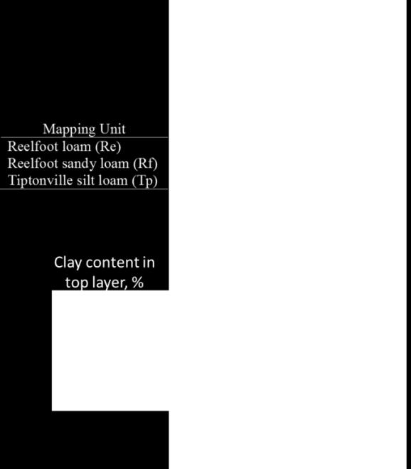
3 Soils are variable... 3 Soil Mapping Units Dd = Dundee sandy loam De = Dundee silt loam Re = Reelfoot loam Rf = Reelfoot sandy loam Tp = Tiptonville silt loam (approx. 20 ac field)
4 4.. but common water management approaches aren t Ensure that the area with the smallest available water holding capacity receives adequate water Match the needs of the average (or largest area) soil water conditions Limit applications to avoid overwatering the wettest areas In all cases, parts of the field are either over- or underirrigated

5 5 Equipment accommodates site-specific irrigation..
6 6.. but what data can be used for the prescription? NRCS soil maps Spatial resolution and accuracy may not be sufficient Static soil water content sensors May be difficult/expensive to install enough to characterize highly variable fields Remote sensing Cost, timeliness issues Mobile proximal soil sensors
7 What is mobile proximal soil sensing? 7 Mobile proximal soil sensing (PSS) is the use of fieldbased sensors to obtain signals from the soil when the sensor s detector is in contact with or close (within 2 m) to the soil (Viscarra Rossel and McBratney, 1998; Viscarra Rossel et al., 2011) A number of mobile PSS are commercially available, and development continues on others Once calibration to soil properties of interest is completed or confirmed, mobile PSS can provide very high (10 m or better) spatial resolution
8 What soil properties would we sense for water management? 8 Those affecting available water capacity (AWC) Texture Organic Matter
9 What soil and landscape properties should we sense for water management? 9 Available Water Capacity -soil texture -organic matter Rate of Water Infiltration -soil surface porosity -layers of impermeability -slope Water Redistribution Within the Field -relative elevation -curvature -slope Soil electrical conductivity (EC a ) Visible & nearinfrared (VNIR) soil reflectance Elevation mapping by RTK-GPS
10 What sensors are important? 10 Visible & near-infrared (VNIR) soil reflectance Soil electrical conductivity (EC a ) Elevation mapping by RTK-GPS
11 Soil electrical conductivity (EC a ) 11 As measured by proximal in-field sensors, bulk, apparent soil electrical conductivity measured in situ, abbreviated EC a. (or just EC) A measure of the soil s ability to transmit (conduct) an electrical charge This is not the same as laboratory measurements of soil electrical conductivity, often done as a saturated paste
12 What is soil electrical conductivity? 12 In precision agriculture, we are usually talking about sensor measured bulk, apparent soil electrical conductivity Abbreviated EC a or just EC Units of EC: millisiemens per meter (ms/m) This is not the same as laboratory measurements of soil electrical conductivity, often done as a saturated paste Soil EC is a measure of the soil s ability to transmit (conduct) an electrical charge
13 Soil pathways of electrical conductance Solid phase particle contact 2. Liquid phase water contact, salinity 3. Solid-liquid phase - CEC 13 After Corwin and Lesch, 2002
14 What affects EC? 14 Physical and chemical properties of the soil affect the soil s ability to transmit electricity These same properties are often important contributors to the productive capability of the soil. salinity clay content/cation exchange capacity (CEC) pore size, shape, and distribution clay type soil moisture soil temperature
15 How is EC measured? 15 Contact method Static electrodes inserted into the ground On-the-go measurement with rolling electrodes Non-contact method Electromagnetic induction (EMI) Sensors are operated in-field either touching or at a fixed distance from the soil surface. Penetrating EC sensors Allow measurement as a function of depth A point measurement, but may be useful for calibrating mobile EC mapping


16 Soil EC sensing history s: Used to estimate salinity in CA with four-probe arrays, four-electrode hand probes, and early electromagnetic induction (EMI) instruments Early 1990s: First used to investigate soil variability in non-saline areas Rhoades and van Schilfgaarde, 1976 Carter et al., 1993


 MSP also adds other")
17 Veris 3100/MSP 17 Deep reading to approximately 3 ft depth (outside coulters) Shallow reading to approximately 1 ft (inside coulters) MSP also adds other sensors soil color and ph


18 Geonics EM38 18 Non-contact, uses electromagnetic (EM) induction About 5 ft sensing depth in usual operation User must assemble transport and data collection system EM-38 sensor Analog/Digital converter DGPS antenna Laptop computer

19 DUALEM (many models) 19 Like EM38, also uses EM induction Depending on model, may provide 2, 4, or 6 measurements simultaneously for different measurement depths

20 EC maps provide highresolution data 20
21 EC sensors provide information about different soil depths 0 Depth, m Geonics EM38 vertical Veris 3100 shallow Veris 3100 deep DUALEM-2S shallow (PRP) DUALEM-2S deep (HCP) Depth for 90% of total response: Veris shallow: Veris deep: DUALEM shallow: EM38: DUALEM deep: 0.3 m 1.0 m 2.2 m 5 m 10 m Fraction of total response from shallower depth 21
22 Mapped differences among sensors 22 VerisShalowVerisDepEMHorizontal EMVertical


23 23 EC data patterns are consistent.

24 but the numeric values can change April 1994 vs. April Differences in: Soil moisture Soil temperature Crop residue Instrument calibration

25 What can EC tell us? 25 Alone, it only indicates the relative differences in soil EC for that field Site calibration/investigation will help establish the causes of soil EC variation Knowing what causes different soil EC values within a field will point to potential management applications of the information


26 26 Infiltration good PAWC poor Leaching high Infiltration good PAWC good Infiltration poor PAWC poor Denitrification high

27 EC can be used to map soil texture within fields 27 Note that these good results required calibration sampling within the field

28 28 New Zealand research by Hedley et al.

29 EC can also be calibrated to soil properties across scattered locations (with less accuracy) 29 Profile-average clay, g/kg A ECa-em, ms/m Profile-average CEC, cmol/kg B ECa-em, ms/m Missouri Illinois Michigan Wisconsin South Dakota Iowa

30 Current research: Calibrating EC to layered soil properties 30 Use mobile EC data and commercial software to perform laterally constrained inversion of Maxwell s equations Extract layer conductivities and compare inversion based layer conductivities with EC from penetrometer Calibrate to layer texture data from soil samples Depth, m Geonics EM38 vertical Veris 3100 shallow Veris 3100 deep DUALEM-2S shallow (PRP) DUALEM-2S deep (HCP) Fraction of total response from shallower depth

31 Multi-sensor penetrometer data 31 Penetrometer with optical, EC, and force sensors (Veris P4000) Combining P4000 probe data with EC and other mobile sensor data can give a better picture of vertical & horizontal soil variability
32 Multi-sensor penetrometer data Depth (m) Sand & Clay (%) Wavelength (nm) EC (ms/m) Force (kpa) 4000 Depth (ft) -0.2
33 0-4" 4-8" 33 Layer-by-layer clay maps from mobile EC and probe data 8-12" 12-16" 16-20" Complex texture depth relationships 20-24" 24-28" Clay Content (%) 3.0 to to to to to 41.0
34 34 Understanding soil moisture effects to standardize EC Working on combining in-season EC data with point-measured soil moisture to more accurately map soil moisture in space (3d) and time
35 Summary 35 Mobile proximal soil sensing provides an alternative method for measuring soil variability important in sitespecific water management Soil EC data is particularly useful as a measure of texture and available water capacity Current research is refining EC-texture relationships and working toward a more standardized calibration of EC to texture
36 Questions? 36

37 37 Applications Better soil maps

38 Applications Nutrient management zones 38 Create zones based on EC (and perhaps topography); soil sample by zones Appropriate in areas where soil fertility variations are primarily due to landscape and soil-forming factors rather than management factors

39 Applications Variable N 39 Response to N varies by EC zones

40 40 Application: Nematode control in cotton Nematodes are more numerous in sandy soils Classified EC maps used to guide chemical application
41 Proximal Soil Sensing and Sensor Fusion

42 How do we improve results? Sensor fusion Combining data from multiple sensors can provide: Improved accuracy Robustness to operating condition variations Estimates of additional parameters of interest
 and deep (1.")
43 Commercial sensor fusion: Veris MSP3 Two-band optical sensor for soil organic matter Red at 660 nm, NIR at 940 nm Shallow (0.3 m) and deep (1.0 m) soil apparent electrical conductivity (EC a ) Ion-selective electrodes for ph Optical sensors EC coulters ph ISEs

 Insertion to ~ 1")
44 Commercial sensor fusion: Veris P4000 Vis-NIR spectrometers for soil reflectance ( nm) Dipole contacts for EC a Force sensor for cone index (CI) Insertion to ~ 1 m depth
45 Off-line data fusion allows integrating multiple sensing campaigns From Adamchuk et al., 2011


46 Case study: Improving bulk density estimates by fusion of mobile sensor measurements Goal: Relate BD to soil EC a as measured by Veris 3100, and soil strength as measured by cone penetrometer or the SSPS developed by Chung et al. (2006) Data collected on alluvial and claypan soil fields in central MO Veris 3100 Cho et al., Biosystems Engineering, 2016
47 Relating BD to WC, EC a and soil resistance Over all depths, better results were obtained for claypan (sites 1 & 3) than for alluvial (site 2) soils. Soil water content (WC) required for accuracy Claypan, Min-till Alluvial, Min-till Claypan, No-till
 400 800 1200 1600 Wavelength (nm) 2000 0 20 40 EC (ms/m) 0 2000 4000 Force (kpa) Cho et al.")
48 Case study: Profile sensor fusion of Vis-NIR, CI, and ECa data (Veris P4000) Depth (m) Sand & Clay (%) Wavelength (nm) EC (ms/m) Force (kpa) Cho et al., Trans. ASABE, 2017 Depth (ft) -0.2
49 Results: R 2 comparison All data vs Vis-NIR alone Adding EC a and CI to Vis-NIR reflectance data improved the model for organic carbon, texture fractions and bulk density.

50 Questions? 50
Soil EC mapping technologies (EM38 and Veris) for identifying soil management zones
 for identifying soil management zones") Soil EC mapping technologies (EM38 and Veris) for identifying soil management zones Shelley Woods Soil and Water Research Scientist Irrigation & Farm Water Division Alberta Agriculture and Rural Development
Soil EC mapping technologies (EM38 and Veris) for identifying soil management zones Shelley Woods Soil and Water Research Scientist Irrigation & Farm Water Division Alberta Agriculture and Rural Development
Employing Electromagnetic Induction Technique for the Assessment of Soil Compaction
 American Journal of Agricultural and Biological Sciences, 2012, 7 (4), 425-434 ISSN: 1557-4989 2012 Science Publication doi:10.3844/ajabssp.2012.425.434 Published Online 7 (4) 2012 (http://www.thescipub.com/ajabs.toc)
Institute of Ag Professionals
 Institute of Ag Professionals Proceedings of the 2006 Crop Pest Management Shortcourse & Minnesota Crop Production Retailers Association Trade Show www.extension.umn.edu/agprofessionals Do not reproduce
Nandkishor Dhawale, PhD. Candidate and PASS research team member Department of Bioresource Engineering
 BGSTECH Lunch Seminar V Nandkishor Dhawale, PhD. Candidate and PASS research team member Department of Bioresource Engineering Research Advisors Dr. Viacheslav I. Adamchuk Dr. Shiv O. Prasher 11/05/2014
Makin and Usin Management Zones A Case Study
 Makin and Usin Management Zones A Case Study Dan Breckon : Woodrill Farms, Precison Ag Specialist Doug Aspinall: Woodrill Farms, Precision Soil Scientist Management Zones Zones are a function of soils,
REAL-TIME VARIABLE RATE TECHNOLOGIES (VRT) PRECISION AGRICULTURE TECHNOLOGY ARCHITECTURE OUTLINE
 PRECISION AGRICULTURE TECHNOLOGY ARCHITECTURE OUTLINE") REAL-TIME VARIABLE RATE TECHNOLOGIES (VRT) Frédéric René-Laforest Master Candidate Bioresource Engineering Macdonald Campus of McGill OUTLINE VRT Concept and Architecture VRT Applications and Results Liquid
REAL-TIME VARIABLE RATE TECHNOLOGIES (VRT) Frédéric René-Laforest Master Candidate Bioresource Engineering Macdonald Campus of McGill OUTLINE VRT Concept and Architecture VRT Applications and Results Liquid
Texture Definition: relative proportions of various sizes of individual soil particles USDA classifications Sand: mm Silt:
 Texture Definition: relative proportions of various sizes of individual soil particles USDA classifications Sand: 0.05 2.0 mm Silt: 0.002-0.05 mm Clay:
Spatial irrigation scheduling for variable rate irrigation
 97 Spatial irrigation scheduling for variable rate irrigation C.B. HEDLEY 1, S. BRADBURY 2, J. EKANAYAKE 3, I.J. YULE 4 and S. CARRICK 3 1 Landcare Research, Massey University Campus, Palmerston North
MONITORING SPATIAL VARIATION OF SOIL MOISTURE IN CROP FIELDS WITH EM38
 MONITORING SPATIAL VARIATION OF SOIL MOISTURE IN CROP FIELDS WITH EM38 J. Padhi 1 and R.K. Misra 2 1 Faculty of Engineering and Surveying, National Centre for Engineering in Agriculture and CRC for Irrigation
Soil conductivity sensing using non-invasive electromagnetic induction-based and electrode-based methods
 Soil conductivity sensing using non-invasive electromagnetic induction-based and electrode-based methods Hezarjaribi, A., H. Sourell, F.-J., Bockisch 1 1 Institute of Production Engineering and Building
Water Budget IV: Soil Water Processes P = Q + ET + G + ΔS
 Water Budget IV: Soil Water Processes P = Q + ET + G + ΔS Infiltration Infiltration capacity: The maximum rate at which water can enter soil. Infiltration capacity curve: A graph showing the time-variation
Proceedings of the 3 rd Annual Nitrogen: Minnesota s Grand Challenge & Compelling Opportunity Conference
 Proceedings of the 3 rd Annual Nitrogen: Minnesota s Grand Challenge & Compelling Opportunity Conference Do not reproduce or redistribute without the written consent of author(s) Upgrade Your Corn Nitrogen
USE OF ELECTROMAGNETIC INDUCTION TOOLS IN SALINITY ASSESSMENT/APPRAISALS IN EASTERN COLORADO. Introduction
 USE OF ELECTROMAGNETIC INDUCTION TOOLS IN SALINITY ASSESSMENT/APPRAISALS IN EASTERN COLORADO Michael L. Petersen, USDA-Natural Resources Conservation Service, Greeley, CO Abstract Electromagnetic induction
3/1/18 USING RADAR FOR WETLAND MAPPING IMPORTANCE OF SOIL MOISTURE TRADITIONAL METHODS TO MEASURE SOIL MOISTURE. Feel method Electrical resistance
 3/1/18 USING RADAR FOR WETLAND MAPPING SOIL MOISTURE AND WETLAND CLASSIFICATION Slides modified from a presentation by Charlotte Gabrielsen for this class. Southeast Arizona: Winter wet period From C.
IS SOIL COMPACTION FROM ANIMAL TRAFFIC A PROBLEM IN PASTURES DICK WOLKOWSKI EXTENSION SOIL SCIENTIST UNIVERSITY OF WISCONSIN
 IS SOIL COMPACTION FROM ANIMAL TRAFFIC A PROBLEM IN PASTURES DICK WOLKOWSKI EXTENSION SOIL SCIENTIST UNIVERSITY OF WISCONSIN SOIL COMPACTION DEFINED Compression of the soil from an applied force that first
Improving soil moisture monitoring in agricultural systems using hydrogeophysics
 Improving soil moisture monitoring in agricultural systems using hydrogeophysics William Avery, MS Student in School of Natural Resources Advisor: Trenton Franz Asst. Professor of Hydrogeophysics, School
Soil Water Monitoring Using Wireless Sensor Network
 Soil Water Monitoring Using Wireless Sensor Network Ruixiu Sui USDA-ARS Crop Production Systems Research Unit Stoneville, Mississippi Mississippi Water Resources Conference Jackson, MS April 7-8, 2015
Veris, NIRS, and Soil Carbon
 Technology for carbon measurements. Veris, NIRS, and Soil Carbon Veris Technologies, Inc. Near Infrared Spectroscopy (NIRS) and soil C The challenges of measuring C for offset payments Results from a measurement
TELIATNIKOV Ivan S. (1), McBRATNEY, Alex B. (1,2), TRIANTAFILIS John (2)
, McBRATNEY, Alex B. (1,2), TRIANTAFILIS John (2)") Scientific registration n 623 Symposium n : 17 Presentation: poster Proximal sensing and profile reconstruction technique for use in quantitative soil survey Télédétection proche et techniques de construction
Scientific registration n 623 Symposium n : 17 Presentation: poster Proximal sensing and profile reconstruction technique for use in quantitative soil survey Télédétection proche et techniques de construction
Lecture 6: Soil Water
 6-1 GEOG415 Lecture 6: Soil Water Infiltration Movement of water into soil. Importance? - flood prediction -erosion -agriculture - water resources Infiltration capacity Expressed in the same unit as rainfall
IMPACT OF CONSERVATION PRODUCTION PRACTICES ON SOIL MOISTURE AVAILABILITY IN ALLUVIAL SOILS
 IMPACT OF CONSERVATION PRODUCTION PRACTICES ON SOIL MOISTURE AVAILABILITY IN ALLUVIAL SOILS Gretchen F. Sassenrath D. Ken Fisher J. Ray Williford USDA-ARS APTRU Stoneville, MS 38776 Gretchen.Sassenrath@ars.usda.gov
Application Note. MadgeTech, Inc. (603) Phone (603) Fax 6 Warner Road Warner NH 03278
 Phone (603) Fax 6 Warner Road Warner NH 03278") Response of the ECH2O Soil Moisture Probe to Variation in Water Content, Soil Type, and Solution Electrical Conductivity Colin S. Campbell, Ph.D SMR110 Introduction Researchers familiar with commercial
Response of the ECH2O Soil Moisture Probe to Variation in Water Content, Soil Type, and Solution Electrical Conductivity Colin S. Campbell, Ph.D SMR110 Introduction Researchers familiar with commercial
Using capacitance sensors to monitor soil moisture. Interpreting the numbers
 Using capacitance sensors to monitor soil moisture Interpreting the numbers Terry Prichard Water Management Specialist Dept. Land, Air, and Water Resources UC Davis MEASURES OF SOIL WATER STATUS There
WIRELESS SOIL MOISTURE SENSOR NETWORKS FOR PRECISION IRRIGATION SCHEDULING
 WIRELESS SOIL MOISTURE SENSOR NETWORKS FOR PRECISION IRRIGATION SCHEDULING Carolyn Hedley 1, Jagath Ekanayake 2 and Pierre Roudier 1 1 Landcare Research, Riddet Road, Massey University Campus, Palmerston
The Effects of Light Intensity on Soil Depth of Different Moisture Contents using Laser Sensor
 International Journal of Scientific and Research Publications, Volume 6, Issue 5, May 2016 488 The Effects of Light Intensity on Soil Depth of Different Moisture Contents using Laser Sensor Emmanuel Atta
Fuel Fluorescence Logging using the Optical Image Profiler (OIP)
") Fuel Fluorescence Logging using the Optical Image Profiler (OIP) Note: A Patent is Pending for this System. Daniel Pipp Chemist, Geoprobe Systems Presented May 2017 at the Battelle Bioremediation Symposium
Fuel Fluorescence Logging using the Optical Image Profiler (OIP) Note: A Patent is Pending for this System. Daniel Pipp Chemist, Geoprobe Systems Presented May 2017 at the Battelle Bioremediation Symposium
Application of geographical information system for farm mechanization education and training
 Scientific Journal of Pure and Applied Sciences (2013) 2(4) 196-203 ISSN 2322-2956 Contents lists available at Sjournals Journal homepage: www.sjournals.com Original article Application of geographical
Irrigation Water Management and Scheduling
 Irrigation Water Management and Scheduling John Panuska & Scott Sanford UW Extension Biological Systems Engineering Dept. BSE Boot Camp Training November 3 rd, 2017 Irrigation Water Management So you want
Irrigation. Presentation to. 14 January 2009, Amarillo, Texas Steve Evett
 Soil Water Management for Irrigation Presentation to High Plains Irrigation Conference 14 January 2009, Amarillo, Texas Steve Evett Determine The Irrigation Problem When to irrigate, Where to irrigate,
Urban Soil Conservation and Management
 Urban Soil Conservation and Management Urban Soil include those located in: Cities in park areas Recreation areas Community gardens Green belts Lawns Septic absorption fields Sediment basins We need a
Hydrology. Jürg M. Matter Lamont-Doherty Earth Observatory, The Earth Institute at Columbia University. May 9, 2008
 Well Logging Principles and Applications Hydrology Jürg M. Matter Lamont-Doherty Earth Observatory, The Earth Institute at Columbia University May 9, 2008 Outline Background Flowmeter Logging Fluid Movement
Coefficients for Estimating SAR from Soil ph and EC Data and Calculating ph from SAR and EC Values in Salinity Models
 Arid Soil Research and Rehabilitation, Volume 7, pp. 29-38 0890-3069/93 $10.00 +.00 Printed in the UK. All rights reserved. Copyright 1993 Taylor & Francis Coefficients for Estimating SAR from Soil ph
Northwest Regional Certified Crop Adviser
 Northwest Regional Certified Crop Adviser Performance Objectives Prepared by Northwest Regional CCA Board CONTENTS Introduction... iii Soil Fertility Competency Areas...1 1 Basic concepts of soil fertility...2
Surface Irrigation Suitability Assessment of the Soils of Almanaqil Ridge, Gezira State, Sudan
 IJETST-Vol. 2 Issue 7 Pages 23-2814 July ISSN 2348-94 2015 International Journal of Emerging Trends in Science and Technology Surface Irrigation Suitability Assessment of the Soils of Almanaqil Ridge,
in the Midsouth Management Chris Henry, Ph.D., P.E. Assistant Professor and Water Management Engineer Merritt McDougal Graduate Research Assistant
 Lessons Pasture Learned / Hay from Irrigation Pump options Monitoring and in the Midsouth Management Chris Henry, Ph.D., P.E. Assistant Professor and Water Management Engineer Merritt McDougal Graduate
SOIL CARBON AND NITROGEN MAPPING: HOW THESE RELATE TO NEW MARKETS AND PUBLIC POLICY ABSTRACT
 SOIL CARBON AND NITROGEN MAPPING: HOW THESE RELATE TO NEW MARKETS AND PUBLIC POLICY E.D. Lund G. Kweon C. R. Maxton P.E. Drummond Veris Technologies, Inc. Salina Kansas ABSTRACT An impending soil measurement
IPM Scopes 6/19/2015. The Growers Tool Box. Don t let pests catch you by surprise. Meters & Devices to Improve Plant Quality
 Cultivate 15 The Growers Tool Box Meters & Devices to Improve Plant Quality IPM Scopes Don t let pests catch you by surprise IPM Scope View live images on the computer screen 40x and 140x magnification
Amending soils for improved hydraulic and edaphic properties. Todd A. Houser, MS, CPSS, CPESC DiGeronimo Aggregates LLC
 Amending soils for improved hydraulic and edaphic properties Todd A. Houser, MS, CPSS, CPESC DiGeronimo Aggregates LLC Infiltration Air exchange Plant-available water Rooting depth Microbial biomass Earthworms
EXAMPLE QUESTIONS NUTRIENT MANAGEMENT CERTIFICATION EXAM
 Department of Environmental Science and Technology EXAMPLE QUESTIONS NUTRIENT MANAGEMENT CERTIFICATION EXAM NOTE: The following questions were developed based on several of the knowledge areas for the
Variable-depth Tillage based on Geo-referenced Soil Compaction Data in Coastal Plain Soils
 Variable-depth Tillage based on Geo-referenced Soil Compaction Data in Coastal Plain Soils Serap Görücü Keskin a,*, Ahmad Khalilian b, Young J. Han b, Roy B. Dodd b a Assistant Professor, Department of
Soil Salinity Measurement
 Soil Salinity Measurement Dennis L. Corwin United States Department of Agriculture (USDA), Riverside, California, U.S.A. INTRODUCTION The measurement of soil salinity is a quantification of the total salts
Soil Basics for Field Scouting
 Soil Basics for Field Scouting May 18, 2012 CONTENTS Soil Sampling Soil ph Soil Texture Soil Structure Compaction Diagnostic Tools More Soil Management Information More Soil References For more soil information,
TECHNICAL NOTES U.S. DEPARTMENT OF AGRICULTURE NATURAL RESOURCES CONSERVATION SERVICE. TEXAS Revised May, 2011 NITROGEN LEACHING INDEX FOR TEXAS
 TECHNICAL NOTES U.S. DEPARTMENT OF AGRICULTURE NATURAL RESOURCES CONSERVATION SERVICE TEXAS Revised May, 2011 AGRONOMY TECHNICAL NOTE NUMBER 11 NITROGEN LEACHING INDEX FOR TEXAS INTRODUCTION The Nitrate
Enhancing Agricultural Water Management Through Soil Moisture Monitoring and Irrigation Scheduling
 Enhancing Agricultural Water Management Through Soil Moisture Monitoring and Irrigation Scheduling Mary Love Tagert, J. Caleb Rawson, Anna Linhoss, Gretchen Sassenrath*, and Billy Kingery Mississippi State
The Understanding around Soil Compaction in Crop Production
 The Understanding around Soil Compaction in Crop Production John Fulton CompactionSmart, Waterloo, ON Your decision on field operations / practices: Right decision Wrong decision NDVI Image Early July
UC Berkeley Technical Completion Reports
 UC Berkeley Technical Completion Reports Title Soil water monitoring using geophysical techniques : development and applications in agriculture and water resources management Permalink https://escholarship.org/uc/item/2zw1t2gp
Calibration and Evaluation of an Improved Low-Cost Soil Moisture Sensor
 Calibration and Evaluation of an Improved Low-Cost Soil Moisture Sensor Colin S. Campbell, Gaylon S. Campbell, Douglas R. Cobos, and Lauren L. Bissey Decagon Devices, Inc., 2365 NE Hopkins Ct., Pullman,
Evaluation of soil salinity using this technique relies on the application of the equations developped by McNeal (1980):
:") Enregistrement scientifique : 0299 Symposium n : 8 Présentation : poster Determination of global and dynamic salinity of soils using electromagnetic conductivity. Détermination de la salinité globale et
Enregistrement scientifique : 0299 Symposium n : 8 Présentation : poster Determination of global and dynamic salinity of soils using electromagnetic conductivity. Détermination de la salinité globale et
East TX Test Site (1/2 Treated)
") 1 East TX Test Site (1/2 Treated) 2 CATION EXCHANGE CAPACITY ( CEC ) It is a measure of the quantity of cations reversibly adsorbed per unit weight of soil. CEC is expressed in meq/100 g of mass (meq is
1 East TX Test Site (1/2 Treated) 2 CATION EXCHANGE CAPACITY ( CEC ) It is a measure of the quantity of cations reversibly adsorbed per unit weight of soil. CEC is expressed in meq/100 g of mass (meq is
FACTORS AFFECTING CROP NEEDS FOR POTASSIUM WESTERN PERSPECTIVE TERRY A. TINDALL AND DALE WESTERMANN MANAGER OF AGRONOMY J.R
 FACTORS AFFECTING CROP NEEDS FOR POTASSIUM WESTERN PERSPECTIVE TERRY A. TINDALL AND DALE WESTERMANN MANAGER OF AGRONOMY J.R. SIMPLOT COMPANY USDA-ARS SOIL SCIENTIST SOIL FACTORS--POTATOES Potassium uptake
Crop Water Use Program for Irrigation
 Crop Water Use Program for Irrigation Divisions of Plant Sciences, Applied Social Sciences, Food Sciences and Bioengineering, and Soil, Environmental, and Atmospheric Sciences Water is an important factor
Red River Valley Drainage Water Management Demonstration Project
 Red River Valley Drainage Water Management Demonstration Project Aaron Janz, Margaret Wagner, Jeppe Kjaersgaard Minnesota Department of Agriculture Drainage Research Forum November 23, 2015 Project Partners
Soil Compaction in Sugarcane Fields under Mechanized and Labor Farming
 Soil Compaction in Sugarcane Fields under Mechanized and Labor Farming Prathuang USABORISUT Kasetsart University, Kampahaengsaen Campus, Faculty of Engineering at Kamphaengsaen, Department of Agricultural
PRECISION FARMING APPROACHES TO SMALL-FARM AGRICULTRUE
 PRECISION FARMING APPROACHES TO SMALL-FARM AGRICULTRUE Sakae Shibusawa Faculty of Agriculture, Tokyo University of Agriculture and Technology 3-5-8 Saiwai-Cho, Fuchu, Tokyo 183-8509, Japan ABSTRACT Precision
ARE TILLAGE AND SOIL QUALITY MUTUALLY EXCLUSIVE. Dick Wolkowski Department of Soil Science University of Wisconsin
 ARE TILLAGE AND SOIL QUALITY MUTUALLY EXCLUSIVE Dick Wolkowski Department of Soil Science University of Wisconsin WHAT IS SOIL QUALITY DEPENDS ON WHO YOU ARE: Farmer: Highly productive, sustainable soil
Soil Health Research Landscape Tool, v Data Dictionary Soil Health Institute 12/21/2016
 Soil Health Research Landscape Tool, v.12-21-16 Data Dictionary Soil Health Institute 12/21/2016 The Soil Health Research Landscape tool provides up-to-date information on soil health-related research
PHYSICAL SOIL PROPERTIES
 PHYSICAL SOIL PROPERTIES Physical Soil Properties Santa Cruz County, California Scotts Valley Target Physical Soil Properties This table shows estimates of some physical characteristics and features that
Soil Sampling & N Management. Nick Andrews (503) x 149
 x 149") Soil Sampling & N Management Nick Andrews (503) 678 1264 x 149 Nick.andrews@oregonstate.edu Soil Sampling For Home Gardens & Small Acreages (EC 628) Test soil every 2 3 years in the spring or summer for
Soil Sampling & N Management Nick Andrews (503) 678 1264 x 149 Nick.andrews@oregonstate.edu Soil Sampling For Home Gardens & Small Acreages (EC 628) Test soil every 2 3 years in the spring or summer for
Saturated Buffer. Subsurface Drainage PURPOSE N REDUCTION LOCATION COST BARRIERS
 Saturated Buffer To intercept tile drainage prior to discharging to surface waters and redistribute the water laterally in the soil profile of the streamside buffer. Subsurface drainage, also known as
Optical Sensing of Crop N
 Optical Sensing of Crop N Under Water-Limited Conditions Dan Long and John McCallum USDA-ARS Pendleton, Oregon In-Season N Management Applying fertilizer N based on information acquired during the growing
BAEN 673 / February 18, 2016 Hydrologic Processes
 BAEN 673 / February 18, 2016 Hydrologic Processes Assignment: HW#7 Next class lecture in AEPM 104 Today s topics SWAT exercise #2 The SWAT model review paper Hydrologic processes The Hydrologic Processes
Triton TR8 Turbidity Analyzer
 Triton TR8 Turbidity Analyzer The Clear Choice Water to Sludge ELECTRO-CHEMICAL DEVICES What is Turbidity? Standard Methods for the Examination of Water and Wastewater describes Turbidity as an expression
Soil Compaction in Sugarcane Fields Induced by Mechanization
 American Journal of Agricultural and Biological Sciences 6 (3): 418-422, 2011 ISSN 1557-4989 2011 Science Publications Soil Compaction in Sugarcane Fields Induced by Mechanization Prathuang Usaborisut
Placement and Interpretation of Soil Moisture Sensors for Irrigated Cotton Production in Humid Regions SITE SELECTION IN A FIELD OBJECTIVE
 Brian Leib, University of Tennessee Jose Payero, Clemson University Lyle Pringle, Mississippi State University James Bordovsky, Texas A&M University Wesley Porter, University of Georgia Ed Barnes, Cotton
Mid Infrared Spectroscopy for Rapid and Cheap Analysis of Soils
 Page 1 of 5 Mid Infrared Spectroscopy for Rapid and Cheap Analysis of Soils R.H. Merry and L.J. Janik CSIRO Land and Water, Urrbrae, South Australia. ABSTRACT Due to advances in spectrometer hardware,
Soil Health. Key Messages. Vegetable Industry Development Program. What is Soil Health?
 Vegetable Industry Soil Health What is Soil Health? Soil health refers to the ability of the soil to achieve its full potential and be productive under the intended land use. Healthy soils have favourable
Soil Health. Key Messages. Vegetable Industry Development Program. What is Soil Health?
 Soil Health What is Soil Health? Soil health refers to the ability of the soil to achieve its full potential and be productive under the intended land use. Healthy soils have favourable physical, chemical
SOIL QUALITY AND CROP PRODUCTION. Dick Wolkowski Department of Soil Science University of Wisconsin
 SOIL QUALITY AND CROP PRODUCTION Dick Wolkowski Department of Soil Science University of Wisconsin WHAT IS SOIL QUALITY DEPENDS ON WHO YOU ARE: Farmer: Highly productive, sustainable media for growing
We PA1 17 Investigation of Pedogeophysical Relationships Using in Situ Measured Electrical Resistivity and Soil Physical and Root
 We PA1 17 Investigation of Pedogeophysical Relationships Using in Situ Measured Electrical Resistivity and Soil Physical and Root U. Werban* (Helmholtz-Centre for Environmental Research- UFZ), M. Pohle
Evaluation of Soil Moisture Sensors
 Evaluation of Soil Moisture Sensors Ruixiu Sui USDA-ARS Crop Production Systems Research Unit, Stoneville, MS Horace C. Pringle III Delta Research and Extension Center, Mississippi State University, Stoneville,
Earthen Manure Storage Seepage
 July 2001 Agdex 729-1 Earthen Manure Storage Seepage A Study of Five Typical Sites With the increasing concerns about manure storage in agriculture, a study was done to look into manure seepage from several
USE OF CROP SENSORS IN WHEAT AS A BASIS FOR APPLYING NITROGEN DURING STEM ELONGATION
 USE OF CROP SENSORS IN WHEAT AS A BASIS FOR APPLYING NITROGEN DURING STEM ELONGATION Rob Craigie and Nick Poole Foundation for Arable Research (FAR), PO Box 80, Lincoln, Canterbury, New Zealand Abstract
NDVI for Variable Rate N Management in Corn
 NDVI for Variable Rate N Management in Corn David Mulla, Ph.D. Director Precision Ag. Center Dept. Soil, Water & Climate University of Minnesota Co-authors: Aicam Laacouri, Tyler Nigon and Jeff Vetsch
Effects of Machine-Induced Soil Compaction on Growth and Yield of Sugarcane
 American Journal of Agricultural and Biological Sciences 5 (3): 269-273, 2010 ISSN 1557-4989 2010 Science Publications Effects of Machine-Induced Soil Compaction on Growth and Yield of Sugarcane Prathuang
Management to improve soil productivity and maximise lateral infiltration in permanent bed-furrow irrigation systems
 Management to improve soil productivity and maximise lateral infiltration in permanent bed-furrow irrigation systems Greg Hamilton 1, Ghani Akbar 2, Iqbal Hassan 3, Steve Raine 4, Allen McHugh 5, Peter
EASY Efficient Agriculture Systems. Precision farming
 EASY Efficient Agriculture Systems Precision farming Simply get more done. Sound management Productivity and efficiency are the buzzwords in modern farming. Only those who farm successfully with these
Nitrogen Management in Sugarcane and Cotton in Louisiana
 Nitrogen Management in Sugarcane and Cotton in Louisiana Brenda S. Tubana Associate Professor of Soil Fertility School of Plant, Environmental, and Soil Science Louisiana State University AgCenter Content
Optical sensors aid agriculture
 Optical sensors aid agriculture Farmers turn to information from optical sensors to make environmentally sound use of fertilizers, herbicides, pesticides, and water. Geofiey J. Shropshire and James A.
Evaluation of the CRITERIA Irrigation Scheme Soil Water Balance Model in Texas Initial Results
 Evaluation of the CRITERIA Irrigation Scheme Soil Water Balance Model in Texas Initial Results Guy Fipps 1 and Gabriele Bonaiti 2 1 Ph.D., P.E., Department of Biological and Agricultural Engineering, 2117
Does Organic Matter Really Matter? Jodi DeJong-Hughes Regional Extension Educator, Willmar x 2006
 Does Organic Matter Really Matter? Jodi DeJong-Hughes Regional Extension Educator, Willmar 320-235-0726 x 2006 dejon003@umn.edu Soil health affects the resiliency of the soil or the ability of a soil to
Estimating the Seasonal High Water Table: A Mix of Art & Science
 Estimating the Seasonal High Water Table: A Mix of Art & Science PONDS WORKSHOP - SJRWMD Devo Seereeram, Ph.D., P.E. This paper was originally written over 4 years ago & generated a lot of interest. The
The comparison between powder and granular lime to elevate low soil ph
 The comparison between powder and granular lime to elevate low soil ph J.G. Dreyer, Department of Geology and Soil Science, North-West University, Potchefstroom 1. Introduction The North-West University
Denitrification, nitrous oxide emissions and the EPA. Amitava Chatterjee Soil Science, NDSU
 Denitrification, nitrous oxide emissions and the EPA Amitava Chatterjee Soil Science, NDSU Greenhouse effect Nitrous oxide (N 2 O) & climate change Stratosphere N 2 O > NO X > Ozone effect N 2 O +infrared
Air. Water. Minerals (rocks)
") Water Needs and Irrigation Timing for Green Peas R. Troy Peters, Ph.D. WSU Extension Irrigation Engineer Composition of Soil Air Water Minerals (rocks) Soil Water Saturation Field Capacity (FC) Excess
Water Needs and Irrigation Timing for Green Peas R. Troy Peters, Ph.D. WSU Extension Irrigation Engineer Composition of Soil Air Water Minerals (rocks) Soil Water Saturation Field Capacity (FC) Excess
Interpretation of Soil Moisture Content to Determine Soil Field Capacity and Avoid Over Irrigation in Sandy Soils Using Soil Moisture Measurements
 Interpretation of Soil Moisture Content to Determine Soil Field Capacity and Avoid Over Irrigation in Sandy Soils Using Soil Moisture Measurements By: Lincoln Zotarelli, Research Scientist, Michael D.
RI Site Specific Soil Mapping Standards and Procedures
 RI Site Specific Soil Mapping Standards and Procedures Understanding Hydrologic Soil Groups and Site Specific Mapping URI Coastal Institute, Kingston June 28 th 2012 Jillian Phillips URI Cooperative Extension
Fertilizing with Biosolids Dan M. Sullivan Craig G. Cogger
 Fertilizing with Biosolids Dan M. Sullivan Craig G. Cogger BioFest, Chelan, WA, Sept. 2015 Pacific NW Extension publication 508-E Biosolids: Fertilizer replacement value of nutrients Publication under
Testing field-moist soil samples improves the assessment of potassium needs by crops
 2012 Integrated Crop Management Conference - Iowa State University 137 Testing field-moist soil samples improves the assessment of potassium needs by crops Antonio P. Mallarino, professor, Agronomy, Iowa
Time Lapse 3D Electrical tomography for soil-plant dynamics
 Time Lapse 3D Electrical tomography for soil-plant dynamics Jacopo Boaga 1, Giorgio Cassiani 1, Matteo Rossi 1 Andrea D Alpaos 1, Giuseppe Fadda 2, Mario Putti 2, Marco Marani 3 1. Department of Geosciences,
Effects of Transmission Speed on Equipment Performance and Utilizing Spatial Equipment Performance Data for Management Decisions ABSTRACT
 Effects of Transmission Speed on Equipment Performance and Utilizing Spatial Equipment Performance Data for Management Decisions C.M. Kichler 1, J.P. Fulton 2, R.L. Raper 1, W.C. Zech 3, T.P. McDonald
MODELING SEDIMENT AND PHOSPHORUS YIELDS USING THE HSPF MODEL IN THE DEEP HOLLOW WATERSHED, MISSISSIPPI
 MODELING SEDIMENT AND PHOSPHORUS YIELDS USING THE HSPF MODEL IN THE DEEP HOLLOW WATERSHED, MISSISSIPPI Jairo Diaz-Ramirez, James Martin, William McAnally, and Richard A. Rebich Outline Background Objectives
Cross Borehole Electrical Resistivity Tomography (ERT) Measurements
 Measurements") Introduction Cross Borehole Electrical Resistivity Tomography (ERT) Measurements Resistivity imaging at the surface may be used for applications such as cavity detection, geotechnical investigation, site
Introduction Cross Borehole Electrical Resistivity Tomography (ERT) Measurements Resistivity imaging at the surface may be used for applications such as cavity detection, geotechnical investigation, site
Air. Water. Minerals (rocks)
") Irrigation Fundamentals R. Troy Peters, Ph.D. WSU Extension Irrigation Engineer Demonstration Composition of Soil Air Water Minerals (rocks) Soil Water Saturation Field Capacity (FC) Excess Water Permanent
Irrigation Fundamentals R. Troy Peters, Ph.D. WSU Extension Irrigation Engineer Demonstration Composition of Soil Air Water Minerals (rocks) Soil Water Saturation Field Capacity (FC) Excess Water Permanent
Establishing Critical Protective Concentration Levels (PCLs) for Lead-Affected Soils
 for Lead-Affected Soils") Establishing Critical Protective Concentration Levels (PCLs) for Lead-Affected oils Introduction Effective Date: August 2, 2001 The purpose of this document is to describe the processes for establishing
Establishing Critical Protective Concentration Levels (PCLs) for Lead-Affected oils Introduction Effective Date: August 2, 2001 The purpose of this document is to describe the processes for establishing
A s California s historic drought
 Better Growing By Tim Spann Research Program Director Using Soil Moisture Sensors to Improve Irrigation Efficiency A s California s historic drought drags on, every grower is feeling the pinch and trying
Effect of Land Surface on Runoff Generation
 Effect of Land Surface on Runoff Generation Context: Hydrologic Cycle Runoff vs Infiltration Infiltration: Process by which water on the ground surface enters the soil Runoff: Water (from rain, snowmelt,
Design of efficient ground based soil moisture monitoring networks using cosmic-ray neutron probes and space-time data fusion
 Design of efficient ground based soil moisture monitoring networks using cosmic-ray neutron probes and space-time data fusion Trenton E. Franz Asst. Professor of Hydrogeophysics, School of Natural Resources,
Irrigation Scheduling: Checkbook Method
 Know how. Know now. EC709 Irrigation Scheduling: Checkbook Method Steven R. Melvin, Extension Educator C. Dean Yonts, Extension Irrigation Specialist Irrigation scheduling helps determine when and how
Optimizing Nitrogen and Irrigation Timing for Corn Fertigation Applications Using Remote Sensing
 Optimizing Nitrogen and Irrigation Timing for Corn Fertigation Applications Using Remote Sensing A.R. Asebedo, E.A. Adee and D.B. Mengel Kansas State University, Manhattan, KS Abstract Nitrogen (N) use
Soil Particle Density Protocol
 Soil Particle Density Protocol Purpose To measure the soil particle density of each horizon in a soil profile Overview Students weigh a sample of dry, sieved soil from a horizon, mix it with distilled