INTEGRATION OF THE LOCAL MITIGATION STRATEGY INTO THE LOCAL COMPREHENSIVE PLAN. Executive Summary
|
|
|
- Philomena Byrd
- 6 years ago
- Views:
Transcription
1
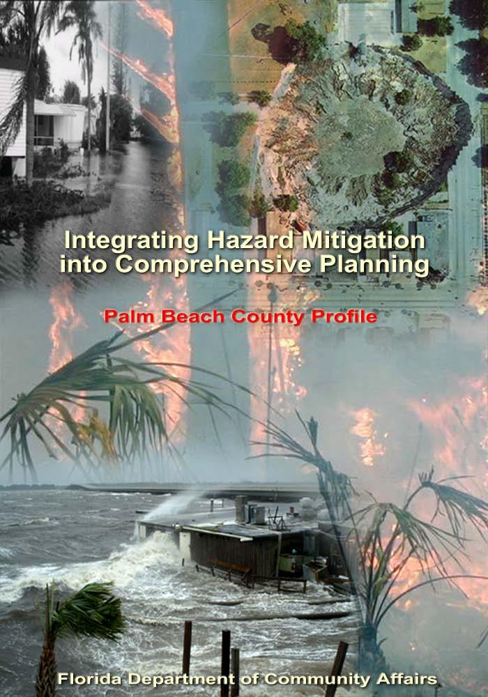
2 Executive Summary The experiences of the 2005 hurricane season epitomize the importance of better integrating hazard mitigation activities into local comprehensive planning. In the fall of 2005, residents all over the state experienced significant damages from Hurricanes Dennis, Katrina, Rita, and Wilma as a result of winds, tornadoes, surge, and/or flooding. But these were not the only times we have experienced natural disasters, nor will they be the last. In 1992, Hurricane Andrew devastated South Florida. In 1998 and 1999, most counties in Florida experienced wildfires. In some cases, despite firefighters' best efforts, fires advanced through neighborhoods and homes were lost. Every year in Central Florida, new sinkholes emerge, swallowing homes and damaging infrastructure. The cost of recovery for these various disasters ranges from hundreds of thousands to billions of dollars, significantly taxing local, State, and federal financial sources. Losses covered through federal funding as a result of the 2004 hurricanes alone could reach as high as $7 billion. Worst of all, however, are the many lives that, directly or indirectly, are lost due to natural disasters. It is imperative that we reduce the human and financial costs of natural disasters. Through better integration of natural hazard considerations into local comprehensive planning, we can build safer communities. This Palm Beach County Profile has been prepared as part of a statewide effort by the Florida Department of Community Affairs to guide local governments in integrating hazard mitigation principles into local Comprehensive Plans. Information provided in this profile will enable planners to (1) convey Palm Beach County s existing and potential risk to identified hazards; (2) assess how well local hazard mitigation principles have been incorporated into the County s Comprehensive Plan; (3) provide recommendations on how hazard mitigation can be better integrated into the Comprehensive Plan; and (4) determine if any enhancements could be made to the Palm Beach County Unified Local Mitigation Strategy (LMS) to better support comprehensive planning. Best available statewide level data are provided to convey exposure and risk as well as illustrate the vulnerability assessment component of the integration process. In this profile, we present an argument for why hazard mitigation needs to be a part of comprehensive planning through an examination of population growth, the hazards that put the County at risk, the special needs population and structures that could be affected by these hazards, and the distribution of existing and future land uses in different hazard areas. We hope that this analysis will serve as an example of the issues each jurisdiction should consider as they update their plans to include hazard mitigation. The profile also contains a review of the LMS and the Comprehensive Plan. Based on the analysis and review, we were able to develop specific options for the County on how to incorporate more hazard mitigation into the Comprehensive Plan and how to enhance the LMS so that it is also a better tool for local planners. During our review, we found that Palm Beach County had many strengths regarding hazard mitigation in both its LMS and Comprehensive Plan, and these are outlined in the profile. There are always ways to further strengthen such plans, however, and the following is a summary of some of the options that would enable the County to do so. GENERAL RECOMMENDATIONS The County can include a Comprehensive Plan policy that establishes an evacuation clearance time level of service (LOS). Currently, evacuation clearance times for Category 3, 4, and 5 hurricanes are hours, as shown in Table 2.2 of this report. As development is likely to continue to occur in Palm Beach County, evacuation route demand will increase. An evacuation clearance time level of service could act as a quantitative benchmark with which the County could use to ensure evacuation route capacity is met through land development regulations, a schedule of evacuation route improvements, or any mechanism the County can employ to reach the LOS. Draft 1/25/2013 FLORIDA DEPARTMENT OF COMMUNITY AFFAIRS ii
3 In conjunction with the above recommendation, the LMS could include a goal or an objective that aims to maintain or improve hurricane evacuation times in coordination with the MPO and with neighboring jurisdictions, much like the policies found in the Comprehensive Plan. Evacuation route demand will increase with development and maintaining capacity may be an ongoing challenge for the County and local municipalities. Having a goal in the LMS can keep this challenge in the forefront of mitigation activities. Evacuation route capacity and clearance times are regional concerns and apply to all jurisdictions in the County, much like the other existing goals in the LMS. The Comprehensive Plan and the LMS can include goals or policies that aim to meet shelter demand in accordance with the State Shelter Plan. As suggested in this report, the regional population is likely to increase and shelter demand will rise. Creating a policy in the Comprehensive Plan to meet existing and future shelter demand may help to ensure the safety of residents in the event of a hurricane. The County can include policies in the LMS and the Comprehensive Plan that promote ongoing dissemination of hazard mitigation and emergency preparedness information to the public and to local government employees. While the LMS discusses existing programs and initiatives that educate citizens and government officials on natural hazards and emergency preparedness, policies in the LMS and the Comprehensive Plan could ensure that education is a part of the long-term hazard mitigation strategy and information will be available to existing as well as future residents. Also, ensuring the training of public officials including engineers, building inspectors, and site plan reviewers on the hazards associated with natural disasters can continue to help the County take mitigative actions before development occurs. This analysis, as well as LMS Section , shows that wildfire areas are located adjacent to residential neighborhoods and that future development is likely to occur in wildfire susceptible areas. The County could explore incorporating mitigative measures into the Comprehensive Plan to reduce wildfire risk including that suggested in the LMS: clearing of vacant lots, periodic removal of accumulated leaf litter, maintained fire breaks, and controlled burns in the undeveloped or rangeland areas of the county are the best mitigative measures that can be applied for this hazard (Palm Beach County, 2004). The County can update existing Comprehensive Plan goals or objectives that protect natural resources to include hazard mitigation as a benefit. The County has many existing policies that mitigate the impacts of hazards but that purpose isn t mentioned. Current growth management techniques such as land conservation, buffering, and the clustering of development protect and conserve natural resources but also provide the major benefit of protecting development from natural disasters. The County can include a Comprehensive Plan policy and an LMS objective that aim to retrofit or relocate public structures in hazard areas. Policies can ensure that public and private structures with deficiencies are retrofitted to warrant structural integrity, or be relocated out of hazard areas to maintain the continuance of county services after a natural disaster. The County can include a Comprehensive Plan policy that aims to reduce the number of repetitive loss properties in the County, much like Goal 3 of the LMS. Including a policy in the Comprehensive Plan can reinforce the County s commitment to reducing repetitive loss structures and reduce the costs associated with natural disasters in the future. Since the LMS applies to all jurisdictions in Palm Beach County, a goal to limit populations within the CHHA could potentially reduce the number of people and the amount of property at risk from coastal hazards. The Palm Beach County Comprehensive Draft 1/25/2013 FLORIDA DEPARTMENT OF COMMUNITY AFFAIRS iii
4 Plan has an objective and several policies that aim to limit densities within the CHHA. By including such a goal in the LMS, a more unified countywide hazard mitigation may be achieved. The County can encourage safe rooms outside of flood zones and in structures able to withstand 130 mph winds. The promotion of safe rooms in new structures outside hazard zones may provide a safe alternative to evacuation shelters and reduce the number of evacuees in the event of an emergency. The County can include an LMS evaluation of historic sites and structures. Current Comprehensive Plan policies support conservation, protection, and enhancement of natural and historic resources through the ULDC. A proactive approach to protecting historic structures from natural hazards may include the inspection of structures to identify needed enhancements that could help a building withstand the effects of a hurricane or a flood. Also, an inventory of historical sites and historical structures could be added to the HIVA section of the LMS in order to analyze the potential risks to these resources. Mitigation initiatives that address historic needs could be added to the LMS. Currently, there are no policies that directly address wildfire in the Comprehensive Plan. As more development is likely to occur in Palm Beach County, it may encroach on wildfire prone lands, as shown on the maps in Appendix C. The County could add policies in the Comprehensive Plan that address this hazard prior to development. The County could explore hazard mitigation resources provided by the Florida Division of Forestry and develop a relationship to use their services to carry out a prescribed burning program. The County can create an educational program that provides information about wildfire mitigation strategies and Firewise Communities to the public. Finally, the County could explore the adoption of a firewise building code that may reduce wildfire risk to structures and persons. As part of this study, a similar analysis to that of the County profile was completed for a statewide sample of 14 Florida municipalities, including Riviera Beach in Palm Beach County. Some options for the integration of hazard mitigation into the City s comprehensive plan are as follows: RIVIERA BEACH GENERAL RECOMMENDATIONS The City can create a Comprehensive Plan policy that promotes educational programs to inform the public and city officials about hazard mitigation techniques. Currently, Public School Facilities Element Policy 2.2g supports enhancing public awareness of evacuation zones, shelter locations and evacuations routes, but does not address flood hazards, mitigation homeowners can do, programs to aid in the retrofit of private structures, or the training of public officials. Including a policy that expands educational programs for the public may help ensure citizens receive adequate information to protect themselves and their property prior to a natural disaster. Also, a policy that promotes the education of public officials (including site plan reviewers, city engineers, public works officials, and building inspectors) in hazard mitigation matters may help the city address hazard mitigation issues prior to development as well as provide insight to the strengths and weaknesses of the City s current strategy. The Comprehensive Plan can include a policy that aims to meet shelter demand in accordance with the State Shelter Plan and in cooperation with Palm Beach County Emergency Management. As the city redevelops and population increases in the Category 1 evacuation zone, creating a policy in the Comprehensive Plan to provide shelter space for existing and future demand as development occurs, may help ensure the safety of residents in the event of a hurricane. These efforts should be in conjunction Draft 1/25/2013 FLORIDA DEPARTMENT OF COMMUNITY AFFAIRS iv
5 with a regional effort to meet existing and future shelter demand, since the city may not be able to safely shelter all residents within its boundaries. The City can update existing Comprehensive Plan polices that protect natural resources to include hazard mitigation as a benefit. There are many policies that mitigate the impacts of hazards involving natural resources. These policies do not identify hazard mitigation as a benefit to these efforts. Policies that aim to restore and protect natural resources such as beaches and dunes, native vegetation, wetlands, and barrier islands also preserve their natural functions that buffer and absorb the impacts of waves and flood waters. Adding language into these policies can help ensure hazard mitigation remains at the forefront of City policy. In conjunction with Coastal Management Element Policy that enforces city code and regulations that provide for hazard mitigation, the City can incorporate a program to promote the retrofit or relocation of substandard structures and repetitive loss structures. There are many polices that focus on the redevelopment of the city and the removal of substandard structures. Instituting a program to rehabilitate housing focused on structural measures that mitigate natural hazards, particularly for low income housing, may help ensure an adequate supply of safe dwelling units. Also the City could explore the use of an acquisition program to relocate the housing supply outside of high-risk hazard areas. Currently, Future Land Use Element Objective 1.7 shows that the City employs innovative land development regulations and zoning districts. The subsequent policies mention the use of crime preventive design, the intensity of land uses that allow timeshare development, and the promotion of PUD districts. The City could also explore other techniques such as the clustering of development away from hazard areas as shown in the attached maps. Transfer of Development Rights or Purchase of Development Rights could also be used to promote development away from hazard areas and concentrate development and redevelopment in areas with existing infrastructure including evacuation routes and stormwater facilities. Draft 1/25/2013 FLORIDA DEPARTMENT OF COMMUNITY AFFAIRS v
6 Table of Contents Executive Summary... i 1. County Overview Hazard Vulnerability Existing Mitigation Measures Comprehensive Plan Review Recommendations Municipal Case Study: Riviera Beach Sources Attachments... Attachment A: Maps of the Existing and Future Land Uses within the Coastal Hazard Zone and the Hurricane Vulnerability Zone... A-1 Attachment B: Maps of the Existing and Future Land Uses within the 100-year Floodplain... B-1 Attachment C: Maps of the Existing and Future Land Uses within Wildfire Susceptible Areas... C-1 Attachment D: Maps of the Existing and Future Land Uses within Potential Sinkhole Hazard Areas... D-1 Attachment E: Palm Beach County Local Mitigation Strategy Goals and Objectives... E-1 Attachment F: Palm Beach County Comprehensive Plan Excerpts Related to Hazard Mitigation... F-1 Attachment G: Riviera Beach Comprehensive Plan Excerpts Related to Hazard Mitigation... G-1 Draft 1/25/2013 FLORIDA DEPARTMENT OF COMMUNITY AFFAIRS vi
.")
7 1. County Overview Geography and Jurisdictions Palm Beach County is located along the eastern coast of South Florida. It covers a total of 1,974 square miles with an average population density of 573 people per square mile (U.S. Census, 2000). There are 37 incorporated municipalities within the County, and these are listed in Table 1.1. Population and Demographics Official 2004 population estimates for all jurisdictions within Palm Beach County as well as the percent change in population from the 2000 U.S. Census are presented in Table 1.1. The most current estimated countywide population of Palm Beach County is 1,242,270 people (University of Florida, Bureau of Economic and Business Research, 2004). The most populated city in Palm Beach County is West Palm Beach with an estimated population of 97,708 residents. Still, 44.9% of the countywide population lives in the unincorporated portion of the County. Between 1990 and 2000, Palm Beach County as a whole had a growth rate of 31.0%, which was greater than the statewide growth rate of 23.5% in those 10 years. Table 1.1 Population Estimates by Jurisdiction Jurisdiction Population, Census 2000 Population Estimate, 2004 % Change, % of Total Population (2004) Unincorporated 521, , % 44.9% Atlantis 2,005 2, % 0.2% Belle Glade 14,906 14, % 1.2% Boca Raton 74,764 79, % 6.4% Boynton Beach 60,389 65, % 5.2% Briny Breezes % 0.0% Cloud Lake % 0.0% Delray Beach 60,020 63, % 5.1% Glen Ridge % 0.0% Golf Village % 0.0% Greenacres City 27,569 30, % 2.5% Gulf Stream % 0.1% Haverhill 1,454 1, % 0.1% Highland Beach 3,775 4, % 0.3% Hypoluxo 2,015 2, % 0.2% Juno Beach 3,262 3, % 0.3% Jupiter 39,328 46, % 3.7% Jupiter Inlet Colony % 0.0% Lake Clarke Shores 3,451 3, % 0.3% Lake Park 8,721 9, % 0.7% Lake Worth 35,133 35, % 2.9% Lantana 9,404 9, % 0.8% Manalapan % 0.0% Mangonia Park 1,283 2, % 0.2% North Palm Beach 12,064 12, % 1.0% Draft 1/25/2013 FLORIDA DEPARTMENT OF COMMUNITY AFFAIRS 1
8 Table 1.1 Population Estimates by Jurisdiction Jurisdiction Population, Census 2000 Population Estimate, 2004 % Change, % of Total Population (2004) Ocean Ridge 1,636 1, % 0.1% Pahokee 5,985 6, % 0.5% Palm Beach 9,676 9, % 0.8% Palm Beach Gardens 35,058 42, % 3.4% Palm Beach Shores 1,269 1, % 0.1% Palm Springs 11,699 13, % 1.1% Riviera Beach 29,884 32, % 2.6% Royal Palm Beach 21,523 29, % 2.4% South Bay 3,859 4, % 0.3% South Palm Beach 1,531 1, % 0.1% Tequesta Village 5,273 5, % 0.5% Wellington 38,216 49, % 4.0% West Palm Beach 82,103 97, % 7.9% Countywide Total 1,131,191 1,242, % 100.0% Source: University of Florida, Bureau of Economic and Business Research, According to the University of Florida, Bureau of Economic and Business Research (2004), Palm Beach County s population is projected to grow considerably over the next 25 years, reaching 1,908,500 people by the year Figure 1.1 illustrates medium population projections for Palm Beach County based on 2004 calculations. Figure 1.1 Medium Population Projections for Palm Beach County, Population 2,000,000 1,800,000 1,600,000 1,400,000 1,200,000 1,000, , , , , Year Source: University of Florida, Bureau of Economic and Business Research, Of particular concern within Palm Beach County s population are those persons with special needs and/or limited resources such as the elderly, disabled, low-income, or language-isolated residents. According to the 2000 U.S. Census, 23.2% of Palm Beach County residents are listed as 65 years old or over, 19.8% are listed as having a disability, 9.9% are listed as below poverty, and 21.7% live in a home with a primary language other than English. Draft 1/25/2013 FLORIDA DEPARTMENT OF COMMUNITY AFFAIRS 2
9 2. Hazard Vulnerability Hazards Identification The following are natural hazards that pose a risk for the County as identified in the County s Local Mitigation Strategy (LMS): hurricane/tropical storm, flooding, severe thunderstorm/ lightning, wildfire, muck fire, tornado, extreme temperatures, soil collapse and beach erosion, agricultural pest and disease, drought, epidemic, and seismic hazards. These hazards are analyzed in Section 3.2 of the LMS. Also, Appendix A of the LMS lists specific hazards for the county and each jurisdiction, and incorporates a risk, exposure, vulnerability, and frequency rating into the analysis. The LMS states flooding and hurricanes as high-risk threats, wildfire as a moderate threat, and soil erosion as a low threat. (Palm Beach County, 2004) Section 3 of the LMS includes a list of historical flooding and hurricane/tropical storm events. It states that in 2002, the county received 37 consecutive days of rain causing Lake Okeechobee to rise feet. Luckily, flooding was localized due to a previous dry season. The recent 2004 and 2005 hurricane seasons had major impacts on Palm Beach County. (Palm Beach County, 2004) Hazards Analysis The following analysis looks at four major hazard types: hurricanes and tropical storms (specifically surge), flooding, sinkholes, and wildfire. All of the information in this section, except the evacuation and shelter estimates, was obtained through the online Mapping for Emergency Management, Parallel Hazard Information System (MEMPHIS). MEMPHIS was designed to provide a variety of hazard related data in support of the Florida Local Mitigation Strategy DMA2K revision project. It was created by Kinetic Analysis Corporation under contract with the Florida Department of Community Affairs (FDCA). Estimated exposure values were determined using the Category 3 Maxima Scenario for storm surge, the Federal Emergency Management Agency's (FEMA s) designated 100-year flood zones (A, AE, V, VE, AO, 100 IC, IN, AH), levels of concern 5 through 9 for wildfire and high through adjacent risk zones for sinkholes. Storm surge exposure data are a subset of flood exposure, therefore the storm surge results are also included in the flood results. For more details on a particular hazard or an explanation of the MEMPHIS methodology, consult the MEMPHIS Web site ( or your countywide LMS. Existing Population at Risk Table 2.1 presents the estimated countywide population at risk from hazards, as well as a breakdown of the sensitive needs populations at risk. The largest risks for Palm Beach County s residents are flooding and surge, with 176,178 and 54,204 people at risk respectively. While this is a large number of people at risk and should be a major concern for the County, those at risk from flooding only account for 15.6% of the countywide population while surge is only 4.8% of the population. Flooding in Palm Beach County is likely to affect more persons with special needs than sinkholes, wildfires, and storm surge combined. There are 53,775 people over the age of 65 and 65,526 people with a disability that live within the 100-year floodplain in the county. Many of these residents may need special-needs sheltering in the event of a hurricane or flood event. While those at risk from sinkholes and wildfire are a very small percentage of the population, attention still must be paid to those areas susceptible to these hazards. There are 1,683 people living in a high to adjacent risk zone for sinkholes and 8,996 people living within a medium to high risk zone for wildfire. Table 2.1 also shows that there are 5,145 people with disabilities living within an area susceptible to wildfire. Some of these people may be much more vulnerable since a quick evacuation may be more difficult for them in the event of a wildfire moving toward their neighborhood. Draft 1/25/2013 FLORIDA DEPARTMENT OF COMMUNITY AFFAIRS 3
10 Table 2.1 Estimated Number of Persons at Risk from Selected Hazards Population Flood Sinkhole (highadjacent risk) Wildfire (medium-high risk) Surge Minority 25, ,571 Over 65 53, ,486 18,652 Disabled 65, ,145 18,807 Poverty 13, ,046 3,936 Language Isolated 8, ,420 Single Parent 9, ,818 Countywide Total 176,178 1,683 8,996 54,204 Evacuation and Shelters Source: Florida Department of Community Affairs, 2005a. As discussed in the previous sections, population growth in Palm Beach County has been rapid, and this trend is projected to continue. As the population increases in the future, the demand for shelter space and the length of time it takes to evacuate the County is only going to increase. Currently, evacuation clearance times for Palm Beach County are estimated to be hours for Category 3, 4, and 5 hurricanes, as shown in Table 2.2. These data were derived from 11 regional Hurricane Evacuation Studies that have been produced by FEMA, the U.S. Army Corps of Engineers, and Florida Regional Planning Councils. The study dates range from 1995 to 2004 and are updated on a rotating basis. According to Rule 9J-5, counties must maintain or reduce hurricane evacuation times. Some experts have suggested that counties should try to achieve 12 hours or less clearance time for a Category 3 hurricane. This is due to the limited amount of time between the National Hurricane Center issuing a hurricane warning and when the tropical stormforce winds make landfall. Palm Beach County has already exceeded this recommendation and with continued growth, it will be difficult to maintain this evacuation time. Additionally, storm events requiring evacuation typically impact larger areas, often forcing multiple counties to issue evacuation orders and placing a greater number of evacuees on the major roadways, further hindering evacuation progress. Thus, it is important to not only consider evacuation times for Palm Beach County, but also for other counties in the region as shown in Table 2.2. Since a major evacuation route for this region is Interstate 95, most of the evacuees from Monroe, Miami- Dade, and Broward will be traveling north through Palm Beach County if there is a hurricane headed for Southeast Florida. This makes evacuation for Palm Beach County residents much more complicated. Table 2.2 County Evacuation Clearance Times in Hours (High Tourist Occupancy, Medium Response) County Hurricane Category Broward Miami-Dade Monroe Palm Beach Note: Best available data as of 7/05 Source: State of Florida, 2005 (some counties may be in the process of determining new clearance times) Coupled with evacuation is the need to provide shelters. If adequate space can be provided in safe shelters for Palm Beach County residents, then this could be a partial solution to the ever- Draft 1/25/2013 FLORIDA DEPARTMENT OF COMMUNITY AFFAIRS 4
11 increasing clearance times for evacuation. Currently, the State Shelter Plan reports that there is space for 38,065 people in the County s shelters, and there are 3,949 more people that will need sheltering in the case of a Category 5 hurricane. It is projected that by 2009 the deficit will increase to 10,266 people in need of space (FDCA, 2004). The County will need to address this deficiency but might also try to decrease the demand for public shelters by encouraging new homes to be built with safe rooms if they are outside of flood and surge zones. Residents who are further inland in the County and not in a flood zone could shelter in place if they had a safe room that could withstand hurricane-force winds. Safe rooms could at least be a last option for residents who cannot evacuate in time, especially in the case of a tornado. Existing Built Environment While the concern for human life is always of utmost importance in preparing for a natural disaster, there also are large economic impacts to local communities, regions, and even the State when property damages are incurred. To be truly sustainable in the face of natural hazards, we must work to protect the residents and also to limit, as much as possible, property losses that slow down a community s ability to recover from a disaster. Table 2.3 presents estimates of the number of buildings in Palm Beach County by structure type that are at risk from each of the four hazards being analyzed. As with the population at risk, flooding by far puts the most structures at risk as well. Table 2.3 shows that there are more structures in the 100-year floodplain, 245,104, than those at risk from sinkhole hazards, wildfire, and storm surge combined. Of these structures in the floodplain, 234,113, or 95.5%, are residential structures. There are also 40,437 structures at risk from storm surge, 67.4% of which are multi-family homes, most likely high-priced ocean condominiums. Table 2.3 also shows that there are 11,945 structures within medium to high wildfire risk zones and 931 structures susceptible to sinkholes. Of the structures at risk from wildfire, 68% are single-family homes or mobile homes since this type of development is typically found in the wildland-urban interface zone where sprawl meets undeveloped, forested tracks. Low-density development usually associated with these risk zones is more vulnerable since there is often enough wildfire fuel surrounding these homes to allow a wildfire to spread into a neighborhood. Of the 931 structures potentially at risk from sinkholes, 66.8% are multi-family homes possibly making an economic impact if a sinkhole should make one of these structures unstable. Table 2.3 Estimated Number of Structures at Risk from Selected Hazards Structure Type Flood Sinkhole (highadjacent risk) Wildfire (mediumhigh risk) Surge Single-Family Homes 73, ,006 10,998 Mobile Homes 88, , Multi-Family Homes 71, ,531 27,266 Commercial 6, ,119 1,489 Agriculture 2, Gov./Institutional 1, Total 245, ,945 40,437 Source: Florida Department of Community Affairs, 2005a. In addition to understanding exposure, risk assessment results must also be considered for prioritizing and implementing hazard mitigation measures. The risk assessment takes into account not only the people and property in a hazard area, but also the probability of occurrence that is necessary to understand the impacts to people and property. Although people and property are exposed to hazards, losses can be greatly reduced through building practices, land Draft 1/25/2013 FLORIDA DEPARTMENT OF COMMUNITY AFFAIRS 5
12 use, and structural hazard mitigation measures. The next section of this report examines the existing and future land use acreage in hazard areas. This information can be useful in considering where to implement risk reducing comprehensive planning measures. Analysis of Current and Future Vulnerability The previous hazards analysis section discussed population and existing structures at risk from flooding, sinkholes, wildfire, and surge according to MEMPHIS estimates. This section demonstrates the County s vulnerability to these hazards spatially and in relation to existing and future land uses. The following maps and tabulations of existing land use within hazard areas are based on the 2004 Palm Beach County Property Appraiser s Office / Florida Department of Revenue data and the 1995 Florida Department of Environmental Protection and South Florida Water Management District shapefiles. Maps and tabulations of future land uses in hazard areas were developed using the Palm Beach County future land use map obtained May In Attachment A, four maps show the existing and future land uses within the coastal hazard zone (Category 1 storm surge zone) and the hurricane vulnerability zone (Category 1 evacuation zone). Only a limited amount of unincorporated acreage falls within the coastal hazard zone (CHZ) since nearly all of the land along the coast in Palm Beach County is urban and incorporated into one of the numerous municipalities within the County. The hurricane vulnerability zone (HVZ) extends a little farther inland in the northern part of the county to land on either side of the Intracoastal Waterway. For both the CHZ and HVZ, the largest existing land use in these zones is single-family residential making up 46.7% and 49.8% respectively of the total unincorporated acres within these zones (Table 2.4). This means that there are currently many homes within surge and Category 1 evacuation zones even in the unincorporated County. A majority of the rest of the acreage in these zones, however, is either used for parks, conservation, and golf courses or has not yet been developed. The County has done a good job to prevent development on some of this valuable property and hopefully can continue to limit densities in these hazardous coastal areas. In Table 2.5, the largest designated future use of currently undeveloped lands in the CHZ and HVZ is residential. While ideally it would be best if no new homes were built in these zones, the County has limited densities by designating a majority of the undeveloped portions as only 2 or 3 dwelling units per acre. In Attachment B, two maps present the existing and future land uses within the 100-year floodplain. There are several large swaths of flood-prone land in the interior of the County where the natural drainage has not been altered. These large areas are almost entirely conservation lands. Other smaller flood-prone areas are found throughout the urban areas of the County, mostly along the Intracoastal Waterway and other water bodies. Table 2.4 shows that of the 267,753 acres within a flood zone, 86.4% are currently used for parks, conservation areas, and golf courses. Of the 6,292 vacant acres within a flood zone, 91.4% of these lands are designated for residential use on the Future Land Use Map. While a majority of these acres are designated for rural or low-density residential, 654 acres are set aside for up to 8 dwelling units per acre. Development regulations for new development in flood-prone areas should keep these new structures from being vulnerable, however, the more development that occurs in the floodplain, the more the natural drainage of the land is altered. Often, piecemeal hydrology alterations can create new flood areas as more storm water is forced into limited drainage pathways. In Attachment C, maps present the land uses associated with high-risk wildfire zones. Most of the areas susceptible to wildfire are scattered in the interior of the County, north of Wellington. Table 2.4 indicates that there are 49,390 acres within a wildfire susceptible area in Palm Beach County. Forty-five percent of the wildfire hazard areas are currently used for parks and conservation, while another 16.4% are vacant. While the lack of development in a majority of the risk area is good, there is still 21.2%, or 10,762 acres, in single-family residential use. Residential development is also located adjacent to many of these wildfire hazard areas. Table 2.5 shows that 70.2% of the 8,091 undeveloped acres susceptible to wildfire are designated for future rural residential use and another 14% of those acres are designated for low-density residential. Large- Draft 1/25/2013 FLORIDA DEPARTMENT OF COMMUNITY AFFAIRS 6
13 lot residential development is the most at risk since these homes typically are surrounded by wooded lots and often do not have enough defensible space to stop a wildfire from spreading throughout the neighborhood. Attachment D includes maps of potential sinkhole areas in the County. The presence of potential sinkhole areas is limited in Palm Beach County with only one area near Boca Raton next to the Turnpike and Glades Road. Only 648 acres are within the hazard area. Currently 34.3% are used for agriculture, 18.7% are commercial, and 14.4% are vacant. Of the 93 vacant acres, all are designated for future residential use. Before development occurs, the property owners should be notified of the possible risk so that they can choose to have their land tested since it is such a limited area of concern. Draft 1/25/2013 FLORIDA DEPARTMENT OF COMMUNITY AFFAIRS 7
14 Table 2.4 Total Unincorporated Acres in Hazard Areas by Existing Land Use Category Existing Land Use Category Coastal Hazard Zone Hurricane Vulnerability Zone Flood Zones Wildfire Susceptible Areas Potential Sinkhole Areas Agriculture Attractions, Stadiums, Lodging Places of Worship Commercial Government, Institutional, Hospitals, Education Industrial Parks, Conservation Areas, Golf Courses Residential Group Quarters, Nursing Homes Residential Multi-Family Residential Mobile Home, or Commercial Parking Lot Residential Single-Family Submerged Lands (Water Bodies) Transportation, Communication, Rights-of-Way Utility Plants and Lines, Solid Waste Disposal Vacant Total Acres Acres , , % Acres % Acres % Acres % Acres , , % Acres , % Acres , , % Acres % Acres , % Acres % Acres , , , % Acres % Acres % Acres % Acres , , % Acres 1, , , , % Draft 1/25/2013 FLORIDA DEPARTMENT OF COMMUNITY AFFAIRS 8
15 Table 2.5 Total and Undeveloped Acres in Hazard Areas by Future Land Use Category for the Unincorporated County Future Land Use Category Agricultural Production Agricultural Reserve Agricultural Production Agricultural Reserve Commercial Commercial High Commercial High Office, with an Underlying HR-8 Commercial High Office, with an Underlying MR-5 Commercial High, with Cross-Hatching Commercial High, with Cross-Hatching, with an underlying HR-8 Commercial High, with Cross-Hatching, with an underlying MR-5 Commercial High, with an Underlying HR-12 Commercial High, with an Underlying HR-8 Commercial High, with an Underlying Industrial Commercial High, with an Underlying LR-3 Commercial High, with an Underlying MR-5 Commercial Low Office, with an Underlying MR-5 Commercial Low with Cross-Hatching Commercial Low, with an Underlying HR-8 Commercial Low, with an Underlying LR-3 Coastal Hazard Zone Hurricane Vulnerability Zone Flood Zones Wildfire Susceptible Areas Potential Sinkhole Areas Total Undev. Total Undev. Total Undev. Total Undev. Total Undev. Acres , % Acres % Acres , % Acres , % Acres % Acres % Acres % Acres % Acres % Acres % Acres % Acres % Acres % Acres % Acres % Acres % Acres % Acres % Acres % Acres % Draft 1/25/2013 FLORIDA DEPARTMENT OF COMMUNITY AFFAIRS 9
16 Table 2.5 Total and Undeveloped Acres in Hazard Areas by Future Land Use Category for the Unincorporated County Future Land Use Category Commercial Low, with an Underlying MR-5 Commercial Low, with an Underlying RR-10 Commercial Recreation, with an Underlying HR-8 Commercial Recreation, with an Underlying LR-2 Commercial Recreation, with an Underlying MR-5 Commercial Recreation, with an Underlying RR-10 Commercial, with an Underlying HR-8 Commercial, with an Underlying Ind Commercial, with an Underlying LR-3 Commercial, with an Underlying MR-5 Conservation Economic Development Center High Residential, 12 Units per Acre High Residential, 18 Units per Acre High Residential, 8 Units per Acre Industrial Industrial, with an Underlying MR-5 Institutional Institutional, Institutional, with an Underlying LR-1 Lake Okeechobee Coastal Hazard Zone Hurricane Vulnerability Zone Flood Zones Wildfire Susceptible Areas Potential Sinkhole Areas Total Undev. Total Undev. Total Undev. Total Undev. Total Undev. Acres % Acres % Acres % Acres % Acres % Acres % Acres % Acres % Acres % Acres % Acres , , % Acres % Acres % Acres % Acres , % Acres , % Acres % Acres % Acres % Acres % Acres % Draft 1/25/2013 FLORIDA DEPARTMENT OF COMMUNITY AFFAIRS 10
17 Table 2.5 Total and Undeveloped Acres in Hazard Areas by Future Land Use Category for the Unincorporated County Future Land Use Category Low Residential, 1 Unit per Acre Low Residential, 2 Units per Acre Low Residential, 3 Units per Acre Medium Residential, 5 Units per Acre Multiple Land Use Park Recreation Residential High Density Residential Low Density Residential Medium Density Rural Residential Rural Residential, 1 Unit per 10 Acres Rural Residential, 1 Unit per 2.5 Acres Rural Residential, 1 Unit per 5 Acres Spoil Utilities and Transportation Utility/Transportation Total Coastal Hazard Zone Hurricane Vulnerability Zone Flood Zones Wildfire Susceptible Areas Potential Sinkhole Areas Total Undev. Total Undev. Total Undev. Total Undev. Total Undev. Acres , % Acres , % Acres , % Acres , % Acres % Acres , % Acres , % Acres % Acres , , % Acres % Acres , , % Acres , , % Acres % Acres , % Acres % Acres % Acres % Acres 1, , , , , , % Draft 1/25/2013 FLORIDA DEPARTMENT OF COMMUNITY AFFAIRS 11
18 Table 2.6 presents the total numbers of acres in each hazard zone in Palm Beach County s incorporated areas and how many of those acres are currently undeveloped. None of the incorporated area is considered to have a high risk for sinkholes. Most of the CHZ and the HVZ fall within incorporated areas. Table 2.6 shows that there are 6,874 acres of incorporated land within the CHZ/HVZ and 1,163 acres are still undeveloped. The City of Jupiter accounts for 1,903 of these acres, or 27.7% of the zone. It also has 521 vacant acres in the zone where development can be limited or mitigation required. Boca Raton, North Palm Beach, and Palm Beach all have over 600 acres of land within the CHZ/HVZ while the remaining communities have smaller amounts or are outside the zones and should also be cognizant of how development occurs in these areas. Flooding affects every community in Palm Beach County, except for Pahokee. Table 2.6 shows that West Palm Beach has the most flood-prone acres with 17,962 acres. Wellington, Royal Palm, Jupiter, Boynton Beach, and Boca Raton all have over 2,000 acres within a flood zone. Vacant municipal acreage within a flood zone totals 8,440 acres, leaving each jurisdiction an opportunity to take action to protect future persons and property against the effects of flooding. Table 2.6 also shows that there are 16,564 acres of wildfire susceptible land within incorporated areas. Palm Beach Gardens contains 6,963 acres of land susceptible to wildfires. Wellington, West Palm Beach, Royal Palm Beach, and Jupiter all have significant amounts of land that is subject of wildfire as well. The Town of Wellington has already taken steps to reduce its vulnerability to wildfire by preparing a wildfire mitigation plan. Draft 1/25/2013 FLORIDA DEPARTMENT OF COMMUNITY AFFAIRS 12
19 Table 2.6 Total and Vacant Incorporated Acres in Hazard Areas Jurisdiction Atlantis Belle Glade Boca Raton Boynton Beach Briny Breezes Cloud Lake Delray Beach Glen Ridge Golf Greenacres Gulf Stream Haverhill Highland Beach Hypoluxo Juno Beach Jupiter Jupiter Inlet Colony Lake Clarke Shores Lake Park Lake Worth Lantana Coastal Hazard Zone Hurricane Vulnerability Zone Flood Zones Wildfire Susceptible Areas Total Vacant Total Vacant Total Vacant Total Vacant Acres % Acres % Acres , % Acres , % Acres % Acres % Acres , % Acres % Acres % Acres , % Acres % Acres % Acres % Acres % Acres % Acres 1, , , , % Acres % Acres % Acres % Acres % Acres % Draft 1/25/2013 FLORIDA DEPARTMENT OF COMMUNITY AFFAIRS 13
INTEGRATION OF THE LOCAL MITIGATION STRATEGY INTO THE LOCAL COMPREHENSIVE PLAN. Executive Summary
 Executive Summary The experiences of the 2004 hurricane season epitomize the importance of better integrating hazard mitigation activities into local comprehensive planning. Last fall, residents all over
INTEGRATION OF THE LOCAL MITIGATION STRATEGY INTO THE LOCAL COMPREHENSIVE PLAN. ExecutiveSumary
 ExecutiveSumary The experiences of the 2004 and 2005 hurricane seasons epitomize the importance of better integrating hazard mitigation activities into local comprehensive planning. In the fall of 2004,
INTEGRATION OF THE LOCAL MITIGATION STRATEGY INTO THE LOCAL COMPREHENSIVE PLAN. Executive Summary
 Executive Summary The experiences of the 2004 Hurricane Season epitomize the importance of better integrating hazard mitigation activities into local comprehensive planning. Last fall, residents from all
INTEGRATION OF THE LOCAL MITIGATION STRATEGY INTO THE LOCAL COMPREHENSIVE PLAN SARASOTA COUNTY PROFILE. Executive Summary
 Executive Summary The experiences of the 2004 Hurricane Season epitomize the importance of better integrating hazard mitigation activities into local comprehensive planning. Last fall, residents from all
INTEGRATION OF THE LOCAL MITIGATION STRATEGY INTO THE LOCAL COMPREHENSIVE PLAN. ExecutiveSumary
 ExecutiveSumary The experiences of the 2004 hurricane season epitomize the importance of better integrating hazard mitigation activities into local comprehensive planning. Last fall, residents all over
INTEGRATION OF THE LOCAL MITIGATION STRATEGY INTO THE LOCAL COMPREHENSIVE PLAN
 SEMINOLE COUNTY The 2004 hurricane season underscores the importance of better integrating hazard mitigation activities and local comprehensive planning. This past fall, Floridians experienced significant
TREASURE COAST REGIONAL PLANNING COUNCIL M E M O R A N D U M. To: Council Members AGENDA ITEM 3E
 TREASURE COAST REGIONAL PLANNING COUNCIL M E M O R A N D U M To: Council Members AGENDA ITEM 3E From: Date: Subject: Staff May 19, 2017 Council Meeting Local Government Comprehensive Plan Review Draft
- Intergovernmental Coordination Goal, Objectives and Policies.
 9.0 INTERGOVERNMENTAL COORDINATION 9.1 INTRODUCTION The INTERGOVERNMENTAL COORDINATION element is required to be included within the Comprehensive Plan per requirements of State planning law and criteria.
Vulnerability Assessment
 Brief coastal vulnerability assessment for the City of Cocoa Beach, conducted utilizing available NOAA and UF GeoPlan tools. Vulnerability Assessment City of Cocoa Beach East Central Florida Regional Planning
Work Group Discussion Guidance
 Infrastructure Work Group Discussion Guidance Lead Work Group Member: Agency or Department: Additional Departments/Organizations Identified Please list any contact information for the departments or organizations
TOWN OF KILL DEVIL HILLS, NORTH CAROLINA ANNUAL PROGRESS REPORT ON ADOPTED HAZARD MUTIGATION PLAN COMMUNITY #
 TOWN OF KILL DEVIL HILLS, NORTH CAROLINA ANNUAL PROGRESS REPORT ON ADOPTED HAZARD MUTIGATION PLAN COMMUNITY # 375353 Since the last application for continued participation in the Community Rating System
2006 EVALUATION AND APPRAISAL REPORT
 EVALUATION OF MAJOR ISSUES 2.1 DISASTER MITIGATION AND RECOVERY 2006 EVALUATION AND APPRAISAL REPORT Disaster Mitigation: The County will assess whether provisions of the Comprehensive Plan have been successful
SAFETY AND NOISE 9. Safety and Noise
 SAFETY AND NOISE 9 9 Safety and Noise Safety is a basic human need and is required for a community to thrive. The goals and policies in this element are designed to protect and enhance public health and
SECTION 6: MITIGATION STRATEGIES
 SECTION 6: MITIGATION STRATEGIES This section presents mitigation actions for Onondaga County to reduce potential exposure and losses identified as concerns in the Risk Assessment portion of this plan.
EXECUTIVE OFFICE OF THE GOVERNOR
 EXECUTIVE OFFICE OF THE GOVERNOR STATE REPORT OF FINDINGS AND RECOMMENDATIONS FOR THE TREASURE COAST REGIONAL PLANNING COUNCIL'S STRATEGIC REGIONAL POLICY PLAN OCTOBER 23, 1995 INTRODUCTION The State Report
APPENDIX 5: PIONEER/VOLCANO PLAN- NING UNIT COMMUNITY FEATURES
 APPENDIX 5: PIONEER/VOLCANO PLAN- NING UNIT COMMUNITY FEATURES CONTENTS Pioneer/Volcano Community Features... 102 5.1. Social and Political Setting... 102 5.1.1. Cultural Resources... 102 5.1.2. Population
Kane County Natural Hazards Mitigation Committee
 Kane County Natural Hazards Mitigation Committee Annual Report For 2004 TO: Members of the Kane County Board FROM: Kane County Natural Hazards Mitigation Committee SUBJECT: Annual Report for 2004 Date:
IS YOUR NEIGHBOR. Landscaping to Reduce Wildfire Risk. South Florida Edition
 IS YOUR NEIGHBOR Landscaping to Reduce Wildfire Risk South Florida Edition F Wildland/Urban Interface For additional information: www.firewise.org www.floridaforestservice.com Contents 4 Fire in Florida
3.1 Problem Statements, Goals, Objectives and Action Items
 3.0 Mitigation Plan Hazard mitigation planning is the coordination of actions taken to reduce injuries, deaths, property damage, economic losses, and degradation of natural resources due to natural or
TWIN PLATTE NATURAL RESOURCES DISTRICT
 TWIN PLATTE NATURAL RESOURCES DISTRICT Twin Platte NRD Multi-Jurisdictional Hazard Mitigation Plan Update Twin Platte NRD Multi-Jurisdictional Hazard Mitigation Plan Update 2016 1 INTRODUCTION This HMP
MECKLENBURG COUNTY HAZARD MITIGATION PLAN
 MECKLENBURG COUNTY HAZARD MITIGATION PLAN 2010 Plan Update Adopted By: Mecklenburg County City of Charlotte Town of Cornelius Town of Davidson Town of Huntersville Town of Matthews Town of Mint Hill Town
Division of Emergency Management Shelter Retrofit Report CURRENT SITUATION
 II. CURRENT SITUATION Florida has experienced near catastrophic events with loss of life and property on a massive scale due to hurricanes and a wide array of other disasters. Our 35 coastal counties lie
East St. Tammany Storm Surge Protection Project Request
 East St. Tammany Storm Surge Protection Project Request Submitted to Coastal Protection & Restoration Authority of Louisiana (CPRA) August 2015 Contact Information: Thomas Nolan Thompson The East St. Tammany
Broward County Climate Change Element
 Broward County Climate Change Element The following policies are an extension of the 126 recommendations detailed in Broward s Climate Change Action Plan Addressing our Changing Climate, as developed by
CHAPTER 26. SAN RAMON VALLEY FIRE PROTECTION DISTRICT ANNEX
 CHAPTER 26. SAN RAMON VALLEY FIRE PROTECTION DISTRICT ANNEX 26.1 HAZARD MITIGATION PLAN POINT OF CONTACT Primary Point of Contact Mike Picard, Battalion Chief 1500 Bollinger Canyon Rd San Ramon, CA 94583
DRAFT. Coastal Resilience Index: A Community Self-Assessment. A Guide to Examining How Prepared Your Community Is for a Disaster
 Florida Pilot Test Coastal Resilience Index: A Community Self-Assessment A Guide to Examining How Prepared Your Community Is for a Disaster Rod Emmer, Louisiana Sea Grant LaDon Swann, Melissa Schneider,
A State Policy Framework for Adaptation to Climate Change
 A State Policy Framework for Adaptation to Climate Change James Murley, Director Barry N. Heimlich Nick Bollman* Center for Urban and Environmental Solutions at Florida Atlantic University *In Memoriam
Gov. Scott Issues Updates on Hurricane Matthew Preparedness Efforts as Storm Approaches Florida
 FOR IMMEDIATE RELEASE October 4, 2016 CONTACT: GOVERNOR S PRESS OFFICE (850) 717-9282 media@eog.myflorida.com Gov. Scott Issues Updates on Hurricane Matthew Preparedness Efforts as Storm Approaches Florida
7. NATURAL HAZARDS 7.1 SECTION INTRODUCTION
 7. NATURAL HAZARDS 7.1 SECTION INTRODUCTION 7.1.1 The Resource Management Act empowers Council to control any actual or potential effects of the use, development, or protection of land for the purpose
INTERGOVERNMENTAL COORDINATION ELEMENT GOALS, OBJECTIVES, AND POLICIES
 INTERGOVERNMENTAL COORDINATION ELEMENT GOALS, OBJECTIVES, AND POLICIES Goal 8 To provide accessible, effective and frequent intergovernmental opportunities to achieve consistency among all government agencies
WHAT DO YOU NEED TO KNOW ABOUT HAZARDS IN YOUR COMMUNITY
 WHAT DO YOU NEED TO KNOW ABOUT HAZARDS IN YOUR COMMUNITY R. JOSH HUMAN, DIRECTOR UNIVERSITY OF LOUISVILLE CENTER FOR HAZARDS RESEARCH AND POLICY DEVELOPMENT Presentation Outline Introduction Hazards Overview
Natural Hazards Mitigation Plan Kankakee County, Illinois Executive Summary
 1. Introduction Natural Hazards Mitigation Plan Kankakee County, Illinois Executive Summary Kankakee County s first Natural Hazards Mitigation Plan was adopted by the Kankakee County Board on October 11,
Sea Level Rise: Impacts, Adaptation and Information Gaps
 University of New Orleans ScholarWorks@UNO Coastal Resilience Workshop Coastal Resilience Workshop 2015 Oct 28th, 10:00 AM - 12:00 PM Sea Level Rise: Impacts, Adaptation and Information Gaps Jeffrey R.
TOWN OF SOUTH PALM BEACH, FLORIDA COMPREHENSIVE PLAN
 TOWN OF SOUTH PALM BEACH, FLORIDA COMPREHENSIVE PLAN 1989 REVISED 2008 TOWN OF SOUTH PALM BEACH COMPREHENSIVE PLAN March 1, 1989 Revised July 21, 1989; October, 2008 Prepared by: TOWN OF SOUTH PALM BEACH
Community Disaster Resilience
 Community Disaster Resilience Overview Disaster Management Cycle Community Disaster Resilience Hands on Approach for Increasing Community Disaster Resilience Addressing Weaknesses Planning for the Future
DRAINAGE AND NATURAL AQUIFER GROUNDWATER RECHARGE ELEMENT
 Goal 7.0. To optimize integrated stormwater management in order to reduce damage and impacts from sea level rise and flooding, promotes recharge to the Surficial Aquifer System (SAS), improve and protect
Challenge 2: Community Resilience in Dania Beach
 University of New Orleans ScholarWorks@UNO Coastal Resilience Workshop Coastal Resilience Workshop 2015 Oct 27th, 1:00 PM - 1:15 PM Challenge 2: Community Resilience in Dania Beach Samantha Danchuk Environmental
CHNEP/SWFRPC Climate Ready Programs
 CHNEP/SWFRPC Climate Ready Programs Southwest Florida is currently experiencing climate change. The natural setting of southwest Florida coupled with extensive overinvestment in the areas closest to the
THE COMMUNITY RESILIENCY INITIATIVE Planning for Adaptation: Adaptation Action Areas. Sean Reiss Division of Community Development
 THE COMMUNITY RESILIENCY INITIATIVE Planning for Adaptation: Adaptation Action Areas Sean Reiss Division of Community Development COMMUNITY RESILIENCY PROJECT GOALS Follow the lead of local governments
Intergovernmental Affairs and Communications Subcommittee. Initial recommendations for consideration by the Broward County Climate Change Task Force
 Intergovernmental Affairs and Communications Subcommittee Initial recommendations for consideration by the Broward County Climate Change Task Force September 17, 2009 The Intergovernmental Affairs and
2.1 Summary of Existing and Future Population Estimates
 SECTION 2 Demographics This technical memorandum identifies the uncertainties and describes potential future demographics that might affect wastewater facilities in the City of McCall, Idaho (the City).
Climate Change Adaptation Strategies for Infrastructure Managers
 Climate Change Adaptation Strategies for Infrastructure Managers Green Streets and Highways Conference November 17, 2010 Butch Wlaschin Office of Asset Management Federal Highway Administration U.S. Department
Stormwater Control and Treatment
 Stormwater Control and Treatment EXISTING CONDITIONS The topography of Pinellas County is mostly flat to gently sloping, characterized by sandy soils and high groundwater levels. Elevations range from
FEMA s National Risk Index
 FEMA s National Risk Index Agenda National Risk Index (NRI) Background NRI Working Groups Calculating and NRI Hazard Data Resilience Score Social Vulnerability and Resilience Data Built Environment Data
Working with Transportation Concurrency Exception Areas
 Working with Transportation Concurrency Exception Areas September 2006 Presented by the Florida Department of Transportation Working with Transportation Concurrency Exception Areas Volume 1, September
Mitigation Plan Mission, Goals and Action Items
 Section 4: Mitigation Plan Mission, Goals and Action Items Introduction... 2 Mission... 2 Mitigation Plan Goals... 2 Natural Hazard Mitigation Plan Action Items... 3 Coordinating Organization... 4 Partner
Vulnerabilities to Climate Change Impacts and Strengthening Disaster Risk Management in East Asian Cities
 2008 Primer Reducing Vulnerabilities to Climate Change Impacts and Strengthening Disaster Risk Management in East Asian Cities I/ CITY DESCRIPTION New York City comprises five boroughs, each of which is
CITY OF BOYNTON BEACH COMPREHENSIVE PLAN UTILITIES ELEMENT
 EXHIBIT B CITY OF BOYNTON BEACH COMPREHENSIVE PLAN UTILITIES ELEMENT PROPOSED AMENDMENTS Table of Contents Objective Page Sanitary Sewer Sub-Element 3A.1 Secure reserve capacity at the South Central Regional
US Forest Service Open Space Conservation Strategy
 US Forest Service Open Space Conservation Strategy Transportation Research Board September 3, 2008 Atlanta, Georgia Photo Credit: Regents at the University of Minnesota. All rights reserved. Used with
PRESCRIBED FIRE IN SOUTHWEST IDAHO
 2016 PRESCRIBED FIRE IN SOUTHWEST IDAHO In southwest Idaho, public land managers work to: address public health and safety concerns; treat insect and disease infestations; reduce the risk of severe wildfires
The newly updated and comprehensive SWMP shall:
 RFQ SCOPE OF SERVICES 2.1 Project Purpose The City of Miami, ( City ) is seeking professional engineering services from a qualified firm for the purpose of planning and developing a newly updated and comprehensive
Polk County Post Disaster Redevelopment Plan Case Study
 Polk County Post Disaster Redevelopment Plan Case Study Background Polk County has several features that distinguish it from other pilot communities that were selected for Phase II of the Post Disaster
Municipal Stormwater Management Planning
 Municipal Stormwater Management Planning Christopher C. Obropta, Ph.D., P.E. Water Resources Extension Specialist with Rutgers Cooperative Extension Assistant Professor with Department of Environmental
A Salt Marsh Advancement Zone Assessment of Clinton, Connecticut
 A Salt Marsh Advancement Zone Assessment of Clinton, Connecticut Front cover image: Open space and unprotected parcels critical to the conservation of marsh advancement corridors in Clinton; from the accompanying
Worksheet Task Capability Assessment Worksheet. Planning and Regulatory. Jurisdiction:
 Capability Assessment Worksheet Worksheet Task 4.13 Capability Create Assessment an Outreach Worksheet Strategy Jurisdiction: Local mitigation capabilities are existing authorities, policies, programs,
OVERVIEW ORDINANCE: ORD # APPLICATION: 2014C-002
 PROPOSED SMALL-SCALE FUTURE LAND USE MAP (FLUM) AMENDMENT OVERVIEW ORDINANCE: ORD # 2014-191 APPLICATION: 2014C-002 APPLICANT: PAUL M. HARDEN PROPERTY LOCATION: 8101 Southside Boulevard Acreage: 1.76 Acres
D Olive Watershed. Path Toward Restoration
 D Olive Watershed Path Toward Restoration Water is the most critical resource issues of our lifetime and our children s lifetime. The health of our waters is the principal measure of how we live on the
Environment & Conservation Introduction
 Environment & Conservation Introduction Anacortes is blessed with an abundance of natural beauty. Residents identify marine shorelines, streams, lakes, forested areas, and other natural features as defining
Wildfire in South Carolina
 Wildfire in South Carolina Average number of wildfires per year 3,000 Average acres per year 20,000 Average acres per fire 6.7 Wildfires happen almost every day across SC! January 29 Fire Activity A Landscape
Good morning, Chairman Yaw, Chairman Yudichak, Chairman Vulakovich, Chairman Costa,
 Testimony of Patrick McDonnell, Secretary Pennsylvania Department of Environmental Protection Joint Hearing on Flooding and Emergency Response Senate Environmental Resources & Energy and Veterans Affairs
A Salt Marsh Advancement Zone Assessment of West Haven, Connecticut
 A Salt Marsh Advancement Zone Assessment of West Haven, Connecticut Front cover image: Open space and unprotected parcels critical to the conservation of marsh advancement corridors in West Haven; from
Protecting Open Space & Ourselves
 Protecting Open Space & Ourselves Reducing Flood Risk in the Gulf of Mexico Through Strategic Land Conservation NATURE.ORG/GULF PROTECTING OPEN SPACE & OURSELVES: REDUCING FLOOD RISK IN THE GULF OF MEXICO
Preparing a Community Wildfire Protection Plan
 Preparing a Community Wildfire Protection Plan A Handbook for Wildland Urban Interface Communities Sponsored By: Communities Committee National Association of Counties National Association of State Foresters
CONSERVATION & COASTAL MANAGEMENT
 CONSERVATION & COASTAL MANAGEMENT City of St. Augustine Comprehensive Plan EAR-Based Amendments Conservation and Coastal Management Element Conservation Goal Protect and conserve natural areas, environmentally
INFRASTRUCTURE ELEMENT
 Goals, Objectives and Policies INFRASTRUCTURE ELEMENT SANITARY SEWER GOAL 4.A.1.: PROVIDE ADEQUATE CENTRAL SANITARY SEWAGE FACILITIES FOR RESIDENTIAL AND NON-RESIDENTIAL DEVELOPMENT AND REDEVELOPMENT IN
South Florida Water Management District Future Directions. Melissa Meeker, Executive Director
 South Florida Water Management District Future Directions Melissa Meeker, Executive Director September 15, 2011 District Overview Oldest and largest of five water management districts Covers 18,000 square
POLICY FOR NATURAL RESOURCE MANAGEMENT AREAS
 POLICY FOR NATURAL RESOURCE MANAGEMENT AREAS I. POLICY STATEMENT Auburn University's (the University's) "Policy for Natural Resource Management Areas" implements the Campus Master Plan Land Use Element
ACKNOWLEDGEMENTS. Sincerely, Executive Director and Staff. Rockingham Planning Commission. 156 Water Street Exeter, NH (603)
") ACKNOWLEDGEMENTS The gratefully acknowledges the participation of coastal New Hampshire municipalities in the preparation of this report: City of Portsmouth Town of New Castle Town of Rye Town of North
ACKNOWLEDGEMENTS The gratefully acknowledges the participation of coastal New Hampshire municipalities in the preparation of this report: City of Portsmouth Town of New Castle Town of Rye Town of North
COMPREHENSIVE PLAN Executive Summary C ITY OF ENNIS, TEXAS
 COMPREHENSIVE PLAN 2000-2020 Executive Summary CITY OF ENNIS, TEXAS COMPREHENSIVE PLAN 2000 2020 EXECUTIVE SUMMARY! The Future Land Use Plan! Public Facilities Plan (Map) Table of Contents! Parks, Recreation
Increasing the Coastal Resilience of Vulnerable Wastewater Infrastructure on Cape Cod and the Islands Two Case Studies
 Increasing the Coastal Resilience of Vulnerable Wastewater Infrastructure on Cape Cod and the Islands Two Case Studies Anastasia Rudenko GHD Marc Drainville GHD Guy Campinha Town of Wareham, MA June 2017
SOUTHEAST FLORIDA REGIONAL COMPACT CLIMATE CHANGE. Sustainable Communities & Transportation Planning
 SOUTHEAST FLORIDA REGIONAL COMPACT CLIMATE CHANGE Draft Regional Climate Action Plan Sustainable Communities & Transportation Planning SP-1 Develop criteria in collaboration with municipal and county planning
CHAPTER 10 NATURAL GROUNDWATER AND AQUIFER RECHARGE ELEMENT
 CHAPTER 10 NATURAL GROUNDWATER AND AQUIFER RECHARGE ELEMENT Page 1 of 7 G:\Comp\Adopted Comprehensive Plans\15. Cylce 16-2 and 16-3\Elements not changed\ Groundwater & Aquifer A. OVERVIEW CHAPTER 10 NATURAL
State of Florida Department of Community Affairs Areas of Critical State Concern Implementation Status Report Apalachicola Bay Area
 State of Florida Department of Community Affairs Areas of Critical State Concern Implementation Status Report Apalachicola Bay Area Thaddeus L. Cohen, AIA Secretary November 2006 CONTENTS Part 1 - Summary
Memorandum of Understanding
 Memorandum of Understanding Between the Federal Emergency Management Agency (FEMA) And the United States Department of Agriculture (USDA) Forest Service -- IA # 00-MU-1130144-158 I. PURPOSE The purpose
New Jersey Forest Stewardship Program Spatial Analysis Project Map Products And Data Layers Descriptions
 New Jersey Forest Stewardship Program Spatial Analysis Project 2007 Map Products And Data Layers Descriptions 01/07 NJ Forest Stewardship Program (FSP) Spatial Analysis Project (SAP) Methodology Project
Chapter 2.0. Mitigation Strategy: Goals, Objectives, and Initiatives. Introduction. Vision: Chapter 2.0 Mitigation Strategy
 Chapter 2.0 Mitigation Strategy: Goals, Objectives, and Initiatives Vision: All sectors of the community work together to create a disaster resilient region. Introduction The mitigation strategy is this
CITY OF PALM BEACH GARDENS COMPREHENSIVE PLAN CONSERVATION ELEMENT SUPPORT DOCUMENT. Prepared by: The City of Palm Beach Gardens
 CITY OF PALM BEACH GARDENS COMPREHENSIVE PLAN CONSERVATION ELEMENT SUPPORT DOCUMENT Prepared by: The July 2016 I. INTRODUCTION The continues to be committed to protect and preserve the City s natural resources
Watershed master planning, City of Griffin, Georgia, USA
 Water Resources Management VII 3 Watershed master planning, City of Griffin, Georgia, USA J. K. Kaplan & B. J. Watson Tetra Tech, Water Resources Group, Atlanta, Georgia, USA Abstract Tetra Tech has assisted
B. Wildfire Mitigation
 B. Wildfire Mitigation Addendum Part B supplements the information in Parts I through VIII of the HMA Unified Guidance. Addendum Part B is applicable to HMGP and the PDM Program and supersedes FEMA Mitigation
SECTION 6: MITIGATION STRATEGY
 SECTION 6: MITIGATION STRATEGY This section describes the process by which the Lehigh Valley Steering Committee and municipal planning partnership performed the update to the county and local mitigation
Pinellas County Community Ratings System. CRS Floodplain Management Plan
 Preface Pinellas County Community Ratings System Floodplain Management Plan Prepared by the Pinellas County Planning Department Under the Direction of the Community Ratings System Floodplain Management
Miami-Dade Water & Sewer Department. Miami-Dade Water and Sewer Department 1
 Miami-Dade Water & Sewer Department Miami-Dade Water and Sewer Department www.miamidade.gov/water 1 Miami-Dade Water and Sewer Department (WASD) Largest Water & Sewer Utility in the Southeastern United
VEGETATIVE, WATER, FISH AND WILDLIFE RESOURCES POLICIES
 VEGETATIVE, WATER, FISH AND WILDLIFE RESOURCES POLICIES The County will: GOALS AND OBJECTIVES 1.1 Conserve, Enhance, Protect, Maintain and Manage Vegetative, Water, Fish and Wildlife Resources Promote
A Community Wildfire Protection Plan. Insert signature Block
 A Community Wildfire Protection Plan Insert signature Block A Community Wildfire Protection Plan A Simplified Template Objectives of a Community Wildfire Protection Plan: Comprehensive Forest planning
Stafford Capitol Region Natural Hazards Mitigation Plan Update - Page 384
 Stafford Stafford is a rural community of approximately 12,000 residents. Situated in the Willimantic River Valley between almost parallel ranges of hills, Stafford is located in the northern portion of
PLEASE do not reuse without permission from NYCDEP. [Please notify Pinar Balci and Alan Cohn
 PLEASE do not reuse without permission from NYCDEP. [Please notify Pinar Balci (PBalci@dep.nyc.gov) and Alan Cohn (AlanC@dep.nyc.gov) if you intend to use any of these slides, and indicate where and when
Inland Port Cargo Complex
 Inland Port Cargo Complex Regional Approach for Ports A statewide improvement Connects five plus seaports Promotes connectivity utilizing existing transportation network Improves rail efficiencies Relocates
BOROUGH OF HIGHLANDS STRATEGIC RECOVERY PLANNING REPORT. September 2014
 BOROUGH OF HIGHLANDS September 2014 Why do a Strategic Recovery Planning Report? (SRPR) To access state $$ for plans/ordinance re-writing To assist in decision-making To educate about risks & vulnerability
Virginia Tech Hazard Mitigation Plan
 Virginia Tech Hazard Mitigation Plan October 2006 Purpose of the Plan Virginia Tech Hazard Mitigation Plan Executive Summary Disasters can impact universities in a multitude of ways. In addition to the
APPENDIX: GLOSSARY OF TERMS
 Affordable Housing Amenity Zone Area Source Best Management Practices (BMPs) Biodiversity Brownfield Business Improvement District (BID) Certified Local Government Community Activity Area Community Development
Jakarta, Indonesia. Local progress report on the implementation of the 10 Essentials for Making Cities Resilient (First Cycle)
") Jakarta, Indonesia Local progress report on the implementation of the 10 Essentials for Making Cities Resilient (First Cycle) Name of focal point: Anita Boje Organization: Jakarta Capital City Title/Position:
Jakarta, Indonesia Local progress report on the implementation of the 10 Essentials for Making Cities Resilient (First Cycle) Name of focal point: Anita Boje Organization: Jakarta Capital City Title/Position:
(1) Bridge, Road and Railway (Adaptation Project) (2) Bridge, Road and Railway (BAU Development with Adaptation Options)
 Bridge, Road and Railway (Adaptation Project) (2) Bridge, Road and Railway (BAU Development with Adaptation Options)") Sub-sector Guideline: (1) Bridge, Road and Railway (Adaptation Project) (2) Bridge, Road and Railway (BAU Development with Adaptation Options) Basic Concept A. General Concept Climate change will increase
Sub-sector Guideline: (1) Bridge, Road and Railway (Adaptation Project) (2) Bridge, Road and Railway (BAU Development with Adaptation Options) Basic Concept A. General Concept Climate change will increase
Published by the Palm Beach Metropolitan Planning Organization (MPO) in coordination with Leftwich Consulting Engineers, Inc.
 in coordination with Leftwich Consulting Engineers, Inc.") AMENDMENT #3 + Published by the Palm Beach Metropolitan Planning Organization (MPO) in coordination with Leftwich Consulting Engineers, Inc. Adopted October 16, 2014 by the Board of Directors Palm Beach
AMENDMENT #3 + Published by the Palm Beach Metropolitan Planning Organization (MPO) in coordination with Leftwich Consulting Engineers, Inc. Adopted October 16, 2014 by the Board of Directors Palm Beach
Duval County, Florida Local Mitigation Strategy July, 2015
 Duval County, Florida Local Mitigation Strategy July, 2015 Participating Agencies Local Mitigation Strategy Working Group Baldwin, Neptune Beach, Atlantic Beach and Beach Mayors Chief Administration Officer
COMMUNITY PROFILE PLATTE VALLEY IRRIGATION DISTRICT. Twin Platte Natural Resources District Multi-Jurisdictional Hazard Mitigation Plan Update
 COMMUNITY PROFILE PLATTE VALLEY IRRIGATION DISTRICT Twin Platte Natural Resources District Multi-Jurisdictional Hazard Mitigation Plan Update Twin Platte NRD Multi-Jurisdictional Hazard Mitigation Plan
Sea Level Change Considerations on Federal Coastal Storm Damage Reduction Projects
 Sea Level Change Considerations on Federal Coastal Storm Damage Reduction Projects Jason Engle, P.E. Matt Schrader, P.E. Presented by: Jason Engle Jacksonville District U.S. Army Corps of Engineers ENGINEERING
Climate Sensitivity Runs (DRAFT)
") Climate Sensitivity Runs (DRAFT) South Florida Water Management Model SOUTH FLORIDA WATER MANAGEMENT DISTRICT February 13, 2013 Authored by: Hydrologic & Environmental Systems Modeling (HESM) Contributors:
Climate Sensitivity Runs (DRAFT) South Florida Water Management Model SOUTH FLORIDA WATER MANAGEMENT DISTRICT February 13, 2013 Authored by: Hydrologic & Environmental Systems Modeling (HESM) Contributors: