VTA S BART SILICON VALLEY PHASE II EXTENSION PROJECT INITIAL SITE ASSESSMENT
|
|
|
- Elinor Ray
- 6 years ago
- Views:
Transcription
1 VTA S BART SILICON VALLEY PHASE II EXTENSION PROJECT INITIAL SITE ASSESSMENT P REPARED FOR: Santa Clara Valley Transportation Authority Federal Transit Administration P REPARED BY: BASELINE Environmental Consulting 5900 Hollis Street, Suite D Emeryville, CA November 2017
2 BASELINE Environmental Consulting VTA s BART Silicon Valley Phase II Extension Project. November. Emeryville, CA. Prepared for the Santa Clara Valley Transportation Authority, San Jose, CA, and the Federal Transit Administration, Washington, D.C.
3 E.1 Introduction Errata This Errata reflects the modifications to the that may have resulted from comments received during the public review of the Supplemental Environmental Impact Statement (SEIS) and Subsequent Environmental Impact Report (SEIR) for the BART Silicon Valley Phase II Extension (Phase II) Project or that were required for purposes of clarifications. Changes to the are shown in strikeout text for deletions and in underline text for additions. These modifications do not alter the conclusions of the environmental analysis such that new significant environmental impacts have been identified, nor do they constitute significant new information. The modifications are provided by chapter and indicated with the page number from the that they would replace. This Errata is intended to be used in conjunction with the. E.2 Chapter/Section Changes E.2.1 Global Changes to the Assessment Two station names from the Phase I Extension have been renamed: Berryessa Station (or Berryessa BART Station) is now Berryessa/North San Jose Station. Milpitas BART Station is officially the Milpitas Station. E.2.2 Changes to Chapter 1, Project Description The revised Chapter 1, Project Description, is provided below. E-1 November 2017
4 Santa Clara Valley Transportation Authority Errata This page intentionally left blank. E-2 November 2017
5 Project Description This chapter describes the proposed Project improvements, the potential for hazardous materials to be used during Project construction and operation, and existing regulatory oversight requirements for the assessment and management of hazardous materials that could be encountered during Project construction. City of San Jose Connection to Phase I Berryessa Extension The BART extension would begin where the Phase I tail tracks end. The at-grade Phase I tail tracks would be partially removed to allow for construction of the bored tunnels, East Tunnel Portal, and supporting facilities. The alignment would transition from a retained-fill configuration east of U.S. 101 and south of Mabury Road near the end of the Phase I alignment into a retained-cut configuration and enter the East Tunnel Portal nearjust north of Las Plumas Avenue. South of the portal, the alignment would pass beneath North Marburg Way, then approximately 25 feet below the creek bed of Lower Silver Creek for the Twin-Bore Option, or approximately 30 feet for the Single-Bore Option, just to the east of U.S. 101, then curve under U.S. 101 south of the McKee Road overpass, and enter Alum Rock/28 th Street Station. Alum Rock/28 th Street Station Alum Rock/28 th Street Station would be located between U.S. 101 and North 28 th Street and between McKee Road and Santa Clara Street. The station would be underground with streetlevel entrance portals with elevators, escalators, and stairs covered by canopy structures. In general, each station would have a minimum of two entrances. Under the Single-Bore Option, an underground concourse level would span between the two entrances adjacent to the tunnel. A parking structure of up to seven levels would accommodate BART park-andride demand with 1,200 parking spaces. The station would include systems facilities both above and below ground. From Alum Rock/28th Street Station, the alignment would curve under North 28th Street, North 27th Street, and North 26th Street before aligning under Santa Clara Street. The alignment would continue under the Santa Clara Street right-of-way (ROW) until the alignment approaches Coyote Creek. 2-1 November 2017
6 Santa Clara Valley Transportation Authority Chapter 1. Project Description Tunnel Alignment near Coyote Creek For the Twin-Bore Option, the alignment would transition north of Santa Clara Street beginning just west of 22 nd Street and pass approximately 20 feet beneath the creekbed of Coyote Creek to the north of Santa Clara Street and avoid the Coyote Creek/Santa Clara Street bridge foundations. The alignment would transition back into the Santa Clara Street ROW near 13 th Street, west of Coyote Creek. However, for the Single-Bore Option, the alignment would continue directly under Santa Clara Street and pass approximately 55 feet beneath the creekbed of Coyote Creek and approximately 20 feet below the existing bridge foundations. 13 th Street Ventilation Structure A systems facility site would be located at the northwest corner of Santa Clara and 13 th Streets. This site would include a tunnel ventilation structure, which would be an aboveground structure with an associated ventilation shaft. Downtown San Jose Station There are two station location options for the Downtown San Jose Station: the Downtown San Jose Station East Option and the Downtown San Jose Station West Option, as described in detail below. The alignment for this area would be the same irrespective of the station option. The station would consist of boarding platform levels and systems facilities aboveground and within the tunnel beneath Santa Clara Street, as well as entrances at street level. In general, each station would have a minimum of two entrances. Elevators, escalators, and stairs that provide pedestrian access to the mezzanineconcourse would be at station portal entrances. Escalators and stairs would be covered by canopy structures. The station would not have dedicated park-and-ride facilities. Under either Downtown San Jose Station Option, streetscape improvements, guided by San Jose s Master Streetscape Plan, would be provided along Santa Clara Street to create a pedestrian corridor. For the East Option, streetscape improvements would be between 7th and 1st Streets; for the West Option, streetscape improvements would be between 4th and Market Streets Downtown San Jose Station East Option The alignment would continue beneath Santa Clara Street to the Downtown San Jose Station East Option. Under the Twin-Bore Option, crossover tracks would be located east of the Downtown San Jose Station between 7 th and 5 th Streets (within the cut-and-cover box). Under the Single-Bore Option, the crossover tracks would be located east of the station between 9 th and 5 th Streetswithin the limits of 8 th and 13 th Streets. 2-2 November 2017
7 Santa Clara Valley Transportation Authority Chapter 1. Project Description Downtown San Jose Station West Option The alignment would continue beneath Santa Clara Street to the Downtown San Jose Station West Option. Crossover tracks for the Twin-Bore Option would be located east of the Downtown San Jose Station between 2 nd and 4 th Streets (within the cut-and-cover box). Under the Single-Bore Option, the crossover tracks would be located east of the station between 7 th and 2 nd within the limits of 8 th and 13 th Streets. Tunnel Alignment into Diridon Station There are two station location options at Diridon Station: the Diridon Station South Option and the Diridon Station North Option, as described in detail below. The alignment into Diridon Station varies between the North and South Options and between the Twin-Bore and Single-Bore Tunnel Options as described below Tunnel Alignment into Diridon Station South Option The alignment would continue beneath Santa Clara Street from the Downtown San Jose Station and shift south beginning just west of South AlamadenAlmaden Boulevard to pass between the SR 87 bridge foundations. For the Twin-Bore Option, the alignment would pass 4540 feet below the riverbed of the Guadalupe River, pass beneath and a retaining wall west of the river, and over 2025 feet below the creekbed of Los Gatos Creek. For the Single-Bore Option, the alignment would pass approximately 50 feet below the riverbed of the Guadalupe River, pass under the retaining wall, and approximately 35 feet below the creekbed of Los Gatos Creek. After passing under Los Gatos Creek, the alignment for both options would enter the Diridon Station between Los Gatos Creek and Autumn Street Tunnel Alignment east of Diridon Station North Option Under the Twin-Bore Option, the alignment would continue beneath Santa Clara Street from the Downtown San Jose Station and shift south beginning just west of South Almaden Boulevard to pass between the SR 87 bridge foundations. The alignment would then pass 45 then continue approximately 50 feet below the riverbed of the Guadalupe River and a retaining wall, then veer back north to a location just south of and adjacent to Santa Clara Street. The alignment passes feet below the creekbed of Los Gatos Creek. After passing under Los Gatos Creek, the alignment would enter Diridon Station under between Autumn and Montgomery Streets and directly south of Santa Clara Street. The Diridon Station North Option is closer to Santa Clara Street in comparison to the South Option. Under the Single-Bore Option, the alignment would continue and remain beneath Santa Clara Street, and continue 4550 feet below the riverbed of the Guadalupe River and 4050 feet below the creekbed of Los Gatos Creek. After passing under Los Gatos Creek, the alignment would shift north and enter Diridon Station The boarding platforms, with the Single-Bore tunnel, would be located between Autumn and Montgomery and White Streets, directly south 2-3 November 2017
8 Santa Clara Valley Transportation Authority Chapter 1. Project Description of Santa Clara Street. The Diridon Station North Option is closer to Santa Clara Street in comparison to the South Option. Diridon Station There are two station location options for the Diridon Station: the Diridon Station South Option and the Diridon Station North Option. The alignment varies by station location. Diridon Station would be generally located between Los Gatos Creek to the east, the San Jose Diridon Caltrain Station to the west, Santa Clara Street to the north, and West San Fernando Street to the south. The South Option would be located midway between Santa Clara Street and Stover Street. The North Option would be located adjacent to, and just south of, Santa Clara Street. The station would consist of a boarding platform level, a mezzanine concourse level, and entrances at street-level portals. Under the Single-Bore Option, an underground concourse level would span between the two entrances adjacent to the tunnel. The station would have a minimum of two entrances. Entrances would have elevators, escalators, and stairs covered by canopy structures. Systems facilities would be located aboveground and underground at each end of the station. An The existing VTA bus transit center would be reconfigured for better access and circulation to accommodate projected bus and shuttle transfers to and from the BART station. The reconfiguration would be compatible/consistent with the Diridon Transportation Facilities Master Plan s design of the area. Kiss-and-ride facilities would be located along Cahill Street. No park-and-ride parking would be provided at this station Tunnel Alignment West of Diridon Station North Option For the South Option, west of the station, the alignment for both the Twin-Bore and Single-Bore Options would continue beneath the Diridon Caltrain Station train tracks and White Street. The alignment would then turn towards the north, crossing under The Alameda at Cleaves Avenue and under West Julian Street at Morrison Avenue before aligning under Stockton Avenue. Under the Diridon Station North Option and Twin-Bore Option, west of the station, the alignment would continue beneath the Diridon Caltrain Station train tracks and under White and Bush Streets south of The Alameda. The alignment would then turn towards the north, crossing under The Alameda at Wilson Avenue Sunol Street and under West Julian Street at Morrison AvenueCleaves Street before aligning under Stockton Avenue. Under the Diridon Station North Option and Single-Bore Option, west of the station, the alignment would continue under White and Bush Streets south of Santa Clara Street/The Alameda. The alignment would then turn towards the north at Wilson Avenue, crossing under Rhodes CourtThe Alameda at Sunol Street and under West Julian Street at Morrison Avenue before aligning under Stockton Avenue. 2-4 November 2017
9 Santa Clara Valley Transportation Authority Chapter 1. Project Description Tunnel Alignment along Stockton Avenue Around Pershing Avenue, all of the options the Twin-Bore and Single-Bore Options and the Diridon Station South and North Options converge back onto the same alignment under Stockton Avenue. Stockton Avenue Ventilation Structure On the east side of Stockton Avenue between Schiele Avenue and West Taylor Street, there are three alternate locations for a systems facility site that would house a tunnel ventilation structure, which would be an aboveground structure with an associated ventilation shaft. Tunnel Alignment near I-880 The alignment would continue north and cross under the Caltrain tracks then underand Hedding Street. The alignment would continue on the east side of the Caltrain tracks and cross under Interstate (I-) 880 before ascending and exiting the West Tunnel Portal near Newhall Street. City of Santa Clara The BART Extension Alternative in Santa Clara would consist of the Newhall Maintenance Facility, system facilities, storage tracks for approximately 200 BART revenue vehicles (passenger cars), the Santa Clara Station, and tail track. The San Jose/Santa Clara boundary is located approximately midway through the Newhall Maintenance Facility. Newhall Maintenance Facility The Newhall Maintenance Facility is approximately 40 acres, would begin north of the West Tunnel Portal at Newhall Street in San Jose, and extend to Brokaw Road near the Santa Clara Station in Santa Clara. A single tail track would extend north from the Santa Clara Station and cross under the De La Cruz Boulevard overpass and terminate on the north side of the overpass. The maintenance facility would serve two purposes: (1) general maintenance, running repairs, and storage of up to 200 BART revenue vehicles and (2) general maintenance of non-revenue vehicles. The facility would also include maintenance and engineering offices and a yard control tower. Several buildings and numerous transfer and storage tracks would be constructed. Santa Clara Station The closest streets to the Santa Clara Station would be El Camino Real to the southwest, De La Cruz Boulevard to the northwest, and Coleman Avenue to the northeast near the intersection of Brokaw Road. The station would be at grade, centered at the west end of Brokaw Road, and would contain an at-grade boarding platform with a mezzanineconcourse 2-5 November 2017
10 Santa Clara Valley Transportation Authority Chapter 1. Project Description one level below. Access to the mezzanineconcourse would be provided via elevators, escalators, and stairs covered by canopy structures. An approximately 240-foot-long pedestrian tunnel would connect from the mezzanineconcourse level of the BART station to the Santa Clara Caltrain plaza, and an approximately 175-foot-long pedestrian tunnel would connect from the mezzanineconcourse level to a new BART plaza near Brokaw Road. Kissand-ride, bus, and shuttle loading areas would be provided on Brokaw Road. A parking structure of up to five levels would be located north of Brokaw Road and east of the Caltrain tracks within the station area and would accommodate 500 BART park-and-ride parking spaces in addition to public facilities on the site. An approximately 150-foot-high radio tower and an associated equipment shelter would be located within the systems site. VTA s Transit-Oriented Joint Development (CEQA Only) VTA is proposing to construct Transit-Oriented Joint Development (TOJD) with office, retail, and residential land uses at the four BART stations (Alum Rock/28 th Street, Downtown San Jose, Diridon, and Santa Clara), which offers the benefit of encouraging transit ridership. VTA is also proposing to construct TOJD at two mid-tunnel ventilation structure locations (the northwest corner of Santa Clara and 13th Streets and east of Stockton Avenue south of Taylor Street). VTA s primary objective for the proposed TOJD is to encourage transit ridership and support land use development patterns that make the most efficient and feasible use of existing infrastructure and public services while promoting a sense of community as envisioned by the San Jose and Santa Clara General Plans and relevant adopted specific plans. Estimates for VTA s TOJD at the station sites and at the mid-tunnel ventilation structure locations are provided below and are based on current San Jose and Santa Clara general plans, approved area plans, the existing groundwater table constraints, and market conditions. Table 1 summarizes the land uses at each proposed TOJD location. The number of parking spaces is based on meeting the Cities of San Jose and Santa Clara parking requirements. Hazardous Materials and Waste Potential Construction and operation of the Project would include the routine transport, use, or disposal of hazardous materials, such as motor fuels, oils, solvents, and lubricants. During Project operations, these hazardous materials would be primarily stored and used at the Newhall Maintenance Facility. Diesel would also be used for standby generators located at each station, yard, shop, and pump station, and possibly at the train control buildings. 2-6 November 2017
11 Santa Clara Valley Transportation Authority Chapter 1. Project Description Contaminant Management Plan At the request of the VTA, the San Francisco Bay Regional Water Quality Control Board (RWQCB) agreed to provide regulatory oversight for the assessment and management of hazardous materials that could be encountered during construction of VTA s BART Silicon Valley Program. In 2008, RWQCB approved a Contaminant Management Plan (CMP) that provides a framework for proper characterization and management of contaminated soil, groundwater, railroad ballasts, and building materials that could be encountered during all construction activities (AECOM Technical Services, Inc. 2014). The CMP describes how to meet the following key objectives: Identify various scenarios under which large volumes of soil and railroad ballast generated during construction can be safely reused. Identify maximum acceptable contaminant levels for each reuse scenario, by combining existing regulatory agency guidance with calculation of risk-based cleanup goals. Identify sampling and analysis, stockpiling, transportation, health and safety, and other procedures by which soil and ballast must be managed in order to meet safety, regulatory, and other standards. Define how groundwater encountered during construction will be characterized, properly treated, and discharged. Define how building materials, if encountered during construction, will be characterized, handled, and disposed. 2-7 November 2017
12 MARIN Berkeley 24 Walnut Creek Embarcadero San Francisco SAN FRANCISCO COUNTY Glen Park Balboa Park Daly City Daly City Colma 101 South San Francisco Montgomery St Powell St Civic Center/UN Plaza 16th St Mission 24th St Mission 80 West Oakland Oakland Alameda MacArthur CONTRA 19th St Oakland COSTA COUNTY 12th St Oakland City Center Lake Merritt Fruitvale Coliseum/Oakland Airport San Leandro Bay Fair San Leandro Legend Project Corridor Existing BART System Berryessa Extension* Warm Springs Extension** BART Station * Under Construction ** Opened since release of the Draft SEIS/SEIR Miles 1 San Bruno San Francisco International Airport Hayward Castro Valley Millbrae San Mateo 92 Hayward South Hayward Union City ALAMEDA COUNTY Redwood City 84 Fremont Fremont 35 Warm Springs SAN MATEO COUNTY Palo Alto Los Altos Mountain View Milpitas 1 Sacramento San Francisco Monterey Project Location SANTA CLARA COUNTY Sunnyvale Santa Clara Santa Clara 280 Diridon San José Berryessa Alum Rock/28th Street Station Downtown San Jose Graphics ( ) Los Angeles CALIFORNIA SANTA CRUZ COUNTY Figure 1 Regional Location (Revised) VTA s BART Silicon Valley Phase II Extension Project
13 VTA S BART SILICON VALLEY PHASE II EXTENSION PROJECT INITIAL SITE ASSESSMENT P R E P A R E D F O R : Santa Clara Valley Transportation Authority Federal Transit Administration P R E P A R E D B Y : BASELINE Environmental Consulting 5900 Hollis Street, Suite D Emeryville, CA November 2016
14 BASELINE Environmental Consulting VTA s BART Silicon Valley Phase II Extension Project. November. Emeryville, CA. Prepared for the Santa Clara Valley Transportation Authority, San Jose, CA, and the Federal Transit Administration, Washington, D.C.
15 Executive Summary The Santa Clara Valley Transportation Authority s (VTA) Bay Area Rapid Transit (BART) Silicon Valley Phase II Extension Project (the Project ) would extend BART service approximately 6 miles through the Cities of San Jose and Santa Clara. The Project improvements would include approximately 5 miles of subway tunnel from Berryessa Station, continuing through downtown San Jose, and terminating at grade near the Santa Clara Caltrain Station. In addition, four passenger stations are proposed. Passenger service on the Phase II Project is scheduled to begin in 2025/2026. The purpose of this Initial Site Assessment (ISA) is to identify and evaluate the level of risk associated with hazardous materials, hazardous waste, and/or contamination on the Project site that could potentially result from the proposed construction activities and/or operations. This ISA has identified low, medium, and high risk associated with the following hazardous material concerns. Potential hazardous building materials in existing buildings proposed for demolition Low Risk Potential soil and/or groundwater contamination from undocumented releases associated with commercial and/or industrial properties located on or adjacent to the Project site (Figure 4) Medium Risk Residual soil and/or groundwater contamination from closed release sites located on or adjacent to the Project site (Table 3 and Figure 5) Medium Risk Potential arsenic and lead contamination in shallow railroad soils and ballasts Medium Risk Potential soil and/or groundwater contamination from 13 release sites of concern (Sites 13 through 25 on Table 4 and Figure 6) Medium Risk Known soil and/or groundwater contamination from 12 release sites of concern (Sites 1 through 12 on Table 4 and Figure 6) High Risk Once areas of excavation and demolition are determined, a Preliminary Site Investigation (PSI) should be performed to investigate hazardous materials concerns related to soil, ballasts, groundwater, and hazardous building materials on the Project site, as identified in this ISA. Additional investigation may be required to fully evaluate potential hazardous materials issues if concerns are identified during the PSI. All environmental investigations for the Project should be performed in accordance with current Project Contaminant Management Plan approved by the San Francisco Bay Regional Water Quality Control Board, and the findings should be provided to Project contractors to incorporate into their Health and Safety and Hazard Communication Programs. ES-1 November 2016
16 Contents Executive Summary... 1 Chapter 1 Introduction Chapter 2 Project Description City of San Jose Connection to Phase I Berryessa Extension Alum Rock/28 th Street Station Tunnel Alignment near Coyote Creek th Street Ventilation Structure Downtown San Jose Station Tunnel Alignment into Diridon Station Diridon Station Tunnel Alignment along Stockton Avenue Stockton Avenue Ventilation Structure Tunnel Alignment near I City of Santa Clara Newhall Maintenance Facility Santa Clara Station VTA s Transit-Oriented Joint Development (CEQA Only) Hazardous Materials and Waste Potential Contaminant Management Plan Chapter 3 Methodology Recognized Environmental Conditions Other Environmental Concerns Chapter 4 Review of Data Sources Physical Setting Historical Aerial Photographs Environmental Records Previous Environmental Investigations Chapter 5 Evaluation of Recognized Environmental Conditions Undocumented Hazardous Materials Releases Residual Subsurface Contamination Hazardous Materials Release Sites of Concern Known Subsurface Contamination on the Project Potential Subsurface Contamination on the Project No Subsurface Contamination on the Project Chapter 6 Other Environmental Concerns i November 2016
17 6.1 Hazardous Building Materials Naturally Occurring Asbestos Railroad Soil and Ballast Chapter 7 Data Gaps Chapter 8 ASTM E Deviations Chapter 9 Findings and Conclusions Risk Analysis for Recognized Environmental Conditions Risk Analysis for Other Environmental Conditions Chapter 10 Recommendations Chapter 11 References ii November 2016
18 Tables, Figures, and Appendices Tables 1 Summary of Proposed Transit-Oriented Joint Development 2 Summary of Environmental Records Reviewed 3 Summary of Closed Hazardous Materials Release Sites within 500 feet of the Project Site 4 Summary of Hazardous Materials Release Sites of Concern Figures 1 Regional Location 2 Project Site 3 Physical Setting and Regional Hydrogeology 4 Registered Hazardous Materials Facilities 5 Closed Hazardous Materials Release Sites 6 Hazardous Materials Release Sites of Concern Project Overview 7 Hazardous Materials Release Sites of Concern Santa Clara Station and the Newhall Maintenance Facility 8 Hazardous Materials Release Sites of Concern Western Tunnel Alignment 9 Hazardous Materials Release Sites of Concern Diridon Station Options and Downtown San Jose Station Options 10 Hazardous Materials Release Sites of Concern Central Tunnel Alignment 11 Hazardous Materials Release Sites of Concern Alum Rock/28th Street Station and the Eastern Tunnel Alignment Appendices A B ISA Checklist Historical Aerial Photographs iii November 2016
19 Chapter 1 Introduction The Phase II Project consists of an approximately six-mile extension of the BART system from the terminus of VTA s BART Silicon Valley Berryessa Extension Project (Phase I) from San Jose to Santa Clara (see Figure 1). Phase I is currently under construction and scheduled to be operational in late The Phase II Project would include approximately five miles of subway tunnel from Berryessa Station, continuing through downtown San Jose, and terminating at grade near the Santa Clara Caltrain Station (see Figure 2). In addition, four passenger stations are proposed. Passenger service on the Phase II Project is scheduled to begin in 2025/2026. There are two construction methods proposed for the five-mile-long tunnel portion of the BART extension the Twin-Bore and Single-Bore Options between the East and West Tunnel Portals. Under the Twin-Bore Option, two twin-bore tunnels would be excavated with one track in each. Each tunnel bore would have an outer diameter of approximately 20 feet. The depth of the tunnel would be between 10 and 75 feet below ground surface. The crown, or top, of the tunnel of the Twin-Bore Option would be, on average, 40 feet below the surface. Under the Single-Bore Option, one large-diameter tunnel bore would be excavated which would contain both northbound and southbound tracks. The tunnel bore would have an outer diameter of approximately 45 feet. The crown, or top, of the tunnel of the Single-Bore Option would be, on average, 70 feet below the surface. BASELINE Environmental Consulting (BASELINE) has prepared this Initial Site Assessment (ISA) for the Project. The purpose of this ISA is to identify and evaluate the level of risk associated with hazardous materials, hazardous waste, and/or contamination on the Project site that could potentially result from the proposed construction activities and/or operations. 1-1 November 2016
20 Chapter 2 Project Description This chapter describes the proposed Project improvements, the potential for hazardous materials to be used during Project construction and operation, and existing regulatory oversight requirements for the assessment and management of hazardous materials that could be encountered during Project construction. 2.1 City of San Jose Connection to Phase I Berryessa Extension The BART extension would begin where the Phase I tail tracks end. The at-grade Phase I tail tracks would be partially removed to allow for construction of the bored tunnels, East Tunnel Portal, and supporting facilities. The alignment would transition from a retained-fill configuration east of U.S. 101 and south of Mabury Road near the end of the Phase I alignment into a retained-cut configuration and enter the East Tunnel Portal just north of Las Plumas Avenue. South of the portal, the alignment would pass beneath North Marburg Way, then approximately 25 feet below the creek bed of Lower Silver Creek for the Twin-Bore Option, or approximately 30 feet for the Single-Bore Option, just to the east of U.S. 101, then curve under U.S. 101 south of the McKee Road overpass, and enter Alum Rock/28 th Street Station Alum Rock/28 th Street Station Alum Rock/28 th Street Station would be located between U.S. 101 and North 28th Street and between McKee Road and Santa Clara Street. The station would be underground with streetlevel entrance portals with elevators, escalators, and stairs covered by canopy structures. In general, each station would have a minimum of two entrances. A parking structure of up to seven levels would accommodate BART park-and-ride demand with 1,200 parking spaces. The station would include systems facilities both above and below ground. From Alum Rock/28th Street Station, the alignment would curve under North 28th Street, North 27th Street, and North 26th Street before aligning under Santa Clara Street. The alignment would continue under the Santa Clara Street right-of-way (ROW) until the alignment approaches Coyote Creek Tunnel Alignment near Coyote Creek For the Twin-Bore Option, the alignment would transition north of Santa Clara Street beginning just west of 22 nd Street and pass approximately 20 feet beneath the creekbed of 2-1 November 2016
21 Santa Clara Valley Transportation Authority Chapter 2. Project Description Coyote Creek to the north of Santa Clara Street and avoid the Coyote Creek/Santa Clara Street bridge foundations. The alignment would transition back into the Santa Clara Street ROW near 13 th Street, west of Coyote Creek. However, for the Single-Bore Option, the alignment would continue directly under Santa Clara Street and pass approximately 55 feet beneath the creekbed of Coyote Creek and approximately 20 feet below the existing bridge foundations th Street Ventilation Structure A systems facility site would be located at the northwest corner of Santa Clara and 13 th Streets. This site would include a tunnel ventilation structure, which would be an aboveground structure with an associated ventilation shaft Downtown San Jose Station There are two station location options for the Downtown San Jose Station: the Downtown San Jose Station East Option and the Downtown San Jose Station West Option, as described in detail below. The alignment for this area would be the same irrespective of the station option. The station would consist of boarding platform levels and systems facilities aboveground and within the tunnel beneath Santa Clara Street, as well as entrances at street level. In general, each station would have a minimum of two entrances. Elevators, escalators, and stairs that provide pedestrian access to the mezzanine would be at station portal entrances. Escalators and stairs would be covered by canopy structures. The station would not have dedicated park-and-ride facilities. Under either Downtown San Jose Station Option, streetscape improvements, guided by San Jose s Master Streetscape Plan, would be provided along Santa Clara Street to create a pedestrian corridor. For the East Option, streetscape improvements would be between 7th and 1st Streets; for the West Option, streetscape improvements would be between 4th and Market Streets. Downtown San Jose Station East Option The alignment would continue beneath Santa Clara Street to the Downtown San Jose Station East Option. Under the Twin-Bore Option, crossover tracks would be located east of the Downtown San Jose Station between 7 th and 5 th Streets (within the cut-and-cover box). Under the Single-Bore Option, the crossover tracks would be located east of the station between 9 th and 5 th Streets. Downtown San Jose Station West Option The alignment would continue beneath Santa Clara Street to the Downtown San Jose Station West Option. Crossover tracks for the Twin-Bore Option would be located east of the Downtown San Jose Station between 2 nd and 4 th Streets (within the cut-and-cover box). 2-2 November 2016
22 Santa Clara Valley Transportation Authority Chapter 2. Project Description Under the Single-Bore Option, the crossover tracks would be located east of the station between 7 th and 2 nd Streets Tunnel Alignment into Diridon Station There are two station location options at Diridon Station: the Diridon Station South Option and the Diridon Station North Option, as described in detail below. The alignment into Diridon Station varies between the North and South Options and between the Twin-Bore and Single-Bore Tunnel Options as described below. Tunnel Alignment into Diridon Station South Option The alignment would continue beneath Santa Clara Street from the Downtown San Jose Station and shift south beginning just west of South Alamaden Boulevard to pass between the SR 87 bridge foundations. For the Twin-Bore Option, the alignment would pass 40 feet below the riverbed of the Guadalupe River and a retaining wall west of the river, and over 20 feet below the creekbed of Los Gatos Creek. For the Single-Bore Option, the alignment would pass 50 feet below the riverbed of the Guadalupe River, the retaining wall, and the creekbed of Los Gatos Creek. After passing under Los Gatos Creek, the alignment for both options would enter the Diridon Station between Los Gatos Creek and Autumn Street. Tunnel Alignment east of Diridon Station North Option Under the Twin-Bore Option, the alignment would continue beneath Santa Clara Street from the Downtown San Jose Station and shift south beginning just west of South Almaden Boulevard to pass between the SR 87 bridge foundations. The alignment would then pass 45 feet below the riverbed of the Guadalupe River and a retaining wall, then veer back north to a location just south of and adjacent to Santa Clara Street. The alignment passes 25 feet below the creekbed of Los Gatos Creek. After passing under Los Gatos Creek, the alignment would enter Diridon Station under Autumn Street and directly south of Santa Clara Street. The Diridon Station North Option is closer to Santa Clara Street in comparison to the South Option. Under the Single-Bore Option, the alignment would continue beneath Santa Clara Street, continue 50 feet below the riverbed of the Guadalupe River and 50 feet below the creekbed of Los Gatos Creek. After passing under Los Gatos Creek, the alignment would shift north and enter Diridon Station between Autumn and Montgomery Streets, directly south of Santa Clara Street. The Diridon Station North Option is closer to Santa Clara Street in comparison to the South Option Diridon Station There are two station location options for the Diridon Station: the Diridon Station South Option and the Diridon Station North Option. The alignment varies by station location. Diridon Station would be generally located between Los Gatos Creek to the east, the San 2-3 November 2016
23 Santa Clara Valley Transportation Authority Chapter 2. Project Description Jose Diridon Caltrain Station to the west, Santa Clara Street to the north, and West San Fernando Street to the south. The South Option would be located midway between Santa Clara Street and Stover Street. The North Option would be located adjacent to, and just south of, Santa Clara Street. The station would consist of a boarding platform level, a mezzanine level, and entrances at street-level portals. The station would have a minimum of two entrances. Entrances would have elevators, escalators, and stairs covered by canopy structures. Systems facilities would be located aboveground and underground at each end of the station. An existing VTA bus transit center would be reconfigured for better access and circulation to accommodate projected bus and shuttle transfers to and from the BART station. Kiss-andride facilities would be located along Cahill Street. No park-and-ride parking would be provided at this station. Tunnel Alignment West of Diridon Station North Option For the South Option, west of the station, the alignment for both the Twin-Bore and Single-Bore Options would continue beneath the Diridon Caltrain Station train tracks and White Street. The alignment would then turn towards the north, crossing under The Alameda at Cleaves Avenue and under West Julian Street at Morrison Avenue before aligning under Stockton Avenue. Under the Diridon Station North Option and Twin-Bore Option, west of the station, the alignment would continue beneath the Diridon Caltrain Station train tracks and White Street. The alignment would then turn towards the north, crossing under The Alameda at Wilson Avenue and under West Julian Street at Cleaves Street before aligning under Stockton Avenue. Under the Diridon Station North Option and Single-Bore Option, west of the station, the alignment would continue under White and Bush Streets south of The Alameda. The alignment would then turn towards the north, crossing under The Alameda at Sunol Street and under West Julian Street at Morrison Avenue before aligning under Stockton Avenue Tunnel Alignment along Stockton Avenue Around Pershing Avenue, all of the options the Twin-Bore and Single-Bore Options and the Diridon Station South and North Options converge back onto the same alignment under Stockton Avenue Stockton Avenue Ventilation Structure On the east side of Stockton Avenue between Schiele Avenue and West Taylor Street, there are three alternate locations for a systems facility site that would house a tunnel ventilation structure, which would be an aboveground structure with an associated ventilation shaft. 2-4 November 2016
24 Santa Clara Valley Transportation Authority Chapter 2. Project Description Tunnel Alignment near I-880 The alignment would continue north and cross under the Caltrain tracks and Hedding Street. The alignment would continue on the east side of the Caltrain tracks and cross under Interstate (I-) 880 before ascending and exiting the West Tunnel Portal near Newhall Street. 2.2 City of Santa Clara The BART Extension Alternative in Santa Clara would consist of the Newhall Maintenance Facility, system facilities, storage tracks for approximately 200 BART revenue vehicles (passenger cars), the Santa Clara Station, and tail track. The San Jose/Santa Clara boundary is located approximately midway through the Newhall Maintenance Facility Newhall Maintenance Facility The Newhall Maintenance Facility would begin north of the West Tunnel Portal at Newhall Street in San Jose and extend to Brokaw Road near the Santa Clara Station in Santa Clara. A single tail track would extend north from the Santa Clara Station and cross under the De La Cruz Boulevard overpass and terminate on the north side of the overpass. The maintenance facility would serve two purposes: (1) general maintenance, running repairs, and storage of up to 200 BART revenue vehicles and (2) general maintenance of non-revenue vehicles. The facility would also include maintenance and engineering offices and a yard control tower. Several buildings and numerous transfer and storage tracks would be constructed Santa Clara Station The closest streets to the Santa Clara Station would be El Camino Real to the southwest, De La Cruz Boulevard to the northwest, and Coleman Avenue to the northeast near the intersection of Brokaw Road. The station would be at grade, centered at the west end of Brokaw Road, and would contain an at-grade boarding platform with a mezzanine one level below. Access to the mezzanine would be provided via elevators, escalators, and stairs covered by canopy structures. An approximately 240-foot-long pedestrian tunnel would connect from the mezzanine level of the BART station to the Santa Clara Caltrain plaza, and an approximately 175-foot-long pedestrian tunnel would connect from the mezzanine level to a new BART plaza near Brokaw Road. Kiss-and-ride, bus, and shuttle loading areas would be provided on Brokaw Road. A parking structure of up to five levels would be located north of Brokaw Road and east of the Caltrain tracks within the station area and would accommodate 500 BART park-and-ride parking spaces in addition to public facilities on the site. An approximately 150-foot-high radio tower and an associated equipment shelter would be located within the systems site. 2-5 November 2016
25 Santa Clara Valley Transportation Authority Chapter 2. Project Description 2.3 VTA s Transit-Oriented Joint Development (CEQA Only) VTA is proposing to construct Transit-Oriented Joint Development (TOJD) with office, retail, and residential land uses at the four BART stations (Alum Rock/28 th Street, Downtown San Jose, Diridon, and Santa Clara), which offers the benefit of encouraging transit ridership. VTA is also proposing to construct TOJD at two mid-tunnel ventilation structure locations (the northwest corner of Santa Clara and 13th Streets and east of Stockton Avenue south of Taylor Street). VTA s primary objective for the proposed TOJD is to encourage transit ridership and support land use development patterns that make the most efficient and feasible use of existing infrastructure and public services while promoting a sense of community as envisioned by the San Jose and Santa Clara General Plans and relevant adopted specific plans. Estimates for VTA s TOJD at the station sites and at the mid-tunnel ventilation structure locations are provided below and are based on current San Jose and Santa Clara general plans, approved area plans, the existing groundwater table constraints, and market conditions. Table 1 summarizes the land uses at each proposed TOJD location. The number of parking spaces is based on meeting the Cities of San Jose and Santa Clara parking requirements. 2.4 Hazardous Materials and Waste Potential Construction and operation of the Project would include the routine transport, use, or disposal of hazardous materials, such as motor fuels, oils, solvents, and lubricants. During Project operations, these hazardous materials would be primarily stored and used at the Newhall Maintenance Facility. Diesel would also be used for standby generators located at each station, yard, shop, and pump station, and possibly at the train control buildings. 2.5 Contaminant Management Plan At the request of the VTA, the San Francisco Bay Regional Water Quality Control Board (RWQCB) agreed to provide regulatory oversight for the assessment and management of hazardous materials that could be encountered during construction of VTA s BART Silicon Valley Program. In 2008, RWQCB approved a Contaminant Management Plan (CMP) that provides a framework for proper characterization and management of contaminated soil, groundwater, railroad ballasts, and building materials that could be encountered during all construction activities (AECOM Technical Services, Inc. 2014). The CMP describes how to meet the following key objectives: Identify various scenarios under which large volumes of soil and railroad ballast generated during construction can be safely reused. 2-6 November 2016
26 Santa Clara Valley Transportation Authority Chapter 2. Project Description Identify maximum acceptable contaminant levels for each reuse scenario, by combining existing regulatory agency guidance with calculation of risk-based cleanup goals. Identify sampling and analysis, stockpiling, transportation, health and safety, and other procedures by which soil and ballast must be managed in order to meet safety, regulatory, and other standards. Define how groundwater encountered during construction will be characterized, properly treated, and discharged. Define how building materials, if encountered during construction, will be characterized, handled, and disposed. 2-7 November 2016
27 Chapter 3 Methodology As shown in Figure 2, Project improvements and construction staging areas are included in the Area of Potential Effect (APE). Construction staging could occur within any of the Project improvement areas where stations, system facilities, and the Newhall Maintenance Facility are located. In addition, there are several locations north of U.S. 101 where areas would only be used for construction staging. BASELINE performed this assessment in accordance with Chapter 10 of the California Department of Transportation (Caltrans) Environmental Handbook (Caltrans 2014) to support the preliminary engineering and environmental review of the Project. As required by Caltrans, potential sources of contamination within the Project APE (also referred to as the Project site ) were identified as Recognized Environmental Conditions 1 (RECs) in accordance with ASTM International s (2013) Standard Practice Method E , Standard Practice for Environmental Site Assessments: Phase I Environmental Assessment Process. The scope of services for this ISA included review and evaluation of the physical setting, historical aerial photographs, environmental records, and previous environmental investigations. A completed ISA checklist for the Project is included as Appendix A. 3.1 Recognized Environmental Conditions In accordance with ASTM , standard data sources were reviewed to identify sites associated with hazardous materials within up to 1 mile of the Project site. The data sources included United States Geological Survey (USGS) topographic maps, historical aerial photographs, environmental records derived from regulatory agency databases, and previous environmental investigations. Based on the review of data sources, potential sites of concern were further evaluated to identify releases of hazardous materials that could result in a REC in connection with the Project. Risk levels associated with identified RECs were then assessed for the Project in accordance with the Caltrans Environmental Handbook. 3.2 Other Environmental Concerns Based on Caltrans Environmental Handbook and BASELINE s previous experience working on similar development projects, other environmental concerns that could pose a risk to the Project, but are not considered RECs under ASTM , were identified. These 1 RECs are defined in ASTM E as the presence or likely presence of any hazardous substances or petroleum products in, on, or at a property: (1) due to release to the environment; (2) under conditions indicative of a release to the environment; or (3) under conditions that pose a material threat of a future release to the environment. According to ASTM E , the term REC is not intended to include de minimis conditions that generally do not present a threat to human health or the environment and that generally would not be the subject of an enforcement action if brought to the attention of appropriate governmental agencies. 3-1 November 2016
28 Santa Clara Valley Transportation Authority Chapter 3. Methodology environmental concerns include hazardous building materials, naturally occurring asbestos, and soil and ballast along the railroad ROW. Following the evaluation of other environmental concerns, associated risk levels were assessed for the Project in accordance with the Caltrans Environmental Handbook. 3-2 November 2016
29 Chapter 4 Review of Data Sources This chapter describes the review of the physical setting, historical land uses, environmental records, and previous environmental investigations in the Project vicinity. 4.1 Physical Setting The elevation profile along the Project alignment is relatively flat and ranges from about 65 to 90 feet (NAVD 88) (USGS 2009). The Project is generally underlain by Holocene alluvium (Graymer et al. 2006) and crosses four waterways (Silver Creek, Coyote Creek, Guadalupe River, and Los Gatos Creek) that discharge to the San Francisco Bay, located north of the Project (Figure 3). Groundwater levels recently measured in eight monitoring wells near the Project alignment (Figure 3) were reviewed from the State Water Resources Control Board s (SWRCB) (2013) Groundwater Ambient Monitoring and Assessment (GAMA) database. Based on review of the GAMA database, groundwater elevations reported near the Project range from about 62 to 84 feet (NAVD 88) and the depth to groundwater ranges from about 8 to 18 feet below ground surface (bgs). According to the 65 percent design plans for the Project, the lower elevation of the Project s tunnels would generally range from about 0 to 40 feet (NAVD 88), which is well below groundwater levels reported in the Project vicinity (Figure 3). 4.2 Historical Aerial Photographs Historical land uses in the Project vicinity were determined by reviewing historical aerial photographs. The aerial photographs were geocoded and imported into a Geographic Information System (GIS) to spatially analyze land use developments relative to the Project APE. The aerial photographs reviewed for this ISA are included in Appendix B. As early as 1954, the Project site between Santa Clara Station and Silver Creek had been developed for commercial and industrial land uses, including the Union Pacific Railroad (UPRR) Newhall Yard at the proposed Santa Clara Station and Newhall Maintenance Facility. North of Silver Creek, the Project site appeared to be developed for the UPRR railroad and dry-land farming. By 1960, the farm lands north of Silver Creek had been redeveloped for commercial and industrial land uses. Commercial and industrial land uses have generally remained prevalent on and adjacent to the Project site since the 1960s. 4-1 November 2016
30 Santa Clara Valley Transportation Authority Chapter 4. Review of Data Sources 4.3 Environmental Records BASELINE reviewed environmental records that were reasonably ascertainable 2 from standard sources 3 to identify RECs in connection with the Project site. Standard environmental record sources were not included for state-registered aboveground storage tank (AST) sites, because the records were not reasonably ascertainable. All facilities that have registered ASTs are required to submit information annually to the California Environmental Reporting System (CERS). Information about facilities stored in the CERS database is not currently available to the public. Standard environmental record sources for federal Emergency Response Notification System (ERNS) incidents were not reviewed, because the relatively high density of records reports in the Cities of Santa Clara and San Jose were not practically reviewable. 4 The location description of ERNS incidents are commonly incomplete or too inaccurate to determine if an incident occurred on the Project site without conjecture. In addition, the descriptions of hazardous materials released are commonly too vague to determine if a REC in connection with the Project could potentially exist. As described under Chapter 7, Data Gaps, the exclusion of AST and ERNS records does not pose a significant data gap because review of other environmental record sources (described below) was sufficient for this level of analysis to identify RECs in connection with the Project. The United States Environmental Protection Agency (EPA) oversees facilities that generate, transport, store, treat and/or dispose of hazardous waste as defined by the Resource Conservation and Recovery Act (RCRA). In California, the SWRCB and Department of Toxic Substances Control (DTSC) oversee the cleanup of contaminated properties. The SWRCB and DTSC also oversee the state s underground storage tank (UST) program and permitted hazardous waste facilities, respectively, to minimize the potential threat of future hazardous materials releases. The environmental record sources reviewed for this ISA were derived from the EPA (2015) RCRAInfo database, SWRCB (2015) GeoTracker database, and DTSC (2015) EnviroStor database. A summary of the environmental record sources reviewed is provided on Table 2. Site information from each record source was imported into a GIS program to spatially analyze sites within the minimum search distances defined by ASTM E relative to the boundary of the Project site (Table 2). The spatial analysis identified 5 permitted UST facilities and 66 RCRA generators on or adjacent to the Project site (within 500 feet). The spatial analysis identified 437 hazardous materials release sites within up to 1 mile of the Project site. 2 Information that is (1) publically available, (2) obtainable from its source within reasonable time and cost restraints, and (3) practically reviewable (ASTM E ). 3 Defined in Section 8 of ASTM E Information that is provided by the source in a manner and in a form that, upon examination, yields information relevant to the property without the need for extraordinary analysis of irrelevant data (abbreviated from ASTM E ). 5 The minimum ASTM search distances range from adjacent (about 500 feet) to 1 mile depending on the type of environmental record. 4-2 November 2016
31 Santa Clara Valley Transportation Authority Chapter 4. Review of Data Sources 4.4 Previous Environmental Investigations Numerous environmental investigations have been performed on the Project site and at hazardous materials release sites within 1 mile of the Project site and were identified during the review of environmental records. The findings of the previous environmental investigations at sites of potential concern are summarized in Chapter 5, Evaluation of Recognized Environmental Conditions. 4-3 November 2016
32 Chapter 5 Evaluation of Recognized Environmental Conditions This chapter describes the evaluation of known and suspected sources of subsurface contamination in the Project vicinity that could result in a REC in connection with the Project. 5.1 Undocumented Hazardous Materials Releases Numerous commercial and industrial properties have been located on and adjacent to the Project site since The 5 permitted UST facilities and 66 RCRA generators identified on or adjacent to the Project site (within 500 feet) are generally associated with commercial and industrial properties (e.g., dry cleaners and gas stations) and are distributed along the Project site (Figure 4). The large quantity and apparent long history of commercial and industrial properties that have managed hazardous materials on or adjacent to the Project site has possibly resulted in undocumented releases of hazardous materials. Potential soil and groundwater contamination on the Project site from undocumented hazardous materials releases (if any) could affect Project development and operation. In addition, potential groundwater contamination from adjacent sites could migrate beneath the Project site in the future (due to regional groundwater flow, construction dewatering, and/or tunnel dewatering during operation), posing a risk to the Project. 5.2 Residual Subsurface Contamination Based on review of the environmental records, 107 of the 437 hazardous materials release sites identified are located on or adjacent to (within 500 feet) the Project site and have obtained regulatory closure (Table 3 and Figure 5). These sites have been closed because residual contamination (if any) does not pose an unacceptable health risk to the current users of the site. However, residual contamination could pose an unacceptable health risk under future land use and development scenarios (e.g., grading, excavation, and/or dewatering). As a result, future developers of many of these sites are required to notify the County of Santa Clara Department of Environmental Health (DEH) and the appropriate planning/building department prior to redevelopment to state that residual contamination exists on the property and to list all measure necessary to protect human health and the environment. Therefore, residual soil and groundwater contamination from closed hazardous materials release sites located on or adjacent to the Project site could affect Project development and operation. 5-1 November 2016
33 Santa Clara Valley Transportation Authority Chapter 5. Evaluation of Recognized Environmental Conditions 5.3 Hazardous Materials Release Sites of Concern Based on review of the environmental records, 43 of the 437 hazardous materials release sites identified are under active regulatory oversight and/or have land use restrictions, and are on, adjacent to, or hydraulically upgradient of the Project site. These 43 hazardous release sites were identified as sites of concern that could result in a REC in connection with the Project and are discussed further, below. The other 394 release sites are downgradient of the Project site and/or have a closed regulatory status. Groundwater contamination from sites downgradient of the Project site would not be expected to pose a risk of migrating beneath the Project site. While potential residual contamination from closed release sites close to the Project site could pose a risk of affecting the Project (see Section 5.2, Residual Subsurface Contamination), residual contamination from more distant sites would not be expected to pose a risk of migrating beneath the Project site. Available environmental records and previous investigations were reviewed for the 43 hazardous materials release sites of concern to determine if there are any RECs in connection with the Project. The 43 hazardous materials release site of concern are summarized in Table 4, shown in Figure 6, and discussed in more detail, below. The site names of all the hazardous materials releases sites of concern referenced within this report are derived directly from the SWRCB and DTSC regulatory databases Known Subsurface Contamination on the Project Based on review of environmental records and previous investigations, soil and/or groundwater contamination has been documented on the Project site from 12 of the 43 hazardous materials release sites of concern (Sites 1 through 12 in Table 4 and on Figure 6), as described below. FMC 333 and 328 West Brokaw Road (Sites 1 and 2) Portions of the proposed Santa Clara Station would be located on FMC 333 West Brokaw Road and FMC 333 West Brokaw Road (Sites 1 and 2, respectively, on Table 4 and Figures 6 and 7). The primary contaminant of concern (COC) in soil and groundwater is trichloroethylene (TCE). As shown on Figure 7, three TCE plumes are located on the Project site near Brokaw Road, the Newhall Maintenance Facility, and near the eastern terminus of the Santa Clara Station (Parsons 2013). A deed restriction was recorded on the FMC 333 West Brokaw Road property in 1995 that prohibits subsurface work or groundwater extraction at the site without prior approval from the RWQCB (2011a). A deed restriction was also recorded on the FMC 328 West Brokaw Road property in 1996 that prohibits subsurface work or groundwater extraction at the site without prior approval from FMC and the RWQCB (2011b). 5-2 November 2016
34 Santa Clara Valley Transportation Authority Chapter 5. Evaluation of Recognized Environmental Conditions BART System Silicon Valley Berryessa Extension Project (Site 3) Previous investigations for the entire BART Silicon Valley Program are located on the SWRCB GeoTracker database under the name BART System Silicon Valley Berryessa Extension Project (Site 3 on Table 4 and Figures 6 and 7). Subsurface investigations have been performed at the proposed Santa Clara Station and the Newhall Maintenance Facility. Groundwater is impacted by TCE from FMC 328 West Brokaw Road (Site 2) to the north (Figure 7). Based on the Project CMP, 15 areas have been identified where concentrations of petroleum hydrocarbons and certain metals in shallow soils exceed the soil-reuse criteria, as defined by the CMP (Figure 7). In accordance with the CMP, a Remedial Action Plan (RAP) was developed for the site that describes how shallow soil contamination will be managed and evaluated for re-use or offsite disposal during Project construction (RWQCB 2007a). Bay Area Petroleum (Site 4) Bay Area Petroleum is located above the proposed tunnel alignments (Site 4 on Table 4 and Figures 6 and 8). The primary COCs in soil and groundwater are petroleum hydrocarbons. Soil and groundwater have been impacted by petroleum hydrocarbons from former USTs located on the eastern portion of the site directly above the proposed tunnel alignments (Figure 8) (Broadbent & Associates, Inc. 2015). While DEH is currently considering the site for closure (DEH 2015a), residual groundwater contamination remains on the Project site. E-Z Auto and Transmission (Site 5) E-Z Auto and Transmission is located adjacent to a proposed staging area near West Taylor Street (Site 5 on Table 4 and Figures 6 and 8). The primary COCs in groundwater are petroleum hydrocarbons. Petroleum hydrocarbon impacts on groundwater from former USTs and/or ASTs have been reported on the eastern portion of the site (Figure 8). A contributing source to the groundwater impacts could possibly originate from within the Project APE (Antea Group 2014). Farmers Sheet Metal (Site 6) Farmers Sheet Metal is located above the proposed tunnel alignments (Site 6 on Table 4 and Figures 6 and 8). The site was closed in 2003 with a deed restriction for residual soil and groundwater contamination. The primary COCs are petroleum hydrocarbons in soil and groundwater from a former UST. The deed restriction prohibits subsurface work without preparation of a site health and safety plan and approval from the San Jose Building Department and Santa Clara Valley Water District 6 (RWQCB 2003). San Jose Arena Block 5A (Site 7) The San Jose Arena Block 5A is located on the proposed Diridon Station South and North Option sites (Site 7 on Table 4 and Figures 6 and 9). The primary COCs in soil and 6 Because oversight of the Leaking UST Program was transferred from Santa Clara Valley Water District to DEH in 2004, DEH would likely oversee any excavation activities proposed on the Farmers Sheet Metal site. 5-3 November 2016
35 Santa Clara Valley Transportation Authority Chapter 5. Evaluation of Recognized Environmental Conditions groundwater are petroleum hydrocarbons. RWQCB has closed the site, but a deed restriction was recorded in 2001 that prohibits subsurface work or groundwater extraction at the site without prior approval from DEH and the City of San Jose Planning Department (DEH 2009). Vintage Towers (Site 8) Vintage Towers is adjacent to and north of the proposed tunnel alignments and Downtown San Jose Station East Option at the intersection of North 6 th Street (Site 8 on Table 4 and Figures 6 and 9). The primary COCs in soil and groundwater are petroleum hydrocarbons from a former UST in the sidewalk located south of the property above the proposed tunnel alignments (Trinity Source Group, Inc. 2015). Art Cleaners (Site 9) Art Cleaners is adjacent to and south of the proposed tunnel alignment at the intersection of South 9 th Street (Site 9 on Table 4 and Figures 6 and 10). The primary COCs in soil and groundwater are petroleum hydrocarbons from a former gas station and chlorinated solvents from a former dry cleaning facility. A groundwater plume of petroleum hydrocarbons and chlorinated solvents extends northwest from the site above the proposed tunnel alignments (Murex Environmental, Inc. 2015). Parking Lot 597 East Santa Clara Street (Site 10) Parking Lot 597 East Santa Clara Street is on a staging area and adjacent to the tunnel alignments for the Project (Site 10 on Table 4 and Figures 6 and 10). The primary COCs in soil and groundwater are petroleum hydrocarbons from a former gas station (Cornerstone Earth Group 2015a). While DEH is currently considering the site for closure (DEH 2015b), residual soil and groundwater contamination remains on the Project site. Della Maggiore Stone (Site 11) Della Maggiore Stone is located on the proposed Alum Rock/28 th Street Station and staging area (Site 11 on Table 4 and Figures 6 and 11). The primary COCs in soil and groundwater are petroleum hydrocarbons from former USTs on the southeast portion of the site (Figure 11). A groundwater plume of petroleum hydrocarbons has migrated off site to the south and/or southwest (Geocon Consultants, Inc. 2013). While DEH is currently considering the site for closure (DEH 2015c), residual soil and groundwater contamination remains on the Project site. San Jose Family Shelter (Site 12) San Jose Family Shelter is located within a proposed staging area near Las Plumas Avenue (Site 12 on Table 4 and Figures 6 and 11). The primary COCs in soil and groundwater are petroleum hydrocarbons from former USTs and chlorinated solvents that appear to have originated from a former machine shop on the adjacent property to the southwest at 1550 Las Plumas Avenue. Based on previous groundwater sampling at San Jose Family Shelter and the 5-4 November 2016
36 Santa Clara Valley Transportation Authority Chapter 5. Evaluation of Recognized Environmental Conditions property at 1150 Las Plumas Avenue, groundwater plumes of petroleum hydrocarbons and chlorinated solvents appear to extend between the two properties (Figure 11) (Cornerstone Earth Group 2015b) Potential Subsurface Contamination on the Project Based on review of environmental records and previous investigations, the extent of soil and/or groundwater contamination from 13 of the 43 hazardous materials release sites of concern (Sites 13 through 25 in Table 4 and on Figure 6) has not been fully delineated and could potentially extend onto the Project site or pose a threat of migrating onto the Project site in the future, as described below. AJ Commercial Laundry/All Chem Supply (Site 13) AJ Commercial Laundry/All Chem Supply is approximately 600 feet southwest of the Project (Site 13 on Table 4 and Figures 6 and 7). The primary COCs in soil and groundwater are chlorinated solvents. The downgradient extent of the chlorinated solvent groundwater plume has not been delineated (GeoRestoration, Inc. 2011) and could potentially extend onto the Project site or pose a threat of migrating onto the Project site in the future. Del Monte Plant 51 (Site 14) Del Monte Plant 51 appears to be adjacent to and/or on the proposed tunnel alignments west of the Diridon Station South and North Option sites (Site 14 on Table 4 and Figures 6 and 9). A leak of chlorinated solvents was reported in 1997 that impacted soil. Previous environmental investigations (if any) were not available for review on the SWRCB (2015) GeoTracker database. Soil contamination, and potential undocumented groundwater contamination from Del Monte Plant 51 could possibly be located on the Project site. Perrucci Properties (Site 15) Perrucci Properties appears to be at the proposed Diridon Station South and North Option sites (Site 15 on Table 4 and Figures 6 and 9). A release of petroleum hydrocarbons was reported in 1992 that impacted soil. Previous environmental investigations (if any) were not available for review on the SWRCB (2015) GeoTracker database. Soil contamination and potentially undocumented groundwater contamination from Perrucci Properties could possibly be located on the Project site. Marian Johnson (Site 16) Marian Johnson appears to be about 100 feet south of the proposed Diridon Station South and North Option sites (Site 16 on Table 4 and Figures 6 and 9). A release of petroleum hydrocarbons was reported in 1995, but potential impacts on soil and groundwater have not been reported. Previous environmental investigations (if any) were not available for review on the SWRCB (2015) GeoTracker database. Potential undocumented groundwater 5-5 November 2016
37 Santa Clara Valley Transportation Authority Chapter 5. Evaluation of Recognized Environmental Conditions contamination from Marian Johnson could potentially extend onto the Project site or pose a threat of migrating onto the Project site in the future. Divco West Properties [NPDES] (Site 17) Divco West Properties [NPDES] is about 800 feet southeast of the proposed tunnel alignments (Site 17 on Table 4 and Figures 6 and 9). The primary COCs are chlorinated solvents in groundwater. The chlorinated solvents are reportedly treated in a foundation dewatering treatment system prior to surface water discharge under a National Pollutant Discharge Elimination System (NPDES) permit. The downgradient extent of the chlorinated solvent groundwater plume has not been delineated (SWRCB 2015) and could potentially extend onto the Project site or pose a threat of migrating onto the Project site in the future. Tower II Phase II Adobe Systems Inc. [NPDES] (Site 18) Tower II Phase II Adobe Systems Inc. [NPDES] is about 800 feet southeast of the proposed tunnel alignments (Site 18 on Table 4 and Figures 6 and 9). The primary COCs are chlorinated solvents in groundwater. The chlorinated solvents are reportedly treated in a foundation dewatering treatment system prior to surface water discharge under a NPDES permit. The downgradient extent of the chlorinated solvent groundwater plume has not been delineated (SWRCB 2015) and could potentially extend onto the Project site or pose a threat of migrating onto the Project site in the future. Adobe Systems Tower I Phase II [NPDES] (Site 19) Adobe Systems Tower I Phase II [NPDES] is about 900 feet southeast of the proposed tunnel alignments (Site 19 on Table 4 and Figures 6 and 9). The primary COCs are chlorinated solvents in groundwater. The chlorinated solvents are reportedly treated in a foundation dewatering treatment system prior to surface water discharge under a NPDES permit. The downgradient extent of the chlorinated solvent groundwater plume has not been delineated (SWRCB 2015) and could potentially extend onto the Project site or pose a threat of migrating onto the Project site in the future. San Jose Convention Center (Site 20) The San Jose Convention Center is about 2,200 feet southeast of the proposed tunnel alignments (Site 20 on Table 4 and Figure 6). The primary COCs are petroleum hydrocarbons, chlorinated solvents, and lead in soil and groundwater. The extent of groundwater contamination has not been delineated (RWQCB 2007b) and could potentially extend onto the Project site or pose a threat of migrating onto the Project site in the future. Dr, Eu Building (Site 21) The Dr, Eu Building is adjacent to the proposed Downtown San Jose Station West Option site (Site 21 on Table 4 and Figures 6 and 9). The primary COCs in soil and groundwater are chlorinated solvents. The extent and magnitude of chlorinated solvent impacts on soil and groundwater have not been fully delineated (RWQCB 2015). Based on the proximity of the 5-6 November 2016
38 Santa Clara Valley Transportation Authority Chapter 5. Evaluation of Recognized Environmental Conditions site to the Project site, groundwater contamination could potentially extend onto the Project site or pose a threat of migrating onto the Project site in the future. Electric Battery and Carb (Site 22) Electric Battery and Carb appears to be about 150 feet south of the proposed Downtown San Jose Station West Option site (Site 22 on Table 4 and Figures 6 and 9). A release of petroleum hydrocarbons was reported in 1991, but potential impacts on soil and groundwater have not been reported. Previous environmental investigations (if any) were not available for review on the SWRCB (2015) GeoTracker database. Potential undocumented groundwater contamination from Electric Battery and Carb could potentially extend onto the Project site or pose a threat of migrating onto the Project site in the future. Redevelopment Block 4 (Site 23) Redevelopment Block 4 appears to be about 550 feet southeast of the proposed Downtown San Jose Station East Option site (Site 23 on Table 4 and Figures 6 and 9). A release of chlorinated solvents was reported in 1987, but potential impacts on soil and groundwater have not been reported. Previous environmental investigations (if any) were not available for review on the SWRCB (2015) GeoTracker database. Potential undocumented groundwater contamination from Redevelopment Block 4 could potentially extend onto the Project site or pose a threat of migrating onto the Project site in the future. Parking Lot 601 East Santa Clara Street (Site 24) Parking Lot 601 East Santa Clara Street is adjacent to a staging area and the proposed tunnel alignments (Site 24 on Table 4 and Figures 6 and 10). The primary COCs in soil and groundwater are petroleum hydrocarbons from a former gas station. The extent and magnitude of petroleum hydrocarbon impacts on soil and groundwater have not been fully delineated (Cornerstone Earth Group 2015a). Based on the proximity of the site to the Project, soil and groundwater contamination from Parking Lot 601 East Santa Clara Street could potentially extend onto the Project site or pose a threat of migrating onto the Project site in the future. Corpuz Trust (Site 25) Corpuz Trust is adjacent to and north of the proposed tunnel alignments at North 24 th Street (Site 25 on Table 4 and Figures 6, 10, and 11). The primary COCs in soil and groundwater are chlorinated solvents from a former dry cleaning facility. The extent and magnitude of petroleum hydrocarbon impacts on soil and groundwater have not been fully delineated (Advanced GeoEnvironmental, Inc. 2014). Based on the proximity of the site to the Project site, groundwater contamination from Corpuz Trust could potentially extend onto the Project site or pose a threat of migrating onto the Project site in the future. 5-7 November 2016
39 Santa Clara Valley Transportation Authority Chapter 5. Evaluation of Recognized Environmental Conditions No Subsurface Contamination on the Project Based on review of environmental records and previous investigations, soil and/or groundwater contamination from 18 of the 43 hazardous materials release sites of concern (Sites 26 through 43 on Figure 6) does not extend onto the Project site and would not be expected to migrate onto the Project site in the future, as described below. CV Alviso St (Site 26) CV Alviso St is approximately 500 feet southwest of the Project (Site 26 on Table 4 and Figures 6 and 7). The primary COCs in shallow soil are metals and motor oil from vehicle maintenance and railroad activities. As groundwater impacts have not been reported at the site (Stantec 2015), contamination from the site would not be expected to affect the Project. Unocal #0715 (Site 27) Unocal #0715 is about 2,400 feet southwest of the proposed tunnel alignments (Site 27 on Table 4 and Figure 6). A groundwater plume of petroleum hydrocarbons from former USTs at the Unocal #0715 appears to have stabilized (Stantec 2013); therefore, contamination from the site would not be expected to affect the Project. Variety Metal Finishing (Site 28) Variety Metal Finishing is approximately 500 feet southwest of Newhall Maintenance Facility (Site 28 on Table 4 and Figures 6 and 7). A variety of metal finishing businesses have operated at the site since As the site was operated under a DTSC hazardous waste permit, the facility is subject to corrective action (DTSC 2008); however, no investigations have been performed at the site to determine if a hazardous materials release has occurred. As a hazardous materials release has not been reported, the site would not be expected to affect the Project site. Housing for Independent People (Site 29) Housing for Independent People is approximately 1,900 feet southwest of the proposed tunnel alignments (Site 29 on Table 4 and Figures 6 and 7). Shallow soil contaminated with lead is proposed for removal from the site (DEH 2015d). As groundwater impacts have not been reported, contamination from the site would not be expected to affect the Project site. Empire Gardens Elementary School (Site 30) Empire Gardens Elementary School is approximately 800 feet southwest of the proposed tunnel alignments (Site 30 on Table 4 and Figures 6 and 8). In 2003, the San Jose Unified School District entered into an environmental oversight agreement with the DTSC to assess potential subsurface contamination from a former UST and general refuse disposal on the site; however, no assessments have been performed at the site to determine if a hazardous materials release has occurred (DTSC 2015). As a hazardous materials release has not been reported, the site would not be expected to affect the Project site. 5-8 November 2016
40 Santa Clara Valley Transportation Authority Chapter 5. Evaluation of Recognized Environmental Conditions Diridon Caltrain Station (Site 31) The Diridon Caltrain Station is adjacent to and southwest of the proposed Diridon Station South and North Option sites (Site 31 on Table 4 and Figures 6 and 9). The primary COCs are petroleum hydrocarbons in groundwater. The extent of groundwater contamination has been delineated to an area approximately 700 feet southwest of the Project site along the existing Caltrain tracks where the source of impacted soils were previously excavated and disposed off site (ERM-West, Inc. 2012). The remaining groundwater plume would be expected to stabilize and naturally attenuate over time; therefore, contamination from the site would not be expected to affect the Project site. San Jose Sports Arena (Site 32) The San Jose Sports Arena is immediately north of the proposed Diridon Station South and North Option sites (Site 32 on Table 4 and Figures 6 and 9). The site is a former industrial area that had a Pacific Gas & Electric (PG&E) coal gasification plant, various automobile repair and service businesses, USTs, oil/water clarifiers, and drums. The primary COCs in soil and groundwater are petroleum hydrocarbons, polynuclear aromatic hydrocarbons (PAHs), and lead. A deed restriction was recorded on the site in 2003 that prohibits subsurface work or groundwater extraction at the site without prior approval from the DTSC. Based on historical groundwater quality trends, relatively low to non-detect concentrations of the primary COCs have been reported in the monitoring wells located along the southern boundary of the site that borders the Project site. The closest groundwater impacts are reported about 800 feet north and hydraulically downgradient of the Project site (City of San Jose Environmental Services Department 2013); therefore, contamination from the site would not be expected to affect the Project site. Ohlone Project (Site 33) The Ohlone Project is about 2,500 feet southwest of the proposed Diridon Station South and North Option sites (Site 33 on Table 4 and Figure 6). The primary COCs are petroleum hydrocarbons and arsenic in soil. A RAP has been developed to remove impacted soils during future redevelopment activities. As the source of contamination will be removed and groundwater impacts have not been reported at the site (Arcadis U.S. Inc. 2013), contamination from the site would not be expected to affect the Project site. Pacific Bell 95 S Almaden (Site 34) Pacific Bell 95 S Almaden is about 300 feet southeast of the proposed tunnel alignments (Site 34 on Table 4 and Figures 6 and 9). The primary COCs are petroleum hydrocarbons in soil and groundwater. A groundwater plume of petroleum hydrocarbons from former USTs extends east and northeast across the site, but has not migrated off site (CB&I Environmental & Infrastructure Inc. 2014). In March 2015, a pilot test for chemical in-situ remediation of the groundwater plume was initiated and is scheduled to be completed in March 2016 (CB&I Environmental & Infrastructure Inc. 2015). As contamination has not migrated off site and 5-9 November 2016
41 Santa Clara Valley Transportation Authority Chapter 5. Evaluation of Recognized Environmental Conditions the groundwater plume is actively being remediated, the site would not be expected to affect the Project site. Heart of the City Block 3 (Site 35) Heart of the City Block 3 is about 300 feet southeast of the proposed Downtown San Jose Station East and West Option sites (Site 35 on Table 4 and Figures 6 and 9). The north and south portions of the site have been split into two parcels called the Phase I Site and Phase II Site, respectively. The primary COCs on the Phase I Site were petroleum hydrocarbons and chlorinated solvents in soil and groundwater. In 2010, RWQCB issued a letter for No Further Action for the Phase I Site; therefore, contamination from the Phase I Site would not be expected to impact the Project. Previous environmental investigations (if any) for the Phase II Site were not available for review on the SWRCB (2015) GeoTracker database. However, groundwater monitoring results from the downgradient Phase I Site indicate that relatively low concentrations of chlorinated solvents appear to be migrating northwest from the Phase II Site. The chlorinated solvent plume does not appear to extend beyond the Phase I Site and would not be expected to affect the Project site. 52/48, Inc. and Fifty Two Forty Eight Inc. (Sites 36 and 37) 52/48, Inc. (also recorded as Fifty Two Forty Eight Inc.) is about 1,600 feet southeast of the proposed tunnel alignments (Sites 36 and 37, respectively, on Table 4 and Figure 6). The primary COCs are petroleum hydrocarbons in soil and groundwater. The petroleum hydrocarbon plume extends about 70 feet north of the site and appears to be stable (Trinity Source Group, Inc. 2014); therefore, contamination from the site would not be expected to affect the Project site. Jennings Technology Company LLC (Site 38) Jennings Technology Company LLC is about 1 mile southeast of the proposed tunnel alignments (Site 38 on Table 4 and Figure 6). The site is listed under the RCRA Corrective Action program, but has been inactive, and no COCs or potentially affected media have been reported (DTSC 2015). Based on the lack of information regarding a documented hazardous materials release (if any) and the distance of the site from the Project site, contamination from the site (if any) would not be expected to affect the Project site. Jet Gas (1598 Alum Rock) (Site 39) Jet Gas (1598 Alum Rock) is about 1,100 feet east of the proposed Alum Rock/28 th Street Station (Site 39 on Table 4 and Figure 6). The primary COCs are petroleum hydrocarbons in soil and groundwater. Due to the apparent stability and natural attenuation of the contaminant plume, the site is undergoing a final assessment to qualify for the SWRCB s Low-Threat Underground Storage Tank Case Closure Policy (DEH 2015e); therefore, contamination from the site would not be expected to affect the Project site November 2016
42 Santa Clara Valley Transportation Authority Chapter 5. Evaluation of Recognized Environmental Conditions Gas and Shop (Site 40) Gas and Shop is about 500 feet east of the proposed tunnel alignments (Site 40 on Table 4 and Figures 6 and 11). The primary COCs are petroleum hydrocarbons in soil and groundwater from former USTs. Due to the apparent stability and natural attenuation of the contaminant plume, the site is in the process of being closed under the SWRCB s Low- Threat Underground Storage Tank Case Closure Policy (DEH 2015f); therefore, contamination from the site would not be expected to affect the Project site. Moe's ARCO (Site 41) Moe s ARCO is about 600 feet east of the proposed tunnel alignments (Site 41 on Table 4 and Figures 6 and 11). The primary COCs are petroleum hydrocarbons in soil and groundwater from former USTS. Due to the apparent stability and natural attenuation of the contaminant plume, the site is in the process of being closed under the SWRCB s Low- Threat Underground Storage Tank Case Closure Policy (DEH 2015g); therefore, contamination from the site would not be expected to affect the Project site. Las Plumas Warehouse (Sites 42 and 43) There are two records for Las Plumas Warehouse, which is about 250 feet northeast of a proposed staging area (Sites 42 and 43 on Table 4 and Figures 6 and 11). The primary COCs are petroleum hydrocarbons and chlorinated solvents in soil and groundwater. The extent of soil and groundwater impacts is reportedly limited to the southeast portion of the site and the groundwater plume appears to be stable (Moore Twining Associates, Inc. 2015); therefore, contamination from the site would not be expected to affect the Project site November 2016
43 Chapter 6 Other Environmental Concerns This chapter describes the evaluation of other environmental concerns that could pose a risk of affecting the Project but that are not considered RECs under ASTM Hazardous Building Materials Project development may require demolition of existing buildings that could possibly contain hazardous building materials. Building materials such as thermal system insulation, surfacing materials, and asphalt and vinyl flooring materials installed in buildings prior to 1981 may contain asbestos (Title 8, California Code of Regulations, Section 5208). Lead compounds may be present in interior and exterior paints used for commercial buildings, regardless of construction date (DTSC 2006). Lead and asbestos are state-recognized carcinogens (California Environmental Protection Agency 2010). Other hazardous building materials of concern include polychlorinated biphenyl (PCB)-containing light ballasts, mercury vapor lamps, and/or wood, concrete, or sheetrock contaminated from chemical use, storage, and/or handling (AECOM Technical Services, Inc. 2014). 6.2 Naturally Occurring Asbestos Geologic mapping from the USGS does not show any areas of rock likely to contain naturally occurring asbestos (ultramafic rock) on the Project site (Van Gosen and Clinkenbeard 2011). Therefore, naturally occurring asbestos in bedrock along the Project alignment would not be expected to be a potential hazard during development of the Project. 6.3 Railroad Soil and Ballast Several investigations were conducted between 2001 and 2008 to evaluate the environmental issues related to the soil and ballast along the existing railroad corridor for the Phase I Project. The results from the investigations indicated there were no significant impacts on soil or ballast from PCBs, volatile organic compounds, semi-volatile organic compounds, or petroleum hydrocarbons. However, significant arsenic and lead contamination in the ballast materials was present along much of the Phase I Project alignment. The primary source of arsenic appears to be slag from metals refining that was used as ballast for track maintenance from about 1960 to 1983, and potential secondary sources may have included use of inorganic pesticides. The occurrence of elevated lead concentrations appears to be attributed to aerially deposited automobile exhaust emissions and lead-acid batteries used to power signals near railroad crossings. Overall, arsenic appears to be the primary metal impacting soil and ballast along the railroad corridor (AECOM Technical Services, Inc. 2014). 6-1 November 2016
44 Santa Clara Valley Transportation Authority Chapter 6. Other Environmental Concerns Existing and former railroad corridors are located along the following portions of the Project site: From Mabury Road to Las Plumas Avenue in the City of San Jose along the general Project alignment (Figure 2); Parallel to 28 th Street in the City of San Jose along proposed staging areas for the Alum Rock/28 th Street Station (Figure 2); Immediately west of the proposed Diridon Station North and South Options (Figure 2); Near the intersection of Emory Street in the City of San Jose (Figure 2); and Immediately south of and parallel to the proposed Santa Clara Station and Newhall Maintenance Facility (Figure 2). Based on the previous investigations for the Phase I Project, shallow railroad soils and ballasts on the Project site are likely impacted by arsenic and lead. 6-2 November 2016
45 Chapter 7 Data Gaps The ASTM E requires the identification of data gaps, along with actions taken to address these gaps, and an opinion as to whether these gaps are significant. A data gap may result from a lack of or inability to obtain information during any of the activities required by ASTM E In particular, review of reasonably ascertainable historical land use information, including aerial photographs, from the first developed land use to the present that does not provide sufficient detail to assess potential land use changes at 5-year intervals may be considered a data gap. The time intervals between some of the historical land use records exceeds 5 years. These data gaps are not considered significant because the land uses were relatively consistent between the extended time intervals. ASTM E requires interviews with state or local government regulatory agency officials regarding the potential for contamination on a project site. These interviews were not conducted (see Section 8, ASTM E Deviations) and are not considered a significant data gap because any information obtained would likely duplicate information already reviewed from other standard sources. Standard environmental record sources associated with state-registered ASTs and federal ERNS incidents were not reviewed, because the records were not reasonably ascertainable and practically reviewable, respectively. These exclusions do not pose a significant data gap because review of other environmental record sources were sufficient for this level of analysis to identify RECs in connection with the Project. 7-1 November 2016
46 Chapter 8 ASTM E Deviations The purpose of this ISA was not to qualify VTA for landowner liability protections associated with commercial real estate transactions under the Comprehensive Environmental Response, Compensation, and Liability Act (CERCLA). As a result, the following deviations from ASTM E , which are intended to meet or exceed the federal requirements for landowner liability protections under CERCLA, do not have a significant effect on the findings or conclusions of this ISA: The Project site is not a single contiguous commercial parcel, as assumed in ASTM E , and therefore a title search to identify potential environmental liens and activity and use limitations associated with commercial parcels was not conducted. Interviews with past, present, and prospective owners or operators who are likely to have material information regarding the potential for contamination on the Project site were not conducted, because information from environmental records and previous environmental investigations was sufficient for this level of review. Interviews with state or local government regulatory agency officials regarding the potential for contamination in the Project vicinity were not conducted, because any information obtained would likely duplicate information already reviewed from federal, state, and local regulatory agency records. A site reconnaissance of the Project sites to identify potential sources of undocumented hazardous materials releases was not conducted. Due to the Project corridor s length (about 6 miles) combined with heavy traffic conditions in an urban setting, a windshield site reconnaissance was not considered practical or safe. In addition, a site reconnaissance would not likely alter the findings, conclusions, and recommendations of this ISA, because other data sources indicate potential subsurface contamination on the Project site. 8-1 November 2016
47 Chapter 9 Findings and Conclusions In accordance with the Caltrans Environmental Handbook, the levels of risk associated with RECs and other environmental concerns identified within the Project APE that could potentially affect proposed Project construction activities and/or operations are described further, below. Risks are categorized as either low, medium, or high based on the expected effect on the cost, scope, and schedule of the Project. A high-risk condition typically involves crossing a site or property impacted by a known or suspected hazardous materials release, such as a railroad yard. A high-risk condition can potentially eliminate a build alternative; therefore, high-risk conditions require early investigation to support cost estimates, risk assessments, and adjustments to the project schedule. A medium-risk condition typically involves the management of hazardous materials (e.g., contaminated soils) that require additional investigation, but is not expected to eliminate a build alternative and/or have a significant effect on the project scope, cost, and schedule. A low-risk condition typically includes the management of hazardous materials (e.g., lead-based paint on structures) that may require additional investigation (if necessary), but the effect on the project scope, cost, and schedule can be reasonably estimated based on available information and/or is considered negligible. 9.1 Risk Analysis for Recognized Environmental Conditions BASELINE has performed this ISA in conformance with the scope and limitations of ASTM E for the Project, located between Mabury Road in the City of San Jose and De La Cruz Boulevard in the City of Santa Clara. Any exceptions to, or deletions from, this practice are described in Chapter 8, ASTM E Deviations, of this report. In accordance with the Caltrans Environmental Handbook and ASTM E , this assessment has identified the following RECs and associated risk levels for hazardous materials, hazardous waste, and/or contamination on the Project site that could potentially affect proposed construction activities and/or operations. Potential soil and/or groundwater contamination from undocumented releases associated with commercial and/or industrial properties located on or adjacent to the Project site (Figure 4) Medium Risk Residual soil and/or groundwater contamination from closed release sites located on or adjacent to the Project site (Table 3 and Figure 5) Medium Risk Known soil and/or groundwater contamination from 12 release sites of concern (Sites 1 through 12 on Table 4 and Figure 6) High Risk 9-1 November 2016
48 Santa Clara Valley Transportation Authority Chapter 9. Findings and Conclusions Potential soil and/or groundwater contamination from 13 release sites of concern (Sites 13 through 25 on Table 4 and Figure 6) Medium Risk 9.2 Risk Analysis for Other Environmental Conditions This assessment has also identified the following environmental concerns and associated risk levels on the Project site that are considered outside the standard scope of ASTM E Potential hazardous building materials in existing buildings proposed for demolition Low Risk Potential arsenic and lead contamination in shallow railroad soils and ballasts Medium Risk 9-2 November 2016
49 Chapter 10 Recommendations Once areas of excavation and demolition are determined, a Preliminary Site Investigation (PSI) should be performed to investigate hazardous materials concerns related to soils, ballasts, groundwater, and hazardous building materials on the Project site, as identified in this ISA. Additional investigation may be required to fully evaluate potential hazardous materials issues if concerns are identified during the PSI. All environmental investigations for the Project should be performed in accordance with current Project CMP approved by RWQCB and the findings should be provided to Project contractors to incorporate into their Health and Safety and Hazard Communication Programs November 2016
50 Chapter 11 References Advanced GeoEnvironmental, Inc Phase II Site Assessment Report; Corpuz Property, 1147 East Santa Clara Street, San Jose, California. 25 September. AECOM Technical Services, Inc Contaminant Management Plan; Silicon Valley Berryessa Extension Project, Project-Wide. November. Antea Group Conceptual Site Model; Union Pacific Railroad, San Jose, CA E-Z Auto, 698 Stockton Avenue, San Jose, CA. 24 June. Arcadis U.S. Inc Remedial Action Plan for Former Union Pacific Railroad Company Property and for 345, 365 and 381 Sunol Street San Jose, California. 23 April. ASTM International Standard Practice for Environmental Site Assessments: Phase I Environmental Assessment Process. Standard Practice Method E Broadbent & Associates, Inc Second Quarter 2015 Groundwater Monitoring Report; Golden Gate Petroleum Facility #6 (Cardlock), 905 Stockton Avenue, San Jose, California, CSCDEH / SCVWDID No. 07S1W12A01f, RWQCB Case No July. California Code of Regulations, Title 8, Section California Department of Transportation (Caltrans) Environmental Handbook, Volume I: General Guidance for Compliance; Chapter 10 - Hazardous Materials, Hazardous Waste, and Contamination. Caltrans Standard Environmental Reference. California Environmental Protection Agency Safe Drinking Water and Toxic Enforcement Act of 1986, Chemicals Known to the State to Cause Cancer or Reproductive Toxicity. May 21. CB&I Environmental & Infrastructure Inc System Installation Report; OSE II/iSOC Pilot Test; Pacific Bell Telephone Facility, 95 South Almaden Avenue, San Jose, California. August August 2014 Semi-Annual Groundwater Monitoring Report, Pacific Bell Telephone Company Facility, 95 South Almaden Avenue, San Jose, California. 22 October. City of San Jose Environmental Services Department City of San Jose San Jose Arena, 525 W. Santa Clara Street, San Jose, Five-Year Review Report. 6 May. Cornerstone Earth Group. 2015a. First Quarter 2015 Ground Water Monitoring Report; 579 and 601 East Santa Clara Street, San Jose, CA. 21 April November 2016
51 Santa Clara Valley Transportation Authority Chapter 11. References. 2015b First Semi-Annual Ground Water Monitoring Report and Request for Case Closure; 1590 and 1600 Las Plumas Avenue, San Jose, California. 30 April. County of Santa Clara Department of Environmental Health (DEH). 2015a. Fuel Leak Investigation Case Closure, Former Bay Area Petroleum, 905 Stockton Avenue, San Jose, CA; Case No , SCVWDID No. 07S1W12A01f. 21 April b. Fuel Leak: Parking Lot, 579 E Santa Clara St., San Jose CA; Case No , SCVWDID No. 07S1 E08A03f. 1 October c. Fuel Leak Investigation: Della Maggiore Stone, Inc., h Street, San Jose, CA, Case No , SCVWDID No. 07S1E04K04f. 22 July d. Voluntary Cleanup Project Application; Housing for Independent People, Inc. 17 September e. Fuel Leak Investigation at Jet Gas (Tesoro Site No ), 1598 Alum Rock Ave., San Jose, CA; Case No , SCVWDID No. 07SlE03MOlf. 13 February f. Fuel Leak Investigation Case Closure at Gas and Shop, 1590 McKee Road, San Jose, CA, Case No , SCVWDID No. 07S 1 E04G02f. 24 September g. Fuel Leak Investigation at Moe's Arco, 1604 McKee Road, San Jose, CA 95116, Case No , SCVWDID No. 07SlE04Golf. 20 October Fuel Leak Site Case Closure San Jose Area Block 5A, 522 West Santa Clara Street, San Jose CA; Case No , SCWVDID No. 07S1E07Q12f. 13 February. Department of Toxic Substances Control (DTSC) EnviroStor Database. Accessed on 11 November Site Screening Form; Variety Metal Finishing, 1116 Campbell Ave, San Jose, California December Interim Guidance Evaluation of School Sites with Potential Soil Contamination as a Result of Lead from Lead-Based Paint, Organochlorine Pesticides from Termiticides, and Polychlorinated Biphenyls from Electrical Transformers. June 9 (Revised). ERM-West, Inc Monitoring Well Installation Report Diridon Station, 65 Cahill Road, San Jose, California. 16 February. Geocon Consultants, Inc Additional Soil and Groundwater Investigation Workplan; Della Maggiore Stone, North 30 th Street, San Jose, California. 12 March. GeoRestoration, Inc Remediation Progress Report, Campbell Avenue, San Jose, California, Docket No. IS&E 05/ July November 2016
52 Santa Clara Valley Transportation Authority Chapter 11. References Graymer, R. W, B. C. Moring, G. J. Saucedo, C. M. Wentworth, E. E. Brabb, and K. L. Knudsen Geologic Map of the San Francisco Bay Region. USGS, Scientific Investigations Map Moore Twining Associates, Inc Second Semi-Annual Groundwater Monitoring Report; City of San José, Las Plumas Warehouse, 1608 Las Plumas Avenue, San José, CA. 11 September. Murex Environmental, Inc Additional Site Investigation, Art Cleaners, 400 East Santa Clara Street, San Jose, California. 31 March. Parsons Annual Monitoring Report; Former FMC Corporation Facility, 333 West Brokaw Road, Santa Clara, Santa Clara County, California. January. Regional Water Quality Control Board (RWQCB) Requirement for Remedial Action Plan, Dr. Eu Building, 35 & 43 East Santa Clara Street, San Jose, Santa Clara County. 25 June a. Fact Sheet Status of Environmental Cleanup; 333 West Brokaw Road, Santa Clara, Santa Clara County. August b. Fact Sheet Status of Environmental Cleanup; 328 West Brokaw Road, Santa Clara, Santa Clara County. August a. Fact Sheet on Remedial Action Plan for Former Union Pacific Railroad Newhall Yard, BART Extension Project, San Jose and Santa Clara. June b. Approval of Work Plan for Limited Phase II Environmental Investigation and Requirement for Technical Report, San Jose Convention Center, San Jose, Santa Clara County. 10 July Case Closure Farmers Sheet Metal, 725 Lenzen Ave., San Jose, Santa Clara County, SCVWD ID No. 07S1E07M01f, LOP No October. Stantec Phase II Environmental Site Assessment; 1525 Alviso Street and Surrounding APNs ( ; -012; and -032), Santa Clara, California. 15 April Third Quarter 2013 Semi-Annual Groundwater Monitoring report; Chevron (Former Unocal #0715), 2665 The Alameda, Santa Clara, California. 30 October. State Water Resources Control Board (SWRCB) GeoTracker Database. Accessed on 11 November GeoTracker GAMA database. Accessed on 31 December. Trinity Source Group, Inc Soil and Groundwater Investigation Report; Vintage Towers, 235 East Santa Clara Street, San Jose, California. 22 May November 2016
53 Santa Clara Valley Transportation Authority Chapter 11. References Offsite Soil and Groundwater Investigation; 224 and 226 South 24th Street and 1165 Peach Court, San Jose, California; RWQCB Case # April. United Stated Census Bureau TIGER/Line Shapefile, 2013, Nation, U.S., Rails National Shapefile. U.S. Environmental Protection Agency (EPA) RCRAInfo. Accessed 11 November. U.S. Geological Survey (USGS) Santa Clara County, California, 2006, 1/9-Arc Second National Elevation Dataset (ned19_n37x50_w122x00_ca_santaclaraco_2006.img). Van Gosen, B. S., and J. P. Clinkenbeard Reported Historic Asbestos Mines, Historic Asbestos Prospects, and Other Natural Occurrences of Asbestos in California: U.S. Geological Survey Open- File Report November 2016
54 TABLES
55 Table 1: Summary of Proposed Transit Oriented Joint Development Residential Retail Office Parking Location (dwelling units) (square feet) (square feet) (spaces) Alum Rock/28 th Street Station , ,000 2,150 Santa Clara and 13 th Streets Ventilation Structure N/A 13,000 N/A N/A Downtown San Jose Station East Option (at 3 sites) N/A 160, ,000 1,398 Downtown San Jose Station West Option N/A 10,000 35, Diridon Station South Option N/A 72, , Diridon Station North Option N/A 72, , Stockton Ventilation Structure N/A 15,000 N/A N/A Santa Clara Station , ,000 2,200 Note: N/A = not applicable Page 1 of 1
56 Table 2: Summary of Environmental Records Reviewed Environmental Record Source Search Distance Reference Permitted USTs 500 feet SWRCB, 2015 Hazardous Waste Facilities 500 feet DTSC, 2015 RCRA Facilities 500 feet USEPA, 2015 Cleanup Program Site (formerly SLIC) 0.5 mile SWRCB, 2015 Evaluation 0.5 mile DTSC, 2015 FUDS 0.5 mile DTSC, 2015 HWP / BZP Evaluation 0.5 mile DTSC, 2015 Land Disposal Site 0.5 mile SWRCB, 2015 LUST Cleanup Site 0.5 mile SWRCB, 2015 Military Evaluation 0.5 mile DTSC, 2015 Military Cleanup Site 0.5 mile SWRCB, 2015 School 0.5 mile DTSC, 2015 Voluntary Cleanup 0.5 mile DTSC, 2015 Record Source Description Facilities/sites that have a current permit to operate a UST(s) issued by the local permitting agency. Facilities/sites that were required to obtain a permit or have received a hazardous waste facility permit from the DTSC or U.S. EPA. Facilities/sites that generate, transport, store, treat and/or dispose of hazardous waste as defined by the Resource Conservation and Recovery Act. Contaminated sites generally not associated with petroleum USTs with Regional Water Board oversight for investigation and/or remediation. Suspected, but unconfirmed, contaminated sites that need or have gone through a limited investigation and assessment process. Military facilities that were FUDS with confirmed or unconfirmed releases and where DTSC is involved in investigation and/or remediation. Significant hazardous waste properties (HWPs) and border zone properties (BZPs) located within 2,000 feet of a significant HWP. Regulated waste management units (e.g., waste piles, surface impoundments, and landfills) that discharge waste to land for treatment, storage and disposal. Sites contaminated from leaking USTs with Regional Water Board oversight for investigation and/or remediation. Closed and open military facilities with confirmed or unconfirmed releases with DTSC oversight for investigation and/or remediation. Military UST sites, Military Privatized sites, and Military Cleanup sites with Regional Water Board oversight for investigation and/or remediation. Proposed and existing school sites that are being evaluated by DTSC for possible hazardous materials contamination. Sites with either confirmed or unconfirmed releases, and the project proponents have requested DTSC oversight for investigation and/or remediation. Corrective Action 1.0 mile DTSC, 2015 Investigation or cleanup activities at RCRA or state only permitted hazardous waste facilities. Expedited Remedial Action High priority and high potential risk sites requiring expedited cleanup with DTSC oversight. This 1.0 mile DTSC, 2015 Program is currently a pilot program. Federal Superfund 1.0 mile DTSC, 2015 Sites where the USEPA proposed, listed, or delisted a site on the NPL. State Response 1.0 mile DTSC, 2015 High priority and high potential risk sites requiring cleanup with DTSC oversight. Page 1 of 2
57 Table 2: Summary of Environmental Records Reviewed Notes: Search distances are defined by ASTM E and are relative to the boundary of the Project site. Land use restrictions for contaminated properties are reported by both the SWRCB and DTSC under the status of an environmental record. SWRCB = State Water Resources Control Board DTSC = Department of Toxic Substances Control RCRA = Resource Conservation and Recovery Act FUDS = Formerly Used Defense Sites NPL = National Priorities List USEPA = United States Environmental Protection Agency UST = Underground Storage Tank SLIC = Spills, Leaks, Investigation, and Cleanup Page 2 of 2
58 Table 3: Summary of Closed Hazardous Materials Release Sites within 500 Feet of the Project Site Environmental Site ID Site Name Address Record C1 Mission City Rebar 1709 Grant St, Santa Clara LUST Cleanup Site C2 Caltrans 651 Harrison St, Santa Clara LUST Cleanup Site C3 Santa Clara Police Station 501 El Camino Real, Santa Clara Voluntary Cleanup C4 Price Costco 1601 Coleman Avenue, Santa Clara LUST Cleanup Site C5 Mayfair Packing Plant #4 475 El Camino Real Ave, Santa Clara LUST Cleanup Site C6 Mayfair Packing Site #2 475 El Camino Real, Santa Clara LUST Cleanup Site C7 American Motor Haven 1107 Campbell Ave, San Jose LUST Cleanup Site C8 Custom Food Machinery Campbell Avenue, San Jose Voluntary Cleanup C9 T.W. Smith 1200 Campbell Ave, San Jose LUST Cleanup Site C10 Bertram M. Berns Property 1113 Campbell Ave, San Jose LUST Cleanup Site C11 San Jose Stair 972 Newhall St, San Jose LUST Cleanup Site C12 E.A. Maclean & Sons 951 Hamline St, San Jose LUST Cleanup Site C13 Mcnab Enterprises 1098 Stockton Ave, San Jose LUST Cleanup Site C14 Wattis Construction 964 Stockton Ave, San Jose LUST Cleanup Site C15 Bellarmine College Preparatory 960 W. Hedding Avenue, San Jose LUST Cleanup Site C16 Pac West Transportation 795 W Hedding St, San Jose LUST Cleanup Site C17 Ferron, Inc 645 W Hedding St, San Jose LUST Cleanup Site C18 Body Works The 740 Emory St, San Jose LUST Cleanup Site C19 Satori'S Auto Center 795 Stockton Ave., San Jose LUST Cleanup Site C20 Berger Property 716 Stockton Ave, San Jose LUST Cleanup Site C21 Salvation Army 702 Taylor St W, San Jose LUST Cleanup Site C22 Salvation Army 675 Stockton Ave, San Jose LUST Cleanup Site C23 Esplanade 1 Taylor Street 696 Taylor St, San Jose LUST Cleanup Site C24 Engine Parts Corporation 716 Stockton Ave, San Jose LUST Cleanup Site C25 Consolidated Office Dist. 696 Taylor St, San Jose LUST Cleanup Site C26 Royal Coach Tours 644 Stockton Ave, San Jose LUST Cleanup Site C27 Royal Coach Tours 630 Stockton Ave, San Jose LUST Cleanup Site C28 Diocese Of San Jose 855 Lenzen Ave, San Jose LUST Cleanup Site C29 U Haul 1027 The Alameda, San Jose LUST Cleanup Site C30 Unocal # Stockton Ave, San Jose LUST Cleanup Site C31 Farmers Sheet Metal 725 Lenzen Ave, San Jose LUST Cleanup Site C32 Serpa Property 435 Stockton St, San Jose LUST Cleanup Site C33 Southern Pacific Trans. 595 Lenzen Ave, San Jose LUST Cleanup Site C34 Chevron # The Alameda, San Jose LUST Cleanup Site C35 Campisi Trust 975 The Alameda, San Jose LUST Cleanup Site C36 Cinnabar Commons 875 Cinnabar Street, San Jose Cleanup Program Site C37 Morrison Park 395 Stockton Avenue, San Jose Cleanup Program Site C38 Tim's Auto Trim 369 Stockton Ave, San Jose LUST Cleanup Site C39 Bocardo Property 849 The Alameda, San Jose LUST Cleanup Site C40 Derby Food Service 55 Sunol St, San Jose LUST Cleanup Site C41 Philip San Philippo Properties 735 The Alameda, San Jose LUST Cleanup Site C42 Del Monte Plant Bush St, San Jose LUST Cleanup Site C43 San Jose Arena Ritchey Parcel 60 Montgotmery St N, San Jose LUST Cleanup Site C44 San Jose Arena Geisler Parcel 80 Montgomery St N, San Jose LUST Cleanup Site C45 San Jose Arena Julian St Montgomery N, San Jose LUST Cleanup Site C46 Interior Plant Design 589 Santa Clara St W, San Jose LUST Cleanup Site Page 1 of 3
59 Table 3: Summary of Closed Hazardous Materials Release Sites within 500 Feet of the Project Site Environmental Site ID Site Name Address Record C47 San Jose Arena Pg & E Parcel 90 Montgomery St N, San Jose LUST Cleanup Site C48 San Jose Arena Follosco Parcel 575 Santa Clara St W, San Jose LUST Cleanup Site C49 Custom Pad & Pattern La Fiesta 555 St John St W, San Jose LUST Cleanup Site C50 Butcher Electric 510 W San Fernando St, San Jose LUST Cleanup Site C51 San Jose Arena Block 5A 522 Santa Clara, San Jose LUST Cleanup Site C52 Kosich Construction Company Santa Clara St W, San Jose LUST Cleanup Site C53 Automatic Car Wash 77 S Montgomery St, San Jose LUST Cleanup Site C54 SCV Paramedics SJ Ambulance 58 Autumn St N, San Jose LUST Cleanup Site C55 Vitale Body Shop 52 S Autumn St, San Jose LUST Cleanup Site C56 Bank Of America Wells Fargo 521 Santa Clara St W, San Jose LUST Cleanup Site C57 San Jose Arena Holeman Parcel 443 Santa Clara St W, San Jose LUST Cleanup Site C58 S & W Land Company 454 W Santa Clara St, San Jose LUST Cleanup Site C59 Vitale Auto Body 52 Autumn St S, San Jose LUST Cleanup Site C60 City of San Jose Sidewalk 333 W. Santa Clara St., San Jose LUST Cleanup Site C61 Manning Property 35 River St N, San Jose LUST Cleanup Site C62 Downtown Truck & Trailer 405 Santa Clara St W, San Jose LUST Cleanup Site C63 SCVWD Property 361 Santa Clara St W, San Jose LUST Cleanup Site C64 Carlysle Development 76 Notre Dame, San Jose Cleanup Program Site C65 U.S. Postal Service 101 N 1St St, San Jose LUST Cleanup Site C66 Greyhound Lines, Inc. 70 Almaden Ave, San Jose LUST Cleanup Site C67 Private Residence Private Residence, San Jose LUST Cleanup Site C68 Cornerstone Property 100 N. Fourth Street, San Jose LUST Cleanup Site C69 Century Center 53 S 3Rd St, San Jose LUST Cleanup Site C70 Century City Parking Lot 15 South Third Street, San Jose Cleanup Program Site C71 PF Changs China Bistro 98 S. 2nd Street, San Jose LUST Cleanup Site C72 Loomis Armored, Inc. 128 E Saint John St, San Jose LUST Cleanup Site C73 Chevron # E. Santa Clara Street, San Jose LUST Cleanup Site C74 Bank Of Trade Building 100 E Santa Clara St, San Jose LUST Cleanup Site C75 N 5Th Sidewalk 24 5Th, San Jose LUST Cleanup Site C76 Downtown Auto Express/SJ Redev 154 E Santa Clara St, San Jose LUST Cleanup Site C77 Deluxe Cleaners 224 East Santa Clara Street, San Jose Cleanup Program Site C78 Texaco 78 S 4Th St, San Jose LUST Cleanup Site C79 Horace Mann Elementary 55 N 7Th St, San Jose LUST Cleanup Site C80 Mercados Suvianda 272 E. Santa Clara St., San Jose LUST Cleanup Site C81 7 Eleven # E. Santa Clara St., San Jose LUST Cleanup Site C82 Acc U Tune 510 E Santa Clara St, San Jose LUST Cleanup Site C83 J. W. Construction 478 E Santa Clara St, San Jose LUST Cleanup Site C84 San Jose Medical Center 675 E. Santa Clara St., San Jose LUST Cleanup Site C85 Pacific National Lease 1346 E Taylor St, San Jose LUST Cleanup Site C86 Industrial Landscape 1199 E Taylor St, San Jose LUST Cleanup Site C87 City Of San Jose Mabury Yard 1404 Mabury Rd, San Jose LUST Cleanup Site C88 Roosevelt Comm. Center 961 E. Santa Clara St., San Jose LUST Cleanup Site C89 Graebel Erikson Movers 1460 Mabury Rd, San Jose LUST Cleanup Site C90 Butler Johnson Corp Nicora Ave, San Jose LUST Cleanup Site C91 Thrifty # E Julian Ave, San Jose LUST Cleanup Site C92 Arco # E Julian St, San Jose LUST Cleanup Site Page 2 of 3
60 Table 3: Summary of Closed Hazardous Materials Release Sites within 500 Feet of the Project Site Environmental Site ID Site Name Address Record C93 International Paper 1601 Las Plumas Pl, San Jose LUST Cleanup Site C94 Marburg Place Development 350/350A Marburg Way, San Jose Cleanup Program Site C95 Carriage House Foods 665 Lenfest Rd, San Jose LUST Cleanup Site C96 Dap Inc. 520 N Marburg Way, San Jose LUST Cleanup Site C97 International Paper 1601 Las Plumas Ave, San Jose LUST Cleanup Site C98 Ecolab Inc 640 Lenfest Rd, San Jose Cleanup Program Site C99 Gummow Property 1325 E Julian Ave, San Jose LUST Cleanup Site C100 American Drum 545 Nipper Ave, San Jose LUST Cleanup Site C101 Ecolab Inc 640 Lenfest Ave, San Jose Cleanup Program Site C102 Andrade Trucking 350 Marburg Way, San Jose LUST Cleanup Site C103 Torres Motors 1160 E. Santa Clara Street, San Jose LUST Cleanup Site C104 Security Contractor Services 170 N 28Th St, San Jose LUST Cleanup Site C105 McDonalds Property E Santa Clara &27Th St St, San Jose LUST Cleanup Site C106 San Jose Steel Co., Inc. 195 N 30Th St, San Jose LUST Cleanup Site C107 Mission Concrete Products 125 N 30Th St, San Jose LUST Cleanup Site Notes: Site name, address, and status information (including spellings) are derived directly from the regulatory databases. Site locations are shown on Figure 5. Page 3 of 3
61 TABLE 4: Summary of Hazardous Materials Release Sites of Concern Environmental Record Source Contamination on Site ID Site Name Address Status the Project Site? 1 FMC 333 West Brokaw Road 333 West Brokaw Road, San Jose Open Remediation Yes X X 2 FMC 328 West Brokaw Road 328 West Brokaw Road, Santa Clara Open Remediation Yes X X 3 BART System Silicon Valley Berryessa Extension Various locations along a 16.3 Mile Line, between Milpitas Project And Santa Clara Open Assessment & Interim Remedial Action Yes X 4 Bay Area Petroleum 905 Stockton Ave., San Jose Open Eligible for Closure Yes X 5 E Z Auto and Transmission 698 Stockton, San Jose Open Site Assessment Yes X 6 Farmers Sheet Metal 725 Lenzen Ave, San Jose Completed Case Closed Yes X X 7 San Jose Arena Block 5A 522 Santa Clara, San Jose Completed Case Closed Yes X X 8 Vintage Towers 235 E. Santa Clara Street, San Jose Open Verification Monitoring Yes X 9 Art Cleaners 400 East Santa Clara Street, San Jose Open Assessment & Interim Remedial Action Yes X 10 Parking Lot 579 E Santa Clara 579 E. Santa Clara Street, San Jose Open Eligible for Closure Yes X 11 Della Maggiore Stone 87 N. 30Th Street, San Jose Open Eligible for Closure Yes X 12 San Jose Family Shelter 1590 Las Plumas Avenue, San Jose Open Remediation Yes X 13 AJ Commercial Laundry/All Chem Supply Campbell Avenue, San Jose Active Maybe X 14 Del Monte Plant Bush, San Jose Open Inactive Maybe X 15 Perrucci Properties 53 Montgomery S, San Jose Open Inactive Maybe X 16 Marian Johnson 59 South Autumn Street, San Jose Open Inactive Maybe X 17 Divco West Properties [NPDES] 150 Almaden Blvd., San Jose Open Remediation Maybe X 18 Tower II Phase II Adobe Systems Inc. [NPDES] 151 Almaden Blvd., San Jose Open Remediation Maybe X 19 Adobe Systems Tower I Phase II [NPDES] 345 Park Ave., San Jose Open Remediation Maybe X 20 San Jose Convention Center South Market Street, San Jose Open Site Assessment Maybe X 21 Dr Eu Building 35 & 43 Santa Clara St E, San Jose Open Site Assessment Maybe X 22 Electric Battery and Carb 718 1St St S, San Jose Open Inactive Maybe X 23 Redevelopment Block 4 Parcels 2 & 3, San Jose Open Inactive Maybe X 24 Parking Lot 601 E Santa Clara 601 E. Santa Clara Street, San Jose Open Eligible for Closure Maybe X 25 Corpuz Trust 1147 East Santa Clara Street, San Jose Open Site Assessment Maybe X 26 CV Alviso St 1525 Alviso St., Santa Clara Open Remediation No X 27 Unocal # The Alameda, Santa Clara Open Site Assessment No X 28 Variety Metal Finishing 1166 Campbell Drive, San Jose Inactive Needs Evaluation No X 29 Housing for Independent People 1072/1082 Vermont St, San Jose Open Remediation No X 30 Empire Gardens Elementary School 1060 East Empire Street, San Jose Inactive Needs Evaluation No X 31 Diridon Caltrain Station 65 Cahill Street, San Jose Open Site Assessment No X 32 San Jose Sports Arena 525 West Santa Clara Street, San Jose Certified O&M Land Use Restrictions Only No X X 33 Ohlone Project 860 W San Carlos St, San Jose Open Site Assessment No X 34 Pacific Bell 95 S Almaden 95 S. Almaden Ave., San Jose Open Remediation No X 35 Heart of the City Block South Second Street, San Jose Open Inactive No X 36 Fifty Two Forty Eight Inc Th St S, San Jose Open Inactive No X 37 52/48, Inc 1165 Peach Court And 224/226 South 24Th Street, San Jose Open Assessment & Interim Remedial Action No X 38 Jennings Technology Company LLC 970 McLaughlin Ave, San Jose Inactive Needs Evaluation No X 39 Jet Gas (1598 Alum Rock) 1598 Alum Rock Ave., San Jose Open Verification Monitoring No X Land Use Restrictions Cleanup Program Site LUST Cleanup Site Corrective Action School Evaluation State Response Page 1 of 2
62 TABLE 4: Summary of Hazardous Materials Release Sites of Concern Environmental Record Source Site ID Site Name Address Status Contamination on the Project Site? 40 Gas and Shop 1590 Mckee Road, San Jose Open Eligible for Closure No X 41 Moe's Arco 1604 Mckee Road, San Jose Open Eligible for Closure No X 42 Las Plumas Warehouse 1608 Las Plumas Ave, San Jose Open Site Assessment No X 43 Las Plumas Warehouse 1608 Las Plumas Avenue, San Jose Open Site Assessment No X Notes: Site names and addresses are derived directly from the SWRCB and DTSC regulatory databases. Site locations are shown on Figure 6. Land Use Restrictions Cleanup Program Site LUST Cleanup Site Corrective Action School Evaluation State Response Page 2 of 2
63 FIGURES
64 MARIN Regional Location Berkeley 24 Walnut Creek Figure 1 Embarcadero San Francisco 80 Montgomery St Powell St Civic Center/UN Plaza SAN 16th St Mission FRANCISCO 24th St Mission COUNTY Glen Park Balboa Park Daly City Daly City Colma 101 South San Francisco West Oakland Oakland Alameda MacArthur CONTRA 19th St Oakland COSTA COUNTY 12th St Oakland City Center Lake Merritt Fruitvale Coliseum/Oakland Airport San Leandro San Leandro Bay Fair Legend ProjectCorridor Existing BART System Warm Springs Extension* Berryessa Extension* BART Station * Under construction 0 2 Miles San Bruno San Francisco International Airport Hayward Castro Valley Millbrae San Mateo 92 Hayward 680 South Hayward ALAMEDA COUNTY Union City 82 Redwood City 84 Fremont Fremont 35 Warm Springs SAN MATEO COUNTY Palo Alto Los Altos Mountain View Milpitas 1 Sacramento San Francisco Monterey Project Location SANTA CLARA COUNTY Sunnyvale Santa Clara Berryessa Santa Clara Alum Rock/28th Street Station 280 Diridon Downtown San Jose San José Los Angeles 85 CALIFORNIA SANTA CRUZ COUNTY VTA BART Silicon Valley-Phase II Extension Project Santa Clara County, California

65 De La Cruz Blvd Project Site Figure Mabury Rd Las Plumas Ave City of Santa Clara Norman Y. Mineta San José International Airport Santa Clara Station Newhall Maintenance Facility Caltrain West Tunnel Station Portal Newhall St City of San Jose East Tunnel Portal S 24th St McKee Rd Silver Creek Alum Rock/28 th Street Station S 28th St Emory St W Taylor St Schiele Ave Guadalupe River Diridon Station North and South Options S 4th St Downtown San Jose Station West Option East Saint James St E Santa Clara St S 10th St Downtown San Jose Station East Option Coyote Creek 280 Legend Project Area of Potential Effect Existing/Former Railroad Note: Railroad tracks were formerly located at the Newhall Maintenance Facility. Base: MapQuest OpenStreetMap. Source: Existing/Former Railroads (U.S. Census Bureau, 2013). VTA BART Silicon Valley-Phase II Extension Project Santa Clara County, California 0 1,700 Feet N

66 De La Cruz Blvd Physical Setting and Regional Hydrogeology Figure Norman Y. Mineta San José International Airport Coyote Creek East Tunnel Portal Mabury Rd 75 Las Plumas Ave McKee Rd Guadalupe River Santa Clara Station Newhall Maintenance Facility West Tunnel Portal 84 Alum Rock/28 th Street Station 84 Silver Creek Newhall St Emory St 62 W Taylor St Schiele Ave Ave Downtown San Jose Station West Option S 4th St S 10th St E Santa Clara St Downtown San Jose Station East Option Coyote Creek S 24th St S 28th St Diridon Station North and South Options Los Gatos Creek 100 Guadalupe River Legend 150 Project Area of Potential Effect Surface Elevation Contours Inferred Groundwater Flow Direction Surface Elevation Contour (feet, NAVD 88) Approximate Groundwater Elevation (feet, NAVD 88) Groundwater Monitoring Well Base: MapQuest OpenStreetMap. Sources: Groundwater Levels (State Water Resources Control Board, 2013). Surface Elevation Contours (USGS, 2009). VTA BART Silicon Valley-Phase II Extension Project Santa Clara County, California 0 3,400 Feet N
67 De La Cruz Blvd Registered Hazardous Materials Facilities Figure 4 Mabury Rd Las Plumas Ave 101 Norman Y. Mineta San José International Airport 880 East Tunnel Portal McKee Rd City of Santa Clara Santa Clara Station Newhall St Newhall Maintenance Facility West Tunnel Portal 87 City of San Jose S 24th St Alum Rock/28 th Street Station Emory St W Taylor St Schiele Ave Diridon Station North and South Options S 4th St E Santa Clara St S 10th St Downtown San Jose Station West Option Downtown San Jose Station East Option 280 Legend Project Area of Potential Effect 500-Foot Buffer RCRA Hazardous Waste Generator Permitted Underground Storage Tank Facility VTA BART Silicon Valley-Phase II Extension Project Santa Clara County, California Notes: RCRA = Resource Conservation and Recovery Act Base: MapQuest OpenStreetMap. Sources: RCRA hazardous waste generators (USEPA, 2015). Permitted underground storage tank facilities (DTSC, 2015). 0 2,000 Feet N

68 De La Cruz Blvd Closed Hazardous Materials Release Sites Figure 5 Mabury Rd Las Plumas Ave 101 Norman Y. Mineta San José International Airport 880 East Tunnel Portal McKee Rd City of Santa Clara Santa Clara Station Newhall St Newhall Maintenance Facility West Tunnel Portal 87 City of San Jose E Santa Clara St S 24th St Alum Rock/28 th Street Station Emory St W Taylor St Schiele Ave C23 Diridon Station North and South Options S 4th St S 10th St Downtown San Jose Station West Option Downtown San Jose Station East Option 280 Legend Project Area of Potential Effect 500-Foot Buffer Closed Hazardous Materials Release Site Notes: Site information is summarized in Table 2. Base: MapQuest OpenStreetMap. Sources: Closed hazardous materials release sites (SWRCB, 2015 and DTSC, 2015). VTA BART Silicon Valley-Phase II Extension Project Santa Clara County, California 0 2,000 Feet N

69 Hazardous Materials Release Sites of Concern Project Overview Figure Mabury Rd El Camino Real 26 Santa Clara Station City of Santa Clara Norman Y. Mineta San José International Airport 2 Coleman Ave Newhall Maintenance Facility West Tunnel Portal 29 4 The Alameda West Taylor St Downtown San Jose Station West Option Diridon Station North and South Options City of San Jose East Tunnel Portal 10 East Saint James St North 1 7 th St 9 Downtown San Jose Station East Option East San Fernando St Alum Rock/28 th Street Station 39 McKee Rd 38 Alum Rock Ave Legend Project Area of Potential Effect 1-Mile Buffer Release Site of Concern with Known Subsurface Contamination on the Project Release Site of Concern with Potential Subsurface Contamination on the Project Release Site of Concern with No Subsurface Contamination on the Project Notes: Release Sites of Concern are under active regulatory oversight and/or have land use restrictions, and are located on, adjacent to, or upgradient within one mile of the Project. Site information is summarized in Table 3 and Section 5.3. Base: MapQuest OpenStreetMap. Sources: Release Sites of Concern (SWRCB, 2015 and DTSC, 2015). VTA BART Silicon Valley-Phase II Extension Project Santa Clara County, California 0 3,000 Feet N

70 Figure 7 Hazardous Materials Release Sites of Concern - Santa Clara Station and the Newhall Maintenance Facility St Coleman Ave New hall Newhall Maintenance Facility West Tunnel Portal 2 De La Cruz Blvd Campell Ave 880 New El Camino Real hall St Santa Clara Station Legend Project Area of Potential Effect Approximate Boundary of Release Site Approximate Area of Land Use Restriction Shallow Soil Contamination TCE Groundwater Plume Contour (5 μg/l) Release Site of Concern with Known Subsurface Contamination on the Project Release Site of Concern with Potential Subsurface Contamination on the Project Release Site of Concern with No Subsurface Contamination on the Project VTA BART Silicon Valley-Phase II Extension Project Santa Clara County, California Note: Site information summarized in Table 4 and Section 5.3. Construction staging areas can occur anywhere within the Project Area of Potential Effect. Base: Google Earth. Sources: TCE Plume Data (Parsons, 2013). Soil Contamination Data (Earth Tech, Inc., 2007) Release Sites of Concern (SWRCB, 2015 and DTSC, 2015) Feet N

71 Emory St W Taylor St Villa Ave Schiele Ave Harding Ave Lenzen Ave Hazardous Materials Release Sites of Concern - Western Tunnel Alignment Figure 8 Chestnut St W Hedding St Emory St 5 Stockton Ave 4 Stockton Ave 6 W Hedding St 30 Elm St Legend Project Area of Potential Effect Approximate Boundary of Release Site Approximate Area of Land Use Restriction Release Site of Concern with Known Subsurface Contamination on the Project Release Site of Concern with No Subsurface Contamination on the Project Primary Area of Concern Note: Site information is summarized in Table 3 and Section 5.3. Primary Areas of Concern reported only for releases with known subsurface contamination on the Project. Construction staging areas can occur anywhere within the Project Area of Potential Effect. Base: Google Earth. Sources: Release Sites of Concern (SWRCB, 2015 and DTSC, 2015). VTA BART Silicon Valley-Phase II Extension Project Santa Clara County, California Feet N

72 Figure 9 Hazardous Materials Release Sites of Concern - Diridon Station Options and Downtown San Jose Station Options Stockt W Ju on Ave lian St E St James St W St James St Diridon Station North and South Options 32 W St John St 87 E St John St W St John St W San ta C 14 lar as t E Santa Clara St 7 15 St ery S Sixth St S Fourth St S Third St 34 S 1st St S Market St 16 S Second St 31 ont gom 22 utu mn St SM W San Fernando St SA Legend 8 21 Project Area of Potential Effect Approximate Boundary of Release Site Approximate Area of Land Use Restriction Downtown San Jose Station West Option Release Site of Concern with Known Subsurface Contamination on the Project Release Site of Concern with Potential Subsurface Contamination on the Project Release Site of Concern with No Subsurface Contamination on the Project Primary Area of Concern VTA BART Silicon Valley-Phase II Extension Project Santa Clara County, California Downtown San Jose Station East Option Note: Site information is summarized in Table 3 and Section 5.3. Primary Areas of Concern reported only for releases with known subsurface contamination on the Project. Construction staging areas can occur anywhere within the Project Area of Potential Effect. Base: Google Earth. Sources: Release Sites of Concern (SWRCB, 2015 and DTSC, 2015) Feet N

73 S 16th St S 14th St S 12th St S 10th St S 9th St S 8th St S 24th St S 22th St S 20th St Hazardous Materials Release Sites of Concern - Central Tunnel Alignment Figure 10 E St John St E St John St 9 E Santa Clara St E Santa Clara St 25 E San Fernando St Legend Project Area of Potential Effect Approximate Boundary of Release Site Release Site of Concern with Known Subsurface Contamination on the Project Release Site of Concern with Potential Subsurface Contamination on the Project Primary Area of Concern Note: Site information is summarized in Table 3 and Section 5.3. Primary Areas of Concern reported only for releases with known subsurface contamination on the Project. Construction staging areas can occur anywhere within the Project Area of Potential Effect. Base: Google Earth. Sources: Release Sites of Concern (SWRCB, 2015 and DTSC, 2015). VTA BART Silicon Valley-Phase II Extension Project Santa Clara County, California Feet N

74 th Hazardous Materials Release Sites of Concern - Alum Rock/28 Street Station and the Eastern Tunnel Alignment Figure 11 E Julian St Construction Staging Area 25 N 24th St Construction Staging Area 101 N 26th St Mabury Rd E Santa Clara St Construction Staging Area N 28th St Las Plumas Ave Ave East Tunnel Portal Construction Staging Areas 11 Alum Rock/28 th Street Station McKee Rd Construction Staging Area Lenfest Rd N 33rd St Legend Project Area of Potential Effect Approximate Boundary of Release Site VTA BART Silicon Valley-Phase II Extension Project Santa Clara County, California Release Site of Concern with Known Subsurface Contamination on the Project Release Site of Concern with Potential Subsurface Contamination on the Project Release Site of Concern with No Subsurface Contamination on the Project Primary Area of Concern Note: Site information is summarized in Table 3 and Section 5.3. Primary Areas of Concern reported only for releases with known subsurface contamination on the Project. Construction staging areas can occur anywhere within the Project Area of Potential Effect. In addition, there are several areas that would only be used as construction staging areas as shown in this figure. Base: Google Earth. Sources: Release Sites of Concern (SWRCB, 2015 and DTSC, 2015) Feet N
75 APPENDIX A ISA CHECKLIST
76 Caltrans etric (ISA) Checklist Project Information District: 04 County: SCL EA: N/A Post Mile N/A. Route: The Project alignment would begin at the terminus of VTA s BART Phase I Project (currently under construction) south of Mabury Road in the City of San Jose and terminate in the City of Santa Clara near the existing Caltrain Station (Figure 2). Description: BART Silicon Valley Phase II Santa Clara Extension Project. Is the project on the HW Study Minimal-Risk Projects List (HW1)? No Project Manager Tom Fitzwater phone # Project Engineer Krishna Davey phone # Project Screening Attach the project location map to this checklist to show location of all known and/or potential HW sites identified. See Figures 1, 4, 5, and 6 of the ISA report 1. Project Features: New R/W? Yes Excavation? Yes Railroad Involvement? Yes Structure demolition/modification? Yes Subsurface utility relocation? Yes 2. Project Setting: Rural or Urban: Urban Current land uses: Commercial, industrial, and transportation Adjacent land uses: Residential, commercial, and industrial 3. Check federal, State, and local environmental and health regulatory agency records as necessary, to see if any known hazardous waste site is in or near the project area. If a known site is identified, show its location on the attached map and attach additional sheets, as needed, to provide pertinent information for the proposed project. See Table 4, Figure 6, and the discussion in Section 5.3 of the ISA report. 4. Field Inspection Date: Not applicable; See discussion of deviations in Section 8 of the ISA report. STORAGE STRUCTURES / PIPELINES: The Project Area of Potential Effect may potentially include the following structures noted below: Underground tanks Yes Surface tanks Yes Sumps Yes Ponds None Drums Yes Basins None
77 (continued) Transformers Yes Other None Landfill None CONTAMINATION: (spills, leaks, illegal dumping, etc.) Surface staining NA Odors NA Other NA HAZARDOUS MATERIALS: (asbestos, lead, etc.) Buildings Yes Pipe wrap Unknown Acoustical plaster Unknown Serpentine None mapped in Project vicinity Paint Yes Other None Oil sheen NA Vegetation damage NA Spray-on fireproofing Unknown Friable tile Unknown 5. Additional record search, as necessary, of subsequent land uses that could have resulted in a hazardous waste site. Potential contamination from railroad soils and ballasts. See findings and conclusions reported in section 9 of the ISA report. 6. Other comments and/or observations: Refer to Executive Summary of the ISA report. ISA Determination Does the project have potential hazardous waste involvement? Yes If there is known or potential hazardous waste involvement, is additional ISA work needed before task orders can be prepared for the Investigation? No. A brief memo should be prepared to transmit the ISA conclusions to the Project Manager and Project Engineer. Executive Summary of the ISA report provided to the Project Manager and Project Engineer. ISA Conducted by: Patrick Sutton, BASELINE Environmental Consulting Date: November 2016
78
79 APPENDIX B HISTORICAL AERIAL PHOTOGRAPHS
80 1954
81 1960
82 1970
83 1982
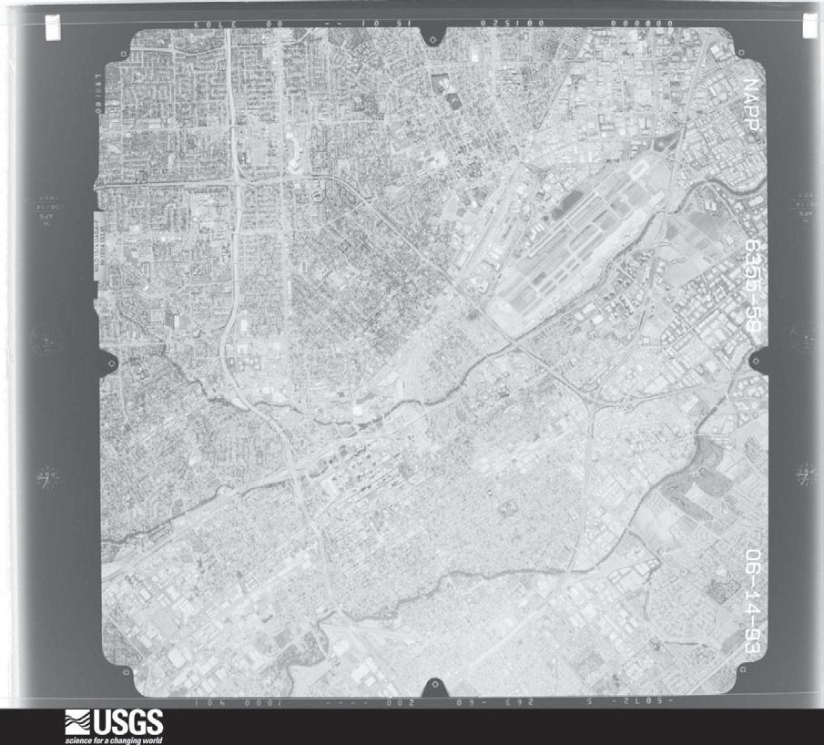
84 1993
VTA S BART SILICON VALLEY PHASE II EXTENSION PROJECT INITIAL SITE ASSESSMENT
 VTA S BART SILICON VALLEY PHASE II EXTENSION PROJECT INITIAL SITE ASSESSMENT P R E P A R E D F O R : Santa Clara Valley Transportation Authority Federal Transit Administration P R E P A R E D B Y : BASELINE
6.2.2 Environmental Consequences and Mitigation Measures
 6.2 6.2.1 Introduction The existing conditions, regulatory setting, and methods of analysis for transportation under CEQA are described in Chapter 3, NEPA and CEQA Analysis. Impacts that would result from
Santa Clara Valley Transportation Authority Board of Directors. General Manager, Nuria I. Fernandez
 8.1.C Date: Current Meeting: Board Meeting: December 6, 2017 December 7, 2017 December 7, 2017 BOARD MEMORANDUM TO: Santa Clara Valley Transportation Authority Board of Directors THROUGH: General Manager,
Chapter ES Executive Summary. Introduction
 ES.1 Introduction Chapter ES The Federal Transit Administration (FTA) and the Santa Clara Valley Transportation Authority (VTA) have prepared this combined Supplemental Environmental Impact Statement (SEIS),
Electromagnetic Interference
 4.6 4.6.1 Introduction This section describes the affected environment and environmental consequences related to electromagnetic fields (EMF) and electromagnetic interference (EMI) from operations of the
4.18 WATER RESOURCES, WATER QUALITY, AND FLOODPLAINS
 4.18 WATER RESOURCES, WATER QUALITY, AND FLOODPLAINS 4.18.1 INTRODUCTION This section describes the regulatory setting and existing conditions applicable to water resources, water quality, and floodplains
City of Sunnyvale. General Plan Structure
 City of Sunnyvale General Plan Structure 1 What is a General Plan? Long-term land use, circulation, environmental, economic and social goals and policies Guides physical development of the City Foundation
Notice of Preparation For Link Union Station (Link US) Project. Joint Environmental Impact Statement and Environmental Impact Report
 Project. Joint Environmental Impact Statement and Environmental Impact Report") Notice of Preparation For Link Union Station (Link US) Project Joint Environmental Impact Statement and Environmental Impact Report Date: May 27, 2016 To: Subject: Project Title: From: All Interested Agencies,
Notice of Preparation For Link Union Station (Link US) Project Joint Environmental Impact Statement and Environmental Impact Report Date: May 27, 2016 To: Subject: Project Title: From: All Interested Agencies,
CHAPTER 4.0 ENVIRONMENTAL SETTING, IMPACTS, AND MITIGATION
 CHAPTER 4.0 ENVIRONMENTAL SETTING, IMPACTS, AND MITIGATION Sections 4.1 through 4.14 of Chapter 4.0 of this EIR contain a discussion of the potential environmental effects from implementation of the proposed
4.15 WATER RESOURCES INTRODUCTON SURFACE WATERS
 4.15 WATER RESOURCES 4.15.1 INTRODUCTON This section discusses the water resources in the SVRTC including surface waters, floodplains, and groundwater. Much of the technical information contained in this
California High-Speed Train Program FEIR/EIS
 Page 2-30 Page 2-31 Page 2-32 Page 2-33 Page 2-34 Page 2-35 Page 2-36 of Enrique Manzanilla, Director U.S. Environmental Protection Agency, August 31, 2004 (Letter AF008) AF008-1 Acknowledged. AF008-2
BUS RAPID TRANSIT. El Camino Real Bus Rapid Transit Project. Environmental Scoping Meetings February 21 and 28
 El Camino Real Bus Rapid Transit Project Environmental Scoping Meetings February 21 and 28 Project Staff Meeting Host Project Manager Environmental Planning Eileen Goodwin, Apex Strategies Steve Fisher,
Federal Transit Administration RECORD OF DECISION
 Federal Transit Administration RECORD OF DECISION Santa Clara Valley Transportation Authority Silicon Valley Rapid Transit Corridor Project Santa Clara County, California DECISION The U.S. Department of
PHASE I INITIAL SITE ASSESSMENT. Santa Clara-Alum Rock Transit Corridor
 PHASE I INITIAL SITE ASSESSMENT Santa Clara-Alum Rock Transit Corridor Prepared for: Santa Clara Valley Transportation Authority 3331 North First Street San Jose, California 95134-1927 Prepared by: PBS&J
3.6 GROUND TRANSPORTATION
 3.6.1 Environmental Setting 3.6.1.1 Area of Influence The area of influence for ground transportation consists of the streets and intersections that could be affected by automobile or truck traffic to
Duwamish Waterway Self Guided Tour: Turning Basin Number Three and Terminal 105 Aquatic Habitat Restoration Sites
 Duwamish Waterway Self Guided Tour: Turning Basin Number Three and Terminal 105 Aquatic Habitat Restoration Sites Text and illustrations in the following pages include: (1) summary information describing
CONSTRUCTION Introduction to Construction
 \ \ \ \ \ \ \ \ \ \ \ \ \ \ \ \ \ \ \ \ \ \ \ \ \ \ \ \ \ \ \ \ \ \ \ \ \ \ \ \ \ \ \ \ \ \ \ \ 4.18 \ \ \ \ \ \ \ \ \ \ \ \ \ \ \ \ \ \ \ \ \ \ \ \ \ \ \ \ \ \ \ \ \ \ \ \ \ \ \ \ CONSTRUCTION \ \ \ \
IV. ENVIRONMENTAL IMPACT ANALYSIS G. HYDROLOGY/WATER QUALITY
 IV. ENVIRONMENTAL IMPACT ANALYSIS G. HYDROLOGY/WATER QUALITY ENVIRONMENTAL SETTING The project site is located in the Wilshire community of the City of Los Angeles and is bound by S. Wetherly Drive to
3 PROJECT DESCRIPTION
 3.1 PROJECT OVERVIEW 3 PROJECT DESCRIPTION The Rocklin 60 project (proposed project) includes the subdivision of 56.9 acres of land, construction of 179 single-family, detached dwelling units, and installation
3.6 Construction Methods
 Exhibit 144: Birchmount Stop Layout West Don River Bridge - Girders are adequate to accommodate LRT right-of-way and required deck widening. Supplementary support or deck strengthening may be required
SR 710 North Study. Technical Advisory Committee Meeting No. 16 August 13, 2014 Stakeholder Outreach Advisory Committee Meeting No. 12 August 14, 2014
 SR 710 North Study Technical Advisory Committee Meeting No. 16 August 13, 2014 Stakeholder Outreach Advisory Committee Meeting No. 12 August 14, 2014 1 1 1 Agenda Public Outreach Activities Project Report
XI. Thornton Planning Area
 XI. A. OVERVIEW The covers 120 square miles in the northwest corner of San Joaquin County. It consists primarily of low-lying Delta islands, sloughs, and large farms. The town of Thornton, a small agriculturally-based
TECHNICAL MEMORANDUM
 California High-Speed Train Project TECHNICAL MEMORANDUM 15% Design Scope Guidelines TM 0.1 Signed document on file Prepared by: 12 May 08_ Ken Jong, PE Checked by: Signed document on file 12 May 08_ John
Local Action Moves the World!
 Local Action Moves the World! What is ICLEI? A worldwide movement of local governments dedicated to achieving tangible improvements in global environmental conditions through cumulative local actions.
APPENDIX M: Hazardous Waste Technical Report
 APPENDIX M: Hazardous Waste Technical Report M.1 Existing Conditions A hazardous waste review was conducted to provide preliminary information regarding the potential presence of any hazardous substances
4.5 ELECTROMAGNETIC FIELDS
 4.5 ELECTROMAGNETIC FIELDS This section presents information on electromagnetic fields and interference related to the BEP and SVRTP alternatives. Information in this section is based on the Electromagnetic
Initial Vision Scenario for Public Discussion
 Initial Vision Scenario for Public Discussion March 11, 2011 Joseph P. Bort MetroCenter 101 Eighth Street Oakland, CA 94607-4756 510.464.7900 tel 510.464-7985 fax Joseph P. Bort MetroCenter 101 Eighth
Comprehensive Outdoor Secondhand Smoke Ordinances
 Comprehensive Outdoor Secondhand Smoke Ordinances February 2017 According to the U.S. Surgeon General, secondhand smoke exposure is harmful at any level. Local cities and counties in California have taken
Attachment 2: Draft Business Plan Scope of Work
 Attachment 2: Draft Business Plan Scope of Work Background: The following pages present a high level draft scope of work for the Caltrain Business Plan along with a description of outreach plans, project
Memorandum. FROM: Jim Ortbal Rosalynn Hughey Barry Ng TO: HONORABLE MAYOR, CITY COUNCIL. DATE: June 16, 2017
 CITY OF SANjOSE CAPITAL OF SILICON VALLEY TO: HONORABLE MAYOR, CITY COUNCIL SUBJECT: TRANSPORTATION POLICY UPDATE REQUIRED BY STATE LAW - LOS TO VMT Memorandum FROM: Jim Ortbal Rosalynn Hughey Barry Ng
Caltrain Rapid Rail Plan
 TRANSPORTATION RESEARCH RECORD 1677 Paper No. 99-1328 31 Caltrain Rapid Rail Plan ANDREW BUTLER NASH The results of Caltrain s Rapid Rail Study are described. The purpose of the study was to develop a
Caltrain Planning Update
 Caltrain Planning Update Board of Directors November 3, 2016 Agenda Item 14 Planning Initiatives Several key policy and strategic planning studies underway that will: Advance and support the Caltrain Strategic
UNIVERSITY OF OREGON NORTH CAMPUS CONDITIONAL USE PERMIT PROJECT Draft Conditional Use Permit Stormwater, Sanitary Sewer, and Water Analysis Report
 UNIVERSITY OF OREGON NORTH CAMPUS CONDITIONAL USE PERMIT PROJECT Draft Conditional Use Permit Stormwater, Sanitary Sewer, and Water Analysis Report Prepared for: Cameron McCarthy Landscape Architects LLP
12:00 noon 7. Tour of the Silicon Valley Water Advanced Water Purification Center
 Joint Recycled Water Policy Advisory Committee Pat Burt, Council Member, City of Palo Alto Tom DuBois, Council Member, City of Palo Tony Estremera, Board Member, Santa Clara Valley Water District Gary
Category 3, BART Capacity, Access and Parking Improvements. Contra Costa Transportation Authority STAFF REPORT Page 2 of 5 The Authority directed staf
 Meeting Date: Subject Summary of Issues Recommendations Financial Implications Options Attachments Changes from Committee Development of a Potential Transportation Expenditure Plan (TEP) Review and Discussion
Drop-off Locations for Medications:
 Drop-off Locations for Medications: Campbell City of Campbell Police Department 70 N. First St., Campbell, CA 95008 (Cross street- Civic Center Dr.) (408) 866-2121 Operating hours: Monday Friday 8:00 am
Management and Integration of Data and Modeling at Santa Clara County Congestion Management Agency
 Management and Integration of Data and Modeling at Santa Clara County Congestion Management Agency VTA Modeling and GIS Group Peter Chen ITE SF Bay Area Annual Modeling Workshop April 29, 2015 Outlines
FINAL ENVIRONMENTAL IMPACT REPORT Volume 1. NBC Universal Evolution Plan ENV EIR STATE CLEARINGHOUSE NO Council District 4
 Division of Land / Environmental Review City Hall 200 N. Spring Street, Room 750 Los Angeles, CA 90012 FINAL ENVIRONMENTAL IMPACT REPORT Volume 1 ENV-2007-0254-EIR STATE CLEARINGHOUSE NO. 2007071036 Council
Metro Blue Line Improvements & Project Update
 Metro Blue Line Improvements & Project Update February 9, 2018 MBL Operational Improvements - External Metro & LADOT coordination to identify traffic signal and intersection treatments aimed at increasing
3.0 CUMULATIVE PROJECTS SCENARIO
 3.0 CUMULATIVE PROJECTS SCENARIO The CEQA Guidelines define cumulative impacts as two or more individual effects that, when considered together, are considerable or which compound or increase other environmental
Northern Intermodal Transit Facility WHAT IS AN INTERMODAL TRANSIT FACILITY?
 WHAT IS AN INTERMODAL TRANSIT FACILITY? An intermodal transit facility gathers many modes of transportation together and is strategically located to increase destination alternatives. Intermodal facilities
12.0 Contaminated Materials
 12.0 Contaminated Materials 12.1 Introduction An investigation was performed to identify hazardous waste and contaminated material sites in the study area of the Columbia Pike Transit Initiative ( the
WATER RESOURCES - WATER SUPPLY
 EXECUTIVE SUMMARY Sacramento County Water Agency (SCWA) constructs water supply improvement projects to serve both newly developing areas and existing customers. This report summarizes those construction
Re: REQUEST TO EXTEND DEADLINE AND REJECT PENINSULA CORRIDOR JOINT POWERS BOARD - PETITION FOR DECLARATORY ORDER Finance Docket No.
 June, 0 Surface Transportation Board E Street, S.W. Washington, DC 0-000 Re: REQUEST TO EXTEND DEADLINE AND REJECT PENINSULA CORRIDOR JOINT POWERS BOARD - PETITION FOR DECLARATORY ORDER Finance Docket
Guidance on Determining Feasibility and Sizing of Rainwater Harvesting Systems
 SANTA CLARA VALLEY URBAN RUNOFF POLLUTION PREVENTION PROGRAM Appendix I Guidance on Determining Feasibility and Sizing of Rainwater Harvesting Systems Table of Contents I.1 Introduction I.2 Rainwater Harvesting/Use
Executive Summary. ES.1 Project Background
 This executive summary presents the key findings of this environmental impact report (EIR) for the San Joaquin Regional Rail Commission s (SJRRC) ACEforward plan. SJRRC proposes to expand service and connections
3.0 CUMULATIVE IMPACT ANALYSIS METHODOLOGY
 3.0 CUMULATIVE IMPACT ANALYSIS METHODOLOGY 1. PURPOSE The purpose of this section is to explain the methodology for the cumulative project analysis presented in this EIR. This section is important because,
CITY OF MONTCLAIR Montclair Civic Center 5111 Benito Street Montclair, CA 91763
 CITY OF MONTCLAIR Montclair Civic Center 5111 Benito Street Montclair, CA 91763 I. Introduction Water Quality A National, State, and Local Concern Throughout the United States, many rivers, creeks, streams,
BACKGROUND OFFSITE FACILITIES/RELEASE CASES
 Project No. S9955-05-02 September 18, 2017 Kemble Pope Trackside Center LLC 2940 Spafford Street, Suite 202 Davis, California 95618 Subject: ENVIRONMENTAL DATA SUMMARY TRACKSIDE CENTER 901 919 THIRD STREET
Phase 2 Exposition Metro Line Project
 Phase 2 Exposition Metro Line Project Monthly Project Status Report November 2013 TABLE OF CONTENTS PHASE 2 EXPO LINE PROJECT STATUS TABLE OF CONTENTS... 2 Phase 2 Exposition Metro Line Construction Authority
3.0 REVIEW OF PREVIOUS STUDIES
 3.0 REVIEW OF PREVIOUS STUDIES This section of the highlights the significant features from previous plans and studies that could impact the development of the I-20 East Transit Initiative. Much of the
Cost Estimate for Removal and Disposal of Contaminated Soil
 14432 SE Eastgate Way, Suite 100 Bellevue, WA 98007 tel: 425-519-8300 Mr. Mark Menard Sound Transit 401 South Jackson Street Seattle, Washington 98104-2820 Subject: Cost Estimate for Disposal of Contaminant-Impacted
U.S. 101 / San Mateo County Smart Corridor Project
 Department of Transportation District 4 - Traffic Operations October 1, 2013 U.S. 101 / San Mateo County Smart Corridor Project www.dot.ca.gov California Department of Transportation (Caltrans) Overview
Fairfield Corporate Commons
 Campus Ln. Kaiser Dr. SACRAMENTO ±30 mi Business Center Dr. Mangels Blvd. NAPA (HWY 12) ±1 mi Suisun Valley Rd. SAN FRANCISCO ±0 mi CONCORD (I-6) ±21 mi Fairfield Corporate Commons ±36.9 Acres of Land
6.9 Greenhouse Gas Emissions and Climate Change
 6.9 Greenhouse Gas Emissions and Climate Change 6.9.1 Introduction This section discusses existing conditions and the regulatory setting regarding greenhouse gas (GHG) emissions, and it describes impacts
Executive Summary. Introduction. Project Location. Project History
 ES.1 Introduction The Santa Clara Valley Transportation Authority (VTA), in cooperation with the Federal Transit Administration (FTA), proposes to implement bus rapid transit (BRT) improvements along a
MIC Core Pre-Schematic Program Analysis
 MIC Core Pre-Schematic Program Analysis April 2001 MIAMI INTERMODAL CENTER (MIC) PROGRAM Work Program Item No. 6113820 State Project No. 87000-1528 Financial Management Item No. 249643 PRE-SCHEMATIC DESIGN
2008 AWRA Spring Specialty Conference March 17-19, 2008
 THE SAN FRANCISCO BAY WATERSHED MODEL FOR COPPER RUNOFF FROM BRAKE PAD WEAR DEBRIS: Part II Model Application and Results Anthony S. Donigian, Jr., Brian R. Bicknell, James N. Carleton, and Kirsten Sinclair
Draft CEQA Resolution - Exhibit A. Environmental Impact Report. [Draft and Final Subsequent Environmental Impact Reports Previously Circulated]
![Draft CEQA Resolution - Exhibit A. Environmental Impact Report. [Draft and Final Subsequent Environmental Impact Reports Previously Circulated]](/thumbs/78/77814538.jpg "Draft CEQA Resolution - Exhibit A. Environmental Impact Report. [Draft and Final Subsequent Environmental Impact Reports Previously Circulated]") Draft CEQA Resolution - Exhibit A Environmental Impact Report [Draft and s Previously Circulated] 6 FINAL SUBSEQUENT ENVIRONMENTAL IMPACT REPORT for BRITANNIA COVE AT OYSTER POINT PRECISE PLAN State Clearinghouse
Draft CEQA Resolution - Exhibit A Environmental Impact Report [Draft and s Previously Circulated] 6 FINAL SUBSEQUENT ENVIRONMENTAL IMPACT REPORT for BRITANNIA COVE AT OYSTER POINT PRECISE PLAN State Clearinghouse
5.D.1 HISTORIC, ARCHITECTURAL, ARCHEOLOGICAL, AND CULTURAL RESOURCES
 5.D.1 HISTORIC, ARCHITECTURAL, ARCHEOLOGICAL, AND CULTURAL RESOURCES Section 106 of the National Historic Preservation Act (NHPA) of 1966, as amended (16 U.S.C. Section 470(f)) protects properties that
extent feasible. Per the and low constructability,
 RELEVANT PUBLIC PROJECTS AND REFERENCES TranTech is proud of its accomplishments in structural engineering. Our staff members have provided design servicess to numerous public agencies on very successful
Exposition Light Rail Transit Project
 Exposition Light Rail Transit Project Expo Project Briefing Phase 1 and 2 For IRWA October 26, 2010 Phase 1 Phase 1 Project Description Phase 1 from Downtown Los Angeles to Culver City: 8.6 mile corridor
PHASE I ENVIRONMENTAL SITE ASSESSMENT
 PHASE I ENVIRONMENTAL SITE ASSESSMENT Commercial and Light Industrial Development Area North of Prairie Street Between Corbin and Shirley Avenues Northridge, California AES Project No. 02-225 June 13,
NOTICE OF PREPARATION
 NOTICE OF PREPARATION Date: June 12, 2014 To: From: Subject: Governor s Office of Planning and Research/State Clearinghouse Unit, Responsible Agencies, Trustee Agencies, and Interested Parties Announcement
Phase 2 Exposition Metro Line Project
 Phase 2 Exposition Metro Line Project Monthly Project Status Report February through April 2012 TABLE OF CONTENTS PHASE 2 EXPO LINE PROJECT STATUS TABLE OF CONTENTS... 2 Phase 2 Exposition Metro Line Construction
Jim Alexander Director of Design and Engineering, Southwest Light Rail Transit Project
 Memorandum Date: January 15, 2014 To: CC: From: Subject: Jim Alexander Director of Design and Engineering, Southwest Light Rail Transit Project Paul Danielson, P.E. Project Manager, Southwest Light Rail
Accept the report on Priority Response to SPUR and Staff Identified Work Items.
 RULES COMMITTEE: 08/03/16 ITEM: G.3 CITY OF JCT Memorandum SAN JOSE CAPITAL OF SILICON VALLEY TO: RULES AND OPEN GOVERNMENT COMMITTEE FROM: Harry Freitas Jim Ortbal SUBJECT: PRIORITY RESPONSE TO SPUR AND
5.14 CONTAMINATED MATERIALS
 5.14 CONTAMINATED MATERIALS 5.14.1 Introduction Contaminated materials are toxic or potentially harmful substances that may be present in soil, groundwater, and building materials. Contaminated materials
Vehicle Service Facilities
 Vehicle Service Facilities B e s t M a n a g e m e n t P r a c t i c e s These guidelines cover the following topics: General Pollution Prevention Practices and Good Housekeeping Outdoor Storage l Waste
4.2 Air Quality Introduction Environmental and Regulatory Setting Environmental Setting. Existing Air Quality Conditions
 4.2 4.2.1 Introduction This section describes the affected environment and environmental consequences related to air quality from operations of the NEPA Alternatives. Information in this section is based
GIS and Database Tools for BART Seismic Upgrade. John Eidinger G&E Engineering Systems Inc.
 GIS and Database Tools for BART Seismic Upgrade John Eidinger G&E Engineering Systems Inc. eidinger@earthlink.net Agenda BART wants to do a comprehensive seismic evaluation and upgrade of its train system
FOR INTERSTATE 81 AND ROUTE 37 INTERCHANGE FREDERICK COUNTY, VIRGINIA MILEPOST 310
 INTERCHANGE MODIFICATION REPORT FOR INTERSTATE 81 AND ROUTE 37 INTERCHANGE FREDERICK COUNTY, VIRGINIA MILEPOST 310 PREPARED BY: VIRGINIA DEPARTMENT OF TRANSPORTATION STAUNTON DISTRICT DECEMBER 13, 2006
FINDINGS CALIFORNIA DEPARTMENT OF TRANSPORTATION FINDINGS FOR THE INTERSTATE 10 CORRIDOR PROJECT SAN BERNARDINO AND LOS ANGELES COUNTIES, CALIFORNIA
 FINDINGS CALIFORNIA DEPARTMENT OF TRANSPORTATION FINDINGS FOR THE INTERSTATE 10 CORRIDOR PROJECT SAN BERNARDINO AND LOS ANGELES COUNTIES, CALIFORNIA DISTRICT 7 LA 10 (PM 44.0/48.3) DISTRICT 8 SBD 10 (PM
FINAL ENVIRONMENTAL IMPACT REPORT. CHAPTER ONE: EXECUTIVE SUMMARY with RESPONSES TO COMMENTS
 FINAL ENVIRONMENTAL IMPACT REPORT SDCRAA # EIR-06-01 State Clearinghouse No. 2005091105 CHAPTER ONE: EXECUTIVE SUMMARY with RESPONSES TO COMMENTS Lead Agency: SAN DIEGO COUNTY REGIONAL AIRPORT AUTHORITY
CONTAMINATED MEDIA MANAGEMENT PLAN MIDLAND MARKET RAIL YARD KLAMATH FALLS, OREGON DEQ ECSI SITE #1732 MAY 4, 2009 FOR BNSF RAILWAY COMPANY
 CONTAMINATED MEDIA MANAGEMENT PLAN MIDLAND MARKET RAIL YARD KLAMATH FALLS, OREGON DEQ ECSI SITE #1732 MAY 4, 2009 FOR BNSF RAILWAY COMPANY File No. 0506-013-07 Contaminated Media Management Plan Midland
Section 4.0 ALTERNATIVES
 Section 4.0 ALTERNATIVES 4.1 Introduction Section 15126.6 of the State California Environmental Quality Act (CEQA) Guidelines requires an environmental impact report (EIR) to describe a range of reasonable
Chapter 6 Transit 2025 Sketch Plan ---Long Range Plan Project Elements
 Chapter 6 Transit 2025 Sketch Plan ---Long Range Plan Project Elements This chapter presents the Transit 2025 Sketch Plan as a summary of the current and proposed future elements of the RTA transit system
Executive Summary A. INTRODUCTION
 Executive Summary A. INTRODUCTION The Federal Transit Administration (FTA) and the Metropolitan Transportation Authority (MTA), in cooperation with MTA New York City Transit (NYCT), propose to construct
Oakland City Planning Commission
 Oakland City Planning Commission September 6, 2006 Design Review Approval: Kaiser Permanente Oakland Medical Center - Master Plan Phase I Medical Office Building, Ground Floor Retail, Parking Garage September
High-Speed Rail - Chicago to St. Louis Alton Regional Multimodal Transportation Center Project
 High-Speed Rail - Chicago to St. Louis Alton Regional Multimodal May 2012 Draft Report: Alternatives Screening Version 1.0 1.0 Introduction This document outlines the alternatives screening process used
HELENA CHEMICAL COMPANY NELSON TERMINAL PROJECT USE PERMIT UP Butte County Board of Supervisors January 29, 2013
 HELENA CHEMICAL COMPANY NELSON TERMINAL PROJECT USE PERMIT UP10-0003 Butte County Board of Supervisors January 29, 2013 Helena Chemical Nelson Terminal Project Develop the Nelson site for use as a regional
4.18 Utilities and Service Systems
 4.18 4.18.1 Introduction This section describes the regulatory and environmental setting for utilities and service systems in the vicinity of ACEforward s near-term and longer-term improvements. It also
Wheaton PRELIMINARY RECOMMENDATIONS
 Wheaton PRELIMINARY RECOMMENDATIONS Wheaton Finding the right balance of land uses within the diversity unique to Wheaton Wheaton s Role in the County Wheaton + Silver Spring = full set Services employment,
Port Jervis Line Service Strategy Report. Appendix C: Port Jervis Line Capacity Improvements Analysis
 Port Jervis Line Service Strategy Report Appendix C: Port Jervis Line Capacity Improvements Analysis January 2018 TABLE OF CONTENTS Introduction... 1 1. Future PJL Service... 1 2. Project Alternatives...
Madison Water Utility Pressure Zone 4 Well Siting Study
 Madison Water Utility Summary of Potential Well Sites March 24 2011 Site Status Comment 1 Dairy Center In consideration Several suitable properties in this area are available. 2 Tradewinds In consideration
6 Preliminary Assessment of Construction Method and Constructability Issues
 6 Preliminary Assessment of Construction Method and Constructability Issues 6.1 Construction Approach Appendix C includes conceptual designs of the alternatives discussed below. Generally, the conceptual
Environmental Analysis, Chapter 4 Consequences, and Mitigation
 Environmental Analysis, Chapter 4 4.9 Geotechnical/Subsurface/Seismic/Hazardous Materials This section summarizes the existing geologic conditions in the project area, including the general topography,
APPENDIX H- ALTERNATIVES PREVIOUSLY CONSIDERED
 APPENDIX H- ALTERNATIVES PREVIOUSLY CONSIDERED APPENDIX H: ALTERNATIVES PREVIOUSLY CONSIDERED This appendix provides an overview of the process that led to the selection of the Locally Preferred Alternative
Conclusions & Lessons Learned
 What is a DDI Recommended Practices Traffic Operations Analysis Geometric Design FHWA Review Conclusions & Lessons Learned It s not about you, it s about the public Developed by Access Utah County
CADIZ VALLEY WATER CONSERVATION, RECOVERY, AND STORAGE PROJECT Final Environmental Impact Report SCH#
 Volume 6: Responses Response to Comments CADIZ VALLEY WATER CONSERVATION, RECOVERY, AND STORAGE PROJECT Final Environmental Impact Report SCH# 2011031002 Prepared for Santa Margarita Water District July
DEVELOPMENT ACTIVITY LIST CITY OF SOUTH SAN FRANCISCO January
 DEVELOPMENT ACTIVITY LIST CITY OF SOUTH SAN FRANCISCO January - 2018 For current updates, please contact the Planning Division @: Phone: (650) 877-8535 Email: planning@ssf.net Site: www.ssf.net/planning
Wastewater ENVIRONMENTAL SETTING. Wastewater Collection
 4.15.3.1 ENVIRONMENTAL SETTING Wastewater Collection The City owns, operates, and maintains the local sewer lines that collect wastewater generated within the City. The existing sewer lines include a gravity
NIGHTTIME ILLUMINATION
 IV.A.3 NIGHTTIME ILLUMINATION 1. INTRODUCTION This section analyzes and discusses the extent to which the proposed project s artificial lighting would affect the visual environment of the project site
Environmental Assessment May 2007
 jurisdictional waters. It is assumed that, at a minimum, a USACE Section 404 Nationwide Permit would be necessary to construct these features. The impacts of the fill into the floodplain cannot be fully
Addendum to the Final Supplemental Environmental Impact Report (SEIR) to the 2030 Concord General Plan EIR for the Concord Development Code Project
 to the 2030 Concord General Plan EIR for the Concord Development Code Project") Addendum Addendum to the Final Supplemental Environmental Impact Report (SEIR) to the 2030 Concord General Plan EIR for the Concord Development Code Project City of Concord January 2014 TABLE OF CONTENTS
Addendum Addendum to the Final Supplemental Environmental Impact Report (SEIR) to the 2030 Concord General Plan EIR for the Concord Development Code Project City of Concord January 2014 TABLE OF CONTENTS
Project Update: Soil Investigation and Groundwater Remedy at Pacific Gas & Electric Company Topock Compressor Station
 Fact Sheet November 2016 The mission of DTSC is to protect California s people and environment from harmful effects of toxic substances through the restoration of contaminated resources, enforcement, regulation
APPENDIX B ISA CHECKLIST FOR HAZARDOUS WASTE
 APPEDIX B ISA CHECKLIST FOR HAZARDOUS WASTE K:\DATAFLS\PROJECTS\2004\2004-054.01\REPORT\2004-054 ISA 7-9-08.DOC Appendix DD - Hazardous Waste Initial Site Assessment (ISA) Checklist for Hazardous Waste
(this cover page left intentionally blank)
") 4. Siting the Well (this cover page left intentionally blank) 4. Siting the Well Chapter Table of Contents Chapter Table of Contents Chapter Description... 4 Regulatory Requirements Well Siting... 4 Relevant
4. Siting the Well (this cover page left intentionally blank) 4. Siting the Well Chapter Table of Contents Chapter Table of Contents Chapter Description... 4 Regulatory Requirements Well Siting... 4 Relevant
INTRODUCTION. 1 Proposed Plan for the Former Lee Field Naval Air Station Landfill Area 2 Site
 1 Proposed Plan for the Former Lee Field Naval Air Station Landfill Area 2 Site U.S. Army Corps of Engineers, Jacksonville District Formerly Used Defense Site Program PROPOSED PLAN for the LANDFILL AREA