PREFERRED ALTERNATIVE/ CONCEPTUAL MITIGATION/ CATEGORICAL EXCLUSION CONCURRENCE PACKAGE. US 219 IMPROVEMENT PROJECT From I-68 to Old Salisbury Road
|
|
|
- Austin Perkins
- 5 years ago
- Views:
Transcription
1
2
3
4 PREFERRED ALTERNATIVE/ CONCEPTUAL MITIGATION/ CATEGORICAL EXCLUSION CONCURRENCE PACKAGE US 219 IMPROVEMENT PROJECT From I-68 to Old Salisbury Road Garrett County, Maryland Project Number GA646A22 MARYLAND DEPARTMENT OF TRANSPORTATION STATE HIGHWAY ADMINISTRATION July 2017
5 US 219 Improvement Project From I-68 to Old Salisbury Road Garrett County, MD Preferred Alternative/ Conceptual Mitigation Package TABLE OF CONTENTS SUMMARY STATEMENT...1 I. PURPOSE & NEED...1 A. Project Background & History...1 B. Purpose and Need for the Project...1 II. PUBLIC WORKSHOP...5 III. ALTERNATIVES RETAINED FOR DETAILED STUDY...6 A. Alternative 1: No Build...6 B. Alternative 2: Widened Existing US C. Alternative 3: Existing Interchange with Local and Relocated US D. Alternative 4: Roundabout Interchange with Local and Relocated US IV. ENGINEERING MODIFICATIONS SINCE APPROVAL OF ARDS...8 A. Alternative 2: Widened Existing US B. Alternative 3: Existing Interchange with Local and Relocated US C. Alternative 4: Roundabout Interchange with Local and Relocated US V. LOCATION/DESIGN PUBLIC HEARING...13 VI. ALTERNATIVES DEVELOPED FOLLOWING THE LOCATION/DESIGN PUBLIC HEARING...13 VII. ALTERNATIVES NOT SELECTED...13 A. Alternative 1: No Build...14 B. Alternative 2: Widened Existing US C. Alternative 3: Existing Interchange with Local and Relocated US D. Alternative 4: Roundabout Interchange with Local and Relocated US VIII. MDOT SHA PREFERRED ALTERNATIVE...16 IX. SUMMARY OF ENVIRONMENTAL IMPACTS...18 A. Socioeconomic Impacts...18 B. Cultural Resources...23 C. Natural Environmental Resources...27 D. Air Quality...32 E. Noise...32 F. Hazardous Materials...33 G. Indirect & Cumulative Effects...33 X. SUMMARY OF MINIMIZATION & MITIGATION MEASURES...38 A. Socioeconomic...38 B. Cultural Resources...38 C. Natural Environment...39 D. Hazardous Materials...41 i
6 US 219 Improvement Project From I-68 to Old Salisbury Road Garrett County, MD Preferred Alternative/ Conceptual Mitigation Package LIST OF APPENDICES Appendix A: Correspondence LIST OF TABLES Table S-1: US 219 Remaining Build Alternatives Comparison Matrix... S-4 Table 1: Summary of Environmental Impacts...19 Table 2: Geology and Soil Impacts...27 Table 3: Impacts to Wetlands and other Waters of the U.S Table 4: Forest and Specimen Tree Impacts...30 LIST OF FIGURES Figure 1: Project Location & Study Area...2 Figure 2: PEL Alignments E & E-Shift...3 Figure 3: Casselman Farm Development Site...4 Figure 4: Alternative 2: Widened Existing US Figure 5: Alternative 3: Existing Interchange with Local and Relocated US Figure 6: Alternative 4: Roundabout Interchange with Local and Relocated US Figure 7: Alternative 4 Modified: Roundabout Interchange with Local and Relocated US Figure 8: Existing & Future Land Use...20 Figure 9: Priority Funding Area & Census Block Groups...22 Figure 10: Historic Properties Impacts...24 Figure 11: Environmental Impacts...29 ii
7 US 219 Improvement Project From I-68 to Old Salisbury Road Garrett County, MD Preferred Alternative/ Conceptual Mitigation Package SUMMARY STATEMENT The Maryland Department of Transportation State Highway Administration (MDOT SHA) and the Federal Highway Administration (FHWA) are currently pursuing improvements to the 1.4-mile segment of US 219 (Chestnut Ridge Road) from I-68 to Old Salisbury Road in Garrett County, Maryland. The primary purpose of the US 219 Improvement Project is to provide transportation improvements that are responsive to planned economic development. Specific economic development needs include supporting regional and local economic growth; providing efficient highway operations for development; and maintaining a sustainable community in northern Garrett County. A supporting purpose of this project is to address safety and mobility concerns related to the projected increase in the truck volumes along US 219 and the mixing of trucks with local traffic. MDOT SHA developed seven preliminary concepts and presented them at a public workshop on September 8, 2016 and an open house on September 9, Based on a preliminary analysis of the concepts, as well as public and agency input, SHA identified the No-Build and three build alternatives as its Alternatives Retained for Detailed Study (ARDS). The build alternatives retained included: Alternative 2: Widened Existing US 219 Alternative 3: Existing Interchange with Local and Relocated US 219 Roundabout Alternative 4: Roundabout with Relocated US 219 MDOT SHA next completed preliminary design and detailed environmental studies to evaluate the alternatives under consideration which resulted in changes to the designs of Alternatives 2, 3, and 4. For Alternative 2, changes include a western shift of the alignment of US 219 in the vicinity of the US 40 Alternate intersection, as well as the addition of a raised median south of US 40 Alternate, concrete islands in the J-turns, and bioswales along the northbound side of US 219. For Alternative 3, changes include the addition of a center turn lane along existing US 219 south of US 40 Alternate; repurposing of the existing outside through lanes as auxiliary lanes; reduction of outside shoulder widths from 12 feet to 10 feet; and the addition of bioswales along the right shoulders and in the median of proposed relocated US 219. For Alternative 4, the changes include the reduction of outside shoulder widths from 12 feet to 10 feet and the addition of bioswales along the right shoulders and in the median of proposed relocated US 219. A Joint Location/Design Public Hearing was held on February 6, 2017 to obtain public input on the alternatives under consideration. Following the public hearing, additional design modifications were made to Alternative 4 including additional resurfacing along I-68, the relocation of a utility line from the northbound side of existing US 219 to the southbound side, and measures to avoid impacts to a wetland system at the northern end of the project. A new alternative, Alternative 4 Modified, was also developed after the public hearing. Alternative 4 Modified is identical to Alternative 4 but also includes the addition of a second roundabout along existing US 219 at the southern limit of the project. A comparison of a full range of engineering, environmental, public input, and cost factors was completed to identify the recommended alternative. This comparison is summarized in Table S-1. Based on the evaluation and comparison of the alternatives, including input from the public, Alternative 4 Modified was recommended as the MDOT SHA Preferred Alternative. Although it would have the highest cost and would require somewhat greater impacts to certain environmental resources, Alternative 4 Modified offers several key advantages over Alternatives 2, 3, and 4 that make it the best option for addressing the project needs. Alternative 4 Modified would reduce potential operational and safety concerns by creating a completely separate facility to allow truck traffic to separate from local traffic destined for the residences and businesses along existing US 219. It would also allow traffic S-1
8 US 219 Improvement Project From I-68 to Old Salisbury Road Garrett County, MD Preferred Alternative/ Conceptual Mitigation Package traveling between the proposed roundabout at I-68 and the Casselman Farm Development Site to maintain a consistent high speed without the need to slow or stop between the two termini. Unlike Alternative 2, Alternative 4 Modified would not introduce restrictions to left-turn access to residences and businesses along any part of existing US 219 and, in comparison to Alternative 2, it would allow for greater flexibility in providing a connection to future US 219 improvements between the northern terminus of this project and Myersdale, Pennsylvania. In terms of supporting regional and local economic growth, Alternative 4 Modified would best meet this need because the scale of the roadway improvements would not limit the growth potential of the Casselman Farm Development Site. Although Alternative 4 Modified would require the greatest amount of impacts to streams, wetlands, and forests, it would require fewer residential and business displacements than Alternative 2 and the same number of displacements as Alternatives 3 and 4. Despite requiring greater amounts of new right-ofway than Alternatives 2, 3 or 4, Alternative 4 Modified would cause least impact to residences and business because it would minimize impacts immediately adjacent to existing US 219 and much of new right-of-way required would consist of land from unused agricultural fields and open space located east of existing US 219. Alternative 4 Modified would also avoid access restrictions in comparison to Alternatives 2. Alternative 4 Modified would require a greater acreage of impact to historic properties than Alternatives 2 and 3 and the same acreage as Alternative 4. However, those impacts must be considered in the context of the total size of the Tomlinson Inn and the Little Meadows historic property, as well as the location of the impacted portion of the property in relation to existing modern development. In addition, the operational and safety benefits and the minimization of community impacts offered by Alternative 4 Modified in comparison to Alternatives 2, 3, and 4 must also be considered. Although Alternative 4 Modified was not presented at the February 2016 Location/Design Public Hearing, it is nearly identical to Alternative 4, which received the greatest amount of support from the public during public meetings, on project generated surveys, or through comments submitted via the project website. Minimization of potential environmental impacts associated with Alternative 4 Modified has occurred throughout the development of the project. Measures to minimize impacts to historic properties as well as streams and wetlands have been incorporated into the project. These include reducing the design speed of the roadway from 70 mph to 55 mph to allow the use of tighter horizontal and vertical curves; shifting the alignment of proposed relocated US 219 as close as possible to the alignment of existing US 219; refining the vertical alignment of the proposed roadway to more closely mimic the existing terrain and reduce the cut/fill slope; reducing the width of the outside shoulders from 12 feet to 10 feet, and revising preliminary SWM locations to avoid wetlands and streams. Measures were also included in Alternative 4 Modified to avoid a wetland system in the northern end of the study area. In addition to minimizing impacts to the extent possible, mitigation measures would also be included in the project. Mitigation for impacts to historic properties would include the following: National Register of Historic Places Amendment Form Context sensitive design for highway appurtenances Aesthetic treatment (stone and mortar bonding pattern similar to the historic Casselman River Bridge) for the bridge along proposed relocated US 219 over US 40 Alternate Provide structures that match the color of the stone required for the bridge along proposed relocated US 219 over US 40 Alternate S-2
9 US 219 Improvement Project From I-68 to Old Salisbury Road Garrett County, MD Preferred Alternative/ Conceptual Mitigation Package Provide an appropriate permanent vegetative buffer for the Tomlinson Inn Archaeological treatment plan Prepare a plan for public interpretation In addition, mitigation for stream and wetland impacts is currently proposed to occur at the project site and could consist of the restoration of approximately 450 linear feet of a tributary to Meadow Run along with the creation of approximately 2.45 acres of wetlands and 0.2 acre of wetland enhancement in the same location. The proposed stream and wetland mitigation could also further mitigate impacts to the Tomlinson Inn and the Little Meadows historic property by improving visual quality through the possible removal of existing unused pavement and grading for previously constructed, but unused highway ramps. Furthermore, impacts to forest would be mitigated either by providing reforestation on an acre-for-acre basis or by payment into DNR's Reforestation Fund. S-3
10 Table S-1 US 219 BUILD ALTERNATIVES COMPARISON MATRIX Comparison Elements Alternative 2 - Widening Existing US 219 Alternative 3: Existing Interchange with Local and Relocated US 219 Alternative 4: Roundabout Interchange with Local and Relocated US 219 SHA Preferred Alternative Alternative 4 Modified: Roundabout Interchange with Local and Relocated US 219 Description Alternative 2 proposes upgrading existing US 219 to a four-lane divided highway from the existing I-68 interchange to Old Salisbury Road. Along US 219 north of Alt. US 40, U-turn bumpouts are used to accommodate movements for turning vehicles. Alternative 3 would follow the existing alignment of US 219, which would be widened to a four-lane undivided roadway with a center turn lane, to just north of the Pilot Travel Center where a roundabout would be installed to facilitate movements between Local US 219 and the proposed Relocated US 219 four lane divided freeway which parallels the existing roadway to the east. Alternative 4 proposes a new four-lane divided highway east of existing US 219, from I-68 to Old Salisbury Road, as well as modification of the existing I-68 interchange. The modified interchange would include a new loop ramp from westbound I-68 to existing US 219 as well as a new two-lane roundabout Alternative 4 Modified proposes a new four-lane divided highway east of existing US 219, from I-68 to Old Salisbury Road, as well as modification of the existing I-68 interchange. The modified interchange would include a new loop ramp from westbound I-68 to existing US 219 as well as a new two-lane roundabout north of I-68 and a new single-lane roundabout south of I-68. Purpose & Need Considerations Traffic Safety & Operations Creates an undesirable safety concern by mixing both residential traffic and larger heavy duty truck traffic. Truck traffic travelling between I-68 and Casselman Farm will contend with multiple access points along with the traffic signal at Alt. US 40 introducing additional operational and safety concerns Crashes in this area are higher than the statewide average. Safety aspect will not be improved by widening the existing alignment to accommodate additional traffic. Traffic speeds would likely decrease compared to the other build alternatives from Old Salisbury Road to I-68 The entrances to the Sunoco and Pilot Station do not meet intersection sight distance (ISD) requirements outlined in AASHTO for the project design speed of 50 MPH without significant changes in pavement elevation that would result in increased impacts to private property. The current ISD is limited to 40 to 45 mph design speeds therefore a design exception would be required for the current layout Avoids potential safety concerns by separating residential traffic and larger heavy duty truck traffic north of Alt. US 40. All traffic would still mix between I-68 and Alt. US 40, which is consistent with the intent of the travel services segment of the community as discussed in the Purpose and Need. Truck traffic travelling between I-68 and Casselman Farm will be primarily on the separate Relocated US 219 facility except south of Alt. US 40, reducing operational and safety concerns Conflict points would be reduced especially north of Alt. US 40, but the proposed roundabout is relatively close to the Alt. US 40 / US 219 intersection which could result in possible operational concerns especially due to the volume of trucks projected for the corridor. Traffic would need to slow down south of Alt. US 40 as it approaches I-68. While traffic would be able to reach relatively higher speeds north of Alt. US 40, those speeds could only be maintained for a short distance. Avoids potential safety concerns by separating residential traffic and larger heavy duty truck traffic from I-68 to the northern terminus of the project, but still allows suitable access to the travel services portion of the study area south of Alt. US 40 Truck traffic travelling between I-68 and Casselman Farm will be entirely on the separate Relocated US 219 facility reducing operational and safety concerns Conflict points would be significantly reduced between I-68 and Old Salisbury Road due to Relocated US 219 and the location of the roundabout at the I-68 Interchange. Traffic would be able to maintain a consistent high speed access between the Casselman Farm Development and the Interstate (I-68) Avoids potential safety concerns by separating residential traffic and larger heavy duty truck traffic from I-68 to the northern terminus of the project, but still allows suitable access to the travel services portion of the study area south of Alt. US 40. Would also eliminate a traditional intersection along existing US 219 south of I-68 and would slow traffic down through the interchange, thereby further reducing conflict points and improving safety. Would iimprove operations along existing US 219 by allowing for more continuous traffic flow in the vicinity of the interchange as drivers would not necessarily be required to stop to enter the roundabout. Would fit better with driver expectancy as there would be a roundabout on each side of the interchange and drivers would have to utilize a roundabout to enter or exit I-68 from any direction. Truck traffic travelling between I-68 and Casselman Farm will be entirely on the separate Relocated US 219 facility reducing operational and safety concerns Conflict points would be significantly reduced between I-68 and Old Salisbury Road due to Relocated US 219 and the location of the roundabout at the I-68 Interchange. Traffic would be able to maintain a consistent high speed access between the Casselman Farm Development and the Interstate (I-68) The currently proposed alignment would not require any known design exceptions The currently proposed alignment would not require any known design exceptions The currently proposed alignment would not require any known design exceptions Accessability Alternative 2 would introduce a center median and associated U-turns along US 219 which will change the existing full ingress / egress access to residents and commercial businesses along US 219 and therefore make the local movements more circuitous Alternative 2 would introduce restrictions to existing residential and commercial at-grade entrances which currently have full movement access making movements along the corridor more circuitous for local residents. The inclusion of a four-lane undivided roadway with a center turn lane south of Alt. US 40, combined with relocated US 219 north of Alt. US 40, would eliminate the need for any U- turns on Local US 219 in the future The widened segment of US 219 south of Alt. US 40, would require modifications to existing access points, which could make ingress/egress more difficult for all of the existing properties in this area. Relocated US 219 would eliminate the need for any U-turns on Local US 219 in the future Least impactful option to local commercial and residential properties. Relocated US 219 would eliminate the need for any U-turns on Local US 219 in the future Less impactful to local commercial and residential properties than Alternative 2 and 3, but slighlty greater impacts than Alternative 4 due to additional right-of-way from the commercial properties as a result of the second roundabout. Access to the local truck oriented commercial businesses (i.e. Pilot, Sunoco Gas Station) between Alt. US 40 and I-68 would remain relatively the same with this alternative Access to the local truck oriented commercial businesses would remain relatively the same except for the Pilot's modified ingress/egress Since the primary traffic would no longer pass in front of some of the truck oriented commercial business, additional signage and wayfinding signs may be required to help awareness based on the change in traffic patterns Since the primary traffic would no longer pass in front of some of the truck oriented commercial business, additional signage and wayfinding signs may be required to help awareness based on the change in traffic patterns Economic Viability Growth potential of the primary employment area (Casselman Farms) could be limited by the scale of the proposed roadway improvements due to some of the inherent safety concerns that would remain along portions of US 219, and the lack of direct access from the development to I-68. Though Alternative 3 would address some of the mixing of truck and residential traffic concerns along US 219 and provide improved access from the Casselman Development to I- 68 it would still not provide a direct expressway level connection, because it requires vehicles to pass through the roundabout and utilize existing US 219 south of Alt. US 40. Would perform better than Alternatives 2 and 3, but not as well as Alternative 4 Modified in regards to addressing safety concerns along existing US 219. Would provide improved access from the Casselman Development to I-68 which could provide the highest rate of return on investment regarding potential commercial / industrial tenants interested in locating within the study area. Would perform better than Alternatives 2, 3 and 4 in regards to addressing safety concerns along existing US 219. Would provide improved access from the Casselman Development to I-68 which could provide the highest rate of return on investment regarding potential commercial / industrial tenants interested in locating within the study area. Human and Natural Environmental Impact Considerations Community Effects Highest level of residential impacts (4 displacements / 27 properties impacted), commercial impacts (6 displacements / 18 properties impacted) and community facility impacts (2 properties impacted) compared to the other three build alternatives Lowest acreage of historic property and right-of-way impacts compared to the other three build alternatives. All three build alternatives impact the same two historic properties. Highest number of existing utilities impacted with (40) utility poles and potential sewer force main. The number of residential (3 displacements / 13 properties impacted), commercial (4 displacements / 8 properties impacted) and community facility (1 property impact) impacts are similar to Alternatives 4 and 4 Modified, but the magnitude of the acreage impact is slightly less in most cases Alternative 3 s acreage of historic property impacts is greater than to Alternative 2 but less than Alternatives 4 and 4 Modified. Alternative 3 would call for a moderate level of utility impacts between I-68 & Alt. US 40 The number of residential (3 displacements / 17 properties impacted ), commercial (4 displacements / 12 properties impacted) and community facility (1 property impact) impacts are similar to Alternative 3 and Alternative 4 Modified, but the magnitude of the acreage impact is slightly higher in most cases Acreage of historic impacts is the same as Alternative 4 Modified, but greater than Alternatives 2 and 3. Alternative 4 would have the lowest amount of utility impacts since a majority of the design is off the existing alignment The number of residential (3 displacements / 18 properties impacted ), commercial (4 displacements / 16 properties impacted) and community facility (1 property impact) impacts are similar to Alternative 3, but the magnitude of the acreage impact is slightly higher in most cases Acreage of historic impacts is the same as Alternative 4, but greater than Alternatives 2 and 3. Would have the lowest amount of utility impacts since a majority of the design is off of the existing alignment Natural Environment Lowest number of permanent stream, forest and wetland impacts 2nd lowest number of permanent stream, forest and wetland impacts Highest number of permanent stream, forest and wetland impacts Highest number of permanent stream, forest and wetland impacts
11 Table S-1 US 219 BUILD ALTERNATIVES COMPARISON MATRIX Comparison Elements Alternative 2 - Widening Existing US 219 Alternative 3: Existing Interchange with Local and Relocated US 219 Alternative 4: Roundabout Interchange with Local and Relocated US 219 SHA Preferred Alternative Alternative 4 Modified: Roundabout Interchange with Local and Relocated US 219 Cost Lowest cost range 2nd lowest cost range Second highest cost range Highest cost range Public Support Has received the lowest level of support from the public during public meetings, project generated surveys or website comments Has received a moderate level of support from the public during public meetings, project generated surveys or website comments Has received the highest level of support from the public during public meetings, project generated surveys or website comments Alternative 4 Modified has not been presented to the public but is nearly identical to Alternative 4, which received the highest level of support from the public during public meetings, project generated surveys or website comments. Alternative 4 Modified was included in the project newsletter ciculated to the public in April No comments were received from the public regarding Alternative 4 Modified. General Considerations The northern terminus for Alternative 2 will make it difficult to connect to any of the proposed alignments transitioning into Pennsylvania towards Meyersdale as identified in the PEL Study since connecting to the dualized facility from Pennsylvania will require some sort of interchange or flyover ramp design north of the current study area that has not been evaluated in previous studies and may prove too impactful. The northern terminus for Alternatives 3, 4, and 4 Modified would provide a higher level of flexibility when connecting to any of the proposed alignments transitioning into Pennsylvania towards Meyersdale as identified in the PEL Study compared to Alternative 2. The northern terminus for Alternatives 3, 4, and 4 Modified would provide a higher level of flexibility when connecting to any of the proposed alignments transitioning into Pennsylvania towards Meyersdale as identified in the PEL Study compared to Alternative 2. The northern terminus for Alternatives 3, 4, and 4 Modified would provide a higher level of flexibility when connecting to any of the proposed alignments transitioning into Pennsylvania towards Meyersdale as identified in the PEL Study compared to Alternative 2. Future Considerations Though Alternative 2 could still potentially meet ADHS funding requirements when combined with the future Meyersdale connection the other two build alternatives make a stronger case and are probably more in line with the intent of the ADHS funding requirements The dualized expressway portion may not be as fully utilized as a four lane facility due to its short length (0.6 miles). In either direction, only a portion of that segment would operate at full design speed before reducing speed to exit/merge to existing US 219 or to enter the roundabout. This design may not be able to provide a full posted speed due to the length of segment. Compared to the Alternatives 2 and 3, Alternative 4 and Alternative 4 Modified are most consistent with the full intent of the ADHS funding requirements by providing expressway level access between the Casselman Farm development and I-68 while also providing a consistent four lane dualized facility that, if extended to the Meyersdale connection in Pennsylvania, would result in a highly functional expressway connection from the Pennsylvania Turnpike to I-68. Compared to the Alternatives 2 and 3, Alternative 4 and Alternative 4 Modified are most consistent with the full intent of the ADHS funding requirements by providing expressway level access between the Casselman Farm development and I-68 while also providing a consistent four lane dualized facility that, if extended to the Meyersdale connection in Pennsylvania, would result in a highly functional expressway connection from the Pennsylvania Turnpike to I-68. In regards to the Logical Termini Requirement "Proposed alternatives should not restrict consideration of alternatives for other reasonably foreseeable transportation improvements.". Alt. 2 could limit the ability to extend a dualized expresway facility into Pennsylvania, which would restrict a number of the proposed alternatives identified in the PEL Study from moving forward. Alternatives 3, 4, and 4 Modified offer the greatest level of flexibility in future design options as it relates to connecting the current improvements into Pennsylvania as identified during the PEL Study. Alternatives 3, 4, and 4 Modified offer the greatest level of flexibility in future design options as it relates to connecting the current improvements into Pennsylvania as identified during the PEL Study. Alternatives 3, 4, and 4 Modified offer the greatest level of flexibility in future design options as it relates to connecting the current improvements into Pennsylvania as identified during the PEL Study.
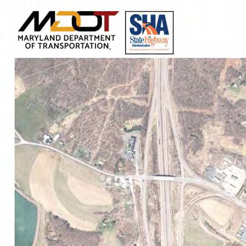
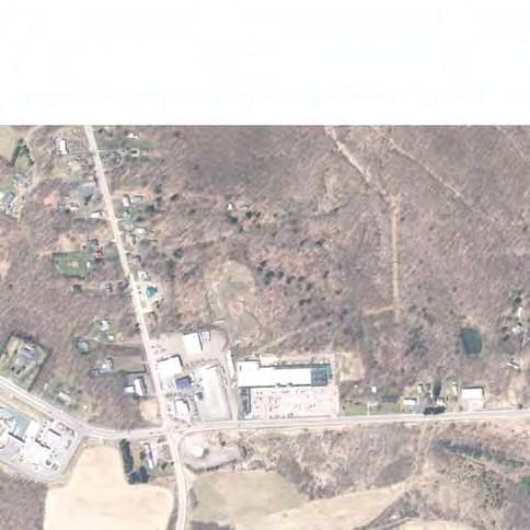
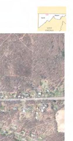
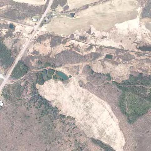
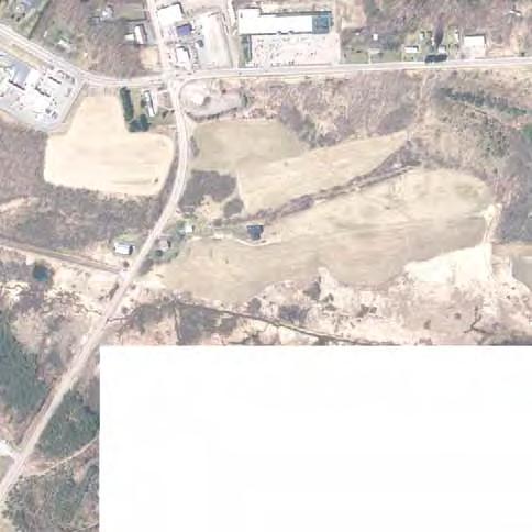
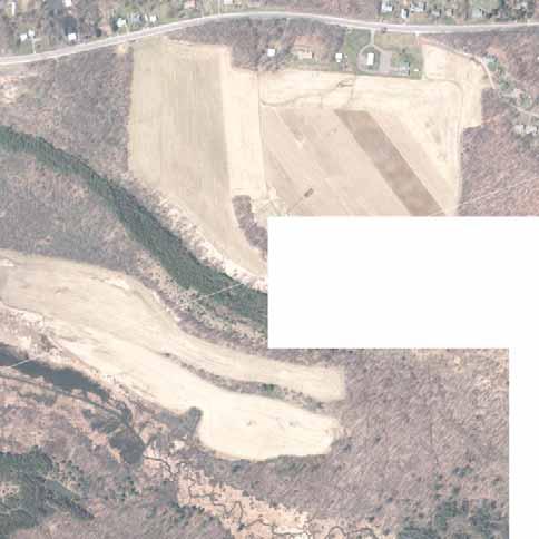
12 US 219 Improvement Project From I-68 to Old Salisbury Road Garrett County, MD Preferred Alternative/ Conceptual Mitigation Package I. PURPOSE & NEED A. Project Background & History The Maryland Department of Transportation State Highway Administration (MDOT SHA) and the Federal Highway Administration (FHWA) are currently pursuing improvements to the 1.4-mile segment of US 219 (Chestnut Ridge Road) from I-68 to Old Salisbury Road in Garrett County, Maryland (Figure 1). The US 219 Improvement Project was identified as the first break-out project from the US 219: I-68 (MD) to Meyersdale (PA) Planning and Environment Linkages (PEL) Study (Figure 2). That PEL study was completed by MDOT SHA and the Pennsylvania Department of Transportation (PennDOT), and acknowledged by the Federal Highway Administration (FHWA), on July 21, The US 219 Improvement Project build alternatives were developed based on the findings of the PEL study and would constitute a segment of the Appalachian Development Highway System (ADHS) Corridor N. B. Purpose and Need for the Project The purpose and need for the US 219 Improvement Project was developed by MDOT SHA in September 2016 and was concurred upon by FHWA, the Environmental Protection Agency (EPA), the U.S. Army Corps of Engineers (USACE), and the U.S. Fish and Wildlife Service (USFWS) in October A summary of the purposed and need for the project is provided below. US 219 is a two-way rural arterial that provides access to industrial, commercial and residential properties in the project area with a posted speed limit of 40 miles per hour, from the I-68/ US 219 Interchange to Old Salisbury Road. There is one signalized intersection along US 219 within the project area, located at US 40 Alternate. I-68 provides east-west access between Maryland and West Virginia and is connected to US 219 by a diamond interchange. North of I-68, along US 219, there is a Pilot Travel Center and a BFS commercial property containing a Sunoco gas station, Burger King, Little Caesar s, and IHOP restaurants. There are currently no sidewalks on either side of US 219, although there are more than 35 residences along the project corridor. The primary purpose of the US 219 Improvement Project is to provide transportation improvements that are responsive to planned economic development. Currently, developers are interested in the proposed Casselman Farm Development Site. The proposed Casselman Farm Development Site is a 340-acre mixed use/industrial site in northeast Garrett County within an economic development area identified in Garrett County's Comprehensive Plan (2008) as the Chestnut Ridge Development Corridor (CRDC) (Figure 3). Improved access to the CRDC may help improve Garrett County s economic viability and competitiveness within the region by maximizing the corridor s land use potential and potentially enabling larger industrial businesses to better access I-68. A direct roadway connection would facilitate development of the proposed Casselman Farm Development Site while also supporting future regional connectivity by completing the 1.4 miles of eligible ADHS mileage in Maryland. The ADHS is a network of 32-highways spanning 3,090 miles and 13 states that was established to connect communities to commerce and address persistent poverty in the Appalachia region. According to traffic projections, development of the proposed Casselman Farm Development Site is expected to yield higher volumes of mid-to-heavy-duty trucks throughout the corridor. A supporting 1
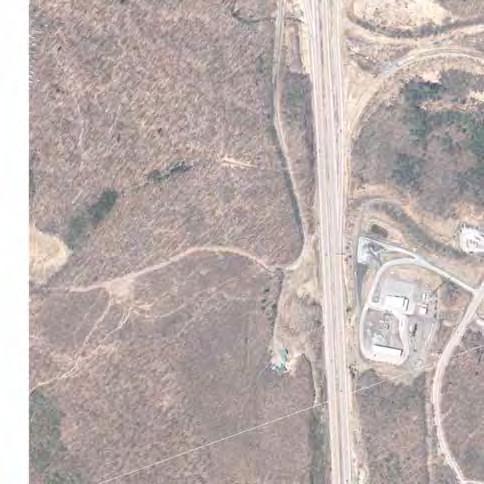
13 US 219 Improvement Project Project Location & Study Area ,000 Feet Garrett Allegany Project Limits Project Limits Figure 1: Project Location & Study Area Legend Existing US 219 Project Limits
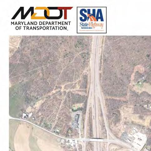
14 US 219 Improvement Project SHA Preferred Alternative 4 (Modified) 0 2,500 5,000 Feet Garrett Allegany Alignment E Alignment E Shift Figure 2: PEL Alignments E & E-Shift Legend Alignment E Alignment E Shift
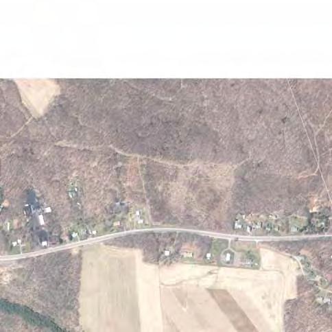
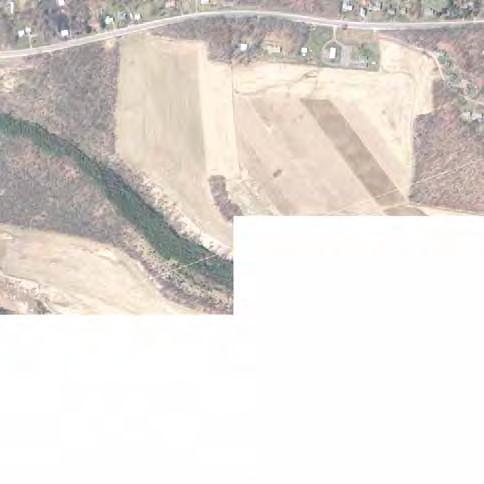
15 US 219 Improvement Project Casselman Farm Development Site ,000 Feet Garrett Allegany Figure 3: Casselman Farm Development Site Legend Casselman Farm Development Site Chestnut Ridge Development Corridor
16 US 219 Improvement Project From I-68 to Old Salisbury Road Garrett County, MD Preferred Alternative/ Conceptual Mitigation Package purpose of this project is to address safety and mobility concerns related to the projected increase in the truck volumes along US 219 and the mixing of trucks with local traffic. Crash rates along this segment of roadway are higher than the statewide average. The ADHS was implemented to support goals of linking the Appalachian Region of the United States with larger population and economic centers. These goals aim to increase jobs, reduce the isolation of Appalachia, and provide an overall opportunity for the region to compete economically on a larger scale. These goals set forth a need for economic development for this area of Garrett County, specifically, a need to support economic development for the CRDC. Specific economic development needs can be viewed in three primary categories: Support regional and local economic growth Efficient highway operations for development Maintain a sustainable community in northern Garrett County. Economic growth in the project area would benefit from efficient highway access. Providing improved transportation access would minimize negative impacts to the surrounding community while maximizing transportation investments because of associated developments within the CRDC. According to a report entitled Economic Impacts of US Route 219 Alignments on Chestnut Ridge Development prepared by the Maryland Department of Transportation s Office of Planning and Capital Programming, the CRDC would benefit Garrett County through the creation of 269 temporary (construction) jobs and 875 permanent jobs. Safety along this section of US 219 is already affected by high truck volumes, which will only increase as new developments occur. This increase in mid to large sized trucks and tractor trailers, coupled with the existing residential (approximately 29) / commercial (approximately 15) access points, crashes, and poor pavement conditions, will further exacerbate the safety concerns already experienced along this corridor, resulting in an undesirable mix of heavy trucks and cars. In evaluating how this community operates, an analysis of community character revealed three main community compositions. These three community characteristics include: travel services, residential/residential amenities, and primary employment. Though they all make up the fabric of the CRDC, they have their own economic value and their own unique and distinctive needs to maintain their economic viability. On a regional level, the goals of the ADHS are to generate economic development in previously isolated areas by supplementing the interstate system. Connecting the missing ADHS link between I-68 to the south and Meyersdale to the north is a critical step in bringing the goals and vision of the ADHS into fruition. Though this project does not fully complete ADHS Corridor N in Maryland, it will provide a significant incremental improvement with both short-term benefits of ensuring development of the CRDC and long-term benefits of a nearly completed ADHS. II. PUBLIC WORKSHOP A Public Informational Workshop was held on September 8, 2016 and an Open House on September 9, 2016 to present the Purpose and Need and preliminary alignment concepts for the US 219 Improvement 5
17 US 219 Improvement Project From I-68 to Old Salisbury Road Garrett County, MD Preferred Alternative/ Conceptual Mitigation Package Project and solicit feedback from the public on the project's purpose and need and the preliminary concepts. Seven preliminary concepts were presented including the following: Concept 1: No-Build Concept 2: Widened Existing US 219 Concept 3: Existing Interchange with Local and relocated US 219 Roundabout Concept 4: Roundabout with Relocated US 219 Concept 5: T-Interchange with Relocated US 219 Concept 6: Flyover Interchange with Relocated US 219 Concept 7: Loop Ramp Interchange with Relocated US 219 A combined total of 104 people attended the Informational Workshop and the Open House. Comments provide by the attendees demonstrated a preference for Concept 5 (which was dropped from consideration due to high costs and environmental impacts); opposition to Concept 1; concerns about safety near the Pilot Travel Center and school bus stops; dislike of roundabouts; and concerns about maintaining access and potential for impacts to properties adjacent to existing US 219. This feedback from the public was considered in the development and identification of the project's Alternatives Retained for Detailed Study (ARDS). III. ALTERNATIVES RETAINED FOR DETAILED STUDY The ARDS report was developed by MDOT SHA in Fall 2016 and was concurred upon by FHWA, EPA, USACE, USFWS, the Maryland Department of the Environment (MDE), and the Maryland Department of Natural Resources (DNR) in October and November As an initial step in developing the alternatives to be analyzed during the US 219 Improvement Project, sixteen corridor alignments were first evaluated and screened through the PEL study process for the US 219: I-68 to Meyersdale project. That study yielded two alignments, Alignments E and E-Shift, which were considered to be the most reasonable corridors for further development as preliminary alternatives for the National Environmental Policy Act (NEPA) analysis phase of the US 219 Improvement Project. Seven preliminary concepts were developed within the two alignments. A comprehensive description of these concepts can be found in the ARDS report. These preliminary concepts were further evaluated to determine which would be retained for detailed study. The following is an overview of the ARDS that were developed based upon input from federal, state and local agencies, and comments received from the public. A. Alternative 1: No Build Alternative 1 (No-Build) consists of taking no action to improve the existing transportation facilities; no improvements would be constructed, while routine maintenance activities would continue with this alternative. Under the No-Build Alternative, existing US 219 would remain in its current layout and alignment. B. Alternative 2: Widened Existing US 219 Alternative 2 proposes upgrading existing US 219 to a four-lane divided highway from the existing I-68 interchange to Old Salisbury Road. The new roadway would maintain the existing interchange 6
18 US 219 Improvement Project From I-68 to Old Salisbury Road Garrett County, MD Preferred Alternative/ Conceptual Mitigation Package configuration at I-68 and an at-grade intersection of US 219 and US 40 Alternate. The roadway south of the US 40 Alternate intersection would be undivided with the typical section consisting of two 12-foot through lanes and a 10-foot shoulder in each direction. The typical section of the new roadway north of US 40 Alternate would consist of two 12-foot through lanes, a 10-foot right shoulder, and a 2-foot left shoulder in each direction separated by variable width (4-foot to 18-foot) curbed median. The widening of existing US 219 would primarily occur along the northbound side of the roadway. Existing access points along both sides of the roadway would be maintained, but the introduction of a median would limit left turns onto and off of existing US 219. Three median openings, with dedicated left turn lanes, between the US 40 Alternate intersection and the entrance to the proposed Casselman Farm Development Site would be provided for traffic to make left-turn and U-turn movements to access the existing residences and businesses along existing US 219. North of the entrance to the Casselman Farm Development Site, the roadway would taper back to a two-lane roadway (one lane in each direction), and tie into the existing typical section of US 219. In addition to the proposed roadway improvements, the existing, but currently unused, slip ramp from I-68 westbound to US 40 Alternate would potentially be removed. Alternative 2 would also include the restoration of a segment of stream located just north of I-68 to the east of the existing US 219 interchange. C. Alternative 3: Existing Interchange with Local and Relocated US 219 In addition to the No-Build Alternative, MDOT SHA is evaluating the construction of a four-lane dual highway that utilizes both the existing roadway and a new alignment from I-68 to Old Salisbury Road and maintains the existing I-68/US 219 interchange. From the I-68 interchange, the alignment of Alternative 3 would follow the existing alignment of US 219, which would be widened to a four-lane undivided roadway with a center turn lane, to just north of the Pilot Travel Center. At that location, proposed relocated US 219 would diverge from the existing alignment, bear to the east of existing US 219, bridge over US 40 Alternate as a four-lane divided roadway, and follow a new alignment to the northern terminus at the entrance of the proposed Casselman Farm Development Site. Existing US 219 would connect to the proposed relocated US 219 alignment with a two-lane, four-legged roundabout. The segment of existing US 219 from just north of the Pilot Travel Center to the US 40 Alternate intersection would be removed and a new connection, which bears to the east of exiting US 219, from the US 40 intersection to the roundabout would be provided. The typical section of the new roadway north of the US 40 Alternate intersection would consist of a four-lane divided highway (two 12-foot through lanes, a 12-foot outside shoulder, and a 4-foot inside shoulder, in each direction) separated by a proposed 28-foot wide median. Alternative 3 would include construction of an overpass (bridge) to carry proposed relocated US 219 over US 40 Alternate. It would provide a new entrance to the Pilot Travel Center with a roundabout to access either existing US 219 or proposed relocated US 219. No ramps would be needed to access US 40 Alternate. At the north end of the study area, Alternative 3 proposes a conventional T-intersection design of existing US 219 and proposed relocated US 219. Existing US 219 would be realigned, beginning approximately 1,500 feet south of Old Salisbury Road, to curve to the east and intersect proposed relocated US 219 at a T-intersection. Proposed relocated US 219 would continue north to the entrance of the proposed Casselman Farm Development Site where it would tie-in to existing US 219. As it 7
19 US 219 Improvement Project From I-68 to Old Salisbury Road Garrett County, MD Preferred Alternative/ Conceptual Mitigation Package approaches the T-intersection, proposed relocated US 219 would transition from the four-lane, divided typical section to a two-lane, undivided section, and would continue as two lanes until it merges with existing US 219 at the entrance to the Casselman Farm Development Site. In addition to the proposed roadway improvements, the existing, but currently unused, slip ramp from I-68 westbound to US 40 Alternate would potentially be removed. Alternative 3 would also include the restoration of a segment of stream located just north of I-68 to the east of the existing US 219 interchange. D. Alternative 4: Roundabout Interchange with Local and Relocated US 219 Alternative 4 proposes a new four-lane divided highway east of existing US 219, from I-68 to Old Salisbury Road, as well as modification of the existing I-68 interchange. The modified interchange would include a new loop ramp from westbound I-68 to existing US 219 as well as a new two-lane roundabout. The typical section of the proposed relocated US 219 would consist of two 12-foot through lanes, a 12-foot right shoulder, and a 4-foot left shoulder in each direction separated by a 28-foot wide median. From north of US 40 Alternate to the northern terminus at Old Salisbury Road, Alternative 4 would be identical in design to Alternative 3. Proposed relocated US 219 would be carried over US 40 Alternate on an overpass. From westbound I-68, a new loop ramp would provide access to proposed relocated US 219 northbound at a roundabout. Existing US 219 would form the north and south legs of the roundabout, and the proposed relocated US 219 roadway would form the east leg of the roundabout. Because of the introduction of a two lane roundabout, the interchange ramp from US 219 to the westbound I-68 would be relocated to the west of its current location. New proposed interchange ramps would consist of one 15-foot lane, a 12-foot right shoulder, and a 4-foot left shoulder. The design speed would vary between 35 mph and 50 mph. The intersection of proposed relocated US 219 and US 40 Alternate would be grade-separated with proposed relocated US 219 being carried over US 40 Alternate on a new overpass. From US 40 Alternate, motorists would utilize existing US 219 and the existing interchange to access I-68. To access I-68 from existing US 219 within the study area, motorists would either travel on existing US 219 south to the existing interchange or travel north along existing US 219 to the entrance of the proposed Casselman Farm Development and follow proposed relocated US 219 south to the I-68 interchange. In addition to the proposed roadway improvements, the existing, but currently unused, slip ramp from I-68 westbound to US 40 Alternate would potentially be removed. Alternative 4 would also include the restoration of a segment of stream located just north of I-68 to the east of the existing US 219 interchange. IV. ENGINEERING MODIFICATIONS SINCE APPROVAL OF ARDS A. Alternative 2: Widened Existing US 219 Following approval of the project s ARDS, Alternative 2 experienced several engineering modifications. The current design of Alternative 2 is shown on Figure 4. South of US 40 Alternate, the alignment of existing US 219 was shifted to the west to tie-into US 40 Alternate at a higher elevation. The shift in 8
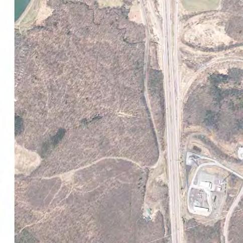
20
21 US 219 Improvement Project From I-68 to Old Salisbury Road Garrett County, MD Preferred Alternative/ Conceptual Mitigation Package alignment allowed the proposed pavement along US 40 Alternate to maintain a maximum grade of eight percent and tie-into the existing grade of US 40 Alternate approximately 250 feet east of existing US 219. In comparison, the location of alignment under the previous design would have required the grade along US 40 Alternate east of US 219 to exceed the maximum of eight percent in order to tie-in at the project limits. Otherwise, limiting the grade to the maximum of eight percent would have resulted in a substantial increase in the elevation of the proposed surface of US 40 Alternate east of existing US 219. This increase in elevation would have extended much further to the east and the proposed roadway would have tied in to the existing roadway approximately 1,450 feet east of existing US 219. The previous design would have greatly increased property impacts within the Tomlinson Inn and the Little Meadows historic site east of US 219 and would have required either large retaining walls adjacent to the Tomlinson Inn or displacement of the Tomlinson Inn building. In addition, a raised median was added along existing US 219 from the Sunoco to connect to the originally proposed raised median just south of US 40 Alternate. This modification was made to avoid the installation of an undivided four-lane facility, which is a facility design no longer supported by MDOT SHA or AASHTO design practices due to safety concerns. As previously mentioned, existing access points along both sides of the roadway would be maintained; however, concrete islands were added in the J-turns north of US 40 Alternate to help prevent left turns from the side streets. The islands will be mountable to accommodate truck traffic. Lastly, to help meet stormwater management requirements, bioswales were included along the northbound side of existing US 219, north of US 40 Alternate. B. Alternative 3: Existing Interchange with Local and Relocated US 219 Substantial modifications were also made to Alternative 3 since approval of the project s ARDS. The current design of Alternative 3 is shown on Figure 5. A center turn lane was added along existing US 219 south of US 40 Alternate and the outside through lanes were repurposed as auxiliary lanes. The change was made to avoid the installation of an undivided four-lane facility, which is a facility design no longer supported by MDOT SHA or AASHTO design practices due to safety concerns. Similarly, the proposed shoulders for the tie-in were also reduced from a width of 12 feet to 10 feet. Additionally, north of US 40 Alternate, the proposed shoulders along the dualized portion of US 219 were reduced from a width of 12 feet to a width of 10 feet. The reduction of shoulder widths minimizes grading impacts and stormwater management needs while also satisfying AASHTO design criteria. Also, north of US 40 Alternate, a crown, which is a peak in the center of the road surface, was added between the two northbound lanes and the two southbound lanes. The revision allows the inside lane to drain towards the median where the runoff can be treated in a stormwater management facility, reducing the need for stormwater management outside of the highway. Bioswales have been included along the right shoulders and in the median north of US 40 Alternate to help meet stormwater management requirements. C. Alternative 4: Roundabout Interchange with Local and Relocated US 219 Like Alternatives 2 and 3, Alternative 4 has also been modified since the approval of ARDS. The current design of Alternative 4 is shown on Figure 6. These modifications mirror a majority those described above for Alternative 3. For instance, along proposed relocated US 219, from the roundabout to the northern tie-in, the proposed shoulders were reduced from a width of 12 feet to a width of 10 feet, thus minimizing grading impacts and stormwater management needs. The proposed shoulders for the tie-in were also reduced from a width of 12 feet to 10 feet, identical to Alternative 3. Along proposed 10
22

23
24 US 219 Improvement Project From I-68 to Old Salisbury Road Garrett County, MD Preferred Alternative/ Conceptual Mitigation Package relocated US 219 from the roundabout to the northern tie-in, a crown was also added between the two northbound lanes and the two southbound lanes. This modification offers the same stormwater management advantage as described for Alternative 3. Along proposed relocated US 219, from the roundabout to the northern tie-in, stormwater management requirements have also been addressed with bioswales that have been included along the right shoulders and in the median. Modifications to Alternative 4 also include additional resurfacing work along I-68, as well as the relocation of a utility line from the northbound side of existing US 219 to the southbound side, which is a result of further refinements to stormwater management locations. Based upon coordination with the U.S. Army Corps of Engineers, Alternative 4 also includes measures to avoid impacts to a wetland system at the northern end of the project. These measures include a slight shift of the alignment of proposed relocated US 219 to the west, elimination of the median in the vicinity of the wetland, and the inclusion of an engineered 1:1 slope on the east side of the proposed roadway. In addition, these measures include the elimination of a SWM pond and an access road to a SWM pond. V. LOCATION/DESIGN PUBLIC HEARING A joint Location/Design Public Hearing was held for the US 219 Improvement Project by MDOT SHA and the USACE on February 6, 2017 at Grantsville Elementary School in Garrett County, Maryland. At this hearing, the ARDS were presented along with preliminary environmental impacts. Opportunity was provided for the public to give formal testimony and to provide written or verbal comments to the project team. Eighty-four people attended the hearing and seven testimonies were received the day of the meeting. Those testimonies included five public testimonies, one private testimony, and one written testimony. The public comment period remained open for ten days after the hearing and officially closed on February 16, Seven additional comments were received via or mail before the close of the comment period. In total, 14 comments were received. Topics of the comments included safety (six comments), environmental impacts (two comments), property impacts (two comments) and support for Continental 1 1 (two comments). Additionally, six of the commenters identified Alternative 4 as their preferred alternative. Alternatives 1-3 each received support from one commenter. One commenter suggested a modification to Alternative 4 to include a high speed interchange as their preferred alternative. VI. ALTERNATIVES DEVELOPED FOLLOWING THE LOCATION/DESIGN PUBLIC HEARING Following the Location/Design Public Hearing, an additional alternative was developed: Alternative 4 Modified. Alternative 4 Modified is identical to Alternative 4 as described above with one key difference in the design. Alternative 4 Modified includes a second roundabout along US 219 at the southern limit of the project at the terminus of the existing ramp from eastbound I-68 to US 219. VII. ALTERNATIVES NOT SELECTED Alternatives not selected for this project include Alternatives 1, 2, 3, and 4. The rationale for why each of these alternatives was not selected is provided below. 1 Continental 1 is a 1,500-mile corridor between Miami, Florida and Toronto, Canada formed by US 219 that is intended to improve accessibility and safety and increase opportunities for economic development. 13
25 US 219 Improvement Project From I-68 to Old Salisbury Road Garrett County, MD Preferred Alternative/ Conceptual Mitigation Package A. Alternative 1: No Build Alternative 1 was not identified as the MDOT SHA Preferred Alternative because it would not meet the purpose and need for the project. It would not improve access to the Casselman Farm Development Site and would not support future regional connectivity by completing the 1.4 miles of eligible ADHS mileage in Maryland. In addition, Alternative 1 would not address safety and mobility concerns related to the projected increase in the truck volumes along US 219 and the mixing of trucks with local traffic. B. Alternative 2: Widened Existing US 219 Alternative 2 was not selected as the MDOT SHA Preferred Alternative due to numerous operational and safety concerns. It would create an undesirable safety concern by allowing the local traffic to mix with the heavy truck traffic. Crash data indicate that the crash rate is higher along this portion of US 219 than the statewide average for similar highways and widening the existing alignment of US 219 to accommodate additional traffic would not improve safety in this location. Alternative 2 was also not identified as the MDOT SHA preferred Alternative because it would limit left-turn access to local businesses and residences by introducing a median along existing US 219 and requiring vehicles to execute U-turns. In addition, the entrances to the Pilot Travel Center and the Sunoco station south of US 40 Alternate would not meet intersection sight distance requirements outlined in AASHTO for the project's design speed of 50 MPH without substantial changes in pavement elevation that would result in increased impacts to adjacent properties. Alternative 2 would create additional operational and safety concerns because truck traffic travelling between I-68 and the Casselman Farm Development Site would contend with multiple access points along existing US 219, as well as the traffic signal at the existing US 219/US 40 Alternate intersection. The presence of multiple access points and a traffic signal under Alternative 2 would make travel between I-68 and the Casselman Farm Development Site slower and more difficult in comparison to alternatives that propose a separate relocated US 219 facility. Slower and more difficult access could limit the attractiveness of the Casselman Farm Development Site to potential commercial/industrial tenants, thereby limiting the site s growth potential. Furthermore, by limiting the growth potential of the Casselman Farm Development Site, which is expected to be the primary employment center in this area, Alternative 2 would also limit opportunities for a sustainable community. An additional concern associated with Alternative 2 is that widening existing US 219 would create additional operational and safety complications if a connection to any of the alignments recommended during the PEL study is made in the future. One complication is that the PEL alignments assume that a four-lane freeway would extend to Myersdale and connect to the four-lane freeway currently under construction. With Alternative 2, the freeway would have to terminate at existing US 219 opposite the proposed entrance to the Casselman Farm Development Site. Motorists would be forced to reduce speed and transition onto a rural arterial roadway to access I-68. Furthermore, additional property impacts and displacements near the project s northern terminus (including the Cherry Grove Church of the Brethren) would likely occur. Environmental factors also contribute to the decision to not identify Alternative 2 as the MDOT SHA preferred Alternative. Alternative 2 would result in the highest number of residential and business displacements and the highest number of individual properties impacted. In addition, it would have the greatest impact on access to local residences and businesses along existing US 219 as well as the 14
26 US 219 Improvement Project From I-68 to Old Salisbury Road Garrett County, MD Preferred Alternative/ Conceptual Mitigation Package greatest visual and noise impacts on residences along existing US 219. Alternative 2 would result in the highest number of impacted community facilities and the highest number of impacts to existing utilities. Lastly, Alternative 2 received the lowest level of support from the public during public meetings, on project generated surveys, or through comments submitted via the project website. While Alternative 2 would require fewer impacts to streams, wetlands, and forests, fewer acres of impact to historic properties, and would have the lowest cost, its inability to address the safety and operation concerns related to the mixing of local and truck traffic, along with the access impacts and displacements, led to the decision to not identify this alternative as the MDOT SHA Preferred Alternative. C. Alternative 3: Existing Interchange with Local and Relocated US 219 Alternative 3 was not identified as the MDOT SHA Preferred Alternative due primarily to operational concerns. The proposed roundabout would be located in relatively close proximity to the existing US 219/US 40 Alternate intersection. Due to the volume of trucks projected for this corridor, the proximity of the roundabout to the existing intersection could result in issues related to the operation of that intersection. In addition, Alternative 3 would not separate truck traffic from local traffic along existing US 219 between I-68 and US 40 Alternate and, thus, would not address the safety concerns related to the mixing of truck traffic with local traffic along this segment of the roadway. Widening existing US 219 between I-68 and US 40 Alternate to four lanes would make ingress and egress to and from the residences and businesses along this segment of the roadway more difficult. Furthermore, the design of the roundabout would reorient ingress and egress to and from the Pilot Travel Center and could potentially introduce issues with internal site circulation at the Pilot Travel Center. Compared to Alternative 2, Alternative 3 would allow for a greater level of flexibility in providing a connection to future US 219 improvements between the northern terminus of this project and Myersdale, Pennsylvania. Alternative 3 was also not identified as the MDOT SHA Preferred Alternative because widening existing US 219 between I-68 and US 40 Alternate, as opposed to a new alignment in this area, would require motorists approaching this segment from the north to slow down before reaching I-68. In addition, the proposed dualized expressway north of US 40 Alternate may not be fully utilized due to its short length (0.6 mile). Motorists would only be able to achieve full speed for a short length of roadway before slowing down to exit or merge back onto existing US 219 where access in not fully controlled. Alternative 3 received only moderate support from the public during public meetings, on project generated surveys, or through comments submitted via the project website. Alternative 3 would result in the same number of residential and commercial displacement as Alternatives 4 and 4 Modified and fewer than Alternative 2. Alternative 3 would also result in impacts to environmental resources including streams, wetlands, forests, and historic sites that are greater than Alternative 2 but less than Alternatives 4 and 4 Modified. Likewise, the cost of Alternative 3 would be greater than that of Alternative 2 but less than that of Alternatives 4 and 4 Modified. While Alternative 3 would address some of the operational and safety concerns, especially north of US 40 Alternate, it would have several disadvantages as described above. Therefore, Alternative 3 was not identified as the MDOT SHA Preferred Alternative. 15
27 US 219 Improvement Project From I-68 to Old Salisbury Road Garrett County, MD Preferred Alternative/ Conceptual Mitigation Package D. Alternative 4: Roundabout Interchange with Local and Relocated US 219 Alternative 4 is very similar to Alternative 4 Modified. The one key difference is that Alternative 4 Modified includes a second roundabout along existing US 219 at the southern limit of the project while Alternative 4 would not. Alternative 4 would have similar costs and environmental impacts as compared to Alternative 4 Modified. However, Alternative 4 Modified would provide additional benefits in comparison to Alternative 4. With the addition of the second roundabout at the southern limit of the project, Alternative 4 Modified would eliminate a traditional intersection, thereby further reducing conflict points and improving safety. In addition, the second roundabout would slow traffic down through the interchange, which would also improve safety. Furthermore, the second roundabout would allow for more continuous traffic flow in the vicinity of the interchange as drivers would not necessarily be required to stop to enter the roundabout. Finally, Alternative 4 Modified would fit better with driver expectancy than Alternative 4 as there would be a roundabout on each side of the interchange and drivers would have to utilize a roundabout to enter or exit I-68 from any direction. Because Alternative 4 and Alternative 4 Modified are very similar and Alternative 4 Modified would offer these additional benefits, Alternative 4 was not identified as the MDOT SHA Preferred Alternative. VIII. MDOT SHA PREFERRED ALTERNATIVE MDOT SHA has identified Alternative 4 Modified as its Preferred Alternative (Figure 7). Although it would have the highest cost and would require somewhat greater impacts to certain environmental resources, Alternative 4 Modified would offer several key advantages over Alternatives 2, 3 and 4 that make it the best option for addressing the project needs. Alternative 4 Modified would reduce potential operational and safety concerns in comparison to Alternatives 2 and 3 by creating a completely separate facility to allow truck traffic to separate from local traffic destined for the residences and businesses along existing US 219. One of the major advantages of Alternative 4 Modified is that the presence of a separate, controlled-access expressway would allow traffic, especially heavy trucks, traveling between the proposed roundabout at I-68 and the Casselman Farm Development Site to maintain a consistent high speed without the need to slow or stop between the two termini. Additionally, unlike Alternative 2, Alternative 4 Modified would not introduce restrictions to left-turn access to residences and businesses along any part of existing US 219. Similar to Alternatives 3 and 4, Alternative 4 Modified would allow for a greater level of flexibility in providing a connection to future US 219 improvements between the northern terminus of this project and Myersdale, Pennsylvania when compared to Alternative 2. Although Alternative 4 would provide the same comparative advantages over Alternatives 2 and 3 as Alternative 4 Modified, Alternative 4 Modified would offer several operational and safety benefits that Alternative 4 would not. As described in Section VII.D above, the inclusion of the second roundabout along existing US 219 under Alternative 4 Modified would ensure continuous traffic flow along the corridor, reduce conflict points, and fit better with driver expectancy. In terms of supporting regional and local economic growth, Alternative 4 Modified could improve the amount or quality of potential commercial or industrial tenants choosing to locate at the Casselman 16
28
29 US 219 Improvement Project From I-68 to Old Salisbury Road Garrett County, MD Preferred Alternative/ Conceptual Mitigation Package Farm Development Site because it would provide a separate, controlled-access expressway between I-68 and the entrance to the site. Providing faster and easier access to the Casselman Farm Development Site from the interstate would also improve opportunities for a sustainable community because it would make the location of the site more attractive to prospective tenants, especially those for which convenient access to the interstate system is an important factor in their decision on where to locate. Therefore, Alternative 4 Modified would best support regional and local economic growth because, under this alternative, the growth potential of the Casselman Farm Development Site would not be limited by the scale of the roadway improvements. Although Alternative 4 Modified would require the greatest amount of impacts to streams, wetlands, and forests, it would require fewer residential and business displacements than Alternative 2 and the same number of displacements as Alternatives 3 and 4. Despite requiring greater amounts of new right-ofway than Alternatives 2, 3 or 4, Alternative 4 Modified would result in the least impact to residences and business because much of the new right-of-way required would consist of strips of land that would not interfere with the current use of those properties. Overall, Alternative 4 Modified would minimize displacements and avoid access restrictions. Alternative 4 Modified would also require the greatest acreage of impact to historic properties; however, when those impacts are considered in the context of the overall size of the Tomlinson Inn and the Little Meadows historic property, the impact that would result from Alternative 4 Modified is not substantially greater than that of Alternatives 2, 3 or 4. Alternative 4 Modified was not presented at the February 2017 Location/Design Public Hearing; however, Alternative 4, which is the alternative presented to the public that most closely resembles Alternative 4 Modified, received the greatest amount of support from the public up to and including the public hearing. In addition, Alternative 4 Modified was included in a project newsletter that was circulated to the public in April No comments from the public regarding Alternative 4 Modified have been received to date. IX. SUMMARY OF ENVIRONMENTAL IMPACTS Impacts to environmental resources were considered in the identification of the MDOT SHA Preferred Alternative. Table 1 summarizes the environmental impacts associated with each of the ARDS and the MDOT SHA Preferred Alternative. The following presents a summary of the environmental impacts associated with the MDOT SHA Preferred Alternative. A. Socioeconomic Impacts Socioeconomic impacts of the ARDS are evaluated in detail in the Community Effects Assessment Technical Report completed for this project in January The following presents a summary of socioeconomic impacts associated with the MDOT SHA Preferred Alternative. Land Use/PFA/Smart Growth The US 219 study area is dominated by rural land uses, principally agricultural and forested land. However, existing land uses immediately adjacent to existing US 219 are low-density residential, commercial and agricultural (Figure 8). The majority of residential uses are very low- and low-density. In addition, the existing US 219 corridor is adjacent to the CRDC, a site identified as an economic development area in the Garrett County Comprehensive Plan. 18
30 Table 1: Summary of Environmental Impacts Community Effects New Right-of- Way Acquisition (Acres) Properties Impacted (No.) Displacements (No.) Cultural Resources Historic Properties Resource MDOT SHA Preferred Alternative Alternative 2 Alternative 3 Alternative 4 Alternative 4 Modified Widened Existing Existing Interchange with Roundabout Interchange US 219 Local and Relocated US with Local and Relocated Roundabout Interchange with Local 219 US 219 and Relocated US 219 Residential Commercial Community Facilities Agricultural Undeveloped Total Residential Commercial Community Facilities Agricultural Undeveloped Total Residential Commercial 3/6 1 1/4 1 1/4 1 1/4 1 Other Properties Impacted (No.) Acres Within MDOT SHA ROW Acres Outside MDOT SHA ROW Total Acres Natural Environment Streams (linear feet) 233 (permanent) / 996 (temporary) (permanent)/ 996 (temporary) 4 3,351 (permanent) 3 / 996 (temporary) 4 3,351 (permanent) 3 / 996 (temporary) 4 Wetlands (acres) 0.1 (permanent) / 0.4 (temporary) (permanent) / 0.4 (temporary) (permanent) / 1.0 (temporary) (permanent) / 1.0 (temporary) Year Floodplains (acres) Forest (acres) DNR Green Infrastructure (acres) Total Cost ($Millions) 5 $40 $65 $81 $83 1 The Hilltop Centre building, which would be displaced under all build alternatives, is a single structure that contains 1 residence and 4 businesses. 2 Total acres of impact to historic properties exceeds the total acres of new right-of-way acquisition because the National Register boundary of Little Meadows/Tomlinson Inn includes substantial amounts of land already owned by MDOT SHA. 3 3,072 of the 3,351 l.f. of stream impacts would be replaced in-kind as part of the project. The remaining 279 l.f. of stream impacts would be mitigated on-site. 4 Temporary impacts for each alternative include 996 l.f. of stream impact and 0.4 acre of wetland impact directly resulting from stream restoration activities. 5 Costs shown are for the year of expenditure (2018). Costs shown include Design, Right-of-Way, and Construction costs. 19


")


31 National Freeway National Freeway US 219 Improvement Project Existing and Proposed Land Use Not To Scale Garrett Allegany National Pike National Pike Chestnut Ridge Rd Chestnut Ridge Rd 219 LEGEND MDP Land Use 2010 Agriculture Commercial Forest Institutional Open urban land Other Developed Lands Residential Transportation Water Wetlands SHA Preferred Alternative 4 (Modified) Alignment * Digitized from georeferrenced Garrett County Proposed Land Use Map LEGEND Figure 8: Existing and Future Land Use Garrett County Proposed Land Use (2008)* Agricultural Resource Employment Center General Commercial Rural Rural Resource Suburban Residential Town Residential SHA Preferred Alternative 4 (Modified) Alignment
32 US 219 Improvement Project From I-68 to Old Salisbury Road Garrett County, MD Preferred Alternative/ Conceptual Mitigation Package The Garret County Comprehensive Plan identified future land use to include less agricultural and forested land immediately along existing US 219 in the study area (Figure 8). According to the plan, commercial land uses are proposed along both sides of existing US 219 from south of I-68 to north of US 40 Alternate. Residential land uses are proposed along existing US 219 from north of US 40 Alternate to the northern limit of the study area, as well as along US 40 Alternate west of existing US 219. In addition, the Casselman Farm Development Site is proposed as an employment center. East of existing US 219, beyond the land immediately along the east side of existing US 219, land use is proposed to remain categorized as rural. The MDOT SHA Preferred Alternative would result in minor direct changes to land use within the Study Area as it would convert existing agricultural, commercial, and residential land to transportation use. In general, the MDOT SHA Preferred Alternative is consistent with the local existing and future land use plans. The Garrett County Department of Planning and Land Management also supports the effort to improve the US 219 corridor north of I-68 as part of the ADHS. The US 219 Improvement Project is within a Priority Funding Area (PFA) (Figure 9). Residential Communities The MDOT SHA Preferred Alternative would impact residential communities by requiring three residential displacements, which are shown on Figure 7, as well as right-of-way acquisition from numerous additional residential properties. The proposed right-of-way acquisition would be linear in nature and would not result in community isolation since the connections between the communities on both sides of existing US 219 would be maintained. Introducing a new four-lane divided highway, which includes a new overpass over US 40 Alternate, would also negatively affect the visual and aesthetic quality of the study area by somewhat diminishing the rural character of the area east of the existing US 219 corridor. However, the MDOT SHA Preferred Alternative would potentially improve visual and aesthetic quality south of US 40 Alternate by possibly removing unused ramps, fill and grading and returning a portion of the Tomlinson Inn and the Little Meadows historic property to a condition that resembles the surrounding historic site. Furthermore, the MDOT SHA Preferred Alternative would improve quality of life in the study area by diverting heavy truck traffic from existing US 219 to a separate facility, thereby reducing truck-related operational conflicts for local traffic and improving safety. Environmental Justice In compliance with Executive Order 12898, Federal Actions to Address Environmental Justice (EJ) in Minority and Low-Income Populations, MDOT SHA must avoid disproportionately high and/or adverse effects on minority and/or low income populations throughout the project area. MDOT SHA reviewed the demographic characteristics of the study area and Garrett County using data from the U.S. Census Bureau (2010), American Community Survey ( ), and the Environmental Protection Agency s EJScreen tool. The identification of low-income and minority populations was based on block group data from the 2010 U.S. Census and ACS data via American FactFinder. Additional sources were also used to help identify potential EJ populations. The Maryland State Department of Education provided demographic information for elementary schools within the study area. The U.S. Department of Housing and Urban Development Affordable Apartment Search was used to determine the location and types of subsidized housing in the study area. Outreach to MDOT SHA's District 6 Community Liaison and the Garret County Department of Planning was also conducted to 21
33 US 219 Improvement Project SHA Preferred Alternative 4 (Modified) ,000 Feet Garrett Allegany Census Tract: 0002 Census Block Group: 002 Census Tract: 0002 Census Block Group: 001 Census Tract: 0003 Census Block Group: 002 Census Tract: 0003 Census Block Group: 001 Figure 9: Priority Funding Area LEGEND SHA Preferred Alternative 4 (Modified) Alignment Maryland Priority Funding Area Census Block Groups
34 US 219 Improvement Project From I-68 to Old Salisbury Road Garrett County, MD Preferred Alternative/ Conceptual Mitigation Package determine potential EJ communities. As a result of this research and outreach, one Environmental Justice block group was identified (Census Tract 2, Block Group 2) directly adjacent to the project area. However, this block group is located south of I-68 and west of US 219 and there are minimal improvements proposed in this area (see Figure 9). There would be no displacements and no access impacts within that block group associated with the MDOT SHA Preferred Alternative. Overall, the Environmental Justice analysis concluded that no disproportionately high or adverse impacts to Environmental Justice and/or Limited English Proficiency populations would be expected to occur as a result of this project. Community Facilities The MDOT SHA Preferred Alternative would require no displacements and no permanent access impacts to community facilities. A linear strip of right-of-way acquisition would be required at the Cherry Grove Church of the Brethren. As a result of construction activities associated with each of the project phases, temporary impacts on traffic operations would affect all community facilities and services. However, the temporary impacts would be offset by a Maintenance of Traffic Plan developed before construction begins. Businesses The MDOT SHA Preferred Alternative would have the fewest commercial displacements, displacing four businesses: Resco Products Inc, Nationwide Insurance, BioScience Spectrum and a State Highway Administration facility. All four businesses are located within a single structure located in the southeast quadrant of the existing US 219/US 40 Alternate intersection. In addition, the MDOT SHA Preferred Alternative may divert through (and possibly tourist) traffic away from local businesses; however, access would still be provided via existing US 219, which would remain in use as a local access road. MDOT SHA will, if possible, address concerns regarding potential impacts to local businesses on US 219 during and after construction through signage. Current signage along existing US 219 will be maintained during construction and augmented based on applicable guidelines and policies as needed. As the Design-Builders finalize the design, MDOT SHA will work with them to ensure the appropriate signage for businesses on existing US 219 are included to meet all applicable guidelines and policies. B. Cultural Resources Historic Properties Two significant historic resources have been identified within the Area of Potential Effects (APE): the National Road and the Tomlinson Inn and the Little Meadows. Impacts to the National Road and the Tomlinson Inn and the Little Meadows are fully detailed in the Final Section 4(f) Evaluation. A summary of the impacts is provided below. The National Road (US 40 Alternate) is both a historic transportation corridor and a federally designated National Scenic Byway. The segment of the National Road within the study area was determined to be eligible for the National Register of Historic Places under Criterion A in The MDOT SHA Preferred Alternative would result in 0.8 acre of impact to the National Road (Figure 10). Much of the impacted area is located within existing MDOT SHA right-of-way. The MDOT SHA Preferred Alternative is expected to have an adverse effect on the National Road because the proposed improvements would alter the highway's integrity of design, feeling, and association. 23
35 US 219 Improvement Project Historic Impacts ,000 Feet Garrett Allegany ± Tomlinson Inn G-I-A-012 LEGEND Figure 10: Historic Impacts National Road G-I-A-227 Alternative 4 Modified Alignment Alternative 4 Modified LOD SHA ROW within LOD National Road within LOD Tomlinson Inn and Little Meadows Historic Site within LOD Delineated Streams Delineated Wetlands Impacted Streams Impacted Wetlands Culvert to be Removed Pavement to be Removed Proposed Mitigation Site
36 US 219 Improvement Project From I-68 to Old Salisbury Road Garrett County, MD Preferred Alternative/ Conceptual Mitigation Package The MDOT SHA Preferred Alternative would require the construction of an overpass to carry proposed relocated US 219 over the National Road. The overpass would consist of two individual bridge structures that would each be 50 feet wide with approximately 18 feet between them for a total width of 118 feet. The bridges would rise approximately 25 feet above the existing surface of the US 40 Alternate roadway. The construction of this overpass would require limited physical impacts within NRHP boundary of the National Road associated with the construction of bridge abutments, but would introduce a new visual element above the existing roadway. The visual impact of the MDOT SHA Preferred Alternative on the National Road would be minimal because the entire route within the project area today is a modern highway with intrusions, such as guardrail and signage. To mitigate the visual impacts, MDOT SHA would provide context sensitive design for the US 219 bridges and highway appurtenances within or immediately adjacent to the Tomlinson Inn and the Little Meadows boundary and would design the new bridges along proposed relocated US 219 over US 40 Alternate to include a stone and mortar bonding pattern that is similar to the historic Casselman River Bridge. The Tomlinson Inn and the Little Meadows was listed in the National Register of Historic Places in The property and its landscape is significant as the location of Braddock s 4th Encampment during the French and Indian War. The original National Register nomination defines the historic property boundaries to include an 897-acre area between Meadow Mountain and Chestnut Ridge. The MDOT SHA Preferred Alternative would result in 89.8 acres of impact to the Tomlinson Inn and the Little Meadows (Figure 10). However, 56.3 of the total 89.8 acres of impact would be located within existing MDOT SHA right-of-way. South of US 40 Alternate, the impact to Tomlinson Inn and the Little Meadows would occur on land that is mostly undeveloped and located within existing MDOT SHA right-of-way that overlaps the NRHP boundary of the property. Much of this area was previously disturbed by activities associated with highway construction. The MDOT SHA Preferred Alternative would result in the removal of trees, shrubs, and unused farm fields that are important characteristics of the historic property. It would also require impacts to streams and wetlands, as well as the displacement of the commercial structure located in the southeast quadrant of the intersection of existing US 219 and US 40 Alternate. Construction of the new roadway and the proposed roundabout would alter the existing landscape by introducing new visual elements, such as the new roadway, the roundabout, and the bridge over US 40 Alternate. The proposed roundabout and the new highway, including the bridges that would rise 25 feet above US 40 Alternate in a prominent area of the southwest portion of the property would be visible from various vantage points as a result of the rolling terrain. North of US 40 Alternate, the impact to Tomlinson Inn and the Little Meadows would involve only undeveloped land, most of which is currently forested. The use of this portion of the property would require removal of trees and shrubs east of existing US 219 and also result in impacts to streams and wetlands. While there would be no physical impact to any man-made features within Tomlinson Inn and the Little Meadows north of US 40 Alternate, the construction of the roadway would introduce a new visual element into the landscape. To mitigate the impact to the Tomlinson Inn and the Little Meadows property, the MDOT SHA Preferred Alternative would potentially remove the existing, unused ramp pavement from westbound I-68 and re-grade the area to remove existing grading for previously planned (but never constructed) interchange ramps. It also proposes the possible restoration of a tributary to Meadow Run east of the Pilot Travel Center. Although these activities would occur within the project's limit of disturbance and 25
37 US 219 Improvement Project From I-68 to Old Salisbury Road Garrett County, MD Preferred Alternative/ Conceptual Mitigation Package are, thus, included in the total acreage of impact to the historic property, they would benefit the property by removing pavement and restoring the landscape to a condition that more closely resembles the landscape in the northern and eastern portions of the property. In addition, the context sensitive design for the US 219 bridges and highway appurtenances, as described above, would further mitigate the visual and aesthetic impacts of the MDOT SHA Preferred Alternative on this property. The MDOT SHA Preferred Alternative is expected to have an adverse effect on the Tomlinson Inn and the Little Meadows property. The removal of trees, shrubs, and unused agricultural fields, as well as the addition of new visual elements such as the new highway, roundabout, and overpass would diminish the property s, integrity of design, feeling, and association. However, it is important to note that these impacts would occur near the south-western corner of the 897-acre historic property in the vicinity of existing commercial and residential development along existing US 219 and in close proximity to I-68 and existing US 219. Furthermore, much of the impacted area would occur in a portion of the property has been previously disturbed by prior highway construction activities. Archaeology Based on the previous and current archaeological studies, MDOT SHA recommended three sites as individually eligible for the National Register: Braddock's Road (18GA314); Little Meadows Encampment (18GA317); and Tomlinson Inn Site (18GA322). All three of these sites are also contributing resources to the NRHP listed Tomlinson Inn and the Little Meadows property. In addition, MDOT SHA has identified the Little Meadows Archaeological District which encompasses 18GA314, 18GA317 and 18GA322 and other known and anticipated resources outside the LOD. The MDOT SHA Preferred Alternative is expected to impact the three individually eligible archaeological sites as well as the Little Meadows Archaeological District. Section 106 Coordination As part of the process followed to demonstrate compliance with Section 106 of the National Historic Preservation Act, coordination with the MHT was initiated in the early stages of this project. Continuing coordination with MHT from the previous NEPA study and the PEL study, MDOT SHA identified potentially eligible historic properties within the project's area of potential effects, evaluated each property, and determined if each was listed or eligible for listing in the NRHP. In a letter dated September 9, 2016, MDOT SHA notified MHT of its intent to continue consultation on the US 219 Improvement Project and requested concurrence from MHT on the revised APE and on the NRHP eligibility of historic sites within the APE. MDOT SHA then sent correspondence to MHT on September 16, 2016 to transmit the draft report of Phase I and Phase 2 archaeological investigations completed in 2015 and 2016, and to request concurrence with MDOT SHA's preliminary determinations of NRHP eligibility for archaeological resources. MHT concurred with MDOT SHA's findings from both the September 9, 2016 and September 16, 2016 letters on October 17, MDOT SHA sent additional correspondence dated October 25, 2016 to MHT requesting concurrence with MDOT SHA's determination that there would be adverse effects on historic properties under all of the build alternatives. MHT concurred with MDOT SHA's effect determination on December 13, After consulting with MHT and other consulting parties and the identifying a Preferred Alternative, MDOT SHA sent additional correspondence dated April 4, 2017 to MHT requesting concurrence with the MDOT SHA's determination that there would be adverse effects on historic properties under Alternative 26
38 US 219 Improvement Project From I-68 to Old Salisbury Road Garrett County, MD Preferred Alternative/ Conceptual Mitigation Package 4 Modified. This correspondence also transmitted the Draft Memorandum of Agreement (MOA) to MHT. MHT concurred with MDOT SHA's effect determination on April 28, The MOA was fully executed on May 15, Copies of all MHT correspondence and the MOA are included in Appendix A. C. Natural Environmental Resources Impacts to natural environmental resources as a result of the ARDS are evaluated in detail in the Natural Environmental Technical Report completed for this project in January The following presents a summary of natural environmental impacts associated with the MDOT SHA Preferred Alternative. Topography, Geology, and Soils Impacts to geology and topography from the MDOT SHA Preferred Alternative are minimal, and are expected to result from cutting and filling to maintain proposed road grades and to reestablish riparian grades for the proposed on-site wetland and waterways mitigation site. Twenty-two soil types fall within the project study area, all of which had varying degrees of erodibility. Some soils were also mapped as Soils of Statewide Importance (a designation of soils preferable for agricultural activities). Table 2 presents potential permanent impacts to highly erodible soils and Soils of Statewide Importance, as well as the maximum cut depth and maximum proposed fill associated with the MDOT SHA Preferred Alternative. Table 2: Geology and Soil Impacts MDOT SHA Preferred Alternative Highly Erodible (ac) During later phases of design, detailed geotechnical studies will be performed to determine specific geological issues that could impact construction and the surrounding environment. Engineering would then be tailored to address the specific concerns, including unstable soil, soil erosion, and steep slopes. To minimize impacts to the surrounding environment, erosion and sediment controls would be implemented both during and after construction. Additionally, the MDOT SHA Preferred Alternative would include stormwater management to address increased surface runoff. Impacts to Soils of Statewide Importance were determined due to potential farmland loss; however, the Natural Resource Conservation Service (NRCS) has provided a Farmland Protection Policy Act (FPPA) review and determined that the MDOT SHA Preferred Alternative would not impact farmlands that meet the criteria for protection under the FPPA (see Appendix A). Scenic and Wild Rivers and Surface Waters Soils of Statewide Importance (ac) Maximum Cut (ft) Maximum Fill (ft) The Youghiogheny River and its tributaries are designated as Scenic and/or Wild under the Maryland Scenic and Wild Rivers Program. There are no tributaries to the Wild portion within the US 219 study area, but the tributaries to the Scenic River within the limits of disturbance (LOD) that fall under this 27
39 US 219 Improvement Project From I-68 to Old Salisbury Road Garrett County, MD Preferred Alternative/ Conceptual Mitigation Package designation include the Casselman River and its tributaries, as well as Meadow Run. The potentially affected streams are all largely manipulated within the preliminary LOD from past road development and changes resulting from implementation of the MDOT SHA Preferred Alternative are in keeping with existing conditions. Streams within the alternatives are primarily intermittent with a few small perennial streams, as well as Meadow Run, the only named perennial stream. They are primarily located along the east side of existing US 219 and south of US 40 Alternate, especially along I-68 (Figure 11). Potential permanent impacts associated with the MDOT SHA Preferred Alternative would include 3,351 linear feet of stream (Table 3 and Figure 11). Stream impacts would include one intermittent headwater tributary to the Casselman River; one ephemeral tributary to Meadow Run; four intermittent tributaries to Meadow Run; three perennial tributaries to Meadow Run; and the mainstem of Meadow Run. The potentially affected streams are all largely manipulated within the limit of disturbance from past road development. However, these stream impacts could result in negative responses in aquatic biota, with Meadow Run already showing signs of impairment in its aquatic communities. Any negative impacts to water chemistry within Meadow Run and Casselman River tributaries could also impact the recreational trout fishery downstream, although these impacts would be expected to be minimal. Table 3: Impacts to Wetlands and other Waters of the U.S. PEM (ac) PSS (ac) PFO (ac) Waters¹ (lf) MDOT SHA Preferred Alternative ,351 Temporary Impacts Resulting from Mitigation Waters includes perennial and intermittent streams. 2 Permanent impacts also include potential SWM features such as bioswales and stormwater basins. 3 Mitigation would result in temporary stream and wetland impacts. The 3,351 linear feet of stream impact associated with the MDOT SHA Preferred Alternative would include 3,072 linear feet of impact to streams located in roadside ditches along I-68 and US 40 Alternate. These streams are expected to be replaced in-kind as part of the MDOT SHA Preferred Alternative. It is important to note that these streams would not be impacted by the other build alternatives considered for this project and the impacts to these streams account for the majority of the disparity in stream impacts between the MDOT SHA Preferred Alternative and the remaining build alternatives as shown in Table 1 above. Temporary impacts would also occur to streams, including associated aquatic habitat and species, during construction of the wetland and waterways mitigation site between I-68 and US 40. However, because these impacts are temporary and would result in more natural stream and riparian conditions than currently exist, these impacts would be minimal. Wetlands Wetlands within the project study area primarily occur as groundwater seeps and are generally supported by a seasonally saturated/flooded water regime. Wetlands are located throughout the study area but primarily east of existing US 219 and south of US 40 Alternate (Figure 11). Some of these seeps are broad and extend beyond the study area, while others are more confined springs. The majority of the wetlands that fall within the limit of disturbance of the project alternatives are palustrine emergent 28
40 US 219 Improvement Project Environmental Impacts ,000 Feet Garrett Allegany W54-A ± W41-A W54-A W25-B W24-B W36-B W54-A W67-A W41-A W63-A W1-A W41-A W5-A W41-A W36-A W37-A W21-A W25-A W36-A W39-A W17-A W19-A W5-A W7-A W3-A W2-A W23-A W35-A W35-A W34-A W33-A W14-A W12-A W12-A W64-A W9-A Figure 11: Environmental Impacts LEGEND W30-A W31-A W31-A W29-A W11-A Alternative 4 Modified Impacted Streams Delineated Streams Impacted Wetlands Delineated Wetlands W26-A W27-A Impacted Forest Delineated Forest 100yr Floodplain Culvert to be Removed Pavement to be Removed Proposed Mitigation Site
41 US 219 Improvement Project From I-68 to Old Salisbury Road Garrett County, MD Preferred Alternative/ Conceptual Mitigation Package (PEM); with smaller areas of palustrine forested (PFO) and palustrine scrub-shrub (PSS) wetlands. The wetlands show varying signs of past disturbance and several of the delineated wetlands occur as roadside ditches or small seeps abutting streams that parallel the roadways. As presented in Tables 1 and 3 and on Figure 11, potential permanent impacts include a total of 0.7 acre of wetland. Wetland impacts from the MDOT SHA Preferred Alternative would occur to a few ditched wetlands and several groundwater seep wetlands. Impacts to wetland W3-A located in the northern end of the study area to the east of existing US 219 were determined to be of the most concern to the USACE, followed by impacts to wetlands 6A and 7A. Based on coordination with USACE, MDOT SHA evaluated and incorporated measures to avoid impacts to wetland W3-A including shifting the alignment to the west, eliminating the median, utilizing an engineered 1:1 slope on the east side of the roadway, and eliminating a SWM pond and access road. In addition to impacts from the footprint of the roadway and ancillary facilities the MDOT SHA Preferred Alternative would result in temporary wetland impacts during construction of the compensatory mitigation for the project. The proposed mitigation involves the potential removal of fill material associated with the old entrance/exit ramps from I-68 to US 40 as well as restoration of approximately 450 linear feet of a tributary to Meadow Run. The ramps currently contain culverts that provide drainage for two unnamed tributaries to Meadow Run and the Meadow Run mainstem. The restoration would remove the culvert and daylight the stream as well as add stability, sinuosity, and riparian plantings. Wetlands are also associated with these streams adjacent to the culverted sections. The proposed mitigation would potentially remove the fill material and restore the free-flowing sections of the streams, as well as restore additional wetland area. This work could potentially result in temporary impacts totaling 0.4 acre of wetlands and 996 linear feet of streams. Terrestrial Habitat and Wildlife The most productive terrestrial habitats within the project limits of disturbance occur in the form of forests. Six distinct forest stand associations were delineated throughout the study area, but the majority of impacts occur to a stand described as Black Cherry/Sugar Maple/White Ash Association, which is a mid-late successional forest in good condition. It had minimal disturbance and invasive species, and high diversity of species that were mature and healthy. Other impacted stands include a Black Cherry/Sugar Maple Association, a Red Maple/White Ash Association, and a Red Maple/White Ash/Pine Association. These stands showed extensive signs of human disturbance, including an abandoned farmstead, ATV trails, and varying levels of refuse dumping. Specimen trees (trees with a diameter at breast height (dbh) of 30 inches or greater) were also identified within the study area and project LOD. As presented in Table 4, potential permanent impacts to forests and specimen trees associated with the MDOT SHA Preferred Alternative total 27.5 acres of forest and 14 specimen trees. Table 4: Forest and Specimen Tree Impacts Forest (ac) Specimen Trees (#) MDOT SHA Preferred Alternative Minor clearing of small forest fragments and encroachments on larger forest resources would result in displacements of some edge adapted species, but would not result in significant loss of wildlife habitat. There would be no impacts to forest interior that could potentially provide habitat for sensitive bird 30
42 US 219 Improvement Project From I-68 to Old Salisbury Road Garrett County, MD Preferred Alternative/ Conceptual Mitigation Package species known as Forest Interior Dwelling Species (FIDS) or to forests considered likely to provide habitat for threatened or endangered bat species. Rare, Threatened and Endangered Species Coordination with U.S. Fish and Wildlife Service (USFWS) and DNR was performed to determine the presence of rare, threatened, and endangered species within the project study area. The DNR correspondence only referenced a state rare plant species, linear-leaved willowherb (Epilobium leptophyllum), but identified no occurrences of the species in the project area and indicated that DNR had no concerns regarding potential impacts. The USFWS identified the potential presence of the Indiana bat (Myotis sodalis) and northern long-eared bat (NLEB) (Myotis septentrionalis), the latter of which was previously observed in the study area during prior bat surveys. Correspondence with USFWS and DNR is included in Appendix A. A Biological Opinion regarding the Indiana Bat was originally issued by the USFWS for the previous US 219, Section 019 (Meyersdale, Pennsylvania to I-68 in Maryland) Project in Recent coordination with the USFWS received on March 2, 2017 (Appendix A) about the current US 219 Improvement project has resulted in a not likely to adversely affect determination for the project impacts to the Indiana bat and the NLEB. While the Indiana bat may occur in the project vicinity, the last known occurrence of the species was in 2005 at a mine (winter habitat) approximately three miles from the project area and, since the project area is at the southernmost edge of the summer swarming area, recent (2014) summer and fall bat surveys found no Indiana bats. To minimize impacts to any Indiana bats in the project area, a tree clearing restriction between April 1st and November 14th, to maintain the summer roosting habitat, and a 1:1 replacement ratio for clearing trees will be enforced. While the NLEB may occur in the project vicinity, this project is not likely to adversely affect the species since the forest clearing activities are exempted under the 4(d) rule. The recent bat surveys caught a NLEB female in Maryland and tracked her to different maternity roost trees, both approximately 0.9 mile from the project area. The surveys also caught two NLEB males approximately 3.3 miles from the project area. Since the proposed tree removal activities would occur outside of a quarter-mile of the mine, and would not cut down occupied maternity roost trees or trees within 150 feet of maternity roost trees during June 1 July 31, this project as proposed is exempt under the 4(d) rule. No other federal proposed or listed endangered or threatened species would be affected by this project. This determination may be reconsidered if project plans change or if additional information about the distribution of species becomes available. MDOT SHA will continue to coordinate with DNR and USFWS to avoid or minimize potential impacts to all rare, threatened or endangered species in the project limits. Floodplains The only mapped 100-year floodplain within the study area is the mainstem of Meadow Run. Potential permanent impacts to the 100-year floodplain of Meadow Run associated with the MDOT SHA Preferred Alternative total 0.2 acre. These potential floodplain impacts would be due to culvert extensions and grading for construction of the project. 31
43 US 219 Improvement Project From I-68 to Old Salisbury Road Garrett County, MD Preferred Alternative/ Conceptual Mitigation Package Roadway improvements may create increases in floodplain elevation and size with potential for property damage and natural resource impacts. Flooding risks would be minimized since all culverts, drainage structures, and bridges would be designed to maintain the current flow regime and limit the increase in flood elevation. Existing culverts would be evaluated to verify any potential impacts to flooding. The use of standard hydraulic design techniques for all waterway openings, which limit upstream flood level increases and approximate existing downstream flow rates, would be utilized where feasible. In addition, the use of state-of-the-art sediment and erosion control techniques and SWM controls would ensure that none of the encroachments result in risks or impacts to the beneficial floodplain values, or provide direct or indirect support to further development within the floodplain. A floodplain finding, if required, would be provided during later phases of design. Unique and Sensitive Areas The project study area contains areas classified by DNR as Green Infrastructure, which are areas established under the GreenPrint Program (2001) by the Maryland General Assembly in an effort to preserve the most ecologically valuable natural lands in Maryland. DNR Green Infrastructure areas are a component of Targeted Ecological Areas (TEAs), which are prioritized for natural resource protection. Within the project study area, DNR Green Infrastructure areas, and therefore TEAs, are present, tied to the protection of the Casselman River. Potential permanent impacts to DNR Green Infrastructure associated with the MDOT SHA Preferred Alternative total 0.2 acre. All impacts occur at the northernmost portion of the LOD. Impacts would increase the man-made footprint along the edge of the DNR Green Infrastructure areas, but the areas would remain intact. D. Air Quality The US 219 Improvement Project is located in Garrett County, Maryland, which is not part of a Metropolitan Planning Organization nor within any nonattainment or maintenance areas for carbon monoxide (CO) or particulate matter (PM). Therefore, transportation conformity requirements do not apply. No regional analysis nor pollutant hot-spot analyses for transportation conformity are required. The FHWA October 2016 Updated Interim Guidance Update on Mobile Source Air Toxics (MSAT) Analysis in NEPA Documents provides guidance on when and how to analyze MSAT within the NEPA review process for proposed highway projects. In accordance with FHWA guidance, this project is considered a Project with No Meaningful Potential MSAT Effects and no analysis or discussion of MSAT is necessary. Based on the above evaluation, the proposed project alternatives for the US 219 Improvement Project would not have a significant impact on air quality and meet the requirements of the Clean Air Act. E. Noise A Type 1 Technical Noise report was prepared and presents the results of a highway traffic noise analysis conducted for the US 219 Improvement Project. A total of 32 Noise Sensitive Areas (NSAs) were identified within the project limits and defined by their corresponding FHWA land use activity category. Sixteen NSAs were determined to be Category B (residential), one Category C (areas such as places of worship or schools with exterior use), and one Category E (areas such as restaurants and offices with exterior use). In addition, NSAs were classified for nine Category F (areas such as 32
44 US 219 Improvement Project From I-68 to Old Salisbury Road Garrett County, MD Preferred Alternative/ Conceptual Mitigation Package agriculture, airports or schools) and five Category G (areas such as undeveloped land) land uses for project area representation. The determination of traffic noise impacts is based on the relationship between the ambient noise levels, the predicted loudest-hour traffic noise levels, and the noise abatement criteria (NAC) dictated by land use in the project area. When evaluating the MDOT SHA Preferred Alternative, two NSAs (06-B and 15-B) would experience design year noise levels that approach or exceed the NAC for the intended land use category. Although a barrier analysis was determined to be warranted at both of these NSAs, due to the unique nature of this project and its location, noise abatement was determined to be not feasible due to driveway and roadway access issues along existing US 219. Any noise barrier built for these areas would have to be terminated at each driveway for sight distance and safety requirements. Due to the nature of sound waves and how they travel through air, traffic noise stemming from existing US 219 would filter through these breaks in the noise barrier significantly compromising the effectiveness of the barrier. Without the ability to design sensible, cost effective noise abatement to its full potential, abatement was determined to be not feasible and, therefore, was not proposed for this project. F. Hazardous Materials Based on Initial Site Assessment findings from reviewing records, conducting interviews, and observations made during field visits, there are six properties located within the project area that may require additional investigation. Two properties have the potential to be impacted by the MDOT SHA Preferred Alternative. The BFS Foods, Inc. and the Pilot Travel Center are recommended for further investigation because of the close proximity of both sites to the project area, their status as active fuel service stations, and open Oil Control Program (OCP) cases at both sites. Performance of a Preliminary Site Investigation (PSI) at these locations is recommended to determine if soil and groundwater sampling and analysis is required. In addition, there are four properties within the project area that could require further review, as properties with potential recognized environmental conditions (RECs) or potential historical RECs, if right-of-way is needed from these parcels. Chestnut Ridge Gas and Liquors, Inc. is an active gas station with a large volume of fuel on-site and a closed OCP case. Hilltop Auto Center is an active auto repair facility with permanently out of use underground storage tanks (USTs). An unlisted equipment laydown yard adjacent to the Grantsville Shopping Center was also selected as a property for further review due to the presence of multiple 55-gallon drums that could contain materials of concern. Finally, Orner & Sons Trucking Inc. was identified as a potential location of historical RECs (three permanently out of use USTs and a closed OCP case). G. Indirect & Cumulative Effects An Indirect and Cumulative Effects (ICE) Analysis was completed for this project in January The following presents a summary of the results of the ICE Analysis. Affected Environment The overall ICE geographic boundary was established by evaluating the appropriate sub-boundaries such as census tract and blocks groups and watershed and natural resource boundaries and is coterminous with the overall study area boundary. The temporal boundary used was 1973 to The ICE boundary is dominated by rural lands, principally agricultural and forested land. Urban land cover is most prevalent in Grantsville and includes medium and high-density residential land uses, as 33
45 US 219 Improvement Project From I-68 to Old Salisbury Road Garrett County, MD Preferred Alternative/ Conceptual Mitigation Package well as commercial and industrial land uses. Generally, land adjacent to existing US 219 within the project corridor is rural, made up of very low and low density residential land uses, agricultural land and forests. A large area of medium-density residential development is located south of Windy Acres Lane. There are a few pockets of commercial land, predominately near the intersections of US 219 with US 40 Alternate and I-68. There is also a pocket of institutional land use near the intersection with Old Salisbury Road used by the Cherry Grove Church of the Brethren. Future Development and Land Use Changes There are no planned transportation projects in the ICE boundary aside from the US 219 Improvement Study. A major area of development in the future could be the mixed-use zoning CRDC which could provide 150 new jobs as well as new housing by Sewage service at the CRDC has been in place since 1995 and the area is planned for water service within the next 10 years. Access to the CRDC is currently available along US 40 Alternate and additional access to the site from existing US 219 is expected to be available in the future. Therefore, this development is not dependent upon this project and could occur regardless of whether the MDOT SHA Preferred Alternative is constructed. However, it is anticipated that there will be no direct/indirect impacts of the proposed economic development aside from the physical construction of the proposed roadway. Environmental Consequences Socioeconomic Impacts The MDOT SHA Preferred Alternative would have direct impacts to commercial and residential property, as well as community facilities, through right-of-way acquisition and displacements. However, no community facilities would be displaced; no neighborhoods or communities would be bisected; and no disruption of community cohesion or isolation of residents within the communities would occur. Visual and aesthetic impacts would be incurred and the existing rural character of the adjacent landscape would be altered by expanding and relocating US 219 and changing the character of the existing road. Due to the rural character of the area, displacement of the existing commercial businesses may require a longer drive by residents to get the same services; however, vacant land exists near the existing businesses which could be used for relocation. Therefore, the indirect impact to businesses would likely be short-term. The local tax base would be impacted by converting commercial property to transportation use. This indirect impact would be considered short-term assuming the businesses could relocate within the same local area. While a plan for the CRDC development has not been formalized, the vision is to create a mixed use development center which would create jobs and provide additional housing. This would have a beneficial economic impact on residents within the study area. The potential increase in population from the CRDC is expected to be minimal and would create few additional demands on community facilities, services, parks, schools, health and emergency services, and utilities. A minor increase in traffic volumes is also expected to occur; however, the MDOT SHA Preferred Alternative would improve local access and safety by re-routing truck traffic to a separate facility. In sum, the MDOT SHA Preferred Alternative, in combination with reasonably foreseeable development, is expected to result in minimal cumulative effects to socio-economic resources. 34
46 US 219 Improvement Project From I-68 to Old Salisbury Road Garrett County, MD Preferred Alternative/ Conceptual Mitigation Package Cultural Resource Impacts The MDOT SHA Preferred Alternative is expected to have an adverse effect on the Tomlinson Inn and the Little Meadows and the National Road because the acquisition of land and the visual impacts would diminish the integrity of setting, feeling, and association related to both historic resources. MDOT SHA has consulted with MHT and consulting parties to identify and resolve the adverse effects to the identified historic resources. Proposed mitigation for impacts to historic properties is described in the MOA included in Appendix A. The US 219 Improvement Project is intended to support planned economic development at the Casselman Farm Development Site and the CRDC. Development pressure at the Casselman Farm Development Site and the CRDC currently exists because this is a location that Garrett County has identified for future economic development. It is expected that the US 219 Improvement Project would support the County s intent to focus future development into these areas. While future development at these sites has some potential to directly or indirectly impact the National Road or the Tomlinson Inn and the Little Meadows properties, that potential is expected to be limited. The Casselman Farm Development Site is located outside of the NRHP boundary of the Tomlinson Inn and the Little Meadows property and almost entirely outside of the NRHP boundary of the National Road. Only a small segment (approximately 1,000 feet) on the westbound side of the National Road west of existing US 219 is located adjacent to the Casselman Farm Development Site and could potentially be impacted by access to future development at this location. If development occurs at the Casselman Farm Development Site, any impact to the National Road would be expected to be minimal because the impacted area would likely be relatively small, the majority of the development would likely be set back from US 40 Alternate, and the development would not likely be out of character with the existing development along this portion of the National Road. Like the Casselman Farm Development Site, few direct and indirect impacts to the National Road or the Tomlinson Inn and the Little Meadows properties as a result of future development within the CRDC are expected to occur. Much of the property within and adjacent to the portion of the National Road that crosses the CRDC contains existing development. Therefore, future development within the CRCD is likely to be set back from the roadway and impacts to the historic property would likely be the result of the creation of access points and the introduction of new development into the visual environment. Similarly, the southwest corner of the Tomlinson Inn and the Little Meadows NRHP boundary is the only portion of the 897-acre historic property that is located within the CRDC boundary. This area is almost entirely developed at present; therefore, there is little potential for any impact to the historic property as a result of future development in the CRDC as there is little room for new development to occur within the historic property. Future development of the Casselman Farm Development Site and the CRDC could also be expected to generate higher volumes of truck traffic in the vicinity of the National Road and Tomlinson Inn and the Little Meadows property. Increased truck traffic could potentially impact the historic setting of the Tomlinson and the Little Meadows property. Construction of the new roadway and the proposed roundabout would alter the existing landscape by introducing new visual elements, such as the new roadway, the roundabout, and the bridge over US 40 Alternate, and by removing vegetation and unused farm fields that are important characteristics of the historic property. The removal of these features would be mitigated through the Section 106 consultation process. 35
47 US 219 Improvement Project From I-68 to Old Salisbury Road Garrett County, MD Preferred Alternative/ Conceptual Mitigation Package The cumulative effects to cultural resources of the MDOT SHA Preferred Alternative, when combined with incremental impacts other actions, such as the CRDC development, are expected to be minimal. This is due to the mitigation proposed to offset impacts from the US 219 Improvement Project, as well as the limited potential for impacts related to other reasonably foreseeable development within the ICE boundary. Natural Resource Impacts Direct permanent stream impacts from the MDOT SHA Preferred Alternative would total 3,351 linear feet from ten perennial, intermittent, and ephemeral streams. Direct impacts to streams and wetlands have been reduced by incorporating avoidance and minimization measures into the MDOT SHA Preferred Alternative. These measures are described in the following section of this report. The impacts may be further reduced during final design through additional minimization measures. Potential indirect impacts from the build alternatives would be in the form of roadway runoff, sedimentation, and alterations to hydrology. Both indirect and direct project-related impacts would decrease available wetland and waterway habitat in the study area, thus affecting biota in the immediate study area and upstream or downstream of the project. Cumulative impacts to surface water may result from the MDOT SHA Preferred Alternative in combination with other planned development within the ICE boundary; however, the anticipated impact would likely be negligible to minor. Cumulative adverse effects on stream and water quality would be related to the continued conversion of existing forest and agricultural lands to residential or urban land uses. Planned residential and commercial development in the area would increase impervious surfaces. Typically, increases in impervious surface in a watershed can lead to increased stormwater flows, flooding, land surface and stream channel erosion, and sediment deposition during and after development. Most of the planned development in the area would occur in the eastern half of the ICE boundary. No direct impacts to groundwater are anticipated from the MDOT SHA Preferred Alternative. Indirect effects from the MDOT SHA Preferred Alternative would include limiting infiltration into the aquifer and reducing or redirecting the hydrology for wetlands and streams. These indirect impacts could be offset by the inclusion of stormwater management in the project. Cumulative impacts would be limited to an increased use of public water following the anticipated development in and expansion of public water service to the CRDC. Population in the study area is not expected to increase enough to detrimentally impact the groundwater supply. Direct permanent impacts resulting from the MDOT SHA Preferred Alternative would total 0.7 acre of wetland. Any direct impacts to wetlands would be regulated by USACE and MDE. The required permitting process has identified avoidance, minimization, and mitigation as needed to offset wetland losses. Avoidance, minimization and mitigation measures are described in the following section of this report. Direct impacts to watercourses would result from filling for roadway embankments, the creation of SWM facilities, and temporary construction-related activities. Indirect impacts to wetlands could result from roadway runoff, sedimentation, and alterations to hydrology. Cumulative impacts to wetlands may result from the US 219 Improvement Project in combination with planned development along the US 219 Corridor; however, the anticipated impact would likely be minor. Any proposed development impacting wetlands would require permitting by the USACE and 36
48 US 219 Improvement Project From I-68 to Old Salisbury Road Garrett County, MD Preferred Alternative/ Conceptual Mitigation Package MDE and review by county government to ensure consistency with environmental protection guidelines. Mitigation and minimization strategies including functional or acreage replacement would minimize cumulative impacts to wetlands. The MDOT SHA Preferred Alternative would impact 0.2 acre of the 100-year floodplain due to culvert extensions and grading for construction of the road improvements. Construction of roadway improvements across drainage ways and in floodplains may create increases in floodplain elevation and size with potential for property damage and natural resource impacts. To ensure that floodwater impacts due to roadway construction are minimized to the greatest extent practicable, drainage structures are required to be designed to maintain the current flow regime and associated flooding (COMAR ). Flooding risks would be minimized since all culverts and bridges would be designed to limit the increase in the elevation of the regulatory flood so that structures would not be affected. Existing culverts, culvert extensions, and new culverts associated with these improvements would require hydraulic evaluations to verify potential impacts to flooding. Other disturbances to the floodplain could result from the proposed development in the area. However, the Meadow Run floodplain is located to the east of the CRDC and, thus, would not be greatly impacted by development within that area. Cumulative impacts to floodplains are expected to be minimal due to existing regulatory controls and SWM practices. Direct impacts to forested land as a result of the MDOT SHA Preferred Alternative would be incurred due to relocation US 219 and the addition of stormwater management facilities. The MDOT SHA Preferred Alternative would require 27.5 acres of forest impacts. Indirect impacts to forested area would result from roadway runoff, sedimentation, and the introduction of non-native plant species from areas disturbed by highway construction. Impacts to forests would be regulated under the Maryland Reforestation Law. This law requires the minimization of forest clearing, replacement of cleared trees, or contributions to the reforestation fund, if forested area is taken. All highway projects utilizing state funds must complete mitigation for all forest impacts. For this project, forest impacts would be mitigated through reforestation on an acre-for-acre basis or through payment into the MD DNR Reforestation Fund. Cumulative effects to forested areas may occur; however, state and local regulations aimed at minimizing forest loss helps reduce the potential for significant cumulative impacts. The Forest Conservation Act of 1991 (FCA) which is implemented by local jurisdictions, is aimed at minimizing the loss of Maryland s forest resources. With certain exceptions, activity requiring an application for subdivision, grading permit or sediment and erosion control permit on areas 40,000 square feet or greater is subject to the FCA and requires a Forest Conservation Plan. Coordination with the USFWS related to the US 219 roadway improvements indicated that the US 219 Improvement Study is not likely to adversely affect either bat species. Any impacts to the Indiana bat and northern long-earned bat would be avoided and minimized by prohibiting forest clearing activities between April 1st and November 14th. Impacts to forests would be to mostly disturbed, deciduous forest stands with mixed age trees. The likelihood of bats being present in the limits of disturbance is low and impacts would likely be avoided by adhering to time of year restrictions. Clearing of forest habitat as a result of the MDOT SHA Preferred Alternative or other potential future development within the CRDC would have the potential to result in cumulative impacts to threatened or 37
49 US 219 Improvement Project From I-68 to Old Salisbury Road Garrett County, MD Preferred Alternative/ Conceptual Mitigation Package endangered species. USFWS regulates effects to listed threatened or endangered species or critical habitat listed for any species under Section 7 of the Endangered Species Act (ESA) of 1973 (16 U.S.C. 35). Thus, potential cumulative impacts to listed threatened or endangered species, such as the Indiana bat and the northern long-eared bat, or to critical habitat for any species would be expected to be minor due to existing regulatory control. X. SUMMARY OF MINIMIZATION & MITIGATION MEASURES A. Socioeconomic Property owners affected by displacement will receive relocation assistance in accordance with the Uniform Relocation Assistance and Real Property Acquisition Policies Act of 1970, revised June 10, 2005, as amended (MDOT SHA-Office of Real Estate, 2005). This act requires that the project shall not proceed into any phase that will cause relocation of any persons or proceed with any construction project until it has furnished assurances that all displaced persons will be satisfactorily relocated to comparable decent, safe and sanitary housing within their financial means, or that such housing is in place and has been made available to the displaced person. Payments for cost of moving are also provided. MDOT SHA will, if possible, address concerns regarding potential impacts to local businesses on US 219 during and after construction through signage. Current signage along existing US 219 will be maintained during construction and augmented based on applicable guidelines and policies as needed. As the Design-Builders finalize the design, MDOT SHA will work with them to ensure the appropriate signage for businesses on existing US 219 are included to meet all applicable guidelines and policies. B. Cultural Resources Minimization of impacts to the National Road and Tomlinson Inn and the Little Meadows historic properties was included in the project and documented in detail in the Draft Section 4(f) Evaluation. Minimization measures included reducing the design speed of the roadway from 70 mph to 55 mph to allow the use of tighter horizontal and vertical curves; shifting the alignment of proposed relocated US 219 as close as possible to the alignment of existing US 219; refining the vertical alignment of the proposed roadway to more closely mimic the existing terrain and reduce the cut/fill slope; and reducing the width of the outside shoulders from 12 feet to 10 feet. Mitigation measures to resolve the adverse effect on the National Road and the Tomlinson Inn and the Little Meadows property are also being proposed as part of this project and have been coordinated with MHT and other consulting parties. The proposed mitigation is documented in detail in the MOA, which is included in Appendix A. Specific mitigation measures proposed include the following: MDOT SHA will provide a NRHP Amendment Form. MDOT SHA will require its Design-Builder to provide a context sensitive design for any US 219 highway appurtenance within and/or immediately adjacent to the Tomlinson Inn and Little Meadows NRHP Boundary. If the MDOT SHA Design-Builder elects to construct above-ground structures to carry US 219 over US 40 Alternate within the Tomlinson Inn and Little Meadows NRHP boundary and/or the National Road s NRHP-eligible boundary, MDOT SHA shall require the Design-Builder to provide a cladding of stone on the visible portions of any structures abutments, wingwalls or 38
50 US 219 Improvement Project From I-68 to Old Salisbury Road Garrett County, MD Preferred Alternative/ Conceptual Mitigation Package similar visible exterior structural components. This cladding will consist of a stone and mortar bonding pattern that is similar to, but does not replicate, the pattern of the historic Casselman River Bridge. If structures are constructed above-ground on US 219 within or immediately adjacent to the Tomlinson Inn and Little Meadows NRHP boundary, MDOT SHA shall require the Design- Builder to provide structures that match the color of the stone required for the US 219 structure described above. MDOT SHA shall require its Design-Builder to provide an appropriate permanent vegetative buffer for the Tomlinson Inn prior to the completion of the Project. MDOT SHA shall implement a Treatment Plan for the recovery of data from the impacted portions of the Little Meadows Archaeological District and its contributing sites, as well as a 19th Century Domestic scatter partially within the LOD prior to the start of Project grounddisturbing activities within the LOD. MDOT SHA shall prepare a Plan for Public Interpretation that incorporates information generated by the project s archeological investigations, the NRHP amendment form, and a drone flyover. MDOT SHA will include provisions for development of a digital story map, and a 30- minute documentary as part of the plan. The plan may also include, but is not limited to such items as artifact loans, photographs, historical vignettes, a prepackaged powerpoint presentation, and speakers; with additional detail and implementation schedule included in the plan. The draft MOA was provided to all consulting parties in advance of a meeting held on February 24, Following that meeting, several consulting parties responded to MDOT SHA's request for comments on the draft MOA. All of the parties who responded were generally in favor of the MOA as drafted, but made further recommendations for protecting historic properties. They asked to see additional materials as they are developed and sought assurance that a speaker will be provided to an upcoming annual meeting. The MOA was finalized through additional coordination with MHT and the consulting parties. The fully executed MOA is included in Appendix A. The proposed mitigation for stream and wetland impacts, which would be made possible by the potential removal of the unused ramp pavement between westbound I-68 and US 40 Alternate, would also help to offset the impact of this project on the Tomlinson Inn and the Little Meadows property. Removal of the unused pavement and regrading of the area east of the Pilot Travel Center to remove grading for previously constructed, but unused, highway ramps would improve the visual quality of the property by returning the landscape in that area to a condition that more closely resembles undisturbed portions of the property. C. Natural Environment Wetlands & Waters of the United States (WUS) Impacts to wetlands and waterways were avoided and/or minimized to the extent practicable throughout the planning process. Due to the project s location along an existing roadway, complete avoidance was not possible and minimization options are somewhat limited. However, efforts to avoid and minimize direct impacts to stream channels and wetlands have been incorporated into the design of the MDOT SHA Preferred Alternative and substantial minimization of impacts has been achieved. Avoidance and minimization measures included alignment shifts and revision of preliminary SWM locations to avoid wetlands and streams where possible. The alignment of proposed relocated US 219 was shifted as far to 39
51 US 219 Improvement Project From I-68 to Old Salisbury Road Garrett County, MD Preferred Alternative/ Conceptual Mitigation Package the west as possible which allowed for minimization of impacts to streams and wetlands. The alignment of proposed relocated US 219 was optimized to minimize grading needs, thereby reducing SWM needs and subsequently minimizing impacts to wetlands and streams. MDOT SHA also continues to investigate the practicability of a number of measures to further minimize impacts, including 2:1 slopes and the use of retaining walls in sensitive areas. In addition, based on coordination with the USACE, MDOT SHA evaluated and incorporated measures to avoid impacts to wetland W3-A in the northern end of the study area to further reduce impacts to those resources. The MDOT SHA Preferred Alternative would result in approximately 3,351 linear feet of stream impacts. Of this total, 3,072 linear feet of stream would occur in roadside ditches along I-68 and US 40 Alternate and would be replaced in kind. Based on this, the total stream mitigation required for this project would be 279 linear feet. Additionally, the project would require impacts to 0.7 acre of wetlands. Based upon the mitigation ratios for the various types of wetlands impacted, a total of 0.8 acre of wetland mitigation would be required. Identification of potential mitigation for this project began in early A mitigation site search was initiated based on the preliminary impacts associated with the PEL recommended alignments E and E-Shift. At that time, mitigation needs were estimated to be approximately 10,000 linear feet of streams and 5 acres of wetlands. Mitigation site selection began with a desktop search of potential sites within the Casselman River Watershed. A total of 75 wetland sites and 45 stream sites were identified. Of these sites, eight were selected for further investigation, including field reviews with the regulatory agencies in March 2016 and August As a result of the field reviews, one site, the Stanton Property, was identified as the top candidate. The Stanton Property would provide the potential for 800 linear feet of stream mitigation and 5.0 acres of wetland mitigation. While the mitigation site search that led to the identification of the Stanton Property was proceeding, the project alternatives were continually being refined and, in October 2016, the alternatives including flyover ramps and alignment E shift were dropped. These design changes and the additional minimization measures described above reduced the impacts to streams and wetlands and, therefore, reduced the mitigation needs to their current level at 279 linear feet of stream and 0.8 acre of wetlands. Because the alternative that proposed flyover ramps was dropped, the project would no longer utilize previously constructed but unused ramps within the MDOT SHA ROW and adjacent to proposed relocated 219. These unused ramps were built within an existing floodplain/wetland area associated with Little Meadows Run. Through several field meetings with the regulatory agencies, agreement was reached that possible removal of the pavement and fill material associated with the unused ramps would provide enough potential for stream restoration and wetland creation to meet the project's mitigation needs. Therefore, this site was identified as an additional potential mitigation site. At this time, the property containing the unused ramps is the proposed mitigation site. This site was preferred over the Stanton Property because it is located on-site and within existing MDOT SHA rightof-way. It is currently estimated that approximately 450 linear feet of stream restoration, 2.45 acres of wetland creation, and 0.2 acre of wetland enhancement would occur at this site. MDOT SHA is currently preparing Phase 1 concept plans for mitigation at the site of the unused ramps. Although formal approval of the mitigation has not been received, the USACE verbally agreed to the proposed mitigation based during an additional site visit on January 23, MDOT SHA intends to submit a Joint Permit Application (JPA) and obtain a provisional permit for the project prior to selecting 40
52 US 219 Improvement Project From I-68 to Old Salisbury Road Garrett County, MD Preferred Alternative/ Conceptual Mitigation Package a Design-Build contractor. The contractor would be responsible for developing Phase 2 mitigation plans to address the requirements of the Final Mitigation Rule and Maryland requirements and would submit them as part of the JPA for impacts to wetlands and other waters of the U.S. Aquatic Resources To minimize indirect impacts to surface water quality and the surrounding environment, erosion and sediment controls would be implemented both during and after construction. Additionally, all alternatives would include stormwater management to address increased surface runoff and provide downstream channel protection, with the aim of minimizing the effects of roadway improvements on aquatic communities. Buried culverts would be used where feasible in culvert extensions, and would be evaluated to prevent downstream degradation and fish blockages. All work in streams would be stopped during the Use I stream closure period from March 1 through June 15 for the protection of aquatic species. MDOT SHA will also continue its use of its Statewide Salt Management Plan to minimize the adverse environmental impact of salt runoff. As previously mentioned, MDOT SHA evaluated and incorporated measures to avoid impacts to a wetland W3-A in the northern end of the study area. Forest & Woodlands Due to the fixed nature of the corridor along an existing roadway, opportunities for avoidance and minimization of impacts to roadside forest and tree resources are somewhat limited. Efforts to minimize impacts to forests and specimen trees could include increasing the side slopes to a 2:1 ratio in areas of wetlands and streams, where forest resources are also located, to reduce the project footprint and locating stormwater facilities in non-forested locations where possible. Unavoidable impacts to forest resources will be mitigated through acre-for-acre reforestation either within the immediate project rightof-way, within other MDOT SHA-owned land, or payment into the DNR Reforestation Fund. Reforestation plans will be coordinated by MDOT SHA s Landscape Operations Division and a DNR Reforestation Site Review form will be prepared during final design. Rare, Threatened & Endangered Species Specific avoidance, minimization, and mitigation measures to be employed through project construction and completion to avoid unauthorized take of Indiana bat or NLEB include: Replacement of cleared forest at a 1:1 ratio. Tree species used during the reforestation effort will include those appropriate for roosting habitat for Indiana bat and NLEB, as recommended in Appendix A of the 2011 Addendum to the 2007 BO. Restriction of tree clearing between April 1st and November 14th to avoid any take of Indiana bat or NLEB potentially roosting in the area. Adherence to state-of-the-art sediment and erosion control practices and implementation of SWM to reduce the potential for water quality impacts and associated effects to aquatic insects. D. Hazardous Materials Coordination with MDE would occur throughout the design and construction phases of the project as appropriate to ensure safe handling and disposal of any hazardous waste disturbed during construction of the selected alternative. 41
53 Appendix A CORRESPONDENCE
54 Ms. Elizabeth Hughes State Historic Preservation Officer Maryland Historical Trust 100 Community Place Crownsville MD Dear Ms. Hughes: Introduction and Project Description The Maryland Department of Transportation s State Highway Administration (MDOT/SHA) is continuing its consultation with the Maryland Historical Trust (MHT) and consulting parties regarding the proposed improvements to US 219 in Garrett County, Maryland. The current project, MDOT/SHA Project No. GA646A22, extends from I-68 to Old Salisbury Road, a distance of approximately 1.4 miles, (Attachment 1). MDOT/SHA previously consulted with MHT and the consulting parties in 2004 and Recently, in September 2014, MDOT/SHA notified MHT and the consulting parties that both the Pennsylvania Department of Transportation (PennDOT) and MDOT/SHA restarted National Environmental Policy Act (NEPA) and National Historic Preservation Act Section 106 Cultural Resources studies for the US 219 project. Following a public meeting on September 23, 2014, MDOT/SHA and PennDOT agreed to reconsider the project and entered into a Planning and Environment Linkages (PEL) Study. This study concluded in July 2016 with a recommendation to only carry out the project in Maryland. The project in Pennsylvania from the state line north to Meyersdale is not an active PennDOT project at this time. MDOT/SHA s main purpose for the stand-alone project is to provide infrastructure that is responsive to planned economic development. This includes improved transportation access to the Chestnut Ridge Development Corridor and completion of an additional 1.4 miles of eligible Appalachian Development Highway System mileage within Maryland. MDOT/SHA is providing a revised Area of Potential Effects (APE) that reflects a smaller US 219 project area, extending from I-68 to Old Salisbury Road. Determination of Eligibility Short Forms for 31 standing structures identified in the APE are enclosed along with a summary of ongoing archaeological investigations. Seven concepts are currently under development for NEPA review for the US 219 alternatives between I-68 and Old Salisbury Road. However, general descriptions of these concepts are provided below (Attachment 2).
55 Ms. Elizabeth Hughes Page Two 1. Concept 1: No-Build Concept 1 (No-Build) consists of taking no action to improve the existing transportation facilities; no improvements would be constructed, while routine maintenance activities would continue with this alternative. US 219 would remain in its current layout and alignment. 2. Concept 2: Widen Existing US 219 Concept 2 proposes upgrading existing US 219 to a four-lane divided highway from the existing I-68 interchange to Old Salisbury Road. The new roadway would maintain the existing interchange configuration at I-68 and an at-grade intersection of US 219 and US 40 Alt. The typical section of the new roadway would consist of two 12-foot through lanes, a 10-foot right shoulder, and a 2-foot left shoulder in each direction separated by variable width (4-foot to 18- foot ) curbed median. The widening of existing US 219 would primarily occur along the northbound side of the roadway. Existing access points along both sides of the roadway would be maintained, but the introduction of a median would limit left turns onto and off existing US 219. Three median openings between the US 40 Alt intersection and the entrance to the proposed Casselman Farm Development would be provided for traffic to make left-turn and U- turn movements to access the existing residences and businesses along existing US 219. North of the entrance to the Casselman Farm Development, the roadway would taper back to a twolane roadway, and tie into the existing typical section of US Concept 3: Existing Interchange with Local and Relocated US 219 In addition to the No-Build and Widening Existing US 219 concepts, MDOT/SHA is evaluating the construction of a four-lane dual highway on a new alignment from I-68 to Old Salisbury Road that maintains the existing I-68/US 219 interchange. From the I-68 interchange, the alignment of Concept 3 would follow the existing alignment of US 219, which would be widened to four lanes, to just north of the Pilot Travel Center. At that location, proposed relocated US 219 would diverge from the existing alignment, bearing to the east of existing US 219, crossing over US 40 Alt on a new structure, and following a new alignment to its northern terminus at Old Salisbury Road. The alignment of Concept 3, north of US 40 Alt, is based largely on the PEL Study Alignments E and E-Shift, which are identical within the study area of this project. The typical section of the new roadway would consist of a four-lane divided highway (two 12-foot through lanes, a 12-foot right shoulder, and a 4-foot left shoulder, in each direction) separated by a 28-foot wide median. Concept 3 would include construction of an overpass to carry the proposed relocated US 219 over US 40 Alt. A round-about intersection will connect the existing alignment to the new overpass and alignment on the south end of the project. At the north end of the study area, Concept 3 proposes a conventional T-intersection design for the intersection of existing US 219 and proposed relocated US 219. Existing US 219 would be realigned beginning approximately 1,500 feet south of Old Salisbury Road to curve to the east
56 Ms. Elizabeth Hughes Page Three and intersect proposed relocated US 219 at a T-intersection. The segment of existing US 219 from proposed relocated US 219 to the proposed entrance to the Casselman Farm Development would be removed. The removal of this segment is intended to discourage truck traffic from using existing US 219. Just north of the T-intersection, a small section of pavement would be left in place to act as a driveway to provide access to two properties on the west side of existing US 219. Proposed relocated US 219 would continue north to the proposed entrance to the Casselman Farm Development where it would tie-in to existing US 219. As it approaches the T- intersection, proposed relocated US 219 would transition from the four-lane typical section to two lanes and would continue as two lanes until it merges with existing US 219 at the entrance to the Casselman Farm Development. This T-intersection design is consistent throughout the alternatives on new alignment. 4. Concept 4: Roundabout Interchange with Local and Relocated US 219 Concept 4 is similar to Concept 3 except the roundabout is shifted further south and closer to the interchange with I-68. In addition, it has the same interstate ramps as the Flyover Interchange (Concept 6). Concept 4 proposes a new four-lane divided highway east of existing US 219 from I-68 to Old Salisbury Road as well as a new interchange at I-68. The typical section of the proposed new roadway would consist of two 12-foot through lanes, a 12-foot right shoulder, and a 4-foot left shoulder in each direction separated by a 28-foot wide median. From north of US 40 Alt to the northern terminus at Old Salisbury Road, Concept 6 would be identical to Concept 3. From north of US 40 Alt to I-68, Concept 6 would be located on a new alignment east of existing US 219. Proposed relocated US 219 would connect to I-68 at a new interchange and would be carried over US 40 Alt on an overpass. From westbound I-68, a new ramp would provide access to proposed relocated US 219 northbound at a roundabout. US 219 would form the north and south legs of the roundabout, and the new four-lane divided highway forms the east leg. This roundabout would be two lanes. New proposed interchange ramps would consist of one 15-foot lane, a 12-foot right shoulder, and a four-foot left shoulder. The design speed would vary between 35 mph and 50 mph. In addition, the existing, but currently unused, slip ramp from I-68 westbound to US 40 Alternate would be removed under this concept. The intersection of proposed relocated US 219 and US 40 Alt would be grade-separated with proposed relocated US 219 being carried over US 40 Alt on a new overpass. From US 40 Alt, motorists would utilize existing US 219 and the existing interchange to access I-68. To access I- 68 from existing US 219 within the study area, motorists would either follow existing US 219 south to the existing interchange or travel north along existing US 219 to the entrance of the proposed Casselman Farm Development and follow proposed relocated US 219 south to the proposed new I-68 interchange.
57 Ms. Elizabeth Hughes Page Four 4. Concept 5: T-Interchange with Relocated US 219 Concept 5 proposes a new four-lane divided highway east of existing US 219 from I-68 to the entrance to the proposed Casselman Farm Development, as well as a new interchange at I-68. Like Concept 3, the typical section of the proposed roadway would consist of two 12-foot through lanes, a 12-foot right shoulder, and a 4-foot left shoulder in each direction separated by a 28-foot wide median. From north of US 40 Alt to the northern terminus at Old Salisbury Road, Concept 5 would be identical to Concept 3. From north of US 40 Alt to I-68, Concept 5 would be located on a new alignment east of existing US 219. Proposed relocated US 219 would connect to I-68 at a new interchange and would be carried over US 40 Alt on an overpass. The proposed I-68 interchange would be a T-interchange located east of the existing I-68/US 219 interchange. From proposed relocated US 219 southbound, traffic would access westbound I-68 by utilizing a new ramp that would tie into the existing ramp from westbound I-68 to existing US 219, crossing over existing US 219 at-grade, and following the ramp from existing US 219 to westbound I-68. Southbound traffic on proposed relocated US 219 would access eastbound I-68 by crossing over I-68 on a structure and turning left onto the ramp from existing US 219 to eastbound I-68. The ramp from existing US 219 to eastbound I-68 would be utilized, but would be slightly realigned and lengthened to accommodate the new interchange. From eastbound I- 68, traffic would access proposed relocated US 219 northbound by following the exit ramp to existing US 219, crossing over existing US 219, and turning left onto the new overpass over I- 68. From westbound I-68, traffic would access proposed relocated US 219 northbound via a new ramp that diverges from the existing ramp from westbound I-68 to existing US 219. New proposed interchange ramps would consist of one 15-foot lane, a 12-foot right shoulder, and a four-foot left shoulder. The design speed would vary between 35 mph and 50 mph. In addition, the existing, but currently unused, slip ramp from I-68 westbound to US 40 Alternate would be removed under this concept. The intersection of proposed relocated US 219 and US 40 Alt would be grade-separated with proposed relocated US 219 being carried over US 40 Alt on a new overpass. From US 40 Alt, motorists would utilize existing US 219 and the existing interchange to access I-68. To access I- 68 from existing US 219 within the study area, motorists would either follow existing US 219 south to the existing interchange or travel north along existing US 219 to the entrance of the proposed Casselman Farm Development and follow proposed relocated US 219 south to the proposed new I-68 interchange. 5. Concept 6: Flyover Interchange with Relocated US 219 Similar to Concept 5, Concept 6 proposes a new four-lane divided highway east of existing US 219 from I-68 to Old Salisbury Road as well as a new interchange at I-68. The typical section of the proposed new roadway would consist of two 12-foot through lanes, a 12-foot right shoulder, and a 4-foot left shoulder in each direction separated by a 28-foot wide median. From north of US 40 Alt to the northern terminus at Old Salisbury Road, Concept 6 would be identical to
58 Ms. Elizabeth Hughes Page Five Concept 3. From north of US 40 Alt to I-68, Concept 6 would be located on a new alignment east of existing US 219. Proposed relocated US 219 would connect to I-68 at a new interchange and would be carried over US 40 Alt on an overpass. The new proposed interchange at I-68 would be a flyover interchange design located east of the existing I-68/US 219 interchange. This design would provide full directional, freeway-tofreeway access between I-68 and proposed relocated US 219 and would also provide local access to and from existing US 219 and US 40 Alternate. From westbound I-68, a new ramp would provide access to proposed relocated US 219 northbound. From eastbound I-68, a new ramp would be constructed to provide access to proposed relocated US 219 northbound. This ramp would be carried on a structure over I-68 before merging with the proposed ramp from westbound I-68 to proposed relocated US 219 northbound. From proposed relocated US 219 southbound, a new ramp would be constructed to provide access to westbound I-68 and existing US 219. This ramp would be constructed at-grade on a new alignment east of the Pilot Travel Center, curve to the west, and intersect existing US 219 north of the existing I-68 interchange. A roundabout would be constructed north of I-68 at the intersection with a new ramp extending west and merging with the ramp from existing US 219 to westbound I-68. Prior to reaching the proposed roundabout, the ramp from proposed relocated US 219 southbound would diverge to provide a connection to I-68 eastbound. This ramp would be carried on a structure over I-68, and under the proposed ramp from eastbound I-68, to proposed relocated US 219 northbound. The I-68 eastbound ramp to existing US 219 and the ramp from existing US 219 to eastbound I- 68 would be slightly realigned and a second roundabout would be constructed south of I-68 at the intersection of the realigned ramps with existing US 219. Additionally, the existing ramp from westbound I-68 to existing US 219 would be removed and replaced with a new loop ramp that connects westbound I-68 to the proposed roundabout on existing US 219 north of the existing interchange. Proposed interchange ramps would consist of one 15-foot lane, a 12-foot right shoulder, and a four-foot left shoulder. Also, the design speed would vary between 35 mph and 50 mph. In addition, the existing, but currently unused, slip ramp from I-68 westbound to US 40 Alternate would be removed under this concept. Under Concept 6, proposed relocated US 219 would be constructed on an overpass over US 40 Alt. Minor intersection improvements could be made at existing US 219 and US 40 Alt. 6. Concept 7: Loop Ramp Interchange with Relocated US 219 Like Concept 4, Concept 7 proposes a new four-lane divided highway east of existing US 219 from I-68 to Old Salisbury Road as well as a new interchange at I-68. The typical section of the proposed new roadway would consist of two 12-foot through lanes, a 12-foot right shoulder, and a 4-foot left shoulder in each direction separated by a 28-foot wide median. From north of US
59 Ms. Elizabeth Hughes Page Six 40 Alt to the northern terminus at Old Salisbury Road, Concept 7 would be identical to Concept 3. From north of US 40 Alt to I-68, Concept 7 would be located on a new alignment east of existing US 219. Proposed relocated US 219 would connect to I-68 at a new interchange and would be carried over US 40 Alt on an overpass. The new proposed interchange at I-68 would be a loop ramp interchange located east of the existing I-68/US 219 interchange. Like the flyover interchange design in Concept 6, the loop ramp design would also provide full directional, freeway-to-freeway access, as well as local access to and from existing US 219 and US 40 Alt. From westbound I-68, the ramp to existing US 219 would remain and a new ramp providing access onto proposed relocated US 219 northbound would split from the existing ramp. From eastbound I-68, the ramp to existing US 219 would remain and a new loop ramp onto proposed relocated US 219 northbound would be constructed. The loop ramp would be carried on a structure over I-68 and would merge with the proposed ramp from westbound I-68 to proposed relocated US 219 northbound. From proposed relocated US 219 southbound, a new ramp would be constructed at-grade to provide access to westbound I-68. A second new at-grade ramp would diverge from this ramp and merge with the existing ramp from westbound I-68 to existing US 219. In addition, a new loop ramp would be carried on a structure over I-68 and would provide access to eastbound I-68. Alternative 6 would realign the ramp from existing US 219 to eastbound I-68 to pull it closer to the I-68 mainline. New proposed interchange ramps would consist of one 15-foot lane, a 12-foot right shoulder, and a four-foot left shoulder. The design speed would vary between 35 mph and 50 mph. The existing, but currently unused, slip ramp from I-68 westbound to US 40 Alternate would be removed under this concept. Under Concept 7, proposed relocated US 219 would be constructed on an overpass over US 40 Alt. Minor intersection improvements could be made at existing US 219 and US 40 Alt. Public Outreach As noted in the Summer 2016 US 219 Newsletter, MDOT/SHA held a Public Informational Workshop to present the revised US 219 project to the public on Thursday, September 8, 2016 from 5:30 p.m. to 7:30 p.m. at the Grantsville Elementary School, 120 Grant Street, Grantsville, and on Friday, September 9, 2016 from 10:00 a.m. to 2:00 p.m. at the Grantsville Senior Center, 125 Durst Court, Grantsville. All of the consulting parties were invited to attend one of the workshops. In addition, the project team and Cultural Resources Section staff have met with the Crossland and Hershberger families to discuss the project. The Crosslands and Hershbergers own property within the APE including Little Meadows. Meetings and coordination through phone calls with
60 Ms. Elizabeth Hughes Page Seven these property owners included sharing findings from the archaeological work carried out thus far on their land. Funding Federal funds are anticipated for this project. Area of Potential Effects As a result of MDOT/SHA s PEL Study, and the current alignment concepts under consideration, the APE has been reduced for the Maryland project. The current project for US 219 now extends from I-68 to Old Salisbury Road, and all the concept alignments are based on these limits. The current APE (Attachment 3) as shown on the USGS 7.5 Avilton Quadrangle, extends 1000 feet north of Old Salisbury Road, extends to the east side of the Kinsinger Farm s historic boundary on the west, includes all of the Tomlinson Inn and Little Meadows National Register of Historic Places (NRHP) boundary to the east, and extends 1000 feet south of I-68. We have selected this area as the APE since MDOT/SHA continues to investigate US 219 Alternative AE as well as 6 different US 219 concepts for Concepts E and E-Shift. These APE limits include identified standing historic properties and important views to and from the Tomlinson Inn and Little Meadows, as well as the National Pike and Braddock s Road. The archaeological survey included the combined worst case limits of disturbance (LOD). The APE may be further reduced once MDOT/SHA has reached a decision about which US 219 concepts are being retained for detailed studies. Identification Methods and Results Architectural and archaeological resources were researched as part of the historic investigation instigated by the proposed widening and other improvements for US 219. Architecture: MDOT/SHA Architectural Historian Anne E. Bruder consulted the SHA-GIS Cultural Resources Database, previous project correspondence and evaluations for historic standing structures, attended team meetings, agency presentations and the public Open House on September 23, 2014, and attended the informational workshops on September 8 and 9, 2016 in Grantsville. A field visit was last made on September 23, Between 2004 and 2007, MDOT/SHA investigated, identified, and evaluated standing historic structures in the APE for eligibility for listing in the NRHP. Standing and ruinous structures, buildings, and sites in the APE that are either listed in the NRHP or determined eligible for inclusion in the NRHP include: The Tomlinson Inn and Little Meadows (G-I-A-12), Stone Arch Bridge, US 40 Alt. over Meadow Run (G-I-A-198), the National Road (US 40 Alt.) 1.1 miles east and.9 miles west of US 219 (G-I-A-227), Braddocks Road Trace (G-I-A-224), Eli Kinsinger Farm (G-I-A-122), Jennings Brothers Railroad (G-I-A-226), Truman J. Maust Barn
61 Ms. Elizabeth Hughes Page Eight (G-I-A-116), and Mason-Dixon Line Marker 191 (G-I-A-189). These historic properties reflect the significant events, persons, architecture and/or engineering in the project area with demonstrated associations to colonial settlement, colonial boundary disputes, the French and Indian War, transportation infrastructure including the first federally funded highway, western migration, travel related facilities, agriculture and farming, and the architecture and engineering of Western Maryland. As a result of the reduced APE, the Eli Kinsinger Farm, the Jennings Brothers Railroad, the Maust Barn, and Mason-Dixon Line Marker 191 are no longer within the APE. Standing structures previously determined not eligible for the NRHP include: John Hershberger House site (G-I-A-005), Sherman House House (G-I-A-120), Sidney Markowitz Farm (G-I-A- 139), Culper Property (G-I-A-225), Anderson Property, Bittinger Property, Dubose Property, Durst Property I, Durst Property II, Edgar Property, Garlitz Property, Johnson Property, Merrill Property, Miller Property, Murray Property, Oester Property, Scofield Monument, Warne Property, Watkins Property I, Watkins Property II, Whisner Property, and Younkin Property. In 2014 and 2015, MDOT/SHA s cultural resources consultants investigated 31 standing structures constructed between 1957 and 1970, in the US 219 APE and evaluated them for inclusion in the NRHP. Most are within the current APE, but 3 properties now stand outside the APE (Attachment 4). Based on the field investigations conducted by Heberling Associates, Inc. and Parsons Brinkerhoff, MDOT/SHA recommends that the following are not eligible for inclusion in the NRHP: National Pike, National Pike, National Pike, 3359 Chestnut Ridge Road, 3403 Chestnut Ridge Road, 3665 Chestnut Ridge Road, 3583 Chestnut Ridge Road, 3457 Chestnut Ridge Road, 3441 Chestnut Ridge Road, 3707 Chestnut Ridge Road, 3681 Chestnut Ridge Road, 3743 Chestnut Ridge Road, 4747 Chestnut Ridge Road, 4720 Chestnut Ridge Road, 4489 Chestnut Ridge Road, 4305 Chestnut Ridge Road,4189 Chestnut Ridge Road, National Pike, National Pike, National Pike, National Pike, 2455 Chestnut Ridge Road, 2515 Chestnut Ridge Road, National Pike, 3641 Chestnut Ridge Road, National Pike, National Pike, National Pike, National Pike, National Pike and 3425 Chestnut Ridge Road. We make this recommendation because the buildings are common types of residential and commercial structures from the mid-20 th century that do not demonstrate associations with any local, state or national events or persons, and are not eligible for inclusion in the NRHP under Criteria A (events) or B (persons). Additional investigations did not identify significant architectural features and the buildings could not be grouped together to demonstrate significance as an historic district. As a result, MDOT/SHA has determined that the buildings standing at the above locations are not eligible for the NRHP under Criterion C (architecture). NRHP Criterion D was not included in this study. MDOT/SHA s consultants surveyed a total of acres. Please note that some of the DOE forms lack a Tax Parcel Number. Some of the SDAT parcel numbers were incorrect. Despite these errors, MDOT/SHA is satisfied that we have identified the correct locations of each
62 Ms. Elizabeth Hughes Page Nine building. A location map, aerial photograph with recommended historic boundary, and one color photograph are included as attachments to each DOE form. The forms will be found in Attachment 5, while MDOT/SHA s eligibility determinations are summarized in Attachment 6, Eligibility/Status Table. Archaeology: MDOT/SHA Archaeologist Carol A. Ebright has assessed the archaeological potential of the US 219 project. The worst case limits of disturbance in all versions of the project have high archaeological potential based on the high probability of archaeological resources associated with Braddock s 4 th encampment in 1755 during the French and Indian War, 18 th and 19 th century transportation routes, and the opening of the western frontier. Notably, this includes resources such as the NRHP eligible Braddocks Road (G-I-A-277 and 18GA314) and the NRHP listed Tomlinson Inn and Little Meadows with its expansive landscape north and south of the National Road. An archaeological predictive model was completed for the joint PennDOT and MDOT/SHA project in 2003 (Coppock et al.) and was used in the PEL study. Phase I fieldwork along the common alignment in Pennsylvania resulted in the conclusion that areas of site potential established in the field do not match the areas anticipated based on the predictive model mapping (Coppock 2009), and MDOT/SHA has not employed the predictive model in Maryland studies. Comprehensive Phase I archaeological investigations were initiated in Maryland in 2015 within worst case LOD for a reduced project encompassing alignments D, AE, E and E-Shift from I-68 to the Pennsylvania state line. However, the extent of 2015 survey was further reduced after fieldwork was started, to approximately the current northern project limit north of Old Salisbury Road. This work identified a number of archaeological sites, but due to the evolving project scope, the 2015 draft report was never transmitted for review. In 2016, supplementary Phase I survey was conducted, along with Phase 2 investigations on four sites located the prior year. These sites included 18GA318 (Yoder Farm Site), 18GA319 (Stacked Stone Foundation Site), 18GA321 (John R. Hershberger Homestead Site), and 18GA322 (Tomlinson Inn Site). In addition, a metal detection survey was undertaken along Braddock s Road and on the expansive Braddock s Encampment site within the current LOD. A revised and expanded Phase 1 and Phase 2 draft archaeological report is currently under MDOT/SHA review and will be submitted shortly. In the meantime, additional remote sensing studies are continuing in Little Meadows to locate buried portions of Braddock s Road and other resources within the LOD, and will be reported separately. These preliminary studies indicate that archaeological resources in Little Meadows are numerous and reflect an intensely used historic landscape.
63 Ms. Elizabeth Hughes Page Ten Review Request Please examine the attached maps, plans, and Eligibility/Status Table (Attachment 6). We request your concurrence by October 10, 2016 with the revised APE, and that the Tomlinson Inn and Little Meadows, Stone Arch Bridge, US 40 Alt. over Meadow Run, the National Road (US 40 Alt.) 1.1 miles east and.9 miles west of US 219, Braddocks Road Trace are either listed in or eligible for listing in the NRHP. MDOT/SHA also requests your concurrence that the 31 standing structures identified in 2014 and 2015 are not eligible for the NRHP (Attachment 5). By carbon copy, we invite the Western Maryland Chapter of the Archeological Society of Maryland, Borough of Salisbury, Braddock Road Preservation Association, Council for Maryland Archeology, Elk Lick Township, French and Indian War Foundation, Garrett County Department of Planning and Zoning, Garrett County Historical Society, Grantsville Community Museum, Historical and Genealogical Society of Somerset County, Maryland Commission on Indian Affairs, Maryland National Road Association, Maryland Geological Survey, Mason-Dixon Line Preservation Partnership, Mountain Maryland Gateway to the West Heritage Area, Preservation Maryland, Pennsylvania Archaeological Council, Society for Pennsylvania Archaeology, Inc., Somerset County Commissioners, Town of Grantsville, Mr. Bryan and Ms. Brandi Palmer, Mr. James and Ms. Doris Miller Stutzman, Mr. John Douglas Hershberger, Mr. Marvin and Ms. Shirley Kinsinger, Mr. John Lindeman & Ms. Janet Hutzel, Ms. Eleanore L. and Mr. Larry J. Lundgren, Mr. Lannie Dietle, Ms. Nancy Hershberger Grew, Ms. Sandra Sue Crossland and Ms. Saundra Banker to provide comments and participate in the Section 106 process. Pursuant to the requirements of the implementing regulations found at 36 CFR Part 800, MDOT/SHA seeks their assistance in identifying historic preservation issues as they relate to this specific project (see 36 CFR 800.2(c)(3) and (5), and 800.3(f) for information regarding the identification and participation of consulting parties, and 800.4, and regarding the identification of historic properties and assessment of effects). For additional information regarding the Section 106 regulations, see the Advisory Council on Historic Preservation s website, or contact the Maryland State Highway Administration or the Maryland Historical Trust. If no response is received by October 10, 2016, we will assume that these offices and property owners decline to participate. Please contact Ms. Anne E. Bruder at or abruder@sha.state.md.us with questions regarding standing structures for this project. Ms. Carol Ebright may be reached at or cebright@sha.state.md.us with concerns regarding archaeology.
64 Ms. Elizabeth Hughes Page Eleven Sincerely, Julie M. Schablitsky Assistant Division Chief Environmental Planning Division Attachments: 1) Location Map 2) Concept Plans 3) 2016 APE Map 4) 2015 Survey Map 5) DOE Short Forms with Attachments 6) Eligibility/Status Table cc: Ms. Sonya Augustine, Chief Clerk, Somerset County Commissioners (w/attachments) Ms. Deborah Carpenter, Garrett County Office of Planning and Land Management (w/attachments) Ms. Nancy Green, Borough of Salisbury (w/attachments) Ms. Robin Jones, Town Administrator, Town of Grantsville (w/attachments) Mr. Charles W. Short, Jr, Elk Lick Township (w/attachments) Mr. Todd M. Babcock, Mason-Dixon Line Preservation Partnership (w/attachments) Mr. Norman L. Baker, French and Indian War Foundation (w/attachments) Ms. Saundra Banker (w/attachments) Mr. Robert L. Bantz, Archeological Society of Maryland, Western Maryland Chapter (w/attachments) Mr. Gerry and Ms. Sue Beachy, Grantsville Community Museum (w/attachments) Mr. Jack Caruthers, Garrett County Historical Society (w/attachments) Ms. Sandra Sue Crossland (w/attachments) Mr. Lannie Dietle (w/attachments) Ms. Lisa M. Dugas, Pennsylvania Archaeological Council (w/attachments) Ms. Jen Durben, Heritage Area & Groups Manager, Mountain Maryland Gateway to the West Heritage Area (w/attachments) Ms. Virginia Frank, Maryland National Road Association (w/attachments) Ms. Nancy Hershberger Grew (w/attachments) Mr. John Douglas Hershberger (w/attachments) Mr. Stephen Israel, Council for Maryland Archeology (w/attachments) Mr. Marvin and Ms. Shirley Kinsinger (w/attachments) Mr. John E. Lindeman & Ms. Janet Hutzel (w/attachments) Ms. Eleanor L. and Mr. Larry J. Lundgren (w/attachments) Dr. John Nass, Society for Pennsylvania Archaeology, Inc. (w/attachments)
65 Ms. Elizabeth Hughes Page Twelve Mr. Bryan and Ms. Brandi Palmer (w/attachments) Dr. Walter Powell, President, Braddock Road Preservation Association (w/attachments) Mr. Nicholas Redding, Executive Director, Preservation Maryland (w/attachments) Mr. James and Ms. Doris Miller Stutzman (w/attachments) Mr. Mark Ware, Executive Director, Historical and Genealogical Society of Somerset County (w/attachments) Ms. Karen Arnold, MDOT/SHA-EPLD (w/attachments) Ms. Anne E. Bruder, MDOT/SHA-EPLD (w/attachments) Ms. Carol Ebright, MDOT/SHA-EPLD (w/attachments) Mr. Rick Jenarine, MDOT/SHA-PMD (w/attachments) Dr. Richard A. Ortt, Jr., Director, Maryland Geological Survey (w/attachments) Dr. Julie Schablitsky, MDOT/SHA-EPLD (w/attachments)
66
67 Attachment 5: Eligibility/Status Table Project Name: US 219: I-68 to Old Salisbury Road (formerly I-68 to Pennsylvania State Line or Meyersdale, PA) September 9, 2016 Resource Type SHA NR Det. SHPO Intersection Attach. Remarks Opinion Tomlinson Inn and Little Meadows, Building & NRL NRL G-I-A-12 Site Stone Arch Bridge, US 40 Alt. over S NR NR Meadow Run, G-I-A-198 John Hershberger House, site, G-I- A-005 S NE NE A ruinous structure in 2005 and determined Not Eligible as a standing structure on 9/13/2005 by MHT National Road (US 40 Alt.) 1.1 S NR NR miles east and.9 miles west of US 219, G-I-A-227 Braddocks Road Trace, G-I-A-224 S NR NR Eli Kinsinger Farm, G-I-A-122 S NR NR Now outside US 219 APE Jennings Brothers Railroad, G-I-A- S NR NR Now outside US 219 APE 226 Truman J. Maust Barn, G-I-A-116 S NR NR Now outside US 219 APE Mason-Dixon Line Marker 191, G- S NR NR Now outside US 219 APE I-A-189 Sherman House House, G-I-A-120 S NE NE Sidney Markowitz Farm, G-I-A-139 S NE NE Culper Property, G-I-A-225 S NE NE Anderson Property S NE NE Bittinger Property S NE NE Dubose Property S NE NE Durst Property I S NE NE Durst Property II S NE NE Edgar Property S NE NE Garlitz Property S NE NE Johnson Property S NE NE Merrill Property S NE NE Miller Property S NE NE
68 Ms. Elizabeth Hughes Page Fifteen Murray Property S NE NE Oester Property S NE NE Scofield Monument S NE NE Warne Property S NE NE Watkins Property I S NE NE Watkins Property II S NE NE Whisner Property S NE NE Younkin Property S NE NE National Pike S NE 9/ National Pike S NE 9/ National Pike S NE 9/ National Pike S NE 9/ National Pike S NE 9/ National Pike S NE 9/ National Pike S NE 9/ National Pike S NE 9/ National Pike S NE 9/ National Pike S NE 9/ National Pike S NE 9/ National Pike S NE 9/ National Pike S NE 9/ Chestnut Ridge Road S NE 9/ Chestnut Ridge Road S NE 9/ Chestnut Ridge Road S NE 9/ Chestnut Ridge Road S NE 9/ Chestnut Ridge Road S NE 9/ Chestnut Ridge Road S NE 9/ Chestnut Ridge Road S NE 9/ Chestnut Ridge Road S NE 9/ Chestnut Ridge Road S NE 9/ Chestnut Ridge Road S NE 9/ Chestnut Ridge Road S NE 9/ Chestnut Ridge Road S NE 9/ Chestnut Ridge Road S NE 9/2016
69 Ms. Elizabeth Hughes Page Sixteen 4189 Chestnut Ridge Road S NE 9/ Chestnut Ridge Road S NE 9/ Chestnut Ridge Road S NE 9/ Chestnut Ridge Road S NE 9/ Chestnut Ridge Road S NE 9/2016 Codes: Resource Types: S (Structure), A (Archaeological Site), HD (Historic District), NHL (National Historic Landmark) NR Determination: ND (Not Determined), X (Not Eligible), NR (Eligible), NRL (Listed), NHL (Landmark) SHPO Opinion: (B) designates opinion regarding boundary, Code following date signifies SHPO opinion Bold rows indicate review action requested
70 September 16, 2016 Ms. Elizabeth Hughes State Historic Preservation Officer Maryland Historical Trust 100 Community Place Crownsville MD Dear Ms. Hughes: The Maryland Department of Transportation s State Highway Administration (MDOT/SHA) is continuing its consultation with the Maryland Historical Trust (MHT) regarding the proposed improvements to US 219 in Garrett County, Maryland. This letter transmits the draft report of Phase I and Phase 2 archaeological investigations completed in 2015 and 2016, and provides preliminary determinations of National Register of Historic Places (NRHP) eligibility for archaeological resources. The current project, MDOT/SHA Project No. GA646A22, extends from I-68 to Old Salisbury Road, a distance of approximately 1.4 miles (Attachment 1). Detailed descriptions of various concepts for proposed improvements were provided in a letter dated September 9, Alternatives Retained for Detailed Study will be presented in future correspondence, which will also include our finding of effect for the current project. Funding Federal funds are anticipated for this project. Area of Potential Effects MDOT/SHA provided a revised Area of Potential Effects (APE) in our September 9, 2016 letter that reflects a smaller US 219 project area confined to Maryland, extending from I-68 to Old Salisbury Road. That APE remains unchanged and is shown on the USGS 7.5 Avilton Quadrangle (Attachment 2). The APE extends 1000 feet north of Old Salisbury Road, includes the Kinsinger Farm s historic boundary on the west, the Tomlinson Inn and Little Meadows National Register of Historic Places (NRHP) boundary to the east, and extends 1000 feet south of I-68. These APE limits include identified standing historic properties and important views to and from the Tomlinson Inn and Little Meadows, as well as the National Road (US 40 Alt) and the trace Braddock s Road. The archaeological survey area includes the combined worst case limits of disturbance (LOD) as it evolved through various configurations of the US 219 improvements project in Maryland, and also include selected ancillary areas in Little Meadows within the APE.
71 Ms. Elizabeth Hughes Page Two Identification Methods and Results Potentially significant architectural and archaeological resources were both researched as part of the cultural resources investigation instigated by the proposed improvements for US 219 in Maryland. Architecture: MDOT/SHA Architectural Historian Anne E. Bruder provided updates on the NRHP eligibility of standing historic structures dating prior to 1957 in the APE, and requested concurrence with eligibility determinations for an additional 31 properties, in correspondence to the MHT dated September 9, This documentation is currently under review by MHT. Archaeology: MDOT/SHA Archaeologist Carol A. Ebright previously assessed the archaeological potential of the US 219 project, as the APE and worst case limits of disturbance have evolved. The combined worst case limits of disturbance in all versions of the project consistently have high archaeological potential based on the high probability of archaeological resources associated with mid-18 th century use of Little Meadows, and early trail cutting by Nemacolin in 1752, by George Washington in 1754 during his expedition to French forts in the upper Ohio drainage, and during Braddock s 4 th encampment in 1755 in Little Meadows during the French and Indian War. There is also high potential for archaeological resources associated with 18 th and 19 th century transportation routes and the opening of the western frontier. Notably, this includes resources such as the NRHP eligible Braddock Road (G-I-A-277 and 18GA314); the 897-acre NRHP-listed Tomlinson Inn and Little Meadows (TILM) property (G-I-A-12) including the associated landscape north and south of the National Road; and the National Road itself (G-I-A-227). In addition to well-documented historic activity, the Little Meadows was assessed as having high potential for Contact and pre-contact Native American archaeological sites, given the glade setting with open terrain, fresh water sources, wetland resources, and unique flora and fauna. Previously Recorded Archaeological Sites Previously recorded site 18GA65, the Patty Newman Grave, was investigated within MDOT/SHA in for I-68/US 219 interchange improvements, but could not be relocated (Ebright 1996). The reported site was investigated again in 2005 by Cheek and Traum of John Milner Associates for earlier configurations of this project. Recorded as a single tombstone (Gibbs 1970), detailed background research later indicated that about 25 graves are likely to have been present. The cemetery may have been destroyed by construction of I-68 and/or the US 219 interchange, but this has not been documented and cannot be confirmed. Significant landscape changes to the surface precluded relocation of any evidence of the cemetery in 1995 and Also recorded prior to this project was the trace of Braddock s Road in both Allegany and Garrett Counties (Ebright 2002), based on the detailed records and field investigations of local historian Robert Bantz, Sr. The Garrett County-wide portion of Braddock s Road, 18GA314, includes one above-ground segment of the trace on Meadow Mountain on the east side of Little Meadows, and another visible segment west of US 219 within the current APE. Both segments are north of US 40. These small sections of Braddock s Road were later given MIHP number G-
72 Ms. Elizabeth Hughes Page Three I-A-224 in conjunction with earlier versions of this project (Hunter 2003) and were determined eligible for NRHP listing under Criteria A, B, and D in Archaeological Investigations in 2015 and 2016 Comprehensive Phase I archaeological investigations were initiated in 2015 in Maryland within worst case LOD for a project encompassing alignments D, AE, E and E-Shift from I-68 to the Pennsylvania state line. However, the extent of 2015 survey was reduced after fieldwork was started, to approximately the current northern project limit, north of Old Salisbury Road. In addition to work in the LOD, the 2015 survey attempted to find evidence of buried portions of Braddock s Road in Little Meadows through remote sensing of a selected corridor largely west of Meadow Run. The 2015 work identified a number of archaeological sites and isolated finds, but due to changes in the project scope requiring additional survey, the 2015 draft report was never transmitted for review. Newly sites recorded in 2015 include 18GA317 (Little Meadows Encampment), 18GA318 (Yoder Farm Site), 18GA319 (Stacked Stone Foundation Site), 18GA320 (Apple Orchard Site), 18GA321 (John R. Hershberger Homestead Site), and 18GA322 (Tomlinson Inn Site). In addition, two Avilton Quad File resources were recorded. QF-02 is the Samuel J. Brown Gravesite buried under mining waste, and QF-03 is the Liston-Piker Boulder consisting of carved historic graffiti. Isolated finds recorded include 18GAX8-1 through 18GAX8-5. Two of these represent isolated pre-contact artifacts; two represent isolated historic artifacts. 18GAX8-3 consists of a small number of 19 th century artifacts adjoining a parcel for which access was denied; this resource is expected to be part of a larger archaeological site. 18GA314 (Braddock s Road) within Little Meadows was incorporated within the boundaries of the Little Meadows Encampment site (18GA317). In 2016, supplementary Phase I survey was conducted within revised worst case LOD for alignments D, AE, E and E-Shift, along with Phase 2 investigations on four potentially significant sites located the prior year. These sites included 18GA318 (Yoder Farm Site), 18GA319 (Stacked Stone Foundation Site), 18GA321 (John R. Hershberger Homestead Site), and 18GA322 (Tomlinson Inn Site). In addition, more intense metal detection efforts were undertaken along Braddock s Road (18GA314) and on the expansive Little Meadows Encampment Site (18GA317), within the current LOD. Metal detection included areas previously shovel-tested in 2015 with largely negative results, and constituted an extension of the identification phase of the investigation on 18GA314 and 18GA317. Enclosed for your review and comment is one copy of the draft report Archaeological Phase I Survey and Phase II Evaluation at Sites 18GA318, 18GA319, 18GA321, and 18GA322 for the Proposed Improvements to US 219 from I-68 to North of Old Salisbury Road, Garrett County, Maryland by Brooke Kenline, et al. of TRC Environmental Corporation (Attachment 3). SHA s comments on the draft report are provided in Attachment 4. The 2015 and 2016 investigations included substantial background research on the numerous 18 th through mid-20 th century historical events, occupations, and activities that occurred in Little Meadows, and on the construction and use of both Braddock s Road and the National Road.
73 Ms. Elizabeth Hughes Page Four Braddock s Road (18GA314) was investigated primarily through metal detection, magnetic gradiometer survey, and ground-penetrating radar. Geophysical results are not completely ground-truthed, though a buried section of the road trace appears to have been located in Little Meadows in 2016, south of an area examined in Distribution of metal artifacts, particularly 18 th century arms and transportations related items, appears to confirm the general location of the road alignment. On the west side of US 219, the distribution of similar artifacts resulted in the identification of an alternate trace to the north of the previously recorded road, and resulted in an expansion of that site area. Also west of US 219, a remote sensing anomaly under a parking lot lines up with above-ground portions of Braddock s Road, and may be a buried portion of the trace; this has not been ground-truthed. Site 18GA314 in the Little Meadows area runs through, and overlaps, the larger encampment site (18GA317). MDOT/SHA is assuming the individual NRHP eligibility of Braddock s Road under criterion A for its association with the French and Indian War and subsequent westward expansion, under criterion B for its association with General Edward Braddock, and with Nemacolin and George Washington who cut and modified the original trace, and under criterion D for its potential to yield important information about the road construction and modification through time, military and later 18 th century uses of the trace, and associated features. Portions of Braddock s Road are within the NRHP listed Tomlinson Inn and Little Meadows MIHP property G-I-A-12, and are a contributing resource to that property. Braddock s Little Meadows Encampment (18GA317) is estimated to have covered about 60 acres, much of which is outside the LOD. The current boundaries of this site are defined primarily by the distribution of 18 th century artifacts within the LOD, including areas north and south of the National Road (US 40 Alt). The site is expected to extend well beyond the current limits of investigation. The distribution of artifacts includes several concentrations of 18 th century items that may represent activity areas within the encampment, and/or use of that area between the early 19 th century construction of the National Road and the abandonment of the Braddock Road. This may include the location of the 18 th century Red House Inn, or other early structures. MDOT/SHA is assuming the individual NRHP eligibility of the Little Meadows Encampment Site (18GA317) under criterion A for its association with the French and Indian War, under criterion B for its associations with both George Washington in 1754 and 1755, and General Edward Braddock in 1755, and under criterion D for its potential to yield important information about the precise location, layout, and organization of this military encampment and how it compares to period schematic plans, as well as subsequent 18 th century uses of the encampment area. Braddock s Little Meadows Encampment (18GA317) is within the NRHP listed Tomlinson Inn and Little Meadows MIHP property G-I-A-12, and is a contributing resource to that property. The Tomlinson Inn Site (18GA322) is the archaeological site associated with the NRHP listed Tomlinson Inn and Little Meadows MIHP property (G-I-A-12), and represents use of area during and following the construction of the National Road. Current boundaries of this site are extensive and are based on the overall distribution of 19 th century artifacts within the LOD. As a major stopping point on the primary Maryland road to the west, the Little Meadows surrounding the Inn are expected to have been heavily used by travelers for livestock grazing, camping, liveries,
74 Ms. Elizabeth Hughes Page Five blacksmiths, and other activities. Phase 1 and 2 investigations uncovered large numbers of artifacts north and south of the National Road, as well as evidence of features and an additional structure. Tomlinson Inn Site boundaries currently overlap with those of Braddock s Little Meadows Encampment (18GA317), Braddock s Road (18GA314), and the John R. Hershberger Homestead Site (18GA321). Future research is expected to result in alteration, and probably subdivision of the current boundaries into smaller sites. MDOT/SHA believes the Tomlinson Inn Site (18GA322) is individually eligible for NRHP listing under criterion A for its association with early travel and the opening of the western frontier, and under criterion D for its potential to yield important information on the multiple functions of a 19 th century inn and its outlying areas and supporting structures, the use of topographical and horizontal space in the Little Meadows, the lifeways of the innkeepers and their free and enslaved employees, aspects of 19 th century travel, and the shift to the use of the National Road as the Braddock Road was abandoned. Site 18GA322 is within the boundaries of the NRHP listed Tomlinson Inn and Little Meadows MIHP property G-I-A-12, and is a contributing resource to that property. The Newman Cemetery (18GA65) was not relocated during the 2015 investigation. MDOT/SHA intends to address this potential resource through Special Provisions in the construction contract. The Yoder Farm Site (18GA318) is a mid to late 19 th century domestic site with a low density scatter of non-diagnostic pre-contact Native American artifacts. Phase 2 investigations identified no above-ground or subsurface features, in terrain that had been plowed and disturbed by other agricultural activities. The site lacks the potential to contribute new or significant information regarding historic or prehistoric occupations in the area and is considered not eligible for NRHP listing. The Stacked Stone Foundation Site (18GA319) was identified as a mid-19 th to early 20 th century sugar camp as a result of Phase 2 investigations. Although structural remnants are present, the artifact assemblage is low in both density and diversity. Phase 1 and 2 investigations have exhausted the research potential of the site. The site lacks significance under NHRP criteria, and is considered not eligible for NRHP listing. The Apple Orchard Site (18GA320) is a pre-contact Native American site of unknown cultural and temporal affiliation, identified by ten lithic artifacts from three out of 25 shovel test pits. Only one artifact was found in intact subsoil, and the site setting precludes the possibility of deeply buried deposits. The low density site lacks the potential to yield important information about prehistory and the site is considered not eligible for NRHP listing. The site is within the boundaries of NRHP listed Tomlinson Inn and Little Meadows MIHP property G-1-A-12 but is not a contributing resource. The John R. Hershberger Homestead Site (18GA321) is the late 19 th to mid-20 th archaeological site associated with the ruinous abandoned structure assigned MIHP No. G-I-A-005. The site boundaries are based on the distribution of 20 th century artifacts, and the resource overlaps sites 18GA317 and 18GA322. Above-ground features include a cement block garage foundation and possible well. The majority of artifacts recovered date to the 2 nd and 3 rd quarters of the 20 th
75 Ms. Elizabeth Hughes Page Six century. Based on the ubiquity of the resource type, the site does not appear to have the potential to yield new or important information, and it is considered to be not eligible for NRHP listing. The site is within the boundaries of NRHP listed Tomlinson Inn and Little Meadows MIHP property G-1-A-227, but it is not a contributing resource. In sum, sites 18GA318, 18GA319, 18GA320, and 18GA321 lack significance and are recommended as not eligible for NRHP listing. Site 18GA322 (Tomlinson Inn Site) is recommended as individually eligible, and is a contributing resource within the NHRP listed G-I- A-12 property. Portions of site 18GA314 (Braddock s Road) within G-I-A-12 that have not yet been fully ground-truthed, and expansions of the trace west of US 219, are considered individually eligible for NRHP listing by MDOT/SHA, and work is ongoing on that resource. Likewise, the site 18GA317 (Little Meadows Encampment), incompletely defined within the Tomlinson Inn and Little Meadows MIHP property G-I-A-12, is considered individually eligible for NRHP listing by MDOT/SHA, and investigations continue on that resource. Following informal consultation with MHT stafff, MDOT/SHA intends to define a Little Meadows Archaeological District that will accommodate overlapping sites, resources that are currently bounded by the limits of investigation rather than the extent of the resource, and that will also include related resources that are outside the current project LOD. The Eligibility/Status table provided as Attachment 5 includes only archaeological sites and the MIHP resources directly related to them. Eligibility data on architectural resources were provided in correspondence dated September 9, 2016, and by agreement with MHT, are not repeated here. Archaeological DOE forms have been transmitted to your office electronically. Ongoing and Future 2016 Investigations These preliminary Phase I and II studies clearly indicate that archaeological resources in Little Meadows are numerous and overlapping, and can be expected to extend well beyond the investigated areas delimited by the project LOD. Additional remote sensing studies are continuing in Little Meadows in 2016 to locate and ground-truth buried portions of Braddock s Road and other resources within the LOD, and will be reported separately. As noted above, MDOT/SHA intends to identify and record the Little Meadows Archaeological District that will encompass sites 18GA314, 18GA317, and 18GA322, as well as resources outside the LOD based on detailed archival research, for example, the Tomlinson Cemetery and locations of 1754/1755 fortifications. Boundaries of presently recorded sites are also expected to be refined, and may be subdivided into additional archaeological sites. This district will exclude areas of extensive disturbance, such current and abandoned I-68/US 219 interchange ramps and previously strip-mined areas, but may include improved areas with shallow disturbances, like parking lots which retain high archeological potential, as demonstrated by limited 2015 remote sensing results. Detailed data on the Little Meadows Archaeological District will be provided in future correspondence conveying our effect determination for this project.
76 Ms. Elizabeth Hughes Page Seven Review Request Please examine the attached maps, draft archaeological report, MDOT/SHA comments on the report, and the Eligibility/Status Table for archaeological resources. We request your concurrence by October 17, 2016 with our determinations of eligibility for archaeological resources. By carbon copy, we invite the Western Maryland Chapter of the Archeological Society of Maryland, Borough of Salisbury, Braddock Road Preservation Association, Council for Maryland Archeology, Elk Lick Township, French and Indian War Foundation, Garrett County Department of Planning and Zoning, Garrett County Historical Society, Grantsville Community Museum, Historical and Genealogical Society of Somerset County, Maryland Commission on Indian Affairs, Maryland National Road Association, Maryland Geological Survey, Mason- Dixon Line Preservation Partnership, Mountain Maryland Gateway to the West Heritage Area, Preservation Maryland, Pennsylvania Archaeological Council, Society for Pennsylvania Archaeology, Inc., Somerset County Commissioners, Town of Grantsville, Mr. Bryan and Ms. Brandi Palmer, Mr. James and Ms. Doris Miller Stutzman, Mr. John Douglas Hershberger, Mr. Marvin and Ms. Shirley Kinsinger, Mr. John Lindeman & Ms. Janet Hutzel, Ms. Eleanore L. and Mr. Larry J. Lundgren, Mr. Lannie Dietle, Ms. Nancy Hershberger Grew, Ms. Sandra Sue Crossland and Ms. Saundra Banker to provide comments and participate in the Section 106 process. Pursuant to the requirements of the implementing regulations found at 36 CFR Part 800, MDOT/SHA seeks their assistance in identifying historic preservation issues as they relate to this specific project (see 36 CFR 800.2(c)(3) and (5), and 800.3(f) for information regarding the identification and participation of consulting parties, and 800.4, and regarding the identification of historic properties and assessment of effects). For additional information regarding the Section 106 regulations, see the Advisory Council on Historic Preservation s website, or contact the Maryland State Highway Administration or the Maryland Historical Trust. If no response is received by October 17, 2016, we will assume that these offices and property owners decline to participate. Please contact Ms. Anne E. Bruder at or abruder@sha.state.md.us with questions regarding standing structures for this project. Ms. Carol Ebright may be reached at or cebright@sha.state.md.us with concerns regarding archaeology. Sincerely, Julie M. Schablitsky Assistant Division Chief Environmental Planning Division
77 Ms. Elizabeth Hughes Page Eight Attachments: 1) Location Map 2) 2016 APE Map 3) Draft Archaeological Report 4) MDOT/SHA Comments on the Draft Report 5) Eligibility/Status Table cc: Ms. Sonya Augustine, Chief Clerk, Somerset County Commissioners (w/attachments) Ms. Deborah Carpenter, Garrett County Office of Planning and Land Management (w/attachments) Ms. Nancy Green, Borough of Salisbury (w/attachments) Ms. Robin Jones, Town Administrator, Town of Grantsville (w/attachments) Ms. Ardith Deal, Elk Lick Township (w/attachments) Mr. Todd M. Babcock, Mason-Dixon Line Preservation Partnership (w/attachments) Mr. Norman L. Baker, French and Indian War Foundation (w/attachments) Ms. Saundra Banker (w/attachments) Mr. Robert L. Bantz, Archeological Society of Maryland, Western Maryland Chapter (w/attachments) Mr. Gerry and Ms. Sue Beachy, Grantsville Community Museum (w/attachments) Mr. Jack Caruthers, Garrett County Historical Society (w/attachments) Ms. Sandra Sue Crossland (w/attachments) Mr. Lannie Dietle (w/attachments) Ms. Lisa M. Dugas, Pennsylvania Archaeological Council (w/attachments) Ms. Jen Durben, Heritage Area & Groups Manager, Mountain Maryland Gateway to the West Heritage Area (w/attachments) Ms. Virginia Frank, Maryland National Road Association (w/attachments) Ms. Nancy Hershberger Grew (w/attachments) Mr. John Douglas Hershberger (w/attachments) Mr. Stephen Israel, Council for Maryland Archeology (w/attachments) Mr. Marvin and Ms. Shirley Kinsinger (w/attachments) Mr. John E. Lindeman & Ms. Janet Hutzel (w/attachments) Ms. Eleanor L. and Mr. Larry J. Lundgren (w/attachments) Dr. John Nass, Society for Pennsylvania Archaeology, Inc. (w/attachments) Mr. Bryan and Ms. Brandi Palmer (w/attachments) Dr. Walter Powell, President, Braddock Road Preservation Association (w/attachments) Mr. Nicholas Redding, Executive Director, Preservation Maryland (w/attachments) Mr. James and Ms. Doris Miller Stutzman (w/attachments) Mr. Mark Ware, Executive Director, Historical and Genealogical Society of Somerset County (w/attachments) Ms. Karen Arnold, MDOT/SHA-EPLD (w/attachments) Ms. Anne E. Bruder, MDOT/SHA-EPLD (w/attachments) Ms. Carol A. Ebright, MDOT/SHA-EPLD (w/attachments) Mr. Rick Jenarine, MDOT/SHA-PMD (w/attachments) Dr. Richard A. Ortt, Jr., Director, Maryland Geological Survey (w/attachments) Dr. Julie Schablitsky, MDOT/SHA-EPLD (w/attachments)


78
79 US 219: I-68 to Old Salisbury Road Improvements Garrett County Avilton USGS 7.5' Quadrangle Attachment 1: Project Location Map Copyright: 2013 National Geographic Society, i-cubed
80 APE Map US 219: I-68 to N of Old Salisbury Road Tomlinson Inn and Little Meadows Boundary G-I-A-12 Ü Braddock Road G-I-A-224 APE ± National Road G-I-A-227 Braddock Road G-I-A Miles Hershberger House G-I-A-059 Combined Worst-Case LOD for Alternatives D, AE, E, and E-shift Copyright: 2013 National Geographic Society, i-cubed
81 Attachment 4. MDOT/SHA Comments on the US 219 Ph 1-2 Draft Archaeological Report Reviewed by Carol A. Ebright 1. We appreciate the effort that TRC and NSA put into this complex investigation, usually under very tight time constraints. 2. Please delete references to the open-end contract and task number on the title page, and anywhere else it may appear in the report. Please correct the Project Number everywhere to GA646A22. The Project Number and Report Number are the key items that should appear in the front matter of reports. 3. Despite the large acreage of Little Meadows, MIHP updates following the 1973 listing, and as confirmed by MHT, the Tomlinson Inn and the Little Meadows was not listed as an historic district but as an individual property. The authors (Morgan and Miller 1972) define the nomination to be composed of a building and a site within its historic environment, and explicitly not as a district. Language and figure labels should be altered throughout the report to reflect this. Please use contributing resources instead of contributing elements for archaeological sites within the boundaries, as appropriate. You might just refer to Little Meadows as a NRHP listed property to avoid confusion that might arise from multiple meanings of the word site. 4. Per extensive on-going discussions, please define and record a Little Meadows Archaeological District. Significant sites within this district should be referred to as contributing elements. 5. On p. 2, 3 rd (and elsewhere in the report), please remove 18AX8-3 from the list of isolated finds where no further work is recommended. Since this resource appears to be part of a larger site, further investigations will, in fact, be required. 6. Fig Please show other recorded portions of 18GA314 (Braddock s Road) that are within the extent of this map segment it extends further to the east. 7. Coal really should have its own paragraph in the Physiography and Geology or Land Use sections since it s exploitation in Little Meadows is a major source of disturbance for this resource. 8. P. 28 Cite data from National Road construction contract that we provided TRC, since it is a primary resource. 9. Please include Robert Ruckert on p. 40 and p On p. 44, mention that the officially recorded archaeological sites of the trace of Braddock s Road in AG and GA counties (18GA314 and 18AG241) are based on Bantz s research and field GPS data. 11. Figure 3.9 is confusing. 12. Can the relevant tracts be colored-coded in Fig. 3.19, 20, and 21 for specific site locations? 13. Scharf (1882) mentions a 1754 small fort built by George Washington in Little Meadows. Scharf also mentions Jesse Tomlinson as a holder of many slaves. Both bits of information have ramifications for identifying and interpreting archaeological deposits in Little Meadows. Please investigate further. 14. It may be useful to include the circa 1760 Peter Force Collection map from the Library of Congress, that we recently provided, since it may show the Red House Inn on the S side of Braddock Road. 15. The argument for the non-eligibility of 18GA318 should be made stronger, considering the tight chronological framework and artifact density.
82 16. Is Figure 8.13 and the artifacts shown thereon correctly attributed to 18GA319? There is no mention of a Mercury dime from 18GA GA321, however, did produce a 1940 Mercury dime. Is that whole figure of artifacts from 18GA321? GA321: Stratum III in TU 5 sure looks like a buried A horizon, and the layer of rock it contains is suspicious at the very least. Could this be a collapsed wall, stone fence, etc.? How would this rock concentration be explained as a natural feature? Is it possible that Strata I and II could be fill, maybe from old SHA ramps? Please expand the discussion of this Test Unit. 18. Please provide descriptive ID s for the individual artifacts in the photograph captions for 18GA322, and for all other illustrations where this data is missing. 19. P. 256 Feature 2 Please reference the figure with the 1908 postcard view. 20. Fig Items don t show up on background. Use a winter view? Or convert the background to grayscale? The legend obscures needed reference points. 21. Figure 6.5. It is unclear how this figure is anchored in real space. Consequently, meaning of the overlaid metal detector finds is uncertain. 22. Figure 6.6. Hillshade LIDAR image. Figure 6.7 Color Slope LIDAR image 23. P. 113, 1 st. Not sure why Forbes 1758 expedition is included here Forbes cut a new road in PA to get Ft. Duquesne, much to George Washington s disgust. Can you document that any part of the 1758 expedition was ever at Little Meadows? 24. Is there more detailed information available about the use of Little Meadows during the Whiskey Rebellion? Was George Washington actually present or just his troops? 25. Why is the Spanish real in Fig assigned to 18GA322 vs 18GA317? 26. Please be clear about what portions of Figures and relate to 18GA322 vs. 18GA The Summary and Recommendations for 18GA322 should be expanded to summarize the rationale for boundary definition, particularly with regard to overlaps with other sites. 28. In the Conclusions Chapter, identify by name/parcel number the Smith parcel for which access has not yet been gained, and which has high archaeological potential. 29. In general, due to the complexity of this project and its resources, the Conclusions Chapter should contain a more detailed summary, better information about expectations, and data critical for future planning. The discussions of individual sites in the Conclusions must clearly state when site boundaries have not been fully defined, but are bounded by the extent of survey, and that they are expected to expand in a particular direction. Any overlaps with other sites must be stated. A sentence discussing the basis for boundaries should also be included, e.g. distribution of artifacts of a particular period. 30. Please delete the Summary paragraph in the Conclusions chapter. 31. Please re-arrange Table 11.1 so the site is the primary organizer, and so that site # s are not repeated. Replace Eligible with Individually Eligible as appropriate for sites within G-I-A Please make sure NRHP significance discussions address all appropriate NRHP criteria and provide corresponding justifications. 33. The Conclusions chapter should contain the master figure of known and expected resources on the 1938 aerial photograph base, current aerial photograph base, and topographic map base. 34. Consider making the artifact catalogs a separate volume.
83 Attachment 5: Eligibility/Status Table for Archaeological Resources Project Name: US 219: I-68 to Old Salisbury Road September 16, 2016 Resource Type SHA NR Det. SHPO Attach. Remarks Opinion Tomlinson Inn and Little Meadows, G-I-A-12 Building & Site NRL NRL 1972 Includes various recorded archeological sites listed below, and will include the Little Meadows Archaeological District in the process of being defined Tomlinson Inn Site 18GA322 Little Meadows Encampment 18GA317 Braddock s Road G-I-A-224 Braddock s Road 18GA314 A A A NR (individual) NR (individual) Oct Oct Within listed G-I-A-12 boundary and is a contributing resource. Would be included in the future Little Meadows Archaeological District Within listed G-I-A-12 boundary and is a contributing resource. Would be included in the future Little Meadows Archaeological District NR NR Two above ground segments in APE determined eligible in NR Recorded archaeological site includes the trace throughout (individual) Oct GA Co. Current research applies to buried portion identified in Little Meadows, and expansion of the trace W of US 219 in the APE. Partly within listed G-I-A-12 boundary and is a contributing resource. Portions would be included in the future Little Meadows Archaeological District John Hershberger House G-I-A-005 S NE NE Structure determined Not Eligible in 2005 John R. Hershberger Homestead Site 18GA321 A X Oct Within listed G-I-A-12 boundary, but not a contributing resource. National Road (US 40 Alt.) 1.1 miles east and.9 miles west of US 219, G-I-A-227 S NR NR Would be included in the future Little Meadows Archaeological District. Newman Cemetery Site 18GA65 A ND Oct Circa 25 unmarked graves. Not relocated, probable destruction, but not confirmed. Will be addressed through Special Provisions Outside listed G-I-A-12 boundary 18GA318 Yoder Farm Site A X Oct GA319 Stacked Stone A X Outside listed G-I-A-12 boundary Foundation Site (Sugar Camp) Oct GA320 Apple Orchard Site A X Within listed G-I-A-12 boundary, but not a contributing resource
84 Ms. Elizabeth Hughes Page Eleven Codes: Resource Types: S (Structure), A (Archaeological Site), HD (Historic District), NHL (National Historic Landmark) NR Determination: ND (Not Determined), X (Not Eligible), NR (Eligible), NRL (Listed), NHL (Landmark) SHPO Opinion: (B) designates opinion regarding boundary, Code following date signifies SHPO opinion Bold rows indicate review action requested
85 October 25, 2016 Ms. Elizabeth Hughes State Historic Preservation Officer Maryland Historical Trust 100 Community Place Crownsville MD Dear Ms. Hughes: Introduction and Project Description This letter serves to inform the Maryland Historical Trust (MHT) of the Maryland Department of Transportation s State Highway Administration s (MDOT/SHA) finding that the proposed Project GA646A22, US 219: I-68 to Old Salisbury Road, would have an adverse effect on historic properties. The project involves the proposed improvements to US 219 for a distance of 1.4 miles, including the crossing of US 40 Alt. (National Road). These improvements were described in SHA s September 9 and September 16, 2016 consultation letters to you. Since sending the recent consultation letters, MDOT/SHA has presented the US 219 concepts to the public at two information workshops on September 8 and 9, 2016 in Grantsville. MDOT/SHA has chosen to drop some of the concepts, revised the Area of Potential Effects (APE), and chosen the Alternatives Retained for Detailed Studies (ARDS). The ARDS include Alternatives 1, 2, 3, and 4 and are described below. Location mapping, alignment mapping, and limits of disturbance (LOD) for Alternatives 2, 3, and 4 are included in Attachments 1, 2, and 3, respectively. Additional refinements or impacts may occur as further planning and design occur. The ARDS were presented at the September 21, 2016 Interagency Review Meeting. Alternative 1: No Build Alternative 1 (No-Build) consists of taking no action to improve the existing transportation facilities. No improvements would be constructed, while routine maintenance activities would continue with this alternative. US 219 would remain in its current layout and alignment.
86 Ms. Elizabeth Hughes Page Two Alternative 2: Widen Existing US 219 Alternative 2 proposes upgrading existing US 219 to a four-lane divided highway from the existing I-68 interchange to Old Salisbury Road (Figure 3). The new roadway would maintain the existing interchange configuration at I-68 and an at-grade intersection of US 219 and US 40 Alternate. The roadway south of the US 40 Alternate intersection would be undivided with the typical section consisting of two 12-foot through lanes and a 10-foot shoulder in each direction. The typical section of the new roadway north of US 40 Alternate would consist of two 12-foot through lanes, a 10-foot right shoulder, and a 2-foot left shoulder in each direction separated by variable width (4-foot to 18-foot ) curbed median. The widening of existing US 219 would primarily occur along the northbound side of the roadway. Existing access points along both sides of the roadway would be maintained, but the introduction of a median would limit left turns onto and off of existing US 219. Three median openings, with dedicated left turn lanes, between the US 40 Alternate intersection and the entrance to the proposed Casselman Farm Development site would be provided for traffic to make left-turn and U-turn movements to access the existing residences and businesses along existing US 219. North of the entrance to the Casselman Farm Development site, the roadway would taper back to a two-lane roadway (one lane in each direction), and tie into the existing typical section of US 219. In addition to the proposed roadway improvements, the existing, but currently unused, exit ramp from I-68 westbound to US 40 Alternate that crosses Meadow Run would be removed. Existing fill material that was placed for this ramp and two additional unpaved ramps would be available to be mined and repurposed for use on this project. The contractor would be required to restore the area and not leave a borrow pit, with the idea that the final product would be restored to more closely resemble the appearance of the area prior to construction of those ramps. Along with the removal of the fill material, two culverts would be removed. In this same area, Alternative 2 would also include the restoration of approximately 680 linear-feet of an unnamed tributary to Meadow Run located just north of I-68 to the east of the existing US 219 interchange. Alternative 3: Existing Interchange with Local and Relocated US 219 In addition to the No-Build Alternative, SHA is evaluating the construction of a four-lane dual highway that utilizes both the existing roadway and a new alignment from I-68 to Old Salisbury Road and maintains the existing I-68/US 219 interchange (Figure 4). From the I-68 interchange, the alignment of Alternative 3 would follow the existing alignment of US 219, which would be widened to a four-lane undivided roadway, to just north of the Pilot Travel Center. At that location, proposed relocated US 219 would diverge from the existing alignment, bear to the east of existing US 219, bridge over US 40 Alternate as a four-lane divided roadway, and follow a new alignment to the northern terminus at the entrance of the proposed Casselman Farm Development site. Existing US 219 would connect to the proposed relocated US 219 alignment with a two-lane, fourlegged roundabout. The segment of existing US 219 from just north of the Pilot Travel Center to the US 40 Alternate intersection would be removed and a new connection, which bears to the east
87 Ms. Elizabeth Hughes Page Three of exiting US 219, from the US 40 intersection to the roundabout would be provided. The typical section of the new roadway north of the US 40 Alternate intersection would consist of a four-lane divided highway (two 12-foot through lanes, a 12-foot outside shoulder, and a 4-foot inside shoulder, in each direction) separated by a proposed 28-foot wide median. Alternative 3 would include construction of an overpass (bridge) to carry the proposed relocated US 219 over US 40 Alternate. It would provide a new entrance to the Pilot Travel Center with a roundabout to access either existing US 219 or proposed relocated US 219. No ramps would be needed to access US 40 Alternate. At the north end of the study area, Alternative 3 proposes a conventional T-intersection design of existing US 219 and proposed relocated US 219. Existing US 219 would be realigned, beginning approximately 1,500 feet south of Old Salisbury Road, to curve to the east and intersect proposed relocated US 219 at a T-intersection. The existing segment of US 219 from proposed relocated US 219 to the entrance of the proposed Casselman Farm Development site would be removed. The removal of this segment is intended to discourage truck traffic from using existing US 219. Just north of the T-intersection, a small section of pavement would be left in place to act as a driveway to provide access to two properties on the west side of existing US 219. Proposed relocated US 219 would continue north to the entrance of the proposed Casselman Farm Development site where it would tie-in to existing US 219. As it approaches the T-intersection, proposed relocated US 219 would transition from the four-lane, divided typical section to a twolane, undivided section, and would continue as two lanes until it merges with existing US 219 at the entrance to the Casselman Farm Development site. Alternative 3 would include the same removal of ramp pavement, fill material, and culverts, and the same stream restoration efforts described under Alternative 2. Alternative 4: Roundabout Interchange with Local and Relocated US 219 Alternative 4 proposes a new four-lane divided highway east of existing US 219, from I-68 to Old Salisbury Road, as well as modification of the existing I-68 interchange. The modified interchange would include a new loop ramp from westbound I-68 to existing US 219 as well as a new two-lane roundabout (Figure 5). The typical section of the proposed relocated US 219 would consist of two 12-foot through lanes, a 12-foot right shoulder, and a 4-foot left shoulder in each direction separated by a 28-foot wide median. From north of US 40 Alternate to the northern terminus at Old Salisbury Road, Alternative 4 would be identical in design to Alternative 3. Proposed relocated US 219 would be carried over US 40 Alternate on an overpass. From westbound I-68, a new loop ramp would provide access to proposed relocated US 219 northbound at a roundabout. Existing US 219 would form the north and south legs of the roundabout, and the proposed relocated US 219 roadway forms the east leg of the roundabout. Because of the introduction of a two lane roundabout, the interchange ramp from US 219 to the westbound I-68 would be relocated to the west of its current location. New proposed interchange
88 Ms. Elizabeth Hughes Page Four ramps would consist of one 15-foot lane, a 12-foot right shoulder, and a 4-foot left shoulder. The design speed would vary between 35 mph and 50 mph. The intersection of proposed relocated US 219 and US 40 Alt would be grade-separated with proposed relocated US 219 being carried over US 40 Alternate on a new overpass. From US 40 Alternate, motorists would utilize existing US 219 and the existing interchange to access I-68. To access I-68 from existing US 219 within the study area, motorists would either travel on existing US 219 south to the existing interchange or travel north along existing US 219 to the entrance of the proposed Casselman Farm Development and follow proposed relocated US 219 south to the I- 68 interchange Alternative 4, from the grade-separated intersection of proposed relocated US 219 and US 40 Alternate would be similar to Alternative 3. Alternative 4 would include the same removal of ramp pavement, fill material, and culverts, and the same stream restoration efforts described under Alternatives 2 and 3. Alternative 3 and Alternative 4--US 219 at US 40 Alt. Overpass and Interchange: The new intersection of relocated US 219 and US 40 Alt. would be grade-separated with proposed relocated US 219 being carried over US 40 Alt. on a new overpass. A ramp would be provided to allow access from US 40 Alt. (eastbound or westbound) to proposed relocated US 219 northbound. From US 40 Alt., motorists would utilize existing US 219 and the existing interchange to access I-68. To access I-68 from existing US 219 within the study area, motorists would either follow existing US 219 south to the existing interchange, or travel north along existing US 219 to the entrance of the Casselman Farm Development Site, and follow proposed relocated US 219 south to the proposed new I-68 interchange. The overpass would be used in either Alternative 3 or Alternative 4. The bridges will be two individual structures that will carry northbound and southbound traffic. Each structure will be 50 feet wide, with 2 12-foot lanes, a 12-foot shoulder, a 4-foot shoulder, and about 5 feet on both sides to account for the parapet walls. There is an approximately 18-foot gap between the 2 individual structures. The total width of the typical sections of the bridges is approximately 118 feet. Alternatives 2, 3 and 4--Ramp Removal: Under all three build alternatives, MDOT/SHA proposes to remove the unused ramp that was constructed as part of the I-68 improvements. It is closed to traffic and has not been used in many years. MDOT/SHA proposes to utilize the abandoned ramp earthworks for borrow for other parts of the project. The location will then be used for wetland mitigation. The area will be appropriately graded to its approximate original contours and planted to blend in with the surrounding historic property. Alternatives 2, 3 and 4--Stream Restoration: All three build alternatives include the restoration of a segment of Meadow Run located just north of I-68 to the east of the existing US 219 interchange, in the vicinity of the abandoned ramps. MDOT/SHA has dropped the following alternatives from further consideration: Alternative 5: T-Interchange with Relocated US 219 Alternative 6: Flyover Interchange with Relocated US 219
89 Ms. Elizabeth Hughes Page Five Funding Alternative 7: Loop Ramp with Interchange with Relocated US 219 Federal funds are anticipated for this project. Area of Potential Effects MDOT/SHA has defined the US 219 Project s Area of Potential Effects (APE) to account for physical, visual, audible and atmospheric impacts to historic properties, both archaeological sites and standing structures, which would diminish National Register of Historic Places (NRHP) qualifying characteristics of an historic property s integrity. The APE extends 1000 feet north of Old Salisbury Road and 1000 feet south of I-68. It has been reduced to the currently identified western boundaries for Braddock s Road and the National Road (US 40 Alt.) and all of the NRHP boundary for the Tomlinson Inn and Little Meadows since the alignments may visually and physically impact these historic properties. The APE is shown on the Avilton aerial in Attachment 4. The archaeological survey area includes the combined worst-case limits of disturbance (LOD) for the US 219 improvements, and the boundaries of the Little Meadows Archaeological District (18GA323). Identification Methods and Results Potentially significant architectural and archaeological resources were both researched as part of the historic investigation instigated by the proposed improvements to US 219 from I-68 to Old Salisbury Road. Architecture: MDOT/SHA evaluated the possible physical and visual impacts on the NRHPlisted Tomlinson Inn and Little Meadows (G-I-A-12), the NRHP-eligible National Road (US 40 Alt.) (G-I-A-227), Braddock s Road Trace (G-I-A-224) east and west of US 219, and Stone Arch Bridge, US 40 Alt. over Meadow Run (G-I-A-198). MDOT/SHA Architectural Historian Ms. Anne Bruder conducted a field visit on October 12, As-built plans for US 40 Alt., US 219 and I-68 from 1955 and 1974 were also reviewed. The following NRHP eligible resources have been removed from further consideration for project impacts by the proposed US 219 improvements since they are now outside the project s APE: Eli Kinsinger Farm, G-I-A-122, Jennings Brothers Railroad, G-I-A-226, Truman J. Maust Barn, G-I-A-116, and Mason-Dixon Line Marker 191, G-I-A-189. MDOT/SHA has determined that the proposed improvements to US 219: I-68 to Old Salisbury Road Alternatives 2, 3, and 4 will have no impact on these standing historic properties because no improvements to US 219 are proposed in these locations. MHT concurred with MDOT/SHA s determinations of non-eligibility on October 17, 2016 for the following standing structures: National Pike, National Pike, National
90 Ms. Elizabeth Hughes Page Six Pike, National Pike, National Pike, National Pike, National Pike, National Pike, National Pike, National Pike, National Pike, National Pike, National Pike, 2455 Chestnut Ridge Road, 2515 Chestnut Ridge Road, 3359 Chestnut Ridge Road, National Pike, National Pike, National Pike, National Pike, National Pike, National Pike, National Pike, National Pike, National Pike, National Pike, National Pike, National Pike, National Pike, 2455 Chestnut Ridge Road, 2515 Chestnut Ridge Road, 3359 Chestnut Ridge Road, 3403 Chestnut Ridge Road, 3425 Chestnut Ridge Road, 3441 Chestnut Ridge Road, 3457 Chestnut Ridge Road, 3583 Chestnut Ridge Road, 3641 Chestnut Ridge Road, 3665 Chestnut Ridge Road, 3681 Chestnut Ridge Road, 3707 Chestnut Ridge Road, 3743 Chestnut Ridge Road, 4189 Chestnut Ridge Road, 4305 Chestnut Ridge Road, 4489 Chestnut Ridge Road, 4720 Chestnut Ridge Road, 4747 Chestnut Ridge Road, National Pike, National Pike, MDOT/SHA has determined that the proposed improvements to US 219: I-68 to Old Salisbury Road Alternatives 2, 3, and 4 will have no impact on these standing historic resources. US 219 Alternatives Impact Assessments: MDOT/SHA has determined that Alternative 1 will have no impact on historic standing structures including the Tomlinson Inn and the Little Meadows, the Stone Arch Bridge, the National Road or Braddock s Road since this alternative takes no action that would alter any of the characteristics that qualify these historic properties for inclusion in the NRHP. MDOT/SHA has determined that Alternative 2 would have no impact on the Stone Arch Bridge (G-I-A-198) because it is approximately 1, feet east of the current US 219 alignment, with rising terrain between the structure and the road, and would not have any direct physical impact on the structure. The bridge does not have any direct views to or from any portion of the current alignment, and the new Alternative 2 alignment would not increase the viewshed impacts. Alternative 3 and Alternative 4 move the new US 219 alignments closer to the Stone Arch Bridge to a distance of approximately 1100 feet. However, the bridge carries the National Road, and is at a low point of that historic property. The addition of a bridge does not alter the significance of a stone structure, and there are no visual or physical impacts from these US 219 alternatives to it. MDOT/SHA has determined that Alternatives 2, 3 and 4 would have an adverse impact on Braddock s Road Trace north of US 40 Alt., 600-3,200 feet west and 2,800-4,800 feet east of US 219 (G-I-A-224). There will be no direct physical or visual impacts to the above-ground portions of Braddock s Road that lie west and east of the current US 219 alignment, but all three alternatives will directly impact the archaeological portion of Braddock Road (18GA314) within the Little Meadows. The physical destruction of a portion the archaeological site is also an impact the above-ground trace in two different locations. MDOT/SHA has determined that Alternative 2 would have an adverse impact on the Tomlinson Inn and the Little Meadows (G-I-A-12). We make this determination because while the new
91 Ms. Elizabeth Hughes Page Seven alignment would be at grade with the current highway, the widening would occur within Little Meadows western NRHP boundary. The new four-lane highway would cause visual and physical impacts to the historic property although some areas have been disturbed by earlier commercial construction. North of the former Sivics Snack Bar location in the northeast quadrant of US 219 and US 40 Alt., the area on the east side of US 219 where the new highway would be located has trees and shrubs. These would be lost as a result of the new construction, which diminishes the integrity of the setting, feeling and association of the Tomlinson Inn and the Little Meadows. MDOT/SHA has determined that Alternative 2 would have an adverse impact on the National Road segment (1.1 miles east and.9 mile west of US 219) (G-I-A-227). At the US 219/US 40 Alt. intersection, MDOT/SHA currently owns 1.0 acre of the National Road required for the proposed widening, but would need an additional right-of-way amounting to 0.3 acre for a total of 1.3 acres to complete the proposed dedicated right-turn lanes. These changes would alter the highway s integrity of design, feeling and association. MDOT/SHA has determined that Alternative 3 would have an adverse impact on standing historic properties including the Tomlinson Inn and the Little Meadows (G-I-A-12). We make this determination because MDOT/SHA will require an additional 33.2 acres of right-of-way, in addition to the 35.4 acres that it currently owns, within the NRHP boundary to construct the highway. Although the highway will be at grade, the roundabout, four new highway lanes, and the bridges that will rise 25-feet above the National Road are in a prominent area of the southwest portion of the Little Meadows. The highway and bridges will be clearly visible from various vantage points as a result of the rolling terrain. These new visual and physical impacts to the Tomlinson Inn and the Little Meadows, including removing farm fields and trees that are an important characteristic of the historic property, diminish the significance of the history property, causing it to lose integrity of design, feeling and association. MDOT/SHA has determined that Alternative 3 would have an adverse impact on standing historic properties including the National Road (US 40 Alt.) We make this determination because the introduction of two bridge structures will cause adverse visual and physical impacts, including the loss of setting, feeling and association, which diminishes the National Road segment s significance. MDOT/SHA has determined that Alternative 4 would have an adverse impact on standing historic properties including the Tomlinson Inn and the Little Meadows (G-I-A-12). We make this determination because MDOT/SHA will require 41.6 acres of right-of-way, in addition to the 56.8 acres that it currently owns within the NRHP boundary to construct the highway. Although the highway will be at grade, it begins near I-68 at the south boundary and extends through the southwest corner of the historic property. The new four-lane highway will include a roundabout and two new highway bridges that will rise 25 feet above the National Road, so that the highway and bridges will be clearly visible from various vantage points as a result the rolling terrain. These new visual and physical impacts to the Tomlinson Inn and the Little Meadows,
92 Ms. Elizabeth Hughes Page Eight including removing farm fields and trees that are an important characteristic of the historic property, diminish the significance of the history property, causing it to lose integrity of design, feeling and association. MDOT/SHA has determined that Alternative 4 would have an adverse impact on standing historic properties including the National Road (US 40 Alt.) We make this determination because the introduction of two bridge structures crossing the highway will cause adverse visual and physical impacts, including the loss of setting, feeling and association, which diminishes the significance of this National Road segment. MDOT/SHA s findings are summarized in Attachment 5, Effects Table. Archaeology: MDOT/SHA s correspondence of September 16, 2016 documented the results of Phase I and II archaeological investigations completed to date within the worst case LOD for the combined Alternatives 2 through 7; made eligibility recommendations concerning individual archaeological sites; and noted MDOT/SHA s intent to define the Little Meadows Archaeological District. On October 17, 2016, MHT concurred that sites 18GA318, 18GA319, 18GA320, and 18GA321 are not eligible for NRHP listing. MHT concurred that archaeological sites 18GA322 (Tomlinson Inn Site), 18GA314 (Braddock s Road), and 18GA317 (Little Meadows Encampment) are individually eligible for NRHP listing, as well as contributing resources within the NHRP-listed Tomlinson Inn and Little Meadows (G-I-A-12). The Tomlinson Inn Site, Little Meadows Encampment, and archaeological portions of Braddock s Road are contributing elements within the now-documented Little Meadows Archaeological District (18GA323). The Little Meadows Archaeological District was defined to include temporally and functionally distinct, but related resources; to accommodate overlapping sites; to accommodate sites that are currently bounded by the limits of investigation rather than the extent of the resource; to include anticipated resources based on detailed background research; and include known related resources that are outside the current project LOD. These various resources are meaningful to the history of the state and region in different, but related ways. MDOT/SHA considers the Little Meadows Archaeological District to be eligible under NRHP Criteria A, B, and D. The archaeological DOE form for the Little Meadows Archaeological District was transmitted to your office electronically, and we request your concurrence with our finding of that the site is eligible for inclusion in the NRHP (Attachment 6). The Little Meadows consist of a western Maryland glade, which was a regionally scarce open area from pre-contact through the 18 th and 19 th centuries. Little Meadows had a unique floral/faunal community, and was well-watered by Meadow Run, wetlands, and springs. Although substantial Native American use has not been detected to date, the Little Meadows provided a continually reused stopping place in Garrett County from at least the mid-18 th century on. Bracketed by Meadow Mountain and Chestnut Ridge, the meadow provides the fundamental setting for the archaeological district that ties its multiple uses together. District resources span
93 Ms. Elizabeth Hughes Page Nine the mid-18 th through mid-20 th centuries, and includes sites related to the opening of the western Euroamerican frontier in Maryland and the trans-appalachian region, various 18 th military encampments, early road traces, 18 th and 19 th century traveler s facilities, cemeteries and farmsteads. The Little Meadows Archaeological District is considered significant under Criterion A for its association with the French & Indian War including both Washington s 1753 and 1754 expeditions to the French Forts in the Upper Ohio drainage, and Braddock s 4 th encampment during the 1755 expedition to Fort Duquesne. Military archaeological resources embedded in this landscape include above and below ground traces of Braddock s Road and the Little Meadows Encampment sites. Both Washington and Braddock constructed fortifications in Little Meadows. Military graves from this period are believed to be located in or near the Tomlinson Family Cemetery. Significance under Criterion A also applies to district archaeological resources under the transportation theme. Resources include the anticipated earliest road traces cut by Nemacolin and Christopher Gist for the Ohio Company, that were later modified by Washington and Braddock, and the use of Braddock s Road as a primary route west from about 1760 until the construction of the National Road around Associated with the civilian use of the road are the anticipated Red House Inn site established by Joseph Tomlinson on the Braddock Road. The Tomlinson Inn site reflects use of the National Road once the Braddock Road was abandoned, and Jesse Tomlinson constructed a new inn on the new road. Resources such as residences, slave quarters, liveries, blacksmiths, and traveler s facilities are anticipated. The Little Meadows Archaeological District is considered significant under Criterion B for its association with both George Washington and General Edward Braddock during the French & Indian War. The meadow also served as a military encampment for Washington s troops during the 1794 Whiskey Rebellion. Significance of the Little Meadows Archaeological District under Criterion D duplicates that previously outlined for 18GA322 (Tomlinson Inn Site), 18GA314 (Braddock s Road), and 18GA317 (Little Meadows Encampment) in our letter of September 16, In addition, the district has potential to yield important information about full horizontal and vertical parameters of the known archaeological sites whose boundaries are incompletely known. Internal loci within known site boundaries have not been investigated and are expected to yield information about functionally and temporally discrete activity areas related to the larger 18 th and 19 th century resources, both military and civilian. The transition of the Little Meadows from a military outpost to a westward migration corridor, then to an important travel artery via the National Road, and finally to farmstead usage, provides a framework for analysis and comparison of archaeological remains. As future investigations occur, it is anticipated that the district boundaries may require revision. The period of significance extends from the mid-18 th century to about 1970 when major largescale land use changes occurred, including the construction of the I-68 and US 219 interchange,
94 Ms. Elizabeth Hughes Page Ten and the exploitation of coal resources. Both activities resulted in major disturbances to landscape on the perimeters of the Little Meadows Archaeological District boundaries. Since strip mined lands have been reclaimed, these disturbances are not obvious on the current landscape and do not affect the landscape viewshed, but this activity would have destroyed any archaeological resources may have once been present in mined locations. Interstate interchange construction and the post-world War II through 21 st century development of modern traveler s facilities, particularly for long-distance trucking, represents a continuation of the transportation function that began with Nemacolin s Trace, however, with a much larger highly destructive footprint on the landscape. Alternative 2 will adversely impact the Little Meadows Archaeological District and the margins of two individually eligible sites: the Tomlinson Inn site, and areas where Braddock s Road is anticipated to be buried under parking lots or fill. Alternatives 3 and 4 will both adversely impact the Little Meadows Archaeological District, and all three the individually eligible sites: Little Meadows Encampment Site, Braddock Road Site, and the Tomlinson Inn site, as well as three incompletely defined activity areas, and two probable former structure locations that contribute to the District. Abandoned Ramp Removal and Stream Restoration south of US 40 and east of US 219 may impact the Newman Cemetery (18GA65), whose precise location remains unknown. This activity may also impact the southern extension of the Little Meadows Encampment and Tomlinson Inn site as well as the Little Meadows Archaeological District, since this area is wooded and was not amenable to remote sensing. Next Steps MDOT/SHA anticipates holding a consulting parties meeting to discuss the alignments and impacts to historic properties, seeking ways to avoid or reduce project impacts. A project Memorandum of Agreement will be prepared to address adverse impacts that cannot be avoided or reduced. Review Request Please examine the attached maps, plans, and Effects Table. We request your concurrence by November 26, 2016 that the Little Meadows Archaeological District is eligible for inclusion in the NRHP, and that there would be adverse effects on historic properties caused by the construction of Alternatives 2, 3 or 4 for the improvement of US 219 from I-68 to Old Salisbury Road. By carbon copy, we invite the Western Maryland Chapter of the Archeological Society of Maryland, Braddock Road Preservation Association, Council for Maryland Archeology, French and Indian War Foundation, Garrett County Department of Planning and Zoning, Garrett County Historical Society, Grantsville Community Museum, Maryland Commission on Indian Affairs, Maryland National Road Association, Maryland Geological Survey, Mountain Maryland
95 Ms. Elizabeth Hughes Page Eleven Gateway to the West Heritage Area, Preservation Maryland, Pennsylvania Archaeological Council, Town of Grantsville, Mr. John Douglas Hershberger, Mr. John Lindeman & Ms. Janet Hutzel, Ms. Eleanore L. and Mr. Larry J. Lundgren, Mr. Lannie Dietle, Ms. Nancy Hershberger Grew, Ms. Sandra Sue Crossland to provide comments and participate in the Section 106 process. Pursuant to the requirements of the implementing regulations found at 36 CFR Part 800, MDOT/SHA seeks their assistance in identifying historic preservation issues as they relate to this specific project (see 36 CFR 800.2(c)(3) and (5), and 800.3(f) for information regarding the identification and participation of consulting parties, and 800.4, and regarding the identification of historic properties and assessment of effects). For additional information regarding the Section 106 regulations, see the Advisory Council on Historic Preservation s website, or contact the Maryland Department of Transportation s State Highway Administration or the Maryland Historical Trust. If no response is received by November 21, 2016, we will assume that these offices and historic property owners decline to participate. Federally recognized tribes will be consulted separately. Please call Ms. Anne E. Bruder at or via at abruder@sha.state.md.us with questions regarding standing structures for this project. Ms. Carol A. Ebright may be reached at or via at cebright@sha.state.md.us with concerns regarding archaeology. Sincerely, Julie M. Schablitsky Assistant Division Chief Environmental Planning Division Attachments: 1) Project Location Map 2) US 219 Alternatives 2, 3, and 4 Alignments 3) US 219 Alternatives 2, 3, and 4 LODs 4) APE Map 5) Effects Table 6) Eligibility Table
96 Ms. Elizabeth Hughes Page Twelve cc: Ms. Deborah Carpenter, Garrett County Office of Planning and Land Management (w/attachments) Ms. Robin Jones, Town Administrator, Town of Grantsville (w/attachments) Mr. Todd M. Babcock, Mason-Dixon Line Preservation Partnership (w/attachments) Mr. Norman L. Baker, French and Indian War Foundation (w/attachments) Mr. Robert L. Bantz, Sr., Archeological Society of Maryland, Western Maryland Chapter (w/attachments) Mr. Gerry and Ms. Sue Beachy, Grantsville Community Museum (w/attachments) Mr. Jack Caruthers, Garrett County Historical Society (w/attachments) Ms. Sandra Sue Crossland (w/attachments) Ms. Lisa M. Dugas, Pennsylvania Archaeological Council (w/attachments) Ms. Jen Durben, Heritage Area & Groups Manager, Mountain Maryland Gateway to the West Heritage Area (w/attachments) Ms. Virginia Frank, Maryland National Road Association (w/attachments) Ms. Nancy Hershberger Grew (w/attachments) Mr. John Douglas Hershberger (w/attachments) Mr. Stephen Israel, Council for Maryland Archeology (w/attachments) Mr. John E. Lindeman & Ms. Janet Hutzel (w/attachments) Dr. Walter Powell, President, Braddock Road Preservation Association (w/attachments) Mr. Nicholas Redding, Executive Director, Preservation Maryland (w/attachments) Ms. Joy Liang, FHWA MD Divn. (w/attachments) Ms. Karen Arnold, MDOT/SHA- EPLD (w/attachments) Ms. Anne E. Bruder, MDOT/SHA-EPLD (w/attachments) Ms. Carol Ebright, MDOT/SHA-EPLD (w/attachments) Mr. Rick Jenarine, MDOT/SHA-PMD (w/attachments) Mr. Bob Maimone, MDOT/SHA-EPLD (w/attachments) Mr. Terry Maxwell, MDOT/SHA-RIPD (w/attachments) Dr. Julie M. Schablitsky, MDOT/SHA-EPLD
97
98
99
100 Attachment #5: Effects Table Project Name: US 219: I-68 to Old Salisbury Road Improvements October 25, 2016 Resource Type Alternative 1 No Build Alternative #2 Widen Existing US 219 SHPO Alternative #3 US 219 & Relocated US 219 with Existing Interchange SHPO Alternative #4 Roundabout Interchange with Local & Relocated US 219 SHPO Attachment Remarks Impact Concur Impact Concur Impact Concur Tomlinson Inn Site 18GA322 A Adverse Adverse Adverse Tomlinson Inn and Little Meadows, G-I-A- 12 Stone Arch Bridge, US 40 Alt. over Meadow Run, G-I-A-198 National Road (US 40 Alt.) 1.1 miles east and.9 miles west of US 219, G-I-A-227 John Hershberger House, site, G-I-A-005 Site and Building S S S Adverse Adverse Adverse Adverse 10/216 10/216 Adverse Adverse Outside direct construction impacts Determined not eligible as a structure John R. Hershberger Homestead Site 18GA321 Braddock s Road, G-I- A-224 A S Adverse Adverse Adverse Outside direct construction impacts Braddock s Road 18GA314 A Adverse Adverse Adverse
101 Eli Kinsinger Farm, G- I-A-122 S Outside APE Jennings Brothers Railroad, G-I-A-226 S Outside APE Truman J. Maust Barn, G-I-A-116 S Outside APE Mason-Dixon Line Marker 191, G-I-A-189 S Outside APE Sherman House House, G-I-A-120 S Sidney Markowitz Farm, G-I-A-139 S Culper Property, G-I-A- 225 S Anderson Property S Bittinger Property S Dubose Property S Durst Property I S Durst Property II S Edgar Property S
102 Garlitz Property S Johnson Property S Merrill Property S Miller Property S Murray Property S Oester Property S Scofield Monument S Warne Property S Watkins Property I S Watkins Property II S Whisner Property S Younkin Property S
103 11782 National Pike S National Pike S National Pike S National Pike S National Pike S National Pike S National Pike S National Pike S National Pike S National Pike S National Pike S National Pike S National Pike S
104 2455 Chestnut Ridge Road S 2515 Chestnut Ridge Road S 3359 Chestnut Ridge Road S 3403 Chestnut Ridge Road S 3425 Chestnut Ridge Road S 3441 Chestnut Ridge Road S 3457 Chestnut Ridge Road S 3583 Chestnut Ridge Road S 3641 Chestnut Ridge Road S 3665 Chestnut Ridge Road S 3681 Chestnut Ridge Road S 3707 Chestnut Ridge Road S
105 3743 Chestnut Ridge Road S 4189 Chestnut Ridge Road S 4305 Chestnut Ridge Road S 4489 Chestnut Ridge Road S 4720 Chestnut Ridge Road S 4747 Chestnut Ridge Road S National Pike S National Pike S Little Meadows Encampment 18GA317 Little Meadows Archaeological District 18GA323 Newman Cemetery Site 18GA65 A A/HD Adverse Adverse Adverse Adverse Adverse A Location unknown but suspected to be in interchange/abandoned ramp locations. To be addressed through Special Provisions
106 Effect NPA Adverse Adverse Adverse Codes: Resource Types: S (Structure), A (Archaeological Site), HD (Historic District), NHL (National Historic Landmark) Impact:, No Adverse, Adverse Effect: NPA (No Properties Affected), NAE (No Adverse Effect), AE (Adverse Effect) Bold rows indicate review action requested Eligibility/Status Table Attachment #6 Project Name: US 219: I-68 to Old Salisbury Road Improvements October 25, 2016 Resource Type SHA NR Det. SHPO Opinion Little Meadows Archaeological District A NR (18GA323) October 2016 Attachment Remarks Codes: Resource Types: S (Structure), A (Archaeological Site), HD (Historic District), NHL (National Historic Landmark) NR Determination: ND (Not Determined), X (Not Eligible), NR (Eligible), NRL (Listed), NHL (Landmark) SHPO Opinion: (B) designates opinion regarding boundary, Code following date signifies SHPO opinion Bold rows indicate review action requested
107 Larry Hogan, Governor Boyd K. Rutherford, Lt. Governor Pete K. Rahn, Secretary Gregory C. Johnson, Administrator April 4, 2017 Ms. Elizabeth Hughes State Historic Preservation Officer Maryland Historical Trust 100 Community Place Crownsville MD Dear Ms. Hughes: Introduction and Project Description This letter serves to inform the Maryland Historical Trust (MHT) of the Maryland Department of Transportation s State Highway Administration s (SHA) finding that proposed Project No. GA646A22, US 219: I-68 to Old Salisbury Road Improvements, will have an adverse effect on historic properties. After investigating three build alternatives, SHA recommended Alternative 4 Modified as the Preferred Alternate for the US 219: I-68 to Old Salisbury Road project to the Federal Highway Administration. Since our October 2016 consultation on Alternatives Retained for Detailed Studies (ARDS), SHA has minimized our impacts to Little Meadows. This letter transmits a draft Memorandum of Agreement (MOA), a draft archaeological treatment plan, and the draft Phase I and II draft archaeology report. SHA s US 219 Alternative 4 Modified proposes a new roadway alignment of approximately 1.4 miles, with two 12-foot lanes in each direction, and grass median that will be up to 28-feet wide. This new alignment begins south of the I-68 interchange by modifying the existing intersection of the I-68 eastbound ramps with US 219 as a one-lane roundabout. US 219 crosses I-68 on the existing structure and replaces the existing intersection at US 219 and the I-68 westbound ramps with a two-lane roundabout. The current exit ramp from I-68 westbound to US 219 will be removed and replaced with a ramp that passes under the existing bridge over I-68 and ties-in to the western side of the new two-lane roundabout with two ramp lanes. East of the roundabout, the new alignment loops around the Pilot Travel Center as a four-lane divided highway. It will cross over US 40 Alternate via new bridges and will continue for approximately one mile before it ties back into existing US 219 near the entrance to the proposed Casselman Farm Development site and Old Salisbury Road. Design revisions to avoid or minimize impacts to Wetland 3A ¼ mile north of US 40 Alt. are still being evaluated and could include minor alignment shifts, engineered slopes, and/or structures. The northern tie-in will provide an exit ramp for southbound US 219 to access US 219 Business for local traffic, and a T-intersection further to the south to provide access to the new US 219 alignment from US 219 Business. The project will also include stormwater management and Maryland Department of Transportation State Highway Administration 707 North Calvert St., Baltimore, MD I TTY I roads.maryland.gov My telephone number/toll-free number is
108 Ms. Elizabeth Hughes Page Two various environmental mitigation, anticipated to occur within the current worst case limits of disturbance (LOD) (Attachment 1). Design-Build Process For the US 219 project, SHA will utilize the design-build project delivery method by entering into a contract with a Design-Build Team (consisting of a contractor and a designer) who is responsible for completing the design and constructing the project within the performance measures and contract provisions provided by SHA. In this process, the Design-Build Team can work on design and construction concurrently. As plans are completed on one section of the project and approved by SHA, the contractor can begin work, provided that all right-of-way has been obtained and permits are complete. Any field changes are immediately brought to the designer for resolution, requiring consultation with SHA based on the scope of the change. As currently described in the project s draft MOA, SHA proposes to address further project developments as specified in Stipulation V.B. If there is a reduction of the LOD or minimization of scope that does not result in new effects on historic properties, SHA will provide a summary of the findings to MHT. Funding Federal funds are anticipated for this project. Area of Potential Effects As explained in SHA s previous correspondence, the APE includes the known limits of the standing historic properties, including the western portions of Braddock s Road Trace, National Road (US 40 Alt.), the Tomlinson Inn and Little Meadows, and the Little Meadows Archaeological District. Since the work will be at grade outside the historic properties boundaries, the APE has been reduced to the worst-case LOD south of I-68, Old Salisbury Road and the western limit of the project on I-68. The archaeological survey area includes the worstcase LOD for the selected US 219 alternative. SHA considered the potential visual, physical, audible and atmospheric impacts to the standing historic properties, since right-of-way will be required to construct the project (Attachment 2). Identification Methods and Results Historic resources were researched as part of the historic properties investigation instigated by the proposed new highway construction project. Architecture: SHA Architectural Historian Anne E. Bruder consulted the SHA-GIS Cultural Resources Database, made field visits on October 12 and December 20, 2016, attended the
109 Ms. Elizabeth Hughes Page Three December 12, 2016 and the February 24, 2017 consulting party meetings and the Public Hearing in Grantsville on February 5, Standing historic properties that will be impacted by the project include the Tomlinson Inn and Little Meadows (G-I-A-12), the National Road (US 40 Alt.) 1.1 miles east and 0.9 miles west of US 219 (G-I-A-227) (National Road Segment) and Braddock s Road (G-I-A-224). In addition to the plan sheet, SHA has submitted renderings to show the likely visual and/or physical impacts to the Tomlinson Inn, the National Road and Braddock s Road. Since our last correspondence, SHA has sought ways to avoid or reduce the physical and visual impacts to the standing historic properties by moving the alignment of Alternate 4 Modified 70 feet further west reduce the visual impact of the two US 219 overpass bridges on the Tomlinson Inn. The Little Meadows topography limits the views towards the highway, and the road is visible mainly from a close proximity such as the Tomlinson Inn, rather than from locations such as US 40 Alt. as it crosses Meadow Mountain or the Little Meadows Stone Arch Bridge crossing at Meadow Run to the east of the project, or along US 219 near the Cherry Grove Church of the Brethren at the north end of the project. SHA has determined that Alternate 4 Modified would adversely affect Braddock s Road Trace north of US 40 Alt ,200 feet west and 2,800-4,800 feet east of US 219 (G-I-A-224). There will be no direct physical or visual impacts to the above-ground portions of Braddock s Road that lie west and east of the current US 219 alignment, but the project will adversely impact the archaeological component. SHA has determined that Alternate 4 Modified would adversely affect the National Road Segment within the APE. We make this determination because the introduction of two structures carrying US 219 and crossing the highway will cause adverse visual and physical effects, including loss of integrity of setting as well as feeling and association, which diminishes the characteristics of the National Road segment that render it eligible for the NRHP. SHA proposes to clad the exterior surfaces such as the abutments and wingwalls of the structures with stone cladding similar in color and texture to the Casselman River Bridge as a way to reduce the visual and physical impact of the new highway on the National Road. SHA has determined that Alternate 4 Modified would adversely affect the Tomlinson Inn and Little Meadows, which is listed in the NRHP. Although the road has been moved 70-feet to the west from the Tomlinson Inn, its construction will require additional right-of-way, the addition of two four-lane roads with the attendant highway appurtenances, and two 25-foot tall bridges. Although the topography and landscape prevent the road from being visible from certain landmarks within the Little Meadows boundary, portions of it will be visible from the Tomlinson Inn and impact its traditional viewshed. The construction of the highway through Little Meadows will alter the integrity of both the Tomlinson Inn and the Little Meadows setting, feeling and association. As noted above, SHA moved the alignment west to reduce the visual and physical impacts to the historic property, but it remains within the Little Meadows boundary,
110 Ms. Elizabeth Hughes Page Four and visible from the Tomlinson Inn. SHA has prepared renderings to demonstrate the views of the bridges and highway under the conceptual design from the Tomlinson Inn and these are provided in Attachment 3 for your consideration. Please note that the rendering of the bridges is a graphic to provide information about the highway s size and location relative to the historic property. The renderings also show how the bridges would look with the cladding. The John Hershberger House (site), G-I-A-0005, was determined not eligible for inclusion in the NRHP as a standing structure due to its ruinous condition. SHA s project effects determination is summarized in the Effects Table that is included as Attachment 4. Archaeology: SHA previously conducted Phase I, Phase II, and remote sensing archeological investigations in the worst case LOD for all the proposed alternatives, including Alternative 4 Modified. Detailed background research and field investigations, documented in a series of interim reports, resulted in the definition of the Little Meadows Archaeological District (18GA323) which was determined eligible for NRHP listing on December 13, Alternative 4 Modified, including stormwater management and other environmental mitigation to be designed and constructed within the current LOD, will adversely affect the Little Meadows Archaeological District and several of its contributing sites, including the archaeological portion of the Braddock s Road alignment (18GA314) and the Little Meadows Encampment site (18GA317) (Attachment 5). In addition, the Newman Cemetery (18GA65), is mapped in the LOD and is believed, though not confirmed, to have been destroyed by prior road construction (Cheek and Traum 2005). Your office previously concurred that SHA has made a good faith effort to locate this site, and agreed with SHA s strategy to address this resource through Special Provisions and inadvertent discovery plan in the archaeological treatment plan (Attachment 6) should it be encountered during construction. Next Steps As part of the Section 106 consultation process, SHA conducted the second of two consulting party meetings on Friday, February 24, Information was presented about the SHA US 219 Preferred Alternative, the basis for its selection, avoidance and minimization options, and SHA s plans to mitigate the adverse impacts. A draft MOA was circulated for comment, and a revised draft MOA, based on discussion at that the meeting, is provided for your review and comment (Attachment 7). The MOA specifies SHA s recommended mitigation items: 1. US 219 over US 40 Alt. crossing -- stone facing on US 219 over US 40 Alt. crossing the historic National Road and through Little Meadows stone similar in color and texture to
111 Ms. Elizabeth Hughes Page Five the Casselman River Bridge would be used on the exterior of the 2 overpasses included in the conceptual design. 2. Additional structures a provision has been included that if SHA and/or the Design- Build Team proposes any additional above-ground structures within or immediately adjacent to the Little Meadows boundary, SHA will require its Design-Build Team to create a structure that is context sensitive in design and that the color of the structure will be compatible with the structures over US 40 Alt. 3. A National Register of Historic Places Amendment Form for the Tomlinson Inn and Little Meadows SHA proposes to revise the current form to include new information from archaeological investigations and building descriptions. 4. Landscaping SHA proposes to create a landscaping plan if there are additional visual impacts from new structures or design changes. 5. Treatment of Archaeological Resources Phase III Data Recovery will be described in the treatment plan; additional archaeological investigations are proposed outside SHA s project LOD. 6. Little Meadows Story Map SHA will provide Mountain Maryland Gateway to the West Heritage Area with electronic content such as a story map showing historic features such as Braddock s Road, the National Road, Tomlinson Inn, Little Meadows Bridge, Casselman River Bridge, Penn Alps and Stanton s Mill between Meadow Mountain and the Casselman River 7. Drone Flyover prior to the start of construction, SHA intends to complete a drone flyover of the Little Meadows area to document the landscape. Information obtained from it may be used to create digital renderings such as the story map. 8. Braddock s Road Documentary SHA will fund the creation of a 30-minute documentary regarding the archaeology, ecology and history of Little Meadows. 9. Additional mitigation is stipulated in the draft MOA, including funding speakers or providing artifact loans. 10. Ramp Removal between I-68 Westbound and US 40 Alt. within Little Meadows NRHP Boundary -- SHA has conducted preliminary soil borings to determine the feasibility of removing the ramp as previously discussed with MHT. Additional investigations are underway and we will provide any new information when available, but at this time, the proposal to remove the ramp as a mitigation item has been removed from the MOA. Through this letter, SHA formally requests that the Hershberger Family, owners of the Tomlinson Inn and Little Meadows, as well as the Mountain Maryland Gateway to the West Heritage Area provide SHA with their agreement to concur in the MOA. The mitigation items that require their participation include proposed additional archaeological investigations outside the project s LOD and Mountain Maryland Gateway to the West Heritage Area is currently identified to host the story map on the organization s webpage.
112 Ms. Elizabeth Hughes Page Six Review Request Please examine the attached plans, renderings, archaeological report, treatment plan, draft MOA, and Effects Table. By April 25, 2017, we request your comments on these materials and SHA s determination that there would be adverse effects on historic properties by the construction of the US 219: I-68 to Old Salisbury Road Alt. 4 Modified alignment By carbon copy, we invite the Archeological Society of Maryland, Western Maryland Chapter of the Archeological Society of Maryland, Braddock Road Preservation Association, Council for Maryland Archeology, French and Indian War Foundation, Garrett County Department of Planning and Zoning, Garrett County Historical Society, Grantsville Community Museum, Maryland Commission on Indian Affairs, Maryland National Road Association, Mountain Maryland Gateway to the West Heritage Area, Preservation Maryland, Pennsylvania Archaeological Council, Town of Grantsville, Mr. John Douglas Hershberger, Mr. John Lindeman & Ms. Janet Hutzel, Ms. Eleanore L. and Mr. Larry J. Lundgren, Mr. Lannie Dietle, Ms. Nancy Hershberger Grew, and Ms. Sandra Sue Crossland to provide comments and participate in the Section 106 process. Pursuant to the requirements of the implementing regulations found at 36 CFR Part 800, SHA seeks their assistance in identifying historic preservation issues as they relate to this specific project (see 36 CFR 800.2(c)(3) and (5), and 800.3(f) for information regarding the identification and participation of consulting parties, and 800.4, and regarding the identification of historic properties and assessment of effects). For additional information regarding the Section 106 regulations, see the Advisory Council on Historic Preservation s website, or contact the Maryland Department of Transportation s State Highway Administration or the Maryland Historical Trust. If no response is received by April 25, 2017, we will assume that these entities decline to participate. Please call Anne E. Bruder at or via at abruder@sha.state.md.us with questions regarding standing structures for this project. Carol A. Ebright may be reached at or via at cebright@sha.state.md.us with concerns regarding archaeology. Sincerely, Julie M. Schablitsky Assistant Division Chief Environmental Planning Division Digitally signed by Richard Ervin DN: cn=richard Ervin, o=cultural Resources Section, ou=mdot SHA EPLD, =rervin@sha.state.md.us, c=us Date: :10:43-04'00' Attachments: 1) Project Plans
113 Ms. Elizabeth Hughes Page Seven 2) APE Map 3) US 219 Renderings 4) Effects Table 5) Draft Archaeological Report (Kenline et al. 2017) 6) Draft US 219 Memorandum of Agreement 7) Draft Archaeological Treatment Plan cc: Ms. Deborah Carpenter, Garrett County Office of Planning and Land Management (w/attachments) Ms. Robin Jones, Town Administrator, Town of Grantsville (w/attachments) Mr. Norman L. Baker, French and Indian War Foundation (w/attachments) Mr. Robert L. Bantz, Sr. Archeological Society of Maryland, Western Maryland Chapter (w/attachments) Mr. Gerry and Ms. Sue Beachy, Grantsville Community Museum (w/attachments) Mr. Bob Boal, Garrett County Historical Society (w/attachments) Ms. Sandra Sue Crossland (w/attachments) Ms. Lisa M. Dugas, Pennsylvania Archaeological Council (w/attachments) Ms. Jen Durben, Heritage Area & Groups Manager, Mountain Maryland Gateway to the West Heritage Area (w/attachments) Ms. Virginia Frank, Maryland National Road Association (w/attachments) Ms. Nancy Hershberger Grew (w/attachments) Mr. John Douglas Hershberger (w/attachments) Ms. Emily Swain, Council for Maryland Archeology (w/attachments) Mr. John E. Lindeman & Ms. Janet Hutzel (w/attachments) Ms. Joy Liang, FHWA MD Divn. (w/attachments) Dr. Walter Powell, President, Braddock Road Preservation Association (w/attachments) Mr. Nicholas Redding, Executive Director, Preservation Maryland (w/attachments) Mr. Steve Archer, MDOT/SHA- EPLD (w/attachments) Ms. Karen Arnold, MDOT/SHA- EPLD (w/attachments) Ms. Anne E. Bruder, MDOT/SHA-EPLD (w/attachments) Ms. Carol A. Ebright, MDOT/SHA-EPLD (w/attachments) Mr. Rick Jenarine, MDOT/SHA-PMD (w/attachments) Mr. Bob Maimone, MDOT/SHA-EPLD (w/attachments)
114 Attachment 4: Effects Table Project Name: US 219: I-68 to Old Salisbury Road Alt. 4 Modified April 4, 2017 US 219 Alternative 4 Modified Resource Type SHPO Impact Concur Tomlinson Inn Site 18GA322 A Adverse 2/2017 Tomlinson Inn and Little Meadows, G-I-A-12 Site and Adverse Building 2/2017 National Road (US 40 Alt.) 1.1 miles east and S Adverse 0.9 miles west of US 219, G-I-A-227 2/2017 Braddock s Road, G-I-A-224 S Adverse 2/2017 Braddock s Road, 18GA314 A Adverse 2/2017 John Hershberger House (site), G-I-A-005 S 2/2017 John R Hershberger Homestead Site, A 18GA321 2/2017 Little Meadows Encampment Site A Adverse 18GA317 2/2017 Little Meadows Archaeological District A Adverse 18GA323 2/ GA320 A 2/ GA65 Newman Cemetery A ND 2/2017 Attachment Effect Adverse 2/2017 Codes: Resource Types: S (Structure), A (Archeological Site), HD (Historic District), NHL (National Historic Landmark) Impact:, No Adverse, Adverse Effect: NPA (No Properties Affected), NAE (No Adverse Effect), AE (Adverse Effect) Bold rows indicate review action requested Remarks Not eligible as a standing structure Not eligible Not eligible Not relocated and probably destroyed. To be addressed through Special Provisions
115
116
117
118
119
120
121
122
123
124
125
126
127
128
129
130
131
132
133

134

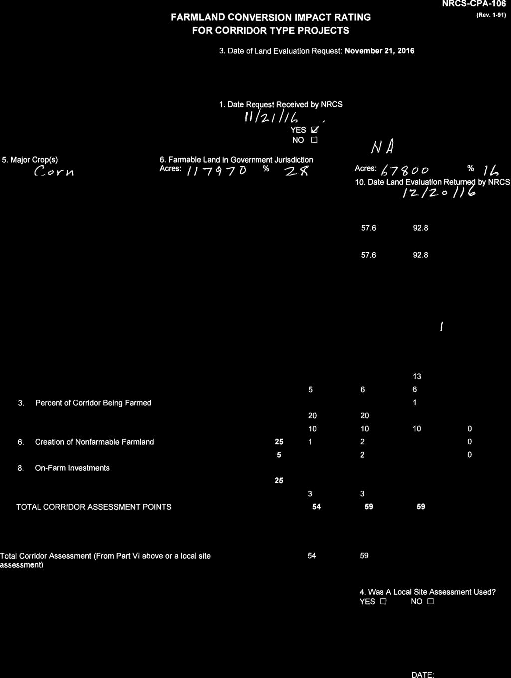
135
136 June 14, 2016 MEMO To: Heather Lowe SHA Environmental From: Lori Byrne DNR Wildlife and Heritage RE: Environmental Review for US 219 PEL: I-68 (MD) to Meyersdale (PA) In general the Wildlife and Heritage Service (WHS) does not encourage pursuing the alignments that are closest to the Casselman River, due to the likelihood of adverse impacts to rare, threatened and endangered (RT&E) species. Previous reviews of this project s alignments by WHS have generated similar concerns, so hopefully this has already been taken into account in the selection process. Details of concerns for each proposed alignment are provided below, as the WHS Natural Heritage database indicates that there are areas of potential concern known to support these records of RT&E animal and plant species: Alternative D and Western Alignment The project route crosses two tributaries to the Casselman River which is known to support these RT&E species, and is associated with Nontidal Wetlands of Special State Concern downstream. It is important to note that NTWSSCs are regulated by Maryland Department of the Environment. Scientific Name Common Name State Status animals Strophitus undulatus Creeper In Need of Conservation Cryptobranchus alleganiensis Eastern Hellbender Endangered Noturus flavus Stonecat Endangered Catostomus catostomus Longnose Sucker Endangered Extirpated Regulus satrapa Golden-crowned Kinglet Rare (breeding) Etheostoma nigrum Johnny Darter Watchlist/GCN Salvelinus fontinalus Brook Trout Watchlist Luxilus chrysocephalus Striped Shiner In Need of Conservation Boyeria grafiana Ocellated Darner Highly Rare Gomphus adelphus Mustached Clubtail Highly Rare Gomphus descriptus Harpoon Clubtail Highly Rare/Rare Gomphus viridifrons Green-faced Clubtail Highly Rare Lanthus parvulus Northern Pygmy Clubtail Rare Ophiogomphus mainensis fastigiatus Maine Snaketail Highly Rare Glyptemys insculpta Wood Turtle GCN (Of Greatest Conservation Need) Tawes State Office Building 580 Taylor Avenue Annapolis, Maryland DNR or toll free in Maryland DNR dnr.maryland.gov TTY Users Call via the Maryland Relay
137 Page 2 In addition there are these animal records documented for the South Casselman which may occur between Rt. 40 and PA line: Gomphus quadricolor Rapids Clubtail In Need of Conservation Gomphus rogersi Sable Clubtail In Need of Conservation Lanthus vernalis Southern Pygmy Clubtail Rare plants Valerianella chenopodofolia Goose-foot Cornsalad Endangered Viola appalachiensis Appalachian Blue Violet Rare Matteucia struthiopteris Ostrich Fern Rare Actaea podocarpa American Bugbane Rare As most of these species are aquatic animals and vulnerable to any changes in water quality or hydrology, it is crucial that all appropriate best management practices for sediment and erosion control be strictly enforced during all work in this area. Alternative AE This project route crosses only one tributary to Casselman River, and the above comments for the RT&E species would still apply here. Strict enforcement of all appropriate best management practices for sediment and erosion control should be incorporated into site plans. Alignment A This alignment is located within the drainage of the portion of the Casselman where the above species are found, and activities within the project route have the potential to impact this rare species habitat. Strict enforcement of all appropriate best management practices for sediment and erosion control should be incorporated into site plans. Alternative E/Alignment B These project routes are immediately adjacent to Meadow Run which is known to support these RT&E species; further coordination with WHS may be warranted. Scientific Name Common Name State Status Epilobium leptophyllum Linear-leaved Willowherb Rare/watchlist Empidonax alnorum Alder Flycatcher In Need of Conservation Ridge Alignments Both segments of this proposal cross Piney Creek which supports the following RT&E species. Of particular concern is the western segment of this alignment, as it has the potential to directly impact some of these occurrences where it crosses Piney Creek. The records are:
138 Page 3 Scientific Name Common Name State Status Strophitus undulatus Creeper In Need of Conservation Epilobium leptophyllum Linear-leaved Willowherb Rare/watchlist Phegopteris connecticus Northern Beechfern Rare Oryzopsis aperifolia Mountain-ricegrass Threatened Amblyscirtes hegon Pepper-and-Salt Skipper In Need of Conservation Luxilus chrysocephalus Striped Shiner In Need of Conservation Glyptemys insculpta Wood Turtle GCN (Of Greatest Conservation Need) Alternative E shift/alignment C/Agency Alignment/USACOE1 & 2/Upgrade/USFWS Alignment The WHS has no records for rare, threatened or endangered species occurring in or immediately adjacent to these proposed Alignments. Overall Project Site Our analysis of the information provided also suggests that the forested area on or adjacent to the project site contains Forest Interior Dwelling Bird habitat. Populations of many Forest Interior Dwelling Bird Species (FIDS) are declining in Maryland and throughout the eastern United States. The conservation of FIDS habitat is strongly encouraged by the Department of Natural Resources. The following guidelines will help minimize the project s impacts on FIDS and other native forest plants and wildlife: 1. Avoid placement of new roads or related construction in the forest interior. If forest loss or disturbance is absolutely unavoidable, restrict development to the perimeter of the forest (i.e., within 300 feet of the existing forest edge), and avoid road placement in areas of high quality FIDS habitat (e.g., old-growth forest). Maximize the amount of remaining contiguous forested habitat. 2. Do not remove or disturb forest habitat during April-August, the breeding season for most FIDS. This seasonal restriction may be expanded to February-August if certain early nesting FIDS (e.g., Barred Owl) are present. 3. Maintain forest habitat as close as possible to the road, and maintain canopy closure where possible. 4. Maintain grass height at least 10" during the breeding season (April-August). There is also the possibility of impacts to the Indiana Bat (Myotis sodalis), which is known to winter in hibernacula just over the PA/MD border. The Indiana Bat is endangered at both the Maryland state and Federal levels, and is listed as such. This species is thought to utilize ridges for its migration corridors, and may also summer in forested areas along the proposed alignments, especially along the forested edges. Thank you for allowing us the opportunity to review this project. If you should have any further questions regarding this information, please contact me at (410)
139 David Smith From: Sent: To: Subject: Tim Larney -DNR- Friday, September 30, :55 PM David Smith Fwd: US 219 Breakout Study Tim Larney -DNR- David, Lynn forwarded your request on to me. As you probably are aware we provided input into the broader 219 review when it started up a few years back. I don't know where this request fits into that process or which of the possible alignments we looked at back then it is related to. In any event I guess it does not matter. We have no occurrences in the area you delineated and no concerns regarding potential impacts. The only plant in the area that is rare (but not listed) is Linear-leaved Willowherb (Epilibium leptophylum). That currently has a state rank of S2S3. We do not feel that plant or any other species need to be surveyed for in this area. I hope this information helps. Tim Tim Larney Program Manager, Habitat Conservation Wildlife and Heritage Service Maryland Department of Natural Resources Lynn M. Davidson -DNR- Here it is... lynn 1
140 David Smith Thanks Lynn, much appreciated. David R. Smith Senior Environmental Scientist, PWS Coastal Resources, Inc. 25 Old Solomons Island Road Annapolis, MD Office: Ext. 110 Direct: FAX: Cell: resources.net From: Lynn M. Davidson DNR Sent: Thursday, September 29, :25 AM To: David Smith Subject: Re: US 219 Breakout Study Dave, 2
141 I've passed your inquiry along to Tim Larney, who has been involved with the review of this project. I'm waiting to hear back from him and will let you know. Thanks, lynn Lynn Davidson 3
142 David R. Smith Senior Environmental Scientist, PWS 4
143 United States Department of the Interior FISH AND WILDLIFE SERVICE Pennsylvania Ecological Services Field Office 315 SOUTH ALLEN STREET, SUITE 322 STATE COLLEGE, PA PHONE: (814) FAX: (814) URL: Consultation Code: 05E2PA SLI-0627 January 06, 2016 Event Code: 05E2PA E Project Name: US 219: Meyersdale to I created on April 25, :01 Subject: Updated list of threatened and endangered species that may occur in your proposed project location, and/or may be affected by your proposed project To Whom It May Concern: The enclosed species list identifies threatened, endangered, proposed and candidate species, as well as proposed and final designated critical habitat, that may occur within the boundary of your proposed project and/or may be affected by your proposed project. The species list fulfills the requirements of the U.S. Fish and Wildlife Service (Service) under section 7(c) of the Endangered Species Act (Act) of 1973, as amended (16 U.S.C et seq. ). New information based on updated surveys, changes in the abundance and distribution of species, changed habitat conditions, or other factors could change this list. Please feel free to contact us if you need more current information or assistance regarding the potential impacts to federally proposed, listed, and candidate species and federally designated and proposed critical habitat. Please note that under 50 CFR (e) of the regulations implementing section 7 of the Act, the accuracy of this species list should be verified after 90 days. This verification can be completed formally or informally as desired. The Service recommends that verification be completed by visiting the ECOS-IPaC website at regular intervals during project planning and implementation for updates to species lists and information. An updated list may be requested through the ECOS-IPaC system by completing the same process used to receive the enclosed list. The purpose of the Act is to provide a means whereby threatened and endangered species and the ecosystems upon which they depend may be conserved. Under sections 7(a)(1) and 7(a)(2) of the Act and its implementing regulations (50 CFR 402 et seq. ), Federal agencies are required to utilize their authorities to carry out programs for the conservation of threatened and endangered species and to determine whether projects may affect threatened and endangered species and/or designated critical habitat.
144 A Biological Assessment is required for construction projects (or other undertakings having similar physical impacts) that are major Federal actions significantly affecting the quality of the human environment as defined in the National Environmental Policy Act (42 U.S.C. 4332(2) (c)). For projects other than major construction activities, the Service suggests that a biological evaluation similar to a Biological Assessment be prepared to determine whether the project may affect listed or proposed species and/or designated or proposed critical habitat. Recommended contents of a Biological Assessment are described at 50 CFR If a Federal agency determines, based on the Biological Assessment or biological evaluation, that listed species and/or designated critical habitat may be affected by the proposed project, the agency is required to consult with the Service pursuant to 50 CFR 402. In addition, the Service recommends that candidate species, proposed species and proposed critical habitat be addressed within the consultation. More information on the regulations and procedures for section 7 consultation, including the role of permit or license applicants, can be found in the "Endangered Species Consultation Handbook" at: Please be aware that bald and golden eagles are protected under the Bald and Golden Eagle Protection Act (16 U.S.C. 668 et seq. ), and projects affecting these species may require development of an eagle conservation plan ( Additionally, wind energy projects should follow the wind energy guidelines ( for minimizing impacts to migratory birds and bats. Guidance for minimizing impacts to migratory birds for projects including communications towers (e.g., cellular, digital television, radio, and emergency broadcast) can be found at: and We appreciate your concern for threatened and endangered species. The Service encourages Federal agencies to include conservation of threatened and endangered species into their project planning to further the purposes of the Act. Please include the Consultation Tracking Number in the header of this letter with any request for consultation or correspondence about your project that you submit to our office. Attachment 2
145 United States Department of Interior Fish and Wildlife Service Project name: US 219: Meyersdale to I created on April 25, :01 Provided by: Official Species List Pennsylvania Ecological Services Field Office 315 SOUTH ALLEN STREET, SUITE 322 STATE COLLEGE, PA (814) Expect additional Species list documents from the following office(s): Chesapeake Bay Ecological Services Field Office 177 ADMIRAL COCHRANE DRIVE ANNAPOLIS, MD (410) Consultation Code: 05E2PA SLI-0627 Event Code: 05E2PA E Project Type: TRANSPORTATION Project Name: US 219: Meyersdale to I created on April 25, :01 Project Description: This is a new corridor project - adding 4 lanes of new roadway along one of three possible alignments. Please Note: The FWS office may have modified the Project Name and/or Project Description, so it may be different from what was submitted in your previous request. If the Consultation Code matches, the FWS considers this to be the same project. Contact the office in the 'Provided by' section of your previous Official Species list if you have any questions or concerns. 01/06/ :48 AM 1
)) Project Counties: Garrett, MD Somerset, PA http://ecos.")
146 United States Department of Interior Fish and Wildlife Service Project name: US 219: Meyersdale to I created on April 25, :01 Project Location Map: Project Coordinates: MULTIPOLYGON ((( , , , , , , ))) Project Counties: Garrett, MD Somerset, PA 01/06/ :48 AM 2
147 United States Department of Interior Fish and Wildlife Service Project name: US 219: Meyersdale to I created on April 25, :01 Endangered Species Act Species List There are a total of 2 threatened or endangered species on your species list. Species on this list should be considered in an effects analysis for your project and could include species that exist in another geographic area. For example, certain fish may appear on the species list because a project could affect downstream species. Critical habitats listed under the Has Critical Habitat column may or may not lie within your project area. See the Critical habitats within your project area section further below for critical habitat that lies within your project. Please contact the designated FWS office if you have questions. Mammals Status Has Critical Habitat Condition(s) Indiana bat (Myotis sodalis) Population: Entire Northern long-eared Bat (Myotis septentrionalis) Endangered Threatened 01/06/ :48 AM 3
148 United States Department of Interior Fish and Wildlife Service Project name: US 219: Meyersdale to I created on April 25, :01 Critical habitats that lie within your project area There are no critical habitats within your project area. 01/06/ :48 AM 4

149 PNDI Project Environmental Review Receipt Project Search ID: PROJECT INFORMATION Project Name: SR 219 PEL Study Alignment AE, E, and E Shift Date of review: 11/16/2015 2:43:20 PM Project Category: Transportation,Roads,New construction/ New alignment Project Area: acres County: Somerset Township/Municipality: Summit,Elk Lick Quadrangle Name: AVILTON ~ ZIP Code: 15552,15558 Decimal Degrees: N, W Degrees Minutes Seconds: 39 47' 35 N, W 2. SEARCH RESULTS Agency Results Response PA Game Commission Potential Impact FURTHER REVIEW IS REQUIRED, See Agency Response No Further Review Required PA Department of Conservation No Known Impact and Natural Resources PA Fish and Boat Commission Potential Impact FURTHER REVIEW IS REQUIRED, See Agency Response U.S. Fish and Wildlife Service Potential Impact FURTHER REVIEW IS REQUIRED, See Agency Response As summarized above, Pennsylvania Natural Diversity Inventory (PNDI) records indicate there may be potential impacts to threatened and endangered and/or special concern species and resources within the project area. If the response above indicates "No Further Review Required" no additional communication with the respective agency is required. If the response is "Further Review Required" or "See Agency Response," refer to the appropriate agency comments below. Please see the DEP Information Section of this receipt if a PA Department of Environmental Protection Permit is required. Page 1 of 5
150 PNDI Project Environmental Review Receipt Project Search ID: RESPONSE TO QUESTION(S) ASKED Q1: Is tree removal, tree cutting or forest clearing necessary to implement all aspects of this project? Your answer is: 2. Yes Q2: The proposed project is in the range of the Indiana bat. Describe how the project will affect potential Indiana bat habitat (forests, woodlots and trees) and indicate what measures will be taken in consideration of this. Your answer is: 4. The project will affect 40 to 200 acres of forests, woodlots and trees AND a seasonal restriction on tree clearing will be implemented. 3. AGENCY COMMENTS Regardless of whether a DEP permit is necessary for this proposed project, any potential impacts to threatened and endangered species and/or special concern species and resources must be resolved with the appropriate jurisdictional agency. In some cases, a permit or authorization from the jurisdictional agency may be needed if adverse impacts to these species and habitats cannot be avoided. These agency determinations and responses are valid for two years (from the date of the review), and are based on the project information that was provided, including the exact project location; the project type, description, and features; and any responses to questions that were generated during this search. If any of the following change: 1) project location, 2) project size or configuration, 3) project type, or 4) responses to the questions that were asked during the online review, the results of this review are not valid, and the review must be searched again via the PNDI Environmental Review Tool and resubmitted to the jurisdictional agencies. The PNDI tool is a primary screening tool, and a desktop review may reveal more or fewer impacts than what is listed on this PNDI receipt. The jursidictional agencies strongly advise against conducting surveys for the species listed on the receipt prior to consultation with the agencies. PA Game Commission RESPONSE: Further review of this project is necessary to resolve the potential impacts(s). Please send project information to this agency for review (see WHAT TO SEND). PGC Species: (Note: The PNDI tool is a primary screening tool, and a desktop review may reveal more or fewer species than what is listed below.) Scientific Name: Myotis leibii Common Name: Eastern Small-footed Myotis Current Status: Threatened Scientific Name: Sensitive Species** Common Name: Current Status: Special Concern Species* PA Department of Conservation and Natural Resources RESPONSE: No Impact is anticipated to threatened and endangered species and/or special concern species and resources. Page 2 of 5
151 PNDI Project Environmental Review Receipt Project Search ID: PA Fish and Boat Commission RESPONSE: Further review of this project is necessary to resolve the potential impacts(s). Please send project information to this agency for review (see WHAT TO SEND). PFBC Species: (Note: The PNDI tool is a primary screening tool, and a desktop review may reveal more or fewer species than what is listed below.) Scientific Name: Catostomus catostomus Common Name: Longnose Sucker Current Status: Endangered Scientific Name: Sensitive Species** Common Name: Current Status: Special Concern Species* U.S. Fish and Wildlife Service RESPONSE: Further review of this project is necessary to resolve the potential impacts(s). Please send project information to this agency for review (see WHAT TO SEND). * Special Concern Species or Resource - Plant or animal species classified as rare, tentatively undetermined or candidate as well as other taxa of conservation concern, significant natural communities, special concern populations (plants or animals) and unique geologic features. ** Sensitive Species - Species identified by the jurisdictinal agency as collectible, having economic value, or being susceptible to decline as a result of visitation. WHAT TO SEND TO JURISDICTIONAL AGENCIES If project information was requested by one or more of the agencies above, send the following information to the agency(s) seeking this information (see AGENCY CONTACT INFORMATION). Check-list of Minimum Materials to be submitted: SIGNED copy of this Project Environmental Review Receipt Project narrative with a description of the overall project, the work to be performed, current physical characteristics of the site and acreage to be impacted. Project location information (name of USGS Quadrangle, Township/Municipality, and County) USGS 7.5-minute Quadrangle with project boundary clearly indicated, and quad name on the map The inclusion of the following information may expedite the review process. A basic site plan(particularly showing the relationship of the project to the physical features such as wetlands, streams, ponds, rock outcrops, etc.) Color photos keyed to the basic site plan (i.e. showing on the site plan where and in what direction each photo was taken and the date of the photos) Information about the presence and location of wetlands in the project area, and how this was determined (e.g., by a qualified wetlands biologist), if wetlands are present in the project area, provide project plans showing Page 3 of 5
152 PNDI Project Environmental Review Receipt Project Search ID: the location of all project features, as well as wetlands and streams 4. DEP INFORMATION The Pa Department of Environmental Protection (DEP) requires that a signed copy of this receipt, along with any required documentation from jurisdictional agencies concerning resolution of potential impacts, be submitted with applications for permits requiring PNDI review. For cases where a "Potential Impact" to threatened and endangered species has been identified before the application has been submitted to DEP, the application should not be submitted until the impact has been resolved. For cases where "Potential Impact" to special concern species and resources has been identified before the application has been submitted, the application should be submitted to DEP along with the PNDI receipt. The PNDI Receipt should also be submitted to the appropriate agency according to directions on the PNDI Receipt. DEP and the jurisdictional agency will work together to resolve the potential impact(s). See the DEP PNDI policy at Page 4 of 5
153 PNDI Project Environmental Review Receipt Project Search ID: ADDITIONAL INFORMATION The PNDI environmental review website is a preliminary screening tool. There are often delays in updating species status classifications. Because the proposed status represents the best available information regarding the conservation status of the species, state jurisdictional agency staff give the proposed statuses at least the same consideration as the current legal status. If surveys or further information reveal that a threatened and endangered and/or special concern species and resources exist in your project area, contact the appropriate jurisdictional agency/agencies immediately to identify and resolve any impacts. For a list of species known to occur in the county where your project is located, please see the species lists by county found on the PA Natural Heritage Program (PNHP) home page ( Also note that the PNDI Environmental Review Tool only contains information about species occurrences that have actually been reported to the PNHP. 6. AGENCY CONTACT INFORMATION PA Department of Conservation and Natural Resources Bureau of Forestry, Ecological Services Section 400 Market Street, PO Box 8552, Harrisburg, PA Fax:(717) PA Fish and Boat Commission Division of Environmental Services 450 Robinson Lane, Bellefonte, PA NO Faxes Please 7. PROJECT CONTACT INFORMATION U.S. Fish and Wildlife Service Pennsylvania Field Office 110 Radnor Rd; Suite 101, State College, PA NO Faxes Please. PA Game Commission Bureau of Wildlife Habitat Management Division of Environmental Planning and Habitat Protection 2001 Elmerton Avenue, Harrisburg, PA Fax:(717) Name: Company/Business Name: Address: City, State, Zip: Phone:( ) Fax:( ) 8. CERTIFICATION I certify that ALL of the project information contained in this receipt (including project location, project size/configuration, project type, answers to questions) is true, accurate and complete. In addition, if the project type, location, size or configuration changes, or if the answers to any questions that were asked during this online review change, I agree to re-do the online environmental review. applicant/project proponent signature date Page 5 of 5

154 PNDI Project Environmental Review Receipt Project Search ID: PROJECT INFORMATION Project Name: SR 219 PEL Study Alignment D Date of review: 11/16/2015 2:31:17 PM Project Category: Transportation,Roads,New construction/ New alignment Project Area: acres County: Somerset Township/Municipality: Elk Lick,Summit Quadrangle Name: AVILTON ~ ZIP Code: 15552,15558 Decimal Degrees: N, W Degrees Minutes Seconds: 39 47' 21 N, W 2. SEARCH RESULTS Agency Results Response PA Game Commission Potential Impact FURTHER REVIEW IS REQUIRED, See Agency Response No Further Review Required PA Department of Conservation No Known Impact and Natural Resources PA Fish and Boat Commission Potential Impact FURTHER REVIEW IS REQUIRED, See Agency Response U.S. Fish and Wildlife Service Potential Impact FURTHER REVIEW IS REQUIRED, See Agency Response As summarized above, Pennsylvania Natural Diversity Inventory (PNDI) records indicate there may be potential impacts to threatened and endangered and/or special concern species and resources within the project area. If the response above indicates "No Further Review Required" no additional communication with the respective agency is required. If the response is "Further Review Required" or "See Agency Response," refer to the appropriate agency comments below. Please see the DEP Information Section of this receipt if a PA Department of Environmental Protection Permit is required. Page 1 of 5
155 PNDI Project Environmental Review Receipt Project Search ID: RESPONSE TO QUESTION(S) ASKED Q1: Is tree removal, tree cutting or forest clearing necessary to implement all aspects of this project? Your answer is: 2. Yes Q2: The proposed project is in the range of the Indiana bat. Describe how the project will affect potential Indiana bat habitat (forests, woodlots and trees) and indicate what measures will be taken in consideration of this. Your answer is: 4. The project will affect 40 to 200 acres of forests, woodlots and trees AND a seasonal restriction on tree clearing will be implemented. 3. AGENCY COMMENTS Regardless of whether a DEP permit is necessary for this proposed project, any potential impacts to threatened and endangered species and/or special concern species and resources must be resolved with the appropriate jurisdictional agency. In some cases, a permit or authorization from the jurisdictional agency may be needed if adverse impacts to these species and habitats cannot be avoided. These agency determinations and responses are valid for two years (from the date of the review), and are based on the project information that was provided, including the exact project location; the project type, description, and features; and any responses to questions that were generated during this search. If any of the following change: 1) project location, 2) project size or configuration, 3) project type, or 4) responses to the questions that were asked during the online review, the results of this review are not valid, and the review must be searched again via the PNDI Environmental Review Tool and resubmitted to the jurisdictional agencies. The PNDI tool is a primary screening tool, and a desktop review may reveal more or fewer impacts than what is listed on this PNDI receipt. The jursidictional agencies strongly advise against conducting surveys for the species listed on the receipt prior to consultation with the agencies. PA Game Commission RESPONSE: Further review of this project is necessary to resolve the potential impacts(s). Please send project information to this agency for review (see WHAT TO SEND). PGC Species: (Note: The PNDI tool is a primary screening tool, and a desktop review may reveal more or fewer species than what is listed below.) Scientific Name: Myotis leibii Common Name: Eastern Small-footed Myotis Current Status: Threatened Scientific Name: Sensitive Species** Common Name: Current Status: Special Concern Species* PA Department of Conservation and Natural Resources RESPONSE: No Impact is anticipated to threatened and endangered species and/or special concern species and resources. Page 2 of 5
156 PNDI Project Environmental Review Receipt Project Search ID: PA Fish and Boat Commission RESPONSE: Further review of this project is necessary to resolve the potential impacts(s). Please send project information to this agency for review (see WHAT TO SEND). PFBC Species: (Note: The PNDI tool is a primary screening tool, and a desktop review may reveal more or fewer species than what is listed below.) Scientific Name: Catostomus catostomus Common Name: Longnose Sucker Current Status: Endangered Scientific Name: Sensitive Species** Common Name: Current Status: Special Concern Species* U.S. Fish and Wildlife Service RESPONSE: Further review of this project is necessary to resolve the potential impacts(s). Please send project information to this agency for review (see WHAT TO SEND). * Special Concern Species or Resource - Plant or animal species classified as rare, tentatively undetermined or candidate as well as other taxa of conservation concern, significant natural communities, special concern populations (plants or animals) and unique geologic features. ** Sensitive Species - Species identified by the jurisdictinal agency as collectible, having economic value, or being susceptible to decline as a result of visitation. WHAT TO SEND TO JURISDICTIONAL AGENCIES If project information was requested by one or more of the agencies above, send the following information to the agency(s) seeking this information (see AGENCY CONTACT INFORMATION). Check-list of Minimum Materials to be submitted: SIGNED copy of this Project Environmental Review Receipt Project narrative with a description of the overall project, the work to be performed, current physical characteristics of the site and acreage to be impacted. Project location information (name of USGS Quadrangle, Township/Municipality, and County) USGS 7.5-minute Quadrangle with project boundary clearly indicated, and quad name on the map The inclusion of the following information may expedite the review process. A basic site plan(particularly showing the relationship of the project to the physical features such as wetlands, streams, ponds, rock outcrops, etc.) Color photos keyed to the basic site plan (i.e. showing on the site plan where and in what direction each photo was taken and the date of the photos) Information about the presence and location of wetlands in the project area, and how this was determined (e.g., by a qualified wetlands biologist), if wetlands are present in the project area, provide project plans showing Page 3 of 5
157 PNDI Project Environmental Review Receipt Project Search ID: the location of all project features, as well as wetlands and streams 4. DEP INFORMATION The Pa Department of Environmental Protection (DEP) requires that a signed copy of this receipt, along with any required documentation from jurisdictional agencies concerning resolution of potential impacts, be submitted with applications for permits requiring PNDI review. For cases where a "Potential Impact" to threatened and endangered species has been identified before the application has been submitted to DEP, the application should not be submitted until the impact has been resolved. For cases where "Potential Impact" to special concern species and resources has been identified before the application has been submitted, the application should be submitted to DEP along with the PNDI receipt. The PNDI Receipt should also be submitted to the appropriate agency according to directions on the PNDI Receipt. DEP and the jurisdictional agency will work together to resolve the potential impact(s). See the DEP PNDI policy at Page 4 of 5
158 PNDI Project Environmental Review Receipt Project Search ID: ADDITIONAL INFORMATION The PNDI environmental review website is a preliminary screening tool. There are often delays in updating species status classifications. Because the proposed status represents the best available information regarding the conservation status of the species, state jurisdictional agency staff give the proposed statuses at least the same consideration as the current legal status. If surveys or further information reveal that a threatened and endangered and/or special concern species and resources exist in your project area, contact the appropriate jurisdictional agency/agencies immediately to identify and resolve any impacts. For a list of species known to occur in the county where your project is located, please see the species lists by county found on the PA Natural Heritage Program (PNHP) home page ( Also note that the PNDI Environmental Review Tool only contains information about species occurrences that have actually been reported to the PNHP. 6. AGENCY CONTACT INFORMATION PA Department of Conservation and Natural Resources Bureau of Forestry, Ecological Services Section 400 Market Street, PO Box 8552, Harrisburg, PA Fax:(717) PA Fish and Boat Commission Division of Environmental Services 450 Robinson Lane, Bellefonte, PA NO Faxes Please 7. PROJECT CONTACT INFORMATION U.S. Fish and Wildlife Service Pennsylvania Field Office 110 Radnor Rd; Suite 101, State College, PA NO Faxes Please. PA Game Commission Bureau of Wildlife Habitat Management Division of Environmental Planning and Habitat Protection 2001 Elmerton Avenue, Harrisburg, PA Fax:(717) Name: Company/Business Name: Address: City, State, Zip: Phone:( ) Fax:( ) 8. CERTIFICATION I certify that ALL of the project information contained in this receipt (including project location, project size/configuration, project type, answers to questions) is true, accurate and complete. In addition, if the project type, location, size or configuration changes, or if the answers to any questions that were asked during this online review change, I agree to re-do the online environmental review. applicant/project proponent signature date Page 5 of 5
159
160 Project Location US 219 from I-68 to Old Salisbury Road Sources: Esri, HERE, DeLorme, USGS, Intermap, increment P Corp., NRCAN, Esri Japan, METI, Esri China (Hong Kong), Esri (Thailand), MapmyIndia, OpenStreetMap contributors, and the GIS User Community Scale: 1: 24,000 MilesÜ
161 United States Department of the Interior FISH AND WILDLIFE SERVICE Chesapeake Bay Ecological Services Field Office 177 ADMIRAL COCHRANE DRIVE ANNAPOLIS, MD PHONE: (410) FAX: (410) URL: Consultation Code: 05E2CB SLI-1634 August 03, 2016 Event Code: 05E2CB E Project Name: US 219 Improvement Project Subject: List of threatened and endangered species that may occur in your proposed project location, and/or may be affected by your proposed project To Whom It May Concern: The enclosed species list identifies threatened, endangered, proposed and candidate species, as well as proposed and final designated critical habitat, that may occur within the boundary of your proposed project and/or may be affected by your proposed project. This species list fulfills the requirements of the U.S. Fish and Wildlife Service (Service) under section 7(c) of the Endangered Species Act (Act) of 1973, as amended (16 U.S.C et seq. ). New information based on updated surveys, changes in the abundance and distribution of species, changed habitat conditions, or other factors could change this list. Please feel free to contact us if you need more current information or assistance regarding the potential impacts to federally proposed, listed, and candidate species and federally designated and proposed critical habitat. Please note that under 50 CFR (e) of the regulations implementing section 7 of the Act, the accuracy of this species list should be verified after 90 days. This verification can be completed formally or informally as desired. The Service recommends that verification be completed by visiting the ECOS-IPaC website at regular intervals during project planning and implementation for updates to species lists and information. An updated list may be requested through the ECOS-IPaC system by completing the same process used to receive the enclosed list. The purpose of the Act is to provide a means whereby threatened and endangered species and the ecosystems upon which they depend may be conserved. Under sections 7(a)(1) and 7(a)(2) of the Act and its implementing regulations (50 CFR 402 et seq. ), Federal agencies are required to utilize their authorities to carry out programs for the conservation of threatened and endangered species and to determine whether projects may affect threatened and endangered species and/or designated critical habitat.
162 A Biological Assessment is required for construction projects (or other undertakings having similar physical impacts) that are major Federal actions significantly affecting the quality of the human environment as defined in the National Environmental Policy Act (42 U.S.C. 4332(2) (c)). For projects other than major construction activities, the Service suggests that a biological evaluation similar to a Biological Assessment be prepared to determine whether the project may affect listed or proposed species and/or designated or proposed critical habitat. Recommended contents of a Biological Assessment are described at 50 CFR If a Federal agency determines, based on the Biological Assessment or biological evaluation, that listed species and/or designated critical habitat may be affected by the proposed project, the agency is required to consult with the Service pursuant to 50 CFR 402. In addition, the Service recommends that candidate species, proposed species and proposed critical habitat be addressed within the consultation. More information on the regulations and procedures for section 7 consultation, including the role of permit or license applicants, can be found in the "Endangered Species Consultation Handbook" at: Please be aware that bald and golden eagles are protected under the Bald and Golden Eagle Protection Act (16 U.S.C. 668 et seq. ), and projects affecting these species may require development of an eagle conservation plan ( Additionally, wind energy projects should follow the wind energy guidelines ( for minimizing impacts to migratory birds and bats. Guidance for minimizing impacts to migratory birds for projects including communications towers (e.g., cellular, digital television, radio, and emergency broadcast) can be found at: and We appreciate your concern for threatened and endangered species. The Service encourages Federal agencies to include conservation of threatened and endangered species into their project planning to further the purposes of the Act. Please include the Consultation Tracking Number in the header of this letter with any request for consultation or correspondence about your project that you submit to our office. Attachment 2
163 United States Department of Interior Fish and Wildlife Service Project name: US 219 Improvement Project Provided by: Official Species List Chesapeake Bay Ecological Services Field Office 177 ADMIRAL COCHRANE DRIVE ANNAPOLIS, MD (410) Consultation Code: 05E2CB SLI-1634 Event Code: 05E2CB E Project Type: TRANSPORTATION Project Name: US 219 Improvement Project Project Description: The Maryland Department of Transportation's State Highway Administration is studying potential improvements along US 219 from I-68 to Old Salisbury Road in Garrett County. The study will evaluate alternatives for addressing existing economic development, safety, and mobility needs in the study area. Please Note: The FWS office may have modified the Project Name and/or Project Description, so it may be different from what was submitted in your previous request. If the Consultation Code matches, the FWS considers this to be the same project. Contact the office in the 'Provided by' section of your previous Official Species list if you have any questions or concerns. 08/03/ :53 AM 1

164 United States Department of Interior Fish and Wildlife Service Project name: US 219 Improvement Project Project Location Map: Project Coordinates: MULTIPOLYGON ((( , , , , , , ))) Project Counties: Garrett, MD 08/03/ :53 AM 2
165 United States Department of Interior Fish and Wildlife Service Project name: US 219 Improvement Project Endangered Species Act Species List There are a total of 1 threatened or endangered species on your species list. Species on this list should be considered in an effects analysis for your project and could include species that exist in another geographic area. For example, certain fish may appear on the species list because a project could affect downstream species. Critical habitats listed under the Has Critical Habitat column may or may not lie within your project area. See the Critical habitats within your project area section further below for critical habitat that lies within your project. Please contact the designated FWS office if you have questions. Mammals Status Has Critical Habitat Condition(s) Indiana bat (Myotis sodalis) Population: Entire Endangered 08/03/ :53 AM 3
166 United States Department of Interior Fish and Wildlife Service Project name: US 219 Improvement Project Critical habitats that lie within your project area There are no critical habitats within your project area. 08/03/ :53 AM 4
167 United States Department of Interior Fish and Wildlife Service Project name: US 219 Improvement Project Appendix A: FWS National Wildlife Refuges and Fish Hatcheries There are no refuges or fish hatcheries within your project area. 08/03/ :53 AM - Appendix A 1
168 United States Department of Interior Fish and Wildlife Service Project name: US 219 Improvement Project Appendix B: NWI Wetlands The U.S. Fish and Wildlife Service is the principal Federal agency that provides information on the extent and status of wetlands in the U.S., via the National Wetlands Inventory Program (NWI). In addition to impacts to wetlands within your immediate project area, wetlands outside of your project area may need to be considered in any evaluation of project impacts, due to the hydrologic nature of wetlands (for example, project activities may affect local hydrology within, and outside of, your immediate project area). It may be helpful to refer to the USFWS National Wetland Inventory website. The designated FWS office can also assist you. Impacts to wetlands and other aquatic habitats from your project may be subject to regulation under Section 404 of the Clean Water Act, or other State/Federal Statutes. Project Proponents should discuss the relationship of these requirements to their project with the Regulatory Program of the appropriate U.S. Army Corps of Engineers District. The Service's objective of mapping wetlands and deepwater habitats is to produce reconnaissance level information on the location, type and size of these resources. The maps are prepared from the analysis of high altitude imagery. Wetlands are identified based on vegetation, visible hydrology and geography. A margin of error is inherent in the use of imagery; thus, detailed on-the-ground inspection of any particular site may result in revision of the wetland boundaries or classification established through image analysis. The accuracy of image interpretation depends on the quality of the imagery, the experience of the image analysts, the amount and quality of the collateral data and the amount of ground truth verification work conducted. Metadata should be consulted to determine the date of the source imagery used and any mapping problems. Wetlands or other mapped features may have changed since the date of the imagery and/or field work. There may be occasional differences in polygon boundaries or classifications between the information depicted on the map and the actual conditions on site. Exclusions - Certain wetland habitats are excluded from the National mapping program because of the limitations of aerial imagery as the primary data source used to detect wetlands. These habitats include seagrasses or submerged aquatic vegetation that are found in the intertidal and subtidal zones of estuaries and nearshore coastal waters. Some deepwater reef communities (coral or tuberficid worm reefs) have also been excluded from the inventory. These habitats, because of their depth, go undetected by aerial imagery. Precautions - Federal, state, and local regulatory agencies with jurisdiction over wetlands may define and describe wetlands in a different manner than that used in this inventory. There is no attempt, in either the design or products of 08/03/ :53 AM - Appendix B 1
169 United States Department of Interior Fish and Wildlife Service Project name: US 219 Improvement Project this inventory, to define the limits of proprietary jurisdiction of any Federal, state, or local government or to establish the geographical scope of the regulatory programs of government agencies. Persons intending to engage in activities involving modifications within or adjacent to wetland areas should seek the advice of appropriate federal, state, or local agencies concerning specified agency regulatory programs and proprietary jurisdictions that may affect such activities. The following NWI Wetland types intersect your project area in one or more locations. To understand the NWI Classification Code, see To view the National Wetlands Inventory on a map go to Wetland Types Freshwater Emergent Wetland Freshwater Emergent Wetland Freshwater Emergent Wetland Freshwater Forested/Shrub Wetland Freshwater Forested/Shrub Wetland Freshwater Forested/Shrub Wetland Freshwater Forested/Shrub Wetland Freshwater Forested/Shrub Wetland Freshwater Pond Freshwater Pond Riverine Riverine NWI Classification Code PEM5A PEM5Ad PEM5C PFO1A PFO4/SS4A PSS1/EM5Ad PSS1A PSS1C PUBHh PUBHx R3UBH R5UBH 08/03/ :53 AM - Appendix B 2
170 David Smith From: Sent: To: Cc: Subject: Li, Ray Wednesday, August 03, :48 AM Karen Arnold Julie Thompson; Chris Guy; Clark, Trevor Re: US 219 IPaC update Hi Karen, IPaC has been updated with the new northern long-eared bat roost sites from the US 219 bat surveys. We are coordinating with our Pennsylvania office on the next steps in the review of this project. Thanks Karen. 1
171 2
172 David Smith From: Sent: To: Cc: Subject: Attachments: Li, Ray Wednesday, August 10, :46 AM Bob Maimone Karen Arnold; Trevor Clark; Julie Thompson; Chris Guy; Cherry Keller Fwd: SHA Project Review Request - US 219 Improvement Project USFWS Request pdf Clark, Trevor Bob Maimone Please find the attached MD SHA Project Review Request: US 219 Improvement Project (Garrett County). Feel free to contact me with any questions. Thanks! 1
173 Right-click here to download pictures. To help p ro tect your privacy, Outlook prevented automatic download of this picture from the Internet. 2
174 3
175 David Smith From: Sent: To: Cc: Subject: Li, Ray Wednesday, August 03, :50 PM Karen Arnold Julie Thompson; Chris Guy; Clark, Trevor; Bob Maimone Re: US 219 IPaC update Hi, Thank you for the update Ray. I had asked Bob to complete the IPAC submission this week, so it is good that we are all on the same page at the same time. I am wondering about the timing. Right now we have several alignments, but by 2017 MDOT/SHA will have completed the process sufficiently to be down to just one (preferred) alignment. Since we have the B.O., would it make more sense to start the amending process in January/February? We would need it to be concluded by June though. My preference would be to start in September, but I want your thoughts. Right now the alignments are No Build, Widen, New Alignment (not that far to the east of existing US 219), with four interchange configurations, but we haven t taken these alignments to FHWA, the agencies or citizens yet. Would this discussion be better in person or by phone? At some point I want to discuss the mitigation in the B.O. with you too. I may have just convinced myself that a meeting is better when would work for you? Thanks, Karen MDOT s State Highway Administration 1
176 707 North Calvert Street, Mailstop C 301 Baltimore, Maryland karnold@sha.state.md.us Phone: (toll free) Fax: From: Li, Ray [mailto:ray_li@fws.gov] Sent: Wednesday, August 03, :48 AM To: Karen Arnold <karnold@sha.state.md.us> Cc: Julie Thompson <julie_thompson@fws.gov>; Chris Guy <chris_guy@fws.gov>; Clark, Trevor <trevor_clark@fws.gov> Subject: Re: US 219 IPaC update 2
177 Hi Karen, IPaC has been updated with the new northern long-eared bat roost sites from the US 219 bat surveys. We are coordinating with our Pennsylvania office on the next steps in the review of this project. Thanks Karen. 3
178
179
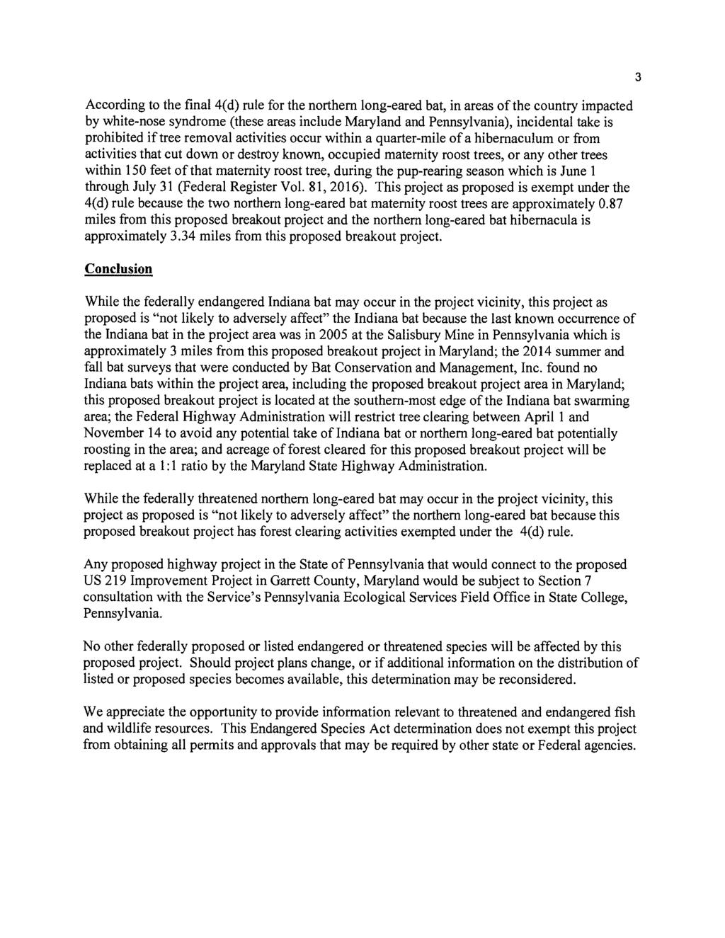
180
181
182
183
184
185
186
187 US 219 FROM I-68 TO OLD SALISBURY ROAD TABLE OF CONTENTS I. Introduction...1 II. Proposed Action...1 A. Purpose & Need for the Project...1 B. Alternative 4 Modified: Roundabout Interchange with Local and Relocated US III. Section 4(f) Properties...8 A. National Road...8 B. Tomlinson Inn and the Little Meadows (Stone House)...10 IV. Impacts to Section 4(f) Properties...12 A. Alternative 1: No-Build...12 B. Alternative 2: Widened Existing US C. Alternative 3: Existing Interchange with Local and Relocated US D. Alternative 4: Roundabout Interchange with Local and Relocated US E. Alternative 4 Modified: Roundabout Interchange with Local and Relocated US V. Avoidance Alternatives and Analysis...25 A. No-Build Alternative...25 B. Relocation of US 219 to the West...25 C. Relocation of US 219 to the East...26 D. Avoidance Analysis Results...26 VI. Analysis of All Possible Planning to Minimize Harm...27 A. Widen Existing US 219 to 4-Lane Undivided Highway...27 B. PEL Alignments D and AE...29 C. Optimize Alignment of Proposed Relocated US D. Minimize New Alignment Roadway Width...31 E. Mitigation...32 F. Minimization Analysis Results...33 VII. Least Overall Harm...33 A. Least Overall Harm Analysis...33 B. Least Overall Harm Analysis Results...37 VIII. Coordination...40 IX. Conclusion...42 FINAL SECTION 4(f) EVALUATION i
188 US 219 FROM I-68 TO OLD SALISBURY ROAD Appendix A: Correspondence LIST OF APPENDICES LIST OF TABLES Table 1: Summary of Section 4(f) Uses...13 Table 2: Summary of Environmental Impacts...34 Table 3: Least Overall Harm Analysis Summary...38 LIST OF FIGURES Figure 1: Project Location & Study Area...2 Figure 2: Casselman Farm Development Site...4 Figure 3 Preferred Alternative: Alternative 4 Modified...7 Figure 4: National Road &Tomlinson Inn and the Little Meadows (Stone House)...9 Figure 5: Section 4(f) Use: Alternative Figure 6: Section 4(f) Use: Alternative Figure 7: Section 4(f) Use: Alternative Figure 8: Section 4(f) Use: Alternative 4 Modified...24 Figure 9: Minimization Option: Widen Existing US 219 to 4-Lane Undivided Highway...28 Figure 10: Minimization Option: PEL Alignments D & AE...30 FINAL SECTION 4(f) EVALUATION ii
189 US 219 FROM I-68 TO OLD SALISBURY ROAD I. Introduction Section 4(f), as amended and codified in the U.S. Department of Transportation Act of 1966, 49 U.S.C. 303 (c), states that the Federal Highway Administration (FHWA) may not approve the use of land from a significant publicly owned public park, recreation area, or wildlife and waterfowl refuge, or any significant historic site unless a determination is made that: 1) there is no feasible and prudent alternative to the use of land from the property and 2) the action includes all possible planning to minimize harm to the property resulting from such use [23 CFR 774.3(a)]. This Final Section 4(f) Evaluation has been prepared in accordance with 23 CFR 774 and 49 U.S.C. 303 to assess the potential effects of the US 219 Improvement Project, from I-68 to Old Salisbury Road, upon Section 4(f) resources and evaluate options that avoid or minimize impacts to those resources caused by the project's build alternatives. The Draft Section 4(f) Evaluation was approved on January 6, and was provided for coordination and comment to the Maryland Historical Trust (MHT), which serves as the official with jurisdiction over the impacted Section 4(f) properties, on January 23, The US 219 Improvement Project, from I-68 to Old Salisbury Road, is a 1.4-mile roadway project with logical termini at the I-68/US 219 Interchange and Old Salisbury Road. This standalone breakout project originated from the US 219: I-68 (MD) to Meyersdale (PA) Planning and Environment Linkages (PEL) study, which was completed by the Maryland Department of Transportation State Highway Administration (MDOT SHA), in collaboration with the Pennsylvania Department of Transportation (PennDOT) and FHWA, in July The decision to advance the US 219 Improvement Project separately from PennDot was made due to the different funding priorities between the two states. All of the Section 4(f) resources within the Maryland portion of the PEL study are contained within the stand-alone project in northern Garrett County, Maryland (Figure 1). II. Proposed Action A. Purpose & Need for the Project US 219 is a two-way rural arterial that provides access to industrial, commercial and residential properties in the project area with a posted speed limit of 40 miles per hour, from the I-68/ US 219 Interchange to Old Salisbury Road. There is one signalized intersection along US 219 within the project area, located at US 40 Alternate. I-68 provides east-west access between Maryland and West Virginia and is connected to US 219 by a diamond interchange. North of I-68, along US 219, there is a Pilot Travel Center and a commercial property containing a Sunoco gas station, Burger King, Little Caesar s, and IHOP restaurants. There are currently no sidewalks on either side of US 219, although there are more than 35 residences along the project corridor. The primary purpose of the US 219 Improvement Project is to provide transportation improvements that are responsive to planned economic development. Currently, developers are interested in the proposed Casselman Farm Development Site with County support in providing FINAL SECTION 4(f) EVALUATION 1
190 US 219 Improvement Project Project Location & Study Area ,000 Feet Garrett Allegany Project Limits Project Limits Figure 1: Project Location & Study Area Legend Existing US 219 Project Limits
191 US 219 FROM I-68 TO OLD SALISBURY ROAD the necessary infrastructure. The proposed Casselman Farm Development site is a 340-acre mixed use/industrial site in northeast Garrett County within an economic development area identified in Garrett County's Comprehensive Plan (2008) as the Chestnut Ridge Development Corridor (CRDC) (Figure 2). Improved access to the CRDC may help improve Garrett County s economic viability and competitiveness within the region. The mountainous terrain and the amount of public lands in Garrett County is an impediment to economic growth in that area. Only 2.8 percent of the land area in Garrett County is located within Priority Funding Areas (PFAs). In light of these facts, Garrett County evaluated its land opportunities and identified the CRDC as a strategic opportunity because it encompassed a relatively large expanse of available, developable land with access to the interstate as well as key municipal markets. Few opportunities such as this exist within Garrett County. According to a report entitled Economic Impacts of US Route 219 Alignments on Chestnut Ridge Development prepared by the Maryland Department of Transportation s Office of Planning and Capital Programming, the CRDC would benefit Garrett County through the creation of 269 temporary (construction) jobs and 875 permanent jobs. Improving access to the CRDC is expected to maximize the corridor s land use potential; potentially enabling larger industrial businesses better access to I-68. A direct roadway connection would facilitate development of the proposed Casselman Farm Development site while also supporting future regional connectivity by completing the 1.4 miles of eligible Appalachian Development Highway System (ADHS) mileage in Maryland. The ADHS is a network of 32-highways spanning 3,090 miles and 13 states that was established to connect communities to commerce and address persistent poverty in the Appalachia region. The Average Daily Traffic volume (ADT) along this segment of US 219 in 2015 was 4,250 vehicles per day, 17 percent of which were trucks. According to traffic projections derived from the Maryland Statewide Transportation Model 1, the ADT is expected to increase to 5,800 vehicles per day by 2045 even if the Casselman Farm Development does not occur. With the development of the proposed Casselman Farm Development site, the ADT could increase to as much as 7,000 to 10,000 vehicles per day. Therefore, the development of the proposed Casselman Farm Development site would yield higher volumes of mid-to-heavy-duty trucks throughout the corridor. A supporting purpose of this project is to address safety and mobility concerns related to the projected increase in the truck volumes along US 219 and the mixing of trucks with local traffic. 1 Traffic projections for the US 219 corridor were derived from the Maryland Statewide Transportation Model (MSTM) regional growth analysis (see US 219 Study: Meyersdale to I-68 Analysis of Regional Travel Demand dated September 18, 2014) and the Casselman proposed land use (see Casselman Farm Concept by K&D dated June 3, 2014), which included nearly 160 acres of industrial use and 180 acres of residential use. Due to the high industrial demand in the Casselman Farm development and because the corridor already generates high truck volumes, the future year traffic projections yielded higher volumes of mid-toheavy-duty trucks. A short description of how the MSTM is used can be found at The above referenced reports, along with the MSTM regional demand model itself, are available upon request from the MDOT SHA Travel Forecasting and Analysis Division (TFAD). DRAFT SECTION 4(f) EVALUATION 3
192 US 219 Improvement Project Casselman Farm Development Site ,000 Feet Garrett Allegany Figure 2: Casselman Farm Development Site Legend Casselman Farm Development Site Chestnut Ridge Development Corridor
193 US 219 FROM I-68 TO OLD SALISBURY ROAD Recent crash data for the project area corridor was assessed for the three-year period from January 1, 2013 to December 31, Sixteen crashes were recorded during this period. Of those 16 crashes, approximately 57 percent were categorized as angle crashes and approximately 19 percent were categorized as left-turn crashes. Crash rates for both the angle and left-turn crashes along this segment of US 219 are higher than the statewide average. 2 A major factor in the high percentage of angle crashes is the large number of access points along the corridor. These access points increase conflicts between vehicles making turns to enter or exit US 219 more difficult as opposing vehicles are crossing paths at higher rates of speed to or from I-68. Ultimately, the US 219 Improvement Project would deliver a portion of the missing transportation link needed to connect I-68 in Maryland to Meyersdale, Pennsylvania, and is consistent with the goals and vision of the ADHS (which is intended to generate economic development in previously isolated areas by supplementing the interstate system in Appalachia and by providing access to underserved market areas within the Appalachian Region). Though this stand-alone project will not make the overall connection of US 219 between I-68 to the south and Meyersdale to the north, it will have a significant incremental improvement with both short term and long term benefits. The ADHS was implemented to support goals of linking the Appalachian Region of the United States with larger population and economic centers. These goals aim to increase jobs, reduce the isolation of Appalachia, and provide an overall opportunity for the region to compete economically on a larger scale. These goals set forth a need for economic development for this area of Garrett County, specifically, a need to support economic development for the CRDC. Specific economic development needs can be viewed in three primary categories: Support regional and local economic growth Efficient highway operations for development Maintain a sustainable community in northern Garrett County. By serving the PFA, the US 219 Improvement project is anticipated to have direct impacts to the Section 4(f) resources. However, as a limited access highway, the US 219 Improvement project is anticipated to have minor indirect impacts to those resources. B. Alternative 4 Modified: Roundabout Interchange with Local and Relocated US 219 Alternative 4 Modified has been identified as the Preferred Alternative. Alternative 4 Modified, which is described in detail below, is identical to Alternative 4 except that Alternative 4 Modified includes a second roundabout at the intersection of US 219 with the ramps to and from eastbound I-68. The second roundabout was added as a refinement to the design of Alternative 4 following the February 2017 public hearing because it would reduce conflict points and improve safety along US 219. Alternative 4 Modified proposes a new four-lane divided highway east of 2 See Figure 5 in the US 219 from I-68 to Old Salisbury Road Purpose & Need Report (October 2016). FINAL SECTION 4(f) EVALUATION 5
194 US 219 FROM I-68 TO OLD SALISBURY ROAD existing US 219, from I-68 to Old Salisbury Road, as well as modification of the existing I-68 interchange (Figure 3). The modified interchange would include a new loop ramp from westbound I-68 to existing US 219 as well as a new two-lane roundabout north of I-68 and a new single-lane roundabout south of I-68. The intersection of proposed relocated US 219 and US 40 Alternate would be grade-separated with proposed relocated US 219 being carried over US 40 Alternate on a new overpass. Although it would have the highest cost and would require somewhat greater impacts to certain environmental resources, Alternative 4 Modified offers several key advantages over the Alternatives 2, 3, and 4 (which are also described in detail below) that make it the best option for addressing the project needs. Alternative 4 Modified would reduce potential operational and safety concerns in comparison to Alternative 2 by creating a completely separate facility to allow truck traffic to separate from local traffic destined for the residences and businesses along existing US 219. One of the major advantages of Alternative 4 Modified is that the presence of a separate, controlled-access expressway would allow traffic, especially heavy trucks, traveling between I-68 and the Casselman Farm Development site to maintain a consistent high speed without the need to slow or stop between the two termini. Additionally, unlike Alternative 2, Alternative 4 Modified would not introduce restrictions to left-turn access to residences and businesses along existing US 219. Similar to Alternative 3, Alternative 4 Modified would allow for a greater level of flexibility in providing a connection to future US 219 improvements between the northern terminus of this project and Myersdale, Pennsylvania when compared to Alternative 2. Alternative 4 would offer the same key advantages over Alternatives 2 and 3 described above for Alternative 4 Modified. However, Alternative 4 Modified would provide additional benefits in comparison to Alternative 4. With the addition of the second roundabout at the southern limit of the project, Alternative 4 Modified would eliminate a traditional intersection, thereby further reducing conflict points and improving safety. In addition, the second roundabout would slow traffic down through the interchange, which would also improve safety. Furthermore, the second roundabout would allow for more continuous traffic flow in the vicinity of the interchange as drivers would not necessarily be required to stop to enter the roundabout. Finally, Alternative 4 Modified would fit better with driver expectancy than Alternative 4 as there would be a roundabout on each side of the interchange and drivers would have to utilize a roundabout to enter or exit I-68 from any direction. In terms of supporting regional and local economic growth, Alternative 4 Modified could improve the amount or quality of potential commercial or industrial tenants choosing to locate at the Casselman Farm Development site because it would provide a separate, controlled-access expressway between I-68 and the entrance to the site. Providing faster and easier access to the Casselman Farm Development site from the interstate would also improve opportunities for a sustainable community because it would make the location of the site more attractive to prospective tenants, especially those for which convenient access to the interstate system is an important factor in their decision on where to locate. Therefore, Alternative 4 Modified would best support regional and local economic growth because, under this alternative, the growth potential of the Casselman Farm Development site would not be limited by the scale of the roadway improvements. FINAL SECTION 4(f) EVALUATION 6
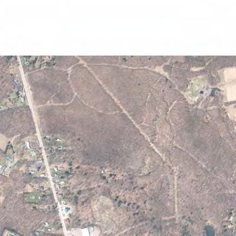
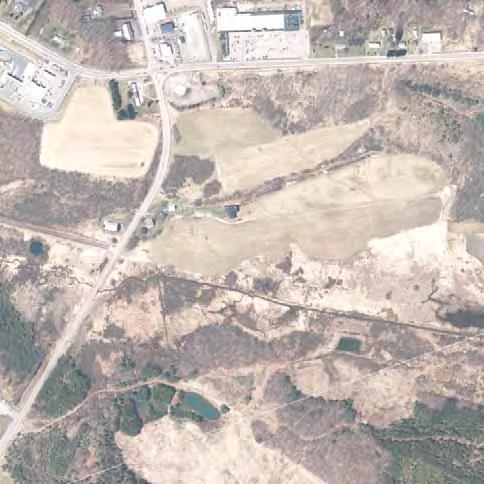
195
196 US 219 FROM I-68 TO OLD SALISBURY ROAD There are no planned transportation projects in the ICE boundary aside from the US 219 Improvement Study. A major area of development in the future could be the mixed-use zoning CRDC which could provide 150 new jobs as well as new housing by Sewage service at the CRDC has been in place since 1995 and the area is planned for water service within the next 10 years. Access to the CRDC is currently available along US 40 Alternate and additional access to the site from existing US 219 is expected to be available in the future. Therefore, this development is not dependent upon this project and could occur regardless of whether the MDOT SHA Preferred Alternative is constructed. However, it is anticipated that there will be no direct/indirect impacts of the proposed economic development on these Section 4(f) properties aside from the physical construction of the proposed roadway. Although Alternative 4 Modified would require the greatest amount of impacts to streams, wetlands, and forests, it would require fewer residential and business displacements than Alternative 2 and the same number of displacements as Alternatives 3 and 4. Despite requiring greater amounts of new right-of-way than Alternatives 2, 3, or 4, Alternative 4 Modified would have the least impact on residences and business because much of the new right-of-way required would consist of narrow strips of land, the loss of which would not affect the use of those properties. Overall, Alternative 4 Modified would minimize displacements and avoid access restrictions. Alternative 4 Modified would also require the greatest acreage of impact to historic properties; however, when those impacts are considered in the context of the overall size of the Tomlinson Inn and the Little Meadows historic property, the impact that would result from Alternative 4 Modified is not substantially greater than that of Alternatives 2, 3 or 4. Alternative 4 Modified was not presented at the public meeting; however, Alternative 4, which is the alternative presented to the public that most closely resembles Alternative 4 Modified, received the greatest amount of support from the public during public meetings, on project generated surveys, or through comments submitted via the project website. III. Section 4(f) Properties Two significant historic properties that qualify for protection under Section 4(f) would be impacted by the proposed build alternatives. These properties include the National Road and Tomlinson Inn and the Little Meadows. The MHT concurred with MDOT SHA's determination that these sites are either listed in or are eligible for listing in the National Register of Historic Places (NRHP) on October 17, 2016 (Appendix A). A. National Road The National Road (US 40 Alternate) is a historic transportation corridor as well as a federally designated National Scenic Byway, and is recognized as "the road that built the nation" (Figure 4). The original route through the Alleghenies was, initially, little more than a path through the wilderness. The narrow and unmarked path later became one of the first colonial routes traveled by settlers. George Washington traveled along the general line of the National Road as he made his way from Fort Cumberland to the Youghiogheny and Monongahela Rivers in FINAL SECTION 4(f) EVALUATION 8
197 US 219 Improvement Project National Road & Tomlinson Inn and the Little Meadows ,500 Feet Garrett Allegany Chestnut Ridge Rd National Freeway National Pike Tomlinson Inn G-I-A-012 Tomlinson Inn and Little Meadows Boundary G-I-A-012 National Road G-I-A-227 Figure 4: National Road & Tomlinson Inn and the Little Meadows LEGEND National Road Tomlinson Inn and the Little Meadows
198 US 219 FROM I-68 TO OLD SALISBURY ROAD In 1806, Thomas Jefferson put forth legislation to build the National Road, continuing the bank road, or Baltimore Turnpike, beyond Cumberland, Maryland to Wheeling, (West) Virginia in 1818 and eventually to Vandalia, Illinois by the 1840s. It was this country s first national road building project. The 600 plus mile roadway crosses six states and represents over 250 years of American history. The segment of the National Register-eligible National Road that extends through the project area is nearly five miles long. It currently functions as a two-lane arterial roadway providing an alternate, non-interstate, east-west travel route. It also provides access to local residences and businesses located along the roadway. This segment of the National Road was determined to be eligible for the NRHP under Criterion A in The significant qualities of integrity include its location, setting, feeling and association. The historic property boundary conforms to the original 66-foot "chartered width" of the road, extending 10 meters (33 feet) to either side of the centerline. The section of the National Road to the east of US 219 in the project area passes through the Tomlinson Inn and the Little Meadows (Stone House). The Tomlinson Inn contributes to the 1976 "Inns of the National Road" thematic listing. Also, this section of the National Road contains the Stone Arch Bridge, a reconstructed individually eligible historic bridge associated with the development of the National Road. Today, the National Road maintains its integrity of location and its association with historic events. While the National Road is important to the history of the United States, "the transformation of the roadway over time has destroyed important aspects of its integrity." 3 The section of the National Road to the west of US 219 is not adjacent to any resources or sites known to have been historically associated with the original route. The entire route within the project area today is a modern highway with intrusions, such as guardrail and signage. In addition, the roadway "has been subject to minor adjustments to both its horizontal and vertical profiles" and "is divorced from the design of its predecessors." 4 B. Tomlinson Inn and the Little Meadows (Stone House) The Tomlinson Inn and the Little Meadows (Stone House) was listed in the NRHP in 1972 under National Register Criteria A, B and C 5 (see Figure 4). The property and its landscape is significant as the location of Braddock s 4th Encampment during the French and Indian War. The original National Register nomination defines the historic property boundaries to include an 897-acre area between Meadow Mountain and Chestnut Ridge. The majority of this property is located north of I-68 and east of existing US 219, though small portions extend south of I-68 and west of existing US 219. The property is accessed primarily from US 40 Alternate. Most of the land within the historic boundary is currently undeveloped. While there are several agricultural fields along the western side of the property and a lowdensity residential development in the northeastern portion of the property, the majority of the meadow north of US 40 Alternate remains undisturbed. South of US 40 Alternate and along the southern end of the property s western boundary, substantial development has occurred. This development includes modern highways (I-68, existing US 219, and existing interchange ramps), 3 Maryland Historical Trust Determination of Eligibility Form for National Road. 4 Maryland Historical Trust Determination of Eligibility Form for National Road. 5 Maryland Historical Trust Maryland Inventory of Historic Properties Form, Inventory No. G-I-A-012. FINAL SECTION 4(f) EVALUATION 10
199 US 219 FROM I-68 TO OLD SALISBURY ROAD as well as 20 th and 21 st century commercial and residential buildings along existing US 219 and US 40 Alternate. The site is privately owned with the exception of approximately 129 acres in the southwestern portion owned by MDOT SHA. The largest piece under one owner is a 542- acre parcel containing the Tomlinson Inn Complex. Over 100 acres are contained within the residential development in the northeast portion of the property. The NRHP boundary includes a number of important features including the Tomlinson Inn and outbuildings, a stone arch bridge that carries US 40 Alternate over Meadow Run, and a cemetery. The Tomlinson Inn, which is currently not in use and is unoccupied, is considered a significant feature of this historic property because it is a fine example of tavern that catered to traffic along the National Road. 6 The Stone Arch Bridge is considered a significant feature of the Tomlinson Inn and Little Meadows historic site as well as being individually eligible for the National Register. In addition to these features, several archaeological sites including the site of Braddock s fourth camp, traces of Braddock s Road, and the Tomlinson Inn site are located within the historic boundary. The property also contains a 1.1-mile segment of the National Road (US 40 Alternate) and contributes to the "Inns of the National Road" thematic listing, established in An additional significant feature of the Tomlinson Inn and the Little Meadows property is the landscape itself. While the emphasis of the 1972 National Register nomination was intended to be the Tomlinson Inn building, the mountain meadow between Chestnut Ridge and Meadow Mountain was included in the nomination because, at that time, the landscape had largely been undisturbed and it reflected the historic environment of the Tomlinson Inn. Although the landscape within the site has changed substantially, much of the site still retains visual integrity, including the Tomlinson Inn, the barns and outbuildings, the cemetery, the trace of Braddock s Road, the traditional site of Braddock s fourth camp, and a portion of the Meadow Run glades and its immediate surroundings. As stated, the landscape within the site has changed over the years and has been compromised by modern day intrusions. These intrusions consist of surface mining, the low-density residential neighborhood on the east, and abandoned interchange ramps from I-68 to US 40 Alternate in the south. They also include substantial development in the southwestern portion of the property as described above. Historically, Braddock s Road was contained within the Tomlinson Inn and the Little Meadows boundary, but, due to modern major alterations to the land, only a 1,500-foot long remnant remains visible in the eastern part of the site outside of the project s potential impact area. As stated, there is no visible trace of Braddock s Road within the western portions of the Tomlinson Inn and the Little Meadows property; however, the potential exists for the road s existence below the existing ground surface. Based on Phase I and II archaeological studies completed on , NRHP eligible archaeological resources are present within the Tomlinson Inn and the Little Meadows MIHP boundary, particularly within the associated landscape north and south of National Road, where the Little Meadows Archeological District (18GA323) has been recorded and also determined eligible for NHRP listing. Within the portions of the archaeological district in the LOD, sites 6 National Register of Historic Places Inventory - Nomination Form for Tomlinson Inn and the Little Meadows, FINAL SECTION 4(f) EVALUATION 11
200 US 219 FROM I-68 TO OLD SALISBURY ROAD 18GA314, 18GA317, and 18GA322 overlap and have been determined individually eligible. Additional activity areas exist within these sites, and are expected to be refined by future investigations. Portions of 18GA314 (Braddock s Road) were constructed through Little Meadows (and the future archaeological district), first by Nemacolin, then utilized by George Washington in 1753 and 1754, and expanded by Edward Braddock in 1755 during the French and Indian War. The trace then became a civilian road important in westward expansion and the opening of the frontier for Euroamericans, serving as a primary Euroamerican migration route prior to the construction of the National Road. In addition to the significance of the Braddock Road in the broad patterns in American history, definition of the road location and documentation of the trace can yield information about colonial road construction. Site 18GA317 (Little Meadows Encampment) contains information pertaining to the French and Indian War and early military encampments by George Washington and Edward Braddock, including data about the layout of the encampment, and later use of Little Meadows by later 18th century travelers and potential location of the Red House Inn. Site 18GA322 (Tomlinson Inn Archaeological Site) is defined by 19th century artifacts north and south of the National Road and is associated with the opening and use the federal road. According to MDOT SHA's letter to the MHT on September 16, 2016, each of these sites has been identified as a contributing resource to the Tomlinson Inn and the Little Meadows property (see Appendix A). During construction, any late discoveries will be regulated by the Memorandum of Agreement (MOA). IV. Impacts to Section 4(f) Properties Impacts to the National Road and the Tomlinson Inn and the Little Meadows would occur under all of the build alternatives as a result of the widening of existing US 219 or the construction of a new roadway. The impacts of each alternative on each Section 4(f) property are summarized in Table 1. A. Alternative 1: No-Build Alternative 1 (No-Build) consists of taking no action to improve the existing transportation facilities; no improvements would be constructed, while routine maintenance activities would continue with this alternative. Under Alternative 1, existing US 219 would remain in its current layout and alignment. Alternative 1 would not meet the purpose and need for the project. It would not provide a direct roadway connection to the Casselman Farm Development site and would not support future regional connectivity by completing the 1.4 miles of eligible ADHS mileage in Maryland. In addition, Alternative 1 would not address safety and mobility concerns related to the projected increase in the volume of truck traffic along US 219 and the mixing of trucks with local traffic. Alternative 1, the No-Build Alternative, would completely avoid all use of Section 4(f) property, but would not meet the purpose and need for the project. FINAL SECTION 4(f) EVALUATION 12
201 US 219 FROM I-68 TO OLD SALISBURY ROAD Table 1: Summary of Impacts to Section 4(f) Properties Section 4(f) Property Alternative 1 Alternative 2 Alternative 3 Alternative 4 Alternative 4 Modified Within MDOT SHA ROW National Road Outside MDOT SHA ROW Total Tomlinson Inn and Little Meadows Within MDOT SHA ROW Outside MDOT SHA ROW Total Within MDOT SHA ROW Total 1 Outside MDOT SHA ROW Total The Section 4(f) use of National Road for each alternative is fully contained within the Section 4(f) use of the Tomlinson Inn and the Little Meadows. Therefore, when calculating the total Section 4(f) use for each alternative, the additional acreage of Section 4(f) use associated with the National Road is not added to the Section 4(f) use associated with the Tomlinson Inn and the Little Meadows. FINAL SECTION 4(f) EVALUATION 13
202 US 219 FROM I-68 TO OLD SALISBURY ROAD B. Alternative 2: Widened Existing US 219 i. Description of Alternative Alternative 2 proposes upgrading existing US 219 to a four-lane divided highway from the existing I-68 interchange to Old Salisbury Road (Figure 5). The new roadway would maintain the existing interchange configuration at I-68 and an at-grade intersection of US 219 and US 40 Alternate. The typical section of the new roadway would consist of two 12-foot through lanes, a 10-foot right shoulder, and a 2-foot left shoulder in each direction separated by variable width (4- foot to 18-foot) curbed median. North of US 40 Alternate, the widening of existing US 219 would primarily occur along the northbound side of the roadway. Existing access points along both sides of the roadway would be maintained, but the introduction of a median would limit left turns onto and off of existing US 219. Three median openings, with dedicated left turn lanes, between the US 40 Alternate intersection and the entrance to the proposed Casselman Farm Development site would be provided for traffic to make left-turn and U-turn movements to access the existing residences and businesses along existing US 219. J-turns with concrete islands would also be provided at these locations to facilitate U-turns. North of the entrance to the Casselman Farm Development site, the roadway would taper back to a two-lane roadway (one lane in each direction), and tie into the existing typical section of US 219. In addition to the proposed roadway improvements, the existing, but currently unused, slip ramp from I-68 westbound to US 40 Alternate would potentially be removed. Alternative 2 would also potentially include the restoration of a segment of stream located just north of I-68 to the east of the existing US 219 interchange. ii. Impacts to National Road Alternative 2 would result in a total Section 4(f) use of 1.3 acres from National Road (Figure 5). The proposed use would be located at the intersection of existing US 219 and US 40 Alternate and would extend for approximately 800 feet from 400 feet west of existing US 219 to 400 feet east of existing US 219. Within this 800-foot segment of National Road, Alternative 2 would result in only minor impacts associated with improvements to the intersection of existing US 219 and US 40 Alternate. The modification of dedicated right-turn lanes at the intersection due to the widening of existing US 219 to four lanes would require some roadway construction within the boundary of the National Road where the modified right-turn lanes would tie in to existing US 40 Alternate. The proposed improvements would cause minimal harm to the historic property as they would not alter the use of the property and would not substantially alter its appearance within this segment. However, the impact to the National Road would be an adverse effect under Section 106 of the National Historic Preservation Act because the proposed changes at the existing US 219/US 40 Alternate intersection would alter the highway's integrity of the design, feeling, and association. iii. Impacts to Tomlinson Inn and the Little Meadows Alternative 2 would result in a Section 4(f) use of approximately 47.7 acres from the Tomlinson Inn and the Little Meadows property (Figure 5). This use would constitute only five percent of FINAL SECTION 4(f) EVALUATION 14
 Use: Alternative 2 Alternative 2 LOD Alternative 2 Alignment Delineated Streams")

203 US 219 Improvement Project Section 4(f) Use: Alternative ,000 Feet Garrett Allegany ± Tomlinson Inn G-I-A-012 LEGEND Figure 5: Section 4(f) Use: Alternative 2 Alternative 2 LOD Alternative 2 Alignment Delineated Streams Delineated Wetlands National Road G-I-A-227 SHA ROW within LOD National Road within LOD Tomlinson Inn and Little Meadows Historic Site within LOD Impacted Streams Impacted Wetlands Culvert to be Removed Pavement to be Removed Proposed Mitigation Site
204 US 219 FROM I-68 TO OLD SALISBURY ROAD the total acreage of the property (897 acres). Of the 47.7 acres of Section 4(f) use, 33.3 acres would occur within MDOT SHA right-of-way. Also included in the 47.7 acres of Section 4(f) use are 8.4 acres located to the east of the proposed roadway improvements and just north of I- 68. These 8.4 acres are associated with potential mitigation measures such as: removal of pavement and fill material from an existing, but unused, exit ramp from I-68 to US 40 Alternate removal of fill material previously placed on the property for grading associated with two additional interchange ramps which were never paved restoration of a stream The proposed Section 4(f) use would be located in the already compromised southwestern corner of the property immediately adjacent to existing US 219 from I-68 to north of the Grantsville Plaza shopping center, as well as in the vicinity of the existing, but currently unused, exit ramp from I-68 westbound to US 40 Alternate and the stream located just north of I-68 to the east of the existing US 219 interchange. The impacts within the Tomlinson Inn and the Little Meadows property along US 219 would result from the widening of existing US 219 and the associated roadside grading needed to construct the widened roadway as well as the removal of trees and shrubs. South of US 40 Alternate, the use would occur along both sides of existing US 219 and would impact the frontage of numerous residential and commercial properties. Just north of the Pilot Travel Center, Alternative 2 would result in the displacement of one commercial building located in the southeast quadrant of the intersection of existing US 219 and US 40 Alternate. In addition, one residential structure along the southbound side of existing US 219 would also be displaced. The commercial building and the residential structure are not individually eligible for the National Register and do not contribute to the significance of Tomlinson Inn and the Little Meadows. North of US 40 Alternate, the use would also occur on both sides of existing US 219, but would be greater on the northbound side. While one commercial building in the northwest quadrant of the existing US 219/US 40 Alternate intersection would be displaced and several additional commercial properties along southbound US 219 would be impacted, the majority of the impacted property, which occurs on the northbound side, would be undeveloped land. Though Alternative 2 would alter the viewshed by adding additional paved surfaces in the area and removing trees and shrubs, these impacts would occur immediately adjacent to the existing transportation corridor. In addition, Alternative 2 would not require any structures that would be elevated above the grade of existing US 219. Furthermore, the Section 4(f) use of the property associated with the potential removal of the existing, unused exit ramp and the restoration of the stream east of the Pilot Travel Center would benefit the property by removing pavement and restoring the landscape to a condition that more closely resembles the landscape in the northern and eastern portions of the property. FINAL SECTION 4(f) EVALUATION 16
205 US 219 FROM I-68 TO OLD SALISBURY ROAD C. Alternative 3: Existing Interchange with Local and Relocated US 219 i. Description of Alternative In addition to the No-Build Alternative, MDOT SHA is evaluating the construction of a fourlane dual highway that utilizes both the existing roadway and a new alignment from I-68 to Old Salisbury Road and maintains the existing I-68/US 219 interchange (Figure 6). From the I-68 interchange, the alignment of Alternative 3 would follow the existing alignment of US 219, which would be widened to a four-lane undivided roadway with a center turn lane, to just north of the Pilot Travel Center. At that location, proposed relocated US 219 would diverge from the existing alignment, bear to the east of existing US 219, bridge over US 40 Alternate as a fourlane divided roadway, and follow a new alignment to the northern terminus at the entrance of the proposed Casselman Farm Development site. Existing US 219 would connect to the proposed relocated US 219 alignment with a two-lane, four-legged roundabout. The segment of existing US 219 from just north of the Pilot Travel Center to the US 40 Alternate intersection would be removed and a new connection, which bears to the east of existing US 219, from the US 40 intersection to the roundabout would be provided. The typical section of the new roadway north of the US 40 Alternate intersection would consist of a four-lane divided highway (two 12-foot through lanes, a 10-foot outside shoulder, and a 4-foot inside shoulder, in each direction) separated by a proposed 28-foot wide median. Alternative 3 would include construction of an overpass (bridge) to carry proposed relocated US 219 over US 40 Alternate. It would provide a new entrance to the Pilot Travel Center with a roundabout to access either existing US 219 or proposed relocated US 219. No ramps would be needed to access US 40 Alternate. At the north end of the study area, Alternative 3 proposes a conventional T-intersection design of existing US 219 and proposed relocated US 219. Existing US 219 would be realigned, beginning approximately 1,500 feet south of Old Salisbury Road, to curve to the east and intersect proposed relocated US 219 at a T-intersection. Proposed relocated US 219 would continue north to the entrance of the proposed Casselman Farm Development site where it would tie-in to existing US 219. As it approaches the T-intersection, proposed relocated US 219 would transition from the four-lane, divided typical section to a two-lane, undivided section, and would continue as two lanes until it merges with existing US 219 at the entrance to the Casselman Farm Development site. In addition to the proposed roadway improvements, the existing, but currently unused, slip ramp from I-68 westbound to US 40 Alternate would potentially be removed. Alternative 3 would also potentially include the restoration of a segment of stream located just north of I-68 to the east of the existing US 219 interchange. ii. Impacts to National Road Alternative 3 would result in a total Section 4(f) use of 0.9 acre from National Road (Figure 6). The impacted area extends for approximately 700 feet along US 40 Alternate from FINAL SECTION 4(f) EVALUATION 17

206 US 219 Improvement Project Section 4(f) Use: Alternative ,000 Feet Garrett Allegany ± Tomlinson Inn G-I-A-012 LEGEND Figure 6: Section 4(f) Use: Alternative 3 Alternative 3 LOD Alternative 3 Alignment Delineated Streams Delineated Wetlands National Road G-I-A-227 SHA ROW within LOD National Road within LOD Tomlinson Inn and Little Meadows Historic Site within LOD Impacted Streams Impacted Wetlands Culvert to be Removed Pavement to be Removed Proposed Mitigation Site
207 US 219 FROM I-68 TO OLD SALISBURY ROAD approximately 100 feet west of existing US 219 to approximately 600 feet east of existing US 219 and is fully contained within the limits of Tomlinson Inn and the Little Meadows property. The Section 4(f) use area consists only of the US 40 Alternate roadway and the area immediately adjacent to the roadway. Alternative 3 would impact the National Road by reconstructing the portion of existing US 219 that ties into the eastbound side of US 40 Alternate. This reconstruction would be needed to realign existing US 219 to connect to the proposed roundabout. In addition, Alternative 3 would require the construction of an overpass to carry proposed relocated US 219 over the National Road. The overpass would consist of two individual bridge structures that would each be 50 feet wide with approximately 18 feet between them for a total width of 118 feet. The bridges would rise approximately 25 feet above the existing surface of the US 40 Alternate roadway. The construction of this overpass would require limited physical impacts within the National Road boundary associated with the construction of bridge abutments, but would introduce a new visual element above the existing roadway. Although there would be a visual impact as a result of the new bridge, the bridge would not be out of character with this portion of the National Road because the entire route within the project area today is a modern highway with intrusions, such as guardrail and signage. The visual impact would also be offset because MDOT SHA would provide an aesthetic treatment for the bridge that would complement the character of the community. iii. Impacts to Tomlinson Inn and the Little Meadows Alternative 3 would result in a Section 4(f) use of approximately 65.3 acres of Tomlinson Inn and the Little Meadows (Figure 6). This use would constitute only seven percent of the total acreage of the property (897 acres). Of the 65.3 acres of Section 4(f) use, 36.5 acres would be located within existing MDOT SHA right-of-way. Also included in the 65.3 acres of Section 4(f) use are 8.4 acres associated with the same mitigation measures described under Alternative 2. The proposed Section 4(f) use would be located in the already compromised southwestern corner of the property immediately adjacent to existing US 219 from I-68 to north of the Pilot Travel Center, along proposed relocated US 219 from north of the Pilot Travel Center to north of the Grantsville Plaza shopping center, as well as in the vicinity of the existing, but currently unused, slip ramp from I-68 westbound to US 40 Alternate and the stream located just north of I-68 to the east of the existing US 219 interchange. South of US 40 Alternate, the Section 4(f) use of Tomlinson Inn and the Little Meadows associated with Alternative 3 would consist primarily of undeveloped land adjacent to the northbound side of existing US 219 north of the Pilot Travel Center and an area to the east of the Pilot Travel Center in the vicinity of the existing, unused exit ramp, which would be removed by Alternative 3. Just north of the Pilot Travel Center, Alternative 3 would result in the displacement of one commercial building located in the southeast quadrant of the intersection of existing US 219 and US 40 Alternate. The commercial building is not individually eligible for the National Register and does not contribute to the significance of Tomlinson Inn and the Little Meadows. There would also be impacts to streams, wetlands, woodlands, and an unused agricultural field on the Tomlinson Inn and the Little Meadows property south of US 40 Alternate. Stream and wetland impacts south of US 40 Alternate would consist of relocation of a roadside ditch along eastbound US 40 Alternate, as well as temporary impacts to Little Meadows Run and impacts associated with wetland creation and enhancement activities east of the Pilot FINAL SECTION 4(f) EVALUATION 19
208 US 219 FROM I-68 TO OLD SALISBURY ROAD Travel Center. Impacts to woodlands south of US 40 Alternate would involve tree clearing in the area east of the Pilot Travel Center. Tree impacts would be mitigated through reforestation on a 1:1 basis. The portion of the new roadway from north of the Pilot Travel Center to US 40 Alternate, including the proposed roundabout, would be on a new alignment. Although construction of the new roadway in this area would not impact any specific features that contribute to the historic significance of the Tomlinson Inn and the Little Meadows property, it would introduce a new visual element into the landscape. Alternate 3 includes the potential removal of the existing, unused ramp from westbound I-68. While the removal of this ramp would physically alter the current appearance of landscape, it is anticipated that its removal would be beneficial to the historic property by helping to restore that portion of the landscape to a condition that more closely resembles the surrounding area. North of US 40 Alternate, the Section 4(f) use of Tomlinson Inn and the Little Meadows would involve only undeveloped land, most of which is currently forested. The use of this portion of the property would require removal of trees and shrubs east of existing US 219 and also result in impacts to streams and wetlands. Tree impacts would be mitigated through reforestation on a 1:1 basis. Two streams and two wetland systems would be impacted north of US 40 Alternate. These impacts would be mitigated at the proposed mitigation site south of US 40 Alternate, east of the Pilot Travel Center through stream restoration and wetland creation activities. While there would be no physical impact to any man-made features within Tomlinson Inn and the Little Meadows north of US 40 Alternate, the construction of the roadway, including the construction of the overpass over US 40 Alternate, would introduce a new visual element into the landscape. The proposed roundabout and the new highway, including the bridges (as described in the previous section) that would rise 25-feet above US 40 Alternate in the southwest portion of the property would be clearly visible from various vantage points as a result of the rolling terrain. The removal of trees and agricultural fields, which are an important characteristic of the historic property, would diminish the significance of the property and cause it to lose integrity of design, feeling, and association. However, these impacts would occur near the western edge of the historic property in the vicinity of existing commercial and residential development along existing US 219 and in close proximity to the proposed Casselman Farm Development site. D. Alternative 4: Roundabout Interchange with Local and Relocated US 219 i. Description of Alternative Alternative 4 proposes a new four-lane divided highway east of existing US 219, from I-68 to Old Salisbury Road, as well as modification of the existing I-68 interchange. The modified interchange would include a new loop ramp from westbound I-68 to existing US 219 as well as a new two-lane roundabout (Figure 7). The typical section of the proposed relocated US 219 would consist of two 12-foot through lanes, a 10-foot right shoulder, and a 4-foot left shoulder in each direction separated by a 28-foot wide median. From north of US 40 Alternate to the northern terminus at Old Salisbury Road, Alternative 4 would be identical in design to Alternative 3. Proposed relocated US 219 would be carried over US 40 Alternate on an overpass. FINAL SECTION 4(f) EVALUATION 20
 Use: Alternative 4 Alternative 4 Alternative 4 Alignment Delineated Streams Delineated")

209 US 219 Improvement Project Section 4(f) Use: Alternative ,000 Feet Garrett Allegany ± Tomlinson Inn G-I-A-012 LEGEND Figure 7: Section 4(f) Use: Alternative 4 Alternative 4 Alternative 4 Alignment Delineated Streams Delineated Wetlands National Road G-I-A-227 SHA ROW within LOD National Road within LOD Tomlinson Inn and Little Meadows Historic Site within LOD Impacted Streams Impacted Wetlands Culvert to be Removed Pavement to be Removed Proposed Mitigation Site
210 US 219 FROM I-68 TO OLD SALISBURY ROAD From westbound I-68, a new loop ramp would provide access to proposed relocated US 219 northbound at a roundabout. Existing US 219 would form the north and south legs of the roundabout, and the proposed relocated US 219 roadway forms the east leg of the roundabout. Because of the introduction of this two-lane roundabout, the interchange ramp from US 219 to the westbound I-68 would be relocated to the west of its current location. The intersection of proposed relocated US 219 and US 40 Alternate would be grade-separated with proposed relocated US 219 being carried over US 40 Alternate on a new overpass. From US 40 Alternate, motorists would utilize existing US 219 and the existing interchange to access I-68. To access I-68 from existing US 219 within the study area, motorists would either travel on existing US 219 south to the existing interchange or travel north along existing US 219 to the entrance of the proposed Casselman Farm Development and follow proposed relocated US 219 south to the I-68 interchange. Alternative 4, from the grade-separated intersection of proposed relocated US 219 and US 40 Alternate would be similar to Alternative 3. In addition to the proposed roadway improvements, the existing, but currently unused, slip ramp from I-68 westbound to US 40 Alternate would potentially be removed. Alternative 4 would also potentially include the restoration of a segment of stream located just north of I-68 to the east of the existing US 219 interchange. Since the February 2016 public hearing, several modifications have been made to Alternative 4. Alternative 4 now includes additional resurfacing work along I-68, as well as the relocation of a utility line from the northbound side of existing US 219 to the southbound side, which is a result of further refinements to stormwater management locations. Based upon coordination with the U.S. Army Corps of Engineers, Alternative 4 also includes measures to avoid impacts to a wetland system at the northern end of the project. These measures include a slight shift of the alignment of proposed relocated US 219 to the west, elimination of the median in the vicinity of the wetland, and the inclusion of an engineered 1:1 slope on the east side of the proposed roadway. In addition, these measures include the elimination of a SWM pond and an access road to a SWM pond. ii. Impacts to National Road Alternative 4 would result in a Section 4(f) use of 0.8 acre from National Road (Figure 7). The impacted area extends for approximately 360 feet along US 40 Alternate from approximately 180 feet east of existing US 219 to approximately 540 feet east of existing US 219 and is fully contained within the limits of Tomlinson Inn and the Little Meadows property. Unlike Alternative 3, Alternative 4 would not require reconstruction of existing US 219 at the approaches to the intersection with US 40 Alternate. Otherwise, the Section 4(f) use of the National Road associated with Alternative 4 is very similar in nature to that of Alternative 3 and would result in similar physical impacts and similar visual impacts resulting from the construction of the overpass over US 40 Alternate. FINAL SECTION 4(f) EVALUATION 22
211 US 219 FROM I-68 TO OLD SALISBURY ROAD iii. Impacts to Tomlinson Inn and the Little Meadows Alternative 4 would require 89.8 acres of Section 4(f) use from The Tomlinson Inn and the Little Meadows property (Figure 7). The Section 4(f) use would occur in the already compromised southwestern portion of the property and would constitute 10 percent of the 897-acre historic property. Of the 89.8 acres of Section 4(f) use, 56.3 acres are located within existing MDOT SHA right-of-way. Also included in the 89.8 acres of Section 4(f) use are 8.4 acres associated with the same mitigation measures described under Alternative 2. South of US 40 Alternate, Alternative 4 proposes a new four-lane, divided highway on a new alignment which would connect to existing US 219 via a proposed roundabout at the existing I- 68 interchange. Construction of the new roadway through the Tomlinson Inn and the Little Meadows property would occur on mostly undeveloped land, most of which is within existing MDOT SHA right-of-way, but would result in the removal of trees and shrubs, impacts to streams and wetlands, and the displacement of one commercial structure located in the southeast quadrant of the intersection of existing US 219 and US 40 Alternate. The stream, wetland, and woodland impacts would be similar to those described under Alternative 3 and would be mitigated in the same manner. Construction of the new roadway and the proposed roundabout would alter the existing landscape by introducing new visual elements, such as the new roadway, the roundabout, and the bridge over US 40 Alternate, and by removing vegetation and unused farm fields that are important characteristics of the historic property. The removal of these features would diminish the property s integrity of design, feeling, and association. Similar to Alternative 3, Alternative 4 would potentially remove the existing, unused ramp from westbound I-68 and is anticipated to benefit the Tomlinson Inn and the Little Meadows property in the same way as Alternative 3. North of US 40 Alternate, the Section 4(f) use of Tomlinson Inn and the Little Meadows associated with Alternative 4 is similar in nature to that of Alternative 3. E. Alternative 4 Modified: Roundabout Interchange with Local and Relocated US 219 i. Description of Alternative Alternative 4 Modified is identical to Alternative 4 as described above, but with one modification. Alternative 4 Modified includes a second roundabout along US 219 at the southern limit of the project at the terminus of the existing ramp from eastbound I-68 to US 219 (see Figure 8). Alternative 4 Modified was not presented or discussed at the February 2017 public hearing because the decision to add the second roundabout did not occur until after the hearing. However, Alternative 4 Modified was included in a project newsletter that was circulated to the public in April No comments from the public regarding Alternative 4 Modified have been received to date. FINAL SECTION 4(f) EVALUATION 23
212 US 219 Improvement Project Section 4(f) Use: Alternative 4 Modified ,000 Feet Garrett Allegany ± Tomlinson Inn G-I-A-012 LEGEND Figure 8: Section 4(f) Use: Alternative 4 Modified National Road G-I-A-227 Alternative 4 Modified Alignment Alternative 4 Modified LOD SHA ROW within LOD National Road within LOD Tomlinson Inn and Little Meadows Historic Site within LOD Delineated Streams Delineated Wetlands Impacted Streams Impacted Wetlands Culvert to be Removed Pavement to be Removed Proposed Mitigation Site
213 US 219 FROM I-68 TO OLD SALISBURY ROAD ii. Impacts to National Road Because the only difference between Alternative 4 and Alternative 4 Modified would occur outside the boundary of the National Road, the Section 4(f) use of Alternative 4 Modified would be identical to that described for Alternative 4. Alternative 4 Modified would require 0.8 acre of Section 4(f) use from the National Road (Figure 8). iii. Impacts to Tomlinson Inn and the Little Meadows Because the only difference between Alternative 4 and Alternative 4 Modified would occur outside the boundary of the Tomlinson Inn and the Little Meadows property, the Section 4(f) use of Alternative 4 Modified would be identical to that described for Alternative 4. Alternative 4 Modified would require 89.8 acres of Section 4(f) use from The Tomlinson Inn and the Little Meadows property (Figure 8). The Section 4(f) use would occur in the already compromised southwestern portion of the property and would constitute 10 percent of the 897-acre historic property. Of the 89.8 acres of Section 4(f) use, 56.3 acres are located within existing MDOT SHA right-of-way. Also included in the 89.8 acres of Section 4(f) use are 8.4 acres associated with the same mitigation measures described under Alternative 2. V. Avoidance Alternatives and Analysis Per the Section 4(f) regulations, FHWA may not approve the use of Section 4(f) property if it is determined that a feasible and prudent avoidance alternative exists. Avoidance alternatives are those alternatives that completely avoid all impacts to Section 4(f) properties. The presence of the National Road property makes avoidance of all Section 4(f) properties difficult in the vicinity of existing US 219 because the National Road NRHP boundary extends linearly along US 40 Alternate for nearly five miles through the study area (see Figure 4). Avoidance of the National Road would require shifting the alignment of proposed US 219 more than 1.5 miles to the west or more than three miles to the east. The feasibility and prudence of the No-Build Alternative, Relocation of US 219 to the West, and Relocation of US 219 to the East are evaluated below. A. No-Build Alternative One alternative that completely avoids all Section 4(f) properties is the No-Build Alternative. Although the No-Build Alternative would avoid all Section 4(f) properties, it would provide no improvements to the roadway network within the study area. Therefore, the No-Build Alternative would not support regional and local economic growth by providing enhanced access to the CRDC, would not increase safety and mobility, and would not further the completion of the ADHS. As such, the No-Build Alternative would compromise the project to a degree that it is unreasonable to proceed with the project in light of its stated purpose and need. Therefore, the No-Build Alternative would not constitute a feasible and prudent avoidance alternative. B. Relocation of US 219 to the West Avoidance of Section 4(f) properties could be achieved by relocating US 219 to the west of its current location. Because the NRHP boundary of the National Road extends 1.5 miles to the FINAL SECTION 4(f) EVALUATION 25
214 US 219 FROM I-68 TO OLD SALISBURY ROAD west of existing US 219, this avoidance alternative would require relocating US 219 to a new alignment more than 1.5 miles to the west. Relocating the roadway to the west would require the construction of a roadway that is approximately one mile longer than the proposed alignment and would follow a more circuitous route to connect the logical termini of I-68 in the south and the proposed entrance to the Casselman Farm Development Site in the north. This alternative would also necessitate the construction of a new interchange along I-68. This interchange would be located slightly less than 1.5 miles to the west of the existing I-68/US 219 interchange. The distance between these interchanges would not meet American Association of State Highway Transportation Officials (AASHTO) standards, which call for a minimum of 1.5 miles between interchanges. Relocation of US 219 to the west would also be less effective at providing enhanced access to the CRDC because the new interchange would be farther from the entrance to the Casselman Farm Development Site. Relocation of US 219 to the west would also require crossing several agricultural fields and a tributary to Casselman River. Because it would be less effective at providing enhanced access to the CRDC, relocation of US 219 to the west would compromise the project to a degree that it is unreasonable to proceed with the project in light of its stated purpose and need. Furthermore, the inability to meet AASHTO standards for the distance between interchanges would create an unacceptable operational problem. For these reasons, relocation of US 219 to the west would not be a feasible and prudent avoidance alternative. C. Relocation of US 219 to the East Avoidance of Section 4(f) properties could also be achieved by relocating US 219 to the east of its current location. Because the NRHP boundary of the National Road extends to the east of existing US 219, this avoidance alternative would require relocating US 219 to a new alignment more than three miles to the east. An existing interchange along I-68 at Lower New Germany Road is located in the vicinity and could potentially be utilized for this avoidance alternative, thereby eliminating the need to construct an entirely new interchange. However, the size and location of the Tomlinson Inn and the Little Meadows property would make it impossible to connect I-68 from that location to existing US 219 at the project s current northern terminus. The tie-in would minimally need to occur nearly one mile farther to the north along existing US 219 at a point where a logical terminus does not exist. This alignment would be over three miles long, which is more than double the length of Alternative 4 Modified. In addition, it would be located outside of Garrett County s Priority Funding Area and would completely bypass the CRDC. Accessing the CRDC would require following this relocated alignment for three miles to existing US 219 and then travelling south for approximately one additional mile along existing US 219 to access the Casselman Farm Development Site. This avoidance alternative would also require a new crossing of Red Run. Relocation of US 219 to the east would not be a prudent and feasible avoidance alternative because its inability to provide a direct connection to the CRDC would compromise the project to a degree that it is unreasonable to proceed with the project in light of its stated purpose and need. D. Avoidance Analysis Results Based on the above analyses, all of the avoidance alternatives considered in this Section 4(f) evaluation would "cause other severe problems of a magnitude that substantially outweighs the FINAL SECTION 4(f) EVALUATION 26
215 US 219 FROM I-68 TO OLD SALISBURY ROAD importance of protecting the Section 4(f) property" 7 because each would "compromise the project to a degree that it is unreasonable to proceed with the project in light of its stated purpose and need." 8 Therefore, there is no feasible and prudent alternative to the use of Section 4(f) property. VI. Analysis of All Possible Planning to Minimize Harm Section 4(f) requires that all possible planning to minimize harm to Section 4(f) properties be included in a project before it may be approved by FHWA. All possible planning includes all reasonable measures to minimize harm and mitigate for adverse impacts and effects. During the development of the project alternatives, it was recognized that harm to Section 4(f) properties may be minimized through various measures. The following describes the measures that were evaluated and identifies which measures have been incorporated into the project. A. Widen Existing US 219 to 4-Lane Undivided Highway To minimize the Section 4(f) use of Tomlinson Inn and the Little Meadows and the National Road, an option to widen existing US 219 to a four-lane, undivided highway was considered (Figure 9). This option would reduce the Section 4(f) use of Tomlinson Inn and the Little Meadows to 16.2 acres, but would require 1.3 acres of use from National Road. However, providing a four-lane, undivided highway along the US 219 corridor would only partially meet the project's purpose and need because it would not separate truck traffic from residential traffic and would not control access along existing US 219 due to the presence of numerous existing commercial and residential driveway entrances. As a result, this option would present safetyrelated concerns. Along US 219 from just south of I-68 to Old Salisbury Road, there are 45 driveways (access points). Each of these driveways represents a point of potential conflict between vehicles travelling on US 219 and vehicles wishing to enter or exit US 219. The vehicle mix in the study area is 17 percent trucks. Widening US 219 to four lanes would increase the potential for conflicts for vehicles wishing to make left-turns onto or off of the roadway because they would need to cross an additional lane of oncoming traffic. In addition, the high percentage of truck traffic along the US 219 corridor would exacerbate the potential for conflicts as the presence of trucks limit visibility, and because the stopping time and distance for trucks (e.g., dump truck, tractor trailers, etc.) is much greater than it is for cars. Based on the safety related issues associated with providing a four-lane, undivided highway along this segment of US 219, it was determined that this option would not constitute a reasonable measure to minimize harm CFR CFR FINAL SECTION 4(f) EVALUATION 27
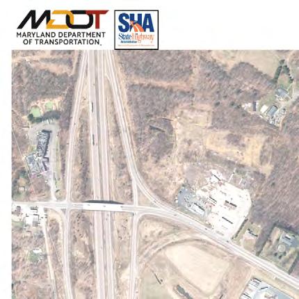
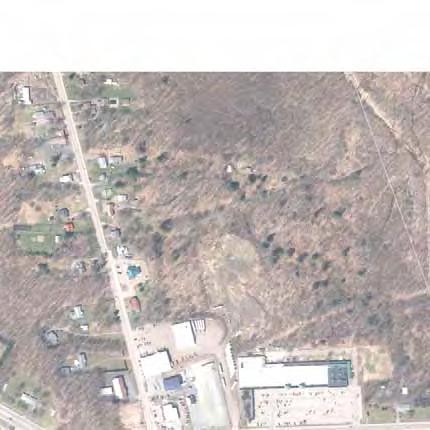
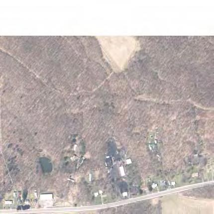
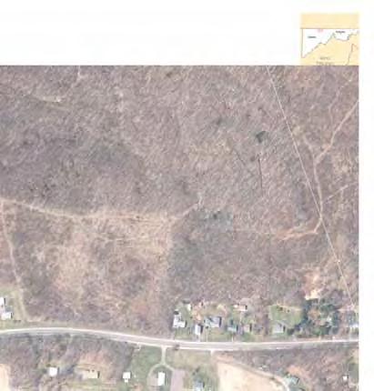
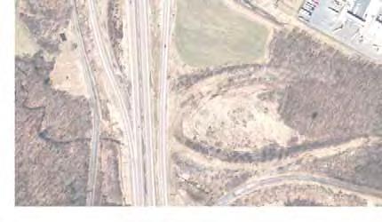
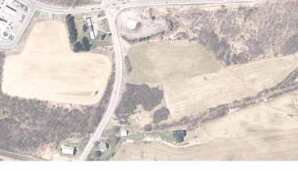
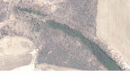
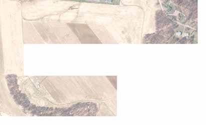
216
217 US 219 FROM I-68 TO OLD SALISBURY ROAD B. PEL Alignments D and AE Impacts to Section 4(f) properties could be minimized by relocating US 219 to the west of its current alignment. Two such alignments were previously evaluated during the PEL Study completed by MDOT SHA and PennDOT in July PEL Alignments D and AE each proposed the relocation of US 219 to the west of existing US 219 (Figure 10). Relocating US 219 to the west of existing US 219 would allow impacts to the Tomlinson Inn and Little Meadows property to be avoided. However, Alignments D and AE both result in impacts to the National Road and Braddock's Road properties. The total Section 4(f) use of Alignment D through the study area would range from 1.4 to 2.0 acres and the total Section 4(f) use of Alignment AE would range from 1.9 to 2.1 acres. 9 PEL Alignments D and AE were both dropped during the PEL study because they would be aligned through Garrett County's CRDC, an identified Priority Funding Area specifically designated for economic development, which this project is intended to support. PEL Alignments D and AE, as limited access roadways, would effectively bisect the CRDC, utilizing approximately 19 acres of the site for the roadway, and impacting the viability of the site. These alignments were strongly opposed by the site owners. Because a major component of the purpose and need for this project involves providing infrastructure improvements to help stimulate economic development in this part of Garrett County, impacting the CRDC would contradict the purpose and need for the project. Because PEL Alignments D and AE would result in impacts that are contrary to the purpose and need for the project, it was determined that these options would not constitute reasonable measures to minimize harm. C. Optimize Alignment of Proposed Relocated US 219 The Section 4(f) use associated with Alternatives 3 and 4 was minimized by optimizing the alignment of proposed relocated US 219 north of US 40 Alternate to minimize the use of Section 4(f) properties. Optimization of the alignment involved reducing the design speed of the roadway from 70 mph to 55 mph to allow the use of tighter horizontal and vertical curves, thereby minimizing impacts to the adjacent properties. Optimization also included shifting the alignment of proposed relocated US 219 as close as possible to the alignment of existing US 219 to minimize impacts to the Tomlinson Inn and the Little Meadows property, which required displacing a building containing four businesses and one residence. In addition, the vertical alignment of the roadway was refined to more closely mimic the existing terrain which reduced the cut/fill slope and further minimized impacts within the Tomlinson Inn and the Little Meadows property. Finally, the outside shoulders were reduced from 12 feet to 10 feet to reduce the width of the typical section of the roadway and minimize impacts to Tomlinson Inn and the Little Meadows. The optimization of the alignment of proposed relocated US 219 was 9 Impact ranges for Alignments D and AE to National Road and Braddock's Road were calculated based on the linear feet of impacts to each resource reported in the July 2016 PEL Study multiplied by the standard width of the Braddock's Road NRHP boundary (50 feet) and the National Road NRHP (66 feet). DRAFT SECTION 4(f) EVALUATION 29
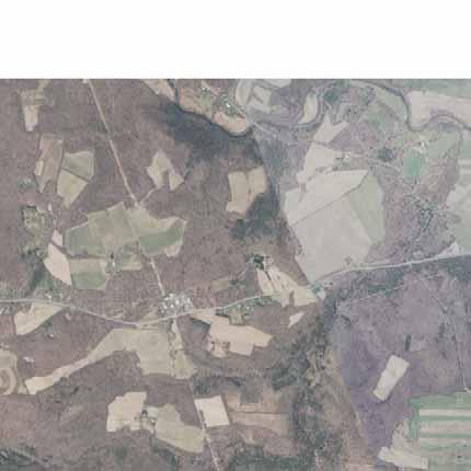
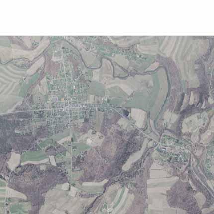
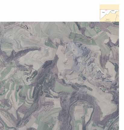
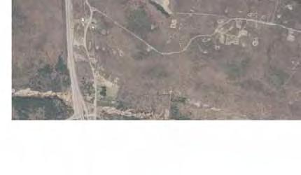
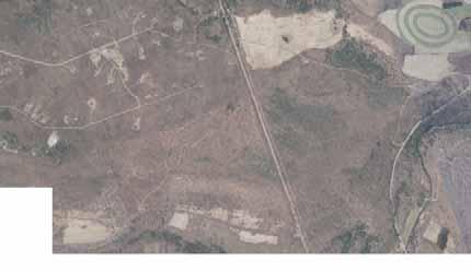
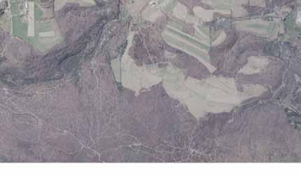
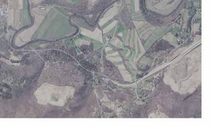
218
219 US 219 FROM I-68 TO OLD SALISBURY ROAD determined to be feasible and, therefore, was incorporated into the project. Figures 3, 6, 7, and 8 reflect the optimized alignment of proposed relocated US 219. A reduction in Section 4(f) use of approximately 10 acres for Alternative 3 and approximately 12 acres for Alternatives 4 and 4 Modified was achieved. D. Minimize New Alignment Roadway Width Minimization of Section 4(f) use for each of the alternatives could potentially be achieved by including in the design measures to reduce the width of the proposed roadway through Section 4(f) properties. Reductions in the width of travel lanes, shoulders, and medians, along with increases in side slopes and the use of retaining walls to minimize grading are considered below. 1. Lane and Shoulder Width To evaluate possible measures to minimize harm to the National Road and Tomlinson Inn and the Little Meadows properties, the lane and shoulder width included in the each of the alternatives was evaluated to determine if reduction would be possible. For all of the build alternatives, the minimum lane width and minimum inside shoulder width (four feet) allowable within the AASHTO standards are already included in the design. Reduction of the outside shoulder widths from 12 feet to 10 feet was evaluated and determine to be a reasonable measure to minimize harm. Therefore, 10-foot outside shoulders were incorporated into the design. 2. Median Width Where a divided highway is proposed, the use of Section 4(f) properties could be minimized by reducing the width of the median. The width of the median associated with each of the build alternatives was evaluated to determine whether any reduction would be possible for this project. This evaluation allowed for the placement of stormwater management (SWM) Best Management Practices (BMPs) in the median. The proposed median was already eliminated along a portion of proposed relocated US 219 to address the USACE s request to avoid the wetland system at the northern end of the project area. Elsewhere, it was determined that the minimum median width to allow for placement of stormwater management facilities in the median was already being used. Reducing the median width further would not allow the median to be used for SWM and, therefore, would result in additional use of Section 4(f) property to the east of proposed relocated US 219 for stormwater management purposes. Since the majority of the length of the build alternatives would be within the Tomlinson Inn and the Little Meadows property, placing stormwater management facilities in the median would be necessary in order to adequately address stormwater management needs. 3. Side Slopes/Retaining Walls Increasing side slopes and incorporating retaining walls are additional measures that could reduce the grading necessary for each alternative and potentially minimize impacts to Section 4(f) properties. An engineered 1:1 slope along the northbound side of proposed relocated US 219 would be included along a short segment of the roadway to allow avoidance of the wetland system at the north end of the project area. However, because this project will be completed FINAL SECTION 4(f) EVALUATION 31
220 US 219 FROM I-68 TO OLD SALISBURY ROAD using the Design-Build process, the design of the roadway is not yet developed in sufficient detail to make a final determination of whether increased slopes or retaining walls could be included in the design elsewhere. As the design of the alternatives progresses, further minimization of the use of the Section 4(f) properties will be evaluated by the Design-Build contractor. E. Mitigation All use of Section 4(f) property associated with the project alternatives involves historic properties. Therefore, mitigation of the harm resulting from the use of Section 4(f) property is being developed in coordination with the MHT and other consulting parties participating in the Section 106 consultation process for this project. A Memorandum of Agreement (MOA) was developed that specifies the measures that would be provided to mitigate for impacts to historic properties as a result of this project. The MOA is included in Appendix A and identifies the following mitigation measures: MDOT SHA will provide a NRHP Amendment Form. MDOT SHA will require its Design-Builder to provide a context sensitive design for any US 219 highway appurtenance within and/or immediately adjacent to the Tomlinson Inn and Little Meadows NRHP Boundary. If the MDOT SHA Design-Builder elects to construct above-ground structures to carry US 219 over US 40 Alternate within the Tomlinson Inn and Little Meadows NRHP boundary and/or the National Road s NRHP-eligible boundary, MDOT SHA shall require the Design-Builder to provide a cladding of stone on the visible portions of any structures abutments, wingwalls or similar visible exterior structural components. This cladding will consist of a stone and mortar bonding pattern that is similar to, but does not replicate, the pattern of the historic Casselman River Bridge. If structures are constructed above-ground on US 219 within or immediately adjacent to the Tomlinson Inn and Little Meadows NRHP boundary, MDOT SHA shall require the Design-Builder to provide structures that match the color of the stone required for the US 219 structure described above. MDOT SHA shall require its Design-Builder to provide an appropriate permanent vegetative buffer for the Tomlinson Inn prior to the completion of the Project. MDOT SHA shall implement a Treatment Plan for the recovery of data from the impacted portions of the Little Meadows Archaeological District and its contributing sites, as well as a 19th Century Domestic scatter partially within the LOD prior to the start of Project ground-disturbing activities within the LOD. MDOT SHA shall prepare a Plan for Public Interpretation that incorporates information generated by the project s archeological investigations, the NRHP amendment form, and a drone flyover. MDOT SHA will include provisions for development of a digital story map, and a 30-minute documentary as part of the plan. The plan may also include, but is not limited to such items as artifact loans, photographs, historical vignettes, a prepackaged powerpoint presentation, and speakers; with additional detail and implementation schedule included in the plan. FINAL SECTION 4(f) EVALUATION 32
221 US 219 FROM I-68 TO OLD SALISBURY ROAD F. Minimization Analysis Results Numerous measures to minimize harm to Section 4(f) properties were evaluated. As described above, these measures have been incorporated into the current design of the alternatives where possible. In addition, the proposed mitigation measures described above would further reduce the harm to Section 4(f) properties. As such, this evaluation concludes that all possible planning to minimize harm to Section 4(f) properties has been included in the project. VII. Least Overall Harm Pursuant to 23 CFR 774.3(c)(1), if the avoidance analysis determines that there is no feasible and prudent avoidance alternative, then only the alternative that causes the least overall harm may be approved. After all possible planning to minimize harm to Section 4(f) properties has been included in the project, a comparative analysis of the alternatives is completed to evaluate which would result in the least overall harm. The least overall harm analysis is based upon the seven factors identified in 23 CFR 774.3(c)(1), which identifies the need to take into account impacts to other, non-section 4(f) resources. Table 2 presents a summary of the environmental impacts associated with each of the alternatives that would require the use of Section 4(f) properties. An analysis that compares the alternatives in terms of each of the least overall harm evaluation factors follows. This analysis takes into account input received from the public and the officials with jurisdiction. A. Least Overall Harm Analysis Evaluation Factor 1: The ability to mitigate adverse impacts to each Section 4(f) property (including any measures that result in benefits to the property (23 CFR 774.3(c)(1)(i)) Alternatives 2, 3, 4, and 4 Modified each involve Section 4(f) uses of National Road and Tomlinson Inn and the Little Meadows. Measures that would be provided to mitigate the adverse impacts to Section 4(f) properties are summarized in Section VI.E above and are described in detail in the Section 106 MOA included in Appendix A. The proposed mitigation for historic properties would not vary as a result of the differences in acreage of Section 4(f) use associated with each alternative and would be identical for all of the build alternatives with one exception. Because Alternative 2 would not propose new bridge structures, the proposed mitigation would not include aesthetic treatment for the structures that would be included for Alternatives 3, 4, and 4 Modified. Because the Section 4(f) use of historic properties, despite the range in the overall acreage of impact, are similar in nature for all of the alternatives, the ability to mitigate the adverse impacts to these historic properties is substantially equal for all alternatives. FINAL SECTION 4(f) EVALUATION 33
222 US 219 FROM I-68 TO OLD SALISBURY ROAD Table 2: Summary of Environmental Impacts Resource Alternative 2 Widened Existing US 219 Alternative 3 Existing Interchange with Local and Relocated US 219 Alternative 4 Roundabout Interchange with Local and Relocated US 219 MDOT SHA Preferred Alternative Alternative 4 Modified Roundabout Interchange with Local and Relocated US 219 Community Effects Displacements Residential Properties Impacted (no.) Total Acres Displacements 3/6 (Structures/Businesses) 1/4 1 1/4 1 1/4 1 Commercial Properties Impacted (no.) Total Acres Displacements Community Properties Impacted (no.) Facilities Total Acres Parks and Recreation Displacements Properties Impacted (no.) Total Acres Displacements Historic/ Properties Impacted (no.) Archaeological Total Acres Acres Outside MDOT SHA ROW Right-of-Way (Acres) Natural Environment Streams (linear feet) 233 (permanent) / 756 (permanent) / 3,351 (permanent) 3 / 3,351 (permanent) 3 / 996 (temporary) (temporary) (temporary) (temporary) 4 Wetlands (acres) 0.1 (permanent) / 0.7 (permanent) / 0.7 (permanent) / 0.7 (permanent) / 0.4 (temporary) (temporary) (temporary) (temporary) Year Floodplains (acres) Forest (acres) DNR Green Infrastructure (acres) Total Cost ($Millions) 5 $40 $65 $81 $83 1 The Hilltop Centre building, which would be displaced under all build alternatives, is a single structure that contains 1 residence and 4 businesses. 2 Total acres of impact to historic/archaeological sites exceed the total acres of right-of-way required because the National Register boundary of Little Meadows/Tomlinson Inn includes substantial amounts of land already within MDOT SHA right-of-way. 3 3,072 of the 3,351 l.f. of stream impacts would be replaced in-kind as part of the project. 4 Temporary impacts for each alternative include 996 l.f. of stream impact and 0.4 acre of wetland impact directly resulting from stream restoration activities. 5 Costs shown are for the year of expenditure (2018). Costs shown include Design, Right-of-Way, and Construction costs. FINAL SECTION 4(f) EVALUATION 34
223 US 219 FROM I-68 TO OLD SALISBURY ROAD Evaluation Factor 2: The relative severity of the remaining harm, after mitigation, to the protected activities, attributes or features that qualify each Section 4(f) property for protection (23 CFR 774.3(c)(1)(ii)) Alternative 4 Modified would result in the greatest acreage of Section 4(f) use, while Alternative 2 would result in the least. However, consideration of the context of the Section 4(f) use associated with each alternative is necessary. All of the build alternatives would result in uses of the Tomlinson Inn and the Little Meadows property that range between five and ten percent of the total acreage of the site and much of that use (56 to 70 percent) is located within right-of-way that is already owned by MDOT SHA, some of which was previously utilized for interstate ramp construction. In addition, all of the Section 4(f) uses would occur in proximity to a portion of the Tomlinson Inn and the Little Meadows property that already contains modern features that do not contribute to the historic value of the property. Although there are minor differences in the locations of the Section 4(f) uses for each alternative, all avoid impacts to protected activities, attributes or features that qualify the properties for protection including the Tomlinson Inn and the Stone Arch Bridge. In addition, all of the build alternatives minimize impacts to the undisturbed northern portion of the Tomlinson Inn and the Little Meadows property. Furthermore, a portion of the acreage of Section 4(f) use associated with each build alternative is the result of measures proposed to mitigate impacts to streams and wetlands and completion of those mitigation measures would also serve to reduce harm to the historic property. In light of the context of the Section 4(f) uses, Alternative 2 would result in the least remaining harm. Alternative 3 would result in harm that is greater than Alternative 2, but less than Alternatives 4 and 4 Modified. Alternatives 4 and 4 Modified would result in the greatest remaining harm after mitigation, but would be substantially equal to each other. However, since the Section 4(f) property is so large and the Section 4(f) use associated with each alternative is concentrated in a portion of the property that is already degraded by modern highways and development, the relative severity of the remaining harm, after mitigation, to the protected activities, attributes or features that qualify each Section 4(f) property for protection would not differ greatly between the alternatives. Furthermore, the proposed mitigation would largely offset the harm to historic properties. When considered collectively, the context in which the Section 4(f) uses would occur and the substantial amount of proposed mitigation reduce the weight of evaluation factor 2 in the least overall harm analysis. Evaluation Factor 3: The relative significance of each Section 4(f) property (23 CFR 774.3(c)(1)(iii)) Alternatives 2, 3, 4 and 4 Modified each require Section 4(f) uses of the same two properties: the National Road and Tomlinson Inn and the Little Meadows. Therefore, they are all substantially equal in terms of the relative significance of each Section 4(f) property. Evaluation Factor 4: The views of the officials with jurisdiction over each Section 4(f) property (23 CFR 774.3(c)(1)(iv)) The officials with jurisdiction, MHT, have concurred that all alternatives would have an adverse effect on Tomlinson Inn and the Little Meadows and the National Road. MHT is also a signatory to the Section 106 MOA developed to resolve the adverse effect. Therefore, the views FINAL SECTION 4(f) EVALUATION 35
224 US 219 FROM I-68 TO OLD SALISBURY ROAD of the officials with jurisdiction over each Section 4(f) property were considered in terms of the impacts to Section 4(f) properties and the mitigation proposed to resolve the adverse effect to those properties. The views of the officials with jurisdiction did not differentiate between the alternatives. Therefore, the views of the officials with jurisdiction are substantially equal for each of the build alternatives. It should also be noted, however, that MHT concurred with the identification of Alternative 4 Modified as the Preferred Alternative. Evaluation Factor 5: The degree to which each alternative meets the purpose and need for the project (23 CFR 774.3(c)(1)(v)) Alternative 2 would only partially meet the purpose and need for the project because it would not address safety and mobility concerns related to the projected increase in the truck volumes along US 219 and the mixing of trucks with local traffic by providing a relocated US 219 facility to separate the truck traffic from the local traffic. Alternative 3 would also partially meet the purpose and need for the project and would not separate truck traffic from local traffic south of US 40 Alternate. However, the portion of US 219 between I-68 and US 40 Alternate already contains development targeted towards truck traffic. Alternative 4 and Alternative 4 Modified would fully meet the purpose and need for the project. Alternative 4 and Alternative 4 Modified would be most effective in meeting the purpose and need for the project. Alternative 3 would be slightly less effective than Alternative 4 and Alternative 4 Modified, but would be more effective than Alternative 2. Alternative 2 would only partially meet the purpose and need. Since the location where Alternative 3 does not separate truck traffic from local traffic is the portion of the US 219 corridor that already contains development targeted towards truck traffic, separation of the truck traffic in that area is of lesser importance than it is north of US 40 Alternate. Therefore, Alternatives 4, and 4 Modified would be substantially equal in terms of the degree to which each alternative meets the purpose and need for the project, while Alternative 3 would be slightly less effective and Alternative 2 would be the least effective. Evaluation Factor 6: After reasonable mitigation, the magnitude of any adverse impacts to resources not protected by Section 4(f) (23 CFR 774.3(c)(1)(vi)) Because Alternative 2 would not provide a separate relocated US 219 facility, it would minimize impacts to natural resources including streams, wetlands, and forest in comparison to Alternatives 3, 4, and 4 Modified (see Table 2). However, it would result in the greatest impacts to socioeconomic resources and would require the highest number of residential and commercial displacements and impact the highest number of residential and commercial properties and community facilities. It would also result in the most substantial impacts to residential and business access in the study area due to the introduction of a median along existing US 219. Alternative 3 would result in impacts to natural resources such as streams, wetlands, and forest that are greater than Alternative 2 but less than Alternative 4 and Alternative 4 Modified (see Table 2). Similarly, Alternative 3 would require fewer residential and commercial displacements than Alternative 2 and comparable displacements to Alternative 4 and Alternative 4 Modified. FINAL SECTION 4(f) EVALUATION 36
225 US 219 FROM I-68 TO OLD SALISBURY ROAD Alternative 4 would result in greater impacts to natural environmental resources than Alternatives 2 and 3 and comparable impacts to Alternative 4 Modified (see Table 2). Alternative 4 would also be comparable to Alternative 3 and Alternative 4 Modified in terms of displacements. The linear feet of stream impacts (3,351 l.f.) associated with Alternative 4 is notably higher than those of Alternatives 2 and 3. However, it should be noted that impacts to roadside ditches located along westbound I-68 and eastbound US 40 Alternate account for 3,072 of the 3,351 l.f. of the total stream impact of Alternative 4 and that these ditches would be replaced in-kind as part of the project. Alternative 4 Modified would be very similar to Alternative 4 in terms of impacts to natural resources, but would have slightly greater right-of-way impacts. Although it would not require additional residential or commercial displacements compared to Alternative 4, it would require additional property impacts due to the inclusion of the second roundabout at the southern limit of the project. Overall, Alternative 2 would minimize natural resources impacts, but would have greater impacts to the residential and commercial properties along existing US 219 in terms of both property impacts and access. Alternatives 3, 4, and 4 Modified would have greater impacts to natural resources, but would minimize impacts to properties along existing US 219. Alternative 3 would minimize impacts to residential and commercial access compared to Alternative 2, while Alternatives 4 and 4 Modified would avoid those access impacts altogether. Since this project is located within the CRDC and is intended to support future economic development, greater importance must be placed on the protection of socioeconomic resources. Furthermore, impacts to streams, wetlands, and forests would be mitigated through stream restoration, wetland creation and enhancement, and reforestation to further reduce the harm to those resources. In light of this context, the magnitude of adverse impacts to resources not protected by Section 4(f) would be greatest under Alternative 2, slightly less under Alternative 3 and least under Alternatives 4 and 4 Modified. Alternatives 4 and 4 Modified would be substantially equal. Evaluation Factor 7: Substantial differences in cost among the alternatives (23 CFR 774.3(c)(1)(vii)) The cost of the build alternatives would range from $40 to $83 million with Alternative 2 being the least expensive and Alternative 4 Modified being the most expensive. However, the cost of any of these alternatives would not exceed the ADHS funding available for Corridor N in Maryland. B. Least Overall Harm Analysis Results A summary of the Least Overall Harm analysis is included in Table 3. All of the alternatives are substantially equal in terms of least overall harm evaluation factors 1, 3, and 4. For factor 2, Alternative 2 is the best, followed by Alternative 3 then Alternatives 4 and 4 Modified, which are substantially equal to each other. However, because of the context within which the Section 4(f) uses would occur and the proposed mitigation, factor 2 is less influential to the least overall harm analysis than certain other factors. In terms of factors 5 and 6, Alternatives 4 and 4 Modified are FINAL SECTION 4(f) EVALUATION 37
226 US 219 FROM I-68 TO OLD SALISBURY ROAD Table 3: Least Overall Harm Analysis Summary 23 CFR 774.3(c)(1) Factor i. The ability to mitigate adverse impacts to each Section 4(f) property (including any measures that result in benefits to the property ii. The relative severity of the remaining harm, after mitigation, to the protected activities, attributes or features that qualify each Section 4(f) property for protection iii. The relative significance of each Section 4(f) property iv. The views of the officials with jurisdiction over each Section 4(f) property Alternative 2 Widened Existing US 219 Proposed mitigation is comprehensive and would be nearly the same for all alternatives. Differs for Alternative 2 due only to lack of a proposed structure over US 40 Alternate. Less than 10 percent of Tomlinson Inn and the Little Meadows property impacted Least acreage of impact to Section 4(f) properties (47.7 acres) 70 percent of impacted Section 4(f) property is within existing MDOT SHA right-of-way, some of which was previously used for interstate ramps Acreage of impact includes land to be used for stream and wetland mitigation that would benefit the historic property Section 4(f) impacts occur in proximity to other modern development Minimizes impacts to undisturbed northern portion of Tomlinson Inn and the Little Meadows property Impacts 2 NRHP listed properties (National Road and Tomlinson Inn and the Little Meadows) MHT concurred that Alternative 2 would have an adverse effect on Tomlinson Inn and the Little Meadows and National Road historic properties. Alternative 3 Existing Interchange with Local and Relocated US 219 Proposed mitigation is comprehensive and would be the same for Alternatives 3, 4, and 4 Modified. Would differ from mitigation for Alternative 2 due only to the inclusion of a proposed structure over US 40 Alternate. Less than 10 percent of Tomlinson Inn and the Little Meadows property impacted Second least acreage of impact to Section 4(f) properties (65.3 acres) 56 percent of impacted Section 4(f) property is within existing MDOT SHA right-of-way, some of which was previously used for interstate ramps Acreage of impact includes land to be used for stream and wetland mitigation that would benefit the historic property Section 4(f) impacts occur in proximity to other modern development Minimizes impacts to undisturbed northern portion of Tomlinson Inn and the Little Meadows property Impacts 2 NRHP listed properties (National Road and Tomlinson Inn and the Little Meadows) MHT concurred that Alternative 3 would have an adverse effect on Tomlinson Inn and the Little Meadows and National Road historic properties. Alternative 4 Roundabout Interchange with Local and Relocated US 219 Proposed mitigation is comprehensive and would be the same for Alternatives 3, 4, and 4 Modified. Would differ from mitigation for Alternative 2 due only to the inclusion of a proposed structure over US 40 Alternate. Approximately 10 percent of Tomlinson Inn and the Little Meadows property impacted Greatest acreage of impact to Section 4(f) properties (89.8 acres) 63 percent of impacted Section 4(f) property is within existing MDOT SHA right-of-way, some of which was previously used for interstate ramps Acreage of impact includes land to be used for stream and wetland mitigation that would benefit the historic property Section 4(f) impacts occur in proximity to other modern development Minimizes impacts to undisturbed northern portion of Tomlinson Inn and the Little Meadows property Impacts 2 NRHP listed properties (National Road and Tomlinson Inn and the Little Meadows) MHT concurred that Alternative 4 would have an adverse effect on Tomlinson Inn and the Little Meadows and National Road historic properties. Alternative 4 Modified Roundabout Interchange with Local and Relocated US 219 Proposed mitigation is comprehensive and would be the same for Alternatives 3, 4, and 4 Modified. Would differ from mitigation for Alternative 2 due only to the inclusion of a proposed structure over US 40 Alternate. Approximately 10 percent of Tomlinson Inn and the Little Meadows property impacted Greatest acreage of impact to Section 4(f) properties (89.8 acres) 63 percent of impacted Section 4(f) property is within existing MDOT SHA right-of-way, some of which was previously used for interstate ramps Acreage of impact includes land to be used for stream and wetland mitigation that would benefit the historic property Section 4(f) impacts occur in proximity to other modern development Minimizes impacts to undisturbed northern portion of Tomlinson Inn and the Little Meadows property Impacts 2 NRHP listed properties (National Road and Tomlinson Inn and the Little Meadows) MHT concurred that Alternative 4 Modified would have an adverse effect on Tomlinson Inn and the Little Meadows and National Road historic properties. MHT concurred with the identification of Alternative 4 Modified as the Preferred Alternative Conclusion 1 The ability to mitigate the adverse impacts to National Road and the Tomlinson Inn and the Little Meadows properties is substantially equal for all alternatives. After mitigation, the relative severity of the remaining harm to the protected activities, attributes or features of the Section 4(f) properties is least under Alternative 2, slightly greater under Alternative 3, and greatest under Alternatives 4 and 4 Modified, which are substantially equal to each other. However, the limited remaining harm after mitigation taken in consideration of the context within which the harm occurs, reduces the importance of this evaluation factor relative to other factors. Relative significance of each Section 4(f) property is substantially equal for all alternatives. The views of the officials with jurisdiction are substantially equal for all alternatives. FINAL SECTION 4(f) EVALUATION 38
227 US 219 FROM I-68 TO OLD SALISBURY ROAD Table 3: Least Overall Harm Analysis Summary 23 CFR 774.3(c)(1) Factor v. The degree to which each alternative meets the purpose and need for the project vi. After reasonable mitigation, the magnitude of any adverse impacts to resources not protected by Section 4(f) vii. Substantial differences in cost among the alternatives Alternative 2 Widened Existing US 219 Partially meets the purpose and need for the project Would not address safety and mobility concerns related to the projected increase in the truck volumes Would not separate truck traffic from local traffic Natural Resources Minimizes impacts to streams, wetlands, and forests. Socioeconomic Resources Greatest number of residential and commercial displacements Greatest number of residential and commercial properties impacted Substantial impacts to residential and commercial access along existing US 219 Alternative 3 Existing Interchange with Local and Relocated US 219 Partially meets the purpose and need for the project Would not separate truck traffic from local traffic between I-68 and US 40 Alternate Natural Resources Moderate impacts to streams, wetlands, and forests. Socioeconomic Resources Fewest number of residential and commercial displacements Moderate number of residential and commercial properties impacted Moderate impacts to residential and commercial access along existing US 219 between I-68 and US 40 Alternate Alternative 4 Roundabout Interchange with Local and Relocated US 219 Fully meets the purpose and need for the project. Natural Resources Greatest impacts to streams, wetlands, and forests. Socioeconomic Resources Fewest number of residential and commercial displacements Fewest residential and commercial properties impacted No impacts to residential and commercial access along existing US 219 between I-68 and US 40 Alternate Alternative 4 Modified Roundabout Interchange with Local and Relocated US 219 Fully meets the purpose and need for the project. Natural Resources Greatest impacts to streams, wetlands, and forests. Socioeconomic Resources Fewest number of residential and commercial displacements Moderate residential and commercial properties impacted No impacts to residential and commercial access along existing US 219 between I-68 and US 40 Alternate Lowest cost ($40 Million) Second lowest cost ($65 Million) Second highest cost ($81 Million) Highest cost ($83 Million) Conclusion 1 Alternative 4 and Alternative 4 Modified would fully meet the purpose and need for the project and are substantially equal. Alternatives 2 and 3 meet the purpose and need to a lesser degree. Since impacts to streams, wetlands, and forests would be mitigated to reduce the harm to those resources, the purpose of the project allows greater importance to be placed on the protection of socioeconomic resources. Therefore, the magnitude of adverse impacts to resources not protected by Section 4(f) would be greatest under Alternative 2, slightly less under Alternative 3, and least under Alternatives 4 and 4 Modified. Alternatives 4 and 4 Modified would be substantially equal. The cost of the build alternatives would range from $40 to $83 million with Alternative 2 being the least expensive and Alternative 4 Modified being the most expensive. However, the cost of any of these alternatives would not exceed the ADHS funding available for Corridor N in Maryland. FINAL SECTION 4(f) EVALUATION 39
228 US 219 FROM I-68 TO OLD SALISBURY ROAD the best and are substantially equal to each other. Alternative 3 is slightly worse than Alternatives 4 and 4 Modified and Alternative 2 is the worst. For factor 7, Alternative 2 is the best because it has the lowest cost, followed by Alternative 3, while Alternatives 4 and 4 Modified, which are substantially equal to each other, are the worst. However, the cost of all of the alternatives is less than the ADHS funding available for the project. Therefore, the costs evaluated in factor 7 are less influential to the least overall harm than the remaining factors. Based on the above analysis, Alternatives 4 and 4 Modified would result in the least overall harm and would be substantially equal to each other. VIII. Coordination As part of the process followed to demonstrate compliance with Section 106 of the National Historic Preservation Act, coordination with the MHT took place throughout the early stages of this project. Continuing coordination with MHT from the previous National Environmental Policy Act (NEPA) study and the PEL study, MDOT SHA has identified potentially eligible historic properties within the project's area of potential effects, evaluated each property, and determined if each was listed or eligible for listing in the NRHP. MDOT SHA sent additional correspondence dated October 25, 2016 to MHT requesting concurrence with the MDOT SHA's determination that there would be adverse effects on historic properties under Alternative 2, Alternative 3, and Alternative 4 (see Appendix A). MHT concurred with MDOT SHA's effect determination on December 13, By carbon copy of its October 25, 2016 letter to MHT, MDOT SHA also invited the following parties to provide comments and participate in the Section 106 process: Western Maryland Chapter of the Archeological Society of Maryland Borough of Salisbury Braddock Road Preservation Association Council for Maryland Archeology Elk Lick Township French and Indian War Foundation Garrett County Department of Planning and Zoning Garrett County Historical Society Grantsville Community Museum Historical and Genealogical Society of Somerset County Maryland Commission on Indian Affairs Maryland National Road Association Maryland Geological Survey Mason-Dixon Line Preservation Partnership Mountain Maryland Gateway to the West Heritage Area Preservation Maryland Pennsylvania Archaeological Council Society for Pennsylvania Archaeology, Inc. Somerset County Commissioners FINAL SECTION 4(f) EVALUATION 40
229 US 219 FROM I-68 TO OLD SALISBURY ROAD Town of Grantsville Mr. Bryan and Ms. Brandi Palmer Mr. James and Ms. Doris Miller Stutzman Mr. John Douglas Hershberger Mr. Marvin and Ms. Shirley Kinsinger Mr. John Lindeman & Ms. Janet Hutzel Ms. Eleanore L. and Mr. Larry J. Lundgren Mr. Lannie Dietle Ms. Nancy Hershberger Grew Ms. Sandra Sue Crossland Ms. Saundra Banker Following completion of the Draft Section 4(f) Evaluation and the identification of the Preferred Alternative, MDOT SHA sent additional correspondence dated April 4, 2017 to MHT requesting concurrence with the MDOT SHA's determination that there would be adverse effects on historic properties under Alternative 4 Modified. This correspondence also transmitted the Draft MOA to MHT. MHT concurred with MDOT SHA's effect determination on April 28, The MOA was full executed on May 15, Archaeological investigations are currently being completed within the limits of disturbance of the US 219 from I-68 to Old Salisbury Road Project; however, because there is high archaeological potential within the Tomlinson Inn and the Little Meadows historic boundary, the potential exists for the discovery of archaeological sites during construction. In accordance with 23 CRF (e), Section 4(f) may apply to archaeological sites discovered during construction. If such discovery of archaeological sites occurs during construction of the project, analysis of feasible and prudent avoidance alternatives will be completed as required. In addition, all appropriate consultation with the MHT and other agencies will be completed. The Draft Section 4(f) Evaluation was submitted to the U.S. Department of the Interior (DOI) on February 1, In correspondence dated March 17, 2017, DOI indicated that agreed that all alternatives would have an adverse effect on Section 4(f) resources within the project area, but that they were unable to concur that there is no prudent and feasible alternative to the proposed use of 4(f) lands in the draft since a preferred alternative had not been identified (Appendix A). The Final Section 4(f) Evaluation was submitted to the DOI on May 15, In a letter dated June 21, 2017, the DOI concurred that there is no feasible and prudent alternative to the proposed use of Section 4(f) lands by Alternative 4 Modified. In addition, the DOI acknowledged that Alternative 4 Modified would have an adverse effect on historic properties and concurred that the mitigation measures identified in the MOA are appropriate. Coordination with the U.S. Department of Agriculture or the U.S. Department of Housing and Urban Development is not warranted for this project. FINAL SECTION 4(f) EVALUATION 41
230 US 219 FROM I-68 TO OLD SALISBURY ROAD IX. Conclusion Based upon the above considerations, there is no feasible and prudent alternative to the use of land from the National Road and the Tomlinson Inn and the Little Meadows. The Least Overall Harm analysis included in this Final Section 4(f) Evaluation demonstrates that Alternative 4 and Alternative 4 Modified would result in the least overall harm and would be substantially equal to each other. Furthermore, this Final Section 4(f) Evaluation demonstrates that this project includes all possible planning to minimize harm to the National Road and the Tomlinson Inn and the Little Meadows resulting from the Section 4(f) use. FHWA s Section 4(f) Policy Paper states: Pursuant to substantial case law, if the assessment of overall harm finds that two or more alternatives are substantially equal, FHWA can approve any of those alternatives. Therefore, Alternative 4 Modified has been identified as the Preferred Alternative because it is among the alternatives would result in the least overall harm and it offers several operational and safety advantages over Alternative 4. FINAL SECTION 4(f) EVALUATION 42
231 US 219 FROM I-68 TO OLD SALISBURY ROAD APPENDIX A FINAL SECTION 4(f) EVALUATION
232 September 9, 2016 Ms. Elizabeth Hughes State Historic Preservation Officer Maryland Historical Trust 100 Community Place Crownsville MD Dear Ms. Hughes: Introduction and Project Description The Maryland Department of Transportation s State Highway Administration (MDOT/SHA) is continuing its consultation with the Maryland Historical Trust (MHT) and consulting parties regarding the proposed improvements to US 219 in Garrett County, Maryland. The current project, MDOT/SHA Project No. GA646A22, extends from I-68 to Old Salisbury Road, a distance of approximately 1.4 miles, (Attachment 1). MDOT/SHA previously consulted with MHT and the consulting parties in 2004 and Recently, in September 2014, MDOT/SHA notified MHT and the consulting parties that both the Pennsylvania Department of Transportation (PennDOT) and MDOT/SHA restarted National Environmental Policy Act (NEPA) and National Historic Preservation Act Section 106 Cultural Resources studies for the US 219 project. Following a public meeting on September 23, 2014, MDOT/SHA and PennDOT agreed to reconsider the project and entered into a Planning and Environment Linkages (PEL) Study. This study concluded in July 2016 with a recommendation to only carry out the project in Maryland. The project in Pennsylvania from the state line north to Meyersdale is not an active PennDOT project at this time. MDOT/SHA s main purpose for the stand-alone project is to provide infrastructure that is responsive to planned economic development. This includes improved transportation access to the Chestnut Ridge Development Corridor and completion of an additional 1.4 miles of eligible Appalachian Development Highway System mileage within Maryland. MDOT/SHA is providing a revised Area of Potential Effects (APE) that reflects a smaller US 219 project area, extending from I-68 to Old Salisbury Road. Determination of Eligibility Short Forms for 31 standing structures identified in the APE are enclosed along with a summary of ongoing archaeological investigations. Seven concepts are currently under development for NEPA review for the US 219 alternatives between I-68 and Old Salisbury Road. However, general descriptions of these concepts are provided below (Attachment 2).
233 Ms. Elizabeth Hughes Page Two 1. Concept 1: No-Build Concept 1 (No-Build) consists of taking no action to improve the existing transportation facilities; no improvements would be constructed, while routine maintenance activities would continue with this alternative. US 219 would remain in its current layout and alignment. 2. Concept 2: Widen Existing US 219 Concept 2 proposes upgrading existing US 219 to a four-lane divided highway from the existing I-68 interchange to Old Salisbury Road. The new roadway would maintain the existing interchange configuration at I-68 and an at-grade intersection of US 219 and US 40 Alt. The typical section of the new roadway would consist of two 12-foot through lanes, a 10-foot right shoulder, and a 2-foot left shoulder in each direction separated by variable width (4-foot to 18- foot ) curbed median. The widening of existing US 219 would primarily occur along the northbound side of the roadway. Existing access points along both sides of the roadway would be maintained, but the introduction of a median would limit left turns onto and off existing US 219. Three median openings between the US 40 Alt intersection and the entrance to the proposed Casselman Farm Development would be provided for traffic to make left-turn and U- turn movements to access the existing residences and businesses along existing US 219. North of the entrance to the Casselman Farm Development, the roadway would taper back to a twolane roadway, and tie into the existing typical section of US Concept 3: Existing Interchange with Local and Relocated US 219 In addition to the No-Build and Widening Existing US 219 concepts, MDOT/SHA is evaluating the construction of a four-lane dual highway on a new alignment from I-68 to Old Salisbury Road that maintains the existing I-68/US 219 interchange. From the I-68 interchange, the alignment of Concept 3 would follow the existing alignment of US 219, which would be widened to four lanes, to just north of the Pilot Travel Center. At that location, proposed relocated US 219 would diverge from the existing alignment, bearing to the east of existing US 219, crossing over US 40 Alt on a new structure, and following a new alignment to its northern terminus at Old Salisbury Road. The alignment of Concept 3, north of US 40 Alt, is based largely on the PEL Study Alignments E and E-Shift, which are identical within the study area of this project. The typical section of the new roadway would consist of a four-lane divided highway (two 12-foot through lanes, a 12-foot right shoulder, and a 4-foot left shoulder, in each direction) separated by a 28-foot wide median. Concept 3 would include construction of an overpass to carry the proposed relocated US 219 over US 40 Alt. A round-about intersection will connect the existing alignment to the new overpass and alignment on the south end of the project. At the north end of the study area, Concept 3 proposes a conventional T-intersection design for the intersection of existing US 219 and proposed relocated US 219. Existing US 219 would be realigned beginning approximately 1,500 feet south of Old Salisbury Road to curve to the east
234 Ms. Elizabeth Hughes Page Three and intersect proposed relocated US 219 at a T-intersection. The segment of existing US 219 from proposed relocated US 219 to the proposed entrance to the Casselman Farm Development would be removed. The removal of this segment is intended to discourage truck traffic from using existing US 219. Just north of the T-intersection, a small section of pavement would be left in place to act as a driveway to provide access to two properties on the west side of existing US 219. Proposed relocated US 219 would continue north to the proposed entrance to the Casselman Farm Development where it would tie-in to existing US 219. As it approaches the T- intersection, proposed relocated US 219 would transition from the four-lane typical section to two lanes and would continue as two lanes until it merges with existing US 219 at the entrance to the Casselman Farm Development. This T-intersection design is consistent throughout the alternatives on new alignment. 4. Concept 4: Roundabout Interchange with Local and Relocated US 219 Concept 4 is similar to Concept 3 except the roundabout is shifted further south and closer to the interchange with I-68. In addition, it has the same interstate ramps as the Flyover Interchange (Concept 6). Concept 4 proposes a new four-lane divided highway east of existing US 219 from I-68 to Old Salisbury Road as well as a new interchange at I-68. The typical section of the proposed new roadway would consist of two 12-foot through lanes, a 12-foot right shoulder, and a 4-foot left shoulder in each direction separated by a 28-foot wide median. From north of US 40 Alt to the northern terminus at Old Salisbury Road, Concept 6 would be identical to Concept 3. From north of US 40 Alt to I-68, Concept 6 would be located on a new alignment east of existing US 219. Proposed relocated US 219 would connect to I-68 at a new interchange and would be carried over US 40 Alt on an overpass. From westbound I-68, a new ramp would provide access to proposed relocated US 219 northbound at a roundabout. US 219 would form the north and south legs of the roundabout, and the new four-lane divided highway forms the east leg. This roundabout would be two lanes. New proposed interchange ramps would consist of one 15-foot lane, a 12-foot right shoulder, and a four-foot left shoulder. The design speed would vary between 35 mph and 50 mph. In addition, the existing, but currently unused, slip ramp from I-68 westbound to US 40 Alternate would be removed under this concept. The intersection of proposed relocated US 219 and US 40 Alt would be grade-separated with proposed relocated US 219 being carried over US 40 Alt on a new overpass. From US 40 Alt, motorists would utilize existing US 219 and the existing interchange to access I-68. To access I- 68 from existing US 219 within the study area, motorists would either follow existing US 219 south to the existing interchange or travel north along existing US 219 to the entrance of the proposed Casselman Farm Development and follow proposed relocated US 219 south to the proposed new I-68 interchange.
235 Ms. Elizabeth Hughes Page Four 4. Concept 5: T-Interchange with Relocated US 219 Concept 5 proposes a new four-lane divided highway east of existing US 219 from I-68 to the entrance to the proposed Casselman Farm Development, as well as a new interchange at I-68. Like Concept 3, the typical section of the proposed roadway would consist of two 12-foot through lanes, a 12-foot right shoulder, and a 4-foot left shoulder in each direction separated by a 28-foot wide median. From north of US 40 Alt to the northern terminus at Old Salisbury Road, Concept 5 would be identical to Concept 3. From north of US 40 Alt to I-68, Concept 5 would be located on a new alignment east of existing US 219. Proposed relocated US 219 would connect to I-68 at a new interchange and would be carried over US 40 Alt on an overpass. The proposed I-68 interchange would be a T-interchange located east of the existing I-68/US 219 interchange. From proposed relocated US 219 southbound, traffic would access westbound I-68 by utilizing a new ramp that would tie into the existing ramp from westbound I-68 to existing US 219, crossing over existing US 219 at-grade, and following the ramp from existing US 219 to westbound I-68. Southbound traffic on proposed relocated US 219 would access eastbound I-68 by crossing over I-68 on a structure and turning left onto the ramp from existing US 219 to eastbound I-68. The ramp from existing US 219 to eastbound I-68 would be utilized, but would be slightly realigned and lengthened to accommodate the new interchange. From eastbound I- 68, traffic would access proposed relocated US 219 northbound by following the exit ramp to existing US 219, crossing over existing US 219, and turning left onto the new overpass over I- 68. From westbound I-68, traffic would access proposed relocated US 219 northbound via a new ramp that diverges from the existing ramp from westbound I-68 to existing US 219. New proposed interchange ramps would consist of one 15-foot lane, a 12-foot right shoulder, and a four-foot left shoulder. The design speed would vary between 35 mph and 50 mph. In addition, the existing, but currently unused, slip ramp from I-68 westbound to US 40 Alternate would be removed under this concept. The intersection of proposed relocated US 219 and US 40 Alt would be grade-separated with proposed relocated US 219 being carried over US 40 Alt on a new overpass. From US 40 Alt, motorists would utilize existing US 219 and the existing interchange to access I-68. To access I- 68 from existing US 219 within the study area, motorists would either follow existing US 219 south to the existing interchange or travel north along existing US 219 to the entrance of the proposed Casselman Farm Development and follow proposed relocated US 219 south to the proposed new I-68 interchange. 5. Concept 6: Flyover Interchange with Relocated US 219 Similar to Concept 5, Concept 6 proposes a new four-lane divided highway east of existing US 219 from I-68 to Old Salisbury Road as well as a new interchange at I-68. The typical section of the proposed new roadway would consist of two 12-foot through lanes, a 12-foot right shoulder, and a 4-foot left shoulder in each direction separated by a 28-foot wide median. From north of US 40 Alt to the northern terminus at Old Salisbury Road, Concept 6 would be identical to
236 Ms. Elizabeth Hughes Page Five Concept 3. From north of US 40 Alt to I-68, Concept 6 would be located on a new alignment east of existing US 219. Proposed relocated US 219 would connect to I-68 at a new interchange and would be carried over US 40 Alt on an overpass. The new proposed interchange at I-68 would be a flyover interchange design located east of the existing I-68/US 219 interchange. This design would provide full directional, freeway-tofreeway access between I-68 and proposed relocated US 219 and would also provide local access to and from existing US 219 and US 40 Alternate. From westbound I-68, a new ramp would provide access to proposed relocated US 219 northbound. From eastbound I-68, a new ramp would be constructed to provide access to proposed relocated US 219 northbound. This ramp would be carried on a structure over I-68 before merging with the proposed ramp from westbound I-68 to proposed relocated US 219 northbound. From proposed relocated US 219 southbound, a new ramp would be constructed to provide access to westbound I-68 and existing US 219. This ramp would be constructed at-grade on a new alignment east of the Pilot Travel Center, curve to the west, and intersect existing US 219 north of the existing I-68 interchange. A roundabout would be constructed north of I-68 at the intersection with a new ramp extending west and merging with the ramp from existing US 219 to westbound I-68. Prior to reaching the proposed roundabout, the ramp from proposed relocated US 219 southbound would diverge to provide a connection to I-68 eastbound. This ramp would be carried on a structure over I-68, and under the proposed ramp from eastbound I-68, to proposed relocated US 219 northbound. The I-68 eastbound ramp to existing US 219 and the ramp from existing US 219 to eastbound I- 68 would be slightly realigned and a second roundabout would be constructed south of I-68 at the intersection of the realigned ramps with existing US 219. Additionally, the existing ramp from westbound I-68 to existing US 219 would be removed and replaced with a new loop ramp that connects westbound I-68 to the proposed roundabout on existing US 219 north of the existing interchange. Proposed interchange ramps would consist of one 15-foot lane, a 12-foot right shoulder, and a four-foot left shoulder. Also, the design speed would vary between 35 mph and 50 mph. In addition, the existing, but currently unused, slip ramp from I-68 westbound to US 40 Alternate would be removed under this concept. Under Concept 6, proposed relocated US 219 would be constructed on an overpass over US 40 Alt. Minor intersection improvements could be made at existing US 219 and US 40 Alt. 6. Concept 7: Loop Ramp Interchange with Relocated US 219 Like Concept 4, Concept 7 proposes a new four-lane divided highway east of existing US 219 from I-68 to Old Salisbury Road as well as a new interchange at I-68. The typical section of the proposed new roadway would consist of two 12-foot through lanes, a 12-foot right shoulder, and a 4-foot left shoulder in each direction separated by a 28-foot wide median. From north of US
237 Ms. Elizabeth Hughes Page Six 40 Alt to the northern terminus at Old Salisbury Road, Concept 7 would be identical to Concept 3. From north of US 40 Alt to I-68, Concept 7 would be located on a new alignment east of existing US 219. Proposed relocated US 219 would connect to I-68 at a new interchange and would be carried over US 40 Alt on an overpass. The new proposed interchange at I-68 would be a loop ramp interchange located east of the existing I-68/US 219 interchange. Like the flyover interchange design in Concept 6, the loop ramp design would also provide full directional, freeway-to-freeway access, as well as local access to and from existing US 219 and US 40 Alt. From westbound I-68, the ramp to existing US 219 would remain and a new ramp providing access onto proposed relocated US 219 northbound would split from the existing ramp. From eastbound I-68, the ramp to existing US 219 would remain and a new loop ramp onto proposed relocated US 219 northbound would be constructed. The loop ramp would be carried on a structure over I-68 and would merge with the proposed ramp from westbound I-68 to proposed relocated US 219 northbound. From proposed relocated US 219 southbound, a new ramp would be constructed at-grade to provide access to westbound I-68. A second new at-grade ramp would diverge from this ramp and merge with the existing ramp from westbound I-68 to existing US 219. In addition, a new loop ramp would be carried on a structure over I-68 and would provide access to eastbound I-68. Alternative 6 would realign the ramp from existing US 219 to eastbound I-68 to pull it closer to the I-68 mainline. New proposed interchange ramps would consist of one 15-foot lane, a 12-foot right shoulder, and a four-foot left shoulder. The design speed would vary between 35 mph and 50 mph. The existing, but currently unused, slip ramp from I-68 westbound to US 40 Alternate would be removed under this concept. Under Concept 7, proposed relocated US 219 would be constructed on an overpass over US 40 Alt. Minor intersection improvements could be made at existing US 219 and US 40 Alt. Public Outreach As noted in the Summer 2016 US 219 Newsletter, MDOT/SHA held a Public Informational Workshop to present the revised US 219 project to the public on Thursday, September 8, 2016 from 5:30 p.m. to 7:30 p.m. at the Grantsville Elementary School, 120 Grant Street, Grantsville, and on Friday, September 9, 2016 from 10:00 a.m. to 2:00 p.m. at the Grantsville Senior Center, 125 Durst Court, Grantsville. All of the consulting parties were invited to attend one of the workshops. In addition, the project team and Cultural Resources Section staff have met with the Crossland and Hershberger families to discuss the project. The Crosslands and Hershbergers own property within the APE including Little Meadows. Meetings and coordination through phone calls with
238 Ms. Elizabeth Hughes Page Seven these property owners included sharing findings from the archaeological work carried out thus far on their land. Funding Federal funds are anticipated for this project. Area of Potential Effects As a result of MDOT/SHA s PEL Study, and the current alignment concepts under consideration, the APE has been reduced for the Maryland project. The current project for US 219 now extends from I-68 to Old Salisbury Road, and all the concept alignments are based on these limits. The current APE (Attachment 3) as shown on the USGS 7.5 Avilton Quadrangle, extends 1000 feet north of Old Salisbury Road, extends to the east side of the Kinsinger Farm s historic boundary on the west, includes all of the Tomlinson Inn and Little Meadows National Register of Historic Places (NRHP) boundary to the east, and extends 1000 feet south of I-68. We have selected this area as the APE since MDOT/SHA continues to investigate US 219 Alternative AE as well as 6 different US 219 concepts for Concepts E and E-Shift. These APE limits include identified standing historic properties and important views to and from the Tomlinson Inn and Little Meadows, as well as the National Pike and Braddock s Road. The archaeological survey included the combined worst case limits of disturbance (LOD). The APE may be further reduced once MDOT/SHA has reached a decision about which US 219 concepts are being retained for detailed studies. Identification Methods and Results Architectural and archaeological resources were researched as part of the historic investigation instigated by the proposed widening and other improvements for US 219. Architecture: MDOT/SHA Architectural Historian Anne E. Bruder consulted the SHA-GIS Cultural Resources Database, previous project correspondence and evaluations for historic standing structures, attended team meetings, agency presentations and the public Open House on September 23, 2014, and attended the informational workshops on September 8 and 9, 2016 in Grantsville. A field visit was last made on September 23, Between 2004 and 2007, MDOT/SHA investigated, identified, and evaluated standing historic structures in the APE for eligibility for listing in the NRHP. Standing and ruinous structures, buildings, and sites in the APE that are either listed in the NRHP or determined eligible for inclusion in the NRHP include: The Tomlinson Inn and Little Meadows (G-I-A-12), Stone Arch Bridge, US 40 Alt. over Meadow Run (G-I-A-198), the National Road (US 40 Alt.) 1.1 miles east and.9 miles west of US 219 (G-I-A-227), Braddocks Road Trace (G-I-A-224), Eli Kinsinger Farm (G-I-A-122), Jennings Brothers Railroad (G-I-A-226), Truman J. Maust Barn
239 Ms. Elizabeth Hughes Page Eight (G-I-A-116), and Mason-Dixon Line Marker 191 (G-I-A-189). These historic properties reflect the significant events, persons, architecture and/or engineering in the project area with demonstrated associations to colonial settlement, colonial boundary disputes, the French and Indian War, transportation infrastructure including the first federally funded highway, western migration, travel related facilities, agriculture and farming, and the architecture and engineering of Western Maryland. As a result of the reduced APE, the Eli Kinsinger Farm, the Jennings Brothers Railroad, the Maust Barn, and Mason-Dixon Line Marker 191 are no longer within the APE. Standing structures previously determined not eligible for the NRHP include: John Hershberger House site (G-I-A-005), Sherman House House (G-I-A-120), Sidney Markowitz Farm (G-I-A- 139), Culper Property (G-I-A-225), Anderson Property, Bittinger Property, Dubose Property, Durst Property I, Durst Property II, Edgar Property, Garlitz Property, Johnson Property, Merrill Property, Miller Property, Murray Property, Oester Property, Scofield Monument, Warne Property, Watkins Property I, Watkins Property II, Whisner Property, and Younkin Property. In 2014 and 2015, MDOT/SHA s cultural resources consultants investigated 31 standing structures constructed between 1957 and 1970, in the US 219 APE and evaluated them for inclusion in the NRHP. Most are within the current APE, but 3 properties now stand outside the APE (Attachment 4). Based on the field investigations conducted by Heberling Associates, Inc. and Parsons Brinkerhoff, MDOT/SHA recommends that the following are not eligible for inclusion in the NRHP: National Pike, National Pike, National Pike, 3359 Chestnut Ridge Road, 3403 Chestnut Ridge Road, 3665 Chestnut Ridge Road, 3583 Chestnut Ridge Road, 3457 Chestnut Ridge Road, 3441 Chestnut Ridge Road, 3707 Chestnut Ridge Road, 3681 Chestnut Ridge Road, 3743 Chestnut Ridge Road, 4747 Chestnut Ridge Road, 4720 Chestnut Ridge Road, 4489 Chestnut Ridge Road, 4305 Chestnut Ridge Road,4189 Chestnut Ridge Road, National Pike, National Pike, National Pike, National Pike, 2455 Chestnut Ridge Road, 2515 Chestnut Ridge Road, National Pike, 3641 Chestnut Ridge Road, National Pike, National Pike, National Pike, National Pike, National Pike and 3425 Chestnut Ridge Road. We make this recommendation because the buildings are common types of residential and commercial structures from the mid-20 th century that do not demonstrate associations with any local, state or national events or persons, and are not eligible for inclusion in the NRHP under Criteria A (events) or B (persons). Additional investigations did not identify significant architectural features and the buildings could not be grouped together to demonstrate significance as an historic district. As a result, MDOT/SHA has determined that the buildings standing at the above locations are not eligible for the NRHP under Criterion C (architecture). NRHP Criterion D was not included in this study. MDOT/SHA s consultants surveyed a total of acres. Please note that some of the DOE forms lack a Tax Parcel Number. Some of the SDAT parcel numbers were incorrect. Despite these errors, MDOT/SHA is satisfied that we have identified the correct locations of each
240 Ms. Elizabeth Hughes Page Nine building. A location map, aerial photograph with recommended historic boundary, and one color photograph are included as attachments to each DOE form. The forms will be found in Attachment 5, while MDOT/SHA s eligibility determinations are summarized in Attachment 6, Eligibility/Status Table. Archaeology: MDOT/SHA Archaeologist Carol A. Ebright has assessed the archaeological potential of the US 219 project. The worst case limits of disturbance in all versions of the project have high archaeological potential based on the high probability of archaeological resources associated with Braddock s 4 th encampment in 1755 during the French and Indian War, 18 th and 19 th century transportation routes, and the opening of the western frontier. Notably, this includes resources such as the NRHP eligible Braddocks Road (G-I-A-277 and 18GA314) and the NRHP listed Tomlinson Inn and Little Meadows with its expansive landscape north and south of the National Road. An archaeological predictive model was completed for the joint PennDOT and MDOT/SHA project in 2003 (Coppock et al.) and was used in the PEL study. Phase I fieldwork along the common alignment in Pennsylvania resulted in the conclusion that areas of site potential established in the field do not match the areas anticipated based on the predictive model mapping (Coppock 2009), and MDOT/SHA has not employed the predictive model in Maryland studies. Comprehensive Phase I archaeological investigations were initiated in Maryland in 2015 within worst case LOD for a reduced project encompassing alignments D, AE, E and E-Shift from I-68 to the Pennsylvania state line. However, the extent of 2015 survey was further reduced after fieldwork was started, to approximately the current northern project limit north of Old Salisbury Road. This work identified a number of archaeological sites, but due to the evolving project scope, the 2015 draft report was never transmitted for review. In 2016, supplementary Phase I survey was conducted, along with Phase 2 investigations on four sites located the prior year. These sites included 18GA318 (Yoder Farm Site), 18GA319 (Stacked Stone Foundation Site), 18GA321 (John R. Hershberger Homestead Site), and 18GA322 (Tomlinson Inn Site). In addition, a metal detection survey was undertaken along Braddock s Road and on the expansive Braddock s Encampment site within the current LOD. A revised and expanded Phase 1 and Phase 2 draft archaeological report is currently under MDOT/SHA review and will be submitted shortly. In the meantime, additional remote sensing studies are continuing in Little Meadows to locate buried portions of Braddock s Road and other resources within the LOD, and will be reported separately. These preliminary studies indicate that archaeological resources in Little Meadows are numerous and reflect an intensely used historic landscape.
241 Ms. Elizabeth Hughes Page Ten Review Request Please examine the attached maps, plans, and Eligibility/Status Table (Attachment 6). We request your concurrence by October 10, 2016 with the revised APE, and that the Tomlinson Inn and Little Meadows, Stone Arch Bridge, US 40 Alt. over Meadow Run, the National Road (US 40 Alt.) 1.1 miles east and.9 miles west of US 219, Braddocks Road Trace are either listed in or eligible for listing in the NRHP. MDOT/SHA also requests your concurrence that the 31 standing structures identified in 2014 and 2015 are not eligible for the NRHP (Attachment 5). By carbon copy, we invite the Western Maryland Chapter of the Archeological Society of Maryland, Borough of Salisbury, Braddock Road Preservation Association, Council for Maryland Archeology, Elk Lick Township, French and Indian War Foundation, Garrett County Department of Planning and Zoning, Garrett County Historical Society, Grantsville Community Museum, Historical and Genealogical Society of Somerset County, Maryland Commission on Indian Affairs, Maryland National Road Association, Maryland Geological Survey, Mason-Dixon Line Preservation Partnership, Mountain Maryland Gateway to the West Heritage Area, Preservation Maryland, Pennsylvania Archaeological Council, Society for Pennsylvania Archaeology, Inc., Somerset County Commissioners, Town of Grantsville, Mr. Bryan and Ms. Brandi Palmer, Mr. James and Ms. Doris Miller Stutzman, Mr. John Douglas Hershberger, Mr. Marvin and Ms. Shirley Kinsinger, Mr. John Lindeman & Ms. Janet Hutzel, Ms. Eleanore L. and Mr. Larry J. Lundgren, Mr. Lannie Dietle, Ms. Nancy Hershberger Grew, Ms. Sandra Sue Crossland and Ms. Saundra Banker to provide comments and participate in the Section 106 process. Pursuant to the requirements of the implementing regulations found at 36 CFR Part 800, MDOT/SHA seeks their assistance in identifying historic preservation issues as they relate to this specific project (see 36 CFR 800.2(c)(3) and (5), and 800.3(f) for information regarding the identification and participation of consulting parties, and 800.4, and regarding the identification of historic properties and assessment of effects). For additional information regarding the Section 106 regulations, see the Advisory Council on Historic Preservation s website, or contact the Maryland State Highway Administration or the Maryland Historical Trust. If no response is received by October 10, 2016, we will assume that these offices and property owners decline to participate. Please contact Ms. Anne E. Bruder at or abruder@sha.state.md.us with questions regarding standing structures for this project. Ms. Carol Ebright may be reached at or cebright@sha.state.md.us with concerns regarding archaeology.
242 Ms. Elizabeth Hughes Page Eleven Sincerely, Julie M. Schablitsky Assistant Division Chief Environmental Planning Division Attachments: 1) Location Map 2) Concept Plans 3) 2016 APE Map 4) 2015 Survey Map 5) DOE Short Forms with Attachments 6) Eligibility/Status Table cc: Ms. Sonya Augustine, Chief Clerk, Somerset County Commissioners (w/attachments) Ms. Deborah Carpenter, Garrett County Office of Planning and Land Management (w/attachments) Ms. Nancy Green, Borough of Salisbury (w/attachments) Ms. Robin Jones, Town Administrator, Town of Grantsville (w/attachments) Mr. Charles W. Short, Jr, Elk Lick Township (w/attachments) Mr. Todd M. Babcock, Mason-Dixon Line Preservation Partnership (w/attachments) Mr. Norman L. Baker, French and Indian War Foundation (w/attachments) Ms. Saundra Banker (w/attachments) Mr. Robert L. Bantz, Archeological Society of Maryland, Western Maryland Chapter (w/attachments) Mr. Gerry and Ms. Sue Beachy, Grantsville Community Museum (w/attachments) Mr. Jack Caruthers, Garrett County Historical Society (w/attachments) Ms. Sandra Sue Crossland (w/attachments) Mr. Lannie Dietle (w/attachments) Ms. Lisa M. Dugas, Pennsylvania Archaeological Council (w/attachments) Ms. Jen Durben, Heritage Area & Groups Manager, Mountain Maryland Gateway to the West Heritage Area (w/attachments) Ms. Virginia Frank, Maryland National Road Association (w/attachments) Ms. Nancy Hershberger Grew (w/attachments) Mr. John Douglas Hershberger (w/attachments) Mr. Stephen Israel, Council for Maryland Archeology (w/attachments) Mr. Marvin and Ms. Shirley Kinsinger (w/attachments) Mr. John E. Lindeman & Ms. Janet Hutzel (w/attachments) Ms. Eleanor L. and Mr. Larry J. Lundgren (w/attachments) Dr. John Nass, Society for Pennsylvania Archaeology, Inc. (w/attachments)
243 Ms. Elizabeth Hughes Page Twelve Mr. Bryan and Ms. Brandi Palmer (w/attachments) Dr. Walter Powell, President, Braddock Road Preservation Association (w/attachments) Mr. Nicholas Redding, Executive Director, Preservation Maryland (w/attachments) Mr. James and Ms. Doris Miller Stutzman (w/attachments) Mr. Mark Ware, Executive Director, Historical and Genealogical Society of Somerset County (w/attachments) Ms. Karen Arnold, MDOT/SHA-EPLD (w/attachments) Ms. Anne E. Bruder, MDOT/SHA-EPLD (w/attachments) Ms. Carol Ebright, MDOT/SHA-EPLD (w/attachments) Mr. Rick Jenarine, MDOT/SHA-PMD (w/attachments) Dr. Richard A. Ortt, Jr., Director, Maryland Geological Survey (w/attachments) Dr. Julie Schablitsky, MDOT/SHA-EPLD (w/attachments)
244
245 Attachment 5: Eligibility/Status Table Project Name: US 219: I-68 to Old Salisbury Road (formerly I-68 to Pennsylvania State Line or Meyersdale, PA) September 9, 2016 Resource Type SHA NR Det. SHPO Intersection Attach. Remarks Opinion Tomlinson Inn and Little Meadows, Building & NRL NRL G-I-A-12 Site Stone Arch Bridge, US 40 Alt. over S NR NR Meadow Run, G-I-A-198 John Hershberger House, site, G-I- A-005 S NE NE A ruinous structure in 2005 and determined Not Eligible as a standing structure on 9/13/2005 by MHT National Road (US 40 Alt.) 1.1 S NR NR miles east and.9 miles west of US 219, G-I-A-227 Braddocks Road Trace, G-I-A-224 S NR NR Eli Kinsinger Farm, G-I-A-122 S NR NR Now outside US 219 APE Jennings Brothers Railroad, G-I-A- S NR NR Now outside US 219 APE 226 Truman J. Maust Barn, G-I-A-116 S NR NR Now outside US 219 APE Mason-Dixon Line Marker 191, G- S NR NR Now outside US 219 APE I-A-189 Sherman House House, G-I-A-120 S NE NE Sidney Markowitz Farm, G-I-A-139 S NE NE Culper Property, G-I-A-225 S NE NE Anderson Property S NE NE Bittinger Property S NE NE Dubose Property S NE NE Durst Property I S NE NE Durst Property II S NE NE Edgar Property S NE NE Garlitz Property S NE NE Johnson Property S NE NE Merrill Property S NE NE Miller Property S NE NE
246 Ms. Elizabeth Hughes Page Fifteen Murray Property S NE NE Oester Property S NE NE Scofield Monument S NE NE Warne Property S NE NE Watkins Property I S NE NE Watkins Property II S NE NE Whisner Property S NE NE Younkin Property S NE NE National Pike S NE 9/ National Pike S NE 9/ National Pike S NE 9/ National Pike S NE 9/ National Pike S NE 9/ National Pike S NE 9/ National Pike S NE 9/ National Pike S NE 9/ National Pike S NE 9/ National Pike S NE 9/ National Pike S NE 9/ National Pike S NE 9/ National Pike S NE 9/ Chestnut Ridge Road S NE 9/ Chestnut Ridge Road S NE 9/ Chestnut Ridge Road S NE 9/ Chestnut Ridge Road S NE 9/ Chestnut Ridge Road S NE 9/ Chestnut Ridge Road S NE 9/ Chestnut Ridge Road S NE 9/ Chestnut Ridge Road S NE 9/ Chestnut Ridge Road S NE 9/ Chestnut Ridge Road S NE 9/ Chestnut Ridge Road S NE 9/ Chestnut Ridge Road S NE 9/ Chestnut Ridge Road S NE 9/2016
247 Ms. Elizabeth Hughes Page Sixteen 4189 Chestnut Ridge Road S NE 9/ Chestnut Ridge Road S NE 9/ Chestnut Ridge Road S NE 9/ Chestnut Ridge Road S NE 9/ Chestnut Ridge Road S NE 9/2016 Codes: Resource Types: S (Structure), A (Archaeological Site), HD (Historic District), NHL (National Historic Landmark) NR Determination: ND (Not Determined), X (Not Eligible), NR (Eligible), NRL (Listed), NHL (Landmark) SHPO Opinion: (B) designates opinion regarding boundary, Code following date signifies SHPO opinion Bold rows indicate review action requested
248 October 25, 2016 Ms. Elizabeth Hughes State Historic Preservation Officer Maryland Historical Trust 100 Community Place Crownsville MD Dear Ms. Hughes: Introduction and Project Description This letter serves to inform the Maryland Historical Trust (MHT) of the Maryland Department of Transportation s State Highway Administration s (MDOT/SHA) finding that the proposed Project GA646A22, US 219: I-68 to Old Salisbury Road, would have an adverse effect on historic properties. The project involves the proposed improvements to US 219 for a distance of 1.4 miles, including the crossing of US 40 Alt. (National Road). These improvements were described in SHA s September 9 and September 16, 2016 consultation letters to you. Since sending the recent consultation letters, MDOT/SHA has presented the US 219 concepts to the public at two information workshops on September 8 and 9, 2016 in Grantsville. MDOT/SHA has chosen to drop some of the concepts, revised the Area of Potential Effects (APE), and chosen the Alternatives Retained for Detailed Studies (ARDS). The ARDS include Alternatives 1, 2, 3, and 4 and are described below. Location mapping, alignment mapping, and limits of disturbance (LOD) for Alternatives 2, 3, and 4 are included in Attachments 1, 2, and 3, respectively. Additional refinements or impacts may occur as further planning and design occur. The ARDS were presented at the September 21, 2016 Interagency Review Meeting. Alternative 1: No Build Alternative 1 (No-Build) consists of taking no action to improve the existing transportation facilities. No improvements would be constructed, while routine maintenance activities would continue with this alternative. US 219 would remain in its current layout and alignment.
249 Ms. Elizabeth Hughes Page Two Alternative 2: Widen Existing US 219 Alternative 2 proposes upgrading existing US 219 to a four-lane divided highway from the existing I-68 interchange to Old Salisbury Road (Figure 3). The new roadway would maintain the existing interchange configuration at I-68 and an at-grade intersection of US 219 and US 40 Alternate. The roadway south of the US 40 Alternate intersection would be undivided with the typical section consisting of two 12-foot through lanes and a 10-foot shoulder in each direction. The typical section of the new roadway north of US 40 Alternate would consist of two 12-foot through lanes, a 10-foot right shoulder, and a 2-foot left shoulder in each direction separated by variable width (4-foot to 18-foot ) curbed median. The widening of existing US 219 would primarily occur along the northbound side of the roadway. Existing access points along both sides of the roadway would be maintained, but the introduction of a median would limit left turns onto and off of existing US 219. Three median openings, with dedicated left turn lanes, between the US 40 Alternate intersection and the entrance to the proposed Casselman Farm Development site would be provided for traffic to make left-turn and U-turn movements to access the existing residences and businesses along existing US 219. North of the entrance to the Casselman Farm Development site, the roadway would taper back to a two-lane roadway (one lane in each direction), and tie into the existing typical section of US 219. In addition to the proposed roadway improvements, the existing, but currently unused, exit ramp from I-68 westbound to US 40 Alternate that crosses Meadow Run would be removed. Existing fill material that was placed for this ramp and two additional unpaved ramps would be available to be mined and repurposed for use on this project. The contractor would be required to restore the area and not leave a borrow pit, with the idea that the final product would be restored to more closely resemble the appearance of the area prior to construction of those ramps. Along with the removal of the fill material, two culverts would be removed. In this same area, Alternative 2 would also include the restoration of approximately 680 linear-feet of an unnamed tributary to Meadow Run located just north of I-68 to the east of the existing US 219 interchange. Alternative 3: Existing Interchange with Local and Relocated US 219 In addition to the No-Build Alternative, SHA is evaluating the construction of a four-lane dual highway that utilizes both the existing roadway and a new alignment from I-68 to Old Salisbury Road and maintains the existing I-68/US 219 interchange (Figure 4). From the I-68 interchange, the alignment of Alternative 3 would follow the existing alignment of US 219, which would be widened to a four-lane undivided roadway, to just north of the Pilot Travel Center. At that location, proposed relocated US 219 would diverge from the existing alignment, bear to the east of existing US 219, bridge over US 40 Alternate as a four-lane divided roadway, and follow a new alignment to the northern terminus at the entrance of the proposed Casselman Farm Development site. Existing US 219 would connect to the proposed relocated US 219 alignment with a two-lane, fourlegged roundabout. The segment of existing US 219 from just north of the Pilot Travel Center to the US 40 Alternate intersection would be removed and a new connection, which bears to the east
250 Ms. Elizabeth Hughes Page Three of exiting US 219, from the US 40 intersection to the roundabout would be provided. The typical section of the new roadway north of the US 40 Alternate intersection would consist of a four-lane divided highway (two 12-foot through lanes, a 12-foot outside shoulder, and a 4-foot inside shoulder, in each direction) separated by a proposed 28-foot wide median. Alternative 3 would include construction of an overpass (bridge) to carry the proposed relocated US 219 over US 40 Alternate. It would provide a new entrance to the Pilot Travel Center with a roundabout to access either existing US 219 or proposed relocated US 219. No ramps would be needed to access US 40 Alternate. At the north end of the study area, Alternative 3 proposes a conventional T-intersection design of existing US 219 and proposed relocated US 219. Existing US 219 would be realigned, beginning approximately 1,500 feet south of Old Salisbury Road, to curve to the east and intersect proposed relocated US 219 at a T-intersection. The existing segment of US 219 from proposed relocated US 219 to the entrance of the proposed Casselman Farm Development site would be removed. The removal of this segment is intended to discourage truck traffic from using existing US 219. Just north of the T-intersection, a small section of pavement would be left in place to act as a driveway to provide access to two properties on the west side of existing US 219. Proposed relocated US 219 would continue north to the entrance of the proposed Casselman Farm Development site where it would tie-in to existing US 219. As it approaches the T-intersection, proposed relocated US 219 would transition from the four-lane, divided typical section to a twolane, undivided section, and would continue as two lanes until it merges with existing US 219 at the entrance to the Casselman Farm Development site. Alternative 3 would include the same removal of ramp pavement, fill material, and culverts, and the same stream restoration efforts described under Alternative 2. Alternative 4: Roundabout Interchange with Local and Relocated US 219 Alternative 4 proposes a new four-lane divided highway east of existing US 219, from I-68 to Old Salisbury Road, as well as modification of the existing I-68 interchange. The modified interchange would include a new loop ramp from westbound I-68 to existing US 219 as well as a new two-lane roundabout (Figure 5). The typical section of the proposed relocated US 219 would consist of two 12-foot through lanes, a 12-foot right shoulder, and a 4-foot left shoulder in each direction separated by a 28-foot wide median. From north of US 40 Alternate to the northern terminus at Old Salisbury Road, Alternative 4 would be identical in design to Alternative 3. Proposed relocated US 219 would be carried over US 40 Alternate on an overpass. From westbound I-68, a new loop ramp would provide access to proposed relocated US 219 northbound at a roundabout. Existing US 219 would form the north and south legs of the roundabout, and the proposed relocated US 219 roadway forms the east leg of the roundabout. Because of the introduction of a two lane roundabout, the interchange ramp from US 219 to the westbound I-68 would be relocated to the west of its current location. New proposed interchange
251 Ms. Elizabeth Hughes Page Four ramps would consist of one 15-foot lane, a 12-foot right shoulder, and a 4-foot left shoulder. The design speed would vary between 35 mph and 50 mph. The intersection of proposed relocated US 219 and US 40 Alt would be grade-separated with proposed relocated US 219 being carried over US 40 Alternate on a new overpass. From US 40 Alternate, motorists would utilize existing US 219 and the existing interchange to access I-68. To access I-68 from existing US 219 within the study area, motorists would either travel on existing US 219 south to the existing interchange or travel north along existing US 219 to the entrance of the proposed Casselman Farm Development and follow proposed relocated US 219 south to the I- 68 interchange Alternative 4, from the grade-separated intersection of proposed relocated US 219 and US 40 Alternate would be similar to Alternative 3. Alternative 4 would include the same removal of ramp pavement, fill material, and culverts, and the same stream restoration efforts described under Alternatives 2 and 3. Alternative 3 and Alternative 4--US 219 at US 40 Alt. Overpass and Interchange: The new intersection of relocated US 219 and US 40 Alt. would be grade-separated with proposed relocated US 219 being carried over US 40 Alt. on a new overpass. A ramp would be provided to allow access from US 40 Alt. (eastbound or westbound) to proposed relocated US 219 northbound. From US 40 Alt., motorists would utilize existing US 219 and the existing interchange to access I-68. To access I-68 from existing US 219 within the study area, motorists would either follow existing US 219 south to the existing interchange, or travel north along existing US 219 to the entrance of the Casselman Farm Development Site, and follow proposed relocated US 219 south to the proposed new I-68 interchange. The overpass would be used in either Alternative 3 or Alternative 4. The bridges will be two individual structures that will carry northbound and southbound traffic. Each structure will be 50 feet wide, with 2 12-foot lanes, a 12-foot shoulder, a 4-foot shoulder, and about 5 feet on both sides to account for the parapet walls. There is an approximately 18-foot gap between the 2 individual structures. The total width of the typical sections of the bridges is approximately 118 feet. Alternatives 2, 3 and 4--Ramp Removal: Under all three build alternatives, MDOT/SHA proposes to remove the unused ramp that was constructed as part of the I-68 improvements. It is closed to traffic and has not been used in many years. MDOT/SHA proposes to utilize the abandoned ramp earthworks for borrow for other parts of the project. The location will then be used for wetland mitigation. The area will be appropriately graded to its approximate original contours and planted to blend in with the surrounding historic property. Alternatives 2, 3 and 4--Stream Restoration: All three build alternatives include the restoration of a segment of Meadow Run located just north of I-68 to the east of the existing US 219 interchange, in the vicinity of the abandoned ramps. MDOT/SHA has dropped the following alternatives from further consideration: Alternative 5: T-Interchange with Relocated US 219 Alternative 6: Flyover Interchange with Relocated US 219
252 Ms. Elizabeth Hughes Page Five Funding Alternative 7: Loop Ramp with Interchange with Relocated US 219 Federal funds are anticipated for this project. Area of Potential Effects MDOT/SHA has defined the US 219 Project s Area of Potential Effects (APE) to account for physical, visual, audible and atmospheric impacts to historic properties, both archaeological sites and standing structures, which would diminish National Register of Historic Places (NRHP) qualifying characteristics of an historic property s integrity. The APE extends 1000 feet north of Old Salisbury Road and 1000 feet south of I-68. It has been reduced to the currently identified western boundaries for Braddock s Road and the National Road (US 40 Alt.) and all of the NRHP boundary for the Tomlinson Inn and Little Meadows since the alignments may visually and physically impact these historic properties. The APE is shown on the Avilton aerial in Attachment 4. The archaeological survey area includes the combined worst-case limits of disturbance (LOD) for the US 219 improvements, and the boundaries of the Little Meadows Archaeological District (18GA323). Identification Methods and Results Potentially significant architectural and archaeological resources were both researched as part of the historic investigation instigated by the proposed improvements to US 219 from I-68 to Old Salisbury Road. Architecture: MDOT/SHA evaluated the possible physical and visual impacts on the NRHPlisted Tomlinson Inn and Little Meadows (G-I-A-12), the NRHP-eligible National Road (US 40 Alt.) (G-I-A-227), Braddock s Road Trace (G-I-A-224) east and west of US 219, and Stone Arch Bridge, US 40 Alt. over Meadow Run (G-I-A-198). MDOT/SHA Architectural Historian Ms. Anne Bruder conducted a field visit on October 12, As-built plans for US 40 Alt., US 219 and I-68 from 1955 and 1974 were also reviewed. The following NRHP eligible resources have been removed from further consideration for project impacts by the proposed US 219 improvements since they are now outside the project s APE: Eli Kinsinger Farm, G-I-A-122, Jennings Brothers Railroad, G-I-A-226, Truman J. Maust Barn, G-I-A-116, and Mason-Dixon Line Marker 191, G-I-A-189. MDOT/SHA has determined that the proposed improvements to US 219: I-68 to Old Salisbury Road Alternatives 2, 3, and 4 will have no impact on these standing historic properties because no improvements to US 219 are proposed in these locations. MHT concurred with MDOT/SHA s determinations of non-eligibility on October 17, 2016 for the following standing structures: National Pike, National Pike, National
253 Ms. Elizabeth Hughes Page Six Pike, National Pike, National Pike, National Pike, National Pike, National Pike, National Pike, National Pike, National Pike, National Pike, National Pike, 2455 Chestnut Ridge Road, 2515 Chestnut Ridge Road, 3359 Chestnut Ridge Road, National Pike, National Pike, National Pike, National Pike, National Pike, National Pike, National Pike, National Pike, National Pike, National Pike, National Pike, National Pike, National Pike, 2455 Chestnut Ridge Road, 2515 Chestnut Ridge Road, 3359 Chestnut Ridge Road, 3403 Chestnut Ridge Road, 3425 Chestnut Ridge Road, 3441 Chestnut Ridge Road, 3457 Chestnut Ridge Road, 3583 Chestnut Ridge Road, 3641 Chestnut Ridge Road, 3665 Chestnut Ridge Road, 3681 Chestnut Ridge Road, 3707 Chestnut Ridge Road, 3743 Chestnut Ridge Road, 4189 Chestnut Ridge Road, 4305 Chestnut Ridge Road, 4489 Chestnut Ridge Road, 4720 Chestnut Ridge Road, 4747 Chestnut Ridge Road, National Pike, National Pike, MDOT/SHA has determined that the proposed improvements to US 219: I-68 to Old Salisbury Road Alternatives 2, 3, and 4 will have no impact on these standing historic resources. US 219 Alternatives Impact Assessments: MDOT/SHA has determined that Alternative 1 will have no impact on historic standing structures including the Tomlinson Inn and the Little Meadows, the Stone Arch Bridge, the National Road or Braddock s Road since this alternative takes no action that would alter any of the characteristics that qualify these historic properties for inclusion in the NRHP. MDOT/SHA has determined that Alternative 2 would have no impact on the Stone Arch Bridge (G-I-A-198) because it is approximately 1, feet east of the current US 219 alignment, with rising terrain between the structure and the road, and would not have any direct physical impact on the structure. The bridge does not have any direct views to or from any portion of the current alignment, and the new Alternative 2 alignment would not increase the viewshed impacts. Alternative 3 and Alternative 4 move the new US 219 alignments closer to the Stone Arch Bridge to a distance of approximately 1100 feet. However, the bridge carries the National Road, and is at a low point of that historic property. The addition of a bridge does not alter the significance of a stone structure, and there are no visual or physical impacts from these US 219 alternatives to it. MDOT/SHA has determined that Alternatives 2, 3 and 4 would have an adverse impact on Braddock s Road Trace north of US 40 Alt., 600-3,200 feet west and 2,800-4,800 feet east of US 219 (G-I-A-224). There will be no direct physical or visual impacts to the above-ground portions of Braddock s Road that lie west and east of the current US 219 alignment, but all three alternatives will directly impact the archaeological portion of Braddock Road (18GA314) within the Little Meadows. The physical destruction of a portion the archaeological site is also an impact the above-ground trace in two different locations. MDOT/SHA has determined that Alternative 2 would have an adverse impact on the Tomlinson Inn and the Little Meadows (G-I-A-12). We make this determination because while the new
254 Ms. Elizabeth Hughes Page Seven alignment would be at grade with the current highway, the widening would occur within Little Meadows western NRHP boundary. The new four-lane highway would cause visual and physical impacts to the historic property although some areas have been disturbed by earlier commercial construction. North of the former Sivics Snack Bar location in the northeast quadrant of US 219 and US 40 Alt., the area on the east side of US 219 where the new highway would be located has trees and shrubs. These would be lost as a result of the new construction, which diminishes the integrity of the setting, feeling and association of the Tomlinson Inn and the Little Meadows. MDOT/SHA has determined that Alternative 2 would have an adverse impact on the National Road segment (1.1 miles east and.9 mile west of US 219) (G-I-A-227). At the US 219/US 40 Alt. intersection, MDOT/SHA currently owns 1.0 acre of the National Road required for the proposed widening, but would need an additional right-of-way amounting to 0.3 acre for a total of 1.3 acres to complete the proposed dedicated right-turn lanes. These changes would alter the highway s integrity of design, feeling and association. MDOT/SHA has determined that Alternative 3 would have an adverse impact on standing historic properties including the Tomlinson Inn and the Little Meadows (G-I-A-12). We make this determination because MDOT/SHA will require an additional 33.2 acres of right-of-way, in addition to the 35.4 acres that it currently owns, within the NRHP boundary to construct the highway. Although the highway will be at grade, the roundabout, four new highway lanes, and the bridges that will rise 25-feet above the National Road are in a prominent area of the southwest portion of the Little Meadows. The highway and bridges will be clearly visible from various vantage points as a result of the rolling terrain. These new visual and physical impacts to the Tomlinson Inn and the Little Meadows, including removing farm fields and trees that are an important characteristic of the historic property, diminish the significance of the history property, causing it to lose integrity of design, feeling and association. MDOT/SHA has determined that Alternative 3 would have an adverse impact on standing historic properties including the National Road (US 40 Alt.) We make this determination because the introduction of two bridge structures will cause adverse visual and physical impacts, including the loss of setting, feeling and association, which diminishes the National Road segment s significance. MDOT/SHA has determined that Alternative 4 would have an adverse impact on standing historic properties including the Tomlinson Inn and the Little Meadows (G-I-A-12). We make this determination because MDOT/SHA will require 41.6 acres of right-of-way, in addition to the 56.8 acres that it currently owns within the NRHP boundary to construct the highway. Although the highway will be at grade, it begins near I-68 at the south boundary and extends through the southwest corner of the historic property. The new four-lane highway will include a roundabout and two new highway bridges that will rise 25 feet above the National Road, so that the highway and bridges will be clearly visible from various vantage points as a result the rolling terrain. These new visual and physical impacts to the Tomlinson Inn and the Little Meadows,
255 Ms. Elizabeth Hughes Page Eight including removing farm fields and trees that are an important characteristic of the historic property, diminish the significance of the history property, causing it to lose integrity of design, feeling and association. MDOT/SHA has determined that Alternative 4 would have an adverse impact on standing historic properties including the National Road (US 40 Alt.) We make this determination because the introduction of two bridge structures crossing the highway will cause adverse visual and physical impacts, including the loss of setting, feeling and association, which diminishes the significance of this National Road segment. MDOT/SHA s findings are summarized in Attachment 5, Effects Table. Archaeology: MDOT/SHA s correspondence of September 16, 2016 documented the results of Phase I and II archaeological investigations completed to date within the worst case LOD for the combined Alternatives 2 through 7; made eligibility recommendations concerning individual archaeological sites; and noted MDOT/SHA s intent to define the Little Meadows Archaeological District. On October 17, 2016, MHT concurred that sites 18GA318, 18GA319, 18GA320, and 18GA321 are not eligible for NRHP listing. MHT concurred that archaeological sites 18GA322 (Tomlinson Inn Site), 18GA314 (Braddock s Road), and 18GA317 (Little Meadows Encampment) are individually eligible for NRHP listing, as well as contributing resources within the NHRP-listed Tomlinson Inn and Little Meadows (G-I-A-12). The Tomlinson Inn Site, Little Meadows Encampment, and archaeological portions of Braddock s Road are contributing elements within the now-documented Little Meadows Archaeological District (18GA323). The Little Meadows Archaeological District was defined to include temporally and functionally distinct, but related resources; to accommodate overlapping sites; to accommodate sites that are currently bounded by the limits of investigation rather than the extent of the resource; to include anticipated resources based on detailed background research; and include known related resources that are outside the current project LOD. These various resources are meaningful to the history of the state and region in different, but related ways. MDOT/SHA considers the Little Meadows Archaeological District to be eligible under NRHP Criteria A, B, and D. The archaeological DOE form for the Little Meadows Archaeological District was transmitted to your office electronically, and we request your concurrence with our finding of that the site is eligible for inclusion in the NRHP (Attachment 6). The Little Meadows consist of a western Maryland glade, which was a regionally scarce open area from pre-contact through the 18 th and 19 th centuries. Little Meadows had a unique floral/faunal community, and was well-watered by Meadow Run, wetlands, and springs. Although substantial Native American use has not been detected to date, the Little Meadows provided a continually reused stopping place in Garrett County from at least the mid-18 th century on. Bracketed by Meadow Mountain and Chestnut Ridge, the meadow provides the fundamental setting for the archaeological district that ties its multiple uses together. District resources span
256 Ms. Elizabeth Hughes Page Nine the mid-18 th through mid-20 th centuries, and includes sites related to the opening of the western Euroamerican frontier in Maryland and the trans-appalachian region, various 18 th military encampments, early road traces, 18 th and 19 th century traveler s facilities, cemeteries and farmsteads. The Little Meadows Archaeological District is considered significant under Criterion A for its association with the French & Indian War including both Washington s 1753 and 1754 expeditions to the French Forts in the Upper Ohio drainage, and Braddock s 4 th encampment during the 1755 expedition to Fort Duquesne. Military archaeological resources embedded in this landscape include above and below ground traces of Braddock s Road and the Little Meadows Encampment sites. Both Washington and Braddock constructed fortifications in Little Meadows. Military graves from this period are believed to be located in or near the Tomlinson Family Cemetery. Significance under Criterion A also applies to district archaeological resources under the transportation theme. Resources include the anticipated earliest road traces cut by Nemacolin and Christopher Gist for the Ohio Company, that were later modified by Washington and Braddock, and the use of Braddock s Road as a primary route west from about 1760 until the construction of the National Road around Associated with the civilian use of the road are the anticipated Red House Inn site established by Joseph Tomlinson on the Braddock Road. The Tomlinson Inn site reflects use of the National Road once the Braddock Road was abandoned, and Jesse Tomlinson constructed a new inn on the new road. Resources such as residences, slave quarters, liveries, blacksmiths, and traveler s facilities are anticipated. The Little Meadows Archaeological District is considered significant under Criterion B for its association with both George Washington and General Edward Braddock during the French & Indian War. The meadow also served as a military encampment for Washington s troops during the 1794 Whiskey Rebellion. Significance of the Little Meadows Archaeological District under Criterion D duplicates that previously outlined for 18GA322 (Tomlinson Inn Site), 18GA314 (Braddock s Road), and 18GA317 (Little Meadows Encampment) in our letter of September 16, In addition, the district has potential to yield important information about full horizontal and vertical parameters of the known archaeological sites whose boundaries are incompletely known. Internal loci within known site boundaries have not been investigated and are expected to yield information about functionally and temporally discrete activity areas related to the larger 18 th and 19 th century resources, both military and civilian. The transition of the Little Meadows from a military outpost to a westward migration corridor, then to an important travel artery via the National Road, and finally to farmstead usage, provides a framework for analysis and comparison of archaeological remains. As future investigations occur, it is anticipated that the district boundaries may require revision. The period of significance extends from the mid-18 th century to about 1970 when major largescale land use changes occurred, including the construction of the I-68 and US 219 interchange,
257 Ms. Elizabeth Hughes Page Ten and the exploitation of coal resources. Both activities resulted in major disturbances to landscape on the perimeters of the Little Meadows Archaeological District boundaries. Since strip mined lands have been reclaimed, these disturbances are not obvious on the current landscape and do not affect the landscape viewshed, but this activity would have destroyed any archaeological resources may have once been present in mined locations. Interstate interchange construction and the post-world War II through 21 st century development of modern traveler s facilities, particularly for long-distance trucking, represents a continuation of the transportation function that began with Nemacolin s Trace, however, with a much larger highly destructive footprint on the landscape. Alternative 2 will adversely impact the Little Meadows Archaeological District and the margins of two individually eligible sites: the Tomlinson Inn site, and areas where Braddock s Road is anticipated to be buried under parking lots or fill. Alternatives 3 and 4 will both adversely impact the Little Meadows Archaeological District, and all three the individually eligible sites: Little Meadows Encampment Site, Braddock Road Site, and the Tomlinson Inn site, as well as three incompletely defined activity areas, and two probable former structure locations that contribute to the District. Abandoned Ramp Removal and Stream Restoration south of US 40 and east of US 219 may impact the Newman Cemetery (18GA65), whose precise location remains unknown. This activity may also impact the southern extension of the Little Meadows Encampment and Tomlinson Inn site as well as the Little Meadows Archaeological District, since this area is wooded and was not amenable to remote sensing. Next Steps MDOT/SHA anticipates holding a consulting parties meeting to discuss the alignments and impacts to historic properties, seeking ways to avoid or reduce project impacts. A project Memorandum of Agreement will be prepared to address adverse impacts that cannot be avoided or reduced. Review Request Please examine the attached maps, plans, and Effects Table. We request your concurrence by November 26, 2016 that the Little Meadows Archaeological District is eligible for inclusion in the NRHP, and that there would be adverse effects on historic properties caused by the construction of Alternatives 2, 3 or 4 for the improvement of US 219 from I-68 to Old Salisbury Road. By carbon copy, we invite the Western Maryland Chapter of the Archeological Society of Maryland, Braddock Road Preservation Association, Council for Maryland Archeology, French and Indian War Foundation, Garrett County Department of Planning and Zoning, Garrett County Historical Society, Grantsville Community Museum, Maryland Commission on Indian Affairs, Maryland National Road Association, Maryland Geological Survey, Mountain Maryland
258 Ms. Elizabeth Hughes Page Eleven Gateway to the West Heritage Area, Preservation Maryland, Pennsylvania Archaeological Council, Town of Grantsville, Mr. John Douglas Hershberger, Mr. John Lindeman & Ms. Janet Hutzel, Ms. Eleanore L. and Mr. Larry J. Lundgren, Mr. Lannie Dietle, Ms. Nancy Hershberger Grew, Ms. Sandra Sue Crossland to provide comments and participate in the Section 106 process. Pursuant to the requirements of the implementing regulations found at 36 CFR Part 800, MDOT/SHA seeks their assistance in identifying historic preservation issues as they relate to this specific project (see 36 CFR 800.2(c)(3) and (5), and 800.3(f) for information regarding the identification and participation of consulting parties, and 800.4, and regarding the identification of historic properties and assessment of effects). For additional information regarding the Section 106 regulations, see the Advisory Council on Historic Preservation s website, or contact the Maryland Department of Transportation s State Highway Administration or the Maryland Historical Trust. If no response is received by November 21, 2016, we will assume that these offices and historic property owners decline to participate. Federally recognized tribes will be consulted separately. Please call Ms. Anne E. Bruder at or via at abruder@sha.state.md.us with questions regarding standing structures for this project. Ms. Carol A. Ebright may be reached at or via at cebright@sha.state.md.us with concerns regarding archaeology. Sincerely, Julie M. Schablitsky Assistant Division Chief Environmental Planning Division Attachments: 1) Project Location Map 2) US 219 Alternatives 2, 3, and 4 Alignments 3) US 219 Alternatives 2, 3, and 4 LODs 4) APE Map 5) Effects Table 6) Eligibility Table
259 Ms. Elizabeth Hughes Page Twelve cc: Ms. Deborah Carpenter, Garrett County Office of Planning and Land Management (w/attachments) Ms. Robin Jones, Town Administrator, Town of Grantsville (w/attachments) Mr. Todd M. Babcock, Mason-Dixon Line Preservation Partnership (w/attachments) Mr. Norman L. Baker, French and Indian War Foundation (w/attachments) Mr. Robert L. Bantz, Sr., Archeological Society of Maryland, Western Maryland Chapter (w/attachments) Mr. Gerry and Ms. Sue Beachy, Grantsville Community Museum (w/attachments) Mr. Jack Caruthers, Garrett County Historical Society (w/attachments) Ms. Sandra Sue Crossland (w/attachments) Ms. Lisa M. Dugas, Pennsylvania Archaeological Council (w/attachments) Ms. Jen Durben, Heritage Area & Groups Manager, Mountain Maryland Gateway to the West Heritage Area (w/attachments) Ms. Virginia Frank, Maryland National Road Association (w/attachments) Ms. Nancy Hershberger Grew (w/attachments) Mr. John Douglas Hershberger (w/attachments) Mr. Stephen Israel, Council for Maryland Archeology (w/attachments) Mr. John E. Lindeman & Ms. Janet Hutzel (w/attachments) Dr. Walter Powell, President, Braddock Road Preservation Association (w/attachments) Mr. Nicholas Redding, Executive Director, Preservation Maryland (w/attachments) Ms. Joy Liang, FHWA MD Divn. (w/attachments) Ms. Karen Arnold, MDOT/SHA- EPLD (w/attachments) Ms. Anne E. Bruder, MDOT/SHA-EPLD (w/attachments) Ms. Carol Ebright, MDOT/SHA-EPLD (w/attachments) Mr. Rick Jenarine, MDOT/SHA-PMD (w/attachments) Mr. Bob Maimone, MDOT/SHA-EPLD (w/attachments) Mr. Terry Maxwell, MDOT/SHA-RIPD (w/attachments) Dr. Julie M. Schablitsky, MDOT/SHA-EPLD
260
261
262
263 Attachment #5: Effects Table Project Name: US 219: I-68 to Old Salisbury Road Improvements October 25, 2016 Resource Type Alternative 1 No Build Alternative #2 Widen Existing US 219 SHPO Alternative #3 US 219 & Relocated US 219 with Existing Interchange SHPO Alternative #4 Roundabout Interchange with Local & Relocated US 219 SHPO Attachment Remarks Impact Concur Impact Concur Impact Concur Tomlinson Inn Site 18GA322 A Adverse Adverse Adverse Tomlinson Inn and Little Meadows, G-I-A- 12 Stone Arch Bridge, US 40 Alt. over Meadow Run, G-I-A-198 National Road (US 40 Alt.) 1.1 miles east and.9 miles west of US 219, G-I-A-227 John Hershberger House, site, G-I-A-005 Site and Building S S S Adverse Adverse Adverse Adverse 10/216 10/216 Adverse Adverse Outside direct construction impacts Determined not eligible as a structure John R. Hershberger Homestead Site 18GA321 Braddock s Road, G-I- A-224 A S Adverse Adverse Adverse Outside direct construction impacts Braddock s Road 18GA314 A Adverse Adverse Adverse
264 Eli Kinsinger Farm, G- I-A-122 S Outside APE Jennings Brothers Railroad, G-I-A-226 S Outside APE Truman J. Maust Barn, G-I-A-116 S Outside APE Mason-Dixon Line Marker 191, G-I-A-189 S Outside APE Sherman House House, G-I-A-120 S Sidney Markowitz Farm, G-I-A-139 S Culper Property, G-I-A- 225 S Anderson Property S Bittinger Property S Dubose Property S Durst Property I S Durst Property II S Edgar Property S
265 Garlitz Property S Johnson Property S Merrill Property S Miller Property S Murray Property S Oester Property S Scofield Monument S Warne Property S Watkins Property I S Watkins Property II S Whisner Property S Younkin Property S
266 11782 National Pike S National Pike S National Pike S National Pike S National Pike S National Pike S National Pike S National Pike S National Pike S National Pike S National Pike S National Pike S National Pike S
267 2455 Chestnut Ridge Road S 2515 Chestnut Ridge Road S 3359 Chestnut Ridge Road S 3403 Chestnut Ridge Road S 3425 Chestnut Ridge Road S 3441 Chestnut Ridge Road S 3457 Chestnut Ridge Road S 3583 Chestnut Ridge Road S 3641 Chestnut Ridge Road S 3665 Chestnut Ridge Road S 3681 Chestnut Ridge Road S 3707 Chestnut Ridge Road S
268 3743 Chestnut Ridge Road S 4189 Chestnut Ridge Road S 4305 Chestnut Ridge Road S 4489 Chestnut Ridge Road S 4720 Chestnut Ridge Road S 4747 Chestnut Ridge Road S National Pike S National Pike S Little Meadows Encampment 18GA317 Little Meadows Archaeological District 18GA323 Newman Cemetery Site 18GA65 A A/HD Adverse Adverse Adverse Adverse Adverse A Location unknown but suspected to be in interchange/abandoned ramp locations. To be addressed through Special Provisions
269 Effect NPA Adverse Adverse Adverse Codes: Resource Types: S (Structure), A (Archaeological Site), HD (Historic District), NHL (National Historic Landmark) Impact:, No Adverse, Adverse Effect: NPA (No Properties Affected), NAE (No Adverse Effect), AE (Adverse Effect) Bold rows indicate review action requested Eligibility/Status Table Attachment #6 Project Name: US 219: I-68 to Old Salisbury Road Improvements October 25, 2016 Resource Type SHA NR Det. SHPO Opinion Little Meadows Archaeological District A NR (18GA323) October 2016 Attachment Remarks Codes: Resource Types: S (Structure), A (Archaeological Site), HD (Historic District), NHL (National Historic Landmark) NR Determination: ND (Not Determined), X (Not Eligible), NR (Eligible), NRL (Listed), NHL (Landmark) SHPO Opinion: (B) designates opinion regarding boundary, Code following date signifies SHPO opinion Bold rows indicate review action requested
270 Larry Hogan, Governor Boyd K. Rutherford, Lt. Governor Pete K. Rahn, Secretary Gregory C. Johnson, Administrator April 4, 2017 Ms. Elizabeth Hughes State Historic Preservation Officer Maryland Historical Trust 100 Community Place Crownsville MD Dear Ms. Hughes: Introduction and Project Description This letter serves to inform the Maryland Historical Trust (MHT) of the Maryland Department of Transportation s State Highway Administration s (SHA) finding that proposed Project No. GA646A22, US 219: I-68 to Old Salisbury Road Improvements, will have an adverse effect on historic properties. After investigating three build alternatives, SHA recommended Alternative 4 Modified as the Preferred Alternate for the US 219: I-68 to Old Salisbury Road project to the Federal Highway Administration. Since our October 2016 consultation on Alternatives Retained for Detailed Studies (ARDS), SHA has minimized our impacts to Little Meadows. This letter transmits a draft Memorandum of Agreement (MOA), a draft archaeological treatment plan, and the draft Phase I and II draft archaeology report. SHA s US 219 Alternative 4 Modified proposes a new roadway alignment of approximately 1.4 miles, with two 12-foot lanes in each direction, and grass median that will be up to 28-feet wide. This new alignment begins south of the I-68 interchange by modifying the existing intersection of the I-68 eastbound ramps with US 219 as a one-lane roundabout. US 219 crosses I-68 on the existing structure and replaces the existing intersection at US 219 and the I-68 westbound ramps with a two-lane roundabout. The current exit ramp from I-68 westbound to US 219 will be removed and replaced with a ramp that passes under the existing bridge over I-68 and ties-in to the western side of the new two-lane roundabout with two ramp lanes. East of the roundabout, the new alignment loops around the Pilot Travel Center as a four-lane divided highway. It will cross over US 40 Alternate via new bridges and will continue for approximately one mile before it ties back into existing US 219 near the entrance to the proposed Casselman Farm Development site and Old Salisbury Road. Design revisions to avoid or minimize impacts to Wetland 3A ¼ mile north of US 40 Alt. are still being evaluated and could include minor alignment shifts, engineered slopes, and/or structures. The northern tie-in will provide an exit ramp for southbound US 219 to access US 219 Business for local traffic, and a T-intersection further to the south to provide access to the new US 219 alignment from US 219 Business. The project will also include stormwater management and Maryland Department of Transportation State Highway Administration 707 North Calvert St., Baltimore, MD I TTY I roads.maryland.gov My telephone number/toll-free number is
271 Ms. Elizabeth Hughes Page Two various environmental mitigation, anticipated to occur within the current worst case limits of disturbance (LOD) (Attachment 1). Design-Build Process For the US 219 project, SHA will utilize the design-build project delivery method by entering into a contract with a Design-Build Team (consisting of a contractor and a designer) who is responsible for completing the design and constructing the project within the performance measures and contract provisions provided by SHA. In this process, the Design-Build Team can work on design and construction concurrently. As plans are completed on one section of the project and approved by SHA, the contractor can begin work, provided that all right-of-way has been obtained and permits are complete. Any field changes are immediately brought to the designer for resolution, requiring consultation with SHA based on the scope of the change. As currently described in the project s draft MOA, SHA proposes to address further project developments as specified in Stipulation V.B. If there is a reduction of the LOD or minimization of scope that does not result in new effects on historic properties, SHA will provide a summary of the findings to MHT. Funding Federal funds are anticipated for this project. Area of Potential Effects As explained in SHA s previous correspondence, the APE includes the known limits of the standing historic properties, including the western portions of Braddock s Road Trace, National Road (US 40 Alt.), the Tomlinson Inn and Little Meadows, and the Little Meadows Archaeological District. Since the work will be at grade outside the historic properties boundaries, the APE has been reduced to the worst-case LOD south of I-68, Old Salisbury Road and the western limit of the project on I-68. The archaeological survey area includes the worstcase LOD for the selected US 219 alternative. SHA considered the potential visual, physical, audible and atmospheric impacts to the standing historic properties, since right-of-way will be required to construct the project (Attachment 2). Identification Methods and Results Historic resources were researched as part of the historic properties investigation instigated by the proposed new highway construction project. Architecture: SHA Architectural Historian Anne E. Bruder consulted the SHA-GIS Cultural Resources Database, made field visits on October 12 and December 20, 2016, attended the
272 Ms. Elizabeth Hughes Page Three December 12, 2016 and the February 24, 2017 consulting party meetings and the Public Hearing in Grantsville on February 5, Standing historic properties that will be impacted by the project include the Tomlinson Inn and Little Meadows (G-I-A-12), the National Road (US 40 Alt.) 1.1 miles east and 0.9 miles west of US 219 (G-I-A-227) (National Road Segment) and Braddock s Road (G-I-A-224). In addition to the plan sheet, SHA has submitted renderings to show the likely visual and/or physical impacts to the Tomlinson Inn, the National Road and Braddock s Road. Since our last correspondence, SHA has sought ways to avoid or reduce the physical and visual impacts to the standing historic properties by moving the alignment of Alternate 4 Modified 70 feet further west reduce the visual impact of the two US 219 overpass bridges on the Tomlinson Inn. The Little Meadows topography limits the views towards the highway, and the road is visible mainly from a close proximity such as the Tomlinson Inn, rather than from locations such as US 40 Alt. as it crosses Meadow Mountain or the Little Meadows Stone Arch Bridge crossing at Meadow Run to the east of the project, or along US 219 near the Cherry Grove Church of the Brethren at the north end of the project. SHA has determined that Alternate 4 Modified would adversely affect Braddock s Road Trace north of US 40 Alt ,200 feet west and 2,800-4,800 feet east of US 219 (G-I-A-224). There will be no direct physical or visual impacts to the above-ground portions of Braddock s Road that lie west and east of the current US 219 alignment, but the project will adversely impact the archaeological component. SHA has determined that Alternate 4 Modified would adversely affect the National Road Segment within the APE. We make this determination because the introduction of two structures carrying US 219 and crossing the highway will cause adverse visual and physical effects, including loss of integrity of setting as well as feeling and association, which diminishes the characteristics of the National Road segment that render it eligible for the NRHP. SHA proposes to clad the exterior surfaces such as the abutments and wingwalls of the structures with stone cladding similar in color and texture to the Casselman River Bridge as a way to reduce the visual and physical impact of the new highway on the National Road. SHA has determined that Alternate 4 Modified would adversely affect the Tomlinson Inn and Little Meadows, which is listed in the NRHP. Although the road has been moved 70-feet to the west from the Tomlinson Inn, its construction will require additional right-of-way, the addition of two four-lane roads with the attendant highway appurtenances, and two 25-foot tall bridges. Although the topography and landscape prevent the road from being visible from certain landmarks within the Little Meadows boundary, portions of it will be visible from the Tomlinson Inn and impact its traditional viewshed. The construction of the highway through Little Meadows will alter the integrity of both the Tomlinson Inn and the Little Meadows setting, feeling and association. As noted above, SHA moved the alignment west to reduce the visual and physical impacts to the historic property, but it remains within the Little Meadows boundary,
273 Ms. Elizabeth Hughes Page Four and visible from the Tomlinson Inn. SHA has prepared renderings to demonstrate the views of the bridges and highway under the conceptual design from the Tomlinson Inn and these are provided in Attachment 3 for your consideration. Please note that the rendering of the bridges is a graphic to provide information about the highway s size and location relative to the historic property. The renderings also show how the bridges would look with the cladding. The John Hershberger House (site), G-I-A-0005, was determined not eligible for inclusion in the NRHP as a standing structure due to its ruinous condition. SHA s project effects determination is summarized in the Effects Table that is included as Attachment 4. Archaeology: SHA previously conducted Phase I, Phase II, and remote sensing archeological investigations in the worst case LOD for all the proposed alternatives, including Alternative 4 Modified. Detailed background research and field investigations, documented in a series of interim reports, resulted in the definition of the Little Meadows Archaeological District (18GA323) which was determined eligible for NRHP listing on December 13, Alternative 4 Modified, including stormwater management and other environmental mitigation to be designed and constructed within the current LOD, will adversely affect the Little Meadows Archaeological District and several of its contributing sites, including the archaeological portion of the Braddock s Road alignment (18GA314) and the Little Meadows Encampment site (18GA317) (Attachment 5). In addition, the Newman Cemetery (18GA65), is mapped in the LOD and is believed, though not confirmed, to have been destroyed by prior road construction (Cheek and Traum 2005). Your office previously concurred that SHA has made a good faith effort to locate this site, and agreed with SHA s strategy to address this resource through Special Provisions and inadvertent discovery plan in the archaeological treatment plan (Attachment 6) should it be encountered during construction. Next Steps As part of the Section 106 consultation process, SHA conducted the second of two consulting party meetings on Friday, February 24, Information was presented about the SHA US 219 Preferred Alternative, the basis for its selection, avoidance and minimization options, and SHA s plans to mitigate the adverse impacts. A draft MOA was circulated for comment, and a revised draft MOA, based on discussion at that the meeting, is provided for your review and comment (Attachment 7). The MOA specifies SHA s recommended mitigation items: 1. US 219 over US 40 Alt. crossing -- stone facing on US 219 over US 40 Alt. crossing the historic National Road and through Little Meadows stone similar in color and texture to
274 Ms. Elizabeth Hughes Page Five the Casselman River Bridge would be used on the exterior of the 2 overpasses included in the conceptual design. 2. Additional structures a provision has been included that if SHA and/or the Design- Build Team proposes any additional above-ground structures within or immediately adjacent to the Little Meadows boundary, SHA will require its Design-Build Team to create a structure that is context sensitive in design and that the color of the structure will be compatible with the structures over US 40 Alt. 3. A National Register of Historic Places Amendment Form for the Tomlinson Inn and Little Meadows SHA proposes to revise the current form to include new information from archaeological investigations and building descriptions. 4. Landscaping SHA proposes to create a landscaping plan if there are additional visual impacts from new structures or design changes. 5. Treatment of Archaeological Resources Phase III Data Recovery will be described in the treatment plan; additional archaeological investigations are proposed outside SHA s project LOD. 6. Little Meadows Story Map SHA will provide Mountain Maryland Gateway to the West Heritage Area with electronic content such as a story map showing historic features such as Braddock s Road, the National Road, Tomlinson Inn, Little Meadows Bridge, Casselman River Bridge, Penn Alps and Stanton s Mill between Meadow Mountain and the Casselman River 7. Drone Flyover prior to the start of construction, SHA intends to complete a drone flyover of the Little Meadows area to document the landscape. Information obtained from it may be used to create digital renderings such as the story map. 8. Braddock s Road Documentary SHA will fund the creation of a 30-minute documentary regarding the archaeology, ecology and history of Little Meadows. 9. Additional mitigation is stipulated in the draft MOA, including funding speakers or providing artifact loans. 10. Ramp Removal between I-68 Westbound and US 40 Alt. within Little Meadows NRHP Boundary -- SHA has conducted preliminary soil borings to determine the feasibility of removing the ramp as previously discussed with MHT. Additional investigations are underway and we will provide any new information when available, but at this time, the proposal to remove the ramp as a mitigation item has been removed from the MOA. Through this letter, SHA formally requests that the Hershberger Family, owners of the Tomlinson Inn and Little Meadows, as well as the Mountain Maryland Gateway to the West Heritage Area provide SHA with their agreement to concur in the MOA. The mitigation items that require their participation include proposed additional archaeological investigations outside the project s LOD and Mountain Maryland Gateway to the West Heritage Area is currently identified to host the story map on the organization s webpage.
275 Ms. Elizabeth Hughes Page Six Review Request Please examine the attached plans, renderings, archaeological report, treatment plan, draft MOA, and Effects Table. By April 25, 2017, we request your comments on these materials and SHA s determination that there would be adverse effects on historic properties by the construction of the US 219: I-68 to Old Salisbury Road Alt. 4 Modified alignment By carbon copy, we invite the Archeological Society of Maryland, Western Maryland Chapter of the Archeological Society of Maryland, Braddock Road Preservation Association, Council for Maryland Archeology, French and Indian War Foundation, Garrett County Department of Planning and Zoning, Garrett County Historical Society, Grantsville Community Museum, Maryland Commission on Indian Affairs, Maryland National Road Association, Mountain Maryland Gateway to the West Heritage Area, Preservation Maryland, Pennsylvania Archaeological Council, Town of Grantsville, Mr. John Douglas Hershberger, Mr. John Lindeman & Ms. Janet Hutzel, Ms. Eleanore L. and Mr. Larry J. Lundgren, Mr. Lannie Dietle, Ms. Nancy Hershberger Grew, and Ms. Sandra Sue Crossland to provide comments and participate in the Section 106 process. Pursuant to the requirements of the implementing regulations found at 36 CFR Part 800, SHA seeks their assistance in identifying historic preservation issues as they relate to this specific project (see 36 CFR 800.2(c)(3) and (5), and 800.3(f) for information regarding the identification and participation of consulting parties, and 800.4, and regarding the identification of historic properties and assessment of effects). For additional information regarding the Section 106 regulations, see the Advisory Council on Historic Preservation s website, or contact the Maryland Department of Transportation s State Highway Administration or the Maryland Historical Trust. If no response is received by April 25, 2017, we will assume that these entities decline to participate. Please call Anne E. Bruder at or via at abruder@sha.state.md.us with questions regarding standing structures for this project. Carol A. Ebright may be reached at or via at cebright@sha.state.md.us with concerns regarding archaeology. Sincerely, Julie M. Schablitsky Assistant Division Chief Environmental Planning Division Digitally signed by Richard Ervin DN: cn=richard Ervin, o=cultural Resources Section, ou=mdot SHA EPLD, =rervin@sha.state.md.us, c=us Date: :10:43-04'00' Attachments: 1) Project Plans
276 Ms. Elizabeth Hughes Page Seven 2) APE Map 3) US 219 Renderings 4) Effects Table 5) Draft Archaeological Report (Kenline et al. 2017) 6) Draft US 219 Memorandum of Agreement 7) Draft Archaeological Treatment Plan cc: Ms. Deborah Carpenter, Garrett County Office of Planning and Land Management (w/attachments) Ms. Robin Jones, Town Administrator, Town of Grantsville (w/attachments) Mr. Norman L. Baker, French and Indian War Foundation (w/attachments) Mr. Robert L. Bantz, Sr. Archeological Society of Maryland, Western Maryland Chapter (w/attachments) Mr. Gerry and Ms. Sue Beachy, Grantsville Community Museum (w/attachments) Mr. Bob Boal, Garrett County Historical Society (w/attachments) Ms. Sandra Sue Crossland (w/attachments) Ms. Lisa M. Dugas, Pennsylvania Archaeological Council (w/attachments) Ms. Jen Durben, Heritage Area & Groups Manager, Mountain Maryland Gateway to the West Heritage Area (w/attachments) Ms. Virginia Frank, Maryland National Road Association (w/attachments) Ms. Nancy Hershberger Grew (w/attachments) Mr. John Douglas Hershberger (w/attachments) Ms. Emily Swain, Council for Maryland Archeology (w/attachments) Mr. John E. Lindeman & Ms. Janet Hutzel (w/attachments) Ms. Joy Liang, FHWA MD Divn. (w/attachments) Dr. Walter Powell, President, Braddock Road Preservation Association (w/attachments) Mr. Nicholas Redding, Executive Director, Preservation Maryland (w/attachments) Mr. Steve Archer, MDOT/SHA- EPLD (w/attachments) Ms. Karen Arnold, MDOT/SHA- EPLD (w/attachments) Ms. Anne E. Bruder, MDOT/SHA-EPLD (w/attachments) Ms. Carol A. Ebright, MDOT/SHA-EPLD (w/attachments) Mr. Rick Jenarine, MDOT/SHA-PMD (w/attachments) Mr. Bob Maimone, MDOT/SHA-EPLD (w/attachments)
277 Attachment 4: Effects Table Project Name: US 219: I-68 to Old Salisbury Road Alt. 4 Modified April 4, 2017 US 219 Alternative 4 Modified Resource Type SHPO Impact Concur Tomlinson Inn Site 18GA322 A Adverse 2/2017 Tomlinson Inn and Little Meadows, G-I-A-12 Site and Adverse Building 2/2017 National Road (US 40 Alt.) 1.1 miles east and S Adverse 0.9 miles west of US 219, G-I-A-227 2/2017 Braddock s Road, G-I-A-224 S Adverse 2/2017 Braddock s Road, 18GA314 A Adverse 2/2017 John Hershberger House (site), G-I-A-005 S 2/2017 John R Hershberger Homestead Site, A 18GA321 2/2017 Little Meadows Encampment Site A Adverse 18GA317 2/2017 Little Meadows Archaeological District A Adverse 18GA323 2/ GA320 A 2/ GA65 Newman Cemetery A ND 2/2017 Attachment Effect Adverse 2/2017 Codes: Resource Types: S (Structure), A (Archeological Site), HD (Historic District), NHL (National Historic Landmark) Impact:, No Adverse, Adverse Effect: NPA (No Properties Affected), NAE (No Adverse Effect), AE (Adverse Effect) Bold rows indicate review action requested Remarks Not eligible as a standing structure Not eligible Not eligible Not relocated and probably destroyed. To be addressed through Special Provisions
278
279
280
281
282
283
284
285
286
287
288
289
290
291
292
293
294
295
296
297 United States Department of the Interior IN REPLY REFER TO: OFFICE OF THE SECRETARY Office of Environmental Policy and Compliance Custom House, Room Chestnut Street Philadelphia, Pennsylvania March 17, ER 17/0060 Joy Liang Federal Highway Administration Maryland Division 10 South Howard Street, Suite 2450 Baltimore, MD Subject: Draft Section 4(f) Evaluation US 219 Improvement Project from I-68 to Old Salisbury Road, Garrett County, Maryland. Dear Ms. Liang: The Department of the Interior (Department) has reviewed the Section 4(f) Evaluation for the proposed US 219 Improvement Project, from I-68 to Old Salisbury Road. The purpose of this project is to provide transportation improvements that are responsive to planned economic development. We offer the following comments on this project for your consideration. Section 4(f) Evaluation Comments The Department is unable to concur that there is no prudent and feasible alternative to the proposed use of 4(f) lands in this draft since a preferred alternative has not been identified. The Department does agree that all alternatives would have an adverse effect on the 4(f) resources within the project area. We note that you are working with the Maryland SHPO to mitigate these impacts. We look forward to reviewing the Final Section 4(f) Evaluation. We appreciate the opportunity to provide these comments. Sincerely, cc: SHPO-MD (Elizabeth.Hughes@maryland.gov) Lindy Nelson Regional Environmental Officer

298 United States Department of the Interior IN REPLY REFER TO: OFFICE OF THE SECRETARY Office of Environmental Policy and Compliance Custom House, Room Chestnut Street Philadelphia, Pennsylvania June 21, ER 17/0060F Joy Liang Federal Highway Administration, Maryland Division 10 South Howard Street, Suite 2450 Baltimore, MD Subject: Final Section 4(f) Evaluation US 219 Improvement Project from I-68 to Old Salisbury Road, Garrett County, Maryland. Dear Ms. Liang: The Department of the Interior (Department) has reviewed the Section 4(f) Evaluation for the proposed US 219 Improvement Project, from I-68 to Old Salisbury Road. The purpose of this project is to provide transportation improvements that are responsive to planned economic development. We offer the following comments on this project for your consideration. Section 4(f) Evaluation Comments The Department concurs that there is no prudent and feasible alternative to the proposed use of 4(f) lands by the preferred alternative, Alternative 4 Modified. The preferred alternative will have an adverse effect on historic properties, which include The National Road (US 40 Alternate) and The Tomlinson Inn and the Little Meadows (Stone House). The Department notes that a Memorandum of Agreement has been developed among the Federal Highway Administration, the Maryland Department of Transportation State Highway Administration and the Maryland State Historic Preservation Officer to mitigate these adverse effects. We concur that the measures to minimize harm are appropriate. We appreciate the opportunity to provide these comments. Sincerely, cc: SHPO-MD (Elizabeth.Hughes@maryland.gov) Lindy Nelson Regional Environmental Officer
FOR INTERSTATE 81 AND ROUTE 37 INTERCHANGE FREDERICK COUNTY, VIRGINIA MILEPOST 310
 INTERCHANGE MODIFICATION REPORT FOR INTERSTATE 81 AND ROUTE 37 INTERCHANGE FREDERICK COUNTY, VIRGINIA MILEPOST 310 PREPARED BY: VIRGINIA DEPARTMENT OF TRANSPORTATION STAUNTON DISTRICT DECEMBER 13, 2006
WELCOME IL 47. Community Advisory Group Meeting #5 Waubonsee Community College Wednesday, May 31, 2017
 WELCOME IL 47 Community Advisory Group Meeting #5 Waubonsee Community College Wednesday, May 31, 2017 MEETING PURPOSE MEETING AGENDA 1. Welcome/Introduction 2. Review Previous Public Involvement 3. Process/Schedule
I 75 PD&E STUDIES TABLE OF CONTENTS DTTM, TECHNICAL REPORT No. 2 TABLE OF CONTENTS
 TABLE OF CONTENTS DTTM, TECHNICAL REPORT No. 2 TABLE OF CONTENTS SECTION PAGE NO. SECTION TITLE NO. EXECUTIVE SUMMARY -------------------------------------------------------------------- ES-1 1.0 INTRODUCTION
US 14 EIS (New Ulm to N. Mankato) Interchange and Intersection Type Comparison
 Interchange and Intersection Type Comparison") T E C H N I C A L M E M O R A N D U M US 14 EIS (New Ulm to N. Mankato) Interchange and Intersection Type Comparison PREPARED FOR: Mn/DOT District 7 PREPARED BY: CH2M HILL DATE: March 27, 2007 This technical
T E C H N I C A L M E M O R A N D U M US 14 EIS (New Ulm to N. Mankato) Interchange and Intersection Type Comparison PREPARED FOR: Mn/DOT District 7 PREPARED BY: CH2M HILL DATE: March 27, 2007 This technical
5.0 PRELIMINARY ENVIRONMENTAL REVIEW
 5.0 PRELIMINARY ENVIRONMENTAL REVIEW 5.1 INTRODUCTION A preliminary environmental review was performed on the proposed freeway improvements that form Concept C, which encompasses the three freeway corridors
Northwest State Route 138 Corridor Improvement Project
 Northwest State Route 138 Corridor Improvement Project Los Angeles County, CA DISTRICT 7- LA- 138 (PM 0.0/36.8); DISTRICT 7- LA- 05 (PM 79.5/83.1); DISTRICT 7- LA- 14 (PM 73.4/74.4) 265100/ 0700001816
Summary. Preliminary Alternative Development and Screening. DEIS July 23, 2018
 What is the Carolina Crossroads Project? The South Carolina Department of Transportation (SCDOT), in cooperation with the Federal Highway Administration (FHWA), is proposing to upgrade and redesign a key
APPENDIX B. Excerpts from the October 2002 Conceptual Alternatives Report
 APPENDIX B Excerpts from the October 2002 Interstate 83 and PA Route 921 The objective for the SR 921 interchange site was to study alternatives for construction of a new interchange. There are no short-term
I-35/80 Operations Study: Douglas Avenue to NW 86 th Street FOR
 : Douglas Avenue to NW 86 th Street FOR Iowa Department of Transportation City of Urbandale City of Grimes February 7, 2013 FINAL Prepared by: HR Green, Inc. HR Green Project Number: 40110031 TABLE OF
DRAFT. SR-60 7 th Avenue Intersection Control Evaluation (ICE) I-605 Corridor Improvement Project (CIP) I-605/SR-60 EA# 3101U0
 I-605 Corridor Improvement Project (CIP) I-605/SR-60 EA# 3101U0") SR-60 7 th Avenue Intersection Control Evaluation (ICE) I-605/SR-60 EA# 3101U0 October 9, 2017 Contents 1 Purpose of ICE Memo... 1 2 Background... 1 3 Existing Interchange Deficiencies... 1 4 Context Sensitive
SR-60 7 th Avenue Intersection Control Evaluation (ICE) I-605/SR-60 EA# 3101U0 October 9, 2017 Contents 1 Purpose of ICE Memo... 1 2 Background... 1 3 Existing Interchange Deficiencies... 1 4 Context Sensitive
5/11/2016 SR 15 SECTION 088 CSVT SOUTHERN SECTION SR 15 SECTION 088 CSVT SOUTHERN SECTION AGENDA
 PUBLIC OFFICIALS MEETING MAY 11, 2016 AGENDA I. INTRODUCTIONS V. CURRENT PROJECT STATUS VI. PROJECT SCHEDULE VII. UPCOMING ACTIVITIES VOPEN DISCUSSION & QUESTIONS IX. ACTION ITEMS 1 A. Bridge Lighting
Conceptual Design Report
 Conceptual Design Report I-244/Arkansas River Multimodal Bridge Tulsa, Oklahoma Prepared for the Oklahoma Department of Transportation Prepared by: August 2009 I-244 / ARKANSAS RIVER MULTIMODAL BRIDGE
M D 355 [FR E D E R IC K R O A D] OVER
![M D 355 [FR E D E R IC K R O A D] OVER](/thumbs/79/79553721.jpg "M D 355 [FR E D E R IC K R O A D] OVER") M D 355 [FR E D E R IC K R O A D] OVER LITTLE BENNETT CREEK MAINTENANCE OF TRAFFIC ALTERNATIVE ANA LYSIS Prepared by: INTRODUCTION The purpose of this report is to present the results of traffic analyses
M D 355 [FR E D E R IC K R O A D] OVER LITTLE BENNETT CREEK MAINTENANCE OF TRAFFIC ALTERNATIVE ANA LYSIS Prepared by: INTRODUCTION The purpose of this report is to present the results of traffic analyses
MEMORANDUM: INITIAL CONCEPTS SUMMARY
 MEMORANDUM: INITIAL CONCEPTS SUMMARY INTRODUCTION This memo presents a summary of initial concepts that have been identified as development of the project study has progressed, along with a recommendations
Environme ntal Assessment Addendum
 FI Improved Interchange at I-71 and Routes 36/37 and Proposed Sunbury Parkway Environme ntal Assessment Addendum DEL-71-7.91 PID 90200 September 20, 2017 The environmental review, consultation, and other
CHAPTER 4 GRADE SEPARATIONS AND INTERCHANGES
 CHAPTER 4 GRADE SEPARATIONS AND INTERCHANGES 4.0 INTRODUCTION The ability to accommodate high volumes of intersecting traffic safely and efficiently through the arrangement of one or more interconnecting
MEMORANDUM. Date: July 14, 2006 Project #: To: US 97 & US 20 Refinement Plan Steering Committee
 MEMORANDUM Date: July 14, 2006 Project #: 6389 To: US 97 & US 20 Refinement Plan Steering Committee From: Sonia Hennum, P.E., Andrew Cibor, E.I.T., & Julia Kuhn, P.E. Project: US 97 & US 20 Refinement
Informational Brochure. Proposed Interchange. Interstate Route 295 (I-295) AT Greenville Avenue (State Route 5) Town of Johnston, Rhode Island
 AT Greenville Avenue (State Route 5) Town of Johnston, Rhode Island") Informational Brochure Proposed Interchange OF Interstate Route 295 (I-295) AT Greenville Avenue (State Route 5) Town of Johnston, Rhode Island October 5, 2016 Department of Transportation Two Capitol
Informational Brochure Proposed Interchange OF Interstate Route 295 (I-295) AT Greenville Avenue (State Route 5) Town of Johnston, Rhode Island October 5, 2016 Department of Transportation Two Capitol
Interchange Workshop Report (August 2004)
") U.S. Highway 14 Corridor Study New Ulm to North Mankato Table of Contents Section Interchange Workshop Report (August 2004) Page 1. Introduction and Next Steps 1 2. Interchange Workshop Participants &
U.S. Highway 14 Corridor Study New Ulm to North Mankato Table of Contents Section Interchange Workshop Report (August 2004) Page 1. Introduction and Next Steps 1 2. Interchange Workshop Participants &
Welcome and thank you for spending time with us today to talk about the 75 th Street Corridor Improvement Project.
 1 Welcome and thank you for spending time with us today to talk about the 75 th Street Corridor Improvement Project. 2 During this public meeting, we will explain the 75 th Street Corridor Improvement
NORTHWEST CORRIDOR PROJECT. NOISE TECHNICAL REPORT 2015 Addendum Phase IV
 Noise Technical Report 2015 Addendum NOISE TECHNICAL REPORT 2015 Addendum PREPARED FOR: Federal Highway Administration and Georgia Department of Transportation PREPARED BY: Parsons Brinckerhoff Project
Appendix C - Highway 400 Widening and Interchange Evaluation Summary Tables
 Highway 400 Improvements from 1 km South of Highway 89 to the Junction of Highway 11 Appendix C - Highway 400 Widening and Interchange Tables Prepared for: Ontario Ministry of Transportation Four General
TRANSPORTATION PROJECT REPORT DRAFT CONCEPTUAL ACCESS MODIFICATION PROPOSAL OCTOBER 2002
 TRANSPORTATION INTERSTATE 87 INTERCHANGE 11A TOWN OF MALTA SARATOGA COUNTY, NY DRAFT CONCEPTUAL ACCESS MODIFICATION PROPOSAL OCTOBER 2002 PROJECT REPORT NEW YORK STATE DEPARTMENT OF TRANSPORTATION JOSEPH
Chapter 1. General Design Information. Section 1.02 Structure Selection and Geometry. Introduction
 Chapter 1 Bridge Design Manual General Design Information Section 1.02 Selection and Geometry Introduction Selection or Rehabilitation Report This section of the design manual provides guidance on the
2 Purpose and Need. 2.1 Study Area. I-81 Corridor Improvement Study Tier 1 Draft Environmental Impact Statement
 2 Purpose and Need 2.1 Study Area Interstate 81 (I-81) is relied upon for local and regional travel and interstate travel in the eastern United States. It extends 855 miles from Tennessee to New York at
Placerville, a Unique Historical Past Forging into a Golden Future
 Placerville, a Unique Historical Past Forging into a Golden Future City Manager s Report June 24, 2014 City Council Meeting Prepared by: Nathan Stong, City Engineer Item #: Subject: Adopt a Resolution:
9.0 I-26 & I-526 Interchange Improvements
 9.0 I-26 & I-526 Interchange Improvements The I-26 & I-526 System-to-System interchange currently consists of a combination of directional and loop ramps providing for all movements from one Interstate
I-69 Angelina and Nacogdoches Counties Scoping Study Executive Summary
 I-69 Angelina and Nacogdoches Counties Scoping Study Executive Summary November 2013 The Texas Department of Transportation (TxDOT) is working to find the most appropriate means to develop the Interstate
DRAFT AIR QUALITY TECHNICAL MEMORANDUM
 AIR QUALITY TECHNICAL MEMORANDUM PROJECT DEVELOPMENT AND ENVIRONMENT STUDY STATE ROAD 60 GRADE SEPARATION OVER CSX RAILROAD Polk County, Florida Financial Project ID: 436559-1-22-01 Prepared for: Florida
LOCATION AND DESIGN DIVISION
 VIRGINIA DEPARTMENT OF TRANSPORTATION LOCATION AND DESIGN DIVISION INSTRUCTIONAL AND INFORMATIONAL MEMORANDUM GENERAL SUBJECT: Design Exceptions / Waivers SPECIFIC SUBJECT: Design Exception Request Form
GEOMETRIC DESIGN CRITERIA for Non-freeway Resurfacing, Restoration, and Rehabilitation Projects
 GEOMETRIC DESIGN CRITERIA for Non-freeway Resurfacing, Restoration, and Rehabilitation Projects SEPTEMBER 1989 Arkansas State Highway and Transportation Department GEOMETRIC DESIGN CRITERIA for Non-freeway
January 16, Rhode Island Energy Facilities Siting Board 89 Jefferson Boulevard Warwick, Rhode Island 02888
 INVENERGY 196 January 16, 2019 Rhode Island Energy Facilities Siting Board 89 Jefferson Boulevard Warwick, Rhode Island 02888 Re: Clear River Energy Center Invenergy Docket No. SB-2015-06 When Invenergy
100 Design Controls and Exceptions
 100 Design Controls and Exceptions Table of Contents 100 Introduction... 1 101 Functional Classification... 1 101.1 General... 1 101.2 Urban & Rural... 1 101.3 Classification Used In ODOT Design Criteria...
Interstate 73 FEIS: I-95 to the Myrtle Beach Region Chapter 4. Public Involvement and Agency Coordination
 4-65 Interstate 73 FEIS: I-95 to the Myrtle Beach Region 4-66 Comment noted. The use of existing roadways was considered during alternative development (refer to Chapter 2, Section 2.1, page 2-1 and the
IH 30/IH 35E Reconstruction Project Pegasus Final Technical Memorandum - Evaluation of Conceptual Alternatives Task 7.5
 MEMO TO: Timothy Nesbitt, P.E. DATE: August 26, 2002 FROM: SUBJECT: Sandy Wesch-Schulze, P.E., AICP IH 30/IH 35E Reconstruction Project Pegasus Final Technical Memorandum - Evaluation of Conceptual Alternatives
500 Interchange Design
 500 Interchange Design Table of Contents 501 Interchange Design... 1 501.1 General... 1 501.2 Interchange Type... 1 501.2.1 General... 1 502 Interchange Design Considerations... 2 502.1 Determination of
WELCOME. Public Meeting for I-35 / I-44 Interchange. October 6, 2015
 WELCOME Public Meeting for I-35 / I-44 Interchange October 6, 2015 TEAM INTRODUCTIONS PURPOSE OF THIS MEETING is to present the alternative alignments for the I-35/I-44 and I-35/NE 63rd Street Interchanges
TABLE OF CONTENTS. Section Section 2 Alternative A...7 Section 2 Alternative B...7
 TABLE OF CONTENTS I. General Description...................................................... 3 II. Need for Project.......................................................... 3 III. Adjacent Projects........................................................
PROJECT STUDY REPORT. Cal Poly Pomona Senior Project
 06/2014 PROJECT STUDY REPORT (Cal Poly Pomona Senior Project) For Conceptual Approval of an Interchange Improvement And Cooperative Agreement with The City of Lake Elsinore for completion of Project Approval
3 ENVIRONMENTAL CONSEQUENCES
 TABLE OF CONTENTS Section 1 PURPOSE AND NEED Page 1.1 Study Area 1 1.2 History 2 1.3 Need 3 1.3.1 Existing Conditions 3 1.3.1.a. Safety 3 1.3.1.b. Capacity 4 1.3.1.c. Access Management 5 1.3.2 Future Conditions
Community Advisory Committee Meeting No. 2. June 22, 2006
 Community Advisory Committee Meeting No. 2 June 22, 2006 Introductions The Study Team KDOT Wichita Partners Consultants CAC members Overview Today s Agenda Opinion Survey Study Status Starting Concept
Welcome. Public Meeting. August 2, :00 to 7:00 p.m. Presentation 6:00 to 6:30 p.m.
 Welcome Public Meeting August 2, 2017 5:00 to 7:00 p.m. Presentation 6:00 to 6:30 p.m. www.glenwoodsouthbridge.net Welcome to the South Bridge Environmental Assessment Public Meeting Why Are We Here Tonight?
FEDERAL HIGHWAY ADMINISTRATION RECORD OF DECISION FOR THE LYNNWOOD LINK EXTENSION
 FEDERAL HIGHWAY ADMINISTRATION RECORD OF DECISION FOR THE LYNNWOOD LINK EXTENSION AUGUST 2015 Table of Contents 1 Decision... 1 1.1 Project Description... 2 1.2 Basis for the FHWA Decision... 7 1.2.1
The Folded Interchange: An Unconventional Design for the Reconstruction of Cloverleaf Interchanges
 The Folded Interchange: An Unconventional Design for the Reconstruction of Cloverleaf Interchanges I. ABSTRACT Keith A. Riniker, PE, PTOE This paper presents the Folded Interchange design and compares
Appendix D: Functional Classification Criteria and Characteristics, and MnDOT Access Guidance
 APPENDICES Appendix D: Functional Classification Criteria and Characteristics, and MnDOT Access Guidance D.1 Functional classification identifies the role a highway or street plays in the transportation
500 Interchange Design
 500 Interchange Design Table of Contents 501 Interchange Design... 5-1 July 2015 501.1 General... 5-1 501.2 Interchange Type... 5-1 501.2.1 General... 5-1 502 Interchange Design Considerations... 5-2 502.1
On behalf of the Carolina Crossroads project team we thank you for taking the time to attend this meeting.
 On behalf of the Carolina Crossroads project team we thank you for taking the time to attend this meeting. Located in the heart of South Carolina, the I-20/26/126 Corridor is the crossroads of the state
NEPA and Design Public Hearings
 NEPA and Design Public Hearings Monday, December 5, 2016 Washington-Lee High School 1301 N. Stafford Street Arlington, VA 22201 Thursday, December 8, 2016 Mary Ellen Henderson Middle School 7130 Leesburg
Oklahoma Department of Transportation Environmental Programs Division Office Fax
 Oklahoma Department of Transportation Environmental Programs Division Office 521-3050 Fax 522-5193 Documented Categorical Exclusion (DCE) for I-40: Pavement Reconstruction and Added Lanes from the Douglas
FINDINGS OF FACT and CONCLUSIONS
 FINDINGS OF FACT and CONCLUSIONS I-694/ I-494/ I-94 Interchange Improvements State Project No. 8286-81 Prepared by: Minnesota Department of Transportation July, 2018 CONTENTS STATEMENT OF ISSUE... 2 ADMINISTRATIVE
DEVELOPMENT, ANALYSIS, AND DESIGN OF A NEW PARKWAY AT GRADE INTERSECTION (PAGI)
") 2013 ITE Western District Annual Meeting COCEPT DEVELOPMET, AALYSIS, AD DESIG OF A EW PARKWAY AT GRADE ITERSECTIO (PAGI) Lead Author: James M. Witkowski, PhD Supporting Author: Darrell Truitt, PE The Pima
2013 ITE Western District Annual Meeting COCEPT DEVELOPMET, AALYSIS, AD DESIG OF A EW PARKWAY AT GRADE ITERSECTIO (PAGI) Lead Author: James M. Witkowski, PhD Supporting Author: Darrell Truitt, PE The Pima
I-35/I-80/Iowa 141 Interchange IJR and NEPA A Practical Approach to Resolving a Decades-Old Traffic Operations Challenge
 I-35/I-80/Iowa 141 Interchange IJR and NEPA A Practical Approach to Resolving a Decades-Old Traffic Operations Challenge Client: AJR or IJR? This is a TO-MAY-TO This is a TO-MAH-TO Practical Design PRACTICAL
FINAL PROJECT PRIORITIZATION PLAN FOR THE NM 599 CORRIDOR
 FINAL PROJECT PRIORITIZATION PLAN FOR THE NM 599 CORRIDOR PROJECT NO. WIP-599-1(102) CONTROL NO. D5SF2 APRIL 2010 Prepared for: New Mexico Department of Transportation Northern Design Bureau P.O. Box 1149
Chapter 4: Transportation and Circulation
 Chapter 4: Transportation and Circulation 4.1 Introduction Circulation improvements constructed for the West Valley Logistics Center will improve the functional efficiency of the circulation system in
GRE PID 80468
 Assessment of Feasible Alternatives Prepared for Ohio Department of Transportation 505 South SR 741 Lebanon, OH 45036-9518 December 2011 One Dayton Centre, Suite 1100 One South Main Street Dayton, OH 45402
Texas State Highway 130 Proposed Routes
 Texas State Highway 130 Proposed Routes Submitted by: Mary Magnuson Tom Myatt April 12, 2000 Executive Decision Making Dr. Ernest Forman Table of Contents Executive Summary... 1 Background. 2 Alternatives.
U.S. Army Corps of Engineers Permit Application Tips
 U.S. Army Corps of Engineers Permit Application Tips MnDOT Environmental Conference Ben Orne and Sarah Wingert, USACE 4-29-2015 US Army Corps of Engineers BUILDING STRONG Outline Introduction to Corps
IMPROVING I 81 IN MARYLAND
 IMPROVING I 81 IN MARYLAND April 25, 2017 Stephen A. Bucy, P.E. Improving I 81 in Maryland Overview: Facts SHA s Comprehensive I 81 Strategy Current Phase 1 Widening Project Update Closing Improving I
vi Figures viii Summary S.1
 Contents Contents iii Tables vi Figures viii Summary S.1 Chapter 1: Purpose and Need Project History A.1 Project Description A.2 Project Purpose A.5 Transportation Need A.6 Highway Capacity and Congestion
CLA /10.54, PID Project Description:
 Project Description: The proposed project will consist of widening IR 70 to three lanes from Enon Road (SLM 06.75) to the US 68 interchange ramps (SLM 10.55). IR 70 is a component of the Strategic Highway
Alternatives Evaluation Report. Appendix C. Alternatives Evaluation Report
 s Evaluation Report Appendix C s Evaluation Report I-35W North Corridor Project EA Minnesota Department of Transportation Final Project s Report I-35W North Corridor Preliminary Design Project Report Version
Executive Summary. ES.1 Project Overview
 ES.1 Project Overview The New Hampshire Department of Transportation (NHDOT) and the Federal Highway Administration (FHWA) have prepared this Environmental Assessment/Draft Section 4(f) Evaluation (EA/4(f))
PUBLIC INFORMATION MEETING TUESDAY MARCH 9, 2010
 St. Francis Drive Corridor Study Draft Phase B Review 1 PUBLIC INFORMATION MEETING TUESDAY MARCH 9, 2010 Objective Present Alternatives Evaluated Solicit Feedback On Selection of Recommended Projects 2
Appendix C. Wetland Impact Assessment and Two-Part Finding. I-94 St. Michael to Albertville Minnesota Department of Transportation
 Appendix C Wetland Impact Assessment and Two-Part Finding I-94 St. Michael to Albertville Minnesota Department of Transportation Office of Environmental Stewardship 395 John Ireland Blvd. St. Paul, MN
I 95 EXPRESS LANES SOUTHERN TERMINUS EXTENSION TRAFFIC OPERATIONS AND SAFETY ANALYSIS REPORT
 I 95 EXPRESS LANES SOUTHERN TERMINUS EXTENSION TRAFFIC OPERATIONS AND SAFETY ANALYSIS REPORT February 2016 INTERSTATE 95 EXPRESS LANES SOUTHERN TERMINUS EXTENSION PROJECT Commonwealth of Virginia Virginia
University Region FY 2023 Final Scoping Package
 September 30, 2016 University Region FY 2023 Final Scoping Package I-496/US-127 Scoping From I-96 to the I-496/US- 127 Interchange CS 33045 JN 126442 I-496/US-127 STUDY EXECUTIVE SUMMARY UNIVERSITY REGION
THIS IS NOT A PAID ADVERTISEMENT. Public Notice. Public Notice No. CENAP-OP-R October 26, 2018
 THIS IS NOT A PAID ADVERTISEMENT Public Notice Wanamaker Building 100 Penn Square East Philadelphia, PA 19107-3390 ATTN: CENAP-OP-R Public Notice No. Date CENAP-OP-R-2018-822 October 26, 2018 Application
Appendix D Functional Classification Criteria and Characteristics, and MnDOT Access Guidance
 Appendix D Functional Classification Criteria and Characteristics, and MnDOT Access Guidance Functional classification identifies the role a highway or street plays in the transportation system. Some highways
BCEO TRAFFIC IMPACT STUDY GUIDELINES
 BCEO TRAFFIC IMPACT STUDY GUIDELINES February 2006 TABLE OF CONTENTS INTRODUCTION..... i TRAFFIC IMPACT STUDY STRUCTURE... 1 WHEN IS A TRAFFIC IMPACT STUDY NEEDED?..... 1 STUDY AREA, SITE PLAN & HORIZON
PROCEDURES FOR NEW OR REVISED FREEWAY ACCESS IN ARKANSAS
 PROCEDURES FOR NEW OR REVISED FREEWAY ACCESS IN ARKANSAS June 2011 PROCEDURES FOR NEW OR REVISED FREEWAY ACCESS IN ARKANSAS June 2011 Prepared by: Arkansas State Highway and Transportation Department
U S H I G H W A Y 1 4 F I N A L E N V I R O N M E N T A L I M P A C T S T A T E M E N T ( F E I S
 U S H I G H W A Y 1 4 F I N A L E N V I R O N M E N T A L I M P A C T S T A T E M E N T ( F E I S ) N E W U L M T O N O R T H M A N K A T O, M I N N E S O T A Summary What is the US 14 Final EIS? An Environmental
S.R. 0070, Section T20. Engineering District ASHE National Project of the Year Award
 S.R. 0070, Section T20 Engineering District 12-0 ASHE National Project of the Year Award AMERICAN SOCIETY OF HIGHWAY ENGINEERS National Project of the Year Award OFFICIAL ENTRY FORM AWARD CATEGORY (Check
I-65/I-70 North Split Interchange Reconstruction Project Frequently Asked Questions
 I-65/I-70 North Split Interchange Reconstruction Project Frequently Asked Questions General Overview What is the I-65/I-70 North Split Reconstruction Project? The I-65/I-70 North Split Reconstruction Project
TABLE OF CONTENTS 3.0 AFFECTED ENVIRONMENT AND ENVIRONMENTAL CONSEQUENCES
 TABLE OF CONTENTS 1.0 PURPOSE AND NEED -------------------------------------------------------------------------------------------- 1-1 1.1 STUDY AREA -----------------------------------------------------------------------------------------------------
Chapter GRADE SEPARATIONS & INTERCHANGES
 Chapter 9 GRADE SEPARATIONS & INTERCHANGES 2012 ODOT Highway Design Manual Grade Separations And Interchanges 9.1 GENERAL INFORMATION There are three types of roadway intersections: intersections at-grade,
Final Air Quality Report
 Florida Department of TRANSPORTATION Final Air Quality Report PD&E Study From East of Babcock Street (SR 507) to US 1 Brevard County, Florida Financial Project ID: 430136-1-22-01 ETDM Project Number: 13026
VIII. LAND USE ISSUES
 VIII. LAND USE ISSUES The & Route 57 Land Use and Circulation Study (Land Use Study, Figure 6) was completed for the Town of Clay in November 1999 (Clough, Harbour & Associates). This study investigated
Indirect and Cumulative Effects
 Chapter 21: Indirect and Cumulative Effects 21-1 INTRODUCTION The federal Council on Environmental Quality s (CEQ) regulations implementing the procedural provisions of the National Environmental Policy
SUMMARY S.1 PROJECT DESCRIPTION AND LOCATION S.2 PURPOSE AND NEED
 S SUMMARY S.1 PROJECT DESCRIPTION AND LOCATION The Virginia Department of Transportation (VDOT), in cooperation with the Federal Highway Administration (FHWA), is studying alternatives to meet transportation
Project Initiation Form
 Meeting Date: The Project Initiation Form should be completed in conjunction with the Level 2 Screening Form. Process Leads and/or Planners should complete the Project Initiation Form to document coordination
WELCOME IL 47. Community Advisory Group Meeting #4 Waubonsee Community College Tuesday, November 15, 2016
 WELCOME IL 47 Community Advisory Group Meeting #4 Waubonsee Community College Tuesday, November 15, 2016 MEETING AGENDA 1. Welcome/Introduction 2. Review Previous Public Involvement 3. Range of Alternatives
INTERCHANGE MODIFICATION REPORT
 INTERSTATE 75 AND STATE ROAD 884 (COLONIAL BOULEVARD) INTERCHANGE LEE COUNTY, FLORIDA INTERCHANGE MODIFICATION REPORT Prepared for: Florida Department of Transportation District One May 2017 Interchange
EXECUTIVE SUMMARY. Part 1 Introduction
 EXECUTIVE SUMMARY The Maine Turnpike Authority s (MTA) Enabling Legislation in its Legislative Findings (23 M.R.S.A. 1961) makes the following findings of fact: the economic and social wellbeing of the
Appendix A: Project Planning and Development A-1 White Paper on Transit and the Tappan Zee Hudson River Crossing Project
 Appendix A: Project Planning and Development A-1 White Paper on Transit and the Tappan Zee Hudson River Crossing Project Purpose of White Paper White Paper on Transit and the Tappan Zee Hudson River Crossing
NW La Center Road/I-5 Interchange Improvement Project (MP 16.80)
") FINAL DRAFT - NW La Center Road/I-5 Interchange Improvement Project (MP 16.80) La Center, Washington February 2015 FINAL DRAFT - NW La Center Road/I-5 Interchange Improvement Project (MP 16.80) La Center,
FINAL DRAFT - NW La Center Road/I-5 Interchange Improvement Project (MP 16.80) La Center, Washington February 2015 FINAL DRAFT - NW La Center Road/I-5 Interchange Improvement Project (MP 16.80) La Center,
LOCATION AND DESIGN DIVISION
 VIRGINIA DEPARTMENT OF TRANSPORTATION LOCATION AND DESIGN DIVISION INSTRUCTIONAL AND INFORMATIONAL MEMORANDUM GENERAL SUBJECT: Interstate, NHS Non-Interstate and Non-NHS (IJR / IMR Guidance) SPECIFIC SUBJECT:
APPENDIX B. Public Works and Development Engineering Services Division Guidelines for Traffic Impact Studies
 APPENDIX B Public Works and Development Engineering Services Division Guidelines for Traffic Impact Studies Revised December 7, 2010 via Resolution # 100991 Reformatted March 18, 2011 TABLE OF CONTENTS
Beltline Interchange Range of Alternatives Screening Summary Memo
 Range of Alternatives Screening Summary Memo (Concurrence Point #2 from the Agency Coordination Plan) (I-39/90 and US 12/18 Interchange) Dane County, Wisconsin WisDOT Project ID 1007-10-02 Table of Contents
CHAPTER 5. City of Greensburg Comprehensive Plan. Introduction. Transportation Goals & Objectives
 CHAPTER 5 TRANSPORTATION Introduction The transportation system forms the backbone of the community. I-74 provides the community with connections to larger metropolitan areas such as Indianapolis and Cincinnati.
St. Francis Drive through the City of Santa Fe Corridor Study
 VIII. ENGINEERING AND ENVIRONMENTAL EVALUATION INTERSECTION IMPROVEMENTS SOUTHERN For the southern end of the corridor, traffic volumes are expected to increase over existing levels. The Phase A Report
Douglas Woods Wind Farm
 Traffic Evaluation and Access Management Report Douglas Woods Wind Farm Douglas,Massachusets Prepared for American Pro Wind 195 Libbey Parkway - Unit Two Weymouth, MA 02189 Prepared by Transportation,
I-15 South, MP 0 to MP 16 Environmental Assessment. Public Hearing. August 7, :00 PM to 7:00 PM
 I-15 South, MP 0 to MP 16 Environmental Assessment Public Hearing August 7, 2012 5:00 PM to 7:00 PM 1 PROJECT OVERVIEW The Federal Highway Administration (FHWA) and the Utah Department of Transportation
Chapter 2: Alternatives
 Chapter 2: Alternatives Introduction An Environmental Impact Statement (EIS) is a procedural document. In other words, the environmental planning process follows a logical sequence of development. Subsequent
PROPOSED AMENDMENT OF THE I 76 INTEGRATED CORRIDOR MANAGEMENT PROJECT TO THE CONNECTIONS 2040 PLAN FOR GREATER PHILADELPHIA
 PROPOSED AMENDMENT OF THE I 76 INTEGRATED CORRIDOR MANAGEMENT PROJECT TO THE CONNECTIONS 2040 PLAN FOR GREATER PHILADELPHIA Background and Project Description In July 2013, the Delaware Valley Regional
Public Notice. CENAB-OP-RMN (MD SHA/I-795 at Dolfield Blvd/Interchange) PN Comment Period: January 22, 2015 to February 23, 2015
 PN Comment Period: January 22, 2015 to February 23, 2015") U.S. Army Corps of Engineers Baltimore District Public Notice In Reply to Application Number CENAB-OP-RMN (MD SHA/I-795 at Dolfield Blvd/Interchange) 2008-02409 M15 PN 15-05 Comment Period: January 22,
U.S. Army Corps of Engineers Baltimore District Public Notice In Reply to Application Number CENAB-OP-RMN (MD SHA/I-795 at Dolfield Blvd/Interchange) 2008-02409 M15 PN 15-05 Comment Period: January 22,
Environmental Consequences and Mitigation
 Chapter 4 Environmental Consequences and Mitigation 4.1 Introduction This chapter provides a detailed description of the impacts (and indirect impacts where applicable) associated with the alternatives
A three-stage process was implemented in order to develop and evaluate the project concepts and provide recommendations for the project.
 MEMORANDUM TO: FROM: Highway 36/Rice Street PMT Mark Benson DATE: March 23, 2009 RE: Selection of a Preferred Alternative SEH No. 105803 The purpose of this memorandum is to document the process for selecting
I-10 CORRIDOR IMPROVEMENTS STAGE 0 FEASIBILITY STUDY STATE PROJECT NUMBER H FEDERAL AID PROJECT NUMBER H004100
 JULY 2016 I-10 CORRIDOR IMPROVEMENTS STAGE 0 FEASIBILITY STUDY STATE PROJECT NUMBER H.004100 FEDERAL AID PROJECT NUMBER H004100 EAST BATON ROUGE AND WEST BATON ROUGE PARISHES, LOUISIANA Section TABLE OF
Appendix B. Design. Page i. Design
 Page i Princeville, North Carolina Flood Risk Management Integrated Feasibility Report and Environmental Assessment Table of Contents 1.1. Introduction... 1 1.2. Existing Conditions... 1 1.3. Objectives...
Final Air Quality Report
 Florida Department of Transportation - District VII County Line Road (C.R. 578) Project Development and Environment Study From U.S. 19 (S.R. 55) to U.S. 41 (S.R. 45) Work Program Item Segment Number: 257298