Introduction. Methods
|
|
|
- Lindsay Park
- 5 years ago
- Views:
Transcription
1
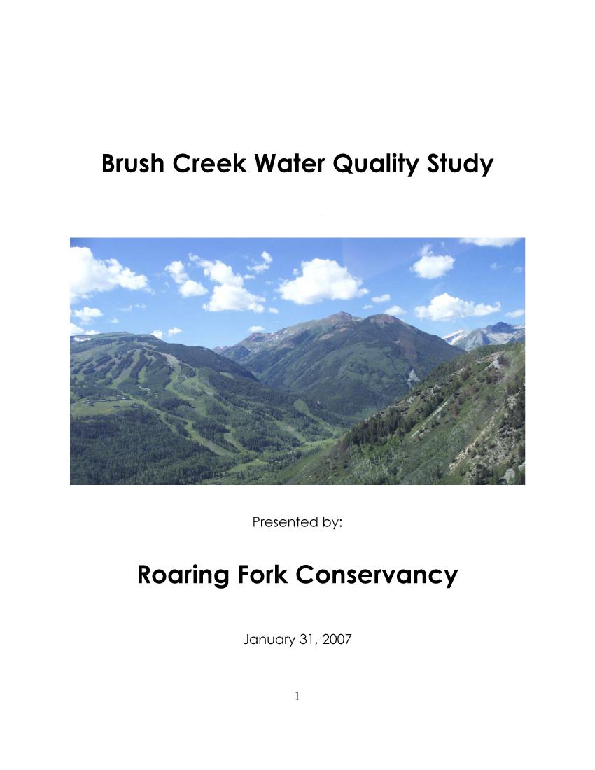
2 Introduction Brush Creek is located in the south central part of the Roaring Fork Watershed. It is between the drainages of Maroon Creek and Snowmass Creek and is the major creek flowing below the Snowmass Ski Area and the Town of Snowmass Village. The Brush Creek watershed is 1. square miles and Brush Creek is 7. miles in length. Brush Creek starts at an elevation of,1 feet in the Mid-Elevation Forests Ecoregion and then flows through the Foothill Shrublands Ecoregion to join the Roaring Fork River at 7, feet. In its Water Quality Report, Roaring Fork Conservancy placed Brush Creek on its impacted list. Several factors led to this designation: consistently high ph and phosphorous levels, and continued construction and development along the creek and riparian zone. Brush Creek also had a Family Biotic Index (FBI) of good. This is a rating system for measuring the biological health of a river, and a good rating indicates organic pollution is probable. By comparison, Snowmass Creek (another nearby creek), lacks the high ph levels, has a FBI rating of excellent, and does not have the large scale development seen on Brush Creek. During the course of this study, a new rating system called the Multimetric Index (MMI) provided additional and more in-depth information on Brush Creek. In Roaring Fork Conservancy initiated a targeted water quality study to further investigate these concerns on Brush Creek. Partners for this study included: Aspen Skiing Company, Colorado Department of Public Health and Environment, Colorado Watershed Network, and Pitkin County. The overall purpose of the Brush Creek Study was threefold. The first goal was to establish an accurate baseline for Brush Creek. Baseline data will be helpful for comparing with data collected in the future as development and construction continue along the creek. The second was to determine the magnitude, duration, and location of high ph and phosphorus levels found in Brush Creek. (There were 11 ph tests above the state limit of. over three years, and % of phosphorous samples exceeded recommended levels.) The third and final goal of the study was to provide a better understanding of appropriate management of open space parcels with regard to riparian habitat. Methods Sample Stations: Sampling was conducted at four sites, including a reference site above all development (Divide), one site in the Town of Snowmass Village (Chapel), one site below Snowmass Club Golf Course (Y), and lastly one at Roaring Fork Conservancy s River Watch Station on Brush Creek near Highway (Historic). This last site was a good reference site because of the five years of historic data compiled by Roaring Fork Conservancy. See Figure in the Appendix for detailed site locations and descriptions.
3 Sample Parameters: The following categories list the parameters sampled in this study: Chemical Parameters: Dissolved oxygen (DO), hardness, ph, temperature, and total alkalinity. (Analysis conducted by RFC staff and contracted consultant) Macro-invertebrates: Samples of small aquatic insects taken to identify species and quantities and used to determine the FBI Index and Multimetric Index. (Analysis conducted by Colorado Division of Public Health and Environment) Nutrient Parameters: Ammonia, conductivity, nitrate, and phosphate. (Analysis conducted by Aspen Water and Sanitation District). ph Samples: Most ph samples included chemical parameters as well. On October rd half of the samples included chemical parameters and the other half focused on ph and temperature. (Analysis conducted by RFC Staff and contracted consultant) Chemical parameters were determined for up to samples on 1 different dates from April through January 7. Macro-invertebrates were collected at two sites, Chapel and Y, in September. Nutrient parameters were determined on four different dates: April, May, August, and September. For a detailed list of all sample dates and parameters see Figure in the Appendix. A segment of the study was heavily focused on ph as well. This segment was conducted to determine the magnitude, frequency, and duration of some high ph events found at the Historic site in the past five years. It consisted of weekly sampling during a six week period in September and October. At the end of this period, on October rd, real time sampling was conducted throughout the day with four samples taken at each site. Protocol: Field protocol: Temperature was recorded in degrees Celsius using a standard thermometer that was submerged in the creek for a minimum of one minute. Temperature was recorded on the field data sheet. Dissolved oxygen (DO) samples were taken at each site with a ml DO bottle that was rinsed three times with creek water and then placed in the creek and angled at degrees for three minutes. The bottle was then capped underwater and fixed with magnesium sulfate and alkaline iodide-azide solutions. The sample and solutions were thoroughly mixed together twice (the second time after settling %). In order to complete the procedure for stabilizing the amount of DO in solution, sulfamic acid was introduced. For ph, alkalinity and hardness, a standard ml plastic container was rinsed three times with creek water and then the sample was collected. Macro-invertebrates were collected according to the CDPHE protocols using kick nets. Samples for nutrient parameters were taken at each site using a standard 1 ml plastic container after rinsing three times with creek water. Lab Protocol: Dissolved Oxygen was measured in milligrams per liter (mg/l) with the standard Winkler Titration Method utilizing sodium thiosulfate as the chemical titrant. Percent saturation of DO was determined by the water temperature cross referenced with the dissolved oxygen value in mg/l. ph was analyzed using a Beckman ph meter that was standardized, utilizing ph 7 and ph 1 buffer solutions, before the creek sample was measured. Alkalinity was determined in mg/l via a titration method utilizing sulfuric acid as the titrant. Hardness was determined in mg/l via a titration method utilizing ethylenediaminetetraacetic acid (EDTA). All results were
4 recorded on the appropriate field data sheets. Macro-invertebrates were analyzed through the CDPHE. Nutrient parameters were measured at the Aspen Water and Sanitation District laboratory. Results Ammonia in its unionized form is toxic to aquatic organisms. Temperature and ph can affect the levels of unionized ammonia in a stream and in-stream concentrations may be reduced with dilution. Low ammonia concentrations are better for aquatic organisms. The state standards for acute ammonia concentrations are currently being reevaluated by the State and were not available at this time. Ammonia levels at the Divide site were N/A, <., <., and. mg/l respectively during each of the sampling periods. Ammonia levels at the Chapel site were <., <..., and <. mg/l respectively. Ammonia levels at the Y site were <., <.,., and.7 mg/l respectively. Ammonia levels at the Historic site were N/A, <., <., and <. mg/l respectively. (The detection limit (for Ammonia) of the Aspen Water and Sanitation District is..) Conductivity is the ability of a substance to conduct an electrical current. Pure liquid water has a very low conductivity. The presence of charged ions in the water makes the solution more conductive. As ion concentration increases, conductance of the solution increases. Therefore, the conductance measurement provides an indication of ion concentration. There is no state standard for conductivity. Conductivity levels at the Divide site were N/A, 1, and 1 ohms/cm respectively during each of the sampling periods. Conductivity levels at the Chapel site were, 1,, and 1 ohms/cm respectively. Conductivity levels at the Y site were, 1,, and 7 ohms/cm respectively. Conductivity levels at the Historic site were N/A, 17,, and ohms/cm respectively. For a detailed graph of Conductivity levels see Figure in the Appendix. Dissolved Oxygen concentrations in water determine which organisms can survive in a particular environment. The state standard for dissolved oxygen is a minimum of. milligrams per liter (mg/l). Dissolved oxygen ranged from 7. to. mg/l at the Divide site,.1 to 1.7 mg/l at the Chapel site,. to 11. mg/l at the Y site, and. to 11. mg/l at the Historic site. For a detailed graph of Dissolved Oxygen measurements see Figures 11-1 in the Appendix. Hardness is the measure of minerals (specifically calcium and magnesium) that are in the water. There is no state standard for hardness. Hardness ranged from 1 to mg/l at the Divide site, to mg/l at the Chapel site, to mg/l at the Y site, and to 1 mg/l at the Historic site. For a detailed graph of Hardness levels see Figures 7-1 in the Appendix. Macro-invertebrates are organisms that have no internal skeleton of cartilage or bone, and are large enough to see without magnification. In freshwater environments, these organisms (e.g. stoneflies, mayflies, and caddisflies) are the primary food for fish and other riparian animals, and are responsible for the breakdown of organic material and nutrients. Some macros are pollution sensitive while others are pollution tolerant. The absence of pollution sensitive species coupled with the presence of pollution tolerant species may indicate organic pollution. This was the basis for the FBI Index. During the past year the CDPHE adopted new criteria for analyzing Macro-
5 invertebrate samples. It is called the Multimetric Index and uses the above criteria along with additional parameters to give a more accurate idea of the biological health of streams. According to this new index the Chapel Site had an average MMI score of 7.7 and the Y Site had an average MMI score of 7.. Both of these scores carry a rating of least disturbed indicating a lack of organic pollution and a biologically healthy stream. Nitrate is a reduced form of nitrogen. Excessive concentrations of nitrate in water can cause harm to aquatic organisms. The state standard for nitrate in creeks such as Brush Creek is 1 mg/l. Nitrate levels at the Divide site were N/A,.,., and 1. mg/l respectively during each of the sampling periods. Nitrate levels at the Chapel site were 1., 1.7,.7, and 1. mg/l respectively. Nitrate levels at the Y site were.,.1,.1, and. mg/l respectively. Nitrate levels at the Historic site were N/A,.,., and 1.7 mg/l respectively. For a detailed graph of Nitrate Levels see Figure 1 in the Discussion section. ph is the measurement of the acidity of water, with acidic (as low as 1) on one end of the ph scale and basic (as high as 1) on the other end of the scale. Aquatic organisms each have an optimal ph range for functioning, and extremes on either end of the ph scale can be toxic. The state standard for ph is between. and.. ph ranged from 7. to. at the Divide site,.1 to. at the Chapel site,.1 to. at the Y site, and.1 to. at the Historic site. For a detailed graph of ph levels see Figure in the Discussion section. Phosphate is a constituent of total phosphorus in water. High phosphate concentrations in a water body may decrease productivity of aquatic organisms. Phosphate does not have a state standard. Phosphate levels at the Divide site were N/A,.1,.1, and 1.7 mg/l respectively during each of the sampling periods. Phosphate levels at the Chapel site were 1.,.1,., and. mg/l respectively. Phosphate levels at the Y site were.1,.,.7 and 1. mg/l respectively. Phosphate levels at the Historic site were N/A,.1, 1. and., mg/l respectively. For a detailed graph of phosphate levels see Figure in the Discussion section. Temperature helps determine which kind of organisms can survive in water. Species such as trout and mayflies prefer lower temperatures because cold water holds greater levels of dissolved oxygen. The state standard for temperature in creeks such as Brush Creek is a maximum of Celsius. Temperature at the Divide site ranged from a minimum of C to a maximum of 11 C. Chapel site temperature ranged from C to 1 C. Y site temperature ranged from C to 1 C. Historic site temperature ranged from 1 C to 11 C. The lower temperatures reflected January sampling as opposed to August sampling. For a detailed graph of Temperature measurements see Figures 11-1 in the Appendix. Total alkalinity concentrations in water represent the total amount of bicarbonate and carbonate in a body of water. Alkalinity measures the ability of water to resist change in ph when either an acid or base is added to the water. There is no state standard for alkalinity. Total Alkalinity ranged from to 17 mg/l at the Divide site, to 1 mg/l at the Chapel site, 7 to 17 mg/l at the Y site, and 7 to 1 mg/l at the Historic site. For a detailed graph of Total Alkalinity levels see Figures 7-1 in the Appendix.
6 Discussion Most parameters in this study seemed to reflect normal and relatively healthy conditions for Brush Creek. Although there are no state standards for alkalinity and hardness, the values seem to fall within reasonable ranges and follow expected trends. The state standards for acute ammonia concentrations are currently being reevaluated by the State and were not available at this time. In terms of state standards for temperature and dissolved oxygen, all four sites fell within acceptable ranges and followed expected trends. MMI scores for Macro-invertebrates carry a rating of least disturbed indicating a lack of organic pollution and a biologically healthy stream. Nitrate The nitrate levels found at all the sites on Brush Creek were well below the state standards. There was, however, a marked increase in nitrate levels between the Chapel and Y sites during every sample event. The Y site also posted the highest nitrate levels of all the sites. This data may indicate that the Snowmass Club Golf Course may be contributing to the rise in nitrate levels. Interestingly, the levels usually dropped again between the Y and Historic sites indicating the possibility of some mitigating factor between those sites. Total Nitrate Divide Chapel Y Historic Total Nitrate (mg/l) Sample Date // // // /7/ Divide.. 1. Chapel Y Historic Figure 1 (Total Nitrate levels at each site)
7 ph One major focus of this study was to determine the magnitude, duration, and location of high ph levels found in Brush Creek. Over a three-year period, 11 ph tests were above the state limit of.. Data shows that all ph samples collected for this study were within the state standard. Data from the Divide site shows the lowest ph levels, indicative of a headwater sampling point. The ph rose at the Chapel and Y sites, but still at acceptable levels. Yet it was the rise in ph between the Y site and the Historic site that is of note where ph minimums were.1 and. respectively and where ph maximums were. and. respectively. This data may suggest that there are factors which slightly influence the rise in ph between the Chapel site which is located below the Town of Snowmass Village, and the Y site which is below Snowmass Club Golf Course. This data also suggests that factors of greater influence to the ph rise exist between the Y site and the Historic site which is near Brush Creek s confluence with the Roaring Fork River at Highway.. ph gradient values at each site Divide Chapel Y Historic... ph Sample Date 1: AM1: PM: PM : PM // // // // /7/ // /7/ 1// 1/11/ 1/1/ 1// 1// 1// 1// 1//7 Divide Chapel Y Historic Figure ( ph levels at each site) The fact that no ph levels exceeded the state standard is of particular interest. This result, although unexpected, is good news for the health of Brush Creek, especially considering the construction and development in progress during the study period. Closer examination of data from previous years shows an interesting trend emerging. It would appear that ph levels are higher during years of lower water levels/flows and lower during years of average water levels/flows. Also, in previous years the ph spike occurred most often in the fall, a time of the year usually associated with lower water levels/flows. These trends seem to indicate the possibility of a relationship between ph levels and water/flow levels. 7
8 Phosphate Although phosphate does not have a state standard, past levels in Brush Creek were high, with values reaching 1.1 mg/l at the Historic sample site near Highway. This pattern was recognized during this study as well with each sampling station recording phosphate values that exceeded even those historic values. The highest phosphate value was 1.7 at Divide, 1. at Chapel,.7 at Y, and 1. at Historic. In three out of four samples the largest increase in Phosphate was noted between the Chapel and Y sites. This data may indicate that the Town of Snowmass Village and the Snowmass Club Golf Course may both be contributing to these higher phosphate values, with the larger increased occurring around the Snowmass Club Golf Course. Total Phosphate Divide Chapel Y Historic.7. Total Phosphate (mg/l) Sample Date // // // /7/ Divide Chapel Y Historic Figure (Total Phosphate levels at each site) Conclusion The overall purpose of the Brush Creek Study was threefold. The first goal was to establish an accurate baseline for Brush Creek. This was completed and the data collected will be useful for future comparison to the seven years of historic data Roaring Fork Conservancy has collected on Brush Creek. Looking towards the future, Roaring Fork Conservancy will continue monitoring three of the four sites established during study, and work toward incorporating the fourth site in 7. The second goal was determining the magnitude, duration, and location of high ph and phosphorus levels found in Brush Creek. As stated in the discussion, no exceedences of the state limit for ph were recorded during the Brush Creek Study. One possible theory points toward a link between ph and stream flows. This theory could be the basis for the need of a gauging
9 station on Brush Creek in order to better study the relationship between flows and ph. It could also point towards a need for a minimum in-stream flow to be established on Brush Creek during low flow years. Roaring Fork Conservancy will continue to monitor at least three sites on Brush Creek in hopes to learn more regarding ph. Regarding phosphorus levels, the Roaring Fork Conservancy will share this report with the Snowmass Golf Club, and the Town of Snowmass Village and will provide consultation if requested. The third and final goal of the study was to provide a better understanding of appropriate management of open space parcels with regard to riparian habitat. Roaring Fork Conservancy will distribute this report to the Aspen Skiing Company, Pitkin County Open Space and Trails, Pitkin County Department of Environmental Health, Snowmass Club Golf Course, and the Town of Snowmass Village, and continue to assist with management decisions in regards to Brush Creek water quality, water quantity, and riparian habitat. This report will also be made available to other interested parties upon request.


 of Brush Creek Road and Highline Road.")
10 Sampling locations: Appendix Divide Near divide of Brush and Snowmass Creeks. Follow Brush Creek Road up to Krabloonik and park in lot. Sample site is just downstream from divide across the creek from the large house across from Krabloonik parking lot. Lat: 1 Long: 1 11 Elevation: Chapel Downstream of Base Village. From the Divide site turn right on Highline Road and take an immediate left into the Chapel/Anderson Ranch parking lot. Site is ~1m upstream of culvert at obvious spot among big boulders. Lat: 1 1 Long: 1 1 Elevation: 1 Y Just downstream from Snowmass Club outflow and bridge at obvious turn in Creek. Approximately 1m upstream from Y intersection (now a round-about) of Brush Creek Road and Highline Road. Lat: 1 Long: 1 1 Elevation: 1 Historic Historic RW site located in median of Hwy, just upstream from culvert underneath southbound Hwy.. Lat: 1 1 Long: 1 1 Elevation: 7 Figure (Sample Site Locations) 1
11 Sample Schedule for Brush Creek Study April through January 7 Site // // // // /7/ // /7/ 1// Divide C C, N C, N C C, N C Chapel C, N C C, N C, N C, M C C, N C Y C, N C, N C, N C, M C C, N C Historic C C, N C, N C C, N C Site 1/11/ 1/1/ 1// 1// 1// 1// 1//7 1:am 1:pm :pm :pm Divide C C C ph C ph Chapel C C C ph C ph C Y C C C ph C ph C Historic C C C ph C ph C Key C N M ph Figure (Sample Schedule) Chemistry Parameters = Alkalinity, Dissolved Oxygen, Hardness, ph, and Temperature Nutrient Parameters = Ammonia, Conductivity, Nitrate, and Phosphate Macroinvertebrates ph and temperature only Conductivity Divide Chapel Y Historic Conductivity (ohms/cm) Sample Date // // // /7/ Divide 1 1 Chapel 1 1 Y 1 7 Historic 17 Figure (Conductivity levels at each site) 11
12 Divide: Total Alkalinity and Hardness total alkalinity (mg/l) hardness (mg/l) Total Alkalinity (mg/l) and Hardness (mg/l) : AM : PM Sample Date // // // // /7/ 1// 1/11/ 1/1/ 1// 1// 1// total alkalinity (mg/l) hardness (mg/l) Figure 7 (Total Alkalinity and Hardness levels at the Divide Site) Chapel: Total Alkalinity and Hardness total alkalinity (mg/l) hardness (mg/l) Total A lkalinity and H ardness (m g/l) Sample Date 1: AM : PM // // // // /7/ // /7/ 1// 1/11/ 1/1/ 1// 1// 1//7 total alkalinity (mg/l) hardness (mg/l) Figure (Total Alkalinity and Hardness levels at the Chapel Site) 1
13 Y: Total Alkalinity and Hardness Total Alkalinity (mg/l) Hardness (mg/l) Total Alkalinity (mg/l) and Hardness (mg/l) : AM : PM Sample Date // // // /7/ // /7/ 1// 1/11/ 1/1/ 1// 1// 1//7 Total Alkalinity (mg/l) Hardness (mg/l) Figure (Total Alkalinity and Hardness levels at the Y Site) Historic: Total Alkalinity and Hardness Total Alkalinity (mg/l) Hardness (mg/l) Total Alkalinity (mg/l) and Hardness (mg/l) : AM : PM Sample Date // // // // /7/ 1// 1/11/ 1/1/ 1// 1// 1//7 Total Alkalinity (mg/l) Hardness (mg/l) Figure 1 (Total Alkalinity and Hardness levels at the Historic Site) 1
14 Divide: Dissolved Oxygen and Temperature water temp. (degrees C) dissolved oxygen (mg/l) 1 Dissolved Oxygen (mg/l) and Temperature (degrees C) : AM : PM Sample Date / / / / /7 1/ 1/11 1/1 1/ 1/ 1//7 water temp. (degrees C) 1 1 dissolved oxygen (mg/l) Figure 11 (Dissolved Oxygen and Temperature measurements at the Divide Site) 1 Chapel: Dissolved Oxygen and Temperature water tempersture (degrees C) dissolved oxygen (mg/l) Dissolved Oxygen (mg/l) and Temperature (degrees C) Sample Date 1: AM : PM // // // // /7/ // /7/ 1// 1/11/ 1/1/ 1// 1// 1//7 water tempersture (degrees C) dissolved oxygen (mg/l) Figure 1 (Dissolved Oxygen and Temperature measurements at the Chapel Site) 1
15 Y: Dissolved Oxygen and Temperature water temperature (degrees C) dissolved oxygen (mg/l) Dissolved Oxygen (mg/l) and Temperature (degrees C) : AM : PM Sample Date // // // /7/ // /7/ 1// 1/11/ 1/1/ 1// 1// 1//7 water temperature (degrees C) 11 1 dissolved oxygen (mg/l) Figure 1 (Dissolved Oxygen and Temperature measurements at the Y Site) Historic: Dissolved Oxygen and Temperature water temp. (degrees c) dissolved oxygen (mg/l) 1 Dissolved Oxygen (mg/l) and Temperature (degrees C) : AM : PM Sample Date // // // // /7/ 1// 1/11/ 1/1/ 1// 1// 1//7 water temp. (degrees c) dissolved oxygen (mg/l) Figure 1 (Dissolved Oxygen and Temperature measurements at the Historic Site) 1
16 1 Divide: ph and Temperature ph (S.U.) water temp. (degrres c) ph and Temperature (degrees C) State Standard is between. and Sample Date 1: AM 1: PM : PM : PM // // // // /7/ 1// 1/11/ 1/1/ 1// 1// 1// 1// 1//7 ph (S.U.) water temp. (degrres c) 1 1 Figure 1 (ph and Temperature measurements taken at the Divide Site) 1 Chapel: ph and Temperature 1 ph temperature (degrees C) ph and Temperature (degrees C) State Standard is between. and Sample Number 1: AM 1: PM : PM : PM // // // // /7/ // /7/ 1// 1/11/ 1/1/ 1// 1// 1// 1// 1//7 ph temperature (degrees C) Figure 1 (ph and Temperature measurements taken at the Divide Site) 1
17 1 1 Y: ph and Temperature 1 ph water temperature (degrees C) ph and Temperature (degrees C) State Standard is betwenn. and Sample Number 1: AM1: PM: PM: PM // // // /7/ // /7/ 1//1/11/1/1/1//1//1//1// 1//7 ph water temperature (degrees C) 11 1 Figure 17 (ph and Temperature measurements taken at the Y Site) 1 Historic: ph and Temperature 11 ph Temperature (degrees C) 11 ph and Temperature (degrees C) State Standard is between. and : AM1: PM: PM : PM Sample Date // // // // /7/ 1// 1/11/1/1/1//1//1//1// 1//7 ph Temperature (degrees C) Figure 1 (ph and Temperature measurements taken at the Historic Site) 17
Acidity and Alkalinity:
 Evaluation of Pollution Sources to Lake Glenville Quarterly Report December 2018 Kimberlee K Hall, PhD Environmental Health Program, Western Carolina University Summary Chemical and microbial analysis
2012 Brush Creek Focused Water Quality Assessment
 2012 Brush Creek Focused Water Quality Assessment SUBMITTED: 12/20/13 A Project of The: Prepared For: PO Box 3349 Basalt, CO 81621 Prepared By: PO Box 1524 Carbondale, CO 81623 And: 155 West Harvard, Suite
Impact of an Agricultural Point Source on Macroinvertebrate Communities and Water Quality on the Lamoille River
 Impact of an Agricultural Point Source on Macroinvertebrate Communities and Water Quality on the Lamoille River Fundamentals of Ecology 12/2/05 Introduction The purpose of this study was to determine if
Reading the River 2006 Water Study Sixth Grade Science Mindy Fry Kenton County
 Reading the River 2006 Water Study Sixth Grade Science Mindy Fry Kenton County Curriculum Plan Lesson Context: To kick off this unit of study, I will have Jamie Egglemeyer from Sanitation District No.
Clyde Mine Discharge/Tenmile Creek Water Quality Final Report
 Clyde Mine Discharge/Tenmile Creek Water Quality Final Report November 01, 2016 Background In follow-up to the Pennsylvania Department of Environmental Protection s (DEP) December 15, 2015, Tenmile Creek
The Snapshot CONODOGUINET CREEK WATERSHED SNAPSHOT
 CONODOGUINET CREEK WATERSHED SNAPSHOT ABOVE: CONODOGUINET CREEK AT RT 74 BRIDGE FACING DOWNSTREAM The Snapshot The Conodoguinet Watershed Snapshot was a collaborative effort to engage local citizens in
An Evaluation of Antes Creek. Antes Creek has a drainage area of square miles and is a tributary of the
 An Evaluation of Antes Creek Introduction Antes Creek has a drainage area of 55.75 square miles and is a tributary of the West Branch of the Susquehanna near Jersey Shore, PA. The purpose of this study
Mr. Leach Science Burrillville High School
 Mr. Leach Science Burrillville High School The Clear River subwatershed, is located in northwestern Rhode Island. This subwatershed is a component of the Lower Blackstone River Watershed, the Blackstone
Sandies Creek Watershed
 SH 97 Sandies Creek Watershed Gonzales De Witt FM 1116 Sandies Creek SH 72 FM 240 FM 466 Sandies Creek Karnes Smiley Elm Creek FM 108 US 87 SH 80 FM 1117 Guadalupe FM 1681 Wilson Nixon 13657 1803B 1803B
Santa Rosa Creek Water Quality Results 2004
 Santa Rosa Creek Water Quality Results 24 Community Clean Water Institute Site Description: SRC4: Off 3rd Street in downtown Santa Rosa. Behind the Vineyard Hotel just West of Highway 11 along the Prince
A Claytor Nature Center Stream Monitoring Experience
 A Claytor Nature Center Stream Monitoring Experience Conduct field investigations in which distinctions are made among observations, hypotheses, results and conclusions Perform a visual habitat assessment
Basics of Water Quality Sheila Murphy
 Basics of Water Quality Sheila Murphy Water quality: The chemical, physical, and biological characteristics of water, usually in respect to its suitability for a particular purpose Water quality can include:
Lake Washington. Water Quality Assessment Report. Copyright 2012 PLM Lake & Land Management Corp.
 Lake Washington 2012 Water Quality Assessment Report Copyright 2012 PLM Lake & Land Management Corp. Water Quality Report On May 22nd, June 18th, July 30th, August 29th, and September 27 th, 2012, PLM
Basic concepts of managing the water within an aquaponics system
 Water Quality Station Basic concepts of managing the water within an aquaponics system Water is the life-blood of an aquaponics system. It is the medium through which all essential macro- and micronutrients
2012 ROARING FORK WATERSHED MANAGEMENT PLAN TABLE OF CONTENTS
 2012 ROARING FORK WATERSHED MANAGEMENT PLAN TABLE OF CONTENTS Page 1.0 WATERSHED OVERVIEW RF- 3 1.1 Geography and Hydrology RF- 3 1.2 Land Uses and Population Characteristics RF- 4 1.3 Watershed Water
Water Quality Consists of these Eight Important Components:
 Water Quality Consists of these Eight Important Components: ph The H in ph stands for Hydrogen and the p stands for potential or the power of that Hydrogen, the concentration of hydrogen ions in a solution.
Today s Webinar: Types of Monitoring and Assessment Data and What They Mean
 Welcome to the 1 st Webinar in the Series Monitoring & Assessment for Watershed Plans: Identifying, Accessing, and Using Data to Protect and Restore Indiana s Waters Each Monday in May at noon Today s
Grants Pass Water Quality Monitoring
 Grants Pass Water Quality Monitoring 2003-2005 Rogue Valley Council of Governments April 2005 Rogue Valley Council of Governments Natural Resources Department 155 North First Street Central Point, Oregon
Dissolved oxygen. How Does Dissolved Oxygen Affect Freshwater Ecosystems? Ecology Dissolved Oxygen.notebook. September 30, 2014
 Dissolved oxygen Information from "Water's The Matter" module How Does Dissolved Oxygen Affect Freshwater Ecosystems? 1 Dissolved oxygen MS LS2 I can construct an argument with empirical evidence to show
Modeling Hydrology, Sediment, and Nutrients in the Flathead Lake Watershed Appendix C
 APPENDIX C. SOUTH FORK FLATHEAD RIVER BOUNDARY CONDITION CONTENTS Introduction... C 3 Available Data... C 6 Available Flow Data... C 6 Available Suspended Sediment Concentration Data... C 8 Available Nitrogen
Clockhouse Lane Pit Lakes - Water Quality and Ecology Overview 2016
 Clockhouse Lane Pit Lakes - Water Quality and Ecology Overview 2016 Heathrow Airport uses specialist consultants to monitor the Clockhouse Lane Pit system of interconnected lakes for water quality and
Peach Creek Watershed
 SH 304 Peach Creek Watershed Bastrop Peach Cree FM 713 Caldwell Peach Creek, Sandy Fork Copperas Creek 1803C Peach Creek Fayette FM 1054 US 90 Waelder US IH US 90 FM 1680 IH 10 Dry Run Gonzales SH 97 Peach
Summary of Basin Characteristics and Facilities. General Land-use Characteristics: Withdrawal and Discharge Sites: Sampling Site Statistics:
 -Digit Watershed Identity Number: 28 This report was prepared by the Kentucky Water Research Institute as a product of the statewide Kentucky Watershed Management process. Information presented in this
Texas Stream Team Volunteer Water Quality Monitoring Program 2009 Upper Guadalupe River Data Summary
 Texas Stream Team Volunteer Water Quality Monitoring Program 29 Upper Guadalupe River Data Summary This data summary report includes general basin volunteer monitoring activity, general water quality descriptive
Sabine River Basin Volunteer Water Quality Monitoring Data Summary Report compiled by Texas Watch
 Sabine River Basin Volunteer Water Quality Monitoring Data Summary Report compiled by Texas Watch This data summary report includes general basin volunteer monitoring activity, general water quality descriptive
Know What You re Monitoring! Since not all of us are water chemists, here is a brief understanding of what your different tools measure
 1 Know What You re Monitoring! Since not all of us are water chemists, here is a brief understanding of what your different tools measure Extech EC400 meters Salinity (SAL) Total Dissolved Solids (TDS)
COOPERATIVE EXTENSION Bringing the University to You
 COOPERATIVE EXTENSION Bringing the University to You Fact Sheet-02-91 SAMPLING AND INTERPRETATION OF LANDSCAPE IRRIGATION WATER Robert Morris and Dr. Dale Devitt TAKING A WATER SAMPLE FOR ANALYSIS Contact
MARK CREEK DEMONSTRATION PROJECT
 MARK CREEK DEMONSTRATION PROJECT OCC Tasks 20 and 21 FY 1990 319(h) Task 210 EPA Grant # C9-006704-90-0 Submitted by: Oklahoma Conservation Commission Water Quality Division 413 NW 12 th Oklahoma City,
Pebble Lake - Water Quality Report
 Emerald Lakes Village, Oakland County January 8 th, 218 Pebble Lake - Water Quality Report The goal of this testing protocol was to monitor various water quality parameters of the lake, compare results
Environmental Chemistry Section 2.1 Name: Pgs. 213 to Define the following: a. Ozone Layer. b. Monitoring. c. Invertebrates
 Environmental Chemistry Section 2.1 Name: Pgs. 213 to 224 1. Define the following: a. Ozone Layer b. Monitoring c. Invertebrates d. Parts per million e. Spring Acid Shock f. Toxic g. Toxicity h. LD50 i.
Water Quality Results from Indian Head River, Hanover, MA
 Bridgewater State University Virtual Commons - Bridgewater State University Watershed Access Lab Projects Watershed Access Lab 2006 Water Quality Results from Indian Head River, Hanover, MA Recommended
Red River Gorge Restoration and Watershed Plan Chapter 3: Learning More - Monitoring to Secure New Data Draft
 Red River Gorge Restoration and Watershed Plan Chapter 3: Learning More - Monitoring to Secure New Data Draft There are two main goals of watershed planning: protect good water quality and improve poor
Water Chemistry. Water 101
 Water Chemistry Water 101 I. Introduction A. Water is not pure Many different kinds of chemicals dissolved in it Ions, organic chemicals, organic matter, particulate matter, and gases can all be in water
REPORT ON RABBIT CREEK SPECIAL STUDY SUBWATERSHED 5.19
 REPORT ON RABBIT CREEK SPECIAL STUDY SUBWATERSHED 5.19 Sabine River Authority of Texas August 31, 23 Prepared in Cooperation with the Texas Commission on Environmental Quality Under the Authorization of
UPPER GALL ATIN RIVER WATERSHED
 218 UPPER GALL ATIN RIVER WATERSHED MONITORING REPORT Kristin Gardner, PhD Executive Director, Gallatin River Task Force Jack Murray Big Sky Watershed Corps, Gallatin River Task Force January 216 The Gallatin
Mock Stream Habitat Assessment: Bringing the outside in!
 Mock Stream Habitat Assessment: Bringing the outside in! Objectives: At the end of this activity, youth should be able to: Assess the overall health of a stream habitat Apply the terms abiotic and biotic
Measuring Dissolved Oxyg Instructions for the La Motte Field-Test Kit
 Then, immediately add 8 drops of alkaline potassium iodide azide to the water sample Recap the bottle and shake to mix. Immediately add 8 drops of manganous sulfate to the water Record the temperature
Results from the 2017 Water Quality Monitoring Program
 Results from the 217 Water Quality Monitoring Program As part of a larger project, this summer the BWC conducted water sampling throughout the Belleisle Bay to get a baseline of data and determine the
UPPER GALLATIN RIVER WATERSHED
 216 UPPER GALLATIN RIVER WATERSHED WATER QUALITY REPORT Kristin Gardner, PhD Executive Director, Gallatin River Task Force Stephanie Lynn Education and Communications Coordinator, Gallatin River Task Force
Forrest Bell, FB Environmental Mare Brook Stressor Analysis Methodology
 MEMORANDUM TO: Jared Woolston, Town of Brunswick FROM: SUBJECT: DATE: April 20, 2016 CC: Forrest Bell, FB Environmental Mare Brook Stressor Analysis Methodology Margaret Burns & Sabrina Vivian, FB Environmental;
Sugar Creek Watershed Watershed Number:
 Watershed Watershed Number: 512511 Location Map Mercer Jessam ine %g 27 %g15 41 Harrodsburg Burgin %g 152 %g 39 %g1268 Sugar C reek W atershed Richm ond %g1355 %g 876 Madison %g 34 %g 595 Boyle Danville
SAN BERNARD RIVER ABOVE TIDAL - SEGMENT 1302
 SAN BERNARD RIVER ABOVE TIDAL - SEGMENT 1302 SAN BERNARD RIVER ABOVE TIDAL - SEGMENT 1302 LAND COVER BACTERIA DISSOLVED OXYGEN NUTRIENTS Impairment Concern No Impairments or Concerns SAN BERNARD RIVER
Water Quality indicators and How Human Activities Affect Water Quality
 Water Quality indicators and How Human Activities Affect Water Quality Name: Online Assignment: Period: Date: Purpose: to learn how to evaluate water quality and how pollution can make water unavailable
Past Studies in the Clearwater River Watershed. Past Studies MPCA Lost River Investigation. Past Studies Clearwater River Nonpoint Study
 Past Studies in the Clearwater River Watershed March 2007 Stakeholder Advisory Group Meeting Clearwater Nonpoint Study Biological studies Wild rice paddy water quality Clearwater Lake Water Quality Model
Water Monitoring in Spa Creek: A Summary
 Water Monitoring in Spa Creek: A Summary Written by: Alexis Jones & Blake Harden Edited by: Hannah Krauss Water monitoring is very important in order to determine the health of the Chesapeake Bay and its
Little Cypress Bayou Special Study - Subwatershed 1.10
 - Subwatershed 1.1 Sabine River Authority of Texas August 31, 21 Prepared in Cooperation with the Texas Natural Resource Conservation Commission Under the Authorization of the Texas Clean Rivers Act Table
Clockhouse Lane Pit Lakes - Water Quality and Ecology Overview 2014
 Clockhouse Lane Pit Lakes - Water Quality and Ecology Overview 2014 Heathrow Airport uses specialist consultants to monitor the Clockhouse Lane Pit system of interconnected lakes for water quality and
4.0 SAN GABRIEL RIVER WATERSHED MANAGEMENT AREA
 4.0 SAN GABRIEL RIVER WATERSHED MANAGEMENT AREA 4.1 Watershed Description 4.1.1 Watershed Land Use, Percent Impervious, and Population Land use in the San Gabriel River Watershed Management Area is approximately
Applicable TEKS. Procedure. Duration. Objectives. Prerequisites. Materials. Temperature Station. ph Station
 L E S S O N LESSON 7 Survey: Physical Properties Applicable TEKS Grade 4 4.1 A 4.2 A, B, D, E, F 4.3 A 4.4 A, B Grade 4 4.1 A, C 4.8 C Duration Two 40-minute lessons Grade 5 5.1 A 5.2 A, C, D, E, F 5.3
Results from Fall Water Monitoring FortWhyte Alive Riverwatch Test Kit September October 2017
 Results from Fall Water Monitoring FortWhyte Alive Riverwatch Test Kit September October 2017 with: Westwood Collegiate, Elmwood Jr. High, Maples Met School, Miles Macdonnell Collegiate, Seven Oaks Met
Clockhouse Lane Pit Lakes - Water Quality and Ecology Overview 2015
 Clockhouse Lane Pit Lakes - Water Quality and Ecology Overview 2015 Heathrow Airport uses specialist consultants to monitor the Clockhouse Lane Pit system of interconnected lakes for water quality and
Life Science: A Water Field Study
 Life Science: A Water Field Study Grade 8 Dora Carnevali Bath County Middle School Dora Carnevali 8th Grade Science 2 days Life Science: A Water Field Study Targeted Standards: Academic Expectations 2.3
Management Objectives and Targets
 Management Objectives and Targets As part of the Yampa River Stream Management Plan, the community of Steamboat Springs developed management objectives for the reach of the Yampa River near Steamboat Springs.
Summary of EPA Surface Water Sampling of Select Metals Results to Date Gold King Mine Blowout
 Summary of EPA Surface Water Sampling of Select Metals Results to Date Gold King Mine Blowout August 7, 215 EPA initiated a sampling effort on August 5, 215, to assess the impacts of the blowout at the
Water Quality Analysis of Streams in the City of Lynchburg By: The Class
 Water Quality Analysis of Streams in the City of Lynchburg By: The Class Introduction: When monitoring water quality it is important to know what to look at to help determine if the stream is healthy.
PINEY RUN WATERSHED 2005 PROFILE
 PINEY RUN WATERSHED 25 PROFILE Table of Contents Page Watershed Description Water Quality Studies Stream Monitoring Water Chemistry Conditions Water Bacteria Conditions Stream Habitat Conditions Aquatic
Resource. ph must be measured in the field. The ph will change if the water is collected and stored, and will not reflect the true value at the site.
 Resource ph What is ph? ph is a measurement of how acidic or alkaline (basic) the water is. ph is measured on a scale of 0 to 14, with 0 being the most acidic, and 14 being the most basic. Distilled water,
Globeville Landing Outfall Surface Water. December 12, 2017 Andrew Ross, Jon Novick Denver Department of Public Health & Environment
 Globeville Landing Outfall Surface Water December 12, 2017 Andrew Ross, Jon Novick Denver Department of Public Health & Environment Introductions Andrew Ross Environmental Program Manager, DDPHE Jon Novick
Water Chemistry Monitoring
 Chicago River Fieldtrip Activity Summary Students use basic to advanced water quality monitoring kits and probes to assess the water quality of the Chicago River. Water chemistry kits available for loan
Water Quality Testing
 Field Experience Water Quality Testing How s the Water? Overview Students will use chemical tests to determine the water quality of a local pond. Teacher Background: Water Quality In 1972 the Clean Water
LabQuest INTRODUCTION
 LabQuest 2 INTRODUCTION Water contains both hydrogen ions, H +, and hydroxide ions, OH. The relative concentrations of these two ions determine the value. 1 Water with a of 7 has equal concentrations of
Portland Water District Sebago Lake Watershed Monitoring Programs Crooked River Monitoring (1977 to 2016) Brie Holme
 Brie Holme") Portland Water District Sebago Lake Watershed Monitoring Programs Crooked River Monitoring (1977 to 2016) Brie Holme Introduction Sebago Lake is the primary drinking water supply for 200,000 people in
Portland Water District Sebago Lake Watershed Monitoring Programs Crooked River Monitoring (1977 to 2016) Brie Holme Introduction Sebago Lake is the primary drinking water supply for 200,000 people in
Carp Creek 2013 Summary Report
 Monitoring Activity in the Carp River Watershed In 2012, Mississippi Valley Conservation Authority (MVCA) worked with Friends of the Carp River (FCR) on a preliminary assessment of the Carp River. This
Baseline Water Quality Survey of the Annapolis, Cornwallis and Habitant River Watersheds
 Baseline Water Quality Survey of the Annapolis, Cornwallis and Habitant River Watersheds Prepared for Nova Scotia Environment by M. Brylinsky Acadia Center for Estuarine Research Acadia University Wolfville
Eutrophication: Tracing Nutrient Pollution Back to Penns Creek
 Eutrophication: Tracing Nutrient Pollution Back to Penns Creek Nutrients are substances that life depends on for growth and reproduction. However, when these nutrients enter our planets waterways in excess,
West Souris River Technical Water Quality Report Summary
 Page 1 West Souris River Technical Water Quality Report Summary SAMPLING BACKGROUND INFORMATION Surface water quality data have been collected by the Water Quality Management Section, Manitoba Water Stewardship,
5.0 NUTRIENT TMDL COMPONENTS
 5.0 NUTRIENT TMDL COMPONENTS This section of the document focuses on nutrients as a cause of water quality impairment in the Bitterroot project area. It describes: (1) how excess nutrients impair beneficial
Jean Unmuth Wisconsin DNR
 Spring Creek Watershed Project Jean Unmuth Wisconsin DNR Cooperators Friends of Scenic Lodi Valley Lodi Public High School Columbia County LWCD UWSP CWS City of Lodi Wisconsin DNR Spring Cr. Watershed
Stream Ecology. Physical Characteristics
 Stream Ecology Objectives: To measure physical, chemical and biotic characteristics of a stream Learn how to use aquatic sampling gear and chemical kits Learn to quantify and assess species diversity in
2015 Water Quality Monitoring Program Overview
 2015 Water Quality Monitoring Program Overview Scott Gall, Rural Conservationist scott@wmswcd.org Version Date: 2/10/2016 Introduction Since 2009 West Multnomah Soil & Water Conservation District (WMSWCD)
Water Quality Lab Packet Environmental Science
 Name Water Quality Lab Packet Environmental Science Instructions: 1. READ. Before measuring anything, you need to read the information provided at each station. 2. PREDICT. Using a scale of 1-10, 1 being
What s In your Watershed Reeder Creek
 What s In your Watershed Reeder Creek Stephen Penningroth, Ph.D. Executive Director, Community Science Institute, Ithaca, NY Three Brothers Winery, Geneva, NY October 29, 2015 Sponsored by the Seneca Lake
Appendix C1: Batch Kinetics Tests
 Appendix C1: Batch Kinetics Tests This appendix contains the entire data set for the batch kinetics tests for the potential biofilter components. These tests were performed to provide estimates of optimal
Carbon Dioxide Pretreatment of AMD for Limestone Diversion Wells
 Carbon Dioxide Pretreatment of AMD for Limestone Diversion Wells ABSTRACT Barnaby J. Watten NBS Research and Development Laboratory Wellsboro, Pennsylvania Michael F. Schwartz Freshwater Institute Sheperdstown,
LOCATION: Circle Your Location
 SSU WATERS COLLABORATIVE - COPELAND CREEK WATER QUALITY PROJECT WATER QUALITY DATA SHEET Student Names (no name, no credit!): Date: Tests on This DataSheet: Time: Conductivity/TDS Temperature Discharge
What is the purpose of the plan? Why did we choose Raccoon Creek? What pollutants does this TMDL address? Where do the pollutants come from?
 INFORMATION SHEET Proposed Total Maximum Daily Load (TMDL) for Harmon Creek, located in Hanover, Smith, Mount Pleasant, Robinson, Findlay, Independence, and Raccoon Townships, Allegheny, Beaver, and Washington
LAVACA BASIN SUMMARY REPORT
 LAVACA BASIN SUMMARY REPORT July, 2002 Lavaca-Navidad River Authority PO Box 429 Edna, Texas 77957 Paul Price Associates, Inc. 3006 Bee Caves Road, Suite D-230 Austin, Texas 78746 Prepared in cooperation
REVISED PROPOSED REGULATION OF THE STATE ENVIRONMENTAL COMMISSION. LCB File No. R December 3, 2015
 REVISED PROPOSED REGULATION OF THE STATE ENVIRONMENTAL COMMISSION LCB File No. R101-14 December 3, 2015 EXPLANATION Matter in italics is new; matter in brackets [omitted material] is material to be omitted.
Comparing the quality of the water in Roaring Brook in Glastonbury CT, and Porter Brook in East Hartford CT
 Group 4 Project Comparing the quality of the water in Roaring Brook in Glastonbury CT, and Porter Brook in East Hartford CT Renzo Hidalgo, Sharif Islam, Kyler Jesanis, Jessica Mitchell, and Robert Moore
Aquatic Species Diversity and Water Quality
 Aquatic Species Diversity and Water Quality Reference: Wagner & Sanford. Environmental Science. Wiley & Sons, 2005 Introduction: Freshwater is only a small part of the Earth s supply of water, yet it is
Fountain Creek Watershed Water Quality Overview. Fountain Creek Watershed Citizen Advisory Committee June 12, 2015
 Fountain Creek Watershed Water Quality Overview Fountain Creek Watershed Citizen Advisory Committee June 12, 2015 Outline Fountain Creek Watershed Strategic Plan - 2009 Regulatory standards and classifications
Subject: Keewatinoow Construction Camp Waste Water: Screening of Sewage Effluent Discharge. North/South Consultants Inc.
 KEEWATINOOW CAMP MEMORANDUM Subject: Keewatinoow Construction Camp Waste Water: Screening of Sewage Effluent Discharge. To: From: Pat McGarry Manitoba Hydro Kurt Mazur North/South Consultants Inc. Date:
2018 WATER QUALITY MONITORING BLUE MARSH RESERVOIR LEESPORT, PENNSYLVANIA
 2018 WATER QUALITY MONITORING BLUE MARSH RESERVOIR LEESPORT, PENNSYLVANIA U.S. Army Corps of Engineers Philadelphia District Environmental Resources Branch January 2019 2018 Water Quality Monitoring Blue
Morro Bay Watershed Creek Health For Water Year 2017
 Morro Bay Watershed Creek Health For Water Year 201 Date Range: October 1, 201 to September 30, 201 Analytes: Dissolved oxygen, water temperature, nitrates as N, orthophosphates as P Background The Morro
What is the purpose of the plan? Why did we choose Raccoon Creek? What pollutants does this TMDL address? Where do the pollutants come from?
 INFORMATION SHEET Proposed Total Maximum Daily Load (TMDL) for Raccoon Creek Watershed, located in Allegheny, Beaver, and Washington Counties, Pennsylvania What is being proposed? A TMDL is a report that
National Science Content Standards: A: Science as Inquiry E: Science and Technology
 National Science Content Standards: A: Science as Inquiry E: Science and Technology To develop an understanding of water quality monitoring and an appreciation of the methods used to keep water safe and
Fishing and Boating: Past, Present, and Restoration Thoughts
 Fishing and Boating: Past, Present, and Restoration Thoughts West Branch Susquehanna River Douglas Austen Pennsylvania Fish and Boat Commission West Branch Basin Stream Resources Miles Category 1,249
APPENDIX M SELECTION OF KEY WATER QUALITY PARAMETERS AND BASELINE WATER QUALITY CONDITIONS
 APPENDIX M SELECTION OF KEY WATER QUALITY PARAMETERS AND BASELINE WATER QUALITY CONDITIONS APPENDIX M SELECTION OF KEY WATER QUALITY PARAMETERS AND BASELINE WATER QUALITY CONDITIONS 1 Key Water Quality
HARPETH RIVER MAIN STEM DISSOLVED OXYGEN STUDY
 HARPETH RIVER MAIN STEM DISSOLVED OXYGEN STUDY September 18, 2002 Report prepared by David J. Wilson Introduction Dissolved oxygen (dissolved O 2, a.k.a. DO) is essential for fish and benthic macroinvertebrates.
Beaver Lake Nutrient Criteria
 Beaver Lake Nutrient Criteria Tate Wentz Aquatic Ecologist Coordinator-Research and Field Programs Office of Water Quality-Planning Branch Arkansas Department of Environmental Quality 501-682-0661 Beaver
Drinking Water from Forests and Grasslands
 United States Department of Agriculture Forest Service m Southern Research Station General Technical Report SRS-39 Drinking Water from Forests and Grasslands A Synthesis of the Scientific Literature George.
Waterford River Kilbride NF02ZM0009 December 2013 to January 2014
 Waterford River @ Kilbride NF02ZM0009 December 2013 to January 2014 Government of Newfoundland & Labrador Department of Environment and Conservation Real Time Water Quality Monthly Report Waterford River
River of Ashe County, NC
 Running Head: Annual Variations in Mayfly Populations and Relations to Water Quality Annual Variations in Mayfly Populations and Relations to Water Quality in the New River of Ashe County, NC Benjamin
Arkansas Water Resources Center
 Arkansas Water Resources Center WATER QUALITY SAMPLING, ANALYSIS AND ANNUAL LOAD DETERMINATIONS FOR TSS, NITROGEN AND PHOSPHORUS AT THE WASHINGTON COUNTY ROAD 195 BRIDGE ON THE WEST FORK OF THE WHITE RIVER
Rocky River Monitoring Study, Division of Water Resources- Water Sciences Intensive Survey Branch
 Rocky River Monitoring Study, 2016 Division of Water Resources- Water Sciences Intensive Survey Branch Thank You Tim Sweeny Town of Siler City Area of Study 6.7 mile stretch of River located in Chatham
Laurel Lake water quality, nutrients, and algae, summer
 Laurel Lake water quality, nutrients, and algae, summer 2011 1 H.A. Waterfield, W.N. Harman and M.F. Albright SAMPLING ACTIVITIES Site visits to Laurel Lake were made on 16 June and 25 July 2011; water
Baseline Water Quality Survey of the Annapolis, Cornwallis and Habitant River Watersheds
 Baseline Water Quality Survey of the Annapolis, Cornwallis and Habitant River Watersheds Prepared for Nova Scotia Environment by M. Brylinsky Acadia Center for Estuarine Research Acadia University Wolfville
CLMP+ Report on Grass Lake (Anoka County) Lake ID# CLMP+ Data Summary
 Lake ID# CLMP+ Data Summary") CLMP+ Report on Grass Lake (Anoka County) Lake ID# 02-0113-00 2012-2013 CLMP+ Data Summary October 2014 Authors Shannon Martin, MPCA Editing and graphic design Public Information Office Staff The (MPCA)
CLMP+ Report on Grass Lake (Anoka County) Lake ID# 02-0113-00 2012-2013 CLMP+ Data Summary October 2014 Authors Shannon Martin, MPCA Editing and graphic design Public Information Office Staff The (MPCA)
Riffle Beetles to Riparian Buffers
 We care about WateR. it S What We do. Riffle Beetles to Riparian Buffers Exploring Methods of Assessing Surface Water Quality Grade level: 7-12 objective: Students will evaluate the quality of two water
F7 Stream Reach Summary
 F7 Stream Reach Summary Study Reach: F7, Fraser River - Ranch Creek confluence downstream to Canyon below Strawberry Road. Reach Description: Approximate channel length: 1 ½ miles, approximate channel