Public Information Centre September 19 th, 2017
|
|
|
- Quentin Underwood
- 5 years ago
- Views:
Transcription

1 Public Information Centre September 19 th, 2017


2 WELCOME! Public Information Centre for the Maple Hill Creek Rehabilitation Class Environmental Assessment Please take the time to sign our sign in sheet and fill out the project comment sheet, thank you. City Staff members and Consultant Team Members are available to discuss the project and any questions or concerns you may have.
3 PURPOSE OF THIS PUBLIC INFORMATION CENTRE The City of Waterloo has held two Public Information Centres (PICs) to date (November 2016 and March 2017). This is the third and final PIC of the Class Environmental Assessment process. A fourth PIC will be held prior to the start of construction activities to communicate important details to affected residents. Objectives of this PIC: Review the potential restoration alternatives presented in PIC #2 (March 2017) Present a summary of the evaluation of these alternatives Present preliminary preferred alternatives for review by the public Input received from the public will be considered through the completion of the EA process.
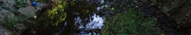
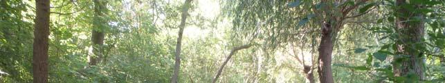
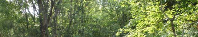
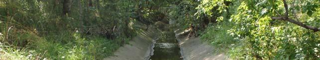
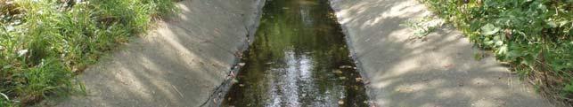
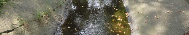
4 STUDY AREA AND OBJECTIVES The City of Waterloo has initiated a Schedule B Class Environmental Assessment (Class EA) Study for the rehabilitation of Maple Hill Creek from the Westvale Park Stormwater Management Area to the creek s confluence with Clair Creek at University Avenue. The Study Area is divided into two Stormwater Management Areas and six creek reaches, as shown on the map below. The study is being undertaken to examine options related to channel improvements on Maple Hill Creek. A rehabilitation and management plan for the preservation and enhancement of the Maple Hill Creek system will be developed, including bank stabilization, removing existing barriers to fish passage from the Clair and Laurel Creek systems and incorporating a more natural channel form.
5 CLASS ENVIRONMENTAL ASSESSMENT PROCESS The Study will be conducted in accordance with the planning and design process for Schedule B projects, as outlined in the Municipal Class Environmental Assessment (EA) document, (October 2000, as amended in 2015), which is approved under the Ontario Environmental Assessment Act. Schedule B projects involve Phase 1 and Phase 2 of the Municipal Class EA process, as illustrated to the right. The Class EA process includes public/external agency consultation, an evaluation of alternative solutions and alternative design concepts, an assessment of potential impacts associated with the proposed improvements and the development of measures to mitigate identified impacts. PHASE 1 Problem or Opportunity PHASE 2 Alternative Solutions Identify Problem or Opportunity Public Consultation to Review Problem or Opportunity Inventory Natural, Social, Economic Environment Identify Alternative Solutions to Problem or Opportunity Evaluate Alternative Solutions, Identify Recommended Solutions Select Preferred Solution Public Notices and Public Information Centre #1 Public Information Centre #2 WE ARE HERE Public Information Centre #3 Public Notice of Completion Opportunity for Part II Order Request Implementation (Design and Construction) Public Information Centre #4
6 PROPOSED ALTERNATIVES WESTVALE PARK SWMA Alternative 1 Do Nothing Take no action to correct identified issues, let things take their course. Alternative 2 Sediment Removal, Maintain Pond in Existing Configuration Westvale Park SWMA - Dredge sediment from existing pond to improve water quality performance. Do not alter current pond configuration. Alternative 3 Distributed Oil Grit Separators in Upstream Watershed Install Oil Grit Separators strategically throughout upstream watershed to improve quality of water entering the Westvale Park SWMA, reducing future sedimentation. Alternative 4 Restore Pond with a Moderately Sized Wet Pond Reconfigure existing facility into a moderately sized stormwater wet pond, using adjacent available space in Westvale Park, resulting in improved water quality/quantity performance. Alternative 5 Restore Pond with a Moderately Sized Wetland Reconfigure existing facility into a moderately sized stormwater wetland, using adjacent available space in Westvale Park, resulting in improved water quality/quantity performance.
7 PROPOSED ALTERNATIVES WESTVALE SWMA Alternative 1 Do Nothing Take no action to correct identified issues, let things take their course. Alternative 2 Outlet Structure Modifications Modify the existing outlet to improve drainage conditions. Alternative 4 Restore Pond with a Wet Pond Reconfigure existing facility into a stormwater wet pond, using adjacent available space, resulting in improved water quality/quantity performance. Alternative 5 Restore Pond with a Wetland Reconfigure existing facility into a stormwater wetland, using adjacent available space, resulting in improved water quality/quantity performance.
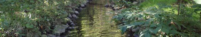
8 Alternative 1 Do Nothing Take no action to correct identified issues, let things take their course. PROPOSED ALTERNATIVES MAPLE HILL CREEK Alternative 2 Spot Repairs/Local Restoration Reach 1: Reconstruct gabion basket retaining walls that are showing early signs of instability, primarily located at the lower end of the reach near Westvale Drive. Reach 2: Complete spot repairs to concrete pipe as per City of Waterloo OSIM report recommendations for the structure. Address existing surface drainage issues in Thorndale Park adjacent to private residences. Reach 3: Reconstruct gabion basket retaining walls behind Thorndale Place with engineered retaining wall solution. Replace damaged gabion basket instream drop structure at the downstream end of Reach 3 with step pool sequence for fish passage. Reach 4: Reshape instream bar at upstream end of Reach 4 to reduce risk to adjacent gabion basket retaining walls. Repair failed section of gabion basket wall. Reach 5: Repair bank erosion adjacent to concrete lined channel at the upstream end of Reach 5. Repair existing erosion protection works at the downstream end of the concrete channel lining, which includes instream armourstone weirs and rock, as well as vegetated bank protection. Repair channel scour downstream of the existing concrete weir upstream of Erb Street. Reach 6: Install bank protection on critical areas adjacent to University Ave. to protect the infrastructure from ongoing erosion due to channel migration. Alternative 3 Partial Reach-Scale Restoration Reach 1: Reconstruct the downstream portion of Reach 1 to remove gabion basket retaining walls, and replace with armourstone walls or other appropriate stabilization to extend the lifespan of the creek banks and provide a more natural material for the instream structures. Reach 2: Not applicable: partial reach restoration is not possible in this Reach, as it would not be effective to restore only part of the buried channel (i.e., daylighting of creek and establishment of a natural channel in Thorndale Park) while maintaining the rest within a concrete pipe. Reach 3: Extend culvert pipe under Thorndale Drive through the upstream end of Reach 3 behind the properties on Thorndale Place to resolve ongoing issues of bank instability and impacts to the rear yards of the properties. Replace damaged gabion basket instream drop structure at the downstream end of Reach 3 with step pool sequence for fish passage. Reach 4: Reconfigure the upstream end of Reach 4 to eliminate gabion basket retaining walls and integrate increased flow dissipation from the golf course inlet to the south. Reach 5: Remove the concrete lined channel and the existing weir upstream of Erb Street and establish a step-pool or cascade system to improve fish passage. Reach 6: Realign portions of channel away from University Avenue where space is available. Alternative 4 Full Reach-Scale Restoration Reach 1: Remove all gabion basket drop structures and retaining walls and restore the entire reach as a step-pool or cascade system. Reach 2: Daylight channel and establish natural channel through Thorndale Park. Reach 3: Remove all gabion basket channel lining and restore reach as a step-pool or cascade system where possible given property constraints. Reach 4: Not applicable: full reach restoration has been previously completed and is in satisfactory condition. Reach 5: Remove the concrete lined channel and the existing weir upstream of Erb Street and establish a step-pool or cascade system to improve fish passage. Restore access to floodplain for incised channel areas. Reach 6: Restore entire reach to a natural channel with meanders as space is available; restore floodplain access for incised areas.
9 Evaluation Criteria Project Cost Capital Cost Consideration of O&M Cost/Frequency Technical Effectiveness Technical Effectiveness Constructability Approvability Natural Environment Healthy Fish and Aquatic Community Healthy Terrestrial and Wildlife Community Impacts to Existing Vegetation Nuisance Species Private Property Impacts to Private Property EVALUATION PROCESS AND CRITERIA Table below displays the evaluation criteria by which the alternatives for each Reach/SWMA are evaluated. A qualitative ranking system was implemented, using scores from 1 to 5. An assignment of 1 represents minimum quality or value, while an assignment of 5 represents the best outcome that can be reasonably attained. The category scores were averaged together to determine the overall score for each alternative. Social/Cultural Services Maintain Current Recreational Uses of the Reach/SWMA Archaeological Impacts Safety Short-term Impacts during Construction Criteria Details The capital cost to implement the alternative is estimated based on conceptual-level information. The lowest cost Alternative is assigned a score of 5. The highest cost Alternative is assigned a cost of 1. Other Alternatives are assigned a score between the high and low Alternatives based on the relative cost of the Alternative to the cost of the high and low Alternatives. The ongoing costs of operation and maintenance must be sustainable by the City of Waterloo. Maintenance requirements consider the site setting, scope and frequency of maintenance. Minimization of maintenance cost and frequency is desirable. The potential for the Alternative to effectively address the identified issues in each Reach or Stormwater Management Area. For Reaches of Maple Hill Creek, the measurement of technical effectiveness is specific to the issues in each Reach, but primarily involves the mitigation of active erosion to protect vulnerable infrastructure or private property. For the Stormwater Management Areas, the measurement of technical effectiveness indicates how well the Alternative addresses the need to remove accumulated sediment from the SWMA, as well as how well it meets the Ministry of Environment and Climate Change s targets for removal of Total Suspended Solids from stormwater runoff. Requirements for specialized expertise or equipment, sensitivity to weather conditions, access restrictions, specialized materials, etc. are evaluated to assess overall constructability of each Alternative. The potential for the Alternative to receive regulatory approval from applicable review agencies such as the Grand River Conservation Authority, Department of Fisheries and Oceans, Ministry of Natural Resources and Forestry, and Ministry of Environment and Climate Change. Evaluate the ability of the alternative to provide species diversity and a stable, healthy fish and aquatic community in the long term. Assessment of the timeframe following implementation of the alternative to achieve goals, and the reliance of community health on ongoing maintenance will also be included. Evaluate the ability of the alternative to provide species diversity and a stable, healthy terrestrial and wildlife community in the long term. Assessment of the timeframe following implementation of the alternative to achieve goals, and the reliance of community health on ongoing maintenance will also be included. The effect the alternative will have upon existing vegetation, including mature trees within the creek corridor and adjacent green spaces. The alternative should minimize the potential to promote growth of nuisance plant or aquatic species, or attraction of nuisance animals/birds. Measure of the impact to adjacent private property (i.e., loss of property, access to property) Potential impacts which positively or negatively impact current uses of the Reach or SWMA will be assessed. The alternative should mitigate impacts to areas of archaeological interest and preserve existing historical/heritage features. The alternative must provide a safe environment for members of the public of all ages. Evaluation of the potential temporary disruption to adjacent residents (i.e., traffic impacts, property access impacts), as well as nuisance factors such as noise and dust generation.
10 EVALUATION OF ALTERNATIVES WESTVALE PARK SWMA List of Alternatives and evaluation ranking: Preliminary Preferred (4.0): Alt 5 Wetland 2 nd Place (3.8): Alt 4 Wet Pond 3 rd Place (3.6): Alt 3 OGS and Alt 2 Sediment Removal (Tied) 4 th Place (3.4): Alt 1 Do Nothing Project Cost Technical Effectiveness Natural Environment Private Property Social/Cultural Services Alternative 2 Lowest capital cost, highest Alternative 3 Highest capital cost, high Alternatives 4 & 5 Moderate capital cost for each option, least amount of maintenance. Alternatives that solve current issues: Inflow short circuiting through north inlet Alt 4 & 5 Poor water quality treatment Alt 3, 4, & 5 Poor attenuation of peak flows Alt 3, 4, & 5 Sediment accumulation Alt 2, 4, & 5 Alternatives 4 and 5 provide the most opportunity to enhance the natural environment as native plants will be incorporated as part of the retrofit activities. Alternatives 1, 2, and 3 provide minimal opportunities to enhance the natural environment. None of the alternatives are expected to incur any impacts to adjacent private properties. All work will be conducted on City-Owned property (Westvale Park). Alternatives 2 and 3 result in minimal impacted park area; however will create construction disruptions to install the OGSs. Alternatives 4 and 5 result in more impacted area of the park. Tobogganing poses public safety concern with Alternative 4.
11 EVALUATION OF ALTERNATIVES REACH 1 List of Alternatives and evaluation ranking: Preliminary Preferred (4.1): Alt 3 Partial Reach 2 nd Place (3.9): Alt 2 Local Restoration 3 rd Place (3.6): Alt 4 Full Reach 4 th Place (3.4): Alt 1 Do Nothing Project Cost Technical Effectiveness Natural Environment Private Property Social/Cultural Services Alternative 2 Lowest capital cost, slightly higher maintenance costs. Alternative 3 & 4 Higher capital costs, less required maintenance. Alternatives that solve current issues: Unstable gabion lining channel Alt 2, 3, & 4 Barrier for fish passage Alt 3 & 4 Shape of channel None Lack of riparian vegetation Alt 3 & 4 Alternative 2 provides minimal enhancements to the natural environment, as it is limited to gabion failure areas. Alternatives 3 and 4 provide many opportunities to enhance the natural environment through the restoration activities. No significant impacts from any Alternatives Alternative 4 may cause minor impacts to rear yards along Appledale Crescent and Old Meadow Lane as several properties encroach the creek block. Alternatives 2 and 3 will have minimal impact due to their limited extent. Alternative 4 may involve disturbance to the adjacent trail during construction and possibly after if the restoration encroaches the trail to maximize storage areas.
12 EVALUATION OF ALTERNATIVES WESTVALE SWMA List of Alternatives and evaluation ranking: Preliminary Preferred (4.1): Alt 2 Outlet Modifications 2 nd Place (3.3): Alt 1 Do nothing 3 rd Place (3.0): Alt 4 Wetland 4 th Place (2.1): Alt 3 Wet Pond Project Cost Technical Effectiveness Natural Environment Private Property Social/Cultural Services Alternative 2 Lowest capital cost, lower maintenance costs expected Alternative 3 & 4 Higher capital costs, greater amount of maintenance. Alternatives that solve current issues: No water quality control Alt 3 & 4 Outlet blocks fish passage Alt 3 & 4 Outlet structure clogs with debris Alt 2, 3, & 4 Alternative 2 provides little opportunity for enhancement. Alternative 3 also provides little opportunity as most of the area would be a permeant pool. Alternative 4 creates the most potential to enhance the environment through a wetland. Alternative 3 and 4 may slightly impact the adjacent residential properties in terms of use or enjoyment of property. Alternative 2 would have no impact on private property. Alternatives 3 and 4 could potentially impact the area s recreational use, create public safety concerns (ponded water) and have short term construction impacts. Alternative 2 would minimize all impacts that 3 and 4 create.
13 EVALUATION OF ALTERNATIVES REACH 2 List of Alternatives and evaluation ranking: Preliminary Preferred (3.9): Alt 2 Local Restoration 2 nd Place (3.0): Alt 1 Do Nothing 3 rd Place (2.7): Alt 4 Full Reach Project Cost Technical Effectiveness Natural Environment Private Property Social/Cultural Services Alternative 2 Lowest capital cost, higher maintenance costs expected Alternative 4 Higher capital costs, lower Alternatives that solve current issues: Concrete culvert requires repair Alt 2 & 4 Surface drainage issues in Thorndale Park Alt 2 & 4 Buried reach creates barrier to fish passage Alt 4 Alternative 2 provides no opportunity to improve the natural environment. Alternative 4 provides significant opportunity to enhance the environment through the development of a naturalized creek corridor. Alternative 2 creates no impacts to private property and will actually benefit them by creating improved drainage from their property. Alternative 4 could possibly impact private properties and could create a flooding risk to the properties. Alternative 2 would not impact the social and cultures features of the reach. Alternative 4 would significantly change the configuration of the Thorndale Park and could create some public safety risks with an open channel.
14 EVALUATION OF ALTERNATIVES REACH 3 List of Alternatives and evaluation ranking: Preliminary Preferred (3.7): Alt 3 Partial Reach 2 nd Place (3.5): Alt 2 Local Restoration 3 rd Place (2.9): Alt 4 Full Reach 4 th Place (2.1): Alt 1 Do Nothing Project Cost Technical Effectiveness Natural Environment Private Property Social/Cultural Services Alternative 2 & 3 Lower costs, alternative 2 has higher maintenance costs than alternative 3 due to retaining structures maintenance. Alternative 4 Highest cost, modest Alternatives that solve current issues: Gabion limit ecological potential Alt 2, 3 & 4 Gabion failing, creates barrier to fish passage Alt 2, 3 & 4 Lack of aquatic habitat Alt 4 Lack of vegetated banks Alt 4 Alternative 4 provides the most potential for enhancement through naturalization of the reach. Alternative 3 provides some enhancement, but will require removals of aquatic habitats Alternative 2 provides minor potential upstream of the reach. Alternative 2 would protect the properties with a more robust retaining wall solution. Alternative 3 would positively alter the rear yards of several properties. Alternative 4 will significantly disturb and change future uses of private properties. Alternative 2 will have minimal impact to social and cultural uses of the reach. Alternative 3 will provide a great benefit to the recreational use of the reach and solve current safety risks. Alternative 4 is expected to have the most widespread impact.
15 EVALUATION OF ALTERNATIVES REACH 4 List of Alternatives and evaluation ranking: Preliminary Preferred (3.8): Alt 3 Partial Reach Restoration 2 nd Place (3.7): Alt 1 Do Nothing and Alt 2 Local Restoration (Tied) Project Cost Technical Effectiveness Natural Environment Private Property Social/Cultural Services Alternative 2 Lower capital cost, higher Alternative 3 Highest capital cost, lower Alternatives that solve current issues: Failing gabion basket Alt 2 & 3 Erosion risks Alt 2 & 3 Narrow Floodplain None High flows from outlet Alt 3 Alternatives 2 and 3 provide limited opportunities to enhance habitats. Alternative 3 provides higher potential due to the possibility of incorporating specific habitat features on a larger scale than alternative 2. Alternative 2 will results in negligible impact to private property. Alternative 3 may potentially alter a small portion of an upstream adjacent property. Alternative 2 maintains recreational use and results in negligible impacted areas. Alternative 3 will have a larger construction impact, but will improve public safety within the area.
16 EVALUATION OF ALTERNATIVES REACH 5 List of Alternatives and evaluation ranking: Preliminary Preferred (3.9): Alt 3 Partial Reach 2 nd Place (3.7): Alt 2 Local Restoration 3 rd Place (3.6): Alt 4 Full Reach 4 th Place (2.9): Alt 1 Do Nothing Project Cost Technical Effectiveness Natural Environment Private Property Social/Cultural Services Alternative 2 Lowest capital cost, higher maintenance costs due to monitoring requirements. Alternative 3 Higher capital cost, low Alternative 4 Highest capital costs, low Alternatives that solve current issues: Scouring and erosion Alt 2, 3 & 4 Limited habitat Alt 2, 3 & 4 Concrete drop structure Alt 3 & 4 Low flow from riffle feature - Alt 3 & 4 Downstream incised and eroded Alt 4 Alternative 2 provides little enhancement. Alternative 3 and 4 provide significantly more benefits to the natural environment due to their design. Alternative 2 involves no impacts to private properties. Alternative 3 may incur a small impact to the properties due to slight changes to the creek. Alternative 4 will incur the largest impacts due to the floodplain reconnection efforts. Alternative 2 incurs the lowest impact to current social and cultural features with no impacts to recreational uses and minimal construction. Alternatives 3 and 4 have higher impacts to these areas due to greater restoration area and longer construction period.
17 EVALUATION OF ALTERNATIVES REACH 6 List of Alternatives and evaluation ranking: Preliminary Preferred (3.8): Alt 3 Partial Reach 2 nd Place (3.7): Alt 2 Local Restoration 3 rd Place (3.4): Alt 4 Full Reach 4 th Place (2.8): Alt 1 Do Nothing Project Cost Technical Effectiveness Natural Environment Private Property Social/Cultural Services Alternative 2 Modest capital cost, highest Alternative 3 Modest capital cost, low Alternative 4 Highest capital cost, low maintenance costs Alternatives that solve current issues: Incised and migrating channel Alt 3 & 4 Lack of riparian vegetation Alt 3 & 4 Lack of floodplain connectivity Alt 3 & 4 Ad-hoc treatments Alt 2, 3 & 4 Alternative 2 provides little enhancement. Alternatives 3 and 4 provide progressively more opportunities for enhancement; however has higher impact to the existing vegetation. All alternatives are expected to affect the adjacent private properties. As the scope of work increases from alternatives 2-4, the impact to properties also increases. Restoration will require negotiation of easements to affected properties. Alternative 2 incurs lowest impact to current social/cultural features. Alternatives 3 & 4 incur progressively higher impacts in these areas due to greater disturbance areas and longer construction periods.
18 COMMENTS AND NEXT STEPS Public Participation forms an integral part of the Class EA Study to ensure that the ongoing concerns of the public and affected groups within the study area are identified, documented and assessed. Please complete your comment form and submit them to the Consultant Team Members before you leave, so that our views and comments will be recorded and considered. A fourth PIC will be scheduled prior to initiating the construction phase of the Project. Public notices will be advertised in advance of each public information centre. For more information on this project, and to stay informed on project developments, please visit the City s website at: If you would like to provide comments following the public information centre, or for any further information on the study, please contact the study leaders below: Jessica Kellerman, P.Eng. Project Manager City of Waterloo 100 Regina Street South PO Box 337, Station Waterloo Waterloo, ON N2J 4A8 Tel: ext jessica.kellerman@waterloo.ca Jeff Daniel, P.Eng. Consultant Project Manager GHD Limited 651 Colby Drive Waterloo, ON N2V 1C2 Tel: ext jeff.daniel@ghd.com
Town of Aurora Stream Management Master Plan PUBLIC INFORMATION CENTRE May 1 st, 2018
 Town of Aurora Stream Management Master Plan PUBLIC INFORMATION CENTRE May 1 st, 2018 Your comments are encouraged and appreciated, as this will provide us an opportunity to address project issues and
Table D1: WC-R1 to WC-R3 (Wilket Creek Park)
") APPENDIX D Table D1: WC-R1 to WC-R3 (Wilket Creek Park) Category of Consideration Criteria Alternative 1 Do Nothing Alternative 2 Local Improvements Alternative 3 Channel Realignment Natural Geomorphic
APPENDIX D Table D1: WC-R1 to WC-R3 (Wilket Creek Park) Category of Consideration Criteria Alternative 1 Do Nothing Alternative 2 Local Improvements Alternative 3 Channel Realignment Natural Geomorphic
Please complete the sign-in sheet and review display materials.
 Municipal Class Environmental Assessment Please complete the sign-in sheet and review display materials. As you move through the information presented today, we encourage you to ask questions and provide
Municipal Class Environmental Assessment for Pottersburg Creek Slope Stability Study South of Hamilton Road, Schedule B
 Municipal Class Environmental Assessment for Pottersburg Creek Slope Stability Study South of Hamilton Road, Schedule B February 13, 2013 Municipal Class EA Process We are here Purpose and Objective of
Public Information Centre No. 2 June 15, :00 8:00 pm. Valley Park Community Centre (GYM B) 970 Paramount Drive Stoney Creek
 970 Paramount Drive Stoney Creek") Public Information Centre No. 2 June 15, 2017 6:00 8:00 pm Valley Park Community Centre (GYM B) 970 Paramount Drive Stoney Creek Please complete the sign-in sheet and review display materials. The project
Public Information Centre No. 2 June 15, 2017 6:00 8:00 pm Valley Park Community Centre (GYM B) 970 Paramount Drive Stoney Creek Please complete the sign-in sheet and review display materials. The project
Public Information Centre # 2 Flood Mitigation Opportunities Study Fourteen Mile Creek & M c Craney Creek Systems Town of Oakville
 Public Information Centre # 2 Flood Mitigation Opportunities Study Fourteen Mile Creek & M c Craney Creek Systems Town of Oakville Municipal Class Environmental Assessment Study Area The limits of the
Appendix M. Criteria, Measures and Indicators for Effects Assessment
 Appendix M Criteria, Measures and Indicators for Effects Assessment Appendix M. Criteria, Measures and Indicators for Effects Assessment Objective 1: Naturalization Changes to Aquatic Habitat Disruption,
CIP-01: Stream Channel Stabilization, Silver Creek
 CIP-01 CIP-01: Stream Channel Stabilization, Silver Creek HIGHEST PRIORITY This project consists of stream channel stabilization to address channel incision and the replacement of two cross-culverts. Preferred
CITY OF NEW WESTMINSTER. Bylaw No. 7033, 2005 RIPARIAN AREAS PROTECTION BYLAW
 CITY OF NEW WESTMINSTER Bylaw No. 7033, 2005 RIPARIAN AREAS PROTECTION BYLAW WHEREAS the City may preserve, protect, restore and enhance the natural environment near streams that support fish habitat from
City of Mississauga Environmental Impact Studies Terms of Reference 2002
 City of Mississauga Environmental Impact Studies Terms of Reference 2002 1.0 INTRODUCTION To ensure in so far as possible, both private and public developments are consistent with Natural Heritage and
Flood Mitigation Opportunities Study Fourteen Mile Creek & McCraney Creek Systems
 Town of Oakville Flood Mitigation Opportunities Study Fourteen Mile Creek & McCraney Creek Systems November 14, 2013 Study Area The limits of the study area extend from Lake Ontario to Dundas Street. McCraney
Primer introduction to watershed management Plan Process highlight the major steps of plan development Project types look at some examples of common
 1 Primer introduction to watershed management Plan Process highlight the major steps of plan development Project types look at some examples of common projects Plan Organization how to read the plan Next
IMPROVING OUTCOMES FOR STREAM ALTERATION PROJECTS
 IMPROVING OUTCOMES FOR STREAM ALTERATION PROJECTS Bethany Matousek Inland Lakes and Streams Program Coordinator Wetlands, Lakes and Streams Unit DEQ Water Resources Division MatousekB@Michigan.gov 517-243-6421
PROJECT SCOPE OF WORK CITY OF TOWN AND COUNTRY STORMWATER PROGRAM
 PROJECT SCOPE OF WORK CITY OF TOWN AND COUNTRY STORMWATER PROGRAM Project Name: 1338 Thornhill Dr Project ID Number: 1-3 Problem: Creek bank erosion is occurring along from the northern property line at
Town of Whitchurch-Stouffville Bethesda Side Road Reconstruction
 Town of Whitchurch-Stouffville Bethesda Side Road Reconstruction Date: Wednesday, April 26, 2017 Time: 3:00 pm to 5:00 pm and 7:00 pm to 8:00 pm 1 Your input is appreciated. You are encouraged to review
Logan River at Rendezvous Park, Channel and Floodplain Restoration: Crack Willow (Salix fragilis) Issues and Management Strategies
 Issues and Management Strategies") Logan River at Rendezvous Park, Channel and Floodplain Restoration: Crack Willow (Salix fragilis) Issues and Management Strategies Prepared May 2, 2017 by Darren Olsen, BIO-WEST, Inc. Issues Crack willow
Logan River at Rendezvous Park, Channel and Floodplain Restoration: Crack Willow (Salix fragilis) Issues and Management Strategies Prepared May 2, 2017 by Darren Olsen, BIO-WEST, Inc. Issues Crack willow
Torbram Road Improvements From Queen Street East to Bovaird Drive
 Torbram Road Improvements From Queen Street East to Bovaird Drive Municipal Class EA Study Public Information Centre No. 1 November 16 2017 6:30 pm 8:30 pm Please sign in so we can keep you updated on
Old Mill School Stream Restoration
 Project Overview This conceptual plan restores and stabilizes two consecutive reaches of a highly incised and unstable stream and reconnects them with the floodplain. The restoration reaches are part of
BACKGROUND INFORMATION
 BACKGROUND INFORMATION Preliminary Design & Class Environmental Assessment Study G.W.P. 30-95-00 The following information was included in the Transportation Environmental Study Report (TESR) that was
FORM B: DAMMING AND DIVERSION OF WATER
 APPLICATION FOR RESOURCE CONSENT FORM B: DAMMING AND DIVERSION OF WATER NOTES Resource use activities must meet all the conditions of any relevant Permitted Activity Rules in the Waikato Regional Plan
Mike Jastremski, CFM Watershed Conservation Director
 Planning for Flood Resilient and Fish Friendly Road-Stream Crossings in CT s Northwest Hills Mike Jastremski, CFM Watershed Conservation Director Presentation Outline Project area Climate threats Field
Environmental Assessment Derry Road and Argentia Road Intersection
 Environmental Assessment Derry Road and Argentia Road Intersection Project 11-4295 City of Mississauga, Region of Peel October 15, 2014 INTRODUCTION Table of Contents Introduction... 2 Description of the
South St. Vrain / Hall Meadows Restoration Planning August 20, 2015
 South St. Vrain / Hall Meadows Restoration Planning August 20, 2015 Agenda Introductions Purpose & Goals of Meeting Planning Area Master Plan Restoration Planning: Cost Estimates, Grants, Scope, Timeline
COLE ENGINEERING GROUP LTD.
 CITY OF MARKHAM PROJECT FILE Stormwater Management Facilities Retrofit Municipal Class EA ES12-0316 COLE ENGINEERING GROUP LTD SEPTEMBER 2015 [ Month Year ] HEAD OFFICE 70 Valleywood Drive Markham, ON
Welcome to the Boulevard Lake Dam Class Environmental Assessment. Public Information Session #1. June 14, 2016
 Welcome to the Boulevard Lake Dam Class Environmental Assessment Public Information Session #1 June 14, 2016 Boulevard Dam - Overview Built approximately 100 years ago Owned and operated by the City of
Appendix D Index. SWM/BMP Facility Site Photographs. Subshed 440 Facility Photo #
 Index Subshed 440 Facility Photo # 19 1-3 489 4-7 Subshed 444 Facility Photo # 63 8-9 207 No photo 208 No photo 632 10-12 Subshed 448 Facility Photo # 28 13-16 481 17-20 5147 21-23 5255 24-25 5355 No photo
Temporary Watercourse Crossing: Fords
 Temporary Watercourse Crossing: Fords DRAINAGE CONTROL TECHNIQUE Low Gradient Velocity Control Short Term Steep Gradient Channel Lining Medium-Long Term Outlet Control Soil Treatment Permanent [1] [1]
Application for resource consent Form B Damming and diversion of water
 Application for resource consent Form B Damming and diversion of water Notes Resource use activities must meet all the conditions of any relevant Permitted Activity Rules in the Waikato Regional Plan or
RECOMMENDATION. the financing for the project BE APPROVED in accordance with the Sources of Financing Report attached hereto as Appendix A ;
 TO: FROM: SUBJECT: CHAIR AND MEMBERS CIVIC WORKS COMMITTEE MEETING ON JANUARY 9, 2018 KELLY SCHERR, P.ENG., MBA, FEC MANAGING DIRECTOR, ENVIRONMENTAL & ENGINEERING SERVICES & CITY ENGINEER APPOINTMENT
RIPARIAN AREAS REGULATION
 Definitions and interpretation RIPARIAN AREAS REGULATION 1 (1) In this regulation: Act means the Fish Protection Act; active floodplain means an area of land that supports floodplain plant species and
PUBLIC INFORMATION CENTRE Class Environmental Assessment For. Black Creek Flood Management
 PUBLIC INFORMATION CENTRE Class Environmental Assessment For Conservation Ontario Class Environmental Assessment for Remedial Flood and Erosion Control Projects (2002) The Class EA for Remedial Flood and
Meacham Creek Restoration Project
 Meacham Creek Restoration Project Meacham Creek Restoration Project Umatilla National Forest Walla Walla Ranger District Michael Rassbach, District Ranger Public Scoping Document Proposal Summary The Walla
Temporary Stream Crossing
 Categories EC Erosion Control SE Sediment Control TC Tracking Control WE Wind Erosion Control Non-Stormwater NS Management Control Waste Management and WM Materials Pollution Control Legend: Primary Objective
Temporary Stream Crossing
 Temporary Stream Crossing NS-4 Objectives EC Erosion Control SE Sediment Control TR Tracking Control WE Wind Erosion Control Non-Stormwater NS Management Control Waste Management and WM Materials Pollution
Massachusetts River and Stream Crossing Standards: Technical Guidelines
 Massachusetts River and Stream Crossing Standards: Technical Guidelines August 6, 2004 INTRODUCTION As long and linear ecosystems, rivers and streams are very important for fish and other wildlife movements,
EXHIBIT 9. Supplemental Environmental Projects Plan
 EXHIBIT 9 Supplemental Environmental Projects Plan I. Introduction Defendants shall perform the streambank stabilization, leachate control, greenway creation, and in-stream restoration projects described
CHAPTER 3 Environmental Guidelines for WATERCOURSE CROSSINGS GOVERNMENT OF NEWFOUNDLAND AND LABRADOR DEPARTMENT OF ENVIRONMENT AND LABOUR
 GOVERNMENT OF NEWFOUNDLAND AND LABRADOR DEPARTMENT OF ENVIRONMENT AND LABOUR CHAPTER 3 Environmental Guidelines for WATERCOURSE CROSSINGS WATER RESOURCES MANAGEMENT DIVISION Water Investigations Section
Date: Time: Location: Thursday, March 15, :00 p.m. to 8:00 p.m. Nobleton Arena Programs Room 15 Old King Road Nobleton, ON
 TOWNSHIP OF KING TH 15 SIDEROAD RECONSTRUCTION From Highway 27 To Concession 8 Municipal Class Environmental Assessment Schedule B Project Information Session Date: Time: Location: Thursday, March 15,
Factor Potential Effects Mitigation Measures
 Natural Environment No impacts of provincial significance to the natural environment are anticipated for the rapid transit project. Other impacts and how they will be mitigated are outlined in the table
TRCA Natural Channel Design Monitoring Program. SOSMART Group Meeting December 7, 2010
 TRCA Natural Channel Design Monitoring Program SOSMART Group Meeting December 7, 2010 Natural Channel Design (NCD) Reconstruction of a stream channel and floodplain using techniques to restore or replicate
Ten Principles of River Restoration and Four River Project of Korea
 Ten Principles of River Restoration and Four River Project of Korea Randolph T. Hester, G. Mathias Kondolf, Marcia McNally, Department of Landscape Architecture and Environmental Planning University of
7.0 WATER-BASED CONTROL MEASURES
 7.0 WATER-BASED CONTROL MEASURES 7.1 IDENTIFICATION AND DESCRIPTION OF CONTROL MEASURES Table 7-1 lists the water-based options being considered for implementation in the initial screening stage. Descriptions
Temporary Watercourse Crossing: Culverts
 Temporary Watercourse Crossing: Culverts DRAINAGE CONTROL TECHNIQUE Low Gradient Velocity Control Short Term Steep Gradient Channel Lining Medium-Long Term Outlet Control Soil Treatment Permanent Symbol
WELCOME. Please sign in Representatives are available to answer questions Please complete a comment sheet
 WELCOME Please sign in Representatives are available to answer questions Please complete a comment sheet Place it in the box or send it to the Consultant undertaking the study or to the Town of Wasaga
Detailed Options Evaluation
 Appendix F Detailed Options Evaluation 06 Google Category & Criterion Description Measure/Indicator Natural Environment Rating Scale for Measuring Impacts Comparative Evaluation Score Comparative Evaluation
COON CREEK WATERSHED DISTRICT PERMIT REVIEW
 16-054 Woodland Creek Wetland Banking Restoration Project, Page 1 of 6 COON CREEK WATERSHED DISTRICT PERMIT REVIEW MEETING DATE: August 22, 2016 AGENDA NUMBER: 11 FILE NUMBER: 16-054 ITEM: Woodland Creek
Form 1: Application for resource consent
 Form 1: Application for resource consent All sections must be completed in full and accompanied by the initial fixed application fee (see section 11) and the relevant activity form (see section 7). Failure
DECISION MEMO FOR CATEGORICAL EXCLUSION HOLY JIM CREEK CROSSING REPLACEMENT
 DECISION MEMO FOR CATEGORICAL EXCLUSION HOLY JIM CREEK CROSSING REPLACEMENT U.S.D.A. Forest Service Cleveland National Forest Trabuco Ranger District Orange County, California Background The current configuration
Chehalis Basin Strategy Programmatic SEPA Draft EIS
 Chehalis Basin Strategy Programmatic SEPA Draft EIS History of Flooding I-5 closed in 1990, 1996, 2007, 2009 Five largest flood events occurred since 1986 2 History of Habitat Degradation Harvest has been
Welcome. Public Information Event. Dufferin Sanitary Trunk Sewer (STS) System Improvements Municipal Class Environmental Assessment Study
 System Improvements Municipal Class Environmental Assessment Study") Welcome Public Information Event Dufferin Sanitary Trunk Sewer (STS) System Improvements Municipal Class Environmental Assessment Study Please sign in to be added to the study mailing list and receive
Welcome Public Information Event Dufferin Sanitary Trunk Sewer (STS) System Improvements Municipal Class Environmental Assessment Study Please sign in to be added to the study mailing list and receive
CHATHAM PARK EXCEPTIONAL DESIGN EVALUATION
 CHATHAM PARK EXCEPTIONAL DESIGN EVALUATION 1 Chatham Park Basics 7,600 Acre Mixed Use Development 22,000 New Residences 22 Million Square Feet Commercial Space 60,000 Jobs 2,000+ Acres Open Space Estimated
Watershed Hydrology: Go with the flow. Greg Jennings, PhD, PE
 Watershed Hydrology: Go with the flow Greg Jennings, PhD, PE jenningsenv@gmail.com Streams What are your CHALLENGES? Hydrology too much water Pollutants upstream and on-site Vegetation wrong plants, wrong
COTTON CREEK CULVERT REPLACMENT
 COTTON CREEK CULVERT REPLACMENT Integrating Mobility with Environmental Innovation Located along a scenic section of Highway 3/95 in British Columbia, Moyie Bluffs, a 6.5 km stretch of inland highway had
No. 6 December, Wisconsin s Forestry Best Management Practices for Water Quality Forest Roads
 No. 6 December, 1995 Wisconsin s Forestry Best Management Practices for Water Quality Forest Roads Steve Holaday, Wisconsin Dept. of Natural Resources, and Jeff Martin, Dept. of Forestry, UW-Madison BMPs
WELCOME. Eastern Subwatersheds Stormwater Management Retrofit Study. Online Information Session #2 June 15 to July 13, 2018
 WELCOME Eastern Subwatersheds Stormwater Management Retrofit Study Online Information Session #2 June 15 to July 13, 2018 1 Eastern Subwatersheds Stormwater Management Retrofit Study This study is one
I-3 THE IMPERVIOUS COVER MODEL
 I-3 THE IMPERVIOUS COVER MODEL AT A GLANCE Imperviousness is a metric that represents the sum of roads, parking lots, sidewalks, rooftops, and other impermeable surfaces that prevents water from infiltrating
Lyon Creek Cedar Way Stormwater Detention Dam Operation and Maintenance Manual
 Lyon Creek Cedar Way Stormwater Detention Dam Operation and Maintenance Manual Prepared by: Mike Shaw Stormwater Program Manager City of Mountlake Terrace January 2010 Section I General Information This
CLOCA Rural & Agricultural Guide to Permits
 CLOCA Rural & Agricultural Guide to Permits Regulation of Development, Interference with Wetlands and Alterations to Shoreline and Watercourses, Ontario Regulation 42/06 April 2014 Table of contents Introduction...
Moonlight Aquatic Organism Passage Project
 Notice of Proposed Action Moonlight Aquatic Organism Passage Project Mt. Hough Ranger District Plumas National Forest Plumas County, California Figure 1. Hungry 1 aquatic organism passage outlet showing
Good morning, Chairman Yaw, Chairman Yudichak, Chairman Vulakovich, Chairman Costa,
 Testimony of Patrick McDonnell, Secretary Pennsylvania Department of Environmental Protection Joint Hearing on Flooding and Emergency Response Senate Environmental Resources & Energy and Veterans Affairs
SHORELINE INVENTORY AND RESTORATION PLANNING
 CHAPTER 3 SHORELINE INVENTORY AND RESTORATION PLANNING A. PURPOSE OF THE SHORELINE INVENTORY AND CHARACTERIZATION A first step in the comprehensive Master Program update process is development of a shoreline
TRIECA Stormwater Management Facilities Condition Assessments, Inventories and Maintenance Prioritization
 TRIECA 2017 Stormwater Management Facilities Condition Assessments, Inventories and Maintenance Prioritization Pippy Warburton, P.Eng. Manager, Water Resources, Kitchener Steven Scott, M.Sc. Water Resources
Ottawa-Trussler Area Sewage Facility Class Environmental Assessment
 Welcome to the Ottawa-Trussler Area Sewage Facility Class Environmental Assessment Public Open House May 7, 2013 September 25, 2013 Welcome The purpose of this second Public Open House is to: Present the
INDIAN CREEK WATERSHED PLAN EXECUTIVE SUMMARY
 INDIAN CREEK WATERSHED PLAN EXECUTIVE SUMMARY The Indian Creek Watershed covers a 38 square mile area in southern Lake County, Illinois that drains 24,116 acres before discharging into the Des Plaines
Warren Wagon Road Improvement Project McCall Ranger District, Payette National Forest Project Description
 Warren Wagon Road Improvement Project McCall Ranger District, Payette National Forest Project Description Introduction The analysis of the Warren Wagon Road Improvement Project is tiered to the 2003 Environmental
BMP 5.4.2: Protect /Conserve/Enhance Riparian Areas
 BMP 5.4.2: Protect /Conserve/Enhance Riparian Areas The Executive Council of the Chesapeake Bay Program defines a Riparian Forest Buffer as "an area of trees, usually accompanied by shrubs and other vegetation,
FLOOD PLAIN MANAGEMENT
 CITY OF STRATFORD STRATFORD WEST SECONDARY PLAN FLOOD PLAIN AND STORM WATER MANAGEMENT COURT DRAIN AND MCNAMARA DRAIN MCCORMICK RANKIN CORPORATION December 2007 TABLE OF CONTENTS 1.0 INTRODUCTION...2 1.1
4. Present Activities and Roles
 4. Present Activities and Roles The present missions, authorities, activities and roles of the various agencies involved with flood protection, floodplain management and flood-damage reduction are identified
SCRCA SECTION 28 WETLAND POLICY
 April 21, 2016 SCRCA SECTION 28 WETLAND POLICY SCRCA Policies and Procedures of Administration of Section 28 Regulations Wetland Policies Definitions section (Source: Section 28 CA Act) Development means:
East Holland River Project: Final Report.
 East Holland River Project: 2007-2012 Final Report www.lsrca.on.ca Page 1 The East Holland River Background Under considerable development pressure, and already one of the most populated and polluted river
Welcome South London Wastewater Servicing Study. Municipal Class Environmental Assessment Master Plan Public Information Centre.
 Welcome South London Wastewater Servicing Study Municipal Class Environmental Assessment Master Plan Public Information Centre February 26, 2018 The purpose of this Public Information Centre (PIC) is to:
Public Information Centre
 Vineland West Private Water System Municipal Class Environmental Assessment Public Information Centre Tuesday, July 12, 2016, 6 to 8 p.m. Vineland Research and Innovation Centre, Rittenhouse Hall Welcome!
CATEGORY a protection of the natural environment, its ecosystems and biodiversity.
 29. ENVIRONMENTAL DEVELOPMENT PERMIT AREA CATEGORY a protection of the natural environment, its ecosystems and biodiversity. The requirement to obtain an environmental development permit is cited in Section
BCWMC Capital Improvement Program (Approved with Minor Plan Amendment July 2017)
") BCWMC Capital Improvement Program 2019 2023 (Approved with Minor Plan Amendment July 2017) Project Name City Number 2016 2017 2018 2019 2020 2021 2022 2023 Totals Honeywell Pond Expansion, Main Stem Watershed
BCWMC Capital Improvement Program 2019 2023 (Approved with Minor Plan Amendment July 2017) Project Name City Number 2016 2017 2018 2019 2020 2021 2022 2023 Totals Honeywell Pond Expansion, Main Stem Watershed
City of Fortuna Rohner Creek Flood Control Project
 City of Fortuna Rohner Creek Flood Control Project Presented To: Fortuna City Council Special Session April 26, 2013 Presented By: Merritt Perry, PE Jeremy Svehla, PE Robert Holmlund, AICP Presentation
Agency Organization Organization Address Information. Name United States Department of Agriculture
 Logo Department Name United States Department of Agriculture Agency Organization Organization Address Information Forest Service Pacific Northwest Region 1220 SW Third Avenue (97204) P.O. Box 3623 Portland,
Cascades Resource Area Soil Rehabilitation
 Cascades Resource Area Soil Rehabilitation DECISION RECORD March 2007 United States Department of the Interior Bureau of Land Management Oregon State Office Salem District Cascades Resource Area Environmental
BCWMC Capital Improvement Program (approved April 19, 2018; pending minor Plan amendment)
") BCWMC Capital Improvement Program 2020 2024 (approved April 19, 2018; pending minor Plan amendment) Project Name City Number 2019 2020 2021 2022 2023 2024 2025 Totals Medicine Lake Rd and Winnetka Ave
BCWMC Capital Improvement Program 2020 2024 (approved April 19, 2018; pending minor Plan amendment) Project Name City Number 2019 2020 2021 2022 2023 2024 2025 Totals Medicine Lake Rd and Winnetka Ave
Public Notice. Public Notice No. Date: April 8, 2016 CENAP-PL-E Comment Period Closes: May 9, 2016
 Public Notice Public Notice No. Date: April 8, 2016 CENAP-PL-E-16-02 Comment Period Closes: May 9, 2016 USACE Philadelphia District: http://www.nap.usace.army.mil COBBS CREEK FISH PASSAGE PROJECT SECTION
City of Madison: 2017 Capital Budget Capital Improvement Plan
 City of Madison: 2017 Capital Budget Capital Improvement Plan Agency: Stormwater Utility Project Summary Backyard Drainage Problems 25,000 25,000 25,000 25,000 25,000 25,000 CIPP Lining Storm Sewer 100,000
WELCOME. Eastern Subwatersheds Stormwater Management Retrofit Study. Online Information Session
 WELCOME Eastern Subwatersheds Stormwater Management Retrofit Study Online Information Session July 31 to Septemberember 19, 2014 1 Eastern Subwatersheds Stormwater Management Retrofit Study This study
WELCOME! Please sign in so we can keep you updated on the study
 The City of Peterborough Chemong Road/Reid Street Widening Class Environmental Assessment (Schedule C) Public Information Centre #2 March 20, 2012 Northminster United Church WELCOME! Please sign in so
Project Summary
 Stormwater Utility Capital Improvement Plan Project Summary 2017 2018 2019 2020 2021 2022 Backyard Drainage Problems 25,000 25,000 25,000 25,000 25,000 25,000 CIPP Lining Storm Sewer 100,000 100,000 100,000
Wood Canyon Emergent Wetland Project. City of Aliso Viejo 12 Journey, Suite 100 Aliso Viejo, CA 92656
 Wood Canyon Emergent Wetland Project City of Aliso Viejo 12 Journey, Suite 100 Aliso Viejo, CA 92656 Introduction Wood Canyon is located within Aliso and Wood Canyon Regional Park in southwest Orange County,
APPENDIX H JOINT PUBLIC NOTICE
 APPENDIX H JOINT PUBLIC NOTICE DEPARTMENT OF THE ARMY SAVANNAH DISTRICT, CORPS OF ENGINEERS 100 W. OGLETHORPE AVENUE SAVANNAH, GEORGIA 31401-3604 August 17, 2016 JOINT PUBLIC NOTICE U.S. Army Corps of
Section 6: Stormwater Improvements
 Section 6: Stormwater Improvements A major objective of this study was to identify opportunities for improvements to address the widespread water quality impairments caused by stormwater runoff in the
Comparative Evaluation Option #1 & Option #2
 Comparative Evaluation Option #1 & Option #2 Option #1 Existing Landfill Approx. 47 metres/14 stories Proposed Layout Approx. 31 metres/9.5 stories Option #2 Existing Landfill Approx. 47 metres/14 stories
OurFuture. Protecting. March Ontario Provincial Plans and Conservation Authorities
 Protecting OurFuture Ontario Provincial Plans and Conservation Authorities March 2015 Greenbelt Plan I Niagara Escarpment Plan I Growth Plan for the Greater Golden Horseshoe I Oak Ridges Moraine Conservation
Table of Contents. List of Tables. 11. Advantages and Disadvantages
 Table of Contents 11. Advantages and Disadvantages... 11-1 page List of Tables... 11-1 11. Advantages and Disadvantages The overall advantages and disadvantages of the DMNP are articulated, summarized
COMPREHENSIVE ENVIRONMENTAL IMPACT STUDY & MANAGEMENT PLAN South Albion Bolton Community Plan Employment Needs & North Hill Commercial Lands Study
 COMPREHENSIVE ENVIRONMENTAL IMPACT STUDY & MANAGEMENT PLAN South Albion Bolton Community Plan Employment Needs & North Hill Commercial Lands Study Part A Study Components Background Information Review
Understanding and Restoring Natural Floodplain Function. Gary James CTUIR Fisheries Program Manager
 Understanding and Restoring Natural Floodplain Function Gary James Fisheries Program Manager Future of Our Salmon Technical Workshop on Healthy Floodplains Spokane, WA - August 16-18, 2016 Presentation
Stream Crossing Reconstruction on the Bog Dam Loop Road (FR15) Scoping Notice. Androscoggin Ranger District
 Scoping Notice. Androscoggin Ranger District") United States Department of Agriculture Forest Service White Mountain National Forest Stream Crossing Reconstruction on the Bog Dam Loop Road (FR15) Scoping Notice Androscoggin Ranger District Androscoggin
United States Department of Agriculture Forest Service White Mountain National Forest Stream Crossing Reconstruction on the Bog Dam Loop Road (FR15) Scoping Notice Androscoggin Ranger District Androscoggin
DEVELOPING A WATERSHED IMPROVEMENT PLAN TO MEET MULTIPLE COMMUNITY OBJECTIVES IN GAINESVILLE AND HALL COUNTY, GEORGIA
 DEVELOPING A WATERSHED IMPROVEMENT PLAN TO MEET MULTIPLE COMMUNITY OBJECTIVES IN GAINESVILLE AND HALL COUNTY, GEORGIA Chrissy, Thom 1, David Dockery 2, Kevin McInturff 3, Betsy Massie 1, and Lauren Murphy
Honeysuckle Reservoir decommissioning
 Honeysuckle Reservoir decommissioning Christopher Dwyer Earth Tech, PO Box 165 Wangaratta, 3676. Web: www.earthtech.com.au, Email: chris.dwyer@earthtech.com.au Abstract Often significant investment is
ENVIRONMENT ACT TERMS OF REFERENCE NOVA SCOTIA DEPARTMENT OF TRANSPORTATION AND PUBLIC WORKS. Beaver Bank Bypass
 ENVIRONMENT ACT TERMS OF REFERENCE NOVA SCOTIA DEPARTMENT OF TRANSPORTATION AND PUBLIC WORKS Beaver Bank Bypass Highway 101 to the Beaver Bank Road Halifax County, NS NOVA SCOTIA DEPARTMENT OF THE ENVIRONMENT
LITTLE SHADES CREEK RESTORATION PROJECT CWA Section 319(h) Nonpoint Source Implementation Grant Project Workplan #17 ADEM Contract #C
 Nonpoint Source Implementation Grant Project Workplan #17 ADEM Contract #C") LITTLE SHADES CREEK RESTORATION PROJECT CWA Section 319(h) Nonpoint Source Implementation Grant Project Workplan #17 ADEM Contract #C90593066 PARTNERS Alabama Department of Environmental Management Cawaco
LITTLE SHADES CREEK RESTORATION PROJECT CWA Section 319(h) Nonpoint Source Implementation Grant Project Workplan #17 ADEM Contract #C90593066 PARTNERS Alabama Department of Environmental Management Cawaco
Mixed Conifer Working Group Meeting April 15, 2011 Water and Soil Resource Management Considerations
 Mixed Conifer Working Group Meeting April 15, 2011 Water and Soil Resource Management Considerations It is difficult to tie watershed health directly to mixed-conifer forests. Watersheds encompass a variety
Hydromodification Management Measures
 Chapter 7 Hydromodification Management Measures This Chapter summarizes the requirements for controlling erosive flows from development projects. 7.1 Why Require Hydromodification Management? Changes in
Hydromodification Management Measures
 Chapter 7 Hydromodification Management Measures This Chapter summarizes the requirements for controlling erosive flows from development projects. 7.1 Why Require Hydromodification Management? Changes in
Lake Samish Comprehensive Stormwater Plan Capital Improvement Recommendations
 Lake Samish Comprehensive Stormwater Plan Capital Improvement Recommendations drainage. The easement could potentially be used to site a surface water quality treatment facility for the flow. The design