ITS GEOLOGY AND HYDROLOGY
|
|
|
- Curtis Mathews
- 5 years ago
- Views:
Transcription
1 ITS GEOLOGY AND HYDROLOGY
2 The Black River the Origin of its Name?? Likely the tannic-acid color derived from the forested and wetland areas in the Adirondack Mountains create the dark color of the water in these tributaries and to the Black River itself. Tannins are derived from hardwood trees and some plant species growing in nutrient-poor, acidic environments, and from wetland bogs where plant decay is very slow. The Black River, a much better name than The Tannic Acid Colored River.
3 The Black River and its Watershed The Boring Facts. The Black River starts at North Lake (Herkimer County) at an elevation of 1,850 ft The river is about 125 miles long and eventually discharges to Lake Ontario near Dexter, Jefferson County, at an elevation of 246 ft. The upper and lower reaches of the River have the most elevation change per mile, while the central section is fairly flat. Major tributaries that enter the Black River drain from the western flank of the Adirondack Mountains the Moose, Independence, and Beaver Rivers.
4

5 Fulton Chain Lakes (North Branch Moose River)


6 Flooded fields in the central Black River Basin
7 The Black River and its Watershed The Boring Facts. The Black River starts at North Lake (Herkimer County) at an elevation of 1,850 ft The river is about 125 miles long and eventually discharges to Lake Ontario near Dexter, Jefferson County, at an elevation of 246 ft. The upper and lower reaches of the River have the most elevation change, while the central section is fairly flat. Major tributaries that enter the Black River drain from the western flank of the Adirondack Mountains the Moose, Independence, and Beaver Rivers. The Black River Watershed is about 1,920 square miles, with an average flow at Watertown of about 4,240 cubic feet per second (~31,500 gallons per second).
8 01/01/21 01/01/24 01/01/27 01/01/30 01/01/33 01/01/36 01/01/39 01/01/42 01/01/45 01/01/48 01/01/51 01/01/54 01/01/57 01/01/60 01/01/63 01/01/66 01/01/69 01/01/72 01/01/75 01/01/78 01/01/81 01/01/84 01/01/87 01/01/90 01/01/93 01/01/96 01/01/99 01/01/02 01/01/05 01/01/08 01/01/11 01/01/14 Annual Mean Flow, cin ubic feet per second Annual precipitation, in inches Annual Mean Flow (Black River at Watertown, NY) and Annual Regional Precipitation Year
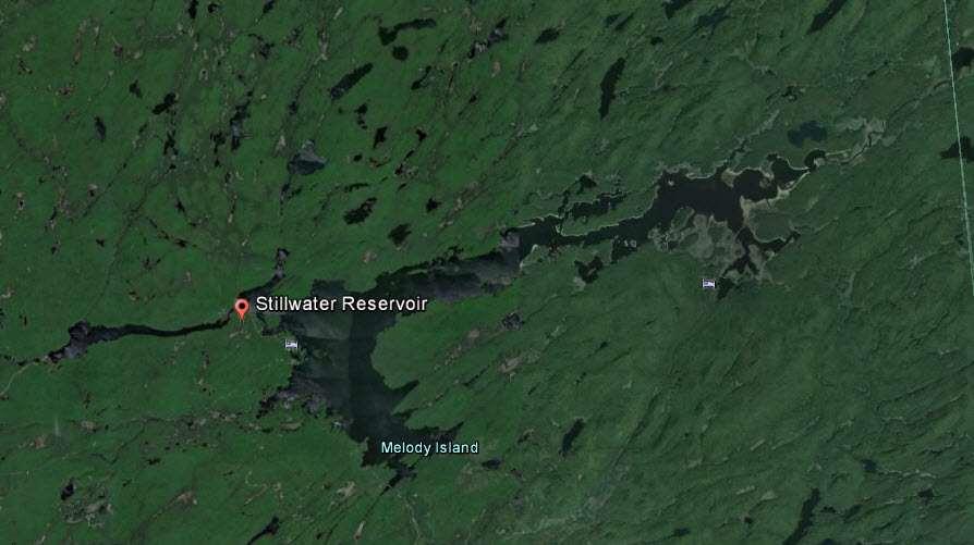
9 The Black River and its Watershed The Boring Facts. The Black River starts at North Lake (Herkimer County) at an elevation of 1,850 ft The river is about 125 miles long and eventually discharges to Lake Ontario near Dexter, Jefferson County, at an elevation of 246 ft. The upper and lower reaches of the River have the most elevation change, while the central section is fairly flat. Major tributaries that enter the Black River drain from the western flank of the Adirondack Mountains the Moose, Independence, and Beaver Rivers. The Black River Watershed is about 1,920 square miles, with an average flow at Watertown of about 4,240 cubic feet per second (~31,500 gallons per second). Some water from Forestport and other reservoirs can be routed to the New York State Barge Canal at Rome. (Forestport feeder canal to Boonville then to Delta Lake). The Hudson River-Black River Regulating District regulates discharges from their respective reservoirs Black River Stillwater and Fulton Chain Lakes Reservoirs.

10 Forestport Reservoir Forestport, Woodhull and other reservoir water can be diverted south to the Barge Canal
11
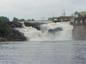
12 The Black River and its Watershed The Boring Facts. The Black River starts at North Lake (Herkimer County) at an elevation of 1,850 ft The river is about 125 miles long and eventually discharges to Lake Ontario near Dexter, Jefferson County, at an elevation of 246 ft. The upper and lower reaches of the River have the most elevation change, while the central section is fairly flat. Major tributaries that enter the Black River drain from the western flank of the Adirondack Mountains the Moose, Independence, and Beaver Rivers. The Black River Watershed is about 1,920 square miles, with an average flow at Watertown of about 4,240 cubic feet per second (~31,500 gallons per second). Water from the Forestport Reservoir can be routed south, to the New York State Barge Canal. The Hudson River-Black River Regulating District regulates discharges from their respective reservoirs Black River Stillwater and Fulton Chain Lakes Reservoirs. The river is otherwise regulated by dams in its upper and lower reaches. These dams are of the run-of-the-river type, and now used for hydropower production.

13 Lyons Falls, NY
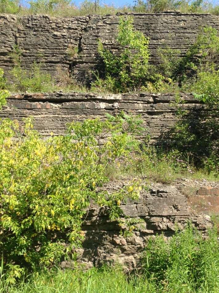
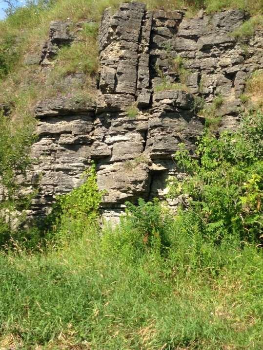
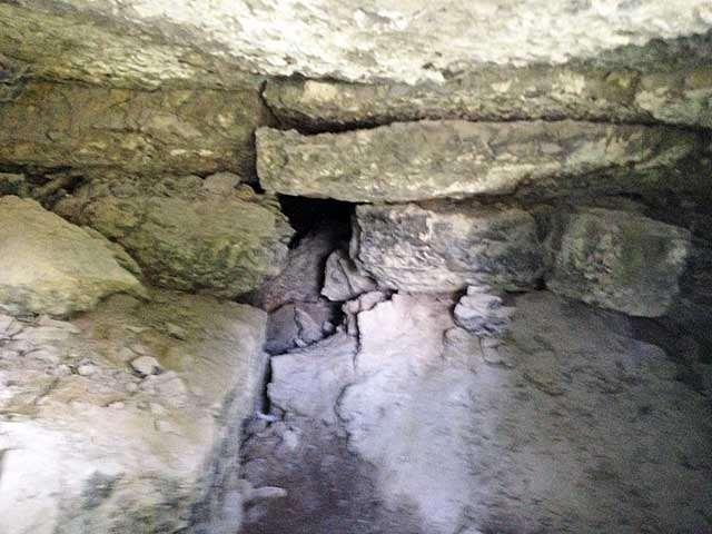
14

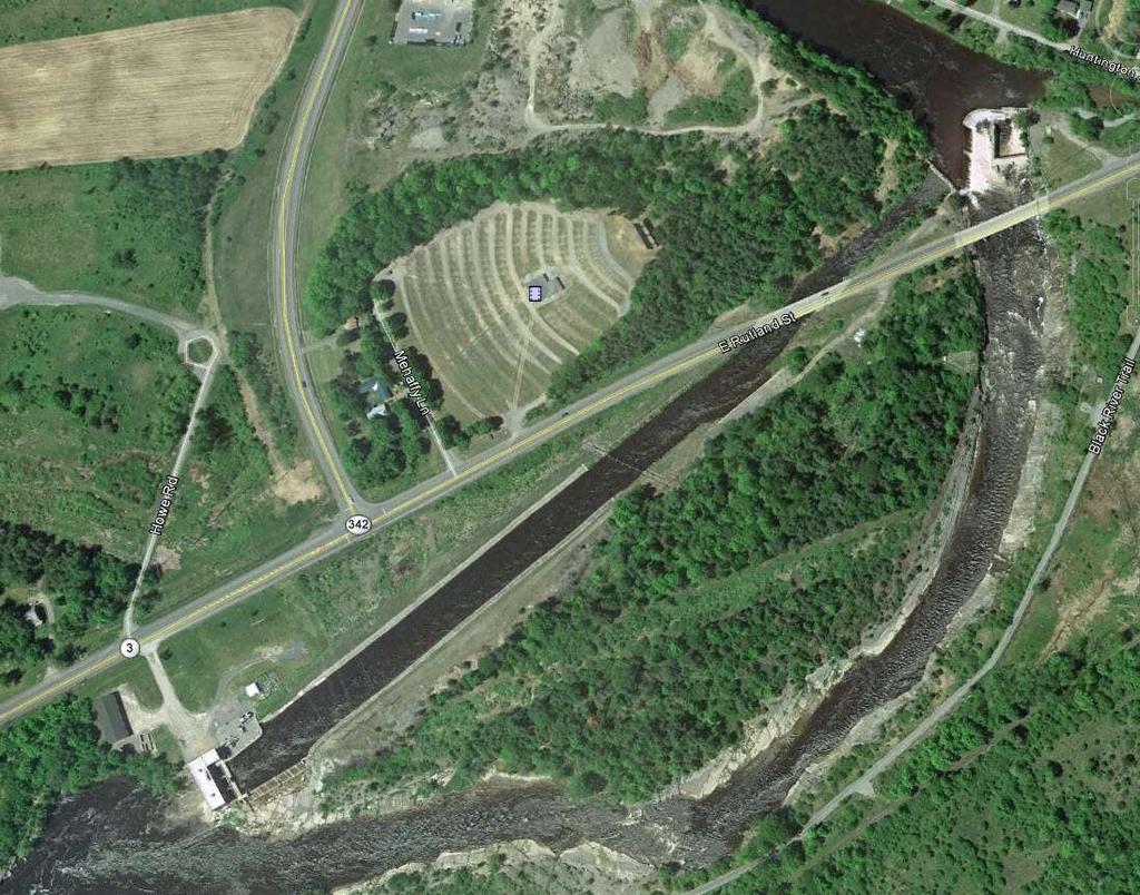
15 Hydropower project near Watertown

16 Last control structure at Dexter, NY
17 The Black River and its Watershed The Boring Facts. The Black River starts at North Lake (Herkimer County) at an elevation of 1,850 ft The river is about 125 miles long and eventually discharges to Lake Ontario near Dexter, Jefferson County, at an elevation of 246 ft. The upper and lower reaches of the River have the most elevation change, while the central section is fairly flat. Major tributaries that enter the Black River drain from the western flank of the Adirondack Mountains the Moose, Independence, and Beaver Rivers. The Black River Watershed is about 1,920 square miles, with an average flow at Watertown of about 4,240 cubic feet per second (~31,500 gallons per second). The Hudson River-Black River Regulating District regulates discharges from their respective reservoirs Black River Stillwater and Fulton Chain Lakes Reservoirs. The river is otherwise regulated by dams in its upper and lower reaches. These dams are of the run-of-the-river type, and now used for hydropower production. Surface water supplies Watertown with drinking water while groundwater supplies most municipalities and homeowners in rural areas. Glacial deposits generally have more-consistent and better-quality water than that from bedrock.


18 Eastern extent of the Tug Hill Plateau primarily shale bedrock with limited water supply in bedrock, and very modest water in any glacial sediments. Western extent of the Adirondack Dome primarily igneous and metamorphic bedrock provide some water supply but glacial sediments provide additional sources of drinking water.
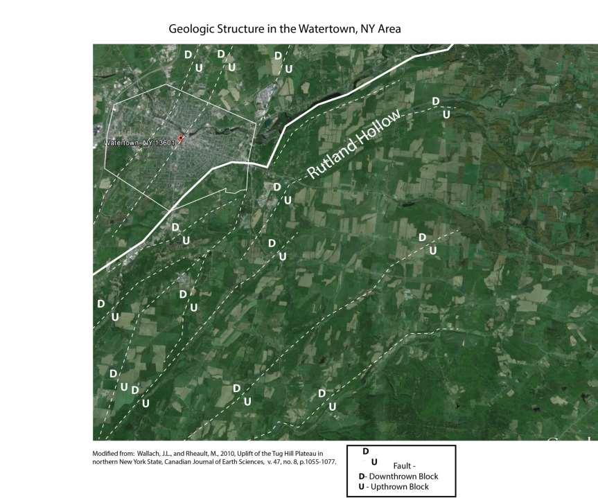
19 The Black River Fault Physiographic Areas - Geologic Features
20

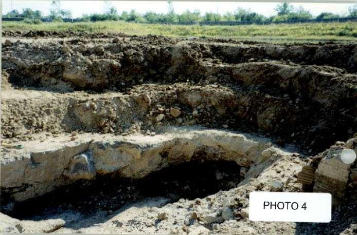
21 Bedrock fracture pattern, Black River at NYS-Route 3, Watertown, NY
22
23
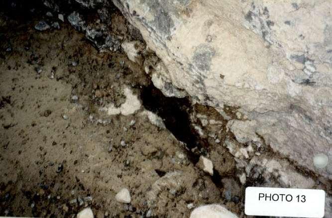
24
25

26
27 Fracture Orientation SW - NE

28 Town of Pamelia Philomel Creek - East

29 Town of Pamelia Philomel Creek Mid section - dry

30 Town of Pamelia Philomel Creek West - resurgence


31 Photo courtesy of Bob Brower Franklin County SWCD Bedrock fracture Pattern SW-NE

32 Natural rapids downstream of Watertown, NY

33 Black River at Black Bay
34 The Current Water Resource Concerns within the Black River Watershed Maintaining and improving the quantity and quality of water within the watershed. Quantity of water is generally dependent on our climate, of which we understand is changing. Differences in the amount and timing of rainfall and snow melt may effect how much and when precipitation runs off versus infiltrates permeable glacial and bedrock aquifers and then appears as recharge to the river system. Also, we need to carefully understand and manage our water resources for future users. Quality of water is dependent on us: 1. How and where we manage, recycle/reuse, or eventually landfill the wastes we produce. 2. How we perceive, manage, and produce products from our industrial, agricultural, and forest environments to protect the quality of the water resources now, and into the future. 3. How we, as individuals, mange our water use and waste flows ( i.e., septic systems) to protect surface water and groundwater resources now, and into the future.

35 Questions? Bill Gary Larson, 1981 Monitoring Framework Concept
The Town of Chester Stormwater Mapping Report
 The Town of Chester Stormwater Mapping Report Prepared by the Warren County Soil & Water Conservation District December 2013 Table of Contents Introduction and Location 3 Stormwater Runoff 3 Assessment
GROUNDWATER ASSESSMENT AND RECOMMENDATIONS REPORT for the Black River Watershed, New York
 GROUNDWATER ASSESSMENT AND RECOMMENDATIONS REPORT for the Black River Watershed, New York Prepared by: 200 First Federal Plaza 28 East Main Street Rochester, New York 14614 DECEMBER 2008 Acknowledgements:
NATURAL FEATURES, LAND SUITABILITY FOR DEVELOPMENT AND DEVELOPMENT CONCERNS
 East Central Wayne County Comprehensive Plan - Natural Features, Land Suitability Page 170 NATURAL FEATURES, LAND SUITABILITY FOR DEVELOPMENT AND DEVELOPMENT CONCERNS Introduction The residents of East
Hydrologic Characteristics of the Owens River Basin below the Upper Owens River
 Appendix T. Hydrologic Characteristics of the Owens River Basin below the Upper Owens River The hydrology of Mono Basin is described in detail in Chapter 3A. This appendix describes the Owens River basin
Environmental Resource Inventories. What are ERIs? Significance of information How to use them
 Environmental Resource Inventories What are ERIs? Significance of information How to use them Environmental Resource Inventory - ERI Compiled by the environmental commission Information about the natural
From My Backyard to Our Bay It s the 911 for the Chesapeake Bay
 From My Backyard to Our Bay Reporting Problems on Our Bay, Rivers, and Streams We can all be the eyes and ears of our local waterways. Maryland has established the Chesapeake Bay Safety and Environmental
Jordan River Basin. Planning for the Future. Salt Lake County Watershed Symposium (August 11, 2011) Todd Stonely Utah Division of Water Resources
 Todd Stonely Utah Division of Water Resources") Jordan River Basin Planning for the Future Todd Stonely Utah Division of Water Resources Salt Lake County Watershed Symposium (August 11, 2011) 8/12/2011 Jordan River Basin Planning for the Future Slide
Jordan River Basin Planning for the Future Todd Stonely Utah Division of Water Resources Salt Lake County Watershed Symposium (August 11, 2011) 8/12/2011 Jordan River Basin Planning for the Future Slide
Talk Outline. Roadside Ditches. Roadside Ditch Team. Roadside Drainage Networks. Methods. Study Sites 6/10/2013
 Roadside Ditches Improving Roadside Ditch Management Identifying and Overcoming the Hurdles Rebecca Schneider, Ph.D. Dept. Natural Resources, Cornell Local Roads Program 3 June 2013 Cornell University
Vermillion River Headwaters Groundwater Recharge Area Inventory and Protection Plan
 Vermillion River Headwaters Groundwater Recharge Area Inventory and Protection Plan A project funded through a Metro Environmental Partnership grant from the Metropolitan Council with technical analysis
Quantifying the Bellamy River Watershed Hydrologic Budget
 Quantifying the Bellamy River Watershed Hydrologic Budget A Hydrologic Assessment Prepared For: Town of Madbury Water District Board of Commissioners By: Thomas Fargo, C.G. Final Report January 2002 Page
Chapter 2: Conditions in the Spring Lake Watershed related to Stormwater Pollution
 Chapter 2: Conditions in the Spring Lake Watershed related to Stormwater Pollution To identify the primary causes and consequences of stormwater discharges to Spring Lake and its adjoining waterbodies,
Exploring the Possibilities At Prado Dam
 Exploring the Possibilities At Prado Dam Greg Woodside, P.G., C.HG. Executive Director of Planning & Natural Resources December 5, 2017 The Orange County groundwater basin lies at the base of the Santa
Issue paper: Aquifer Water Balance
 Issue paper: Aquifer Water Balance 1. Introduction And Background 1.1. Purpose and Scope The population in Kitsap County has grown rapidly in recent years and is expected to increase substantially in the
WATERSHED. Maitland Valley. Report Card 201
 Maitland Valley WATERSHED Report Card 201 The Maitland Valley Conservation Authority has prepared this report card as a summary on the state of our forests, wetlands, surface water, and ground water resources.
Watershed: an area or ridge of land that separates waters flowing to different rivers, basins, or seas. It is the interdependent web of living
 Watershed: an area or ridge of land that separates waters flowing to different rivers, basins, or seas. It is the interdependent web of living organisms that inhabit a geographic area and depend on it
Water Resources June 24, WATER RESOURCES
 3. WATER RESOURCES June 4, 0 A complete stormwater analysis and SWPPP was prepared for the Conventional Subdivision Plan and was submitted to the Planning Board in previous draft versions of the DEIS.
Maitland Valley WATERSHED
 Maitland Valley WATERSHED Report Card 2018 Maitland Conservation has prepared this report card as a summary of the state of your forests, wetlands, and water resources. WHERE ARE WE? We are one of 36 Conservation
water, forestry, fossil fuels, metallic and non-metallic minerals
 water, forestry, fossil fuels, metallic and non-metallic minerals Faith / spirituality (water baptisms, FNMI water stories, etc) Sustains us / necessary for life Sanitation Transportation (canoe, boat,
Groundwater in Bayfield County. Madeline Gotkowitz Hydrogeologist April 23, 2015
 Groundwater in Bayfield County Madeline Gotowitz Hydrogeologist April 23, 2015 Groundwater in Bayfield County Groundwater basics Hydrogeology across Wisconsin Hydrogeology in Bayfield County Mapping groundwater
Sabine River Basin Big Sandy Creek Watershed Characterization Report 2015
 67. Big Sandy Big Sandy Creek at White Oak Road Station 16011 Sabine River Basin Big Sandy Creek Watershed Characterization Report 2015 Prepared in Cooperation with the Texas Commission on Environmental
Black River Watershed Management Plan Plan
 Black River Watershed Management Plan Plan Final Report Part II: Appendices May 2010 This watershed management plan was prepared for the New York State Department of State Division of Coastal Resources
Site Suitability Analysis for Potential Reservoir Sites in the Texas Hill Country
 Site Suitability Analysis for Potential Reservoir Sites in the Texas Hill Country Introduction: By Dana Carstens In this project, I aimed to find the areas suitable for the potential construction of a
Supplemental Guide II-Delineations
 Supplemental Guide II-Delineations Contents Source Water Protection Area Delineation... 1 Delineation Criteria for Systems Using Groundwater Sources... 2 Time of Travel... 4 Flow Boundaries... 4 Delineation
California s s Water Supplies and Uses
 California s s Water Supplies and Uses Presented to Delta Stewardship Council Presented by Joe Grindstaff September 21 1 Place to Place: Most precipitation falls in the mountains in the north and east
Groundwater and Groundwater Surface Water Interaction: How Does It Work?
 Napa Valley Groundwater Advisory Committee February 23, 2012 Groundwater and Groundwater Surface Water Interaction: How Does It Work? Thomas Harter University of California, Davis ThHarter@ucdavis.edu
BAEN 673 / February 18, 2016 Hydrologic Processes
 BAEN 673 / February 18, 2016 Hydrologic Processes Assignment: HW#7 Next class lecture in AEPM 104 Today s topics SWAT exercise #2 The SWAT model review paper Hydrologic processes The Hydrologic Processes
Welcome to a WATERSHED Event!
 Welcome to a WATERSHED Event! Long-Term Flood Resiliency for Communities: A Watershed Management Approach April 16, 2015 Kim Sherwood Watershed Consultant from Chautauqua County, NY WATERSHEDS THE FUNNEL,
HYDROGEOLOGY OF THE HUMBOLDT RIVER BASIN, IMPACTS OF OPEN-PIT MINE DEWATERING AND PIT LAKE FORMATION
 HYDROGEOLOGY OF THE HUMBOLDT RIVER BASIN, IMPACTS OF OPEN-PIT MINE DEWATERING AND PIT LAKE FORMATION June, 2015 Tom Myers, Ph.D., Hydrologic Consultant, Reno NV tom_myers@charter.net Prepared for: Progressive
Watersheds and the Hydrologic Cycle
 Watersheds and the Hydrologic Cycle The Global Hydrologic Cycle Water Cycle in Florida Florida Water Facts Surface Area = 170,452 km 2 Average Rainfall = 140 cm (55 ) Total Annual Rain = 238 billion m
2
 1 2 3 4 5 Context Our basin has diverse landscapes from the forested Cascade Mountains, the agricultural Willamette Valley, to the densely populated cities of Eugene, Salem, and Portland. Water flows through
WASA Quiz Review. Chapter 2
 WASA Quiz Review Chapter 2 Question#1 What is surface runoff? part of the water cycle that flows over land as surface water instead of being absorbed into groundwater or evaporating Question #2 What are
North Country Stormwater Conference - Porous Pavement Section
 North Country Stormwater Conference - Porous Pavement Section Sponsored by Champlain Watershed Improvement Coalition of NY (CWICNY) October 14, 2010 Presentor Daniel R. Hershberg, P.E. & L.S. Managing
Broome County Comprehensive Plan Building Our Future. Water Resources
 Water Resources Water resources have shaped settlement patterns in this region long before the inception of Broome County. Indigenous peoples settled along its rivers, the Susquehanna, Chenango, Tioughnioga,
The five regional level maps of natural and cultural resources are included below:
 Environmental Mitigation CDTC s New Visions 2040 regional transportation plan encourages smart growth as well as investment and development in urban areas as a method to protect natural resources Smart
7.9 Lake Whitney Reallocation
 7.9 Lake Whitney Reallocation 7.9.1 Description of Option Lake Whitney is a major impoundment located on the Brazos River approximately 30 miles north of the City of Waco in Hill and Bosque Counties. The
Water Resources on PEI: an overview and brief discussion of challenges
 Water Resources on PEI: an overview and brief discussion of challenges Components: Components and links Atmospheric water Surface water (including glacial water) Groundwater Links: Precipitation (atm(
Workshop 1 Our Groundwater and Surfacewaters are Connected and We are What We Drink Hosted by: Lackawanna County Conservation District
 Workshop 1 Our Groundwater and Surfacewaters are Connected and We are What We Drink Hosted by: Lackawanna County Conservation District Sponsored by: Pocono Northeast RC&D Council Through the C-SAW C Program
Stabilizing and Restoring an Aquifer and Springs Managed Aquifer Recharge in the Walla Walla Basin
 ABSTRACT & POWERPOINT PRESENTATION Stabilizing and Restoring an Aquifer and Springs Managed Aquifer Recharge in the Walla Walla Basin Robert Bower, M.Sc., B.Sc. Principal Hydrologist Golder Associates
Option 11. Divert Water from Miocene and Hendricks Canal to Supply the Ridge
 Integrated Water Resources Plan Option 11 Divert Water from Miocene and Hendricks Canal to Supply the Ridge This option would use water from the Miocene Canal and/or Hendricks Canal for municipal supplies
Municipal Stormwater Management Plan Prepared For The Borough of Cape May Point By Van Note-Harvey Associates VNH File No.
 Municipal Stormwater Management Plan Prepared For The Borough of Cape May Point By Van Note-Harvey Associates 2005 VNH File No. 35317-210-21 Table of Contents Introduction... 3 Goals... 3 Storm water Discussion...
GROUNDWATER AND GENEVA LAKE
 GROUNDWATER AND GENEVA LAKE INTRODUCTION For years it was assumed that groundwater was a significant source of water to Geneva Lake. Local folklore once contended that the water in Geneva Lake came all
The Sustainability of Floods Pond
 The Sustainability of Floods Pond Bangor Water District s Public Water Supply Presented By: Rick Pershken Bangor Water District Overview Brief BWD History Watershed Characteristics Lake Characteristics
STRAWMAN OUTLINE March 21, 2008 ISWS/ISGS REPORT ON THE OPPORTUNITIES AND CHALLENGES OF MEETING WATER DEMAND IN NORTH-EAST ILLINOIS
 STRAWMAN OUTLINE March 21, 2008 ISWS/ISGS REPORT ON THE OPPORTUNITIES AND CHALLENGES OF MEETING WATER DEMAND IN NORTH-EAST ILLINOIS REPORT TO BE DELIVERED TO THE RWSPG BY SEPTEMBER 30, 2008 Table of Contents
IV. ENVIRONMENTAL IMPACT ANALYSIS G. HYDROLOGY/WATER QUALITY
 IV. ENVIRONMENTAL IMPACT ANALYSIS G. HYDROLOGY/WATER QUALITY ENVIRONMENTAL SETTING The project site is located in the Wilshire community of the City of Los Angeles and is bound by S. Wetherly Drive to
Freight Street Development Strategy
 Freight Street Development Strategy Appendix B: Naugatuck River Floodplain Analysis Freight Street Development Strategy DECEMBER 2017 Page B-1 1.0 NAUGATUCK RIVER FLOODPLAIN AT FREIGHT STREET 1.1 Watershed
Aquifer Characterization and Drought Assessment Ocheyedan River Alluvial Aquifer
 Aquifer Characterization and Drought Assessment Ocheyedan River Alluvial Aquifer Iowa Geological Survey Water Resources Investigation Report 10 Aquifer Characterization and Drought Assessment Ocheyedan
River Talk Patterns. Student Copy Page PART I (1 of 1) 3. Human nervous system. Waters and drainage patterns. Road system.
 3. Human nervous system. Waters and drainage patterns. Road system.") River Talk Patterns Student Copy Page PART I (1 of 1) 3 Human nervous system photo credit: Hemera Thinkstock Photos Waters and drainage patterns photo credit: Comstock Getty Images Road system photo credit:
River Talk Patterns Student Copy Page PART I (1 of 1) 3 Human nervous system photo credit: Hemera Thinkstock Photos Waters and drainage patterns photo credit: Comstock Getty Images Road system photo credit:
Cape Fear River Water Supply Evaluation
 Cape Fear River Water Supply Evaluation March 30, 2016 Division of Water Resources Cape Fear River WaterSupply Evaluation Todays goal: Review the Draft Cape Fear River Water Supply Evaluation Review the
Napa Watershed Symposium. Factors affecting future water quantity and quality in Napa County, and strategies for adaptation
 Napa Watershed Symposium Factors affecting future water quantity and quality in Napa County, and strategies for adaptation Pierre Stephens California Department of Water Resources May 21, 2009 Source:
Midwest Technology Assistance Center Groundwater Resource Assessment for Small Communities
 Midwest Technology Assistance Center Groundwater Resource Assessment for Small Communities Groundwater Availability At St. Rose PWD, Illinois (Clinton County) Project Overview This project is an outgrowth
CHAPTER 4 - EROSION & SEDIMENT CONTROL AND STORMWATER MANAGEMENT ORDINANCE OF DUBUQUE COUNTY, IOWA. Adopted March 29, 2010.
 CHAPTER 4 - EROSION & SEDIMENT CONTROL AND STORMWATER MANAGEMENT ORDINANCE OF DUBUQUE COUNTY, IOWA Adopted March 29, 2010 Table of Contents Page Part 1 Introduction...3 4-1 Title..................3 4-2
MEMORANDUM. FROM: Jordan Kear, P.G., C.Hg. KG
 MEMORANDUM TO: Mr. Robert Elliott Little Baldy Water Company PO Box 313 Llano, California 93544 FROM: Jordan Kear, P.G., C.Hg. KG12-0100 DATE: July 20, 2012 SUBJECT: Reconnaissance Level Hydrogeologic
Background Information on the. Peace River Basin
 Background Information on the Peace River Basin Resource Conservation & Development Department August 24 Background Physiography The Peace River drainage basin occupies large parts of Polk, Hardee, DeSoto,
Integrated Watershed Management Plan
 mighty peace watershed alliance Integrated Plan SUMMARY What is the Plan? The Mighty Peace Alliance (MPWA) supports the three goals of Alberta s Water for Life Strategy: safe secure drinking water, healthy
DEPARTMENT OF ENVIRONMENTAL RESOURCES REVIEW NOTICE
 DEPARTMENT OF ENVIRONMENTAL RESOURCES REVIEW NOTICE This report, prepared by outside consultants, has been reviewed by the Department of Environmental Resources and approved for publication. The contents
Chapter 1 Introduction
 Engineering Hydrology Chapter 1 Introduction 2016-2017 Hydrologic Cycle Hydrologic Cycle Processes Processes Precipitation Atmospheric water Evaporation Infiltration Surface Runoff Land Surface Soil water
VI-1. The Water Cycle What is the water cycle? evaporate condenses surface runoff ground water
 Classroom Copy VI-1. The Water Cycle What is the water cycle? Did you know that the water we see all around us never gets destroyed, and new water never gets created? Instead, it constantly recycles and
The Water Cycle. 1. The diagram below is a cross-sectional view of rain falling on a farm field and then moving to the water table.
 1. The diagram below is a cross-sectional view of rain falling on a farm field and then moving to the water table. Which word best describes the movement of the rainwater through zone A? A. runoff B. saturation
Isotope Hydrology Investigation of the Pawcatuck Watershed. Principle Investigators. Anne I. Veeger
 Isotope Hydrology Investigation of the Pawcatuck Watershed Principle Investigators Anne I. Veeger Introduction There are three new research projects for the FY1999 annual research program for the Water
Surface Water. Solutions for a better world
 1 Surface Water Solutions for a better world Our Surface Water Services Expertise Growing worldwide awareness of water scarcity has encouraged water preservation programs, better irrigation techniques
Irrigation. Branch. Groundwater Quality in the Battersea Drainage Basin
 AGRICULTURE, FOOD AND RURAL DEVELOPMENT Irrigation Branch Groundwater Quality in the Battersea Drainage Basin Groundwater quality in the Battersea drainage basin was monitored between 1995 and 21 to characterize
Grand Traverse Bay Watershed Protection Plan:
 Grand Traverse Bay Watershed Protection Plan: An Overview Sarah U Ren Program Director The Watershed Center 231-935-1514, suren@gtbay.org What is a Watershed? A watershed is an area of land that captures
Watershed Systems & Impairments
 Watershed Systems & Impairments Environmental Stewards Program ~ 2014 Lisa Galloway Evrard Senior Program Coordinator Rutgers Cooperative Extension Water Resources Program Part I: Overview of Watershed
Why Is The Hillsborough River Watershed Important? A Practice Timed Writing Exercise
 Why Is The Hillsborough River Watershed Important? A Practice Timed Writing Exercise Essential Question: Why is the Hillsborough River Watershed important? Objective: Students will write an expository
Watershed Management Ordinance
 Watershed Management Ordinance Resilient Chicago September 30, 2014 Presented by: John Murray, P.E., CFM WMO Objective Establish uniform, minimum, and comprehensive countywide stormwater management regulations
This is a digital document from the collections of the Wyoming Water Resources Data System (WRDS) Library.
 Library.") This is a digital document from the collections of the Wyoming Water Resources Data System (WRDS) Library. For additional information about this document and the document conversion process, please contact
This is a digital document from the collections of the Wyoming Water Resources Data System (WRDS) Library. For additional information about this document and the document conversion process, please contact
Raw water sources, facilities, and infrastructure
 WATER AND WASTEWATER SERVICES IN STEAMBOAT SPRINGS Prepared by Jay Gallagher, General Manager Mt. Werner Water and Sanitation District (February, 2015) Raw water sources, facilities, and infrastructure
Appendix B Stormwater Site Plan Submittal Requirements Checklist
 Stormwater Site Plan Submittal Requirements Checklist The Submittal Requirements Checklist is intended to aid the design engineer in preparing a Stormwater Site Plan. All items included in the following
East Maui Watershed Partnership Adapted from Utah State University and University of Wisconsin Ground Water Project Ages 7 th -Adult
 INTRODUCTION What is groundwater? Water contained in saturated soil and rock materials below the surface of the earth. It is not NEW water, but is recycled water through the hydraulic cycle. The source
Groundwater Levels and Pumpage in the East St. Louis Area, Illinois,
 Circular 112 STATE OF ILLINOIS DEPARTMENT OF REGISTRATION AND EDUCATION Groundwater Levels and Pumpage in the East St. Louis Area, Illinois, 1967-1971 by W. H. BAKER, JR. ILLINOIS STATE WATER SURVEY URBANA
FACT FLASH. 5: Groundwater. What is groundwater? How does the ground store water? Fact Flash 5: Groundwater
 FACT FLASH 5: Groundwater What is groundwater? Groundwater is fresh water (from rain or melting ice and snow) that soaks into the soil and is stored in the tiny spaces (pores) between rocks and particles
Report. Environmental Water Demands. Butte County Department of Water and Resource Conservation Integrated Water Resources Plan.
 Report Butte County Department of Water and Resource Conservation Integrated Water Resources Plan s June 2004 s Section 1 - Introduction 1.1 Project Description This project is a preliminary investigation
Contribution of Irrigation Seepage to Groundwater-Surface Water Interactions on the Eastern Snake River Plain
 Contribution of Irrigation Seepage to Groundwater-Surface Water Interactions on the Eastern Snake River Plain Rob Van Kirk, HSU Department of Mathematics http://www.humboldt.edu/henrysfork/ BSU Geosciences
year within the area of Kings County (California Department of Water Resources, 1979).
.") 4.3 WATER RESOURCES 4.3 WATER RESOURCES This section describes the existing hydrological setting for the County, including a discussion of water quality, based on published and unpublished reports and
4.3 WATER RESOURCES 4.3 WATER RESOURCES This section describes the existing hydrological setting for the County, including a discussion of water quality, based on published and unpublished reports and
Appendix A Stormwater Site Plan Report Short Form
 Appendix A Stormwater Site Plan Report Short Form The Stormwater Site Plan Report Short Form may be used for projects that trigger only Minimum Requirements #1-#5. These projects typically fall within
STORM WATER and LID SESSION
 STORM WATER and LID SESSION STORM WATER & LID SESSION SESSION LINEUP NEDES Overview Patrick Bryan Environmental Resources Technician, Fresno Metropolitan Flood Control District Local Prospective Gene Matters
The Contribution of Irrigation Seepage to Groundwater-Surface Water Interactions on the Snake River Plain, Idaho
 The Contribution of Irrigation Seepage to Groundwater-Surface Water Interactions on the Snake River Plain, Idaho Rob Van Kirk, HSU Department of Mathematics http://www.humboldt.edu/henrysfork/ HSU Geology
Northern Arizona Hydrogeology
 Northern Arizona Hydrogeology Some basics Coconino Plateau Hydrogeology Flagstaff and Coconino Plateau Water Resources Well development, City of Flagstaff Effluent discharge to the Rio de Flag from Wildcat
WATERSHEDS. Env. Science and Ecology Standards 4.1
 WATERSHEDS Env. Science and Ecology Standards 4.1 WATER, WATER EVERYWHERE, BUT. Earth is known as the blue planet: 70% of the Earth s surface is covered in water. The Earth and its atmosphere contain ~336million
Occurrence of Iron in Surface Waters of the Upper St. Johns River Basin
 Occurrence of Iron in Surface Waters of the Upper St. Johns River Basin Prepared by Florida Department of Environmental Protection Bureau of Watershed Management Ground Water Protection Section December
Reservoir age, increasing human population,
 B-6249 02/12 Eagle Mountain Watershed Management Brent Clayton, Justin Mechell, David Waidler and Clint Wolfe* Reservoir age, increasing human population, and changing land uses have prompted the development
King County Flood Control District approves grants for flood prevention projects Regional projects to benefit from district funds
 News Release Contact: Al Sanders 206-477-1016 August 31, 2015 Flood Control District approves grants for flood prevention projects Regional projects to benefit from district funds The Flood Control District
EL PASO COUNTY WATER REPORT
 EL PASO COUNTY WATER AUTHORITY EL PASO COUNTY WATER REPORT DRAFT Executive Summary The El Paso County Water Authority (EPCWA) has prepared this Water Report to assist in evaluating how water demands of
Names: ESS 315. Lab #6, Floods and Runoff Part I Flood frequency
 Names: ESS 315 Lab #6, Floods and Runoff Part I Flood frequency A flood is any relatively high flow of water over land that is not normally under water. Floods occur at streams and rivers but can also
Groundwater Hydrology
 University of California, Davis Department of Land, Air and Water Resources Hopland Research and Extension Center Groundwater Hydrology Workshop: Impact of Drought on Livestock Oct/2014 Sam Sandoval, PhD
Grand Traverse Bay Watershed Protection Plan:
 Grand Traverse Bay Watershed Protection Plan: An Overview Sarah U Ren Program Director The Watershed Center 231-935-1514, suren@gtbay.org The Grand Traverse Bay Watershed 973 square miles Bay Volume =
Groundwater Flow Demonstration Model Activities for grades 4-12
 Groundwater Flow Demonstration Model Activities for grades 4-12 NR/WQ/2012-5 SET-UP Please allow time to practice using the groundwater model before conducting demonstrations. 1. Remove the groundwater
Watershed Analysis Linda Reinen, Pomona College Bob Newton, Smith College
 Watershed Analysis Linda Reinen, Pomona College Bob Newton, Smith College Groundwater is a major source for drinking and irrigation water. 50% of the people in the United States depend on groundwater for
Dry Creek Flood Control Improvement Project
 Dry Creek Flood Control Improvement Project The following is a brief overview of the planned IRWM Stormwater Flood Management Grant Application from the Fresno Metropolitan Flood Control District (FMFCD)
Helena Valley Ground Water Monitoring Program
 Helena Valley Ground Water Monitoring Program James Swierc Lewis & Clark County Water Quality Protection District October 6, 2011 WQPD Sampling Program Overview Helena Area Water Related Issues Nutrient
Cokato Lake (86-263) Wright County. Hydrologic Investigation
 Wright County. Hydrologic Investigation") Cokato Lake (86-263) Wright County Hydrologic Investigation April 14, 2005 Cokato Lake (86-263) Wright County Hydrologic Investigation April 14, 2005 Problem Statement In recent years, heavy rainfall has
Cokato Lake (86-263) Wright County Hydrologic Investigation April 14, 2005 Cokato Lake (86-263) Wright County Hydrologic Investigation April 14, 2005 Problem Statement In recent years, heavy rainfall has
SITING YORETOWN S NEW LANDFILL INFORMATIONAL SHEET
 SITING YORETOWN S NEW LANDFILL INFORMATIONAL SHEET Yoretown has a solid waste disposal problem. The landfill used for the disposal of its solid waste is near maximum capacity. Since Yoretown is so far
CROSBY BROOK RESTORATION STUDY BRATTLEBORO, VT
 Key Stakeholders: CROSBY BROOK RESTORATION STUDY BRATTLEBORO, VT Funded By: VT Dept. of Environmental Conservation VT Agency of Transportation (VTrans) Town of Brattleboro NEWEA Spring Meeting Omni Mt.
Watershed Response to Water Storage. 8/1/2012 Paul Wymar Scientist Chippewa River Watershed Project
 Watershed Response to Water Storage 8/1/2012 Paul Wymar Scientist Chippewa River Watershed Project Chippewa River Watershed 1.3 Million Acres Largest tributary watershed in the Minnesota River Basin 7
TORCH LAKE TOWNSHIP WATER QUALITY ACTION PLAN
 TORCH LAKE TOWNSHIP WATER QUALITY ACTION PLAN Elk-River-Chain-of-Lakes Gaps Analysis Project The Watershed Center Grand Traverse Bay Tip of the Mitt Watershed Council Michigan Department of Natural Resources
Ground- Water in the Clark Fork Basin
 Well 19142: 6N 19W 7 BABC- Ravalli County Ground- Water in the Clark Fork Basin Tom Patton, John LaFave, and Larry Smith Montana Ground-Water Assessment September 27, 26 The Ground-Water Assessment Program
Section 8 Stevinson Water District Study Area
 Stevinson Water District Study Area Figure 8-1. Location of Stevinson Water District & the Merquin County Water District (SWD 2005). 8.1 Introduction and Overview The Stevinson Water District (SWD) is
Inputs. Outputs. Component/store. Section of a system where material or energy is held. Something that enters the system (material or energy)
") .. Inputs Something that enters the system (material or energy) Outputs Something that leaves the system (material or energy) Component/store Section of a system where material or energy is held Transfer/flow
.. Inputs Something that enters the system (material or energy) Outputs Something that leaves the system (material or energy) Component/store Section of a system where material or energy is held Transfer/flow
Environmental Check List Georgia Environmental Policy Act
 Environmental Check List Georgia Environmental Policy Act Project No. : Project Name: GEORGIA IS AREA AFFECTED? IF AFFECTED, HOW SEVERELY? AREA/CATEGORY NO YES UNKNOWN MINOR MEDIAN MAJOR UNKNOWN 1. Wetlands
CHAPTER 7 PHYSICAL INVENTORY OF THE CITY
 CHAPTER 7 PHYSICAL INVENTORY OF THE CITY Chapter 7: Physical Inventory of the City 39 This page intentionally left blank. Chapter 7: Physical Inventory of the City 40 SECTION 1 PHYSICAL SETTING While communities