Discussion on Colquitt County Solid Waste. June 16, 2016
|
|
|
- Vernon Small
- 5 years ago
- Views:
Transcription

1 Discussion on Colquitt County Solid Waste June 16, 2016
2 Landowner Discussion Purpose of today s meeting: - Focus is on Environmental - Informative: We want to keep landowners in the loop and clear up any misinformation - Two way conversation: We d like to get some feedback - Keep things cordial: We understand this is a sensitive issue - Continue to meet in the future: keep the lines of communication open
3 Our Purpose Two key components: 1) Determine additional revenue sources for the county: Diversify our revenues away from property tax Identify possible additional sources of revenue and pursue them 2) Develop a long term solution for Colquitt County s municipal solid waste
 400 Acres")
4 Acres (Additional) Acres (Original) 400 Acres Total
5 Solid Waste Options Municipal Solid Waste / C & D Options: - 1) Permitting a new landfill on county-owned property Currently on-going (long term solution) - 2) Devise a waste to energy program that would convert solid waste into usable energy Currently on-going (long term solution) - 3) Collective bargaining with City of Moultrie for rates on surrounding area landfills and share privatized transfer costs Currently on-going (short term solution)
6 Current Status of Landfill Actions Taken Thus Far for Landfill: - June 10 & 17, 2015: Pursuant to O.C.G.A , the County ran advertisements in the Moultrie Observer to advertise for a public meeting on June 25, 2015 to discuss waste management needs of the local government or region and to describe the process of siting facilities to the public. - June 25, 2015: During a Called Meeting on this date, the Board unanimously voted to proceed with a site suitability study to be conducted by TTL.
7 Current Status of Landfill Actions Taken Thus Far for Landfill: - June 1, 2016: Site Suitability Study received. - Purpose of Site Suitability Study: A Site Suitability study is a government mandated process to evaluate a proposed landfill through scientific siting criteria. The process also requires for public and government participation/input into the siting of a landfill.
8 Recent EPD Inspection On May 10 th, EPD received an anonymous call from an individual claiming that leachate from the landfill was seeping into the Ochlockonee River. On May 12 th, EPD conducted an inspection of the landfill and determined that the claim was unsubstantiated.
9 Old Landfill vs. New Landfill: Old Landfill Opened in early 1970 s Less stringent design standards Environmental Concern Portions of the landfill disposal cells extended very near or down to groundwater No liner system in place to prevent migration of contaminants to groundwater No leachate collection system to prevent leachate from migrating to groundwater and causing contamination No landfill gas collection system to prevent methane migration Daily cover likely not applied, which contributed to leachate generation and odor problems. Groundwater monitoring and methane monitoring not required until (or not performed until) after 1991 Post Closure Care and Financial Assurance Monitoring Required (Closed in 1994)
10 Old Landfill vs. New Landfill: New Landfill Stringent siting and design standards. Environmental Concern Landfill will be constructed with a minimum 5 foot separation between the bottom of the waste unit and groundwater. The bottom and side slopes of the landfill will be lined with either a clay or geo-synthetic liner system or combination or both to prevent leakage into the underlying groundwater. Only one cell is open at a time to receive waste. Regulation requires that garbage is compacted and covered at the end of each day to minimized odor, pests, and wind disturbance. Leachate recovery system incorporated into the landfill design: A network of drains constructed in the bottom of the landfill collects the leachate that flows through the decomposing waste. The leachate is recovered and treated, recirculated, or disposed at an off-site treatment facility.
11 Old Landfill vs. New Landfill: Environmental Concern New Landfill, cont. Landfill gas collection system will be designed and installed to reduce Landfill Gas emissions and migration. More stringent restrictions on what can be disposed in a MSW landfill. More stringent reporting requirements. Groundwater and methane monitoring network will be installed before first waste is accepted. Groundwater will be monitored prior to placement of waste. Post Closure Care and Financial Assurance Monitoring Required for a minimum of 30 years
12 Discussion of Site Acceptability Study For Proposed Municipal Solid Waste Facility June 16, 2016 James R. Smith, P.G. Keith H. Reaves, P.E.

13 TRANSFER STATION CLOSED LANDFILL Study Area = ±120 Acres
14 Landfill Siting Process Criteria for the Siting of a New Landfill is Governed by Georgia Department of Environmental Protection Division (EPD) Rule TTL Followed Georgia EPD and Georgia Geologic Survey Circular 14 - Criteria for Performing Site Acceptability Studies for Solid Waste Landfills Website Address -
15 Landfill Siting Process Georgia Geologic Survey Circular Conform to Zoning Ordinances 2. Proximity to Airport 3. Proximity to 100-Year Flood Plain 4. Proximity to Streams and Wetlands 5. Proximity to Faults Areas 6. Proximity to Seismic Impact Zones 7. Proximity to Unstable Areas 8. Proximity to County Boundaries and National Historic Sites 9. Proximity to Most Significant Groundwater Recharge Areas 10. Proximity to Public and Domestic Drinking Water Supply Wells 11. Proximity to Surface Water Intakes 12. Perform Hydrogeological Assessment 13. Provide Site Recommendations for Design and Environmental Monitoring Information is Compiled and Submitted to the GA EPD in a Site Acceptability Report
16 Landfill Siting Process Georgia Geologic Survey Circular Does Study Area Conform To Zoning Ordinances Yes 2. Proximity To Airport --- Landfill Cannot Be Located Within: 10,000 Feet Of An Runway End Used By Turbojet Aircraft, or 5,000 Feet Of An Runway End Used By Piston-Type Aircraft o Findings - Study Area Is Approximately 11,000 Feet From Nearest Airport
17 Landfill Siting Process Georgia Geologic Survey Circular Proximity To 100-Year Flood Plain Landfill Cannot Restrict the Flow Of The 100-Year Flood o Findings - As Shown on the FEMA Flood Plain Map, The 100-year Floodplain is Present Along the Southern Boundary of the Study Area. o The Final Engineering Design Should Ensure that the Landfill is Not Within 100- Year Floodplain

18 FEMA Flooplain Map Flood Zone
19 Landfill Siting Process Georgia Geologic Survey Circular Proximity to Streams A Minimum 25-foot Buffer Zone is Required Between a Landfill and Waters of the State (i.e. Streams or Rivers) o Finding - Study Area is not Within a 25-foot Buffer Zone o Study Area is About 50 Feet from Big Creek and 1,200 Feet West of the Ochlocknee River 5. Proximity Wetlands Landfill Cannot Be Located in Wetlands -- Unless A Mitigation Permit Is Granted By The U.S. Army Corps of Engineers (USACOE) o o Finding Acres of Wetlands Were Identified Within Study Area. A USACOE Wetlands Mitigation Permit Will Be Required for This Area. Wetlands are Present Along the Southern Boundary But Outside of Study Area. This Area Should Not Be Disturbed

20 National Wetlands Inventory Map

21 1,200 Ft. to Ochlocknee River Big Creek Site Specific Wetlands Inventory Map
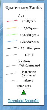
22 Landfill Siting Process Georgia Geologic Survey Circular Proximity to Faults and Seismic Impact Zones New Landfills Cannot Be Located Within 200 Feet Of A Fault With Displacement in the Last 12,000 Years Findings: Based on U.S Geological Survey Data: o o Study Area Is Not Located Within 200 Feet of This Type Fault, and Colquitt County is Within One of the Lower Seismic Hazard Areas in Georgia (4 to 6% of Standard Gravity)

23 STUDY AREA U.S. Geological Survey Earthquake Hazard Map

24 2014 U.S. Geological Survey Seismic Hazard Map
25 Landfill Siting Process Georgia Geologic Survey Circular Proximity to Unstable Areas Includes Poor Foundation Conditions, Areas Susceptible to Mass Movements (i.e. Landslides), and/or Karst Terrain (i.e. Sinkholes) o o Finding -- No Unstable Areas Were Observed Within the Study Area, and No Evidence of Karst Terrain Documented Within the Study Area or Surrounding Vicinity A Surface Depression was Observed Off-Site -- East of Shade Murphy Road. This Depression was Present in Historical Aerial Photographs Back to at Least 1940

26 2014 U.S. Geological Survey Seismic Hazard Map
27 Landfill Siting Process Georgia Geologic Survey Circular Proximity to County Boundaries and National Historic Sites A Landfill Cannot Be Sited Within: ½-Mile of the County Boundary 5,708 Yards of a National Historic Site o Finding - Study Area is 2.5-Miles From the County Boundary o No Historical Sites Were Identified Within 5,708 Yards (GT Hill Planners Preservation Professional)
28 Landfill Siting Process Georgia Geologic Survey Circular Proximity to Most Significant Groundwater Recharge Areas (i.e. Recharge Area for the Major Drinking Water Aquifer) Floridan Aquifer Is the Major Aquifer in Colquitt County Landfill Cannot Be Sited Within 2 Miles of a Significant Groundwater Recharge Area Unless A Liner and Leachate System is Incorporated Into the Design o As Show on the Following Maps, the Study Area Is Not Located Within An Area Designated as a Significant Groundwater Recharge Area

29 Study Area Groundwater Recharge Areas Map


30 Recharge Area for unconfined Aquifer Recharge Area for confined Aquifer Georgia Geological Survey Groundwater Recharge Areas Map
31 Landfill Siting Process Georgia Geologic Survey Circular Proximity to Wellhead Protection Zones Landfills Are Not Allowed Within The Inner or Outer Wellhead Protection Zones of Wells or Springs Used As Public Water Supply (Serving Municipalities, Counties, or Authorities) o Finding - Study Area Is Not Located Within An Inner or Outer Well-Head Protection Zone
32 Landfill Siting Process Georgia Geologic Survey Circular Evaluated the Proximity to Public and Domestic Drinking Water Supply Wells Identified Public Drinking Water Supply Wells Within 2-Mile Radius of the Study Area Identified Domestic Drinking Water Supply Wells Within 1/2-Mile Radius of the Study Area o Downgradient Wells Represent Potential Receptors To Be Discussed More

33 13 Domestic Drinking Water Wells 1 Public Drinking Water Well Public Drinking Water Well DW Domestic Water Well Public and Domestic Drinking Water Well Radius Map
34 Landfill Siting Process Georgia Geologic Survey Circular Proximity to Surface Water Intakes Landfill Cannot Be Sited Within 2-miles Upgradient of Any Surface Water Intake Used as a Public Drinking Water Source (Unless Engineering Modifications to Landfill Design are Included) o Finding = Study Area Is Not Within 2-Miles of This Type Surface Water Intake
35 Landfill Siting Process Georgia Geologic Survey Circular Performed a Hydrogeological Assessment To Evaluate: o o o o Depth to the Uppermost Aquifer Groundwater Flow Direction and Rate of Flow Geologic Setting Pollution Potential of Study Area Under Natural Conditions (i.e. No Liner or Leachate Systems or Other Engineering Controls)

36 Depth to Groundwater Ranged from 2 to 10 Feet During Seasonal Highs 1,200 feet To Ochlocknee River Piezometer and Boring Map 8 Piezometers 28 to 38 Feet Deep 1 Exploratory Boring to Feet Deep

 =")
37 Public and Domestic Drinking Water Well Radius Map Distance to Nearest Downgradient Drinking Water Well (DW-9 & DW-12) = ±1,400 ft.

38 Geologic Map of Study Area
39 Unconfined Uppermost Aquifer Domestic Well Surficial Well Confined Major Limestone Aquifer Confining Unit Example of Depiction of Aquifer Systems

40 Gulf Trough Upper Confining Unit Thickness = 200 to <300 feet Leakage Potential/Exchange = Extremely Low to None U.S. Geological Survey ---- Overburden Thickness and Leakage Potential of the Upper Confining Unit to the Floridan Aquifer


41 Land Surface of Study Area = +217 to +254 ft. mean sea level Top of Floridan Aquifer = 0 to -100 ft. mean sea level Confining Unit Thickness = 200 to <300 ft. Structural Top of Floridan Aquifer


42 Unconfined Uppermost Aquifer 0 Feet Domestic Well 2 to 10 Feet Surficial Well 65 Feet 300 Feet Confined Major Aquifer Confining Unit Example of Depiction of Aquifer Systems
43 Landfill Siting Process Georgia Geologic Survey Circular Pollution Potential of Study Area Under Natural Conditions (i.e. No Liner or Leachate Systems or Other Engineering Controls) Circular 14 Recommends - LeGrand Empirical Point-Count System to Evaluate Potential for Leachate to Migrate into Unconfined Aquifer o Pollution Potential For An Unlined Landfill = 9.5 Points o Pollution Potential For An Lined Landfill With Leachate Collection System = 13.5 Points

44 Landfill Siting Process Georgia Geologic Survey Circular 14 o o o Please Note the Following: LeGrand System Does Not Take into Account That the Floridan Aquifer is Confined Which Prohibits Potential Pollution from Migrating Downward to Drinking Water Aquifer. TTL Used a Conservative Distance (50 feet) to Nearest Downgradient Drinking Water Well (Police Firing Range Well) Actual Distance to Downgradient Drinking Water Well = ±1,400 feet = 9 point increase in scoring ( = 22.5 points)
45 Siting Requirements/Recommendations to Protect Human Health and the Environment Buffers Minimum 200 Feet Buffer Area Between Property Line and Waste Boundary Minimum 500 Feet Buffer Area from Off-Site Occupied Dwelling/Water Well and Waste Disposal Boundary Additional Buffer Area (Approx. 150 Foot) Along Southern End Of Study Area to Be Protective of Big Creek and Wetlands Waste Unit Cannot Be Located Within Floodplain Mitigate 1.19 Acre Wetlands Within Study Area (USACOE) Establish a 5-foot Separation Between Land Surface and Seasonal High Groundwater Across the Study Area (Site Grading) Install Groundwater, Surface Water, and Methane Monitoring Network


46 Siting Requirements/Recommendations to Protect Human Health and the Environment Due to Pollution Potential Score Under Natural Conditions Installation of A Liner and Leachate Collection System is Required Conclusion Up to 92 Acres of Land is Suitable Using Engineering Controls/Designs (Assumes Firing Range is Relocated Off-Site)

47 Favorable Area Based on Siting Criteria Up to 92 Acres Considered Favorable

48 Next Step:
49 Next Actions Board of Commissioners hold vote to send Site Suitability Study to Georgia EPD. Vote will be held in a called meeting If Board votes to send Site Suitability study forward to EPD, they will ask for comments / additional clarification EPD will make final determination (Go / No Go) Board of Commissioners hold vote to proceed with design / construction of new permitted landfill Approximately two year process
50 Landowner Discussion Purpose of today s meeting: - Focus is on Environmental - Informative: We want to keep landowners in the loop and clear up any misinformation - Two way conversation: We d like to get some feedback - Keep things cordial: We understand this is a sensitive issue - Continue to meet in the future: keep the lines of communication open
51 Our Purpose Two key components: 1) Determine additional revenue sources for the county: Diversify our revenues away from property tax Identify possible additional sources of revenue and pursue them 2) Develop a long term solution for Colquitt County s municipal solid waste
52 Questions and Additional Discussion Thank you for your attendance.
LAND LIMITATION ENVIRONMENTAL LIMITATIONS
 LAND LIMITATION ENVIRONMENTAL LIMITATIONS Floodplains An ideal municipal solid waste landfill will have little or no floodplain areas within its boundaries. A site located within the 100-year floodplain,
City of Valdosta Land Development Regulations
 Chapter 324 Section 324-1 Environmental Planning Criteria Protection of Groundwater Recharge Areas (A) Purpose and Intent. Pursuant to O.C.G.A. 12-2-8 and the Georgia Department of Natural Resources (DNR),
SITING YORETOWN S NEW LANDFILL INFORMATIONAL SHEET
 SITING YORETOWN S NEW LANDFILL INFORMATIONAL SHEET Yoretown has a solid waste disposal problem. The landfill used for the disposal of its solid waste is near maximum capacity. Since Yoretown is so far
Additional criteria for approval of sanitary landfill facility permit to install applications.
 3745-27-07 Additional criteria for approval of sanitary landfill facility permit to install applications. (A) General criteria. The director shall not approve any permit to install application for a sanitary
Environmental Resource Inventories. What are ERIs? Significance of information How to use them
 Environmental Resource Inventories What are ERIs? Significance of information How to use them Environmental Resource Inventory - ERI Compiled by the environmental commission Information about the natural
Craig Dufficy U.S. EPA Office of Resource Conservation and Recovery
 Craig Dufficy U.S. EPA Office of Resource Conservation and Recovery Overview What is a Landfill? Basic waste properties. Area and Volume calculations. What is allowed in a landfill and what is not. How
CCR RULE 40CFR LOCATION RESTRICTIONS CRITERIA CERTIFICATION REPORT ASH DISPOSAL FACILITY COMANCHE STATION PUEBLO, COLORADO
 CCR RULE 40CFR 257.60 64 LOCATION RESTRICTIONS CRITERIA CERTIFICATION REPORT ASH DISPOSAL FACILITY COMANCHE STATION PUEBLO, COLORADO Prepared For: Public Service Company of Colorado (PSCo) Prepared by:
VIRGINIA POLLUTION ABATEMENT APPLICATION FORM D MUNICIPAL EFFLUENT AND BIOSOLIDS
 VIRGINIA POLLUTION ABATEMENT APPLICATION FORM D MUNICIPAL EFFLUENT AND BIOSOLIDS PART D-II LAND APPLICATION OF BIOSOLIDS All of the information provided in this application will become part of the Biosolids
February 19, 2007 DENR SUMMARY OF LANDFILL RECOMMENDATIONS
 SUMMARY OF LANDFILL RECOMMENDATIONS 1. Specify how a landfill applicant must demonstrate financial qualifications to construct and operate the landfill. The applicant should provide cost estimates for:
The purpose of this report is to document that the Wateree Station Class Three Landfill meets the requirements of CCR rule Unstable Areas.
 1 OVERVIEW The EPA Administrator, Gina McCarthy, signed the Disposal of Coal Combustion Residuals from Electric Utilities final rule on December 19, 2014, and it was published in the Federal Register (FR)
Model Riparian Buffer Ordinance.
 Model Riparian Buffer Ordinance. This is a sample riparian buffer ordinance written as an amendment to an existing zoning ordinance. This ordinance complies with the state minimum standards for river corridor
David Miller, P.E.- Atlanta. The New Coal Ash Regulations Wednesday, May 6, 2015
 David Miller, P.E.- Atlanta The New Coal Ash Regulations Wednesday, May 6, 2015 Overview of CCR Management & Regulations Subtitle D Requirements & Compliance Schedule Non-Utility Boilers Beneficial Reuse
15A NCAC 13A.0109 STANDARDS FOR OWNERS AND OPERATORS OF HAZARDOUS WASTE TREATMENT, STORAGE, AND DISPOSAL FACILITIES - PART 264 (a) Any person who
 Any person who") 15A NCAC 13A.0109 STANDARDS FOR OWNERS AND OPERATORS OF HAZARDOUS WASTE TREATMENT, STORAGE, AND DISPOSAL FACILITIES - PART 264 (a) Any person who treats, stores, or disposes of hazardous waste shall comply
15A NCAC 13A.0109 STANDARDS FOR OWNERS AND OPERATORS OF HAZARDOUS WASTE TREATMENT, STORAGE, AND DISPOSAL FACILITIES - PART 264 (a) Any person who treats, stores, or disposes of hazardous waste shall comply
Environmental Information Worksheet
 Environmental Information Worksheet Water System Owner (Attach additional sheets if necessary) Needs and Alternatives Provide a brief narrative that describes: Current drinking water system needs. Project
Supplemental Guide II-Delineations
 Supplemental Guide II-Delineations Contents Source Water Protection Area Delineation... 1 Delineation Criteria for Systems Using Groundwater Sources... 2 Time of Travel... 4 Flow Boundaries... 4 Delineation
Minnesota Pollution Control Agency 520 Lafayette Road North, St. Paul, Minnesota (612) Toll Free
 Toll Free") Minnesota Pollution Control Agency 520 Lafayette Road North, St. Paul, Minnesota 55155 (612) 296-6300 Toll Free 1-800-657-3864 DEMOLITION DEBRIS LAND DISPOSAL SITE or FACILITY PERMIT-BY-RULE NOTIFICATION
Minnesota Pollution Control Agency 520 Lafayette Road North, St. Paul, Minnesota 55155 (612) 296-6300 Toll Free 1-800-657-3864 DEMOLITION DEBRIS LAND DISPOSAL SITE or FACILITY PERMIT-BY-RULE NOTIFICATION
Guidance for Industrial Waste Management Evaluation Model (IWEM) Waste/Solid Waste #5.03, October 2005
 Waste/Solid Waste #5.03, October 2005") Solid Waste Program Guidance for Industrial Waste Management Evaluation Model (IWEM), October 2005 Contents: Introduction... 1 Background... 1 IWEM... 2 Tier 1 Evaluation... 2 Tier 2 Evaluation... 3 Infiltration
Solid Waste Program Guidance for Industrial Waste Management Evaluation Model (IWEM), October 2005 Contents: Introduction... 1 Background... 1 IWEM... 2 Tier 1 Evaluation... 2 Tier 2 Evaluation... 3 Infiltration
Solid Waste for the Environmental Advisory Council
 Briefing on Solid Waste for the Environmental Advisory Council July 21, 2005 Jennifer Kaduck Chief, Land Protection Branch Georgia Environmental Protection Division Who is responsible for managing Solid
Limited Purpose Landfill Solid Waste Permit Application per WAC
 Limited Purpose Landfill Solid Waste Permit Application per WAC 173-350-400 Name of Applicant: Name of Facility: Permit # assigned by Health Department: Date Received: Lead Agency Reviewer Name: Phone:
Groundwater Investigations for CCR Landfills in Karst Terrain
 Groundwater Investigations for CCR Landfills in Karst Terrain Justin Brown, RG, GeoEngineers, Inc. Chris Hickman, PG, Jacobs Engineering Coal Ash Regulatory History 1978: Fossil fuel combustion waste was
Application For Waste Regulation (Check all that apply)
") Environmental Protection and Growth Management Department ENVIRONMENTAL ENGINEERING AND PERMITTING DIVISION 1 North University Drive, Mailbox #201 Plantation, Florida 33324 954-519-1483 FAX 954-519-1412
Environmental Protection and Growth Management Department ENVIRONMENTAL ENGINEERING AND PERMITTING DIVISION 1 North University Drive, Mailbox #201 Plantation, Florida 33324 954-519-1483 FAX 954-519-1412
Texas Commission on Environmental Quality
 Texas Commission on Environmental Quality Permit For Municipal Solid Waste (MSW) Management Facility Issued under provisions of Texas Health and Safety Code Chapter 361 MSW Permit No.: 2383 Name of Site
Design and Operation of Landfills
 Design and Operation of Landfills Soils and hydrogeology Site selection criteria Site layout and landfill operations Liner design Water balance Biological reactions in landfills Leachate quality Gas production
The purpose of this report is to document that the Cope Station Class Three Landfill meets the requirements of CCR rule Unstable Areas.
 1 OVERVIEW The EPA Administrator, Gina McCarthy, signed the Disposal of Coal Combustion Residuals from Electric Utilities final rule on December 19, 2014, and it was published in the Federal Register (FR)
Closure of Unlined CCR Impoundments: Working with State and Federal Agencies to Develop a Mutually Acceptable Solution
 2011 World of Coal Ash (WOCA) Conference May 9-12, 2011 in Denver, CO, USA http://www.flyash.info/ Closure of Unlined CCR Impoundments: Working with State and Federal Agencies to Develop a Mutually Acceptable
Coal Combustion Residuals (CCRs)
") Coal Combustion Residuals (CCRs) Overview of 40 CFR Part 257 & Relationship with Florida Requirements October 26, 2016 Introduction 40 CFR Part 257 under RCRA Subtitle D Establishes national criteria for
Coal Combustion Residuals (CCRs) Overview of 40 CFR Part 257 & Relationship with Florida Requirements October 26, 2016 Introduction 40 CFR Part 257 under RCRA Subtitle D Establishes national criteria for
TOOELE COUNTY LAND USE ORDINANCE CHAPTER 26 Page 1
 CHAPTER 26 CONSTRUCTION DEBRIS AND MUNICIPAL SOLID WASTE ZONES Part 26-1. General. 26-2. Construction debris overlay zone (CDO). 26-3. Municipal solid waste zone (MSW). 26-4. Use tables. Part 1 General
Background Information on the. Peace River Basin
 Background Information on the Peace River Basin Resource Conservation & Development Department August 24 Background Physiography The Peace River drainage basin occupies large parts of Polk, Hardee, DeSoto,
DEKALB COUNTY STORMWATER MANAGEMENT PLAN PHASE 2
 DEKALB COUNTY STORMWATER MANAGEMENT PLAN PHASE 2 Introduction DeKalb County, Illinois, located approximately 50 miles west of Lake Michigan, is rectangular in shape, with a north/south dimension of 36
RULES OF TENNESSEE DEPARTMENT OF ENVIRONMENT AND CONSERVATION SOLID WASTE MANAGEMENT DIVISION
 RULES OF TENNESSEE DEPARTMENT OF ENVIRONMENT AND CONSERVATION SOLID WASTE MANAGEMENT DIVISION 0400-12-02 COMMERCIAL HAZARDOUS WASTE MANAGEMENT FACILITIES TABLE OF CONTENTS 0400-12-02-.01 Commercial Hazardous
Guidance for Liner Design for Demolition Debris or Industrial Solid Waste Landfills Waste/Solid Waste #5.02, October 2005
 Solid Waste Program Guidance for Liner Design for Demolition Debris or Industrial Solid Waste Landfills, October 2005 INTRODUCTION In Minnesota, ground water is owned by the people of the state until it
Lights shall be so shielded and directed as to prevent glare into a single-family residential district Water Resource Districts Established
 Lights shall be so shielded and directed as to prevent glare into a single-family residential district. 28.090 Water Resource Districts Established 1. Purpose The establishment of Water Resource Districts
THE COST OF COAL ASH MISMANAGEMENT: ENERGY FINANCE 2015 CONFERENCE
 THE COST OF COAL ASH MISMANAGEMENT: ENERGY FINANCE 2015 CONFERENCE Eric Schaeffer/Environmental Integrity Project March 17, 2015 Final Coal Ash Rule Location Restrictions Structural Stability Requirements
BERRY CREEK WASTEWATER INTERCEPTOR PROJECT. December 11, 2018
 BERRY CREEK WASTEWATER INTERCEPTOR PROJECT December 11, 2018 Project Team City of Georgetown Owner Walker Partners Design Consultant SWCA Environmental and Hydrogeology Cambrian Geologic Assessment and
New Minnesota Landfill Siting Rules
 New Minnesota Landfill Siting Rules Stuart Grubb, PG Grubb Environmental Services Dr. E. Calvin Alexander, Jr. University of Minnesota Legislation Originally passed in 2008: The rules for the disposal
LAKE LABELLE DEWATERING MODEL. AUTHOR Gail Murray Doyle, P.G. September Murray Consultants, Inc 769 Skyview Dr Hayesville, NC
 LAKE LABELLE DEWATERING MODEL AUTHOR Gail Murray Doyle, P.G. September 2013 Murray Consultants, Inc 769 Skyview Dr Hayesville, NC 28904 828-389-2476 LAKE LABELLE DEWATERING MODEL INTRODUCTION Purpose The
DRAINAGE AND NATURAL AQUIFER GROUNDWATER RECHARGE ELEMENT
 Goal 7.0. To optimize integrated stormwater management in order to reduce damage and impacts from sea level rise and flooding, promotes recharge to the Surficial Aquifer System (SAS), improve and protect
Draft. Scope of Work. Task 1 RCRA Facility Investigation and Corrective Measures Study
 Draft Scope of Work Task 1 RCRA Facility Investigation and Corrective Measures Study DRAFT Table of Contents Task 1 RCRA Facility Investigation and Corrective Measures Study... 2 Scope of Work:... 2 Technical
6. DOES THIS PROJECT PROPOSE FLOODPLAIN MODIFICATION? YES** NO If yes, then check all that apply:
 Case No.: (City use only) Environmental Resource Inventory For the City of Austin Relating to the Land Development Code (LDC) Section 5-8, Title 3-5, ECM 1.3. & 1.1. Effective October 8, 13 1. SITE/PROJECT
Appendix A Stormwater Site Plan Report Short Form
 Appendix A Stormwater Site Plan Report Short Form The Stormwater Site Plan Report Short Form may be used for projects that trigger only Minimum Requirements #1-#5. These projects typically fall within
Groundwater Monitoring Requirements of the CCR Rule What s Next?
 2017 World of Coal Ash (WOCA) Conference in Lexington, KY - May 9-11, 2017 http://www.flyash.info/ Groundwater Monitoring Requirements of the CCR Rule What s Next? Thomas A. Mann, PE SynTerra Corporation,
Comparative Evaluation Option #1 & Option #2
 Comparative Evaluation Option #1 & Option #2 Option #1 Existing Landfill Approx. 47 metres/14 stories Proposed Layout Approx. 31 metres/9.5 stories Option #2 Existing Landfill Approx. 47 metres/14 stories
DEVELOPMENT OVER OLD CLOSED LANDFILLS. Brenda S. Clark, PE Darryl Lee, PE, LEED AP
 2014 HDR Architecture, 2014 2014 HDR, HDR, Inc., all all rights reserved. DEVELOPMENT OVER OLD CLOSED LANDFILLS Brenda S. Clark, PE Darryl Lee, PE, LEED AP Introduction What are old landfills and why do
Bioreactor Landfill Design
 Bioreactor Landfill Design Timothy Townsend, PhD, PE Department of Environmental Engineering Sciences University of Florida ttown@ufl.edu Bioreactor Landfill Design Modern landfill design entails many
Regulation SWM: Yard Trash and Land-Clearing Debris; and Compost
 South Carolina Department of Health and Environmental Control Regulation 61-107.4 SWM: Yard Trash and Land-Clearing Debris; and Compost Effective Date: April 23, 1993 Bureau of Land & Waste Management
Candlewood Solar Potential Environmental Effects Summary
 Candlewood Solar Potential Environmental Effects Summary The Project was selected, sited, developed and designed to minimize any environmental impacts and to maximize environmental benefits. In support
Appendix 9. Wright Landfill Stabilization Report 2013
 Appendix 9 Wright Landfill Stabilization Report 2013 Board of County Commissioners State of Florida October 30, 2013 Ms. Dawn Templin Northwest District Florida Department of Environmental Protection 160
Section 9 Recommendations and limitations
 Section 9 Recommendations and limitations A. Recommendations After reviewing other studies and experiences in oil and gas producing states, DENR has concluded that information available to date suggests
DEKALB COUNTY DEPARTMENT OF WATERSHED
 DEKALB COUNTY DEPARTMENT OF WATERSHED DAM SAFETY THE MISSED RISK IN PLAIN SIGHT 11/9/2017 Sandra L. Glenn, P.E. Sandy A. Smith 1 AGENDA 1 7 INTRODUCTION 2 3 4 5 6 BASIC TERMINOLOGY DWM DAMS WHAT WE LEARNED
130A-294. Solid waste management program. (a) The Department is authorized and directed to engage in research, conduct investigations and surveys,
 The Department is authorized and directed to engage in research, conduct investigations and surveys,") 130A-294. Solid waste management program. (a) The Department is authorized and directed to engage in research, conduct investigations and surveys, make inspections and establish a statewide solid waste
130A-294. Solid waste management program. (a) The Department is authorized and directed to engage in research, conduct investigations and surveys, make inspections and establish a statewide solid waste
Technical Data
 4906-17-05 Technical Data (A) PROJECT AREA SITE have occurred in this section. (1) Geography and Topography have occurred in this section. (2) Aerial Photography have occurred in this section. (3) Site
19 STUDY AREA 19: DURHAM PENTZ/HIGHWAY 99
 19 Study Area 19, Durham Pentz/Highway 99, consists of 389 acres located adjacent to and south of Study Area 15, at the intersection of Durham-Pentz Road and Highway 99. The study area is currently undeveloped,
DEPARTMENT OF ENVIRONMENTAL QUALITY WATER QUALITY DIVISION PERMIT APPLICATION FORM UNDERGROUND INJECTION CONTROL (UIC) CLASS V WELL
 CLASS V WELL") DEPARTMENT OF ENVIRONMENTAL QUALITY WATER QUALITY DIVISION PERMIT APPLICATION FORM UNDERGROUND INJECTION CONTROL (UIC) CLASS V WELL Mail To: WDEQ/WQD ATTN: UIC Program 122 W. 25 th St. 4W Cheyenne, WY
DEPARTMENT OF ENVIRONMENTAL QUALITY WATER QUALITY DIVISION PERMIT APPLICATION FORM UNDERGROUND INJECTION CONTROL (UIC) CLASS V WELL Mail To: WDEQ/WQD ATTN: UIC Program 122 W. 25 th St. 4W Cheyenne, WY
CHAPTER 5 OVERLAY ZONES
 CHAPTER 5 OVERLAY ZONES SECTION: 10-5-1: Conditional Use Permit Required 10-5-2: Sensitive Areas 10-5-3: Hazard Flood Zone (HF) 10-5-4: Hazard Slope Zone (HS) 10-5-5: Hazard Water Table Zone (HW) 10-5-6:
Conservation, Open Space & Groundwater Recharge Element
 Conservation, Open Space & Groundwater Recharge Element GOAL 1 ESTABLISH AND MAINTAIN AN INTEGRATED AND URBAN-DEFINING OPEN SPACE NETWORK THAT PROTECTS AND CONSERVES KEY ENVIRONMENTAL FEATURES. Objective
Instructions for Notice of Ground Disturbance Form:
 Instructions for Notice of Ground Disturbance Form: Prior to beginning any ground disturbance activity or finalizing your storm water plan, submit a completed 2 page Notice of Ground Disturbance Form to
Overview of the EPA RCRA Coal Ash Rule
 Overview of the EPA RCRA Coal Ash Rule Outline: I. RCRA Citizen Suit Provisions II. Applicability of the Coal Ash Rule III. Major Deficiencies of the Rule IV. Major Advances of the Rule V. General Solid
A. Exemptions from the Geotechnical/Geological Engineering Report submittal requirements are:
 CHAPTER 800. SECTION 807. NATURAL AND CULTURAL RESOURCES PROTECTION SOILS AND GEOTECHNICAL HAZARDS 807.1. Intent and Purpose The intent and purpose of this section is to evaluate the suitability of soils
Maitland Valley WATERSHED
 Maitland Valley WATERSHED Report Card 2018 Maitland Conservation has prepared this report card as a summary of the state of your forests, wetlands, and water resources. WHERE ARE WE? We are one of 36 Conservation
CCR Update: What s Next?!
 CCR Update: What s Next?! Midwest Environmental Compliance Conference Kansas City Convention Center Subtitle Presented by Gary Pendergrass, PE, RG, F.NSPE Principal Geological Engineer Date April 12, 2018
The Illinois Livestock Management Facilities Act. and how it might impact a producer interested in Methane Production
 The Illinois Livestock Management Facilities Act and how it might impact a producer interested in Methane Production State Program History Fall 1994 Donohue / Meyers Task Force Spring 1995 Governor s Livestock
To reduce the environmental impact we should ISOLATE or CONTAIN the waste in an IMPERMEABLE BARRIER
 To reduce the environmental impact we should ISOLATE or CONTAIN the waste in an IMPERMEABLE BARRIER 1 COMPONENTS OF ENGINEERED LANDFILL a) A Liner System b) A Leachate Collection Facility c) A Gas Control
MINNESOTA POLLUTION CONTROL AGENCY SITE REMEDIATION SECTION
 MINNESOTA POLLUTION CONTROL AGENCY SITE REMEDIATION SECTION GROUND WATER POLICY DOCUMENT WORKING DRAFT, August, 1998 Fax (651) 296-9707 NOTICE THIS DOCUMENT IS AN. The of MPCA is developing guidelines
Hatfield s Ferry Landfill Unstable Areas Demonstration
 Hatfield s Ferry Landfill Unstable Areas Demonstration Hatfield s Ferry Landfill October 2018 Prepared for: 76 South Main Street Akron, Ohio 44308-1812 Prepared by: GAI Consultants, Inc. Murrysville Office
David Brockbank, Senior Planner Contra Costa County Department of Conservation and Development 30 Muir Road Martinez, CA, 94553
 WRITTEN COMMENTS: Interested agencies and the public may also submit written comments to the County. Please submit your comments at the earliest possible date, but no later than 5 p.m. on Friday, November
AMENDMENTS TO BAYFIELD COUNTY ZONING ORDINANCE. Lake Superior Shoreland Lot Development Requirements.
 AMENDMENTS TO BAYFIELD COUNTY ZONING ORDINANCE Sec. 13-1-34 is created to read as follows: Sec. 13-1-34 Lake Superior Shoreland Lot Development Requirements. Introduction. Much of Bayfield County s Lake
Groundwater Monitoring System Certification
 Groundwater Monitoring System Certification for Compliance with the Coal Combustion Residuals (CCR) Rule Xcel Energy July 21, 2016, Denver, Colorado Table of Contents 1.0 Introduction... 1 2.0 Facility
130A-294. Solid waste management program.
 130A-294. Solid waste management program. (a) The Department is authorized and directed to engage in research, conduct investigations and surveys, make inspections and establish a statewide solid waste
INSTRUCTIONS FOR SUBMITTING A COMMERCIAL SEWAGE DISPOSAL PERMIT APPLICATION
 Permits will be processed only when ALL required information is provided Application MUST be accompanied by the following: Property address or road location with distance from nearest intersection. IT
Maps for Nutrient Management Planning
 Maps for Nutrient Management Planning Table of Contents Introduction... 3 Dry Poultry NMP Exceptions... 3 Making a Base Map... 3 NRCS Toolkit... 3 Online Maps... 4 Photocopied Maps... 4 Additional or Supporting
CHAPTER 10 NATURAL GROUNDWATER AND AQUIFER RECHARGE ELEMENT
 CHAPTER 10 NATURAL GROUNDWATER AND AQUIFER RECHARGE ELEMENT Page 1 of 7 G:\Comp\Adopted Comprehensive Plans\15. Cylce 16-2 and 16-3\Elements not changed\ Groundwater & Aquifer A. OVERVIEW CHAPTER 10 NATURAL
DEVELOPMENTS OF REGIONAL IMPACT
 DEVELOPMENTS OF REGIONAL IMPACT Regional Review Notification Northeast Georgia Regional Commission 305 Research Drive, Athens, Georgia www.negrc.org The project described below has been submitted to this
The following findings are hereby adopted by The Regents in conjunction with the approval of the Project which is set forth in Section III, below.
 CALIFORNIA ENVIRONMENTAL QUALITY ACT FINDINGS IN CONNECTION WITH THE APPROVAL OF THE EAST CAMPUS STUDENT HOUSING PHASE III DEVELOPMENT PROJECT UNIVERSITY OF CALIFORNIA, IRVINE I. ADOPTION OF THE MITIGATED
A Guide to Navigating EPA s Final CCR Rule
 A Guide to avigating EPA s Final CCR Rule The final Coal Combustion Residuals (CCR) rule, published by the U.S. Environmental Protection Agency (EPA) on April 17, 2015 and effective October 19, 2015, will
CONCEPTUAL DEVELOPMENT PLAN Land Use, Governance, Funding & Implementation
 M a r y l a n d P a r k L a k e D i s t r i c t Advisory Committee Meeting CONCEPTUAL DEVELOPMENT PLAN Land Use, Governance, Funding & Implementation City of Maryland Heights, Missouri November 07, 2018
PIMA COUNTY COMPREHENSIVE PLAN CO PIMA COUNTY REGIONAL COMPREHENSIVE PLAN POLICY MAJOR PLAN AMENDMENT
 PIMA COUNTY COMPREHENSIVE PLAN CO7-07-04 PIMA COUNTY REGIONAL COMPREHENSIVE PLAN POLICY MAJOR PLAN AMENDMENT Arizona law [A.R.S. 11-821(C)(3)] requires: Planning for water resources that addresses: a)
Subject: Notice of Preparation of a Draft Environmental Impact Report
 NOTICE OF PREPARATION From: Santa Clara Valley Water District 5750 Almaden Expressway San Jose, CA 95118 Subject: Notice of Preparation of a Draft Environmental Impact Report Project Title: Guadalupe Dam
State of West Virginia Source Water Assessment and Protection Program Source Water Assessment Report
 State of West Virginia Source Water Assessment and Protection Program Source Water Assessment Report Pierpoint PSD Wyoming County PWSID: WV3305536 Prepared by: West Virginia Department of Health and Human
AQUIFER STORAGE AND RECOVERY EVALUATION REPORT
 AQUIFER STORAGE AND RECOVERY EVALUATION REPORT Prepared for: CLALLAM COUNTY 228 East 4 th Street, Port Angeles, WA 98362 Prepared by: 12100 NE 195 th Street, Suite 200, Bothell, WA 99011 July 2003 TABLE
Subtitle D Municipal Landfills vs Classical Sanitary Landfills: Are Subtitle D Landfills a Real Improvement?
 Subtitle D Municipal Landfills vs Classical Sanitary Landfills: Are Subtitle D Landfills a Real Improvement? G. Fred Lee, PhD, PE, DEE and Anne Jones-Lee, PhD G. Fred Lee & Associates El Macero, California
APPENDIX M CEQA Initial Study Checklist
 APPENDIX M CEQA Initial Study Checklist Appendix G ENVIRONMENTAL CHECKLIST FORM (To be Completed by Applicant) 1. Project title: 2. Lead agency name and address: 3. Contact person and phone number: 4.
ENVIRONMENTAL HYDROGEOLOGY
 ENVIRONMENTAL HYDROGEOLOGY m LEWIS Mostafa M. Soliman Professor, Faculty of Engineering Ain Shams University Cairo, Egypt Philip E. LaMoreaux Senior Hydrogeologist Bashir A. Memon Executive Vice President
ADAGE Mason LLC. November 12, 2010
 ADAGE Mason LLC November 12, 2010 VIA HAND DELIVERY Barbara A. Adkins, AICP Department Manager Mason County Department of Community Development Post Office Box 279 Shelton, WA 98584 360/427-9670 ext. 286
G. Fred Lee, PhD, PE, BCEE and Anne Jones-Lee PhD G. Fred Lee & Associates El Macero, CA
 Comments on the Potential for the Turkey Run Landfill to Pollute Groundwater and Surface Waters in Violation of GA EPD Solid Waste Management Rules and Landfill Permit G. Fred Lee, PhD, PE, BCEE and Anne
OAR Table 240-1
 OAR 690-240-0005 Table 240-1 WATER RESOURCES DEPARTMENT CHAPTER 690 DIVISION 240 CONSTRUCTION, MAINTENANCE, ALTERATION, CONVERSION AND ABANDONMENT OF MONITORING WELLS, GEOTECHNICAL HOLES AND OTHER HOLES
MAJOR LANDFILL TOPICS
 LANDFILL SITING, DESIGN AND OPERATIONS World Bank Landfill Learning Event, Urban Week May 8, 2006, Room H3-290 Bob Isenberg, PE, CPG MAJOR LANDFILL TOPICS Regulatory controls Siting Permitting and Design
LANDFILL EXPANSION AND OPERATIONAL REVIEW
 LANDFILL EXPANSION AND OPERATIONAL REVIEW Municipality of Southwest Middlesex January 2018 Final Archibald Engineering archibald.engineering@rogers.com Table of Contents Executive Summary ii 1.0 INTRODUCTION...
Grounding Water: An Exploration of the Unseen World Beneath Our Feet
 1 Grounding Water: An Exploration of the Unseen World Beneath Our Feet Kerry Schwartz, Director, Arizona Project WET Protect Your Groundwater Day: Tuesday, September 9, 2014 What I Hope to Convey Groundwater
Site Plan and Subdivision Review
 Site Plan and Subdivision Review Municipal Land Use Framework Environmental Resource Inventory Master Plan Zoning Land Use Regulation Ordinance requirements for each zone Lot size, setbacks parking, cluster
VIRGINIA POLLUTION ABATEMENT (VPA) PERMIT APPLICATION. FORM B - ANIMAL FEEDING OPERATIONS (AFOs)
 PERMIT APPLICATION. FORM B - ANIMAL FEEDING OPERATIONS (AFOs)") VIRGINIA POLLUTION ABATEMENT (VPA) PERMIT APPLICATION FORM B - ANIMAL FEEDING OPERATIONS (AFOs) Department of Environmental Quality Rev. 02-2013 VIRGINIA POLLUTION ABATEMENT (VPA) PERMIT APPLICATION FORM
VIRGINIA POLLUTION ABATEMENT (VPA) PERMIT APPLICATION FORM B - ANIMAL FEEDING OPERATIONS (AFOs) Department of Environmental Quality Rev. 02-2013 VIRGINIA POLLUTION ABATEMENT (VPA) PERMIT APPLICATION FORM
SWANA RECYCLING TECHNICAL ASSISTANCE
 SWANA RECYCLING TECHNICAL ASSISTANCE FINAL REPORT HANOVER BOROUGH PERMIT-BY-RULE COMPOST FACILITY EVALUATION HARRISBURG, PENNSYLVANIA SEPTEMBER 2008 HANOVER BOROUGH SWANA Recycling Technical Assistance
The Relationship Between Water and the CCR Rule
 The Relationship Between Water and the CCR Rule A Vital Issue for CCR Rule Compliance Teresa L. Entwistle, P.E., CFM AECOM St. Louis, MO 07.11.16 MWCC Conference Introduction With the strict regulations
State of West Virginia Source Water Assessment and Protection Program Source Water Assessment Report
 State of West Virginia Source Water Assessment and Protection Program Source Water Assessment Report Windmill Gap Water System Mercer County PWSID: WV3302853 Prepared by: West Virginia Department of Health
INFRASTRUCTURE ELEMENT/NATURAL GROUNDWATER AQUIFER RECHARGE SUB-ELEMENT
 I. INTRODUCTION A. Purpose As provided in this Natural Groundwater Aquifer Recharge Sub-element, the City of Ocoee has developed guidelines based on the St. Johns River Water Management District s programs.
City of Bishop. Environmental Checklist Form
 City of Bishop Environmental Checklist Form 1. Project title: Environmental Review / 2007 California Building Codes 2. Lead agency name and address: City of Bishop 377 W. Line Street Bishop, Ca 93514 3.
HYDROLOGIC FACTORS AFFECTING SINKHOLE DEVELOPMENT IN A WELL FIELD IN THE KARST DOUGHERTY PLAIN, SOUTHWEST OF ALBANY, GEORGIA
 HYDROLOGIC FACTORS AFFECTING SINKHOLE DEVELOPMENT IN A WELL FIELD IN THE KARST DOUGHERTY PLAIN, SOUTHWEST OF ALBANY, GEORGIA Debbie Warner Gordon AUTHOR: Hydrologist, U.S. Geological Survey, Georgia Water
RECLAMATION PLAN FOR. (name of Mine) MINING OPERATION
 MINING OPERATION") RECLAMATION PLAN FOR (name of Mine) MINING OPERATION Note: This prototype, developed by the State Mining and Geology Board (Board), is intended to assist smaller-scale mine operators in environmentally
RECLAMATION PLAN FOR (name of Mine) MINING OPERATION Note: This prototype, developed by the State Mining and Geology Board (Board), is intended to assist smaller-scale mine operators in environmentally
DEVELOPMENT OF AQUIFER TESTING PLANS. Brent Bauman, P.G. / Erin Lynam, Aquatic Biologist
 DEVELOPMENT OF AQUIFER TESTING PLANS Brent Bauman, P.G. / Erin Lynam, Aquatic Biologist DEVELOPMENT OF AQUIFER TESTING PLANS Goals of Aquifer Testing What questions are we trying to answer Staff review
PUTNAM COUNTY COMPREHENSIVE PLAN EXHIBIT DD INFRASTRUCTURE ELEMENT
 COMPREHENSIVE PLAN EXHIBIT DD D. Infrastructure Element (Sanitary Sewer, Potable Water, Solid Waste, Drainage and Natural Groundwater Aquifer Recharge) Goals, Objectives and Policies GOAL D.1: Putnam County
Management of Hazardous Wastes: Issues in Mexico
 Management of Hazardous Wastes: Issues in Mexico G. Fred Lee, PhD, MSPH, PE, DEE President G. Fred Lee & Associates El Macero, California USA Issues That Should Be Considered in Management of Hazardous