WORCESTER TOWNSHIP MONTGOMERY COUNTY, PENNSYLVANIA. MINOR ACT 537 SEWAGE FACILITIES PLAN UPDATE REVISION COMPONENT 3M PADEP CODE # m
|
|
|
- Sandra King
- 5 years ago
- Views:
Transcription
1 WORCESTER TOWNSHIP MONTGOMERY COUNTY, PENNSYLVANIA MINOR ACT 537 SEWAGE FACILITIES PLAN UPDATE REVISION COMPONENT 3M PADEP CODE # m FOR WORCESTER TOWNSHIP HICKORY HILL AREA LOW PRESSURE SEWER SYSTEM EXTENSION September 16, 2013 (REVISED: November 1, 2013) REFERENCE NO CKS ENGINEERS, INC. 88 SOUTH MAIN STREET DOYLESTOWN, PENNSYLVANIA 18901
2 TABLE OF CONTENTS TRANSMITTAL LETTER - MINOR ACT 537 SEWAGE FACILITIES PLAN UPDATE COMPONENT 3M SEWAGE FACILITIES PLANNING MODULE FOR MINOR ACT 537 UPDATE REVISION ATTACHMENTS PAGE PROJECT NARRATIVE SECTION F... 2 SEWAGE DISPOSAL NEEDS IDENTIFICATION - SECTION G... 4 PROPOSED WASTEWATER FACILITIES - SECTION I... 5 ALTERNATIVES ANALYSIS SECTION J... 7 INSTITUTIONAL EVALUATION SECTION L... 9 PROJECT COST AND FUNDING ANALYSIS SECTION M... 9 PROJECT IMPLEMENTATION SCHEDULE SECTION N EXHIBITS NO. 1 - MUNICIPAL ADOPTING RESOLUTION NO. 2 - PROOF OF PUBLIC NOTIFICATION NO. 3 - PROJECT CORRESPONDENCE CORRESPONDENCE REGARDING PROJECT ISSUES/FEASIBILITY LOCAL AND COUNTY PLANNING AGENCY REVIEWS; COUNTY HEALTH DEPARTMENT REVIEWS/GUIDANCE, STATE AGENCY REVIEWS; PUBLIC COMMENTS AND OTHER APPLICABLE CORRESPONDENCE NO. 4 - U.S.G.S. QUADRANGLE MAP NO. 5 WORCESTER TOWNSHIP ZONING MAP NO. 6 HICKORY HILL AREA LOW PRESSURE SEWER EXTENSION PROJECT PLANNING AREA MAP NO. 7 PLANNING AREA PARCELS AND PROJECTED SEWAGE FLOW NO. 8 - PROPERTY OWNER SURVEY NO. 9 SCHEMATIC DIAGRAM OF PROPOSED LOW PRESSURE SEWER SERVICE AND PRELIMINARY ESTIMATED PROJECT COST NO NATIONAL WETLAND INVENTORY (NWI) WETLAND MAP NO FEMA FLOODPLAIN INFORMATION AND TOPOGRAPHIC MAP NO. 12 SOILS INFORMATION NO. 13 VALLEY GREEN WASTEWATER TREATMENT PLANT EXPANSION PROJECT NARRATIVE APPENDICES APPENDIX WORCESTER TOWNSHIP COMPREHENSIVE PLAN EXCERPTS... A WORCESTER TOWNSHIP ACT 537 PLAN - EXCERPTS... B
3 SEWAGE FACILITIES PLANNING MODULE FOR MINOR ACT 537 UPDATE REVISION COMPONENT 3M (FORM 3800-FM-BPNPSM0353m)
4 3800-FM-BPNPSM0353m 1/2013 Form COMMONWEALTH OF PENNSYLVANIA DEPARTMENT OF ENVIRONMENTAL PROTECTION BUREAU OF POINT AND NON-POINT SOURCE MANAGEMENT SEWAGE FACILITIES PLANNING MODULE FOR MINOR ACT 537 UPDATE REVISION Code No M Component 3m. Municipal or Authority Sponsored Minor Sewage Collection Project (Return completed module package to appropriate municipality) DEP CODE # M DEP USE ONLY CLIENT ID # SITE ID # APS ID # AUTH ID # This document provides a simplified planning format for municipalities and municipal authorities proposing the construction of a sewer extension primarily serving existing development. Typically, this format would be used for projects involving the extension of sewer service to no more than 100 equivalent dwelling units (EDUs) and where the majority of the project serves existing development. For projects where more than 50 percent of the proposed customers will result from new land development, a Component 3 Sewage Facilities Planning Module would typically be used. For larger projects or if the project would involve the construction or modification of a wastewater treatment facility, then a general Act 537 Update Revision, meeting all of the requirements of Title 25 Pennsylvania Code, Chapter , is appropriate. DEP staff will make a final determination as to the appropriate type of planning for a given project based on the review of a plan of study. Eligibility for a grant to offset the cost of planning will be determined by DEP staff based upon review of a Task/Activity Report (3800-FM-BPNPSM0005). The project sponsor submits both documents. DO NOT use this form without coordinating with your local DEP staff. Refer to the instructions. This planning document, along with any other documents specified in the cover letter, must be completed and submitted to the municipality with jurisdiction over the project site for review and approval. All required documentation must be attached for the Sewage Facilities Planning Module to be complete. Refer to the instructions for help in completing this component. A. PROJECT INFORMATION (See Section A of instructions) 1. Project Name HICKORY HILL AREA LOW PRESSURE SEWER SYSTEM EXTENSION 2. Brief Project Description LOW PRESSURE SEWER SERVICE WILL BE PROVIDED TO 74 PARCELS LOCATED IN WORCESTER TOWNSHIP, BOUND BY HICKORY HILL DRIVE, LANDIS ROAD, CREST TERRACE, VALLEY FORGE ROAD, AND GREEN BRIAR DRIVE, THROUGH THE WORCESTER TOWNSHIP SEWER SYSTEM. B. CLIENT (MUNICIPALITY) INFORMATION (See Section B of instructions) Municipality Name County City Boro Twp WORCESTER TOWNSHIP MONTGOMERY Municipality Contact - Last Name First Name MI Suffix Title MANGAN LEE TOWNSHIP MANAGER Additional Individual - Last Name First Name MI Suffix Title Municipality Mailing Address Line VALLEY FORGE ROAD Mailing Address Line 2 P.O. BOX 767 Address Last Line - City State ZIP+4 WORCESTER PA Phone + Ext. FAX (optional) (optional) manager@worcestertwp.com - 1 -
5 3800-FM-BPNPSM0353m 1/2013 Form C. SITE INFORMATION (See Section C of instructions) Site Name HICKORY HILL AREA Site Location Line 1 Site Location Line 2 AREA BOUND BY HICKORY HILL DRIVE, LANDIS ROAD, CREST TERRACE, VALLEY FORGE ROAD, AND GREEN BRIAR DRIVE (Refer Exhibit Nos. 4, 6 and 9) Site Location Last Line - City State ZIP+4 Latitude Longitude WORCESTER PA N W Detailed Written Directions to Site FROM PA TURNPIKE NORTHEAST EXTENSION INTERCHANGE #31: SOUTH ON SUMNEYTOWN PIKE TO WEST ON VALLEY FORGE ROAD (PA RT. 363), CROSS OVER SKIPPACK PIKE (PA RT 73) AND MAKE LEFT ONTO HICKORY HILL DRIVE. Description of Site RESIDENTIALLY ZONED, SINGLE FAMILY RESIDENCES (WITH A FEW COMMERCIAL PROPERTIES) WITH WELLS AND ON-LOT SEWAGE DISPOSAL SYSTEMS. (Refer Exhibit No. 5 and 7) Site Contact - Last Name First Name MI Suffix Phone Ext. Site Contact Title FAX Site Contact Firm (if none, leave blank) Mailing Address Line 1 Mailing Address Line 2 Mailing Address Last Line City State ZIP+4 D. PROJECT CONSULTANT INFORMATION (See Section D of instructions) Last Name First Name MI Suffix JANETKA ERIC J Title Consulting Firm Name PROJECT MANAGER CKS ENGINEERS, INC. Mailing Address Line 1 Mailing Address Line 2 88 SOUTH MAIN STREET Address Last Line - City State ZIP+4 Country DOYLESTOWN PA USA Phone Ext. FAX ejanetka@cksengineers.com E. AVAILABILITY OF DRINKING WATER SUPPLY (See Section E of instructions) The project will be provided with drinking water from the following source: (Check appropriate box) Individual wells or cisterns. A proposed public water supply. An existing public water supply. If existing public water supply is to be used, provide the name of the water company and attach documentation from the water company stating that it will serve the project. Name of water company: N/A (Refer Narrative Section F Item 1) - 2 -
6 3800-FM-BPNPSM0353m 1/2013 Form F. PROJECT NARRATIVE (See Section F of instructions) A narrative has been prepared as described in Section E of the instructions and is attached. The applicant may choose to include additional information beyond that required by Section E of the instructions. (Refer Report Attachments Page 2 of 205) G. SEWAGE DISPOSAL NEEDS IDENTIFICATION (See Section G of instructions) Conduct sanitary and water supply surveys per DEP's publication entitled Sewage Disposal Needs Identification. This is highly recommended for all projects. It is required if PENNVEST funding is to be sought for the project, or if required by DEP as indicated by the checked box opposite this item. (Refer Narrative Section G-Page 3 of 9) H. EXISTING WASTEWATER FACILITIES (See Section H of instructions) 1. COLLECTION SYSTEM Provide requested information concerning the existing treatment facility. a. Name of existing collection system WORCESTER TOWNSHIP SEWER SYSTEM Clean Streams Law Permit Number b. Name of interceptor N/A Clean Streams Law Permit Number N/A 2. WASTEWATER TREATMENT FACILITY Provide requested information concerning the existing treatment facility. Name of existing facility VALLEY GREEN WASTEWATER TREATMENT PLANT NPDES Permit Number for existing facility PA A-1 I. PROPOSED WASTEWATER FACILITIES (See Section I of instructions) 1. Provide an estimate of the immediate and five year projected flow from the proposed sewer extension. Address the capacity for this flow in the existing conveyance and treatment facilities in terms of the most recent wasteload management annual report for these facilities. (Refer Narrative Section I Page 4 of 9) 2. PLOT PLAN (Refer Exhibit Nos. 4, 5, 6, 9, 10, 11 and 12) The following information is to be submitted on a plot plan or map of the proposed project that clearly reflects the relationship between the proposed facilities and the identified features. a. Existing and proposed buildings. b. Lot lines and lot sizes. c. Adjacent lots. d. Existing and proposed sewerage facilities. e. Show tap-in or sewer extension to the point of connection to existing collection system. f. Existing and proposed water supplies and surface water (wells, springs, ponds, streams, etc.) g. Existing and proposed rights-of-way. h. Existing and proposed streets, roadways, access roads, etc. i. Any designated recreational or open space area j. Wetlands - from National Wetland Inventory Mapping and USGS Hydric Soils Mapping. k. Flood plains or Floodprone area soils, floodways, watercourses, water bodies (from Federal Flood Insurance Mapping) l. Prime Agricultural Land. m. Any other facilities (pipelines, power lines, etc.) n. Orientation to north
7 3800-FM-BPNPSM0353m 1/2013 Form I. PROPOSED WASTEWATER FACILITIES (continued) 3. WETLAND PROTECTION (Refer Exhibit No. 10) YES NO a. Are there wetlands in the project area? If yes, indicate these areas on the plot plan as shown in the mapping or through on-site delineation. b. Are there any construction activities (encroachments, or obstructions) proposed in, along, or through the wetlands? If yes, Identify any proposed encroachments on wetlands and identify whether a General Permit or a full encroachment permit will be required. If a full permit is required, address time and cost impacts on the project. Note that wetland encroachments should be avoided where feasible. Also note that a feasible alternative MUST BE SELECTED to an identified encroachment on an exceptional value wetland as defined in Chapter 105. Identify any project impacts on HQ or EV streams and address impacts of the permitting requirements of said encroachments on the project. 4. PRIMARY AGRICULTURAL LAND PROTECTION (Refer Exhibit No. 12) a. Will your project involve the disturbance of any prime agricultural lands? If yes indicate any alternatives to this disturbance that were considered and the reasons they were not deemed feasible. Identify any primary or secondary impacts of the project on the Commonwealth's prime agricultural lands. Evaluate alternatives to avoid or mitigate undesirable impacts. The selected sewage facilities plan must be consistent with local measures in place to protect prime agricultural lands. 5. STORMWATER MANAGEMENT IMPACTS: a. Will the project impact an area covered by a DEP approved County Stormwater Management Plan? If yes show that the proposed facilities are consistent with that plan. 6. PENNSYLVANIA NATURAL DIVERSITY INDEX (PNDI) CONSISTENCY: Check one: The "Pennsylvania Natural Diversity Inventory (PNDI) Project Environmental Review Receipt" resulting from my search of the PNDI database and all supporting documentation from jurisdictional agencies (when necessary) is/are attached. (Refer Exhibit No. 3) A completed "Pennsylvania Natural Diversity Inventory (PNDI) Project Planning & Environmental Review Form," (PNDI Form) available at and all required supporting documentation is attached. I request DEP staff to complete the required PNDI search for my project. I realize that my planning module will be considered incomplete upon submission to the Department and that the DEP review will not begin, and that processing of my planning module will be delayed, until a "PNDI Project Environmental Review Receipt" and all supporting documentation from jurisdiction agencies (when necessary) is/are received by DEP. Applicant or Consultant Initials 7. COMPREHENSIVE PLAN CONSISTENCY: (Refer Narrative Section G and I; Appendix A) A narrative and mapping to show that the proposed project is consistent with any comprehensive plan developed under the Pennsylvania Municipalities Planning Code (Act 247) is attached. Document that the proposed project is consistent with land use and all other requirements stated in the comprehensive plan. 8. COOPERATION WITH PA. HISTORICAL AND MUSEUM COMMISSION (PHMC): (Refer Exhibit No. 3) A copy of DEP s Cultural Resource Notice and map which were sent to the Commission and a copy of the Commission s response are attached. Note that the Commission may require archeological surveys if federal funds, including PENNVEST, will be used in the project. If PENNVEST funds are to be used, DEP cannot recommend the project to PENNVEST for consideration until any required surveys have been done and the project has been cleared by the Commission
8 3800-FM-BPNPSM0353m 1/2013 Form 9. ADDITIONAL REQUIREMENTS FOR PENNVEST PROJECTS: A copy of the additional information is attached. If PENNVEST funding is to be sought for the project, address these additional items in terms of any project impacts and measures to avoid or mitigate same. Cost Effectiveness Air quality Floodplains Wild and scenic rivers Coastal zone management Socio-economic impacts Water supplies Other environmentally sensitive areas J. ALTERNATIVE SEWAGE FACILITIES ANALYSIS (See Section J of instructions) An alternative sewage facilities analysis has been prepared as described in Section J of the instructions and is attached. The applicant may choose to include additional information beyond that required by Section J of the instructions. (Refer Narrative Section J Page 6 of 9) - 5 -
 I2$J Projects that propose the use of existing municipal collection, conveyance or wastewater treatment facilities, or the")
9 3800-FM-BPNPSM0353m 1/2013 Form K. CHAPTER 94 CONSISTENCY DETERMINATION (See Section K of instructions) I2$J Projects that propose the use of existing municipal collection, conveyance or wastewater treatment facilities, or the construction of collection and conveyance facilities to be served by existing municipal wastewater treatment facilities must be consistent with the requirements of Chapter 94 of DEP's rules and regulations (relating to Municipal Wasteload Management). If more than one municipality or authority will be affected by the project, please obtain the information required in this section for each. Additional sheets may be attached for this purpose. 1. Project Flows gpd 2. Total Sewage Flows to Facilities * a. Enter average and peak sewage flows for each proposed or existing facility as designed or permitted. b. Enter the present average and peak sewage flows for the critical sections of existing facilities. c. Enter the average and peak sewage flows projected for 5 years through the critical sections of existing facilities which includes existing, proposed, or future projects. To complete the table, refer to Section K of instructions. * c. Projected Flows in a. Design and/or Permitted b. Present Flows (gpd) 5 years (gpd) Capacity (gpd) Average Peak Average Peak Average Peak Collection 225, ,000 98, , , ,100 Conveyance Treatment 220, ,000 98, , , ,100 Refer to Exhibit No. 13 "Valley Green Wastewater Treatment Plant Expansion - Narrative". 3. Collection and Conveyance Facilities Project The questions below are to be answered by the sewer authority, municipality, or agency responsible for completing the Chapter 94 report for the collection and conveyance facilities. These questions should be answered in coordination with the latest Chapter 94 annual report and the above table. This project proposes sewer extensions or tap-ins. Will these actions create a hydraulic overload within five years on any existing collection or conveyance facilities that are part of the system? D Yes I2$J No a. If yes, this sewage facilities planning module will not be accepted for review by the municipality, delegated local agency and/or DEP until all inconsistencies with Chapter 94 are resolved or unless there is an approved plan and schedule granting an allocation for this project. A letter granting allocations to this project under the plan and schedule must be attached to the module package. b. If no, the sewer authority, municipality, or agency responsible for completing the Chapter 94 report for the collection and conveyance facilities must sign below to indicate that the collection and conveyance facilities have adequate capacity and are able to provide service to the proposed development in accordance with Chapter 94 requirements and that this proposal will not affect this status. c. Collection System Name of Agency, Authority, Municipality..:..W.=.:o::.:.r.=c=-es:.:t:.:e-'- r...:.t.=o~ w..:..:n.:.sh:.:.;i""p Name of Responsibl Ag_:ny:)Lee Mangan. Townsh= Manager Agent Signature ~::1...:. : L: :::::::==-.J(...!:.../-=.::::~:=== Date _..._.,_1_/-+-/--'J= Mf--- d. Conveyance System Name of Agency, Authority, Municipality..:. W.:.:o,..,r_,.c""'e:::<;st.,.e"- r-'-t_,. o"-'w:..:.:n:.:s!.!.hi,.,p' Name of Responsible -4'gent Agent Signature ;;:~;;.. Date 1 fh/j J ( I er...:_---j,_ =
10 3800-FM-BPNPSM0353m 1/2013 Form K. CHAPTER 94 CONSISTENCY DETERMINATION (continued) 4. Treatment Facility The questions below are to be answered by the facility permittee in coordination with the information in the table and the latest Chapter 94 report. This project proposes the use of an existing wastewater treatment plant for the disposal of sewage. Will this action create a hydraulic or organic overload within 5 years at that facility? 0 Yes [gl No a. If yes, this planning module for sewage facilities will not be reviewed by the municipality, delegated local agency and/or DEP until this inconsistency with Chapter 94 is resolved or unless there is an approved plan and schedule granting an allocation for this project. A letter granting allocations to this project under the plan and schedule must be attached to the planning module. b. If no, the treatment facility permittee must sign below to indicate that this facility has adequate treatment capacity and is able to provide wastewater treatment services for the proposed development in accordance with Chapter 94 requirements and that this proposal will not impact this status c. Name of Agency, Authority, Municipality _,_W.:...:o:o.:.r=ce=s=te=r'-T.:...:o=w=n..:..:s:..:..h""ip, _ Name of Respons~ 1\(Je~t F Agent Signature _:::::..:..:._ : z:_ =:._t_~:_.:~~===::::: Date ~'-'-~~'-'----~~
11 3800-FM-BPNPSM0353m 1/2013 Form L. INSTITUTIONAL EVALUATION (See Section L of instructions) An institutional evaluation is attached. Identify the entity which will design, obtain necessary permits, construct, own and operate the proposed facilities. If a low pressure vacuum or effluent sewer are proposed, discuss purchase, installation, operation and maintenance responsibilities for the individual pumping, valves, tanks, etc. (Refer Narrative Section L Page 8 of 9) M. PROJECT COST AND FUNDING ANALYSIS (See Section M of instructions) A detailed cost estimate and present worth analysis for the project is attached. Provide a financing plan for the project, identifying the funding source(s) and identifying estimated tap fees and user rates. For projects proposing the use of PENNVEST funds, see Section I. 9. ADDITIONAL REQUIREMENTS FOR PENNVEST PROJECTS. Complete the following table: Cost and Funding Information (Estimated) (Also refer Exhibit No. 9 and Narrative Section M Page 8 of 9) COST Construction cost $ 878, Administrative, legal, engineering cost $ 175, Total project cost $ 1,053, Annual O/M cost $ N/A FUNDING Tap-in fees ($ per EDU X no. EDUs) $ 259, (=$3, x 74) Proceeds from primary funding source $ 1,053, Proceeds from other funding sources $ N/A USER COSTS Initial user base Monthly debt service per EDU Monthly O/M cost per EDU 74 EDUs $ N/A $ N/A Total estimated monthly user cost per EDU $ N. PROJECT IMPLEMENTATION SCHEDULE (See Section N of instructions) A project implementation schedule showing milestone dates for submission of DEP permit applications, initiation and completion of construction and any other milestones significant to this particular project is attached to this component. (Refer Narrative Section N Page 8 and 9 of 9) O. PUBLIC NOTIFICATION REQUIREMENT (See Section O of instructions) Attached is a copy of the public notice. All comments received as a result of the notice are attached. Municipal response to these comments is attached. No comments were received. A copy of the public notice is attached. (Refer Exhibit Nos. 2 and 3) - 8 -
12 3800-FM-BPNPSM0353m 1/2013 Form P. ADDITIONAL CHAPTER 71 PLANNING ELEMENTS (See Section P of instructions) a. Additional planning elements are required by DEP. Q. PLANNING AGENCY REVIEW (See Section Q of instructions) Local Planning Commission comments or Component 4a are attached. (Refer Exhibit No. 3) County, Area, Or Region Planning Commission comments or Component 4b are attached. (Refer Exhibit No. 3) County or Joint County Health Department comments (if appropriate) or Component 4c are attached. (Refer Exhibit No. 3) R. RESOLUTION OF ADOPTION (See Section R of instructions) An original, signed, and sealed Resolution of Adoption is attached. (Refer Exhibit No. 1) - 9 -
13 ATTACHMENTS Report Attachments Page 1 of 215
14 Narrative Page 1 of 9 SEWAGE FACILITIES PLANNING MODULE FOR MINOR ACT 537 UPDATE REVISION COMPONENT 3M HICKORY HILL AREA LOW PRESSURE SEWER SYSTEM EXTENSION WORCESTER TOWNSHIP, MONTGOMERY COUNTY, PENNSYLVANIA SECTION F PROJECT NARRATIVE 1. Nature of the Project Worcester Township is currently in the planning phase of the Hickory Hill Area Low Pressure Sewer System Extension. The project proposes public sanitary sewer service to a total of seventy-four (74) properties bounded by Hickory Hill Drive, Landis Road, Valley Forge Road, Crest Terrace, and Green Briar Drive within Worcester Township, Montgomery County, Pennsylvania (Refer Exhibit Nos. 6 and 9). This proposed Planning Area is identified in the Township s Act 537 Plan (February 12, 1997) and Worcester Township Comprehensive Plan as being within the Center Point Village Sewer Service Area, but is presently served by on-lot sewage disposal systems and private wells. The Planning Area is also within the 10 Year Planning Area for Public Sewers as identified in Figure 5-1 of the Worcester Township Act 537 Plan of 1997 (Refer Appendix A & B). The Center Point Village Service Area and the proposed Planning Area are within the service area of the Valley Green Wastewater Treatment Plant (WTP), which was recently approved for expansion to a capacity of 220,000 gallons per day (gpd). Construction of the approved expansion of the Valley Green WTP will be completed concurrently with construction of the low pressure sewer system (which is the subject of this Minor Act 537 Plan Update). The engineering design of the treatment plant is complete and bid for construction of the expansion will be let in late Engineering design of the low pressure sewer system (LPSS) is being completed concurrently with preparation of this Planning Module and the Township intends to file for Water Quality permit for the LPSS within the same timeframe as submission of the Planning Modules (Refer Section N, Project Implementation Schedule, of this narrative). The treatment plant is presently permitted for a maximum capacity of 130,000 gpd (Refer Valley Green Wastewater Treatment Plant Expansion Narrative Exhibit No. 13 of this report; and NPDES Permit No. PA A-1 Exhibit No. 3 of this report). No connections to the LPSS will be made that will hydraulically overload the treatment plant or the collection system. No public water mains are to be constructed in conjunction with this project. The Hickory Hill Area Low Pressure Sewer System Extension Planning Area, to which public sewer service is to be extended, consists of 74 parcels, located within five different Zoning Districts, R-75, R-150, R-175, AGR, Commercial (Refer Exhibit Nos. 5 and 7). Twelve (12) parcels are zoned Commercial, but several of these parcels contain an existing residential use. One of the parcels, while being residentially zoned, contains an existing utility use and does not contain a residential dwelling. All other parcels are residentially zoned or zoned to allow Report Attachments Page 2 of 215
15 Narrative Page 2 of 9 residential uses. Some of the parcels zoned Commercial and which contain existing residential uses, could be utilized in the future for traditional Commercial uses. Most parcels in the Planning Area are developed and being utilized for either residential or commercial use (as described above). Several of the parcels are heavily encumbered by restrictive environmental features such as floodplains, riparian corridors, wetlands, or woodlands and are unable to be further subdivided or developed (Refer Exhibit Nos. 10 and 11). Some larger lots exist within the Planning Area but are limited from higher density subdivision due to location, Zoning Regulations, and/or environmental/physical encumbrances. A total of one (1) EDU is allotted to each parcel in the Planning Area with additional EDUs allotted for future subdivision and/or development of five (5) parcels as described below and in Exhibit No. 7 Planning Area Parcels and Projected Sewage Flow. A map of the Planning Area is attached (Refer Exhibit No. 6). 2. Wastewater Flow Projections (Also Refer to Exhibit No. 7) A total of 74 properties are within the project Planning Area, and as described above, at least one (1) EDU is allotted for each parcel, but additional EDUs are allotted for those parcels that might be further subdivided/developed in the future (Refer Exhibit No. 7 Planning Area Parcels and Projected Sewage Flow). A total of four (4) EDUs are allotted to Parcel Numbers , , , and and a total of two (2) EDUs are allotted to Parcel Number The remaining sixty-nine (69) parcels are allotted one (1) EDU resulting in a total quantity of 87 EDUs for the Planning Area (69 1 EDU plus 4 4 EDUs plus 1 2 EDUs). The Worcester Township Act 537 Plan identifies one EDU as being the equivalent of 300 gpd of sewage flow; therefore, the total proposed flow in the Planning Area is 26,100 gpd (87 EDUs x 300 gpd). Based on PADEP definition of 400 gpd per EDU, the proposed additional flow would equate to sixty-six EDUs. All parcels with failing or malfunctioning On-Lot Disposal Systems (OLDS) will be required to immediately connect to the low pressure sewer system. Properties with failing systems will be determined in consultation with the Montgomery County Department of Health. All lots within the Planning Area will be required to equally share the cost to install the sewer system within the public rights-of-way and sewer easement areas. Cost of the system will be divided equally amongst the initial user base of 74 parcels (Refer Section M of Component 3M form, Section M of this narrative and Exhibit No. 9). Worcester Township will require all properties within the Planning Area to connect to the system at time of transfer of property or refinance of a mortgage. A maximum time period after which connection must be made to the system has not been established by Worcester Township as part of this Act 537 Sewage Facilities Plan Update Revision. A summary of projected immediate flow, 5-year flow, 10-year flow and ultimate flow is provided in Table I.1 of Section I of this narrative. 3. Proposed Collection and Conveyance System The proposed low pressure sewer extension will consist of 1.5-inch to 3-inch PVC piping largely located within paved public roadways including Hickory Hill Drive, Report Attachments Page 3 of 215
16 Narrative Page 3 of 9 Landis Road, Valley Forge Road, Crest Terrace, and Green Briar Drive (Refer Exhibit No. 9). A small portion of the system is to be constructed within easements on private property in order to directly connect to the Valley Green WTP, owned and operated by Worcester Township. This portion of the system will convey sewage flow from parcels along Valley Forge Road, Hickory Hill Drive (between Landis Road and Valley Forge Road) and Landis Road. The other portion of system will convey sewage flow from parcels along Hickory Hill Drive (south of Landis Road) and Green Briar Drive and will connect to an existing gravity sewer manhole at the intersection of Green Briar Drive and Conestoga Lane. This manhole is part of a sanitary sewer system owned and operated by Worcester Township. This system, which consists of 8-inch gravity sewer mains, conveys flow along Defford Road, directly to the Valley Green WTP, which was recently approved for expansion to a capacity of 220,000 gallons per day (gpd). Construction of the approved expansion of the Valley Green WTP will be completed concurrently with construction of the low pressure sewer system (which is the subject of this Minor Act 537 Plan Update). The engineering design of the treatment plant is complete and bid for construction of the expansion will be let in late Engineering design of the low pressure sewer system (LPSS) is being completed concurrently with preparation of this Planning Module and the Township intends to file for Water Quality permit for the LPSS within the same timeframe as submission of the Planning Modules (Refer Section N, Project Implementation Schedule, of this narrative). The treatment plant is presently permitted for a maximum capacity of 130,000 gpd (Refer Valley Green Wastewater Treatment Plant Expansion Narrative Exhibit No. 13 of this report; and NPDES Permit No. PA A-1 Exhibit No. 3 of this report). No connections to the LPSS will be made that will hydraulically overload the treatment plant or the collection system. SECTION G - SEWAGE DISPOSAL NEEDS IDENTIFICATION Soils within the project Planning Area are identified in the Montgomery County Soil Survey as very limited or moderately limited for traditional sand mound or subsurface sand filter trench on-lot disposal systems (OLDS), and are considered marginal for septic systems under current regulations. Several OLDS within the project Planning Area are known to have failed and several other malfunctions are suspected based on soil conditions and reports from property owners. A list of the classifications and limitations (for on-lot septic systems) for soils within the Planning Area is attached (Refer Exhibit No. 12). A survey of 71 owners of parcels within the proposed Planning Area, regarding their OLDS, conducted in 2012, resulted in 62 responses (87%), of which 29 owners (47%) chose either gravity or low pressure public sewer as their preference for sewage disposal, over their private, on-lot systems (Refer Exhibit No. 8). Further, information reported by the 62 respondents identified that 11 of the existing OLDS were approximately 10-years old or less, confirming failure or malfunction of at least 18% of the OLDS in the Planning Area. Respondents indicated there are approximately 30 OLDS that are at least 40 years old or greater, which is significantly greater than the Report Attachments Page 4 of 215
17 Narrative Page 4 of 9 normal lifespan of an on-lot disposal system. Accordingly, it is reasonable to anticipate that additional OLDS failures are likely in the near future. Worcester Township anticipated extending public sewer service to the Planning Area as this location is within the Center Point Village Sewer Service Area pursuant to the Worcester Township Act 537 Plan (February 12, 1997) and Worcester Township Comprehensive Plan. Further, the Act 537 Plan identifies the Planning Area as being within the 10 Year Planning Area for Public Sewers (Refer Appendix A and B). SECTION I - PROPOSED WASTEWATER FACILITIES The Hickory Hill Area Low Pressure Sewer System Extension Planning Area, to which public sewer service is to be extended, consists of 74 parcels (the initial user base). As described in this narrative, at least one (1) EDU is allotted for each parcel in the Planning Area, but additional EDUs are allotted for those parcels that might be further subdivided/developed in the future (Refer Exhibit No. 7 Planning Area Parcels and Projected Sewage Flow). A total of four (4) EDUs are allotted to four of the Planning Area parcels and a total of two (2) EDUs are allotted to one of the Planning Area parcels. The remaining sixty-nine (69) parcels are allotted one (1) EDU resulting in a total quantity of 87 EDUs for the Planning Area (69 1 EDU plus 4 4 EDUs plus 1 2 EDUs). The total proposed flow in the Planning Area is 26,100 gpd (87 EDUs x 300 gpd). Based on PADEP definition of 400 gpd per EDU, the proposed additional flow would equate to sixty-six EDUs (Refer Exhibit No. 7). All parcels with failing or malfunctioning OLDS will be required to immediately connect to the low pressure sewer system. Properties with failing systems will be determined in consultation with the Montgomery County Department of Health. All lots within the Planning Area will be required to equally share the cost to install the sewer system within the public rights-of-way and sewer easement areas. Cost of the system will be divided equally amongst the initial user base of 74 parcels (Refer Section M of Component 3M form, Section M of this narrative and Exhibit No. 9). Worcester Township will require all properties within the Planning Area to connect to the system at time of transfer of property or refinance of a mortgage. A maximum time period after which connection must be made to the system has not been established by Worcester Township as part of this Act 537 Sewage Facilities Plan Update Revision. A summary of projected immediate flow, 5-year flow, 10-year flow and ultimate flow is provided in Table I.1 of Section I of this narrative. The proposed low pressure sewer extension will consist of 1.5-inch to 3-inch PVC piping largely located within paved public roadways including Hickory Hill Drive, Landis Road, Valley Forge Road, Crest Terrace, and Green Briar Drive. A small portion of the system is to be constructed within easements on private property in order to directly connect to the Valley Green WTP, owned and operated by Worcester Township. This portion of the system will convey sewage flow from parcels along Valley Forge Road, Hickory Hill Drive (between Landis Road and Valley Forge Road) and Landis Road. The other portion of system will convey sewage flow from parcels along Hickory Hill Drive (south of Landis Road) and Green Briar Drive and will connect to an existing Report Attachments Page 5 of 215
18 Narrative Page 5 of 9 gravity sewer manhole at the intersection of Green Briar Drive and Conestoga Lane. This manhole is part of a sanitary sewer system owned and operated by Worcester Township. This system, which consists of 8-inch gravity sewer mains, conveys flow along Defford Road, directly to the Valley Green WTP (Refer Valley Green Wastewater Treatment Plant Expansion Narrative Exhibit No. 13 of this report). Project clearance for the proposed schematic sewer layout and lateral connections has been obtained from the Pennsylvania Historical and Museum Commission and is included in the attachments to the Component 3M (Refer Exhibit No. 3). A Pennsylvania Natural Diversity Inventory (PNDI) Environmental review has been conducted and indicated no known impacts and no further review required. The location of wetlands is shown on the attached Exhibit No. 10 based on the National Wetland Inventory. No impact to wetlands is anticipated with this project; however, the presence of wetlands will be determined at time of completion of engineering design for the sewer system and as each property submits application for connection and construction of their individual lateral connections. Since the proposed low pressure sewer mains and related improvements are to be largely constructed on previously developed ground (streets, residential lots, previously graded areas), the presence of wetlands is not anticipated. A copy of the PNDI Environmental Review is attached (Refer Exhibit No. 3). This project is consistent with Worcester Township s Comprehensive Plan (Refer Appendix A). Chapter 1 of the Plan indicates the provision of extending public sewer into the Township s growth areas, including Center Point Village, as a Growth and Development Objective. This objective is also included in the Township s Sewage Disposal and Water Supply Goals of Chapter 1. Also, in Chapter 1 under Sewage Disposal and Water Supply Objectives, extension of public sewer service is proposed for Center Point. In Chapter 3 of the Comprehensive Plan, Sewage Disposal and Water Supply, the proposed Planning Area is within the 1995 Sewer Growth Plan area (Refer Appendix A). The following table summarizes immediate, 5-year, 10-year and ultimate proposed sewage flows for the Planning Area (also refer Exhibit No. 7): TABLE I.1 COMPONENT 3M FORM SECTION I.1 - PROPOSED WASTWATER FLOWS ESTIMATE OF IMMEDIATE, 5-YEAR and 10-YEAR PROJECTED FLOW IMMEDIATE FLOW 5-YEAR PROJECTED FLOW 10-YEAR PROJECTED FLOW ULTIMATE PROJECTED FLOW 3,900 gpd (1) 11,400 gpd (2) 22,200 gpd (3) 26,100 gpd (4) Footnotes: 1. Flow based on connection of parcels with failing/malfunctioning systems within the Planning Area at 300 gpd per connection. It is estimated that approximately 10% of the parcels are experiencing OLDS failures or malfunctions. Properties with failing/malfunctioning septic systems will be required to connect immediately. Also included in this total is flow from 5 parcels with functioning septic system that voluntarily request to connect. Report Attachments Page 6 of 215
19 Narrative Page 6 of 9 2. Total estimated flow at Year 5 includes connection of parcels transferring ownership (average of 3 property sales per year, over 5 years) plus 1 voluntary connection per year (over 5 years) plus connection of 1 newly failing system (estimated) per year (over 5 years) plus flow of 3,900 gpd from the immediate connections of Year All 74 parcels are connected at 300 gpd per parcel. 4. Total proposed flow from the Planning Area ( gpd per EDU). SECTION J - ALTERNATIVES ANALYSIS The Hickory Hill Area Low Pressure Sewer System Extension will ultimately serve seventy-four (74) properties bounded by Hickory Hill Drive, Landis Road, Valley Forge Road, Crest Terrace, and Green Briar Drive (Refer Exhibit No. 6). The following alternatives for providing sewer service to the proposed Planning Area have been considered: 1. Construction of a Conventional Gravity Sewer System This alternative involves the construction of gravity sanitary sewer pipe to serve the 74 parcels within the Planning Area. This system would require a substantial quantity of 8-inch diameter pipe, sewer manholes, two stream crossings, and roadway restoration. Due to the significant cost to construct this system (approximately $37, per initial user), as compared to low pressure sanitary sewer, it is not considered economically feasible, particularly since the Planning Area is on the perimeter of the Center Point Village Sewer Service Area and it is not anticipated that additional connections (beyond those planned, as described in this Planning Modules Component 3M) to the system will be made in the future from those surrounding areas, thus there is no potential to recover additional upfront cost through future sewer connection tapping fees (Refer Section M of this narrative). 2. Construction of a Low Pressure Sewer System This alternative involves the construction of a low pressure sanitary sewer (LPSS) system with sewer mains ranging in size from 1-1/2 inches to 3 inches. This system would only serve the 74 parcels (the initial user base) within the Planning Area. There is no additional capacity in the LPSS system as future extension of sewer beyond the proposed Planning Area is not intended nor is it recommended as part of the Worcester Township Comprehensive Plan or Act 537 Plan. Annual maintenance cost associated with this type of system (for individual grinder pumps, electric, etc.) would be substantially greater than a gravity sewer system, but the cost to install this system is substantially less than gravity sewer system. 3. Continued Use of On-Lot Sewage Disposal Systems The continued use of on-lot sewage disposal systems (OLDS) was considered as an alternative for the Planning Area. The properties within the Planning Area are Report Attachments Page 7 of 215
20 Narrative Page 7 of 9 served by OLDS built under earlier regulations for soil testing and design of septic disposal systems, and which are greater than 40 years old. Nearly 20% of the OLDS in the Planning Area have already failed and been replaced (Refer Exhibit No. 8). It is anticipated that due to the age of the remaining OLDS in the Planning Area, additional system failures are likely in the near future. Due to the history of system failures and based on current regulations for the testing of soils and system design, OLDS are not considered a viable option given the environmental restrictions in the Planning Area, specifically the soils which are mostly classified by the Montgomery County Soil Survey as moderately limited or very limited for traditional on-lot sewage disposal systems including elevated sand mounds and subsurface sand filter trenches. Use of OLDS in the Planning Area is also restricted due to the design challenges presented by setback and separation regulations on small lots. Since the Planning Area is located in the Center Point Village Sewer Service Area and the 10 Year Planning Area for Public Sewers as identified in Figure 5-1 of the Worcester Township Act 537 Plan of 1997, the continued use of OLDS is not considered technically or economically feasible. Cost for installation of replacement OLDS (estimated between $35, and $40,000.00) is greater than the cost associated with the alternatives discussed herein. 4. Small Flow or Community Treatment Facility The proposed Planning Area is located in close proximity to the Worcester Township Sanitary Sewer collection system, Valley Green WTP, within the Center Point Village Sewer Service Area and the 10 Year Planning Area for Public Sewers (as identified in the Worcester Township Act 537 Plan of 1997), thus construction of an additional plant(s) is not considered technically or economically feasible. 5. Retaining Tanks Generally, retaining tanks are only permitted on an interim basis where connection to sanitary sewer is imminent. While they may have some viability on a short-term basis, any reliance on the continued use of retaining tanks is not considered technically feasible. 6. Do Nothing This alternative would require that nothing be done to eliminate sewage system failures or malfunctions. This alternative would not meet the goals and objectives of the Worcester Township Act 537 Sewage Facilities Plan or Comprehensive Plan (Refer Appendix A and B) and is not considered viable. Report Attachments Page 8 of 215
21 Narrative Page 8 of 9 7. Selected Alternative Based upon the alternatives considered above, construction of a low pressure sewer system has been determined to be the most desirable and cost effective alternative for serving the properties within the Proposed Planning Area in Worcester Township. This alternative provides a permanent method of sanitary sewage disposal allows for connection of the greatest number of lots served by OLDS and limits potential for pollution to the Zacharias Creek and groundwater system. SECTION L - INSTITUTIONAL EVALUATION The proposed low pressure sewer system and the portion of the laterals within the public right-of-ways (and easement areas) will be owned and maintained by Worcester Township. Additionally, Worcester Township owns, operates and maintains the downstream gravity sewer collection system and Valley Green WTP to which the low pressure sewer system will discharge. The portion of the low pressure sanitary sewer system on the individual properties will be installed, owned and maintained by the property owner. This will include the grinder pump and pump basin, electric supply and controls, and the lateral pipe from the right-of-way to the pump basin and from the pump basin to the dwelling. SECTION M - PROJECT COST AND FUNDING ANALYSIS The low pressure sewer system is to be constructed, operated and maintained by Worcester Township. The cost to install all system components is estimated to be $1,053, which equates to a cost of $14, per parcel/initial user base EDU. With the inclusion of an estimated private lateral construction cost of $ 10, (which includes grinder pump, electric supply/controls, lateral installation and abandonment of existing on-lot disposal system) and a tapping fee of $3, per connection, the total overall project cost of the low pressure sewer system is $28, per EDU (based on a current total of 74 initial user base EDUs). A copy of the preliminary estimated cost of this project is attached (Refer Exhibit No. 9). By comparison, the estimated cost of the gravity sewer system is $37, per initial user base EDU (including private lateral construction cost, abandonment of existing septic system, and tapping fee). The total costs to install the LPSS (excluding private lateral construction) will be immediately assessed to each parcel owner (approximately $14, per parcel) upon completion of construction. A maximum time period after which connection must be made to the system has not been established by Worcester Township as part of this Act 537 Sewage Facilities Plan Update Revision. SECTION N PROJECT IMPLEMENTATION SCHEDULE REFER TO FOLLOWING NARRATIVE PAGE FOR ATTACHED SCHEDULE Report Attachments Page 9 of 215
22 Narrative Page 9 of 9 HICKORY HILL AREA LOW PRESSURE SEWER SYSTEM EXTENSION Period Highlight: 1 Plan % Complete PROJECT IMPLEMENTATION SCHEDULE START DATE: 9/9/13 PLAN START PLAN DURATION ACTUAL START ACTUAL DURATION PERCENT COMPLETE WEEK STARTING 9/9/13 9/16/13 9/23/13 9/30/13 10/7/13 10/14/13 10/21/13 10/28/13 11/4/13 11/11/13 11/18/13 11/25/13 12/2/13 12/9/13 12/16/13 12/23/13 12/30/13 1/6/14 1/13/14 1/20/14 1/27/14 2/3/14 2/10/14 2/17/14 2/24/14 3/3/14 3/10/14 3/17/14 3/24/14 3/31/14 4/7/14 4/14/14 4/21/14 4/28/14 5/5/14 5/12/14 5/19/14 5/26/14 6/2/14 6/9/14 6/16/14 6/23/14 6/30/14 7/7/14 7/14/14 7/21/14 7/28/14 8/4/14 8/11/14 8/18/14 8/25/14 9/1/14 9/8/14 9/15/14 9/22/14 9/29/14 10/6/14 10/13/14 10/20/14 10/27/14 11/3/14 ACTIVITY Prepare Act 537 Planning Modules Component 3M % Act 537 Planning Modules MCPC Review and approval % Act 537 Planning Modules MC Dept. of Health Review and approval % Act 537 Planning Modules Worcester Township Planning Commission Review and approval % Act 537 Planning Modules 30 Day Public Notice % Act 537 Planning Modules Worcester Township Board of Supervisors Review and Approval % PADEP Planning Modules Review and Approval % Engineering and Design Low Pressure Sewer System % Water Quality Permit Low Pressure Sewer System % Let Bid for Low Pressure Sewer System % Construct Low Pressure Sewer System % Initial Resident Connections to System % Valley Green WTP Expansion Engineering Design and Permits % Valley Green WTP Expansion Let Bid for Construction % Valley Green WTP Expansion Construction % Report Attachments Page 10 of 215
23 EXHIBITS Report Attachments Page 11 of 215
24 EXHIBIT NO. 1 MUNICIPAL ADOPTING RESOLUTION Report Attachments Page 12 of 215
25 PADEP Code No m RESOLUTION FOR MINOR ACT 537 PLAN REVISION RESOLUTION OF THE BOARD OF SUPERVISORS OF WORCESTER TOWNSHIP, MONTGOMERY COUNTY, PENNSYLVANIA (hereinafter "the municipality"). WHEREAS, Section 5 of the Act of January 24, 1966, P.L. 1535, No. 537, known as the "Pennsylvania Sewage Facilities Act," as amended, and the Rules and Regulations of the Department of Environmental Protection (Department) adopted there under, Chapter 71 of Title 25 of the Pennsylvania Code, requires the municipality to adopt an Official Sewage Facilities Plan providing for sewage services adequate to prevent contamination of waters and/or environmental health hazards with sewage wastes, and to revise said plan whenever it is necessary to meet the sewage disposal needs of the municipality in conformance with a comprehensive program of pollution control and water quality management, and WHEREAS, Worcester Township has prepared the attached Minor Act 537 Sewage Facilities Plan Update Revision which provides for extension of public sewage facilities to a portion of Worcester Township, which is within the Center Point Village Service Area, and which includes seventy-four (74) properties bound by Hickory Hill Drive, Crest Terrace, Valley Forge Road, Landis Road, and Green Briar Drive, and WHEREAS, the alternative of choice to be implemented is construction of and connection to a low pressure sewer system to be owned and operated by Worcester Township, and WHEREAS, Worcester Township finds that the Sewage Facilities Plan described above conforms to applicable zoning, subdivision, other municipal ordinances and plans and to a comprehensive program of pollution control and water quality management. NOW, THEREFORE, BE IT RESOLVED that the Worcester Township Board of Supervisors hereby adopt and submit to the Department of Environmental Protection for its approval as a revision to the "Official Sewage Facilities Plan" of the municipality, the abovereferenced Sewage Facilities Planning Module, which is attached hereto. The municipality hereby assures the Department of the complete and timely implementation of the said plan as required by law. (Section 5, Pennsylvania Sewage Facilities Act as amended). I,, Secretary, Worcester Township Board of Supervisors hereby certify that the foregoing is a true copy of the Township Resolution No. adopted 20. AUTHORIZED SIGNATURE: MUNICIPAL SEAL: Worcester Township 1721 Valley Forge Road Worcester, PA Report Attachments Page 13 of 215
26 EXHIBIT NO. 2 PROOF OF PUBLIC NOTIFICATION Report Attachments Page 14 of 215
27 PUBLIC NOTICE Public Notice is hereby given that Worcester Township, Montgomery County, Pennsylvania proposes to adopt a Minor Act 537 Sewage Facilities Plan Update Revision, Component 3M for the Hickory Hill Area Low Pressure Sewer System Extension, in accordance with Pennsylvania Act 537. This Planning Module provides the planning for eighty-seven (87) EDUs of sewage flow for connection of mostly residentially zoned properties (known as Hickory Hill Area) bound by Hickory Hill Drive, Crest Terrace, Valley Forge Road, Landis Road, and Green Briar Drive, to a public, low pressure sanitary sewer system to be owned and operated by Worcester Township. The Act 537 Update will allow the connection of the residential properties in the Sewage Facilities Planning Area (bound by Hickory Hill Drive, Crest Terrace, Valley Forge Road, Landis Road, and Green Briar Drive) to a public, low pressure sanitary sewer system to be extended from the existing Worcester Township collection system. Tapping Fees and User Fees for properties connecting to the low pressure sewer system are included in the Sewage Facilities Plan Update. The Planning Module will also address comments received during the Public Comment Period and any comments received from Planning Agency and Health Department reviews. A copy of the Sewage Facilities Planning Module, Component 3M can be reviewed at the Worcester Township Building at 1721 Valley Forge Road, Worcester Pennsylvania, weekdays from 9:00 a.m. until 3:00 p.m., or on the Worcester Township website, Written comments from the public regarding the Sewage Facilities Planning Module, Component 3M will be received by the Township at the above address for 30 calendar days following the date of publication of this Notice. All comments should be submitted to the attention of Lee Mangan, Township Manager. This Minor Act 537 Sewage Facilities Plan Update Revision Component 3M will become part of Worcester Township s official Act 537 Sewage Facilities Plan. Lee Mangan, Township Manager Worcester Township Report Attachments Page 15 of 215
28 EXHIBIT NO. 3 - PROJECT CORRESPONDENCE CORRESPONDENCE REGARDING PROJECT ISSUES/FEASIBILITY LOCAL AND COUNTY PLANNING AGENCY REVIEWS; COUNTY HEALTH DEPARTMENT REVIEWS/GUIDANCE, STATE AGENCY REVIEWS; PUBLIC COMMENTS AND OTHER APPLICABLE CORRESPONDENCE Report Attachments Page 16 of 215
29 EXHIBIT NO. 3 INDEX CORRESPONDENCE REGARDING PROJECT ISSUES/FEASIBILITY LOCAL AND COUNTY PLANNING AGENCY REVIEWS; COUNTY HEALTH DEPARTMENT REVIEWS/GUIDANCE, STATE AGENCY REVIEWS; PUBLIC COMMENTS AND OTHER APPLICABLE CORRESPONDENCE. 1. Worcester Township Correspondence dated September 10, 2013 to Worcester Township residents within the Planning Area inviting them to attend a Board of Supervisors Meeting on September 18, 2013, at which the financial aspects of the low pressure sewer project will be discussed. 2. Pennsylvania Department of Environmental Protection (PADEP) Correspondence dated June 20, 2013 to Worcester Township requesting the status of providing public sewer service to the Hickory Hill Drive/Landis Road area of the Township (as proposed by the Worcester Township Act 537 Plan). Correspondence dated July 17, 2013 to Worcester Township approving NPDES Permit No. PA A-1 for the Valley Green Wastewater Treatment Plant. Sewage Facilities Planning Module Application Mailer dated September 4, PADEP correspondence dated September 25, 2013 regarding review of the Application Mailer. for the Worcester Township gravity sewer system discharging to Valley Green WTP. 4. Pennsylvania Historical and Museum Commission Submission Correspondence of August 28, Review Correspondence of September 16, Pennsylvania Natural Heritage Program Pennsylvania Natural Diversity Inventory (PNDI) PNDI Environmental Review Receipt No dated August 22, Worcester Township Planning Commission Approved Component 4A dated November 14, Report Attachments Page 17 of 215
30 7. Montgomery County Planning Commission Submission Correspondence of October 2, Submission Correspondence of November 1, 2013 for amended Planning Modules Report. Review Correspondence of November 14, Approved Component 4B dated November 14, Montgomery County Health Department Submission Correspondence of October 2, Review Correspondence of October 8, Approved Component 4C dated October 8, Submission Correspondence of November 7, 2013 for amended Planning Modules Report. Review Correspondence of November 13, 2013 for amended Planning Modules Report. 9. Public Comments Comments Received from the Public and response to those comments by Worcester Township. Report Attachments Page 18 of 215
31 ERECfED INTO A TOWNSHIP rn 1733 TOWNSHIP OF WORCESTER ATHI E CENTER POI NT OF MONTGOMERY COUNTY PENNSYLVANIA Board of Supervisors: ARTH UR C. BUSTARD, C HAIRMAN SUSAN G. CAUGHLAN, VICE CHA IRMAN ST EPHEN C. QUIGL EY, MEMBER September 10, Valley Fo rge Road P.O. Bo~ 767 Wo r~cs t c r, PA 0~).- Denise Walsh 1805 Green Briar Drive PO Box 984 Worcester, PA RE: Hickory Hill Sewer Expansion Financing Dear M s. Walsh, As you know by now, Worcest er Township is preparing the design of a low pressure sanitary sewer syst em to serve properties in your neighborhood. Your property, located at 1805 Green Briar Drive will ultimat ely be connect ed t o t his sew er syst em. At the August 21, 2013 meeting, the Board of Supervisors voted to publica lly sewer this area by use of a low pressure syst em. An explanation of this syst em was shared with the residents at a special meeting held on September 13, Since then, surveys have been mailed and analyzed, additional design work has been performed, and the Board has reviewed all this data. At the September 18, 2013 meeting, the Board of Supervisors will discuss the financing for this expansion t o the Hickory Hill Area. At this time, the Board will explain the interest rat es and payment sch edules. You are encouraged to attend this meeting. If you are unable to attend, information w ill be posted on our web site following the meet ing at ertwp.com. This meeting will be held at the Worcester Township Community Hall locat ed at 1031 Val ley Forge Road Fairview Village. If you have any questions rega rding this information after the presentation on the 18 1 h of September, please ca ll me at fo r any questions that might pertain specifica lly t o your property. Sincerely, WORCESTER TOWNSHIP ;,?_'t_fvl F. l ee M angan ~ Township M anager (6 10) Report Attachments Page 19 of 215 Fax: (610)
32 Report Attachments Page 20 of 215
33 Report Attachments Page 21 of 215
34 c K s CKS Engineers, Inc. 88 South Main Street Doylestown, PA FAX September 4, 2013 Ref: #7039 David W. Connell, P.E. Joseph J. Nolan, P.E. Thomas F. Zarko, P.E. James F. Weiss Patrick P. DiGangi, P.E. Ruth Cunnane Pennsylvania Department of Environmental Protection Southeast Region 2 E. Main Street Norristown, PA Reference: Sewage Facilities Planning Module Application Mailer Hickory Hill Area Sanitary Sewer Project Minor Act 537 Plan Update Worcester Township, Montgomery County Dear Sir or Madam: On behalf of Worcester Township, Montgomery County, enclosed is the Sewage Facilities Planning Module Application Mailer for the proposed extension of public sewage facilities to the Center Point area of the Township located in the vicinity of Hickory Hill Road, Landis Road, Valley Forge Road, Crest Terrace and Green Briar Drive (refer ~nclosed project planning area exhibit identifying impacted tax parcels). Please confirm a Minor Act 537 Plan Update revision (Planning Module Component 3M) is required to accomplish this extension of low pressure sewer and assign a PADEP project code. Also enclosed for your reference are U.S.G.S. map exhibit showing the project planning area and a list of tax parcels potentially impacted by the project. The planning area is presently served by on-lot sewage disposal systems that have experienced malfunctions and failures dating back greater than 30 years. By copy of this correspondence, Montgomery County Department of Health is notified of this application as directed in the application mailer instructions. If you have any questions regarding the above or should you require additional information, please do not hesitate to contact me. Sincerely, CKS ENGINEERS, INC. ship Engineers EJJ/klk Enclosures cc: Lee Mangan, Township Manager Eunice C. Kriebel, Assistant Township Manager Montgomery County Department of Health Joseph J. Nolan, P.E., CKS Engineers, Inc. Kenneth G. Kollmer, CKS Engineers, Inc. File Report Attachments Page 22 of 215
35 SEWAGE FACILITIES PLANNING MODULE APPLICATION MAILER For more information, visit DEP's Web site at keyword: Act 537. Report Attachments Page 23 of 215
36 3800-CD-WSFR0359 Rev. 5/ Development Information Name of Development Hickory Hill Area Low Pressure Sewer System Extension Developer Name Worcester Township Address 1721 Valley Forge Road, P.O. Box 767 Worcester, PA Telephone # manager@worcestertwp.com 2. Location of Development a. County Montgomery b. Municipality Worcester Township c. Address or Coordinates , d. Tax Parcel # Refer attached exhibit e. USGS Quad Name Lansdale inches up over from bottom right corner of map. f. Located in a High Quality/Exceptional Value watershed? Yes No 3. Type of Development Proposed (check appropriate box) Residential Multi-Residential Describe PUBLIC SEWER SERVICE EXTENSION TO EXISTING RESIDENTIAL and COMMERCIAL PARCELS Commercial Describe Brownfield Site Redevelopment Other (specify) Institutional 4. Size a. # of lots 74 # of EDUs 66 b. # of lots since 5/15/72 74 c. Development Acreage 154 d. Remaining Acreage 0 5. Sewage Flows 26,100 gpd 6. Proposed Sewage Disposal Method (check applicable boxes) a. Sewerage System Existing (connection only) New (extension) Public Private Pump Station(s)/Force Main Gravity Name of existing system being extended Worcester Township Interceptor Name N/A Treatment Facility Name Valley Green WTP NPDES Permit # PA A-1 b. Construction of Treatment Facility With Stream Discharge With Land Application (not including IRSIS) Other Repair? Name of waterbody where point of discharge is proposed (if stream discharge) c. Onlot Sewage Disposal Systems (check appropriate box) Individual onlot system(s) (including IRSIS) Community onlot system Large-Volume onlot system d. Retaining tanks Number of Holding Tanks Number of Privies 7. Request Sewage Facilities Planning Module forms in electronic format 8. Request for Planning Exemption a. Protection of rare, endangered or threatened species Check one: The "PNDI Project Environmental Review Receipt" is attached. or A completed "PNDI Project Planning & Environmental Review Form," (PNDI Form) is attached. I request DEP staff to complete the required PNDI search for my project. I realize that my planning exemption will be considered incomplete and that the DEP processing of my planning exemption request will be delayed, until a "PNDI Project Environmental Review Receipt" and all supporting documentation from jurisdictional agencies (when necessary) is/are received by DEP. Applicant or Consultant Initials b. Plot Plan Attached Site Reports Attached c. Onlot Disposal Systems (1) I certify that the Official Plan shows this area as an onlot service area. (Signature of Municipal Official) Name (Print) Municipality (must be same as in 2.b.) Telephone # Report Attachments Page 24 of 215 / / Date Title (2) I certify that each lot in this subdivision has been tested and is suitable for both a primary and replacement sewage disposal system. Signature of SEO) / Date / Name (Print) Certification # Telephone # (3) I certify that each lot in this subdivision is at least 1 acre in size (Signature of Project Applicant/Agent) / Date d. Public Sewerage Service (i.e., ownership by municipality or authority) Based upon written documentation, I certify that the facilities proposed for use have capacity and that no overload exists or is projected within 5 years. (Attach documents.) (Signature of Municipal Official) Name (Print) Municipality (must be same as in 2.b.) Telephone # / / Date Title
37 Return Correspondence/Forms to: DEPARTMENT OF ENVIRONMENTAL PROTECTION DEP USE Components Sent Onlot Disposal Collection and Treatment Planning Agency Review Exempt from Planning Code Date "Fold Here" Report Attachments Page 25 of 215
38 t: ~~~~~!~~E~A~!?.CTI ON SOUTHEAST REGIONAL OFFICE September 25, 2013 Mr. Eric Janetka CKS Engineers, Inc. 88 South Main Street Doylestown, P A Re: Application for Planning Modules Hickory Hill Sanitary Sewer Project DEP Code JM Worcester Township Montgomery County Dear Mr. Janetka: On September 6, 2013, we received your application for Sewage Facilities Planning Modules for the extension of public sewers to the Hickory Hill sewer service area. This project encompasses the areas of Hickory Hill Road, Landis Road, Valley Forge Road, Crest Terrace and Green Briar Drive designated as public sewer service areas in Worcester Township's Act 537 plan update approved on September 6, Sewage Facilities Planning Module forms are now available from our elibrary as MS Word Form Fields files directly from the Department of Environmental Protection's (DEP) website address located in the footer below. In the left-hand column, select the Water heading and then select Water Standards and Facility Regulation. In the right-hand column, select Wastewater Management and then select Act 537. Under Act 537, select Act 537- Planning Authorizations. Under Planning Forms, select the appropriate forms. The link will take you to the elibrary location for the form. Please select the fo llowing forms for this project and enter the above-referenced DEP Code Number on the first page of each form. Projects submitted without coding may be subject to delays, including the assignment of additional forms or different planning module packages. Sewage Facilities Planning Module Transmittal Letter, Form 3800-FM-WSWM0355 Sewage Facilities Planning Module Resolution, Form 3980-FM-WSWM0356 Sewage Facilities Planning Module Component 3m, Form 3800-FM-WSWM0353m Instructions Form Southeast Regional Office 1 2 East Main Street I Norristown, PA Fax Printed on Recycled Paper@ Report Attachments Page 26 of 215
39 Mr. Eric Janetka September 25, 2013 Sewage Facilities Planning Module Component 4 4A-Municipal Planning Agency Review, Form 3800-FM-WSWM0362A 4B-County Planning Agency Review, Form 3800-FM-WSWM0362B 4C-County or Joint Health Department Review, Form 3800-FM-WSWM0362C If you have any questions, or if you are unable to print the forms from our website, please call me at 484, s~3 Stefanic Y osmanovich Sewage Planning Specialist 2 Clean Water cc: Montgomery County Health Department Montgomery County Planning Commission Worcester Township Planning Section Re 30 (GJE13CLW)268-3 Report Attachments Page 27 of 215
40 ~!1. pennsylvania iiii!p":"f DEPARTMENT OF ENVIRONMENTAL 'a PROTECTION July 17, 2013 Southeast Regional Office CERTIFIED MAIL NO Mr. Lee F. Mangan Township Manager Worcester Township 1721 Valley Forge Road, P. 0. Box 767 Worcester, PA Re: Final NPDES Pennit - Sewage Valley Green STP NPDES Pennit No. PA A-1 Authorization ID No Worcester Township, Montgomery County Dear Mr. Mangan: Your NPDES pennit amendment is enclosed. Please read the permit carefully. The permit expires on the date identified on page 1 of the permit. A renewal application must be submitted to this office 180 days prior to the permit expiration date, if a discharge is expected to continue past the expiration date of the permit. Enclosed are Discharge Monitoring Rep01i (DMR) templates and DMR instructions. It is recommended that you retain the DMR templates in the event you are unable to submit DMRs electronically through DEP's edmr system. Routine use of the edmr system is a requirement of the pennit unless the conditions in Part A III.B of the pennit are met to withdraw from the edmr system. Also ertclosed is a SupplemerrtaJ Fomrinventory, which lderttlflesthe forms that are attached to the permit and must be submitted as attachments to edmr rep01is, as applicable (see individual fom1 instructions). The submission of other supplemental fonns may be required in accordance with the permit. We encourage you to use the spreadsheet versions of supplemental forms that contain appropriate validation and DEP-approved calculations. Any person aggrieved by this action may appeal, pursuant to Section 4 of the Environmental Hearing Board Act, 35 P.S. Section 7514, and the Administrative Agency Law, 2 Pa.C.S. Chapter 5A, to the Environmental Hearing Board, Second Floor, Rachel Carson State Office Building, 400 Market Street, P.O. Box 8457, Harrisburg, PA , TDD users may contact the Board through the Pennsylvania Relay Service, Appeals must be filed with the Environmental Hearing Board within 30 days of receipt of written notice of this action unless the appropriate statute provides a different time period. Copies of the appeal form and the Board's rules of practice and procedure may be obtained from the Board. The appeal form and the Board's rules of practice and procedure are also available in braille or on 2 E Main Street 1 Norristown, PA Fax Report Attachments Page 28 of 215
41 Mr. Lee F. Mangan audiotape from the Secretary to the Board at This paragraph does not, in and of itself, create any right of appeal beyond that pe1mitted by applicable statutes and decisional law. IF YOU WANT TO CHALLENGE THIS ACTION, YOUR APPEAL MUST REACH THE BOARD WITHIN 30 DAYS. YOU DO NOT NEED A LAWYER TO FILE AN APPEAL WITH THE BOARD. IMPORT ANT LEGAL RIGHTS ARE AT STAKE, HOWEVER, SO YOU SHOULD SHOW THIS DOCUMENT TO A LAWYER AT ONCE. IF YOU CANNOT AFFORD A LAWYER, YOU MAY QUALIFY FOR FREE PRO BONO REPRESENTATION. CALL THE SECRETARY TO THE BOARD ( ) FOR MORE INFORMATION. If you have any questions, please contact Sara Abraham at Sincerely, J~l~ Environmental Program Manager Clean Water Program Enclosures cc: Worcester Township (w/o enclosure) Montgomery County Health Department (w/o enclosure) Ms. Lashley (w/o enclosure) Mr. Nolan-CKS Engineers, rrtc.. Operations Section. Mr:KoVach-DRBC --- ~ Central Office, Division of Operations, Monitoring and Data Systems Re Report Attachments Page 29 of 215
42 3800-PM-BPNPSM0012 Rev. 5/2012 COMMONWEALTH OF PENNSYLVANIA Permit DEPARTMENT OF ENVIRONMENTAL PROTECTION ll!!kr l. BUREAU OF POINT AND NON-POINT SOURCE MANAGEMENT ~ e:~n~f~ro~e~a~!~ct!on AUTHORIZATION TO DISCHARGE UNDER THE NATIONAL POLLUTANT DISCHARGE ELIMINATION SYSTEM DISCHARGE REQUIREMENTS FOR PUBLICLY OWNED TREATMENT WORKS (POTWs) NPDES PERMIT NO: PA Amendment No. 1 In compliance with the prov1s1ons of the Clean Water Act, 33 U.S.C. Section 1251 et seq. ("the Act") and Pennsylvania's Clean Streams Law, as amended, 35 P.S. Section et seq., Worcester Township 1721 Valley Forge Road, P. 0. Box 767 Worcester, PA is authorized to discharge from a facility known as Valley Green STP, located in Worcester Township, Montgomery County, to Zacharias Creek in Watershed(s) 3-E in accordance with effluent limitations, monitoring requirements and other conditions set forth in Parts A, B and C hereof. THIS PERMIT SHALL BECOME EFFECTIVE ON AUGUST 1, 2013 THIS PERMIT SHALL EXPIRE AT MIDNIGHT ON SEPTEMBER 30,2016 The authority granted by this permit is subject to the following further qualifications: 1. If there is a conflict between the application, its supporting documents and/or amendments and the terms and conditions of this permit, the terms and conditions shall apply. 2. Failure to comply with the terms, conditions or effluent limitations of this permit is grounds for enforcement action; for permit termination, revocation and reissuance, or modification; or for denial of a permit renewal application. (40 CFR (al) 3. A complete application for renewal of this permit, or notice of intent to cease discharging by the expiration date,. _ must.be. submitted.. todep.. aueast 180. days prior to the. above expiration. dale (unless permission has been granted by DEP for submission at a later date), using the appropriate NPDES permit application form. (40 CFR (b), (d)) In the event that a timely and complete application for renewal has been submitted and DEP is unable, through no fault of the permittee, to reissue the permit before the above expiration date, the terms and conditions of this permit, including submission of the Discharge Monitoring Reports (DMRs), will be automatically continued and will remain fully effective and enforceable against the discharger until DEP takes final action on the pending permit application. (25 Pa. Code 92a.7(b), (c)) 4. This NPDES permit does not constitute authorization to construct or make modifications to wastewater treatment facilities necessary to meet the terms and conditions of this permit. DATE PERMIT ISSUED September 14, 2011 ISSUED BY DATE PERMIT AMENDMENT ISSUED July 17, 2013 Jenife Clean r Program Manager Southeast Regional Office Report Attachments Page 30 of 215
43 I. A. For Outfall 001, Latitude 40 11'55.70", Longitude 75' 20' 48.38", River Mile Index 2.6, Stream Code Based on the anticipated wastewater characteristics and flows described in the permit application and its supporting documents and/or amendments, the following effluent limitations and monitoring requirements apply (see also Additional Requirements and Footnotes). ph (S.U.) XXX XXX 6.0 XXX XXX 9.0 1/day Grab Dissolved Oxygen XXX XXX 6.0 XXX XXX XXX 1/day Grab i 2 Report Attachments Page 31 of PM-BPNPSM0012 Rev Permit Permit No. PA A-1 PART A- EFFLUENT LIMITATIONS, MONITORING, irecordkeeping AND REPORTING REQUIREMENTS Receiving Waters: Zacharias Creek Type of Effluent: Sewage 1. The permittee is authorized to discharge during the period from Permit Effective Date through December Effluent Limitations Monitoring Requirements ' Parameter Mass Units (lbs/day) 1 Concentrations (mg/l) Minimum I Required Average Weekly Instant. Average Weekly Instant. Measurement Sample Monthly AVerage Minimum Monthly Average Maximum Frequency Type Report Flow (MGD) Report D<Jily Max XXX XXX XXX XXX Gontinuous Recorded 24-Hr. _ 1 24-Hr 1 CBOD '16.0 XXX /week Composite! CBOD5, 24-Hr Raw Sewage Influent Report :xxx XXX Report XXX XXX 2/week Composite BOD5 24-Hr Raw Sewage Influent Report!XXX XXX Report XXX XXX 2/week. Composite Total Suspended Solids 24-Hr Raw Sewag_e Influent Report XXX XXX Report XXX XXX 2/week Composite Total Suspended Solids XXX /week, Composite Fecal Coliform (CFU/1 00 ml)* 200 -~ _j I' May 1 _::_Se(l_30 L _ XXX _, _XXX _ 1 _XXX Qeo Mean XXX 1,000 2/week Grab
44 I Report Attachments Page 32 of PM-BPNPSM0012 Rev. 5/2012 Permit Permit No. PA A-1 Outfall 001, Continued (from Permit Effective Date ~hrough December 31, 2014)., Effluent Limitations Mass Units (lbs/day) Concentrations (mg/l) Parameter Average Weekly Instant. Average Weekly Monthly Average Minimum Monthly Average Fecal Coliform (CFU/1 00 ml)* 200 Oct 1 -Apr 30 XXX XXX XXX Geo Mean XXX Nitrate-Nitrite as N XXX :XXX XXX Report Report Ammonia-Nitrogen 2.2 : 3.3 XXX Total Phosphorus 0.66 :XXX XXX 0.61 XXX Report UV Intensity (f.lw/cnh XXX XXX Min XXX XXX Monitoring Requirements Minimum Required Instant. Measurement Sample Maximum Frequency Type. 24-Hr 24-Hr 24-Hr 1,000 2/week Grab Report 2/week Composite 4.0 2/week Composite 1.0 2/week Composite XXX -- _1_/dai'_ - L... MeterE)d Samples taken in compliance with the monitoring requirements specified above shall be taken at the following location(s): Outfall 001 *See Part C, I. Other Requirement No. F 3
45 3800-PM-BPNPSM0012 Rev. 5/2012 Permit Permit No. PA A-1 I. B. For Outfall 001, Latitude 40 11' ", Longitude 75 20' 48.38", River Mile Index 2.6, Stream Code Based on the anticipated wastewater characteristics and flows described in the permit application and its supporting documents and/or amendments, the following effluent limitations and monitoring requirements apply (see also Additional Requirements and Footnotes). 4 Report Attachments Page 33 of 215 PART A- EFFLUENT LIMITATIONS, MONITORING, RECORDKEEPING AND REPORTING REQUIREMENTS Receiving Waters: Zacharias Creek Type of Effluent: Sewage 1. The permittee is authorized to discharge during the period from January 1, 2015 through September 30, Flow(MGD) Parameter Effluent Limitations Monitoring Requirements Mass Units (lbs/day) I Concentrations (mg/l) Minimum i Required Average Weekly i Instant. Average Weekly I Instant. Measurement I Sample Monthly Average Minimum Monthly Average Maximum Frequency Type Report II Report Daily Max XXX XXX XXX XXX Continuous Recorded i ph (S.U.) XXX :xxx 6.0 XXX XXX I 9.0 1/dav Grab I Dissolved Oxygen XXX XXX 6.0 XXX XXX XXX 1/dav Grab CBOD5 24-Hr Raw Sewage Influent Report XXX XXX Report XXX XXX 2/week Composite CBOD XXX /week 24-Hr Composite BOD5 24-Hr Raw Sewage Influent Report XXX XXX Report XXX XXX 2/week Composite Total Suspended Solids I 24-Hr Raw Sewage Influent Report XXX XXX Report XXX XXX 2/week Composite 24-Hr Total Suspended Solids XXX /week Composite Fecal Coliform (CFU/1 00 ml)* 200 I I May 1 - Sep 30 XXX XXX XXX Geo Mean XXX 1,000 2/week Grab I
46 Report Attachments Page 34 of PM-BPNPSM0012 Rev. 5/2012 Permit Permit No. PA A-1 Outfall 001, Continued {from January 1, 2015 through September 30, 2016) Effluent Limitations Parameter Mass Units lbs/day) Concentrations (mg/l) Average Weekly Instant. Average Weekly Monthly Average Minimum Monthly Average Fecal Coliform (CFU/1 00 ml)* 200 Oct 1- Apr 30 XXX XXX XXX Geo Mean XXX. Nitrate-Nitrite as N XXX 'XXX XXX Report Report Ammonia-Nitrogen XXX Total Phosphorus 1.1 XXX XXX 0.61 XXX UV Intensity (!1W/cm 2 ) Report XXX :xxx Min XXX XXX Monitoring Requirements Minimum Required Instant. Measurement Sample Maximum. Frequency Type I 24-Hr 24-Hr 24-Hr 1,000 2/week Grab Report 2/week Composite 4.0 2/week Composite 1.0 2/week Composite XXX 1/day Metered Samples taken in compliance with the monitoring requirements specified above shall be taken at the following location(s): Outfall 001 *See Part C, I. Other Requirement No. F 5
47 3800-PM-BPNPSM0012 Rev Permit Permit No. PA A-1 PART A- EFFLUENT LIMITATIONS, I\IIONIT9R.II\IC3, RECORDKEEPII\IG.~t)IP REPORTING R.EQUIREMENTS (Continued) Additional Requirements 1. The permittee may not discharge: a. Floating solids, scum, sheen or substances that result in observed deposits in the receiving water. (25 Pa Code 92a.41(cl) b. Oil and grease in amounts that cause a film or sheen upon or discoloration of the waters of this Commonwealth or adjoining shoreline, or that exceed 15 mg/1 as a daily average or 30 mg/1 at any time (or lesser amounts if specified in this permit). (25 Pa. Code 92a.47(a)(7) and 95.2(2)) c. Substances in concentration or amounts sufficient to be inimical or harmful to the water uses to be protected or to human, animal, plant or aquatic life. (25 Pa Code 93.6(a)) d. Foam or substances that produce an observed change in the color, taste, odor or turbidity of the receiving water, unless those conditions are otherwise controlled through effluent limitations or.other requirements in this permit. (25 Pa Code 92a.41(c)) 2. The monthly average percent removal of BOD 5 or CBOD 5 and TSS must be at least 85% for POTW facilities on a concentration basis except where 25 Pa. Code 92a.47(g) and (h) are applicable to facilities with combined sewer overfows (CSOs) or as otherwise specified in this permit. (25 Pa. Code 92a.47(a)(3)) 3. If the permit requires the reporting of average weekly statistical results, the maximum weekly average concentration and maximum weekly average mass loading shall be reported, regardless of whether the results are obtained for the same or different weeks. 4. The permittee shall monitor the sewage effluent discharge(s) for the effluent parameters identified in the Part A limitations table(s) during all bypass events at the facility, using the sample types that are specified in the limitations table(s). Where the required sample type is "composite", the permittee must commence sample collection within one hour of the start of the bypass, wherever possible. The results shall be reported on the Daily Effluent Monitoring supplemental form (3800-FM-BPNPSM0435) and be incorporated into the calculations used to report self-monitoring data on Discharge Monitoring Reports (DMRs). Footnotes (1) When sampling to determine compliance with mass effluent limitations, the discharge flow at the time of sampling must be measured and recorded. (2) This is the minimum number of sampling events required. Permittees are encouraged, and it may be advantageous in demonstrating compliance, to perform more than the minimum number of sampling events. Supplemental Information (1) The hydraulic design capacity of 0.13 million gallons per day before the expansion of the plant and 0.22 million gallons per day after the expansion of the plant are used to prepare the annual Municipal Wasteload Management Report to help determine whether a "hydraulic overload" situation exists, as defined in Title 25 Pa. Code Chapter 94. (2) The effluent limitations for Outfall 001 were determined using an effluent discharge rate of 0.13 MGD before the expansion of the plant and 0.22 MGD after the expansion of the plant. Report Attachments Page 35 of 215 6
48 3800-PM-BPNPSM0012 Rev. 5/2012 Permit Permit No. PA A-1 II. DEFINITIONS At Outfall (XXX) means a sampling location in outfall line XXX below the last point at which wastes are added to outfall line (XXX), or where otherwise specified. Average refers to the use of an arithmetic mean, unless otherwise specified in this permit. (40 CFR (I)( 4 )(iii)) Best Management Practices (BMPs) means schedules of activities, prohibitions of practices, maintenance procedures and other management practices to prevent or reduce the pollution to surface waters of the Commonwealth. BMPs also include treatment requirements, operating procedures and practices to control plant site runoff, spillage or leaks, sludge or waste disposal, or drainage from raw material storage. (25 Pa. Code 92a.2) Bypass means the intentional diversion of waste streams from any portion of a treatment facility. (40 CFR CmlC1 llil) Calendar Week is defined as the seven consecutive days from Sunday through Saturday, unless the permittee has been given permission by DEP to provide weekly data as Monday through Friday based on showing excellent performance of the facility and a history of compliance. In cases when the week falls in two separate months, the month with the most days in that week shall be the month for reporting. Clean Water Act means the Federal Water Pollution Control Act, as amended (33 U.S.C.A to 1387). Composite Sample (for all except GCIMS volatile organic analysis) means a combination of individual samples (at least eight for a 24-hour period or four for an 8-hour period) of at least 100 milliliters (ml) each obtained at spaced time intervals during the compositing period. The composite must be flow-proportional; either the volume of each individual sample is proportional to discharge flow rates, or the sampling interval is proportional to the flow rates over the time period used to produce the composite. (EPA Form 2C) Composite Sample (for GC/MS volatile organic analysis) consists of at least four aliquots or grab samples collected during the sampling event (not necessarily flow proportioned). The samples must be combined in the laboratory immediately before analysis and then one analysis is performed. (EPA Form 2C) Daily Average Temperature means the average of all temperature measurements made, or the mean value plot of the record of a continuous automated temperature recording instrument, either during a calendar day or during the operating day if flows are of a shorter duration. Daily Discharge means the discharge of a pollutant measured during a calendar day or any 24-hour period that - reasonably. represents the calendar day for purposes-of -sampling,... For pollutants with limitations-expressed in- units of mass, the "daily discharge" is calculated as the total mass of the pollutant discharged over the day. For pollutants with limitations expressed in other units of measurement, the "daily discharge" is calculated as the average measurement of the pollutant over the day. (25 Pa. Code 92a.2, 40 CFR 122.2) Daily Maximum Discharge Limitation means the highest allowable "daily discharge." Discharge Monitoring Report (DMR) means the DEP or EPA supplied form(s) for the reporting of selfmonitoring results by the permittee. (25 Pa. Code 92a.2 and 40 CFR 122.2) Estimated Flow means any method of liquid volume measurement based on a technical evaluation of the sources contributing to the discharge including, but not limited to, pump capabilities, water meters and batch discharge volumes. Geometric Mean means the average of a set of n sample results given by the n'h root of their product. Grab Sample means an individual sample of at least 100 ml collected at a randomly selected time over a period not to exceed 15 minutes. (EPA Form 2C) Report Attachments Page 36 of 215 7
49 3800-PM-BPNPSM0012 Rev. 5/2012 Permit Permit No. PA A-1 Hauled-In Wastes means any waste that is introduced into a treatment facility through any method other than a direct connection to the sewage collection system. The term includes wastes transported to and disposed of within the treatment facility or other entry points within the collection system. Hazardous Substance means any substance designated under 40 CFR Part 116 pursuant to Section 311 of the Clean Water Act. (40 CFR 122.2) Immersion Stabilization (i-s) means a calibrated device is immersed in the wastewater until the reading is stabilized. Indirect Discharger means a non-domestic discharger introducing pollutants to a Publicly Owned Treatment Works (POTW) or other treatment works. (25 Pa. Code 92a.2 and 40 CFR 122.2) Industrial User means a source of Indirect Discharge. (40 CFR 403.3) Instantaneous Maximum Effluent Limitation means the highest allowable discharge of a concentration or mass of a substance at any one time as measured by a grab sample. (25 Pa. Code 92a.2) Measured Flow means any method of liquid volume measurement, the accuracy of which has been previously. demonstrated in engineering practice, or for which a relationship to absolute volume has been obtained. Monthly Average Discharge Limitation means the highest allowable average of "daily discharges" over a calendar month, calculated as the sum of all "daily discharges" measured during a calendar month divided by the number of "daily discharges" measured during that month. (25 Pa. Code 92a.2) Municipality means a city, town, borough, county, township, school district, institution, authority or other public body created by or pursuant to State law and having jurisdiction over disposal of sewage, industrial wastes, or other wastes. (25 Pa. Code 92a.2) Publicly Owned Treatment Works (POTW) means a treatment works as defined by 212 of the Clean Water Act, owned by a state or municipality. The term includes any devices and systems used in the storage, treatment, recycling and reclamation of municipal sewage or industrial wastes of a liquid nature. The term also includes sewers, pipes or other conveyances if they convey wastewater to a POTW providing treatment. The term also means the municipality as defined in section 502(4) of the Clean Water Act, which has jurisdiction over the indirect discharges to and the discharges from such a treatment works. (25 Pa Code 92a.2 and 40 CFR 122.2) Severe Property Damage means substantial physical damage to property, damage to the treatment facilities that causes them to become inoperable, or substantial and permanent loss of natural resources that can _....reasonably be expected to occur. in the.. absence.ot a_bypass...se;,~ere property... damage do.esnot. mean.. economic loss caused by delays in production. (40 CFR (m)(1 )(ii)) Stormwater means the runoff from precipitation, snow melt runoff, and surface runoff and drainage. (25 Pa. Code 92a.2) Stormwater Associated With Industrial Activity means the discharge from any conveyance that is used for collecting and conveying stormwater and that is directly related to manufacturing, processing or raw materials storage areas at an industrial plant, and as defined at 40 CFR (b)(14)(i)- (ix) and (xi) and 25 Pa. Code 92a.2. Toxic Pollutant means those pollutants, or combinations of pollutants, including disease-causing agents, which after discharge and upon exposure, ingestion, inhalation or assimilation into any organism, either directly from the environment or indirectly by ingestion through food chains may, on the basis of information available to DEP cause death, disease, behavioral abnormalities, cancer, genetic mutations, physiological malfunctions, including malfunctions in reproduction, or physical deformations in these organisms or their offspring. (25 Pa. Code 92a.2) Weekly Average Discharge Limitation means the highest allowable average of "daily discharges" over a calendar week, calculated as the sum of all "daily discharges" measured during a calendar week divided by the number of "daily discharges" measured during that week. Report Attachments Page 37 of 215 8
50 3800 PM-BPNPSM0012 Rev Permit Permit No. PA A-1 Ill. SELF-MONITORING, REPORTING AND RECORDKEEPING A. Representative Sampling 1. Samples and measurements taken for the purpose of monitoring shall be representative of the monitored activity (40 CFR (j)(1 )). Representative sampling includes the collection of samples, where possible, during periods of adverse weather, changes in treatment plant performance and changes in treatment plant loading. If possible, effluent samples must be collected where the effluent is well mixed near the center of the discharge conveyance and at the approximate mid-depth point, where the turbulence is at a maximum and the settlement of solids is minimized. (40 CFR and 25 Pa. Code 92a.61) 2. Records Retention (40 CFR (il(2)) Except for records of monitoring information required by this permit related to the permittee's sludge use and disposal activities which shall be retained for a period of at least 5 years, all records of monitoring activities and results (including all original strip chart recordings for continuous monitoring instrumentation and calibration and maintenance records), copies of all reports required by this permit, and records of all data used to complete the application for this permit shall be retained by the permittee for 3 years from the date of the sample measurement, report or application, unless a longer retention period is required by the permit. The 3-year period shall be extended as requested by DEP or the EPA Regional Administrator. 3. Recording of Results (40 CFR (j)(3)) For each measurement or sample taken pursuant to the requirements of this permit, the permittee shall record the following information: a. The exact place, date and time of sampling or measurements. b. The person(s) who performed the sampling or measurements. c. The date(s) the analyses were performed. d. The person(s) who performed the analyses. e. The analytical techniques or methods used; and the associated detection level. f. The results of such analyses. 4. Test Procedures (40 CFR (j)(4}) Facilities that test or analyze environmental samples used to demonstrate compliance with this permit shall be in compliance.witb.laboratory accreditation_requirements_ oli'.ct.90.ol2002.(27..pa.c.s ) and 25 Pa. Code Chapter 252, relating to environmental laboratory accreditation. Unless otherwise specified in this permit, the test procedures for the analysis of pollutants shall be those approved under 40 CFR Part 136 (or in the case of sludge use or disposal, approved under 40 CFR Part 136, unless otherwise specified in 40 CFR Part 503 or Subpart J of 25 Pa. Code Chapter 271 ), or alternate test procedures approved pursuant to those parts, unless other test procedures have been specified in this permit. 5. Quality/Assurance/Control In an effort to assure accurate self-monitoring analyses results: a. The permittee, or its designated laboratory, shall participate in the periodic scheduled quality assurance inspections conducted by DEP and EPA. (40 CFR (e), (i)(3)) b. The permittee, or its designated laboratory, shall develop and implement a program to assure the quality and accurateness of the analyses performed to satisfy the requirements of this permit, in accordance with 40 CFR Part 136. (40 CFR (j)(4)) Report Attachments Page 38 of 215 9
51 3800-PM-BPNPSM0012 Rev. 5/2012 Permit Permit No. PA A-1 B. Reporting of Monitoring Results 1. The permittee shall effectively monitor the operation and efficiency of all wastewater treatment and control facilities, and the quantity and quality of the discharge(s) as specified in this permit. (40 CFR (e) (i)(1 )) 2. Discharge Monitoring Reports (DMRs) must be completed in accordance with DEP's published DMR Instructions (3800-BPNPSM-0463). DMRs are based on calendar reporting periods. DMR(s) must be received by the agency(ies) specified in paragraph 3 below in accordance with the following schedule: Monthly DMRs must be received within 28 days following the end of each calendar month. Quarterly DMRs must be received within 28 days following the end of each calendar quarter, i.e., January 28, April 28, July 28, and October 28. Semiannual DMRs must be received within 28 days following the end of each calendar semiannual period, i.e., January 28 and July 28. Annual DMRs must be received by January 28, unless Part C of this permit requires otherwise. 3. The permittee shall complete all Supplemental Reporting forms (Supplemental DMRs) provided by DEP in this permit (or an approved equivalent), and submit the signed, completed forms as an attachment to the DMR(s). If the permittee elects to use DEP's electronic DMR (edmr) system, one electronic submission may be made for DMRs and Supplemental DMRs. If paper forms are used, the completed forms shall be mailed to: Department of Environmental Protection Clean Water Program 2 East Main Street Norristown, PA If the permittee elects to begin using DEP's edmr system to submit DMRs required by the permit, the permittee shall, to assure continuity of business operations, continue using the edmr system to submit all DMRs and Supplemental Reports required by the permit, unless the following steps are completed to discontinue use of edmr: a. The permittee shall submit written notification to the regional office that issued the permit that it intends to discontinue use of edmr. The notification shall be signed by a principal executive officer or. authorized agent of the permittee. b. The permittee shall continue using edmr until the permittee receives written notification from DEP's Central Office that the facility has been removed from the edmr system, and electronic report submissions are no longer expected. 5. The completed DMR Form shall be signed and certified by either of the following applicable persons, as defined in 25 Pa. Code 92a.22: For a corporation - by a principal executive officer of at least the level of vice president, or an authorized representative, if. the representative is responsible for the overall operation of the facility from which the discharge described in the NPDES form originates. For a partnership or sole proprietorship - by a general partner or the proprietor, respectively. For a municipality, state, federal or other public agency- by a principal executive officer or ranking elected official. If signed by a person other than the above, written notification of delegation of DM R signatory authority must be submitted to DEP in advance of or along with the relevant DMR form. (40 CFR (bl) Report Attachments Page 39 of
52 3800-PM-BPNPSM0012 Rev Permit Permit No. PA A-1 6. If the permittee monitors any pollutant at monitoring points as designated by this permit, using analytical methods described in Part A III.A.4. herein, more frequently than the permit requires, the results of this monitoring shall be incorporated, as appropriate, into the calculations used to report selfmonitoring data on the DMR. (40 CFR (1)(4)(ii)) C. Reporting and Notification Requirements 1. Planned Changes to Physical Facilities -The permittee shall give notice to DEP as soon as possible but no later than 30 days prior to planned physical alterations or additions to the permitted facility. A permit under 25 Pa. Code Chapter 91 may be required for these situations prior to implementing the planned changes. A permit application, or other written submission to DEP, can be used to satisfy the notification requirements of this section. Notice is required when: a. The alteration or addition to a permitted facility may meet one of the criteria for determining whether a facility is a new source in 40 CFR (b). (40 CFR (1)(1 )(i)) b. The alteration or addition could significantly change the nature or increase the quantity of pollutants discharged. This notification applies to pollutants which are not subject to effluent limitations in this permit. (40 CFR (1)(1 )(iil) c. The alteration or addition results in a significant change in the permittee's sludge use or disposal practices, and such alteration, addition, or change may justify the application of permit conditions that are different from or absent in the existing permit, including notification of additional use or disposal sites not reported during the permit application process or not reported pursuant to an approved land application plan. (40 CFR (1)(1)(iiil) d. The planned change may result in noncompliance with permit requirements. (40 CFR (1)(2)) e. The facility is proposing an expansion or modifications to its treatment processes. 2. Planned Changes to Waste Stream - Under the authority of 25 Pa. Code 92a.24(a) and 40 CFR (b), the permittee shall provide notice to DEP and EPA as soon as possible but no later than 45 days prior to any changes in the volume or pollutant concentration of its influent waste stream as a result of indirect discharges or hauled-in wastes, as specified in paragraphs 2.a. and 2.b., below. Notice shall be provided on the "Planned Changes to Waste Stream" Supplemental Report (3800-FM BPNPSM0482), available on DEP's website. The permittee shall provide information on the quality and.. quantity of waste introdu(;ed_lnto tll.e f"otw, and any_anticipateclimpact <Jf the cha11ge on the quantity or quality of effluent to be discharged from the POTW (40 CFR (b)(3)). The Report shall be sent via Certified Mail or other means to confirm DEP's receipt of the notification. DEP will determine if the submission of an application and receipt of an amended permit is required. a. Introduction of New Pollutants (25 Pa. Code 92a.24(a), 40 CFR (b)(1 )) New pollutants are defined as parameters that meet one or more of the following criteria: (i) Were not detected in the facilities' influent waste stream as reported in the permit application, or were otherwise not analyzed in the influent and reported to DEP prior to permit issuance; (ii) Have not been previously approved to be included in the permittee's influent waste stream by DEP and/or EPA in writing; (iii) Are previously unapproved pollutants introduced into the POTW from an indirect discharger which would be subject to Sections 301 and 306 of the Clean Water Act if it were directly discharging those pollutants (40 CFR (b)(1)). Report Attachments Page 40 of
53 3800-PM-BPNPSM0012 Rev. 5/2012 Permit Permit No. PA A-1 The permittee shall provide notification of the introduction of new pollutants in accordance with paragraph 2 above. The permittee may not authorize the introduction of new pollutants until the permittee receives DEP's and/or EPA's written approval. b. Increased Loading of Approved Pollutants (25 Pa. Code 92a.24(a), 40 CFR (b)(2)) Approved pollutants are defined as parameters that meet one or more of the following criteria: (i) Were detected in the facilities' influent waste stream as reported in the permittee's permit application or were otherwise analyzed and reported to DEP prior to permit issuance; (ii) Have an effluent limitation or monitoring requirement in this permit; (iii) Have been previously approved for the permittee's influent waste stream by DEP in writing. The permittee shall provide notification of the introduction of increased influent loading (lbs/day) of approved pollutants in accordance with paragraph 2 above when (1) the cumulative increase in influent loading (lbs/day) exceeds 10% of the maximum loading reported in the permit application, or a loading previously approved by DEP, or (2) may cause an exceedance in the effiuent of Effluent Limitation Guidelines (ELGs) or limitations in Part A of this permit, or (3) may cause interference or pass through at the POTW, or (4) may cause exceedances of the applicable water quality standards in the receiving stream. Unless specified otherwise in this permit, if DEP and/or EPA does not respond to the notification within 30 days of its receipt, the permittee may proceed with the increase in loading. The acceptance of increased loading of approved pollutants may not result in an exceedance of ELGs or effiuent limitations, may not result in a hydraulic or organic overload condition as defined in 25 Pa. Code 94.1, and may not cause exceedances of the applicable water quality standards in the receiving stream. c. New Information on Existing Discharges The permittee shall notify DEP and EPA where it discovers new information, not reported previously, on the quality and quantity of the effluent introduced into the POTW by an industrial user or an indirect discharger and the anticipated impact of the change in the quality and quantity of effluent to be discharged from the POTW. (40 CFR (h) and ) 3. Reporting Requirements for Hauled-In Wastes a. Receipt of Residual Waste (i) The permittee shall document the receipt of all hauled-in residual wastes (including but not limited to wastewater from oil and gas wells, food processing waste, and landfill leachate) received for processing at the treatment facility. The permittee shall report hauled-in residual wastes on a monthly basis to DEP on the "Hauled In Residual Wastes" Supplemental Report (3800-FM-BPNPSM0450) as an attachment to the DMR. If no residual wastes were received during a month, submission of the Supplemental Report is not required. The following information is required by the Supplemental Report. The information used to develop the Report shall be retained by the permittee for five years from the date of receipt and must be made available to DEP or EPA upon request. (1) The dates that residual wastes were received. (2) The volume (gallons) of wastes received. (3) The license plate number of the vehicle transporting the waste to the treatment facility. (4) The permit number(s) of the well(s) where residual wastes were generated, if applicable. Report Attachments Page 41 of
54 3800-PM-BPNPSM0012 Rev. 5/2012 Permit Permit No. PA A-1 (5) The name and address of the generator of the residual wastes. (6) The type of wastewater. (7) Documentation of whether or not a chemical analysis of the residual wastes were reported on a Residual Waste Form 26R, or a separate waste characterization using the parameters from Form 26R. The transporter of residual waste must maintain these and other records as part of the daily operational record (25 Pa. Code ). If the transporter is unable to provide this information, the residual wastes shall not be accepted by the permittee until such time as the transporter is able to provide the required information. (ii) The following conditions apply to the characterization of residual wastes received by the permitted treatment facility: (1) The permitted facility must receive and maintain on file a characterization of the residual wastes it receives from the generator, as required by 25 Pa. Code The characterization shall conform to the Bureau of Waste Management's Form 26R except as noted in paragraph (2), below. Each load of residual waste received must be characterized accordingly. (2) For wastewater generated from hydraulic fracturing operations ("frac wastewater") within the first 30 production days of a well site, the characterization may be a general frac wastewater characterization approved by DEP. Thereafter, the characterization must be waste-specific and reported on the Form 26R. b. Receipt of Municipal Waste (i) The permittee shall document the receipt of all hauled-in municipal wastes (including but not limited to septage and liquid sewage sludge) received for processing at the treatment facility. The permittee shall report hauled-in municipal wastes on a monthly basis to DEP on the "Hauled In Municipal Wastes" Supplemental Report (3800-FM-BPNPSM0437) as an attachment to the DMR. If no municipal wastes were received during a month, submission of the Supplemental Report is not required. The following information is required by the Supplemental Report: (1) Thedatesthatml1_f1lcipal W?l?tecs wecrereceived, (2) The volume (gallons) of wastes received. (3) The BODs concentration (mg/1) and load (lbs) for the wastes received. (4) The location(s) where wastes were disposed of within the treatment facility. (ii) Sampling and analysis of hauled-in municipal wastes must be completed to characterize the organic strength of the wastes, unless composite sampling of influent wastewater is performed at a location downstream of the point of entry for the wastes. The influent BODs characterization for the treatment facility, as reported in the annual Municipal Wasteload Management Report per 25 Pa. Code Chapter 94, must be representative of the hauled-in municipal wastes received. Report Attachments Page 42 of
55 3800-PM-BPNPSM0012 Rev. 5/2012 Permit Permit No. PA A-1 4. Unanticipated Noncompliance or Potential Pollution Reporting a. Immediate Reporting - The permittee shall immediately report any incident causing or threatening pollution in accordance with the requirements of 25 Pa. Code Sections and 92a.41 (b). (i) If, because of an accident, other activity or incident a toxic substance or another substance which would endanger users downstream from the discharge, or would otherwise result in pollution or create a danger of pollution or would damage property, the permittee shall immediately notify DEP by telephone of the location and nature of the danger. Oral notification to the Department is required as soon as possible, but no later than 4 hours after the permittee becomes aware of the incident causing or threatening pollution. (ii) If reasonably possible to do so, the permittee shall immediately notify downstream users of the waters of the Commonwealth to which the substance was discharged. Such notice shall include the location and nature of the danger. (iii) The permittee shall immediately take or cause to be taken steps necessary to prevent injury to property and downstream users of the waters from pollution or a danger of pollution and, in addition, within 15 days from the incident, shall remove the residual substances contained thereon or therein from the ground and from the affected waters of this Commonwealth to the extent required by applicable law. b. The permittee shall report any noncompliance which may endanger health or the environment in accordance with the requirements of 40 CFR (1)(6). These requirements include the following obligations: (i) 24 Hour Reporting- The permittee shall orally report any noncompliance with this permit which may endanger health or the environment within 24 hours from the time the permittee becomes aware of the circumstances. The following shall be included as information which must be reported within 24 hours under this paragraph (40 CFR (1)(6)(iil): (1) Any unanticipated bypass which exceeds any effluent limitation in the permit; (2) Any upset which exceeds any effluent limitation in the permit; and (3) Violation of the maximum daily discharge limitation for any of the pollutants listed in the permit as being subject to the 24-hour reporting requirement. (ii) Written Report---A-written submission shall also be. provided within 5 days of the time the permittee becomes aware of any noncompliance which may endanger health or the environment. The. written submission shall contain a description of the noncompliance and its cause; the period of noncompliance, including exact dates and times, and if the noncompliance has not been corrected, the anticipated time it is expected to continue; and steps taken or planned to reduce, eliminate, and prevent reoccurrence of the noncompliance. (iii) Waiver of Written Report - DEP may waive the written report on a case-by-case basis if the associated oral report has been received within 24 hours from the time the permittee becomes aware of the circumstances which may endanger health or the environment. Unless such a waiver is expressly granted by DEP, the permittee shall submit a written report in accordance with this paragraph. (40 CFR (1)(6)(iii)) 5. Other Noncompliance The permittee shall report all instances of noncompliance not reported under paragraph C.4 of this section or specific requirements ot compliance schedules, at the time DMRs are submitted, on the Non-Compliance Reporting Form (3800-FM-BPNPSM0440). The reports shall contain the information listed in paragraph C.4.b.(ii) of this section. (40 CFR (1)(7)) Report Attachments Page 43 of
56 3800-PM-BPNPSM0012 Rev. 5/2012 Permit Permit No. PA A-1 PARTB I. MANAGEMENT REQUIREMENTS A. Compliance Schedules (25 Pa. Code 92a CFR (a)) 1. The permittee shall achieve compliance with the terms and conditions of this permit within the time frames specified in this permit. 2. The permittee shall submit reports of compliance or noncompliance, or progress reports as applicable, for any interim and final requirements contained in this permit. Such reports shall be submitted no later than 14 days following the applicable schedule date or compliance deadline. (40 CFR (a)(4)) B. Permit Modification, Termination, or Revocation and Reissuance 1. This permit may be modified, terminated, or revoked and reissued during its term in accordance with 25 Pa. Code 92a. 72 and 40 CFR (f). 2. The filing of a request by the permittee for a permit modification, revocation and reissuance, or termination, or a notification of planned changes or anticipated noncompliance, does not stay any permit condition. (40 CFR (f)) 3. In the absence of DEP action to modify or revoke and reissue this permit, the permittee shall comply with effluent standards or prohibitions established under Section 307(a) of the Clean Water Act for toxic pollutants within the time specified in the regulations that establish those standards or prohibitions. (40 CFR (a)(1)) C. Duty to Provide Information 1. The permittee shall furnish to DEP, within a reasonable time, any information which DEP may request to determine whether cause exists for modifying, revoking and reissuing, or terminating this permit, or to determine compliance with this permit. (40 CFR (h)l 2. The permittee shall furnish to DEP, upon request, copies of records required to be kept by this permit. (40 CFR (h)) 3. Other Information- Where the permittee becomes aware that it failed to submit any relevant facts in a permit application, or submitted incorrect information in a permit application or in any report to DEP, it shall promptly submitthe correct and complete facts or information. (40 CFR (1)(8)) 4. The permittee shall provide the following information in the annual Municipal Wasteload Management Report, required under the provisions of Title 25 Pa. Code Chapter 94: a. The requirements identified in 25 Pa. Code b. The identity of any indirect discharger(s) served by the POTW which are subject to pretreatment standards adopted under Section 307(b) of the Clean Water Act; the POTW shall also specify the total volume of discharge and estimate concentration of each pollutant discharged into the POTW by the indirect discharger. c. A "Solids Management Inventory" including the following information for the preceding year, at a minimum: average annual flow (MGD), average influent BOD 5 (mg/1), average effluent CBOD 5 (mg/1), total volume of sludge wasted (gallons), average solids concentration of return or waste sludge flow (mg/1), and total sludge or biosolids generated (wet or dry tons). d. The total volume of hauled-in residual and municipal wastes received during the year, by source. Report Attachments Page 44 of
57 3800-PM-BPNPSM0012 Rev. 5/2012 Permit Permit No. PA A-1 e. The Annual Report requirements for permittees required to implement an industrial pretreatment program listed in Part C, as applicable. D. General Pretreatment Requirements 1. POTWs shall require indirect dischargers to the treatment works subject to pretreatment standards adopted under Section 307(b) of the Clean Water Act to comply with the reporting requirements of Sections 204(b), 307, and 308 of the Clean Water Act and regulations thereunder. 2. Any POTW (or combination of POTWs operated by the same authority) with a total design flow greater than 5 million gallons per day (MGD) and receiving from industrial users pollutants which pass through or interfere with the operation of the POTW or are otherwise subject to Pretreatment Standards will be required to establish a POTW Pretreatment Program unless specifically exempted by the Approval Authority. A POTW with a design flow of 5 MGD or less may be required to develop a POTW Pretreatment Program if the Approval Authority finds that the nature or volume of the industrial influent, treatment process upsets, violations of effluent limitations, contamination of sludge, or other circumstances warrant in order to prevent interference or pass through. (40 CFR 403.8) 3. Each POTW with an approved Pretreatment Program pursuant to 40 CFR shall develop and enforce specific limits to implement the prohibitions listed in 40 CFR 403.5(a)(1) and (b), and shall continue to develop these limits as necessary and effectively enforce such limits. This condition applies, for example, when there are planned changes to the waste stream as identified in Part A IILC.2. If the permittee is required to develop or continue implementation of a Pretreatment Program, detailed requirements will be contained in Part C of this permit. 4. For all POTWs, where pollutants contributed by indirect dischargers result in interference or pass through, and a violation is likely_ to recur, the permittee shall develop and enforce specific limits for indirect dischargers and other users, as appropriate, that together with appropriate facility or operational changes, are necessary to ensure renewed or continued compliance with this permit or sludge use or disposal practices. Where POTWs do not have an approved Pretreatment Program, the permittee shall submit a copy of such limits to DEP when developed. (25 Pa. Code 92a.47ldl) E. Proper Operation and Maintenance 1. The permittee shall employ operators certified in compliance with the Water and Wastewater Systems Operators Certification Act (63 P.S ). 2. The permittee shall at all times properly operate and maintain all facilities and systems of treatment anq _ c;ontrol(<!dcj.re!atecl ap;:>urtenanc:es}whic;h _are Jnstall.ed.. oc used by the.. permittee to achieve compliance with the terms and conditions of this permit. Proper operation and maintenance includes, but is not limited to, adequate laboratory controls including appropriate quality assurance procedures. This provision also includes the operation of backup or auxiliary facilities or similar systems that are installed by the permittee, only when necessary to achieve compliance with the terms and conditions of this permit. (40 CFR (e)) F. Duty to Mitigate The permittee shall take all reasonable steps to minimize or prevent any discharge, sludge use or disposal in violation of this permit that has a reasonable likelihood of adversely affecting human health or the environment. (40 CFR ldl) G. Bypassing 1. Bypassing Not Exceeding Permit Limitations -The permittee may allow a bypass to occur which does not cause effluent limitations to be exceeded, but only if it also is for essential maintenance to assure efficient operation. These bypasses are not subject to the provisions in paragraphs two, three and four of this section. (40 CFR (m)(2)) Report Attachments Page 45 of
58 3800-PM-BPNPSM0012 Rev. 5/2012 Permit Permit No. PA A-1 2. Other Bypassing - In all other situations, bypassing is prohibited and DEP may take enforcement action against the permittee for bypass unless: a. A bypass is unavoidable to prevent loss of life, personal injury or "severe property damage." (40 CFR (m)(4)(i)(a)) b. There are no feasible alternatives to the bypass, such as the use of auxiliary treatment facilities, retention of untreated wastes, or maintenance during normal periods of equipment downtime. This condition is not satisfied if adequate backup equipment should have been installed in the exercise of reasonable engineering judgment to prevent a bypass which occurred during normal periods of equipment downtime or preventive maintenance. (40 CFR (m)(4)(i)(b)) c. The permittee submitted the necessary notice required in paragraph G.4 below. (40 CFR (m) (4)(i)(C)) 3. DEP may approve an anticipated bypass, after considering its adverse effects, if DEP determines that it will meet the conditions listed in paragraph G.2 above. (40 CFR (m)(4)(ii)) 4. Notice a. Anticipated Bypass- If the permittee knows in advance of the need for a bypass, it shall submit prior notice, if possible, at least 10 days before the bypass. (40 CFR (m)(3)(i)) b. Unanticipated Bypass (i) The permittee shall submit immediate notice of an unanticipated bypass causing or threatening pollution. The notice shall be in accordance with Part A III.C.4.a. (ii) The permittee shall submit oral notice of any other unanticipated bypass within 24 hours, regardless of whether the bypass may endanger health or the environment or whether the bypass exceeds effluent limitations. The notice shall be in accordance with Part A III.C.4.b. H. Sanitary Sewer Overflows (SSOs) An SSO is an overflow of wastewater, or other untreated discharge from a separate sanitary sewer system (which is not a combined sewer system), which results from a flow in excess of the carrying capacity of the system or from some other cause prior to reaching the headworks of the sewage treatment facility. SSOs are not authorized under this permit. The permittee shall immediately report any SSO to DEP in accordanc<3 v;ith Part AIII.C.4 of this permit. II. PENAL TIES AND LIABILITY A Violations of Permit Conditions Any person violating Sections 301, 302, 306, 307, 308, 318 or 405 of the Clean Water Act or any permit condition or limitation implementing such sections in a permit issued under Section 402 of the Act is subject to civil, administrative and/or criminal penalties as set forth in 40 CFR (a)(2). Any person or municipality, who violates any provision of this permit; any rule, regulation or order of DEP; or any condition or limitation of any permit issued pursuant to the Clean Streams Law, is subject to criminal and/or civil penalties as set forth in Sections 602, 603 and 605 of the Clean Streams Law. B. Falsifying Information Any person who does any of the following: Falsifies, tampers with, or knowingly renders inaccurate any monitoring device or method required to be maintained under this permit, or Report Attachments Page 46 of
59 3BOO-PM-BPNPSM0012 Rev. 5/2012 Permit Permit No. PA A-1 Knowingly makes any false statement, representation, or certification in any record or other document submitted or required to be maintained under this permit (including monitoring reports or reports of compliance or noncompliance) Shall, upon conviction, be punished by a fine and/or imprisonment as set forth in 18 Pa.C.S.A 4904 and 40 CFR )(5) and (k)(2). C. Liability Nothing in this permit shall be construed to relieve the permittee from civil or criminal penalties for noncompliance pursuant to Section 309 of the Clean Water Act or Sections 602, 603 or 605 of the Clean Streams Law. Nothing in this permit shall be construed to preclude the institution of any legal action or to relieve the permittee from any responsibilities, liabilities or penalties to which the permittee is or may be subject to under the Clean Water Act and the Clean Streams Law. D. Need to Halt or Reduce Activity Not a Defense It shall not be a defense for the permittee in an enforcement action that it would have been necessary to halt or reduce the permitted activity in order to maintain compliance with the conditions of this permit. 40 CFR (c) Ill. OTHER RESPONSIBILITIES A. Right of Entry Pursuant to Sections 5(b) and 305 of Pennsylvania's Clean Streams Law, and Title 25 Pa. Code Chapter 92a and 40 CFR (i), the permittee shall allow authorized representatives of DEP and EPA, upon the presentation of credentials and other documents as may be required by law: 1. To enter upon the permittee's premises where a regulated facility or activity is located or conducted, or where records must be kept under the conditions of this permit; (40 CFR (i){1 )) 2. To have access to and copy, at reasonable times, any records that must be kept under the conditions of this permit; (40 CFR (i)(2)) 3. To inspect at reasonable times anyfacilities, equipment (including monitoring and control equipment), practices or operations regulated or required under this pen1lit; and (46 CFR (1)/3)) 4. To sample or monitor at reasonable times, for the purposes of assuring permit compliance or as otherwise authorized by the Clean Water Act or the Clean Streams Law, any substances or parameters at any location. (40 CFR (i)(4 )) B. Transfer of Permits 1. Transfers by modification. Except as provided in paragraph 2 of this section, a permit may be transferred by the permittee to a new owner or operator only if this permit has been modified or revoked and reissued, or a minor modification made to identify the new permittee and incorporate such other requirements as may be necessary under the Clean Water Act. (40 CFR (a)) 2. Automatic transfers. As an alternative to transfers under paragraph 1 of this section, any NPDES permit may be automatically transferred to a new permittee if: a. The current permittee notifies DEP at least 30 days in advance of the proposed transfer date in paragraph 2.b. of this section; (40 CFR (b\(1 )) Report Attachments Page 47 of
60 3800-PM-BPNPSM0012 Rev. 5/2012 Permit Permit No. PA A-1 Payment for annual fees shall be remitted to DEP at the address below by the anniversary date. Checks should be made payable to the Commonwealth of Pennsylvania. PA Department of Environmental Protection Bureau of Point and Non-Point Source Management Re: Chapter 92a Annual Fee P.O. Box 8466 Harrisburg, PA Report Attachments Page 48 of
61 3800-PM-BPNPSM0012 Rev. 5/2012 Permit Permit No. PA A-1 [PARTC I. OTHER REQUIREMENTS A. No storm water from pavements, area ways, roofs, foundation drains or other sources shall be directly admitted to the sanitary sewers associated with the herein approved discharge. B. The approval herein given is specifically made contingent upon the permittee acquiring all necessary property rights by easement or otherwise, providing for the satisfactory construction, operation, maintenance or replacement of all sewers or sewerage structures associated with the herein approved discharge in, along, or across private property, with full rights of ingress, egress and regress. C. Collected screenings, slurries, sludges, and other solids shall be handled and disposed of in compliance with 25 Pa. Code, Chapters 271, 273, 275, 283, and 285 (related to permits and requirements for landfilling, land application, incineration, and storage of sewage sludge), Federal Regulation 40 CFR 257, Pennsylvania Clean Streams Law, Pennsylvania Solid Waste Management Act of 1980, and the Federal Clean Water Act and its amendments. The permittee is responsible to obtain or assure that contracted agents have all necessary permits and approvals for the handling, storage, transport, and disposal of solid waste materials generated as a result of wastewater treatment. D. Notification of the designation of the responsible operator must be submitted to the permitting agency by the permittee within 60 days after the effective date of the permit and from time to time thereafter as the operator is replaced. E. The attention of the permittee is directed to the fact that the herein approved discharge is directed to a small stream which affords a limited dilution potential. If the effluent creates a health hazard or nuisance, the permittee shall upon notice from the DEP, provide such additional treatment as may be required by the DEP. F. The seasonal effluent limitations for fecal coliform are based on Chapter 92a ( 92a.47(4) & {5)) of DEP's regulations and Delaware River Basin Commission's (DRBC's) Water Quality Regulations at A. DEP's regulations govern the summer limits for fecal coliform while the winter limits are based on DRBC's regulations. The DRBC regulations state that during winter season from October through April, the instantaneous maximum concentration of fecal coliform organisms shall not be greater than 1,000 per 100 milliliters in more than 10 percent of the samples tested. For reporting purposes, a copy of the guidelines on the 10 percent rule is enclosed with the permit. G. Laboratory Certification The Environmental Laboratory Accreditation Act of 2002 requires that all environmental laboratories register with the DEP. An environmental laboratory is any facility engaged in the testing or analysis of environmental samples required by a statute administered by the DEP relating to the protection of the environment or of public health, safety, and welfare. H. The Worcester Township shall submit an Infiltration/Inflow abatement plan within three months from the effective date of this permit. The plan shall include at a minimum the following information: a. A description of identified sources of 1/1 from the collection system, along with locations. b. A schedule of corrective actions such as televising sewer system, rehabilitation of collection system, reduction of 1/1 from private sewer laterals and any other measures necessary to either eliminate or reduce the sources of 1/1 shall be included in the plan. c. Information regarding flow metering, hydraulic characterization of the sanitary sewer collection system and expected reduction in 1/1 flow. 21 Report Attachments Page 49 of 215
62 CKS Engineers, Inc. Attn: Eric J. Janetka, P.E. 88 South Main Street Doylestown, PA Dear Mr. Janetka: Commonwealth of Pennsylvania Pennsylvania Historical and Museum Commission Bureau for Historic Preservation Commonwealth Keystone Building. 2od Floor 400 North Street Harrisburg, PA l.i!j5!..~1j.!jj.!,;'_jifaf.jij!o.lfs September 16, 2013 RE: ER# A DEP: Hickory Hill Area Sanitary Sewer Project, Minor Act 537 Plan Update, Low Pressure Sanitary Sewer System Extension, Worcester Township, Montgomery County Thank you for submitting information concerning the above referenced project. The Bureau for Historic Preservation (the State Historic Preservation Office) reviews projects in accordance with state and federal laws. Section 106 of the National Historic Preservation Act of 1966, and the implementing regulations (36 CFR Part 800) of the Advisory Council on Historic Preservation, is the primary federal legislation. The Environmental Rights amendment, Article 1, Section 27 of the Pennsylvania Constitution and the Pennsylvania History Code, 37 Pa. Cons. Stat. Section 500 et seq. (1988) is the primary state legislation. These laws include consideration of the project's potential effects on both historic and archaeological resources. Our comments are as follows: Historic Resources There may be historic buildings, structures, districts, and/ or objects eligible for the National Register of Historic Places located in the project area. However, in our opinion, the activity described in your proposal should have no effect on such resources. Shou.ld the scope and/ or nature of the project activities change, the Bureau for Historic Preservation should be contacted immediately. ArcJ).aeological Resources In our opinion, no archaeological investigations are necessary for this project. Pennsylvania I-Iistorica1 & ~[useum Cornmjssion Report Attachments Page 50 of 215
63 Page Two Mr. Janetka September 16, 2013 If you have any questions or comments concerning our review, please contact BaTbara Frederick at (71 7) Sincerely, Douglas C. McLearen, Chief Division of Archaeology and Protection cc: DEP, Southeast Region Office Pennsylvania l-iistorica.l & Mnseum Commission Report Attachments Page 51 of 215
64 c K CKS Engineers, Inc. 88 South Main Street Doylestown, PA s FAX August 28, 2013 Ref: #7471 David W. Connell, P.E. Joseph J. Nolan, P.E. Thomas F. Zarko, P.E. James F. Weiss Patrick P. DiGangi, P.E. Ruth Cunnane CERTIFIED MAIL RETURN RECEIPT REQUESTED Pennsylvania Historical and Museum Commission Bureau of Historic Preservation 400 North Street, Second Floor Harrisburg, PA Reference: Cultural Resource Notice Hickory Hill Area Sanitary Sewer Project Minor Act 537 Plan Update Low Pressure Sanitary Sewer System Extension Worcester Township, Montgomery County Dear Sir or Madam: On behalf of Worcester Township, Montgomery County, enclosed is an executed Cultural Resource Notice, checklist, narrative, U.S.G.S. quadrangle map showing the project planning area, a schematic diagram of proposed low pressure sewer system extension and PNDI Project Environmental Review receipt for the subject project. In accordance with the requirements of PADEP Act 537 Planning Approval process, we request that your office determine if the proposed SEWAGE FACILITIES PLANNING will, or will not, impact any archaeological sites or historic structures. No construction is proposed at this time and it is anticipated that future construction activity will have no impact on any existing structures. If you have any questions regarding the above or should you require additional information, please do not hesitate to contact me., INC. EJJ/klk Enclosures cc: Lee Mangan, Township Manager Eunice C. Kriebel, Assistant Township Manager Joseph J. Nolan, P.E., CKS Engineers, Inc. Kenneth G. Kollmer, CKS Engineers, Inc. File (w/encls.) Report Attachments Page 52 of 215

65 Report Attachments Page 53 of 215
66 0120-PM-PY0003 Rev. 5/2006 ~AA~~~r!~.~.~!~"'"" COMMONWEALTH OF PENNSYLVANIA DEPARTMENT OF ENVIRONMENTAL PROTECTION CULTURAL RESOURCE NOTICE Please check the following list to make sure that you have included all the required information. Place a checkmark in the column provided for all items completed and/or provided. Failure to provide all of the being placed information will delay the processing of the application and may result in the or will be considered withdrawn and the application file closed. Requirement If Included i e) H- Photographs of any buildings over 50 years old. Indicate what is to be done to all in the area. f) ;e,::tion H - in property under review. Of this acreage, total acres of earth disturbance for /II/ A g) Return receipt of delivery of Cultural Resource Notice to the Pennsylvania Historical and Museum Commission. c) Submitted application to DEP Regional, Central, District Mining or Oil and Gas Mgmt. Office on with copy of return receipt from PHMC as proof of submittal. or d) Submitted with copy of Requests Report Attachments Page 54 of 215

67 0120-PM-P 0003 Rev. 5/2006 NOTICE Q P!~-~.~l,~~.~~nJ,~"'"" SECTION A. APPLICANT IDENTIFIER COMMONWEALTH OF PENNSYLVANIA DEPARTMENT OF ENVIRONMENTAL PROTECTION CULTURAL RESOURCE NOTICE Read the instructions before completing this form. Applicant Name Worcester Township Street Address 1721 Valley Forge Road, P.O. Box 767 City Worcester State PA Zip Telephone Number Project Title Center Point (Hickorv Hill & Landis Road) and Vicinitv Act 537 Planning Module Comv. 3M SECTION B. LOCATION OF PROJECT Municipality Worcester TownshiR County Name Montgomet:y DEP County Code 46 SECTION C. PERMITS OR APPROVALS Name of Specific DEP Permit or Approval Requested: Sewage Facilities Planning Module Component 3M Anticipated federal permits: N/A 0 Surface Mining D 404 Water Quality Permit 0 Army Corps of Engineers D Federal Energy Regulatory Commission Water Quality Certification D Other: SECTION D. GOVERNMENT FUNDING SOURCES N'/A 0 State: (Name) D Local: (Name) 0 Federal: (Name) 0 Other: (Name) SECTION E. RESPONSIBLE DEP REGIONAL, CENTRAL, DISTRICT MINING or OIL & GAS MGMT OFFICE DEP Regional Office Responsible for Review of Permit Application D Central Office (Harrisburg) [2J Southeast Regional Office (Norristown) 0 Northeast Regional Office (Wilkes-Barre) 0 Southcentral Regional Office (Harrisburg) 0 Northcentral Regional Office (Williamsport) 0 Southwest Regional Office (Pittsburgh) 0 Northwest Regional Office (Meadville) 0 District Mining Office: 0 Oil & Gas Office: SECTION F. RESPONSIBLE COUNTY CONSERVATION DISTRICT, if applicable. County Conservation District Telephone Number, if known Montgomet:y County Consetvation District SECTION G. CONSULTANT Consultant, if applicable CKS Engineers, Inc., Etic J. Janetka, P.E. Street Address 88 South Main Street City Doylestown State PA Zip Telephone Number Report Attachments Page 55 of 215
68 0120-PM-PYOOOJ Rev. 5/2006 SECTION H. PROJECT BOUNDARIES AND DESCRIPTION REQUIRED Indicate the total acres in the property under review. Of this acreage, indicate the total acres of earth disturbance for the proposed activity. Attach a 7.5' U.S.G.S. Map indicating the defined boundary of the proposed activity. Attach photographs of any building over 50 years old. Indicate what is to be done to all buildings in the project area. Attach a narrative description of the proposed activity. Attach the retum receipt of delivery of this notice to the Pennsylvania Historical and Museum Commission. REQUESTED Attach photographs of any building over 40 years old. Attach site map, if available. BLOCK ~~~..!!~~~~~~~-~ ~AMua~u~s~t~226~.2~0~1~3~ Date of Submission of Notice to PHMC P.E Report Attachments Page 56 of 215
69 CKS Engineers, Inc. NARRATIVE SEWAGE FACILITIES PLANNING MODULE MINOR ACT 537 UPDATE REVISION COMPONENT 3M CENTER POINT (HICKORY HILL AND LANDIS ROAD) AND VICINITY LOW PRESSURE SEWER SYSTEM EXTENSION PROJECT WORCESTER TOWNSHIP, MONTGOMERY COUNTY, PENNSYLVANIA This Minor Act 537 Sewage Facilities Planning Module is prepared on behalf of Worcester Township, Montgomery County, Pennsylvania, to allow the connection of 74 properties to a proposed low pressure sanitary sewer system in the Center Point area of the Township which is flanked by Hickory Hill Drive, Landis Road, Valley Forge Road, and Crest Terrace. The location of the properties to be connected is shown on the attached U.S.G.S. Lansdale quadrangle map and the attached project planning area map. A map of the schematic location of existing and proposed public sewer is also enclosed for reference. No construction is proposed at this time and engineering design of the system is not complete and is in the preliminary planning and alternatives evaluation stage. Prior to completing engineering design, The Township s Act 537 Plan must be amended by way of Planning Modules Component 3M (Minor Act 537 Update Revision). Properties within the planning area have on-lot disposal system (OLDS) and have experienced malfunctions and failures of these systems, dating back 30 plus years. The planning area is located in the Center Point Village Service Area with effluent conveyed to and treated at the Valley Green Wastewater Treatment Plant (VGWTP) located on Defford Road. Installation of public sewer in the proposed Planning Area is identified in the Worcester Township Act 537 Plan (March 1996) as part of the Areas Proposed for Sewer within 5 Years. The VGWTP will be expanded to accommodate flow anticipated with this sewer extension. Design and permitting for the VGWTP expansion will be completed concurrently with this Minor Act 537 Plan Update (Component 3M). The properties within the project planning area are largely zoned residential but there are a small number of commercial, utility, and agricultural properties, as well. Existing single-family homes within the planning area are served by individual on-lot septic systems. Most soils in the area are classified as poorly drained or somewhat poorly drained in the Montgomery County Soil Survey and would be considered marginal for septic systems under current regulations. The area of land to be disturbed in conjunction with this sewer extension project will vary for each individual property, but the sewage service connection will be installed within a single trench for each home. Lower pressure sewer mains will largely be located within developed area such as streets, yards, or previously graded/cleared areas. No existing buildings are to be demolished as a result of this project. Report Attachments Page 57 of 215

70 PNDI Project Environmental Review Receipt Project Search ID: PROJECT INFORMATION Project Name: Center Point and Vicinity Minor Act 537 Plan Update Date of review: 8/22/2013 9:55:47 AM Project Category: Waste Transfer, Treatment, and Disposal,Liquid waste/effluent,sewage module/act 537 plan Project Area: acres County: Montgomery Township/Municipality: Worcester Quadrangle Name: LANSDALE ~ ZIP Code: 19403,19426 Decimal Degrees: N, W Degrees Minutes Seconds: 40 11' 33 N, W 2. SEARCH RESULTS Agency Results Response PA Game Commission No Known Impact No Further Review Required PA Department of Conservation No Known Impact No Further Review Required and Natural Resources PA Fish and Boat Commission No Known Impact No Further Review Required U.S. Fish and Wildlife Service No Known Impact No Further Review Required As summarized above, Pennsylvania Natural Diversity Inventory (PNDI) records indicate no known impacts to threatened and endangered species and/or special concern species and resources within the project area. Therefore, based on the information you provided, no further coordination is required with the jurisdictional agencies. This response does not reflect potential agency concerns regarding impacts to other ecological resources, such as wetlands. Report Attachments Page 58 of 215 Page 1 of 4
71 PNDI Project Environmental Review Receipt Project Search ID: Note that regardless of PNDI search results, projects requiring a Chapter 105 DEP individual permit or GP 5, 6, 7, 8, 9 or 11 in certain counties (Adams, Berks, Bucks, Carbon, Chester, Cumberland, Delaware, Lancaster, Lebanon, Lehigh, Monroe, Montgomery, Northampton, Schuylkill and York) must comply with the bog turtle habitat screening requirements of the PASPGP. 3. AGENCY COMMENTS Regardless of whether a DEP permit is necessary for this proposed project, any potential impacts to threatened and endangered species and/or special concern species and resources must be resolved with the appropriate jurisdictional agency. In some cases, a permit or authorization from the jurisdictional agency may be needed if adverse impacts to these species and habitats cannot be avoided. These agency determinations and responses are valid for two years (from the date of the review), and are based on the project information that was provided, including the exact project location; the project type, description, and features; and any responses to questions that were generated during this search. If any of the following change: 1) project location, 2) project size or configuration, 3) project type, or 4) responses to the questions that were asked during the online review, the results of this review are not valid, and the review must be searched again via the PNDI Environmental Review Tool and resubmitted to the jurisdictional agencies. The PNDI tool is a primary screening tool, and a desktop review may reveal more or fewer impacts than what is listed on this PNDI receipt. The jursidictional agencies strongly advise against conducting surveys for the species listed on the receipt prior to consultation with the agencies. PA Game Commission RESPONSE: No Impact is anticipated to threatened and endangered species and/or special concern species and resources. PA Department of Conservation and Natural Resources RESPONSE: No Impact is anticipated to threatened and endangered species and/or special concern species and resources. PA Fish and Boat Commission RESPONSE: No Impact is anticipated to threatened and endangered species and/or special concern species and resources. U.S. Fish and Wildlife Service RESPONSE: No impacts to federally listed or proposed species are anticipated. Therefore, no further consultation/coordination under the Endangered Species Act (87 Stat. 884, as amended; 16 U.S.C et seq. is required. Because no take of federally listed species is anticipated, none is authorized. This response does not reflect potential Fish and Wildlife Service concerns under the Fish and Wildlife Coordination Act or other authorities. 4. DEP INFORMATION The Pa Department of Environmental Protection (DEP) requires that a signed copy of this receipt, along with any required documentation from jurisdictional agencies concerning resolution of potential impacts, be submitted with applications for permits requiring PNDI review. For cases where a "Potential Impact" to threatened and endangered species has been identified before the application has been submitted to DEP, the application should not be submitted until the impact has been resolved. For cases where "Potential Impact" to special Report Attachments Page 59 of 215 Page 2 of 4
72 PNDI Project Environmental Review Receipt Project Search ID: concern species and resources has been identified before the application has been submitted, the application should be submitted to DEP along with the PNDI receipt. The PNDI Receipt should also be submitted to the appropriate agency according to directions on the PNDI Receipt. DEP and the jurisdictional agency will work together to resolve the potential impact(s). See the DEP PNDI policy at Report Attachments Page 60 of 215 Page 3 of 4
73 PNDI Project Environmental Review Receipt Project Search ID: ADDITIONAL INFORMATION The PNDI environmental review website is a preliminary screening tool. There are often delays in updating species status classifications. Because the proposed status represents the best available information regarding the conservation status of the species, state jurisdictional agency staff give the proposed statuses at least the same consideration as the current legal status. If surveys or further information reveal that a threatened and endangered and/or special concern species and resources exist in your project area, contact the appropriate jurisdictional agency/agencies immediately to identify and resolve any impacts. For a list of species known to occur in the county where your project is located, please see the species lists by county found on the PA Natural Heritage Program (PNHP) home page ( Also note that the PNDI Environmental Review Tool only contains information about species occurrences that have actually been reported to the PNHP. 6. AGENCY CONTACT INFORMATION PA Department of Conservation and Natural Resources Bureau of Forestry, Ecological Services Section 400 Market Street, PO Box 8552, Harrisburg, PA Fax:(717) PA Fish and Boat Commission Division of Environmental Services 450 Robinson Lane, Bellefonte, PA NO Faxes Please 7. PROJECT CONTACT INFORMATION U.S. Fish and Wildlife Service Endangered Species Section 315 South Allen Street, Suite 322, State College, PA NO Faxes Please. PA Game Commission Bureau of Wildlife Habitat Management Division of Environmental Planning and Habitat Protection 2001 Elmerton Avenue, Harrisburg, PA Fax:(717) Name: Company/Business Name: Address: City, State, Zip: Phone:( ) Fax:( ) 8. CERTIFICATION I certify that ALL of the project information contained in this receipt (including project location, project size/configuration, project type, answers to questions) is true, accurate and complete. In addition, if the project type, location, size or configuration changes, or if the answers to any questions that were asked during this online review change, I agree to re-do the online environmental review. applicant/project proponent signature date Report Attachments Page 61 of 215 Page 4 of 4
74 Report Attachments Page 62 of 215
75 Report Attachments Page 63 of 215
76 c K CKS Engineers, Inc. 88 South Main Street Doylestown, PA FAX s October 2, 2013 Ref: #7471 David W. Connell, P.E. Joseph J. Nolan, P.E. Thomas F. Zarko, P.E. James F Weiss Patrick P. DiGangi, P.E. Ruth Cunnane Montgomery County Planning Commission PO Box 311 Norristown, PA Attention: Reference: Jody L. Horton, AICP, Executive Director Hickory Hill Area Low Pressure Sewer System Extension Sewage Facilities Planning Module Component 3M Component 4B- County Planning Agency Review Worcester Township Dear Ms. Horton: On behalf of Worcester Township, CKS Engineers has prepared a Sewage Facilities Planning Module Component 3M (Minor Act 537 Plan Update Revision) for the Hickory Hill Drive/Landis Road area in Worcester Township, for extension of low pressure sewer to serve parcels presently utilizing on-lot sewage disposal systems. This Act 537 Plan Update is required to gain planning approval for the connection of 74 parcels along Hickory Hill Drive, Landis Road, Valley Forge Road, Crest Terrace, and Green Briar Drive. A total of 87 EDUs are proposed and the Township has been directed by PADEP to proceed with submission of the Component 3M (refer enclosed correspondence dated June 20, 2013 and July 30, 2013 from PADEP to Worcester Township). An application mailer was recently submitted to PADEP and a project code of M has been assigned. The "planning area" is presently served by onlot sewage disposal systems that have experienced numerous malfunctions and failures dating back over 30 years. A detailed plan of the improvements is not included with the Planning Module report as preliminary engineering design has not commenced. Please review the enclosed Planning Module package, including PADEP Component 3M and supporting documents, and verify the information on the enclosed Planning Module Component 4B - County Planning Agency Review. Please return a signed copy of the Component 4B to this office. Report Attachments Page 64 of 215
77 CKS Engineers, Inc. Ref: #7471 Page 2 If you have any questions regarding the above or should you require additional information, please do not hesitate to contact me. Sincerely, CKS ENGINEERS, INC. EJJ/klk Enclosures cc: Lee Mangan, Township Manager Eunice C. Kriebel, Assistant Township Manager Joseph J. Nolan, P.E., CKS Engineers, Inc. Kenneth G. Kollmer, CKS Engineers, Inc. File Report Attachments Page 65 of 215
78 c K CKS Engineers, Inc. 88 South Main Street Doylestown, PA FAX s November 1, 2013 Ref: #7471 David W. Connell, P.E. Joseph J. Nolan, P.E. Thomas F. Zarko, P.E. James F. Weiss Patrick P. DiGangi, P.E. Ruth Cunnane Montgomery County Planning Commission PO Box 311 Norristown, PA Attention: Reference: Drew Shaw, AICP, Environmental Planning Section Chief Hickory Hill Area Low Pressure Sewer System Extension Sewage Facilities Planning Module- Component 4B Worcester Township Dear Drew: On behalf of Worcester Township, this office recently submitted the subject Sewage Facilities Planning Module Component 3M to the Montgomery County Planning Commission for review. Worcester Township has decided to revise the criteria for mandatory connection of properties within the Planning Area to the proposed sewer system, thus minor revisions have been made to portions of the Planning Module Report. The original Planning Module Report Narrative (dated September 16, 2013) indicated that all properties within the Planning Area would be required to connect to the sewer extension within ten years of the date of completion of the extension. Worcester Township will no longer require connection within this ten-year time period, but will require all properties with failing/malfunctioning septic systems to immediately connect to the sewer system and all others to connect at time of transfer of a property to a new owner or refinance of a mortgage. Enclosed is a copy of those portions of the Planning Module Report that have been amended to address the revision to the required sewer connection schedule. There are no other substantive changes. Please note the Planning Module Report of record for this review is dated September 16, 2013 with a revision date of November 1, Report Attachments Page 66 of 215
79 CKS Engineers, Inc. Ref: #7471 Page 2 If you have any questions regarding the above or should you require additional information, please do not hesitate to contact me. Sincerely, CKS ENGINEERS, INC. ship Engineers EJJ/klk Enclosures cc: Lee Mangan, Township Manager Eunice C. Kriebel, Assistant Township Manager Joseph J. Nolan, P.E., CKS Engineers, Inc. Kenneth G. Kollmer, CKS Engineers, Inc. File tka, P.E. Report Attachments Page 67 of 215
80 Report Attachments Page 68 of 215
81 Report Attachments Page 69 of 215
82 Report Attachments Page 70 of 215
83 Report Attachments Page 71 of 215
84 c K CKS Engineers, Inc. 88 South Main Street Doylestown, PA FAX s October 2, 2013 Ref: #7471 David W. Connell, P.E. Joseph J. Nolan, P.E. Thomas F. Zarko, P.E. James F Weiss Patrick P. DiGangi, P.E. Ruth Cunnane Montgomery County Department of Health PO Box 311 Norristown, PA Attention: Reference: Tori McQueen, SEO, Division of Water Quality Management Hickory Hill Area Low Pressure Sewer System Extension Sewage Facilities Planning Module Component 3M Component 4C - County Health Department Review Worcester Township Dear Ms. McQueen: On behalf of Worcester Township, CKS Engineers has prepared a Sewage Facilities Planning Module Component 3M (Minor Act 537 Plan Update Revision) for the Hickory Hill Drive/Landis Road area in Worcester Township, for extension of low pressure sewer to serve parcels presently utilizing on-lot sewage disposal systems. This Act 537 Plan Update is required to gain planning approval for the connection of 74 parcels along Hickory Hill Drive, Landis Road, Valley Forge Road, Crest Terrace, and Green Briar Drive. A total of 87 EDUs are proposed and PADEP has assigned this a project code of M. The "planning area" is presently served by on-lot sewage disposal systems that have experienced numerous malfunctions and failures dating back over 30 years. A detailed plan of the improvements is not included with the Planning Module report as preliminary engineering design has not commenced. Please review the enclosed Planning Module package, including PADEP Component 3M and supporting documents, and verify the information on the enclosed Planning Module Component 4C - County Health Department Review. Please return a signed copy of the Component 4C to this office. Also enclosed is a check for $ required for review of the Component 3M. Report Attachments Page 72 of 215
85 CKS Engineers, Inc. Ref: #7471 Page 2 If you have any questions regarding the above or should you require additional information, please do not hesitate to contact me. Sincerely, CKS ENGINEERS, INC. EJJ/klk Enclosures Eric J. cc: Lee Mangan, Township Manager Eunice C. Kriebel, Assistant Township Manager Joseph J. Nolan, P.E., CKS Engineers, Inc. Kenneth G. Kollmer, CKS Engineers, Inc. File Report Attachments Page 73 of 215
86 MONTGOMERY COUNTY BOARD OF COMMISSIONERS JOSH SHAPIRO, CHAIR L.ESUE S. RICHARDS, V1ce: CHAIR BRUCE I_. CASTOR, JR. HEALTH DEPARTMENT DEKALB STHEET 1"'0 BOX 31 1 NormiSTOWN, PA () FAX: WWW. HEAL TH.MONTCOPA.ORG JOSEPH M. DIMINO, DO DIRECTOI'< OF HEAL TH/Ml':DICAL DII~I:.CTOr~ October 8, 2013 Lee Mangan, Township Manager 1721 Valley Forge Road P.O. Box 767 Worcester, Pa Re: Hickory Hill Area Low Pressure Sewer System Extension Sewage Facilities Planning Module Component 4C Worcester Township, Montgomery County, PA Dear Mr. Mangan: The Montgomery County Health Department (MCHD) has reviewed the Sewage Facilities Planning Module for the Hickory Hill Area Low Pressure Sewer System Extension. The module was prepared by CKS Engineers, Inc., and a complete copy was received by MCHD on October 4, The module proposes a sanitary sewer extension to provide service to seventy-four (74) existing properties located on Hickory Hill Drive, Landis Road, Valley Forge Road, Crest Terrace, and Green Briar Drive. The proposed extension will generate an estimated 26,100 gallons per day (GPD) of sewage flow that will be conveyed and treated by the Valley Green Wastewater Treatment Plant. Drinking water for the site is currently served by private wells. MCHD has no objections to the proposed Sewage Facilities Planning Module. If you have any further questions, please contact me at (61 0) extension Sincerely,.J~ mcj-uevn Tori McQueen Environmental Health Specialist/SEO Division of Water Quality Management tmcqueen@montcopa.org Enclosures xc: Department of Environmental Protection CKS Engineers, Inc. NORRISTOWN HEALTH CENTER 1430 DcKalb Street, PO Box 311 Norristown, PA 19404~0311 Phone: (610} Fax: (610) POTTSTOWN HEALTH CENTER 364 King Street Pottstown, PA Phone: (610) Fax: (610) Report Attachments Page 74 of 215 EASTERN COURT HOUSE ANNEX 102 York Road, Suitc401 Willow Grove, PA Phone: (215) Fax: (215)
87 Report Attachments Page 75 of 215
88 c K CKS Engineers, Inc. 88 South Main Street Doylestown, PA FAX s November 7, 2013 Ref: #7471 David W. Connell, P.E. Joseph J. Nolan, P.E. Thomas F. Zarko, P.E. James F. Weiss Patrick P. DiGangi, P.E. Ruth Cunnane Montgomery County Department of Health PO Box 311 Norristown, PA Attention: Reference: Tori McQueen, Environmental Health Specialist/SEQ Division of Water Quality Management Hickory Hill Area Low Pressure Sewer System Extension Sewage Facilities Planning Module - Component 4C Worcester Township Dear Ms. McQueen: Worcester Township received executed Component 4C for the subject Sewage Facilities Planning Module, pursuant to correspondence dated October 8, 2013 from the Montgomery County Health Department. Since your initial review and execution of Component 4C, the Township has revised the criteria for mandatory connection of properties within the Planning Area to the proposed sewer system. The original Planning Module Report Narrative (dated September 16, 2013) indicated that all properties within the Planning Area would be required to connect to the sewer extension within ten years of the date of completion of the extension. Worcester Township will no longer require connection within this ten-year time period, but will require all properties with failing/malfunctioning septic systems to immediately connect to the sewer system and all others to connect at time of transfer of a property to a new owner or refinance of a mortgage. This change in sewer connection requirements has resulted in minor revisions to portions of the Planning Module Report, most notably, the project narrative. Accordingly, as you requested, enclosed is a copy of those portions of the Planning Module Report that have been amended to address the revision to the required sewer connection schedule. Please note the Planning Module Report of record for this review is dated September 16, 2013 with a revision date of November 1, Report Attachments Page 76 of 215
89 CKS Engineers, Inc. Ref: #7471 Page 2 The above changes do not impact the Component 4C form. Please advise whether the currently executed Component 4C can be included with the Planning Modules application/report that Worcester Township will be submitting to PADEP for approval. If you have any questions regarding the above or should you require additional information, please do not hesitate to contact me. Sincerely, CKS ENGINEERS, INC. Township Engineers 1:}:tka,PE - EJJ/klk Enclosures cc: Lee Mangan, Township Manager Eunice C. Kriebel, Assistant Township Manager Joseph J. Nolan, P.E., CKS Engineers, Inc. Kenneth G. Kollmer, CKS Engineers, Inc. File Report Attachments Page 77 of 215
90 MONTGOMERY COUNTY BOARD OF COMMISSIONERS JOSH SHAPIRO, CHAIR LESLIE S. I~ICHAFlDS, VICE CHAIR BRUCET::CASTOR, JR. HEALTH DEPARTMENT DEKALB Sn~EET PO Box 311 NORRISTOWN, PA FAX: WWW:-1-iEAtTH:MONTCOPA-:QHG--- JOSEPH M. DIMINO, 00 OU~ECl"OROf'" HEALTH/MEDICAL DIHf':CTOH November 13, 2013 Lee Mangan, Township Manager 1721 Valley Forge Road P.O. Box 767 Worcester, Pa Re: Hickory Hill Area Low Pressure Sewer System Extension Sewage Facilities Planning Module Component 4C PADEP Code # m Worcester Township, Montgomery County, PA Dear Mr. Mangan: The Montgomery County Health Department (MCHD) has reviewed the Sewage Facilities Planning Module for the Hickory Hill Area Low Pressure Sewer System Extension. The module was prepared by CKS Engineers, Inc., and a revised copy was received by MCHD on November 12, The revised module proposes a sanitary sewer extension to provide service to seventy-four (74) existing properties located on Hickory Hill Drive, Landis Road, Valley Forge Road, Crest Terrace, and Green Briar Drive.. The proposed ~ extension will generate an estimated 26,100 gallons per day (GPD) of sewage flow that will be conveyed and treated by the Valley Green Wastewater Treatment Plant. Drinking water for the site is currently served by private wells. The revised module eliminates a maximum time limit for which a connection to this system must be made. MCHD has no objections to the revisions made to the Sewage Facilities Planning Module. NORRISTOWN HEALTH CENTEN DcKalb Street, PO Box 311 Norristown, PA 19404w031 I Phone: (610) Fax: (610) PoTTSTOWN HEALTH CENTER 364 King Street Pottstown, PA Phone: Report (610) Attachments Fax: Page (610) of 215 EASTERN COURT HOUSE ANNEX 102 York Road, Suite 401 Willow Grove, PA Phone: (215) Fax: (215)
91 Mangan Page 2 November 13, 2013 If you have any further questions, please contact me at (61 0) extension Sincerely, Tori McQueen Environmental Health Specialist/ SEO Division of Water Quality Management tmcqueen@montcopa.org Enclosures xc: Department of Environmental Protection CKS Engineers, Inc. Rachel DeMarzio, Field Supervisor~ NORRISTOWN HEALTH CENTER 1430 DEKALB STREET. PO BOX 311 NORRISTOWN, PA 'HONE: (610) FAX: (610) POTTSTOWN HEALTH CENTER EASTERN COURT HOUSE ANNEX 364 KING STREET 102 YORK ROAD, SUITE 401 POTTSTOWN, Report PA Attachments Page 79 of 215 WILLOW GROVE, PA PHONE: (610) FAX: (610) PHONE: (215) FAX: (215)
92 EXHIBIT NO. 4 U.S.G.S. QUADRANGLE MAP Report Attachments Page 80 of 215

93 CENTER POINT (HICKORY HILL AND LANDIS ROAD) AND VICINITY LOW PRESSURE SEWER SYSTEM EXTENSION PROJECT MINOR ACT 537 PLAN UPDATE REVISION WORCESTER TOWNSHIP, MONTGOMERY COUNTY, PENNSYLVANIA USGS PROJECT LOCATION MAP QUADRANGLE NAME: LANSDALE PROJECT LOCATION LATITUDE/LONGITUDE: 40 11' 33.16"N, ' 37.46"W Report Attachments Page 81 of 215 J:\ Worcester\ Hickory Hill-Landis Road PMod Component 3M\COMPONENT 3M\USGS MAP EXHIBIT.doc
94 EXHIBIT NO. 5 WORCESTER TOWNSHIP ZONING MAP Report Attachments Page 82 of 215

95 Report Attachments Page 83 of 215
96 EXHIBIT NO. 6 HICKORY HILL AREA LOW PRESSURE SEWER EXTENSION PROJECT PLANNING AREA MAP Report Attachments Page 84 of 215
97 VALLEY FORGE RD DEFFORD CIR DEFFORD RD BAYTON RD HIGHVIEW DR SEWAGE FACILITIES PLANNING AREA HICKORY HILL AREA SANITARY SEWER PROJECT LOW PRESSURE SEWER SYSTEM EXTENSION SEWAGE FACILITY PLANNING MODULE MINOR ACT 537 UPDATE REVISION CLYSTON RD DEFFORD RD CLYSTON CIR LANDIS RD VALLEY FORGE RD µ DEFFORD RD DEFFORD RD Report Attachments Page 85 of VALLEY FORGE RD HICKORY HILL DR LANDIS RD HICKORY HILL DR HICKORY HILL DR CONESTOGA LN CREST TER GREEN BRIAR DR CREST TER SHEFLEY LN LANDIS RD Legend Center Point Planning Area STREAMS Worcester Township Parcels Parcels within Planning Area WORCESTER TOWNSHIP Owned Parcels
98 EXHIBIT NO. 7 PLANNING AREA PARCELS AND PROJECTED SEWAGE FLOW Report Attachments Page 86 of 215
99 No. PARCEL NUM. HICKORY HILL AREA SANITARY SEWER PROJECT LOW PRESSURE SEWER SYSTEM EXTENSION MINOR ACT 537 UPDATE REVISION PLANNING AREA PARCELS AND PROJECTED EDUs PROPOSED EDUs CALC. ACREAGE CLASS ZONING BLOCK UNIT OWNER OWNER ADDRESS LOCATION R R175B 019A 030 ROCK STEVEN L & ANNE F 2885 CREST TER NORRISTOWN PA CREST TER R R175B 019A 029 BURZYNSKI REGINA 2875 CREST TER PO BOX 610 WORCESTER PA CREST TER R R175B 019A 028 CIPOLLINI AUGUSTUS M JR & SUZANNE P 2869 CREST TER NORRISTOWN PA CREST TER R R175B 019A 027 KOELLNER EFFRIEDE 2863 CREST TER PO BOX 64 WORCESTER PA CREST TER R R175B 019A 026 MONASTERO DANIEL & ANNE C 2859 CREST TER NORRISTOWN PA CREST TER R R175B 019A 034 BARCLAY WILLIAM R & SHIRLEY G 2862 CREST TER PO BOX 432 WORCESTER PA CREST TER R R175B 019A 035 ANDREWS ROGER D 2888 CREST TER WORCESTER PA CREST TER R R175B 019A 036 CHIAPPETTA MARK C & DEBRA E 2884 CREST TER NORRISTOWN PA CREST TER R R175B 019A 037 GIANGIULIO NICHOLAS & SALVATRICE 2880 CREST TER PO BOX 778PA WORCESTER PA CREST TER R R175B 019A 039 WOLF RUDOLPH J JR & ANN G 2874 CREST TER P O BOX 177 WORCESTER PA CREST TER R R175B 019A 040 IRVIN STEVEN D & ELIZABETH H 2868 CREST TER NORRISTOWN PA CREST TER R R175B 019A 041 MOORE JOAN R 2862 CREST TER P O BOX 274 WORCESTER PA CREST TER R R175B 019A 042 HUNT ROGER C & NANCY S 2858 CREST TER NORRISTOWN PA CREST TER R AGR COUGHLIN JOHN F PO BOX 462 WORCESTER PA VALLEY FORGE RD R R LUDWIG DAVID C & SUSAN L PO BOX VALLEY FORGE RD WORCESTER PA VALLEY FORGE RD R R WYATT MICHAEL T & DEBORAH A 1716 VALLEY FORGE RD PO BOX 210 WORCESTER PA VALLEY FORGE RD R C TYSON EDWARD K & BARBARA A 1726 VALLEY FORGE RD WORCESTER PA VALLEY FORGE RD R C GEYER ELLA REVOCABLE TRUST PO BOX 191 WORCESTER PA VALLEY FORGE RD R C BLUM WILLIAM R & HOWLIN EILEEN M 1806 VALLEY FORGE RD P O BOX 9 WORCESTER PA VALLEY FORGE RD R C WEED RICHARD A & ROBIN S 1808 VALLEY FORGE RD P O BOX 173 WORCESTER PA VALLEY FORGE RD C C BATEMAN GLEN W & PAMELA P O BOX 218 WORCESTOR PA VALLEY FORGE RD R C KREISHER JOHN H JR & MARY S 2956 DEFFORD RD WORCESTER PA DEFFORD RD U AGR BELL TELEPHONE CO 1 PARKWAY PHILADELPHIA PA VALLEY FORGE RD I C VALLEY FORGE ROAD LP 1030 W GERMANTOWN PIKE P O BOX 287 FAIRVIEW VILLAGE PA VALLEY FORGE RD R C DEMITO HENRY J & ROBERTA A 1803 VALLEY FORGE RD WORCESTER PA VALLEY FORGE RD R R175B 019A 007 ZAPALAC THOMAS E & MELODYE R 1812 GREEN BRIAR DR NORRISTOWN PA GREEN BRIAR DR R R175B 019A 006 DREHER DANA W & LAURA A 1804 GREEN BRIAR DR NORRISTOWN PA GREEN BRIAR DR R R175B 019A 005 ALDERFER HARRY H & SHIRLEY R 1758 GREEN BRIAR DR WORCESTER PA GREEN BRIAR DR R R175B 019A 004 WILDE N JAMES & JANET T PO BOX 752 WORCESTER PA GREEN BRIAR DR R AGR 019A 001 UMAR KENAN & BELMA 2802 CREST TER NORRISTOWN PA CREST TER R R175B 019A 003 DIRESO THOMAS M & TAYLOR SUSAN M PO BOX 8 WORCESTER PA GREEN BRIAR DR R R175B 019A 002 COOK JEFFREY & DIANE C 1740 GREENBRIAR DR NORRISTOWN PA GREEN BRIAR DR R R175B 019A 024 BRIGHT ELAINE W 1805 GREEN BRIAR DR PO BOX 84 WORCESTER PA GREEN BRIAR DR R R175B 019A 025 FOURNIER JAMES N & MARY E 1751 GREEN BRIAR DR NORRISTOWN PA GREEN BRIAR DR R R175B 019A 043 LICWINKO KENNETH J & ALICE R 1745 GREEN BRIAR DR NORRISTOWN PA GREEN BRIAR DR R C BLUM RICHARD & HOWLIN EILEEN PO BOX 9 WORCESTER PA HICKORY HILL DR R C HALEY BRIAN & STEPHANIE 2947 HICKORY HILL RD WORCESTER PA HICKORY HILL DR R R175B MANIKOWSKI JESSE & KRISTEN 2939 HICKORY HILL RD NORRISTOWN PA HICKORY HILL DR R R175B BAUER SHAWN M & MICHELLE PO BOX 456 WORCESTER PA HICKORY HILL DR R R175B BEAUCHAMP PATRICIA F 2925 HICKORY HILL DR NORRISTOWN PA HICKORY HILL DR R R175B LACEK WALTER S & REGINA T 2921 HICKORY HILL DR P O BOX 267 WORCESTER PA HICKORY HILL DR R R175B PENNYPACKER DONALD L & DEBRA J 2915 HICKORY HILL DR NORRISTOWN PA HICKORY HILL DR R R175B KEHR ROBERT L SR & MILDRED W 2909 HICKORY HILL DR NORRISTOWN PA HICKORY HILL DR R R175B 019A 018 DEPEPPE CHRISTOPHER T & DEBORAH L 2887 HICKORY HILL DR NORRISTOWN PA HICKORY HILL DR R R175B 019A 017 GIBSON BYRON C & JUDITH A 2879 HICKORY HILL DR NORRISTOWN PA HICKORY HILL DR R R175B 019A 015 JACKINSKI SAMUEL & MARIANNE 2875 HICKORY HILL DR NORRISTOWN PA HICKORY HILL DR R R175B 019A 011 LONG SCOTT R & CAROL D 2857 HICKORY HILL RD NORRISTOWN PA HICKORY HILL DR R R175B 019A 014 ABIAAD MAROUN & FRANCISCA 2871 HICKORY HILL DR P O BOX 209 WORCESTER PA HICKORY HILL DR R R175B 019A 013 BUNTING NICOLE LYNN & OPPERMAN KATHRYN A 2867 HICKORY HILL DR NORRISTOWN PA HICKORY HILL DR R R175B 019A 012 WATSON CHARLES & SUSAN M 2861 HICKORY HILL DR NORRISTOWN PA HICKORY HILL DR R C WORCESTER OFFICE PARTNERS PO BOX 669 WORCESTER PA HICKORY HILL DR R C WORCESTER OFFICE PARTNERS PO BOX 669 WORCESTER PA HICKORY HILL DR R R175B ALDERFER GLENN & HEIDI 2938 HICKORY HILL DR NORRISTOWN PA HICKORY HILL DR R R175B LACKMAN EDWARD L & JULIE R 2928 HICKORY HILL DR NORRISTOWN PA HICKORY HILL DR R R175B DUTTON HOWARD J & WANDA S 2924 HICKORY HILL DR P O BOX 694 WORCESTER PA HICKORY HILL DR R R175B NYCE MICHAEL W & MARGARET A 2918 HICKORY HILL DR NORRISTOWN PA HICKORY HILL DR R R175B PINEY GEOFFREY E & MODESTINE MAUREEN PO BOX 536 WORCESTER PA HICKORY HILL DR EDU CALC. PAGE 1 of 6 Report Attachments Page 87 of 215
100 HICKORY HILL AREA SANITARY SEWER PROJECT LOW PRESSURE SEWER SYSTEM EXTENSION MINOR ACT 537 UPDATE REVISION PLANNING AREA PARCELS AND PROJECTED EDUs PROPOSED No. PARCEL NUM. EDUs CALC. ACREAGE CLASS ZONING BLOCK UNIT OWNER OWNER ADDRESS LOCATION R R175B WILLIAMS SUZANNE & HAROLD D 2902 HICKORY HILL DR NORRISTOWN PA HICKORY HILL DR R R175B 019A 032 ROMANO ANNMARIE R 2896 HICKORY HILL DR P O BOX 36 WORCESTER PA HICKORY HILL DR R R175B 019A 033 EARLEY RICHARD J & KATHY J PO BOX 304 WORCESTER PA HICKORY HILL DR R R175B 019A 031 LEMANOWICZ JOHN & JOANNE M 2882 HICKORY HILL DR NORRISTOWN PA HICKORY HILL DR R R175B 019A 020 WITTENBERG FRANK & DEBORAH 2876 HICKORY HILL DR NORRISTOWN PA HICKORY HILL DR R R175B 019A 021 OPPERMAN RICHARD A JR & KATHRYN A 2868 HICKORY HILL RD P O BOX 279 WORCESTER PA HICKORY HILL DR R R175B 019A 022 WATTERS EDMOND A III & KATHLENE A 2862 HICKORY HILL DR NORRISTOWN PA HICKORY HILL DR R R175B 019A 023 GOLDKAMP CAROL M 2858 HICKORY HILL DR NORRISTOWN PA HICKORY HILL DR R R175B MOOGAN THOMAS B & EILEEN M PO BOX 841 WORCESTER PA LANDIS RD R R175B ROGERS CHARLES THOMAS III 1720 LANDIS RD P O BOX 517 WORCESTER PA LANDIS RD R R175B 019A 019 MISUS SCOTT C 1804 LANDIS RD NORRISTOWN PA LANDIS RD R R175B 019A 016 SHAW WAYNE C & ELIZABETH ANNE P O BOX 336 WORCESTER PA LANDIS RD R R175B DIESEL JOHN J & AMY D 1715 LANDIS RD P O BOX 182 WORCESTER PA LANDIS RD R R175B SYKES MICHAEL C & PETER S 1721 LANDIS RD P O BOX 281 WORCESTER PA LANDIS RD R R175B BROWN MICHAEL C & BOWERS ELIZABETH S 1803 LANDIS RD NORRISTOWN PA LANDIS RD R R175B LACROSSE THOMAS J & LINDA H 1809 LANDIS RD NORRISTOWN PA LANDIS RD R AGR BURKEY MARILYN 1743 GREEN BRIAR DR PO BOX 680 WORCESTER PA GREEN BRIAR DR TOTAL EDUs: 87 Note: Refer to narrative attached to Planning Area Parcel and Projected EDUs List for explanation of total projected EDUs, immediate and ultimate. TOTAL PARCELS: 74 Note: Refer to narrative attached to "Planning Area Parcel and Projected EDUs List" for explanation of total projected EDUs, immediate and ultimate. EDU CALC. PAGE 2 of 6 Report Attachments Page 88 of 215
101 HICKORY HILL AREA LOW PRESSURE SEWER SYSTEM EXTENSION PROJECTED SEWAGE FLOW EDU Calc. Page 3 of 6 The Hickory Hill Area Low Pressure Sewer System Extension Planning Area consists of 74 parcels, located within five different Zoning Districts, R-75, R-150, R-175, AGR, and C (Commercial). With the exception of C, all districts are either zoned residential or allow residential uses (such as AGR ). Allowable lot area and width regulations for each zoning district are identified below under the heading Chapter 150. Zoning. With the exception of 13 parcels, all presently contain a residential use or are designated for residential use. Of the 13 aforementioned parcels, one is utilized for utility use and the others are zoned Commercial. Some of the parcels zoned Commercial presently are utilized for residential purposes, only, but could be utilized in the future for Commercial. Most parcels are developed and being utilized for either residential or commercial use (as described above). Several of the parcels are heavily encumbered by environmental features such as floodplains, riparian corridors, wetlands, or woodlands and are unable to be further developed. The rear portion of one parcel is zoned LPD but is not considered as part of this analysis since it is environmentally encumbered. For the purposes of identifying sewage facilities needs (EDUs), immediate and future, the following assumptions are made: 1. The Worcester Township Act 537 Plan identifies one (1) EDU as 300 gallons per day (gpd) for single family residential uses. There are no multi-family residential uses existing within the Planning Area nor are any anticipated in the future based on current Zoning Regulations. The Act 537 Plan identifies that 0.10 gallons of sewage flow is anticipated from one (1) gross square foot of commercial building area (Refer to Worcester Township Act 537 Plan). Gross building area ( Commercial ) in the Planning Area, present and future, is assumed to be based on one-story. The maximum permitted gross building area in the Commercial Zoning District is 6,500 square feet pursuant to Section B.1 of the Zoning Ordinance. 2. Unless otherwise identified in this narrative, a minimum of one (1) EDU is allotted as the immediate flow required for every parcel within the Planning Area, regardless of lot area, lot dimensions, or other environmental encumbrances. Additional future (ultimate) EDUs are allotted for several parcels within the Planning Area (refer Planning Area Parcel List) due to their size, location, and current Zoning Regulations. 3. Due to lot area and dimensions, and in consideration of environmental restrictions, the following residential parcels are identified as being able to be further subdivided: Zoning Parcel Estimated Parcel Number District Acreage Number of Lots AGR Ac AGR 6.04 Ac R Ac 4 Report Attachments Page 89 of 215
102 EDU Calc. Page 4 of 6 4. Due to lot area and dimensions, and in consideration of environmental restrictions, the following Commercial zoned parcels are identified as being able to be further developed: Estimated Gross Gallons Estimated Parcel Number Number of Lots Building Area Per Day EDUs * (condo units) 19,500 sf 1, (condo units) 19,500 sf 1,950 4 * Calculation results in 6.5 EDUs (based on a definition of 300 gpd per EDU) but use 4 EDUs due to space limitations and environmental restrictions on this parcel. 5. In summary, the immediate number of EDUs proposed for the Planning Area is 300 gpd for a total immediate flow of 22,200 gpd. The ultimate number of EDUs for the Planning Area is 69 one (1) EDU per parcel, 4 four (4) EDUs per parcel, and 1 two (2) EDUs per parcel for a total of 87 EDUs and 26,100 gpd (based on 300 gpd per EDU). Worcester Township Zoning Regulations - Chapter 150 of the Township Code Article IV. AGR Agricultural District Lot area and width regulations. A. Minimum lot area. Eighty thousand square feet shall be the minimum lot area that shall be provided for every building or use. B. Minimum lot width. All lots shall meet the following lot width requirement: (1) Two hundred fifty feet shall be the minimum lot width for every building or use. (2) Lots which front secondary collector or primary streets (highways) shall have a minimum lot width measured at both the building and street lines of at least 250 feet for every building or use. Article XII. R-75 Residential District Lot area and width regulations. A. Minimum lot area with public sewer and water. Twenty thousand square feet shall be the minimum lot area that shall be provided for every building or use, provided that the lot is served by public water and sewers. B. Minimum lot area with on-site water or on-site sewers. Forty thousand square feet shall be the minimum lot area that shall be provided for every building or use, provided that either on-site water or on-site sewer is proposed. Report Attachments Page 90 of 215
103 EDU Calc. Page 5 of 6 C. Minimum lot width. One hundred feet shall be the minimum lot width provided for every building or use. Article IX. R-150 Residential District Lot area and width regulations. A. Minimum lot area. Fifty thousand square feet shall be the minimum lot area that shall be provided for every building or use. B. Minimum lot width. One hundred fifty feet shall be the minimum lot width provided for every building or use. Article VII. R-175 Residential District Lot area and width regulations. A. Minimum lot area. Sixty thousand square feet shall be the minimum lot area that shall be provided for every building or use. B. Minimum lot width. One hundred seventy-five feet shall be the minimum lot width provided for every building or use. Article XVII. C Commercial District Use regulations. A building may be erected or used and a lot may be used or occupied for any one of the following purposes and no other: A. Retail store selling or leasing for local neighborhood use one or more of the following items at retail: food, groceries, meats, vegetables, fruit, drugs, cosmetics, hardware, clothing, jewelry, watches, optical goods, nursery stock, musical, professional or scientific instruments. B. Office, bank, financial institution. C. Personal service shop of a dressmaker, shoe repairer, tailor, hairdresser. D. Medical offices of a private practitioner, other than a clinic. E. Undertaker, not including crematorium. F. Baker, confectioner or custom shop for the production of articles to be sold only on the premises. G. Restaurant, catering operation, ice cream shop or other food service operation, provided not more than four persons are employed by the same, and provided that no alcoholic beverages are served. H. Any similar use to those specified in this section above, when authorized as a special exception by the Zoning Hearing Board and when not employing more than five persons. I. Special exceptions. The following uses are permitted when authorized as a special exception by the Zoning Hearing Board. (1) Public garages. (2) Motor vehicle sales. (3) Motor vehicle service or repair, employing not more than three persons. Report Attachments Page 91 of 215
104 EDU Calc. Page 6 of 6 (4) Motor vehicle rental or leasing. (5) Gasoline service station when limited to three bays and customary sales room and including sanitary toilet rooms, provided that any outdoor display of merchandise is kept within 25 feet of the building or on the pump islands, and provided that between the hours of 10:00 p.m. and 6:00 a.m., prevailing time, it will be closed, with no illumination evident excepting a dim nightlight indoors. (6) Hotel, motel or similar lodging facility. (7) Wholesale merchandise establishment. (8) Multiple use office building. (9) Laundry or dry cleaning. (10) Parking lot incidental to any of the uses under this subsection. (11) Nursing homes, personal care facilities and life care facilities. (12) Hospitals. J. Municipal use as defined in Article III Lot area and width regulations. A. Minimum lot area. Twenty-five thousand square feet shall be the minimum lot area that shall be provided for every building or use. B. Minimum lot width. A lot width of not less than 100 feet shall be provided for every building or use. Report Attachments Page 92 of 215
105 EXHIBIT NO. 8 PROPERTY OWNER SURVEY Report Attachments Page 93 of 215
106 Board of Supervisors: ARTIHJR C. BlJSTAIUJ, CIIAIRMAN SIJSAN G. CAlJGHLAN, VICE CHAIRMAN STEPHEN C. QIJIGLEY, MEMBER EJmcnm INTO A TOWNSHIP IN 1733 TOWNSHIP OF WORCESTER AT THE ClcNTER!'OINT OF MONTGOMERY COUNTY PENNSYLVANIA 1721 Valley Forge Road P.O. Box 767 Worcester, PA '"~... u September 4, 2013 Nicholas & Sa1vatrice Giangiulio 2880 Crest Terrace PO Box 778 Worcester, PA Subject: Worcester Township Unsewered Area Status of On-Lot Septic Systems Dear Nicholas & Salvatrice Giangiulio, As you may know, Worcester Township is gathering information in the Valley Green Waste Water Treatment area for residences that currently do not have the means to connect to the public sewer system. Your prope11y is located in the area identified by Worcester as being a location for the extension of the sewer system. It is Worcester's belief that extension of public sewer to areas of the Township that are currently unsewered would be of benefit to the individual residences and to the community in general. Enclosed is a copy of the PowerPoint that was Rresented at the September 13'" meeting for your reference. Please note, should the project go forward, the homeowner would be responsible for the assessed cost at the time of project approval. Further, the non-assessed cost illustrated in the attachment will be paid by the homeowner at the time of connection to the system. From our discussion with a number of homeowners in your area, it is our understanding that some of the on lot systems are new, while others are failing. So that we may have a better understanding as to the current condition of your system, we are requesting that you complete the enclosed survey so we can obtain information to adequately make a determination if there is a need for expanding the sewer area. Worcester is interested in obtaining this information within the next two weeks. Please return the survey in the self addressed stamped envelope. You may respond online at Please respond by Monday, October 8, A follow up meeting will be held on Wednesday, October 24, 2012 at 7:30p.m. at the Worcester Community Hall located at I 031 Valley Forge Road. Should you have any questions, please call me directly. Very truly yours, WORCESTER TOWNSHII> F. Lee Mangan, Township Manager (610) Fax: (610) Report Attachments Page 94 of 215
107 October 5, 2012 "7 I _)./' ;,, \"( ~) 0' U U 1741 Valley Forge Road LP 1741 Valley Forge Road PO Box 287 Fairview Village, PA Subject: Worcester Township Unsewered Area Status of On-Lot Septic Systems Dear Sir or Madam, On September 21, 2012, a questionnaire was forwarded to you relative to your on-site sewer system. If you have already responded to the questionnaire, please ignore this follow up letter. If you have not responded, please take the time to fill out the enclosed questionnaire and return it in the enclosed prepaid envelope as soon as possible. This will ensure that your concerns and comments will be reviewed for inclusion in the results. Thank you for your prompt attention to this matter. Very truly yours, WORCESTER TOWNSHIP F. Lee Mangan, Township Manager FLM/ell Enclosure{s) Report Attachments Page 95 of 215
108 PROPERTY OWNERS SURVEYED No. Survey# Last Name First Name Street Address PO Box City StateZip Code Valley Forge Road LP 1741 Valley Forge Road PO Box 287 Fairview VillPA Demito Henry J & Roberta A 1803 Valley Forge Road PO Box 266 Worcester PA Wyatt Michael T & Deborah A 1716 Valley Forge Road PO Box 210 Worcester PA Tyson Frank & Deborah 1726 Valley Forge Road PO Box 488 Worcester PA Kreisher John H JR & Mary 2956 Defford Road PO Box 203 Worcester PA Lacek Walter S & Regina T 2921 Hickory Hill Drive PO Box 267 Worcester PA Blum William R & Howlin Eileen 1806 Valley Forge Road PO Box 9 Worcester PA Weed Richard A & Robin S 1808 Valley Forge Road PO Box 173 Worcester PA Alderfer Glenn & Heidi 2938 Hickory Hill Road Norristown PA Diesel John J & Amy D 1715 Landis Road PO Box 182 Worcester PA Sykes Michael C & Peter S 1721 Landis Road PO Box 281 Worcester PA Brown Michael C & Bowers Elizabeth 1803 Landis Road Norristown PA Lacrosse Thomas J & Linda H 1809 Landis Road Norristown PA Dutton Howard J & Wanda S 2924 Hickory Hill Drive PO Box 694 Worcester PA Nyce Michael W & Margaret A 2918 Hickory Hill Road Norristown PA Piney Geoffrey E & Modestine Maureen 2912 Hickory Hill Drive PO Box 536 Worcester PA Williams Suzanne & Harold D 2902 Hickory Hill Road Norristown PA Lackman Edward L & Julie R 2928 Hickory Hill Road Norristown PA Bateman Glen W & Pamela 1814 Valley Forge Road PO Box 218 Worcester PA Pennypacker Donald L & Debra J 2915 Hickory Hill Road Norristown PA Kehr Robert L SR & Mildred 2909 Hickory Hill Road Norristown PA Worcester Office Partners P.O. Box 669 Worcester PA Haley Brian & Stephanie 2947 Hickory Hill Drive Norristown PA Manikowski Jesse & Kristen 2939 Hickory Hill Drive Norristown PA Bauer Shawn M & Michelle 2931 Hickory Hill Drive PO Box 456 Worcester PA Beauchamp Patricia F 2925 Hickory Hill Road Norristown PA Geyer Ella Revocable Trust 1730 Valley Forge Road PO Box 191 Worcester PA Coughlin John F 1704 Valley Forge Road PO Box 462 Worcester PA Ludwig David C & Susan L 1700 Valley Forge Road PO Box 697 Worcester PA Moogan Thomas B & Eileen M 1716 Landis Road PO Box 841 Worcester PA Rogers Charles Thomas III 1720 Landis Road PO Box 517 Worcester PA Burkey Marilyn 1743 Green Briar Drive PO Box 680 Worcester PA Rock Steven L & Anne F 2885 Crest Terrace Norristown PA Burzynski Regina 2875 Crest Terrace PO Box 610 Worcester PA Cipollini Augustus M JR & Suzanne 2869 Crest Terrace Norristown PA Koellner Effriede 2863 Crest Terrace PO Box 64 Worcester PA Monastero Daniel & Anne C 2859 Crest Terrace Norristown PA Barclay William R & Shirley G 2892 Crest Terrace PO Box 432 Worcester PA Andrews Roger D 2888 Crest Terrace PO Box 156 Worcester PA Chiappetta Mark C & Debra E 2884 Crest Terrace Norristown PA Giangiulio Nicholas & Salvatrice 2880 Crest Terrace PO Box 778 Worcester PA Wolf Rudoplh J JR & Ann 2874 Crest Terrace PO Box 177 Worcester PA Irvin Steven D & Elizabeth H 2868 Crest Terrace Norristown PA Moore Joan R 2862 Crest Terrace PO Box 274 Worcester PA Hunt Roger C & Nancy S 2858 Crest Terrace Norristown PA Zapalaz Thomas E & Melodye R 1812 Green Briar Drive Norristown PA Dreher Dana W & Laura A 1804 Green Briar Drive Norristown PA Alderfer Harry H & Shirley R 1758 Green Briar Drive PO Box 298 Worcester PA Wilde N James & Janet T 1752 Green Briar Drive PO Box 752 Worcester PA Umar Kenan & Belma 2936 Crest Terrace Norristown PA Direso Thomas M & Taylor Susan 1746 Green Briar Drive PO Box 8 Worcester PA Cook Jeffrey & Diane C 1740 Green Briar Drive Norristown PA Walsh Denise 1805 Green Briar Drive PO Box 984 Worcester PA Fournier James N & Mary E 1751 Green Briar Drive Norristown PA Licwinko Kenneth J & Alice R 1745 Green Briar Drive Norristown PA Depeppe Christopher T & Deborah L 2887 Hickory Hill Road Norristown PA Gibson Byron C & Judith A 2879 Hickory Hill Road Norristown PA Jackinski Samuel & Marianne 2875 Hickory Hill Road Norristown PA Long Scott R & Carol D 2857 Hickory Hill Road Norristown PA Abiaad Maroun & Francisca 2871 Hickory Hill Road PO Box 209 Worcester PA Bunting Nicole Lynn & Opperman Kathryn 2867 Hickory Hill Road Norristown PA Watson Charles & Susan M 2861 Hickory Hill Road Norristown PA Romano Annmarie R 2896 Hickory Hill Road PO Box 36 Worcester PA Earley Richard J & Kathy J 2888 Hickory Hill Road PO Box 304 Worcester PA Lemanowicz John & Joanne M 2882 Hickory Hill Road Norristown PA Wittenberg Frank & Deborah 2876 Hickory Hill Road Norristown PA Opperman Richard A JR & Kathryn 2868 Hickory Hill Road PO Box 279 Worcester PA Watters Edmond A III & Kathlene 2862 Hickory Hill Road Norristown PA Report Attachments Page 96 of 215
109 PROPERTY OWNERS SURVEYED No. Survey# Last Name First Name Street Address PO Box City StateZip Code Goldkamp Carol M 2858 Hickory Hill Road Norristown PA Misus Scott C & Carol A 1804 Landis Road Norristown PA Shaw Wayne C & Elizabeth Anne 1812 Landis Road PO Box 336 Worcester PA Report Attachments Page 97 of 215
110 INDIVIDUAL SEWER SURVEY RESPONSES Survey# Last Name Response Type Response Gravity Low Pressure Private System Age of System Valley Forge Road LP No Demito Name Given Yes X Wyatt Name Given yes X Unknown Tyson Name Given Yes DID NOT ANSWER QUESTION Unknown ABOUT PREF Kreisher Name Given Yes X Lacek Anonymous Yes X Blum Anonymous Yes X Unknown Weed Anonymous Yes X Unknown Alderfer Name Given Yes X Diesel Name Given yes X Sykes Anonymous Yes X Brown Name Given yes X Unknown Lacrosse Name Given Yes X Dutton Name Given Yes DID NOT ANSWER QUESTION Approx. 48 ABOUT PREF Nyce Anonymous Yes X Piney Name Given Yes X Approx Williams Name Given Yes X Unknown Lackman Name Given Yes X Bateman Name Given Yes X Approx Pennypacker Name Given Yes DID NOT ANSWER QUESTION 50 ABOUT PREF Kehr Anonymous Yes X Unknown Worcester Office Partners Anonymous Yes DOES NOT APPLY TO THIS No System PROPERTY Haley Name Given Yes X Manikowski Name Given Yes X Bauer Anonymous Yes DID NOT ANSWER QUESTION Unknown ABOUT PREF Beauchamp Name Given Yes X Geyer Name Given Yes X? X? Coughlin Anonymous Yes X Unknown Ludwig Name Given Yes X Unknown Moogan Name Given Yes X Rogers Name Given Yes X Unknown Burkey Name Given Yes X Rock No Burzynski Anonymous Yes X Unknown Cipollini Anonymous Yes X Unknown Koellner Anonymous Yes X Monastero No Barclay Name Given Yes DID NOT ANSWER QUESTION Unknown ABOUT PREF Andrews Anonymous Yes X Unknown Chiappetta Name Given Yes X Approx Giangiulio Name Given Yes X Approx Chew Verbal yes X Irvin Name Given Yes X Approx Moore Name Given Yes X Hunt Name Given Yes X Approx Zapalaz Name Given Yes X Dreher No Alderfer No Wilde Name Given Yes X Approx Umar Survey and Presentation returned to Twp Office twice. No Direso Name Given Yes X Approx Cook Anonymous Yes X Approx Walsh Address Given Yes X Unknown 1 Report Attachments Page 98 of 215
111 INDIVIDUAL SEWER SURVEY RESPONSES Survey# Last Name Response Type Response Gravity Low Pressure Private System Age of System Fournier Name Given Yes X x Unknown Licwinko Name Given Yes X Depeppe No Gibson Name Given Yes X Unknown Jackinski Name Given Yes X Long No Abiaad Anonymous yes X? Unknown Bunting Name Given Yes X Watson Anonymous Yes X Approx Romano Name Given Yes X Approx Earley Name Given Yes DID NOT ANSWER QUESTION Unknown ABOUT PREF Lemanowicz Anonymous Yes DID NOT ANSWER QUESTION ABOUT PREF Wittenberg Name Given Yes X Opperman Name Given Yes X Watters Anonymous Yes X Goldkamp Name Given Yes X Approx Misus Anonymous Yes X Shaw Name Given Yes X 1 TOTALS Responded w/preference 55 Responded w/no preference 7 Did Not Respond at all 7 Returned to office 1 Property not in service area Report Attachments Page 99 of 215
112 EXHIBIT NO. 9 SCHEMATIC DIAGRAM OF PROPOSED LOW PRESSURE SEWER SERVICE AND PRELIMINARY ESTIMATED PROJECT COST Report Attachments Page 100 of 215
113 Report Attachments Page 101 of 215
114 Ref: #7471 WORCESTER TOWNSHIP HICKORY HILL AREA LOW PRESSURE SEWER SYSTEM EXTENSION PRELIMINARY ESTIMATED PROJECT COST ITEM NO. DESCRIPTION QUANTITY UNIT UNIT COST (1) TOTAL COST (2) 1 2½" PVC F.M. in State Highway 530 L.F. $52.00 $27, " PVC F.M. in State Highway 800 L.F. $49.00 $39, ½" PVC F.M. in State Highway 350 L.F. $45.00 $15, " PVC F.M. in Township Streets 880 L.F. $50.00 $44, ½" PVC F.M. in Township Streets 2,490 L.F. $47.00 $117, " PVC F.M. in Township Streets 2,640 L.F. $44.00 $116, ½" PVC F.M. in Township Streets 1,135 L.F. $40.00 $45, ½ " PVC F.M. in Easements 565 L.F. $41.00 $23, ½" PVC F.M. in Easements 25 L.F. $35.00 $ ¼" PVC Indiv. F.M. Laterals 1,980 L.F. $42.00 $83, Flushing Connections 5 Ea. $1, $7, Lateral Assemblies 74 Ea. $ $42, Connect to Exist. System 3 Ea. $1, $4, Stream Crossings 2 Ea. $5, $10, State Highway Restoration (3) 1,100 S.Y. $65.00 $71, Township Road Restoration (3) 4,600 S.Y. $40.00 $184, Easement Restoration 1,600 S.Y. $2.50 $4, ESTIMATED CONSTRUCTION COST $836, % CONTINGENCIES $41, SUBTOTAL $878, % ENGINEERING/LEGAL/INSPECTION $175, TOTAL (4) $1,053, NOTES (1) Unit cost based upon current construction cost data. (2) Preliminary construction cost estimates based upon conceptual design layout and are subject to change with preparation of detailed engineering plans. (3) Restoration costs based upon standard Township and PennDOT trench restoration criteria, including milling and overlay of roadway half-width of PennDOT Highways. (4) Preliminary estimated project cost does not include easement acquisition costs. Report Attachments Page 102 of 215
115 EXHIBIT NO. 10 NATIONAL WETLANDS INVENTORY (NWI) WETLAND MAP Report Attachments Page 103 of 215
116 VALLEY FORGE RD BAYTON DR BAYTON RD DEFFORD CIR DEFFORD RD CREST TER HIGHVIEW DR GREEN BRIAR DR CONESTOGA LN GREEN BRIAR DR MERION WAY HIGHVIEW DR SKIPPACK PIKE OLD FORGE WAY CLYSTON RD DEFFORD RD CLYSTON CIR LANDIS RD BAYTON RD VALLEY FORGE RD µ DEFFORD RD DEFFORD RD Report Attachments Page 104 of 215 HICKORY HILL DR HICKORY HILL DR LANDIS RD HICKORY HILL DR VALLEY FORGE RD CREST TER SHEFLEY LN VALLEY FORGE RD LANDIS RD Legend Planning Area Worcester Township Parcels STREAMS WORCESTER TOWNSHIP OWNED PARCELS NWI Wetland Inventory NWI WETLANDS INVENTORY EXHIBIT HICKORY HILL AREA SANITARY SEWER PROJECT LOW PRESSURE SEWER SYSTEM EXTENSION SEWAGE FACILITY PLANNING MODULE MINOR ACT 537 UPDATE REVISION
117 EXHIBIT NO. 11 FEMA FLOODPLAIN INFORMATION AND TOPOGRAPHIC MAP Report Attachments Page 105 of 215
118 BAYTON DR BAYTON RD DEFFORD CIR 295 DEFFORD RD CREST TER HIGHVIEW DR 355 GREEN BRIAR DR CONESTOGA LN GREEN BRIAR DR CREST TER MERION WAY HIGHVIEW DR SKIPPACK PIKE OLD FORGE WAY VALLEY FORGE RD 240 CLYSTON RD DEFFORD RD CLYSTON CIR LANDIS RD BAYTON RD VALLEY FORGE RD DEFFORD RD DEFFORD RD µ Report Attachments Page 106 of HICKORY HILL DR 305 HICKORY HILL DR LANDIS RD HICKORY HILL DR VALLEY FORGE RD SHEFLEY LN VALLEY FORGE RD LANDIS RD Legend FLOODPLAIN AND TOPOGRAPHY EXHIBIT HICKORY HILL AREA SANITARY SEWER PROJECT LOW PRESSURE SEWER SYSTEM EXTENSION SEWAGE FACILITY PLANNING MODULE MINOR ACT 537 UPDATE REVISION Planning Area Worcester Township Parcels STREAMS WORCESTER TOWNSHIP OWNED PARCELS Index Contour Interrmediate Contour FEMA FLOODPLAIN ZONE A FEMA FLOODPLAIN ZONE AE FEMA FLOODPLAIN ZONE AO
119 EXHIBIT NO. 12 SOILS INFORMATION Report Attachments Page 107 of 215
120 75 21' 15'' W Soil Map Montgomery County, Pennsylvania (HICKORY HILL AREA COMPONENT 3M) 75 20' 12'' W 40 12' 2'' N ' 2'' N ' 58'' N ' 58'' N 75 21' 15'' W N Map Scale: 1:9,590 if printed on A portrait (8.5" x 11") sheet. Meters Feet Map projection: Web Mercator Corner coordinates: WGS84 Edge tics: UTM Zone 18N WGS ' 12'' W Natural Resources Conservation Service Web Soil Survey Report National Attachments Cooperative Page Soil 108 Survey of 215 9/3/2013 Page 1 of 3
121 Report Attachments Page 109 of 215 Soil Map Montgomery County, Pennsylvania (HICKORY HILL AREA COMPONENT 3M) MAP LEGEND MAP INFORMATION Area of Interest (AOI) Area of Interest (AOI) Soils Soil Map Unit Polygons Soil Map Unit Lines Soil Map Unit Points Special Point Features Blowout Borrow Pit Clay Spot Closed Depression Gravel Pit Gravelly Spot Landfill Lava Flow Marsh or swamp Mine or Quarry Miscellaneous Water Perennial Water Rock Outcrop Saline Spot Sandy Spot Severely Eroded Spot Sinkhole Slide or Slip Sodic Spot Spoil Area Stony Spot Very Stony Spot Wet Spot Other Special Line Features Water Features Streams and Canals Transportation Rails Interstate Highways US Routes Major Roads Local Roads Background Aerial Photography The soil surveys that comprise your AOI were mapped at 1:12,000. Please rely on the bar scale on each map sheet for map measurements. Source of Map: Natural Resources Conservation Service Web Soil Survey URL: Coordinate System: Web Mercator (EPSG:3857) Maps from the Web Soil Survey are based on the Web Mercator projection, which preserves direction and shape but distorts distance and area. A projection that preserves area, such as the Albers equal-area conic projection, should be used if more accurate calculations of distance or area are required. This product is generated from the USDA-NRCS certified data as of the version date(s) listed below. Soil Survey Area: Montgomery County, Pennsylvania Survey Area Data: Version 5, Feb 26, 2009 Soil map units are labeled (as space allows) for map scales 1:50,000 or larger. Date(s) aerial images were photographed: Mar 19, 2011 Jul 1, 2011 The orthophoto or other base map on which the soil lines were compiled and digitized probably differs from the background imagery displayed on these maps. As a result, some minor shifting of map unit boundaries may be evident. Natural Resources Conservation Service Web Soil Survey National Cooperative Soil Survey 9/3/2013 Page 2 of 3
122 Soil Map Montgomery County, Pennsylvania HICKORY HILL AREA COMPONENT 3M Map Unit Legend Montgomery County, Pennsylvania (PA091) Map Unit Symbol Map Unit Name Acres in AOI Percent of AOI AbA Abbottstown silt loam, 0 to 3 percent slopes AbB Abbottstown silt loam, 3 to 8 percent slopes % % Bo Bowmansville-Knauers silt loams BwA Buckingham silt loam, 0 to 3 percent slopes CrA Croton silt loam, 0 to 3 percent slopes LeA Lawrenceville silt loam, 0 to 3 percent slopes LeB Lawrenceville silt loam, 3 to 8 percent slopes PeC Penn silt loam, 8 to 15 percent slopes PlB Penn-Lansdale complex, 3 to 8 percent slopes PlC Penn-Lansdale complex, 8 to 15 percent slopes ReA Readington silt loam, 0 to 3 percent slopes ReB Readington silt loam, 3 to 8 percent slopes ReC Readington silt loam, 8 to 15 percent slopes % % % % % % % % % % % Rt Rowland silt loam, terrace % UusB Urban land-udorthents, shale and sandstone complex, 0 to 8 percent slopes % W Water % Totals for Area of Interest % Natural Resources Conservation Service Web Soil Survey National Cooperative Soil Survey 9/3/2013 Page 3 of 3 Report Attachments Page 110 of 215
123 75 21' 15'' W Septic System Sand Mound Bed or Trench (PA) Montgomery County, Pennsylvania (HICKORY HILL AREA COMPONENT 3M) 75 20' 12'' W 40 12' 2'' N ' 2'' N ' 58'' N ' 58'' N 75 21' 15'' W N Map Scale: 1:9,590 if printed on A portrait (8.5" x 11") sheet. Meters Feet Map projection: Web Mercator Corner coordinates: WGS84 Edge tics: UTM Zone 18N WGS ' 12'' W Natural Resources Conservation Service Web Soil Survey Report National Attachments Cooperative Page Soil 111 Survey of 215 9/3/2013 Page 1 of 7
124 Report Attachments Page 112 of 215 Septic System Sand Mound Bed or Trench (PA) Montgomery County, Pennsylvania (HICKORY HILL AREA COMPONENT 3M) MAP LEGEND MAP INFORMATION Area of Interest (AOI) Area of Interest (AOI) Soils Soil Rating Polygons Very limited Moderately limited Slightly limited Not limited Not rated or not available Soil Rating Lines Very limited Moderately limited Slightly limited Not limited Not rated or not available Soil Rating Points Very limited Moderately limited Slightly limited Not limited Not rated or not available Water Features Streams and Canals Transportation Rails Interstate Highways US Routes Major Roads Local Roads Background Aerial Photography The soil surveys that comprise your AOI were mapped at 1:12,000. Please rely on the bar scale on each map sheet for map measurements. Source of Map: Natural Resources Conservation Service Web Soil Survey URL: Coordinate System: Web Mercator (EPSG:3857) Maps from the Web Soil Survey are based on the Web Mercator projection, which preserves direction and shape but distorts distance and area. A projection that preserves area, such as the Albers equal-area conic projection, should be used if more accurate calculations of distance or area are required. This product is generated from the USDA-NRCS certified data as of the version date(s) listed below. Soil Survey Area: Montgomery County, Pennsylvania Survey Area Data: Version 5, Feb 26, 2009 Soil map units are labeled (as space allows) for map scales 1:50,000 or larger. Date(s) aerial images were photographed: Mar 19, 2011 Jul 1, 2011 The orthophoto or other base map on which the soil lines were compiled and digitized probably differs from the background imagery displayed on these maps. As a result, some minor shifting of map unit boundaries may be evident. Natural Resources Conservation Service Web Soil Survey National Cooperative Soil Survey 9/3/2013 Page 2 of 7
125 75 21' 15'' W Septic System Subsurface Sand Filter Trench (Standard) (PA) Montgomery County, Pennsylvania (HICKORY HILL AREA COMPONENT 3M) 75 20' 12'' W 40 12' 2'' N ' 2'' N ' 58'' N ' 58'' N 75 21' 15'' W N Map Scale: 1:9,590 if printed on A portrait (8.5" x 11") sheet. Meters Feet Map projection: Web Mercator Corner coordinates: WGS84 Edge tics: UTM Zone 18N WGS ' 12'' W Natural Resources Conservation Service Web Soil Survey Report National Attachments Cooperative Page Soil 113 Survey of 215 9/3/2013 Page 1 of 14
126 Report Attachments Page 114 of 215 Septic System Subsurface Sand Filter Trench (Standard) (PA) Montgomery County, Pennsylvania (HICKORY HILL AREA COMPONENT 3M) MAP LEGEND MAP INFORMATION Area of Interest (AOI) Area of Interest (AOI) Soils Soil Rating Polygons Very limited Moderately limited Slightly limited Not limited Not rated or not available Soil Rating Lines Very limited Moderately limited Slightly limited Not limited Not rated or not available Soil Rating Points Very limited Moderately limited Slightly limited Not limited Not rated or not available Water Features Streams and Canals Transportation Rails Interstate Highways US Routes Major Roads Local Roads Background Aerial Photography The soil surveys that comprise your AOI were mapped at 1:12,000. Please rely on the bar scale on each map sheet for map measurements. Source of Map: Natural Resources Conservation Service Web Soil Survey URL: Coordinate System: Web Mercator (EPSG:3857) Maps from the Web Soil Survey are based on the Web Mercator projection, which preserves direction and shape but distorts distance and area. A projection that preserves area, such as the Albers equal-area conic projection, should be used if more accurate calculations of distance or area are required. This product is generated from the USDA-NRCS certified data as of the version date(s) listed below. Soil Survey Area: Montgomery County, Pennsylvania Survey Area Data: Version 5, Feb 26, 2009 Soil map units are labeled (as space allows) for map scales 1:50,000 or larger. Date(s) aerial images were photographed: Mar 19, 2011 Jul 1, 2011 The orthophoto or other base map on which the soil lines were compiled and digitized probably differs from the background imagery displayed on these maps. As a result, some minor shifting of map unit boundaries may be evident. Natural Resources Conservation Service Web Soil Survey National Cooperative Soil Survey 9/3/2013 Page 2 of 14
127 75 21' 15'' W Hydrologic Soil Group Montgomery County, Pennsylvania (HICKORY HILL AREA COMPONENT 3M) 75 20' 12'' W 40 12' 2'' N ' 2'' N ' 58'' N ' 58'' N 75 21' 15'' W N Map Scale: 1:9,590 if printed on A portrait (8.5" x 11") sheet. Meters Feet Map projection: Web Mercator Corner coordinates: WGS84 Edge tics: UTM Zone 18N WGS ' 12'' W Natural Resources Conservation Service Web Soil Survey Report National Attachments Cooperative Page Soil 115 Survey of 215 9/3/2013 Page 1 of 4
128 Report Attachments Page 116 of 215 Hydrologic Soil Group Montgomery County, Pennsylvania (HICKORY HILL AREA COMPONENT 3M) MAP LEGEND MAP INFORMATION Area of Interest (AOI) Area of Interest (AOI) Soils Soil Rating Polygons A A/D B B/D C C/D D Not rated or not available Soil Rating Lines A A/D B B/D C C/D D Not rated or not available Soil Rating Points A A/D B B/D C C/D D Not rated or not available Water Features Streams and Canals Transportation Rails Interstate Highways US Routes Major Roads Local Roads Background Aerial Photography The soil surveys that comprise your AOI were mapped at 1:12,000. Please rely on the bar scale on each map sheet for map measurements. Source of Map: Natural Resources Conservation Service Web Soil Survey URL: Coordinate System: Web Mercator (EPSG:3857) Maps from the Web Soil Survey are based on the Web Mercator projection, which preserves direction and shape but distorts distance and area. A projection that preserves area, such as the Albers equal-area conic projection, should be used if more accurate calculations of distance or area are required. This product is generated from the USDA-NRCS certified data as of the version date(s) listed below. Soil Survey Area: Montgomery County, Pennsylvania Survey Area Data: Version 5, Feb 26, 2009 Soil map units are labeled (as space allows) for map scales 1:50,000 or larger. Date(s) aerial images were photographed: Mar 19, 2011 Jul 1, 2011 The orthophoto or other base map on which the soil lines were compiled and digitized probably differs from the background imagery displayed on these maps. As a result, some minor shifting of map unit boundaries may be evident. Natural Resources Conservation Service Web Soil Survey National Cooperative Soil Survey 9/3/2013 Page 2 of 4
129 75 21' 15'' W Farmland Classification Montgomery County, Pennsylvania (HICKORY HILL AREA COMPONENT 3M) 75 20' 12'' W 40 12' 2'' N ' 2'' N ' 58'' N ' 58'' N 75 21' 15'' W N Map Scale: 1:9,590 if printed on A portrait (8.5" x 11") sheet. Meters Feet Map projection: Web Mercator Corner coordinates: WGS84 Edge tics: UTM Zone 18N WGS ' 12'' W Natural Resources Conservation Service Web Soil Survey Report National Attachments Cooperative Page Soil 117 Survey of 215 9/3/2013 Page 1 of 5
130 9/3/2013 Page 2 of 5 Report Attachments Page 118 of 215 Farmland Classification Montgomery County, Pennsylvania (HICKORY HILL AREA COMPONENT 3M) MAP LEGEND Area of Interest (AOI) Soils Area of Interest (AOI) Soil Rating Polygons Not prime farmland All areas are prime farmland Prime farmland if drained Prime farmland if protected from flooding or not frequently flooded during the growing season Prime farmland if irrigated Prime farmland if drained and either protected from flooding or not frequently flooded during the growing season Prime farmland if irrigated and drained Prime farmland if irrigated and either protected from flooding or not frequently flooded during the growing season Soil Rating Lines Prime farmland if subsoiled, completely removing the root inhibiting soil layer Prime farmland if irrigated and the product of I (soil erodibility) x C (climate factor) does not exceed 60 Prime farmland if irrigated and reclaimed of excess salts and sodium Farmland of statewide importance Farmland of local importance Farmland of unique importance Not rated or not available Not prime farmland All areas are prime farmland Prime farmland if drained Prime farmland if protected from flooding or not frequently flooded during the growing season Prime farmland if irrigated Prime farmland if drained and either protected from flooding or not frequently flooded during the growing season Prime farmland if irrigated and drained Prime farmland if irrigated and either protected from flooding or not frequently flooded during the growing season Prime farmland if subsoiled, completely removing the root inhibiting soil layer Prime farmland if irrigated and the product of I (soil erodibility) x C (climate factor) does not exceed 60 Prime farmland if irrigated and reclaimed of excess salts and sodium Farmland of statewide importance Farmland of local importance Soil Rating Points Farmland of unique importance Not rated or not available Not prime farmland All areas are prime farmland Prime farmland if drained Prime farmland if protected from flooding or not frequently flooded during the growing season Prime farmland if irrigated Prime farmland if drained and either protected from flooding or not frequently flooded during the growing season Water Features Prime farmland if irrigated and drained Prime farmland if irrigated and either protected from flooding or not frequently flooded during the growing season Prime farmland if subsoiled, completely removing the root inhibiting soil layer Prime farmland if irrigated and the product of I (soil erodibility) x C (climate factor) does not exceed 60 Prime farmland if irrigated and reclaimed of excess salts and sodium Farmland of statewide importance Farmland of local importance Farmland of unique importance Not rated or not available Natural Resources Conservation Service Web Soil Survey National Cooperative Soil Survey
131 9/3/2013 Page 3 of 5 Report Attachments Page 119 of 215 Farmland Classification Montgomery County, Pennsylvania (HICKORY HILL AREA COMPONENT 3M) MAP INFORMATION Streams and Canals Transportation Rails Interstate Highways US Routes Major Roads Local Roads Background Aerial Photography The soil surveys that comprise your AOI were mapped at 1:12,000. Please rely on the bar scale on each map sheet for map measurements. Source of Map: Natural Resources Conservation Service Web Soil Survey URL: Coordinate System: Web Mercator (EPSG:3857) Maps from the Web Soil Survey are based on the Web Mercator projection, which preserves direction and shape but distorts distance and area. A projection that preserves area, such as the Albers equal-area conic projection, should be used if more accurate calculations of distance or area are required. This product is generated from the USDA-NRCS certified data as of the version date(s) listed below. Soil Survey Area: Montgomery County, Pennsylvania Survey Area Data: Version 5, Feb 26, 2009 Soil map units are labeled (as space allows) for map scales 1:50,000 or larger. Date(s) aerial images were photographed: Mar 19, 2011 Jul 1, 2011 The orthophoto or other base map on which the soil lines were compiled and digitized probably differs from the background imagery displayed on these maps. As a result, some minor shifting of map unit boundaries may be evident. Natural Resources Conservation Service Web Soil Survey National Cooperative Soil Survey

132 75 21' 15'' W Depth to Water Table Montgomery County, Pennsylvania (HICKORY HILL AREA COMPONENT 3M) 75 20' 12'' W 40 12' 2'' N ' 2'' N ' 58'' N ' 58'' N 75 21' 15'' W N Map Scale: 1:9,590 if printed on A portrait (8.5" x 11") sheet. Meters Feet Map projection: Web Mercator Corner coordinates: WGS84 Edge tics: UTM Zone 18N WGS ' 12'' W Natural Resources Conservation Service Web Soil Survey Report National Attachments Cooperative Page Soil 120 Survey of 215 9/3/2013 Page 1 of 4
133 Report Attachments Page 121 of 215 Depth to Water Table Montgomery County, Pennsylvania (HICKORY HILL AREA COMPONENT 3M) MAP LEGEND MAP INFORMATION Area of Interest (AOI) Area of Interest (AOI) Soils Soil Rating Polygons > 200 Not rated or not available Soil Rating Lines > 200 Not rated or not available Soil Rating Points > 200 Not rated or not available Water Features Streams and Canals Transportation Rails Interstate Highways US Routes Major Roads Local Roads Background Aerial Photography The soil surveys that comprise your AOI were mapped at 1:12,000. Please rely on the bar scale on each map sheet for map measurements. Source of Map: Natural Resources Conservation Service Web Soil Survey URL: Coordinate System: Web Mercator (EPSG:3857) Maps from the Web Soil Survey are based on the Web Mercator projection, which preserves direction and shape but distorts distance and area. A projection that preserves area, such as the Albers equal-area conic projection, should be used if more accurate calculations of distance or area are required. This product is generated from the USDA-NRCS certified data as of the version date(s) listed below. Soil Survey Area: Montgomery County, Pennsylvania Survey Area Data: Version 5, Feb 26, 2009 Soil map units are labeled (as space allows) for map scales 1:50,000 or larger. Date(s) aerial images were photographed: Mar 19, 2011 Jul 1, 2011 The orthophoto or other base map on which the soil lines were compiled and digitized probably differs from the background imagery displayed on these maps. As a result, some minor shifting of map unit boundaries may be evident. Natural Resources Conservation Service Web Soil Survey National Cooperative Soil Survey 9/3/2013 Page 2 of 4
134 Septic System Sand Mound Bed or Trench (PA) Montgomery County, Pennsylvania HICKORY HILL AREA COMPONENT 3M Septic System Sand Mound Bed or Trench (PA) Septic System Sand Mound Bed or Trench (PA) Summary by Map Unit Montgomery County, Pennsylvania (PA091) AbA AbB Bo Map unit symbol Map unit name Rating Component name (percent) Abbottstown silt loam, 0 to 3 percent slopes Abbottstown silt loam, 3 to 8 percent slopes Bowmansville- Knauers silt loams Very limited Very limited Abbottstown (93%) Croton (5%) Abbottstown (93%) Croton (6%) Rating reasons (numeric values) Seasonal high water table (1.00) Slope (0.18) Seasonal high water table (1.00) Slow percolation 12-20" (1.00) Slope (0.18) Seasonal high water table (1.00) Slope (0.40) Seasonal high water table (1.00) Slow percolation 12-20" (1.00) Slope (0.40) Very limited Knauers (40%) Seasonal high water table (1.00) Bowmansville (40%) Flooding (1.00) Slow percolation 12-20" (0.50) Slope (0.18) Seasonal high water table (1.00) Flooding (1.00) Slow percolation 12-20" (0.50) Slope (0.18) Acres in AOI Percent of AOI % % % Natural Resources Conservation Service Web Soil Survey National Cooperative Soil Survey 9/3/2013 Page 3 of 7 Report Attachments Page 122 of 215
135 Septic System Sand Mound Bed or Trench (PA) Montgomery County, Pennsylvania HICKORY HILL AREA COMPONENT 3M Septic System Sand Mound Bed or Trench (PA) Summary by Map Unit Montgomery County, Pennsylvania (PA091) BwA CrA LeA LeB Map unit symbol Map unit name Rating Component name (percent) Buckingham silt loam, 0 to 3 percent slopes Croton silt loam, 0 to 3 percent slopes Lawrenceville silt loam, 0 to 3 percent slopes Lawrenceville silt loam, 3 to 8 percent slopes PeC Penn silt loam, 8 to 15 percent slopes PlB PlC Penn-Lansdale complex, 3 to 8 percent slopes Penn-Lansdale complex, 8 to 15 percent slopes Very limited Buckingham (80%) Croton (5%) Knauers (2%) Rating reasons (numeric values) Seasonal high water table (1.00) Slope (0.18) Seasonal high water table (1.00) Slow percolation 12-20" (1.00) Slope (0.18) Seasonal high water table (1.00) Flooding (1.00) Slow percolation 12-20" (0.50) Slope (0.18) Very limited Croton (82%) Seasonal high water table (1.00) Moderately limited Moderately limited Moderately limited Lawrenceville (81%) Lawrenceville (83%) Slow percolation 12-20" (1.00) Slope (0.18) Low potential seasonal high water table (0.67) Slope (0.18) Low potential seasonal high water table (0.67) Slope (0.40) Acres in AOI Percent of AOI % % % % Penn (90%) Too steep (0.85) % Potential bedrock near 20" (0.35) Slightly limited Penn (69%) Slope (0.40) % Moderately limited Potential bedrock near 20" (0.35) Lansdale (25%) Slope (0.40) Penn (50%) Too steep (0.85) % Potential bedrock near 20" (0.35) Lansdale (40%) Too steep (0.85) Natural Resources Conservation Service Web Soil Survey National Cooperative Soil Survey 9/3/2013 Page 4 of 7 Report Attachments Page 123 of 215
136 Septic System Sand Mound Bed or Trench (PA) Montgomery County, Pennsylvania HICKORY HILL AREA COMPONENT 3M Septic System Sand Mound Bed or Trench (PA) Summary by Map Unit Montgomery County, Pennsylvania (PA091) ReA ReB ReC Rt UusB Map unit symbol Map unit name Rating Component name (percent) Readington silt loam, 0 to 3 percent slopes Readington silt loam, 3 to 8 percent slopes Readington silt loam, 8 to 15 percent slopes Rowland silt loam, terrace Urban land- Udorthents, shale and sandstone complex, 0 to 8 percent slopes Moderately limited Moderately limited Moderately limited Readington (85%) Readington (80%) Readington (86%) Rating reasons (numeric values) Low potential seasonal high water table (0.67) Slope (0.18) Low potential seasonal high water table (0.67) Slope (0.40) Acres in AOI Percent of AOI % % Too steep (0.85) % Low potential seasonal high water table (0.67) Very limited Rowland (82%) Flooding (1.00) % Knauers (8%) Low potential seasonal high water table (0.86) Slope (0.18) Seasonal high water table (1.00) Flooding (1.00) Slow percolation 12-20" (0.50) Slope (0.18) Not rated Urban land (80%) % W Water Not rated Water (99%) % Totals for Area of Interest % Septic System Sand Mound Bed or Trench (PA) Summary by Rating Value Rating Acres in AOI Percent of AOI Moderately limited % Very limited % Slightly limited % Null or Not Rated % Totals for Area of Interest % Natural Resources Conservation Service Web Soil Survey National Cooperative Soil Survey 9/3/2013 Page 5 of 7 Report Attachments Page 124 of 215
137 Septic System Sand Mound Bed or Trench (PA) Montgomery County, Pennsylvania HICKORY HILL AREA COMPONENT 3M Description This is a system of pressurized lines that distribute effluent from a septic tank into a mound with sand under aggregate. The mound is placed on top of the mineral soil surface. About 1 to 4 feet of sand could be placed on the mineral soil surface in a sand mound system. Only the part of the soils between depths of 0 and 20 inches is considered when the soils are rated. The soil properties and site features considered are those that affect absorption of the effluent and construction and maintenance of the system and those that may affect public health. These include depth to a water table, depth to bedrock, content of rock fragments, flooding, slope, and saturated hydraulic conductivity (Ksat). Flooding is a serious problem because it can result in improper treatment of the effluent and contamination of ground water or surface water. If Ksat is too fast or too slow, if the content of rock fragments is too high, or if the water table is too close to the surface, the effluent can contaminate the ground water. If this system is improperly installed on the steeper slopes, the effluent could flow along the surface of the soils. Additional grading may be needed in areas downslope from the system. The ratings are both verbal and numerical. Rating class terms indicate the extent to which the soils are limited by all of the soil features that affect the specified use. "Not limited" indicates that the soil has features that are very favorable for the specified use. Good performance and very low maintenance can be expected. "Slightly limited" indicates that the soil has features that are favorable for the specified use. The limitations are minor and can be easily overcome. Good performance and low maintenance can be expected. "Moderately limited" indicates that the soil has features that are somewhat favorable for the specified use. The limitations can be overcome or minimized by special planning, design, or installation. Fair performance and moderate maintenance can be expected. "Very limited" indicates that the soil has one or more features that are unfavorable for the specified use. The limitations generally cannot be overcome without major soil reclamation, special design, or expensive installation procedures. Poor performance and high maintenance can be expected. Numerical ratings indicate the severity of individual limitations. The ratings are shown as decimal fractions ranging from 0.01 to They indicate gradations between the point at which a soil feature has the greatest negative impact on the use (1.00) and the point at which the soil feature is not a limitation (0.00). The map unit components listed for each map unit in the accompanying Summary by Map Unit table in Web Soil Survey or the Aggregation Report in Soil Data Viewer are determined by the aggregation method chosen, which is displayed on the report. An aggregated rating class is shown for each map unit. The components listed for each map unit are only those that have the same rating class as listed for the map unit. The percent composition of each component in a particular map unit is presented to help the user better understand the percentage of each map unit that has the rating presented. Other components with different ratings may be present in each map unit. The ratings for all components, regardless of the map unit aggregated rating, can be viewed by generating the Selected Soil Interpretations report with this interpretation Natural Resources Conservation Service Web Soil Survey National Cooperative Soil Survey 9/3/2013 Page 6 of 7 Report Attachments Page 125 of 215
138 Septic System Sand Mound Bed or Trench (PA) Montgomery County, Pennsylvania HICKORY HILL AREA COMPONENT 3M included from the Soil Reports tab in Web Soil Survey or from the Soil Data Mart site. Onsite investigation may be needed to validate these interpretations and to confirm the identity of the soil on a given site. Rating Options Aggregation Method: Dominant Condition Component Percent Cutoff: None Specified Tie-break Rule: Higher Natural Resources Conservation Service Web Soil Survey National Cooperative Soil Survey 9/3/2013 Page 7 of 7 Report Attachments Page 126 of 215
139 Septic System Subsurface Sand Filter Trench (Standard) (PA) Montgomery County, Pennsylvania HICKORY HILL AREA COMPONENT 3M Septic System Subsurface Sand Filter Trench (Standard) (PA) Septic System Subsurface Sand Filter Trench (Standard) (PA) Summary by Map Unit Montgomery County, Pennsylvania (PA091) Map unit symbol Map unit name Rating Component name (percent) Rating reasons (numeric values) Acres in AOI Percent of AOI AbA Abbottstown silt loam, 0 to 3 percent slopes Very limited Abbottstown (93%) Seasonal high water table (1.00) % Bedrock, above 72" (1.00) Slow percolation 12-36"; can not use system (1.00) Slow percolation 36-60" (1.00) Slope (0.01) Croton (5%) Seasonal high water table (1.00) Slow percolation 12-36"; can not use system (1.00) Slow percolation 36-60" (1.00) Potential bedrock near 72" (0.10) Slope (0.01) Natural Resources Conservation Service Web Soil Survey National Cooperative Soil Survey 9/3/2013 Page 3 of 14 Report Attachments Page 127 of 215
140 Septic System Subsurface Sand Filter Trench (Standard) (PA) Montgomery County, Pennsylvania HICKORY HILL AREA COMPONENT 3M Septic System Subsurface Sand Filter Trench (Standard) (PA) Summary by Map Unit Montgomery County, Pennsylvania (PA091) Map unit symbol Map unit name Rating Component name (percent) Rating reasons (numeric values) Acres in AOI Percent of AOI AbB Abbottstown silt loam, 3 to 8 percent slopes Very limited Abbottstown (93%) Seasonal high water table (1.00) % Bedrock, above 72" (1.00) Slow percolation 12-36"; can not use system (1.00) Slow percolation 36-60" (1.00) Slope (0.12) Croton (6%) Seasonal high water table (1.00) Slow percolation 12-36"; can not use system (1.00) Slow percolation 36-60" (1.00) Slope (0.12) Potential bedrock near 72" (0.10) Natural Resources Conservation Service Web Soil Survey National Cooperative Soil Survey 9/3/2013 Page 4 of 14 Report Attachments Page 128 of 215
141 Septic System Subsurface Sand Filter Trench (Standard) (PA) Montgomery County, Pennsylvania HICKORY HILL AREA COMPONENT 3M Septic System Subsurface Sand Filter Trench (Standard) (PA) Summary by Map Unit Montgomery County, Pennsylvania (PA091) Map unit symbol Map unit name Rating Component name (percent) Rating reasons (numeric values) Acres in AOI Percent of AOI Bo Bowmansville- Knauers silt loams Very limited Knauers (40%) Seasonal high water table (1.00) % Flooding (1.00) Slow percolation 12-36"; can not use system (1.00) Potential fast percolation 36-60" (0.18) Slight voided fragments (0.10) Bowmansville (40%) Seasonal high water table (1.00) Flooding (1.00) Slow percolation 12-36"; can not use system (1.00) Slow percolation 36-60" (0.98) Slope (0.01) Natural Resources Conservation Service Web Soil Survey National Cooperative Soil Survey 9/3/2013 Page 5 of 14 Report Attachments Page 129 of 215
142 Septic System Subsurface Sand Filter Trench (Standard) (PA) Montgomery County, Pennsylvania HICKORY HILL AREA COMPONENT 3M Septic System Subsurface Sand Filter Trench (Standard) (PA) Summary by Map Unit Montgomery County, Pennsylvania (PA091) Map unit symbol Map unit name Rating Component name (percent) Rating reasons (numeric values) Acres in AOI Percent of AOI BwA Buckingham silt loam, 0 to 3 percent slopes Very limited Buckingham (80%) Seasonal high water table (1.00) % Slow percolation 12-36"; can not use system (1.00) Slow percolation 36-60" (1.00) Slope (0.01) Croton (5%) Seasonal high water table (1.00) Bedrock, above 72" (1.00) Slow percolation 12-36"; can not use system (1.00) Slow percolation 36-60" (0.98) Slope (0.01) Knauers (2%) Seasonal high water table (1.00) Flooding (1.00) Slow percolation 12-36"; can not use system (1.00) Potential fast percolation 36-60" (0.18) Slight voided fragments (0.10) Natural Resources Conservation Service Web Soil Survey National Cooperative Soil Survey 9/3/2013 Page 6 of 14 Report Attachments Page 130 of 215
143 Septic System Subsurface Sand Filter Trench (Standard) (PA) Montgomery County, Pennsylvania HICKORY HILL AREA COMPONENT 3M Septic System Subsurface Sand Filter Trench (Standard) (PA) Summary by Map Unit Montgomery County, Pennsylvania (PA091) CrA LeA Map unit symbol Map unit name Rating Component name (percent) Croton silt loam, 0 to 3 percent slopes Lawrenceville silt loam, 0 to 3 percent slopes Rating reasons (numeric values) Very limited Croton (82%) Seasonal high water table (1.00) Very limited Lawrenceville (81%) Doylestown (4%) Bedrock, above 72" (1.00) Slow percolation 12-36"; can not use system (1.00) Slow percolation 36-60" (0.98) Slope (0.01) Seasonal high water table (1.00) Slow percolation 12-36"; can not use system (1.00) Slow percolation 36-60" (1.00) Slope (0.01) Seasonal high water table (1.00) Bedrock, above 72" (1.00) Slow percolation 12-36"; can not use system (1.00) Slow percolation 36-60" (1.00) Slope (0.01) Acres in AOI Percent of AOI % % Natural Resources Conservation Service Web Soil Survey National Cooperative Soil Survey 9/3/2013 Page 7 of 14 Report Attachments Page 131 of 215
144 Septic System Subsurface Sand Filter Trench (Standard) (PA) Montgomery County, Pennsylvania HICKORY HILL AREA COMPONENT 3M Septic System Subsurface Sand Filter Trench (Standard) (PA) Summary by Map Unit Montgomery County, Pennsylvania (PA091) LeB Map unit symbol Map unit name Rating Component name (percent) Lawrenceville silt loam, 3 to 8 percent slopes PeC Penn silt loam, 8 to 15 percent slopes PlB Penn-Lansdale complex, 3 to 8 percent slopes Very limited Lawrenceville (83%) Doylestown (3%) Rating reasons (numeric values) Seasonal high water table (1.00) Slow percolation 12-36"; can not use system (1.00) Slow percolation 36-60" (1.00) Slope (0.12) Seasonal high water table (1.00) Bedrock, above 72" (1.00) Slow percolation 12-36"; can not use system (1.00) Slow percolation 36-60" (1.00) Slope (0.01) Very limited Penn (90%) Bedrock, above 72" (1.00) Slow percolation 12-36"; see criteria (0.96) Slope (0.46) Very limited Penn (69%) Bedrock, above 72" (1.00) Lansdale (25%) Slow percolation 12-36"; see criteria (0.96) Slope (0.12) Bedrock, above 72" (1.00) Slow percolation 12-36"; can not use system (1.00) Potential slow percolation 36-60" (0.27) Slope (0.12) Acres in AOI Percent of AOI % % % Natural Resources Conservation Service Web Soil Survey National Cooperative Soil Survey 9/3/2013 Page 8 of 14 Report Attachments Page 132 of 215
145 Septic System Subsurface Sand Filter Trench (Standard) (PA) Montgomery County, Pennsylvania HICKORY HILL AREA COMPONENT 3M Septic System Subsurface Sand Filter Trench (Standard) (PA) Summary by Map Unit Montgomery County, Pennsylvania (PA091) PlC ReA Map unit symbol Map unit name Rating Component name (percent) Penn-Lansdale complex, 8 to 15 percent slopes Readington silt loam, 0 to 3 percent slopes Rating reasons (numeric values) Very limited Penn (50%) Bedrock, above 72" (1.00) Very limited Lansdale (40%) Readington (85%) Croton (3%) Slow percolation 12-36"; see criteria (0.96) Slope (0.46) Bedrock, above 72" (1.00) Slow percolation 12-36"; can not use system (1.00) Slope (0.46) Potential slow percolation 36-60" (0.27) Seasonal high water table (1.00) Bedrock, above 72" (1.00) Slow percolation 12-36"; can not use system (1.00) Slow percolation 36-60" (1.00) Slope (0.01) Seasonal high water table (1.00) Slow percolation 12-36"; can not use system (1.00) Slow percolation 36-60" (1.00) Potential bedrock near 72" (0.10) Slope (0.01) Acres in AOI Percent of AOI % % Natural Resources Conservation Service Web Soil Survey National Cooperative Soil Survey 9/3/2013 Page 9 of 14 Report Attachments Page 133 of 215
146 Septic System Subsurface Sand Filter Trench (Standard) (PA) Montgomery County, Pennsylvania HICKORY HILL AREA COMPONENT 3M Septic System Subsurface Sand Filter Trench (Standard) (PA) Summary by Map Unit Montgomery County, Pennsylvania (PA091) Map unit symbol Map unit name Rating Component name (percent) Rating reasons (numeric values) Acres in AOI Percent of AOI ReB Readington silt loam, 3 to 8 percent slopes Very limited Readington (80%) Seasonal high water table (1.00) % Bedrock, above 72" (1.00) Slow percolation 12-36"; can not use system (1.00) Slow percolation 36-60" (1.00) Slope (0.12) Croton (6%) Seasonal high water table (1.00) Slow percolation 12-36"; can not use system (1.00) Slow percolation 36-60" (1.00) Slope (0.12) Potential bedrock near 72" (0.10) Natural Resources Conservation Service Web Soil Survey National Cooperative Soil Survey 9/3/2013 Page 10 of 14 Report Attachments Page 134 of 215
147 Septic System Subsurface Sand Filter Trench (Standard) (PA) Montgomery County, Pennsylvania HICKORY HILL AREA COMPONENT 3M Septic System Subsurface Sand Filter Trench (Standard) (PA) Summary by Map Unit Montgomery County, Pennsylvania (PA091) Map unit symbol Map unit name Rating Component name (percent) Rating reasons (numeric values) Acres in AOI Percent of AOI ReC Readington silt loam, 8 to 15 percent slopes Very limited Readington (86%) Seasonal high water table (1.00) % Bedrock, above 72" (1.00) Slow percolation 12-36"; can not use system (1.00) Slow percolation 36-60" (1.00) Slope (0.46) Croton (2%) Seasonal high water table (1.00) Slow percolation 12-36"; can not use system (1.00) Slow percolation 36-60" (1.00) Potential bedrock near 72" (0.10) Slope (0.01) Natural Resources Conservation Service Web Soil Survey National Cooperative Soil Survey 9/3/2013 Page 11 of 14 Report Attachments Page 135 of 215
148 Septic System Subsurface Sand Filter Trench (Standard) (PA) Montgomery County, Pennsylvania HICKORY HILL AREA COMPONENT 3M Septic System Subsurface Sand Filter Trench (Standard) (PA) Summary by Map Unit Montgomery County, Pennsylvania (PA091) Rt UusB Map unit symbol Map unit name Rating Component name (percent) Rowland silt loam, terrace Urban land- Udorthents, shale and sandstone complex, 0 to 8 percent slopes Rating reasons (numeric values) Very limited Rowland (82%) Seasonal high water table (1.00) Knauers (8%) Flooding (1.00) Slow percolation 12-36"; see criteria (1.00) Slow percolation 36-60" (0.98) Slope (0.01) Seasonal high water table (1.00) Flooding (1.00) Slow percolation 12-36"; can not use system (1.00) Potential fast percolation 36-60" (0.18) Slight voided fragments (0.10) Acres in AOI Percent of AOI % Not rated Urban land (80%) % W Water Not rated Water (99%) % Totals for Area of Interest % Septic System Subsurface Sand Filter Trench (Standard) (PA) Summary by Rating Value Rating Acres in AOI Percent of AOI Very limited % Null or Not Rated % Totals for Area of Interest % Natural Resources Conservation Service Web Soil Survey National Cooperative Soil Survey 9/3/2013 Page 12 of 14 Report Attachments Page 136 of 215
149 Septic System Subsurface Sand Filter Trench (Standard) (PA) Montgomery County, Pennsylvania HICKORY HILL AREA COMPONENT 3M Description This is a subsurface system of lines that distribute effluent from a septic tank into a sand filter above the natural soil. The distribution lines are at a minimum depth of 36 to 60 inches. The part of the soils between depths of 0 and 72 inches is considered when the soils are rated. Only the soils with slopes of less than 25 percent are rated. The soil properties and site features considered are those that affect absorption of the effluent and construction and maintenance of the system and those that may affect public health. These include depth to a water table, depth to bedrock, content of rock fragments, flooding, slope, and saturated hydraulic conductivity (Ksat). Flooding is a serious problem because it can result in improper treatment of the effluent and contamination of ground water or surface water. If Ksat is too fast or too slow, if the content of rock fragments is too high, or if the water table is too close to the surface, the effluent can contaminate the ground water. If this system is improperly installed on the steeper slopes, the effluent could flow along the surface of the soils. Additional grading may be needed in areas downslope from the system. The ratings are both verbal and numerical. Rating class terms indicate the extent to which the soils are limited by all of the soil features that affect the specified use. "Not limited" indicates that the soil has features that are very favorable for the specified use. Good performance and very low maintenance can be expected. "Slightly limited" indicates that the soil has features that are favorable for the specified use. The limitations are minor and can be easily overcome. Good performance and low maintenance can be expected. "Moderately limited" indicates that the soil has features that are somewhat favorable for the specified use. The limitations can be overcome or minimized by special planning, design, or installation. Fair performance and moderate maintenance can be expected. "Very limited" indicates that the soil has one or more features that are unfavorable for the specified use. The limitations generally cannot be overcome without major soil reclamation, special design, or expensive installation procedures. Poor performance and high maintenance can be expected. Numerical ratings indicate the severity of individual limitations. The ratings are shown as decimal fractions ranging from 0.01 to They indicate gradations between the point at which a soil feature has the greatest negative impact on the use (1.00) and the point at which the soil feature is not a limitation (0.00). The map unit components listed for each map unit in the accompanying Summary by Map Unit table in Web Soil Survey or the Aggregation Report in Soil Data Viewer are determined by the aggregation method chosen, which is displayed on the report. An aggregated rating class is shown for each map unit. The components listed for each map unit are only those that have the same rating class as listed for the map unit. The percent composition of each component in a particular map unit is presented to help the user better understand the percentage of each map unit that has the rating presented. Other components with different ratings may be present in each map unit. The ratings for all components, regardless of the map unit aggregated rating, can be viewed by generating the Selected Soil Interpretations report with this interpretation Natural Resources Conservation Service Web Soil Survey National Cooperative Soil Survey 9/3/2013 Page 13 of 14 Report Attachments Page 137 of 215
150 Septic System Subsurface Sand Filter Trench (Standard) (PA) Montgomery County, Pennsylvania HICKORY HILL AREA COMPONENT 3M included from the Soil Reports tab in Web Soil Survey or from the Soil Data Mart site. Onsite investigation may be needed to validate these interpretations and to confirm the identity of the soil on a given site. Rating Options Aggregation Method: Dominant Condition Component Percent Cutoff: None Specified Tie-break Rule: Higher Natural Resources Conservation Service Web Soil Survey National Cooperative Soil Survey 9/3/2013 Page 14 of 14 Report Attachments Page 138 of 215
151 Depth to Water Table Montgomery County, Pennsylvania HICKORY HILL AREA COMPONENT 3M Depth to Water Table Depth to Water Table Summary by Map Unit Montgomery County, Pennsylvania (PA091) Map unit symbol Map unit name Rating (centimeters) Acres in AOI Percent of AOI AbA Abbottstown silt loam, 0 to 3 percent slopes AbB Abbottstown silt loam, 3 to 8 percent slopes % % Bo Bowmansville-Knauers silt loams BwA Buckingham silt loam, 0 to 3 percent slopes CrA Croton silt loam, 0 to 3 percent slopes LeA Lawrenceville silt loam, 0 to 3 percent slopes LeB Lawrenceville silt loam, 3 to 8 percent slopes PeC Penn silt loam, 8 to 15 percent slopes PlB PlC ReA ReB ReC Rt UusB Penn-Lansdale complex, 3 to 8 percent slopes Penn-Lansdale complex, 8 to 15 percent slopes Readington silt loam, 0 to 3 percent slopes Readington silt loam, 3 to 8 percent slopes Readington silt loam, 8 to 15 percent slopes Rowland silt loam, terrace Urban land-udorthents, shale and sandstone complex, 0 to 8 percent slopes % % % % % > % > % > % % % % % > % W Water > % Totals for Area of Interest % Natural Resources Conservation Service Web Soil Survey National Cooperative Soil Survey 9/3/2013 Page 3 of 4 Report Attachments Page 139 of 215
152 Depth to Water Table Montgomery County, Pennsylvania HICKORY HILL AREA COMPONENT 3M Description "Water table" refers to a saturated zone in the soil. It occurs during specified months. Estimates of the upper limit are based mainly on observations of the water table at selected sites and on evidence of a saturated zone, namely grayish colors (redoximorphic features) in the soil. A saturated zone that lasts for less than a month is not considered a water table. This attribute is actually recorded as three separate values in the database. A low value and a high value indicate the range of this attribute for the soil component. A "representative" value indicates the expected value of this attribute for the component. For this soil property, only the representative value is used. Rating Options Units of Measure: centimeters Aggregation Method: Dominant Component Component Percent Cutoff: None Specified Tie-break Rule: Lower Interpret Nulls as Zero: No Beginning Month: January Ending Month: December Natural Resources Conservation Service Web Soil Survey National Cooperative Soil Survey 9/3/2013 Page 4 of 4 Report Attachments Page 140 of 215
153 Hydrologic Soil Group Montgomery County, Pennsylvania HICKORY HILL AREA COMPONENT 3M Hydrologic Soil Group Hydrologic Soil Group Summary by Map Unit Montgomery County, Pennsylvania (PA091) Map unit symbol Map unit name Rating Acres in AOI Percent of AOI AbA Abbottstown silt loam, 0 to 3 percent slopes AbB Abbottstown silt loam, 3 to 8 percent slopes C % C % Bo Bowmansville-Knauers silt loams BwA Buckingham silt loam, 0 to 3 percent slopes CrA Croton silt loam, 0 to 3 percent slopes LeA Lawrenceville silt loam, 0 to 3 percent slopes LeB Lawrenceville silt loam, 3 to 8 percent slopes PeC Penn silt loam, 8 to 15 percent slopes PlB PlC ReA ReB ReC Rt UusB Penn-Lansdale complex, 3 to 8 percent slopes Penn-Lansdale complex, 8 to 15 percent slopes Readington silt loam, 0 to 3 percent slopes Readington silt loam, 3 to 8 percent slopes Readington silt loam, 8 to 15 percent slopes Rowland silt loam, terrace Urban land-udorthents, shale and sandstone complex, 0 to 8 percent slopes D % C % D % C % C % C % C % C % C % C % C % C % % W Water % Totals for Area of Interest % Natural Resources Conservation Service Web Soil Survey National Cooperative Soil Survey 9/3/2013 Page 3 of 4 Report Attachments Page 141 of 215
154 Hydrologic Soil Group Montgomery County, Pennsylvania HICKORY HILL AREA COMPONENT 3M Description Hydrologic soil groups are based on estimates of runoff potential. Soils are assigned to one of four groups according to the rate of water infiltration when the soils are not protected by vegetation, are thoroughly wet, and receive precipitation from long-duration storms. The soils in the United States are assigned to four groups (A, B, C, and D) and three dual classes (A/D, B/D, and C/D). The groups are defined as follows: Group A. Soils having a high infiltration rate (low runoff potential) when thoroughly wet. These consist mainly of deep, well drained to excessively drained sands or gravelly sands. These soils have a high rate of water transmission. Group B. Soils having a moderate infiltration rate when thoroughly wet. These consist chiefly of moderately deep or deep, moderately well drained or well drained soils that have moderately fine texture to moderately coarse texture. These soils have a moderate rate of water transmission. Group C. Soils having a slow infiltration rate when thoroughly wet. These consist chiefly of soils having a layer that impedes the downward movement of water or soils of moderately fine texture or fine texture. These soils have a slow rate of water transmission. Group D. Soils having a very slow infiltration rate (high runoff potential) when thoroughly wet. These consist chiefly of clays that have a high shrink-swell potential, soils that have a high water table, soils that have a claypan or clay layer at or near the surface, and soils that are shallow over nearly impervious material. These soils have a very slow rate of water transmission. If a soil is assigned to a dual hydrologic group (A/D, B/D, or C/D), the first letter is for drained areas and the second is for undrained areas. Only the soils that in their natural condition are in group D are assigned to dual classes. Rating Options Aggregation Method: Dominant Condition Component Percent Cutoff: None Specified Tie-break Rule: Higher Natural Resources Conservation Service Web Soil Survey National Cooperative Soil Survey 9/3/2013 Page 4 of 4 Report Attachments Page 142 of 215
155 Farmland Classification Montgomery County, Pennsylvania HICKORY HILL AREA COMPONENT 3M Farmland Classification Farmland Classification Summary by Map Unit Montgomery County, Pennsylvania (PA091) Map unit symbol Map unit name Rating Acres in AOI Percent of AOI AbA Abbottstown silt loam, 0 to 3 percent slopes AbB Abbottstown silt loam, 3 to 8 percent slopes Bo Bowmansville-Knauers silt loams BwA Buckingham silt loam, 0 to 3 percent slopes CrA Croton silt loam, 0 to 3 percent slopes LeA Lawrenceville silt loam, 0 to 3 percent slopes LeB Lawrenceville silt loam, 3 to 8 percent slopes PeC Penn silt loam, 8 to 15 percent slopes PlB PlC ReA ReB ReC Rt UusB Penn-Lansdale complex, 3 to 8 percent slopes Penn-Lansdale complex, 8 to 15 percent slopes Readington silt loam, 0 to 3 percent slopes Readington silt loam, 3 to 8 percent slopes Readington silt loam, 8 to 15 percent slopes Rowland silt loam, terrace Urban land-udorthents, shale and sandstone complex, 0 to 8 percent slopes Farmland of statewide importance Farmland of statewide importance % % Not prime farmland % Farmland of statewide importance % Not prime farmland % All areas are prime farmland Farmland of statewide importance Farmland of statewide importance All areas are prime farmland Farmland of statewide importance All areas are prime farmland Farmland of statewide importance Farmland of statewide importance All areas are prime farmland % % % % % % % % % Not prime farmland % W Water Not prime farmland % Totals for Area of Interest % Description Farmland classification identifies map units as prime farmland, farmland of statewide importance, farmland of local importance, or unique farmland. It identifies the location and extent of the soils that are best suited to food, feed, fiber, forage, and oilseed crops. NRCS policy and procedures on prime and unique farmlands are published in the "Federal Register," Vol. 43, No. 21, January 31, Natural Resources Conservation Service Web Soil Survey National Cooperative Soil Survey 9/3/2013 Page 4 of 5 Report Attachments Page 143 of 215
156 Farmland Classification Montgomery County, Pennsylvania HICKORY HILL AREA COMPONENT 3M Rating Options Aggregation Method: No Aggregation Necessary Tie-break Rule: Lower Natural Resources Conservation Service Web Soil Survey National Cooperative Soil Survey 9/3/2013 Page 5 of 5 Report Attachments Page 144 of 215
157 Sewage Disposal---Montgomery County, Pennsylvania HICKORY HILL AREA COMPONENT 3M Sewage Disposal This table shows the degree and kind of soil limitations that affect septic tank absorption fields and sewage lagoons. The ratings are both verbal and numerical. Rating class terms indicate the extent to which the soils are limited by all of the soil features that affect these uses. Not limited indicates that the soil has features that are very favorable for the specified use. Good performance and very low maintenance can be expected. Somewhat limited indicates that the soil has features that are moderately favorable for the specified use. The limitations can be overcome or minimized by special planning, design, or installation. Fair performance and moderate maintenance can be expected. Very limited indicates that the soil has one or more features that are unfavorable for the specified use. The limitations generally cannot be overcome without major soil reclamation, special design, or expensive installation procedures. Poor performance and high maintenance can be expected. Numerical ratings in the table indicate the severity of individual limitations. The ratings are shown as decimal fractions ranging from 0.01 to They indicate gradations between the point at which a soil feature has the greatest negative impact on the use (1.00) and the point at which the soil feature is not a limitation (0.00). Septic tank absorption fields are areas in which effluent from a septic tank is distributed into the soil through subsurface tiles or perforated pipe. Only that part of the soil between depths of 24 and 72 inches or between a depth of 24 inches and a restrictive layer is evaluated. The ratings are based on the soil properties that affect absorption of the effluent, construction and maintenance of the system, and public health. Saturated hydraulic conductivity (Ksat), depth to a water table, ponding, depth to bedrock or a cemented pan, and flooding affect absorption of the effluent. Stones and boulders, ice, and bedrock or a cemented pan interfere with installation. Subsidence interferes with installation and maintenance. Excessive slope may cause lateral seepage and surfacing of the effluent in downslope areas. Some soils are underlain by loose sand and gravel or fractured bedrock at a depth of less than 4 feet below the distribution lines. In these soils the absorption field may not adequately filter the effluent, particularly when the system is new. As a result, the ground water may become contaminated. Sewage lagoons are shallow ponds constructed to hold sewage while aerobic bacteria decompose the solid and liquid wastes. Lagoons should have a nearly level floor surrounded by cut slopes or embankments of compacted soil. Nearly impervious soil material for the lagoon floor and sides is required to minimize seepage and contamination of ground water. Considered in the ratings are slope, saturated hydraulic conductivity (Ksat), depth to a water table, ponding, depth to bedrock or a cemented pan, flooding, large stones, and content of organic matter. Natural Resources Conservation Service Web Soil Survey National Cooperative Soil Survey 9/3/2013 Page 1 of 6 Report Attachments Page 145 of 215
158 Sewage Disposal---Montgomery County, Pennsylvania HICKORY HILL AREA COMPONENT 3M Saturated hydraulic conductivity (Ksat) is a critical property affecting the suitability for sewage lagoons. Most porous soils eventually become sealed when they are used as sites for sewage lagoons. Until sealing occurs, however, the hazard of pollution is severe. Soils that have a Ksat rate of more than 14 micrometers per second are too porous for the proper functioning of sewage lagoons. In these soils, seepage of the effluent can result in contamination of the ground water. Groundwater contamination is also a hazard if fractured bedrock is within a depth of 40 inches, if the water table is high enough to raise the level of sewage in the lagoon, or if floodwater overtops the lagoon. A high content of organic matter is detrimental to proper functioning of the lagoon because it inhibits aerobic activity. Slope, bedrock, and cemented pans can cause construction problems, and large stones can hinder compaction of the lagoon floor. If the lagoon is to be uniformly deep throughout, the slope must be gentle enough and the soil material must be thick enough over bedrock or a cemented pan to make land smoothing practical. Information in this table is intended for land use planning, for evaluating land use alternatives, and for planning site investigations prior to design and construction. The information, however, has limitations. For example, estimates and other data generally apply only to that part of the soil between the surface and a depth of 5 to 7 feet. Because of the map scale, small areas of different soils may be included within the mapped areas of a specific soil. The information is not site specific and does not eliminate the need for onsite investigation of the soils or for testing and analysis by personnel experienced in the design and construction of engineering works. Government ordinances and regulations that restrict certain land uses or impose specific design criteria were not considered in preparing the information in this table. Local ordinances and regulations should be considered in planning, in site selection, and in design. Report Sewage Disposal [Onsite investigation may be needed to validate the interpretations in this table and to confirm the identity of the soil on a given site. The numbers in the value columns range from 0.01 to The larger the value, the greater the potential limitation. The table shows only the top five limitations for any given soil. The soil may have additional limitations] Sewage Disposal Montgomery County, Pennsylvania Map symbol and soil name Pct. of map unit Septic tank absorption fields Rating class and limiting features Value Sewage lagoons Rating class and limiting features Value AbA Abbottstown silt loam, 0 to 3 percent slopes Abbottstown 93 Very limited Very limited Slow water movement 1.00 Depth to saturated zone 1.00 Depth to saturated zone 1.00 Depth to hard bedrock 0.61 Depth to bedrock 0.86 Seepage 0.53 Natural Resources Conservation Service Web Soil Survey National Cooperative Soil Survey 9/3/2013 Page 2 of 6 Report Attachments Page 146 of 215
159 Sewage Disposal---Montgomery County, Pennsylvania HICKORY HILL AREA COMPONENT 3M Sewage Disposal Montgomery County, Pennsylvania Map symbol and soil name Pct. of map unit Septic tank absorption fields Rating class and limiting features Value Sewage lagoons Rating class and limiting features Value AbB Abbottstown silt loam, 3 to 8 percent slopes Abbottstown 93 Very limited Very limited Bo Bowmansville-Knauers silt loams Slow water movement 1.00 Depth to saturated zone 1.00 Depth to saturated zone 1.00 Slope 0.92 Depth to bedrock 0.86 Depth to hard bedrock 0.61 Bowmansville 40 Very limited Very limited Seepage 0.53 Flooding 1.00 Flooding 1.00 Depth to saturated zone 1.00 Seepage 1.00 Seepage, bottom layer 1.00 Depth to saturated zone 1.00 Slow water movement 1.00 Knauers 40 Very limited Very limited BwA Buckingham silt loam, 0 to 3 percent slopes Flooding 1.00 Flooding 1.00 Depth to saturated zone 1.00 Seepage 1.00 Seepage, bottom layer 1.00 Depth to saturated zone 1.00 Ponding 1.00 Ponding 1.00 Slow water movement 0.46 Buckingham 80 Very limited Very limited CrA Croton silt loam, 0 to 3 percent slopes Depth to saturated zone 1.00 Depth to saturated zone 1.00 Slow water movement 1.00 Seepage 0.53 Croton 82 Very limited Very limited LeA Lawrenceville silt loam, 0 to 3 percent slopes Slow water movement 1.00 Depth to saturated zone 1.00 Depth to saturated zone 1.00 Ponding 1.00 Ponding 1.00 Depth to hard bedrock 0.88 Depth to bedrock 0.96 Seepage 0.27 Lawrenceville 81 Very limited Somewhat limited Depth to saturated zone 1.00 Seepage 0.53 Slow water movement 1.00 Depth to saturated zone 0.44 Natural Resources Conservation Service Web Soil Survey National Cooperative Soil Survey 9/3/2013 Page 3 of 6 Report Attachments Page 147 of 215
160 Sewage Disposal---Montgomery County, Pennsylvania HICKORY HILL AREA COMPONENT 3M Sewage Disposal Montgomery County, Pennsylvania Map symbol and soil name Pct. of map unit Septic tank absorption fields Rating class and limiting features Value Sewage lagoons Rating class and limiting features Value LeB Lawrenceville silt loam, 3 to 8 percent slopes Lawrenceville 83 Very limited Somewhat limited PeC Penn silt loam, 8 to 15 percent slopes Depth to saturated zone 1.00 Slope 0.92 Slow water movement 1.00 Seepage 0.53 Penn 90 Very limited Very limited PlB Penn-Lansdale complex, 3 to 8 percent slopes Depth to saturated zone 0.44 Depth to bedrock 1.00 Depth to hard bedrock 1.00 Seepage, bottom layer 1.00 Slope 1.00 Slope 0.63 Seepage 1.00 Penn 69 Very limited Very limited Depth to bedrock 1.00 Depth to hard bedrock 1.00 Seepage, bottom layer 1.00 Seepage 1.00 Lansdale 25 Very limited Very limited PlC Penn-Lansdale complex, 8 to 15 percent slopes Slope 0.92 Seepage, bottom layer 1.00 Seepage 1.00 Depth to bedrock 0.89 Slope 0.92 Penn 50 Very limited Very limited Depth to hard bedrock 0.71 Depth to bedrock 1.00 Depth to hard bedrock 1.00 Seepage, bottom layer 1.00 Slope 1.00 Slope 0.63 Seepage 1.00 Lansdale 40 Very limited Very limited Seepage, bottom layer 1.00 Slope 1.00 Depth to bedrock 0.89 Seepage 1.00 Slope 0.63 Depth to hard bedrock 0.71 Natural Resources Conservation Service Web Soil Survey National Cooperative Soil Survey 9/3/2013 Page 4 of 6 Report Attachments Page 148 of 215
161 Sewage Disposal---Montgomery County, Pennsylvania HICKORY HILL AREA COMPONENT 3M Sewage Disposal Montgomery County, Pennsylvania Map symbol and soil name Pct. of map unit Septic tank absorption fields Rating class and limiting features Value Sewage lagoons Rating class and limiting features Value ReA Readington silt loam, 0 to 3 percent slopes Readington 85 Very limited Somewhat limited ReB Readington silt loam, 3 to 8 percent slopes Depth to saturated zone 1.00 Seepage 0.53 Slow water movement 1.00 Depth to saturated zone 0.44 Depth to bedrock 0.36 Depth to hard bedrock 0.01 Readington 80 Very limited Somewhat limited ReC Readington silt loam, 8 to 15 percent slopes Depth to saturated zone 1.00 Slope 0.92 Slow water movement 1.00 Seepage 0.53 Depth to bedrock 0.36 Depth to saturated zone 0.44 Readington 86 Very limited Very limited Rt Rowland silt loam, terrace Depth to hard bedrock 0.01 Depth to saturated zone 1.00 Slope 1.00 Slow water movement 1.00 Seepage 0.53 Slope 0.63 Depth to saturated zone 0.44 Depth to bedrock 0.36 Depth to hard bedrock 0.01 Rowland 82 Very limited Very limited UusB Urban land- Udorthents, shale and sandstone complex, 0 to 8 percent slopes Flooding 1.00 Flooding 1.00 Depth to saturated zone 1.00 Seepage 1.00 Seepage, bottom layer 1.00 Depth to saturated zone 1.00 Slow water movement 0.72 Urban land 80 Not rated Not rated Udorthents, shale and sandstone 15 Very limited Very limited Filtering capacity 1.00 Seepage 1.00 Seepage, bottom layer 1.00 Slope 0.32 Depth to bedrock 0.01 W Water Water 99 Not rated Not rated Natural Resources Conservation Service Web Soil Survey National Cooperative Soil Survey 9/3/2013 Page 5 of 6 Report Attachments Page 149 of 215
162 Sewage Disposal---Montgomery County, Pennsylvania HICKORY HILL AREA COMPONENT 3M Data Source Information Soil Survey Area: Montgomery County, Pennsylvania Survey Area Data: Version 5, Feb 26, 2009 Natural Resources Conservation Service Web Soil Survey National Cooperative Soil Survey 9/3/2013 Page 6 of 6 Report Attachments Page 150 of 215
163 Map Unit Description---Montgomery County, Pennsylvania HICKORY HILL AREA COMPONENT 3M Map Unit Description The map units delineated on the detailed soil maps in a soil survey represent the soils or miscellaneous areas in the survey area. The map unit descriptions in this report, along with the maps, can be used to determine the composition and properties of a unit. A map unit delineation on a soil map represents an area dominated by one or more major kinds of soil or miscellaneous areas. A map unit is identified and named according to the taxonomic classification of the dominant soils. Within a taxonomic class there are precisely defined limits for the properties of the soils. On the landscape, however, the soils are natural phenomena, and they have the characteristic variability of all natural phenomena. Thus, the range of some observed properties may extend beyond the limits defined for a taxonomic class. Areas of soils of a single taxonomic class rarely, if ever, can be mapped without including areas of other taxonomic classes. Consequently, every map unit is made up of the soils or miscellaneous areas for which it is named and some minor components that belong to taxonomic classes other than those of the major soils. Most minor soils have properties similar to those of the dominant soil or soils in the map unit, and thus they do not affect use and management. These are called noncontrasting, or similar, components. They may or may not be mentioned in a particular map unit description. Other minor components, however, have properties and behavioral characteristics divergent enough to affect use or to require different management. These are called contrasting, or dissimilar, components. They generally are in small areas and could not be mapped separately because of the scale used. Some small areas of strongly contrasting soils or miscellaneous areas are identified by a special symbol on the maps. If included in the database for a given area, the contrasting minor components are identified in the map unit descriptions along with some characteristics of each. A few areas of minor components may not have been observed, and consequently they are not mentioned in the descriptions, especially where the pattern was so complex that it was impractical to make enough observations to identify all the soils and miscellaneous areas on the landscape. The presence of minor components in a map unit in no way diminishes the usefulness or accuracy of the data. The objective of mapping is not to delineate pure taxonomic classes but rather to separate the landscape into landforms or landform segments that have similar use and management requirements. The delineation of such segments on the map provides sufficient information for the development of resource plans. If intensive use of small areas is planned, however, onsite investigation is needed to define and locate the soils and miscellaneous areas. An identifying symbol precedes the map unit name in the map unit descriptions. Each description includes general facts about the unit and gives important soil properties and qualities. Natural Resources Conservation Service Web Soil Survey National Cooperative Soil Survey 9/3/2013 Page 1 of 20 Report Attachments Page 151 of 215
164 Map Unit Description---Montgomery County, Pennsylvania HICKORY HILL AREA COMPONENT 3M Soils that have profiles that are almost alike make up a soil series. All the soils of a series have major horizons that are similar in composition, thickness, and arrangement. Soils of a given series can differ in texture of the surface layer, slope, stoniness, salinity, degree of erosion, and other characteristics that affect their use. On the basis of such differences, a soil series is divided into soil phases. Most of the areas shown on the detailed soil maps are phases of soil series. The name of a soil phase commonly indicates a feature that affects use or management. For example, Alpha silt loam, 0 to 2 percent slopes, is a phase of the Alpha series. Some map units are made up of two or more major soils or miscellaneous areas. These map units are complexes, associations, or undifferentiated groups. A complex consists of two or more soils or miscellaneous areas in such an intricate pattern or in such small areas that they cannot be shown separately on the maps. The pattern and proportion of the soils or miscellaneous areas are somewhat similar in all areas. Alpha-Beta complex, 0 to 6 percent slopes, is an example. An association is made up of two or more geographically associated soils or miscellaneous areas that are shown as one unit on the maps. Because of present or anticipated uses of the map units in the survey area, it was not considered practical or necessary to map the soils or miscellaneous areas separately. The pattern and relative proportion of the soils or miscellaneous areas are somewhat similar. Alpha-Beta association, 0 to 2 percent slopes, is an example. An undifferentiated group is made up of two or more soils or miscellaneous areas that could be mapped individually but are mapped as one unit because similar interpretations can be made for use and management. The pattern and proportion of the soils or miscellaneous areas in a mapped area are not uniform. An area can be made up of only one of the major soils or miscellaneous areas, or it can be made up of all of them. Alpha and Beta soils, 0 to 2 percent slopes, is an example. Some surveys include miscellaneous areas. Such areas have little or no soil material and support little or no vegetation. Rock outcrop is an example. Additional information about the map units described in this report is available in other soil reports, which give properties of the soils and the limitations, capabilities, and potentials for many uses. Also, the narratives that accompany the soil reports define some of the properties included in the map unit descriptions. Report Map Unit Description Montgomery County, Pennsylvania AbA Abbottstown silt loam, 0 to 3 percent slopes Map Unit Setting Elevation: 200 to 1,000 feet Mean annual precipitation: 40 to 48 inches Mean annual air temperature: 50 to 55 degrees F Frost-free period: 160 to 200 days Map Unit Composition Abbottstown and similar soils: 93 percent Natural Resources Conservation Service Web Soil Survey National Cooperative Soil Survey 9/3/2013 Page 2 of 20 Report Attachments Page 152 of 215
165 Map Unit Description---Montgomery County, Pennsylvania HICKORY HILL AREA COMPONENT 3M Minor components: 5 percent Description of Abbottstown Setting Landform: Hillslopes Landform position (two-dimensional): Toeslope, footslope Landform position (three-dimensional): Base slope, head slope Down-slope shape: Concave, linear Across-slope shape: Linear, concave Parent material: Acid reddish brown residuum weathered from shale and siltstone Properties and qualities Slope: 0 to 3 percent Depth to restrictive feature: 15 to 30 inches to fragipan; 40 to 60 inches to lithic bedrock Drainage class: Somewhat poorly drained Capacity of the most limiting layer to transmit water (Ksat): Moderately low to moderately high (0.06 to 0.20 in/hr) Depth to water table: About 6 to 18 inches Frequency of flooding: None Frequency of ponding: None Available water capacity: Low (about 3.7 inches) Interpretive groups Farmland classification: Farmland of statewide importance Land capability (nonirrigated): 3w Hydrologic Soil Group: C Typical profile 0 to 10 inches: Silt loam 10 to 20 inches: Silt loam 20 to 39 inches: Channery loam 39 to 48 inches: Channery silt loam 48 to 49 inches: Bedrock Minor Components Croton Percent of map unit: 5 percent Landform: Depressions Landform position (two-dimensional): Toeslope Landform position (three-dimensional): Base slope Down-slope shape: Concave, linear Across-slope shape: Linear, concave AbB Abbottstown silt loam, 3 to 8 percent slopes Map Unit Setting Elevation: 200 to 1,000 feet Mean annual precipitation: 40 to 48 inches Mean annual air temperature: 50 to 55 degrees F Natural Resources Conservation Service Web Soil Survey National Cooperative Soil Survey 9/3/2013 Page 3 of 20 Report Attachments Page 153 of 215
166 Map Unit Description---Montgomery County, Pennsylvania HICKORY HILL AREA COMPONENT 3M Frost-free period: 160 to 200 days Map Unit Composition Abbottstown and similar soils: 93 percent Minor components: 6 percent Description of Abbottstown Setting Landform: Hillslopes Landform position (two-dimensional): Footslope, toeslope Landform position (three-dimensional): Base slope, head slope Down-slope shape: Concave, linear Across-slope shape: Linear, concave Parent material: Acid reddish brown residuum weathered from shale and siltstone Properties and qualities Slope: 3 to 8 percent Depth to restrictive feature: 15 to 30 inches to fragipan; 40 to 60 inches to lithic bedrock Drainage class: Somewhat poorly drained Capacity of the most limiting layer to transmit water (Ksat): Moderately low to moderately high (0.06 to 0.20 in/hr) Depth to water table: About 6 to 18 inches Frequency of flooding: None Frequency of ponding: None Available water capacity: Low (about 3.7 inches) Interpretive groups Farmland classification: Farmland of statewide importance Land capability (nonirrigated): 3w Hydrologic Soil Group: C Typical profile 0 to 10 inches: Silt loam 10 to 20 inches: Silt loam 20 to 39 inches: Channery loam 39 to 48 inches: Channery silt loam 48 to 49 inches: Bedrock Minor Components Croton Percent of map unit: 6 percent Landform: Depressions Landform position (two-dimensional): Toeslope Landform position (three-dimensional): Base slope Down-slope shape: Concave, linear Across-slope shape: Linear, concave Natural Resources Conservation Service Web Soil Survey National Cooperative Soil Survey 9/3/2013 Page 4 of 20 Report Attachments Page 154 of 215
167 Map Unit Description---Montgomery County, Pennsylvania HICKORY HILL AREA COMPONENT 3M Bo Bowmansville-Knauers silt loams Map Unit Setting Elevation: 150 to 900 feet Mean annual precipitation: 38 to 48 inches Mean annual air temperature: 45 to 57 degrees F Frost-free period: 150 to 210 days Map Unit Composition Bowmansville and similar soils: 40 percent Knauers and similar soils: 40 percent Description of Knauers Setting Landform: Flood plains Landform position (two-dimensional): Footslope, toeslope Landform position (three-dimensional): Tread Down-slope shape: Concave, linear Across-slope shape: Linear, concave Parent material: Recent alluvium derived from sandstone and shale Properties and qualities Slope: 0 to 3 percent Depth to restrictive feature: 72 to 99 inches to lithic bedrock Drainage class: Poorly drained Capacity of the most limiting layer to transmit water (Ksat): Moderately high (0.20 to 0.60 in/hr) Depth to water table: About 0 inches Frequency of flooding: OccasionalNone Frequency of ponding: None Available water capacity: Low (about 5.5 inches) Interpretive groups Farmland classification: Not prime farmland Land capability (nonirrigated): 4w Hydrologic Soil Group: D Typical profile 0 to 8 inches: Silt loam 8 to 17 inches: Silt loam 17 to 24 inches: Gravelly sandy loam 24 to 60 inches: Stratified sand to gravelly sandy loam Description of Bowmansville Setting Landform: Flood plains Landform position (two-dimensional): Footslope, toeslope Landform position (three-dimensional): Head slope Down-slope shape: Concave, linear Across-slope shape: Linear, concave Natural Resources Conservation Service Web Soil Survey National Cooperative Soil Survey 9/3/2013 Page 5 of 20 Report Attachments Page 155 of 215
168 Map Unit Description---Montgomery County, Pennsylvania HICKORY HILL AREA COMPONENT 3M Parent material: Recent alluvial deposits weathered from sandstone and siltstone Properties and qualities Slope: 0 to 3 percent Depth to restrictive feature: 72 to 99 inches to lithic bedrock Drainage class: Somewhat poorly drained Capacity of the most limiting layer to transmit water (Ksat): Moderately high (0.20 to 0.60 in/hr) Depth to water table: About 0 to 18 inches Frequency of flooding: OccasionalNone Frequency of ponding: None Available water capacity: Moderate (about 8.2 inches) Interpretive groups Farmland classification: Not prime farmland Land capability (nonirrigated): 3w Hydrologic Soil Group: B/D Typical profile 0 to 7 inches: Silt loam 7 to 26 inches: Silty clay loam 26 to 43 inches: Fine sandy loam 43 to 65 inches: Stratified gravel to sand BwA Buckingham silt loam, 0 to 3 percent slopes Map Unit Setting Elevation: 150 to 450 feet Mean annual precipitation: 38 to 48 inches Mean annual air temperature: 46 to 57 degrees F Frost-free period: 150 to 200 days Map Unit Composition Buckingham and similar soils: 80 percent Minor components: 7 percent Description of Buckingham Setting Landform: Drainageways Landform position (two-dimensional): Toeslope Landform position (three-dimensional): Head slope Down-slope shape: Linear, concave Across-slope shape: Concave, linear Parent material: Fine-loamy colluvium and old alluvium derived from shale and siltstone Properties and qualities Slope: 0 to 3 percent Depth to restrictive feature: 20 to 40 inches to fragipan; 80 to 99 inches to lithic bedrock Drainage class: Somewhat poorly drained Natural Resources Conservation Service Web Soil Survey National Cooperative Soil Survey 9/3/2013 Page 6 of 20 Report Attachments Page 156 of 215
169 Map Unit Description---Montgomery County, Pennsylvania HICKORY HILL AREA COMPONENT 3M Capacity of the most limiting layer to transmit water (Ksat): Moderately low to moderately high (0.06 to 0.60 in/hr) Depth to water table: About 6 to 18 inches Frequency of flooding: None Frequency of ponding: None Available water capacity: Moderate (about 7.4 inches) Interpretive groups Farmland classification: Farmland of statewide importance Land capability (nonirrigated): 3w Hydrologic Soil Group: C Typical profile 0 to 16 inches: Silt loam 16 to 40 inches: Silt loam 40 to 48 inches: Silty clay loam 48 to 62 inches: Gravelly silt loam Minor Components Croton Percent of map unit: 5 percent Landform: Depressions Landform position (two-dimensional): Toeslope Landform position (three-dimensional): Base slope Down-slope shape: Linear, concave Across-slope shape: Linear, concave Knauers Percent of map unit: 2 percent Landform: Flood plains Landform position (two-dimensional): Toeslope, footslope Landform position (three-dimensional): Tread Down-slope shape: Linear, concave Across-slope shape: Concave, linear CrA Croton silt loam, 0 to 3 percent slopes Map Unit Setting Mean annual precipitation: 40 to 48 inches Mean annual air temperature: 50 to 55 degrees F Frost-free period: 160 to 190 days Map Unit Composition Croton and similar soils: 82 percent Description of Croton Setting Landform: Depressions Landform position (two-dimensional): Toeslope Landform position (three-dimensional): Base slope Down-slope shape: Concave, linear Natural Resources Conservation Service Web Soil Survey National Cooperative Soil Survey 9/3/2013 Page 7 of 20 Report Attachments Page 157 of 215
170 Map Unit Description---Montgomery County, Pennsylvania HICKORY HILL AREA COMPONENT 3M Across-slope shape: Linear, concave Parent material: Residuum weathered from sandstone and shale Properties and qualities Slope: 0 to 3 percent Depth to restrictive feature: 12 to 25 inches to fragipan; 40 to 60 inches to lithic bedrock Drainage class: Poorly drained Capacity of the most limiting layer to transmit water (Ksat): Very low to moderately high (0.00 to 0.20 in/hr) Depth to water table: About 0 to 6 inches Frequency of flooding: None Frequency of ponding: None Available water capacity: Low (about 3.4 inches) Interpretive groups Farmland classification: Not prime farmland Land capability (nonirrigated): 4w Hydrologic Soil Group: D Typical profile 0 to 11 inches: Silt loam 11 to 19 inches: Silty clay loam 19 to 30 inches: Channery silty clay loam 30 to 44 inches: Channery silt loam 44 to 64 inches: Bedrock LeA Lawrenceville silt loam, 0 to 3 percent slopes Map Unit Setting Elevation: 200 to 1,500 feet Mean annual precipitation: 38 to 48 inches Mean annual air temperature: 50 to 57 degrees F Frost-free period: 140 to 200 days Map Unit Composition Lawrenceville and similar soils: 81 percent Minor components: 4 percent Description of Lawrenceville Setting Landform: Upland slopes, depressions Landform position (two-dimensional): Footslope Landform position (three-dimensional): Base slope Down-slope shape: Linear, concave Across-slope shape: Linear, concave Parent material: Loess over residuum weathered from shale and siltstone Properties and qualities Slope: 0 to 3 percent Natural Resources Conservation Service Web Soil Survey National Cooperative Soil Survey 9/3/2013 Page 8 of 20 Report Attachments Page 158 of 215
171 Map Unit Description---Montgomery County, Pennsylvania HICKORY HILL AREA COMPONENT 3M Depth to restrictive feature: 24 to 38 inches to fragipan; 48 to 99 inches to lithic bedrock Drainage class: Moderately well drained Capacity of the most limiting layer to transmit water (Ksat): Moderately high (0.20 to 0.60 in/hr) Depth to water table: About 18 to 36 inches Frequency of flooding: None Frequency of ponding: None Available water capacity: Low (about 4.5 inches) Interpretive groups Farmland classification: All areas are prime farmland Land capability (nonirrigated): 2w Hydrologic Soil Group: C Typical profile 0 to 12 inches: Silt loam 12 to 26 inches: Silt loam 26 to 47 inches: Silt loam 47 to 75 inches: Silt loam Minor Components Doylestown Percent of map unit: 4 percent Landform: Drainageways Landform position (two-dimensional): Toeslope, footslope, backslope Landform position (three-dimensional): Head slope Down-slope shape: Linear, concave Across-slope shape: Concave, linear LeB Lawrenceville silt loam, 3 to 8 percent slopes Map Unit Setting Elevation: 200 to 1,500 feet Mean annual precipitation: 38 to 48 inches Mean annual air temperature: 50 to 57 degrees F Frost-free period: 140 to 200 days Map Unit Composition Lawrenceville and similar soils: 83 percent Minor components: 3 percent Description of Lawrenceville Setting Landform: Upland slopes Landform position (two-dimensional): Footslope Landform position (three-dimensional): Base slope Down-slope shape: Linear, concave Across-slope shape: Linear, concave Natural Resources Conservation Service Web Soil Survey National Cooperative Soil Survey 9/3/2013 Page 9 of 20 Report Attachments Page 159 of 215
172 Map Unit Description---Montgomery County, Pennsylvania HICKORY HILL AREA COMPONENT 3M Parent material: Loess over residuum weathered from shale and siltstone Properties and qualities Slope: 3 to 8 percent Depth to restrictive feature: 24 to 38 inches to fragipan; 48 to 99 inches to lithic bedrock Drainage class: Moderately well drained Capacity of the most limiting layer to transmit water (Ksat): Moderately high (0.20 to 0.60 in/hr) Depth to water table: About 18 to 36 inches Frequency of flooding: None Frequency of ponding: None Available water capacity: Low (about 4.5 inches) Interpretive groups Farmland classification: Farmland of statewide importance Land capability (nonirrigated): 2e Hydrologic Soil Group: C Typical profile 0 to 12 inches: Silt loam 12 to 26 inches: Silt loam 26 to 47 inches: Silt loam 47 to 75 inches: Silt loam Minor Components Doylestown Percent of map unit: 3 percent Landform: Drainageways Landform position (two-dimensional): Toeslope, footslope, backslope Landform position (three-dimensional): Head slope Down-slope shape: Concave, linear Across-slope shape: Linear, concave PeC Penn silt loam, 8 to 15 percent slopes Map Unit Setting Elevation: 250 to 950 feet Mean annual precipitation: 38 to 48 inches Mean annual air temperature: 50 to 57 degrees F Frost-free period: 170 to 200 days Map Unit Composition Penn and similar soils: 90 percent Description of Penn Setting Landform: Hillslopes Landform position (two-dimensional): Shoulder, backslope, summit Natural Resources Conservation Service Web Soil Survey National Cooperative Soil Survey 9/3/2013 Page 10 of 20 Report Attachments Page 160 of 215
173 Map Unit Description---Montgomery County, Pennsylvania HICKORY HILL AREA COMPONENT 3M Landform position (three-dimensional): Nose slope, interfluve, side slope Down-slope shape: Convex, linear Across-slope shape: Linear, convex Parent material: Residuum weathered from shale and siltstone Properties and qualities Slope: 8 to 15 percent Depth to restrictive feature: 20 to 40 inches to lithic bedrock Drainage class: Well drained Capacity of the most limiting layer to transmit water (Ksat): Moderately high to high (0.20 to 6.00 in/hr) Depth to water table: More than 80 inches Frequency of flooding: None Frequency of ponding: None Available water capacity: Low (about 4.1 inches) Interpretive groups Farmland classification: Farmland of statewide importance Land capability (nonirrigated): 3e Hydrologic Soil Group: C Typical profile 0 to 10 inches: Silt loam 10 to 22 inches: Channery silt loam 22 to 28 inches: Very channery silt loam 28 to 48 inches: Bedrock PlB Penn-Lansdale complex, 3 to 8 percent slopes Map Unit Setting Elevation: 250 to 950 feet Mean annual precipitation: 38 to 48 inches Mean annual air temperature: 50 to 57 degrees F Frost-free period: 160 to 200 days Map Unit Composition Penn and similar soils: 69 percent Lansdale and similar soils: 25 percent Description of Penn Setting Landform: Hillslopes Landform position (two-dimensional): Shoulder, backslope Landform position (three-dimensional): Side slope, nose slope Down-slope shape: Linear, convex Across-slope shape: Convex, linear Parent material: Residuum weathered from shale and siltstone Properties and qualities Slope: 3 to 8 percent Depth to restrictive feature: 20 to 40 inches to lithic bedrock Natural Resources Conservation Service Web Soil Survey National Cooperative Soil Survey 9/3/2013 Page 11 of 20 Report Attachments Page 161 of 215
174 Map Unit Description---Montgomery County, Pennsylvania HICKORY HILL AREA COMPONENT 3M Drainage class: Well drained Capacity of the most limiting layer to transmit water (Ksat): Moderately high to high (0.20 to 6.00 in/hr) Depth to water table: More than 80 inches Frequency of flooding: None Frequency of ponding: None Available water capacity: Low (about 4.1 inches) Interpretive groups Farmland classification: All areas are prime farmland Land capability (nonirrigated): 2e Hydrologic Soil Group: C Typical profile 0 to 10 inches: Channery silt loam 10 to 22 inches: Channery silt loam 22 to 28 inches: Very channery silt loam 28 to 48 inches: Bedrock Description of Lansdale Setting Landform: Hillsides Landform position (two-dimensional): Shoulder, backslope, summit Landform position (three-dimensional): Side slope Down-slope shape: Convex Across-slope shape: Convex Parent material: Residuum weathered from sandstone and/or residuum weathered from conglomerate Properties and qualities Slope: 3 to 8 percent Depth to restrictive feature: 42 to 60 inches to lithic bedrock Drainage class: Well drained Capacity of the most limiting layer to transmit water (Ksat): Moderately high (0.20 to 0.60 in/hr) Depth to water table: More than 80 inches Frequency of flooding: None Frequency of ponding: None Available water capacity: Low (about 5.6 inches) Interpretive groups Farmland classification: All areas are prime farmland Land capability (nonirrigated): 2e Hydrologic Soil Group: B Typical profile 0 to 10 inches: Channery loam 10 to 30 inches: Sandy loam 30 to 47 inches: Channery loamy sand 47 to 57 inches: Bedrock Natural Resources Conservation Service Web Soil Survey National Cooperative Soil Survey 9/3/2013 Page 12 of 20 Report Attachments Page 162 of 215
175 Map Unit Description---Montgomery County, Pennsylvania HICKORY HILL AREA COMPONENT 3M PlC Penn-Lansdale complex, 8 to 15 percent slopes Map Unit Setting Elevation: 250 to 950 feet Mean annual precipitation: 38 to 48 inches Mean annual air temperature: 50 to 57 degrees F Frost-free period: 160 to 200 days Map Unit Composition Penn and similar soils: 50 percent Lansdale and similar soils: 40 percent Description of Penn Setting Landform: Hillslopes Landform position (two-dimensional): Shoulder, backslope Landform position (three-dimensional): Side slope, nose slope Down-slope shape: Convex, linear Across-slope shape: Linear, convex Parent material: Residuum weathered from shale and siltstone Properties and qualities Slope: 8 to 15 percent Depth to restrictive feature: 20 to 40 inches to lithic bedrock Drainage class: Well drained Capacity of the most limiting layer to transmit water (Ksat): Moderately high to high (0.20 to 6.00 in/hr) Depth to water table: More than 80 inches Frequency of flooding: None Frequency of ponding: None Available water capacity: Low (about 3.9 inches) Interpretive groups Farmland classification: Farmland of statewide importance Land capability (nonirrigated): 3e Hydrologic Soil Group: C Typical profile 0 to 10 inches: Channery silt loam 10 to 22 inches: Channery silt loam 22 to 28 inches: Very channery silt loam 28 to 48 inches: Bedrock Description of Lansdale Setting Landform: Hillsides Landform position (two-dimensional): Summit, shoulder, backslope Landform position (three-dimensional): Side slope Down-slope shape: Convex Across-slope shape: Convex Natural Resources Conservation Service Web Soil Survey National Cooperative Soil Survey 9/3/2013 Page 13 of 20 Report Attachments Page 163 of 215
176 Map Unit Description---Montgomery County, Pennsylvania HICKORY HILL AREA COMPONENT 3M Parent material: Residuum weathered from sandstone and/or residuum weathered from conglomerate Properties and qualities Slope: 8 to 15 percent Depth to restrictive feature: 42 to 60 inches to lithic bedrock Drainage class: Well drained Capacity of the most limiting layer to transmit water (Ksat): Moderately high (0.20 to 0.60 in/hr) Depth to water table: More than 80 inches Frequency of flooding: None Frequency of ponding: None Available water capacity: Low (about 5.4 inches) Interpretive groups Farmland classification: Farmland of statewide importance Land capability (nonirrigated): 3e Hydrologic Soil Group: B Typical profile 0 to 10 inches: Channery loam 10 to 30 inches: Sandy loam 30 to 47 inches: Channery loamy sand 47 to 57 inches: Bedrock ReA Readington silt loam, 0 to 3 percent slopes Map Unit Setting Elevation: 200 to 900 feet Mean annual precipitation: 36 to 50 inches Mean annual air temperature: 46 to 57 degrees F Frost-free period: 160 to 200 days Map Unit Composition Readington and similar soils: 85 percent Minor components: 3 percent Description of Readington Setting Landform: Hillslopes Landform position (two-dimensional): Backslope, footslope Landform position (three-dimensional): Base slope, head slope, side slope Down-slope shape: Linear, concave Across-slope shape: Linear, concave Parent material: Residuum weathered from shale and siltstone Properties and qualities Slope: 0 to 3 percent Depth to restrictive feature: 20 to 36 inches to fragipan; 40 to 70 inches to lithic bedrock Drainage class: Moderately well drained Natural Resources Conservation Service Web Soil Survey National Cooperative Soil Survey 9/3/2013 Page 14 of 20 Report Attachments Page 164 of 215
177 Map Unit Description---Montgomery County, Pennsylvania HICKORY HILL AREA COMPONENT 3M Capacity of the most limiting layer to transmit water (Ksat): Moderately high (0.20 to 0.60 in/hr) Depth to water table: About 18 to 36 inches Frequency of flooding: None Frequency of ponding: None Available water capacity: Low (about 4.0 inches) Interpretive groups Farmland classification: All areas are prime farmland Land capability (nonirrigated): 2w Hydrologic Soil Group: C Typical profile 0 to 8 inches: Silt loam 8 to 29 inches: Silt loam 29 to 58 inches: Channery silt loam 58 to 68 inches: Bedrock Minor Components Croton Percent of map unit: 3 percent Landform: Depressions Landform position (two-dimensional): Toeslope Landform position (three-dimensional): Base slope Down-slope shape: Linear, concave Across-slope shape: Concave, linear ReB Readington silt loam, 3 to 8 percent slopes Map Unit Setting Elevation: 200 to 900 feet Mean annual precipitation: 36 to 50 inches Mean annual air temperature: 46 to 57 degrees F Frost-free period: 160 to 200 days Map Unit Composition Readington and similar soils: 80 percent Minor components: 6 percent Description of Readington Setting Landform: Hillslopes Landform position (two-dimensional): Footslope, backslope Landform position (three-dimensional): Side slope, base slope, head slope Down-slope shape: Linear, concave Across-slope shape: Linear, concave Parent material: Residuum weathered from shale and siltstone Properties and qualities Slope: 3 to 8 percent Natural Resources Conservation Service Web Soil Survey National Cooperative Soil Survey 9/3/2013 Page 15 of 20 Report Attachments Page 165 of 215
178 Map Unit Description---Montgomery County, Pennsylvania HICKORY HILL AREA COMPONENT 3M Depth to restrictive feature: 20 to 36 inches to fragipan; 40 to 70 inches to lithic bedrock Drainage class: Moderately well drained Capacity of the most limiting layer to transmit water (Ksat): Moderately high (0.20 to 0.60 in/hr) Depth to water table: About 18 to 36 inches Frequency of flooding: None Frequency of ponding: None Available water capacity: Low (about 4.0 inches) Interpretive groups Farmland classification: Farmland of statewide importance Land capability (nonirrigated): 2e Hydrologic Soil Group: C Typical profile 0 to 8 inches: Silt loam 8 to 29 inches: Silt loam 29 to 58 inches: Channery silt loam 58 to 68 inches: Bedrock Minor Components Croton Percent of map unit: 6 percent Landform: Depressions Landform position (two-dimensional): Toeslope Landform position (three-dimensional): Base slope Down-slope shape: Linear, concave Across-slope shape: Concave, linear ReC Readington silt loam, 8 to 15 percent slopes Map Unit Setting Elevation: 200 to 900 feet Mean annual precipitation: 36 to 50 inches Mean annual air temperature: 46 to 57 degrees F Frost-free period: 160 to 200 days Map Unit Composition Readington and similar soils: 86 percent Minor components: 2 percent Description of Readington Setting Landform: Hillslopes Landform position (two-dimensional): Footslope, backslope Landform position (three-dimensional): Base slope, head slope, side slope Down-slope shape: Concave, linear Across-slope shape: Concave, linear Parent material: Residuum weathered from shale and siltstone Natural Resources Conservation Service Web Soil Survey National Cooperative Soil Survey 9/3/2013 Page 16 of 20 Report Attachments Page 166 of 215
179 Map Unit Description---Montgomery County, Pennsylvania HICKORY HILL AREA COMPONENT 3M Properties and qualities Slope: 8 to 15 percent Depth to restrictive feature: 20 to 36 inches to fragipan; 40 to 70 inches to lithic bedrock Drainage class: Moderately well drained Capacity of the most limiting layer to transmit water (Ksat): Moderately high (0.20 to 0.60 in/hr) Depth to water table: About 18 to 36 inches Frequency of flooding: None Frequency of ponding: None Available water capacity: Low (about 4.3 inches) Interpretive groups Farmland classification: Farmland of statewide importance Land capability (nonirrigated): 3e Hydrologic Soil Group: C Typical profile 0 to 11 inches: Silt loam 11 to 29 inches: Silt loam 29 to 58 inches: Channery silt loam 58 to 68 inches: Bedrock Minor Components Croton Percent of map unit: 2 percent Landform: Depressions Landform position (two-dimensional): Toeslope Landform position (three-dimensional): Base slope Down-slope shape: Concave, linear Across-slope shape: Linear, concave Rt Rowland silt loam, terrace Map Unit Setting Elevation: 150 to 600 feet Mean annual precipitation: 36 to 50 inches Mean annual air temperature: 48 to 57 degrees F Frost-free period: 150 to 200 days Map Unit Composition Rowland and similar soils: 82 percent Minor components: 8 percent Description of Rowland Setting Landform: Flood plains Landform position (two-dimensional): Toeslope, footslope Landform position (three-dimensional): Head slope, base slope Down-slope shape: Linear, concave Natural Resources Conservation Service Web Soil Survey National Cooperative Soil Survey 9/3/2013 Page 17 of 20 Report Attachments Page 167 of 215
180 Map Unit Description---Montgomery County, Pennsylvania HICKORY HILL AREA COMPONENT 3M Across-slope shape: Linear, concave Parent material: Alluvium derived from sandstone and shale Properties and qualities Slope: 0 to 3 percent Depth to restrictive feature: 60 to 99 inches to lithic bedrock Drainage class: Moderately well drained Capacity of the most limiting layer to transmit water (Ksat): Moderately high to high (0.20 to 2.00 in/hr) Depth to water table: About 12 to 36 inches Frequency of flooding: NoneOccasional Frequency of ponding: None Available water capacity: Moderate (about 8.0 inches) Interpretive groups Farmland classification: All areas are prime farmland Land capability (nonirrigated): 2w Hydrologic Soil Group: C Typical profile 0 to 12 inches: Silt loam 12 to 34 inches: Silty clay loam 34 to 46 inches: Silty clay loam 46 to 61 inches: Stratified gravel to sand Minor Components Knauers Percent of map unit: 8 percent Landform: Flood plains Landform position (two-dimensional): Toeslope, footslope Landform position (three-dimensional): Tread Down-slope shape: Linear, concave Across-slope shape: Linear, concave UusB Urban land-udorthents, shale and sandstone complex, 0 to 8 percent slopes Map Unit Setting Mean annual precipitation: 40 to 48 inches Mean annual air temperature: 48 to 57 degrees F Frost-free period: 161 to 215 days Map Unit Composition Urban land: 80 percent Udorthents, shale and sandstone, and similar soils: 15 percent Description of Urban Land Setting Landform: Hills Parent material: Pavement, buildings and other artifically covered areas Natural Resources Conservation Service Web Soil Survey National Cooperative Soil Survey 9/3/2013 Page 18 of 20 Report Attachments Page 168 of 215
181 Map Unit Description---Montgomery County, Pennsylvania HICKORY HILL AREA COMPONENT 3M Properties and qualities Slope: 0 to 8 percent Depth to restrictive feature: 10 to 99 inches to lithic bedrock Available water capacity: Very low (about 0.0 inches) Interpretive groups Farmland classification: Not prime farmland Land capability (nonirrigated): 8s Typical profile 0 to 6 inches: Variable Description of Udorthents, Shale And Sandstone Setting Landform: Ridges Landform position (two-dimensional): Backslope, shoulder, summit Landform position (three-dimensional): Interfluve, side slope, nose slope Down-slope shape: Convex, linear Across-slope shape: Convex, linear Parent material: Graded areas of sandstone and shale Properties and qualities Slope: 0 to 8 percent Depth to restrictive feature: 20 to 99 inches to lithic bedrock Drainage class: Well drained Capacity of the most limiting layer to transmit water (Ksat): Moderately low to high (0.06 to 6.00 in/hr) Depth to water table: More than 80 inches Frequency of flooding: None Frequency of ponding: None Available water capacity: Very low (about 2.9 inches) Interpretive groups Farmland classification: Not prime farmland Land capability (nonirrigated): 7s Hydrologic Soil Group: B/D Typical profile 0 to 6 inches: Very channery loam 6 to 60 inches: Very channery silt loam W Water Map Unit Setting Mean annual precipitation: 36 to 50 inches Mean annual air temperature: 46 to 59 degrees F Frost-free period: 120 to 214 days Map Unit Composition Water: 99 percent Natural Resources Conservation Service Web Soil Survey National Cooperative Soil Survey 9/3/2013 Page 19 of 20 Report Attachments Page 169 of 215
182 Map Unit Description---Montgomery County, Pennsylvania HICKORY HILL AREA COMPONENT 3M Description of Water Setting Parent material: Rivers streams ponds Data Source Information Soil Survey Area: Montgomery County, Pennsylvania Survey Area Data: Version 5, Feb 26, 2009 Natural Resources Conservation Service Web Soil Survey National Cooperative Soil Survey 9/3/2013 Page 20 of 20 Report Attachments Page 170 of 215
183 EXHIBIT NO. 13 VALLEY GREEN WASTEWATER TREATMENT PLANT EXPANSION PROJECT NARRATIVE Report Attachments Page 171 of 215
184 TOWNSHIP OF WORCESTER VALLEY GREEN WASTEWATER TREATMENT PLANT EXPANSION WATER QUALITY MANAGEMENT PERMIT APPLICATION PROJECT NARRATIVE I. GENERAL PROJECT DESCRIPTION A. Project Narrative Summary The Valley Green Treatment Plant is a package type treatment plant with both secondary and tertiary treatment units. The plant was originally constructed in 1979 as a 45,000 gpd facility. The plant was subsequently expanded in July of 1988 to handle a hydraulic capacity of 80,000 gpd. The plant was again expanded in 1993 to a design capacity of 90,000 gpd. The original plant was composed of three (3) separate Pure Stream treatment trains. This type of treatment plant is constructed with steel tanks which are buried in the ground. The 90,000 gpd facility is referred to as the original plant. In 1998, the treatment plant was expanded with the addition of a 130,000 gpd extended aeration treatment plant, which was built in conjunction with the Center Point Farms development. The facility is, therefore, composed of the original 90,000 gpd portion and the new 130,000 gpd portion. Each portion could be operated independently but the total plant was permitted as a 222,000 gpd facility. After the new plant was operational, total flows to the facility were ranging from 80,000 gpd to 90,000 gpd. The new plant was capable of handling all the flows through the facility. At some point, the Township contract operations personnel took the original plant off line, which saved in utility and operation costs since this new facility was more efficient to operate and maintain. The original facility was to be placed back in service when the additional capacity was required. In 2011 and 2012 DEP had performed several inspections of the facility and met with the Township to discuss the current status and condition of the WWTP. The DEP had also issued several Notice of Violation (NOV) letters in conjunction with permit violations at the facility. Subsequent to these inspections and meetings DEP requested a Corrective Action Plan (CAP) from the Township to place the original 90,000 gpd plant back in service. One of the main concerns of the Township was the condition and operability of the original plant, and after some investigation it was concluded that it would not be economically feasible to put additional funds into the original plant which is past its useful life and would require a complete overhaul. Current technology has greatly improved over the years and utilizing a more current process would be also be beneficial with regards to pending changes in the effluent requirements. The Township s CAP was approved by DEP in a letter dated February, 24, The CAP proposed a 90,000 gpd expansion to the facility. The proposed expansion involves the demolition of the original 90,000 gpd plant and installation of a new 90,000 gpd 1 Report Attachments Page 172 of 215
185 extended aeration treatment plant, similar to the one in operation, designed and constructed by Dutchland, Inc. This will bring the plant back to the permitted discharge rate of 220,000 gpd, with each treatment train capable of treating 110,000 gpd. It is proposed to divide the flow equally between the two treatment trains via the splitter box. Each of the treatment trains can operate within acceptable limits at 25% of the design flow, which in this case would be 33,000 gallons per day per each train. Currently the annual average flow at the WWTP is 98,000 gallons per day; therefore splitting the flow equally does not present an operational issue. An application for a temporary amendment to the existing NPDES permit No. PA was submitted at the request of DEP in order to coincide with the Chapter 94 reporting. This temporary amendment (Amendment No. 1) was received and took effect on August 1, This temporary amendment will reduce the plant s permitted discharge flow from 220,000 gpd to 130,000 gpd until the expansion is complete at which time the 220,000 gpd permitted discharge rate will be restored. The township has received the Water Quality Management Part 2 Permit for construction of the expansion and is ready to bid this project by the end of September Award of the contract and start of construction is expected in November 2013, with a one year construction time frame. It is therefore anticipated that the full 220,000 gpd of capacity will be restored by December In the meantime, there is adequate capacity in the existing facility to allow approval of the 537 planning required for the Hickory Hill Area. The construction timeline for design, bidding, and construction of the public sewer system will coincide with the treatment plant construction, and full capacity should be available before any connections in the Hickory Hill area. However, there is adequate capacity in the existing facility to accept new connections if necessary. 2 Report Attachments Page 173 of 215
186 APPENDICES Report Attachments Page 174 of 215
187 APPENDIX A WORCESTER TOWNSHIP COMPREHENSIVE PLAN EXCERPTS Report Attachments Page 175 of 215
188 1 Chapter 1 Goals and Objectives The goals and objectives identified in this chapter provide the basic framework for this update of Worcester s 1995 Comprehensive Plan. These goals are intended to guide Township decision-making on rural preservation, growth, development, environmental protection, parkland, and infrastructure to the year This update is the result of a review of the 1995 Comprehensive Plan to determine any revisions that may be appropriate as a result of changing conditions. The Township recognizes that these goals and other parts of the plan should be reviewed again in the future to remain relevant. These goals and objectives summarize the desires and vision of the Township and spell out the goals contained throughout this comprehensive plan. The goals are explained briefly and followed by a set of objectives and action steps to help the township achieve these goals. Rural Preservation Goals Maintain the Rural Character of the majority of the Township: For social, economic, and environmental benefits that come from remaining a rural community near a metropolitan area. Preserve Farmland: To provide areas for growing produce and raising farm animals close to the greater Philadelphia market while contributing to the diversity of the township s economic base and employment. Also, to preserve soils that are suitable for farming instead of paving them over, and to help protect environmentally sensitive areas. Preserve Scenic Views and Roads: To help define and preserve the township s rural character, history, and property values. Preserve Historic Sites and Landscapes: To help people understand the township s heritage as part of the history of the United States. Rural Preservation Ojectives Achieve Rural Preservation Goals through the following objectives: Classify rural preservation areas for low density development and direct growth by concentrating higher density zoning in specific areas provided with sewers. Consider enacting a transfer of development rights ordinance to allow development rights to be transferred from rural and farm areas to growth areas. Consider establishing a regional planning effort in order to reduce development pressures in inappropriate areas. Encourage farmers to join the Township s agricultural security district and sell their development rights to the County, State or conservation organizations. Encourage cluster development to help preserve critical natural and farmland resources and to move homes away from roads or behind ridgelines and woodlands to preserve views. Continue to use conservation subdivision techniques to ensure new residential development contributes positively to the character of the township and preserves rural resources. Encourage historic cluster development to preserve historic buildings within their context, instead of demolishing them or surrounding historic homes, farm buildings, or mills with suburban subdivision. Use landscaping, buffering, and tree preservation to screen and protect views of historic sites, to maintain, restore, or expand scenic roads and views, and to retain Worcester s unique rural character. Consider new ordinance provisions to preserve scenic views and scenic roads. Enact village commercial zoning in commercial areas that still have a historic character and in areas where a village character is desired. Consider hamlet-style zoning provisions for appropriate rural areas. Enact natural resource protection ordinances and require tree protection, buffers between uses, and installation of street trees with new development. Encourage the County to continue acquiring land around Peter Wentz farmstead, so that this grouping of historic farm buildings continues to evoke Worcester as it existed 200 years ago. Encourage donations of land, development rights, and scenic easements to the Township or to land conservation groups. Preserve open space and farmland by purchasing development rights and/or easements and by facilitating preservation through land trusts, conservancies, or similar organizations. Report Attachments Page 176 of 215
189 2 Chapter One Growth and Development Goals Develop the Villages: To reduce conflicts between agricultural uses and suburban development, to facilitate provision of infrastructure to concentrated development, to create a sense of place and community where shopping, recreation, institutions, and housing are close by, to maintain the rural character of the township, and to reduce development pressures on the rural and the preservation areas of the township. Almost all new development should occur in the villages and not in the rural or preservation areas. Provide a Range of Housing Types and Densities: To provide a balanced housing stock that meets the needs of residents with different incomes, housing preferences, and ages, and to meet its fair share of housing types and densities. Encourage Housing that Fits the Township s Character: To help preserve the township s history, preserve its aesthetic beauty and character, to protect property values, and to foster a sense of community. Allow Neighborhood and Convenience Commercial Facilities: To meet the shopping needs of the township s residents for food, and other items. To diminish the potential for increased traffic, environmental, aesthetic, and safety problems that often arise with extensive commercial development, no community or regional shopping facilities are proposed. Instead, residents will continue to be served within the trade areas of the eight community shopping centers, five town centers, and three regional malls outside the township. Discourage Strip Commercial Uses: To reduce potential problems that occur where relatively small commercial buildings are strung out along a road, each with its own access, and avoid: traffic congestion caused by numerous turning points and the need to drive, not walk, between neighboring or nearby businesses; the proliferation of competing signs; increased vehicular accidents and conflicts between pedestrians and cars; additional noise, pollution, light, and unsightliness, stretched out along roads and affecting a larger number of adjacent properties. Permit a Limited Amount of Office and Industrial Development: To provide local job opportunities for township residents while reducing the distance they have to drive to work and meet the Township s fair share obligations for these uses. To limit potential negative impacts on traffic congestion, farmland, rural character, and the environment, the Township should not become a major industrial and office employment center, but will continue to rely on nearby major industrial and office employment centers. Consider Regional Planning Options: To better control land uses, to better coordinate development and preservation with one or more neighboring municipalities, and to provide new planning opportunities. Growth and Development Objectives Achieve Residential Growth and Development Goals through the following objectives: Direct more intense development into, and provide public sewers for, the township s four growth areas, as follows: high-density residential, medium-density residential, and commercial uses in Fairview Village and Center Point; high- and medium-density residential uses in Cold Spring; and only medium-density residential uses in Locust Corner. Allow a variety of housing types in the high-density areas to help create a village character and encourage uses and development that will maintain and enhance the historic character of existing village centers. Do not provide public sewers to rural preservation areas within the time frame of this plan, unless necessary for specific cluster projects. Locate high- and medium-density housing in the township s growth areas, with access to public sewers and water, major roads, and community facilities. Allow a range of housing types in the high-density areas and a range of single-family detached lot sizes in the medium-density areas. In the township s rural preservation areas: limit housing to the lowest permitted density; encourage location of new homes in less visible wooded areas at the edges of farm fields or below ridgelines and prominent hilltops, especially when using a cluster plan; preserve scenic and roadside views, especially for scenic roads; consider rural character for new roads; preserve as much viable agricultural and natural resource land as possible; provide for trail connections to the township s destinations such as parks, other trails, and villages. Achieve Nonresidential Growth and Development Goals through the following objectives: Limit commercial zoning to be sufficient for neighborhood and convenience shopping needs. Minimize the amount of commercial zoning strung out Report Attachments Page 177 of 215
190 Goals and Objectives 3 along roads, but encourage common driveways and interconnected parking lots for abutting commercial uses where permitted. Limit the amount of industrial and office zoning in the township and encourage small-scale offices and small satellite office locations. Environmental Goals Preserve Steep Slope Areas: To prevent or diminish potential problems on sloped areas that are more susceptible to erosion and mass movement, including increased runoff and sedimentation from disturbed slopes. Also, to reduce potential for unnecessary public expenditures for flood control, water quality, and stormwater management, and to protect habitats for important species of plants and wildlife. Preserve Stream Corridors and Floodplains: To carry floodwaters, minimize erosion, protect water quality, provide plant and animal habitats, and provide recreation opportunities, including trail linkages. Preserve Wetlands: To purify water, retain stormwater runoff, limit erosion, reduce flood flows, provide food and shelter for a wide array of animals and plants, facilitate groundwater recharge, and to help maintain the base flows of area streams. Preserve Woodlands: To provide habitat for many animal and plant species, control erosion, clean the air, protect privacy, provide windbreaks, cool the air in the summer, reduce the impact of rainfall, muffle noise, absorb odors, and to improve the appearance of an area. Preserve High-Priority Open Space Lands: To protect natural resources, to preserve important agricultural lands and working farms, to conserve historic and heritage resources, to buffer important historic and natural resource areas, to protect scenic views and roads, and to provide high-quality passive recreation opportunities. Environmental Objectives Achieve Environmental Goals through the following objectives: Continue to enforce the Township s steep slope ordinance to prohibit development on slopes that are 25% or more, minimize development or regrading on slopes of 15% to 25%, and continue to subtract steep slopes from the calculation of lot area. Establish a setback from stream corridors to protect the riparian corridor and woodlands along the stream. Continue to enforce the Township s floodplain ordinance to prohibit development in the floodplain and consider a twenty-five foot building setback from the floodplain edge. Use cluster standards, conservation subdivision procedures, and/or the transfer of development rights to keep steep slopes, stream corridors, wetlands, and floodplains undeveloped, and to reduce the amount of woodlands removed from development sites. Require wetlands to be shown on subdivision and land development plans, prohibit development of wetlands, require a 25-foot setback from wetlands, and subtract wetlands from the township s definition of lot area. Revise the Township s landscaping ordinance, to more strongly encourage tree preservation and require a larger number of new trees to replace mature trees that are destroyed. Encourage the State to expand Evansburg State Park into wooded areas and valuable natural resource areas that adjoin the park. Acquire land or easements to provide additional park and recreation facilities. Parkland and Recreation Goals Provide Community Level Parks: To provide all Township residents with a place to play a variety of sports. Meet the Township s Neighborhood Park Needs: To provide parks close to people s homes, where they are more accessible, especially for young children. Provide a Trail Along Zacharias Creek: To extend from the County s Peter Wentz Farmstead to Evansburg State Park, with additional connections to the Township Building, through Heebner Park, and through passive parkland along Zacharias Creek, and to give township residents easy access to various trails in Evansburg State Park. Develop a Network of Parks and Trails Throughout the Township: To provide bicycle, hiking, jogging, equestrian and walking recreation opportunities for township residents by ensuring that trails of various types are constructed that: connect multiple destinations in the township; provide a variety of recreation experiences; connect to trail networks outside the township, and extend the county-wide, multi-municipal trail network. Report Attachments Page 178 of 215
191 4 Chapter One Create Passive Parkland Sites: To provide places for township residents to hike, picnic, fish, and enjoy nature in general. Parkland and Recreation Objectives Achieve Parkland and Recreation Goals through the following objectives: Develop Nike Park for public park uses, Develop the former Army Reserve property for public park uses. Require developments to provide open space or pay a fee in lieu of such open space. Require developments to provide trails and public access easements when the trail network is proposed to traverse the development or a link to the network is desired, or to provide a public access easement and pay a fee in lieu of such trail construction to allow future construction of the trail. Provide neighborhood parks in the Cold Spring and Fairview Village growth areas. Acquire land or easements to provide additional park and recreation facilities. Sewage Disposal and Water Supply Goals Provide public sewers for intense land uses: To serve more intensive residential, and non-residential uses, for health reasons and serve less intense land uses by on-lot sewage facilities. Also, to provide public sewers to the suburban growth areas, for high-density residential, medium density residential, and commercial land uses; to reduce pressure for development of rural preservation areas by not extending sewers beyond the growth areas, unless necessary for a cluster development. Provide Public Water Wherever Public Sewers Are Proposed: To prevent depletion of groundwater where homes use wells for water and public sewers for wastewater. In order to help preserve areas outside growth areas, public water should not be extended beyond the growth boundaries or sewer areas. Where on-lot wells and on-lot sewage disposal are used, filtered wastewater can percolate back into the groundwater table and replenish water that was removed by the well. Sewage Disposal and Water Supply Objectives Achieve Sewage Disposal and Water Supply Goals through the following objectives: Provide public sewers for the Fairview Village, Center Point, Locust Corner, and Cold Spring growth areas and encourage the North Penn Water Authority to provide public water to the Center Point, Locust Corner, and Cold Spring growth areas and the Pennsylvania American Water Company to the Fairview Village growth area. Prohibit extension of public sewers into rural preservation areas during the time frame of this plan. Transportation Goals Reduce traffic congestion and improve traffic safety: To reduce costs to residents in money and time and reduce additional air pollution, thereby enhancing the health and welfare of township residents. Provide Transportation Alternatives: To encourage alternatives to the automobile, such as walking, bicycling, or public transportation, and provide a means of traveling for those who cannot drive, such as children and some elderly. Preserve Scenic Roads: To help define and preserve the township s rural character, history, and property values. Develop Rural Road Standards: To help preserve the township s unique rural character, history, and property values. Transportation Objectives Achieve Transportation Goals through the following objectives: Encourage context-sensitive solutions for transportation planning in cooperation with the State and County governments to improve the roads in Worcester to the Township s standards. Reserve rights-of-way needed for realigning roads and intersections where appropriate. Reserve road ultimate right-of-way widths that will be adequate for future road widening and/or other transportation improvements. Report Attachments Page 179 of 215
192 Goals and Objectives 5 Consider using various traffic-calming techniques on roads with inappropriate vehicle speeds. Discourage individual driveways to strip commercial uses and encourage abutting commercial uses to use common drive-ways and interconnected parking areas. Limit new development in the township to reduce new traffic generation. Require sidewalks and/or trails throughout the Center Point, Fairview Village, Locust Corner, and Cold Spring growth areas, so that people can walk to commercial, civic, and residential uses. Develop special road and streetscape standards unique to Worcester for its villages, hamlets, and rural roads. Require sidewalks and/or trails within developments built in other portions of the township. Support future plans to provide bus service to Worcester Township. Create a trail network to connect Township, County and State Park lands and trails. Report Attachments Page 180 of 215
193 33 Chapter 3 Sewage Disposal and Water Supply Development cannot occur unless adequate sewage disposal and water supply facilities are available. For land use planning, it is important to determine where centralized facilities exist or are planned and where development must use individual on-lot facilities. Centralized facilities allow more intense development while individual on-lot facilities can accommodate only lower intensity development. Therefore, the Township can guide the intensities of development by carefully planning and limiting the locations where centralized sewer and water facilities are located or proposed. In Worcester Township, with only two exceptions, the centralized sewer systems that serve existing developments are all municipally owned and operated public systems. The two exceptions are privately owned and operated package plants for two developments with more than 80 residential units. Private companies regulated by the Public Utilities Commission provide centralized water supplies. This chapter describes Worcester s existing and proposed centralized sewage and water facilities and provides recommendations for future purposes. Public Sewage Facilities Existing or planned public sewage facilities provide an incentive for growth when there is sufficient capacity for new development. Conversely, there is a disincentive for growth where public sewage facilities and capacity are not available. Therefore, the Township s sewage facilities and land use plans should be closely coordinated and sewer growth areas should be provided where the Township wants to direct growth of intensive land uses. These intensive land uses should be grouped together to provide economical sewage treatment service and to control suburban sprawl. This section identifies the existing public sewage facilities available in the Township and summarizes guidelines in the Township s official Sewage Facilities Plan. Figure 3-1 Plant Capacities Name 1992 EDU Flow by Worcester* 1995 Average Annual Plant Capacity* 1995 EDU Flow by Worcester** 1995 Projected Total Future EDU Flow by Worcester** 1998 Average Annual Plant Capacity*** 1998 EDU Flow by Worcester 2001 Measured Flow by Worcester**** 2002 EDU Flow by Worcester**** 2002 Projected Total Future EDU Flow by Worcester**** 2005 Average Annual Plant Capacity***** 2005 EDU Flow by Worcester***** Upper Gwynedd 81,000 gallons per day 2,500,000 gallons per day 98,300 gallons per day 241,700 gallons per day 4,500,000 gallons per day 98,000 gallons per day 4,500,000 gallons per day 173,100 gallons per day Upper Gwynedd/ Towamencin 45,000 gallons per day 6,500,000 gallons per day 86,800 gallons per day 120,960 gallons per day 6,500,000 gallons per day 6,500,000 gallons per day 92,400 gallons per day * From 1995 Worcester Comprehensive Plan ** From 1995 Worcester Township 537 Plan *** From 1998 Montgomery County Planning Commission Sewage Treatment Facilities Status Report **** From 2002 Worcester Township 537 Plan Update ***** From 2005 Montgomery County Planning Commission Report Attachments Sewage Treatment Page 181 of Facilities 215 Status Report Berwick Place Valley Green (built 1994) 62,000 gallons per day 60,000 gallons per day 0 gallons per day 150,000 gallons per day 150,000 gallons per day 52,000 gallons per day 70,400 gallons per day 149,900 gallons per day 150,000 gallons per day 80,000 gallons per day 90,000 gallons per day 61,300 gallons per day 220,000 gallons per day 230,000 gallons per day 74,000 gallons per day 220,000 gallons per day 100,000 gallons per day
194 34 Chapter Three Figure 3-2 Existing Sewage Facilities Figure 3-3 Sewer Plant Service Areas, 1995 MORRIS RD MORRIS RD BUSTARD RD WENTZ CHURCH RD SKIPPACK PIKE VALLEY FORGE RD Peter Wentz Farmstead PENNSYLVANIA TPKE BERKS RD BETHEL RD NORTHEAST EXT SKIPPACK PIKE BUSTARD RD WENTZ CHURCH RD SKIPPACK PIKE VALLEY FORGE RD Peter Wentz Farmstead PENNSYLVANIA TPKE BERKS RD BETHEL RD NORTHEAST EXT SKIPPACK PIKE Worcester Golf Center KRIEBEL MILL RD STUMP HALL RD POTSHOP RD Center Square Golf Course WHITEHALL RD BEAN RD Worcester Golf Course KRIEBELL MILL RD STUMP HALL RD POTSHOP RD Center Square Golf Course WHITEHALL RD BEAN RD TOWNSHIP LINE RD TOWNSHIP LINE RD MILL RD Methacton H.S. WATER STREET RD MERRYBROOK RD VALLEY FORGE RD Existing Sewage Facilities Sewer Line Force Main Pumping Station Sewage Treatment Plant MILL RD WATER STREET RD MERRYBROOK RD VALLEY FORGE RD Sewer Plant Service Areas Methacton H.S. Source: MCPC, Berwick Place Plant Upper Gwynedd Plant Worcester s Valley Green Plant Upper Gwynedd/Towamencin Plant GERMANTOWN PIKE Source: Sewer System Layout, C.K.S. Engineers, 1994; MCPC Sewage Facilities Map, 2000 GERMANTOWN PIKE Existing Sewage Facilities Worcester Township is currently served by four municipally owned and operated sewage treatment plants: the Upper Gwynedd and the Upper Gwynedd/Towamencin plants, and Worcester Township s Valley Green and Berwick Place plants. Plant capacities are shown in the table in Figure 3-1. Figure 3-2 shows the location of existing sewer lines, pumping stations, and treatment plants. Figure 3-3 shows areas that served by public sewers in Sewage Facilities Planning In 1966, the Pennsylvania Legislature passed Act 537, the Sewage Facilities Act. This required local governments to provide for sewage needs within their borders and required these governments to prepare sewage facilities plans and amend them as needed. The following list summarizes additional relevant sewer planning for Worcester Township: 1974: Act 537 was amended by Act 208, which provided additional standards for the administration of on-site sewage systems and for revising local sewage facilities plans in a coordinated manner. 1972: Worcester and all but two Montgomery County municipalities adopted a countywide sewage facilities plan. 1976: The Township prepared a revision to its part of the county base plan. 1985: The Township revised the plan for the Center Point area only. 1995: To reflect the land use plan in the 1995 Comprehensive Plan, the Township prepared an Act 537 plan update. This update was used as a guide for the sewer growth plan described in the 1995 Comprehensive Plan. 2002: The Township revised the plan for the Fairview Village area. 2006: The Township revised the plan for the Hollow Road/Zacharias Creek area. Report Attachments Page 182 of 215
195 Sewage Disposal and Water Supply 35 Figure 3-4 Proposed Sewer Service Areas in 1995 BUSTARD RD Worcester Golf Course MILL RD WENTZ CHURCH RD KRIEBEL MILL RD Methacton H.S. STUMP HALL RD WATER STREET RD MERRYBROOK RD SKIPPACK PIKE VALLEY FORGE RD VALLEY FORGE RD GERMANTOWN PIKE Peter Wentz Farmstead MORRIS RD PENNSYLVANIA TPKE NORTHEAST EXT POTSHOP RD BERKS RD BETHEL RD Center Square Golf Course SKIPPACK PIKE WHITEHALL RD TOWNSHIP LINE RD Sewer Service Areas Proposed in 1995 Center Point Cold Spring Fairview Village Locust Corner BEAN RD 1995 Sewer Growth Plan Figure 3-4 shows the parts of the Township that were proposed as sewer growth areas in the 1995 Comprehensive Plan. These growth areas include proposed medium-density and high-density residential, commercial, and village commercial land uses. Unserved low-density areas near Center Point and Cedars were also included, since these areas were already approved for sewers. This sewer growth plan was intended to serve the Township s sewage needs until the year 2020, although the Township anticipated a need to review the sewer growth plan sooner. The 1995 Comprehensive Plan anticipated these sewer service areas would accommodate nearly all of the Township s expected residential growth until 2020 (1,800 units). The areas outside the sewer growth areas were designated rural preservation/low-density residential on the 1995 Land Use Plan, and comprise the majority of the township. The 1995 Plan anticipated growth in these areas to occur slowly and at very low densities to protect rural character and limit suburban sprawl. Public sewers should extend into these areas only to serve low-density cluster development (density of one dwelling unit per two acres with over 70% open space). Figure 3-4 also shows areas where possible cluster development might be served by public sewers. Public Sewer System Capacities Figure 3-5 shows the 1995 numbers for sewage generated by existing development, sewage capacity set aside, and sewage projected to be generated by new development on vacant land. Figure 3-5 Projected Sewage Flows in Gallons Per Day (1995 Comprehensive Plan) Center Point Sewer Service Area Fairview Village Sewer Service Area Cold Spring Sewer Service Area Locust Corner Sewer Service Area 1992 Sewage Flows plus Reserved Sewage Flows 90,000 89,750 98,300 86,800 Additional Sewage Flows from Residential Buildout of Vacant Tracts 91,400 46, ,400 34,160 Additional Sewage Flows from Buildout on Non-Residential Vacant Tracts 12,000 14, Possible Sewage Flows from Cluster Development Outside of Growth Area 26, ,900 43,680 Total Future Sewage Flows 220, , , ,640 Existing Sewage Capacity 90,000 60,000 Net Set 100,000 Report Attachments Page 183 of 215
196 36 Chapter Three Valley Greene Plant: To accommodate projected growth in the Center Point area, this plant was expanded to 230,000 gallons per day of sewer capacity. Four pumping stations serve the area. Berwick Place Plant: At 150,000 gallons per day, the capacity of the plant is projected to be adequate to meet the future sewage needs of the Fairview Village area. Three pumping stations serve the area. Upper Gwynedd Plant: This plant s expanded capacity can easily accommodate the Cold Spring area s projected 230,000 gallons per day. Four pumping stations in Worcester serve the area. Upper Gwynedd/Towamencin Plant: This plant has the capacity to handle the 121,000 gallons per day projected in the 1995 Plan for the Locust Corner growth area. If future cluster development requires additional capacity, the Township will have to work with the Upper Gwynedd/Towamencin sewer authority to assure that capacity. Two pumping stations in Worcester serve the area. Overall, the proposed sewer growth areas provide room for the township s growth while limiting this growth to specific growth areas. The Township s 1995 Act 537 plan recommended how sewers will serve these areas. Figure 3-6 Existing Water Facilities BUSTARD RD Worcester Golf Course WENTZ CHURCH RD KRIEBEL MILL RD Pennsylvania American Water Co. MILL RD Methacton H.S. SKIPPACK STUMP HALL RD WATER STREET RD MERRYBROOK RD PIKE VALLEY FORGE RD VALLEY FORGE RD GERMANTOWN PIKE Peter Wentz Farmstead MORRIS RD PENNSYLVANIA TPKE POTSHOP RD BERKS RD North Penn Water Authority BETHEL RD Center Square Golf Course TOWNSHIP LINE RD SKIPPACK PIKE WHITEHALL RD Existing Water Facilities BEAN RD Water Line Franchise Area Boundary Well Storage Source: MCPC, Existing Water Facilities Map, Centralized Water Facilities Water service is another important determinant of the amount and location of growth in a township. Centralized water supply is necessary for higher-density residential growth, which also needs public sewers. Therefore, the water facilities plan should be closely coordinated with the sewage and land use plans. This section examines the township s existing public water facilities and proposes a water supply plan. Existing Water Suppliers Most of Worcester is within the franchise area of the North Penn Water Authority. The rest of the township falls within the franchise area of the Pennsylvania American Water Company, except for the Center Point Farms development near Center Point, which is a service area of the Superior Water Company. Within these franchise areas, only a small portion of the township is served by public water. Figure 3-6 shows the franchise areas and the extent of water lines. The North Penn Water Authority draws water from two general sources: groundwater via wells located throughout its franchise area and surface water that is pumped from the Delaware River through the Point Pleasant pumping station data indicated the North Penn Water Authority was permitted to withdraw nearly 20 million gallons per day but its average daily withdrawal was less than 10 million gallons per day. Therefore, it appears the Authority will have capacity to serve Worcester s water needs for many years, although its excess capacity will be distributed throughout the eleven communities that comprise its service area. The Pennsylvania American Water Company uses two wells and the Schuylkill River for its primary water supply. In 1998, the company was permitted to withdraw and treat 18 million gallons per day from the river, but actually used only 8.8 million gallons per day of this capacity. Its two wells are permitted for an additional 150,000 gallons per day. This leaves the company with a large excess capacity, some of which can be used to serve new customers within its service area in Worcester, and the remainder throughout the ten communities that comprise its service area. Water Plan Although the State does not require water planning by local governments, in 1979 the Montgomery County Planning Commission published a Water Service Plan that proposed water service growth areas and outlined criteria for identifying these areas. These criteria include population estimates, proposed land use and growth areas, sewage facility growth areas, Report Attachments Page 184 of 215
197 Sewage Disposal and Water Supply 37 proximity to existing water lines, physical constraints, location of problem water areas, and water supply. The county Water Service Plan stresses that water plans should be correlated closely with sewage facility plans and that residential areas zoned for two or more acre lots are rarely justified for public water service. When these criteria are applied to Worcester, the proposed water service area closely corresponds with the proposed sewage facilities areas, except that the industrial area on Potshop Road, which is near water lines, has been included in the wa-ter service area while a sewered development on Hollow Road is not proposed for water service. The Township s proposed water service area is shown in Figure 3-7 and includes all non-residential areas and residential areas with more than one dwelling unit per acre. The water service areas support growth near Fairview Village, Center Point, Locust Corner, and Cold Spring. In addition, secondary water service areas are shown for potential low-density cluster development sites. If public sewers are provided for these sites, public water supply should also be provided. Cluster developments can also be served by on-site centralized water supply and sewage disposal owned and operated by a homeowners association or by the Township. The Future Land Use chapter explains how low-density cluster principles can be used to preserve major elements of rural character throughout the township while allowing reasonable amounts of new residential development. As shown in Figure 3-7, much of the Township is not proposed to be served by public water lines. Instead, these areas of the Township will continue to be served by private, on-lot wells that depend on groundwater sources. To help protect the groundwater supply for wells, homeowners and businesses should conserve water by changing water-use habits and using water saving devices. Contamination can be avoided by properly storing and handling hazardous materials, by limiting the amount of chemicals used outdoors, and by properly installing, using, and maintaining private on-lot sewage systems. Figure 3-7 Future Public Water Service Areas BUSTARD RD Worcester Golf Course MILL RD Methacton H.S. WENTZ CHURCH RD KRIEBEL MILL RD SKIPPACK STUMP HALL RD WATER STREET RD MERRYBROOK RD PIKE VALLEY FORGE RD VALLEY FORGE RD GERMANTOWN PIKE Peter Wentz Farmstead MORRIS RD PENNSYLVANIA TPKE NORTHEAST EXT POTSHOP RD BERKS RD BETHEL RD Center Square Golf Course TOWNSHIP LINE RD Future Public Water Service Areas SKIPPACK PIKE WHITEHALL RD BEAN RD Public Water Service Areas Source: MCPC, PUC Report Attachments Page 185 of 215
198 Report Attachments Page 186 of 215
199 Report Attachments Page 187 of 215
200 Report Attachments Page 188 of 215
201 APPENDIX B WORCESTER TOWNSHIP ACT 537 PLAN - EXCERPTS Report Attachments Page 189 of 215
202 CKS Engineers, Inc. TOWNSHIP OF WORCESTER MONTGOMERY COUNTY, PA ACT 537 SEWAGE FACILITIES PLAN UPDATE MARCH 1996 FINAL DEP APPROVAL: FEBRUARY 12, 1997 REF.: # CKS ENGINEERS, INC. 88 SOUTH MAIN STREET DOYLESTOWN, PA Report Attachments Page 190 of 215
203 CKS Engineers, Inc. PLAN SUMMARY SECTION I SECTION II SECTION III SECTION IV SECTION v INTRODUCTION TABLE OF CONTENTS Authorization Planning Background Act Sewage Facilities Planning Objectives and Scope of Study DESCRIPTION OF PLANNING AREA Location and Boundaries Topography and Drainage Soils Water Supply Wetlands Inventory POPULATION AND DEVELOPMENT TRENDS Population Growth Development Trends Land Use Plan Urbanization, Recreation and Industrial Potential EXISTING PUBLIC SEWAGE FACILITIES Worcester Township Lower Providence Township West Norriton Township East Norriton Township Whitpain Township Upper Gwynedd Township Towamencin Township Skippack Township PLANNED PUBLIC SEWAGE FACILITIES AREAS PAGE S Introduction 16 Method of Projecting Wastewater Flows 16 Evaluation of Alternatives for Sewage Treatment 16 Areas with Existing Wastewater Treatment Plants 17 Areas Serviced by Adjacent Municipalities 19 Fairview Village Service Area 21 Center Point Village Service Area 23 Upper Gwynedd Service Area 23 Upper Gwynedd/Towamencin Service Area 26 i Report Attachments Page 191 of 215
204 CKS Engineers, Inc. SECTION VI SECTION VII INDIVIDUAL, ON-LOT SEWAGE DISPOSAL SYSTEMS Existing use of On-Lot Systems Elimination of Problem Areas Future Use of On-Lot Systems On-Lot Sewage Management Program - ECONOMIC EVALUATION ,.. " 7.6 SECTION VIII - Introduction 37 Fairview Village Service Area 37 Center Point Village Service Area 37 Upper Gwynedd Service Area 37 Upper Gwynedd/Towamencin Service Area 38 Summary of Costs and Projected Tapping Fees 38 PLAN IMPLEMENTATION Ability to Implement Plan Funding Options Developer Financing Tapping Fees Municipal Bonds Selected Funding Plan Implementation Schedule Consistency Determination of Selected Alternatives Sewage Management Plan Appendix A - Appendix B - Appendix C - Appendix D - Appendix E - Appendix F - Appendix G - Appendix H - On-Lot Sewage Management Ordinance Municipal Adopting Resolution Proof of Public Notice Correspondence Regarding I,ocal and County Planning Agency and Health Department Reviews; State Agency Reviews; and Applicable Correspondence Act 537 Plan Content and Environmental Assessment Checklist Towamencin Township Resolution Upper Gwynedd Township Resolution 10-96; Intermunicipal Service Agreement DEP Plan Approval Letters of September 6, 1996; February 12, 1997 ii Report Attachments Page 192 of 215
205 CKS Engineers, Inc. PLAN SUMMARY INTRODUCTION. This study is an update to the Township of worcester's Sewage Facilities Management Plan (Act 537). This plan update has been prepared in accordance with the Sewage Facilities Planning Guidelines as most recently published by the Pennsylvania Department of Environmental Resources. This study is divided into numerous sections for evaluation. Section I provides a general introduction and overview of the Act 537 process and previous sewage planning in Worcester Township. Section II includes a detailed description of the physical and environmental setting of the Township. This covers the geology, soils, topography and environmentally sensitive areas. Section I I I next discusses population and land use projection. Projections and development trends are provided, consistent with the Township Land Use Plan and the Comprehensive Plan. Section IV covers the existing sewage facilities in the Township, and the potential for public sewer service by adjoining municipalities. A detailed discussion and evaluation of existing sewage treatment facilities in the Township are provided. Section V projects future wastewater flows, and provides an evaluation of sewer alternatives in the Township to handle the flow needs of each designated sewer service area. This section evaluates and selects the best alternative for each area. Section VI reviews the existing use of on-lot sewer systems in the Township and evalu.ates the elimination of problem areas. This section also looks at the future use of on-lot systems in the Township and the development of an on-lot sewage management plan to monitor and control on-lot systems. Section VII provides cost estimates for all selected alternatives and an estimate of operational costs, and sewer tapping fees. And finally, Section VIII looks at the plan implementation and schedule. PLAN SUMMARY. The Township of Worcester Sewage Facilities Management Plan Update addresses sewage management needs throughout the Township. For this study, four (4) sewer service areas have been designated throughout the Township in accordance with a number of considerations, such as drainage areas, existing sewage facilities and existing development proposals. Major issues and/or problems addressed by the plan include the following: 1. Correction of on-lot sewage disposal problems. 2. Extension of public sewer service to higher density development areas. 3. Preservation of open space. 4. Protection of environmentally sensitive areas. S-1 Report Attachments Page 193 of 215
206 Cl\.S Engineers, Inc. In order to address the issues and problems identified by the study, the following alternatives are selected for each sewer service area. o Fairview Village Service Area - The selected a lternative for this area includes the expansion of the Berwick Place Treatment Plant from its current permitted capacity of 40,500 gpd to 150,000 gpd. In addition, two gravity interceptors will be constructed along Germantown Pike, and two wastewater pumping stations will be constructed in conjunction with proposed development in this area. o Center Point Village Service Area The selected alternative for this area includes the expansion of the Valley Green Treatment Plant from its current permitted capacity of 90,000 gpd to 220,000 gpd. In addition, two wastewater pumping stations will be required in conjunction with the proposed development in this service area. o Upper Gwynedd Service Area - The selected alternative for this area includes the continued conveyance of sewage to Uppe r Gwynedd Township for treatment at their treatment plant. The service area will be expanded, and a total capacity of 241,700 gpd would be required at the treatment facility. A n ew gravity interceptor along Bethel Road, as well as a pumping station and force main, would be required to serve the sewer needs of this area. A new Intermunicipal Sewer Service Agreement will be required between Upper Gwynedd and Worcest er in conjunction with this alternative. o Upper Gwynedd/Towamencin Service Area - The selected alternative for this area includes the continued conveyance of sewage to Towamencin Township for eventual treatment at t h e Upper Gwynedd/Towamencin Authority Treatment Plant. The service a r ea will be expanqed, and a total capacity of 120,960 gpd would be required at the treatment facility. A n ew pumping s tation and force main would be constructed in conjunction with a projected new d e velopme nt in the area. A n ew Intermunicipal Sewer. Service Agreement will be required b etween Towamencin Township, the Upper Gwynedd/ Towame ncin Authority and Worcester in conjunction wit h this alternative. An on-lot sewage ma nage me nt program will be developed and imple mented in t hese areas of the Township where public sewer service will not be provided. The cost of impleme ntation of the selected alternatives has been develope d and i s prese nted in Tables 7-1 through 7-4 in Section VII of t he report. S-2 Report Attachments Page 194 of 215
207 CKS Engineers, Inc. discussed further in the next section. Table 3-2 identifies all development/subdivision activity in the Township and lists the status, size and projected population. These developments are depicted on Figure LAND USE PLAN. In addition to the proposed and current development, the Township has considered the remaining areas of the Township for land use and growth potential. The Township retained the MCPC to prepare a new Land Use Plan for the Township. This plan was developed in conjunction with the Township Planning Commission and was completed in This plan evaluated the entire Township to identify the past land use trends in the Township and determine the preferred future land use patterns based on proper planning practices and Township goals for orderly development. Figure 3-2 is entitled "Future Land use Plan," and is taken directly from the completed 1993 Land Use Plan. This figure shows the desired areas of growth that will require consideration for public sewers or other sewer alternatives acceptable for higher densities. Clearly, the location of these areas of higher density was logical, in that they are accessible to public sewer systems already in place, or anticipated in the near future. The Land Use Plan will be considered in this plan and in determining alternatives and capacity needs. The Township's zoning Map will require changes to conform to the new Land Use Plan. The current zoning Map was last revised in The Township is working with the MCPC to update the map to conform to the Land Use Plan. The Sewage Plan Update is based on the recommendations in the Land Use Plan and on assumptions that the zoning Map will be revised accordingly. In addition to the Land Use Plan, the Township has also adopted a new Township Comprehensive Plan, recently completed by the MCPC. The Comprehensive Plan reflects the planning goals of the Township, and the overall development of all aspects of the Township to reflect these planning goals. This 537 Plan Update has been coordinated with the Comprehensive Plan and reflects the recommendations of that plan relative to the sewage facilities needs of the Township. -9- Report Attachments Page 195 of 215
 ~ ~ Medium Density Residential (1 to less than 4 dulacre) High Density Residential ( 4 or more dulacre) ~ Industry Commercial. 0 Limited Commercia!")
208 FUTURE LAND USE PLAN. WORCESTER TOWNSHIP MONTGOMERY COUNTY, PENNSYLVANIA -' - - Report Attachments Page 196 of Rural Preservation/Low Density Residential (.2 to less than 1 du/acre) ~ ~ Medium Density Residential (1 to less than 4 dulacre) High Density Residential ( 4 or more dulacre) ~ Industry Commercial. 0 Limited Commercia!Nillage Commercial Parkland FIGURE 3-2
209 CKS Engineers, Inc. SECTION IV EXISTING PUBLIC SEWAGE FACILITIES The existing public sewage facilities within Worcester Township are s hown on Figure 4-1. Public sewage facilities are defined to include all coll ection systems serving more than one individual property owner and all sewage treatment facilities to the surface or s urface waters. Individual, on-lot sewage disposal systems discharging below ground are considered private sewage disposal systems. 4.1 WORCESTER TOWNSHIP. Within worcester Towns hip at the present t ime, the public sewage facilities include three ( 3) pac kage-type wastewater treatment plants and extensio ns of the Lower Gwynedd Township and Towamencin Town s hip sanitary sewer systems to serve recent devel opme nt within Worcester. The first of t he sewage treatment facilities within Worcester Township is located on the Methacton High School property and sol ely serves the high school complex. This treatment facility utilizes a n extende d aeration type of treatment process with intermitten t sand f iltration a nd discharges its effluent to a tributary stream of Skippack Creek. The treatment plant has a capacity for 40,000 gallons per day (gpd), with a present average daily loading of approximately 30,000 gpd over an e i ght-hour period. At t he present time, the facility is known to be a d equate in capacity. The second sewage treatment facility is t he Vall e y Green Treatment Plant. This is a pac kage-type treatment plant with both secondary and terti ary treatment units. The plant, which was constructed in 1979 and began operation i n July 1980, was recently expande d to handle a hydraulic capacity of 90,000 gpd. Pl a nt operation is the responsibility of the Township, which assumed t his r esponsibility in from t he former owner, Clover Construct ion Company. All operational personnel is provided by a contract operations consultant, who is directly responsible to the Township Board of Supervisors. The plant ' s liquid treatment process consists of t he followin g: Influent Pumping Station Comminution with Bypass Bar Screens Extended Aeration-type Activated Sludge Seconda ry Cl arification Chemical Flocculation Chamber Settling Chamber Gravi ty Filtration Disinfection Report Attachments Page 197 of 215
210 CKS Engineers, Inc. Sludge produced by this facility is hauled off-site by a private contractor. The Valley Green facility serves the Center Point area of the Township. This includes the Valley Green and Worcester Downs developments, the Meadowood Life Care facility, the Center Point Village Shopping Center and the adjacent commercial tracts. In addition, this facility has reserve capacity designated for the existing worcester Acres subdivision and the planned subdivision called Fawn Creek. All of the treatment capacity of this facility (90,000 gpd) is either being utilized or has been allocated for future use. The third sewage treatment facility is the Berwick Place Treatment Plant. This is an extended aeration facility recently constructed in conjunction with the Berwick Place town house development. The plant was placed in service in April of 1994, and was dedicated to the Township of worcester. Plant operations are also performed by a contract operations consultant who is responsible to the Township. The plant's liquid treatment process consists of the following: Influent Pumping Station Comminution with Bypass Bar Screens Extended Aeration-type Activated Sludge with Oxic/Anoxic zones Secondary Clarification Chemical Flocculation Chamber Settling Chamber Gravity Filtration Disinfection Sludge produced by this facility is hauled off-site by a private contractor. The Berwick Place plant will initially serve the 154 town houses proposed for Berwick Place (40,500 gpd). The plant was constructed as a 60,000 gpd facility, but was permitted initially for 40,500 gpd. The layout of the plant will allow the eventual expansion of this facility to 150,000 gpd. The sizing was determined by a study performed in conjunction with the Berwick Place project for the DER. The plant site was approved by the DER as the best site for the servicing of the entire Fairview Village area in the future, as the area develops. The various municipalities which border the Township also need to be evaluated for their potential for public sewers. Two townships ( Towamencin and Upper Gwynedd) already have service extended into the Township. A discussion of the adjacent municipalities follows: -13- Report Attachments Page 198 of 215
211 CKS Engineers, Inc. SECTION V PLANNED PUBUC SEWAGE FACILITIES AREAS 5.1 INTRODUCTION. This section will discuss those areas of the Township which are the most feasible for public sewers. In all areas, public sewers already exist, to a certain degree, and extension of sewers to serve adjacent areas is a practical solution. All areas already have planning approval for public sewers, and all planning of the areas has occurred with future public sewer service in mind. In the Fairview Village area, for instance, DER has already conceptually approved the Berwick STP as a sub-regional facility with expansion capability to serve the entire Fairview Village area. This section will further define these areas, and provide a more detailed look at the potential growth, sewage flows and sewage alternatives for each area. Figure 5-1 shows the planned areas discussed in this section. Refer to this Figure for locating the different service areas. 5.2 METHOD OF PROJECTING WASTEWATER FLOWS. The planning of public sewage facilities must be based on existing flows and the projected future wastewater flows based on reasonable flow factors for the size and types of developments proposed. For the purposes of this 537 Plan update, existing development flows are based on either the actual flows determined from historical information, or from previously approved Planning Module submissions. Planning flow values, previously approved, were maintained in order to avoid confusion and possible conflicts with allocated and approved capacity amounts. For all new developments, and projected future growth, sewage flows for worcester Township are based on a sewage flow factor of 300 gpd/sfu, and 250 gpd/mfu. In addition, commercial flows were based on a flow factor of 0.10 gallons/square foot of projected building area. For the area tributary to Upper Gwynedd/Towamencin, however, a flow factor of 280 gallons/edu was used to conform to the Upper Gwynedd/Towamencin Authority. The number of units in each development was based on actual field count, or the number of units proposed in currently planned projects. The projections for those presently undeveloped and unplanned areas are based on the maximum density allowed by the Township's current Zoning Ordinance. The higher density areas identified by the Township Planning Commission were taken from the Land Use Plan prepared for the Township by the County. 5.3 EVALUATION OF ALTERNATIVES FOR SEWAGE TREATMENT. Four (4) service areas will be evaluated for expansion of public sewers. These areas are as follows: -16- Report Attachments Page 199 of 215
212 CKS Engineers, Inc Fairview Village Service Area Center Point Village Service Area Upper Gwynedd Service Area Upper Gwynedd/Towamencin Service Area Areas with Existing wastewater Treatment Plants. The Fairview Village and Center Point Village Service Areas are currently served by sanitary sewers and wastewater. treatment plants owned and operated by Worcester Township. The existing treatment capacity of each treatment plant is not adequate to handle the projected sewage flow needs of these areas. Therefore, the following alternatives were evaluated in conjunction with each area. o Expand the existing wastewater treatment plant to provide additional treatment capacity, continue to use stream discharge of effluent. o Expand the existing wastewater treatment plant and utilize spray irrigation for disposal of treated e ffluent from wastewater treatment plant. o o o Convey wastewater to adjacent municipalities for wastewater disposal. Utilize individual on-site or community onsite treatment alternatives for wastewater treatment. "Do Nothing" to plan for additional treatment capacity. Expanding the existing wastewater treatment plants with a continued stream discharge is a viable alternative in both service areas. There is adequate existing space at each treatment plant site for expansion, and the sites are located in areas suited for this use. The existing sewer system can be expanded logically to serve areas of growth, and the sewers are adequate in size to handle additional sewage flows. A revised permit and a new stream allocation are required for the plant expansions. This alternative allows the Township to continue operation of existing facilities with control over capacity allocations, treatment costs and sewage rates Report Attachments Page 200 of 215
213 CKS Engineers, Inc. In addition to plant expansions with stream discharge, the option of spray irrigation was also evaluated. This alternative would require converting and expanding the existing advanced treatment plants to secondary treatment facilities with spray irrigation of the final effluent. The limiting factors for this alternative relate to the availability of land with soils suitable for this type of effluent disposal. Using the standard acceptable factor of 3,000 gallons per acre for land requirement would generate the need for 72 acres of "open space" suitable for spray for the valley Green plant and 50 acres for the Berwick Place plant. The Township does not currently own enough land to satisfy this need. The open space to be included in the pending development projects is also not sufficient in size to meet the need. The Township would, therefore, have to consider purchasing the land necessary for this alternative. Most of the surrounding open land is currently being used as agricultural farms, with the crops being used as human food source. These parcels would, therefore, be unsuitable for spray irrigation. In addition, most soils in the immediate area, and throughout the Township, are not conducive to sewage treatment. Most soils are classified as having "severe" limitations for sewage disposal due to "slow to moderately slow" percolation and a seasonally high water table. These factors would limit the potential for obtaining an adequate amount of land with proper soils. Therefore, in light of the lack of an adequate amount of land and the poor soil compatibility, this alternative should not be considered further for evaluation. Another alternative considered in conjunction with these two service areas is the conveyance of wastewater flows to adjacent municipalities for treatment. In the Fairview Village area, Lower Providence Township was contacted in conjunction with the Berwick Place project, and they indicated that they had no sewage capacity available for worcester Township and no interest in providing sewer service. The Berwick Place Treatment Plant was constructed as a result and, therefore, Lower Providence Township is not considered a viable alternative for sewage treatment. In the Center Point area, consideration was seriously given to conveying excess sewage flows to Upper Gwynedd/'I'owarnencin Authority. The Authority expressed interest in providing additional capacity, as the Authority already serves the Milestone and Hollis Estates subdivisions.in the Township. However, after an economic evaluation of the costs.involved for the construction of the necessary pumping station and force main, plus the cost of actual capacity, this alternative -18- Report Attachments Page 201 of 215
214 CKS Engineers, Inc. 5.5 CENTER POINT VILLAGE SERVICE AREA. The Center Point Village Service Area will be served by the existing Valley Green wastewater Treatment Plant. This facility has an existing permitted capacity of 90,000 gpd, and is currently operating a flow of approximately 61,000 gpd, based on the 1994 Chapter 94 Report. The remaining excess capacity of approximately 29,000 gpd is currently reserved for two projects. The Worcester Acres is an existing development with on-lot septic systems, and Fawn Creek which is a proposed 42-lot subdivision with planning approval for capacity in the WTP. In addition to the existing and approved flows to the WTP, there is a multi-family development proposed along Skippack Pike which will connect to the treatment plant. Center Point Farms will include 174 town house units and has requested planning approval for connection to the Valley Green Treatment Plant. This will require an expansion of the facility. In addition to Center Point Farms, numerous other projects are proposed in this service area, and the Township's Land Use Plan has designated several areas for rezoning to higher densities. Based on the anticipated growth in the service area, an expansion of the WTP will be necessary. Table 5-2 sets forth the existing and projected development in this service area and projects the associated sewage flows. Figure 5-1 shows this service area and the associated development and properties included in this area. Based on the flow projections set forth in Table 5-2, a. total treatment plant capacity of 220,000 gpd is necessary to handle the designated service area. Therefore, the treatment plant must be expanded by 130,000 gpd and the permit revised from its current capacity limitation of 90,000 gpd to 220,000 gpd. 5.6 UPPER GWYNEDD SERVICE AREA. This section will evaluate the existing and projected development and the associa ted public sewage needs in the northeas tern corner of Worcester Township. The area under study is bounded by Skippack Pike and Morris road to the south and north, and North Wales road and Schultz Road to the east and west. The Upper Gwynedd Service Area currently has four developments being served by public sewers. These are Wister Mews, Bethel Grant, Bethel Terrace and Hillcrest Meadows. The Ford facility is also currently served by Upper Gwynedd Township. All of these developments discharge, by gravity, to the Upper Gwynedd Township sewer system for treatment at the Upper Gwynedd wastewater Treatment Plant. Over the past several years, no additional connections have been allowed in worcester Township due to a lack of sewage capacity at the treatment plant. However, a recently completed expansion has provided for the potential to serve new areas in worcester Township. The existing and future wastewater flows projected for this study area are based on a sewage flow factor of 300 gpd/sfu and 250 gpd/mfu, as set forth in Section 5.2. The number of units in each development was based on actual field count, or the number of Report Attachments -23- Page 202 of 215

215 CKS Engineers, Inc. units proposed in currently planned projects. The projections for those presently undeveloped and unplanned areas are based on the maximum density allowed by the Township's current zoning Ordinance. The higher density areas identified by the Montgomery County Planning Commission were taken from the proposed Land Use Plan prepared for the Township by the County. Valley Green/Worcester Downs Meadowood Community Center Point Commercial Area Worcester Acres Fawn Creek Subdivision , ,000 1, , ,700 SUBTOTAL 90,000 Center Point Farms Development Meadowood Expansion Worcester Elementary School , ,000 10,500 Land Use Plan - Medium Density Areas TMP 28/20 TMP 29/30 TMP 14/34 TMP 14/24 AGR Zoning - Fill Areas Commercial Zoning - Fill Areas 43 12, , , , , ,000 S.F. of Bldg. 12,000 SUBTOTAL 130,000 TOTAL FLOWS 220, Report Attachments Page 203 of 215
216 CKS Engineers, Inc. SECTION VI INDIVIDUAL, ON-LOT SEWAGE DISPOSAL SYSTEMS 6.1 EXISTING USE OF ON-LOT SYSTEMS. With the exception of the existing public sewage facilities defined in Section IV, all sewage facilities within worcester Township are individual, on-lot sewage disposal systems. These facilities are known to include holding tanks, septic tank and tile field and elevated sand mound systems of various ages and design, which include: aerobic treatment tanks, and alternate subsurface absorption systems. Holding tanks are currently in establishments: use for the following o o o o o o o The worcester Tennis Club located along valley Forge Road south of Germantown Pike. The Greco's Luncheonette located along Germantown Pike east of Valley Forge Road. The Orchard view Trailer Park located along Germantown Pike at Adair Drive. The former Sunoco Station within Fairview Village located at the intersection of Valley Forge Road and Germantown Pike. The newest Bell Telephone Building located along Valley Forge Road south of Skippack Pike. The Fairview Village Shopping Center near the Germantown Pike/Valley Forge Road intersection. Cedars Country Store As holding tanks are considered to be a regulatory problem by the DER, they are considered only as a last resort or to be used as an interim measure for periods of generally less than 18 months. Although the use of holding tanks is also noted to be more expensive than conventional sewage disposal systems, they can be managed as an acceptable sewage disposal system and have, on the large part, functioned acceptably within Worcester Township. As noted previously, the remainder of the individual on-lot sewage disposal systems within Worcester Township are septic tank, tile field and elevated sand mound systems of various ages and designs. The history of the effectiveness of the individual on-lot sewage disposal systems in worcester Township is obtained from the investigation of complaint files of Worcester Township, as well as -29- Report Attachments Page 204 of 215
217 CKS Engineers, Inc. recorded applications to correct malfunctioning systems through the expansion of individual on-lot systems of one type or another. Review of the Township files indicates, over the recorded history of malfunctioning on-lot sewage disposal systems of more than 25 years, that approximately 50 such malfunctions are noted. These problem systems are distributed throughout the Township in what appears to be a direct proportion to the distribution of residential dwellings. Although most of the noted malfunctioning systems have been repaired and have not indicated subsequent problems, there are, at this time, a few existing problems. Township records and observations indicate current existing problem areas, such as the individual on-lot sewage disposal systems contained in the worcester Acres development and the Shady Lane/Oak Terrace development. If we assume that past malfunctioning on-lot sewage disposal systems indicate potentially continuing or reoccurring problems, specific localized problem areas within the Township can be identified. The nature of the malfunctions identified are the discharge of partially treated sewage to the surface. In addition to this obvious indication of a malfunctioning system, an inadequately designed system can also pollute the groundwater used for drinking water supplies. This type of malfunction, however, does not become obvious until drinking water supplies are noticeably affected. Within the "Montgomery County Act 537 Plan," prepared by the Montgomery County Planning Commission, malfunctioning on-lot sewage disposal problem areas are defined through the convention of considering clusters of homes of 25 or more that 10% or more malfunction. Utilizing this convention with the malfunctioning on-lot sewage disposal systems identified in the preceding paragraphs, whether repaired or not, defines four areas that could be suspected as potential problem areas. These areas include the Center Point area, including Worcester Acres development, the eastern and western portions of the Fairview Village area and the Shady Lane/Oak Terrace area. 6.2 ELIMINATION OF PROBLEM AREAS. The previous section identified numerous establishments with sewage holding tanks and four areas with a history of malfunctioning on-lot sewage disposal systems. Good sewage planning would attempt to eliminate these potential problem areas by incorporating the planning of public sewers to serve these areas wherever practical. Of the six establishments with holding tanks, all but one (Bell Telephone) is included in the Fairview Village Service Area. These five establishments will be able to connect to the planned public sewers in Germantown Pike, which will convey sewage to the Berwick Place Treatment Plant. The Bell Telephone Building is in an isolated area with no access to planned or existing public sewers. The potential exists, -30- Report Attachments Page 205 of 215
218 CKS Engineers, Inc. however, for this establishment to investigate the alternative onlot sewage treatment systems which will be discussed later in this section. The four existing development areas with on-lot system problems have also been included in the public sewer service areas discussed in Section v. Worcester Acres has always been included in the Center Point Village Service Area, and capacity is reserved in the existing Valley Green Treatment Plant for this development. Public sewers would be required to collect and convey flow to the treatment plant. The Shady Lane/Oak Terrace development have now been included in the Upper Gwynedd Service Area, and part of the requested capacity allocation will be designated for this development. Public sewers already exist to serve the Bethel Terrace subdivision recently constructed at the end of Oak Terrace. A sewer extension would be required to serve the remaining existing homes on these streets. The eastern and western portions of the Fairview Village Service Area with on-site systems have been included in the Fairview Village Sewer Service Area. East and west gravity interceptors are planned for construction in Germantown Pike, with sewage flows to be conveyed to the Berwick Place Treatment Plant. All adjacent developed areas along Germantown Pike will be able to connect to this interceptor once it is constructed. Sewer extension along the feeder streets would be necessary to convey flow to the interceptor. It can be seen that provisions have been made to include all prob~em areas in the Township into the various public sewer servlce areas. This will result in the eventual elimination of all existing and potential problems with malfunctioning on-lot systems and the elimination of sewage holding tanks in these areas. 6.3 FUTURE USE OF ON-LOT SYSTEMS. Conventional on-lot sewage disposal techniques, as defined by PA Code, Title 25, Chapter 73, are based upon the concept of a threestage treatment including: o o o Treatment in the septic tank by settling and biological action. Treatment in the seepage bed by filtration and biological action. Treatment in deep soil layers by filtration and biological action. The major difficulty with all soil absorption disposal techniques is that overloading of the absorptive capacity of soil results in serious public health problems through overflowing of inadequately treated sewage onto the land surface and/or infiltration into water supply wells Report Attachments Page 206 of 215
219 CKS Engineers, Inc. In rural areas, on-lot systems are the predominant method of sewage disposal. If on-lot sewage disposal is to be effective, certain soil characteristics are necessary. The soil permeability must be rapid enough to allow the effluent to be distributed to the soil absorption system with a reasonable uniformity. This is the same basic concern as when considering the applicability of a spray irrigation system. There must be an adequate depth to bedrock to ensure the effluent will be sufficiently treated by the soil before it enters the groundwater. Areas in which the soil is underlain by a fractured rock are considered hazardous because of their high potential for groundwater contamination. This is important because the groundwater supplies that may be contaminated by on-lot disposal systems often come from the same geologic formation from which drinking water supplies are drawn. A low susceptibility for flooding and a deep seasonal high water table are primary requirements of conventional on-lot sewage disposal systems. Figure 6-1 and 6-2 relate to the applicability of on-lot disposal systems and spray irrigation systems to soil types and criteria soil features. In areas where it is judged that the use of a conventional sewage disposal system is unsuitable, it may be feasible to utilize an alternate subsurface disposal system. An alternate disposal system is defined as a "system employing the use of demonstrated technology in a manner not specifically recognized by Title 25." The purpose of the alternate disposal system is to provide various methods of on-lot disposal which may provide a satisfactory solution to overcome limitations of the soil for use of a conventional system. The conventional system is composed of a septic tank, which separates the solids from the liquid and holds it for bacterial action; the distribution box, a small tank which allows an equal amount of the liquid to reach each of the trenches in the disposal field; and the disposal field, which consists of perforated pipes that discharge the effluent to gravel filled trenches for infiltration into the soil. The only difference between the conventional septic tank system and the alternate system is the design of the disposal field. Generally, the alternate subsurface disposal system is designed to create a more suitable disposal field where soils are inadequate for conventional systems. Some of these alternate systems include: o Elevated sand mound bed installed on slopes between 8% and 12%. o o o Separate of blackwater/greywater sewage flows. Subsurface sand filter trench. Shallow placement systems. While these systems serve their purposes as outlined when properly designed and constructed, they have two main disadvantages. First, the design and construction costs are higher than the conventional disposal field. Secondly, they may be considered unsightly due to their physical design Report Attachments Page 207 of 215
220 CKS Engineers, Inc. When planning sewage disposal systems which include on-lot systems, it is convenient to have the soils in the area classified with respect to their suitability for on-lot sewage disposal systems. The Pennsylvania Sewage Facilities Act (Act 537) requires that such a classification be made. The soil suitability for on-lot sewage disposal systems presented within Figure 6-1 classifies the soils within Worcester Township into three basic categories. The soils identified as being generally suitable for conventional sewage disposal systems are noted to be deep (greater than 6 feet), well-drained soils with probable percolation rates of 1 inch of water in not less than 6 minutes nor greater than 60 minutes. The soil classification noted to be generally suitable for alternate sewage disposal systems are noted to include soils with the characteristics as follows: o o o Rapid percolation normally resulting in possible insufficient filtration and treatment of effluent. Moderately deep, well-drained soils with probable percolation rates of 1 inch of water in 6 to 60 minutes. Well-drained soils with probable percolation rates slower than 1 inch of water in 60 minutes. o Soils underlain by limestone and normally having a high hazard of groundwater pollution through solution channels. o o Well-drained soils that are shallow ( 1-2 feet) or very shallow (0-1 foot) to bedrock. Moderately well-drained soils on upland sites having seasonal high water tables which are the major limitations for use as conventional subsurface disposal systems. The soils identified as being generally unsuitable for on-lot sewage disposal systems include soils that are noted to be either within the floodplain and have a high flooding hazard or are somewhat poorly, poorly or very poorly-drained soils on upland sites having sufficiently high water table elevations to make them unsuitable for sewage disposal systems. The information presented within the Figure showing soil suitability for on-lot sewage disposal systems is derived from the Montgomery County Soil Survey, prepared by the U. s. Soil Conservation Service. The specific soil types within each category have been defined by the DER within the "Rules and Regulations of the Department of Environmental Resources, Chapter 73, Standards for Sewage Disposal Facilities, Appendix B, Soil Groups." It should be noted that the soil suitability map is a general guide to the location of soils sui table for on-lot disposal systems. Detailed investigations and field tests may demonstrate that a specific site within a larger area of predominately unsuitable soils may have a soil which would accept on-lot systems and vice versa. In addition, there are other restrictions established by the DER which prohibit the construction of subsurface disposal systems within 100 feet of any individual water supply, and within 50 feet of streams, lakes and other surface water Report Attachments Page 208 of 215

221 CKS Engineers, Inc. As shown on Figure 6-1, and considering the information presented herein, many of the existing on-lot sewage disposal systems are constructed on soils that are classed as generally unsuitable for conventional sewage disposal facilities. In fact, combining the two soil classifications that are noted to be not generally suitable for conventional sewage disposal systems would cover an area estimated to be 95% of the land area within Worcester Township. The recent provisions allowing alternate subsurface disposal systems have, therefore, significantly aided worcester Township in the potential use of on-lot sewage disposal systems. Combining the soil classifications indicating suitable soil conditions for both conventional and alternate sewage disposal systems would cover what is estimated to be 80% of the land area of Worcester Township. Therefore, 80% of the land area under the new regulations is considered to be generally suitable for some type of on-lot sewage disposal system, while the previous regulations allowed approximately 5%. In addition to significantly changing the allowed use of individual on-lot sewage disposal systems, the new regulations have also provided a means of repairing malfunctioning sewage disposal systems that will produce a sewage disposal system of an acceptable design. we have noted, however, that by far, most of the malfunctioning on-lot systems have occurred out of what we believe to be neglect and inappropriate usage of these systems. we feel that an effective educational program in the use, including correct operation and maintenance of on-lot sewage disposal systems, could greatly improve the operation and extend the useful life of both new and existing sewage disposal systems. we believe that through carefully designed repairs to existing sewage disposal systems and through effective education of the use, maintenance and operation of on-lot sewage disposal systems, adequate on-lot sewage disposal can be achieved throughout the majority of the Township where public sewers are not available and not planned. 6.4 ON-LOT SEWAGE MANAGEMENT PROGRAM. It is inevitable that the use of on-lot subsurface disposal systems will continue throughout worcester Township. As documented previously, many of these systems are malfunctioning, which can cause opportunity for undesirable odors and health problems to arise. The extension of the existing public sewage facilities in conjunction with the construction of proposed sewage facilities will alleviate on-lot disposal problems in areas currently experiencing malfunctioning. Meanwhile, the areas that are determined to be less problematic, and those areas that are within remote locations and unable to receive public sewer service by way of connection to the proposed or existing sewage facilities, will be required to comply with a Sewage Management Program implemented by the 1'ownship in accordance with Chapter 71 of DER regulations. Implementation of the Sewage Management Program should improve the performance of on-lot sewage disposal systems and also help resolve existing problems associated with on-lot systems. This -34- Report Attachments Page 209 of 215
222 CKS Engineers, Inc. can be accomplished through regular required maintenance and inspection enforced through an ordinance governing municipal management of on-site subsurface sewage disposal facilities. The key components of a successful Sewage Management Program are briefly discussed below. o Permit Requirements - The Sewage Management Program must incorporate the current requirements that all on-lot disposal users obtain and maintain a permit from the Montgomery County Health Department to install, construct, operate or rehabilitate an individual or community on-lot system. The permit must indicate that the installation of an on-lot disposal system is in compliance with all state regulations. o Inspections - Provisions to schedule and conduct inspections of on-lot systems should be included in the Sewage Management Program. Inspections may include sampling of surface water, wells and other groundwater sources, tours of the property and sampling of the sewage disposal system itself. An authorized agent of the Township should inspect malfunctioning systems and order the property owner to take any corrective measures necessary in conjunction with the Montgomery County Health Department. o Operations - No industrial wastes, automobile oil and other non-domestic wastes, toxic or hazardous substances or chemicals or clean surface or groundwater should be discharged into any on-lot disposal.system. o Maintenance - Each person utilizing on-lot disposal systems should have the tank pumped on a regular basis of at least once every three years. Receipts from the pumper /hauler should be submitted to the Township within the prescribed pumping period. Owners must also submit a written statement by a qualified individual that the baffles in the septic tank have been inspected and are in good working order. Additional maintenance activity includes cleaning and unclogging of pipes, servicing and repair of equipment, removal of obstructing trees and the diversion of surface water away from the disposal area. o system Rehabilitation - A written notice of violation should be issued to any owner of a property served by a malfunctioning system. Within a specified time period, application for a permit to repair or replace the system must be made by the owner. The Sewage Management Program should require the installation of water conservation equipment and the institution of water conservation practices. Should none of the remedies prove totally effective in eliminating the malfunction, the owner shall not be absolved of responsibility for that malfunction. The Township may require any action necessary to totally eliminate the malfunction Report Attachments Page 210 of 215
223 CKS Engineers, Inc. The Sewage Management Program must be developed in accordance with state regulations and the Township's specific needs. The Program must also be consistent with the Montgomery County Public Health Code and the Montgomery County Health Department operational procedures Report Attachments Page 211 of 215

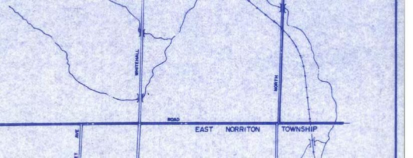


224 Report Attachments Page 212 of 215


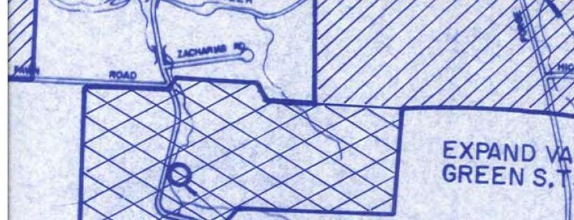


225 Report Attachments Page 213 of 215


226 Report Attachments Page 214 of 215

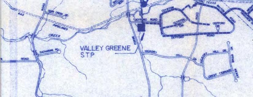


227 Report Attachments Page 215 of 215