City of Elmhurst Comprehensive Flooding Plan Task Force Meeting
|
|
|
- Barnard Dennis
- 5 years ago
- Views:
Transcription
1 April 26, 2011 City of Elmhurst Comprehensive Flooding Plan Task Force Meeting Prepared by CBBEL RJN Group
2 Meeting Overview Progress Report on Comprehensive Plan Sanitary Sewer System Storm Sewer System Task Force Individual Groups Public Sanitary Sewer Infrastructure Stormwater System Public Infrastructure Individual Home Flood Proofing Public Education Commonwealth Edison and Electric Power Reconvene Conclusion
![[FEET] 596.0 594.0 592.0 590.0 588.0 586.0 584.0 582.0 580.0 578.0 576.0 574.0 572.0 570.0 568.0 566.0 564.0 562.0 560.0 558.](/docs-images/85/91310116/images/3-2.jpg "0 556.0 554.0 552.0 Diameter 0.0 500.0 1000.0 1500.0 2000.0 2500.0 3000.0 3500.0 4000.0 4500.")
![0 [FEET] SWMM EXTRAN, WATER LEVEL LINKS - 18-4-2003 08:49 ROCKY_PROJ_FLOW_1.](/docs-images/85/91310116/images/3-4.jpg "prf [m] Sanitary Sewer System Work Plan TASK 1 I/I Reduction TASK 6 Sanitary Sewer Assessment TASK 3 SCADA System TASK 7")

3 [FEET] Diameter [FEET] SWMM EXTRAN, WATER LEVEL LINKS :49 ROCKY_PROJ_FLOW_1.prf [m] Sanitary Sewer System Work Plan TASK 1 I/I Reduction TASK 6 Sanitary Sewer Assessment TASK 3 SCADA System TASK 7 Wet-Weather Plan SBA-269 SBA-269A SBA-270 SBA-271 SBA-272 SBA-305 SBA-306 SBA-377 SBA-378 SBA-379 SBA-380 SBA-381 SBA-382 SBA-383 SBA-384 SBA-388 SBA-389 SBA-390 SBA-391 SBA-392 TASK 8 Risk Assessment of Alternatives TASK 9 Presentation for City Council TASK 2 Overhead Sewers TASK 5 Lift Station Recommendations TASK 4 Lift Station Operations

4 Task 1- Reduction in Infiltration / Inflow Data Review Manhole / Smoke Testing Television Inspection Private Property Program Update ESO Activation History Lining / Rehabilitation Overhead sewer locations Update City GIS

5 Reported Sanitary Sewer Backup Locations

6 Lining Program- South Elmhurst
7 [FEET] Diameter [FEET] SWMM EXTRAN, WATER LEVEL LINKS :49 ROCKY_PROJ_FLOW_1.prf [m] Sanitary Sewer System Work Plan TASK 1 I/I Reduction TASK 6 Sanitary Sewer Assessment TASK 3 SCADA System TASK 7 Wet-Weather Plan SBA-269 SBA-269A SBA-270 SBA-271 SBA-272 SBA-305 SBA-306 SBA-377 SBA-378 SBA-379 SBA-380 SBA-381 SBA-382 SBA-383 SBA-384 SBA-388 SBA-389 SBA-390 SBA-391 SBA-392 TASK 8 Risk Assessment of Alternatives TASK 9 Presentation for City Council TASK 2 Overhead Sewers TASK 5 Lift Station Recommendations TASK 4 Lift Station Operations
8 Task 2 - Overhead Sewer Program Current Program Review Homes completed / Waiting List Comparison to local communities Clustering of targeted homes

9 GIS Map of Overhead Sewer Locations
10
11

12 Task 2 - Overhead Sewer Program Current Program Review Homes completed / Backlogged Comparison to local communities Comparison to backflow prevention options Role in Short / Long Term Plan Short term protection for limited number of homes Residents then have sump pumps / power outages?
13 Task 2 - Overhead Sewer Program Current Program Review Homes completed / Backlogged - Max. $5,000 cost share Comparison to local communities Comparison to backflow prevention options Role in Short / Long Term Plan Short term protection for limited number of homes Residents now have sump pumps / power outages? Chronic backup locations / lowest basement bottom elevations

14 Backup Protection- Clean Check Valve

15 Clean Check Replaces Existing Cleanout
16 Backup Protection- Clean Check Valve Less expensive than overhead sewer/no power required Requires the following criteria: - No directly connected foundation drain - No directly connected storm sumps or other storm water connections to sanitary sewer
17 [FEET] Diameter [FEET] SWMM EXTRAN, WATER LEVEL LINKS :49 ROCKY_PROJ_FLOW_1.prf [m] Sanitary Sewer System Work Plan TASK 1 I/I Reduction TASK 6 Sanitary Sewer Assessment TASK 3 SCADA System TASK 7 Wet-Weather Plan SBA-269 SBA-269A SBA-270 SBA-271 SBA-272 SBA-305 SBA-306 SBA-377 SBA-378 SBA-379 SBA-380 SBA-381 SBA-382 SBA-383 SBA-384 SBA-388 SBA-389 SBA-390 SBA-391 SBA-392 TASK 8 Risk Assessment of Alternatives TASK 9 Presentation for City Council TASK 2 Overhead Sewers TASK 5 Lift Station Recommendations TASK 4 Lift Station Operations
18 Task 3 - SCADA System Assessment of Saylor Jackson Completed in 2010 Review existing SCADA System Recommendations for SCADA System Upgrades Develop Technical Memorandum
19 [FEET] Diameter [FEET] SWMM EXTRAN, WATER LEVEL LINKS :49 ROCKY_PROJ_FLOW_1.prf [m] Sanitary Sewer System Work Plan TASK 1 I/I Reduction TASK 6 Sanitary Sewer Assessment TASK 3 SCADA System TASK 7 Wet-Weather Plan SBA-269 SBA-269A SBA-270 SBA-271 SBA-272 SBA-305 SBA-306 SBA-377 SBA-378 SBA-379 SBA-380 SBA-381 SBA-382 SBA-383 SBA-384 SBA-388 SBA-389 SBA-390 SBA-391 SBA-392 TASK 8 Risk Assessment of Alternatives TASK 9 Presentation for City Council TASK 2 Overhead Sewers TASK 5 Lift Station Recommendations TASK 4 Lift Station Operations

20 Task 4 - Lift Station Operations Evaluate Current Situation Pump / Force Main Capacity Wet well configuration Backup power / reliability history Downstream capacity Force main break history Field calibration
21 [FEET] Diameter [FEET] SWMM EXTRAN, WATER LEVEL LINKS :49 ROCKY_PROJ_FLOW_1.prf [m] Sanitary Sewer System Work Plan TASK 1 I/I Reduction TASK 6 Sanitary Sewer Assessment TASK 3 SCADA System TASK 7 Wet-Weather Plan SBA-269 SBA-269A SBA-270 SBA-271 SBA-272 SBA-305 SBA-306 SBA-377 SBA-378 SBA-379 SBA-380 SBA-381 SBA-382 SBA-383 SBA-384 SBA-388 SBA-389 SBA-390 SBA-391 SBA-392 TASK 8 Risk Assessment of Alternatives TASK 9 Presentation for City Council TASK 2 Overhead Sewers TASK 5 Lift Station Recommendations TASK 4 Lift Station Operations
22 Task 5 - Recommendations for Lift Station Operations Short Term Solutions: ESO s Activation / Lift Station Operations Existing Pump/Force main Modifications SCADA System Modifications Long Term Solutions: Conduct Hydraulic Modeling of Lift Stations / Sewers / ESO s Force main outlet rerouting Major lift station expansion
23 [FEET] Diameter [FEET] SWMM EXTRAN, WATER LEVEL LINKS :49 ROCKY_PROJ_FLOW_1.prf [m] Sanitary Sewer System Work Plan TASK 1 I/I Reduction TASK 6 Sanitary Sewer Assessment TASK 3 SCADA System TASK 7 Wet-Weather Plan SBA-269 SBA-269A SBA-270 SBA-271 SBA-272 SBA-305 SBA-306 SBA-377 SBA-378 SBA-379 SBA-380 SBA-381 SBA-382 SBA-383 SBA-384 SBA-388 SBA-389 SBA-390 SBA-391 SBA-392 TASK 8 Risk Assessment of Alternatives TASK 9 Presentation for City Council TASK 2 Overhead Sewers TASK 5 Lift Station Recommendations TASK 4 Lift Station Operations

24 Task 6 - Sanitary Sewer System Assessment Develop XP SWMM Hydraulic Model GPS Survey manhole elevations GPS Survey basement elevations
25 Skeletal Hydraulic Model
26 All 13 ESO s Included in Model


27 Flow Monitoring

28 Flow Meter Locations

29 Flow Metering Schematic
30 Recent Rainfall Summary
31 Typical Flow Hydrograph Direct Inflow FLOW RATE High Groundwater Infiltration (indirect inflow) INCHES Rain Wastewater production Base infiltration TIME
32 Task 6 - Sanitary Sewer System Assessment Sub Basins Assessment Determine wet weather flow rates from flow monitoring and SCADA / Prioritize Basins Selective manhole inspection / smoke testing Southwest Elmhurst focus Select various ages of construction Budget constraints = Very Small Sample Extrapolate results of sample
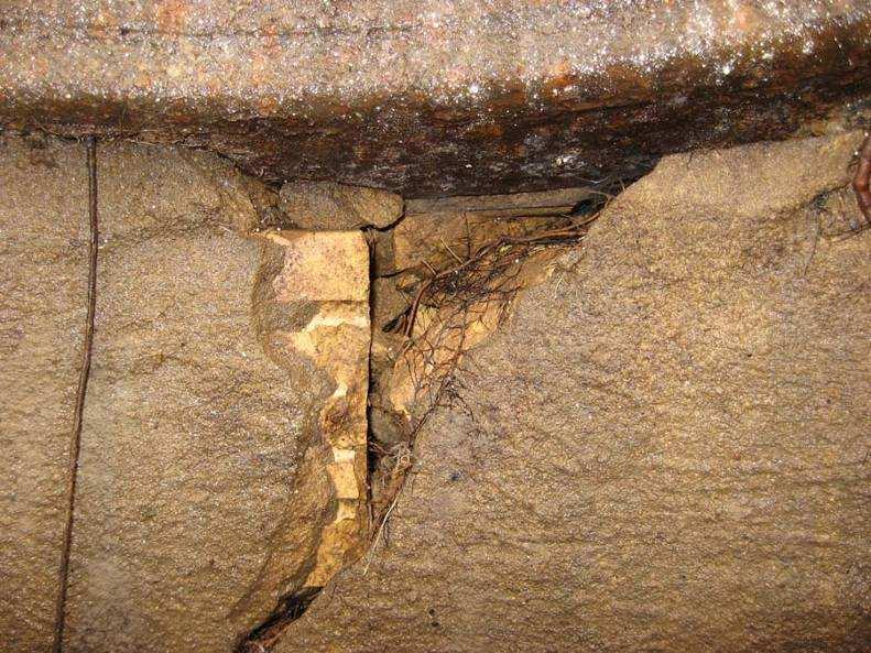

33 Manhole Infiltration/Inflow Defects


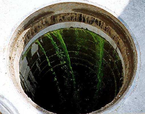
34 Typical I/I Sources- Smoke Testing


35 Typical I/I Sources Smoke Testing
36 [FEET] Diameter [FEET] SWMM EXTRAN, WATER LEVEL LINKS :49 ROCKY_PROJ_FLOW_1.prf [m] Sanitary Sewer System Work Plan TASK 1 I/I Reduction TASK 6 Sanitary Sewer Assessment TASK 3 SCADA System TASK 7 Wet-Weather Plan SBA-269 SBA-269A SBA-270 SBA-271 SBA-272 SBA-305 SBA-306 SBA-377 SBA-378 SBA-379 SBA-380 SBA-381 SBA-382 SBA-383 SBA-384 SBA-388 SBA-389 SBA-390 SBA-391 SBA-392 TASK 8 Risk Assessment of Alternatives TASK 9 Presentation for City Council TASK 2 Overhead Sewers TASK 5 Lift Station Recommendations TASK 4 Lift Station Operations
37 Task 7 - Wet-Weather Flow Reduction Plan / Cost Long Term Improvements Wet Weather Flow Reduction Public Sector I/I reduction Private Sector I/I reduction Private Property Backflow Prevention System Hydraulic Conveyance Improvements Lift Station Improvements Lift Station Force main modifications In-system storage Additional relief sewers/wwtp Expansion Incorporate Green Infrastructure Solutions Integrate Solutions with Stormwater System Solutions


38 Manhole Rehabilitation Permacast Raven 405

39

40
41 Driveway Drains Recommended For Removal in 1988 Currently Legal Non-Conforming Status High Flow Rate / High Cost and Impact to Homeowner of Rerouting Localized Impact on Sewer Backups Can Be Large - Including Southwest Elmhurst
 Stairwell drains/window well drains Directly Connected Foundation")
42 Additional Private Property Sources Not typically removed in 1980 s program Combination Sump Pumps (Washroom in basement) Stairwell drains/window well drains Directly Connected Foundation drains

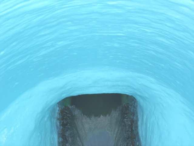
43 Directly Connected Foundation Drain

44 Task 7 - Wet-Weather Flow Reduction Plan / Cost - Challenges Long Term Improvements In-system storage High cost and availability of property Additional relief sewers/wwtp Expansion Elmhurst WWTP Permit has maximum flow limit
45 [FEET] Diameter [FEET] SWMM EXTRAN, WATER LEVEL LINKS :49 ROCKY_PROJ_FLOW_1.prf [m] Sanitary Sewer System Work Plan TASK 1 I/I Reduction TASK 6 Sanitary Sewer Assessment TASK 3 SCADA System TASK 7 Wet-Weather Plan SBA-269 SBA-269A SBA-270 SBA-271 SBA-272 SBA-305 SBA-306 SBA-377 SBA-378 SBA-379 SBA-380 SBA-381 SBA-382 SBA-383 SBA-384 SBA-388 SBA-389 SBA-390 SBA-391 SBA-392 TASK 8 Risk Assessment of Alternatives TASK 9 Presentation for City Council TASK 2 Overhead Sewers TASK 5 Lift Station Recommendations TASK 4 Lift Station Operations
46 Task 8 - Risk Assessment for Alternatives Maximize Number of Homes Protected Soonest for Least $$$
47 Task 8 - Risk Assessment for Alternatives Maximize Number of Homes Protected Soonest for Least $$$ Define Level of Protection Storm recurrence interval (i.e., 10-year)) Storm of record (i.e., July, 2010) Incorporate Available Grant / Loan Programs IEPA Revolving Fund Loans Illinois Green Infrastructure Grant Program
48 Project Status Elmhurst Comprehensive Flood Plan - Sanitary Sewer System Project Status 3/1/11 3/31/11 5/1/11 5/31/11 7/1/11 7/31/11 8/31/11 9/30/11 10/31/11 11/30/11 Task 1 - Reduction of Inflow/Infiltration Task 2 - Evaluation of City's Overhead Sewer Program Task 3 - Review of SCADA System Task 4 - Evaluation of the Lift Station Operation Task 5 - Recommendation for Lift Station System Operations Task 6 - Assessment of the Sanitary Sewer System Task 7 - Wet Weather Flow Reduction Plan and Cost Task 8 - Risk Assessment for Alternatives Task 9 - Presentations at City Council Meetings Series1 Completed *Project Status as of 4/26/11


49 Stormwater Analysis Work Plan TASK 1 Flood Map COMPLETED TASK 4 Compensatory Storage Analysis TASK 5 Risk Assessment for Alternatives TASK 8 Elevation of New Structures TASK 2 Computer Modeling of Ten Subbasins IN PROGRESS TASK 3 Alternatives Analysis IN PROGRESS TASK 6 Individual House Flood Proofing TASK 7 Review of Stormwater Requirements IN PROGRESS TASK 9 Presentation for City Council IN PROGRESS
50 Storm Sewer System - Project Update Task 1 Flood Map (Complete) Compiled 500 flood questionnaires from June/July 2010 flooding based on flooding type. Sanitary sewer backup (183) Yard/street flooding (52) Overland flow (56) Unspecified flooding type (182) Sump pump failure (26) Salt Creek (0) Created GIS database of June/July 2010 flood questionnaires based on location and flooding type.


51 Storm Sewer System - Project Update Task 1 Flood Map (Complete)
 Identified ten storm sewer study areas.")
52 Task 2 - Computer Modeling of Ten Basins (In Progress) Identified ten storm sewer study areas. 52
53 Task 2 - Computer Modeling of Ten Basins (In Progress) Reviewed available background information pertaining to the storm sewer system. GIS storm sewer database Pump station plans Previous studies Site visits by CBBEL staff to verify existing conditions. Currently in the process of identifying survey requirements for the project.
54 Task 2 - Computer Modeling of Ten Basins (In Progress) Initiated development of hydrologic and hydraulic computer modeling for five study areas: Study Area #1 (Pine Street) Study Area #2 (Geneva Avenue) Study Area #3 (York St to Salt Creek, between McKinley Ave and Butterfield Rd) Study Area #4 (York St to Salt Creek, between McKinley Ave and IL Prairie Path) Study Area #6 (Seminole Ave)

55 Overview of Pine Street Study Area Pine Street is a depressional area ( bowl ) with a storm sewer outlet. The lowest rim elevations of the storm sewer system are located at Pine Street, making it the first location of surcharge when the system s capacity is exceeded. The elevations of the houses on Pine Street are close to the overtopping elevation of the 55 overland flow route for this area.

56 Overview of Geneva Study Area Geneva Avenue is a low area in the middle of an overland flow path toward East End Park. Overland flow from the west is blocked by the houses on the east side of the street. 56 As East End Park fills up, houses will see water from the east as well.

57 Overview of Southwest Study Area
58 Overview of Southwest Study Area During intense storm events when the capacities of the inlets/storm sewers are exceeded, the flow of stormwater does not follow the storm sewer drainage boundaries (yellow lines) but rather the overland flow routes (red arrows) toward the low-lying areas. The storm sewer inlets in the low areas may see stormwater runoff from areas that are times the size of the tributary area that they were designed to handle. The most severe cases are located at: Washington St between McKinley Ave and Madison St Vallette St and Swain Ave

59 Reverse-Slope Driveways Southwest Elmhurst There are 64 homes with reverse-slope driveways in Southwest Elmhurst.

60 Overview of Seminole Study Area An area of 179 acres drains to the low spot located at Seminole and Cottage Hill via storm sewer and overland flow. A single 48-inch pipe outlets the low spot with no existing overland flow route. 60

61 Task 2 - Computer Modeling of Ten Basins (In Progress) Hydrologic Model: Identify drainage patterns, delineate drainage boundaries, and determine existing land use.


62 Task 2 - Computer Modeling of Ten Basins (In Progress) Hydraulic Model Input storm sewer information into computer models: Length Diameter Overland flow routes Invert and rim elevations Pipe material Stormwater pumping station information Flood storage (depressional areas) 62
63 Task 3 Alternatives Analysis (In Progress) Initiated development of concept-level drainage improvements. Investigated viability of creating overland flow routes. Determined potential flood storage in open spaces. Evaluated feasibility of relief sewers/overland flow routes in combination with flood storage.
64 Task 3 Alternatives Analysis (In Progress) Computer modeling will analyze the effectiveness of the proposed drainage improvements. Proposed drainage improvements may include: Upsizing storm sewers. Creating new overland flow routes. Excavating flood storage. Oversizing storm sewers where practical. Diverting runoff within a subbasin.
65 Creation of Overland Flow Routes Solution for flood problem areas located in a bowl with only a storm sewer outlet. Examples include: Washington Street Pine Street Larch Avenue Seminole Avenue Geneva Avenue Re-grade roads to provide an overland gravity outlet at an elevation lower than homes in the bowl. The areas in red would have greater impacts on existing infrastructure because the re-graded streets have utilities beneath them, which include: water, sanitary, electric, cable, and gas.

66 Overland Flow Routes Example Pine Street EXISTING OVERLAND FLOW ROUTE AT AN ELEVATION OF FT 66

67 Overland Flow Routes Example Pine Street REGRADE 1 st STREET TO OVERTOP AT ELEVATION OF FT* *WOULD REQUIRE RELOCATION OF STORM, SANITARY, ELECTRIC & WATER UTILITIES 67
68 Potential Flood Storage Sites Look at elevation of existing sewers and existing land. Drag relief sewer over to flood storage. Outlet flood storage to existing storm sewer. Avoid pump-evacuated to maintain function of land. POTENTIAL FLOOD STORAGE SITES 1 3 2
69 Flood Storage - SW Elmhurst Location ID Location Name 1 Potential Flood Storage (Acre-feet) 1 Early Childhood Elementary School Bryan Middle School Jackson Elementary School Christ United Methodist Church POTENTIAL FLOOD STORAGE SITES

70 Flood Storage - SW Elmhurst Location ID Location Name Potential Flood Storage (Acre-feet) 4 Pioneer Park York Commons Park POTENTIAL FLOOD STORAGE SITES
 1 East End Park 31.0 2 Golden Meadows Park 27.")
71 Flood Storage - NE Elmhurst Location ID Location Name Potential Flood Storage (Acre-feet) 1 East End Park Golden Meadows Park POTENTIAL FLOOD STORAGE SITES 2 71

72 Flood Storage Example Early Childhood Elementary School PROPOSED RELIEF SEWER PROPOSED OUTLET PIPE PROPOSED FLOOD STORAGE

73 Task 4 - Compensatory Storage Analysis To be started upon completion of Task 3 - Alternatives Analysis. For proposed drainage alternatives that result in increased discharges to Salt Creek, compensatory storage will be required to offset the increases. Determine the required compensatory storage volume using: Salt Creek FEQ model Aerial photography DuPage County two-foot topography
.")

74 Task 5 - Risk Assessment for Alternatives To be started upon completion of Tasks 3 & 4. Incorporate results of alternatives analysis (Task 3). Determine cost estimates of proposed drainage improvements and compare to the level of flood. Make recommendations based on the costeffectiveness of each alternative.
75 Task 6 - Individual House Flood Proofing To be started upon completion of Tasks 3 5. Assess flood proofing of individual residents. Glass block windows Raised window wells Rear/side yard swales Driveway modification Compare cost-effectiveness of flood proofing to that of largescale public drainage improvements. Cost-effectiveness determined by comparing installation cost to the increased level of flood protection.
76 Task 7 - Review of Stormwater Requirements/Practices for Single Family Houses (In Progress) Reviewed City-provided study of ten recently redeveloped single-family properties. Compared pre- and post-construction impervious area. Pre-construction generally consisted of a small home, detached garage, and long driveway. Post-construction generally consisted of a larger home, attached garage, and shorter driveway. Findings: Average increase in impervious area = 1.4% Largest increase in impervious area = 13% Largest decrease in impervious area = 15%


77 Redevelopment Example Impervious Area Comparison
78 Task 8 Elevation of New Structures To be started upon completion of Tasks 2 and 3. Develop building elevation requirements based on flood elevations determined from computer modeling.
79 Task 9 Presentations at Meetings (In Progress) Work to date includes: Bi-weekly updates to City staff. First Stormwater Task Force Meeting.
80 Project Status
81 Stormwater System Analysis Next Steps: Finalize survey needs and perform field survey. Obtain high water marks from July 2010 storm. Finalize existing conditions computer modeling and calibrate to high water marks. Begin proposed conditions computer modeling.
82 Stormwater Task Force Objectives Public Sanitary Sewer Infrastructure Recommend alternatives for reducing sanitary sewer overflows and basement backups. Observations of reverse-slope driveway flooding during less severe storm events. Known reconnections of sump pumps and down spouts to sanitary sewer. Coordination with Public Education Task Force regarding sanitary issues.
83 Stormwater Task Force Objectives Stormwater System Public Infrastructure Consider green space constraints for flood storage. Review of flood questionnaire exhibits. Identify other areas of overland flooding that didn t have questionnaire. Gather known high water marks throughout study areas. Debris marks on houses, trees, etc. Observations made during the flooding by the residents. Blocked inlets, methods of entry into homes, etc. Coordination with Public Education Task Force regarding stormwater issues.
84 Stormwater Task Force Objectives Individual Home Flood Proofing Identify overland flow routes with blockages or obstructions. Methods of flood proofing reverse-slope slope driveways. Review flood proofing material (provided by CBBEL). Feasibility of creating side and rear yard swales. Investigate feasibility of allocating public funds for installation of Clean Check valves.
85 Stormwater Task Force Objectives Public Education Identify media sources that can be used to educate public on flood control (City website, newsletter, local newspapers, etc.). Coordinate with other Task Forces regarding issues. Provide information from consultant/task force to City residents.
86 Stormwater Task Force Objectives Commonwealth Edison and Electric Power Review of ComEd power distribution grid for the community. Compare Elmhurst s situation to that of other cities. Work with ComEd representatives to understand appropriate measures moving forward. Coordinate with Public Education Task Force to translate information to the public.