Section 42A Report. Transpower New Zealand Limited North Island Grid Upgrade. A Report prepared for the Board of Inquiry
|
|
|
- Brianne Mills
- 5 years ago
- Views:
Transcription
1 Section 42A Report Transpower New Zealand Limited North Island Grid Upgrade A Report prepared for the Board of Inquiry January 2008
2 i TABLE OF CONTENTS Page 1. INTRODUCTION Scope of the Report 2 2. OVERVIEW OF THE APPLICATIONS Notices of Requirement Resource Consent Applications Auckland Region Waikato Region 9 3. STATUTORY FRAMEWORK Introduction NOTICES OF REQUIREMENT Statutory Assessment Section 171 of the RMA Part II of the RMA Section 171 Considerations National Policy Statements / New Zealand Coastal Policy Statement Regional Council Statutory Documents District Council Statutory Documents Consideration of Alternative Sites, Routes, or Methods Necessity for the Work Part II Considerations Summary RESOURCE CONSENT APPLICATIONS Statutory Assessment Section 104 of the RMA Part II of the RMA Section 104 Considerations Actual and Potential Effects Relevant Planning Provisions Other Matters Section 105 Matters 43
3 ii 5.3 Part II Considerations Summary KEY ISSUES Overview Analysis of Key Issues Visual Intrusion/Landscape Effects Electric and Magnetic Fields ( EMF ) Alternatives Justification for the Proposal Economic Effects ADEQUACY OF INFORMATION Introduction NOR Adequacy Electric and Magnetic Fields Landscape Assessment Resource Consent Applications Part II Matters Submissions Section 141 Matters Summary CONCLUDING STATEMENT 57 LIST OF FIGURES 1: Proposed Transmission Line Route. 5 LIST OF TABLES 1: North Island Grid Upgrade Notices of Requirement Components and Anticipated Commissioning Dates. 6 2: Summary of issues raised by submitters. 47
4 iii APPENDICES Appendix I Appendix II Appendix III Appendix IV Appendix V Auckland Regional Policy Statement (Relevant Provisions) Auckland Regional Plan: Air, Land and Water (Relevant Provisions) Auckland Regional Plan: Sediment Control (Relevant Provisions) Waikato Regional Policy Statement (Relevant Provisions) Waikato Regional Plan (Relevant Provisions) Relevant District Council Objectives and Policies Standard Submission Form
5 1 1. INTRODUCTION On 28 May 2007 Transpower New Zealand Limited ( Transpower ) lodged Notices of Requirement ( NOR ) with seven Councils in Auckland and the Waikato to enable them to designate land for the construction, operation and maintenance of a new electricity transmission link (including substations and underground cables) between Whakamaru and South Auckland. Resource consent applications in relation to earthworks and related activities such as track construction and stream crossings were subsequently lodged with the Auckland Regional Council ( ARC ) and Waikato Regional Council ( Environment Waikato ) in June and July At times, and for ease of understanding, we refer to the NOR and resource consent applications collectively as the applications. In summary, Transpower proposes to undertake the following works as part of the project: Extensions to the existing 220kV substation at Otahuhu. New 220kV underground electricity cables from Brownhill Road to the Otahuhu Substation. Replacement of the existing 110kV substation at Pakuranga with a 220kV substation. New 220kV underground electricity cables from Brownhill Road to the Pakuranga Substation. A new 400/220kV substation at Brownhill Road. A 400kV capable overhead transmission line network some 185 km long from Whakamaru Substation to Brownhill Road in Manukau City. Extensions to the existing substation and a new substation at Whakamaru in Taupo District. The proposal would only move to a 400kV operation when demand requires (expected to be around 2033) and this would require later approval for and commissioning of 220 kv/400 kv transformers and associated switchyards near the existing Whakamaru substation and in the South Auckland area. On 8 August 2007 (acting pursuant to s 141A of the Resource Management Act 1991 ( RMA ), Hon Pete Hodgson acting for the Minister for the Environment called-in the notices of requirement and applications for resource consent lodged by Transpower because he considered it to be a matter of national significance. In accordance with sections 140 to 150 of the RMA, the Minister publicly notified Transpower s application, sought public submissions and referred the proposal to a Board of Inquiry.
6 2 1.1 SCOPE OF THE REPORT This report is prepared under the provisions of s 42A of the RMA. Section 42A(1) provides for a Council officer or consultant to prepare a report of relevant information provided by the applicant or any person who made a submission on any matter described in s 39(1), and allows the decision-maker (Council, or Board of Inquiry as in this case) to consider the report at the hearing. Section 39(1) states: 39 Hearings to be public and without unnecessary formality (1) Where a local authority, a consent authority, or a person given authority to conduct hearings under any of sections 33, 34, [34A,] 117, 146, [202, or [[357C]] ], holds a hearing in relation to (b) An application for a resource consent; or (f) A requirement for a designation or heritage order; Section 41(4) of the RMA allows the decision-maker to request and receive from any person who makes a report under s 42A "any information or advice that is relevant and reasonably necessary to determine the application". In accordance with s 42A, and matters described in s 39(1) this report covers the following: An overview of the NOR documentation and resource consent applications lodged by Transpower. A review of the statutory framework in respect to the calling in of Transpower s proposal, and the directions of the RMA for considering the NOR and the resource consent applications. A review of the NOR documentation in accordance with s 171 of the RMA and the adequacy of information provided. A review of the resource consent applications in accordance with s 104 of the RMA and the adequacy of information provided. Identification of the key issues in the NOR, resource consent applications and public submissions. An analysis of the adequacy of information provided by Transpower in the NOR and resource consent applications. A generic brief was given for this assessment that did not request a specific level of detail, nor specify the level of assessment required. Accordingly, this report provides a broad, high level review of information adequacy and the planning information available. A comprehensive analysis/technical audit of all the material contained in the 17 volumes of information provided by Transpower was beyond the scope of this assessment. Rather, a broad judgment of the overall assessment undertaken by the applicant has been made (as informed by the submissions received), however a more detailed assessment of two key issues (landscape and electromagnetic field issues) has been undertaken.
7 3 We acknowledge that experts within specific fields may differ in opinion as to the overview comments we have made in relation to issues and information adequacy. In this regard, we would expect expert opinion on more detailed matters to be required (and presented) during the hearing.
8 4 2. OVERVIEW OF THE APPLICATIONS 2.1 NOTICES OF REQUIREMENT As outlined in Section 1, Transpower lodged NOR with seven Councils in the Auckland and Waikato regions to enable them to designate land for the construction, operation and maintenance of a new electricity transmission link (including substations and underground cables) between Whakamaru and South Auckland. The seven territorial authorities who administer the land that the route of the proposed transmission line traverses are: Manukau City Council Franklin District Council Waikato District Council Matamata-Piako District Council Waipa District Council South Waikato District Council Taupo District Council The overhead line would begin at the Whakamaru Substation and traverse land through the Taupo, South Waikato, Waipa, Matamata-Piako, Waikato and Franklin Districts, terminating at Brownhill Road in Manukau City. The route is some 185 km long and the proposed designation corridor is a minimum of 65 m wide (although in some places it will be wider to allow for conductor swing or specific design components). The line will cross local authority roads and State highways, the East Coast Main Trunk Railway Line, several streams and rivers (including the Waikato River), small areas of land owned by the Crown and some 297 private properties. The proposed transmission line route is illustrated in Figure 1. The proposal also includes ancillary activities such as accesses to the route corridor when they are within the designated area, fencing, safety and directional signage, and the removal of the Arapuni to Pakuranga A 110kV ( ARI-PAK A ) line. The NOR components of the project have been designed in stages as set out in Table 1 below. This is to take into account the timing of other National Gird improvements such as works on other lines and connections (i.e. the Otahuhu system hub), allows the project to meet the immediate requirements by 2011, and allows monitoring of demand growth and adjustment (if necessary) to the timing of subsequent stages.

9 Figure 1: Proposed Transmission Line Route. 5
10 6 Table 1: North Island Grid Upgrade Notices of Requirement Components and Anticipated Commissioning Dates. Date NOR Location Work 2008 to 2009 Otahuhu Construct a new 220kV substation and install voltage support equipment Overhead line route and other areas Decommission and commence removal of ARI-PAK A line Otahuhu Install equipment to terminate the 220kV connections to Pakuranga. Pakuranga New 220kV substation to Pakuranga. Pakuranga New 220kV substation to Pakuranga. Underground cable Underground 220kV cable section, route (Pakuranga to Pakuranga to Brownhill (two circuits). Brownhill) Brownhill Transition station (overhead line / underground cable connections). Overhead line route 400kV capable line, initially operating at 220kV. Overhead line route Completed removal of ARI-PAK A line. Whakamaru Substation upgrades at existing Whakamaru substation. Whakamaru 220kV substation developed to 2017 Otahuhu Install new equipment to terminate the cables from Brownhill. Pakuranga Further minor upgrade work at Pakuranga to 2023 Otahuhu Install new cable termination equipment. Install dynamic voltage support equipment. Brownhill Substation switchgear added at Brownhill. Underground Cable Underground 220kV cable sections from Route (Otahuhu to Otahuhu to Brownhill (two circuits) one in Brownhill) 2021 and the second in Otahuhu Install further dynamic voltage support equipment Whakamaru Install new equipment Otahuhu Install further voltage support to 2031 Otahuhu Install further voltage support. Underground Cable Implement forced cooling of Pakuranga to Route (Pakuranga to Brownhill Cables. Brownhill) 2033 Otahuhu Install new cable termination equipment at Otahuhu. Implement forced cooling of Otahuhu to Brownhill cables. Underground Cable Route (Otahuhu to Brownhill) Brownhill 400kV substation developed. Overhead line route Overhead line operates at 400kV. Whakamaru North 400kV substation developed to 2038 Otahuhu Install additional interconnecting transformer capacity to 2042 Otahuhu Install further voltage support equipment.
11 7 2.2 RESOURCE CONSENT APPLICATIONS Transpower has also lodged applications for a number of resource consents from the ARC and Environment Waikato, as detailed below Auckland Region Transpower applied for resource consents with the ARC in June 2007 for work associated with the construction and installation, use, operation and maintenance of a new 220kV underground transmission cable between the Pakuranga Substation and Brownhill Road, and for works that are proposed to be located within the area of the Notice of Requirement for designation of the over head line section. The application also intrudes into the area of the NOR for designation for the Brownhill Substation. In July 2007 Transpower applied for further resource consents from the ARC for work associated with the construction of towers for the new (400kV-capable) transmission line and ancillary works, including tower access and some topographic modification within the designated area. Resource consent applications to the ARC are as follows: Pakuranga to Brownhill Underground Cable Resource Consents Land Use Consent for earthworks (including but not limited to trenching, excavation test pits, geotech drilling, backfilling or clean filling) to enable the installation and maintenance of a 220kV underground transmission cable inside and outside any sediment control protection area. Discharge of Contaminants to land from ancillary activities that produce wastewater or washwater, such as: - The use of chemical cracking rock breaking techniques. - Dewatering sediment laden water from the trenches. - The washing of vehicles, plant or machinery. - Geotechnical drilling activities. - Dust suppression. - Concrete or asphalt laying or reworking, associated with the installation and maintenance of the 220kV underground cable. Works in the Bed of a Watercourse for the following activities: - To trench through a watercourse for the installation and maintenance of a 220kV transmission cable structure under the bed of the unnamed watercourse immediately north of Ti Rakau Drive adjacent to a Manukau City Council Stormwater Management Area. - Placement of a bridge over the bed of the Turanga Creek, Brownhill Road, Whitford for the installation and maintenance of a 220kV
12 8 transmission cable, including the placement of abutments and a reno matress on the streambanks. - Placement of two culverts in the bed of the Maungemaungeroa Stream, Caldwells Road, East Tamaki, including the placement of fill above those culverts for the installation and maintenance of a 220kV transmission cable. - Placement of a bridge over the Maungemaungeroa Stream, Caldwells Road, East Tamaki for the installation and maintenance of a 220kV transmission cable. - Placement of a culvert and fill over an unnamed stream directly above Dunvegan Rise (and below Point View Drive) East Tamaki, including the associated disturbance of the streambed for the installation and maintenance of a 220kV transmission cable. - Landuse consent for the placement of a bridge over an unnamed stream directly above Dunvegan Rise (and below Point View Drive) East Tamaki, including the associated disturbance of the streambed for the installation and maintenance of a 220kV transmission cable. Diversion of Surface Water for the following activities: - Diversion of stream flow associated with the placement of two culverts in the bed of the Maungemaungeroa Stream, Caldwells Road, East Tamaki for the installation and maintenance of a 220kV transmission cable. - Diversion of stream flow associated with the placement of a bridge over the Maungemaungeroa Stream, Caldwells Road, East Tamaki for the installation and maintenance of a 220kV transmission cable. Overhead Line and Brownhill Substation Resource Consents Land Use Consent for earthworks (including but not limited to benching, foundation excavation, topographic modifications, geotech drilling, backfilling or clean filling) to enable the construction of tower foundations inside and outside any sediment protection control area. Earthworks for roading and tracking to enable access to the tower construction sites inside and outside any sediment protection control area. Discharge of Contaminants to land from ancillary activities that produce wastewater or washwater, such as: - The use of chemical cracking rock breaking techniques. - Dewatering sediment laden water from the trenches. - The washing of vehicles, plant or machinery. - Geotechnical drilling activities.
13 9 - Dust suppression. - Concrete laying or reworking, associated with the installation of the tower foundations Waikato Region Transpower applied for the following resource consents from Environment Waikato in July 2007: Overhead Line and Whakamaru North Substation Resource Consents Land Use Consent for vegetation clearance and earthworks associated with tower site preparation and access tracks within the Designated Area in High Risk Erosion Areas. Discharge Permit for the composting of vegetation (>20m 3 per site) for composting/mulching of vegetation generated through vegetation trimming and clearance. Land Use Consent for the drilling of tower foundation below the water table. Discharge Permit for the discharge of site water and drilling fluids from drilling activities into surface water.
14 10 3. STATUTORY FRAMEWORK 3.1 INTRODUCTION As noted in Section 1, the Minister called-in Transpower s NOR and applications for resource consent under s 141A of the RMA after considering the proposal to be a matter of national significance. Section 141B(2) of the RMA provides guidelines for establishing whether the threshold of national significance is met. Section 141B(2) states: 141B Minister's power to call in matters that are or are part of proposals of national significance (2) In deciding whether a matter is or is part of a proposal of national significance, the Minister may have regard to any relevant factor, including whether the matter (a) has aroused widespread public concern or interest regarding its actual or likely effect on the environment, including the global environment; or (b) involves or is likely to involve significant use of natural and physical resources; or (c) affects or is likely to affect any structure, feature, place, or area of national significance; or (d) affects or is likely to affect more than one region or district; or (e) affects or is likely to affect or is relevant to New Zealand's international obligations to the global environment; or (f) involves or is likely to involve technology, processes, or methods which are new to New Zealand and which may affect the environment; or (g) results or is likely to result in or contribute to significant or irreversible changes to the environment, including the global environment; or (h) is or is likely to be significant in terms of section 8 (Treaty of Waitangi). Section 141C provides the form and effect of the Ministers direction: 141C Form and effect of Minister's direction A direction by the Minister under section 141B(1) must (a) be in writing signed by the Minister; and (b) state the reasons for calling the matter in; and (c) be served on the local authority that would have been required to process and decide the matter if the Minister had not made the direction; and (d) be served, (i) if the matter has not yet come before the local authority, as soon as practicable after the direction is made: (ii) if the matter has come before the local authority and no hearing is to be held on it, before the authority notifies its decision or recommendation on the matter: (iii) if the matter has come before the local authority and a hearing is to be held on it, at least 5 working days before the date fixed for the commencement of the hearing. In regard to Sections 141 B(2) and 141C(b) the Minister called in the applications by Transpower on the grounds that the proposal: Aroused widespread public concern and interest regarding its actual or likely effect on the environment. Involves the significant use of natural and physical resources.
15 11 Affects more than one region or district. Involves technology, processes or methods which are new to New Zealand and which may affect the environment. Is likely to result in or contribute to significant or irreversible changes to the environment. The proposal was called-in before a hearing date was fixed with the relevant local authorities, in accordance with s 141C(d). Section 147 of the RMA outlines the guidelines to be followed by the Board of Inquiry appointed under s 146. Sections 101(1) to (3) apply as if the Board of Inquiry were a consent authority. The Board has the same powers and duties as a local authority and territorial authority under s 147(5) in respect to the resource consent applications and s 147(8) in respect to the NOR. S 147 Conduct of Inquiry (5) A board of inquiry considering a matter that is an application for a resource consent- (a) has the same powers and duties as a local authority, except that the board (i) may permit cross-examination; and (ii) must keep a full record of its hearings; and (b) must apply sections 37, 92, and 104 to 112 as if it were a consent authority. (8) A board of inquiry considering a matter that is a notice of requirement under any of sections 168, 168A, 189, and 189A (a) has the same powers as a territorial authority, except that the board (i) may permit cross-examination; and (ii) must keep a full record of its hearings; and (b) must apply sections 37, 169 to 171, and 175 as if it were a territorial authority; and (c) must apply section 173 as if it were a territorial authority, except that its statement of the time within which an appeal may be lodged must say that the appeal is under section 149A; and (d) must consider whether to confirm the requirement, modify it, impose conditions on it, or withdraw it; and (e) for the purposes of paragraph (d), has the same powers as (i) a requiring authority under section 172; or (ii) a heritage protection authority under section 192. As provided for in s 147, the Board is to apply sections 37, 92, and 104 to 112 to the resource consent applications, and sections 37, 169 to 171, and 175 to the NOR. Sections 4 and 5 of this report set out the RMA framework for the NOR and resource consent applications, and the adequacy of information provided by Transpower in that regard.
16 12 4. NOTICES OF REQUIREMENT 4.1 STATUTORY ASSESSMENT Section 171 of the RMA The NOR are to be assessed in terms of s 171 (1) of the RMA, which states: 171 Recommendation by territorial authority (1) When considering a requirement and any submissions received, a territorial authority must, subject to Part 2, consider the effects on the environment of allowing the requirement, having particular regard to (a) (b) (c) (d) any relevant provisions of (i) a national policy statement: (ii) a New Zealand coastal policy statement: (iii) a regional policy statement or proposed regional policy statement: (iv) a plan or proposed plan; and whether adequate consideration has been given to alternative sites, routes, or methods of undertaking the work if (i) the requiring authority does not have an interest in the land sufficient for undertaking the work; or (ii) it is likely that the work will have a significant adverse effect on the environment; and whether the work and designation are reasonably necessary for achieving the objectives of the requiring authority for which the designation is sought; and any other matter the territorial authority considers reasonably necessary in order to make a recommendation on the requirement. Each of the relevant sections of s 171 (1) are considered in Section 4.2 below Part II of the RMA The provisions of s 171 are all subject to Part II which means that the purpose (s 5) and principles (ss 6 8) are paramount. Section 5 states: (1) The purpose of this Act is to promote the sustainable management of natural and physical resources. (2) In this Act, sustainable management means managing the use, development, and protection of natural and physical resources in a way, or at a rate, which enables people and communities to provide for their social, economic, and cultural wellbeing and for their health and safety while (a) (b) (c) Sustaining the potential of natural and physical resources (excluding minerals) to meet the reasonably foreseeable needs of future generations; and Safeguarding the life-supporting capacity of air, water, soil, and ecosystems; and Avoiding, remedying, or mitigating any adverse effects of activities on the environment.
17 13 Applying s 5 involves an overall broad judgement, which allows for the comparison of conflicting considerations, the scale of them and their relative significance or proportion in the final outcome. Sections 6, 7 and 8 of the RMA set out the principles to be applied in achieving the purpose of the Act. The principles contained in sections 6, 7 and 8 of the RMA are subordinate to the overall purpose of the Act. Each plays a part in the overall consideration of whether the purpose of the Act has been achieved in a particular situation. These matters are not an end in themselves but are an accessory to the principal purpose. The adequacy of information provided by Transpower to enable the Board to address the proposal against Part II of the RMA is outlined in Section 4.3 of this report. 4.2 SECTION 171 CONSIDERATIONS National Policy Statements / New Zealand Coastal Policy Statement The Government has proposed a National Policy Statement ( NPS ) setting out the objective and policies for managing the electricity transmission network under the RMA. The Proposed NPS was notified in May 2007 and submissions closed on 25 June An independent Board of Inquiry (separate from that appointed to determine the NOR and associated resource consent applications) established by the Government considered the submissions and submitted a report to the Minister for the Environment in late November The Board report on the Proposed NPS on electricity transmission is still being considered by the Minister and a final NPS is expected to be issued in The NPS will set the overall policy framework for the electricity transmission network and will contain policies that need to be taken into account when electricity transmission projects are considered under the RMA. In respect to Transpower s applications, s 171(1)(a)(i) requires the Board to have regard to an NPS, not a proposed or draft statement, and as such, the Board will only have to take into account the NPS on electricity transmission once it takes effect. At present, consideration of the Proposed NPS has not been completed, therefore it has not been considered further in this report. However, the Board may need to consider a NPS on electricity transmission should the Minister issue the statement prior to the hearing. As a separate exercise, the Ministry for the Environment ( MfE ) is currently consulting on proposals for two National Environmental Standards ( NES ) for electricity transmission. One proposed standard sets out a consent framework for managing the environmental effects of the operation, maintenance and enhancement of the national grid (but it excludes construction of new transmission lines). The other standard relates to controlling activities that could impact on the national grid. The proposed standards are intended to compliment the NPS on electricity transmission by providing national consistency in how electricity transmission activities are managed, and also by providing protection to the national grid. Public submissions on the proposed NES for electricity transmission closed on 30 November A report (and recommendations) to the Minster is expected in early to mid 2008, and the Ministry has indicated that the NES for electricity transmission are unlikely to take effect until late A decision on the Transpower s applications is
18 14 expected before this time, and as such, the Board will not have to take into consideration the NES on electricity transmission. The New Zealand Coastal Policy Statement has no material implication for these applications. There are no other National Policy Statements relevant to the proposal Regional Council Statutory Documents The proposed overhead transmission line passes through two regions (Auckland and Waikato) and seven districts (Manukau, Franklin, Waikato, Matamata-Piako, Waipa, South Waikato and Taupo). The relevant regional planning documents for these applications are the Auckland Regional Policy Statement, Auckland Regional Plan: Air, Land and Water, the Auckland Regional Plan: Sediment Control, the Waikato Regional Policy Statement and the Waikato Regional Plan. Below, we consider the applications against the policies and objectives of the relevant Regional Policy Statements and Regional Plans. This report does not seek to traverse each and every potentially relevant statutory provision rather it provides a broad overview of relevant objectives and policies pertaining to the proposal. Auckland Regional Council Auckland Regional Policy Statement The Auckland Regional Policy Statement sets in place the broad direction for the management of natural and physical resources. The relevant objectives and policies of the Regional Policy Statement are outlined in Appendix I and include: Chapter 3 Matters of Significance to Iwi. Chapter 5 Energy. Chapter 6 Heritage. Chapter 8 Water Quality. Chapter 12 Soil Conservation. Chapter 18 Esplanade Reserves and Strips. Chapter 3 (Matters of Significance to Iwi) includes objectives relating to cultural values and places of significance, and the need to recognise and provide for these values and places. In particular, Objective (recognising the relationship of Tangata Whenua and their culture and traditions) is relevant to Transpower s application. We are not aware of any cultural issues associated with the proposal that have not been taken into account in the project design.
19 15 Chapter 5 (Energy) seeks to promote the sustainable and efficient use of Auckland s energy resources, including its production and use. The objectives and policies of particular relevance to this application seek to: Avoid, remedy, or mitigate any adverse effects of development proposals relating to the production, distribution and use of energy (Objective 5.3.2); Efficiently use available energy resources (Policy 5.4.1). The applicant proposes to provide a sustained and efficient use of an existing energy resource and is considered consistent with this general policy. Chapter 6 (Heritage) seeks to preserve, protect and restore the regions heritage resources. The objectives and policies of particular relevance to Transpower s application seek to protect and restore ecosystems and other heritage resources and whose heritage value and/or viability is threatened (Objective 6.3), and controlling development on regionally significant ridgelines so that there are no adverse effects, including cumulative effects (Policy (3)). The route of the transmission line has been chosen to avoid significant ridgelines and does not impose on any threatened heritage values. The objectives and policies of Chapter 8 (Water Quality) seek to maintain and enhance the values of Auckland s water resources. The objective of particular relevance to Transpower s application is Objective 8.3 (maintenance of water quality). Transpower propose to undertake earthworks to construct underground cables, substation alterations and access tracks, some of which may be in close proximity to water bodies. Earthworks and sediment guidelines proposed by the applicant and conditions of consent will ensure the proposal is consistent with this objective. Chapter 12 (Soil Conservation) contains objectives and policies that seek to promote the sustainable management of Auckland s soil resource. Objective 12.3 is to protect the productive potential and long-term health of soils in the region while avoiding, remedying and mitigating effects on soil degradation. The relevant policies that are applicable to Transpower s application seek to: Control vegetation clearance on land with moderate to severe erosion potential (Policy (1)); Avoid, remedy or mitigate adverse effects on soil degradation (Policy (3)). The earthworks proposed by the applicant and the soil and sediment control measures will not compromise the productive capacity of surrounding soils and should have no impact on soil erosion if appropriate guidelines are followed. Chapter 18 (Esplanade Reserves and Strips) outlines the mechanisms for identifying present and future needs for the setting aside of esplanade reserves. The objective of relevance to Transpower s proposal seeks to recognise the ability of esplanade reserves and strips to achieve the purpose and principles of Part II of the RMA (Objective ). Transpower s proposal will cross some esplanade reserves but this is not considered inconsistent with objectives and policies of the Regional Policy Statement.
20 16 Summary The Auckland Regional Policy Statement recognises that infrastructure and development are required within the region and specifically the different ways in which particular issues are to be addressed (particularly through regional and district plan provisions). There are no particular matters that arise that suggest the proposal is inconsistent with the Regional Policy Statement. Specific aspects of the proposal will be addressed through the District Plan provisions (developed to give effect to the Regional Policy Statement provisions). Auckland Regional Plans The Proposed Auckland Regional Plan: Air, Land and Water and the Auckland Regional Plan: Sediment Control apply to this proposal. The relevant objectives and policies of these documents in respect to Transpower s application are contained in Appendix II of this report and include the following: Proposed Auckland Regional Plan Air, Land and Water: Part 1 Values. Auckland Regional Plan Sediment: Chapter 5 Regulation. Chapter 7 Minimum Earthworks Strategies. Auckland Regional Plan Air, Land and Water The Proposed Regional Plan: Air, Land and Water provides for the management of air, land and water resources in the Auckland Region, including, soil, rivers and streams, lakes, groundwater, wetlands and geothermal water. Part 1, Chapter 2.1 seeks to sustainably manage the values of the Auckland Region, including natural character, ecosystems and habitats, amenity and Tangata whenua values. The objectives and policies of particular relevance to Transpower s proposal are: Avoid, remedy or mitigate adverse effects on the natural character of wetlands, lakes and rivers, and their margins (Objective 2.1.3, Policy ); Use, development, upgrading or maintenance of network utility infrastructure shall be considered appropriate if it is consistent with strategic directions of the Regional Policy Statement and improves environmental outcomes (Policy ); Consents for network utility infrastructure may be granted on a network wide basis if it promotes the integrated management of the infrastructure, and is effective and efficient to grant a network wide consent (Policy );
21 17 Consideration of the positive social, economic and cultural effects and benefits from any proposal (Policy ). Transpower seeks to provide national transmission utility services to ensure security of supply to the Auckland region to provide positive social, economic and cultural effects, consistent with these policies. Auckland Regional Plan Sediment The Auckland Regional Plan: Sediment Control addresses the issue of sediment discharges and provides measures to ensure that the potential effects associated with land development involving vegetation clearance and/or earthworks is avoided, remedied or mitigated accordingly. The objective and policies of particular relevance to Transpower s proposal seek to maintain or enhance water quality and methods to avoid, remedy or mitigate adverse effects on water quality through land disturbance (Objective 5.1.1, Policy 5.2.1). Chapter 7 seeks to reduce the surface erosion and sediment generation (Objective 7.1) and reduce the duration of vegetation removal (Policy 7.2.1). Transpower propose to follow standard operational regimes and sediment guidelines that will minimise sediment runoff. We consider there are no particular matters in Transpower s applications that are inconsistent with the objectives and policies of the Auckland Regional Plan Sediment. Waikato Regional Council Waikato Regional Policy Statement The Waikato Regional Policy Statement sets out the significant resource management issues for the region and the methods that will be used to manage natural and physical resources. The relevant objectives and policies of the Waikato Regional Policy Statement to Transpower s application are contained in Appendix III and are as follows: Part 3.3 Land and Soil. Part 3.4 Water. Part 3.11 Plants and Animals. Part 3.12 Energy. Part 3.13 Structures. Part 3.15 Heritage. Part 3.3 (Land and Soil) includes objectives and policies to achieve the sustainable management of the regions land and soil resource. In particular, Objectives (accelerated erosion) and (maintenance of soil health) are relevant to Transpower s application. Recommended conditions of consent will ensure that the proposed works are undertaken in a manner consistent with these objectives.
22 18 Part 3.4 (Water) contains objectives and policies that seek to promote the sustainable management of Waikato s water resource. In particular, Objectives (Wetlands) and (Mauri) are relevant to Transpower s application. Overall, it is considered that Transpower s application is consistent with the relevant objectives and policies of Part 3.4. Part 3.11 (Plants and Animals) seeks to maintain the regions biodiversity, including important ecological areas. Objective (maintenance of biodiversity) is of particular relevance to Transpower s applications. Transpower s proposal to replace vegetation cleared from the construction of the towers is consistent with these objectives. Part 3.12 (Energy) and Part 3.13 (Structures) seek to promote efficient energy use and maintain and enhance infrastructure in the region. Objectives (Efficient Energy Use) and (Infrastructure) are of relevance to Transpower s applications. Transpower s proposal to provide and enhance the regions network utilities and provide for the transmission of energy is consistent with these Objectives. Part 3.15 (Heritage) includes objectives relating to the regions natural and cultural heritage, and the need to recognise and provide for these values and places. In particular, Objectives (protecting regionally significant heritage resources) and (protecting heritage resources of significance to Maori) are relevant to Transpower s proposal. We are not aware of any heritage issues associated with the proposal that have not been taken into account in the project design. Summary The Waikato Regional Policy Statement recognises the need to promote efficiency in the transmission of energy and the continued operation of regionally significant infrastructure while maintaining the natural and cultural resources of the region. Transpower s applications are consistent with these provisions and there are no particular matters that arise that suggest the proposal is inconsistent with the Regional Policy Statement. Waikato Regional Plan The Waitkato Regional Plan provides direction regarding the use, development and protection of natural and physical resources in the Waikato Region. The relevant objectives and policies of the Waikato Regional Plan are contained within Appendix III of this report. Relevant chapters include: Chapter 1 - Approaches to Resource Management. Chapter 2 - Matters of Significance to Maori. Chapter 3 - Water Module. Chapter 5 - Land and Soil Module. Chapter 1 (Approaches to Resource Management) sets out the purpose and scope of the plan, and the objectives and policies to achieve this. Objectives (approaches
23 19 to resource management) sets out the controls exercised by the Plan to manage adverse effects on the environment. Chapter 2 (Matters of Significance to Maori) identifies the resource management issues of concern to Maori in the Waikato region. Of particular relevance to Transpower s application is Objective 2.3 (Tangata whenua relationship with natural and physical resources). We are not aware of any cultural issues associated with the proposal that have not been taken into account in the project design and therefore consider Transpower s proposal does not overtly offend these objectives. The objectives and policies in Chapter 3 (Water Module) seek to safeguard, maintain and enhance the values of Waikato s water resources. The objectives and policies of particular relevance to this application seek to: Allocate and promote the use of, Waikato s water resource in a sustainable manner (Objective 3.1.2); Protect the natural character of lakes and rivers and their margins from inappropriate use and development (Policy ). Guidelines proposed by Transpower and conditions of consent will ensure the proposal is consistent with this objective and policy. Chapter 5 (Land and Soil) contains objectives and policies that seek to promote the sustainable management of Waikato s soil resource. Objective seeks to reduce accelerated erosion across the region. The relevant policies that are applicable to Transpower s application seek to: Manage activities that have the potential to cause accelerated erosion and encourage appropriate land management practices (Policy ); and Promote regulatory and non-regulatory approaches to manage soil disturbance and vegetation clearance activities in high risk erosion area (Policy ). The earthworks proposed by the applicant and the soil and sediment control measures will not compromise the productive capacity of surrounding soils and should have no impact on soil erosion if appropriate guidelines are followed. Summary The Waikato Regional Plan provides for the use, development and protection of the natural and physical resources in the region. A high level review of the provisions of the Waikato Regional Plan indicates that Transpower s proposal is not inconsistent with the Plan and no particular issues are identified that would preclude applications of this type District Council Statutory Documents The relevant district planning documents are the Manukau City District Plan, Franklin District Plan, Waikato District Plan, Matamata-Piako District Plan, Waipa District Plan, South Waikato District Plan and the Taupo District Plan. A complete overview of the
24 20 relevant objectives, policies and rules from each District Council is contained in Appendix IV of this report. By way of summary, the overall activity status of the line for each District Council is as follows: Manukau City Council discretionary. Franklin District Council discretionary. Waikato District Council - non-complying. Matamata-Piako District Council discretionary. Waipa District Council discretionary. South Waikato District Council - non-complying. Taupo District Council discretionary. Each of the District Plans is assessed briefly below. MANUKAU CITY DISTRICT PLAN Relevant Zones The land is zoned Rural 1 in the Manukau Operative District Plan. It is also subject to Plan Change 8 (Whitford Rural), and is within the conical protection surface designation for Ardmore Aerodrome and the Auckland International Airport Approach path. Overview of District Plan Tangata Whenua Objectives and Policies Regard needs to be given to Tangata Whenua s right to exercise rangatiratanga and kaitiakitanga over ancestral lands, waters, sites, waahi tapu and other taonga. These rights need to be enabled, and priority must be given to the relationship of Tangata Whenua and their culture and traditions with their ancestral taonga. Tangata Whenua should be able to fully participate in resource management activities and be actively consulted. Adverse effects of development on Tangata Whenua and taonga should be avoided, remedied or mitigated. Heritage Objectives and Policies The heritage values of a diverse range of natural, physical, and cultural resources within Manukau should be preserved or protected, and Tangata Whenua taonga should be actively protected from being damaged, destroyed or desecrated. The adverse effects of development on heritage resources and Tangata Whenua taonga need to be avoided, remedied or mitigated. Tangata Whenua should also be actively consulted when taonga is affected.
25 21 Network Utility Services Objectives and Policies Network Utility Services should not have an adverse effect on the environmental values of the city, including heritage, visual, aural and other amenity values, nor should they have an adverse effect on the health and safety of people. Network utilities need to be managed in a sustainable manner and the operational efficiency and safety of network utility services in the city should be protected. Land use and infrastructure planning should be co-ordinated to achieve the efficient and effective provision, operation and maintenance of network utilities in the city. Network utilities should be sited and designed in such a way that there are minimal adverse effects on visual and other amenity values of the environment, adverse effects on sites, buildings, places or areas of heritage value are avoided, and should provide for other network utility services and allow these to operate efficiently. Land Modification, Development and Subdivision Objectives and Policies Land modification, development and subdivision should proceed in a manner that will maintain or enhance environmental qualities and amenity values. This includes preserving and protecting areas or features of heritage value, and ensuring that land modification, development and subdivision do not create or exacerbate natural hazards, or that they do not increase the potential for natural hazards to adversely affect the environment. Network utility services need to be sustainably managed by coordinating their progression to support subdivision and development. Hazardous Facilities and Substances Objectives and Policies The environment and community needs to be protected from the adverse effects and risks from facilities and activities involving the use, storage and transport of hazardous substances. Hazardous facilities and activities involving the use or storage of hazardous substances should be managed in such a way that avoids, remedies or mitigates adverse effects and unacceptable risks to the environment, human health and property. The risks associated with hazardous substances and facilities should not be incompatible with those of surrounding landuses. Rural Areas Objectives and Policies Rural land and soil resources need to be maintained and significant vegetation and fauna, landscapes of outstanding value, the rural character and amenity values of the area need to be protected. The relationship of Maori and their culture and tradition with their ancestral land should be recognised, and the environment should be protected from the adverse effects of expressing that relationship. Buildings, structures and activities in the rural area should not compromise the future productive potential of the land or soil resources, and should not accentuate erosion.
26 22 Significant areas of vegetation should be retained, and buildings, structures and activities should not create adverse visual effects on particular sensitive ridgeline and coastal margins, nor should they detract from the open space of the area or dominate the site. They should not generate adverse noise, dust and odour that is not in keeping with the rural environment. Residential Areas Objectives and Policies The natural environment needs to be protected from the adverse effects of development in residential areas and the pleasantness and aesthetic qualities of the City s residential environment needs to be maintained and enhanced. Residential development should encourage energy efficiency, support existing and likely future passenger transport and utilise existing social and physical infrastructure. Activities within residential areas should be compatible with human activities such as sleep, the learning process and communication should be in keeping with residential intensity, residential character and use of buildings, and should not generate nuisance effects. Business Areas Objectives and Policies The quality of the natural environment and amenity values in and neighbouring business areas needs to be maintained and enhanced. Potentially objectionable, noxious or dangerous business activities should be separated from sensitive areas and activities, and businesses should be developed in such a way as to avoid, remedy and mitigate adverse effects on air and water quality. Public Open Space Objectives and Policies The efficient, effective and safe use of public open space needs to be ensured, and the amenity values of neighbouring residential areas and public open space areas needs to be protected, maintained and enhanced. Buildings and structures on public open space should be designed and sited in such a way as to enhance safety and should be compatible with the function and predominant purpose of the public open space. They should also enhance the visual amenity of the public open space, and avoid the loss, damage, desecration or deterioration of natural and cultural heritage resources. Future Development Areas Objectives and Policies Natural and physical resources need to be protected and sustainably used as urbanisation occurs. Urban development should be energy efficient, have a high standard of design and amenity, and retain natural features when appropriate.
27 23 Plan Change 8 (12A Whitford Rural) Objectives and Policies This plan change allows for subdivision to occur in the Whitford area, but any use or development of the land must be done in such a way as to maintain the landscape character of the Whitford Rural Area. Adverse effects on the environment such as removal of native bush and vegetation, and soil and water contamination should be avoided, remedied and mitigated. Further, land use activities should not conflict, and physical infrastructure such as roading, power and communications networks should be provided in association with land subdivision, use and development in order to manage environmental effects. The relationship of Maori and their culture and traditions needs to be recognised. Sustainable management practices should be used to retain landscape character and amenity values, work with the natural characteristics of sites, protect and enhance existing remnants of native bush, riparian vegetation and wetlands, and pursue opportunities to improve biodiversity. Other Auckland Airport Conical Protection Zone The towers at the northern end of Section 1 will be below the height limits for the approach path to Auckland International Airport. The height restriction in this area is approximately 182 m above sea level (Appendix 2B.1 in the Manukau Operative District Plan 2002). Ardmore Aerodrome Ardmore Aerodrome is under Designation 234 in Schedule 5A of the Manukau Operative District Plan It states that a building, structure, mast, pole, tree or other object shall be permitted to penetrate any horizontal surface or conical surface provided its maximum height is no greater than 9 metres above terrain. The requiring authority may in terms of Section 176 (1)(b) of the Resource Management Act 1991 consent to works not in compliance with this rule, but any application will be considered principally in the light of potential adverse effects on the safe and efficient operation of the aerodrome and conditions may be imposed to ensure these effects are avoided, remedied or mitigated. Part of Section 1 of the proposed line falls within the Ardmore Aerodrome conical surface designation. Summary Our high level overall analysis of the provisions of the Manukau City District Plan indicates that the proposal is not necessarily inconsistent with the Plan, although some aspects of the proposal may not be strictly in accordance with specific objectives and policies within the Plan. These are matters that are likely to be highlighted in evidence to the Board from the various submitters and Transpower, but do not preclude consideration of the NOR.
28 24 FRANKLIN DISTRICT PLAN Relevant Zones The land is zoned rural and is subject to Plan Change 14, which relates to rural and coastal objectives, policies and methods. The proposal would also fall under the Utilities provisions of the Plan. Overview of District Plan Partnership with Tangata Whenua Objectives and Policies The relationship of Maori and their culture and traditions with their ancestral lands, water, sites waahi tapu, and other taonga should be protected and adverse effects on these should be avoided, remedied or mitigated. Any effects on Tangata Whenua should be assessed in a way that respects Maori customary values and practices. Tangata Whenua should be consulted where activities have the potential to adversely affect ancestral lands, water, sites, waahi tapu, and other taonga. Conservation of Natural Features Objectives and Policies The adverse effects of activities on the life supporting capacity of indigenous ecosystems should be avoided, remedied or mitigated, and the natural heritage resources of the District should be sustainably managed. This would be achieved by protecting outstanding natural features and landscapes, areas of significant vegetation and significant areas of indigenous fauna from inappropriate subdivision, use, and development; and by ensuring that representative samples of natural features, areas of indigenous vegetation, and habitats of indigenous fauna that are of value at a Regional and District level are protected. Natural Hazards Objectives and Policies The potential for natural hazards to occur should be avoided and mitigated. Buildings are required to be controlled in terms of their floor levels and potential for flooding, and a hazard risk assessment should be carried out for any proposal that is in an area of known or suspected natural hazard potential. Adverse effects on flood protection works are to be avoided remedied or mitigated. Cultural Heritage Objectives and Policies Heritage features need to be safeguarded, through protecting places, areas, trees and objects that have known heritage significance from inappropriate subdivision, use, and development. All persons shall avoid the modification, damage, or destruction of
29 25 archaeological sites, heritage items, historic places, trees or objects, and all activities for which a resource consent is required be assessed in terms of any effects on known or significant heritage places, trees or objects in the District. In general the extent of protection required should be limited to the exterior of a building or object and to an area around the "item" which is relative to its size and scale. Recreation and Reserves Objectives and Policies Sufficient recreation and open space land needs to be provided to meet the needs of present and future generations, and recreational activities need to avoid any adverse effects on the quality of natural and physical resources. Public access to the margins of the coastal area, rivers and lakes need to be maintained and improved. Activities throughout the District (Network and other Utilities and Essential Services) Objectives and Policies The importance of network and other utilities and other essential services should be recognised and their development, operation and maintenance provided for. These services should be provided in a manner that does not adversely affect the health and safety of the people of the District, and that allows any adverse effects on the natural and physical resources to be avoided, remedied or mitigated. They should be sensitive to the amenity values of the District and relevant cultural or spiritual values Network and other utilities and essential services will be controlled according to the potential effects of the activity and the continuing operation of significant infrastructure shall be protected from adverse effects from other inappropriate activity. Where technically practicable and financially realistic, utilities shall be placed underground and all agencies shall be encouraged or required, as circumstances permit, to co-site utility equipment and infrastructure where this is technically feasible and practical. Rural Zone Objectives and Policies Land and soil resources should be maintained and managed in such a way that their accessibility, versatility and life-supporting capacity are sustained for present and future generations, life-supporting capacity of soils is safeguarded, and the inappropriate removal of soil from versatile land is avoided. Conflicts between rural residents and primary productive activities should be avoided, remedied or mitigated, as should the adverse effect of activities on outstanding natural features and significant habitats. To manage conflicts, activities in the rural zone should not create noise, odour or dust that would not normally be expected from a rural environment. Buildings and structures should not visually compromise outstanding natural features.
30 26 Rural Plan Change: Part 17 Rural and Coastal Objectives and Policies Objectives and Policies Landscape values, water resources, indigenous ecological resources and natural character should be recognised, maintained and enhanced. The life supporting capacity of versatile soils should be recognised and provided for. It is necessary to enhance opportunities to utilise the productive potential of natural, rural and soil resources in an environmentally sustainable manner while promoting the safe, efficient use, development and protection of physical resources and providing for the sustainable growth of the District at appropriate rural and coastal village settlements. Rural land use conflicts should be managed to balance the expectations of new residents with the need to recognise and protect existing rural activities. Within the Hunua Rural Management Area the connectedness of indigenous vegetation in the area should be protected and enhanced, and there needs to be a wide range of rural, recreation, tourism, visitor, countryside living and environmental activities provided for in ways which complement each other. Conflicts need to be managed, the coastal and rural character needs to be maintained, and the adverse effects on outstanding natural features and significant habitats need to be avoided or minimised. Activities in the rural area shall not create effects of noise, odour, dust etc. that would not normally be found in the rural environment, and activities in the rural area should not cause an adverse effect that would prevent activities that are dependent on the productive potential of land and soil. Buildings and structures should not visually compromise outstanding natural features or the values of significant habitats, or the rural landscape. Summary The Franklin District Plan seeks to protect ecological, heritage and cultural values, while providing for the essential nature of network and other utilities. The proposal is not necessarily inconsistent with the Plan, but the specific details of the project within the Franklin District will need to be considered against the Plan provisions in relation to particular ecological, heritage, and cultural values along the route. Again, this is a matter for evidence at the hearing. WAIKATO DISTRICT PLAN Relevant Zones The land is zoned rural, and the line runs through a Mining Zone and may encroach on a Landscape Policy Area and a Natural Conservation Area.
31 27 Overview of District Plan Tangata Whenua and Region Objectives and Policies Maori perspectives of natural and physical resource management need to be taken into account. This will be done by recognising the importance of the marae to Tangata Whenua and the cultural diversity it introduces to the district as a whole, by promoting the protection and preservation of waahi tapu, by recognising and respecting the spiritual and cultural significance of particular landforms to Tangata Whenua, and by supporting the right of Tangata Whenua to protect indigenous forests. Rural Zone Objectives and Policies The versatility and life-supporting capacity of the soil resource needs to be maintained and safeguarded and the efficient and effective management of the District's physical resources of roading, land drainage, and rural water supplies needs to be ensured. Rural land needs to be retained, intensive forms of farming, rural industries, and commercial services should not adversely affect the environment and the rural visual character and amenity values need to be maintained or enhanced. Rural industries and commercial services must be located in areas free from any natural hazard and coal mining subsidence. Land in the rural zone needs to be efficiently utilised, while recognising the foreseeable needs of future generations. There needs to be provision for subdivision of rural land into shapes and sizes that enable efficient use of the land and all new lots must contain sufficient appropriate area to provide for network utilities, to prevent surface water contamination, and to remedy the effects of noise. Land containing high quality soils must be retained in appropriately shaped and sized lots that enable efficient use and development of the soil resource. The physical effects of tall or large buildings on the landscape need to be avoided, remedied or mitigated. Extractive Industry Objectives and Policies Land use activities should not unduly constrain potential access to, and the development of, identified significant coal and aggregate resources. Mineral resources identified in the Aggregate Extraction Policy Area need to be protected from the effects of the constraints created by encroachment by sensitive activities. Landscape Policy Area Objectives and Policies In the Landscape Policy Area, development should be encouraged to occur in such a way as to integrate physical development with the natural landscape. Any disunity and imbalance in scale between buildings or structures and natural elements within the Landscape Policy Area should be avoided, mitigated or remedied. Any disharmonious
32 28 placement of buildings through poor design and any dominance of structures through their being located as a visual focal point should also be avoided, mitigated or remedied. Natural Hazards and Coal Mining Subsidence Objectives and Policies The adverse effects of natural hazards and coal mining subsidence on people and property need to be minimised. Activities in high risk areas which would place people or significant property at risk should be avoided. Hazard avoidance measures should be adopted in hazard prone areas, and activities should not increase the adverse effects of natural hazards. Noise Objectives and Policies An acceptable ambient noise level must be created or maintained in the District. People, particularly those in dwellings, should be protected from the effects of noise arising from activities. Public Works and Utilities Objectives and Policies Public works and utilities need to be provided in a manner which is sensitive to the amenity values of the District and avoids and/or mitigates any adverse effects on the natural and physical environment. There should be a balance between the operational requirements of public works and utilities with the need to avoid, remedy and mitigate adverse effects on the environment. Further, public works and utilities should be placed underground where practicable, or co-sited with other facilities. The installation of network utility services should not detract from amenity values, and should contribute to the social wellbeing and health and safety of residents. Conservation and Natural Resources Objectives and Policies Those qualities which contribute to the natural character and amenity values of the area need to be conserved and enhanced, and significant habitats of indigenous flora and fauna safeguarded. Outstanding natural features and landscapes and significant areas of remnant indigenous vegetation need to be protected. Items of Cultural Value Objectives and Policies Developments associated with heritage resources should not adversely affect their historical or cultural integrity. The use of land within areas where there are buildings,
33 29 objects, items and areas associated with early Maori and European settlement should not compromise the visual character of those settlements or the links that they provide with ancestral lands, water, sites, waahi tapu and other taonga. Summary The Waikato District Plan recognises the importance of infrastructure and other development, and tries to provide for this in a way that does not compromise environmental values. While the proposal is not necessarily inconsistent with the Plan, landscape and visual effects will be important Board considerations. These are matters that are likely to be highlighted in evidence to the Board from the various submitters and Transpower. MATAMATA PIAKO DISTRICT PLAN Relevant Zones The land is zoned rural, and the line runs through a flood hazard area and an area shown as peat soils on the Council Planning Maps. Overview of District Plan Natural Environment and Heritage Objectives and Policies The varied landscape qualities of the district should be retained and enhanced, and the natural and heritage resources within the District need to be recognised, protected and enhanced. Buildings, structures and activities in outstanding landscapes should preserve the natural character, and not detract from the amenity values of the landscape. Any activities that have the potential to compromise, destroy or damage significant areas of vegetation and fauna should be avoided, mitigated or remedied, and outstanding natural features and areas of indigenous vegetation or fauna are to be permanently protected from subdivision, use and development. Activities in the vicinity of significant heritage resources should be sensitive to their original forms and features, and should not adversely affect significant recorded archaeological sites and waahi tapu. Natural Hazards Objectives and Policies The risks of flooding affecting people and property need to be minimised. Future development must not increase the flood risk and new developments and subdivision should take note of overland flow paths in their design to avoid adverse effects.
34 30 Land and Development Objectives and Policies The District's land resource needs to be maintained and enhanced to enable activities that do not threaten the life supporting capacity of the soil and consequently water and ecosystems. All activities need to be managed in a way that maintains and enhances the District s good quality soils and ensures that the productive capability of rural land is not compromised. Amenity Objectives and Policies Residences need to be free from the effects of unreasonable and excessive noise, odour, dust, glare and vibration. A healthy and safe working, living and recreational environment needs to be provided by avoiding and mitigating the effect of excessive noise, vibration, odour and dust. Residential and rural amenity need to be protected by the use of performance standards for noise, glare, odour, particulates and vibration control to ensure that generated effects do not exceed background or ambient levels. Activities in business, rural, industrial and recreational areas need to avoid, remedy or mitigate generated effects to maintain and enhance a healthy, safe and pleasant environment. Existing mitigation measures need to be reinforced, and those who generate the nuisance effect need to be encouraged to maintain and enhance those measures. Works and Network Utilities Objectives and Policies The effective provision of works and utilities should minimise the adverse environmental effects while enabling people and communities to provide for their social economic and cultural wellbeing and for their health and safety. The co-siting of facilities is encouraged where practical, and existing and proposed works and infrastructure should be protected from incompatible use or subdivision of adjacent lands. Works and network utilities need to have particular regard to the avoidance, remediation or mitigation of anticipated environmental effects, and there needs to be a precautionary approach in the siting of facilities relative to dwellings where there is significant doubt or debate over the impact of its effects. Other State of the Environment Report 1999 There has been concern over the proximity of the proposed line to Morrinsville, which has experience residential growth in the recent years, and that future residential growth will be affected by the line route. The State of the Environment Report 1999 states that Residential and Rural Residential Zones have been provided for in the District Plans, and it is anticipated that the majority of subdivision/residential growth should occur in these areas. The line route passes relatively close to a Rural Residential Zone, but it will not affect development in this area. The main effect of the line will be visual.
35 31 Summary The Matamata-Piako District Plan seeks to enable the provision of works and utilities in a way that minimises adverse environmental effects while enabling people and communities to provide for their social, economic and cultural wellbeing and for their health and safety. On high-level review basis, the Transpower proposal has addressed this basic issue, however a site specific assessment can only be determined on a case by case basis through evidence at the hearing. The proposal may affect future growth in the Morrinsville area in terms of its potential visual effects. WAIPA DISTRICT PLAN Relevant Zones The land is zoned Rural in the Waipa District Plan, and the line runs through Special Landscape Character Areas. Overview of District Plan Rural Activities Objectives and Policies The rural environment needs to be managed so that changes induced by humankind do not significantly affect the ability of the land and water to sustain the activities of human, animal and plant communities. Development which could have an adverse effect on the landscape qualities of the scenic landscape protection corridor should be discouraged. Areas of significant indigenous bush and trees, or significant habitats of indigenous fauna need to be identified and protected. Maori conservation ethics and issues need to be taken into account in the management of rural areas, and assets of cultural significance to Maori need to be protected. Iwi should be consulted on issues of cultural significance. Activities in rural areas should not adversely effect the rural environment, or the sustainability if natural and physical resources. Public Works and Works of Utility Service Operators Objectives and Policies Public works and utility services need to be provided for in the District Plan, and any adverse effects on the environment caused by these services need to be avoided or mitigated. Utility structures of the Council and utility services operators that are not otherwise designated as activities allowed should be included in particular zones as Permitted, Controlled, or Discretionary Activities as may be appropriate. Works and projects which are likely to have a major impact on the environment need to have defined zones.
36 32 Noise Objectives and Policies The adverse effects of noise on the health and wellbeing of people and on the amenity values of the District need to be avoided. Areas for particular performance standards for noise need to be defined, and a maximum permissible noise level needs to be established. Heritage Protection Objectives and Policies Heritage objects and areas should be protected from adverse effects of incompatible uses and activities. The sensitivity of iwi should be respected in identifying the location of places which are waahi tapu or have some aspect of taonga associated with them. The New Zealand Historic Places Trust needs to be advised of significant developments involving identified Heritage Objects and Areas. Significant stands of bush or specimen trees should be identified and protected. Other Special Landscape Character Areas Objectives and Policies Most of the line through the District runs through Special Landscape Character Areas. In these areas, structures must be in keeping with the natural environment, with the height of a structure not permitted to be over a height plane of 8 metres parallel to the ground. The structure should also not be placed so that it intrudes upon views from the length of the state highway within the Landscape Character Area. Summary While the Waipa District Plan provides for the establishment of public works and utility services, and provides for existing infrastructure, it seeks to do this within a framework that protects the environment, and in particular, recognises important landscape features such as the area around Lake Karapiro. The proposed transmission line passes through the area identified as Special Landscape Area in the Plan, but otherwise is not contrary to the provisions of the Plan. SOUTH WAIKATO DISTRICT PLAN Relevant Zones The zone is Rural, and the line passes through a Riparian Protection zone along the Waipa Stream which is an advisory overlay, and passes through the Kinleith Waste Disposal Systems overlay.
37 33 Overview of District Plan Planning Objectives Objectives and Policies The overall planning objective for the District is the sustainable management of natural and physical resources in the South Waikato District. Landscape and amenity values of the District should be enhanced, and significant cultural historic and natural sites should be recognised and protected. The natural and physical resources of the District should be sustainably managed, and adverse effects on these should be avoided, remedied or mitigated. Tangata Whenua Objectives and Policies The principles of the Treaty of Waitangi should be taken into account in all aspects of resource management within the South Waikato District. Any use, development and protection of natural resources should recognise and provide for the relationship of Maori and their culture and traditions. When deemed appropriate by the Council, consultation is required to be undertaken between the applicant and Tangata Whenua prior to lodging a resource consent application. Public Works and Network Utilities Objectives and Policies Appropriate infrastructure should be provided in such a way that it does not have significant adverse effects on the environment. Physical resources need to be sustainably managed, and the importance of network utilities to the social, economic and cultural well-being of the people of the district needs to be recognised. Most public works and network utilities will be provided for as Permitted Activities subject to compliance with Performance Standards. Significant effects of public works and network utilities on the environment need to be avoided, remedied or mitigated. The co-siting or sharing of public works and network utility facilities is encouraged where this is technically feasible and practical and where the operations of co-sited facilities are compatible. Further, public works and network utilities should be placed underground where appropriate and practical to avoid adverse effects on amenity values. Public works and utilities need to be located and designed in a manner that will not adversely affect the health and safety of people. Hazards Objectives and Policies Land use practices should not cause or promote hazards, nor should they increase the risk of adverse effects from hazards on the environment, people and their property. The location of buildings is controlled to ensure they are not going to be damaged by, or cause, hazards.
38 34 Landscape and Amenity Values Objectives and Policies Amenity values should be maintained and enhanced, and special landscapes protected, including areas of indigenous forest and vegetation. The natural character of rural areas needs to be protected and enhanced, as do the amenity values in the District s commercial areas. The adverse visual effects of industrial and commercial activities should be avoided, remedied or mitigated. Noise Objectives and Policies An environment should be created where noise levels and types of noise do not exceed a reasonable level. Noise should be controlled in order to avoid, remedy and mitigate the adverse effects of noise on the health and wellbeing of people. The amenity values of the District should be protected from the adverse effects of noise, and development should be controlled to minimise conflict between 'noisy' and 'quiet' activities. Heritage and Ecological Protection Objectives and Policies Cultural, historic, and natural sites, areas, places and structures within the District, including important ecosystems and vegetation, need to be protected. Indigenous vegetation and natural habitats need to be sustainably managed to protect them from any adverse effects of development. Rural Zone Objectives and Policies The potential of soils in the District needs to be protected for productive rural uses by present and future generations, and the potential of the rural land resource needs to be conserved for use by a wide range of rural activities. Potential incompatibilities between activities in rural areas should be minimised, and the clean green image of the District should be protected and enhanced. Land use practices that result in this should be encouraged. Reserve Zone Objectives and Policies A sufficient area of publicly owned reserve land needs to be maintained with a high level of visual, cultural, historical and ecological amenity and protection to allow for recreation and other activities.
39 35 Hydro-Electric Power Generation Zone Objectives and Policies General and transmission of electricity needs to be allowed for in this zone, and the maintenance, upgrading and limited expansion of existing electricity generation facilities provided for. Any adverse effects on the environment need to be avoided, remedied or mitigated through the use of rules Performance Standards. Summary As with other District Plans, the South Waikato District Plan recognises and provides for public works and network utilities, but also requires adverse effects to be avoided, remedied or mitigated. The proposal will not be contrary to the Plan, although some aspects of the proposal may not be strictly in accordance with specific objectives and policies within the Plan. These are matters that can be addressed in evidence to the Board from Transpower and the relevant submitters. TAUPO DISTRICT PLAN Relevant Zones The land is zoned as Rural Environment in the Taupo District Plan, and the line passes through a foreshore protection area. Overview of District Plan Rural Environment Objectives and Policies The Rural Environment should be protected to maintain and enhance the rural amenity and character. This is done by protecting the District s lakes and river margins from buildings that are visually obtrusive and/or result in a decline of the amenity of the foreshore area, and by avoiding, remedying or mitigating adverse effects of subdivision, use and development of land on areas or features of cultural, historical, landscape or ecological value. The efficient and effective functioning of the Rural Environment should occur by enabling the use and development of natural and physical resources, while at the same time ensuring appropriate environmental outcomes are achieved. The important role of resource use and development in the Rural Environment should be recognised by providing for the continued operation and associated development of existing electricity generation facilities and network utilities by allowing their use, maintenance and minor upgrading where all significant adverse effects are avoided, remedied or mitigated.
40 36 Tangata Whenua Objectives and Policies The cultural and spiritual values of Tangata Whenua should be recognised and provided for when managing the effects of activities on the natural and physical resources within the District. In particular, the principles of the Treaty of Waitangi need to be taken into account. Activities need to have regard for the cultural values of Tangata Whenua, especially those activities on or near sites of significance to Tangata Whenua. Landscape Values Objectives and Policies Outstanding natural features and landscapes need to be protected through Outstanding Landscape Management Areas. Landscape amenity values should be maintained and enhanced through Landscape Amenity Management Areas. Natural Values Objectives and Policies The integrity of areas of natural value should be protected and maintained, particularly from inappropriate activities and development. The scale, intensity and location of activities within areas of natural value needs be considered to avoid adverse effects on the natural values. Natural Hazards Objectives and Policies Activities should be protected from the adverse effects of natural hazards, while at the same time they should not accelerate, displace or increase the effects of a natural hazard. The design and location of activities and development within identified natural hazard areas should be controlled to avoid or mitigate the effects of the natural hazard. The activity or development should also avoid altering or changing the nature of a natural hazard event. Network Utilities Objectives and Policies The efficient and effective operation, maintenance and minor upgrading of existing Network Utilities and the provision of new Network Utilities should be continued, and the establishment of new Network Utilities should be provided for in a way that recognizes the characteristics and amenity of the different Environment Areas. Network Utilities should be designed and located to avoid, remedy or mitigate adverse effects on the environment and protect the health and safety of the community. Network Utilities, where possible, should be placed underground or co-sited, particularly near cities.
41 37 Summary The Taupo District Plan provides for the establishment of new Network Utilities, but requires that this be achieved in a way that recognizes the characteristics and amenity of the different Environment areas and in a way that avoids, remedies or mitigates adverse effects on the environment. A significant consideration in this area will be the maintenance and enhancement of any foreshore areas that the line would pass through. Our high-level assessment indicates that the proposal would not be contrary to the Plan, but there may be site specific issues that will be highlighted in evidence to the hearing from the various parties Consideration of Alternative Sites, Routes, or Methods The s 171(b) requirement to consider alternative sites, routes or methods applies when the requiring authority does not have an interest in the land for which the designation is sought, or where there is likely to be a significant adverse effect on the environment. In this instance, Transpower does not have an interest in all of the land involved for the proposal, and it is commonly accepted that there is the potential for adverse environmental effects to occur, hence s 171(b) is relevant. The Transpower proposal includes details of a range of alternative means for achieving the aims of the project as outlined further in Section of this report. While we have not assessed the details of each alternative or whether there are other alternatives that may deliver similar outcomes, in our opinion the Transpower assessment has given adequate consideration to the alternatives. This can only be tested by evidence presented by the parties at the hearing Necessity for the Work Transpower is a Requiring Authority in terms of s 167 of the RMA, and is authorised to seek land to be designated to enable it to achieve its objectives. Transpower s main function is to provide national transmission utility services to New Zealand, and the objective for this project fits within that broad framework. The Transpower objective is to: To ensure the continued security of electricity supply to Auckland, Northland, and parts of the Coromandel and Waikato, by constructing and operating a new transmission link (including substations and ancillary facilities) and to upgrade existing assets, in a manner that is safe, efficient and consistent with maintaining current grid reliability standards and which provides flexibility to address future changes in supply. There also several supplementary objectives in relation to specific parts of the proposal. While the objective is specifically targeted at this proposal, we consider that the proposal can be regarded as being reasonably necessary for Transpower to achieve its overall objective of providing national network transmission services to New Zealand, as well being reasonably necessary to achieve the specific objectives for the project. That is not to say that it is the only means by which those objectives can be achieved, rather it is simply that the work and designations proposed will achieve the outcome Transpower is seeking.
42 PART II CONSIDERATIONS In respect to the NOR, we believe that the applicant has provided information to describe the nature and extent of the proposal, and has broadly identified the potential effects of the proposal based on the expert advice given to them. We acknowledge that there will be differing opinions as to the level of environmental effects and the extent to which the proposal either upholds or threatens any of the matters of national importance or other matters specified in s 6-7 of the RMA, or whether treaty principles have been taken into account (s 8). Because the NOR and resource consents are linked and the consents are required to achieve the intent of the NOR, the broad s 5 judgement should consider both parts of the application together. However, overall we believe that with the benefit of the information provided by the applicant and the evidence the Board is likely to hear at the hearing from the applicant and submitters, the Board would be in a position to make an overall broad judgement as to whether or not the confirmation of the requirement (in its current form, or modified and/or subject to conditions) will promote the purpose of the RMA. 4.4 SUMMARY This section of the report contains our high level review of the information provided by Transpower in the NOR documentation in respect to the proposed North Island Grid Upgrade Project, and provides an overall assessment in terms of the requirements of s 171 and Part II of the RMA. It should not be seen as either supporting or opposing the NOR, rather the intention is simply to provide an overview of the issues, information shortfalls and planning requirements relating to the project. Our assessment is that the proposal: Is not inconsistent with or contrary to any national policy statement, or any regional policy statement. Is supported by some, and conflicts with other, provisions of the various district plans. Has, subject to any evidence to be given at the hearing, given adequate consideration to alternative sites, routes or methods for undertaking the work, although some deviations to the route could be considered (for example, in relation to special landscape areas). Is for work and designations that are reasonably required for achieving the objectives of the requiring authority. Has provided enough information for the Board to make an overall broad judgement as to whether the NOR promote the purpose of the RMA. Whether the NOR should be upheld or not, or what conditions could be imposed is not the purpose of this report, and can only be determined following consideration of the evidence presented to the Board of Inquiry.
43 39 5. RESOURCE CONSENT APPLICATIONS 5.1 STATUTORY ASSESSMENT This section of the report sets out the RMA framework for the resource consents that Transpower are seeking from the ARC and Environment Waikato, and the adequacy of information provided by Transpower Section 104 of the RMA The matters to which the Board shall have regard to when considering the applications for resource consent by Transpower are set out in s 104 of the RMA. The provisions of s 104 are all "subject" to Part II, which means that the single purpose and principles of the Act are paramount. In accordance with s 104(1), when considering Transpower s applications for resource consent, the Board must have regard to: S 104 Consideration of applications (1) When considering an application for a resource consent and any submissions received, the consent authority must, subject to Part 2, have regard to: (a) any actual and potential effects on the environment of allowing the activity; and (b) any relevant provisions of: (i) a national policy statement: (ii) a New Zealand coastal policy statement: (iii) a regional policy statement or proposed regional policy statement: (iv) a plan or proposed plan; and (c) any other matter the consent authority considers relevant and reasonably necessary to determine the application. (2) When forming an opinion for the purposes of subsection (1)(a), a consent authority may disregard an adverse effect of the activity on the environment if the plan permits an activity with that effect. Section 104 (1) requires that consideration should be given to the effects of the proposal on the environment and the provisions of the relevant statutory documents. Additionally, as a discretionary activity, s 104B dictates that the Board may grant or refuse the application and if granted, may impose conditions pursuant to s 108. Section 105 also applies and states as follows: (1) If an application is for a discharge permit or coastal permit to do something that would contravene section 15 or section 15B, the consent authority must, in addition to the matters in section 104(1), have regard to (a) the nature of the discharge and the sensitivity of the receiving environment to adverse effects; and (b) (c) the applicant's reasons for the proposed choice; and any possible alternative methods of discharge, including discharge into any other receiving environment. (2) If an application is for a resource consent for a reclamation, the consent authority must, in addition to the matters in section 104(1), consider whether an esplanade
44 40 reserve or esplanade strip is appropriate and, if so, impose a condition under section 108(2)(g) on the resource consent. Each of the relevant sections of s 104(1) are considered below. This is a broad, high level review of the Assessment of Environmental Effects ( AEE ) that accompanied resource consent applications by Transpower, and the adequacy of this information in respect to the Board s consideration of, and decisions on, the applications Part II of the RMA The provisions of s 104 are all subject to Part II of the RMA. Section outlines the purpose (s 5) and principles (ss 6 8) contained in Part II of the RMA. The adequacy of information provided by Transpower to enable the Board to address the proposal against Part II is outlined in Section 5.3 of this report. 5.2 SECTION 104 CONSIDERATIONS Actual and Potential Effects The three AEE s provided by Transpower to accompany their applications for resource consent address actual and potential effects on the environment in accordance with s 104(1)(a) and the Fourth Schedule of the RMA. In terms of positive effects, only the resource consent applications to the ARC for the underground cable detail any positive environmental effects of the proposal. This is limited to paragraphs outlining that the proposal will provide an integral link for growing electricity demand, and due to the underground nature of the proposal, will reduce the disruption of existing and planned urban fabric. The resource consent applications to Environment Waikato and to the ARC for activities associated with the overhead section of the proposal omit information in respect of any positive effects on the environment through the granting of each consent, however the positive effects specifically related to the individual consents sought are likely to be minor in themselves, with any positive benefits deriving from the project as a whole. This is a gap in the resource consent applications as the document does not outline the justification and positive benefits for the project. While this is contained in some detail within the NOR documentation, the relevant information could be summarised at the beginning of each AEE to set the scene for the resource consent applications. However, given that the resource consents sought are an integral part of the overall project, it is clear that the Transpower justification for the project and identification of positive benefits would apply to the resource consent applications as well. The applicant may wish to address this matter in evidence at the hearing. With respect to adverse effects on the environment, the two documents accompanying the applications for resource consent from the ARC provide limited, generic, and nonsite specific statements in their assessment. For example, in respect to adverse effects of blasting and drilling associated with the overhead section, the AEE states that the activity can be very noisy with no reference to possible noise levels. Similarly the adverse effect of construction noise is stated as going to range from minor to relatively significant. The AEE s do state that Construction Management Plans and Vegetation Management Plans, where appropriate, will be implemented by the contractor to
45 41 minimise adverse effects, and that the activities are intended to comply with the standards set out in NZS 6803:1999 Acoustics Construction Noise. While adverse effects of the proposal (in relation to the resource consents sought) are unlikely to be significant provided, for example, the appropriate EW/ARC technical publication guidelines are adhered to (such as the requirements of Erosion and Sediment Control Guidelines for Land Disturbing Activities for the Auckland Region, ARC Technical Publication No. 90 ( TP90 ), we consider that it would be appropriate for the applicant to address the potential effects in more detail in evidence to the hearing. While overall the project is large in scale, the individual components for which resource consent has been sought and any site specific effects of activities related to the consent applications can be adequately addressed in the Construction Management Plan and conditions of consent requiring compliance with the relevant ARC/EW technical publications. The cumulative effects of granting all consents are only mentioned in the resource consent applications to the ARC for the underground section of the proposal. This is limited to a two paragraph generic statement that acknowledges that there may be limited short-term cumulative effects from noise and vibration. These effects could be controlled by appropriate noise and vibration conditions in accordance with relevant NZ noise standards (NZ6801, 6802 and 6803) and standard practice for vibration control. Cumulative effects are omitted from the applications for resource consents for the overhead section from the ARC and from the Environment Waikato applications. The resource consents sought in relation to the overhead lines sections relate to relatively discrete sections of work within the overall scheme, and, arguably, the only truly cumulative effects are those associated with the project as a whole, rather than those aspects for which consent is sought. While it is likely that the cumulative effects associated with the works for which resource consents are sought will be minor (particularly if typical requirements such as those set out in TP90 for earthworks and TP131 for culvert installation and the Envronment Waikato Design Guidelines for Earthworks are complied with) because of the nature of the works proposed, we consider that it would be appropriate for the applicant to address this matter specifically in evidence for the hearing Relevant Planning Provisions Consideration of the relevant provisions of a NPS, and regional and district planning documents is required by the Board under s 104(b) of the RMA, as outlined above. With respect to s 104(b)(i) Transpower has not assessed or mentioned the proposed NPS on electricity transmission. Although this is still at the draft stage (as detailed in Section 4.2.1) and hence, will possibly not be considered against the proposal, the applicant may wish to refer to the proposed NPS at the hearing. The regional planning provisions of relevance to Transpower s proposal are detailed in Section and Appendices I to III of this report and are not repeated here. With respect to the regional and district planning documents in the AEE for the resource consent applications, Transpower has identified and listed the regional and district policies and objectives which are relevant for the work associated with the overhead and underground cable sections and for the substations. The identification of the applicable policies is consistent with a similar exercise undertaken for this report. However, Transpower has not undertaken any analysis in relation to the objectives and
46 42 policies, and therefore has not assessed the consistency (or inconsistency) of the proposal with the planning documents. All of the AEE s provided by Transpower provide sufficient information in respect to the status of each activity proposed in a clear and logical table in the Statutory Context chapters. The table includes the relevant plan, a description of the activity, the relevant rule and the activity status. A more detailed table containing comments against each activity is contained within Appendix 4 of the ARC applications and Appendix C of the application to Environment Waikato. The assessment criteria in respect to controlled and restricted discretionary activities are provided in the detailed table contained in the aforementioned Appendices in each AEE. The assessment criteria are listed in the ARC applications but only the relevant rule is referred to in the Environment Waikato applications. There are no cross-boundary issues to consider as the proposals are contained within the boundaries of the Regional Council with which consent is been sought. None of Transpower s applications for resource consent from the ARC and Environment Waikato fall as non-complying activities, therefore there is no need to assess the proposal against S 104D. Transpower have identified that if they are unable to meet specific conditions at any specific site for any activity (for example, drilling of holes below the water table near Geothermal Features) that they will apply for resource consent at a later stage. Drilling below the water table within 50 metres of identified geothermal features (or within 100 metres of features with Development or Limited Development Systems) would be a non-complying activity in the Waikato Region Other Matters Existing Standards As outlined in Section 4.2.1, MfE is currently developing NES for electricity transmission. The proposed NES and their implications for the proposal have not been discussed in the AEE documents for the resource consent applications. Other relevant standards applicable to Transpower s applications are referred to in the AEE documents, namely: Earthworks all earthworks within the Environment Waikato region will be conducted in accordance with the Environment Waikato (2003) document Design Guidelines for Earthworks, Tracking and Crossings. A practitioner s Technical Guide to Minor Effects Based Activities. Revised Edition September Sediment - appropriate sediment control measures consistent with TP90 will be put in place during construction through a Construction Management Plan. Construction noise - activities are intended to comply with the standards set out in NZS 6803:1999 Acoustics Construction Noise. The earthworks and sediment guidelines specific to those regions are accepted guidelines for the respective regions and appropriate for the applications.
47 43 Transpower do not refer to the technical guidelines in the Auckland Region for the sizing and design of culverts (ARC Technical Publication No. 131 Fish Passage Guidelines for the Auckland Region), despite applying for a number of consents for the placement of culverts from the ARC. Transpower should address this aspect specifically in evidence at the hearing. Proposed Consent Conditions The application for resource consents from the ARC for underground cable work provides a list of suggested consent conditions which includes: Providing a Construction Management Plan to the ARC prior to any construction (including accidental discovery protocol, dust excavations, stormwater/sediment-laden runoff, land stability management etc). The conditions proposed are very generic in nature with no precise wording of specific conditions. We consider these are inadequate for the scale of the proposal and, if consent is granted, should specify the standards to which the activity is to be carried out. Transpower have put the onus on the consent authority to supply specific conditions, with the implication being that the proposed construction management plans would detail the standards required. Normal practice in this regard would be that a construction management plan would detail the steps that would be taken to ensure that the activity is undertaken in accordance with the standards specified in the consents. Transpower do not propose any conditions of consent in either the AEE accompanying the application for resource consents for the overhead section from ARC, or the application for resource consents from Environment Waikato. Both AEE s refer to the development of a Construction Management Plan that will include conditions but neither specifies the nature or wording of conditions, what the conditions will relate to, or anything more specific than this generic comment. In summary, the conditions of consent proposed by Transpower are superficial and rely on the consent authority to specify the required conditions. We consider that for a development of this scale, more detail and information should be provided and suggest that the applicant submits a more detailed set of proposed resource consent conditions before the hearing to allow all the parties to comment and provide evidence to at the hearing. We note that the ARC and Environment Waikato have not made any submissions in relation to the resource consents sought. These Councils typically utilise a range of standard conditions and provisions for the types of consent sought for similar activities within their regions. Mitchell Partnerships will, if the Board considers it useful, collate a list of conditions relevant to each consent sought following consultation with the respective Councils for consideration by the Board Section 105 Matters Section 105 requires that in relation to discharges of contaminants that are controlled by s 15 of the Act, the Board must also have regard to: (a) The nature of the discharge and the sensitivity of the necessary environment to adverse effects; and
48 44 (b) (c) The applicant s reasons for the proposed choice; and Any possible alternative methods of discharge, including discharge into any other receiving environment. For each resource consent application to discharge contaminants to the environment Transpower have considered the provisions of s 105 (a), (b), (c) sufficient to enable the Board to assess the applications in accordance with s PART II CONSIDERATIONS The resource consents sought by Transpower would be necessary to achieve the intent of the overall requirement, and, as with the NOR, we believe that the applicant has provided information to describe the nature and extent of the proposal, and has broadly identified the potential effects of the proposal based on the expert advice given to them. Also as with the NOR, there will be differing opinions as to the level of environmental effects and the extent to which the proposal either upholds or threatens any of the matters of national importance or other matters specified in s 6-7 of the RMA, or whether treaty principles have been taken into account (s 8). As with the NOR, we consider that with the benefit of the information provided by the applicant and the evidence the Board is likely to hear at the hearing from the applicant and submitters, the Board would be in a position to make an overall broad judgement as to whether and granting of the resource consents (subject to conditions) will promote the purpose of the RMA. 5.4 SUMMARY This section of the report contains our high level review of the information provided by Transpower in the resource consent applications in respect to the proposed North Island Grid Upgrade Project, and provides an overall assessment in terms of the s 104 requirements and the provisions of Part II. This assessment should not be seen as either supporting or opposing the consent applications, rather the intention is simply to provide an overview of the issues, information shortfalls and planning requirements relating to the project. Our assessment is that the proposal: Is not inconsistent with or contrary to any national or coastal policy statement, any regional policy statement or plan related to the area for which the consent is sought. Has only given basic consideration to the actual and potential effects on the environment associated with the resource consents sought. Although these effects are likely not to be significant, if undertaken in accordance with accepted practices, the applicant should address the actual and potential effects of the activities for which consent has been sought in evidence for the hearing. Further information in respect to proposed consent conditions should be provided before the hearing to enable submitters and expert witnesses to best assist the Board.
49 45 Has provided enough information for the Board to make an overall broad judgement as to whether the resource consents promote the purpose of the RMA.
50 46 6. KEY ISSUES 6.1 OVERVIEW A number of environmental / planning issues in respect to Transpower s proposal have been identified following a review of Transpower s NOR documentation and resource consent applications, and the information contained in the submissions received following the public notification of Transpower s application by the Ministry on 8 September This section of the report sets out a generic summary of what we consider to be the key issues in respect to Transpower s proposal and, in this regard whether the application satisfies the requirements of s 171 and s 104. As noted earlier, our assessment has not been undertaken as a detailed technical assessment of the relative merits of the various aspects of the proposal or the submissions, or as a technical audit of the proposals. Rather, it seeks to identify the key issues associated with the project. A total of 1244 submissions were received at the Ministry during the submission period. By way of a summary, the submissions were as follows: Support 17 Neutral 14 Oppose 1160 Mixed 40 Not Stated 13 The overwhelming majority of submissions received were in opposition to Transpower s proposal. Of particular note, over 300 submissions in opposition used a standard submission form, as provided in Appendix V. The main issues raised by submitters are outlined in Table 2 overleaf. The submitters who were in support of the proposal (17 in total) cited security of supply and the availability of a reliable and affordable electricity as a reason for supporting Transpower s application. A further submitter stated that there was more than adequate consideration of alternative routes. 6.2 ANALYSIS OF KEY ISSUES As outlined in Table 2 there were a number of issues raised in the public submissions on a wide variety of matters and from a wide variety of parties and interests. The analysis of public submissions undertaken for this report, and the information contained within the NOR documents and resource consent applications produced by Transpower identified the key issues relating to the requirements for the proposal as follows: Visual Intrusion/landscape effects. Electric and magnetic fields. Alternative options.
51 47 Table 2: Summary of issues raised by submitters. Issue Raised Number of Submissions Electric and Magnetic Fields: 967 Health Electrical equipment interference Opposition to the 65 m easement zone 900 Demand does not justify the proposal 885 Alternatives to the proposed line need to be considered: 865 Generation alternatives Transmission alternatives False justification for the need for a line upgrade 852 Support for the consideration of smaller scale 220 kv 671 lines Effects on visual / landscape values 193 Undergrounding all and / or part of the line 93 Environmental effects / ecological impacts / effects on 82 native vegetation Development potential / land value effects 53 Tourism impacts 40 Inconsistencies between the Transpower s documents 33 and the relevant planning documents Effects on farming: 31 Disruption of farming practices Effects on milk production Forestry clearance Social effects 31 Effects on aircraft or aerodromes 25 Inadequate compensation offered 24 Realignment of towers to avoid property and areas of 22 native bush. Reliable and affordable electricity supply / security of supply 16 (all of these submitters were either in support of the proposal or Noise: construction noise noise from the line neutral) 12 Consultation inadequate 11 Effects on culture or heritage 9 Analysis of risks or alternatives inadequate 7 Insufficient information for the requirement for outline 3 plans under Section 176A of the Act be waived Impact on existing network utilities or infrastructure 3 Bird strike 2 Ongoing health monitoring necessary 2 More than adequate consideration of alternative routes 1 No discussion of penalties if mitigation is not carried out 1 Construction effects are more than minor 1 *Note, this table identifies all of the issues raised by submitters (either in support, neutral or in opposition). Some submitters raised concerns over a number of issues but still supported or were neutral to the proposal, and likewise some submitters who opposed or were neutral to the proposal raised issues of support in their submission.
52 48 Justification for the proposal. Economic effects. Each of these effects is discussed further below. We note that while our analysis of submissions did not separate submissions into those that were lodged in respect to the NOR or those in respect to the applications for resource consent (due to the general nature of submissions to the overall proposal), few submissions actually refer specifically to the resource consent applications. The submitters also identified a number of other matters which, while they are of no less importance to the proposal, could more readily be addressed through specific conditions attached to any designation, should that be the Board s decision. These include noise effects and construction effects. Other matters, such as inadequate compensation offered and effects on land value and penalties if mitigation is not carried out are not considered further here Visual Intrusion/Landscape Effects The potential adverse effect of the proposal on visual and landscape values was cited in 193 submissions. The extent of adverse visual effects will vary at different points along the overhead transmission route and on individual properties, roads, small townships and landscapes to varying degrees. We also note that the alignment crosses an area identified as a Special Landscape Character Area in the Waipa District Plan. This proposal will result in significant visual effects and this will vary depending on the specific location and route. In this regard, there will be differing opinions (from both specialists in this field and lay people) as to the extent of the adverse effects and whether those effects can be appropriately avoided, remedied or mitigated, and whether the effects are contrary to s 171 (b)(ii) and s 104 (1)(a). We consider that this will be a matter of evidence to be presented at the hearing, and ultimately of judgment of the various opinions expressed Electric and Magnetic Fields ( EMF ) The potential effect of EMFs on health is a key issue for this proposal. This issue was of foremost concern to submitters and was raised in 967 submissions (the majority of submissions in respect to EMF s related to potential health effects while a small number related to electrical equipment interference). A further 900 submissions stated that the 65 m easement zone was too small in comparison to the height of the towers and the potential effects of EMF s. Transpower proposes to use the International Commission on Non-Ionising Radiation Protection ( ICNIRP ) Guidelines as a standard and will comply with the limits for general public protection. A possible weak link between magnetic fields and some childhood cancers has been identified but this is neither sufficiently confirmed nor of substantial enough potential on public health to affect current practice. Transpower considers that direct effects on farm, domestic or wild animals in the vicinity of the proposed transmission line are unlikely.
53 49 We consider that the effect of EMFs will be a significant consideration for the Board and further technical advice may need to be sought by the Board on this particular matter. It is noted that Dr Dockerty has recommended that further information be requested in relation to this matter as outlined in Section This should be provided to all parties prior to the hearing Alternatives A number of alternatives to the proposal were raised in the submission process and included, for example: the consideration of alternative generation and transmission options (865 submissions); use of the smaller scale 220 kv lines as opposed to the 400 kv lines (671 submissions); and an alternative underground option for all and / or part of the overhead section (93 submissions). Transpower assessed a range of alternatives for the proposed project and found as follows: Electricity substitutes not seen as a credible option that would defer the need for the proposal. Generation alternatives local generation would not meet the electricity needs in Energy efficiency alternatives problems with meeting peak demands in electricity. Demand-side management as above, there are problems with meeting peak demands in electricity. In summary, Transpower s investigations of non-transmission alternatives indicated that they are either inadequate or uncertain to be able to meet demand in the short or long-term. It is clear that Transpower have considered a range of alternative options. As noted earlier, in terms of the requirements of s 171 (1)(b) of the RMA, consideration has been given to a range of alternative sites, routes, or methods for achieving the objective of the requiring authority. We consider that the issue of alternatives should appropriately be tested by way of evidence to the hearing Justification for the Proposal A high number of submissions (885) stated that demand growth projections for the Auckland region did not justify the proposal and that the line would not offer security of supply to the Auckland region. A further 852 submissions stated that Transpower provided false justification in respect to the chosen route and whether the line upgrade was required, and provided misleading and inaccurate costings in respect to the project. As outlined in Transpower s NOR documentation, Transpower undertook demand and generation forecasts against its current grid reliability standards and concluded that peak electricity in demand in the Auckland and the North Isthmus (including Northland) regions was forecast to grow to 2265 MW by Without further investment in the current network, this load would exceed the capacity of the existing grid supplying the
54 50 Auckland and Northland region. To meet this demand, Transpower would either have to substantially invest in the current infrastructure by 2013, or be in a position to rely on alternatives to transmission before this date. Transpower has justified its project in terms of meeting electricity requirements in the future within the NOR documentation (albeit this is absent from the resource consent applications), and in our opinion has demonstrated that the proposal is reasonably necessary for Transpower to achieve its stated objectives. However, the details of the Transpower proposal and the significance of the likely effects of the proposal in location will need to be tested by evidence presented to the Board, and an overall judgment in terms of s 171 and Part II of the RMA to determine whether or not the designation should be confirmed and on what terms it could be confirmed Economic Effects The proposal will have a range of economic effects. This includes the effect on farming activities/practices such as the impact on aerial topdressing (loss of airstrips and the need for greater flying height over the line), loss of land associated with the towers, restricted land use activities within the designation area, and the impact on the use of underground or travelling irrigators. Further economic effects identified include the effect on development potential (particularly in respect to subdivision and provisions for urban expansion), adverse effects on land property values, tourism (such as accommodation facilities located in the vicinity of the line) and more generic adverse effects on New Zealand s clean green image. These issues are of particular importance to many submitters along the route, and reflect the specific effects that they are likely to face. We do not consider that there are any further information request issues associated with these matters, but note that they are likely to feature in the evidence heard by the Board.
55 51 7. ADEQUACY OF INFORMATION 7.1 INTRODUCTION For a project such as this, we consider that the applicant (or in this case, requiring authority), should assess and describe the effects of its proposal in sufficient detail and with sufficient independent analysis to be able to withstand an investigation such as that by the Board. In that regard, and as noted earlier, we have not undertaken a detailed technical audit of the information provided, and have not analysed the details of the proposal microscopically. However, we have assessed the information on the basis of what could normally be expected for a significant infrastructure project with regard to the likely effects arising. With this in mind, we have also sought advice in respect to two key issues associated with the project, that being landscape/visual and EMF effects. The review of the adequacy of information provided by Transpower in the NOR was undertaken in respect to s 171(b) of the RMA, in particular with regard to the effect of electric magnetic fields and the adequacy of the landscape assessment. The adequacy of information provided by Transpower in the resource consent applications was undertaken in accordance with s 104(1). Submissions received during the notification period were also reviewed to ascertain further information gaps. 7.2 NOR ADEQUACY Transpower have provided a comprehensive and detailed assessment of the proposal and have considered a range of alternatives and potential effects. This has included a large amount of detailed information contained in 17 volumes or parts. Naturally, for a proposal of this size and given the interest that it has generated, there will always be disagreement on the level of detail provided on particular issues and the conclusions reached about particular issues. By applying a broad judgement to the information provided, there are no matters that stand out to us as reasons to seek further information at this stage. As is common with major infrastructure proposals of this type, we can however expect differing opinions and judgement to be reflected in evidence presented for various parties at a hearing. We consider that the information supplied with the NOR is sufficient to proceed at this stage, but note that it will need to be supported by evidence at the hearing Electric and Magnetic Fields As noted earlier, we have sought specific advice from Dr J Dockerty (Epidemiologist and Public Health Physician) on EMF issues. He has reviewed the NOR documentation to assess the adequacy of information in respect to the potential health effects of the proposal. In summary, Dr Dockerty concluded that the information presented by Transpower was generally of high quality however the EMF figures stated in the NOR documentation only refers to compliance with the ICNIRP Guidelines and there is a gap in the information in respect to the assessment of possible health effects. In this regard, Dr Dockerty requested that calculations be provided for both the 220 kv and 400 kv, to estimate the following:
56 52 Overhead lines the actual magnetic field strengths (µt) at the edges of the easement (65 m from the centre, approximately 1 m above ground), assuming: - Normal loading. - Peak loading. Substations - the magnetic field strengths (µt) at the distance of the closest occupied house to each substation and at the edges of the security fences assuming: - Normal loading. - Peak loading. Underground cables the magnetic strengths (µt) at ground level at the distances of the closest occupied houses to the cables (assuming there is no field contributed from other sources) for: - Normal loading. - Peak loading. Dr Dockerty further concluded that there were no obvious material errors which would invalidate the conclusions of Transpower. We consider that the above information should be provided as soon as possible to all parties, to enable independent evaluation of it prior to the hearing. However, we do not consider this to be a matter requiring that the hearing be delayed while the information is collated and circulated Landscape Assessment The assessment of landscape effects undertaken by Transpower was reviewed by Stephen Brown (Stephen Brown Environments Ltd). Overall Mr Brown considered that the ACRE and associated work undertaken by Transpower provided a comprehensive and wholly adequate foundation for assessing and reaching conclusions about the visual / landscape effects of the proposal. Mr Brown further stated that if any additional work was required, it is likely to relate to a different experts interpretation of specific effects on specific locations, and alternative assessment methodologies. However, he expected that this was not something that Transpower could be expected to address. In respect to prominence, the relative scale, intervening features and structural character of the lines and substation facilities was addressed in the NOR documentation. Matters not addressed include proximity, relative elevation of the structures and the effects in relation to colour contrasting, silhouetting and reflectance. One criticism cited by Mr Brown was that there was a lack of maps and aerial photographs provided with the proposal, in particular, maps detailing the alternative routes that were originally assessed as part of the NOR documentation. This matter is a relatively minor detail that can be addressed by way of evidence during the hearing process.
57 RESOURCE CONSENT APPLICATIONS Similarly to the NOR documentation, Transpower have provided a relatively comprehensive and detailed assessment of the overall proposal and have considered the relevant statutory documents in relation to the resource consent applications. However, limited information has been provided with respect to the potential effects of the activities for which consent has been sought. It is noted that the activities for which resource consents have been sought are typically controlled by standard consent conditions in both regions, unless they are undertaken in particularly sensitive locations. Both the Auckland an Waikato Regional Councils have published guidelines (such as TP90; Environment Waikato design guidelines) for dealing with a number of the issues that could potentially arise with the proposed activities. Again, by applying a broad judgement to the information provided, there are no matters that stand out to us as reasons to seek further information at this stage. While we consider that the likely effects of the activities for which resource consents have been sought will be minor, the applicant should address these matters further in evidence. In addition, and as noted above in Section 5.2.3, the applicant should identify relevant consent conditions and provide details for the proposed construction management plan for the hearing. 7.4 PART II MATTERS As set out in Sections and of this report, the evaluation of the NOR and resource consent applications for the Transpower proposal are all subject to Part II of the RMA. At the highest level, we are satisfied that Transpower have supplied sufficient information to enable the Board to make an overall broad judgement as to whether or not the confirmation of the requirement (in its current form, or modified and/or subject to conditions) and granting of the resource consents will promote the purpose of the RMA. As noted earlier, there will be differing opinions as to the level of environmental effects and the extent to which the proposal either upholds or threatens any of the matters of national importance or other matters specified in s 6-7 of the RMA, or whether treaty principles have been taken into account (s 8). For example, there may be particular outstanding natural landscapes, such as that identified in the Waipa District near Lake Karapiro, or on the slopes of the Hunua Ranges in the Auckland Region where there will be differing opinions as to whether or not the proposal would be an appropriate development. It is likely that the maintenance and enhancement of amenity values (particularly in relation to landscape and visual effects) will be a significant issue for consideration at the hearing as noted earlier. Equally, there may be, for example, sites of particular Maori spiritual, cultural or traditional value that should be protected that may be identified in evidence to the hearing. The impact consideration of these matters will have in terms of the overall broad judgement required in terms of s 5 of the RMA will be a matter of fact and degree, and in our view can only be determined following consideration of all of the evidence to be presented to the Board.
58 SUBMISSIONS A review of submissions received in respect to Transpower s proposal is outlined in Section 6.2 of this report. During that review, any submissions that noted or requested missing and / or inadequate information in the NOR documents and resource consent applications were recorded. In that regard, insufficient information as identified by the submissions is as follows: The applications do not contain sufficient information to accurately assess the effects of the proposal on specific properties. No full visual impact of the line, and not enough information regarding the location and size of the proposed pylons and substations. Insufficient safety data to support Tranpower s claims that there will be no adverse health effects caused by the 400 kv lines. More information required on the alternative routes considered by Transpower (both above and underground). A more accurate costing of the proposal is required and should be made public so submitters are better informed as to what factors have been taken into account in the costing of the proposal. Clarification is required in respect to the easement-purchasing process and compensation process undertaken to date. Clarification of what visual aids (such as flashing lights or coloured balls) would be used on pylons around Ardmore Aerodrome. Further information required on the extent of vegetation clearance for the easements (with particular regard to forestry). Insufficient information and detail is contained within the NOR Documents to satisfy Transpower s request that the requirement for outline plans under Section 176A of the RMA be waived. Uncertainty over the real impacts of high voltage underground cables. Duration and disruption of the construction stage is unclear. In respect to the above additional information requested by submitters, information pertaining to health effects can be addressed through additional information requirements as requested by Dr Dockerty. In addition, there are likely to be differing opinions as to the nature or extent of any potential health effects. In this regard, we consider that these matters would be best addressed through evidence from those with differing opinions (supported by appropriate specialist evidence) at the hearing. The landscape and visual assessment are comprehensive and further information in that regard is not deemed necessary. However, it is recognised that different specialists in this field will express different opinions regarding the proposal as a whole, or in relation to specific aspects of the proposal. These matters are best addressed through evidence adduced at the hearing.
59 55 With respect to the comment that there is insufficient information to support dispensation/waiving the requirement for an outline plan under s 176A of the RMA, we note that the nature and scope of the works proposed within the proposed designations are described in significant detail in the Transpower NOR. While there may be a need for: Any future works within the designation that have not yet been described in detail (such as any modifications that may be proposed in future); or Any significant modifications to or departures from the present proposal; Construction of 400kV switchboards and implementation of any upgrading associated with that; to be the subject of Outline Plans submitted under s 176A of the RMA, the NOR itself incorporates detail consistent with an Outline Plan for the project as presently envisaged. Consideration could be given requiring Transpower to provide landowners the detail of the works proposed for each individual property along the route before the work is carried out, but, if approval was forthcoming, this would more appropriately be the subject of the easements required for the route (backed up with a condition in the designation requiring this). As discussed in Sections and of this report, we consider that Transpower have given adequate consideration to an alternative range of sites, routes and methods to the proposal and that no further information is required in that regard. Requests for more detail of costings, and clarification in respect to the easementpurchasing and compensation process are not specifically relevant to the RMA assessment. Further information requests in respect to the type of visual aids that will be used, the extent of vegetation clearance and the duration and disruption expected during the construction phase are specific matters that should be clarified with individual submitters and can be addressed through evidence at the hearing. 7.6 SECTION 141 MATTERS As detailed in Section 3.1, the Minister called-in Transpower s proposal on the grounds that the proposal was a matter of national significance and met particular criteria under S 141B(2). The adequacy of information provided by Transpower in respect to the reasons cited by the Minister for calling-in the applications is discussed below. Notification of the applications aroused significant public interest as evident in the number of submissions lodged. Key issues raised by the submissions (as outlined in Section 6.2) are landscape effects and health effects of EMF s. These have been discussed in the documentation provided by Transpower, and as outlined in Section of this report, further information in respect to public concerns on the effects of EMF s is recommended. Landscape/visual effects are one of the significant or irreversible changes to the environment that the proposal will bring about, as discussed in the documentation provided by Transpower. In respect to the adequacy of information provided in the applications about significant or irreversible changes to the environment, there will always be disagreement on the level of detail provided on particular issues and the conclusions reached about particular issues. As outlined in
60 56 Section 7.5, information requirements on specific aspects of the proposal can be provided in evidence at the hearing. The project does involve the significant use of natural and physical resources. A key issue in this regard will be landscape/visual effects and effect on significant outstanding natural landscapes. Again, by applying a broad judgement to the information provided in respect to these issues, there are no matters that stand out to us as reasons to seek further information at this stage. Transpower has provided sufficient information in respect to the planning provisions for each region and district that the applications apply to, and in this regard, is sufficient for the hearing. Transpower propose to use 400kV AC transmission lines which are new voltage to the main transmission network in New Zealand, and in this regard they have provided information about the structure, design and operation of the transmission line, and actual and potential effects. As discussed in Section 7.2.1, sufficient information in respect to possible health effects for both the 220kV and 400kV should be provided prior to the hearing for the Board s consideration. The resource consent applications themselves do not raise any particular issues in relation to the specific reasons for which the Minister called-in the proposal, but the resource consents are integral to the project as a whole and should be viewed as such. 7.7 SUMMARY The NOR documentation provided by Transpower provides a comprehensive assessment of the effects of the proposal. There are a few matters of detail that require further information (particularly in respect to health effects of EMFs, and proposed consent conditions). In this regard, the further information requested by Dr Dockerty should be provided to enable a robust assessment of possible health effects. The effects of resource consent activity have been given limited consideration by the applicant and this needs to be addressed in further detail in evidence to the Board. There is no reason to stop the application process at this stage as any further information requests can be addressed during the hearing. The submissions received following public notification of the proposal have been reviewed. The key issue raised in submissions pertained to the potential health effects associated with EMFs, alongside a number of other environmental, economic, cultural and social concerns. The reviewers concluded that some further information could be provided with respect to some aspects of the EMF assessment in the proposal. While a number of other information gaps were also raised by submitters, none are considered sufficient to stop the application at this stage. These issues should be addressed in evidence at the hearing, in particular by the applicant. We note that we do not make any comment as to the accuracy or validity of the information provided in the documentation supplied by Transpower. The veracity of the supporting information should be determined through the evidence adduced to the hearing and resource consent applications
61 57 8. CONCLUDING STATEMENT This report summarises our high level review of the information provided by Transpower for the proposed North Island Grid Upgrade Project, and provides an overall assessment in terms of the requirements of s 171 and s 104, and Part II of the RMA. This report should not be seen as either supporting or opposing the NOR or resource consent applications, rather the intention is simply to provide an overview of the issues, information shortfalls and planning requirements relating to the project. Whether the NOR and resource consent applications should be upheld or not, or what conditions could be imposed is not the purpose of this report, and can only be determined following consideration of the evidence presented to the Board of Inquiry. The key issues and information gaps raised in submissions received following public notification of the proposal have been reviewed, and while some further information could be provided with respect to some aspects of the EMF assessment in the proposal, no issues are considered sufficient to stop the application at this stage. Any identified gaps in information can be addressed by the applicant in evidence at the hearing.
62 APPENDIX I Auckland Regional Policy Statement Relevant Provisions
63 1 AUCKLAND REGIONAL POLICY STATEMENT Chapter 3 Matters of Significance to Iwi 3.3 Objectives 1. To sustain the mauri of natural and physical resources in ways which enable provision for the social, economic and cultural wellbeing of Maori. 2. To afford appropriate priority to the relationship of Tangata Whenua and their culture and traditions with their ancestral taonga when this conflicts with other values. 3. To involve Tangata Whenua in resource management processes in ways which: i. take into account the principles of the Treaty of Waitangi, including rangatiratanga; ii. have particular regard to the practical expression of kaitiakitanga. 3.4 Policies, Methods and Reasons Policy Waahi tapu and other ancestral taonga of special value to Tangata Whenua shall, where agreed by Tangata Whenua, be identified, evaluated, recognised and provided for in accordance with tikanga Maori, and given an appropriate level of protection Policy Provision will be made enabling facilities and associated customary activities which are necessary for the wellbeing of Maori to be provided on Maori land, and on other land where appropriate, and ensuring that these are actively protected from any adverse effects of other activities Policy The management of natural and physical resources shall take into account the effects on relevant Treaty claims and/or customary rights of Tangata Whenua. Chapter 5 Energy 5.3 Objectives 1. The sustainable use of energy resources (excluding minerals), and the efficient use and development of energy resources. 2. To avoid, remedy, or mitigate any adverse effects of development proposals relating to the production, distribution and use of energy. 5.4 Policies, Methods and Reasons Policies 1. More efficient use shall be made of available energy resources by: (i) promoting a reduction in the wasteful use of energy; (ii) promoting the application of energy efficiency: a) in the manufacture and use of construction materials; b) in building design and site layout; c) in the design and operation of transport vehicles; d) in domestic and residential situations; e) in business and commercial situations; f) in production processes and industrial situations; (iii) promoting the application of other relevant energy conservation and efficiency measures. 2. An urban form, supported by transportation systems, which improves efficiency and conservation in energy use, shall be promoted. 3. Assessment of environmental effects for energy generating and transmission proposals shall, where necessary, be carried out in accordance with the requirements of the Fourth Schedule of the RM Act and any relevant provisions of the RM Act.
64 2 Chapter 6 Heritage 6.3 Objectives 1. To preserve or protect a diverse and representative range of the Auckland Region s heritage resources. 2. To maintain, enhance or provide public access to the Region s heritage resources consistent with their ownership and maintenance of their heritage value. 3. To protect and restore ecosystems and other heritage resources, whose heritage value and/or viability is threatened. 4. To maintain the overall quality and diversity of character of the landscapes of the Auckland Region. 6.4 Policies, Methods and Objectives Policies: Heritage Preservation and Protection 1. The significance of natural and physical resources in the Auckland Region which are of value as heritage resources will be established by reference to the criteria set out in Policies and 2, and The relationship of Maori and their culture and traditions with their ancestral lands, water, sites, waahi tapu and other taonga shall be recognized and provided for in the preservation or protection of the heritage resources of the Auckland Region. 3. The subdivision of land, and use and development of natural and physical resources shall be controlled in such a manner that: (a) the values of heritage resources of international, national or regional significance are preserved or protected from significant adverse effects. (b) where preservation or protection and avoidance of significant adverse effects on the values of such significant heritage resources is not practicably achievable, such significant adverse effects shall be remedied, or mitigated. (c) In the context of this Policy, significant adverse effects would include: the destruction of the state and physical integrity of significant heritage resources or of a significant physical or biological process to the level where the maintenance of that process cannot be assured; the destruction of or significant reduction in, the educational, scientific or amenity value of a significant heritage resource, or of that heritage feature s contribution to significant natural character and landscape values; the fragmentation of significant connections of indigenous vegetation between significant ecosystems; the loss of a threatened or protected species; a significant reduction in the abundance or natural diversity of significant indigenous flora and fauna; a significant reduction in the value of the historical, cultural and spiritual association with significant heritage resources which are held by Tangata Whenua and the wider community; a significant reduction in the value of significant heritage resources in their wider historical, cultural and landscape contexts; the loss of significant historic places, areas and waahi tapu; a significant modification of the viability or value of a significant heritage resource as a result of the use or development of other land in the vicinity of the heritage resource Policies: Landscape 1. Subdivision, use and development of land and related natural and physical resources shall be controlled so that in areas identified in Map Series 2 and 3: i. the quality of outstanding landscapes (landscape rating 6 and 7) is protected by avoiding adverse effects on the character, aesthetic value and integrity of the landscape unit as a whole; ii. outstanding landscapes with a sensitivity rating of 6 or 7 are protected by avoiding subdivision, use and development which cannot be visually
65 3 iii. iv accommodated within the landscape without adversely affecting the character, aesthetic value and integrity of the landscape unit as a whole; the quality of regionally significant landscapes (landscape rating 5) is protected by avoiding adverse effects on the elements, features and patterns which contribute to the quality of the landscape unit; regionally significant landscapes with a sensitivity rating of 5 are protected by ensuring that any subdivision, use and development can be visually accommodated within the landscape without adversely affecting the elements, features and patterns which contribute to the quality of the landscape unit. 2. In those rural areas not rated as being outstanding or regionally significant landscapes and in urban areas, the elements, features and patterns which contribute to the character and quality of the landscape and to its amenity value, or which help to accommodate the visual effects of subdivision, use and development, shall be protected by avoiding, remedying, or mitigating any adverse effects on them. 3. Subject to Policy above, subdivision, use and development on regionally significant ridgelines shall be controlled so that there are no significant adverse effects, including cumulative effects, on the landscape quality and integrity of the ridgelines. Chapter 8 Water Quality Objective To maintain water quality in water bodies and coastal waters which have good water quality, and to enhance water quality which is degraded particularly for the following purposes: i. Estuaries and harbours: protection of aquatic ecosystems, recreation, fishing and shellfish gathering, cultural and aesthetic purposes. ii. Open coastal waters, including parts of the Hauraki Gulf: its natural state. iii. Groundwater: water supply. iv. Lakes, rivers and streams: protection of aquatic ecosystems, recreation, food gathering, water supply, cultural and aesthetic purposes. v. Wetlands: protection of aquatic ecosystems. Chapter 12 Soil Conservation 12.3 Objectives 1. To protect the versatility and productive potential of the region s soil resource. 2. To protect the natural long-term health, stability and potential productivity of soils in the Region. 3. To avoid, remedy, or mitigate adverse effects of activities that result in soil degradation. To minimise the effects of soil degradation on the water quality of receiving environments Policies, Methods and Objectives Policies 1. The clearance of protective vegetation from land identified as having a moderate to severe erosion potential shall be controlled to avoid soil erosion. 2. The excavation and transfer of topsoil shall be controlled to minimise soil degradation. 3. The adverse effects of soil degradation will be avoided where practicable. Where complete avoidance of the adverse effects of activities that result in soil degradation is not practicable, those effects shall be remedied, or mitigated. 4. Sustainable land use practices shall be encouraged and promoted in order to avoid, remedy or mitigate soil degradation in the Region and to minimize adverse effects on the water quality of the receiving environment.
66 4 Chapter 18: Esplanade Reserves and Strips Objective To ensure that provision is made for esplanade reserves and esplanade strips in a way which achieves their purposes as described in section 229 of the RM Act. 2. To recognise the ability of esplanade reserves and strips described in section 229 to achieve the purpose and principles of Part II of the RM Act. 3. To allow for the establishment of access strips where these are necessary to enable any existing or proposed esplanade reserve or esplanade strip to fulfil any of the above purposes. 4. To encourage the establishment of continuous linkages along the margins of lakes, rivers and the sea.
67 APPENDIX II Auckland Regional Plan: Air, Land and Water (Relevant Provisions) Auckland Regional Plan: Sediment Control (Relevant Provisions)
68 1 AUCKLAND REGIONAL COUNCIL PROPOSED AUCKLAND REGIONAL PLAN AIR, LAND AND WATER Section 2.1 Natural Values Objectives To sustainably manage the quality and diversity of Auckland s natural values by: Maintaining areas of high environmental quality; Remedying or mitigating adverse effects on degraded natural and physical resources where these cannot be avoided; Enhancing degraded areas where practicable. To preserve the natural character of wetlands, lakes and rivers and their margins by protecting them from inappropriate use and development. To protect significant indigenous terrestrial and aquatic vegetation and the significant habitats of indigenous fauna, both terrestrial and aquatic from inappropriate use and development Natural Character The natural character of wetlands, lakes and rivers and their margins shall be preserved and protected from inappropriate use and development by avoiding where practicable, or remedying or mitigating, adverse effects on the qualities, elements and features that contribute to the natural character of these areas. In assessing the actual or potential effects of use and development on the natural character of wetlands, lakes, rivers and their margins, particular regard shall be had to: Avoiding adverse effects on the natural character values of lakes and rivers which are predominantly in a natural state and that have a high natural character; Protecting appropriate remaining elements of natural character in those lakes and rivers that have been modified or developed. When use and development gives rise to actual or potential adverse effects on the natural character of wetlands, lakes and rivers and their margins, where appropriate these effects shall be remedied or mitigated by restoration or rehabilitation of the natural character of these areas. In determining whether any adverse effects on natural character can be remedied or mitigated by restoration and rehabilitation that is to be carried out, regard shall be had to: the extent to which the qualities and features of natural character in the area of the proposed use and development will be adversely affected, and the ability to restore or rehabilitate natural character in the area subject to the proposal; where restoration or rehabilitation is not practicable in the area subject to the proposal, the potential to mitigate any adverse effects by the rehabilitation or restoration of natural character in another area of wetland, lake or river and their margins; where restoration plantings are carried out, preference shall be given to the use of indigenous species with a further preference for local genetic stock.
69 2 Ecosystems and Habitats The values and the ecological and physical processes of Natural Lake, Natural Streams and Wetland Management Areas shall be preserved or protected as appropriate by: Avoiding inappropriate use and development which will result in more than minor modification of these values and processes; Ensuring that as far as practicable, changes in the extent, quality and diversity of habitats in these areas arise only from the functioning of natural processes. In other areas not identified in Policy [5 above], the life-supporting capacity of ecosystems shall be safeguarded by avoiding as far as practicable, or remedying or mitigating, adverse effects. Where areas of terrestrial indigenous vegetation and habitats of terrestrial indigenous fauna have been identified as being significant, the ARC will have regard to the adverse effects on the ecological values and significance of these areas, of land disturbance, the discharges of contaminants or other activities affecting water quality or quantity. Section 2.2 Use and Development Objectives to enable appropriate use and development of air, land and freshwater resources, while recognising the characteristics, constraints and availability of these resources. To manage the use and development of natural and physical resources in a sustainable, efficient and integrated manner that is not inconsistent with the strategic growth management provisions of the Auckland Regional Policy Statement and the Auckland Regional Growth Strategy. To enable the use and development of air, land and water in a way that provides for the efficient use of land and supports increased urban densities within the Urban Areas. To provide for the ongoing operation, maintenance, development and upgrading of physical infrastructure, in a manner that supports the economic, social and cultural wellbeing of the Region s people and communities and provides for their health and safety, while avoiding, remedying or mitigating adverse effects on the environment. To protect network utility infrastructure from inappropriate use and development. To enable rural activities in rural areas, while avoiding, remedying or mitigating adverse effects. To maintain and enhance the quality and amenity values of Auckland s air, land and freshwater resources. To maintain and enhance public access to, along and within lakes and rivers. To protect the values of significant cultural heritage sites, buildings, places or areas from inappropriate use and development and to retain a diverse and representative range of cultural heritage resources.
70 Policies Use and Development Use and development of air, land and water within Urban Areas (the Metropolitan Urban Limits and rural and coastal settlements) is appropriate where: it is consistent with the strategic directions of the Auckland Regional Policy Statement and the Auckland Regional Growth Strategy; and adverse effects are avoided, remedied or mitigated. The use, development, upgrading or maintenance of network utility infrastructure shall be considered appropriate where: it is consistent with the strategic directions of the Auckland Regional Policy Statement; or it is consistent with the Auckland Regional Growth Strategy; or it is to improve environmental outcomes that result from the operation of this infrastructure; and significant adverse effects on natural and physical resources are avoided, remedied or mitigated. Resource consents for network utility infrastructure may be granted on a network wide basis where it can be demonstrated that: it promotes integrated management of the infrastructure; and the activity for which the consent is sought is generally consistent across the network; and practical methodologies are available to avoid, remedy or mitigate adverse effects from the activity in all relevant circumstances; and it is effective and efficient to grant a network wide consent. Use and development of air, land and water shall avoid giving rise to reverse sensitivity conflicts, particularly in relation to effects on network utility infrastructure. Use and development of air, land and water outside of Urban Areas is appropriate where: it is necessary for rural production activities; or it is for activities which require a rural location and which are consistent with the maintenance of rural character; or it is for activities that are consistent with Policy ; and significant natural areas are protected consistent with Policies to ; and significant adverse effects on natural and physical resources are avoided, remedied or mitigated. The positive social, economic and cultural effects and benefits arising from any proposal for use and development shall be considered when assessing the overall effects of a proposal on air, land or water resources. Cumulative adverse effects of new use and development of air, land and water bodies shall be avoided as far as practicable, or remedied or mitigated. A precautionary approach shall be taken to proposals for use and development where there are potentially significant adverse effects, that cannot be fully assessed due to a lack of scientific or technical knowledge and where there is a threat of serious or irreversible harm to the environment. In assessing any applications, the ARC or its agents may consent to an application and impose conditions that will ensure that the effects of the activity are avoided, remedied or mitigated. These conditions may include but are not limited to any or all of the following: (a) That consent conditions be reviewed in order to avoid, remedy or mitigate any adverse effects that may be generated by the activity; and
71 4 (b) (c) (d) That the consent holder be required to regularly monitor the effects of any activity at an appropriate frequency; and That bonds be imposed to ensure that any works or actions required by any consent are undertaken; and That the duration of any consent is limited to a period that is appropriate to the circumstances Proposals to use or develop air, land or freshwater resources shall have regard to: (a) The relevant provisions of the Auckland Regional Policy Statement; (b) The relevant provisions of the Auckland Regional Plan: Coastal where the proposal may directly affect the coastal marine area; (c) The relationship between the use of air, land and freshwater and the provisions of district plans and other relevant resource management strategies; Use and development shall be undertaken at times of the day, week or year which will avoid as far as practicable, or remedy or mitigate adverse effects on: (a) The growth and reproduction of terrestrial and aquatic vegetation and the feeding, breeding and migratory patterns of fauna, including bird roosting, nesting and feeding; and/or (b) Lawful recreational use of air, land and freshwater bodies; and/or (c) Other lawful established activities in the locality that are likely to be adversely affected by any proposal. Amenity Values In assessing applications for use and development, particular regard shall be had to the maintenance and enhancement of amenity values, including any effects on recreational use of air, land and water bodies Use and development that adversely affects public access to, along and within lakes and rivers shall be required to remedy or mitigate that effect. In assessing the effects on public access and the ability to remedy or mitigate adverse effects, regard shall be had to: (a) The nature, degree and scale of any restriction; (b) Whether the restriction is permanent or temporary and the length of the time public access is to be restricted; (c) The purposes for which access to and along the river or lake is required and options for reasonable alternative access; (d) Whether any remedy or mitigation of public access restriction is consistent with Policy above Use and development of, air, land and freshwater shall consider any effects on sites, buildings, places or areas which have cultural heritage values and which are identified in the ARC s Cultural Heritage Inventory, and should avoid where practicable, or remedy or mitigate, adverse effects on these resources In assessing applications for use and development which will adversely affect sites, buildings, places or areas identified in the ARC s Cultural Heritage Inventory, regard shall be had to: (a) The significance of the historical or cultural values of the site, building, place or area including the relationships that people have with the site, building, place or area and to the extent to which these will be maintained; (b) The integrity of the site, building, place or area, including in the case of a structure its physical appearance, and the extent to which it will be maintained; (c) The ability to record the values by means of: photographic and/or written record; identification at or near the site by a plaque, sign or other method; archaeological investigation and recording. silent files Section 2.3 Tangata Whenua
72 Objectives To sustain the mauri of natural and physical resources in ways which enable provision for the social, economic and cultural wellbeing of Mäori To afford appropriate priority to the relationship of Tängata Whenua and their culture and traditions with their ancestral taonga when this conflicts with other values. To involve Tängata Whenua in resource management processes in ways which: (a) Take into account the principles of the Treaty of Waitangi, including rangatiratanga; (b) Have particular regard to the practical expression of kaitiakitanga Policies Sites and areas of special value to Tängata Whenua identified in - (a) Schedule Y of this Plan; or (b) Appendix B of the Auckland Regional Policy Statement; or (c) A district plan - shall be protected from inappropriate use and development that would cause adverse effects on the qualities, elements and features which contribute to the values of these sites and areas. Sites and areas of special value to Tängata Whenua, which are not identified in accordance with Policy , shall be managed by avoiding where practicable, remedying or mitigating adverse effects on the qualities, elements and features which contribute to the values of these sites and areas, having regard to: (a) The significance of the site or area, taking into account: Whether it is identified in any relevant Iwi planning document, recognised by an Iwi Authority; Whether it is identified in the Auckland Conservation Management Strategy; Whether it has been identified as being significant in any published archaeological or heritage report; Whether it is identified as being significant by Tängata Whenua during consultation. (b) Whether any disturbance or modification would have significant or irreversible effects on the physical or cultural integrity of the site or area; (c) Whether the proposal will protect or enhance the cultural heritage, scientific, or amenity values of the site or area. (d) Physical or visual connections with other heritage sites or areas. The use and enjoyment of marae, papakainga and associated customary uses of ancestral taonga shall be recognised and provided for. In assessing the effects of use and development on marae, papakainga and associated customary uses of ancestral taonga, regard shall be had to: (a) Whether the proposal adversely affects the ability of local Iwi or Hapu to provide for their social, economic and cultural well-being; (b) Whether provision has been made to protect customary and traditional uses and enjoyment of, or access to, ancestral taonga. Regional rules and decisions on resource consents which may affect matters of significance to Tängata Whenua, shall take into account the following: (a) Any relevant Iwi planning document recognised by an Iwi authority; (b) Measures required to address the issues specified in section ; (c) The importance of Mäori customary, cultural, or traditional knowledge.
73 6 AUCKLAND REGIONAL PLAN SEDIMENT Chapter 5 Regulation 5.1 Objectives To maintain or enhance the quality of water in waterbodies and coastal water. To sustain the mauri of water in waterbodies and coastal waters, ancestral lands, sites, waahi tapu and other taonga 5.2 Policies Land disturbance activities which may result in the generation and discharge of elevated levels of sediment will be required to employ methods which avoid, remedy or mitigate adverse effects on the quality of water in waterbodies and coastal waters. Land disturbance activities which may result in the discharge of elevated levels of sediment into waterbodies and coastal waters shall be considered inappropriate where they will have a significant adverse effect on:- i. The qualities, elements and features which contribute to the natural character of areas of the coastal environment, (including the coastal marine area) wetlands, lakes and rivers and their margins; and which are identified in the Auckland Regional Policy Statement and the Auckland Regional Plan: Coastal as having outstanding or regionally significant ecological, landform, geological or landscape values. ii. Outstanding and regionally significant natural features and landscapes as identified in the Auckland Regional Policy Statement and the Auckland Regional Plan: Coastal. iii. Areas of significant indigenous vegetation and significant habitats of indigenous fauna as identified in the Auckland Regional Policy Statement and the Auckland Regional Plan: Coastal as having international, national and regional significance. iv. Areas of significance to Tangata Whenua as identified in the Auckland Regional Policy Statement and the Auckland Regional Plan: Coastal. v. Areas identified by Tangata Whenua in accordance with Tikanga Maori as being of special spiritual, cultural and historical significance. vii. Unless the adverse effects can be avoided, remedied or mitigated. Chapter 7 Minimum Earthworks Strategies 7.1 Objectives To reduce the exposure of land to the risk of surface erosion leading to sediment generation. To minimise sediment discharge to the receiving environment. 7.2 Policies The extent and duration of vegetation removal and earthworks will be minimised. Strategies and initiatives which prevent and limit sediment generation from earthworks will be developed and implemented.
74 APPENDIX III Waikato Regional Policy Statement (Relevant Provisions) Waikato Regional Plan (Relevant Provisions)
75 1 ENVIRONMENT WAIKATO WAIKATO REGIONAL POLICY STATEMENT Part 3 Significant Resource Management Issues, Objectives, Policies and Methods 3.3 Land and Soil Accelerated Erosion Objective: Net reduction in the effects of accelerated erosion and those effects avoided where practicable. Policy One: Avoid, Remedy or Mitigate Accelerated Erosion Ensure that land users: (a) avoid where practicable, practices that cause accelerated erosion; and (b) remedy or mitigate the adverse effects of accelerated erosion if it occurs Maintenance of Soil Health Objective Maintain versatility and productive capacity of the Region s soil resources. Policy One: Avoid, Remedy or Mitigate Degradation of Soil Versatility and Productive Capacity Land use practices should occur in a manner designed to avoid degradation of soil versatility and productive capacity. 3.4 Water Wetlands Objective An increase in the quantity and quality of the Region s wetlands. Policy One: Significant Wetlands Ensure that the natural character of significant wetlands are protected. Policy Two: Other Wetland Areas Allow the use and development of other wetland areas while avoiding, remedying or mitigating any adverse effects on the wetland characteristics in the Region Mauri Objective Tangata whenua concerns relating to the mauri of the water recognised and provided for. Policy One: Effects of Contaminants Ensure that decisions about the discharge of contaminants associated with the use, development and protection of natural and physical resources are made in a way that recognises and provides for the mauri of water Plants and Animals (Biodiversity) Maintenance of Biodiversity Objective Biodiversity within the Region maintained or enhanced. Policy One: Avoid, Remedy or Mitigate Adverse Effects on Biodiversity Allow the use and development of natural and physical resources while avoiding, remedying or mitigating adverse effects on biodiversity in the Region. Policy Three: Protection and Management of Indigenous Vegetation and Habitats of Indigenous Fauna
76 2 (a) Ensure the existing characteristics that identify natural areas as significant indigenous vegetation and/or significant habitats of indigenous fauna are protected in an appropriate way from adverse effects when using or developing natural and physical resources except: i. within Development Geothermal Systems provided for in Chapter 3.7, or ii. where those effects cannot be avoided, in which case the effects are to be remedied or mitigated 3 in such a way that biodiversity is maintained or enhanced, having particular regard to the specific characteristics that identify the area as significant. (b) Subject to the exceptions in Policy Three A), once an area has been identified as being significant, the following factors should be taken into account when determining protective management methods including the allocation of resources: i. positive landowner management initiatives ii. current uses iii. relative significance (based on the characteristics that make an area significant) iv. threats to the characteristics that make the area significant (including relative vulnerability to threats) v. the effectiveness of management options to address threats vi. availability of resources vii. the use of non-regulatory methods Energy Efficient Energy Use Objective Efficient use of energy within the Waikato Region. Policy One: Energy Efficiency and Conservation To promote efficiency and conservation in the production, transmission and consumption of energy Structures (Infrastructure) Infrastructure Objective The continued operation of regionally significant infrastructure (including network utilities) maintained or enhanced. Policy One: Maintenance of Infrastructure Avoidance of significant adverse effects (including cumulative effects) on the safe and efficient operation of regionally significant infrastructure. Where significant adverse effects on regionally significant infrastructure cannot be avoided they shall be remedied or mitigated Heritage The Region's Heritage Objective The protection of regionally significant heritage resources, and allowing subdivision, use, and development of other heritage resources, while ensuring that there is no net loss in the Region. Policy One: Protection of Heritage Resources Ensure the protection of significant natural and cultural heritage resources. Policy Two: Other Heritage Resources Allow subdivision, use and development, while avoiding, remedying or mitigating any adverse effects on other natural and cultural heritage resources Maori Heritage Objective The protection of heritage resources of significance to Maori. Policy One: Protection of Maori Heritage Seek to avoid accidental or intentional damage or interference to heritage resources of significance to Maori.
77 3 REGIONAL PLAN (OPERATIONAL IN PART) 1. Approaches to Resource Management 1.2 Approaches to Resource Management Objectives Objective 1 Controls exercised by the Plan are matched to the significance of adverse effects of the activity on the environment, either individually or cumulatively, and unnecessary bureaucracy and costs are avoided, so that: (a) activities that do not have more than minor adverse environmental effects are allowed to occur; and (b) activities that have more than minor adverse environmental effects are managed to avoid, remedy, or mitigate those adverse effects. Objective 2 Maximise certainty in the decision making processes. Objective 3 The role of resource use in the Waikato and its contribution to enabling people and communities to provide for their social, economic and cultural well being and for their health and safety recognised, while ensuring that the purpose of the Act is met. Objective 4 The resource consent process assisted by adequate and timely consultation between parties Policies Policy 1: Regional Rules for Activities Restricted by the RMA Adopt regional rules for resource use activities that are restricted under Part III of the RMA, pursuant to s13(1), s14(1) and s15(1) that (taking into account scientific uncertainty and lack of information): (a) permit all activities that are likely to have no more adverse effects on the environment provided that specified conditions are met (b) regulate those activities that are likely to have more than minor effects, either individually or cumulatively, on the environment and require site specific consent conditions to ensure that the effects are avoided, remedied or mitigated (c) prohibit those activities for which there is clear evidence that the activity is likely to have adverse effects that are so significant that they could not be adequately avoided, remedied or mitigated under any circumstances. Policy 2: Regional Rules For Activities Not Restricted by the RMA For resource use activities that are provided for by Part III of the RMA pursuant to s9, s13 (2), s14(3) (b) and s15(2) to intervene by way of regional rules only where (taking into account scientific uncertainty and lack of information): (a) information that can be verified, shows that the activity is likely to cause adverse effects on the environment (b) regional rules, either on their own, or in combination with other methods, are the most appropriate means of managing those adverse effects. Policy 3: Encourage Best Practice Use a combination of enabling rules (where appropriate) and non-regulatory methods such as advocacy, environmental education, economic incentives and the development of good practice guides to give resource users incentives to adopt best practice. Policy 4: Monitoring and Enforcement Where activities are permitted in accordance with Policies 1 and 2, monitor the adverse effects of these activities, and ensure that they are managed in accordance with the conditions in the Plan and: (a) if there is non-compliance with a permitted activity rule or an activity has adverse effects that are inconsistent with the policies and methods, including conditions of rules of the Plan, use appropriate enforcement mechanisms under s17 and Part XII of the RMA to ensure compliance
78 4 (b) where the adverse effects of the activity are widespread across the whole or part of the Region change the Plan to ensure that the adverse effects are adequately managed. Policy 5: Assessment Criteria Provide clarity and certainty by way of assessment criteria that will be considered as part of the consent process. Policy 6: Consent Duration When determining consent duration, there will be a presumption for the duration applied for unless an analysis of the case indicates that a different duration is more appropriate having had regard to case law, good practice guidelines, the potential environmental risks and any uncertainty in granting the consent. Policy 9: Elements of Good Consultation Where consultation is considered to be necessary Council will have regard to the following matters: (a) Whether all the parties likely to be affected by the proposed activity have been identified and consulted. (b) Whether the parties have provided all relevant information on the proposal. (c) Whether reasonable time was allowed for consideration of and response to material provided. (d) Whether any further value can be added to the decision-making process by further consultation. (e) The degree to which the views of affected parties have been take into account by modifying the original proposal. (f) Any written approvals from parties likely to be affected. 2. Matters of Significance to Maori 2.3 Tangata Whenua Relationship with Natural and Physical Resources Objective (a) Uncertainty for all parties regarding the relationship between tangata whenua and resources for which they are Kaitiaki minimised. (b) Tangata whenua able to give effect to kaitiakitanga Policies Policy 1: Processes for Defining Relationship Define the processes to determine the relationship of tangata whenua with natural and physical resources for which they are Kaitiaki. Policy 2: Increase awareness Promote methods that will increase community awareness of the relationship between tangata whenua and the natural and physical resources for which they are Kaitiaki. 3. Water Module 3.2 Management of Water Resources Objective The management of water bodies in a way which ensures: (a) that people are able to take and use water for their social, economic and cultural wellbeing (b) net improvement of water quality across the Region (c) the avoidance of significant adverse effects on aquatic ecosystems (d) the characteristics of flow regimes are enhanced where practicable and justified by the ecological benefits (e) the range of uses of water reliant on the characteristics of flow regimes are maintained or enhanced (f) the range of reasonably foreseeable uses of ground water and surface water are protected (g) inefficient use of the available ground surface water resources is minimised (h) an increase in the extent and quality of the Region s wetlands
79 5 (i) (j) (k) (l) (m) (n) (o) (p) that significant adverse effects on the relationship tangata whenua as Kaitiaki have with water and their identified taonga such as waahi tapu, and native flora and fauna that have customary and traditional uses in or on the margins of water bodies, are remedied or mitigated the cumulative adverse effects on the relationship tangata whenua as Kaitiaki have with water their identified taonga such as waahi tapu, and native flora and fauna that have customary and traditional uses that are in or on the margins of water bodies are remedied or mitigated the management of non-point source discharges of nutrients, faecal coliforms and sediment to levels that are consistent with the identified purpose and values for which the water body is being managed the natural character of the coastal environment, wetlands and lakes and rivers and their margins (including caves), is preserved and protected from inappropriate use and development ground water quality is maintained or enhanced and ground water takes managed to ensure sustainable yield shallow ground water takes do not adversely affect values for which any potentially affected surface water body is managed concentrations of contaminants leaching from land use activities and non-point source discharges to shallow ground water and surface waters do not reach levels that present significant risks to human health or aquatic ecosystems that the positive effects of water resource use activities and associated existing lawfully established infrastructure are recognised, whilst avoiding, remedying or mitigating adverse effects on the environment. Policy 3: Natural Character Recognise, and where relevant provide for, the following characteristics when considering the preservation of the natural character of lakes and rivers and their margins and the protection of them from inappropriate use and development: (a) Diversity and composition of aquatic and riparian habitat. (b) Topography and physical composition of river and lake beds and the course of the river. (c) The natural flow characteristics and hydraulic processes (such as sediment transport) of rivers and streams or the pattern and range of water level fluctuations that occur naturally in rivers and lakes. (d) Any significant natural features of the lakes and rivers and their margins. 5. Land and Soil Module 5.1 Accelerated Erosion Objective A net reduction of accelerated erosion across the Region so that: (a) soil productivity, versatility and capability is maintained (b) there are no adverse effects on water quality, aquatic ecosystems and wetlands that are inconsistent with Water Management Objective (c) there is no increase in the adverse effects of flooding or land instability hazards (d) accelerated infilling of lakes, estuaries, rivers, wetlands and cave systems is avoided and the rate of infilling of artificial watercourses, excluding structures designed to trap sediment, is minimised (e) significant adverse effects on the relationship tangata whenua as Kaitiaki have with their identified ancestral taonga such as ancestral lands, water and waahi tapu are avoided (f) cumulative adverse effects on the relationship tangata whenua as Kaitiaki have with their identified taonga such as ancestral lands, water, waahi tapu are remedied or mitigated. (g) significant adverse effects on natural character and ecological values associated with land and the coastal environment including dune systems is avoided (h) there are no adverse effects on air quality that are inconsistent with Air Quality Objective 6.1.2, Objectives 2 and 3 (i) damage to property and infrastructure is avoided in particular in High Risk Erosion Areas together with: i. Catchments of estuaries that are areas of significant conservation value on the Coromandel Peninsula ii. Karst and cave systems.
80 Policies Policy 1: Managing Activities that Cause or Have the Potential to Cause Accelerated Erosion and Encouraging Appropriate Land Management Practices Through permitted activities and non-regulatory methods manage activities that cause or have the potential to cause accelerated erosion, with particular regard to: (a) the potential for the activity to adversely affect the purpose of the water management classes as identified in the policies in Section 3.2.2, and the coastal marine area (b) the risk of downstream sedimentation leading to accelerated infilling of lakes, estuaries, artificial watercourses, rivers, wetlands and caves (c) the erosion potential of soil when it is disturbed or vegetation is cleared (d) the potential to increase the adverse effects of flooding (e) the potential to adversely affect waahi tapu and archaeological sites or other identified sites of importance to tangata whenua as Kaitiaki (f) the potential to adversely affect natural character of the coastal environment and the margins of rivers, lakes and wetlands and areas of significant indigenous vegetation and significant habitats of indigenous fauna (g) the potential to compromise air quality objectives as identified in Module 6 Air (h) the potential to damage property and infrastructure. Policy 2: Use of Regulatory and Non-Regulatory Approaches of Management for Soil Disturbance/Vegetation Clearance Activities in High Risk Erosion Areas Environment Waikato will use a mixture of regulatory and non-regulatory approaches to: (a) minimise the adverse effects of soil disturbance and vegetation clearance in high risk erosion areas (b) minimise the accelerated infilling of Coromandel estuaries that are listed as areas of significant conservation value in the Regional Coastal Plan (c) minimise adverse effects of soil disturbance activities in karst environments on cave ecosystems. Policy 3: Promote Good Practice Promote, through environmental education, good practice guides and incentives, soil and land management practices that avoid adverse effects on soil productivity, capability and versatility and the off-site effects of sediment discharge, and remedies or mitigates these effect if they do occur. Policy 4: Approved Operators Approach Identify methods to reduce regulatory requirements for land managers or operators who are certified under a registered operators system for soil and land managers and who can demonstrate a proven record of good environmental practice and performance.
81 APPENDIX IV Relevant District Council Objectives and Policies
82 1 Manukau City Council Zone: Rural 1 Subject to Plan Change 8 Whitford Rural, changing the zone to Whitford A zone Other: Conical protection surface designation for Ardmore Airport and the Auckland International Airport Approach path. Chapter Relevant Policies and Objectives Relevant Rules 3.A. Tangata Whenua 3.A.3 Objectives 3.A.3.1 To have regard to tangata whenua s right to exercise rangatiratanga and kaitiakitanga over ancestral lands, waters, sites, waahi tapu and other taonga. 3.A.3.2 To enable tangata whenua s right to exercise rangatiratanga and kaitiakitanga over ancestral lands, waters, sites, waahi tapu and other taonga. 3.A.3.3 To ensure appropriate priority is afforded to the relationship of tangata whenua and their culture and traditions with their ancestral taonga. 3.A.4 Policies 3.A.4.1 Tangata whenua should be enabled to fully participate in resource management processes and actively consulted in a way that: (a) fosters partnerships and relationships with representative tangata whenua authorities (including iwi authorities); (b) avoids models which lead to adversarialism; (c) recognises and respects marae authority and affiliations; (d) respects the role of kaumatua; (e) acknowledges historical circumstances and impacts on resource needs; There are no rules under this section
83 2 (f) respects tikanga Maori (Maori customary values and practices). (g) acknowledges the rights of hapu to speak and act on matters that affect them. 3.A.4.2 Adverse effects of development on tangata whenua s taonga and tangata whenua s relationships with taonga are to be avoided, remedied or mitigated. 3.A.4.3 Provision should be made to enable tangata whenua to live on, develop and use ancestral lands in accordance with tikanga Maori (Maori customary values and practices). 6. Heritage 6.3 Objectives To preserve or protect the heritage values of a diverse and representative range of natural, physical and cultural resources within Manukau To actively protect tangata whenua taonga from being damaged, destroyed or desecrated. 6.4 Policies Adverse effects of development on the City s heritage resources should be avoided, remedied or mitigated Adverse effects on tangata whenua taonga and their relationship with taonga should be avoided, remedied or mitigated The assessment of effects on tangata whenua should occur in a way that respects tikanga Maori (Maori customary values and practices) Tangata whenua should be actively consulted where activities have the potential to adversely affect taonga or tangata whenua s relationship to taonga and in particular where development involves: Rule Activities involving Scheduled Heritage Resources Activities involving Heritage Resources shall comply with the following: (a) All permitted activities in Activity Table shall also comply with other zone based rules applying to heritage resources; (b) All discretionary activities in Activity Table shall be assessed against those matters for discretion specified in Section 6.12 Assessment Criteria - Discretionary Activities together with the relevant matters set out in S.104 of the Act; (c) For notification procedures under the Resource Management Act 1991 see 5.2.2, 5.2.3, 5.2.4, and of Chapter 5 General Procedures and Rules. Special care will be taken to consult with tangata whenua where their taonga may be adversely affected. (d) Unless special circumstances exist, applications for resource consent under rule 6.9 as restricted discretionary activities shall not be notified, and the written approval of affected persons need not be obtained. (e) For controlled activities section 94(i)(c) shall apply. The line route is a Permitted Activity as it does not affect any scheduled heritage objects. However, it must still comply with other zone based rules applying to heritage resources.
84 3 7. Network Utility Services (a) greenfield subdivisions; (b) coastal areas; (c) activities near scheduled waahi tapu and archaeological sites; (d) activities near identified archaeological sites; (e) activity in the vicinity of papakainga areas; (f) activities that can adversely affect inland waterways. (g) public open space that contains heritage resources of value to tangata whenua Options for the Council and tangata whenua to co-manage taonga in the Council s ownership should be investigated when assessing applications for development on Council land. 7.3 Objectives To protect the environment of the city including heritage, visual, aural and other amenity values from adverse effects of network utility services and enable efficient traffic movements as far as practicable To protect people from adverse effects that network utility services may have on people's health and safety To enable the efficient and effective provision of network utility services to support the development and functioning of other activities, promote sustainable management of resources, and to protect the operational efficiency and safety of network utility services in the city To co-ordinate land use and infrastructure planning to achieve the efficient and effective provision, operation and maintenance of network utility services in the city. 7.8 RULES - ACTIVITIES Activities - City-Wide (a) All network utility services listed as permitted activities in Rule shall comply with Rule 7.9 General Development and Performance Standards. (b) All network utility services listed as controlled activities in Rule shall comply with Rule 7.9 General Development and Performance Standards and Council shall exercise control over those matters specified in Rule (c) All network utility services listed as discretionary activities shall be assessed against the Assessment Criteria in Rule 7.13, together with the other relevant matters set out in S104 of the Resource Management Act (d) Any network utility service not listed below is a non-complying activity. (e) For notification procedures under the Resource Management Act 1991 see Rules 5.2.2, 5.2.3, and of Chapter 5 - General Procedures and Rules. (f) Notwithstanding the aforementioned provisions, at the time of lodgement of an application for resource consent for a Controlled or Restricted Discretionary Activity to establish equipment or structures for network utility services on or above roads, the applicant will be required to demonstrate that consultation has taken place with affected parties. The presumption is that the written consent of affected parties will not be required.
85 4 7.4 Policies Network utilities services should be sited and designed in such a way that: (a) minimise adverse effects on quality of visual and other amenity values of the environment as much as practicable; (b) enables reasonable on site amenity regarding design, landscaping and screening for neighbouring properties; (c) avoids adverse effects on sites, buildings, places or areas of heritage and archaeological values; (d) is sensitive to adjacent activities; (e) is timely, and of adequate technical standards and capacities to support the potential scale and timing of development in the area served by the particular network; (f) allows for the provision and efficient operation of other network utility services to adequate technical standards and capacities to support the needs of the ultimate areas they are required to serve Network utility services should be installed, operated and maintained in such a way as to: (a) avoid, remedy or mitigate the potential discharge of contaminants to the environment; (b) avoid, remedy or mitigate potential adverse effects on the health, safety and wellbeing of people and communities Network utility services shall be sited in such a way that: (a) avoids adverse effects on network utility services in the vicinity; (b) avoids or minimises adverse effects on Under the Activity Table, the line is a Discretionary Activity in this section (Buildings, equipment or structures, or any mast, aerial, tower, pole, antenna or support structure for a network utility service throughout the city, not being permitted or controlled or restricted discretionary activities) ASSESSMENT CRITERIA: DISCRETIONARY ACTIVITIES General Assessment Criteria Where equipment or structures for network utility services, including any mast, aerial, tower, pole, antenna or support structure for network utility services are to be considered as a discretionary activity, the Council will have regard to those matters listed in Rule 7.11, 7.12, the following assessment criteria and any relevant matters set out in Section 104 of the Resource Management Act (a) Effects on existing character of the locality and amenity values: (i) Whether there are sensitive activities in the vicinity including residential neighbourhoods and heritage areas whose amenity values could be adversely affected by the proposed type and location of the network utility service. (ii) Whether the proposal has the potential to adversely affect landforms, landscapes, or areas of visual or scenic worth which contribute to the amenity values of the City, particularly where those areas are located on the coast or along visually prominent ridgelines. (iii) Whether there are native bush, bird or wildlife habitats that could be adversely affected by the proposal. (iv) Whether the proposal could have adverse effects on landforms or areas with scientific, cultural or archaeological value. Council shall assess the significance of the affected area and the degree of damage which could result from network utility services in those areas and may limit or not approve network utility services in these areas. (v) Whether the location of the network utility service in the new road space enables ready access for maintenance purposes and will not seriously limit the opportunity for additional underground network utility services in the future. (vi) Whether alternative technologies and design have been considered and included in the proposal which would avoid remedy or mitigate adverse effects on the environment. (vii) Whether the proposal is necessary to support strategic directions in the
86 5 the safety of other network utility services; (c) minimises disruption and interference to other network utility services. District Plan (viii) Noise, Dust and Vibration: Whether the amenity values of properties are likely to be adversely affected by the proposal, and the extent or impacts of such effects (ix) Engineering Performance Standards: Whether the proposed network utility service will meet the Engineering Performance Standards in Chapter 9, Land Modification, Development and Subdivision, and the extent or impacts of any such non-compliance. (x) Location: Whether the proposed location of the Network Utility Service will improve the operational efficiency of the network utility service, and the extent or impacts of such effects; Where alternative locations of network utility services are proposed to accommodate alternative subdivision design or layout, the extent to which these services can be installed, operated and maintained in a manner which does not adversely affect other network utility services. (xi) Air Emissions: Whether the proposal may discharge fumes, smoke or gases to a level that causes a nuisance or affects the amenity values of the area, and the extent or impacts of such effects; Whether the activity creates any objectionable or offensive odour that is able to be detected at the site boundary or road and the extent or impacts of such effects. (xii) Dust: Whether measures to mitigate potential dust nuisance and detraction from visual amenity values of the area have been considered, and the extent or impacts of such effects. (xiii) Traffic Control: Whether the proposed traffic control measures will ensure the safety of persons and vehicles using the road, and the extent or impacts of such effects. (xiv) Radio Frequency Radiation: The event to which the proposal complies with NZ Standards 6609 Parts 1 and 2, and the extent or impacts of such effects on health and safety. (xv) Maintenance and Obsolescence: Whether conditions are required to address adverse effects from future maintenance of the network utility service or to remove the network utility in the event it becomes obsolete ASSESSMENT CRITERIA: DISCRETIONARY ACTIVITIES - EQUIPMENT OR STRUCTURES FOR NETWORK UTILITY SERVICES LOCATED ON OR ABOVE ROADS Where equipment or structures for network utility services located on or above
87 6 9. Land Modification, Development and Subdivision 9.3 Objectives To enable land modification, development and subdivision to proceed in a manner that will maintain or enhance the environmental qualities of the environment To preserve or protect areas or features of heritage value To ensure that land modification, development and subdivision do not create or exacerbate natural hazards, and that they do not increase the potential for natural hazards to adversely affect the environment 9.4 Policies Land modification, development and subdivision should occur in a way that: (a) maintains or enhances amenity values by retaining, as far as practicable, existing landscape features such as landforms and significant vegetation, and by minimising the adverse effects of site works and construction, such as by dust, noise, and runoff; (b) encourages land modification, development and subdivision design which creates practicable building sites and the efficient use of infrastructure and urban land and a safe living environment; (c) is consistent with the environmental results envisaged for the relevant zone and area as reflected within any structure roads are to be considered as a discretionary activity, the Council will have regard to those matters listed in Rules 7.10, 7.11, 7.12, the General Assessment Criteria in Rule 7.13, and any relevant matters set out in section 104 of the Resource Management Act RULES - ACTIVITIES Activities - City-wide Rule All permitted activities listed in Rule shall comply with the standards specified under Rule 9.9 General Development and Performance Standards and Council s Engineering Performance Standards. Rule All controlled activities listed in Rule shall comply with Rule 9.9 General Development and Performance Standards and Council s Engineering Performance Standards. Council shall exercise control over those matters specified in Rule 9.10, and applications will be assessed against the assessment criteria for controlled activities in Rule Rule All restricted discretionary activities listed in Rule shall comply with Rule 9.9 General Development and Performance Standards and Council s Engineering Performance Standards, and will be assessed against the matters to which discretion is restricted under Rule Rule Unless special circumstances exist, applications for resource consent under Rule 9.8 as controlled or restricted discretionary activities shall not be notified, and the written approval of affected persons need not be obtained. Rule All subdivision shall comply with the subdivision rules in the relevant zone, and the relevant assessment criteria shall also apply. In addition, subdivision shall also comply with the relevant Structure Plans in Chapter 16 - Future Development Areas. Rule For notification procedures under the Resource Management Act 1991 see Rules 5.2.2, 5.2.3, and Rule Before undertaking any land modification, development or subdivision, including in coastal locations, there is a need to refer to relevant
88 7 plan, and whose character is compatible with any surrounding areas that have already been developed with a similar zoning, and which creates a high quality living environment; (d) provides public open space to mitigate the effects of land modification, development and subdivision and provide for the recreational needs of the community. (e) enhances natural processes and features including natural drainage patterns, protected streams and riparian vegetation to avoid, remedy or mitigate adverse effects on water quality, through all phases of the water cycle from waterborne pollutants; (f) provides a high degree of security and safety; (g) promotes energy and resource efficiency; and (h) preserves or protects areas and features of heritage value. (i) recognises the locational limitations of mineral resources and protects the Quarry Zone and lawfully established mineral extraction sites from the encroachment of sensitive activities that could create ongoing conflicts. Note: The effects of transmission lines for electricity need to be controlled, particularly in new urban areas, to minimise risks of electrocution, to provide adequate access for maintenance, to enhance amenity values, and to limit possible additional adverse effects from electromagnetic fields. Until there is more information regional plans and the Department of Conservation s Management Strategy Maps, Vol. II. Rule Before undertaking any land modification, development or subdivision, especially in coastal locations, there is a need to refer to Regional Planning Documents and/or the Auckland Regional Council, including the Objectives, Policies and Methods in the Proposed Regional Plan Erosion and Sediment Control. Rule The matters over which Council has reserved control are specified under Rule Rule The matters over which Council has restricted the exercise of its discretion are specified under Rule RULES - DEVELOPMENT AND PERFORMANCE STANDARDS General Development and Performance Standards Rule Application All permitted activities for land modification and development shall comply with the requirements specified under this Rule. All controlled and restricted discretionary activities shall also comply with the relevant terms and standards for the particular activity specified under this Rule. Any application for consent for subdivision as a controlled activity which cannot meet the Development and Performance Standards set out in Rule 9.9 shall be considered as a restricted discretionary activity in respect to the matter(s) to which it does not comply. In doing so, the Council shall have regard to the extent and effect of any non-compliance and the presence of exceptional factors such as topography and natural hazards, and features to be protected which would make compliance impractical. Rule Site Preparation (a) No person shall commence any site works or the removal of vegetation unless such activities are expressly permitted in this plan, or a resource consent has been obtained except for investigatory work essential to fulfilling the requirements of Rules 5.13 or 9.13 or both, provided that such work does not have any adverse effects on any scheduled trees or other heritage resources. (b) Sites where the finished building site level is not less than 0.5 metres above
89 8 as to whether or not there are possible additional adverse health effects from extremely low frequency (ELF) magnetic fields, it is preferred to take a cautious approach. However, it is acknowledged that for most people, their principal sources of exposure to ELF electric and magnetic fields are electrical appliances and house wiring To ensure the provision of coordinated, timely, effective and efficient utility services that: (a) enable the sustainable management of network utility services by co-ordinating their progression to support subdivision and development on an orderly basis to meet the requirements of the proposed activity on the land; (b) to ensure that the transport system laid out at the time of the subdivision and/or development: supports the planned roading hierarchy and provides an appropriate distinction and interface between the local, secondary and primary components of the transport network; provides good internal access between communities and businesses and the facilities and services serving them; has the potential to be efficiently and effectively served by passenger transport; and provides a safe and convenient movement network for pedestrians and cyclists. (c) provide a mechanism for the funding of infrastructure and public utility services in a fair and reasonable manner through financial contributions based on the the following Reduced Levels (L & S Datum): 3.39m in catchments draining to the Manukau Harbour; or 2.90m in catchments draining to the Waitemata Harbour or Hauraki Gulf. (c) Finished ground level for potential building sites areas shall meet the following standards relating to freeboard regarding 1% Annual Exceedence Probability levels: For the purpose of this rule minor overland flowpaths are those subject to flows of up to 200 litres a second. (d) All gully traps are to be located at a level which avoids direct entry of stormwater. Where sites adjoin minor overland flowpaths fully formed in permanent materials (such as driveways and paths), open watercourses and streams, gully traps shall have a minimum freeboard as specified in (c) above. Rule Dust Activities shall not create a dust, fume or smoke nuisance. A dust, fume or smoke nuisance will be deemed to have occurred if: (a) There is visible evidence of suspended solids/particulate matter in the air beyond the site boundary; and/or (b) There is visible evidence of deposited particulate matter traceable from a subdivision or land modification activity, settling on the ground, building or structure on an adjoining site or waterbody. Rule Air Emissions No activity shall discharge fumes, smoke or gases to a level that is likely to cause a nuisance or affect the amenity values of the area. Rule Odour Activities shall not create an objectionable or noxious odour which is detectable at the boundary of a neighbouring property. Rule Sediment Control (a) Every person has a duty to avoid, remedy or mitigate the discharge of sediment from any site where land modification, development or subdivision activity is occurring or where the site is left in a state which has the potential for sediment discharge which gives rise to the effects, listed in (b) below. Such action shall be taken as may be necessary by the owner and/or occupier to remedy the
90 9 recoupment of Council s costs generated by the provision of services to that subdivision or development, and with a maximum level sufficient to allow the Council flexibility to determine an adequate contribution to infrastructure and public utility services in each case. (d) require financial contributions for the purpose of stormwater quality on a catchment basis to mitigate effects on the receiving environment. (e) require financial contributions for the purpose of acquiring and developing public open space areas and esplanade reserves at the time subdivision and development of land occurs. (f) notwithstanding (c) above, requires the financial obligation of developers and/or subdividers to be generally limited to the extent to which infrastructure, and public utility services are required to avoid, remedy or mitigate the effects that are generated by the proposed subdivision and/or development of the land. situation to the Council s satisfaction. One or more sediment retention or filtering mechanisms may be necessary to ensure that this standard can be met. (b) Sediment originating from, or within, the site of any land modification activity shall be managed in such a way to ensure that after reasonable mixing it does not give rise to any of the following effects to the receiving waters: the production of any conspicious scums or foams or floatable suspended materials; any conspicious change in the colour or visual clarity; any emission of objectionable odour; the rendering of fresh water unsuitable for farm animals; any significant adverse effect on aquatic life. In the event of a sediment discharge occurring, or in the reasonable opinion of a delegated Council officer, the site is left in a state which has the potential for sediment discharge which gives rise to these effects, such action shall be taken as may be necessary by the owner and/or occupier to remedy the situation to the Council s satisfaction. One or more sediment retention or filtering mechanism may be necessary to ensure that this standard can be met. (c) Any sediment retention measure installed shall be cleaned out before it is 50% full of sediment, and this removed material shall be deposited in a manner which ensures that it cannot wash to any water bodies or coastal waters. (d) All measures to mitigate against the discharge of sediment from a site shall: (i) be implemented prior to the commencement of any land modification activity; (ii) be retained until the land-disturbing activity has been completed, and/or the potential for sediment discharge has ceased. (e) All bare earthworked surfaces shall be revegetated as soon as practicable. Hydroseeding, grassing or other means of revegetation shall be carried out on a progressive basis as soon as the earthworks have been completed on a particular part of the site. (f) All clearance of riparian vegetation shall be undertaken in such a manner as to prevent debris entering any watercourse. Where the felling of trees into a watercourse cannot be avoided, the trees shall be hauled out full length before delimbing or heading. Note: Schedules 6B and 6C in Chapter 6, Heritage, may apply. (g) Vehicle movements to and from the site shall not result in any material being deposited on any public road.
91 10 Rule Runoff Control (a) Earthworks, roading, tracking and trenching activities shall be isolated from the path of any runoff from surrounding land to prevent it from washing across the site and eroding sediment from the bared earth. (b) Any measures used to control the path of any runoff from surrounding land shall: - be capable of containing the flow from the critical 20 year return period rainfall event; - be constructed on a grade to avoid erosion. For bare unlined surfaces this grade shall be no greater than 1%; - have an erosion-proof outfall; - protect all overland flowpaths, including natural and formed. (c) On completion of the land-disturbing activity, the site shall be secured to prevent the generation and discharge of any further sediment from the activity to any receiving waters. Rule Land Stability All earthworks shall be undertaken in a manner which ensures that the land within the site and on adjoining properties remains stable at all times and does not compromise future proposed building and roading uses for the zone within which it is located. Rule Services Earthworks shall be undertaken in a manner which does not cause malfunction or result in damage to utility services, or change the cover over utility services so as to create the potential for damage or malfunction. Rule Flooding Earthworks shall result in final levels which do not affect overland flowpaths or increase flood hazards. Rule Other Standards The following relevant performance standards in other parts of this Plan: (a) Artificial Lighting - Rules in section Chapter 5, General Procedures and Rules shall apply. (b) Noise and Vibration - Refer to relevant zone standards and General
92 Hazardous Facilities and Substances Objectives To protect the environment from the adverse effects and risks from facilities and activities involving the use and/or storage, and transport of hazardous substances To protect the community and its assets from unacceptable risks from hazardous facilities and substances Policies Hazardous facilities and activities involving the Procedures and Rules - Chapter 5. (c) Clean Fills - The relevant rules in Chapters 12, 13 and 14 shall apply. (d) Signs - The rules in General Procedures Chapter 5 shall apply. (e) Hazardous Facilities and Substances - The rules in Chapter 10.1 shall apply. (f) Public Open Space and Reserves Contribution, Esplanade Reserves and Esplanade Strips - The rules in Chapter 15 Public Open Space Rule shall apply Other Matters Rule Grounds for Refusal of Consent to Land Modification, Development and Subdivision The Council will refuse any application for subdivision consent where in its opinion the circumstances outlined in Section 106(1)(a) and (b) of the Act are likely to occur. In addition, the Council may refuse consent where the provision of services is inadequate to serve the proposed subdivision or development; or does not satisfy the performance criteria set out in Appendix 1 to the Chapter, with respect to the wider catchment beyond the subdivision or development. The Council shall not grant a consent to land modification or subdivision if it considers that either: (i) the land in respect of which the activity is proposed is not suitable; (ii) the proposed activity would not be in the public interest; having regard to the objectives and policies of the Plan and the efficient use of resources including land. Rule Determination of Consent Status (a) The Consent Status Matrix forms the basis to determine the consent status of any hazardous facility, and to determine whether an activity is permitted, controlled or discretionary. The Matrix lists Effects Ratio trigger levels against which the Effects Ratios calculated for the HFSP are compared to determine the consent status of a hazardous facility in a particular zone. (b) The Consent Status Matrix provides a signal to hazardous facilities operators as to which zones are best suited for a proposed development, what controls will apply, and the likely outcome of a consent application. In addition, communities will be given some certainty over where hazardous facilities are likely to be located.
93 12 use and/or storage of hazardous substances should be managed in such a way that avoids, remedies or mitigates adverse effects and unacceptable risks to the environment, human health and property, including: a) contamination of water, soil and air; b) short and long-term damage to ecosystems; c) accumulation of persistent substances in the bodies of humans and animals, resulting in chronic and/or long-term damage to their health; d) acute damage to human health through exposure to substances affecting skin, mucous membranes, respiratory and digestive systems; and e) damage through fire and explosion events Hazardous facilities and substances should be managed to ensure they do not cause levels of risk that are incompatible with those of surrounding land use activities by: a) managing the off-site risks to minimise their effects beyond the site boundary; b) ensuring that the cumulative effects of the operation of hazardous facilities do not cause unacceptable risks to the environment or community. 12. Rural Areas 12.3 Objectives To manage the rural land and soil resources in such a way that they: (a) retain their productive potential, and (b) minimise soil erosion To protect significant areas of indigenous vegetation and fauna occurring in the rural area To protect and enhance the rural character and The line will be a Discretionary Activity and subject to the rules under Network Utility Services.
94 13 amenity values of the rural area To preserve or protect landscapes of outstanding value and maintain rural landscape character and diversity To recognise the relationship of Maori and their culture and tradition with their ancestral land, and protect the environment from the adverse effects of expressing that relationship Policies The land and soil resource should remain in a title structure that enables a range of activities to occur and operate in a way which efficiently and effectively utilises the soil and land resources Buildings, structures and activities in the rural area should not: (a) compromise the future productive potential of the land and soil resources of the City, particularly high quality soils. (b) accentuate erosion Significant areas of indigenous vegetation which contribute to the rural character, landscape quality and amenity values of the rural area should be retained Buildings, structures and activities should be designed, of a scale and sited in a manner which complements the rural character of the site and the cumulative effect should not detract from the amenity values and rural character of the area. Particularly they should not: (a) detract from the open space character; (b) dominate the site or area in scale, appearance or density; (c) generate significant increases in traffic volumes Buildings, structures and activities should not
95 Residential Areas create adverse visual effects on particular sensitive ridgeline and coastal margin areas and generally should not be sited on ridges, knolls or other landforms, or in the coastal environment. In particular they should not intrude into or dominate the skyline or the coastal margin Activities should not generate adverse noise, dust and odour effects not in keeping with the character of the rural environment Activities should be sited, and structures designed and located in such a way that: (a) retains riparian vegetation and wetlands; and (b) avoids discharges of contaminants into rural water courses Objectives To protect the natural environment from the adverse effects of development in residential areas and to promote the efficient use and development of the City s resources To maintain and enhance the pleasantness and aesthetic qualities of the City s residential environment To ensure that development in residential areas contributes to people s sense of personal safety, and maintains and enhances pedestrian and vehicular safety To enable the establishment of non-residential activities in residential areas where these activities are compatible with the character and qualities of residential areas and residents health and safety. The line will be a Discretionary Activity and subject to the rules under Network Utility Services.
96 To protect and enhance, unique and representative natural and cultural heritage resources, within the City s residential areas Policies Residential areas should be developed in a way that avoids, remedies or mitigates adverse effects of activities on the natural environment including: a) the water quality of the City s harbours, estuaries and natural stream system; b) coastal landscape values; and c) any identified natural or cultural heritage qualities or features Residential areas should be developed and residential activities sited and designed in a way which encourages energy efficiency, supports existing and likely future passenger transport and utilises existing social and physical infrastructure Buildings and structures in residential areas should be designed and/ or sited in such a way as to avoid, remedy or mitigate adverse effects on personal, pedestrian and vehicular safety Buildings and other structures in residential areas should be designed and/or located in such a way as to: a) respect any existing aesthetic qualities in the built form such as proportion, scale, style, unity and coherence; b) contribute to the visual amenity of the streetscape;
97 Business Areas c) enable reasonable on-site amenity, including privacy and access to daylight and sunlight; d) avoid, remedy or mitigate adverse effects on the acoustic environment; and e) protect any identified heritage qualities in the residential neighbourhood Development in residential areas should occur in a way which respects the contribution that areas of ecological importance, land form and vegetation make to: a) enhancing the visual appearance of residential neighbourhoods; and b) mitigating adverse environmental effects such as air pollution Activities within residential areas should be compatible with human activities such as sleep, the learning process and communication Activities within residential areas should be in keeping with residential intensity, residential character and use of buildings, and should not create nuisances such as objectionable noise, smoke, dust, fumes, odours, noxiousness or danger Objectives To ensure that the quality of the natural environment in and neighbouring business areas is maintained and enhanced To maintain and enhance the amenity values within business areas Potentially objectionable, noxious or dangerous The line will be a Discretionary Activity and subject to the rules under Network Utility Services.
98 Public Open Space business activities should be separated from sensitive areas and activities Business areas should be developed and business activities sited and designed in such a way as to avoid, remedy and mitigate adverse effects on air and water quality Business activities in the coastal environment should be sited and designed in a manner which avoids, remedies or mitigates adverse effects on the amenity values of the coast Buildings, carparking areas and other structures in business areas should be designed and located so as to contribute to amenity values in those areas, particularly pedestrian accessibility and visual amenity Noise levels from business activities should not exceed standards appropriate to the function and amenity values of the business areas Objectives To ensure the effective, efficient and safe use of public open space To protect the amenity values of neighbouring residential areas To maintain and enhance the amenity values of public open space areas Policies Buildings and Structures on Public Open Space should be designed and/or sited in such a way as to: (a) enhance personal, pedestrian, and RULES - ACTIVITIES Rule Activities in all Public Open Space Zones (a) All Permitted Activities in Activity Table shall comply with General Development and Performance Standards and any relevant Additional Development and Performance Standards for Specified Activities in Rule (b) All Controlled Activities in Activity Table shall comply with General Development and Performance Standards including any relevant Additional Development and Performance Standards for Specified Activities in Rule and Council shall exercise control over those matters specified in Rule (c) All Restricted Discretionary Activities in Activity Table - shall comply with General Development and Performance Standards including any relevant Additional Development and Performance Standards for Specified
99 Future Development Areas vehicular safety; (b) avoid, remedy or mitigate the effects of glare, noise, visual intrusion or loss of sunlight/daylight to neighbouring residential properties; (c) enhance the use of buildings for a variety of purposes; (d) be compatible with the function and predominant purpose of the public open space; (e) ensure access for people with disabilities; (f) enhance the visual amenity of the public open space; (g) avoid blocking overland flowpaths or natural drainage systems; (h) avoid the loss, damage, desecration or deterioration of natural and cultural heritage resources (including the coastal environment and the margins of rivers and streams) Activities to be located on public open space that require buildings or structures should make efficient and effective use of existing buildings and structures Objectives To avoid or mitigate the adverse effects of urbanisation on natural and physical resources To ensure the sustainable use of natural and physical resources as urbanisation occurs To achieve a high standard of design and amenity in new urban development To enable the provision of social and community Activities in Rule and Council shall exercise its discretion over those matters for discretion specified in Rule (d) All Discretionary Activities in Activity Table below will be assessed against General ssessment Criteria - Discretionary Activities together with the relevant matters set out in S104 of the Act. (e) Any activity not listed in Activity Table shall be deemed to be a noncomplying activity. (f) Unless special circumstances exist a resource consent for a controlled activity need not be notified and the written approval of affected persons need not be obtained. (g) In all cases where a resource consent is required in public open space zones 1 and 5 an assessment of effects by tangata whenua will be sought. (h) For notification procedures under the Resource Management Act 1991 see Rules 5.2.2, 5.2.3, and of Chapter 5 - General Procedures and Rules. The line will be a Permitted Activity as it does not pass through any Public Open Spaces. The line will be a Discretionary Activity and subject to the rules under Network Utility Services.
100 19 facilities required by the population of new urban areas Policies Urban development shall be promoted in such a way as to be energy efficient. In particular urban development shall: minimise motor vehicle travel; encourage pedestrian and cycle access; promote convenient access to public passenger transport; maximise the use of solar energy The release of land for urban development will be staged in a manner which ensures: the maintenance of sufficient vacant land zoned for residential activities; maintenance of sufficient vacant land zoned for business activities; the development of new transport linkages; the availability of infrastructural services, utilities and facilities; the continued availability of rural land for farming purposes and the retention of rural character until urban development occurs; vacant land availability in proximity to existing urban development New urban development will occur in such a way that: retains natural landforms, vegetation and features where appropriate; retains other existing heritage items; minimises land recontouring, bulk earthworks and modification of natural streams; minimises noise, particularly traffic noise;
101 20 Plan Change 8 12A: Whitford Rural maximises the safety of the population; achieves a high degree of access, particularly pedestrian and cycle access within communities; ensures that the design of structures is sensitive to the character of the area; promotes the provision of adequate public open space opportunities; avoids natural hazards. 12A.3 Objectives 12A.3.1 To ensure that the landscape character and rural amenity values of the Whitford Rural Area is maintained and enhanced. 12A.3.2 To ensure that subdivision, use and development of land protects and enhances the terrestrial and aquatic ecology of remnant native bush and vegetation, stream and flow channels, wetlands, and estuarine and coastal areas within the Whitford Rural Area. 12A.3.3 To ensure that subdivision, use and development of land is undertaken in a way that avoids, remedies or mitigates land use activity conflicts. 12A.3.5 To provide physical infrastructure such as roading, stormwater and wastewater treatment, solid waste disposal, and power and communications networks in association with land subdivision, use and development in order to manage environmental effects. 12A.3.6 To provide a safe, well-connected and integrated public open space network within the Whitford Rural Area that includes a range of outdoor activities that are easily accessible, offer visual appreciation of the area and protect key areas of ecological, heritage and landscape The line will be a Discretionary Activity and subject to the rules under Network Utility Services.
102 21 significance. 12A.3.7 To recognise the relationship of Maori and their culture and traditions with their ancestral lands, water, sites, waahi tapu and other taonga. 12A.4 Policies 12A.4.1 Subdivision, use and development of land shall retain the landscape character and rural amenity values of the Whitford Rural Area. 12A.4.2 Views of the rural landscape from key public vantage points such as public roads (including primary roads) and reserves shall be maintained and enhanced. 12A.4.3 The rural character and outlook of the prominent ridgelines within the Whitford Rural Area shall be maintained and enhanced. 12A.4.5 Management measures shall be applied to ensure that adverse effects on the environment such as damage to coastal areas, land instability, sedimentation of waterways, removal of native bush and vegetation, and soil and water contamination are avoided, remedied and mitigated. 12A.4.6 Subdivision, use and development shall incorporate sustainable management practices as part of the land modification process which: retain landscape character and rural amenity values; work with the natural characteristics of sites; protect and enhance existing remnants of native bush, riparian vegetation and wetlands; pursue opportunities to improve biodiversity; incorporate stormwater and sediment
103 22 management options that address runoff and water quality; incorporate wastewater treatment options that prevent contamination of soil and groundwater. 12A.4.7 Activities within the Whitford Rural Area including countryside living, shall be located, designed and managed in such a manner as to avoid, remedy or mitigate conflicts between differing land uses. 12A.4.8 Physical infrastructure such as roading, stormwater and wastewater treatment, solid waste disposal, and power and communication networks shall be provided in an efficient and effective manner as part of the subdivision and development of land. 12A.4.10 Subdivision, use and development of land should recognise and provide for the relationship of Maori, their culture and traditions with their ancestral lands, water, sites, waahi tapu and other taonga. Auckland Airport: The towers at the northern end of Route Section 1 will be below the height limits for the approach path to Auckland International Airport. The height restriction in this area is ~182m above sea level (see Appendix 2B.1 in the Manukau Operative District Plan 2002). Ardmore Aerodrome: part of Route Section 1 is in an Ardmore Airport designation. Ardmore Airport is under Designation 234 in Schedule 5A: Ardmore - Aerodrome Protection Measures Explanatory Statement: Description of Surfaces In the vicinity of Ardmore aerodrome there have been defined a number of surfaces which are used as the basis for controls on the height of buildings, masts and other structures and the permitted height of trees. These surfaces are approach and takeoff surfaces, transitional surfaces, a horizontal surface and a conical surface as described below and more particularly defined in the document "ARDMORE AERODROME : SPECIFICATION FOR DEFINING PROTECTION SURFACES" a) Approach and takeoff surfaces are fan-shaped and rise from each end of the two runways. b) Side clearances (transitional slopes) rise up from the outside edges of the approach and takeoff surfaces. c) The horizontal surface, which overlays the aerodrome and its surrounds.
104 23 d) The conical surface which rises upwards and outwards from the periphery of the horizontal surface. Additional Height Limits which apply in Respect of Surfaces: No building, structure, mast, pole, tree or other object shall penetrate any of the approach and takeoff surfaces, transitional surfaces, horizontal surface or the conical surfaces as defined. Provided that where there is any conflict between these height control limits and the Auckland International Airport height controls, the lower height restriction shall apply. A building, structure, mast, pole, tree or other object shall be permitted to penetrate any horizontal surface or conical surface provided its maximum height is no greater than 9 metres above terrain. The requiring authority may in terms of Section 176 (1)(b) of the Resource Management Act 1991 consent to works not in compliance with this rule, but any application will be considered principally in the light of potential adverse effects on the safe and efficient operation of the aerodrome and conditions may be imposed to ensure these effects are avoided, remedied or mitigated. Explanation The various surfaces are intended to define the airspace in the vicinity of the aerodrome which is required to remain unobstructed to enable safe and efficient operation of the Ardmore aerodrome. However it is recognised that the terrain to the north side of the aerodrome approaches sometimes penetrates the surfaces. The control is intended to allow for a reasonable level of development potential, while making sure that structures which could cause an obstruction will either be restricted or clearly marked in an appropriate manner. The line runs through the conical surface designation of the Ardmore Aerodrome.
105 24 Franklin District Council Zone: Rural Subject to Plan Change 14 Chapter Relevant Objectives and Policies Relevant Rules 4. Partnership with Tangata Whenua Objective Traditional Relationship To protect the relationship of Maori and their culture and traditions with their ancestral lands, water, sites, waahi tapu, and other taonga. Policies 1. Adverse effects on Tangata Whenua s ancestral lands, water, sites, waahi tapu, and other taonga and on their relationship with such should be avoided, remedied or mitigated. 2. The assessment of effects on Tangata Whenua should occur in a way that respects Maori customary values and practices. 3. Tangata Whenua should be consulted where activities have the potential to adversely affect ancestral lands, water, sites, waahi tapu, and 5. Conservati on of Natural Features other taonga Objective Ecosystems To avoid remedy or mitigate the adverse effects of activities on the life supporting capacity of indigenous ecosystems. Policies 1. To control the effects of activities where they compromise, directly or indirectly, the life supporting capacity of any indigenous ecosystem including those ecosystems which cross the boundary of Mean High Water Springs. 2. That priority be given to avoiding any adverse effects of land subdivision, use or development
106 25 on those areas identified in Schedule 5.A Objective: Sustainably Managing Natural Heritage Resources To sustainably manage the natural heritage resources of the District by: 1. Protecting the following items from inappropriate subdivision, use, and development: outstanding natural feature s and landscapes; areas of significant indigenous vegetation, and significant habitats of indigenous fauna including trout and salmon; 2. Ensuring that representative samples of natural features, areas of indigenous vegetation, and habitats of indigenous fauna that are of value at a Regional and District level are protected. Policies 1. Adverse effects of land use activities that have the potential to damage or destroy the values of those items listed in Schedule 5A shall be avoided. 2. Significant natural features, areas of indigenous vegetation and habitats of indigenous fauna not listed in Schedule 5A which contribute to the rural or natural character of the area should be retained. In the assessment of the significance of such heritage resources the following criteria will be taken into account: Whether the native bush: is of sufficient size and shape to maintain its intrinsic qualities; consists of a coherent well-developed canopy of native species; consists of a range of native species
107 26 7. Natural Hazards appropriate to that forest type; contains a significant percentage (at least 25 per cent) of mature native trees; represents a significant or prominent landscape feature; may contain native species threatened in the Franklin District; the area has wildlife habitat values, or provides or contributes to a habitat corridor facilitating the movement of wildlife species in the local area. Whether natural features and habitats of indigenous fauna are: are of sufficient size and shape to maintain its intrinsic qualities; the habitat of threatened species (as defined by IUCN criteria); an area of recognised wildlife or earth science significance; a freshwater wetland; an uncommon indigenous vegetation community; Contribute to the National, Regional or District geological heritage. Note: Schedule 5A outlines sites of special wildlife interest, the type of protection the area has, and adverse effects that could occur in the area Objective: Hazards Avoidance and Mitigation To ensure, as far as practicable, that activities do not cause, accelerate or contribute to natural hazards; activities do not occur in or near areas of known natural hazards; the public is well informed as to the location and nature of natural hazards. 7.3 RULE NATURAL HAZARD AVOIDANCE AND MITIGATION Notwithstanding the standards or controls contained in any other part of the Plan, the following standards shall be complied with. Where an activity does not comply, the activity shall be deemed to require consent to at least a Discretionary (Restricted Assessment) activity, which shall be assessed in terms of Objective and in the case of the Pukekohe South floodway, in terms of Objective Except for in the Residential Zone (Rule 27) and the Business Zone (Rule 29) all buildings other than drainage structures shall be sited at least 30 metres from all
108 27 8. Cultural Heritage Policies 1. That buildings be controlled in terms of their floor levels and siting where this would safeguard against the on-site or off-site effects of both low probability, high impact events and high probability, low impact events. 2. That a conservative or precautionary approach be taken to setting building controls until a greater level of understanding of each hazard or the particular locality is achieved. 4. That a natural hazards register be maintained and regularly updated and that this information be made available or disseminated to the public in effective ways. 5. That a hazard risk assessment be required for any proposal that does not comply with the minimum building standards or which is in or near an area of known or suspected natural hazard potential, and that approval only be given where adequate and appropriate measures can be taken to avoid or mitigate any probable adverse effects related to the particular hazard or proposal. 6. That adverse effects on flood protection works are avoided, remedied or mitigated Objective: Safeguarding Heritage Features To protect known places, areas, trees and objects having heritage significance in the District from inappropriate subdivision, use, and development. Policies 1. All persons shall avoid the modification, damage, or destruction of archaeological sites, streams, rivers, and lakes The minimum floor level for any new OCCUPIABLE FLOOR SPACE in the Bells Road, Mangatawhiri, Motukaraka and Tuakau Swamp Drainage Districts shall be 500 millimetres above the 1% Annual Exceedance Probability flood or ponding level OR 500 millimetres above the highest observed flood level, whichever is the greater The minimum floor level for any new OCCUPIABLE FLOOR SPACE in the low lying areas adjoining the Firth of Thames and shown on the Hazards Register shall be RL 3.5m (Reduced Level 3.5 metres) in terms of the LINZ (Land Information New Zealand) Datum OR 500 millimetres above the highest observed flood level, whichever is the greater In areas subject to flooding and referred to in the Hazards Register (excluding those areas specified in Rule and above), any new OCCUPIABLE FLOOR SPACE shall have a minimum floor level which is at least 500 millimetres above the 1% Annual Exceedance Probability flood or ponding level OR 500 millimetres above the highest observed flood level, whichever is the greater Except for in the Residential Zone (Rule 27), Rural-Residential Zone (Rule 28) and the Business Zone (Rule 29) all buildings and structures shall be sited a minimum of 60 metres from mean high water springs Earthworks in the Development Setbacks adjoining the coastal marine area, lakes and rivers shall not exceed a total volume of 25 cubic metres or a total area of 250 square metres. 8.3 RULE HERITAGE PROTECTION Notwithstanding the controls or standards in any other part of the Plan, the following activities are deemed to be Discretionary (Restricted Assessment) activities in respect of any resource or item listed in Schedule 8A of the District Plan: any external modification, except re-painting, of any building or object; any removal, relocation or demolition;
109 28 heritage items, historic places, trees or objects listed in Schedule 8.A, and other resources subject to a Heritage Covenant or a Heritage Order whether or not they are identified in this Plan, except where consent has been granted by the NZ Historic Places Trust and Tangata Whenua. 2. That all activities for which a resource consent is required be assessed in terms of any effects on known or significant heritage places, trees or objects in the District, and that where appropriate, conditions be used to avoid or minimise any direct or indirect loss of heritage value, or to ensure that there is sufficient and reasonable compensation to the community for any significant loss. 3. That in general the extent of protection required be limited to the exterior of a building or object and to an area around the "item" which is relative to its size and scale; that in respect of trees the protection extend at least to the drip line and that no activity which would threaten the life or health of the tree, such as building too close or excavating for driveways or foundations, be allowed, unless a resource consent has been granted. any work within the drip line of a tree; any work (including underground) within 6 metres of the trunk of a tree; any work within 6 metres of the exterior surface of any building or object except: where the building or work is on a public road or reserve; where such work is on a different SITE and that SITE was in existence as at 31 May 1994; any activity which would offend tangata whenua in terms of the known spiritual or cultural associations; provided that any person may prune a scheduled tree in accordance with recognised horticultural practices following consultation with the Chief Executive or officer(s) acting under delegated authority and in terms of instructions issued by him/her The Council may process any application under this Rule as a non-notified application and without requiring the written consents of affected persons, subject to those requirements specified in the policies and methods of Objective The Council may grant or refuse consent. All applications shall include sufficient information to enable an assessment of environmental effects in respect of the matters in Rule which follows The Council will only assess the application and, if granting consent, impose conditions in respect of the matters set out below, over which it has restricted the exercise of its discretion. Where appropriate, the opinion of a Architectural Conservator, Archaeologist, Historian, Tangata Whenua representative, or other suitably qualified or experienced person will be sought by the Council: The criteria for scheduling outlined in Part 8.2 and the extent to which they would be compromised or lost, or could be compensated for if consent were granted whether by conditions or otherwise. The nature and extent of any work or proposal, and how conspicuous or significant it would be in the context of the maintenance of the integrity and intrinsic value of the scheduled item. The height and the location, design and external appearance of buildings, structures and other objects. The Council may require the preparation of a Conservation Plan prepared by a suitably qualified or experienced person, where it is considered necessary to ensure the proper management of a heritage item listed in Schedule 8A.
110 Recreation and Reserves Objective Providing Sufficient Land To provide sufficient recreation and open space land to meet the needs of present and future generations. 1. That the Plan uses a range of methods to acquire land for and develop the reserves and recreational resources of the District. 2. That methods also be used to protect, both legally and physically, valued areas of bush or open space which can remain in private ownership. 3. That this Plan be used to further the key resource development needs of the District as outlined in the Council's Recreation Plan Objective - Maximising Recreational Opportunities To provide for a wide range of recreational activities while ensuring that any adverse effects on the quality of natural and physical resources or the amenity of adjoining areas are avoided or mitigated. 1. Recreational activities locating in the Rural zone should not: give rise to levels of noise, illumination, dust, traffic or other adverse effects inconsistent with levels associated with typical agricultural activities in the area. modify, damage or destroy features identified in Schedule 5A. 2. Recreational activities locating in the Conservation zones should not result in the modification,
111 30 damage or destruction of the areas of indigenous vegetation and habitats of indigenous fauna which contribute to the natural character of the zone. 3. Recreational activities locating in the Recreation zone shall be controlled so as to mitigate effects of noise and illumination on dwellings that adjoin the zone boundary Objective - Access And Recreation To maintain and improve public access to, and recreational opportunities along, the margins of the coastal area, rivers and lakes. 1. Esplanade reserves or esplanade strips shall be required where access will provide the greatest public benefit. In particular they shall be set aside or created where the reserve or strip is required to enlarge, or to enable public access to an existing reserve. 2. Public access over esplanade reserves or esplanade strips shall be restricted where it is necessary to: protect areas identified in Schedule 5A; be consistent with conservation values; protect Maori cultural values; protect public health and safety; ensure a level of security consistent with the purpose of a resource consent and in other exceptional circumstances Objective Waivers To waive the requirement for an esplanade reserve or esplanade strip where it will be
112 31 15 Activities throughout the District (Network and other utilities and Essential Services) unnecessary or inappropriate for the purposes of protecting conservation values or enabling public access and recreational use of the land and water involved Objective - Reductions To reduce the width of any required esplanade reserve or esplanade strip where 20 metres is unnecessary or inappropriate for the purposes of protecting conservation values or enabling public access and recreational use of the land involved; or where it will conflict with an existing dwelling or activity on the land involved Objective To recognise the importance to the economic and social well-being of the District and the essential nature of network and other utilities and other essential services and to provide for their development, operation and maintenance Objective To ensure that network and other utilities and other essential services are provided in a manner that: (a) does not adversely affect the health and safety of the people of the District; (b) avoids, remedies or mitigates any adverse effects on the natural and physical resources; (c) is sensitive to the amenity values of the District, and relevant cultural or spiritual values; (d) is efficient. Policies 1. Network and other utilities and essential services will be controlled according to the RULE NETWORK AND OTHER UTILITIES AND ESSENTIAL SERVICES Discretionary activities NETWORK AND OTHER UTILITIES which are not permitted, controlled, or discretionary (RA) activities, or prohibited activities under Part 15.3; Water, sewage and wastewater treatment facilities; Water supply facilities which are not permitted, controlled or discretionary (RA) activities for the distribution of water; WASTE MANAGEMENT, LANDFILL and the deposition of more than 100 cubic metres of CLEANFILL. [Note that the EARTHWORKS rule for a site may require a resource consent for cleanfill of less than 100 cubic metres volume.]; New Zealand Fire Service stations and St. Johns Ambulance Association stations. The following are a Discretionary activity except on land which is in a Residential, Rural Residential, Wetland Conservation or Forest Conservation Zone or which is listed in Schedule 5A or 8A: Construction, operation and maintenance of an airport as defined by the Airport Authorities Act 1966, including the provision of any approach control service within the meaning of the Civil Aviation Act 1990; Electricity generation which is not a permitted activity or prohibited activity under Part 15.3.
113 32 potential effects of the activity. 2. The continuing operation of significant infrastructure such as network and other utilities shall be protected from adverse effects from other inappropriate activity. 3. Where technically practicable and financially realistic taking into account the environmental cost of above-ground placement, utilities shall be placed underground, unless there are cultural, landscape or conservation objectives and policies that would be compromised thereby. 4. All agencies shall be encouraged or required, as circumstances permit, to co-site utility equipment and infrastructure where this is technically feasible and practical Assessment criteria for network and other utilities and other essential services which are discretionary activities: In addition to the criteria of Section 104 of the Act and Part 53, a discretionary activity application will be assessed against the following criteria: Proposed location, site and route (in general high voltage lines are inappropriate in Residential Zones); External appearance (including screening if any); Effect on the health and safety of people; Adverse effects on the environment, and the degree to which they are remedied or mitigated; Alternative routes and sites available, including underground or overhead locations; Reasons for particular choice of site or route; Bulk and location of structures within the site; Effect on amenity values, especially visual amenities; Effect on Maori cultural values; The nature of the liquid or substance carried; The need for the conduit pipe and alternative proposals considered; Effects on the environment caused by a rupture to the conduit pipe, and the probability of a rupture occurring by accident.; The probability of risks associated with construction and operation of the activity and any methods of avoidance or mitigation, particularly in respect of the technology used and its likely or potential effects on the health and safety of people, and the risk of rupture, breakage, collapse, failure or movement of the components of the facility as they relate to its design and maintenance; Vehicle generation, access, loading and parking; The importance of any proposed utility facility and any social and economic benefits it may have for the community; Note: Subdivision for Network and other Utilities is provided for under Rule Objectives, Policies and Objective: Land and Soil Resource Management To manage land and soil resources in such a way that their accessibility, versatility and life- RULE 22 RURAL SUBDIVISON 22.3 DISCRETIONARY (R A) ACTIVITIES Rural Zone:
114 33 Methods: Rural supporting capacity are sustained for present and future generations. Policies 1. That land and soil resources are maintained in a title structure that safeguards their accessibility, versatility and life-supporting capacity and enables a wide range of activities to establish and operate on a long term sustainable basis. 2. Activities should avoid, remedy or mitigate any adverse effects on the accessibility, versatility or life-supporting capacity of rural land and soil resources. Priority shall be given to avoiding any adverse effects on versatile land. 3. That subdivision and subsequent development avoids, remedies or mitigates any adverse effects on the present and future accessibility of land and soil resources. Where it is necessary for the better achievement of the purposes of the Act to compromise land and soil resources, the greatest priority shall be given to the protection of the most versatile land Objective: Sustaining Soil Resources To safeguard the life-supporting capacity of soils. Policies 1. That the loss or reduction of the versatility and life-supporting capacity of soils be avoided, remedied or mitigated. Priority for protection is to be given to the soils of versatile land. 2. That the consideration of alternative locations or sites be part of the assessment of an application where it can be seen that this would result in the General purpose lots in accordance with Rule 22.8; Conservation lots in accordance with Rule 22.9; Title relocation subdivision in accordance with Rule 22.13; Common boundary relocation in accordance with Rule 22.14; Existing intensive use subdivision in accordance with Rule except in the Pukekohe Hill Special Policy Area; Subdivision For Network And Other Utilities in accordance with Rule 22.10; Residential lots within the identified "Growth Areas" shown on the Plan Maps and complying with Rule (Note: this only applies to defined areas adjacent to small urban "settlements"). Wetland and Forest Conservation Zones: Conservation lots in accordance with Rule 22.9; Common boundary relocation in accordance with Rule LOTS FOR NETWORK AND OTHER UTILITIES PERFORMANCE STANDARDS: The Utility is Permitted in terms of Part 15.1 or a resource consent has been granted for the Utility. ASSESSMENT CRITERIA: 1. The degree to which the proposed size of the allotment allows sufficient land area to: Accommodate the activity, associated structures; and Provide amenity treatment sufficient to mitigate potential adverse effects where it is practicable to do so. 2. The extent to which the creation of a new lot is consistent with the resource consent approval or where the activity is permitted any of the relevant standards and assessment criteria in Part The extent to which the creation of a new lot will affect the practical utilisation of the balance area. RULE 23 RURAL ZONE 23.5 NON-COMPLYING ACTIVITIES i. Non-complying activities require a resource consent, and the consent may be
115 34 avoidance of significant adverse effects Objective: Avoid Soil Loss To avoid the inappropriate removal of the soils of versatile land. Policies 1. That the excavation or removal from a site of soils from versatile land be prevented except where it is for the purposes of making more effective or sustainable use of remaining soils or there is some characteristic of the soil which necessitates its removal Objective: Managing Conflicts To avoid, remedy or mitigate conflicts between rural residents and primary productive activities and between different primary productive activities. Policies 1. Activities in the Rural Zone shall not create effects of noise, odour, dust, and spray that would not normally be expected from a predominantly rural environment. granted or refused. An application must be submitted in the prescribed format (available from the Council). ii. Applications will be assessed in terms of the matters set out in Rule 53, and where consent is granted, conditions of consent may be imposed. iii. The information submitted with the application must be in terms of Rule 52. iv. The activities listed below are Non-complying activities in the Rural Zone. Residential and Business activities in the Pukekohe Urban Growth Area. (Note: Objective , Policy 3 as well as the Rural Objectives and Policies should be referred to); Fitch Farming; A DWELLING HOUSE on a lot consented to under Rule 22.8 of this Plan or Ordinance of the Franklin Section of the Transitional District Plan where there is an encumbrance restricting the right to erect a DWELLING HOUSE; Any other activity to the extent that it is not provided for as either a Permitted, Controlled, Discretionary (R A) or Discretionary activity. 2. Activities in the Rural Zone shall not cause an adverse effect that would result in those activities that are dependent on the productive potential of land and soil resources being prevented or constrained from operating Objective: Rural Amenities To avoid or minimise the adverse effects of activities on outstanding natural features and significant habitats, and manage other effects on rural landscape and amenities for the benefit of the District.
116 35 Rural Plan Change: Part 17 Rural and Coastal Objectives Policies and Methods Policies 1. That buildings and structures be so sited and designed that they do not visually compromise outstanding natural features or the values of significant habitats of indigenous fauna as identified in Schedule 5A, or the natural character of the coastal environment. 2. That adverse visual impacts of rural-residential development on the rural landscape shall be avoided, remedied or mitigated. 3. That adverse visual impacts of signs on the rural landscape shall be avoided, remedied or mitigated. 6. That buildings and structures be so sited and designed that they do not visually compromise items listed in Schedule 8A. Objectives for Sustainability of the Natural and Physical Environment 1. Recognise and provide for enhancement of those landscape values that contribute to the sense of enjoyment and appreciation of living in rural and coastal areas. 2. Maintain and enhance the quality and quantity of water resources. 3. Preserve and enhance remaining indigenous ecological resources and enhance their contribution to biodiversity, landscape and amenity values. 4. Protect natural character, outstanding landscape features and values. 5. Recognise and provide for the life supporting capacity of versatile soils and their contribution to the economic and social well being of the District. PART 22, SUBDIVISION: RURAL AND COASTAL AREAS (RULES) 22.2 CONTROLLED ACTIVITIES Within the Rural Zone, Coastal Zone, Wetland Conservation, Forest Conservation and Village Countryside Living Zones, the subdivision activities listed below are Controlled Activities. 1. Boundary relocation or adjustments in accordance with Rule Lots for Road Severances in accordance with Rule Subdivision For Network And Other Utilities in accordance with Rule (including lots within the COASTAL PROTECTION SETBACK). 4. Village Countryside Living Lots in accordance with Rule TRANSFERABLE RURAL LOT RIGHT to Village Countryside Living Zone Subdivision in accordance with Rule LOTS FOR NETWORK AND OTHER UTILITIES 1. SPECIFIC PERFORMANCE STANDARDS: The Utility is required:
117 36 6. Protect and preserve the taonga of Tangata Whenua. Objectives for Rural Growth Management 7. Enhance opportunities to utilise the productive potential of natural, rural and soil resources in an environmentally sustainable manner. 8. Promote the safe, efficient use, development and protection of physical resources, including roads, water supplies and sewage schemes and other infrastructure. 9. Provide for the sustainable growth of the District at appropriate rural and coastal village settlements through zoning, structure planning and appropriate subdivision and land use controls. 10. Provide limited opportunities for living in rural and coastal areas, where significant environmental benefits are gained through the protection, enhancement, or restoration of the natural, physical and cultural environment. 11. Provide limited opportunities for living in the rural and coastal areas by avoiding adverse effects on the productive use of versatile soils, through zoning, adjustment of lot boundaries and Transferable Rural Lot Rights. 12. Manage rural land use conflicts that balance the expectations of new residents with the need to recognise and protect existing rural activities and their typical effects and characteristics to ensure conflicts and reverse sensitivity issues are avoided, remedied or mitigated Hunua Rural Management Area Objectives 1. To protect and enhance the connectedness of indigenous vegetation with the Hunua Forestlands and the ecological biodiversity of the a) to be a Permitted Activity in terms of Part 15.1 and to have been established on the site; or b) to have been granted resource consent for the Utility; or c) to have had land designated for the required purpose. 2. SPECIFIC MATTERS OVER WHICH COUNCIL MAY EXERCISE CONTROL In addition to the general matters for control specified in Rule 22.8, the Council reserves control over the following matters: a) The degree to which the proposed size of the allotment allows sufficient land area to: (i) Accommodate the activity and associated structures; and (ii) Provide amenity treatment sufficient to mitigate potential adverse effects where it is practicable to do so. b) The extent to which the creation of a new lot is consistent with the resource consent approval or where the activity is permitted, any of the relevant standards and assessment criteria in Part 15. c) The extent to which the creation of a new lot will affect the practical utilisation of the balance area. If resource consent under Part 15.1 is not granted, the activity status of the line becomes Discretionary: 22.4 DISCRETIONARY ACTIVITIES Within the Rural Zone, Coastal Zone, Wetland Conservation, Forest Conservation and Village Countryside Living Zones: the subdivision activities listed below are Discretionary Activities 1. Any subdivision activity listed under Rule 22.2 or Rule 22.3 which does not meet one or more than one of the standards set out in its relevant Rule or Rule (General Performance Standards 1-8 inclusive). 2. TRANSFERABLE RURAL LOT RIGHT Subdivision between different Management Areas in accordance with Rule GENERAL ASSESSMENT CRITERIA Each subdivision proposal shall be assessed against the relevant matters specified in the Act and the following matters: 1. The extent to which boundaries will assist, or constrain, the effective and efficient management and development of the resultant lots, in terms of the likely uses to
118 37 area. 2. To provide for a wide range of rural, recreation, tourism, visitor, countryside living and environmental activities in ways which complement each other. 3. To recognise the significance of Pokeno in the context of the Districts growth management Hunua Rural Management Area Policies 1. Provide for limited countryside living or appropriate development through the encouragement of environmental protection, enhancement or restoration subdivision, especially where large tracts of indigenous vegetation are being protected or and ecological connections are enhanced to the Hunua Forestlands. 2. Provide for and encourage appropriate tourist activities, outdoor recreation and visitor accommodation and services. 3. Maintained and enhanced landscape, cultural, archaeological, heritage and amenity values. 4. Focus development in and around rural villages through structure and concept planning. 5. Provide for countryside living opportunities and the managed and integrated expansion of Pokeno through a Special Structure Plan Area and Village Structure Plan Areas that improve infrastructure and services for the whole village. 6. Encourage planting of indigenous forestry and sustainable farm forestry in appropriate locations. 7. Provide for the protection and enhancement of ecological resources and water bodies, especially riparian management and planting and provide for stock proofing, environmental protection, enhancement or restoration and subdivision incentives. which they will be put, given their size, shape and location. In particular each new boundary shall be located in accordance with the topography of the area to assist the fencing, stock control and land management and development of any new lot. 2. Each new boundary shall be designed to take account of the protection of people and property from the adverse effects of all hazards, which may include erosion, inundation, falling debris or subsidence. 3. The extent to which each new lot will have safe and stable vehicular access to the Identified Building Site, including its gradient, width and the extent of any cutting and filling that may be required to ensure this. In the case of access requirements to a state highway, whether or not the applicant obtained the consent of Transit New Zealand. 4. The Council will have regard to the effect that the subdivision and subsequent development will have on, or in terms of: a) The roading network in the locality or District, existing reserves (and the need for additional reserves or recreational facilities), and on any other services or facilities provided by the Council. The Council will consider the extent to which "financial contributions" in terms of Part 10 of the Plan would avoid or minimise any adverse effect, or ensure positive effects. b) Areas of native bush or wildlife or other natural areas, including water bodies, of significance on the property, which is the subject of the application or on adjacent properties. c) Where relevant, the coastal environment and in Coastal Management Areas and in the Rural Zone, the effect of COASTAL PROTECTION SETBACK, SPECIAL CHARACTER AREA or ADDITIONAL NATURAL CHARACTER AREA on the future use of the land. d) Schedule 5: Conservation of Outstanding Natural Features, 5A: Sites of Special Wildlife Interest 5B: Important Geological Sites, 5C: Other Important Sites and SPECIAL CHARACTER AREA. e) Other schedules of important features or sites held by Council. f) Heritage features as identified in Schedule 8A of the Plan. g) Identified archaeological features on the property. h) Existing activities nearby 5. The Council will have regard to any potential for mineral extraction activities to be unreasonably or inappropriately curtailed by sensitive activities (such as dwellings) located in the vicinity. In carrying out this assessment, the Council will be guided by, in the case of rock extraction sites, the desirable buffer distance of 500 metres
119 38 8. Expansion of Pokeno and the provision of improved infrastructure Objective Managing Conflicts Objective: To manage conflicts between different productive primary activities and with residential activities but recognising that a certain level of noise, odour and other adverse effects are characteristic of the rural and coastal environments Policies: 1. Activities in the rural area shall not create effects of noise, odour, dust and spray that would not normally be expected from a predominantly rural environment. 2. Activities in the rural area shall not cause an adverse effect that would result in activities which are dependent on the productive potential of land and soil resources being prevented or constrained from operating. 3. Mechanisms such as setbacks and buffer distances will be used to manage the potential for conflicts between urban, rural and coastal village areas and intensive farming operations. The main concern outside the buffer distances shall be to mitigate any adverse effects. 4. The expansion of the main urban centres and selected rural and coastal villages shall be in those directions where the potential for creating conflicts with established rural activities is minimised. 5. The creation of new rural titles must demonstrate that such development avoids, remedies or mitigates any reverse sensitivity conflicts between between the extraction site and the sensitive activity and for sand extraction sites, the desirable buffer distance of 200 metres. The extraction sites to which such buffer distances apply are as follows: (i) those specifically zoned, or proposed to be zoned, for such activities by this Plan (not including those proposed to be zoned for such activities by a private plan change); (ii) those established by a resource consent (land use) which is in force at the time of receipt of the application for the sensitive land use activity; (iii) those which hold existing use rights under Section 10 of the Act; (iv) those specifically zoned or established via resource consent under the authority of adjacent territorial local authorities. 6. Additional matters to be addressed in assessing any potential for mineral extraction activities to be unreasonably or inappropriately curtailed by sensitive activities (such as dwellings) located in the vicinity. (i) adjacent or sensitive activities nearby and the need for subdivision and landuse consents to provide for adequate buffers internally, either through setbacks, minimum lot sizes or SPECIFIED HOUSE SITE, to avoid or mitigate adverse effects. (ii) the extent to which any aspect of the proposed subdivision might worsen or give rise to any land use conflict between incompatible activities on adjoining properties (including conflict due to the legitimate expectations of land owners or resource users). (iii) the cumulative effects of the proposed subdivision. 7. In assessing any proposal the Council will have regard to whether the subdivision and subsequent development will require power and telephone services. The Council will generally require as a condition of consent that each new lot be served by power and telephone unless the applicant can demonstrate that this is unnecessary or inappropriate in the circumstances. 8. An "effective stormwater disposal system", as required in Rule , is one where stormwater flows related to any natural or altered water course or any impervious surfaces likely to be formed or constructed on the SITE, or from other activities on the SITE, would not cause or contribute to any adverse effects for adjacent SITES or any natural and physical resources in the locality. The "effective system" may include natural or constructed elements, but low impact design is preferred where: a) Stream courses are maintained or restored as natural systems;
120 39 existing or potential primary productive activities and the use of rural land for countryside living Objective Coastal And Rural Character Objective: To avoid or minimise the adverse effects of activities on outstanding natural features and significant habitats, and manage other effects on rural landscape and amenities for the benefit of the District Policies: 1. That buildings and structures be so sited and designed that they do not visually compromise outstanding natural features or the values of significant habitats of indigenous fauna as identified in Schedule 5A, or the natural character of the coastal environment. 2. That adverse visual impacts of rural-residential development on the rural landscape shall be avoided, remedied or mitigated. 3. That adverse visual impacts of signs on the rural landscape shall be avoided, remedied or mitigated. 4. That proposed mineral extraction activities are assessed against their impact on rural landscapes. 5. That all subdivisions have regard for the likely development of the land including the way this might adversely affect significant landscape features as well as the rural amenities of the District. 6. That buildings and structures be so sited and designed that they do not visually compromise items listed in Schedule 8A. b) Culverts and stream crossings are minimised; c) Sediments are controlled during construction; d) Infiltration is optimised (especially over volcanic aquifers); e) Low impact devices are utilised for storage, detention or flow restriction, such as artificial wetlands; and f) Hydrological neutrality should be achieved where possible. 9. "Adverse effects", as referred to in , relates primarily to activities and developments most likely to proceed on the new lots, given their size and location, and includes scouring from uncontrolled discharges; overland flow picking up contaminants when passing over operational or farming areas; overland sheeting from heavy flows leaving impervious surfaces; and stormwater penetrating sewage effluent disposal areas. 10. Where access from the road to the lot is not by way of a Right of Way or similar then the lot shall have sufficient frontage to the road to allow safe ingress and egress. A six meter frontage is considered necessary. 11. Where subdivision includes a contaminated site or a partly contaminated site, appropriate mitigation measures are required and these shall be specified in accompanying assessment reports provided as necessary. The reports shall show the levels of contamination before and after mitigation, mitigation techniques and any on going monitoring requirements. 12. The extent to which the subdivision, and the proposed or probable subsequent development of any lot, would constrain, maintain or enhance: a) The ACCESSIBILITY, VERSATILITY and life-supporting capacity of the land (particularly VERSATILE SOILS ) and soil resources of the property; b) The ACCESSIBILITY or VERSATILITY of the land and soil resources (particularly VERSATILE SOILS of any adjoining property. (Note: A detailed Land Use Capability (LUC) Soil assessment may be required). 13. The extent to which the Objectives and Policies of the District s Management Areas are met and promoted. 14. In addition to the above matters, where an application is made because the standards in Rule have not been met, the following matters will be considered: a) Whether there are unusual or special reasons for not meeting the standard so that consent would not undermine the relevant rule. b) Whether not meeting the standard would have any adverse effect.
121 Whether the subdivision can occur without generating adverse cumulative effects on the rural or coastal character of the locality. 16. Where it is proposed to subdivide land to create new allotments within an area measured 20 metres either side of the centre point of a National Grid Transmission Line (as shown on the Planning Maps), the subdivision design should have particular regard to the following matters: a) The minimisation of risk or injury and/or property damage from such lines, and b) The outcome of any consultation with the utility operator, and c) The extent to which any earthworks and the construction of any subsequent buildings will comply with the New Zealand Electrical Code of Practice for Electrical Safe Distances (NZECP; , or any subsequent amendment thereof), and d) The nature and location of any proposed vegetation to be planted in the vicinity of the National Grid Transmission Lines. RULE 23 - LANDUSE ACTIVITIES: RURAL AND COASTAL AREAS 23A.1.5 NON-COMPLYING ACTIVITIES RURAL ZONE [1014] The following activities are Non-Complying Activities in the Rural Zone. Council may grant or refuse consent to a Non-Complying Activity application, and may attach conditions of consent. 1. A DWELLING HOUSE on a LOT consented to under RULE 22.8 of the Operative District PLAN or Ordinance of the Franklin section of the Transitional District PLAN where there is an encumbrance restricting the right to erect a DWELLING HOUSE. 2. Any activities not provided for under Rules 23A.1.1 or 23A.1.2 or 23A.1.3 or 23A.1.4 or that is not prohibited by Rule 23A ACCESSORY BUILDINGS and ANCILLARY ACTIVITIES for any of the above. 4. MINERAL EXTRACTION AND PROCESSING not meeting those standards as specified in Rule 23A.5.2,A. 5. BUILDINGS, EARTHWORKS, FARM QUARRY, PROSPECTING or EXPLORATION for MINERALS, MINERAL EXTRACTION AND PROCESSING or AGGREGATE EXTRACTION ACTIVITIES within a COASTAL PROTECTION SETBACK. 6. The damage, clearance or destruction of INDIGENOUS vegetation within the COASTAL PROTECTION SETBACK.
122 41
123 42 Waikato District Council Zone: Rural Mining Zone (end of Section 6 and start of Section 7) Other: Landscape Policy Area Chapter Relevant Objectives and Policies Relevant Rules 6. Tangata 6.1 Objectives None Whenua and Region To take into account Maori perspectives of natural and physical resource management. 6.2 Policies for Tainui To recognise the importance of the marae to tangata whenua and the cultural diversity it introduces to the district as a whole To promote respect for and, where considered appropriate by the tangata whenua, the protection and preservation of waahi tapu To provide for the Taupiri maunga (mountain) and urupa (burial ground). Taupiri maunga is recognised as a major urupa and burial place of the kahui ariki To recognise and respect the spiritual and cultural significance of particular landforms to tangata whenua. 9. Rural Zone To support the right of tangata whenua to protect indigenous forests and rongoa rakau (medicinal plants). 9.1 Objectives To maintain the versatility and safeguard the life-supporting capacity of the soil resource, Network utilities or power lines of any form are not mentioned in this section. The line, however, does not comply with any rules regarding building heights and amenity values, thus it is a non-complying activity.
124 43 while ensuring new lots are able to: a) absorb or manage stormwater runoff, b) accommodate household effluent disposal, c) avoid location in proximity to mineral extraction, d) maintain road safety and promote transport efficiency, e) maintain the health and wellbeing of people, f) reflect rural amenity values, g) remedy or mitigate adverse effects from adjacent, established activities, h) retain community connections to their past, i) retain indigenous habitats, and j) retain sediment from disturbed land To retain rural land, particularly land containing high quality soils, in large holdings that maintain versatility and efficient use of the land in terms of providing for the needs of future generations and safeguarding the life-supporting capacity of the soil To ensure efficient and effective management of the District's physical resources of roading, land drainage, and rural water supplies To ensure intensive forms of farming, rural industries, and commercial services do not adversely affect the environment To ensure that the rural visual character and amenity values are maintained or enhanced.
125 To ensure urban consolidation of existing District urban areas is not compromised by interim development To ensure that rural industries and commercial services do not adversely affect traffic safety and the convenient use of State Highways To ensure that rural industries and commercial services are located in areas free from any natural hazard and coal mining subsidence To enable efficient use of land in the Rural Zone, recognising the reasonably foreseeable needs of future generations, by managing transitional development. 9.2 Policies To provide for subdivision of rural land into shapes and sizes that enable efficient use of the land while retaining opportunities to use the soil resource now and in the future To ensure all new lots contain sufficient appropriate area: a) for the treatment and disposal of household effluent and stormwater runoff, b) so that sediment resulting from building platforms, access formation and use, and landscaping does not contaminate surface water, c) so that noise, dust, traffic and odour from activities located in rural areas including mineral extraction, can be remedied or mitigated, and
126 Extractive Industries d) so that significant levels of noise, dust, agrichemicals and odour from onsite activities can be contained within the boundaries of the lot To retain land containing high quality soils in appropriately shaped and sized lots that enable efficient use and development of the soil resource, now and in the future To avoid potential adverse effects on State Highways from commercial services and To avoid, remedy, or mitigate the visual and physical effects of tall or large buildings on the landscape and the overshadowing effect of trees on existing residences on adjacent properties in Rural Zones and on urban zoned land To avoid, remedy, or mitigate the increased risks to public health and safety from the intensification of rural land use through: a) significantly increased generation of road dust b) significantly increased traffic volumes on minor roads c) limitations on quality or availability of water supply To avoid the development of rural industries and commercial services on sites within any coal mining policy area Objectives To ensure land use activities do not unduly constrain potential access to and the r There are no rules regarding power lines or network utilities in this section all the rules refer specifically to extractive industries.
127 46 development of identified significant coal and aggregate resources Policies To protect mineral resources identified in the Aggregate Extraction Policy Area from the effects of the constraints created by encroachment by sensitive activities. 20. Landscape Policy Area 20.1 Objectives To encourage development in such a way so as to integrate physical development with the natural landscape Policies To avoid, mitigate, or remedy any disunity and imbalance in scale between buildings o To avoid, mitigate, or remedy any disharmonious placement of buildings through poor design To avoid, mitigate, or remedy any dominance of structures through their being sited as a visual focal point RULES Where relevant the provisions of the Rural Zone, Rural Residential Zone, and Pa Zone (Rural) relating to permitted, controlled, and discretionary activities shall also apply to those categories of activities described as such in this Section. See also Assessment Criteria, paragraph below. Where there is conflict between the provisions of the relevant Zone and this Section, the provisions of this Section shall prevail Assessment Criteria In addition to the provisions of the relevant Zone (see 20.5), in the exercise of its discretion to determine whether an application for a resource consent for a discretionary activity or a controlled activity within the Landscape Policy Area should be granted and/or any conditions to be imposed as part of any such consent, the Council shall have regard to (but without restricting the exercise of its discretion to) the assessment criteria set out below. The Council shall also have regard to any other relevant matter in exercising its discretion. (a) Principles Landscape conservation should be based upon the principles of unity, harmony, dominance or subordinance and scale. (1) Unity Order through repetition of the same design elements. For example, use of the same plant material already existing in the local area on any new development. (2) Harmony Order through the repetition of related design elements. (3) Dominance or Subordinance To dominate is to make a structure a focal point within the landscape. In the rural area structures should not become a focal point but should become part of the local landscape. For example, a house close to a road does not fit easily into the
128 47 surrounding landscape because it becomes dominant and urban in character. (4) Scale Elements of the landscape should balance each other. For example, planting to soften the appearance of a large building needs to be large scale. (b) Examples The following are examples of how the assessment criteria will be applied in relation to buildings. (1) Siting * Minimise excavations and ensure a natural ground shape is achieved * Keep buildings well back from a road where possible. If a location near the road is essential a group of trees between the road and the building can achieve visual separation. * Group buildings only of similar scale, shape, materials and colours. Where buildings are of different scale or style. Site them apart from each other and tie them together using tree planting. * Planting and earthworks can be used to incorporate a structure into the landscape if it is isolated from other buildings. * Site buildings with a background of land, not sky. The skyline should not be broken by buildings. The benefits of a 360o view from a hilltop are often lost due to the need to plant and shelter in such an exposed position (b) (2) Design * Use simple symmetrical roof shapes and relate these to the lie of the land. * Reduce the impact of large buildings by: - keeping wall heights to a minimum. - making buildings wider than they are high. - breaking the form by lowering sections of roof or forming an L-shape. - using large scale tree planting to give a backdrop and some screening. (3) Materials * Use a minimal number of different materials and finishes. Use the same materials on other buildings and extensions. * Use a different material on the roof from the walls to define the shape of the building, or run the same material in a different direction on the roof from the walls. (4) Colours * Aim to co-ordinate the colour of all buildings, and consider those on neighbouring properties. (5) Amenity Planting
129 Natural Hazards and Coal Mining Subsidenc e Objectives To minimise the adverse effects of natural hazards and coal mining subsidence on people and property Policies To avoid activities in high risk areas which would place people or significant property at risk To require hazard avoidance or mitigation measures to be adopted in hazard prone areas subject to medium or low risk To ensure activities do not increase the adverse effects of natural hazards on people or significant property To ensure activities do not result in environmental degradation through creating or increasing hazards. Consider planting as a means of mitigating the effect of buildings RULES Criteria for assessing an application for a resource consent in areas of natural hazards In assessing an application for any controlled, or discretionary activity, the Council shall have regard to the criteria set out in Section (i) above. These criteria shall be in addition to, and not limit the relevant provisions in the other Sections of the District Plan. Where a proposed development is identified as potentially being impacted upon by a hazard event, Council considers that detailed site investigations will be necessary to accurately assess the level of risk, and in issuing a resource consent will require the appropriate mitigation measures be undertaken That natural hazards and coal mining subsidence be identified and subdivisions designed to safeguard future residents from these potential hazards. 48. Noise 48.1 Objective To create or maintain an acceptable ambient noise level in the District Policies To protect people, particularly those in dwellings, from the effect of noise arising from activities RULES Controls for Noise (c) Rural Area All activities, excluding farming and those activities undertaken at Agricultural Research Centres, shall be conducted and buildings located, designed and used to ensure that noise levels at or within the notional boundary do not exceed the following limits: Monday to Friday 7.00 am pm 50 dba (L10)
130 To especially protect from noise dwelling houses located in any Residential Zone, Rural Residential Zone, Pa Zone (Urban) and Pa Zone (Rural) by ensuring the noise levels generated by any activity within these zones are compatible with the quieter environment expected in those zones. Saturday 7.00 am pm 50 dba (L10) At all other times including Public Holidays 40 dba (L10) provided that for conveyance utilities, the noise limits contained in rule (b)(3) (Industrial) shall apply instead. Reason To recognise and maintain the community expectations in a Rural zone so that residents' amenity values including the ability to sleep at night are protected. The noise from the line will exceed these levels, but this is mitigated by the ~65m easement zone. At the edges of this zone the noise levels will be below the allowable levels and therefore the line will be a permitted activity. However, if there are houses within the easement zone, the noise levels will be higher than the allowed 50dBA (L10), and the line will be a non-complying activity Public Works and Utilities 51.1 Objectives To ensure that public works and utilities are provided in a manner which is sensitive t Overhead lines and extensions to lines and necessary support structures for conveying electricity at a voltage of and over 110kV are a discretionary activity in the Rural Zone and in Landscape Policy areas Policies To balance the operational requirements of public works and utilities to ensure a continuity of service with the need to avoid, remedy or mitigate adverse effects on the environment To ensure that, where practicable, public works and utilities are placed underground ( practicable here means technically and economically feasible) To encourage co-siting or sharing of facilities where this is technically feasible and the operations of co-sited facilities are compatible To ensure that the installation of telecommunication and electricity services does not detract from the amenity values expected of Assessment Criteria for Discretionary Activities These do not apply to the agricultural research centres or public works and utilities related to power stations. In the exercise of its discretion to determine whether an application for a resource consent for a discretionary activity should be granted and/or whether any conditions should be imposed as part of any such consent, the Council shall have regard to (but without restricting the exercise of its discretion to) the conditions for permitted activities, standards and terms for controlled, and discretionary activities, and the assessment criteria set out below. The Council shall also have regard to any other relevant matter in exercising its discretion. (a) The adequacy of measures to avoid and/or mitigate any adverse effects created by the activity. Examples of these include but are not limited to: the visual impact of structures on the landscape and the effect on the microclimate of adjoining properties. (b) Possible risks and hazards associated with the activity. (c) Notwithstanding the introductory statements for this Rule, in respect of overhead telecommunication and electricity lines, conveying electricity at a voltage of up to 109kV, Council shall restrict the exercise of its discretion to the following matters only:
131 50 new subdivision in the Rural Residential, Residential, Industrial, Business and Commercial Zones of development in the Rural Residential Zone and in the Coastal, Landscape and Ridgeline Protection Policy Areas, whilst contributing to social wellbeing and the health and safety of residents. (i) Whether there would be an adverse visual effect from any overhead and supporting structures when located within any Ridgeline Protection Policy Area, Landscape or Coastal Policy Areas, that cannot be avoided, remedied or mitigated to ensue that there would be no significant detraction from the visual amenity of the area. (ii) The extent to which there are practical difficulties in laying underground lines. This would include the difficulties due to the presence of hard rock, bush, production forestry, lakes, rivers or streams and coal mining subsidence. (iii) The extent to which earth works or construction activities would result in the removal or disturbance of native bush. (iv) Whether there is an alternative route which would reduce the visual impact of lines and supporting structures on the environment. (d) The suitability of the site with respect to shape, location, size and access. (e) Any resultant restrictions imposed on the use of adjacent land. 53. Conservati on and Natural Resources 53.1 Objectives To conserve and enhance those qualities which contribute to the natural character and amenity values of the rural, urban and coastal areas of the District To protect significant remnant areas of indigenous bush and to preserve wetlands, to s 53.2 Policies To ensure that natural conservation features under the jurisdiction of the Department of Conservation are protected To protect ecologically sensitive wildlife habitats To protect trees of significant landscape or historic value including indigenous trees at the time of subdivision RULES Reference needs to be made to: (a) Department of Conservation designated reserves shown on the Planning Maps and in the Schedule of designations in Section (b) The Landscape, Ridgeline Protection, and Coastal Policy Areas and the rules for these given in 20.5, 21.5 and 22.5 respectively. (c) Rule concerning consultation with iwi. (d) Rules 9S.2.2(e) and 9S.2.7(c) concerning the subdivision of land in a Rural Zone and the opportunity to erect a house as an incentive to retain a natural conservation feature or ecologically sensitive habitat or both. (e) Rule 35.5 concerning the creation of esplanade reserves. (f) Rule 34.5 concerning a reserve contribution of land which includes the situation where there is a need to protect a natural conservation feature or ecologically sensitive habitat or both. (h) The Schedule of notable trees given on Pages The following assessment criteria may be used by Council in assessing a discretionary activity although Council is not limited in its discretion only to these matters: a) The tree is dying or dead. b) The tree is badly storm-damaged or vandalised.
132 Items of Cultural Value To encourage the protection of outstanding natural features and landscapes and areas of significant indigenous vegetation and significant habitats of indigenous fauna Objectives To ensure that developments associated with heritage resources do not adversely affect their historical or cultural integrity. c) The tree restricts sight lines for motorists even after careful tree surgery. d) The tree roots are encroaching on to the highway or are impeding surface water drainage or are damaging underground reticulation. e) The tree is badly balanced or has poor branch structure. f) Roadwork activities are likely to damage the tree's crown, trunk, or roots, for example by changing soil characteristics. g) Competition from the tree is damaging another more desirable specimen. h) The tree's height or spread is affecting overhead reticulation. i) In the case of a proposed State Highway deviation, realignment, or widening which causes the removal of a listed tree, the following factors may be taken into account: * Whether the path of the proposed road can avoid the trees * Where there is compelling reason for the path of the proposed road not to avoid the trees then, in the case of an immature specimen, whether it can be replanted nearby. Replanting would be at the expense of Transit New Zealand. j) In the case of proposals for buildings and structures on private property the following factors may be taken into account: * Whether there is a practicable alternative site for a building * Whether the structures are for the safety of the property for protection against natural hazards. These factors are in addition to the matters in (a) - (i) above. Consent to the removal of a listed tree may be granted where there is no alternative site for a building provided that the applicant who owns the property was the owner prior to 30 September A similar proviso applies to anyone leasing a property. (k) Rule (g)(iii) - for the removal or destruction of a listed tree in a road reserve: criteria are provided for the assessment of a discretionary activity With regard to yards which abut esplanade reserves, reference needs to be made to Section (b)(4) concerning the reason for side and rear yards. This is in connection with policy and reason RULES Archaeological Sites No person shall commence work on any archaeological feature, Maori feature or waahi tapu listed on the Planning Maps without first obtaining Council consent for a discretionary activity.
133 Policies To ensure that the use of land within areas where there are buildings, objects, items and areas associated with early Maori and European settlement should not compromise the visual character of those settlements or the links that they provide with ancestral lands, water, sites, waahi tapu and other taonga. That prior to granting consent for any activity which may involve the destruction, damage or modification of any archaeological feature, Council shall require confirmation from the applicant that consultation has been entered into with the Tangata Whenua and that the necessary authority has been obtained from the Historic Places Trust. Known archaeological features have been shown on the Planning Maps. Developers may refer to the NZ Historic Places Trust Historic Places Inventories held by Council and included for explanatory purposes in Appendix I to Section 54.
134 53 Matamata-Piako District Council Zone: Rural Other: Peat soils and Flood hazard area (Towers ) Chapter Relevant Objectives and Policies Relevant Rules 3.1 Natural 1. Landscape Character The activity table and rules refer to scheduled items. As the line route does not Environme Objective 1 To retain and enhance the varied affect any scheduled items, none of the rules apply. nt and landscape qualities of the District. Heritage Policy 1 The scale, location and design of buildings, structures and activities in outstanding landscape types of the District should: a) preserve the elements which contribute to its natural character; b) not detract from the amenity values of the landscape. 2. Natural Environment Objective 1 To protect and enhance the natural resources within the District that are valued for their intrinsic, scientific, educational and recreational values. Policy 2 Policy 3 To avoid, remedy or mitigate the adverse effects of activities that have the potential to compromise, damage or destroy significant areas of indigenous vegetation and habitats of indigenous fauna. Outstanding natural features, areas of indigenous vegetation or habitats of indigenous fauna are to be permanently
135 54 protected at the time of subdivision, use and development. Policy 4 To maintain and enhance ecosystems with their essential values and qualities. 3. Heritage Objective 1 To recognise, protect and enhance significant heritage resources which are valued as part of the District s heritage. Policy 1 Policy 4 Activities in the vicinity of significant heritage resources should be sensitive to their original form and features. Activities which adversely affect significant recorded archaeological sites and waahi tapu should be avoided, remedied or mitigated.
136 Natural Hazards 3.3 Land and Developme nt 1. Flooding Objective 1 To minimise the risks of flooding affecting people and property in the District. Policy 1 Policy 2 To ensure that all future development does not increase the flood risk for existing buildings and activities. To avoid building development below a known risk factor of 1% annual return flood levels. Policy 3 To ensure new developments and subdivision take cognisance of overland flow paths in their design to avoid adverse effects. Policy 4 To utilise public open space as natural floodways and ponding areas where this does not adversely affect protected natural environments and heritage features. 1. Sustainable Activities Objective 1 To maintain and enhance the District's land resource to enable activities that do not threaten the life supporting capacity of the soil and consequently water and ecosystems. All Natural Hazard Areas 1. Any use, development or subdivision of land within areas identified as Natural Hazard Areas on the planning maps with the exception of upgrading of electrical lines listed as and Where the intended upgrading meets the definition provided in the District Plan, such a work shall be permitted. Apart from the upgrade of electrical lines, all other activities are Discretionary Activity. 1 GENERAL PROVISIONS 1.4 ASSESSMENT CRITERIA FOR RESTRICTED DISCRETIONARY, DISCRETIONARY AND NON-COMPLYING ACTIVITY RESOURCE CONSENT APPLICATIONS In considering discretionary and non-complying activities, Council shall have regard to any or all of the following matters, as appropriate, as well as the Performance Standards (Section 5), and Development Contributions (Section 7),and the Other Methods in Section 13. These matters do not restrict Council s discretionary power Activities in Natural Hazard Areas Council shall have regard to: a. The existing and anticipated stormwater and debris flows and the necessity or otherwise of retention ponds or other stormwater control and/or mitigation devices to avoid, remedy or mitigate natural hazards. b. Measures to be taken to mitigate any adverse effects of fire. c. Whether the use of land is likely to accelerate, worsen or result in material damage to that land, any other land or structure. d. Whether the development and use of land involves the storage of hazardous substances or the congregation of large numbers of people. e. Any measures to be taken to avoid any adverse effects of ecotoxicity. 3 DEVELOPMENT CONTROLS 3.2 RURAL AND RURAL-RESIDENTIAL ZONES Building Envelope i. Maximum height 10m Matamata Airport Height Restrictions See ii. Height relative to Site Boundary No part of any building shall exceed a height of 3m plus the shortest horizontal
137 56 Objective 2 To manage all activities in a manner that maintains and enhances the District s good quality soils and to ensure that the productive capability of rural land is not compromised. Policy 1 Policy 2 To maintain and enhance the soil cover and soil values including: water holding capacity, soil structure and organic components necessary to support a diversity of vegetation. Subdivision, use or development must minimise the coverage of good quality soils. distance between that part of the building and the nearest site boundary. iii. Yards Front yards on State Highways for residential or habitable buildings Front yards on other roads Side yard and rear yards River Protection yard 50m 25m 10m 20m Provided that: A. Accessory buildings may be erected on any rear and/or side yard but not the river protection yard so long as the written consent of any affected property owner(s) is obtained and rule (i) is not compromised. B. Any accessory building to be developed in conjunction with an existing dwelling shall be permitted in a front yard provided that it shall be erected behind the front line of the dwelling. Advice Note: Alternative yard provisions are able to be considered through the restricted activity consent process. 1 GENERAL PROVISIONS 1.3 STANDARDS AND TERMS FOR CONTROLLED ACTIVITY RESOURCE CONSENT APPLICATIONS Overhead Power Lines i. The visual effects shall be considered in the light of ii. The management of risk as in Amenity 1. Development Standards Objective 2 To minimise the adverse effects created by building scale or dominance, shading, building location and site layout. Policy 1 To ensure that development in residential and rural areas achieves adequate levels of daylight admission, privacy and open space for development sites and adjacent properties.
138 57 Policy 2 Policy 3 To minimise the effects created by building scale, overshadowing, and building bulk in business, industrial and recreational areas. To maintain the open space character of residential and rural areas by ensuring that development is compatible in scale to surrounding activities and structures. 3. Nuisance Effects Objective 1 To ensure that residences are free from the effects of unreasonable and excessive noise, odour, dust, glare and vibration. Objective 2 To provide healthy and safe working, living and recreational environments by avoiding and mitigating the effect of excessive noise, vibration, odour and dust. Objective 3 To ensure that land use activities are located and sited in a manner that recognises existing transportation routes. Policy 1 Policy 2 To protect residential and rural amenity by the use of performance standards for noise, glare, odour, particulates and vibration control which generally ensure that generated effects do not exceed background or ambient levels. To ensure that activities in business, rural, industrial and recreational areas avoid, remedy or mitigate generated effects to maintain and enhance a healthy, safe and pleasant environment and take all
139 58 reasonable steps to internalise any nuisance effects. Policy 3 To reinforce existing mitigation measures, and to encourage those who generate the nuisance effect to maintain and enhance those measures, including separation between industry, public or designated works or intensive farming operations and residential zones and the notional boundaries about rural residences. 3.7 Works and Network Utilities Policy 4 To avoid, remedy or mitigate significant adverse noise, odour, dust, glare and vibration effects generated by rural activities and other activities in rural areas. 1. Provision and Benefits Objective 1 To enable the effective provision of works and utilities so as to minimise the adverse environmental effects while enabling people and communities to provide for their social economic and cultural wellbeing and for their health and safety. Policy 1 Policy 2 Policy 3 To encourage the co-siting of facilities where practical to avoid, remedy or mitigate adverse environmental effects particularly the impact of multiple masts and lines on the landscape. To protect existing and proposed works and infrastructure from incompatible use or subdivision of adjacent lands. To ensure that works and network utilities are considered having particular regard to Activity Table 4. Overhead electrical lines including support pylons and structures (new lines; extension in length of lines) for conveying electricity at voltage in excess of 110kV and telecommunication lines forming part of the same facility. In the Rural Zone, this is a Discretionary Activity. 1 GENERAL PROVISIONS 1.4 ASSESSMENT CRITERIA FOR RESTRICTED DISCRETIONARY, DISCRETIONARY AND NON-COMPLYING ACTIVITY RESOURCE CONSENT APPLICATIONS Visual i. The visual effects of an activity or work will be assessed in terms of the likely effect on: a. The surrounding environment and general landscape character (including ridgelines and view planes) with particular consideration of public roads, public reserves, identified significant features, residential zones, dwellings in rural zones, or marae in the vicinity of the proposed facility. b. Design elements in relation to the locality, with reference to the existing landscape character of the locality and amenity values.
140 59 Policy 4 the avoidance, remediation or mitigation of anticipated adverse environmental effects and comprehensive analysis of the existing and future services/facilities. To take a precautionary approach in the siting of facilities relative to dwellings where there is significant doubt or debate over the impact of its effects. ii. c. The mitigating effects of any proposed Landscaping. With regard to Activities in the Kaitiaki (Conservation) Zone: a. Whether the siting, design and external appearance of any building dominates the skyline when viewed from any formed public road, accessway or public open space; b. Where the application involves a building on or near a ridgeline the Council will consider whether: The highest point of any building is below that of the natural landform at the watershed of the ridge line immediately adjacent to it; or The highest point of any building is below that of any existing vegetation, or proposed planting, which provides a vegetative screen between the site of the proposed building and the watershed of the ridge immediately adjacent to that site. c. Whether existing bush and vegetation will be retained where practicable, and sufficient landscape planting is provided for screening and as a backdrop where necessary, to ensure that buildings blend with the natural character of the landscape. d. Whether any earthworks necessary for the creation of a building platform, and access, will cause minimal disturbance to the landform and character of the site, and whether any such areas will be appropriately landscaped as soon as practicable having regard to the season. e. Whether driveways, private ways and turning areas will be constructed in such a manner as to require minimal disturbance to existing landform or vegetation. f. In addition to (a) (e) above consideration shall be given to the activities provided for on the Development Concept Plan for Part Okauia 1 Block being Part DP7148, Okauia 4B Block, Lot 1 DPS Blocks IV and VIII Tapapa SD as identified in Schedule 5 whilst ensuring adverse effects of such activities are avoided, remedied or mitigated. g. In addition to (a) (e) above consideration shall be given to the activities provided for on the Development Concept Plan for Part Section 126, Block II Tapapa East Survey District (CT SA5B/22) as
141 60 iii. iv. identified in Schedule 5 whilst ensuring adverse effects of such activities are avoided, remedied or mitigated. In making an assessment of visual impact regard shall be had to: a. The scale of the facility or building; b. Height, cross sectional area, colour and texture of structures and buildings; c. Distance of structures to site boundaries, the degree of compatibility with surrounding properties; d. Site location in terms of the general locality, topography, geographical features, adjoining land use, ie landscape character, rural houses; e. Proposed planting, fencing and other landscaping treatments; f. Proposed signs; g. Civil aviation height, colour and design requirements; h. The intensity of lighting when viewed from a distance should not be out of character with the environment in which the installation is situated; i. Lights should be directed and positioned as far as practicable so as to prevent spill or light adversely affecting the use and enjoyment of adjoining properties; j. The opportunity for co-siting the facilities; k. Increased movement resulting from the activity. In assessing any proposed landscaping regard shall be had to: a. Whether existing landscape features are integrated into the new development; b. Whether the layout and design are of a high standard, and provide a visual environment that is interesting and in scale with the proposed development; c. Size and type of trees to be planted at the time of planting and at maturity having considered: The character of the building or activity on-site; The character of adjacent properties; The scale of any parking areas to be screened; Potential shadowing in winter of adjacent residential or rural properties or public reserves; Underground and overground services;
142 61 Suitability of the species to the location; Suitability of the maintenance plan and watering programme to the species. d. The timing of implementation of the landscape plan and the maintenance of approved planting; e. Whether the type and the location of planting promotes public safety. f. Whether the Landscape Plan is certified by an appropriately qualified person as consisting of hardy plants suited to the location and capable of achieving the appropriate screening or enhancement purposes desired in the circumstances. g. The Preliminary Visual and Landscape Study, October 1992 (Volume I) Noise Effects i. The Council shall ensure that existing activities are not adversely affected by the proposal. In determining appropriate noise levels, Council shall have regard to the noise environment of the locality in which it is proposed to site the facility and the practicality of reducing noise from the utility components. ii. With regard to airports, Council shall have regard to New Zealand Standard 6805:1992 and New Zealand Standard 6807 with regard to Helicopter noise. iii. Council shall also have regard to the "Guidelines for the Management of iv. Road Traffic Noise - State Highway Improvements" by Transit New Zealand. With regard to dwellings located within 50 metres of a State Highway and 25 metres of any other road within the rural zone, Council shall have regard to the environmental outcome prescribed for dwellings in Rule Applicants should note that in some circumstances an acoustic design report may be required to enable the impact of noise on the dwelling to be fully assessed Risk Management i. Council shall have regard to the degree of risk associated with the following. (Council may require further information to enable a full assessment of the proposal): a. The use of hazardous substances in the facility and proof that the NZ Fire Service and the Regional Council have been advised. b. The technology used in the provision of the service eg. high voltage
143 62 electricity, radio-active material, electro magnetic fields. c. Risk of rupture, breakage, collapse, failure, movement etc of components of the facility as it relates to the design and maintenance of the facility and the effect of natural hazards on the facility. d. The measures inherent in the proposal which will avoid, remedy or mitigate the potential for that effect to occur. ii. Where the application relates to the use, management, development or rehabilitation of a contaminated site the applicant shall advise on the risks of undertaking the proposed activity in relation to the contaminants identified on the site Biological Effects The existence on-site or adjacent to the site of outstanding, significant or intrinsically valuable ecosystems or flora or fauna (see Appendix 1, for the Evaluation Criteria). a. Whether all existing indigenous vegetation will be retained but not including the understorey, and regrowth of failed lawful plantings of a plantation forest except where removal is unavoidable for the reasons outlined below: to create a building platform, for access and parking, Any works should minimise disturbance to the landform/character and vegetation. b. Whether there is sufficient time and expertise to record and document the heritage resource before the proposal occurs. c. Consideration of the provisions of any relevant Management Plans. d. Where the evaluation criteria in Appendix 1 show any significant natural feature, tree or stand of trees, building, object, geological feature or waahi tapu worthy of protection then that item should be included in the relevant schedule Rural Zone Discretionary or non-complying activity resource consent applications on Class I, II and III soils within the Rural Zone must show that the good quality soil is not degraded, compromised or lost from the land resource. This rule applies to a title where 90% of the soils are Class I, II and III. This rule does not apply to (3)(c) and (5), (6) and (7). 8 WORKS AND NETWORK UTILITIES
144 DEVELOPMENT CONTROLS The following development controls apply, rather than Sections 3.1 to 3.4 to the activities listed below: i. Landscape planting to a minimum depth of 3 metres shall be developed and maintained around the perimeter of any of the above activities. Landscape planting shall be assessed in accordance with Section (iv). ii. All Yards Minimum 3m Electrical Substations and Switching Stations above and including 66kv Electrical, Radio, Telecommunication and Council Depots or workshops, Telephone exchanges, Radio, Meteorological or Telecommunication buildings greater than 30m 2 gross floor area, Gas compressor stations valve and take off stations, sales gates and regulator stations, but excluding standard regulator stations with a maximum floor area of 3 m 2 and maximum height of 2m. Windmills, wind power generators, Community solid waste management sites, sewage treatment plants Water reservoirs, hydro electric power stations, geothermal natural gas biomass and coal-fired generators of electricity facilities General Performance Standards 5.1 CONSERVATION Riparian Planting and Retirement i. Any resource consent granted in respect of land contiguous to a riverbank may require the establishment and maintenance of conservation planting or the retirement of land for regeneration of indigenous vegetation up to a maximum of 20 metres along all rivers to avoid, remedy or mitigate any adverse effects from the land use practices for which consent has been granted. ii. For the purposes of this rule river means all natural perennial flowing streams and modified watercourses; but does not include any artificial watercourse (including an irrigation canal, water supply race, canal for the supply of water for electricity power generation, and farm drainage canal). With the exception of Scheduled Item 213 of Schedule 3, the establishment of such areas may be subject to a covenant or consent notice or other such legal instrument as may be considered appropriate in the circumstances to ensure the long term protection of the waterway as well as the maintenance of the planted area as a protective environment. Such an instrument shall include provisions for fencing, and where stock are present, stock proof fencing, maintaining the waterway,
145 64 iii. clearing noxious weeds, maintaining and replacing the trees as required and shall define the extent of planting. Consultation with Environment Waikato, where it has responsibilities for operation and maintenance for soil conservation, river control or drainage assets, be undertaken concerning access and conservation provisions Rehabilitation i. All activities involving extraction, excavation, drilling, tunnelling or other disturbance or deposition of land shall, where practicable, restore the land and structures to a stable land form with a soil structure and fertility that is capable of supporting vegetation similar to that found in local habitats. Provided that: These provisions do not apply to road construction, farm tracks (including farm or forestry access tracks) or excavation for a building platform of less than 1000 m3 in volume. Restoration includes loosening of the soil to prevent over-compaction and slipping surfaces and to aid root penetration. In particular: a. Topsoil stripped from the working area shall, where practicable, be retained for future restoration of the land. b. All excavations, heaps, dumps, spoil, tailings or other materials shall be restored in a manner that will enable reinstatement of a natural vegetated landscape, similar to that found locally. c. Rehabilitated lands shall be planted within the first growing season following restoration of the soil profile. Site rehabilitation associated with mining and quarrying shall include the management of tailings to avoid discharges, and the removal of all machinery, buildings, equipment and solid waste. See Section ii. iii. iv. Where vegetation clearing and/or burning is undertaken the land shall be rehabilitated and replanted in a way that avoids any potential for adverse effects from soil erosion and water sedimentation. All rehabilitation and replanting that is required in standards (i) and (ii) above shall be certified as being completed in accordance with the provisions of these rules by a suitably qualified or experienced person. To ensure that appropriate restoration is undertaken, Council may apply bonds or financial charges to an equivalent value. 5.2 NOISE General Noise ii. Where any dwelling in a business zone is to be constructed within 10m of any road boundary an acoustic design report, prepared by a suitably qualified acoustic engineer, confirming that the specific design of the dwelling will provide a noise level (24 hours Leq) that will not exceed 45dBA and the maximum noise level (Lmax) that will not exceed 78dBA in all habitable rooms with all opening windows closed shall be obtained within twelve months of the commencement of construction. iii. For any new activity in any zone Council may require the submission of an acoustic design report from a suitably qualified Acoustic Engineer confirming that the anticipated noise levels will be in accordance with the requirements for the zone (or Development Concept Plan with respect to Scheduled Industrial Sites). iv. For any noise with special audible characteristics as defined by NZS6802:1991 the L 10 noise level standards shall be reduced in accordance with the standard. v. Construction noise from the site shall meet the limits recommended in Table 1 of NZS6803P:1984. The Measurement and Assessment of Noise from Construction, Maintenance and Demolition Work and shall be measured in accordance with NZS6803P:1984. Adjustments provided in Clause 6.1 of NZS6803P:1984 shall apply, and references in the Tables of NZS6803P:1984 to NZS6802 shall read as references to Clause of NZS6802:1991. vi. The noise levels shall be measured and assessed in accordance with the requirements of NZS6801:1991 Measurement of Sound and NZS6802:1991 Assessment of
146 65 Environmental Sound Rural and Rural-Residential Zones i. The noise level (L 10) as measured within any residentially zoned boundary or within the notional boundary of any rural dwelling shall not exceed the following: ii. 7.00am to 8.00pm 8.00pm to 7.00am Exclusions 50dBA 40dBA Seasonal or temporarily intermittent noise resulting from agriculture and forestry activities (eg. crop spraying, agriculture or forestry harvesting, frost control, etc) consistent with the predominant character of the rural zone, are permitted provided that: a. The activity is conducted in accordance with good management practice; and b. Machinery is operated in accordance with manufacturers specifications. This exclusion does not include rural operations such as the distribution of industrial factory by-products. The noise levels set by this rule do not apply within the quarry noise control boundary shown in Appendix 12. The noise levels set by this rule will apply to rural zoned land outside that boundary.
147 1 Waipa District Council Zone: Rural Other: Special Landscape Character Area Chapter Relevant Policies and Objectives Relevant Rules 2. Rural Activities 2.2 Rural Objectives Objective RU1 To manage the rural environment so that changes induced by humankind do not significantly affect the ability of the land and water to sustain the activities of human, animal and plant communities Objective RU2 To monitor the effects on the environment of changes in the use of land and water areas. 2.3 Policies Landscape Character Areas Policy RU1 To identify the different landscape character areas within the district and create controls and performance standards appropriate to the special circumstances of each area and design guidelines as may be required Rule Height of structures and trees etc. 1. Maximum height of structures 12m but subject in all cases to Rule (2). Provided that no structure shall penetrate a recession plane at right angles to a boundary inclined inwards and upwards at an angle of 45 from 2.7 metres above the finished ground level of the front, side or rear boundaries of a site. Any activity which does not comply with Rule (1) shall be a discretionary activity in relation to this matter and shall be considered in accordance with Rule Rule Noise All activities shall be conducted and buildings located, designed and used to ensure that noise levels within the boundaries of any site which is zoned Residential or within the notional boundary of any rural dwelling shall not exceed the following limits: All activities (Except Mineral Extraction Activities): Day Time 7.00am 8.00pm 50dBA(L10) Night Time 8.00pm 7.00am 40dBA(L10) Special Landscape Character Areas Policy RU2 To protect the existing landscape character of Mount Kakepuku, Mount Pirongia and Mount Maungatautari and the steep hill country around them. Policy RU3 To identify the different landscape character areas of the mountains and provide management guidelines for No single event noise level Lmax shall exceed 65dBA between 10.00pm and 7.00am. The noise levels shall be measured an assessed in accordance with the requirements of NZS 6801:1991 Measurement of Sound and NZS 6802:1991 Assessment of Environment Sound. 2.7 Criteria for assessing discretionary activities Rule General Without restricting the Council s ultimate discretion in any way the following Rules
148 2 development which will recognise and enhance the landscape character of the area. Policy RU8 To protect the landscape of the Waikato River Valley and lakes and control development so as to avoid or mitigate any adverse effects on the environment. Policy RU9 To protect the landscape quality of the State Highway 1 corridor alongside Lake Karapiro. Policy RU10 To discourage further development which could have an adverse effect on the landscape qualities of the scenic landscape protection corridor along State Highway 1 including restrictions on the erections of further buildings, structures, powerlines, drives and accessways. Policy RU11 To protect the landscape character of the edge of Lake Karapiro. Policy RU12 To restrict development to pastoral farming activities. Policy RU14 To protect the landscape character of the river whilst allowing activities including rural-residential development, in areas where they will have minimal adverse visual effect on the landscape. Policy RU15 To ensure that uses which are likely to have adverse effects on the landscape are sited, designed and set out the matters which the Council will have regard to in determining whether to grant consent and what conditions, if any, to impose Rule protection of indigenous trees and vegetation and habitat of indigenous fauna 1. Any resource consent application shall describe the use of land which does not comply with Rule and shall submit the following information: a) A site plan detailing the area affected by any activity which does not comply with Rule The site plan shall show contours at 5m intervals, rivers, lakes etc. in order to give a general impression of the type of country within which the activity is to take place. b) A statement showing the staging of work with: Estimated duration of the activity; and Whether the activity is to be a staged programme or total clearing or selective clearing or a combination c) A programme indicating the restoration of the areas affected and the subsequent proposed use of those areas. d) Existing potential or capability of the soil in terms of production and change expected after restoration. e) Proposals for protection of any forest in in relation to the edges of rivers, streams, roads, areas prone to erosion or areas of wetland as required by the Waikato Regional Council. f) Outline of any proposal for protection of the visual amenities with respect to tourist routes or resorts in the area and in particular any proposals to alleviate straight interfaces between cleared land and remnant areas of forest or other vegetation. 2. In considering an application for a resource consent for a Discretionary Activity the Council has not restricted the exercise of its discretion and will have regard to the following matters: a) the likely adverse effects on the botanical, ecological, wildlife habitat and scenic value of indigenous trees and vegetation, and water areas. b) the likely adverse effects of drainage, excavation and filling including; A risk of detritus entering any water course; A risk of instability of potential instability of surrounding land and whether an alternative is available; A risk of inundation or flooding. c) the need to obtain a practicable building site, access, parking area or the
149 3 screens so that the adverse effects are avoided or sufficiently integrated so that the effect is minimal. Policy RU16 To provide management with guidelines for development which will recognise and enhance the landscape character of the River valley as shown on Figure 7. Policy RU17 To protect the landscape quality of Lake Arapuni and environs General Rural Policies Policy RU18 To preserve the natural character of wetlands, lakes and rivers and their margins and to protect them from inappropriate subdivision, use and development. Policy RU19 To require good riparian management in the margins of wetlands, lakes and rivers. Policy RU20 To require good riparian management as a condition of resource consent for any activity which is likely to have an adverse effect on the ecology of any wetland, lake or river. Policy RU21 To support the protection of riparian margins by all methods within the Council s power including esplanade reserves and esplanade strips and to seek financial and other assistance from other organisations for this purpose. installation of services on the land. d) the practical utilisation of the land for farming or other activities. e) the reasonable requirements of a landowner to engage in farming activities and utilise indigenous trees or bush as timber for fencing, firewood or other limited ises on their own land. f) the visual effect on the existing character of the rural area. g) the likely adverse effects on Maori ancestral land, water sites, waahi tapu and other taonga Rule Height of structures In determining whether to grant consent for a structure of a height in excess of that permitted by Rule (1) and what conditions, if any, to impose the Council shall have regard the Section 104 of the Act and to the following matter: a) the visual impact of the structure on the scenic and landscape qualities of the area in which it is likely to be located; b) the effects buildings may have on neighbours and neighbouring properties and in particular: Any additional shading of gardens, buildings or crops; Blocking of daylight to adjoining residential buildings; and Loss or obstruction of views or outlook enjoyed by the occupants of existing residential dwellings Except in cases where Section 104(6) of the Resource Management Act applies Rule Effects of noise 1. in determining whether to grant consent for an activity with noise levels exceeding those set out in Rules and and what conditions, if any, to impose the Council shall have regard to Section 104 of the Act and to the following matters: a) the maximum noise levels of the proposed activity; b) the frequency that the noisy activity takes place; c) the length of time that the noise continues; d) special characteristics of the noise; e) the likely adverse effects of noise on other activities in the locality (includes cumulative effects); and f) Any possible means of mitigating the effects of the noise. 2. In granting any consent the Council may impose conditions including maximum
150 4 Policy RU22 To identify areas of significant indigenous bush or trees in the District Plan, and devise a variety of methods to ensure their protection. noise levels and the days and times during the day on which the noise may be created, and requirements for the mitigation of the effects of noise. Policy RU37 To protect areas of significant indigenous vegetation and significant habitats of indigenous fauna. Policy RU38 To prepare management plans for each protected area (particularly the lakes within the District), so as to ensure that their unique qualities are protected. Policy RU39 To ensure that prime agricultural land remains available for future primary productive use. Policy RU40 To encourage activities which would compromise the future use and availability of prime agricultural land to locate in alternative rural or urban locations. Policy RU41 To ensure that Maori conservation ethics and issues are taken into account in the management of rural areas. RU42 To protect assets of cultural significance to Maori Policy RU43 To consult with Iwi on issues of cultural significance including kaitiakitanga and waahi tapu. Policy RU45 To ensure that other land uses in rural areas do not
151 5 9. Public Works and Works of Utility Service Operators adversely affect the rural environment or the sustainable use of any resource to any significant extent wither separately or in aggregation Matters to be Considered in Relation to Rural Activities which could have an Adverse Effect in the Environment Policy RU63 To ensure for any land use activity in rural areas that adequate consideration is given to matters which could adversely or beneficially affect the environment or the sustainability of natural and physical resources. 9.2 Objectives Objective PW1 To make provision in the District Plan for public works and utility services. Objective PW2 To ensure that any likely adverse effects on the environment of public works and utility services are avoided or mitigated to the extent that is possible and practical. 9.3 Policies Policy PW3 To prescribe additional Rules for the performance of any public work, work or project as may be necessary in order to mitigate any adverse effects on the environment. Policy PW4 To include utilities structures of the Council and utility service operators that are not otherwise designated in the District Plan as activities allowed, in particular zones as Permitted, Controlled, or Discretionary Activities as Rule Permitted activities 4. the construction, maintenance, upgrading, replacement or alteration of, or addition to, a utility service located above ground in all zones except the Special Landscape Character Areas of the Rural Zone and the Deferred Residential Zone. Conditions: a) the maximum height of a mast with or without electric lines and/or telecommunication lines and/or associated antennae and satellite dishes shall not exceed 20m in the General Zone and 25m in the other zones provided for in this rule. b) the maximum height of any other utility structures shall comply with the height of structures Rule for the zone in which it is located. d) no utility structure more than 2.5m square in area and 2.5m in any dimension shall be located within 40m of the boundary of a Residential Zone or within 40m of a dwellinghouse in the Rural Zone, with the exception of telecommunication lines or 110kV transmission lines and any necessary supporting structures. h) electric lines shall be designed and/or constructed to conduct electricity at a voltage no greater than 110kV and with a capacity no greater than 110MVA per circuit. i) a utility operator shall adopt the best practicable option to ensure that the noise level from the utility does not exceed the maximum noise level included in the rules for the zone in which the utility is located. Noise will be measured from a location within the boundary of the nearest adjoining site to the utility. Any activity which does not comply with Rule shall be a discretionary activity and shall be considered in accordance with Rule
152 6 may be appropriate according to their scale of operation and likely effect on the environment. Policy PW5 To define zones for works and projects which are likely to have a major impact on the environment and for which the procedure of designation is not available and identification and classification as an activity in other zones is inappropriate Rule Discretionary activities The following are discretionary activities in all zones in the District. 1. the construction, alteration of and addition to utility services, including reservoirs, not specifically provided for elsewhere as permitted, controlled or discretionary activities in all areas of the District. 2. In considering an application for a resource consent for a discretionay activity which does not comply with Rules , or or for a discretionary activity under Rule the Council has restricted the exercise of discretion to the following matters: a) whether the utility structures will be obtrusively visible or will detract from the amenities of the area in which it is located or any nearby area, and the extent of any measures taken to avoid, remedy or mitigate those effects. b) whether the size or location of the structure will affect significant views of the urban or rural landscape particularly from State Highway Numbers 1 and 3, together with the extent of any measures taken to avoid, remedy or mitigate such effects. c) whether the size or location of the structure will affect the provision of adequate sunlight into residential buildings and public places. d) whether alternative locations or other options are physically, technically, or operationally possible in order to protect the environment, having regard to the costs and benefits involved. e) whether the utility structure damages habitats or ecosystems or causes loss of significant vegetation. f) whether the building of the utility structure causes any significant alteration to or recontouring of existing landforms or topography. g) whether the heritage significance of the area or site is affected by the construction of the structure. h) whether the utility will be hazardous or will otherwise affect people s health or safety. In considering an application for a Resource Consent for a discretionary activity under Rule the Council has restricted the exercise of its discretion to the following matters: a) whether the heritage significance of the area or site or building is affected by the construction of the utility structure or is affected by the existence of the utility structure. b) whether alternative locations or routes are available in order to safeguard the
153 7 11. Noise 11.2 Objectives Objective NS1 To avoid the adverse effects of noise on the health and wellbeing of people in the District. area or site. Refer to Rules under Rural Zone 12. Heritage Protection Objective NS2 To protect the amenity values of the District from the adverse effects of noise Policies Policy NS1 To define areas of the District in which particular performance standards for noise shall apply. Policy NS2 To establish maximum permissible noise levels as a minimum standard for defined areas of the District. Policy NS6 To provide for public information and participation on District noise issues. Policy NS7 To monitor noise trends throughout the District. Policy NS8 To cooperate with adjoining territorial local authorities in providing equity and effectiveness in inter-district noise management General Objectives Objective HGH1 To identify in the District Plan all heritage objects and areas of architectural, historical, cultural, spiritual, scientific or ecological significance Preservation of archaeological sites including those in Appendix 11 (refer to Rule ) Rule General No alteration shall be made to landform, trees, bush or any other physical feature or
154 8 Objective HG2 To develop an effective process for consultation with the Historic Places Trust and other Heritage Protection Authorities established to ensure that any proposed activity (whether permitted or where a consent is required) will not have a detrimental effect on any heritage item or areas. Objective HG3 To ensure that the most appropriate and sensitive consultation process is established with the Iwi Authorities and the tangata whenua. Objective HG4 To protect heritage objects and areas from adverse effects of incompatible uses and activities Policies 1. Identification of Heritage Areas Policy HG1 To clearly identify in the District Plan all heritage objects and are as that have high conservation or heritage status. structure on any heritage site included in Appendices 11 and 12 or any urupa or waahi tapu and other taonga sites identified in any consultative process except with the consent of the Council and/or the appropriate Heritage Authority where it is necessary to do so for the preservation of the heritage values of the site or for matters of public safety. Activities which do not comply with Rule shall be discretionary activities in relation to this matter and shall be considered under Rule Discretionary Activity Assessment Criteria Council shall have regard to the following matters in respect of any application relating to a heritage resource listed in Appendices 11 and 12: The category in which the resource is listed and the reasons why it has been listed; The nature, form and extent of the proposed development, the effect of these factors on the character of the listed feature; Any conservation plan or assessment of environmental effects submitted with the application; Whether the consent of the Historic Places Trust has been obtained; and The written consent, where necessary, of the relevant Heritage Protection Authority where the feature is the subject of a Heritage order. Policy HG2 To respect the sensitivity of Iwi in identifying the location of places which are waahi tapu or have some aspect of taonga associated with them. 2. Notification of Development involving Heritage Objects and Areas Policy HG3 To advise the New Zealand Historic Places Trust of proposed significant developments involving identified Heritage Objects and Areas.
155 9 3. Stands of Significant Bush and Trees Policy HG4 To identify significant stands of bush or trees and significant specimen trees in the District Plan, and devise a variety of methods to ensure their protection. 2.5 Conditions for Permitted Activities in Special Landscape Character Areas Rule Special Landscape Character Areas These conditions for Permitted Activities (Rule 2.4) are deemed to be the conditions for Permitted Activities within the Special Landscape Character Areas Rule Structures Notwithstanding the conditions for Permitted Activities (Rule 2.4) the following further conditions shall apply to Permitted Activities in the Special Landscape Character Areas as shown on the Planning Maps: a) No structure shall be erected with the exception of the following: Fences for containing stock and boundary fences; or Any buildings not exceeding 3m in height and 20m 2 in floor area; or Marae and associated buildings including dwellinghouses on multiple owned Maori land; or Dwellinghouses or accessory buildings to the dwellinghouse and farm buildings which are visible from and within 2 kilometres of a public road or the Waikato River and its associated lakes if i. They are erected in a part of the Special Landscape Area that is outside a Rural Residential Policy Area; and ii. The whole of the structure including the roof is below the level of the skyline when viewed from a height of 1.5 metres from a public road or from the Waikato River and its associated lakes; and iii. As to height the structure does not penetrate a height plane 8 metres parallel to the ground; iv. As to size the total size of the structure does not exceed or form part of a structure that will after construction exceed 350m 2 in floor area; and v. The whole of the walls of the structure are finished so that they are either of o Unpainted natural timber board or batten; or o Uncoated brick or stone, or any surface coated with paint, stain or varnish, but in each case in the combination of the colours, set out in Appendix 21; or o A combination of the above provided always that this part of this Rule does not apply to an extension of an existing dwellinghouse or accessory building thereto or farm building which has a floor are of 30% or less of the existing building; and o The whole of the roof of the structure is finished in the colours, or a combination of the colours, set out in Appendix 21 provided always that this part of this Rule does not apply to an extension of an existing dwelling or accessory building or farm building which has a floor area of 30% or less of the existing building. b) Tracks and roads shall be formed and constructed so that the batters of cuts and fills by such formation shall be regressed within a period of 12 months. c) No forest shall be planted.
156 10 d) No structure, artificial screening, tree or tree within a plantation or shelterbelt shall be planted or placed such that it obstructs or intrudes upon views from the length of State Highway within the Landscape Character Area. The provisions of Rule will not apply to activities or structures which are not visible from, or are 2 kilometres or more from, a public road or the Waikato River and its associated lakes.
157 1 South Waikato District Council Zone: Rural Other: Riparian Protection along Waipa Stream (towers 335 and 336) advisory overlay. Kinleath Waste Disposal Systems overlay (passes through). Chapter Relevant Policies and Objectives Relevant Rules 3.0 Planning Objectives 3.1 Overall Planning Objective for the District The sustainable management of natural and physical resources in the South Waikato District. No rules associated with this section. 3.2 Planning Objectives a) The maintenance and enhancement of the landscape and amenity values of the District. b) Safe and efficient transport systems. c) The recognition and protection within the District of significant cultural historic and natural sites including ecosystems, indigenous vegetation and wildlife habitats. d) The sustainable management of the natural and physical resources of the District in a manner that will enable people and communities to provide for their social, economic and cultural wellbeing and for their health and safety. e) Adverse effects on the environment avoided, remedied, or mitigated. f) The sustainable management of the natural and physical resources of the District to meet the reasonably foreseeable needs of future generations. g) The presentation of the natural character of significant wetlands, lakes and rivers and their margins from inappropriate subdivision, use and development within the District.
158 2 6.0 Tangata Whenua 10.0 Public Works and Network Utilities 6.2 Objectives The principles of the Treaty of Waitangi taken into account in all aspects of resource management within the South Waikato District Use, development and protection of natural and physical resources that recognise the relationship of Maori and their culture and traditions with their ancestral lands, water, sites, waahi tapu and other taonga. 6.3 Policies To recognise and provide for the relationship of Maori and their culture and traditions with their ancestral lands, water, sites, waahi tapu (sacred sites), and other taonga (treasures) To require, when deemed appropriate by Council, consultation to be undertaken between the applicant and the Tangata Whenua, prior to lodging a resource consent application Objectives The provision of appropriate infrastructure in a way that does not have significant adverse effects on the environment Sustainable management of physical resources (the built environment) To recognise the importance of network utilities to the social, economic and cultural well-being of the people of the district Policies To provide for most public works and network utilities as Permitted Activities subject to No rules associated with this section Methods to Achieve Objectives and Policies Specific Rules Rule A The following public works and network utilities shall be Permitted Activities throughout the District unless otherwise stated and subject to complying with Rule B below: (i) Electric lines for conveying electricity at a voltage up to and including 110KV with a capacity up to and including 100 MVA per circuit. Rule B Public works and network utilities specified in Rule A above excluding private forestry roads, private ways, and farm tracks shall comply with the following performance standards to be a permitted activity: (i) The consent of the directly affected landowner(s) must be obtained before any public work or utility is constructed or carried out. (ii) Comply with the rules in all other sections of Part B of the District Plan. Rule C Every public work and utility not provided for as a Permitted Activity shall be deemed to be a Discretionary Activity in every zone.
159 3 compliance with Performance Standards To require the avoidance, remediation, or mitigation of significant adverse effects on the environment associated with the development of a public work or network utility To encourage the co-siting or sharing of public works and network utility facilities where this is technically feasible and practical and where the operations of co-sited facilities are compatible. Rule D In relation to public works and network utilities, the following criteria shall be used when considering an application for a Resource Consent for a Discretionary Activity in the District Plan. Without limiting Council s discretion, Council will have regard to: (i) The degree of compliance with the performance standards for permitted public works and network utilities specified in Rule (B) above. (ii) The degree of compliance with other sections in this District Plan. (iii) The adequacy of measures to avoid or mitigate any adverse effects created by the activity Hazards To encourage network utility operators to place public works and network utilities underground where appropriate and practical to avoid adverse effects on amenity values To ensure that all public works and network utilities are located and designed in a manner that will not adversely affect the health and/or safety of people Objectives Land use practices that do not cause or promote hazards Land use practices which recognise limitations on activities caused by hazards Safe land use practices which do not increase the risk of adverse effects from hazards on the environment, people and their property Policies To control the location of buildings to ensure Resource consent will be assessed on the following: Specific Rules Rule A No building shall be erected or placed, no activity shall be established, no development commenced, or subdivision consent given, on any land which is not suitable for the proposed use because of a hazard. Rule B All applicants for resource consents (including subdivision consents) shall address in the application and to the satisfaction of Council, matters related to hazards as they may affect the suitability of the site for the proposed activity. The matters addressed shall include (amongst other matters) the possibility of material damage to either existing or proposed structures or property caused by: (i) erosion; (ii) earthquake faultlines or areas of seismic risk; (iii) falling debris; (iv) subsidence;
160 4 that they are not likely to be damaged by, or cause, hazards or cause risk to the health and safety of people To maintain an up to date Hazards Register and to map the recorded hazards as a guide for landowners to consider when carrying out landuse activities in the District To take any necessary action to avoid, remedy, or mitigate any actual or potential effects on the environment, including people, that could result from hazards. (v) slippage; or (vi) inundation, from any source, (vii) fire, (viii) drought, wind and volcanic activity. Rule C Where the Council considers it necessary, the applicant shall obtain and submit to Council at his or her cost and prior to any decision by Council, a professional opinion from a suitably qualified person, addressing the suitability of any site for the proposed activity. Such an opinion shall address: (i) The nature of any hazard identified and how it can be avoided, remedied or mitigated. (ii) Whether any proposed works or activities will accelerate or increase the potential for any hazard. (iii) The likely effects that any remedial or mitigation work or activity may have on any other site or property. (iv) Whether any works proposed to avoid or mitigate any potential hazard have been properly designed and can be satisfactorily carried out. Rule D If during the course of the construction or placement of a building, establishment of an activity or development, Council is of the opinion that a professional opinion as set out in Rule C above is required, that opinion shall be supplied by the applicant before work will be allowed to continue. Rule E Council shall have regard to Section 36 of the Building Act 1991 before granting or refusing a building consent. This section of the Act governs hazard matters such as erosion, inundation and slippage etc. as it affects building construction. Rule F Council may impose as conditions of any resource consent, any requirements it considers necessary to avoid, remedy or mitigate any hazard identified in any resource consent application (including any subdivision consent application) which it considers necessary to protect the environment. Council also reserves the right to refuse consent to any application for resource consent where it considers that any hazard that cannot be avoided, remedied, or mitigated in accordance with the requirements of the Act may cause or advance the effect on the environment.
161 Landscape and Amenity Values 12.2 Objectives The maintenance and enhancement of amenity values, and the protection of special landscapes The protection and enhancement of the natural character of rural areas of the District Residential areas that are peaceful and attractive places in which to live The enhancement of amenity values in the District s commercial areas The avoidance, remedy, or mitigation of adverse visual effects of industrial and commercial activities Policies To protect all special landscapes and landscape features of the District including areas of indigenous forest and vegetation To protect and enhance the amenity values of rural areas in the District. No rules associated with this section To recognise the value of the landscape and visual amenity of the District as a basis for tourism recreational activities, particularly in relation to the main tourist routes Noise 14.2 Objectives An environment where noise levels and types of noise do not exceed a reasonable level Policies To control noise in order to avoid, remedy and Specific Rules Rule B The following Performance Standards for noise shall be complied with throughout the District as detailed in this rule unless otherwise provided for in Rule C. Noise levels to be achieved will be measured at the affected boundaries of the properties receiving the noise of the activity or the notional boundary of a rural dwelling. The notional boundary will apply in the event that the nearest dwelling in
162 6 mitigate the adverse effects of noise on the health and wellbeing of people, and fauna of the District To protect the amenity values of the District from the adverse effects of noise. the Rural Zone is more than 20 metres away from the boundary of the property on which the noise is sourced. The notional boundary may shift in the event that a new dwelling is erected on a lot created in the Rural Zone prior to 21 July 1994 (the date on which the Proposed District Plan was publicly notified) To regularly monitor ambient noise levels in the District and review performance standards To liase with other agencies to harmonise Performance Standards relating to the control, measurement and assessment of noise To control development to minimise conflict between 'noisy' and 'quiet' activities Heritage and Ecological Protection 15.2 Objective The protection of cultural, historic, and natural sites, areas, places and structures within the District, including important ecosystems and vegetation The management of indigenous vegetation and natural habitats in a sustainable manner in order to protect them from any adverse effects of development. The line route does not affect any heritage or ecological features identified in the Council s Land Information System. As such, there are no specific rules that apply Assessment Criteria for Heritage & Ecological Features Where a proposed subdivision or development application includes a heritage or ecological feature identified on Council s Land Information System, the following assessment criteria will be used to assess whether protection methods (e.g. covenant) should be included as part of the resource consent approval (refer to Section ).
163 Rural Zone 15.3 Policies To identify and include in the Heritage and Ecological Inventory all heritage, historic, cultural, and ecological resources of importance including special natural features and landscapes, areas of important indigenous vegetation, and important habitats of indigenous fauna To implement a range of voluntary and incentive methods to promote, protect and enhance the sites and areas of heritage and ecological value identified in the Heritage and Ecological Inventory To assess the value of heritage and ecological features and implement protection measures, as part of resource consent applications To recognise the intrinsic value of natural and historic resources Objectives Protect and conserve the potential of soils in the District for productive rural uses by present and future generations Conserve the potential of the rural land resource for use by a wide range of rural activities To enable a range of size of rural properties and a range and choice of rural living environments to meet the needs of existing and future land users Minimise potential incompatibilities between activities in rural areas Non-complying Activities Activities that are not Permitted, Controlled, or Discretionary will be Noncomplying and assessed according to the Performance Standards in Section 19.9 and the criteria contained in Section 5 (Administration) of the District Plan. Non-residential storage and activity is a Non-complying Activity in the Rural Zone Performance Standards for all Activities To avoid, remedy or mitigate any actual or potential adverse effect on the environment, the following Performance Standards are required to be met for Permitted and Controlled Activities, and used as a guide for assessing Discretionary and Non-complying Activities Landscape and Amenity Values All buildings shall conform to the following bulk and location requirements to minimise any adverse effects on the landscape or amenity values of the Rural Zone Height Maximum height 10 metres.
164 Reserve Zone Protect and enhance those attributes of the District's rural environment that promote the "clean green" image and make it an attractive place in which to live Policies To encourage land use practices that will enhance environmental quality and the "clean green" image of the District To control any actual or potential adverse effects on the environment by the use of performance standards for all activities in the Zone To monitor the effects of Council's objectives, policies and rules based on the following criteria: a) fragmentation of rural land; b) loss or degradation of rural landscape or character; c) loss or degradation of community valued features, eg sites of ecological, cultural or historic value; d) activity conflicts; e) pressure on roading and other services; f) traffic conflicts Objectives A sufficient area of publicly owned reserve land to ensure that the present and future needs of the District are met. Note: No building, structure, mast, tree or other object shall penetrate any of the approach/departure slopes, transitional side slopes or horizontal surface as shown on Planning Map No. 45. Where the ground rises so that it penetrates or becomes close to the approach/departure slopes or transitional side slopes then these slopes may be adjusted in conformity with the contours of the ground so as to provide a vertical clearance of 10m above ground level Separation Minimum distance of 5 metres between dwellings Part B : District Wide Planning Provisions Every activity undertaken in the Rural Zone is required as a Performance Standard to comply with the rules detailed in Part B of the District Plan Subdivision In addition to the provisions of Section 18 (Subdivision and Development) all subdivisions in the Rural Zone shall comply with the following Performance Standards Rural Sites Site Area (i) Minimum m² (exclusive of accessways) (ii) Average site area per subdivision - at least 10 ha including the balance area. Number of Sites The maximum number of sites per subdivision application created (including the balance area) under this rule shall be 3 (i.e. 2 additional). The minimum area required for a subdivision under this Rule is 30 hectares Small Rural Sites (including lifestyle blocks) Site area (i) Minimum m² (exclusive of accessways) (ii) Average site area per subdivision - at least 2 ha Number of Sites The maximum number of sites per subdivision application created (including the balance area) under this rule shall be 2 (i.e. one additional). The minimum area required for a subdivision under this Rule is 4 hectares Non-complying Activities Activities that are not Permitted or Discretionary will be Non-complying and assessed according to the Performance Standards in Section 25.9 and the criteria contained in Section 5 (Administration) of the District Plan.
165 A high standard of visual, cultural, historical and ecological amenity and protection Provision of a network of esplanade reserves, esplanade strips and access strips along those streams, rivers and lakes which have significant natural, recreational, cultural, landscape, and/or amenity values Linkages between existing and new esplanade reserves Provision for recreational and other activities on lake and navigable rivers in a manner that is compatible with other uses and values of water Policies To provide an adequate number, range and distribution of recreation reserves Performance Standards for all Activities To avoid, remedy or mitigate any actual or potential adverse effect on the environment, the following Performance Standards are required to be met for Permitted Activities, and used as a guide for assessing Discretionary and Noncomplying Activities Landscape and Amenity Values All buildings shall conform to the following bulk and location requirements to minimise any adverse effects on the landscape or visual amenity of the Reserve Zone Yard Requirements All Yards - 10 m Height On Recreation Reserves: Maximum height: 8m for buildings and structures except that there shall be no maximum height for goal posts associated with a sport of any code. No part of any building shall protrude through a plane rising at an angle of 45 degrees commencing at the boundary. On all other Reserves: Maximum height: 1m To establish and develop reserves in such a way as to enhance the amenity and visual character of the District whilst ensuring a minimum of conflict between recreational uses and adjoining land uses To encourage and/or require appropriate forms of riparian margin protection adjacent to water bodies which have significant natural, recreational, cultural, landscape, and/or amenity values To enable a wide range of recreational activities within the Zone in a manner that does not have adverse effects on the environment.
166 Hydro- Electric Power Generation Zone To establish and maintain reserves for the protection of significant indigenous vegetation and significant habitats of indigenous fauna Objectives 27.2 Conflicts with other uses and users of water resources avoided, remedied or mitigated Policy To allow for the generation and transmission of electricity within the zone To provide for the maintenance, upgrading and limited expansion of existing electricity generating facilities To ensure adverse effects on the environment are avoided, remedied or mitigated through the use of rules and Performance Standards To ensure that the safety of the public is not adversely affected by activities within the Zone Non-complying Activities Activities that are not Permitted, Controlled, or Discretionary will be Noncomplying and assessed according to the Performance Standards in Section 27.9 and the criteria contained in Section 5 (Administration) of the District Plan Performance Standards for all Activities To avoid, remedy or mitigate any actual or potential adverse effect on the environment, the following Performance Standards are required to be met for Permitted and Controlled Activities, and used as a guide for assessing Discretionary and Non-complying Activities Landscape and Amenity Values All buildings shall conform to the following bulk and location requirements to minimise any adverse effects on the landscape or visual amenity of the Hydro Electric Power Generation Zone or any adjacent zone Yard Requirements for Site Development A 15 metre yard is required for all structures at the boundary with any adjacent zone except for the upstream log booms and associated ancillary structures.
167 1 Taupo District Council Zone: Rural Environment Other: Foreshore Protection Area Chapter Relevant Objectives and Policies Relevant Rules 3b. Rural Environme nt Objective 1 3b.2.1 The protection of the Rural Environment to maintain and enhance the rural amenity and character. Policies i. Maintain and enhance the amenity and character of the Rural Environment by providing land use performance standards and subdivision rules to manage the scale and density of development. v vi Protect the District s lakes and river margins from buildings that are visually obtrusive and/or result in a decline of the amenity of the foreshore area, by controlling the bulk and location of these structures. Avoid, remedy or mitigate adverse effects of subdivision, use and development of land on areas or features of cultural, historical, landscape or ecological value. Objective 4 3b.2.4 The efficient and effective functioning of the Rural Environment by enabling the use and development of natural and physical resources, while ensuring appropriate environmental outcomes are achieved. 4b.1 Rules 4b.1.4 Any activity involving continued operation, maintenance and minor upgrading of existing electricity generation core sites, geothermal steamfields and associated structures is a permitted activity. For the purpose of this rule maintenance means: All activities associated with the protective care and monitoring of a hydro dam, a geothermal or hydro electric power station, geothermal steamfield and associated structures, in order to arrest the processes of decay, structural fatigue, erosion or dilapidation and includes maintenance of surrounds and water areas. For the purpose of this rule minor upgrading means: Structure improvement, repair and replacement of worn or technically deficient parts of the powerhouse, hydro dams, separation plants, switchyards, intake, control and diversion structures, wells, pipes, tunnels, cables, other equipment and accessory buildings and structures of similar character and scale, and includes associated drilling, earthworks and vegetation removal. Also the extension to existing buildings and structures, and the erection of new buildings and structures up to 100m2 in area and not exceeding the maximum height standard for the Rural Environment and the erection of any aerial, antennae or communication dish not exceeding 5m2 in area located on top of a hydro or geothermal existing structure, subject to compliance with the Noise Performance Standard. 4b.1.7 Any activity that: i. is not a PERMITTED, controlled activity or restricted discretionary activity, is a discretionary activity. 4b.2 Assessment Criteria Please note: These criteria are not exclusive with other criteria able to be considered in the assessment of a discretionary activity. 1. GENERAL CRITERIA i. Impact of the development or subdivision on the functioning of the Rural
168 2 Policies v To recognise the important role of resource use and development in the Rural Environment, by providing for the continued operation and associated development of existing electricity generation facilities and network utilities by allowing their use, maintenance and minor upgrading where all significant adverse effects are avoided, remedied or mitigated. Objective 5 3b.2.5 The protection of adjoining Environments from the adverse effects of activities within the Rural Environment. Policies i Manage the potential for adverse effects of activities in the Rural Environment at the interface of this and other more sensitive Environments. Environment, surrounding allotments and other adjoining Environments. ii. Potential for conflict between the development or subdivision and other existing activities within the Rural Environment. iii. Any cumulative effects of the development or subdivision, (including precedent effects). iv. The design, density and layout of the development or subdivision (including any response to natural hazards). v. Any immediate or potential cumulative effects of the land use on the quality of the District s lakes, waterways and aquifers, and the methods by which these adverse effects can be avoided, remedied or mitigated. vi. Any actual or potential cumulative effects of the development or subdivision on the amenity and character of the Rural Environment, and the methods by which such effects can be avoided, remedied or mitigated. Attributes that may contribute to a higher level of amenity and rural character include, (but are not limited to): _ A sense of place; _ Aesthetic coherence; _ Feelings of remoteness; _ Open space, including existing recreational opportunities; _ A relatively high standard of privacy; _ A lower incidence of household noise; _ A lower incidence of traffic on local roads and access ways; _ A lower incidence of litter and pollution; _ Open vistas of vegetation and prominent topographical features; _ A lower incidence of buildings and structural clutter. vii. Any actual and potential effects of the development or subdivision on areas or features of cultural, historical, landscape or ecological value, (as identified through the provisions of this Plan). viii. The provision, design and location of network utility services, secure water supply, waste water treatment systems, access ways and vehicle crossings, new and existing roads. ix. The location general assessment criteria and scope of earthworks, including its movement to, from and on the site. x. The clearance or planting of vegetation, including its location, species and maintenance. xi. The imposition of conditions in accordance with Section 108 of the Resource Management Act 1991.
169 3 xii. Consideration of any relevant Management Plan or Strategy as guidance during the resource consent process. xiii. Any effects or potential effects on land stability. xiv. Any potential adverse effects from Natural Hazards, including flood inundation or erosion from the District s waterways and lakes. 2. BUILDING HEIGHT i. The extent to which the extra height will: _ adversely affect the character and visual amenity of the area and the surrounding Rural Environment, particularly in terms of the dominance of open space over built form; _ reduce the privacy or outlook of adjoining allotments; _ adversely affect Outstanding Landscape Management Areas and Landscape Amenity Management Areas. ii. Proposed methods for the avoidance, remedying or mitigation of potential adverse effects, and the degree to which they would be successful including: _ the extent to which topography, alternative design, planting or setbacks can mitigate the adverse effects of the extra height. 5. NOISE i. Ambient sound levels and the impact of any cumulative increase. ii. The degree to which the sound contrasts with the characteristics of the existing sound environment in terms of level, character, duration and timing. iii. The length of time, and the level by which the noise limits will be exceeded, particularly at night. iv. The nature and location of nearby activities and the effects they may experience resulting from the increase in sound levels. v. 1Whether the sound levels are likely to detract from the amenity or general environmental quality of the surrounding Residential Environment. [399/03] vi. The topography of the allotment and any influence this may have on sound propagation. vii. Proposed methods for the avoidance, remedying or mitigation of potential adverse effects and the degree to which they would be successful including: _ insulation and barriers and the isolation of the source of the noise. 8. EARTHWORKS i. Detraction from the amenity of adjoining allotments in terms of such matters as noise and dust occurring as a result of the earthworks, and the resulting impact on the use of these allotments.
170 4 ii. Potential for the creation of a nuisance effect for residents within the area. iii. Time period for which soil will be exposed. iv. Proposed methods for the avoidance, remedying or mitigation of potential adverse effects and the degree to which they would be successful including: _ planned rehabilitation, recontouring and revegetation or the retention of existing vegetation. _ Identification of alteration to catchment drainage including diversions and stormwater management during earthworks construction. v. Whether there are any Archaeological sites, and the potential effect of the earthworks on these sites. 4b.3 Performance Standards 4b.3.1 Maximum Building Height i. 10m ii. EXCEPTION: Height Restricted Areas 5m Unless otherwise indicated on the Planning Maps iii. EXCEPTION: Activities associated with Electricity Generation on land identified as Geothermal Area in Section O and on land identified as an Electricity Generation Core Site 15m iv. EXCEPTION: Cranes being used as part of any construction or maintenance works for the duration of those works no height limit v. EXCEPTION: Drilling Rigs for up to 60 days per well site no height limit 4b.3.6 Maximum Noise i. The measurement sample time within the following time frames shall not exceed: _ Daytime 55 dba _ Evening 55 dba _ Night time hours 40 dba Leq with a maximum sound level (Lmax) of 70 dba _ Measurement location to be at any point within the notional boundary of any dwelling on another site. ii. 2At the boundary of other Environments, the more stringent Maximum Noise requirement shall apply iii. All construction noise shall meet the requirements of New Zealand Standard NZS 6803:1999 Acoustics Construction Noise iv. To be measured in accordance with New Zealand Standard NZS6801:1999 Acoustics Measurement of Environmental Noise, and assessed in accordance with New Zealand Standard NZS 6802:1999 Acoustics Assessment of
171 5 3g. Tangata Whenua 3h. Landscape Values Objective 1 3g.2.1 Recognise and provide for the cultural and spiritual values of Tangata Whenua in managing the effects of activities within the District. Policies i Take into account the principles of the Treaty of Waitangi (Te Tiriti o Waitangi) in the management of the natural and physical resources of the District. ii Ensure activities have regard for the cultural values of Tangata Whenua as Kaitiaki of their culture, traditions, ancestral lands, water and other taonga. Iii Ensure activities on or near Sites of Significance to Tangata Whenua are undertaken in a manner which provides for the cultural and spiritual value and significance of the site. 3h.2 Objective and Policies Objective 1 3h.2.1 Protection of outstanding natural features and landscapes through Outstanding Landscape Management Areas, and the maintenance and Environmental Noise v. EXCEPTION: The Taupo Airport shall meet the requirements and be managed according to New Zealand Standard NZS 6805:1992 Airport Noise Management and Land Use Planning 4b.3.9 Maximum Earthworks i. No dust or silt nuisance beyond the boundaries of the allotment (except internal allotment boundaries). ii. Please note: Where activities such as earthworks and on-site sewage treatment involve discharges to land, air and water, a resource consent may be required from the relevant Regional Council. 4e.4 Tangata Whenua Cultural Values There are no rules or performance standards for this issue. However, during assessment of a resource consent application, the following matters shall be taken into consideration where appropriate. ASSESSMENT CRITERIA i. Where there are any sites of significance to Tangata Whenua (whether identified in the Plan or not), and the potential effect of the activity on the cultural value of the site. ii. Any alternative locations available for the activity, or whether the activity can be undertaken without adversely affecting the site of significance to Tangata Whenua. iii. Whether proposed mitigation measures to be undertaken as a result of the activity protects or preserves the value and/or significance of the site. iv. The relationship of a site of significance to Tangata Whenua with the surrounding area and whether the activity will result in severance or isolation from the surrounding area, resulting in the loss of that value. 4e.2 Foreshore Protection RULES 4e.2.1 Any building on or above ground within a Foreshore Protection Area is a discretionary activity. Exception: Electricity Generation Core Sites (as identified on the planning maps)
172 6 3i. Natural Values enhancement of landscape amenity values through Landscape Amenity Management Areas. Policies i. Provide for the Outstanding Landscape Management Areas and Landscape Amenity Management Areas identified in the District. ii. Manage the scale and intensity of activities within Outstanding Landscape Management Areas and Landscape Amenity Management Areas to avoid, remedy or mitigate potential adverse effects on the landscape values. iii. Encourage new development to be located and designed in a way that protects the landscape attributes of Outstanding Landscape Management Areas and maintains and enhances the amenity of Landscape Amenity Management Areas. Objective 1 3i.2.1 Protection of the integrity of areas of natural value. Policies i Maintain the integrity of areas of natural value and protect them from inappropriate activities and development. ii Allow for activities which are compatible with the qualities of areas of natural value and avoid, remedy or mitigate adverse effects on the natural values. permitted activity where in accordance with Rule 4b.1.4 and where located no more than 100 metres from any existing structure associated with power generation. ASSESSMENT CRITERIA i. The nature, form, scale and extent of the proposed building. ii. The necessity for the building and any alternative methods and locations available for the location of the building. iii. The impact the building will have on the visual amenity, openness and natural character values of the foreshore environment. iv. The potential for flood inundation or erosion from the District s waterways and Lakes. 4e.6 Natural Values These assessment criteria shall only apply in relation to assessment of a resource consent application required pursuant to rule 4e.6.1. ASSESSMENT CRITERIA i. Effect of the activity on the integrity or functioning of the natural values in the area. ii. The extent of disturbance or modification of an activity on the ecological or geological qualities of the natural values in the area. iii. The effectiveness of any existing or proposed protection of enhancement mechanisms. iv. Community desire for access to a public area of natural value and the potential effect on the natural values in allowing public access. v. The current condition or state of the natural values in the area. iii Consider the scale, intensity, location and design of activities within areas of natural value to avoid adverse effects on the natural values. 4e.6.1 Criteria for Natural Value Management Areas Discretionary activity resource consent is required for any of the following activities, except where a resource consent is held from a regional council that authorises that particular activity: 1. Clearance of indigenous vegetation of a total area of 1ha or greater in any 12 month period from a contiguous area of vegetation;
173 7 2. Clearance of any indigenous vegetation or habitat of indigenous species within an area that has been set aside by statute or covenant; 3. Clearance of vegetation that contains known rare or threatened indigenous species; 4. Indigenous vegetation clearance in a wetland identified as significant indigenous vegetation or significant habitat of indigenous fauna under Appendix 3 to the Waikato Regional Policy Statement; 5. Indigenous vegetation clearance within 20 metres of a Significant Geothermal Feature as defined in the Waikato Regional Policy Statement and mapped for Development Systems in the Proposed Waikato Regional Plan; 6. Indigenous vegetation clearance within: _ 10 metres of a wetland or perennial stream or lake, with a bank slope of less than 15 degrees; or _ 20 metres of a wetland or perennial stream or lake, with a bank slope of 15 degrees or greater For the purposes of this rule, vegetation clearance excludes: _ clearance of planted tree vegetation _ clearance of up to 10 linear metres of indigenous vegetation that does not contain a threatened indigenous species on either side of a wetland or perennial stream per kilometre of bank length for stream or wetland crossings; _ clearance of vegetation that has grown under the canopy of planted tree vegetation; _ clearance of vegetation for operation, maintenance and minor upgrading (as defined by Rules 4e.14.3 and 4b.1.5 provided that the effects are of the same intensity, character and scale) of existing facilities and electricity generation activities, but excluding their expansion; _ clearance of any vegetation that has become a threat to human life or property as a result of natural causes; _ clearance of any vegetation that has regenerated within five years following harvest in areas of planted tree vegetation; _ clearance of discrete areas of failed planted tree vegetation within the original stand boundary of an area of planted tree vegetation that failed within the last rotation; _ damage or disturbance, but not destruction, of indigenous vegetation as a result of planted tree vegetation harvesting provided that the damage or disturbance is temporary and minor and any damage or disturbance is minimised;
174 8 3l. Natural Hazards Objective 1 3l.2.1 Protection of activities, development and life from the adverse effects of natural hazards. Policies i. Control the design and location of activities and development within identified natural hazard areas, or areas which have significant potential to be affected by a natural hazard, to avoid or mitigate the effects of the natural hazard. ii. Objective 2 3l.2.2 Manage the location, design, and type of new activities and development to avoid or mitigate the adverse effects of flooding, erosion, ground rupture and deformation, hot ground and land instability on development and the community. Activities and development do not create, accelerate, displace, or increase the effects of a natural hazard. Policies i. Ensure that activities do not alter or change the nature of a natural hazard event, increase the intensity of a natural hazard event or increase the risk of the event occurring. ii. Ensure that activities and structures do not increase the risk to the community or the _ clearance of vegetation in Development Geothermal Systems (as defined in the relevant Regional Plan) in the course of the use and development of geothermal resources within areas consented by a Regional Council for the take and discharge of geothermal fluid and well drilling. Note: Landowners may wish to contact the District Council or the Department of Conservation for assistance with ascertaining whether an area contains rare or threatened species. 4e.9 Flood Hazard Area RULES 4e.9.1 Any activity within the Flood Hazard Area which: a. complies with all the rules and performance standards for the Environment within which it is located; b. is not identified as a discretionary activity within another part of this Plan; and c. is not in the Erosion Hazard Area, is a controlled activity. The matters which the Council reserves control for the purpose of assessment are: i. the minimum floor level of any structure; ii. earthworks and any alteration of ground level; iii. the location of any building or structure in relation to any overland flow path; iv. the distance of any building or structure in relation to the banks of the river and Lake Taupo; v. the storage and use of any hazardous substance, excluding those substances used or stored for domestic purposes. 4e.9.2 Any activity within the Flood Hazard Area that is not a controlled activity, is a discretionary activity. ASSESSMENT CRITERIA i. Degree to which building, structural or design work to be undertaken can avoid or mitigate the effects of the natural hazard. ii. The nature of the activity, its intended uses including whether the use is temporary or permanent and the degree to which other people are put at risk as a result of the activity. iii. Degree to which the activity may increase, worsen or alter the effect of the
175 9 iii. environment from the effects of natural hazards. Ensure that where development occurs within areas subject to the effects of natural hazards, property owners and/or occupiers are informed of and manage the risk. natural hazard. iv. Any increase of/in the flood hazard to other sites, including any effect on drainage function (outside of the bed of a river) during a flood event from the proposed activity. v. Any risk to the structure or proposed activity from erosion. 3n. Network Utilities iv. Control the location and presence of hazardous substances in areas subject to natural hazards to ensure that there is no increase in the effects of the natural hazard or risk to the community from hazardous substances. Objective 1 3n.2.1 The continued efficient and effective operation, maintenance and minor upgrading of existing Network Utilities and the provision of new Network Utilities. Policies ii Provide for the establishment of new Network Utilities in a way that, as far as practicable, recognises the characteristics and amenity of the different Environment areas. Objective 2 3n.2.2 Network Utilities are designed and located to avoid, remedy or mitigate adverse effects on the environment and protect the health and safety of the community. Policies i The establishment, operation, maintenance or upgrading of Network Utilities does not compromise the health and safety of the community. ii Avoid, remedy or mitigate the potential adverse effects of the location and siting of new Network 4e.14 Network Utilities RULES 4e.14.7 Network Utility masts, poles, lines and support structures within legal roads which are not a permitted, controlled or restricted discretionary activity, are a discretionary activity. 4e.14.8 Network Utility structures which are not a permitted, controlled or restricted activity are a discretionary activity. ASSESSMENT CRITERIA i. The size and scale of proposed new masts, poles, lines, antennae and support structures and whether they are in keeping with the size and scale of any existing overhead reticulation or facilities. ii. Any technological or topographical reasons why the new lines and or structures cannot be placed underground. iii. Whether the location of new or additional overhead lines, antennae and/or structures will have an impact on: _ whether the placement of any new structures, antennae and/or lines will have an adverse affect on other users of the road; _ amenity values, including public views and streetscape; _ areas of significant Tangata Whenua cultural value, landscape, natural, or historic value. iv. Reconstruction or reinstatement of any natural ground surface, including the replacement of any vegetation removed. 4e.14.9 New overhead lines outside legal road are a discretionary activity, except as provided for by Rule 4e.14.2.
176 10 iii iv v Utilities on significant landscape features and the amenity and character of the District. Encourage, in urban areas, the underground siting of those components of Network Utilities (e.g. pipes, lines, cables) that have the potential to result in adverse visual effects while having regard to the best practicable option for the location of these components. Encourage Network Utilities to avoid, remedy or mitigate adverse effects on the environment by co-siting or sharing facilities where this is technically practical and feasible while having regard to the best practicable option for the siting or sharing of facilities. Recognise that Network Utility services can maintain and enhance the social and economic well-being of communities. PERFORMANCE STANDARDS 4e Max. Exposure Levels i Not exceeding the levels specified within NZS :1999 Maximum exposure levels 3KHz to 300GHz in areas normally accessible to the public. ii Operator to notify the Council of the location of proposed transmission facility (except point to point facilities). 4e Gas Distribution Natural or manufactured gas, pipes and ancillary equipment for the distribution (but not transmission) of gas at a gauge pressure not exceeding 2000 kilopascals. 4e Electricity Voltage Lines for conveying electricity at a voltage up to and including 110kV with a capacity up to and including 100 MVA. 4e Masts and Poles within legal road and in Rural Environment _ 15m max height _ 0.5m max diameter
177 APPENDIX V Standard Submission Form
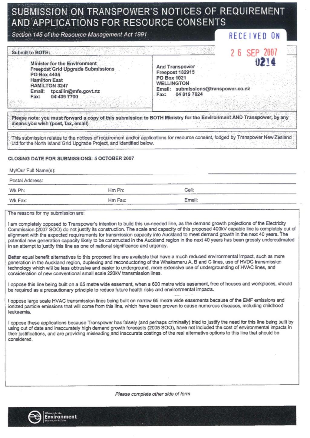
178 1