Groundwater Development in Bangladesh
|
|
|
- Matthew Charles
- 5 years ago
- Views:
Transcription

 Deputy Director, Ground")

1 Groundwater Development in Bangladesh Anwar Zahid, Ph.D. (Hydro-geology and Environmental Science) Deputy Director, Ground Water Hydrology Bangladesh Water Development Board


2 Hydrologic Cycle Hydrologic cycle circulation of water in the environment Hydrogeology deals the relationships of geologic materials and flowing water
3 Groundwater The water (mostly from precipitation) that flows through the soil and rocks beneath the surface Water can infiltrate to several km in crust Stored in pore spaces of rocks and sediments Groundwater is the largest accessible reservoir of fresh water Valuable resource Susceptible to depletion and pollution Used mostly as well water Stored and transmitted through aquifers Discharged into lakes, rivers, the ocean, or springs
4 Types of Porous Media (Freeze and Cherry, 1979) Relation between texture and porosity. (a) Well sorted sedimentary deposit having high porosity; (b) Poorly sorted sedimentary deposit having low porosity; (c) Well sorted sedimentary deposit consisting of pebbles that are themselves porous, so that deposit as a whole has a very high porosity; (d) Well sorted sedimentary deposit whose porosity has been diminished by the deposit of mineral matter in the interstices; (e) Rock rendered porous by solution; (f) Rock rendered porous by fracturing 4


5 Aquifer and Groundwater Table Aquifer : Geologic unit that can store and transmit water at rates fast enough to supply reasonable volume of water to wells

 Aquiclude: layer of no")
6 Aquifer Types Unconfined Aquifer: Porous and permeable rocks/sediments extend up to the surface Water level corresponds to Water Table Confined Aquifer: Porous and pervious rocks/sediments underlain and overlain by impervious rock/sediment units (aquicludes/aquitards) Aquitard (aquifuge): Geologic unit of little to no permeability (retards the groundwater flow but its almost never really zero) Aquiclude: layer of no permeability (no flow) 6
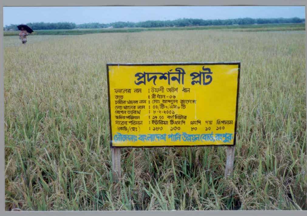
7 Groundwater Development in Bangladesh Abundance of water during the monsoon causing widespread flood in Bangladesh and little water in dry season to meet requirements. The GBM river system has the largest sediment load eroded from the Himalayas where fluvio-deltaic sediments form productive aquifers in most part. The country has gained a significant success in the development of groundwater for its irrigated agriculture, industrial and domestic water supply. Along with surface water irrigation, DTW and STW irrigation was extended rapidly during the late 1970 s and 1980 s. As a result the target for self sufficiency in food has almost been achieved.

8


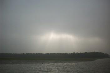
9 ABUNDANCE OF WATER DURING THE MONSOON CAUSING FLOOD


10 LITTLE WATER IN DRY SEASON TO MEET REQUIREMENTS


11 Surface Water Irrigation Projects


12 Low Cost Methods for TW Installation Rotary Drilling Method for DTW (Upto 350m) Hand Percussion Method for STW (Upto 100m)


13 Groundwater Irrigation in the Vicinity of Mighty Rivers Branch of the Ganges Failure of LLP Attempted LLP was Replaced by STW
14 UNCONTROLLED WITHDRAWAL OF GROUNDWATER: MINIMUM WELL SPACING IS IGNORED Irrigation Tubewells Wells
15 STW (Million) Irrigation Development by STW and DTW Year Nos. of STW Nos. of DTW Year Nos. of STW Nos. of DTW ,844 15, ,671 25, ,431 23, ,574 23, ,879 23, ,152 24, ,309 21, ,182,525 28, ,875 25, ,202,728 29, ,383 27,169 Sources: BADC, MPO/WARPO, AST/DAE, DAE/ATIA, NMIDP Year
16 Depth (m) Groundwater Development Zones in Bangladesh Unit-1: Upper Boundary Shallow Hand Tubewell Zone Shallow Irrigation Tubewell Zone Unit 2: 1 st Aquitard Unit 3-4: 1 st Aquifer Unit 5: 2 nd Aquitard Deep Irrigation Tubewell Zone / Shallow Urban Tubewell Zone Deep Hand Tubewell Zone / Deep Urban Tubewell Zone Unit 6-7: 2 nd Aquifer 300 Unit 8: 3 rd Aquitard 350 Deep Aquifer Unit 9-10: 3 rd Aquifer 400


17 FIELD ACTIVITIES


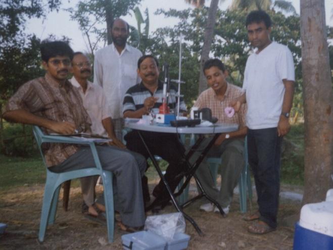


18 FIELD ACTIVITIES


19 Locations of BWDB Test Hole Sites

20 Location of BWDB Aquifer Pump Test Sites


21 Locations of BWDB Groundwater Table Monitoring Wells
22 Declining Trend of Groundwater Table/Level


23 Groundwater Contour Maps
24 River WL/GWL (RL in m-pwd) Rainfall (mm) Jan 10-Feb Groundwater - Surface Water Interaction Ganges at Mondel Para Section SW-GW Profile of observation Gauge 3G & Line w ell no. 3D (D,C,B,A) Monthly Rainfall of Madaripur, Direction of GW flow 3C 800 3B Jan Feb Mar 3D Apr 14 3G May Jul Jan Feb Mar Apr May Jun Aug SepOct Distance of GW obs w ells from Month River Gauge in km. 3A Nov Dec 14-Mar 15-Apr 17-May 18-Jun 20-Jul 21-Aug 22-Sep Groundwater Level (m) Ganges Water Level (m) Ganges Daily Discharge (10000 m3) 24-Oct 25-Nov 27-Dec
25 Groundwater and Climate Change Establishment of Monitoring Network and Mathematical Model Study to Assess Saline Water Intrusion in Groundwater in the Coastal Area of Bangladesh due to Climate Change (Rjevq~ cwiez b RwbZ Kvi Y evsjv ` ki DcK~jeZ x GjvKvq f~-mf cvwb Í i jebv³zvi AbycÖ ek wpwýzki Y vqx ch e Y buiqvk vcb I MvwbwZK g Wj mgx v) Climate Change Trust Fund Project Theme: T4. Research and Knowledge Management Program: P3. Preparatory studies for adaption against sea level rise (SLR) and its impacts Anwar Zahid, Ph.D. (Hydro-geology and Environmental Science) Deputy Director, Ground Water Hydrology Bangladesh Water Development Board anwarzahid_b@yahoo.com
26 Climate Change The climate system is a complex and interactive system consisting of the atmosphere, land surface, snow and ice, oceans and other bodies of water, and living beings. Climate change is generally defined as the changes that are gradually brought into earth s weather condition and hydrological cycle in a time scale of decades to millions of years. Though it is a natural phenomenon, but can be accelerated by human activities. Climate warming observed over the past several decades is consistently associated with changes in a number of components of the hydrological cycle such as increases in global average air and ocean temperatures, widespread melting of snow and ice, rising global sea-level, changing precipitation patterns, intensity and extremes, increasing evaporation, and changes in soil moisture and runoff.
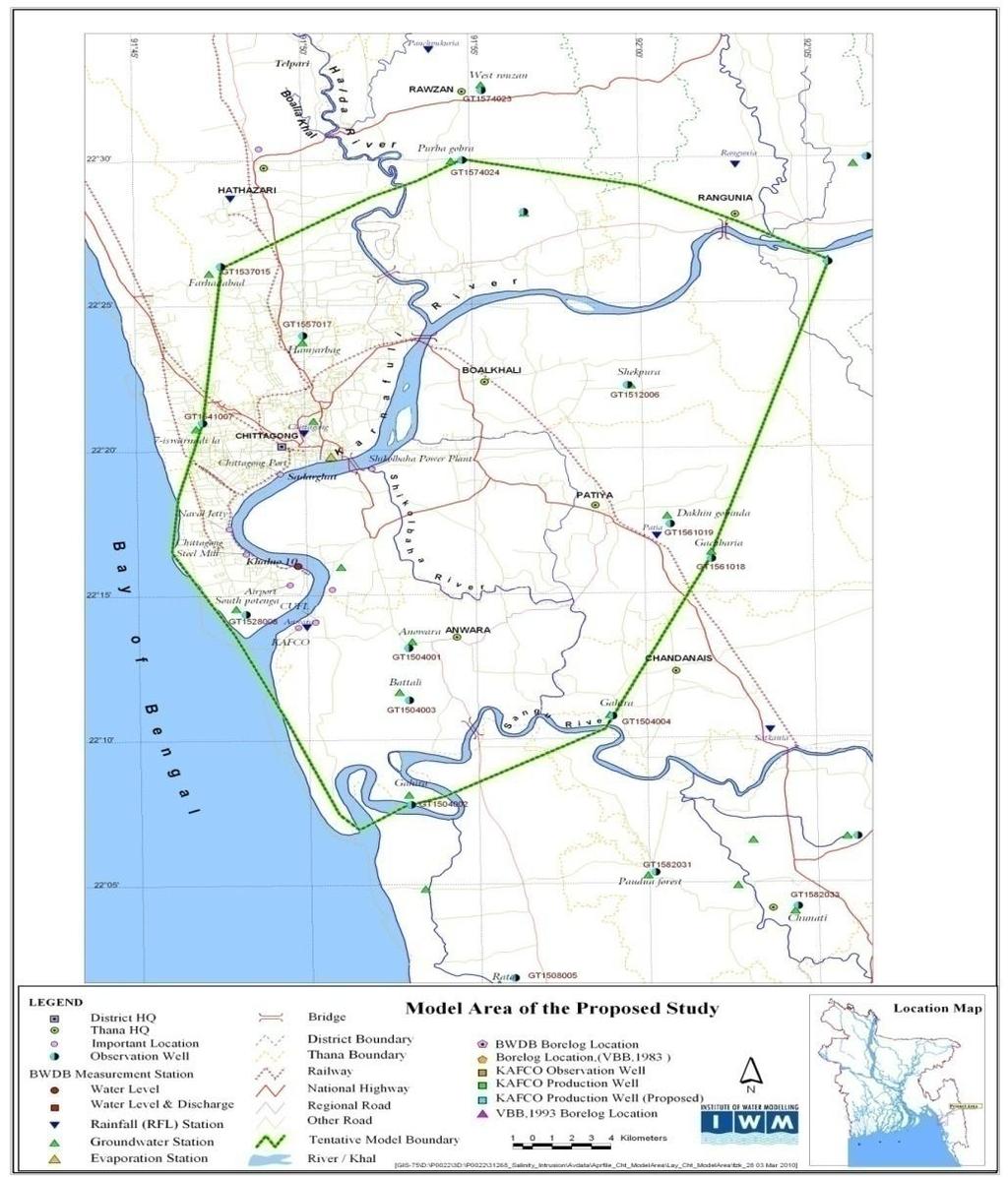
27 Climate Change and Bangladesh Because of its geographic location and low-lying topographic condition, Bangladesh is likely to be in extreme vulnerable situation under the current scenario of changing in climatic condition, especially the water resources in the low-lying coastal area is at maximum risk. Bangladesh is a disaster-prone country and almost every year, the country experiences disasters like tropical cyclones, storm surges, coastal erosion, floods, droughts and saline water encroachment in the coast. Agriculture and rural development have been identified as the topmost priority sector for poverty reduction and to meet up food demand of growing population of the country. Almost every sector of socio-economic life in Bangladesh is likely to be affected by climate change.
28 Climate Change and Bangladesh The water sector and water dependent agriculture are the most vulnerable and sensitive amongst them. In Bangladesh about 80% of dry season irrigation water has been provided by groundwater. On-time water availability is mandatory for growing Boro paddy irrigation. Groundwater is the major source of water across much of the world but there has been very little research on the potential effects of climate change on this resource (IPCC, 2001). All components of the system, e.g., recharge, discharge, storage and quality can be affected by changes in both climate and population pressures (UNESCO-IHP, 2006). Increased temperatures are expected to cause increased potential evaporation and less snow, and possible changes in mean rainfall, rainfall intensity, and rainfall seasonality that would affect soil moisture, discharge in rivers, and groundwater recharge.
29 Climate Change and Bangladesh The amount of water stored in the soil is fundamentally important to agriculture and has an influence on the rate of actual evaporation, groundwater recharge, and generation of runoff. However, the most devastating consequence of climate change and global warming is the rise in sea level. Bangladesh is very low elevated country, where major portion of coastal land form lies within 2-3 meters above mean sea level. Rise in sea level will cause increased encroachment of saline water both in surface water and groundwater regime and thus will create more stress on fresh water availability for irrigated agriculture and water supply.
30 Impact of Climate Change in Bangladesh Climate and Related Elements Temperature rise and drought Sea Level Rise and Salinity Intrusion Critical Vulnerable Areas North-west Coastal Area Island Most Impacted Sectors Agriculture (crop, livestock, fisheries) Water Energy Health Agriculture (crop, fisheries, livestock) Water (water logging, drinking water, urban) Human settlement Energy Health Floods Cyclone and Storm Surge Central Region North East Region Char land Coastal and Marine Zone Agriculture (crop, fisheries, livestock) Water (urban, industry) Infrastructure Human settlement Health Disaster Energy Marine Fishing Infrastructure Human settlement Life and property Drainage congestion Coastal Area Urban South West Water (Navigation) Agriculture (crop)
31 Anticipated Impact on Water Sector Regarding safe water supply for rural, urban and industrial demand, both of the quantity and quality of water resources including groundwater has already posed a threat in many areas. With respect to fresh water availability, the costs of climate change will outweigh the benefits globally as precipitation variability is expected to increase, and more frequent floods and droughts are anticipated. In Bangladesh where groundwater is the principal source of irrigation and potable water supply, monitoring of this resource by establishing appropriate and adequate monitoring network is utmost important. Monitoring network is also required to assess water budget analysing surface water groundwater interaction for conjunctive use. Intensification of aquaculture and rice-based agriculture requires more water frequently produces negative effects that range from environmental degradation to social conflict. Managing these impacts in a sustainable manner is imperative to protect the social and ecological foundations of tropical deltaic systems.
32 Anticipated Impact on Water Sector Coastal embankments and hydraulic structures are very important for coastal water resources management in Bangladesh to control coastal flooding, to prevent saline water intrusion etc. The damage of these infrastructures has a severe impact on the agricultural production hence on the food security of the country. During severe cyclone storm surge height is more than the existing embankment height. So embankment heightening is necessary to protect the agricultural land from the adverse impact of the cyclonic storm surges. One of the most prevalent concerns in recent age is the inherent difficulty of developing, implementing and maintaining appropriate land and water management policies in coastal deltas. Being heterogeneous, highly complex and dynamically changing, coastal zones are often not administered in ways that support the judicious management of natural resources.


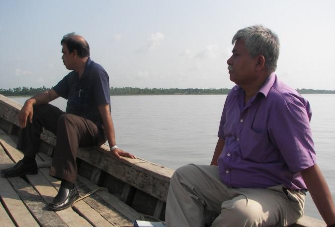


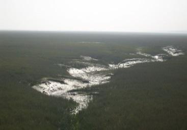
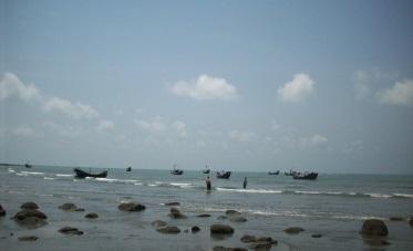
33 Tidal rivers characterize the coastal drainage system
34 Major Objectives Establishment of monitoring network (observation well nests and line wells) to determine and assess water quality including salinity and surface water groundwater interaction. Zoning and characterization of coastal aquifers where fresh groundwater is threatening from salt water intrusion. Assessment of salinity distribution on the groundwater aquifer and surface water regime and evaluate future trends due to sea level rise. Model of changes (qualitative and quantitative) due to increased withdrawal of groundwater and anticipated impact of climate change.
35 Consultancy Services for Mathematical Modeling Package 1: Mathematical Modelling Study (Groundwater + Surface Water) to Assess Upazilla-Wise Surface Water & Groundwater Resources and Changes in Groundwater Level Distribution due to Withdrawal of Groundwater in the the Study Area Package 2: Mathematical Modelling Study on Saline Water Intrusion to Assess Salinity Intrusion, Salinity Level, Sea Level Rise due to Climate Change, Movement of Salinity & Development Information System (MIS) Package 3: Hydrogeological Study & Mathematical Modelling to Identify Sites for Installation of Observation Well Nests, Selection on Model Boundary, Supervision of Pumping Test, Slug Test, Assessment of Different Hydrologycal Parameters Collection & Conduct Chemical Analysis of SW & GW
36 Project Area The project area covers 19 coastal districts includes Zone-I: Khulna, Bagerhat, Satkhira, Jessore and Narail. Zone-II: Barguna, Patuakhali, Barisal, Jhalkati, Pirojpur, Bhola, Gopalganj, and Shariatpur. Zone-III: Chandpur, Feni, Lakshmipur and Noakhali. Zone-IV: Chittagong and Cox s Bazar. The study on hydrogeology covers for entire project area. Mathematical model study has been conducted for two pilot areas i.e. Barguna-Patuakhali and Chittagong.

37 Proposed Locations of Monitoring Setup

38 Pilot Areas for Model Simulations


39 Geological Map of Bangladesh
40 Major Components of Monitoring Network SL No Description of Data Unit Qnty. 1. Survey of Observation Wells Location 1.1 Survey (RL) and Geo-referencing of all observation wells (well nests and line wells) No Hydro metric and Hydro-geological data 2.1 Installation of observation well nests (up to 350 m) No Installation of Line wells (up to 100 m) No Slug test of observation wells No Aquifer pumping test of existing wells No Collection and chemical analysis of GW samples No Collection and chemical analysis of SW samples No 300-


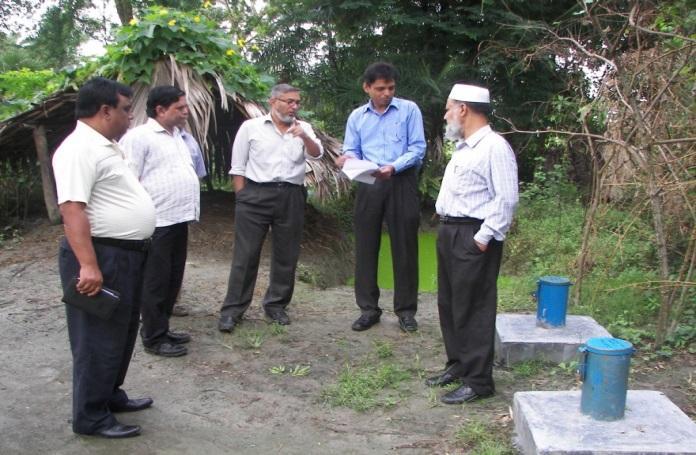
41 On the Job Training


42 Completed Activities and Monitoring Network

43 Tentative Design and Installed Observation Well Nests
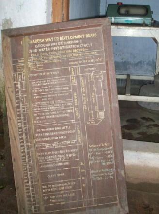
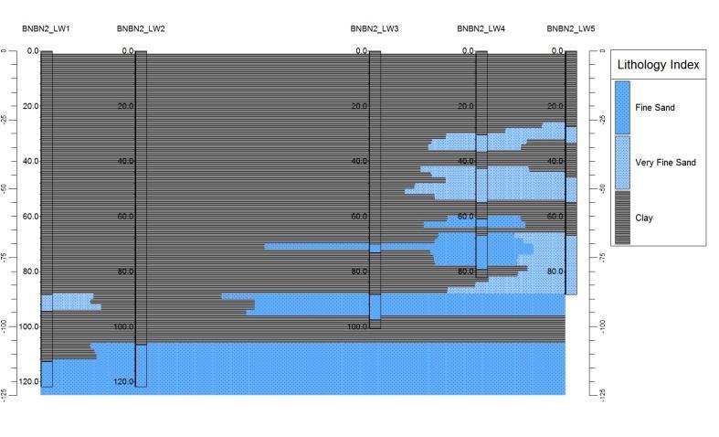
44 Lithologic Logs of Installed Line Wells Lithologic Sections of Installed Line Wells Bashkhali, Chittagong Lithologic Sections of installed Line Wells Borguna Sadar, Borguna. BN--LW1 BN--LW2 BN--LW3 BN--LW4 BN--LW5 Depth (m) CHBS--LW1 CHBS LW2 CHBS LW3 CHBS LW4 CHBS LW5 Depth (m) LEGEND Clay Silty Clay Silt Very Fine Sand Fine Sand Medium Sand Coarse Sand Total Depth: 98 m Total Depth: 101 m Clay Sealing Gravel Pack Total Depth: 101 m Total Depth: 101 m MAJOR FEATURES Drilling Dia: mm Blind Pipe: 50 mm Dia Strainer (50 mm Dia): 10 m Slot Size: slot Bail Plug (50 mm Dia): 3 m Total Installed Depths: 100 m x 5 Grain Size Analysis: 5 Samples Metal Cover: 1 m x 150 mm Total Depth: 89 m Clay Silty Clay Silt Total Depth: 102 m LEGEND Very Fine Sand Sand Fine Sand Medium Sand Coarse Sand Total Depth: 122 m Clay Sealing Gravel Pack Total Depth: 122 m Total Depth: 116 m MAJOR FEATURES Drilling Dia: mm Blind Pipe: 50 mm Dia Strainer (50 mm Dia): 06 m Slot Size: slot Bail Plug (50 mm Dia): 1.5 to 3 m Total Installed Depths: 100 m x 5 Grain Size Analysis: 5 Samples Metal Cover: 1 m x 150 mm Total Depth: 122 m

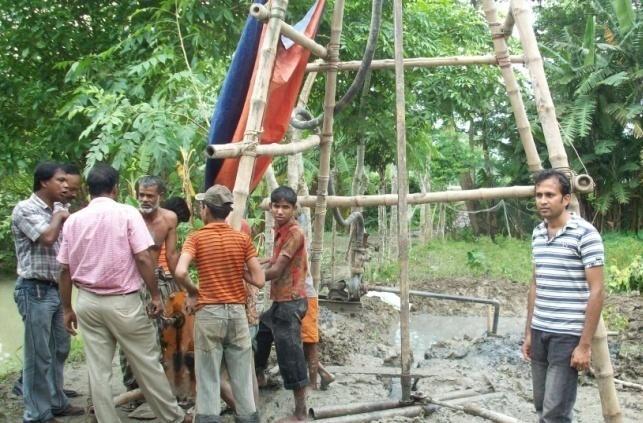
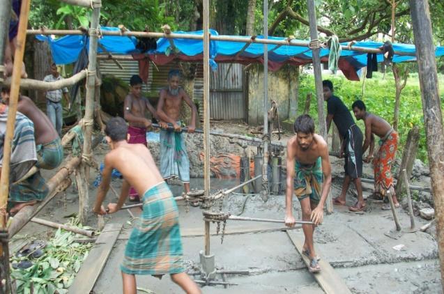


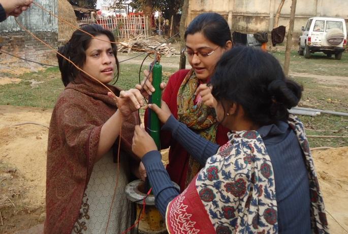
45 Installation Process of Monitoring Wells

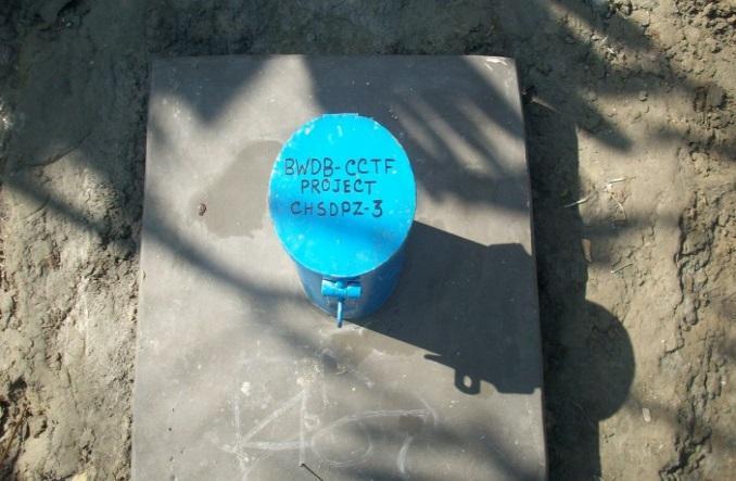


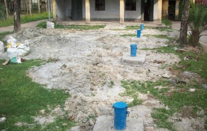


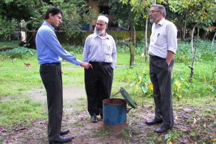
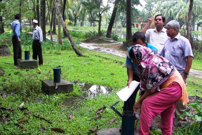
46 Installed Monitoring Wells


47 AQUIFERS IN FLOODPLAIN AND DELTA (350mx100m)


48 AQUIFERS IN FLOODPLAIN AND DELTA (100mx4km)

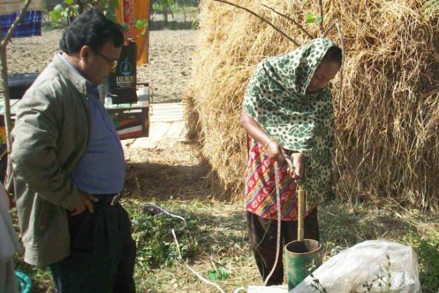


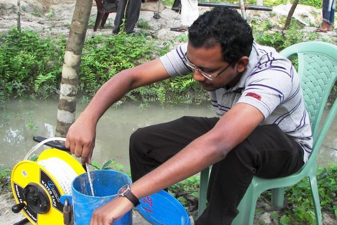

49 Ground Water Table Measurements and Slug Tests
50 Groundwater Table Hydrographs


51 Depth-wise Groundwater Table Contour Maps Monsoon/Wet Season Pre-monsoon/Dry Season
52 Slug Test: Analysis of Drawdown Data


53 Depth-wise Hydraulic Conductivities of Coastal Aquifers


54 Depth-wise Transmissivity of Coastal Aquifers


55 Tentative Design and Installed Aquifer Pump Test Setup


56 Aquifer Pump Test
57 Aquifer Pump Test: Analysis of Drawdown Data


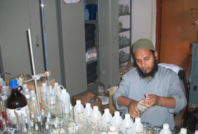


58 In-situ and Laboratory Analysis of Water Samples

59 Measured Physico-Chemical Parameters of Water Samples
60 Surface and Groundwater Salinity Lines (1979)


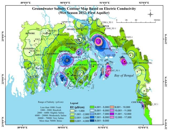
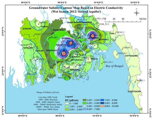

61 Groundwater Salinity in Coastal Aquifers Monsoon/Wet Season Pre-monsoon/Dry Season
 0 200 400 Unit 5 Unit 6 Unit 7 Unit 8 Unit 9-10")
62 Geologic Units Defined in the Model KACHUA 10 Geologic Units Kx = Variable Kz = Variable Unit 1-2 Unit 3-4 Depth (m) Unit 5 Unit 6 Unit 7 Unit 8 Unit

63 MODEL GW HEADS OF AQUIFER UNITS UNDER DIFFERENT GEOLOGIC CONDITIONS


 2004 stress Anisotropic Anisotropic (Discont.")


64 Flowlines and Age of Groundwater to different Aquifer Units 2004 Development KACHUA Shallow Aquifer Recharge Area 2004 Development Main Aquifer Recharge Area KACHUA 2004 Development KACHUA Deep Aquifer Recharge Area Flowlines Anisotropic with aquitards 2004 Development Shallow Aquifer Recharge Area Flowlines Anisotropic with aquitards 2004 Development Main Aquifer Recharge Area Anisotropic with aquitards 2004 Development Flowlines Deep Aquifer Recharge Area Anisotropic with discontinuous aquitards 2004 Development Shallow Aquifer Recharge Area Anisotropic with discontinuous aquitards 2004 Development Main Aquifer Recharge Area Anisotropic with discontinuous aquitards 2004 Development Recharge Area Deep Aquifer Low anisotropic with aquitards Low anisotropic with aquitards Aquifer Low anisotropic with aquitards Travel Time (Years) 2004 stress Anisotropic Anisotropic (Discont.) Low Anisotropic Max Min Ave Max Min Ave Max Min Ave Unit Unit Unit Unit Unit
65 Travel Time (Year) Travel Time (Year) MINIMUM TRAVEL TIME OF RECHARGE WATER TO AQUIFER UNITS THROUGH THE ARSENIC CONTAMINATED LAYER A B C D E F G H I Shallow Aquifer (Up p er) Shallow Aquifer (Lower) M ain Aquifer (Up p er) A B C D E F G H I Different Geologic Conditions and Develop ment Stresses Main Aquifer (Lower) Deep Aquifer A B C D E F G H I Different Geologic Conditions and Develop ment Stresses 2004 development stresses (anisotropic) 2004 development stresses (anisotropic, discontinuous aquitards) 2004 development stresses (low anisotropic) 2014 development stresses (anisotropic) 2014 development stresses (low anisotropic) 2014: new Shallow Irrigation Wells in unit 6 (anisotropic) 2014: new Shallow Irrigation Wells in unit 6 (low anisotropic) 2014: Hand Tube Wells in main aquifer upper (anisotropic) 2014: Hand Tube Wells in main aquifer upper (low anisotropic)
66 Project Output Data, information and guideline for sustainable use of limited fresh groundwater resources in the coastal area mainly for drinking and agriculture purpose. The designed observation well setup will help to monitor any change of groundwater recharge and quality as well as saline front movement in the coastal belt. Model simulations would predict future changes under different hydrogeologic and variable climatic parameters. Groundwater users, farmers, planners, and researchers will get benefit from the data and results of this project that would lead to sustainable development and management of water resources.
67 Specific outcomes includes; Base maps of aquifers and water quality at different depth levels. Data sets on aquifer characteristics, baseline water quality, quantity and groundwater levels etc. Calibrated and verified coupling of surface water and groundwater model results along with the simulation results of base condition and various development scenarios. An assessment of the impact of sea level rise in the groundwater distribution and changes in salt water intrusion in the groundwater flow regime. A monitoring system for decision making and preparation of management information system based on collected data.
68 RECOMMENDATIONS Matching long term withdrawals of groundwater to recharge is the principal objective of sustainable groundwater resource planning. Maintaining the water balance of withdrawals and recharge using available data and information is vital for managing human impact on water and ecological resources. Management and governance of groundwater resources, projecting the future development possibilities and environment impact assessment, can be achieved by zoning of aquifer units and surface water availability for different purposes. Regular assessment and monitoring of water quality and quantity in coastal area needs to be ensured using monitoring network. Expansion of existing groundwater monitoring network in other parts of the country is required considering installation of piezometers upto greater depths i.e m. Extension of existing network of BWDB groundwater monitoring wells should be increased spatially and vertically covering upto deep aquifers considering recharge and discharge areas, flow domain, surface water regime etc. for calculating recharge, monitoring fluctuation of groundwater table, water quality and groundwater flow pattern.
69 RECOMMENDATIONS Because of increasing demand of water and to reduce dependency on limited fresh groundwater resources, utilization of available surface water and conjunctive use is required that is also highlighted in the existing guideline and policies of the Government. This will minimize the stress on fresh groundwater resource in the arsenic affected and saline prone coastal areas. Groundwater resources that can be safely abstracted from both upper and deeper aquifer needs to be properly assessed before large scale abstraction based on available and project generated data and information. Regional modeling of the groundwater systems has to be developed for effective water resource management, to plan agricultural, rural and urban water supplies and to forecast the groundwater situation in advance of dry seasons. Better operation and maintenance of tubewells, improving the management efficiency, crop diversification based on water quality parameters and future prediction of saline water augmentation can be done for the sustainable use of fresh water resources.
70 RECOMMENDATIONS Initiate monitoring of river water level at the location of Line wells. Integrate the monitoring network of other agencies to avoid duplication of works, achieve uniformity in data coverage in terms data item, spatial and temporal coverage and fill gaps. Continue the monitoring activity after completion of the project. Evaluate the findings and make necessary adjustment where needed, based on the experience gained through the monitoring. Efforts are needed to sustain the capacity in respect of data collection, monitoring and evaluation through mathematical modeling for prediction of anticipated climate change impacts. Proper legislation, enactment of law, efficient organizational strength are essential tools to regulate unwise use of limited fresh groundwater resources like in arsenic and saline prone coastal areas. Water allocation plan can be formulated to ensure fresh and safe water availability for everyone. Present organizational strength needs to be enhanced to study, investigate and monitor groundwater resources of the country more efficiently.


71 THANK YOU ALL