Dynamic Inundation Mapping for Emergency Planning and Disaster Response
|
|
|
- Merilyn Short
- 5 years ago
- Views:
Transcription

1 Dynamic Inundation Mapping for Emergency Planning and Disaster Response Ross Gordon, LEED AP October 29, 2008

2 Presentation Overview Introduce MIKE FLOOD Rice / TMC Case Study Emergency Planning Disaster Response
3 Deficiencies of Existing Modeling Complex Overland Hydraulics Can we really assume static flow paths and watershed boundaries? Are we correctly accounting for overland storage and flow? Flooding is often a local phenomena Regional models may not have enough detail Lumped parameter models lack resolution Why does one building flood and not another? How do we deal with urbanized drainage systems? Is it possible to easily and accurately determine the timing, location, severity, and duration of flooding at any and every point in a watershed?
4 Can we better model complex urban drainage systems? How can this assist us in emergency planning and disaster response?

5 MIKE FLOOD Overview


6 MIKE 21 Overview 2D hydrodynamic overland flow model Exact accounting of all overland storage volume Hydrology and hydraulics in the same model Distributed rainfall, infiltration, and roughness

7 MIKE URBAN Overview 1D dynamic storm sewer model Incorporates backwater, flow reversals, and surcharging Simple development overland flow addressed in M21
8 MIKE FLOOD Coupling Overview 2D OVERLAND MODEL MIKE 21 MIKE FLOOD DYNAMIC INTERACTION Coordinates simultaneous, integrated, operation of MIKE 21 and MIKE URBAN MIKE URBAN STORM SEWER MODEL Dynamic connection between MIKE 21 and MIKE URBAN through inlets
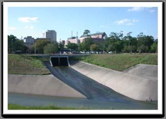
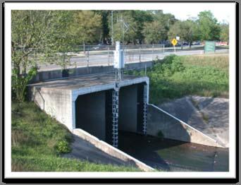

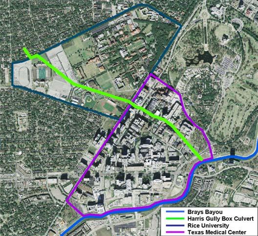
9 Rice University / TMC Case Study Overland Flow Storm Sewer Flow Tailwater
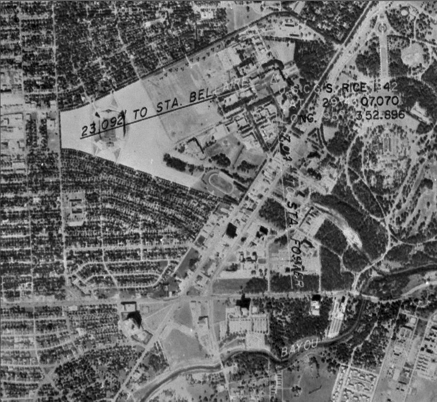
10 Harris Gully Watershed Small Urban Watershed Approximately 5 mi 2 Extensive storm sewer network Outfalls to Brays Bayou High Risk for Flooding Gulf Coast rainfalls Rapid development Flat topography Clay soils

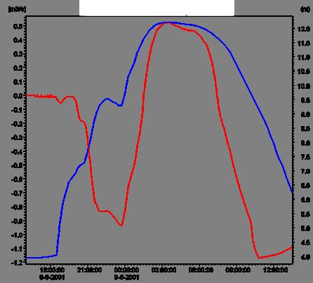
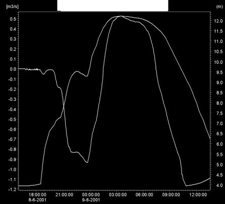
11 Tailwater Effect

12 Emergency Planning Applications Comprehensive Flood Protection Planning Solve the problem before it happens Flood Alert / Prediction Implement protections or warnings before the peak hits Emergency Planning / Disaster Response Using the best available data and modeling: Know where problems are likely to occur Prepare disaster response action plans Route emergency responders to key locations Location Timing Duration Severity

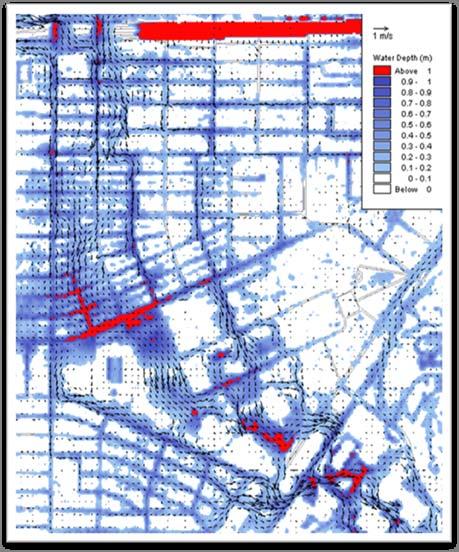
13 TS Allison Dynamic Inundation Map

14 Rice Dynamic Inundation Map
15 Rice Harris Gully Storm Sewer Profile Link Water Level :38:00 HG_allison.PRF Discharge / / / [m] HGoutletlink robin m3/s end of branch [m] Ground Lev [m] Invert lev [m] Length / [m] Diameter 4.57/ / / / / / / [m] Slope o/oo 0.52/ / / / / / /

16 Rice Inlet Surcharging Harris Gully MacGregor

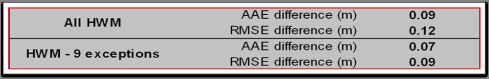
17 MIKE FLOOD - Validation

18 Rice Validation Cont.

19 100 Year Floodplain? 100 yr. FEMA/TSARP Floodplain
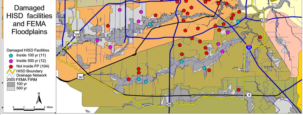
20 100 Year Floodplain?
21 MIKE FLOOD Conclusions Spatially variable hydrologic and hydraulic parameters Rainfall, infiltration, roughness Hydrology and hydraulics in the same model Physics based model for determining runoff 2D distributed overland model every M 2 modeled Captures details of urban topography and overland flow No predetermined flow paths or watersheds High resolution output detailed prediction everywhere Interactions between overland, storm sewer, and tailwater Truly dynamic location, timing, duration, and severity
22 Predicting and Preparing for Severe Flooding Urban flooding is dependent on: Rainfall intensity and distribution Local drainage infrastructure and topography Regional hydrology / watershed response Interconnectivity of drainage systems Accurately assess how a city, town, or region will respond to severe rainfall and plan accordingly to protect life and property Resolution/detail defines the capability of the system

23 Questions and Discussion