REGIONAL PLANNING IN THE SAN DIEGO REGION COLEEN CLEMENTSON, SANDAG SEPTEMBER 2010
|
|
|
- Clare Reynolds
- 5 years ago
- Views:
Transcription
1 REGIONAL PLANNING IN THE SAN DIEGO REGION COLEEN CLEMENTSON, SANDAG SEPTEMBER 2010
2 AREA OF SAN DIEGO REGION 4,230 square miles
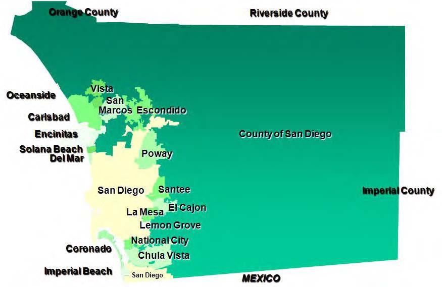
3 SAN DIEGO JURISDICTIONS

4 ANNUAL AVERAGE GROWTH RATES

5 A LOOK AT THE FUTURE

6 CHANGING DEMOGRAPHICS
7 WHO PLANS FOR THE REGION? Local/Regional Agencies: Local Cities and the County of San Diego SANDAG Metropolitan Transit System (MTS) North County Transit District (NCTD) San Diego Airport Authority San Diego Unified Port District San Diego County Water Authority Southern California Tribal Chairmen s Association San Diego Regional Energy Office Local Agency Formation Commission (LAFCO ) Air Pollution Control District
8 WHO PLANS FOR THE REGION (CONT.)? State/Federal Agencies: Caltrans Regional Water Quality Control Board California Coastal Commission California Department of Fish and Game U.S. Fish and Wildlife Service U.S. Department of Defense

9 SANDAG BOARD AND POLICY COMMITTEES

10 SAN DIEGO REGIONAL COMPREHENSIVE PLAN Urban Form Transportation Housing Healthy Environment Economic Prosperity Public Facilities Borders
11 REGIONAL VISION Preserve and enhance the San Diego region s unique features its vibrant and culturally diverse communities, its beaches, deserts, mountains, lagoons, bluffs, and canyons, and its international setting and promote sustainability, economic prosperity, and an outstanding quality of life for everyone.


12 A REGIONAL APPROACH Connect land use and transportation plans Guide infrastructure investments Provide incentives and collaboration
13 LAND USE-TRANSPORTATION CONNECTION

14 System Facts 53 miles of light rail transit 42 miles commuter rail Local bus service Transit centers Dial-A-Ride and ADA Services WHERE WE VE BEEN 95.5 million annual riders 29 million trolley 1.5 million Coaster 65 million bus PAST 30 YEARS Growth 1975 Present Transit ridership = 150% County population = 75%


15 RCP SMART GROWTH PLACE TYPES Metropolitan Center Urban Center Town Center Community Center Mixed Use Transit Corridor Special Use Center Rural Village
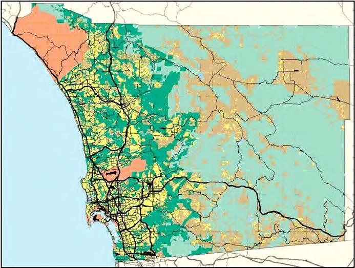
16 SMART GROWTH CONCEPT MAP

17 USE OUR TRANSPORTATION & LAND USE PLANS TO GUIDE OUR INVESTMENTS


18 MAKE IT HAPPEN THROUGH INCENTIVES AND COLLABORATION

19 40 YEAR EXPENDITURE PLAN
20 SMART GROWTH TOOL BOX Planning Tools Smart Growth Concept Map Sketch Planning Tool Visual Simulations and Smart Growth Photo Library Smart Growth Design Guidelines Trip Generation/Parking Study San Diego Regional Bicycle Plan RCP Monitoring Financing Tools TransNet Smart Growth Incentive Program TransNet Environmental Mitigation Program TransNet Bike/Ped Neighborhood Safety Program Regional Housing and Smart Growth Financing Strategy

21 SMART GROWTH CONCEPT MAP

22 ALPINE BOULEVARD ALPINE, CA PLACE TYPE RURAL VILLAGE
23 E STREET NEAR BAYFRONT/ E STREET TROLLEY STATION CHULA VISTA, CA PLACE TYPE: URBAN CENTER

24 SMART GROWTH PHOTO LIBRARY


25 SMART GROWTH INCENTIVE PROGRAM Capital Improvements: Sidewalks, plazas Streetscape enhancements Improvements to transit stations Other community initiatives 2% of TransNet Sales Tax Planning Grants: General plan updates Specific plans

26 ENVIRONMENTAL MITIGATION PROGRAM
27 REGIONAL HABITAT CONSERVATION FUND $200 million Available for regional habitat acquisition, management, and monitoring activities necessary to implement the MSCP and MHCP Funds to be distributed as economic benefits of program are accrued

28 TRACKING OUR PROGRESS

29 MILESTONES 2004: Regional Comprehensive Plan 2004: TransNet Extension 2005: Regional Housing Needs Assessment 2006: Smart Growth Concept Map 2006: Baseline Report for Performance Monitoring 2006: TransNet Environmental Mitigation Program 2006: Smart Growth Incentive Program 2007: Tribal Representation and Binational Strategic Plan 2008: 2030 Regional Transportation Plan 2010: Regional Bicycle Plan 2011: 2050 Regional Transportation Plan