Houston Brister and Brandy Meservey 2014 Fall EMPACTS project Intro to GIS, ( Paul Lowery ) and Intro to Soil Science ( Ted Siebert)
|
|
|
- Hester Scott
- 5 years ago
- Views:
Transcription
 and Intro to Soil Science ( Ted")
1 Houston Brister and Brandy Meservey 2014 Fall EMPACTS project Intro to GIS, ( Paul Lowery ) and Intro to Soil Science ( Ted Siebert)
2 The purpose of this project is to determine the ph of soils developing in urban drainage swales in Benton and Washington Counties and to assess the environmental conditions creating these soils.
3 The objectives of this study are to.. Create an interactive map which shows the distribution of soil attributes collected in this field study of urban drainage soils Combine course content from two separate courses into one overall project based learning experience The learning goals of this project are to learn.. How to classify soils based on their physical characteristics Objectives of this Study Learning Goals How ph (soil chemistry) is influenced by environmental factors Field data collection techniques (soil samples, ph and GPS) How to tabulate the attributes of soil characteristic at each location How to import attribute data from Excel to GIS to create raster files How to create a map of all field data collected, using an imagery base


4 The ph scale indicates how or a solution is by giving the concentration of hydrogen ions. The smaller the number on the scale the stronger the acidity of the substance being tested. Each ph point multiplies acidity by a factor of 10, so a ph of 5.0 is 10 times more acidic than 6.0 and 100 times more acidic than a ph of 7. It is the balance between hydrogen and hydroxyl ions that dictates ph. The more hydrogen ions to hydroxyl ions the more acidic the substance. When you have more hydroxyl ions than hydrogen ions you have a more basic substance. ( Acidic 0-7, basic 7-14, with 7 being neutral).
.")

5 Soil can range from an extremely reading of around 3.5 and up to an extreme reading of around 10.5, however they generally hover around the range. Alkaline soils can be expected is areas were annual rainfall is less than annual evapotranspiration (the sum of water lost from soils from evaporation and transpiration). Young soils gain their ph from the parent material. Acidic parent materials include granite, sand stone, and shale. Parent material high in Calcium will yield more neutral to basic soils. A good example of this would be limestone. When you have an older soil the ph mainly is a result of the percolation of acidic water (naturally or otherwise) through the soil.

6 ph is a major factor in the amount of nutrients available to plants for use. Many elements change form as a result of reactions in the soil. It is important to maintain a natural ph for the ecosystems the soil supports. The variations in anticipated readings could be attributed to urban causes leaching into the soil as storm water runoff makes it way to its next destination.


7
8 Division of Labor Benton County field data collection, map construction, research; Houston Brister, Washington County field data collection, power point presentation research; Brandy Meservey Time Line Project proposed Met with Dianne Phillips Nov 20 Restructured project Nov 24 began work on Map and Power point Nov 25 Collected Benton County field data Nov 25 Collected Washington County field data Dec 3 met with Dianne Phillips December 4 practice run in soil science class Dec 9 presented in Soil Science class


9 Used smart phones for GPS and photography Sampled soil for ph using ph test kits Recorded notes on paper then Inserted data into Excel Used ArcGIS to create map of sampled areas Created PowerPoint over project Collaborated With Dianne Phillips on web page and brochure
10 Downloaded from Geostor.gov the Soil Map for Property Tax Assessment. Used the imagery base map in ArcGIS to locate points
11 Arc GIS and internet resources = GeoStor.gov and ArcGIS.com Microsoft Excel, Word, Power Point, Publisher GPS (smart phone technology)

12 ArcGIS software Android smart phone Apple smart phone ph test kit
13 Washington Co. Benton Co.
14 Central Rogers

15


16


17
18
19 2e Suitable for all uses with mild limitations. The E indicates runoff and or erosion issues that may need to be addressed. 2w Suitable for all uses with mild limitations. The W indicates wetness resulting form possible flooding or poor drainage issues.


20


21


22


23
24 (2e) Secesh gravelly silt loam Jay Silt Loam (2e) Taloka Silt Loam (2w) Very deep, well drained floodplains, stream terraces, and footslopes. Formed in about 2 feet of loamy alluvium and the underlying cherty residuum or alluvium from limestone and sandstone. Deep moderately well drained, formed in loamy material overlaying siltstone or cherty limestone. Deep poorly drained formed in loamy clayey material from colluvium and alluvium over interbedded shale and sandstone parent material
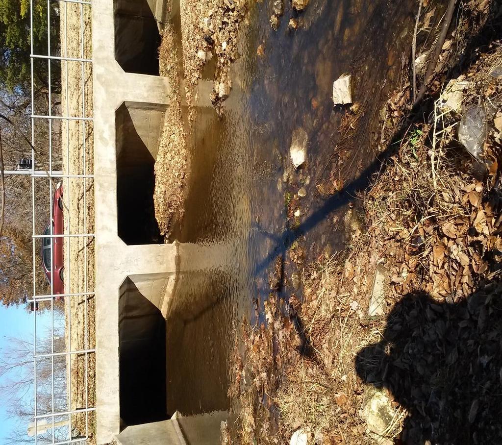
25 Royal Oaks Drainage Swale

26


27


28


29
30 3w 6s Can be used as class 1 & 2 if serious problems addressed. W indicates wetness, poor drainage, or occasional flooding, can be classed as wetlands Unsuitable for cultivated crops.s indicates root zone or tillage problems. Shallow, stoney, droughty, infertile, or saline. Potential erosion hazards


31


32


33
34 Sogn rocky silt loam Johnsburg silt loam shallow and very shallow, somewhat excessively drained, soils that formed from weathered limestone, upland soil. very deep, somewhat poorly drained, formed in loess or silty material and the underlying loamy residuum weathered from interbedded sandstone, siltstone, and shale. These soils are on hills.

35

36 Map Power point Brochure Website ArcGIS.com ArcGIS.com/Tour
37 Use of GIS software Skills needed to import data into ArcGis Procedures to upload a map document onto ArcGIS.com Communication of data via the internet flickr, explorer vs chrome and their respective policies on s with attachments ph testing of soils Procedures and use of resources to find information such as soil class and soil series from maps
38 Display results in a variety of formats Utilized GIS skills to create a GIS product for analysis of local problems as a final group project Imported, stored, and managed geographical data from a variety of sources Organized layers including layer activation, hierarchy and manipulation of layers display properties to optimize visual effect.
39 Central Rogers, Whispering Timbers neighborhood East Fayetteville Mission and Crossover area East Fayetteville Gulley Park Drainage swales were tested in these communities for ph
40 Geostor.gov Soil Science and Management, 6 th edition, Edward J. Plaster Soilseries.sc.egov.usda.gov Esri Google Maps