Salinas Valley. Integrated Regional Water Management Functionally Equivalent Plan Update. Proposition 50 Chapter 8 Implementation Grant Application
|
|
|
- Cecilia Peters
- 5 years ago
- Views:
Transcription

1 Submitted for: Proposition 50 Chapter 8 Implementation Grant Application Salinas Valley Integrated Regional Water Management Functionally Equivalent Plan Update May 2006 Marina Coast Water District Castroville Water District Monterey County Water Resources Agency

2 Salinas Valley Integrated Regional Water Management Functionally Equivalent Plan Summary Document UPDATE Prepared by: for The Monterey County Water Resources Agency May 2006
3 This document represents an update to the Salinas Valley IRWM Functionally Equivalent Plan (FEP) based on the review comments provided by the California Department of Water Resources and the State Water Resources Control Board. The updated sections of the FEP are written in italics to simplify the review of the updated document. The updates are summarized in the table below. Scoring Criterion IRWM Plan and Proof of Formal Adoption Description of Region Prev. Score Actionable Comment FEP Update Response to Comment 5 none The Updated FEP was readopted by member agencies in May, Does not explain why all of the Salinas River Watershed is not in the region. Riparian and upland ecological processes are not described. More detailed description of region as well as explanation of why entire watershed is not included. Expanded description of ecological processes Location of Update External to this report Page 3-1 Page 3-18 Objectives 4 Objectives seem to relate to groundwater management, which does not help a fish habitat monitoring project. Water Management Strategies and Integration Priorities and Schedule 4 Benefits from integrating strategies were listed, but evidence that these benefits are occurring is not provided. 3 No discussion of decision making process. No discussion of how decision making will be responsive to regional changes or how project sequencing may be altered. Implementation 3 Questionable that projects can be implemented in time period shown SVWP financing and water rights concerns. Technical Analysis and Plan Performance Not sufficient description of institutional structure to ensure implementation. 4 Not clear that monitoring program will do more than determine if seawater intrusion is reduced. Data Management 3 Statements regarding data management come short of integration with SWRCB s programs. No discussion No update several objectives address environment and ecosystem, including an objective that specifically mentions steelhead Specifics were added to the bulleted list of benefits of integrating strategies New section to address decision making process Section on modifying priorities was edited to reflect these concerns Timelines have been updated to reflect current schedule. SVWP concerns updated in Stakeholder Outreach Section. Section on institutional structure was added Information added regarding plan performance Section edited to reflect the Water Management Group s dedication to sharing data with the Please see Page 4-9 Page 5-10 Page 6-1 Page 6-4 Page 7-7 Page 14-5 Page 7-16 Page 9-2 Page 10-5
4 regarding how to support statewide data needs. Financing 3 Status of SVWP financing is in question due to litigation Relation to Local Planning and Sustainability Stakeholder Involvement and Coordination No documentation of ongoing support of the projects. 3 Evidence is needed that shows that the FEP is being integrated into the General Plan. 3 Much stakeholder coordination goes back to the 1990 s and it s unclear if it is ongoing. A clear list of stakeholders was not included. State and supporting data needs. Section added to address results of recent litigation Section added to address ongoing support Section rewritten to show way in which FEP is integrated into General Plan. Section rewritten to document ongoing coordination for FEP Reference given for list of stakeholders Page 11-1 Page 11-2 Page 13-1 Page 14-1 Page 14-1
5 Attachment 3 - Table of Contents Table of Contents Executive Summary...1 ES-1 Background...1 ES-2 On-Going Planning...1 ES-3 Stakeholder Support...1 ES-4 Region...2 ES-5 Current and Future Water Resources of the Salinas Valley...4 ES-6 Planning Objectives...8 ES-7 Salinas Valley Water Resource Management Goals...9 ES-8 Water Management Strategies and Integration...11 ES-9 Short Term Regional Priorities...11 ES-10 Long Term Regional Priorities...12 ES-11 Selected Projects Based on Regional Priorities...13 ES-12 Implementation...13 ES-13 Impacts and Benefits...14 ES-14 Technical Analysis and Plan Performance...15 ES-15 Data Management...15 ES-16 Project Financing...16 ES-17 Statewide Priorities and Local Planning...16 ES-18 Stakeholder Involvement Introduction Regional Water Management Group Salinas Valley Regional Management Group Key Agency Stakeholders Memorandum of Understanding Letters of Support Region Description General Description Current and Future Water Resources of the Salinas Valley The Salinas Valley is an Ideal Region for Integrated Water Management Quality and Quantity of Water Resources within the Region Water Supplies and Demand for a 25-Year Planning Horizon Ecological Processes and Environmental Resources Economic Conditions and Important Trends Social and Cultural Make up of the Regional Community Other Regional Plans in Monterey Bay San Luis Integrated Regional Water Management Plan Objectives Salinas Valley Water Resource Management Goals Plan Objectives Description of Objectives Water Management Strategies and Integration Strategy Consideration Strategy Integration Regional Priorities Procedure for Developing Priorities Short Term Regional Priorities Long Term Regional Priorities...6-2
6 Attachment 3 - List of Tables 6.4 Selected Projects Process for Modifying Priorities Implementation Projects and Programs for FEP Implementation Institutional Structures to Ensure Implementation Future Priority Projects for Integrated Planning Impacts and Benefits Impacts of Individual Projects Benefits of Projects Advantages of a Regional Plan Impacts and Benefits to Disadvantaged Communities Impacts to Energy and Air Quality Technical Analysis and Plan Performance Technical Analysis Project Evaluation and Performance Data Management Current Data Collection and Dissemination Future Data Collection and Dissemination Financing Salinas Valley Water Project Well No. 33, Booster Station and Reservoir Water Quality and Fish Habitat Monitoring Program Soledad Water Recycling/Reclamation Project Ongoing Support for Projects Statewide Priorities Previous State Involvement in Region Statewide Priorities Considered Relation to Local Planning Monterey County General Plan Fort Ord Reuse Authority Planning City of Soledad General Plan Stakeholder Involvement and Coordination Outreach for Functionally Equivalent Plan Ongoing Stakeholder Processes Project Specific Outreach Environmental Justice Concerns Disadvantaged Communities Coordination Potential Obstacles to Implementation Provisions for Changing IRWMP References List of Tables Table 2-1 Letters of Support Table 3-1: Water Districts in Salinas Valley Table 3-2: Urban Groundwater Pumping in Table 3-3: Salinas Groundwater Basin Pumping in Table 3-4: Estimated Water Demand Based on Basin Modeling Table 4-1 Goals for Salinas Valley Water Planning...4-2
7 Attachment 3 - List of Figures Table 4-2 List of Objectives Table 5-1 Water Management Strategies Table 5-2 Objectives and Strategies Comparison Matrix Table 5-3 Integration of Strategies for FEP Table 6-1 Projects Meet Short and Long Term Priorities Table 7-1 Planning Objectives Table 7-2 Salinas Valley Water Project Status Table 7-3 Water Quality and Fish Habitat Monitoring Program Status Table 7-4 Well 33, Booster Station and Reservoir Project Status Table 7-5 City of Soledad Water Recycling/Reclamation Project Status Table 8-1 List of Objectives that will be Met with the Salinas Valley Priority Projects Table 10-1: Groundwater Data Collection and Schedule Table 10-2 Elkhorn Slough Surface Water Quality Stations Table 14-1: Cost Allocation Committee List of Figures Figure 3-1 Regional Map of Monterey County Figure 3-2 Salinas Basin Hydrologic Subareas Figure 3-3 Monterey County Water District Jurisdictions Figure 3-4 Existing Land Uses within the Basin Figure 3-5 Nitrate Concentrations for 65 Shallow Wells Figure 3-6 Future Regional Planning in Monterey Bay Figure 4-1 Goals and Objectives Process Figure 4-2 Objectives Development Process Figure 4-3 Salinas Valley Goals and Objectives Figure 5-1 Strategy Integration Process Figure 7-1 Salinas Valley Integrated Regional Planning Process Figure 8-1 Regional Demographics Appendices Appendix A...Memorandum of Understanding Appendix B...Letters of Support Appendix C...Planning Documents Appendix D... Project Prioritization Appendix E...Implementation Schedule Appendix F...Monterey Bay MOU
8 Executive Summary Executive Summary ES-1 Background The California Department of Water Resources (DWR) and the State Water Resources Control Board (SWRCB) are encouraging local and regional water management planners to establish integrated regional water management plans through the collaboration of planning efforts and project coordination. The intent is to encourage planners to implement projects focused on meeting multiple water resources needs on a regional basis. Jointly, both agencies are soliciting grant applications for Proposition 50 Chapter 8 grant funding, which was established to provide a fiscal tool to support integrated regional water management. In order to take advantage of this funding opportunity, Monterey County Water Resources Agency (MCWRA), Marina Coast Water District (MCWD), and Castroville Water District (CWD) have formed the Salinas Valley Water Management Group to spearhead regional planning for the Salinas Valley Region of Monterey County. One of the requirements of the Proposition 50 Chapter 8 guidelines is the preparation of an Integrated Regional Water Management Plan (IRWM Plan). However, both DWR and the SWRCB recognize that many communities in the state have already completed planning documents such as Basin Management Plans, Water Supply Master Plans and Urban Water Management Plans. There is a provision in the funding guidelines that allows for the submittal of a Functionally Equivalent Plan (FEP) that consists of a group of water management planning documents that meet all of the requirements of an IRWM Plan. This report functions as an FEP for the Salinas Valley Region for the purposes of applying for Proposition 50 Chapter 8 funds. The FEP documents the manner in which the adopted plans in the region jointly meet all of the requirements of an IRWM Plan. A list of these adopted plans is included in Appendix C of this report. ES-2 On-Going Planning In a parallel but related effort, MCWRA has obtained US EPA grant funding for integrated water management planning efforts in the Salinas Valley. Through the EPA grant funding process, MCWRA, through the Salinas Valley Water Management Group, is undertaking preparation of an updated Integrated Regional Water Management Plan for the Salinas Valley that is scheduled for completion in late MCWRA has been awarded a series of EPA grants that will extend the Integrated Regional Water Management Planning process to potentially include a broader regional area and/or greater analysis of water management issues and opportunities. ES-3 Stakeholder Support Three key stakeholders have been identified for the Salinas Valley Planning Region. The three key stakeholders are: Monterey Regional Water Pollution Control Agency MCWRA and the Salinas Valley Water Management Group are committed to IRWM Planning MCWRA has obtained a series of EPA grants that provide the funding necessary to update the integrated regional planning work represented in the FEP, with a particular focus on integrated regional water management planning for future urban water needs. This funding provides an opportunity for the Salinas Valley to update this FEP and provide a sound basis for implementation of future water resource management projects in the Salinas Valley. May 2006 ES-1
9 Executive Summary The Elkhorn Slough Foundation, and The City of Soledad. In addition, a number of additional stakeholders have expressed their support for the efforts of the Salinas Valley Water Management Group and its planning efforts. Presented in Table ES-1 is a list of stakeholders that have provided letters of support. A detailed discussion of key agency stakeholders, including a list of stakeholders is included in Section 2.2. ES-4 Region Table ES-1 Letters of Support Stakeholder Group California Water Service Company State Senator Jeff Denham Elkhorn Slough Foundation Fort Ord Reuse Authority City of Gonzales City of Greenfield Grower-Shipper Association of Central California Nancy Isakson, Government Affairs Consultant King City State Assemblymember John Laird City of Marina Monterey County Board of Supervisors Monterey County Farm Bureau Monterey County Planning and Building Inspection Department Monterey Peninsula Water Management District Monterey Regional Water Pollution Control Agency Pajaro Valley Water Management Agency City of Salinas State Assemblymember Simon Salinas Salinas River Channel Coalition Salinas Valley Water Coalition City of Soledad Watershed Institute The region for the Salinas Valley Integrated Regional Water Management (SVIRWM) plan is defined by the boundaries of the Salinas Valley Groundwater Basin, as shown in Figure ES-1. The Salinas River generally runs in the northwestern direction from its headwaters in San Luis Obispo County, to the Monterey Bay. The region includes parts of the Nacimiento, San Antonio and Arroyo Seco Rivers and their watersheds, all of which are tributary to the Salinas River. The Salinas Valley is a highly productive agricultural region in Monterey County. Along the Salinas River there are several urban and residential centers, including (from south to north): Bradley, San Ardo, King City, Greenfield, Soledad, Gonzales, Chualar, Salinas, Marina, and Castroville. Over 60% of the valley s population resides in the City of Salinas. The former military installation of Fort Ord is located in the northwestern portion of the county, and is being redeveloped into an education, technology and housing center. May 2006 ES-2
10 PAJARO RIV ER Monterey Bay Salinas River Diversion Facility Castroville Castroville Seawater Intrusion Project Salinas Water Quality and Fish Habitat Monitoring Program Monterey MCWD Well #33, Pump Station and Reservoir Project Chualar Gonzales CARMEL RIVER Soledad Soledad Water Recycling Reclamation Project A R R O Y O SEC O RIVER Greenfield King City SA LI NAS RIVER Pacific Ocean San Antonio Reservoir Nacimiento Reservoir SVWP Dam Modification/Reoperation Text Legend Cities Castroville Water District Marina Coast Water District Salinas Valley Monterey County Water Resources Agency (MCWRA) Rivers Figure ES-1 Mo nt er ey Coun ty Wa ter District Jurisdictions Miles Note: The scale and configuration of all information shown hereon are approximate and are not intended as a guide forsurveyordesignwork.
11 Executive Summary The water supply in the region is managed by several agencies, both public and private. The Monterey County Water Resources Agency (MCWRA) is responsible for managing, protecting, and enhancing the water supply and water quality as well as providing flood protection for specific areas within the County. The other major water suppliers in the Salinas Valley are the Marina Coast Water District (MCWD), the Castroville Water District (CWD), and the California Water Company. MCWD is responsible for providing water to the City of Marina and the former Fort Ord. CWD serves water to the Castroville area. California Water Company provides water to the Cities of Salinas and King City. Table ES-2 summarizes the water supply responsibilities in the Valley. The Monterey Regional Water Pollution Control Agency (MRWPCA) provides wastewater treatment services for several communities of coastal Monterey County, including Marina, Salinas, and Castroville in the Salinas Valley. Additionally, MRWPCA provides recycled water for agricultural irrigation in the Castroville area in cooperation with MCWRA. Table ES-2 Water Districts in Salinas Valley Community Castroville Chualar Fort Ord Gonzales Greenfield King City Marina Salinas San Ardo San Lucas Soledad Water Supplier Castroville Water District California American Water Marina Coast Water District City of Gonzales City of Greenfield California Water Company Marina Coast Water District California Water Company San Ardo California Water District San Lucas County Water District City of Soledad ES-5 Current and Future Water Resources of the Salinas Valley Surface Water The primary surface water features overlying and influencing the Basin s hydrology are the Salinas River and its tributaries, Nacimiento and San Antonio reservoirs, and Monterey Bay. Average annual flows to the ocean from the Salinas River are around 282,000 AFY, most of which occurs during the period of November through March. This period corresponds to the months of peak seasonal rainfall and coincides with a seasonal drop in irrigation in the valley. During the spring and summer months, the reservoirs on the Nacimiento and San Antonio Rivers regulate flow to minimize outflow to the ocean, maximizing groundwater recharge through the Salinas River channel. Under current reservoir operations, water is released into the river during summer months to recharge the groundwater basin. Because a natural clay layer underlies the river in the northern portion of the valley, outflows from the dams are regulated to maintain river flow only as far May 2006 ES-4
12 Executive Summary north as the Spreckels area. The river channel north of Davis Road has minimal flow during the summer season, except for agricultural run off. Groundwater Groundwater is the main source of water in the Salinas Valley for both agricultural and urban users. In the northern coastal areas of the Basin, groundwater extraction occurs primarily from two groundwater sources, the 180-Foot and the 400-Foot Aquifers. Groundwater extraction occurs from the unconfined aquifer in the central and southern portions of the Basin. Groundwater withdrawal has outpaced groundwater recharge and has resulted in overdraft conditions in the Basin, allowing for seawater to infiltrate both aquifers. In 1999, MCWRA estimated that seawater affected approximately 24,000 acres overlying the 180-Foot Aquifer and 10,500 acres overlying the 400-Foot Aquifer in the Northern Salinas Valley. As a result of this intrusion, urban and agricultural supply wells have been abandoned, destroyed and relocated. To prevent further seawater intrusion, groundwater pumping rates and recharge need to be brought into balance. History of Regional Planning in the Salinas Valley Seawater intrusion was first documented in 1946 when the State Department of Public Works (now known as Department of Water Resources) published Bulletin 52. Groundwater withdrawal in the Salinas Valley groundwater basin has outpaced groundwater recharge that has resulted in overdraft conditions in the Basin, allowing seawater to move steadily inland and infiltrate the 180-Foot and 400-Foot aquifers. As a result of publication of Bulletin 52 and other subsequent studies, Nacimiento and San Antonio Reservoirs were constructed in 1957 and 1967, respectively. In 1977, the State Water Resources Control Board (SWRCB) listed the Salinas Valley groundwater basin as a candidate for adjudication. However, no further action was recommended at that time. In 1998, the SWRCB initiated adjudication proceedings for the Basin. The SWRCB considers the problems facing the Basin to be one of the most critical water resource issues facing California. Because of the seriousness of the issue, the SWRCB assembled a Salinas Valley Groundwater Basin Adjudication Team in order to protect the water resources in Salinas Valley. The SWRCB expressed an interest in working with local stakeholders and decisionmakers to solve the seawater intrusion and nitrate contamination issues in the Valley, only bringing to bear adjudication as a last resort. The SWRCB then conducted a public workshop in Salinas, the result of which was a commitment by the SWRCB to provide approximately $600,000 in State funding to the MCWRA to assist in updating seawater intrusion lines, investigating continuity of clay layers, and preparing groundwater hydrostatic and monitoring reports. These efforts led to developing a local solution as opposed to adjudication. The result of this undertaking was development and definition of the Salinas Valley Water Project, a project that was developed through public input and involvement of key stakeholders from throughout the Salinas Valley. Numerous studies were conducted between 1977 and 1998 to determine the extent of the seawater intrusion and possible solutions. The results of these studies created a series of projects known as the Monterey County Water Recycling Projects (MCWRP), which were joint efforts between MCWRA and Monterey Regional Water Pollution Control Agency (MRWPCA). The projects addressed a portion of the seawater intrusion problem in the Salinas Valley coastal area near Castroville by providing recycled water for agricultural irrigation. The MCWRP began operation in April The use of recycled water for irrigation has decreased the amount of groundwater pumping required to meet water supply needs within the distribution area. May 2006 ES-5
13 Executive Summary Quality and Quantity of Water Resources within the Region The region faces two major water quality issues: seawater intrusion and nitrate contamination. Groundwater withdrawal has resulted in overdraft conditions in the Basin, allowing seawater to infiltrate both the 180-Foot and 400-Foot Aquifers. The MCWRA uses a 500 mg/l chloride concentration as an indicator of impaired water, based on the upper limit of the California Safe Drinking Water Act, Secondary Drinking Water Standard. Nitrate contamination in the Salinas Valley was first documented in a report published by the Association of Monterey Bay Area Governments (AMBAG) in The SWRCB has twice documented that nitrate levels in the Salinas Valley groundwater have impaired its beneficial use as a drinking water supply. In response to the identification of nitrate contamination, the Nitrate Technical Advisory Committee (NTAC) was formed by the MCWRA to examine nitrate in the Salinas Valley groundwater basin and recommend a course of action, and as a result, MCWRA has prepared a nitrate management plan that is currently under implementation. Water Use within the Region The primary source of water in the Salinas Valley region is groundwater. Presented in Table ES-3 is a summary of groundwater pumping for the year 1999, the most recent year for which complete records are available. Table ES-3 Salinas Groundwater Basin Pumping in 1999 Subarea Agricultural Pumping (acre-feet) Urban Pumping (acre-feet) Total Pumping (acre-feet) Pressure 97,910 20, ,873 East Side 79,562 8,955 88,517 Forebay 136,169 6, ,528 Upper Valley 150,367 4, ,649 Total 464,008 40, ,567 Source: MCWRA 1999 Groundwater Extraction Report published in October Projected water needs within the region are presented in Table ES-4. Although urban water use is projected to increase, there is a projected decrease in total water use within the region due to a projected decrease in agricultural water use. However, since a majority of the increase in urban water use is projected to occur in the northern portion of the region, long-term water management planning is required to provide a balanced basin that stops seawater intrusion and provides a reliable long-term supply of water. May 2006 ES-6
14 Executive Summary Parameter Basin Groundwater Pumping Table ES-4 Estimated Water Demand Baseline or Existing (1995) Conditions 1 (AFY) Projected Future Baseline (2030) Conditions 1 (AFY) Urban 45,000 85,000 Agricultural 418, ,000 Total Basin Pumping 463, ,000 Basin Overdraft (does not include seawater intrusion) 2 17,000 14,000 Seawater Intrusion 3 8,900 10,300 Salinas River Outflow to Ocean 238, ,000 1 Both conditions assume that deliveries from MCWRP are being made, with 13,300 AFY delivered for 1995 conditions and 15,900 AFY delivered under 2030 conditions. Integrated Water Management Planning The SVIRWM Plan is one of four detailed IRWM planning efforts in the greater Monterey Bay region. All IRWM Plan efforts originate within four Monterey Bay regions, which can generally be described as (1) Northern Santa Cruz County through and including Aptos Creek, San Andreas and the Watsonville Sloughs watershed, (2) the Pajaro River watershed in parts of Santa Clara, San Benito, Santa Cruz, and Monterey Counties, (3) the Salinas River watershed in Monterey County, and (4) the Carmel River watershed and Seaside groundwater basin in Monterey County. In addition, a Monterey Bay IRWM Plan is proposed as one of the future steps in regional water management planning for the greater Monterey Bay area. The greater Monterey Bay IRWM Plan will be an effort undertaken by local water districts signatory to a MOU for Integrated Regional Water Management in the Monterey Bay Area. This MOU has been approved by MCWRA, the Pajaro Valley Water Management Agency, and the Monterey Peninsula Water Management Agency. May 2006 ES-7
15 Executive Summary Figure ES-2 Future Regional Planning in Monterey Bay Area Monterey Bay Region IRWMP Association of Monterey Bay Area Governments Santa Cruz County Watersheds Pajaro River Salinas River Seaside Basin, Carmel River & San Jose Creek Santa Cruz County PVWMA MCWRA MPWMD ES-6 Planning Objectives The objectives of the Functionally Equivalent Plan (FEP) were developed in order to identify and address the major water related issues of the region. The objectives were developed in a two-step fashion. An initial set of goals were established for water resource management within the Salinas Valley. After these goals were agreed upon by the partners and stakeholders in the region, the objectives of the FEP were developed based on received feedback. A diagram delineating the decision process by the Water Management Group and stakeholders is provided in Figure ES-3. Figure ES-3 Goals and Objectives Process Partners and Stakeholders GOALS (Water Quality, Water Supply, Flood Protection, and Environmental Enhancement) OBJECTIVES (Water Quality, Water Supply, Flood Protection, and Environmental Enhancement) May 2006 ES-8
16 Executive Summary ES-7 Salinas Valley Water Resource Management Goals The first step in determining the objectives of the plan was to establish the water resource management goals for the region. While developing these goals, the Water Management Group considered the water related concerns of the Salinas Valley communities as well as the Salinas Groundwater Basin. The goals were organized into four general categories: water supply, water quality, flood protection, and environmental enhancement. The goals for each of these four categories are summarized in Table ES-5. Table ES-5 Goals for Salinas Valley Water Planning Water Supply Improve Water Supply Reliability Augment Existing Groundwater Availability Improve Drought Reliability Water Quality Protect and Improve Groundwater Quality Protect and Improve Surface Water Quality Meet TMDL and Non-Point Source Objectives Flood Protection Maintain Present Flood Protection Levels Minimize Flood Potential Maintain Flood Channel Capacity Environmental Enhancement Opportunity to Enhance Streams/Fisheries Opportunity to Enhance Wetlands Opportunity to Enhance Monterey Bay Sanctuary Opportunity to Enhance Upland Habitat The second step in the process was to establish a set of project specific objectives. Like the regional goals, the plan objectives were organized under the four categories of water supply, water quality, flood protection, and environmental enhancement. These objectives are specific to the Salinas Valley region, and are defined as the means by which the planning goals can be met. May 2006 ES-9
17 Executive Summary Table ES-6 List of Objectives Water Supply Stop Seawater Intrusion Improve the long-term hydrologic balance between recharge and withdrawal Provide sufficient water supply to meet all water needs through the year 2030 Increase groundwater recharge through the Salinas River Increase groundwater storage Optimize the use of groundwater storage Diversify Water Supply Sources Continue and enhance water conservation programs for both municipal and agricultural uses Optimize conjunctive use of the Salinas River, its tributaries, and the Groundwater Basin Flood Protection Protect existing infrastructure from flooding and erosion due to flood events Work with Stakeholders to preserve existing channel maintenance program Preserve flood protection associated with Dam Operations Water Quality Meet or exceed all applicable water quality regulatory standards Meet or exceed M&I water quality targets established by stakeholders Deliver Agricultural water to meet quality guidelines established by stakeholders. Meet or exceed Recycled water quality targets established by stakeholders Aid in meeting TMDL's established for the Salinas River Watershed Protect surface waters from contamination and threat of contamination Protect groundwater basins from contamination and the threat of contamination Prevent seawater intrusion Manage groundwater levels to minimize water quality impacts to existing land uses while preserving environmental habitats Environmental Enhancement Identify opportunities to protect, enhance, and/or restore natural resources including streams, groundwater, watersheds, and other resources. Minimize adverse environmental impacts of potential projects Identify opportunities for open spaces and trails adjacent to streams, sloughs and lagoons Identify opportunities to enhance ecological habitats, including migratory steelhead fish, through project implementation and operation. The next step in this process was to make sure that each identified objective corresponds to one of the planning goals. Additionally, the Water Management Group verified that each goal had at least one objective associated with it. As a result of this analysis the Water Management Group concluded that the majority of the objectives that had been identified could be categorized under more than one of the planning goals, and many objectives can be categorized as reaching goals in more than one category (for example, the objective of stopping seawater intrusion corresponds to both water supply and water quality goals). Additionally, each planning goal had at least one May 2006 ES-10
18 Executive Summary objective associated with it and many had more than one. Specific details about each objective are given in Section 4.3. ES-8 Water Management Strategies and Integration A number of water management strategies were considered in developing this plan. Several strategies are required in order to meet minimum Integrated Regional Water Management (IRWM) Plan Standards. The Water Management Group considered all of the required strategies along with others. Table ES-7 Water Management Strategies Water Management Strategy Required to Meet Min. Plan Standards Considered Ecosystem Restoration Environmental and habitat protection and improvement Water Supply Reliability Flood management Groundwater management Recreation and public access Storm water capture and management Water conservation Water quality protection and improvement Water recycling Wetlands enhancement and creation Conjunctive use Desalination Imported water Land use planning NPS pollution control Surface storage Watershed planning Water and wastewater treatment Water transfers A detailed discussion of the evaluation of water management strategies and the benefits of integrating strategies is presented in Section ES-9 Short Term Regional Priorities Projects that Stop Seawater Intrusion and Balance Basin The most pressing problem in the Salinas Valley region from a water supply and water quality standpoint is seawater intrusion. Balancing the quantity of water that recharges the basin with the amount of water that is pumped for agricultural, municipal and industrial uses will stop the spread May 2006 ES-11
19 Executive Summary of seawater intrusion that has occurred since before Stopping seawater intrusion has been recognized as a regional priority by local and state agencies. Projects that Help Meet Existing Water Demands The combination of development in the coastal communities of the region (including the former Fort Ord Army base) and the extent of the existing seawater intrusion cause problems for the region s urban water suppliers. These two forces have jointly increased water demand and decreased water supply availability and quality in certain areas within the region. Projects that provide higher quality water to these areas while addressing seawater intrusion will receive priority. Projects that Re-Establish Steelhead in Arroyo Seco A priority in the region is to re-establish Steelhead Trout passage through the Salinas River system and into its tributaries, with particular short-term emphasis on reintroduction of this endangered species to the Arroyo Seco River. Biological studies have indicated that the Arroyo Seco River (a major tributary to the Salinas River) has potentially significant fish spawning habitat. The re-establishment of fish spawning at this location, which is 40 miles upstream of the mouth of the Salinas River, is a priority. Projects that Protect and Improve Groundwater Quality Groundwater quality in the Salinas Basin has been affected by both agricultural and urban influences. Several contaminants, including nitrates, have been detected through monitoring efforts done by MCWRA. Groundwater is an important water supply for the area. The protection and improvement of groundwater quality are important to the region to avoid loss of this resource. ES-10 Long Term Regional Priorities Meet Future Water Demands Future water demands were projected for the region as part of the planning process for the Salinas Valley Water Project. These projections (as discussed in the Regional Description) show that water demands will increase as well as change location. As these demand patterns change, they will continue to challenge both urban and agricultural water managers. Meeting these demands in a manner that protects groundwater quality is a long term priority of the region. Establish Steelhead Upstream of Arroyo Seco There is potential spawning habitat in the Salinas River watershed upstream of the Salinas River confluence with the Arroyo Seco River. One such location is the Nacimiento River, which is approximately 90 miles upstream of the mouth of the Salinas River. After Steelhead Trout are reestablished in the Arroyo Seco River, it is a long term priority for the region to re-establish spawning in the Nacimiento River and other upstream tributaries of the Salinas River. Continue Efforts to Improve Groundwater Quality As monitoring of groundwater provides more and more data and drinking water standards become more stringent, the need for continued groundwater quality improvement will be necessary. Implement Watershed Management Integrated watershed management in the Nacimiento and San Antonio watersheds will improve the water quality in the reservoirs as well as in the riparian and aquatic ecosystems of the Salinas River and Salinas River Groundwater Basin. May 2006 ES-12
20 Executive Summary ES-11 Selected Projects Based on Regional Priorities Based on their ability to address regional priorities, four projects have been selected and are included in the plan. A discussion of the decision-making process in project selection and on how project components may be altered is given in Section 6. The selected projects meet several of the plan objectives, and they are described in greater detail in Section 7. Presented in Table ES-8 is a summary of the selected projects and each project meets the short term priorities of the region and position the Water Management Group to meet its long term priorities. Table ES-8 Projects That Meet Short and Long Term Priorities Project Salinas Valley Water Project Water Quality and Fish Habitat Monitoring Program MCWD Well 33, Pump Station and Reservoir Project Soledad Water Recycling/Reclamation Project Short Term Priorities Addressed Stop Seawater Intrusion/Balance Basin Meet Existing Water Demands Re-Establish Steelhead in Arroyo Seco River Re-Establish Steelhead in Arroyo Seco River Stop Seawater Intrusion/Balance Basin Meet Existing Water Demands Meet Existing Water Demands Protect and Improve Groundwater Quality Positioning for Long Term Priorities Meet Future Water Demand Re-Establish Steelhead Upstream of Arroyo Seco Re-Establish Steelhead Upstream of Arroyo Seco Meet Future Water Demand Meet Future Water Demand Continue to Improve Groundwater Quality Detailed descriptions of each project, including cost, status, project timeline, and other related information, is presented in Section 7. ES-12 Implementation The Water Management Group has prioritized projects based on their compliance with the IRWM Plan priorities and which have a proposed construction start date by the end of The reason for this readiness-to-proceed criterion is the IRWM Plan implementation is critical to meeting the primary objectives of stopping seawater intrusion, hydrologically balancing the basin, increasing groundwater storage, and meeting water quality objectives. The next phase of the ongoing regional planning is scheduled to be completed by December 31, This next phase will involve the next steps of integrated water management in the Salinas Valley, assuming that the projects highlighted in this FEP will already be under construction or fully implemented. Figure ES-4 illustrates this phased planning process. Some of the projects that have already been identified as part of future IRWM Planning efforts are discussed in Section 7.2. Potential concerns regarding project implementation are discussed in Section A discussion on the institutional structure in place to ensure project implementation is in Section 7.2 May 2006 ES-13
21 Executive Summary Figure ES-4 Salinas Valley Integrated Regional Planning Process Salinas Valley Functionally Equivalent Plan Prop 50 Chapter 8 Implementation Application Plus Local Funding FEP and Associated Projects Form Basis for Future Regional Planning Salinas Valley I R M P (Planning Funded through an EPA Grant) Construction of Projects and Programs to Meet Immediate Needs of the Region ES-13 Impacts and Benefits Project Impacts Each project identified for implementation within the Plan has either completed CEQA compliance or is in the process of completing this process. In each case, any impacts identified with each project for which mitigation is available will be mitigated. An EIR has been completed for the Salinas Valley Water Project, and CEQA compliance is currently being completed for the Well No. 33, Booster Station and Reservoir Project and the Soledad Water Recycling/Reclamation Project. In addition, an EIS for the Salinas Valley Water Project is awaiting final certification. Final certification will be issued once MCWRA completes the Section 7 consultation process with NOAA Fisheries and a Section 404 Permit is issued by the USACE. Project Benefits Each of the projects provides an individual, interlinked set of benefits. The identified benefits for all projects include: Balancing the Basin Hydrologically, Stopping Seawater Intrusion, Improving Groundwater Quality, Increasing Groundwater Storage, Improving Conjunctive Use, May 2006 ES-14
22 Executive Summary Improving Reliability and Quality of Domestic Water Supplies, Improving Fish Passage, Improving Salinas River Lagoon Habitat, and Creating Benefits to Disadvantaged Communities. A full discussion of identified project benefits is presented in Section 8.2. ES-14 Technical Analysis and Plan Performance A detailed discussion of technical analysis and plan performance is given in Section 9. Technical Analysis The Salinas Valley Integrated Ground and Surface water Model (SVIGSM) was used to estimate and quantify the hydrologic benefits of the Salinas Valley Water Project (SVWP). SVIGSM is a comprehensive hydrologic model that simulates the various components of the water cycle, including the agricultural and urban land water uses, evapotranspiration and deep percolation through the soil and unsaturated zones, flows in the river systems, subsurface flows in the groundwater basin, and the dynamic interaction of these components over time. The SVIGSM was adapted for use in the Salinas Valley from the Integrated Ground and Surface Water Model developed by the California Department of Water Resources, the California State Water Resources Control Board, and the Bureau of Reclamation. Project Evaluation and Performance In order to accurately monitor and understand the relative effectiveness of the proposed projects, the members of the Salinas Valley Water Management, in coordination with the Key Stakeholders, is proposing to tailor, and supplement where necessary, existing monitoring efforts. To accomplish this, the Group is conducting a thorough review of the existing monitoring programs and making recommendations for possible modification and refinement for their use in measuring the success of the proposed projects. Once updated, the monitoring programs will become an important tool for use in the future refinement of project operations. Monitoring will occur over time. It will determine if the proposed projects are successful in halting seawater intrusion. In addition, a Project Assessment & Evaluation Plan (PAEP) will be established for each project that establishes quantifiable and measurable metrics for determining project progress. These plans will be prepared with input, cooperation and approval from the SWRCb and DWR. ES-15 Data Management MCWRA is the lead agency in the Salinas Valley that collects and disseminates data and other information to stakeholders, public, and State agencies, and is therefore the responsible party of the Salinas Valley Water Management Group for data management. MCWRA considers surface and groundwater data collection and management very important to managing and maintaining water supply and water quality. This section discusses current data management measures and future improvements that will allow broader dissemination of data to stakeholders, public, and State agencies. Reports that are developed through the IRWMP process will be provided to the appropriate State and Federal Agencies for use in their programs. Data dissemination to stakeholders and the public will continue to occur after the implementation of the proposed projects. The Management Group will utilize the regularly scheduled MCWRA Board of Director s (Board) and Committee meetings as the primary vehicle for data dissemination to the public as well as through websites and Board approved reports. May 2006 ES-15
23 Executive Summary ES-16 Project Financing Salinas Valley Water Project Apart from grant funding obtained from the Prop 50 Chapter 8 application, the Salinas Valley Water Project (SVWP) will be financed by the landowners of the Salinas Valley. In the late 1990 s, MCWRA and key stakeholders in the Salinas Valley created the Cost Allocation Committee (CAC). The CAC was formed to provide a basis for evaluating the benefits of the SVWP and developing a methodology for assigning its benefits. The CAC consisted of 19 members of the public that were selected as representatives of the wide range of Salinas Valley water user interests. The CAC formed the basis for the Proposition 218 land based assessment initiative, which allowed Salinas Valley landowners to vote on the cost allocation for the SVWP. A Proposition 218 Ballot was passed with 85% of the vote for the assessment of every irrigated acre in the affected region. The result is a total of $18.8 million available from the landowners for the implementation of the SVWP. The assessments on the landowners will be adjusted if grant money is obtained for this project. Annual Operations and Maintenance (O&M) costs were taken into account during the SVWP CAC process and were included in the Proposition 218 land based assessments. As a result, O&M will also be paid by the Salinas Valley landowners and beneficiaries of the project. Water Quality and Fish Habitat Monitoring Program Funding for this work is included in the annual operations and maintenance portion of the land based assessments associated with the SVWP. Well 33, Booster Station and Reservoir Project MCWD Well No. 33, Booster Station and Reservoir projects will be funded by borrowing money to fund the Ord community s Capital Improvement Projects (CIP). MCWD will acquire new debt for the implementation of its CIP and repay its debt by charging water users in capacity charges, consumer surcharges, and water rates. O&M cost will also be recovered with water consumer s charges. MCWD has a separate rate structure for the former Fort Ord facilities specifically to address these issues, and is committed to providing a 60 percent match to any grant funds provided through Proposition 50, Chapter 8 funding. Soledad Water Recycling/Reclamation Project The primary beneficiaries of this project will be the residents of Soledad. The city, through its bonding and borrowing capacity and capital improvement components of its enterprise funds has the ability to finance this project with the assistance of Proposition 50 grant opportunities. In addition to the capital costs of the project, the city s sewer enterprise fund is yearly funded to assure that the proper and ongoing operations and maintenance of its facilities, including those that are planned in this project are carried out. ES-17 Statewide Priorities and Local Planning Statewide Priorities In March of 1998, the SWRCB cited that MCWRA had made significant progress on addressing some of the issues it needed to accomplish in order to address that Board s concerns. In the same letter, the SWRCB stated that it considers the water quality problems in the Salinas Valley to be among the most critical water resources issue in the State. Further, the SWRCB remains committed to pursuing adjudication proceedings against Salinas Valley water users in the event the SVWP is not implemented. May 2006 ES-16
24 Executive Summary TMDL s for the Salinas River are under development. The Regional Board has allocated funds to the California State University Monterey Bay (CSUMB) for the completion of technical studies for nutrient and sediment TMDL s. CSUMB finished and has delivered its studies to the Regional Board. The study is also published on CSUMB s website. This study will be used by the Regional Board for an assessment and future implementation of TMDL s in the Salinas River. Two projects that are part of this proposal that are responsive to the Regional Board s priorities are the Nitrate Management Plan and the Monterey Regional Storm Water Management Program. MCWRA with other regional entities completed the Monterey Regional Storm Water Management Plan (MRSWMP) on December 8, 2004.The Central Coast Regional Water Quality Control Board held a public hearing on this plan on May 12, The MRSWMP is a critical component of overall water resource management in the Salinas Valley region. Local Planning The Salinas Valley Water Management Group has incorporated local planning into its planning of water resource management projects. Integration of the FEP into the County General Plan/ General Plan Update is discussed in Section 13. Other local planning efforts that have been considered and/or incorporated include the Fort Ord Reuse Authority Base Reuse and Capital Improvement Program planning, City General Plans, Urban Water Management Plans, and other similar local planning efforts. This FEP is fully consistent with those planning efforts. ES-18 Stakeholder Involvement The Salinas Valley water management process has fully integrated key stakeholders throughout its development. Each of the member agencies has participated in water management planning in the Salinas Valley region, and they have included significant stakeholder and public outreach efforts. Numerous projects that address the water supply needs of the Salinas Valley have been constructed and put into operation. Of particular importance in this process is the Cost Allocation Committee (CAC) which was formed by the MCWRA as a key element in the stakeholder process for the SVWP. A list of the stakeholders directly involved in the CAC is presented in Table ES-9. A detailed discussion of historic and ongoing stakeholder involvement is presented in Section 14. See Section 2.2 for a discussion of stakeholders and other supporters, including a list of stakeholders. May 2006 ES-17
25 Executive Summary Table ES-9 Cost Allocation Committee Individual Interest Region Dan Anderson Agriculture Forebay Area Bob Antle Agriculture Pressure Area Mike Armstrong Urban Marina Coast Water District Chris Bunn Agriculture Pressure Area Don Chapin Urban North Monterey County Carl Chase Urban North Monterey County Jan Collins Urban City of Salinas Matt Gourley Urban City of Gonzales Chris Indelicato Agriculture Upper Valley Area Nancy Isakson Agriculture Arroyo Seco Area Steve Jensen Agriculture East Side Area Jim Manassero Agriculture East Side Area Bob Martin Agriculture Forebay Area Roger Moitoso Agriculture Upper Valley Area Arvid Myhre Agriculture Upper Valley Area Greg O Neal Agriculture Pressure Area Jim Perrine Urban Former Fort Ord Rich Smith Agriculture Arroyo Seco Area Jim Smith Urban Salinas and King City Potential Obstacles to Implementation The Management Group has worked diligently to obtain public, key stakeholder, and agency support for the proposed projects. Regional water projects in California commonly focus more energy on litigation than developing solutions to water resources management; the Management Group is very pleased that only three areas of potential obstacle currently remain to the implementation of the IRWM Plan. These three potential obstacles are: Water Rights Petition Protest MCWRA has petitioned the SWRCB for a change in the place of use and the addition of a new point of diversion for the water rights for Nacimiento and San Antonio Reservoirs. NOAA Fisheries is the sole protestor of this petition. However, NOAA Fisheries and MCWRA have been working closely to develop in-stream flow regimes that will protect and/or enhance Steelhead fish passage on the Salinas River. On this basis, MCWRA now believes the protest of the water rights petition by NOAA Fisheries is not a significant obstacle to implementation of the IWRM Plan. Legal Challenge by Salinas Valley Property Owners for Lawful Assessments (SVPOLA) A group called Salinas Valley Property Owners for Lawful Assessments (SVPOLA) filed a legal challenge to the basis of the SVWP assessments in Monterey County Superior Court. On March 16th, 2006, the judge in the case entered a stipulated judgment settling the case and establishing modified assessments for the plaintiffs. The judgment will not hurt MCWRA s ability to implement and fund the project. The modified assessments will result in approximately $130, less per year in funding for the SVWP. The total assessment is approximately $4 May 2006 ES-18
26 Executive Summary million annually. This loss can be recouped through reallocation of project resources, acquisition of increased outside funding, and/or increased water delivery charges. Legal Challenge by Water World Resorts, Inc. MCWRA prepared and certified an EIR for the SVWP that fully addresses the issues, impacts, and mitigation measures associated with the SVWP. Based on the information presented in the SVWP EIR, Water World Resorts, Inc., operators of the recreational facilities at San Antonio Reservoir and owner of similar facilities at Nacimiento Reservoir, has filed a suit contending impacts on reservoir levels that will result from implementation of the SVWP will negatively affect their business. Water World is not challenging the project, but is seeking monetary compensation for the affects caused by the IRWM Plan implementation to Water World s operations at the two reservoirs. Therefore, the legal challenge by Water World Resorts, Inc. is not an obstacle to the project, but is an attempt to resolve the financial impacts to the owner/operators of recreational facilities at the two reservoirs. This challenge is scheduled to be heard in Los Angeles County Superior Court in September of this year. The Management Group feels that all potential obstacles will be effectively resolved in favor of project development. May 2006 ES-19
27 1 Introduction 1 Introduction The California Department of Water Resources (DWR) and the State Water Resources Control Board (SWRCB) are encouraging local and regional water management planners to establish integrated regional water management plans through the collaboration of planning efforts and project coordination. The intent is to encourage planners to implement projects focused on meeting multiple water resources needs on a regional basis. Jointly, both agencies are soliciting grant applications for Proposition 50 Chapter 8 grant funding, which was established to provide a fiscal tool to support integrated regional water management. In order to take advantage of this funding opportunity, Monterey County Water Resources Agency (MCWRA), Marina Coast Water District (MCWD), and Castroville Water District (CWD) have formed the Salinas Valley Water Management Group to spearhead regional planning for the Salinas Valley Region of Monterey County. One of the requirements of the Proposition 50 Chapter 8 guidelines is the preparation of an Integrated Regional Water Management (IRWM) Plan. However, both DWR and the SWRCB recognize that many communities in the state have already completed planning documents such as Basin Management Plans, Water Supply Master Plans and Urban Water Management Plans. There is a provision in the funding guidelines that allows for the submittal of a Functionally Equivalent Plan (FEP) consisting of a group of water management planning documents that meet all of the requirements of an IRWM Plan. This report functions as an FEP for the Salinas Valley Region for the purpose of applying for Proposition 50 Chapter 8 funds. The FEP documents the manner in which the adopted plans in the region jointly meet all of the requirements of an IRWMP. A list of these adopted plans is included in Appendix C of this report. In a parallel but related effort, MCWRA has obtained US EPA grant funding for integrated water management planning efforts in the Salinas Valley. Through the EPA grant funding process, MCWRA, through the Salinas Valley Water Management Group, is preparing an updated IRWM Plan for the Salinas Valley that is scheduled for completion in early MCWRA has been awarded a series of EPA grants that will extend the IRWM planning process to potentially include a broader regional area and/or greater analysis of water management issues and opportunities. MCWRA and the Salinas Valley Water Management Group are committed to IRWM Planning MCWRA has obtained a series of EPA grants that provides the funding necessary to update the integrated regional planning work represented in the FEP, with a particular focus on integrated regional water management planning for future urban water needs. This funding provides an opportunity for the Salinas Valley to update this FEP and provide a sound basis for implementation of future water resource management projects in the Salinas Valley. This FEP is a collection of planning studies which identifies possible future projects for the region. The Salinas Valley Water Management Group has not approved, adopted, or funded the projects included in this plan. Therefore, consistent with Section of the Public Resources Code, this IRWMP is statutorily exempt from the California Environmental Quality Act. Any agency decision to implement any project or program identified herein would be subject to CEQA compliance at such time as such agency commits to fund or implement the project. May
28 2 Regional Water Management Group 2 Regional Water Management Group IRWM Standard A This section describes the regional Water Management Group for development and implementation of the Plan. It includes the member agencies and organizations and their management responsibilities related to water. This section demonstrates that all agencies and organizations that were necessary to address the objectives and water management strategies of the Plan were involved in the planning process. 2.1 Salinas Valley Regional Management Group Monterey County Water Resources Agency (MCWRA), Marina Coast Water District (MCWD), and Castroville Water District (CWD) form the Salinas Valley Water Management Group (Group) that has developed the Salinas Valley Integrated Regional Water Management (SVIRWM) Plan. The Group conducted extensive outreach in the region during project planning and identified key stakeholders that will contribute and benefit from the set of projects listed in this plan and in this application. The Salinas Valley Water Management Group consists of Monterey County Water Resources Agency (MCWRA), Marina Coast Water District (MCWD), and Castroville Water District (CWD). MCWRA MCWRA is the lead agency in developing the SVIRWM Plan. MCWRA was formed under Chapter 699 of the Statutes of 1947 as the Monterey County Flood Control and Water Conservation District. In 1990 the District was renamed the Monterey County Water Resources Agency in Chapter 2 of the Water Code Appendix. MCWRA is responsible for managing, protecting, and enhancing the water supply and water quality, as well as providing flood protection in the County of Monterey. MCWRA operates the Nacimiento and San Antonio Reservoirs for flood management and water supply (groundwater recharge) purposes. MCWRA operates a distribution system that delivers recycled water to approximately 12,000 acres of agricultural land in the northern Salinas Valley. The agency also performs groundwater elevation and ground and surface water quality monitoring, and manages numerous flood protection facilities that provide localized flood protection benefits. MCWD MCWD is located on the coast of Monterey Bay at the northwest limit of the Salinas Valley and occupies a service area of about 4.5 square miles (2,881 acres). MCWD is a county water district formed and authorized by Division 12 of the California Water Code. MCWD was formed in 1960 and provides potable water and wastewater treatment services to customers in its service area. MCWD currently delivers approximately 2,000 acre-feet per year (AFY) of potable water to approximately 18,000 customers in the City of Marina through a network of four supply wells, one desalination plant, two storage tanks and 42 miles of pipeline. Approximately 98% of MCWD s supply is groundwater, while less than 2% of the water is obtained from the MCWD desalination plant. MCWD also provides water and wastewater services to the former Fort Ord. The Ord community uses drinking water from three supply wells that pump groundwater from the aquifers of the Salinas Valley groundwater basin. Drinking water is delivered to the Ord community customers May
29 2 Regional Water Management Group through a network of seven reservoir tanks, seven pressure zones and 170 miles of pipeline. Total existing water demand in the Ord community is estimated at approximately 3,000 AFY. CWD CWD is a special district formed in 1952 under the County Water District Act for the purpose of installing and operating water supply and distribution system facilities for the community of Castroville. The district serves more than 6,000 customers through 1,522 connections located in the Salinas Valley in northern Monterey County. CWD currently delivers approximately 1,000 AFY of water 100% of which is groundwater. CWD operates three production wells. The estimated capacity of the wells is just under 5 million gallons per day. The CWD system encompasses approximately 13 miles of pipeline and includes two water storage tanks with a capacity of 1.1 million gallons. In addition, monitoring wells strategically placed along the coast monitor water quality and groundwater levels in the 400-Foot Aquifer. All monitoring wells are sampled to measure chlorides, nitrates, total dissolved solids, static water level and the threat of salt water intrusion. 2.2 Key Agency Stakeholders Three key stakeholders have been identified for the Salinas Valley Planning Region. The three key stakeholders are: Monterey Regional Water Pollution Control Agency, The Elkhorn Slough Foundation, and The City of Soledad. All necessary water management entities in the region were included in the planning process. The Monterey Regional Water Pollution Control Agency (MRWPCA) owns and operates the regional wastewater treatment plant at the northern end of the City of Marina. Wastewater from the Monterey Peninsula, Salinas, Marina, Moss Landing and the former Fort Ord is conveyed to the MRWPCA treatment plant for processing. To retard the advancement of seawater intrusion, MRWPCA, in partnership with MCWRA, built two projects: a water recycling facility at the Regional Treatment Plant and a reclaimed water distribution system that delivers recycled water to approximately 12,000 acres of agricultural users near Castroville. These projects were completed in 1997 and are known collectively as the Monterey County Recycled Water Projects. The Elkhorn Slough Foundation (ESF), located in Moss Landing, is a nonprofit, membersupported organization working to conserve and restore Elkhorn Slough and its watershed. The Foundation works with local, state, and national constituencies to protect the Elkhorn Slough s water quality and conservation of lands for improvement of habitat, research, and education. MCWRA and the ESF have been working together on the implementation of a water quality monitoring program and a habitat restoration project. MCWRA and ESF have developed cooperative water monitoring projects since 1998 when this partnership won the award for the Best Poster for Collaborative Research in the Monterey Bay National Marine Sanctuary Symposium. The City of Soledad (City) owns and operates wastewater treatment plant facilities located one mile southwest of the City. The City also leases and plans to operate the former State Department of Corrections Wastewater Treatment Plant five miles northwest of the City. The City has been involved in the development of the plan. Its Water Recycling/Reclamation Project is included in May
30 2 Regional Water Management Group this Functionally Equivalent Plan as a project that will meet the plan s goals, objectives, and priorities. Along with these key stakeholders, other entities responsible for water management in the region, as well as other interested parties, have been involved in the development of this plan. The Group is satisfied that all agencies and organizations that are necessary to address the objectives and water management strategies of the Plan were involved in the planning process. 2.3 Memorandum of Understanding Stakeholder and agency participation for the implementation of projects in the Salinas Valley has occurred for many years. A memorandum of understanding (MOU) has been prepared and signed by all partnering agencies to acknowledge cooperative efforts in the Salinas Valley and agreements among agencies on project implementation. The MOU formalizes the collaborative planning effort that these agencies have been involved in for several years. A copy of this MOU is included in Appendix A. 2.4 Letters of Support Several stakeholders have offered their support of the Salinas Valley Water Management Group s planning efforts. The following is a list of letters of support from stakeholders in the region. These letters are included in Appendix B. Table 2-1 Letters of Support Stakeholder Group California Water Service Company State Senator Jeff Denham Elkhorn Slough Foundation Fort Ord Reuse Authority City of Gonzales City of Greenfield Grower-Shipper Association of Central California Nancy Isakson, Government Affairs Consultant King City State Assemblymember John Laird City of Marina Monterey County Board of Supervisors Monterey County Farm Bureau Monterey County Planning and Building Inspection Department Monterey Peninsula Water Management District Monterey Regional Water Pollution Control Agency Pajaro Valley Water Management Agency City of Salinas State Assemblymember Simon Salinas Salinas River Channel Coalition Salinas Valley Water Coalition City of Soledad Watershed Institute May
31 3 Region Description 3 Region Description IRWM Standard B This section explains why the region is an appropriate area for integrated regional water management. Included in this section are descriptions of: internal boundaries within the region, major water related infrastructure, major land-use divisions, a description of the quality and quantity of water resources within the region, water supplies and demand for a minimum 20-year planning horizon, important ecological processes and environmental resources within the regional boundaries, and the associated water demands to support environmental needs, the social and cultural makeup of the regional community; important cultural or social values, and economic conditions and important economic trends within the region. Also included in this section is a discussion of the plans for a regional planning process throughout the Monterey Bay area. 3.1 General Description The Salinas Valley region is located in Monterey County. Monterey County is situated along the central California coast, approximately 110 miles south of San Francisco and 320 miles north of Los Angeles. The county has approximately 105 miles of coastline and is bordered by Santa Cruz County to the north, San Luis Obispo County to the south, and San Benito, Kings and Fresno Counties to the east. Elevation within the county ranges from sea level to 5,862 feet at Junipero Serra Peak, which is located 12 miles inland in the Santa Lucia Range. The region for the Salinas Valley Integrated Regional Water Management (SVIRWM) plan is defined by the boundaries of the Salinas Valley Groundwater Basin, as shown in Figure 3-2. The Salinas River generally runs in the northwestern direction from its headwaters in San Luis Obispo County to the Monterey Bay. The region includes parts of the Nacimiento, San Antonio and Arroyo Seco Rivers and their associated watersheds, all of which are tributary to the Salinas River. The creation of the Salinas Valley Region signifies another affirmative step in regional planning in Monterey County. There is a history of successful inter-agency projects to address water issues in the County. The Salinas Valley Water Management Group has had discussions with neighboring regional groups regarding combining and/or changing regions in order to consolidate the planning process. Future integrated planning efforts with the regions that drain into the Monterey Bay are discussed in Section 3.9. The Water Management Group has also discussed regional planning with San Luis Obispo County due to the planned shared use of the resources of the Nacimiento Reservoir and the fact that the Salinas River Watershed spans both counties. The decision was made, however, to contain the planning area to within Monterey County and to base it on the groundwater basin as opposed to the watershed. This decision was made for several reasons: It is the historic planning region for identifying solutions for seawater intrusion, which was identified by the State Water Resources Control Board as among the most critical water resources issues in the State. The reliance of Monterey County on groundwater resources for water supply has led to a focus on the Salinas River groundwater basin. May
32 3 Region Description The approach of the Central Coast towards IRWM Planning is to address smaller regions specific water management planning needs before combining into larger regions. Using the groundwater basin as the Salinas Valley region avoided overlaps with neighboring planning areas. The Water Management Group continues to coordinate with San Luis Obispo County on watershed management and water supply issues, and has discussed joint regional planning efforts for the future Salinas River Watershed The Salinas Valley Region is located within the Salinas River Watershed. The Salinas River Watershed encompasses an area of approximately 3,950 square miles and is the largest water system in Monterey County. The watershed includes the Salinas Valley, which extends from the Salinas River headwaters in the La Panza and Garcia Mountains in southern San Luis Obispo County to Monterey Bay, a length of approximately 170 miles Salinas Valley Groundwater Basin The Salinas Valley Groundwater Basin (Basin) is located entirely within Monterey County. The Basin consists of one large hydrologic unit comprised of five subareas: Upper Valley, Arroyo Seco, Forebay, Pressure and East Side, as shown in Figure 3-2. These subareas have different hydrogeologic and recharge characteristics, though they are not separated by barriers to horizontal flow and water can move between them. The Upper Valley, Arroyo Seco and Forebay Subareas are unconfined and in direct hydraulic connection with the Salinas River. May
33 Santa Cruz Santa Clara Merced PAJ ARO RIV E R Monterey Bay Castroville Marina Salinas Monterey Chualar San Benito CARMEL RIVER Gonzales Soledad AR R OY O SECO RIVER Greenfield King City Fresno San Ardo SA LINAS RIV ER Pacific Ocean King San Antonio Reservoir Nacimiento Reservoir San Luis Obispo Legend Monterey County Counties Surrounding Monterey Reservoirs Rivers Cities Figure 3-1 Regi onal M ap o f M ont er ey Co unt y Miles Note: The scale and configuration of all information shown hereon are approximate and are not intended as a guide forsurveyordesignwork.


34 PAJARO RIVER Monterey Bay Castroville Marina Salinas Gabilan Range Monterey Chualar Diablo Range CARMEL RIVER Gonzales Soledad Santa Lucia Range AR RO Y O SECO RIV ER Greenfield King City SALINAS RIVER San Ardo Pacific Ocean San Antonio Reservoir Nacimiento Reservoir Legend Cities Rivers Reservoirs Figure 3-2 Sa lin as V a lley Hydrologic Subareas Subareas Pressure East Side Upper Valley Arroyo Seco Forebay Miles Note: The scale and configuration of all information shown hereon are approximate and are not intended as a guide forsurveyordesignwork.
35 3 Region Description The Upper Valley Subarea includes approximately 99,000 acres near the south end of the Salinas Valley from Greenfield to Bradley. Groundwater recharge to the Upper Valley Subarea occurs primarily from percolation in the channel of the Salinas River. The Forebay Subarea, from Gonzales to Greenfield, consists of approximately 60,000 acres of unconsolidated alluvium. Principal sources of recharge to the Forebay Subarea are percolation from the Salinas River, and groundwater outflow from the Upper Valley and Arroyo Seco. The Arroyo Seco Subarea consists of approximately 22,000 acres of land located on the west side of the Salinas River between Soledad and approximately two miles south of Greenfield. The principal source of groundwater replenishment in the Arroyo Seco Subarea is percolation from the Arroyo Seco River and its tributary, Reliz Creek. Average annual flow in the Arroyo Seco River is approximately 40 percent of average annual flow in the Salinas River. This predominance of flow from the Arroyo Seco River precludes flow in the Salinas River from recharging the upper portion of the Arroyo Seco Cone even though the area is in hydraulic continuity with the alluvium of the Salinas Valley. The Pressure Subarea includes approximately 114,000 acres between Gonzales and Monterey Bay. It is composed mostly of confined and semi-confined aquifers separated by clay layers (aquicludes) that limit the amount of vertical recharge. Three primary water-bearing strata have been identified in the Pressure Subarea: The 180-Foot Aquifer, the 400-Foot Aquifer, and the Deep Aquifer. These aquifers are separated by aquitards, although some vertical recharge occurs locally where the aquitards are thin or absent. The uppermost aquitards allow some limited recharge from the Salinas River directly to the 180-Foot Aquifer in the area near Spreckels. The areas of thin or absent aquitards also allow some interconnection between the shallow 180-Foot and deeper 400-Foot Aquifers. The East Side Subarea consists of 87,000 acres and includes unconfined and semi-confined aquifers in the northern portion of the Basin that historically received some of their recharge from percolation from stream channels on the west slope of the Gabilan Range. As a result of extractions in excess of recharge, the declines in groundwater level in the East Side Subarea have increased subsurface recharge from the Pressure Subarea and the Forebay Subarea. This inflow is now a larger source of recharge than the stream channels coming from the Gabilan Range. Groundwater recharge in the Salinas Valley is principally from infiltration from the Salinas River, Arroyo Seco - and to a much less extent - other tributaries to the Salinas River; and deep percolation of rainfall. Very minor amounts are derived from infiltration from small streams and inflow from bedrock areas adjoining the basin. Deep percolation of applied irrigation water is the second largest component of the groundwater budget, but because it represents recirculation of existing groundwater rather than an inflow of new water, it is not considered a source of recharge Internal Boundaries The Salinas Valley is a highly productive agricultural region in Monterey County. Along the Salinas River there are several urban and residential centers, including (from south to north): Bradley, San Ardo, King City, Greenfield, Soledad, Gonzales, Chualar, Salinas, Marina, and Castroville. Over 60% of the valley s population resides in the City of Salinas. The former military installation of Fort Ord is located in the northwestern portion of the county, and is being redeveloped into an education, technology and housing center. The water supply in the region is managed by several agencies, both public and private. The Monterey County Water Resources Agency (MCWRA) is responsible for managing, protecting, and enhancing the water supply and water quality, as well as providing flood protection for May
36 3 Region Description specific areas within the County. The other major water suppliers in the Salinas Valley are the Marina Coast Water District (MCWD), the Castroville Water District (CWD), and the California Water Company. MCWD is responsible for providing water to the City of Marina and the former Fort Ord. CWD serves water to the Castroville area. California Water Company provides water to the Cities of Salinas and King City. Table 3-1 summarizes the water supply responsibilities in the Valley. The jurisdictions of the various water agencies are shown in Figure 3-3. Table 3-1: Water Districts in Salinas Valley Community Castroville Chualar Fort Ord Gonzales Greenfield King City Marina Salinas San Ardo San Lucas Soledad Water Supplier Castroville Water District California American Water Marina Coast Water District City of Gonzales City of Greenfield California Water Company Marina Coast Water District California Water Company San Ardo California Water District San Lucas County Water District City of Soledad The Monterey Regional Water Pollution Control Agency (MRWPCA) provides wastewater treatment services for several communities of coastal Monterey County, including Marina, Salinas, and Castroville in the Salinas Valley. Additionally, MRWPCA provides recycled water for agricultural irrigation in the Castroville area in cooperation with MCWRA Major Water Related Infrastructure The two most prominent elements of the Salinas Valley s water infrastructure are the Nacimiento and San Antonio Reservoirs, built in 1957 and 1967, respectively. These reservoirs provide several benefits for the Salinas Valley including: Flood protection for the downstream communities and agricultural resources, Groundwater recharge through releases into the Salinas River, Recreational opportunities, and Power generation The vast majority of water supply in the Salinas Valley comes from groundwater pumping and related distribution systems. In addition to the groundwater pumping systems, two other alternative water supply systems exist in the valley. MCWD has a desalination plant that provides 300 acre-feet of water to the City of Marina, and MRWPCA provides approximately 13,300 acrefeet of recycled water from its Regional Treatment Plant to approximately 12,000 acres of agricultural land located near Castroville through a distribution system operated by MCWRA. May


37 PAJARO RIV ER Monterey Bay Salinas River Diversion Facility Castroville Castroville Seawater Intrusion Project Salinas Water Quality and Fish Habitat Monitoring Program Monterey MCWD Well #33, Pump Station and Reservoir Project Chualar Gonzales CARMEL RIVER Soledad Soledad Water Recycling Reclamation Project A R R O Y O SEC O RIVER Greenfield King City SA LI NAS RIVER Pacific Ocean San Antonio Reservoir Nacimiento Reservoir SVWP Dam Modification/Reoperation Text Legend Cities Castroville Water District Marina Coast Water District Salinas Valley Monterey County Water Resources Agency (MCWRA) Rivers Figure 3-3 Monterey County Water District Jurisdictions Miles Note: The scale and configuration of all information shown hereon are approximate and are not intended as a guide forsurveyordesignwork.
38 3 Region Description Major Land Use Divisions The Salinas River watershed is the largest individual watershed in the Central Coast area and provides water to some of the most fertile and productive agricultural areas on the west coast. The region holds national importance in that it provides a wide range of produce for the rest of the United States, as well as agricultural exports to a large number of countries. Agricultural production generated $3.4 billion in 2004 (Monterey County Agricultural Commissioner Crop Report, 2004). The predominant land use in the Salinas Valley is agriculture and rangeland, with discrete areas of urban development occurring in cities and towns along the Salinas River. A map that illustrates the existing land uses within the region is shown in Figure 3-4. The highest density areas of urban development (which include residential, commercial and industrial uses) are clustered to the north in the vicinity of Monterey Bay. Agricultural practices vary throughout the Basin based on soil type and climatic conditions. In general, most of the high-value produce is grown in the northern two-thirds of the Salinas Valley, with hardier crops, vineyards, and rangeland in the southern third. May
39 Monterey Bay Salinas River Salinas Gonzales Land Use Types Total Acreage Field Crops 6,504 Grain 8,447 Native Vegetation 153,570 Orchard 1,961 Pasture 2,264 Residential 12,407 Riparian Vegetation 17,006 Semiagricultural 2,700 Truck Crop 151,061 Urban 31,027 Vineyards 38,440 Water Surface 5,852 Soledad Greenfield King City Pacific Ocean Legend Roads Monterey County Existing Land Use Classes Truck Crop Pasture Vineyard Urban Orchard Residential Grain Riparian Vegetation Field Crop Water Surface Semiagricultural Native Vegetation Source: Dept. of Water Resources, 1997, Summer Landuse for Monterey County. Figure 3-4 Ex i s tin g Lan d U s es Within the Basin Miles Note: The scale and configuration of all information shown hereon are approximate and are not intended as a guide forsurveyordesignwork.
40 3 Region Description 3.2 Current and Future Water Resources of the Salinas Valley Surface Water The primary surface water features overlying and influencing the Basin s hydrology are the Salinas River and its tributaries, Nacimiento and San Antonio reservoirs, and Monterey Bay. In Monterey County, the Salinas River meanders through the Salinas Valley floor, an area of about 239,000 acres. Several tributaries enter the river along the length. These include Pancho Rico Creek, Santa Rita Creek, Estrella Creek, Chalone Creek, San Lorenzo Creek, El Toro Creek, Prunedale Creek, Arroyo Seco River, Nacimiento River and San Antonio River. The Nacimiento and San Antonio Rivers are by far the largest tributaries, with watersheds of about 330 and 328 square miles, respectively. Dams owned and operated by the MCWRA control both of these rivers. Nacimiento and San Antonio Rivers contribute approximately 200,000 AFY and 70,000 AFY, respectively, to the Salinas River. Another significant tributary is the Arroyo Seco River, the largest unregulated tributary to the Salinas River. In addition, there is flow from the upper Salinas River, which is most prominent during the wet winter months. Average annual flows to the ocean from the Salinas River are around 282,000 AFY, most of which occurs during the period of November through March. This period corresponds to the months of peak seasonal rainfall and coincides with a seasonal drop in irrigation in the valley. During the spring and summer months, the reservoirs on the Nacimiento and San Antonio Rivers regulate flow to minimize outflow to the ocean, maximizing groundwater recharge through the Salinas River channel. Under current reservoir operations, water is released into the river during summer months to recharge the groundwater basin. Because a natural clay layer underlies the river in the northern portion of the valley, outflows from the dams are regulated to maintain river flow only as far north as the Spreckels area. The river channel north of Davis Road has minimal flow during the summer season, except for agricultural run off Groundwater Groundwater is the main source of water in the Salinas Valley for both agricultural and urban users. In the northern coastal areas of the Basin, groundwater extraction occurs primarily from two groundwater sources, the 180-Foot and the 400-Foot Aquifers. Groundwater extraction occurs from the unconfined aquifer in the central and southern portions of the Basin. Groundwater withdrawal has outpaced groundwater recharge and has resulted in overdraft conditions in the Basin, allowing for seawater to infiltrate both aquifers. In 1999, MCWRA estimated that seawater affected approximately 24,000 acres overlying the 180-Foot Aquifer and 10,500 acres overlying the 400-Foot Aquifer in the Northern Salinas Valley. As a result of this intrusion, urban and agricultural supply wells have been abandoned, destroyed and relocated. To prevent further seawater intrusion, groundwater pumping rates and recharge need to be brought into balance. 3.3 The Salinas Valley is an Ideal Region for Integrated Water Management History of Regional Planning in the Salinas Valley Seawater intrusion was first documented in 1946 when the State Department of Public Works (now known as Department of Water Resources) published Bulletin 52. Groundwater withdrawal in the Salinas Valley groundwater basin has outpaced groundwater recharge that has resulted in overdraft conditions in the Basin, allowing seawater to move steadily inland and infiltrate the May
41 3 Region Description 180-Foot and 400-Foot aquifers. In 1977, the State Water Resources Control Board (SWRCB) listed the Salinas Valley groundwater basin as a candidate for adjudication. However, no further action was recommended at that time. In 1983, MCWRA (then known as Monterey County Flood Control and Water Conservation District) received SWRCB funding to evaluate alternatives that would prevent further seawater intrusion. Numerous studies were conducted between 1983 and 1992 to determine the extent of the seawater intrusion and possible solutions. The results of these studies created a series of projects known as the Monterey County Water Recycling Projects (MCWRP), which were joint efforts between MCWRA and Monterey Regional Water Pollution Control Agency (MRWPCA). The projects addressed a portion of the seawater intrusion problem in the Salinas Valley coastal area near Castroville by providing recycled water for agricultural irrigation. The MCWRP began operation in April The use of recycled water for irrigation has decreased the amount of groundwater pumping required to meet water supply needs within the distribution area. The MCWRA Board of Directors held a daylong workshop in 1992 to determine the long-term planning goals for the Basin, which ultimately led to development of the Salinas Valley Water Project (SVWP). The primary objective of the SVWP is to reduce the reliance on groundwater in the Salinas Valley in order to: Stop seawater intrusion, Improve the long-term hydrologic balance between recharge and withdrawal, and Provide a sufficient water supply to meet municipal and agricultural water needs through the year The planning process was focused on developing the most cost-effective, environmentally sound approach to meeting these objectives of the project. When the MCWRA held another daylong workshop, 35 alternatives were presented and screened based on their ability to meet the required engineering and operational objectives. Other considerations included economic, legal and regulatory, socio-cultural, and biophysical characteristics and other effects of each alternative. In addition to seawater intrusion, nitrate has contaminated the groundwater throughout the Salinas Valley. Fifty percent of wells sampled in the Salinas Valley exceed the maximum contaminant level for drinking water, which is 45 mg/l (NO 3 ). In 1998, the SWRCB initiated adjudication proceedings for the Basin. The SWRCB considers the problems facing the Basin to be one of the most critical water resource issues facing California. Because of the seriousness of the issue, the SWRCB assembled a Salinas Valley Groundwater Basin Adjudication Team in order to protect the water resources in Salinas Valley. The SWRCB expressed an interest in working with local stakeholders and decision-makers to solve the seawater intrusion and nitrate contamination issues in the Valley, only bringing to bear adjudication as a last resort. If adjudication were to be initiated, it would mean loss of local control and oversight over the water resources of the Basin. The SWRCB initiated the first phase of the adjudication process, although it suspended the process and committed to terminate the proceedings if the following conditions are met: A viable solution to halt seawater intrusion is identified; There is agreement on a workable cost allocation; An implementation schedule is developed for the solution; and A nitrate management work plan is adopted that includes specific goals and timetables. In addition, the SWRCB committed approximately $600,000 in funding support to MCWRA in an effort to further the development of a local solution that would obviate the need for adjudication of the groundwater basin. The funding was provided to MCWRA to assist in May
42 3 Region Description updating seawater intrusion lines, investigating continuity of clay layers, and preparing groundwater hydrostatic and monitoring reports. These efforts led to developing a local solution as opposed to adjudication. During the 1994 to 1996 time period, Notices of Preparation (NOPs) were released as the alternatives continued to be refined and reconsidered. However, none of the projects released in these NOPs advanced. In 1996, MCWRA held a series of workshops that redefined the Salinas Valley Integrated Ground and Surface water Model (SVIGSM) and prepared the Historic Benefits Analysis (HBA). These workshops led to the development of an alternative that met the objectives of the project. The MCWRA Board of Directors directed MCWRA to advance the engineering of that alternative in October 1997 and begin work on a project-level EIR. This led to the creation of the Salinas Valley Water Project, the 1997 NOP, and the 1998 Draft EIR. The project included elements such as: Modification of Lake Nacimiento Dam spillway; Altering operations of the Reservoir (re-operation of the Reservoir); Recharge of reoperation-created water into Salinas Valley groundwater aquifers; Diversion of a portion of Salinas River via a subsurface facility; Storage of diverted water and recycled water (from MRWPCA plant) into a new offstream surface impoundment; Alternative storage of recycled water within a defined area of the groundwater basin; and Treatment and distribution of water to agricultural and/or municipal users. During review of the Draft EIR, the public raised concerns over project costs and the feasibility of some of the project elements. An alternative project was proposed by public interests, which addressed concerns over project costs and the feasibility of the subsurface diversion and the injection of recycled water project elements. After several public meetings and workshops, MCWRA decided to prepare a joint EIR/Environmental Impact Statement (EIS) that would incorporate a seasonal surface diversion facility that was based on the alternative project that was presented in public meetings. This revised project became what is now the proposed SVWP project. Changes to the original 1998 project are as follows: A surface diversion facility instead of a subsurface facility; No new surface impoundments; No injection and subsurface storage of recycled water; Use of existing distribution facilities; Expansion of these facilities in the long term if monitoring data suggests seawater intrusion has not been stopped; and Distribution to agricultural users only. The surface diversion facility has triggered a need for federal approval (US Army Corp of Engineers) for the project, requiring a joint EIR/EIS environmental document to satisfy the California Environmental Quality Act (CEQA) and the National Environmental Policy Act (NEPA) Regional Problems Require Regional Solutions Seawater intrusion in the Salinas Valley can only be solved with multiple water management strategies. The region encompasses multiple water agencies and water purveyors that are actively contributing to implementation of projects to ease the stress on groundwater pumping, restore May
43 3 Region Description Salinas River flows, improve impacted habitat, and allow long-term development of agriculture and urban areas. 3.4 Quality and Quantity of Water Resources within the Region As previously described, groundwater is the main source of water in the Salinas Valley for both agricultural and urban users. Recharge to the groundwater basin occurs primarily from precipitation, return flows from irrigated lands, and stream recharge from the Arroyo Seco and Salinas Rivers. It is estimated that stream recharge accounts for approximately half of the total basin recharge. Average precipitation in the Salinas Valley ranges from 15 to 60 inches in the mountain ranges on either side of the Valley, and from 10 to 15 inches within the Valley itself. Most of the precipitation occurs in winter, from November through March. To help increase the use of Salinas River flows for groundwater recharge and to provide flood control benefits, Nacimiento and San Antonio Reservoirs began operations in 1957 and 1967, respectively. In addition to flood protection, these reservoirs have been operated to optimize Salinas River recharge by storing winter runoff and making releases in a timely manner during the irrigation season when the potential for recharge is highest Water Quality The MCWRA has an existing monitoring program focused on monitoring water supply levels and water quality changes over time. Conditions currently tracked by the MCWRA include: seawater intrusion; nitrate and other groundwater quality conditions; factors influencing Basin balance (i.e., data for rainfall, streamflows, reservoir operations, groundwater levels, etc.); and land use and water needs. Existing monitoring efforts by the MCWRA have been very successful in generating data necessary for the public, water managers, and relevant regulatory agencies to understand and evaluate the issues facing the Basin. Seawater Intrusion Groundwater withdrawal has resulted in overdraft conditions in the Basin, allowing seawater to infiltrate both the 180-Foot and 400-Foot Aquifers. The MCWRA uses a 500 mg/l chloride concentration as an indicator of impaired water, based on the upper limit of the California Safe Drinking Water Act, Secondary Drinking Water Standard. Native groundwater in the 180-Foot and 400-Foot aquifers has chloride concentrations of less than 50 mg/l. Values over the 500 mg/l chloride concentration limit serve as an indicator for seawater intrusion. Several studies have been prepared since the original 1946 Bulletin 52 to evaluate the extent, causes, impacts, and possible mitigations of the seawater intrusion problem. The most significant of these studies were prepared by California Department of Water Resources in 1973; Leedshill- Henkenhoff, Inc. in 1985; and David Keith Todd Engineers in Currently, MCWRA monitors seawater intrusion through its groundwater well monitoring program. Nitrate Contamination Nitrate contamination in the Salinas Valley was first documented in a report published by the Association of Monterey Bay Area Governments (AMBAG) in The SWRCB has twice documented that nitrate levels in the Salinas Valley groundwater have impaired its beneficial use as a drinking water supply. This was first documented by the SWRCB in 1988 through the Nonpoint Source Assessment, and was again documented by the SWRCB in 1992 in the Water Quality Assessment. In response to these reports, the Nitrate Technical Advisory Committee (NTAC) was formed by the MCWRA to examine nitrate in the Salinas Valley groundwater basin and recommend a course of action. Their report was published in 1990 and echoed the concerns and findings of the SWRCB. The SWRCB ranked the Salinas Valley as their number one water quality concern due May
44 3 Region Description to the severity of nitrate contamination in a July 1995 staff report. As a result, development and implementation of a nitrate management program for the Salinas Valley became a priority for the SWRCB. Nitrate may occur naturally in groundwater due to biologic activity or decomposition of geologic deposits, but rarely do natural concentrations exceed the Primary Drinking Water Standard of 45 mg/l NO 3. Groundwater degradation from nitrate pollution is usually indicative of contamination directly resulting from human influence and land use activities. The activities that have been most directly linked to high nitrate levels include agricultural fertilizer application, confined animal production facilities, and septic waste disposal systems. MCWRA has prepared a nitrate management plan that is currently under implementation. Figure 3-5 shows the extent of nitrate contamination in the basin Water Quantity The Salinas Valley relies primarily upon its groundwater resources. According to the most recently published MCWRA groundwater extraction summary report, 504,000 AF of groundwater is reported to have been extracted in 1999; 464,000 AF of which is designated for agricultural purposes and 40,000 AF for urban use. The total groundwater extractions attributed to urban (residential, commercial/institutional, industrial, and governmental) pumping for the 1999 water reporting year are summarized by city or area in Table 3-2. Table 3-2: Urban Groundwater Pumping in 1999 City or Area Urban Pumping (acre-feet) Percentage of Total Castroville 1, % Chualar % Fort Ord 2, % Gonzales 1, % Greenfield 1, % King City 3, % MCWD 1, % Salinas 18, % San Ardo % San Lucas N/A 0% Soledad 1, % Soledad Prisons 2, % Other Areas 5,138 15% Total 40, % Source: MCWRA 1999 Groundwater Extraction Report published in October MCWRA has an agreement with agricultural landowners to provide agricultural water use information. MCWRA is responsible for measuring and documenting the amount of agricultural groundwater extracted in the Basin each year. Table 3-3 summarizes total urban and agricultural water use per Subarea in the Salinas Valley for the year of For purposes of groundwater extraction data collection, the Arroyo Seco and Forebay Subareas are combined. May
45 Monterey Bay Pacific Ocean Castroville Salinas # T # T # U T HWY 101 Chualar # U # T ## UT # T Gonzales # TSoledad # T # T # U # T # T # T S # U T# # T # ## # U # T U S Greenfield ## STT T# ### TTT # T T# U T # U ## TS King City # # TU T U U TUS # S# S U# Detail 'A' # TUSUS # S# HWY 101 Location Map S# San Ardo U# Figure 3-5 Legend: Nitrate Concentrations for 65 Shallow Wells Salinas Valley Basin Well Depths (below ground surface): S 100 feet or Less U Between 101 and 200 feet T Between 201 and 300 feet Nitrate Concentrations (as NO3): Below Detection Level 45 mg/l or Less mg/l # Over 100 mg/l Hydrologic Subareas: Pressure Area East Side Area Forebay Area Upper Valley Area Cities Rivers Major Roads Zone 2A Monterey County Pacific Ocean N W E S Miles Monterey County Water Resources Agency Note: The scale and configuration of all information shown hereon are approximate and are not intended as a guide for design or survey work.
46 3 Region Description Table 3-3: Salinas Groundwater Basin Pumping in 1999 Subarea Agricultural Pumping (acre-feet) Urban Pumping (acre-feet) Total Pumping (acre-feet) Pressure 97,910 20, ,873 East Side 79,562 8,955 88,517 Forebay 136,169 6, ,528 Upper Valley 150,367 4, ,649 Total 464,008 40, ,567 Source: MCWRA 1999 Groundwater Extraction Report published in October Water Supplies and Demand for a 25-Year Planning Horizon The primary land use within the Salinas Valley is agricultural. Since the late 1940s, irrigated acreage within the Valley has increased substantially, with steady increases in the 1940s and 1950s, and more rapid increases in the 1960s and 1970s. Total irrigated acreage has remained relatively constant since the 1980s. Urban acreage has also experienced substantial growth, mostly in Castroville, Gonzales, Greenfield, King City, Marina, Salinas, and Soledad. As the agricultural and urban areas have expanded, so have the water needs of the Valley. The Salinas Valley Integrated Ground and Surface Water Model (SVIGSM) was developed by MCWRA as a planning tool to assist in analyzing and managing the groundwater resources of the Salinas Valley. As part of this model development, the current and future water needs of the basin were estimated using land use, water demand estimates, and hydrogeologic data. Basin water needs are anticipated to decline slightly between 1995 and 2030 as indicated in Table 3-4. Total urban needs are projected to increase from 45,000 AFY in 1995 to 85,000 AFY in 2030 (a 90% increase) based on projected population growth. A large amount of this growth is expected to occur in the northern end of the valley. Agricultural needs, which make up a far greater share of water use, are projected to decrease by approximately 60,000 AFY (a 13% reduction) as a result of several factors, including increased irrigation efficiencies, changes in crops (e.g., increase in lower water-demand grape production), and some conversion of land from agriculture to urban uses. Although some agricultural land will be converted to urban uses, some of this acreage will be replaced by conversion of nonagricultural or non-irrigated land to irrigated uses. An overall slight net reduction in agricultural land use is expected. In total, reductions are projected to be substantial, with an overall reduction of 20,000 AFY in basin-wide water use by The Monterey County Water Recycling Project (MCWRP) was put in operation in April 1998, and is now in full operation. The MCWRP provides tertiary treated recycled water for delivery to agricultural water users in the northern portion of the Basin. The MCWRP could generate approximately 21,600 AFY of recycled water, 13,300 AFY of which is presently delivered directly to the Castroville Seawater Intrusion Project (CSIP) area for irrigation during the irrigation season. The remaining 8,300 AFY of available capacity would be generated during the non-irrigation season, but cannot directly be delivered for irrigation purposes without seasonal storage facilities. May
47 3 Region Description Table 3-4: Estimated Water Demand Based on Basin Modeling Baseline or Existing (1995) Conditions 1 Projected Future Baseline (2030) Conditions 1 Parameter (AFY) (AFY) Basin Groundwater Pumping Urban 45,000 85,000 Agricultural 418, ,000 Total Basin Pumping 463, ,000 Basin Overdraft (does not include seawater intrusion) 2 17,000 14,000 Seawater Intrusion 3 8,900 10,300 Salinas River Outflow to Ocean 238, ,000 1 Both conditions assume that deliveries from MCWRP are being made, with 13,300 AFY delivered for 1995 conditions and 15,900 AFY delivered under 2030 conditions. 2 Basin overdraft is defined as the average annual rate of groundwater extraction over and above the total recharge to the groundwater basin. 3 Seawater intrusion is defined as the average annual rate of subsurface flow from the Monterey Bay into the groundwater aquifers. All numbers shown assume that SVWP is not in place. Source: Salinas Valley Water Project, Montgomery Watson and RMC, October 1998 Despite the overall reduction in total Basin water use, the current groundwater problems in the basin are projected to continue into the future. Therefore, a strategy is needed to offset groundwater pumping in order to meet the objective of achieving a hydrologic balance within the Basin. 3.6 Ecological Processes and Environmental Resources Elkhorn Slough Elkhorn Slough is the largest tidal estuary between San Francisco Bay and Morro Bay. The estuary provides some of the most important freshwater marsh and brackish marsh habitat for wildlife in California. Several sensitive plant and animal species are known to inhabit the Elkhorn Slough tidal estuary. The area is protected by a combination of private, federal, and state landowners including the Elkhorn Slough National Estuarine Research Reserve, the Moss Landing Wildlife Area, and the Nature Conservancy. In 1989, the Elkhorn Slough Wetland Management Plan was prepared for the California State Coastal Conservancy and the Monterey County Planning Department (ABA Consultants, 1989); to address the preservation and protection of wetlands and other sensitive resources. Prior to the 1900s, the Salinas River flowed north, and before reaching Monterey Bay, joined with the mouth of Elkhorn Slough, and emptied into Monterey Bay north of Moss Landing. Following a series of storms in , the Salinas River changed course, creating a river mouth at its present location (MCWRA, 1997). Farmers seeking to use the old riverbed subsequently diked the River (ABA Consultants, 1989). With the new opening being maintained about five miles south of the natural river mouth, there was a dramatic decrease in the input of freshwater into Elkhorn Slough. Today, the majority of freshwater enters into the north end of the May
48 3 Region Description Slough through Carneros Creek and Watsonville Creek, two intermittent creeks with substantial flows during the winter and virtually none during the summer. Direct runoff from surrounding hills in the winter and agricultural flows from irrigated fields contribute additional freshwater Monterey Bay National Marine Sanctuary The Monterey Bay National Marine Sanctuary (MBNMS) encompasses over 5,000 square miles, stretching along 360 miles of coastline from Marin County in the north to San Luis Obispo County in the south. Because of its proximity to the coast, MBNMS is vulnerable to pollution from contaminated rainwater and agricultural runoff. Recognizing that water quality is a key to ensuring protection for all MBNMS resources, 26 groups consisting of federal, state, local agencies and public and private organizations are working together to develop a comprehensive Water Quality Protection Program to enhance and protect the MBNMS s physical, chemical and biological conditions (MBNMS, 1998) Steelhead Trout Migration and Spawning The Salinas River tributaries provide natural habitat for Steelhead Trout, a federally listed endangered species. MCWRA has engaged with the National Oceanographic and Atmospheric Administration, National Marine Fisheries Service (NMFS) relative to Steelhead Trout conditions along the Salinas River and its tributaries. MCWRA and NMFS, in coordination with the Corps of Engineers, have completed consultation under Section 7 of the Endangered Species Act for the River Channel Maintenance Program, and are now engaged in a similar consultation for the SVWP Biological Resources in the Region Biological resources are discussed for the region in this section. The discussion for each area contains two summaries: one pertaining to the general biological resources and the second detailing sensitive biological resources that are known or have the potential of occurrence in the region. Sensitive biological resources addressed in the following sections include those that are afforded specific protection under the federal Endangered Species Act (ESA); California Fish and Game Code, California Endangered Species Act (CESA); federal Clean Water Act; federal Rivers and Harbors Act, and CEQA. The list of potentially occurring special-status species in the project area was developed through a review of previously completed biological studies and consultation with USFWS and CDFG. The CDFG California Natural Diversity Database was also reviewed for specific information on documented observations of special-status species in the project area. Each of the special-status species is also described in more detail in each of the sections below, as applicable. San Antonio and Nacimiento Reservoirs This project area includes the San Antonio and Nacimiento Reservoirs, and the area surrounding the Nacimiento Reservoir spillway. Nacimiento Reservoir has a maximum storage capacity of 377,900 AF and San Antonio Reservoir stores approximately 335,000 AF of water at full capacity. Both reservoirs are relatively shallow and occupy long narrow ravines. General Biological Resources Habitats in the vicinity of the reservoirs include annual grassland, blue oak woodland and chaparral. Open areas on the hillsides surrounding the Nacimiento and San Antonio Reservoirs are dominated by annual grassland used for livestock grazing. Grasslands adjacent to the Nacimiento spillway are disturbed (i.e., ruderal) from previous dam construction activity. A large percentage of the plant species that occur in this habitat are non-native. Non-native grasses and other herbaceous annuals that are common in this habitat include wild oat (Avena fatua), soft May
49 3 Region Description chess (Bromus hordeaceus), foxtail chess (Bromus madritensis), black mustard (Brassica nigra), sky lupine (Lupinus nanus), and Italian ryegrass (Lolium multiflorum). Immediately below the spillway, coyote brush (Baccharis pilularis) and Fremont cottonwoods (Populus fremontii) are scattered along the banks of the Nacimiento River; however, no mature riparian habitat is present directly below the spillway. The project area provides habitat for many of the animals that are common in the grasslands of southern Monterey and northern San Luis Obispo County. Wildlife species observed in this habitat during field surveys include California ground squirrel (Spermophilus beecheyi), mourning dove (Zenaida macroura), lark sparrow (Chondestes grammacus), and savannah sparrow (Passerculus sandwichensis). Blue oak woodland, dominated by open stands of mature blue oaks (Quercus douglassii) and foothill pines (Pinus sabiana) is the predominant plant community in the vicinity of the reservoirs. Shrubs scattered in the understory include poison oak (Toxicodendron diversilobum), toyon (Heteromeles arbutifolia), and California buckeye (Aesculus californicus). Blue oak woodland provides important habitat for many of the wildlife species that occur in the foothills surrounding the Salinas Valley. Common species observed during field surveys include western scrub-jay (Aphelocoma californica), western bluebird (Sialia mexicana), and western fence lizard (Sceloporus occidentalis). Dense patches of chaparral occur on some of the steeper south- or east-facing slopes in the project area. Chaparral is usually dominated by chamise (Adenostoma fasciculatum). Other plants found in this habitat include California sagebrush (Artemisia californica), coyote brush, and black sage (Salvia mellifera), sticky monkeyflower (Mimulus aurantiacus), poison oak (Toxicodendron diversilobum), and manzanita (Arctostaphylos sp.). Common wildlife species in the project area include California thrasher (Toxostoma redivivum), wrentit (Chamaea fasciata), Bewick s wren (Thryomanes bewickii), gopher snake (Pituophis melanoleucus), and southern alligator lizard (Gerrhonotus multicarinatus). Shoreline and open water habitat on Nacimiento Reservoir and San Antonio Reservoir provides suitable habitat for a number of terrestrial and semi-aquatic wildlife species such as great blue heron (Ardea herodias) ruddy duck (Oxyura jamaicensis), western grebe (Aechmophorus occidentalis), and Clark s grebe (Aechmophorus clarkii). Salinas River/Tributaries The Salinas River study area includes the sections of river channel between the Salinas River Lagoon and the confluence of the Salinas River with the Nacimiento River. General Biological Resources Riparian habitat is the dominant plant community along the banks of the Salinas River. Riparian habitat is widely distributed in narrow strands along the banks of the Salinas River but rarely exists as extensive, mature stands. Riparian habitat within the project area has been severely reduced and fragmented by agricultural conversion, urban development, and flood control activities. Grazing and human alteration of the natural river flows have also adversely affected this habitat. Most (approximately 75 percent) of the riparian habitat in the project area is dominated by woody shrubs and low-growing herbaceous vegetation. These areas are characterized by dense stands of narrow-leaved willow (Salix exigua), and mulefat (Baccharis salicifolius). Two invasive, non-native plants are also common: giant reed (Arundo donax) and tamarisk (Tamarix sp.). The herbaceous layer is typically dominated by low-growing species such as willow dock (Rumex salicifolius ), willow herb (Epilobium sp.), rabbitfoot grass (Polypogon monspeliensis), and common monkeyflower (Mimulus guttatus). Wildlife species observed frequently in these areas include Audubon s cottontail (Sylvilagus audubonii), Pacific treefrog (Hyla regilla), May
50 3 Region Description brown-headed cowbird (Molothrus ater), black phoebe (Sayornis nigricans), orange-crowned warbler (Vermivora celata), and song sparrow (Melospiza melodia). A dense, multi-layered canopy of deciduous trees, shrubs, vines, and herbaceous species characterizes the remainder of the riparian habitat. Dominant tree species include black cottonwood (Populus balsamifera trichocarpa), Fremont s cottonwood, box-elder (Acer negundo), and arroyo willow (Salix lasiolepis). South of San Ardo, the canopy layer includes western sycamore (Platanus racemosa). Shrub species in this portion of the project area include blue elderberry (Sambucus mexicana), poison oak (Toxicodendron diversilobum), and California rose (Rosa californica). Vines and other herbaceous species that form the dense understory include Pacific blackberry (Rubus ursinus), giant nettle (Urtica dioica holosericea), and mugwort (Artemisia douglasiana). Multi-layered riparian vegetation supports a wide diversity of terrestrial fauna. Contiguous stands of riparian habitat and serve as breeding habitat and movement corridors for many species. Wildlife species observed during field surveys in these areas include a number of birds that are found predominantly, or exclusively, in multi-layered riparian vegetation such as Swainson s thrush (Catharus ustulatus), warbling vireo (Vireo gilvus), and Wilson s warbler (Wilsonia pusillus). Other wildlife observed or expected in this habitat include raccoon (Procyon lotor), striped skunk (Mephitis mephitis), gray fox (Urocyon cinereoargenteus), and dusky-footed woodrat (Neotoma fuscipes). Riparian habitat in the central coastal region of California has evolved to flourish with the cool, wet winters and hot, dry summers that typify the region s climatic conditions. High winter flows that result from heavy winter rains provide the moisture needed for riparian vegetation to endure the summer months. Although riparian habitat thrives on high winter flows, this plant community has also evolved to persist during years of below normal flows (i.e., drought conditions). Sensitive Biological Resources The Salinas River Lagoon, located at the downstream terminus of the Salinas River, is a valuable natural resource. The value of this area is underscored by the great diversity of vertebrate species known to occur there. Habitats near the lagoon support over 280 species of fish and wildlife, including at least 38 rare, threatened, or endangered species. The Lagoon is valuable to wildlife because of its diversity of habitats and close proximity to the highly productive Elkhorn Slough system and Monterey Bay. State and/or federally listed (i.e., Threatened or Endangered) wildlife species, which have the potential to occur within and along the Salinas River and its tributaries, include California redlegged frog, least Bell s vireo, and arroyo toad (Bufo microscaphus californicus). The western snowy plover (Charadrinus alexandrius nivosus) is known to occur at the mouth of the Salinas River. Other non-listed, special-status wildlife species that are known to occur in the area include three California Species of Special Concern: western pond turtle (Clemmys marmorata), yellowbreasted chat (Icteria virens), and yellow warbler (Denroica petechia). A list of sensitive species potentially occurring in the Salinas Valley Region is provided in Table 3-5. May
51 3 Region Description Table 3-5: Sensitive Species Potentially Occurring in the Region Plants Species Robust spineflower Chorizanthe robusta robusta Hickman's cinquefoil Potentilla hickmanii Seaside bird s-beak Cordylanthus rigidus littoralis Yadon s piperia Piperia yadonii Amphibians California redlegged frog Rana aurora draytonii Arroyo toad Bufo microscaphus californicus Reptiles Western pond turtle Clemmys marmorata Birds Western snowy plover Charadrinus alexandrius nivosus Bald eagle Haliaeetus leucocephalus Least Bell s vireo Vireo bellii pusillus US- FWS CDFG CNPS Habitat Potential for Occurrence E -- 1B woodlands, coastal scrub, coastal dunes E E 1B coniferous forest, freshwater marsh, meadows -- E 1B coastal grasslands, chaparral, and woodlands B conifer forest, coastal bluff scrub, and sandy chaparral T CSC -- streams and ponds with emergent or riparian vegetation E CSC -- rivers with shallow pool and sandy terraces CSC freshwater ponds, streams, and rivers. T sand dune and beaches T E -- lakes and large rivers Unlikely to occur; no appropriate habitat in the project area Unlikely to occur; only marginal habitat in the project area Unlikely to occur; only marginal habitat in the project area. Unlikely to occur; no appropriate habitat present May occur; suitable habitat present. Known to occur in the San Antonio River. Not expected in lower Salinas River but could occur in upper Salinas River near confluence with San Antonio River. Known to occur Known to nest and winter on the sand dunes west of the project area, near the mouth of the Salinas River. Known to winter in the vicinity of Nacimiento and San Antonio Reservoirs E E -- riparian habitat Unlikely to occur; presumed extirpated from Monterey County. May
52 3 Region Description Yellow warbler CSC -- riparian habitat Known to occur Dendroica petechia Yellow-breasted CSC -- riparian habitat Known to occur chat Icteria virens U.S. Fish and Wildlife Service (USFWS) Federal Listing Categories: E Federal Endangered T Federal Threatened PE Proposed Endangered * Proposed for delisting California Department of Fish and Game (CDFG) State Listing Categories: E California Endangered CSC California Species of Special Concern California Native Plant Society (CNPS) Listing Categories: 1B considered rare or endangered in California and elsewhere 1B considered rare or endangered in California and elsewhere Source: EDAW Existing Fish Resources in the Project Area The reservoirs, rivers, and lagoons in the region contain several species of fish as described in this section. San Antonio and Nacimiento Reservoirs Fishery and Aquatic Resources A listing of fish species occurring in San Antonio and Nacimiento Reservoirs based on CDFG electrofishing surveys is provided in Table 3-6. Table 3-6: Fish Species Occurring in San Antonio and Nacimiento Reservoirs Common Name Scientific Name San Antonio Reservoir Nacimiento Reservoir Native/ Introduced Bluegill Lepomis macrochirus x x I Striped bass Morone saxatilis x I Largemouth bass Micropterus salmoides x x I Inland Silverside Menidia beryllina x I Threadfin shad Dorosoma patenense x x I Smallmouth bass Micropterus dolomieu x x I White bass Morone chrysops x I White catfish Ictalurus catus x x I Channel catfish Ictalurus punctatus x x I Common carp Cyprinus carpio x x I Goldfish Carassius auratus x I Hitch Lavinia exilicauda x N Golden shiner Notemigonus x I chrysoleucas Redear sunfish Lepomis microlophus x x I Green sunfish Lepomis cyanellus x x I Black crappie Pomoxis nigromaculatus x x I May
53 3 Region Description Brown bullhead Ameiurus nebulosus x x I Sacramento Ptychocheilus grandis x x N pikeminnow Western Gambusia affinis x I mosquitofish Sacramento Catostomus occidentalis x x N sucker Rainbow trout Oncorynchus mykiss x x N Source: CDFG file data None of the fish found in San Antonio or Nacimiento reservoir are special status species. Salinas River and its Tributaries Most of the fish species of the Salinas River Basin are migratory to some degree. Steelhead and lamprey adults migrate to spawning habitat in the headwaters and tributaries and juveniles return to the ocean. A list of fish species found in the rivers of the region is provided in Table 3-7. Table 3-7 Fish Species Reported from Rivers and Streams of the Salinas River Basin Common Name Scientific Name Salinas River Nacimiento River San Antonio River Arroyo Seco Native Species Pacific lamprey Lampetra tridentate Þ Ë Þ California roach Hesperoleucus symmetricus Þ Hitch Lavinia exilicauda Ë Ë Ë Sacramento blackfish Orthodon microlepidotus Sacramento pikeminnow Ptychocheilus grandis Ë Ë Ë Þ Speckled dace Rhinichthys osculus Ë Ë Ë Sacramento sucker Catostomus occidentalis Ë Þ Ë Ë Þ Steelhead/rainbow trout Oncorhynchus mykiss Ë Threespine stickleback Gasterosteus aculeatus Ë Ë Ë Þ Prickly sculpin Cottus asper Þ Ë Coastrange sculpin Cottus aleuticus Riffle sculpin Cottus gulosus Tule perch Hysterocarpus traski Introduced Species Goldfish Carassius auratus Ë Carp Cyprinus carpio Þ Ë Black bullhead Ameiurus melas Ë Mosquitofish Gambusia affinis Ë Ë Ë White bass Morone chrysops Þ May
54 3 Region Description Green sunfish Lepomis cyanellus Ë Ë Ë Bluegill Lepomis macrochirus Ë Ë Largemouth bass Micropterus salmoides Ë Ë Black crappie Pomoxis nigromaculatus Ë - reported by Snyder (1913) Þ - incidental observations during visual surveys for spawning steelhead Ë - collected by Page et al., Source: EDAW 2002 Salinas River Lagoon Fishery and Aquatic Resources The Salinas River Lagoon (Lagoon) is a brackish to freshwater estuary extending from the mouth of the Salinas River at Monterey Bay upstream for several miles. The mouth of the Lagoon is typically closed by a sand bar, and historically the main River channel (Old Salinas River) flowed north behind the dunes to join the ocean at the mouth of Elkhorn Slough near Moss Landing Harbor). A gate at the head of this channel now restricts flows down the Old Salinas River channel. During low flow periods the gate is usually maintained in a partially opened position, allowing a small flow from the lagoon into the Old Salinas River channel. During high flows in the Salinas River, the outlet gate is closed to raise the lagoon level and the beach is artificially breached to convey flows directly to the ocean and prevent flooding in adjacent agricultural areas. Table 3-8 Fish Species Recorded from the Salinas River Lagoon Common Name Scientific Name Historical Records Native Fresh And Brackish Water Species Green sturgeon Acipenser medirostris X Hitch Lavinia exilicauda X X X Sacramento blackfish Sacramento pikeminnow Orthodon X X X microlepidotus Ptychocheilus grandis X X Speckled dace Rhinichthys osculus X Sacramento Catostomus X X X sucker occidentalis Steelhead Oncorhynchus mykiss X X Threespine stickleback Gasterosteus aculeatus X X X Prickley sculpin Cottus asper X X Sacramento Archoplites X perch interruptus Tidewater goby Eucyclogobius newberryi X Introduced Freshwater Species May
55 3 Region Description Carp Cyprinus carpio X X X Mosquitofish Gambusia affinis X X White bass Morone chrysops X Marine/Estuarine Species Pacific herring Clupea harengus X X X Northern anchovy Engraulis mordax X Surf smelt Hypomesus pretiosus X Topsmelt Atherinops affinis X X X Jacksmelt Threespine stickleback Pacific staghorn sculpin Atherinopsis californiensis Gasterosteus aculeatus X X X X Leptocottus armatus X X X Striped bass Morone saxatilis X Shiner surfperch Silver surfperch Cymatogaster aggregata Hyperprosopon ellipticum Spotfin surfperch Hyperprosopon anale X Walleye surfperch White seaperch (or surfperch) Hyperprosopon argenteum Phanerodon furcatus Starry flounder Platichthys stellatus X X English sole Pleuronectes vetulus X Source: EDAW Economic Conditions and Important Trends The Salinas Valley has such a strong agricultural economy that it is called the Salad Bowl of the World. The agricultural economy supplies lettuce, broccoli, strawberries, artichokes, wine grapes and numerous other crops all over the United States and the world. Agricultural production generated $3.4 billion in 2004 (Monterey County Agricultural Commissioner Crop Report, 2004). The economy of the region is highly dependent on agricultural production. An emerging economic trend in the Salinas Valley is the growth of a tourism economy. The growing wine industry and the establishment of the National Steinbeck Center have brought tourist dollars into the valley. Several annual festivals and events attract thousands of visitors to the Salinas Valley including (Salinas Valley Chamber of Commerce, 2005): The California Rodeo, The California Airshow, The Castroville Artichoke Festival, and The Steinbeck Festival. X X X X X May
56 3 Region Description The latest (2004) California Department of Transportation socio-economic forecast for Monterey County states that farm jobs are not forecast to rise much over the next several years, as more service and government jobs dominate future employment growth. The service sector is the largest employment sector in the county with 24% of all the wage and salary jobs. This sector is expected to be the dominant job growth engine for the next 5-10 years as jobs, especially in education, personal services and health care, are added. The Monterey County Economic Forecast highlights the following: Job growth is forecast to average 0.9 percent per year over the next 5 years The unemployed rate is expected to be in the 10 to 11 percent range for the next 5 years Population growth is expected to average 1.3 percent per year for the next 5 years Real per capita income is projected rise at an annual compound rate of 0.6 percent until 2008 The entire report for Monterey County can be found at Social and Cultural Make up of the Regional Community Latinos make up nearly half (46.8 percent) of Monterey County's 401,762 residents, according to the 2000 Census. Almost nine out of 10 of the county's Latinos are of Mexican descent. But the County is becoming home to a growing and more diverse Latino population (Parsons, 2005): In 2000, people of Mexican origin accounted for 86.3 percent of county Latinos -- a slightly smaller segment than the 88.3 percent share in the 1990 census. In Salinas, people with Mexican roots made up 91 percent of the city's Latino population in In 2000, in large part because of an increase of 7,144 Latinos without ties to Mexico, Cuba or Puerto Rico, the Mexican segment of Salinas' Latino population dropped to 87.5 percent. Disadvantaged Communities in the Planning Region A disadvantaged community is one that has a Median Household Income (MHI) of less that 80% of the State MHI. For California, the MHI is $47, making a disadvantaged community one that has a MHI of $37, or less. The cities in the planning region (shown on the map in Figure 3-1) that meet the definition of disadvantaged are Greenfield, San Ardo and King City. Castroville, with a MHI of 38,594.00, is just above the cutoff of $37, All of the communities are below the MHI for both the State of California and Monterey County. The following Table 3-9 shows the MHI of all of the cities in the planning region. This information comes from the 2000 US Census at May
57 3 Region Description Table 3-9 Median Household Income Community Median Household Income State of California $47, Monterey County $48, Castroville $38, Chualar $43, Gonzales $41, Greenfield $37, King City $34, Marina $43, Salinas $43, San Ardo $25, Soledad $42, Other Regional Plans in Monterey Bay The SVIRWM Plan is one of four detailed IRWM planning efforts in the greater Monterey Bay region. All IRWM planning efforts originate within four Monterey Bay regions, which can generally be described as (1) Northern Santa Cruz County through and including Aptos Creek, San Andreas and the Watsonville Sloughs watershed, (2) the Pajaro River watershed in parts of Santa Clara, San Benito, Santa Cruz, and Monterey Counties, (3) the Salinas River watershed in Monterey County, and (4) the Carmel River watershed and Seaside Groundwater Basin in Monterey County. This Functionally Equivalent Plan (FEP) is one of four Monterey Bay area IRWM plans that will steer the development of a greater Monterey Bay IRWM Plan. Collaborative efforts have been undertaken with representatives from each of the other three IRWM planning regional groups to ensure overlapping areas and projects are understood and coordinated. All other Monterey Bay area IRWM planning efforts considered their delineations to be appropriate. The greater Monterey Bay IRWM Plan was not determined to be the most feasible initial step, as each regional planning group determined that its specific water management planning needs required an approach that initially focuses on each region s individual watersheds and groundwater basins. The greater Monterey Bay IRWM Plan will be an effort undertaken by local water districts signatory to a MOU for Integrated Regional Water Management in the Monterey Bay Area. This MOU has been approved by MCWRA, Pajaro Valley Water Management Agency, and Monterey Peninsula Water Management Agency. A copy of the MOU is included in Appendix F. The Monterey Bay IRWM Plan, and the associated MOU, demonstrates a recognized need for increased coordination, collaboration and communication in the region among public agencies, contributing entities, and regulatory agencies. The desired result is more effectively managed resources, cost efficiencies and better service to the public. Participatory agencies plan to link and integrate the respective IRWM planning efforts and address, at a minimum; water supply, water quality, wastewater, recycled water, water conservation, storm water/flood control, watershed planning and aquatic habitat protection and restoration on a regional scale. The region, or geographic scope, for the Monterey Bay IRWM Plan will include the watersheds and associated May

58 3 Region Description groundwater basins contributing to Monterey Bay. Figure 3-6 illustrates the relationship of the four ongoing planning efforts with the greater Monterey Bay effort. The six goals of the Monterey Bay IRWM planning effort are: 1. To develop a comprehensive IRWM Plan for the Monterey Bay area that incorporates regional water supply, water quality, flood control, and environmental protection and enhancement objectives consistent with regional IRWM planning efforts currently underway, 2. To improve and maximize coordination of individual water district plans, programs and projects for mutual benefit and optimal regional gain, 3. To help identify, develop, and implement collaborative plans, programs, and projects that may be beyond the scope or capability of a single water district, but which would be of mutual benefit if implemented among multiple districts, 4. To facilitate regional water management efforts that include multiple water supply, water quality, flood control, and environmental protection and enhancement objectives, 5. To foster coordination, collaboration and communication between water districts and interested stakeholders, to achieve greater efficiencies, enhance public services, and build public support for vital projects, and 6. To realize regional water management objectives at the least cost possible through mutual cooperation, elimination of redundancy and enhanced competitiveness for State and Federal grant funding. Figure 3-6 Future Regional Planning in Monterey Bay Monterey Bay Region IRWMP Association of Monterey Bay Area Governments Santa Cruz County Watersheds Pajaro River Salinas River Seaside Basin, Carmel River & San Jose Creek Santa Cruz County PVWMA MCWRA MPWMD May
59 3 Region Description 3.10 San Luis Integrated Regional Water Management Plan The San Luis Obispo County Flood Control and Water Conservation District (District) has prepared the San Luis Integrated Regional Water Management Plan. The region for the Plan is defined as the County of San Luis Obispo. One of the projects contained in the Plan, the Nacimiento Water Project (NWP), includes the construction of a pipeline and appurtenant facilities from the existing Nacimiento reservoir south to the communities of Paso Robles, Templeton, Atascadero and San Luis Obispo to convey the District's existing water entitlement from the reservoir to areas of use. While the Nacimiento Reservoir is located within San Luis Obispo County, it is owned and operated by Monterey County Water Resource Agency. It is located on the Nacimiento River, which is a tributary to the Salinas River. The NWP of the District will complete the major conveyance facilities for San Luis Obispo County. The project, together with the Coastal Branch of the State Water Project, the Lopez Water Project, Salinas Dam and Reservoir and Whale Rock reservoir will place the San Luis region in a good position to meet water supply needs for upcoming decades. By completing the backbone conveyance facilities - three of which intersect at the Cuesta Grade on State Highway the San Luis region will also be well positioned to begin the planning on groundwater banking programs and other conjunctive use programs. The MCWRA and the District have coordinated efforts for the implementation of the Salinas Valley Water Project (SVWP) and the NWP, which both include water from the Nacimiento Reservoir. The modeling that supported the development of the SVWP included the delivery of water (17,500 AF/yr) to which San Luis Obispo County is entitled for the NWP, so the NWP has already been and will continue to be an element of the planning process for the Nacimiento Reservoir and the Salinas Basin. May
60 4 Objectives 4 Objectives IRWM Standard C This section identifies IRWM Plan objectives and the manner in which they were determined. The objectives of the Functionally Equivalent Plan (FEP) were developed in order to identify and address the major water related issues of the region. The objectives were developed in a two-step fashion. An initial set of goals were established for water resource management within the Salinas Valley. After these goals were agreed upon by the partners and stakeholders in the region, the objectives of the FEP were developed based on received feedback. A diagram delineating the decision process by the Water Management Group and stakeholders is provided in Figure 4-1. Figure 4-1 Goals and Objectives Process Partners and Stakeholders GOALS (Water Quality, Water Supply, Flood Protection, and Environmental Enhancement) OBJECTIVES (Water Quality, Water Supply, Flood Protection, and Environmental Enhancement) 4.1 Salinas Valley Water Resource Management Goals The first step in determining the objectives of the plan was to establish the water resource management goals for the region. While developing these goals, the Water Management Group considered the water related concerns of the Salinas Valley communities as well as the Salinas Groundwater Basin. The goals were organized into four general categories: water supply, water quality, flood protection, and environmental enhancement. The goals for each of these four categories are summarized in Table 4-1. May
61 4 Objectives Table 4-1 Goals for Salinas Valley Water Planning Water Supply Improve Water Supply Reliability Augment Existing Groundwater Availability Improve Drought Reliability Water Quality Protect and Improve Groundwater Quality Protect and Improve Surface Water Quality Meet TMDL and Non-Point Source Objectives Flood Protection Maintain Present Flood Protection Levels Minimize Flood Potential Maintain Flood Channel Capacity Environmental Enhancement Opportunity to Enhance Streams/Fisheries Opportunity to Enhance Wetlands Opportunity to Enhance Monterey Bay Sanctuary Opportunity to Enhance Upland Habitat 4.2 Plan Objectives The plan objectives were developed based on the goals for the region. Several objectives, both short term and long term, were developed in order to address the major water related issues and conflicts within the region. The Water Management Group agreed that these objectives best illustrated their shared vision of what they hoped to accomplish through this FEP as well as the ongoing Salinas Valley Integrated Regional Water Management (SVIRWM) Plan and other future planning efforts in the valley. The objectives are more specific than the goals in solving the region s problems Development of Objectives The first step in the objective development process was to list specific objectives. Like the regional goals, the plan objectives were organized under the four categories of water supply, water quality, flood protection, and environmental enhancement. The Plan s Objectives are organized under four categories: Water Supply (including Groundwater Management), Water Quality (including Groundwater management), Flood Protection, and Environmental Enhancement. These objectives are specific to the Salinas Valley region, and are defined as the means by which the planning goals can be met. The result of this effort is shown in Table 4-2. May
62 4 Objectives Water Supply Stop seawater intrusion Improve the long-term hydrologic balance between recharge and withdrawal Provide sufficient water supply to meet all water needs through the year 2030 Increase groundwater recharge through the Salinas River Increase groundwater storage Optimize the use of groundwater storage Diversify water supply Sources Continue and enhance water conservation programs for both municipal and agricultural uses Optimize conjunctive use of the Salinas River, its tributaries, and the Groundwater Basin Flood Protection Protect existing infrastructure from flooding and erosion due to flood events Work with stakeholders to preserve existing channel maintenance program Preserve flood protection associated with dam operations Table 4-2 List of Objectives Water Quality Meet or exceed all applicable water quality regulatory standards Meet or exceed M&I water quality targets established by stakeholders Deliver agricultural water to meet quality guidelines established by stakeholders. Meet or exceed recycled water quality targets established by stakeholders Aid in meeting TMDL's established for the Salinas River Watershed Protect surface waters from contamination and threat of contamination Protect groundwater basins from contamination and the threat of contamination Prevent seawater intrusion Manage groundwater levels to minimize water quality impacts to existing land uses while preserving environmental habitats Environmental Enhancement Identify opportunities to protect, enhance, and/or restore natural resources including streams, groundwater, watersheds, and other resources. Minimize adverse environmental impacts of potential projects Identify opportunities for open spaces and trails adjacent to streams, sloughs and lagoons Identify opportunities to enhance ecological habitats, including migratory steelhead fish, through project implementation and operation. The next step in this process was to make sure that each identified objective corresponded to one of the planning goals. Additionally the Water Management Group verified that each goal had at least one objective associated with it. This process is illustrated in Figure 4-2. May

63 4 Objectives Figure 4-2 Objectives Development Process As a result of this analysis the Water Management Group concluded that the majority of the objectives identified could be categorized under more than one of the planning goals, and many objectives can be categorized as reaching goals in more than one category. For example, the objective of stopping seawater intrusion corresponds to both water supply and water quality goals. Additionally, each planning goal had at least one objective associated with it and many had more than one. The relationship between the goals for the region and the plan objectives is shown in Figure 4-3. Specific details about each objective are given in Section 4.3. May
64 4. Objectives Figure 4-3 Salinas Valley Goals and Objectives Goals Water Supply Water Quality Flood Protection Environmental Enhancement Objectives Improve Reliability Augment Existing Groundwater Availability Improve Drought Reliability Protect and Improve Groundwater Protect and Improve Surface Water Meet TMDL and Non- Point Source Objectives Maintain Present Flood Protection Levels Minimize Flood Potential Maintain Flood Channel Capacity Opportunity to Enhance Streams/Fisheries Opportunity to Enhance Wetlands Opportunity to Enhance Monterey Bay Sanctuary Opportunity to Enhance Upland Habitat Water Supply Water Quality Stop Seawater Intrusion Improve the long-term hydrologic balance between recharge and withdrawal Provide sufficient water supply to meet all water needs through the year 2030 Increase groundwater recharge through the Salinas River Increase groundwater storage Optimize the use of groundwater storage Diversify Water Supply Sources Continue and enhance water conservation programs for both M&I and agricultural uses Optimize conjunctive use of the Salinas River, its tributaries, and the Groundwater Basin Meet or exceed all applicable water quality regulatory standards Meet or exceed M&I water quality targets established by stakeholders. Deliver Agricultural water to meet quality guidelines established by stakeholders. Meet or exceed Recycled water quality targets established by stakeholders. Aid in meeting TMDL's established for the Salinas River Watershed Protect surface waters from contamination and threat of contamination Protect groundwater basins from contamination and the threat of contamination Prevent seawater intrusion Manage groundwater levels to minimize impacts to existing land uses while preserving environmental habitats. May

65 Goals Water Supply Water Quality Flood Protection 4. Objectives Environmental Enhancement Objectives Improve Reliability Augment Existing Groundwater Availability Improve Drought Reliability Protect and Improve Groundwater Protect and Improve Surface Water Meet TMDL and Non- Point Source Objectives Maintain Present Flood Protection Levels Minimize Flood Potential Maintain Flood Channel Capacity Opportunity to Enhance Streams/Fisheries Opportunity to Enhance Wetlands Opportunity to Enhance Monterey Bay Sanctuary Opportunity to Enhance Upland Habitat Flood Protection Environmental Enhancement Protect existing infrastructure from flooding and erosion due to flood events Work with Stakeholders to preserve existing flood channel maintenance program Optimize Dam Operations for flood protection Identify opportunities to protect, enhance, and/or restore natural resources including streams, groundwater, watersheds, and other resources. Minimize adverse environmental impacts Identify opportunities for open spaces and trails adjacent to streams, sloughs and lagoons Identify opportunities to enhance ecological habitats, including migratory steelhead fish, through project implementation and operation. *The intent of this table is to show the objectives established to meet the regional goals. As illustrated by their groupings, the objectives were developed to address specific goals; however the ability of some of the objectives to meet multiple goals is reflected in this table. May
66 4. Objectives 4.3 Description of Objectives This section summarizes each objective developed by the Water Management Group Water Supply Objectives Stop seawater intrusion Seawater intrusion in the coastal area of the Salinas Basin was first documented in 1946 and several regional projects have been undertaken in order to stop the trend. These projects have slowed the advance of the intrusion, but seawater intrusion still impacts more than 24,000 acres of the Salinas Valley. It is a threat to the region s water supplies and water quality. Improve the long-term hydrologic balance between recharge and withdrawal The Salinas Valley groundwater basin is not in hydrologic balance. Groundwater extractions exceed groundwater recharge in portions of the basin. Groundwater is the primary water supply for both urban and agricultural users in the Salinas Valley. The basin s primary source of recharge is via the Salinas River. In order to maintain a reliable, high quality water supply, the extractions and recharge of the basin must be balanced. Provide sufficient water supply to meet all water needs through the year 2030 As urban and agricultural land use trends change within the region, water demands will change accordingly. The water suppliers of the region must be able to meet all of these demands as they are projected into the future. Increase groundwater recharge through the Salinas River Nacimiento and San Antonio Reservoirs have been operated in a manner to enhance and increase groundwater recharge through the Salinas River while providing flood protection for the communities of the valley. The ability to increase groundwater recharge from the river would improve the health of the groundwater basin. Increase groundwater storage The current operation of Nacimiento and San Antonio Reservoirs has resulted in the addition of approximately 1,000,000 acre-feet to the Salinas Groundwater Basin. The ability to further increase groundwater storage in the basin would lead to a more reliable water supply for both urban and agricultural users. Optimize the use of groundwater storage Numerous studies of the groundwater basin indicate there are ways to use the storage in the basin more efficiently to increase groundwater pumping without negatively impacting basin storage or seawater intrusion. Ways to optimize the location of pumping and recharge should be addressed. Diversify water supply sources The water users of the Salinas Valley depend on groundwater pumping for the vast majority of water demands. Water supply diversification can result in a more reliable, higher quality water supply for all users. Continue and enhance water conservation programs for both M&I and agricultural uses Water conservation is an important aspect of all water supply efforts. Both urban and agricultural conservation programs have been very successful in the Salinas Valley. These efforts must be continued and enhanced. May
67 4. Objectives Optimize conjunctive use of the Salinas River, its tributaries, and the groundwater basin The Salinas River and its groundwater basin are inextricably linked. Effective conjunctive use of these water bodies would optimize the water supply to the basin and provide long-term reliable groundwater supply during droughts. Manage groundwater levels to minimize impacts to existing land uses while preserving environmental habitats Groundwater level management is necessary in portions of the Salinas Valley to preserve beneficial use of the lands for agricultural production. Groundwater level management can be accomplished in a manner that preserves habitat in the region s lagoons and wetlands while also minimizing the affect of high groundwater on the root zone of agriculture Water Quality Objectives Meet or exceed all applicable water quality regulatory standards Seawater intrusion as well as high levels of nitrates present throughout the basin threaten the quality of the groundwater in the region. Programs need to be in place to ensure that water quality regulations are either met or exceeded. Meet or exceed M&I water quality targets established by stakeholders Municipal and industrial water stakeholder involvement is important in determining water quality targets. The targets established by urban stakeholders that are beyond the regulatory requirements should be met or exceeded. Deliver agricultural water to meet quality guidelines established by stakeholders Agricultural water stakeholder involvement is important when determining water quality targets. The targets established by agricultural stakeholders should be met or exceeded. Meet or exceed recycled water quality targets established by stakeholders Stakeholder involvement is particularly important when determining recycled water quality. The targets established by the recycled water customers that are beyond the regulatory requirements should be met or exceeded. Aid in meeting TMDL s established for the Salinas River watershed Total maximum daily loads (TMDL) are currently being developed for the Salinas River Watershed. Meeting the TMDL s in the valley will be an important aspect of ensuring the water quality for all water users in the valley. Protect surface waters from contamination and threat of contamination The surface waters in the Salinas Valley include the Nacimiento Reservoir, San Antonio Reservoir, the Salinas River, and its tributaries. These surface waters should be protected from contamination to ensure the highest levels of water quality. Protect groundwater basins from contamination and the threat of contamination The Salinas Groundwater Basin is the primary source of drinking water for the Salinas Valley. It is important to protect the groundwater from contamination. Prevent seawater intrusion Seawater intrusion into the groundwater basin is a threat to both the water supply and the water quality of the region. Several regional projects have been undertaken in order to stop the trend. May
68 4. Objectives These projects have yielded positive results; however,- seawater intrusion continues to be a threat to the region s water supplies and water quality Flood Protection Objectives Protect existing infrastructure from flooding and erosion due to flood events Flood protection is an important aspect of water resource management in the Salinas Valley. Nacimiento and San Antonio dams provide significant flood protection to the communities of the valley. Work with Stakeholders to preserve existing flood channel maintenance program The Monterey County Water Resources Agency (MCWRA), under a permit from the Army Corps of Engineers and in partnership with Salinas Valley landowners, provides the opportunity for a yearly effort by the private landowners to maintain the flood capacity of the Salinas River. This program is a critical flood protection activity. Preserve flood protection associated with dam operations Nacimiento Dam has a rule curve established by the California Division of Safety of Dams (DSOD) and the Federal Energy Regulatory Commission (FERC) for protection against the probable maximum flood. Changes to the spillway at Nacimiento and resulting changes in the operations of the dam can increase flood protection while providing increased storage Environmental Enhancement Objectives Identify opportunities to protect, enhance, and/or restore natural resources including streams, groundwater, watersheds, and other resources The Salinas Valley has several natural resources that have been affected by human activities in the region. Water related planning in the region should consider the effects of humans on these resources and identify opportunities to protect, enhance and restore them. Minimize adverse environmental impacts Most infrastructure projects have environmental impacts associated with them. It is important to minimize and, to the extent possible, mitigate these environmental impacts. This will be an important objective of any regional planning effort. Identify opportunities for open spaces and trails adjacent to streams, sloughs and lagoons Opportunities for recreation are often created with environmental enhancement. In the regional planning effort, the Water Management Group will seek to combine recreational activities with environmental enhancement projects. Identify opportunities to enhance ecological habitats, including migratory steelhead fish, through project implementation and operation Projects that involve operation of the reservoirs and optimizing flows in the Salinas River also have the opportunity of enhancing the ecological habitats for endangered species such as the steelhead trout. Identification and inclusion of these ecological habitats in planning efforts is an important part of the planning effort. May
69 5. Water Management Strategies and Integration 5 Water Management Strategies and Integration IRWM Standards D and E This section documents the range of water management strategies considered to meet the objectives. All of the required strategies are included in this section. This section also presents the mix of water management strategies selected for inclusion in the Plan and discusses how these strategies work together to provide reliable water supply, protect or improve water quality, and achieve other objectives. Included in this section is a discussion of the added benefits of integration of multiple water management strategies. The next step in the integrated planning process was to choose the appropriate water management strategies to meet the planning objectives. Eighteen strategies were considered for inclusion in the plan. Once the strategies were considered, they were evaluated based on how they could, in combination or individually, align with the planning objectives. This section describes the strategies that were considered by the Water Management Group in its discussions in preparing this integrated plan for the region. Also included in this section is the process by which the strategies were integrated into a cohesive plan that meets the objectives of the planning process. 5.1 Strategy Consideration Strategies Considered A number of water management strategies were considered in developing this plan. Several strategies are required in order to meet minimum Integrated Regional Water Management (IRWM) Plan Standards. The Water Management Group considered all of the required strategies along with others, as shown in Table 5-1 and discussed in Section The Salinas Valley Water Management Group considered all of the required strategies to meet the minimum IRWM Plan Standards. May
70 5. Water Management Strategies and Integration Table 5-1 Water Management Strategies Required to Meet Min. Plan Water Management Strategy Standards Considered Ecosystem Restoration Environmental and habitat protection and improvement Water Supply Reliability Flood management Groundwater management Recreation and public access Storm water capture and management Water conservation Water quality protection and improvement Water recycling Wetlands enhancement and creation Conjunctive use Desalination Imported water Land use planning NPS pollution control Surface storage Watershed planning Water and wastewater treatment Water transfers Strategy Consideration Process The strategies listed in Table 5-1 were each considered based on their applicability to the region and their ability to fulfill the planning objectives. Integrated planning includes several water management strategies for implementation and achieving the planning goals and objectives. The Water Management Group chose to consider all of the water management strategies that were applicable to the region and further the goals of the integrated planning effort. It was understood that not all of the strategies considered would necessarily be included in the plan. The following summarizes the consideration of each of the water management strategies for inclusion in the plan. Ecosystem Restoration There are many opportunities for ecosystem restoration in the Salinas Valley Region. Opportunities include fish habitat restoration on the Salinas River as well as ecosystem restoration at Elkhorn Slough and in the Salinas River National Wildlife Refuge. May
71 5. Water Management Strategies and Integration Environmental and Habitat Protection and Improvement Protecting and improving the habitat of endangered species of plants and animals in the region is an important aspect of water related planning. There are opportunities to improve environmental habitat along the Salinas River and in its lagoon, its tributaries, and Elkhorn Slough. Water Supply Reliability The reliability of the region s water supply is very important. Water supply reliability can be achieved through programs and projects that improve the region s groundwater quality, improve the hydrologic balance of the groundwater basin, stop seawater intrusion, and diversify the water supply sources. Flood Management The Monterey County Water Resources Agency is responsible for flood management throughout Monterey County. Flood protection is an important aspect of all surface water related planning in the region. Groundwater Management Since the region relies so heavily on groundwater for its water supplies, groundwater management is a critical strategy. There are already groundwater management programs throughout the basin for monitoring and evaluating water quality and water surface elevation as well as for establishing a hydrologic balance in the groundwater basin. Continuing and building upon these programs is an important water management strategy. Recreation and Public Access Recreation and public access are important aspects of water resource planning, particularly as related to the water supply reservoirs, the Salinas River, and the coast. Projects and programs should include consideration of recreation and public access as components of water resource planning. Storm Water Capture and Management Storm water management is important for surface water quality in the Salinas River and Monterey Bay as well as for flood protection in the region. Water Conservation The agricultural water users and urban water suppliers in the region have extensive water conservation programs that include education and incentives to increase conservation. Continuance and further development of these programs are very important for future water supply planning. Water Quality Protection and Improvement Surface water and groundwater quality protection and improvement are strategies that are very important for inclusion in integrated planning. Projects that include these aspects of water management are anticipated to be high priority for the region. Water Recycling Recycled water is an alternate water supply source for irrigation as well as other non-potable uses. Increasing the use of recycled water in the region, including extending it to urban users and providing storage for available wintertime recycled water, is an important water supply alternative. May
72 5. Water Management Strategies and Integration Wetlands Enhancement and Creation Opportunities for wetlands enhancement exist at Elkhorn Slough and the Salinas River Lagoon. Projects that address wetlands should be a part of water resource management planning. Conjunctive Use Optimizing conjunctive use of the Salinas River and its groundwater basin is important for the region s water supply as well as the quality of both the surface and groundwater in the region. Storage of water in the Salinas River groundwater basin is one of the most effective storage mechanisms within the region. Therefore, conjunctive use is an important aspect of water supply planning. Desalination Desalination has been shown to be successful in the Salinas Valley Region on a relatively small scale. It continues to be pursued as a water supply source in order to help protect the region from drought, and allow more water to go towards the groundwater imbalance that has lead to seawater intrusion. Imported water The agencies in charge of water supply in the region are not interested in imported water as a supply. The existing water supplies in the region can be managed in a way to provide a reliable, sustainable quantity of water without the need to import. Therefore, this strategy was not considered as part of the planning process. Land use Planning Water supply is and important aspect of land use planning throughout Monterey County. Those in charge of the County and the cities water supplies have coordinated, and will continue to coordinate, with the land use planning process as it relates to water. NPS Pollution Control Non point source pollution control is important in this heavily agricultural region. This is mostly reflected in nitrate concentrations in the groundwater. Efforts to control non-point pollution are important for surface and groundwater quality. Surface Storage Surface storage of potable and recycled water may be considered as part of the overall water supply planning process. Watershed Planning The Salinas River Watershed can be managed for water supply, water quality, and environmental habitat considerations. All of these watershed planning strategies should be included in the planning process as it relates to surface and groundwater supply. Water and Wastewater Treatment As water supplies change in the region - including the potential for developing surface water supplies for urban use - water treatment plants may need to be built depending on the quality and source of new water supplies. Additionally, wastewater treatment facilities in some of the cities in the Salinas Valley may be required to address groundwater quality concerns. May


73 5. Water Management Strategies and Integration Water Transfers The existing water supplies in the region can be managed to provide a reliable, sustainable quantity of water without the need to for water transfers. Therefore, this strategy was not considered as part of the planning process. 5.2 Strategy Integration The Water Management Group recognized that virtually all of the water management strategies are interrelated and difficult to evaluate separately from one another. In addition to this, the implementation of many of the strategies can meet more than one of the plan s objectives. This understanding guided the strategy integration process Matching Strategies with Projects In order to better understand intersections and synergies of these strategies and to evaluate them in a meaningful way, the group used a matrix approach for matching planned or potential projects with each of the identified strategies. Many projects were listed under more than one strategy due to the fact that they incorporate several water management elements. These projects will be further discussed in the Implementation Section of this report. This list includes projects to be included in this Functionally Equivalent Plan as well as for future regional integrated planning efforts already underway Matching Strategies with Objectives After the strategies were matched up with potential projects, they were compared to the planning objectives that had been established by the Water Management Group. The matrix in Table 5-2 shows the relationship of the projects and strategies to the objectives. The proposed projects are listed under their associated strategies. A check mark indicates the project in the row meets the objective in the column. The process of matching strategies with objectives is shown in Figure 5-1. Figure 5-1 Strategy Integration Process May
74 5. Water Management Strategies and Integration Table 5-2 Objectives and Strategies Comparison Matrix Responsible Agency/ Party 1) Water Supply 2) Water Quality 3) Flood Management 4) Environmental Enhancement Stop Seawater Intrusion Improve the long-term hydrologic balance between recharge and withdrawal Provide sufficient water supply to meet all water needs through the year 2030 Increase groundwater recharge through the Salinas River Increase groundwater storage Optimize the use of groundwater storage Diversify Water Supply Sources Continue and enhance water conservation programs for both M&I and agricultural uses Optimize conjunctive use of the Salinas River, its tributaries, and the Groundwater Basin Meet or exceed all applicable water quality regulatory standards Meet or exceed M&I water quality targets established by stakeholders. Deliver Agricultural water to meet quality guidelines established by stakeholders. Meet or exceed Recycled water quality targets established by stakeholders. Aid in meeting TMDL's established for the Salinas River Watershed Protect surface waters from contamination and threat of contamination Protect groundwater basins from contamination and the threat of contamination Prevent seawater intrusion Manage groundwater levels to minimize water quality impacts to existing land uses while preserving environmental habitats. Protect existing infrastructure from flooding and erosion due to flood events Work with Stakeholders to preserve existing flood channel maintenance program Optimize Dam Operations for flood protection Identify opportunities to protect, enhance, and/or restore natural resources including streams, groundwater basins, watersheds, and other resources. Minimize adverse environmental impacts Identify opportunities for open spaces and trails adjacent to streams, sloughs and lagoons Identify opportunities to enhance ecological habitats, including migratory steelhead fish, through project implementation and operation. Strategies/ Project Objectives Ecosystem Restoration Water Quality and Fish Habitat Monitoring Program MCWRA Elkhorn Slough Conservation Plan ESF Environmental and Habitat Protection and Improvement Water Quality and Fish Habitat Monitoring Program MCWRA Salinas River Lagoon Habitat Improvement MCWRA Water Supply Reliability Salinas Valley Water Project MCWRA MCWD Well 33, Booster Station and Reservoir Project MCWD Soledad Water Recycling/Reclamation Project Soledad Urban Recycled Water Project - Former Ft. Ord MCWD/MRWPCA Increased Urban/Ag Recycled Water Use MCWD/MRWPCA Additional Diversion of Salinas River for M&I Use MCWRA Relocation of Groundwater Pumping Partners Desalination Partners Indirect Potable Reuse Partners Cloud Seeding MCWRA Flood Management (Protection) Salinas Valley Water Project MCWRA On-going Channel Maintenance Program MCWRA On-going waterway flow and water quality monitoring and data collection w/usgs MCWRA May
75 5. Water Management Strategies and Integration Responsible Agency/ Party 1) Water Supply 2) Water Quality 3) Flood Management 4) Environmental Enhancement Stop Seawater Intrusion Improve the long-term hydrologic balance between recharge and withdrawal Provide sufficient water supply to meet all water needs through the year 2030 Increase groundwater recharge through the Salinas River Increase groundwater storage Optimize the use of groundwater storage Diversify Water Supply Sources Continue and enhance water conservation programs for both M&I and agricultural uses Optimize conjunctive use of the Salinas River, its tributaries, and the Groundwater Basin Meet or exceed all applicable water quality regulatory standards Meet or exceed M&I water quality targets established by stakeholders. Deliver Agricultural water to meet quality guidelines established by stakeholders. Meet or exceed Recycled water quality targets established by stakeholders. Aid in meeting TMDL's established for the Salinas River Watershed Protect surface waters from contamination and threat of contamination Protect groundwater basins from contamination and the threat of contamination Prevent seawater intrusion Manage groundwater levels to minimize water quality impacts to existing land uses while preserving environmental habitats. Protect existing infrastructure from flooding and erosion due to flood events Work with Stakeholders to preserve existing flood channel maintenance program Optimize Dam Operations for flood protection Identify opportunities to protect, enhance, and/or restore natural resources including streams, groundwater basins, watersheds, and other resources. Minimize adverse environmental impacts Identify opportunities for open spaces and trails adjacent to streams, sloughs and lagoons Identify opportunities to enhance ecological habitats, including migratory steelhead fish, through project implementation and operation. Strategies/ Project Objectives Groundwater Management Salinas Valley Water Project MCWRA MCWD Well No. 33, Booster Station and Reservoir Project MCWD Soledad Water Recycling/Reclamation Project Soledad Groundwater Pump for GW Level Management Partners On-Farm Tile Drain Management MCWRA Wastewater Disposal Management Partners Continued Enhancement of Groundwater/Surface Water Models MCWRA On-going GW extraction, elevation, and quality monitoring and data collection. Maintain and enhance data management tools. Partners Well Construction and Abatement Ordinance, Well Management Programs Partners Recreation and Public Access Elkhorn Slough Conservation Plan ESF Storm Water Capture and Management Storm Water Management Plan MCWRA Water Conservation Water Use Efficiency Studies Partners Water Use/Metering Programs Partners Tiered Water Rates Partners Mobile Irrigation Laboratory Program MCWRA Agricultural irrigation audits MCWRA Grower education and demonstration projects MCWRA Low flow toilet rebates, shower heads and kitchen and lavatory faucets Partners High-efficiency washing machine rebates Partners Conservation Ad Campaign Partners May
76 5. Water Management Strategies and Integration Responsible Agency/ Party 1) Water Supply 2) Water Quality 3) Flood Management 4) Environmental Enhancement Stop Seawater Intrusion Improve the long-term hydrologic balance between recharge and withdrawal Provide sufficient water supply to meet all water needs through the year 2030 Increase groundwater recharge through the Salinas River Increase groundwater storage Optimize the use of groundwater storage Diversify Water Supply Sources Continue and enhance water conservation programs for both M&I and agricultural uses Optimize conjunctive use of the Salinas River, its tributaries, and the Groundwater Basin Meet or exceed all applicable water quality regulatory standards Meet or exceed M&I water quality targets established by stakeholders. Deliver Agricultural water to meet quality guidelines established by stakeholders. Meet or exceed Recycled water quality targets established by stakeholders. Aid in meeting TMDL's established for the Salinas River Watershed Protect surface waters from contamination and threat of contamination Protect groundwater basins from contamination and the threat of contamination Prevent seawater intrusion Manage groundwater levels to minimize water quality impacts to existing land uses while preserving environmental habitats. Protect existing infrastructure from flooding and erosion due to flood events Work with Stakeholders to preserve existing flood channel maintenance program Optimize Dam Operations for flood protection Identify opportunities to protect, enhance, and/or restore natural resources including streams, groundwater basins, watersheds, and other resources. Minimize adverse environmental impacts Identify opportunities for open spaces and trails adjacent to streams, sloughs and lagoons Identify opportunities to enhance ecological habitats, including migratory steelhead fish, through project implementation and operation. Strategies/ Project Objectives Water Quality Protection and Improvement Water Quality and Fish Habitat Monitoring Program MCWRA Soledad Water Recycling/Reclamation Project Soledad Relocation of groundwater pumping Partners Continued implementation of Nitrate management programs MCWRA Storm Water Capture and Management Partners Salinity and Nitrate Education and Incentive Programs MCWRA Industrial Wastewater Source Control Programs MRWPCA Water Quality Improvement delivered to CSIP MCWRA Modification of pumping practices along the Coast Partners Water Recycling Soledad Water Recycling/Reclamation Project Soledad Regional Urban Water Augmentation Project MCWD/MRWPCA Regional Urban Recycled Water Distribution Project MCWD/MRWPCA Delivery to Expanded CSIP MCWRA/MRWPCA MRWPCA Plant Membrane Treatment MRWPCA Seasonal Storage of Recycled Water MRWPCA Wetlands Enhancement and Creation Elkhorn Slough Wetland Enhancement ESF Wetland Augmentation with Recycled Water, Groundwater, diverted Surface Water MRWPCA Conjunctive Use Salinas Valley Water Project MCWRA Additional Diversion of Salinas River for M&I Use MCWRA Groundwater extraction/transfer/banking Partners May
77 5. Water Management Strategies and Integration Responsible Agency/ Party 1) Water Supply 2) Water Quality 3) Flood Management 4) Environmental Enhancement Stop Seawater Intrusion Improve the long-term hydrologic balance between recharge and withdrawal Provide sufficient water supply to meet all water needs through the year 2030 Increase groundwater recharge through the Salinas River Increase groundwater storage Optimize the use of groundwater storage Diversify Water Supply Sources Continue and enhance water conservation programs for both M&I and agricultural uses Optimize conjunctive use of the Salinas River, its tributaries, and the Groundwater Basin Meet or exceed all applicable water quality regulatory standards Meet or exceed M&I water quality targets established by stakeholders. Deliver Agricultural water to meet quality guidelines established by stakeholders. Meet or exceed Recycled water quality targets established by stakeholders. Aid in meeting TMDL's established for the Salinas River Watershed Protect surface waters from contamination and threat of contamination Protect groundwater basins from contamination and the threat of contamination Prevent seawater intrusion Manage groundwater levels to minimize water quality impacts to existing land uses while preserving environmental habitats. Protect existing infrastructure from flooding and erosion due to flood events Work with Stakeholders to preserve existing flood channel maintenance program Optimize Dam Operations for flood protection Identify opportunities to protect, enhance, and/or restore natural resources including streams, groundwater basins, watersheds, and other resources. Minimize adverse environmental impacts Identify opportunities for open spaces and trails adjacent to streams, sloughs and lagoons Identify opportunities to enhance ecological habitats, including migratory steelhead fish, through project implementation and operation. Strategies/ Project Objectives Aquifer Storage and Recovery Partners Desalination Regional Urban Water Augmentation Project MCWD/MRWPCA Desalination plant at Moss Landing Partners MCWD Desalination plant expansion MCWD Surface Storage Surface water storage and diversion for urban delivery and agriculture during irrigation periods MCWRA Continued Reservoir Operations and Maintenance MCWRA Land Use Planning Coordination with County General Plan Update Partners NPS Pollution Control Central Coast RWQCB Ag. Waiver Program MCWRA Implementation of Best Management Practices MCWRA Urban Runoff Management Program Partners Watershed Planning Salinas Valley Integrated Water Management Plan MCWRA Salinas River Coalition MCWRA Water and Wastewater Treatment Soledad Water Recycling/Reclamation Project Soledad Local Treatment Facility/Infrastructure Improvements Partners M&I Water Treatment Plants Partners *The intent of this table is to show the range of water management strategies that are being considered to meet the objectives. **Partners refers to MCWRA, MCWD, and CWD. May
78 5. Water Management Strategies and Integration The projects included in this FEP are: Salinas Valley Water Project, Water Quality and Fish Habitat Monitoring Program, MCWD Well No. 33, Booster Station and Reservoir Project, and Soledad Water Recycling/Reclamation Project. Table 5-3 shows the way in which each project integrates more than one strategy. Table 5-3 Integration of Strategies for FEP Project Salinas Valley Water Project Water Quality and Fish Habitat Monitoring Program MCWD Well No. 33, Booster Station and Reservoir Project Soledad Water Recycling/Reclamation Project Strategies Employed Ecosystem Restoration Environmental and Habitat Protection and Improvement Water Supply Reliability Flood Management (Protection) Groundwater Management Conjunctive Use Ecosystem Restoration Environmental and Habitat Protection and Improvement Water Quality Protection and Improvement Water Supply Reliability Groundwater Management Water Supply Reliability Groundwater Management Water Quality Protection and Improvement Water Recycling Water and Wastewater Treatment Benefits of Integrating Strategies There are several benefits to integrating a number of water management strategies in an integrated plan. These include: The ability to address a broad range of water management goals. The projects included in this FEP address water supply, water quality, flood protection, and environmental enhancement goals within the region. The ability to identify projects that will allow for regional cooperation. The Water Management Group has already identified several projects including the Regional Urban Water Augmentation Project, a potential regional desalination project that will benefit from the IRWM Planning process. More consensus building opportunities among stakeholders that have varied interests in different water management strategies. May
79 5. Water Management Strategies and Integration Through the stakeholder outreach process, the Water Management Group continues to illustrate the benefits of each project and bring together stakeholders. Since the FEP includes projects that benefit several different interests, the FEP projects have received widespread support, as evidenced by the number of letters of support obtained. Opportunities to add on elements to projects that address different water management strategies. The inclusion of the Blanco Drain element of the Salinas Valley Water Project added a surface water quality element to the SVWP, which is primarily a water supply/groundwater quality project. May
80 6. Regional Priorities 6 Regional Priorities IRWM Standard F This section includes short-term and long-term priorities for implementation of the Plan. The process for modifying priorities in response to regional changes is also discussed. This section outlines the short term and long term priorities for the Salinas Valley region as determined by the Water Management Group. These priorities were developed in order to refine the list of strategies and projects discussed in the strategies section. The projects that match up well with the short term priorities are included in this Functionally Equivalent Plan, while the projects and strategies that match up with long term priorities will be considered in further planning efforts. The Monterey County Water Resources Agency (MCWRA) currently has funding from the United States Environmental Protection Agency (EPA) in the next round of regional planning in the Salinas Valley. 6.1 Procedure for Developing Priorities In developing priorities, the Water Management Group first established prioritization criteria in order to serve the best interests of the region. These criteria were as follows: Develop priorities that address the needs of the region as a whole as opposed to each individual agency Concentrate on all aspects of water management (water supply, water quality, groundwater management, environmental issues, etc.) Consider statewide priorities and IRWM Grant Program preferences These criteria provided the guidance for the members of the Water Management Group to look beyond individual project needs and develop priorities that were consistent with the intent of Integrated Regional Water Management Planning. The priorities were developed in a four step process that consisted of: (1) Brainstorming a long list of water related issues was developed that encompassed all aspects of water management in the region. (2) Refining the list of issues was refined according to the prioritization criteria that had previously been developed by the group. This process condensed the list of issues into the most pressing priorities facing the region. (3) Categorizing -- the remaining issues were grouped into short term and long term priorities. (4) Finalizing the list of short term and long term priorities was finalized for the region. The final decision on priorities was developed via a consensus process among the members of the water management group. The following sections describe the final list of regional priorities. May
81 6. Regional Priorities 6.2 Short Term Regional Priorities Projects that Stop Seawater Intrusion and Balance Basin The most pressing problem in the Salinas Valley region from a water supply and water quality standpoint is seawater intrusion. Balancing the quantity of water that recharges the basin with the amount of water pumped for agricultural, municipal and industrial uses will stop the spread of seawater intrusion that has occurred since before Stopping seawater intrusion has been recognized as a regional priority by local and state agencies Projects that Help Meet Existing Water Demands The combination of development in the coastal communities of the region (including the former Fort Ord Army base) and the extent of the existing seawater intrusion causes problems for the region s urban water suppliers. These two forces have jointly increased water demand and decreased water supply availability and quality in certain areas within the region. Projects that provide higher quality water to these areas while addressing seawater intrusion will receive priority Projects that Re-Establish Steelhead in Arroyo Seco A priority in the region is to re-establish Steelhead Trout passage through the Salinas River system and into its tributaries, with particular short-term emphasis on reintroduction of this endangered species to the Arroyo Seco River. Biological studies have indicated that the Arroyo Seco River (a major tributary to the Salinas River) has potentially significant fish spawning habitat. The re-establishment of fish spawning at this location, which is 40 miles upstream of the mouth of the Salinas River, is a priority Projects that Protect and Improve Groundwater Quality Groundwater quality in the Salinas Basin has been affected by both agricultural and urban influences. Several contaminants, including nitrates, have been detected through monitoring efforts done by MCWRA. Groundwater is an important water supply for the area. The protection and improvement of groundwater quality are important to the region to avoid loss of this resource. 6.3 Long Term Regional Priorities Meet Future Water Demands Future water demands were projected for the region as part of the planning process for the Salinas Valley Water Project. These projections (as discussed in the Regional Description) show that water demands will increase as well as change location. As these demand patterns change, they will continue to challenge both urban and agricultural water managers. Meeting these demands in a manner that protects groundwater quality is a long term priority of the region Establish Steelhead Upstream of Arroyo Seco There is potential spawning habitat in the Salinas River watershed upstream of the Salinas River confluence with the Arroyo Seco River. One such location is the Nacimiento River, which is approximately 90 miles upstream of the mouth of the Salinas River. After Steelhead Trout are reestablished in the Arroyo Seco River, it is a long term priority for the region to re-establish spawning in the Nacimiento River and other upstream tributaries of the Salinas River. May
82 6. Regional Priorities Continue Efforts to Improve Groundwater Quality As monitoring of groundwater provides more and more data and drinking water standards become more stringent, the need for continued groundwater quality improvement will be necessary Implement Watershed Management Integrated watershed management in the Nacimiento and San Antonio watersheds will improve the water quality in the reservoirs as well as in the riparian and aquatic ecosystems of the Salinas River and Salinas River Groundwater Basin. 6.4 Selected Projects The following projects are included in the plan: Salinas Valley Water Project, Marina Coast Water District (MCWD) Well No. 33, Booster Station and Reservoir Project, Water Quality and Fish Habitat Monitoring Program, and City of Soledad Water Recycling/Reclamation Project. These projects meet several of the objectives described in Section 4.3. They are described in more detail in Section 7. Table 6-1 summarizes how these projects meet the short term priorities of the region and position the Water Management Group to meet its long term priorities. Table 6-1 Projects Meet Short and Long Term Priorities Project Salinas Valley Water Project Water Quality and Fish Habitat Monitoring Program MCWD Well 33, Pump Station and Reservoir Project Soledad Water Recycling/Reclamation Project Short Term Priorities Addressed Stop Seawater Intrusion/Balance Basin Meet Existing Water Demands Re-Establish Steelhead in Arroyo Seco River Re-Establish Steelhead in Arroyo Seco River Stop Seawater Intrusion/Balance Basin Meet Existing Water Demands Meet Existing Water Demands Protect and Improve Groundwater Quality Positioning for Long Term Priorities Meet Future Water Demand Re-Establish Steelhead Upstream of Arroyo Seco Re-Establish Steelhead Upstream of Arroyo Seco Meet Future Water Demand Meet Future Water Demand Continue to Improve Groundwater Quality May
83 6. Regional Priorities 6.5 Process for Modifying Priorities The Water Management Group understands that conditions continually change in the region. These changes can be: Physical (changes in water supply and quality) Political (changes in political leadership and priorities of stakeholders) Regulatory Changes to Short Term Priorities It is not anticipated that the short term priorities for the region will be altered due to changes in the region. The short term priorities are widely regarded as the biggest and most immediate water-related issues facing the region. There is potential, however that changes to the region will affect the projects that have come out of the prioritization process. Throughout the remainder of the design, permitting, and implementation of these projects, their status in relation to regional issues will be continuously assessed through the stakeholder outreach process, the continuing monitoring of regional conditions and project performance, and discussions with regulators. Potential Changes to Project Sequencing The four projects identified are interrelated in the respect that the benefits that they provide to the region complement and build upon each other to the benefit of the whole region. However, they are, for the most part, independent projects that do not depend on each other for implementation. For example, if unforeseen regional changes affect the schedule for Marina Coast Water District to implement the Well 33, Pump Station and Reservoir Project, it will not affect the schedule of the Salinas Valley Water Project. The one exception to the independence of the project schedules is the SVWP and the Water Quality and Fish Habitat Monitoring Program. The monitoring program is currently scheduled to be implemented after the construction of the SVWP. If there is an unforeseen delay in the SVWP, the monitoring program may be implemented in some form before the SVWP is complete Changes to Long Term Priorities As stated previously, the Water Management Group is currently in the process of developing the Salinas Valley Integrated Regional Water Management Plan. During the development of this plan, the regional priorities will be re-evaluated through the decision making and stakeholder outreach processes. It is expected that the long term priorities may change due to physical, political, or regulatory changes in the region, especially as the projects outlined in this FEP document are implemented. The priorities will be evaluated using the same criteria used during the development of this FEP. The monitoring programs that have been established to assess the performance of the projects will be one tool used in the future development of priorities. May
84 7. Implementation 7 Implementation IRWM Standard G This section identifies specific actions, projects, and studies, by which the Plan will be implemented. Included in this section is identification of: the agency responsible for project implementation, linkages or interdependence between projects, economic and technical feasibility on a programmatic level, the current status of each element of the Plan, timelines for all active or planned projects, and the institutional structure that will ensure Plan implementation. This section describes the projects and programs by which the goals and objectives of the IRWM Plan will be implemented. The IRWM Plan objectives were developed in Section 4, and shown in Table 7-1. A list of strategies was developed as a basis to meet the identified planning objectives, and is presented in Section 4. Potential local and regional projects were developed that correspond to the strategies and would achieve the goals and objectives of the planning process. This list of local and regional projects included a broad range of projects, ranging between projects that are already in the design process to projects that have not been fully evaluated and therefore may or may not be feasible. The projects included in the implementation of this Functionally Equivalent Plan (FEP) are discussed in Section 7.1. May
85 7. Implementation Table 7-1 Planning Objectives Water Supply Stop seawater intrusion Improve the long-term hydrologic balance between recharge and withdrawal Provide sufficient water supply to meet all water needs through the year 2030 Increase groundwater recharge through the Salinas River Increase groundwater storage Optimize the use of groundwater storage Diversify water supply sources Continue and enhance water conservation programs for both M&I and agricultural uses Optimize conjunctive use of the Salinas River, its tributaries, and the Groundwater Basin Flood Protection Protect existing infrastructure from flooding and erosion due to flood events Work with stakeholders to preserve existing channel maintenance program Preserve flood protection associated with dam operations Water Quality Meet or exceed all applicable water quality regulatory standards Meet or exceed M&I water quality targets established by stakeholders. Deliver agricultural water to meet quality guidelines established by stakeholders. Meet or exceed recycled water quality targets established by stakeholders. Aid in meeting TMDL's established for the Salinas River Watershed Protect surface waters from contamination and threat of contamination Protect groundwater basins from contamination and the threat of contamination Prevent seawater intrusion Manage groundwater levels to minimize water quality impacts to existing land uses while preserving environmental habitats. Environmental Enhancement Identify opportunities to protect, enhance, and/or restore natural resources including streams, groundwater, watersheds, and other resources. Minimize adverse environmental impacts of potential projects Identify opportunities for open spaces and trails adjacent to streams, sloughs and lagoons Identify opportunities to enhance ecological habitats, including migratory steelhead fish, through project implementation and operation. The Water Management Group has prioritized projects based on their compliance with the IRWM Plan priorities and has a proposed construction start date by the end of The reason for this readiness-to-proceed criterion is the IRWM Plan implementation is critical to meeting the primary objectives of stopping seawater intrusion, hydrologically balancing the basin, increasing groundwater storage, and meeting water quality objectives. The next phase of the ongoing regional planning is scheduled to be completed by December 31, This next phase will involve the next steps of integrated water management in the Salinas Valley, assuming that the projects highlighted in this FEP will already be under construction or fully implemented. Figure 7-1 illustrates this phased planning process. Some of the projects that have already been identified as part of future IRWM Planning efforts are discussed in Section 7.2. May
86 7. Implementation Figure 7-1 Salinas Valley Integrated Regional Planning Process Salinas Valley Functionally Equivalent Plan Prop 50 Chapter 8 Implementation Application Plus Local Funding FEP and Associated Projects Form Basis for Future Regional Planning Salinas Valley I R M P (Planning Funded through an EPA Grant) Construction of Projects and Programs to Meet Immediate Needs of the Region 7.1 Projects and Programs for FEP Implementation Four projects have been identified for implementation as a result of this FEP. These four projects meet all of the goals and priorities of the IWRM Plan process, and all four are scheduled for construction and implementation during The projects are presented in this section along with tables that show the following information for each project: Responsible Agency, Brief Project Description, Current Status of Project, Linkages/Interdependencies with other Projects, Economic Feasibility, Technical Feasibility, Project Timeline, and Institutional Structure that will Ensure Plan Implementation Salinas Valley Water Project The Salinas Valley Water Project consists of three distinct components: (1) Modification of the Nacimiento Dam Spillway, (2) Construction of the Salinas River Surface Diversion Facility, and (3) Modified operation and maintenance of the existing reservoirs. The following sections provide a brief description of each project component. May
87 7. Implementation Nacimiento Dam Spillway Modifications A spillway modification is needed at Nacimiento Dam, to address lack of capacity to pass the Probable Maximum Flood (PMF) event. The SVWP takes advantage of the spillway modification, to provide greater flexibility and operational storage in the existing reservoir. Nacimiento Dam s spillway structure was evaluated in the 1980 s by MCWRA at the request of the California Department of Water Resources Division of Safety of Dams (DSOD) and the Federal Energy Regulatory Commission (FERC). The evaluation was required to determine the capacity of the dam structure to safely pass a PMF event. The PMF is a measure used to evaluate the dam spillway capacity to prevent catastrophic failure of the dam under extreme meteorological conditions. Recently, MCWRA retained GEI Consultants, Inc. (GEI) to conduct additional PMF capacity analyses, and to prepare recommendations for the physical modifications necessary to meet DSOD and FERC requirements. The GEI study was prepared under the guidance and review of MCWRA through its Reservoir Operations Committee, providing both technical oversight as well as stakeholder input to the process. GEI found that spillway modifications were required at Nacimiento Dam in order to safely pass the revised PMF. The only alternative to modifying the reservoir spillway is to lower the operating rule curve to provide the level of additional storage required to attenuate a PMF event within the reservoir and prevent overtopping of the dam structure. The option of lowering the rule curve would reduce the effective water conservation storage capacity of Nacimiento Reservoir by approximately 124,000 acre-feet (out of a total of 377,900 AF), and was, therefore, not considered to be a viable alternative. Upon completion of the spillway modifications, MCWRA will comply with DSOD requirements, as well as gain additional flexibility in the operation of Nacimiento Reservoir. This flexibility allows for re-operation of the reservoir, one of the key components of the proposed project. The proposed project calls for modifying Nacimiento Reservoir s existing spillway by lowering the spillway crest by eight feet and installing an inflatable rubber dam. Lowering the crest will require the excavation and removal of more than 1,000 cubic yards of concrete. The spillway crest will then be prepared and finished with concrete to accommodate the installation of an inflatable rubber dam. The sidewalls of the downstream spillway chute will be raised to accommodate the increased flows that could pass through the modified spillway. The structure will be installed such that the current maximum storage level of 800 feet elevation will be maintained. The PMF will be passed by lowering (deflating) the rubber dam, resulting in an increase in the spillway capacity. Once the peak of the event hydrograph has passed, or late in the winter season, the rubber dam would be inflated to allow the reservoir water levels to return to the full storage capacity of Nacimiento Reservoir. Implementation of this component will not increase the existing maximum lake level (i.e., maximum inundation area surrounding the lake) of elevation 800 feet. The inflatable rubber dam will be a custom-made structure anchored to the new spillway concrete foundation. Two rubber dam sections, each approximately 75 feet in length, will be installed across the 150-foot spillway crest. The inflatable dams will be raised by compressed air. An air pipe inflation system will be installed, consisting of an air supply and exhaust pipe, upstream water level sensor pipe, and inner pressure sensor pipe. It will take approximately minutes to fully inflate the rubber dam. Deflation will be rapid. Inflation and deflation will be accomplished automatically and by remote or local control. Automatic safety devices will be installed to protect the dam from damage should any of the other control mechanisms fail. Final design of the facility is subject to the review and approval of DSOD and FERC. May
88 7. Implementation Salinas River Surface Diversion Facility The proposed project includes conveying water released from Nacimiento and San Antonio Reservoirs and diversion of that water at the proposed Salinas River Diversion Facility (SRDF). The proposed operations will involve: (1) conveyance of water from San Antonio and Nacimiento reservoirs via the Salinas River, (2) seasonal (April to October) confinement of water behind a proposed in-stream inflatable diversion structure, and (3) diversion of up to 12,800 AFY of water into the existing Castroville Seawater Intrusion Project (CSIP) distribution pipeline where it will be blended with recycled water produced at the Monterey County Water Recycling Project s facility and delivered to agricultural users for irrigation. Delivery of water from the Salinas River to replace groundwater pumping in the area suffering from seawater intrusion has long been considered a potential component in solving the Basin s groundwater problems. With the listing in 1997 of steelhead fish as a federally threatened species under the Endangered Species Act; however, this component brings new environmental considerations for MCWRA. A remnant of steelhead runs the Salinas River mainstream for migration to spawning habitat in the Arroyo Seco and potentially in the Upper Salinas River. The proposed in-stream surface diversion facility will be designed to accommodate steelhead fish migration and to minimize potential impacts to steelhead. The SRDF will be constructed within the Salinas River channel, approximately two miles upstream of Highway 1 near Moro Cojo at the approximate location of the Salinas River crossing of the CSIP distribution pipeline. The diversion facility will impound river water during the irrigation season (April through October). Up to 12,800 AFY of water will be diverted from the river by pumping directly into the existing CSIP pipeline. It then will be delivered to agricultural users within the CSIP service area. The diversion of water from the Salinas River to the CSIP distribution pipeline will include the following features: Inflatable Impoundment Structure Fish Screen Diversion Facility Fish Ladder Salinas River Pump Station and CSIP Interconnection Pipeline The diversion structure will incorporate an Obermeyer Spillway gate approximately 230 feet in length. The height of the spillway gate will be controlled with an inflatable air bladder. The diversion structure foundation will be constructed of reinforced concrete with vinyl sheet piles driven at the upstream and downstream ends. Vinyl sheet piles are proposed to avoid deterioration by corrosion, which will occur with steel. The upstream sheet piles will serve as a hydraulic cutoff to prevent piping under the structure and undermining of the foundation. The downstream sheet piles will serve as a structural cutoff to protect the foundation from being undercut by scouring. The fish screen will be designed to comply with the criteria of the National Marine Fisheries Service (NMFS) and the California Department of Fish and Game (CDFG) for steelhead. The fish screen and fish ladder will be designed as a single hydraulic unit in that the bypass flows for fish passage through the ladder will provide sweeping velocities across the screen face. Final design parameters will be reviewed with the respective agencies for concurrence in advance of design. The impoundment created by the diversion structure will be operated to provide flexibility in the water delivery, while minimizing spills at the diversion structure. The top one foot of the impoundment provides approximately 85 acre-feet of storage. This volume is equivalent to approximately 12 hours of the pump station operation at its design capacity of 85 cfs. May
89 7. Implementation Operation and Maintenance of Nacimiento and San Antonio Reservoirs The historic operation of the two reservoirs has been focused on two objectives: (1) providing flood protection and (2) providing conservation of winter flows for release during the summer months. As such, the reservoirs are operated based on rule curves that establish minimum flood pool requirements necessary to provide an adequate level of flood protection. Stored winter flows are released during the summer season, with the MCWRA s objective to increase stream recharge by maintaining flow to an approximate location of the Davis Road crossing of the Salinas River. The spillway modifications at Nacimiento Dam will allow changes in the way both reservoirs are operated. This will result in additional water for surface diversion and/or groundwater recharge, ensure adequate flood control capacity, and maximize conservation releases. The increased flexibility provided by the proposed spillway modification would be especially evident during the late winter and early spring when Nacimiento Reservoir levels have historically been maintained at a maximum elevation of 777 feet (per the currently accepted rule curve) for flood control operation and to accommodate existing spillway capacity. During normal and heavier rainfall years, this has meant that Monterey County Water Resources Agency (MCWRA) is forced to release water from the reservoir that could otherwise have been stored for conservation (i.e., recharge) uses later in the year during the late-spring/summer months. By increasing the capacity of the spillway and redefining Nacimiento Reservoir s rule curve (or re-operating), more water can be stored during the winter/spring, while still passing the probable maximum flood (PMF), thus making more water available for release later in the year. Re-operation would involve changes in the amount, frequency, and schedule for releases of water from the Nacimiento and San Antonio reservoirs into their respective rivers and would not involve physical improvements. Although no physical modifications are required at or proposed for San Antonio Reservoir, the operation and management of one reservoir impacts the other. Therefore, a change in operation at Nacimiento Dam translates into a change in operation at San Antonio Dam. Based on the modeling conducted for the SVWP, it was determined that re-operation of both reservoirs (assuming implementation of the spillway modifications at Nacimiento) could increase the water available for surface diversion and/or groundwater recharge. Specifically, the reoperation will result in approximately 29,000 AFY (average over the hydrologic record) of additional stored water that will be available for conservation releases (i.e., recharge of the groundwater aquifer) and downstream diversion. Under the proposed project, releases from Nacimiento will be lower during the winter months. This is primarily the result of the increased spillway capacity, as well as no diversion requirement at the Salinas River Diversion Facility (SRDF) at Moro Cojo, during the winter months. Higher release requirements for diversion and recharge during the irrigation months will result in increased releases for the April through August period. Releases from San Antonio Reservoir under the proposed project will generally be higher during the summer months than under existing conditions. Re-operation will also increase the releases from San Antonio Reservoir during the irrigation months to enhance groundwater recharge and meet diversion requirements. During the winter and early spring months, a reduction in releases will occur under the proposed project. The proposed project allows releases for recharge and diversion during the April through October period. Blanco Drain Treatment System The Blanco Drain serves approximately 8,000 acres of agricultural land located between Castroville and Salinas. The drain discharges up to 2,000 AFY of agricultural runoff to the Salinas River just upstream of the proposed location of the SRDF. The lower Salinas River and May
90 7. Implementation the Salinas River Lagoon are listed as impaired water bodies under Section 303(d) of the Clean Water Act. According to work completed by the Watershed Institute, California State University, Monterey Bay, drainage discharge has been found to contain chlorpyrifos and diazinon at average concentration up to 62 and 91 mg/l, respectively. Both of these pesticides have been documented to be toxic to steelhead fish populations. The SVWP includes a biological treatment system utilizing natural vegetation that will be installed in the Blanco Drain. The purpose of the system is to remove provide up to 75% removal of the two pesticides of concern, along with other contaminants of lesser concern. The system will be implemented and managed by the Resource Conservation District in coordination with MCWRA and the Monterey County Farm Bureau. Project Progress Table 7-2 summarizes the key information for the Salinas Valley Water Project. Information included in this table includes: the agency responsible for project implementation, linkages or interdependence between projects, economic and technical feasibility on a programmatic level, the current status of each element of the Plan, timelines for all active or planned projects, and the institutional structure that will ensure Plan implementation. May
91 7. Implementation Salinas Valley Water Project Table 7-2 Salinas Valley Water Project Status Responsible Agency: Monterey County Water Resources Agency Brief Project Description: The Salinas Valley Water Project has three components (1) enlarging the spillway at Nacimiento Dam to handle a maximum probable flood, (2) prolonging releases of water to the Salinas River so that the basin s groundwater can be recharged; and (3) installing a diversion structure on the Salinas River near Marina to temporarily store and divert water during dry periods. That water, about 10,000 acre-feet per year, will be pumped to the Castroville Seawater Intrusion Project area, thus further reducing groundwater pumping and recharging the area s aquifers to hold off seawater intrusion. During winter months, the diversion structure will be lowered so that water can flow to Monterey Bay and endangered steelhead trout can migrate up river to spawn in Arroyo Seco River and other upstream waters. Flowrates will be maintained in the river and fish screens installed to support steelhead migration. Current Status of Project: Planning Permitting/Design Construction O&M The project has undergone a lengthy planning and public outreach phase that has resulted in widespread support throughout the region. The project EIR was completed, and the agency is currently in Section 7 consultation with NOAA Fisheries as well as negotiating water rights with the State Water Resources Control Board. Both the diversion structure and spillway modifications are currently under design. Linkages/Interdependencies with other Projects: All future water management in the Salinas Valley Region is dependent upon the implementation of the Salinas Valley Water Project. The project will halt seawater intrusion and the continuing effect that seawater intrusion has had on water supply planning. Additionally, the SVWP is linked with the Water Quality and Fish Habitat Monitoring Program, which will track the efforts to improve steelhead trout habitat in the Salinas Valley Region. Economic Feasibility: A Proposition 218 Land Based Ballot Initiative was passed with 85% of the vote for the assessment developed lands in the affected region to pay for a total capital cost of $18.8 million, plus ongoing annual O&M of $2,390,000. Technical Feasibility: The Salinas Valley IGSM model has been developed and reviewed through a process that included members of the public as well as modeling experts. Model runs from the SVISGM indicate that the implementation of the SVWP will halt seawater intrusion. Project Timeline: Planning/EIR Preparation and Certification/Cost Allocation and Assessment Process Permitting and Design Construction Operation and Maintenance Institutional Structure to Ensure Implementation: The MCWRA is responsible for project implementation. May
92 7. Implementation Water Quality and Fish Habitat Monitoring Program Development of the Salinas Valley Water Project has involved detailed consideration of environmental effects, including potential effects to a remnant run of steelhead trout. Consultation with NOAA Fisheries has incorporated provisions in the project to protect steelhead and their habitat with the long term goal of enhancing the probability of their continued existence in the Salinas Basin. One result of the consultation was the recognition by all participants that there is substantial remaining uncertainty concerning aspects of steelhead biology in the Salinas Basin and the potential effects of certain elements of project operations. For that reason, participants are adopting an adaptive management approach to implementation of the project whereby sources of uncertainty are identified, appropriate hypotheses developed and tested and operations management adjusted to improve project performance with respect to safeguarding steelhead populations and maintaining or improving water quality. An adaptive management approach involves monitoring of both project operations performance and steelhead response variables. In many cases, it is more feasible to monitor steelhead habitat parameters than to attempt direct measures of steelhead response to project operations. The information needs and monitoring structure of an adaptive management program will change over time. A description of key monitoring program elements likely to be included at the initial stages (first three years) of an adaptive management program for the Salinas Valley Water Project is outlined below. Elements are identified as short-term if relatively firm conclusions are likely to be evident within 3 years, moderate-term if conclusions may be evident within 5 years, and longterm if firm conclusions are not expected until more than 5 years or if needed to demonstrate compliance with regulatory requirements. Facilities Performance and Maintenance Monitoring (long-term) The SVWP will require a new inflatable diversion dam and diversion intake structure on the lower Salinas River near the Salinas River Lagoon. The purpose of this monitoring element is to ensure that fish passage and protection structures at the diversion structure and other project facilities are performing according to design specifications and that migrating fish are not impeded. Monitoring will include: Fish screens remain operational and meet approach and sweep velocity criteria, Fish ladders are clean of sediment and debris and meet velocity and depth criteria, Diversion spillway is clear and fish passage is unimpeded, Sufficient depth of water in the spillway pool, and Diversion dam footing meets passage criteria when the dam not operational. Impoundment Habitat Monitoring (short-term) Steelhead will have to pass through the diversion impoundment when migrating between Monterey Bay and upstream spawning and rearing habitat. The impoundment may receive some level of agricultural return flows. Habitat conditions in the impoundment should be capable of supporting steelhead. Monitoring includes: Measurement of depth, temperature, and dissolved oxygen, Measurement of pesticides (chlorpyrifos and diazinon), and Measurement of flow velocity. May
93 7. Implementation Lagoon Habitat Monitoring (short-term or moderate-term) The project will result in some alteration in seasonal inflow to the Salinas River Lagoon. Project operations should not diminish habitat conditions for steelhead that may rear in the lagoon over the summer. Key monitoring variables include: Water quality parameters: temperature, salinity, dissolved oxygen, carbon dioxide, hydrogen sulfide, Depth and relationship to water surface elevation, Pesticides (chlorpyrifos and diazinon), and Periods of opening or closure of the mouth and relationship to river flow. Passage Flow Monitoring The SVWP will alter streamflow in the Salinas River and will be operated to provide flows during certain periods for migration of steelhead. There is some remaining uncertainty concerning the level of flow needed for passage by different life stages (adult upstream, smolt/juvenile downstream), and the length of time needed by different life-stages to migrate between points in the system. Part of the uncertainty is related to the interaction of river flows and the geomorphic processes of bar formation and low flow channel development. Monitoring includes: Stream discharge at key locations - accomplished by existing gages - (long-term), and Channel structure, flow depth, and velocity at critical passage locations in mainstem Salinas and Arroyo Seco (short-term or moderate-term). Steelhead Response Monitoring (long-term) Steelhead response to management actions is a key element of an adaptive management program. Response may be measured by behavioral parameters and/or by abundance parameters. Significant areas of unresolved uncertainty include timing of life history events (i.e. smolt migration and return of adults downstream after spawning), ability to migrate past key points (diversion impoundment, lower Arroyo Seco, mainstem critical riffles, etc.), and abundance of spawning or rearing populations in key locations (Arroyo Seco, Nacimiento River). Monitoring will include: Counts of fish passing the diversion facility, Relative abundance of lagoon rearing juveniles, Relative abundance of spawning populations- redd/spawning counts, and Relative abundance of rearing populations- juvenile abundance surveys. Project Progress Table 7-3 shows the vital information for the Water Quality and Fish Habitat Monitoring Program. Information displayed in this table includes: the agency responsible for project implementation, linkages or interdependence between projects, economic and technical feasibility on a programmatic level, the current status of each element of the Plan, timelines for all active or planned projects, and the institutional structure that will ensure Plan implementation. May
94 7. Implementation Table 7-3 Water Quality and Fish Habitat Monitoring Program Status Water Quality and Fish Habitat Monitoring Program Responsible Agency: Monterey County Water Resources Agency Brief Project Description: The MCWRA has adopted an adaptive management approach to monitoring the Salinas Valley Water Project s effects on steelhead trout whereby sources of uncertainty are identified, appropriate hypotheses developed and tested and operations management adjusted to improve project performance with respect to safeguarding steelhead populations. There are five elements of this adaptive management program: (1) Facilities Performance and Maintenance Monitoring - The purpose of this monitoring element is to ensure that fish passage and protection structures at the diversion structure and other project facilities are performing according to design specifications and that migrating fish are not impeded. (2) Impoundment Habitat Monitoring - Steelhead will have to pass through the diversion impoundment when migrating between Monterey Bay and upstream spawning and rearing habitat. Habitat conditions in the impoundment should be capable of supporting steelhead. (3) Lagoon Habitat Monitoring - Project operations should not diminish habitat conditions for steelhead that may rear in the lagoon over the summer. (4) Passage Flow Monitoring - The project will alter streamflow in the Salinas River and will be operated to provide flows during certain periods for migration of steelhead. Streamflow will be monitored in various locations (5) Steelhead Response Monitoring - Steelhead response to management actions is a key element of an adaptive management program. Response may be measured by behavioral parameters and/or by abundance parameters. Current Status of Project: NOAA Consultation and Plan Development Program Implementation The plan for this program has been developed in cooperation with NOAA Fisheries as part of the Salinas Valley Water Project Section 7 Consultation. Linkages/Interdependencies with other Projects: This program will be implemented in conjunction with the Salinas Valley Water Project (SVWP) and will monitor its affect on steelhead trout in the Salinas River. The results of the adaptive management plan will be used to adjust the operation of the SVWP, particularly the reservoir and diversion structure operation. Project Timeline: Discuss w/ NOAA Fisheries Further Planning Economic Feasibility: This program will be incorporated into the MCWRA annual budget after the completion of construction of the SVWP. Technical Feasibility: Adaptive management approaches have been applied to natural resources management efforts for more than 20 years, and have shown to be effective in optimizing ecosystem management. Implement Program Institutional Structure to Ensure Implementation: The MCWRA is responsible for project implementation. May
95 7. Implementation Well 33, Booster Station and Reservoir Project The 2004 Ord Community Water Distribution System Master Plan identified a near-term need for a proposed drinking water production well (well no. 33), associated booster pump station, and storage tank(s). Locating Well No. 33 inland would remove the threat of seawater intrusion, as well as contamination from volatile organic compounds, e.g., trichloroethylene and carbon tetrachloride that remain from past Army practices. A site on federal property, within the Fort Ord footprint, near the intersection of Reservation Road and State Highway 68 has currently been identified as suitable for the well. Negotiations with the US Bureau of Land Management have started and are progressing well. The well will discharge into a two to three mile pipeline and will enter the former Fort Ord near East Garrison. A storage tank(s) will be located in this area. It is desirable to have two tanks located at the site to facilitate repair of one while maintaining system service; however, that decision will be reserved until the site is secured. Two sites have been identified as possible candidates primarily due to their elevation and proximity to existing pipelines and service areas. The storage tanks will be ideally located at an elevation that will correspond with existing Marina Coast Water District Service thereby providing gravity storage and pumped storage to service areas that are higher in elevation. A new booster pump station will also be part of the project, which will enable water to be transferred from the lower elevations to the higher elevations where it will be used by other Marina Coast Water District customers. The proposed facilities are an integral part of Marina Coast Water District s system and will serve all of its customers. They will ensure a reliable, secure water system is available without concern of seawater intrusion or volatile organic compounds that remain from past Army practices. Project Progress Table 7-4 shows the vital information for the Well 33, Booster Station and Reservoir Project. Information displayed on this table includes: the agency responsible for project implementation, linkages or interdependence between projects, economic and technical feasibility on a programmatic level, the current status of each element of the Plan, timelines for all active or planned projects, and the institutional structure that will ensure Plan implementation. May
96 7. Implementation Table 7-4 Well 33, Booster Station and Reservoir Project Status Well 33, Booster Station and Reservoir Project Responsible Agency: Marina Coast Water District Brief Project Description: The 2004 Ord Community Water Distribution System Master Plan identified a near-term need for a proposed drinking water production well (Well No. 33), associated booster pump station, and storage tank(s). A site on federal property near the intersection of Reservation Road and State Highway 68 has currently been identified as suitable for the well. The well will discharge into a two to three mile pipeline and will enter the former Fort Ord near East Garrison. A storage tank(s) will be located in this area. Two sites have been identified as possible candidates primarily due to their elevation and proximity to existing pipelines and service areas. A new booster pump station will also be part of the project, which will enable water to be transferred from the lower elevations to the higher elevations where it will be used by other Marina Coast Water District customers. Current Status of Project: Planning Permitting/Design Construction O&M This project has gone through the planning process. Design and environmental permitting processes are planned to begin in July It is expected that the CEQA process will result in a Mitigated Negative Declaration. Linkages/Interdependencies with other Projects: This project work in conjunction with the Salinas Valley Water Project to help stop seawater intrusion in the basin. The new well will pump water from the deep aquifer, replacing other wells that pump from the aquifers that suffer from seawater intrusion, and reducing the pumping stress on these aquifers. Economic Feasibility: Cost was a factor in the planning process that led to the development of these projects. The projects will be included in the district s Capital Improvements Program. Technical Feasibility: These water system improvements were developed with the use of the WaterCAD hydraulic model that has been updated several times to reflect the conditions in the Fort Ord area. Design criteria have been developed to ensure a technically feasible project. The water supply aspect of the project has been modeled utilizing SVIGSM. Project Timeline: Planning Design Const. O&M Institutional Structure to Ensure Implementation: The MCWD is responsible for project implementation. May
97 7. Implementation City of Soledad Water Recycling/Reclamation Project The City of Soledad owns and operates a wastewater treatment facility located one mile southwest of the City. The City also leases and intends to operate the former State Department of Corrections Wastewater Treatment Plant five miles northwest of the City. Both facilities use biological and physical treatment within aeration ponds and supplemental oxidation/disposal ponds. Additional biological and physical treatment occurs within the soil column after disposal. This additional treatment is severely limited during high groundwater conditions due to a lack of separation to groundwater. The City intends to upgrade to tertiary treatment levels, with disinfection, to mitigate groundwater quality concerns and to allow for disposal via water recycling. Review of effluent nitrate and total Kjedahl nitrogen data indicate that no appreciable nitrogen removal (nitrification and denitrification) is occurring in the treatment ponds. Some nitrification may be occurring in the vadose zone beneath infiltration basins or other treatment/disposal ponds as wastewater percolates through the soil. The City s plans to recycle wastewater will address nutrient disposal issues, and nitrogen impacts for onsite wastewater disposal/storage. The Soledad Water Recycling/Reclamation Project, in general, consists of upgrading its treatment capabilities from secondary to tertiary levels; transforming its disposal ponds to storage of Title 22 water quality treated effluent; and transporting the reclaimed water to two locations for use as irrigation water. From one point, the recycled water will be transported to a site just north of the city s plant and used for agricultural irrigation. Along the second route, the recycled water will be transported to a central stabilization/holding storage tank where it will distributed to various parks, landscape areas and a golf course for irrigation of green areas. This project is consistent with: the underlying objective of the Salinas Valley Water Project, the city s Waste Discharge Requirements, Order No. R , the city s Draft General Plan Update and Programmatic EIR and the city s Wastewater Treatment Plant and Disposal Master Plan (WWTPDMP). The project is conceptualized and scoped to reach the 20 year planning horizon of the General Plan Update and the city s WTPDMP. It is therefore anticipated that the level of capacity, treatment and reclamation will be approximately 5.0 MGD within this planning period. More specifically, the intent of the project is to mitigate some of the existing plant deficiencies in light of the recently adopted WDR and provide for the upgrades necessary to meet the objectives and requirements consistent with the City s General Plan Update. Project Progress Table 7-5 shows the vital information for the City of Soledad Water Recycling/Reclamation Project. Information displayed on this table includes: the agency responsible for project implementation, linkages or interdependence between projects, economic and technical feasibility on a programmatic level, the current status of each element of the Plan, timelines for all active or planned projects, and the institutional structure that will ensure Plan implementation. May
98 7. Implementation Table 7-5 City of Soledad Water Recycling/Reclamation Project Status City of Soledad Water Recycling/Reclamation Project Responsible Agency: City of Soledad Brief Project Description: The city s proposed project, in general, consists of upgrading its treatment capabilities from secondary to tertiary levels; transforming its disposal ponds to storage of Title 22 water quality treated effluent; transporting the reclaimed water to two distinct points for irrigation use. At one point, the recycled water will be transported to a site just north of the city s plant and used for agricultural irrigation. Along the second route, the recycled water will be transported to a central stabilization/holding storage tank where it will distributed to various parks, landscape areas and a golf course for irrigation of green areas. Current Status of Project: Planning Permitting/Design Construction O&M The project has gone through a lengthy planning and public outreach phase that has resulted in widespread support throughout the city and surrounding areas. A programmatic EIR is anticipated to be certified by September A Mitigated Negative Declaration will be completed (if required); otherwise, the Programmatic EIR for the General Plan Update, which reflects the Wastewater Treatment and Disposal Master Plan, will meet CEQA compliance for the proposed implementation project. Preliminary design for the majority of the project components has been completed. Linkages/Interdependen cies with other Projects: This project is consistent with the goals and objectives of the Salinas Valley Region as well as the planning priorities for this FEP. This project, in conjunction with the other projects included in this plan will help achieve the plan s objectives. Economic Feasibility: Cost was a factor in the planning process that led to the development of this project. The project will be included in the City s General plan. Technical Feasibility: The City of Soledad has retained several consultants that are experts in their respective fields relevant to this project. These consultants have concluded that the elements of the proposed project are technically feasible and that the technology currently exists to implement the project. Project Timeline: Planning Design/Permitting Constr. O&M Institutional Structure to Ensure Implementation: The City of Soledad is responsible for project implementation. May
99 7. Implementation 7.2 Institutional Structures to Ensure Implementation The Water Management Group entered into a Memorandum of Understanding on June 20, 2005 to undergo the planning and implementation of IRWM projects. The structure of this MOU allows for each agency to be responsible for the implementation of its own projects while supporting the integrated regional planning process. The Salinas Valley Water Project and the Water Quality and Fish Habitat Monitoring Project will be implemented by the MCWRA. The MCWRA was created (as the Monterey County Flood Control and Water Conservation District) to manage the quantity and quality of the water supply of the Salinas Valley and provide flood control services. The MCWRA Board of Directors is appointed by the Monterey County Board of Supervisors as well as selection committees representing agricultural and urban water users in the County. The Well 33, Booster Station and Reservoir Project will be implemented by the MCWD. The MCWD is responsible for water supply to the City of Marina and the communities on the former Ft. Ord. The MCWD is governed by a Board of Directors who are registered voters of the community. The District is governed by a five-member Board, each elected to serve four years. The Water Recycling/Reclamation Project will be implemented by the City of Soledad. The City is responsible for the collection, treatment, and disposal of the wastewater generated in the City as well as in the Department of Correction prison facilities. The City Council is comprised of five elected members. 7.3 Future Priority Projects for Integrated Planning There are several projects that have been identified as priority projects but do not meet the criterion of readiness to proceed. Further evaluation of their feasibility for inclusion in regional planning efforts will be included in future updates of the Salinas Valley Integrated Regional Water Management Plan (SVIRWM Plan). The next update for the SVIRWM Plan is currently underway. Funding for this planning effort has been obtained through a series of grants from the USEPA. Two of the projects that will be considered in future IRWM Plan planning are the Regional Urban Water Augmentation Project and the Castroville Water District Well Relocation and Replacement Project. These projects are described in this section Regional Urban Water Augmentation Project The Regional Urban Water Augmentation Project (RUWAP) will provide tertiary treated water produced by the Monterey Regional Water Pollution Control Agency at the Salinas Valley Reclamation Plant (SRVP) to customers in the Marina, Fort Ord, Seaside, Del Rey Oaks, and Monterey Areas. The project consists of a pipeline distribution system, pump stations, and storage tanks and reservoirs. The size of these facilities was determined by estimating recycled water demand while taking into account the efficiencies that can be achieved through conservation practices. The project is projected to provide 3000 acre feet per year (AFY) of a combination of recycled and desalinated water, and it will be constructed in two phases. An EIR has been completed for the project, but design has not begun. Another project associated with the RUWAP involves delivering recycled water for the Seaside Basin Groundwater Replenishment Project (GRP). The GRP is included in the Monterey Peninsula, Carmel Bay, and South Monterey Bay Implementation Grant application because it is located within their region. May
100 7. Implementation Castroville Water District Well Relocation & Replacement Project Groundwater serves as the sole water supply source for the Castroville Water District. Regionally, the Salinas Valley Groundwater Basin has experienced heavy use to meet agricultural demands. The District has operated groundwater wells in the Basin since 1952 to meet the urban water demands of the community of Castroville. While the Castroville Seawater Intrusion Project (CSIP) has positively affected the basin, the District has nevertheless experienced increasing concentrations of total dissolved solids (TDS) in its water supply wells. Implementation of the SVWP will provide further benefits to the groundwater basin, and is projected to provide significant benefits to the long-term water supply for the Castroville Water District. Tracking of the 500 TDS concentration front in the basin by the MCWRA identifies Castroville to be in the direct line and immediate path of the seawater intrusion. Additionally, future development in the community is anticipated to more than double the potable water demand over the next three to five years. This project may necessary to protect the CWD water supply from further degradation and ensure the availability of water supplies for existing and approved future developed. Implementation of this project is pending evaluation of the effectiveness of the SVWP, and the long-term viability of the existing wells that serve the CWD. The District has planned the construction of three new groundwater supply wells to meet the needs of the unincorporated community of Castroville. The project consists of the planning, engineering design, environmental compliance and construction of replacement wells approximately one-half mile inland from their current locations. May
101 8. Impacts and Benefits 8 Impacts and Benefits IRWM Standard H This section discusses at a screening level the impact and benefits from Plan implementation, including an evaluation of potential impacts within the region and in adjacent areas from Plan implementation. This section identifies the advantages of the regional plan as well as which objectives necessitate a regional solution. Identify interregional benefits and impacts. The impacts and benefits to environmental justice or disadvantaged communities are described along with an evaluation of impacts/benefits to other resources, such as air quality or energy. This section summarizes the impacts and benefits of the proposed projects of this Functionally Equivalent Plan (FEP). Future projects were identified and described in the Regional Priorities section of this FEP, but their impacts and benefits were not evaluated. The Salinas Valley Water Project is the only project with a complete and certified EIR; therefore, detailed impacts have already been established and are described below. MCWD Well No. 33, Booster Station and Reservoir and City of Soledad Recycling Reclamation Projects have not yet completed the environmental review process. As a result, these projects impacts are discussed at a screening level. 8.1 Impacts of Individual Projects Salinas Valley Water Project (SVWP) The SVWP is described in the Implementation Section of this report. The SVWP EIR, certified in 2002, evaluated potential impacts of the SVWP. According to the EIR, the impacts of primary concern were related to: 1) impacts of project operations on fish passage, 2) changes in surface water elevations in Nacimiento and San Antonio Reservoirs, and 3) impacts during construction. The diversion structure will operate in April-October, generally after the up-stream steelhead migration season has passed. The impoundment will impact an estimated 32 acres of riparian and mixed riparian-woodland habitat, approximately half of which is mature and the other half of which is regenerating following annual channel maintenance activities. No sensitive terrestrial species are expected to be affected. Species of concern include California red-legged frog, and the area is considered unsuitable habitat for this species. Each of these potential impacts can be mitigated to a less-than-significant level. Sufficient flow will occur in the channel and past the diversion facility (when it is operational) such that steelhead migration will not be adversely affected and may be moderately benefited. The modified schedule for releasing water from Nacimiento and San Antonio reservoirs that will occur under the SVWP will result in additional variation in surface elevations compared with existing operations. Air quality impacts associated with construction will be significant and unavoidable, although they will be relatively short-term and restricted to fugitive dust (PM 10 ) concerns Water Quality and Fish Habitat Monitoring Program The Water Quality and Fish Habitat Monitoring Program is a monitoring project and will be tailored to evaluate and assure SVWP success. This project is will focus on: (1) Facilities Performance and Maintenance Monitoring (long-term), (2) Impoundment Habitat Monitoring (short-term), (3) Lagoon Habitat Monitoring (short-term or moderate-term), (4) Passage Flow Monitoring, and (5) Steelhead Response Monitoring (long-term). There are no identified negative potential impacts from this local monitoring program. May
102 8. Impacts and Benefits Well No. 33, Booster Station and Reservoir Project The Well No.33, Pump Station and Reservoir Projects are elements of the Capital Improvement Projects (CIP) that MCWD has determined are required for the successful implementation of the development of the former Fort Ord. MCWD anticipates completing a mitigated negative declaration for this project during the project permitting phase which is schedule to be completed by December, It is anticipated that any identified impacts will be mitigated Soledad Water Recycling Reclamation Project It is anticipated that the impacts of the project will be felt throughout the region as the city of Soledad will be one of the first municipalities in the Salinas Valley Region with pond disposal of treated wastewater that will implement tertiary treatment and reclamation/recycling. Further, the City of Soledad is planning to require all new developments to incorporate dual plumbing ( purple pipe ) in its infrastructure plan in order to accommodate the distribution of the recycled water throughout new developments, especially to new parks that are part of these future projects. The city of Soledad also expects that a new planned golf course will be either entirely or mostly irrigated recycled water. The project footprint will be within previously disturbed areas, including the Treatment Plant areas, actively farmed areas and within the City s limits (i.e., parks and landscape areas), such that there are no adverse impacts expected on endangered species and/or cultural resources. No appreciable impacts are also expected on air quality. 8.2 Benefits of Projects Salinas Valley Water Project (SVWP) In 1977, the State Water Resources Control Board (SWRCB) listed the Salinas Valley as a candidate for adjudication. Later, in 1996, the SWRCB adopted a budget and conducted a public meeting as a first step in an adjudication process. Following that public meeting, the SWRCB elected to provide funds to the MCWRA to aid in the development of a local solution, while awaiting the outcome of the local solution development before proceeding with a formal adjudication process. Through a series of workshops and public meetings, MCWRA developed the SVWP, and a Cost Allocation Committee (CAC) was formed to provide the basis for evaluating the benefits of the Salinas Valley Water Project and to develop a methodology for assigning its benefits. The CAC consisted of 19 members of the public that were selected as representatives of the wide range of Salinas Valley water user interests. The planning for the SVWP led to the EIR that was certified in SVWP benefits are: Balancing the Basin Hydrologically, Stopping Seawater Intrusion, Increasing Groundwater Storage, Improving Conjunctive Use, Improving Fish Passage, Improving Salinas River Lagoon Habitat, and Creating Benefits to Disadvantaged Communities Water Quality and Fish Habitat Monitoring Program The Water Quality and Fish Habitat Monitoring Program is an extension of the SVWP. NOAA Fisheries and MCWRA have been working closely to develop in-stream flow regimes that will May
103 8. Impacts and Benefits protect and/or enhance Steelhead fish passage on the Salinas River in addition to monitoring Salinas River water quality. This project is a requirement from NOAA Fisheries for completing its Section 7 consultation process and issuing a Biological Opinion for the SVWP. This process is required for MCWRA to obtain a U.S. Army Corps of Engineers 404 permit and then certify its EIS. This additional project will tailor and ensure success of the SVWP. The benefits of the Water Quality and Fish Habitat Monitoring Program are summarized below: Improved Fish Passage, Improved Salinas River Lagoon Habitat, Improved Understanding of Salinas River Water Quality, Improved Understanding of SVWP Impacts and Benefits, and Improved Understanding of Steelhead Fish Habitat in the Salinas Valley Region Well No. 33, Booster Station and Reservoir Project Well No. 33, Booster Station and Reservoir project will provide important benefits to the development of the former Fort Ord. Evidence of seawater intrusion has become clear with the recent contamination of wells No. 29 and No. 32, leading MCWD to develop an additional well inland of these two wells in the 900-Foot Aquifer of the Salinas Valley Groundwater Basin. Furthermore, the Ord community will benefit from the increased water quality obtained from the new source. The booster station and associated 1.3 million gallon reservoir will help the Ord Community to have availability for future capacity expansion for future water needs Soledad Water Recycling/Reclamation Project The project is expected to improve the water quality of the groundwater immediately surrounding the City s plant and also reduces the impact on the extraction of groundwater by reusing the recycled water for irrigation of agricultural crops and landscaping. It is expected that the effect of this project along with other projects included in the FEP will, with time, show improvements in water quality to the groundwater basin. 8.3 Advantages of a Regional Plan Salinas Valley Integrated Planning There are multiple advantages for a regional plan in the Salinas Valley. Residents and landowners in the Salinas Valley are under the threat of continued seawater intrusion, which could lead to adjudication of the groundwater basin. This would have widespread regional consequences for urban and agricultural interests. A regional plan encompassing regional objectives and delineating strategies to meet these objectives is, in the long run, a more sustainable and efficient process, and a process that will preserve the economic, environmental, and social values of the Salinas Valley region. One major step in creating a regional plan to meet the Salinas Valley objectives was the involvement of stakeholders in the region. Through several workshops and meetings, the regional group was able to involve different parties and put forward a set of projects that are ready to proceed. Other projects were also identified and incorporated as future regional projects. Present and future project implementation in the Salinas Valley through a regional plan will provide greater benefits than individual project implementation. Individual projects focus on local priorities and usually do not take into account the regional needs. Through a regional plan and intensive stakeholder involvement, projects and alternatives can be evaluated at a screening level to solve the region s water management issues. These processes lead to prioritization of projects May
104 8. Impacts and Benefits that will have greater regional benefits in the Salinas Valley. Table 8-1 summarizes regional objectives that will be accomplished by implementing the proposed priority projects described in this FEP Greater Monterey Bay Regional Planning The greater Monterey Bay IRWM Plan will be an effort undertaken by local water districts signatory to a MOU for Integrated Regional Water Management in the Monterey Bay Area. This MOU has been approved by MCWRA the Pajaro Valley Water Management Agency, and the Monterey Peninsula Water Management Agency. A copy of the MOU is included in Appendix F. The Monterey Bay IRWM Plan, and the associated MOU, demonstrates a recognized need for increased coordination, collaboration and communication in the region among public agencies, contributing entities, and regulatory agencies. The desired result is more effectively managed resources, cost efficiencies and better service to the public. Participatory agencies plan to link and integrate the respective IRWM planning efforts and address - at a minimum - water supply, water quality, wastewater, recycled water, water conservation, storm water/flood control, watershed planning and aquatic habitat protection and restoration on a regional scale. The region, or geographic scope, for the Monterey Bay IRWM Plan will include the watersheds and associated groundwater basins contributing to Monterey Bay. The goals of the Monterey Bay IRWM Plan effort are: 1. To develop a comprehensive IRWM Plan for the Monterey Bay area that incorporates regional water supply, water quality, flood control, and environmental protection and enhancement objectives consistent with regional IRWM planning efforts currently underway; 2. To improve and maximize coordination of individual water district plans, programs and projects for mutual benefit and optimal regional gain; 3. To help identify, develop, and implement collaborative plans, programs, and projects that may be beyond the scope or capability of a single water district, but which would be of mutual benefit if implemented among multiple districts; 4. To facilitate regional water management efforts that include multiple water supply, water quality, flood control, and environmental protection and enhancement objectives; 5. To foster coordination, collaboration and communication between water districts and interested stakeholders, to achieve greater efficiencies, enhance public services, and build public support for vital projects; and, 6. To realize regional water management objectives at the least cost possible through mutual cooperation, elimination of redundancy and enhanced competitiveness for State and Federal grant funding. May
105 8. Impacts and Benefits Table 8-1 List of Objectives that will be Met with the Salinas Valley Priority Projects Stop seawater intrusion Improve the long-term hydrologic balance between recharge and withdrawal Provide sufficient water supply to meet all water needs through the year 2030 Increase groundwater recharge through the Salinas River Increase groundwater storage Optimize the use of groundwater storage Diversify water supply sources Optimize conjunctive use of the Salinas River, its tributaries, and the Groundwater Basin Meet or exceed recycled water quality targets established by stakeholders. Aid in meeting TMDL's established for the Salinas River Watershed Protect surface waters from contamination and threat of contamination Protect groundwater basins from contamination and the threat of contamination Manage groundwater levels to minimize water quality impacts to existing land uses while preserving environmental habitats 8.4 Impacts and Benefits to Disadvantaged Communities Disadvantaged communities in the Salinas Valley will benefit from the implementation of the proposed projects. Disadvantaged communities occur throughout the Salinas Valley and are often found to be communities (or localized regions) with a large number of agricultural workers. The disadvantaged communities, along with the population of all of the communities in the region are shown in Figure 8-1. The proposed projects are, in general, water management projects that will halt seawater intrusion, make available other sources of supply, improve groundwater quality, and increase groundwater storage. These goals will allow agriculture in the Salinas Valley to sustain and succeed (agriculture in the Salinas Valley generates approximately $3.4 Billion in annual revenue). In addition, these projects will allow for development of infrastructure (i.e. City of Soledad) that has the potential for job creation and community involvement through educational outreach for the use of recycled water. The regional group has not identified any project that will negatively impact disadvantaged communities in the Salinas Valley. 8.5 Impacts to Energy and Air Quality Energy resources will be partially impacted with the implementation of the proposed projects. Proposed projects that have energy requirements include (1) Pump station at the Salinas River diversion facility, (2) Pump Station and Well Pump for the Ord Community water distribution system, and (3) Pump stations for the city of Soledad Recycling Reclamation Project. The projects do not require any greater supplies of energy than the existing water supply facilities that they are replacing. The SVWP EIR, certified in June, 2002, evaluated air quality impacts of project implementation. It was determined that air quality impacts associated with construction would be significant and unavoidable, although they would be relatively short-term and restricted to fugitive dust (PM 10 ) concerns. The same conclusion will probably be reached when the CEQA process for other proposed projects are finalized. MCWD and the City of Soledad are committed to mitigating any necessary measure that their projects might require. May
106 PAJARO RIV ER Monterey Bay Castroville MHI: $38,594 Marina Salinas Chualar CARMEL RI VER Gonzales Soledad Greenfield MHI: $37,602 A RR O YO S ECO RIVE R King City MHI: $34,398 SA L INAS RIVER San Ardo MHI: $25,208 Pacific Ocean San Antonio Reservoir Nacimiento Reservoir Legend Population Totals for Cities in Monterey County Figure 8-1 Regional Demographics 400-1,000 1,001-10,000 10,001-50,000 Rivers Monterey County MHI: Mean Household Income 50, , Miles Note: The scale and configuration of all information shown hereon are approximate and are not intended as a guide for survey or design work.
107 9. Technical Analysis and Plan Performance 9 Technical Analysis and Plan Performance IRWM Standard I This section includes a discussion of data, technical methods, and analyses used in development of the Plan. Included in this section are: a discussion of measures that will be used to evaluate Project/Plan performance, monitoring systems that will be used to gather performance data, and mechanisms to adapt project operations and Plan implementation based on performance data collected. 9.1 Technical Analysis This section outlines the technical analysis and plan performance for the Salinas Valley projects. Seawater intrusion in the Salinas Valley was first documented in 1946 when the California Department of Public Works published the Salinas Basin Investigation; also known as Bulletin No. 52. Monterey County Water Resources Agency (MCWRA) is the lead agency in the County of Monterey responsible for monitoring seawater intrusion and managing the groundwater resources of the Salinas Valley. Many studies have been conducted in the region to solve seawater intrusion since the publication of Bulletin No. 52. Of special importance are the Salinas Valley Water Project Summary Report and the Salinas Valley Water Project EIR/EIS. These two documents, along with other studies and documents conducted and published during the late 1990 s and early 2000 s, addressed four main issues: 1) Refinement of the Salinas Valley Integrated Ground and Surface water Model (SVIGSM), 2) Evaluation of alternative water management strategies to address water supply, water quality, and seawater intrusion, 3) Hydrologic and water supply benefits, including the benefits that the operation of reservoirs and operation of the proposed Salinas River Diversion Facility have on increased groundwater levels, reliability of supply, preservation of aquifer storage, and reduction in seawater intrusion, and 4) The benefits of reducing and/or eliminating pumping in the aquifers immediately adjacent to Monterey Bay Technical Analysis of Strategic Water Management Measures The Salinas Valley Integrated Ground and Surface water Model (SVIGSM) was used to estimate and quantify the hydrologic benefits of the Salinas Valley Water Project (SVWP). SVIGSM is a comprehensive hydrologic model that simulates the various components of the water cycle, including the agricultural and urban land water uses, evapotranspiration and deep percolation through the soil and unsaturated zones, flows in the river systems, subsurface flows in the groundwater basin, and the dynamic interaction of these components over time. The SVIGSM was adapted for use in the Salinas Valley from the Integrated Ground and Surface Water Model developed by the California Department of Water Resources, the California State Water Resources Control Board, and the Bureau of Reclamation, The SVIGSM was developed for MCWRA in 1993 and revised in Subsequently, the SVIGSM was updated with additional data and recalibrated for the hydrologic period. The SVIGSM was used to model all of the alternatives evaluated in the SVWP 2001 EIR/EIS in addition to the well relocation project for MCWD. During the NOAA fisheries Section 7 consultation process, multiple model runs were completed to better understand how required water for fish passage would benefit and/or impact the Salinas Valley Groundwater Basin. The SVIGSM is a reliable tool that stakeholders in the Salinas Valley trust and has been the basis for assessing the validity of multiple alternatives developed for the proposed projects. May
108 9. Technical Analysis and Plan Performance Identification of Data Gaps and Solutions Identification of data gaps was an important component of the IRWM Plan development. MCWRA, MCWD and their technical advisory committee constantly looked for opportunities where the performance of the proposed projects could be assessed. During analysis of the steelhead fish conditions in the Salinas Valley, and in consultation with NOAA fisheries, MCWRA agreed to include a water quality and fish habitat monitoring program that will allow for better understanding of project benefits on Steelhead Trout migration through the Salinas River. This monitoring program will also help MCWRA to understand non-point source pollution affecting river water quality. The Water Management Group is committed to looking for technically and scientifically sound solutions for the implementation of its proposed and long term projects. A general consensus exists among partners that the SVIGSM will continue to be utilized and/or updated for the assessment of any water management alternative. Solutions will continue to be established with the identification of data gaps during project implementation. 9.2 Project Evaluation and Performance Project Evaluation and Performance The MCWRA has an existing monitoring program that is focused on monitoring how water supply and water quality changes over time. Conditions currently tracked by the MCWRA include: groundwater elevation and water quality network in the northern portion of the Salinas Valley for monitoring of seawater intrusion, nitrates and other groundwater quality conditions; general hydrologic data (i.e., rainfall, streamflows, reservoir operations, and valley-wide groundwater levels); and land use and water needs. Existing monitoring efforts by the MCWRA have been very successful in generating data necessary for the public, water managers, and relevant regulatory agencies to understand and evaluate problems facing the Basin. In order to accurately monitor and understand the relative effectiveness of the proposed projects, MCWRA is proposing to tailor, and supplement where necessary, existing monitoring efforts. To accomplish this, MCWRA is conducting a thorough review of the existing groundwater monitoring network and making recommendations for possible modification and refinement for its use in measuring the success of the project. Once updated, the monitoring program will become an important tool for use in the future refinement of project operations. Monitoring will occur over time. It will determine if the proposed projects are successful in halting seawater intrusion. A Project Assessment & Evaluation Plan (PAEP) will be established for each project that establishes quantifiable and measurable metrics for determining project progress. These plans will be prepared with input, cooperation and approval from the SWRCB and DWR. Each PAEP will address the following aspects of evaluation: Planning, Research, Monitoring and assessment Education, Outreach and Capacity Building Habitat Restoration Load Reduction Beneficial Use Improvement and Protection The methods developed and described in the PAEP s will be used to evaluate and document project progress to the State as well as regulating agencies and stakeholders. May
109 10. Data Management 10 Data Management IRWM Standard J This section discusses mechanisms by which data will be managed and disseminated to stakeholders and the public, and includes discussion of how data collection will support statewide data needs. Included is an assessment of the state of existing monitoring efforts for water quantity and water quality, and identification of data gaps where additional monitoring is needed. Seawater Intrusion in the Salinas Valley was first documented in Monterey County Water Resources Agency (MCWRA) is the lead agency in the Salinas Valley that collects and disseminates data and other information to stakeholders, public, and State agencies, and is therefore the responsible party of the Salinas Valley Water Management Group for data management. MCWRA considers surface and groundwater data collection and management very important to managing and maintaining water quality. This section discusses current data management measures and future improvements that will allow broader dissemination of data to stakeholders, public, and State agencies Current Data Collection and Dissemination MCWRA Data Collection MCWRA currently collects data for the following: 1. Groundwater elevation, 2. Groundwater quality, 3. Surface water quality, 4. Streamflow, and 5. Reservoir elevation and release These data give the Agency a picture of the status of its water supplies. The collection of these data is important for the MCWRA and its stakeholders as well as the urban water providers in the region, whose groundwater supplies are linked to the agricultural water supplies. The data collection and analysis methods are described in the following sections. Groundwater Elevation and Quality Annual and Monthly Elevation Data Collection MCWRA collects groundwater elevation data every December from approximately 350 wells throughout the Salinas Valley. MCWRA also monitors 80 of these wells for groundwater elevation on a monthly basis. August Trough Program In August, MCWRA collects groundwater elevation data from approximately 140 wells. This program is called the August Trough Program. This groundwater elevation data program occurs only in the Northern Salinas Valley, with data collected in a single 12-hour period. The objective of the August Trough Program is to monitor how groundwater extraction affects groundwater elevation and to provide groundwater elevation data during a time of high pumping stress on the aquifer. This program allows better understanding of local hydrologic interactions and their relationships with seawater intrusion. Water Quality Data Collection May
110 10. Data Management Water quality data is obtained during the summer months of June, July and August. MCWRA collects groundwater and analyzes for Calcium (Ca +2), Magnesium (Mg +2 ), Potassium (K + ), ph, Sulfate (SO 4-2 ), Conductivity, Chloride (Cl - ), and Nitrate (NO 3 - ). Some wells where collected water is analyzed for water quality parameters are also part of the August Trough Program. It is during these three summer months that groundwater Nitrate concentration data are collected. Table 10-1 provides a summary of the groundwater elevation and quality monitoring program and their schedules in the Salinas Valley. Table 10-1: Groundwater Data Collection and Schedule Number of Wells Groundwater Collection Frequency Data Collected 350 December Groundwater elevation 140 August Groundwater elevation 80 Monthly Groundwater elevation 90 June, July and August Groundwater elevation Water quality analysis: Ca +2, Mg +2, K +, SO -2 4, ph, Conductivity, - Chloride, NO 3 Notes Data from approximately all of the monitoring wells in the Salinas Valley are collected annually. Northern Salinas Valley August Trough Program Data from a subset of the monitoring wells in the Valley are collected monthly Some of these wells are part of the Northern Salinas Valley August Trough Program Surface Water Quality Surface water quality data are collected by MCWRA and the Elkhorn Slough Foundation (ESF). The ESF manages a local water quality monitoring volunteer program established in the early 1990 s that is partially funded by MCWRA. Volunteers collect monthly surface water data from 24 locations in the Elkhorn Slough and Salinas River. Table 10-2 lists the sampling stations at Elkhorn Slough and Salinas River. May
111 10. Data Management Station Number Table 10-2 Elkhorn Slough Surface Water Quality Stations Station Name Station Number Station Name 1 Carneros Creek 13 Bennett Slough East 2 Hudson Landing West 14 Jetty Rd. 3 Hudson Landing East 15 Skipper s 4 Upper Pond 16 Moss Landing Rd. North 5 Mid Pond 17 Moss Landing Rd. South 6 Lower Pond 18 Moro Cojo Slough 7 Kirby Park 19 Potrero Rd. North 8 North Marsh/Strawberry 20 Potrero Rd. South 9 South Marsh 21 Monterey Dunes Way 10 Reserve Bridge 22 Salinas River Lagoon 11 Struve Pond 23 Salinas River Bridge 12 Bennett Slough West 24 Tembladero Slough In addition to the Elkhorn Slough monitoring, MCWRA collects dissolved oxygen (DO) and nutrients data from the Nacimiento and San Antonio Reservoirs. Streamflow USGS collects daily streamflow data from the San Antonio, Nacimiento, Salinas and Arroyo Seco Rivers. This information is used by MCWRA and the Reservoir Operations Committee to operate the San Antonio and Nacimiento Reservoirs. This information helps the Committee with the establishment of water release and flood protection policies. Reservoir Elevation and Release Reservoir elevation information and release schedule is a guide to assist MCWRA in making water conservation releases from both Nacimiento and San Antonio Dams. Prior to cessation of natural flow in the Salinas River each year, MCWRA staff drafts a Preliminary Reservoir Release Schedule that considers various factors contained in the Dams Operations Policies. The schedule considers the following priorities: 1) provide maximum groundwater recharge for the entire Salinas Valley, 2) operate the lakes to provide recreation benefits, 3) provide for the needs of fish and wildlife, and 4) waste as little water as possible to evaporation or to the ocean. Each spring, usually at its annual April meeting, the Reservoir Operations Committee reviews the Preliminary Release Schedule and recommends a Proposed Release Schedule to the Board of Directors for adoption. The Reservoir Operations Committee reviews the adopted Release Schedule monthly and makes recommendations or changes as needed. Current Data Dissemination Groundwater elevation and quality data are currently stored in the Water Resources and Information Management Systems (WRAIMS) database. The WRAIMS database is the most recent data management system that MCWRA has implemented and is capable of storing multiple data sets for ground and surface water. In addition, the WRAIMS database stores well construction logs helping MCWRA to keep track of active and inactive groundwater extraction locations in the Salinas Valley. Groundwater extraction data is shared with the SWRCB through May
112 10. Data Management MCWRA Groundwater Extraction Annual Reports where information from the WRAIMS database is tabulated in a concise format. Surface water collected monthly by the ESF volunteers and MCWRA is sent to the Consolidated Chemistry Laboratory, a certified environmental laboratory operated by the County of Monterey. The data is stored in the laboratory database called Laboratory Information Management System (LIMS). At the end of the year, the Consolidated Chemistry Laboratory downloads a selected data set from the LIMS database and shares it with MCWRA and the Central Coast Ambient Monitoring Program (CCAMP). This information is then disseminated to the public through to the Regional Board internal procedures. MCWRA maintains a website with up to date daily information on reservoir elevation and release schedule. The public, stakeholders, and state Agencies can assess this data. On the MCWRA website, one can also find USGS stream gage data for the San Antonio, Nacimiento, Salinas and Arroyo Seco Rivers MCWD Data Collection The District's state-certified laboratory performs extensive water quality monitoring of the Marina and Fort Ord's drinking water supply. The District monitors for coliform bacteria in the distribution system every week. One water sample from each of five sampling sites in Marina and from each of five in Fort Ord is collected and analyzed each week. A different set of five is analyzed each week in a month for each water system. There are a total of twenty different sample sites in Marina and twenty different sample sites in the former Fort Ord community from which water samples are collected. To make sure that water quality is maintained from the source to the tap, the District laboratory also performs weekly monitoring of general physical and chemical parameters. Each of these five water samples are collected from the Marina and Fort Ord coliform sampling sites, from the Marina and Fort Ord source wells and from the two water reservoirs in Marina. The water samples are tested for color, odor, turbidity, temperature, ph, conductivity, free chlorine residual and sulfides. In addition, the Marina and Fort Ord source wells are also tested for chloride, fluoride, nitrate, bromide and sulfate. The State requires that the District monitor water quality at different stages of the Marina Desalination Plant treatment processes. Water samples are collected from the ocean (Monterey Bay), its seawater intake well and its finished product water, daily, weekly, monthly or quarterly. Water samples are tested for coliform organisms, free chlorine residual, ph, turbidity, conductivity, total dissolved solids, temperature, chloride, sulfate, alkalinity, hardness and corrosive index. This monitoring program ensures that the desalination plant is operating properly and is producing water that meets or exceeds state and federal standards. The District s state certified contract laboratory monitors for compliance over 110 constituents in drinking water in varying schedules. Many of these constituents are naturally occurring substances. The Marina and Fort Ord's source wells and Marina's reservoirs and the desalination plant are tested for general minerals such as calcium, magnesium, hardness; inorganic chemicals such as arsenic, chromium and other metals; organic chemicals such as solvents, pesticides and herbicides; radioactivity including radon; asbestos and other chemicals that are still not regulated and have no state or federal standards. Regulations also require that the District test for disinfection by-products such as total trihalomethanes and haloacetic acids in the distribution system. Lead and copper are tested from indoor water samples to check if materials used in home or building plumbing contribute to levels of lead and copper. The District publishes its monitoring information for the public in monthly Distribution System Water Quality Reports as well as annual Consumer Confidence Reports. May
113 10. Data Management Soledad Data Collection The starting point for the data that will be generated, maintained and reported will be through Monitoring and Reporting Program of Order No. R and subsequent updates. The city also has dedicated staff assigned to collecting the data, storing it and reporting it in the format spelled out by the regulatory agency. In addition, the city will also disseminate the ongoing data collected to the MCWRA in such format to facilitate the sharing of information. As the city is a public entity, it will also make all these records available to the public as public records. City staff will also report to the city council on a periodic basis, the condition and performance of the plant and its improvements, including its continual compliance with agency reporting requirements Future Data Collection and Dissemination Future Data Collection MCWRA has plans for expanding its data collection opportunities. In addition to the present data collection program, MCWRA will collect additional information on Salinas River water quality as well as Steelhead Trout habitat and population parameters in conjunction with the implementation of the Salinas Valley Water Project (SVWP). The Steelhead Trout habitat and population monitoring program will be implemented to assess the success of Steelhead Trout migration into and use of the Salinas River Basin. The Water Management Group is committed to cooperation with the state to provide data that is consistent with statewide data needs. The data acquired in the IRWMP process is managed in a format compatible with State and Federal databases such as Surface Water Ambient Monitoring Program (SWAMP), Groundwater Ambient Monitoring Assessment (GAMA), and California Environmental Resources Evaluation System (CERES). Reports that are developed through the IRWMP process will be provided to the appropriate State and Federal Agencies for use in their programs Future Data Dissemination Data dissemination to stakeholders and the public will continue to occur after the implementation of the proposed projects. The Management Group will utilize the regularly scheduled MCWRA Board of Director s (Board) and Committee meetings as the primary vehicle for data dissemination to the public as well as through websites and Board approved reports. Moreover, one component of the proposed Salinas Valley Water Project is a water quality and Steelhead Trout habitat and population monitoring program in the Salinas River. Data obtained from this program will be shared with the California Department of Fish and Game and NOAA Fisheries to ensure compliance with project permit requirements. Water quality information collected will assist the MCWRA, state agencies, public and stakeholders to better assess water quality issues in the Salinas Watershed. Both the water quality data and Steelhead Trout related monitoring parameters will be stored in the Water Resources Agency Information Management System (WRAIMS) database. May
114 11. Financing 11 Financing IRWM Standard K This section identifies beneficiaries and identifies potential funding/financing for Plan implementation. Included is a discussion of ongoing support and financing for operation and maintenance of implemented projects Salinas Valley Water Project Apart from grant funding obtained from the Prop 50 Chapter 8 application, the Salinas Valley Water Project (SVWP) will be financed by the landowners of the Salinas Valley. In the late 1990 s, MCWRA and key stakeholders in the Salinas Valley created the Cost Allocation Committee (CAC). The CAC was formed to provide a basis for evaluating the benefits of the SVWP and developing a methodology for assigning its benefits. The CAC consisted of 19 members of the public that were selected as representatives of the wide range of Salinas Valley water user interests. The CAC formed the basis for the Proposition 218 land based assessment initiative, which allowed Salinas Valley landowners to vote on the cost allocation for the SVWP. A Proposition 218 Ballot was passed with 85% of the vote for the assessment of every irrigated acre in the affected region. The result is a total of $18.8 million available from the landowners for the implementation of the SVWP. The assessments on the landowners will be adjusted if grant money is obtained for this project. Annual operations and maintenance (O&M) costs were taken into account during the SVWP CAC process and were included in the Proposition 218 land based assessments. As a result, O&M will also be paid by the Salinas Valley landowners and beneficiaries of the project. The implementation of the SVWP will benefit the entire Salinas Valley. Seawater intrusion has already impacted over 24,000 acres of land and will continue to deteriorate the quality of the Salinas Groundwater Basin if no other measures are taken. In addition, the SVWP provides increased groundwater storage and preserves groundwater as a long-term supply for all residents and landowners of the Salinas Valley. MCWRA, its partners and stakeholders consider the SVWP their priority project for the region, and are committed to providing a 60 percent match to any grant funds provided through Proposition 50, Chapter 8 funding. A group called Salinas Valley Property Owners for Lawful Assessments (SVPOLA) filed a legal challenge to the basis of the SVWP assessments in Monterey County Superior Court. On March 16th, 2006, the judge in the case entered a stipulated judgment settling the case and establishing modified assessments for the plaintiffs. The judgment will not hurt MCWRA s ability to implement and fund the project. The modified assessments will result in approximately $130, less per year in funding for the SVWP. The total assessment is approximately $4 million annually. This loss can be recouped through reallocation of project resources, acquisition of increased outside funding, and/or increased water delivery charges Well No. 33, Booster Station and Reservoir This project consists of MCWD s first priority CIP projects for the development of facilities to meet the water supply needs of the former Fort Ord redevelopment. These projects are necessary due to the changing water demands, the existence of seawater intrusion into the basin, as well as the aging infrastructure of the former Fort Ord. The beneficiaries of this project will be the District s water customers on the former Fort Ord. May
115 11. Financing MCWD Well No. 33, Booster Station and Reservoir projects will be funded by borrowing money to fund the Ord community s Capital Improvement Projects (CIP). MCWD will acquire new debt for the implementation of its CIP and repay its debt by charging water users in capacity charges, consumer surcharges, rates, etc. O&M cost will also be recovered with water consumer s charges. MCWD has a separate rate structure for the former Fort Ord facilities specifically to address these issues, and is committed to providing a 60 percent match to any grant funds provided through Proposition 50, Chapter 8 funding Water Quality and Fish Habitat Monitoring Program The Water Quality and Fish Habitat Monitoring Program is an extension of the SVWP. NOAA Fisheries and MCWRA have been working closely to develop in-stream flow regimes that will protect and/or enhance Steelhead fish passage on the Salinas River. This project is a requirement from NOAA Fisheries to complete its Section 7 consultation process and issue a Biological Opinion for the SVWP. MCWRA is currently determining whether this project should be conducted with its current staff or subcontracted to a consultant. This project is estimated to cost approximately $170,000 per year if a consultant is chosen. Funding for this project will partially come from the Salinas Valley landowners through the CAC process. MCWRA is committed to providing a 60 percent match to any grant funds provided through Proposition 50, Chapter 8 funding Soledad Water Recycling/Reclamation Project The primary beneficiaries of this project will be the residents of Soledad. The city, through its bonding and borrowing capacity and capital improvement components of its enterprise funds has the ability to finance this project with the assistance of Proposition 50 grant opportunities. In addition to the capital costs of the project, the city s sewer enterprise fund is yearly funded to assure that the proper and ongoing operations and maintenance of its facilities, including those that are planned in this project, are carried out. The City of Soledad is committed to providing a 60 percent match to any grant funds provided through Proposition 50, Chapter 8 grant funding Ongoing Support for Projects Operation and maintenance costs have been taken into account during the planning and design of each project due to a lifecycle cost approach to planning. Financing of these O&M costs has been considered in the financing plan for each project. For the SVWP and the Fish Habitat Monitoring Project, the O&M funds were included in the land-based assessments that were established and approved in the Prop 218 Election. The Well 33,Booster Station and Reservoir Project and the Water Recycling/Reclamantion Project will recover O&M costs through service fees. May
116 12. Statewide Priorities 12 Statewide Priorities IRWM Standard L This section identifies statewide or State agency priorities that will be met or contributed to by implementation of the Plan, proposal, or specific projects. The section describes how the Plan, proposal, or specific projects were developed pursuant to Statewide Priorities. The Salinas Valley Integrated Water Management Plan proposes the implementation of four projects in the Salinas River watershed: Salinas Valley Water Project Water Quality and Fish Habitat Monitoring Program MCWD Well 33, Booster Station and Reservoir Project Soledad Water Recycling/Reclamation Project 12.1 Previous State Involvement in Region Adjudication Proceedings In a letter dated June 12, 1997 to MCWRA, the SWRCB initiated the Salinas Valley Groundwater Adjudication process by holding a public hearing as specified in Section 2101 of the Water Code. This potential adjudication proceeding was due to a concern by the SWRCB of seawater intrusion and nitrate contamination in the groundwater basin. In March of 1998, the SWRCB cited that MCWRA had made significant progress on addressing some of the issues it needed to accomplish in order to address that Board s concerns. In the same letter, the SWRCB stated that it considers the water quality problems in the Salinas Valley to be among the most critical water resources issue in the State and consequently encourages continued cooperation from all of the stakeholders to find a local solution for the groundwater problems. The SWRCB has stated that it considers the water quality problems in the Salinas Valley to be among the most critical water resources issue in the State. These water quality concerns have been addressed through the Nitrate Management Program established by the agency, as well as the public planning processes that have lead to the Salinas Valley Water Project. The implementation of the Salinas Valley Water Project, the Well Relocation Project, the Urban Recycled Water Project, and the Salinas River Fish Habitat Monitoring Program will complement efforts that are currently taking place in the Salinas River watershed in assisting DWR and SWRCB in meeting statewide priorities. A description of considered statewide priorities is provided below Statewide Priorities Considered Implementation of RWQCB Watershed Management Initiative, Chapter, Plans and Policies In October 22, 1999 the Central Coast Regional Water Quality Control Board (Regional Board) published the Salinas River Watershed Management Action Plan (Plan). The purpose of the plan was to describe the Regional Board approach to watershed management in the Salinas River watershed, to increase Regional Board presence in the watershed through development of May
117 12. Statewide Priorities partnerships, and better improve water quality in the watershed by reducing point and non point source pollution. The Salinas River watershed has several water quality issues and has been listed by the Regional Board on the Clean Water Act s 303(d) list of impaired water bodies. All water bodies on the 303(d) list are scheduled for development and implementation of Total Maximum Daily Loads (TMDL s) within the next several years. The Salinas River is on the TMDL list for nutrients, pesticides, priority organics, salinity and siltation Implementation of TMDL s that are established or under development TMDL s for the Salinas River are under development. The Regional Board has allocated funds to the California State University Monterey Bay (CSUMB) for the completion of technical studies for nutrient and sediment TMDL s. CSUMB finished and has delivered its studies to the Regional Board. The study is also published on CSUMB s website. This study will be used by the Regional Board for an assessment and future implementation of TMDL s in the Salinas River. MCWRA has been involved with the Salinas River water quality programs. Two important strategic projects that are part of this proposal are the Nitrate Management Plan and the Monterey Regional Storm Water Management Program. The Nitrate Management Plan was prepared in 1998 as part of the Salinas Valley Water Project (SVWP) and is being implemented. The Plan outlines 13 management strategies and deliverables. Ten strategies (77%) have already been completed and final completion is estimated to occur in the near future. The specific goals established for the plan are: Improve irrigation and fertigation practices through grower outreach and education programs Reduce the net nitrate/nitrogen load to the groundwater system through improved irrigation and fertigation practices Better define the extent and fate of nitrate contamination in the Salinas Valley groundwater basin Define programs to protect domestic water supplies from nitrate contamination These efforts carried out by MCWRA are intended to solve one of the two critical water quality problems in the Salinas Valley Watershed. The Nitrate Management Plan will reduce the amount of net nitrogen load to the Salinas River and the groundwater basin. Another project that will supplement the Regional Board in the development of TMDL s is the Salinas River Fish Habitat Monitoring Program. The goal of this project is to monitor water quality and fish habitat patterns in different stretches of the Salinas River system. A database will be created to store the collected data which will then be shared with stakeholders and state agencies through the SWAMP website Implementation of the SWRCB s Non Point Source Pollution Plan MCWRA with other regional entities completed the Monterey Regional Storm Water Management Plan (MRSWMP) on December 8, The Central Coast Regional Water Quality Control Board held a public hearing on this plan on May 12, At that hearing, the Regional Board requested that modifications be made to the plan. The Regional Board will reconsider approving the plan in The purpose of the MRSWMP is first to comply with NPDES phase II regulations then to implement and enforce a series of management practices, referred to as Best Management Practices (BMP's). These BMP's are designed to reduce the discharge of pollutants from the municipal storm sewer systems to the maximum extent practicable, to May
118 12. Statewide Priorities protect water quality, and to satisfy the appropriate water quality requirements of the Clean Water Act. The achievement of these objectives will be gauged using a series of measurable goals, which also are contained in the MRSWMP. The BMP s are grouped under the following six Minimum Control Measures, which are required under the Phase II regulations of the NPDES program: 1. Public Education and Outreach 2. Public Participation/Involvement 3. Illicit Discharge Detection and Elimination 4. Construction Site Runoff Control 5. Post-Construction Runoff Control 6. Pollution Prevention/Good Housekeeping Program accountability is critical to reassure the public of the State s commitment to deal with the NPS pollution problem. The Program Plan contains actions that will result in consistent and timely evaluation and reporting of the Program s progress in effectively dealing with NPS pollution. This includes annual, biennial, and five-year reporting cycles and the use of Internetbased interactive information tools. Also important is greater public participation through: (1) development of the five-year implementation plans; (2) tracking the implementation of and assessing effectiveness of management measures; (3) use of public reports; (4) expanded volunteer monitoring and education programs; (5) use of the Internet; and, (6) expansion of public outreach workshops. May
119 13. Relation to Local Planning 13 Relation to Local Planning IRWM Standard M This section discusses how the IRWM Plan relates to planning documents and programs established by local agencies. It demonstrates coordination with local land-use planning decision-makers, and discusses how local agency planning documents relate to the IRWM strategies and the dynamics between the two planning documents. Included is a discussion of the linkages between the Plan and local planning documents. Throughout the planning process, the water management agencies have coordinated with and have been involved in local land use planning processes. This section documents the interconnected efforts of the water management and land use planning processes for all of the projects Monterey County General Plan Coordination with Monterey County The current General Plan for County of Monterey was adopted in In 1999, the County began working on an update to the General Plan for the current planning conditions of the County. The planning effort included extensive public outreach and public participation. A Draft General Plan Update and Draft EIR document were produced in 2004, but the update was opposed by several interest groups in the County. In May of 2004, the County Board of Supervisors voted to retain some aspects of the Draft Update and create a new Draft General Plan Update. This extensive effort has resulted in a March 2006 General Plan Update Draft. The March 2006 draft addresses all unincorporated areas of the county and considers the general plans of all cities within the county to allow for cooperative planning. The MRWCA and other water management agencies in the County have provided input to the General Plan update efforts throughout the entire process, by providing information related to water quality, water supply, flood protection, and environmental enhancements. The goals, objectives and projects in this FEP have been incorporated into that input. MCWRA and its partners support a collaborative approach with the planning community and provide support and resources where necessary Dynamics Between FEP and Monterey County General Plan The March 2006 draft of the Monterey County General Plan Update integrates elements of the FEP and addresses the FEP issues by including compatible goals relating to Water Supply, Water Quality, Flood Protection and Environmental Enhancement. The FEP will utilized by the Monterey County Water Resources Agency as a basis for assisting the County in meeting and implementing the General Plan goals and the follow- on policies. The relationships between the FEP goals (as outlined in Section 4.1) and General Plan goals are shown in the following paragraphs. FEP Goals - Water Supply and Water Quality General Plan Goal PS-2: Assure an adequate and safe water supply to meet the county s current and long-term needs. General Plan Update Goal PS-3: Ensure that new development is assured a long-term sustainable water supply. May
120 13. Relation to Local Planning FEP Goal - Flood Protection General Plan Update Goal S-7: Reduce the amount of new development in floodplains and for any development that does occur, minimize the risk from flooding and erosion. General Plan Update Goal S-3: Ensure effective storm drainage and flood control to protect life, property and the environment. FEP Goal - Environmental Enhancement General Plan Update Goal OS-4: Protect and conserve the quality of coastal, marine and river environments. General Plan Update Goal OS-5: Conserve natural habitats for native plant and animal species designated as federal or state Threatened or Endangered species and Critical Habitats designated in area plans and promote preservation of these species Fort Ord Reuse Authority Planning Coordination with Fort Ord Reuse Authority The Fort Ord Reuse Authority (FORA) is responsible for the redevelopment of the former Fort Ord Military Installation, a 45 square mile/28,000 acre facility. Following a competitive selection process in 1997, the FORA Board approved MCWD as the purveyor to own and operate the water and wastewater collection systems on the former Fort Ord. By agreement with FORA, MCWD is tasked to assure that a Capital Improvement Program (CIP) is in place and implemented to accommodate repair, replacement and expansion of the water and wastewater systems. To provide uninterrupted service to existing customers, track with system expansion, and keep pace with proposed development, MCWD and FORA staffs continue to coordinate system(s) needs with respect to anticipated development Dynamics Between FEP and Fort Ord Reuse Authority Planning MCWD is fully engaged in the FORA CIP Process, and adjusts its program for the noted systems to be coincident with the FORA CIP. The FORA Board, by its action in 1997, has also established a Water and Wastewater Oversight Committee (WWOC), which serves in an advisory capacity to the Board. A primary function of the WWOC is to meet and confer with MCWD staff in the development of operating and capital budgets and the corresponding customer rate structures. The WWOC and staff annually prepare recommended actions for the Board s consideration with respect to budget and rate approvals. This process provides the proper tracking mechanism to assure that capital development of the systems is in sequence with development needs on the former Fort Ord City of Soledad General Plan Understanding the importance of integrating the various planning efforts, the City of Soledad was cognizant of the efforts undertaken in developing and implementing the Salinas Valley Water Project, including the fact that its Mayor has played an important role in the MCWRA and its ongoing efforts. Building on this, the City has incorporated in its General Plan Update, the City s Wastewater Treatment Plant and Disposal Master Plan. By incorporating the Wastewater Master Planning Document into the City s General Plan, the City has incorporated land use planning and water management planning on the most basic level. May
121 14. Stakeholder Involvement and Coordination 14 Stakeholder Involvement and Coordination IRWM Standard N and O This section identifies how stakeholders were identified, how they participate in planning and implementation efforts and how they can influence decisions made regarding water management. Included in this section is documentation of stakeholder involvement by means of letters of support from non-agency stakeholders. Included is a discussion of: mechanisms and processes that have been and will be used to facilitate stakeholder involvement and communication during implementation, watershed or other partnerships developed during the planning process, disadvantaged communities within the region and their involvement in the planning process, efforts to identify and address environmental justice needs and issues within the region, and possible obstacles to implementation. This section also identifies State or Federal agencies involved with strategies, actions, and projects Outreach for Functionally Equivalent Plan The Salinas Valley water management process has fully integrated key stakeholders throughout its development. Along with the partner agencies, there are three key stakeholders identified for the Salinas Valley Planning Region: Monterey Regional Water Pollution Control Agency The Elkhorn Slough Foundation, and The City of Soledad See Section 2.2 for a discussion of these stakeholders and other supporters, including a list of stakeholders. The efforts to address water resource management, including groundwater overdraft and seawater intrusion, have been on-going since the 1940s. Since that time, numerous studies that address water management options have been completed, and numerous projects that address the water supply needs of the Salinas Valley have been constructed and put into operation. The projects identified in this Plan are components of those previous planning efforts that have been developed with extensive stakeholder and public involvement over the last several years. Development of this plan has been publicly noticed and reported twice through the proceedings of the Castroville Water District Board of Directors, the Monterey County Water Resources Agency Board of Directors, the Marina Coast Water District Board of Directors and once through the City of Soledad s City Council. The SVIRWM Plan process was underscored by several key events. First, in 1977, the State Water Resources Control Board listed the Salinas Valley as a candidate for adjudication. Later, in 1996, the State Water Resources Control Board adopted a budget and conducted a public meeting as a first step in an adjudication process. Following that public meeting, the SWRCB elected to provide funds to the MCWRA to aid in the MCWRA s efforts to develop a local solution, while awaiting the outcome of that effort before proceeding with a formal adjudication process. That commitment by the SWRCB provided the impetus for MCWRA and the local interests to focus on a solution to the groundwater overdraft and seawater intrusion problem. Following that May
122 14. Stakeholder Involvement and Coordination public meeting in 1996, a series of major planning activities were undertaken that included extensive public involvement, leading ultimately to the SVIRWM Plan Ongoing Stakeholder Processes The Salinas Valley Regional Management Group is modifying the composition of the key stakeholder group for the project implementation and the next phase of planning efforts. The stakeholder group is being expanded to include a broader range of urban interest groups, environmental resource groups, business groups and the agricultural community. A similar process that proved so successful to date will be utilized to facilitate this group s discussions and direction. A series of public meetings was held in the Spring of 2006 in the Cities of Marina, Salinas, and Soledad to gain input and raise public awareness of the SVIWMP process and the Prop 50 grant application. These meetings, called Community Forums on Prop. 50 Integrated Water Planning were advertised on the MCWRA s website as well as in local newspapers. They took place on April 25 th, May 1 st, and May 3 rd, The meeting in Salinas included a Spanish language interpreter Project Specific Outreach MCWRA has developed the Salinas Valley Water Project that provides the basis for solving the groundwater overdraft and seawater intrusion problems. Outreach efforts included: Monthly, publicly noticed and attended Basin Management Planning (BMP) Committee meetings. This is a standing committee of the Board of Directors of MCWRA that has been used as a forum to discuss Salinas Valley water management issues and strategies. A series of public meetings to identify alternatives, present the analyses of the identified alternatives, and solicit public input. These meetings were very effective at identifying issues of importance to the various stakeholders. As a result of these meetings, one group of stakeholders took on the responsibility of developing an alternative project that was presented to the MCWRA and the community, and which became the proposed Salinas Valley Water Project. Creation of a workshop process for evaluating the effectiveness of the Salinas Valley Integrated Ground and Surface water Model (SVIGSM) for use in evaluating benefits to the level necessary for public support as a basis for establishing benefit assessments. The result of this process is an updated model that has become the community basis for evaluating alternatives, benefits, and effectiveness of management strategies. Creation of the Cost Allocation Committee (CAC). The CAC was formed to provide a basis for evaluating the benefits of the Salinas Valley Water Project and developing a methodology for assigning its benefits. The CAC consisted of 19 members of the public that were selected as representatives of the wide range of Salinas Valley water user interests. The members of the CAC and their affiliations are shown in Table May
123 14. Stakeholder Involvement and Coordination Table 14-1 Cost Allocation Committee Individual Interest Region Dan Anderson Agriculture Forebay Area Bob Antle Agriculture Pressure Area Mike Armstrong Urban Marina Coast Water District Chris Bunn Agriculture Pressure Area Don Chapin Urban North Monterey County Carl Chase Urban North Monterey County Jan Collins Urban City of Salinas Matt Gourley Urban City of Gonzales Chris Indelicato Agriculture Upper Valley Area Nancy Isakson Agriculture Arroyo Seco Area Steve Jensen Agriculture East Side Area Jim Manassero Agriculture East Side Area Bob Martin Agriculture Forebay Area Roger Moitoso Agriculture Upper Valley Area Arvid Myhre Agriculture Upper Valley Area Greg O Neal Agriculture Pressure Area Jim Perrine Urban Former Fort Ord Rich Smith Agriculture Arroyo Seco Area Jim Smith Urban Salinas and King City The results of this stakeholder outreach process are borne in the successful development and certification of the Salinas Valley Water Project. The success of the Salinas Valley Water Project is due in large part on the extensive public outreach effort conducted through the late 1990s through today. The best test of the effectiveness of these stakeholder efforts, however, is the results obtained in the Salinas Valley Water Project Proposition 218 land based assessment initiative. That ballot process resulted in an 85% vote of support, a true testament to the effectiveness of MCWRA s outreach efforts Environmental Justice Concerns One key area of environmental justice was actively discussed by the stakeholder group, namely the impacts of nitrate contamination on disadvantaged communities within the Salinas Valley. This issue became a major topic following the 1996 identification of nitrates in excess of 45 mg/l in the water supply for Chualar, a 900-resident, economically disadvantaged community just south of Salinas Disadvantaged Communities In the Proposition 218 proceeding, approximately 85 percent of the Salinas Valley landowners that voted supported the levy of a new assessment to fund the Project, evidencing a keen appreciation of the need to protect the quantity and quality of the water supplies that are critical to the improvement and continued vitality of the urban and agricultural communities within the Salinas Valley. The cities of San Ardo, King City and Greenfield participated in the proposition May
124 14. Stakeholder Involvement and Coordination 218 process and are also in charge of paying for their shared benefit obtained from the implementation of the project. These regions receive the following benefits from the project: increased groundwater recharge, groundwater quality, timing and location of recharge, and drought protection benefits 14.6 Coordination The Management Group has entered into extensive coordination with state and federal agencies for the planning process and for implementation of each of the identified projects. The major state and federal agencies that have been involved are described below. California State Water Resources Control Board MCWRA has been in extensive contact with the SWRCB Division of Water Rights regarding the status of development of a solution to the groundwater overdraft and seawater intrusion issues. During the late 1990 s, MCWRA made regular presentations to the SWRCB. In addition, MCWRA has filed a petition to change the place of diversion and place of use for water presently diverted and stored in Nacimiento and San Antonio Reservoirs and released to the Salinas River for recharge. Key contact: Kathy Mwroka (916) California Department of Water Resources, Division of Safety of Dams (DSOD) MCWRA has been in extensive contact with the DSOD regarding the evaluation of the proposed modification to the Nacimiento Dam Spillway and the proposed changes in the operating rule curve associated with the SVWP. Key contact: Y-Nhi Enzler (916) California Regional Water Quality Control Board, Region 3 (Regional Board) MCWRA has worked closely with the Regional Board in development of the Nitrate Management Plan and other programs, including non-point source, TMDL, and other management programs. MCWRA has also applied for a 401 Water Quality Certification for the SVWP. The City of Soledad has worked closely with the Regional Board in developing the Water Recycling/ Reclamation Project. Key contacts: Bill Hoffman, Donette Dunaway, Allison Jones, Amanda Bern, and John Goni US Environmental Protection Agency (EPA) MCWRA has received grant funding from the EPA to complete a regional water management plan for the Salinas Valley. Key contact: Kathleen A. Dadey (415) California Department of Fish and Game (Fish and Game) MCWRA has worked closely with Fish and Game on issues associated with the SVWP, including coordination for a Stream Alteration Agreement and issues associated with endangered species that may be impacted by the proposed SVWP. Key contact: Serge Glushkoff May
125 14. Stakeholder Involvement and Coordination US Army Corps of Engineers (COE) The COE served as the lead NEPA agency for the SVWP and preparation of the Environmental Impact Statement (EIS) for that project. In addition, a 404 Permit from the COE is required for construction of the diversion structure associated with the SVWP. Key contact: Robert Smith (415) US Fish and Wildlife Service (FWS) MCWRA has worked closely with FWS on issues associated with the SVWP, including evaluation of impacts and appropriate mitigations for endangered species that may be impacted by the proposed SVWP. MCWRA is now participating in Section 7 consultation for the SVWP, through the COE, for Snowy Plover, a federally listed species. Key contact: David Pereksta (805) National Oceanographic and Atmospheric Administration, Marine Fisheries (NOAA Fisheries) MCWRA has worked closely with NOAA Fisheries on issues associated with the SVWP, including evaluation of impacts and appropriate mitigations for endangered species that may be impacted by the proposed SVWP. MCWRA is now participating in Section 7 consultation for the SVWP, through the COE, for Steelhead, a federally listed species. Key contact: Dick Butler (707) Potential Obstacles to Implementation The Management Group has worked diligently to obtain public, key stakeholder, and agency support for the proposed projects. Regional water projects in California commonly focus more energy on litigation than developing solutions to water resources management; the Management Group is very pleased that only three areas of potential obstacle currently remain to the implementation of the IRWM Plan. The Management Group feels that all potential obstacles will be effectively resolved in favor of project development. Water Rights Petition Protest MCWRA has petitioned the SWRCB for a change in the place of use and the addition of a new point of diversion for the water rights for Nacimiento and San Antonio Reservoirs. NOAA Fisheries is the sole protestor of this petition. However, NOAA Fisheries and MCWRA have been working closely to develop in-stream flow regimes that will protect and/or enhance Steelhead fish passage on the Salinas River. As a result of these efforts and very recent progress in these negotiations, NOAA Fisheries has begun to better appreciate the hydrology of the Salinas River system and the proposed SVWP relative to its potential to enhance flows for fish passage. NOAA Fisheries has agreed to remove its protest once successful negotiations are completed, which would then allow NOAA fisheries to complete its Section 7 consultation process and issue a Biological Opinion for the project and would allow the SWRCB Division of Water Rights to administratively process the water rights petition. On this basis, MCWRA now believes the protest of the water rights petition by NOAA Fisheries is not a significant obstacle to implementation of the IWRM Plan. Legal Challenge by Salinas Valley Property Owners for Lawful Assessments (SVPOLA) May
126 14. Stakeholder Involvement and Coordination A group called Salinas Valley Property Owners for Lawful Assessments (SVPOLA) filed a legal challenge to the basis of the SVWP assessments in Monterey County Superior Court. On March 16th, 2006, the judge in the case entered a stipulated judgment settling the case and establishing modified assessments for the plaintiffs. The judgment will not hurt MCWRA s ability to implement and fund the project. The modified assessments will result in approximately $130, less per year in funding for the SVWP. The total assessment is approximately $4 million annually. This loss can be recouped through reallocation of project resources, acquisition of increased outside funding, and/or increased water delivery charges. Legal Challenge by Water World Resorts, Inc. MCWRA prepared and certified an EIR for the SVWP that fully addresses the issues, impacts, and mitigation measures associated with the SVWP. Based on the information presented in the SVWP EIR, Water World Resorts, Inc. - operators of the recreational facilities at San Antonio Reservoir and owner of similar facilities at Nacimiento Reservoir - has filed a suit contending impacts on reservoir levels that will result from implementation of the SVWP, negatively affecting their business. Water World is not challenging the project, but is seeking monetary compensation for the affects caused by the IRWM Plan implementation to Water World s operations at the two reservoirs. Therefore, the legal challenge by Water World Resorts, Inc. is not an obstacle to the project, but is an attempt to resolve the financial impacts to the owner/operators of recreational facilities at the two reservoirs. This challenge is scheduled to be heard in Los Angeles County Superior Court in October of this year Provisions for Changing IRWMP The elements of this IRWMP reflect the current understanding of the Salinas Valley Region and specific problems or areas of concern about that resource. While this Functionally Equivalent Plan provides a framework for present and future actions, new data will be developed as a result of implementing the Plan Projects. That new data could define conditions which will require modifications to currently definable management actions. As a result, this IRWMP is intended to be a living document which can be updated to modify existing elements and/or incorporate new elements as appropriate in order to recognize and respond to future groundwater and surface water conditions. Although not intended to be a rigid schedule, review and updating of this IRWMP will initially be conducted in five years, with subsequent updates to be scheduled as appropriate. May
127 15. References 15 References Edaw, Inc., (2001). Draft EIR/EIS for the Salinas Valley Water Project, Prepared for U.S.Army Corps of Engineers on behalf of Monterey County Water ResourcesAgency. Edaw, Inc., (2002). Final EIR/EIS for the Salinas Valley Water Project, Volume I and II, Denise Duffy and Associates, Inc and RBF Consulting, (2004). Regional Urban Water Augmentation Project Draft EIR, Prepared for Marina Coast Water District. Denise Duffy and Associates, Inc and RBF Consulting, (2004). Regional Urban Water Augmentation Project Final EIR, Prepared for Marina Coast Water District. Marina Coast Water District (2001) Urban Water Management Plan. MCWRA (2004) Groundwater Extraction Report. Monterey County Agricultural Commissioner s Office. (2005) Monterey County Crop Report. Montgomery Watson and Raines, Melton and Carella, Inc. (1998). Salinas Valley Water Project. Parsons, L. (May 29, 2001) More 'other Hispanics' in area Region seeing quiet shifts in Latino population. Retrieved June 14, 2005, from Raines, Melton and Carella, Inc. (RMC), (2001). Salinas Valley Water Project Summary Report, Prepared for Monterey County Water Resources Agency. Raines, Melton and Carella, Inc. (RMC), (2003). "Salinas Valley Water Project Engineer s Report, Prepared for Monterey County Water Resources Agency. Prepared for U.S. Army Corps of Engineers on behalf of Monterey County Water Resources Agency. RBF Consulting, (2004). Water Distribution System Master Plan Ord Community Prepared for Marina Coast Water District. RBF Consulting & Malcolm Pirnie, (2004). Engineering Feasibility Study Report for Regional Urban Water Augmentation Project, Prepared for Marina Coast Water District. Soledad, City of, (2005). Wastewater Treatment and Disposal Master Plan. Unknown. (2004) Salinas Valley Chamber of Commerce Website. Retrieved May 25, 2005 from May
128 Appendix A Appendix A Memorandum of Understanding

129
130


131
132
133 Appendix B Appendix B Letters of Support
134

135

136
137
138
139

140
141
142
143 NI N. ISAKSON CONSULTANT, INC. TRANSMITTED VIA Mr. Curtis Weeks, General Manager Monterey County Water Resources Agency P. O. Box 930 Salinas, Ca June, 2005 Re: Salinas Valley Integrated Regional Water Management Plan Implementation Dear Mr. Weeks; This letter is written in support of Monterey County Water Resources Agency (Agency) seeking funds for the Salinas Valley Water Project through an application for Proposition 50 Grant funding. I am attaching a copy of the February 4, 2003 Resolution of Support for the Salinas Valley Water Project which provides a partial list of those who supported adoption of the SVWP Proposition 218 Assessment ballot on that date. As an independent government affairs consultant, I was part of the campaign/public outreach team for the Proposition 218 vote for the Salinas Valley Water Project. As you will recall, 85% of the voters said YES, adopt the Assessment Ballot as proposed. This support was based on the understanding that the Salinas Valley Water Project would halt seawater intrusion, improve flood control, improve the long-term hydrologic balance between recharge and withdrawal in the groundwater basin, and restructure Zones 2 and 2A to form one new Zone in the Salinas Valley, thereby protecting the fresh groundwater supply, and providing some level of benefit to all areas of the Valley. The Salinas Valley Water Project s Assessment ballot was not only a resounding victory for Monterey County, but also set a record success for Proposition 218 ballots throughout the State. I believe this success was due in large part to the Agency s willingness to include the participation of the various stakeholders and its willingness to resolve outstanding issues. The Agency is to be applauded. I encourage and support the Agency seeking all available funds, including Proposition 50 Grant funding, to assist in reducing the overall debt of the Salinas Valley Water Project, and to continue to work with stakeholders to resolve outstanding issues associated with the implementation of the Project. I look forward to working with the Agency toward completion of the SVWP and its full implementation. Sincerely, Nancy Isakson Government Affairs Consultant PO Box 804 Carmel, CA Phone (831) FAX (831) nisakson@mbay.net
144 A Resolution of Support for Salinas Valley Water Project WHEREAS, WE rely on the groundwater resources in the Salinas Valley for our agriculture, industrial and/or domestic water supply; and WHEREAS, the seawater intrusion is contaminating about 9,000 acre-feet of groundwater a year, creating a problem for irrigation of farms and threatening to contaminate drinking water supplies; and WHEREAS, the Nacimiento and San Antonio Reservoirs are operated as a system, it is necessary to restructure the existing Zones 2 and 2A to form one new Zone for the operation and maintenance of both reservoirs, and; WHEREAS, WE recognize the need to Halt Seawater Intrusion NOW, to provide a reliable water supply for agriculture NOW, to prevent contamination of drinking water supplies NOW, to improve flood control NOW, to protect the local fresh water supply NOW; and WHEREAS, the Monterey County Water Resources Agency (MCWRA) has prepared the SVWP Assessment Ballot pursuant to Proposition 218; and WHEREAS, the SVWP Assessment Ballot, if approved by the voters, would provide the authority for MCWRA to implement and fund the Salinas Valley Water Project to halt seawater intrusion, improve flood control, improve the long-term hydrologic balance between recharge and withdrawal in the groundwater basin, and restructure Zones 2 and 2A to form one new Zone in the Salinas Valley, thereby protecting the fresh groundwater supply; NOW, THEREFORE, BE IT RESOLVED WE support the efforts of the MCWRA and urge the adoption of the SVWP Assessment Ballot. The Monterey County Board of Supervisors voted unanimously to support the SVWP Supervisor Fernando Armenta, Chair Supervisor Lou Calcagno Supervisor Dave Potter Supervisor Edith Johnsen Supervisor W. B. Lindley The Monterey County Water Resources Board of Directors voted unanimously to support the SVWP Steve Collins, Chair MCWRA Richard Morgantini, Vice-Chair MCWRA Paul Martin, Director MCWRA Richard Ortiz, Director MCWRA & Mayor of Soledad Roy Alsop Jr., Director MCWRA Mary Mecartney, Director MCWRA Warren Church, Director MCWRA Timothy Handley, Director MCWRA 1
145 Leo Poppoff, Director MCWRA Congressman Sam Farr Senator Bruce McPherson Assemblyman Simon Salinas City of King City of Salinas City of Greenfield City of Gonzales City of Soledad Salinas Chamber of Commerce Pajaro Valley Water Management Agency Monterey County Hospitality Association Marina Coast Water District Castroville Water District Monterey County Business Council Monterey County Business PAC Special Ad-Hoc North Monterey County Water Issues Advisory Committee Monterey County Farm Bureau Grower-Shipper Vegetable Association Salinas Pressure Zone Coalition Salinas Valley Water Coalition Eastside Water Alliance Salinas River Channel Coalition California Water Service, Salinas and King City John D Arrigo D Arrigo Bros. Henry Hibino David Nunes Jon Fanoe Mike Bassetti Hugo Scattini Marvin Borzini Bill Tarp Richard Breschini Gary Caraccioli Enos Barera Tanimura & Antle Inc. L & J Farms R C Farms Eric Tynan Chris Bunn Bob Antle Bob Martin Dennis Caprara Dan Andersen Laura Plaskett Rob Goodwin Bob McKenzie Rich Smith Nancy Isakson Alex Hulanicki Mark Zanko Chris Randall Agapito Vazquez David Bunn Ann Myhre Margarita Lopez Chemical Lime Company Arvid Myhre Byron Lynn Roger Moitoso John Baillie Robert Tamez Marilyn Dorman Martin Vonnegut John Myers Michael Cling Jim Bogart Ralph Riva Michael J. Griva Allan Giudici Richard Bascou Michael Hearne Frankie Hearne Patrick Collins John Nino Louie Betancourt Michael Scattini Pat Kirby Betsy Roth Greg Scattini Ted Mills Joann Davis Frank Fedema Ray Diaz Juan Garcia Andrew Sirolak Benny Jefferson David Hart LeRoy Martella Gordon Rosenberg Robert Silacci Alicia Greenan Vicki Rosenberg Jim Manassero George Higashi Gary Tanimura Keith Tanimura David Gill John Marihart Jim Smith Mike Thorp Terry Hughes Kurt Gollnick Jim Giannolini Jeff Davi LuAnn Meador Luchessa Company Ed Boutonnet Alfred Diaz-Infante Basil Mills John Anderson Jay Brown Roger Mills Don Chapin Christine Gianascol David Mills Aaron Johnson Don Nucci James Mills Nick Lombardo Steve Jensen Mills, Inc. 2
146 David Martella David Costa Norman Martella Crown Packing Company, Inc. General Farm Investment Norm Braga 3
147
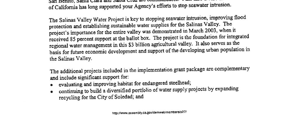
148
149
150
151
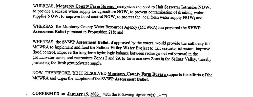
152
153
154

155
156
157
158

159
160
161
162
163
164 TRANSMITTED VIA Mr. Curtis Weeks, General Manager Monterey County Water Resources P. O. Box 930 Salinas, Ca June, 2005 Re: Salinas Valley Integrated Regional Water Management Plan Implementation Dear Mr. Weeks; The Salinas Valley Water Coalition (SVWC) supports the Monterey County Water Resources Agency application for Proposition 50 Grant funds for the Salinas Valley Water Project. We support the Agency using these funds to reduce the debt for all of the Project Components of the Salinas Valley Project as adopted by the voters in March The Salinas Valley Water Coalition is a non-profit organization whose members have supported, and continue to support Monterey County in its pursuit of long-term balance of the supply and demand of water in the Salinas River basin and its effort to halt seawater intrusion. Representatives of the Coalition participated in good faith in the various Monterey County Water Resource Agency (MCWRA) activities pertaining to the issues surrounding Zones 2/2A as well as the development and implementation of the Salinas Valley Water Project. This participation included an effort to evaluate and better understand the Agency, its administrative and operational systems, and to develop a new and proportional form of assessment(s) to replace the Agency s existing Zone 2 and 2A water standby charges. The Salinas Valley Water Project (SVWP) has been designed to halt seawater intrusion and restructure the Agency s Zone 2 and 2A zones to better manage our reservoir operations. The SVWP will manages our resource in such a way that some level of benefit is provided throughout the community. The Coalition has supported the SVWP because of this and the belief that it would mitigate many of the issues that remained outstanding from prior projects. The Coalition continues to support the implementation of the SVWP, and its goals and the resolution of outstanding issues. The Coalition has appreciated the Agency s willingness to include participation of the various stakeholders we believe this has made a tremendous difference within the Community. The Coalition encourages the Agency to continue stakeholder participation and we look forward to working with the Agency toward completion of the SVWP and its full implementation. Thank You, Cc: MCWRA SVWC Board of Directors Nancy Isakson, Consultant Salinas Valley Water Coalition

165
166 Appendix C Appendix C Planning Documents
167 The following adopted reports were used as the basis for the Functionally Equivalent Plan (FEP). They are included in the CD that has been provided as a part of this proposal. 1. Salinas Valley Water Project Summary Report, October Salinas Valley Water Project Figure Salinas Valley Water Project Engineer's Report, January Salinas Valley Water Project Draft EIR, June Salinas Valley Water Project Final EIR, Volume I, April Salinas Valley Water Project Final EIR, Volume II, April Monterey Regional Storm Water Management Program, December Montgomery Watson and Raines, Melton and Carella, Inc., Draft Nitrate Management Plan, October Urban Water Management Plan, MCWD, June Water Distribution System Master Plan Ord Community, June Regional Urban Water Augmentation Project Draft EIR, June Regional Urban Water Augmentation Project Final EIR, September Engineering Feasibility Study Report, MCWD Regional Urban Water Augmentation Project, August Regional Urban Recycled Water Distribution Project, MCWD and MRWPCA, July City of Soledad, Wastewater Treatment and Disposal Master Plan, 2005.
168 Appendix D Appendix D Project Prioritization
169 Appendix D Project Prioritization Project Prioritization in the Salinas Valley Region occurred in four steps. 1. First, a list of current and future water related projects was created. This list consisted of a range of potential projects; including projects in the design phase and projects that have not undergone feasibility assessments. Projects were included for all of the water management entities in the Region. Primary List of Projects Additional Diversion of Salinas River for M&I Use Implementation of Best Management Practices Salinas River Lagoon Habitat Improvement Agricultural irrigation audits Increased Urban/Ag Recycled Water Use Salinas Valley Integrated Water Management Plan Aquifer Storage and Recovery Indirect Potable Reuse Salinas Valley Water Project Central Coast RWQCB Ag. Waiver Program Cloud Seeding Conservation Ad Campaign Continued Enhancement of Groundwater/Surface Water Models Industrial Wastewater Source Control Programs Local Treatment Facility/Infrastructure Improvements Low flow toilet rebates, shower heads and kitchen and lavatory faucets M&I Water Treatment Plants Salinity and Nitrate Education and Incentive Programs Seasonal Storage of Recycled Water Soledad Water Recycling/Reclamation Project Storm Water Capture and Management Continued implementation of Nitrate management programs MCWD Desalination plant expansion Storm Water Management Plan Continued Reservoir Operations and Maintenance MCWD Well No. 33, Booster Station and Reservoir Project Surface water storage and diversion for urban delivery and agriculture during irrigation periods Coordination with County General Plan Update Mobile Irrigation Laboratory Program Tiered Water Rates Delivery to Expanded CSIP Modification of pumping practices along the Coast MRWPCA Plant Membrane Treatment Urban Recycled Water Project - Former Ft. Ord Desalination Urban Runoff Management Program Desalination plant at Moss Landing On-Farm Tile Drain Management Wastewater Disposal Management Elkhorn Slough Conservation Plan Elkhorn Slough Wetland Enhancement Groundwater extraction/transfer/banking Groundwater Pump for GW Level Management Grower education and demonstration projects High-efficiency washing machine rebates On-going Channel Maintenance Program On-going GW extraction, elevation, and quality monitoring and data collection. Maintain and enhance data management tools. On-going waterway flow and water quality monitoring and data collection w/usgs Regional Urban Water Augmentation Project Relocation of groundwater pumping Salinas River Coalition Projects Water Quality Improvement delivered to CSIP Water Quality and Fish Habitat Monitoring Program Water Use Efficiency Studies Water Use/Metering Programs Well Construction and Abatement Ordinance, Well Management Programs Wetland Augmentation with Recycled Water, Groundwater, diverted Surface Water
170 Appendix D 2. The second step of the process focused on choosing projects from the primary list that were potential projects for inclusion in the current round of Salinas Valley Integrated Regional Water Management. The criteria for this step included projects that were either currently being implemented or are currently under development and at a stage of development that their scope was clear. Cloud Seeding Continued implementation of Nitrate management programs Continued Reservoir Operations and Maintenance Coordination with County General Plan Update Desalination Elkhorn Slough Conservation Plan Secondary List of Projects Elkhorn Slough Wetland Enhancement MCWD Well No. 33, Booster Station and Reservoir Project On-going Channel Maintenance Program On-going GW extraction, elevation, and quality monitoring and data collection. Maintain and enhance data management tools. On-going waterway flow and water quality monitoring and data collection w/usgs Regional Urban Water Augmentation Project Salinas Valley Water Project Soledad Water Recycling/Reclamation Project Storm Water Management Plan 3. The third step was to determine which projects from the secondary list of projects would be included in the IRWM Planning process. These projects were identified to be in the planning or design process and scheduled to begin the bidding/construction process by December 31, The reason for this readiness-to-proceed criterion is that the IRWM Plan implementation is critical to meeting the primary objectives of stopping seawater intrusion, hydrologically balancing the basin, increasing groundwater storage, and meeting water quality objectives. The projects that were identified through this step were MCWD Well No. 33, Booster Station and Reservoir Project, Salinas Valley Water Project, Soledad Water Recycling/Reclamation Project, and Water Quality and Fish Habitat Monitoring Program. Additional projects that will be considered in future IRWM planning are: Regional Urban Water Augmentation Project, Castroville Water District Well Relocation and Replacement Project, and Urban Recycled Water Project - Former Fort Ord. 4. The last step was the prioritization of the projects in the proposal. The projects were ranked based on the following criteria: Regional Project The projects were given three points if they covered a large part of the region as opposed to a localized area. The Salinas Valley Water Project and the Water Quality and Fish Habitat Monitoring Program both cover and provide benefit the entire region.
171 Appendix D Number of Regional Priorities Addressed The Water Management Group identified eight regional priorities: Projects that Stop Seawater Intrusion and Balance the Basin Projects that Help Meet Existing Water Demands Projects that Re-Establish Steelhead in Arroyo Seco Projects that Protect and Improve Groundwater Quality Meet Future Water Demands Establish Steelhead Upstream of Arroyo Seco Continue Efforts to Improve Groundwater Quality Implement Watershed Management The projects got one point for every priority addressed. However, projects that met the priority of helping to stop seawater intrusion and balance the basin received three points because it is the highest priority of the region. The projects met these priorities in the following way: Project Salinas Valley Water Project Water Quality and Fish Habitat Monitoring Program MCWD Well 33, Pump Station and Reservoir Project Soledad Water Recycling/Reclamation Project Short Term Priorities Addressed Stop Seawater Intrusion/Balance Basin Meet Existing Water Demands Re-Establish Steelhead in Arroyo Seco River Re-Establish Steelhead in Arroyo Seco River Stop Seawater Intrusion/Balance Basin Meet Existing Water Demands Meet Existing Water Demands Protect and Improve Groundwater Quality Positioning for Long Term Priorities Meet Future Water Demand Re-Establish Steelhead Upstream of Arroyo Seco Re-Establish Steelhead Upstream of Arroyo Seco Meet Future Water Demand Meet Future Water Demand Continue to Improve Groundwater Quality Number of Water Management Strategies Integrated The projects received one point for every water management strategies that they employed. The projects matched up with the water management strategies as follows: Project Salinas Valley Water Project Strategies Employed Ecosystem Restoration Environmental and Habitat Protection and Improvement Water Supply Reliability
172 Appendix D Project Water Quality and Fish Habitat Monitoring Program MCWD Well No. 33, Booster Station and Reservoir Project Soledad Water Recycling/Reclamation Project Strategies Employed Flood Management (Protection) Groundwater Management Conjunctive Use Ecosystem Restoration Environmental and Habitat Protection and Improvement Water Quality Protection and Improvement Water Supply Reliability Groundwater Management Water Supply Reliability Groundwater Management Water Quality Protection and Improvement Water Recycling Water and Wastewater Treatment Member Salinas Valley Water Management Group Finally, the projects received three points each if they were to be implemented by a partner in the Salinas Valley Water Management Group (Group). The Group has taken the lead in IRWM Planning in the Salinas Valley Region. The Salinas Valley Water Project, the Water Quality and Fish Habitat Monitoring Program, and the Well No. 33, Booster Station and Reservoir Project each earned three points for meeting this criterion. The prioritization process yielded the following results: MCWD Well No. 33, Booster Station and Reservoir Project Salinas Valley Water Project Soledad Water Recycling/ Reclamation Project Water Quality and Fish Habitat Monitoring Program Regional Project 3 3 Number of Regional Priorities Addressed Number of Water Management Strategies Integrated Member Salinas Valley Water Management Group Total
173 Therefore, the projects are prioritized in the following order: 1. Salinas Valley Water Project 2. Water Quality and Fish Habitat Monitoring Program 3. MCWD Well No. 33, Booster Station and Reservoir Project 4. Soledad Water Recycling/Reclamation Project Appendix D
174 Appendix E Appendix E Implementation Schedule
175 ID Task Name Start Finish H2 H1 H2 H1 H2 H1 H2 H1 H2 H1 H2 H1 H2 H1 H2 H1 H2 H1 H2 H1 H2 H1 H2 H1 1 Salinas Valley FEP Implementation Fri 1/1/99 Thu 12/31/09 2 Salinas Valley Water Project Fri 1/1/99 Thu 3/29/07 3 CEQA Certification Fri 1/1/99 Tue 6/4/02 4 NEPA Fri 1/1/99 Fri 9/30/05 5 Identification and acquisition of permits Tue 6/4/02 Tue 2/28/06 6 Project Design Fri 6/4/04 Thu 2/23/06 7 Land Acquisition and Right of Way Fri 6/4/04 Thu 12/15/05 8 Permits Acquisition Fri 6/4/04 Thu 10/20/05 9 Bid Solicitation Process Fri 2/24/06 Thu 4/20/06 10 Project Construction Fri 5/12/06 Thu 3/29/07 11 Environmental Mitigation/Enhancement Fri 5/12/06 Thu 3/29/07 12 Water Quality and Fish Habitat Monitoring Program Wed 9/1/04 Thu 12/31/09 13 Consultation with NOAA Fisheries Wed 9/1/04 Mon 10/31/05 14 Program Planning Tue 11/1/05 Thu 3/29/07 15 Identification and acquisition of permits Tue 11/1/05 Fri 3/30/07 16 Monitoring Program Implementation Mon 4/2/07 Thu 12/31/09 17 MCWD Well # 33 Booster Station and Reservoir Project Mon 1/3/05 Mon 1/12/09 18 CEQA Certification Thu 1/6/05 Wed 5/31/06 19 NEPA Thu 1/6/05 Wed 5/31/06 20 Identification and acquisition of permits Mon 1/3/05 Fri 6/30/06 21 Project Design Fri 7/1/05 Thu 6/29/06 22 Land Acquisition and Right of Way Thu 1/6/05 Wed 5/31/06 23 Bid Solicitation Process Mon 7/3/06 Fri 10/6/06 24 Project Construction Mon 11/20/06 Fri 4/11/08 25 Environmental Mitigation/Enhancement Mon 11/20/06 Mon 1/12/09 26 City of Soledad Water Recycling/Reclamation Project Wed 12/1/04 Thu 12/31/09 27 CEQA/NEPA Compliance Mon 1/3/05 Fri 9/30/05 28 Identification and acquisition of permits Wed 12/1/04 Thu 11/30/06 29 Project Design Mon 1/2/06 Fri 12/29/06 30 Bidding Process Mon 1/1/07 Fri 3/30/07 31 Land Acquisition Mon 10/3/05 Wed 11/30/05 32 Construction Mon 4/2/07 Fri 5/30/08 33 Environmental Mitigation/Enhancement Mon 4/2/07 Fri 5/30/08 34 Ongoing Monitoring Mon 6/2/08 Thu 12/31/09 Project: Salinas Valley FEP Implement Date: Sun 7/10/05 Task Split Progress Milestone Summary Project Summary External Tasks External Milestone Deadline Page 1
176 Appendix F Appendix F Monterey Bay MOU
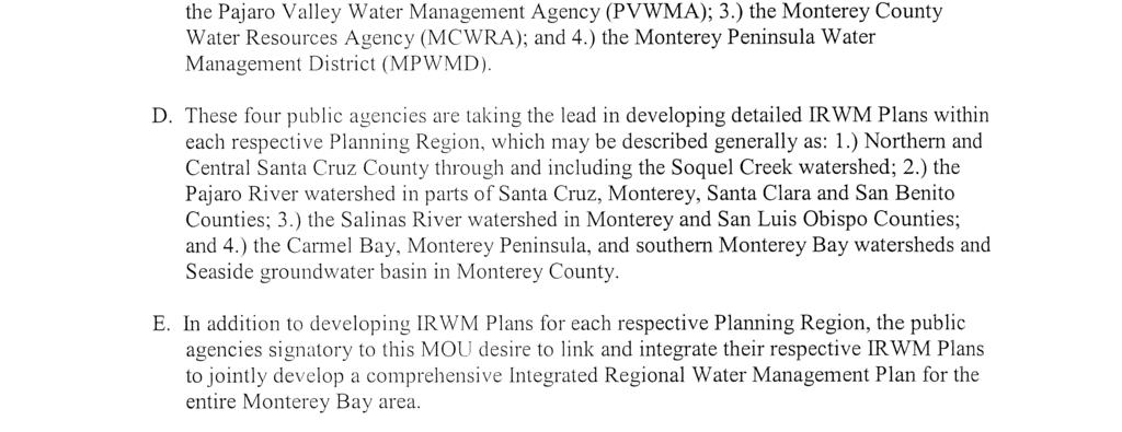
177
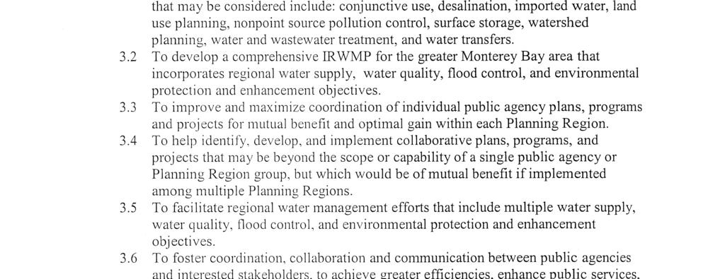
178

179

180
181