Lower Cotter Catchment Draft Reserve Management Plan 2017
|
|
|
- Aubrie Lawson
- 5 years ago
- Views:
Transcription

1
2 YOUR SAY The Environment, Planning and Sustainable Development Directorate welcomes comments on this draft Reserve Management Plan for the Lower Cotter Catchment. Information is available at: You can make comments by: Visiting: Post: Manager, Conservation Planning Environment, Planning and Sustainable Development Directorate PO Box 158, Canberra ACT 2601 Comments can made until COB 10 March 2017 Privacy Before making a submission, please review the Environment, Planning and Sustainable Development Directorate s privacy policy and annex at Any personal information received in the course of your submission will be used only for the purposes of this community engagement process. Names of organisations may be included in any subsequent consultation report, but all individuals will be de-identified unless prior approval is gained. Accessibility The ACT Government is committed to making its information, services, events and venues as accessible as possible. If you have difficulty reading a standard printed document and would like to receive this publication in an alternative format, such as large print, please phone Canberra Connect on or the Environment, Planning and Sustainable Development Directorate at epd_communications@act.gov.au If English is not your first language and you require a translating and interpreting service, please phone If you are deaf, or have a speech or hearing impairment and need the teletypewriter service, please phone and ask for Access Canberra on For speak and listen users, please phone and ask for Access Canberra on For more information on these services, visit Enquiries: Phone Access Canberra on Website: Cover photos: Top: Cotter Reservoir from new Cotter Dam (M. Jekabsons) Bottom left: Platypus at Vanitys Crossing (M. Jekabsons) Bottom Right: Cotter River at Bracks Hole (now flooded) prior to 2003 fires (M. Jekabsons) ii
3 LOWER COTTER CATCHMENT DRAFT RESERVE MANAGEMENT PLAN 2017 iii
4 Acknowledgements The ACT Government acknowledges the Traditional Custodians of the ACT, the Ngunnawal people. We respect their continuing culture and the unique contribution they make to the life of this area. This Draft Reserve Management Plan for the Lower Cotter Catchment has been developed by Conservation Planning, ACT Parks and Conservation Service, in the ACT Environment, Planning and Sustainable Development Directorate (EPSDD). EPSDD acknowledges the many people who provided advice and assistance in the preparation of this draft Reserve Management Plan. Published by the Environment, Planning and Sustainable Development Directorate. Australian Capital Territory 2017 This work is copyright. Apart from any use as permitted under the Copyright Act 1968, no part may be reproduced without the written permission of the Environment, Planning and Sustainable Development Directorate, PO Box 158, Canberra ACT Disclaimer: Any representation, statement, opinion, advice, information or data expressed or implied in this publication is made in good faith but on the basis that the ACT Government, its agents and employees are not liable (whether by reason of negligence, lack of care or otherwise) to any person for any damage or loss whatsoever which has occurred or may occur in relation to that person taking or not taking (as the case may be) action in respect of any representation, statement, advice, information or data referred to above. Maps: ACT Government does not warrant that the data is free from errors. Design: DesignEdge Printed on: 100% recycled paper. iv

5 A Vision for the Lower Cotter Catchment Sunrise over Cotter River (EPSDD photo library) v
6 Contents YOUR SAY... ii Acknowledgements... iv A Vision for the Lower Cotter Catchment... v Contents... 1 Management Plan Aim INTRODUCTION Management plan purpose and scope Statement of significance Regional Setting Geography of the Lower Cotter Catchment Climate Cotter Dam and reservoir ACT Auditor General s performance audit report Implementation SIGNIFICANT CHALLENGES IN THE LOWER COTTER CATCHMENT A new approach to managing the Lower Cotter Catchment Protecting water quality Conserving the natural environment Adapting to climate change Caring for cultural heritage Providing opportunities for low-impact recreation Managing fire Engaging the community MANAGEMENT FRAMEWORK ACT Legislation Commonwealth legislation International and national agreements Land planning in the ACT Responsibilities for management of the LCC Key desired outcomes for the management plan ZONING AND ACCESS Reserve zoning Access Boundary rationalisation WATER RESOURCES Primary management objective
7 5.2 Background Hydrology and water management Water quality Factors affecting water quality LANDSCAPE AND ECOLOGICAL VALUES Primary management objectives Background Landscape and habitat connectivity Geodiversity Native vegetation Native animals Management issues Ecological rehabilitation Translocation of wildlife CULTURAL HERITAGE VALUES Primary management objectives Background Aboriginal heritage Contemporary Aboriginal Connection to Country Management considerations and issues: Aboriginal connections and heritage European cultural heritage Heritage legislation and registers Management considerations and issues: European cultural heritage RECREATION Primary management objective Recreational activities New recreational activities Management considerations and issues FIRE MANAGEMENT Primary management objective Background Fire history in the Lower Cotter Catchment Current fire planning Protecting water resources Fire ecology Planned burning Fire access
8 9.9 Blue Range COMMUNITY ENGAGEMENT Primary management objectives Interpretation, education and community engagement Community involvement in management Neighbours Community engagement: management considerations ENVIRONMENTAL PROTECTION, MANAGEMENT OPERATIONS AND RESEARCH Primary management objectives Introduction Environmental impact assessment Management operations and environmental protection Resource extraction Commercial forestry Compliance and enforcement Research and monitoring APPENDICES Appendix 1: Table of Actions Appendix 2: ACT legislation relevant to the management of the Lower Cotter Catchment Appendix 3: ACT strategies and plans relevant to the LCC Appendix 4: Interesting, rare and threatened species of the Lower Cotter Catchment Appendix 5: LCC Risk Treatment Plan Reconciliation with Reserve Management Plan Appendix 6: Fish management plan references GLOSSARY REFERENCES PHOTOS
9 FIGURES Figure 1 Location of the Lower Cotter Catchment Figure 2 Management zones in the Lower Cotter Catchment Figure 3 Diagram showing the warming of the future climate (ACT Government 2016) Figure 4 Soil erodibilty 2006 (ACT Government 2007a) Figure 5 Location of Blue Range and the Lower Cotter Catchment TABLES Table 4.1 Lower Cotter Catchment management zones Table 4.2 Management policies for defined management zones in the Lower Cotter Catchment related to visitor experience, access and infrastructure Table 4.3 Road categories in the Lower Cotter Catchment Table 6.1 Pest animals in the Lower Cotter Catchment status and control programs Table 8.1 Summary of policies for recreational activities and permitted/prohibited activities in the Lower Cotter Catchment
10 5

11 Management Plan Aim Reflections on the Cotter Reservoir (Mark Jekabsons) 6
12 7

13 Pierces Creek Falls at junction with Cotter Reservoir (Mark Jekabsons) 8

14 1 INTRODUCTION Lower Cotter Catchment Draft Reserve Management Plan Management plan purpose and scope This Draft Reserve Management Plan has been prepared as required by the provisions of the Nature Conservation Act 2014 and the Planning and Development Act The Nature Conservation Act describes the process for preparing the plan, and the Planning and Development Act (Schedule 3) establishes the planning and development management objectives for the reserve. The management objectives defined for a reserve set aside for the protection of water supply are: 1. to protect existing and future domestic water supply 2. to conserve the natural environment 3. to provide for public use of the area for education, research and low-impact recreation. This draft management plan identifies the values of the reserve and describes how the objectives will be implemented and promoted in the reserve. Note: this plan does include the Cotter Reserve picnic area below the dam wall or the nearby campground. Vanitys Crossing (Mark Jekabsons) 9
15 1.2 Statement of significance Lower Cotter Catchment Draft Reserve Management Plan 2017 A place s natural significance and cultural significance (aesthetic, historic, scientific, social or spiritual value) should be acknowledged in any management document, and ideally presented as a statement of significance. A statement of significance sets out why a place is important. (Australian Heritage Commission 2003) Value Water Resources Natural Heritage Cultural Heritage Recreation Research and Education Significance The project to enlarge the Cotter Dam has delivered an increase of 35 per cent to the total water storage available to Canberra and Queanbeyan. As Canberra grows and faces the uncertainties posed by climate change, delivery of a reliable supply of high quality water from the Lower Cotter Catchment will be one of the keys to a long-term solution for Canberra s water supply. The native vegetation remaining along the Cotter River, together with remnant and regenerating vegetation to the south of Cotter Dam, provides an important wildlife movement corridor linking the northern part of Namadgi National Park with the Murrumbidgee River. Blundells Flat contains the lowest elevation bog and fen wetlands within the region. Several rare and threatened plants occur in the area, and the Cotter River and reservoir support populations of threatened aquatic fauna. The extensive areas burnt in the 2003 bushfires, including former pine plantations, are slowly recovering with predominantly native species, and nature conservation values are likely to increase over time. The northern Brindabella Ranges have abundant archaeological evidence of Aboriginal occupation since the last ice age, more than 25,000 years ago. The nearby peaks of the Tidbinbilla Range were recorded by early Europeans as initiation sites for young men. Aboriginal people have an ongoing connection to their Country that links past, present and future. The Ngunnawal people have a continuing sense of responsibility to preserve the spirit and stories of their ancestors throughout the landscape. European settlement and land use is represented by hut ruins and other remains that relate to early pastoral and later forestry activities and provide the basis for telling the story of struggling pioneers and successive changes in use of the area. While the area was popular for a range of activities including four-wheel driving, trail-bike and mountain bike riding, and fishing, to protect the water supply the future emphasis will be on low-impact recreational activities. The recovering native landscape increasingly offers more opportunities for bush walking and nature appreciation. The LCC has a long history as a site for research and education, with substantial research undertaken to support the enlarged Cotter Dam project, and other research conducted since the 2003 bushfires. The LCC provides further opportunities to study catchment behaviour following fire (particularly vegetation rehabilitation and the movement of water and pollutants within the catchment associated with various rehabilitation strategies), as well as the impacts of climate change, water recharge associated with the forest growth lifecycle, and threatened aquatic species. 10

16 1.3 Regional Setting Lower Cotter Catchment Draft Reserve Management Plan 2017 The potential for water supply from the forested mountain catchment of the Cotter River was an important factor influencing the choice of the site for Australia s capital city. When Canberra was proclaimed the national capital in 1913, the government and planners showed great foresight in setting aside the whole of the Cotter River to supply water to the new city. Three dams have been constructed on the river Corin Dam on the upper Cotter and Bendora Dam on the middle Cotter, built in the 1960 s, and Cotter Dam on the lower Cotter, built in Removing grazing licences, replanting cleared areas to pine plantations and closing large areas of the catchment to general public use were among measures taken to ensure the protection of the catchment for the future. The Cotter River catchment is well protected, with no farms or houses and restrictions on recreation activities to protect the quality of the water. The majority of the catchment, including Corin and Bendora dams, lies within Namadgi National Park. The Lower Cotter Catchment is bounded to the south and west by Namadgi National Park and the adjoining Tidbinbilla Nature Reserve and represents the northernmost end of a string of protected areas covering more than 1.6 million hectares, stretching south almost to Melbourne. This area, known as the Australian Alps National Parks, includes Namadgi National Park in the ACT, Kosciuszko National Park in New South Wales and the Victorian Alpine National Park. Following the devastating 2003 fires, the decision made by the ACT Government to restore the Lower Cotter Catchment to native vegetation to ensure the protection of water quality in Cotter Reservoir into the future will also have significant benefits for other environmental and social values. As the area recovers and functioning natural ecosystems are restored over the longer term, it is intended that the Lower Cotter Catchment will be incorporated into Namadgi National Park, completing the comprehensive protection of the entire Cotter catchment and safeguarding Canberra s supply of clean, high quality water into the future. Cotter River (EPSDD photo library) 1.4 Geography of the Lower Cotter Catchment The Lower Cotter Catchment, depicted in Figure 1, totals 6350 hectares of the 19,000 hectares of the Cotter River catchment below Bendora Dam in the ACT. The balance of the catchment is within Namadgi National Park and is managed under the Namadgi National Park Plan of Management (ACT Government 2010a). The LCC is essentially a bowl of undulating topography draining into the Cotter Reservoir, primarily via the Cotter River, which dissects the reserve into western and eastern halves. The Cotter River is approximately 74 km long and drains a forested montane catchment of 482 km2, which has been managed to protect water quality since the early 1900s. Shortly after exiting the Cotter Dam, the Cotter River enters the Murrumbidgee River at Casuarina Sands. The western and southern boundaries of the LCC adjoin Namadgi National Park and Tidbinbilla Nature Reserve. Uriarra Village adjoins the northern boundary, while the site of the former Pierces Creek settlement (destroyed in the 2003 fires) lies just outside the eastern boundary. 11

17 Figure 1 Location of the Lower Cotter Catchment 12
18 The LCC has traditionally supported land uses such as plantation forestry, recreation and agriculture. At the time of the 2003 ACT bushfires, the LCC contained 4300 hectares of pine plantations which were almost entirely burnt with only salvage harvesting possible. Rain events immediately following the fires scoured gullies, roads and trails, and lead to elevated levels of turbidity in streams leading into the Cotter Reservoir. The 2003 bushfires triggered a resetting of priorities in natural resource management in the ACT, and this was evident in the Lower Cotter Catchment. The fires and the resulting loss of pine plantations coincided with a long period of drought and increasing concerns about the potential impacts of climate change and the security of water supplies in the face of a growing population. In addressing water security, the ACT Government has made an investment of over $500 million to enlarge the Cotter Dam and ensure the LCC becomes a major contributor of reliable and high quality water for Canberra. The priority placed on the value of the LCC as a catchment (evidenced by the change to the Territory Plan to focus management on water supply) has had implications for other land management programs in the LCC, especially fire management and recreation. 1.5 Climate The Canberra climate is typically continental with occasional extreme summer temperatures and winter minimums frequently below freezing. Rainfall is highest in winter, with snow melt contributing to stream flows. The Lower Cotter Catchment averages about 800 mm rainfall per annum which is higher than the Canberra average of 600 mm. Regional drought is a common feature, nine significant droughts having occurred since The mean annual maximum temperature at Uriarra is 19 0 C (ACT Government 2007a). Cold air drainage and cold winters inhibit the growth of woody vegetation in low-lying depressions (frost hollows). The more extreme features of the local climate are of importance to management of the LCC, namely: occasional heavy rainfall that causes localised flooding of Condor Creek and Cotter River and erosion on steeper and poorly vegetated slopes resulting in runoff into waterways, putting water quality at risk; and summer heatwave conditions, with hot, dry north-westerly winds that quickly cure forest and grassland fuels, resulting in high to extreme fire danger. 1.6 Cotter Dam and reservoir For over 40 years following its completion in 1912, the Cotter Reservoir was Canberra s only water supply, until Bendora and Corin Dam were built upstream on the Cotter River in the 1960s. These became the primary source of supply, (with the Cotter used only as an emergency back-up supply), supplemented more recently by Googong Reservoir on the Queanbeyan River in New South Wales. In response to the 2003 bushfires and the prolonged drought of the late 1990s and early 2000s, Cotter Reservoir was accessed again for domestic water in Between 2009 and 2013 a new, higher dam wall was constructed, increasing the capacity of the reservoir from 4 gigalitres to 79.4 gigalitres an increase of 35 per cent in water storage capacity for Canberra. Before 2004, the Cotter Reservoir had not been used for domestic water supply for more than 30 years. Drawing water again from the Cotter Reservoir is a significant and continuing change in Canberra s water supply, and there is a renewed focus on the reliability of water resources in the surrounding catchment. 13
. One of the key recommendations was that a cross-agency risk management plan be developed cooperatively by the key stakeholders.")
19 1.7 ACT Auditor General s performance audit report In 2015, the ACT Auditor General undertook a review of the effectiveness of management strategies employed by the ACT Government and Icon Water in the management of the Lower Cotter Catchment (ACT Government 2015a). One of the key recommendations was that a cross-agency risk management plan be developed cooperatively by the key stakeholders. The risk management plan identifies 13 risks that require further treatment through the reserve management plan. These risks and how they have been addressed in this reserve management plan are listed in Appendix Implementation The actions identified in each chapter of this plan are consolidated in the Table of Actions at Appendix 1. The table includes priorities and responsibilities for implementing the actions, and will form the basis of a separate implementation plan to be developed by the land manager. A report on implementation will be provided to the Minister five years after this reserve management plan is approved. Cotter Dam spillway (Mark Jekabsons) 14
20 15
")
21 Cotter Reservoir from new Cotter Dam (Mark Jekabsons) 16

22 2 SIGNIFICANT CHALLENGES IN THE LOWER COTTER CATCHMENT 2.1 A new approach to managing the Lower Cotter Catchment From late 1996 to mid-2010, Canberra, along with much of southern Australia, experienced a prolonged period of dry conditions, known as the millennium drought. In 2003, the bushfires that devastated parts of Canberra swept though the Lower Cotter Catchment, destroying more than 4000 hectares of pine plantation and extensive areas of native vegetation in a single afternoon. In response to the drought and the 2003 bushfires, the ACT Government committed significant resources to secure Canberra s future water supply. In 2007, the ACT Government recognised water as the primary value of the Lower Cotter Catchment and in 2008 changes to the Territory Plan established the Lower Cotter Catchment as a reserve with the primary purpose of protecting Canberra s water supply. The change of land use in the Territory Plan triggered the requirement for a statutory management plan for the Lower Cotter Catchment, with the protection of water resources the priority focus. This new draft plan has been prepared to guide management of the Lower Cotter Catchment over the next ten years. When finalised, the Lower Cotter Catchment Reserve Management Plan will give statutory effect to the policies and actions outlined in this draft plan. 2.2 Protecting water quality The primary risk to water quality in the Lower Cotter Catchment is increased turbidity from sediment produced as a consequence of the area s highly erodible soils, combined with the loss of vegetation from the 2003 fires and the extensive network of ex-forestry trails. To maintain water quality, it is important to maintain vegetation cover and limit activities that can lead to increased erosion. Trails have been identified as a major source of sediment. Over 100km of trails have already been closed and rehabilitated, and motorised vehicle access has been limited. The trail network will be kept under review over the life of this plan. Risks of water contamination by micro-organisms and other pathogens, chemicals or other pollutants will be minimised though actions such as prohibiting all recreational activities in the reservoir, and prohibiting or restricting some recreational activities throughout the catchment. Native and pest animals will be carefully managed and stock, domestic animals and the use of chemicals and other potential contaminants strictly controlled. Further information on protecting water quality is in Chapter 5. Lees Creek (M. Jekabsons) 17

23 2.3 Conserving the natural environment Lower Cotter Catchment Draft Reserve Management Plan 2017 Although the reserve has a history of disturbance from human activity, including clearing for grazing, planting with pines, and severe fire damage, the Lower Cotter Catchment retains significant natural values. It provides important landscape-scale connections for wildlife movement, supports a number of threatened plant species and communities, and provides habitat for some declining woodland birds, as well as native fish and invertebrates. The plan proposes that remaining pine plantations will be returned to native vegetation as soon as practicable, allowing for a commercial return. Continuing restoration of native vegetation in the catchment will increase the availability of habitat for woodland birds and other fauna, and enhance the resilience of native species and communities to climate change. Restrictions on fishing, the prohibition on live bait, together with other management interventions such as the provision of fishways and constructed shelter areas, will help to conserve populations of threatened native fish. Control of weeds, including St Johns Wort, blackberry, and especially pine wildings, is an ongoing management issue. Control of blackberry will prioritise habitat for threatened species and prevent incursions into adjoining areas, particularly Namadgi National Park. With the support of community volunteers, extensive revegetation is continuing and, over time, the reserve will be restored to a fully functioning landscape of native vegetation, producing clean water, conserving natural and cultural values, and providing low impact recreational opportunities for Canberra residents and visitors. Further information on conserving the natural environment is in Chapter 6. Cotter River from Vanitys Crossing Road (Mark Jekabsons) 18
24 2.4 Adapting to climate change Lower Cotter Catchment Draft Reserve Management Plan 2017 Predictions about the impact of climate change in the ACT region point to a hotter and possibly drier climate in the future. A consequent increase in fire frequency and intensity is likely and water inflows into the Cotter catchment may be reduced by up to 50 per cent. Climate change is a cross cutting issue that will potentially affect the full range of values and uses of the Lower Cotter Catchment. Minimising the impact of climate change on water resources, biodiversity and other values is best achieved by building the resilience of natural ecosystems through restoring native vegetation, enhancing habitat connectivity across environmental gradients and reducing the impacts of other stressors such as weeds and pest animals. This Draft Reserve Management Plan builds on the decision of the ACT Government to revegetate the Lower Cotter Catchment with native vegetation. Over a long period of time the catchment should return to a selfgenerating and resilient ecosystem that is best able to safeguard Canberra s water supply, conserve biodiversity and minimise the impacts of climate change on other values into the future. 2.5 Caring for cultural heritage The Lower Cotter Catchment has extensive evidence of Aboriginal occupation over thousands of years, including scarred trees, rock shelters and artefact scatters. All Aboriginal sites are of cultural significance to the Ngunnawal and other Aboriginal groups of the region. The plan provides for their protection and interpretation in collaboration with Traditional Custodians and Aboriginal Representative Organisations. Some evidence of early European settlement and historical forestry activities also remains. Cultural heritage will be managed in accordance with best practice principles set out in the Australia ICOMOS Charter for the Conservation of Places of Cultural Significance (the Burra Charter). Further information on cultural heritage is in Chapter Providing opportunities for low-impact recreation Consistent with the primary objective of protecting water supply, it is intended that recreational use of the Lower Cotter Catchment remains low-key, with a matching level of facilities. The reserve management plan identifies two management zones within the reserve and sets out which activities are permitted or not permitted within each zone. Some historical uses are not compatible with protecting the water supply. Since 2007 restrictions have been introduced on activities such as motor sport events, horse riding and trail-bike riding, and previous controls on camping, lighting fires and firewood collection remain in place. Swimming is not permitted anywhere in the reserve and all recreational activities are prohibited in the reservoir. Fishing is only permitted in the Cotter River upstream of the junction with Condor Creek. Driving (2WD and 4WD) and trail bike riding are only permitted on roads and management tracks that are publicly accessible. Walking is permitted everywhere. Cycling (including mountain bike riding) is permitted on management trails and publicly accessible roads. Horse riding is permitted on management trails (to be identified) west of Brindabella Road. Illegal four wheel driving and trail bike riding on closed roads and illegally created trails, and the consequent erosion problems, remain significant management issues in the reserve. Wherever possible, a public relations and education approach will be adopted to highlight appropriate behaviour. However, increased efforts by ACT Parks and Conservation Service (PCS) rangers may be required to control illegal and damaging activities. Recreational activities in the reserve will continue to be monitored to ensure that they do not adversely affect water quality or other catchment values. Further information on recreation is in Chapter 8. 19

25 Water supply catchment advisory sign (EPSDD photo library) Lower Cotter Catchment Draft Reserve Management Plan Managing fire The objectives for fire management in the LCC are to reduce the risk of large scale wildfires impacting on all assets including the water supply. Fire management activities are undertaken in a manner that considers all attributes across the landscape and can include promoting the recovery of vegetation in order to reduce erosion and improve water quality, and protecting threatened and fire-sensitive species and ecological communities. Management of fire in the reserve will continue to be consistent with the current Strategic Bushfire Management Plan for the ACT and the Cotter Regional Fire Management Plan. These documents together identify all fuel management that is to be undertaken in the LCC and surrounds. Planned fire will continue to be an important tool in reducing the risk of wildfire in the catchment, and will be carefully managed and undertaken in accordance with the ACT Government s Ecological Guidelines for Fuel and Fire Management Operations. Where possible, a Water Quality Protection Area (WQPA), comprising a vegetated buffer strip adjacent to the impounded waters in Cotter Reservoir, will be maintained when conducting fire management operations in the catchment. Further information on fire is in Chapter 9. 20

26 2.8 Engaging the community Lower Cotter Catchment Draft Reserve Management Plan 2017 There is a strong history of community involvement in the reserve since the 2003 fire, with thousands of volunteers planting over 306,000 trees and shrubs. The plan encourages on-going community participation in stewardship of the LCC. Ongoing interpretation and education activities are proposed to improve community knowledge about the values of the LCC and promote appropriate use. Further information on community engagement is in Chapter 10. Greening Australia revegetation work, LCC (EPSDD photo library) 21
")
27 Cotter Reservoir near Pierces Creek inflow (Mark Jekabsons) 22
28 3 MANAGEMENT FRAMEWORK Lower Cotter Catchment Draft Reserve Management Plan 2017 The management of land in the ACT is underpinned or influenced by a wide range of legislation, agreements, and government planning and policy documents. 3.1 ACT Legislation The Planning and Development Act 2007 governs land use in the ACT. The Act establishes the Territory Plan; provides for the identification of Public Land and its reservation for defined purposes; defines management objectives for each category of Public Land; and provides for environmental impact assessment. The Nature Conservation Act 2014 is the chief legislation for the protection of native plants and animals in the ACT, including the declaration of threatened species and ecological communities. The Act prescribes the process for preparing reserve management plans for conservation reserves, a nature conservation strategy, and action plans for threatened species and ecological communities. A report on the implementation of a reserve management plan is required every five years and plans must be reviewed every ten years after commencement. The Act includes provisions that apply to managing recreation activities in reserves, and offences and penalties for clearing and damaging land in reserves, and for damaging infrastructure. The Nature Conservation Act also provides for the ACT Conservator of Fauna and Flora to notify Activities Declarations if the Conservator reasonably believes that a certain activity may have a negative impact on the reserve. In deciding whether to make an Activities Declaration, the Conservator must consider the Reserve Management Plan (where it exists) for the reserve. The current Activities Declaration for the LCC is available at Key Territory legislation related to managing land in the ACT includes: Emergencies Act 2004, which establishes requirements for fire management in the ACT, including the preparation of the ACT Strategic Bushfire Management Plan. Heritage Act 2004, which establishes a system for the recognition, registration and conservation of natural and cultural heritage places and values. Fisheries Act 2000, which regulates recreational fishing, prohibits fishing in the Cotter Reservoir, and protects threatened fish species. Pest Plants and Animals Act 2005, which lists pest plants and animals and provides for development of pest animal and pest plant management plans. Water Resources Act 2007, which provides for the sustainable use and management of ACT water resources, the protection of aquatic ecosystems and aquifers from damage and, where practicable, the reversal of past damage. Environment Protection Act 1997, which regulates activities that have the potential to cause environmental harm. Human Rights Act 2004, which acknowledges that Aboriginal and Torres Strait Islander peoples hold distinct cultural rights and must not be denied the right to maintain, protect and develop their culture. The Act also recognises their material and economic relationships with the land, waters and other resources. Other ACT legislation relevant to the management of the LCC is shown in Appendix 2. 23

29 Management is also guided by strategies and plans, including the ACT Water Strategy, ACT Weeds Strategy, ACT Pest Animal Management Strategy, Bushfire Operational Plans, Action Plans for threatened species and ecological communities, and the ACT Kangaroo Management Plan. These should be read in conjunction with this plan and are further described in Appendix 3. Detailed management prescriptions and operational guidelines may be referred to, but are not included in the plan. 3.2 Commonwealth legislation The main Commonwealth legislation relevant to management of the Lower Cotter Catchment is the Environment Protection and Biodiversity Conservation Act 1999 (EPBC Act). This Act provides for environmental impact assessment for matters of national environmental significance, which include Commonwealth-listed threatened species and ecological communities. 3.3 International and national agreements The International Union for Conservation of Nature (IUCN) categories of protected areas may also be of relevance to the Lower Cotter Catchment. As a reserve for the protection of water supply, the reserve does not presently qualify for any of the categories of protected area defined by the IUCN. However parts of the LCC could potentially meet the definitions of some categories. The areas of relatively undisturbed native vegetation adjoining Namadgi National Park could, for example, potentially meet Category II of the IUCN classification as a protected area managed mainly for ecosystem protection and recreation. As the vegetation recovers over time, the LCC more broadly may also meet these criteria. The potential application of IUCN categories to the LCC will be kept under review over the life of this plan. Lower Cotter Catchment and Cotter Reservoir from Blue Range (Mark Jekabsons) National-level agreements and frameworks that provide further context for policies developed under ACT legislation and relevant to the management of the LCC include: Australia's Biodiversity Conservation Strategy (DSEWPC Natural Resource Management Ministerial Council 2010), which sets out objectives and actions to achieve the goal of protecting biological diversity and maintaining ecological processes and systems. Australia s Strategy for the National Reserve System (National Reserve System Task Group 2009). Throughout Australia, attention is being directed to protecting and building ecological connectivity across the wider landscape in the face of climate change. Under the auspices of the National Reserves System Cooperative Program, Australia has been divided into 85 bioregions. These are large geographically distinct areas of land with common characteristics such as climate, ecological features, and plant and animal communities (DEWHA 2009a). The ACT falls within the Australian Alps and South Eastern Highlands bioregions, sharing its environmental characteristics with surrounding New South Wales and parts of Victoria. 24
30 3.4 Land planning in the ACT Lower Cotter Catchment Draft Reserve Management Plan 2017 Planning in the ACT occurs at different scales: Land use planning: determines in a broad sense which areas of land will be used for what purpose (National Capital Plan, Territory Plan) Reserve management planning: once land use has been determined, management plans determine how reserved areas such as the LCC will be managed Site planning: deals with the design of a particular area or facility (for example, design of picnic areas). This detailed planning may be done in a master plan, and in subsequent design documentation for the construction of new facilities as part of specific capital works projects. All the land in the Lower Cotter Catchment is Territory Land as defined in the Australian Capital Territory (Planning and Land Management) Act 1988 (Commonwealth). Its management is the responsibility of the ACT Government; however, it is still subject to the policies of the National Capital Plan (NCA 2008) as well as those of the Territory Plan (ACTPLA 2008). Within the National Capital Plan, the LCC is included in the General Policy Plan for the ACT, in the Mountains and Bushland land-use category of the National Capital Open Space System (NCOSS). The latter involves a linked system of open space areas aimed at protecting the visual backdrop and landscape setting of the National Capital. The National Capital Plan contains principles and policies both for NCOSS and Mountains and Bushland, as well as permitted uses of Mountains and Bushland. The National Capital Plan requires that the Mountains and Bushland area is to be maintained as an important visual background to the National Capital; to protect both its nature conservation values and Canberra's existing and future water supply and to develop appropriate National Capital and tourist uses. It notes that: The Cotter and Gudgenby catchments should be managed to protect the water supply to the National Capital in a manner consistent with their nature conservation values. The quality of water supply in the Cotter catchment is to be assured primarily by controls over catchment uses. The North Cotter area should be planned and managed in a manner consistent with Namadgi National Park in terms of protection for nature conservation and water supply requirements, with the additional potential of use for low to medium intensity recreation particularly in the pine plantations and adjacent Uriarra rural area. In the Territory Plan, established under the Planning and Development Act 2007, the LCC is included in the Non-Urban Zone: NUZ5 Mountains and Bushland (Territory Plan Vol. 1 ACTPLA 2008). General objectives for this zone cover protection of the environment (including water supply), scenic and landscape character, opportunities for education and research, and ensuring any development is unobtrusive. The Non-Urban Zones Development Code contains additional planning, design and environmental controls, including restrictions on use. 3.5 Responsibilities for management of the LCC The ACT Parks and Conservation Service is the contemporary custodian of the land within the Lower Cotter Catchment, and is responsible for managing the area to meet the statutory objectives to protect existing and future domestic water supply, conserve the natural environment, and provide for public use of the area for education, research and low-impact recreation. The Environment Protection Authority (EPA) within the ACT Government regulates the taking of water and the provision of environmental flows from the dam under the provisions of the Water Resources Act Water supply infrastructure and the use of water stored in Cotter Reservoir are managed by Icon Water Limited, which is an unlisted public company, owned by the ACT Government, with assets and investments in water, sewerage and energy services and operations. Icon Water is responsible for providing and 25
31 maintaining water supply and storage infrastructure, dam safety, the water distribution network, reservoir drawdown, treatment for drinking purposes, and monitoring of water quality. However, Icon Water does not have regulatory powers to control land use in the catchment. The Directors-General Water Group, which comprises senior representatives from across the ACT Government with responsibilities relating to water, has the strategic oversight for high level coordination of Lower Cotter Catchment management. All land managers with an interest in the LCC meet regularly to coordinate management activities and decision making. 3.6 Key desired outcomes for the management plan Key desired outcomes for the ten-year life of the management plan are: Water Values Water quality benefits from improved catchment stability and appropriate controls on recreational use. Natural Values Natural processes of recovery from past disturbance continue and are enhanced by active management where necessary to re-establish a native vegetation cover, stabilise soils, and restore naturally functioning ecosystems, where possible. Cultural Values Cultural values are better understood, conserved, considered in management actions, and interpreted to visitors. Aboriginal people are involved in land management activities. Recreation Recreational use is managed in a manner that is compatible with achieving water quality objectives. Fire Management The approach to fire management recognises the primary role of the LCC for water supply while balancing objectives for biodiversity protection with risk management on a wider regional scale. Research and Monitoring A coordinated program of research and monitoring assists in the achievement of management objectives focussed on catchment health, water quality and protection of natural and cultural values. Community Engagement An active program of community engagement is conducted to encourage an understanding of the inherent values of the LCC, the objectives for management and appropriate use of the area. Community groups remain active in restoration works within the LCC. 26
32 27

33 Pierces Creek Forest (Mark Jekabsons) 28
34 4 ZONING AND ACCESS 4.1 Reserve zoning Lower Cotter Catchment Draft Reserve Management Plan 2017 Zoning is a system of defining what activities can occur in which locations within a reserve, both to protect reserve values and to separate potentially conflicting activities. The Lower Cotter Catchment is covered by existing zones identified by agencies with specific functional responsibilities. Key among these are: the Territory Plan, which zones the entire LCC as being for the purpose of protecting water supply. Adjoining areas are identified as P4 Plantation Forestry and Pb National Park the ACT Strategic Bushfire Management Plan, which currently identifies areas within the LCC as either Strategic Fire Advantage Zone or Landscape Fire Management Zone. The main purpose of zoning in this Draft Reserve Management Plan is to specify the appropriate levels and forms of use and access (particularly for recreation), having considered the values, associated facilities and management priorities of the area. Management and recreation policies are applied to each zone. The management zones for the LCC are described in Table 4.1 and shown in Figure 2. These zones have similar intent to those defined in the draft LCC Recreation Strategy (ACT Government 2010c), but their geographic extent has been updated to take account of changed access controls, particularly the location of locked gates. They also align with zones in the adjoining areas of Namadgi National Park, while giving more emphasis to protecting water quality due to the proximity of easy access to the water impoundment of Cotter Dam. While key values are identified for each of the management zones, particular high-value attributes (for example, presence of threatened species or significant cultural heritage places) can occur anywhere in the LCC and require appropriate protection and management, whether or not they are identified as a key value for the zone in which they occur. In addition to the management zones identified in Table 4.1, a Water Quality Protection Area (WQPA) will be identified in Operational Plans. This WQPA will comprise a vegetated buffer strip consistent with ACT Government overarching guidelines on sustainable land management, which are currently the ACT Code of Forest Practice version 1 (ACT Government 2005a)and the Ecological Guidelines for Fuel and Fire Management Operations (ACT Government 12b). Table 4.1 Lower Cotter Catchment management zones Zone Description Values Core Catchment The area surrounding the impounded waters of Cotter Dam, creeks flowing directly into it and the Cotter River and tributaries. Key value is preservation of water quality. Other values are biodiversity, scenic, cultural heritage and scientific. Road Corridors Roads available for public vehicle access Key value is preservation of water quality. Other values are recreation and scenic. Restricted Zone The area immediately adjacent to the Cotter Dam infrastructure, consisting of the water body between the log boom anchors and the dam wall, and the instream channel and riparian banks below the dam wall to the suspension bridge Key values are water supply and public safety. Public access is prohibited. 29

35 Figure 2 Management zones in the Lower Cotter Catchment 30
36 4.2 Access Management policies for access in each zone in the LCC are set out in Table 4.2. An extensive road and trail network relating to earlier forestry use remains in the LCC, despite some rationalisation after the 2003 fires. Management of illegal access will continue to be a challenge, and the road network will be kept under review with the aim of closing roads and trails that are not required for management purposes. Table 4.2 Management policies for defined management zones in the Lower Cotter Catchment related to visitor experience, access and infrastructure Policy Item Zone 1:Core Catchment Zone 2: Road Corridors (refer Table 4.3) Zone 3: Restricted Zone Visitor Experience Suitably prepared visitors (pedestrians and cyclists) can enjoy recreational experiences in natural settings with scenic and spectacular views from higher elevations. Recommended routes are on roads, trails or walking tracks. Encounters with other visitors generally low. Driving and bike riding on publicly accessible roads through recovering landscapes. Encounters with other visitors low to moderate for term of this plan. No public access. Access Public access by foot, or bicycle (management trails only). Motorised access on management trails for management vehicles and specific authorised purposes (for example, research, volunteer work, open days). Motorised access on publicly accessible roads for registered vehicles only. Other public access by foot or bicycle (management trails only). No public access. Management Trails Existing trail network to be kept under review and rationalised subject to management and emergency requirements. Existing trail network to be kept under review and rationalised subject to management and emergency requirements No public access. Trails to be retained only for essential management purposes. Walking Tracks Walking along existing tracks and off track is permissible. Walking along existing tracks and off track is permissible. New walking tracks may be developed. No public access. Public Facilities No facilities. Limited low-key facilities. No facilities. 31

37 For the purposes of recreation management and the application of a zoning system, the hierarchy of roads in the LCC is described in the following table. Table 4.3 Road categories in the Lower Cotter Catchment Type of road Description Example Comment Publicly accessible road Sealed or unsealed Brindabella Road, Blue Range Road, Bullock Paddock Road. Access is generally unrestricted. Restricted access road Formed (management) trail beyond locked gate Vanitys Crossing beyond locked gate. No public vehicular access beyond gate. All people entering the LCC, including other agencies, need to be made aware of the catchment role of the LCC, as there are many points of access. Organisations that officially carry out work or approved research beyond locked gates will be issued with a key to access management trails where necessary. These organisations include Icon Water and affiliated businesses (for example, Ecowise), research institutions such as the Water CRC, Australian National University and University of Canberra, and all emergency management vehicles for the Emergency Services Agency. Occasionally, event organisers with access for special purposes may be issued with a key in case of emergency or to remove waste and equipment. Locked gate on Vanitys Crossing Road (Mark Jekabsons) 32
38 MANAGEMENT OF ACCESS OBJECTIVE Access is effectively managed to protect catchment values. POLICY The road and trail network will be kept under review, with the aim of closing roads and trails that are not required for management purposes. ACTIONS 1. Monitor and assess the use of roads and trails by management and other organisations, and maintain strict oversight of the issue of keys for locked gates. 2. Ensure that roads and trails are maintained to appropriate standards. 3. Manage the construction, maintenance and use of roads and trails to minimise impacts such as erosion, the spread of weeds or other factors that may adversely affect reserve values. 4.3 Boundary rationalisation For the purposes of day-to-day management of the Lower Cotter Catchment, it is an advantage if the boundaries of the reserve follow easily identified features on the ground, especially roads and trails. There are several instances in the LCC where the boundary follows the watershed and is close to but not coincident with nearby roads and trails. It is intended to change these through variations to the Territory Plan. The LCC boundary was also defined before the enlarged Cotter Dam was completed. The existing boundary follows the old dam wall and requires realigning to the new dam wall. This plan has been written in the assumption that this will occur as soon as possible, and the identification of the Restricted Zone is consistent with this proposed amendment. BOUNDARY RATIONALISATION OBJECTIVE Boundary amendments improve management efficiency in the Lower Cotter Catchment. POLICIES Reserve boundaries will be adjusted where necessary to assist management operations. ACTIONS 4. Request amendment/s be made to the Territory Plan to exclude or include small areas where this helps to establish an identifiable boundary for the LCC. 5. Adjust the boundary of the LCC to include the Cotter Dam wall. 33
")
39 Cotter River above Vanitys Crossing (Mark Jekabsons) 34
40 5 WATER RESOURCES Lower Cotter Catchment Draft Reserve Management Plan Primary management objective The hydrological condition of the Lower Cotter Catchment is maintained and where possible improved to ensure a continuing high quality and cost effective water supply for the ACT. 5.2 Background The Cotter water supply was protected from 1914 by legislation that restricted land use in the catchment. Authorities resisted proposals for reducing controls on recreational use, grazing and mineral exploration. Eventually this vigilance was relaxed and hardwood logging and clearing of native forest for softwood plantations were permitted, until they were prohibited in 1960 (Higgins 1994) and 1961 (ANU 1973) respectively, because of concerns for catchment protection. The initial reafforestation (pine planting) to control erosion on previously grazed areas was extended to include areas of native forest in 1931 and Concern was expressed about the impact of forestry operations on turbidity in the untreated water supply as early as 1930, and increased at intervals after 1934 (Teakle 1962a). In 1925, Lane Poole had reported rapid silt deposition at the head of the reservoir after the Cotter Dam had been in operation for just 10 years. The level of the dam was raised in 1951, and within five years an estimated 170 acre feet (about 210,000 m 3 ) of sediment had been deposited at the head of the reservoir, with additional fine material in lower and deeper parts of the impoundment (Teakle 1965). Land use in the Lower Cotter Catchment affords a high degree of protection to ensure a high quality raw water source for potable supply to the ACT population. Increased storage capacity from the enlargement of the Cotter Dam in 2013 is intended to meet demand from the growing population, projected to be 405,000 in 2017 and potentially 500,000 by Consequently, the ACT Government is now necessarily focused on the reliability of high quality raw water resources across the Territory, including the LCC. Restrictive management of the Cotter Catchment does not guarantee that water quality issues do not arise in the future. Major disturbances, such as the 1983 and 2003 bushfires, can severely compromise water quality. During storms after the 2003 fire, the highly erodible western slopes of the Tidbinbilla Range deposited massive volumes of sediment into streams and then into the Cotter River reservoirs. The water quality in the Cotter Reservoir suffered from these inputs after the 2003 fire, demonstrating that only managing recreation in the LCC is insufficient to deliver pure, clean water. The relationships between vegetation cover, catchment yield and fire in the Cotter Catchment were the subject of studies by the Forest Research Institute and CSIRO from the 1960s to the 1980s. In response to the 2003 fires, the ACT Government reviewed land use and management practices over much of the north-west of the ACT, with particular emphasis on the Cotter catchment (ACT Government 2003). The review recommended that: no further commercial or broadacre pine plantations be established in the LCC those that had been planted post-fire (approximately 1000 hectares) be removed progressively and replaced with native vegetation natural regeneration of former pine areas be assisted by weed management and, if required, direct seeding and planting (ACT Government 2007a) decisions about the management of the existing plantations be made on the basis of catchment management principles rather than commercial return from the sale of timber. The Lower Cotter Catchment Strategic Management Plan (ACT Government 2007a) proposed restoring the catchment to a natural and stable condition that would support delivery of clean water and allow for a range of compatible activities. The plan envisaged the return of the catchment, over an extended period, to native vegetation rather than plantation pines, using indicative modelling of pre-1750 vegetation types to identify suitable species. An ACT Cabinet decision in July 2008 agreed to the plan. 35
 have a combined storage capacity of approximately 160 gigalitres since the enlargement of the Cotter Dam, while Googong Reservoir has the")
41 Today, water for Canberra and Queanbeyan is supplied from the Cotter, Murrumbidgee and Googong catchments. The three Cotter storages (Corin, Bendora and Cotter) have a combined storage capacity of approximately 160 gigalitres since the enlargement of the Cotter Dam, while Googong Reservoir has the capacity to store almost 122 gigalitres. The enlarged Cotter Dam has increased the impoundment capacity of the reservoir from 4 gigalitres to 79.4 gigalitres, and increased the area of land managed for catchment purposes by 57 per cent (from 33,889 hectares to more than 53,000 hectares). The enlargement increases the relative importance of the Cotter Catchment in maintaining Canberra s water supply. Prolonged dry periods and greater evaporation rates predicted to result from climate change are likely to place more pressure on water resources (ACT Government 2014a) and consequently to focus attention on minimising disturbance in water supply catchments. 5.3 Hydrology and water management The Cotter River is fed by numerous small streams and soaks originating in the Brindabella, Tidbinbilla and Hardy Ranges. Within the lower catchment, small floodplains occur in the riparian zones of the river and larger streams, while significant wetlands in the form of a bog/fen complex occur at Blundells Flat and Shannons Flat. Bog or fen complexes are important structures as they release water slowly following rain events. Upper Cotter River at Cotter Flats, Namadgi National Park (Mark Jekabsons) Flow in the Cotter River is regulated by releases and diversions from the Corin, Bendora and Cotter Dams (ACT Government 2007a). The ACT is a signatory to the Murray Darling Basin water reforms and is obliged to keep its water use within the limits defined in the Basin Water Sharing Plan and to provide for environmental flows downstream. To meet this requirement, the ACT is required to release water into the Murrumbidgee River in ways designed to maintain the health of downstream aquatic ecosystems and significant aquatic species. Cultural flows will also be investigated during implementation of this plan. Cultural flows are defined as water entitlements that are legally and beneficially owned by Indigenous Nations of a sufficient and adequate quantity and quality, to improve the spiritual, cultural, environmental, social and economic conditions of those Indigenous Nations (Echuca Declaration, 2007). 36

42 Aerial view of new Cotter Dam wall under construction (EPSDD photo library) Lower Cotter Catchment Draft Reserve Management Plan 2017 HYDROLOGY AND WATER MANAGEMENT OBJECTIVE The LCC delivers high quality raw water to Cotter Reservoir, which provides a clean, safe, reliable and cost-effective domestic water supply. POLICIES The protection of water resources is the primary consideration for all decisions and activities occurring in the catchment. Restoration and natural regeneration will continue to be a major activity within LCC. Any works within LCC will minimise site disturbance. ACTIONS 6. Continue releases of environmental flows to maintain the health of downstream aquatic systems, timed to have maximum ecological benefits, particularly to assist with recruitment and sustainability of threatened fish populations. 7. Investigate the cultural and spiritual values of water to Indigenous peoples and incorporate the findings into management approaches where possible. 8. Control and minimise road and trail runoff and active erosion. 9. Protect wetlands and riparian vegetation. 10. Prepare an environmental management plan for any works and events that pose a contamination risk to the reservoir or streams in relation to pathogens, chemicals, or erosion and sediment delivery. 37
43 5.4 Water quality Lower Cotter Catchment Draft Reserve Management Plan Water quality standards and guidelines The following water quality standards and guidelines are relevant to the ACT: Environment Protection Regulation 2005, which sets the water quality standards for all ACT waterways. Guidelines developed under the National Water Quality Management Strategy (ANZECC/ARMCANZ 2000a) to cover issues across the whole of the water cycle. These are updated as required. Australian and New Zealand Guidelines for Fresh and Marine Water Quality (ANZECC/ARMCANZ 2000b) and the Australian Drinking Water Guidelines (NHMRC, NRMMC 2011). These guidelines are not mandatory, but set parameters for specification of guidelines or standards (see Glossary) at the state, territory or regional level. 5.5 Factors affecting water quality Contaminants of most concern in water supply catchments are: micro-organisms (in particular organisms that are pathogenic or harmful to humans) suspended material (soil and organic debris) excess nutrients (in particular, phosphorus and nitrogen) chemicals (including pesticides, herbicides and hydrocarbons) Micro-organisms The most common and widespread health risk associated with drinking water is contamination, either directly or indirectly, by human or animal excreta and the micro-organisms contained in faeces (NHMRC, NRMMC 2011). Micro-organisms (bacteria, viruses and protozoa) and helminths (parasitic worms) are found in most aquatic environments, and some are pathogenic (disease-causing) or otherwise harmful to humans. It is not feasible to regularly monitor water bodies for all potential pathogens, and therefore an indicator measure (faecal coliforms) has been developed to use as a guideline. The presence of faecal coliforms in a water sample may be an indication that human or animal faeces have contaminated the water and that harmful, less easily detectable pathogens such as Cryptosporidium or Giardia may be present (ACT Government 2008). Conventional water treatment reduces, but does not completely eliminate, pathogen contamination. Cryptosporidium, for example, is resistant to disinfection by chlorine, and a proportion of Cryptosporidium oocysts are able to pass through filters. The first barrier to the entry and transmission of pathogens to the water supply system is to protect the catchment from contamination by human and animal faeces. On-site sewage systems and septic systems, if located in the catchment, are potential sources of pathogens and nutrients. Recreation Recreational use of water supply catchments and reservoirs has the potential to impact adversely on microbiological water quality, and access is generally prohibited or controlled. This consideration has guided the use of the LCC since the introduction of the Cotter River Ordinance in Recreation activities and policies are discussed in Chapter 8. There are considerable water quality benefits in retaining water in Cotter reservoir before its use in water supply. Direct contamination in the impoundment, especially adjacent to the off-take, may pose a more serious threat than similar contamination higher in the catchment. For this reason, a Restricted Zone will be identified at the dam wall and off-take. Public access into this area will be prohibited. Recreational activities are not permitted in or on the waters of the Cotter Reservoir. 38
44 Grazing by native and feral animals Lower Cotter Catchment Draft Reserve Management Plan 2017 Feral animals may also be sources of pathogens potentially transmissible to humans. Faecal contamination from kangaroos and other native animals presents a lower risk to humans because humans are well separated from these animals in an evolutionary sense. As well as direct water quality effects, management of the numbers of native and feral animals is important in terms of grazing pressure and loss of ground cover. Consequent increased runoff and erosion increases the opportunity for transport of micro-organisms to the reservoir. WATER QUALITY: MICRO-ORGANISMS OBJECTIVE Water in Cotter Reservoir will meet applicable microbiological standards and guidelines for raw water quality within the framework of the National Water Quality Management Strategy. POLICIES Control of the potential for contamination by harmful micro-organisms will be given high priority in managing the LCC, with particular attention given to human access and recreation within a catchment still recovering from the 2003 bushfires. Recreational use of the LCC will be managed to minimise impact on water quality. Populations of native and feral animals in the LCC will be controlled to minimise direct and indirect impacts on microbiological water quality. ACTIONS 11. Manage grazing pressure from native and feral animals to limit erosion and transport of nutrients (soil phosphorus and nutrients in faecal material) to Cotter Reservoir. 12. Manage kangaroo densities consistent with the ACT Kangaroo Management Plan. 13. Undertake feral animal control using the most effective current approaches suitable for use in a water supply catchment Turbidity and suspended solids Turbidity (the amount of suspended material in water) is an important public health consideration, as bacteria and pollutants are often attached to the surface of suspended material. Suspended solids comprise organic and inorganic particles of varying sizes, ranging from fine clay soil particles (common in the Canberra region) to coarse plant materials, such as leaves. Elevated turbidity levels commonly occur after storm events as a result of increased sediment transport. In water bodies this can also be due to re-suspension of sediments from shallow areas in windy conditions or result from mechanical disturbance, such as from wash and propellers of powerboats. Turbidity can also derive from roads and stream crossings. A range of activities have the potential to initiate soil erosion in the catchment, including road works, storms, forestry operations and vegetation removal by burning or grazing. The effects of high intensity fire in exposing soil and removing organic matter will result in increased turbidity following rainfall. Vegetative cover in the LCC is vital to providing high quality water, as most of the reserve consists of a highly erodible soil type. Prior to the 2003 fires, water from Cotter Reservoir had turbidity levels ranging between 1 and 5 Nephelometric Turbidity Units (NTU) with occasional peaks of up to 20 NTU. However, since the 2003 bushfires, turbidity levels have been in the range NTU, with one peak level briefly reaching 200 NTU. 39
, turbidity levels in Cotter Dam remained high.")
45 Highly turbid water in the Lower Cotter Catchment following heavy rain (EPSDD photo library) While post-bushfire turbidity in Bendora Dam returned to around 2 NTU in just two years (ACT Government 2007a), turbidity levels in Cotter Dam remained high. The difference between the two adjoining catchments can be attributed to soil type, resilience of the native vegetation at Bendora, and its minimal road network. Although management can do little about soil type, it can influence and alter the type of vegetation, the amount of vegetative cover, and the extent and stability of the road and trail network. The peaks in turbidity in Cotter Reservoir well exceed the design parameters of the newly installed treatment plant at Stromlo, which is intended to cope with a maximum of 15 NTU (White et al, CRES undated). As turbidity increases, the throughput of the plant decreases while the cost of treating the water increases. If revegetation and other remediation work in the LCC enable a sustained reduction in the turbidity of Cotter water to levels akin to those from Bendora, then these additional costs can be avoided. The increased likelihood of fires and storm events predicted as a result of climate change will increase the risk of erosion, in turn potentially leading to higher levels of turbidity. Minimising ground disturbance, maintaining vegetation cover, slowing overland flow, restricting activity in erosion-prone areas, and filtering runoff from bare areas (vehicle and walking tracks) are management responses that will help to reduce impacts on water quality. 40
46 WATER QUALITY: TURBIDITY AND SUSPENDED SOLIDS OBJECTIVE Lower Cotter Catchment Draft Reserve Management Plan 2017 Water in Cotter Reservoir meets applicable turbidity standards and guidelines within the framework of the National Water Quality Management Strategy. POLICY Control of the potential for contamination of Cotter reservoir by soil erosion and transport of materials will be given high priority. ACTIONS 14. Restrict recreational activities in the Core Catchment Zone (see Chapter 8). 15. Identify in operational plans a Water Quality Protection Area (WQPA) comprising a vegetated buffer strip consistent with ACT Government overarching guidelines on sustainable land management, which are currently the ACT Code of Forest Practice version 1 (ACT Government 2005a) and the Ecological Guidelines for Fuel and Fire Management Operations (ACT Government 12b). The approval of Icon Water must be obtained prior to the use of prescription burning, wetting agents, foaming agents, retardant or earth moving machinery within this buffer. 16. Undertake stabilisation and erosion control measures in areas that show evidence of active erosion. 17. Continue restoration of native vegetation cover to stabilise the catchment Excess nutrients (phosphorus and nitrogen) Nutrients are a natural component of all water bodies, but increases in their supply often have undesirable effects, including the eutrophication of aquatic ecosystems (ACT Government 2008). Eutrophication is the presence of an abnormally high quantity of plant nutrients. This can lead to excess algal growth, including algal blooms that have recreational, ecological and public health implications. Cyanobacteria (blue-green algae) are of particular concern, as they can produce toxins that are poisonous to people and animals. Bluegreen algae counts typically increase during summer. This may necessitate extra measures in the water treatment process or suspension of the use of the water if counts are too high. Phosphorus is an essential nutrient in aquatic ecosystems, but high concentrations (especially filterable phosphorus) can result in algal blooms and consequent serious water quality problems. In the ACT region, phosphorus is the nutrient that commonly determines the amount of algae that can occur described as a limiting factor (ACT Government 2008). The LCC does not contain major point sources of phosphorus (for example, sewage treatment plants or intensive agriculture). Similar to the rest of the upper Murrumbidgee Catchment, phosphorus most likely comes from subsoil material derived from channel erosion (Starr 1999). Inputs to the reservoir are therefore directly related to catchment condition and management. Nitrogen is not generally a limiting factor in algal growth in the ACT region, as blue-green algae are able to fix atmospheric nitrogen. Nitrogen is non-toxic to organisms. For this reason, priority is given to minimising the input of phosphorus to waterways, with nitrogen reduction a second priority (ACT Government 2008). At full supply level, the enlargement of the Cotter Reservoir has inundated an additional 287 hectares of previously terrestrial vegetation. Flooded vegetation will decay, releasing nutrients and organic material. Over time, the reservoir will mature and the initial nutrient and organic inputs will undergo reactions, either being consumed or being chemically bound into less soluble forms. Nutrients in various compounds can accumulate on bottom-lying sediments, and can undergo further chemical reactions under the right conditions, which make the nutrients available for algal growth in future. Accumulation of nutrients in the reservoir is to be minimised through appropriate management actions. 41
47 WATER QUALITY: EXCESS NUTRIENTS OBJECTIVE Nutrient levels in the LCC are maintained below levels that result in nuisance or toxic algal growth and conform to applicable nutrient standards or guidelines within the framework of the National Water Quality Management Strategy. POLICY Control of the potential for contamination of Cotter Reservoir by nutrient inputs will be given high priority in managing the Lower Cotter Catchment. ACTIONS 18. In the event of problematic algal growth in the reservoir, seek to identify contributing nutrient sources, in cooperation with Icon Water. If there is evidence of sources within the LCC, undertake remedial action where this can be defined and is practicable. For nutrients suspected to have originated outside of the LCC, liaise with Icon Water and relevant ACT Government agencies regarding potential sources and corrective measures. 19. Minimise nutrient inputs by restricting visitor activities such as camping and bringing domestic pets into the catchment Chemicals and hazardous materials A wide range of compounds can be present in raw water and may be naturally occurring (such as mineral salts) or derive from the use of chemicals in the catchment. Pesticides, herbicides and hydrocarbons are the main products considered here, as these chemicals are the ones most likely to present a risk to water quality in Cotter Reservoir. Potentially hazardous materials include asbestos building materials, synthetic mineral fibres, and polychlorinated biphenyls (PCBs). Pesticides and herbicides For the purposes of the Australian Drinking Water Guidelines (NHMRC, NRMMC 2011), pesticides and herbicides are grouped with other agricultural chemicals as pesticides. Pesticides are an example of contaminants that can be introduced to water storage by improper use, by accidental spillage in a catchment area, or by an intentional act to sabotage the water supply. They can be difficult, if not impossible, to remove by practicable water treatment processes. The Guidelines set out the method for control of pesticide use through a national scheme of registration, and recommend that their use in water or water catchments be authorised only when necessary. Pesticides not authorised for such use should not be present in drinking water. Pesticides and herbicides are used in the LCC, mainly for control of plant and animal pests. The use, handling, transport and storage of pesticides in the LCC will be in accordance with standards or guidelines and relevant legislation. The use of pesticides and herbicides in the ACT is regulated under the Environment Protection Act Hydrocarbons Potential entry of hydrocarbons (in particular fuels and oils) to Cotter Reservoir is mainly related to the use of internal combustion engines in the area. This potential is limited by the prohibition of public use of petroleum-fuelled powerboats. However there is an intensive road and trail network and a history of dumping cars in the LCC, which poses a threat to water quality. 42
 have")
48 Spraying Blackberry in the Lower Cotter Catchment (EPSDD photo library) Lower Cotter Catchment Draft Reserve Management Plan 2017 Disturbance during fire management operations In addition to the normal concerns about minimising soil disturbance impacts in a managed catchment during fire operations, the Ecological Guidelines for Fuel and Fire Management Operations (ACT Government 2012b) have been developed for application in the ACT, to minimise adverse impacts on ecological values. The Guidelines will be applied to fire management operations in the LCC. 43
49 WATER QUALITY: CHEMICALS AND HAZARDOUS MATERIALS OBJECTIVE Lower Cotter Catchment Draft Reserve Management Plan 2017 Chemicals and hazardous materials in the Lower Cotter Catchment are managed in accordance with the Environment Protection Act 1997 so that they present minimal risks to reservoir water quality and human health, consistent with the standards within the framework of the National Water Quality Management Strategy. POLICIES Chemical selection and use within the LCC will be kept to the minimum necessary to undertake management functions. Control of the potential for chemical contamination of Cotter Reservoir will be given high priority in managing the Lower Cotter Catchment. Chemicals and hazardous materials will be transported, stored, handled and applied in compliance with Australian standards and legislative requirements, including those for occupational health and safety and for avoidance of pollution. The handling and use of chemicals and hazardous materials is to be undertaken only by suitably qualified and trained personnel. All operations where there is potential for fuel, oil or chemical spills must have spill kits available, and any spillage must be cleaned up as soon as possible. Pollution incidents that could cause environmental damage are to be reported to the ACT Environmental Protection Authority and, in cases of emergency, the ACT Fire Brigade. ACTIONS 20. Apply the Ecological Guidelines for Fuel and Fire Management Operations (ACT Government 2012b) to all fire management operations. 21. As far as practicable, use chemicals only outside an appropriate buffer distance from the reservoir and away from catchment drainage lines. Strictly control the use of chemicals for weed control in riparian and shoreline areas (for example, blackberry control) to minimise contamination of the water body, and advise Icon Water when chemicals are in use. 22. Minimise chemical usage by applying Integrated Pest Management techniques, and select chemicals and application methods that will have least environmental impact, including impact on reservoir water. 23. Manage the use, handling, transport and storage of chemicals in accordance with industry best practice, relevant legislation, and ACT Government procedures and protocols. 44
50 45
 at Condor Creek (Mark")
51 Alpine Spiny Crayfish (Euastacus crassus) at Condor Creek (Mark Jekabsons) 46
52 6 LANDSCAPE AND ECOLOGICAL VALUES 6.1 Primary management objectives Lower Cotter Catchment Draft Reserve Management Plan 2017 The ecological condition of natural systems in the Lower Cotter Catchment is improved. Populations of threatened aquatic and riparian species are maintained. The connectivity value of the Cotter River is enhanced. 6.2 Background The LCC has been subject to significant disturbance as a result of human activity. Up to half the area (3000 hectares) was cleared during the early period of settlement in the Canberra region to create grazing land. As early as 1918, overgrazing had resulted in serious soil erosion, which was further exacerbated by the effects of rabbits. To stabilise the landscape, a program of tree planting was established, with 3000 hectares of pines (Pinus radiata) planted by Over time the plantation area grew substantially to finally total 4300 hectares prior to the bushfires in Eucalypt forest was cleared for pine plantations from 1931 to 1961, although this practice eventually ceased because of community pressure and concerns about the impacts on water quality in the Cotter Reservoir. Virtually all of the vegetation in the LCC was severely burnt in the 2003 wildfire. The former pine plantations and the open forest areas are now undergoing natural regeneration and assisted restoration. About 448 hectares of pine plantations remain, and pine wildings have spread to many areas within the LCC. 6.3 Landscape and habitat connectivity The distant mountain ranges, bushlands and river corridors to the west of the Murrumbidgee River are part of the National Capital Open Space System. This visual background contributes significantly to the landscape setting of Canberra (NCA 2008). From the most common points of access travelling from Canberra, the Lower Cotter Catchment presents as a bowl, with the foothills of the Brindabella Ranges descending towards the viewer into the Cotter Reservoir. Sunset over the Brindabella Ranges, Lower Cotter Catchment (EPSDD photo library) 47
53 The landscape is recovering from severe bushfire and past land uses. Dry forest occupies the steeper slopes, ridge tops and the Cotter River valley. Two thirds of the area is either existing or former pine plantation. The native vegetation along the Cotter River, together with remnant and regenerating vegetation to the south of the Cotter Dam, provides a wildlife corridor of regional significance linking the northern part of Namadgi National Park with the Murrumbidgee River. Recent analysis of Birdlife Australia data has indicated that the Murrumbidgee Namadgi link is a significant cross-over point between at least three wildlife movement corridors recognised as important on a national scale: the Great Eastern Ranges corridor that runs from Victoria to North Queensland generally along the coastal escarpment the Australian Alps corridor the Southern Flyway a connection of woodland vegetation across the southern slopes and central west. Maintaining and enhancing ecological connectivity is a key approach to implementing conservation at the landscape scale. The resilience of natural areas their ability to persevere and adjust despite disturbances and changes in land use and climate depends on the continuity of ecological processes such as energy flows, nutrient cycles, hydrological cycles and food webs. Natural areas should become more resilient if they are larger and better connected, helped by abatement of threats (for example, through control of weeds and pests) and by maintenance of ecological processes and intact native vegetation. Research by CSIRO shows that most animals of southern Australian woodlands and forests will usually not cross a canopy gap of more than 100 metres, nor travel more than 1.1 kilometres away from a suitably sized patch of living habitat of at least 10 hectares (Doerr et al 2010). Encouraging the development of connected areas of habitat will be important in restoring ecological function to the recovering vegetation of the LCC. LANDSCAPE AND HABITAT CONNECTIVITY OBJECTIVE The scenic quality of the Lower Cotter Catchment is maintained and recovered, and connectivity value is enhanced. POLICIES Management activities, works and structures that have potential to interrupt or modify significant landscape elements such as skylines, ridgelines and major view-fields will be assessed for visual impact, and adverse impacts will be mitigated. Modification, relocation, screening and removal are options to be considered in mitigating or avoiding impact. Vistas will be maintained at strategic locations to enable appreciation of the landscape values of the surrounding hills. Connectivity across the area will be enhanced through improving habitat condition and size of woodland and forest remnants and by ensuring there is canopy connection between patches. ACTIONS 24. Prioritise habitat connectivity and restoration of ecosystem function in landscape rehabilitation activities in the LCC. 48

54 6.4 Geodiversity Lower Cotter Catchment Draft Reserve Management Plan 2017 The terrain of the Lower Cotter Catchment is hilly with some steep slopes. Ridges generally run in a northsouth direction. Altitude ranges from 500 metres within the valley of the Cotter River up to 1050 metres on the ridges. The western upper slopes and ridges are composed of Ordovician sediments, deposited in a deep marine environment between 460 and 445 million years ago. These ancient sediments consist of thick sequences of sandstone, shales and quartzite, and form steep and rugged terrain and shallow soils of varying erosion susceptibility. Dacites from Late Silurian ( million years ago) volcanic activity underlie the middle section of the LCC, while slightly younger rhyolites occur in the eastern third of the area. Soils derived from these volcanics are variable and may form deep sandy and gravelly topsoils over thick and compacted clay subsoils (Abell 1992) The majority of the area is considered to have high to very high erosion potential, particularly on the slopes and ridges (URS 2009). This has implications for fire management, roading, revegetation and works that involve soil disturbance. There is some localised soil erosion from plantation areas, tracks and firebreaks (ACT Government 2005c). Old erosion gully in Pierces Creek (EPSDD photo library) 49

55 Two sites of geological significance lie partly within the LCC: Lower Cotter Catchment Draft Reserve Management Plan 2017 A narrow linear ridge, 100 metres high and 2 kilometres long, extends south-west from the Pierces Creek picnic area. This ridge lies along a splinter of the Winslade Fault, which is a major structural feature of the northern ACT. The ridge marks where a slice of sedimentary rock has been faulted against intrusive volcanics. The ridge is an unusual example of fault-developed topography. Sugarloaf Hill, on the eastern edge of LCC, is a cone-shaped hill rising to 753 metres and is a distinctive remnant of sedimentary rock rising above intrusive granitic rocks. The hill has interesting exposures of these rocks and their contact zones. Sugarloaf Hill (EPSDD photo library) GEODIVERSITY OBJECTIVES Soils across the Lower Cotter Catchment are stabilised. Features of geological significance are protected from unnecessary disturbance. POLICIES The potential for activities (such as recreation and fire management), works and developments (including rehabilitation works) to impact upon geodiversity values and stability of soils will be assessed as part of planning, approval and management processes. ACTIONS 25. Continue to regenerate hill slopes with suitable native species, stabilise gullies, and remediate erosion from roads and trails. 50
56 6.5 Native vegetation Lower Cotter Catchment Draft Reserve Management Plan 2017 The slopes above and in the vicinity of the Cotter River support relatively intact native forest dominated by Red Stringybark (Eucalyptus macrorhyncha), Brittle Gum (E. mannifera) and Broad-leaved Peppermint (E. dives). The vegetation community is described as Western Southern Tablelands Brittle Gum Stringybark Peppermint Dry Grass/Shrub Forest. The understorey has a diverse shrub layer. Common shrubs include Sticky Cassinia (Cassinia spp.), Giant Hop Bush (Dodonaea viscosa), Austral Indigo (Indigofera australis), and Woolly-head Pomaderris (Pomaderris eriocephala). Common groundcover plants include Kangaroo Grass (Themeda triandra), Native Raspberry (Rubus parvifolius), Many-flowered Mat Rush (Lomandra multiflora) and Golden Everlasting (Xerochrysum bracteatum). Small areas of riparian forest dominated by River She-oak (Casuarina cunninghamiana) or Ribbon Gum (E. viminalis) occur on flats associated with the Cotter River. Sugarloaf Mountain, on the eastern boundary of the area, was intensively burnt in 2003 and supports a recovering open forest dominated by Red Box (Eucalyptus polyanthemos) and Red Stringybark. The understorey is similar to that found in the vicinity of the Cotter River with Red-stemmed Wattle (Acacia rubida) and Fringed Wattle (Acacia falciformis) being prominent. About 50 hectares of Mountain Gum (Eucalyptus dalrympleana) montane forest occurs above 1000 metres on the northern end of Bulls Head Range in the south of the LCC. Brittle Gum, Broad Leaved Peppermint and Narrow Leaved Peppermint (Eucalyptus radiata) open forest occupies the lower altitude slopes of Bulls Head Range and Thompsons Hill. Scribbly Gum (Eucalyptus rossii) is dominant on the west-facing slope above Condor Creek. Common mid-storey species include Redstemmed Wattle, Broad Leaved Hickory Wattle and Cassinia. The understorey contains much bare ground, a Snow Grass (Poa sieberiana) and Spiny-headed Mat-rush (Lomandra longifolia). 51

57 Ribbon Gum (Eucalyptus viminalis) (Michael Maconachie) Lower Cotter Catchment Draft Reserve Management Plan
, with one recorded location above the Cotter Reservoir Brooklime (Gratiola pumilio), recorded at Bullocks Paddock community planting area Emu Foot (Cullen tenax), Pale Flax-Lily (Dianella")
, occurring at two nearby")
58 6.5.1 Threatened and uncommon plant species and vegetation communities Plant species recorded in the Lower Cotter Catchment that are considered threatened in the ACT include: Anchor Plant (Discaria pubescens), with one recorded location above the Cotter Reservoir Brooklime (Gratiola pumilio), recorded at Bullocks Paddock community planting area Emu Foot (Cullen tenax), Pale Flax-Lily (Dianella longifolia), Yellow Burr-daisy (Calotis lappulacea) and Varnish Wattle (Acacia verniciflua), recorded in areas disturbed or inundated as a result of the Cotter Dam enlargement (Biosis 2009). It is likely that at least some of these species remain in the Cotter Valley about 200 plants of the mallee form of Mountain Swamp Gum (Eucalyptus camphora subsp humeana), occurring at two nearby locations in the Upper Condor Creek Shannons Flat area. Pale Flax Lily and Anchor Plant (EPSDD photo library) The Alpine Sphagnum Bogs and Associated Fens ecological community is listed as an endangered ecological community under the EPBC Act. This is due to its small geographic distribution, coupled with significant demonstrable threats (including climate change and fire), continued decline of functionally important species, and the severe reduction of the community s integrity across its range. Listing the community as endangered recognises that its long-term survival is under threat, and aims to prevent any further decline and to promote and assist its recovery (DoE 2016). Under EPBC Act regulations, the Australian Government prepared conservation advice for the endangered Alpine Sphagnum Bogs and Associated Fens ecological community and has developed a recovery plan (Department of the Environment 2015). The sphagnum bog and fen at Blundells Flat is close to public access roads and is at a particularly low elevation (720 metres). It is one of only two examples of this community to occur in the ACT outside Namadgi National Park the other is at Gibraltar (ACT Government 2009c). Management of the Blundells Flat wetland will be guided by new management guidelines for the ACT s Sphagnum bogs and fens. 53
59 NATIVE VEGETATION OBJECTIVE Native plant species and communities are maintained and/or rehabilitated, with an increase in both extent and condition. Populations of threatened plant species are conserved. POLICY Priority will be given to the conservation of riparian vegetation, populations of threatened plant species, and the bog/fen complex at Blundells Flat. ACTIONS 26. Monitor the effectiveness of the restoration/regeneration effort. 27. Wherever possible, avoid disturbing riparian or wetland vegetation, or areas supporting protected plant populations. 6.6 Native animals Fish Within the Lower Cotter Catchment, the Cotter River and its tributaries are important habitat for three threatened fish species Macquarie Perch (Macquaria australasica) and Trout Cod (Maccullochella macquariensis), listed as endangered at both ACT and national levels, and Two-spined Blackfish (Gadopsis bispinosus), listed as vulnerable in the ACT. The Mountain Galaxias (Galaxias olidus) is also present. The Cotter Dam has prevented invasion of the Cotter system by some alien species such as Carp (Cyprinus carpio) and Redfin Perch (Perca fluviatilis), and the continued exclusion of these fish is important for the conservation of threatened species and the health of the aquatic environment generally. The threats to native fish species are outlined in ACT Action Plans and can be summarised as: habitat destruction or modification (including the effects of dams and weirs) introduction of alien species illegal fishing. Habitat destruction or modification is one of the most important causes of native fish declines in Australia. The major types of habitat modification are: barriers to fish passage (including from natural barriers, dams, road crossings and weirs) alteration to flow or thermal regimes below dams and weirs reduction of in stream habitat from sedimentation reduction in water quality. The introduction of alien species is often cited as a cause of native fish declines in Australia, although much of the evidence is anecdotal. However, there is evidence of Mountain Galaxias and Two-spined Blackfish being adversely affected by Brown Trout and Rainbow Trout by predation and competition for feeding, spawning or territory. 54
 and Goldfish (Carassius auratus) are confined to the Cotter Reservoir and the river immediately upstream.")
60 Two-spined Blackfish (EPSDD photo library) Rainbow Trout (Oncorhynchus mykiss) and Brown Trout (Salmo trutta) are located throughout the LCC, while Eastern Gambusia (Gambusia holbrooki), Oriental Weatherloach (Misgurnus anguillicaudatus) and Goldfish (Carassius auratus) are confined to the Cotter Reservoir and the river immediately upstream. Another potential impact of alien species is their ability to introduce or spread diseases and parasites to native fish species, principally the disease Epizootic Haematopoietic Necrosis (EHN) virus. The spread of EHN has been aided by its relatively resistant characteristics and the ease with which it can be transmitted from one geographical location to another on nets, fishing lines, boats and other equipment. As part of the enlarged Cotter Dam Project, ACTEW Water developed the EHN Virus Management and Response Plan to ensure staff and contractors avoided contamination of the reservoir (ACTEW Water 2013a). Protocols for preventing the spread of EHN and other diseases will be developed and implemented in management operations in the LCC. The Two-spined Blackfish (Gadopsis bispinosus) is listed as a vulnerable species in the ACT. It occurs in cool clear upland streams in a narrow band from north-eastern Victoria, extending through south-eastern NSW to the ACT, which is the northern extremity of its range. In the ACT, the species is now only found in the Cotter River catchment upstream of the Cotter Dam. Threats to the ACT Blackfish population include sediment loads and flow conditions as well as drought and exotic species (ACT Government 2007b). Following the 2003 bushfire and subsequent sedimentation, Blackfish were in reduced abundance from monitoring in the LCC for a number of years. Through sediment mitigation in the catchment and provision of environmental flows, the species has recovered from more secure areas upstream. A key recovery action for Blackfish is to monitor the condition of the local population (in particular, recruitment) to inform decisions about adaptive flow and catchment management in an effort to minimise adverse impacts on the species. Movement of the Blackfish is limited, with an estimated home range to be in rivers of less than 30 metres (Lintermans 1998). 55

61 Macquarie Perch (Macquaria australasica) (EPSDD photo library) Lower Cotter Catchment Draft Reserve Management Plan 2017 Macquarie Perch (Macquaria australasica) is listed as endangered in the ACT and nationally. Cotter Reservoir contains one of the most viable populations of Macquarie Perch in Australia. Macquarie Perch was once widely distributed in the region, but currently the only sustainable population in the ACT is found in the Cotter reservoirs and the Cotter River immediately upstream of Cotter Dam (ACTEW 2009). Macquarie Perch is the only native species known to make regular river-reach or larger migrations within the Cotter catchment. It spawns in flowing waters, in late spring/summer, when water temperatures reach approximately C. The eggs are washed downstream where they lodge in gravel or rocky areas until hatching (Lintermans 2012). The fishway at Vanitys Crossing on the Cotter River was built in 2001 to allow Macquarie Perch to gain access to the Cotter River above the barrier of Vanitys Crossing during their breeding migrations. The fishway was severely damaged in the high flows of spring/summer 2010 and was rebuilt in autumn Macquarie Perch have now been found breeding more than five kilometres above the crossing, and the resident population has also expanded. 56

62 Fishway at Vanitys Crossing (EPSDD photo library) Lower Cotter Catchment Draft Reserve Management Plan 2017 Despite the mitigation of this man-made barrier, a number of natural barriers have been identified which, depending on flow level, may prevent Macquarie Perch from the Cotter Reservoir accessing suitable upstream breeding sites. Sedimentation, flow (including thermal pollution), and altered flow regimes may also have an impact and are adaptively managed through provision of environmental flows. Other threats to Macquarie Perch include alien species and disease. In the Cotter Reservoir, it has also been shown that fringing emergent macrophyte beds provided important daytime habitat for adult Macquarie Perch and protection from aerial predators, especially cormorants (ACTEW 2009). Concerns about loss of this habitat with the enlargement of Cotter Dam have partly been addressed by provision of alternate shelter constructed from boulders. A Cormorant Management Plan has been developed by the University of Canberra for implementation should numbers become problematic (ACTEW 2013a). The nationally endangered Trout Cod (Maccullochella macquariensis) is present in Bendora Dam and the Cotter River upstream from Bendora, and some individuals of this species have been displaced downstream of Bendora Dam and may be present in the lower Cotter. Trout Cod are usually associated with in stream cover such as fallen timber or boulders (ACTEW 2009). 57

63 Trout Cod (Maccullochella macquariensis) (EPSDD photo library) Lower Cotter Catchment Draft Reserve Management Plan 2017 Under the Fisheries Act 2000, the Cotter River upstream of the Cotter Dam wall to the junction of Condor Creek and including Cotter Reservoir is defined as Prohibited Waters, meaning that the waters are closed to fishing. Consideration may be given to moving the prohibited waters boundary upstream to Vanitys Crossing under a future review of the Fisheries Act Invertebrates The Murray River Crayfish (Euastacus armatus), listed as vulnerable in the ACT, has been observed in a short reach of river immediately upstream of the impounded waters of the old Cotter Dam. This species is widespread across the Murray River catchment. In the ACT it is found in low numbers in the adjacent Murrumbidgee River and in the Cotter River below the Cotter Dam (ACT Government unpublished data 2015). The tributaries of the Cotter River, particularly Condor and Lees creeks, provide habitat for Alpine Spiny Crayfish (Euastacus crassus). The LCC is the type locality for this species, and within the ACT it appears to be restricted to the tributaries of the Lower Cotter and upper Paddys River catchments. Distribution of the species in the ACT is currently under assessment. The Alpine Spiny Crayfish is found through the uplands of NSW and Victoria. It is listed as threatened in Victoria and by the IUCN as endangered (DSE 2003). The species has a restricted range and thermal tolerance, and is likely to be at risk from climate change (Coughran and Furse 2011). Blundells Flat is the type locality of a burrowing land crayfish (Engaeus cymus) (Butz 2004). This is a widespread species across eastern Australia (IUCN 2010). The regionally uncommon Flightless Matchstick Grasshopper (Keyacris scurra) has also been recorded at Blundells Flat (NCPA 1989), but was not found during extensive searching in 1992 (Butz 2004). 58

, considered to be uncommon in the ACT, has been recorded in the Cotter River (Rauhala 1997, Biosis 2009).")
64 Murray River Crayfish (Mark Jekabsons) Amphibians Until 1996, Blundells Flat supported a breeding population of the Corroboree Frog (Pseudophyrne corroboree) (Rauhala 1997). This is the lowest altitudinal record of this species and one of the most northerly. However, it now appears to be extinct in the LCC. The Brown Toadlet (Pseudophryne bibronii), which is considered rare in the ACT, has been recorded in a phragmites swamp at Thompsons Corner, off Condor Creek. The Brown-striped Frog (Limnodynastes peronii), considered to be uncommon in the ACT, has been recorded in the Cotter River (Rauhala 1997, Biosis 2009). Other common species found in the Lower Cotter Catchment are Peron s Tree Frog (Litoria perroni), Verreaux's Tree Frog (Litoria verreauxii crinnian) and the Eastern Banjo Frog or Pobblebonk (Limnodynastes dumerili). Pobblebonk (Limnodynastes dumerili) (EPSDD photo library) 59
 and Varied Sitella (Daphoenositta chrysoptera), both listed as vulnerable in the ACT and NSW.")
65 6.6.4 Birds Lower Cotter Catchment Draft Reserve Management Plan 2017 A relatively large number of threatened and regionally declining woodland birds have been recorded within the Lower Cotter Catchment, including the Brown Treecreeper (Climacteris picumnus) and Varied Sitella (Daphoenositta chrysoptera), both listed as vulnerable in the ACT and NSW. Other species recorded in the LCC and listed as vulnerable in NSW include the Flame Robin (Petroica phoenicea), Red-capped Robin (Petroica goodenovii), Scarlet Robin (Petroica boodang), Diamond Firetail (Stagonopleura guttata), Gang Gang Cockatoo (Callocephalon fimbriatum), Dusky Woodswallow (Artamus cyanopterus), White-browed Woodswallow (Artamus superciliosus), Crested Shrike Tit (Falcunculus frontatus) and Southern Whiteface (Aphelocephala leucopsis) (ACT Wildlife Atlas, Biosis 2009).The restoration of sections of former pine plantations to native vegetation, particularly the shrubbing up of these areas, is likely to favour woodland bird species and enhance the wildlife connectivity of the catchment. Scarlet Robin (EPSDD photo library) 60
66 6.6.5 Mammals Lower Cotter Catchment Draft Reserve Management Plan 2017 Three bat species listed as vulnerable in NSW have been recorded in the vicinity of the Cotter Reservoir. The Lower Cotter Catchment is likely to be foraging habitat for the Large-footed Myotis (Myotis macropus), Eastern False Pipistrelle (Falsistrellus tasmaniensis) and Eastern Bent-wing (Miniopterus schreibersii oceanensis) (Biosis 2009). The area is also likely to provide habitat and connectivity between the Murrumbidgee River corridor and Namadgi National Park for the Spotted Tailed Quoll (Dasyurus maculatus), a vulnerable species occasionally recorded in the LCC vicinity. The physical shape and natural boundaries of the LCC make it a suitable site for re-introduction of the Eastern Bettong (Bettongia gaimardi). The mainland populations are thought to have become completely extinct by the 1920s, and were probably lost from the ACT by around A breeding population has been successfully introduced to Mulligans Flat Nature Reserve and Tidbinbilla from animals obtained in Tasmania (Ikin 2012) Reptiles The Nobby Dragon (Amphibolurus nobbi) was recorded in 1993 in the vicinity of the Cotter Dam wall. This is an uncommon species in the ACT. It may be found elsewhere in the vicinity of the Cotter River in open Callitris and Eucalyptus forest, on warm aspects that are rocky and have a large amount of bare ground with woody debris (Rauhala 1993). NATIVE ANIMALS OBJECTIVE Populations of native animal species are maintained in secure habitat. POLICIES Management priority will be given to maintaining viable populations of the LCC s threatened aquatic fauna. Revegetation will utilise native plant species and seek to provide habitat suitable for woodland birds. Fishers are required to return to the river unharmed any caught Macquarie Perch, Two-spined Blackfish, Trout Cod and Murray River Crayfish. ACTIONS 28. Continue to prohibit the use of live bait in the LCC, as it may introduce alien species and carry parasites and diseases. 29. Undertake research into the impacts of introduced trout on Macquarie Perch and other threatened aquatic fauna to determine the need for control of trout species. 30. Prohibit the movement of any aquatic plants, aquatic animals or water from outside the Cotter catchment into the Cotter catchment. 61

67 6.7 Management issues Climate change The ACT is already experiencing warming, with more hot days and fewer cold nights. Future rainfall is predicted to decrease in spring and winter, and increase in summer and autumn. The rainfall changes are also associated with changes in extremes, such as floods and droughts, as well as secondary impacts such as water quality and soil erosion that occur as a result of changes to rainfall intensity. Increases in average and severe fire weather are expected to occur mainly in summer and spring (OEH 2014). Figure 3 Diagram showing the warming of the future climate (ACT Government 2016) The ongoing impacts of climate change on biodiversity are expected to be serious, even with a relatively small increase of 1 2º C in average temperature. Native species will likely experience quite different local environments than they do now and will need to adapt to those environmental changes, expand or change their range, or go extinct (Doerr et al 2013). Species with restricted climatic ranges, small populations and limited ability to adapt or migrate, are most likely to suffer dramatic declines or local extinction as suitable habitat disappears in the ACT (ACT Government 2012d). Doerr et al (2013) consider that within the ACT, the wildlife of the Murrumbidgee and North Canberra areas will be under greatest pressure from climate change. Increased frequency and magnitude of fire may have multiple negative impacts on the region s biodiversity through ecosystem destruction and alteration, including changes to species distribution and abundance, and increased establishment of invasive species after a fire (Steffen & Hughes 2013). Potential implications of climate change include increasing susceptibility of: nectar feeding birds breeding cycles to lower nectar yields in spring-flowering eucalypts insectivorous birds (for example, scarlet, flame and hooded robins) to changes in habitat heterogeneity and habitat structure dry forests to a higher frequency of extreme droughts and fires. ecosystem resilience of Sphagnum bogs and fens and the species that rely on them for habitat, through increased temperatures, drought, increased incidence of wildfires and flooding, and changes to the distribution and prevalence of invasive species and disease. 62
68 Habitat protection is considered the optimal action for assisting the majority of species to adapt to climate change within budgetary limitations (Steffen & Hughes 2013). Ecosystem resilience needs to be maximised by managing threats such as weeds, pest animals, and fire. Predicted climate change is likely to increase these threats, and a proactive approach to managing them is vital. The LCC is important to enhancing the resilience of the ACT s wildlife to climate change, as it provides an altitudinal connectivity link between the landscapes of the Murrumbidgee and North Canberra and those of Namadgi National Park and the Australian Alps. The link is between a range of ecosystem types and microclimates and is a potential route by which the current ranges of species may be altered in response to climate changes. To help ecosystems and species adapt in the face of climate change, reserve managers will focus on no regret options that emphasise natural resilience and are likely to benefit biodiversity regardless of the degree of climate change. Approaches might include: increasing resilience by controlling or managing non-climate change ecological stressors such as weeds, native and introduced herbivores, and introduced predators for landscapes identifying, managing and protecting potential climate refugia, and connections across communities and environmental gradients for ecological communities promoting resilience through native diversity, and in some cases, accepting transitions to new structural community types for species maintaining large, well connected and genetically diverse populations. Restoration of the Cotter Catchment following bushfires in 2003 is a key ACT Government initiative related to water and climate change adaptation in the ACT (ACT Government 2014c). The ACT Government s strategic approach to adapting to climate change is set out in the Draft ACT Climate Change Adaptation Strategy: Living with a Warming Climate (ACT Government 2016). As a small jurisdiction, it is not possible for the ACT to address climate change and its impacts in isolation. A collaborative approach across the Australian Alps and Southern Tablelands region will be most effective in addressing the impacts of climate change. CLIMATE CHANGE OBJECTIVE The resilience of natural systems against climate change impacts is strengthened. POLICIES Knowledge and understanding of potential climate change impacts will be incorporated into management of the LCC. The protection of species and ecological communities considered to be most at risk from climate change will receive high management priority. The ecological connectivity of the LCC, particularly the Cotter River, will be maintained and improved. ACTIONS 31. Promote resilience to climate change by: maintaining and restoring diversity in ecological communities identifying, managing and protecting potential refugia and landscape connections maintaining large, well connected and genetically diverse populations. 63

69 6.7.2 Pest plants and animals Lower Cotter Catchment Draft Reserve Management Plan 2017 Introduced plants and animals are a management challenge within the Lower Cotter Catchment, as they thrive at the expense of ecological processes and native populations. A strategic approach to managing pest species involves determining priorities based on the damage that particular species cause and the feasibility and ease of their control. Weeds are prolific in many areas of the catchment. Large patches of St Johns Wort occur in the former pine plantation areas. Blackberries heavily infest much of the riparian environment and adjacent areas. Priority control of blackberry will be targeted to: sites containing threatened species the perimeter of the LCC where there is a risk of blackberry spreading to other areas of conservation significance, such as Namadgi National Park. Pine wildings are widespread throughout the native areas bordering the former plantations. Management of pines is discussed further in Chapter 10. Pine wilding removal in the Lower Cotter Catchment (EPSDD photo library) The main animal species of concern are pigs, rabbits, foxes and wild dogs. More recently, the European Wasp has emerged as a significant environmental threat. Feral pigs have a range of impacts, including digging for and feeding on native plants and animals, and wallowing and disturbing soils in dams, waterholes and other moist areas, destabilising creek banks and accelerating erosion. Feral pigs also spread weeds and disease and can present a direct physical risk to visitors. Predation, habitat degradation, competition and disease transmission by feral pigs is listed as a key threatening process under the EPBC Act. Feral pigs are present in the LCC, where they are subject to reactive control programs, mainly trapping and 1080 baiting, conducted in accordance with nationallyagreed methods. 64
 and Goldfish (Carassius auratus)], one expanding upstream from Cotter Reservoir [Oriental Weatherloach")
70 Feral Pig in the Lower Cotter Catchment (EPSDD photo library) Lower Cotter Catchment Draft Reserve Management Plan 2017 There are a number of alien fish species established in the Cotter catchment, two of which are centred in the Cotter Reservoir [Eastern Gambusia (Gambusia holbrooki) and Goldfish (Carassius auratus)], one expanding upstream from Cotter Reservoir [Oriental Weatherloach (Misgurnus anguillicaudatus)], one restricted to the lower catchment, downstream of Bendora Dam [Brown Trout (Salmo trutta)], and one widespread throughout the catchment [Rainbow Trout (Oncorhynchus mykiss)] (Lintermans 2012). Carp (Cyprinus carpio) and Redfin Perch (Perca fluviatilis) are alien species common in the Murrumbidgee River but not known to occur above Cotter Reservoir. Table 6.1 Pest animals in the Lower Cotter Catchment status and control programs Pest animals Status Control programs Feral pig 1,2 Dingo/wild dog 1,2 Groups of feral pigs appear in LCC each year. An important high order predator. Trapping and/or baiting whenever fresh signs are found. Wild dog control, using trapping and/or seasonal baiting, undertaken along Pipeline Road. Fox (European Present. Seasonal baiting with 1080 and also killed as part of Red Fox) 1,2 wild dog baiting. Rabbit 1,2 Present in large numbers. Warren ripping, rabbit haemorrhagic disease virus releases, ground baiting, fumigation. Follow-up shooting. Hare (European Local populations. Shooting. Brown Hare) 2 Goat 1,2 Occasional animals. Monitoring for goat incursion followed by trapping/shooting to control. 65
71 Pest animals Status Control programs Lower Cotter Catchment Draft Reserve Management Plan 2017 Deer (Sambar, Red, and Fallow Deer) 1 Emerging pest species in the ACT and region. Sightings in the LCC and vicinity. Informal monitoring. Collaboration with other reserve managers on developing appropriate control methods. Feral cats 2 Present. Trapping, baiting and opportunist shooting. European Wasp 1 Voracious predator of native invertebrates. Aggressive species with painful multiple stinging capability. Control and response measures: public education, including identification, food handling and disposal baiting and nest destruction. Notes 1 Listed in Pest Plants and Animals (Pest Animals) Declaration 2005 (No. 1). 2 Listed in ACT Pest Animal Management Strategy (ACT Government 2012c) Disease Phytophthora cinnamomi is a water mould that grows through the roots of plants, preventing them from absorbing water and nutrients and resulting in dieback. Some plants such as Red Stringybark, Proteaceae (Banksia, Grevillea, Lomatia) and Xanthorrea are particularly susceptible to the fungus. Phytophthora was recently recorded near Pierces Creek. The Cotter River fish populations are currently free from a number of exotic fish parasites and diseases, such as Epizootic Haematopoietic Necrosis (EHN) virus, carried by Redfin Perch). The effects of introduced parasites and diseases on native fish can be severe, with EHN a notable case. This disease can be transported from one water body to another either on live fish, through water transfer or on fishing lines, boats and other fishing tackle. This disease is widespread in Canberra s urban lakes and the Murrumbidgee River but has not established in the Cotter system, probably due to the absence of the common carrier species (Redfin Perch), a policy of not stocking fish species for recreational fishing (since the 1980s), and restricted fishing access. EHN has been shown to infect several native fish species, including some that occur in the Cotter River catchment. In particular, the threatened Macquarie Perch has been shown in laboratory trials to have 100 per cent mortality to EHN (Langdon 1989). Compliance with policies and procedures to prevent EHN entering the Cotter River system are critical to survival of Macquarie Perch populations. PESTS AND DISEASE OBJECTIVE The damaging impacts of pests and disease on the values of the LCC are minimised through strategic and effective management programs. POLICIES Weed control will focus on high priority areas and high priority species, particularly in areas adjacent to Namadgi National Park and within areas of high quality native vegetation. Attempts will be made to contain Phytophthora to existing infestations. Priorities for pest animal control will be guided by the impact particular animals are having, firstly on the water resource and then on restoration and protection of cultural and natural heritage values. 66

72 PESTS AND DISEASE ACTIONS 32. Target weed control to priority areas and to where regeneration is occurring naturally. 33. Conduct a survey for Phytophthora and manage infected areas to contain the disease. 34. Develop and implement protocols for preventing the spread of EHN and other aquatic diseases. 35. Design and undertake management programs for pest animals in accordance with the ACT Pest Animal Management Strategy , ACT Weeds Strategy and pest control priorities, and in cooperation with adjacent land managers. 6.8 Ecological rehabilitation More than $15 million has been invested in catchment restoration works in the Lower Cotter Catchment since the bushfires in Natural regeneration across areas of former pine plantation has been variable, ranging from heavy regrowth of acacias to areas of low surface cover with high levels of weed infestation. Initial restoration action focused on stabilisation and erosion control, as sites denuded of vegetation were exposed and prone to soil loss. Revegetation is a key element of restoration works. Priority has been given to riparian zones and other sensitive areas. Weed control is an ongoing challenge, as many weeds thrive in the post-fire environment when competition from native plants is minimal. Gully erosion control, Lower Cotter Catchment (EPSDD photo library) Monitoring of restoration and regeneration areas since 2008 consistently shows an increasing trend in landscape function increases in ground cover, perennial plants, numbers of trees and shrubs, leaf litter and development of soil crusts. The abundance of annual weeds has been reduced but blackberry remains a problem. Native plant diversity has also typically increased, with a higher diversity of native plants than of exotic species in many areas. Monitoring indicates that a positive successional transition is taking place within the LCC but it is occurring at varying rates across the different ecological communities. All sites are showing signs of recovery. However, limited ground cover and weed invasion is of particular concern in some areas of the catchment (DNA Environmental 2011). 67
73 The tasks required to achieve native vegetation coverage consistent with the water quality objectives are principally weed control, removal of wilding pines, treatment of erosion hotspots with more intensive vegetation establishment, reduction/removal of surplus road infrastructure and remediation of the surrounds, continued monitoring of recovery, and management of fire fuel hazards. Significant efforts have been taken to rehabilitate aquatic habitat in the LCC. Rock reefs have been constructed in the Cotter Reservoir to provide Macquarie Perch with shelter from predation, and structures, such as the Vanitys Crossing fish ladder, have been constructed to allow fish passage into upstream habitat. ECOLOGICAL REHABILITATION OBJECTIVES Regeneration of the Lower Cotter Catchment will result in more resilient and self-regenerating ecosystems that are able to deliver clean water to rivers and streams. Native vegetation and native animal habitat will occur across the majority of the LCC. POLICIES Existing pine plantations will be managed on a non-commercial basis, progressively removed, and replaced with native vegetation appropriate to site conditions. No new commercial or broad acre pine plantations will be established in the LCC. Restoration measures such as weed management, direct seeding and planting with native species will be implemented where necessary. Restoration will be undertaken collaboratively with the community, and community stewardship of the LCC will be encouraged. ACTIONS 36. Implement a long-term program of restoration incorporating community involvement, sediment and erosion control, plantings and direct seeding. 37. Progressively remove existing pine plantations and replace with native species. 68

.")
74 Five years growth after a Greening Australia community planting in the Lower Cotter Catchment. Before (top) and after (bottom) (Julian Robinson) 6.9 Translocation of wildlife Conservation translocation is the deliberate movement of organisms from one site for release in another. It can entail releases either within or outside the species natural range. An example is the population of Trout Cod in the LCC, which is a result of earlier stocking of Bendora Dam regarded as a nationally significant achievement (Lintermans 2012). The characteristics of the aquatic system in the LCC, particularly the absence of EHN virus and strict controls on access, may also attract proposals to release aquatic species. There have been several proposals for translocation of wildlife into the LCC, including the release Eastern Bettongs (Bettongia gaimardi), which have been extinct in the region for more than a century. 69

75 Eastern Bettong (EPSDD photo library) The IUCN Guidelines for Reintroductions and Other Conservation Translocations (IUCN 2012) will be applied to proposals for translocation releases in the LCC, including that: Any conservation translocation must be justified, with development of clear objectives, identification and assessment of risks, and with measures of performance. Translocation must be intended to yield a measurable conservation benefit at the levels of a population, species or ecosystem, and not only provide benefit to translocated individuals. There should generally be strong evidence that the threat(s) that caused any previous extinction have been correctly identified and removed or sufficiently reduced and that the reduction can be sustained by management intervention, such as fox control programs. Resources are available to support population monitoring of the released species. 70
76 71
")
77 Weir on Lees Creek (Mark Jekabsons) 72
78 7 CULTURAL HERITAGE VALUES 7.1 Primary management objectives Lower Cotter Catchment Draft Reserve Management Plan 2017 Cultural heritage within the Lower Cotter Catchment is identified and conserved to retain its significance. Cultural heritage is to be interpreted and (where appropriate) promoted to foster community appreciation of past and continuing connections. 7.2 Background All landscapes contain the imprint of human use. The way perceptions, beliefs, stories, experiences and practices give shape, form and meaning to the landscape is termed a cultural landscape (AHC 1998). The Lower Cotter Catchment retains evidence, mostly artefact scatters, of thousands of years of Aboriginal occupation and of travel routes between mountains and the Limestone Plains. The Ngunnawal people occupied and actively managed the area for more than 25,000 years prior to European settlement and have an ongoing deep connection to the cultural landscape. European history is represented by hut ruins and other remains that relate to early pastoral and later forestry activities (ACT Government 2007a). 7.3 Aboriginal heritage The Ngunnawal people are recognised as the Traditional Custodians of the region. The Ngunnawal comprise various groups and families, with each having an ongoing responsibility to care for Country. The Aboriginal history of the ACT extends from more than 25,000 years ago to the present day, evidenced by both the tangible and intangible aspects of Aboriginal culture and history. Archaeological investigations have demonstrated Aboriginal occupation going back to the last Ice Age. Each year Bogong moths pass through the region on their way from breeding grounds on the plains to the mountains to aestivate for the summer. The moths are highly nutritious and easy to collect. The collecting of seasonal foods such as the Bogong moths, mountain pepper and other delicacies, and annual initiation ceremonies, marriage, corroborees and trade brought large gatherings of Aboriginal people from far and wide to Ngunnawal Country. These gatherings were an essential part of Aboriginal life to exchange knowledge and maintain a spiritual, social and environmental connectivity among traditional caretakers. Groups hosted by the Ngunnawal included the Wiradjuri to the west, Walgalu to the south, Yuin to the east, Ngarigo to the south-east, Gundungurra to the north-east, and Ngambri. From the early 1800s, Ngunnawal families were dispossessed of their lands by European settlers and migrants, although many families still remained in the area. Beginning in the late 1800s, a mission and reserve network was established throughout NSW, managed by the Aboriginal Protection Board and some co-managed with European missionaries. Many Aboriginal people in the region, including Ngunnawal families, were forcibly removed and displaced from their Countries and placed on missions and reserves at this time. Aboriginal people throughout the region also created their own camps, commonly on the outskirts of towns or along rivers, often on traditional camp grounds. In his 1927 History of and Legends relating to the Federal Capital Territory of the Commonwealth of Australia, long-time resident and well-known public figure, John Gale, records a conversation with the late Mrs John (82) McDonald, whose husband then owned the pastoral property Urayarra on the western banks of the Murrumbidgee River not far from Canberra. Claiming that the name of their property was taken from an Aboriginal expression meaning running to the feast, Mrs McDonald related how hundreds of Aboriginal people from neighbouring districts used to gather in the nearby mountains every spring and summer to feast on the boogong moths [sic] that swarmed the heights. She linked the name Urayarra to a large flat rock on their property, which she recalled being heated in order to roast the harvest of moths brought back down from the mountains in dilly bags. In good seasons, she 73

79 claimed, the feast would continue for weeks around this rock, providing an opportunity for much socialising and lounging around. It was a season of luscious feeling, something so far better than possums and yams, that the skins of the eaters literally shone, and their bodies showed a plumpness quite in contrast with the leanness of normal times (Rigby 2011). Aboriginal use of Uriarra for moth gathering and processing continued until 1859, and Aboriginal people continued to live and work at Uriarra Station until the late 19 th century. The 1891 census for Queanbeyan and Canberra recorded 21 Aboriginal people located at Uriarra, Queanbeyan, the Gundaroo area and Tharwa (NSW Census 1891). Stations that continued to employ Kamberri individuals from the 1860s to the 1880s included Ginninderra, Glenwood, Uriarra, Naas, Gudgenby, Lanyon, Cuppacumbalong and Booroomba (Jackson-Nakano 2001:115). As a result of the history of Aboriginal occupation, the LCC contains hundreds of archaeological sites, including scarred trees, grinding grooves, rock shelters and artefact scatters that reflect the sustained use of the landscape by Ngunnawal people into historic times. Aboriginal heritage sites link generations of Aboriginal people over time, and represent the history of a complex Aboriginal belief system linked to the whole environment, which in turn sustains people and culture. Aboriginal grinding grooves (EPSDD photo library) While some Aboriginal heritage sites are listed in the ACT Heritage Register, many other sites in the LCC are recorded but not listed, and many more sites are still not recorded. The Traditional Custodians and Representative Aboriginal Organisations (RAOs) of the Canberra region view all Aboriginal places and objects as an important part of their history and want not only to have them protected but also to have a greater involvement in their ongoing maintenance. All Aboriginal places and objects in the ACT are protected under the Heritage Act 2004, and anyone finding an (unregistered) Aboriginal object or place has an obligation to report it to the Heritage Council. 74
80 7.4 Contemporary Aboriginal Connection to Country Today, when Aboriginal and Torres Strait Islander people care for the land, they also care for their culture. Working on land management projects gives Indigenous people a sense of personal pride and affirms their identity through a cultural belonging and connection to the land. This directly benefits the health and well being of their community. Caring for Country is the Aboriginal and Torres Strait Islander concept of natural resource management which includes the nurturing and management of the land as well as the cultural responsibility to protect the sites, values, stories, and ancestral obligations of that Country. Connecting to Country refers to Aboriginal and Torres Strait Islander people being on, or remembering, Country, acknowledging the specific localised knowledge of that area s natural and cultural landscape and ancestral stories (EPSDD). An Aboriginal cultural landscape is a place or area valued by an Aboriginal group (or groups) because of their long and complex relationship with that land. It expresses their unity with the natural and spiritual environment. It embodies their traditional knowledge of spirits, places, land uses, and ecology. Material remains of the association may be prominent, but will often be minimal or absent. (Buggey 1999). ACT Parks and Conservation Service Aboriginal staff are involved in various land management roles. They work to better involve local Traditional Custodians in identifying the traditional uses, values and connections to fire, land and water and to capture the contemporary aspirations for management of the cultural landscape. An Indigenous fire management framework has been developed by Aboriginal staff in the Parks and Conservation Service. The framework aims to build a connection between the local Traditional Custodians, the Ngunnawal people, and the Parks and Conservation Service through involvement in fire management activities. Cultural burning is based on historical Indigenous knowledge and skill, and fosters the involvement of Traditional Custodians in Caring for Country. The Murray Darling Basin Plan requires the identification of Indigenous cultural and spiritual values in future water planning and management. The ACT is required to consult with the Traditional Custodians to identify the objectives and outcomes of Indigenous people in relation to their water values and uses and also have regard to their views with respect to cultural flows. This will require consideration of waterrelated sites in the ACT including the Cotter River. Cultural flows are defined as water entitlements that are legally and beneficially owned by the Nations of a sufficient and adequate quantity and quality to improve the spiritual, cultural, natural, environmental, social and economic conditions of those Nations. These are our inherent rights. (MLDRIN 2007). The ACT Water Resource Plan is being developed in consultation with the Traditional Custodians to identify opportunities for recognising and strengthening the protection of Indigenous water values and uses. The ACT Parks and Conservation Service is establishing an ACT Parks Aboriginal Advisory Group to support the work of Aboriginal staff and provide ongoing advice on management of the parks and reserves across the ACT, including the Lower Cotter Catchment. Traditional Custodians and the broader Aboriginal and Torres Strait Islander community may also utilise the LCC for cultural and social purposes. These uses could include ceremonies, gatherings, fishing, cooking, healing, resource collection and knowledge transference. 75
81 7.5 Management considerations and issues: Aboriginal connections and heritage Recognition of Aboriginal culture, protection and conservation of Aboriginal heritage places and objects, and ongoing connection by Aboriginal people to their Country are important considerations for this reserve management plan. The following considerations and issues are pertinent to management: All Aboriginal places and objects in the ACT are protected under the Heritage Act 2004, and anyone finding an (unregistered) Aboriginal object or place has an obligation to report it to the Heritage Council. Under the Heritage Act 2004, RAOs have a formal, statutory role in Aboriginal heritage assessment and management in the ACT. Consultation with Aboriginal people (particularly Traditional Custodians) is a crucial first step in managing Aboriginal cultural heritage places. Guidance for conserving and managing places of cultural significance is provided by the Australia ICOMOS Charter for the Conservation of Places of Cultural Significance (the Burra Charter). A conservation management plan is the appropriate basis for management of significant heritage places. Recreation and tourism need careful consideration where they could be incompatible with the significance or management objectives of an Aboriginal cultural heritage place. Research in nearby areas such as Tidbinbilla indicates the region is important for the presence of Aboriginal heritage sites and for its place in the scientific study of the Aboriginal occupation of Australia prior to European settlement. A strategic approach to the interpretation of Aboriginal cultural heritage should be adopted, involving an inventory of all sites, knowledge about them and their significance, and considering all places within a broader cultural landscape framework. All artefact scatters are considered to be significant by the Aboriginal community, and Aboriginal people generally express the desire for all such sites to be left in-situ wherever feasible. Aboriginal ecological knowledge, and the interests of Aboriginal people in managing the environment as a cultural landscape, can make an important contribution to reserve management. Access to the Lower Cotter Catchment by Aboriginal people for cultural purposes should be addressed in guidelines prepared in consultation with Aboriginal people. The guidelines should consider whether restrictions need to be imposed regarding the protection of water quality or any cultural sensitivities regarding Aboriginal heritage places. Management of Aboriginal cultural heritage needs to consider: the extent to which any proposal maintains and strengthens Aboriginal cultural connections to Country how best to recognise the interests of Aboriginal people in the protection and conservation of their heritage, including their involvement in managing cultural information and research what provision should be made for access by Aboriginal people to their sites and places, including access for transferring cultural knowledge or gathering materials for cultural or ceremonial purposes, and vehicle access by elders to sites not open to public vehicles the extent to which management can assist in developing employment, education and training opportunities for Aboriginal people the best means to protect and conserve Aboriginal sites and objects, and what particular risks need to be planned for the level of access by LCC visitors that will be allowed to Aboriginal cultural heritage places (ranging from prohibition to open access) in recognition of cultural sensitivity the interpretation of Aboriginal cultural heritage places as part of the recreation, tourism and education policies in the plan. Not providing information can be a form of protection in some circumstances the desire of Aboriginal people to undertake the interpretation of their cultural heritage in the LCC. 76
 set up camp on the lower Cotter River near Vanitys Crossing. Cotter lived in a cave and a hut in the upper Cotter.")
82 7.6 European cultural heritage Lower Cotter Catchment Draft Reserve Management Plan 2017 In 1828 Garret Cotter, seeking relief grazing for drought-starved stock and guided by local Aboriginal people, (particularly Onyong, chief of the Namadgi ) set up camp on the lower Cotter River near Vanitys Crossing. Cotter lived in a cave and a hut in the upper Cotter... during his exile and learned his bushcraft from an Aboriginal man named Onyong (also spelled Hongyong, Honyong and Hong Kong), who was a feared fighter for his people. Cotter and Onyong developed an enduring friendship, and Cotter learned from him the mountain routes through to south and west (Higgins 2009:24). Cotter also established good relations with the Ngunnawal, and according to oral traditions was led to good grazing land by Onyong of whom he made a lifelong friend (Bell 1975: 44). Interpretative sign at the Cotter Dam (Mark Jekabsons) From 1826, the Murrumbidgee River marked the western limit of occupation, beyond which settlers were not permitted by the Government to take land. However, the drought of saw squatters expand beyond the legal limit and by the late 1830s two runs had been established on the lower portions of the LCC. These were the 23,000 acres Urayarra property, shortly acquired by Robert Campbell of Duntroon, and a smaller enterprise on Cotter s original camp held by Phillip Pierce (Navin Officer 2008). The Free Selection Act of 1861 allowed for more equitable distribution of land between squatters and free selectors of lesser financial means. Most selections in the LCC were taken up by people who already had connections in the area, either as station hands or to protect existing holdings. John MacDonald and brothers Joseph and William Webb selected most of the land within the Parish of Urayarra. John Blundell reared a large family at his isolated selection on Condor Creek, while David Perrott selected 640 acres at Vanitys Crossing (Navin Officer 2008). In 1900, Samuel Shannon took up a holding downstream from John Blundell, at what became Shannons Flat (Butz 2004). The distribution of Ngunnawal land impacted severely on the Ngunnawal people causing widespread displacement on access and traditional land ownership. A Travelling Stock Reserve was declared in the 1880s between Condor Creek (Thompsons Corner area) and the Goodradigbee River at Brindabella, passing along an unnamed range. This formalised a long-established route leading from the Canberra area across the Brindabellas to the mountain pastures of the Snowy 77

83 Mountains. It was probably first utilised by Terrence Murray in The route had also been used by miners in the 1860s seeking alluvial gold in the Brindabellas (Butz 2004). Early selections were largely self-sufficient mixed farms, which evolved into large-scale sheep and cattle grazing properties. Partial clearing of flats and milder slopes occurred. The ruins of five huts remain from this early pastoral period (ACT Government 2007a). On 1 January 1911, the Australian Capital Territory came into existence. Protecting the Cotter catchment as the main source of water for the National Capital resulted in grazing leases in the catchment being terminated and freehold land being resumed between 1911 and Work on the Cotter Dam and the associated Water Supply Pipeline and Cotter Pumping Station began in 1912 and was finished by The wall was subsequently raised by 7.5 metres in 1949 and (Navin Officer 2008). Cotter Dam site, October 1913 The Forestry and Timber Bureau was initiated in 1927, and one of its functions was to establish experimental stations for the study of silviculture, forest management and forest protection. Consequently, in the period 1928 to 1969, 34 arboreta were established in and near the ACT to test various species for possible introduction into Australia for timber. A particular aim was to reduce the need for imported softwood. The species planted were therefore mainly conifers. The plantings of different provenances of Radiata Pine, Bishop Pine and Knobcone Pine confirmed the suitability of Radiata Pine for plantation forestry around Australia. Twenty-one arboreta were established in the Brindabella Ranges. All but Bendora arboretum were destroyed in the 2003 fires. Within the LCC, arboreta were located at Blundells Flat and Reids Pinch. Blundells Flat arboreta (Arboretum Number One), was the largest of the ACT arboreta at 6.1 hectares with over 150 plots containing 80 species (National Capital Planning Authority 1989). 78
84 7.7 Heritage legislation and registers Lower Cotter Catchment Draft Reserve Management Plan 2017 Cultural heritage values are formally recognised by the inclusion of places or objects in registers or listings under Commonwealth and state/territory legislation. They may also be recognised in non-statutory ways through classification or documentation by the National Trust of Australia or by professional organisations. The main heritage legislation applicable to the Lower Cotter Catchment is the Heritage Act 2004, administered by the ACT Heritage Council. Several Aboriginal heritage sites in the LCC are interim-listed in the ACT Heritage Register, while the old Cotter Dam and associated infrastructure has been nominated for listing. All Aboriginal sites are protected, whether listed or not, with approval required before any site or object may be damaged. If works or development is intended on either an Aboriginal or European place listed in the ACT Heritage Register, then potential impacts are considered by the Heritage Council as part of the development approval process. Heritage registers and lists are updated as places move through nomination and assessment processes, and should always be consulted for the latest information before commencing works or other activities that have any impacts in the landscape. All ACT Government agencies are required to identify, protect and manage heritage places and objects for which they are responsible. The appropriate mechanism for this is a conservation management plan. In 2008, a Cultural Heritage Impact Assessment report (Navin Offficer, 2008) guided construction of the enlarged Cotter Dam. The construction project was conducted according to an approved Conservation Management Plan as defined under section 15 of the ACT Heritage Act 2004, and included archaeological excavations and artefact collections. More than 2000 artefacts were collected, catalogued and recorded. Four Representative Aboriginal Organisations were involved in all stages of work related to the construction project. Salvaged artefacts were returned to Country in late 2013 at the completion of the construction project. In 2009, a European Heritage Impact Mitigation Program (Construction and Inundation) Conservation Management Plan (CMP) was developed for the management of European heritage items impacted by the Enlarged Cotter Dam project. The CMP was approved by the ACT Heritage Council under the Heritage Act. The original Cotter Dam wall was left in-situ and inundated and remains as part of the new reservoir. Butz (2009) prepared a comprehensive conservation management plan for Blundells Flat and Shannons Flat, which contains recommendations for managing and presenting cultural heritage values in this part of the LCC. 79

85 Aerial view of Blundells Flat arboretum, September 1999 (Mark Butz) Lower Cotter Catchment Draft Reserve Management Plan Management considerations and issues: European cultural heritage Most of the obvious evidence of early occupation of the Lower Cotter Catchment by Europeans was destroyed in the 2003 fires. Conversely, the removal of the vegetation by the wildfire also resulted in much better visibility of small-scale features and artefacts, such as building foundations, pottery fragments and evidence of farming practices. These provide the basis for being able to tell the story of struggling pioneers and successive changes in use of the area. There is increasing recognition that the stories and evidence of earlier lifestyles and their continuing links with the community are an important part of our cultural heritage. The intensity and range of past uses was related to local topography, presence of natural resources, and economic and social factors. The following considerations and issues are pertinent to management: Cultural heritage management best practices are set out in the Australia ICOMOS Charter for Conservation of Places of Cultural Significance (the Burra Charter). A conservation management plan is recognised as the appropriate basis for managing significant heritage places. Recreational and tourism use of some heritage places has the potential to alter, damage or even destroy them. Access needs to be planned to ensure it is appropriate to the significance of the place and its conservation requirements. The fabric of cultural heritage places is fragile, vulnerable, and expensive to maintain, and the resources for maintenance are limited. There is an important opportunity to use the skills, knowledge and volunteer labour of people and community groups that have a special interest in protecting and conserving cultural heritage and in managing cultural heritage places. 80
86 MANAGEMENT OF CULTURAL HERITAGE OBJECTIVES The cultural heritage values of the Lower Cotter Catchment are protected, understood and interpreted. Aboriginal Connection to Country, past and present, is better understood, acknowledged and supported. Traditional Custodians and Aboriginal staff are actively involved in conserving and interpreting Aboriginal cultural landscape values through land management programs. POLICIES Relationships with Traditional Custodians will be strengthened, and opportunities for their involvement in managing the cultural landscape will be encouraged and facilitated. Cultural heritage values in the LCC will be managed in accordance with relevant legislative and planning frameworks including the Australia ICOMOS Charter for the Conservation of Places of Cultural Significance (the Burra Charter) and its guidelines. The principles of Ask First: A guide to respecting Indigenous heritage places and values (Australian Heritage Commission 2002b) will guide engagement with Aboriginal people in identifying, conserving and interpreting Aboriginal heritage. ACTIONS 38. Support the ACT Parks Aboriginal Advisory Group to increase the involvement of Aboriginal staff and Traditional Custodians in land management programs that encourage greater understanding and connection with the cultural landscape. 39. Consult with Traditional Custodians regarding water values, uses and cultural flows. 40. In collaboration with Traditional Custodians and the ACT Parks Aboriginal Advisory Group, prepare conservation management plans for significant Aboriginal cultural heritage places as the primary basis for their ongoing management. 41. Support the development of guidelines for Aboriginal people s access to Country for cultural purposes. 42. Increase awareness and appreciation of cultural heritage, including through the involvement of local Aboriginal people and their stories. 43. Explore opportunities to conserve and interpret European cultural heritage. 81
")
87 Fly fishing on Cotter River (Mark Jekabsons) 82
88 8 RECREATION Lower Cotter Catchment Draft Reserve Management Plan Primary management objective The Lower Cotter Catchment will be managed to provide a variety of recreational opportunities that are consistent with the protection of the water supply catchment, reservoir water quality and natural and cultural heritage values. 8.2 Recreational activities Walking, cycling, fishing and trail-bike riding are the most popular recreational activities in the LCC. Bird watching is also popular. The area to the west of Brindabella Road is popular for picnicking and sightseeing. All of these activities have been facilitated by the extensive road network that was constructed to enable management of the former commercial pine plantations. Visitor facilities within the LCC are minimal and existing recreational use is widespread across the area, rather than being concentrated on developed nodes. Consistent with the primary objective of protecting water supply, it is intended that recreational use of the Lower Cotter Catchment remains low impact, with a matching level of facilities. This section contains policies and actions for specific recreational activities in the LCC. It also refers to public vehicle use on management trails (permitted only in certain circumstances). Permitted and prohibited activities in the LCC are listed in Table 8.1. Walking Day walks are permitted both on and off roads and trails in the LCC. However, overnight bush camping is not permitted in order to minimise the risk of contaminating the water supply. The extensive road and trail network is well signposted. Cycling Cycling is permitted on publicly accessible roads and vehicle management trails within the LCC. Single track or off-road or trail cycling is not permitted in the LCC in order to minimise the potential for erosion developing within the recovering landscape. For the purposes of this reserve management plan, single track refers to any track informally developed through use by motor bikes. Excellent facilities, including technical courses of national and international standard, are available outside the LCC. Picnicking Picnicking is a low impact recreational activity in the LCC and is usually combined with sightseeing and scenic driving, particularly along Brindabella Road. There are no existing facilities in the LCC other than the road and trail network. Picnic and barbeque areas exist in adjoining areas, ranging from highly developed sites in the Cotter Precinct to bush picnic areas at Bulls Head and Blue Range Hut. Blundells Flat is one area that previously had picnic facilities, but these were destroyed in the 2003 fires. Despite the facilities having not been replaced, this area continues to attract visitors, particularly those aware of the former arboretum nearby. Blundells Flat presents an opportunity to provide information to visitors about past uses at a location that is a sufficient distance from Cotter Reservoir to minimise water quality impacts. Consideration may be given to installing low key facilities for visitors, including information on catchment values. Scenic Driving 2WD The major roads bordering or passing through the LCC, including Tidbinbilla Road and Brindabella Road, are popular for scenic driving using two wheel drive vehicles. Users are typically heading to other visitor nodes such as Tidbinbilla, the Mount Franklin area or the Brindabella Valley. There are numerous points along 83
89 these roads offering views of the LCC and Cotter Reservoir. Other unsealed public access roads suitable for two wheel drive in most conditions include Bullock Paddock Road, Blue Range Road and Warks Road. Flying: Non-powered (for example, hang gliding, paragliding, balloon flying) There are no suitable take off sites for hang gliding and paragliding in the LCC. Hot air balloons may be associated with special events. Nature-based activities including wildlife viewing and bird watching Other areas such as Tidbinbilla have a better resource and established patterns of use for nature study. Nevertheless, wildlife viewing is a popular activity, particularly around water bodies; it is consistent with preferred low-impact usage of the LCC, and is encouraged as a means of informing the community about catchment values. The bushfire-affected landscape also holds particular interest for some visitors. Wildlife viewing can be expected to increase as the area recovers. Visiting natural and cultural heritage sites There is little demand at present for visiting natural and cultural heritage sites in the LCC. However, this use should be encouraged as part of any community engagement program to promote the values of the LCC, particularly the recovery of the landscape from bushfire and its catchment values. Geocaching Geocaching is an organised adventure game based on a treasure hunt theme where participants in one party use a handheld GPS device to search for sealed caches left by other parties. Geocaching is only permitted in the LCC where it does not involve digging holes and burying objects, depositing objects within cultural heritage sites, or littering (not collecting objects previously deposited). The placement of a physical cache in the LCC requires the permission of the reserve manager. Orienteering, rogaining, mountain running Orienteering is a sport in which individual participants walk or run around a course, navigating with a map and compass. Rogaining is the sport of long-distance cross-country navigation, in which teams of two to five people visit orienteering type control points within a set time period. Mountain running is conducted on trails in natural and semi-natural areas and includes an altitudinal component. The LCC is a suitable location for these activities provided that approval considers the following factors: potential impacts of the large number of participants on natural and cultural values and the role of the LCC as a catchment (for example, trampling of vegetation and disturbance to wildlife) the need for toilet facilities, parking, and sites capable of withstanding high-intensity use for short periods as staging areas. Environmental impacts can be mitigated by the careful selection of staging areas and course routes, avoiding sensitive areas or sites, cancelling or postponing events in adverse conditions (such as after heavy rain), providing appropriate facilities (such as portable toilets), and using buses or car-pooling to reduce parking requirements. Social impacts may be more difficult to overcome; however, public notification of major events is important to advise other users. The impacts of the activities will be monitored as a basis for management policy. The use of the water catchment for large scale sporting events will generally not be permitted. Where approved, events must be planned in consultation between reserve management, other government agencies and the sporting organisations concerned. This would include scheduling; identification of suitable sites, routes and staging areas; provision of facilities; transport and parking; monitoring requirements and criteria; and conditions pertaining to the permitted events. 84
90 Group activities (for example, bushwalking clubs, social clubs, tour groups, conference groups) Many group activities that are non-commercial in nature occur in open space around Canberra and do not require permits or special arrangements. Large group activities that require considerable space, parking, and are likely to affect other users are considered under Special Events (below) and Orienteering, Rogaining and Mountain Running (above). No permit or special arrangements are required for small group activities that are in accordance with the management objectives for the LCC. Exclusive use of facilities and locations normally open to visitors (such as picnic areas) will generally not be granted to groups. See policies for Special Events (below). Special access privileges may be granted to groups where this is likely to be of benefit to the management of the LCC or for scientific or educational purposes, or Aboriginal cultural purposes where access is not in conflict with management objectives and policies. Special events Special events encompass a range of activities such as large group gatherings (tour groups and conference groups), weddings, ceremonies, concerts, Aboriginal cultural events and other large public gatherings. In general, a water catchment such as the LCC is not the place to hold large events that do not relate to, or are incompatible with, the values of the area as defined in this management plan. Large group gatherings will require a permit, which will specify appropriate conditions. Public vehicle use on management trails General public vehicle use on restricted management trails will not be permitted in the LCC. Access to management trails may be permitted for specific purposes such as research projects, group conference tours, open days (under ranger supervision), to support the work of volunteers, or approved tourism operations. Fishing Fishing is a popular recreational pastime in ACT streams. Trout fishing is permitted in the Cotter River and its tributaries above the junction with Condor Creek as far upstream as Bendora Dam. However, fishing within Cotter Reservoir has been prohibited since the dam was built, initially in order to protect water quality, and more recently to protect the population of threatened fish species. In 1997 the ACT Environment Advisory Committee conducted a review into the recreational use of Cotter Reservoir and concluded that: We find the arguments about the threats to the Macquarie perch population compelling, given the fact that this species is regarded as threatened at the national level. Overfishing, the potential for introductions of carp and redfin, and the political pressure to stock the area provide unacceptable risks. We believe the costs of management to protect this species should the area be opened to recreational fishing to be high, and we do not see a way that these and the capital costs could be recovered from users. There has been no change to the rationale for these restrictions and it is not proposed to change the prohibition on fishing in the reservoir. In accordance with the Fish Stocking Plan for the Australian Capital Territory (ACT Government 2015b), fish stocking for recreational purposes is not undertaken in the LCC. Recreational fishing in the public waters of the ACT does not require a licence, but the regulations within the Fisheries Act 2000 apply in relation to bag limits, use of lures, closed seasons etc. The Act identifies the Cotter River and reservoir above the Cotter Dam wall up to the junction with Condor Creek as Prohibited Waters, meaning that fishing is not permitted in this area at any time. Consideration may be given to moving the Prohibited Waters boundary upstream to Vanitys Crossing under a future review of the Fisheries Act, in order to protect the Macquarie Perch population. The regulations that apply to the LCC protect threatened native species and effectively limit fishing to Rainbow and Brown trout, using lures or flies, to minimise the potential risk to threatened aquatic species and the aquatic environment. 85
.")
91 Fishing prohibited sign on the Cotter River in the LCC (EPSDD photo library) Lower Cotter Catchment Draft Reserve Management Plan 2017 Horse riding Horse riding is only permitted in the LCC in the area west of Brindabella Road on routes (to be identified). The ACT Government has an MOU with the ACT Equestrian Association Inc (February 2014), which states: It is noted that the equestrian sector seeks the provision of access to Blue Range and in the Lower Cotter Catchment (LCC) for organised trekking and endurance training and competition. It is agreed that any access to the LCC be consistent with the LCC Strategic Management Plan and the LCC Recreation Strategy. Access to the Blue Range outside of the LCC is agreed to. It is noted that access to these areas may be subject to change at short notice (such as, for example, to protect the ACT s water supply). Watercraft, including canoeing, kayaking, rafting, jet-skiing and paddle-boarding Cotter Reservoir has never been available for recreational boating, even during the 40-year period it was not relied upon for domestic water. In order to protect water quality, the water supply reservoirs and the creeks and rivers that directly feed into them within the ACT are not open to any recreational water craft activities, including canoeing, kayaking, rafting, jet-skiing and paddle-boarding. The only exceptions to the prohibition on watercraft are boats used for: (a) management purposes, including research and water quality monitoring; and (b) emergency purposes such as rescue. Such craft must be maintained to a high standard and use motors with the lowest possible hydrocarbon input to the waterway. Hygiene protocols apply to the use of watercraft for management and emergency purposes. Car rallies and other motor sports Car rallies and other motor sports are not permitted, with the exception of transport sections of car rallies by registered vehicles on Publicly Accessible roads only. 86
92 Drones Lower Cotter Catchment Draft Reserve Management Plan 2017 Drones, also known as unmanned aerial vehicles (UAV) or remotely piloted aircraft (UAP), are considered by The Civil Aviation and Safety Authority (CASA) to be aircraft and their use is governed by Commonwealth aviation regulations. While the ACT Parks and Conservation Service recognises that drones can be useful for search and rescue, event photography and scientific research, their recreational use can adversely affect wildlife and impact on the privacy and enjoyment of visitors. Drones can also represent a serious risk to park operations such as fire management. In the light of these risks and adverse impacts, the recreational use of drones is generally not permitted in the Lower Cotter Catchment. The use of drones for other purposes will require the prior approval of the ACT Parks and Conservation Service (Regional Manager, National Parks and Catchments). Approval will only be granted where the Parks and Conservation Service is satisfied that the drone: will not annoy or cause risk to visitors, including the privacy of visitors will not be a nuisance or cause risk to wildlife will not interfere with park management operations, and the drone user will operate only in the area covered by the consent. Should approval be granted, it is up to the operator of a drone to ensure that it is airworthy, and is flown safely and in accordance with Commonwealth aviation regulations. These include requirements that drones must be flown in line-of-sight (i.e. visible to the operator) and at least 30 metres from other people. Their use by the public in the vicinity of bushfires is prohibited. 8.3 New recreational activities Over the life of this plan, new recreational activities may emerge that have not been catered for or specifically considered in this plan, such as the use of pedal-assisted electric bicycles. In determining whether or not a recreational activity should be permitted in the LCC, consideration will be given to: the risk the activity poses to water quality its relationship to the objectives and policies outlined in this plan relevant legislative provisions and government policies the capacity to undertake the activity outside the LCC relevant policy within Namadgi National Park and the other Australian Alps national parks the potential impact of the activity on the natural and cultural heritage values of the LCC and on visitors public health and safety and the exposure of park management to risk. 87
93 Table 8.1 Summary of policies for recreational activities and permitted/prohibited activities in the Lower Cotter Catchment Note: in managing any activities, consideration will be given to providing a buffer around the water impoundment as a primary means of protecting water quality. Recreational Activity and Policy Core Catchment Zone Road Corridors Zone Walking The LCC is available for day walks only (no overnight bush camping). Walking is permitted everywhere. Cycling (including mountain-bike riding) Cycling will be permitted on roads only. Construction of single track will not be permitted. Permitted. Only permitted on roads and management trails. No single track permitted. Permitted. Only permitted on roads. No single track permitted. Picnicking (not including use of barbecues) Permitted. Permitted. Fires Not permitted. Not permitted. Scenic driving/sightseeing (2WD, 4WD, motorcycles and other powered vehicles). All vehicles must be registered Trail-bike riding (all trail bikes must be registered). Only permitted where cars are permitted Rock climbing and abseiling Flying non-powered (for example, hang gliding, paragliding, balloon flying) Nature-based activities (including wildlife viewing and bird watching) Not permitted. Not permitted. No single track or off-road. Permitted (except for significant Aboriginal cultural heritage sites). Not permitted. Permitted. Permitted on publicly accessible roads. Permitted on publicly accessible roads only. No single track or off-road. Permitted (except for significant Aboriginal cultural heritage sites). PCS approval required Permitted. Visiting natural and cultural heritage sites Permitted. Permitted. Geocaching Permitted with conditions. Permitted with conditions. Orienteering, rogaining, mountain running Permit required. Permit required. Non-commercial group activities (for example, bushwalking clubs, social clubs, tour groups, conference groups, family and other groups) Special Events (weddings, ceremonies, concerts, Aboriginal cultural events and other public gatherings) Permitted. Not generally permitted except if just passing through zone. Permit required. Permitted. Permit required. 88
94 Recreational Activity and Policy Core Catchment Zone Road Corridors Zone Commercial recreation/tourism activities (undertaken by organisations, businesses or individuals that charge a fee for services or products) Public vehicle use on management trails (trail bikes, 2WD and 4WD vehicles, other powered vehicles) Only for management and other approved purposes Not generally permitted. Not generally permitted. May be permitted for specific authorised purposes. PCS approval required. Not generally permitted. May be permitted for specific authorised purposes. Camping (car based or pack camping) Not permitted. Not permitted. Fishing Fishing in the Cotter River is permitted above Condor Creek and beyond the LCC as far as Bendora Dam wall. Permitted. Motor sports Not permitted Not generally permitted. Transport sections of car rallies permitted by registered vehicles on publicly accessible roads only. Permit required for special events west of Brindabella Road. Watercraft (only permitted for management purposes, such as weed control or fisheries management) Not permitted. Not permitted. Horse riding Not permitted Permitted west of Brindabella Road on trails (to be identified). Hunting Not permitted. Not permitted. Firewood collection Not permitted. Not permitted. Pets (guide dogs are permitted). Not permitted. Not permitted. Swimming Not permitted Not permitted Flying (powered, low altitude, for example, ultralights) Drones Emergency only. Not generally permitted. PCS approval required Emergency only. Not generally permitted. PCS approval required 8.4 Management considerations and issues The most effective way to protect drinking water quality and protect public health is to adopt a preventive management approach that encompasses all steps in water production from the catchment to the consumer. The key aspect of this approach is to prevent contamination of water by creating multiple barriers. These barriers may be grouped into those that operate before extracting the water (catchment management and source water protection, detention in protected reservoirs or storages) and those in 89
.")
95 place from the point of extraction (extraction management, treatment, distribution). The strength of this approach is that a failure of one barrier may be compensated by the effective operation of the remaining barriers (NHMRC, NRMMC 2011). An important aspect of the first set of barriers is control of access and activities that potentially threaten water quality. Catchments may be completely closed with no human or livestock access (for example, forested catchments of Melbourne Water) or they may allow some controlled public access (for example, the upper Cotter catchment where permitted access and recreational use is defined in the plan of management for Namadgi National Park (ACT Government 2010a). Recreational access to water supply catchments can be a contentious issue and is generally prohibited or restricted in Australia. Where recreational access is permitted, it involves trade-offs between public amenity and public safety (through contamination of the water supply) and requires an appropriate risk management strategy. The types of recreational activities, their permitted locations, numbers of people involved, and the provision of facilities need to be considered. Such recreational planning means that some activities will be allowed, others will be prohibited, and all will be subject to restrictions. An important aspect of managing recreational use in a water supply catchment is making users aware of that primary purpose and of the need to adjust their behaviour accordingly. A pattern of recreational use and illegal activities has been established in the LCC since the 1960s, during the period when the Cotter Reservoir was not relied upon for domestic water. Car dumping, for example, has been particularly prevalent for decades because of the catchment s proximity to the urban area and the dense vegetation cover previously afforded. An average of one car per fortnight has been dumped and often burnt on roads in the area. Motor bike damage at Vanitys Crossing (EPSDD photo library) 90
96 Completion of the project to enlarge and recommission Cotter Dam as a key part of domestic water supply and the higher priority thereby placed on water values demand a change to the historical pattern of use of the LCC. This change applies particularly to those activities that pose a threat to water quality, such as indiscriminate off-road vehicle use, such as trail bike riding, and anti-social activities such as car dumping. Management of recreation in the LCC now has to consider: Historical patterns of use. Some of the uses (whether previously legal or illegal) are no longer compatible with protecting the water supply. Both the Strategic Management Plan (ACT Government 2007a) and the draft LCC Recreation Strategy (ACT Government 2010c) introduced new controls (for example, on motor sport events, horse riding and trail-bike riding) while reiterating previous controls on camping and firewood collection. Proximity of urban development and increasing demand for recreation. Newly developed residential areas in the Uriarra settlement and Molonglo Valley are less than 10 kilometres away by direct and upgraded road links. The Molonglo Valley will eventually house up to 55,000 people. Development of Stromlo Forest Park as an off-road cycling node has already created additional demand for suitable cycling opportunities in nearby areas such as the LCC. The Cotter Precinct. The recent major investment in recreation infrastructure in the Cotter Precinct centred on the Cotter Dam wall has provided a new focus on recreation in the area immediately adjacent to the LCC, which will draw more people into the area. It is inevitable that this will lead to increasing recreation generally in the area. Changing behaviour patterns will require engaging the community and disseminating messages about catchment values, as well as applying appropriate compliance and enforcement actions Managing visitor safety Some level of risk is associated with all recreational activities. Risk is not an absolute in itself, as the competency of those undertaking the activity is a significant factor in mitigating the risk. Outdoor pursuits sometimes require critical judgements to be made, which are based on a combination of skills, knowledge and experience. The duty of management is to identify foreseeable risks and take reasonable steps to reduce them, particularly for people who may not have the skills, knowledge or experience to recognise the risk or its magnitude. Actions may include signs, closure of particular areas, maintenance or reconstruction work, and visitor education. However, managers cannot take responsibility for the safety of participants who visit the LCC. 91
97 RECREATION OBJECTIVE Levels and types of recreational use are consistent with the protection of water quality and catchment values. POLICIES Recreational activities inconsistent with protection of water quality and catchment values will not be permitted. Permitted recreational uses and their impacts will be monitored and remain under review over the life of this plan. Additional restrictions may be applied through Activities Declarations where activities are found to be having an adverse impact on water quality or other catchment values. Fish stocking for recreational purposes will not be undertaken in the LCC. ACTIONS 44. Identify a Restricted Zone at the dam wall and off-take by the use of signs and fencing to prohibit access into this area. 45. Prohibit body contact recreation in the reservoir (swimming, windsurfing, water skiing). 46. Prohibit or restrict other recreational activity that has the potential to adversely affect water quality. 47. Identify appropriate trails for equestrian access west of Brindabella Road. 92
98 93

99 View over Lower Cotter Catchment (EPSDD photo library) 94
100 9 FIRE MANAGEMENT Lower Cotter Catchment Draft Reserve Management Plan Primary management objective The management of fire in the Lower Cotter Catchment strikes a balance between the need to reduce the risk of fire to life, property and the environment, and the requirement to protect existing and future domestic water supply, while recognising that the natural environment is still recovering from the 2003 bushfire. 9.2 Background The primary legislation for bushfire management in the ACT is the Emergencies Act 2004, which requires the development of a Strategic Bushfire Management Plan (SBMP). Under the Act, the land manager must as far as practicable ensure that the area is managed in accordance with the SBMP. If there is an inconsistency between the SBMP and a reserve management plan, the reserve management plan has no effect to the extent of the inconsistency. The forests of south eastern Australia are among the most fire prone landscapes in the world. Current fire planning recognises the importance of fire management in the LCC in providing for the protection of both the values of the catchment and the nearby city of Canberra. Bushfire management plans and programs are based on a risk management framework that incorporates sound bushfire and environmental science. It is predicted that climate change will result in an increased frequency of bushfires in the forests of south eastern Australia, possibly from every 40 years or so in the past, to every 20 years in the future. Worst-case scenarios suggest that major fires could occur as frequently as every 6 12 years. Fire intensity is expected to increase by approximately 25 per cent (ACT Government 2014a). Fire in the Lower Cotter Catchment, 2003 (Stephen Wilkes) Suppression of fires in the area surrounding the LCC, particularly to the west and south, is made difficult due to rugged terrain and difficulty of access, the extensive forest areas to the west and south in NSW, the possibility of multiple lightning strikes, and considerations of fire-fighter safety. Early suppression of bushfire occurring within the LCC is favoured by factors including its location close to Canberra, its relatively gentle topography and ready access using the intensive road and trail network. 95
101 The ACT Rural Fire Service is responsible for fire suppression in the LCC, while ACT Parks and Conservation is responsible for all other aspects of fire management, including fire access maintenance, prescribed burning and other fire fuel management. 9.3 Fire history in the Lower Cotter Catchment Fire is integral to the management of an Aboriginal cultural landscape and an important symbol in the lives of Aboriginal people. It is used for many everyday cultural purposes such as cooking, tool making and for providing warmth. Fire also has a role to play in ceremonies and in dreaming stories. All living things were considered advantaged by fire and burning the landscape was manipulated at both large and small scales for hunting and food harvesting. According to the seasons and after ceremonies were completed, certain areas of the higher country were burned as Aboriginal people travelled to lower country. This burning ensured that resources were available for the next journey back into higher country. Each burn had a specific purpose and was determined by the seasons, animal breeding periods and when plants flowered and fruited (Brown 2013). Before the arrival of Europeans, the fire history of the ACT region was one of occasional intense bushfires with ignitions caused by lightning, and fires derived from Aboriginal burning (Banks 1982, 1989; Pryor 1939). While Aboriginal burning is highly likely to have been a feature of lower elevation grassland, woodland and open forest environments (Benson and Redpath 1997; Lunt 1997, ACT Government 2005b), there is no evidence for burning of higher elevation areas such as the Brindabella Ranges. There is no known reason for Aboriginal people to have extensively burned high altitude eucalypt forest and woodland or the alpine zone (Banks 1982, 1989). These differences between lower and higher elevation fire regimes demonstrate the need for an understanding of the local history of fire (Griffiths 2002). With the arrival of Europeans, the fire regime in the Brindabellas changed dramatically, with the frequency of fires increasing by more than five times during the period 1850 to 1950, but reducing thereafter. It is likely that large-scale, high-intensity fires will occur again under future climate change scenarios (ACT Government 2014a), while planned fire is intended to be introduced more frequently as a management tool (ACT Government 2014b). European arrival and the consequent displacement of Aboriginal people also resulted in the cessation of traditional Aboriginal burning of Country and impacted on the transfer of this knowledge to future generations. The area has a history of relatively frequent arson ignition, although the presence of a commercial pine resource for much of the 20 th century meant that management resources were directed to early suppression. Most of the LCC was subject to very high fire severity during the 2003 bushfires and all of the native forest and pine plantations were significantly impacted. Much of the native remnant woodland and forest has reestablished through epicormic and lignotuber sprouting, seed germination or other modes of recovery while the pine trees have regenerated from a mix of seedlings and regeneration. The known historical pattern of fire in the LCC has varied and is now likely to be entering a new phase, with the introduction of a regime of regular planned fires to create fire-fighting advantages in protecting the catchment from bushfires. 96
 Lower Cotter Catchment")

102 Burned vegetation at Vanitys Crossing, January 2003 (EPSDD photo library) Lower Cotter Catchment Draft Reserve Management Plan 2017 Recovering vegetation at Vanitys Crossing, July 2016 (Mark Jekabsons) 97

103 9.4 Current fire planning Lower Cotter Catchment Draft Reserve Management Plan 2017 The Strategic Bushfire Management Plan identifies areas in the LCC as either: Land Fire Management Zone Planned fire is applied for ecological and catchment requirements, recognising that in some plant communities, no planned fire will be applied. This zone covers about 65 per cent of the LCC; or Strategic Fire Management Zone This zone contains corridors that are established to break up major fire runs where conditions permit. These areas are strategically located to slow the spread of unplanned fires and reduce fire intensity and spotting. This zone covers about 35 per cent of the LCC. Under the SBMP, regional fire management is planned and represented spatially in Regional Fire Management Plans (RFMPs). The Cotter Regional Fire Management Plan (RFMP) (ACT Government 2009b) establishes the major fire fuel management, fire access management and fire infrastructure management actions for the period The RFMP accommodates ecological issues arising from the 2003 fires, including the preferred fire regimes for the range of vegetation communities present, and identifies areas to be subject to planned burning and the timing of that burning. All programmed fuel reduction and fire management measures are to be reviewed in the event of bushfire. Bushfire Operational Plans (BOPs) are also required under the Emergencies Act and are prepared annually by PCS. The BOPs provide details of all actions planned for the twelve month period across all land in the ACT managed by PCS, including the LCC. The Aboriginal fire management framework is integrated into the annual BOPs. The framework was developed by the ACT PCS Murumbung Yurung Murra Rangers in conjunction with Registered Aboriginal organisations and local Traditional Custodians and establishes a set of guidelines and principles for rejuvenation of Aboriginal cultural burning practices. It allows for the involvement of the local Aboriginal community in implementing and monitoring cultural-ecological burns within the fire management operations of PCS. ACT PCS Murumbung Rangers implementing a cultural burn (EPSDD photo library) 98

104 9.5 Protecting water resources Lower Cotter Catchment Draft Reserve Management Plan 2017 The 2003 fire demonstrated the vulnerability of the Cotter Catchment, and thus Canberra s water supply, to the effects of broad-scale high-intensity fire. Impacts of the 2003 fire will be evident in the hydrology of the Lower Cotter Catchment for the life of this plan and will require both monitoring and careful consideration in fire management for the LCC. Developing more detailed programs and arrangements for fire management will need to involve ACT Parks and Conservation as the LCC manager, Icon Water, and the ACT Emergency Services Agency, drawing as required on research conducted by organisations such as the Bushfire CRC and university departments. The following considerations are relevant to the impacts of fire (both planned and unplanned) on the role of the LCC in supplying potable water to Canberra: Some 85 per cent of the LCC soils are rated as highly, very highly or extremely erodible see Figure 4. Soil erosion after a fire can lead to significant environmental degradation. The transport of nutrients, ash and sediment into streams, wetlands and water supply reservoirs after rain reduces water quality and has the potential for severe impacts on aquatic ecology and drinking water quality. This impact is significantly greater after high intensity large fires or very frequent fires. The use of planned fire in water supply catchments considers risks of soil erosion, the techniques available to reduce impacts, and protection of areas sensitive to the impacts of fire. Ground cover, both living plants and fallen and decaying organic material, provides habitat and a protective mantle against soil erosion in catchments, as well as being a potential fire fuel load under suitable conditions. The Sphagnum bog and wetland system at Blundells Flat was severely burnt in 2003, and this has the potential of long-term impacts on catchment hydrology in terms of water storage, yield and water quality. It is important to exclude fire from this sensitive community. Sediment deposited in creek following 2003 fires, Lower Cotter Catchment (EPSDD photo library) 99

105 Figure 4 Soil erodibilty 2006 (ACT Government 2007a) Lower Cotter Catchment Draft Reserve Management Plan
106 9.6 Fire ecology The frequency and intensity of fires influences the distribution and abundance of plants and animals, the successional stages characterising the vegetation, and the nature of the soils and watercourses. Fires occur as discrete events but their effects on the environment, ecological communities and component species depend upon the history of these events, the seasons in which the fires occurred, and their properties (such as intensity). Together, these comprise a fire regime (Gill et al. 2002). While individual species show adaptations to fire, a consideration of fire regimes is necessary to understand the responses to fire of different species and the ecological communities they are part of. Fire is an important management tool for maintaining biodiversity. Changes in fire regimes can disrupt ecological processes so that some plants and animals (including invasive species) are favoured to the detriment of other species. Fire, at greater or lesser frequencies than species are adapted to, could cause localised extinction, and possibly total extinction if the range of a species is extremely limited or populations very small. Continued frequent fire, or exclusion of fire, may keep affected vegetation communities suspended in early seral stages without the representative range of successional stages of vegetation and age classes that is desirable to maintain biodiversity. Studies of fire responses of plants and animals in Australian ecosystems have been accumulating rapidly in the last twenty years (Whelan 2002), providing one of the building blocks to predicting the effects of fire along with knowledge of the life cycle of organisms and local environmental conditions. 9.7 Planned burning Increased impacts from fires across Australia, including the 2003 bushfire, has focussed attention on managing fire risks to the north and west of Canberra, including within the LCC. Managing bushfire fuels reduces the risks presented by large high-intensity bushfire in the catchment. The objective of planned burning is to break up the fuel and minimise the intensity and spread of fire across the landscape. In addition to aiding the suppression of fire over the broader catchment area, the reduced fuel loads will decrease the intensity and spread of wildfire and reduce the adverse impacts of fire on catchment values, including water quality. Conversely, it is recognised that frequent planned burning may also adversely affect water quality and quantity. The planned burning program within the LCC will consider the cumulative effects of frequent fuel management on a recovering landscape alongside the risks of impacts from a high intensity bushfire affecting an extensive area and causing adverse water quality outcomes. While the catchment is still recovering from the 2003 bushfires, the pattern of native vegetation in the LCC is expected in the long term to consist primarily of: montane dry forest dominated by Eucalyptus dives or E. rubida tableland grass/shrub forest dominated by E. macrorhyncha montane moist forest dominated by E. robertsonii/e. viminalis montane forest dominated by E. dalrympleana. To maintain biodiversity, key considerations in undertaking planned burning include the return interval between burns, the spatial arrangement of burns, and the burning prescription applied. The use of fire thresholds to define the return intervals between fires is utilised where possible and is based on achieving a mosaic of fire histories that is consistent with the time periods native vegetation types require to produce a viable means of propagation (either through producing seed or being able to resprout). For some of the vegetation types within the LCC, the minimum tolerable fire interval is significantly longer (between 10 and 25 years) than the frequency of burning that will be required to manage bushfire fuels for a fire-fighting advantage. In these instances, strategic decisions will be made to balance all the values within the LCC. 101

107 Both bushfires and bushfire prevention activities, which may be undertaken to reduce the likelihood of bushfires igniting and spreading, can reduce surface cover and may affect water quality and quantity. Planned burning objectives are to maintain some level of vegetation cover and not to expose mineral soil. It also considers the rate at which bushfire fuels accumulate in these communities while aiming to achieve a mosaic of fire regimes across the catchment. Some areas are thus likely to be burnt more frequently than indicated by the fire thresholds for the communities present in that area where it has least impact on catchment values and the recovery of each vegetation community. The Cotter RFMP proposes a series of burns covering approximately 25 per cent of the LCC over this period. About 5 per cent of the area is indicated for physical removal of vegetation (mainly pine wildings), while a further 5 per cent is shown as having been burnt in the preceding period Fuel reduction burning in the Lower Cotter Catchment (EPSDD photo library) The Ecological Guidelines for Fuel and Fire Management Operations (ACT Government 2012b) are to be followed for fire operations in the LCC. They may be modified during the life of this plan, but they currently require that: Rare, threatened and fire-sensitive species and threatened ecological communities are protected. Fire-fighting foam should not be used in the Cotter River Catchment, upstream of Cotter Dam. Fire-fighting retardant should not be used in planned-burn operations. All planned-burn operations in the Cotter River Catchment EHN Exclusion Zone 1 should minimise the potential for introduction of the EHN virus. All water used for fire suppression in the Cotter River Catchment EHN Exclusion Zone should be sourced from potable supplies, or be extracted from the Cotter River above Cotter Dam, to prevent EHN virus being introduced to the catchment. All drafting equipment used in EHN-infected waters (the rest of the ACT) should be sterilised in a chorine solution before being used in the Cotter Catchment, to prevent EHN virus being introduced. Where possible, fire water storage units (tankers, buoy-walls etc) should be sterilised using chlorine before entering the Cotter Catchment, to prevent EHN virus being introduced. The Cotter RFMP does not propose any planned burns adjacent to the Cotter Reservoir impoundment, instead favouring the physical removal of material or the exclusion of fire. Experience elsewhere has been that catchment disturbance caused by fires (both planned and unplanned) can result in 102

108 the movement of sediment and trash primarily burnt and unburnt vegetative material as well as ash. This material can have a major impact on water quality in the impoundment and on water treatment infrastructure. The most effective means of minimising this impact is to ensure that unburnt buffer strips are left adjoining the impoundment and major creek lines. For planned burns including back burns during bushfire suppression, it is proposed that a Water Quality Protection Area (WQPA) consisting of a vegetated buffer strip is maintained around the impoundment using available roads and trails as boundaries where possible. An appropriate width for the buffer will be considered during preparation of a future code/s of sustainable land management. The buffer will apply when carrying out: planned burning physical removal of vegetation vegetation management (trittering), and access management and maintenance. It is inevitable that some unplanned bushfires are likely to enter the WQPA under all but the mildest fire weather conditions. 9.8 Fire access A network of strategically located fire trails is a key requirement for fire management. Trails are critical to rapid suppression of bushfire and provide fuel breaks for planned burning and indirect attack. The Lower Cotter Catchment contains an extensive road and trail network, relating to its early forestry use when mechanisation was less developed than today. Studies have shown that the road and trail network is a major contributor to erosion and sedimentation due to the highly erodible soils (Wasson 2003). Road and trail maintenance is also a significant ongoing cost to management. Immediately following the 2003 fire, a program commenced to close many kilometres of roads and trails. These roads have either been rehabilitated to a natural state or closed but retained in a dormant state for emergency use. The road and trail network will remain under review, with a priority given to ensuring adequate access for all management purposes. Management access trail, Lower Cotter Catchment (EPSDD photo library) 103

109 9.9 Blue Range Lower Cotter Catchment Draft Reserve Management Plan 2017 The Blue Range straddles the north-western border of the LCC. While only a small area of the Blue Range falls within the LCC, managing fuel hazard in the areas of planted pine and pine regrowth presents a major challenge, which is being addressed through a site-specific planning process. On-ground works involve major disturbance for significant pine regrowth removal, but are being undertaken in a manner that minimises damage to catchment values and that accords with the requirements of the Environment Protection Act Figure 5 Location of Blue Range and the Lower Cotter Catchment 104
110 FIRE MANAGEMENT OBJECTIVES The adverse impact of wildfire is managed. The recovery of native vegetation is promoted, erosion reduced and water quality improved. Threatened and fire-sensitive species and ecological communities are protected. POLICY Fire management will aim to maximise compatibility between fire fuel management priorities and preferred water catchment and ecological outcomes. ACTIONS 48. Set intervals for planned fires to create fire-fighting advantages across the landscape while also maintaining areas of each vegetation community within the fire thresholds (including the upper end of each threshold) for that community. 49. Include actions in the LCC underneath the overarching EPSDD annual Bushfire Operations Plans. 50. Consider long-term systematic monitoring and research programs to better understand the ecology of the LCC as a basis for fire management planning. 51. Develop an access strategy for fire management in the LCC that takes account of environmental, social and economic values. This strategy will include: the provision of an appropriate fire-trail network to assist in rapid suppression and/or management operations and to provide the basis for fire fuel management activities specified standards for the maintenance of fire trails and classification of trails according to classification standards identified in the SBMP, current codes of practice, and requirements under the Environment Protection Act 1997 a network of water access points for vehicles and helicopters. 52. Consider the protection of sensitive areas in planned fire operations, including soils of extreme or very high erodibility that are actively eroding or showing signs of landscape dysfunction, and fire sensitive vegetation communities. 53. Follow the Ecological Guidelines for Fuel and Fire Management Operations in all fire operations. 54. Consider an appropriate width for a Water Quality Protection Area (WQPA) consisting of a vegetated buffer strip when preparing a future code/s of sustainable land management. 55. Involve the local Aboriginal community in implementing and monitoring cultural-ecological burns in fire management operations where possible. 105
")
111 Signage on Brindabella Road (EPSDD photo library) 106
112 10 COMMUNITY ENGAGEMENT 10.1 Primary management objectives Lower Cotter Catchment Draft Reserve Management Plan 2017 The community is actively engaged and supported in restoring and rehabilitating the Lower Cotter Catchment to stable native vegetation. Visitors to the LCC understand and respect the importance of protecting the catchment from damaging activities Interpretation, education and community engagement Interpretation and environmental education activities help the community, including reserve visitors, to understand and appreciate the values and management objectives for the LCC. Successful community engagement fosters stewardship an aware and engaged community is more likely to become involved in the protection and maintenance of reserve values. An important element of community engagement is ensuring that recreational users understand the potential impacts of recreational activities and the reasons for the limitations placed on some activities in some areas. The proximity of the LCC to Canberra means that the catchment can play an important role in enhancing community understanding of the area and its contribution to Canberra s water supply, as well as the natural and cultural values of the region and how ecosystems recover after fire and other major disturbances. Information about the LCC is provided on the ACT Parks and Conservation Service website, in brochures, on signs, and on ACT Government ACTMAPi Community involvement in management There is a strong recent history of community involvement in the LCC since the 2003 fire, with nearly 15,000 volunteers spending more than 47,000 hours planting over 306,000 trees and shrubs (Greening Australia 2015). The Yurung Dhaura (meaning Strong Earth) Indigenous Land Management Team was formed under the federally funded Caring for Country initiative in March 2011 which focussed on improving the health of the Cotter catchment and supporting Aboriginal people to be engaged in natural resource management programs. The team entered a two year contract in partnership with PCS and worked on Country to undertake environmental restoration in the catchment and to apply and record traditional ecological knowledge. Over the two years, the team were involved in a variety of projects including weed control, fencing, pine wilding removal, track maintenance, water monitoring, river and landscape restoration and revegetation. The team restored over six kilometres of stream banks and 76 hectares of high conservation ecosystems in the Cotter Catchment. Community participation is an integral component of protected area management. Future community participation in the LCC could include involvement in a range of activities including, but not limited to, water quality monitoring, research, heritage restoration and maintenance, track construction and maintenance, interpretation programs, provision of visitor services, erosion control, bushfire recovery, weed control, feral animal control, and engagement in policy and program development through meetings and forums. The LCC also offers opportunities for further land management programs that involve the local Aboriginal community and provide them with meaningful work on Country and economic benefits from this work. Community involvement demonstrates a continuing interest in the recovery of the area and offers an opportunity to disseminate messages further into the community about the role of the LCC in providing clean water. 107

113 Yurung Dhaura Aboriginal Land Management Team constructing a walking track and bridge near Blue Range Camp (EPSDD photo library) 108

114 Yurung Dhaura Aboriginal Land Management Team preparing seed for plant propagation (EPSDD photo library) 10.4 Neighbours Neighbours are mainly concerned with the interface between the LCC and their land. Their focus is generally on issues that apply across land tenures and arise through shared boundaries. Neighbours adjoining or near to the LCC include: ACT rural landholders Uriarra Village Icon Water NSW Office of Environment and Heritage Tidbinbilla Nature Reserve and Namadgi National Park. Communication between ACT rural landholders and ACT Parks and Conservation Service rangers occurs frequently but on an ad hoc basis. The ACT Rural Forum, which is open to all ACT rural lessees, meets three or four times a year to provide the opportunity for government agencies and rural lessees to exchange information and views Community engagement: management considerations Groups that regularly use protected areas and may have done so over a long period feel a sense of stewardship; they seek opportunities to take on responsibilities, especially to address issues relating directly to the use they and others engage in. Examples include the volunteers involved in the revegetation project run by Greening Australia and the Friends of ACT Arboreta who have long had an interest in the Blundells Flat area. 109

115 Community planting in the Lower Cotter Catchment (EPSDD photo library) Lower Cotter Catchment Draft Reserve Management Plan 2017 Volunteers require ongoing planning, support and coordination to ensure that: occupational, health and safety standards are met due process is followed, so that work, accidents and other relevant matters are properly recorded for risk management purposes roles and responsibilities are clearly defined and understood. Generally, volunteer involvement is centrally coordinated within ACT Parks and Conservation Service and supported to ensure that Occupational Health and Safety requirements are met, and that equipment and personnel are available as required. Government agencies managing neighbouring lands have formal and informal communication mechanisms and are represented in cross-jurisdictional planning bodies such as the Australian Alps co-operative management program, and regional natural resource management and catchment management programs. However, there are opportunities for more collaboration in operational matters, and in research, monitoring and knowledge-sharing. 110
116 COMMUNITY ENGAGEMENT AND NEIGHBOUR RELATIONS OBJECTIVE Lower Cotter Catchment Draft Reserve Management Plan 2017 The community is engaged in the protection and management of the LCC. POLICIES Education and interpretation activities will seek to inform and enrich the visitor experience and increase community understanding of the LCC. Opportunities will be identified for the community, particularly local Aboriginal people, to actively participate in land management activities. ACTIONS 56. Develop and implement strategies to improve community knowledge about the values of the LCC, appropriate use, and the importance of access restrictions in protecting water quality. 57. Continue to support community involvement in revegetation and other environmental improvement activities. 58. Enhance partnerships with neighbours in managing reserve boundaries. 111

117 Restoration works on previous forestry track (EPSDD photo library) 112
118 11 ENVIRONMENTAL PROTECTION, MANAGEMENT OPERATIONS AND RESEARCH 11.1 Primary management objectives The damaging impacts of illegal activities in the Lower Cotter Catchment are reduced through increased compliance and enforcement measures. Research and monitoring inform improved management of a recovering landscape Introduction This chapter considers a number of management issues, functions and requirements not addressed elsewhere in this plan Environmental impact assessment Environmental assessment requirements for developments in the ACT are contained in the Planning and Development Act Schedule 4 of the Act lists development proposals which trigger the requirement for environmental impact assessment(part 4.3), and which of those activities might allow the Conservator of Flora and Fauna to provide an Environmental Significance Opinion (ESO) indicating that the proposal is not likely to have a significant adverse environmental impact. Any proposal that is likely to have a significant adverse environmental impact on a domestic water supply catchment (such as the LCC) will require an environmental impact assessment and there is no provision for the Conservator to provide an ESO. Development is defined in s.7 of the act and includes building, earthworks or other construction work, carrying out work that would affect the landscape and using the land. It is preferable that environmental considerations be part of the early stages of any development proposal (an environmental planning approach). Where a number of projects are planned, it is desirable to address these collectively in order to determine cumulative impacts. As noted in Chapter 3, the Environment Protection and Biodiversity Conservation Act 1999 can be applied to the LCC in relation to Commonwealth-listed species. The Commonwealth and ACT governments have a bilateral agreement under the EPBC Act in relation to environmental impact assessment (DEWHA 2009b). ENVIRONMENTAL IMPACT ASSESSMENT OBJECTIVE Development proposals are subject to environmental assessments and result in the protection of reserve values. POLICIES All developments will gain approval as required under the Planning and Development Act. Wherever relevant, proposed developments are to be assessed collectively. ACTIONS 59. Ensure that staff and contractors are aware of their responsibilities in adhering to the requirements of the development assessment process in the Planning and Development Act and Territory Plan. 113
119 11.4 Management operations and environmental protection Maintenance of environmental quality is a legislative and government policy requirement in managing the Lower Cotter Catchment, particularly given its role as a source of potable water. Part of the role of management is to manage human activities that can potentially have an impact on reserve values and visitors. Maintenance works undertaken by the ACT Parks and Conservation Service are subject to the relevant code/s of practice and require works plans to be prepared. MANAGEMENT OPERATIONS AND ENVIRONMENTAL PROTECTION OBJECTIVE Best practice standards are applied to all management operations to maintain the environmental quality of the LCC and to ensure the health and safety of visitors. ACTIONS 60. Prepare work plans that incorporate licensing and environmental protection requirements for all works undertaken in the reserve. Firearms and other weapons Recreational use of firearms is not permitted in the LCC. Under the Nature Conservation Act 2014, it is also an offence to use or possess other weapons (such as bow and arrow), or a trap, net, snare or other device capable of capturing animals, without the written consent of the ACT Conservator of Flora and Fauna. Firearms may be used for management purposes in accordance with prevailing legislation and ACT Government policy including codes of practice. Domestic animals Domestic animals are not allowed in the LCC as they disturb wildlife, may introduce pathogens into the water supply, and may cause conflict among visitors. Guide dogs are permitted Resource extraction Resource extraction (especially timber) is part of the history of the Lower Cotter Catchment. However, with the increased focus on protecting water quality, this will be limited into the future. In accordance with the management objectives for the reserve, resource extraction is limited to: small-scale use of local soil or gravel for management trails and walking tracks; the use of groundwater; and the possible use of local materials in interpretation. Local sourcing of trail and track material is often preferable to obtaining materials from elsewhere, which may introduce weeds or pathogens. The following activities are prohibited: timber cutting and firewood removal (except for management purposes and forestry activities in the remaining pine plantations) taking rocks, gravel or soil (except for management purposes) taking, killing, picking, defacing or otherwise disturbing natural or cultural features (except for purposes authorised by the Conservator, such as research) beekeeping domestic livestock grazing Commercial forestry An ACT Cabinet decision in July 2008 agreed to the Lower Cotter Catchment Strategic Management Plan The strategy proposed that the LCC would not be returned to commercial pine plantations, and that existing planted pines would be progressively removed and replaced with native species, with the objective 114

120 of complete restoration of the LCC to native vegetation in 30 years (2035). In the meantime, the management techniques applied to the existing plantations will be the minimum required to support this objective and to comply with bushfire risk management. The predicted earliest date for some commercial removal as pulp is 2017, with the remaining product removed as small sawlogs in 2022 (Neil Cooper, 2016 pers. comm.). There are already extensive areas of pine wildings across the LCC and while ever the plantations remain, they will be a source of further seed. The existing wildings are already sufficiently mature to provide a seed source. As the goal of returning the LCC to native vegetation will only become more difficult and expensive the longer pines are present, it is preferable that they are removed as soon as feasible. COMMERCIAL FORESTRY OBJECTIVE Commercial forestry operations do not result in any adverse impacts on catchment values. POLICIES Non-native plant species will be removed consistent with the primary land management objective of protecting the water supply. No further commercial pine plantations will be established within the LCC. Pine plantations, Lower Cotter Catchment 2016 (Mark Jekabsons) 11.7 Compliance and enforcement ACT Parks and Conservation Service permanent rangers are trained in law enforcement and are Conservation Officers, authorised under the Nature Conservation Act The Act includes provisions that apply to managing recreation activities in the reserve, and offences and penalties for clearing and damaging land in reserves, and for damaging infrastructure. Increased public use of the Lower Cotter Catchment is likely to lead to more pressure on PCS resources. Wherever possible, a public relations and education approach will be adopted to highlight appropriate behaviour. Incidents of activities that are incompatible with the provisions of this plan will be recorded and analysed in order to determine whether a more strategic and proactive approach is required. Serious incidents and those of a criminal nature are referred to the Australian Federal Police. 115

121 COMPLIANCE AND ENFORCEMENT OBJECTIVE Visitors are aware of and comply with all legislative and policy requirements. POLICY Activities inconsistent with protection of water quality values will not be permitted. ACTIONS 61. Strengthen operational efforts to minimise the adverse impacts of inappropriate activities on reserve values Research and monitoring The Lower Cotter Catchment has a long history of use as a site for research and education. This research has occurred over a long period, driven primarily by the need to understand catchment processes. Recent investigations supporting the enlarged Cotter Dam project, and the research that has been conducted since the 2003 bushfires, has greatly expanded the already substantial information base about the LCC. Impact mitigation research associated with the enlarged Cotter Dam project included a number of Fish Management Plans and associated research projects (see Appendix 6). While some research and monitoring programs are already underway, the outcomes and recommendations from those studies should, where feasible, be used to inform and further improve management of threatened fish species. Radio tracking threatened fish species (Ben Broadhurst) 116
, the impacts of climate change, water recharge associated with the forest growth life-cycle, and further research on threatened aquatic")
122 The LCC provides further opportunities to research catchment behaviour following fire (particularly vegetation rehabilitation trials and monitoring the movement of water and pollutants within the catchment associated with various rehabilitation strategies), the impacts of climate change, water recharge associated with the forest growth life-cycle, and further research on threatened aquatic species. Research and monitoring programs may be directed towards the following areas: impacts of planned and unplanned fire on ecosystem services, particularly in relation to water resources ecological effects of fuel reduction activities, particularly planned fire erosion hazard assessment and mapping effects of fire on riparian and aquatic ecosystems the response of weeds and feral animals to management activities preferred fire regimes for species and communities of conservation concern fuel load dynamics, including the relationship between fuel properties and fire behaviour the effectiveness of fuel reduction strategies mapping fire history for planned and unplanned fires threatened aquatic species management. Monitoring is vital to provide information on changes over time and will inform management of the success or otherwise of the various programs and works in the Lower Cotter Catchment. The key indicators of success are whether water quality is improving, and whether catchment soils and vegetation are stabilising. The LCC can provide opportunities to link study and monitoring of post-fire recovery to improving land management operations such as water quality control measures, road decommissioning, regeneration techniques and bushfire management. Research on vegetation recovery following the 2013 fires (EPSDD photo library) 117
123 Priorities for monitoring include: Lower Cotter Catchment Draft Reserve Management Plan 2017 water quality and in-stream health of streams and the reservoir. Icon Water will be conducting comprehensive ongoing monitoring of water quality to meet the requirements of their licences for the taking and provision of water from the catchment the biological condition of streams flowing through the LCC with particular focus on stream turbidity linked to operational activities the status of threatened aquatic fauna naturally regenerating areas and areas that may require more direct management or intervention the progress, impact and outcomes of operational activities in the catchment the level of support and understanding amongst visitors and the wider Canberra community of the LCC s role in providing potable water. Both the ACT Auditor General Performance Audit Report and the subsequent risk management plan highlighted that ineffective management coordination arrangements were a risk to the management objectives for the LCC. This will also need to be an area for review. RESEARCH AND MONITORING OBJECTIVE Research and monitoring assists in the recovery of stable natural ecosystems in the LCC and improved management of threatened species. POLICIES Research projects must be linked to overall objectives and will require a research licence and/or written approval. The results of all research projects will be lodged with PCS. Monitoring programs will focus on the key desired outcomes for the management plan (section 3.5), in particular the maintenance of water quality, restoration of ecological processes and the provision of low-impact recreational opportunities that are consistent with the protection of water catchment, natural and cultural heritage values. ACTIONS 62. Continue to contribute to research and monitoring on changes in the distribution, abundance and ecology of specific fauna species in response to the 2003 fires, the enlargement of Cotter Dam and subsequent restoration activities. 63. Implement the recommendations of Fish Management Plans and associated research projects (Appendix 6), where feasible, to improve management of threatened aquatic species. 64. Require researchers to demonstrate that projects have sound methodology, are appropriately supervised, and minimise disturbance to important habitat areas. 65. Encourage and support survey, monitoring and research activities, particularly related to water supply, catchment management and fire management, and protection of natural and cultural heritage. 66. Monitor the impact of recreation (types of activities, levels of use and location) with a focus on activities that affect water quality. 118
124 119
 120")
125 Grass Trees (EPSDD photo library) 120
126 APPENDICES Lower Cotter Catchment Draft Reserve Management Plan 2017 Appendix 1 Table of Actions Appendix 2 ACT legislation relevant to the management of the Lower Cotter Catchment Appendix 3 ACT strategies and plans relevant to the LCC Appendix 4 Interesting, rare and threatened species in the LCC Appendix 5 LCC Risk Treatment Plan Reconciliation with Reserve Management Plan Appendix 6 Fish Management Plans 121
127 APPENDIX 1: TABLE OF ACTIONS Lower Cotter Catchment Draft Reserve Management Plan 2017 Priority for implementation of actions High: Implemented within three years of the publication of this plan. Medium: Implemented within five years of the publication of this plan. Low: Implemented within the life of this plan. *Ongoing actions: Some actions will be ongoing throughout the life of the plan. ACTIONS PRIORITY RESPONSIBILITY Chapter 4: Zoning and access 1. Monitor and assess the use of roads and trails by management and other organisations, and maintain strict oversight of the issue of keys for locked gates. 2. Ensure that roads and trails are maintained to appropriate standards. 3. Manage the construction, maintenance and use of roads and trails to minimise impacts such as erosion, the spread of weeds or other factors that may adversely affect reserve values. 4. Request amendment/s be made to the Territory Plan to exclude or include small areas where this helps to establish an identifiable boundary for the LCC. High* High* High* High EPSDD EPSDD EPSDD EPSDD 5. Adjust the boundary of the LCC to include the Cotter Dam wall. High EPSDD Chapter 5: Water resources 6. Continue releases of environmental flows to maintain the health of downstream aquatic systems, timed to have maximum ecological benefits, particularly to assist with recruitment and sustainability of threatened fish populations. 7. Investigate the cultural and spiritual values of water to Indigenous peoples and incorporate the findings into management approaches where possible. Medium Icon Water EPSDD 8. Control and minimise road and trail runoff and active erosion. High* EPSDD 9. Protect wetlands and riparian vegetation. High* EPSDD 10. Prepare an environmental management plan for any works and events that pose a contamination risk to the reservoir or streams in relation to pathogens, chemicals, or erosion and sediment delivery. Medium* EPSDD 122
128 ACTIONS PRIORITY RESPONSIBILITY 11. Manage grazing pressure from native and feral animals to limit erosion and transport of nutrients (soil phosphorus and nutrients in faecal material) to Cotter Reservoir. 12. Manage kangaroo densities consistent with the ACT Kangaroo Management Plan. 13. Undertake feral animal control using the most effective current approaches suitable for use in a water supply catchment. 14. Restrict recreational activities in the Core Catchment Zone (see Chapter 8). 15. Identify in operational plans a Water Quality Protection Area (WQPA) comprising a vegetated buffer strip consistent with ACT Government overarching guidelines on sustainable land management, which are currently the ACT Code of Forest Practice version 1 (ACT Government 2005a) and the Ecological Guidelines for Fuel and Fire Management Operations (ACT Government 12b). The approval of Icon Water must be obtained prior to the use of prescription burning, wetting agents, foaming agents, retardant or earth moving machinery within this buffer. 16. Undertake stabilisation and erosion control measures in areas that show evidence of active erosion. 17. Continue restoration of native vegetation cover to stabilise the catchment. 18. In the event of problematic algal growth in the reservoir, seek to identify contributing nutrient sources, in cooperation with Icon Water. If there is evidence of sources within the LCC, undertake remedial action where this can be defined and is practicable. For nutrients suspected to have originated outside of the LCC, liaise with Icon Water and relevant ACT Government agencies regarding potential sources and corrective measures. 19. Minimise nutrient inputs by restricting visitor activities such as camping and bringing domestic pets into the catchment. 20. Apply the Ecological Guidelines for Fuel and Fire Management Operations (ACT Government 2012b) to all fire management operations. 21. As far as practicable, use chemicals only outside an appropriate buffer distance from the reservoir and away from catchment drainage lines. Strictly control the use of chemicals for weed control in riparian and shoreline areas (for example, blackberry control) to minimise contamination of the water body, and advise Icon Water when chemicals are in use. Medium* Medium* Medium* High* High* High* Medium* High* High High* High* EPSDD EPSDD EPSDD EPSDD EPSDD EPSDD EPSDD EPSDD ICON EPSDD EPSDD EPSDD 123
129 ACTIONS PRIORITY RESPONSIBILITY 22. Minimise chemical usage by applying Integrated Pest Management techniques, and select chemicals and application methods that will have least environmental impact, including impact on reservoir water. 23. Manage the use, handling, transport and storage of chemicals in accordance with industry best practice, relevant legislation, and ACT Government procedures and protocols. Chapter 6: Landscape and ecological values 24. Prioritise habitat connectivity and restoration of ecosystem function in landscape rehabilitation activities in the LCC. 25. Continue to regenerate hill slopes with suitable native species, stabilise gullies, and remediate erosion from roads and trails. High* High* Medium* High* EPSDD EPSDD EPSDD EPSDD 26. Monitor the effectiveness of the restoration/regeneration effort. Medium* EPSDD 27. Wherever possible, avoid disturbance of riparian or wetland vegetation, or areas supporting protected plant populations. 28. Continue to prohibit the use of live bait in the LCC, as it may introduce alien species and carry parasites and diseases. 29. Undertake research into the impacts of introduced trout on Macquarie Perch and other threatened aquatic fauna to determine the need for control of trout species. 30. Prohibit the movement of any aquatic plants, aquatic animals or water from outside the Cotter catchment into the Cotter catchment. 31. Promote resilience to climate change by: maintaining and restoring diversity in ecological communities identifying, managing and protecting potential refugia and landscape connections maintaining large, well connected and genetically diverse populations. 32. Target weed control to priority areas and to where regeneration is occurring naturally. 33. Conduct a survey for Phytophthora and manage infected areas to contain the disease. 34. Develop and implement protocols for preventing the spread of EHN and other aquatic diseases. High* High* Medium High* Medium* Medium* Medium High EPSDD EPSDD EPSDD EPSDD EPSDD EPSDD EPSDD EPSDD 124
130 ACTIONS PRIORITY RESPONSIBILITY 35. Design and undertake management programs for pest animals in accordance with the ACT Pest Animal Management Strategy , ACT Weeds Strategy and pest control priorities, and in cooperation with adjacent land managers. 36. Implement a long-term program of restoration incorporating community involvement, sediment and erosion control, plantings and direct seeding. 37. Progressively remove existing pine plantations and replace with native species. Chapter 7: Cultural heritage values 38. Support the ACT Parks Aboriginal Advisory Group to increase the involvement of Aboriginal staff and Traditional Custodians in land management programs that encourage greater understanding and connection with the cultural landscape. 39. Consult with Traditional Custodians regarding water values, uses and cultural flows. 40. In collaboration with Traditional Custodians and the ACT Parks Aboriginal Advisory Group prepare conservation management plans for significant Aboriginal cultural heritage places as the primary basis for their ongoing management. 41. Support the development of guidelines for Aboriginal people s access to Country for cultural purposes. 42. Increase awareness of cultural heritage, including through the involvement of local Aboriginal people and their stories. 43. Explore opportunities to conserve and interpret European cultural heritage. Chapter 8: Recreation 44. Identify a Restricted Zone at the dam wall and off-take by the use of signs and fencing to prohibit access into this area. 45. Prohibit body contact recreation in the reservoir (swimming, windsurfing, water skiing). 46. Prohibit or restrict other recreational activity that has the potential to adversely affect water quality. 47. Identify appropriate trails for equestrian access west of Brindabella Road. High* Medium* Low* Medium* Medium* Medium* Medium* Medium* Medium* High High High EPSDD EPSDD EPSDD EPSDD EPSDD EPSDD EPSDD EPSDD EPSDD Icon Water EPSDD EPSDD EPSDD 125
131 ACTIONS PRIORITY RESPONSIBILITY Chapter 9: Fire management 48. Set intervals for planned fires to create fire-fighting advantages across the landscape while also maintaining areas of each vegetation community within the fire thresholds (including the upper end of each threshold) for that community. 49. Include actions in the LCC underneath the overarching EPSDD annual Bushfire Operations Plans. 50. Consider long-term systematic monitoring and research programs to better understand the ecology of the LCC as a basis for fire management planning. 51. Develop an access strategy for fire management in the LCC that takes account of environmental, social and economic values. This strategy will include: the provision of an appropriate fire-trail network to assist in rapid suppression and/or management operations and to provide the basis for fire fuel management activities specified standards for the maintenance of fire trails and classification of trails according to classification standards identified in the SBMP, current codes of practice, and requirements under the Environment Protection Act a network of water access points for vehicles and helicopters. 52. Consider the protection of sensitive areas in planned fire operations, including soils of extreme or very high erodibility that are actively eroding or showing signs of landscape dysfunction, and fire sensitive vegetation communities. 53. Follow the Ecological Guidelines for Fuel and Fire Management Operations in all fire operations. 54. Consider an appropriate width for a Water Quality Protection Area (WQPA) consisting of a vegetated buffer strip when preparing a future code/s of sustainable land management. 55. Involve the local Aboriginal community in implementing and monitoring cultural-ecological burns in fire management operations where possible. Chapter 10: Community engagement 56. Develop and implement strategies to improve community knowledge about the values of the LCC, appropriate use, and the importance of access restrictions in protecting water quality. 57. Continue to support community involvement, including Aboriginal groups, in revegetation and other environmental improvement activities. High* High* High High High* High* Medium Medium* High* Medium* EPSDD EPSDD EPSDD EPSDD EPSDD EPSDD EPSDD EPSDD EPSDD EPSDD 126
132 ACTIONS PRIORITY RESPONSIBILITY 58. Enhance partnerships with neighbours in managing reserve boundaries. Medium* EPSDD Chapter 11: Environmental protection, management operations and research 59. Ensure that staff and contractors are aware of their responsibilities in adhering to the requirements of the development assessment process in the Planning and Development Act and Territory Plan. 60. Prepare work plans, which incorporate licensing and environmental protection requirements, for all works undertaken in the reserve. 61. Strengthen operational efforts to minimise the adverse impacts of inappropriate activities on reserve values. 62. Continue to contribute to research and monitoring on changes in the distribution, abundance and ecology of specific fauna species in response to the 2003 fires, the enlargement of Cotter Dam and subsequent restoration activities. 63. Implement the recommendations of Fish Management Plans and associated research projects (Appendix 6), where feasible, to improve management of threatened aquatic species. 64. Require researchers to demonstrate that projects have sound methodology, are appropriately supervised, and minimise disturbance to important habitat areas. 65. Encourage and support survey, monitoring and research activities, particularly related to water supply, catchment management and fire management, and protection of natural and cultural heritage. 66. Monitor the impact of recreation (types of activities, levels of use and location) with a focus on activities that affect water quality. High* High* High* Medium* Medium* Medium* Medium* Medium* EPSDD EPSDD EPSDD EPSDD EPSDD ICON EPSDD EPSDD EPSDD 127
133 APPENDIX 2: ACT LEGISLATION RELEVANT TO THE MANAGEMENT OF THE LOWER COTTER CATCHMENT. Legislation Nature Conservation Act 2014 Heritage Act 2004 Emergencies Act 2004 Water Resources Act 2007 Environment Protection Act 1997 Pest Plants and Animals Act 2005 Domestic Animals Act 2000 Crimes Act 1990 Firearms Act 1996 Prohibited Weapons Act 1996 Fisheries ACT 2000 Litter Act 2004 Animal Diseases Act 2005 Relevance to the Lower Cotter Catchment Requires the preparation of management plans for wilderness areas, national parks, nature reserves and water catchment areas. Provides for the protection and conservation of native plants and animals, declaration of threatened species and ecological communities, and provides management authority for areas reserved for conservation of the natural environment. Establishes a system for the recognition, registration and conservation of natural and cultural heritage places and objects. A list of these places is maintained on the ACT Heritage Register. Primary object is to protect and preserve life, property and the environment. The Act requires the preparation of a Strategic Bushfire Management Plan for the ACT. It also establishes the ACT Rural Fire Service as the body responsible for operational planning and fire response in rural areas, which includes the LCC. Provides for the sustainable use and management of ACT water resources, the protection of aquatic ecosystems and aquifers from damage and, where practicable, the reversal of past damage. The ACT water resources strategy and environmental flow guidelines for streams are established under the Act (ACT Government 2004a, 2006). Provides the regulatory framework to help reduce and eliminate the discharge of pollutants into the air, land and water. Environmental protection policies are established under the Act, which also sets water quality standards. Main objects are to protect the land and water resources of the ACT from threats from pest plants and animals and to promote a strategic and sustainable approach to pest management. Provides for the identification and registration of certain animals including dogs, and sets out the duties of owners, carers and keepers. Consolidates statutes related to criminal law. Provides for the use of firearms by park personnel. Prohibits the possession of certain dangerous weapons and other articles. Objects are to conserve native fish species and habitats and to sustainably manage ACT fisheries. Provides for the control and regulation of litter, including dumping. Provides for the control of endemic and exotic diseases of animals. 128
134 Legislation Animal Welfare Act 1992 Public Health Act Roads and Public Places Act 1937 Stock Act 2005 Trespass on Territory Land Act 1932 Hawkers Act 2003 Relevance to the Lower Cotter Catchment Primary purposes are to promote vertebrate animal welfare and control activities that cause suffering to animals. The Act covers scientific research and gazetted codes of practice for management and control of animals: Code of Practice for the Humane Destruction of Kangaroos in the ACT (1994) (DI ); Australian code for the care and use of animals for scientific purposes (NHMRC 2013) gazetted under the Animal Welfare Act (DI ). Provides for the protection of the public from public health risks. Provides for temporary roads, temporary closure of roads and use of public places. Contains regulations for the control of stock and ruminants. Provides for the regulation of straying stock, illegal camping, and unauthorised occupation of public or private land. Provides for the regulation of the activities of hawkers in public places. 129
135 APPENDIX 3: ACT STRATEGIES AND PLANS RELEVANT TO THE LCC ACT Nature Conservation Strategy Prepared under the Nature Conservation Act, this strategy establishes a policy framework for conservation of biodiversity in the ACT. Action Plans for threatened species/ecological communities under the Nature Conservation Act. Action Plan No. 27: Woodlands for wildlife, ACT Lowland Woodland Conservation Strategy. This strategy focuses on lowland woodland in the approximate altitudinal range metres. It includes the threatened Yellow Box Red Gum Grassy Woodland and threatened species associated with woodland habitat (ACT Government 2004). Action Plan No. 28: A Vision Splendid of the Grassy Plains Extended, ACT Lowland Native Grassland Conservation Strategy. This strategy focuses on lowland native grassland, generally occurring at altitudes below 625 metres where tree growth is limited by cold air drainage. It includes the threatened Natural Temperate Grassland and threatened species associated with grassland habitat (ACT Government 2005b). Action Plan No. 29: Ribbons of Life: ACT Aquatic Species and Riparian Zone Conservation Strategy. This strategy focuses on aquatic and riparian species in the ACT. (ACT Government 2007b) Action Plan No. 30: Spotted-tailed Quoll Dasuyurus maculatus a vulnerable species (ACT Government 2005c). Bush Capital Legacy: iconic city, iconic natural assets. Plan for Managing the Natural Resources of the ACT (2009): This plan, prepared by the ACT Natural Resource Management Council, contains sixteen targets to guide natural resource investment in the ACT. These are based on issues of concern under the categories of community, land, water and biodiversity (ACT NRM Council 2009). ACT Weeds Strategy : The strategy aims to reduce the impact of weeds on the environment, the economy, human health and amenity. It recognises that weed management is an integral component of sustainable management of natural resources and the environment (ACT Government 2009a). ACT Strategic Bushfire Management Plan, Version This plan sets out the objectives, strategies, policies, and specific actions by which the ACT community and the ACT Government can better manage bushfires and reduce the bushfire risk to life, property and the environment (ACT Government 2014b). ACT Kangaroo Management Plan (2010): This plan sets out the approach to be adopted in maintaining wild populations of eastern grey kangaroos in the ACT while managing their environmental, economic and social impacts and ensuring their welfare (ACT Government 2010b). ACT Water Strategy : Striking the Balance (2014). This strategy focuses on three outcomes: 1. Healthy catchments and waterbodies; 2. A sustainable water supply used efficiently; and 3. A community that values and enjoys clean, healthy catchments. Strategies and actions are identified to achieve these outcomes (ACT Government 2014c). AP2: A new climate change strategy and action plan for the Australian Capital Territory: This updates the Territory s 2007 Climate Change Strategy: Weathering the Change and provides a pathway to achieve the Territory s legislated 2020 greenhouse gas reduction targets, and a set of actions to progress the strategy to its next review point in 2015 (ACT Government 2012d). ACT Pest Animal Management Strategy : This sets outs the key principles, objectives and strategic actions for reducing the damage caused by pest animals in the ACT (ACT Government 2012c). 130
136 APPENDIX 4: INTERESTING, RARE AND THREATENED SPECIES OF THE LOWER COTTER CATCHMENT The following interesting, rare and threatened species have been recorded in the Lower Cotter Catchment. Over time, other species may be recorded in the area, particularly after suitable habitat has recovered or is restored as a result of implementing this plan. Macquarie Perch (Macquaria australasica) Found in four ACT Rivers. In the lower Cotter River, Macquarie Perch is restricted to the section of the river from the junction with the Murrumbidgee to Bendora Dam (since Vanitys Crossing and other fish ladders were built). Declared endangered in the ACT and under Commonwealth legislation, and vulnerable in NSW (ACT Government 2007b). Trout Cod (Maccullochella macquariensis) 8750 Trout Cod were released into Bendora Dam in as part of a national recovery plan. Breeding occurred in Declared endangered in the ACT and NSW (ACT Government, 2007b). Murray River Crayfish (Euastacus armatus) Has a large geographic range in the Murray-Darling Basin. In the ACT it is found mainly in the Murrumbidgee River and has been recorded below Cotter Dam and at Bracks Hole above Cotter Dam. Declared vulnerable in the ACT (ACT Government, 2007b). Two-spined Blackfish (Gadopsis bispinosus) Found in selected rivers in the ACT region. In the ACT, the species is now found only in the Cotter River catchment upstream of the Cotter Dam. Declared vulnerable in the ACT (ACT Government, 2007b). Northern Corroboree Frog (Pseudophryne pengilleyi) The lowest altitude population of this species was recorded at Blundells Flat in the late 1980s (Butz 2004). Declared endangered in the ACT, critically endangered in NSW and vulnerable under Commonwealth legislation. A burrowing land crayfish (Engaeus cymus) Considered uncommon in the ACT. Known locations include Blundells Flat, Two Sticks Road and Condor Creek (Butz 2004). Key s Matchstick Grasshopper (Keyacris scurra) Flightless grasshopper formerly common in grasslands and grassy woodlands in south-eastern Australia but now uncommon in the ACT region. Recorded at Blundells Flat in the 1950s (Butz 2004). Mountain Swamp Gum (Eucalyptus camphora) A regionally uncommon species considered to be restricted in the ACT to Shannons Flat and Blundells Flat in the LCC. Despite its limited range, Mountain Swamp Gum is not listed as a threatened species (Butz 2004). Pomaderris pallida A narrow leaved shrub 1 2 metres high with cream-coloured flowers. Occupies open forest. Has been recorded from the Paddys-Cotter rivers area. Declared vulnerable under Commonwealth and NSW threatened species legislation (ACT Government 2007b). 131
137 APPENDIX 5: LCC RISK TREATMENT PLAN RECONCILIATION WITH RESERVE MANAGEMENT PLAN Risk ID Risk Statement Existing Control Measures Risk Rating Priority Treatment Plan Actions Position Responsible Authority Accountable Timeframe/ Milestones Monitor & Review LCC Reserve Management Plan reference The following risks acknowledge a common treatment initiative that is the Statutory Management Plan for the Lower Cotter Catchment, which is currently in draft. This Report will serve to further strengthen the initiatives and actions within the Plan of Management that will address the risks listed below. The fact that the Residual Risk Rating was calculated as HIGH, demonstrates the need for this Plan to be finalised and effectively implemented. Further treatment G1 NA2 There is a risk that uncoordinated governance and ineffective implementation of legislative frameworks will impact on the key LCC land use objectives serving to: Ensure the effective management of the LCC as a Drinking Water Catchment to preserve the high water quality Respect its environmental value, recognising it is a recovering landscape ; and Ensure effective land management as a recreational opportunity There is a risk that an introduction of disease (e.g. EHN) will threaten the viability of native aquatic fauna (including threatened fish species) populations resulting in a significant decline of one or more species. DG Water Group Access Management Group LCCIC Group Legislative review processes Parliamentary Council Strategic Management Plan (2007) Territory Plan Budgetary Processes Restrict of public access and recreational activities Protocol for fire Management Protocols for boat use HIGH 18 HIGH 18 To finalise the development of the Statutory Management Plan (SMP) for The Lower Cotter Catchment, following public consultation and endorsement Develop an implementation strategy (targeting high risk and noncompliances) Clearly articulate roles and responsibility for implementation actions Provide a review and report on implementati on and coordination Include and review the accountability structure in the SMP Include protocols for disease for prevention in SMP LCCRM Working Group LCCRM Working Group End 2016 Annually Project Officer PCS By July 2017 July 2017 Project Officer PCS By July 2017 July 2017 Appendix 1: LCCRMP Table of Actions: Priority and Responsibility. Provides basis for development of an Implementation Plan. Implementation report to Minister every 5 years Ch 3 of LCCRMP sets out responsibilities for management of the LCC Chapter 6 of LCCRMP includes action to develop and implement protocols for preventing the spread of EHN and other aquatic diseases. NA4 There is a risk that bushfire during elevated fire danger conditions will lead to habitat change resulting in decline of Ecological input into SBMP, regional fire management plans and BOPS. HIGH 18 Include protocols for disease for prevention in Project Officer PCS By July 2017 July 2017 Ecological Guidelines for Fuel and Fire Management 132
138 Risk ID Risk Statement Existing Control Measures Risk Rating Priority Treatment Plan Actions Position Responsible Authority Accountable Timeframe/ Milestones Monitor & Review LCC Reserve Management Plan reference one or more fauna populations Ecological guidelines and/or conservator directions applied to treatment areas. Prescribed burn and fuel management research and ecological monitoring. SMP Operations to be followed in LCC. No water for fire fighting to be taken from within EHN exclusion zone (not in Cotter Reservoir). NV4 There is a risk that bushfire during elevated fire danger conditions will lead to vegetation change resulting in decline in composition structure or function of vegetation communities Ecological input into SBMP, Regional Fire Management Plans and BOP Ecological guidelines and or conservator directions applied to treatment areas Prescribed burn and fuel management research and ecological monitoring HIGH 18 Include protocols for monitoring change in vegetation communities in SMP and Regional Fire Management Plan Project Officer PCS By July 2017 July 2017 Identified in Actions for Fire Management A1 There is a risk that unmanaged public access will impact on water quality in the Cotter Dam Gates, locks and natural barriers to public access PCS and ICON COP BOP Enforcement of powers LCC Statutory Management Plan HIGH 18 Ensure that adequate resources are available to implement SMP Director PCS PCS Annually Annually LCCRMP provides a statutory basis for restricting access within LCC. Resourcing is beyond scope of LCCRMP. R1 There is a risk that unauthorised activities within the LCC will impact on the water quality in Cotter Dam Barriers to entry to parts of LCC PCS and ICON COP LCC Statutory Management Plan Recreation Strategy Enforcement of powers HIGH 17 Ensure that adequate resources are available to implement SMP Include protocols for prevention and enforcement in SMP Director PCS PCS Annually Annually Project Officer PCS July 2017 July 2017 Beyond scope of LCCRMP LCCRMP establishes policies for limiting recreation access in LCC e.g. no swimming, boating fishing etc in Cotter Reservoir. R2 There is a risk that ineffective management of expectations management will create Barriers to entry to parts of LCC PCS and ICON COP HIGH 17 Proactive engagement Director PCS PCS Ongoing Annually LCCRMP identifies need for ongoing community 133
139 Risk ID Risk Statement Existing Control Measures Risk Rating Priority Treatment Plan Actions Position Responsible Authority Accountable Timeframe/ Milestones Monitor & Review LCC Reserve Management Plan reference inappropriate recreational opportunities LCC Statutory Management Plan LCC signs project Recreation Strategy of community engagement activities. Implementation is beyond scope of LCCRMP R3 There is a risk that unregulated high impact use of the LCC will impact the quality of water in the Cotter Dam Barriers to entry to parts of LCC PCS and ICON COP LCC Statutory Management Plan Recreation Strategy HIGH 17 Proactive engagement of community and strengthen compliance and enforcement Director PCS PCS Ongoing Annually As above. R4 There is a risk that unrestricted public access will increase illegal fishing pressures resulting in declines in one or more aquatic species. Restrict public access Fishing regulations Public education HIGH 17 Proactive engagement of community and strengthen compliance and enforcement Director PCS PCS Ongoing Annually As above. R5 There is a risk that unauthorised recreational activities (e.g. swimming, canoeing, driving) will impact on human safety and result in loss of life Barriers to entry to parts of LCC PCS and ICON COP LCC Statutory Management Plan Recreation Strategy Enforcement of powers HIGH 18 Proactive engagement of community and strengthen compliance and enforcement Director PCS PCS Ongoing Annually As above. WM2 There is a risk that ineffective management of the LCC will result in a reduction in water quality leading to potential public health impact SBMP Strategic Management Plan other operational policies and procedures for land management HIGH 18 Ensure that adequate resources are available to implement SMP Include and review the accountability structure in the SMP Director PCS PCS Annual Annually Project Officer PCS By July 2017 July 2017 Beyond scope of LCCRMP Ch 3 of LCCRMP sets out responsibilities for management of the LCC WM3 There is a risk that competing SBMP HIGH 18 Review and Each LCCRM As required Annually Beyond scope of 134
140 Risk ID Risk Statement Existing Control Measures Risk Rating Priority Treatment Plan Actions Position Responsible Authority Accountable Timeframe/ Milestones Monitor & Review LCC Reserve Management Plan reference legislative priorities/ objectives (threatened species Management versus water security, fire management risk mitigation) will impact on the LCC water quantity and quality Strategic Management Plan Other operational policies and procedures for land management elevate to DG Water Group for resolution respective Agency Working Group LCCRMP WM4 There is a risk that fire during elevated fire danger conditions will result in significant reduction in water quantity and quality SBMP Early detection capabilities Rapid response Restricted access Equipment and resources Protocols and principles Asset condition monitoring program Regional coordination Appropriate increase of resources available during periods of elevated fire danger EXTREME 24 Review strategies for the LCC under the SBMP and Regional Fire Management Plan Chair LCCICG ESA By July 2017 Annually Beyond scope of LCCRMP 135
141 APPENDIX 6: FISH MANAGEMENT PLAN REFERENCES ACTEW Water 2013a, Enlarged Cotter Dam Fish Management Plan Version 3, November ACTEW, Canberra. Broadhurst, BT, Clear, RC, Fulton, C and Lintermans, M 2015, Enlarged Cotter Reservoir ecological monitoring program: Technical Report Institute for Applied Ecology, University of Canberra, Canberra. Broadhurst, BT, Clear, RC and Lintermans, M 2016, Potential barriers to upstream migration of Macquarie perch to spawning areas in the Cotter River, ACT. Institute for Applied Ecology, University of Canberra, Canberra. Hugh, S. 2010, Predicting barriers to the movement of Macquarie perch (Macquaria australasica) Report to the ActewAGL Bulk Water Alliance, Fenner School of Environment and Society, Australian National University, Canberra. Lintermans, M ACT Future Water Options Fish Impact Study: A Review of Potential Impacts on Fish and Crayfish of Future Water Supply Options for the Australian Capital Territory: Stage 1. ACTEW Corporation, Canberra.125 p. Lintermans, M 2012, Managing potential impacts of reservoir enlargement on threatened Macquaria australasica and Gadopsis bispinosus in southeastern Australia. Endangered Species Research 16: Lintermans, M., Broadhurst, B. Thiem, J. D., Ebner, B. C., Wright, D., Clear, R., and Norris, R. H Constructed homes for threatened fishes in the Cotter River catchment: Phase 2 final report. Report to ACTEW Corporation. Institute for Applied Ecology, University of Canberra, Canberra. 205 p. Lintermans, M, Broadhurst B, Clear, R 2011, Characterising potential predation of Macquarie perch Macquaria australasica by cormorants in Cotter Reservoir. Report to Bulk Water Alliance. Institute for Applied Ecology, University of Canberra, Canberra Lintermans, M (ed.) 2013, Using translocation to establish new populations of Macquarie perch, Trout cod and Two-spined blackfish in the Canberra region, Final report to ACTEW Water. Institute for Applied Ecology, University of Canberra, Canberra. MacDonald, AJ, Young, MJ, Lintermans, M and Sarre, SD 2014, Primers for detection of Macquarie perch from environmental and trace DNA samples. Conservation Genetics Resources 6: DOI /s Norris, RH, Wright, DW, Lintermans, M, Bourke DF, Harrison, ET 2012, Food resources for Macquarie perch in Cotter Reservoir. Final Report to the Bulk Water Alliance. Institute for Applied Ecology, University of Canberra, Canberra. Ryan, KA, Lintermans, M, Ebner, B and Norris, R 2013, Using fine-scale overlap in predator-prey distribution to assess avian predation risk to a reservoir population of threatened Macquarie perch. Freshwater Science 32 (4): Starrs, D, Ebner, BC, Lintermans, M and Fulton, CJ 2011, Using sprint swimming performance to predict upstream passage of the endangered Macquarie perch in a highly regulated river. Fisheries Management and Ecology, 18,
142 GLOSSARY adaptive management Adaptive management is defined as: management research involving the development of prior hypotheses about a dynamic natural resource; experimental application of a management treatment; collection of data sufficient to evaluate the effect of the intervention; and analysis (adapted from Walters 1986). Under this approach, management intervention is conducted in a rigorous experimental framework where the intervention is implemented as a scientific experiment (Georges, Hone and Norris 2008). aestivation Aestivation is a period of dormancy in the life cycle of an animal, occurring during the period of summer heat (opposite of hibernation). biodiversity (biological diversity) Biodiversity is the variability among living organisms from all sources (including terrestrial, aquatic, marine and other ecosystems and ecological complexes of which they are part), which includes genetic diversity, species diversity and ecosystem diversity (National Biodiversity Strategy Review Task Group 2009). connectivity Habitat connectivity is the degree to which an organism can move around the landscape due to the presence of suitable habitat. For fauna, connectivity has been defined as the degree to which the landscape facilitates or impedes movement among patches (Bennett 1999). conservation When applied to natural heritage, conservation means all the processes and actions of looking after a place so as to retain its natural significance, and always includes protection, maintenance and monitoring. It may also involve actions to repair degradation and includes conserving natural processes of change (Australian Heritage Commission, 2002a). As applied to species and ecological communities, conservation refers to all the processes and actions aimed at the maintenance of those entities in perpetuity. This is also expressed as the conservation of biological diversity. When applied to cultural heritage, conservation means all the processes of looking after a place so as to retain its cultural significance. Cultural significance means aesthetic, scientific, social or spiritual value for past, present or future generations (Australia ICOMOS, 2013). Conservation may also be applied to specific objects. Controlled Land Under the Nature Conservation Act 1980 (repealed), controlled land means: (a) public land; or (b) Territory land that is not subject to a territory lease. cultural significance Cultural significance means aesthetic, historic, scientific, social or spiritual value for past, present or future generations (Australia ICOMOS, 2013). 137
143 custodian The Planning and Development Act 2007 (ACT) defines a custodian for an area of land as an administrative unit or other entity* with administrative responsibility for land in the ACT that is unleased land, public land or both. * An entity includes an unincorporated body and a person (including a person occupying a position) (Legislation Act 2001). ecological community An ecological community is an assemblage of plant and animal species that occur together in space and time. ecosystem An ecosystem is a dynamic complex of organisms and their environment, interacting as a functional unit (Australian Heritage Commission 2002a). ecosystem services Ecosystem services are functions of natural ecosystems that maintain the atmosphere; provide clean water; control soil erosion, pollution and pests; pollinate plants; and provide many other essential services. The functioning of natural ecosystems provides services essential to human survival. Collectively, these services maintain the earth in a state that can support life (National Biodiversity Strategy Review Task Group 2009). Few ecosystem services have been valued economically and most are unrecognised and under-priced (PMSEIC 2002). High quality water from well-managed catchments is an example of an ecosystem service, and one which is better recognised and valued than many others. fire intensity Fire intensity is a measure of the energy generated by the burning of the fuels in the fire (Carey et al. 2003). fire severity Fire severity is a measure of the impact of the fire on vegetation (Carey et al. 2003). geodiversity Geodiversity is the natural range (diversity) of geological (bedrock), geomorphological (landform) and soil features, assemblages, systems and processes (Australian Heritage Commission 2002a). hydrology Hydrology is the science dealing with water on the land, or under the earth's surface, its properties, laws, geographical distribution, etc. (Macquarie Dictionary). MLDRIN The Murray Lower Darling Rivers Indigenous Nations (MLDRIN) is a confederation of Indigenous Nations or traditional owners in the lower southern part of the Murray Darling Basin. natural significance Natural significance means the importance of ecosystems, biodiversity and geodiversity for their existence value or for present or future generations, in terms of their scientific, social, aesthetic and life-support value [Australian Natural Heritage Charter. 2nd edition (Australian Heritage Commission 2002a)]. 138
144 National Reserve System The National Reserve System is the system of formally recognised parks, reserves and protected areas primarily dedicated to the long-term protection of Australia s biodiversity. The protected areas occur on public, private and Indigenous land and are formally protected through legal or other effective means and managed in perpetuity (National Reserve System Task Group 2009). rehabilitation Rehabilitation refers to the improvement in condition of land and/or ecological communities and their component species following degrading disturbance. Rehabilitation may involve regeneration, restoration or reinstatement, representing progressively greater degrees of human intervention. These terms are defined in the Australian Natural Heritage Charter (Australian Heritage Commission 2002a). Regeneration means the natural recovery of natural integrity following disturbance or degradation. Restoration means returning existing habitats to a known past state or to an approximation of the natural condition by repairing degradation, by removing introduced species or by reinstatement. Reinstatement means to introduce to a place one or more species or elements of habitat or geodiversity that are known to have existed there naturally at a previous time, but that can no longer be found at that place. social impact Social impact refers to how reserve users and their activities affect others. This includes: the number of encounters with other people in more remote areas incompatible activities, or behaviour affecting other people (e.g. noise) presence of too many people (crowding), especially where low numbers are expected the presence of management facilities that may detract from the outdoor experience. survey, monitoring, research Survey involves establishing the characteristics (or baseline condition) of something in a comprehensive or general way, e.g. a building, vegetation of an area, a group of people. It often involves the counting, measurement and/or assessment of a variable or variables. Monitoring involves the assessment of the characteristics of something over a period of time and will often involve the repeated counting, measurement and/or assessment of a variable or variables. It is only fully effective when a standardised method is used each time. Monitoring is focused on baseline conditions and long-term trends. Research involves systematic investigations into a significant question (usually deriving from an established discipline) or problem with the aim of establishing new knowledge. It is conducted over a period of time, may involve the investigation of relationships between variables and varying levels of analysis, and will be related to the philosophical and theoretical foundations of a discipline. Research can involve survey and monitoring. threatened Threatened is an umbrella term for various categories of risk of premature extinction. 139
145 values A value is a property or characteristic of something that makes it esteemed, desirable or useful. A value expresses worth, merit or importance. In land management, values are characterised as natural (deriving from the natural environment, i.e. from landforms, geology, soils, vegetation, flora and fauna, hydrology, waterways) or cultural (deriving from human use and/or settlement). Natural and cultural values may be inter-related, or may overlap or be perceived as inseparable by some people. 140
146 REFERENCES Abell, RS 1992, Canberra 1: scale geological map st Edition, BMR, Canberra. ACT Government 2000, An Integrated Catchment Management framework for the ACT. Environment ACT, Canberra. ACT Government 2003, Shaping our Territory Final Report: Opportunities for Non-Urban ACT. ACT Government Publishing Services, Canberra. ACT Government 2004, Woodlands for Wildlife: ACT Lowland Woodland Conservation Strategy. Action Plan No. 27. Environment ACT. Canberra. ACT Government 2005a, ACT Code of Forest Practice, Environment ACT, Canberra. ACT Government 2005b, A Vision Splendid of the Grassy Plains Extended: ACT Lowland Native Grassland Conservation Strategy. Action Plan No. 28. Arts, Heritage and Environment ACT, Canberra. ACT Government 2005c, Issues and Proposed Works in the Lower Cotter: Report from Lower Cotter Catchment Working Group to Agency Heads Water Catchment Management Group, Canberra, unpublished. ACT Government 2007a, Lower Cotter Catchment Strategic Management Plan. A report prepared in collaboration with ACTEW, Ecowise Environmental and Emergency Services Agency. Environment and Recreation, TAMS. ACT Government 2007b, Ribbons of Life: ACT Aquatic Species and Riparian Zone Conservation Strategy. Action Plan No 29. Department of Territory and Municipal Services, Canberra. ACT Government 2008, ACT Water Report (Department of Territory and Municipal Services, Canberra). ACT Government 2009a, ACT Weeds Strategy (Department of the Environment, Climate Change, Energy and Water, Canberra). ACT Government 2009b, Cotter Regional Fire Management Plan (ACT Emergency Services Agency, Canberra). < ACT Government 2009c, Technical Report 20. Sphagnum Bog Mapping and Recovery Plan. ACT Climate Change Strategy Action Plan , Action 35 Project Report (Macdonald, T). ACT Government 2010a, Namadgi National Park: Plan of Management. Department of Territory and Municipal Services, Canberra. ACT Government 2010b, ACT Kangaroo Management Plan. Department of Territory and Municipal Services, Canberra. ACT Government 2010c, Lower Cotter Catchment Recreation Strategy (Draft) data/assets/pdf_file/0009/391923/lower-cotter-catchment-rec- Strategy-Accessible-Version.pdf ACT Government 2012a, Tidbinbilla Plan of Management. Territory and Municipal Services Directorate, Canberra. ACT Government 2012b, Ecological Guidelines for Fuel and Fire Management. data/assets/pdf_file/0011/411113/2_ _ecological_guidelines_final_for_web.pdf ACT Government 2012c, ACT Pest Animal Management Strategy Environment and Sustainable Development Directorate, Canberra. 141
147 ACT Government 2012d, AP2: A new climate change strategy and action plan for the Australian Capital Territory. Environment and Sustainable Development Directorate, Canberra. ACT Government 2013a, ACT Government 2013b, ACT Nature Conservation Strategy Environment and Sustainable Development Directorate, Canberra. ACT Government 2014a, Adapting to a changing climate: Directions for the ACT. ACT Government 2014b, ACT Strategic Bushfire Management Plan Version 3, ACT ESA (Emergency Services Agency), Canberra. ACT Government 2014c, ACT Water Strategy : Striking the Balance. Environment and Planning Directorate, Canberra. ACT Government 2015a, Restoration of the Lower Cotter Catchment Report. ACT Auditor General s Report No 3/2015. ACT Government 2015b, Fish Stocking Plan for the Australian Capital Territory Environment and Planning Directorate, Canberra. data/assets/pdf_file/0009/720873/fish-stockplan pdf ACT Government 2016, Draft ACT Climate Change Adaptation Strategy: Living with a Warming Climate. Environment and Planning Directorate, Canberra. ACT Government, Fish in the Lower Cotter catchment. data/assets/pdf_file/0012/576696/native_fish_in_the_low er_cotter_catchment.pdf AHC 1998, Protecting local heritage places: a guide for communities, Australian Heritage Commission, Canberra. ACT Heritage Council 2005, Aboriginal Places in Pierces Creek Forest, ACT. Interim Heritage Listing. ACT Heritage Register. ACT Heritage Council 2012, Decision about Provisional Registration of Arboreta Notice ACT Natural Resource Management Council 2009, Bush Capital Legacy: iconic city, iconic natural assets. Plan for Managing the Natural Resources of the ACT. ACT NRM Council, Canberra. ACTEW 2005, Future Water Options for the ACT Region in the 21st Century, Future Water Options for the ACT Region Implementation Plan A Recommended Strategy to increase the ACT s Water Supply, Canberra. ACTEW 2007, Submission to the Water use and Management Inquiry of Standing Committee on Planning and Environment, November committees/previous-assemblies/standing-committees-sixth-assembly/standing-committee-on- Planning-and-Environment/Water-Use-and-Management/Submissions ACTEW 2009, Cotter: nature's gift to Canberra - water supply and recreation. ACTEW, Canberra. ACTEW 2013a, Enlarged Cotter Dam Fish Management Plan Version 3, November ACTEW, Canberra. ACTEW 2013b, Annual Heritage Report 2013: As required under Section 108 of the Heritage Act 2004 (ACT) (Benjamin Bryant and Alastair Smith of ACTEW Environment & Sustainability Section, Mt Stromlo ACT). 142
148 ACTPLA (ACT Planning and Land Authority) 2008, Territory Plan (ACT Government, Canberra). < ANZECC and ARMCANZ 2000a, National Water Quality Management Strategy, Australian and New Zealand Environment and Conservation Council and the Agriculture and Resource Management Council of Australia and New Zealand. ANZECC and ARMCANZ 2000b, Australian Guidelines for Fresh and Marine Water Quality, Australian and New Zealand Environment and Conservation Council and the Agriculture and Resource Management Council of Australia and New Zealand. Australian National University 1973, A resource and management survey of the Cotter River Catchment. Resource and Environment Consultant Group, Department of Forestry, ANU, Canberra. Australia ICOMOS 1999, The Burra Charter: The Australia ICOMOS Charter for the Conservation of Places of Cultural Significance. Australia ICOMOS Incorporated. < Australian Heritage Commission 2000, Protecting Local Heritage Places: A guide for communities Australian Heritage Commission, Canberra. Australian Heritage Commission 2002a, Australian Natural Heritage Charter for the conservation of places of natural heritage significance 2nd edit. Australian Heritage Commission and Australian Committee for IUCN, Canberra. Australian Heritage Commission 2002b, Ask First: A guide to respecting Indigenous heritage places and values. Australian Heritage Commission, Canberra. Australian Heritage Commission 2003, Protecting Natural Heritage: using the Australian Natural Heritage Charter. Australian Heritage Commission and Australian Committee for IUCN, Canberra. Banks, JCG 1982, Man, Fire and Snow Gum in the Brindabella Range, New South Wales, Paper to XIII International Botanical Congress, Sydney, August Banks, JCG 1989, A History of Forest Fire in the Australian Alps, in Good RG ed., The Scientific Significance of the Australian Alps. Proceedings of the First Fenner Conference. (Australian Academy of Science, Canberra), pp Bell, D 1975, From Moth Hunters to Black Trackers: an Interpretive Analysis of the Black and White Experience. Unpublished BA Honours thesis, Monash University, Melbourne. Bennett, AF 1998, 2003, Linkages in the Landscape: The Role of Corridors and Connectivity in Wildlife Conservation. IUCN, Gland, Switzerland and Cambridge, UK. Benson, JS and Redpath, PA 1997, The nature of pre-european native vegetation in Australia: a critique of Ryan, DG, Ryan, JR and Starr, BJ 1995, The Australian Landscape - Observations of Explorers and Early Settlers. Cunninghamia 5(2), pp Biosis 2009, Cotter Dam Enlargement EIS: Terrestrial Flora and Fauna Impact Assessment. Report for ACTEW Corporation. ACTEW, Canberra. Brown, C 2013 Personal comment Buggey, S 1999, An approach to Aboriginal cultural landscapes, Historic Sites and Monuments Board of Canada, Ottawa. Viewed 17 November 2016 Butz, M 2004, Blundells Flat area, ACT: Management of natural and cultural heritage values - Background study for the Friends of ACT Arboreta. 143
149 Butz, M 2009, Conservation Management Plan: Blundells Flat and Shannons Flat, ACT. ACT Government Heritage Grants Program HG04/22. Carey A, Evans M, Hann P, Lintermans M, MacDonald T, Ormay P, Sharp S, Shorthouse D and Webb N 2003, Wildfires in the ACT: Report on Initial Impacts on Natural Ecosystems. Environment ACT Technical Report No. 7. Commonwealth Department of Works 1965, On the investigation of turbidity in the Cotter River catchment and Canberra s water supply. Canberra ACT, Report No. CD 65/1, Part 1, December DECCW (Department of Environment, Climate Change and Water) NSW 2006, Proceedings of the 2006 Aboriginal Joint Management Meeting. Department of Environment, Climate Change and Water NSW, Sydney. DEWHA (Department of the Environment, Water, Heritage, and the Arts) 2009a, Australia s Bioregions. Viewed 15 June < DEWHA (Department of the Environment, Water, Heritage and the Arts) 2009b, An Agreement between the Commonwealth of Australia and the Australian Capital Territory under section 45 of the Environment Protection and Biodiversity Conservation Act 1999 (Cwlth) relating to Environmental Impact Assessment. Australian Government, Department of the Environment, Water, Heritage and the Arts, Canberra). Viewed 31/8/2009. < Department of the Environment 2015, National recovery plan for the Alpine Sphagnum Bogs and Associated Fens ecological community. Department of the Environment, Canberra. DoE (Department of the Environment) 2016, Matters of National Environmental Significance threatened species and ecological-communities. Doerr, VAJ, Doerr, ED, and Davies, MJ 2010, Does structural connectivity facilitate dispersal of native species in Australia s fragmented terrestrial landscapes? CEE review (SR44). Collaboration for Environmental Evidence: Accessed 15/07/ Doerr, V, Williams, K, Drielsma, M, Doerr, E, Davies, M, Love, J, Langston, A, Low Choy, S, Manion, G, Cawsey, M, McGinness, H, Jovanovic, T, Crawford, D, Austin, M and Ferrier, S 2013, Designing landscapes for biodiversity under climate change: final report, National Climate Change Adaptation Research Facility Gold Coast p. 276 DNA Environmental 2011, Lower Cotter Catchment Vegetation Monitoring Program. Prepared for Parks and Conservation Service, TAMS. Dowling, P undated, Birrigai Rock Shelter, Tidbinbilla A human history from 21,000 years ago. ACT National Trust Notes. DSE (Department of Sustainability and Environment) 2003, Alpine Spiny Crayfish Euastacus crassus. Flora and Fauna Guarantee Act 1988 Action Statement No Department of Sustainability and Environment, Victoria. DSEWPC (Department of Sustainability, Water, Population and Communities) 2010, Natural Resource Management Ministerial Council. Australia's Biodiversity Conservation Strategy EPSDD (Environment, Planning and Sustainable Development Directorate) Aboriginal Heritage and the Cultural Landscape of the ACT, 144
150 conservation/caring_for_ngunnawal_country/aboriginal_heritage_and_cultural_landscape ACT Government, accessed 18 November Feary, S 2010, Submission on Tidbinbilla Draft Plan of Management May 2010 (Dr Sue Feary, Conservation Management, Vincentia, NSW). Finlayson, DM (compiler) 2008, A Geological Guide to the Canberra Region and Namadgi National Park (Geological Society of Australia (ACT Division)). Flood, J 1980, The Moth Hunters: Aboriginal Prehistory of the Australian Alps (Australian Institute of Aboriginal Studies, Canberra). Coughran, J and Furse, JM 2011, An assessment of genus Euastacus (49 species) versus IUCN Red List criteria. International Association of Astacology, Hinterthal, Austria and Griffith University, Queensland. Echuca Declaration 2007, Murray Lower Darling Rivers Indigenous Nations (MLDRIN). Georges, A, Hone, L J and Norris, RH 2008, Applied Ecology. In SE Jorgensen and BD Fath (Eds), Encyclopaedia of Ecology (pp ). Oxford: Elsevier. Gill, AM, Bradstock, RA and Williams, JE 2002, Fire regimes and biodiversity: legacy and vision. In: Bradstock, RA, Williams, JE and Gill, AM (eds.) Flammable Australia: the Fire Regimes and Biodiversity of a Continent, pp Greening Australia 2015, Regreening the Cotter. Report produced for ACT Parks and Conservation Service. Griffiths, T 2002, How many trees make a forest? Cultural debates about vegetation change in Australia, Australian Journal of Botany, vol. 50: pp Higgins, M 1994, Watershed in history: some themes in European history and the heritage of the Brindabellas; in Fraser, Ian and McJannett, Margaret (eds) Brindabella heritage: from a series of illustrated talks by local experts on the heritage of the Brindabellas. Higgins, M 2009, Rugged Beyond Imagination: Stories from an Australian Mountain Region. National Museum Australia, Canberra. Ikin, K 2012, ACT Management Plan for the Eastern Bettong (Bettongia gaimardi). Prepared for the Eastern Bettong Management Group. Ingwersen, F and Wade, A 2004, Impact of the fires of January 2003 on the vegetation of the Cotter catchment early assessment and photo-monitoring. Report to ActewAGL, March 2004, 75pp. IUCN Red List of Threatened Species (2010) Engaeus cymus. (Accessed 7 May 2013). IUCN Species Survival Commission 2012, Guidelines for Reintroductions and Other Conservation Translocations. Jackson-Nakano, A 2001, The Kamberri: A History of Aboriginal People in the ACT and Surrounds. Aboriginal History Inc. O Connor, Australia. Langdon, JS 1989, Journal of Fish Diseases. Vol. 12: pp Landloch 2008, Soil Erosion and Soil Amelioration in the Lower Cotter Catchment. A report by Landloch Pty Ltd for ACT Territory and Municipal Services. Lennon, J and Mathews, S 1996, Cultural Landscape Management: guidelines for identifying, assessing and managing cultural landscapes in the Australian Alps national parks (Jane Lennon and Associates for the Cultural Heritage Working Group, Australian Alps Liaison Committee). Lintermans, M 1998, The Ecology of the two spine blackfish. MSc Thesis, ANU Canberra. 145
151 Lintermans, M 2012, Managing potential impacts of reservoir enlargement on threatened Macquaria australasica and Gadopsis bispinosus in southeastern Australia. Inter-Research Vol. 16, Published online. Lunt, ID 1997, Effects of long-term vegetation management on remnant grassy forests and anthropogenic native grasslands in south-eastern Australia. Biological Conservation vol. 81, pp Martin, Eric and Associates 2007, Cotter Pumping Station Conservation Management Plan. MLDRIN (Murray Lower Darling Rivers Indigenous Nations), Echuca Declaration, 2007, National Cultural Flows Research Project Accessed 14 November National Biodiversity Strategy Review Task Group 2009, Australia s Biodiversity Conservation Strategy Consultation Draft. Australian Government, Department of the Environment, Water, Heritage and the Arts, Canberra. National Health and Medical Research Council 2013, Australian code for the care and use of animals for scientific purposes, 8th edition. Canberra: National Health and Medical Research Council pdf National Reserve System Task Group 2009, Australia s Strategy for the National Reserve System (Australian Government, Department of the Environment, Water, Heritage and the Arts, Canberra). Navin Officer 2008, Water Security Program. Enlarged Cotter Dam. Cultural Heritage Impact Assessment. A report to ActewAGL. NCA (National Capital Authority) 2008, National Capital Plan (Consolidated). Commonwealth of Australia, National Capital Authority, Canberra. NCDC (National Capital Development Commission) 1986, Cotter River Catchment Environmental Analysis. Technical Paper 45. National Capital Development Commission, Canberra. NCPA (National Capital Planning Authority) 1989, Sites of Significance in the ACT: Vol 8, Cotter River Catchment. NCDC Technical Paper 56. NHMRC, NRMMC 2011, Australian Drinking Water Guidelines Paper 6 National Water Quality Management Strategy. Commonwealth of Australia, Canberra. Updated NSW NPWS (National Parks and Wildlife Service) 2006, 2006 Plan of Management Kosciuszko National Park (Department of Environment and Conservation NSW, Sydney). OEH (NSW Government Office of Environment and Heritage) 2014, Australian Capital Territory Climate change snapshot, Sydney. PMSEIC (Prime Minister s Science, Engineering and Innovation Council) 2002, Sustaining our Natural Systems and Biodiversity. Eighth Meeting, 31 May Pryor, LD 1939, The Bushfire Problem in the Australian Capital Territory, Australian Forestry vol. 4, no. 1, pp Rauhala, M 1993, Distribution and Habitat of the Nobby Dragon (Amphibolurus nobbi) in the Australian Capital Territory. Technical Report 5. Dept. of Environment, Land and Planning. ACT Government. Rauhala, M 1997, Frog Fauna of the Australian Capital Territory: A Review. Technical Report 14. ACT Parks and Conservation Service. 146
152 Rigby, K 2011, Getting a Taste for the Bogong Moth. Australian Humanities Review, Issue 50. Rustomji, PK and Hairsine, PB 2006, Revegetation of water supply catchments following bushfire: A review of the scientific literature relevant to the Lower Cotter. CSIRO Land and Water Science Report 9/06. Sharp, S, Macdonald, T, Kitchin, M and Dunford, M 2007, Setting Conservation Targets for Vegetation Communities in the ACT. Department of Territory and Municipal Services, Canberra. Starr, B 1999, A review of Lanyon Bowl soil erosion and sedimentation and management recommendations. Lanyon Bowl Landcare Group. TAMS (Department of Territory and Municipal Services) 2009, ACT Heritage Register. Viewed 22 June < district/pdf> Teakle, LJH 1962a (unpublished), Interim report on Cotter Dam catchment, 17 August 1962, [ Teakle Report to NCDC]. Teakle, LJH 1962b (unpublished), Cotter Dam catchment investigation programme for 1963, 1 November [ Second Teakle Report to NCDC]. Teakle, LJH 1965 (unpublished), Draft report Canberra Water Supply catchment control related to water quality, September [Report to NCDC]. URS Australia 2009, Report Erosion Potential Mapping. Unpublished internal report Parks, Conservation and Lands, ACT Government, Canberra. Walters, C 1986, Adaptive management of renewable resources. MacMillan, New York, New York, USA. Wasson, R 2003, Erosion and Turbidity in the Cotter Catchment, Centre for Resource and Environmental Studies, Australian National University, Canberra, unpublished paper. Whelan, RJ 2002, Managing Fire Regimes for Conservation and Property Protection: an Australian Response. Conservation Biology 16(No. 6): White, I, Wade, A, Barnes, R, Mueller, N, Worthy, M and Knee, R 2005? Impacts of the January 2003 Wildfires on ACT Water Supply Catchments. Centre for Resource and Environmental Studies, Australian National University. Worboys, G, Lockwood, M and de Lacy, T 2005, Protected Area Management: Principles and Practice. 2 nd edn. (Oxford University Press, South Melbourne). 147
153 PHOTOS Sunrise over Cotter River (EPSDD photo library)... v Reflections on the Cotter Reservoir (Mark Jekabsons)... 6 Pierces Creek Falls at junction with Cotter Reservoir (Mark Jekabsons)... 8 Vanitys Crossing (Mark Jekabsons)... 9 Cotter River (EPSDD photo library) Cotter Dam spillway (Mark Jekabsons) Cotter Reservoir from new Cotter Dam (Mark Jekabsons) Lees Creek (M. Jekabsons) Cotter River from Vanitys Crossing Road (Mark Jekabsons) Water supply catchment advisory sign (EPSDD photo library) Greening Australia revegetation work, LCC (EPSDD photo library) Cotter Reservoir near Pierces Creek inflow (Mark Jekabsons) Lower Cotter Catchment and Cotter Reservoir from Blue Range (Mark Jekabsons) Pierces Creek Forest (Mark Jekabsons) Locked gate on Vanitys Crossing Road (Mark Jekabsons) Cotter River above Vanitys Crossing (Mark Jekabsons) Upper Cotter River at Cotter Flats, Namadgi National Park (Mark Jekabsons) Aerial view of new Cotter Dam wall under construction (EPSDD photo library) Highly turbid water in the Lower Cotter Catchment following heavy rain (EPSDD photo library) Spraying Blackberry in the Lower Cotter Catchment (EPSDD photo library) Alpine Spiny Crayfish (Euastacus crassus) at Condor Creek (Mark Jekabsons) Sunset over the Brindabella Ranges, Lower Cotter Catchment (EPSDD photo library) Old erosion gully in Pierces Creek (EPSDD photo library) Sugarloaf Hill (EPSDD photo library) Ribbon Gum (Eucalyptus viminalis) (Michael Maconachie) Pale Flax Lily and Anchor Plant (EPSDD photo library) Two-spined Blackfish (EPSDD photo library) Macquarie Perch (Macquaria australasica) (EPSDD photo library) Fishway at Vanitys Crossing (EPSDD photo library) Trout Cod (Maccullochella macquariensis) (EPSDD photo library) Murray River Crayfish (Mark Jekabsons) Pobblebonk (Limnodynastes dumerili) (EPSDD photo library) Scarlet Robin (EPSDD photo library) Pine wilding removal in the Lower Cotter Catchment (EPSDD photo library)
154 Feral Pig in the Lower Cotter Catchment (EPSDD photo library) Gully erosion control, Lower Cotter Catchment (EPSDD photo library) Five years growth after a Greening Australia community planting in the Lower Cotter Catchment. Before (top) and after (bottom) (Julian Robinson) Eastern Bettong (EPSDD photo library) Weir on Lees Creek (Mark Jekabsons) Aboriginal grinding grooves (EPSDD photo library) Interpretative sign at the Cotter Dam (Mark Jekabsons) Cotter Dam site, October Aerial view of Blundells Flat arboretum, September 1999 (Mark Butz) Fly fishing on Cotter River (Mark Jekabsons) Fishing prohibited sign on the Cotter River in the LCC (EPSDD photo library) Motor bike damage at Vanitys Crossing (EPSDD photo library) View over Lower Cotter Catchment (EPSDD photo library) Fire in the Lower Cotter Catchment, 2003 (Stephen Wilkes) Burned vegetation at Vanitys Crossing, January 2003 (EPSDD photo library) Recovering vegetation at Vanitys Crossing, July 2016 (Mark Jekabsons) ACT PCS Murumbung Rangers implementing a cultural burn (EPSDD photo library) Sediment deposited in creek following 2003 fires, Lower Cotter Catchment (EPSDD photo library).. 99 Fuel reduction burning in the Lower Cotter Catchment (EPSDD photo library) Management access trail, Lower Cotter Catchment (EPSDD photo library) Signage on Brindabella Road (EPSDD photo library) Yurung Dhaura Aboriginal Land Management Team constructing a walking track and bridge near Blue Range Camp (EPSDD photo library) Yurung Dhaura Aboriginal Land Management Team preparing seed for plant propagation (EPSDD photo library) Community planting in the Lower Cotter Catchment (EPSDD photo library) Restoration works on previous forestry track (EPSDD photo library) Pine plantations, Lower Cotter Catchment 2016 (Mark Jekabsons) Radio tracking threatened fish species (Ben Broadhurst) Research on vegetation recovery following the 2013 fires (EPSDD photo library) Grass Trees (EPSDD photo library) Back Cover photos: Alpine Spiny Crayfish (Mark Jekabsons) Lees Creek (Mark Jekabsons) 149
155 150
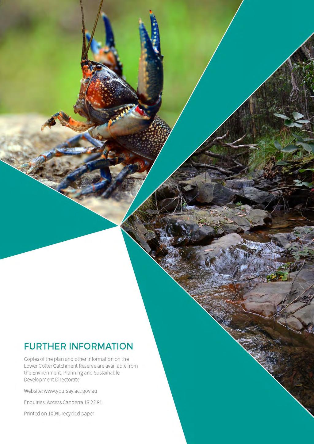
156