WELCOME TO POND 101 OREGON WATER RESOURCES DAM SAFETY SECTION. John Falk, PE
|
|
|
- Kathlyn Norman
- 5 years ago
- Views:
Transcription


1 WELCOME TO POND 101 OREGON WATER RESOURCES DAM SAFETY SECTION John Falk, PE
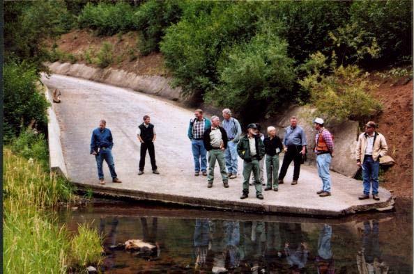
2 MISCONCEPTION 101 This is my own property..so I guess it s really none of your %*&^`!# business if I want to build a pond.

3 R E S E R V O I R P E R M I T S
4 BASIC FACTS ABOUT WATER RIGHTS Under Oregon Law, all water above and below ground belongs to the public. Any person wishing to store surface water or ground water must obtain a permit from the Water Resources Department. The permit, once developed, becomes a type of property right, thus the term Water Right. Senior water rights have priority over more recent (Junior) water rights. A water right is valid until it is canceled.
5 RESERVOIR PERMITS 101 Well, OK so how do I go about getting one of them %*&^`!# Reservoir Permits
6 Application for a Permit to Store Water in a Reservoir (Standard Review) Four (4) page* form. An engineered design is required if the dam is 10 feet high or greater and reservoir capacity is equal to or greater than 9.2 acre-feet. * Plus the following: 1. Location Map 2. Land Use Information Form 3. Legal Description of all Property Involved 4. Check made payable to WRD
7
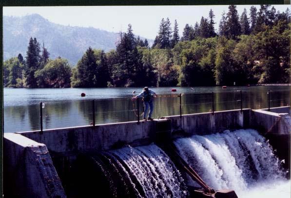
8 RESERVOIR PERMITS 101 What s all this %*&^`!# noise about 10 feet and acre-feet and designs and stuff?
9 STATUTORY SIZED DAMS: Dams equal to or greater than 10 feet height measured from ground surface or stream bed to the top of dam AND Reservoirs greater than or equal to 9.2 acre-feet (3 million gallons) storage
10 STATUTORY SIZED DAMS: All statutory sized dams must be designed by an Oregon Licensed Professional Engineer. In addition, the design must be reviewed and approved in writing by the State Dam Safety Engineer prior to construction.
11 Of the following, who in Oregon are qualified to design statutory sized dams and reservoirs? a). Geologists b). Attorneys c). Professional Engineers d). Soil Scientists e). Inspectors
12 GEOLOGISTS?

13 ATTORNEYS?
14 PROFESSIONAL ENGINEERS?
15 SOIL SCIENTISTS?

16 INSPECTORS?

17 Correct Answer: (c). Professional Engineers


18 WHY A PROFESSIONAL ENGINEER???
19 DESIGN CRITERIA FOR STATUTORY DAM APPROVAL OF PLANS AND SPECIFICATIONS VICINITY MAP PLAN VIEW OF DAM PROFILE ON DAM CENTERLINE AXIS SECTIONAL VIEW AT MAXIMUM HEIGHT EMERGENCY SPILLWAY DETAIL OUTLET/ PRIMARY SPILLWAY DETAIL OUTLET CONTROL DETAIL TECHNICAL DATA & REPORTS OPERATION & MAINTENANCE PLAN (HIGH HAZARD DAMS) EMERGENCY ACTION PLAN (HIGH HAZARD DAMS)
20 RESERVOIR PERMITS 101 Holy Toledo, Man..all I want is a dinky little fish pond! It s not like I am going to build Hoover %*&^`!# Dam!
21 RESERVOIR PERMITS 101 The 1995 Legislature created the Alternate Review Process for small dams. Two page* form Applicable to any pond less than the statutory size limits of 10 feet or 9.2 acre-feet. * Plus the following: 1. Location map 2. Land use information form 3. Check payable to WRD
22
23 RESERVOIR APPLICATION PROCESSING 101 WRD must make public notice of the application within 60 days of its filing. Any person may submit detailed, legally obtained information requesting the Department deny or limit the application. All comments must be received within 60 days from the date of posting (priority date). Upon a satisfactory review, WRD will prepare a Final Order proposing that a Reservoir Permit be issued within 180 days of the priority date.
24 COMPLAINTS 101 You ve gotta be pulling my leg? I m ready to build my dam now, not six %*&^`!# months from now!

25 It s s Prudent to Plan Ahead
26


27 OREGON DAM SAFETY PROGRAM John Falk, PE - Dam Safety Coordinator
28 STATUTORY AUTHORITY ORS ORS ORS ORS ORS ORS ORS ORS ORS ORS ORS ORS ORS ORS ORS ORS ORS ORS
29 DESIGN CRITERIA FOR STATUTORY DAM APPROVAL OF PLANS AND SPECIFICATIONS VICINITY MAP PLAN VIEW OF DAM PROFILE ON DAM CENTERLINE AXIS SECTIONAL VIEW AT MAXIMUM HEIGHT EMERGENCY SPILLWAY DETAIL OUTLET/ PRIMARY SPILLWAY DETAIL OUTLET CONTROL DETAIL TECHNICAL DATA & REPORTS OPERATION & MAINTENANCE PLAN (HIGH HAZARD DAMS) EMERGENCY ACTION PLAN (HIGH HAZARD DAMS)
30 VICINTIY MAP Location of dam and reservoir in relation to township, range section, together with survey tie (bearing & distance) from an established government land corner to a permanent benchmark set on the dam Watershed map that delineates the areal extent of the contributing drainage area above the dam Position of access roads, significant land features, urban areas and other important downstream development Proposed borrow sites, existing quarries, utilities and property lines within the project boundary
31 PLAN VIEW OF DAM AND APPURTENANT WORKS Topographic contour map, 2-foot maximum interval Primary outlet, auxiliary spillway and/or emergency spillway w/relation to footprint Illustrate toe drains, internal filters, log boom, fish facilities and other appurtenant features, as applicable Include area-capacity diagram Provide locations of field exploration or subsurface sampling such as bore holes, test pits, excavations, monitoring wells or other invasive methods
32 PROFILE VIEW ALONG CENTERLINE DAM AXIS Illustrate existing ground surface and thickness of stripping or grubbing Illustrate grade line for cutoff trench, foundation excavation and/or bedrock contacts Show top of dam w/ reference to benchmark elevation, include camber if applicable Locate by station the primary outlet, auxiliary and/or emergency spillways plus toe drains, internal filters and other appurtenant features as appropriate
33 SECTIONAL VIEW OF DAM AT MAXIMUM HEIGHT Existing ground surface and thickness of stripping or grubbing Grade line for cutoff trench, foundation excavation and/or bedrock contacts Upstream and downstream slopes, including dimensions and/or elevations referenced to identified benchmark Primary outlet, auxiliary and/or emergency spillways Water surface elevations including normal pool and flood maximums Interior material zones and filters as applicable Invert elevations for outlet conduit, toe drains and other water conveyance features
34 AUXILIARY/ EMERGENCY SPILLWAY DETAIL Illustrate both section and profile views Elevations and dimensions at all stations where channel configuration or grade lines transition Elevations and dimensions for stilling basin and flow energy dissipaters including formed concrete channel splitters and other component channel armoring Elevations and dimensions of reservoir control mechanisms such as weirs, flashboards, stop-logs and lift gates and channel splitters
35 OUTLET/ PRIMARY SPILLWAY DETAIL Cross section showing sizes, dimensions and material types including encasement and/or pipe bedding Longitudinal section showing inlet and outlet structures, joints, flanges or other connections Draw down data, flow rating information or discharge capacity curve
36 OUTLET CONTROL DETAIL Operating gates or valves plus guard gates or valves; if manufactured list the name, model number and supplier Base block or anchor, pedestals, operating stem and/or lift mechanism Trash rack, fish screen, anti-vortex shroud or other flow augmentation features
37 TECHNICAL DATA AND TEST RESULTS Reference all elevations to established benchmark tied to government datum Hydrologic report or calculations verifying adequacy of emergency spillway for a minimum 100-year flow rate (1% event) plus two (2) feet freeboard Summary of foundation investigation which may include site geology, groundwater hydrology, subsurface soil logs, laboratory test results, and slope and seismic stability as determined necessary
38 OPERATION AND MAINTENANCE MANUAL Instructional reference containing recommended maintenance activities, manufacturer/supplier component information, operation and inspection records plus storage/release schedules
39 EMERGENCY ACTION PLAN Dam failure/breach analysis for sunny day and worst-case failure scenarios Notification flow chart Downstream inundation maps for sunny day and worst-case failure scenarios Monitoring and/or warning systems Evacuation procedures
40 DESIGN CRITERIA FOR APPROVAL OF PLANS AND SPECIFICATIONS VICINITY MAP PLAN VIEW OF DAM PROFILE ON DAM CENTERLINE AXIS SECTIONAL VIEW AT MAXIMUM HEIGHT EMERGENCY SPILLWAY DETAIL OUTLET/ PRIMARY SPILLWAY DETAIL OUTLET CONTROL DETAIL TECHNICAL DATA & REPORTS OPERATION & MAINTENANCE PLAN (HIGH HAZARD DAMS) EMERGENCY ACTION PLAN (HIGH HAZARD DAMS)


41 DESIGN CRITERIA FOR APPROVAL OF PLANS AND SPECIFICATIONS