Transfer of European Approach of Groundwater Monitoring to China
|
|
|
- Gabriel Webb
- 5 years ago
- Views:
Transcription
1 Transfer of European Approach of Groundwater Monitoring to China Yangxiao Zhou PhD UNESCO-IHE Institute for Water Education Delft, The Netherlands 3 rd rd IYRF, Dongying,, China, October 2007
2 Contents of presentation EU WFD groundwater monitoring China groundwater information centre Methodology Urumqi River Basin case Beijing Plain case Conclusions
3 EU Water Framework Directive Objectives Achievement of good status of water resources Promotion of sustainable use of water resources Improvement of aquatic environment Reduction of groundwater pollution Mitigation of the effects of floods and droughts
4 EU WFD Time Framework Action Time References River Basin Districts 2003 Article 3 and 24 Characterisation (pressure, impacts, water use, protection areas) 2004 Article 5 and 6, Annex II and III) Monitoring network operational 2006 Article 8, Annex V Programme of measures River Basin Management Plan Implementation of water price policies Programme of measures operational 2009 Article 11 and 13, Annex III 2010 Article Article 11 Environmental objectives 2015 Article 4
5 EU WFD Groundwater Objectives Prevent deterioration in the status of all groundwater bodies Prevent or limit the input of pollutants into groundwater Protect, enhance and restore all bodies of groundwater Reverse significant and sustained upward trend in pollutant concentration Achieve the objectives for Protected Areas
6 EU WFD Groundwater Monitoring Objectives Reliable assessment of quantitative status Estimation of the direction and rate of cross boundary groundwater flow Validation of impact assessment procedure Assessment of long-term trends Reliable assessment of qualitative status Detection of significant and sustained upward trends in pollutant concentrations Assessment of the reversal of such trends
7 Schedule of EU Groundwater Monitoring WFD requirements Monitoring activities Time Period Characterisation of water bodies Define information need Design and installation Performing monitoring Assess groundwater status Define monitoring strategy Network design, install new wells, modify old wells Monitoring and data collection Interpretation and presentation of monitoring results 2 yrs yrs yrs yr yr 2008 Draft RBMPs Monitoring plan 2 yrs Implement measures First monitoring cycle Monitoring effects 3 yrs Monitoring effects 7 yrs
8 Classification of Groundwater Monitoring
9 Groundwater Quantitative Status Good groundwater quantitative status: Available groundwater resources > long-tern annual average abstraction No negative impacts on surface water and terrestrial ecosystems No saltwater intrusion Information from monitoring (water level, flow) should be able to assess quantitative status together with estimate of recharge and conceptual model No specific method is proposed how to determine number of monitoring wells and frequency
10 Chemical Status and Pollutant Trend Concentrations of pollutants: do not exhibit effects of intrusions do not exceed quality standards will not result in failure to achieve environmental objectives Groundwater quality monitoring should provide information in classifying the chemical status of groundwater bodies detection of any significant upward trend in pollutant concentrations Two types of monitoring distinguished surveillance monitoring operational monitoring
11 Objectives of Surveillance Monitoring Supplement and validate the assessments of risks of failing to achieve: good groundwater status; Protected Area objectives; the trend reversal objective Contribute to the assessment of significant long-term trends (natural and artificial) No specific method is proposed how to determine number of samples and sampling frequency
12 Objectives of Operational Monitoring Only in groundwater bodies (or groups) identified as being at risk following risk assessment and surveillance monitoring To classify bodies at risk as poor or good status with appropriate level of confidence To establish the presence of significant upward trends in pollutant concentrations No specific method is proposed how to determine number of samples and sampling frequency

13 Conceptual Framework Monitoring Network Design
14 Guiding Documents European Union Water Framework Directive: Common Implementation Strategy, 2001, Statistical aspects of the identification of groundwater pollution trends, and aggregation of monitoring results. European Union Water Framework Directive: Common Implementation Strategy, 2003, Guidance on Monitoring for the Water Framework Directive, Final Version, Working Group 2.7. European Union Water Framework Directive: Common Implementation Strategy, 2004, Technical report on groundwater monitoring.
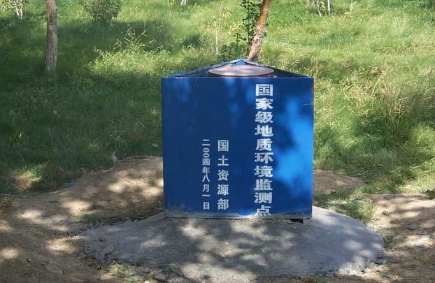
15 China Groundwater Information Centre Project period: DGIS Oret/Miliev Programme (35%) Ministry of Land and Resources (65%) China Institute for Geo-Environmental Monitoring (CIGEM) Geo-Environmental Monitoring Stations of Beijing, Shandong and Xinjiang, China TNO-NITG, UNESCO-IHE, Van Essen Instruments, The Netherlands
16 China Groundwater Information Centre To establish and strengthen the capacity of the China Groundwater Information Centre To increase the efficiency and effectiveness of groundwater monitoring, data processing and analysis, information dissemination To train a large number of specialists for groundwater information management To raise awareness of public and decision-makers for groundwater resources protection
17 China Groundwater Information Centre To optimise groundwater monitoring networks with automatic recorders To develop a China Groundwater Information System based on ArcGIS To develop regional groundwater models for supporting decision-making in groundwater resources management To implement 3 pilot studies: Urumqi River Basin, Beijing Plain, and Jinan Karstic Spring Catchment

18 China Groundwater Information Centre China Groundwater Information Centre Urumqi River Basin Beijing Plain Jinan Basin A lot land, no water Fertile land, some water A lot water, less land
19 Groundwater Level Monitoring Geomorphology Geology Hydrogeological units Water table depth Soil properties Parameter zones Unsaturated zones Land use Precipitation Recharge zones Rivers, Lakes, Reservoirs, Springs, Well fields Groundwater divide, Geological faults Influencing zones Groundwater regime zones
20 Groundwater Regime Zone Map II III OW3 OW4 OW2 IV I OW1 VI OW6 V OW5 OW9 W1 VIII VII OW7 W2 OW10 OW8
21 Groundwater Quality Monitoring Conceptual understanding/model of groundwater system and pressures Assessment of groundwater vulnerability to pollution Inventory of potential groundwater pollution sources Assessment of groundwater pollution risk Modelling of contaminant transport Design of a groundwater quality monitoring network Assessment of groundwater quality status Formulation of groundwater protection guidelines
22 Groundwater Pollution Risk Map Groundwater value map Groundwater vulnerability map Groundwater protection urgency map Pollution source rating map Groundwater pollution risk map
23 Groundwater Monitoring Urumqi River Basin Xinjiang GEMS Urumqi River Basin Total wells 72 Good wells 32 Fair wells 10 Clogged wells 22 Abandoned 8 Only monitor well fields and urban areas
24 Urumqi River Basin Regional Groundwater Level Monitoring Network 91 new observation wells Chaiwopu Basin 42 River Valley 4 River Plain 45 Surface-groundwater interaction Spring discharges Shallow water table Groundwater irrigation Groundwater depletion


25 Maintenance of Existing Wells


26 Protection of Monitoring Wells


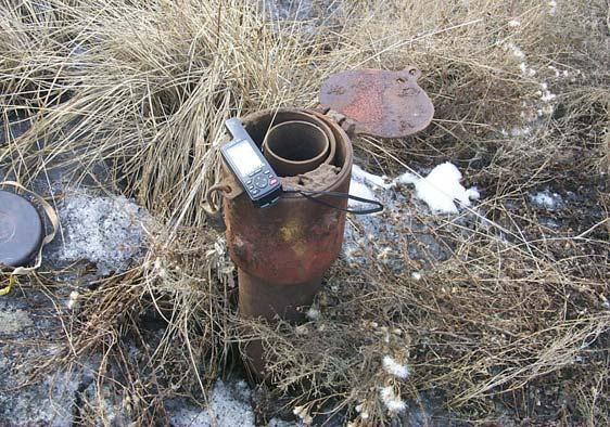
27 Installation of Data Loggers Installation of Data Loggers Diver(hourly) Hand measurements (3 times/month) Time Installation of Divers Groundwater level (m)
28 Groundwater Pollution Trends Groundwater Pollution Trends 北部平原米泉 404 号点 SO4 2- 含量历时曲线 y = x R 2 = 年 北部平原米泉 404 号点 NO3 - 含量历时曲线 y = x R 2 = SO4 2- (mg/ L) NO3 - (mg/ L) 2005 年
29 Groundwater Pollution Risk Beijing Plain High pollution risk areas: urban area; wastewater irrigation area; top of alluvial fans
30 Groundwater Quality Monitoring Beijing Plain Groundwater quality monitoring High pollution risk areas Water supply well fields Background monitoring 538 monitoring sites 136 multiple aquifer wells
31 Groundwater level changes in Beijing Plain Groundwater level (m) P (mm) Precipitation H218 Time (month) Historical groundwater level changes Precipitation (mm) Groundwater level (m) Pr eci pi tation new 17 New 22 Year

32 Cone of depression in Beijing Plain
33 Concluding Remarks Characteristics of European approach on groundwater monitoring: River basin context; Integration of quantity and quality; Cyclic long-term monitoring and assessment; Assessment of status, detection of trend and identification of impacts of pressures. Groundwater monitoring in China concentrated mainly on well fields and urban areas local problem monitoring, not yet as regional process monitoring. However, impact on groundwater occurs at river basin scale.
34 Concluding Remarks Groundwater regime zone and groundwater pollution risk mapping provides effective tools to design regional groundwater level and quality monitoring networks. They are also helpful for interpreting monitoring results. The challenge for implementing national groundwater monitoring in China is to establish a national coordinating body to coordinate monitoring activities by different ministries and provincial departments. A national standard approach should be developed, all monitored data should be stored in a national database and shared by all ministries and departments.
35 Acknowledgements Financial support by Sino-Dutch Cooperation project on Capacity Building of a China Groundwater Information Centre. Technical support of the Ministry of Land and Resources, China Institute of Geo-environmental Monitoring, Geo-environmental Monitoring Institutes of Xinjiang, Beijing and Shandong.