Don Mouth Naturalization & Port Lands Flood Protection Project. Site Walk of the Mouth of the Don. Summary Notes. July 26, 2005
|
|
|
- Madeline Robertson
- 5 years ago
- Views:
Transcription
1 Don Mouth Naturalization & Port Lands Flood Protection Project Site Walk of the Mouth of the Don Summary Notes July 26,
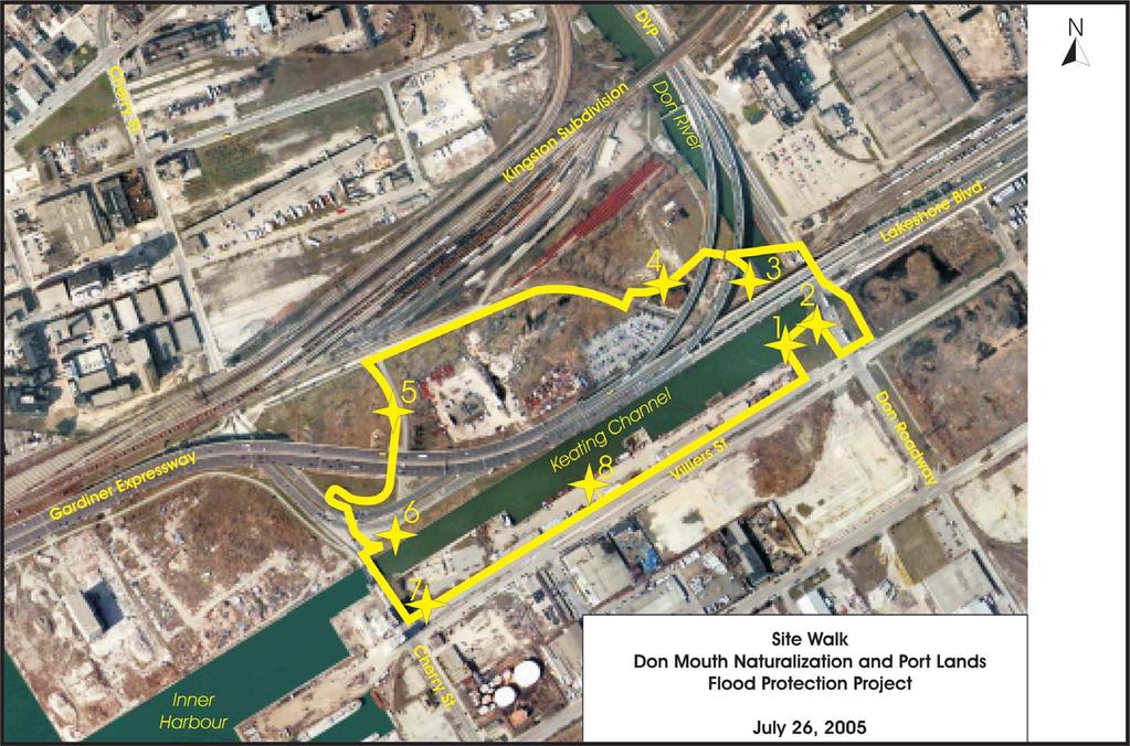
2 Site Walk of the Mouth of the Don Tuesday, July 26, :30 9:00 p.m. SUMMARY NOTES 1.0 Welcome and Site Walk Format Overview The evening following Public Working Session #1, participants gathered at the parkette at the corner of Villiers Street and Don Roadway to take part in an organized site walk around the mouth of the Don River. 46 people signed in to participate in the walk. A list of those who participated can be found in Appendix A. As participants arrived, they were divided into small groups and were provided with the following as they signed in: Route map showing the location of, and a brief overview for each of the eight information stations; and Feedback form and pencil to provide comments during the evening. One or two participants in each group were asked to wear a bright safety vest to ensure high visability of the groups as they crossed busy intersections and walked along high traffic bike paths. Experts were situated at eight stations which were strategically located around the Keating Channel and 480 Lakeshore Boulevard. Discussion topics at each of the stops included fish and aquatic habitat; flora and fauna; flood protection; recreation; soil remediation at 480 Lakeshore Boulevard; infrastructure and other active planning studies; Commissioners Park; and river management issues. Each group was to spend approximately minutes at each station where they would hear a brief presentation and would have an opportunity to ask questions. The presentation format varied slightly at each station and are included in section 2.0 of these notes. 2
3 2.0 Presentations Station 1: Fish and Aquatic Habitat Presented by: Deborah Martin-Downs, TRCA Fish Species Found at the Mouth of the Don There are a variety of species, including forage (fish that are food for other fish) and sport fish (fish that are food for people). There are low numbers of sport fish, such as northern pike, walleye and salmon or trout and higher numbers of more tolerant species such as white sucker. Of interest is a recent find of some juvenile walleye, which we suspect may have been reproduced in the Don and if that is the case, it is very promising and suggests that some of the habitat works we have been introducing in the lower Don may be paying off (e.g. creating rocky ramps at old weirs). Current Habitat and Water Quality Conditions Why are there so few sport fish? The low numbers of sport fish in the Don is related to the type of habitat and water quality in the river. Fish like pike need a wetland to spawn in. They spawn over flooded vegetation in the spring and the young move into adjacent deeper waters when large enough. Historically, there was a wetland at the mouth of the Don and pike were common in the river, according to Mrs. Simcoe. Walleye spawn on shoals in the lake, or in rapids. The young are transported into slower moving waters with a good food source for growth. While walleye like water that is a little murky (they have sensitive eyes), they also need a good food source in the water column, like algae and zooplankton. If there is too much sediment in the water it limits light such that algae, (which are plants) cannot grow and zooplankton (which depend on algae to grow) will also be limited. Many fish need to see the surface of the water to catch their dinner, particularly the sport fish. Atlantic salmon used to be abundant in the Don until they were extirpated in the mid 1800s. This loss was related to dams blocking their upstream movements and changes in water quality when forested lands were converted to agricultural lands and the Town of York. Degradation of water quality in the Don started in 1794 and continues today. Salmon and trout spawn in the river upstream on gravel river beds. While today we have removed dams to allow pacific salmon and rainbow trout to access the Don, the water quality is such that they cannot spawn successfully. We also have added a lot of sediment to the river beds upstream such that they are not good for incubating the eggs. Sediment settles on the eggs and smothers them. What Causes Poor Water Quality? Sediment comes from many sources, including erosion within the river, delivered from exposed soils at construction sites, and from our streets where, for example, sand is applied during winter. Sediment concentrations in the river are higher when it rains. 3
4 The river can be very clear during dry weather. Runoff to the stream carries other pollutants to the river, such as oil and grease, bacteria, salt, pesticides, fertilizers; so concentrations of these contaminants also increases when it rains. In addition, there may be spills on roads and industrial areas any time, which may be toxic to fish. Considerations for Improved Fish Habitat What do we need to Consider for a Naturalized River Mouth? To provide habitat for the fish that are in the Don and the Harbour, the edge of the river must be more gradual and have wetland vegetation. Fish need shade for cover from predators, as well as other cover types, such as rocks and logs. Fish need food, so there must be a variety of habitat types for forage fish, algae, plankton and benthic invertebrates. The water needs to be cleaner. Plans are currently in place with the City of Toronto to tackle wet weather flow and its effects on water quality. The fish need refuge, away from the floods, away from people, away from sediment and its contaminants. Although not part of this project, fish that move through the mouth to access upstream habitat need to have good habitat to go to. The wet weather flow plan and fish management plans for the Don will identify needed upstream naturalization. Station 2: Flora and Fauna Presented by: Dale Leadbeater, Gartner Lee Limited Historical Habitat The coastal marshes of Lake Ontario have suffered as a result of many slings and arrows; all flung in the name of improving the quality of life for people in the Great Lakes Basin. Changes have occurred as a result of deforestation of the watersheds; intensive agriculture; urbanization; construction of the St. Lawrence Seaway; dredging for harbours and ship passage; filling to control disease and insects; and reclamation of wetlands for development. The marshes of the Don River mouth were once extensive and appear to have been mats of cattail, bulrushes and sedges that would have provided habitat for a plethora of birds, mammals, amphibians and fish. Marshes are among the most productive ecosystems in the world. 4
5 Benefits and Opportunities for Improved Habitat The goal of this project is to establish the form, features, and function of a natural river mouth within the context of an urban environment. One of the prime objectives is to recover a fraction of this lost immense biodiversity. But just as the historical biodiversity is irrevocably changed, so has the environmental basis for that diversity. The quantity and quality of the water, not only chemistry but the micro and macro fauna and flora and the ecosystems they support; even the chemistry of the air has changed. Therefore, the ecosystem that can be reclaimed at this site will be uniquely urban and adapted to the coast of Lake Ontario in This EA process will look at the existing conditions to determine what building blocks are available to assemble a river mouth that is sustainable and, among other things provides habitat for a variety of urban tolerant species and looks for opportunities to create stepping stones to connect the wildlife of the Toronto Islands and the Leslie Street Spit with those of the Don River watershed. Although recreation of a wetland would be a good target to compensate for those lost, due to the constraints of the modern world, a range of options will be considered that include not only wetlands, but also upland forests and meadows. Station 3: Flood Protection Presented by: Don Haley, TRCA Historical and Current Causes of Flooding Flooding within the Lower Don River has a written history dating back to the mid-1870s. The primary cause of flooding in this area was mostly related to ice jams and the spring breakup. Heavy rainfall occurring in late fall also created high flows and flooding on the Lower Don. Following the Second World War, a development boom in the City began and although it seems never to have stopped, the major land use changes on the Don took place through the 1960 s s. The principle cause of flooding shifted away from ice jamming to heavy rainfall (thunderstorm) generated flooding within the area. Ice jams still occur, however they are generally minor. As recently as May of 2000, flooding occurred within this area resulting from a series of severe thunderstorms. While most of the flooding over the last few decades has resulted in mainly nuisance type flooding, the area is subject to extensive flooding under a tropical storm similar to Hurricane Hazel which occurred on October 15 and 16 of
6 Flood Prone Areas The Province of Ontario currently uses the rainfall from Hurricane Hazel centered over the Don watershed to define the limits of flooding. Under this rainfall, the river is anticipated to rise to levels which will exceed the channel of the river and begin to spill to the extent that the valley allows. Upstream of Queen Street, the valley feature is narrow and will contain the flood although depths and velocities will be extremely high. South of Queen Street, the valley expands outwards along the historical Lake Ontario shoreline and the flood expands outwards with it, spilling south and west into the downtown core of the City and eastward towards the beaches area. The railway lines which run west to east across the area are on an elevated fill embankment which restricts the flow from moving south to the lake on both sides of the river. The flood waters begin to back up behind this embankment only allowing water to pass southward through the north-south roadways which pass under the tracks located to the east and west of the Don River. Water depths are estimated to be in the three metre range immediately upstream of the tracks at the peak flood depth. Flooding south of the rail line occurs as waters flow through the embankment at these road crossings and through the main bridge on the rail line as it passes over the Don River. The EA for the Lower Don River West Remedial Flood Protection Project was completed in late This project, once completed, will protect the lands west of the river and north of the rail line. This current EA will address flood protection issues on the lands located to the east of the River. Station 4: Recreation Presented by: Sean Harvey, City of Toronto Existing Conditions Existing site conditions include industrial, former industrial, vacant, significant transportation infrastructure, and port/dock functions. Currently, there are very limited recreation opportunities in the area. Crossing through the space are the Lakeshore and Don Valley Trails with very limited access to the water s edge and no formal existing park space in the immediate area. The closest existing open spaces are McCleary Park, Crombie Park, and the Leslie Street Spit (Tommy Thompson Park). Policy Context The primary obstruction to redevelopment in the broader area has been the flood risk which is being addressed through the Lower Don River West Remedial Flood Protection 6
7 EA and this EA which will bring a number of surrounding areas into development (West Don Lands & East Bayfront). A number of policy documents and studies provide direction to surrounding area initiatives and to the provision of new parks and open spaces: Parks, Forestry and Recreation s Strategic Plan Our Common Grounds has three pillars for the focus of the department s works which include: Environmental Stewardship, Child and Youth Development, and Lifelong Active Living. The Central Waterfront Secondary Plan for the area outlines the following core principles: Removing barriers and making connections; Building a network of spectacular waterfront parks and open spaces; Promoting a clean and green environment; and Creating dynamic and diverse communities. West Don Lands & East Bayfront are proceeding through the Precinct Planning process, a process which is intended to: Define the location and character of parks and open spaces, streets and blocks, building form and location of transportation and infrastructure; Express a more detailed vision within the framework of the secondary Plan; Bridge the space between the Secondary Plan and the Zoning By-law; and Emphasize the public realm. The Central Waterfront Open Space Framework document (which overviews the entire central waterfront existing and proposed open spaces) also offers useful principles for consideration: Continuous, publicly accessible, magnificent water s edge; Design excellence for waterfront public spaces; Integration of public art, heritage and archaeological features; High environmental standards; Strengthen east-west connections on the waterfront; Link existing and emerging waterfront communities; Improve aquatic habitat and water quality on the waterfront; Introduce a palette of waterfront design elements; Co-ordinate use to maximize the economic, recreational and environmental asset of Lake Ontario; and Create a network of public spaces on the waterfront. 7
8 Area Initiatives West Don Lands: Location north of CN Rail line and west of the Don River. Development area is approximately 80 acres. Approximately 6,000 residential units are proposed. Don River Park is proposed on the east side of the precinct 19 acres in size. Linkages will be built from the Don Valley Trail extending under the Bala Rail Line though the park to the new West Don Lands community and downtown. East Bayfront Location south of the Gardiner Expressway from Jarvis to Parliament. Development area is approximately 90 acres. Approximately 5,700 residential units are proposed. Primary park space located at the foot of Sherbourne Street. Precinct also proposes a 19m-wide waterfront promenade. Port Lands Location south of Lakeshore Boulevard. Development Area is approximately 990 acres. Mixed-use development proposed with a strategic implementation initiative underway. Primary active waterfront park space is Commissioners Park which is 41 acres in size and located on the south side of Keating channel. Other open spaces include Don Greenway, Cherry Beach, Tommy Thompson, and Lake Ontario Park. Don Mouth Challenges and opportunities. The following page of photos illustrates examples of opportunities at the water s edge for recreation. Station 5: Soil Remediation at 480 Lakeshore Blvd. Presented by: Michael Longland, CH2M Hill Canada Ltd. History of the Site The lands proximal to the mouth of the Don River include a unique geological feature. Before the Great Lakes were formed, ancient rivers carried water to the Atlantic Ocean. The most important of these ancient rivers flowed beneath the current Don River. The ancient Laurentian River eroded the bedrock to a depth of 30 m. Over geological time, with changing conditions, the deep river valley filled with sand and silt. Subsurface 8

9 investigations conducted just north of the mouth of the Don River have generated much information on the location and depth of the buried valley. In the mid-1850s, the Don River followed a sinuous path through marshy land before discharging to the lake. With the development of the lands along and near the mouth of the Don River, the course of the river was adjusted. Concurrently, the lakeshore, which was originally just south of Front Street, was advancing through the placement of lake fill. At this time, the river passed through the lands currently proposed for naturalization. The former Burgess Estate occupied much of the marshland at the mouth of the Don River. Portions of the estate were purchased by the British-American Oil Company in the 1920s. A foundry owned by the Don Foundry Company also occupied some of the land. Little is know about this foundry. The British-American Oil Company built one of Canada s earliest refineries at the site. In 1932, piping was installed under Lake Shore Boulevard (then Keating Street) to unload crude oil for refining purposes. The refinery produced a number of petroleum hydrocarbon fuels including gasoline. In 1936, large crude petroleum and petroleum product tanks occupied extensive tracts on both sides of the Don River. Gulf Oil Canada Limited became the owners of the refining operations during the 1950s. Gulf Oil owned and operated the refinery until 1979 when the land was sold to the City of Toronto. By this time, only 12 tanks remained on the site (see 1965 aerial photograph, included on the following page). Before the land was assumed by the City, the remaining tanks and underground piping were removed. The bulk of the property has remained vacant since it was purchased. Various tenants have occupied parts of the land for various small-scale operations aerial photograph, 480 Lakeshore Boulevard 9
10 Extent of Soil Contamination The City of Toronto commissioned subsurface investigations at the site in It was found that liquid fuel was present in the subsurface in several areas. The petroleum hydrocarbon fuels have a specific gravity of less than unity. The liquid fuel is therefore present in the form of lenses that are buoyant on the water table which is located two metres below the ground surface. Much of the soil appeared to be impacted by petroleum hydrocarbons at levels of potential concern. In some areas, soil was found to be impacted by lead. The lead may have resulted from releases of ethyl lead, a compound that was added to gasoline in the past. Impacted soil was found to depths beneath the ground surface exceeding four metres. TWRC s Sustainability Plan Naturalization of this area will require the removal of much of the near-surface soil. The Toronto Waterfront Revitalization Corporation has put in place a sustainable development framework that includes provisions for soil that has been impacted by past industrial operations. The framework requires that impacted soil either be managed in place or conditioned and reused. A Soil Management Facility is currently under development that will provide the needed soil conditioning capability. Options for Site Remediation and Soil Management Some of the soil at the site is impacted by organic compounds (that is, petroleum hydrocarbons) that tend to degrade to innocuous substances in the environment. Normally, the degradation processes are slow. This is because the oxygen and nutrients required to support biodegradation are naturally available in limited amounts. By enhancing the availability of oxygen and nutrients, the process can be accelerated. Consideration will be given to reducing the petroleum hydrocarbon content of the soils requiring removal by conducting in-situ biodegradation in advance of the removal of the soil. The liquid fuels present in the subsurface will likely require removal. Subsurface phaseseparated liquids such as this can migrate considerable distances and enter subsurface structures such as basements and manholes. They also represent concentrated sources of groundwater contaminants. Ground Water Quality Limited data was collected during the subsurface investigations described above. Additional subsurface investigations are planned for the near future. During these investigations, efforts will be made to characterize the site and soil and groundwater quality to the extent that conceptual management plans can be generated. 10
11 Station 6: Infrastructure & Other Active EAs and Studies Presented by: Jim Gough, Toronto Waterfront Joint Venture Other Active EAs and Studies A Transit EA is about to start for 3 projects involving streetcar service on an exclusive right-of-way. This is an Individual EA, involving development of Terms of Reference for all 3 projects, and completion of the EA for two of these: Queens Quay Streetcar Extension from Union Station to Small Street (just east of Parliament); West Don Lands Streetcar service, extending from the King Street service either via Front Street or Cherry Street, to a terminus just north of the rail corridor; Port Lands Streetcar service, extending the Queens Quay and/or West Don Lands streetcar services into the Port Lands. The Queens Quay and West Don Lands projects will proceed through the full Individual EA process now; the Port Lands Streetcar EA will be completed at a later date. Queens Quay Extension/Lower Don River Roads EA - This study will define the road needs in the area between Parliament Street and the Don Roadway, addressing: Extension of Queens Quay from Parliament to Cherry Street; Alignment of Cherry Street from the rail overpass to Villiers Street; Connections between Cherry Street and Queens Quay/Lake Shore Boulevard; Alignment of Lake Shore Boulevard east to the Don Roadway, and bridge over Don River; and Cherry Street bridge capacity and alignment requirements over the Don River. Issues Short spacing on Cherry Street between the rail overpass and the (relocated) Don River, in which Lake Shore Boulevard and the proposed intersection of Queens Quay must be accommodated, together with an appropriate profile for accommodating the bridge over the River; Width of the Cherry Street bridge into the Port Lands is one bridge sufficient for travel demands by auto, transit, bike and walking? Should there be a second bridge, perhaps exclusively for one or two modes (e.g. bike/pedestrian or transit only); Potential Broadview Avenue extension intothe Port Lands (as per City Secondary Plan); Clear span of the bridge(s) required over the Don River, and the relationship of this issue to the Cherry Street profile; 11
12 Re-alignment of Lake Shore Boulevard; Accommodation of rail spur to the east side of the Don River; and Potential changes to the Gardiner Expressway and Lake Shore Boulevard, ranging from Transformation to introduction of the Great Street/Waterfront Boulevard. Station 7: Commissioners Park Presented by: Oliver Jerschow, Urban Strategies Inc. Conceptual design for Commissioners Park and its current planning context The Toronto Waterfront Revitalization Corporation (TWRC) has completed a conceptual design for Commissioners Park, a 41-acre waterfront park located in the Port Lands between the Keating Channel and Commissioners Street, and between Cherry Street and the Don Roadway. The location for the park was identified in the City of Toronto's Central Waterfront Secondary Plan that was adopted by City Council in April The goal for the design of the park was to create a landmark urban waterfront open space that would address the critical need for active recreation facilities in the City of Toronto. The design also had to take into account the future needs of emerging waterfront communities in the West Don Lands, East Bayfront and Port Lands. The TWRC selected an integrated team to prepare the conceptual design for Commissioners Park. The team included ENVision - The Hough Group, Claude Cormier Architectes Paysagistes, and ERA Architects. The design process began in January The design process considered extensive input from recreational sports groups and the public. Two conceptual options were created and presented for review at a public meeting in April Based on public feedback, one of the design options - Camouflage Park" - was selected to be developed further. The final conceptual design was presented at a second public meeting in July The final conceptual design includes a diversity of landforms, spaces that accommodate a range of active recreational pursuits, and a contemporary system of access and circulation within the park. The conceptual design process explored the relationship of the park to the Keating Channel immediately to the north. There were a wide range of opinions as to how this important interface between the park and the Don River should be addressed. The opinion of the design team was that, notwithstanding the goal of naturalizing the Don River, the existing south wall of the Keating Channel should be retained, in part because of its heritage significance as a feature of the Port's industrial past. The conceptual design proposed a floating boardwalk in the Keating Channel to enhance public access to the water and to provide opportunities for habitat creation. 12
13 The conceptual design also acknowledged that the Don Mouth EA process would have to resolve the nature of the Keating Channel interface in detail. The conceptual design for Commissioners Park also accommodated the Don Greenway at the east end of the site by suggesting this as an area for more densely planted landscaping and less intensive public use. Future work related to Commissioners Park will include the preparation of a detailed design for the park, including multiple opportunities for public input. Other issues that will need to be addressed include incorporating the outcomes of the Don Mouth EA process into the design, acquisition of the properties comprising the park, and the completion of a strategy to deal with any areas of contamination. More information about Commissioners Park, including a detailed description and illustrations of the conceptual design, can be found on the TWRC's web site at: Station 8: River Management Issues Presented by: Ken Lundy, Toronto Port Authority The following eight display boards were presented by the Toronto Port Authority. 13

14 KEATING CHANNEL DREDGING Don River ice jam & high water (1920) Importance of hydraulic capacity: Ice jams. Lower Don River flooding. Toronto Port Authority
15 KEATING CHANNEL DREDGING In 1972, Canada & the USA signed an agreement to ban the open water disposal of polluted sediments. Ministry of the Environment (MOE) asked the Toronto Port Authority (TPA) to design a Confined Disposal Facility (CDF) for the disposal of polluted sediments dredged from the Keating Channel (KC). Design & construction of the Endikement as an extension of the Leslie St. Spit (1979-today). CDF consists of 3 cells (#1 filled in 1985; #2 in 1997; #3: 60 years to go). Disposal of the dredgeate into the CDF carried out pursuant to the Keating Channel Environmental Assessment (1983). Toronto Port Authority
16 KEATING CHANNEL DREDGING Volume of sediment in recent years: 40,000 m3/yr (approx.) Cost: $450,000/Yr (approx.) Share: Toronto Port Authority (1/3) Toronto and Region Conservation Authority (2/3) The "Keating Channel / Leslie Street Working Committee" with representatives of TPA, TRCA and the City of Toronto oversee the project. Toronto Port Authority
17 KEATING CHANNEL DREDGING Quality of sediments flowing into the KC & Inner Harbour: Early polluted sediment produced by agricultural & industrial activities. Before 1914 accumulated in Ashbridge's Bay. Since 1914 accumulated at NE section of Harbour after Don River realigned. Since the 1960's, sources of contaminants: Don River, storm sewer and combined sewer overflow discharges. Studies identify source control, for Waterfront and watershed of the Don River, as the most effective means of improving the conditions in the Inner Harbour. (Golder Associates Ltd., 2001) KC has provided the opportunity of managing the flow of sediment originated in the Don River watershed. Toronto Port Authority

18 KEATING CHANNEL DREDGING Dredgeate transportation route Toronto Port Authority


19 Keating Channel Debris Management Regular removal of floating debris using two control booms. Increased debris following storm events. Annually the debris collected is approximately 400 tonnes. For the May 12, 2000 storm: 337 tonnes of debris (most of it at the expense of TPA). Derrick THC 50 removing debris. Toronto Port Authority


20 Keating Channel Debris Management Toronto Port Authority Containment


21 Toronto Port Authority Backland requirements
22 Don Mouth Naturalization & Port Lands Flood Protection Project Site Walk of the Mouth of the Don Appendix A List of Project Team Members July 26,
23 TRCA Project Team members Ken Dion Adele Freeman Deborah Martin-Downs Amy Thurston Don Haley Aish Ramakrishnan Consulting Team members Dale Leadbeater Gartner Lee Ltd. Paul Murray Gartner Lee Ltd. Anneliese Grieve SENES Consultants Limited Nicole Swerhun Facilitator Presenters Jim Gough Sean Harvey Oliver Jerschow Michael Longland Ken Lundy Dale Leadbeater Deborah Martin-Downs Don Haley Toronto Waterfront Joint Venture City of Toronto Urban Strategies Inc. CH2M Hill Canada Ltd. Toronto Port Authority Gartner Lee Ltd. TRCA TRCA 23
24 Don Mouth Naturalization & Port Lands Flood Protection Project Site Walk of the Mouth of the Don Appendix B Route Map / Station Overview Handout July 26,
25
26 DON MOUTH SITE WALK TOPICS & INFORMATION STATIONS 1. Fish & Aquatic Habitat Presented by: Deborah Martin-Downs, TRCA Fish species found at the mouth of the Don Current habitat and water quality conditions Considerations for improved fish habitat 2. Flora & Fauna Presented by: Dale Leadbeater, Gartner Lee Limited Historical habitat and reasons for its degradation Benefits of naturalization Considerations and opportunities for improved habitat 3. Flood Protection Presented by: Don Haley, TRCA Flood prone areas Causes of flooding, historical and current Components and challenges of future flood protection works 4. Recreation Presented by: Sean Harvey, City of Toronto Existing conditions and recreational opportunities Policy context and direction Challenges and opportunities for future recreational opportunities 5. Soil Remediation at 480 Lakeshore Blvd. Presented by: Michael Longland, CH2M Hill History of the site TWRC s Sustainability Plan Options for site remediation and soil management 6. Infrastructure Presented by: Jim Gough, Toronto Waterfront Joint Venture Other active Environmental Assessments & studies occurring adjacent to the study area Challenges and opportunities for integration with other projects 7. Commissioners Park Presented by: Oliver Jerschow, Urban Strategies Inc. Conceptual design for Commissioners Park and its current planning context Description of park features Relationship to the Keating Channel 8. River Management Issues Presented by: Ken Lundy, Toronto Port Authority Issues surrounding debris, sediment and ice management at the Mouth of the Don Current conditions and future considerations
27 Don Mouth Naturalization & Port Lands Flood Protection Project Site Walk of the Mouth of the Don Appendix C Public Feedback Form Summaries July 26,
28 Appendix C: Public Feedback Form Summaries Summary of Responses from Participants Q. Please provide any thoughts or comments you may have based on what you have learned during tonight s site walk of the mouth of the Don: Today s walk was very informative. I would like to see the streetcar extension from Union Station become a reality. That would encourage development into the area. I was amazed at the complexity of the process. I hope to see SOMETHING happen soon. You must get streetcar [service] soon. Maybe extend line down Parliament Street from King Street and then up to Castle Frank Station. Very Interesting. 28
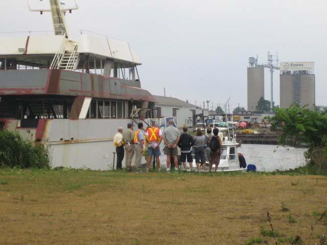
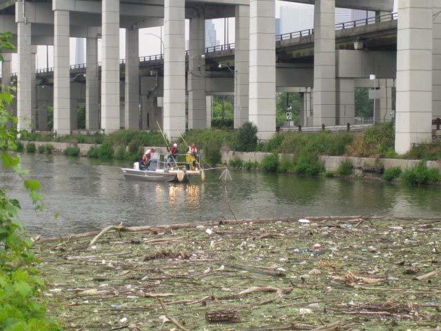
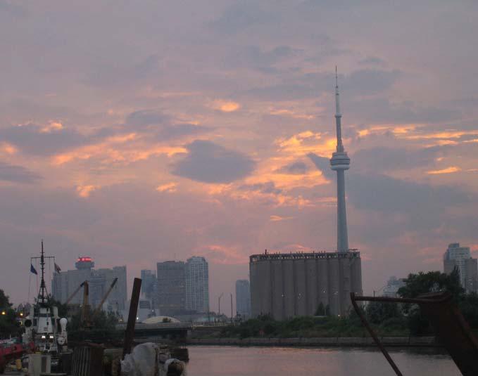
29 Don Mouth Naturalization & Port Lands Flood Protection Project Site Walk of the Mouth of the Don Appendix D Photos of the Event July 26,

30