Water for Virginia Master Naturalists. What are the types What is important to know about: Functions Values Issues
|
|
|
- Christopher Daniel Marsh
- 5 years ago
- Views:
Transcription
1 Water for Virginia Master Naturalists What are the types What is important to know about: Functions Values Issues
2 Francis J. Reilly, Jr. WHY ME?
3 Outline Hydrologic cycle Healthy waters The unique waters of Virginia A trip to the Chesapeake
4 Why is Water Important???
5 Why is Water Quality Important Life is water-based Federal Law Clean Water Act FIFRA Rivers and Harbors Clean Air Act State Law VA Constitution (Article XI sec1)

6 Hydrologic Cycle Precipitation Runoff Infiltration Evaporation
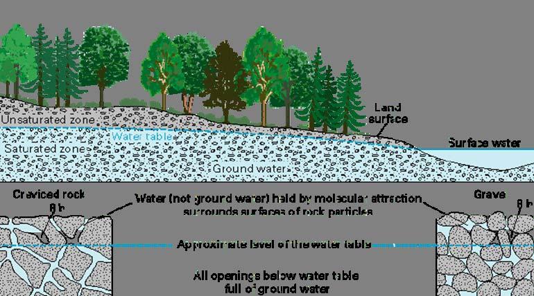
7 Groundwater
8 ? Factors that affect runoff
9 Factors that affect runoff Slope Vegetation Previous moisture Infiltration rate
10 Infiltration This however, is only valid when the soil surface remains undisturbed.


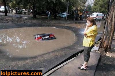
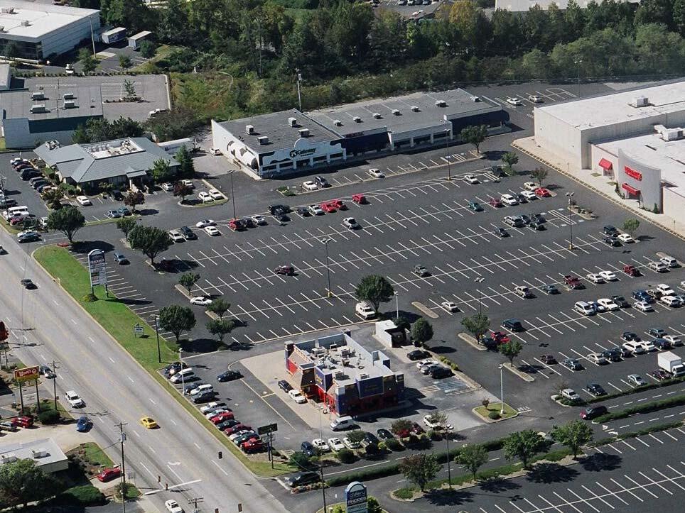
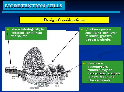
11 Impervious Surface Solutions Storm Water Structures Retain water onsite Rain gardens Slow down flow at gutters Decrease impervious surfaces
12 Hydrograph Developed Condition, Conventional CN (Higher Peak, More Volume, and Earlier Peak Time) Q Existing Condition T

13 Prince William County Watersheds
14 Watersheds What is a watershed? What is your watershed? How can you find out?
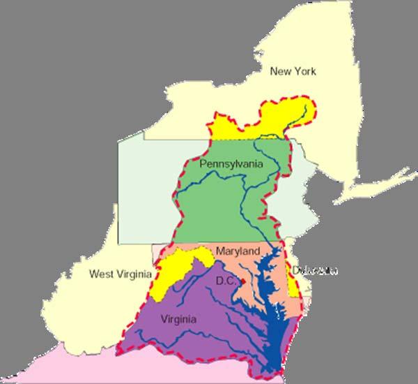
15 Chesapeake Bay Watershed

16 Know where you live!
17 Water Quality Healthy vs. Unhealthy Sunlight Minimal Nitrogen, Phosphorus and Sediment Inputs Excessive Nitrogen, Phosphorus and Sediment Inputs Sunlight Healthy Bay Grasses Balanced Algae Growth Algal Bloom Reduced Bay Grasses Healthy Habitat Unhealthy Habitat Algae Die-off Healthy Oyster Reef Adequate Oxygen No Oxygen Algae Decomposition Barren Oyster Reef Benthic Community Lack of Benthic Community
18 Impaired Waters Watershed approach 10 major tributaries Tributary Strategy crosses political boundaries The states (and counties) adopt the Chesapeake Bay Restoration Plan Find yours
19 Types of surface water Wetlands Ephemeral streams vernal pools Puddles Streams Ponds Lakes Rivers Estuaries Oceans

20 Ridge & Valley Region Allegheny Plateau Tidewater Region Piedmont Region
 - divided by Chesapeake Bay into 2 main parts (Mainland and Eastern")
21 - stretches from north and south along Atlantic Ocean and Chesapeake Bay - flat and sandy lowland (coastal plain) - divided by Chesapeake Bay into 2 main parts (Mainland and Eastern Shore)
22 Potomac River Rappahannock River York River James River Four major rivers divide the Tidewater Region s Mainland into peninsulas. The Tidewater s most important example of wetland is the Great Dismal Swamp.

23 The Tidewater is divided into four peninsulas: Eastern Shore Northern Neck Peninsula Middle Peninsula The Peninsula
24 Williamsburg-2nd Virginia capital Jamestown-1st permanent English settlement and 1st Virginia capital Newport News-ship building Norfolk-major U.S. naval base Virginia Beach-most populated in Virginia

25 - largest region - between Tidewater Region & Blue Ridge Mts. - means foot of the mountain - has gently, rolling hills - a plateau (large, raised, level piece of land)

26 - divides Piedmont Region from Tidewater Region - made of waterfalls and rapids

27 There are four important rivers in the Piedmont Region. Potomac River Rappahannock River James River Roanoke River
28 The Fall Line was responsible for the growth of major cities. Alexandria Fredericksburg Richmond (state state capital) Petersburg

29 Many cities grew up on roads leading to gaps through the Blue Ridge Mountains. Charlottesville Lynchburg Martinsville
30 - located west of the Piedmont Region - made up of mountains and valleys
31 The region is made of two main lines of mountains which are part of a larger mountain system called the Appalachian Mountains. Blue Ridge Mountains Allegheny Mountains
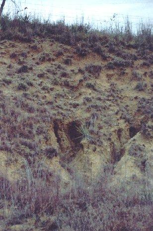
32 The Great Valley of Virginia separates the Blue Ridge & Allegheny Mountains. The Great Valley of Virginia

33 - largest in the Great Valley - located down its middle Massanutten Mountain and Shenandoah River Massanutten Mountain Shenandoah River
34 - known also as Appalachian Plateau - located in southwestern part of Virginia - no valleys as in Ridge and Valley Region - covered with forests A plateau with an average elevation of 2,000 ft.
35 A Brief Break
36 Match the region with its geographic feature. Tidewater coal deposits Piedmont coastal plain and Chesapeake Bay Ridge & Valley rolling hills, rapids, and Fall Line Allegheny Plateau mountains, valleys, and caves
37 Types of surface water Wetlands Ephemeral streams vernal pools Puddles Streams Ponds Lakes Rivers Estuaries Oceans


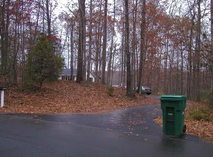
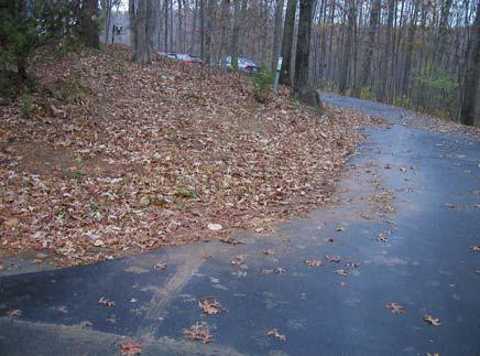
38 Water Bodies start where it isn t wet! Riparian areas Resource Protection Areas Buffer Strips CREP NRCS etc.


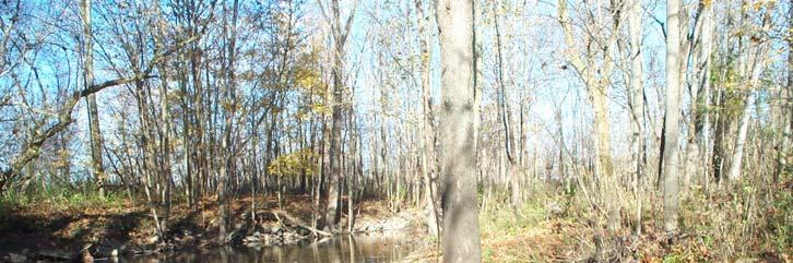
39 Eroded topsoil, rills, gullies

40 Ephemeral Streams Flow in direct response to precipitation Not drainage ditches Important regulatory context Intermittent streams?


41 Vernal Pools What lives in them? How could they be important? What is their Function? What is their Value?
42 Puddles Mosquitoes Mud Further damage


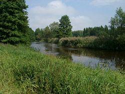
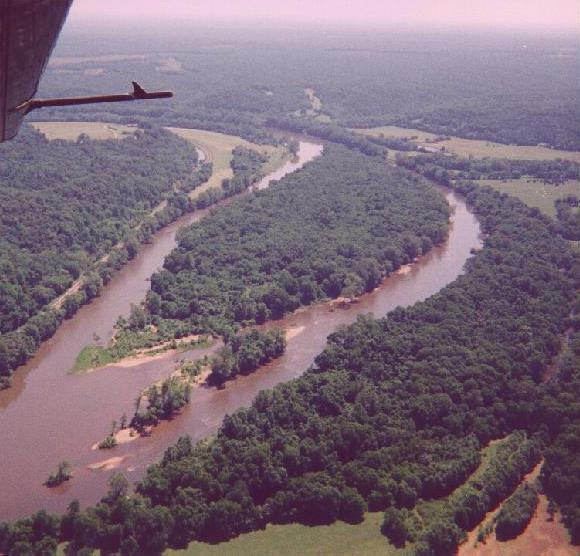
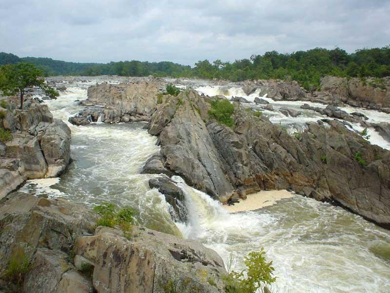
43 How can we make residential developments function hydrologically like natural systems?
44
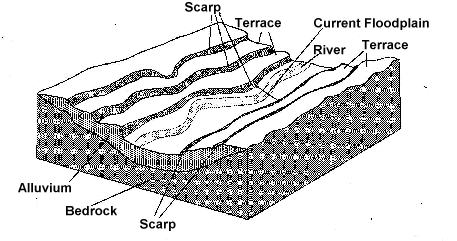
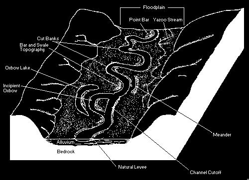
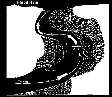
45
46 Types of surface water Wetlands Ephemeral streams vernal pools Puddles Streams Ponds Lakes Rivers Estuaries Oceans


47 Streams Creek, Crick, Brook, Kill, Slough, Run,


48 Stream Anatomy Gradient Thalweg Flood plain Channel
49 Stream Concepts Habitat Flow Cover Depth Light Benthos


50 Stream Concepts continued Riffle/Pool

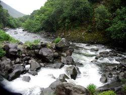
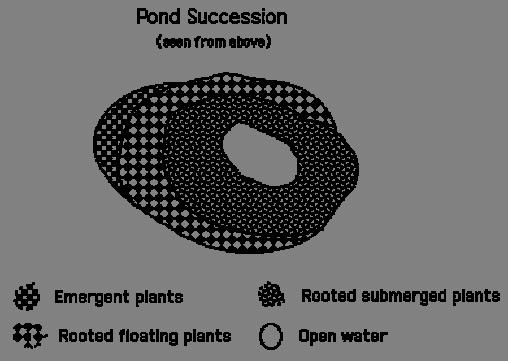
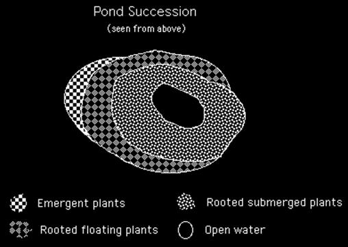
51 Rivers

52 River review
53 River Morphology

54 Farm ponds Natural ponds Storm Water features Ornamental Water Features The Pond Part
55 How does a Pond Work Water Sediment Air
56 Water Quality Nutrients the most important issue The source of most problems you hear
57 Algae Growth Water Nutrients Light The right temperature

58 Aquatic Weeds Navigational problem Unsightly Odors
59 Succession