Treatability Testing and the Development of Stormwater
|
|
|
- Lynne Allen
- 5 years ago
- Views:
Transcription


1 Module 4b: Sedimentation and Wet Detention Ponds Robert Pitt Department of Civil and Environmental Engineering University of Alabama Presentation Contents Stormwater treatability and enhancements to improve stormwater control Small-scale settling devices Stormwater ponds Use of sedimentation with other unit processes and the development of other control practices Chemical-assisted sedimentation Example design calculations for wet detention ponds Modeling wet detention facilities with WinSLAMM Treatability Testing and the Development of Stormwater Control ldesign Criteria i Particle Size Analyses Using Cascading Sieves Particle sizes and settling rates Relative toxicity after different unit processes Laboratory-scale and field pilot-scale tests Full-scale tests 1


2 Particle Size Analyses Using Video Microscope and Computer Micrograph of Road Surface Sediment Washoff Approx. 100 m long Particle Size Analyses Using Coulter Counter Multi-Sizer 2 Typical Stormwater Particle Size Distributions for Outfall Samples 2


3 Measured Particle Sizes, Including Bed Load Component, at Monroe St. Detention Pond, Madison, WI Particle Size Distribution of Street Dirt Pitt 1979 Particle Settling Rates; Stoke s and Newton s Laws Azur s Microtox Unit used for Relative Toxicity Measurements 3


4 4


5 Atomic Adsorption Spectrophotometer (AAS) With Graphite Furnace, Used for Ultra Low Level Measurements of Heavy Metals 5


6 Gas Chromatograph/Mass Spectrophotometer (GC/MSD) used for Organic Toxicant Trace Analyses % reduction Example Stormwater Lead and Copper Reductions using Chemical Coagulation and Precipitation Alum usually had adverse toxicity it effect, while ferric chloride with microsand gave best overall reductions. Lead Copper Turbidity Toxicity Stormwater Toxicant Control Toxicant removal mechanisms include sedimentation, biodegradation, volatilization, sorption onto soil particles, and chemical oxidation and hydrolysis These processes are available in many urban runoff controls, but modifications should be made in their designs to increase their toxicant removal efficiencies -10 Buffered Aluminum Sulfate (mg/l) 6
, - screening through 40")


7 Stormwater Toxicant Control, cont. The most effective treatment processes included: - settling for at least 24 hours (40 to 90% reductions), - screening through 40 micrometer sieves (20 to 70% reductions), and - aeration and or photo-degradation for at least 24 hours (up to 80% reductions). Design Modifications to Enhance Control of Toxicants in Wet Detention Ponds Settling of fine particulates Photo-degradation (enhanced vertical circulation, but not complete mixing that can scour sediments) Aeration Floatation (subsurface discharges) to increase trapping of floating litter Retro-fitted Catchbasin with Sump Tested at Ocean County, NJ Common Stormwater Controls Public works practices (drainage systems, street and catchbasin cleaning) Sedimentation Infiltration/biofiltration Critical source area controls Public education 7


8 Stormceptor Corp. 8


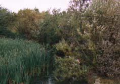
9 Sedimentation Wet Basins Dry detention ponds Wet detention ponds Wetlands Caltrans, San Diego, California Extended Detention Ponds Caltrans, San Diego and Los Angeles, California Wet Detention Pond Advantages Very good control of particulate pollutants Opportunity to utilize biological processes Protozoa as bacteria predators Aquatic plants enable higher levels of nutrient removal Outfall ponds capture and treat all storm sewer discharges Wet weather stormwater runoff Dry weather baseflows Snowmelt Industrial spills Illegal discharges 9


10 Typical Dry Detention Pond, with Pilot Channel Unusual Dry Detention Pond Located on Hillside to Meet Peak Flow Rate Criterion Dry Detention Pond Forebay for Stormwater Pump Station, Los Angeles, CA 10


11 Scour and Sediment Transport in Dry Detention Ponds Large Corrugated Pipes used for Underground Detention Below Parking Area Wet Detention Facility at Shopping Center, Birmingham, AL Wet Detention Facility at Shopping Center, Dayton, OH 11


12 Wet Detention Facility at Industrial Park, Birmingham, AL Wet Detention Facility at Convention Center, Orlando, FL Wet Detention Facility at Apartments, Lake Oswego, OR (Part of Treatment Train) Wet Detention Facility at Residential Area, Birmingham, AL 12


13 Advertising for New Wet Ponds, Austin, TX Wetlands for Stormwater Control Wetlands in Malmo, Sweden (under construction and mature) Inlet for Wetland in Malmo. Sweden for Treatment of CSOs and Stormwater Watch your step Eric! 13


14 Mature Wetlands and Wet Detention Pond Facility, Malmo, Sweden New Wetlands being Planted by Volunteers, Malmo, Sweden New Wetlands being Planted by Volunteers, Malmo, Sweden Necessary Harvesting of Aquatic Plants from Wetland used for Treatment of Municipal Wastewater Lemna Systems 14
15 Observed Wet Pond Performance (when constructed and operated according to best guidance) Suspended solids: 70 to 95% COD: 60 to 70% BOD 5 : 35 to 70% Total Kjeldahl nitrogen: 25 to 60% Total phosphorus: 35 to 85% Bacteria: 50 to 95% Copper: 60 to 95% Lead: 60 to 95% Zinc: 60 to 95% Wet Pond Design Criteria for Water Quality Surface area should have a minimum area based on land use and desired pollutant control Pond freeboard storage equal to runoff associated with 1.25 inches of rain for the land use and development Select outlet device to obtain desired pollutant control for all pond stages Incorporate special features for harsh winters and snowmelt loads, if needed Pond Area as a Percentage of Drainage Area 5 micrometer 20 micrometer Totally paved Industrial Commercial Institutional Residential Open space Construction

")


16 Suspended Solids Control at Monroe St. Detention Pond, Madison, WI (USGS and WI DNR data) Total Dissolved Solids Control at Monroe St. Detention Pond, Madison, WI (USGS and WI DNR data) COD Control at Monroe St. Detention Pond, Madison, WI (USGS and WI DNR data) 16


17 Pond Problems Safety Nuisance conditions Maintenance Poorly known site conditions Critters Safety of Detention Ponds Numerous design features to maximize pond safety: - Side slopes - Depth - Safety ledge - Accessibility - Outlet structure protection -etc. Deep Water Too Close To Shore Thin Ice Near Shore Steve Auger photo 17


18 Children are Attracted to Urban Waters Frequent Maintenance and Adjustments to Outlets may be Needed Wisconsin DNR Wet Ponds Located in Areas of Karst Geology may have Sinkholes Sometimes the pond wins! 18


19 However, they may be mutually exclusive uses Ponds can be attractive and in some areas they actually encourage contact recreation, but water quality is usually poor. Birds and other wildlife are also frequently attracted to ponds. Existing Ponds can be Modified for Improved Performance Change outlet device Reshape pond Add internal berms to prevent short-circuiting Bob Kort photo Other critters also attracted to ponds 19


20 Modification of Outlet for Improved Performance Modification of Pond Outlet at Epcot Center, Orlando, FL Re-building Pond (Re-shaping and Dredging), Moscow, Russia Berm Located in Pond to Minimize Short-Circuiting, Gulfport, MS 20

 Use sub-surface outlets to minimize clogging and to retain floatables. Discourage water contact recreation and consumptive fishing. Stock mosquito eating fish.")

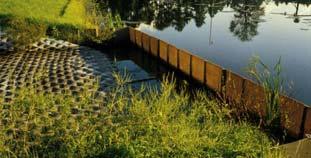
21 Design Suggestions to Enhance Pollutant Control and to Minimize Problems Composite list from literature and experience Locate and size ponds to minimize hydraulic interferences. Keep pond shape simple to minimize short-circuiting. Slope ground leading to pond between 5 and 25%. Use shallow perimeter shelf as a safety ledge. Plant dense emergent vegetation on shelf. Plant thick vegetation barrier around pond perimeter. Provide at least 3 ft. of permanent pool depth for scour protection. Provide at least 2 more feet as sacrificial storage. Design Suggestions (cont.) Use sub-surface outlets to minimize clogging and to retain floatables. Discourage water contact recreation and consumptive fishing. Stock mosquito eating fish. Minimize water level fluctuations to reduce mosquito problems. Place rocks at inlet and outlet areas to minimize scour. Use anti-seep collars around outlet pipes to minimize piping. Provide trash and safety racks, plus baffles on outlets. Provide emergency spillway. Use of Sedimentation in Conjunction with other Controls Effluent can be directed to infiltration or wetland area. Sedimentation is a common pre-treatment option for filtration and chemical treatment Sedimentation can better handle large flows and serves to protect downstream more fragile devices, such as wetlands or infiltration areas. Infiltration Swale in Office Park Area, Downstream of Wet Pond, Lake Oswego, OR, Part of Treatment Train 21


22 Wet Pond after Oil and Grease Trap and Step Aerator, Austin, TX Settling Pond after Alum Injection, Orlando, FL Dry Pond to Equalize Flows before Sand Filter, Austin, TX Equalizing Dry Pond to Control SSO Problems, Moody, AL 22


23 Development of other Control Devices Pilot-Scale Treatment Tests using Filtration, Carbon Adsorption,UV Disinfection, and Aeration Multiple treatment processes can be incorporated into other stormwater treatment units sized for various applications. Gross solids and floatables control (screening) Capture of fine solids (settling or filtration) Control of targeted dissolved pollutants (sorption/ion exchange) Pilot-scale filters examining many different media. Lab and pilot-scale filters and multichambered treatment train (MCTT) 23
 developed during EPA")

")


 Milwaukee (15")
")
 >80 (<0.")
 Lead 96 (1.")
 90 (15 g/l) Benzo (b)")
 >75 <0.")
24 Multi-Chambered Treatment Train (MCTT) developed during EPA research to protect groundwater during infiltration, (Pitt, et al. 1999) Minocqua, WI, MCTT (2.5 acre commercial parking) Milwaukee, WI, Ruby Garage Public Works Maintenance Yard (0.25 acre) Wisconsin Full-Scale MCTT Test Results (median % reductions and median effluent quality) Milwaukee (15 events) Minocqua (7 events) Particulate Solids 98 (<5 mg/l) 85 (10 mg/l) Phosphorus 88 (0.02 mg/l) >80 (<0.1 mg/l) Copper 90 (3 g/l) 65 (15 g/l) Lead 96 (1.8 g/l) nd (<3 g/l) Zinc 91 (<20 g/l) 90 (15 g/l) Benzo (b) fluoranthene >95 (<0.1 g/l) >75 <0.1 g/l) Phenanthrene 99 (<0.05 g/l) >65 (<0.2 g/l) Pyrene 98 (<0.05 g/l) >75 (<0.2 g/l) 24

,")
, and")
.")


25 Upflow filter insert for catchbasins Upflow Filter TM patented Main features of the MCTT can be used in smaller units. The Upflow Filter TM uses sedimentation (22), gross solids and floatables screening (28), moderate to fine solids capture (34 and 24), and sorption/ion exchange of targeted pollutants (24 and 26). Successful flow tests using prototype unit and mixed media as part of EPA SBIR phase 1 project. Phase 2 tests are being currently conducted, including ETV. Flow (gp pm) 80 to 90% removal of dissolved zinc using sand/peat upflow filtration Headloss (inches) % Remova al Residence Time, minutes Series1 Series2 Series3 15 to 20 gpm/ft 2 obtained for most media tested UpFlow Filter Components: 1. Access Port 2. Filter Module Cap 3. Filter Module 4. Module Support 5. Coarse Screen 6. Outlet Module 7. Floatables Baffle/Bypass Upflow Filter Components Module Cap/Media Restraint and Upper 3 Flow Collection Chamber 6 2. Conveyance Slot 4 3. Flow-distributing Media 4. Filter Media 3 5. Coarse Screen 6. Filter Module 5 25

 Effluent (mg/l)")
_5 Effluent (mg/l)_5 Very high levels of control, even for very small")

26 Hydraulic Characterization High flow tests EPA-funded SBIR2 Field Test Setup, Tuscaloosa, AL Assembling Upflow Filter modules for lab tests Initial CFD Model Results 40 Boxplot of Concentration for the Particle Range 3-12 um Use of Chemical-Assisted Sedimentation 30 mg/l Influent (mg/l) Effluent (mg/l) Probability Plot of Concentration for Particle Range um Normal Variable Influent (mg/l)_5 Effluent (mg/l)_5 Very high levels of control, even for very small particles. Percent 90 Mean StDev N AD P mg/l Auckland Regional Council, New Zealand 26


 (%) Mason s Rd 3 26,300 3 144 99.4 Mason s Rd 2 5,100 2 40 99.")
27 Polyaluminum Chloride (PAC) was a more suitable choice, especially for clayey soil conditions, than alum and other tested coagulants. The overall suspended solids treatment efficiency of PAC-treated ponds has been between % for ponds having good physical designs. Lower treatment efficiencies have occurred where there have been problems with decants not operating properly, or physical problems such as multiple inflow points, high inflow energy, and poor separation of inlets and outlets. Example Performance Data for PAC-assisted Settling Pond Inflow Outflow SS Reduction Flow SS Flow SS (L/sec) (mg/l) (L/sec) (mg/l) (%) Mason s Rd 3 26, Mason s Rd 2 5, OVR E 15 1, OVR E E 8 14, E 1 18, B1 Gully 0.3 4, B1 Gully , Flow-Balancing Method (FBM) Developed by Karl Dunkers, Taby, Sweden Sedimentation facility placed directly in water. Usually for pumpback systems to treatment facilities 27


28 Drawing of FBM in Place (Karl Dunkers, Taby, Sweden) FBM Chamber at Lake Ronningesjon, Taby Sweden (Karl Dunkers) Ferric Chloride Treatment Unit at Lake Ronningesjon, Taby Sweden (Karl Dunkers) 28


29 Percolation Ponds Can incorporate sedimentation with infiltration Usually in areas of shallow groundwater Concern about possible groundwater contamination, at o especially in industrial areas Watertable Percolation Pond, Berlin, Germany Watertable Percolation Pond, Madison, WI 29
30 Special Stormwater Control Considerations in Areas having Harsh Winters Snowmelt can contribute the majority of the annual pollutant loads from urban areas Summer runoff is typically only considered in the design of stormwater controls Cold weather hinders all stormwater control processes (such as infiltration, settling, and plant uptake) Deicing salts are a special threat to urban groundwater quality Stormwater Design Considerations for Cold Climates Oversize wet ponds to accommodate reduced settling rates (can be one-half of the summer rates) Protect sediment from scour during snowmelt Oversize infiltration areas due to reduced soil infiltration rates, but substantial infiltration does occur under snowpacks during long winters Divert snowmelt from infiltration areas Do not rely on wetlands and other controls utilizing plants during long dormant season Follow good snow removal practices Reduce the use of deicing salts Prevention is especially important in design of land development Cost-Benefit Analysis for Various Stormwater Controls, SLAMM Appropriate Combinations of Controls No single control is adequate for all problems Only infiltration reduces water flows, along with soluble and particulate pollutants. Only applicable in conditions having minimal groundwater contamination potential. Wet detention ponds reduce particulate pollutants and may help control dry weather flows. They do not consistently reduce concentrations of soluble pollutants, nor do they ygenerally solve regional drainage and flooding problems. A combination of biofiltration and sedimentation practices is usually needed, at both critical source areas and at critical outfalls. 30

 Pond Size Factor Paved area 0.6 3% 0.018 Undeveloped 3.8 0.6% 0.023 area Construction 27.")
 Pond WQ Volume Factor Pond WQ Volume Paved area 0.6 1.1 inches 0.")
31 Conclusions relative effectiveness of controls Cost Effectiveness Inappropriate discharge Low High Erosion control Low to mod. Low to moderate Floatable and litter control Low to mod. Low to high Oil&water separators Moderate Very low Critical source control High Low to high Low impact development Low to mod. Moderate to high Public education Low to mod.????? Wet detention ponds Mod. To high Usually high Design of Wet Detention Ponds 1. The wet pond should have a minimum surface corresponding to land use and desired pollutant control. The following is an example of how initial size guidance values can be used: Example site Land Area (acres) Pond Size Factor Paved area 0.6 3% Undeveloped % area Construction % area Total: Resulting Pond Surface Area (acres) Design of Wet Detention Ponds (cont.) 2. The pond freeboard storage should be equal to the runoff associated with 1.25 inches rain for the land use and development type. The following is an example: Example site Land Area (acres) Pond WQ Volume Factor Pond WQ Volume Paved area inches 0.66 ac-in Undeveloped area (clayey soils) Construction site (clayey soils) Total ac-in (1.53 ac-ft) 31


 Head (ft)")
 30 Storage Reqd.")
 0.5 0.1 <0.01 0.01 0.1 <0.01 0.02 1 0.")


32 3The dead 3. storage is needed to prevent scour of previously deposited material and should be at least 3 ft deep over the sediment. Sediment storage volume is also needed and can be estimated using RUSLE for the construction site. Selection of Outlet Control Device (this example for two small V-notch weirs) Head (ft) Flow (cfs) 22.5 Storage Reqd. area Flow (cfs) 30 Storage Reqd. area (ac-ft) (acres) (ac-ft) (acres) < <
 = 8.")
 = 0.021 mi 2 (13.")
33 SCS TR-55 plot used to size additional freeboard needed for emergency spillway Vs = 1.53 acre-ft Vr = 7.5 acre-ft and Vs/Vr = 0.20 for type II or III rain categories: qo/qi = 0.72 if the calculated peak discharge rate entering the pond (qi) = 8.7 cfs, the resulting peak discharge rate leaving the pond, qo, (through the water quality primary outlet plus the emergency spillway) is therefore: 0.72 (8.7) = 6.3 cfs Rain and watershed characteristics for the emergency spillway design: P = 8 inches CN = 86; therefore the Ia = Q = 62i 6.2 inches and di Ia/P = Area (Am) = mi 2 (13.2 acres) Tc = 20 min (0.3 hr) The peak unit discharge rate from the tabular hydrograph method is 498 csm/in, and the peak discharge is therefore: Q peak = (498 csm/in)(0.021 mi 2 )(6.2 in) = 63.7 ft 3 /sec Also, the volume of runoff for this event is: V r = [(6.2 in)(13.2 ac)]/12 in/ft = 6.82 ac-ft The maximum desired discharge rate for this pond (for both the water quality outlet plus the emergency spillway) is given as 46.5 ft3/sec. The ratio of the outlet to the inlet flow rate is therefore: q o /q i = 46.5/63.7 = 0.73 The ratio of the storage volume (V s ) to the runoff volume (V r ), for Type II rains is 0.2, for this ratio of outlet to inlet peak flow rates. Therefore the storage for the pond to meet this peak discharge rate goal is: V s = 0.2 (6.82 acre-ft) = 1.34 acre-ft 33
34 The length (LW in feet) of a rectangular weir, for a given stage (HW in feet) and desired outflow rate (qo in ft 3 /sec) can be expressed as: q o H w Lw 5 The desired q o for the rectangular weir is = 44.3 ft 3 /sec. If the maximum stage for the emergency spillway is 1 ft, then length for the emergency spillway is: L qo 3.2H 3 44 ft / sec ft w w ft Example Sizing of Wet Detention Pond the basic pond area, the live storage volume, the pond side slopes, top surface area, and dead storage volume, the selection of the primary discharge device, the additional storage volume needed for the emergency spillway, the sizing of the emergency spillway, and the sacrificial storage volume for sediment accumulation. the basic pond area and live storage volume The following are the areas associated with each surface in the drainage area: - paved areas: 0.2 acres - undeveloped areas: 1.2 acres - construction area: 32 acres - total site area: 33.4 acres Site Subarea Pond Surface Area (acres) Pond Live Volume, runoff from 1.25 inches of rain fall (acre- inches of runoff) paved area 3% of 0.2 acres = 1.11 inches x 0.2 acres = (0.2 acres) acres 0.22 ac-in undeveloped area (1.2 acres) construction area (32 acres) 0.6% of 1.2 acres = acres 1.5% of 32 acres = 0.48 acres 0.3 inches x 1.2 acres = 0.36 ac-in 0.6 inches x 32 acres = 19.2 ac-in Total: 0.49 acres 19.8 ac-in = 1.65 ac-ft pond side slopes, top surface area, and dead storage volume 1) If 3 ft deep: Top area: at 0.61 acres: 2 r 26, 570 ft at 0.49 acres: 2 r 21,340 ft 0.49acres X 3 ft 1.65ac ft 2 X 0. 61acres 2 2 r = 92 ft r = 82 ft side slope = 3 ft/(92-82 ft) = 3 ft/10 ft = 0.3 = 30% too steep 34
35 Therefore try different pond depths and calculate diameters and slopes: If 1 ft deep; top area = 2.81 acres and r = 197 ft and side slope = 1.2% too shallow If 2 ft deep; top area = 1.16 acres and r = 126 ft and side slope = 4.5% suitable, but on the low side etc.. The pond sizer spreadsheet does this (and evaluates different outlet devices) for you. the selection of the primary discharge device At the top of the live storage volume, this pond will have 2 ft of stage and 1.16 acres maximum pond area: 45 o V-notch weir requires at least 1.0 acres of pond surface at 2 feet of stage in order to provide about 90% control of sediment. 30 o V-notch weir would require only 0.7 acres, 60 o V-notch weir would require 1.4 acres. None of the rectangular weirs would be suitable, as the smallest 2 ft weir requires at least 2.6 acres at 2 feet of stage. The 45 o weir is closest to the area available and is therefore selected for this pond. Another suitable outlet structure would be an 18 drop tube structure which requires at least 1.1 acres. the sacrificial storage volume for sediment accumulation Using RUSLE, calculate the sediment loss for the complete construction period for the site area draining to the pond: R = 350 LS = 1.28 (based on typical slope lengths of 300 ft at 5% slope) k = 0.28 C = 0.24 (assuming that 5 of the 32 acres of the construction area is being actively worked with a C=1, and the other 27 acres of the construction area is effectively protected with a C=0.1) A = (350)(1.28)(0.28)(0.24) = 30 tons per acre per year. Since the construction period is for one year and the active construction area is 32 acres, the total sediment loss is estimated to be about 960 tons. For a loam soil, this sediment volume is about 980 yd 3, or 0.8 acre-ft. At least 1 or 2 ft should be used for stabilized areas. The pond water surface is about 0.5 acres. With a three feet deep dead storage depth to minimize scour, the surface area at the bottom of this 3 ft scour protection zone (and the top of the sediment storage zone), can be about 0.35 acres (about 25% underwater slope). The sacrificial storage zone can be about 3 ft deep also, and the bottom pond area would be about 0.18 acre, as shown in the following calculations: Top of sacrificial storage area is 0.35 acres, at 0.35 acres: 2 2 r 15,250 ft r = 70 ft 35
36 Therefore, the area of the bottom of the sacrificial storage area needed to provide 0.8 acre-ft of storage, if 3 feet deep can be approximated by: 0.35acres X 3 ft 0.8ac ft 2 X 0. 18acres at 0.18 acres, r = 50 ft side slope = 3 ft/(70-50 ft) = 3 ft/20 ft = 0.15 = 15% the additional storage volume needed for the emergency spillway Therefore, this example will only consider the capacity of the emergency spillway to meet the design storm flow rate, the 25- year event. Other watershed characteristics are: watershed area: construction area (32 acres), paved area (0.2 acres), and undeveloped area (1.2 acres) = 33.4 acres = mi 2 clayey (hydrologic soil group D) soils (weighted curve number = 94) time of concentration (Tc): 12 minutes (0.2 hours). Since the pond is at the bottom of this watershed, there is no travel time through down-gradient subwatershed areas. rain intensity for a 25-year rain for the Birmingham, AL, area, with a 15 minute time of concentration (from the local IDF curve): 6.6 inches/hour (type III rain) - Ia for this curve number is inches. -24-hour, 25-year rain has a total rain depth (P) of 6.9 inches. -Ia/P ratio is therefore: 0.128/6.9 = 0.019, which is much less than 0.1. Therefore the tabular hydrograph table to be used would be Exhibit III, corresponding to a Tc of 0.2 hour. The top segment of csm/in (cubic feet per second per square mile of watershed per inch of direct runoff) values are therefore used, corresponding to Ia/P values of 0.1, or less. The top row is also selected as there is no travel time through downstream subwatersheds. Examining this row, the largest value is 565 csm/in, occurring at 12.3 hours. The amount of direct runoff for a site having a CN of 94 and a 24-hr rain depth of 6.9 inches is 6.2 inches. The AmQ value (area in square miles times the direct runoff in inches) for this site is: (0.052 mi 2 )(6.2 inches) = 0.32 mi 2 -in. This value is multiplied by the csm value to obtain the peak runoff rate for this design storm: (0.32 mi2-in)( 565 csm/in) = 182 ft 3 /sec. The first trial for an emergency spillway will be a rectangular weir, with one foot of maximum stage. At the one foot of stage on this weir, the 45 o V-notch weir will have 3 feet of stage. The V- notch weir will discharge 16 ft 3 /sec at this stage. Therefore, the rectangular weir will need to handle: ft 3 /sec = 166 ft 3 /sec. The rectangular weir can be sized from the rectangular weir equation : 3 qo 166 ft / sec Lw 52 ft H w This may be large for this pond so another alternative is to try for This may be large for this pond, so another alternative is to try for a rectangular weir having 2 ft of maximum stage. 36
37 Another alternative is to try for a rectangular weir having 2 ft of maximum stage. At this elevation (4 ft total), the 45 o V-notch weir will discharge 33 ft 3 /sec. Therefore, the rectangular weir will need to handle: ft 3 /sec = 149 ft 3 /sec. The rectangular weir can be sized from the rectangular weir equation: 3 qo 149 ft / sec Lw 16 ft H w This is a suitable length, but does result in an additional foot of pond depth. For this example, the 52 foot long weir is selected. Final pond profile and expected performance Pond Depth (ft from bottom of pond, the datum) Surface Area at Depth (acres) Pond Storage below Elevation (calculate d by Detpond) (acre-ft) Pond slope between this elevation and next highest noted elevation notes the pond bottom (datum) must be 0 acres for the routing calculations % the area close to the bottom can be the calculated/desired pond bottom area. This is the bottom of the sacrificial storage area for the sediment % this is the top of the sacrificial storage area for the sediment % this is the bottom of the dead storage area, at least 3 feet above the pond bottom (this is 6 feet above the absolute bottom, but is 3 feet above the top of the maximum sediment accumulation depth) Pond Depth (ft from bottom of pond, the datum) Surface Area at Depth (acres) Final pond profile (continued) Pond Storage below Elevation (calculate d by Detpond) (acre-ft) Pond slope between this elevation and next highest noted elevation notes % this is the bottom (invert) of the water quality outlet structure (and live storage volume), a 45 o V-notch weir % this is the top of live storage volume, and the bottom of the emergency spillway, a 52 ft long rectangular weir foot of freeboard above maximum expected water depth, the top of the pond 37
 was calculated using Detpond.")

 Event Inflow Volume (ac-ft) Event Flushing Ratio Flowweighted Particle Size (µm) Partic.")


 found particulates reduced by")

38 The pond performance for a 30 year period of rain (3,346 events, ranging from 0.01 to 13.6 inches) was calculated using Detpond. During these 30 years, the expected maximum pond stage is slightly more 8 ft. The emergency spillway was used a total of four times in this period. The flow-weighted particulate solids removal rate was about 92%. Max. Pond Stage (ft) Event Inflow Volume (ac-ft) Event Flushing Ratio Flowweighted Particle Size (µm) Partic. Solids Removed (%) Maximum Average n/a n/a Flow-weighted Average n/a n/a Median Standard Deviation COV Therefore, this pond is likely over-designed for these conditions and could be somewhat reduced in area and depth. Entering Wet Detention Pond Data into the WinSLAMM Model Model Output NURP (1983) found particulates reduced by between 0% (for small ponds and large drainage areas) and 90+% for large ponds. For well designed ponds BOD and COD removals were 70%, and heavy metals between 60 95%. Oliver (1981) reported 88% reductions in SS and 54% and 60% reductions for COD and total phosphorus. Yousef (1986) found 85% removal of soluble nutrients due to plant uptake. V L v D Particulate Settling Q v A Pages of detention pond design.pdf out Ideal Settling Particle path is vector sum of particle velocity through pond and settling (upflow) velocity L Pond Length D Outlet Depth V Water Velocity through Pond v Settling Velocity Q out Outflow from Pond A Pond Surface Area 38
 for")
 10000 1000 100 10 1 0.")
 0.01 1 10 100 1000 Particle Size (microns) Settling Velocity (ft/hr) Settling Velocity (ft/hr), R > 0.")

39 Measured Particle Sizes, Including Bed Load Component, at Monroe St. Detention Pond, Madison, WI Particulate Settling Ideal settling is modeled Using Stokes Law (Ideal Settling) for smaller particles Settling velocity as a function of Reynolds number and particle size for larger particles Velocity (ft/hr) Calculated Settling Velocity Transition from Stokes Settling (laminar flow) to Newton s Settling Rates (turbulent flow) Particle Size (microns) Settling Velocity (ft/hr) Settling Velocity (ft/hr), R > 0.5 Hydrograph Creation Flow rate calculated using Complex Triangular Hydrograph Runoff Volume calculated from WinSLAMM Runoff Duration = 1.2 times rainfall duration Complex Triangular Hydrograph The Monroe St. detention pond in Madison has been monitored by the WI DNR and USGS for many years. The data have been used to verify the wet detention pond routines in WinSLAMM and Detpond. 39


40 Retrofitted to result in 90% SS control, the long-term monitored results were 87%. Modeling Notes WinSLAMM assumes a 3.0 ft scour depth. Pond routing is performed using the Modified Puls Indication Storage Method. Time increments are established by the model and vary by event. Three Components to Modeling Wet Detention Ponds 1. Pond Geometry 2 Flow Initial Stage and Particle Size Data 2. Flow, Initial Stage and Particle Size Data 3. Outlet Information 40
41 Pond Geometry 7 Top of Pond Elevation Above Datum (ft) 6 Height of W eir Opening (ft) Height from Datum to Bottom of Weir Opening (ft) 3 ft Storage above Scour Depth (See scour note below) Scour Depth Dead Storage Volume 0 Datum - Pond Bottom Wet Detention Pond Geometry Pond Datum is always zero ft. Wet Detention Pond Data Entry Form Flow, Initial Stage and Particle Size Information Pond Geometry Information Wet Detention Pond Data Entry Form Pond Outlet Information 41


42 Stage Area Values Sharp Crested Weir Enter Stage and Area Data here Wet Detention Outlets V-Notch Weir Seepage Field Wet Detention Outlets Wet Detention Outlets 42


43 Natural Seepage Discharge Evaporation Wet Detention Outlets Wet Detention Outlets User-Specified Stage Discharge Data Broad Crested Weir Wet Detention Outlets Wet Detention Outlets 43


44 Vertical Stand Pipe Orifice Outlet Wet Detention Outlets Wet Detention Outlets Water Withdraw Wet Detention Pond Output Wet Detention Outlets For this Example, the Wet Detention Pond is Located at Drainage Basin Outfall Wet Detention Pond Model Results 44


 (ft) (ac-ft) (ac-ft) (ac-ft) (ac-ft) (ac-ft) (ac-ft) (ac-ft). (ac-ft) 162 1 0.46 0 3.67 3 0.63 0.6 0 0 0 0.6 0.03 0.6 0.03 162 2 0.58 5 3.")


45 Outfall Runoff Volume Pond-Related Statistics Pond Outlet Structure Failure (overtopping) Outfall Particulate Solids Yield After Drainage System Total Total After Outfall Controls StageOutflowDP.csv Additional Output <filename>. PWB Detention Pond Water Balance Performan Summary, by Event Pond Rain Rain Time Maximum Minimum Event Event Event Event Event Event Event Total Cum Source Number Depth (Julian Pond Pond Inflow Hydr Infil Evap Wtr_Wdrl Total Flow Outflow Flow Area. (in) Date) Stage Stage Volume Ouflow Ouflow Ouflow Outflow Ouflow Balance (ac-ft) Balance Number... (ft) (ft) (ac-ft) (ac-ft) (ac-ft) (ac-ft) (ac-ft) (ac-ft) (ac-ft). (ac-ft)