MAITLAND / NORTH ROTHBURY WATER SUPPLY AUGMENTATION - LOCHINVAR RESERVOIR
|
|
|
- Rhoda Small
- 5 years ago
- Views:
Transcription
1 MAITLAND / NORTH ROTHBURY WATER SUPPLY AUGMENTATION - LOCHINVAR RESERVOIR February 2011 FINAL Infrastructure & Environment 3 Warabrook Blvd Warabrook 2304 Australia Telephone: Facsimile: ABN Copyright WorleyParsons
2 Disclaimer This report has been prepared on behalf of and for the exclusive use of Hunter Water Corporation, and is subject to and issued in accordance with the agreement between Hunter Water Corporation and WorleyParsons. WorleyParsons accepts no liability or responsibility whatsoever for it in respect of any use of or reliance upon this report by any third party. Copying this report without the permission of Hunter Water Corporation or WorleyParsons is not permitted. PROJECT MAITLAND / NORTH ROTHBURY WATER SUPPLY AUGMENTATION - LOCHINVAR RESERVOIR REV DESCRIPTION ORIG REVIEW WORLEY- PARSONS APPROVAL DATE CLIENT APPROVAL DATE A Issued for internal review L.Beith A.Ford July 2009 N/A B Draft - For HWC Review L.Beith A.Ford Aug 2009 C Final Draft L.Beith P.Macinante Nov 2009 D Final Client Review M.McCarthy M.Rose Sept 2010 E Final - For Public Display A.Ford M.Rose Jan 2011 F Revised Final - For Public Display A.Ford M.Rose Feb 2011 o:\301015\ maitland north rothbury - pack b & c\01507_maitland nth rothbury & macquarie road - wsa\10.0 engineering\10.06 refs\ windella reservoir\revision f\ ww-ref-0001(windella reservoir)_revf.docx Page ii
3 CONTENTS 1. INTRODUCTION Objectives of the Proposal Purpose of the REF NEED FOR THE PROPOSAL ASSESSMENT OF OPTIONS General Reservoir Location DESCRIPTION OF PROPOSAL General Reservoir Scour / Overflow Main Access Road Construction Works Operation LEGISLATIVE FRAMEWORK Environmental Planning and Assessment Act Local Environmental Plan State Environment Planning Policies SEPP (Infrastructure) SEPP 44 (Koala Habitat Protection) Other Legislation Relevant to the Proposal Water Management Act National Parks and Wildlife Act Threatened Species Conservation Act Native Vegetation Act Protection of the Environment Operations Act Environment Protection and Biodiversity Conservation Act Page iii : Rev F : February 2011
4 5.5 Clause 228 Checklist CONSULTATION EXISTING ENVIRONMENT, POTENTIAL IMPACTS AND ENVIRONMENTAL SAFEGUARDS Location Land Use Existing Environment Potential Impacts Environmental Safeguards Geology, Soils and Hydrogeology Existing Environment Potential Impacts Environmental Safeguards Surface Water Quality Existing Environment Potential Impacts Environmental Safeguards Hydrology and Flooding Existing Environment Potential Impacts Environmental Safeguards Flora and Fauna Existing Environment Potential Impacts Environmental Safeguards Non-Indigenous Heritage Existing Environment Potential Impacts Environmental Safeguards Page iv : Rev F : February 2011
5 7.8 Indigenous Heritage Existing Environment Potential Impacts Environmental Safeguards Air Quality Existing Environment Potential Impacts Environmental Safeguards Noise and Vibration Existing Environment Potential Impacts Environmental Safeguards Traffic and Access Existing Environment Potential Impacts Environmental Safeguards Visual Amenity Existing Environment Potential Impacts Environmental Safeguards Socio-Economic Setting Existing Environment Assessment of Environmental Impacts Environmental Safeguards Waste Management Waste Generation Environmental Safeguards Hazardous Materials Page v : Rev F : February 2011
6 7.16 Energy Use and Greenhouse Gas Emissions Existing Environment Potential Impacts Environmental Safeguards SUMMARY OF ENVIRONMENTAL SAFEGUARDS ENVIRONMENTAL MANAGEMENT General Purpose of CEMP Content of CEMP Project Overview Implementation Statutory Requirements Environmental Management Procedures Audit and Review Operational Procedures PROJECT JUSTIFICATION AND CONCLUSIONS Need for Proposal Consequences of Not Proceeding with Proposal Conclusion REFERENCES ABBREVIATIONS Figure 2 - Site Selection Process Figure 3 - Short Listed Reservoir Sites Figure 6 - Residential Receivers in the vicinity of Reservoir Site Plate 1 - View of Proposed Reservoir from 19 Winders Lane Plate 2 - View of Proposed Reservoir from 35 Winders Lane Plate 3 - View of Proposed Reservoir from Winders Lane Page vi : Rev F : February 2011
7 APPENDIX A - CLAUSE 228 CHECKLIST APPENDIX B - FLORA AND FAUNA ASSESSMENT APPENDIX C - AUTHORITY CONSULTATION APPENDIX D - GEOTECHNICAL ASSESSMENT APPENDIX E - HERITAGE ASSESSMENT APPENDIX F - NOISE AND VIBRATION ASSESSMENT APPENDIX G - VISUALISATION STUDY Page vii : Rev F : February 2011
8 1. INTRODUCTION The Maitland / North Rothbury water supply system supplies water to approximately 23,000 properties within the Maitland, Cessnock and Singleton Local Government Areas (LGAs). The system currently has operational issues relating to loss of supply, low pressure and security of supply. In addition, 26,000 new domestic connections and a similar number of non-domestic connections are projected for the Maitland / North Rothbury system over the next 25 years. It is anticipated that a significant proportion of these new connections would be located in the Thornton North, Aberglasslyn, Anambah, Lochinvar and Branxton areas. Hunter Water Corporation (Hunter Water) has developed a six-stage capital works program for the Maitland / North Rothbury water supply system to address current operational issues and provide capacity for predicted growth within the system. Stage 3 of the works includes construction of a 10 megalitre (ML) reservoir at Lochinvar. The proposed reservoir is the subject of this Review of Environmental Factors (REF), which has been prepared by WorleyParsons on behalf of Hunter Water. The remaining components of Stage 3 would be subject to a separate environmental assessment. The location of the proposal is shown on Figure Objectives of the Proposal The objectives of the Stage 3 augmentation of the Maitland / North Rothbury water supply system (including the 10 ML reservoir at Lochinvar) are to: Address loss of supply and low-pressure problems within the system. Improve security of supply to the Maitland, Rutherford, Aberglasslyn, Windella, Lochinvar, Branxton and Greta areas. Provide sufficient capacity within the system to cater for projected development in the area. 1.2 Purpose of the REF This REF has been prepared to assess the potential impacts from construction and operation of the proposal. It presents details of the proposal, assesses the existing environment, describes the potential impacts on the environment from the proposal and presents safeguards to mitigate these impacts. Clause 228 of the Environmental Planning and Assessment Regulation 2000 (EP&A Regulation) lists the factors that an authority must take into account when examining the impact of its activity on the environment. Consideration of these factors is summarised in Appendix A. Page : Rev F : February 2011
9
10 2. NEED FOR THE PROPOSAL The Maitland / North Rothbury water supply system currently supplies water to the majority of the Maitland LGA. The system also services some areas within the Cessnock and Singleton LGAs. Approximately 23,000 properties are currently connected to the Maitland / North Rothbury system, with average day and peak day demands of 23 ML and 48 ML respectively. The Lower Hunter Regional Strategy (Department of Planning (DoP) 2006) has projected an additional 26,000 new domestic connections and a similar number of non-domestic connections to the Maitland / North Rothbury system over the next 25 years. In addition, further areas within the Singleton LGA have recently been included in Hunter Water s area of operations and it is likely that the Maitland / North Rothbury system will be required to service these areas. A number of operational issues have been identified in relation to the Maitland / North Rothbury water supply system, as follows (Hunter Water 2008): Low-pressure problems have been identified in the Aberglasslyn, Lochinvar, Greta and Branxton areas. Hydraulic modelling indicates that during peak day demand conditions, approximately 119 properties within the system are without water and a further 3,080 properties experience low water pressure. In addition, it is projected that approximately 1,000 properties will be without water under peak day demand conditions within five years. Hunter Water considers that loss of supply at properties during peak day demand conditions is not acceptable. Further, Hunter Water s operating licence specifies that no more than 4,800 properties are to have loss of supply or low water pressure throughout Hunter Water s entire area of operations in a financial year. Low-pressure problems within the Maitland / North Rothbury system would therefore constitute a significant proportion of Hunter Water s noncompliance limit within five years. Modelling indicates that the North Rothbury reservoir falls to below 10 percent of capacity under peak week demand conditions and it is predicted that without system augmentation, the North Rothbury reservoir would empty under peak day demand conditions within four years. The Lochinvar reservoir, which provides suction pressure to the Lochinvar water pumping station (WPS), empties under extreme day demand conditions. This does not meet Hunter Water s design guidelines or operational protocols. Hunter Water considers that a minimum capacity within reservoirs of 20 percent under all demand conditions is required to maintain operational efficiency. The system does not have any storage to supply water to the Maitland, Rutherford, Aberglasslyn, Windella and Lochinvar areas in the event of a major trunk system failure between Maitland and Buttai. The Lochinvar WPS does not have any standby pumping capacity. There is limited supply available to Branxton and Greta if the Lochinvar WPS fails. Page : Rev F : February 2011
11 A six-stage capital works program for the Maitland / North Rothbury water supply system has been developed by Hunter Water to address the above issues. The works proposed include water mains, pumping stations and reservoirs. The Stage 3 works include construction of a 10 ML reservoir at Lochinvar. This reservoir would: Provide adequate water pressure in the mains upstream of the Lochinvar WPS. Provide adequate pressure to both the Rutherford and Aberglasslyn areas during peak demand periods. Provide security of supply to the Maitland, Rutherford, Aberglasslyn, Windella, Lochinvar, Branxton and Greta areas. Provide capacity to enable further development to occur within the system. Page : Rev F : February 2011
12 3. ASSESSMENT OF OPTIONS 3.1 General Three broad options were considered for addressing the issues with the existing Maitland / North Rothbury water supply system identified in Section 2, as follows: Construct a reservoir in the Windella-Lochinvar area. Upgrade the existing Anambah booster pumping station. Do nothing. Upgrading the existing Anambah booster pumping station would not address the low pressure issues in Aberglasslyn or improve security of supply and was therefore not considered a suitable option for upgrading the Maitland / North Rothbury water supply system. The do nothing option was not considered appropriate, as it would not enable provision of adequate water pressure with the Maitland / North Rothbury system, security of supply or provision for future growth within the area. Construction of a reservoir in the Windella-Lochinvar area was therefore adopted as the preferred option for upgrading the Maitland / North Rothbury water supply system. 3.2 Reservoir Location Selection of the preferred reservoir location involved a site selection process that involved a number of phases, stakeholders and inputs. The process is summarised in Figure 2. Page : Rev F : February 2011
13 OPTIONS DEVELOPMENT Development of options for the reservoir location Output: Set criteria Identify options for locating the new reservoir Constraints map PRELIMINARY OPTIONS ASSESSMENT Options assessment to shortlist four options Output: Options screening criteria Shortlist of four options ADDITIONAL INVESTIGATIONS Additional investigation of the shortlisted options Output: Geotechnical investigation Visualisation study Preliminary estimates Consultation with land owners RESERVOIR SITE SELECTION Output: Site selected for the new reservoir Figure 2 - Site Selection Process (source: WorleyParsons 2010) The site selection process is outlined in more detail in the Windella - Lochinvar Reservoir Site Selection Study (WorleyParsons 2010). The identification of potential sites initially involved identifying locations with suitable surface elevation (69 metres Australian Height Datum (AHD)). A short list of potential sites was then produced through a multi-criteria assessment based on the following considerations: Proximity to existing trunk mains. Accessibility of site for construction and operation. Air safety requirements. Page : Rev F : February 2011

14 Opportunities for appropriate discharge of scour and overflow water. Proximity to existing dwellings. Potential flora and fauna impacts. The four short listed sites are shown in Figure 3. Figure 3 - Short Listed Reservoir Sites (source: WorleyParsons 2010) Page : Rev F : February 2011
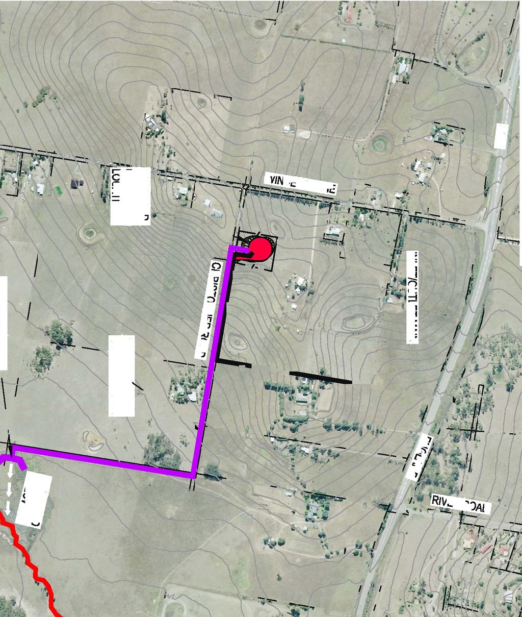
15 Additional investigations were undertaken for the short listed sites. These investigations indicated that all sites had similar geotechnical conditions and would result in similar visual impacts. The preferred site was selected taking into account the following factors: Feedback from owners of the sites. Safe access for construction and operational traffic. Proximity to existing dwellings. Future development proposed in the vicinity of the site. The preferred site was Location 3. This site is located on private property off Christopher Road, Lochinvar. Page : Rev F : February 2011
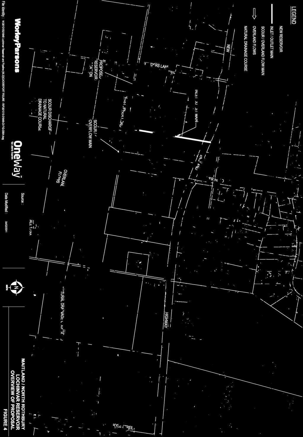
16 4. DESCRIPTION OF PROPOSAL 4.1 General The proposal involves the construction of a 10 ML potable water reservoir at Lochinvar. The principal components of the proposed works are: A 10 ML reservoir located off Christopher Road, Lochinvar. Overflow and scour pipe in private property alongside Christopher Road. Access road. Landscaping. An overview of the proposal is included on Figure 4. The inlet/outlet main to the reservoir will be included in the REF for the other mains in the Lochinvar / Rutherford area that form part of the Maitland / North Rothbury Stage 3 upgrade works Reservoir The proposed reservoir would be located off Christopher Road, Lochinvar. The reservoir would be approximately 10 metres high and would have a diameter of approximately 40 metres. The reservoir structure would be constructed of either reinforced concrete or steel and would have a roof to prevent access by animals and/or wind-blown debris. The proposed reservoir layout is illustrated in Figure Scour / Overflow Main The scour / overflow main would be used to transport sediment-laden water from the bottom of the reservoir during maintenance works (scour) or to drain clean potable water from the top portion of the reservoir during maintenance works and direct overflows of clean potable water from the reservoir (overflows). During maintenance works, the reservoir is generally drawn down to 10 to 20 percent of the reservoir capacity and the residual water drained via the scour main. The scour / overflow main would extend from the reservoir site in an easterly direction within private property alongside Christopher Road, from where water would flow overland to a natural drainage course. It is anticipated that the reservoir would only overflow as a result of a failure in the system. The reservoir would form part of a water supply system that would be monitored on a 24-hour basis via radio telemetry by Hunter Water and any overflows would be brought to the immediate attention of Hunter Water. It is expected that it would be very rare for the reservoir to overflow and that overflows would occur for a short time only. Page : Rev F : February 2011
17 This REF includes an assessment of the potential environmental impacts due to operation of the scour / overflow main. Potential impacts due to construction of the main will be included in the REF for construction of the other mains in the Lochinvar / Rutherford area that form part of the Maitland / North Rothbury Stage 3 upgrade works (along with the inlet/outlet main to the reservoir) Access Road A sealed access road to the reservoir would be constructed from Christopher Road (refer Figure 5). The reservoir site and access road would be completely fenced with a lockable gate. 4.2 Construction Works Construction of the proposal would be undertaken by qualified contractors, to detailed specifications prepared for Hunter Water. Activities associated with construction of the reservoir would include: Grading and levelling at the site. Excavation of the site. Construction of the reservoir. Construction of the access road. Off-site removal of materials. Machinery used during construction of the reservoir would typically include an excavator, backhoes, a compactor and other construction-related equipment. A crane and concreting equipment would also be required. The construction workforce would vary according to the contractor s equipment and techniques. Indicative numbers for workforce personnel during construction would be in the order of 5 to 10. Working hours for all construction activities would be restricted to Monday to Friday 7:00 a.m. to 6:00 p.m. and Saturday 8:00 a.m. to 1:00 p.m.. No work would be undertaken on Sundays or public holidays. Traffic associated with construction works has been estimated to average 2-4 truck movements per day, plus traffic associated with contractors. Construction works would require a temporary site office and compound. The site office and compound would be located on Lot No. 12 DP , on which the reservoir is proposed. This area would be restored and returned to the private landowner at the completion of the project. The construction time is estimated to be approximately 9 months. Page : Rev F : February 2011
18 4.3 Operation The operation and maintenance of the reservoir would be managed by Hunter Water. The new works would be part of a system that is monitored on a 24-hour per day basis with signals managed on an area telemetry network. A site maintenance program would also be implemented. Page : Rev F : February 2011


19
20
21 5. LEGISLATIVE FRAMEWORK 5.1 Environmental Planning and Assessment Act 1979 In New South Wales, the framework for assessing the potential environmental impact of a proposed development is provided by the Environmental Planning and Assessment Act 1979 (EP&A Act) and the Environmental Planning and Assessment Regulation 2000 (EP&A Regulation). Under this legislation, land development is subject to state and local planning instruments. The proposal lies within the Maitland LGA. The Maitland Local Environmental Plan 1993 (Maitland LEP) governs as the relevant planning instrument for the project. As discussed in Section below, the proposal would not require development consent from Council. As the proposal is permissible without consent, it is considered an activity under Clause 110 of the EP&A Act. The proposal therefore requires environmental assessment under Part 5 of the EP&A Act. As the Proponent (Hunter Water) is a public authority, it is constituted as a determining authority under Clause 110 of the EP&A Act. Clause 111 of the EP&A Act requires the determining authority to examine and take into account to the fullest extent possible all matters affecting or likely to affect the environment by reason of that activity. This REF has been prepared to assess the environmental impacts of the proposal in accordance with Part 5 of the EP&A Act. 5.2 Local Environmental Plan The proposed works are located within the Maitland LGA. The proposed reservoir site is zoned 1(b) Secondary Rural Land under the Maitland LEP. Construction and operation of the proposal is not prohibited under the current zoning. 5.3 State Environment Planning Policies State Environmental Planning Policies (SEPPs) are drafted by the NSW State Government and apply to issues and developments of significance to the state. The SEPPs relevant to the proposal are SEPP (Infrastructure) 2007 and SEPP 44 (Koala Habitat Protection) SEPP (Infrastructure) SEPP (Infrastructure) 2007 aims to facilitate the effective delivery of infrastructure within NSW by public authorities. It does this by prescribing the infrastructure related works that may be undertaken without development consent. Clause 125(1) of SEPP states that development for the purpose of water reticulation systems may be carried out by or on behalf of a public authority without consent on any land. Clause 125 of SEPP (Infrastructure) defines a water reticulation system as including water storage reservoirs. Page : Rev F : February 2011
22 Under Part 5 of the EP&A Act, Hunter Water has delegated authority from the Minister to undertake environmental assessment of the project as the determining authority. Development consent would therefore not be required for the proposal SEPP 44 (Koala Habitat Protection) The aim of SEPP 44 is to encourage the proper conservation and management of areas of natural vegetation that provide habitat for koalas, to ensure a permanent free-living population over their present range and reverse the current trend of koala population decline. The Maitland LGA is identified under Schedule 1 of SEPP 44 as being a LGA to which SEPP 44 applies, although Part 5 approvals are exempt from consideration under the SEPP. Consideration of the proposal with respect to SEPP 44 is included in the Flora and Fauna Assessment included in Appendix B and summarised in Section Other Legislation Relevant to the Proposal Water Management Act 2000 The Water Management Act 2000 (WM Act) provides for the preparation of water management plans, which contain much of the detail necessary for the operation of the Act. Water management plans address matters such as water sharing, water use, drainage and floodplain management and water source protection. Under the WM Act, an approval is required for: A water supply work. A drainage work. A flood work in or in the vicinity of a river or lake, or within a floodplain The WM Act does not apply to any water supply works under the control or management of the Sydney Water Corporation, Hunter Water or a local water utility. The proposed works are works under the management of Hunter Water and as such, the WM Act does not apply to the proposal National Parks and Wildlife Act 1974 The National Parks and Wildlife Act 1974 (NPW Act) provides for the protection of National Parks, historic sites, nature reserves, State Recreation Areas, Aboriginal areas and State game reserves. State conservation areas, special conservation reserves and regional parks are also administered under the NPW Act. A permit under Section 87 of the NPW Act is required to undertake a range of activities relating to Aboriginal objects, including disturbing or excavating land for the purpose of discovering an Aboriginal object. Section 90 of the NPW Act requires that the consent of the Director-General of the Page : Rev F : February 2011
23 Department of Environment, Climate Change and Water (DECCW) is required in order to destroy, deface or damage an Aboriginal object or place. Archaeological test excavation under Section 87 of the NPW Act has been undertaken at the proposed reservoir site Threatened Species Conservation Act 1995 The Threatened Species Conservation Act 1995 (TSC Act) outlines the protection of threatened species, communities and critical habitat in NSW. Schedules 1, 1A and 2 of the TSC Act list endangered, critically endangered and vulnerable species and ecological communities. Schedule 3 of the TSC Act lists key threatening processes, which are defined as processes that could adversely affect threatened species, populations or ecological communities or that cause a species, population or ecological community to become threatened. Part 3 of the TSC Act allows for declaration of critical habitat for endangered species, populations and ecological communities and critically endangered species and ecological communities. The TSC Act provides information on Species Impact Statements. The EP&A Act requires a Species Impact Statement to be prepared in the event that an activity is being undertaken within critical habitat or is likely to affect threatened species, populations or ecologically communities, or their habitats. In order to determine whether an activity is likely to significantly affect threatened species, populations or ecological communities, or their habitats. In order to determine whether an activity is likely to affect threatened species, populations or ecological communities, a seven-part test under Section 5A of the EP&A Act is required for threatened species, populations or ecological communities that have the potential to be impacted by a proposal Native Vegetation Act 2003 Under the Native Vegetation Act 2003 (NV Act), scheduled clearing needs to be assessed in the development application process or through a Property Vegetation Plan in agreement with the Catchment Management Authority. Construction of the proposed reservoir is exempt from the NV Act, as the Act does not apply to any clearing that is carried out by a determining authority under Part 5 of the EP&A Act Protection of the Environment Operations Act 1997 The Protection of the Environment Operations Act 1997 (POEO Act) establishes the NSW environmental regulatory framework and determines whether an Environment Protection Licence is required for a specific activity. Schedule 1 of the POEO Act lists activities that require a licence from DECCW. This proposal is not a scheduled activity; however, a person who pollutes any waters, air or land is guilty of an offence under the Act. Page : Rev F : February 2011
24 5.4.6 Environment Protection and Biodiversity Conservation Act 1999 The Commonwealth Environment Protection and Biodiversity Conservation Act 1999 (EPBC Act) provides for the protection of the environment and the conservation of biodiversity for those aspects of the environment that are matters of national environmental significance, including: World Heritage. National Heritage. Wetlands of International Importance. Listed Threatened Species and Communities. Listed Migratory Species. Protection of the Environment from Nuclear Actions. The Marine Environment. The Great Barrier Reef Marine Park. Additional Matters of National Environmental Significance. Threatened flora, fauna and ecological communities, critical habitat and key threatening processes are listed under the EPBC Act. Approval is required from the Federal Minister for Sustainability, Environment, Water, Population and Communities under the EPBC Act if it is determined that an action has, would have, or is likely to have, a significant impact on a matter of national significance. 5.5 Clause 228 Checklist Clause 228 of the EP&A Regulation lists the factors that an authority must take into account when examining the impact of its activity on the environment. Appendix A presents these factors and summarises the findings of the REF. Page : Rev F : February 2011
25 6. CONSULTATION Relevant authorities were consulted as part of the REF process for the proposed reservoir. A list of issues raised by authorities is shown in Table 6-1. A copy of the responses received from authorities is included in Appendix C. Table 6-1 Summary of Authority Responses Authority Response Summary Reference Maitland City Council Department of Lands Department of Environment, Climate Change and Water Department of Planning Hunter-Central Rivers Catchment Management Authority Maitland City Council (MCC) has advised that the water main to the reservoir and the scour / overflow main should be located outside the existing road reserve width to allow for future road widening. The proposal would not affect any Crown land. The Department has no comments or requirements in relation to the project. The Department has no comments, advice or requirements in relation to the project. The following principles should be considered in the REF: Soils Erosion of all soils should be minimised. Vegetation cover should be retained on highly erodible soils. Soil erosion and sediment control policies need to be adopted. Best practice construction should ensure that erosion does not degrade downstream environments. Vegetation Future development should be restricted to primarily cleared land. Plant species to be regenerated from local sources. Degraded riparian vegetation should be Noted N/A N/A N/A Section 7.3 Section 7.6 Page : Rev F : February 2011
26 Authority Response Summary Reference rehabilitated and weeds controlled. Riparian rehabilitation should use native, locally sourced spaces. Weeds Restoring habitat so that it would enable native species to out-compete exotic species. Section 7.6 Mine Subsidence Board Civil Aviation Safety Authority (CASA) Royal Newcastle Aero Club (RNAC) Road and Traffic Authority The reservoir site is not within a Mine Subsidence District and not subject to any building restrictions imposed by the Mine Subsidence Board. CASA indicated that the proposed reservoir would penetrate the Runway 05 Approach Surface of the Obstacle Limitation Surfaces (OLS) for the Maitland Aerodrome by approximately 5-6 metres. CASA is awaiting detailed survey to confirm the penetration distance. Penetration of the Approach Surface may impact on runway operation and instrument approach procedures for the Maitland Aerodrome. CASA would prefer that the reservoir did not penetrate the OLS. Note: CASA has not responded to correspondence from WorleyParsons sent in January 2011 regarding the outcomes of the detailed survey. The RNAC has requested that visual montages of the reservoir be created so that they can make an assessment on the level of marking required. The RNAC indicated that it may be sufficient for the roof only of the reservoir to be marked. More than 48 hours notice would need to be provided to the RNAC to advise of both the timing of the construction work and heights of the construction equipment that would be used. This would enable RNAC to displace the runway threshold as needed. No comments specific to the proposal. Section 7.3 Section 7.13 Sections 7.12, 7.13 N/A Page : Rev F : February 2011
27 Authority Response Summary Reference Department of Water and Energy (now part of DECCW) No response received to correspondence relating to the current project. Advice from the Department relating to previous projects indicates that: Public authorities are exempt from approval under the Water Management Amendment (Controlled Activities) Regulation The Department requests that designs consider the guidelines relevant to Controlled Activity Approvals. Where no water sharing plan has been gazetted pursuant to the WM Act, a licence or permit is required under the Water Act 1912 if work would involve the extraction of water from a surface or ground water source. Where a water sharing plan has been gazetted under the WM Act, an approval pursuant to the WM Act is required if work would involve the extraction of water from a surface or ground water source. N/A Further consultation with CASA and the RNAC will be required to determine requirements for the reservoir with regard to the Maitland Aerodrome. Page : Rev F : February 2011
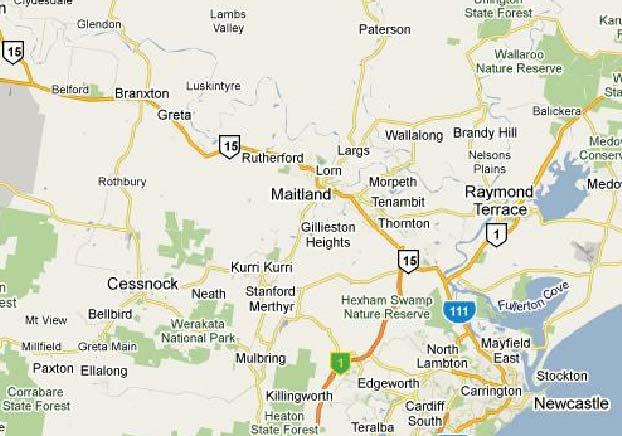
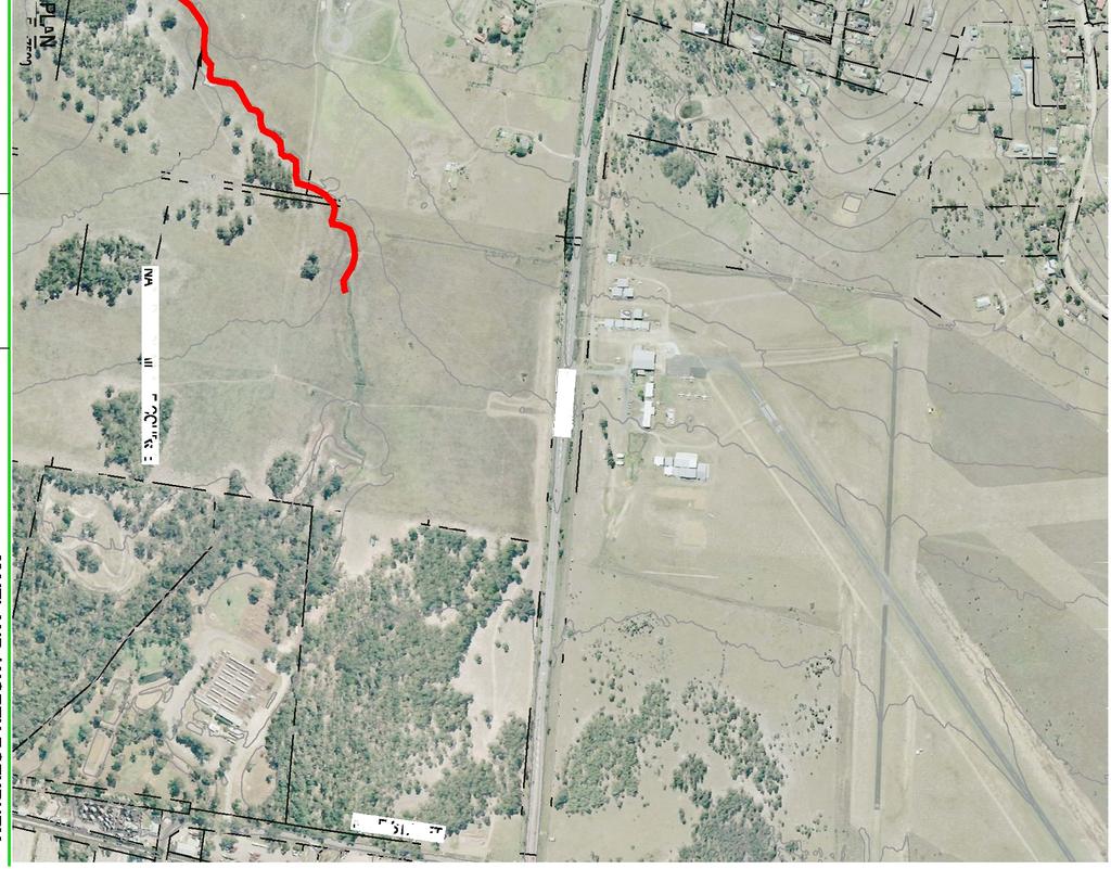
28 7. EXISTING ENVIRONMENT, POTENTIAL IMPACTS AND ENVIRONMENTAL SAFEGUARDS 7.1 Location The Maitland LGA is located in New South Wales, approximately 130 kilometres north of Sydney and 30 kilometres northwest of Newcastle. It covers an area of approximately 39,200 hectares at the junction of the Paterson and Hunter Rivers in the Lower Hunter Valley. The major urban centres are Maitland, Thornton, Woodberry, East Maitland, Ashtonfield, Metford, Rutherford, Lorn, Largs, Lochinvar, Morpeth and Telarah. The proposal would be located in the suburb of Lochinvar, north-west of Maitland, as shown on Figure Land Use Existing Environment Land at the proposed reservoir site is currently privately owned and used for rural purposes. It is proposed that the land required for the reservoir site be acquired by Hunter Water by mutual agreement with the landowner Potential Impacts Construction The proposed reservoir site would occupy an area of approximately 86 metres by 78 metres (approximately 6,700 square metres). During construction of the reservoir, access to the reservoir site would be restricted to construction personnel. The site would be fenced with temporary fencing and private landowners and the public would not have access to the site. A site office and compound would be located on private property adjacent to the reservoir site for the duration of construction works. This site would also be fenced to prevent access by the public. Operation The reservoir site would undergo a permanent change in land use following the completion of construction works. The reservoir site and access road would be fenced and isolated from the surrounding land use. The site office and compound would be removed and the land returned to the private landowner following the completion of construction works. There would be no ongoing impact on land use within the area occupied by the site office and compound. There would not be any impact on land use from operation of the scour / overflow main. Page : Rev F : February 2011
29 7.2.3 Environmental Safeguards The following safeguards would be employed to minimise land use impacts: A community consultation plan would be prepared and implemented in accordance with Hunter Water community consultation policies and protocols. Following the completion of construction works, the land occupied by the site office and compound would be returned to its pre-construction condition and returned to the private landowner. 7.3 Geology, Soils and Hydrogeology Existing Environment A geotechnical assessment has been undertaken for the reservoir site (Douglas Partners 2011). The assessment report is included in Appendix D and the findings are summarised below: Subsurface conditions at the reservoir site comprise clay and silty clay overlying sandstone bedrock at a depth of approximately 0.5 metre. Clays in the Lochinvar area are susceptible to softening and volume changes in moisture content. Some clays in the area are prone to dispersion and would require suitable erosion protection. Acid sulphate soils have not been encountered at the reservoir site. No free groundwater was observed during drilling. There are no known contaminated sites in the vicinity of the reservoir site. The reservoir site is not subject to any building restrictions from the Mine Subsidence Board (refer Section 6 and Appendix C). Page : Rev F : February 2011
30 7.3.2 Potential Impacts Construction There is the potential for erosion of soils to occur during construction works. Appropriate safeguards would need to be implemented to prevent adverse impacts on soils due to erosion. Operation There would be no impact on soils during operation of the proposal. Safeguards would be implemented to ensure that operation of the scour / overflow main does not cause erosion of soils Environmental Safeguards A Construction Environmental Management Plan (CEMP) would be developed prior to the commencement of construction works and implemented for the duration of works. The CEMP would include a detailed Erosion and Sediment Control Plan (ESCP). The ESCP would be prepared in accordance with Managing Urban Stormwater: Soils and Construction (Landcom 2004). The ESCP would include the following environmental safeguards to control erosion and sedimentation during construction: Erosion and sediment control measures are to be installed prior to the commencement of construction works and their locations marked on a plan of the construction areas along with sensitive environmental features (such as drainage lines) as part of the CEMP. All sediment control structures are to be inspected daily and maintained to ensure that they are operating effectively. Disturbed areas are to be minimised during construction. Construction boundaries are to be clearly marked and no activity is to be permitted outside designated areas. Clean water from undisturbed areas is to be diverted around work areas. Runoff from construction areas is to be intercepted and filtered (using measures such as straw bales, sediment basins etc.) prior to release or disposal. Temporary stockpiles are not to be located in drainage lines. Controls are to be installed both upslope and downslope of stockpiles. Topsoil is to be stockpiled separately and used in restoration of the site. Roads are to be kept clean and free of soil materials generated from the construction works. Operating procedures are to be implemented to ensure that flows from the scour / overflow main are released in a controlled manner during maintenance works. These procedures would also specify the maximum flow that can be discharged during a controlled release to prevent erosion of overland drainage lines. Page : Rev F : February 2011
31 Suitable erosion protection and energy dissipation facilities would be provided at the discharge point for the scour / overflow main to minimise the potential for erosion. 7.4 Surface Water Quality Existing Environment The reservoir site lies within the Hunter River catchment. The site is located near the crest of a gently sloping hill with local drainage to the north-west and south-east. Runoff from the site would flow to the Hunter River via existing, unnamed, drainage paths and to a low-lying area at the corner of the New England Highway and Kyle Street, Rutherford Potential Impacts Construction Disturbance of soils during construction works has the potential to impact on local surface water quality by increasing the sediment load in runoff. Spills of chemicals and oil during construction works also have the potential to impact upon surface water quality. Operation Clean, treated water may be released from the reservoir during an overflow event or prior to maintenance works via the scour / overflow main. Sediment-laden water may be released from the reservoir via this main during scouring conducted as part of maintenance works. The scour / overflow main would discharge water to a natural drainage course, from where it would flow overland to a lowlying area at the corner of the New England Highway and Kyle Street, Rutherford (refer Figure 4). There is the potential for the residual chlorine in treated water to be released to surface waters via the scour / overflow main. High concentrations of chlorine in surface waters can be toxic to marine organisms. However, the following factors would reduce the potential concentrations of chlorine in surface waters: Chlorine breaks down rapidly in the presence of sunlight. Chlorine is broken down into non-toxic derivates during turbulent flow, as would occur during overland flow from the scour / overflow main. Chlorine would be absorbed by organic matter within the scour / overflow main and along the natural drainage course. In the event that overland flows from the scour / overflow main reach surface waters, concentrations of chlorine would be reduced via dilution. Page : Rev F : February 2011
32 7.4.3 Environmental Safeguards The CEMP for the proposal would include measures to control erosion and sedimentation during construction. Typical erosion and sediment control measures are included in Section Operating procedures would be developed and implemented to ensure that clean water and scours from the reservoir are released in manner that would have minimal impact on surface waters. These procedures would include: The volume of water in the reservoir is to be lowered to approximately 10 to 20 percent of capacity prior to releasing water from the reservoir, to minimise the volume of water released via the scour / overflow main. Where possible, planned releases of water from the reservoir are to occur during wet weather events, to allow dilution of chlorine concentrations. 7.5 Hydrology and Flooding Existing Environment The reservoir site is located near the crest of hill. Local run-off drains to tributaries of the Hunter River and a low-lying area at the corner of the New England Highway and Kyle Street, Rutherford via existing drainage lines Potential Impacts Construction The following works would require excavation and temporary stockpiling of material: Clearing prior to construction of the access road and reservoir. Excavation of the reservoir site. There is potential for local catchment runoff to intercept temporary stockpiles and/or disturbed areas during construction works. Operation The reservoir and access road would result in a slight increase in the impervious area at the reservoir site, which may increase the volume of runoff. However, the additional runoff is not expected to be significant in relation to the total volume of runoff generated within the catchment. Releases from the reservoir due to overflows, controlled releases of treated water or scouring would not impact upon local hydrology or flooding Environmental Safeguards The following safeguards would be implemented to minimise impacts on flooding and hydrology: Page : Rev F : February 2011
33 During construction works, all temporary stockpiles are to be located as far away from drainage lines as possible to minimise impacts on flood behaviour. Measures to ensure that the quantity, quality and rate of runoff are maintained at a suitable level are to be included in the CEMP. 7.6 Flora and Fauna Existing Environment An assessment of the existing flora and fauna at the reservoir site has been undertaken as part of this REF (LesryK 2011). A copy of the assessment report is included in Appendix B. Two threatened flora species and 19 threatened fauna species listed on the Schedules to the EPBC Act and/or the TSC Act have been previously recorded in the study region (the area surrounding the reservoir site for a distance of up to 10 kilometres). Four native flora species and 14 native fauna species were recorded within or adjacent to the reservoir site during field investigations; although none of the recorded flora and fauna species are of significance. Details of these species are included in Appendix B Potential Impacts Flora Impacts The reservoir site, site office and compound area do not provide suitable habitat for either of the two threatened flora species that have been previously recorded in the study region. None of the native flora species recorded at the reservoir site are listed, or currently being considered for listing, on the Schedules to the EPBC Act or the TSC Act. Similarly, none are identified as a Rare or Threatened Australian Plant (ROTAP) species or are of regional conservation significance. The proposal would not require removal of any hollow-bearing trees. The proposal would not have any adverse impact on any flora species of national and / or state conservation significance (LesryK 2011). Fauna Impacts None of the 19 state and/or nationally listed threatened fauna species previously recorded in the study region rely upon or utilise the reservoir site. Construction and operation of the reservoir would not have a significant impact on the local or regional viability of these species, their populations or habitats and would not limit the diversity of any of these animals foraging, sheltering or breeding sites. The proposal would not fragment or isolate any of these species habitat areas or present any barriers to their breeding or movement requirements. None of the native fauna species recorded at the reservoir site are listed (or currently being considered for listing) under the Schedules to either the EPBC or TSC Acts. Similarly, none of the recorded fauna species are of regional conservation concern within the Maitland LGA. One of the native fauna species recorded, the Nankeen Kestrel (Falco cenchroides), is listed as occurring within Page : Rev F : February 2011
34 a family of birds listed as migratory under the EPBC Act. This bird was observed adjacent to the proposed reservoir site, over one of the nearby farming properties. However, this species is not considered to be migratory within Australia. The proposed works would therefore have no adverse impact on any fauna species of national and/or state conservation significance (LesryK 2011) Environmental Safeguards To minimise potential impacts of the proposed works on native flora and fauna, the following environmental safeguards would be implemented: Any area of vegetation cleared is to be restricted to the minimum necessary for the safe undertaking of the project. The extent of permissible clearing is to be clearly defined through the erection of temporary fencing or tape. No vehicles, machinery or equipment is to be permitted beyond these defined limits. Vegetation to be cleared is to be marked on maps included in the CEMP and approved prior to clearing taking place. Suitable erosion and sediment control measures are to be in place prior to the commencement of works. These measures are to be regularly checked and repaired if required, particularly after periods of heavy rain. To prevent the spread of weeds, all vehicles and machinery are to be cleaned prior to arrival on site. The appropriate management and control of any noxious weeds is to be discussed with Council if encountered at the site. Control measures would include ongoing monitoring and treatment of any new infestations/occurrences for a period of at least 12 months. Any weed treatment is to be undertaken by a qualified person. All contaminants (e.g. rubbish) would be collected and removed from construction areas. The topsoil layer, including mulch (to a depth of approximately 50 mm), would be scraped and stored separately to any excavated material. Following construction of the reservoir, the topsoil would be used in reinstatement of the site. Excavated material would be placed in areas previously cleared and disturbed. Cleared and disturbed areas would be stabilised with suitable grasses as soon as possible to prevent soil erosion. The reservoir site would be landscaped and planted with locally sourced indigenous species following the completion of construction works. Page : Rev F : February 2011
35 7.7 Non-Indigenous Heritage Existing Environment There are currently 293 items of heritage significance within the Maitland LGA that have been identified under the Heritage Act 1977 and/or recorded in the Maitland LEP. These items range from prominent buildings such as Maitland Town Hall, Court House and Railway Station, to significant stately homes and various artefacts. In addition, there are five Heritage Conservation Areas identified in the Maitland LGA. A search of the Australian Heritage Database, State Heritage Inventory and the Maitland LEP indicates that no items of heritage significance are located in the vicinity of the proposal Potential Impacts Construction Construction of the proposal would not impact upon any previously identified non-indigenous heritage items. Operation Operation of the proposal would not have any impact on non-indigenous heritage items Environmental Safeguards The CEMP would include the following controls: Implementation of induction / training and educational programs addressing heritage issues for construction crews. This would assist in alerting crews to the correct procedures to be followed in the event that an item of historic heritage is uncovered. Historical relics are protected under the Heritage Act 1977, regardless of location. If any heritage items are identified during construction of the proposal, all works in the area must cease and Hunter Water s Project Manager contacted. Hunter Water s Project Manager would contact the Heritage Branch of the NSW Department of Planning concerning appropriate permit requirements. All contractors are to be made aware that it is an offence to move, disturb or destroy historical relics without the written permission of the NSW Heritage Branch. 7.8 Indigenous Heritage Existing Environment Within the Maitland LGA there are currently 171 significant Aboriginal sites listed under the NPW Act. The majority of these sites relate to Aboriginal artefacts and also ceremonial and burial sites. Page : Rev F : February 2011
36 A draft Aboriginal Heritage Impact Assessment (RPS 2010, refer Appendix E) has been prepared to identify heritage constraints associated with the reservoir site. A search of the Aboriginal Heritage Information Management System (AHIMS) indicated that 83 Indigenous heritage sites have been previously identified in the vicinity of the proposal. However, no heritage sites have previously been identified on the reservoir site. During field investigations, no Aboriginal sites or areas of archaeological sensitivity were identified at the reservoir site, and it is unlikely that Aboriginal heritage items are located within the subsoil at the site (RPS 2010). Consultation with the local Aboriginal community with regard to the proposal is currently being undertaken in accordance with the Aboriginal Cultural Heritage Community Consultation Requirements for Proponents (DECCW 2009). The Aboriginal Heritage Impact Assessment will be finalised once the consultation process in complete Potential Impacts Construction Construction of the reservoir would not impact upon any previously identified Indigenous heritage items. The Indigenous heritage assessment (refer Appendix E) found that there is a low probability of Indigenous heritage sites being present at the reservoir site. Therefore, it is unlikely that construction works would impact on any unidentified items of Indigenous heritage. Operation Operation of the reservoir and scour / overflow main would be unlikely to impact upon any items of Indigenous heritage Environmental Safeguards Consultation with the local Aboriginal community is currently being undertaken in accordance with DECCW requirements to ensure there are no impacts on Indigenous heritage as a result of the proposal. The following safeguards are to be included in the CEMP for the proposal and implemented during construction works: All contractors will be made aware that it is an offence to move, disturb or destroy Aboriginal objects without the written permission of the Director-General of the DECCW. Should any objects be identified during the course of construction works, all works must cease and Hunter Water s project manager notified immediately. The project manager shall consult with Hunter Water s environmental planners regarding consultation with relevant stakeholders (DECCW and local Aboriginal community representatives) in regard to appropriate management before any further works are undertaken. Page : Rev F : February 2011
37 In the event that suspected skeletal material is uncovered during the course of construction works, all works must cease and Hunter Water s Project Manager be contacted immediately. Hunter Water s Project Manager would contact DECCW and NSW Police. 7.9 Air Quality Existing Environment Air quality in the vicinity of the reservoir site is influenced by emissions from the rural environment with additional emissions from motor vehicles, industry and other commercial and domestic activities Potential Impacts Construction The construction works would be located adjacent to rural and residential areas. Therefore, there is the potential for air quality impacts on residents during construction works, including dust emissions and emissions from construction equipment. Environmental safeguards would therefore need to be implemented during construction of the proposal. Operation Impacts on air quality due to the operation of the proposal would be limited to dust and emissions from occasional maintenance works. These works would be infrequent and short-term and would not significantly impact upon air quality Environmental Safeguards Environmental safeguards to minimise the potential for dust and odour generation during construction works would be included in the CEMP. Typical safeguards would include: Minimising the area of exposed surfaces Dampening exposed surfaces in windy conditions. Covering loads on vehicles hauling materials to and from work sites. Local roads are to be kept clean from construction vehicle tyre movements. Rehabilitating exposed areas as soon as possible following the completion of construction works. Page : Rev F : February 2011
. A copy of the assessment is included in Appendix F.")
38 7.10 Noise and Vibration Existing Environment The proposed reservoir site is situated in a rural area. An assessment of the existing noise and vibration environment in the vicinity of the proposal site has been undertaken (SLR Heggies 2011). A copy of the assessment is included in Appendix F. There are eleven residential receivers in the vicinity of the reservoir site, as shown on Figure 6. Figure 6 Residential Receivers in the vicinity of Reservoir Site (source: SLR Heggies 2011) Page : Rev F : February 2011
39 The New England Highway is situated approximately 550 metres to the north of the reservoir site. Traffic on the New England Highway is the major noise source at the reservoir site. Existing ambient noise levels are summarised in Table 7-1. Page : Rev F : February 2011
40 Table 7-1 Existing Ambient Noise Levels Location Period Rating Background Level (RBL) Measured Existing LA eq (daytime) noise level 67 Winders Lane (Receiver R7) Day 40 dba 49 dba Source: SLR Heggies (2011) The RBL is the overall background level during the assessment period (day, evening or night). The LA eq is the equivalent continuous level of noise Potential Impacts Construction Construction of the proposed reservoir would involve earthworks and other construction activities that have the potential to generate noise. Noise would be generated from equipment such as excavators, trucks and vibrating rollers, as well as general construction traffic. Subsurface conditions at the reservoir site include rock from a depth of 0.5 metres (refer Section 7.3). Rock hammering and/or sawing may therefore be required during excavation for the reservoir. Predicted noise levels have been assessed at residential receivers under three scenarios: Scenario 1 Construction of access road. Scenario 2 Excavation of reservoir site. Scenario 3 Construction of reservoir. The equipment assumed for each of these scenarios is included in the noise and vibration assessment in Appendix F. The results of the construction noise assessment are included in Table 7-2. Bold indicates exceedance of the construction noise goal. Page : Rev F : February 2011
41 Table 7-2 Receptor Predicted Noise Levels Predicted Noise Level LA eq(15 minute) dba Construction Noise Goal LA eq(15 minute) dba Scenario 1 Scenario 2 Scenario 3 Noise Affected Highly Noise Affected R R R R R R R R R R R Source: SLR Heggies (2011) Based on the measured RBL, a Noise Management Level of 50 dba applies to this site in accordance with the Interim Construction Noise Guidelines (DECC 2009). Construction works have the potential to cause noise impacts (LA eq (15 minute) greater than 50 dba) at four residential properties in the vicinity of the reservoir site (receivers R3, R4, R6 and R7). Safeguards would need to be applied during construction works to minimise impacts on these properties. Use of a vibratory roller during construction of the access road to the reservoir would cause vibrations of approximately 1 mm/s, which would exceed the criteria for annoyance risk for human comfort of 0.45 mm/s at receiver R7. However, it is unlikely that vibration would cause annoyance, given the short period for which a vibratory roller would be operating in close proximity to receiver R7. Vibrations at this receiver would be below the damage risk criterion of 5 mm/s (refer Appendix F). Vibration levels due to rock hammering during construction of the reservoir would be significantly below the criteria for annoyance risk for human comfort at the two closest residential receivers to the reservoir site (receivers R6 and R7). Page : Rev F : February 2011
42 Operation Operation of the reservoir would not result in any significant noise or vibration impacts. Maintenance works would be short-term and would not have a significant impact on nearby residences Environmental Safeguards The following noise and vibration control measures would be implemented during construction works: Construction works (and entry and departure of heavy vehicles to and from site) will be restricted to the following daytime construction hours in accordance with the Interim Construction Noise Guidelines (DECC 2009). o o o Monday to Friday 7:00 a.m. to 6:00 p.m. Saturday: 8:00 a.m. to 1:00 p.m. No work on Sundays or public holidays. Noisy plant operating simultaneously is to be avoided wherever possible. Maintenance work on all construction plant is to be carried out away from noise sensitive areas and confined to construction hours. Noisy equipment is to be sited behind structures that could act as noise barriers, or at the greatest distance from noise sensitive areas, or equipment oriented so that noise emissions are directed away from noise sensitive areas. Equipment is to be kept well maintained. Vibration monitoring is to be undertaken at the commencement of potentially vibration generating activities (such as use of vibratory rollers or rock hammering) at the nearest vibration sensitive receiver. Prior to commencing construction works, all potentially affected residents in the vicinity of the proposal are to be notified in writing of the construction activities, informed of the hours of construction and provided with a contact name and telephone number for inquiries or complaints. Regular liaison with residents is to continue for the duration of construction works. Site induction training is to include a noise and vibration awareness component. Noise monitoring may be required at affected residences if excessive noise is generated or complaints are received. Page : Rev F : February 2011
43 7.11 Traffic and Access Existing Environment Access to the reservoir site is via the New England Highway and Christopher Road, refer Figure 1. The New England Highway is a RTA road and has significant car and traffic movements. The speed limit on this road is 80 km/hr. Christopher Road is a private road used primarily by local traffic Potential Impacts Construction There is the potential for Winders Lane and Christopher Road to be affected by increased traffic movements for the duration of construction works (approximately 9 months). The increase in traffic volume on the New England Highway due to construction works would be negligible. Operation Operation of the proposal would not have any adverse impacts on traffic or access. Operational traffic would be limited to occasional maintenance works Environmental Safeguards To protect public safety and minimise traffic impacts, a traffic management plan complying with the publication Traffic Control at Work Sites (RTA 2010) is to be prepared prior to the commencement of construction works and incorporated into the CEMP. Safeguards to be included in the plan include: Advance notice of traffic disruptions is to be provided to Council and residents. The traffic management plan is to be submitted to Council and the RTA two weeks prior to the commencement of construction works. Appropriate signage is to be used for construction traffic. The reservoir site and site compound is to be fenced to prevent access. Any traffic incident on the New England Highway must be immediately reported to the NSW Transport Management Centre on Visual Amenity Existing Environment The proposed reservoir would be located in a rural area. Local roads are located to the south and west of the reservoir site. The closest residence is approximately 50 metres from the proposed reservoir site. Page : Rev F : February 2011

44 Potential Impacts Construction Construction activities would involve the use of construction equipment and machinery (e.g. excavators, backhoes) and associated vehicle movements. These activities would be visible to local residents and traffic on the New England Highway, but would not have a significant visual impact. Operation A visualisation study has been undertaken for the Lochinvar reservoir and is included in Appendix G. Once completed, the reservoir would be between 7.5 and 11 metres above the existing ground level. The viewshed for the proposed reservoir is shown in Figure 7. Green shading in this figure depicts areas from which the reservoir can be seen. Figure 7 - Reservoir Viewshed (source: Manidis Roberts 2010) The completed reservoir would be visible from surrounding residential properties and from the New England Highway (Manidis Roberts 2010). Photomontages of the proposed reservoir are included as Plates 1, 2 and 3. Page : Rev F : February 2011

45 Plate 1 - View of Proposed Reservoir from 19 Winders Lane Page : Rev F : February 2011

46 Plate 2 - View of Proposed Reservoir from 35 Winders Lane Page : Rev F : February 2011

47 Plate 3 - View of Proposed Reservoir from Winders Lane View of the reservoir from the residential areas of Windella, Lochinvar and the industrial area at Rutherford would be limited. There would not be any significant visual impact on these communities from the proposal. Operation of the scour / overflow main would not impact upon visual amenity Environmental Safeguards To reduce construction impacts the following environmental safeguards would be implemented: Consultation with nearby residents would be undertaken by Hunter Water during detailed design and prior to the commencement of construction works. The construction site would be fenced and all works would be limited to the fenced area. Disturbed areas would be rehabilitated immediately following construction. These safeguards would be included in the CEMP. The visual impact of the reservoir during the operational phase would be mitigated by: Page : Rev F : February 2011