Overview of Water Resources (Part 2): Groundwater in Sonoma Valley
|
|
|
- Dale McDaniel
- 5 years ago
- Views:
Transcription

1 . Overview of Water Resources (Part 2): Groundwater in Sonoma Valley Marcus Trotta, PG, CHg Principal Hydrogeologist Sonoma County Water Agency Sonoma Valley Groundwater Sustainability Agency October 23,
2 Part 1 Recap Integrated Water Resource Management Recycled Water Resources Water Conservation Programs Russian River Water Resources Groundwater Resources Climate Change Impacts & Considerations
3 Presentation Overview 1. Background on Groundwater Science 2. Sonoma Valley Groundwater Studies 3. Voluntary Groundwater Management Planning Basin Advisory Panel Insights and Recommendations 4. Groundwater Sustainability Plan Requirements and Data Needs 5. Next Steps 6. Questions & Discussion


4 Hydrologic Cycle US Geological Survey Circular 1139

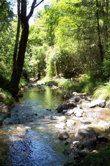
5 Groundwater Surface Water Connection Groundwater Affects Stream Flow Gaining Stream Gaining Stream High Groundwater Levels Groundwater Maintains Stream Flow Courtesy The Nature Conservancy


6 Groundwater Surface Water Connection Groundwater Affects Stream Flow Losing Stream Losing Stream Pumping Lowers Groundwater Levels Stream Loses Flow Flow to to Groundwater Courtesy The Nature Conservancy


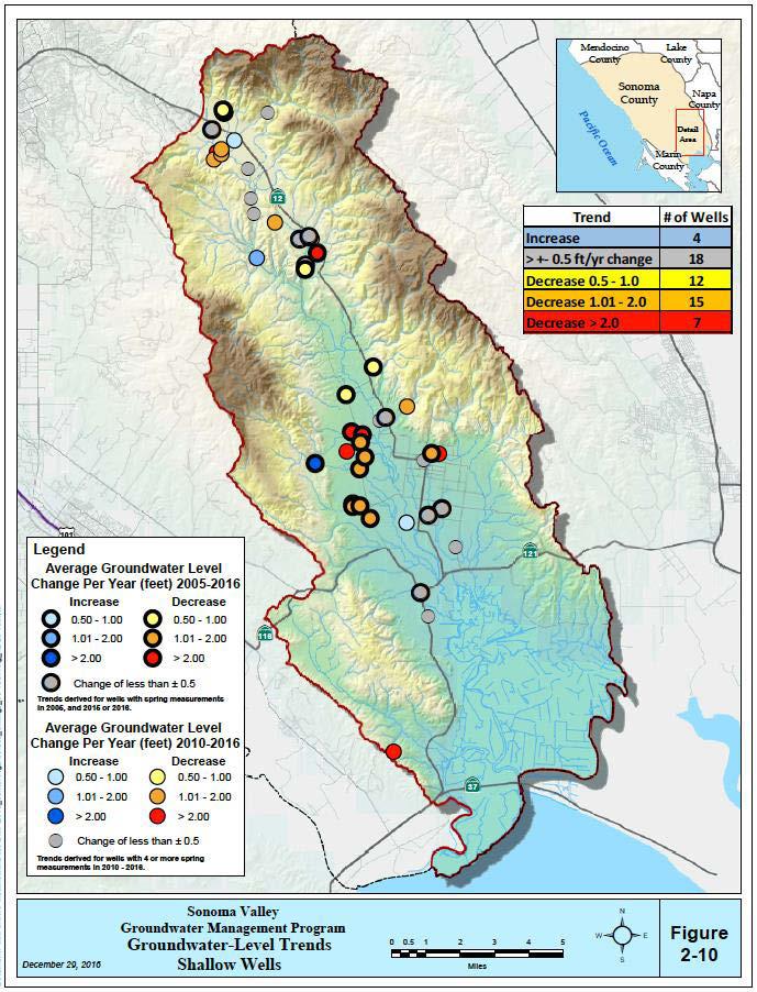
7 Sonoma Valley Groundwater Studies Key Findings/Outcomes: Complex Geology Higher salinity/brackish groundwater in southern Sonoma Valley Increased pumping since early 1980s Areas of declining groundwater levels Development of Groundwater Flow Models USGS, 1960 DWR, 1982 USGS, 2006 SVGMP, 2014
8 Sonoma Valley Water Use Estimated Total Water Use: 17,900 Acre-Feet (2012) Local Surface Water 8% Recycled Water 7% Estimated Groundwater Use: 10,500 Acre-Feet (2012) Commercial 3% Mutual 6% Irrigated Turf 4% Imported Water (Russian River) 26% Local Groundwater 59% Municipal 5% Rural Residential 27% Agriculture 55% Urban demand primarily met through imported Russian River water Agricultural and Rural Residential demand primarily met through local groundwater At least 2,200 groundwater wells


9 Sonoma Valley Hydrogeologic Setting Complex Geology: Intermixed sedimentary and volcanic deposits Layers have been uplifted, tilted and faulted Sonoma Valley Groundwater Basin


10 Sonoma Valley Groundwater Management Program Convened Stakeholder Group in June 2006 Basin Advisory Panel Agricultural alliances, environmental organizations, water purveyors, and residential groundwater users Voluntary AB3030/SB1938 Groundwater Management Plan Adopted by Sonoma County Water Agency, City of Sonoma & Valley of the Moon Water District in Late 2007 Non-Regulatory and Collaborative Process 10

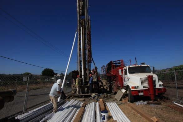
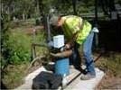
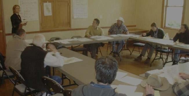
11 Program Activities Groundwater-Level and Streamflow Monitoring Involvement of Community Stakeholders Monitoring Well Construction & Data Collection Groundwater Model Update and Initial Alternatives Analyses


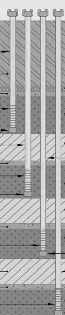
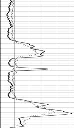
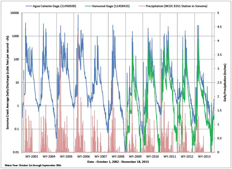
12 Voluntary Groundwater- Level Monitoring 90 - New Wells since Wells with Synchronized Monitoring Groundwater Levels Only Track and Assess Seasonal and Long-term Trends

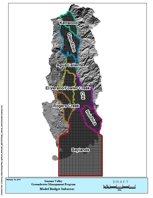
13 Sonoma Valley Groundwater Basin Sonoma Valley Groundwater Basin
14

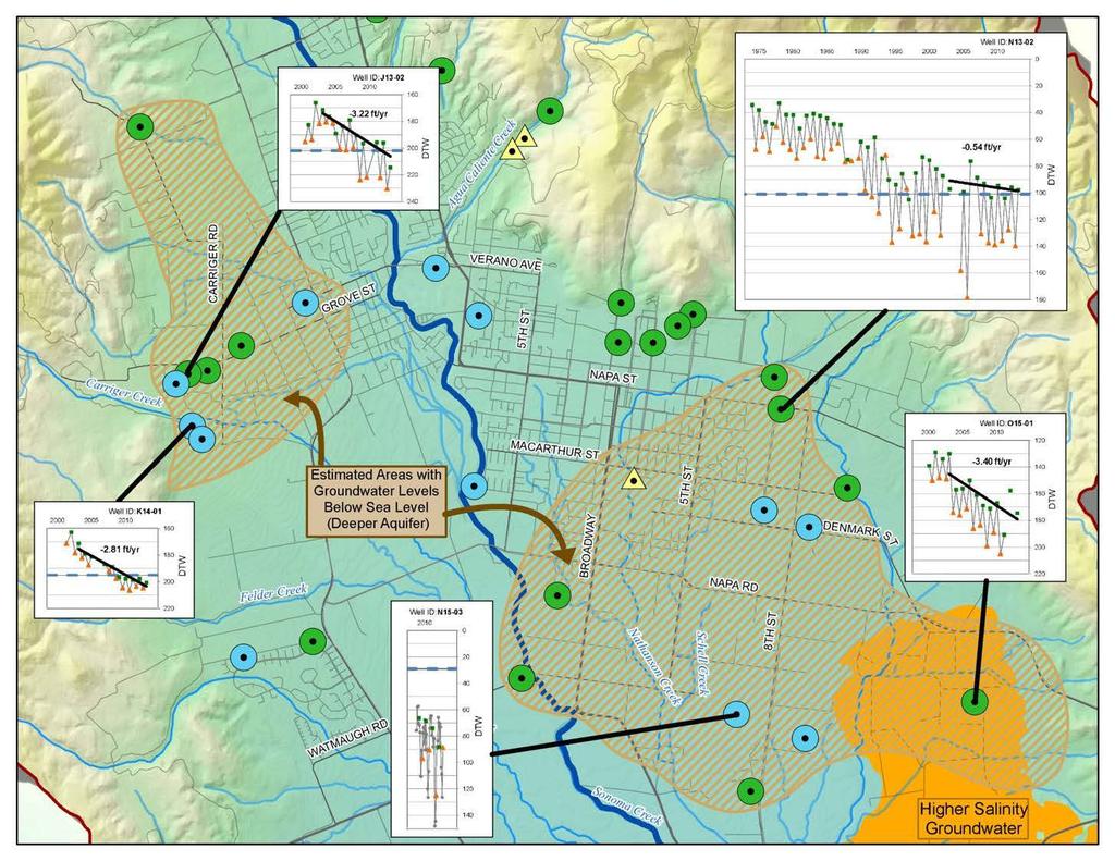
15 Salinity In Groundwater is a Concern Salinity Sources: Historical Brackish Water Beneath Tidal Marshlands Thermal Water Deep Groundwater from Older Formations
 Sonoma Creek near Kenwood Carriger Upper reaches of Fryer and Nathanson Portion of Felder Creek Sonoma Valley Groundwater")
16 Groundwater Important Provider of Flow to Streams Discharge Segments (Groundwater flows into Stream) Most of Sonoma Creek Most of Calabazas Lower reaches of Fryer and Nathanson May 2010 Recharge Segments (Stream recharges Groundwater) Sonoma Creek near Kenwood Carriger Upper reaches of Fryer and Nathanson Portion of Felder Creek Sonoma Valley Groundwater Basin


17 Basin Advisory Panel Recommended Management Strategies CONSERVATION of Urban, Non- Urban, & Agriculture WATER REUSE use to offset groundwater pumping GROUNDWATER BANKING Russian River winter-time water to recharge groundwater basin STORMWATER to recharge groundwater
18 Alternatives Analysis to Address Groundwater Depletion Identification of potential technical, regulatory, land use and institutional response action alternatives: a) Additional water supply (stormwater capture, aquifer storage and recovery, and increased water reuse); b) Water use efficiency and conservation programs c) Increased data collection and reporting; d) Implementation of land use strategies; e) Regulatory responses; and f) Institutional approaches. Identification of preliminary screening criteria, including technical feasibility, regulatory and community acceptance, relative cost, and environmental benefits. Simulation of baseline future model scenarios that incorporate a range of climate futures, population growth and potential land use changes.

19 Groundwater Flow Model Integrated Hydrologic Model Climatically driven agricultural demands Improved streamflow simulation Incorporation of surface water diversions Recycled Water deliveries Representation of land use trends and changes Uncertainty analysis to better understand and convey applicability and limitations of the model Example Model Uses Estimate hydrologic budget Identify recharge areas Evaluate water-resource management strategies Evaluate climate-change impacts Evaluate effects of changes in landuse
20 SV BAP Insights and Recommendations 1. Give Prompt Attention to Areas of Declining Groundwater Levels in southern Sonoma Valley 2. Continue and Expand Monitoring Programs 3. Importance of Contributing Watershed Areas to Groundwater Sustainability 4. Close Coordination with Land-Use Planning 5. Expand Level of Community Outreach
21 SV BAP Insights and Recommendations 6. Incorporate and expand Analyses of Potential Solutions to Address Groundwater Depletion Areas 7. Support Pursuit of Strategies from the Original Plan 8. Set Goals to Achieve and Sustain a Healthy Basin Beyond the January 2015 Requirement in SGMA 9. Represent Multiple and Diverse Interests in Sonoma Valley 10.Continue Involvement and Transfer of Intellectual Knowledge of the SVGMP Panel and TAC
22 Groundwater Sustainability Plan Requirements DWR developed requirements and regulations Require significant level of technical work Avoid significant and unreasonable undesirable results for the following sustainability indicators: Chronic lowering of groundwater levels Reduction of groundwater storage Seawater intrusion Degraded water quality Land subsidence Depletions of interconnected surface water that have adverse impacts on beneficial uses of the surface water Require setting of measureable thresholds and objectives for each sustainability indicator Identify projects and actions needed to achieve sustainability
23 Draft GSP Work Plan Objectives Meet SGMA requirements - establish criteria and management actions to achieve and maintain sustainable groundwater. Build on strong technical foundation established through previous technical studies and voluntary groundwater management activities. Provide opportunity for significant public and community engagement and integrate the perspectives and address the needs of the many diverse users and uses of groundwater resources within the basin. Leverage local resources through continued regional coordination and information sharing.
24 Phased Approach to GSP Development Six General Phases following DWR s GSP Regulations 1. Plan Area and Basin Setting 2. Sustainable Management Criteria 3. Sustainability Progress Monitoring Program 4. Proposed Project and Management Actions 5. GSP Implementation Costs, Detailed Schedule, and Reporting 6. Compile Complete GSP and Prepare for Adoption All phases will be developed through iterative process with input from Advisory Committee, GSA Board and community members
25 New Requirements vs Existing Information: Plan Area and Basin Setting Example Groundwater Conditions Example of Required GSP Component* Information available from existing GMP or studies Additional GSP Requirements Groundwater Conditions Description of groundwater elevation trends over time, groundwater elevation hydrographs and contour maps, groundwater quality data. Annual and cumulative change in groundwater storage based on groundwater-level changes, description and map of known groundwater contamination sites and plumes, rates and map of land subsidence (as applicable) identification of interconnected surface waters and groundwater dependent ecosystems and estimates on timing and quantity of stream depletions. *Represents one of many required GSP components
26 Key Data Needs and Challenges Improved water use estimates for rural groundwater users (rural domestic and agriculture), which comprise over an estimated 80% of the total groundwater use. Depth-dependent water level and water quality data to improve understanding of the hydrogeology and better define relationships between the shallow and deeper aquifer systems. Improved information is needed about well location, lithology and construction to better understand Basin hydrogeology and improve the groundwater model. Additional modeling of future projected conditions that simulate the impacts of climate change, land use changes, hydrology, and changes in demands.
27 Key Data Needs and Challenges More information to address potential depletion of interconnected surface water from groundwater pumping Identifying undesirable results as defined in SGMA and establishing quantifiable thresholds. Transitioning from a voluntary groundwater management plan to a new plan with regulatory authority will require extensive public outreach and community engagement.
28 Next Steps 1. Share information and coordinate with newly formed Advisory Committee 2. Complete Work Plan for GSP Development for Prop 1 Grant Application Submittal by November 13, Assess and Scope Near-term monitoring and data needs 4. Develop Community Engagement Plan 5. Prepare and File Initial Notice of GSP Preparation 6. Initiate Development of GSP must be filed with DWR by January 2022
29 Questions and Discussion