Blythewood Road Blythewood, South Carolina
|
|
|
- Bernice Fox
- 5 years ago
- Views:
Transcription


1 For Sale Golf Club 917 Lots ±141.5 Acres 77 Blythewood Park Bethel-Hanberry Elementary School Dollar McNulty Plaza Food Village at Blythewood " " Recreation Center " Future Sharpe Shoppe Comfort Inn 75 Rooms Holiday Inn Express 88 Rooms Oakwood Plaza Fairfield Electric Cooperative The Maples (Willow Creek LLC) Muller Road Middle School Blythewood High School Blythewood Road Blythewood, South Carolina Property Features ±141.5 acres available on Blythewood Road, in close proximity to I-77 Utilities: - Water to be provided by Winnsboro - Sewer to be provided by Palmetto Utilities Tract - features frontage on three roads: ±1,180 on Blythewood Road ±2,050 on Muller Road ±1,700 on Syrup Mill Road CONTACT BROKER FOR MORE INFORMATION Tom Milliken tmilliken@naiavant.com Tombo Milliken tombo.milliken@naiavant.com Wetlands delineated Zoning: PDD, Blythewood Sales Price: $3,550,000 $2,750,000 THE INFORMATION CONTAINED HEREIN HAS BEEN GIVEN TO US BY THE OWNER OF THE PROPERTY OR OTHER SOURCES WE DEEM RELIABLE. WE HAVE NO REASON TO DOUBT ITS ACCURACY, BUT WE DO NOT GUARANTEE IT. ALL INFORMATION SHOULD BE VERIFIED PRIOR TO PURCHASE OR LEASE. 807 Gervais Street, Suite 301 Columbia, South Carolina
2 For Sale ±141.5 Acres Table of Contents Location Map Page 3 Points of Interest Page Aerial Page Aerial Page Infrared Page 7 Topography Aerial Page 8 FEMA Flood Hazard Page 9 Wetlands Page 10 Soil Survey Page Gervais Street, Suite 301 Columbia, South Carolina


3 Location Little Mountain Summit Gilbert 20 Chapin Lake Murray Lexington Fairfield County Dutch Fork/Irmo Lexington Red Bank 26 Irmo Saluda Shoals Seven Oaks Oak Grove Harbison State Forest 26 Springdale Columbia Metropolitan p Airport South Congaree North Columbia St Andrews Pine Ridge 20 Columbia West Columbia Cayce/West Columbia Central Business District Cayce Blythewood ^ Dentsville Arcadia Lakes Forest Acres Forest Acres Northeast Columbia Lake Carolina Sesquicentennial State Park Southeast Columbia Village at Sandhill Fort Jackson Miles McIntire AFB Outlying Richland County Kershaw County Elgin Lugoff Eastover Outlying Lexington County Gaston 26 Outlying Calhoun County Congaree National Park


 Muller Road Middle")
4 Points of Interest Golf Club 917 Lots 77 Bethel-Hanberry Elementary School Blythewood Park Food Village at Blythewood Dollar McNulty Plaza " " Cobbleston Recreation Center Comfort Inn 75 Rooms Future Sharpe Shoppe " Holiday Inn Express 88 Rooms Oakwood Plaza Fairfield Electric Cooperative The Maples (Willow Creek LLC) Muller Road Middle School Blythewood High School


5 2013 Aerial Syrup Mill Rd 917 Lots Golf Club Muller Rd Recreation Center Tobacco Barn Rd Muller Road Middle School Fairfield Electric Cooperative The Maples (Willow Creek LLC)


6 2010 Aerial Syrup Mill Rd 917 Lots Golf Club Muller Rd Recreation Center Tobacco Barn Rd Muller Road Middle School Fairfield Electric Cooperative The Maples (Willow Creek LLC)


7 2006 Infrared Syrup Mill Rd Muller Rd Tobacco Barn Rd


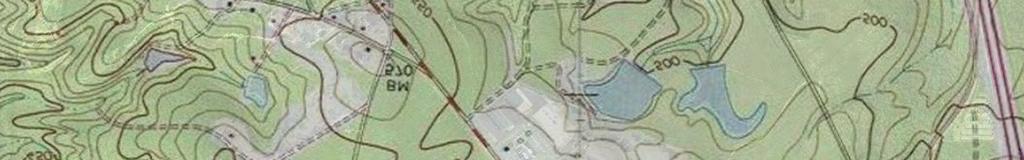
8 Topographical Map

9 FEMA National Flood Hazard Layer Syrup Mill Rd Muller Rd Tobacco Barn Rd


10 National Wetlands Inventory Syrup Mill Rd Muller Rd National Wetlands Inventory Estuarine and Marine Deepwater Tobacco Barn Rd Estuarine and Marine Wetland Freshwater Emergent Wetland Freshwater Forested/Shrub Wetland Freshwater Pond Lake Other Riverine


11 Soil Survey GeC W GeC GeB Syrup Mill Rd FuB GeC GeB Ce HeC GeB GeC BaB BaB BaB FuB GeC Muller Rd W FuB W PeD LaB W Tobacco Barn Rd PeD BaB GeB BaB W PeB LaB TrB PeB HeC GeC BaB W W LaB BaB
12 Map Unit Description (Brief, Generated) Richland County, South Carolina [Minor map unit components are excluded from this report] Map unit: FuB - Fuquay sand, 2 to 6 percent slopes Component: Fuquay (100%) The Fuquay component makes up 100 percent of the map unit. Slopes are 2 to 6 percent. This component is on marine terraces on coastal plains. The parent material consists of plinthic loamy marine deposits. Depth to a root restrictive layer is greater than 60 inches. The natural drainage class is well drained. Water movement in the most restrictive layer is moderately low. Available water to a depth of 60 inches is low. Shrink-swell potential is low. This soil is not flooded. It is not ponded. A seasonal zone of water saturation is at 60 inches during January, February, March. Organic matter content in the surface horizon is about 1 percent. Nonirrigated land capability classification is 2s. This soil does not meet hydric criteria. Map unit: GeB - Georgeville silt loam, 2 to 6 percent slopes Component: Georgeville (85%) The Georgeville component makes up 85 percent of the map unit. Slopes are 2 to 6 percent. This component is on interfluves, piedmonts. The parent material consists of residuum weathered from metavolcanics and/or residuum weathered from metasedimentary rock and/or residuum weathered from slate. Depth to a root restrictive layer is greater than 60 inches. The natural drainage class is well drained. Water movement in the most restrictive layer is moderately high. Available water to a depth of 60 inches is high. Shrink-swell potential is low. This soil is not flooded. It is not ponded. There is no zone of water saturation within a depth of 72 inches. Organic matter content in the surface horizon is about 1 percent. Nonirrigated land capability classification is 2e. This soil does not meet hydric criteria. Map unit: GeC - Georgeville silt loam, 6 to 10 percent slopes Component: Georgeville (100%) The Georgeville component makes up 100 percent of the map unit. Slopes are 6 to 10 percent. This component is on hillslopes on uplands. The parent material consists of clayey residuum weathered from slate. Depth to a root restrictive layer is greater than 60 inches. The natural drainage class is well drained. Water movement in the most restrictive layer is moderately high. Available water to a depth of 60 inches is high. Shrink-swell potential is low. This soil is not flooded. It is not ponded. There is no zone of water saturation within a depth of 72 inches. Organic matter content in the surface horizon is about 1 percent. Nonirrigated land capability classification is 3e. This soil does not meet hydric criteria. Map unit: LaB - Lakeland sand, 2 to 6 percent slopes Component: Lakeland (100%) The Lakeland component makes up 100 percent of the map unit. Slopes are 2 to 6 percent. This component is on marine terraces on sandhills. The parent material consists of sandy marine deposits. Depth to a root restrictive layer is greater than 60 inches. The natural drainage class is excessively drained. Water movement in the most restrictive layer is high. Available water to a depth of 60 inches is low. Shrink-swell potential is low. This soil is not flooded. It is not ponded. There is no zone of water saturation within a depth of 72 inches. Organic matter content in the surface horizon is about 1 percent. Nonirrigated land capability classification is 4s. This soil does not meet hydric criteria. Survey Area Version: 15 Survey Area Version Date: 12/23/2013 Page 1
13 Map Unit Description (Brief, Generated) Richland County, South Carolina Map unit: - Nason complex, 10 to 30 percent slopes Component: Nason (100%) The Nason component makes up 100 percent of the map unit. Slopes are 10 to 30 percent. This component is on hillslopes on uplands. The parent material consists of clayey residuum weathered from slate. Depth to a root restrictive layer, bedrock, paralithic, is 40 to 60 inches. The natural drainage class is well drained. Water movement in the most restrictive layer is moderately high. Available water to a depth of 60 inches is moderate. Shrink-swell potential is moderate. This soil is not flooded. It is not ponded. There is no zone of water saturation within a depth of 72 inches. Organic matter content in the surface horizon is about 2 percent. Nonirrigated land capability classification is 4e. This soil does not meet hydric criteria. Map unit: PeD - Pelion loamy sand, 6 to 15 percent slopes Component: Pelion (100%) The Pelion component makes up 100 percent of the map unit. Slopes are 6 to 15 percent. This component is on marine terraces on sandhills. The parent material consists of loamy marine deposits. Depth to a root restrictive layer is greater than 60 inches. The natural drainage class is moderately well drained. Water movement in the most restrictive layer is low. Available water to a depth of 60 inches is low. Shrink-swell potential is low. This soil is not flooded. It is not ponded. A seasonal zone of water saturation is at 12 inches during January, February, March, April, November, December. Organic matter content in the surface horizon is about 1 percent. Nonirrigated land capability classification is 6e. This soil does not meet hydric criteria. Map unit: TrB - Troup sand, 0 to 6 percent slopes Component: Troup (100%) The Troup component makes up 100 percent of the map unit. Slopes are 0 to 6 percent. This component is on marine terraces on sandhills. The parent material consists of sandy and loamy marine deposits. Depth to a root restrictive layer is greater than 60 inches. The natural drainage class is somewhat excessively drained. Water movement in the most restrictive layer is moderately high. Available water to a depth of 60 inches is low. Shrinkswell potential is low. This soil is not flooded. It is not ponded. There is no zone of water saturation within a depth of 72 inches. Organic matter content in the surface horizon is about 0 percent. Nonirrigated land capability classification is 3s. This soil does not meet hydric criteria. Survey Area Version: 15 Survey Area Version Date: 12/23/2013 Page 2
14 Map Unit Description (Brief, Generated) The map units delineated on the detailed soil maps in a soil survey represent the soils or miscellaneous areas in the survey area. The map unit descriptions in this report, along with the maps, can be used to determine the composition and properties of a unit. A map unit delineation on a soil map represents an area dominated by one or more major kinds of soil or miscellaneous areas. A map unit is identified and named according to the taxonomic classification of the dominant soils. Within a taxonomic class there are precisely defined limits for the properties of the soils. On the landscape, however, the soils are natural phenomena, and they have the characteristic variability of all natural phenomena. Thus, the range of some observed properties may extend beyond the limits defined for a taxonomic class. Areas of soils of a single taxonomic class rarely, if ever, can be mapped without including areas of other taxonomic classes. Consequently, every map unit is made up of the soils or miscellaneous areas for which it is named and some minor components that belong to taxonomic classes other than those of the major soils. The Map Unit Description (Brief, Generated) report displays a generated description of the major soils that occur in a map unit. Descriptions of nonsoil (miscellaneous areas) and minor map unit components are not included. This description is generated from the underlying soil attribute data. Additional information about the map units described in this report is available in other Soil Data Mart reports, which give properties of the soils and the limitations, capabilities, and potentials for many uses. Also, the narratives that accompany the Soil Data Mart reports define some of the properties included in the map unit descriptions. Survey Area Version: 15 Survey Area Version Date: 12/23/2013 Page 3