South Eastern CFRAM Study
|
|
|
- Amos Shields
- 5 years ago
- Views:
Transcription


1 South Eastern CFRAM Study IBE0601Rp0077 rpsgroup.com/ireland
2 rpsgroup.com/ireland
3 Final Report Unit of Management 17 DOCUMENT CONTROL SHEET Client Project Title Document Title Document No. This Document Comprises The OPW South Eastern CFRAM Study IBE0601Rp0077 F02 IBE0601Rp0077 DCS TOC Text List of Tables List of Figures No. of Appendices Rev. Status Author(s) Reviewed By Approved By Office of Origin Issue Date F01 Final Various M Brian G Glasgow Belfast Aug 2017 F02 2 nd Issue Various M Brian G Glasgow Belfast Oct 2017 rpsgroup.com/ireland
4 Copyright Copyright - Office of Public Works. All rights reserved. No part of this report may be copied or reproduced by any means without prior written permission from the Office of Public Works. Legal Disclaimer This report is subject to the limitations and warranties contained in the contract between the commissioning party (Office of Public Works) and RPS Group Ireland rpsgroup.com/ireland
5 TABLE OF CONTENTS ABBREVIATIONS... II 1 INTRODUCTION THE 17 UNIT OF MANAGEMENT UOM OBJECTIVE OF THIS REPORT ACCOMPANYING AND SUPPORTING REPORTS ACCOMPANYING AND SUPPORTING GIS DELIVERABLES HEALTH & SAFETY ROLE THE UoM17 INCEPTION REPORT THE UoM17 HYDROLOGY REPORT THE UoM17 HYDRAULICS REPORT THE UoM17 PRELIMINARY OPTIONS REPORT THE DEVELOPMENT OF THE UoM17 DRAFT FLOOD RISK MANAGEMENT PLAN DRAFT FLOOD RISK MANAGEMENT PLAN DRAFT FRMP CONSULTATION & DEVELOPMENT OF THE FINAL FRMP CONCLUSIONS AND RECOMMENDATIONS TECHNICAL COMMUNICATIONS GENERAL REFERENCES & BIBLIOGRAPHY LIST OF FIGURES Figure 1.1: UoM17 Location Map LIST OF TABLES Table 1.1: Table 1.2: Table 5.1: Table 5.2: Table 6.1: Reports South Eastern CFRAM Study Overall & UoM17 Specific Reports GIS Deliverables South Eastern CFRAM Study Overall & UoM17 Specific Flood Risk Analysis UoM17 Potential Options UoM17 Summary of Flood Risk Management Measures APPENDICES APPENDIX A KEY INFORMATION UOM17 IBE0601Rp00077 i F02
6 ABBREVIATIONS AEP AFA BCR CFRAM FHRC FRA FRM FRMP HEFS ICM KMM MCM MPW MRFS OPW OSi PFRA POR PVb PVd RBD SEA SI SoP SSA SUDS UoM Annual Exceedance Probability Area for Further Assessment Benefit Cost Ratio Catchment Flood Risk Assessment and Management Flood Hazard and Research Centre Flood Risk Assessment Flood Risk Management Flood Risk Management Plan High end future scenario Integrated Catchment Management Kirk McClure Morton Multi Coloured Manual Medium Priority Watercourse Mid range future scenario Office of Public Works Ordnance Survey ireland Preliminary Flood Risk Assessment Preliminary Options Report Present Value benefit Present Value damage River Basin District Strategic Environmental Assessment Statutory Instrument Standard of Protection Spatial Scale of Assessment Sustainable Urban Drainage Systems Unit of Management IBE0601Rp00077 ii F02
 each comprised of a single")
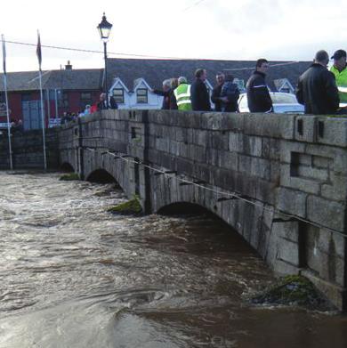
7 1 INTRODUCTION 1.1 THE 17 UNIT OF MANAGEMENT UOM17 The South Eastern CFRAM Study covers an area of 12,857 km 2 and includes six River Basins organised into Units of Management (UoM) each comprised of a single Hydrometric Area (HA). They are UoM11 (Owenavorragh & Blackwater RB), UoM12 (Slaney RB), UoM13 (Ballyteigue-Bannow RB), UoM14 (Barrow RB), UoM15 (Nore RB) and UoM17 (Waterford South Coast RB). UoM16 (Suir RB) is covered by the Suir pilot CFRAM Study and covers an area of approximately 3,542 km 2. There is a high level of flood risk within UoM17, with significant coastal and fluvial flooding events having occurred in the past. UoM17 covers an area of approximately 655km 2 and lies entirely within county Waterford. UoM17 is a predominantly rural catchment with the major urbanised areas being Dungarvan and Tramore. There are no particularly large rivers within UoM17 rather a number of smaller coastal rivers including the Brickey, Colligan, Dalligan, Mahon and Tay. These rise in the Comeragh Mountains in the north of the area and flow generally southwards to the coast. Figure 1.1: UoM17 Location Map There is one Arterial Drainage Scheme within UoM17, the Brickey Scheme where OPW has a statutory responsibility for inspection and maintenance under the 1945 Arterial Drainage Act. IBE0601Rp F02
8 UoM17 contains one drainage district, the Shandon Drainage District where the Local Authority has responsibility to maintain watercourse channels and therefore maintain the existing regime. However none of modelled watercourses are included within either the Brickey Arterial Drainage Scheme or the Shandon Drainage District in UoM17 and as such maintenance activities associated with these schemes are not considered to significantly contribute to the maintenance of the existing regime affecting the AFAs however they do contribute to the maintenance of the existing regime in other parts of UoM OBJECTIVE OF THIS REPORT The principal objective of this report, in accordance with Section 12.2 of the CFRAM Studies Stage 1 Project Brief, is to; provide a summary of the relevant reports prepared for UoM17 as part of the South Eastern CFRAM Study, and; detail the development of the draft UoM17 Flood Risk Management Plan (FRMP) consulted on during the second half of 2016 and the finalisation of the UoM17 FRMP in preparation for its adoption in This report also aims to identify any issues that may influence the proposed methodologies or programme going forward into the second cycle of Floods Directive implementation. 1.3 ACCOMPANYING AND SUPPORTING REPORTS This report accompanies the draft UoM17 Flood Risk Management Plan containing the following volumes: VOLUME I Draft Flood Risk Management Plan VOLUME II SEA Environmental Report and Natura Impact Statement. This report is also supported by a suite of project deliverables, including flood maps and key UoM17 technical reports on inception, hydrology, hydraulics and preliminary options, which are summarised in Sections 2 to 5 of this report respectively. The development of the draft and final Flood Risk Management Plan (FRMP) is summarised in Section 6 of this report. The full list of project reports to date, which also include a series of relevant consultation and environmental reports and specific assessments of flood risk, survey data and rainfall within the South Eastern CFRAM Study area, are listed in Table 1.1. IBE0601Rp F02
9 Table 1.1: Ref. Reports South Eastern CFRAM Study Overall & UoM17 Specific Reports Document Title Rp0001 Rp0002 Rp0003 Rp0004 Rp0006 IBE0601Rp0001_Communications Plan, Implementation Programmes & Event Plans Initial Scoping Phase Mapping Phase Options Phase Draft Plan Phase IBE0601Rp0002_Flood Risk Review IBE0601Rp0003_Initial Scoping Phase Synthesis Report Stakeholders Workshop IBE0601Rp0004_Initial Scoping Phase Public Open Evening Synthesis Report IBE0601Rp0006_HA17 Inception Report Rp0009 IBE0601Rp0009_Radar Rainfall Stage 3 Rp0013 Rp0016 Rp0018 Rp0019 Rp0020 Rp0021 Rp0022 Rp0026 Rp0027 Rp0034 Rp0040 Rp0044 Rp0045 Rp0049 Rp0053 Rp0058 Rp0062 Rp0067 Rp0073 Rp0077 Rp0078 OPW IBE0601Rp0013_HA17 Hydrology Report IBE0601Rp0016_RPS_CFRAM_SouthEasternCFRAMS_SurveyContractReport_D01 IBE0601Rp0018_HA17 Hydraulics Report IBE0601Rp0019_Mapping Phase Summary Report IBE0601Rp0020_SE_SEA Scoping Constraints Report IBE0601Rp0021_SE_SEA Scoping Report IBE0601Rp0022_SE_AA_Screening_Report IBE0601RP0026_HA17 POR IBE0601Rp0027_SE_SEA_Environmental_Report_D01 UoM17 IBE0601RP0034_UoM17_NIS O17_FRMP_PART01 IBE0601Rp0044_HA17 draft final report IBE0601Rp0045_Option Phase Synthesis Report IBE0601Rp0049 UoM17 Strategic SUDS Report IBE0601Rp0053_UoM17 Strategic Planning Report IBE0601Rp0058_UoM17_SEA_Environmental_Statement_Report IBE0601Rp0062_UoM17 Defence Asset Database Report IBE0601Rp0067_UoM17 Health & Safety Report IBE0601Rp0073_O17_FRMP_PART01 Flood Risk Management Plan IBE0601Rp0077_UoM17 final report (this report) IBE0601Rp0078_Draft Plan Phase Synthesis Report Synthesis report in preparation IBE0601Rp F02
10 1.4 ACCOMPANYING AND SUPPORTING GIS DELIVERABLES Table 1.2: GIS Deliverables CFRAM Study Overall & UoM17 Specific Survey Data Type Scale Survey Water Channel Polyline UoM Surveys Cross Sections Polyline UoM Surveyed Structures Polyline UoM Floodplain Photo Location Point UoM Flood Model Datasets Type Scale Scenario (Probability %AEP) Extent Polygon AFA Flood Zones Polygon AFA Depth Raster AFA Current (All) Mid-Range Future Scenario (All) High End Future Scenario (10, 1, 0.1) Current (1, 0.1) Mid-Range Future Scenario (1, 0.1) Current (All) Velocity Raster AFA Current (All) Mid-Range Future Scenario (All) High End Future Scenario (10,1,0.1) Risk to Life Raster AFA Current (10,1 0.1) Defence Failure Scenario- Extent Polygon AFA Current (2 Scenarios) Defence Failure Scenario- Depth Raster AFA Current (2 Scenarios) Defence Failure Scenario- Raster AFA Current (2 Scenarios) Defence Failure Scenario-Risk to Raster AFA Current (2 Scenarios) Specific Risk (No. of Inhabitants) Raster AFA Specific Risk (Type of Economic Activity) Point UoM Specific Risk (Risk Density) Raster AFA Modelled River Centreline Polyline AFA Other Datasets Current (10, 1, 0.1) Mid-Range Future Scenario (10, 1, 0.1) Current (0.1) Mid-Range Future Scenario (0.1) Current (0.1) Mid-Range Future Scenario (0.1) Flows and Water Level Nodes Point AFA Current, Mid-Range & High End Defended Area Polygon AFA Def. Failure Breach Time Steps Polygon AFA Def. Failure Defence Removal Polyline AFA Def. Failure Defence Removal End point Point AFA Defence Asset Database Type Scale UoM Asset Menu Polyline UoM UoM Asset Menu_Point Point UoM UoM Structure Menu Polyline UoM UoM Defence Asset Database Geodatabase UoM Geometry Infill (if Applicable) CAD Dwg AFA Risk Management Type f Scale Damage Assessment (Baseline) Point AFA Damage Assessment Benefit Point AFA Damage Assessment Defended Point AFA Current (If Applicable) Mid-Range (If Applicable) IBE0601Rp F02
11 1.5 HEALTH & SAFETY ROLE RPS have a role to advise the OPW on CFRAM Study related matters of Health and Safety; RPS undertook duties in the management of the Survey Contractor (ensuring compliance with best practice and Health, Safety and Welfare at Work legislation); and RPS was appointed as Project Supervisor Design Process (PSDP) under the Safety, Health and Welfare and Work (Construction Regulations) updated Within the remit of PSDP, RPS have undertaken a preliminary hazard management/risk assessment as part of the multi-criteria analysis of options. This has quantitatively assessed the potential hazards and risks associated with the construction and maintenance of options (for example, working near water (construction), working near water (maintenance), heavy plant and machinery, working at heights (construction), working at heights (maintenance), etc.). These have been collated into a South- Eastern CFRAM Study Safety File, which has been reviewed by the PSDP and will be provided with the final project deliverables in IBE0601Rp F02
12 2 THE UoM17 INCEPTION REPORT In 2012, an Inception Report was prepared for UoM17. Its principal objective was to provide detail on the relevant datasets identified for use in the Colligan-Mahon Area as part of the South Eastern CFRAM Study, and also to provide an update on the collection and interpretation process to date for that data. The Inception Report identified any issues that had been encountered in sourcing data and flagged any that were considered to potentially affect the proposed methodologies or programme going forward. The data requested, received or outstanding was detailed in the document, together with progress with data analysis. At the time of preparing the report RPS had not identified any significant data gaps that would impact on the completion of the South Eastern CFRAM Study however this statement was made without having received any survey information or having full data returns for the information requested from the Local Authorities. Key findings: RPS had to adopt an ongoing data collection and quality assurance exercise, to incorporate additional or updated data, as the South Eastern CFRAM Study evolved through its subsequent phases. For example, in South Eastern CFRAM areas for further assessment (i.e. AFAs) outside UoM17, when the LiDAR and cross sectional survey data were received and quality checked in comparison with the National Digital Height Model, it became evident that manual data interpolation and correction was required during the hydraulic analysis stage. This ensured linkage between topographical survey and floodplain levels obtained from National Digital Terrain Models or LiDAR survey. Similarly, population of the defence database remained live throughout the study, as, in some cases it was difficult to establish which structures were acting as formal or informal defences, and in others, the effectiveness of the defences required update of their condition due to damage by events or due to recent construction activities. Thus, the flood risk management process must be considered as live and it is not possible at any given point in time to categorically conclude that there are no data gaps which will impact in some way on the future stages of the South Eastern CFRAM Study. IBE0601Rp F02
13 Throughout the South Eastern CFRAM Study a register of datasets received was maintained, this is available with the project s progress reporting for reference. Metadata provided with final project GIS deliverables is also available to confirm the versions of datasets utilised in the CFRAM Study analysis. IBE0601Rp F02
14 3 THE UoM17 HYDROLOGY REPORT In 2013, RPS commenced the preparation of the Hydrology Report for UoM 17. Its principal objectives were to build on the inception report methodology and to provide detail on the outputs from the processes of hydrological analysis and design flow estimation. The hydrology report did not include details of the data collection process, flood history within the Areas for Further Assessment (AFAs) or methodology and results from the historic flood analysis (except where this was used to inform the design flow estimation) as this was already contained within the Inception Report for UoM17. The Hydrology Report provided a review and summary of the methodologies used as well as details of any amendments to the methodologies since completion of the Inception Report. The report detailed the results of the hydrological analysis and design flow estimation and summarised the outputs from the analysis which were taken forward as inputs to subsequent hydraulic modelling. Discussion was provided on the outputs in terms of the degree of confidence which could be attached to the outputs and the opportunities for providing greater certainty for future studies, including opportunities for improving the observed data used to inform the study. The Hydrology Report was finalised in 2016 after completion of the hydraulic modelling. Hydrological analysis and hydraulic modelling activities were interactive and required input from the mapping consultation programme in order that they could be concluded. The UoM17 catchment can be characterised hydrologically as follows: The catchment has a wide range of climatic and physiographic characteristics. The drier, lowland areas to the centre moving towards the coast have SAAR values as low as 875mm while the upper catchment to the north west has SAAR values in excess of 1500mm. There is no hydrometric data available for any of the modelled watercourses within UoM17 for use in model verification. Similarly, meteorological data is limited to rain gauge data across the catchment. The processing of rainfall data from the Dublin and Shannon Airport radar was not of benefit since it did not cover any of the AFAs in UoM17. Flood behaviour when defined in terms of the growth curve, i.e. in orders of magnitude greater than the median event, is on average higher than would have been thought based on older methodologies (Flood Studies Report (FSR)) particularly in smaller catchments. The 1% AEP flood event ranges from approximately 2.0 (lower reaches of the River Colligan) to 3.4 times larger than the median flood flow depending on catchment size. This compares to approximately 2 under FSR. IBE0601Rp F02
15 Key Findings: The primary output of the hydrological analysis was design flow estimation which was based on previous observed data and estimation/modelling techniques. Hydrological analysis required further validation through the calibration of the hydraulic models which is reflective of best practice in hydrology/hydraulic modelling for flood risk assessment. RPS believe that through complementing statistical analysis techniques with rainfall run-off modelling that the design flow estimation has as high a degree of certainty as is possible prior to calibration/validation and that this yielded efficiency and increased accuracy in the hydraulic modelling phase of the CFRAM Study process. However, it should be noted that the interaction between the hydrology and hydraulic analysis and mapping meant that hydrology could not be finalised until mapping consultation was concluded. Risks - The main potential source of uncertainty in the analysis is due to the complete lack of useable hydrometric gauge data in UoM17. This has been mitigated as much as possible by the use of a comprehensive range of analysis and estimation techniques from statistical, catchment descriptor based estimates in line with the most recent CFRAM guidance to the use of rainfall run-off modelling. After this cycle of the South Eastern CFRAM Study the main potential adverse impact on the hydrological performance of the catchment is the effect of future changes including climate change and urbanisation. Opportunities - the following potential opportunities to improve the hydrological analysis further in the next cycle of the South Eastern CFRAM Study were identified: 1. No hydrometric gauging stations were identified for rating review in UoM17 there are two stations within UoM 17 where it is advised by EPA Hydrometrics that ratings are poor and unreliable (17001 at Kilmacthomas and at Fox s Castle, records since 1976). It is worth pursuing the improvement of these gauges by considering rating review of existing data, additional spot gaugings, or infrastructure improvements where needed. These stations are not located on any of the watercourses to be modelled in this Study but could serve as preferred pivotal sites in index flow adjustment if their reliability was improved. 2. Recommending that new gauging stations are installed on all of the ungauged models (or branches of models) is a long term goal but probably unrealistic within the timeframe of this or even the next CFRAM Study cycle. Multiplied up nationally this would lead to a long list of gauging stations which would likely remain unrealised at a time when many organisations are rationalising their existing networks and may even obscure the case for those gauging stations which are more acutely needed. However, a more focussed exercise to identify the most acutely needed gauging stations more effectively was IBE0601Rp F02
16 undertaken following hydraulic modelling and consultation such that the AFAs which are at greatest risk, are most affected by uncertainty in the design flow estimates and which would significantly benefit from additional calibration data were identified as priorities. This exercise was undertaken following the hydraulic modelling and flood risk assessment stages. AFAs and watercourses within UoM17 which are presently ungauged but are considered to have significant flood risk, and as such would significantly benefit from the installation of new gauge stations are identified as follows: Dungarvan (Colligan River Tributary) Dunmore East (Dunmore River) Interim improvements to the existing hydrometric gauge network should focus on improving the ratings through the collection of additional spot flow gaugings during flood flows at existing stations. IBE0601Rp F02
17 4 THE UoM17 HYDRAULICS REPORT Following delivery of UoM17 survey data in , RPS undertook the development of hydraulic models and hazard mapping throughout Drafting of the Hydraulics Report in 2014, led to consultation on the draft final deliverables, including core hazard and risk mapping, during The final hydraulics deliverables were completed during 2016, with reporting finalised in UoM17 includes four AFAs which has resulted in the development of three separate models for flood risk analysis. A single model was developed for the Dungarvan and Environs and Ringphuca AFAs, due to their proximity and hydraulic interaction. The hydraulic analysis utilised computational modelling software informed by detailed topographical survey information (channel cross-sections, in-channel/flood defence structures, bathymetric and floodplain data), combined with hydrological inputs (riverine inflows and sea levels) and water-level control parameters (such as channel-roughness), to determine flood hazard. The principal modelling software package used was the MIKE FLOOD software shell which was developed by the Danish Hydraulics Institute (DHI). This provided the integrated and detailed modelling required at a river basin scale and provides a 1-dimensional /2-dimensional interface for all detailed hydraulic model development thus enabling seamless integration of fluvial and coastal models in the AFAs for which this was required. Key flood events, where available, were used in the calibration of each model whereby the model was reviewed in order to make sure historic flooding was accurately represented. The principal model parameters that were reviewed and amended during the model calibration process were: Bed and floodplain roughness coefficients; Structure roughness and head loss coefficients; Timing of hydrographs; Magnitude of hydrographs; Incorporation of additional survey information (e.g. additional cross-sections or missed structures). The calibrated models (incorporating relevant updates following the consultation process) were used to simulate present day and future flood hazard conditions for events with a range of AEPs. There are inherent assumptions, limitations and uncertainty associated with hydraulic modelling, which are detailed for each hydraulic model within the Hydraulics Report. Defence failure scenarios (where relevant) and sensitivity tests have been conducted for each model. The parameters selected for the sensitivity analysis were dependent on the specific model but generally included: Roughness coefficients; 2D domain grid cell size; Critical structure coefficients; Flow inputs; IBE0601Rp F02
18 Operation of dynamic structures. Key Findings: A series of flood extent, depth, velocity, zone and risk-to-life maps known collectively as flood hazard maps were generated based on the model results. The outputs from the hydraulic analysis informed the subsequent stages of the CFRAM Study - the models were used to simulate potential options, facilitating the appraisal of possible flood risk management actions and measures and model outputs also helped to determine and map the degree of flood risk. The specific findings in relation to the hydraulic modelling of each of the AFAs within UoM17 are summarised as follows: Dungarvan & Environs AFA & Ringphuca AFA- There is good confidence in both the hydrology and hydraulics of the model. While there are no flow or water level gauges within model reaches for the purposes of flow calibration the flood model does generally agree with flood extent verification events. There are a significant number of residential and non-residential properties which are at flood risk in these AFAs. Many local roads are also located within the floodplain along with a utility asset and many social amenity sites. Dungarvan & Environs AFA & Ringphuca AFA are affected by 0.5% AEP coastal and 1% AEP fluvial flood events respectively. There are three areas around Dungarvan Harbour where low lying ground is subject to tidal inundation and wave overtopping. As these areas are close together and subject to the same flood mechanisms, they are considered complex. There is also a discrete area affected by fluvial flooding on the Colligan River (within Ringphuca AFA) due to both insufficient channel and culvert capacity which inundates the floodplain. Due to frequent flooding of properties in both the Dungarvan & Environs AFA & Ringphuca AFA there are significant damages and risks in both present day and future scenarios. Dunmore East AFA - Historical flood data for specific events was very limited and insufficient, with no specific flood extent or frequency information available. There are also no active gauging stations within the model extent. Due to the lack of data available, it was possible to conduct only a limited verification exercise on this model. Despite this, the model is shown to be a reasonable representation of the flood mechanisms described from the available flood event records and considered to be performing satisfactorily for design event simulation. Fluvial flooding occurs within Dunmore East AFA at a discrete location during the 1% AEP event, due to both insufficient channel and culvert capacity on the Dunmore River, which inundates the floodplain. There are several properties at risk during the less frequent events IBE0601Rp F02
19 within this floodplain along with a local and a regional road. Tramore & Environs AFA - Very little historical data relating to flooding is available and quantifying historical flood events is difficult as there are no hydrometric gauges within the model extents. There are also no tidal gauges within close proximity to the AFA, and data only goes back as far as 2000 at the nearest gauge at Cobh. Despite the lack of calibration and verification data, the model is considered to be performing satisfactorily for design event simulation. Fluvial flooding occurs during the 1% AEP event at two discrete locations in Tramore & Environs AFA. Both areas are due to insufficient culvert capacities causing out of bank flooding. A few properties, both residential and non-residential, are affected along with a small number of local roads, and a regional road, also located within the floodplain. It should be noted that Tramore AFA experienced flooding due to wave overtopping during the South Eastern CFRAM Study, however this mechanism was not investigated further and it is recommended that analysis be undertaken during subsequent studies possibly in conjunction with progressing local measures within Tramore AFA. IBE0601Rp F02
20 5 THE UoM17 PRELIMINARY OPTIONS REPORT After completion of project level consultation on draft core flood hazard and risk mapping deliverables in early 2015, RPS commenced detailed risk assessment and optioneering. In April 2015, the OPW FRAM project managers attended a two-day workshop in RPS offices in order to review the outcome of the mapping public consultation, discuss the detail of the next stages of analysis, confirm the scope of optioneering (in certain areas with previous schemes) and resolve any associated queries. Risk assessment (including economic analysis) and preliminary optioneering was completed in draft for all AFAs within UoM17 by December 2015, and a series of Progress Group workshops were held (in November and December 2015 and March 2016) to review the outputs and get Local Authority feedback. A further OPW/RPS workshop was held in December 2015 dealing with reporting feedback and final technical inputs (for example climate change analysis). The initial feedback from the workshops was addressed and a series of project level public consultation days on the preliminary options were held in early 2016 and the Preliminary Options Report (POR) was completed in mid- 2016, in parallel with the draft Flood Risk Management Plan which drew heavily on the POR s findings. The Preliminary Options Report (POR) was accompanied by AFA specific appendices containing supporting technical details on all potential options (whole life costing, multi-criteria analysis and option drawings) and also supporting information such as method screening calculations and GIS layers supporting the risk and options analysis and health and safety information. Some elements of analysis were de-coupled and reported separately, in 2016/2017, namely a strategic Sustainable Urban Drainage Systems (SUDS) analysis and a review of Spatial Planning and Impacts of Development. All AFAs within UoM17 were included at POR stage. Identification of a very low risk in the Dunmore East and Tramore AFAs resulted in recommendations within the draft Flood Risk Management Plan (FRMP) to maintain the existing regime/progress options via alternative programmes. Whilst the project level consultation on the mapping was undertaken in the first quarter of 2015, the formal SI consultation was delayed by an update of the relevant legislation and was not completed until the fourth quarter of This meant that the optioneering had to be progressed without having closed out the observations and objections on the mapping, introducing the possibility that model updates may have been required after optioneering had been undertaken. This risk was constrained by the relatively low number of AFAs for which valid formal consultation input was received. The OPW awarded a specialist contract to develop an analysis tool to support the whole-life costing of the CFRAM Study options, so that these were consistently applied at national level, in order that the resulting options would be comparable for use to develop a nationally prioritised programme of implementation. Local Authority and the OPW regional team feedback raised concerns regarding the outcome costs of some options developed under this tool, particularly with regard to smaller schemes, and a wider perception that coastal works costing may be generally conservative, whilst culverting works may be less so. Although the database was informed by costs for completed projects, it was IBE0601Rp F02
21 considered prudent to respond to these concerns by lowering the benefit cost ratio threshold for potential schemes. A cut-off ratio of 0.5 (rather than 1.0) was used so that more potentially viable schemes were retained in the optioneering process. The following explanatory note was included in the draft FRMP option(s) identified has(have) a BCR below unity. It is considered that the costs for certain works, or smaller schemes, is likely to be conservative in the Unit Cost Database. More detailed assessment of costs, taking local factors into consideration, may improve the BCR. The risk assessment, and particularly the economics aspects, drew together and analysed a range of datasets in relation to receptors and damages. For consistency, standard base year and versions of data (including Middlesex Flood Hazard Research Centre damage statistics) were utilised across the CFRAM studies. During the analysis it was noted that there were gaps and inconsistencies between the An Post geodatabase and the OSi buildings layers which required significant truthing and update. Recognising the benefit of the draft mapping Progress Group workshops, RPS again found the addition of workshops with the OPW, on methodology/process, and the progress group, to gain local knowledge, to be useful, and a subsequent workshop on the draft FRMP was held. This engagement process, at least in part, meant that there was less change between the potential options presented in the POR and those in the draft FRMP than might have been expected. The consultation on the options mainly informed stakeholders and the wider public and there was little feedback received in terms of alternatives or modifications that resulted in alteration of the options in the draft FRMP. Key Findings: The main deliverables for this report were the AFA specific risk analysis and the assessment of a series of potential flood risk management measures relevant at differing spatial scales of assessment (UoM, Sub-Catchment and AFA). These are presented in the following Tables 5.1 and 5.2 for the risk assessment and potential options for UoM17 respectively. IBE0601Rp F02
22 Table 5.1 Flood Risk Analysis UoM17 Type of Risk Flood Risk for Design AEP (%) Event Dungarvan AFA * & Ringphuca AFA Dunmore East AFA Tramore AFA Event Damage ( ) No. Residential Properties at Risk No. Business Properties at Risk No. Utilities at Risk No. Major Transport Assets at Risk No. Highly Vulnerable Properties at Risk No. of Social Infrastructure Assets at Risk No. Environmental Assets at Risk No. Potential Pollution Sources at Risk Current Scenario (Present Day) 2,635,991 Fluvial 5,907,991 Coastal 1 2,692,174 Coastal 2 24 Fluvial 39 Coastal 1 38 Coastal 2 1 Fluvial 2 5 Coastal 2 1 Coastal 1 0 Coastal 2 4 Fluvial 1 Coastal 1 8 Coastal 2 0 Coastal 2 23 Fluvial 39 Coastal 1 47 Coastal 2 4 Fluvial 4 Coastal 1 5 Coastal 2 0 Coastal 2 Mid-Range Future Scenario 753,027 Fluvial 8 Fluvial 5 Fluvial 5 Coastal 1 3 Fluvial 2 Fluvial 432,273 Fluvial 4Fluvial 2 Fluvial 6 Fluvial 15 Fluvial 9 Fluvial Event Damage ( ) No. Residential Properties at Risk No. Business Properties at Risk No. Utilities at Risk No. Major Transport Assets at Risk 3,213,278 Fluvial 74,145,879 Coastal 1 32,565,353 Coastal 2 31 Fluvial 388 Coastal Coastal 2 1 Fluvial 6 25 Coastal 2 3 Coastal 1 0 Coastal 2 9 Fluvial 6 Coastal 1 2,136,847 Fluvial 16 Fluvial 3 Fluvial 6 Fluvial 5 Coastal 1 559,048 Fluvial 5 Fluvial 2 Fluvial 7 Fluvial IBE0601Rp F02
23 Type of Risk Flood Risk for Design AEP (%) Event Dungarvan AFA * & Ringphuca AFA Dunmore East AFA Tramore AFA No. Highly Vulnerable Properties at Risk No. of Social Infrastructure Assets at Risk No. Environmental Assets at Risk No. Potential Pollution Sources at Risk 51 Coastal 2 1 Coastal 1 1 Coastal 2 36 Fluvial 84 Coastal 1 75 Coastal 2 6 Fluvial 5 Coastal 1 8 Coastal 2 0 Coastal 2 High-End Future Scenario 3 Fluvial 2 Fluvial 17 Fluvial 9 Fluvial Event Damage ( ) No. Residential Properties at Risk No. Business Properties at Risk No. Utilities at Risk No. Major Transport Assets at Risk No. Highly Vulnerable Properties at Risk No. of Social Infrastructure Assets at Risk No. Environmental Assets at Risk No. Potential Pollution Sources at Risk 3,499,625 Fluvial 164,012,933 Coastal 1 85,605,346 Coastal 2 38 Fluvial 613 Coastal Coastal 2 1 Fluvial Coastal 2 4 Coastal 1 0 Coastal Coastal 1 61 Coastal 2 1 Fluvial 1 Coastal 1 1 Coastal 2 96 Fluvial Coastal 2 7 Fluvial 7 Coastal 1 8 Coastal 2 0 Coastal 2 2,228,077 Fluvial 22 Fluvial 3 Fluvial 6 Fluvial 5 Coastal 1 3 Fluvial 2 Fluvial 812,57 1,021,861 Coastal 1 6 Fluvial 25 Coastal 1 2 Fluvial 3 Coastal 1 11 Fluvial 1 Coastal 1 19 Fluvial 9 Fluvial IBE0601Rp F02
24 Table 5.2 Potential Options UoM17 SSA Design flood event (AEP) Number of properties at risk in design flood event Options Area NPVd Option NPVb (capped) Option Cost ( m) Benefit Cost Ratio Total MCA-Benefit Score MCA-Benefit Score / Cost Ratio Sensitivity to MRFS Sensitivity to HEFS UoM Sustainable Planning and Development Management Public Awareness Campaign Dungarvan & Ringphuca 1% Fluvial 0.5% Coastal 110 Hard Defences 27,891,785 17,369, , High High Dunmore East 1% Fluvial 8 Hard Defences 512, , , Moderate Moderate Tramore 1% Fluvial 6 Hard Defences 172,199 96, , Moderate Moderate IBE0601Rp F02
25 6 THE DEVELOPMENT OF THE UoM17 DRAFT FLOOD RISK MANAGEMENT PLAN 6.1 DRAFT FLOOD RISK MANAGEMENT PLAN The development of the draft Flood Risk Management Plans (FRMP), which is the statutory output of the CFRAM studies, was led by the OPW. The OPW produced a template and undertook a series of consultations within the OPW, with other relevant government departments, national groups and the CFRAM Study Consultants. The first draft of the template was produced for comment in July It was intended to indicate the overall format of the draft FRMP, and in particular, to identify the sections to be completed by the Consultants, and the structure of some template tables and forms that the OPW required to be used in order to facilitate reporting to the European Union, Common Implementation Strategy Working Group. A workshop with relevant FRAM Project Managers and RPS personnel was held in early May 2016 to discuss an initial version of the UoM07 draft FRMP (within the Eastern CFRAM Study area) and agree the level of detail required. Revision C of the draft FRMP was produced by the OPW in May 2016, this version, incorporating later additions and policy updates, formed the basis of the draft plans that were consulted on during the second half of The UoM specific material (text, maps and datasets) were populated by the CFRAM Study consultants drawing largely on the supporting technical studies on hydrology, hydraulics and the preliminary options assessments. The OPW reviewed the draft plans at project level and also with regard to consistency at national level. The progress group members also reviewed the draft FRMPs providing information about relevant plans and programmes, previous projects and influenced the selection of the preferred measures identified within the draft plans. Within the draft plans areas of further assessment (AFAs) considered to be at very low risk were identified and the measures for such areas were not presented within the plans. The relevant measures remain available within the Preliminary Options Report and may be more readily implemented via a minor works programme. Within UoM17 there were two very low risk AFAs, namely Dunmore East AFA and Tramore AFA. The draft plans are supported by the final core hazard and risk mapping (Volume II) and also the plan s statutory environmental assessments under the Strategic Environmental Assessment (SEA) Directive and the Habitats Directive (Volume III). The environmental assessment process, which resulted in an SEA Environmental Report and Natura Impact Statement, influenced: the development and assessment of measures, the selection of preferred measures, IBE0601Rp F02
26 the identification of mitigation measures and an environmental monitoring programme during the Plan s implementation. Key Findings: The draft FRMP is a consultation document, its main deliverable being the list of preferred measures. The draft plan incorporates a suite of certain prevention and preparedness measures related to flood risk management that form part of wider Government policy. These measures, set out below, should be applied across the whole of UoM17, including all AFAs: Sustainable Planning and Development Management Sustainable Urban Drainage Systems Voluntary Home Relocation Local Adaptation Planning Land Use Management and Natural Flood Risk Management Measures Maintenance of Arterial Drainage Schemes Maintenance of Drainage Districts Flood Forecasting and Warning Review of Emergency Response Plans for Severe Weather Promotion of Individual and Community Resilience Individual Property Protection Flood-Related Data Collection Minor Works Scheme. No measures were identified at Sub-Catchment scale however the following AFA specific measures were identified under the South Eastern CFRAM Study: Dungarvan & Ringphuca Flood Relief Scheme: Hard Defences and Improvement of Channel Conveyance. It should be noted that there were some policy changes for measures between the preliminary option reporting and draft plan finalisation, such as mechanisms to support relocation and individual property protection. Furthermore, whilst public consultation was undertaken on the preliminary options there was little opinion that necessitated revision of the options, RPS considers that this is, in part, due to the good level of engagement with the South Eastern CFRAM Study Progress Group, Stakeholder Group and the OPW representatives who reviewed the options ahead of public consultation. IBE0601Rp F02
27 A common theme throughout the CFRAM Study consultation process was the need for a programme of when the measures would be implemented. The draft plans did not have such an overall programme as this was dependent on the outcome of the consultation process, however, it was intended, and there was a strong expectation, that the final plan would contain a finalised and prioritised implementation programme of measures. The key information fields to be prepared, in order to facilitate the prioritisation process, are presented in Appendix A. 6.2 DRAFT FRMP CONSULTATION & DEVELOPMENT OF THE FINAL FRMP Project-level consultation activities took place during 2016 in relation to the draft Flood Risk Management Plans produced by the South-Eastern Catchment-based Flood Risk Assessment and Management (CFRAM) Study. These comprised workshops with the South Eastern CFRAM Progress Group, a stakeholder workshop and a Public Consultation Day within Dungarvan. A Public Consultation Day took place during February 2016, for the Dungarvan & Environs and Ringhuca AFAs, with seven members of the public attending. Local details of drainage issues were provided however no preference for or objection to the option was stated nor were any alternative options suggested. No objections were received through the formal SI consultation on the draft Plan, and no comments were received that changed the preferred measure although a number are relevant to the detailed design stage. Formal, national-level consultation in support of the draft plans and supporting environmental assessments was undertaken in parallel during late 2016 by the OPW, comprising briefings to elected members, a website based portal for access to the draft plans and supporting materials and to make on-line submissions and also statutory consultation in relation to the supporting environmental assessments. The OPW, with technical support from RPS, collated responses and reported statutory consultation on the draft FRMPs for UoMs 11, 12, 13, 14, 15 and 17, within a series of Public Consultation Synthesis Reports relating to each Unit of Management. The OPW hosted an environmental workshop at national technical co-ordination level, on 13 th February 2017, to consider the environmental issues raised during the consultation responses on the draft plans and supporting environmental reports with a view to developing standard environmental mitigations. A workshop at project-level was held with relevant FRAM Section Engineers and RPS personnel in late February 2017 to discuss the South Eastern CFRAM consultation submissions in relation to the UoM17 draft FRMP and agree the actions required to reflect these in the final FRMP. The development of the final FRMPs was again led by the OPW through the production of a template. The OPW undertook a series of consultations within the OPW, with other relevant government IBE0601Rp F02
28 departments, national groups and the CFRAM Study Consultants and considered the submissions made on the national suite of draft FRMPs. The template was provided for information on the 10/04/17 (revision A-3) with guidance on the key changes and updates required within the final plans, and as near final on the 18/05/17 (revision C-0) noting further updates and insets to be supplied (executive summary and mapping). The UoM specific material (text, maps and datasets) were again populated by the CFRAM Study consultants where appropriate updating the material from the draft FRMP. The Progress Group again reviewed the final plans, with the OPW examining with regard to both project-level detail and also national consistency, while the Local Authority Progress Group members provided local knowledge, and updated information about relevant plans, programmes and previous projects. The OPW undertook consultation and prioritisation of the preferred measures identified within the final plans and published these separately in a National Flood Relief Capital Investment Programme which complements Ireland s final FRMPs. The final plans are also supported by statutory environmental assessments (Volume II), under the Strategic Environmental Assessment (SEA) Directive and the Habitats Directive and drafts of the final statements for these assessments which remain subject to amendment until formal adoption of the plans. Key Findings: The final FRMP responded to consultation submissions which related to inter alia, development in national policy, environmental requirements and National Flood Relief Capital Investment Programme. Modifications were also incorporated to make the final plans more nationally consistent. The final plan generally contained a preferred measure for each AFA (unless there were requirements for further study to determine a preferred option). Whilst the consultations and submissions on the draft FRMP provided valuable information, which has been noted for detailed design, none resulted in a change of the preferred measures for the AFAs within UoM17. The final FRMP measures for UoM17 are presented in Table 6.1. IBE0601Rp F02
29 Table 6.1 Summary of Flood Risk Management Measures Measure Implementation Funding Measures Applicable for All Areas Application of the Guidelines on the Planning System and Flood Risk Management (DECLG/OPW, 2009) Planning Authorities Planning Authorities Implementation of Sustainable Urban Drainage Systems (SUDS) Planning Authorities Planning Authorities Voluntary Home Relocation Inter-Dept. Flood Policy Review Group Homeowners, OPW (2017 Scheme) Consideration of Flood Risk in Local Adaptation Planning Local Authorities Local Authorities Assessment of Land Use and Natural Flood Risk Management Measures EPA, OPW, Others OPW, Others Minor Works Scheme OPW, Local Authorities OPW, Local Authorities Establishment of a National Flood Forecasting and Warning Service OPW, D/HPCLG, Met Éireann and local authorities Ongoing Appraisal of Flood Event Emergency Response Plans and Management Activities Individual and Community Action to Build Resilience Individual Property Protection Flood-Related Data Collection Catchment / Sub-Catchment Measures No Sub-Catchment methods were found to be feasible Community-Level (AFA) Measures Principal Response Agencies, Regional Steering Groups, National Steering Group Public, business owners, farmers and other stakeholders Home Owners, Inter-Dept. Flood Policy Review Group OPW, Local Authorities / EPA, and other hydrometeorological agencies OPW, D/HPCLG Implementation Bodies N/A Homeowners Implementation Bodies Progress the project-level development and assessment of a Flood Relief Scheme, including environmental assessment as necessary and further public consultation, for refinement and preparation for planning / Exhibition and, if and as appropriate, implementation, for the Communities set out below. Dungarvan & Environs AFA & Ringphuca AFA OPW and/or Waterford County Council OPW IBE0601Rp F02
30 7 CONCLUSIONS AND RECOMMENDATIONS 7.1 TECHNICAL The South Eastern CFRAM Study was a significant and challenging project in terms of the detailed analysis it required, simultaneously across its six Units of Management, and in the context of a suite of similar studies nationwide, including the adjoining Suir CFRAM for UoM16. The level of ambition to undertake catchment scale studies of this nature created a significant resource demand on many of the parties involved, including the organisations represented on project progress, steering and stakeholder groups. In particular, a shortfall in third party survey resource introduced a programme delay, of over one year, which meant that the final consultation deliverables (draft FRMP and accompanying documentation) were prepared in 2016, rather than 2015 as originally programmed. The pre-contract survey programme was a valid endeavour to try to spread the survey workload, but was not sufficiently progressed ahead of the CFRAM studies, and also allowed there to be a disconnect between the survey specification and the modeller requirements (this meant that a supplementary survey arrangement needed to remain in place until model validation was complete). RPS was able to review pre-contract specifications and tailor these to reduce survey programme and costs and ultimately progress all of the South Eastern survey under a single tender action. With the benefit of hindsight, RPS would suggest that the main CFRAM studies should have started earlier (in the period when the pre-contract survey arrangements were being progressed) with more programme allowance for the surveys to the distributed, thus allowing staged delivery of Units of Management on all survey and subsequent deliverables. In addition, RPS would recommend that the Survey Framework is renewed so that support for post-cfram Study activities, such as responding to comments and queries regarding mapping and updates, remains in place. Due to the survey related programme delay, it was decided to prioritise the development of the mapping specifically required for submission to the EU Commission from the rest of the mapping deliverables, so that statutory consultation and reporting obligations in relation to these core deliverables could be discharged as soon as possible within the revised programme. This focus had the additional benefit of avoiding re-working of huge numbers of associated maps with each iteration of core extent and depth mapping. It is recommended that this de-coupling of mapping deliverables would be incorporated into future planning cycles, to permit the earliest consultation on the mapping that the public and stakeholders are most readily engaged regarding, as well as avoiding nugatory reworking. In some AFAs or watercourses there was insufficient information to provide high confidence in the analysis of flood risk and this can only be redressed by collecting data as and when events occur. However, the best use of available data was made so that in most cases recommendations could be made to progress flood risk management measures without recourse to further study. In other areas where data was sufficient, and especially where Flood Event Response was undertaken during the IBE0601Rp F02