Integrated Water Management at The Pinehills Community Plymouth, MA
|
|
|
- Claud Walsh
- 5 years ago
- Views:
Transcription


1 Integrated Water Management at The Pinehills Community Plymouth, MA Neal Price Senior Hydrogeologist


2 3,052 homes on 3,050 acres 3 Golf courses 1.3M sf Commercial : hotel/spa/resort super market village center gas station fire station 1.4 MGD water system 450K gpd WWTF
 39 miles of water mains in 2 pressure zones 2 MG storage tank Treatment for ph only 2,161")
3 Pinehills Water Company - By the Numbers 167.9MG Permitted Annual Withdrawal (460,000 gpd average) 39 miles of water mains in 2 pressure zones 2 MG storage tank Treatment for ph only 2,161 connections (6,275 est. population) Regulated by MA DEP (310 CMR 22.00), WMA (310 CMR 36.00), & SWMI


4 Pinehills PSTF - By the Numbers 450,000 gpd PSTF SBR design TN average 5-6 mg/l 32 miles gravity sewer and forcemain 23 lift stations 2 Infiltration facilities

 (4 wells) (81 MGY) OS Golf Club (1 well) (23 MGY)")
5 Pinehills Irrigation 4 WMA permits: Drinking water and homeowner irrigation (167.9 MGY) Common area irrigation (23 wells) (54 MGY) Pinehills Golf (2 Courses) (4 wells) (81 MGY) OS Golf Club (1 well) (23 MGY) Annual Reporting and Use restrictions under WMA and SWMI

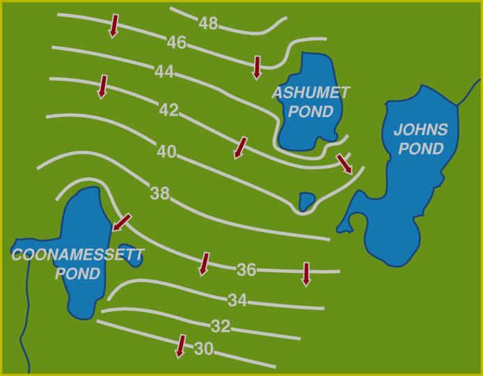
6 Plymouth-Carver Aquifer Second Largest in Massachusetts 200 Square Miles 500 Billion Gallons 400 Ponds 12 Rivers and Streams Cranberry Bogs Miles Standish State Forest at Peak of Mound (15,000 acres)

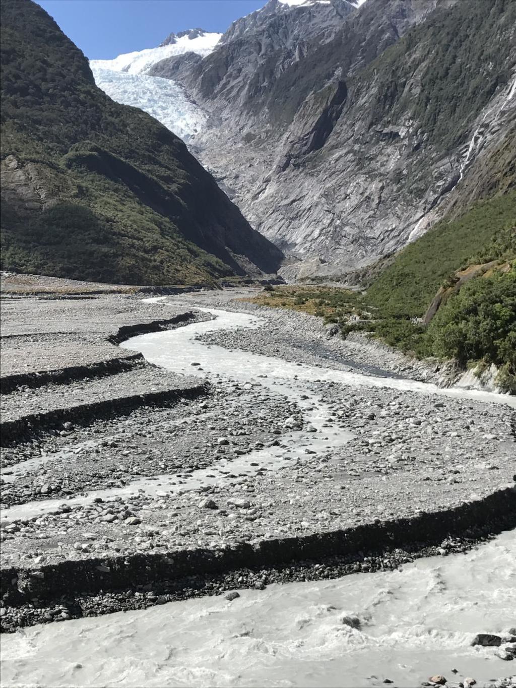
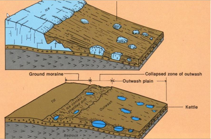
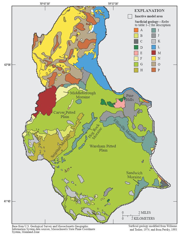
7 Glacial Geology
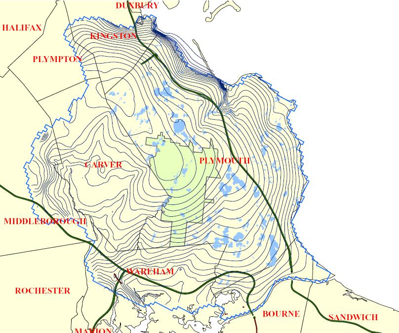
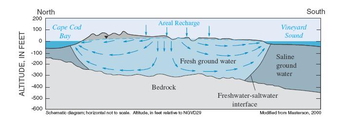
8 Plymouth-Carver Aquifer
9
10
11
12 INTEGRATED WATER MANAGEMENT Stormwater Treatment and Recharge Wastewater Treatment and Recharge Water Supply Withdrawals
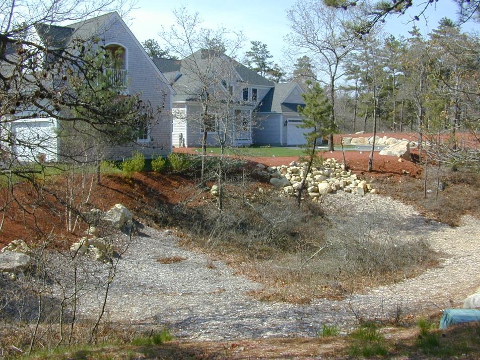
13 Begin with Better Site Design Design for water resources management from the beginning Then select LID BMP s to mitigate impacts Goal TO REDUCE IMPACTS ON WATER RESOURCES: Water Quantity Water Quality

14 Traditional Design Practices Do NOT tend to Minimize the Footprint or Impact of Development Larger lot development; Clearing and grading of significant site area; Wider streets and larger cul-de-sacs; Enclosed drainage Horsley systems Witten for Group, stormwater. Inc.
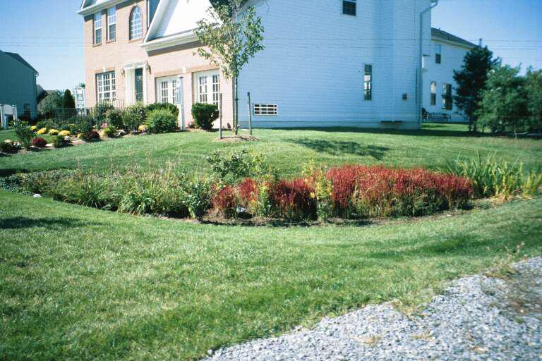
15 Better Site Design Planning Process: 1. Avoid the Impacts Preserve Natural Features and use Conservation Design Techniques 2. Reduce the Impacts Reduce Impervious Cover 3. Manage the Impacts Utilize Natural Features and Natural Low-Impact techniques to manage stormwater

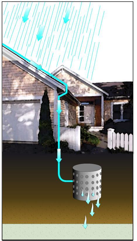
16 Natural Conditions Conventional Development Infiltration/recharge to groundwater supplies Natural filtration of pollutants by vegetation Minimal runoff Loss of natural land or open space Increased runoff/flooding Reduced infiltration/recharge to groundwater Increased infrastructure costs & maintenance
17 Relative Abundance of Indicator Fish Species Metrics in Relation to Impervious Cover Source: Armstrong et al., Preliminary Assessment of Factors Influencing Riverine Fish Communities in Massachusetts, USGS 2010


18 Designed with LID and Integrated Water concepts from its beginning in 1998: Layout designed around existing features Begin with water supply and wastewater Minimize env. impacts 70% open space 20% CR
19 Zone II
20 WWTP Wellhead Protection Area

21 Interceptor/Irrigation Wells WWTP Wellhead Protection Area


22 Horsley Witten Site Design Minimizes Impervious Surfaces

23 Designing with the Landscape


24 Treated Wastewater Recharge Rye Field PSTF

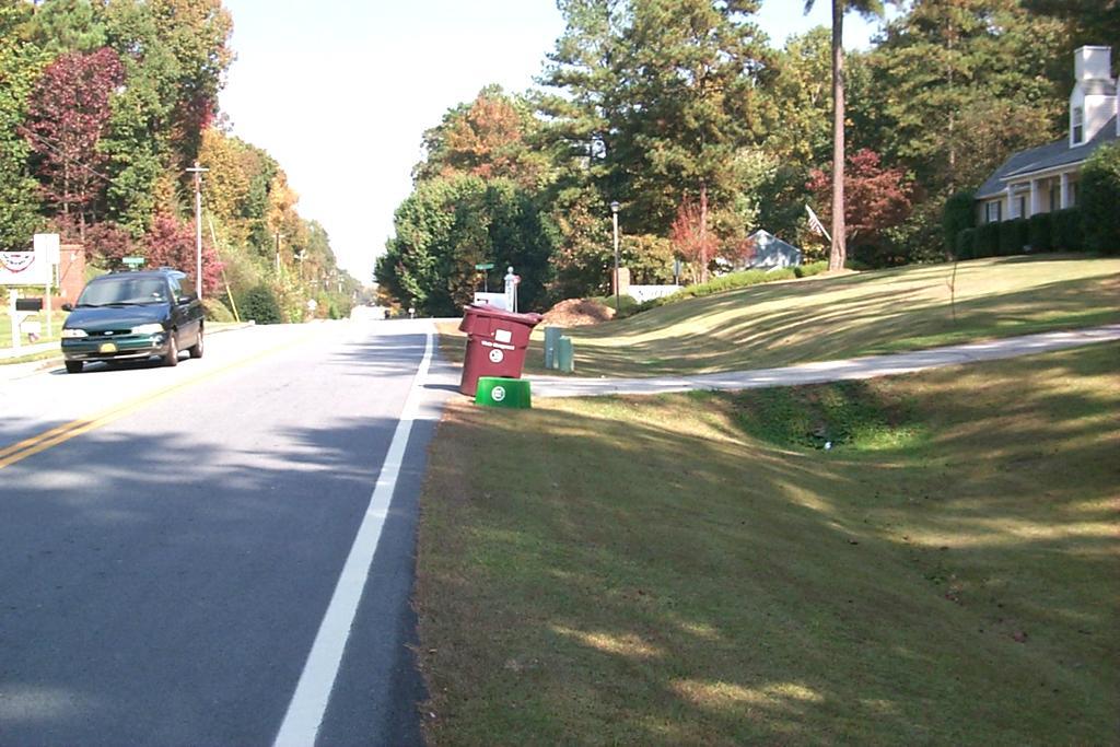
25 Pinehills Stormwater Management All roof drainage to drywells Road and parking drainage to vegetated swales, natural vegetated depressions, or infiltrating catch basins 100% Infiltration except immediate proximity to Eel River 200 ft setback from Eel River for phosphorus management
26


27 Natural vs. LID Water Balance


28 Eel River Watershed OS Golf Irrigation Well
29 Eel River Irrigation Water Balance Amount Long-term irrigation demand for proposed golf course: Offsets: 1. 16% return of irrigation water from existing golf courses % return of irrigation water from proposed golf course: Wastewater return via septic for 35 homes: Stormwater recharge from impervious surfaces related to approved/proposed homes (approximately 700 homes): Stormwater recharge from new golf course parking lot: Stormwater recharge from road area: Total Offset: 47.41
30 Water Re-Use at PSTF 7,300 gpd (2.7 MGY) potable water saved Chemical Solution Make-Up and Odor Scrubber

31 Pinehills Integrated Water Summary Community designed to minimize impervious surfaces & maximize groundwater recharge of stormwater Drinking water and wastewater facilities located prior to defining rest of community
32 Pinehills Integrated Water Summary Irrigation to 2 golf courses supplied by 4 Interceptor Wells located to capture nutrient-rich groundwater down-gradient of PSTF Irrigation supplies spread out over community to minimize localized impacts and preserve potable water
33 Pinehills Integrated Water Summary Stormwater and wastewater recharge offsets much of the irrigation and drinking water withdrawals communitywide Complete offset for OS Golf in sensitive Eel River watershed 2.7 MGY potable water saved through reuse at PSTF for process water

34 Questions? Neal Price Senior Hydrogeologist Horsley Witten Group
35


36 Vegetated Filter Strips Source: City of Portland, OR Source: City of Portland, OR

37 Open Vegetated Channels
38