Ocean Monitoring and Forecasting at the Portuguese Hydrographic Institute
|
|
|
- Stuart Hampton
- 5 years ago
- Views:
Transcription

1 Ocean Monitoring and Forecasting at the Portuguese Hydrographic Institute João Vitorino Oceanography Division


2 Instituto Hidrográfico STATE LABORATORY integrated in the PORTUGUESE NAVY Strategic lines defined by the MINISTRY OF DEFENSE in articulation with MINISTRY OF EDUCATION & SCIENCE and MINISTRY OF AGRICULTURE & SEA Headquarters R.Trinas (Lisbon) Staff: 300 elements Hydrographic Base Azinheira (Seixal) Hydrography Cartography Marine Chemistry & Pollution Navigation Security Marine Geology Data Centre Marine Instrumentation Physical Oceanography
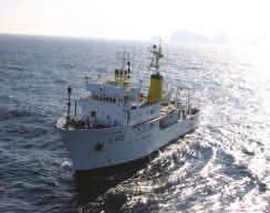
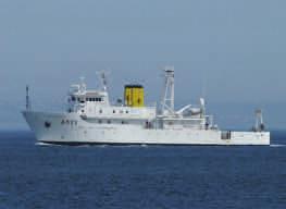
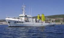
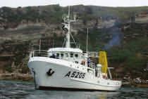
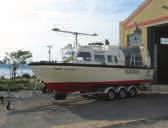
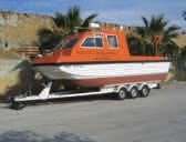
3 Installed capacities in Marine Science Instituto Hidrográfico 70m long hydrographic vessels 32m long vessels NRP Andromeda Small boats for estuary & rivers NRP D. Carlos I NRP Almirante Gago Coutinho NRP Auriga


4 Capacities Installed Before 2000 TIDAL STATIONS NETWORK 21 permanent stations real-time data transmission 4 stations GLOSS 8 stations NEAMTWS WAVE BUOYS NETWORK 3 permanent stations real time transmission 10min COASTAL METEOROLOGICAL STATIONS 3 permanent stations real time transmission GSM/GPRS 10min


5 Capacities Installed After 2000 MONICAN (MONItoring of Nazare CANyon) project EEA Grants RAIA/RAIAco Projects Interreg Near Future IH own budget


6 Capacities Installed After 2000 HF RADAR STATIONS NETWORK SIMOC Project - Defense Financing TRADE/TRADE2 Projects - Interreg in operation in installation planned
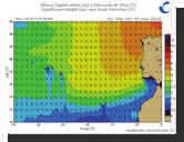
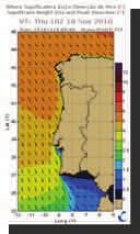
7 Capacities Installed After 2000 Operational and semi-operational forecasts of currents & hydrographic fields Operational Wave Forecasting


 Observing System Simulation Experiments (OSSEs) Work &")
8 Overall Challenge : To build a Monitoring/Forecast system for the Portuguese EEZ MONIZEE system Challenges: HOW TO FILL THE LARGE (SPATIAL/TEMPORAL) GAPS PRESENT IN COASTAL OCEAN OBSERVATION? To improve assimilation strategy HOW TO INCREASE INFORMATION ABOUT PRESENTE CONDITIONS DURING CRISIS? To design the system: Assimilation of CTD profiles Assimilation of MP buoys data HOW TO BUILD AN OPTIMIZED MONITORING Observing System SYSTEM? Experiments (OSEs) Observing System Simulation Experiments (OSSEs) Work & tests under EU JERICO_Next project Assimilation of satellite or airborne SST data


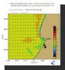
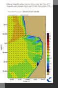
9 Challenge: To increase capacity to provide support during environmental crisis at sea Prestige crisis Key aspect: ability of feature model to reproduce the real slope circulation Semi-Operational Circulation Forecasts using feature model Current & temperature 50m Operational Wave Forecasts Forecasts Oil-spill of observations oil-spill evolution using simple 03 Dec drift 2002 module 30 Nov 2002


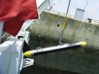
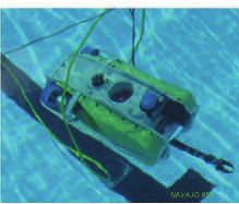
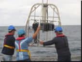
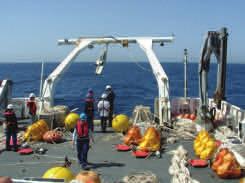
10 Challenge: to develop strategies aiming to broaden the range of available ocean measurements Ongoing systems & opportunity measurements To optimize observation windows during scientific cruises Test of Star-Oddi sensors Towed CTD Seismic Oceanography To explore the use of opportunity ships Ferry-box Radiance sensors VMADCP To integrate autonomous systems (gliders/auvs) with in-situ platforms Image PLOCAN To develop systems & strategies for use of low-cost sensor by local communities

 0-500 -1000-1500")


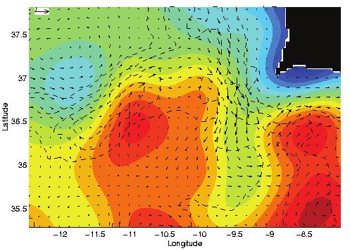
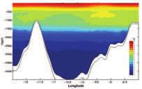
11 Going deeper and looking closer Challenge: to provide real time measurements of near bottom conditions in deep water SST image kindly provided by INIAP/IPIMAR High turbidity flushing events in Nazaré Canyon Depth (m) FTU Challenge: Multiscale vision through articulation with Gliders/AUVs/robotic systems in dedicated surveys Tyler et al,2009 Distance to coast (km)


;")


12 Challenge: To improve strategies for monitoring & forecasting of contaminants in marine environment Need for better oil-spill modeling Partnership with SINTEF in MONICAN project Study of contaminants in water & sediment (metals, hydrocarbons, halogenated compounds); Study of transport and deposition of contaminants Determination of contaminants in water & sediment: Classical methodologies Passive samplers technology (water) Deployment of Sediment traps


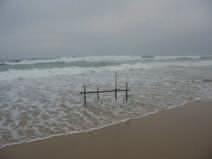
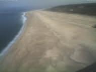
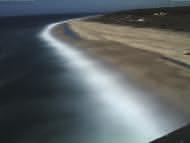
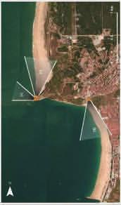
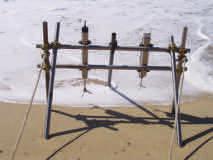
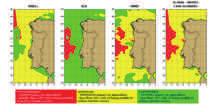
13 Challenge: To develop and test new approaches for Littoral/Surf Zone Monitoring & Forecasting An highly energetic & rapidly changing environment asking for innovative observational & numerical approaches
; applied")


14 Challenges in marine geology at IH 1. New technologies for bottom sediments mapping and stata formation (3D acoustics and geophysical methods); applied to seamounts and islands (Madeira/Porto Santo/Selvagens/Azores); 2. Water masses dynamic processes detected by 3D acoustic and geophysical methods; 3. Upper slope and shelf break extreme events (tsunamis, mass movements, nepheloid layers and internal waves impact); 4. Geophysical and acoustic sensors calibration (ADCP backscattering acoustic signal calibration; LISST; OBS, geotechnical data ). Water column remote sensing calibration (SPM, Chl a); 5. Global change: impacts of sea level rise in fragile sandy coasts and barrier islands.


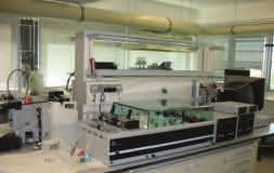
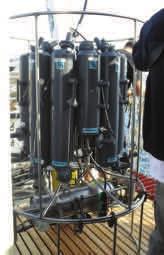
15 Improvements in sensors & strategies aiming to minimize biofouling Challenge: Collect longer time series of high quality measurements IH Calibration Laboratory Present: P, T, C Future: SV, Nef, Fluor To participate in inter-laboratorial essays / experiments


 Seaweed Energy")
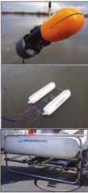
16 Environmental Monitoring & Sea Economy Macro-algae growth experiments using multiparametric buoys installed offshore Nazaré ( ) Seaweed Energy Solution, CIIMAR-UPorto, IH
17