Operational Coastal Flood Forecasting. Holly Denning,
|
|
|
- Leonard Craig
- 5 years ago
- Views:
Transcription
1 Operational Coastal Flood Forecasting FFC & Hydrometeorology Holly Denning, Hydrometerologist Andrew Lane Senior Hydrometeorologist
2 Structure What is the FFC? Hydrometeorology FFC Operations Products & Services Questions
3 What is the FFC? Successful partnership between the Met Office and Environment Agency; Remit to forecast for all sources of flooding; Operational since April 2009 delivering 24/7 services; Combine staff expertise in hydrometeorology to provide improved and new services Agreed outcomes with three year delivery plan Permanent base in MO Exeter DEFRA funded inc. national contributions

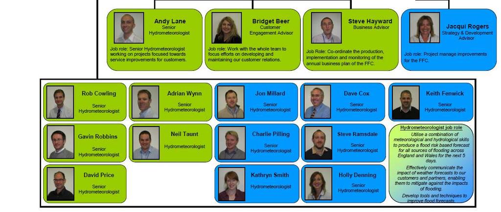
4 FFC Structure
5 Flood Risk

6 Developing our skills: Hydrometeorology
7 Hydrometeorology Training Stage 1: Hydrological Experience Stage 1: Meteorological Experience Stage 2: Meteorological Fundamentals Dynamic Meteorology Thermodynamics Numerical Modelling Remote Sensing Clouds Forecasting Techniques Wave Forecasting Stage 2: Hydrological Fundamentals Hydrology Hydraulics Hydrometry Real Time Modelling NFFS Hyrad Stage 3: On the job training (including MO work placement) Stage 3: On the job training (including EA work placement) Stage 4: Hydrometeorological Training Stage 5: Professional Review in Hydrometeorology
8 Update on recent activity. Two more Hydromets are signed off for operational duty. Applications for professional membership have been submitted to CIWEM. Staff have completed technical and leadership courses. Future succession planning risks have been addressed with three new starters coming in to the Hydromet Training Programme and recent internal promotions. Hydromets working towards attaining vocational diplomas with two recently completed.
9 Forecasting Process
10 Operational Hydrometeorological Set-Up 12 hours Night Shift On Call Night 12 Operational Hydromets 12 hours Day Shift Day D Dev Team 1 Team 2
11 Theme Action Plans Part of the senior hydromets role at the FFC is leading Theme Action Plans (TAPs) TAPs are aligned to FFC Strategic Delivery Plan Targets Set out our detailed work plans Current Themes: Coastal and Tidal Fluvial Groundwater Surface Water Rapid Response Catchments Product Development (cross TAP) Verification (cross TAP)
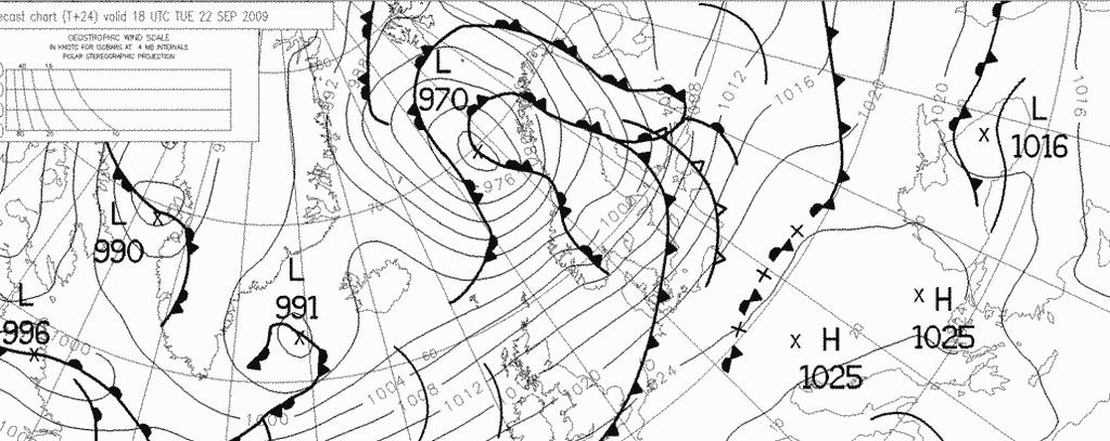


12 Forecasting Tools FSXX charts Model wind data Chiefs Guidance Actual observations

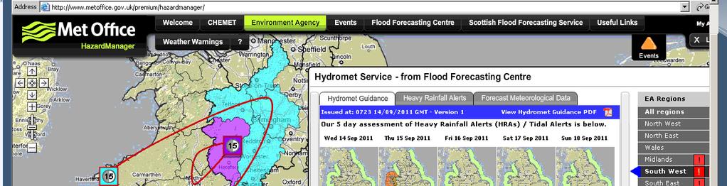
13 The models we look at MOGREPS-15 Unified Model Global Extended UK4 MOGREPS-R NAE UK4 CS3x & Wave model UKV CS3x Storm Surge Ensemble


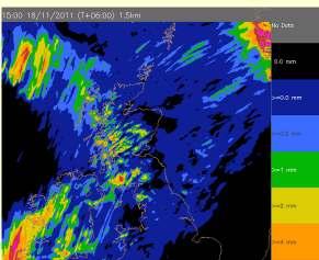
14 Hydrological Tools Intelligence Files G2G Catchment State Surface Water Tool Weather Impact Files
15 We work closely with.. Met Office: Guidance Unit National Severe Weather Warning Service & Public Weather Service Advisors BBC weather forecasters Environment Agency: Environment Agency Regional Forecasting and Modelling Teams Environment Agency Flood Resilience Teams National Flood Risk Systems Incident & Contingency Planning


16 Flood Info Timeline Days 5 & 4 Day 3 Day 2 Day 1 Post Flood Forecasting & Modelling Teams Flood Forecasting Centre Flood Resilience Teams
17 Products & Services
18 Our Services Government Services England, Wales & Local Flood Advisory Services Cat 1 and 2 Services Flood Guidance Statements, Hazard Manager, Consultancy, materials and training Environment Agency English Regions and Wales Hydromet Services: Guidance, Heavy Rainfall Alerts & Forecast Met Data UKCMF Services Outlooks, alerts and consultancy for the UK coast inc Scotland & NI Public Services Public Flood Risk Forecast

19 Environment Agency s Hydromet Services


20 Flood Guidance Statement (FGS) Five day national forecast of flood risk for England & Wales Issued daily, and more frequently at times of higher risk Risk (colour) determined using a flood risk matrix, combining likelihood and impact of flooding and Fax to government and emergency responders
21 Sharing forecasts with the public Three-day flood risk online Raise public awareness and preparedness

22 Flood Risk Matrix Risk colour is determined by assessing both likelihood of flooding and potential impact.
23 Impacts Key POTENTIAL IMPACTS KEY FOR THE FLOOD GUIDANCE STATEMENT to be used by FFC (FGS), EA (Flood Aware) and Met Office (weather alerts / warnings of heavy rain) as an optional link on websites Very low Low Medium High Typical impacts Minimal disruption Generally no impact, however there may still be Isolated and minor flooding of low-lying land and roads Isolated instances of spray/wave overtopping on coastal promenades Little or no disruption to travel although wet road surfaces could lead to difficult driving conditions Minor disruption Localised flooding of land and roads risk of aquaplaning Localised flooding could affect individual properties Individual properties in coastal locations affected by spray and/or wave overtopping Localised disruption to key sites identified in flood plans (e.g. railways, utilities) Local disruption to travel longer journey times Significant disruption Flooding affecting properties and parts of communities Damage to buildings/structures is possible Possible danger to life due to fast flowing/deep water/ wave overtopping/ wave inundation Disruption to key sites identified in flood plans (e.g. railways, utilities, hospitals) Disruption to travel is expected. A number of roads are likely to be closed Severe disruption Widespread flooding affecting significant numbers of properties and whole communities Collapse of buildings/structures is possible Danger to life due to fast flowing/ deep water/ wave overtopping/ wave inundation Widespread disruption or loss of infrastructure identified in flood plans (e.g. railways, utilities, hospitals) Large scale evacuation of properties may be required Severe disruption to travel. Risk of motorists becoming stranded
24 Impact Game Table showing different responses of impact level to 6 actual flood events County Daily FGS FGS Verification 18-Aug-11 Original Surface Water Tool Calibration Surface Water Tool Calibration (2011) FFC Met Office PWS Stakeholder User Group EA Northwest EA Midlands Avon + Somerset East Riding + Hull Bournemouth L L H M L to M L to M M to H M to H M to H M to H Poole L L H M L to M L to M L to H L to H L to H Dorset L L H L VL to M VL to M L to H L to H L to H Berkshire L L H L VL to L VL to L L to M VL to M L to M VL to M Wiltshire L L H L VL to L VL to L L to M VL to M M VL to M Reading L L H M VL to L VL to L L to M VL to M L VL to M Wokingham L L H L VL to L VL to L VL to M VL to L L VL to M Hampshire L L H L VL to L VL to L L to M VL to M L L to M Southampton L L H M VL to L VL to L L to M VL to L L VL to M 09-Jul-11 Powys VL VL VL VL VL to L VL to L L to M L to M L to M VL to M 06-Aug-11 Darlington L L H L VL to M VL to M L to H L to M L to M L to M Durham L L H L VL to M VL to M L to H L to M L to M L to M Northumberland M L H L VL to M VL to M L to H L to M L to M VL to M 17-Jul-11 Tyne & Wear L L H L VL to M VL to M L to H L to M L to M L to H Cumbria VL L H L VL to M VL to M L to H L to H L to M L to H 03-Aug-11 North Yorkshire L L H L VL to L VL to L VL to L L to M VL to L South Yorkshire L L H L VL to M VL to M VL to L L to M VL to L East Riding of Yorkshire L L H L VL to M VL to M L L to M VL to M L to M 09-May-11 Merthyr Tydfill VL L H VL VL to L VL to L VL-H VL to M VL to M


25 QUESTIONS? Contact Us - ffcenquiries@environment-agency.gov.uk Phone Web -