Public Notice. In Reply Refer To: Corps File No. LRE S18 Date: October 1, 2018 Expires: October 19, 2018
|
|
|
- Ann Peters
- 5 years ago
- Views:
Transcription

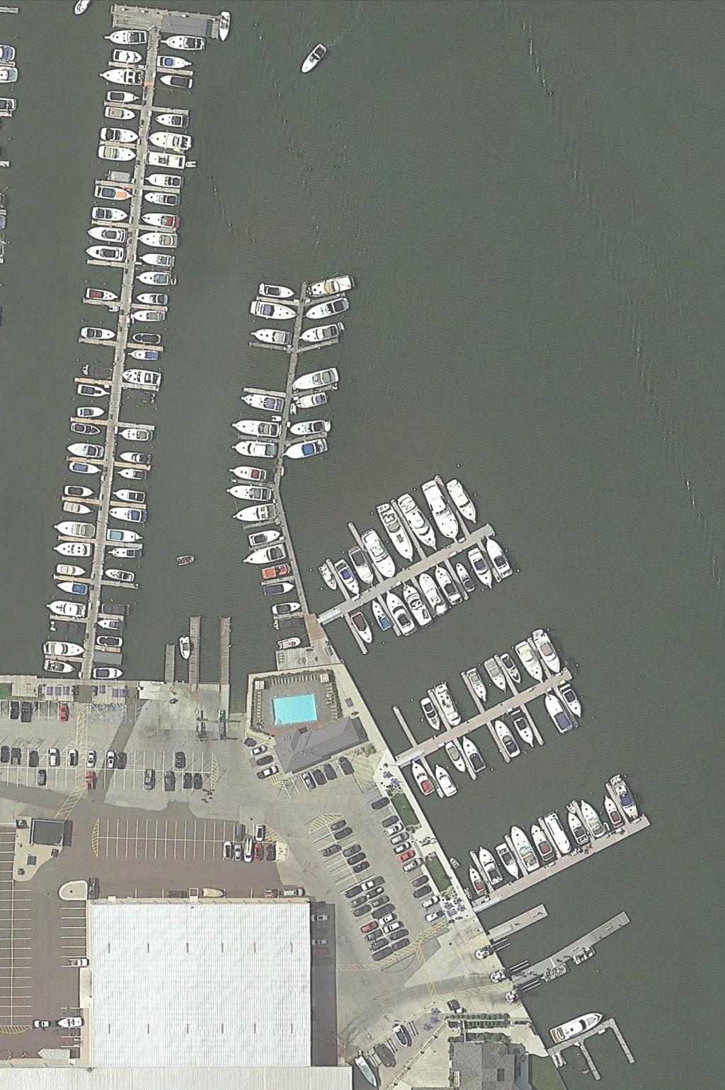
1 US Army Corps of Engineers Detroit District Public Notice Applicant: Barrett Boat Works In Reply Refer To: Corps File No. LRE S18 Date: October 1, 2018 Expires: October 19, 2018 Proposed marina reconfiguration in Spring Lake at Spring Lake, Michigan Applicant: Barrett Boat Works, 821 W Savidge Street, Spring Lake, MI Project Location: The site is located at 821 West Savidge Street, Spring Lake, Section 16, Township 8 N, Range 16 W, Ottawa County, Michigan, Federal Authority: The applicant has applied for a Department of the Army permit under Section 10 of the Rivers and Harbors Act of 1899 and Section 404 of the Clean Water Act. State Authority: Section 401 of the Clean Water Act requires that all discharges of dredged or fill material must be certified by the State as complying with applicable effluent limitations and water quality standards. Coastal Zone Management Certification (or waiver thereof) is required from the State of Michigan if this proposed activity would occur within the designated coastal zone. Project Description: As shown on the attached plans, the applicant proposes to reconfigure an existing marina, as follows: Dock C: Following removal of the existing wooden Dock C (previously authorized in permit A14, issued June 16, 2015), a floating head dock 486 feet long and 10 feet wide would be installed. On the south side of the new Dock C, fourteen 40-foot by 4-foot finger docks would be installed. Five 50-foot by 4-foot finger docks and a total of forty-one 8-foot by 5-foot personal watercraft ramps would be installed on the north side of Dock C. A total of 50 spring piles would be installed between finger docks. Dock C would provide a total of 38 boat slips (twenty-eight 40-foot slips and ten 50-foot slips) and 41 personal watercraft slips. Compared to the configuration authorized in the 2015 permit, the proposed main dock would be 26 feet shorter, and it would have 7 fewer slips and 19 more personal watercraft ramps. The finger docks on the south side of Dock C would be 40 feet long, rather than 35 feet, as previously authorized. One 35-foot finger dock would be
2 File No. LRE S18 October 1, 2018 eliminated from the south side of Dock C, and one 40-foot finger dock and one 50-foot finger dock would be eliminated from the north side of Dock C. Boat ramp relocation: A turbidity curtain would be placed around the existing boat ramp prior to removal. Sixteen linear feet of steel sheetpile would be driven in line with the existing seawall, and approximately 44 cubic yards of commercial sand (potentially substituted in part by up to 10 cubic yards of dredged material from the new boat ramp location) would be discharged as backfill landward of the seawall in an area feet wide and 32 feet long. At the new boat ramp location, following removal of the existing concrete ground surface, steel sheetpile would be driven in an area 44 feet long on either side of the new foot-wide boat ramp. Approximately 81 cubic yards of material would be excavated in an area feet wide and 44 feet long. A new concrete launch slab would be poured in the 44-foot by foot area following excavation. Approximately feet of the existing seawall will be cut and removed to connect the new boat ramp to the waterway. Four 16-foot by 5-foot concrete ramp slabs from the existing boat ramp will be removed and reinstalled in a 16-foot by 20-foot area in the waterward part of the new boat ramp. The applicant proposes to dredge up to 10 cubic yards of material from the 16-foot by 20-foot area of the new ramp location where the concrete slabs would be placed, if needed. Dredge material would be used to backfill the existing boat ramp. The purpose of the proposed work is to provide slips for larger boats and additional personal watercraft. Avoidance & Minimization: The applicant has stated the following concerning avoidance and minimization of impacts to Waters of the United States: The only discharge of fill material proposed below the ordinary high water mark of Spring Lake will occur within the footprint of an existing boat ramp that was constructed in the upland next to the lake. When the upland cut was made to create the existing ramp, the waters of Spring Lake filled a portion of the boat ramp. The bottomland on which fill material will be placed is currently a poured concrete surface (boat ramp). To minimize impacts to waters of the United States during the backfill of the existing ramp, the existing sheet steel pile (SSP) wall (i.e. seawall) that exists on either side of the ramp will be extended across the opening of the ramp before any fill material is placed. Interlocking SSPs will be driven with a vibratory hammer to effectively seal-off the existing ramp from Spring Lake. A deep turbidity curtain will be installed to enclose the SSP driving activities from Spring Lake before the SSPs are driven into the bottomland. With the turbidity curtain in-place, the existing, pre-cast concrete planks that comprise the ramp will be removed from the waterbody and set aside in the adjacent upland for re-use to make the replacement ramp. With the new SSP wall inplace, the existing ramp will be isolated from the water body. Water trapped behind the new SSP wall will be pumped into a filter bag to remove suspended sediment and returned to Spring Lake. The abandoned boat ramp will then be back-filled with clean 2
3 File No. LRE S18 October 1, 2018 earthen material obtained from an off-site commercial source, and then capped with concrete. To avoid and/or minimize impacts to waters of the United States during the excavation and construction of the new boat ramp, most of activities will occur behind, or landward of, the existing SSP seawall. Activities that cannot physically be conducted landward of the existing SSP seawall will occur within a turbidity curtain. The existing concrete surface will be cut and removed from the location of the replacement boat ramp. Sheet steel piles will be driven into the upland to create the sidewalls of the replacement ramp. Earthen material will be excavated from the upland to form the ramp depth and angle. The earthen material removed from the footprint of the ramp will be placed aside in the adjacent upland and covered with a tarp to prevent contact with precipitation. This material will be properly disposed of outside of any floodplain, wetland, or waterbody. The new ramp will be formed and the concrete will be poured. The turbidity curtain will be moved from the location of the existing ramp to the location of the new ramp. Minor reshaping of the bottomland including dredging up to 10 cubic yards within a 16-feet wide by 20-feet long area will be undertaken, if necessary, to create the correct angle on the bottomland needed for the ramp. Any bottomland dredged will be placed on the adjacent upland, covered with a tarp to prevent contact with precipitation, allowed to dry with no return water to Spring Lake, and properly disposed of outside of any floodplain, wetland, or waterbody. The pre-cast concrete planks salvaged from the existing ramp will be placed onto the bottomland to make up that portion of the new ramp waterward of the SSP seawall. The existing SSP wall will then be cut to match the opening for the new ramp, and the waters of the United States will flood the ramp and cover portions of the ramp. The Corps has not verified the adequacy of the applicant s avoidance and minimization statement at this time. Compensatory Mitigation: The applicant has stated the following concerning compensatory mitigation for unavoidable impacts to Waters of the United States: To compensate or mitigate for the loss of the waters of the United States that exists with the existing boat ramp, the applicant proposes to construct a new boat ramp, of the same dimensions and materials, as the existing boat ramp. The new boat ramp will be located approximately 70-feet away from the existing ramp cut into the upland through the same SSP wall. The result will be no net loss of waters of the United States. The Corps has not verified the adequacy of this mitigation proposal at this time. Other Authorizations: A permit is required from the Michigan Department of Environmental Quality under applicable provisions of the Natural Resources and Environmental Protection Act (NREPA), 1994 PA 451. The State site name is Savidge-Spring Lake. Comments: We are publishing this notice in compliance with Title 33 Code of Federal Regulations Parts Comments on the project should be submitted in writing 3
4 File No. LRE S18 October 1, 2018 and postmarked or delivered by the expiration date of this public notice. Comments of a positive or negative nature may be submitted. All responses must refer to file number LRE S18. We will interpret a lack of response as meaning that there is no objection to the permit application. Comments should be filed with: Kerrie E. Kuhne Chief, Permit Evaluation Western Branch Regulatory Office Detroit District, Corps of Engineers 477 Michigan Avenue Detroit, Michigan Comments may be ed to: Katie.L.Otanez@usace.army.mil but must include a name and mailing address. Public Hearing: Any person may request, in writing, within the comment period specified in this notice, that a public hearing be held to consider this application. Requests for public hearings shall state, with particularity, the reasons for holding a public hearing. Evaluation: The decision whether to issue the Department of the Army permit will be based on evaluation of the probable impacts of the proposed activity on the public interest. That decision will reflect the national concerns for both protection and utilization of important resources. The benefit which reasonably may be expected to accrue from the proposal must be balanced against its reasonably foreseeable detriments. All factors which may be relevant to the proposal will be considered including the cumulative effects thereof; among those are conservation, economics, aesthetics, general environmental concerns, wetlands, historic properties, fish and wildlife values, flood hazards, floodplain values, land use, navigation, shoreline erosion and accretion, recreation, water supply and conservation, water quality, energy needs, safety, food and fiber production, mineral needs, considerations of property ownership, and, in general, the needs and welfare of the people. The Corps of Engineers is soliciting comments from the public; Federal, State, and local agencies and officials; Indian Tribes; and other interested parties in order to consider and evaluate the impacts of this proposed activity. Any comments received will be considered by the Corps of Engineers to determine whether to issue, modify, condition or deny a permit for this proposal. To make this decision, comments are used to assess impacts on endangered species, historic properties, water quality, general environmental effects, and the other public interest factors listed above. Comments are used in the preparation of an Environmental Assessment and/or an Environmental Impact Statement pursuant to the National Environmental Policy Act. Comments are also used to determine the need for a public hearing and to determine the overall public interest of the proposed activity. 4
5 File No. LRE S18 October 1, 2018 This activity involves the discharge of dredged or fill material into waters of the United States. Therefore, the U.S. Army Corps of Engineers' evaluation of the impact of the activity on the public interest will include application of the guidelines promulgated by the Administrator of the Federal Environmental Protection Agency, under the authority of Section 404(b)(1) of the Clean Water Act. Endangered Species: We will review this application for the potential impact on threatened or endangered species pursuant to Section 7 of the Endangered Species Act as amended. We are not aware of the presence of any listed species or critical habitat at or in the vicinity of the proposed worksite. We invite information and/or comments regarding the potential presence of, or impacts to, any listed species or critical habitat. Cultural Resources: The District Staff has reviewed existing information on historic properties potentially affected by the proposed project, including the National Register of Historic Places. There are no recorded historic properties within the permit area. The permit area has been so extensively modified by modern development that little likelihood exists for the proposed project to impinge upon an undisturbed historic property. The District Engineer invites responses to this public notice from federal, state and local agencies, historical and archaeological societies, Indian tribes, and other parties likely to have knowledge of or concerns with historic properties in the area. Additional Information: This public notice and drawings are also available for viewing/printing at: px. Questions concerning this application may be directed to Katie Otanez at the Corps of Engineers address listed above, or telephone number (313) FOR THE DISTRICT ENGINEER: Kerrie E. Kuhne Chief, Permit Evaluation Western Branch Regulatory Office NOTICE TO POSTMASTERS: We request that the above notice be conspicuously and continuously posted for the time period of this notice. 5

6

7
8
9
10
11