WINGMOOR FARM. Integrated Waste Management Facility. May2009
|
|
|
- Wesley Claude Anthony
- 5 years ago
- Views:
Transcription


1 WINGMOOR FARM Integrated Waste Management Facility May2009
2 Figure 1 : Location Plan Application Site Herefordshire Worcestershire Warwickshire Gloucestershire Oxfordshire South Gloucestershire Swindon Wiltshire M5 A M NORTH Tewkesbury A A A4 M5 A Bishop s Cleeve A4 A19 A19 G L O U C E S T E R S H I A19 A13 Cheltenham A A A B63 A A A7 A3 Gloucester M5 A3 A A7 A4 A73 A Not to Scale Source. Adams Hendry Crown Copyright O.S. Licence No. AL
3 IntroductIon 1. Grundon Waste Management Ltd (subsequently referred to as Grundon) is applying for planning permission to continue to extract minerals (sand, gravel and clay), import waste and undertake restoration activity at its current operational site at Wingmoor Farm, to the west of Bishop s Cleeve in Gloucestershire. e proposals will result in the site being restored to a profile (landform) that is fundamentally the same as that which was previously granted planning permission, and for it to be put to agricultural use with areas set aside for landscape and nature conservation purposes. In this document, these proposals are referred to as the Scheme. 2. e Scheme is needed because conditions attached to the planning permissions for the site require minerals and waste operations to cease by 12th May is does not give Grundon sufficient time to complete their operation and restore the site. It is considered that the current permitted operations need to continue and a new consent is therefore required. 3. e Scheme is located within the borough of Tewkesbury in Gloucestershire. e planning application has been submitted to Gloucestershire County Council (GCC) which is the Waste Planning Authority. EnvIronmEntaL ImPact assessment and this document 4. An assessment of the potential significant impacts of the Scheme on the environment has been undertaken as required by UK and European laws on Environmental Impact Assessment (EIA). e results of the EIA have been reported in an Environmental Statement (ES) which accompanies the planning application. e EIA was undertaken by Adams Hendry Consulting Ltd and a team of independent specialist consultants. 5. In addition to identifying likely significant environmental impacts, the ES explains why the scheme is needed, the consideration that has been given to alternative solutions, and the measures that are proposed to avoid or reduce adverse environmental impacts. 6. is document is the Non-Technical Summary (NTS) of the ES that accompanies Grundon s planning application. It summarises the findings and conclusions of the ES in non-technical language. the site and Its surroundings 7. e application site is approximately hectares of which hectares are and will be used for the landfilling of waste. is includes approximately 3 hectares of land from which sand and gravel has yet to be extracted. 8. Over % of the site area has already been restored under a planning permission granted in 1996 (ref: 95/86/1099). is has created the northern and eastern slopes, including the high point, of the approved landform. A further 20% of the site has been or is in the process of being filled. 9. e site has two site accesses off Stoke Orchard Road. e eastern access provides access to the materials recovery facility (MRF) and to the south eastern Wingmoor Farm Integrated Waste Management Facility Non-Technical Summary


4 Non-Technical Summary of Envirnmental Statement Wingmoor Farm Integrated Waste Management Facility 4 Figure 2 : Aerial context Active hazardous landfill part of the site used for landfill of non-hazardous waste. e western access point provides access to the waste treatment plant and the hazardous waste landfill area, as well as the current parking and vehicles servicing area for Grundon s fleet of collection vehicles. An aerial photograph of the site taken in September 2008 is provided at Figure e immediate surroundings of the site are generally open and rural, comprising farmland and other land restored after mineral extraction. Western Access Sand and gravel processing plant Waste treatment plant Stoke Orchard Road Eastern Access MRF Wingmoor Farm West, a waste management facility operated by Cory Environmental, is separated from the application site by the Bristol to Birmingham railway line. 11. Away from these two waste management facilities, Bishop s Cleeve has seen additional housing and economic development throughout the 1990 s following the development of the Bishop s Cleeve Bypass, the A4. is brought the settlement closer to the application site. e nearest group of dwellings Active non-hazardous landfill Bristol to Birmingham Railway Source. Grundons Wingmoor Farm Meadow (Key Wildlife Site) September 2008 to Wingmoor Farm East are on the western edge of Bishop s Cleeve, approximately 0m east of the boundary of Grundon s site, 0m from the MRF building, 5m from non-hazardous landfill operations and 1000m from the hazardous waste landfill. Some individual residential properties lie closer to the proposed development site. 12. Residential properties in the village of Stoke Orchard are situated approximately 1km to the west of the site boundary. Residential properties in Brockhampton are over 5m to the south. Cheltenham North RFC rugby ground and clubhouse adjoin the site of the Materials Recovery Facility (MRF). South east of the rugby ground, adjoining the eastern boundary of the site, is a restored area of former infilled mineral workings, known as Elliot s Landfill. 13. e boundary of the Cotswold Area of Outstanding Natural Beauty (AONB) is approximately 2.5km to the east. Wingmoor Farm Meadow, which is a Key Wildlife Site as identified in the Tewkesbury Borough Local Plan, adjoins the operational site s southern boundary, and is within Grundon s ownership. ere are also several public footpaths near to the site. DESCRIPTION OF THE SCHEME 14. e proposed Scheme is largely a continuation of the existing consented activities permitted in 1996, which have no permission beyond May e proposals involve the extraction of minerals from the site and the subsequent restoration of the site through the importation of wastes, including the operation of a waste treatment plant and an MRF. 15. e operational site layout is shown in Figure 3, which identifies the remaining sand and gravel reserves and the next phase of clay extraction, together with the various components of the site. 16. e proposed completed restoration profile (landform) is intended to remain fundamentally the same as that previously approved by GCC in 1996 (Planning Permission Ref: 95/86/1099), but with minor amendments to accommodate revised surface water management requirements and to take account of future site management arrangements. e proposed completed restoration profile of the site is shown on Figure e following current activities are needed to achieve the completed restoration scheme: extraction of approximately,000 m 3 of sand and gravel; extraction of approximately 1,0,000 m 3 of clay, of which approximately 2,000 m 3 will be exported, with the remainder being used on site mainly for engineering purposes; operation of plant to process sand and gravel for restoration of land to the approved profile, which will require the continued importation of approximately 2,9,000 m 3 non-hazardous and 1,7,000 m 3 hazardous wastes; 5
5 LIFE LC LC Non-Technical Summary of Envirnmental Statement Wingmoor Farm Integrated Waste Management Facility Western Access (from/to A4 only) Eastern Access 11 Figure 3 : Proposed Operational Site Layout NORTH Source. Grundons Waste Management Scale. 1:00 Planning application area Surface Water Management Ponds Western Haul Road Eastern Haul Road (to be removed and area restored upon completion of current landfill cell) Remaining sand and gravel reserves Clay stock pile area Current vehicle parking to relocate to the MRF Plant/Buildings 1. Mess building 2. Landfill gas engine 3. West weighbridge 4. West wheel wash 5. Waste treatment plant 6. Sand & gravel processing plant 7. Vehicle servicing 8. Farmhouse & outbuildings 9. Materials recovery facility (MRF) 10. Vehicle servicing building 11. East weighbridge 12. East wheel wash Buildings to be demolished Next phase of clay extraction Current hazardous landfill cell (Phase A) Current non-hazardous landfill cell (Phase 1a) Noise attenuation bund Based upon the Ordnance Survey scale map with the permission of e Controller of Her Majesty's Stationery Office Crown Copyright O.S. Licence No. AL
6 Non-Technical Summary of Envirnmental Statement Wingmoor Farm Integrated Waste Management Facility 8 Hazardous Waste area Stoke Orchard Road Newt ponds Proposed bat roost building Gas Flare Gas Engine Existing site entrance to be retained Leachate treatment compound Non-hazardous waste area Newt ponds Existing site entrance to be retained Rugby Ground Stella Way Figure 4 : Restoration profile and site layout Source. SLR Scale. 1: 00 Planning application area Grundon s ownership area Post-settlement restoration contours Extent of hazardous waste area Surface water management ponds NORTH Based upon the Ordnance Survey scale map with the permission of e Controller of Her Majesty's Stationery Office Crown Copyright O.S. Licence No. AL
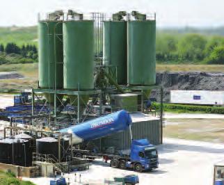
7 Non-Technical Summary of Envirnmental Statement Wingmoor Farm Integrated Waste Management Facility operation of the waste treatment plant (used to treat incoming waste, including air pollution control residues, prior to landfilling); use of the landfill gas control system and associated landfill gas engines; use of site offices and mess facilities; use of weighbridges at both site entrances, and use of wheel wash facilities at both site entrances. 18. e scheme includes the retention of the MRF facility that also includes vehicle servicing facilities, offices and mess facilities. e proposed MRF has a throughput of up to,000 tonnes per year. 19. e site will also continue to operate a clinical waste transfer service, handling approximately 0 tonnes per year. e clinical waste is stored in sealed articulated trailers for transport off site for treatment. e trailers are parked in the operational area of the waste treatment plant on impermeable hard standing at all times. All waste stored in the trailer at the site is stored within lidded bins. 20. All of the above activities will occur concurrently to restore the site in a phased manner. Generally, the existing minerals (sand, gravel and clay) within the site will be excavated and the void space (hole) created as a result will then be engineered and filled with hazardous and non-hazardous wastes. e site will then be capped and restored in accordance with the proposed landscaping scheme. 21. e site will be restored progressively and waste disposal operations are expected to stop in 20 for hazardous waste and the end of 20 for nonhazardous waste, with the site fully restored by June 20.. Under the environmental permitting regime, there will be an ongoing obligation on Grundon to manage the site once it has closed. Infrastructure needed for this purpose includes treatment facilities for leachate (the liquid produced in a landfill from the decomposition of waste), landfill gas collection and management systems, and site-monitoring equipment. is will remain at the site beyond June 20. It is proposed that the plant necessary for this, other than some monitoring equipment, will be within an environmental compound to be located at the current western entrance into the site as shown on Figure 4.. Once restored the site will be put to agricultural use with areas of woodland and areas set aside for nature conservation purposes. A permissive footpath around the site will be provided, affording vantage points looking across the Severn Vale and towards Bishop s Cleeve. Other than the permissive footpath, public access to the site will be restricted by the requirements of the environmental permit and the need for continued site management. e restoration landscaping scheme and indicative route of a permissive footpath is shown in Figure 5.. ere are a number of physical elements of the proposals which are proposed specifically to mitigate the environmental effects of the Scheme. ese include noise attenuation bunds, newt ponds, a building to replace bat roosts at the site, surface water management ponds, and landscape planting and screening.. It is proposed that the landfill will operate between 07:00 and 18:00 on Mondays to Fridays and between 07: and 13:00 on Saturdays, which are the existing permitted operating hours of the site and plant. ere will be no operations on Sundays or public holidays, except for essential maintenance work and in response to emergencies. However, occasional -hour access to the treatment plant for delivery tankers, both leaving the site to collect loads and delivering loads after collection, is required. is reflects the current consented arrangements for the facility.. Operations at the MRF (including the moving, loading or unloading of vehicles, processing and any activity associated with the waste management facility) will operate to the same hours as the landfill, except for operations undertaken inside the MRF building. Operations inside the MRF building will take place between the hours of 06 to 2100 hours Monday to Friday, 0700 to 10 on Saturday and at no time shall operations take place on Saturday afternoons, Sundays or public holidays.. A full description of the Scheme, and the method of mineral extraction, waste operations, restoration and other operations is provided at Chapter 3 of the ES. need For the scheme. e immediate need for the Scheme arises from the conditions attached to the planning permissions for the site that require minerals and waste operations to cease by 12th May ere is also a wider need for the Scheme which relates to national, regional and
8 local waste and planning policies, as well as practical considerations. ese are explained briefly below. conditions on Existing Planning Permissions. e landfilling operations are currently incomplete, as is the approved restoration scheme. Planning conditions require the permitted operations to cease by a date that does not give Grundon sufficient time to complete their operation and restore the site. It is considered that the current permitted operations need to continue and a new consent is therefore required. green Belt. e site is located in the Cheltenham and Bishop s Cleeve Green Belt. e proposals were, and still are, designed to ensure that the operation of the site and its progressive and final restoration are both undertaken to the highest possible environmental standards. As detailed in the ES, the Scheme will provide for a restored site that will not introduce any significant adverse impacts upon the environment, including the Green Belt. In contrast, failure to restore the site as proposed would be considered to result in an inappropriate development in the Green Belt. non-hazardous Waste management. Gloucestershire is assessed as having a combined non-hazardous landfill capacity of approximately 6,669,000 m 3 at the end of 2008/2009, taking account of capacity at the application site. is contrasts to a requirement for non-hazardous capacity between 2009/2010 and 20/20 of between 6,710,160 and 7,197,000 m 3, a shortfall in capacity of between,160 m 3 based upon the forecasts in the draft South West Plan and up to 5,000 m 3 based on interpretations of GCC s draft Waste Core Strategy (Preferred Options). e Scheme will therefore play a critical role in meeting Gloucestershire s non-hazardous waste disposal requirements over the period to 20 and beyond to 20, the end of the life of the site.. e provision of the MRF alongside the waste disposal capacity will continue to assist Gloucestershire County Council in working towards its waste recovery targets and will allow Grundon to process a proportion of the wastes prior to disposal, ensuring that recyclable materials can be diverted from landfill. hazardous Waste disposal. Hazardous waste management in the South West Region is dominated by capacity at Wingmoor Farm. e identified maximum capacity for the region as a whole is estimated at 1,2,000 m 3, of which 1,2,000 m 3 is at Wingmoor Farm. e draft South West Plan identifies a minimum requirement of between 1,0,000 m 3 and 1,4,000 m 3.. e Scheme has an important role in managing wastes from the south west region, as well as the surrounding regions, and meeting the hazardous waste disposal needs identified within regional waste planning policy and guidance. mineral Extraction. Whilst there are limited sand and gravel reserves within the site, it would be inconsistent with Government, Regional and Local Planning Guidance to allow that remaining reserve to be sterilised and lost. Currently, sand and gravel from the application site is supplied to a local market. e continued provision of this material, and completion of sand and gravel extraction operations on site would make a small but nonetheless valuable contribution towards the overall annual sand and gravel supply required in Gloucestershire.. e site has a valuable and recognisable role to play in the provision of engineering clay both for use in the operations on the site, and for export to the local and regional market, mainly for brown field remediation and flood defence works. It is considered that the provision of this essential mineral is fully in accordance with Government and Local Planning Policy. is Environmental Statement has demonstrated that impacts from the extraction, use on-site and export off-site of clay reserves can be accommodated by the receiving environment and the local highway network without significant adverse effects. alternative options to the ProPosEd development. e Environmental Statement has assessed alternative options to the proposed development. e assessment considered whether any alternative options would meet the following key planning objectives, which it is considered justify the need for


9 Court Farm Proposed woodland Pussy Willows Cattery Proposed surface water management pond Proposed scrub grassland Wingmoor Lodge Existing and proposed hedgerows Existing tree belt Bat mitigation building Relocated landfill gas engine compound Flare Leachate treatment compound Existing site entrance to be retained Proposed species rich grassland Surface water management pond Area to be managed for reptiles and invertebrates Current MRF surface water management pond to be enlarged Proposed permissive footpath Haydon Existing site entrance to be retained 12 Non-Technical Summary of Environmental Statement Non-Technical Summary of Envirnmental Statement Figure 5 : Landscape restoration scheme 13 Wingmoor Farm Integrated Waste Management Facility Proposed surface water management pond Newt ponds NORTH Source. David Jarvis Associates Scale. 1:00 Based upon the Ordnance Survey scale map with the permission of e Controller of Her Majesty's Stationery Office Crown Copyright O.S. Licence No. AL Wingmoor Farm Integrated Waste Management Facility Newt ponds
10 Non-Technical Summary of Envirnmental Statement Wingmoor Farm Integrated Waste Management Facility continued mineral extraction and landfilling operations, and the operation of the MRF, at the application site: e need to achieve a restoration profile and landform at Wingmoor Farm following cessation of waste management operations that is compliant with Green Belt policy in PPG2 whilst being acceptable in landfill engineering, design and safety terms. e need to consider the implications of the loss of winnable mineral resources of importance for the local and regional market that would otherwise have been extracted at an already established mineral site. e need to consider the implications of the loss of any waste management capacity that would otherwise have been provided at Wingmoor Farm and the impact of this in national, regional and local policy terms.. Five alternative options were considered. ese include providing the required waste management capacity off-site and, failing this, the ability to pursue alternative on-site options, as outlined below: Expansion of capacity at existing non-hazardous waste landfill facilities in Gloucestershire, i.e. at neighbouring Cory Wingmoor West; Cory Hempsted, Gloucester, or the former Frampton Landfill; Identification of a non-hazardous / hazardous landfill facility at a new site in the County, considering alternative mineral voids or at wholly new sites; e export of wastes requiring management out of the County; Alternative on site option to do nothing, and close the site immediately once working areas have been made safe; and Alternative on site option implementing a minimum engineered scheme to secure the long term engineering integrity and safety of the site.. e Environmental Statement concludes that there is an overwhelming need for the application proposals in terms of minerals and waste management policy and achievement of land restoration that is suitable in the Green Belt. It is concluded that none of the above options provide a viable, sustainable and practicable alternative to meeting the identified need for the proposed development. the PoLIcy context. e statutory development plan against which the planning application for the proposal has to be considered consists of: Regional Planning Guidance for the South West (RPG10) (September 2001) (pending the approval of the Regional Spatial Strategy). e Gloucestershire Structure Plan (Second Review) November 1999 (Saved Policies). Gloucestershire Waste Local Plan October 2004 (Saved Policies). Gloucestershire Minerals Local Plan 2003 (Saved Policies). Tewksbury Borough Local Plan March 2006 (Saved Policies).. Emerging policy within the draft South West Plan and Gloucestershire s Minerals and Waste Local Development Frameworks has also been considered.. e site lies within the Cheltenham Green Belt and is approximately 2.5km west of the Cotswolds Area of Outstanding Natural Beauty (AONB). Policies and guidance of particular relevance to the proposed scheme include those relating to waste management, minerals extraction and management, sustainable development, AONBs and the Green Belt. e main planning and environmental designations at the site are shown in Figure 6. summary of EnvIronmEntaL ImPacts. e basis for the assessment (described in detail in Chapter 7 of the ES) is that the predicted effects of the Scheme have been considered against two scenarios; the on-site alternatives described in paragraph : (i) the do nothing scenario, with the site closing 13 May 2009 and no further operations taking place at the site; and, (ii) the minimum engineered scheme scenario, considered to be necessary to leave the site in a safe and suitably managed form. Landscape. e predicted landscape and visual impacts of the Scheme have been assessed against the two scenarios identified above and in accordance with published guidance.
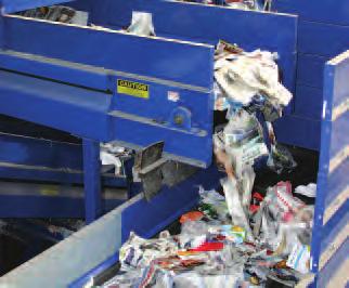
11 . e site is an existing operational landfill within the Severn Vale of Gloucestershire, lying to the west of Bishop s Cleeve and to the north of Cheltenham. e Cotswold Scarp, part of the Cotswold AONB, lies to the east of the site, and certain views from the Scarp include the site. e site lies entirely within the Cheltenham Green Belt, and there is a locallydesignated Key Wildlife Site, also in the ownership of the applicant, immediately to the south of the proposed landfill footprint.. Landscape character, value, features and elements have been identified as landscape receptors in the assessment. Potential visual receptors included users of public rights of way, occupiers of residential properties, users of roads, and passengers of trains with views of the site. In terms of the duration of any impacts to landscape and visual receptors, the assessment considers both the operational phase of development lasting until 20, and the permanent restoration of the site.. e assessment concludes that during the operational phase, the proposed development will result in adverse landscape and visual effects of slight significance. Once the site is fully restored, the site will contribute beneficial landscape and visual impacts of moderate significance. traffic and transport. e ES presents the findings of a detailed assessment of the potential traffic impacts of the development proposals on Stoke Orchard Road and the A4 to the north and south of Bishop s Cleeve.. e application site is located in close proximity to the A4 primary road, which provides access to Cheltenham and the M5 motorway. e motorway can also be accessed via various routes through Cheltenham to the south. e majority of vehicles access the site from the east via Bishop s Cleeve with a small number travelling from the west via Stoke Orchard village.. In terms of two-way Heavy Goods Vehicle (HGV) movements, the Scheme will generate approximately 7 trips per day. is compares with 5 trips per day from the current 2009 operation on the site, and 8 that would be anticipated to be required to undertake the minimum engineered scheme scenario.. Junction capacity tests have been undertaken for 5 junctions along the A4, testing the situation in 2009, 2014 and 20. e assessments indicate that three of the junctions will be nearing capacity in 20 based on a combination of general traffic growth and the planned housing and employment developments in the draft South West Plan. e additional impacts resulting from the proposals are considered to be negligible.. A comprehensive Travel Plan will be developed in conjunction with the Planning and Highway Authorities to promote car sharing between staff and encourage the use of non car modes where practicable.. In light of the traffic generated by the Scheme, and the mitigation measures proposed, it is considered that the Scheme will have an insignificant impact on the highway network and is acceptable in traffic and transport terms. noise. A noise assessment is included within the ES. Existing noise conditions have been calculated by a series of noise surveys in the vicinity of the site. ese noise measurements describe the existing noise climate and are used to determine the level of noise arising from activity within the site boundary. Noise from the site and from vehicles on the site access roads and internal haul routes has been calculated and assessed in line with relevant British Standards and policies.. e conclusion of the noise assessment is that the magnitude of the impact is low for most daytime operations, due to the large separation distances to most dwellings. e exception to this is for operations in the north western corner of the site where clay extraction and restoration activities could give rise to an unmitigated impact for three dwellings, unless mitigated.. Increased bund heights set back from the north western boundary of the site will mitigate this impact and will reduce the residual impact for the nearest dwellings to an impact of minor significance. ese bunds are included in the Scheme for which permission is sought. 57. With mitigation in place the calculated daytime and night-time noise levels resulting from the proposals comply with the noise limits recommended

12 Non-Technical Summary of Envirnmental Statement Wingmoor Farm Integrated Waste Management Facility 16 Figure 6 : Planning Policy Context NORTH Source. Tewkesbury Borough Local Plan to 2011 Cheltenham Borough Local Plan July 2006 Scale. 1: 000 Planning application area Local Authority Boundary Area of Oustanding Natural Beauty Special Landscape Area Site of Special Scientific Interest Key Wildlife Site (Gloucestershire Wildlife Trust Reserve) Scheduled Ancient Monument Housing Allocation Conservation Area Important open space Extent of Extreme Flood Wingmoor Farm West Green Belt Public transport corridor Major employment site Land allocated for employment use Sewage treatment works odour zone (Tewkesbury)/Development exclusion zone (Cheltenham) Residential development boundary Based upon the Ordnance Survey scale map with the permission of e Controller of Her Majesty's Stationery Office Crown Copyright O.S. Licence No. AL
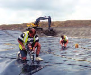
13 Non-Technical Summary of Envirnmental Statement Wingmoor Farm Integrated Waste Management Facility in the assessment. For Stoke Orchard Road and the A4, the changes in noise level are considered to be negligible and imperceptible within the normal daily variation that occurs on the road. 58. e assessment concludes that there will be no significant residual noise or vibration impacts arising from the scheme. air Quality 59. An assessment of the potential effects of the proposed development on air quality is included within the ES. e topics covered by this assessment are: Control of dust from handling hazardous and non-hazardous waste materials, quarrying, and associated activities; Control of odours; Control of emissions to air of treated or untreated landfill gas; and Emissions from road traffic. 60. e assessment has used a variety of techniques to investigate the current and forecast levels of airborne pollutants in the vicinity of the Wingmoor Farm site. 61. It was found that dust levels in the local area are not at levels which would give cause for concern with regard to potential effects on amenity. Furthermore, the levels of chemicals within the dust are sufficiently low that they would not be of concern with regard to their potential effects on air quality. 62. Emissions from the site do occasionally give rise to odours in the local area, but this does not represent a widespread odour problem other sources of odour such as an adjacent site have been more significant sources of odour. e impacts of odour will continue to be reduced at the site through the continued development and improve the system for collecting landfill gas and its use to generate electricity. 63. Emissions from road traffic were forecast not to have a significant effect on local air quality. In conclusion, provided the appropriate mitigation measures continue to be applied, and that the site is operated in accordance with the Environmental Permits, it was found that the proposals will have a residual impact of no more than a minor significance on air quality. geology, hydrology and hydrogeology 64. e geology, surface water and groundwater regimes at the site have been assessed with reference to Environment Agency, Local Authority and other information, and by the consideration of site specific monitoring data. 65. e application site is located on the Quaternary River Terrace sands and gravels of the River Avon, which are classified as a Minor Aquifer. 66. e potential impacts of the Scheme upon the geological, hydrological and hydrogeological environment have been identified and assessed with respect to the currently consented mitigation measures, and the requirements of the Environmental Permits for the Site issued by the Environment Agency. 67. e assessment concludes that, with respect to the geological, hydrological and hydrogeological environment, there are no significant residual impacts or cumulative effects associated with the continuation of operations at Wingmoor, with proposed mitigation measures in place. Waste management activities at the site will continue to operate under the requirements of the site s Environmental Permits to ensure compliance with the Groundwater Regulations. health 68. e ES reports the findings of an assessment of the potential impacts upon human health associated with the proposal. 69. e following methods have been used to determine the potential human health effects associated with the proposed development at Wingmoor Farm: a review of the health profile of the local community; a review of the study undertaken by the Wingmoor Farm Task Group, a sub group of GCC s Health Overview and Scrutiny Committee; a review of the Community Health Impact Assessment of the Wingmoor Waste Treatment and Landfill Sites facilitated by Gloucestershire Primary Care Trust; consultation with Gloucestershire Primary Care Trust and other key health stakeholders;
14 consideration and interpretation of the results and conclusions of other chapters of this Environmental Statement, in particular the findings of the Air Quality and Groundwater chapters. 70. e Neighbourhood Health Profile prepared by Gloucestershire PCT in 2005 concludes that: People living in the Bishop s Cleeve area generally experience levels of ill-health which do not differ markedly from people living in other areas of Gloucestershire when a range of established health indicators and other less robust sources of evidence are compared. 71. e Community Health Impact Assessment (2009) facilitated by Gloucestershire Primary Care Trust concludes that: based on those areas of community health for which data exists, the Steering Group have found no definitive evidence to suggest that the health of the community has been affected by the Wingmoor Farm sites. However, the Group would strongly emphasise that there has often been no definitive data or answers to the areas that have been explored in detail. 72. e available information relating to the health of the local community identifies that there is no definitive data to suggest that the operation of the Wingmoor Farm sites has given rise to public health impacts in the local communities. e proposed development has been designed to provide effective control of the key issues which could potentially affect health and well-being in the local community. ese will be managed through proposed mitigation measures identified throughout the ES and will be regulated by appropriate planning conditions and Environmental Permitting. e key issues identified comprise: Control of emissions to air (including odours and dusts); Noise control; Management of risks to groundwater and surface water; Landscape and visual impacts; and Management of risks relating to road traffic. 73. It is concluded that the potential and perceived health issues can be properly managed via the proposed mitigation measures set out within the ES. Grundon will continue to manage the site so as to minimise, eliminate and monitor potential emissions which could theoretically pose a risk to the health or wellbeing of the local community, and to maintain its ongoing dialogue with the local community in relation to the management of the site. is is the considered to be most appropriate means of ensuring that the public perception of risks to health is effectively addressed throughout the remaining life of the landfill site. Ecology 74. e application site comprises a large expanse of active landfill and quarry workings, with additional smaller areas of semi-improved grassland, recolonised topsoil and gravel, amenity planting, rough grassland, un-vegetated shallow ditches, un-vegetated standing open water, and poor quality hedgerows. Limited areas of broad-leaved woodland, vegetated pools, mature trees, lines of trees, hedgerows and several mature individual trees are also present. 75. e habitats adjacent to the application site are dominated by agricultural fields, both pasture and arable. No statutory designations or sites of ecological importance were identified within 2km of the application site. 76. Wingmoor Farm Meadow, a non-statutory wildlife site, is situated to the south of the proposed landfill footprint. With adoption of industry standard suppression techniques and site monitoring, it is considered unlikely that the favourable conservation status of this site will be impacted upon and that the integrity of its interest features will be maintained. 77. e operation of the Scheme will lead to a direct loss of approximately 21ha of semi-improved grassland, re-colonised topsoil and gravel, amenity planting, rough grassland, un-vegetated shallow ditches, un-vegetated standing open water, and poor quality hedgerows. ese habitats are of site level ecological value only. 78. ere will be a loss of approximately 0.02ha of broad-leaved woodland, vegetated pools, mature trees, lines of trees, hedgerows and several mature individual trees. ese habitats are considered to be of parish-level ecological value to wildlife, there are, however, many other areas of such habitat in the area. 79. e presence of great crested newts, bats, reptiles, breeding birds and badgers has been confirmed
15 Non-Technical Summary of Envirnmental Statement Wingmoor Farm Integrated Waste Management Facility within the application site. Mitigation incorporated into the scheme, including the relocation of reptiles, replacement of alternative bat roosts, operating a safe working scheme, and habitat enhancements, will ensure that residual impacts upon protected species are either avoided or insignificant. 80. e proposed restoration scheme will provide increased areas of species-rich hedgerows, deciduous woodland, standing water bodies and species-rich grassland. ere will also be new lengths of hedgerow planted. e majority of the site will be restored to agriculture, with areas specifically being managed for wildlife, in particular a corridor connecting the north and south of the site along the western site boundary. e proposed mitigation/compensation through the creation of new habitats and species-specific habitats should assist in meeting a number of local and UK BAP targets. e restored site will be of greater value for wildlife than that which currently exists. cultural heritage 81. e likely significant effects on the cultural heritage resource resulting from the implementation of the proposals have been identified, and their magnitude assessed. 82. Information on cultural heritage was gathered from a study area, which extended 0m from the site boundary, using desk-based sources of information and a site-walkover. Early consultation with the Gloucestershire County Council s Senior Planning Archaeologist confirmed that additional surveys were not required. 83. Potential effects on the cultural heritage resource resulting from the proposals have been identified as damage to or loss of potential archaeological deposits, and the loss of a complex of 19th century agricultural buildings which make up Wingmoor Farm. In cultural heritage terms these are considered to be of low value. 84. Without mitigation, the potential impact on archaeological deposits (where present) and the demolition of the Wingmoor Farm complex would result in the total loss of the archaeological deposits and the 19th century buildings. 85. ese impacts will be mitigated by means of an archaeological watching brief and historic building recording. ese techniques are designed to enable preservation by record, a suitable measure for receptors of low value. However, the techniques themselves cannot reduce the magnitude of the identified impacts and consequently, there remains a slight adverse significant effect. other matters 86. e ES also examines the potential impacts associated with the proposed continuation of mineral extraction, waste disposal and MRF activities on additional matters including sport and recreation, sustainability and climate change, agriculture, and operational waste. 87. ere are no direct adverse impacts upon any sport and recreation resources as a result of the proposals. It is considered that the restored site will result in a beneficial residual effect of moderate significance as a result of the provision of a new recreational resource for the local population, where there is currently none. 88. e potential for sustainability and climate change impacts arising from the proposals, including the potential for in combination effects arising as a result of climate change, are considered in the relevant technical chapters of the ES, and within the consideration of need and alternatives. 89. e continuation of the minerals extraction and waste operations at the site will result in a temporary adverse impact on agriculture through the loss of agricultural land. Following restoration of the site, to be secured as part of the proposals, the site will be returned to agricultural use as grazing land, together with the areas to be set aside for nature conservation. It is not considered that there will be any significant residual effects on agriculture arising from the proposals to restore the site. 90. e continuation of the minerals extraction and waste operations at the site have the potential to result in low volume waste streams being produced from the site, including landfill gas and leachate. e assessment of potential impacts arising from this waste is set out in detail in the Air Quality and Hydrology chapters of the ES. e planning application is also supported by a Site Waste Management Plan and Waste Minimisation Strategy that considers other waste generated in more detail. It is not considered that operational waste will give rise to significant adverse residual effects.
16 Further Information 91. Copies of this Non-Technical Statement can be obtained free of charge from the address below, or from the website Copies of the Environmental Statement can be obtained at a reasonable charge to reflect printing and distribution costs from the address below. 93. Any queries about the Scheme, or requests for further information, should be directed to: Grundon Waste Management Ltd Grange Lane Beenham Berkshire RG7 5PY Telephone
17 Non-Technical Summary of Envirnmental Statement Wingmoor Farm Integrated Waste Management Facility