CONTINUING AUTHORITIES PROGRAM (CAP) OVERVIEW
|
|
|
- Ilene Haynes
- 5 years ago
- Views:
Transcription


1 CONTINUING AUTHORITIES PROGRAM (CAP) OVERVIEW USACE Jacksonville District Brandon Burch Project Manager Trusted Partners Delivering Value, Today and Tomorrow Trusted Partners Delivering Value, Today and Tomorrow US Army Corps of Engineers

2 CONTINUING AUTHORITIES PROGRAM (CAP) OVERVIEW 9 legislative authorities under which the Corps, is authorized to plan, design, and construct certain water resources projects These authorities are targeted at small to mid size projects specifically developed to aid municipalities, counties and non-federal agencies Local sponsor cost share amount varies per authority and work in kind is available US Army Corps of Engineers Rose Bay 2


3 CAP AUTHORITIES Section 206 Aquatic Ecosystem Restoration Section 1135 Project Modifications for Improvement of the Environment Virginia Key 3


4 CAP AUTHORITIES Section 14 Emergency Streambank & Shoreline Erosion Section 103 Hurricane & Storm Damage Reduction Police Station, Trujillo Alto Hwy 187 Pinones 4


5 CAP AUTHORITIES Section 107 Small Navigation Improvements Section 111 Shore Damage Attributable to Federal Navigation Works Aguadilla Harbor Aguadilla 5


6 CAP AUTHORITIES Section 204 Beneficial Uses of Dredged Material Section 205 Small Flood Damage Reduction Projects Condado Lagoon Rio Fajardo 6

7 CAP AUTHORITIES Section 208 Snagging & Clearing for Flood Control 7
8 CURRENT CAP FUNDING LIMITS Section Description Project ($ million) 14 Streambank/Shore Protection Hurricane/Storm Damage Reduction Navigation Mitigation of Shore Damage Beneficial Uses - Dredge Material Flood Damage Reduction Aquatic Ecosystem Restoration Snagging/Clearing - Flood Environmental Restoration 10 8
 3. Conduct initial site visit and discussions 4.")
9 CAP PROCESS HOW TO TAKE ADVANTAGE 1. Have a conversation about what you would like to do and we will help identify the authority which is most applicable and can be most competitive 2. Formal letter to the Jacksonville District requesting assistance under one of the CAP authorities, (we have a template) 3. Conduct initial site visit and discussions 4. Prepare a Study Initiation Report (SIR) 5. SIR approval will place the potential project in the National CAP database as a new start and qualify the project for $50K (Fed) to make a Federal Interest Determination (FID).The FID process will not begin until Congress releases a new start list. New start lists are being released every 6 months. 6. A positive FID qualifies the project for the remaining $50K (Fed) to conduct further analysis, prepare and execute a Feasibility Cost Sharing Agreement (FCSA) with sponsor 9
10 CAP PROCESS 7. Prepare feasibility report for approval (approval is at our Division office) 8. Feasibility report approval 9. Prepare and execute Project Partnership Agreement (PPA) 10. Initiate Design & Implementation (DI) phase 11. Construct project 12. Project turnover to sponsor 13. Sponsor assumes O&M responsibilities 10
 All authorities, except Section 1135, 111 and 107, have a 65/35* cost share of design and")

11 CAP PROJECT COST SHARING REQUIREMENTS Site Visit, SIR Approval, FID & Draft FCSA: First $100K all FED Feasibility Phase: 50/50 cost share of total study cost (NEPA and 33% design) All authorities, except Section 1135, 111 and 107, have a 65/35* cost share of design and construction costs * For structural flood damage reduction efforts, the non-federal cost share can increase to 50% based on the cost of Real Estate contributions, 5% must be in cash. For nonstructural measures, the non-federal cost share is limited to 35% with no 5% cash requirement. 11
12 CAP PROJECT TIMELINE Prepare SIR: approximately 1 month FID: within 4 months of being granted a new start by Congress Feasibility Cost Share Agreement (FCSA): within 6 months of the FID approval Feasibility Study: within 18 months of the execution of the FCSA DI: varies depending on complexity of the design and construction 12

13 Boca Ciega Bay CAP 103


14 Boca Ciega Bay CAP 103 Eroded beach east of central pier. The structure in the foreground is the historic dance hall, a nationally registered historic landmark. Eroded beach east of central pier fronting businesses along Shore Blvd. Eroded beach west of central pier. Public parking and businesses along Shore Blvd. South which is inundated during storm events, causing damages and making businesses inaccessible. Similar view as figure above depicting historic dance hall. Public beach, sidewalk and Shore Blvd. South are inundated allowing waves and water to reach landward residences and businesses. Same view as figure above, during Hurricane Francis, Similar view as figure above during coastal storm. Public beach is inundated, allowing waves and water to reach inland infrastructure. Paddling down Shore Blvd. South during an inundation event.
15 Boca Ciega Bay CAP 103 Problems: During hurricanes and coastal storms, waves and currents in Boca Ciega Bay cause inundation and erosion along an approximate quarter mile section of the Gulfport municipal, publicly accessible, beach. The public beaches have eroded, threatening the historic Gulfport Casino Ballroom, a nationally registered historic landmark. Elevated bay waters inundate local roads along Shore Boulevard South and cause damages to inland infrastructure, including private residences and businesses.
16 Boca Ciega Bay CAP 103 Opportunities: There are opportunities to reduce damages caused by inundation, erosion, and wave attack affiliated with storm-induced high water events within the problem area. Initial Management Measures: Structural Sea wall extension and tie-in at the park at the western end of the project area extending east to the municipal park beyond the Gulfport pier Construct a vegetated dune system Beach nourishment Beach and dune nourishment Non-Structural The Non-Federal Sponsor acquires properties affected by the inundation This non-structural measure is expected to exceed the funding limits, however, it will still be evaluated in the feasibility study.
17 Boca Ciega Bay CAP 103 Objectives: Reduce inundation damages resulting from storm induced elevated water levels along the quarter mile of public beach. Reduce erosion and wave attack impacts to the nationally registered historic dance hall structure
18 Boca Ciega Bay CAP 103 Constraints: Potential issues with real estate acquisitions if recommended plan, identified through the feasibility phase, extends to properties not owned by the Non- Federal Sponsor. Minimal information currently available for existing drainage issues identified at the study location. Environmental concerns with regard to established seagrass beds in and near the study area.
19 Boca Ciega Bay CAP 103 Feedback - Mitigation areas close to project location? - Potential Borrow Sources?


20 PACE CAP 205 HERNANDO PASCO PASCO PINELLAS HILLSBOROUGH N We are here General CAP Timeline


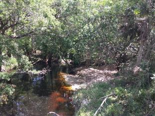
21 PACE CAP 205 HERNANDO PASCO N PINELLAS ANCLOTE (WEST)
22 PACE CAP 205 Problems: Repetitive flood losses from storms including Hurricane Frances in 2004, TS Debbie in 2012, and 2003 flood events and 1998 El Niño event. Flood damages to property: Recorded flood events during the 2004 hurricane season, TS Debby in 2012, and July 2015 storms caused severe flooding resulting in damages to homes, public infrastructure, and businesses. High groundwater levels exasperate flooding by limiting drainage available. Major flooding has led to overtopping of bridges and road closures. Evacuation routes State Road 54 and Little Road (which provide major East-West and North-South routes respectively) are flooded during high storm events. Inundation of these roads presents a road hazard for drivers, limits emergency response vehicle access, and may impact evacuation and emergency management. Two bridges (constructed prior to the County's participation in the flood program represent choke points) cause water to back up and overflow the roadway.


23 PACE CAP 205 Upstream on Celtic Drive Bridge Flooding at Celtic Dr and Elfers Pkwy (south of bridge) Downstream on Celtic Drive Bridge

24 PACE CAP 205 An Elfers Parkway resident shows recorded high water marks

25 PACE CAP 205 Flooding at SR 54 east of Seven Springs Blvd


26 PACE CAP 205 Silver Springs Blvd bridge has been overtopped in extreme flood events. River naturally narrows and bends upstream of bridge constricting flows; water backs up upstream


27 PACE CAP 205 Flooding at Old Co Rd 54 Flooding at SR 54 and Old Co Rd 54
28 PACE CAP 205 Opportunities: Reduce damage to property due to flooding. Reduce flood impacts to roadways. Support local economic and community resilience post-storm through improved access to homes and businesses, reducing local financial losses due to inaccessible roads and inundated properties. Allow more residents to shelter in place rather than evacuate for less severe storms, which would otherwise require evacuation. Provide recreational access to waterways and improve green space for the community.
29 PACE CAP 205 Objectives: Reduce flood impacts to homes and businesses Reduce damage to public infrastructure. Increase access to roadways impacted by flooding
30 PACE CAP 205 Constraints: Avoid inducing or increasing flood impacts outside of the project area. Avoid negative impacts to wellfields. A local agreement between the different counties restrict pumping at wellfields which are regulated through state legislation and limits the ability to drawdown groundwater to provide additional storage. Avoid negative impacts to Starkey Wilderness Park, wetlands, and other environmental resources. Avoid negative impacts to cultural resources.
31 PACE CAP 205 Structural Diversion channels Retention areas Pumping Bridge modifications to allow more flow under the bridge and prevent backup. Channel modifications, e.g., widening, deepening, or straightening channel segments to allow greater flow capacity in the channel and to eliminate areas where water backs up upstream. Initial Management Measures Nonstructural Flood proofing of homes by raising above the 100-yr flood level. Buyouts and relocations Flood warning system improvements may increase effectiveness of flood fighting and emergency response, thereby reducing flood impacts.

32 Tampa Harbor O&M FY2016 Award: Hillsborough Bay Cuts A,C, D Placement site: 3D FY2017 Contract: Upper/Lower Sparkmen, East Bay, Ybor Channel Placement site: 3D FY2018 Contract: Entrance Channel Placement site: Egmont, Dredge Hole **Subject to funding from Congress** Police Station, Trujillo Alto Hwy 187 Pinones 32


33 QUESTIONS? Point of Contact: Brandon Burch, Jacksonville District, Project Manager Jim Suggs, Jacksonville District CAP Manager