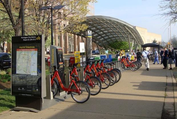
2012 Community Greenhouse Gas Inventory Arlington County, Virginia
|
|
|
- Christian Simpson
- 5 years ago
- Views:
Transcription


1 2012 Community Greenhouse Gas Inventory Arlington County, Virginia August 2013 Prepared by:
2 Table of Contents 1 Executive Summary Buildings Sector Buildings Sector Results Buildings Sector Methodology Stationary Combustion Methodology Electricity Methodology Buildings Sector Data Summary Buildings Sector Emission Factors Community Transportation Sector Community Transportation Sector Results Pass Through and County Origin/Destination Traffic Pass Through and County Origin/Destination Traffic Methodology WMATA Metrobus and Metrorail Metrobus and Metrorail Results Metrobus and Metrorail Methodology Taxis Taxi Results Taxi Methodology University Shuttles University Shuttles Results University Shuttles Methodology Solid Waste Sector Solid Waste Sector Results Solid Waste Sector Methodology Landfill Process Methodology Waste to Energy Methodology Waste Collection and Transportation Methodology Solid Waste Sector Data Solid Waste Sector Emission Factors Solid Waste Sector Assumptions... 31
3 5 Non County Government Sector Non County Government Sector Results Non County Government Sector Methodology Non County Government Sector Data Non County Government Sector Assumptions... 33
4 1 Executive Summary This report contains the greenhouse gas (GHG) emissions for the Community of Arlington County for calendar year (CY) The purposes of this report are to measure progress toward Arlington s recently established Community emissions target of 3.0 metric tons of carbon dioxide equivalent per resident per year by CY 2050 as defined in the County s Community Energy Plan 1, and to document the methodologies, assumptions and data sources used to calculate emissions. The Arlington Initiative to Rethink Energy (AIRE) will use these and future greenhouse gas emissions inventories to guide the specific programs and tools it offers to the community to lead the way to smart energy choices that reduce emissions. In 2012 Arlington Community emissions totaled 2,403,295 metric tons CO 2 e, of which 91,267 metric tons CO 2 e were attributable to the County Government and 2,312,028 metric tons CO 2 e from other County sources. This equates to a per capita emissions level of 11.3 metric tons CO 2 e, an achievement representing a 13 percent decrease in per capita emissions relative to the CY 2007 baseline. On an absolute basis, Community emissions improved by 10 percent relative to CY 2007 and 8 percent relative to CY 2000 despite population growth. Arlington s population reached 212,900 residents in 2012 which represents growth of 3 and 12 percent relative to CY 2007 and CY 2000, respectively. Table ES.1: Arlington County Total Community Emissions and Emissions Per Capita Metric % Change 2012 (reference) (baseline) Community Emissions 2,515,238 2,572,871 2,312,028 10% County Government Emissions* 95,383 96,120 91,267 5% Population (resident) 189, , ,900 3% Per Capita Emissions (mtco 2 e/resident) % *Emissions listed here are the total Government Operations inventory, including Arlington Schools, and are different from the net government operations emissions, which track achievement of the AIRE 2012 goal and are separate and additional to the gross inventory total compiled according to the LGOP. Excluding the County Government emissions portion of the community, Commercial and Residential buildings contributed more than 60 percent to Community emissions in CY 2012 at 1,436,567 metric tons CO 2 e. The transportation sector contributed more than one third of Community emissions at 836,434 metric tons CO 2 e and the solid waste sector emitted 39,027 metric tons CO 2 e or about 2 percent. All three sectors reduced emissions relative to CY The largest percent reduction occurred in the solid waste sector with a total reduction about 21 percent. The buildings sector reduced emission by 15 percent and the transportation sector achieved a modest reduction of 1 percent
 2,500,000 2,000,000 1,500,000 1,000,000 500,000 2,515,238 2,572,871 2,312,028 Solid Waste Sector Transportation")
5 Figure ES.1: Total Community Emissions by Sector and Inventory Year 3,000,000 Emissions (mt CO2e) 2,500,000 2,000,000 1,500,000 1,000, ,000 2,515,238 2,572,871 2,312,028 Solid Waste Sector Transportation Sector Buildings Sector About half of Community emissions were the result of purchased electricity in commercial and residential buildings and by Metrorail trains and infrastructure. Emissions from purchased electricity totaled 1,206,608 metric tons CO 2 e in CY 2012, a 12 percent reduction from CY Slightly more than one third of Community emissions were generated by mobile combustion of gasoline, diesel and compressed natural gas (CNG) in private vehicles, heavy duty commercial vehicles, community transit vehicles and waste haulers. Mobile combustion emissions were virtually unchanged between CY 2007 and CY 2012 at slightly more than 800,000 metric tons CO 2 e. The majority of remaining Community emissions was the result of natural gas, fuel oil, kerosene and LPG consumption in the buildings sector. This stationary combustion generated 263,060 metric tons CO 2 e in CY2012, a 24 percent reduction relative to CY Landfill and waste to energy (WTE) plant emissions contributed marginally to Community emissions in CY 2012, generating about 39,000 metric tons CO 2 e. Table ES.2: Total Community Emissions by Sector, Source and Data Year Sector Revised Values Change % Change Buildings Sector 1,570,917 1,682,148 1,436, ,581 15% Commercial Buildings 1,051,180 1,094, , ,535 17% Single family Residential Homes 337, , ,737 40,131 11% Multi family Residential Buildings 182, , ,636 19,914 9% Transportation Sector 884, , ,434 5,164 1% Passenger Cars/Motorcycles 427, , ,752 12,432 3% Light Trucks/SUVs 282, , ,414 15,767 6% Heavy Duty Trucks 104,369 71,318 68,490 2,829 4% Metrorail 32,862 37,864 33,101 4,763 13% Taxis 14,764 15,871 21,142 5,271 33% Metrobus 22,660 19,500 13,273 6,227 32% University Shuttles % Solid Waste Sector 59,750 49,125 39,027 10,098 21% WTE Plant 53,682 44,431 35,218 9,214 21% 2
6 Landfill 4,818 3,536 2, % Collection and Transport Vehicles 1,249 1,157 1, % Community Emissions (non Government) 2,515,238 2,572,871 2,312, ,210 10% County Government Emissions 95,383 96,120 91,267 4,853 5% Total Community 2,610,621 2,668,991 2,403, ,696 10% Federal and other non County Government 3,303* 315, , % *2000 Federal and Other non County Government emissions only include Airport Service Equipment, other data not available. Methodologies employed in this inventory comply with the Local Government Operations Protocol v1.1 (LGOP) 2 and the ICLEI Community Protocol v1.0 (ICP) 3 where applicable, and cases where methodologies deviate from protocols are noted. The inventory includes all Scope 1 and Scope 2 sources as outlined by the protocols and all emissions data shown are in units of metric tons of carbon dioxide, unless otherwise noted. This inventory updates results and methodologies previously reported 4 for 2000 and 2007 as new data and methodology refinements have emerged. For the purposes of this report, the Community sources described below include commercial and residential activities occurring within the geopolitical boundary of Arlington County, but do not include any of the County government operations emissions reported separately. These activities generate emissions as a result of purchased electricity, combustion of fossil fuels and generation of solid waste. Emissions from the following specific activities and sources are estimated as part of the Community inventory and include those sources which are required for compliance with the ICP 5 : Buildings Sector o Use of fuel in residential and commercial stationary combustion equipment o Use of electricity by the community Transportation Sector o On road passenger vehicles operating within the community boundary o On road freight and service vehicles operating within the community boundary o On road transit vehicles operating within the community boundary o Transit rail vehicles operating within the community boundary Solid Waste Sector o Generation, collection, transportation and disposal of solid waste by the community The buildings sector (referred to as the built environment in the ICP) includes all commercial buildings, single family homes and multi family residences that consume electricity and combust fossil fuels onsite that are not operated by the County Government or school system. Federally controlled sites, including Army National Guard Arlington Hall Station, Joint Base Myer Henderson Hall, National Foreign Affairs Training Center and the Pentagon as well as the Reagan National Airport are included in a separate total 2 protocol/local government operations protocol protocol/community protocol 4 content/uploads/2012/04/greenhouse Gas Emissions Inventory.pdf 5 Emissions from potable water and wastewater facilities are the only required source by the ICP not listed here, however, those facilities are operated by the County Government and emissions are thus captured in a separate report on the County s Government Operations Inventory. 3

7 that represents areas outside of Arlington County s control, but within its jurisdictional boundary. Federal facilities are not included as part of the County Community emissions target, and thus will be tracked separately from the rest of the Community emissions. This is similar to Federal accounting practices under Executive Order 13514, where certain sources are goal subject and certain sources are goal excluded. For Arlington County accounting purposes, Federal buildings and National Airport are considered goal excluded. Any government activities outside of the sites listed are included in the non County government sector of this inventory, and are also goal excluded. The transportation sector includes all electrically and fossil fuel powered passenger vehicles, heavy duty commercial vehicles and Metrorail, Metrobus, university shuttles and taxis traveling within County boundaries, excluding the County, School and Arlington Transit (ART) fleets. This includes trips originating within the County as well as pass through trips. Similar to emissions from the federally controlled buildings, airport emissions from service equipment are considered goal excluded and are tracked separately under non County government. Emissions from solid waste are generated at landfill and WTE facilities physically located outside the County boundary, however, the Community s share of emission from these sites are captured in this inventory since the waste originated within the County boundary. The figure below displays these inventory boundaries and the associated hierarchy for aggregating emissions from Community sources. Figure ES1: Hierarchy for Aggregating Emissions Buildings Non residential Buildings (Commercial) Residential Buildings (Single family, Multi family) Community Sources Transportation Private Passenger Vehicles (Cars, Light Trucks, SUVs, Motorcyles) Commercial Vehicles and Equipment (Heavy Duty Trucks, Haulers, Service Equipment) Community Transit (Metrorail, Metrobus, University Shuttles, Taxis) Solid Waste Landfilled MSW Combusted MSW (Waste to Energy Plant) 4
8 2 Buildings Sector Arlington s Community buildings sector generates emissions as a result of the purchase and consumption of electricity and the combustion of fossil fuels such as natural gas, fuel oil, kerosene and liquefied petroleum gas (LPG). Specific emission sources within the Community include commercial buildings, single family homes and multi family residences. The buildings sector does not include water delivery and wastewater buildings, infrastructure and processes; water delivery and wastewater treatment emissions are captured separately in the Government Operations inventory. This is in accordance with the LGOP and the ICP, which require energy from water delivery and waste water facilities to be separated out to increase transparency on the impact of water use in the community. Federal buildings and Reagan National Airport emissions are not included in any of the emission totals or figures in this section. Those emissions are tracked separately and shown in below in section 5 which summarizes the non County government sector. 2.1 Buildings Sector Results Buildings sector emissions totaled 1,436,567 metric tons CO 2 e during CY 2012, as displayed in Figure 2.1 and Table 2.1. This represents a decrease of 245,581 metric tons CO 2 e, or 15 percent, relative to CY The majority of this decrease occurred in the non residential buildings sector (17 percent), whereas emissions from residential buildings decreased only 10 percent relative to Figure 2.1: Buildings Sector Emissions by Building Type and Inventory Year Emissions (mtco2e) 1,800,000 1,600,000 1,400,000 1,200,000 1,000, , , , ,000 0 Non Residential Buildings Residential Buildings 1,570,917 1,682,148 1,436,567 35% 33% 37% 67% 65% 63% In CY 2012 non residential buildings generated the largest share (63 percent) of total buildings sector emissions, followed by single family homes at 22 percent, and multi family residences around 15 percent. The pie chart and table below display the emissions breakdown from non residential and 5

9 residential buildings. Consumption from 2000 and 2007 was not updated for this report for electricity. For natural gas, County government consumption was removed from 2000 and 2007 due to new information on the data used in the published report. Figure 2.2: CY 2012 Emissions Breakdown for Non residential and Residential Buildings 22% 15% 63% Non Residential Buildings Single family Residential Homes Multi family Residential Buildings Table 2.1: Buildings Sector Emissions by Source and Inventory Year Source % Change Non Residential Buildings 1,051,180 1,094, ,194 17% Residential Buildings 519, , ,374 10% Single family Homes 337, , ,737 11% Multi family Residences 182, , ,636 9% Total Buildings Sector Emissions 1,570,917 1,682,148 1,436,567 15% Nearly three quarters of buildings sector emissions resulted from consumption of 2,483,502 megawatt hours of electricity in CY The balance of emissions was almost entirely the result of combusting 4,714,221 million Btu of natural gas. Only about one percent of buildings sector emissions resulted from combusting other fossil fuels including fuel oil, kerosene and LPG. Fugitive refrigerant emissions were not estimated for Community buildings, in accordance with the ICP because they are assumed to be de minimis and unlike County government refrigerant data, community data was unavailable. 6
10 Figure 2.3: Buildings Sector Emissions by Fuel and Inventory Year Electricity Natural Gas Fuel Oil & Kerosene LPG 1,800,000 1,682,148 2% 1,600,000 1,570,917 4% 19% 1,436,567 1,400,000 1% 23% 17% 1,200,000 1,000, , ,000 73% 79% 82% 400, , Note: LPG emission not visible in the chart Emissions (mtco2e) Table 1.2: Buildings Sector Emissions by Fuel and Inventory Year % Change Source Electricity 1,145,994 1,337,115 1,173,508 12% Natural Gas 355, , ,589 20% Fuel Oil & Kerosene 66,531 27,919 10,584 62% LPG 2,780 2,778 1,886 32% Buildings Sector Emissions 1,570,917 1,682,148 1,436,567 15% 2.2 Buildings Sector Methodology Stationary Combustion Methodology Emissions from combustion of natural gas, fuel oil, kerosene and LPG within the buildings sector were calculated based on fuel consumption of each Community source, in accordance with the LGOP and ICP. To calculate CO 2 emissions, consumption values for each fuel were multiplied by the corresponding emission factor for each fuel type, with the resulting kilograms of CO 2 emissions divided by 1,000 to get metric tons CO 2 emissions. CO 2 emissions for each fuel type were then summed to arrive at total CO 2 emissions in units of metric tons CO 2. Natural Gas CO 2 Emissions (mtco 2 ) = Natural Gas Consumed (MMBtu) Emission Factor (kgco 2 /MMBtu) 1,000 Propane CO 2 Emissions (mtco 2 ) = Propane Consumed (MMBtu) Emission Factor (kgco 2 /MMBtu) 1,000 Diesel CO 2 Emissions (mtco 2 ) = Diesel Consumed (gallons) Emission Factor (kgco 2 /gallon) 1,000 Total CO 2 Emissions (mtco 2 ) = CO 2 from Natural Gas + CO 2 from Propane + CO 2 from Diesel 7
11 The same general process and equations used to calculate CO 2 emissions were then used to calculate CH 4 and N 2 O emissions with substitution of the appropriate emission factors. To calculate a single total emissions value for stationary combustion, total CO 2, CH 4 and N 2 O emissions were first converted into units of metric tons of carbon dioxide equivalent using global warming potentials, then summed. Total CO 2 Emissions =Total CO 2 Emissions (mtco 2 ) GWP CO2 Total CH 4 Emissions =Total CH 4 Emissions (mtch 4 ) GWP CH4 Total N 2 O Emissions =Total N 2 O Emissions (mtn 2 O) GWP N2O Total CO 2 e Emissions =Total CO 2 Emissions + Total CH 4 Emissions + Total N 2 O Emissions Fuel Oil and Kerosene Consumption for Non residential Buildings Methodology 6 The estimation methodology is based on the trend in commercial sector fuel oil consumption relative to natural gas consumption for the District of Columbia per EIA s State Energy Data System (SEDS) for ,8. The correlation exists between fuel oil and natural gas consumption because these fuels are commonly used for the same purposes in non residential buildings (e.g. heating) and natural gas has been consistently replacing fuel oil in recent years. The data used to establish the fuel ratio trend is displayed in the table and graph below. Table 2.3: SEDS Fuel Oil and Natural Gas Consumption Data and Ratio Year Fuel Oil Natural Gas FO/NG (trillion Btu) (trillion Btu) Ratio The methodology used to estimate fuel oil and kerosene consumption for non residential buildings has been updated compared to the methodology used in the 2000/2007 inventory report, to improve accuracy by using more recent data. See the 2000/2007 inventory report for details on the original methodology and data sources for non residential buildings. 7 Kerosene consumption was ignored since marginal relative to fuel oil consumption and, thus, not available in the SEDS dataset. 8 %20Columbia 8
12 The fuel oil to natural gas ratios calculated for 2000 and 2007 for the District of Columbia were applied directly to Arlington County (updating the published Community Inventory). The linear trend of ratios observed 2000 to 2010 was extrapolated to estimate the ratio for Once ratios were calculated, they were multiplied by the known commercial sector natural gas consumption for Arlington County in each inventory year. Subsequently, fuel oil consumption from Government Operation was removed. Table 2.4: Fuel Oil Estimation Data by Inventory Year Year Arlington Community Non residential NG Consumption (MMBtu) FO/NG Ratio Total Estimated FO Consumption for Arlington (gal) FO Consumption from Government Operations (gal) FO Consumption from Nonresidential Buildings (gal) ,870, ,771,825 47,871 3,723, ,184, ,438,925 13,413 1,425, ,542, ,149 42, , Fuel Oil, Kerosene and LPG Consumption for Residential Buildings Methodology Estimates for residential fuel oil, kerosene and LPG consumption in the Community were made using consumption data from the EIA s Residential Energy Consumption Survey (RECS) 9. Trend analysis was performed for each fuel using filtered RECS Microdata data from 1993, 1997, 2001, 2005 and 2009 to develop fuel consumption intensity factors for each inventory year on a per household (HH) basis. Survey results with a heating degree day (HDD) value outside of 3,500 to 4,500 or a cooling degree day (CDD) value outside of 1,000 to 2,000 were filtered out leaving only survey results with similar climates and corresponding heating and cooling demands to Arlington (Arlington s 30 year climate normal are 4030 HDDs and 1,550 CDDs 10 ). The consumption intensity factors were derived by dividing the total fuel oil and kerosene or LPG consumption in each RECS data year by the number of households using each fuel. The linear trend of resulting intensity factors was then used to interpolate and extrapolate intensity factors for CY 2000, CY 2007 and CY /products/temperature/ 11 Note that the LPG intensity factor calculated for 2001 was thrown out as an outlier when performing trend analysis. 9
13 Table 2.5: Filtered RECS Fuel Consumption Intensity Factors (MMBtu/HH/yr) Year FO KER FO+KER LPG Outlier* * The calculated LPG intensity from filtered 2001 RECS data was 28.1 MMBtu/HH/yr and was thrown out as an outlier The factors for each inventory year were multiplied by the number of households using each fuel per Arlington housing profile data 12 to determine residential consumption within the County. Because housing statistics for fuel oil and kerosene use are lumped together in Census data and the housing profile data, these fuels were combined throughout the calculations. This is an acceptable approach because kerosene is often used in conjunction with fuel oil, makes up a much smaller portion of total consumption, and the emission factors for both fuels are virtually identical for CO 2, CH 4 and N 2 O. Residential fuel oil and kerosene consumption estimates are shown in the table below. Table 2.6: Estimated Residential Fuel Oil and Kerosene Consumption by Inventory Year Year Fuel Oil/Kerosene Consumption Intensity Factor (MMBtu/HH/yr)) Number of Households Using Fuel Oil/Kerosene as Primary Heating Fuel (HH count) Fuel Oil/Kerosene Consumption (MMBtu) , , , , ,232 83,877 Residential LPG consumption estimates are shown in the table below. Table 2.7: Estimated Residential LPG Consumption by Inventory Year Year LPG Consumption Intensity Factor (MMBtu/HH/yr)) Number of Households Using LPG as Primary Heating Fuel (HH count) LPG Consumption (MMBtu) , ,072 43, ,707 In order to estimate the breakdown of single family household consumption versus multi family household consumption in Arlington County for fuel oil/kerosene consumption (all LPG consumption is assumed to occur at single family households), U.S. national averages were found for:
14 1. The percentage of total households using each fuel by housing type and 2. The consumption intensity of households using each fuel by housing type. These national averages were combined with Arlington housing data to develop an estimated ratio of consumption between single family and multi family households in Arlington County for each inventory year. These ratios were then applied to the total fuel oil/kerosene consumption calculated previously. The resulting breakdown of residential fuel oil/kerosene consumption estimates are displayed in the table below. These data are provided in section Table 2.8: Estimated Fuel Oil and Kerosene Consumption for Single family and Multi family Households by Inventory Year Year Total Residential Fuel Oil + Kerosene Consumption (MMBtu) Household Type (type) Estimated Share of Consumption (%) Estimated Consumption by Household Type (MMBtu) , , ,877 Single family 57% 215,166 Multi family 43% 164,699 Single family 52% 91,945 Multi family 48% 86,399 Single family 49% 41,351 Multi family 51% 42, Electricity Methodology Emissions from purchased electricity within the building sector were calculated based on consumption of each Community source, in accordance with the LGOP and ICP. The same general processes and equations used to calculate emissions from stationary combustion were also used to calculate emissions from purchased electricity. Note that the conversions from native gas units to units of carbon dioxide equivalent using the global warming potential (GWP) for each GHG have been incorporated into the equations below. Electricity CO 2 Emissions = Electricity Use (MWh) x Emission Factor (kgco 2 /MWh) 1,000 GWP CO2 Electricity CH 4 Emissions = Electricity Use (MWh) x Emission Factor (kgco 2 /MWh) 1,000 GWP CH4 Electricity N 2 O Emissions = Electricity Use (MWh) x Emission Factor (kgco 2 /MWh) 1,000 GWP N2O Total CO 2 e Emissions = Electricity CO 2 Emissions + Electricity CH 4 Emissions + Electricity N 2 O Emissions Buildings Sector Data Summary Arlington housing data was required by this analysis to estimate residential fuel oil/kerosene and LPG consumption as well as to breakdown electricity and fuel oil/kerosene consumption between singlefamily and multi family households. These housing count and heating fuel data are presented in the tables below. Data for federal sites and Reagan National Airport was compiled by Arlington County staff through contact with each of the sites. Consumption for Arlington County Government and Schools was removed from the commercial totals provided by the utilities. 11
15 Table 2.9: Arlington Household Count by Housing Type by Inventory Year HH Type 2000 a 2007 b 2012 c Single family, detached 27,668 31% 27,947 27% 28, % Single family, attached 10,284 11% 10,719 10% 11, % Multi family 52,373 58% 63,385 62% 68, % Other % % % Total 90, % 102, % 108, % a 2000 Census b 2008 Arlington Profile (1/1/2008 data) %20Full%20Profile.pdf c 2013 Arlington Profile (1/1/2013 data) Table 2.10: Arlington Primary Heating Fuel Breakdown by Inventory Year Primary Heating Fuel a Electricity 35% 40% 44% NG 57% 55% 52% Fuel Oil/Kerosene 5% 3% 1% LPG 1% 1% 1% Other fuel 1% 0.1% 1% None 0.4% 1% 0.1% a 2011 data used as proxy Sources: U.S. Census and American Housing Survey Electricity and natural gas consumption data were compiled by Metropolitan Washington Council of Governments (MWCOG) based on utility billing records for Arlington County and for each inventory year. The MWCOG data was broken down by utility customer class for both fuels. To supplement this data, County staff compiled electricity and natural gas data for federal facilities located in Arlington including Reagan National Airport. Fuel oil/kerosene and LPG consumption data estimated using SEDS data for non residential buildings and RECS data for residential buildings as described in sections and above. The tables below summarized buildings sector fuel consumption by source for each inventory year. Table 2.11: CY 2000 Buildings Sector Fuel Consumption Source Electricity (MWh) Natural Gas (MMBtu) Fuel Oil & Kerosene (gal) Non residential 1,618,516 2,870,702 3,723,954 0 Residential 537,410 3,819,274 2,752, ,804 Single family 304,862 2,945,093 1,559, ,804 Multi family 232, ,181 1,193,468 0 Buildings Sector Total 2,155,926 6,689,976 6,476, ,804 LPG (gal) 12
16 Table 2.12: CY 2007 Buildings Sector Fuel Consumption Source Electricity (MWh) Natural Gas (MMBtu) Fuel Oil & Kerosene (gal) Non residential 1,889,421 2,184,288 1,425,512 0 Residential 731,359 3,729,178 1,292, ,449 Single family 377,515 2,984, , ,449 Multi family 353, , ,079 0 Buildings Sector Total 2,620,781 5,193,466 2,717, ,449 LPG (gal) Table 2.13: CY 2012 Buildings Sector Fuel Consumption Source Electricity (MWh) Natural Gas (MMBtu) Fuel Oil & Kerosene (gal) Non residential 1,741,422 1,542, ,543 0 Residential 742,080 3,171, , ,898 Single family 382,092 2,543, , ,898 Multi family 359, , ,154 0 Buildings Sector Total 2,483,502 4,714,221 1,030, ,898 LPG (gal) Buildings Sector Emission Factors The methodologies used to calculate emissions required electricity emission factors, combustion emission factors for natural gas, fuel oil, kerosene and LPG, and GWPs for all generated GHGs. For electricity, regional e GRID factors for the SRVC SERC Virginia/Carolina were used for data years 2000, 2007 and Factors were not available for CY 2012, so factors based on 2009 data were used as proxy. Table 2.14: e GRID Emission Factors by Inventory Year e GRID Data Year Inventory Year CO 2 CH 4 N 2 O (kg/mwh) (kg/mwh) (kg/mwh) Data Sources 2000* egrid egrid egrid2012 * CH 4 and N 2 O data not available in egrid2002; values were extrapolated from GRID2006 egrid2012 data 13
17 Emission Factors used for combustion of natural gas, fuel oil, kerosene and LPG were pulled directly from Tables G.1 and G.3 of the LGOP. Table 2.15: CO 2 Emission Factors for Natural Gas, Fuel Oil, Kerosene and LPG Fuel Type Heat Content Carbon Content (Per Unit Energy) Fraction Oxidized CO 2 Emission Factor (Per Unit Energy) CO 2 Emission Factor (Per Unit Mass or Volume) Btu/scf kgc/mmbtu kgco 2 /MMBtu kgco 2 /scf Pipeline Natural Gas (US weighted average) 1, MMBtu/gallon kgc/mmbtu kgco 2 /MMBtu kgco 2 /gallon Distillate Fuel Oil No *Kerosene LPG Source: LGOP v1.1, Table G.1 *Kerosene and Fuel Oil consumption data are lumped together, the majority of which is fuel oil, thus the kerosene factor is not used in the emission calculations but is provided here as reference. Table 2.16: CH 4 and N 2 O Emission Factors for Natural Gas, Fuel Oil, Kerosene and LPG Natural Gas Fuel Oil and Kerosene LPG Fuel Type / End Use Sector CH 4 N 2 O CH 4 N 2 O Residential / Commercial Source: LGOP v1.1, Table G.3 and Table G.4 CH 4 (kg/mmbtu) (kg/mmbtu) (kg/gal) (kg/gal) (kg/gal) N 2 O (kg/gal) 14
18 3 Community Transportation Sector GHG emissions from mobile combustion within the Arlington County Community are generated by a variety of transportation sources and fuels within various sectors. This section will focus on the sources not under operational control of the County government and include: 1. Pass Through Traffic (In County Vehicle Miles Traveled (VMT) from Vehicle Trips Originating and Ending Outside the County, with no In County stops) 2. County Origin/Destination Traffic (In County VMT from Vehicle Trips Originating or Ending in Arlington County) 3. Commercial sources such as taxicab companies, university shuttle services and the Metrorail and bus systems. A wide range of fuels were consumed by these sources, including unleaded gasoline, diesel, biodiesel, compressed natural gas (CNG) and electricity. Emissions from mobile combustion can be calculated using fuel consumption, distanced traveled (referred to as vehicle miles traveled, or VMT) and specific vehicle information (model type, model year, fuel economy). CO 2 emissions account for the majority of mobile emissions and are dependent on the amount of fuel consumed. CH 4 and N 2 O emissions are dependent on the distance traveled and the emission control technologies within each vehicle. In the absence of fuel consumption data, specific vehicle information and VMT can be used to estimate the quantity of fuel consumed. To calculate mobile combustion emissions, MWCOG model data was utilized along with the protocols and factors provided by the ICP methodologies. Additional details on the methodologies and assumptions used to calculate fuel consumption and GHG emissions for each mobile combustion source are described below. 3.1 Community Transportation Sector Results Community transportation related emissions in 2012 totaled 836,434 metric tons CO 2 e. Emissions decreased by about 1 percent compared to the 2007 estimate for Arlington County of 841,599. This slight decrease was due to a reduction in pass through traffic emissions, as emissions from County origin/destination traffic increased by about 4 percent between 2007 and There was an overall decrease of 8 percent in emissions from community transit sources, including Taxis, University Shuttles, Metrorail and Metrobus services. However, there was a significant increase in emissions from taxis, due to increased number of cabs and overall VMT. There was a reduction in electricity consumption from Metrorail servicing Arlington County stations of 13 percent, but the largest source of emission reductions was from Metrobus, a 32 percent decrease. However, the decrease from Metrobus is likely due in large part to a change in estimation methodology rather than reductions in service or efficiency improvements. 13 There was a 22 percent increase in emissions from university shuttles. Emissions for all three inventory years, 2000, 2007 and 2012 are provided by specific source categories in Table Metro did increase the overall fuel efficiency of its bus fleet since 2007 by introducing diesel hybrid buses; however this alone does not account for the significant reductions. Section provides additional detail. 15
19 Table 3.1: Comparison of Mobile Emissions from Community Transportation Sources by Inventory Year Source 2000 Emissions 2007 Emissions 2012 Emissions % Change Community Mobile Emissions (Total) 884, , ,434 1% Pass Through Traffic 539,273* 366, ,252 4% Passenger Cars/Motorcycles 239,383* 159, ,764 5% Light Duty Trucks/SUVs 199,355* 142, ,000 1% Heavy Duty Trucks 100,536* 64,833 61,488 5% Community Mobile Emissions (Excluding Pass Through Traffic) 345,298* 474, ,182 2% County Origin/Destination Traffic 274,797* 401, ,404 4% Passenger Cars/Motorcycles 187,815* 261, ,988 1% Light Duty Trucks/SUVs 83,150* 132, ,414 13% Heavy Duty Trucks 3,833* 6,485 7,002 8% Community Transit 70,501 73,449 67,778 8% Taxis 14,764 15,871 21,142 33% University Shuttles % Metrorail 32,862 37,864 33,101 13% Metrobus 22,660 19,500 13,273 32% *Breakdown of 2000 data was by residential and commercial traffic, which is not directly comparable to the County origin/destination and passthrough traffic breakdown used in 2007 and The totals are directly comparable. 3.2 Pass Through and County Origin/Destination Traffic In the Arlington County Inventory report published in 2010, community transportation was broken out into residential and non residential emissions. In order to be compliant with the new ICP, this was adjusted when calculating 2012 emissions and recalculating 2007 emissions. The protocol s preferred methodology called for the exclusion of all pass through traffic (trips that neither originated or ended in the County and had no intermediate stops in the County) from being included. The alternative method provided by the ICP is to use the same methodology Arlington County employed for their 2000 and 2007 inventory report, which includes the pass through traffic. In order to be internally consistent and protocol compliant, emissions were calculated using both methods, from just County origin/destination related VMT and total VMT including pass through traffic. This new disaggregation of VMT data (passthrough and origin/destination) is not directly comparable to the original breakdown of residential and non residential. Moving forward the County will continue using the pass through and origin/destination breakdown to be protocol compliant. This new disaggregated data was not available for 2000, so the original data will be maintained. Because emissions were disaggregated in different ways, it is only appropriate to compare total annual emissions, VMT, and fuel use across all three years; the lower levels of aggregation are not comparable Pass Through and County Origin/Destination Traffic Methodology Emissions of CO 2 from vehicles in Arlington County for both pass through traffic and County origin/destination traffic were calculated based on estimates of fuel consumption. To calculate CO 2 emissions, gallons of fuel consumed were multiplied by the emission factor for that fuel type, with the resulting kilograms of CO 2 emissions divided by 1,000 to get metric tons CO 2 emissions, as shown below: 16
20 CO 2 Emissions (mt CO 2 ) = [Gallons Fuel Consumed * Emission Factor (kg CO 2 /gallon)]/1,000 Fuel consumption data are not directly available, but were estimated using the following steps. 1. Fuel estimates were based on County VMT data provided by MWCOG and their Transportation Demand Model, which provided estimates of Total VMT, both including and excluding passthrough traffic (Tables 3.3a and 3.3b below). 2. VMT data were allocated across vehicle types according to the percentages provided in Table VMT data, by vehicle type, were multiplied by the fuel efficiencies for each vehicle type (Table 3.5 below) weighted by model year counts from County registrations to estimate fuel consumption. Emissions of CH 4 and N 2 O were calculated using miles traveled by vehicle type, and applying a model year weighted emission factor. To calculate CH 4 and N 2 O emissions, miles traveled for each vehicle were multiplied by the emission factor assigned to each vehicle type, resulting in grams of emissions. To obtain total metric tons of native gas, the grams of emissions for each vehicle and gas were summed and divided by 1,000,000. To obtain metric tons of CO 2 e, the metric tons of native gas totals were multiplied by a GWP of 21 for CH 4 and a GWP of 310 for N 2 O. CH 4 Emissions = (all vehicles) [(miles traveled vehicle * CH 4 EF vehicle )/1,000,000]*21 N 2 O Emissions = (all vehicles) [(miles traveled vehicle * N 2 O EF vehicle )/1,000,000]* Pass Through and County Origin/Destination Traffic Data Table 3.3a: 2012 and 2007 VMT Provided by MWCOG for Origin/Destination and Pass Through Traffic 2012 Origin / Destination 2012 Pass Through 2007 Origin / Destination 2007 Pass Through Data Source Average Weekday VMT 2,875,557 1,960,178 2,745,066 2,032,859 MWCOG Transportation Demand Model Weekday VMT Adj. Factor MWCOG Memo Average Daily VMT 2,731,779 1,862,169 2,607,813 1,931,216 Days n/a Calculated Annual VMT 997,099, ,691, ,851, ,893,858 Calculated Table 3.3b: 2000 VMT Provided by MWCOG, Disaggregated by Residential and Non residential VMT Data Element 2000 (non residents) 2000 (residents) Data Source Average Weekday VMT 2,937,137 1,911,095 MWCOG Transportation Demand Model Weekday VMT Adj. Factor MWCOG Memo Average Daily VMT 2,790,280 1,815,540 Calculated Number of Days n/a Annual VMT 1,018,452, ,672,215 Calculated *County 0rigin/destination and pass through distinction was not available for 2000 data. The data from the original 2000 inventory was maintained for this calculation, broken down by the County into residential and non residential using MWCOG s household transportation survey results. See the original published inventory report for details on this data. This breakdown is not directly comparable to the breakdown used for 2007 and
21 Table 3.4: Arlington County and Regional VMT by Vehicle Type and Inventory Year VMT by Vehicle Type County (residents trips) Region (nonresidents County (Origin Region (Pass County (Origin Region (Passtrips) / Destination Through / Destination Through trips) trips) trips) trips) Passenger Cars 76% 59% 73% 57% 70% 56% Light Trucks 23% 36% 26% 38% 28% 38% Motorcycles 0.21% 0.21% 0.21% 0.21% 1.3% 0.21% Heavy Duty Trucks 0.30% 5.1% 0.40% 5.4% 0.40% 5.1% Source: 2000 non resident trips from COG and 2012 pass through trips use COG vehicle regional data for 2008 and County breakdown based on County registration data and trends in Washington DC fleet provided by COG. Table 3.5: Arlington County Weighted Fuel Efficiency by Vehicle Type and Inventory Year (miles per gallon) Vehicle Type Passenger Car Light Duty Truck/SUV Heavy Duty Truck Bus Motorcycle Source: Personal Cars and Light Duty Trucks use Arlington registration data and Adj Comp MPG from Table 1 in EPA Light Duty Auto Technology book. Heavy Duty Trucks and Buses use rita.dot.gov Table Motorcycles use rita.dot.gov estimates Table Table 3.6: Calculated Fuel Consumption for Community Transportation Sources by Inventory Year Source Gasoline (gallons) Diesel (gallons) Gasoline (gallons) Diesel (gallons) Gasoline (gallons) Diesel (gallons) *County Origin/ Destination Traffic 29,387, ,176 43,152, ,057 44,225,018 1,084,668 *Passenger Cars/Motorcycles 20,404,034 44,078 28,677, ,920, ,610 Light Duty Trucks/SUVs 8,983, ,474,802 14,489 16,304,091 81,930 Heavy Duty Trucks 0 375, , ,129 Pass Through Traffic 47,562,595 9,890,698 33,011,330 6,359,622 31,605,476 6,266,554 Passenger Cars/Motorcycles 26,024,756 52,066 17,449, ,321, ,844 Light Duty Trucks/SUVs 21,537, ,561,634 15,577 15,283,584 76,802 Heavy Duty Trucks 0 9,838, ,344, ,016,908 *Note that taxicab fuel consumption is removed from these totals and provided separately Pass Through and County Origin/Destination Traffic Emission Factors Emission factors used for the calculation of CO 2 emissions are from the LGOP, version 1.1, and are detailed in Table, below. 18
22 Table 3.7: CO 2 Emission Factors for Mobile Combustion Fuel Factor (kg CO 2 /gallon) Source Motor Gasoline 8.78 LGOP, version 1.1 (May 2010) Table G.11 Default CO 2 Emission Diesel Fuel No. 1 and Factors for Transport Fuels Emission factors for CH 4 and N 2 O are provided in the ICP by model year. As pollution control technology has improved, newer model year vehicles emit less. Arlington County vehicle registrations for 2002/2003 and 2012 were used to develop vehicle counts by model year for each vehicle type for the years 2000, 2007 and These vehicle counts were then used to weight and average the ICLEI provided factors to ensure the factors used were representative of the fleet age in Arlington County. Table 3.8: Weighted CH 4 and N 2 O Emission Factors for Arlington County by Inventory Year (grams per mile) Vehicle Type Fuel Type CH 4 N 2 O CH 4 N 2 O CH 4 N 2 O Passenger Car Gasoline Light Duty Truck/SUV Gasoline Heavy Duty Truck Gasoline Bus Gasoline Motorcycle Gasoline Passenger Car Diesel Light Duty Truck/SUV Diesel Heavy Duty Truck Diesel Bus Diesel Source: ICP TR.1.4 weighted by counts of vehicle types by model year from Arlington County registration data Pass Through and County Origin/Destination Traffic Assumptions Data on VMT allocation by vehicle type was initially provided by COG for 2007 and 2012, however the data was inconsistent and derived from two different models that used conflicting vehicle type definitions. Instead of using the modeled data, the allocation of VMT was based on the same assumption used in Arlington County s original 2000 and 2007 report, that the percent VMT by each vehicle type roughly matches the overall fleet breakdown by vehicle type. If 70 percent of Arlington County s registered vehicles were passenger cars, then it was assumed 70 percent of the VMT in Arlington County would have been driven by passenger cars. For Pass through traffic only, a regional fleet breakdown performed by COG was used instead of the Arlington County specific registration data, as it was assumed the pass through traffic vehicle mix would mirror that of the entire region instead of just Arlington County. MWCOG aggregated vehicle registrations for the vehicle fleet in the Metropolitan DC region, including parts of Maryland, Virginia and Washington DC for 2005, 2008 and This was used to allocate VMT by vehicle type for pass through traffic. 14 MWCOG, The Composition of the Vehicle Fleet in the Metropolitan Washington Region. (2009), and documents/zl1fwflw pdf 19
23 It was assumed that Arlington County and D.C. see similar vehicle trends, as specific Arlington County registration data available for 2002/2003 was very similar to the breakdown of vehicle types within Washington, D.C in Additionally, COG includes Arlington County, Washington D.C. and Alexandria together in a Central Jurisdiction region for some studies. 15 The percent change in the number of vehicles in each vehicle class between 2005 and 2008, and 2008 and 2011 for Washington DC was applied to each vehicle class percentage from the 2002/2003 Arlington County Registration to estimate vehicle type mix in 2007 and The VMT data provided by MWCOG was for 2007 and The 2013 data was used as a proxy for 2012, as MWCOG indicated they would be very similar. 3.3 WMATA Metrobus and Metrorail The Washington Metropolitan Area Transit Authority (WMATA) operates public transit throughout Arlington County to service area residents. Energy consumption data used to estimate emissions are apportioned to Arlington County for both rail service and bus service as described below Metrobus and Metrorail Results Table 3.9: Metrobus and Metrorail Emissions Summary Data by Inventory Year Source 2000 Emissions 2007 Emissions 2012 Emissions % Change Metrorail 32,862 37,864 33,101 13% Metrobus 22,660 19,500 13,273 32% Metrobus and Metrorail Methodology Metrobus Methodology Metrobuses for Arlington County specific routes in 2012 were based out of three different garages: Four Mile Run Division, Royal Division and West Ox Division. WMATA provided the following bus data: Bus Assignments Number of buses by bus route for each garage Bus Route Distance Daily VMT per route, both for in service revenue miles and out of service non revenue miles. Bus Fuel Type Bus fuel type by garage. Four Mile Run contains all CNG buses, Royal houses diesel buses, and West Ox holds diesel hybrid buses. In ArcGIS software, WMATA geospatial route data from the General Transit Feed Specification (GTFS) data exchange 17 were clipped to Arlington County and analyzed to calculate the proportion of each route within the County. In conjunction with these geospatial route results, bus assignments and route distance data were used to calculate the VMT per year within the County for each route. There were a few cases where the same bus route ran from multiple garages, raising the issue of how to properly 15 Griffiths (2009). 16 All 2012 WMATA data gathered and compiled by J. Altavilla (2013). 17 Found through the WMATA Developer Tools at: 20
24 apportion fuel consumption per route based on the fuel type at each garage. In these cases, the 2012 Bus Assignments data were assessed to find the percentage of buses at each garage for each of these routes. This Garage Factor (GF) was applied to the following equation to estimate annual VMT per bus route: Annual VMT per bus route (miles) = {GF (%) x Number of Days per Week 18 x Number of Weeks per Year 19 x [Revenue Distance (miles)* Proportion of Route in Arlington (%) + Non revenue Distance (miles)]} 20 The following equation was used to calculate fuel consumption: Total Fuel Consumption (gallons) = VMT (miles) Fuel Economy (miles/gallon) The following equations outline how emissions were calculated from fuel consumption: CO 2 Emissions = Total Fuel Consumption (gal) x CO 2 Emission Factor (kg CO 2 /gal) 1,000 kg CO 2 /mtco 2 CH 4 Emissions = Total VMT (miles) x CH 4 Emission Factor (g CH 4 /mile) 1,000,000 g CH 4 /mtch 4 * 21 (CH 4 GWP) N 2 O Emissions = Total Fuel Consumption (gal) x N 2 O Emission Factor (g N 2 O/mile) 1,000,000 g N 2 O/mtN 2 O * 310 (N 2 O GWP) A change in the available data for 2012 led to the use of different calculation methods than those from the previous inventory. Measured fuel consumption data by Metrobus garages were used for the 2000 and 2007 calculations while VMT was utilized in The 2012 WMATA bus data coupled with the geospatial route analysis provides accurate VMT, but still relies on assumed MPG values that could cause an underestimation of fuel consumption. Alternatively, the methods used for 2000 and 2007 may have overestimated total fuel consumption for the buses within Arlington County because of the assumption that routes serving the County were 100 percent within the County boundaries. As our Geographic Information System (GIS) analysis shows, the majority of routes servicing the County are not 100 percent in the County, indicating an overestimation in the previous inventory the amount fuel consumption that was allocated to the County. It is expected that a large portion of the decrease in annual emissions from 2000 and 2007 to 2012 is attributable to the improved methodology rather than actual reductions in emissions. However, the spatial data for routes is not available for previous years so the same methodology cannot be retroactively applied to 2000 or Number of days per week depends on the days of the week the bus ran. For example, some bus routes only ran on the weekend or had special schedules during holidays. This was outlined in the WMATA data. 19 Number of weeks per year depends on the days of the week the bus ran. For example, some bus routes ran each week while others only ran a few times per year on holiday weekends. 20 Note that non revenue distance is only added for the Four Mile Run Division as that garage is based in Arlington County. The assumption is that all non revenue miles (i.e., the bus is out of service) occur in Arlington as the bus travels to its route before service and back to the garage at the end of service. Since the Royal and West Ox garages are not located in Arlington County, it was assumed that non revenue miles fell outside of the county. 21