SEDGES ON THE EDGES: THE WETLAND LAKE CONNECTION. Tom Bernthal Pat Trochlell Wisconsin Department of Natural Resources
|
|
|
- Karin Barber
- 5 years ago
- Views:
Transcription


1 SEDGES ON THE EDGES: THE WETLAND LAKE CONNECTION Tom Bernthal Pat Trochlell Wisconsin Department of Natural Resources

2 Mapping Tools and Resources

3

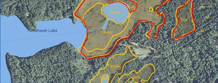
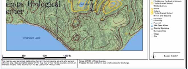
4 WI Wetland Inventory
5 Landscape Level Wetland Functional Assessment NWI+ (Hydrogemorphology) Landscape Position Code Definition Lentic LE Wetlands associated with a lake basin or the relatively flat plain nearby. Lotic River LR Wetland that is within the banks or periodically flooded by a river. Lotic Stream LS Wetland that is within the banks or periodically flooded by a stream. Terrene TE Wetland or complex surrounded by upland. Not within a floodplain or lake basin. It is not affected by lake, river, or stream flow processes. Landform Basin BA Wetlands that occur in a distinct depression. Flat FL Wetlands that occur on relatively level ground surface. Floodplain FP Wetlands that occur within an active flood zone of a river or stream. Fringe FR Wetlands in the shallow water zone of a permanent water body. Island IS A wetland or complex that is completely surrounded by water. Slope SL Wetlands occurring on a gradient of five percent or greater.
6 Landscape Level Wetland Functional Assessment NWI+ Waterflow Path Code Definition Bidirectional Inflow Outflow Outflow Artificial Outflow Intermittent BI IN OU OA OI Wetlands adjacent to lakes that are subject to the rise and fall of its water level. No influence from rivers or streams. Wetlands receiving water from streams, rivers, or other surface source. These wetlands lack surface water outflow. Water flows out from the wetland or complex naturally, but there is no source of water inflow. Water flows out from this wetland or complex via channelized drainage ditches or underground tiles. Outflow occurs from this wetland or complex at intervals, not continuously, and lacks inflow source. Water flows naturally into and out of these wetlands. They are often adjacent to rivers and streams. Water flows into and out of these wetlands and complexes via channelized drainage ditches. Throughflow TH Throughflow Artificial TA Throughflow Intermittent TI Water flows into and out of at intervals, not continuously.
7
8

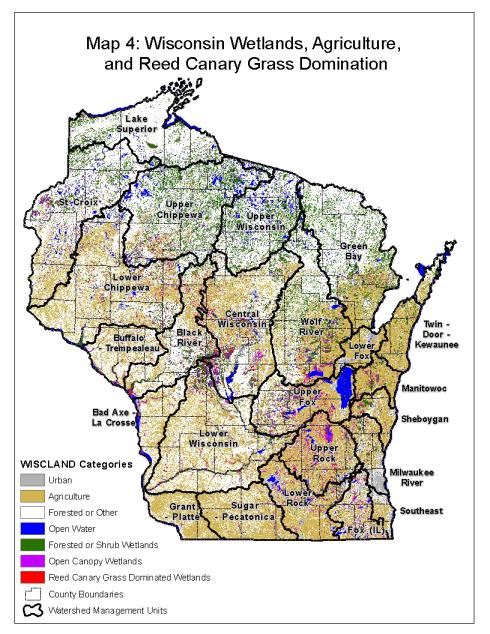
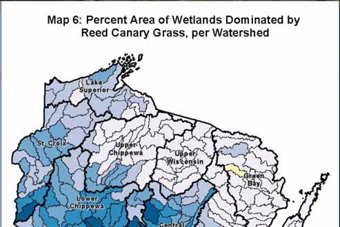
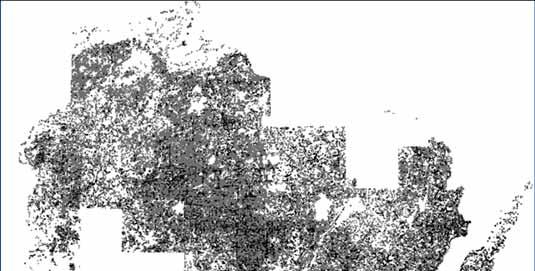
9 Reed Canary Grass Dominated Wetlands Brynda Hatch Statewide ½ Acre Minimum Map Unit Based on Landsat Imagery Caveats 61% to 83% Overall Accuracy Wetlands were based on WISCLAND, 1991
10
11


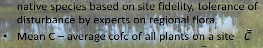

12 Floristic Quality Assessment

13 Potentially Restorable Wetlands
14 Simple PRW Equation Hydric soils (not in urban areas) current wetlands (on Wi Wetland Inventory) recently restored (from restoration data) = Potentially Restorable Wetlands Caveats Doesn t account for wetland lost before soil mapping, eg early cities Only as good as SSURGO and WWI inputs

15

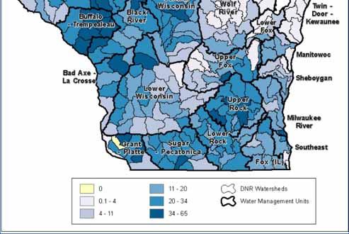
16 Scuppernong Creek Subwatershed

17 Restoration Opportunity


18 The Duck Pensaukee Watershed Approach Mapping Wetland Services Meeting Watershed Needs Nick Miller, Tom Bernthal, John Wagner, Mike Grimm, Gary Casper, Joanne Kline The Nature Conservancy Wisconsin Department of Natural Resources UW Milwaukee Field Station

19 Site ID: Results


20 Watershed Profile: Ecosystem Service Losses Flood Abatement Water Quality Protection Surface Water Supply Carbon Storage


21 Flood Abatement Site Selection Ecosystem Services Water Quality Surface Water Supply Carbon Storage


22 Site Prioritization: Wildlife Habitat Forested Swamps Integrated Landscapes Open Wetlands & Waters Beaches Shrub Swamps Riparian Areas Migratory Shorebirds

23 Site Prioritization: Wildlife Habitat
24 Site Prioritization: Ecosystem Services
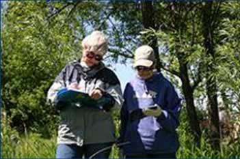
25 Volunteer Monitoring Programs


26 WISCONSIN EPHEMERAL PONDS PROJECT CITIZEN MONITORING NETWORK Wisconsin Ephemeral Ponds Project Citizen Monitoring Network Connecting People to Wetlands


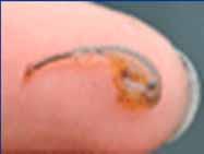
27 WISCONSIN EPHEMERAL PONDS PROJECT CITIZEN MONITORING NETWORK What is an Ephemeral Pond? National Geographic Magazine-April, 1999 Photo by George Grall Ephemeral Depression Depressional Pond Vernal Pool Woodland Pond Autumnal Pool Seasonal Pool Prairie Pothole When does it occur? Where does it occur?


28 WISCONSIN EPHEMERAL PONDS PROJECT CITIZEN MONITORING NETWORK Potential Ephemeral Ponds Mapping
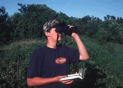
29 WISCONSIN EPHEMERAL PONDS PROJECT CITIZEN MONITORING NETWORK Map Ground Truthing Air Photo Interpretation (API) Soils and topography data Mapping in GIS Ground truth!


30 WISCONSIN EPHEMERAL PONDS PROJECT CITIZEN MONITORING NETWORK

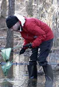
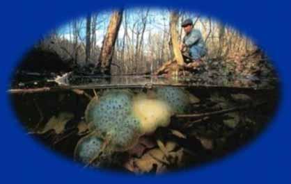
31 WISCONSIN EPHEMERAL PONDS PROJECT CITIZEN MONITORING NETWORK NEW in 2013! Amphibian Egg Mass Surveys Evaluate Importance for Amphibian Reproduction Biotic Inventory for WEPP Database Map on the Natural Heritage Inventory


32 Purple Loosestrife Control Monitoring For more information contact: (608)

33 Rock River Coalition Wetland Monitoring for more information contact
34


35