Public Notice ISSUED: 13 May 2014 EXPIRES: 12 June 2014
|
|
|
- Thomasina Phelps
- 5 years ago
- Views:
Transcription

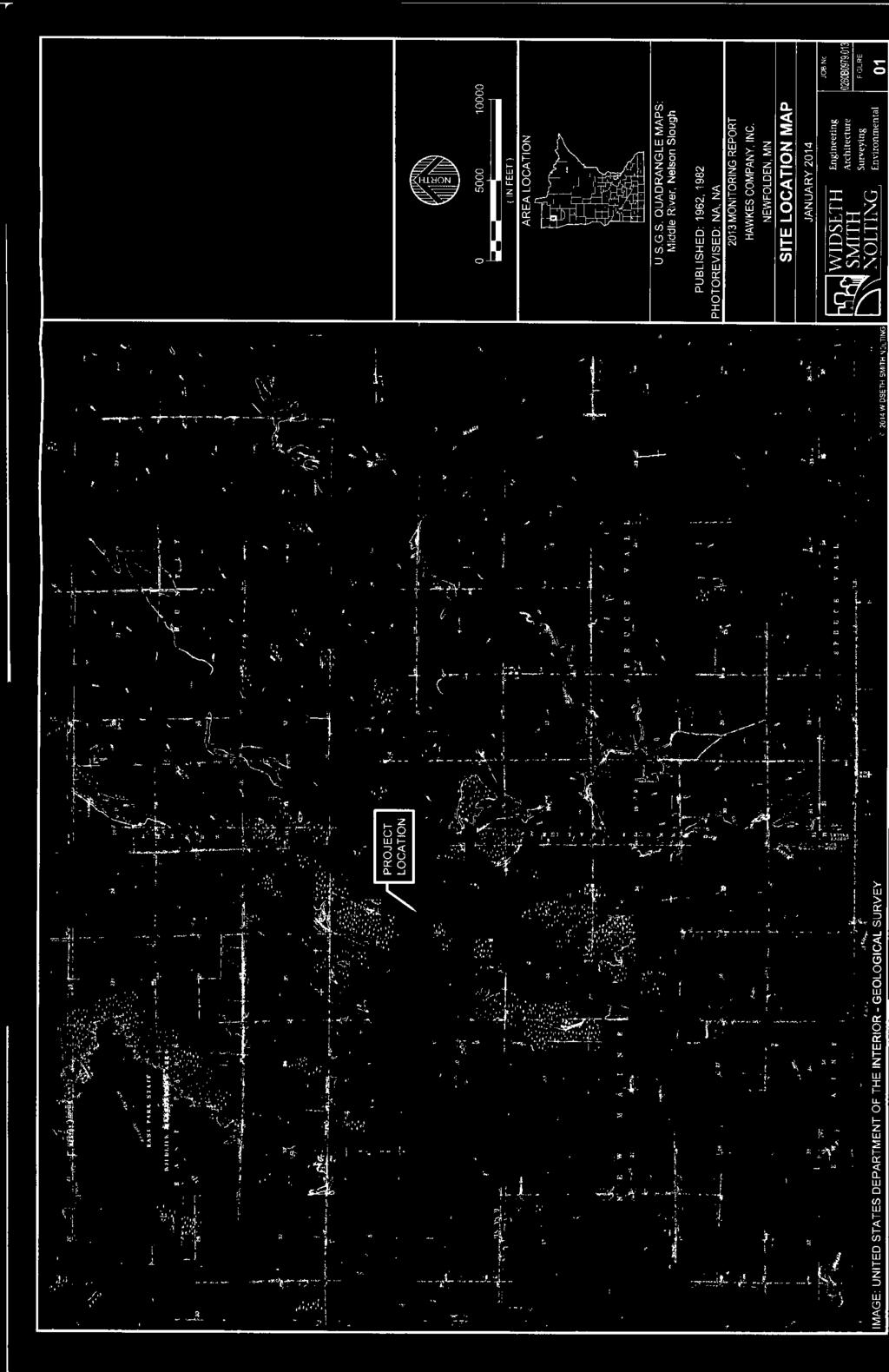
1 APPLICANT: Hawkes Company, Inc REFER TO: CLJ Public Notice ISSUED: 13 May 2014 EXPIRES: 12 June 2014 SECTION: Clean Water Act 1. APPLICATION FOR PERMIT TO retain dredged and fill material discharged into approximately 2.8 acres of wetlands adjacent to Judicial Ditch (JD) #21 without the required Department of the Army (DA) authorization and to discharge dredged and fill material into an additional 4.4 additional acres of wetlands in association with the removal of reed-sedge peat for the next 10 years. The sites, known as Site 7 and Site 10, are characterized by on-going peat mining that discharged dredged and fill material into 74.3 acres of wetlands from 2002 thru 2007 under a previous DA permit. The operation is located adjacent to another existing peat mine operation near Newfolden, Minnesota. 2. SPECIFIC INFORMATION. APPLICANT'S ADDRESS: AGENT: Widseth Smith Nolting Kevin Pierce Hawkes Company, Inc. PO Box Grand Forks, North Dakota AGENT S ADDRESS: 7804 Industrial Park Road Baxter, Minnesota PROJECT LOCATION: The project site is located in Sec. 11 & 12, T. 157N., R. 44W., Marshall County, Minnesota. The approximate center of the site is Latitude N and Longitude W. BACKGROUND: Hawkes Peat, Inc (Hawkes) received a Clean Water Act (CWA) Section 404 standard permit ( JAK) in 2002 authorizing discharges of dredged and/or fill material into 77 acres of wetlands in association with peat mining and related activities in Site 7 and Site 10. Site 7 is a 120-acre tract owned by Hawkes Peat, Inc. containing approximately 50.2 acres of mineable peat. Site 10 is an 80-acre parcel leased by Hawkes Peat from the State of Minnesota containing approximately 31.3 acres of mineable peat. Hawkes developed Sites 7 and 10 in five separate phases. Perimeter and field ditches were excavated to facilitate drainage of the sites. Water from these ditches is conveyed to existing sedimentation basins that outlet to JD #21 and ultimately to the Middle River. Once adequate drainage was established, surface vegetation and a thin layer of peat (overburden) were scraped from the surface and stockpiled along the edges of the site. The stockpiled overburden was proposed to be used later in
2 the reclamation process of the peat mine areas. Phases I through V have all been cleared and all required infrastructure is in-place. Peat has been mined to date from phases I IV. During the peat mining, the top layer of peat beneath the overburden is shredded to promote evaporative drying. The shredded peat is turned periodically until it is sufficiently dry for harvest, at which time it is collected using vacuum harvesters. The harvesters are either self-propelled or pulled behind a tractor and pneumatically lift the air-dried peat from the field surface into collecting tanks. The harvested peat is dumped from the vacuum tanks into stockpiles near the ends of the fields. Stockpiled peat is transported in bulk in covered trailers to existing plant facilities in East Grand Forks, Minnesota, for bagging. Shallow depths of peat are removed in subsequent phases in order to allow for sufficient drying. Approximately 1 to 1.5 feet of peat has been mined in Site 7 and approximately 1 foot of peat has been mined in Site 10. Peat removal in Phase V of Site 7 has not begun yet. The time to complete the work in waters of the United States authorized by JAK expired on December 31, In 2006, Hawkes submitted a request to extend the expiration date of the JAK permit. The Corps did not act on the request and an extension was never granted. Dredged and/or fill material was discharged into 74.3 acres of wetlands from 2002 thru 2007 under the DA permit, and these impacted areas have continued to be impacted by on-going peat harvesting activities as described above since expiration of the permit. Under the DA permit, the applicant was required to restore the mined site via reclamation using the seed bank present in the overburden that was initially removed. No reclamation has occurred to date. DESCRIPTION OF PROJECT: Hawkes continued to conduct peat mining activities on Site 7 and 10 from January 1, 2008 to present, and also discharged dredged and fill material into an additional 2.8 acres of wetlands without a DA permit. Hawkes proposes to mine an additional 2 to 2.5 feet of peat remaining in Site 7, one foot of remaining peat in Site 10, and 2.5 to 3 feet of peat in Phase V located within Site 7. Hawkes anticipates the remaining peat mining life of these sites is 10 more years. Hawkes indicates a number of variables impact when mining will cease and reclamation will begin including market demand for peat, which dictates the rate at which it is mined. The northeast portions of Site 10 (i.e., Phase IV) would likely be the first area to be reclaimed to wetland. Hawkes has also proposed to mine an additional area in the northwest portion of Site 7. This 4.4- acre area identified as Phase VI was not included in the JAK permit. Perimeter ditches will be excavated to facilitate sufficient drainage allowing harvesting equipment to access and mine the peat in this area. The perimeter drainage ditches will outlet into existing larger drainage ditches and sedimentation basins. Once the perimeter ditches are constructed and sufficient drainage is obtained, the site is prepared by removing and stockpiling the overburden. Additional surface preparation includes milling and harrowing. Milling shreds the top layer of peat to promote drying of the peat. The milled peat would then be turned over through the harrowing process until the peat is dry enough for harvest, at which time the peat is removed, stockpiled, and shipped to the bagging plant. QUANTITY, TYPE, AND AREA IMPACTED BY FILL/DREDGED MATERIAL: Development of Phase VI and continued peat mining in the other phases would discharge dredged and fill material into a total of 81.4 acres of wetland. Operational activities include excavating perimeter ditches, clearing of vegetation and peat, and overburden stockpiling. Roads used to access the peat stockpiles 2
3 are currently in place as part of the existing operation. Any additional roads that may be required with Phase VI would be constructed in uplands. Site cleanup would commence upon deactivation of mining activities. Debris and mobile equipment would be removed within one year from the completion of mining activities. According to the Minnesota Department of Natural Resources Permit to Mine, all roads, parking areas and storage pads, equipment, facilities, and structures will be removed within three years and the sites revegetated, unless provisions have been made for subsequent use. All peat stockpile areas would be leveled and revegetated. VEGETATION IN AFFECTED AREA: Site 7 and 10 are located in the Minnesota County Biological Survey Site 72 and were dominated by sedge meadow (Type 2) wetland and scrub-shrub (Type 6) wetland. SURROUNDING LAND USE: The surrounding areas are primarily undeveloped and agricultural land. Adjacent areas include State of Minnesota Wildlife Management Areas (WMA) and the existing peat mining operation. THE FOLLOWING POTENTIALLY TOXIC MATERIALS COULD BE USED AT THE PROJECT SITE: The project would not require the use of any potentially toxic materials. THE FOLLOWING PRECAUTIONS TO PROTECT WATER QUALITY HAVE BEEN DESCRIBED BY THE APPLICANT: Surface water from the perimeter ditches would be routed through an existing culvert that crosses the branch of JD 21. The water would then be routed to the existing sedimentation ponds before being released into JD 21. JD 21 outlets to the Middle River. COMPENSATORY MITIGATION: Under JAK, the applicant was required to restore the mined site via reclamation using the seed bank present in the overburden that was initially removed. This restoration was expected to occur before expiration of the permit in However, based on site conditions and the remaining mineable peat, it is expected that reclamation of the site will not begin to occur until about The applicant proposes to reclaim the mine site by filling the drainage ditches with highly decomposed peat characterized by low hydraulic conductivity to ensure optimum water retention and restoration of hydrology. The overburden initially removed from the site would be re-applied to establish a native plant community from the seed bank and would be applied uniformly over the site in a 4-6 inch layer. Side slopes of 10:1 would be incorporated around the site perimeter to prevent erosion and provide a relatively smooth transition to the surrounding upland. Field topography would be contoured to create a level or slightly concave surface to increase water availability. Reclamation would occur in phases as peat is removed to the desired depth until the entire site is reclaimed. Under JAK, the applicant was required to monitor the restored area for five growing seasons to determine vegetation extent and species composition. Performance standards identified in the original permit required the applicant to demonstrate wetland hydrology through the protocols outlined in the applicant s Hydrologic Monitoring Plan dated April 2002, and achieve 75% areal live cover comprising native wetland or typical peatland species. The applicant is required to provide a compensatory mitigation plan consistent with the requirements of 33 CFR Part 332. Temporal loss is 3
4 one of the factors that must be considered in association with the Corps determination of required compensation ratios. No compensation has been completed or proposed at this time for the temporal loss of waters. 3. REPLIES/COMMENTS. Interested parties are invited to submit to this office written facts, arguments, or objections within 30 days of the date of this notice. These statements should bear upon the suitability of the location and the adequacy of the project and should, if appropriate, suggest any changes believed to be desirable. Comments received may be forwarded to the applicant. Replies may be addressed to Regulatory Branch, St. Paul District, Corps of Engineers, 180 Fifth Street East, Suite 700, Saint Paul, MN Or, IF YOU HAVE QUESTIONS ABOUT THE PROJECT, call Craig Jarnot at the Bemidji Regulatory field office of the Corps, telephone number (651) To receive Public Notices by , go to: and add your information in the New Registration Box. 4. FEDERALLY-LISTED THREATENED OR ENDANGERED WILDLIFE OR PLANTS OR THEIR CRITICAL HABITAT. None were identified by the applicant or are known to exist in the permit area. However, Washington County is within the known or historic range of the following Federally-listed threatened (T) and endangered (E) species: Species Canada lynx Lynx Canadensis (T) Habitat Northern Forested Area This application is being coordinated with the U.S. Fish and Wildlife Service. Any comments it may have concerning Federally-listed threatened or endangered wildlife or plants or their critical habitat will be considered in our final assessment of the described work. 5. JURISDICTION. This application is being reviewed in accordance with the practices for documenting Corps jurisdiction under Sections 9 & 10 of the Rivers and Harbors Act of 1899 and Section 404 of the Clean Water Act identified in Regulatory Guidance Letter We have made an initial determination that the aquatic resources that would be impacted by the proposed project are regulated by the Corps of Engineers under Section 404 of the Clean Water Act and/or Section(s) 9 & 10 of the Rivers and Harbors Act. The Corps will prepare an approved or preliminary jurisdictional determination prior to making a permit decision. Approved jurisdictional determinations are posted on the St. Paul District web page at 4
5 THE APPLICANT HAS STATED THAT THE FOLLOWING STATE, COUNTY, AND/OR LOCAL PERMITS HAVE BEEN APPLIED FOR/ISSUED: Site 7 and Site 10 have received a Permit to Mine and water appropriate permit from the Minnesota Department of Natural Resources. The applicant has also amended their MPCA National Pollutant Discharge Elimination System (NPDES) permit. 6. STATE SECTION 401 WATER QUALITY CERTIFICATION. Valid Section 404 permits cannot be issued for any activity unless state water quality certification for the activity is granted or waived pursuant to Section 401 of the Clean Water Act. The state Section 401 authority in Minnesota is the Minnesota Pollution Control Agency (MPCA). The St. Paul District has provided this public notice and a copy of the applicant s Section 404 permit application form to the MPCA. If MPCA needs any additional information in order for the Section 401 application to be considered complete by MPCA, the MPCA has indicated that it will request such information from the applicant. It is the permit applicant s responsibility to ensure that the MPCA has received a valid, complete application for state Section 401 certification and to obtain a final Section 401 action from the MPCA. The MPCA has indicated that this public notice serves as its public notice of the application for Section 401 water quality certification under Minnesota Rules Part The MPCA has also indicated that the Section 401 process shall begin to commence upon the issuance date of this public notice unless the MPCA notifies both the St. Paul District and the permit applicant to the contrary, in writing, before the expiration date of this public notice. Any comments relative to MPCA s Section 401 Certification for the activity proposed in this public notice may be sent to: Minnesota Pollution Control Agency, Resource Management and Assistance Division, Attention: 401 Certification, 520 Lafayette Road North, St. Paul, Minnesota HISTORICAL/ARCHAEOLOGICAL. This public notice is being sent to the National Park Service and the State Archaeologist for their comments. The Corps will review information on known cultural resources and/or historic properties within and adjacent to the project area. The Corps will also consider the potential effects of the project on any properties that have yet to be identified. The results of this review and the Corps determination of effect will be coordinated with the State Historic Preservation Officer independent of this public notice. Any adverse effects on historic properties will be resolved prior to the Corps authorization, or approval, of the work in connection with this project. 8. PUBLIC HEARING REQUESTS. Any person may request, in writing, within the comment period specified in this notice, that a public hearing be held to consider this application. Requests for public hearings shall state, in detail, the reasons for holding a public hearing. A request may be denied if substantive reasons for holding a hearing are not provided or if there is otherwise no valid interest to be served. 5
6 9. PUBLIC INTEREST REVIEW. The decision whether to issue a permit will be based on an evaluation of the probable impact, including cumulative impacts, of the proposed activity on the public interest. That decision will reflect the national concern for both protection and utilization of important resources. The benefit which reasonably may be expected to accrue from the proposal must be balanced against its reasonably foreseeable detriments. All factors which may be relevant to the proposal will be considered, including the cumulative effects. Among those are conservation, economics, aesthetics, general environmental concerns, wetlands, cultural values, fish and wildlife values, flood hazards, floodplain values, land use, navigation, shoreline erosion and accretion, recreation, water supply and conservation, water quality, energy needs, safety, food and fiber production and, in general, the needs and welfare of the people. Environmental and other documents will be available for review in the St. Paul District Office. The Corps of Engineers is soliciting comments from the public; Federal, State, and local agencies and officials; Indian tribes; and other interested parties in order to consider and evaluate the impacts of this proposed activity. Any comments received will be considered by the Corps of Engineers to determine whether to issue, modify, condition, or deny a permit for this proposal. To make this decision, comments are used to assess impacts on endangered species, historic properties, water quality, general environmental effects, and the other public interest factors listed above. Comments are used in the preparation of an Environmental Assessment and/or an Environmental Impact Statement pursuant to the National Environmental Policy Act. Comments are also used to determine the need for a public hearing and to determine the overall public interest of the proposed activity. Desiree Morningstar Acting Chief, Northwest Section Enclosure NOTICE TO EDITORS: This public notice is provided as background information and is not a request or contract for publication. 6


7


8 CLJ Public Notice 1 of 1