TABLE OF CONTENTS. Atlas-Campaspe Mineral Sands Project Environmental Impact Statement
|
|
|
- Alban Alexander
- 5 years ago
- Views:
Transcription
1
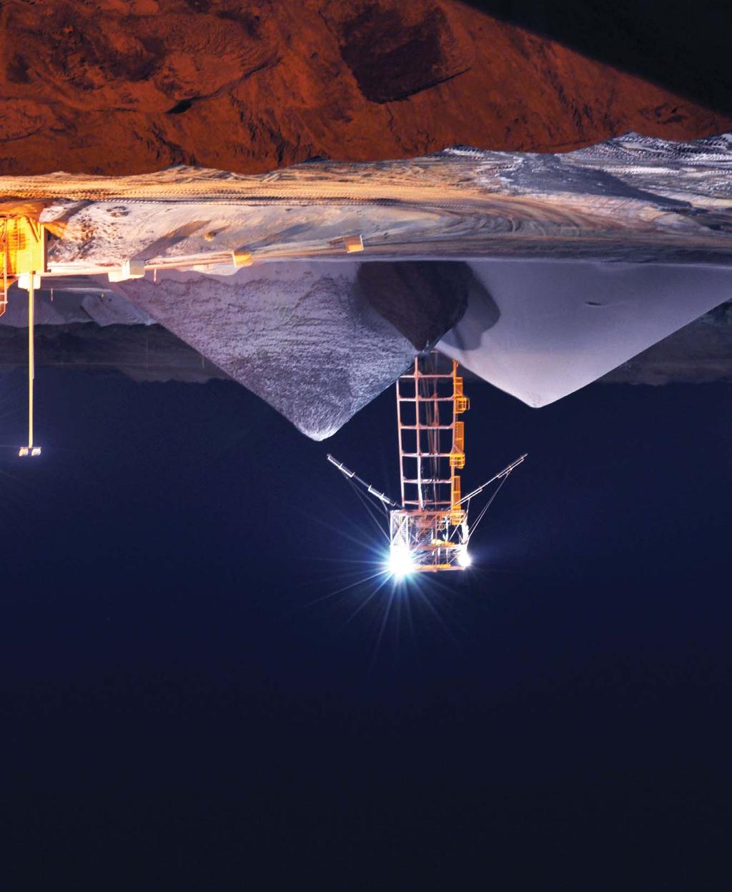
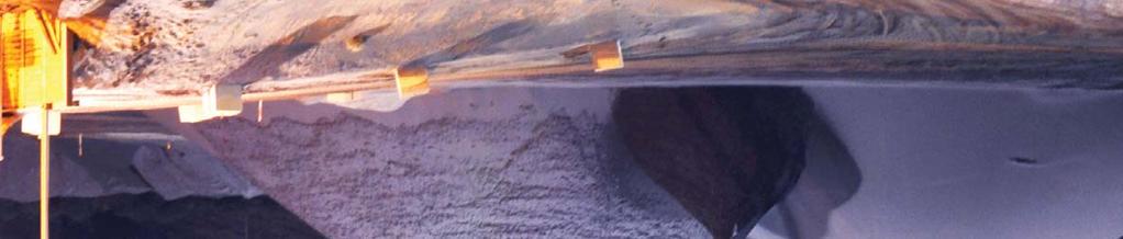
2 TABLE OF CONTENTS 1 INTRODUCTION PROJECT OVERVIEW Purpose of this Report Project Summary Land Tenure, Development Application Area, Tenements and Zoning Proponent DIRECTOR-GENERAL S REQUIREMENTS PROJECT CONSULTANTS DOCUMENT STRUCTURE PROJECT DESCRIPTION APPROVALS HISTORY AND EXISTING/APPROVED CRISTAL MINING OPERATIONS IN WESTERN NSW Broken Hill MSP Ginkgo Mine Snapper Mine MINERAL DEPOSITS AND EXPLORATION ACTIVITIES PROJECT GENERAL ARRANGEMENTS Atlas-Campaspe Mine Ivanhoe Rail Facility PROJECT CONSTRUCTION AND OTHER DEVELOPMENT ACTIVITIES Site Access Roads and Internal Access Roads Accommodation Camp and Sewage Treatment Plant Water Supply Infrastructure Power Supply Infrastructure Fixed Infrastructure Areas Dry Mining Unit Assembly Mineral Processing Infrastructure Materials Handling Infrastructure Off-Path Sand Residue Dams and Process Water Storages Roadworks along Mineral Concentrate Transport Route Ivanhoe Rail Facility MINE OPERATIONS Mining Sequence Vegetation Clearance and Soil Stripping Overburden Removal and Handling Mineral Sands Ore Extraction and Handling Indicative Mine Schedule Mine Fleet ON-SITE PROCESSING AND MINERAL CONCENTRATE STOCKPILING, LOADING AND TRANSPORT Indicative Processing and Mineral Concentrate Production Schedule On-site Processing Hours of Operation Primary Gravity Concentration Unit HMC Treatment Facility Mineral Concentrate Stockpiles and Loading Mineral Concentrate and MSP Process Waste Transport OVERBURDEN MANAGEMENT Overburden Quantities Overburden Geochemistry Overburden Emplacement Strategy PROCESS WASTE MATERIALS MANAGEMENT Coarse Rejects Sand Residues MSP Process Wastes WATER MANAGEMENT Mine Water Management System Mine Water Consumption Groundwater Borefield Mine Dewatering Simulated Performance of the Water Management System (Water Supply Reliability) Final Voids Mineral Concentrate Transport Route Ivanhoe Rail Facility INFRASTRUCTURE AND SERVICES Administration/Office Buildings and Car Parking Facilities Workshop and Stores Site Access Road and Internal Access Roads Electricity Supply and Distribution Site Security Potable Water MANAGEMENT OF DANGEROUS GOODS WASTE MANAGEMENT WORKFORCE Construction Operations 2-37 i
3 3 CONSULTATION AND COMMUNITY INITIATIVES ENVIRONMENTAL IMPACT STATEMENT CONSULTATION Objectives Request for DGRs State Members of Parliament State Government Agencies Local Government Agencies Commonwealth Government Agencies Infrastructure Owners and Service Providers Public Consultation PROJECT DESIGN AMENDMENTS IN RESPONSE TO ISSUES RAISED COMMUNITY INITIATIVES AND INVOLVEMENT Safety, Health and Environmental Policy Website and Community Call Line Community Programmes and Sponsorships Public Reporting Contractors and Suppliers ENVIRONMENTAL ASSESSMENT ENVIRONMENTAL RISK ASSESSMENT CLIMATE Existing Environment Monitoring LAND RESOURCES AND AGRICULTURAL PRODUCTION Existing Environment Potential Impacts Mitigation Measures, Management and Monitoring GROUNDWATER Existing Environment Potential Impacts Mitigation Measures, Management and Monitoring Licensing SURFACE WATER Existing Environment Potential Impacts Mitigation Measures, Management and Monitoring Licensing FLORA Existing Environment Potential Impacts Mitigation Measures, Management and Monitoring Biodiversity Offset Strategy FAUNA Existing Environment Potential Impacts Mitigation Measures, Management and Monitoring Biodiversity Offset Strategy ABORIGINAL HERITAGE Existing Environment Potential Impacts Mitigation Measures, Management and Monitoring NON-ABORIGINAL HERITAGE Existing Environment Potential Impacts AIR QUALITY Existing Environment Potential Impacts Mitigation Measures, Management and Monitoring GREENHOUSE GAS EMISSIONS Scope 1, 2 and 3 Greenhouse Gas Emissions Australian Greenhouse Gas Reduction Targets and Carbon Pricing Mechanism Mitigation Measures, Management and Monitoring NOISE Existing Environment Potential Impacts Mitigation Measures, Management and Monitoring ROAD TRANSPORT Existing Environment Potential Impacts Management Measures VISUAL CHARACTER Existing Environment Potential Impacts Mitigation and Management Measures HAZARD AND RISK Hazard Identification and Risk Assessment Hazard Prevention and Mitigation Measures REGIONAL ECONOMY Existing Environment Potential Impacts Management Measures ii
4 4.17 EMPLOYMENT, POPULATION AND COMMUNITY INFRASTRUCTURE Existing Environment Potential Impacts Mitigation and Management Measures REHABILITATION STRATEGY RELEVANT REHABILITATION EXPERIENCE FROM CRISTAL MINING S MURRAY-DARLING BASIN OPERATIONS REHABILITATION OBJECTIVES REHABILITATION OF THE PROJECT Final Land Use Rehabilitation Domains and Conceptual Final Landforms Rehabilitation Materials Ivanhoe Rail Facility Mineral Concentrate Transport Route GENERAL REHABILITATION METHODS AND MEASURES Vegetation Clearing and Salvage Measures Soil Stripping and Materials Handling Measures Plant Species Selection Erosion and Sediment Control Weed Control and Exotic Animal Management Bushfire Prevention Increasing Habitat Complexity INTEGRATION WITH THE PROPOSED BIODIVERSITY OFFSET STRATEGY REHABILITATION MANAGEMENT PLAN REHABILITATION AND REVEGETATION MONITORING Performance Standards and Completion Criteria Rehabilitation Trials and Research MINE CLOSURE PLANNING FRAMEWORK AND PROJECT JUSTIFICTION EXISTING APPROVALS AND REGULATORY CONTROLS ENVIRONMENTAL PLANNING AND ASSESSMENT ACT, Permissibility and Requirement for Development Consent Application of State Significant Development (Division 4.1) of Part 4 of the Environmental Planning and Assessment Act, Approvals and Authorisations that are not Required for State Significant Development Other Approvals and Legislation that must be Applied Consistently for State Significant Development Environmental Impact Statement Required for State Significant Development Documents to Accompany Development Application Public Notification of the Development Application Part 4, Division 6 Development Contributions ENVIRONMENT PROTECTION AND BIODIVERSITY CONSERVATION ACT, OTHER APPLICABLE STATUTORY APPROVALS NSW Approvals Commonwealth Approvals ENVIRONMENTAL PLANNING INSTRUMENTS State Environmental Planning Policies Local Environmental Plans STRATEGIC PLANNING DOCUMENTS PROVISIONS FOR THE PREVENTION, MINIMISATION AND MANAGEMENT OF RELEVANT IMPACTS MONITORING, ENFORCEMENT AND REVIEW PROCEDURES PROJECT JUSTIFICATION Need For and Objectives of the Project Consideration of Project Alternatives Consideration of Climate Change Projections for Australia and NSW Ecologically Sustainable Development Considerations Consideration of the Project against the Objects of the EP&A Act Consideration of the Consequences of not Carrying out the Project 6-22 iii
5 7 SUMMARY OF MANAGEMENT, MITIGATION, MONITORING AND REPORTING OVERVIEW Project Environmental Management Safety, Health and Environmental Policy Environmental Management Responsibilities CONSULTATION AND COMMUNITY Website and Community Contact Community Support ENVIRONMENTAL MANAGEMENT AND MITIGATION MEASURES Groundwater Surface Water Biodiversity and Offset Aboriginal Heritage Air Quality and Greenhouse Gas Noise Road Transport Agricultural Land Rehabilitation and Mine Closure ENVIRONMENTAL MONITORING Meteorology Groundwater Surface Water Biodiversity and Rehabilitation Air Quality Greenhouse Gas Noise REPORTING Annual Review Development Consent and Controlled Action Decision Requirements Independent Environmental Audit Other Reporting REFERENCES REFERENCE LIST POLICIES, GUIDELINES AND PLANS ABBREVIATIONS, ACRONYMS AND GLOSSARY ABBREVIATIONS ACRONYMS AND GLOSSARY 9-4 LIST OF TABLES Table 1-1 Table 1-2 Table 1-3 Project Summary Land Tenure Summary Director-General s Requirements Reference Summary Table 1-4 Content Requirements of an EIS Clause 7 of Schedule 2 of the EP&A Regulation Table 2-1 Indicative Mine Schedule Table 2-2 Indicative On-site Processing and Mineral Concentrate Production Schedule Table 4-1 Key Potential Environmental Issues Table 4-2 Meteorological Summary Long-Term Average Temperature, Rainfall and Evaporation Table 4-3 Estimated Project Groundwater Licensing Requirements Table 4-4 Native Vegetation Required to be Cleared for the Project Table 4-5 Quantification of Project Disturbance Areas and the Proposed Biodiversity Offset Area Table 4-6 Quantification of Native Vegetation Types in the Project and Proposed Biodiversity Offset Area Table 4-7 Management of the Proposed Biodiversity Offset Area Table 4-8 Reconciliation of the Biodiversity Offset Strategy against OEH Offset Principles Table 4-9 Fauna Habitat Types Proposed to be Cleared for the Project Table 4-10 Summary of the Project Aboriginal Heritage Consultation/Survey Programme Table 4-11 Archaeological Significance of Relevant Aboriginal Heritage Sites Table 4-12 Table 4-13 Table 4-14 Table 4-15 Table 4-16 Table 4-17 Table 4-18 Table 4-19 Table 4-20 Table 4-21 Table 4-22 Table 4-23 EPA Criteria and Ambient Air-NEPM Advisory Standards for Particulate Matter Concentrations Criteria for Dust (Insoluble Solids) Deposition Average Dust Deposition (Insoluble Solids) Levels (g/m 2 /month) Summary of Potential Project Greenhouse Gas Emissions Relative Scale of Various Noise Sources INP Project-specific Intrusive and Amenity Assessment Criteria (dba) Relevant Criteria for Road Traffic Noise Residences EPA Rail Noise Assessment Trigger Levels Existing Average Weekday Traffic Volumes (Vehicles/Day) Predicted Project Traffic Volumes (Vehicles/Day) Predicted Cumulative Traffic Volumes (Vehicles/Day) Contributions to Employment, Gross Regional Product and Output by Industry Sector Regional and NSW Economies (2005 to 2006) iv
6 LIST OF TABLES (Continued) Table 4-24 Table 4-25 Table 5-1 Table 5-2 Table 6-1 Table 7-1 Table 7-2 Table 7-3 Table 8-1 LIST OF PLATES Plate 3-1 Plate 5-1 Plate 5-2 Plate 5-3 Plate 5-4 Plate 5-5 Plate 5-6 Plate 5-7 Plate 5-8 LIST OF FIGURES Figure 1-1 Figure 1-2a Figure 1-2b Figure 2-1 Figure 2-2 Direct Incremental Non-Local Workforce Requirements Project Year 5 Project and Cumulative Population Changes Project Year 5 Preliminary Estimate of Soil Resources Available for Rehabilitation Indicative Species Proposed for Revegetation Principles of ESD EPBC Act and EP&A Act Summary of Project Management, Mitigation, Monitoring and Reporting Management of the Proposed Biodiversity Offset Area Summary of the Project Environmental Monitoring Regime Director-General s Requirements Policies, Guidelines and Plans Community Information Session Rehabilitation at the Ginkgo Mine (aerial view of overburden emplacement) Two year old Chenopod revegetation on an overburden emplacement at the Ginkgo Mine Woody debris (salvaged from vegetation clearance activities) placed on overburden emplacement batters at the Ginkgo Mine to enhance slope stability Rehabilitation trial area at the Snapper Mine including native grass and Chenopod species Cereal crop established on a section of rehabilitated mine path at the former Wemen Mine Almond orchard plantation on a section of rehabilitated mine path at the former Wemen Mine Rehabilitation trial area adjacent to the former Wemen Mine including ten year old Spinifex and Mallee Eucalypt revegetation Rehabilitation trial area adjacent to the former Wemen Mine including ten year old Chenopod and Mallee Eucalypt revegetation Project Location Atlas-Campaspe Mine Relevant Land Tenure Ivanhoe Rail Facility Relevant Land Tenure Currently Approved MSP Process Flow Sheet Conceptual Stratigraphic Section and Deposits LIST OF FIGURES (Continued) Figure 2-3 Atlas-Campaspe Mine Project General Arrangement Figure 2-4 Indicative General Arrangement Year 2 Figure 2-5 Indicative General Arrangement Year 5 Figure 2-6 Indicative General Arrangement Year 6 Figure 2-7 Indicative General Arrangement Year 16 Figure 2-8 Indicative General Arrangement Year 20 Figure 2-9 Ivanhoe Rail Facility Project General Arrangement Figure 2-10 Roadworks along Proposed Mineral Concentrate Transport Route Figure 2-11 Mining Operations Conceptual Plan and Section Figure 2-12 Process Flowsheet and Water Management Schematic Figure 2-13 Conceptual Design of Off-Path Sand Residue Dams and Process Water Storage Embankments Figure 2-14 Conceptual Water Disposal Dam Figure 4-1 Regional Meteorological Monitoring Sites Figure 4-2 Annual Wind Roses Balranald and Ivanhoe Figure 4-3 Regional Geology Figure 4-4 Atlas-Campaspe Mine Groundwater Monitoring Locations Figure 4-5 Atlas-Campaspe Mine Simulated Drawdown Extent - Year 5 Figure 4-6 Atlas-Campaspe Mine Simulated Drawdown Extent - Year 20 Figure 4-7 Atlas-Campaspe Mine Existing Tanks and Proposed Surface Water Monitoring Locations Figure 4-8 Vegetation Communities Atlas-Campaspe Mine Figure 4-9 Vegetation Communities Roadworks along the Mineral Concentrate Transport Route Figure 4-10 Vegetation Communities Ivanhoe Rail Facility Figure 4-11 Threatened Flora Species Records Figure 4-12 Threatened Flora - Roadworks along the Mineral Concentrate Transport Route Figure 4-13 Proposed Biodiversity Offset Area Figure 4-14 Habitat Mapping Atlas-Campaspe Mine Figure 4-15 Threatened Fauna Reptile Species Records Figure 4-16 Threatened Fauna Birds Species Records (1 of 2) Figure 4-17 Threatened Fauna Birds Species Records (2 of 2) Figure 4-18 Threatened Fauna Mammals Species Records (Excluding Bats) Figure 4-19 Threatened Fauna Mammals Species Records (Bats) Figure 4-20 Threatened Fauna Roadworks along the Mineral Concentrate Transport Route Figure 4-21 Atlas-Campaspe Mine - Aboriginal Heritage Sites v
7 LIST OF FIGURES (Continued) LIST OF APPENDICES Figure 4-22 Figure 4-23 Figure 4-24 Figure 4-25 Figure 4-26 Figure 4-27 Figure 5-1 Figure 5-2 Figure 5-3 Figure 5-4 Mineral Concentrate Transport Route Aboriginal and Non-Aboriginal Heritage Sites Ivanhoe Rail Facility Aboriginal Heritage Sites Atlas-Campaspe Mine Project-only 24-hour PM 10 Air Quality Contours Year 16 Atlas-Campaspe Mine Year 16 Night-Time Noise Contours Ivanhoe Rail Facility Night-Time Noise Contours Location of Project Traffic Surveys and Traffic Forecasts Conceptual Rehabilitation Domains Project Conceptual Final Landform (Post-Mining) Conceptual Cross-sections of the Rehabilitated Atlas and Campaspe Mine Paths Conceptual Cross-sections of the Rehabilitated Atlas and Campaspe Final Voids Appendix A Appendix B Appendix C Appendix D Appendix E Appendix F Appendix G Appendix H Appendix I Appendix J Appendix K Appendix L Appendix M Appendix N Appendix O Flora Assessment Fauna Assessment EPBC Act Controlling Provisions Road Transport Assessment Aboriginal and Non-Aboriginal Cultural Heritage Assessment Hydrogeological and Water Supply Assessment Surface Water Assessment Agricultural Impact Statement Socio-Economic Assessment Noise Assessment Air Quality and Greenhouse Gas Assessment Mineral Concentrate and Process Waste Materials Assessment Land Contamination Assessment Preliminary Hazard Analysis Environmental Risk Assessment Figure 7-1 Proposed Biodiversity Offset Area, Conceptual Final Landform and Land Use Figure 7-2 Project Environmental Monitoring Sites Atlas-Campaspe Mine Figure 7-3 Project Environmental Monitoring Sites Ivanhoe Rail Facility LIST OF ATTACHMENTS Attachment 1 Attachment 2 Attachment 3 Attachment 4 Attachment 5 Attachment 6 Director-General s Requirements Development Application Area and Real Property Descriptions Peer Review Letters Community Information Water Licensing Addendum Planning Instruments Addendum vi