WESTMINISTER WOODS EAST PHASE 10 (CLAIR/VICTORIA), GUELPH FUNCTIONAL SERVICING REPORT
|
|
|
- Pierce Quinn
- 5 years ago
- Views:
Transcription

1 WESTMINISTER WOODS EAST PHASE 10 (CLAIR/VICTORIA), GUELPH FUNCTIONAL SERVICING REPORT Prepared for: West Minister Woods Ltd. R.R. # Wellington Road #34 Cambridge ON N3C 2V4 Prepared by: Stantec Consulting Ltd. 49 Frederick Street Kitchener ON N2H 6M7 Project: /20158 March 2015


2
3 WESTMINISTER WOODS EAST PHASE 10 (CLAIR/VICTORIA), GUELPH FUNCTIONAL SERVICING REPORT Table of Contents 1.0 INTRODUCTION SANITARY SERVICING CLAIR GORDON SANITARY CONSIDERATIONS WATER DISTRIBUTION STORM DRAINAGE STORM SEWER DESIGN INFILTRATION WATER QUALITY AREA GRADING AND ROADWORKS UTILITIES CONCLUSIONS LIST OF APPENDICES APPENDIX A SITE PHASING LIMIT PLAN APPENDIX B RHC CONCEPTUAL SITE PLAN APPENDIX C OVERALL SITE SERVICING PLAN APPENDIX D SANITARY AREA PLAN AND SEWER DESIGN SHEET APPENDIX E STORM AREA PLAN AND SEWER DESIGN SHEET APPENDIX F WESTMINISTER WOODS EAST IMPERVIOUS AREA LIST OF FIGURES FOLLOWING PAGE FIGURE 1 - SITE LOCATION PLAN. 1.1 LIST OF TABLES FOLLOWING PAGE TABLE 2.1 CLAIR GORDON SANITARY SEWER CAPACITY STUDY. 2.1 (2013 CIVICA MODEL) TABLE CLAIR GORDON SANITARY SEWER CAPACITY STUDY..2.1 (2013 CIVICA MODEL REVISIONS) TABLE WESTMINISTER WOODS EAST TOTAL IMPERVIOUSNESS ls v:\01603\active\ \design\report\ph10-fsr\rpt_c23-15_ls_functionalservicingreport-ph10.docx i
4 WESTMINISTER WOODS EAST PHASE 10 (CLAIR/VICTORIA), GUELPH FUNCTIONAL SERVICING REPORT Introduction March INTRODUCTION This report has been prepared in support of the proposed Westminster Woods Phase 10 (Clair/Victoria) zoning bylaw amendment (ZBA) and official plan amendment (OPA) to permit 101 new residential units and 2 commercial buildings within the existing Westminster Woods East Subdivision. The development of the subject lands was previously considered and planned for as part of the design of Westminister Wood East Phase 5. Ultimately, the registered plan for Phase 5 excluded these lands and they became a remnant parcel requiring independent approval. For the purposes of this report, the subject lands are being referred to as Westminister Woods Phase 10. The entire Phase 10 (Clair/Victoria) property is comprised of 1.4 hectares (ha) of land bounded by Victoria Road to the east, Samuel Drive to the west and Clair road to the south, as illustrated in Figure 1. The site plan is based on proposed zoning R.4A (General Apartment) and NC (Neighbourhood Shopping Centre) under the City of Guelph zoning by-law. Accessible with two private entrances, one off Samuel Drive and one off Kingsbury Square (private), this Phase is internally divided into two areas: 1. A four (4) storey apartment building with 101 new residential units; and 2. Two (2) - one (1) storey commercial buildings within the existing Westminster Woods East Subdivision. The entire Phase 10 (Clair/Victoria) property is comprised of 1.4 ha with the apartment occupying 1.0 ha and the commercial units occupying 0.4 ha. A copy of the proposed Phasing Limits Plan is attached as Appendix A. The Site Plan for the proposed Phase 10 development has been prepared by Reid s Heritage Construction (RHC) and it forms the basis for the design of the servicing, grading, and landscape opportunities. The Site Plan has been submitted as part of the overall complete submission for ZBA/OPA and a copy is included and attached as Appendix B. This report documents the servicing for the proposed development including sanitary servicing, water distribution and storm drainage as well as grading, road works and utilities. The overall site servicing plan is included as Appendix C. ls v:\01603\active\ \design\report\ph10-fsr\rpt_c23-15_ls_functionalservicingreport-ph10.docx 1.1


5
6 WESTMINISTER WOODS EAST PHASE 10 (CLAIR/VICTORIA), GUELPH FUNCTIONAL SERVICING REPORT Sanitary Servicing March SANITARY SERVICING Sanitary servicing for the proposed site development will be provided via two connections. The four (4) storey apartment building will connect to an existing 200 mm diameter sanitary sewer plug that was installed as part of Phase 5 Block B on Kingsbury Square and the two (2) commercial buildings will connect to an existing 200 mm diameter sanitary sewer plug that was installed as part of Phase 5 on Samuel Drive. The proposed internal sanitary sewers will generally be located within the proposed private roadways at an approximate minimum depth of 2.8 m. From the proposed sanitary mains in the parking areas, the commercial buildings will be provided with 150 mm diameter services and the apartment building will be provided with a 200 mm diameter service. The Sanitary Area Plan and detailed sanitary sewer design sheet are included in Appendix D. 2.1 CLAIR GORDON SANITARY CONSIDERATIONS The Westminster Woods Phase 10 area was included as part of the Clair Gordon Sanitary Sewer evaluations summarized in a report prepared for the City of Guelph by Civica Infrastructure Inc. Location 3 included 657 units and is consistent with the concepts that were available at the time of preparation of the report. Table 2.1 summarizes the breakdown of the various phases of Westminster Woods making up the 657 units (as at 2013). Notes within the report and the model suggest the population associated with the 657 units was assumed to be Conventional population per unit (ppu) rates 1.7, 2.4 and 3.5 ppu for apartments, townhouses and singles would yield a population of Using 2.41 ppu for all unit types would generate the 1584 noted in the report. Per notes in the model the 1584 population and ha area were being used to contribute sanitary flows at rates of 353 L/c/d and 0.33 L/s/ha. As shown in Table 2.1 these rates would generate a flow of L/s. However, the model itself has used a flow rate of L/s representing 1 L/s/ha instead of the above noted population based flows. Table 2.2 summarizes the changes to the concepts including existing registered Plans of Subdivision, Plans of Condominium and Institutional/Residential development. Conventional population per unit (ppu) rates 1.7, 2.4 and 3.5 ppu for apartments, townhouses and singles would yield an updated population of Using 2.41 ppu for all unit types would generate a population of 1665 and using flows at rates of 353 L/c/d and 0.33 L/s/ha would generate a flow of L/s which is still below the L/s used in the model. As area based flows were used the updated unit count should have no impact on the Civica Model. ls v:\01603\active\ \design\report\ph10-fsr\rpt_c23-15_ls_functionalservicingreport-ph10.docx 2.1
7 Table 2.1 Clair Gordon Sanitary Sewer Capacity Study - Location 3 Summary Unit Count / Population Calculation ( CIVICA MODEL) Location Type of Residential/Commercial # units/commercial Population (3.) Population (1.) Westminster Wood East - Ph 2 Single Detached Townhouse Westminster Wood East - Ph 5A Single Detached (Westminster Wood East - Ph 5) Westminster Wood East - Ph 5B Townhouse (Westminster Wood East - Ph 5A) Westminster Wood East - Ph 5C Apartment (Westminster Wood East - Ph 5B) Townhouse Stacked Towns Westminster Wood East - Ph 5D Apartment (Westminster Wood East - Ph 10) (Prop.) Commercial 0.71 Ha Westminster Wood East - Ph 5E Single Detached Institutional 1.76 Ha Westminster Wood East - Ph 4B Multi-Residential (Townhouses) Westminster Wood East - Ph 4C Townhouse Multi-Residential Westminster Wood East - Ph 4D Apartment Townhouse Commercial 0.21 Ha Summary Calculated (3.) CIVICA (1.) Unit Count Total Residential Total Commercial 0.92 Total Institutional 1.76 Density (PPU) PPU (3.) PPU (1.) Townhouse/Stacked Towns 2.4 p/unit 2.41 Apartment 1.7 p/unit 2.41 Semi-Detached 3.5 p/unit Single Detached 3.5 p/unit 2.41 Sanitary Flows (2.) Population/Area Flow Rate Flow (L/s) Residential L/C/d 6.47 Infiltration (area) L/s/ha 6.36 Total Flow used in Model L/s/ha Notes 1. Density adjusted to match CIVICA total Population 2. Sanitary Flow Notes from CIVICA model 3. Typical PPUs V:\01603\active\ \design\report\Ph10-FSR\[tbl_c12-15_pf_Summary_units_population.xlsx]Sheet4
8 Table 2.2 Clair Gordon Sanitary Sewer Capacity Study - Location 3 Summary Unit Count / Population Calculation ( CIVICA MODEL revisions) Location Type of Residential/Commercial # units/commercial Population (3.) Population (1.) Westminster Wood East - Ph 2 Single Detached Townhouse Westminster Wood East - Ph 5A Single Detached (Westminster Wood East - Ph 5) Westminster Wood East - Ph 5B Townhouse (Westminster Wood East - Ph 5A) Westminster Wood East - Ph 5C Apartment (Westminster Wood East - Ph 5B) Townhouse Stacked Towns Westminster Wood East - Ph 5D Apartment (Westminster Wood East - Ph 10) (Prop.) Commercial Ha Westminster Wood East - Ph 5E Single Detached Institutional Ha Westminster Wood East - Ph 4B Multi-Residential (Townhouses) Westminster Wood East - Ph 4C Townhouse Multi-Residential 0.0 Westminster Wood East - Ph 4D Apartment Townhouse Commercial 0.21 Ha Summary Calculated (3.) CIVICA (2013) (1.) CIVICA (2015) (1.) Unit Count Total Residential Total Commercial Total Institutional 1.76 Density (PPU) PPU (3.) PPU (1.) Townhouse/Stacked Towns 2.4 p/unit 2.41 Apartment 1.7 p/unit 2.41 Semi-Detached 3.5 p/unit Single Detached 3.5 p/unit 2.41 Sanitary Flows (2.) Population/Area Flow Rate Flow (L/s) Residential L/C/d 6.80 Infiltration (area) L/s/ha 6.36 Total Flow used in Model L/s/ha Notes 1. Density adjusted to match CIVICA total Population 2. Sanitary Flow Notes from CIVICA model 3. Typical PPUs V:\01603\active\ \design\report\Ph10-FSR\[tbl_c12-15_pf_Summary_units_population.xlsx]Sheet4
9 WESTMINISTER WOODS EAST PHASE 10 (CLAIR/VICTORIA), GUELPH FUNCTIONAL SERVICING REPORT Water Distribution March WATER DISTRIBUTION Watermains for the proposed site development will be provided via two connections which were installed during the construction of Westminister Woods East Phase 5: One to an existing 200 mm diameter watermain stub provided for the site along Kingsbury Square and the other, to an existing 150 mm diameter watermain stub provided for the site off Samuel Drive. The proposed development concept is similar to previous concepts submitted for these lands. As such, the proposed development has not triggered a significant demand change that would alter the outcome of the water distribution modeling. However, the City may wish to review their model for verification purposes. A 200 mm diameter water service for the four (4) storey apartment building (sprinklered) will be provided via connection to the proposed private watermain within this Block. And a 100 mm diameter water service for each commercial building (sprinklered) will be provided via connection to the proposed private watermain within this Block. A backflow prevention device is proposed for the connection to Samuel Street for the commercial block. The residential (Easterly) block is serviced through the extension of a private main that has already been provided with backflow protection at Frederick Street. Fire protection will be provided via installation of onsite hydrants, adequately spaced to ensure proper coverage to all buildings. ls v:\01603\active\ \design\report\ph10-fsr\rpt_c23-15_ls_functionalservicingreport-ph10.docx 3.1
10 WESTMINISTER WOODS EAST PHASE 10 (CLAIR/VICTORIA), GUELPH FUNCTIONAL SERVICING REPORT Storm Drainage March STORM DRAINAGE 4.1 STORM SEWER DESIGN Stantec Consulting has previously designed the Westminster Woods East subdivision storm sewers with the Rational Method for a 5-year return storm using a runoff coefficient (C) of 0.90 for the subject lands. Since the total impervious cover is equal to the original design, the intent of the original design is maintained without additional site-specific Stormwater Management (SWM) control requirements. The Storm Area Plan and Storm Sewer Design Sheets are attached as Appendix E for review. 4.2 INFILTRATION The Westminster Woods East subdivision Stormwater Management Design, prepared by Stantec Consulting Ltd. allowed for onsite infiltration measures, where feasible. The end-of-pipe SWM facilities discharge to the existing kettle on the north part of the property where all flows infiltrate. As such, no surface water is discharged from the overall subdivision. Therefore, the groundwater recharge will be enhanced under post development conditions compared to existing conditions. Within the proposed Phase 10 site plan development, it is proposed that some roof runoff will be directed to infiltration facilities to increase the distribution of recharge across the site where feasible, while the remainder will be directed to pervious surfaces. Where infiltration facilities are feasible, they have been designed using conservative minimum percolation rates for sand of 25 mm/hr (Table 4.4 MOE Stormwater Management Planning and Design Manual, 2003), have greater than 1.0 m separation from the groundwater table, and exclude the bottom area of the gallery from the calculations. All facilities will have an overflow to the storm sewer system and because all runoff is recharged, water budget calculations are not necessary. 4.3 WATER QUALITY The Stormwater Management Design for the Westminster Woods East subdivision, as referenced above, includes two end-of-pipe SWM facilities designed to provide water quality and water quantity control for the entire area, including the subject lands which discharge to the East Pond, as documented in the September 2010 Functional Servicing Report (Stantec Consulting Ltd.) Phase 10 including the proposed Block A & B, drains to the East Pond (south facility) located on Block 199 north of Baxter. The East Pond design assumed that the tributary area would be approximately 45% impervious and includes permanent pool volumes that significantly exceed the MOE "Enhanced" water quality control requirements. ls v:\01603\active\ \design\report\ph10-fsr\rpt_c23-15_ls_functionalservicingreport-ph10.docx 4.1
11 WESTMINISTER WOODS EAST PHASE 10 (CLAIR/VICTORIA), GUELPH FUNCTIONAL SERVICING REPORT Storm Drainage March 2015 Table 4.1 summarizes the impervious areas for the various phases of the Westminister Woods East subdivision and confirms that the total for the East Pond catchment area equates to 47% which is close to the 2010 findings. A diagram of the areas has also been included in Appendix F. Since the pond has more than ample storage volume for this impervious level, no supplemental onsite water quantity/quality control should be required. As the difference is minimal, we anticipate there will be no need to amend the Certificate of Approvals for the facility. ls v:\01603\active\ \design\report\ph10-fsr\rpt_c23-15_ls_functionalservicingreport-ph10.docx 4.2
12 Table 4.1: Westminister Woods East Total Imperviousness (All units in square meters) Phase Phase Phase 2, 3, and 4 4a and 4b 5 & 10 Catholic School School+Park Extenda Care External Roads TOTAL Asphalt 49,252 25,606 15,570 4,642 8,011 3,500 16, ,909 Driveways 5,074 2,718 7,792 Sidewalk 9,833 3,410 1,682 4,707 19,632 Houses 80,905 5,912 86,817 Townhouses 4,446 8,352 12,798 Buildings 21,504 5,435 3,260 3, ,327 Commercial 9,545 9,545 Total Impervious Area 149,510 50,520 49,214 7,902 11,189 4,450 21, ,820 Total Area 342,770 87,470 87,675 12,000 31,595 19,690 48, ,550 Percent Impervious 43.6% 57.8% 56.1% 65.9% 35.4% 22.6% 43.5% 47% Sheet1V:\01603\active\ \design\report\Ph10-FSR\Table Imperviousness.xls
13 WESTMINISTER WOODS EAST PHASE 10 (CLAIR/VICTORIA), GUELPH FUNCTIONAL SERVICING REPORT Area Grading and Roadworks March AREA GRADING AND ROADWORKS Utilizing the proposed Site Plan, parking lot grades and associated lot grading has been designed to generally meet the following criteria: Match existing road grades at development (i.e., Kingsbury Square Development) Match existing boundary grades around the perimeter of the site Ensure adequate cover is provided over services Ensure major overland flow routes are directed off-site with a maximum ponding depth of 0.3 m within parking lot areas, and Comply with municipal standards for minimum and maximum road grades The parking lots will be asphalt and will be such that drainage is directed away from the buildings. Other design elements include drop curb and gutter at entrances and barrier curbs around the off-street parking spaces, concrete sidewalks, asphalt pathways through the amenity areas, roadway illumination and boulevard landscaping, all in accordance with the City of Guelph standards. It is not anticipated that excessive area grading will be required as the existing lands were pregraded as part of the overall subdivision development. Rather, the earthworks and roadworks will primarily be undertaken as each of the areas is developed. ls v:\01603\active\ \design\report\ph10-fsr\rpt_c23-15_ls_functionalservicingreport-ph10.docx 5.1
14 WESTMINISTER WOODS EAST PHASE 10 (CLAIR/VICTORIA), GUELPH FUNCTIONAL SERVICING REPORT Utilities March UTILITIES Utility servicing (electrical, telephone, natural gas, and cable TV) for the proposed development will generally be through the existing services currently in place around the perimeter of the site. Further coordination with Guelph Hydro and all other utility providers including Union Gas (natural gas), Bell Canada (telephone), and Rogers (cable) will be required prior to construction. Stantec has initiated consultation and coordination with each utility provider and will continue to work closely with the representatives to ensure servicing is provided. ls v:\01603\active\ \design\report\ph10-fsr\rpt_c23-15_ls_functionalservicingreport-ph10.docx 6.1
15 WESTMINISTER WOODS EAST PHASE 10 (CLAIR/VICTORIA), GUELPH FUNCTIONAL SERVICING REPORT Conclusions March CONCLUSIONS Based on the foregoing it is concluded that: The proposed development can be adequately serviced through the connection to and extension of the existing services on Samuel Drive and Kingsbury Square. The minor changes in number of units does not impact the 2013 Civica Model as the sanitary flow was generated by area. SWM for this development has been accommodated through the existing piping and facilities to the east (i.e., East Pond), however, provisions have been made for infiltration of roof water where feasible. Overall site grading will provide for major overland flow conveyance to the downstream municipal road allowances, provide adequate cover over municipal services and generally match existing roads and boundary grades The proposed development can be adequately serviced through the extension of existing utilities including hydro, gas, cable TV and telephone Furthermore, it is recommended that: This report be circulated to and reviewed by the relevant City of Guelph staff and other review agencies in support of ZBA/OPA and approval for the subject property. ls v:\01603\active\ \design\report\ph10-fsr\rpt_c23-15_ls_functionalservicingreport-ph10.docx 7.1
16 APPENDIX A Site Phasing Limit Plan


17 N
18 APPENDIX B RHC Conceptual Site Plan


19
20 APPENDIX C Overall Site Servicing Plan

21
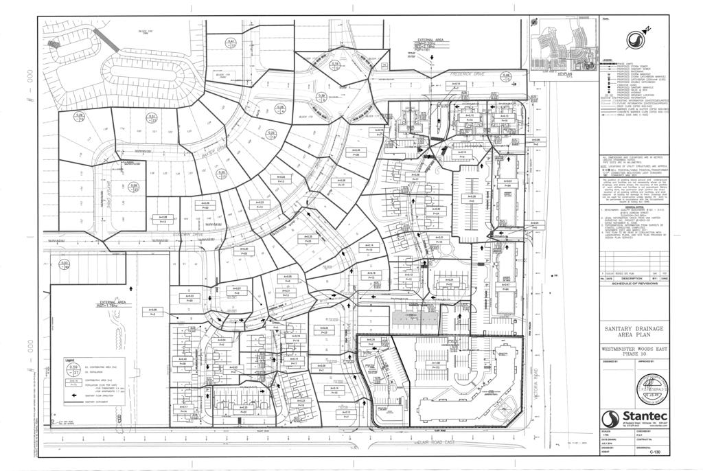
22 APPENDIX D Sanitary Area Plan and Sewer Design Sheet


23
24
25 APPENDIX E Storm Area Plan and Sewer Design Sheet


26


27

28
29 APPENDIX F Westminister Woods East Impervious Area

30