Noise Analysis Technical Report Environmental Reevaluation of the Draft Environmental Impact Statement Bi-County Parkway Location Study
|
|
|
- Patricia Goodman
- 5 years ago
- Views:
Transcription
1 Noise Analysis Technical Report Environmental Reevaluation of the Draft Environmental Impact Statement Bi-County Parkway Location Study VDOT UPC 52405; Project R000-96A-102, PE-101 Prince William and Loudoun Counties, Virginia HMMH Report No June 2013 Prepared for: Virginia Department of Transportation Environmental Division Prepared by: Harris Miller Miller & Hanson Inc. 77 South Bedford Street Burlington, MA and Woodland Park Road, Suite 620 Herndon, VA 20171
2 Noise Analysis Technical Report June 2013 Bi-County Parkway Project page i EXECUTIVE SUMMARY The Federal Highway Administration (FHWA) regulations for mitigation of highway traffic noise in the planning and design of federally aided highway projects are contained in Title 23 of the United States Code of Federal Regulations Part 772 (23 CFR 772). These regulations state that a Type I traffic noise impact analysis is required when interchange ramps are added or relocated and a highway is constructed on new location. This report details the noise impact analysis for the Bi- County Parkway (BCP) Reevaluation, formerly named the Tri-County Parkway project, in Prince William and Loudoun Counties, Virginia. The Bi-County Parkway project involves the construction of a new four-lane divided facility within a new right-of-way and on a new alignment between Route 50 and I-66. This noise analysis was conducted in accordance with FHWA and Virginia Department of Transportation (VDOT) noise assessment regulations and guidelines. This study details the noise impact assessment for the Existing (2013) conditions and for the designyear (2040) No-Build and Build Alternatives. The table below summarizes the projected number of dwelling units and recreational receptors potentially exposed to noise impact by the project alternatives. No noise impact at interior institutional or commercial outdoor areas are predicted in any of the study alternatives. There is a considerable amount of residential as well as recreational land use on both sides of the BCP and all of the noise impacts in the study area would be associated with traffic traveling on the new roadway. At noise-sensitive locations up to nearly 1000 feet from the BCP mainline, substantial increases in noise levels are predicted from the Existing conditions to the 2040 Build scenario. Only one residential dwelling is currently exposed to noise impact in the Existing 2013 case. The 2040 No Build conditions are predicted to impact four residential units. Under the 2040 Build Alternative, 111 residential units and 32 recreational receptors are predicted to be impacted. Because future noise impacts are predicted under the Build Alternative for this Type I project, noise abatement measures must be considered. Noise Impact Summary Land Use Projected Number of Impacted Receptors by Alternative 2013 Existing 2040 No Build 2040 Build Residential Recreational Total Source: HMMH, 2013 Noise abatement by alternative measures to noise barriers was considered, as suggested in the Noise Policy Code of Virginia HB 2577, but they may not be feasible. Further consideration to the feasibility of alternative abatement measures will be given during the final design phase, with particular attention to areas of Manassas National Battlefield Park as a part of the Section 106 Programmatic Agreement. Noise barriers were evaluated for all of the impacted residential and recreational noise sensitive land use along the BCP. This study made a preliminary determination of barrier feasibility and reasonableness for the 2040 Build Alternative to provide appropriate noise reduction for the impacted areas. Up to approximately 1,004, feet of warranted barriers would be potentially feasible and reasonable with a uniform height of 20 ft. at an approximate cost of $963,792. The barrier would provide sufficient noise reduction to benefit 16 impacted residential VDOT UPC 52405, Project R000-96A-102, PE-101
3 Noise Analysis Technical Report June 2013 Bi-County Parkway Project page ii units, and 21 units in total. An additional 9.2 miles of potentially feasible barriers could benefit 87 impacted receptors at an estimated cost of $54 million, however, they were found to be not reasonable. A preliminary noise evaluation was performed and a more detailed review will be completed during final design. As such, noise barriers that are found to be feasible and reasonable during the preliminary noise analysis may also not be found to be feasible and reasonable during the final design noise analysis. Conversely, noise barriers that were not considered feasible and reasonable may meet the established criteria and be recommended for construction. The need for an analysis of reflected sound and the potential use of sound absorbing materials will be evaluated during the noise barrier analysis conducted during the final design phase of the project. Construction activity may cause intermittent fluctuations in noise levels. During the construction phase of the project, all reasonable measures will be taken to minimize noise impact from these activities. VDOT UPC 52405, Project R000-96A-102, PE-101
4 Noise Analysis Technical Report June 2013 Bi-County Parkway Project page iii TABLE OF CONTENTS 1 INTRODUCTION Overview Project Description NOISE TERMINOLOGY AND CRITERIA Regulations and Guidelines Noise Abatement Criteria Undeveloped Lands and Permitted Developments EXISTING NOISE CONDITIONS Monitoring of Existing Noise Levels Characterization of Existing Background Sound Levels Predicted Existing Noise Levels PREDICTED NOISE LEVELS Noise Prediction Model Noise Model Validation Traffic Data for Noise Prediction Presentation of Results NOISE IMPACT ASSESSMENT NOISE ABATEMENT MEASURES Alternative Noise Abatement Measures Noise Barriers Feasibility and Reasonableness Barriers Found Not Feasible Details of Potential Feasible Barriers CONSTRUCTION NOISE CONSIDERATION INFORMATION FOR LOCAL GOVERNMENT OFFICIALS Noise-Compatible Land-Use Planning VDOT s Noise Abatement Program VDOT UPC 52405, Project R000-96A-102, PE-101
5 Noise Analysis Technical Report June 2013 Bi-County Parkway Project page iv APPENDIX A LIST OF PREPARERS...A-1 APPENDIX B TRAFFIC DATA USED IN NOISE MODELING... B-1 APPENDIX C PREDICTED NOISE LEVELS... C-1 APPENDIX D NOISE MEASUREMENT DATA...D-1 APPENDIX E RESPONSE FROM VDOT PROJECT MANAGEMENT ON ALTERNATIVE NOISE ABATEMENT MEASURES... E-1 APPENDIX F WARRANTED, FEASIBLE AND REASONABLE WORKSHEETS...F-1 VDOT UPC 52405, Project R000-96A-102, PE-101
6 Noise Analysis Technical Report June 2013 Bi-County Parkway Project page v LIST OF TABLES Table 1 FHWA Noise Abatement Criteria...4 Table 2 Short-term Noise Measurements on April 3 and 4, Table 3 Predicted vs. Measured Sound Levels at Measurement Sites...10 Table 4 Common Noise Environment (CNE) Descriptions...12 Table 5 Ranges of Predicted Worst-hour Leq Noise Levels by CNE...13 Table 6 Noise Impact Summary...33 Table 7 Noise Impact by Common Noise Environment...34 Table 8 Potential Noise Barriers...39 Table 9 Loudest-hour Traffic for All Roadways: 2013 Existing Alternative...B-1 Table 10 Loudest-hour Traffic for All Roadways: 2040 No Build Alternative...B-2 Table 11 Loudest-hour Traffic for All Roadways: 2040 Build Alternative...B-4 Table 12 Predicted Existing and Future Noise Levels...C-1 Table 13 Noise Monitor Output - Interval Leqs...D-1 Table 14 Noise Monitor Output - Calibration Record...D-9 LIST OF FIGURES Figure 1 Roadway Design Typical Sections...2 Figure 2 Location Map for Common Noise Environments, Receptors, Build Contours and Barriers VDOT UPC 52405, Project R000-96A-102, PE-101
7 Noise Analysis Technical Report June 2013 Bi-County Parkway Project page 1 1 INTRODUCTION 1.1 Overview The FHWA regulations for mitigation of highway traffic noise in the planning and design of federally aided highway projects are contained in Title 23 of the United States Code of Federal Regulations Part 772 (23 CFR 772). These regulations state that a Type I traffic noise impact analysis is required when interchange ramps are added or relocated and lanes are added. This report details the noise impact analysis for the Bi-County Parkway project in Prince William and Loudoun Counties, Virginia. This study details the noise impact assessment for the Existing (2013) conditions and for the designyear (2040) No-Build and Build Alternatives. A noise assessment of the No-Build scenario was required per FHWA and VDOT guidance since the BCP new location is proposed to connect to an existing interstate highway (I-66). The noise assessment for Build Alternative incorporates the Build Alternative 2 from the Dulles Air Cargo, Passenger, and Metro Access Highway (DACPMAH) project, including an assumed interchange at Route 50 and Bi-County Parkway. The DACPMAH project is included in the BCP study because both projects are being considered within the Loudoun County s Constrained Long Range Plan for the same future design year. Although several alternatives are proposed for the DACPMAH project, Alternative 2 was chosen for the BCP Build model in order to assess a worst-case scenario for noise impact. The traffic volumes and speeds would be highest along the BCP and the ramps connecting to Route 50 in that alternative. This report presents a description of noise terminology, the applicable standards and criteria, an evaluation of the existing noise conditions, a description of the predictions of existing and future noise levels, a prediction of future noise impact, and an evaluation of potential noise abatement measures. Appendices provide details of the traffic data used in the noise modeling, predicted noise levels at receptors, noise monitoring data, and noise barrier worksheets. 1.2 Project Description The VDOT, in cooperation with the FHWA, is conducting an Environmental Reevaluation for the Bi-County Parkway (formerly Tri-County Parkway Location Study) to update findings of the Draft Environmental Impact Statement (DEIS) that was completed and approved by FHWA in The DEIS addressed the No-build Alternative and three Candidate Build Alternatives (CBA), West Two, West Four, and the Comprehensive Plan. On November 17, 2005, the CTB approved the mile CBA West Two alignment as the preferred alternative, which is now referred to as the Bi-County Parkway (BCP). The BCP is located along the western edge of the Manassas National Battlefield and would provide a new urban principal arterial roadway from the northern terminus near the intersection of US 50 (John Mosby Highway) and Route 877 (Racefield Lane) and the southern terminus at the I-66 and 234 Bypass Interchange. The alignment generally follows or parallels existing Route 705 (Pageland Lane and Sanders Lane) and lies west of Route 659 (Gum Spring Road). The BCP would consist of Segment 1 (Option 1) and Segment 2 designs as referenced in the DEIS. Figure 1 below shows typical sections for general design Segment 1 (Option 1) and Segment 2. In order to take into account what the actual environmental impacts of the proposed project may be, design concepts for an interchange at BCP/234 Bypass and I-66 was included in the Build VDOT UPC 52405, Project R000-96A-102, PE-101
8 Noise Analysis Technical Report June 2013 Bi-County Parkway Project page 2 Alternative. This method provides a conservative estimate for maximum impacts that may occur in order to allow for flexibility in final design, eliminating the need for further environmental analysis. However, these assumptions do not reflect the completion of any design detail. At-grade intersections are assumed at Braddock Road, Sudley Road, and Lee Highway. Figure 2, shown later in the report, depicts the locations of the proposed roadway improvements. Figure 1 Roadway Design Typical Sections VDOT UPC 52405, Project R000-96A-102, PE-101
9 Noise Analysis Technical Report June 2013 Bi-County Parkway Project page 3 2 NOISE TERMINOLOGY AND CRITERIA 2.1 Regulations and Guidelines The noise impact of Bi-County Parkway Project was assessed in accordance with FHWA and VDOT noise assessment regulations and guidelines. The FHWA regulations are set forth in 23 CFR Part On July 13, 2010, FHWA published revised noise regulations which became effective on July 13, FHWA has also published a guidance document to support the new regulations. 2 VDOT prepared revisions to its noise policy in accordance with FHWA s requirements and revised policy. VDOT s revised policy has received approval from FHWA, and was updated on February 11, Noise Abatement Criteria To assess the degree of impact of highway traffic and noise on human activity, the FHWA established Noise Abatement Criteria (NAC) for different categories of land use (see Table 1). The NAC are given in terms of the hourly, A-weighted, equivalent sound level in decibels (dba). The A- weighted sound level is a single number measure of sound intensity with weighted frequency characteristics that corresponds to human subjective response to noise. Most environmental noise (and the A-weighted sound level) fluctuates from moment to moment, and it is common practice to characterize the fluctuating level by a single number called the equivalent sound level (L eq ). The L eq is the value or level of a steady, non-fluctuating sound that represents the same sound energy as the actual time-varying sound evaluated over the same time period. For traffic noise assessment, L eq is typically evaluated over a one-hour period, and may be denoted as L eq (h). In this study, residential (Category B), recreational (Category C) and commercial (Category E) land uses were evaluated for noise impact. For Categories B and C, noise impact is assumed to occur when predicted exterior noise levels approach or exceed 67 dba in terms of L eq (h) during the loudest hour of the day. For Category E land use, noise impact is assumed to occur when predicted exterior noise levels due to the Project approach or exceed 72 dba in terms of L eq (h) during the loudest hour of the day. VDOT defines the word approach in approach or exceed as within 1 decibel. Therefore, the threshold for noise impact for Categories B and C is where exterior noise levels are within 1 decibel of 67 dba, L eq (h), or 66 dba. The threshold for noise impact for Category E is where exterior noise levels are within 1 decibel of 72 dba, L eq (h), or 71 dba. Noise impact also would occur wherever Project noise causes a substantial increase over 1 23 CFR Part 772, as amended 75 FR 39820, July 13, 2010; Effective date July 13, 2011 Procedures for Abatement of Highway Traffic Noise and Construction Noise, Federal Highway Administration, U.S. Department of Transportation. 2 Highway Traffic Noise: Analysis and Abatement Guidance, Federal Highway Administration, U.S. DOT, June 2010, revised January guidance.pdf 3 Highway Traffic Noise Impact Analysis Guidance Manual (Version 3), Virginia Department of Transportation, updated February 11, VDOT UPC 52405, Project R000-96A-102, PE-101
10 Noise Analysis Technical Report June 2013 Bi-County Parkway Project page 4 Table 1 FHWA Noise Abatement Criteria Activity Category A L eq(h) 1 57 (Exterior) Description of Activity Category Lands on which serenity and quiet are of extraordinary significance and serve an important public need and where the preservation of those qualities is essential if the area is to continue to serve its intended purpose B 2 67 (Exterior) Residential C 2 D E 67 (Exterior) 52 (Interior) 72 (Exterior) F G 1 Hourly Equivalent A-weighted Sound Level (dba) 2 Includes undeveloped lands permitted for this activity category Source: 23 CFR Part 772. Active sport areas, amphitheaters, auditoriums, campgrounds, cemeteries, day care centers, hospitals, libraries, medical facilities, parks, picnic areas, places of worship, playgrounds, public meeting rooms, public or nonprofit institutional structures, radio studios, recording studios, recreation areas, Section 4(f) sites, schools, television studios, trails, and trail crossings Auditoriums, day care centers, hospitals, libraries, medical facilities, places of worship, public meeting rooms, public or nonprofit institutional structures, radio studios, recording studios, schools, and television studios Hotels, motels, offices, restaurants/bars, and other developed lands, properties or activities not included in A-D or F Agriculture, airports, bus yards, emergency services, industrial, logging, maintenance facilities, manufacturing, mining, rail yards, retail facilities, shipyards, utilities (water resources, water treatment, electrical), and warehousing Undeveloped lands that are not permitted (without building permits) existing noise levels. VDOT defines a substantial increase as an increase of 10 decibels or more above existing noise levels. When the predicted design-year Build scenario noise levels approach or exceed the NAC during the loudest hour of the day or cause a substantial increase in existing noise, consideration of traffic noise reduction measures is necessary. If it is found that such mitigation measures will cause adverse social, economic or environmental effects that outweigh the benefits received, they may be dismissed from consideration. For this study, noise levels throughout the study area were determined for Existing (2013) conditions and for the design-year (2040) Build Alternatives. All noise-sensitive land uses potentially affected by the project are near roads for which traffic data were developed as part of the environmental study. Therefore, all noise levels were predicted from the appropriate loudest-hour traffic data. The prediction methods and predicted noise levels appear in Section 3. VDOT UPC 52405, Project R000-96A-102, PE-101
11 Noise Analysis Technical Report June 2013 Bi-County Parkway Project page Undeveloped Lands and Permitted Developments Highway traffic noise analyses will be performed for developed lands as well as undeveloped lands if they are considered permitted. Undeveloped lands are deemed to be permitted when there is a definite commitment to develop land with an approved specific design of land use activities as evidenced by the issuance of at least one building permit. In accordance with the VDOT Traffic Noise Policy, an undeveloped lot is considered to be planned, designed, and programmed if a building permit has been issued by the local authorities prior to the Date of Public Knowledge for the relevant project. VDOT considers the Date of Public Knowledge as the date that the final NEPA approval is made. VDOT has no obligation to provide noise mitigation for any undeveloped land that is permitted or constructed after this date. Michael Seigfried at Loudoun County and Christopher Price at Prince William County Planning Departments were contacted on March 22, 2013 and April 18, 2013, respectively, to determine the locations of known noise-sensitive undeveloped lands with active building permits in the corridor. The following neighborhoods were confirmed for assessment in the BCP Reevaluation: Westridge Townhomes in CNE 13 Stone Ridge in CNE 13 Stratshire Crossing in CNEs 11 and 12 Kirkpatrick Farms in CNEs 11 and 12 VDOT UPC 52405, Project R000-96A-102, PE-101
12 Noise Analysis Technical Report June 2013 Bi-County Parkway Project page 6 3 EXISTING NOISE CONDITIONS Existing noise conditions within the study area were evaluated to assist in determining the noise impacts of the proposed project. A noise measurement program was conducted, consistent with FHWA and VDOT recommended procedures, to document existing ambient noise levels in noisesensitive locations in the study corridor, and to provide a means for validation of the TNM noise prediction model. 3.1 Monitoring of Existing Noise Levels Noise monitoring was conducted at ten short-term (30 minutes in duration) sites on April 3 rd and 4 th, Traffic classification counts on the roadways nearest each measurement site were conducted simultaneously with each noise measurement. The short-term measurements characterized existing noise levels in the study area but were not necessarily conducted during the loudest hour of the day. They included contributions from sources other than traffic, such as aircraft. Figure 2, presented later in the report, show the locations of the three noise measurement sites within the project study area. Short-term noise monitoring is not a process to determine design year noise impacts or barrier locations. Short-term noise monitoring provides a level of consistency between what is present in real-world situations and how that is represented in the computer noise model. Short-term monitoring does not need to occur within every Common Noise Environment to validate the computer noise model. The short-term noise measurements were conducted using a Larson Davis 870 (ANSI Type I, Precision ) integrating sound level meter. The short-term data collection procedure involved measurements of individual one-minute L eq s, so that periods including events that were not representative of the ambient noise environment or not traffic-related could be separated or excluded. Specifically, minutes that included such events were logged, and those with events not representative of the ambient environment were eliminated. Minutes with representative events not related to traffic were separated, and the total measurement period L eq was determined both with and without the minutes that included these events. By comparing the two totals, the significance of non-traffic events (such as aircraft operations) to the overall noise level can be determined for the measurement period. The dominant source of noise at site M1 was traffic on Lee Highway due to the proximity of the measurement location to the roadway and the low level of activity directly near the site. Ambient outdoor noise dominated at site M2, and Pageland Lane traffic was the dominant noise source at sites M3 and M4. Sudley Road was the dominant noise source at site M5, and Sanders Lane and ambient outdoor noise dominated at site M6. The noise environment was dominated by ambient outdoor noise at M7 and M8. Traffic on Braddock Road dominated the noise level at M9, and local traffic excluding construction activity dominated at site M10. Ambient outdoor noise sources that were not related to traffic included primarily wood or forest activity, local community activity, and overflights. Local human activity is typical of the study zone and is included in the measurement results presented under Total in Table 2. Noise from some local community activity, such as construction or yard work, was thought to be non-typical and was excluded from the totals. Overflights were found to contribute significantly to the noise level north of Braddock Road. During the measurement program, the weather was overcast, with temperatures between 50 and 55 degrees F and light, variable winds with up to 10 mile per hour (mph) wind gusts. Noise levels VDOT UPC 52405, Project R000-96A-102, PE-101
13 Noise Analysis Technical Report June 2013 Bi-County Parkway Project page 7 recorded on April 3 rd were adjusted to not include noise associated with wind gusts above approximately 12 mph. The measured short-term noise levels appear in Table 2 as equivalent sound levels (L eq ). As described above, the L eq is a sound-energy average of the fluctuating sound level (in A-weighted decibels, dba) measured over a specified period of time. The measurement time periods are shown in the table. Appendix D provides details of the data acquired during the noise measurement program, including noise monitor output, site sketches, photographs, noise level data with site summary results, and traffic counts with hourly totals. Table 2 shows that the measured Total L eq s range from a low of 55 dba at measurement site ST2 to a high of 60 dba at the mobile home community on Old Courthouse Tpke (Site ST3). Also shown in Table 2 are the measured Traffic Only L eq s, which are the same as the measured Total L eq s at all sites, which is an indication that traffic was the dominant source of noise in spite of the presence of occasional human activity. Table 2 Short-term Noise Measurements on April 3 and 4, 2013 Site No. Location Date Time Measured L eq (dba) Total Traffic Only Dominant Sources of Noise M Lee Highway, Manassas National Battlefield Park 4/4/13 13: Lee Highway M Pageland Lane 4/4/13 15: Ambient Noise M Pageland Lane 4/4/13 12: Pageland Lane M Pageland Lane 4/4/13 11: Pageland Lane M Sudley Road, Catharpin Park 4/3/13 16: Sudley Road M Sanders Lane 4/4/13 10: Ambient Noise and Sanders Lane M Lightridge Farm Road 4/3/13 15: Ambient Noise M Kinsale Place 4/3/13 13: Ambient Noise M Hitchin Court 4/3/13 12: M Sacred Mountain Street, John Champe High School 4/3/13 10: Note: Site locations shown on map in Figure 2. Detailed data presented in Appendix D. Source: HMMH, 2013 Braddock Road and Overflights Ambient Noise and Local Traffic 3.2 Characterization of Existing Background Sound Levels The two days of noise measurements HMMH conducted in the study area were used to form the basis of a reasonable and conservative background noise level associated with the aircraft activity in the area. The characterization of existing background sound levels presented in the Dulles Air Cargo, VDOT UPC 52405, Project R000-96A-102, PE-101
14 Noise Analysis Technical Report June 2013 Bi-County Parkway Project page 8 Passenger and Metro Access Highway project 4 was also considered for receptors in the vicinity of Route 50, since the project study areas overlap there. That project determined 57 dba to be the resulting average background Leq after energy-averaging all of the background Leq sound levels associated with aircraft. Through field observation and measurements, it was determined that aircraft does not contribute as significantly to areas of the Bi-County Parkway corridor south of Braddock Road, but there is still a contribution to consider north of Braddock Road as evidenced by observations and noise levels measured at sites M8 through M10. In the same manner as for the Dulles Air Cargo project, the background Leqs found at these sites were energy-averaged (equivalent to determining Leq for all sites combined) to determine an average background Leq to apply to the area from approximately Tall Cedars Parkway to just south of Braddock Road. The resulting average background L eq for this portion of the study area is 54 dba. As a result, 57 dba or 54 dba are added to the TNM-predicted roadway traffic Leq noise levels to determine the total Leq at each receptor in the study area north of the vicinity of Braddock Road for the Existing and future scenario analyses. At receptors south of the Braddock Road vicinity, background sound levels of 50 dba or less are characteristic away from major roadways, and were attributed in that portion of the study corridor. Measured background sound levels associated with the aircraft activity do not include noise from nearby or project roadways. The background aircraft noise levels are used in two ways in the study: 1. The first way is to establish existing noise levels throughout the study area against which the project noise levels are compared to determine substantial increase noise impact. The background sound level is used directly in areas away from roadways (i.e. in the Alternative 2 corridor. In areas near roadways that are included in the noise prediction model, the background noise level is added to the existing traffic noise level computed with the Traffic Noise Model (TNM see Section 4.1 for description) to determine a total existing noise level at each receptor. 2. The second way that the background sound level is used is that it is added to all TNMpredicted future roadway noise levels. This provides the proper context for the determination of noise impact and the noise reduction and feasibility of noise barriers. The approach described above to account for the contribution of aircraft activity to the background noise level is consistent with that used where other types of noise sources exist in a study area, such as a rail line or another roadway. In such cases, the noise from those sources is added to the noise from project roadways at receptors affected. 3.3 Predicted Existing Noise Levels For calculation of loudest-hour noise levels throughout the study area in the TNM noise-prediction computer model, many additional receiver locations were added to the measurement sites to provide a comprehensive basis of comparison for the analysis of noise impacts from the existing and future project conditions. Using the appropriate loudest-hour traffic data, existing and future traffic noise levels were predicted for the measurement sites and the additional receiver locations. The prediction methods and predicted noise levels are presented in the next section of this report. 4 Noise Analysis Technical Report, Dulles Air Cargo, Passenger and Metro Access Highway, Loudoun County, Virginia HMMH Report No , May VDOT UPC 52405, Project R000-96A-102, PE-101
15 Noise Analysis Technical Report June 2013 Bi-County Parkway Project page 9 4 PREDICTED NOISE LEVELS 4.1 Noise Prediction Model All traffic noise predictions for this study were conducted using the latest version of the FHWA Traffic Noise Model (FHWA TNM 2.5). 5 The FHWA TNM incorporates state-of-the-art sound emissions and sound propagation algorithms, based on well-established theory or on accepted international standards. The acoustical algorithms contained within the FHWA TNM have been validated with respect to carefully conducted noise measurement programs, and show excellent agreement in most cases for sites with and without noise barriers. Available project engineering plans, topographic contours and building information were used to create a three-dimensional model in the TNM of the geometry of the existing and future design roadway configurations and the surrounding terrain and buildings. The noise modeling also accounted for such factors as propagation over different types of ground (acoustically soft and hard ground), elevated roadway sections, significant shielding effects from local terrain and structures, distance from the road, traffic speed, and hourly traffic volumes including percentage of medium and heavy trucks. To fully characterize existing and future noise levels at all noise-sensitive land uses in the study area, nearly five hundred noise prediction receivers (also called receptors and sites ) were added to the ten measurement sites in the TNM model. The majority of the proposed BCP project modeling in this reevaluation used the same design files from the 2004 preliminary noise analysis including roadway plans, right-of-way, typical sections, profiles, and cross-sections. The updated Avoidance Alignment plan for a portion of the BCP was provided by Parsons. Elevations for the modeling used a single updated LIDAR data set for completeness, consistency and accuracy from the Geospatial Data Gateway hosted by the United States Department of Agriculture, Natural Resource Conservation Service. A concept of the BCP and I-66 interchange was provided by Parsons and included in the future Build model of this project. The improvements to the interchange that affect the noise environment in the study area include a proposed connection from BCP southbound to an existing flyover ramp connection to I-66 westbound and a ramp from I-66 westbound to BCP northbound. The BCP was assumed to be elevated above I-66 and the existing ramps. Any interchange roadway modeled onstructure was elevated approximately 25 feet above the roadway below, a standard engineering assumption consistent with other proposed interchanges in Loudoun County, Virginia. A concept known as Alternative 2 from the DACPMAH preliminary noise assessment was also included in the model of this project. The proposed improvements include a BCP/DACPMAH/Route 50 partial-cloverleaf interchange with six ramps and an alignment of the DACPMAH freeway on new location to the north of the interchange. The BCP/DACPMAH roadway was assumed to be on elevated structure 25 feet over Route 50 with an adjacent roadway profile that did not exceed the maximum grade assumed in the DACPMAH study. 5 Anderson, G.S., C.S.Y. Lee, G.G. Fleming, and C.W. Menge, FHWA Traffic Noise Model, Version 1.0 User s Guide. Federal Highway Administration Report No. FHWA-PD , January VDOT UPC 52405, Project R000-96A-102, PE-101
16 Noise Analysis Technical Report June 2013 Bi-County Parkway Project page Noise Model Validation A validation of the noise modeling assumptions was conducted using the traffic counted on nearby roadways simultaneous with the noise measurement at sites where roadway noise dominated as input to the noise prediction model. The traffic counts are provided in Appendix D. Predicted noise levels based on the counted traffic were compared to the measured noise levels to confirm the assumptions about aspects of the TNM model, such as the acoustical shielding provided by intervening terrain. The modeling assumptions were refined, as necessary, to obtain appropriate agreement between the predicted and measured values. The validated modeling assumptions at the measurement sites and for the existing geometry were then extended to the design-year alternative and applied at prediction locations where no measurements were made. Noise levels were predicted at five of the measurement sites where local traffic dominated the noise environment, using the counted traffic as input to the model. These levels were on average slightly higher by 2.5 decibels when compared to the measured noise levels, with a standard deviation of the differences of 0.8 decibels. This generally good agreement confirms that traffic is the dominant source of noise at these sites. There is variation between measured and predicted levels of about four decibels at one of the sites, which may be due to a combination of the relative complex geometry, varying terrain and trees/brush in the area, and wind gusts during the measurement. The comparison of measured versus predicted sound levels at each of the validated measurement sites is shown in Table 3. Table 3 Predicted vs. Measured Sound Levels at Measurement Sites Site No. Location Land Use Measured L eq (dba) (Traffic Only) Predicted L eq (dba) Difference M Lee Highway, Manassas National Battlefield Park Park M Pageland Lane Residential 41.7 N/A N/A M Pageland Lane Residential M Pageland Lane Residential M Sudley Road, Catharpin Park Park M Sanders Lane Residential 43.6 N/A N/A M Lightridge Farm Road Residential 49.7 N/A N/A M Kinsale Place Residential 52.4 N/A N/A M Hitchin Court Residential M Sacred Mountain Street, John Champe High School School 52.7 N/A N/A Note: Site locations shown on map in Figure 2. Detailed data presented in Appendix D. N/A indicates no validation was performed due to ambient noise dominating the measured noise level. Source: HMMH, 2013 VDOT UPC 52405, Project R000-96A-102, PE-101
17 Noise Analysis Technical Report June 2013 Bi-County Parkway Project page Traffic Data for Noise Prediction The traffic data used in the noise analysis must produce sound levels representative of the loudest hour of the day, per FHWA and VDOT policy. Hour-by-hour vehicle volumes, truck percentages and speeds were developed by VDOT and Parsons Transportation Group for the Bi-County Parkway, Route 50, Braddock Road, Sudley Road, Lee Highway, I-66, Pageland Lane, Sanders Lane, and 234 Bypass and Interchange Build traffic data for the Route 50 Interchange ramps was calculated using data from the Dulles Air Cargo, Passenger, and Metro Access Highway project Alternative 2 condition. The volumes and speeds producing the loudest-hour conditions for the 2013 Existing and 2040 No-Build and Build Alternatives were used in the modeling of those roadways. The loudesthour conditions for the Existing and No-Build scenarios were determined by calculating the loudesthours on Pageland Lane, Sanders Lane, Route 50, and I-66. The Build loudest-hour was determined by calculating the loudest-hour for all segments of the Bi-County Parkway. The worst-hour traffic for the 2013 Existing case was in the hour starting at 7:00. For the future 2040 alternatives, the worst-hour traffic occurred in the hour starting at 7:00 for the No Build Alternative and the 11:00 hour for the Build Alternative. Appendix B provides tables of the existing and future traffic data used in the noise model for all roadways in the network. 4.4 Presentation of Results The study area includes mostly residential land use and development, as well as some recreational and institutional land use. There are several residential developments with building permits near the northern end of the corridor between Route 50 and Braddock Road that are included in the study. Arcola Elementary School and John Champe High School are also located in this area. The remainder of the study area contains scattered residential land use, with Catharpin Park at Sudley Road and Manassas National Battlefield Park near Route 29. To fully characterize existing and future noise levels at all noise-sensitive land uses in the study area, roughly 500 additional noise prediction receptors (also called receivers and sites ) were added in the TNM model to the ten measurement sites. Each of these receptors represented exterior noisesensitive land use except for one receptor representing the interior of each school and the building associated with the Manassas Battlefield Park. All noise levels predicted were the A-weighted equivalent sound level, or Leq, in dba. Loudest-hour noise levels were predicted for the Existing 2013 and the design-year 2040 No-Build and Build Alternatives. Table 4 presents a list of the CNEs in the study area with FHWA Activity categories, descriptions of the associated land use, and the general location for each CNE. Table 5 presents ranges of the predicted sound levels at the receptors in each Common Noise Environment (CNE) for each alternative. Appendix C provides a table that lists the predicted sound levels at all of the receptors for each alternative. Each receptor, or prediction site, is given an identifier that is also displayed in Figure 2 using a P### format. Figure 2 shows the location and predicted barrier status for all receptors in the Build Alternative in graphical form. For the receptors in Figure 2 depicting impact, predicted 2040 Build noise levels would approach or exceed the NAC for the associated land use category, or would cause substantial increases in existing noise levels. The NAC is 67 dba L eq at all residential and recreational receptors, and 72 dba L eq at the commercial land uses. These receptor locations are shown with either a light blue, dark blue, or red dot indicating impact with 5 or 6 dba insertion loss, impact with 7 dba or more of insertion loss, and impact with less than 5 dba of insertion loss from a noise VDOT UPC 52405, Project R000-96A-102, PE-101
18 Noise Analysis Technical Report June 2013 Bi-County Parkway Project page 12 Table 4 Common Noise Environment (CNE) Descriptions CNE FHWA Activity Categories* Description of Land Use and Location 1 C,D Manassas National Battlefield Park and undeveloped land south of Lee Highway and east of the BCP 2 C Manassas National Battlefield Park north of Lee Highway and east of the BCP 3 B Single-family residences north of Lee Highway and west of the BCP 4 B Single-family residences along Pageland Lane and east of the BCP 5 B Single-family residences along Pageland Lane and west of the BCP 6 B Single-family residences in the vicinity of Sudley Road and east of the BCP 7 B,C Single-family residences and Catharpin Park in the vicinity of Sudley Road and west of the BCP 8 B Single-family residences north of the Sudley Road area and east of the BCP 9 B,C Single-family residences along Sanders Lane/Lightridge Farm Road and east of the BCP; Boxwood Farms Equestrian Area 10 B Single-family residences along Sanders Lane and west of the BCP 11 B 12 B,C 13 B Single-family and multi-family residences in Stratshire Crossing and Kirkpatrick Farms subdivisions under construction and in the vicinity of Braddock Road and east of the BCP Single-family and multi-family residences in Stratshire Crossing and Kirkpatrick Farms subdivisions under construction and in the vicinity of Braddock Road and west of the BCP; Park at the corner of Braddock and Goshen Roads Future permitted residences Stone Ridge and Westridge Townhomes east of Northstar Boulevard 14 B Single-family residence in wooded area west of Northstar Boulevard 15 C Arcola Elementary School recreation areas east of Northstar Boulevard 16 B,C,D John Champe High School recreation areas and future single-family residences west of Northstar Boulevard 17 B Single-family residences in the vicinity of Route 50 and east of the BCP 18 B Single-family residences in the vicinity of Route 50 and west of the BCP * Note: Activity Category B is exterior residential, C exterior recreational or institutional, D - interior institutional, E - exterior commercial. Table 1 provides detailed descriptions of the land uses included in the categories. Source: HMMH, 2013 barrier, respectively. Receptors represented by green dots are not predicted to be impacted by project noise but would be benefited and receive at least 5 db of insertion loss from a barrier. The yellow dots indicate sites that would be neither impacted by highway traffic noise nor benefited by the proposed noise mitigation. Dark gray symbols represent properties that may be potential acquisitions related to the project. Section 6.2 discusses the details of the barrier designs. Overall, predicted noise levels range from 43 to 66 dba L eq (exterior) for the Existing case, 44 to 67 dba L eq (exterior) for the No-Build case and 48 to 72 dba L eq (exterior) for the Build Alternative. On average for all receptors, sound levels are predicted to increase from Existing to No-Build conditions by approximately two decibels. This increase is due to predicted increases in traffic volumes in the area in general. For all receptors, an average increase of seven db over the Existing VDOT UPC 52405, Project R000-96A-102, PE-101
19 Noise Analysis Technical Report June 2013 Bi-County Parkway Project page 13 Table 5 Ranges of Predicted Worst-hour Leq Noise Levels by CNE CNE ID Area Land Use and Description Manassas National Battlefield Park and undeveloped land south of Lee Highway and east of the BCP Manassas National Battlefield Park north of Lee Highway and east of the BCP Single-family residences north of Lee Highway and west of the BCP Single-family residences along Pageland Lane and east of the BCP Single-family residences along Pageland Lane and west of the BCP Single-family residences in the vicinity of Sudley Road and east of the BCP Single-family residences and Catharpin Park in the vicinity of Sudley Road and west of the BCP Single-family residences north of the Sudley Road area and east of the BCP Single-family residences along Sanders Lane/Lightridge Farm Road, east of the BCP; Boxwood Farms Equestrian Area Single-family residences along Sanders Lane and west of the BCP Single- and multi-family residences in Stratshire Crossing and Kirkpatrick Farms subdivisions and near Braddock Road and east of the BCP Single- and multi-family residences in Stratshire Crossing and Kirkpatrick Farms subdivisions and near Braddock Road and west of the BCP; Park at the corner of Braddock and Goshen Roads Future permitted residences Stone Ridge and Westridge Townhomes east of Northstar Boulevard Single-family residence in wooded area west of Northstar Boulevard Arcola Elementary School recreation areas east of Northstar Boulevard John Champe High School recreation areas and future single-family residences west of Northstar Boulevard Single-family residences in the vicinity of Route 50 and east of the BCP Single-family residences in the vicinity of Route 50 and west of the BCP Receptor Nos. Ranges of predicted Worst-hour Leq Noise Levels, dba Existing No Build Build VDOT UPC 52405, Project R000-96A-102, PE-101
20 Noise Analysis Technical Report June 2013 Bi-County Parkway Project page 14 case is predicted for the Build scenario. The proposed BCP roadway is the major contributor to the increase in sound levels within the study area. A small number of receptors are predicted to experience slight decreases in sound level from the No build to the Build scenario due to significant traffic volumes being redirected onto roadways farther from the receptors. Predicted sound levels at land uses other than residential properties are discussed in the paragraphs below. Table 14 in Appendix C presents the predicted sound levels for all receptors under all project alternatives. The Manassas Battlefield Park Headquarters area in CNE 1 would experience approximately 6 db increases in noise levels from the existing condition to future Build Alternative due to the proposed construction of the BCP roadway. Existing loudest-hour noise levels are predicted up to 51 dba (exterior) and Build noise levels are predicted up to 57 dba, Leq (exterior). Interior noise levels at the headquarters building are projected to be 37 dba under the Build conditions, assuming an outside-to-inside noise reduction of 20 decibels for wood frame construction and air conditioning. The Manassas Battlefield Park trail area in CNE 2 would experience approximately 13 db increases in noise levels from the existing condition to the future Build alternative due to the proposed construction of the new BCP roadway. Existing loudest-hour noise levels are predicted up to 52 dba in some areas, Build noise levels are predicted up to 70 dba, Leq. The receptors at the baseball fields within Catharpin Park in CNE 7 would be impacted under the Build alternative with worst-hour noise levels predicted up to 65 dba and an average increase of approximately 6 db. The maximum increase at Catharpin Park receptors is approximately 10 db over existing noise levels, which are predicted to range from 47 to 61 dba at the receptors within all fields. CNE 9 includes the Boxwood Farms equestrian area FHWA Activity Category C with an exterior NAC of 67 dba. The exterior riding area is predicted to have worst-hour noise levels of 52 dba under the Build scenario; therefore it is not predicted to be impacted. CNE 12 includes an unnamed park at the corner of Braddock and Goshen Roads. The exterior court and field areas are predicted to have worst-hour noise levels of 56 dba under the Build scenario; therefore it is not predicted to be impacted. CNE 15 includes the Arcola Elementary School. The exterior use consists of two playing fields and several playground areas to the north of the building. Existing loudest-hour noise levels are predicted up to 57 dba, Build noise levels are predicted up to 70 dba, Leq. The interior of this airconditioned masonry building would not be impacted under the Build condition with predicted interior worst-hour Leqs of up to 45 dba CNE 16 includes the John Champe High School. The exterior use consists of two playing fields to the south of the main building. Existing loudest-hour noise levels are predicted up to 57 dba, Build noise levels are predicted up to 67 dba, Leq. The interior of this air-conditioned masonry building would not be impacted under the Build condition with predicted interior worst-hour Leqs of up to 39 dba. This area is also the future location of the Boyd School in Stone Ridge represented by Site P464. The interior of this assumed air-conditioned masonry building would not be impacted under the Build condition with predicted interior worst-hour Leqs of up to 37 dba. The next section presents the noise impact assessment in detail. VDOT UPC 52405, Project R000-96A-102, PE-101

21 Figure 2 Bi-County Parkway Reevaluation Prince William and Loudoun Counties, Virginia Location Map for Common Noise Environments, Receptors, Contours, and Barriers Project No. R000-96A-102, PE-101; UPC No HMMH Report No June 2013 Path: G:\Projects\305XXX\305000VDOT\009Tri-CountyPkwy\GIS\ TPCBarrierSheetLayout.mxd Randolph Ridge Ln 66 Pageland Ln CNE1 66 dba 66 dba Receiver Site and Number Impacted and 5 or 6 dba Insertion Loss Impacted and 7 dba or more Insertion Loss Impacted and Not Benefited Not Impacted and Benefited Not Benefited or Impacted Potential Acquisitions #* ST# Sheet 1 of UV 66 UV 55 Short-Term Measurement Site Potential Barrier Non-Feasible Barrier 66 dba Leq Ground Floor Noise Contour without Potential Barriers in Residential and Recreational Areas Common Noise Environment (CNE) Areas Note: Grouped Receiver Labels are Ordered Left to Right, Top to Bottom Prince William County UV 234 Fairfax Co Feet Loudoun County
22 66 dba P dba P033 Figure 2 Bi-County Parkway Reevaluation Path: G:\Projects\305XXX\305000VDOT\009Tri-CountyPkwy\GIS\ TPCBarrierSheetLayout.mxd Pageland Ln CNE1 P001 P003 P002 #* P030 M1 66 dba P032 Lolan St CNE3 P034 Barrier NF3-2 P035 Barrier NF3-1 Barrier NF dba CNE2 Barrier 1 Barrier Sheet 2 of Prince William and Loudoun Counties, Virginia UV 66 UV Location Map for Common Noise Environments, Receptors, Contours, and Barriers Project No. R000-96A-102, PE-101; UPC No HMMH Report No June 2013 Receiver Site and Number Impacted and 5 or 6 dba Insertion Loss Impacted and 7 dba or more Insertion Loss Impacted and Not Benefited Not Impacted and Benefited Not Benefited or Impacted Potential Acquisitions #* ST# 55 Short-Term Measurement Site Potential Barrier Non-Feasible Barrier 66 dba Leq Ground Floor Noise Contour without Potential Barriers in Residential and Recreational Areas Common Noise Environment (CNE) Areas Note: Grouped Receiver Labels are Ordered Left to Right, Top to Bottom Prince William County UV 234 Fairfax Co Feet Loudoun County
23 Figure 2 Bi-County Parkway Reevaluation Prince William and Loudoun Counties, Virginia Path: G:\Projects\305XXX\305000VDOT\009Tri-CountyPkwy\GIS\ TPCBarrierSheetLayout.mxd P035 Barrier NF3-3 CNE3 Barrier 1 CNE2 P004 P005 P006 P007 Barrier 2-1 P008 P009 P011 P010 P012 P dba P014 P015 P016 Angelond Ln 66 dba P017 P019 P018 P020 P024 P046 Barrier 2-2 Pageland Ln P021 P023 P022 P025 P027 P026 P028 P029 P047 CNE5 M2 #* P036 Barrier 2-3 CNE4 P048 Barrier NF4-1 Sheet 3 of UV 66 UV Location Map for Common Noise Environments, Receptors, Contours, and Barriers Project No. R000-96A-102, PE-101; UPC No HMMH Report No June 2013 Receiver Site and Number Impacted and 5 or 6 dba Insertion Loss Impacted and 7 dba or more Insertion Loss Impacted and Not Benefited Not Impacted and Benefited Not Benefited or Impacted Potential Acquisitions #* ST# 55 Short-Term Measurement Site Potential Barrier Non-Feasible Barrier 66 dba Leq Ground Floor Noise Contour without Potential Barriers in Residential and Recreational Areas Common Noise Environment (CNE) Areas Note: Grouped Receiver Labels are Ordered Left to Right, Top to Bottom Prince William County UV 234 Fairfax Co Feet Loudoun County
24 P048 Figure 2 Bi-County Parkway Reevaluation Artemus Rd Prince William and Loudoun Counties, Virginia Location Map for Common Noise Environments, Receptors, Contours, and Barriers Project No. R000-96A-102, PE-101; UPC No HMMH Report No June 2013 CNE5 P050 P051 Receiver Site and Number Impacted and 5 or 6 dba Insertion Loss Impacted and 7 dba or more Insertion Loss Impacted and Not Benefited Not Impacted and Benefited Not Benefited or Impacted Potential Acquisitions Path: G:\Projects\305XXX\305000VDOT\009Tri-CountyPkwy\GIS\ TPCBarrierSheetLayout.mxd Barrier NF4-1 P037 P038 P049 Barrier 2-3 Barrier 3-1 Barrier NF4-2 CNE4 66 dba Barrier 3-2 P039 P dba Barrier 3-3 Pageland Ln Barrier NF4-3 Barrier NF4-4 #* P040 M3 Barrier 3-4 #* ST# Sheet 4 of UV 66 UV 55 Short-Term Measurement Site Potential Barrier Non-Feasible Barrier 66 dba Leq Ground Floor Noise Contour without Potential Barriers in Residential and Recreational Areas Common Noise Environment (CNE) Areas Note: Grouped Receiver Labels are Ordered Left to Right, Top to Bottom Prince William County UV 234 Fairfax Co Feet Loudoun County
25 Thornton Dr Figure 2 Bi-County Parkway Reevaluation P058 P059 Prince William and Loudoun Counties, Virginia Location Map for Common Noise Environments, Receptors, Contours, and Barriers Project No. R000-96A-102, PE-101; UPC No HMMH Report No June 2013 Path: G:\Projects\305XXX\305000VDOT\009Tri-CountyPkwy\GIS\ TPCBarrierSheetLayout.mxd P051 Barrier NF4-4 Barrier 3-4 P052 P053 Barrier 3-5 Barrier NF4-5 Pageland Ln P041 Barrier 3-6 P045 Barrier NF4-6 P042 P054 CNE5 CNE4 Barrier 3-7 Barrier NF4-7 P dba Barrier NF dba M4 #* P060 P055 Barrier NF4-9 Receiver Site and Number Impacted and 5 or 6 dba Insertion Loss Impacted and 7 dba or more Insertion Loss Impacted and Not Benefited Not Impacted and Benefited Not Benefited or Impacted Potential Acquisitions #* ST# Sheet 5 of UV 66 UV 55 Short-Term Measurement Site Potential Barrier Non-Feasible Barrier 66 dba Leq Ground Floor Noise Contour without Potential Barriers in Residential and Recreational Areas Common Noise Environment (CNE) Areas Note: Grouped Receiver Labels are Ordered Left to Right, Top to Bottom Prince William County UV 234 Fairfax Co Feet Loudoun County
26 P056 Figure 2 Bi-County Parkway Reevaluation Prince William and Loudoun Counties, Virginia Path: G:\Projects\305XXX\305000VDOT\009Tri-CountyPkwy\GIS\ TPCBarrierSheetLayout.mxd Barrier 3-7 CNE4 Barrier 4 CNE5 66 dba 66 dba P057 Stoners Ln Barrier 6-1 Sheet 6 of UV 66 UV Location Map for Common Noise Environments, Receptors, Contours, and Barriers Project No. R000-96A-102, PE-101; UPC No HMMH Report No June 2013 Receiver Site and Number Impacted and 5 or 6 dba Insertion Loss Impacted and 7 dba or more Insertion Loss Impacted and Not Benefited Not Impacted and Benefited Not Benefited or Impacted Potential Acquisitions #* ST# 55 Short-Term Measurement Site Potential Barrier Non-Feasible Barrier 66 dba Leq Ground Floor Noise Contour without Potential Barriers in Residential and Recreational Areas Common Noise Environment (CNE) Areas Note: Grouped Receiver Labels are Ordered Left to Right, Top to Bottom Prince William County UV 234 Fairfax Co Feet Loudoun County
27 CNE5 Stoners Ln Figure 2 Bi-County Parkway Reevaluation Prince William and Loudoun Counties, Virginia Path: G:\Projects\305XXX\305000VDOT\009Tri-CountyPkwy\GIS\ TPCBarrierSheetLayout.mxd 66 dba Barrier 6-1 Barrier dba P061 P064 CNE7 234 P068 UV 234 P069 P065 P066 P062 CNE6 P077 P082 P087 P095 P100 P071 P076 P081 P088 P093 P099 P072 P073 P078 P083 P090 P096 P103 P070 P079 P084 P089 P094 P101 M5 P074 P080 P086 P091 P097 P102 P075 P085 P092 P098 #* 66 dba Barrier 6-2 P067 Barrier 5-2 P063 P105 P107 P108 P106 P104 Richgar Dr Richland Dr P110 CNE8 P dba P111 Sheet 7 of UV 66 UV Location Map for Common Noise Environments, Receptors, Contours, and Barriers Project No. R000-96A-102, PE-101; UPC No HMMH Report No June 2013 Receiver Site and Number Impacted and 5 or 6 dba Insertion Loss Impacted and 7 dba or more Insertion Loss Impacted and Not Benefited Not Impacted and Benefited Not Benefited or Impacted Potential Acquisitions #* ST# 55 Short-Term Measurement Site Potential Barrier Non-Feasible Barrier 66 dba Leq Ground Floor Noise Contour without Potential Barriers in Residential and Recreational Areas Common Noise Environment (CNE) Areas Note: Grouped Receiver Labels are Ordered Left to Right, Top to Bottom Prince William County UV 234 Fairfax Co Feet Loudoun County
28 CNE10 66 dba Barrier 8-1 Figure 2 Bi-County Parkway Reevaluation Prince William and Loudoun Counties, Virginia Location Map for Common Noise Environments, Receptors, Contours, and Barriers Project No. R000-96A-102, PE-101; UPC No HMMH Report No June dba Receiver Site and Number Impacted and 5 or 6 dba Insertion Loss Impacted and 7 dba or more Insertion Loss Impacted and Not Benefited Not Impacted and Benefited Not Benefited or Impacted Potential Acquisitions Path: G:\Projects\305XXX\305000VDOT\009Tri-CountyPkwy\GIS\ TPCBarrierSheetLayout.mxd P111 Barrier 6-2 CNE8 Richland Dr Barrier 5-2 P112 P116 P113 P114 P117 P115 P118 #* ST# Sheet 8 of UV 66 UV 55 Short-Term Measurement Site Potential Barrier Non-Feasible Barrier 66 dba Leq Ground Floor Noise Contour without Potential Barriers in Residential and Recreational Areas Common Noise Environment (CNE) Areas Note: Grouped Receiver Labels are Ordered Left to Right, Top to Bottom Prince William County UV 234 Fairfax Co Feet Loudoun County
29 P155 P167 Figure 2 Bi-County Parkway Reevaluation Prince William and Loudoun Counties, Virginia P152 P153 CNE10 Bridle Ln P166 Location Map for Common Noise Environments, Receptors, Contours, and Barriers Project No. R000-96A-102, PE-101; UPC No HMMH Report No June 2013 Path: G:\Projects\305XXX\305000VDOT\009Tri-CountyPkwy\GIS\ TPCBarrierSheetLayout.mxd Barrier 8-1 Barrier 7 66 dba P165 P149 P150 P119 P151 Sanders Ln P dba Barrier 9-1 CNE9 P121 P154 Barrier 8-2 Boxwood Farms Dr P156 P123 P122 P157 P124 Barrier 9-2 Barrier 9-3 Dunigan Ct Barrier 8-3 P125 P158 P126 P146 Receiver Site and Number Impacted and 5 or 6 dba Insertion Loss Impacted and 7 dba or more Insertion Loss Impacted and Not Benefited Not Impacted and Benefited Not Benefited or Impacted Potential Acquisitions #* ST# Sheet 9 of UV 66 UV 55 Short-Term Measurement Site Potential Barrier Non-Feasible Barrier 66 dba Leq Ground Floor Noise Contour without Potential Barriers in Residential and Recreational Areas Common Noise Environment (CNE) Areas Note: Grouped Receiver Labels are Ordered Left to Right, Top to Bottom Prince William County UV 234 Fairfax Co Feet Loudoun County
30 Bridle Ln Figure 2 Bi-County Parkway Reevaluation Prince William and Loudoun Counties, Virginia P162 Location Map for Common Noise Environments, Receptors, Contours, and Barriers P167 CNE10 P168 P dba Pin Oak Ct Project No. R000-96A-102, PE-101; UPC No HMMH Report No June 2013 Receiver Site and Number Impacted and 5 or 6 dba Insertion Loss Impacted and 7 dba or more Insertion Loss Impacted and Not Benefited Not Impacted and Benefited Not Benefited or Impacted Potential Acquisitions Path: G:\Projects\305XXX\305000VDOT\009Tri-CountyPkwy\GIS\ TPCBarrierSheetLayout.mxd Barrier 8-3 P158 P125 P126 P146 Barrier 8-4 Barrier 9-4 P159 P127 CNE9 P128 P160 P129 P130 P dba P132 Sanders Ln Barrier 8-5 Barrier 9-5 P134 P133 Korogwe Forest Rd M6 #* P147 P135 P136 #* ST# Sheet 10 of UV 66 UV 55 Short-Term Measurement Site Potential Barrier Non-Feasible Barrier 66 dba Leq Ground Floor Noise Contour without Potential Barriers in Residential and Recreational Areas Common Noise Environment (CNE) Areas Note: Grouped Receiver Labels are Ordered Left to Right, Top to Bottom Prince William County UV 234 Fairfax Co Feet Loudoun County
31 Chatter Brook Dr Figure 2 Bi-County Parkway Reevaluation CNE10 P163 Prince William and Loudoun Counties, Virginia Location Map for Common Noise Environments, Receptors, Contours, and Barriers Path: G:\Projects\305XXX\305000VDOT\009Tri-CountyPkwy\GIS\ TPCBarrierSheetLayout.mxd P136 Pin Oak Ct P148 CNE9 P137 Sanders Ln Barrier 8-5 P138 Barrier 9-5 P140 P139 P164 Barrier 8-6 P141 P dba 66 dba Lightridge Farm Rd Sheet 11 of UV 66 UV Project No. R000-96A-102, PE-101; UPC No HMMH Report No June 2013 Receiver Site and Number Impacted and 5 or 6 dba Insertion Loss Impacted and 7 dba or more Insertion Loss Impacted and Not Benefited Not Impacted and Benefited Not Benefited or Impacted Potential Acquisitions #* ST# 55 Short-Term Measurement Site Potential Barrier Non-Feasible Barrier 66 dba Leq Ground Floor Noise Contour without Potential Barriers in Residential and Recreational Areas Common Noise Environment (CNE) Areas Note: Grouped Receiver Labels are Ordered Left to Right, Top to Bottom Prince William County UV 234 Fairfax Co Feet Loudoun County
32 Figure 2 Bi-County Parkway Reevaluation Prince William and Loudoun Counties, Virginia Location Map for Common Noise Environments, Receptors, Contours, and Barriers Project No. R000-96A-102, PE-101; UPC No HMMH Report No June dba Receiver Site and Number Impacted and 5 or 6 dba Insertion Loss Impacted and 7 dba or more Insertion Loss Impacted and Not Benefited Not Impacted and Benefited Not Benefited or Impacted Potential Acquisitions Path: G:\Projects\305XXX\305000VDOT\009Tri-CountyPkwy\GIS\ TPCBarrierSheetLayout.mxd CNE9 Lightridge Farm Rd P143 M7 #* 66 dba P144 P145 #* ST# Sheet 12 of UV 66 UV 55 Short-Term Measurement Site Potential Barrier Non-Feasible Barrier 66 dba Leq Ground Floor Noise Contour without Potential Barriers in Residential and Recreational Areas Common Noise Environment (CNE) Areas Note: Grouped Receiver Labels are Ordered Left to Right, Top to Bottom Prince William County UV 234 Fairfax Co Feet Loudoun County
33 Figure 2 Bi-County Parkway Reevaluation Lightridge Farm Rd 66 dba 66 dba P258 P235 Randolph Dr Prince William and Loudoun Counties, Virginia Location Map for Common Noise Environments, Receptors, Contours, and Barriers Project No. R000-96A-102, PE-101; UPC No HMMH Report No June 2013 Receiver Site and Number Impacted and 5 or 6 dba Insertion Loss Impacted and 7 dba or more Insertion Loss Impacted and Not Benefited Not Impacted and Benefited Not Benefited or Impacted Potential Acquisitions Path: G:\Projects\305XXX\305000VDOT\009Tri-CountyPkwy\GIS\ TPCBarrierSheetLayout.mxd CNE11 CNE12 P170 P169 P206 Barrier 11 P207 Barrier P236 P259 #* ST# Sheet 13 of UV 66 UV 55 Short-Term Measurement Site Potential Barrier Non-Feasible Barrier 66 dba Leq Ground Floor Noise Contour without Potential Barriers in Residential and Recreational Areas Common Noise Environment (CNE) Areas Note: Grouped Receiver Labels are Ordered Left to Right, Top to Bottom Prince William County UV 234 Fairfax Co Feet Loudoun County
34 Figure 2 Bi-County Parkway Reevaluation Path: G:\Projects\305XXX\305000VDOT\009Tri-CountyPkwy\GIS\ TPCBarrierSheetLayout.mxd Randolph Dr P170 P169 P206 P207 P236 P259 P270 P171 P209 P208 P172 P210 P237 P260 P268 CNE11 P271 P262 P173 P263 P261 P272 P273 P174 P239 P264 P175 P238 P212 P240 P177 P211 P265 P176 P213 P241 P242 #* P214 P178 P216 P179 P215 P dba Barrier 10 Barrier 12-1 M8 P217 P243 P dba P180 P181 P244 P219 CNE12 Barrier 11 Barrier 13 P220 P245 P267 P269 P182 P221 P224 P223 P246 P183 P222 P247 P185 P186 P184 P225 P226 P248 P187 P228 P227 P188 P189 P dba P249 P230 Braddock Rd P190 P192 P193 P191 P194 P290 M9 P289 P276 P275 P dba #* P196 P295 P195 P197 P231 P250 P296, P292, P291, P278, P277 P297, P293, P282, P279 P198 P251 P199 Goshen Rd P280 P281 P283 Barrier 12-2 P200 P201 P232 P252 P253 Sheet 14 of Prince William and Loudoun Counties, Virginia UV 66 UV Location Map for Common Noise Environments, Receptors, Contours, and Barriers Project No. R000-96A-102, PE-101; UPC No HMMH Report No June 2013 Receiver Site and Number Impacted and 5 or 6 dba Insertion Loss Impacted and 7 dba or more Insertion Loss Impacted and Not Benefited Not Impacted and Benefited Not Benefited or Impacted Potential Acquisitions #* ST# 55 Short-Term Measurement Site Potential Barrier Non-Feasible Barrier 66 dba Leq Ground Floor Noise Contour without Potential Barriers in Residential and Recreational Areas Common Noise Environment (CNE) Areas Note: Grouped Receiver Labels are Ordered Left to Right, Top to Bottom Prince William County UV 234 Fairfax Co Feet Loudoun County
35 Path: G:\Projects\305XXX\305000VDOT\009Tri-CountyPkwy\GIS\ TPCBarrierSheetLayout.mxd P296, P292, P291, P278, P277 P297, P293, P282, P279 CNE12 P198 P199 P251 P280 P281 P283 Barrier 12-2 Barrier 13 P200 P201 P232 CNE11 P252 P253 P298 P294 P203 P202 P254 P257 P256 P255 P288 P285 P284 P286 P287 Barrier 12-3 P204 P205 P234 P233 Goshen Rd P393 CNE13 CNE14 P299 P dba P301 P339 P dba P465 P466 P415 P416 P303 P305 P304 P340 P306 P467 P468 P417 P418 P307 P341 P342 P469 P470 P419 P308 P309 CNE16 P310 P343 P344 P311 P420 P421 P312 P313 P345 P422 P424 P423 P314 P346 P426 P427 P425 P315 Barrier 14 P317 P428 P348 P347 P316 P318! Sheet 15 of Figure 2 Bi-County Parkway Reevaluation Prince William and Loudoun Counties, Virginia UV 66 UV Location Map for Common Noise Environments, Receptors, Contours, and Barriers Project No. R000-96A-102, PE-101; UPC No HMMH Report No June 2013 Receiver Site and Number Impacted and 5 or 6 dba Insertion Loss Impacted and 7 dba or more Insertion Loss Impacted and Not Benefited Not Impacted and Benefited Not Benefited or Impacted Potential Acquisitions #* ST# 55 Short-Term Measurement Site Potential Barrier Non-Feasible Barrier 66 dba Leq Ground Floor Noise Contour without Potential Barriers in Residential and Recreational Areas Common Noise Environment (CNE) Areas Note: Grouped Receiver Labels are Ordered Left to Right, Top to Bottom Prince William County UV 234 Fairfax Co Feet Loudoun County
36 arrier 14 Path: G:\Projects\305XXX\305000VDOT\009Tri-CountyPkwy\GIS\ TPCBarrierSheetLayout.mxd P317 P428 P348 P347 P316 P318 CNE13 66 dba 66 dba P319 P321 P320 P349 P368 P367 M10 P324 P322 P350 P369 #* P323 P325 P353 P352 P351 P370 P431 P430 P429 P382 P383 P391 P471 P326, P327, P328, P329, P330, P331 P484 P355 P354 P372 P373 P371 P385 P386 P384 P392 P485 P483 P472 P473 P474 P432 P433 P435 P434 P438 P332, P333, P334, P335, P336, P337 P387 P486 Barrier 15-1 P356, P357, P358, P359, P360, P361 P374 P487 P442 P388 P488 P475 P444 P450 P448 P436, P437, P439, P440, P441, P443 P489 P476 P381 P380 P379 P378 P377 P390 P389 P452 P477 P453 P445, P446, P447, P449 CNE15 P362, P363, P375, P376 P454 P451, P338, P336, P365, P364 Barrier 17 P394 P403 P405 P404 P406 P413 P395 P414 P396 P407 P408 P409 CNE16 P397 P399 P401 P398 P400 P402 P411 P410 P412 P dba P458 P456 P459 P460 P478 P457 P479 P461 P480 P490 P482 P481 P463 P462 Barrier 16 P464 P493 CNE17 P491 CNE18 Sheet 16 of Figure 2 Bi-County Parkway Reevaluation Prince William and Loudoun Counties, Virginia UV 66 UV Location Map for Common Noise Environments, Receptors, Contours, and Barriers Project No. R000-96A-102, PE-101; UPC No HMMH Report No June 2013 Receiver Site and Number Impacted and 5 or 6 dba Insertion Loss Impacted and 7 dba or more Insertion Loss Impacted and Not Benefited Not Impacted and Benefited Not Benefited or Impacted Potential Acquisitions #* ST# 55 Short-Term Measurement Site Potential Barrier Non-Feasible Barrier 66 dba Leq Ground Floor Noise Contour without Potential Barriers in Residential and Recreational Areas Common Noise Environment (CNE) Areas Note: Grouped Receiver Labels are Ordered Left to Right, Top to Bottom Prince William County UV 234 Fairfax Co Feet Loudoun County
37 Figure 2 Bi-County Parkway Reevaluation P490 Prince William and Loudoun Counties, Virginia P482 P481 P463 P462 Path: G:\Projects\305XXX\305000VDOT\009Tri-CountyPkwy\GIS\ TPCBarrierSheetLayout.mxd CNE16 P464 P493 Barrier 16 P dba P494 CNE17 66 dba CNE18 P492 P495 P dba 66 dba P497 Racefield Ln Quail Ridge Ln Sheet 17 of UV 66 UV Location Map for Common Noise Environments, Receptors, Contours, and Barriers Project No. R000-96A-102, PE-101; UPC No HMMH Report No June 2013 Receiver Site and Number Impacted and 5 or 6 dba Insertion Loss Impacted and 7 dba or more Insertion Loss Impacted and Not Benefited Not Impacted and Benefited Not Benefited or Impacted Potential Acquisitions #* ST# 55 Short-Term Measurement Site Potential Barrier Non-Feasible Barrier 66 dba Leq Ground Floor Noise Contour without Potential Barriers in Residential and Recreational Areas Common Noise Environment (CNE) Areas Note: Grouped Receiver Labels are Ordered Left to Right, Top to Bottom Prince William County UV 234 Fairfax Co Feet Loudoun County
38 Noise Analysis Technical Report June 2013 Bi-County Parkway Project page 33 5 NOISE IMPACT ASSESSMENT The potential noise impact of the Bi-County Parkway project was assessed according to FHWA and VDOT noise assessment guidelines, described in detail in Section 2. In summary, noise impact would occur wherever Project noise levels are expected to approach within one decibel or exceed 67 dba, Leq at noise-sensitive land uses in Activity Categories B (residential) and C (recreational) and approach within one decibel or exceed 72 dba, Leq at noise-sensitive land uses in Activity Categories E during the loudest hour of the day. Noise impact also would occur wherever Project noise levels cause a substantial increase over existing noise levels an increase of 10 db or more is considered substantial by VDOT. Figure 2, the study area graphic presented in the previous section, shows the locations of individual receptors where noise impacts are predicted to occur in the Build Alternative. Figure 2 also includes a noise impact contour for the Build Alternative without abatement in the residential and recreational areas (at the applicable Categories B and C NAC of 67 dba, which is represented by 66 dba L eq for ground floor receptors). Table 6 presents a summary of the projected noise impact for the 2013 Existing and 2040 No Build and Build alternatives. The impacts are summarized for the entire study area and separated by NAC activity categories and type of impact. For each NAC, noise impact is first given as residential or recreational units that approach or exceed the NAC. This is the only type of impact that occurs for the Existing and No Build alternatives. For the Build alternatives, NAC impact is listed first, followed by substantial increase impact, followed by impact by both NAC and substantial increase, followed by the total noise impact count. Table 6 Noise Impact Summary Alternative Impact Type Land Use and NAC Activity Category Residential B Recreational C Interior D Commercial E Total Existing NAC/Total No Build NAC/Total Build NAC Only Subs. Increase Only Both* Total *Both indicates all receptors where both NAC and Substantial Increase impact is predicted. Residential land use is the only category where there are impacts under all alternatives, including the Existing and No Build alternatives. No Category D or E impacts are predicted under any alternative. Total noise impact under the Existing Alternative is one residence, and under the 2040 No Build Alternative, four residential units would be impacted. The reason impacts are as low under the Existing and No Build alternatives is that there are few major noise sources in the study corridor currently, except the major intersecting roadways. The Build alternative would impact a total of 143 receptors, 111 of which are residential, and 32 of which are recreational. The NAC would be exceeded at 45 of the residential receptors, and 40 of those would also experience a substantial increase in existing noise levels. Sixty-six additional residences would experience noise impact only due to substantial increases. Of the 32 impacted recreational areas, sound levels would approach or VDOT UPC 52405, Project R000-96A-102, PE-101
39 Noise Analysis Technical Report June 2013 Bi-County Parkway Project page 34 exceed the NAC at six receptors, and 31 would be exposed to substantial increases in existing noise levels. Table 7 lists the noise impacts by Common Noise Environment. Residential impact is scattered along the project corridor, some in sparsely-settled areas, and some in existing and proposed residential subdivisions. The permitted subdivisions include Stratshire Crossing and Kirkpatrick Farms in CNEs 11 and 12, and Stone Ridge and Westridge Townhomes in CNE 13. There are no recreational Table 7 Noise Impact by Common Noise Environment CNE 1 2 Area Description Manassas National Battlefield Park and undeveloped land south of Lee Highway and east of the BCP Manassas National Battlefield Park nouth of Lee Highway and east of the BCP Dwelling or Recreational Units Impacted by Noise Existing NB Build Single-family residences north of Lee Highway and west of the BCP Single-family residences along Pageland Lane and east of the BCP Single-family residences along Pageland Lane and west of the BCP Single-family residences in the vicinity of Sudley Road and east of the BCP Single-family residences and Catharpin Park in the vicinity of Sudley Road and west of the BCP Single-family residences north of the Sudley Road area and east of the BCP Single-family residences along Sanders Lane/Lightridge Farm Road and east of the BCP Single-family residences along Sanders Lane and west of the BCP Single-family and multi-family residences in Stratshire Crossing and Kirkpatrick Farms subdivisions under construction and in the vicinity of Braddock Road and east of the BCP Single-family and residences in Stratshire Crossing and Kirkpatrick Farms subdivisions under construction and in the vicinity of Braddock Road and west of the BCP Future permitted residences Stone Ridge and Westridge Townhomes east of Northstar Boulevard Single-family residence in wooded area west of Northstar Boulevard Arcola Elementary School recreation areas east of Northstar Boulevard John Champe High School recreation areas and future Single-family residences west of Northstar Boulevard Single-family residences in the vicinity of Route 50 and east of the BCP Single-family residences in the vicinity of Route 50 and west of the BCP Totals VDOT UPC 52405, Project R000-96A-102, PE-101
40 Noise Analysis Technical Report June 2013 Bi-County Parkway Project page 35 impacts and very few residential impacts under the Existing and No Build alternatives. Most of the Build case recreational impact occurs in CNE 2, along a Manassas Battlefield Trail located north of Rt. 29, just east of the Build alignment. Noise impact is projected at a total of 25 receptor units, which are spaced 100 feet apart along trail. Two receptors in CNE 7, the Catharpin Park fields, are projected to be impacted. Impact is predicted at three recreational receptors each in the playing fields of Arcola Elementary School (CNE 15) and John Champe High School (CNE 16). VDOT UPC 52405, Project R000-96A-102, PE-101
41 Noise Analysis Technical Report June 2013 Bi-County Parkway Project page 36 6 NOISE ABATEMENT MEASURES FHWA has identified certain noise abatement measures that may be incorporated in projects to reduce traffic noise impact. In general, mitigation measures can include alternative measures (traffic management, the alteration of horizontal and vertical alignment, and low-noise pavement), in addition to the construction of noise barriers. 6.1 Alternative Noise Abatement Measures Traffic management measures normally considered for noise abatement include reduced speeds and truck restrictions. Reduced speeds would not be an effective noise mitigation measure since a substantial decrease in speed is necessary to provide a significant noise reduction. A 10 mph reduction in speed would result in only a two decibel decrease in noise level. Restricting truck usage on the Bi-County Parkway itself along the entire corridor is not practical since providing a more direct route for vehicles to and from I-66 and Route 50 and improve traffic flow in the area are primary reasons for constructing the project. Diversion of truck traffic to other roadways would increase noise levels in nearby residential areas. A significant alteration of the horizontal alignment of BCP for this project would be necessary to make such a measure effective in reducing noise and would create undesirable impacts such as right-of-way acquisitions, easements, and retaining walls. Altering the vertical alignment significantly would not be feasible since the project design attempts to minimize the excavation into the hilly terrain and provide the safest vertical slopes possible to intersect with existing cross-streets. Additionally, the Noise Policy Code of Virginia (HB 2577, as amended by HB 2025) states: Requires that whenever the Commonwealth Transportation Board or the Department plan for or undertake any highway construction or improvement project and such project includes or may include the requirement for the mitigation of traffic noise impacts, first consideration should be given to the use of noise reducing design and low noise pavement materials and techniques in lieu of construction of noise walls or sound barriers. Vegetative screening, such as the planting of appropriate conifers, in such a design would be utilized to act as a visual screen if visual screening is required. Consideration will be given to these measures during the final design stage, where feasible. Particular attention will be given to areas of Manassas National Battlefield Park as a part of the Section 106 Programmatic Agreement. The response from project management is included Appendix E. 6.2 Noise Barriers The only remaining abatement measure investigated was the construction of noise barriers. The feasibility of noise barriers was evaluated in locations where noise impact is predicted to occur in the Build condition. Where the construction of noise barriers was found to be physically practical, barrier noise reduction was estimated based on roadway, barrier, and receiver geometry as described below. To be constructed, any noise barriers identified in this document must satisfy final feasibility and cost reasonableness criteria. Therefore, the noise barrier design parameters and cost identified in this document are preliminary and should not be considered final. Final design parameters, feasibility, and cost reasonableness cannot be determined, as the noise barrier cost estimate must be based upon an approved road design alignment and include all required materials and installation costs. If a noise VDOT UPC 52405, Project R000-96A-102, PE-101
42 Noise Analysis Technical Report June 2013 Bi-County Parkway Project page 37 barrier is determined to be feasible and reasonable, the affected public will be given an opportunity to decide whether they are in favor of construction of the noise barrier Feasibility and Reasonableness FHWA and VDOT require that noise barriers be both feasible and reasonable to be recommended for construction. To be feasible, a barrier must be effective, that is it must reduce noise levels at noise sensitive locations by at least 5 decibels, thereby benefiting the property. VDOT requires that at least fifty percent (50%) of the impacted receptors receive 5 decibels or more of insertion loss from the proposed barrier for it to be feasible. A second feasibility criterion is that it must be possible to design and construct the barrier. Factors that enter into constructability include safety, barrier height, topography, drainage, utilities, maintenance of the barrier, and access to adjacent properties. VDOT has a maximum allowable height of 30 feet for noise barriers. Barrier reasonableness is based on three factors: cost-effectiveness, ability to achieve VDOT s insertion loss design goal, and views of the benefited receptors. To be cost-effective, a barrier cannot require more than 1600 square feet per benefited receptor. VDOT s maximum barrier height of 30 feet figures into the assessment of benefited receptors. Where multi-family housing includes balconies at elevations above that of a 30-ft high barrier, or terrain lifts ground-based receptors above the elevation of a 30-ft barrier, these receptors will not be assessed for barrier benefits and are thereby not included in the prediction of the barrier s feasibility or reasonableness. The second reasonableness criterion is VDOT s noise reduction design goal of 7 decibels. This goal must be achieved for at least one of the impacted receptors, for the barrier to be considered reasonable. The third reasonableness criterion relates to the views of the owners and residents of the potentially benefited properties. A majority of the benefited receptors must favor the barrier for it to be considered reasonable to construct. Community views are surveyed in the final design phase of projects Barriers Found Not Feasible The future Build alternative roadway designs resulted in several impacted areas where mitigation would be warranted and barrier designs were evaluated but were found not feasible based on VDOT criteria. In general, the major factors contributing to barriers being found not feasible are the limitations to barrier length due to driveway or local roadway access. Narrative descriptions are given below for each of the areas where barriers were investigated but found to be not feasible. Barriers that are not feasible due to driveway and local roadway access limitations are not displayed on the graphics. In addition, Warranted, Feasible and Reasonable Worksheets were prepared for all of the areas where quantitative barrier analysis was conducted. Those worksheets are provided in Appendix F. Three residential dwelling units in CNE 3, represented by sites P034 and P035, would be impacted approximately 65 feet from the Bi-County Parkway edge of roadway. The major contributor to the noise environment in the future Build alternative is the proposed BCP east of the receptors. Barrier system NF-3 was evaluated for this area but found to be not feasible due to gaps required in the VDOT UPC 52405, Project R000-96A-102, PE-101
43 Noise Analysis Technical Report June 2013 Bi-County Parkway Project page 38 barrier to allow for driveway access to the BCP. The barrier could not provide the necessary minimum 5-decibel reduction at any impacted receptors. Eleven residential dwelling units in CNE 4, represented by sites P038, P040, P041 and P043-P045, would be impacted along the east side of the proposed BCP from approximately 150 feet to 950 feet from the edge of roadway. The major contributor to the noise environment in the future Build alternative is the proposed BCP west of the receptors. Barrier system NF-4 was evaluated for this area but found to be not feasible due to gaps required in the barrier to allow for driveway access to the BCP. The barrier could not provide the necessary minimum 5-decibel reduction at 50% of the impacted receptors in the area as required by VDOT Details of Potential Feasible Barriers Details of each of the evaluated barriers are given in Table 8 and described in narratives following the table. Each of the barriers is also shown in Figure 2 as a solid red line along the roadway, and is labeled with a barrier number. One of the seventeen barriers that were determined to be feasible was also found to be cost reasonable, Barrier 15 in CNEs 13 and 15. All barriers are discussed in the paragraphs below and their characteristics are shown in Table 8 and in Figure 2. Appendix F presents the preliminary Warranted, Feasible and Reasonable Worksheets for all barriers. The potential barriers evaluated and shown in the graphics have not been intentionally placed outside of VDOT right of way. While the need for right of way to construct some barriers for this project is not anticipated, it also cannot be precluded in the future, given the limited information available for this noise analysis. In some cases, the potential barriers shown on the graphic indicate designs with significant length that do not meet reasonableness criteria in order to make clear that the situation cannot yield a reasonable barrier but still provide the most insertion loss for impacted receptors. Note that several of the barriers discussed below represent barrier systems with many separate segments. Ideally, these barrier systems would have been evaluated as a continuous barrier in order to benefit impacted receptors set well back from the proposed BCP. However, some of the barriers needed to be broken into separate segments with gaps to accommodate driveway or other access that would have to be maintained between private property and the BCP. Judgment was used to determine the locations of the gaps in the barriers, since detailed engineering guidance was unavailable at the time of study. The acoustical analysis of such barrier systems found that many of these barrier systems would be feasible even with the gaps, and the entire system would be needed to benefit the more distant receptors. All of these barriers and systems would be reexamined during the final design phase of the project, and would be evaluated as both barrier systems and individual barriers to determine if both the feasibility and reasonableness criteria could be met. Barrier 1 Recreational receptors in Manassas National Battlefield Park (CNE 2) Barrier 1 is designed to benefit the impacted trail in Manassas National Battlefield Park (MNBP) on the east side of the proposed BCP. A barrier height of 20 feet would be necessary to provide benefit and meet the VDOT design goal of achieving a minimum of 7 db of insertion loss at one impacted receptor. Barrier 1 would benefit 100% of the impacted recreational receptors in CNE 2, therefore the barrier is considered feasible. Eleven of these impacted and benefited sites would meet VDOT s noise reduction goal of 7 decibels or more. A total of 25 impacted and benefited recreational receptors are predicted with this design. The barrier would provide 5 to 15 decibels of noise reduction to the benefited receptors. Barrier 1 would be 3,436 feet long along the BCP northbound north of Lee VDOT UPC 52405, Project R000-96A-102, PE-101
44 Noise Analysis Technical Report June 2013 Bi-County Parkway Project page 39 Table 8 Potential Noise Barriers Barrier No. CNE Noise Reduction Range (dba) Length (ft) Barrier Data Height Range (ft) Surface Area (sq ft) Cost at $48.00/sf Benefited Dwellings & Recreational Receptors Total (Impacted) Surface Area of Barrier per Benefited Receptor (SF/BR) 1 2, , ,665 $3,295, (25) 2, , ,300 $6,734,400 2 (2) 70, , ,941 $7,917,168 5 (5) 32, , ,460 $2,086,080 2 (2) 21, , , ,400 $5,155, (14) 6, , ,608 $5,789,184 5 (2) 24, , ,778 $2,293,344 1 (1) 47, , ,845 $9,352, (9) 19, , ,753 $5,172,144 8 (6) 13, ,424 $452,352 2 (2) 4, , ,318 $1,215, (5) 1, , ,640 $798,720 4 (3) 4, , ,468 $1,078,464 5 (3) 4, ,263 $444,624 2 (2) 4, , ,079, $963, (16) ,515 $600,720 3 (3) 4, , ,768 $1,428,864 6 (3) 4,961 Highway, with a uniform height of 20 feet. The total area of the barrier would be 68,665 sq. ft., and it would cost a total of $3,295,920 based on a unit cost of $48.00 per square foot. Barrier 1 would not be reasonable as it would be above VDOT s cost-reasonableness guideline, with a predicted surface area per benefited receptor of 2,747. Although the barrier is not reasonable (and was not desired by the NPS and preservation groups), a commitment to consider other measures to minimize noise impacts to the MNBP during the design process is included in the Section 106 programmatic agreement being developed for the project. Barrier 2 Single-family residences off Angel Rod Road (CNE 5) The Barrier 2 system, comprised of three barriers, is designed to benefit the two impacted homes, P046 and P047, on the west side of the proposed BCP across from Manassas National Battlefield Park on Angel Rod Road. A barrier height of 30 feet was evaluated but found to be not reasonable as it would not provide enough benefit to meet the VDOT design goal of achieving a minimum of 7 db of insertion loss at one impacted receptor. The Barrier 2 system would benefit both impacted residential dwelling units, therefore the system is considered feasible. The barriers would provide 5 to 6 decibels of noise reduction to the benefited receptors. The Barrier 2 system would be a total 4,678 feet long along BCP southbound, with a uniform height of 30 feet. The total area of the barriers would be 140,300 sq. ft., and they would cost a total of $6,734,400 based on a unit cost of $48.00 per square foot. The Barrier 2 system would be well above VDOT s cost-reasonableness guideline, with a predicted surface area per benefited receptor of 70,150. VDOT UPC 52405, Project R000-96A-102, PE-101
45 Noise Analysis Technical Report June 2013 Bi-County Parkway Project page 40 Barrier 3 Single-family residence west of Pageland Lane (CNE 5) The Barrier 3 system, comprised of seven barriers, is designed to benefit all but two of the remaining impacted homes west of the proposed BCP in CNE 5. A uniform height of 30 feet would provide enough benefit to meet the VDOT design goal of achieving a minimum of 7 db of insertion loss at one impacted receptor. The Barrier 3 system would benefit 50% of the impacted residential dwelling units behind it in CNE 5, therefore the system is considered feasible. Two impacted and benefited sites would meet VDOT s noise reduction goal of 7 decibels or more. A total of 5 impacted and benefited residences are predicted with this design. The barriers would provide 5 to 11 decibels of noise reduction to the benefited receptors. The Barrier 3 system would be a total of 5,498 feet long along BCP southbound, with a uniform height of 30 feet. The total area of the barriers would be 164,941 sq. ft., and they would cost a total of $7,917,168 based on a unit cost of $48.00 per square foot. The Barrier 3 system would be well above VDOT s cost-reasonableness guideline, with a predicted surface area per benefited receptor of 32,988. Barrier 4 Single-family residences west of Pageland Lane (CNE 5) Barrier 4 is designed to benefit the remaining impacted residences, represented by site P057, west of the proposed BCP in CNE 5. A uniform height of 20 feet would provide enough benefit to meet the VDOT design goal of achieving a minimum of 7 db of insertion loss at one impacted receptor. Barrier 4 would benefit both impacted residential dwelling units, therefore the barrier is considered feasible. The barrier is predicted to provide approximately 7 decibels of noise reduction to the benefited receptors. Barrier 4 would be 2,173 feet long along BCP southbound, with a uniform height of 20 feet. The total area of the barrier would be 43,460 sq. ft., and it would cost a total of $2,086,080 based on a unit cost of $48.00 per square foot. Barrier 4 would be well above VDOT s cost-reasonableness guideline, with a predicted surface area per benefited receptor of 21,730. Barrier 5 Scattered single-family residences north of Sudley Road (CNE 6,8) The Barrier 5 system, comprised of two barriers, is designed to benefit scattered single-family residences north of Sudley Road, east of the proposed BCP in CNE 6 and 8. A uniform height of 20 feet would benefit the impacted residential receptors, and it would provide enough benefit to meet the VDOT design goal of achieving a minimum of 7 db of insertion loss at one impacted receptor. The Barrier 5 system would benefit 100% of the impacted residential dwelling units in CNE 6 and 8, therefore the system is considered feasible. Nine impacted and benefited sites are predicted to meet VDOT s noise reduction goal of 7 decibels or more. A total of 14 impacted and benefited residences and two additional non-impacted residences are predicted to be benefited. The barriers would provide 5 to 15 decibels of noise reduction to the benefited receptors. The Barrier 4 system would be a total of 5,371 feet long along BCP northbound, with a uniform height of 20 feet. The total area of the barriers would be 107,400 sq. ft., and they would cost a total of $5,155,200 based on a unit cost of $48.00 per square foot. The barriers were found not to be reasonable as the Barrier 5 system would be above VDOT s cost-reasonableness guideline, with a predicted surface area per benefited receptor of 6,713. Barrier 6 Scattered single-family residences and Catharpin Park north of Sudley Road (CNE 7) The Barrier 6 system, comprised of two barriers, is designed to benefit scattered single-family residences and Catharpin Park north of Sudley Road, west of the proposed BCP in CNE 7. A VDOT UPC 52405, Project R000-96A-102, PE-101
46 Noise Analysis Technical Report June 2013 Bi-County Parkway Project page 41 uniform height of 25 feet would benefit two impacted recreational receptors and three non-impacted recreational receptors. The system was found to be not reasonable as it does not provide enough benefit to meet the VDOT design goal of achieving a minimum of 7 db of insertion loss at one impacted receptor. The Barrier 6 system would benefit 67% of the impacted receptors in CNE 7, therefore the system is considered feasible. The barriers are predicted to provide approximately 5 decibels of noise reduction to the benefited receptors. The Barrier 6 system would be a total of 4,826 feet long along BCP southbound, with a uniform height of 25 feet. The total area of the barriers would be 120,608 sq. ft., and they would cost a total of $5,789,184 based on a unit cost of $48.00 per square foot. The Barrier 6 system would be well above VDOT s cost-reasonableness guideline, with a predicted surface area per benefited receptor of 24,122. Barrier 7 Single-family residence east of Sanders Lane (CNE 9) Barrier 7 is designed to benefit a single-family residence, P119, east of the proposed BCP in CNE 9. A uniform height of 30 feet would benefit the impacted receptor, but the barrier was found to be not reasonable as it does not provide enough benefit to meet the VDOT design goal of achieving a minimum of 7 db of insertion loss at one impacted receptor. Barrier 7 would benefit the only impacted residence in CNE 9, therefore the barrier is considered feasible. The barrier is predicted to provide approximately 6 decibels of noise reduction to the benefited receptor. Barrier 7 would be 1,593 feet long along BCP northbound, with a uniform height of 30 feet. The total area of the barrier would be 47,778 sq. ft., and it would cost a total of $2,293,344 based on a unit cost of $48.00 per square foot. Barrier 7 would be well above VDOT s cost-reasonableness guideline, with a predicted surface area per benefited receptor of 47,778. Barrier 8 Scattered single-family residences west of Sanders Lane (CNE 10) The Barrier 8 system, comprised of six barriers, is designed to benefit scattered single-family residences west of the proposed BCP in CNE 10. A uniform height of 25 feet is predicted to benefit nine impacted receptors and one non-impacted receptor, and the barriers do provide enough benefit to meet the VDOT design goal of achieving a minimum of 7 db of insertion loss at five impacted receptors. The Barrier 8 system would benefit 53% of the impacted receptors in CNE 10, therefore the system is considered feasible. The barriers are predicted to provide 5 to 11 decibels of noise reduction to the benefited receptors. The Barrier 8 system would be a total of 7,796 feet long along BCP southbound, with a uniform height of 25 feet. The total area of the barriers would be 194,845 sq. ft., and they would cost a total of $9,352,560 based on a unit cost of $48.00 per square foot. The barriers were found not to be reasonable as they would be well above VDOT s cost-reasonableness guideline, with a predicted surface area per benefited receptor of 19,485. Barrier 9 Scattered single-family residences off Sanders Lane (CNE 9) The Barrier 9 system, comprised of five barriers, is designed to benefit the remaining scattered single-family residences east of the proposed BCP in CNE 9. A uniform height of 20 feet is predicted to benefit six impacted receptors and two additional non-impacted receptors, and the barriers would provide enough benefit to meet the VDOT design goal of achieving a minimum of 7 db of insertion loss at one impacted receptor. VDOT UPC 52405, Project R000-96A-102, PE-101
47 Noise Analysis Technical Report June 2013 Bi-County Parkway Project page 42 The Barrier 9 system would benefit 55% of the impacted receptors in CNE 9, therefore the system is considered feasible. The barriers are predicted to provide 5 to 8 decibels of noise reduction to the benefited receptors. The Barrier 9 system would be a total of 5,388 feet long along BCP northbound, with a uniform height of 25 feet. The total area of the barriers would be 107,753 sq. ft., and they would cost a total of $5,172,144 based on a unit cost of $48.00 per square foot. The barriers were found not to be reasonable as the system would be well above VDOT s cost-reasonableness guideline, with a predicted surface area per benefited receptor of 13,469. Barrier 10 Single-family residences in Kirkpatrick Farms (CNE 12) Barrier 10 is designed to benefit two single-family residences in the Kirkpatrick Farms development west of the proposed BCP in CNE 12. A uniform height of 15 feet would benefit the impacted receptors, but the barrier was found to be not reasonable as it is predicted to not provide enough benefit to meet the VDOT design goal of achieving a minimum of 7 db of insertion loss at one impacted receptor. Barrier 10 would benefit 100% of the two impacted receptors in CNE 12, therefore the barrier is considered feasible. The barrier is predicted to provide 5 to 6 decibels of noise reduction to the benefited receptors. Barrier 10 would be 629 feet long along BCP southbound, with a uniform height of 15 feet. The total area of the barrier would be 9,424 sq. ft., and it would cost a total of $452,352 based on a unit cost of $48.00 per square foot. The barrier would be above VDOT s costreasonableness guideline, with a predicted surface area per benefited receptor of 4,712. Barrier 11 Single-family residences in Kirkpatrick Farms (CNE 11) Barrier 11 is designed to benefit single-family residences in the Kirkpatrick Farms development east of the proposed BCP in CNE 11. A uniform height of 15 feet would benefit the five impacted receptors and eight additional non-impacted residential receptors, and the barrier is predicted to provide enough benefit to meet the VDOT design goal of achieving a minimum of 7 db of insertion loss at two impacted receptors. Barrier 11 would benefit 100% of the impacted receptors in Kirkpatrick Farms in CNE 11, therefore the barrier is considered feasible. The barrier is predicted to provide 5 to 9 decibels of noise reduction to the benefited receptors. Barrier 11 would be 1,689 feet long along BCP northbound, with a uniform height of 15 feet. The total area of the barrier would be 25,318sq. ft., and it would cost a total of $1,215,264 based on a unit cost of $48.00 per square foot. The barrier would be above VDOT s cost-reasonableness guideline, with a predicted surface area per benefited receptor of 1,948. Barrier 12 Single-family residences in Stratshire Crossing (CNE 12) The Barrier 12 system, comprised of three barriers, is designed to benefit single-family residences in the Stratshire Crossing development west of the proposed BCP in CNE 12. A uniform height of 15 feet would benefit three impacted receptors and one additional non-impacted residential receptor, and the system is predicted to provide enough benefit to meet the VDOT design goal of achieving a minimum of 7 db of insertion loss at one impacted receptor. The Barrier 12 system would benefit 60% of the impacted receptors in Stratshire Crossing in CNE 12, therefore the system is considered feasible. The barriers are predicted to provide 5 to 9 decibels of noise reduction to the benefited receptors. The Barrier 12 system would be a total of 1,110 feet long along BCP southbound, with a uniform height of 15 feet. The total area of the barriers would be 16,640 sq. ft., and they would cost a total of $798,720 based on a unit cost of $48.00 per square foot. VDOT UPC 52405, Project R000-96A-102, PE-101
48 Noise Analysis Technical Report June 2013 Bi-County Parkway Project page 43 The barriers would be above VDOT s cost-reasonableness guideline, with a predicted surface area per benefited receptor of 4,160. Barrier 13 Single-family residences in Stratshire Crossing (CNE 11) Barrier 13 is designed to benefit single-family residences in the Stratshire Crossing development east of the proposed BCP in CNE 13. A uniform height of 15 feet would benefit the three impacted receptors and two additional non-impacted residential receptors, and the barrier is predicted to provide enough benefit to meet the VDOT design goal of achieving a minimum of 7 db of insertion loss at two impacted receptors. Barrier 13 would benefit 100% of the impacted receptors in Stratshire Crossing in CNE 11, therefore the barrier is considered feasible. The barrier is predicted to provide 5 to 13 decibels of noise reduction to the benefited receptors. Barrier 13 would be 1,497 feet long along BCP northbound, with a uniform height of 15 feet. The total area of the barrier would be 22,468 sq. ft., and it would cost a total of $1,078,464 based on a unit cost of $48.00 per square foot. The barrier was found to be not reasonable as it would be above VDOT s cost-reasonableness guideline, with a predicted surface area per benefited receptor of 4,494. Barrier 14 John Champe High School field west of Northstar Boulevard (CNE 16) Barrier 14 is designed to benefit an outdoor recreational field at John Champe High School west of the proposed BCP in CNE 14. A uniform height of 20 feet would benefit the two impacted recreational receptors, and the barrier is predicted to provide enough benefit to meet the VDOT design goal of achieving a minimum of 7 db of insertion loss at two impacted receptors. Barrier 14 would benefit 100% of the impacted recreational receptors in CNE 16, therefore the barrier is considered feasible. The barrier is predicted to provide 6 to 10 decibels of noise reduction to the benefited receptors. Barrier 14 would be 618 feet long along BCP southbound, with a uniform height of 20 feet. The total area of the barrier would be 9,263 sq. ft., and it would cost a total of $444,624 based on a unit cost of $48.00 per square foot. The barrier was found to be not reasonable as it would be above VDOT s cost-reasonableness guideline, with a predicted surface area per benefited receptor of 4,632. Barrier 15 Single-family residences in Stone Ridge east of Northstar Boulevard (CNE 13) Barrier 15 is designed to benefit single-family residences in Stone Ridge east of the proposed BCP in CNE 13. A uniform height of 20 feet would benefit 16 impacted receptors and five additional nonimpacted receptors, and the barrier is predicted to provide enough benefit to meet the VDOT design goal of achieving a minimum of 7 db of insertion loss at twelve impacted receptors. Barrier 15 would benefit 84% of the impacted receptors in Stone Ridge in CNE 13, therefore the barrier is considered feasible. The barrier is predicted to provide 5 to 12 decibels of noise reduction to the benefited receptors. Barrier 15 would be 1,004 feet long along BCP northbound, with a uniform height of 20 feet. The total area of the barrier would be 20,079 sq. ft., and it would cost a total of $963,792 based on a unit cost of $48.00 per square foot. Barrier 15 is reasonable as it would be below VDOT s cost-reasonableness guideline, with a predicted surface area per benefited receptor of 956. VDOT UPC 52405, Project R000-96A-102, PE-101
49 Noise Analysis Technical Report June 2013 Bi-County Parkway Project page 44 Barrier 16 Single-family residences in Stone Ridge west of Northstar Boulevard (CNE 16) Barrier 16 is designed to benefit single-family residences in Stone Ridge west of the proposed BCP in CNE 16. A uniform height of 15 feet would benefit the three impacted receptors, and the barrier is predicted to provide enough benefit to meet the VDOT design goal of achieving a minimum of 7 db of insertion loss at one impacted receptor. Barrier 16 would benefit 100% of the impacted receptors in Stone Ridge in CNE 16, therefore the barrier is considered feasible. The barrier is predicted to provide 5 to 7 decibels of noise reduction to the benefited receptors. Barrier 16 would be 834 feet long along BCP southbound, with a uniform height of 15 feet. The total area of the barrier would be 12,515 sq. ft., and it would cost a total of $600,720 based on a unit cost of $48.00 per square foot. Barrier 16 is not reasonable as it would be above VDOT s cost-reasonableness guideline, with a predicted surface area per benefited receptor of 4,172. Barrier 17 Arcola Elementary School field east of Northstar Boulevard (CNE 15) Barrier 17 is designed to benefit an outdoor recreational field at Arcola Elementary School east of the proposed BCP in CNE 15. A uniform height of 20 feet would benefit the three impacted receptors and three additional non-impacted receptors, and the barrier is predicted to provide enough benefit to meet the VDOT design goal of achieving a minimum of 7 db of insertion loss at three impacted receptors. Barrier 17 would benefit 100% of the impacted recreational receptors in CNE 15, therefore the barrier is considered feasible. Barrier 17 is predicted to be 1,489 feet long along BCP northbound, with a uniform height of 20 feet. The total area of the barrier would be 29,768 sq. ft., and it would cost a total of $1,428,864 based on a unit cost of $48.00 per square foot. Barrier 17 is not reasonable as it would be above VDOT s cost-reasonableness guideline, with a predicted surface area per benefited receptor of 4,961. VDOT UPC 52405, Project R000-96A-102, PE-101
50 Noise Analysis Technical Report June 2013 Bi-County Parkway Project page 45 7 CONSTRUCTION NOISE CONSIDERATION Construction noise provisions are contained in Section (b)3 Noise of the 2007 VDOT Road and Bridge Specifications. The specifications have been reproduced below: The Contractor s operations shall be performed so that exterior noise levels measured during a noise-sensitive activity shall not exceed 80 decibels. Such noise level measurements shall be taken at a point on the perimeter of the construction limit that is closest to the adjoining property on which a noise-sensitive activity is occurring. A noise-sensitive activity is any activity for which lowered noise levels are essential if the activity is to serve its intended purpose and not present an unreasonable public nuisance. Such activities include, but are not limited to, those associated with residences, hospitals, nursing homes, churches, schools, libraries, parks, and recreational areas. The Department may monitor construction-related noise. If construction noise levels exceed 80 decibels during noise sensitive activities, the Contractor shall take corrective action before proceeding with operations. The Contractor shall be responsible for costs associated with the abatement of construction noise and the delay of operations attributable to noncompliance with these requirements. The Department may prohibit or restrict to certain portions of the project any work that produces objectionable noise between 10 P.M. and 6 A.M. If other hours are established by local ordinance, the local ordinance shall govern. Equipment shall in no way be altered so as to result in noise levels that are greater than those produced by the original equipment. When feasible, the Contractor shall establish haul routes that direct his vehicles away from developed areas and ensure that noise from hauling operations is kept to a minimum. These requirements shall not be applicable if the noise produced by sources other than the Contractor s operation at the point of reception is greater than the noise from the Contractor s operation at the same point. VDOT UPC 52405, Project R000-96A-102, PE-101
51 Noise Analysis Technical Report June 2013 Bi-County Parkway Project page 46 8 INFORMATION FOR LOCAL GOVERNMENT OFFICIALS FHWA and VDOT policies require that VDOT provides certain information to local officials within whose jurisdiction the highway project is located, to minimize future traffic noise impacts of Type I projects on currently undeveloped lands. (Type I projects involve highway improvements with noise analysis.) This information must include information on noise-compatible land-use planning, noise impact zones in undeveloped land in the highway project corridor and federal participation in Type II projects (noise abatement only). This section of the report provides that information, as well as information about VDOT s noise abatement program. 8.1 Noise-Compatible Land-Use Planning Section 9.0 of VDOT s 2011 noise policy outlines VDOT s approach to communication with local officials and provides information and resources on highway noise and noise-compatible land-use planning. VDOT s intention is to assist local officials in planning the uses of undeveloped land adjacent to highways to minimize the potential impacts of highway traffic noise. Entering the Quiet Zone is a brochure that provides general information and examples to elected officials, planners, developers, and the general public about the problem of traffic noise and effective responses to it. A link to this brochure on FHWA s website is provided: qz00.cfm A wide variety of administrative strategies may be used to minimize or eliminate potential highway noise impacts, thereby preventing the need or desire for costly noise abatement structures such as noise barriers in future years. There are five broad categories of such strategies: Zoning, Other legal restrictions (subdivision control, building codes, health codes), Municipal ownership or control of the land, Financial incentives for compatible development, and Educational and advisory services. The Audible Landscape: A Manual for Highway and Land Use is a very well-written and comprehensive guide addressing these noise-compatible land use planning strategies, with significant detailed information. This document is available through FHWA s Website, at lelandscape/al00.cfm 8.2 VDOT s Noise Abatement Program Information on VDOT s noise program is provided in Highway Traffic Noise Impact Analysis Guidance Manual (Version 2), updated September 16, This document is available from VDOT s Noise Abatement Section, Virginia Department of Transportation, 1401 E. Broad St., Richmond, VA VDOT UPC 52405, Project R000-96A-102, PE-101
52 Noise Analysis Technical Report June 2013 Bi-County Parkway Project page A-1 APPENDIX A LIST OF PREPARERS This appendix lists the preparers of this noise study report. Preparers with Harris Miller Miller & Hanson Inc. are as follows: Christopher Menge, Project Manager James Ferguson, III, noise analysis Ruth Anne Mazur, noise measurements and analysis Ryan Cranfill, noise analysis Michael Hamilton, noise analysis Kirk Harris, noise measurements analysis TNM Certification of HMMH s Project Manager, Christopher Menge, is on file in VDOT s offices. VDOT UPC 52405, Project R000-96A-102, PE-101
53 Noise Analysis Technical Report June 2013 Bi-County Parkway Project page B-1 APPENDIX B TRAFFIC DATA USED IN NOISE MODELING This appendix lists the traffic volumes and speeds used in the noise analysis modeling. Hour-by-hour vehicle volumes, truck percentages and speeds were developed by VDOT and Parsons Transportation Group and provided in a format similar to ENTRADA. The traffic volumes and speeds from the ENTRADA forms representing loudest-hour conditions for the Existing, future No Build and future Build alternative for the Bi-County Parkway and associated roadways were entered into the model. Table 9 Loudest-hour Traffic for All Roadways: 2013 Existing Alternative Roadway Name and Location Vehicle Volume in the loudest hour (vph) Autos Medium Trucks Heavy Trucks I-66 EB Between US 29 [Gainesville] and VA 234 Byp./BCP I-66 WB Between US 29 [Gainesville] and VA 234 Byp./BCP I-66 EB Between VA 234 Byp./BCP and VA 234 Bus I-66 WB Between VA 234 Byp./BCP and VA 234 Bus Ramp - EB I-66 to SB VA 234 Byp Ramp - WB I-66 to SB VA 234 Byp Ramp - NB VA 234 Byp. to WB I Ramp - NB VA 234 Byp. to EB I Speed (mph) BCP/Northstar Blvd SB From Tall Cedars Pkwy to Braddock Rd BCP/Northstar Blvd NB From Braddock Rd to Tall Cedars Pkwy Bypass SB From I-66 to Balls Ford Rd Bypass NB From Balls Ford Rd to I VA 234 (Sudley Rd) EB From Pageland Ln to BCP VA 234 (Sudley Rd) WB From BCP to Pageland Ln VA 234 (Sudley Rd) EB From BCP to Marble Hill Ln VA 234 (Sudley Rd) WB From Marble Hill Ln to BCP VA 705 (Sanders Ln) SB From Boxwood Farms D to VA 234 (Sudley Rd) VA 705 (Sanders Ln) NB From VA 234 (Sudley Rd) to Boxwood Farms D VA 705 (Sanders Ln) SB From VA VDOT UPC 52405, Project R000-96A-102, PE-101
54 Noise Analysis Technical Report June 2013 Bi-County Parkway Project page B-2 Roadway Name and Location (Sudley Rd) to Livia Dr VA 705 (Sanders Ln) NB From Livia Dr to VA 234 (Sudley Rd) US 50 EB From Racefield Ln to BCP/Dulles Connector US 50 WB From BCP/Dulles Connector to Racefield Ln US 50 EB From BCP/Dulles Connector to Stone Springs Blvd US 50 WB From Stone Springs Blvd to BCP/Dulles Connector Tall Cedars Pkwy EB From BCP/Northstar Blvd to Stone Springs Blvd Tall Cedars Pkwy WB From Stone Springs Blvd to BCP/Northstar Blvd VA 620 (Braddock Rd) EB From VA 705 (Lightridge Farm Rd) to BCP/Northstar Blvd VA 620 (Braddock Rd) WB From BCP/Northstar Blvd to VA 705 (Lightridge Farm Rd) VA 620 (Braddock Rd) EB From BCP/Northstar Blvd to Summerall Dr VA 620 (Braddock Rd) WB From Summerall Dr to BCP/Northstar Blvd Source: VDOT 2013 Vehicle Volume in the loudest hour (vph) Autos Medium Trucks Heavy Trucks Speed (mph) Table 10 Loudest-hour Traffic for All Roadways: 2040 No Build Alternative Roadway Name and Location Vehicle Volume in the loudest hour (vph) Autos Medium Trucks Heavy Trucks I-66 EB Between US 29 [Gainesville] and VA 234 Byp./BCP I-66 WB Between US 29 [Gainesville] and VA 234 Byp./BCP I-66 EB Between VA 234 Byp./BCP and VA 234 Bus I-66 WB Between VA 234 Byp./BCP and VA 234 Bus Ramp - EB I-66 to SB VA 234 Byp Ramp - WB I-66 to SB VA 234 Byp Ramp - NB VA 234 Byp. to WB I Ramp - NB VA 234 Byp. to EB I BCP/Northstar Blvd SB From Tall Cedars Speed (mph) VDOT UPC 52405, Project R000-96A-102, PE-101
55 Noise Analysis Technical Report June 2013 Bi-County Parkway Project page B-3 Roadway Name and Location Pkwy to Braddock Rd BCP/Northstar Blvd NB From Braddock Rd to Tall Cedars Pkwy BCP/MNBPB SB From VA 234 (Sudley Rd) to US 29 BCP/MNBPB NB From US 29 to VA 234 (Sudley Rd) 234 Bypass SB From I-66 to Balls Ford Rd 234 Bypass NB From Balls Ford Rd to I- 66 VA 234 (Sudley Rd) EB From Pageland Ln to BCP VA 234 (Sudley Rd) WB From BCP to Pageland Ln VA 234 (Sudley Rd) EB From BCP to Marble Hill Ln VA 234 (Sudley Rd) WB From Marble Hill Ln to BCP VA 705 (Sanders Ln) SB From Boxwood Farms D to VA 234 (Sudley Rd) VA 705 (Sanders Ln) NB From VA 234 (Sudley Rd) to Boxwood Farms D VA 705 (Sanders Ln) SB From VA 234 (Sudley Rd) to Livia Dr VA 705 (Sanders Ln) NB From Livia Dr to VA 234 (Sudley Rd) US 50 EB From Racefield Ln to BCP/Dulles Connector US 50 WB From BCP/Dulles Connector to Racefield Ln US 50 EB From BCP/Dulles Connector to Stone Springs Blvd US 50 WB From Stone Springs Blvd to BCP/Dulles Connector Tall Cedars Pkwy EB From BCP/Northstar Blvd to Stone Springs Blvd Tall Cedars Pkwy WB From Stone Springs Blvd to BCP/Northstar Blvd VA 620 (Braddock Rd) EB From VA 705 (Lightridge Farm Rd) to BCP/Northstar Blvd VA 620 (Braddock Rd) WB From BCP/Northstar Blvd to VA 705 (Lightridge Farm Rd) VA 620 (Braddock Rd) EB From BCP/Northstar Blvd to Summerall Dr Vehicle Volume in the loudest hour (vph) Autos Medium Trucks Heavy Trucks Speed (mph) VDOT UPC 52405, Project R000-96A-102, PE-101
56 Noise Analysis Technical Report June 2013 Bi-County Parkway Project page B-4 Roadway Name and Location VA 620 (Braddock Rd) WB From Summerall Dr to BCP/Northstar Blvd Source: VDOT 2013 Vehicle Volume in the loudest hour (vph) Autos Medium Trucks Heavy Trucks Speed (mph) Table 11 Loudest-hour Traffic for All Roadways: 2040 Build Alternative Roadway Name and Location Vehicle Volume in the loudest hour (vph) Autos Medium Trucks Heavy Trucks Speed (mph) I-66 EB Between US 29 [Gainesville] and VA 234 Byp./BCP I-66 WB Between US 29 [Gainesville] and VA 234 Byp./BCP I-66 EB Between VA 234 Byp./BCP and VA 234 Bus I-66 WB Between VA 234 Byp./BCP and VA 234 Bus Ramp - EB I-66 to SB VA 234 Byp Ramp - EB I-66 to NB BCP Ramp - WB I-66 to SB VA 234 Byp Ramp - WB I-66 to NB BCP Ramp - NB VA 234 Byp. to WB I Ramp - SB BCP to WB I Ramp - NB VA 234 Byp. to EB I Ramp - SB BCP to EB I BCP SB From US 50 to Tall Cedars Pkwy BCP NB From Tall Cedars Pkwy to US BCP/Northstar Blvd SB From Tall Cedars Pkwy to Braddock Rd BCP/Northstar Blvd NB From Braddock Rd to Tall Cedars Pkwy BCP SB From Braddock Rd to VA 234 (Sudley Rd) BCP NB From VA 234 (Sudley Rd) to Braddock Rd BCP/MNBPB SB From VA 234 (Sudley Rd) to US BCP/MNBPB NB From US 29 to VA 234 (Sudley Rd) BCP SB From US 29 to I BCP NB From I-66 to US VDOT UPC 52405, Project R000-96A-102, PE-101
57 Noise Analysis Technical Report June 2013 Bi-County Parkway Project page B-5 Roadway Name and Location 234 Bypass SB From I-66 to Balls Ford Rd 234 Bypass NB From Balls Ford Rd to I- 66 VA 234 (Sudley Rd) EB From Pageland Ln to BCP VA 234 (Sudley Rd) WB From BCP to Pageland Ln VA 234 (Sudley Rd) EB From BCP to Marble Hill Ln VA 234 (Sudley Rd) WB From Marble Hill Ln to BCP VA 705 (Sanders Ln) SB From Boxwood Farms D to VA 234 (Sudley Rd) VA 705 (Sanders Ln) NB From VA 234 (Sudley Rd) to Boxwood Farms D VA 705 (Sanders Ln) SB From VA 234 (Sudley Rd) to Livia Dr VA 705 (Sanders Ln) NB From Livia Dr to VA 234 (Sudley Rd) US 50 EB From Racefield Ln to BCP/Dulles Connector US 50 WB From BCP/Dulles Connector to Racefield Ln US 50 EB From BCP/Dulles Connector to Stone Springs Blvd US 50 WB From Stone Springs Blvd to BCP/Dulles Connector Tall Cedars Pkwy EB From BCP/Northstar Blvd to Stone Springs Blvd Tall Cedars Pkwy WB From Stone Springs Blvd to BCP/Northstar Blvd VA 620 (Braddock Rd) EB From VA 705 (Lightridge Farm Rd) to BCP/Northstar Blvd Source: VDOT 2013 Vehicle Volume in the loudest hour (vph) Autos Medium Trucks Heavy Trucks Speed (mph) VDOT UPC 52405, Project R000-96A-102, PE-101
58 Noise Analysis Technical Report June 2013 Bi-County Parkway Project page C-1 APPENDIX C PREDICTED NOISE LEVELS Appendix C provides the predicted 2013 Existing, future design-year 2040 No Build, and future design-year 2040 Build sound levels at all of the receiver locations shown in the study graphics. Also provided are the name and location of each receiver site, the number of dwelling units or recreational units assigned, a description of the land use, the applicable Noise Abatement Criteria, and the Loudest-hour L eq sound levels. For the Build Alternative, three values are given for each site: the predicted L eq without a barrier, the L eq with the potential barrier evaluated and the insertion loss of the barrier. Graphi c ID Receiver Site Name Table 12 Predicted Existing and Future Noise Levels Dwell or Rec. Units Land Use NAC Imp. Crit. Loudest-Hour Leq (dba) Existing No- Bld Bld No-Bar Bld w/ Bar P001 LEE HY Manassas Row 1 1 Int P002 PAGELAND LN Manassas Row 1 1 Rec P003 LEE HY Manassas Row 1 1 Rec P004 P005 P006 P007 P008 P009 P010 P011 P012 P013 P014 P015 P016 P017 PAGELAND LN Manassas Row 1 PAGELAND LN Manassas Row 1 PAGELAND LN Manassas Row 1 PAGELAND LN Manassas Row 1 PAGELAND LN Manassas Row 1 PAGELAND LN Manassas Row 1 PAGELAND LN Manassas Row 1 PAGELAND LN Manassas Row 1 PAGELAND LN Manassas Row 1 PAGELAND LN Manassas Row 1 PAGELAND LN Manassas Row 1 PAGELAND LN Manassas Row 1 PAGELAND LN Manassas Row 1 PAGELAND LN Manassas Row 1 1 Rec Rec Rec Rec Rec Rec Rec Rec Rec Rec Rec Rec Rec Rec Bar IL VDOT UPC 52405, Project R000-96A-102, PE-101
59 Noise Analysis Technical Report June 2013 Bi-County Parkway Project page C-2 Graphi c ID P018 P019 P020 P021 P022 P023 P024 P025 P026 P027 P028 P029 P030 P031 P032 P033 P034 P035 P036 P037 P038 P039 P040 Receiver Site Name PAGELAND LN Manassas Row 1 PAGELAND LN Manassas Row 1 PAGELAND LN Manassas Row 1 PAGELAND LN Manassas Row 1 PAGELAND LN Manassas Row 1 PAGELAND LN Manassas Row 1 PAGELAND LN Manassas Row 1 PAGELAND LN Manassas Row 1 PAGELAND LN Manassas Row 1 PAGELAND LN Manassas Row 1 PAGELAND LN Manassas Row 1 PAGELAND LN Manassas Row 1 LOLAN ST Manassas Row 1 Flr. 1 LOLAN ST Manassas Row 1 Flr. 1 LOLAN ST Manassas Row 1 Flr. 1 LOLAN ST Manassas Row 1 Flr. 1 PAGELAND LN Manassas Row 1 PAGELAND LN Manassas Row 1 PAGELAND LN Manassas Row 1 PAGELAND LN Manassas Row 1 PAGELAND LN Manassas Row 1 PAGELAND LN Gainesville Row 1 PAGELAND LN Gainesville Row 1 Dwell or Rec. Units Land Use NAC Imp. Crit. Loudest-Hour Leq (dba) Existing No- Bld Bld No-Bar Bld w/ Bar 1 Rec Rec Rec Rec Rec Rec Rec Rec Rec Rec Rec Rec Res Res Res Res Res Res Res Res PA PA PA 2 Res Res PA PA PA 1 Res Bar IL VDOT UPC 52405, Project R000-96A-102, PE-101
60 Noise Analysis Technical Report June 2013 Bi-County Parkway Project page C-3 Graphi c ID P041 P042 P043 P044 P045 P046 P047 P048 P049 P050 P051 P052 P053 P054 P055 P056 P057 P058 P059 P060 P061 P062 P063 Receiver Site Name PAGELAND LN Catharpin Row 1 PAGELAND LN Catharpin Row 1 PAGELAND LN Catharpin Row 1 GENERAL TRIMBLES LN Gainesville Row 2 PAGELAND LN Catharpin Row 2 PAGELAND LN Manassas Row 1 PAGELAND LN Manassas Row 1 ARTEMUS RD Manassas Row 1 PAGELAND LN Manassas Row 1 PAGELAND LN Gainesville Row 1 PAGELAND LN Gainesville Row 1 PAGELAND LN Catharpin Row 1 PAGELAND LN Catharpin Row 1 DOMINIQUE ESTATES LN Catharpin Row 1 PAGELAND LN Catharpin Row 1 PAGELAND LN Catharpin Row 1 SUDLEY RD Catharpin Row 1 Flr. 1 PAGELAND LN Catharpin Row 2 DOMINIQUE ESTATES LN Catharpin Row 2 PAGELAND LN Catharpin Row 2 SUDLEY RD Catharpin Row 1 Flr. 1 SUDLEY RD Catharpin Row 1 Flr. 1 RICHLAND DR Catharpin Row 1 Dwell or Rec. Units Land Use NAC Imp. Crit. Loudest-Hour Leq (dba) Existing No- Bld Bld No-Bar Bld w/ Bar 2 Res Res PA PA PA 1 Res Res Res Res Res Res Res Res Res Res Res Res Res Res Res Res Res Res Res Res Bar IL 1 Res PA PA PA VDOT UPC 52405, Project R000-96A-102, PE-101
61 Noise Analysis Technical Report June 2013 Bi-County Parkway Project page C-4 Graphi c ID P064 P065 P066 P067 P068 P069 P070 P071 P072 P073 P074 P075 P076 P077 P078 P079 P080 P081 P082 P083 P084 P085 P086 Receiver Site Name SUDLEY RD Catharpin Row 2 Flr. 1 SUDLEY RD Catharpin Row 2 Flr. 1 SUDLEY RD Catharpin Row 2 Flr. 1 RICHLAND DR Catharpin Row 2 SUDLEY RD Catharpin Row 1 Flr. 1 SUDLEY RD Catharpin Row 1 Flr. 1 Catharpin Park, Catharpin Row 1 Catharpin Park, Catharpin Row 1 Catharpin Park, Catharpin Row 1 Catharpin Park, Catharpin Row 1 Catharpin Park, Catharpin Row 1 Catharpin Park, Catharpin Row 1 Catharpin Park, Catharpin Row 1 Catharpin Park, Catharpin Row 1 Catharpin Park, Catharpin Row 1 Catharpin Park, Catharpin Row 1 Catharpin Park, Catharpin Row 1 Catharpin Park, Catharpin Row 1 Catharpin Park, Catharpin Row 1 Catharpin Park, Catharpin Row 1 Catharpin Park, Catharpin Row 1 Catharpin Park, Catharpin Row 1 Catharpin Park, Catharpin Row 1 Dwell or Rec. Units Land Use NAC Imp. Crit. Loudest-Hour Leq (dba) Existing No- Bld Bld No-Bar Bld w/ Bar 1 Res Res Res Res Res Res Rec Rec Rec Rec Rec Rec Rec Rec Rec Rec Rec Rec Rec Rec Rec Rec Rec Bar IL VDOT UPC 52405, Project R000-96A-102, PE-101
62 Noise Analysis Technical Report June 2013 Bi-County Parkway Project page C-5 Graphi c ID P087 P088 P089 P090 P091 P092 P093 P094 P095 P096 P097 P098 P099 P100 P101 P102 P103 P104 P105 P106 P107 P108 P109 Receiver Site Name Catharpin Park, Catharpin Row 1 Catharpin Park, Catharpin Row 1 Catharpin Park, Catharpin Row 1 Catharpin Park, Catharpin Row 1 Catharpin Park, Catharpin Row 1 Catharpin Park, Catharpin Row 1 Catharpin Park, Catharpin Row 1 Catharpin Park, Catharpin Row 1 Catharpin Park, Catharpin Row 1 Catharpin Park, Catharpin Row 1 Catharpin Park, Catharpin Row 1 Catharpin Park, Catharpin Row 1 Catharpin Park, Catharpin Row 1 Catharpin Park, Catharpin Row 1 Catharpin Park, Catharpin Row 1 Catharpin Park, Catharpin Row 1 Catharpin Park, Catharpin Row 1 Catharpin Park, Catharpin Row 1 Catharpin Park, Catharpin Row 1 Catharpin Park, Catharpin Row 1 Catharpin Park, Catharpin Row 1 Catharpin Park, Catharpin Row 1 RICHLAND DR Catharpin Row 1 Dwell or Rec. Units Land Use NAC Imp. Crit. Loudest-Hour Leq (dba) Existing No- Bld Bld No-Bar Bld w/ Bar 1 Rec Rec Rec Rec Rec Rec Rec Rec Rec Rec Rec Rec Rec Rec Rec Rec Rec Rec Rec Rec Rec Rec Res Bar IL VDOT UPC 52405, Project R000-96A-102, PE-101
63 Noise Analysis Technical Report June 2013 Bi-County Parkway Project page C-6 Graphi c ID P110 P111 P112 P113 P114 P115 P116 P117 P118 P119 P120 P121 P122 P123 P124 P125 P126 P127 P128 P129 P130 P131 P132 Receiver Site Name RICHLAND DR Catharpin Row 1 RICHLAND DR Catharpin Row 1 RICHLAND DR Catharpin Row 1 RICHLAND DR Catharpin Row 1 RICHLAND DR Catharpin Row 1 RICHLAND DR Catharpin Row 1 RICHLAND DR Catharpin Row 2 RICHLAND DR Catharpin Row 2 RICHLAND DR Catharpin Row 2 SANDERS LN Catharpin Row 1 SANDERS LN Catharpin Row 1 SANDERS LN Catharpin Row 1 SANDERS LN Catharpin Row 1 SANDERS LN Catharpin Row 1 SANDERS LN Catharpin Row 1 SANDERS LN Catharpin Row 1 SANDERS LN Catharpin Row 1 SANDERS LN Catharpin Row 1 SANDERS LN Catharpin Row 1 SANDERS LN Catharpin Row 1 SANDERS LN Catharpin Row 1 SANDERS LN Catharpin Row 1 SANDERS LN Catharpin Row 1 Dwell or Rec. Units Land Use NAC Imp. Crit. Loudest-Hour Leq (dba) Existing No- Bld Bld No-Bar Bld w/ Bar 3 Res Res Res Res Res Res Res Res Res Res Res Res Res PA PA PA 1 Res Res Res Res Res Res Res Res Res Res Bar IL VDOT UPC 52405, Project R000-96A-102, PE-101
64 Noise Analysis Technical Report June 2013 Bi-County Parkway Project page C-7 Graphi c ID P133 P134 P135 P136 P137 P138 P139 P140 P141 P142 P143 P144 P145 P146 P147 P148 P149 P150 P151 P152 P153 P154 P155 Receiver Site Name SANDERS LN Catharpin Row 1 SANDERS LN Catharpin Row 1 SANDERS LN Catharpin Row 1 SANDERS LN Catharpin Row 1 SANDERS LN Catharpin Row 1 PIN OAK CT Catharpin Row 1 Flr. 1 SANDERS LN Catharpin Row 1 CHATTER BROOK DR Catharpin Row 1 LIGHTRIDGE FARM RD Catharpin Row 1 LIGHTRIDGE FARM RD Catharpin Row 1 LIGHTRIDGE FARM RD Aldie Row 1 LIGHTRIDGE FARM RD Aldie Row 1 LIGHTRIDGE FARM RD Aldie Row 1 DUNIGAN CT Catharpin Row 2 SANDERS LN Catharpin Row 2 SANDERS LN Catharpin Row 2 SANDERS LN Catharpin Row 1 SANDERS LN Catharpin Row 1 SANDERS LN Catharpin Row 1 GABLES GREEN WY Catharpin Row 1 GABLES GREEN WY Catharpin Row 1 BRIDLE LN Catharpin Row 1 Flr. 1 BRIDLE LN Catharpin Row 1 Flr. 1 Dwell or Rec. Units Land Use NAC Imp. Crit. Loudest-Hour Leq (dba) Existing No- Bld Bld No-Bar Bld w/ Bar 1 Res Res Res Res Res Res Res Res Res Res Res Res Res Rec Res Res Res Res Res Res Res Res Res Bar IL VDOT UPC 52405, Project R000-96A-102, PE-101
65 Noise Analysis Technical Report June 2013 Bi-County Parkway Project page C-8 Graphi c ID P156 P157 P158 P159 P160 P161 P162 P163 P164 P165 P166 P167 P168 P169 P170 P171 P172 P173 P174 P175 P176 P177 P178 Receiver Site Name SANDERS LN Catharpin Row 1 SANDERS LN Catharpin Row 1 SANDERS LN Catharpin Row 1 SANDERS LN Catharpin Row 1 SANDERS LN Catharpin Row 1 PIN OAK CT Catharpin Row 1 Flr. 1 PIN OAK CT Catharpin Row 1 Flr. 1 CHATTER BROOK DR Catharpin Row 1 CHATTER BROOK DR Catharpin Row 1 SANDERS LN Catharpin Row 2 BRIDLE LN Catharpin Row 2 Flr. 1 BRIDLE LN Catharpin Row 2 Flr. 1 BRIDLE LN Catharpin Row 2 Flr. 1 KIRKPATRICK FARMS Aldie Row 1 KIRKPATRICK FARMS Aldie Row 1 KIRKPATRICK FARMS Aldie Row 1 KIRKPATRICK FARMS Aldie Row 1 KIRKPATRICK FARMS Aldie Row 1 KIRKPATRICK FARMS Aldie Row 1 KIRKPATRICK FARMS Aldie Row 1 KIRKPATRICK FARMS Aldie Row 1 KIRKPATRICK FARMS Aldie Row 1 KIRKPATRICK FARMS Aldie Row 1 Dwell or Rec. Units Land Use NAC Imp. Crit. Loudest-Hour Leq (dba) Existing No- Bld Bld No-Bar Bld w/ Bar 1 Res Res Res Res Res Res Res Res Res Res Res Res Res Res Res Res Res Res Res Res PA PA PA 1 Res Res PA PA PA 1 Res Bar IL VDOT UPC 52405, Project R000-96A-102, PE-101
66 Noise Analysis Technical Report June 2013 Bi-County Parkway Project page C-9 Graphi c ID P179 P180 P181 P182 P183 P184 P185 P186 P187 P188 P189 P190 P191 P192 P193 P194 P195 P196 P197 P198 P199 P200 P201 Receiver Site Name KIRKPATRICK FARMS Aldie Row 1 KIRKPATRICK FARMS Aldie Row 1 KIRKPATRICK FARMS Aldie Row 1 KIRKPATRICK FARMS Aldie Row 1 KIRKPATRICK FARMS Aldie Row 1 KIRKPATRICK FARMS Aldie Row 1 KIRKPATRICK FARMS Aldie Row 1 KIRKPATRICK FARMS Aldie Row 1 KIRKPATRICK FARMS Aldie Row 1 KIRKPATRICK FARMS Aldie Row 1 KIRKPATRICK FARMS Aldie Row 1 STRATSHIRE CROSSING Aldie Row 1 STRATSHIRE CROSSING Aldie Row 1 STRATSHIRE CROSSING Aldie Row 1 STRATSHIRE CROSSING Aldie Row 1 STRATSHIRE CROSSING Aldie Row 1 STRATSHIRE CROSSING Aldie Row 1 STRATSHIRE CROSSING Aldie Row 1 STRATSHIRE CROSSING Aldie Row 1 STRATSHIRE CROSSING Aldie Row 1 STRATSHIRE CROSSING Aldie Row 1 STRATSHIRE CROSSING Aldie Row 1 STRATSHIRE CROSSING Aldie Row 1 Dwell or Rec. Units Land Use NAC Imp. Crit. Loudest-Hour Leq (dba) Existing No- Bld Bld No-Bar Bld w/ Bar 1 Res Res Res Res Res Res Res Res Res Res Res Res Res Res PA PA PA 1 Res PA PA PA 1 Res Res PA PA PA 1 Res Res Res PA PA PA 1 Res PA PA PA 1 Res PA PA PA Bar IL 1 Res PA PA PA VDOT UPC 52405, Project R000-96A-102, PE-101
67 Noise Analysis Technical Report June 2013 Bi-County Parkway Project page C-10 Graphi c ID P202 P203 P204 P205 P206 P207 P208 P209 P210 P211 P212 P213 P214 P215 P216 P217 P218 P219 P220 P221 P222 P223 P224 Receiver Site Name STRATSHIRE CROSSING Aldie Row 1 STRATSHIRE CROSSING Aldie Row 1 STRATSHIRE CROSSING Aldie Row 1 STRATSHIRE CROSSING Aldie Row 1 KIRKPATRICK FARMS Aldie Row 2 KIRKPATRICK FARMS Aldie Row 2 KIRKPATRICK FARMS Aldie Row 2 KIRKPATRICK FARMS Aldie Row 2 KIRKPATRICK FARMS Aldie Row 2 KIRKPATRICK FARMS Aldie Row 2 KIRKPATRICK FARMS Aldie Row 2 KIRKPATRICK FARMS Aldie Row 2 KIRKPATRICK FARMS Aldie Row 2 KIRKPATRICK FARMS Aldie Row 2 KIRKPATRICK FARMS Aldie Row 2 KIRKPATRICK FARMS Aldie Row 2 KIRKPATRICK FARMS Aldie Row 2 KIRKPATRICK FARMS Aldie Row 2 KIRKPATRICK FARMS Aldie Row 2 KIRKPATRICK FARMS Aldie Row 2 KIRKPATRICK FARMS Aldie Row 2 KIRKPATRICK FARMS Aldie Row 2 KIRKPATRICK FARMS Aldie Row 2 Dwell or Rec. Units Land Use NAC Imp. Crit. Loudest-Hour Leq (dba) Existing No- Bld Bld No-Bar Bld w/ Bar 1 Res PA PA PA 1 Res PA PA PA 1 Res Res Res Res Res Res Res Res Res Res Res Res Res Res Res Res Res Res Res Res Res Bar IL VDOT UPC 52405, Project R000-96A-102, PE-101
68 Noise Analysis Technical Report June 2013 Bi-County Parkway Project page C-11 Graphi c ID P225 P226 P227 P228 P229 P230 P231 P232 P233 P234 P235 P236 P237 P238 P239 P240 P241 P242 P243 P244 P245 P246 P247 Receiver Site Name KIRKPATRICK FARMS Aldie Row 2 KIRKPATRICK FARMS Aldie Row 2 KIRKPATRICK FARMS Aldie Row 2 KIRKPATRICK FARMS Aldie Row 2 KIRKPATRICK FARMS Aldie Row 2 STRATSHIRE CROSSING Aldie Row 2 STRATSHIRE CROSSING Aldie Row 2 STRATSHIRE CROSSING Aldie Row 2 STRATSHIRE CROSSING Aldie Row 2 STRATSHIRE CROSSING Aldie Row 2 KIRKPATRICK FARMS Aldie Row 3 KIRKPATRICK FARMS Aldie Row 3 KIRKPATRICK FARMS Aldie Row 3 KIRKPATRICK FARMS Aldie Row 3 KIRKPATRICK FARMS Aldie Row 3 KIRKPATRICK FARMS Aldie Row 3 KIRKPATRICK FARMS Aldie Row 3 KIRKPATRICK FARMS Aldie Row 3 KIRKPATRICK FARMS Aldie Row 3 KIRKPATRICK FARMS Aldie Row 3 KIRKPATRICK FARMS Aldie Row 3 KIRKPATRICK FARMS Aldie Row 3 KIRKPATRICK FARMS Aldie Row 3 Dwell or Rec. Units Land Use NAC Imp. Crit. Loudest-Hour Leq (dba) Existing No- Bld Bld No-Bar Bld w/ Bar 1 Res Res Res Res Res Res Res Res Res Res Res Res Res Res Res Res Res Res Res Res Res Res Res Bar IL VDOT UPC 52405, Project R000-96A-102, PE-101
69 Noise Analysis Technical Report June 2013 Bi-County Parkway Project page C-12 Graphi c ID P248 P249 P250 P251 P252 P253 P254 P255 P256 P257 P258 P259 P260 P261 P262 P263 P264 P265 P266 P267 P268 P269 P270 Receiver Site Name KIRKPATRICK FARMS Aldie Row 3 STRATSHIRE CROSSING Aldie Row 3 STRATSHIRE CROSSING Aldie Row 3 STRATSHIRE CROSSING Aldie Row 3 STRATSHIRE CROSSING Aldie Row 3 STRATSHIRE CROSSING Aldie Row 3 STRATSHIRE CROSSING Aldie Row 3 STRATSHIRE CROSSING Aldie Row 3 STRATSHIRE CROSSING Aldie Row 3 STRATSHIRE CROSSING Aldie Row 3 KIRKPATRICK FARMS Aldie Row 4 KIRKPATRICK FARMS Aldie Row 4 KIRKPATRICK FARMS Aldie Row 4 KIRKPATRICK FARMS Aldie Row 4 KIRKPATRICK FARMS Aldie Row 4 KIRKPATRICK FARMS Aldie Row 4 KIRKPATRICK FARMS Aldie Row 4 KIRKPATRICK FARMS Aldie Row 4 KIRKPATRICK FARMS Aldie Row 4 KIRKPATRICK FARMS Aldie Row 4 KIRKPATRICK FARMS Aldie Row 5 KIRKPATRICK FARMS Aldie Row 5 KIRKPATRICK FARMS Aldie Row 1 Dwell or Rec. Units Land Use NAC Imp. Crit. Loudest-Hour Leq (dba) Existing No- Bld Bld No-Bar Bld w/ Bar 1 Res Res Res Res Res Res Res Res Res Res Res Res Res Res Res Res Res Res Res Res Res Res Bar IL 1 Res PA PA PA VDOT UPC 52405, Project R000-96A-102, PE-101
70 Noise Analysis Technical Report June 2013 Bi-County Parkway Project page C-13 Graphi c ID P271 P272 P273 P274 P275 P276 P277 P278 P279 P280 P281 P282 P283 P284 P285 P286 P287 Receiver Site Name KIRKPATRICK FARMS Aldie Row 1 KIRKPATRICK FARMS Aldie Row 1 KIRKPATRICK FARMS Aldie Row 1 STRATSHIRE CROSSING Aldie Row 1 STRATSHIRE CROSSING Aldie Row 1 STRATSHIRE CROSSING Aldie Row 1 STRATSHIRE CROSSING Aldie Row 1 STRATSHIRE CROSSING Aldie Row 1 STRATSHIRE CROSSING Aldie Row 1 BRADDOCK RD Aldie Row 1 Flr. 1 BRADDOCK RD Aldie Row 1 Flr. 1 STRATSHIRE CROSSING Aldie Row 1 STRATSHIRE CROSSING Aldie Row 1 STRATSHIRE CROSSING Aldie Row 1 STRATSHIRE CROSSING Aldie Row 1 STRATSHIRE CROSSING Aldie Row 1 STRATSHIRE CROSSING Aldie Row 1 Dwell or Rec. Units Land Use NAC Imp. Crit. Loudest-Hour Leq (dba) Existing No- Bld Bld No-Bar Bld w/ Bar 1 Res Res Res PA PA PA 1 Res PA PA PA 1 Res Res Res PA PA PA 1 Res Res PA PA PA 1 Rec Rec Res Res PA PA PA 1 Res PA PA PA 1 Res Res PA PA PA 1 Res PA PA PA P288 GOSHEN RD Aldie Row 1 1 Res P289 P290 P291 P292 P293 STRATSHIRE CROSSING Aldie Row 2 STRATSHIRE CROSSING Aldie Row 2 STRATSHIRE CROSSING Aldie Row 2 STRATSHIRE CROSSING Aldie Row 2 STRATSHIRE CROSSING Aldie Row 2 1 Res Res Res Res Res P294 STRATSHIRE CROSSING Aldie 1 Res Bar IL VDOT UPC 52405, Project R000-96A-102, PE-101
71 Noise Analysis Technical Report June 2013 Bi-County Parkway Project page C-14 Graphi c ID P295 P296 P297 P298 Row 2 Receiver Site Name STRATSHIRE CROSSING Aldie Row 3 STRATSHIRE CROSSING Aldie Row 3 STRATSHIRE CROSSING Aldie Row 3 STRATSHIRE CROSSING Aldie Row 3 Dwell or Rec. Units Land Use NAC Imp. Crit. Loudest-Hour Leq (dba) Existing No- Bld Bld No-Bar Bld w/ Bar 1 Res Res Res Res P299 CD SMITH Aldie Row 1 1 Res P300 CD SMITH Aldie Row 1 1 Res P301 CD SMITH Aldie Row 1 1 Res P302 CD SMITH Aldie Row 1 1 Res P303 CD SMITH Aldie Row 1 1 Res P304 CD SMITH Aldie Row 1 1 Res P305 CD SMITH Aldie Row 1 1 Res P306 CD SMITH Aldie Row 1 1 Res P307 CD SMITH Aldie Row 1 1 Res P308 CD SMITH Aldie Row 1 1 Res P309 CD SMITH Aldie Row 1 1 Res P310 CD SMITH Aldie Row 1 1 Res P311 CD SMITH Aldie Row 1 1 Res P312 CD SMITH Aldie Row 1 1 Res P313 CD SMITH Aldie Row 1 1 Res P314 P315 P316 P317 P318 P319 P320 P321 P322 P323 STONE RIDGE Ashburn Row 1 STONE RIDGE Ashburn Row 1 STONE RIDGE Ashburn Row 1 STONE RIDGE Ashburn Row 1 STONE RIDGE Ashburn Row 1 STONE RIDGE Ashburn Row 1 STONE RIDGE Ashburn Row 1 STONE RIDGE Ashburn Row 1 STONE RIDGE Ashburn Row 1 STONE RIDGE Ashburn Row 1 1 Res Res Res Res Res Res Res Res Res Res P324 STONE RIDGE Ashburn Row 1 1 Res Bar IL VDOT UPC 52405, Project R000-96A-102, PE-101
72 Noise Analysis Technical Report June 2013 Bi-County Parkway Project page C-15 Graphi c ID P325 P326 P327 P328 P329 P330 P331 P332 P333 P334 P335 P336 P337 P338 Receiver Site Name STONE RIDGE Ashburn Row 1 STONE RIDGE Ashburn Row 1 STONE RIDGE Ashburn Row 1 STONE RIDGE Ashburn Row 1 STONE RIDGE Ashburn Row 1 STONE RIDGE Ashburn Row 1 STONE RIDGE Ashburn Row 1 STONE RIDGE Ashburn Row 1 STONE RIDGE Ashburn Row 1 STONE RIDGE Ashburn Row 1 STONE RIDGE Ashburn Row 1 STONE RIDGE Ashburn Row 1 STONE RIDGE Ashburn Row 1 STONE RIDGE Ashburn Row 1 Dwell or Rec. Units Land Use NAC Imp. Crit. Loudest-Hour Leq (dba) Existing No- Bld Bld No-Bar Bld w/ Bar 2 Res Res Res Res PA PA PA 1 Res PA PA PA 1 Res PA PA PA 1 Res PA PA PA 1 Res PA PA PA 1 Res PA PA PA 1 Res PA PA PA 1 Res PA PA PA 1 Res PA PA PA 1 Res PA PA PA 1 Res PA PA PA P339 CD SMITH Aldie Row 2 1 Res P340 CD SMITH Aldie Row 2 1 Res P341 CD SMITH Aldie Row 2 1 Res P342 CD SMITH Aldie Row 2 1 Res P343 CD SMITH Aldie Row 2 1 Res P344 CD SMITH Aldie Row 2 1 Res P345 CD SMITH Aldie Row 2 2 Res P346 P347 P348 P349 P350 STONE RIDGE Ashburn Row 2 STONE RIDGE Ashburn Row 2 STONE RIDGE Ashburn Row 2 STONE RIDGE Ashburn Row 2 STONE RIDGE Ashburn Row 2 2 Res Res Res Res Res Bar IL VDOT UPC 52405, Project R000-96A-102, PE-101
73 Noise Analysis Technical Report June 2013 Bi-County Parkway Project page C-16 Graphi c ID P351 P352 P353 P354 P355 P356 P357 P358 P359 P360 P361 P362 P363 P364 P365 P366 P367 P368 P369 P370 P371 P372 P373 Receiver Site Name STONE RIDGE Ashburn Row 2 STONE RIDGE Ashburn Row 2 STONE RIDGE Ashburn Row 2 STONE RIDGE Ashburn Row 2 STONE RIDGE Ashburn Row 2 STONE RIDGE Ashburn Row 2 STONE RIDGE Ashburn Row 2 STONE RIDGE Ashburn Row 2 STONE RIDGE Ashburn Row 2 STONE RIDGE Ashburn Row 2 STONE RIDGE Ashburn Row 2 STONE RIDGE Ashburn Row 2 STONE RIDGE Ashburn Row 2 STONE RIDGE Ashburn Row 2 STONE RIDGE Ashburn Row 2 STONE RIDGE Ashburn Row 2 STONE RIDGE Ashburn Row 3 STONE RIDGE Ashburn Row 3 STONE RIDGE Ashburn Row 3 STONE RIDGE Ashburn Row 3 STONE RIDGE Ashburn Row 3 STONE RIDGE Ashburn Row 3 STONE RIDGE Ashburn Row 3 Dwell or Rec. Units Land Use NAC Imp. Crit. Loudest-Hour Leq (dba) Existing No- Bld Bld No-Bar Bld w/ Bar 2 Res Res Res Res Res Res Res Res Res Res PA PA PA 1 Res PA PA PA 1 Res Res PA PA PA 1 Res PA PA PA 1 Res PA PA PA 1 Res PA PA PA 2 Res Res Res Res Res Res Res Bar IL VDOT UPC 52405, Project R000-96A-102, PE-101
74 Noise Analysis Technical Report June 2013 Bi-County Parkway Project page C-17 Graphi c ID P374 P375 P376 P377 P378 P379 P380 P381 P382 P383 P384 P385 P386 P387 P388 P389 P390 P391 P392 Receiver Site Name STONE RIDGE Ashburn Row 3 STONE RIDGE Ashburn Row 3 STONE RIDGE Ashburn Row 3 STONE RIDGE Ashburn Row 3 STONE RIDGE Ashburn Row 3 STONE RIDGE Ashburn Row 3 STONE RIDGE Ashburn Row 3 STONE RIDGE Ashburn Row 3 STONE RIDGE Ashburn Row 4 STONE RIDGE Ashburn Row 4 STONE RIDGE Ashburn Row 4 STONE RIDGE Ashburn Row 4 STONE RIDGE Ashburn Row 4 STONE RIDGE Ashburn Row 4 STONE RIDGE Ashburn Row 4 STONE RIDGE Ashburn Row 4 STONE RIDGE Ashburn Row 4 STONE RIDGE Ashburn Row 5 STONE RIDGE Ashburn Row 5 Dwell or Rec. Units Land Use NAC Imp. Crit. Loudest-Hour Leq (dba) Existing No- Bld Bld No-Bar Bld w/ Bar 2 Res Res Res Res Res Res Res Res Res Res Res Res Res Res Res Res Res Res Res P393 GOSHEN RD Aldie Row 1 1 Res P394 P395 P396 TALL CEDARS PKWY Stone Ridge Row 1 Arcola Elementary School, Fairfax Row 1 TALL CEDARS PKWY Stone Ridge Row 1 1 Rec Int Rec P397 TALL CEDARS PKWY Stone 1 Rec Bar IL VDOT UPC 52405, Project R000-96A-102, PE-101
75 Noise Analysis Technical Report June 2013 Bi-County Parkway Project page C-18 Graphi c ID P398 P399 P400 P401 P402 P403 P404 P405 P406 P407 P408 P409 P410 P411 P412 P413 P414 P415 P416 P417 P418 P419 Receiver Site Name Ridge Row 1 TALL CEDARS PKWY Stone Ridge Row 1 TALL CEDARS PKWY Stone Ridge Row 1 TALL CEDARS PKWY Stone Ridge Row 1 TALL CEDARS PKWY Stone Ridge Row 1 TALL CEDARS PKWY Stone Ridge Row 1 TALL CEDARS PKWY Stone Ridge Row 2 TALL CEDARS PKWY Stone Ridge Row 2 TALL CEDARS PKWY Stone Ridge Row 2 TALL CEDARS PKWY Stone Ridge Row 2 TALL CEDARS PKWY Stone Ridge Row 2 TALL CEDARS PKWY Stone Ridge Row 2 TALL CEDARS PKWY Stone Ridge Row 2 TALL CEDARS PKWY Stone Ridge Row 2 TALL CEDARS PKWY Stone Ridge Row 2 TALL CEDARS PKWY Stone Ridge Row 2 TALL CEDARS PKWY Stone Ridge Row 3 TALL CEDARS PKWY Stone Ridge Row 3 SACRED MOUNTAIN ST Aldie Row 1 SACRED MOUNTAIN ST Aldie Row 1 SACRED MOUNTAIN ST Aldie Row 1 SACRED MOUNTAIN ST Aldie Row 1 SACRED MOUNTAIN ST Aldie Row 1 Dwell or Rec. Units Land Use NAC Imp. Crit. Loudest-Hour Leq (dba) Existing No- Bld Bld No-Bar Bld w/ Bar 1 Rec Rec Rec Rec Rec Rec Rec Rec Rec Rec Rec Rec Rec Rec Rec Rec Rec Rec Rec Rec Rec Rec P420 SACRED MOUNTAIN ST Aldie 1 Rec Bar IL VDOT UPC 52405, Project R000-96A-102, PE-101
76 Noise Analysis Technical Report June 2013 Bi-County Parkway Project page C-19 Graphi c ID P421 P422 P423 P424 P425 P426 P427 P428 P429 P430 P431 P432 P433 P434 P435 P436 P437 P438 P439 P440 P441 P442 Row 1 Receiver Site Name SACRED MOUNTAIN ST Aldie Row 1 SACRED MOUNTAIN ST Aldie Row 1 SACRED MOUNTAIN ST Aldie Row 1 SACRED MOUNTAIN ST Aldie Row 1 SACRED MOUNTAIN ST Aldie Row 1 SACRED MOUNTAIN ST Aldie Row 1 SACRED MOUNTAIN ST Aldie Row 1 SACRED MOUNTAIN ST Aldie Row 1 STONE RIDGE Ashburn Row 1 STONE RIDGE Ashburn Row 1 STONE RIDGE Ashburn Row 1 STONE RIDGE Ashburn Row 1 STONE RIDGE Ashburn Row 1 STONE RIDGE Ashburn Row 1 STONE RIDGE Ashburn Row 1 STONE RIDGE Ashburn Row 1 STONE RIDGE Ashburn Row 1 STONE RIDGE Ashburn Row 1 STONE RIDGE Ashburn Row 1 STONE RIDGE Ashburn Row 1 STONE RIDGE Ashburn Row 1 STONE RIDGE Ashburn Row 1 Dwell or Rec. Units Land Use NAC Imp. Crit. Loudest-Hour Leq (dba) Existing No- Bld Bld No-Bar Bld w/ Bar 1 Rec Rec Rec Rec Rec Rec Rec Int Res Res Res Res Res Res Res Res PA PA PA 1 Res PA PA PA 1 Res Res PA PA PA 1 Res PA PA PA 1 Res PA PA PA 1 Res P443 STONE RIDGE Ashburn Row 1 1 Res PA PA PA Bar IL VDOT UPC 52405, Project R000-96A-102, PE-101
77 Noise Analysis Technical Report June 2013 Bi-County Parkway Project page C-20 Graphi c ID P444 P445 P446 P447 P448 P449 P450 P451 P452 P453 P454 Receiver Site Name STONE RIDGE Ashburn Row 1 STONE RIDGE Ashburn Row 1 STONE RIDGE Ashburn Row 1 STONE RIDGE Ashburn Row 1 STONE RIDGE Ashburn Row 1 STONE RIDGE Ashburn Row 1 STONE RIDGE Ashburn Row 1 STONE RIDGE Ashburn Row 1 STONE RIDGE Ashburn Row 1 STONE RIDGE Ashburn Row 1 STONE RIDGE Ashburn Row 1 Dwell or Rec. Units Land Use NAC Imp. Crit. Loudest-Hour Leq (dba) Existing No- Bld Bld No-Bar Bld w/ Bar 1 Res Res PA PA PA 1 Res PA PA PA 1 Res PA PA PA 1 Res Res PA PA PA 2 Res Res PA PA PA 2 Res Res Res P455 MARRWOOD Fairfax Row 1 2 Res P456 MARRWOOD Fairfax Row 1 2 Res P457 MARRWOOD Fairfax Row 1 2 Res P458 MARRWOOD Fairfax Row 1 1 Res P459 MARRWOOD Fairfax Row 1 1 Res P460 MARRWOOD Fairfax Row 1 1 Res P461 MARRWOOD Fairfax Row 1 1 Res P462 MARRWOOD Fairfax Row 1 1 Res P463 MARRWOOD Fairfax Row 1 1 Res P464 Boyd School, Fairfax Row 1 1 Int P465 P466 P467 P468 P469 P470 SACRED MOUNTAIN ST Aldie Row 2 SACRED MOUNTAIN ST Aldie Row 2 SACRED MOUNTAIN ST Aldie Row 2 SACRED MOUNTAIN ST Aldie Row 2 SACRED MOUNTAIN ST Aldie Row 2 SACRED MOUNTAIN ST Aldie Row 2 1 Rec Rec Rec Rec Rec Rec Bar IL VDOT UPC 52405, Project R000-96A-102, PE-101
78 Noise Analysis Technical Report June 2013 Bi-County Parkway Project page C-21 Graphi c ID P471 P472 P473 P474 P475 P476 P477 Receiver Site Name STONE RIDGE Ashburn Row 2 STONE RIDGE Ashburn Row 2 STONE RIDGE Ashburn Row 2 STONE RIDGE Ashburn Row 2 STONE RIDGE Ashburn Row 2 STONE RIDGE Ashburn Row 2 STONE RIDGE Ashburn Row 2 Dwell or Rec. Units Land Use NAC Imp. Crit. Loudest-Hour Leq (dba) Existing No- Bld Bld No-Bar Bld w/ Bar 1 Res Res Res Res Res Res Res P478 MARRWOOD Fairfax Row 2 2 Res P479 MARRWOOD Fairfax Row 2 2 Res P480 MARRWOOD Fairfax Row 2 2 Res P481 MARRWOOD Fairfax Row 2 1 Res P482 MARRWOOD Fairfax Row 2 2 Res P483 P484 P485 P486 P487 P488 P489 STONE RIDGE Ashburn Row 3 STONE RIDGE Ashburn Row 3 STONE RIDGE Ashburn Row 3 STONE RIDGE Ashburn Row 3 STONE RIDGE Ashburn Row 3 STONE RIDGE Ashburn Row 3 STONE RIDGE Ashburn Row 3 2 Res Res Res Res Res Res Res P490 MARRWOOD Fairfax Row 3 2 Res P491 P492 P493 P494 P495 P496 JOHN MOSBY HWY Fairfax Row 1 JOHN MOSBY HWY Fairfax Row 1 JOHN MOSBY HWY Fairfax Row 1 John Mosby Hwy Barn Area, Fairfax Row 1 JOHN MOSBY HWY Fairfax Row 1 QUAIL RIDGE LN Fairfax Row 1 1 Res Res PA PA PA 0 Res Res Res Bar IL 1 Res PA PA PA VDOT UPC 52405, Project R000-96A-102, PE-101
79 Noise Analysis Technical Report June 2013 Bi-County Parkway Project page C-22 Graphi c ID P497 Receiver Site Name Dwell or Rec. Units Land Use NAC Imp. Crit. Loudest-Hour Leq (dba) Existing No- Bld Bld No-Bar Bld w/ Bar QUAIL RIDGE LN Fairfax Row 1 1 Res Note: Noise levels presented in this table are rounded. Comparison of values may appear incorrect as a result. Receptors with design-year Build levels of PA are considered acquisitions for the purposes of this study. IL = Insertion loss PA = Potential Acquisition Bold red values indicate impact based on the predicted noise level approaching or exceeding the FHWA noise abatement criterion for that land use Bold orange values indicate impact based on the substantial increase of predicted no-barrier noise levels in the future Build scenario over the Existing noise level Bold values indicate receptor receives at least 5 db of insertion loss due to proposed barrier Bar IL Source: HMMH, 2013 VDOT UPC 52405, Project R000-96A-102, PE-101
80 Noise Analysis Technical Report June 2013 Bi-County Parkway Project page D-1 APPENDIX D NOISE MEASUREMENT DATA This appendix includes data acquired during the noise measurement program, including noise monitor calibration data, site sketches, photographs, field noise and traffic data sheets, and noise measurement results spreadsheets, which include site summary results, noise monitor acoustic data with period Leq calculations, and traffic counts. Noise Monitor Sound Level Output and Calibration Records Table 13 Noise Monitor Output - Interval Leqs Meas Start Duration Leq Site No. Date Time (sec) (dba) M10 3-Apr-13 10:45:07 00: M10 3-Apr-13 10:46:00 01: M10 3-Apr-13 10:47:00 01: M10 3-Apr-13 10:48:00 01: M10 3-Apr-13 10:49:00 01: M10 3-Apr-13 10:50:00 01: M10 3-Apr-13 10:51:00 01: M10 3-Apr-13 10:52:00 01: M10 3-Apr-13 10:53:00 01: M10 3-Apr-13 10:54:00 01: M10 3-Apr-13 10:55:00 01: M10 3-Apr-13 10:56:00 01: M10 3-Apr-13 10:57:00 01: M10 3-Apr-13 10:58:00 01: M10 3-Apr-13 10:59:00 01: M10 3-Apr-13 11:00:00 01: M10 3-Apr-13 11:01:00 01: M10 3-Apr-13 11:02:00 01: M10 3-Apr-13 11:03:00 01: M10 3-Apr-13 11:04:00 01: M10 3-Apr-13 11:05:00 01: M10 3-Apr-13 11:06:00 01: M10 3-Apr-13 11:07:00 01: M10 3-Apr-13 11:08:00 01: M10 3-Apr-13 11:09:00 01: M10 3-Apr-13 11:10:00 01: M10 3-Apr-13 11:11:00 01: M10 3-Apr-13 11:12:00 01: M10 3-Apr-13 11:13:00 01: VDOT UPC 52405, Project R000-96A-102, PE-101
81 Noise Analysis Technical Report June 2013 Bi-County Parkway Project page D-2 Meas Start Duration Leq Site No. Date Time (sec) (dba) M10 3-Apr-13 11:14:00 01: M10 3-Apr-13 11:15:00 01: M10 3-Apr-13 11:16:00 00: M9 3-Apr-13 12:00:16 00: M9 3-Apr-13 12:01:00 01: M9 3-Apr-13 12:02:00 01: M9 3-Apr-13 12:03:00 01: M9 3-Apr-13 12:04:00 01: M9 3-Apr-13 12:05:00 01: M9 3-Apr-13 12:06:00 01: M9 3-Apr-13 12:07:00 01: M9 3-Apr-13 12:08:00 01: M9 3-Apr-13 12:09:00 01: M9 3-Apr-13 12:10:00 01: M9 3-Apr-13 12:11:00 01: M9 3-Apr-13 12:12:00 01: M9 3-Apr-13 12:13:00 01: M9 3-Apr-13 12:14:00 01: M9 3-Apr-13 12:15:00 01: M9 3-Apr-13 12:16:00 01: M9 3-Apr-13 12:17:00 01: M9 3-Apr-13 12:18:00 01: M9 3-Apr-13 12:19:00 01: M9 3-Apr-13 12:20:00 01: M9 3-Apr-13 12:21:00 01: M9 3-Apr-13 12:22:00 01: M9 3-Apr-13 12:23:00 01: M9 3-Apr-13 12:24:00 01: M9 3-Apr-13 12:25:00 01: M9 3-Apr-13 12:26:00 01: M9 3-Apr-13 12:27:00 01: M9 3-Apr-13 12:28:00 01: M9 3-Apr-13 12:29:00 01: M9 3-Apr-13 12:30:00 01: M9 3-Apr-13 12:31:00 00: M8 3-Apr-13 13:02:44 00: M8 3-Apr-13 13:03:00 01: M8 3-Apr-13 13:04:00 01: M8 3-Apr-13 13:05:00 01: M8 3-Apr-13 13:06:00 01: VDOT UPC 52405, Project R000-96A-102, PE-101
82 Noise Analysis Technical Report June 2013 Bi-County Parkway Project page D-3 Meas Start Duration Leq Site No. Date Time (sec) (dba) M8 3-Apr-13 13:07:00 01: M8 3-Apr-13 13:08:00 01: M8 3-Apr-13 13:09:00 01: M8 3-Apr-13 13:10:00 01: M8 3-Apr-13 13:11:00 01: M8 3-Apr-13 13:12:00 01: M8 3-Apr-13 13:13:00 01: M8 3-Apr-13 13:14:00 01: M8 3-Apr-13 13:15:00 01: M8 3-Apr-13 13:16:00 01: M8 3-Apr-13 13:17:00 01: M8 3-Apr-13 13:18:00 01: M8 3-Apr-13 13:19:00 01: M8 3-Apr-13 13:20:00 01: M8 3-Apr-13 13:21:00 01: M8 3-Apr-13 13:22:00 01: M8 3-Apr-13 13:23:00 01: M8 3-Apr-13 13:24:00 01: M8 3-Apr-13 13:25:00 01: M8 3-Apr-13 13:26:00 01: M8 3-Apr-13 13:27:00 01: M8 3-Apr-13 13:28:00 01: M8 3-Apr-13 13:29:00 01: M8 3-Apr-13 13:30:00 01: M8 3-Apr-13 13:31:00 01: M8 3-Apr-13 13:32:00 01: M8 3-Apr-13 13:33:00 00: M7 3-Apr-13 15:39:22 00: M7 3-Apr-13 15:40:00 01: M7 3-Apr-13 15:41:00 01: M7 3-Apr-13 15:42:00 01: M7 3-Apr-13 15:43:00 01: M7 3-Apr-13 15:44:00 01: M7 3-Apr-13 15:45:00 01: M7 3-Apr-13 15:46:00 01: M7 3-Apr-13 15:47:00 01: M7 3-Apr-13 15:48:00 01: M7 3-Apr-13 15:49:00 01: M7 3-Apr-13 15:50:00 01: M7 3-Apr-13 15:51:00 01: VDOT UPC 52405, Project R000-96A-102, PE-101
83 Noise Analysis Technical Report June 2013 Bi-County Parkway Project page D-4 Meas Start Duration Leq Site No. Date Time (sec) (dba) M7 3-Apr-13 15:52:00 01: M7 3-Apr-13 15:53:00 01: M7 3-Apr-13 15:54:00 01: M7 3-Apr-13 15:55:00 01: M7 3-Apr-13 15:56:00 01: M7 3-Apr-13 15:57:00 01: M7 3-Apr-13 15:58:00 01: M7 3-Apr-13 15:59:00 01: M7 3-Apr-13 16:00:00 01: M7 3-Apr-13 16:01:00 01: M7 3-Apr-13 16:02:00 01: M7 3-Apr-13 16:03:00 01: M7 3-Apr-13 16:04:00 01: M7 3-Apr-13 16:05:00 01: M7 3-Apr-13 16:06:00 01: M7 3-Apr-13 16:07:00 01: M7 3-Apr-13 16:08:00 01: M7 3-Apr-13 16:09:00 01: M7 3-Apr-13 16:10:00 00: M5 3-Apr-13 16:57:45 00: M5 3-Apr-13 16:58:00 01: M5 3-Apr-13 16:59:00 01: M5 3-Apr-13 17:00:00 01: M5 3-Apr-13 17:01:00 01: M5 3-Apr-13 17:02:00 01: M5 3-Apr-13 17:03:00 01: M5 3-Apr-13 17:04:00 01: M5 3-Apr-13 17:05:00 01: M5 3-Apr-13 17:06:00 01: M5 3-Apr-13 17:07:00 01: M5 3-Apr-13 17:08:00 01: M5 3-Apr-13 17:09:00 01: M5 3-Apr-13 17:10:00 01: M5 3-Apr-13 17:11:00 01: M5 3-Apr-13 17:12:00 01: M5 3-Apr-13 17:13:00 01: M5 3-Apr-13 17:14:00 01: M5 3-Apr-13 17:15:00 01: M5 3-Apr-13 17:16:00 01: M5 3-Apr-13 17:17:00 01: VDOT UPC 52405, Project R000-96A-102, PE-101
84 Noise Analysis Technical Report June 2013 Bi-County Parkway Project page D-5 Meas Start Duration Leq Site No. Date Time (sec) (dba) M5 3-Apr-13 17:18:00 01: M5 3-Apr-13 17:19:00 01: M5 3-Apr-13 17:20:00 01: M5 3-Apr-13 17:21:00 01: M5 3-Apr-13 17:22:00 01: M5 3-Apr-13 17:23:00 01: M5 3-Apr-13 17:24:00 01: M5 3-Apr-13 17:25:00 01: M5 3-Apr-13 17:26:00 01: M5 3-Apr-13 17:27:00 01: M5 3-Apr-13 17:28:00 00: M6 4-Apr-13 10:07:50 00: M6 4-Apr-13 10:08:00 01: M6 4-Apr-13 10:09:00 01: M6 4-Apr-13 10:10:00 01: M6 4-Apr-13 10:11:00 01: M6 4-Apr-13 10:12:00 01: M6 4-Apr-13 10:13:00 01: M6 4-Apr-13 10:14:00 01: M6 4-Apr-13 10:15:00 01: M6 4-Apr-13 10:16:00 01: M6 4-Apr-13 10:17:00 01: M6 4-Apr-13 10:18:00 01: M6 4-Apr-13 10:19:00 01: M6 4-Apr-13 10:20:00 01: M6 4-Apr-13 10:21:00 01: M6 4-Apr-13 10:22:00 01: M6 4-Apr-13 10:23:00 01: M6 4-Apr-13 10:24:00 01: M6 4-Apr-13 10:25:00 01: M6 4-Apr-13 10:26:00 01: M6 4-Apr-13 10:27:00 01: M6 4-Apr-13 10:28:00 01: M6 4-Apr-13 10:29:00 01: M6 4-Apr-13 10:30:00 01: M6 4-Apr-13 10:31:00 01: M6 4-Apr-13 10:32:00 01: M6 4-Apr-13 10:33:00 01: M6 4-Apr-13 10:34:00 01: M6 4-Apr-13 10:35:00 01: VDOT UPC 52405, Project R000-96A-102, PE-101
85 Noise Analysis Technical Report June 2013 Bi-County Parkway Project page D-6 Meas Start Duration Leq Site No. Date Time (sec) (dba) M6 4-Apr-13 10:36:00 01: M6 4-Apr-13 10:37:00 01: M6 4-Apr-13 10:38:00 01: M6 4-Apr-13 10:39:00 00: M4 4-Apr-13 11:11:23 00: M4 4-Apr-13 11:12:00 01: M4 4-Apr-13 11:13:00 01: M4 4-Apr-13 11:14:00 01: M4 4-Apr-13 11:15:00 01: M4 4-Apr-13 11:16:00 01: M4 4-Apr-13 11:17:00 01: M4 4-Apr-13 11:18:00 01: M4 4-Apr-13 11:19:00 01: M4 4-Apr-13 11:20:00 01: M4 4-Apr-13 11:21:00 01: M4 4-Apr-13 11:22:00 01: M4 4-Apr-13 11:23:00 01: M4 4-Apr-13 11:24:00 01: M4 4-Apr-13 11:25:00 01: M4 4-Apr-13 11:26:00 01: M4 4-Apr-13 11:27:00 01: M4 4-Apr-13 11:28:00 01: M4 4-Apr-13 11:29:00 01: M4 4-Apr-13 11:30:00 01: M4 4-Apr-13 11:31:00 01: M4 4-Apr-13 11:32:00 01: M4 4-Apr-13 11:33:00 01: M4 4-Apr-13 11:34:00 01: M4 4-Apr-13 11:35:00 01: M4 4-Apr-13 11:36:00 01: M4 4-Apr-13 11:37:00 01: M4 4-Apr-13 11:38:00 01: M4 4-Apr-13 11:39:00 01: M4 4-Apr-13 11:40:00 01: M4 4-Apr-13 11:41:00 01: M4 4-Apr-13 11:42:00 00: M3 4-Apr-13 12:09:02 00: M3 4-Apr-13 12:10:00 01: M3 4-Apr-13 12:11:00 01: M3 4-Apr-13 12:12:00 01: VDOT UPC 52405, Project R000-96A-102, PE-101
86 Noise Analysis Technical Report June 2013 Bi-County Parkway Project page D-7 Meas Start Duration Leq Site No. Date Time (sec) (dba) M3 4-Apr-13 12:13:00 01: M3 4-Apr-13 12:14:00 01: M3 4-Apr-13 12:15:00 01: M3 4-Apr-13 12:16:00 01: M3 4-Apr-13 12:17:00 01: M3 4-Apr-13 12:18:00 01: M3 4-Apr-13 12:19:00 01: M3 4-Apr-13 12:20:00 01: M3 4-Apr-13 12:21:00 01: M3 4-Apr-13 12:22:00 01: M3 4-Apr-13 12:23:00 01: M3 4-Apr-13 12:24:00 01: M3 4-Apr-13 12:25:00 01: M3 4-Apr-13 12:26:00 01: M3 4-Apr-13 12:27:00 01: M3 4-Apr-13 12:28:00 01: M3 4-Apr-13 12:29:00 01: M3 4-Apr-13 12:30:00 01: M3 4-Apr-13 12:31:00 01: M3 4-Apr-13 12:32:00 01: M3 4-Apr-13 12:33:00 01: M3 4-Apr-13 12:34:00 01: M3 4-Apr-13 12:35:00 01: M3 4-Apr-13 12:36:00 01: M3 4-Apr-13 12:37:00 01: M3 4-Apr-13 12:38:00 01: M3 4-Apr-13 12:39:00 01: M3 4-Apr-13 12:40:00 00: M1 4-Apr-13 13:09:57 00: M1 4-Apr-13 13:10:00 01: M1 4-Apr-13 13:11:00 01: M1 4-Apr-13 13:12:00 01: M1 4-Apr-13 13:13:00 01: M1 4-Apr-13 13:14:00 01: M1 4-Apr-13 13:15:00 01: M1 4-Apr-13 13:16:00 01: M1 4-Apr-13 13:17:00 01: M1 4-Apr-13 13:18:00 01: M1 4-Apr-13 13:19:00 01: M1 4-Apr-13 13:20:00 01: VDOT UPC 52405, Project R000-96A-102, PE-101
87 Noise Analysis Technical Report June 2013 Bi-County Parkway Project page D-8 Meas Start Duration Leq Site No. Date Time (sec) (dba) M1 4-Apr-13 13:21:00 01: M1 4-Apr-13 13:22:00 01: M1 4-Apr-13 13:23:00 01: M1 4-Apr-13 13:24:00 01: M1 4-Apr-13 13:25:00 01: M1 4-Apr-13 13:26:00 01: M1 4-Apr-13 13:27:00 01: M1 4-Apr-13 13:28:00 01: M1 4-Apr-13 13:29:00 01: M1 4-Apr-13 13:30:00 01: M1 4-Apr-13 13:31:00 01: M1 4-Apr-13 13:32:00 01: M1 4-Apr-13 13:33:00 01: M1 4-Apr-13 13:34:00 01: M1 4-Apr-13 13:35:00 01: M1 4-Apr-13 13:36:00 01: M1 4-Apr-13 13:37:00 01: M1 4-Apr-13 13:38:00 01: M1 4-Apr-13 13:39:00 01: M1 4-Apr-13 13:40:00 00: M2 4-Apr-13 15:08:30 00: M2 4-Apr-13 15:09:00 01: M2 4-Apr-13 15:10:00 01: M2 4-Apr-13 15:11:00 01: M2 4-Apr-13 15:12:00 01: M2 4-Apr-13 15:13:00 01: M2 4-Apr-13 15:14:00 01: M2 4-Apr-13 15:15:00 01: M2 4-Apr-13 15:16:00 01: M2 4-Apr-13 15:17:00 01: M2 4-Apr-13 15:18:00 01: M2 4-Apr-13 15:19:00 01: M2 4-Apr-13 15:20:00 01: M2 4-Apr-13 15:21:00 01: M2 4-Apr-13 15:22:00 01: M2 4-Apr-13 15:23:00 01: M2 4-Apr-13 15:24:00 01: M2 4-Apr-13 15:25:00 01: M2 4-Apr-13 15:26:00 01: M2 4-Apr-13 15:27:00 01: VDOT UPC 52405, Project R000-96A-102, PE-101
88 Noise Analysis Technical Report June 2013 Bi-County Parkway Project page D-9 Meas Start Duration Leq Site No. Date Time (sec) (dba) M2 4-Apr-13 15:28:00 01: M2 4-Apr-13 15:29:00 01: M2 4-Apr-13 15:30:00 01: M2 4-Apr-13 15:31:00 01: M2 4-Apr-13 15:32:00 01: M2 4-Apr-13 15:33:00 01: M2 4-Apr-13 15:34:00 01: M2 4-Apr-13 15:35:00 01: M2 4-Apr-13 15:36:00 01: M2 4-Apr-13 15:37:00 01: M2 4-Apr-13 15:38:00 01: M2 4-Apr-13 15:39:00 00: Table 14 Noise Monitor Output - Calibration Record Date Time Level Offset Status 3-Apr-13 10:42: Stable 3-Apr-13 11:18: Stable 3-Apr-13 11:59: Stable 3-Apr-13 12:31: Stable 3-Apr-13 12:59: Stable 3-Apr-13 13:34: Stable 3-Apr-13 15:38: Stable 3-Apr-13 16:14: Stable 3-Apr-13 16:55: Stable 3-Apr-13 17:31: Stable 4-Apr-13 10:05: Stable 4-Apr-13 10:43: Stable 4-Apr-13 11:08: Stable 4-Apr-13 11:43: Stable 4-Apr-13 12:08: Stable 4-Apr-13 12:40: Stable 4-Apr-13 13:08: Stable 4-Apr-13 13:41: Stable 4-Apr-13 15:06: Stable 4-Apr-13 15:39: Stable 3-Apr-13 10:42: Stable VDOT UPC 52405, Project R000-96A-102, PE-101
89
90
91
92
93
94
95
96
97
98
99
100
101
102
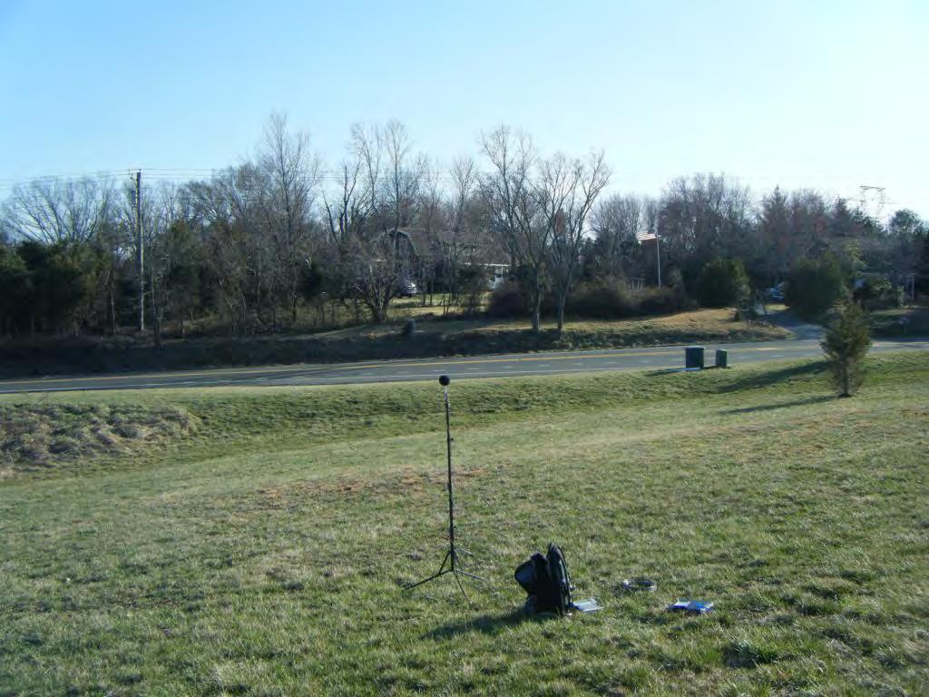
103
104
105

106
107
108

109
110
111
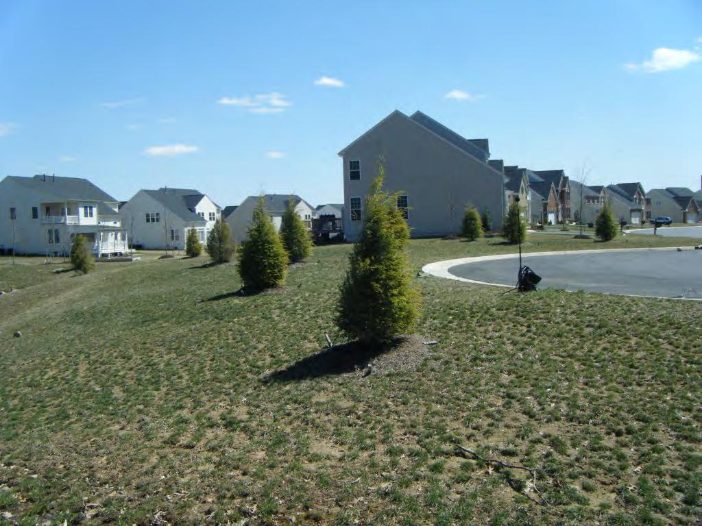
112
113
114

115
116
117
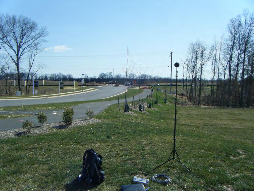
118
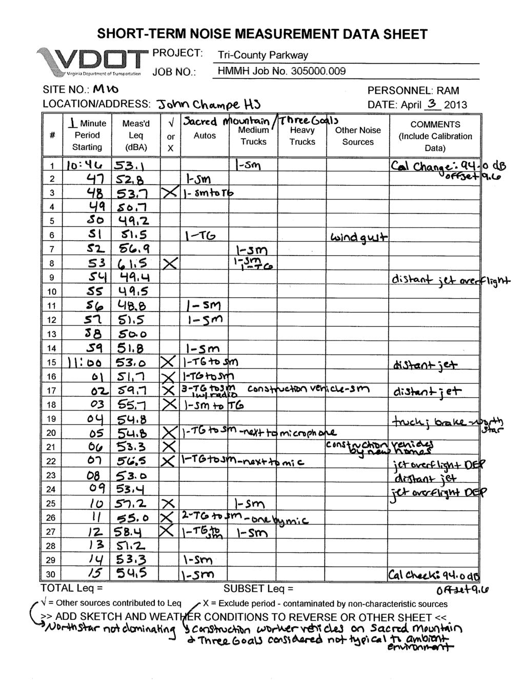
119
120
121
122 Noise Analysis Technical Report: Bi-County Parkway Project Noise measurement and traffic data from noise measurement program Job#: Name: Bi-County Parkway Site#: M1 - M10 Location: Chantilly, VA Date: 4/03/2013-4/04/2013 NOISE MEASUREMENT AND VALIDATION SUMMARY Measurement data Site Address Date Time Start Duration Total Leq, dba Traffic Only Leq, dba M Lee Highway, Manassas National Battlefield Park 4/4/ : M Pageland Lane 4/4/ : M Pageland Lane 4/4/ : M Pageland Lane 4/4/ : M Sudley Road and Kyle Wilson Way (Catharpin Park) 4/3/ : M Sanders Lane 4/4/ : M Lightridge Farm Road 4/3/ : M Kinsale Place (cul-de-sac) 4/3/ : M & Hitchin Court 4/3/ : M Sacred Mountain Street (John Champe High School) 4/3/ : VDOT UPC 52405; Project # R000-96A-102, PE-101
123 Noise Analysis Technical Report: Bi-County Parkway Project Noise measurement and traffic data from noise measurement program Site Number M1 Location: Lee Highway, Manassas National Battlefield Park Date: 4/4/2013 Start Time: 13:10 Duration (min): 30 VALIDATION SOUND LEVEL Enter Y for Yes For Plot Time Leq Non-Traffic Exclude Energy Traffic-only Overall Traffic-only Leq Overall Leq 13: : : : : : : : : : : : : : : : : : : : : : : : : : Y : : : : : : : : : : : : : Traffic-only Leq: 54.6 Overall Leq: 54.8 VDOT UPC 52405; Project # R000-96A-102, PE-101
124 Noise Analysis Technical Report: Bi-County Parkway Project Noise measurement and traffic data from noise measurement program TRAFFIC INPUT Data Entry Table Roadway Direction VehicleType TotalLookup VehTypeLookup StartTime Duration Count Speed Rt 29 WB A Rt 29WB Rt 29WBA 13: Rt 29 WB MT Rt 29WB Rt 29WBMT 13: Rt 29 WB HT Rt 29WB Rt 29WBHT 13: Rt 29 EB A Rt 29EB Rt 29EBA 13: Rt 29 EB MT Rt 29EB Rt 29EBMT 13: Rt 29 EB HT Rt 29EB Rt 29EBHT 13: A A MT MT HT HT A A MT MT HT HT TNM Input Table Roadway Direction VehicleType Lookup Lookup TotalDuration TotalTypeCount AvgSpeedHourCount Speed TotalCount Percentage Rt 29 WB A Rt 29WB Rt 29WBA % Rt 29 WB MT Rt 29WB Rt 29WBMT % Rt 29 WB HT Rt 29WB Rt 29WBHT % Rt 29 EB A Rt 29EB Rt 29EBA % Rt 29 EB MT Rt 29EB Rt 29EBMT % Rt 29 EB HT Rt 29EB Rt 29EBHT % VDOT UPC 52405; Project # R000-96A-102, PE-101
125 Noise Analysis Technical Report: Bi-County Parkway Project Noise measurement and traffic data from noise measurement program Site Number M2 Location: 6389 Pageland Lane Date: 4/4/2013 Start Time: 15:09 Duration (min): 30 VALIDATION SOUND LEVEL Enter Y for Yes For Plot Time Leq Non-Traffic Exclude Energy Traffic-only Overall Traffic-only Leq Overall Leq 15: : : : : : : : : : : : : : Y : : : : : : : : : : : : : : : : : : : : : : : : : Traffic-only Leq: 41.7 Overall Leq: 41.7 VDOT UPC 52405; Project # R000-96A-102, PE-101
126 Noise Analysis Technical Report: Bi-County Parkway Project Noise measurement and traffic data from noise measurement program TRAFFIC INPUT Data Entry Table Roadway Direction VehicleType TotalLookup VehTypeLookup StartTime Duration Count Speed Pageland Ln NB A Pageland LnNB Pageland LnNB 15: Pageland Ln NB MT Pageland LnNB Pageland LnNB 15: Pageland Ln NB HT Pageland LnNB Pageland LnNB 15: Pageland Ln SB A Pageland LnSB Pageland LnSB 15: Pageland Ln SB MT Pageland LnSB Pageland LnSB 15: Pageland Ln SB HT Pageland LnSB Pageland LnSB 15: TNM Input Table Roadway Direction VehicleType Lookup Lookup TotalDuration TotalTypeCount AvgSpeedHourCount Speed TotalCount Percentage Pageland Ln NB A Pageland LnNB Pageland LnNB % Pageland Ln NB MT Pageland LnNB Pageland LnNB % Pageland Ln NB HT Pageland LnNB Pageland LnNB % Pageland Ln SB A Pageland LnSB Pageland LnSB % Pageland Ln SB MT Pageland LnSB Pageland LnSB % Pageland Ln SB HT Pageland LnSB Pageland LnSB % #DIV/0! #DIV/0! #DIV/0! #DIV/0! #DIV/0! #DIV/0! #DIV/0! #DIV/0! #DIV/0! #DIV/0! #DIV/0! #DIV/0! VDOT UPC 52405; Project # R000-96A-102, PE-101
127 Noise Analysis Technical Report: Bi-County Parkway Project Noise measurement and traffic data from noise measurement program Site Number M3 Location: 5905 Pageland Lane Date: 4/4/2013 Start Time: 12:10 Duration (min): 30 VALIDATION SOUND LEVEL Leq Enter Y for Yes For Plot Time Non-Traffic Exclude Energy Traffic-only Overall Traffic-only Leq Overall Leq 12: : : : : : : : : : : : : : : : : : : : : : Y : : : : : : : Y : : : : : : : : : : Traffic-only Leq: 49.1 Overall Leq: 49.4 VDOT UPC 52405; Project # R000-96A-102, PE-101
128 Noise Analysis Technical Report: Bi-County Parkway Project Noise measurement and traffic data from noise measurement program TRAFFIC INPUT Data Entry Table Roadway Direction VehicleType TotalLookup VehTypeLookStartTime Duration Count Speed 10 min Count Pageland Ln WB A Pageland LnW Pageland LnW 12: Pageland Ln WB MT Pageland LnW Pageland LnW 12: Pageland Ln WB HT Pageland LnW Pageland LnW 12: Pageland Ln EB A Pageland LnEBPageland LnE 12: Pageland Ln EB MT Pageland LnEBPageland LnE 12: Pageland Ln EB HT Pageland LnEBPageland LnE 12: TNM Input Table Roadway Direction VehicleType Lookup Lookup TotalDuration TotalTypeCount AvgSpeedHourCount Speed TotalCount Percentage Pageland Ln WB A Pageland LnW Pageland LnW % Pageland Ln WB MT Pageland LnW Pageland LnW % Pageland Ln WB HT Pageland LnW Pageland LnW % Pageland Ln EB A Pageland LnEBPageland LnE % Pageland Ln EB MT Pageland LnEBPageland LnE % Pageland Ln EB HT Pageland LnEBPageland LnE % #DIV/0! #DIV/0! #DIV/0! #DIV/0! #DIV/0! #DIV/0! #DIV/0! #DIV/0! #DIV/0! #DIV/0! #DIV/0! #DIV/0! VDOT UPC 52405; Project # R000-96A-102, PE-101
129 Noise Analysis Technical Report: Bi-County Parkway Project Noise measurement and traffic data from noise measurement program Site Number M4 Location: 5501 Pageland Lane Date: 4/4/2013 Start Time: 11:12 Duration (min): 30 VALIDATION SOUND LEVEL Enter Y for Yes For Plot Time Leq Non-Traffic Exclude Energy Traffic-only Overall Traffic-only Leq Overall Leq 11: : : : : : : : : : : : : : : : : : : : Y : : : : : : : : : : : : : : : : : : : Traffic-only Leq: 43.4 Overall Leq: 43.4 VDOT UPC 52405; Project # R000-96A-102, PE-101
130 Noise Analysis Technical Report: Bi-County Parkway Project Noise measurement and traffic data from noise measurement program TRAFFIC INPUT Data Entry Table Roadway Direction VehicleType TotalLookup VehTypeLookStartTime Duration Count Speed 10 min Count Pageland Ln WB A Pageland LnWB Pageland LnW 11: Pageland Ln WB MT Pageland LnWB Pageland LnW 11: Pageland Ln WB HT Pageland LnWB Pageland LnW 11: Pageland Ln EB A Pageland LnEB Pageland LnE 11: Pageland Ln EB MT Pageland LnEB Pageland LnE 11: Pageland Ln EB HT Pageland LnEB Pageland LnE 11: TNM Input Table Roadway Direction VehicleType Lookup Lookup TotalDuration TotalTypeCount AvgSpeedHourCount Speed TotalCount Percentage Pageland Ln WB A Pageland LnWB Pageland LnW % Pageland Ln WB MT Pageland LnWB Pageland LnW % Pageland Ln WB HT Pageland LnWB Pageland LnW % Pageland Ln EB A Pageland LnEB Pageland LnE % Pageland Ln EB MT Pageland LnEB Pageland LnE % Pageland Ln EB HT Pageland LnEB Pageland LnE % #DIV/0! #DIV/0! #DIV/0! #DIV/0! #DIV/0! #DIV/0! #DIV/0! #DIV/0! #DIV/0! #DIV/0! #DIV/0! #DIV/0! VDOT UPC 52405; Project # R000-96A-102, PE-101
131 Noise Analysis Technical Report: Bi-County Parkway Project Noise measurement and traffic data from noise measurement program Site Number M5 Location: 5805 Sudley Road and Kyle Wilson Way (Catharpin Park) Date: 4/3/2013 Start Time: 16:58 Duration (min): 30 VALIDATION SOUND LEVEL Enter Y for Yes For Plot Time Leq Non-Traffic Exclude Energy Traffic-only Overall Traffic-only Leq Overall Leq 16: : : : : : : : : : : : : : : : : Y : Y : : Y : : : : : : Y : Y : : : : : : : : : : : : Traffic-only Leq: 57.0 Overall Leq: 57.1 VDOT UPC 52405; Project # R000-96A-102, PE-101
132 Noise Analysis Technical Report: Bi-County Parkway Project Noise measurement and traffic data from noise measurement program TRAFFIC INPUT Data Entry Table Roadway Direction VehicleType TotalLookup VehTypeLookup StartTime Duration Count Speed Sudley Rd WB A Sudley RdWB Sudley RdWBA 16: Sudley Rd WB MT Sudley RdWB Sudley RdWBM 16: Sudley Rd WB HT Sudley RdWB Sudley RdWBH 16: Sudley Rd EB A Sudley RdEB Sudley RdEBA 16: Sudley Rd EB MT Sudley RdEB Sudley RdEBM 16: Sudley Rd EB HT Sudley RdEB Sudley RdEBHT 16: TNM Input Table Roadway Direction VehicleType Lookup Lookup TotalDuration TotalTypeCount AvgSpeedHourCount Speed TotalCount Percentage Sudley Rd WB A Sudley RdWB Sudley RdWBA % Sudley Rd WB MT Sudley RdWB Sudley RdWBM % Sudley Rd WB HT Sudley RdWB Sudley RdWBH % Sudley Rd EB A Sudley RdEB Sudley RdEBA % Sudley Rd EB MT Sudley RdEB Sudley RdEBM % Sudley Rd EB HT Sudley RdEB Sudley RdEBHT % #DIV/0! #DIV/0! #DIV/0! #DIV/0! #DIV/0! #DIV/0! #DIV/0! #DIV/0! #DIV/0! #DIV/0! #DIV/0! #DIV/0! VDOT UPC 52405; Project # R000-96A-102, PE-101
133 Noise Analysis Technical Report: Bi-County Parkway Project Noise measurement and traffic data from noise measurement program Site Number M6 Location: 3480 Sanders Lane Date: 4/4/2013 Start Time: 10:08 Duration (min): 30 VALIDATION SOUND LEVEL Enter Y for Yes For Plot Time Leq Non-Traffic Exclude Energy Traffic-only Overall Traffic-only Leq Overall Leq 10: : : : : : : : : : : : : : : : : : : : : : : : : : : : : : : : : : : : : : : Traffic-only Leq: 43.6 Overall Leq: 43.6 VDOT UPC 52405; Project # R000-96A-102, PE-101
134 Noise Analysis Technical Report: Bi-County Parkway Project Noise measurement and traffic data from noise measurement program TRAFFIC INPUT Data Entry Table Roadway Direction VehicleType TotalLookup VehTypeLookup StartTime Duration Count Speed Sanders Ln NB A Sanders LnNB Sanders LnNBA 10: Sanders Ln NB MT Sanders LnNB Sanders LnNBM 10: Sanders Ln NB HT Sanders LnNB Sanders LnNBH 10: Sanders Ln SB A Sanders LnSB Sanders LnSBA 10: Sanders Ln SB MT Sanders LnSB Sanders LnSBM 10: Sanders Ln SB HT Sanders LnSB Sanders LnSBH 10: TNM Input Table Roadway Direction VehicleType Lookup Lookup TotalDuration TotalTypeCount AvgSpeedHourCount Speed TotalCount Percentage LCP NB A LCPNB LCPNBA 0 0 #DIV/0! #DIV/0! #DIV/0! #DIV/0! #DIV/0! LCP NB MT LCPNB LCPNBMT 0 0 #DIV/0! #DIV/0! #DIV/0! #DIV/0! #DIV/0! LCP NB HT LCPNB LCPNBHT 0 0 #DIV/0! #DIV/0! #DIV/0! #DIV/0! #DIV/0! LCP SB A LCPSB LCPSBA 0 0 #DIV/0! #DIV/0! #DIV/0! #DIV/0! #DIV/0! LCP SB MT LCPSB LCPSBMT 0 0 #DIV/0! #DIV/0! #DIV/0! #DIV/0! #DIV/0! LCP SB HT LCPSB LCPSBHT 0 0 #DIV/0! #DIV/0! #DIV/0! #DIV/0! #DIV/0! #DIV/0! #DIV/0! #DIV/0! #DIV/0! #DIV/0! #DIV/0! #DIV/0! #DIV/0! #DIV/0! #DIV/0! #DIV/0! #DIV/0! VDOT UPC 52405; Project # R000-96A-102, PE-101
135 Noise Analysis Technical Report: Bi-County Parkway Project Noise measurement and traffic data from noise measurement program Site Number M7 Location: Lightridge Farm Road Date: 4/3/2013 Start Time: 15:40 Duration (min): 30 VALIDATION SOUND LEVEL Enter Y for Yes For Plot Time Leq Non-Traffic Exclude Energy Traffic-only Overall Traffic-only Leq Overall Leq 15: : : : : : : : Y : : : Y : : : : : : : : : Y : Y : Y : Y : : : Y : Y : Y : Y : : : : : : : : : : Traffic-only Leq: 49.7 Overall Leq: 49.7 VDOT UPC 52405; Project # R000-96A-102, PE-101
136 Noise Analysis Technical Report: Bi-County Parkway Project Noise measurement and traffic data from noise measurement program TRAFFIC INPUT Data Entry Table Roadway Direction VehicleType TotalLookup VehTypeLookup StartTime Duration Count Speed Lightridge Farm Rd NB A Lightridge Farm RdLightridge Farm R 15: Lightridge Farm Rd NB MT Lightridge Farm RdLightridge Farm R 15: Lightridge Farm Rd NB HT Lightridge Farm RdLightridge Farm R 15: Lightridge Farm Rd SB A Lightridge Farm RdLightridge Farm R 15: Lightridge Farm Rd SB MT Lightridge Farm RdLightridge Farm R 15: Lightridge Farm Rd SB HT Lightridge Farm RdLightridge Farm R 15: TNM Input Table Roadway Direction VehicleType Lookup Lookup TotalDuration TotalTypeCount AvgSpeedHourCount Speed TotalCount Percentage Lightridge Farm Rd NB A Lightridge Farm RdLightridge Farm R % Lightridge Farm Rd NB MT Lightridge Farm RdLightridge Farm R % Lightridge Farm Rd NB HT Lightridge Farm RdLightridge Farm R % Lightridge Farm Rd SB A Lightridge Farm RdLightridge Farm R % Lightridge Farm Rd SB MT Lightridge Farm RdLightridge Farm R % Lightridge Farm Rd SB HT Lightridge Farm RdLightridge Farm R % #DIV/0! #DIV/0! #DIV/0! #DIV/0! #DIV/0! #DIV/0! #DIV/0! #DIV/0! #DIV/0! #DIV/0! #DIV/0! #DIV/0! VDOT UPC 52405; Project # R000-96A-102, PE-101
137 Noise Analysis Technical Report: Bi-County Parkway Project Noise measurement and traffic data from noise measurement program Site Number M8 Location: Kinsale Place (cul-de-sac) Date: 4/3/2013 Start Time: 13:03 Duration (min): 30 VALIDATION SOUND LEVEL Enter Y for Yes For Plot Time Leq Non-Traffic Exclude Energy Traffic-only Overall Traffic-only Leq Overall Leq 13: : : : : : : : : : : : : : : : : : : : : : : : : : : : : : : : : : : : : : : Traffic-only Leq: 52.4 Overall Leq: 52.4 VDOT UPC 52405; Project # R000-96A-102, PE-101
138 Noise Analysis Technical Report: Bi-County Parkway Project Noise measurement and traffic data from noise measurement program TRAFFIC INPUT Data Entry Table Roadway Direction VehicleType TotalLookup VehTypeLookup StartTime Duration Count Speed Kinsale Place NB A Kinsale PlaceNB Kinsale PlaceNB 15: Kinsale Place NB MT Kinsale PlaceNB Kinsale PlaceNB 15: Kinsale Place NB HT Kinsale PlaceNB Kinsale PlaceNB 15: Kinsale Place SB A Kinsale PlaceSB Kinsale PlaceSB 15: Kinsale Place SB MT Kinsale PlaceSB Kinsale PlaceSB 15: Kinsale Place SB HT Kinsale PlaceSB Kinsale PlaceSB 15: TNM Input Table Roadway Direction VehicleType Lookup Lookup TotalDuration TotalTypeCount AvgSpeedHourCount Speed TotalCount Percentage Kinsale Place NB A Kinsale PlaceNB Kinsale PlaceNB #DIV/0! Kinsale Place NB MT Kinsale PlaceNB Kinsale PlaceNB #DIV/0! Kinsale Place NB HT Kinsale PlaceNB Kinsale PlaceNB #DIV/0! Kinsale Place SB A Kinsale PlaceSB Kinsale PlaceSB #DIV/0! Kinsale Place SB MT Kinsale PlaceSB Kinsale PlaceSB #DIV/0! Kinsale Place SB HT Kinsale PlaceSB Kinsale PlaceSB #DIV/0! #DIV/0! #DIV/0! #DIV/0! #DIV/0! #DIV/0! #DIV/0! #DIV/0! #DIV/0! #DIV/0! #DIV/0! #DIV/0! #DIV/0! VDOT UPC 52405; Project # R000-96A-102, PE-101
139 Noise Analysis Technical Report: Bi-County Parkway Project Noise measurement and traffic data from noise measurement program Site Number M9 Location: & Hitchin Court Date: 4/3/2013 Start Time: 12:01 Duration (min): 30 VALIDATION SOUND LEVEL Enter Y for Yes For Plot Time Leq Non-Traffic Exclude Energy Traffic-only Overall Traffic-only Leq Overall Leq 12: : : : : : Y : : : : : : : : : : : : : : Y : Y : Y : Y : : Y : Y : Y : Y : : Y : : : : : : : : : Traffic-only Leq: 50.2 Overall Leq: 55.5 VDOT UPC 52405; Project # R000-96A-102, PE-101
140 Noise Analysis Technical Report: Bi-County Parkway Project Noise measurement and traffic data from noise measurement program TRAFFIC INPUT Data Entry Table Roadway Direction VehicleType TotalLookup VehTypeLookup StartTime Duration Count Speed Braddock Rd WB A Braddock RdWB Braddock RdWB 12: Braddock Rd WB MT Braddock RdWB Braddock RdWB 12: Braddock Rd WB HT Braddock RdWB Braddock RdWB 12: Braddock Rd EB A Braddock RdEB Braddock RdEB 12: Braddock Rd EB MT Braddock RdEB Braddock RdEB 12: Braddock Rd EB HT Braddock RdEB Braddock RdEB 12: TNM Input Table Roadway Direction VehicleType Lookup Lookup TotalDuration TotalTypeCount AvgSpeedHourCount Speed TotalCount Percentage Braddock Rd WB A Braddock RdWB Braddock RdWB % Braddock Rd WB MT Braddock RdWB Braddock RdWB % Braddock Rd WB HT Braddock RdWB Braddock RdWB % Braddock Rd EB A Braddock RdEB Braddock RdEB % Braddock Rd EB MT Braddock RdEB Braddock RdEB % Braddock Rd EB HT Braddock RdEB Braddock RdEB % #DIV/0! #DIV/0! #DIV/0! #DIV/0! #DIV/0! #DIV/0! #DIV/0! #DIV/0! #DIV/0! #DIV/0! #DIV/0! #DIV/0! VDOT UPC 52405; Project # R000-96A-102, PE-101
141 Noise Analysis Technical Report: Bi-County Parkway Project Noise measurement and traffic data from noise measurement program Site Number M10 Location: Sacred Mountain Street (John Champe High School) Date: 4/3/2013 Start Time: 10:46 Duration (min): 30 VALIDATION SOUND LEVEL Enter Y for Yes For Plot Time Leq Non-Traffic Exclude Energy Traffic-only Overall Traffic-only Leq Overall Leq 10: : : : Y : : : : Y : : : : : : : Y : Y : Y : Y : : Y : Y : Y : : : Y : Y : Y : : : : : : : : : : : : Traffic-only Leq: 52.7 Overall Leq: 52.7 VDOT UPC 52405; Project # R000-96A-102, PE-101
142 Noise Analysis Technical Report: Bi-County Parkway Project Noise measurement and traffic data from noise measurement program TRAFFIC INPUT Data Entry Table Roadway Direction VehicleType TotalLookup VehTypeLookup StartTime Duration Count Speed Northstar Blvd NB A Northstar BlvdNB Northstar BlvdNB 10: Northstar Blvd NB MT Northstar BlvdNB Northstar BlvdNB 10: Northstar Blvd NB HT Northstar BlvdNB Northstar BlvdNB 10: Northstar Blvd SB A Northstar BlvdSB Northstar BlvdSB 10: Northstar Blvd SB MT Northstar BlvdSB Northstar BlvdSB 10: Northstar Blvd SB HT Northstar BlvdSB Northstar BlvdSB 10: TNM Input Table Roadway Direction VehicleType Lookup Lookup TotalDuration TotalTypeCount AvgSpeedHourCount Speed TotalCount Percentage Northstar Blvd NB A Northstar BlvdNB Northstar BlvdNB % Northstar Blvd NB MT Northstar BlvdNB Northstar BlvdNB % Northstar Blvd NB HT Northstar BlvdNB Northstar BlvdNB % Northstar Blvd SB A Northstar BlvdSB Northstar BlvdSB % Northstar Blvd SB MT Northstar BlvdSB Northstar BlvdSB % Northstar Blvd SB HT Northstar BlvdSB Northstar BlvdSB % #DIV/0! #DIV/0! #DIV/0! #DIV/0! #DIV/0! #DIV/0! #DIV/0! #DIV/0! #DIV/0! #DIV/0! #DIV/0! #DIV/0! VDOT UPC 52405; Project # R000-96A-102, PE-101
143 Noise Analysis Technical Report June 2013 Bi-County Parkway Project page E-1 APPENDIX E RESPONSE FROM VDOT PROJECT MANAGEMENT ON ALTERNATIVE NOISE ABATEMENT MEASURES This appendix includes a memo and survey sent to the VDOT project managers about the potential for use of alternative noise abatement measures, pursuant to Virginia House Bill VDOT UPC 52405, Project R000-96A-102, PE-101

144 Gregory A. Whirley Acting Commissioner DEPARTMENT OF TRANSPORTATION 1401 EAST BROAD STREET RICHMOND, VIRGINIA Month 11, 2013 MEMORANDUM TO: Nick Nies, Project Manager FROM: SUBJECT: Lovejoy Muchenje, Noise Abatement Engineer UPC 52405; Tri-County Parkway Location Study The 2009 General Assembly passed Chapter 120 (HB 2577), which amends the Code of Virginia by adding in Article 15 of Chapter 1 of Title 33.1 a section numbered :21, relating to highway noise abatement. House Bill 2577 States: Requires that whenever the CTB or the Department plan for or undertake any highway construction or improvement project and such project includes or may include the requirement for the mitigation of traffic noise impacts, consideration should be given to the use of noise reducing design and low noise pavement materials and techniques in lieu of construction of noise walls or sound barriers. Landscaping in such a design would be utilized to act as a visual screen if visual screening is required. In an effort to honor the intent of HB 2577 we are asking for your input (per Chapter VI of Materials Division s Manual of Instruction and Section 2B-3 Determination of Roadway Design of the VDOT Road Design manual (pages 2B-5 and 2B-6)). As part of the Noise Technical Report and technical files, we are seeking your professional opinion by providing comments for the project noted above. Please distribute this memorandum to the appropriate District staff and combine all responses into one response. Should you have any questions, please contact me at (804) Thank you for your time and consideration regarding this request. VirginiaDOT.org WE KEEP VIRGINIA MOVING