A Collaborative Approach to. Planning and Improvement. Ranching Program. Laurel Marcus, Executive Director
|
|
|
- Linda Anderson
- 5 years ago
- Views:
Transcription


1 A Collaborative Approach to Comprehensive Ranch Planning and Improvement through the Fish Friendly Ranching Program Laurel Marcus, Executive Director California Land Stewardship Institute 550 Gateway Dr #108 Napa, Ca
2 The Fish Friendly Farming Environmental Certification Program began in Mendocino and Sonoma Counties in Collaboration between farmers, regulatory agencies and scientists. FFF program is now in 8 counties and is under development in 5 other counties. Total enrollment has reached 130,000 acres on over 1000 farms. In 2009 we started creating a similar program for rangeland in Napa, Sonoma, Mendocino, Solano and El Doradocounties. Fish Friendly Ranching was developed with a committee of ranchers, regulators who serve as the certifiers and scientists i including Dr Larry Ford who served as a consultant to CLSI
3 Like the Fish Friendly Farming program, FFR is intended to provide compliance with Clean Water Act Total Maximum Daily Loads (TMDLs) particularlylistingsfor listings fine sediment, temperature and pathogens. TMDLs Russian River fine sediment and temperature; and in some locations, pathogens (also termed indicator bacteria) and nutrients Navarro River fine sediment and temperature Gualala River fine sediment and temperature GarciaRiver fine sediment Eel River fine sediment and temperature Napa River fine sediment, pathogens and nutrients Sonoma Creek fine sediment, pathogens and nutrients Tomales Bay fine sediment and pathogens and improvements to stream habitats to support endangered salmonids
4 Goals set by committee Maintain good water quality and aquatic and riparian habitat conditions Create a program to comply with environmental rules but which also sustains s economic o c use of the land Create one program that addresses many regulations to reduce paper work and time expended Keep compliance costs down by seeking cost share and grant funding to cover technical and project costs Create a program which will provide a long term defensible plan for owner and which sustains water quality Maintain privacy of detailed ranch information By working together to create the Fish Friendly Ranching Program the concerns of ranchers, regulators and scientists are all incorporated and compromises were made to recognize each other s concerns
5 STEPS IN RANCH PLAN PROCESS Rancher signs up or enrolls property, CLSI creates maps for site Rancher attends series of 3 BMP workshops Site Visit i with ihclsi scientist i sediment source inventory and creek assessment, rancher describes operation CLSI completes maps and ranch plan template and rancher reviews CLSI revises plan and sets up certification Certification by objective third party National Marine Fisheries Service and Regional Water Quality Control Board in coastal counties; Natural Resource Conservation Service and County Ag Commissioner in Sierra foothill program Rancher implements ranch plan; CLSI works with rancher to design, permit and find grant funding for projects
6 RANCH CONSERVATION PLAN Element I General Site Features Element II Managing ggrazing Areas and Livestock Element III Roads Element IV Creek/River Corridors Element V Photo monitoring
7 ELEMENT 2 - MANAGING GRAZING AREAS AND LIVESTOCK
8 Ranch Plan documents: Grazing Area Use Operation Type Timing of grazing


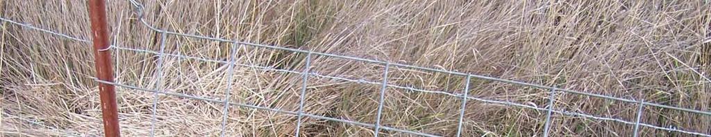
9 Grazing, Special Management and Service Areas Fencing Grazing related buildings and shelters Water sources, mineral/supplement sites Feeding areas
10


11 Water sources
12 Service area without an adequate buffer to filter fine sediment from runoff
13 Service area with an adequate buffer to filter fine sediment from runoff
14 Special management field with wetlands that require limited seasonal grazing (Sonoma County)


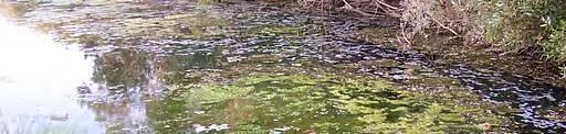
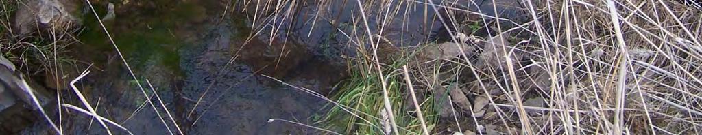
15 Ephemeral Creeks
16


17 Stable unconfined ephemeral creek with grass cover Eroding unconfined ephemeral creek delivering fine sediment into water
18 Steep confined ephemeral creeks
19 Erosion sites Debris flow in terracettes
20 CHECKLIST OF STANDARDS FOR CONTROLLING FINE SEDIMENT POLLUTION FROM GRAZING OPERATIONS ALREADY BEING APPLIED NEEDS TO BE APPLIED BMP Grazing area maps and inventory are complete and grazing areas are described. Special management areas are defined where needed and are managed to protect the area. Water sources, attractants, herding, fencing, timing and duration of grazing or other measures are used to distribute livestock over grazing areas. Residual dry matter is assessed in early fall and grazing practices are altered based on RDM levels and climatic conditions. Service areas are located away from waterways or surrounded by vegetated filer strips. Ephemeral creeks that t are accessible to livestock are stable and vegetated. Active erosion sites are evaluated and needed BMPs are applied. Supplemental activity sites are evaluated for erosion potential and BMPs are applied.
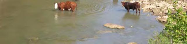
21 For ranches near to water supplies calves under 4 months old must be restricted from the creek
22 CHECKLIST: ELEMENT 2: MANAGING GRAZING AREAS TO REDUCE PATHOGENS ALREADY BEING APPLIED NEEDS TO BE APPLIED BMP If ranch is upstream of a surface water drinking supply, fence calves less than 4 months old out of all creek/river corridors. Relocate livestock attractants away from creeks into uplands or areas where surface runoff will not flow into a creek/river. er Manage livestock to limit use of waterways to a few crossings and develop water sources in upland areas where surface runoff will not flow into a creek/river. Relocate service areas (corrals, feeding areas) to areas outside of the creek corridor where surface runoff will not flow into a creek/river
23 16. SUMMARY OF ACTIONS: ELEMENT 2, MANAGING GRAZING AREAS TO REDUCE FINE SEDIMENT ACTION/BMP TIMELINE
24 ELEMENT 3 ROADS. Roads are the main source of fine sediment pollution to creeks. FFR staff complete a road assessment and prioritize actions for sites with a high likelihood of delivery of sediment into a creek


25
26
27 CHECKLIST: ELEMENT 3 ROADS ALREADY NEEDS BEING TO BE BMP APPLIED APPLIED Completion of road survey and identification of road problems. Road repair and improvement program including: Changes in road drainage and surface design (for example, inslope to outslope). Replacement and repair of ditches, ditch relief culverts, energy dissipaters. Increase in frequency of water bars, rolling dips, or ditch relief culverts. Closure or relocation of roads with continual erosion problems, those built on unstable ground, or too close to creeks. Repair/replacement of stream crossings with a minimum of seasonal crossings and use of bridges for year-round creeks. Road maintenance and inspection program including: All culverts, energy dissipaters, road surfaces, stream crossings, and ditches. Winterization of all seasonal roads. Winter inspection of stream crossings and removal of wood and debris to avoid failures. Periodic maintenance of road system with regular inspection program. New road design/construction program, reconstruction program, or road restoration program (if applicable)
28 ELEMENT 4: CREEKS AND RIVERS
29 Potential Effects of Livestock on Stream Corridors Reduction of vegetative cover and biodiversity in riparian area Loss of shade canopy adequate to maintain low temperatures for salmonid habitat Erosion of stream banks Pathogens in creek Nutrient loading Effects are limited to locations where livestock spend time in creeks/river or use the creek during certain seasons

30


31


32
33 Fencing out livestock from all creeks is very expensive and difficult in the hilly rangelands ofcalifornia Scientific study of the effects of livestock on creeks shows that unlimited access in all seasons will degrade the riparian corridor and result in a loss of stream shade. However there is little research defining the level of grazing allowable in riparian areas that will sustain adequate shade canopy for salmonid habitat or defining management practices to apply to protect water quality Some research suggests livestock can be managed in unconfined creek areas to reduce effects on the riparian corridor without having to fence every creek.
34 Research Findings Other than by direct deposit of feces into the streams by livestock and other animals, pathogens are transported into the streams when heavy rains result in overland flow carrying fecal material Larsen s (1996) review of the scientific literature found that rangeland improvement practices that attract livestock away from riparian zones and associated streams were effective in reducing exposure of the livestock to the waters, and thus in protecting water quality. Tate (2010) described an experimental application of an optimal grazing management plan focused on improving i and maintaining i i water quality at a coastal tlranch in Southern California. The grazing system would rotate cattle to: the upland fields for the winter where the least risk of soil compaction, run off to carry pollutants to streams, and direct exposure to waters occur; then to the swale riparian fields with off stream water development for the spring and early summer where there is the least impact to sensitive riparian woodland and wetlands; then to the floodplain fields away from creeks for the summer.


35 George s (1996) review of the scientific literature found that construction and maintenance of fencing can be prohibitively expensive. Fencing can also be impractical pactcaor ineffective: ect e on steep and unstable hillsides; on the banks of unstable stream channels on forested rangelands where falling trees and limbs frequently damage fences. Exclusion can be counter productive by promoting the growth and spread of pest plants, increasing fire fuels, and reducing forage availability. Rangeland livestock operations are typically based on small profit margins
36 A recent study by T.A. Ward Becchetti (2002) looks at sites in California using several rapid visual assessment methods to document aquatic habitat health, geomorphic conditions and a survey of rancher s management practices. The Ward study primarily il used the EPA (1999) method of visual assessment of stream conditions used with benthic macroinvertebrate (BMI) sampling, the Rosgen stream classification system (Rosgen 1994), and a ranchers survey to document management practices. These factors were evaluated to determine the management measures associated with good & poor instream habitat conditions. This study found that high stock density and frequent grazing had the greatest negative effect on the assessment results for aquatic habitat conditions. Rest between grazing, herding to achieve better distribution, less use of the riparian area, and increased time by the rancher providing attractants outside the riparian area had the greatest effect to produce high quality aquatic habitat.
37 The FFR program uses geologic features to determine the level of confinement in the creek channel as the physical processes of sediment transport and channel erosion vary with the level of confinement. Additionally confined channels can be steep and inaccessible to livestock. A confined channel is in a canyon or has a bedrock channel. An unconfined channel flows through an alluvial valley or floodplain. Partially confined channels have both a floodplain l and bedrock.


38 CONFINED CHANNEL CONFINED CHANNEL UNCONFINED CHANNEL UNCONFINED CHANNEL
39
40
41 The goal of the FFR ranch plan is to orient and adjust grazing practices and facilities to protect water quality while sustaining the ranching operation Livestock Management Measures for unconfined creeks Revision of season of use of riparian area Revision of number of animals using area Locating service areas, watering troughs, and corrals away from stream channels and in lowslope areas Reducing livestock creek crossings to the minimum number required Retention of vegetative cover, herbaceous and woody to serve as a fl filter strip between grazing areas and waterways to intercept sediment Use of distributed alternative water supplies Use of livestock attractants such as mineral supplements Changing kind and class of livestock Culling misbehaving livestock Herding Installation of barriers Fencing
42 Grazing adjacent to creek is carried out in late Winter/Spring with alternative water supplies located away from the creek


43 Distributed Alternative Water Supplies
44 Minerals/ Supplements located away Minerals/ Supplements located away from the creek


45 Herding and Culling misbehaving livestock
46 Defined livestock crossings
47 Exclusionary fencing of unconfined alluvial stream


48
49
50 CHECKLIST: CREEK/RIVER CORRIDORS ELEMENT UNCONFINED, ALLUVIAL AND PARTIALLY CONFINED ALLUVIAL CHANNELS ALREADY BEING APPLIED NEEDS TO BE APPLIED BMP Completed inventory of corridor condition and other factors with maps and required information included. Current management practices are reviewed. Assessment of necessary width for sustainable corridor is completed. Identification of Proposed Additional Livestock Management Practices Upslope or river channel processes affecting the stream corridor are identified and owner will work with the Fish Friendly Ranching program to address any problem. Identification of Channel Restoration and Revegetation Measures if applicable Completion of Implementation Timeline and Evaluation of Funding Sources with FFR Program.
 need to be based on the best available science that is applicable in California s Mediterranean climate Collaboration requires")

51 Summary Collaborative programs must take into account the needs of all participants Program must balance economic uses of land with protection and improvement of habitat and water quality Best management practices (BMPs) need to be based on the best available science that is applicable in California s Mediterranean climate Collaboration requires developing working relationships between Collaboration requires developing working relationships between participants ranchers talking with regulators during certifications; scientists working with regulators to determine best practices; scientists and regulators working with ranchers to accommodate their needs while protecting the environment