Typical Local Erosion Control Requirements (Storm Water Management Authority, Inc.)
|
|
|
- Daniel Franklin
- 5 years ago
- Views:
Transcription
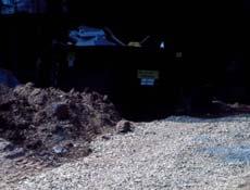
1 Module 2: Selection of Controls and Site Planning for Construction Site Erosion Prevention Robert Pitt Department of Civil, Construction, and Environmental Engineering University of Alabama Tuscaloosa, AL Recommended Controls for Small Construction Sites (EPA Guidance) Best control accomplished through proper planning, installation, and maintenance of controls. Non-Structural Controls: - Minimize disturbance - Preserve natural vegetation - Good housekeeping Recommended Controls for Small Construction Sites (cont.) Small sites have less space that prevent use of some controls, plus less access to qualified help. Structural Controls: - Erosion controls (mulch, grass, and stockpile covers) - Sediment controls (silt fence, inlet protection, check dams, stabilized construction entrances, and sediment traps) Typical Local Erosion Control Requirements (Storm Water Management Authority, Inc.) All surface waters flowing towards construction areas shall be either passed through the site in protected channels or diverted using berms or channels. All slope or fill areas which have been graded shall within 14 days of the completion of grading, or the completion of any phase of grading, be planted or otherwise provided with ground cover to retrain erosion.
2 Typical Local Erosion Control Requirements (cont.) All upslope and downslope controls must be in place before any on-site construction begins. No visible floating scum, oil or other matter allowed in discharge. All controls shall be checked and repaired monthly and within 24 hrs after any rainfall at the site of 0.75 inch occurring within 24 hrs. Typical Local Erosion Control Requirements (cont). The control plan must include the size of the disturbed areas and a schedule of the starting and completion dates of land disturbing activities. Written descriptions of controls and schedule of their implementation Description of procedures for proper storage, handling, and disposal of construction materials. Typical Erosion Control Plan Contents (Storm Water Management Authority, Inc.) Present contours and drainage facilities on property Drainage facilities on adjacent property Proposed contours after development (intervals of 2 ft, or less) Description of existing site conditions (erosion characteristics of soils, potential problem areas, soil stabilization specifications) General Approach Divert upland drainage Mulch exposed ground Control site discharges Good housekeeping Proper maintenance
3 Erosion Control Manuals There are many erosion control manuals that have been produced over the past 20 years, or so: Alabama Handbook for Erosion Control, Sediment Control, and Stormwater Management on Construction Sites and Urban Areas. Alabama Soil and Water Conservation Committee and the SCS. Original in1993 with most recent update in This is an example of the type of manual produced by the SCS (now NRCS) for local governments. Complete%20ESC%20Handbook10-09.pdf Erosion Control Manuals (cont.) Other manuals have included: Erosion and Sediment Control Handbook (3 rd edition). Division of Soil and Water Conservation. State of Virginia Many of the manuals from throughout the country are based on the Virginia manuals. Counties update. Wisconsin Construction Site Best Management Practice Handbook, revised. Wisconsin Department of Natural Resources This is an example based on the above VA manual, but with some local modifications. Currently revised with technical standards. Important Local Considerations for Guidance Manuals It is critical that construction site erosion control practice design manuals consider local conditions, especially: Rainfall conditions. Most practices are strongly affected by site hydrologic and hydraulic conditions. Rainfall has a direct effect on the amount of runoff and flow velocities. Devices that can withstand conditions in a generally mild area will frequently fail during the more common severe conditions found in Alabama. Important Local Considerations for Guidance Manuals (cont.) Erosion rates. Maintenance is strongly influenced by the amount of sediment produced. In Alabama, these rates can be much greater than in other areas, requiring special considerations for sediment storage and frequent maintenance access. Sediment characteristics. Very high concentrations of suspended solids and small particle sizes also require modifications of standard designs.


4 Primary Erosion Control Requirements Minimize upslope water contributions General diversion structures Temporary diversion structures Permanent diversion structures General channel stabilization Check dams Riprap Waterway drops Stream crossings Grassed waterway Slope down drain structure Diversion Channels, Berms, and Waterway Drops Protect Channels (Check dams and liners)


.")

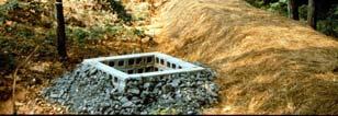
5 Primary Erosion Control Requirements (cont.) Provide Downslope Controls: General sediment fence Filter fabric fences Straw bale fences Sediment basins Outlet protection Typical Construction Sediment Ponds Filter fences create small ponding areas Control Site Discharges Filter fencing for small sites (but only for slope lengths less than about 100 ft). Expect about 10 to 50% control of suspended solids. Sediment ponds for areas larger than 10 acres. Expect up to 80% control of suspended solids.
 Protect Disturbed Areas: Mulching Local vegetation")


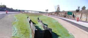
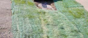
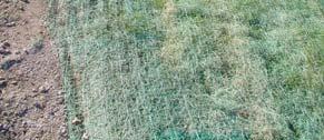
6 Primary Erosion Control Requirements (cont.) Protect Disturbed Areas: Mulching Local vegetation information General seeding Temporary seeding Permanent seeding Sodding Trees and shrubs Maintenance of vegetation Slope Protection with Surface Roughening Slope Protection with Hydroseeding and Blankets Supporting Erosion Control Requirements Control wastewater from dewatering operations Dewatering settling basins Properly dispose of construction debris Control tracking of sediment off-site Entrance controls Site road controls Dust control


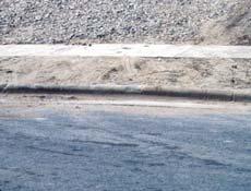


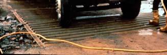

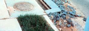
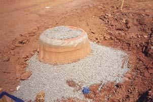

7 On-Site Good Housekeeping Controls Gravel Driveways Clean Vehicles before Traveling on Public Roads Supporting Erosion Control Requirements (cont.) On-Site Good Housekeeping Controls Inlet Protection Protect storm drain inlets Storm drain inlet protection Inlet protection barriers Inlet insert baskets Minimize area disturbed Land grading Control erosion scour from roof runoff


 Drainage patterns (all")
 Adjacent areas (roads, streams, houses, utilities, etc. should be shown).")
8 Special Controls for Working within Waterways Alabama Procedures for Developing Plans for Erosion and Sediment Control The following are the minimum components of the plan: Location or vicinity map and a clear and concise narrative describing existing site conditions, along with the proposed sediment and erosion control measures and rationale. Specifications for planned erosion and sediment control measures. Reference standard design manual and describe pre-approved innovative measures. Site plan or treatment map. Site development drawing showing the type and locations of planned conservation practices. Step-by-Step Procedure for Plan Development Step 1 Data Collection. Inventory existing site conditions which will help the planner develop the most effective control plan. The following information should be shown on a map and verbally explained in the plan narrative: Topography (1 to 5 ft contours) Drainage patterns (all existing drainages and swales) Soils(major soil types, especially the soil erodibility factor k and the hydrologic soil type). Ground cover (existing vegetation) Adjacent areas (roads, streams, houses, utilities, etc. should be shown). Step-by-Step Procedure for Plan Development (cont.) Step 2 Data Analysis. Identify the site potential and limitations and associated critical erosion hazards. A. Topography. Slope steepness and length determine critical hazards associated with topography. If the following are exceeded, the erosion hazard becomes critical: 0 to 2% and 300 feet 2 to 5% and 150 feet Over 5% and 75 feet


9 Initial Topography (grubbing and clearing phase) Pink: low hazard Blue: Moderate hazard Yellow: High hazard Orange: High hazard Final Topography Step-by-Step Procedure for Plan Development (cont.) Step 2 - Data Analysis (cont.) B. Drainage Patterns. Natural drainage features collect and concentrate water. These need to be identified so they can be avoided by site development. The natural drainages should also be utilized for future site drainage, after proper management. C. Soils. Many soil characteristics affect erosion control. The NRCS county soil maps contain general information of interest, especially depth to bedrock, depth to seasonable water table, permeability, shrink-swell potential, texture, hydrologic soil group, and erodibility. If it is likely that critical soil problems exist on the site, then more detailed and site specific soil investigations to supplement the mapped data are warranted.
10 Step-by-Step Procedure for Plan Development (cont.) Step 2 - Data Analysis (cont.) D. Ground Cover. This is the most important factor in terms of preventing site erosion. Any existing vegetation that can be saved will be a great benefit. In areas where existing vegetation cannot be saved, construction needs to be carefully staged and temporary mulching or vegetation controls will be needed soon after grading operations cease. E. Adjacent Areas. Downslope/downstream areas are the most important. However, upslope areas that contribute flowing water to the construction site also need to be examined and considered. Controls will be needed to divert or safely convey this upslope water, and downslope controls are needed to protect the downstream resources. Step-by-Step Procedure for Plan Development (cont.) Step 3 Facility Plan Development. A site plan needs to consider site limitations. Locate buildings, roads, parking areas, etc., to minimize site and downstream problems. A. Fit development to terrain. Existing site conditions need to be considered to minimize land disturbance, erosion hazards, and development costs. B. Confine construction activities to least critical areas. C. Cluster buildings together. D. Minimize impervious areas. E. Utilize the natural drainage system. Step-by-Step Procedure for Plan Development (cont.) Step 4 Planning for Erosion and Sediment Control. The following general procedure is recommended in the Alabama Manual for erosion and sediment control planning: A. Divide the site into drainage areas. B. Determine the limits of clearing and grading. C. Select erosion and control measures. - Vegetative controls (consider first due to costeffectiveness, but must carefully consider site conditions) - Structural controls (more costly, but can be designed for site specific conditions and desired levels of control) - Management controls (sequencing construction, etc.) D. Plan for stormwater management. Step-by-Step Procedure for Plan Development (cont.) Step 5 Plan Assembly. This final step is consolidating the pertinent information into the mapping and narrative portions of the plan.

11 Busiest Markets for Single-Family Housing Permits (1999) Acres Converted from Undeveloped to Developed Uses Typical Large City National Estimates of Land Area Developed per Year
12 Example Unit Capital Costs for Construction Site Erosion and Sediment Control Measures (2002 estimates) Quantities of Silt Fencing Needed for Different Developments (at about $5/ft) Control Unit Typical Unit Cost Temporary seeding Sq yard $0.15 Mulching Sq yard $0.45 Sodding Sq yard $3.60 Filter fabric fence foot $5.10 Inlet protection device inlet $ ft deep diversion swale 100 ft $1, Sediment pond 1 acre $73, Summary of Available Controls and Planning Efforts Many erosion control guidance manuals exist, but care is needed to ensure they are applicable for local extreme conditions. Redundant controls are needed (upslope water diversions, protect exposed soil, downslope controls, and good housekeeping). Many options are available for each component. These can be selected (and designed) to fit site conditions. Module 2 Homework When your site selection is confirmed, prepare the initial portions of the erosion control plan, according to the AL Handbook outline (basically site and regional descriptions). Describe the work phases during the construction period (initial clearing and grubbing to final landscaping) Prepare hazard maps based on slope lengths and angles for at least the first clearing and grubbing and final contour conditions.