Predicting Impacts of Development and Land Use Change Upon Complex Wetland Systems in Largely Undeveloped Catchments of Northern Australia
|
|
|
- Ira Nelson Wheeler
- 5 years ago
- Views:
Transcription
1 Predicting Impacts of Development and Land Use Change Upon Complex Wetland Systems in Largely Undeveloped Catchments of Northern Australia Damien Burrows and Barry Butler TropWATER Centre for Tropical Water and Aquatic Ecosystem Research, James Cook University, Australia

2 Nearly 20% of Aust land mass, but <1% of population Most development is on small section of NE coast Only 300,000 in all of northern Australia Only 3 towns >10,000 people

3 Pressure to Develop North Australia Northern part of Australia has 24% of national runoff (equals 23,000,000ML) but <1% is allocated for all uses (urban, mining, irrigation) so essentially free-running rivers Grazing dominant land use There is now much pressure to further develop this vast region to become an ínternational foodbowl This would be a 21 st century development of a relatively intact region - can we manage it right?

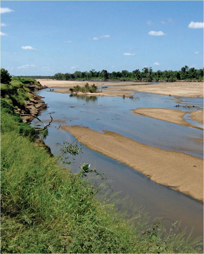
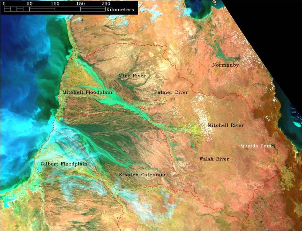
4 Gulf Rivers
5 Burdekin Catchment, northern Australia

6 Burdekin Catchment and Dam TOWNSVILLE BURDEKIN BOWEN Burdekin Dam BELYANDO Grazing = 88%, cropping = 1% Average Annual Rainfall: 800 to 1200mm


7 Dominant Wetland Management Issues Impacts of Dams Management of Aquatic Weeds Management of Livestock Grazing

8 Burdekin Falls Dam Built 1987, stores 1.8 million megalitres of water Captures runoff from 86% of catchment Supports increased irrigation development on the Burdekin delta and floodplain Seasonal river with large floods but low dry season flow

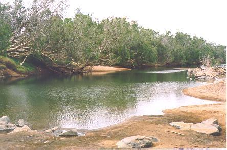
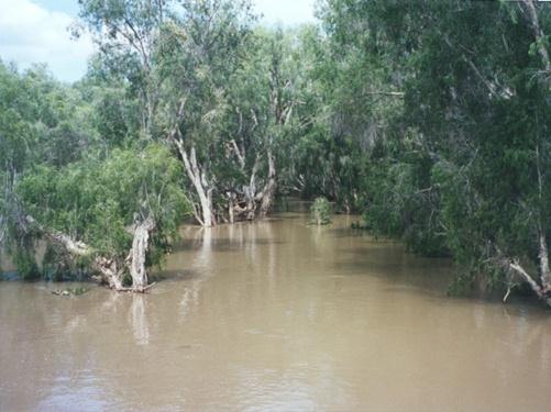
9 Wet and Dry Season Differences


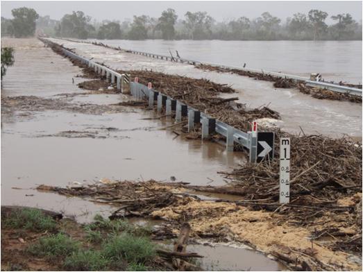
10 Turbidity (NTU) Above and Below Burdekin Dam Upper Burdekin River, above dam Lower Burdekin River, below dam Upper Burdekin turbid after stormflows, but runs clear shortly after Dam traps stormwater and remains persistently turbid 50 Distributes turbid water downstream 0 N = 31 Upper Burdekin Bow en River Clare Pump Station River Region 31 Warren's Gully

11 Downstream Implications Turbid Interconnected Irrigation Channels Clear Non-connected Lagoons Water from the Burdekin Dam is pumped into floodplain creeks and wetlands for irrigation distribution 159km of river below the dam now persistently turbid


12 Managing the Turbidity of Burdekin Falls Dam Elevated turbidity commonly blamed on poor land management However, dam turbidity due to its size and location and the seasonal nature of the streams The cause of turbid water in the lower catchment below the dam cannot be treated - we must manage the symptoms
13 Northern Dam Sites Likely to suffer same problems depending on their size Fortunately, NALWT downplayed the likelihood of dam construction due to: inadequate (shallow) storage sites; distance to suitable agricultural areas economics


 and")
14 Aquatic Weeds in Burdekin Coastal Wetlands Coverage of lagoons by floating weeds such as water hyacinth Invasion by exotic grasses such as Urochloa mutica (paragrass) and Hymenachne amplexicaulus


15 Removal of Water Hyacinth Before clean-out 7-8 fish species Anoxic water column After clean-out fish species Much improved dissolved oxygen


16 Hyacinth Removal Projects Before After


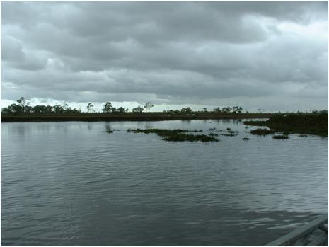
17 Gulf Irrigated Creeks Upstream, not floodplain, so no water hyacinth


18 Livestock as Management Tools In irrigated areas, cessation of grazing or conversion of land from grazing to agriculture, allowed introduced grasses to dominate wetlands Photos Jim Tait


19 Restoration Through Grazing and Fire Use grazing as a management tool to control weeds and restore wetlands Management

20 North Aust Land & Water Taskforce North Australian Land and Water Taskforce thorough evaluation of northern economic development potential Downplayed irrigation potential Limited dam storage sites Likely small-scale mosaic irrigation Talked up a potential doubling of cattle output, through better access to water and irrigating fodder crops


21 Livestock Management Dominant land use (by area) in the catchment A series of non-flowing waterholes vulnerable to disturbance Cow Dung


22 Riparian Fencing of Inland Waterholes Thousands of km s of river frontage country fenced to manage stock access, not exclude them altogether Adoption of wet season spelling Significant improvement in water quality and riparian vegetation cover High degree of adoption by landowners and govt incentives considered to be very successful
 % of years water")
23 Waterbody Permanence Abundance and permanency of waterbodies (n=2755) % of years water present

24 Waterbody Clarity
25 Conclusions Gulf and other northern rivers and wetlands relatively undeveloped Pressure to develop irrigation and/or double cattle turnoff Dams found to have high impact and low reliability Mosaic irrigation via harvesting floodwaters with pumps, and gradual increase in cattle herd more likely Maintaining connection between land managers and their aquatic/riparian systems is key

26 Questions??