Restoring Wreck Pond Inlet Jenna Krug, Habitat Restoration Coordinator
|
|
|
- Hannah Shepherd
- 5 years ago
- Views:
Transcription


1 Restoring Wreck Pond Inlet Jenna Krug, Habitat Restoration Coordinator Borough of Spring Lake Borough of Sea Girt
 Drains the following municipalities: Borough of Spring Lake Heights")
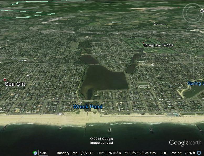
2 Project Location: Wreck Pond Watershed ~12.8 square miles (8,172 acres) Drains the following municipalities: Borough of Spring Lake Heights Borough of Spring Lake Borough of Sea Girt Wall Township


 Hannabrand Brook 5")
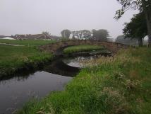
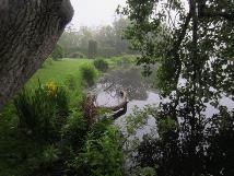
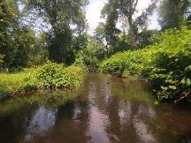
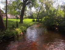
3 Project Location: Wreck Pond Watershed Three major tributaries: Wreck Pond Brook (approx. 8 RKM) Splits into a fourth tributary in upper watershed Hurley s Pond Brook (approx. 1.5 RKM) Hannabrand Brook (approx. 5 RKM) Black Creek (approx. 2 RKM)


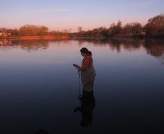
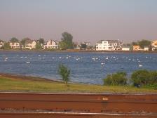
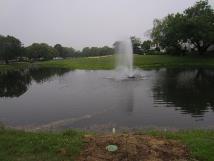
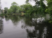
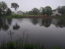
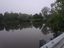
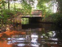
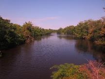
4 Project Location: Wreck Pond Straddles Boroughs of Spring Lake and Sea Girt, NJ 73-acre tidally-influenced coastal pond 1920 s September 2013
5 Current Issues Limited Fish Passage Opportunities Repeated Flooding Impaired Water Quality


6 Current Issues: Fish Passage Limited Fish Passage Opportunities Alewife, Blueback herring, American eels Current pipe was not designed for fish passage River herring migrating River herring: Alewife and Blueback


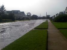
7 Current Issues: Flooding Hurricane Irene to total rainfall to total rainfall AM high tide to total rainfall
8 Current Issues: Flooding Tidal Flooding Historic Crests (57 total) = 36 historic crests over 56 years (63%; average 0.64 historic crests per year) = 21 historic crests over 14 years (37%; average 1.5 historic crests per year) Major tidal flooding historic crests were at or above of those occurred since 2000 Moderate tidal flooding historic crests were between 7.7 and 8.7 Minor tidal flooding historic crests were between 6.7 and 7.7


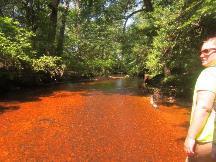
9 Current Issues: Water Quality Stormwater runoff, sedimentation, tidal constriction


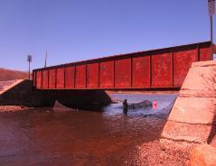
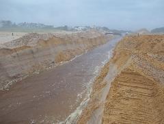
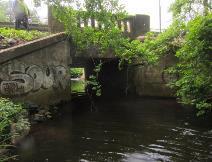
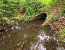
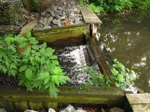
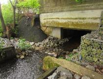
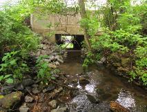
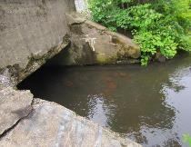
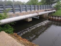
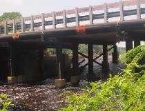
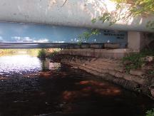
10 How are these issues being addressed? Restore Wreck Pond Inlet Project Installation of a 5.5 x 8 x 600 box culvert just north and parallel to the existing 84 diameter 800 pipe Funding
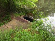
11 Outfall Overview
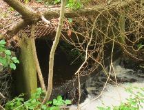
12 Outfall Profile
13 Outfall Cross Section
")

14 Project Goals 1) Increase Fish Passage Opportunities 2) Reduce Flooding 3) Improve Water Quality

15 Project Goals: Enhance Fish Passage 1) Increase Fish Passage Opportunities Improvements for fish passage included on culvert lighting, flow regulation, water elevation level control, eel netting
16 Project Goals: Reduce Flooding

17 Project Goals: Reduce Flooding
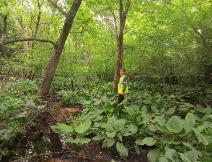
18 Project Goals: Reduce Flooding

19 Project Goals: Reduce Flooding
20 Project Goals: Improve Water Quality 3) Improve Water Quality Increased natural tidal flows & flushing Improve salinity gradient to benefit wetlands flora and fauna ALS NJDEP
21 What s been done so far? Oct 2014 Received letter of concurrence for Section 106 review from State Historic Preservation Office and local tribal offices Oct 2014 Feb 2015 Apr 2015 May 2015 Jun 2015 Attended Joint Project Permitting Meeting Received concurrence on revised Intra-service Section 7 Biological Evaluation; Completed permit ready plans Environmental Assessment complete and FONSI issued Received Federal Consistency Determination from NJDEP &US Army Corps of Engineers Nationwide permit Received EFH consultation from NOAA; Applied for Tidelands License
22 Project Timeline Project start Jun 30, 2014 Funding in place; Submitted permits Feb 2015 Construction Bidding Jul 2015 Construction end Mar Pre- and postmonitoring 2014 Jun Sep Dec Mar Jun Sep Dec Mar Jun 2016 Today Receive permits & finalize EA May 2015 Project end Jun 29, 2016 Begin on-site construction post-sept
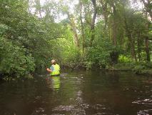
23 Pre and Post-Construction Monitoring 1) Fish 2) Habitat 3) Water Quality & Salinity 4) Water Level 5) Tidal Flow 6) Flooding


 May 15-19")
 June 14-18")
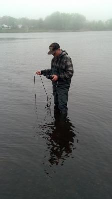
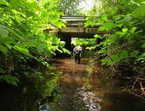
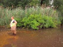
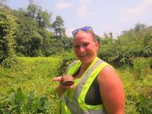
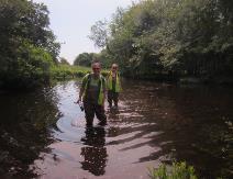
24 Monitoring: Fish Spring 2015 Adult River Herring Fyke net RR Track Bridge 6 am and 6 pm net checks 4 events May 1-5 (Full Moon) May (New Moon) May 31-June 4 (Full Moon) June (New Moon)
25 Monitoring: Fish Total Alewife 2006 (229) 2007 (49) 2008 (4) 2014 (103) 2015 (108)
26 Monitoring: Fish - Spring 2015

27 Monitoring: Fish Coming up - Fall Juvenile River Herring Surveys September/October Seine nets
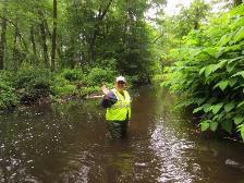
28 Monitoring: Habitat : Freehold Soil Conservation District Natural Resources Conservation Service Stream Visual Assessment Protocol Spring 2015 Surveys June 3, 4, 16, 18, 30 & July 1 Hannabrand, Wreck Pond Brook, Black Creek Goals: 1) Document fish passage barriers 2) Assess stream habitat upstream of barriers
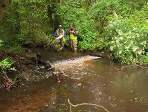
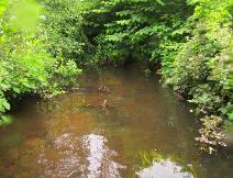
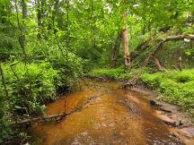
29 Monitoring: Habitat - Hannabrand Brook
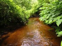
30 Monitoring: Habitat Black Creek
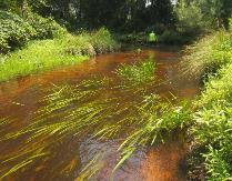
31 Monitoring: Habitat Wreck Pond Brook

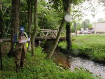
32 Monitoring: Water Quality & Salinity NJDEP website:

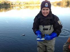
33 Monitoring: Water Quality & Salinity Location: Spring Fish Survey RR Tracks; Equipment: YSI Pro Plus

34 Monitoring: Water Level & Tidal Flow Pre-construction monitoring completed by USACE (Wreck Pond Feasibility Study; 2014) More information can be found at Post-construction monitoring details to be determined
35 Outreach & Education Outreach Coordinator Julie Schumacher Signage Video School programs and field trips Community tours & citizen science monitoring Birds beach, main pond, Jimmy Burns park Spill Spotters assessment Wreck Pond Pal
36 Next steps: Jul 2015 Aug 2015 Sept 2015 Mar 2016 May Jun 2016 Apply for Dam Safety permit; Open bidding for construction contractor Receive bids & award bid at Borough of Spring Lake Council Meeting; Attend Tidelands meeting Mobilization/start of on-site construction (4-6 months) Construction complete for permit compliance Outreach; Complete Operations and Maintenance Manual for culvert; Pre-and post- construction monitoring of Habitat, fish, flow, water quality, tidal flow/flushing, birds
37 QUESTIONS?