EVALUATING AND FORECASTING FLOODING IN HO CHI MINH CITY USING MIKE FLOOD MODEL
|
|
|
- Janel Shepherd
- 5 years ago
- Views:
Transcription
1 EVALUATING AND FORECASTING FLOODING IN HO CHI MINH CITY USING MIKE FLOOD MODEL Bui Ta Long, Nguyen Thai Hoa, Nguyen Ngoc Khai Department of Environmental Informatics Institute of Environment and Resources, Vietnam National University of Hochiminh city, 142 To Hien Thanh, Dist. 10, Hochiminh city, Vietnam ABSTRACT Climate change is one of the most interested international issues in the XXI century, its aftermath is affecting many countries in the world. Research on Climate Change requires an alignment of many fields, particularly environmental, economic and social issues. According to the evaluation of scientists, Vietnam is a country heavily affected by climate change. Currently, the damage caused by natural disasters each year accounted for 1.5% GDP of Vietnam, so now, to deal with this challenge is becoming an urgent task. National target program responding to climate change was adopted through the state on 2/12/2008 with the objectives are: evaluate the impacts of climate change on regions and areas in a specific period and developing action plans to effectively deal with climate change in the short term and long term. The program will be implemented in three stages: from 2009 to 2010 is the inception stage, from 2011 to 2015 is the implement stage and after 2015 is development stage with a total estimated budget from 2009 to 2015 is 1965 billion VND. In the last two years, all levels, has in turn announced the framework for climate change adaptation actions and consider this is a top priority program in all levels. Notable among these is the impact assessment program of climate change and sea level rise to the system of urban infrastructure. In the framework of this paper the authors present simulation results for the county flooding of Ho Chi Minh City based on Mike Flood Model. 1. Introduction Ho Chi Minh City is the most important center of economical, political, cultural and technology, is the core in key economic areas to the south. With an area of 2095 km 2 and a population of over 7 million people (2009). In fifteen years, the city has developed rapidly, becoming the leader in the reform of the country, drawing a large of human resources from over the country and strong investment from abroad. To meet the needs of development, Ho Chi Minh City has been proactive in building up many of the commercial, residential, industrial,... especially the infrastructure including transportation systems, drainage systems to serve the demands of production and life. These economic activities such as industrial production, agriculture, aquaculture... and the rapid urbanization process will generate a huge wastewater. The leveling of many lakes, the valley or concrete a very large proportion of natural land area, International Symposium on Geoinformatics for Spatial Infrastructure Development in Earth and Allied Sciences


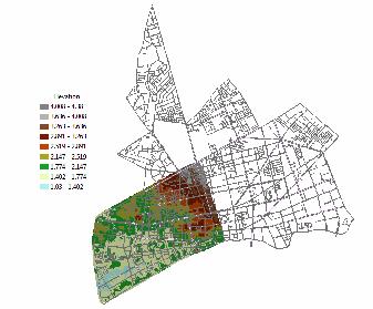
2 using many kinds of plant protection chemicals, fertilizer... will cause great pressure for the drainage of rain water, industrial wastewater, agricultural and domestic wastes,... One of the severe consequences that city are suffering from rapid urbanization process is flooding often occurs frequently. Flooding causes severe impact to develop socioeconomic, life and health of people and environmental pollution. To ensure the living conditions and development, in recent time, Ho Chi Minh City has conducted many scientists research, many of the anti-flood projects have been implemented to bring high efficiency, such as: Binh Trieu prevent tidal project, Hang Bang canal drainage project, Tan Hoa - Lo Gom canal drainage project, Nhieu Loc - Thi Nghe canal wastewater and rainwater drainage project and Tau Hu - Ben Nghe - Doi - Te canal environmental improvement project... However, flooding issues are not reduced significantly and appeared new flooding areas. Meanwhile, studies of flood are still some limitations such as not taking into account the overall properties of the whole basin, not seen all the underlying causes leading to flooding, has not taken full speed urbanization quickly reduces the amount of drainage area, drainage capacities of existing canals. Solutions have not come together, especially the phenomenon of climate change lead to extreme rainfall; rising sea levels, higher peak tide than the previous / source [2], [3], [4]/. In the context of flooding are causing major obstacle to develop socioeconomic, this work "Evaluating and forecasting of flooding in Ho Chi Minh City using Mike Flood Model, particularly in the Bac Tau Hu Basin, in order to provide real scientific basis for forecasting floods to Bac Tau Hu Basin, from which to expand to the entire city, within the framework of the impact of climate change and sea level rise to the system of urban infrastructure. 2. Objective and Methodology 2.1. Objective Figure 1. Scope of Bac Tau Hu Basin Bac Tau Hu Basin is located in the center area of Ho Chi Minh City. Including District 5, a portion of District 6, 10 and District 11. Total area of the entire basin is km 2. The Northern of Bac Tau Hu contiguous to the South of Nhieu Loc includes District 10, Tan Binh. The souther of Bac Tau Hu contiguous to the South of the city includes District 7, 8, Binh Evaluating and forecasting and forecasting flooding in Ho Chi Minh city using Mike Flood 2


![According to the [4] there are three](/docs-images/89/98620948/images/3-16.jpg "possible causes lead to urban flooding in")


3 Chanh, Nha Be. The Western of Bac Tau Hu contiguous to Tan Hoa-Lo Gom includes District 6, 11, Tan Binh, The Eastern of Bac Tau Hu contiguous to Ben Nghe Basin includes District 1, 4. Research area: 3,798.7 ha. Elevation within the basin is m. Flood situation in the study area in recent years tend to be complex with the increasing of flooding area, a wider scope and duration of flood inundation is longer than before. In 2009 the Bac Tau Hu Basin had 37 flooding points, including 20 points flooded by rain, 7 points flooded by the tide and 10 points flood due to rain and tidal. In general, the cause of the flooding in the basin is mainly due to three following reasons: cause 1: The drainage system have become obsolete, old, degraded, not enough capacity to drain the area; cause 2: rain causes the most concern of the basin, flooding issue will be more severe if the rain in the days tides; cause 3: the rate of urbanization and concrete to meet the needs of socioeconomic development, the basin is almost no water storage areas. According to the [4] there are three possible causes lead to urban flooding in general: water needs to drain; drainage system from Ho Chi Minh and the ability to drain; flow regime on rivers and canals. Three reasons above are closely related, it should be analyzed, calculated separately to determine the cause, as well as unfavorable combination of all three causes. The attention to all three factors in a scenario lead to the need to apply a powerful software such as Mike Flood Selecting model Figure 2. Simulation process of Mike Flood Figure 3. Terrain data of Bac Tau Hu Basin Derived from the objectives of the study, the selection model has been implemented. This is important in the calculation process. In this study, MIKE software was selected because it met the criteria such as: integrated suite of features, tested in real, allowing calculation of water International Symposium on Geoinformatics for Spatial Infrastructure Development in Earth and Allied Sciences
 within 20 years, is used to simulate flow, water quality and transport")
4 quality with high precision, friendly interface, easy to use, GIS technology applications, a new technique with high efficiency. MIKE model is a set of engineering software dedicated which was building and development by DHI (Danish Hydraulics Institute) within 20 years, is used to simulate flow, water quality and transport silt sand in estuaries, rivers, irrigation systems, canals and other water systems. MIKE includes a lot of software which different functions and duties such as MIKE 11, MIKE 21, MIKE 3, MIKE GIS, MIKE BASIN, MIKE SHE, MIKE MOUSE v.v and in this subject have used MIKE FLOOD. MIKE FLOOD is an integrated product of one dimensional model such as MIKE URBAN (MOUSE), MIKE 11 and two dimensions model MIKE 21 into one. Using the integrated approach allows to promote the best features of both models, while avoiding many of the limitations of resolution and accuracy encountered when using Separate MIKE 11, MIKE URBAN (MOUSE), or MIKE 21. Special features of the MIKE Flood, including the ability to link with the horizontal (lateral link), allowing the simulation beyond the shore from the river channel to flood-prone areas; hydraulic model is quite comprehensive, allowing the link hole station where the interworking of sewer system/rain can interact with the flow on land, allowing the link between the river channel system and drainage system. Besides MIKE FLOOD GIS technology applications, allowing connectivity with MIKE 21 horizontally or vertically, using the graphical interface, allows easy data input and output as well as preparing and data analysis. MIKE FLOOD was used to solve the following problem: flooding simulation, studied the rise of water due to storms, urban drainage calculations, designed dam, hydraulic calculations and assessment of pollution in estuaries. [1] 2.3. Used data Figure 4. Drainage system of Bac Tau Hu Basin Data to run Mike Flood model include: terrain data (Figure 3); drainage system of Bac Tau Hu Basin include: culverts: length, diameter, shape, flow direction, structure,...; tunnel station: number, type, size, structure,...; outlet: number, type, size... the entire drainage system Evaluating and forecasting and forecasting flooding in Ho Chi Minh city using Mike Flood 4
5 of Bac Tau Hu Basin was put into the GIS system (Figure 4). The data on meteorological conditions, hydrology, tides, rainfall patterns, precipitation, elevation terrain of study area is derived from Radio Southern Hydrometeorology. 3. Results and Discussion Calculating date is on 15/10/2007. Precipitation and tide data on 15/10/2007 is giving in Table 1. Table 1. Precipitation and tide data on 15/10/2007 Time Precipitation (mm/h) Tide (m) 10/15/2007,15: /15/ : /15/ : Simulating results are on Figure 5 Figure 6 Figure 5. Simulation result 20 minutes after rain In the time 15:20:00 15/10/2007 step 10. Observed that after 20 minutes of raining, calculating area has local flooded and flooding depth is low, 0.05m. In the time 17:00:00 15/10/2007 final step 60. Flooding area and flooding depth was reduced but still high, maximum depth is 0,25m. This reflects the poor drainage capacity of the drainage system in the study area. International Symposium on Geoinformatics for Spatial Infrastructure Development in Earth and Allied Sciences
6 Figure 6. Simulation result 2 hours after rain 4. Conclusion Research results and simulations flooding for Bac Tau Hu Basin, Ho Chi Minh City shows that simulation results are relatively consistent with the actual terms of the calculation. Results showed that the dependence of the wetlands associated with factors such as terrain elevation, drainage systems (culverts: length, diameter, shape, flow direction, structure, tunnel station: number, type, size, structure, outlet: number, type, size) and the receiving water system (river channel) and other natural factors such as rainfall and tide. This result allows technicians, managers offer solutions appropriate for management, reduce investment and improve efficiency of water drainage in the context of HCM City are very interest in anti flooding issue. Continuing research model methods to make accurate forecasts and timely helping for the future planning of Ho Chi Minh City. 5. References [1]. Mike Flood - modelling of river flooding, a step by step training guide. DHI water and environment, Agern Alle 5, DK 2970 Horsholm, Denmark. [2]. Nguyen Van Diem, Nguyen Quang Cau, Đang Quoc Dung. Urban rainwater drainage and measures of flood prevention in Ho Chi Minh City. [3]. Hoang Van Huan, Flow channel change of lower Dong Nai-Saigon river and suggestions of prevention solutions. Journal of Water Resources and Environmental Engineering, No. 23, November 2008, 167. [4]. Nguyen Quang Cau. Urban drainage issues in tidal affected areas. Tech. Publisher, Hanoi. Evaluating and forecasting and forecasting flooding in Ho Chi Minh city using Mike Flood 6