ESA DUE INNOVATOR III: EO4Urban
|
|
|
- Leona Harvey
- 5 years ago
- Views:
Transcription


1 KTH ROYAL INSTITUTE OF TECHNOLOGY ESA DUE INNOVATOR III: EO4Urban Multitemporal Sentinel-1A SAR & Sentinel-2A MSI Data for Global Urban Services Yifang Ban 1 and Paolo Gamba 2 1 KTH Royal Institute of Technology Stockholm, Sweden 2 University of Pavia, Italy
2 ESA EOEP DUE Program The Data User Element (DUE) is a programmatic component of the Earth Observation Envelope Programme (EOEP), an optional programme of the European Space Agency, currently subscribed by 18 ESA Member States. The DUE mission is to favour the establishment of a longterm relationship between the User communities and Earth Observation. It is a continuation on a larger scale of the Data User Programme (DUP).


3 ESA DUE Innovator Program


4 ESA DUE Innovator III Program


5 ESA DUE Innovator Program


6 ESA DUE Innovator Program


7 ESA DUE Innovator III Projects Global Urban Services Team Users KTH Royal Institute of Technology, Sweden University of Pavia, Italy Stockholm County Administration, Sweden National Geomatics Center, China
8 ESA DUE Innovator III Projects


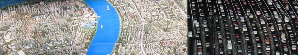
9 Global Urbanization Trend In 2008, more than 50% of the world population live in cities. By 2050, the world is expected to add an additional 2.5 billion urban dwellers; with nearly 90 percent of the increase concentrated in Asia and Africa. (United Nations, 2014).


10 Shanghai, 1979

11 Shanghai, 2010
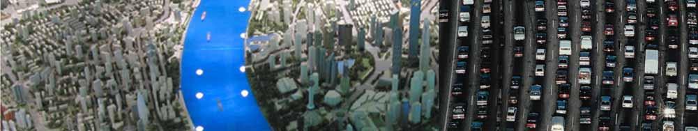
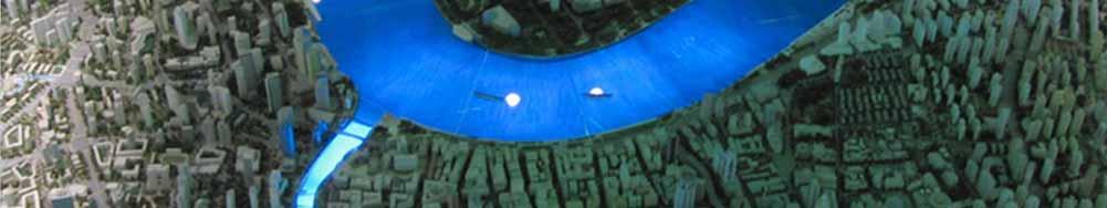
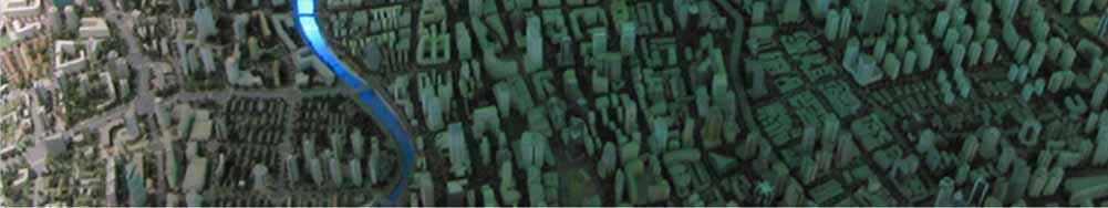
12


13 Environmental Consequences High concentrations of aerosols, exhaust gases, pollution and dust Hazardous to health Increased smog, haze, fog, clouds Source: The Associated Press Source: Suicup via Wikimedia Source: zmescience.com


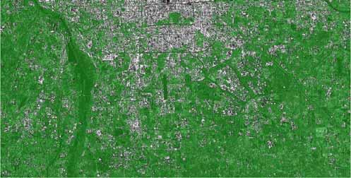
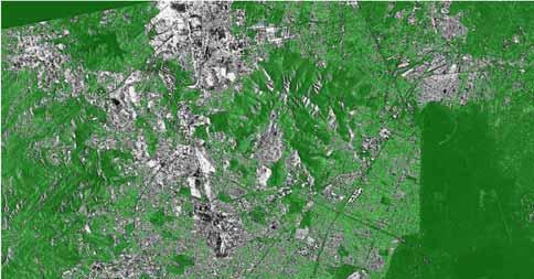
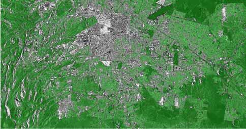
14 Environmental Consequences Paved surfaces -> rainfall water -> flooding Urbanization results in more impervious surfaces, thus reducing the area where infiltration to ground water can occur. Thus, more storm water runoff occurs. 79 people died in July 2012 Beijing flooding Source: rendezvous.blogs.nytimes.com Source: BBC News Source:


15 Environmental Consequences Urban heat island (UHI) and heat waves UHI urban air temperatures higher than surrounding rural areas. The average air temperature in a city with 1 million inhabitants is 1-3 degrees warmer. Heat waves: In the afternoon, the difference can be 12 degrees warmer, no night time cooling. Death rate increases during heat waves.


16 Environmental Impact The growth of urban areas & subsequent transportation networks generates a host of environmental impacts Deforestation, habitat fragmentation and loss of biodiversity Loss of high quality farmland Contamination of Lakes and other waterways Increases in fossil fuel consumption & emissions of greenhouse gases


17 Existing Global Urban Data in GLC Products Derived from optical data (TM, MERIS, MODIS, etc.) Data gaps: difficulties to acquire images in appropriate seasons Information gaps: confusions among various classes such as bare soil and builtup areas, and among vegetation classes


18 Existing Global Urban Data in GLC Products
")
 L-Band, 1992-1998 SIR-C/X-SAR")

 C-Band,")
 NASA/JPL (C-Band), DLR (X-Band)")
 C-Band (dual), 2002-today ALOS /")
, 2004 TerraSAR-X German Aerospace")
 C-Band")
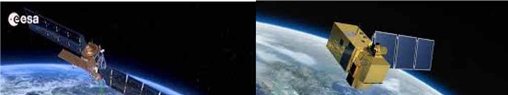
19 Spaceborne SAR Systems SEASAT NASA/JPL (USA) L-Band, 1978 ERS-1 European Space Agency (ESA) C-Band, J-ERS-1 Japanese Space Agency (NASDA) L-Band, SIR-C/X-SAR NASA/JPL, L- and C-Band (quad) DLR / ASI, X-band April and October 1994 RadarSAT-1 Canadian Space Agency (CSA) C-Band, 1995-today ERS-2 European Space Agency (ESA) C-Band, 1995-today Shuttle Radar Topography Mission (SRTM) NASA/JPL (C-Band), DLR (X-Band) February 2000 ENVISAT / ASAR European Space Agency (ESA) C-Band (dual), 2002-today ALOS / PALSAR Japanese Space Agency (NASDA) L-Band (quad), 2004 TerraSAR-X German Aerospace Center (DLR) / Astirum X-Band (quad), 2005 RadarSAT-II Canadian Space Agency (CSA) C-Band (quad), 2005 SAR-Lupe BWB, Germany X-Band, 2005
20 Range / Azimuth Resolution 10m 3m 1m 10cm ENVISAT / ASAR ERS 1&2 RADARSAT 1 RADARSAT 2 TerraSAR-X ALOS SENTINEL-1 Cosmo-Skymed SAR-Lupe FGAN - PAMIR HJ-1-C TerraSAR-X ONERA - RAMSES ONERA - SETHI


21 Urban Extraction: ENVISAT ASAR Data Beijing Berlin Jakarta Lagos Mexico City Average values Kappa Overall Accuracy Std. Dev. Comission Omission KTH - UNIPV 0,707 85,36% 4% 5,47 23,75 GlobCover 0,471 72,67% 13% 17,10 40,47 MODIS 500 0,525 76,31% 11% 20,03 31,12 Ban, Y. and A. Jacob & P. Gamba, Spaceborne SAR Data for Global Urban Mapping at 30m Resolution Using a Robust Urban Extractor. ISPRS J. of Photogrammetry & Remote Sensing Mumbai New York City Rio de Janeiro Stockholm Sydney


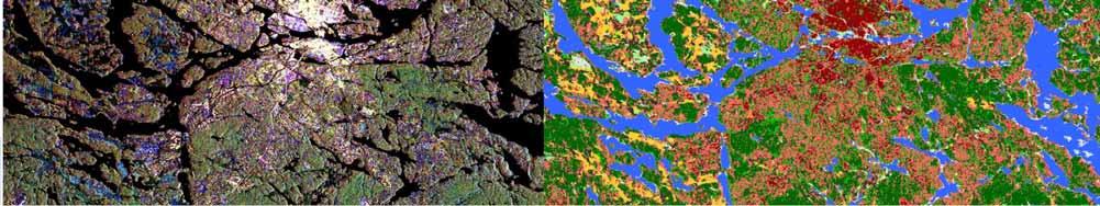
22 KTH-Pavia vs. MODIS 500 & GlobCover Beijing 2009 Lagos 2010 KTH Pavia Modis 500 Glob Cover false color x x x red x o x blue x x o blue x o o yellow o x x green o o x green o x o green
23 Sentinel-1A SAR & -2A MSI Data
24 EO4Urban: Objectives The overall objective is to evaluate multi-temporal multi-resolution Sentinel-1A SAR and Sentinel-2A MSI data for developing a pilot global urban services based on user requirements to support sustainable urban development.

25 The Stockholm County Administrative Board's Challenges Very high demand for housing and regional development VS National interests for sustainable development climate impact Infrastructure Green structure and biodiversity
.")

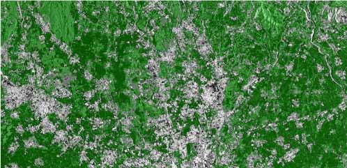
26 Stockholm County User Needs Up-to-date, accurate information on urban development in the region (Urban Structures map). No viable way to see what areas are being developed after approved planning. Construction process is often several years. Up to two years delay for finished construction to be registered in the national database.


27 Stockholm County User Needs Temporal information regarding green structure SCAB is charged with maintaining the biodiversity and oversee green structure Mapping green structure and monitoring changes No accurate biotope database exists for the region Lots of field work, lots of manual image interpretation

28 Stockholm County User Needs Accurate spatiotemporal information on waterbodies and their developments. Climate change is a very important factor in sustainable planning. We lack good information on impervious surface classes for flooding analysis. We lack a good information on soil moisture for risk analysis. The coastline today is derived from Swedish National Land Survey data and provides static maps. We wish to follow the developments.


29 National Geomatics Center of China User Needs

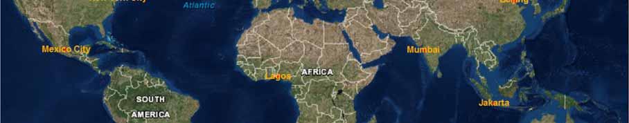
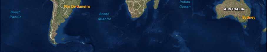
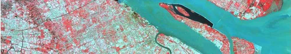
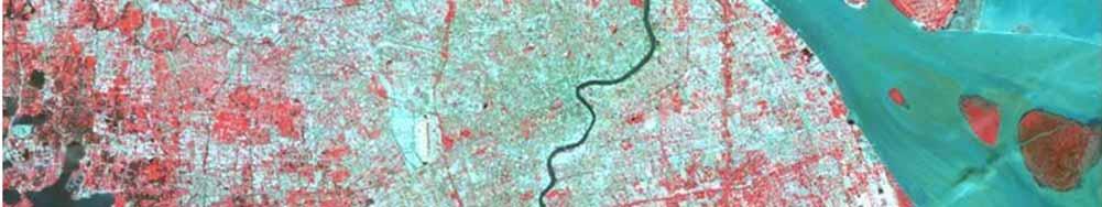
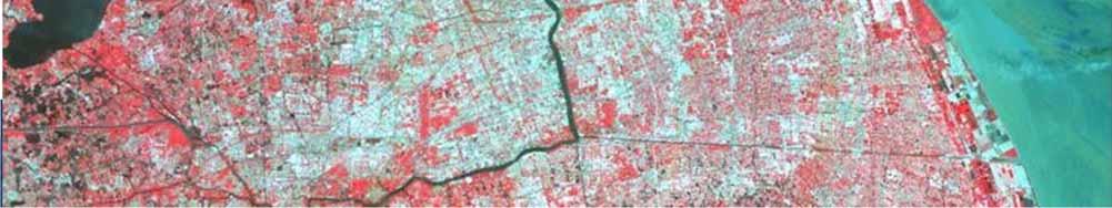
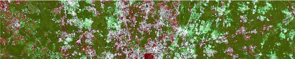
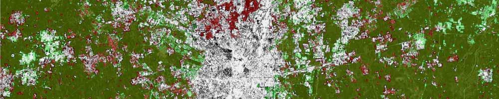
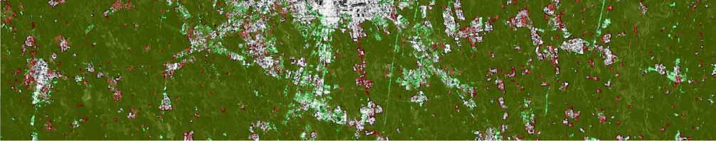
30 Study Areas
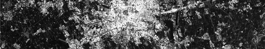
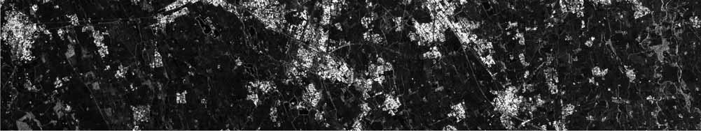
31 Sentinel-1A SAR Data Study area Image Date Image Type Orbit Type Polarization Incidence Angle Beijing IW DSC VV IW(1 2) Jakarta IW DSC VV IW(1 2) Mexico IW DSC VV IW(3) Milan SM DSC HH/HV ~ 35 (S4) SM ASC HH/HV ~ 43 (S6) Stockholm IW DSC VV IW(2 3)

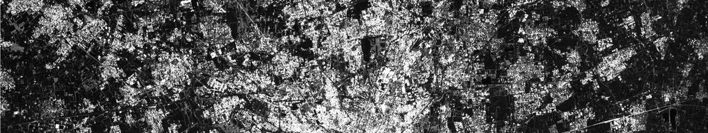
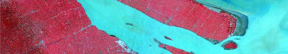
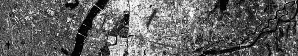
32 ENVISAT ASAR: Nanchang Sentinel-1A SAR: Milan
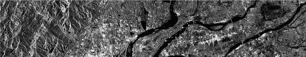
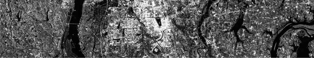
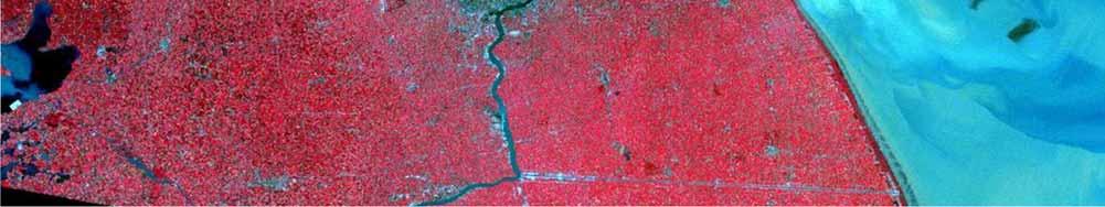
33 Sentinel-1A SAR: Nanchang


34 Sentinel-1A SAR Data Stockholm Date Orientation Polarization Descending VH VV Descending VH VV Ascending VH VV Ascending VH VV Ascending VH VV Descending VH VV Beijing Date Orientation Polarization Descending VV Ascending VV Descending VV Ascending VV Descending VV Descending VH VV Ascending VV
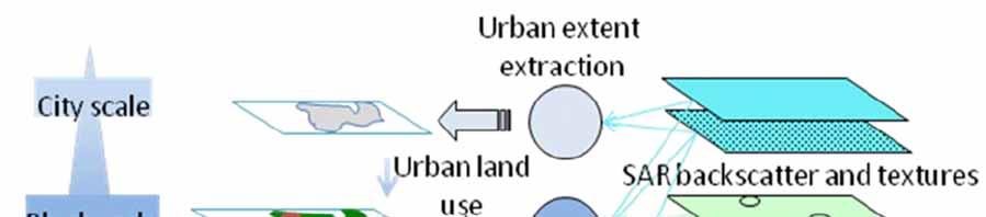
35 Methodlogy
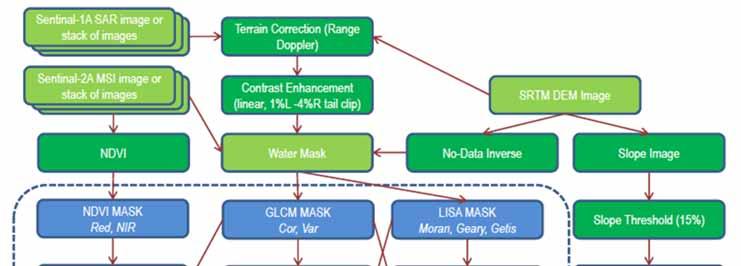
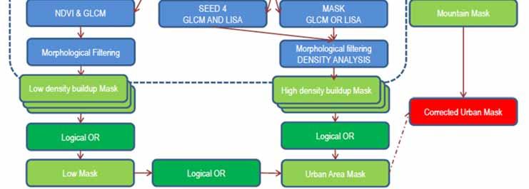
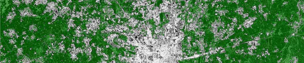
36 Methodology 36


37 Methodology Ban, Y. and A. Jacob, Object-based Fusion of Multitemporal Multi-angle ENVISAT ASAR and HJ-1 Multispectral Data for Urban Land-Cover Mapping. IEEE Transaction on GeoScience and Remote Sensing, Vol. 51, No. 4, pp

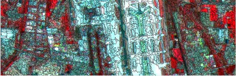
38 KTH-SEG: Stepwise Example
39 Preliminary Results Study area Observation Image Overall Accuracy Urban Precision Milan (1 image) SM ASC HH 81.81% 69.9% Milan (dual pol) SM ASC HH & HV 78.57% 55.1% Milan (2 images) SM ASC & DSC HH 83.21% 79.5% Stockholm IW ASC VV 77.29% 52.3%
40 Preliminary Results 35th EARSeL Symposium, Stockholm
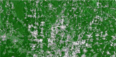
41 Preliminary Results

42 Preliminary Results
43 Preliminary Results
44 Preliminary Results


45 Preliminary Results 35th EARSeL Symposium, Stockholm


46 Preliminary Results 35th EARSeL Symposium, Stockholm


47 Preliminary Results Chengdu > >2008->2011


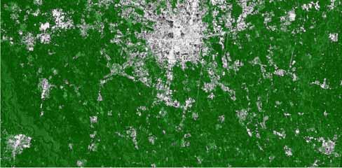
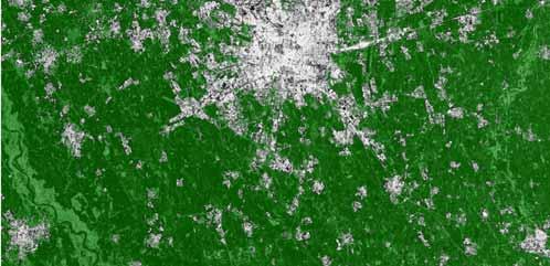
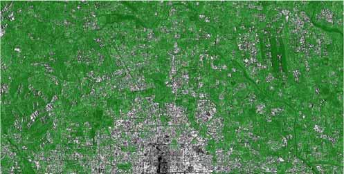
48 Results: Stockholm EARSEL SYMPOSIUM 2015 STOCKHOLM

")

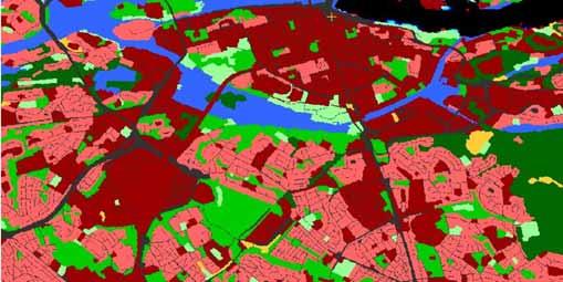
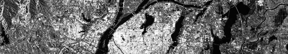
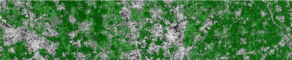
49 Results: Stockholm KTH-SEG (2015) Urban Atlas (2010)
50 Results: Stockholm Confustion Matrix with Producer's and User's Accuracy in % KTH SEG Urban Classification Stockholm Name Testing Urban Atlas Water 97,6 83 Roads 36,5 17,6 High Density Builtup 72,3 31,7 Low Density Builtup 59,4 53,8 Golf course 89,3 29,5 Forest 81 61,9 Urban Green Structure 22,5 20,2 Agricultural Open Land 77,7 37,6 Airport 55,8 36,4 Average Accurracy 65,8 41,3 Name ID User Water 1 97, , ,8 97,6 Roads ,5 6 34,2 4,9 2,6 9,4 4,2 2,2 36,5 High Density Builtup 3 0 7,4 72,3 18, , ,3 Low Density Builtup 4 0 4,1 3,6 59,4 0, ,7 1,1 0 59,4 Golf course 5 1,2 3,5 0 0,2 89,3 0,2 1,3 0,2 4,1 89,3 Forest 6 0 0,2 0 10, , ,0 Urban Green Structure ,4 1,4 25,1 7,3 18,9 22,5 1,2 2,2 22,5 Agricultural Open Land 8 0 8,4 0 3,6 2,1 0,1 1,5 77,7 6,7 77,7 Airport , ,2 2,9 55,8 55,8 Producer's Acc. 100,0 14,0 79,5 64,0 60,0 83,4 10,2 98,6 14,9


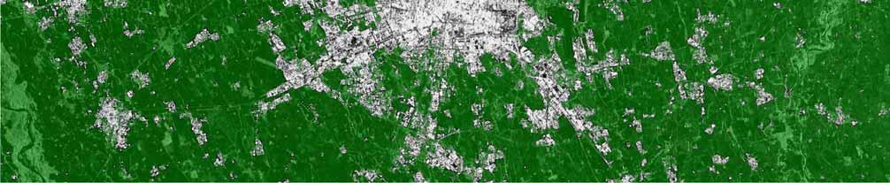
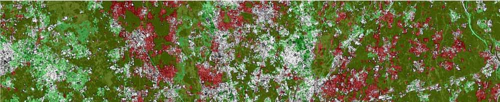
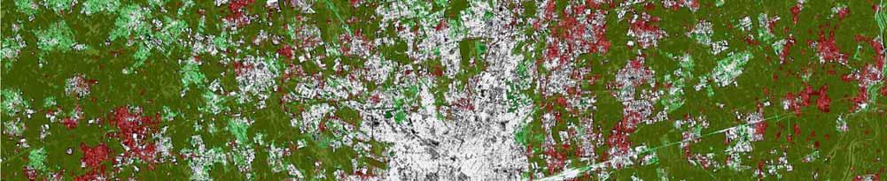
51 Results: Beijing EARSEL SYMPOSIUM 2015 STOCKHOLM

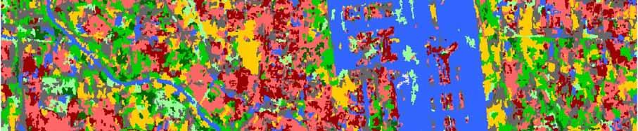
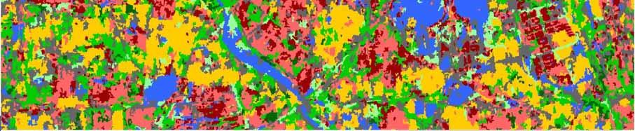
52 Results: Beijing
53 Conclusions Sentinel-1A SAR Data are promising for urban extent extraction, especially when multiple images in two orbit orientations were used, the urban extraction accuracies were significantly improved. The preliminary results also show higher resolution SM mode to be advantageous. Further research and testing will be performed to evaluate and compare multitemporal Sentintel-1A SM and IW data in dual polarization in both ascending and descending orbits for urban extent extraction when more data become available
54 Conclusion Sentinel-1A IW mode imagery showed promising potential for urban classifications. However, Sentinel-1A IW images lack the spatial resolution required for detailed urban land cover classification
55 Future Research Fusion of Sentinel-1A SAR and Sentinel-2A MSI data Improved implementation of KTH-Pavia Urban Extractor and KTH-SEG for parallel processing environments (GPU & cluster computing) Multi-scale segmentation & multi-level classification