Peter Ruggiero Oregon State University Corvallis, OR USA
|
|
|
- Hortense McCormick
- 5 years ago
- Views:
Transcription


1 Envisioning Grays Harbor County Coastal Futures Adapting to climate change impacts on coastal hazards Peter Ruggiero Oregon State University Corvallis, OR USA Collaborators: John Stevenson John Bolte Denise Lach Sally Hacker Contributing Students: Janan Evans-Wilent, Alexis Mills, Eva Lipiec, Katy Serafin, Chad Zanocco, Lindsay Carroll
 ENSO (El Niño - La Niña range) Trends and variability in storminess patterns (and the associated nearshore")
2 Climate Controls on changing Coastal Flood and Erosion Hazards Global rise in sea level (informed with regional variability) ENSO (El Niño - La Niña range) Trends and variability in storminess patterns (and the associated nearshore processes)
")

3 Global Mean Sea-level Rise ( )
4 Geological and Hydrodynamic Setting of the PNW Vertical land motions alter impacts of SLR Komar, Allan, and Ruggiero, 2011
5 Geological and Hydrodynamic Setting of the PNW Varying rates of uplift are reflected in RSLR Komar, Allan, and Ruggiero, after Burgette et al. 2009
 Projections (Rahmstorf, 2007) Instrumental record (Church and White, 2006) Rate of SLR (mm/yr) Uncertainty is increasing! From Thieler et al.")
6 Past, present, and potential future rates of sealevel rise Geologic past (Fairbanks, 1989; Horton et al. 2009) Projections (Rahmstorf, 2007) Instrumental record (Church and White, 2006) Rate of SLR (mm/yr) Uncertainty is increasing! From Thieler et al., 2009 Years before present Wide range of SLR 2100 estimates m (IPCC, 2007) Up to 2.0 m (Pfeffer et al., 2008) m (Rahmstorf, 2007; 2010) m (National Climate Assessment, 2012) m (NRC Committee on SLR, 2012) m (IPCC, 2013)

7 High water levels (10s of cms) Larger than typical wave heights Anomalous wave approach angles Enhanced longshore and cross-shore sediment transport Hot-spot erosion Geological and Hydrodynamic Setting of the PNW During El Niños the PNW effectively experiences decades worth of SLR for months

8 El Niños impact on the US West Coast Event

9 Future frequency and magnitude of El Niños? More, less, no change from present-day?? Major ENSO events may double in frequency

10 Geological and Hydrodynamic Setting of the PNW Extreme Wave Heights > 14 m! One of the most intense wave climates in the world

11 Increasing PNW wave heights Annual Max +9.5 cm/yr Wave Height (m) Avg. 5 Largest +7.1 cm/yr Winter Mean cm/yr Annual Mean cm/yr Ruggiero et al., 2010; after Allan and Komar, 2000; 2006


12 Over the last ~30 years changing wave heights have been more important than changing sea level over much of the PNW coast! RSL NDBC Wave Runup NDBC Ruggiero, 2013 Relative Sea Level Rise (mm/yr)


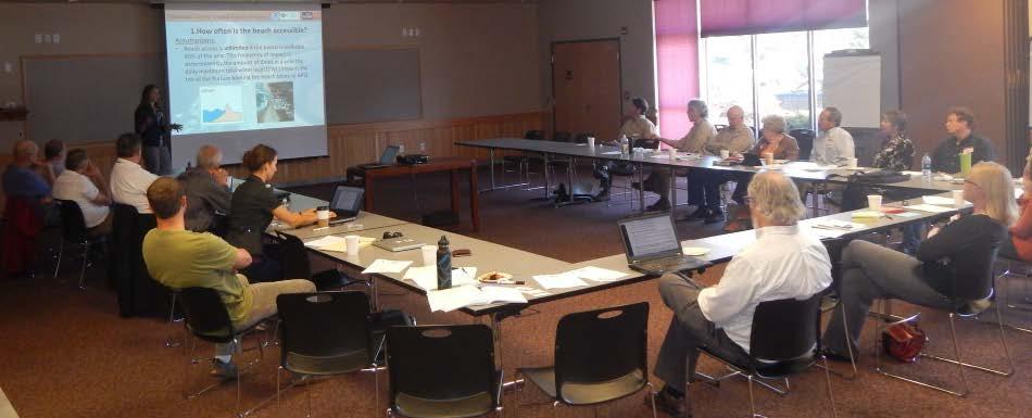
13 Envisioning Coastal Futures Climate Policy Alternative Futures Analysis: Explore how complex coupled natural and human systems dynamically respond to varying adaptation strategies and driving forces.


14 Tillamook County Coastal Futures Project Objective: Collaboratively develop the information and tools necessary to envision future scenarios, assess impacts and vulnerability associated with climate change driven erosion and flood hazards, and quantitatively evaluate a range of adaptation strategies. More riprap? Nourish the coastline? Move away from coast?
15 Tillamook County Coastal Futures Project Alternative Futures Analysis: Envision Data Sources Metrics Bolte et al., 2007 Landscape Data Landscape Change Models Population Growth Development Total Water Level Coastal Change Models Scenarios Policy Scenario Narratives Climate Impact Change Scenarios Agent Based Model: Envision Flooding Structures & Infrastructure Economic Value of Property Erosion Structures & Infrastructure Economic Value of Property Percent Shoreline Hardened Beach Accessibility
16 Tillamook County Coastal Futures Project Data Sources Landscape Data Landscape Change Models Metrics Location and Value of New Development Percent Shoreline Hardened Total Water Level Coastal Change Models Population Growth Development Scenarios Climate Impact Change Scenarios Envision Flooding Structures & Infrastructure Economic Value of Property Erosion Structures & Infrastructure Economic Value of Property Beach Accessibility Policy Scenario Narratives Cost of Management Options


17 Tillamook County Coastal Futures Project Population Growth and Development Submodels
18 Tillamook County Coastal Futures Project Data Sources Landscape Data Landscape Change Models Metrics Location and Value of New Development Percent Shoreline Hardened Total Water Level Coastal Change Models Population Growth Development Scenarios Climate Impact Change Scenarios Envision Flooding Structures & Infrastructure Economic Value of Property Erosion Structures & Infrastructure Economic Value of Property Beach Accessibility Policy Scenario Narratives Cost of Management Options
19 Tillamook County Coastal Futures Project Data Sources Landscape Data Landscape Change Models Metrics Location and Value of New Development Percent Shoreline Hardened Total Water Level Coastal Change Models Population Growth Development Scenarios Climate Impact Change Scenarios Envision Flooding Structures & Infrastructure Economic Value of Property Erosion Structures & Infrastructure Economic Value of Property Beach Accessibility Policy Scenario Narratives Cost of Management Options

20 Tillamook County Coastal Futures Project Climate Change Scenarios sea level rise wave variability El Niño variability e.g, NRC, 2012, IPCC 2013, Hemer 2013, Cai et al., 2014, Serafin and Ruggiero 2014

21 Tillamook County Coastal Futures Project Data Sources Landscape Data Landscape Change Models Metrics Location and Value of New Development Percent Shoreline Hardened Total Water Level Coastal Change Models Population Growth Development Scenarios Climate Impact Change Scenarios Envision Flooding Structures & Infrastructure Economic Value of Property Erosion Structures & Infrastructure Economic Value of Property Beach Accessibility Policy Scenario Narratives Cost of Management Options


22 Tillamook County Coastal Futures Project Co-development of Policy Scenarios J. StevEl Ninon P. Corcoran
23 Tillamook County Coastal Futures Project Policy Scenario Narratives 1. Status Quo Continuation of present-day policies. Example Policy: Maintain current backshore protection structures (BPS) and allow more BPS to be built on eligible lots.

24 Tillamook County Coastal Futures Project Policy Scenario Narratives 1. Status Quo 2. Hold the Line Policies or decisions are implemented that involve resisting environmental change (e.g. building or raising flood defenses, building or strengthening shoreline armor, nourishing beaches) in order to preserve existing infrastructure and human activities (e.g. beach access).


25 Tillamook County Coastal Futures Project Policy Scenario Narratives 1. Status Quo 2. Hold the Line 3. Laissez-Faire 4. ReAlign 5. Neskowin 6. Hybrid Implement policies in accordance with the preferences established by the KTAN

 X Policy Scenarios")
26 Tillamook County Coastal Futures Project Climate Scenarios (Physical Drivers) X Policy Scenarios (Human Drivers)
27 Tillamook County Coastal Futures Project Data Sources Landscape Data Landscape Change Models Metrics Location and Value of New Development Percent Shoreline Hardened Total Water Level Coastal Change Models Population Growth Development Scenarios Climate Impact Change Scenarios Envision Flooding Structures & Infrastructure Economic Value of Property Erosion Structures & Infrastructure Economic Value of Property Beach Accessibility Policy Scenario Narratives Cost of Management Options
28 Tillamook County Coastal Futures Project The effect of policies on development patterns Neskowin Rockaway Beach Land Use Adaptation Policies Prevent further development within hazard zone. Remove buildings from hazard zones through easements, etc. DOGAMI Hazard Zone

29 Tillamook County Coastal Futures Project The effect of policies on development patterns Neskowin Rockaway Beach Land Use Adaptation Policies prevent further development within the DOGAMI moderate hazard zone. Remove buildings from hazard zones through easements Etc. DOGAMI Hazard Zone Medium impact climate scenario High and low impact climate scenarios
30 Tillamook County Coastal Futures Project Data Sources Landscape Data Landscape Change Models Metrics Location and Value of New Development Percent Shoreline Hardened Total Water Level Coastal Change Models Population Growth Development Scenarios Climate Impact Change Scenarios Envision Flooding Structures & Infrastructure Economic Value of Property Erosion Structures & Infrastructure Economic Value of Property Beach Accessibility Policy Scenario Narratives Cost of Management Options
31 Coastline armored in response to erosion Rockaway Beach Littoral Sub-Cell Existing BPS New BPS Present Day

32 Coastline armored in response to erosion Rockaway Beach Littoral Sub-Cell Existing BPS New BPS Present Day Status Quo Medium Climate Impact Scenario
33 Coastline armored in response to erosion Rockaway Beach Littoral Sub-Cell Existing BPS New BPS Present Day Status Quo Status Quo Status Quo
34 Tillamook County Coastal Futures Project Data Sources Landscape Data Landscape Change Models Metrics Location and Value of New Development Percent Shoreline Hardened Total Water Level Coastal Change Models Population Growth Development Scenarios Climate Impact Change Scenarios Envision Flooding Structures & Infrastructure Economic Value of Property Erosion Structures & Infrastructure Economic Value of Property Beach Accessibility Policy Scenario Narratives Cost of Management Options

35 Beach Accessibility 2010 Limited Beach Access Unlimited Beach Access Present Day


36 Beach Accessibility Limited Beach Access Medium Climate Impact Scenario Unlimited Beach Access Present Day Status Quo Hold the Line Laissez-Faire ReAlign Hybrid

 (Rockaway Beach)")

37 Shoreline Armoring vs. Beach Accessibility Percent Armored (Rockaway Beach) Beach Accessibility (Rockaway Beach) Percentage of Accessible Coastline Time
38 Tillamook County Coastal Futures Project Data Sources Landscape Data Landscape Change Models Metrics Location and Value of New Development Percent Shoreline Hardened Total Water Level Coastal Change Models Population Growth Development Scenarios Climate Impact Change Scenarios Envision Flooding Structures & Infrastructure Economic Value of Property Erosion Structures & Infrastructure Economic Value of Property Beach Accessibility Policy Scenario Narratives Cost of Management Options

39 Climate Scenarios Which drivers (human and physical) cause the greatest variation in landscape metrics? Physical 1. Status Quo 2. Hold the Line 3. Laissez-Faire 4. ReAlign Human 5. Hybrid Policy Scenarios


40 Envisioning Coastal Futures Next Steps Initiate the Grays Harbor County, WA, Coastal Futures Project Recruit a stakeholder network to co-explore alternative Grays Harbor County coastal futures Co-develop policy and climate scenarios to incorporate and explore in Envision Begin dialogue regarding how the approach and findings might inform land use planning. Thanks very much!